53 minute read
History Written on the Land in Emery County


History Written on the Land in Emery County
BY EDWARD A. GEARY
THE TERM HINTERLAND DESCRIBES FEW REGIONS more accurately than it does the Colorado Plateau in eastern Utah and western Colorado In common usage, a hinterland is an area remote from major cities or cultural centers. The root meaning of the term, however, is "the land behind." The situation of the Colorado Plateau as the land behind the main Rocky Mountain ranges on the east, the Uinta Range on the north, and the Wasatch Range and the high plateaus on the west delayed its development by Anglo settlers for several decades after immigrants occupied adjacent areas. By the mid-1870s, the Colorado Plateau was probably the largest area in the contiguous United States without permanent Euro-American settlements.
Several distinct subregions comprise this Colorado Plateau hinterland, each with its own character and history Emery County, at the Plateau's western edge, exhibits the area's characteristic landforms, including massive uplifts, buttes, mesas, badland hills, deep canyons, and long lines of sheer erosional cliffs where thousands of feet of geologic strata are exposed with textbook clarity. Along its western border, the county takes in the high country of the Wasatch Plateau, whose watersheds, coal deposits, grazing lands, and timber have been vital economic resources. The county's center is dominated by the San Rafael Swell, an anticlinal uplift covering more than two thousand square miles. East of the Swell, the Green River Desert reaches to the Green River itself, which forms the county's eastern border in the depths of Labyrinth Canyon. Emery County's developed lands and population are confined to two widely separated areas: Castle Valley, at the base of the Wasatch Plateau, and the low banks of the Green River below Gray Canyon.
In common with other areas of the Colorado Plateau, Emery County has an extensive prehistory reaching back to the Paleo-Indian culture. Projectile points dated to about 11,000 years ago have been recovered from local sites, suggesting that ancient peoples hunted the mammoths, mastodons, and other ice-age mammals that once roamed the region.1 Artifacts representing all four recognized phases of the later Archaic culture have also been found in the county,2 as have dwelling and storage sites of the San Rafael variant of the Fremont culture, dating from A.D 500 tol200 Perhaps the most impressive record written on the land by these ancient peoples is the rock art in both Barrier Canyon and Fremont styles. More than 200 prehistoric rock art panels have been identified in Emery County.3
When Euro-Americans first entered the Colorado Plateau region, what is now Emery County belonged to the Ute domain The San Pitch band made seasonal use of the resources of Castle Valley, and the Sheberetch and Weeminuche probably visited the eastern and southern areas of the county John Wesley Powell understood the name Castle Valley to be a translation of the Ute Toom'pin wunear' Tuweap' or "stone house land."4 The only names of presumably Ute origin that are still attached to major Emery County landmarks are Wasatch and Tavaputs for the two elevated plateaus and Quitchupah for a small tributary to Muddy Creek.
The earliest Euro-American traveler clearly on record as visiting the county wasJedediah S. Smith during his southwestern expedition of 1826.5 Smith found the region "unpromising," describing it as "verry barren and Rocky" with "little appearance of Indians and game quite scarce a few Mt. Sheep and Antelope."6 The Old Spanish Trail reached its northernmost point in Emery County in order to skirt the canyonlands and take advantage of the Green River crossing and the relatively low elevation of Wasatch Pass. In some places, visible traces of the thousands of horses and mules that traveled the trail remained imprinted on the land until the mid-twentieth century. Now only the San Rafael name remains to memorialize this era, though at one time many landmarks bore Spanish names Huntington Creek was known as the San Marcus, Cottonwood Creek as the San Mateo, Muddy Creek as Rio del Morro, or "Castle River," and Ivie Creek as Rio del Puerto, or "River of the Pass."
Most of the recorded impressions of the Emery County region by early travelers carried on the uncomplimentary tradition established by Jedediah Smith George C Yount, a member of the 1830 William Wolfskill party, remembered Castle Valley as "the most desolate 8c forlorn dell in the world—Every thing about it was repulsive 8c supremely awful."7 Orville C. Pratt, a War Department official en route to California in 1848, described the Emery County region as "sandy, hilly 8c utterly barren Water is also scarce, 8c if there is no mineral wealth in these mountains I can hardly conceive of what earthly use a large proportion of this country was designed for!"8 Stephen Vandiver Jones, with the second John Wesley Powell Green River expedition in 1871, summed up his impressions with the remark, "I never understood before the full meaning of the term 'bare ground.'" 9 Powell himself admired the massive erosional landforms and declared that to describe the region would "beggar language and pall imagination." At the same time, he characterized it as "a land of desolation, dedicated forever to the geologist and the artist, where civilization can find no resting place."10 Similarly negative assessments of the region's potential for development continued into the settlement era. Mormon apostle Francis M Lyman remarked on his first visit to Emery County in 1880 that "the more of such land a man possessed himself of, the poorer he would be."11
The first comers to discover something of economic value in the region were the stockraisers who in the mid-1870s moved their herds to the Colorado Plateau from the crowded ranges of western Utah and found an advantageous natural grazing drift between the summer range on the Wasatch Plateau and the winter range in Castle Valley and the San Rafael country Almon H Thompson, who in 1876 investigated the irrigation potential of the lands drained by the San Rafael River, reported that the region was "much used as a winter herding ground for stock owned by the settlers in other portions of Utah." 12 A railroad surveyor who worked in Castle Valley in 1881 wrote of seeing "great numbers of cattle" and "about 50,000 sheep" grazing in the area, "although I could not see what in the world they found to eat." 13
The grazing frontier was a passing phase. Within less than a decade, much of the region was "et out," as the stockmen put it, and permanent settlers were developing farms and towns. Most of the large herds were broken up or moved out of the region although some of the early stockmen remained to become permanent residents of Emery County. The memory of this era is written on the land in numerous place names, including Gentry Mountain, Starr Point, McHadden Hollow, Miller Creek, Seely Creek, Swasey Creek, Sid's Mountain, Sid's Leap, and Rod's Valley. The 1873 Ferron survey had made Emery County land available for occupation under the homestead laws, but no attempts at colonization were made for several years An 1898 history reported that many men had visited the region with the Sanpete militia in search of captured livestock during the Black Hawk conflict (1865-68), and the "most observing ones noticed the many beautiful locations and expressed a desire to found new homes in this section." They were deterred, however, by concerns about water availability and soil quality.14 In 1875 Brigham Young reportedly expressed an interest in "the lands east of Sanpete" as a possible site for colonization, but no definite action was taken until the spring of 1877 when five men were sent across the mountains by LDS stake officials in Sanpete to investigate possible settlement locations. This party explored as far as the Green River but reported that the most promising sites were along the creeks that flowed from the Wasatch Plateau.15
On August 22, 1877, a formal call for settlers to colonize Castle Valley was sent out over the signature of Brigham Young President Young had issued many similar directives during the preceding three decades, but this was to be the last. He fell ill the next day and died a week later on August 29. This sequence of dates gave rise to an oftenrepeated local saying—"When Brother Brigham called settlers to Emery County, the Lord took him"—with a deliberate ambiguity as to whether the Lord had taken him because his work had now been completed or because he had finally gone too far.
Orange Seely, bishop of the Mount Pleasant North Ward, was appointed to direct the Castle Valley colonization and was given ecclesiastical authority over the entire region from the Wasatch Plateau to the Colorado border. Seely had spent two winters in Castle Valley with cattle and sheep belonging to the Mount Pleasant United Order and was apparently a strong supporter of the colonization plan
Orange Seely was an energetic man in his mid-thirties, weighing more than 300 pounds yet so agile that he continued to perform "stepdancing" routines into his sixties. He made his pastoral rounds (which extended from Muddy Creek on the south to Price River on the north and all the way to Moab on the east, a 200-mile circuit that required two weeks to complete) riding one mule and leading another packed with food and camping supplies, blacksmith tools, and even a pair of dental forceps.16 Charles R. Curtis, who in 1878 came to Emery County as a twelve-year-old boy, later recorded his recollections of Seely in verse:
Hanna Seely, compelled to trade a spacious brick home in Mount Pleasant for a one-room log cabin on the banks of Cottonwood Creek, was initially less optimistic than her husband about the region's prospects. She later recalled, "The first time I ever swore was when we arrived in Emery County and I said 'Damn a man who would bring a woman to such a God Forsaken country!'"18
The years from 1877 to 1880 were a transitional period, with settlers living in wagon boxes, dugouts, or rough cabins while they constructed irrigation works and attempted to bring some land under cultivation. The earliest dwellings were of three kinds: dugouts excavated into hillsides or creek banks, crude cabins built of cottonwood logs, and shelters made of "small saplings set upright and interwoven with willow like a basket."19 All three typically had dirt floors and roofs made "of poles, brush or hay, and earth."20 There are no surviving "basket-work" houses and only a few identifiable remains of dugouts, but several cottonwood-log cabins can still be found in various stages of decay.
In many cases, wives and young children remained in Sanpete Valley while husbands and older sons labored to establish homes in Castle Valley In at least one instance, however, these pioneering roles were reversed as Ann Singleton Wrigley and her young children were left to fend for themselves on Ferron Creek while her husband spent the winter of 1878-79 in American Fork with his other wife.21
Eighteen-eighty was a landmark year for the Colorado Plateau region In February, in the midst of the harshest winter in memory, the territorial legislature created Uintah, San Juan, and Emery counties. A petition drafted the preceding fall by Castle Valley residents had requested the name of Castle County, but legislators chose instead to name the county in honor of outgoing territorial governor George W Emery.22 The decennial United States census taken in June found 556 residents, 84 farms, and 1,618 acres of "improved land" in Emery County, which at that time included the areas that would later become Grand and Carbon counties. In August the Emery LDS Stake was established with Christian G. Larsen as president, thereby giving the Emery County settlements ecclesiastical as well as political independence from the Sanpete motherland.
The early settlers were typically second-generation Utahns who had grown up to find the available land and water in their home regions already claimed. There were also several older men and women, experienced pioneers who had helped establish earlier communities. A majority of colonists came from Sanpete County, and Lowry Nelson noted that Emery County provided for Sanpete communities "an economic release of prime importance."23 But many were drawn from other places. Indeed, the early history of Emery County suggests that there was a high degree of mobility in nineteenth-century Utah, with some families changing their residence every few years in response to church assignments or in search of better opportunities. A large proportion of Ferron colonists came from American Fork. Although most Huntington settlers came from Fairview, Moroni, or Fountain Green, the community also attracted people from literally every quarter of Utah, from Grouse Creek to Pine Valley and from Randolph to Bluff. The early Cleveland population was composed of Sanpete Danes, English, Welsh, and Scottish coal miners from Scofield, and Icelanders from Spanish Fork.
Castle Valley was among the first areas in Utah to be occupied under provisions of the homestead laws, which required claimants to live on their farms for several years. But the homestead system, designed for the Midwest, was poorly suited to the arid Colorado Plateau. The rectangular grid survey used to allocate property did not take into account the necessity of aligning irrigation systems to the natural contours of the land. Moreover, the 160 acres available to a homesteader represented in most instances more land than could be effectively cultivated by a single family The dispersed rural settlement pattern fostered by the homestead system also ran counter to the Mormon emphasis on the social, religious, and educational advantages of living in compact communities.
When LDS officials Erastus Snow, Brigham Young,Jr., and Francis M. Lyman visited the county in August 1880, they expressed concern at the "scattered condition" in which they found the homesteaders. Lyman wrote, "I have made diligent inquiry for two days to find the County seat of Emery County, known by the name of Castledale, and it is so scattered up and down the Cottonwood, that it is very difficult to tell which is the centre of gravitation. Every man has located upon his quarter section."24 The church leaders counseled colonists "to settle as soon as possible in a town, to build school and meeting houses, to establish schools, and to hold their meetings regularly."25
In accordance with these instructions, the Orangeville, Castle Dale, Huntington, and Ferron townsites were laid out before the end of the year. The two settlements on Cottonwood Creek were known as Upper Castle Dale and Lower Castle Dale until 1882, when Upper Castle Dale was named Orangeville in honor of Orange Seely.26 This designation was somewhat anomalous in that Seely was a resident of the lower settlement, and the Castle Dale post office had originally been established by John K. Reid at the upper settlement. Most colonists moved into the towns after they had proved up on their homesteads. Some families, however, chose to make permanent homes on their farms This was especially true at Ferron, where about one-third of the residents remained on their farms, and at Cleveland (platted in 1892), where fewer than half resided in the village.
The first settlers took up land near the creeks, where the soil was of relatively good quality and easy to irrigate Those who came later claimed homesteads on the benchlands and found it necessary to construct longer canals diverted higher on the streams Before the town of Emery could be established in 1888, the colonists had to build a canal for four miles along the base of the mountain, including a long tunnel through an obstructing hill, in order to bring the waters of Muddy Creek onto the bench. The founders of Cleveland were compelled to haul water for domestic use for four years while they labored to complete a sixteen-mile canal. These and other irrigation developments provided for an expansion of cultivated land to 13,347 acres on 266 farms by 1890 and 25,918 acres on 458 farms by 1900.27 Relatively few Castle Valley homesteaders kept the entire 160 acres to which they were entitled. In most instances, individuals took up homesteads with the intention of dividing them with relatives or selling a portion of the land to later-arriving settlers The average farm size in 1900 was less than sixty cultivated acres.
The period from 1880 to 1900 saw the development of Emery County from a frontier subsistence way of life to a more fully developed economy based on farming and stockraising supplemented by coal mining and supporting a wider range of occupational activities. As Allan Kent Powell has noted, the 1880 census listed only eight occupations in the county, with 94 percent of the men identified as farmers or ranchers and a single representative in each of six other trades. By 1900 only 58 percent were listed as farmers or ranchers, and there were sixty-one different occupations, including building trades and health occupations, merchants, teachers, lawyers, hotel keepers, and "the ultimate occupational example of the passing frontier, a life insurance salesman."28
The isolation of the Colorado Plateau hinterland had been relieved by construction of the Rio Grande Western Railway in 1881-83. The original intent of the railroad builders was apparently to follow the Spanish Trail route from Green River to Castle Valley Junction, east of Huntington; from there, one line would run north over Soldier Summit to Salt Lake City and Ogden and another would go south over Wasatch Pass and eventually to southern California. This plan, if carried to completion, would have placed Emery County in a prominent position on a transcontinental main line. Between May and December 1881, several hundred workers graded a fifty-mile roadbed from the Green River crossing to the site of the intended junction Other construction crews were working at the same time in Salina Canyon. Then on December 23, 1881, the railroad abruptly abandoned the partially constructed roadbed and instead routed its line through the Price River Valley. Two critical factors apparently precipitated this decision: the lack of sufficient capital to build a line to California and a faulty engineering study that had underestimated the elevation of the Buckhorn divide by several hundred feet.29 It is still possible to trace the unfinished railroad grade across the face of the land and to see the remains of stone culverts, feed and water troughs for the horses, and shelters for the workers.
Emery County residents were disappointed by the railroad's change of plans and continued for several decades to hope for the building of the Wasatch Pass route. Still, the Rio Grande Western brought some substantial benefits to the region in addition to greatly improved access to the outside world. The construction crews provided a profitable cash market for the produce of Castle Valley farms. An 1898 history reported that prices for farm products during the railroad construction period were "the highest ever recorded in this valley."30 Many settlers obtained employment on the construction crews or in cutting railroad ties, earning money that was used to purchase farm equipment or build homes. The most important benefit, however, was the building up of the Green River area.
Green River was beyond the scope of the Mormon colonization plan for Castle Valley, but a few independent settlers had located on the banks of the river by 1878, and a postal station named Blake had been established on the mail route that extended from Salina, Utah, to Ouray, Colorado Most prominent among the settlers was Thomas Farrer, an English immigrant who had lived for a time at Ophir, Tooele County, and who reportedly chose Green River because he "wanted to get as far away from civilization as possible."31 The Farrer family became the community's largest landholders and dominated its commercial activity for three decades.
Early attempts at agriculture were of only limited success because of the extreme variations in the river's flow, which washed away the diversion dams in the spring then left the canals high and dry in late summer. A visitor in the summer of 1880 reported that "Green River City" consisted only of "a postoffice, store, ferry, and three families."32 The area would change radically in the next few months as construction crews moved in to build the railroad bridge. The Rio Grande Western established a divisional headquarters at Green River in 1883 and erected a hotel named the Palmer House, a three-story French empire-style building with landscaped grounds By 1890, the community had grown to 375 residents.
The construction of the railroad through what was then the northern part of Emery County brought great economic and social changes. The tiny settlement of Price, which had fewer than twenty inhabitants at the time of the 1880 census, soon became the shipping point and commercial center of Castle Valley. After an unsuccessful attempt in 1890 to move the county seat from Castle Dale to Price, residents of the railroad and coal towns to the north initiated a campaign to divide the county, a goal that was accomplished with the creation of Carbon County in 1894. By 1900 Carbon County surpassed Emery County in population and was more than twice as large by 1920.
By the early years of the twentieth century, the county was approaching the practical limits of its agrarian economy. The available water supply was sufficient to irrigate only about 2 percent of the area. Extensions of the canals made possible the development of new lands and small communities at Rochester (later renamed Moore), Clawson, and Elmo, but these gains were largely offset by the deterioration of older farmland. Several thousand acres were lost to saltgrass and alkali through the effects of irrigation on the salt-impregnated Mancos shale soils. Furthermore, as canals and laterals grew more extensive, seepage and evaporation claimed a larger share of the water before it could be put to beneficial use.
The economic limits were also being reached, or exceeded, on the public lands that made up the bulk of the county's area Severe overgrazing on the Wasatch Plateau during the last two decades of the nineteenth century had reduced the carrying capacity of the range and damaged the watersheds, increasing the frequency and intensity of floods and lowering the recharge rate of underground aquifers. Streams that had once been muddy only during the spring high water period now became roily and unpalatable the year round. Wastes from bedding grounds and even sheep carcasses got into the streams.
This presented a serious problem for Emery County residents, who typically dipped water for household use directly from roadside irrigation ditches Several sheepherders were arrested for "befouling the waters," but convictions were rare because the law only applied to pollution that occurred within seven miles of a town.33 Senator Thomas Kearns, defending the state's powerful woolgrower interests, declared at the height of the debate over livestock numbers, "If it be true, and scientific men tell us it is a fact, that water purifies itself within three miles, then it occurs to me that all that is necessary ... is to guard the streams against contamination from that distance."34 However, Huntington resident William Howard had anticipated and refuted that line of reasoning several months earlier in a letter to the editor of the Emery County Progress: "When we dip up a bucket of water from our town ditches to drink or cook our food in, and find sheep droppings in it, as we often do, all the science on earth cannot make us believe it is pure water."35 Further supporting evidence for Howard's position was to be found in the typhoid fever that was endemic in the county during this period, claiming several lives each year and leaving others with permanently impaired health.
The creation of the Manti National Forest in 1903, with wide support from Emery County residents, led to a decline in the number and influence of the big livestock operations that had previously dominated the range. In issuing grazing permits, the stated policy of forest supervisor A W Jensen was "to maintain the little man in their status quo and reduce stock of big owners."36 Jensen encouraged local groups to form livestock associations and to cooperate with forest officials in establishing grazing unit boundaries and regulations. Over time, forest grazing permits were restricted to those individuals who operated farms in adjacent areas, effectively eliminating the transient herds that had competed with locally owned livestock These policies helped to foster the emerging farmer-stockraiser economy in Emery County, with a typical farmer cultivating from forty to eighty acres and in addition running from a few dozen to a few hundred head of livestock on the range.
Many visible signs of the county's early history remain inscribed on the landscape. The rectangular survey can be seen in the northeast-south-west townsite grids and in the fence lines of the fields that surround each town like a patchwork quilt In contrast to this rigid geometric pattern are the free-flowing lines of the irrigation canals, whose ditchbank thickets wind across the valley and divide cultivated land from unreclaimed desert. A continuity of economic practices and community ideals with earlier-settled areas of Utah is apparent in the relatively small size of the farms and in the large blocks and wide streets of the towns. In the tradition of the Mormon farm village, each block was originally divided into four large lots, providing space for farm buildings, orchards, gardens, and cow pastures. Houses were typically situated on the corners of the blocks, giving each family three close neighbors, while farm buildings were clustered in the centers of the blocks These village farmsteads were a dominant feature of the Emery County landscape for many years. A few still remain though most were obliterated by "community beautification" zeal during the 1960s and by the rapid growth of the 1970s. Once-common farm structures that can still be seen in scattered examples include unpainted barns built of native lumber on a pole frame, corrals made of horizontal poles or vertical "winny-edge" boards, "inside-out" granaries with exposed stud walls, ramada-like cowsheds thatched with straw and supported by cedar (juniper) posts, and haypoles and stacking derricks in a variety of designs.
Regrettably few public buildings have survived from the county's early decades. Spacious brick meetinghouses were erected by the LDS wards in Ferron and Huntington during the 1890s, and the Emery Ward completed a handsome frame building in 1902 Of these, only the Emery meetinghouse was still standing in 1997. The neo-Gothic Green River Presbyterian church (1907) and Ferron Presbyterian church/school (completed in 1914) are the only other surviving religious buildings dating to the period before the First World War. The only historic school buildings still standing in 1998 are the 1909 Castle Dale public school, now used for city offices and a pioneer museum, and the 1925 North Emery High School in Huntington, which now houses mining company offices.
While communities developed in western Emery County, the boom-and-bust history of Green River passed through several phases The transfer of the railroad divisional operations to Helper in 1892 cut the community's population by half. Agriculture was limited to the few hundred acres under the Gravity Ditch and small riverside fields that could be irrigated by means of water wheels or steam-powered pumps The town's situation as an oasis amid several thousand square miles of open range and its location on the outlaw trail that ran between Robbers Roost and Browns Hole brought in a rough element that hung out at the saloon on "the island" (an area belonging to Grand County but located on the Emery County side of the river and hence largely ignored by both counties), sometimes engaged in gunfights in the streets, and even held up a passenger train.
An oil exploration boom in 1901-02 had little lasting effect, but the "peach boom" of 1905-06 made a profound impact Inspired by developments that had sent land prices soaring in the Grand Valley area of Colorado, promoters acquired purchase options on most of the available property and initiated a sales campaign aimed largely at Colorado and the Midwest, touting Green River as a fruitgrower's paradise with mild winters and endless sunshine. The development scheme included a large diversion dam that would also provide power to pump water into a canal forty-two feet above the river level, bringing several thousand additional acres under cultivation Land was offered in ten- to twenty-acre plots surrounding a large new townsite laid out on the desert above the Gravity Ditch.
The population quadrupled from the 222 recorded in the 1900 census to more than 1,000 in 1910, including the community of Elgin on the east bank of the river. Homes and business buildings rose on the desert townsite complete with concrete sidewalks, a culinary water system, a large new school, a new wagon bridge to replace the river ferry, and plans for electric and telephone service. In 1911 Green River became the first incorporated city in the southeastern quadrant of Utah, beating out Price by two weeks. With its small residential lots and active commercial district, Green River resembled a market town in the Midwest more than it did the Mormon farm villages elsewhere in the county. Its institutions, too, were atypical for rural Utah, with a Presbyterian church as the community's religious center and with a social life revolving around the Masonic and Knights of Pythias lodges.
The peach boom soon faded. The costly diversion dam washed out during its first season, and 25,000 newly-planted trees died for lack of water. More limited diversion works augmented by pumping allowed for replanting of the orchards, which produced their first full crop in 1915 only to find the market saturated and prices so low that "the commission men were the only ones who made any money—and the growers still owed the railroad company for freight."37 Severe temperatures the following winter killed most of the peach trees. Many newcomers who had arrived in Green River with high hopes returned in disappointment to their former homes or tried some other frontier of opportunity. There were widespread defaults and foreclosures. Businesses closed, the bank failed, and a large part of the townsite remained as unreclaimed desert
But some residents refused to give up. Under the direction of a tenacious Iowan named George Thurman, a new diversion dam was built that Thurman claimed was "as much a part of the river bed as the ledges which hold the river up in the canyons."38 Sam Wilson acquired the land under the unfinished Forty-two Foot Canal at a tax sale and developed the largest agricultural operation in Emery County. Those newcomers who stuck it out soon learned what old settlers had known for some time, that the soil and climate were not well adapted to orchard fruits but were ideal for growing melons. During the 1920s, the Wilson Produce Company shipped as many as 350 carloads of melons per year to eastern markets.39 Even in the depths of the Great Depression, Green River melons found a profitable market Labor shortages during the Second World War led to a reduction in the acreage planted, however, and the industry has never regained its former scale Nevertheless, Green River melons are still among Utah's best-known agricultural products.
Visible signs of Green River history that remain imprinted on the land include the symmetrical arc of the diversion dam, the parallel winding courses of the Gravity Ditch and the Forty-two Foot Canal, massive water wheels, homes and business buildings erected during the peach boom, and a sequence of hotels and other tourist service businesses beginning with the designation of the Midland Trail as one of the first transcontinental highways in 1913 and continuing to recently constructed facilities to serve the thousands of travelers who pass through the area each day on Interstate 70
The story of Emery County during the first two-thirds of the twentieth century is representative in some respects of what was happening throughout rural Utah and indeed much of rural America. Population growth slowed and then stopped For the next two decades, population would deviate little from the 1920 figure of 7,411 as almost the entire natural population increase was exported to other areas, primarily to the growing cities of the Wasatch Front or southern California. The market for agricultural products was generally strong in the first two decades of the century but declined sharply in the early 1920s A partial recovery in the latter years of that decade was followed by the more drastic collapse of the 1930s, exacerbated in Emery County, as in most of the American West, by severe droughts in 1931 and 1934.
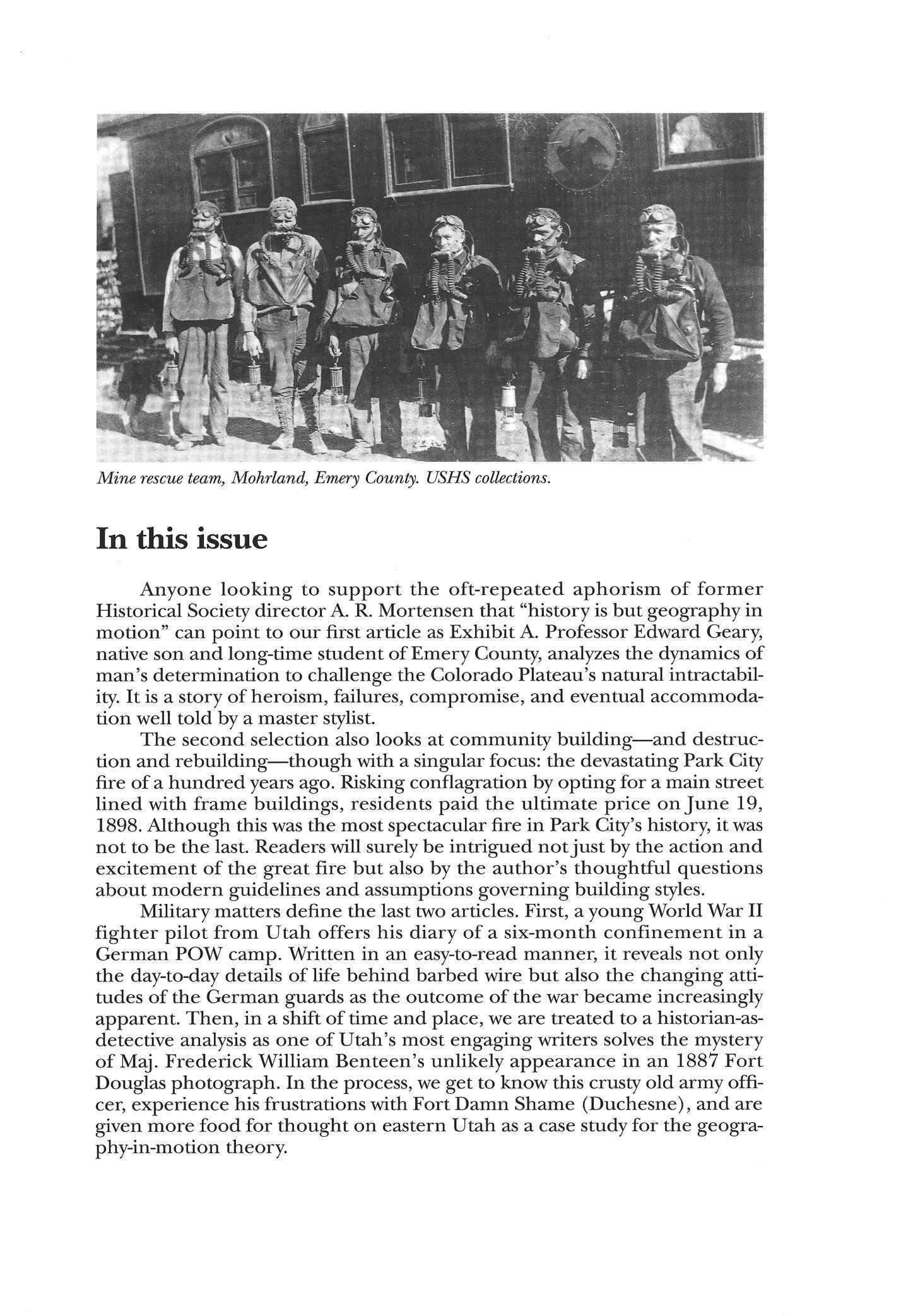
Coal demand followed a similar trend as production from the Carbon County mines grew from about one million tons in 1900 to 5.3 million in 1920, fell to 3.6 million the next year, recovered to 4.6 million by the end of the 1920s, and sank to a low of 2.1 million tons in 1934.40 The Emery County coal camp of Mohrland, established in 1910, reached its peak in the early 1920s, when it consisted of "about two hundred modern dwelling houses, a store, post office, hospital, church, hotel, theater, and amusement hall."41 Mohrland was closed in 1938 following the decision by the United States Fuel Company to extract and process the coal on the other side of the mountain at Hiawatha Every structure was dismantled or moved, leaving only concrete foundations, sidewalks, and refuse heaps to mark the sites of the community center at the mouth of Cedar Creek Canyon and of the several ethnic neighborhoods that had extended up the canyon toward the mine portal.
Emery County was among the hardest-hit regions in one of the hardest-hit states during the Great Depression, because prices for the products of basic industries such as agriculture and mining declined more drastically than prices of manufactured goods.42 Recurrent droughts exacerbated the general economic distress. At the depth of the depression, four out of ten Emery County families were receiving public assistance.43 And yet a certain buoyancy of spirit persisted in the face of hard times An example appears in a report from the Cleveland correspondent to the Emery County Progress during the impoverished summer of 1934: "Our farmers have found that they can raise a crop of whiskers without water, so they are making good use of their opportunity. It seems that all other crops are failing this year."44
The Wilberg Resort, located midway between Huntington and Castle Dale, prospered throughout the depression with crowds of several hundred attending weekend dances. Remains of the large dance floor can still be seen in a verdant hilltop grove, and elderly residents speak fondly of romantic summer nights under the stars. Also vivid are memories of the Prohibition era, which extended through the 1920s and into the 1930s but which seemed to have little impact on the availability of alcoholic beverages. Wine and sake could always be found in the ethnic neighborhoods of Mohrland. Several bootleg whiskey stills reportedly operated at remote springs or pools in the San Rafael country, and the necessary ingredients for home-brewed beer could be purchased at any grocery store According to one recollection of the period, on dance nights at Wilberg, "you only had to walk along the road between the long rows of parked cars, and someone would come up to you and ask if you were looking for a drink. The price was a dollar a pint; it never changed.'"45
Many evidences of depression-relief public works projects are still visible in the Emery County landscape. Civilian Conservation Corps companies based at Ferron, Castle Dale, and Green River built roads and bridges that provided much improved access to the forest and to the San Rafael Swell. The "CCs" also constructed campgrounds, fish ponds, and flood-control structures, provided stock-watering facilities in the desert, fought a destructive forest fire during the drought-ravaged summer of 1934, and provided husbands for numerous local women. Other government programs paved highways, built manual arts buildings for the high schools, funded water systems, and paid almost half the cost of the new Emery County Courthouse erected in 1939. Self-help efforts during this period included a cooperative coal mine, several projects for growing and preserving food, and a surprising renewal of the county's housing stock. Many "depression homes," built with an outlay of only a few hundred dollars combined with ingenious bartering of goods and services, remain as comfortable and attractive additions to their communities.
A significant development of the period was the 1934 passage of the Taylor Grazing Act, which introduced rules for the use of federal lands outside the national forests. In view of the tensions in recent decades between rural residents and federal land managers, it is worth remembering that there was widespread support in Emery County and the state for regulation of the public lands, largely because of concerns about transient herds that competed with locally owned livestock.
The Second World War affected Emery County much as it did other regions of the state and the nation. On the home front, many people left the area for jobs in war industries on the Wasatch Front or the Pacific Coast. Others found full employment and more in the coal mines, often "batching" in dormitories at Carbon County camps during the week and on weekends trying to make it home on rationed tires and rationed gasoline. Emery County played a small role in the relocation of Japanese-Americans from the West Coast when several families were brought to Green River to grow sugar beets in 1942 and others occupied old CCC barracks at the Dog Valley mine south of Emery where they produced coal for the large internment camp at Topaz.
In 1942 the Defense Plant Corporation began developing a mine at Horse Canyon in the Tavaputs Plateau to supply coking coal for the Geneva Steel Plant The Horse Canyon mine, which had a peak employment of about 800, was located in Emery County, but Dragerton, the town built to house the workers, was several miles away in Carbon County. The Emery County "wagon mines," which had formerly served only local fuel needs, also felt the impact of wartime demand combined with improved highways and trucks that made it feasible to reach outside markets Fourteen mines operated in Huntington Canyon under an informal cooperative marketing agreement in which one company would obtain a large contract and other mines would assist in meeting the delivery schedule and would then be paid by the contracting company. One mine operator reported that to the best of his knowledge not a single dispute ever arose from these complicated arrangements. 46
Many families who left the county during the war never returned; the 1940 population of 7,072 had fallen to 6,304 by 1950 Then, in the 1950s, the uranium rush brought a temporary economic stimulus to the county, as it did to much of the Colorado Plateau. Temple Mountain, on the southeastern fringe of the San Rafael Swell, where radioactive ore had first been mined during the radium boom in the early years of the century, yielded 1.29 million pounds of uranium oxide between 1948 and 1956.47
In Castle Valley, the traditional Easter outing to the San Rafael was converted into a "Uranium-Easter" celebration. Dozens of amateur prospectors scrambled up and down ledges with Geiger counters or, if they lacked such devices, brought promising chunks of rock to be checked by Castle Dale druggist L. T. Hunter, who kept ore samples on display in his store window. Many uranium deposits were located, but most were too small for profitable development. A few county residents, however, "struck it rich" in a modest way Owen McClenahan of Castle Dale recalled a visit to the Lucky Strike mine, which had been discovered by a group of prospectors from Ferron:
A decline in the uranium, coal, and other extractive industries left the entire Colorado Plateau as a depressed area in the 1960s. In 1968 Congress established the Four Corners Regional Commission with the objective of diversifying the region's economy and reducing a "job gap" estimated at 137,000.49 This experiment in regional economic planning had only a modest effect on Emery County, but other federal activities made a significant impact on the county's landscape, economy, and quality of life. For instance, the Emery County Project (1963-66), a participating unit in the Upper Colorado Reclamation Project, and the Ferron Watershed Project (1965-71) brought improved efficiency to the management of the water supply and for the first time allowed storage of water from one season to another. The projects' storage units, the Joe's Valley, Huntington North, and Mill Site reservoirs, became popular recreation facilities. In 1963 the Army established the Utah Launch Complex near Green River, where it assembled, tested, and launched Athena and Pershing missiles that landed at White Sands Missile Range in New Mexico. The "missile base," as it was popularly called, employed more than 500 workers at its peak in 1965, raised the population of Green River to a historic high of almost 2,000, and stimulated the building of new residential subdivisions, schools, and churches. With the reduction and eventual cessation of activity at the launch complex by 1979, the population fell again. This decline was partly offset, however, by the new economic stimulus of Interstate 70, begun in 1963 and opened to traffic in 1970.
When 1957 legislation added one thousand additional miles to the original 40,000-mile interstate highway system, Utah officials proposed that part of the added mileage be devoted to a new highway connecting Denver with the Wasatch Front metropolitan area However, federal highway officials decided that the new route should go more directly west from Denver and connect with Interstate 15 at Cove Fort. This plan was decried by the Salt Lake Tribune as a "superhighway [that] goes nowhere" but was welcomed in Emery County as a long-overdue recognition of the natural advantages of the Wasatch Pass route.50
As initially proposed, the interstate would have followed the approximate course of the Old Spanish Trail through Emery County, bringing it close to most of the towns. The route was later altered, however, to cut directly across the San Rafael Swell. This meant that only Green River, situated at one end of what is still the longest stretch without services on the entire interstate highway system, would benefit directly from 1-70 traffic. However, the highway construction, like the major water projects, provided several years of employment for Emery County workers. Interstate 70 also provided easy access for the first time to the interior of the San Rafael Swell, leading to greatly increased public awareness of this remarkable region.
Despite these developments, the county's population continued to decline, falling to 5,137 in 1970. The median age, which had been below twenty-one throughout most of the county's history, had risen to twenty-eight, and between 1940 and 1970 the proportion of residents over the age of sixty-five more than doubled. The Ferron-Emery region was especially hard-hit, losing almost half of its population and reaching an exceptionally high median age of 33.5 in 1970. The town of Emery, which had 705 residents in 1940, had only 216 in 1970. That year, Emery County ranked twenty-fifth among the state's twenty-nine counties in average family income.
Emery County was propelled to the next stage of its history by the international "energy crisis" of the early 1970s. Price increases and production restrictions by petroleum-exporting nations led to widespread fears of an imminent exhaustion of the world's oil reserves and a consequent scramble to develop alternative energy sources Coal, which had been losing its traditional markets to oil and natural gas for decades, was once again in demand. Shirl C. McArthur had foreseen a bright future in coal mining even when the industry was at a low ebb during the early 1960s. Confident that the county's coal reserves could be economically developed, the McArthurs mortgaged their home to establish Castle Valley Mining Company and helped to persuade Utah Power and Light to build coal-fired generating facilities in the county.
UP&L began construction on the Huntington Canyon Plant in January 1972, and the 430,000-kilowatt first unit went online in July 1974 A second unit was completed in 1977 The first unit of the Hunter Plant, located near Castle Dale, was completed in 1978. Units two and three followed in 1980 and 1983. In addition to these massive industrial structures, the Emery County landscape was altered by construction of Electric Lake, a 32,000-acre-foot reservoir in upper Huntington Canyon completed in 1973, and by development of coal mines on a much larger scale than ever before.
Within a short time, the county was transformed from a highunemployment area to a magnet for workers By 1977 the county's average per capita income was the highest in the state, almost 20 percent above second-place Summit County.51 The population grew by 155 percent between 1970 and 1983, from 5,137 to 13,100. In addition, numerous workers commuted to Emery Countyjobs from homes in Carbon and Sanpete counties.
At the beginning of the boom, the county's infrastructure was poorly equipped to accommodate the influx of new residents. Available rental housing was quickly occupied despite a rapid escalation of rents for even substandard units. Mobile home parks were hurriedly opened and almost immediately filled, leaving incoming workers to park mobile homes, travel trailers, and campers on vacant lots or alongside existing homes. By late 1973, Huntington had more mobile homes than houses. Many construction workers lived in campers or tents in Huntington Canyon, often discharging their wastes directly into the creek New annexations almost doubled the area of Castle Dale, Orangeville, and Ferron, and residential growth sprawled beyond the towns into unincorporated areas of the county. Land that had sold for less than $100 per acre during the 1960s was priced as high as $7,500 per acre in 1974. Some families began constructing homes without an assured water supply Others, unfamiliar with the peculiar qualities of Mancos shale soil, built on wet or unstable ground.
Law enforcement agencies accustomed to a quiet rural population were unprepared for the influx of construction workers and a crime rate that soared to twice that of neighboring Sanpete County. On one occasion, county commissioners were pressed into service to guardjail prisoners in order to give overworked sheriff's officers a few hours of rest The county became increasingly plagued with "big city" crimes, including a bank robbery in 1979 during which two local women were killed In addition, Interstate 70 gained a reputation as a major artery in the transportation of illegal drugs, and drug traffickers also took advantage of remote, uranium-era airstrips in the San Rafael Swell. In 1983, sheriff's officers and federal drug agents seized an airplane, loaded with 12.7 tons of marijuana, that had landed at Temple Mountain.
The strains of rapid growth were felt most painfully by the towns. Culinary water systems had been barely sufficient for the pre-boom population. Sewer systems, where they existed at all, provided little or no treatment of sewage and were out of compliance with health and environmental regulations. Yet because the industrial installations were located in unincorporated areas, the immense growth in the county's assessed valuation was of little benefit to town governments The plight of the towns was addressed with the formation of the Castle Valley Special Service District in 1976 Over the next several years, the CVSSD financed new sewer systems, culinary water and pressurized irrigation systems, and the paving of many miles of streets. In addition, county government increased its involvement in providing municipaltype services, establishing a centralized landfill, building and equipping fire stations, providing ambulance and emergency medical technician services, and constructing new libraries.
School enrollments doubled, from 1,732 students in 1974 to 3,589 in 1982 Almost two-thirds of the students were in the elementary grades, reflecting the high proportion of young families. To accommodate this growth and replace outdated facilities, the school district built new schools and expanded others. The county's churches experienced a similar growth By 1981, the historic Emery LDS Stake with its eight wards had expanded to three stakes and seventeen wards. In addition, Catholics, Baptists, Assemblies of God, and several nondenominational religious groups formed new congregations in the county.
By the early 1980s, however, the oil embargo of the early 1970s was only a memory. Moreover, a national economic slump had reduced the demand for industrial energy. The boom's end was almost as abrupt and unsettling as its beginning Mine layoffs between March 1982 and July 1983 cost more than 1,100 Emery County workers their jobs. Construction employment on the third unit of the Hunter Plant, which peaked at 1,200 in November 1982, fell to 650 by April 1983 and only a skeleton staff byJuly. Then, in April 1983, the Thistle landslide severed the main transportation arteries linking southeastern Utah with the Wasatch Front and halted rail shipments of coal to West Coast ports Other mudslides from that exceptionally wet winter blocked alternate routes for several days at a time. Utah coal production fell from seventeen million tons in 1982 to eleven million in 1983.
Nineteen-eighty-four began with a fire in the Beehive Mine that idled 165 workers. By May, coal mining employment in the county was down to 550 from a high of 2,426 only a few years earlier. An estimated thirty percent of housing units in Ferron, Orangeville, and Castle Dale were vacant. Many businesses shut their doors, and mortgage foreclosure notices filled the legal pages of the local newspaper. A painful year ended with the greatest disaster in the county's history when a fire in the Wilberg Mine on December 19 killed twenty-seven workers. The magnitude of the disaster and the drama of the rescue efforts attracted national and international attention, and network television news programs for several days included scenes of the wintry Emery County landscape with smoke billowing from the Wilberg portal. A particularly poignant moment was the memorial service held on December 26 in the spacious new auditorium at Emery High School— the building's ambitious scale a visible symbol of the heady optimism of a boom period that was now definitely at an end.
By the end of the 1980s, however, retrenchment and partial recovery had brought the county's economy to a relatively steady state. Technological advances enabled coal production to increase with a smaller workforce Utah Power's Emery County mines had already been among the most efficient underground operations in the nation in 1980, but output per miner-day doubled between 1980 and 1988 The 1990s brought further reductions in mining and power plant employment However, maintenance, repair, and construction work in support of these major industries provided a sizeable number of additional jobs, many of them in locally owned enterprises. The 1990 census found a median household income of $30,525 in Emery County, above the state average and substantially higher than income in neighboring counties.
A lasting benefit from the energy boom was the rejuvenation of the population Indeed, the 1990 census found that Emery County was the youngest county in Utah and the third-youngest in the nation. Forty-nine percent of the households were composed of marriedcouple families with children under the age of eighteen, compared to the national average of 26.7 percent.52
The traditional mainstays of farming and stockraising have become relatively minor factors in the county's economy. Not only did most of the village farmsteads disappear during the boom, replaced by new houses and trailer courts, but much farm land was subdivided into the ten-acre lots required by county zoning ordinances The intent of these ordinances was to discourage residential sprawl, but the ultimate effect was the creation of numerous plots that were larger than necessary for residential purposes but too small to be viable farms. The 718 farms reported in the 1954 census of agriculture had shrunk to 420 by 1992, only 348 of which harvested any crops More significantly, only 126 county residents reported a primary employment in agriculture in 1990, compared with more than 400 in 1960 Nevertheless, farming and stockraising still have a cultural value for many residents, who hold onto their family farms even though they provide little economic return. The county's agrarian heritage is celebrated in the annual Castle Valley Pageant with its covered wagons and flamboyant exhibitions of horsemanship.
Emery County residents not only cherish their rural heritage but also place a high value on easy access to both the Wasatch Plateau and the San Rafael Swell Local people tend to read their own and their families' history in these public lands. They return year after year to the same mountain campsites or take their Easter excursions to the same favorite destinations in the San Rafael. They show their children and grandchildren where a pioneer ancestor scratched his name on a rock or where a sheepherding great-uncle carved an inscription in the smooth white bark of a quaking aspen The trails where the family's cattle were once driven to the summer range on the mountain or the winter range in the desert, the forest clearing where a relative once operated a sawmill, the ledge where grandpa almost struck it rich during the uranium boom: all have deep personal meaning.
In an essay on the central and eastern Utah hinterland, Wallace Stegner remarked on "the aloofness with which this country greeted human intrusion" and "the effect it has had on its settlers. The plateaus remain aloof and almost uninhabited, but the valleys are a collaboration between land and people, and each has changed the other."53 That collaborative effort continues as history is still being written on the Emery County landscape It is a history representative of land use and abuse in the Colorado Plateau region; representative of the ups and downs of local economies that are dependent on extractive industries; representative, too, of the persistence of an agrarian ideal in a place only marginally suitable for agriculture and of the persistence of a village-based society in an era dominated by the impersonal scale of urban life.
But it is also a unique history of a unique place—as all places are unique. Essayist Scott Russell Sanders has argued that instead of such generalizing abstractions and false metaphors as "the global village" we need to develop "a richer vocabulary of place." "The earth needs fewer tourists and more inhabitants, . . . people committed to knowing and tending their home ground." Nor is this a call for a return to provincial narrowness and isolation, for "every thread you discover in the local web of life leads beyond your place to life elsewhere."54 For lifelong residents of Emery County, for many who first came during the boom years and developed a lasting attachment, and for many native-born whose lives have carried them to other areas, this distinctive landscape at the edge of the Colorado Plateau hinterland will always be "home ground."
NOTES
Dr Geary is a professor of English and director of the Charles Redd Center for Western Studies, Brigham Young University He presented a version of this work as the Statehood Day address in Castle Dale,January 4, 199*7.
1 George W Tripp, "A Clovis Point from Central Utah," American Antiquity 31 (1966): 435;Alan R Schroedl, "Paleo-Indian Occupation in the Eastern Great Basin and Northern Colorado Plateau," Utah Archaeology 1991, pp 8-9.
2 Kevin D Black and Michael D Metcalf, "The Castle Valley Archaeological Project: An Inventory and Predictive Model of Selected Tracts," Cultural Resource Series no 19 (Salt Lake City: Utah State Office, Bureau of Land Management, 1986), pp 9-12.
3 Lee M Swasey, "Emery County Indian Writing Site Study" (unpublished manuscript) lists 226 sites Emery County History Archives, Castle Dale, Utah.
4 John Wesley Powell, The Exploration of the Colorado River and Its Canyons (New York: Viking Penguin, 1987), p 204; "Diary of Almon Harris Thompson, Geographer: Explorations of the Colorado River of the West and Its Tributaries, 1871-75," Utah Historical Quarterly 7 (1939): 44.
5 Mauricio Arze and Lagos Garcia may have passed through Emery County on a fur-trading expedition in 1813 The claim that two "lost trappers" named James Workman and William Spencer visited the region in 1809 rests on dubious historical grounds LeRoy R Hafen and Ann W Hafen, Old Spanish Trail, Santa Fe to Los Angeles (Glendale, CA: Arthur H Clark, 1954), p 86;J Cecil Alter, Utah, the Storied Domain: A Documentary History of Utah's Eventful Career (Chicago and New York: American Historical Society, 1932), 1:10-11.
6 George R Brooks, The Southwest Expedition ofJedediah S. Smith: His Personal Account of theJourney to California, 1826-27 (Glendale, CA: Arthur H Clark, 1977), pp 11-14, 47.
7 "The Chronicles of George C Yount, California Pioneer of 1826," California Historical Society Quarterly 2.1 (1923): 38.
8 "TheJournal of Orville C Pratt," in Hafen and Hafen, Old Spanish Trail, pp 350-51.
9 Herbert E Gregory, ed., "Journal of Stephen VandiverJones, April 21, 1871-December 14, 1872," Utah Historical Quarterly 16-17 (1948-49): 73.
10 Powell, Exploration of the Colorado River, p. 76.
11 F M Lyman, Letter to the Editor, Deseret Evening News, August 28, 1880.
12 A H Thompson, "Irrigable Lands of That Portion of Utah Drained by the Colorado River and Its Tributaries," in John Wesley Powell, Report on the Lands of the Arid Region of the United States, with a More Detailed Account of the Lands of Utah (1878), Wallace Stegner, ed (Cambridge, MA: Belknap Press of Harvard University Press, 1962), p 171.
13 Francis Hodgman, "In the Mountains of Utah," in Jackson Thode and James L Ozment, eds., Dreams, Visions and Visionaries: Colorado Rail Annual, 1992 (Golden, CO: Colorado Railroad Museum, 1992), pp 29, 35.
14 W H Lever, History of Sanpete and Emery Counties, Utah (Ogden: Author, 1898), p 594.
15 Journal History, Church ofJesus Christ of Latter-day Saints, May 24, 1875, cited in John H S Smith, "Census Perspectives: The Sanpete Origins of Emery County Settlement," in Allan Kent Powell, Emery County: Reflections on Its Past and Future (Salt Lake City: Utah State Historical Society, 1979), p 46; Stella McElprang, comp., Castle Valley, a History of Emery County (n.p.: Emery County Company of the Daughters of Utah Pioneers, 1949), p 17.
16 McElprang, Castle Valley, p 27;Argene Olsen, "The Leader of die First Setders of Emery County," in Montell Seely et at, comps., Emery County, 1880-1980 (n.p.: Emery County Historical Society, 1981), p 432.
17 Charles R Curtis, "Fifty Years Ago," in McElprang, Castle Valley, p 56.
18 Emery County Historical Records Survey, quoted in Ward J Roylance, ed., Utah: A Guide to the State (Salt Lake City: Utah a Guide to the State Foundation, 1982), p 700.
19 Hodgman, "In the Mountains of Utah," p 32.
20 Ibid., p 34.
21 McElprang, Castle Valley, p 153.
22 "An Act Creating Emery County," Chapter TV, and "An Act Providing for the Organization of San Juan County, and Changing the Boundaries of Emery County," Chapter IX of Laws of the Territory of Utah, Passed at the Twenty-fourth Session of the Legislative Assembly (Salt Lake City: Deseret News Printing and Publishing Establishment, 1880), pp. 4-5, 10; see also James B. Allen, "The Evolution of County Boundaries in Utah," Utah Historical Quarterly 23 (1955): 273-74.
23 Lowry Nelson, In the Direction of His Dreams: Memoirs (New York: Philosophical Library, 1985), p. 19.
24 F M Lyman, Letter to the Editor, Deseret Evening News, August 28, 1880.
25 Ibid.
26 McElprang, Castle Valley, p. 69.
27 Compendium of the Eleventh Census, 1890 (Washington, D.C.: Government Printing Office, 1892), pp 402-403; Report on the Statistics ofAgriculture in the United States at the Eleventh Census, 1890 (Washington, D.C.: Government Printing Office, 1895), pp 189, 231; Census Reports: Population, Part I. Twelfth Census of the United States, 1900 (Washington, D.C.: U S Census Office, 1901), p 391; Census Reports: Agriculture, Parti, Farms, Livestock, and Animal Products. Twelfth Census of the United States, 1900 (Washington, D.C.: U.S Census Office, 1902), pp 130-31, 302.
28 Allan Kent Powell, "Castle Valley at the Beginning of the Twentieth Century," in Powell, ed., Emery County, pp 5-6.
29 Thode and Ozment, Dreams, Visions and Visionaries, pp 51, 68.
30 Lever, History of Sanpete and Emery Counties, pp. 599-600.
31 Ibid., 595, 644.
32 F.M. Lyman, Letter to the Editor, Deseret Evening News, September 15, 1880.
33 Emery County Progress, September 5, October 24, 1903.
34 Ibid., February 20, 1904.
35 Ibid., November 14, 1903.
36 A. W.Jensen, "Recollections," in Albert C. T. Antrei, ed., The Other Forty-niners: A Topical History of Sanpete County, Utah, 1849-1983 (Salt Lake City: Western Epics, 1983), pp. 206-207.
37 Billy Howland, "The Planting of the Seed and How It Grew," unpublished manuscript copy in Emery County History Archives, p 4, Castle Dale.
38 Pearl Baker and Ruth Wilcox, "Greenriver," in McElprang, Castle Valley, p 184.
39 Baker and Wilcox, "Greenriver," p 191;Laura L Acerson, "Green River Melon Days," typescript copy in Emery County History Archives, Castle Dale.
40 Floyd A O'Neil, "Victims of Demand: The Vagaries of the Carbon County Coal Industry," in Carbon County: Eastern Utah's Industrialized Island, Philip F Notarianni, ed (Salt Lake City: Utah State Historical Society, 1981), p 27.
41 Irene C O'Driscoll, "Mohrland," typescript copy in Emery County History Archives, Castle Dale.
42 See Brian Q Cannon "Against Great Odds: Challenges in Utah's Marginal Agricultural Areas, 1925-39," Utah Historical Quarterly 54 (1986): 321; R Thomas Quinn, "Out of the Depression's Depths: Henry H Blood's First Year as Governor," Utah Historical Quarterly 54 (1986): 217.
43 Emery County Progress, October 23, 1936.
44 Ibid.,July 6, 1934.
45 Owen McClenahan, "Days of Prohibition," in Emery County History Archives, Castle Dale.
46 Vernon Leamaster, "Leamaster Coal Company" (February 1994), typescript copy in Emery County History Archives, Castle Dale.
47 Daniel K. Newsome and Betsy L. Tipps, "Cultural Resource Reconnaissance and Evaluation in the Temple Mountain and Tomisch Butte Mining Areas, Emery County, Utah," Cultural Resources Report 5011-01-9311 (Antiquities Section, Utah Division of State History, and Moab District, Bureau of Land Management, 1993), pp 9-11.
48 Owen McClenahan, "Uranium Mining in the Colorado Plateau," p 12, unpublished manuscript used by permission of the author.
49 "Four Corners Regional Economic Plan Proposal" (Provo: Center for Business and Economic Research, Brigham Young University, 1971).
50 Salt Lake Tribune, October 21, 1957.
51 Emery County Progress-Leader, April 27, 1978.
52 Deseret News, August 22, 1992.
53 Wallace Stegner, "High Plateaus," in Wallace Stegner and Page Stegner, American Places (Moscow: University of Idaho Press, 1983), p 128.
54 Scott Russell Sanders, "Beneath the Smooth Skin of America," in Writing from the Center (Bloomington: Indiana University Press, 1995), pp. 17-19.