
4 minute read
LACH2001 Landscape Dynamic Studio


LACH2001 Landscape Dynamic Studio Unit and Studio Coordinator: Rosie Halsmith ‘Landscape as Infrastructure’
JOYCE VAN LEEUWEN
The Green Loop & Green Links Ashfield was built upon precious ancient wetlands and sits on Whadjuk Noongar country. This area has always been an important meeting place for Noongar people and consisted of lakes, fertile wetlands and woodlands. While most of the natural landscape has been replaced by the suburb, the Ash¬field Flats still offer an example of what life and the landscape along the riverbanks may have looked like before European settlement. Today the Ashfield Flats are an important biodiversity hot spot nearby the city of Perth.
The implementation of a green infrastructure strategy in Ashfield, allows for the natural landscape to be drawn into the suburb and connects it to the existing green spaces along the river, as well as the Ashfield Flats.
The design of the Green Loop & Green Links aims to connect visitors, the community and the suburb, from the train station and various community sites to the wetlands, the Derbal Yerrigan (Swan River) and the surrounding green spaces. It is designed with respect for the natural landscape, ecosystems and the community, past present and future.
The Green Loop & Green Links represent a physical and sensory connection to the landscape. Grounded in the trees and vegetation native to this area, supporting biodiverse ecosystems for people, birds and wildlife to enjoy.
Image: Masterplan Green Infrastructure Ashfield & Ashfield Flats - The Green Loop & Green Links.


KEN CHENG
‘Colstoun Road Transformation, The New Main Street in Ashfield’
This project transforms Colstoun Road to the new main street in Ashfield, establishing an ecological corridor and urban forest in the suburb. The new main street connects the existing amenities and Ashfield Parade, providing a link from the Ashfield train station to the Derbarl Yerrigan (Swan River) and enhancing the existing areas. Colstoun Road acts as a functional main street for residents and visitors with pedestrian and cycle paths surrounded by vegetation and reinterpret the main street in Ashfield. Visitors are encouraged to walk within the suburb and three walking radius zones are designed to provide a diversity of activities and integration with commercial, recreational and ecological uses. The scheme aimed to engage visitors to explore the natural environment in Ashfield, linking to Ashfield Flats and the Swan River, to experience the unique sense of place by nature.
Image: Colstoun Road, The New Main Street, masterplan.


FRANK BARRETO ROJAS
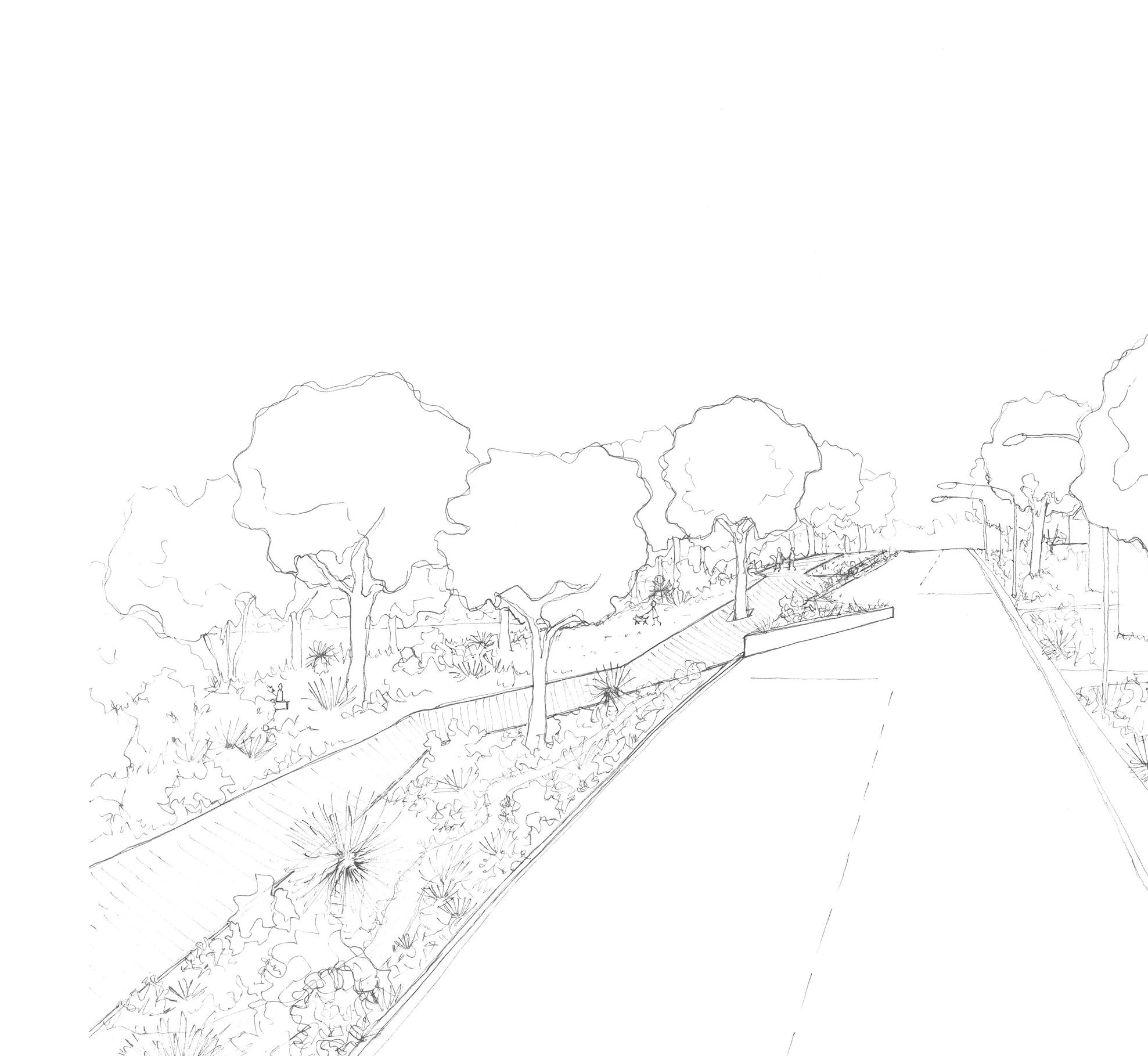
Set along the banks of the Derbal Yerrigan (Swan River), Ashfield is currently an environment depleted of connection – yet is one with immense natural beauty. The flats are a little-known wonder, yet to locals who frequently use this Boodja, it is a great place for gathering and enjoyment. The proposal of The Place of Water Connection imagines a central corridor to connect the flats and river to Ashfield station and beyond (Perth). The use of activation among its ‘new’ central vein and resurfacing of stormwater drainage in the form of a living stream carries all fauna – including humans – through the suburb from the station to the river and vice versa. The planting scheme encourages connection between the vegetation complexes and entices residents to continue the landscape through to the private realm by using endemic plants suitable for smaller spaces. Species from the flats are also used in strategic locations to allow fauna to travel through the grid.
A cultural wall along the green corridor is used to encourage ‘learning through experience’ and allows for users to familiarise themselves with local culture, flora and fauna. As part of the process of creating green infrastructure, disconnection was obvious, but the aim was to also create new green areas and restoring existing ones. Phases beyond are considered to increase connectivity within the flats, restore and improve existing natural habitats, create a grid for a green mesh within the suburb, as well as foresight design with landscape centric schemes for densifying suburbs along the fringe of the Derbal Yerrigan.
Image: The Place of Water Connection - Ashfield.


