NORTH I-5 LID Design Proposals for a
CONNECT!
CLIMATE-RESPONSIBLE
2023 Scan Design Interdisciplinary Master Studio | College of Built Environments | University of Washington

NORTH I-5 LID Design Proposals for a
CLIMATE-RESPONSIBLE NORTH I-5 LID Design Proposals for a
2023 Scan Design Interdisciplinary Master Studio
College of Built Environments, University of Washington
INSTRUCTORS
Nancy Rottle, Professor Emeritus of Landscape Architecture, University of Washington
Louise Grassov, Master Teacher, Schulze + Grassov
Katrina Golladay, Teaching Assistant
STUDIO PARTICIPANTS
Austin Bass, MArch
Grace Brennan, MLA
Neha Chinwalla, MUP
Griffin Cronk, MLA
Clelie Fielding, MLA/MUP
Nat Gregorius, MLA
Meredith Grupe, MLA
Laurel Hicks, MUP
Carmen Kwok, MLA
Katherine Magee, MLA/MUP
Emily Pressprich, MArch/MUP
Tim Seed, MUP
Darryl Vallejos, MLA
ACKNOWLEDGEMENTS
Scan Design Foundation
UDistrict Partnership Lid North I-5 Committee | Katy Ricchiuto, Stephen Antupit, Don Blakeney, Lauren Supp,
Mike Ruby, Winston Saunders
Lid I-5 | Scott Bonjukian
UDistrict Advocates | Cory Crocker
City of Seattle Office of Planning & Community Development | Lyle Bicknell
And to the many professionals and advocates who provided expert presentations, workshop leadership and design reviews | Rasmus Astrup, Bill Estes, Sarah Lukins, Erin Irby, Justin Roberts, Briana Weekes, Constantine Chrisafis, Kate Simonen, Jessyn Farrell, Noelle Higgins, Derek Holmer, Ingrid Krueger, Elizabeth Umbanhowar, Justin Martin, Amber Shi, Ken Miller, Dave Rodgers
Book design by Katherine Magee
Cover image by Tim Seed | Back cover image by Darryl Vallejos
We acknowledge the Coast Salish peoples on whose land we study and work, the land which touches the shared waters of all tribes and bands within the Duwamish, Puyallup, Suquamish, Tulalip and Muckleshoot nations.
We are thankful to the Coast Salish Peoples whose lands we studied, where we were inspired and developed our design proposals. As future designers, we strive to continue to learn about this land’s cultural past and present and to support Coast Salish People.
Image Source: Griffin Cronk
STUDIO OVERVIEW
PRECEDENT STUDIES
The Big Dig + The Green Way (Boston, MA)
Capitol Crossing (Washington, DC)
Cobertura de la Ronda del Mig (Barcelona, Spain)
Det Grønne Strøg (Copenhagen, Denmark)
Federation Square (Melbourne, Australia)
Hudson Yards (New York, NY)
Jardin Serge Gainsbourg (Paris, France)
Klyde Warren Park (Dallas, TX)
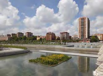
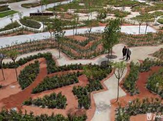
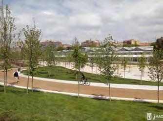
Madrid Río (Madrid, Spain)
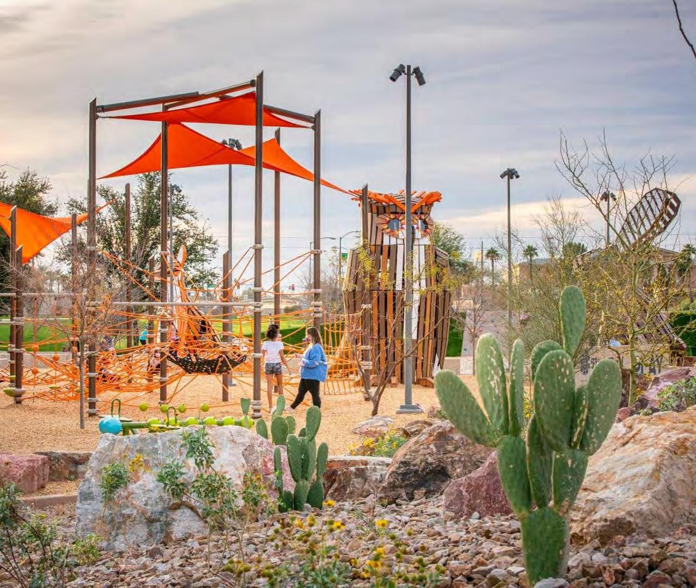
Margaret T. Hance Park (Phoenix, AZ)
Presidio Tunnel Tops (San Francisco, CA)
Vancouver Land Bridge (Vancouver, WA)
ANALYSES + FLOWS
Watershed + Site Topography
Infrastructure + Utilities
Neighborhoods, Culture, + Housing
Public Space, Ecology, + Biodiversity
Transportation + Connections
Economy, Policy, + Ownership

COMMUNITY WORKSHOP REPORTING
Establishing Principles + Goals
Inten{city] Matrix
Site Character
Site Facilities + Activities
Transportation
AI Image Generation
Climate Game
Postcards from the Future
Design Workshopping
Laurel Hick s, Darryl Vallejos, Austin Bass 123
SITE PROPOSALS
Green Seam, Low-Intensity Development
Griffin Cronk, Carmen Kwok, Tim Seed
RECLAIM, Mid-Intensity Development
Grace Brennan, Neha Chinwalla, Nat Gregorius, Katherine Magee
The Living Lid, Mid-Intensity Development
Clelie Fielding, Meredith Grupe, Emily Pressprich
Symbiosis, High-Intensity Development
Seattle and numerous cities worldwide have established excellent success using freeway lids to repair rifts carved by transportation infrastructure, with Freeway Park and I-90 inspiring local examples. Recent efforts to explore expansion of Seattle’s Downtown Interstate-5 cap has met with keen interest, design and engineering funding, and a City Council resolution supporting lidding Interstate-5 in the city. Adding to this momentum, the UDistrict Partnership has joined the Lid I-5 campaign in advancing the concept of reconnecting the severed neighborhoods of Wallingford and the University District, while also providing much-needed open space, pedestrian and bicycle infrastructure, and potential housing and commercial development.
It is within this civic context that our 2023 Scan Design Interdisciplinary Studio undertook the challenging project of envisioning potential new freeway lid space between two urban neighborhoods of distinctly different character and demographics. We were joined by an enthusiastic and committed community, with over 100 attendees at our Community Visioning Workshop, sponsored by the UDistrict Partnership and implemented by our talented interdisciplinary graduate students.
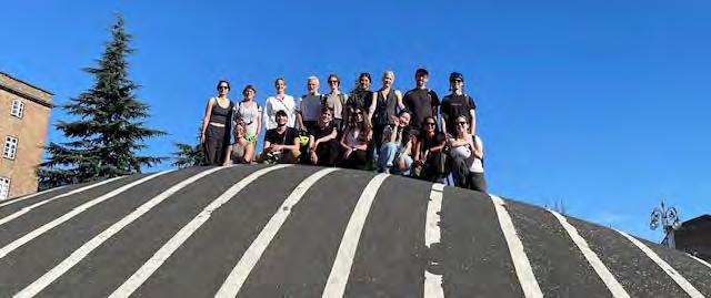
Our group was deeply inspired by the urban design examples that we experienced together during our Scan Design Study Tour to Copenhagen and Malmö, informed by global examples of freeway lidding and research into our local conditions, and apprised by community preferences, all of which contributed notably to the student teams’ planning and design ideas. Four teams undertook
scenarios framed by possible development “intensities” and, recognizing the imperative that we reduce and sequester greenhouse gas emissions in every way possible, carefully considered how a massive freeway lid project might actually be climate-responsible. We sincerely hope that the four teams’ informed, creative, beautifully illustrated proposals contained in this book will illuminate some of the obtainable options a multi-faceted North I-5 lid can achieve.
This year marks the sixteenth Scan Design Interdisciplinary Master Studio and we would like to give special thanks to the Scan Design Foundation for their continued support of this extraordinary opportunity. The immersive relationship between life in Seattle and Copenhagen would not be possible without our Scan Design Master Teacher, Louise Grassov; we are so thankful for her inspiration and guidance. The UDistrict Partnership’s North I-5 Lid Committee’s engaged participation in the studio was invaluable, especially with Urban Vitality Manager Katy Ricchiuto’s expert leadership and support, for which we are tremendously grateful. We benefitted and learned from design professionals who gave their time to help with table leadership at our Community Visioning Workshop; from the corps of experts who made presentations on freeway lid design and climate mitigation techniques; and from our many generous professionals who participated in reviewing the students’ final proposals. We sincerely thank you all!
Nancy Rottle, PLA, FASLA Professor Emeritus, Department of Landscape Architecture Director, UW Green Futures Lab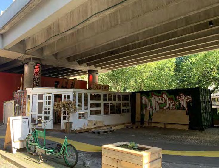
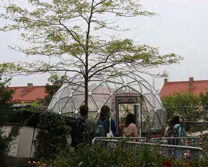 Image Source: Meredith Grupe
Image Source: Nat Gregorius
Image Source: Darryl Vallejos
Image Source: Meredith Grupe
Image Source: Nat Gregorius
Image Source: Darryl Vallejos
A good life…comes from mapping ourselves onto the world, encountering directly at a 1:1 level. The more direct our encounters are with the many facets of our world – things like place, belonging, time, nourishment, and community – the more purpose and meaning we find to flourish. To gain access into the different layers of our cities and build meaning into them, wise city planners will want to consider how various denizens encounter their place… – Of Stories and Stones, p. 3
The 2023 ScanDesign Interdisciplinary Master Studio envisioned how a “lid” over I-5 between the UDistrict and Wallingford might serve to:
• CONNECT and strengthen the neighborhoods
• CONNECT via safe, low-carbon active transportation systems
• CONNECT and create new equitable housing, green and public spaces that cultivate a caring urban culture
• CONNECT places where people live to where they work, play, shop, create, and find services
• CONNECT human health with health of other species, supporting biodiversity
• CONNECT people in the city to Seattle’s natural context
• CONNECT present needs with those of the future, for both local and global intergenerational equity.
Prior to the quarter, studio participants traveled to Denmark and Sweden for a 2+ week study tour exploring active mobility solutions, urban ecological design, green stormwater management, and people-centered public spaces while visiting projects and firms in Copenhagen and Malmö. Upon returning to Seattle, we built on
understandings gained from our travels, employing circular city planning approaches, public space principles, pedestrian and bicycle connectivity, urban biodiversity, and climate mitigation and adaptation projects to the challenge of a North Seattle Lid.
In our process, we explored informative and inspiring precedents of highway caps and land bridges that contribute to urban life; identified guiding frameworks for achieving combined environmental, economic and social goals; investigated and analyzed the large site and its nested contexts of related systems; and developed concepts for a future connective surface across the chasm of I-5. This research created the foundation for the development of group site proposals.
Throughout the quarter, students received invaluable insight from our master teacher Louise Grassov, and in November, students collaborated in a charrette with the UDistrict Partnership, Wallingford and UDistrict residents, City of Seattle staff, local professionals and Lid I-5 proponents. We are excited to share the results of this work in the coming pages!
Boston, MA - The Big Dig + The Green Way
Washington, DC - Capitol Crossing
Barcelona, Spain - Cobertura de la Ronda del Mig
Copenhagen, Denmark - Det Grønne Strøg
Melbourne, Australia - Federation Square
New York, NY - Hudson Yards
Paris, France - Jardin Serge Gainsbourg
Dallas, TX - Klyde Warren Park
Madrid, Spain - Madrid Río
Phoenix, AZ - Margaret T. Hance Park
San Francisco, CA - Presidio Tunnel Tops
Vancouver, WA - Vancouver Land Bridge
After returning from the study tour, students explored examples of highway lids across the world, which exhibit varying levels of urban, structural, and financial intensity. Students researched projects’ histories, programs, goals, and performance over time, especially considering impacts of these lids on climate, social justice issues, and public life.
Precedent studies helped students gain understanding of the broad variety of lid projects that exist today as well as the complex drivers, processes, and outcomes that inform very different experiences. This research informed and inspired our designs for the North Seattle Lid.
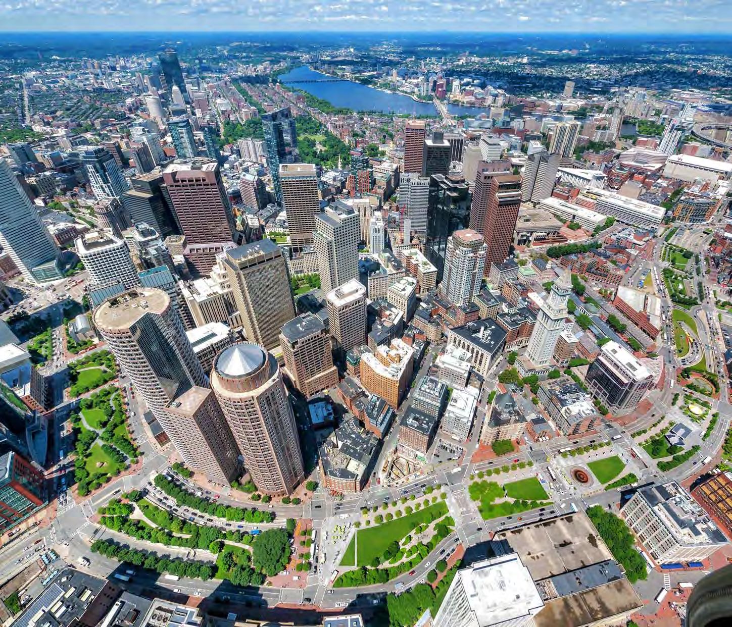
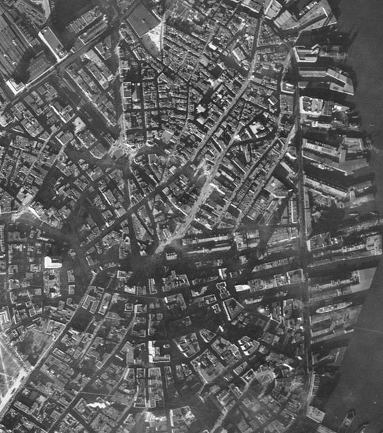
The Rose Fitzgerald Greenway is the final at-grade product of several decades of planning, design, and construction to realign and bury highway connections through downtown Boston. The entire project was named the Central Artery/Tunnel Project (CA/T), but as one of the largest and most expensive infrastructure projects in the history of the United States, it was appropriately nicknamed “The Big Dig.”
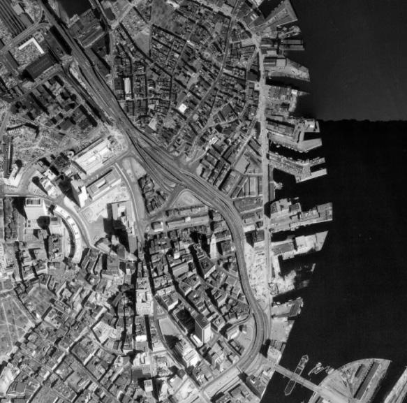
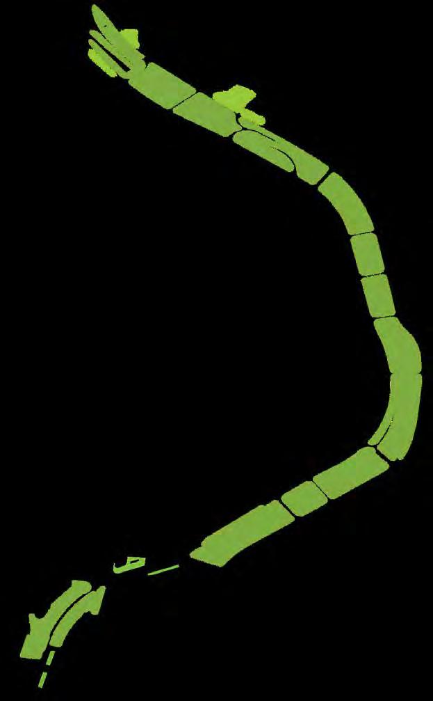
The demolition of the elevated highway that sliced through the city created over 300 acres of open space along a 1.5 mile corridor. Parks were planned for 75% of the space, with parcel designs spread across several firms. The concept of “urban rooms” repeats along the corridor which creates many smaller spaces in contrast to a vast “green oasis” like the Boston Common.
FIGURE 1: BOSTON AERIAL (1938) Image Courtesy of Boston City Archives FIGURE 2: BOSTON AERIAL (1991) Image Source: MassGIS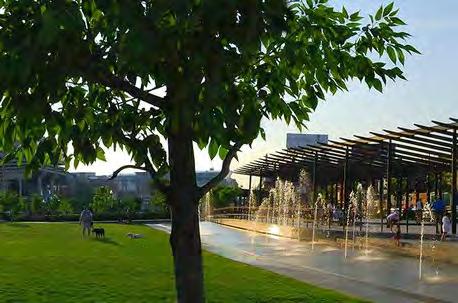
The north end Parks (GGN) were envisioned as the North End’s “Front Porch.” This space considers the topographic and cultural connections between the downtown and North End districts to create a long sought-after open space.
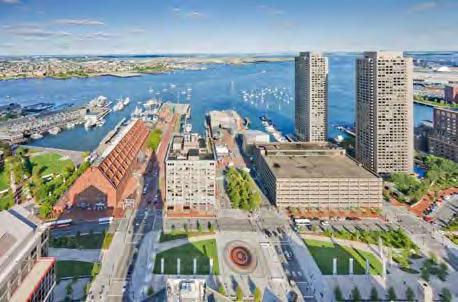
The wharf District Parks Wolff) directly connect the historic and cultural centers of Government Center and Faneuil Hall with the wharfs on the Boston Harbor waterfront. These spaces are highly programmed throughout the year.
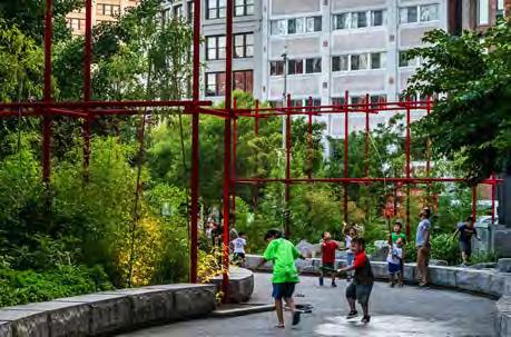
Chinatown Park (Carol R Johnson Associates) is Chinatown’s largest greenspace. Its design reflects the needs of the community by providing space for cultural celebrations adjacent to the Chintown Gate. It also features a serpentine path with bamboo groves, seating, and water features.
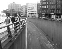 FIGURE 3: NORTH END PARKS Image Source: GGN
FIGURE 4: WHARF DISTRICT PARKS Image Source: Copley Wolff
FIGURE 5: CHINATOWN PARK Image Source: IBI Group
FIGURE 3: NORTH END PARKS Image Source: GGN
FIGURE 4: WHARF DISTRICT PARKS Image Source: Copley Wolff
FIGURE 5: CHINATOWN PARK Image Source: IBI Group
As a northern coastal city, Boston is susceptible to sea level rise and variable precipitation regimes as a result of climate change. The Greenway looks to a more climate resilient future by preparing for coastal flooding events, expanding opportunities for urban heat relief, and calculating carbon emissions and carbon sink potential. The 1.5 miles of open space is a vibrant pollinator and wildlife habitat with a wide variety of plants and ecosystems.
While the infrastructure project embedded vast amounts of carbon into the 3.8 million cubic yards of concrete it took to construct, there are significant environmental and health benefits. Travel times through Boston decreased 62% from 1991 to 2003 and carbon monoxide levels in the city decreased by 12%. It also reduced surface noise and created safer connections for neighboring communities.
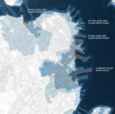
FIGURE 6: SEA LEVEL RISE IMPACT MAP
Image Source: City of Boston
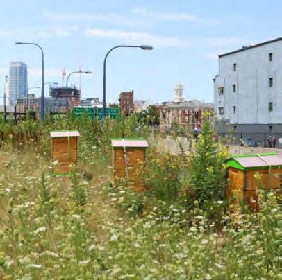
FIGURE 7: POLLINATOR HABITATS
Image Source: The Greenway Conservancy
The highway removal and popularity of the Greenway has increased property values along the corridor. Studies continue on how to foster connections across and through the Greenway to maintain a high quality of life.
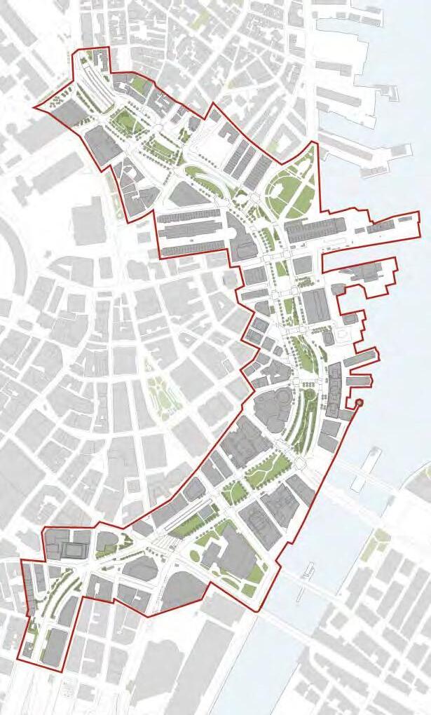
FIGURE 8: GREENWAY PLANNING STUDY AREA.
Utile
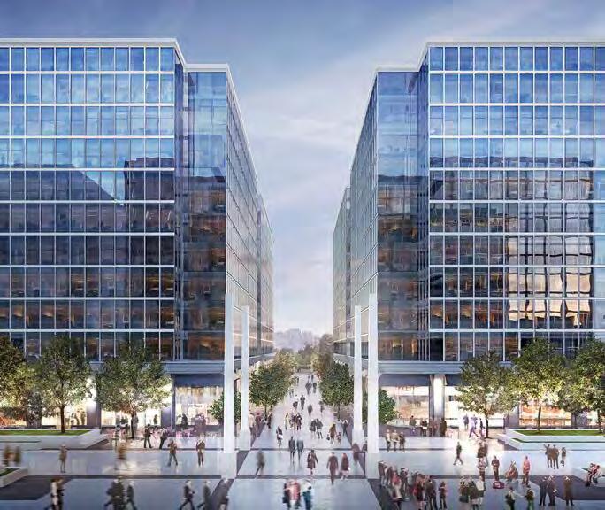
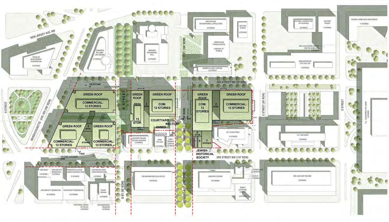
The air space above I-395 in Washington, D.C., was initially purchased in the 80s but development fell through. In 2006, Property Group Partners (PGP) purchased the air rights for development. The project’s goal was to create 1 million sq. ft of office space for mixed commercial use. The project restored the old street grid, and connected two of DC’s neighborhoods; Capitol Hill & East End district.
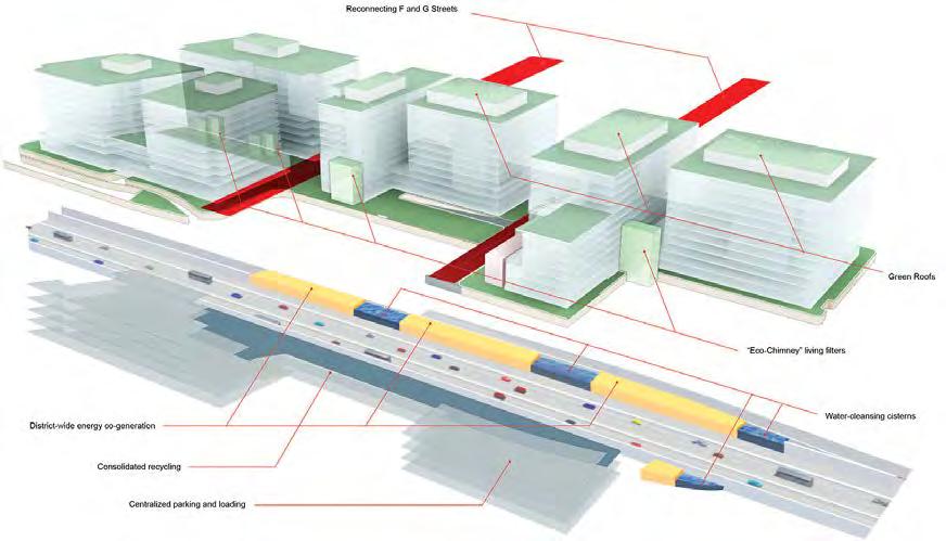
I-395 is a short highway in D.C. that is primarily underground. This project consisted of constructing a platform on top of a recessed section of I-395. To support the buildings, 8-ft footings were built 100 ft into the ground. The buildings on the platform are LEED certified, and the project retains 90% of stormwater for reduction in potable and landscape water usage.
FIGURE 1. Image Source: Kevin Roche, John Dinkeloo, and Associates FIGURE 2. Image Source: SOM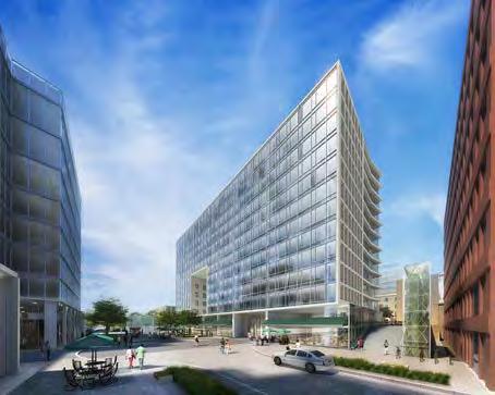
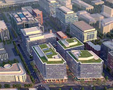
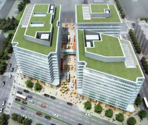
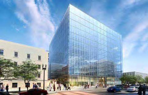
Capitol Crossing was designed with sustainable goals and made LEED Platinum certification. The project implemented rainwater catchment and reuse, green roofs, energy production, and efficient ventilation to reduce the carbon footprint of the development.
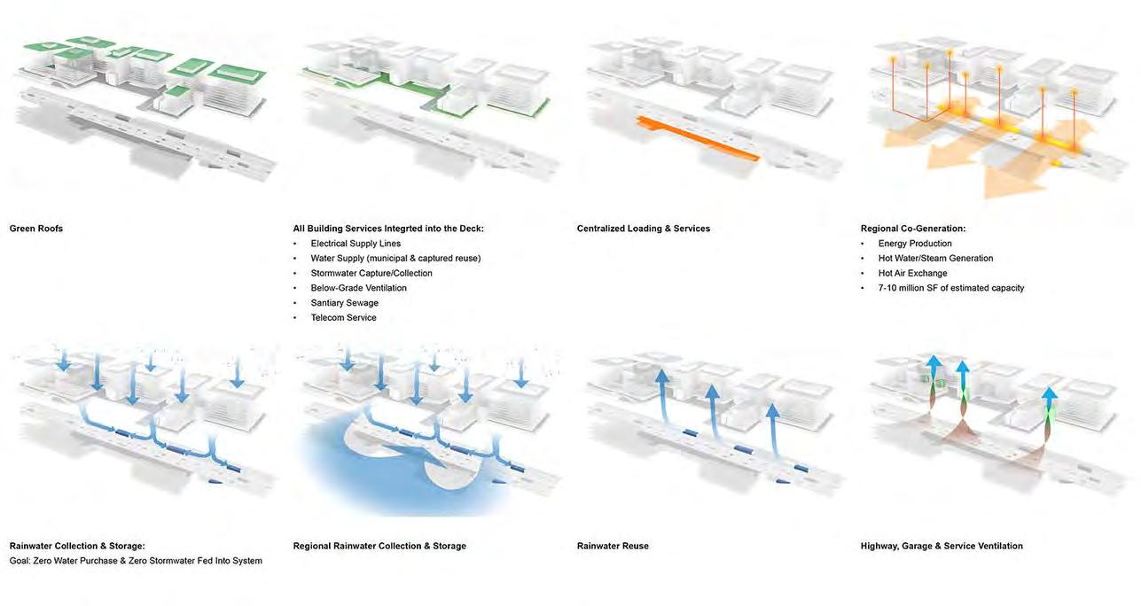 FIGURE 3. Image Source: SOM
FIGURE 4. Image Source: PGP
FIGURE 3. Image Source: SOM
FIGURE 4. Image Source: PGP
The development finished construction in 2020. Based on Google Maps images, a bakery in the development is popular among residents but some of the other retail spaces are vacant. The ground-level design is a pedestrian-friendly and connected space but isn’t necessarily a destination in itself. It is clear that the goal of this project was to maximize leased commercial space.
 PRiVaTeLy DeVeLoPeD sPaCe
FIGURE 6. Image Source: SOM
PRiVaTeLy DeVeLoPeD sPaCe
FIGURE 6. Image Source: SOM
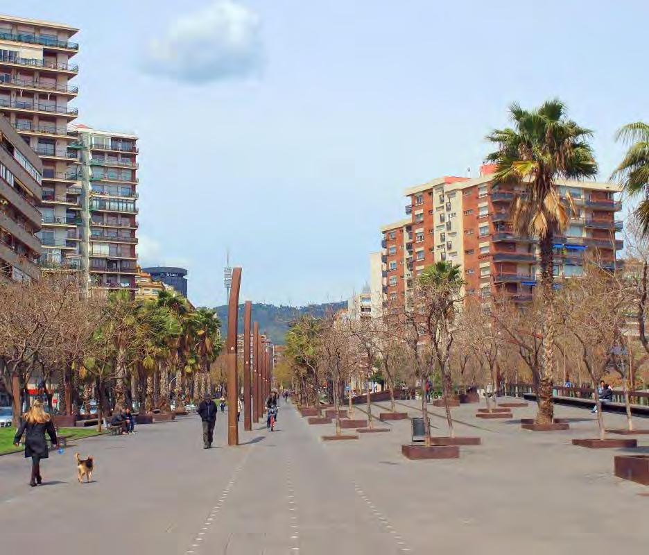
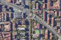
FIGURE 1: MAP OF THE VARIOUS SECTIONS OF THE RONDA DEL MIG THAT HAVE BEEN CAPPED
Image Source: Google Earth


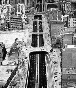


1969-1972: 300 m portion of the road capped with initial expressway construction


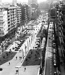
1995-1997: first section capped post expressway due to resident demand, now known as Rambla de Brasil


1996-1997: this section followed the same design as section 2, creating a continuous urban promenade


1998-2003: these last sections contribute to the new 50,000 m2 of continuous urban public space


There is current pressure coming from citizen movements to cap this final section

The Ronda del Mig expressway intersects through the interior of Barcelona, Spain. It was constructed beginning in the 1970s, requiring the leveling of homes and significant cultural spaces. A portion of the expressway was capped in synchrony with its construction due to resident pressure, but most of the expressway was left exposed with a few pedestrian bridge connections. These 800 m voids created disconnected neighborhoods and altered their character and livability through increased property values and significant air and noise pollution. Various citizen-led movements arose to establish a platform for the concerns and demands of the residents to cap more of the exposed expressway.
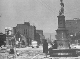
FIGURE 2: IMAGES OF THE EVOLUTION OF THE RONDA DEL MIG FROM PRE-CONSTRUCTION TO CAPPING.
Image Sources: Archive of Sants, Public Space
Content Sources: Public Space, Betéve, F. Javier Fraga Cadórnig
When the city municipality considered the demands to cover the void sections of the expressway, their main concern was how to finance it. The resident associations proposed that a privately owned parking garage be constructed between the Ronda del Mig and the new public space cap to generate the funds needed. A technical and economic feasibility study was carried out which proved the proposal would work and enough parking was sold in the given time period to begin construction.
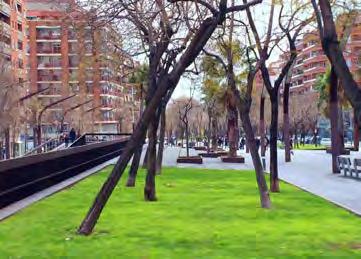
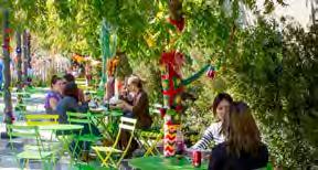
This public space, known as Rambla de Brasil, was designed by architects Jordi Henrich and Olga Tarrasó, who later won the Decade of Architecture for the project. They imagined an urban promenade with a central axis for walking or biking and parallel adjacent strips on both sides for lawn, trees, plantings, and rest areas.
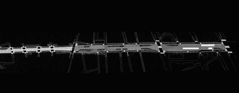
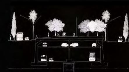
Image Source: Espinàs I Tarrasó SCP
FIGURE 3: PLAN AND SECTION OF THE CAP AT SECTIONS 2 AND 3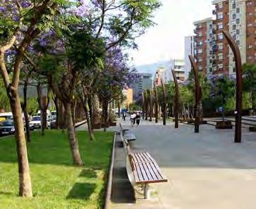
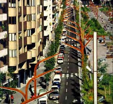
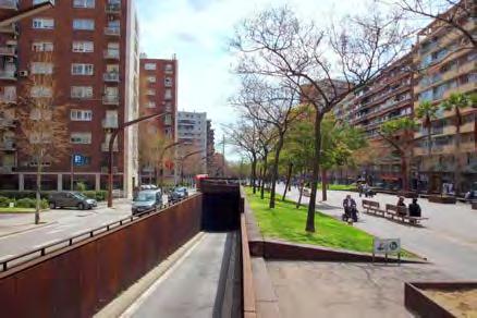
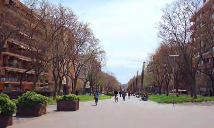
Due to the addition of the parking garage, the pedestrian cap is above the adjacent roads. The architects designed gently graded ramps for access from street level which also created more secluded seating and planting areas.
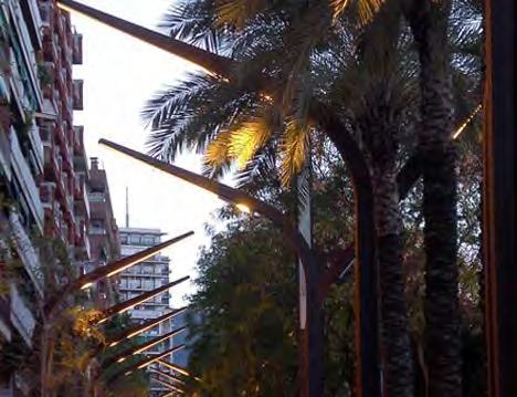
The grading to street level and site elements, such as the newly designed street light posts, are carried out from the public promenade to the adjacent roadways creating a continuous design. Materiality with the corten steel and paving also contributed to this continuity. These design choices were important to consider in order to stitch back together neighborhoods that had been historically disconnected by the expressway.
FIGURE 4: IMAGES OF SURFACE LEVEL FEATURES AND MATERIALITY.
Image Sources: RG Civil Engineering, Espinàs I Tarrasó SCP
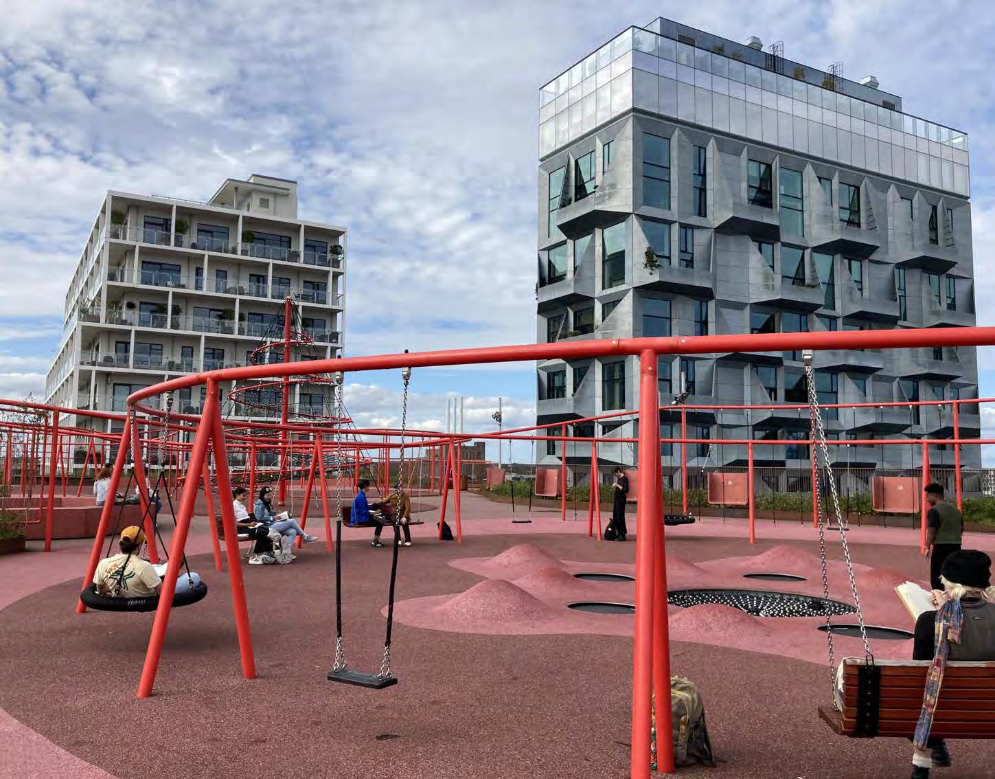
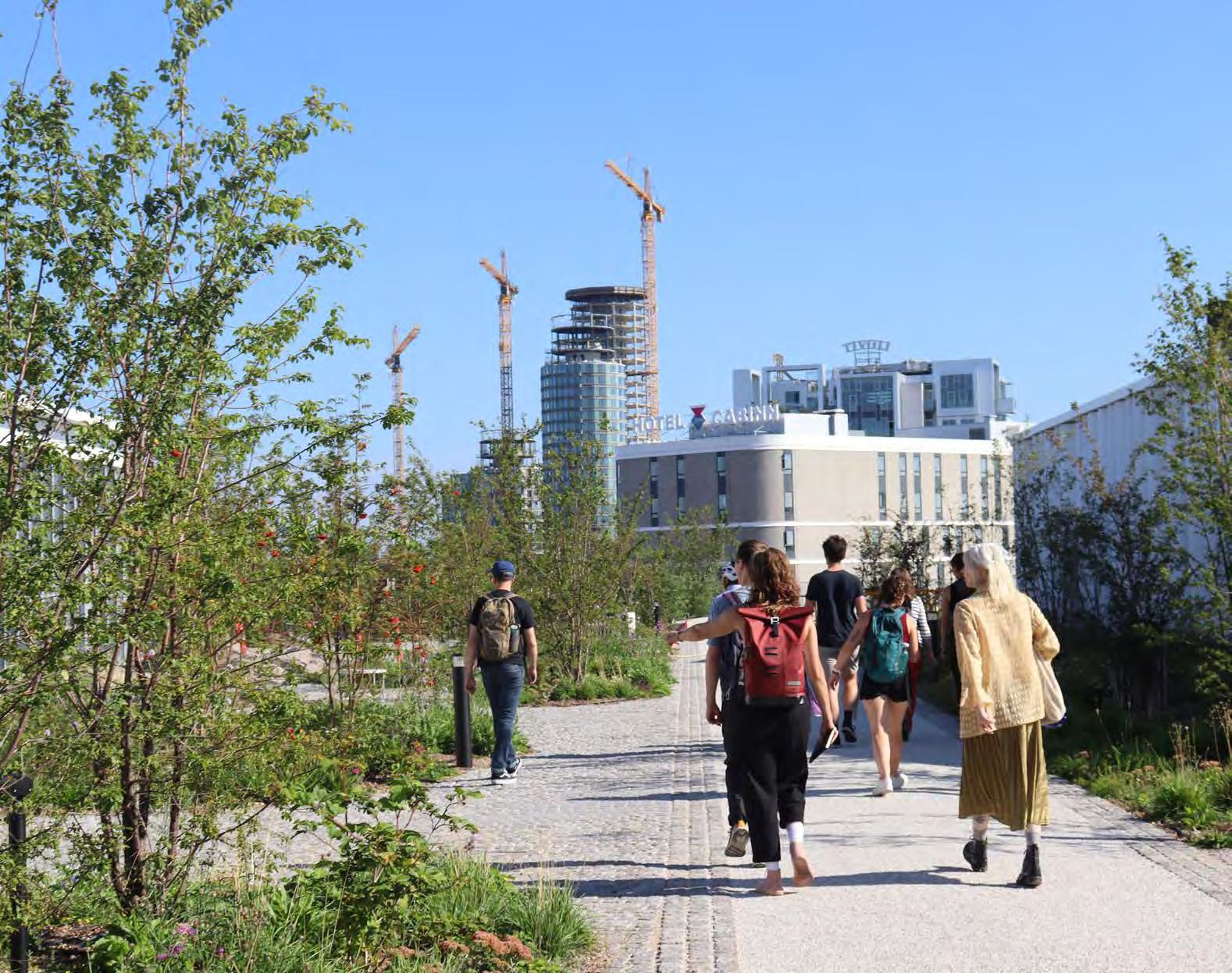
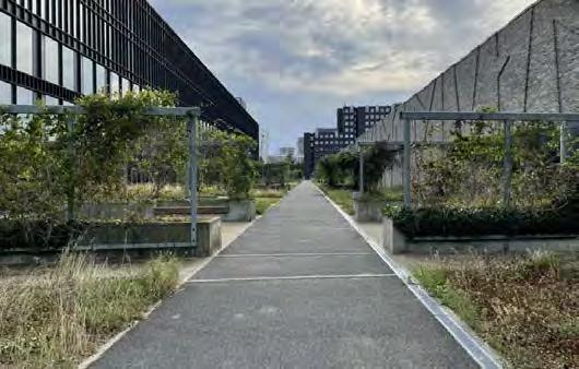
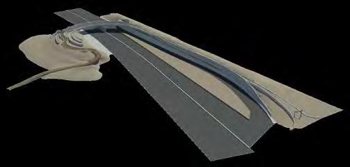
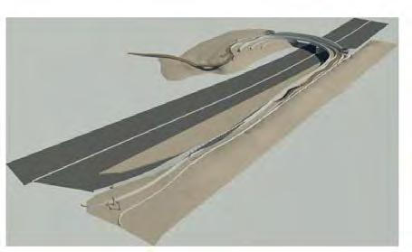
The “green strip” was initially set forth as a grand idea in Copenhagen’s 2006 local plan with goals to create much-needed green space and pedestrian connections through and over this industrial and transit corridor. The project has slowly been realized through multiple private projects, the most recent of which was the IKEA store, finished in 2023. The last segment of the project, directly in the middle, has yet to be achieved.
FIGURE 1:DET GRONNE STROG WITH I-5 SITE OVERLAY. Image Source: BIG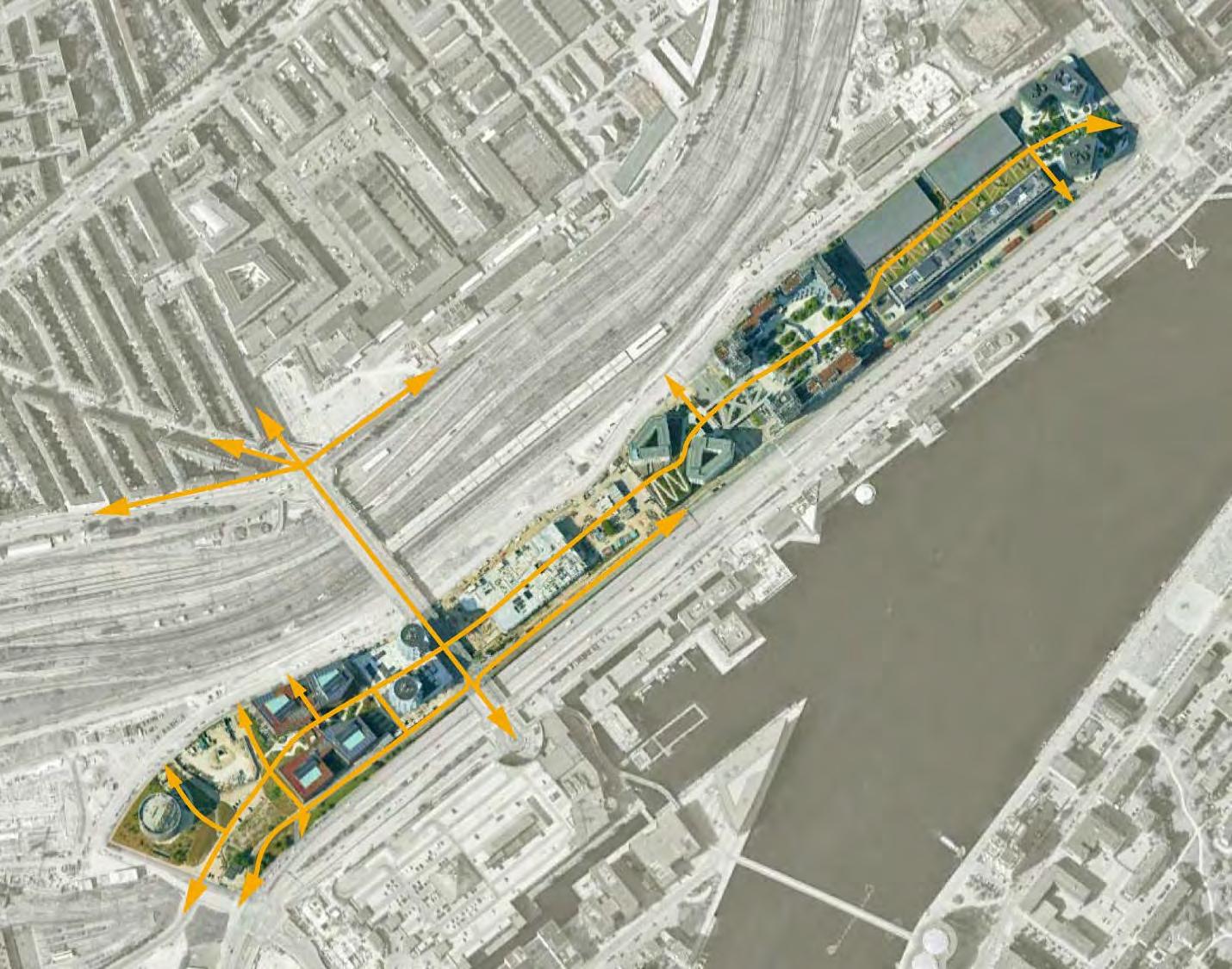
SEB Bank by Lundgaard & Tranberg & The City Dune by SLA (2008-2011)
Rigsarkivet / State Archive by PLH Arkitekter (2009)
KB32 by Vilhelm Lauritzen Architects and JJW ARKITEKTER (2021)
Tivoli Congress Centre by Kim Utzon (2009-2016)
Hotel Cabinn (2019)
IKEA store by Dorte Mandrup (2023)
Kaktustårnene / The Cactus Towers by Bjarke Ingels (2017)
Nexus by Arkitema (2014-2019)
Railway control tower by Tranberg Arkitekter (2013-2015)
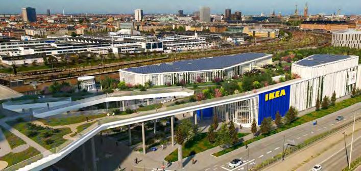
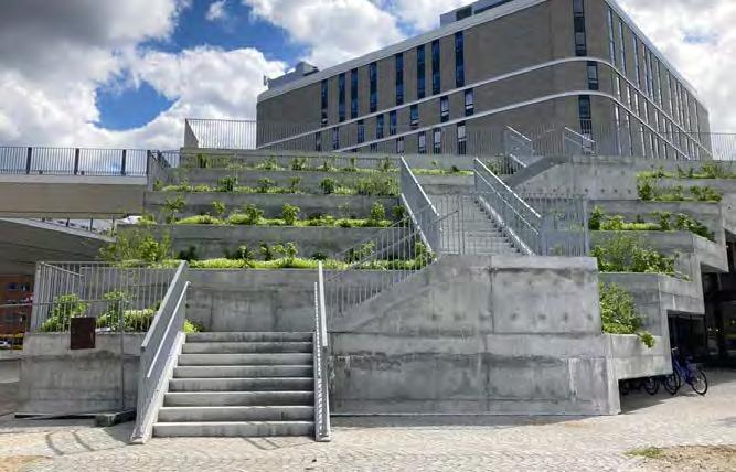
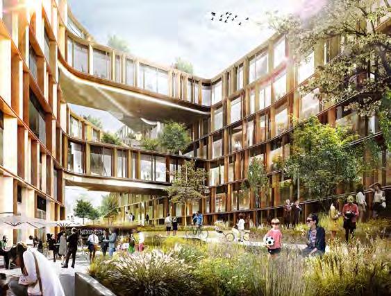
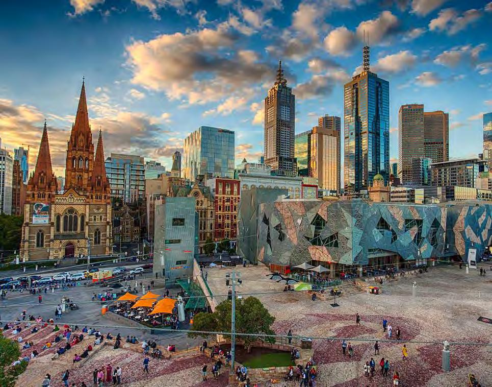
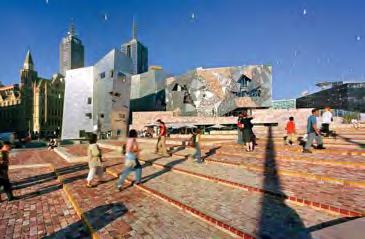
Image Source: Architecture AU
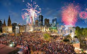
Image Source: TripAdvisor
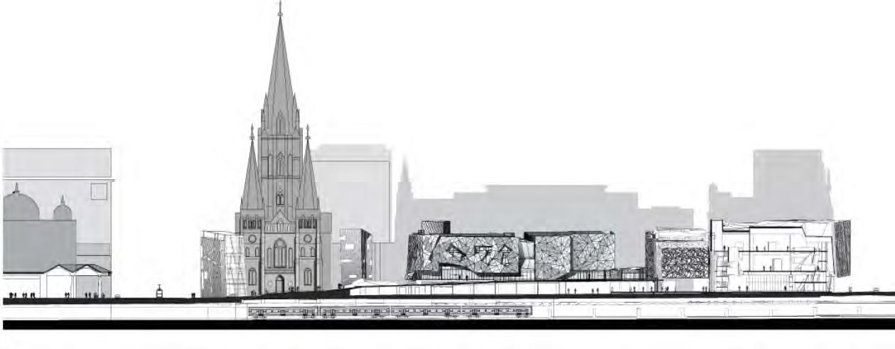
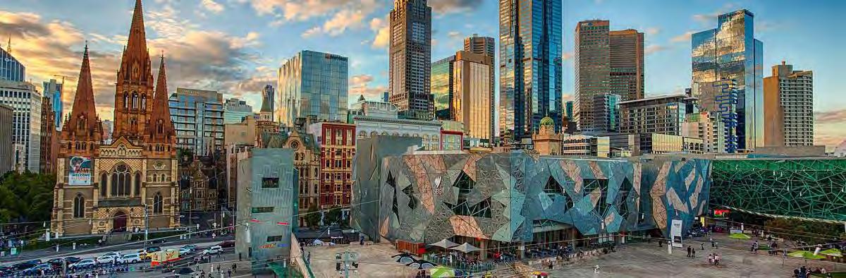
Federation Square was conceived as a major public space, addressing Melbourne’s lack of central public square. Donald Bates and Lab Architecture Studio conceived an innovative design that proposed a complex of buildings and plazas featuring geometric patterns and angular forms. Created in collaboration with Karres en Brands Landscape Architects, the project aimed to create a multi-use civic and cultural hub that would house museums, galleries, and public events. Built over a working railway yard, the square provided an opportunity to reconnect the City with the waterfront.
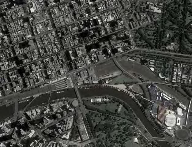
CONTEXT MAP
Image Source: Google Maps
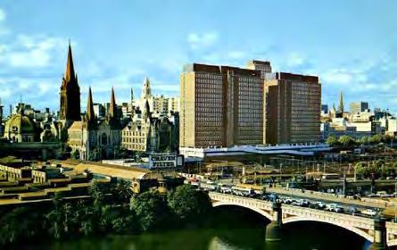
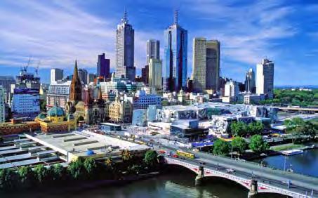
Prior to the construction of Federation Square, the site was occupied by a series of rail yards, industrial buildings, and dilapidated structures, presenting an underutilized and fragmented urban area. The project’s redevelopment significantly improved access to the adjacent Yarra River, converting a formerly disconnected zone into a pedestrian-friendly space. By realigning and integrating pathways, the design facilitated seamless flow from the square to the river’s edge, thereby better linking the city to its waterfront and enhancing urban connectivity.
The primary objective of the design of Federation Square was to establish a multi-use civic hub atop the existing railway lines. The design aimed to encompass a diverse range of functions, including cultural institutions, commercial venues, and public gathering areas. A key aspect was the commemoration of Australia’s federation centenary, imbuing the site with symbolic national significance. Additionally, the project sought to serve as an architectural landmark, contributing to Melbourne’s identity as a contemporary, cosmopolitan city.
FIGURE 5: FEDERATION SQUARE AND SURROUNDINGS. Image Source: Melbourne Convention Bureau FIGURE 6: FEDERATION SQUARE SITE IN 1970s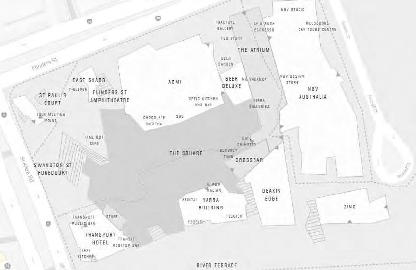
Federation Square employs a decking system composed of steel beams, concrete walls, and vibration-absorbing spring coils and rubber padding to overlay active railway lines. Anchored deep to avoid rail disruption, the piers are the primary load-bearing elements, distributing weight through steel and concrete structural components. The decking serves as a foundational slab for the buildings, which utilize steel-frame and glass curtain wall systems. This design accommodates the load of the buildings and plaza above while preserving the functionality of the railway infrastructure below.
The design incorporates geometrically intricate patterns, open plazas, and modular facades. Architectural features such as the atrium and large LED screen encourage public gathering and cultural events. The plaza is strategically designed to guide pedestrian flow toward the Yarra River, improving waterfront accessibility. The project integrates commercial space and public areas in a way that retains a sense of openness and public accessibility.
Location | New York City, NY
Groundbreaking: 2012
Estimated Completion: 2024
Size of Current Development | 5.2 Acres
Designers|
Master Plan: Kohn Pederson Fox
Landscape: Nelson Byrd Woltz
Architecture: Heatherwick Studio
Client | Related Companies & Oxford Properties
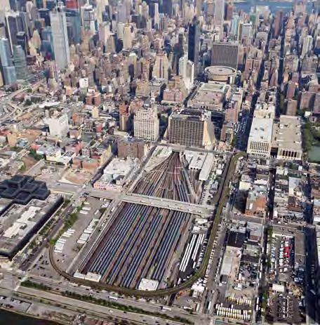
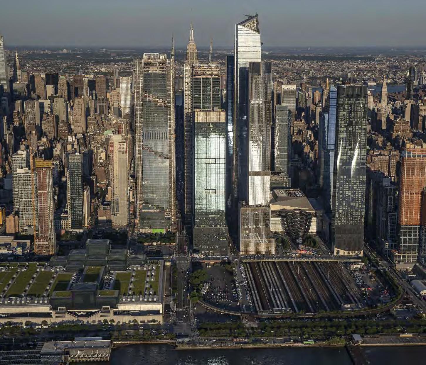
Initially completed in 2019, Hudson Yards is a lid over an active rail yard. The West Side Yard has 30 tracks that store trains between rush hour and play a vital role in the operations of Penn Station, the largest train station in the country. The reconstuction of the site in the 1980s was designed to leave enough space between the tracks for support columns to be built for a future lid project. The air rights above the yard were purchased by two developers who funded the construction. While the full scope of the master plan is not yet complete, the proposed lidded area is 14 acres, equivalent to the size of the area under consideration for the North I-5 lid.
FIGURE 1: AERIAL IMAGE OF THE WEST SIDE YARD BEFORE CONSTRUCTION OF THE HUDSON YARDS LID. Image Source: Mark Lennihan/ Associated Press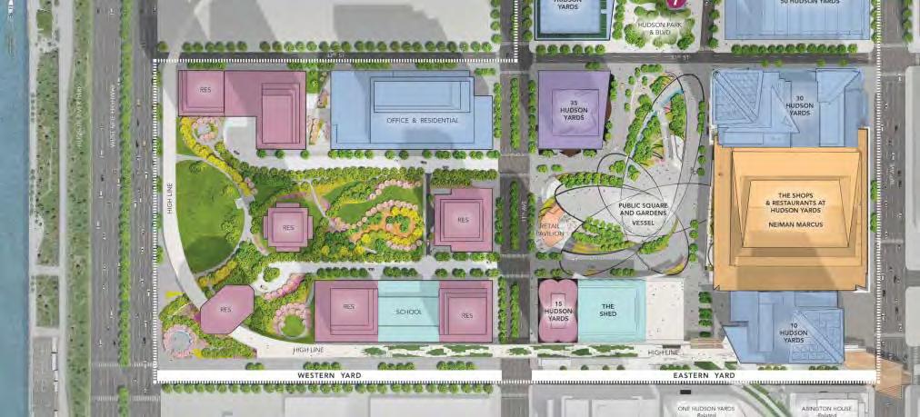
Architects
Phase 1 of the project - the Eastern Yard, or the block between 10th and 11th Avenues - is complete.
Phase 2, the Western Yard, is not yet under construction. While the Eastern Yard offers high-end amenities such as luxury apartments, corporate real estate, fine dining, and commercial space, the Western Yard is expected to include affordable housing, a school, and more public space. The developer chose to build out the eastern lid first to ensure a prompt return on investment.
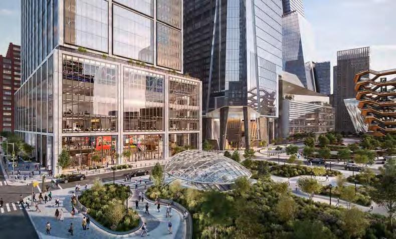
• 5 acres of public space
• Geometric staircase attraction called the Vessel
• 100 shops and restaurants
• A public school
• Hotel(s)
• 4,000 residences
• Commercial real estate
• A new number 7 subway station
• Pedestrian access to the High Line
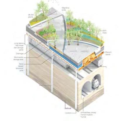
The amount of weight the lid has to bear to hold up multiple highrise buildings is staggering. The platform itself weighs 35,000 tons. Other features include, large fans that circulate air under the “deck,” pipes with cooling liquid to protect tree roots, 4 feet of soil depth for trees (18 inches for plants), and a stormwater tank.
The lid structure contains:
• 25,000 tons of steel
• 14,000 cubic yards of concrete
• Supported by 300 caissons that are each 4 to 5 feet in diameter and are 20 to 80 feet deep
FIGURE 3: SITE PLAN. Image Source: Hudson Yards New York
“Wildflowers in the Echinacea, Monarda and Rudbeckia families attract bees, butterflies, hummingbirds and other pollinators, while fruiting trees and shrubs, such as serviceberry, spicebush and winterberry, are seasonal homes to migratory birds like warblers, sparrows and American redstarts.”
-Nelson Byrd Woltz Landscape ArchitectsThe landscape architecture firm Nelson Byrd Woltz was the prime consultant for the public square and garden, about 5 acres of public space. They planted 200 mature trees and over 28,000 plants. The lid includes a 60,000 gallon stormwater cistern to capture and reuse rainwater for irrigation. The firm estimates the tank saves 6.5 megawatt hours of energy and 5 tons of carbon emissions annually.
FIGURE 5. Image Source: Nelson Byrd Woltz Landscape Architects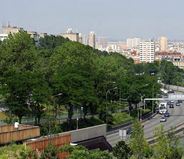
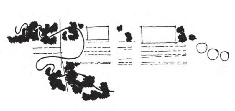
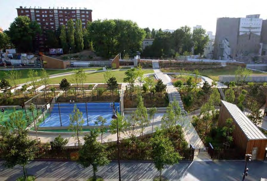
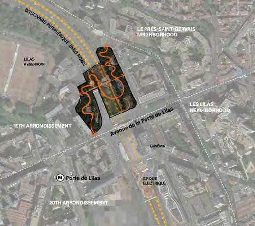
FIGURE 2: NEIGHBORHOOD CONTEXT MAP WITH SITE CIRCULATION ROUTE. Image Source: Clelie Fielding
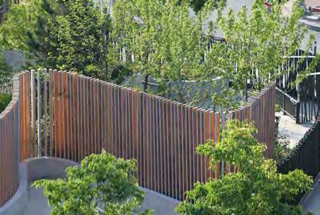
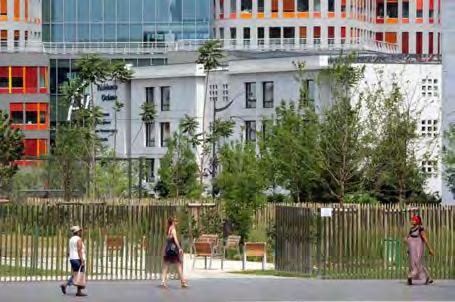
Jardin Serge Gainsbourg, named after a French singer-songwriter, is a 6-acre lid park spanning eight lanes of traffic over the Boulevard Peripherique (Ring Road) in Paris. The ring road was built in the 1970s, a feature meant to mitigate traffic congestion in the inner city. As a result, neighborhoods were divided. The main goal of Jardin Serge Gainsbourg park is to reconnect neighborhoods, such as the 19th and 20th arrondissements and Les Lilas, which all converge around the Porte de Lilas metro station. The design incorporates an accessible walking path (Figure 2), as well as two direct paths that connect to the existing street layout.
FIGURE 1: DESIGNERS’ SKETCH. Image Source: Agence Territoires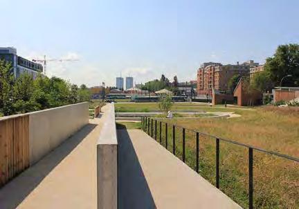
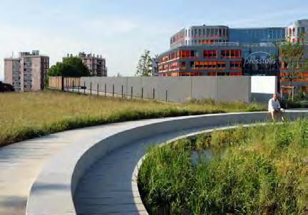
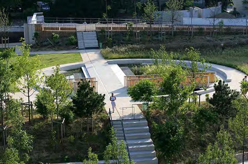
The park is organized around a circular water retention pond, where all paths cross through or around. The pond is located in the center of the lid in the midst of an expansive meadow, providing grand views of the adjacent neighborhoods and city beyond. The pond is planted with diverse aquatic species, and designed to capture runoff from the meadow and create habitat for birds and insects.
 waTeR ReTenTion PonD
DYNAMIC VIEW FROM OVERLOOK.
FIGURE 4: POND DETAILS. Image Source: Agence Territoires
FIGURE 5 (RIGHT): OVERVIEW OF WATER FEATURE. Image Source: Agence Territoires
CURVED CONCRETE BENCH
waTeR ReTenTion PonD
DYNAMIC VIEW FROM OVERLOOK.
FIGURE 4: POND DETAILS. Image Source: Agence Territoires
FIGURE 5 (RIGHT): OVERVIEW OF WATER FEATURE. Image Source: Agence Territoires
CURVED CONCRETE BENCH
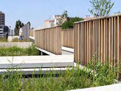
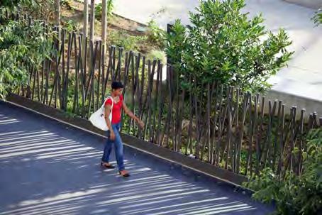
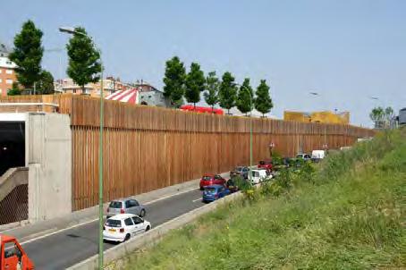
Agence Territoires, the landscape architecture firm that won the design competition, demonstrates an artistic edge condition language throughout the park. Vertical wood fencing with void spaces in between each plank allows sight lines in and out, playing with porous interior/exterior space.
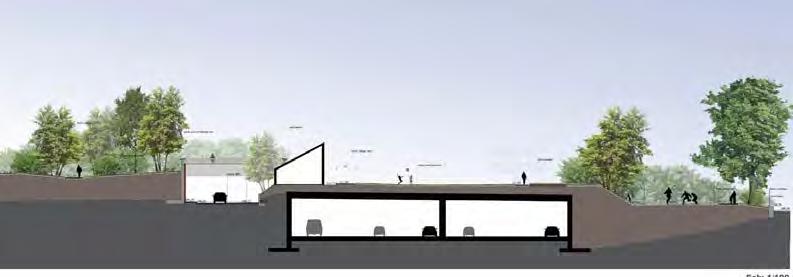
The section shows the connection between the neighborhoods to the east and west of the park and ring road. There is a slight elevation change required to lid the on-ramp, and the lid structure in those places is narrower. While the center of the lid is mainly open space, the edges provide enough soil for tall trees to create a sheltered forest.
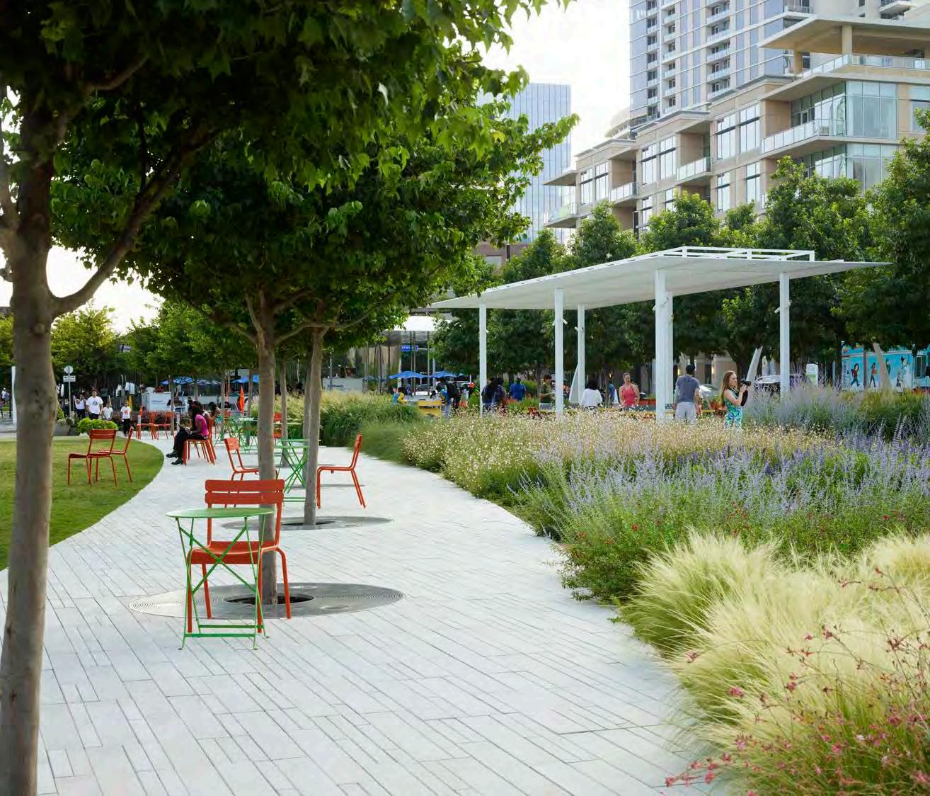
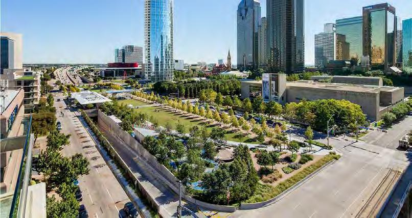
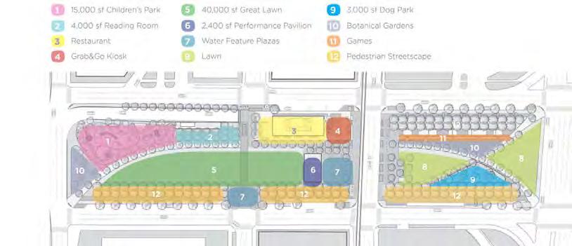
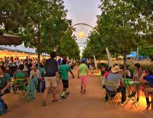
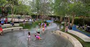
Klyde Warren Park is Dallas’s central urban park that has bridged the eight-lane Woodall Rodgers Freeway, which had been a barrier between Downtown and Uptown. The park reconnects the city’s downtown cultural district with the neighborhoods to the north. The park is designed to reflect the district through its modern design. The park has been warmly embraced by the community and has been a catalyst for economic development. Daily free activities include performances, lectures and fitness classes. A non-profit foundation manages operations and maintenance of the park. Built with public and private funds, the park features a flexible, pedestrian-oriented design, children’s park, great lawn, restaurant, performance pavilion, fountain plaza, games area, dog park, and botanical garden. Dramatic environmental improvements include the sequestration of CO2 through native planted trees, temperature reductions from shade producing trees and canopies, and water conservation through the subgrade reservoir’s collection of storm water.
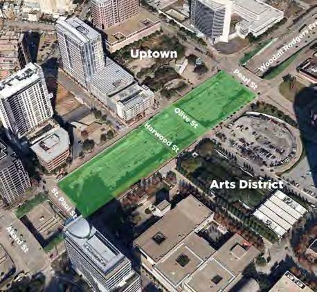
• The freeway had severed Dallas’s two largest cultural districts — the downtown Arts District and Uptown
• The park is constructed above a section of below-grade Woodall Rodgers Freeway, for three blocks between Pearl Street and St. Paul Street
• Restoring the connection by bridging the gap has transformed the roadway into a connected public realm.
FIGURE 2: SITE CONTEXT. Image Source: ASLA FIGURE 1. Image Source: OJB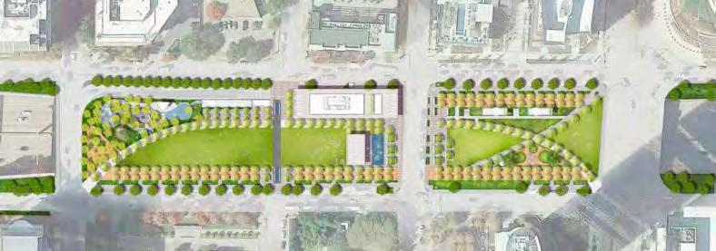
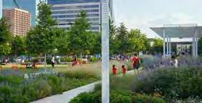
The design is meant to create a sense of discovery as you move to the different “rooms” throughout the 5-acre park. The sustainable landscaping includes 37 native plant species and 322 trees, transforming a former freeway to a beautiful urban oasis.
The park features a flexible, pedestrian-oriented design that arranges 13 programmed spaces designed with ample shade, seating and other amenities, including a carefully planned children’s park, a reading room and games area, a great lawn for 5,000 people, a 6,000-square-foot restaurant, an interactive fountain plaza, a dog park, a half-mile of walkable streetscape, and a performance pavilion to encourage yearround use.
The park features a rich calendar of daily free programming including family activities, fitness classes, educational programs, and musical performances.
FIGURE 3: DESIGN PLAN. Image Source: OJB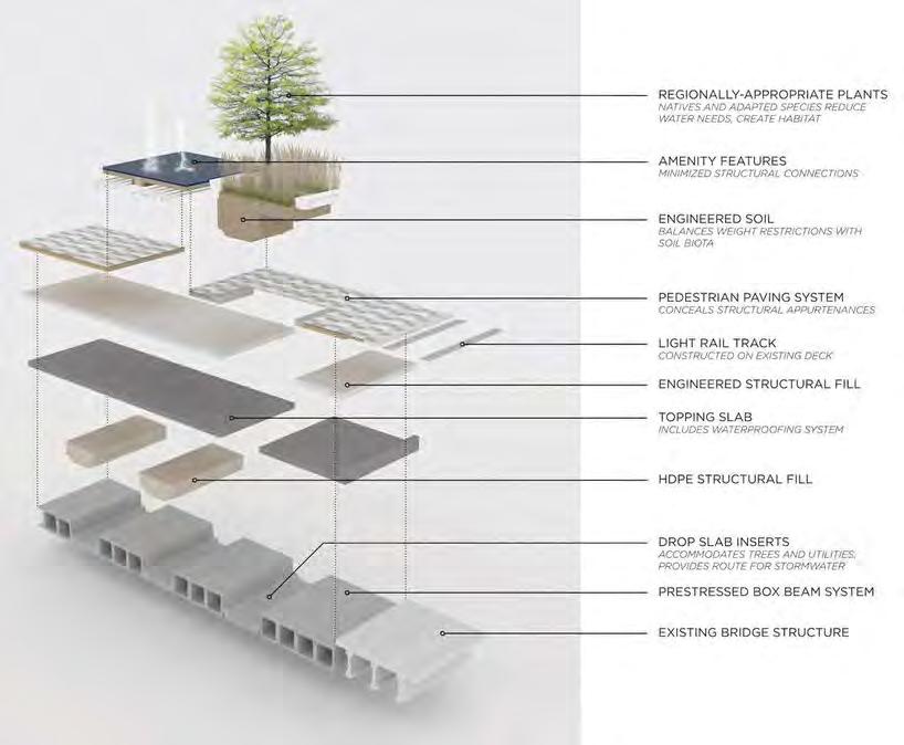
• A bridge over the 1,200 linear feet of recessed freeway consisting of concrete, pre-stressed box beams set on columns constructed outside the former walls of the freeway and supported by a new center wall
• Concrete beams are arranged in groups with spacing in between, where concrete slabs span the spaces connecting to the bottoms of the beams, forming trenches
• Trenches act like planter boxes
• Combination of geofoam and lightweight earth fill the trenches and cover the beams to provide the planting material
• The trough system built into the support truss system which allowed for sub-grade utilities, water feature systems, planting soil and other appurtenances
• The grid became the guiding organizational force and determined the layout of the park
• Trenches enabled entrance points into the park to be designed at grade
FIGURE 4: MATERIALS AND ENGINEERING OF THE LID. Image Source: ASLA FIGURE 5: DETAIL SECTION OF LID STRUCTURE. Image Source: ASLA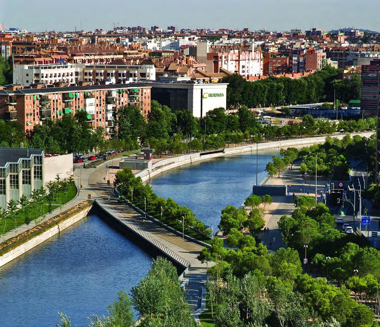
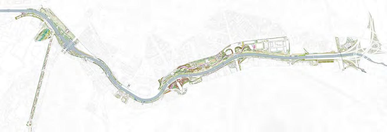
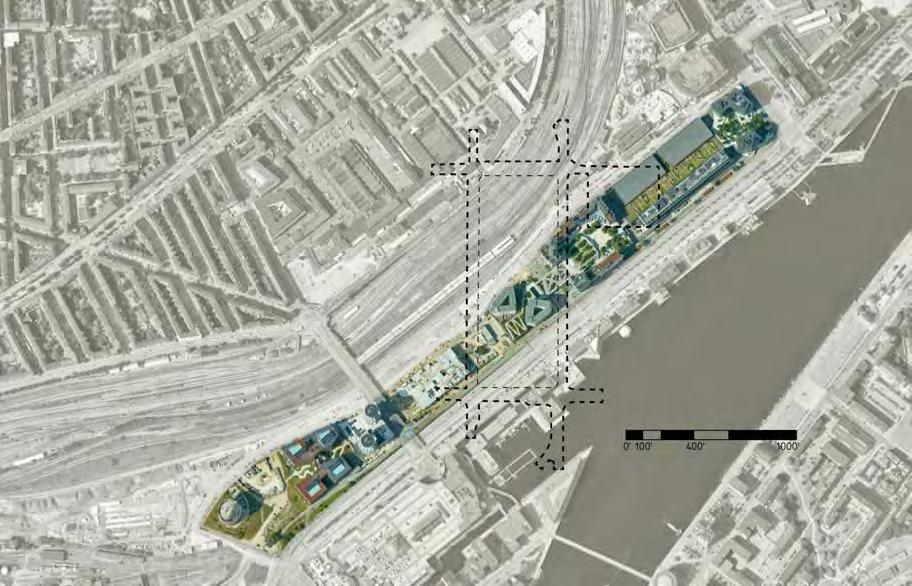
FIGURE 1: PLAN VIEW OF MADRID
Image Source: Simon Architecture Prize
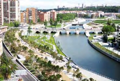
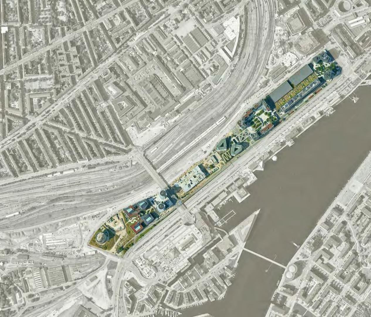
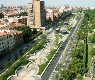
First explored as an idea by the Madrid City Council in 2003, the Madrid Río project sought to reconnect the city with the Río Manzanares by burying the M30 highway and building a 8km long green belt. The project interfaces with a number of important corridors and cultural sites in the city, and creates an unbroken band of green space that knits the city’s existing park systems together. The corridor is an important transportation and utility spine for the entire city, with the total length of 40km of tunnels carrying over 200,000 vehicles per day and electrical lines that transport 40% of the city’s energy. The design included 12 new pedestrian bridges, 6 hectares of public facilities, and 1.2 million m2 of green space.
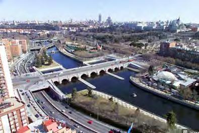
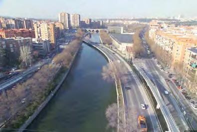
FIGURES 2-5: BEFORE AND AFTER. Image Source: City of Madrid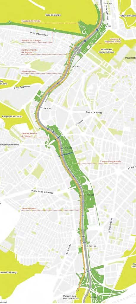
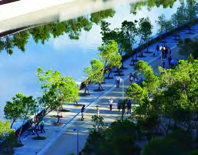
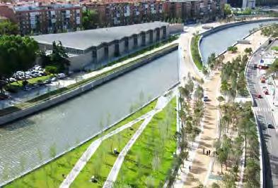
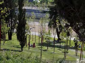
The Salon De Pinos (Hall of Pines) runs nearly the entire 8km length of Madrid Río, snaking along both sides of the river and acting as the main pedestrian and bike thoroughfare through the project.
Acting as the spine of the project, the Salon de Pinos connects the distinct park spaces throughout the project and interfaces with core parts of the city, including major thoroughfares and important cultural sites.
• Over 6km in length
• Major pedestrian and bike route
• River promenade
• Interfaces with core sites in project and throughout city
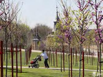
Avenida de Portugal is a major transportation corridor connecting the southwestern part of Madrid to the M30 highway and to the central city. Once a surface limited-access highway, the avenue was buried to support a local access road and park space, as well as large parking garages between the ground level and the road tunnel underneath. This underground highway connects to the M30 highway in an incredibly complex underground interchange beneath the city and the river.
FIGURE 6: SITE LAYOUT DIAGRAM. Image Source: Simon Architecture Award FIGURE 7: SALON DE PINOS. Image Source: Jeroen Musch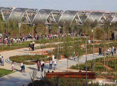
Parque de Arganzuela represents the largest portion of Madrid Río, encompassing over 230,000m2 on the southern end of the project. The park was a previously existing park, but with the burial of the M30 highway, was able to expand to the riverfront, opening up access to the Manzanares and adding over 150,000m2 of new parkspace. Within the park is the newly built urban beach, five play areas for children, a sports complex that includes inline skating, a skatepark & soccer fields, as well as a cultural field that interfaces with the city’s Natural History Museum. The park also contains the Puente de Arganzuela, a pedestrian bridge that is a highlight of the entire project.
TIMELINE:
plan approved 1979, constructed 1991-1992 revitalization planning 2010-present new construction 2020-present
SIZE:
32 acres
COST:
$5.5 million (1990s) + $118 million (2018)
CLIENT:
City of Phoenix
(+ Hance Park Partner Coalition, 2014-present)
DESIGNERS:
original designers unknown
!melk, Weddle Gilmore, Floor Associates + Hargreaves Jones (2014-present)
Content Sources: Arizona Republic, Phoenix.Gov, Hance Park Partner Coalition, Hance Park Conservancy, Salt River Stories, Downtown Phoenix AZ, KTAR News.
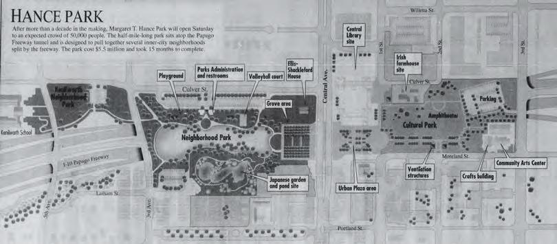
With growing population and traffic congestion issues in downtown, the City of Phoenix began planning Papago Freeway, a segment of Interstate-10, in the 1950s. To appease public voters and mitigate impacts of city division and the displacement of 3000+ residents from the center city, final freeway plans included six blocks of below-grade motorway and a 30-acre “deck park” built on top. The structure is composed of 19 bridges lined up contiguously, creating a tunnel for cars underneath and the deck above.
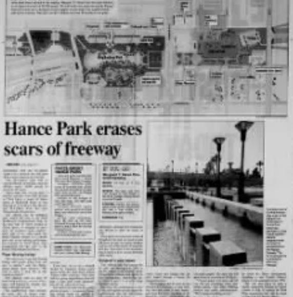
FIGURE 2: HANCE PARK OPENING DAY, 1992. Image Source: Arizona Republic FIGURE 1: 1992 PLAN. ORIGINAL PROGRAMMING INCLUDED A NEIGHBORHOOD PARK AND, ACROSS CENTRAL AVE, A CULTURAL PARK. Image Source: Arizona Republic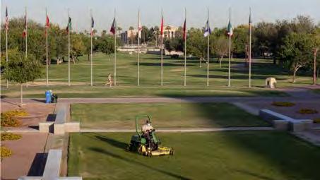
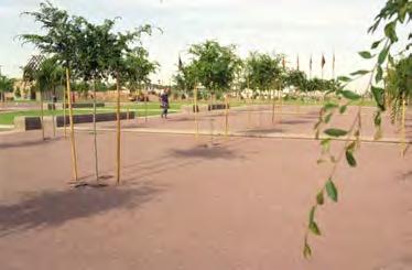
3: PARK USE IN EARLY YEARS
Image Sources: Arizona Republic, L. Potter
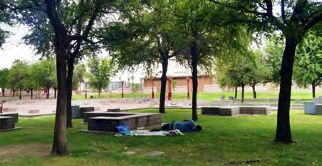
City officials hoped the park would “pull together several innercity neighborhoods” (Arizona Republic, 1992)– a refuge from bustling city life and a hub for art and culture. But the park sat primarily empty in its first few years, only activating as a temporary venue for annual events and as a resting place for houseless individuals. Over the next decade, the City continued to invest in park “improvement,” leaning into goals of making the park a cultural and international hub with the addition of the Japanese Friendship Garden, Irish Cultural Center, Community Arts Center, and Burton Barr Central Library. The new centers gained interest, but the park itself remained stagnant.
Why? Redlining and other discriminatory housing practices of the 1950s60s split Phoenix into North and South. The new Papago Freeway was a physical barrier marking an already existing racial and economic division. The addition of a park was hardly enough to erase these tensions. Rubbing salt in the wound, the park was named for the mayor who advocated for the freeway’s construction and the associated mass displacement as well as the destruction of many other historic buildings and shade trees due to her efforts to widen city roads.
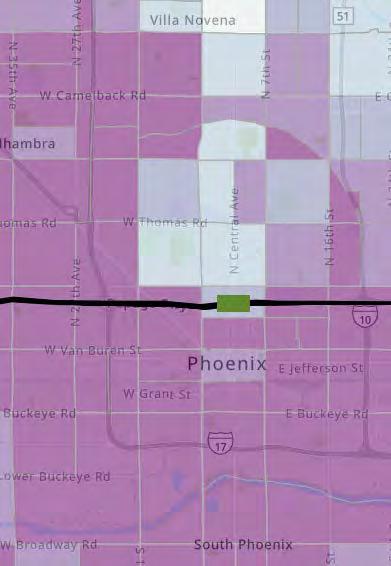
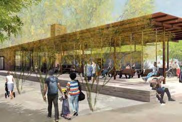
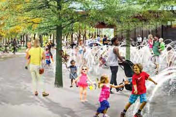
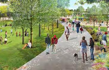
FIGURE 5: REIMAGINING HANCE
PARK: AMPHITHEATER, SPLASH
PAD, JOGGING LOOP WITH LAYERED PROGRAMMING
Image Source: Hargreaves Associates
FIGURE 4: URBAN CONTEXT
% POVERTY BY CENSUS TRACT.
Image Source: City of Phoenix
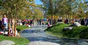
FIGUREThe revitalization plan focuses on what already works within the space: “[Upgrades] enhance that space for events and the things we do, as well as add some of the amenities throughout other areas of the park.”
–Gregg Bach, City of Phoenix Parks Department. New constructions will include an amphitheater, cafe, a “multigenerational” playground, skate park, jogging loop, splash area, and a community garden. Other improvements include doubling the number of trees in the park (planting over 500 shade trees), investing in lighting design,
and layering programs more densely throughout the space.
This plan noticeably considers complexities not previously addressed, including visual and pedestrian connections across Central Avenue, the hot Phoenix climate (more trees and shade structures), nearby community services, and connections to the light rail, which opened in 2008. It is unclear if or how climate change was considered in plant choices, maintenance plans, stormwater management, etc.
Phase 1 of revitalization, a $2 million playground sponsored by the Fiesta Bowl, opened in December 2020.
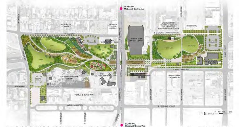
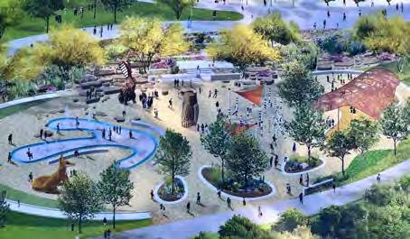
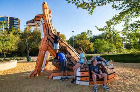
FIGURE 7: NEW HANCE PLAYGROUND
Image Source: Landscape Structures
The 20,000-sqft, “state-of-the-art” playground includes custom animalthemed play structures, a ropes course, and shade structures. The Hance Park Partner Coalition hopes it to become a “multi-generational city asset that millions...can enjoy.” This large, (seemingly) inclusive playscape sets the tone for upcoming revitalization efforts to increase community and creativity in Phoenix, but questions still remain. How will these changes impact existing community dynamics and divisions? Where will houseless individuals live, and will they feel welcome here?
FIGURE 6: NEW MASTER PLAN. Image Source: Hance Park Partner Coalition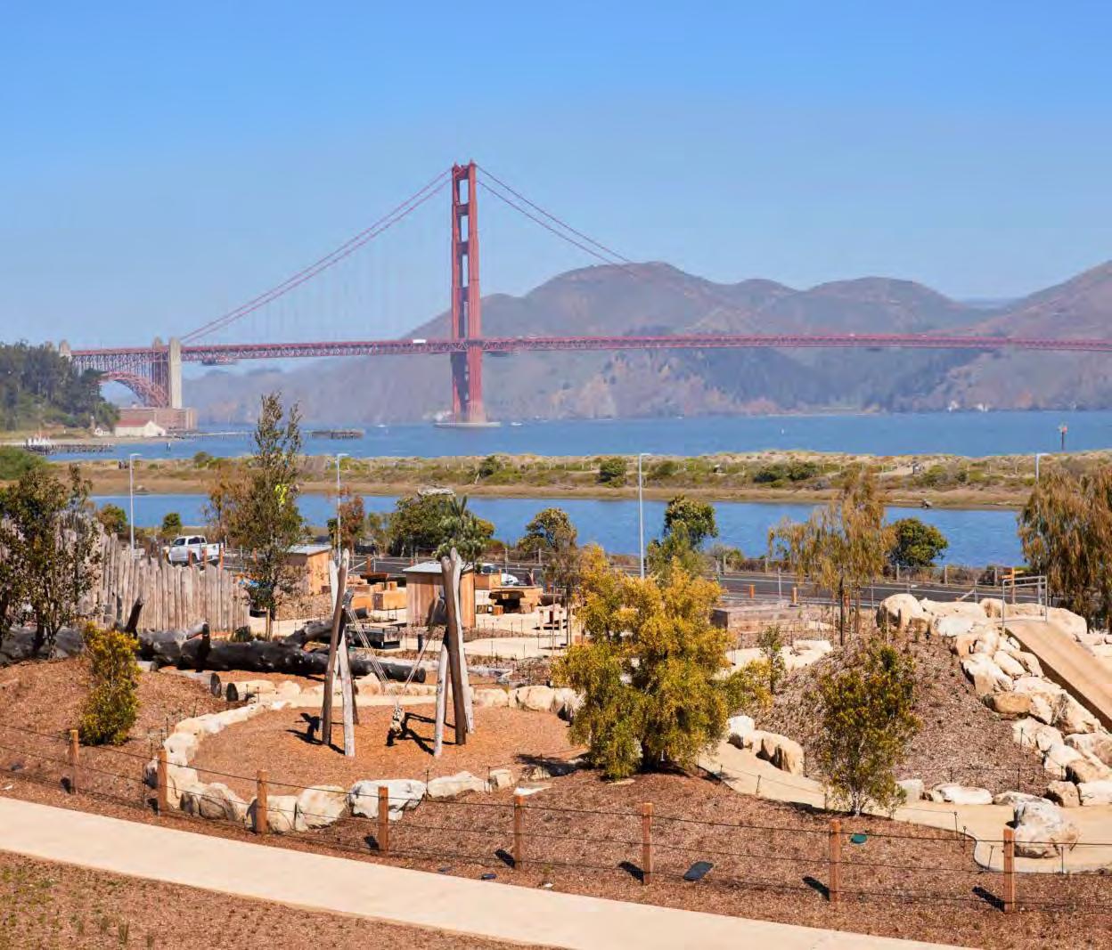
PR esi D io TU nne L To P s
PR esi D io TU nne L To P s
Neha Chinwalla + Nat Gregorius
Neha Chinwalla + Nat Gregorius
Image Source: Rachel Styer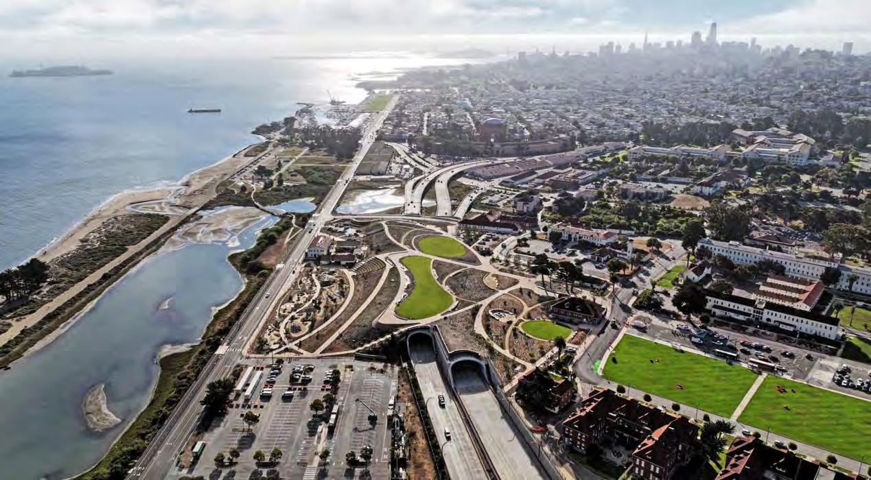
Image Source: James Corner Field Operations
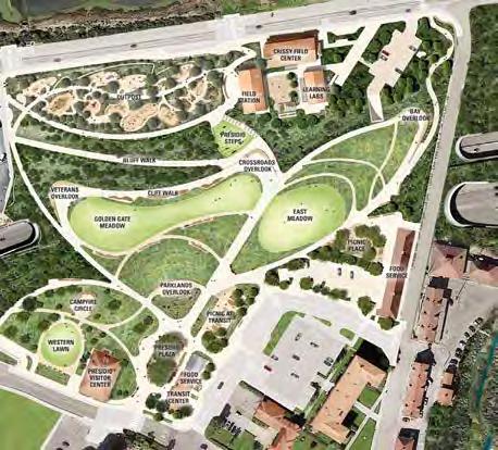
Presidio Tunnel Tops is a 14-acre public park constructed over the Presidio Parkway Highway 1 tunnels in San Francisco, California. Opened in 2022, Tunnel Tops expanded the Presidio, the park and open space of the Golden Gate National Recreation Area, to connect the Mainpost and the Bayfront at Crissy Field.
DesigneR:
James Corner Field Operations
FIGURE 1: AERIAL VIEW OF THE PRESIDIO TUNNEL TOPS COVERING THE HIGHWAY 1 TUNNELS.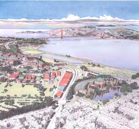
A former U.S. Army Post, Tunnel Tops rests on top of the Presidio Parkway, an at-grade roadway with tunnels. The Parkway was constructed to replace Doyle Drive, a 75-year old freeway viaduct to the Golden Gate Bridge, which had been deemed seismically unsafe. Architect Michael Painter envisioned replacing the viaduct with tunnels so they could be covered with a park to connect residents and visitors with the beautiful views of the Bay and the Golden Gate Bridge.
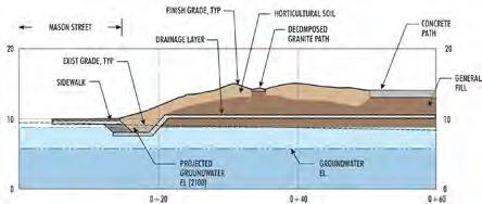
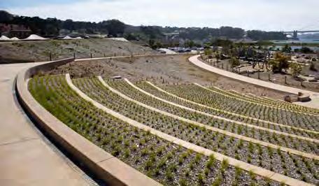
Since San Francisco is an active seismic region, the tunnels and the subsequent park lid were constructed to withstand earthquakes. MKA, a Seattle engineering firm, designed the park on 40 foot deep, 3 feet diameter gravel stone columns in a 10 by 10 foot grid. The foundation cannot be seen from the park level.
The site has around 40 feet of grade change. Differential settlement from the construction over the tunnels was mitigated through preloading of surcharge soil.
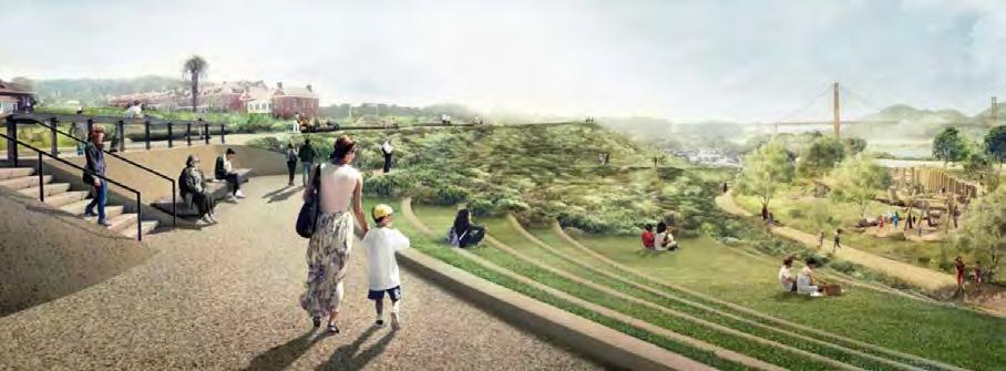
Tunnel Tops is divided into three landscape zones to invite a variety of uses and activites.
The Platform Zone is flat land above the tunnels at the same level of the Presidio’s main parade, allowing access to the area’s scenic views.
The Cliff Walk is a set of trails and gathering spaces designed around certain vantage points and the site’s topography.
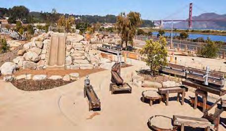
The Outpost is a nature-centric play area, paired with learning centers.
FIGURE 2: SKETCH IMAGINING THE COVERING OF THE PRESIDIO PARKWAY HIGHWAY 1 TUNNEL. Image Source: Michael Painter FIGURE 3: SECTION OF THE OUTPOST PLAYGROUND AREA. Image Source: Magnusson Klemencic Associates FIGURE 4: SITE PLAN. Image Source: James Corner Field Operations + Partnership for the PresidioAn excellent example of an activated public park, the Tunnel Tops have spaces to gather, learn, and play.
PResiDio sTePs: Oriented towards the Bay, the steps invite visitors to lay down a blanket and enjoy the views.
The oUTPosT: The play structures are simple, with stone, wood, and sand elements.
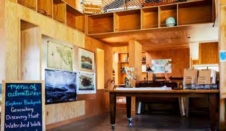
The FieLD sTaTion: The building is centered around youth engagement, expression, and environmental.
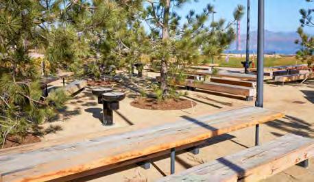
PiCniC aRea: The reservable tables and barbeque areas have shade from torrey pines, bistro lighting, and wheelchair accessible features.
SOURCES: AMERICAN SOCIETY OF CIVIL ENGINEERS, THE AMERICAN SOCIETY OF LANDSCAPE ARCHITECTS’ “THE DIRT,” BAY NATURE, GOLDEN GATE NATIONAL PARKS CONSERVANCY, PRESIDIO.GOV
Project
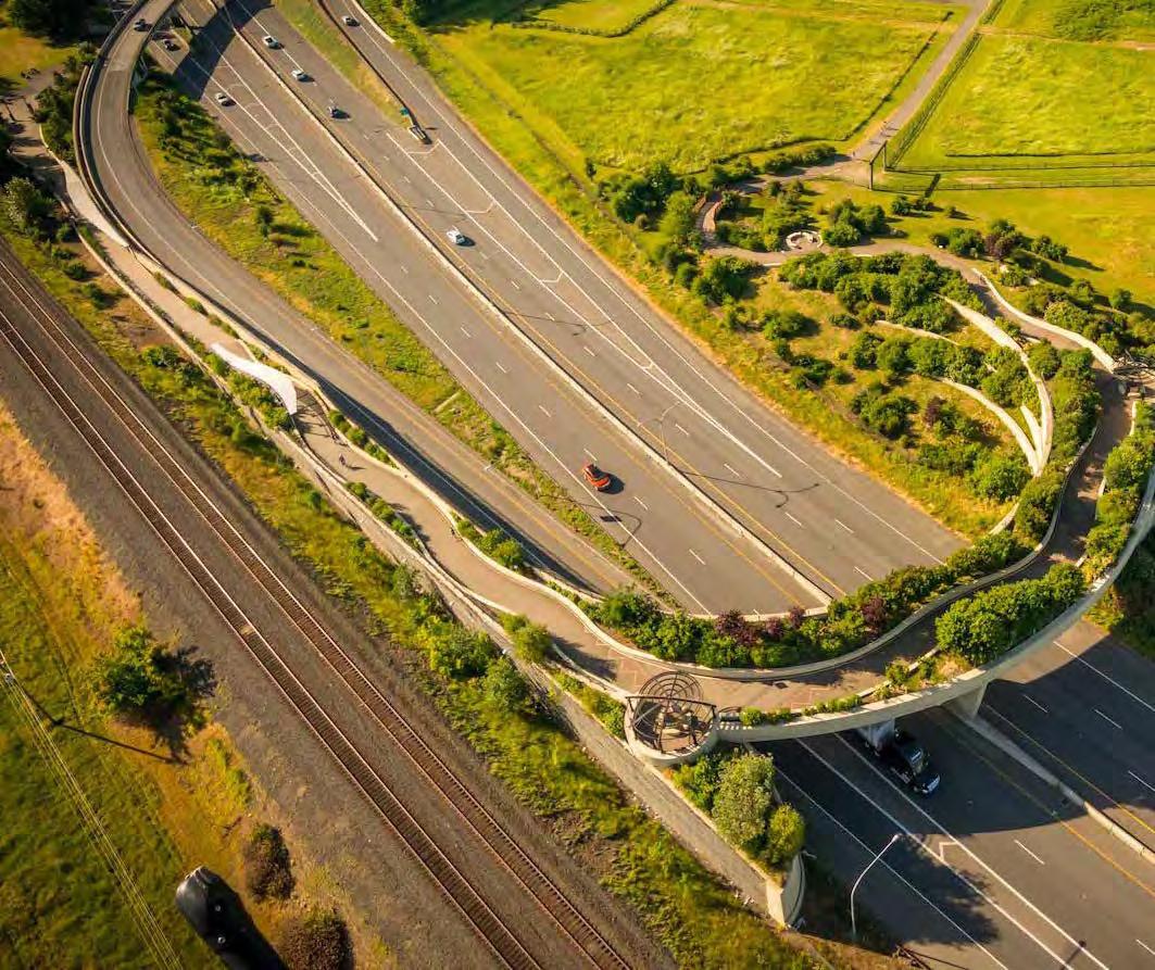
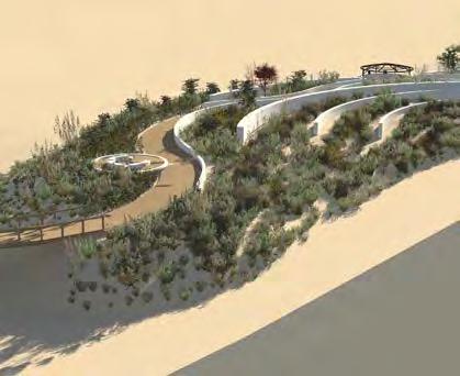
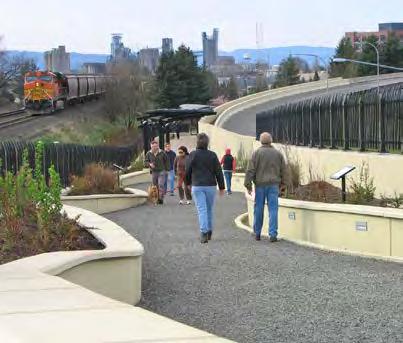
The Vancouver Land Bridge is the biggest of six “art landscapes” created as a part of the Confluence Project, which celebrates the history, culture, ecology of the Columbia River system. The pedestrian bridge connects Fort Vancouver to the Columbia River waterfront, a connection that had been interrupted by the railway and Washington State Highway 14. The design commemorates the historical significance of the area, where the Hudson’s Bay Company’s first European trading post in the Pacific Northwest stood, Lewis and Clark camped, and Fort Vancouver was later established. The project highlights indigenous art and native plant species from the site’s original habitat: a patchwork of forest, prairie, and wetlands.
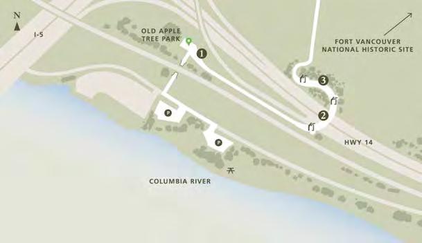
• Connections between Apple Tree Park (with the state’s oldest apple tree!) and Fort Vancouver, with maintained historical homes and museums
• Provides access to enjoy the river waterfront
• Fruit and vegetable garden near the fort managed by volunteers
• Accessible to bikes and wheelchairs, and free public parking available
The goal is to “evoke a landscape and a way of life submerged in time and memory”- Maya Lin, Lead Artist
Enjoy a nice bike ride or a sunset walk, learn the area’s history, see a bird’s eye view of Fort Vancouver or the Pearson Airforce base, or watch downtown light up at night. Get away without going too far from home.
• High winds may make a challenging crossing
• Noise from highway on peak hours
• Lack of upkeep (graffiti, overgrown plants)
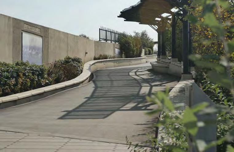
Design DeTaiLs
Length: 1/3 Mile
width: 40 feet
Construction: Pre-stressed and post-tensioned concrete and a voided deck (semi-hollow) with CIP (Cast In Place) upturned edge girders (load bearing bridge support)
irrigation: Rainwater flows to underground storage pipe supplemented by the Columbia River aquifer
Limitations: Curvature/width offered challenges for heavy plant load, requiring 20 retaining walls with unique alignment
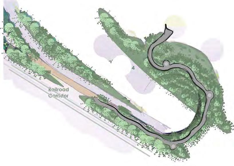
Railroad Corridor
Washington State Highway 14

welcome gate: Entrance featuring indigenous art overlooks: Three overlooks highlight local tribes and their words for River,
and
with corresponding views
1. ethnobotanical walkway: Interpretive panels representing the landscape prior to the 17th century
2. wa state hwy 14
3. Railroad Corridor
Prairie, Village FIGURE 5. Image Source: Devon Boutte, Jones & Jones Architects FIGURE 4. Image Source: Visit Vancouver USA snaPshoT
Infrastructure + Utilities
Neighborhoods, Culture, + Housing
Public Space, Ecology, + Biodiversity
Transportation + Connections
Economy, Policy, + Ownership
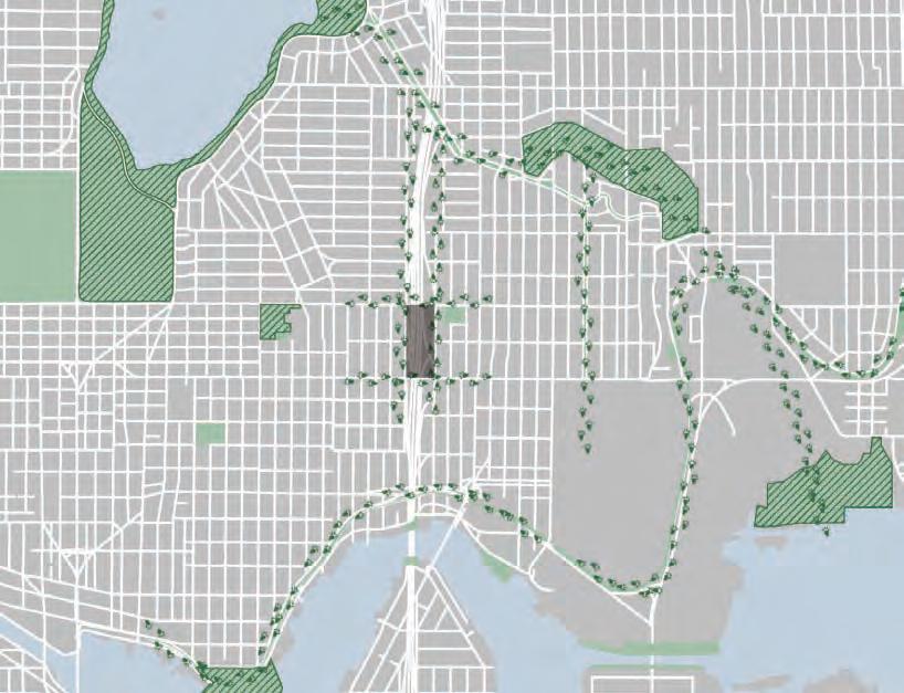
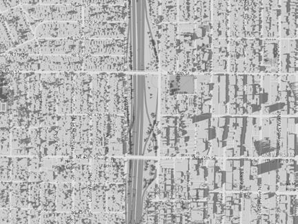
Working together, students uncovered existing and potential conditions, drivers, and flows through the various nested scales of the University/Wallingford I-5 corridor and our particular site between NE 45th and 50th Streets - from the site itself to adjacent neighborhoods, to the city, watershed, and global-scale relationships and impacts. Combining on-the-ground reconnaissance, archival investigation, discussions with local stakeholders, and analytical thinking, the following pages detail the essential qualities of the site and neighborhood districts - their current forms, flows and processes, and predicted future conditions and needs. Watershed + Site Topography
waT e R she D + si T e
To P og R a P hy Grace
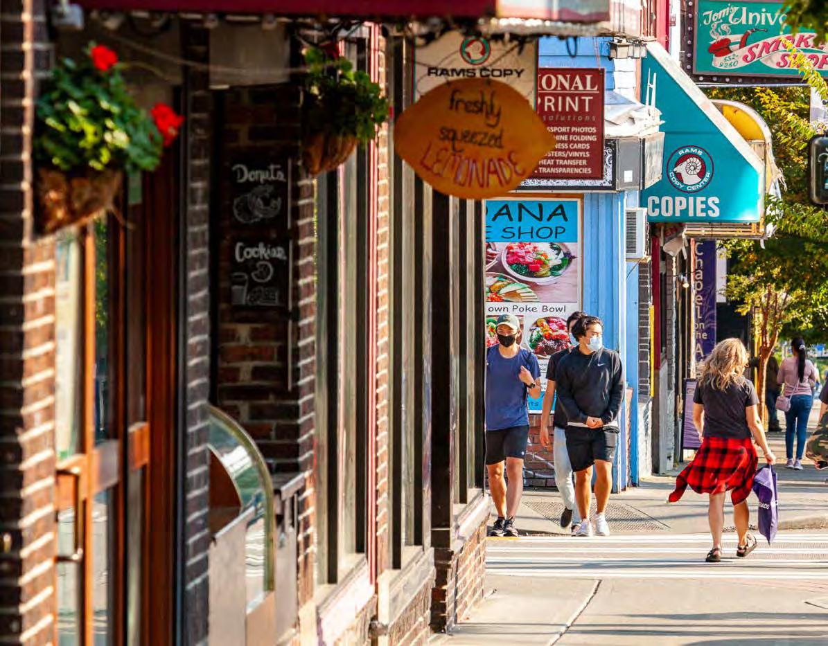
The I-5 corridor is a distinct boundary that separates Wallingford and the UDistrict. It also divides the flow of water. While both sides of the highway are part of the Lake Union/ Ship Canal urban watershed, I-5 is a canyon that diverts water running east down the Wallingford slope directly south, picking up pollutants on the road all the way. It is unclear if runoff is captured or diverted for treatment before it reaches Lake Union.
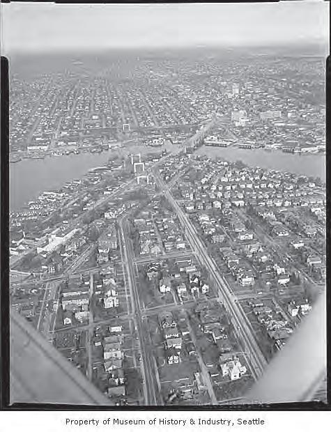
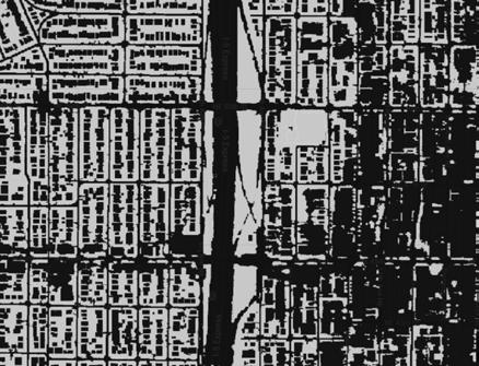
The historic image (right) shows the construction of the I-5 bridge above Lake Union. This image helps us understand how the site, and the watershed, have been transformed by the trench cut for the highway.
The interstate also divides the pipeshed. Stormwater and sewer pipes take a 90 degree turn when they reach I-5 and continue in a parallel direction. The roadway of 50th Street marks the ridge between two watersheds (as shown in the title image).
The current topography of the site is heavily influenced by the grading work that paved the way for the interstate. The highway descends about 30 feet between the 50th street bridge and the 45th bridge. The bridges themselves seem to represent the original grade while the canyon of a roadway stretches out underneath.
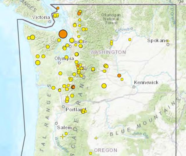
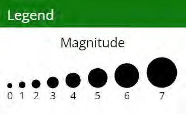
SEISMIC ACTIVITY: [top] Recorded earthquakes in the first half of October 2023. Image Source: Pacific Northwest Seismic Institute; [bottom] the Seattle Fault zone. Image Source: tremblor.net.
The greater Seattle area exists within a tectonically active landscape. The ring of faults around the Pacific Ocean is infamous for its devastating earthquakes. The city is atop several faults called the Seattle Fault Zone. Other local faults include the South Whidbey Island Fault, the Tacoma Fault, and the Rattlesnake Mountain Fault. The Pacific Northwest Seismic Institute maintains a record of all earthquakes for the public to have access to information about quakes that have occured in the previous two weeks. As of mid-October 2023, the largest earthquake in the last two weeks was a magnitude 4.3 quake at a depth of 35 miles, near Port Townsend, Washington. The seismic risk of any lid is an important consideration for construction in the Seattle area.
The I-5 Seattle corridor seismic study done by the Washington Department of Transportation (WSDOT) examined 153 structures including bridges, tunnels, lids, and retaining walls to determine how they would fare in an earthquake. The study requests $11.9 million from the legislature for seismic resiliency packaging and phasing, along with HOV and corridor planning.
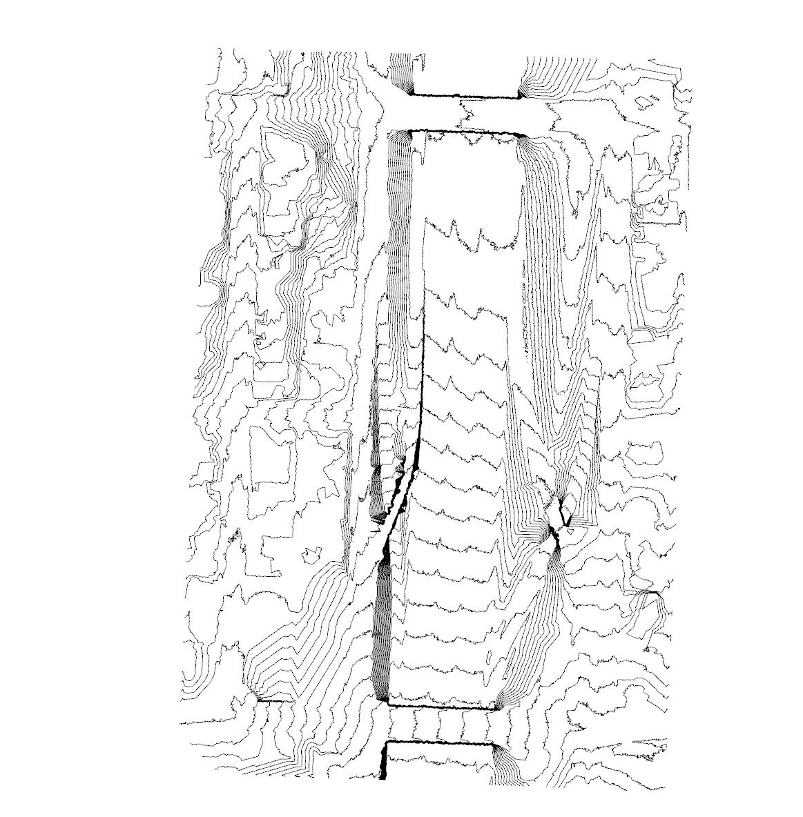
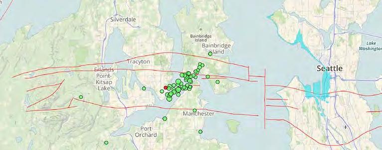
The site includes steep slopes on both sides of the highway. Several areas have grades of up to 40 percent (represented in the map to the right as the deep brown color). The steepest slopes are underneath the bridges and mostly along the west side of the highway where the space is more limited. The east side of the highway has a wider birth for the interchanges to gradually meet the higher grade of the neighborhood. The west side of the highway is largely defined by cement retaining walls that hold the slope in place and create the conditions for the exit ramp to cross over the decending entrance ramp.
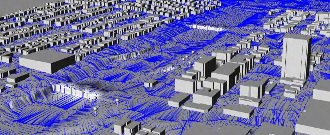
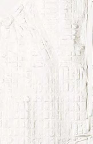
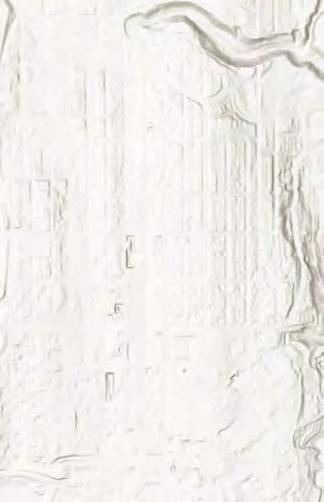
While the steep slopes of the site make landscaping and maintenance difficult, they provide the right conditions for a lid to seamlessly connect the edges of Wallingford and the UDistrict. The image to the right from a digital site model helps us imagine how connecting the gap between the two bridges might be achieved in a way that re-knits people and communities.
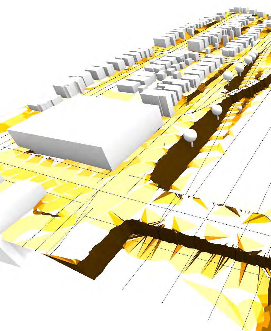
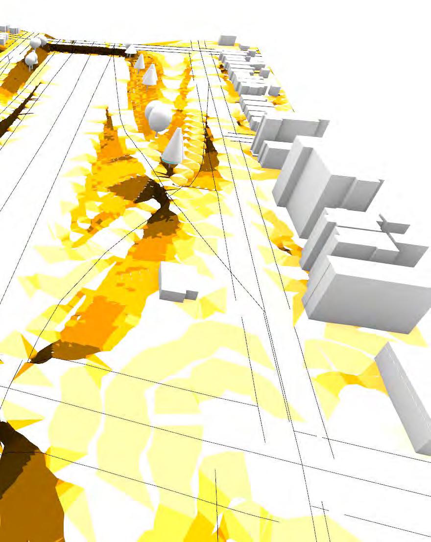
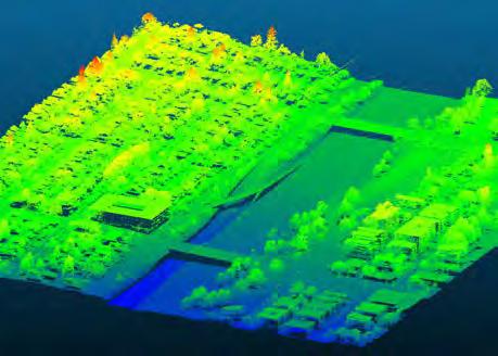
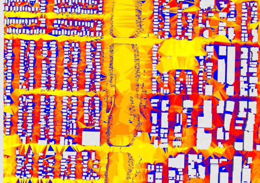
ELEVATION: LiDAR data visualization of the site topography and relative elevations (Griffin Cronk)
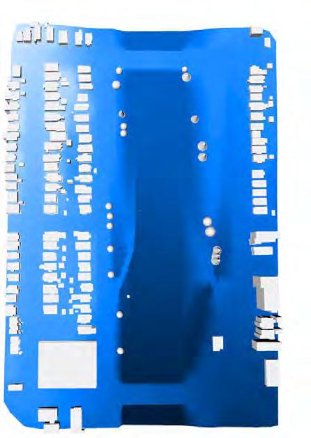
SLOPE: Analysis on a Rhino model of the site (Griffin Cronk)
An analysis of the site slope was done using Land Kit. Colors corresopond to the grade of the slope and are grouped in the following categories: 2, 5, 8.333333, 15, 25, 33, and 50.
The soil within the project area is mapped as Vashon till (qvt) and modified land (m). Vashon till was deposited during the end of the last ice age, around 13,500 years ago.
As the last ice age ended and the glaciers present in the Puget Sound region retreated, they left behind a dense mix of clay and silt, sand, gravel and cobbles, and boulders. This mix became the Vashon till that is present throughout the study area today. This soil type is generally compact and has high shear strength and low permeablitlity. The area in and adjacent to the I-5 corridor in the study area are mapped as modified land. Modified land is classified as land that is filled or graded natural deposits that obscure or alter the original deposit. In this case, grading has likely moved much of the natural deposits around.
The high density and shear strength of Vashon till make it a stable base for heavy infrastructure such as high-rise buildings. However, due to its low permeability, engineers often have to design specific drainage solutations. The presence of boulders and the compact nature of Vashon till make excavation more difficult and time-consuming. Specialized machinery and techniques are often required.
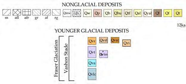
GEOLOGIC MAP OF SEATTLE: Geologic data generated using over 36,000 exploration points. Image Source: USGS / City of Seattle
Wind, sun exposure, and precipitation all impact user experience of place. Understanding the current condition of the site, along with the potential impact of climate change on these factors, is key in generating a design.
Seattle primarily experiences wind from the south-southwest, influenced by its proximity to marine bodies like the Puget Sound and Strait of Juan de Fuca. The presence of tall buildings and structures along I-5 can intensify wind speed at street level due to a wind tunnel effect. As climate change progresses, shifts in jet streams and ocean currents could alter the city’s prevailing wind direction.
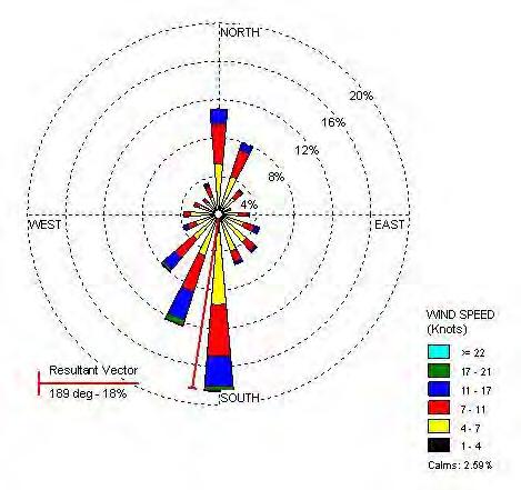
WIND ROSE PLOT: Prevailing wind direction for Seattle. Image Source: Office of the WA State Climatologist, UW
Seattle experiences 152 days of sun per year on average, most of which occur in the summer months. On sunny days, public parks and open spaces tend to see significantly increased foot traffic, which should be anticipated in the design. The model above shows typical sun exposure within the project area. Areas of most sun exposure are along the I-5 corridor. The areas with the most sun exposure are also most likely to contribute to the urban heat island effect.
As climate change progresses, Seattle may experience hotter, drier summers. Climate models suggest that Seattle may experience an increase of sunny days, especially in the summer months, although it is not certain. An increase in sunny and hot days in Seattle will place a premium on shade-providing structures and cooling features like water fountains and misters in public spaces.
Seattle experiences a wet-dry seasonal pattern, with the majority of the precipitation occurring from late autumn to early spring. Being near the Puget Sound, the maritime influence moderates both temperatures and precipitation levels, making extreme weather events less common than in other regions of similar latitude. The Olympic Mountains to the west create a rain shadow effect that actually reduces the amount of precipitation in Seattle compared to areas on the western side of the Cascades. Climate change will likely result in hotter, drier summers and warmer, wetter winters. Heavy rainfall events are likely to become more common.
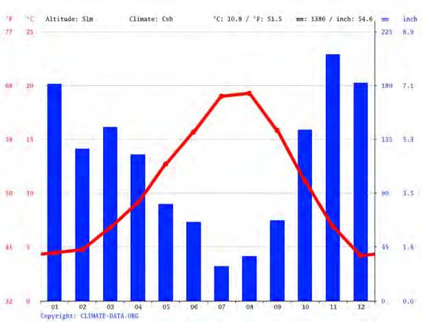
PRECIPITATION: Seattle’s average precipitation and temperature.
Image Source: Climate-data.org.
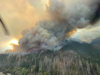
CLIMATE
Image Source: Seattle Times
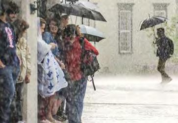 CHANGE: Wildfires in hotter summers, heavier rain events in winter.
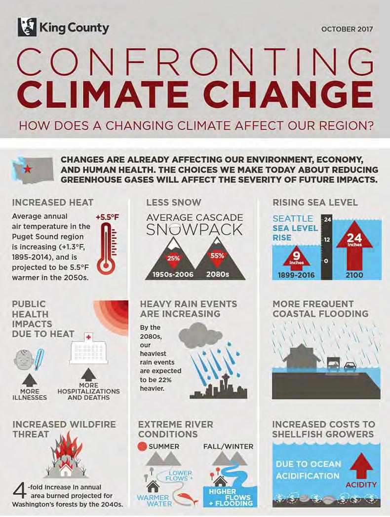
CONFRONTING CLIMATE CHANGE: Regional effects of climate change.
Image Source: King County
As climate change advances, Seattle’s summers are projected to become warmer by up to 8.6°F by the 2080s. This will require urban design solutions such as more shaded areas, cooling centers, and water features to mitigate heat. Concurrently, the city is likely to experience a 22% increase in winter precipitation by the end of the century, focusing the need for improved stormwater management systems like permeable pavements and expanded green infrastructure to prevent flooding. Increased precipitation will also challenge existing sewage and drainage systems, requiring upgrades to accommodate higher water flows. More frequent extreme weather events, including windstorms and heatwaves, will necessitate building designs that are resilient to a range of climatic conditions, as well as emergency preparedness planning. Lastly, air quality is likely to become a growing concern due to increased wildfire activity in the region, calling for urban designs that include better indoor air filtration systems and “clean air” public spaces.
The next few pages outline Seattle’s public utilities and infrastucture. This provides a background to the broader systems of the city so the Lid I-5 project can be strategically designed to reduce the amount of resources used in the utilities systems, and increase climate resiliency.
Seattle’s waste system includes recycling, trash, and organic waste. Metal and glass are 100% recycled in Seattle. 100% of aluminum and plastic are recycled in North America. 45% paper and 25% of cardboard are recycled in North America, with the remaining are recycled in Asia. Seattle’s trash is rail hauled 257 miles south to the Columbia Ridge Landfill in Arlington, Oregon. Seattle also collects food and yard organic waste, that gets processed and turned into compost by a company called Cedar Grove.
Seattle gets 2/3 of its drinking water supply from the Cedar River Watershed and 1/3 from the Tolt River Watershed. The water is piped from the foothills of the cascade mountains, following gravity.
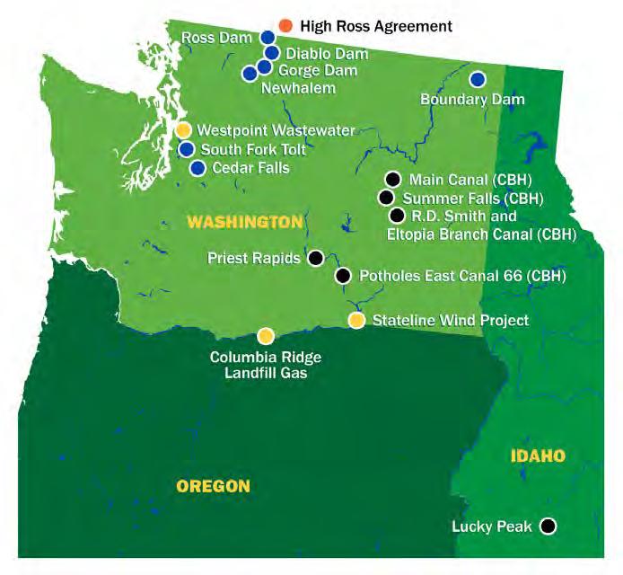


LIGHT POWER SOURCES: Map of Seattle City Light’s power sources.
Image Source: Seattle City Light
The majority of Seattle’s power comes from hydroelectric power. This is a renewable energy; however, it results in habitat loss for salmon and riparian ecosystems. Seattle City Light has dams along the Columbia and Skagit Rivers. It is possible that these dams will generate less power in the future as climate change leads to a lower snow pack.
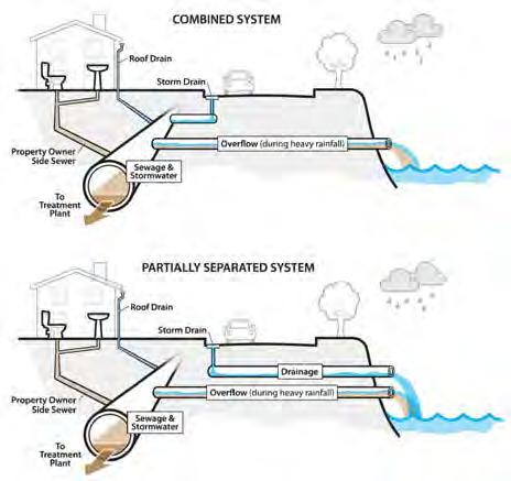
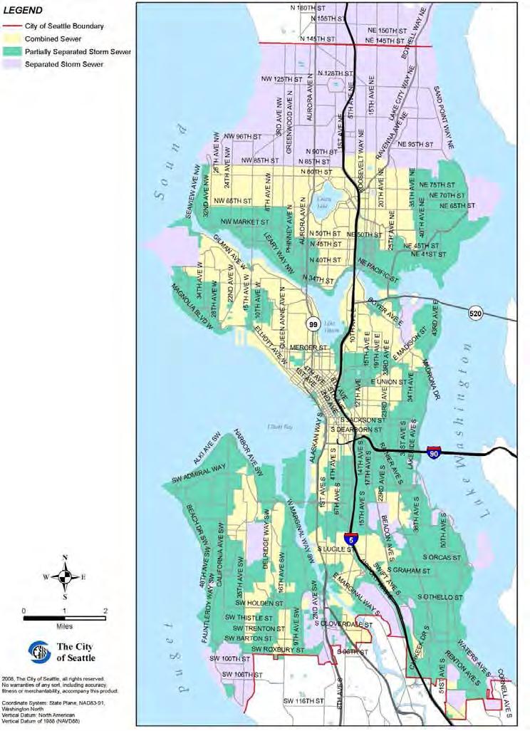
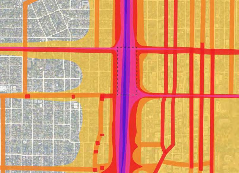
Seattle has three sewer systems, pictured in the graphic below. Combined sewers can cause issues during heavy rainfall events because they overflow into the city’s water bodies, resulting in pollution. The western portion of our site has a combined sewer system, while the eastern portion has a partially separated system. We can design our lid to have green stormwater infrastructure to prevent water pollution.
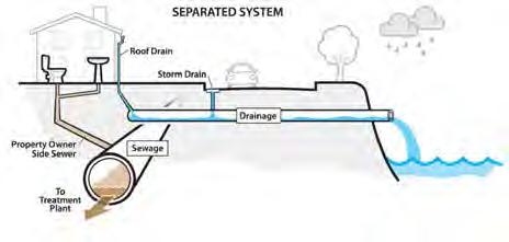
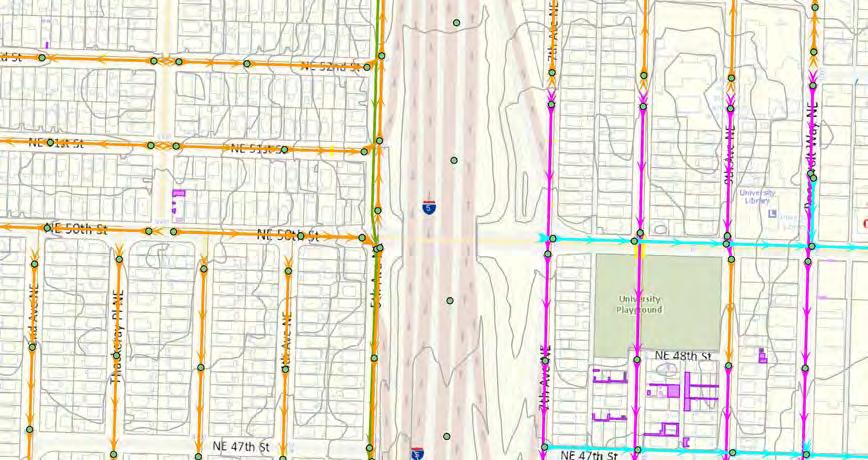
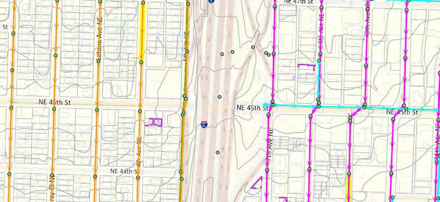
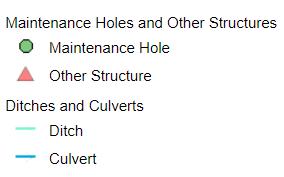
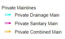
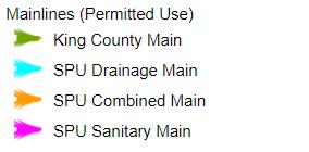
This image is a snippet of Seattle Public Utilities’ water and sewer GIS map. The orange arrows display the combined system (sewage + stormwater) mainlines, the purple represents sanitary (sewage) mainlines, and the blue represents drainage (stormwater) mainlines. The arrows display the flow of water. This is relevant to our site to show the flow of water from I-5 and the surrounding neighborhoods. The mainlines north of NE 50th St flow to the north, towards, Lake Washington, while the mainlines south of NE 50th St flow south, towards Lake Union. This information can help determine where to implement green stormwater infrastructure, and how to orient it with the existing flow of water. Ideally, our design will detain rainwater for reuse on site. It would also be beneficial to implement bioswales to help filter pollutants from stormwater before it flows into the city’s water bodies.
neigh B o R hoo D s , CULTUR e + ho U sing
Planning and ideation for the construction of Interstate 5 began in 1951. In 1956, President Dwight D. Eisenhower enacted the National Interstate Defense and Highways Act, authorizing the funding to build I-5.
In connecting people (in cars) from the Canadian border to California, I-5 tore through the heart of Seattle and fractured communities. In North Seattle, the freeway replaced 6th Avenue, what was once seen as the “cusp of the University District (UDistrict) and Wallingford” (Dorpat 2001). Property north of Lake Union
from the eastern margin of 5th Avenue to the western margin of 7th Avenue between Wallingford and UDistrict was acquired for the freeway. Properties were purchased by WSDOT at market-rate, with buildings then demolished or sold at auction. Many of the sold houses were moved to other locations using barges on Lake Union.
The final segment of I-5 opened on May 14, 1969. At the time, the freeway was thought to be an efficient, un-interrupted way to
transport people between the Canadian border and California, promising economic growth for cities and towns along the route, including Seattle. However, the freeway forged a scar through neighborhoods, and many Seattlelites voiced their opposition to its construction at protests and public meetings.
Advocacy by architect Paul Thiry for a downtown freeway lid and by Seattle Mayor Gordon Clinton for a light rail between highway lanes were rejected to progress the project.
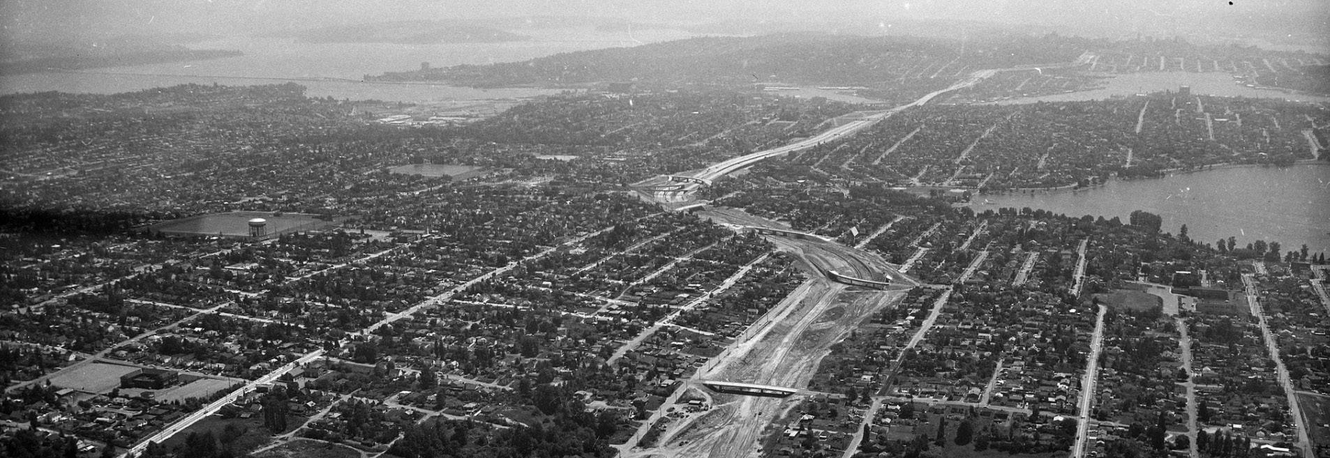
Wallingford, now located west of I-5, was one of Seattle’s streetcar suburbs. The Wallingford Streetcar opened in 1907, creating a commercial district in the neighborhood amidst blocks of single-family homes and transforming 45th Street into a major east-west connection in the neighborhood. As cars became the preferred mode of travel, the last streetcar line closed in the early 1940s, paving way for the construction of I-5.
The UDistrict, now east of I-5, has been home to the University of Washington since 1895. James Moore is responsible for much of the neighborhood’s early development, though none of his original street names still exist. The Alaska-Yukon-Pacific Exposition on the UW Campus turned University Way from a trolley right-ofway into the major commercial street in this “city within a city.” In the first half of the 20th century, the UDistrict was North Seattle’s main street. The construction of I-5, coupled with the opening of the Northgate Mall in 1950 and UVillage in 1956, redirected business away from University Way.
STREETCAR TRAVELS: Passengers boarding the Wallingford Streetcar.
Image Source: MOHAI, Seattle
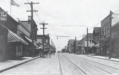
UDISTRICT IN 1912: 14th Ave N.E. (University Way) from N. 41st St. Image Source: UW Libraries
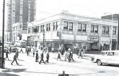
UDISTRICT VIEWS, 1959: Pedestrians at University Way and 45th Street.
Image Source: Seattle Municipal Archives
Wallingford is a primarily residential neighborhood with mostly single-family housing. Wallingford has many Bungalow houses: small cottage-style homes with one story and no stairs, sloped roofs, prominent front windows and porches. Wallingford is pursuing a National Register of Historic Places designation from the federal government. The organization Historic Wallingford claims the area should be preserved as “one of the largest and most cohesive examples of 20th-century architecture left in Seattle” (Bowman 2022). However, the Historic Places designation has been criticized by many as an effort to prevent density and upzoning in the neighborhood.
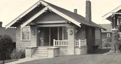
BUNGALOW: House in Wallingford, 1914. Image Source: Historic Wallingford
Much of the character of the UDistrict is shaped by students. The UDistrict has a farmer’s market and a renowned annual street fair, which started in 1970 in response to the many neighborhood changes and continues to celebrate the businesses and artistic character of the UDistrict every year.
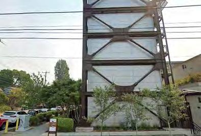
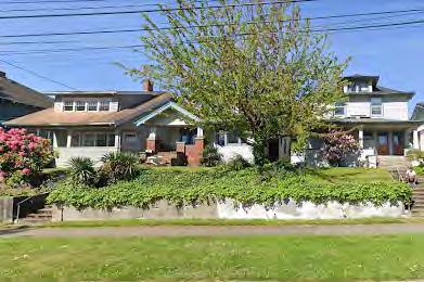
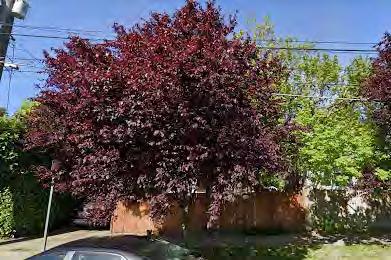
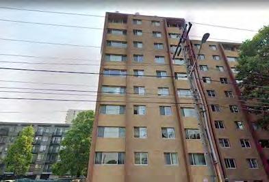
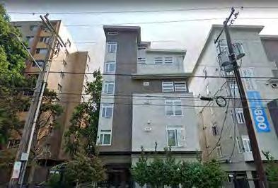
waLLingFoRD FaCaDes neaR i-5
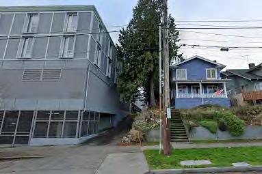
UDisTRiCT FaCaDes neaR i-5
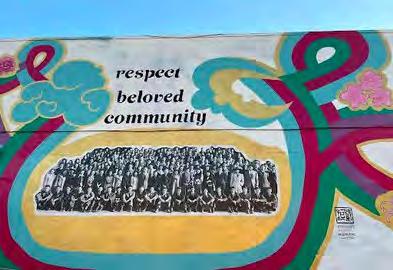
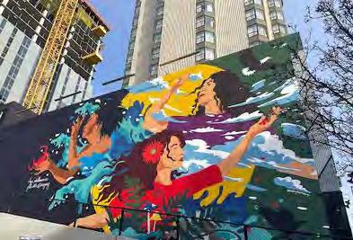
MURaLs in The UDisTRiCT
DIFFERENCES IN FACADES: Facades in Wallingford have more greenery, while UDistrict has more mid and high-rise buildings.
Image Source: Google Maps Street View, 2023
ART WALK: Murals on a 1.2 mile round-trip walk in the UDistrict
Image Source: Aleenah Ansari, The Seattle Times

Our site is impacted by the unique qualities of the UDistrict and Wallingford, on either site of I-5, as well as by even more specific differences and inequities among neighborhood sub-tracts surrounding our site.
age: The highest percentages of population under 18 (20.4%) and over 65 (11.6%) live in tract 46, suggesting families live there. The median ages in tracts 53.05 and 53.06 are the lowest (23.9 and 23.2 respectively), reflecting the student population living near UW.
R aC e: Tracts 45, 46, 50, 51, and 54 report high percentages white (non-hispanic) people, ~8-25% greater than the city’s average (64.9%).
Tracts 53.05 and 53.06 report highest percentages people of color (65.4% and 65.7% respectively). 40-50% of those populations (as well as the population of tract 52.02) identify as “Asian alone.”
in Co M e: In tracts 45 and 46, the median household income is greater than $100k. Meanwhile, over 30% of people living in tracts 44.02, 52.02, 53.05, and 53.06 have poverty-level incomes.
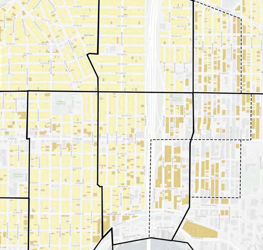
KEY: single-family multi-family
CONTEXT MAP: With Census Tracts and Housing Type (Katherine Magee)
Data source: Seattle Department of Planning and Community Development
ho U sing: Over 95% of housing units in tracts 52.02, 53.05, and 53.06 are renter-occupied. Median monthly rent is over $1800 in tracts 53.06, 45, and 46. The majority of renters are spending over 30% of their household income on gross rent in tracts 44.02, 52.01, 52.02, 53.05, and 53.06.
The highest value owner-occupied housing units (~$1M) are in tracts 46 and 52.01.
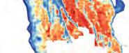
The City of Seattle created the Displacement Risk Index to assess neighborhood characteristcs and estimate long-term displacement risk. Characteristics contributing to higher risk include demographic (low educational attainment, renter households, cost-burdened households, low income); spatial (including access to public transit, proximity to core businesses and schools, proximity to higherincome neighborhoods); as well as potential for change, including development capacity and belowaverage median rent.
THE SITE: from highest risk (red) to lowest risk (blue) of displacement. Image Source: Seattle Office of Planning and Community Development
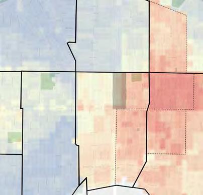
The City of Seattle has designated areas adjacent to our site, Wallingford (south and west of site) and UDistrict (south and east of site), as having mid- to high-risk of displacement. The most at-risk areas are in UDistrict, where rents are rising as development is increasing in the neighborhood. More lowerincome renters and people of color reside in the areas with higher risk of displacement in the UDistrict. In Wallingford, single-family houses reduce displacement risk. These areas (blue on the map below) are also predominantly white and have high home values.
MAPPING VULNERABILITY: understanding the demographics and situations most at risk (red) versus safest (blue) (Katherine Magee)
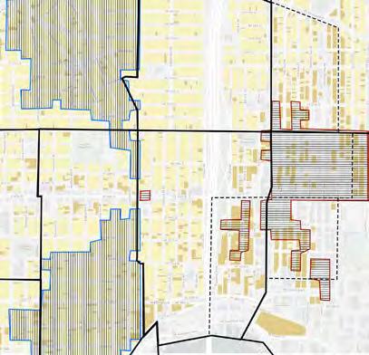
Image Source: U-District Partnership
On the neighborhood scale, Wallingford is designated by the City as a Residential Urban Village with a low displacement risk and high access to opportunity, while UDistrict is designated as an Urban Center with high displacement risk and high access to opportunity. Graduation rates, proximity to transit, proximity to employment, sidewalk completeness, and proximity to a store selling produce contributed to “Access to Opportunity” scores. Though Wallingford has a higher access to opportunity than UDistrict, both neighborhoods share indicators of opportunity while having differing levels of displacement risk. As more highrises develop in the UDistrict and as Historic Wallingford fights for historic preservation, changes in density and affordability surrounding the site may impact who can continue to live in these neighborhoods.
Surrounding our site are a variety of housing types, amenities, services, and places of historic or cultural significance.
Within a 5-minute walk radius of the site, there are 2 grocery stores and 2 food distribution centers, 3 churches, 2 schools, and 1 public library, among other notable places.
Within a 10-minute walk radius, there is the UDistrict light rail station, 4 more grocery stores, 9 more churches, 3 additional schools and 2 preschools, and 3 organizations serving the unhoused.
The site lacks quality open and green spaces within walking distance from the many residences and amenities in the area.
KEY:
single-family housing
multi-family housing commercial school other institution
city landmark
10-minute walk radius
5-minute walk radius
vacant as of 10/2023
open greenspace public services, utilities grocery store food bank farmers market p-patch garden shelter social services points of interest (POI) potential space of community, creativity, belonging
CHURCH OF JESUS CHRIST OF LATTERDAY SAINTS
CATHOLIC CHURCH + FOOD BANK
COMMUNITY CENTER + PUBLIC OPEN SPACE: UNIVERSITY HEIGHTS CENTER (1)
UNIVERSITY PUBLIC LIBRARY (2)
COMMUNITY SPACE: YMCA
OPEN SPACE: UNIVERSITY PLAYGROUND (3)
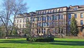
COMMUNITY CENTER + SERVICES: GOOD SHEPERD CENTER (4)
CHURCH + STREET YOUTH MINISTRIES, YOUTH CENTER, FOOD BANK
POI: THE ORIGINAL DICK’S DRIVE IN
UDISTRICT LINK LIGHT RAIL STATION
OPEN SPACE: CHRISTIE PARK (5)
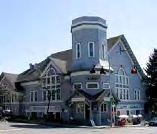
LANDMARK: ANHALT HALL (6)
LANDMARK: UNIVERSITY METHODIST CHURCH + PARSONAGE (7)
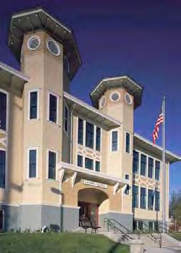
LANDMARK: LATONA SCHOOL, JOHN STANFORD INTNL SCHOOL (8)
SOCIAL SERVICES: NAKANI NATIVE PROGRAM + FACING HOMELESSNESS
UNIVERSITY OF WASHINGTON
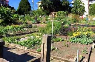
COMMUNITY/OPEN SPACE: P-PATCH (9)
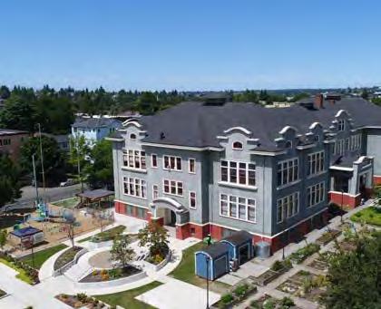
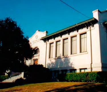
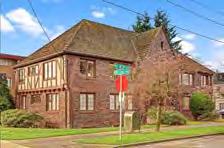
Photos: Brian Rich/Richaven Architecture (1), Seattle Landmarks Preservation Board (2), Katherine Magee (3), Historic Wallingford (4), Forrest Wu/Burke Museum (5), Seattle Landmarks Preservation Board (6,7,8), Medgar Marceau (9))
The One Seattle Homelessness Action Plan, introduced by Mayor Bruce Harrell in May 2022, reports current conditions and “progress” in the city’s “crisis response” to homelessness across many neighborhoods in Seattle. According to the most recent data (June 2023), Wallingford is home to 41 tent and RV encampments while the UDistrict is home to zero. Six encampments were removed from UDistrict in June 2023, while five were removed from Wallingford. With euphemistic dataset titles and reports of aggressive sweep actions taken by the City, the dashboard should only be used as a singular reference. Observational data as well as news sources report different information, and there are many stories that are not and will not ever be available to us.
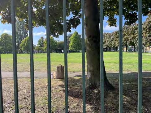
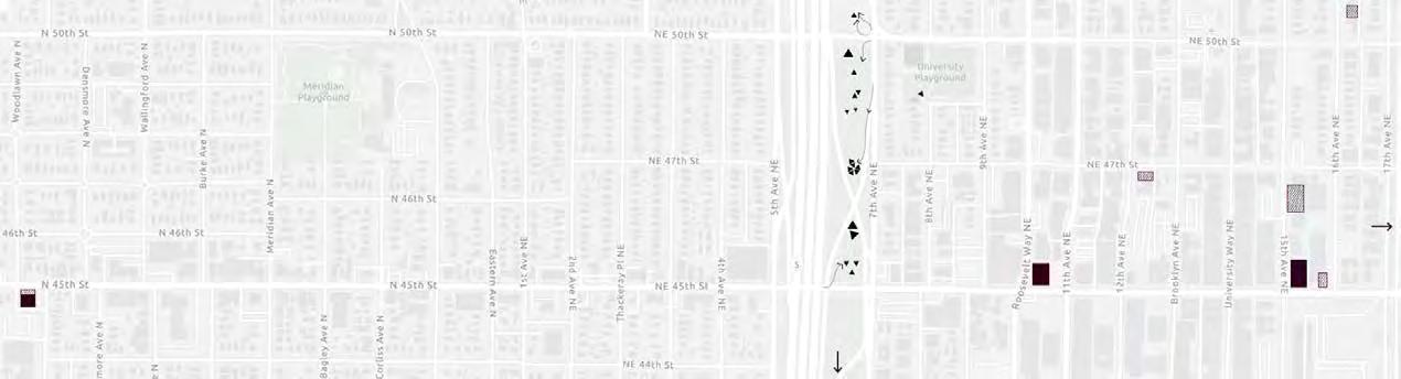
While visiting the site on September 29, 2023, we took note of activity in the vacant land surrounding I-5. Around 20 separate shelters were noted in the vacant land east of I-5 (indicated as triangles in the map below), and many“desire paths” led in and out from tent areas.
For years, an encampment resided underneath the Ship Canal Bridge, another area of I-5 between UDistrict and Wallingford (at 42nd Street). Known as one of the more dangerous encampments in the region, there were fires, explosions, shootings, and a prolific drug scene. Closing the encampment became a priority for Wallingford residents and WSDOT due to the violence and its proximity to John Stanford International School. The encampment was closed in March 2023, with 100% of its residents (at the time) placed in permanent housing.
(a) Broadview Emergency Shelter
(B) Rosie’s Place Tiny Home Village
(C) Teen Feed
(D) Street Youth Ministries
(e) Tent City 3
(F) United Churches Emergency Fund
(g) Elizabeth Gregory Home
(h) Roots Young Adult Shelter
BELOW: OBSERVED SHELTERS + NEARBY SERVICES (Katherine Magee)
Bowman, Nick. “Battle lines drawn in fight over historic district designation in Wallingford.” MyNorthwest (March 3 2022).
Choe, Jonathan. “A Heart for Squatters at the Ship Canal Bridge.” Discovery Institute (November 18 2022).
City of Seattle. “Seattle 2035 Equity Analysis.” Seattle Comprehensive Plan (updated January 2023).
Dorpat, Paul. “Seattle Neighborhoods— Thumbnail History: UDistrict” and “Wallingford.” HistoryLink (June 2001).
Goodwillie, Kristin. “Problematic encampment below the Ship Canal Bridge cleared.” King5 Seattle (March 27 2023).
“The History of the UDistrict Street Fair.” UDistrict Seattle.
King County Assessor and City of Seattle Office of Planning and Community Development. “Existing Land Use (10-category).” Seattle City GIS (September 11 2023).
Office of the Mayor Bruce Harrell. “One Seattle Homelessness Action Plan.” City of Seattle (updated July 2023).
Rantz, Jason. “WA Rep fed up as homeless authority refuses to sweep encampments.” MyNorthwest (February 16 2023).
“Seattle I-5 History.” Lid I-5. https:// lidi5org.files.wordpress.com/2016/06/ seattle-i-5-history.pdf.
Seattle Department of Construction and Inspections. “Landmarks and Historic Preservation Districts.” Seattle City GIS (updated August 21 2023).
Stein, Alan. “This Week Then: I-5 Turns 50.” Seattle Magazine (May 2019).
United States Census Bureau. “Quick Facts: Seattle, Washington.” (July 2022).
United States Census Bureau. “Census Tract Top 50 American Community Survey Data.” Seattle City GIS (updated September 15 2023).
Vieth, Thomas. “A Preliminary Sketch of Wallingford’s History 1855-1985.” (2005).
Seattle.gov.
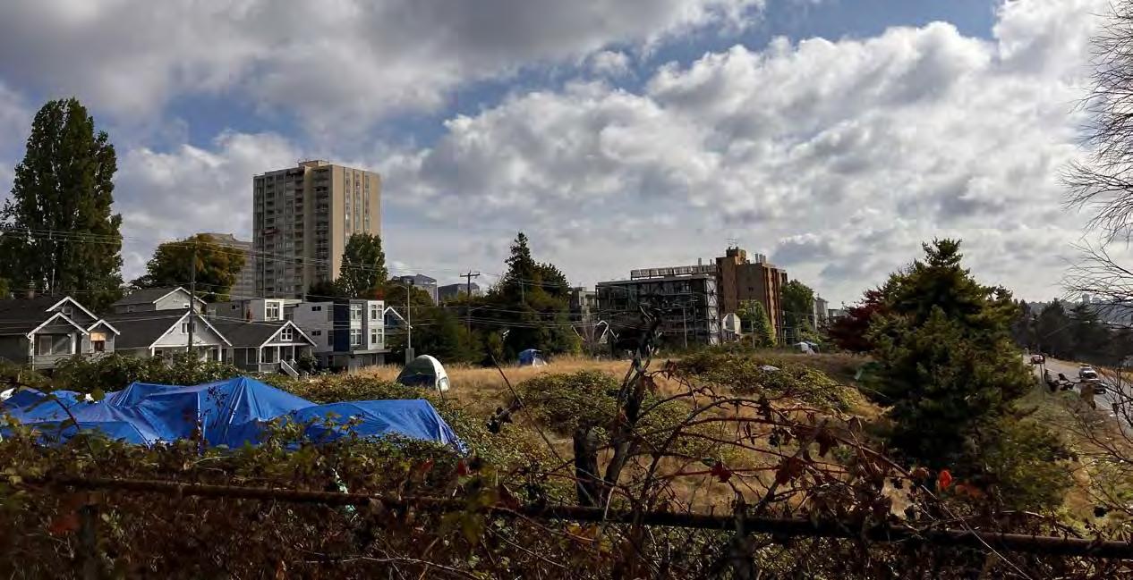
SHELTERS IN THE I-5 BUFFER GREENSPACE: Looking southeast from NE 50th Street. (Photo: Darryl Vallejos)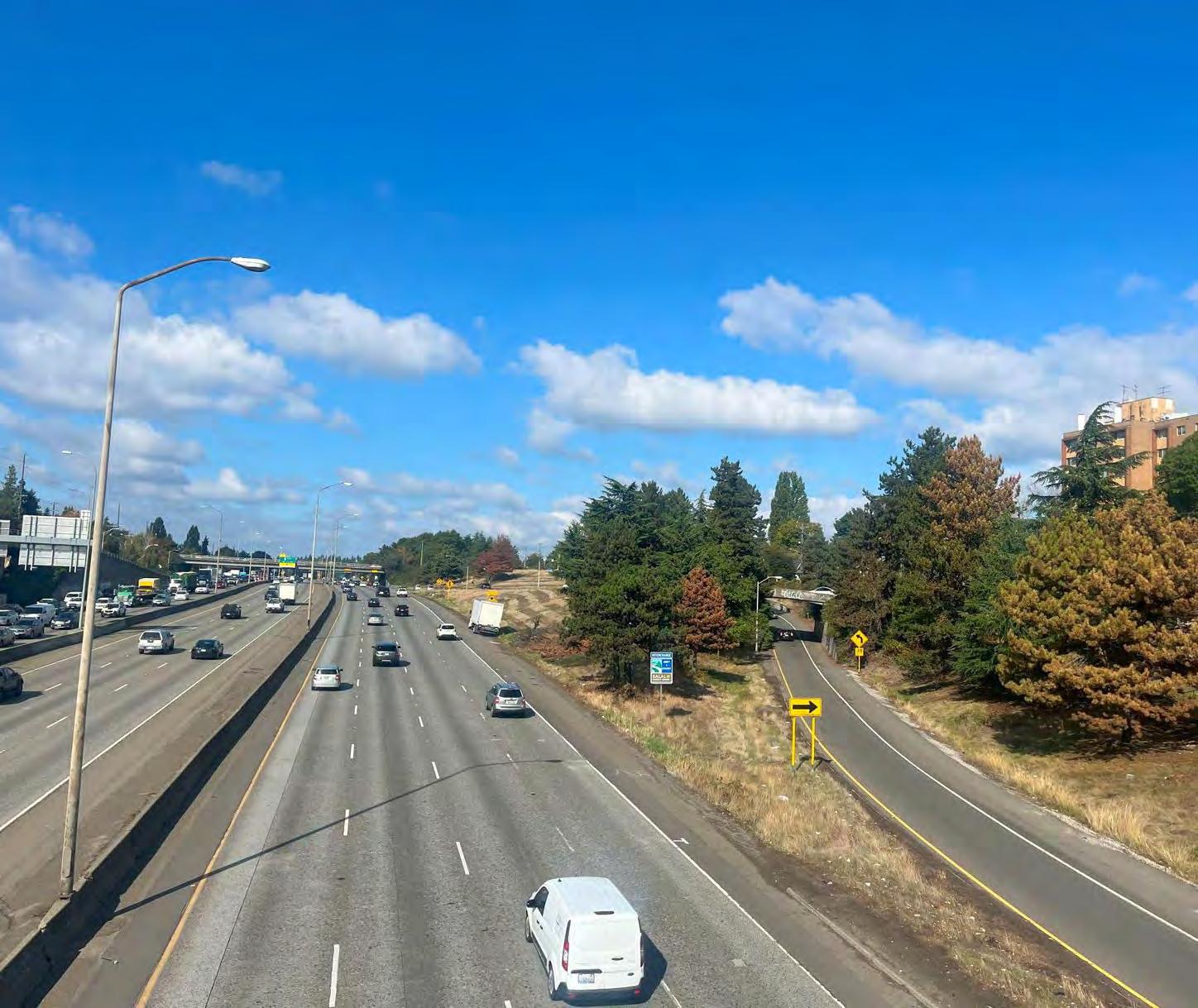
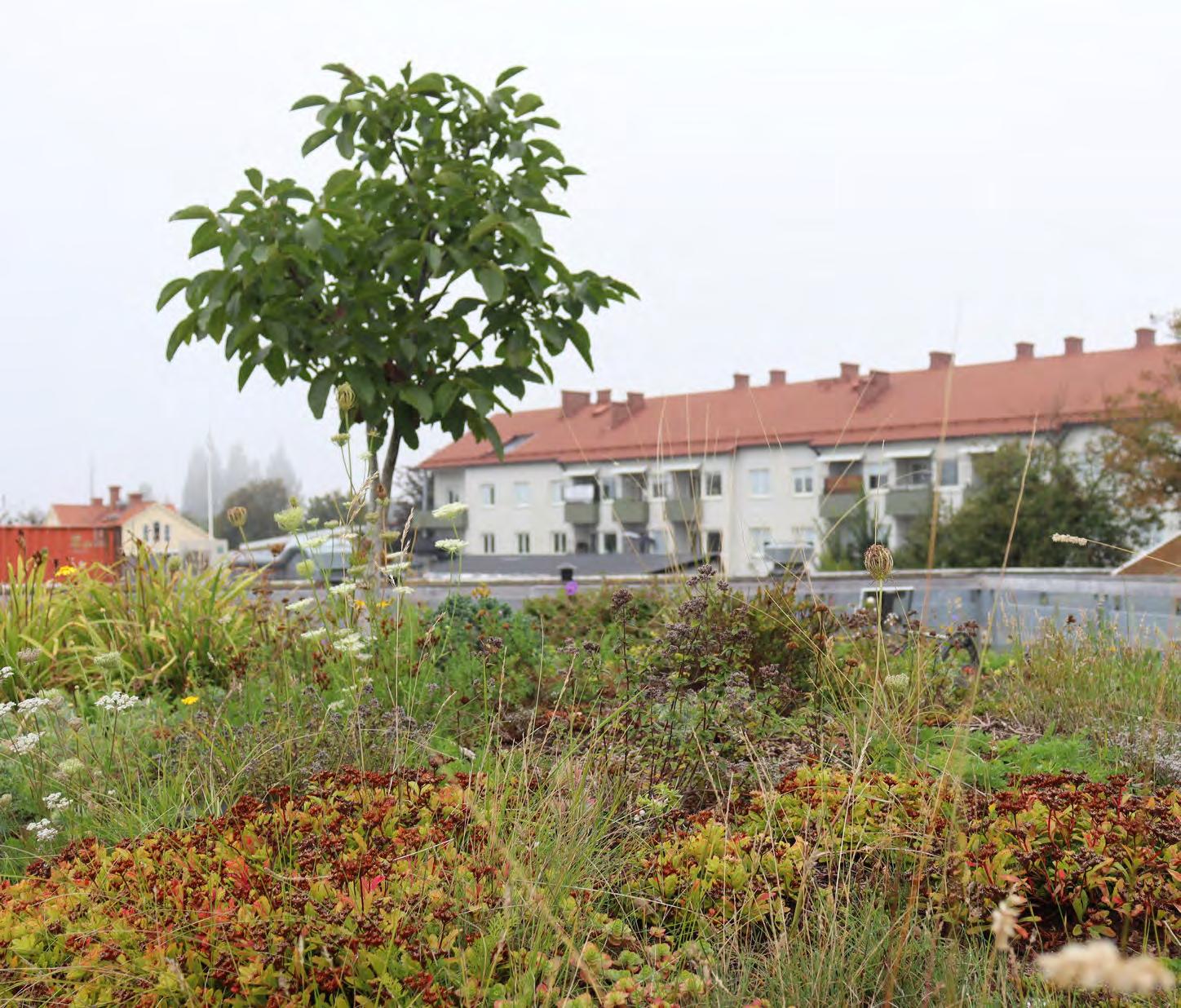
PUBL i C s PaC e , e Co Logy + B io D i V e R si T y
“Canopy cover is an important management tool for the City to understand the extent and distribution of trees in Seattle. Seattle’s goal, established in 2007, is to reach 30% canopy cover by 2037, as well as to improve tree health and equitable distribution of trees to support community health and resilience to climate change.” (City of Seattle, 2023).
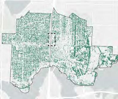
Despite the goals set in 2007, trees in Seattle are still not distributed equally across neighborhoods. Land use, density, and patterns of open space and infrastructure are drivers of canopy coverage. Located between Wallingford and UDistrict, the study site exemplifies a contrast in canopy between adjacent neighborhoods. The UDistrict is densely populated, demographically diverse, and has far less consistent tree canopy when compared to the demographically homogenous and largely single-family residential neighborhood of Wallingford.
Seattle’s urban forests are shrinking. From 2016 to 2021, the city experienced a 5% loss in tree canopyan area the size of Green Lake (City
of Seattle, 2023). This change in canopy coverage was largely experienced in residential areas and in city parks, where the vast majority of the city’s tree stocks are located. The University of Washington and the blocks of single family homes north of the campus represent the largest source of canopy coverage in the UDistrict neighborhood.
Trees provide valuable ecosystem services to communities in the form of shade, wildlife habitat, slowing of stormwater, reduction of energy use, improvement of air, water, and soil quality, and sequestration of atmospheric carbon.
Tree canopy and tree equity are essential components to a climate resilient future.
% TREE CANOPY IN SEATTLE BY HECTARE. Image Source: City of Seattle
% TREE CANOPY IN UDISTRICT & WALLINGFORD BY HECTARE.
Image Source: City of Seattle
TREE CANOPY IN UDISTRICT AND WALLINGFORD.
Image Source: City of Seattle
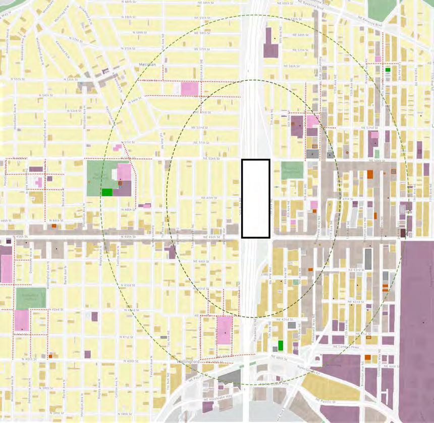
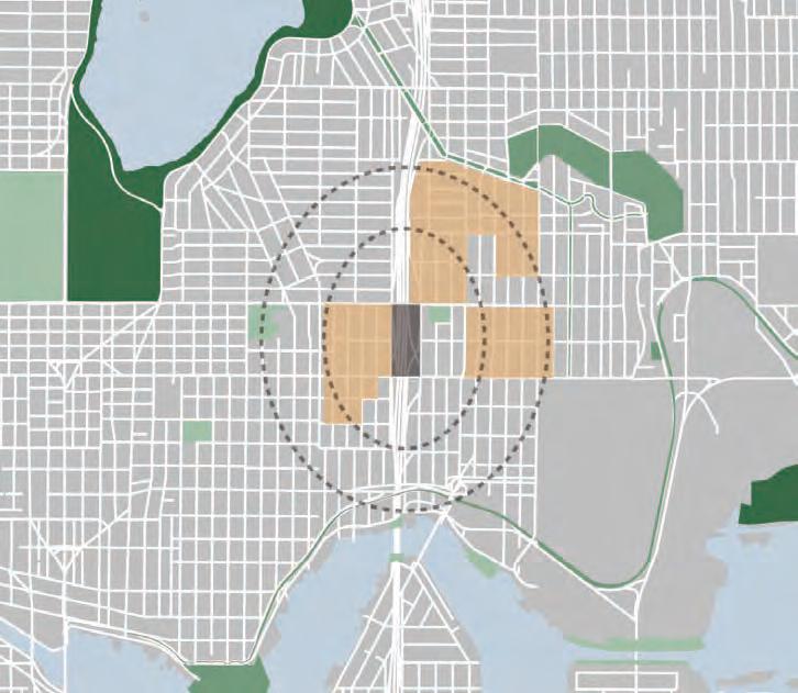
There is limited public space and few outdoor amenities near the site. The dashed lines in the map to the right indicate 5-minute and 10-minute walksheds from any edge of the site. The only park within five minutes is University Playground, and the only park within ten minutes is Meridian Playground, neither of which are particularly rich in amenities. The City of Seattle ranked public park space by the quality of greenspace, public amenities, and ecosystem services to help assess where existing parks need upgrades and where new parks are needed. In the map to the right, the darker the green, the higher that park ranked on the study. It is significant that the parks closest to the site are lowest ranking, of lower quality. In the same study, the city outlined where future parks would be of high prioirity. Highlighted in orange are zones that are medium priority for a new neighborhood park (the rest of this map’s extents are low or lowest priority).
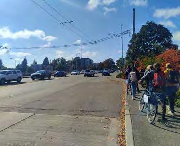
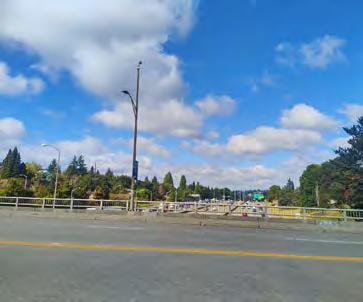
Crossing a large interstate like I-5 at any juncture is a challenge. Our site is bounded by the 45th St. and 50th St. bridges, providing narrow sidewalks on either side of five lanes of traffic. The edges have some vegetation that acts as a small sound barrier, but the center of the bridge is extremely loud and cars dominate. It is an undesireable crossing to make, but it is necessary for many people who live nearby.
There is a noticeable lack of biodiversity within the walkable limits of our site. The trees, shrubs, and plethora of invasive plant species appear to be planted of their own volition and are surviving well despite harsh conditions. Clearcutting to make way for I-5 destroyed a strip of the neighborhood’s flora and created a wind tunnel which makes it challenging for new trees to grow. The surrounding ecosystem additionally has to endure traffic noise, vehicular exhaust pollution, and extensive concrete surfaces that inhibit natural growth and spread of plants and wildlife. The map to the right indicates our best guess at the existing wildlife corridors and notes that it is necessary for wildlife to cross I-5 even though it is dangerous.

Decades of human development have created many of physical barriers for terrestrial animals in Seattle. Roaming from one location to another is required to find food and shelter, yet often impossible to do safely in a city due to a lack of connected wildlife corridors. A lid over I-5 should address an improved east-west wildlife corridor in addition to human connectivity.

This portion of I-5 drains into Union Bay, an essential migration path for salmon and a substantive habitat for other aquatic life. All chemicals on the road or in the atmosphere such as 6PPD-quinone, a “deadly chemical derived from automobile tires, a chemical that can rapidly kill coho salmon” are carried in stormwater runoff into the bay (Dunagan, 2021).

The Seattle portion of I-5 is located within the Pacific Flyway, reaching from Patagonia to Alaska. Highway traffic noise has proven to be harmful to migratory birds during navigation. A 2015 study found that the excessive noise “distracts them from the business of finding food, and leaves them physically weaker” (Yong, 2015).
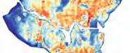
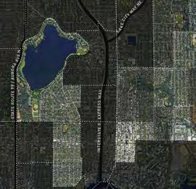
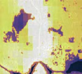
“Structures such as buildings, roads, and other infrastructure absorb and re-emit the sun’s heat more than natural landscapes such as forests and water bodies. Urban areas, where these structures are highly concentrated and greenery is limited, become “islands” of higher temperatures relative to outlying areas.” (EPA, 2023)
Clear patterns emerge when examining recorded surface temperature on a summer evening, and canopy coverage. Areas without substantial canopy or access to water features, and concentration of densely built structures experience higher surface temperatures. These patterns are affirmed when looking at the amount of impervious surfaces and shade profiles in the study area and neighborhoods. Finding solutions to urban heat will become even more urgent and necessary as the region experiences the effects of climate change which are projected to include longer, warmer, and drier summers.
IMPERVIOUS SURFACES: Dark areas represent greater % impervious surface coverage. Image Source: Nature Conservancy


The study site is very exposed to the elements. There is little relief from direct sunlight in the summer months. UDistrict and Wallingford have different shade sources, with buildings providing more shade in the UDistrict, and tree canopy in Wallingford.
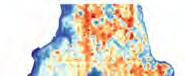

URBAN HEAT EFFECT: Recorded surface temperatures on a summer evening
SHADE PROFILE: August 1 at 4pm.
Image Source: Shademap.app
AVIATION + VEHICLE: Noise pollution near site.
Image Source: US Dept of Transportation
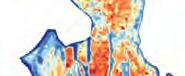
ROAD TRAFFIC AIR POLLUTION. Image
Source: Washington Tracking Network
COPPER CONCENTRATION IN RUNOFF.
Image Source: Nature Conservancy
The map to the left, adapted from the National Transportation Noise Map, shows decibel levels over a 24-hour period. The deeper the color, the louder the noise. The yellow shows aviation noise pollution from the SeaTac International Airport flight path. Within this map extent, we would expect to see that the I-5 corridor has the highest decible level. The noise created by vehicles traveling on I-5 can be harmful to people’s hearing if endured for an extensive amount of time. The red lines indicate where certain roads are busier than others, and the dots indicate where stop signs detain sitting traffic regularly.
These two maps illustrate the concentration of air and water pollution surrounding I-5. It is clear that the areas closest to heavy traffic roads are disproportionately affected by particulate matter and copper levels. From a zoomed out view, it is obvious to see where major roadways carve through the landscape. There are detrimental health risks to living and working near highways that a lid structure could potentially help to mitigate.
The narrowness of the sidewalks on 45th Ave and 50th Ave that cross over I-5 are not designed for people to stop or stay. The single purpose of these paths are to allow people to cross the highway chasm.
Looking over the bridges, there are three distinct themes. Firstly, the highway’s 11 lanes and many ramps take up much of what one sees. Secondly, the lower elevation of the highway and its sloped sides allows for some trees and vegetation. This creates a frame around the highway on its east and west extents. Thirdly, looking beyond the highway, distinct building typologies emerge when one compares neighborhoods.
Future projects on these east-west crossings should address the lack of space to stop, stay, or sit, and take advantage of the dramatic south-facing views. Both bridges, but especially 45th Ave, have wide views of downtown Seattle and its skyline, Lake Union, Capitol Hill, and on a clear day, Mount Rainier can be seen in the distance.
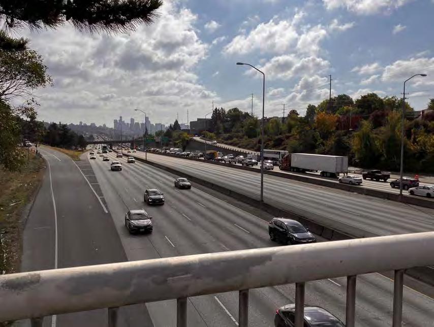
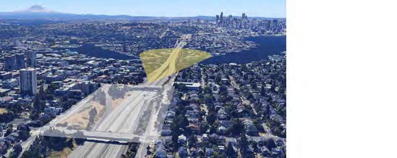
City of Seattle. “Ecosystem Services.” Trees for Seattle (2023): https:// www.seattle.gov/trees/management/ecosystem-services.
Dunagan, Christopher. “Discovery of tire-related chemical that kills coho salmon sparks widespread response.” Puget Sound Institute, UW Tacoma, 2021. https://www. pugetsoundinstitute.org/2021/08/ discovery-of-tire-related-chemicalthat-kills-coho-salmon-sparkswidespread-response/
EPA. “Urban Heat Islands.” (August, 2023): https://www.epa.gov/heatislands/learn-about-heat-islands.
EarthExplorer. “LC08_L1TP_046027 _20210725_20210803_02_T1” (2021)
United States Geologic Survey. https://earthexplorer.usgs.gov
Google Earth. 47°39’57”N 122°19’20”W, 68 m.
The Nature Conservancy. “Stormwater Heatmap.” 2023. https://www. stormwaterheatmap.org/
Seattle GeoData. “Neighborhood Map Atlas.” City of Seattle (2023): GIS Data.
Seattle GeoData. “Seattle Tree Canopy Change 2016 2021 Map Package.” City of Seattle (2023): GIS Data.
Shademap.app. https://shademap. app/@47.66248,-122.32033,15z, 1690930708077t,0b,0p, 0m!1690894052666!1690947968751 (August 1, 2023).
US Department of Transportation. “National Transportation Noise Map.” 2020. https:// maps.dot.gov/BTS/NationalTransportationNoiseMap/
Washington Tracking Network. “Populations Near Heavy Traffic Roadways.” Washington State Department of Health, 2020. https://fortress.wa.gov/doh/wtn/WTNPortal/home/#!q0=570
Yong, Ed. “The Phantom Road.” The Atlantic, 2015. https://www.theatlantic.com/science/ archive/2015/08/phantom-road-trafficnoise-birds/402919/
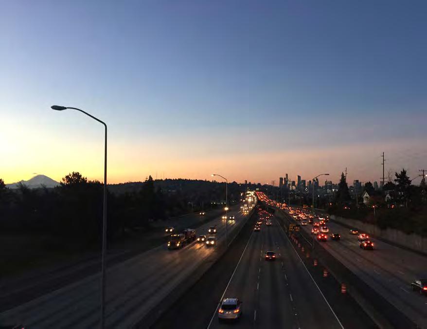 SUNSET FROM 45TH AVE BRIDGE (Photo: Tim Seed)
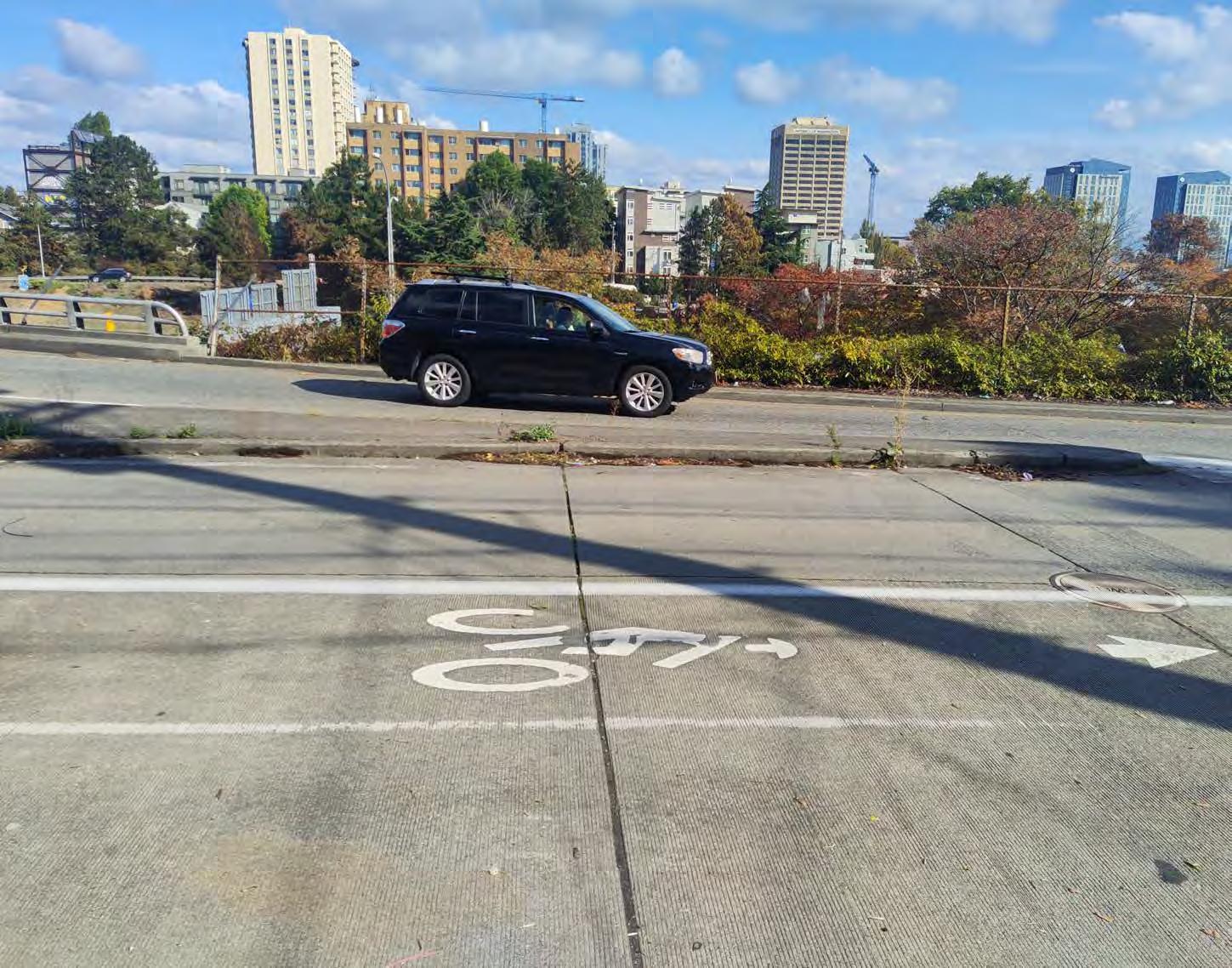
The proposed site for lid development has the potential to make connections between Wallingford and University District and to I-5. Other immediate connections include University Ave businesses, UDistrict light rail station and Wallingford business district. Further connections may include smoother access to the Roosevelt light rail station, Burke-Gilman trail, and possibly the future Ballard light rail station depending on 45th St. transit options.
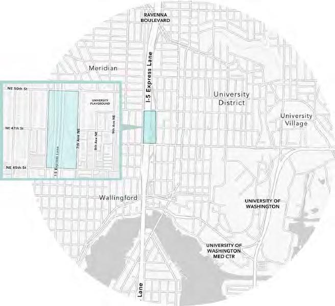
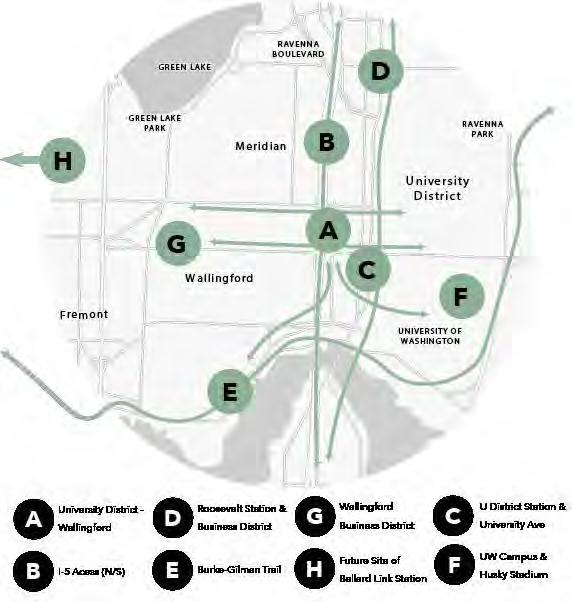
Within a 15-minute walking distance from the center of the NE 45th St. bridge, there are a handful of public schools and two libraries. The area surrounding the site is in need of a community center, with the closest ones in Green Lake and Roosevelt. There are plenty of bus stops and lines running through the area currently, and the site is in close proximity to the Link. Alternative forms of transportation along the East-West corridor should be considered to improve connections between neighborhoods.
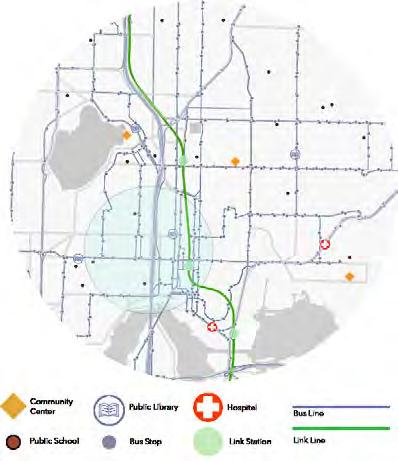
The sidewalk conditions around the site are rated between poor and good. Considering the conditions observed during a site visit, however, these ratings may not be the best assessment of quality or accessibility.
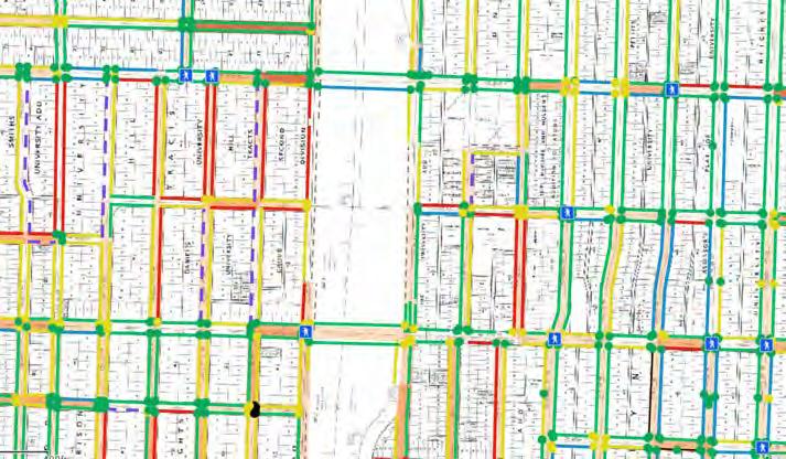
When entering Wallingford there is a significant slope, which should be considered in efforts to connect Wallingford and the UDistrict.
Accessible pedestrian signals, which offer non-visual ways to communicate safety to cross, are limited. These are dangerous intersections; the pedestrian crosswalk adjacent to the NE 45th St I-5 North on-ramp is particularly dangerous.
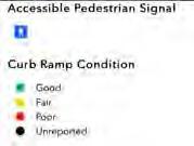
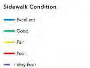
PEDESTRIAN CONDITIONS.
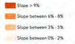
Image Source: City of Seattle GIS
BICYCLIST CONDITIONS.
Image Source: City of Seattle GIS
According to the planned bicycle facilities presented in the 2014 Bicycle Master Plan, the area surrounding the proposed lid site is due for major bicycle infrastructure upgrades. There is a planned neighborhood greenway through the center of the site, potentially including a bike bridge across NE 47th St. - worth considering for possible incorporation into lid proposals. A greenway heading South from the site is planned, connecting the site area and the Burke-Gilman trail. A greenway heading North could create a connection to the Roosevelt business district and Link station. While there are many existing bike facilities along the site, the conditions of these facilities are poor and potentially dangerous to cyclists. There is no bike parking immediately on or around the site.
ON & OFF RAMP FLOW: Direction of flow and annual traffic counts for I-5 ramps around site.
Image Source: WSDOT Traffic Data Reporting System
Traffic counts for the I-5 on- and off-ramps around the site were last counted and made publicly available in 2022. WA Department of Transportation (WSDOT) data shows that the most popular ramps used are the I-5 N to NE 45th St. bridge off-ramp (C) and the 5th Ave NE to I-5 S (D) onramp. The least used ramps are those leaving I-5 S towards 5th
Ave NE (I) and 5th Ave NE on-ramp to I-5 S (J).
These counts show that NE 45th St. is more heavily used by car commuters in comparison to NE 50th St. This is important to interrogate when addressing public concern that will inevitably arise upon proposals to alter this popular travel way. It is also critical in
understanding dangers posed to non-motorized commuters who also use this street to move along the East-West corridor of NE 45th St.
A fairly high number of cars use the ramp entering I-5 N from NE 45th St. This is a particularly important thing to consider given this ramp takes up the dominant amount of available green space on the site.
The two most dangerous intersections in Seattle based on collision data are on 45th St. Just immediately around the proposed site, there were 307 collisions in the last year (October 2022-2023). Of those collisions, eight pedestrians and 10 cyclists were involved and most events were due to inattention. Most of the collisions happened in the intersection or mid-block unrelated to the intersection. Inferring from the data, these collisions are not due to poor road or weather conditions. Most occurred during daylight hours, in clear conditions, and on dry roads. Most collisions occurred at the NE 45th St. corner on the UDistrict side, with the corner on the Wallingford side close behind.
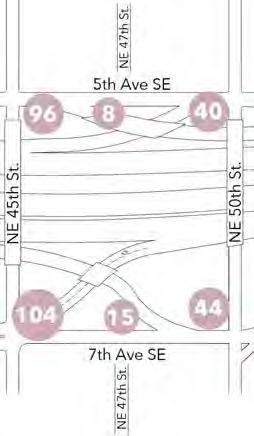


COLLISION DATA: Details on the collisions that occurred in the last year. Image Source: Tim Ganter
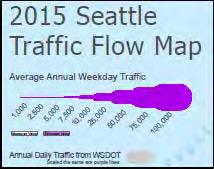
The Annual Weekday Traffic counts show that 45th and 50th are both heavily used E-W connections between UDistrict and Wallingford and beyond. At I-5, 45th Street has double the traffic count compared to 50th Street, showing that 45th is more heavily driven than 50th.
There is a mismatch between this and SDOT’s arterial classification, where the full stretch of 50th across UDistrict and Wallingford is classified as a main arterial and is considered a minor arterial East of I-5.
Cross streets on the UDistrict side also have regular usage with counts ranging around 45006000. Cross streets on the Wallingford side are less frequently used by comparison, with counts ranging from 2000-4000.
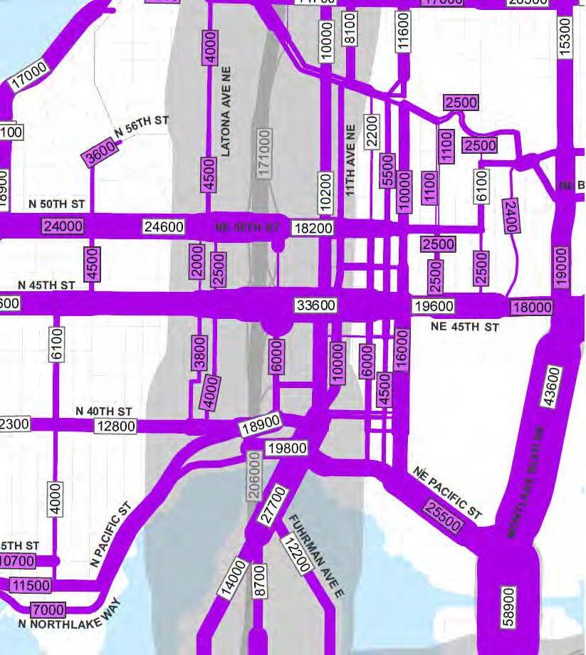 SEATTLE TRAFFIC FLOW MAP: Depicting North Seattle including the project site.
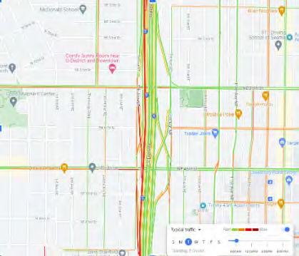
WEEKDAY 8AM
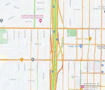
WEEKEND 12PM
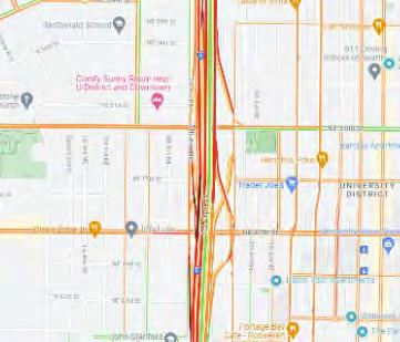
WEEKDAY 5-6PM
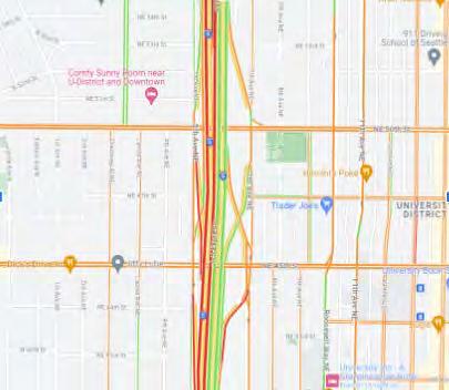
WEEKEND 4PM
Peak traffic hours on weekdays are 8 AM and 5-6 PM along the segment of I-5 that runs through the proposed lid site. This indicates that the majority of car users traveling on I-5 are commuters during the week. Based on traffic flow density, the majority of travel around the site at 8 AM on weekdays passes under the site (on I-5), not flowing through adjacent neighborhoods. Neighborhood traffic density increases in the peak evening hours (5-6 PM).
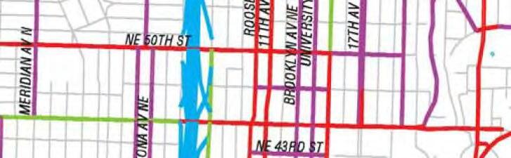

Weekend peak traffic hours are noon and 4 PM. Weekend traffic density shows that many cars are flowing through adjacent neighborhoods at both traffic peaks, and a higher number of cars pass through on I-5 at the early evening peak (4 PM).
SDOT’s 10-year Strategic Vision for Transportation (2015) was approved by voters through the Move Seattle Levy and thus is now state-funded. The Plan identified some major transport trends in Seattle and committed to integrated modal plans including freight, transit, walking, and bicycling to deliver transformational projects. The Strategic Plan also sought to prioritize projects to identify funding.
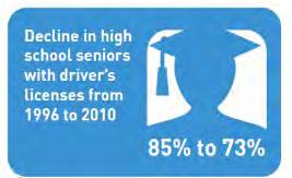
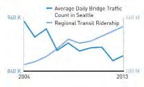
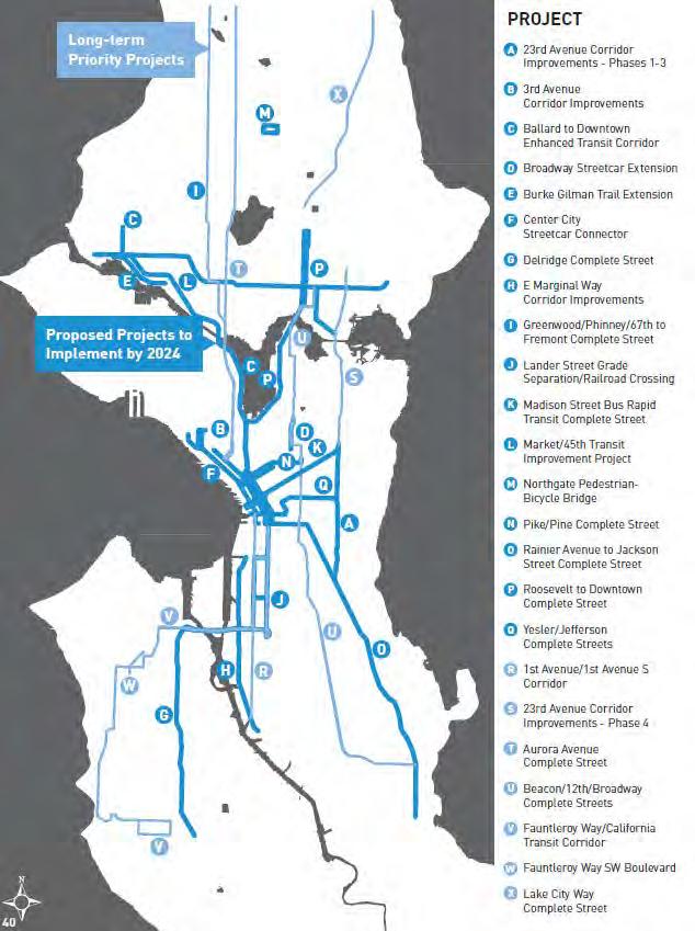
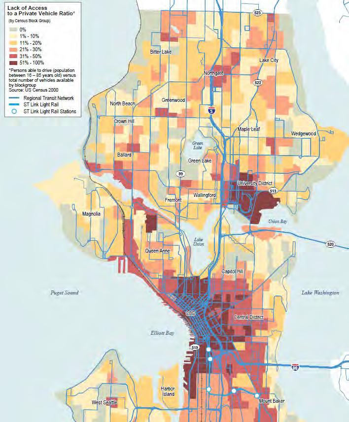
The 10-year vision identified the declining importance of cars by providing data such as decline in high school seniors with driver’s licenses and decline in average daily bridge traffic counts in Seattle. However, regional transit ridership has been steadily increasing. This points to a need to provide more reliable options for transit in future planning.
The transit reliance index also shows that the UDistrict has a very high ‘lack of access to private vehicle ratio.’ Therefore, there is a critical need to establish good transit connections in the area.
PR io R i T y PR oJ e CT s + i MP o RTan T Co RR i D o R s
The Market/45th Improvement project and the Roosevelt to Downtown Complete Street were identified as priority projects, important corridors for mobility in the Master Plan.
Following identification of important corridors in its 10-year vision, SDOT issued a Transit Master Plan (TMP) in 2015 as 20-year look-ahead to the type of transit system that will be required to meet Seattle’s transit needs through 2030.
The Transit Master plan aimed to identify the city’s most important transit corridors that carry high ridership today, as well as potential new ridership markets that will emerge as Seattle grows in jobs and population. The Plan also aims to select transit modes —such as bus rapid transit, light rail, or street car—that would work best on those corridors.
Identified as one of the city’s most important transit corridors carrying high ridership today, the Market/45th corridor was designated as a Rapid Ride corridor which would carry passengers across UDistrict to Ballard. The Rapid Ride planning included designated bus lanes, priority signals etc. to make this an efficient transit corridor.
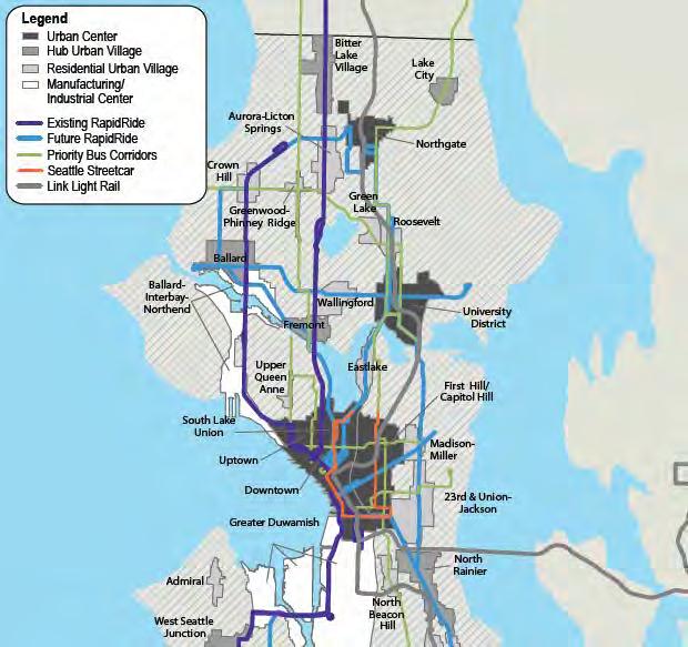

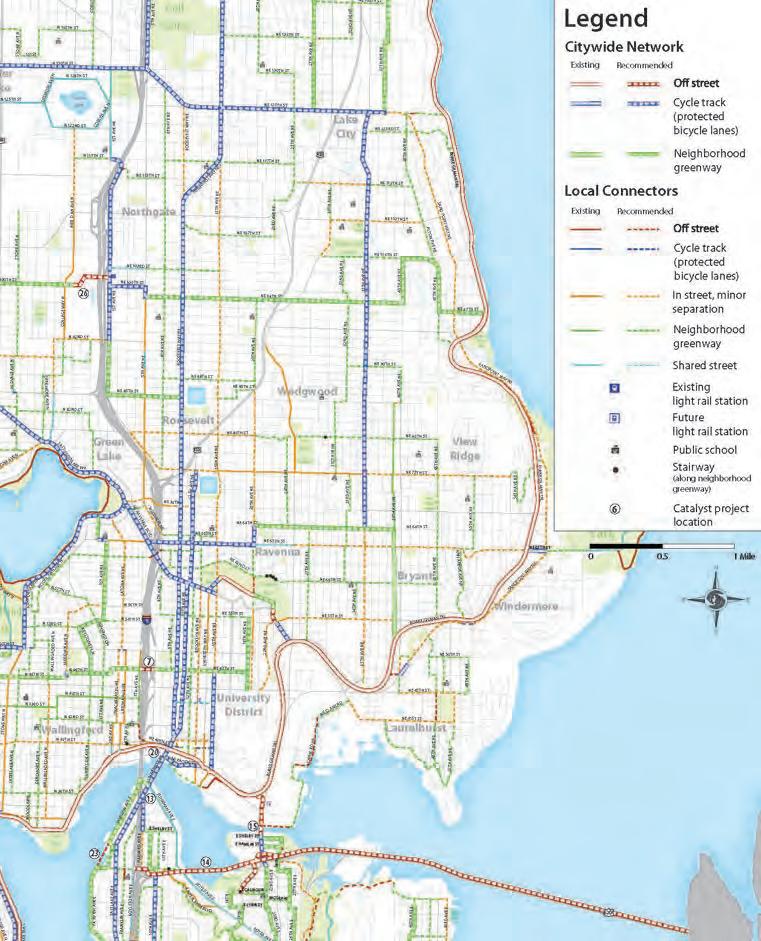
The Bicycle Master Plan (BMP) was also laid out in 2014, looking ahead to a more bike-friendly Seattle. The concept of bike greenways were introduced in this plan; bike greenways are planned as bike and pedestrian priority streets with additional safety features and signage. In this plan, a bike greenway was proposed along 47th, across our site. Plans for connecting the greenway over I-5 are unclear.
Both the TMP and BMP have undergone implementation since 2015, but there have been various challenges, including budget cuts that led to changes and inability to execute the vision coherently. For example: the RapidRide Market/45th Corridor was downgraded alongside Routes 40 and 48 to a “Transit-Plus” Line, which is currently in planning/implementation process. The bike greenway along 47th has also not been successful and SDOT has yet to offer a protected bike lane across the I-5. SDOT
While a lot of future transport or mobility technology may still need to undergo further testing, many are fast developing. New transport and mobility technologies point to trends of multi-use curb space and reduced use of road space. Transport will be more customized with micro-mobility tools and delivery drones.
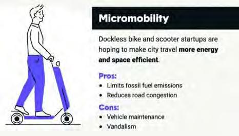
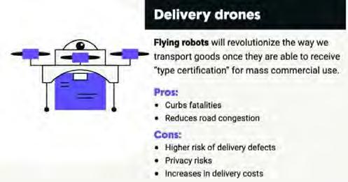
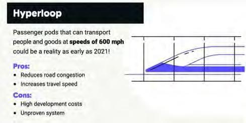
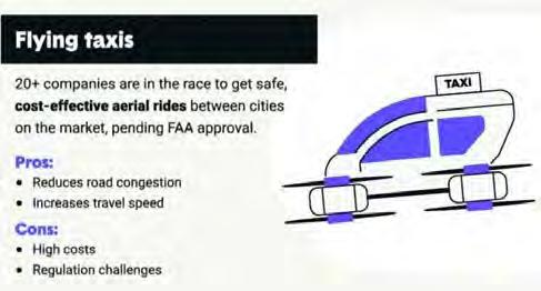
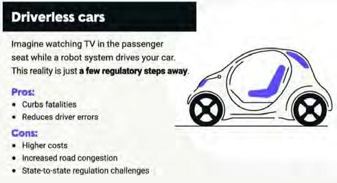
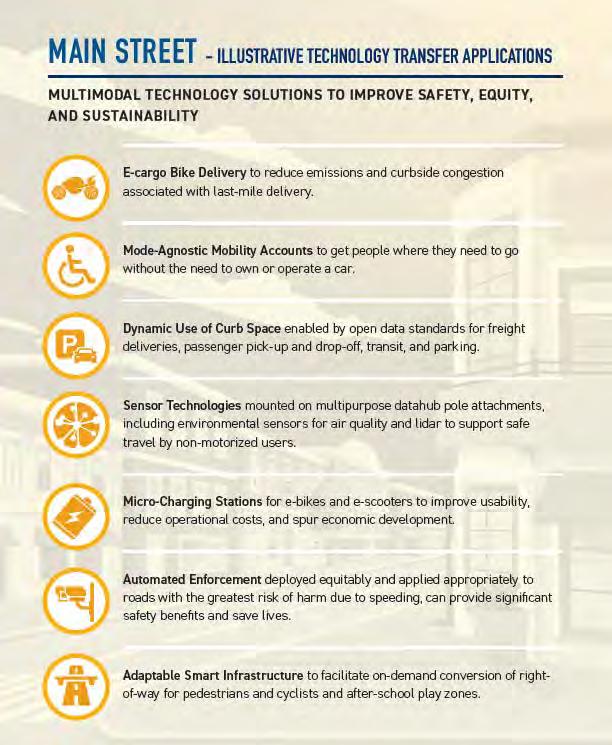
TECHNOLOGY TRANSFER APPLICATIONS. Image Source: USDOT
Seattle Department of Transportation, Move Seattle: Mayor Edward B. Murray’s 10-year strategic vision for Transportation (2015).
Seattle Department of Transportation, City of Seattle Department of Transportation: Transit Master Plan: Final summary report (2012). Seattle: The Dept.
Seattle Department of Transportation, Seattle bicycle master plan (2013). Seattle, WA: Seattle Dept. of Transportation.
(N.d.). Retrieved from https://www. thezebra.com/resources/driving/ future-transportation/
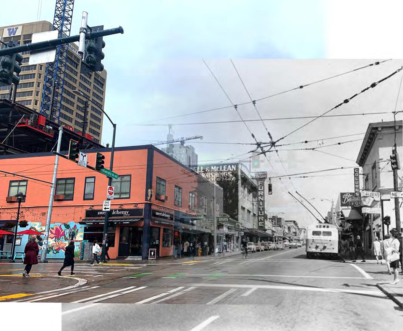
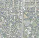
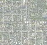
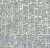
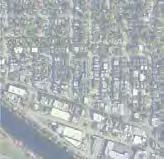
University District and Wallingford are nearly adjacent neighborhoods, separated by an 11-lane interstate highway. Over the years the neighborhoods have developed within their zoning designations, and even undergone re-zoning as is the case in UDistrict. The character of the neighborhoods differ in current and future land use, housing, business, and employment due to this. UDistrict maintains a more dense, mixed use business
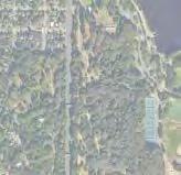
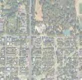
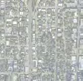
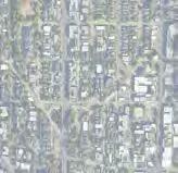
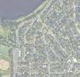
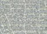
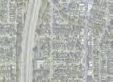
district character and Wallingford maintains a more residential character with a concentrated business area. How these two neighborhood characters are stitched together with the proposed highway lid is a main design question we are exploring in this studio. In this section we gather and analyze policy plans, zoning designations, land ownership in and around the highway, rent vs own comparisons, businesses and employment, and potential future economies of Seattle.
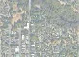
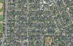
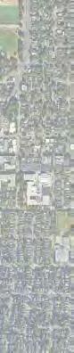

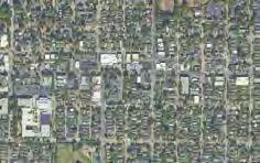
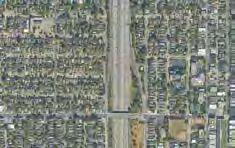
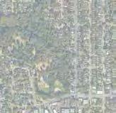


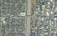
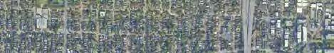
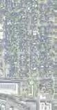
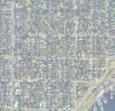
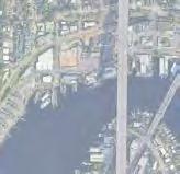
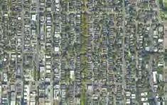
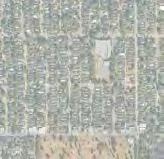
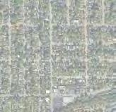
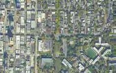
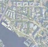
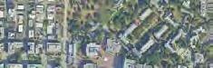

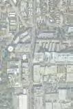
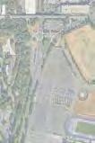
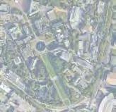
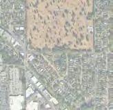
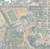
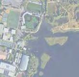
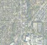
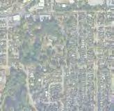
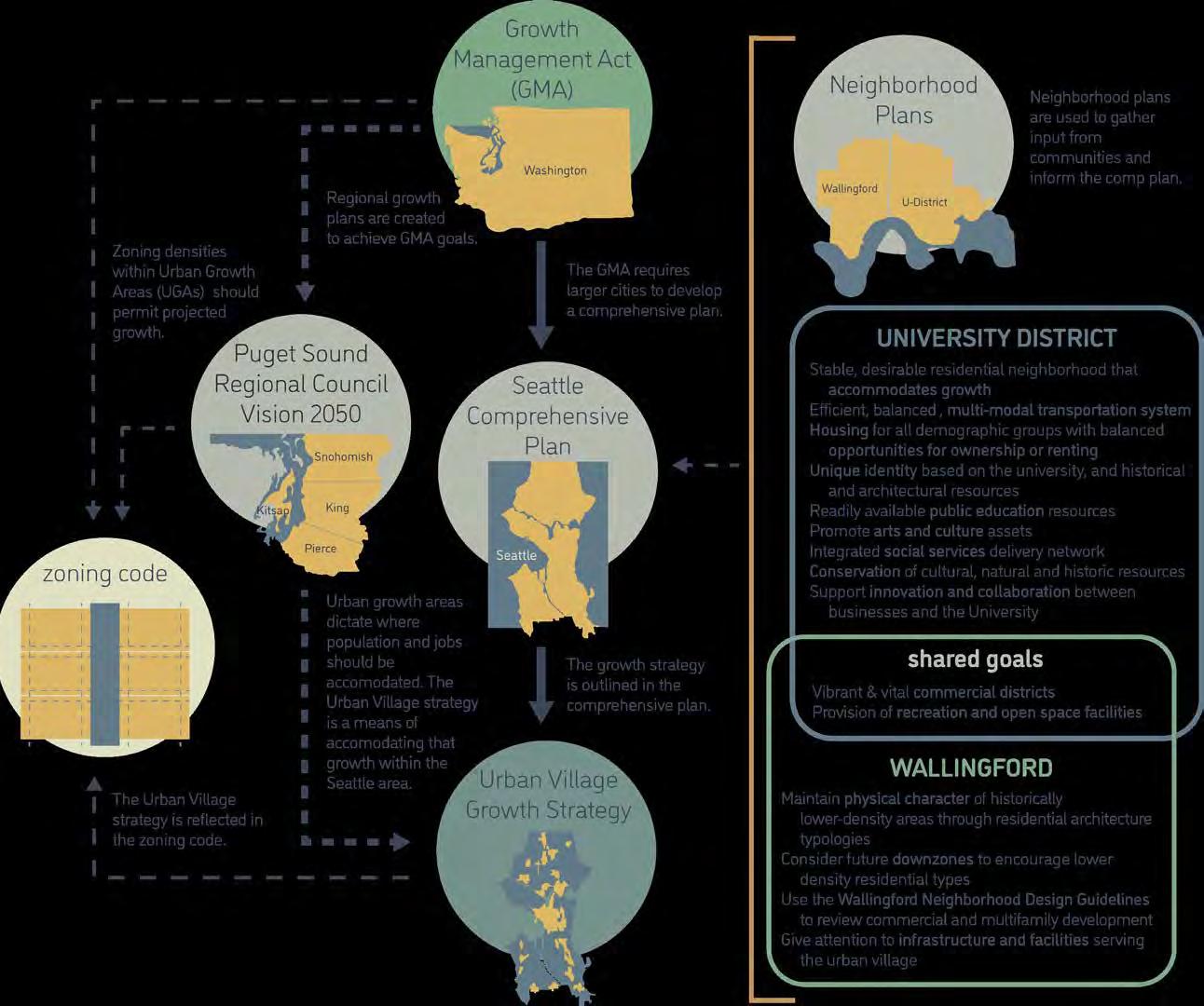
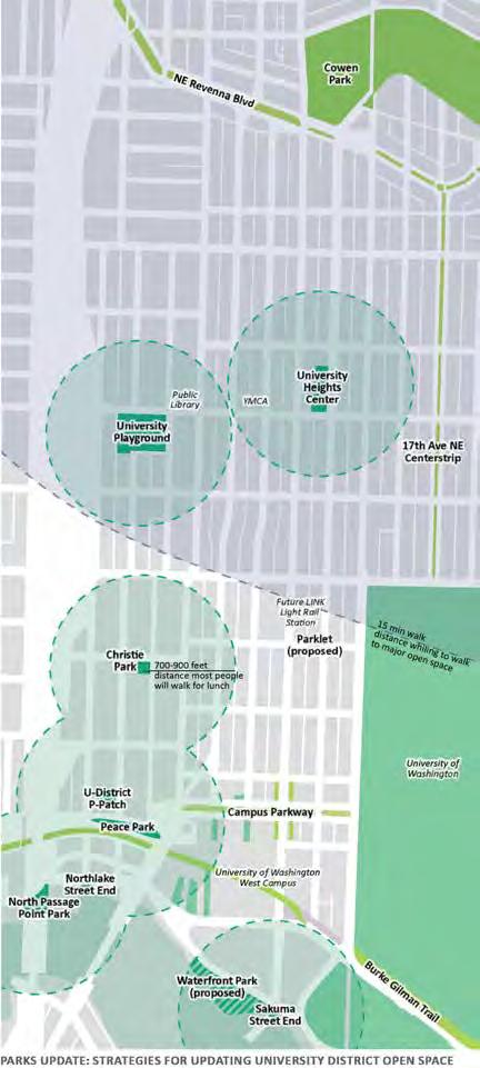
The University District currently falls short of city open space goals for urban centers, which it has been designated as per the Urban Village Strategy in the Comprehensive Plan. The current Parks Plan was updated in 2015 with community input. Relevant goals include a publicly-owned “Central Square,” which would ideally be located in the heart of the district around 43rd and University Way; east-west pedestrian connections to link the neighborhood to the west; improvements to existing parks; pocket plazas; and a public realm management program to improve maintenance, safety, and security of open spaces.
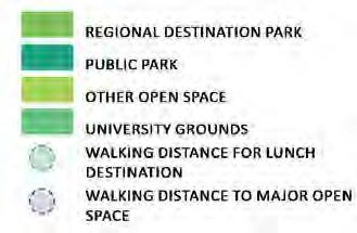
EXISTING AND PROPOSED OPEN SPACE. Image Source: University District Parks Plan 2015)
socializing and meeting people: Street fairs, markets, sporting events, soap boxes, dance and exercise, demonstrations
eating and Drinking: Dinner and drinks outside, food trucks, lunch
Music and entertainment: Musical performances, outdoor movies, street musicians
Playing for all ages: Climbing wall, swings for adults, basketball court, features for people with disabilities
sitting and relaxing: Napping, relaxing, reading, studying in public (Wi-Fi), people watching interacting with nature: Learning opportunities, gardening, physical interaction with water, water sounds
development map boundary
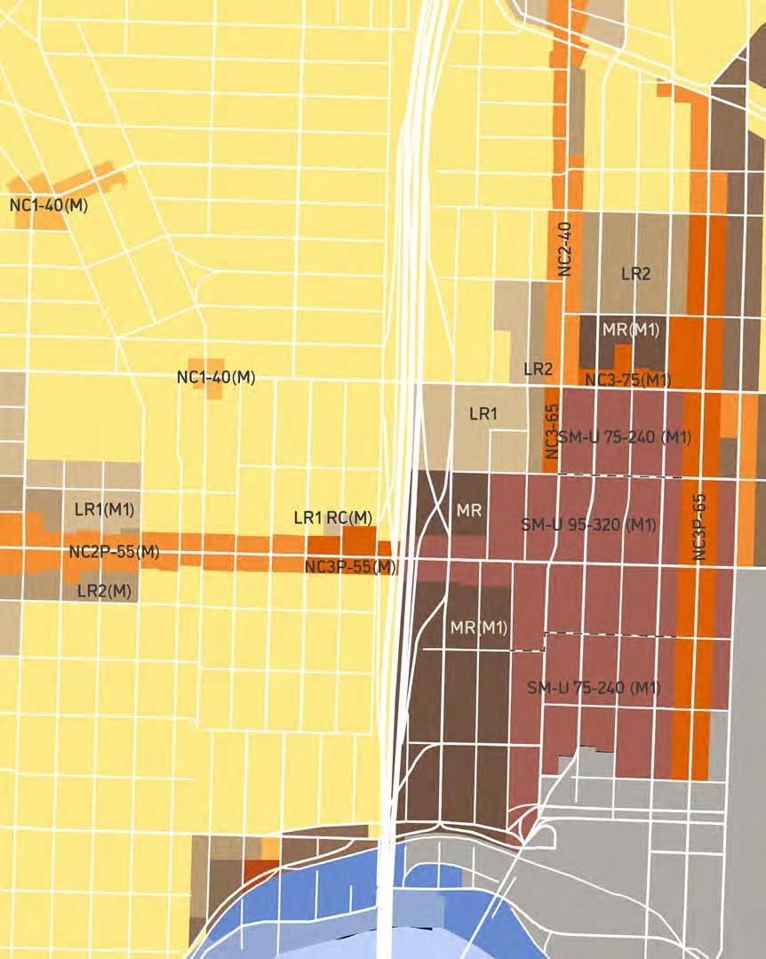
NR3: Neighborhood Residential 3 single-family homes, or middle housing (per HB1110)
LR1: Lowrise 1
multifamily residential, 1.0 FAR, 1.3 FAR for MHA
LR2: Lowrise 2
multifamily residential, 1.1 FAR, 1.4 FAR for MHA
LR3: Lowrise 3
multifamily residential, 1.2-1.5 FAR, 1.8-2.3 FAR for MHA
MR: Midrise
multifamily residential, 3.2 FAR, 4.5 FAR for MHA
SM-U: Seattle Mixed
FAR dependant on use & building type: .5 - 10
NC1: Neighborhood Commercial 1
mixed-use, FAR dependant on height:
2.5 - 8.25
NC2: Neighborhood Commercial 2
upzone boundary
mixed-use, FAR dependant on height:
2.5 - 8.25
NC3: Neighborhood Commercial 3
mixed-use, FAR dependant on height:
2.5 - 8.25
C2: Commercial 2
mixed-use, FAR dependant on height:
2.5 - 8.25
IB: Industrial Buffer
2.5 FAR
IC: Industrial Commercial
2.75 FAR
Major Institution Overlay
M/ M1/ M2: mandatory affordable housing
40/ 75-240 : height limit, in feet
P : pedestrian friendly
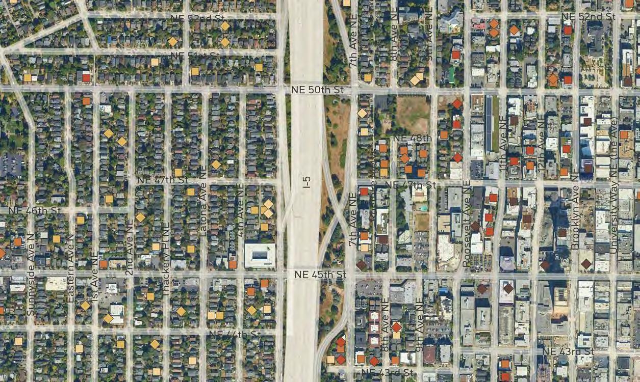
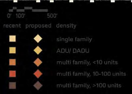
The UDistrict was rezoned for higher density development (“upzoned”) in 2017. This map shows recent development from approximately the last ten years, as well as proposed development. As existing, naturally affordable housing is replaced with new, denser development, the University District will become more expensive before it becomes less expensive.
The surrounding land adjacent to the proposed site has a large number of individual owners. This map highlights which individual parcels fall into three separate categories: private ownership, public ownership, and land owned by the Parks and Recreation Department of Seattle.
PRIVATE OWNERSHIP
PUBLIC OWNERSHIP
PARKS AND RECREATION
SEATTLE PUBLIC LIBRARY
UNIVERSITY PLAYGROUND
PUBLIC HOUSING
UDISTRICT TINY VILLAGE
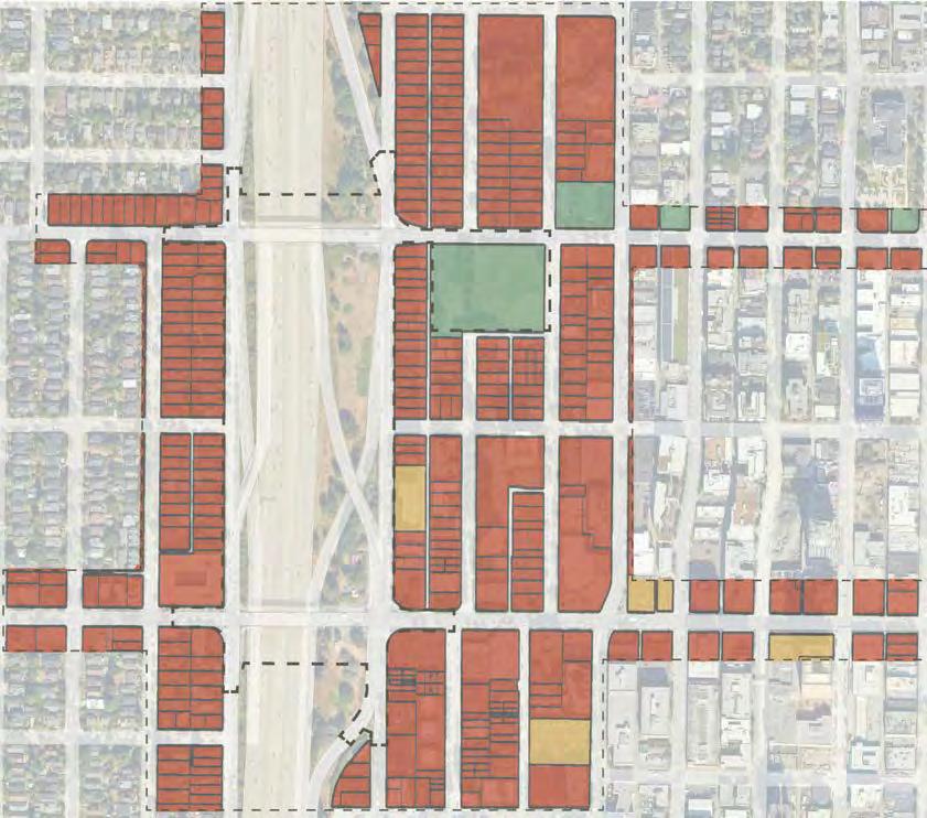
LAND OWNERSHIP
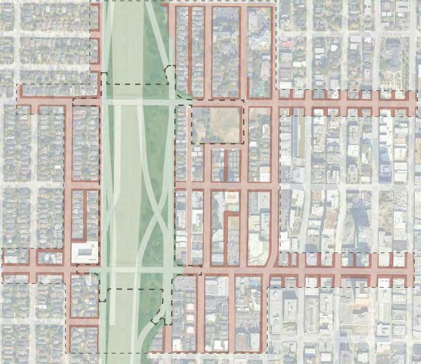
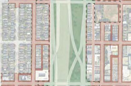
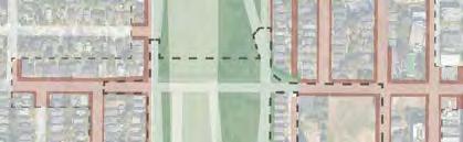
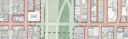
There are two main stakeholders in right of way (ROW) ownership in the area: Washington State Department of Transportation (WSDOT) and Seattle Department of Transportation (SDOT).
Along the proposed site, the existing I-5 access roads have shared ownership of the right of way. WSDOT is responsible for the auto infrastructure (driving lanes, curbs, traffic signals, etc.) and SDOT is resposible for the pedestrian infrastructure (sidewalks).
All bridges, on and off ramps, and buffer spaces are owned and maintained by WSDOT, including the 45th and 50th St. bridges and associated on and off ramps.
The vast difference across I-5 is shown in the breakdown of two very different census tracts, both the extreme example within their respective neighborhoods, but illustrative nonetheless.
RENTER-OCCUPIED
This map is highlighting which census tracts within the surrounding neighborhoods are either majority renter-occupied or owner-occupied. The differences between Wallingford and the UDistrict are apparent in the number of renter-dominant tracts throughout the UDistrict vs ownerdominated tracts in Wallingford. OVER
OWNER-OCCUPIED
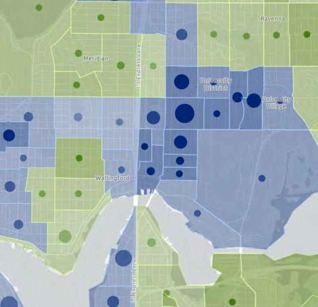
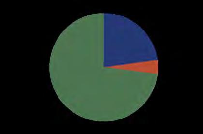
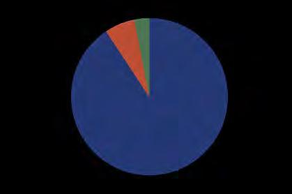
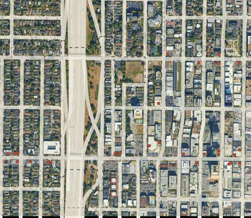
The site is adjacent to two wellestablished business corridors centered along 45th St. Both the UDistrict side and the Wallingford side contain thriving commercial districts with a diversity of business types within both.
A majority of the adjacent businesses are food and beverage serviceoriented, with retail services (including neighborhood services like salons) making up the other significant portion of businesses. The neighborhood does also contain three market/grocery oriented businesses, hotels, and auto services (incl. gas stations and service stations).
The UDistrict is designated as an Urban Center while Wallingford is a Residential Urban Village. As seen on the zoning map on a previous page, these designations have implications on what can be built where. UDistrict has a greater proportion of mixed-use with a commercial core along University Way NE. Wallingford is primarily single or multifamily residential with a neighborhood commercial core along NE 45th St. This impacts the employment potential of each neighborhood; we see UDistrict with many more jobs compared to Wallingford (also due to the presence of UW).

Despite the higher number of jobs in UDistrict, the median household income remains lower overall compared to Wallingford. There is also a higher percentage of people who work from home in Wallingford, which suggests that most are earning their income from jobs that do not require being physically there or jobs that are not located in their neighborhood. There is lower percentage of people who work from home in the UDistrict, with most utilizing walking or public transit to get to their work.
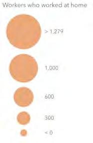

TOP: Map of median household income overlaid with number of people who work from home, by census tract. BOTTOM: Graph of number of jobs in UDistrict and Wallingford from 2015 to 2022 with estimated growth by 2035 per Seattle’s comprehensive plan. Image Source: City of Seattle Geodata
King County Climate Action Plan
Section I: Reducing Greenhouse Gas Emissions
reduce countywide GHG emissions by 50% by 2030 through addressing greenhouse gas targets & policies; transportation & land use; building & facilities energy; green building; consumption of goods & materials; forests & agriculture
Section II: Sustainable & Resilient Frontline Communities
community leadership & community-driven policy-making; community capacity development; equitable green jobs & pathways; community health & emergency preparedness; food systems & security; housing security & anti-displacement; energy justice & utilities; transportation access & equity
Section III: Preparing for Climate Change
mainstream climate preparedness; technical capacity; health & equity; community & organizational partnerships; outreach & education
Seattle Climate Action Plan
Section I: Reducing Greenhouse Gas Emissions
transportation & land use (transportation choices; complete communities; economic signals); building energy (information; incentives & assitance; performance requirements; energy supply); waste (reduction & product stewardship; recycling & composting; collection, processing, & disposal)
There is no designated section to Frontline Communities but the proposed actions for reducing GHG emissions & increased resiliency also aim to support community goals, foster economic growth, & enhance social equity. The Green New Deal Oversight Board directly provides recommendations on Frontline community equity to the city.
Section II: Increase Resilience to Impacts of Climate Change
assessment planning; natural systems; utility systems; land use & the built environment; community preparedness
In order to address these climate goals we must transition (justly) our current economy from one of extraction to one of regeneration (or green economy).
The GND Oversight Board is composed of 19 appointed members who are passionate about advancing an equitable transition to renewable energy by centering the expertise of BIPOC, immigrants, refugees, people with low incomes, youth, elders & workers harmed first and worse by climate change. They work by these guiding principles: community driven strategies; the influence & decision-making of those most affected; strong accountablity; solutions that recognize complexity & interdependence
CLIMATE ACTION PLANS FLOWCHART. Data Sources: King County Climate Action Plan, City of Seattle Climate Action Plan
A regenerative economy for a climateresponsible highway lid can include green infrastructure, renewable energy sources, circular or innovative design for materials and resources, and ecosystem services. Apart from physical features, a regenerative economy also extends to the relationships we hold with humans and more-than-
humans, and also to our collective values - working collectively and centering the voices of those most impacted by climate change and a transition to a low-carbon economy. While a regenerative economy will have positive impacts on the economy, we cannot just think about the number of jobs that will
be established, but also about who those jobs are going to, how those people are trained for these emerging job sectors, as well as who benefits from, owns, and manages the green infrastructure.
How can design address these concerns of community equity and self determination?
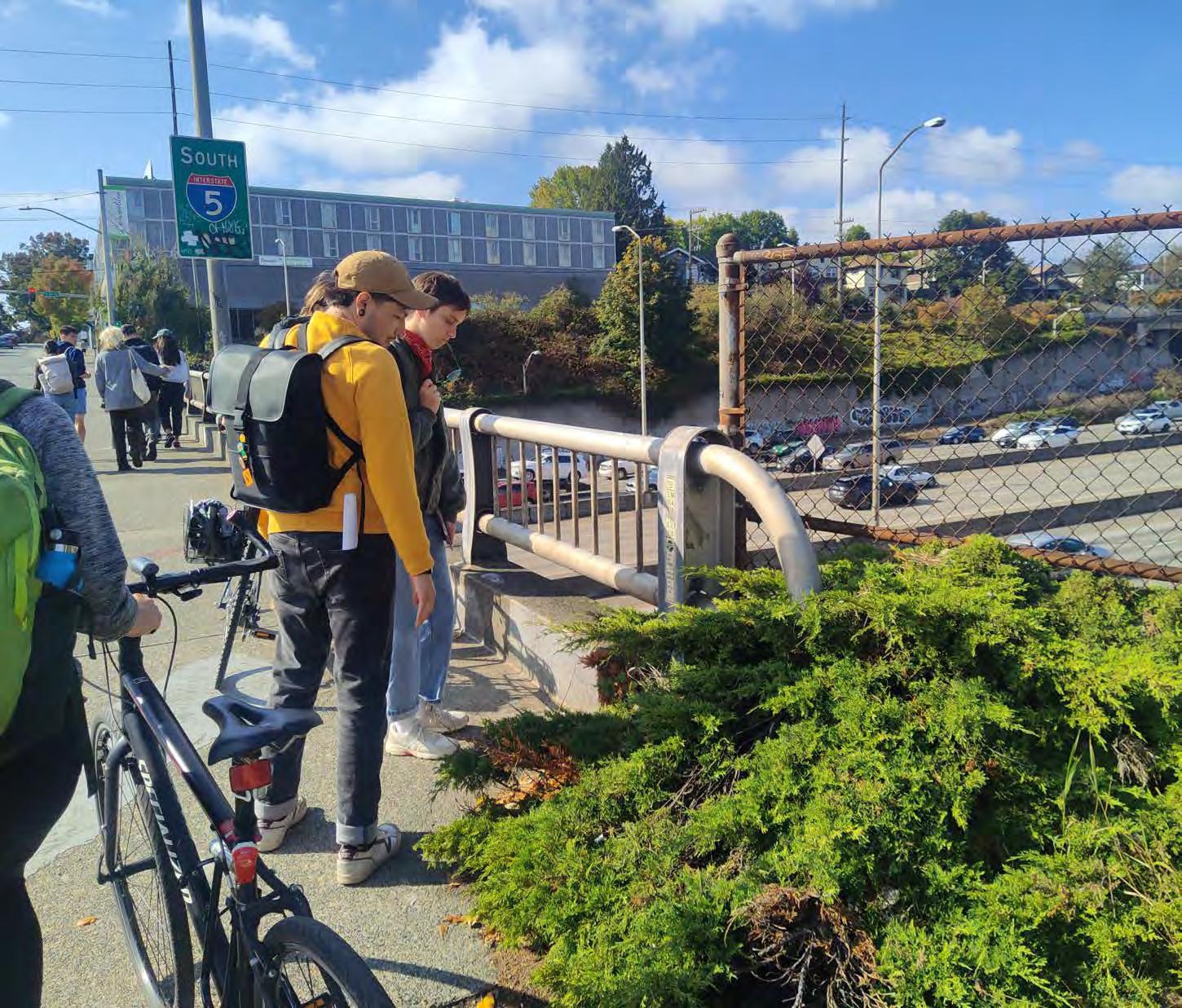
“Built Units Since 2010, Seattle GeoData.” Published 2020. Updated 2023. Accessed October 17 2023. https://data-seattlecitygis. opendata.arcgis.com.
City of Seattle ArcGIS Online. “Seattle Streets.” Published July 14 2022. Accessed October 17 2023. https://data-seattlecitygis.opendata.arcgis.com/datasets/ SeattleCityGIS::seattle-streets-3/explore.
City of Seattle ArcGIS Online. “Legal Right of Way.” Published November 1 2022. Accessed October 17 2023. https://data-seattlecitygis.opendata.arcgis.com/datasets/ legal-right-of-way/explore.
City of Seattle ArcGIS Online. “Parcels.” Published November 1 2022. Accessed October 17 2023. https://data-seattlecitygis.opendata.arcgis.com/datasets/ SeattleCityGIS::parcels-1/explore.
City of Seattle ArcGIS Online. “Median Household Income.” Published February 11 2020. Accessed October 17 2023. https:// uw.maps.arcgis.com/home/item.html?id=c 992502531324bb6889837f3ed974ccc.
City of Seattle ArcGIS Online. “Telecommuters.” Published February 7 2020. Accessed October 17 2023. https://seattlecitygis.maps.arcgis.com/home/item.htm l?id=af240fd015af40f3a0c69070e966a514# overview
City of Seattle, Green New Deal Oversight Board. “What We Do”. Accessed October 17 2023. https://www.seattle.gov/green-newdeal-oversight-board/what-we-do.
King County Climate Action Team (eds.). 2020. King County 2020 Strategic Climate Action Plan. King County, Washington.
Seattle 2035 Comprehensive Plan: Neighborhood Plans. 2016. Seattle, WA.
“Seattle in Progress.” n.d. Seattle in Progress. Accessed October 17 2023. https:// www.seattleinprogress.com.
Seattle Office of Sustainability. Seattle Climate Action Plan. Adopted 2013.
Seattle Municipal Code. Title 23, Subtitle III, Chapter 23.
Puget Sound Regional Council, Vision 2050. Adopted 2020.
University District Parks Plan. Updated 2015. Prepared for the University District Partnership, in collaboration with Seattle Parks and Recreation and Department of Planning and Development.
University of Washington Libraries, Special Collections, [SEA3601].
Urban Observatory by Esri. “Owners, Renters, or Vacant?” Web Map. Updated June 24 2019. Accessed October 17 2023. https://www.arcgis.com/home/ item.html?id=ebd3e0398c214efe99cc65 498d23b2b0.
Washington State Growth Management Act. Adopted 1990. Last amended 2023.
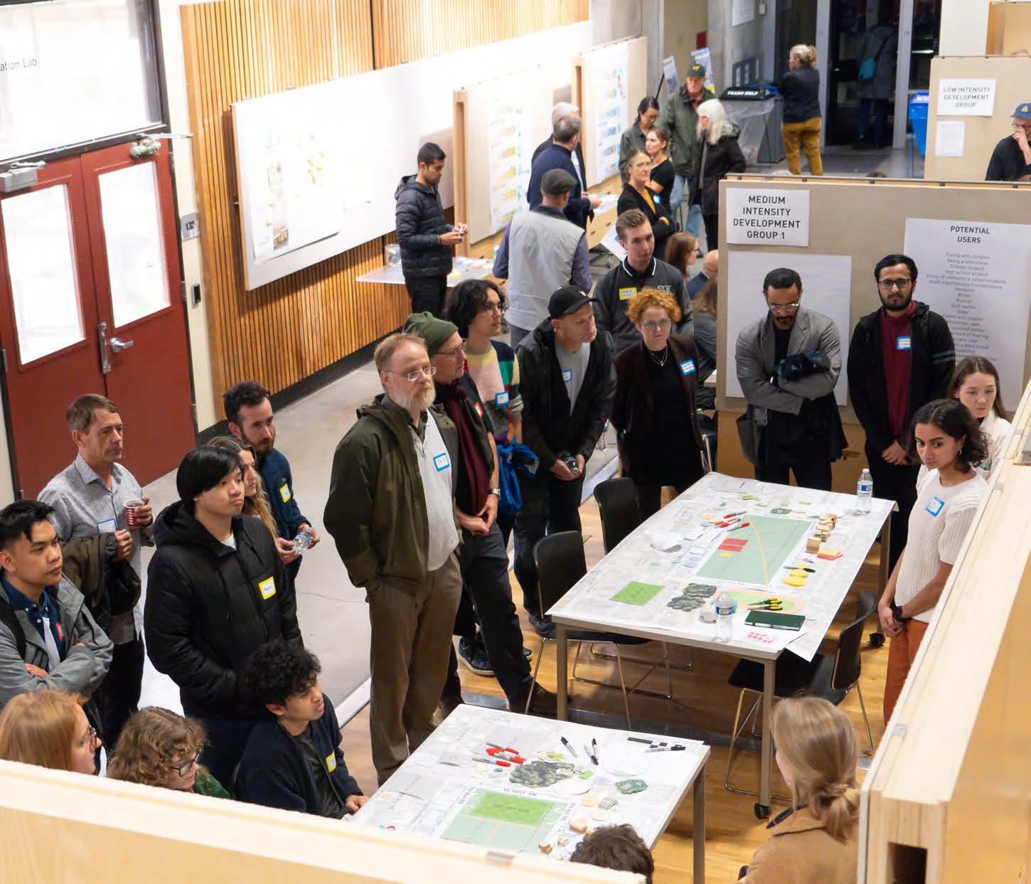
Establishing Principles + Goals
Site Character
Site Facilities + Activities
Postcards from the Future
On Thursday, November 9, 2023, the UDistrict Partnership and Lid I-5 North Steering Committee, in collaboration with the Scan Design Interdisciplinary Studio, led a community visioning workshop to gather initial community input about a potential highway lid over Interstate 5 around NE 45th and 50th Streets. Over 170 community members registered for the event, and the enthusiasm and engagement underscored the collective desire to shape the future of this urban space. The event included informative presentations, interactive activities, which are detailed in the upcoming pages, and a collaborative design session. The invaluable feedback gathered at the workshop fueled further iterations by our four design groups and grounded the designs in the tangible realities of what neighborhood residents desire.
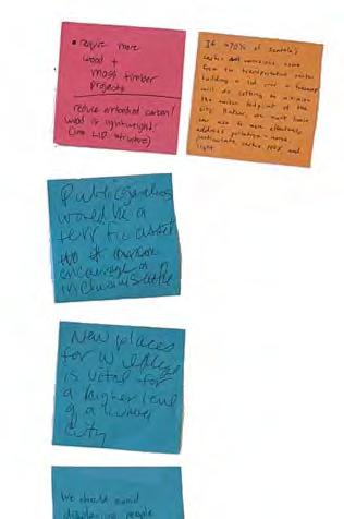
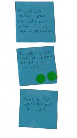
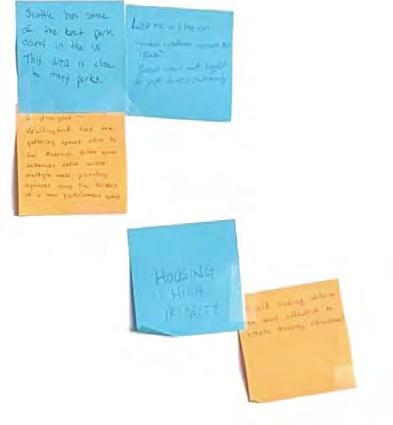
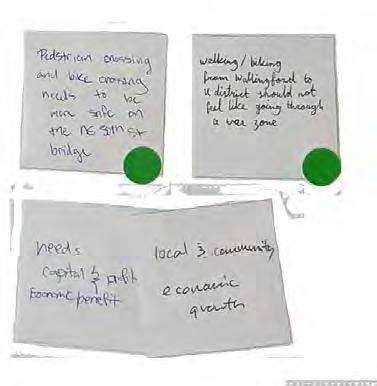
Twelve principles were developed for the Community Visioning Workshop that would elicit opinions, connect to elements of the eight design options displayed at the tables, and gather feedback for future design iterations. These principles were further defined with short descriptions to generate a greater baseline understanding of the meaning of the principle.
Participants were asked to place a dot along a spectrum between low priority (left) to high priority (right) to identify what goals the lid should accomplish in its design. Participants were also invited to share additional thoughts about what these principles meant on post-it notes.
walkability was a dominant high-priority goal for the site. Cost had the widest variation and lowest priority rankings.
Overall, participants found most of these principles to be high priorities which should be considered in future designs. Recorded written comments and observed dialogue emphasize the important and diverse conversations these principles prompt.
Commitment to reduce carbon emissions and expand opportunities for adapting to a changing climate

Buildings and facilities open to all community members that provide some benefit

wildlife habitat
Green space for pollinators, birds, and mammals

Pedestrian safety and ease of access to lid programs
Local economic activity
Popup markets and events; small business opportunities/support
Equitable community engagement and efforts to reduce displacement

Access to green space, spaces for people to engage in various activities, maintain sightlines across the space
Places for all ages to play
Aiming for the lowest construction and maintenance costs for maximum benefits
Promoting flow and reducing car traffic
Safe, welcoming, and comfortable
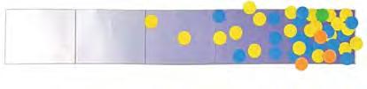
Reusing resources (e.g. renewable energy, water capture, building materials, recycling, etc.)


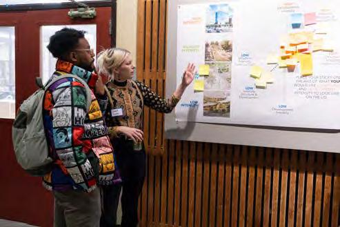
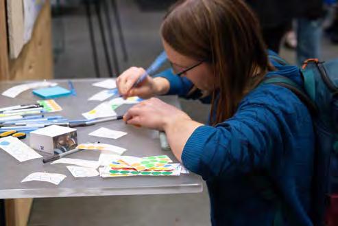
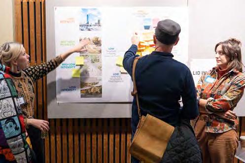
In the Inten[City] Matrix exercise, the intention was to gather information from the public as to how intense they imagined the future lid site to be. Intensity was broken up into two axes, structural intensity and development intensity.
structural intensity, in this case, was defined by the degree of investment into the lid itself. This means how much interference and material is included in the structure, with high interference leading to higher costs.
Structural intensity ran along the horizontal axis with the degree of lid investment illustrated as varying amounts dollar signs ($-$$$) and labelled “lid cost” for clarification.
Development intensity was shown with a brief visual breakdown of degrees of intensity. These range from low to high intensity with two mid-intensity options. These roughly mimic the different forms of intensity proposals that the public would see later in the charette process, but are not directly pulled from any of the proposals to allow imagination in the public process. goaLs
Development intensity was defined by the degree of building density and heights. More buildings on the lid, and more stories per building, can contribute to how the public views the lid development’s relationship to nearby neighborhoods.
The two axes were shown along on a matrix, and participants were asked to put a sticky note where they view the importance of structure and development along the diagonal axis running between structural intensity and development intensity. These notes also offered the opportunity to write more detail about how they envisioned the lid.
Blue dots are shown where participants determined they would like to see the balance between development and structural density. These outcomes show that the majority of people preferred a lid that had moderately high development and structural intensity. Some of sticky notes strayed from the diagonal axis.
sTRUCTURaL inTensiTy CoMMenTs
The desired costs of the lid are generally in the mid range of structural intensity. This is expected for those who also want high development intensity since increased building density requires more structural integrity of the lid.
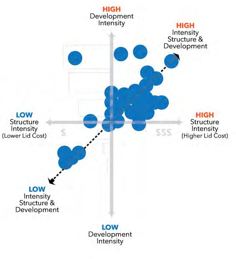
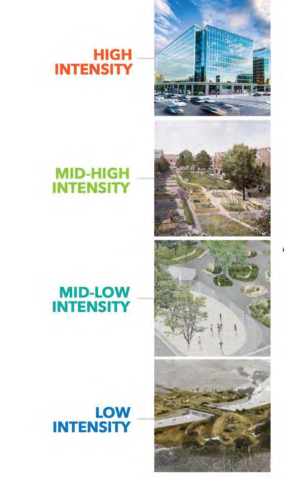
Comments advocating for high-intensity development stress the area’s excellent transit services and existing amenities. The urgency of Seattle’s housing needs is emphasized, with proposals for mid-rise housing, parks on the lid, and bike trails. The focus is on maximizing the potential of the space to accommodate the city’s growing population and offset the costs associated with lid construction.
Within the mid-high intensity range, the public envisions a combination of open green space, bike paths, and mixed-use developments along the lid’s edges. Recommendations highlight the need to address the UDistrict’s shortage of public open space and integrate housing with the surrounding neighborhoods, particularly Wallingford.
Mid-intensity comments overall include innovative ideas like phytoremediation and wildlife corridors. There is also an emphasis on community gardening, affordable housing, and mixed-use spaces. Some comments address the broader issue of Seattle’s housing crisis, suggesting that legislative reform and zoning changes are necessary before adding new space.
In the mid-to-low-intensity range, the public supports a mix of small business commerce, parks, restaurants, and a farmer’s market. This suggests a desire for a balanced approach that incorporates both commercial and recreational elements into the lid development.
Public sentiments advocating for low-intensity development focus on bringing greenery back to the UDistrict. Suggestions include planting public gardens and creating a Central Park-style space without housing on the lid. Emphasis is placed on public park amenities, trees, and walkways, with consideration for compatible uses beyond specific streets.
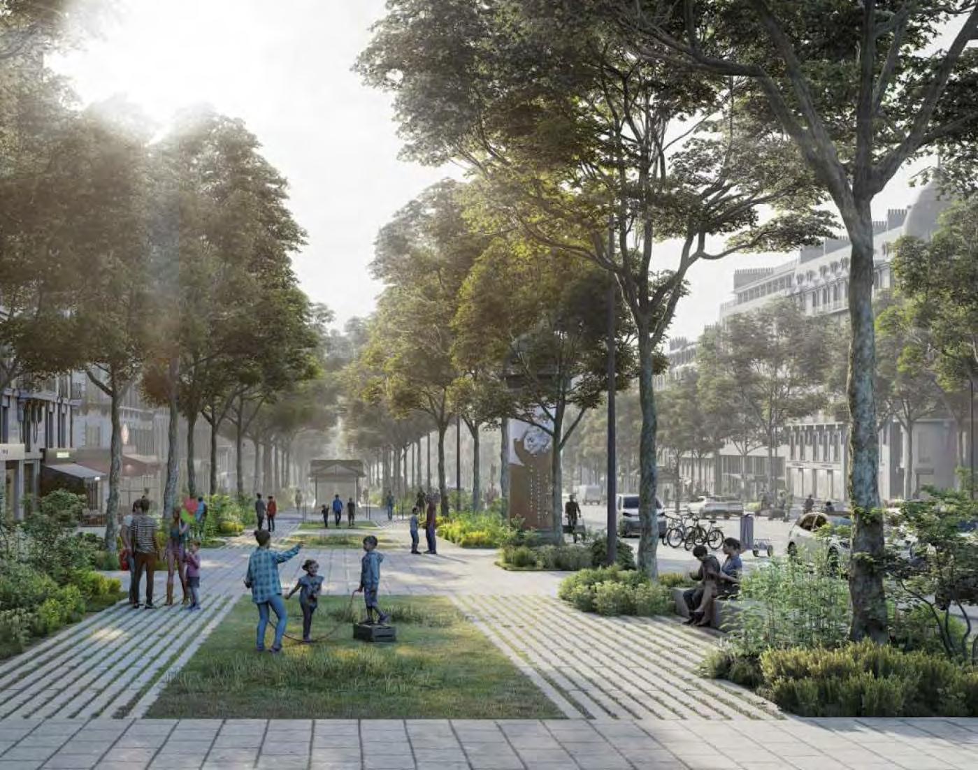
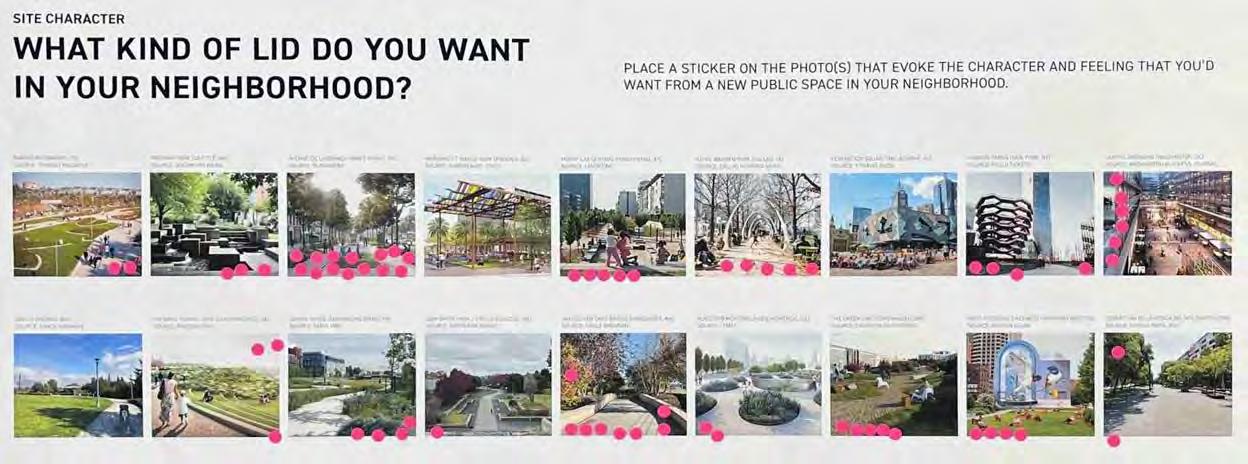
We developed this activity in order to better understand what community members want the future North Seattle lid park to look and feel like. We collected key images from a range of lid park precedents from around the world, choosing images that reflect the most variety in urban vs natural feel, density, plantings, pavings, and organization.
We organized the images on the poster above in order to better interpret our results. The top row shows parks with more density and intensity (in pro-
grams and structures), while the bottom row shows lower intensity parks. Both rows are organized along a spectrum of less urban in feeling (left) to more urban (right). Workshop participants were asked to place one dot on the image that best portrayed the type of public space they want on a future lid.
This activity received 68 responses. Over half of the votes (39) went to parks with higher density/ intensity (top row), and participants liked a roughly equal mix of urban and natural character.
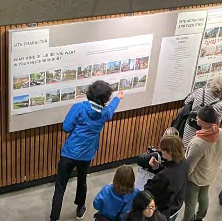
FIGURE 2:
choosing their preferred lid park (Photo: Kat Golladay)
WORKSHOP PARTICIPANTS, FIGURE 1: ACTIVITY RESULTS, participant choices indicated with dot stickers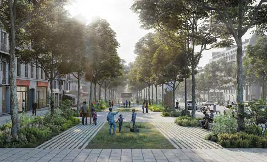
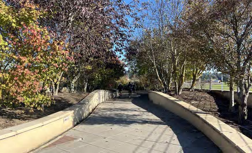
The parks with the most votes were: the Avenue de la Grande Armée in Paris, France (14 votes), the Vancouver Land Bridge in Vancouver, Washington (8 votes), and Capitol Crossing in Washington, DC (6 votes).
Similarities between these favorites include large, dense, and linear plantings that provide urban green areas (Avenue de la grande Armée, Vancouver Land Bridge), urban settings with structured boulevard-style walkways (Avenue de la grande Armée, Capitol Crossing), and high intensity mixed residential along the margins of the space (Avenue de la grande Armée, Capitol Crossing).
FIGURE 3: AVENUE DE LA GRANDE ARMÉE IN PARIS, FRANCE. Image Source: Bloomberg FIGURE 4: VANCOUVER LAND BRIDGE IN VANCOUVER, WA (Photo: Grace Brennan)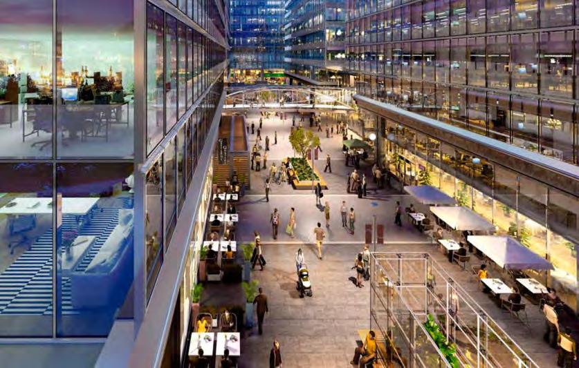
Eight park images got two or fewer votes, and three park images received no votes (pictured below). These low- and no-scoring images have a few things in common: wide expanses of paving or uninhabited lawn (Madrid Río, Federation Square in Melbourne, the 520 Lid Park in Medina, Sam Smith Park in Seattle, Cobertura de la ronda del mig in Barcelona), iconic (and controversial) architectural features (Margaret T. Hance Park in Phoenix, Federation Square, Madrid Río), and highly manicured, shaped, or non-native-looking plantings (Madrid Río, Hance Park, Medina, Place des Montréalaises in Montreal).
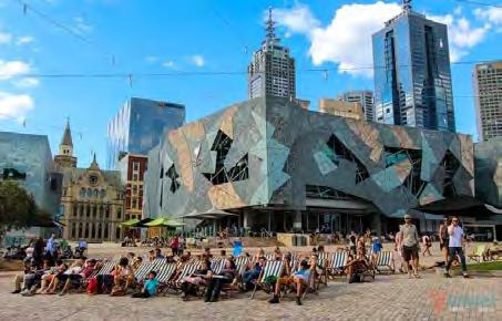
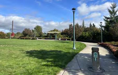
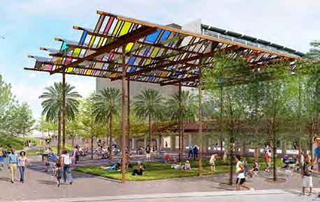 FIGURE 5: CAPITOL CROSSING, WASHINGTON, DC. Image Source: Washington Business Journal
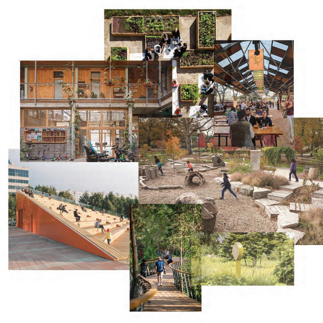
Neha Chinwalla + Nat Gregorius
At the Site Facilities & Activities station, participants were given three green sticker dots and three red sticker dots. They were asked to place the green dots on buildings, facilities, open space activities, and recreational programs that they preferred, and the red dots on those they did not prefer to see on the lid. A blank poster was also displayed for participants to write or draw any ideas they had which were not captured by the other boards.
As shown on the images displaying the results of the boards, several themes emerged from the activity.
For housing, an overwhelming majority expressed disinterest in single family housing types (indicated by 25 red dots). Participants had a higher preference for higher density multi-family housing over mid-rise multi-family housing. Cooperative housing had more support than mid-rise multi family, but higher density multifamily housing had the most
green dots of all the displayed housing types.
The other most supported programs on the Buildings & Facilities page shared themes of community building and shared services (community center, tool lending library, and outdoor stage). Support was also higher for dining opportunities from walk up food and beverage to a food hall. Lastly, green roofs had an overwhelming amount of support (11 green dots), which can be added to buildings on the lid.
More nature-oriented open space and recreational activities received the most support (community garden, nature play, trails, and habitat). Sports and recreation that may be louder received the most red dots (skate park, tennis court, basketball court, dog park). Activities more associated with children (carousel, splash park, playground) also received less support. Participants also indicated interest in spaces to spend time outdoors (outdoor
dining space, lawn, and seating). Ideas on the final page expanded on, or contradicted, earlier boards with suggestions for a sports playfield, covered gathering spaces, food carts, water catchment areas, community research labs, and a quiet space for residents.
The majority of participants support a vibrant lid with a variety of programming opportunities and housing. A limitation of the exercise was that the photos may have influenced the participants’ decisions on which programs they supported. There were also a few instances where participants misunderstood the directions and did not realize the colors had a significance (these were corrected when possible).
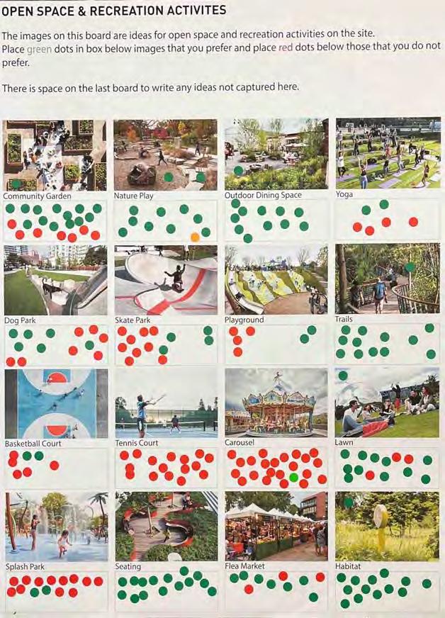
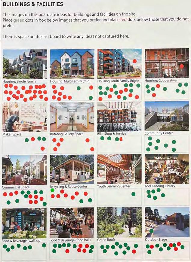
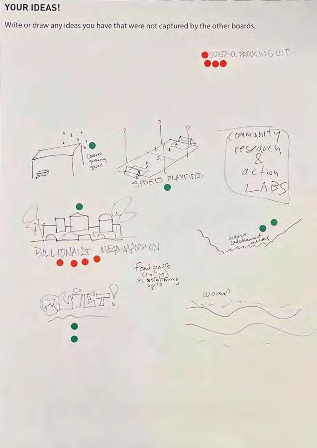
On the facing page, you can see the preferences and non-preferences of workshop participants for programs that were provided to them. On this page, you can see the self write-in ideas where people also added dots.
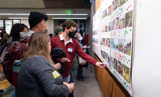
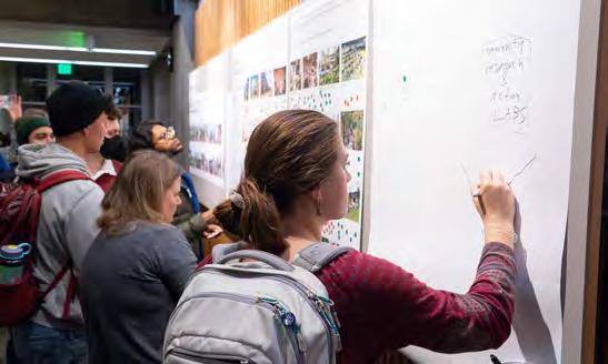
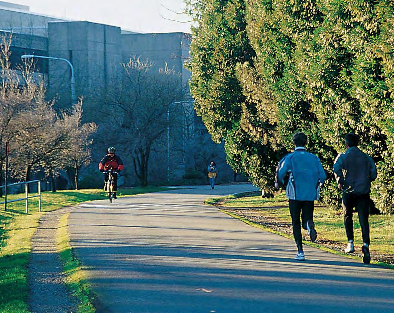
Image Source: Kathy Sauber, University of Washington Magazine
Most of the people that came to the table were bikers with the next most prevalent group being bus riders. The general consensus was that 45th needs to be better for biking, walking, and buses. Most people agreed that removing the ramps between 45th and 50th makes the most sense.
Many bikers would love an east/ west connection of some sort in the area of the site. Currently many of them loop down to the Burke Gilman Trail to make the east/west connection. Other bike connection options were offered including a separate bike bridge elsewhere (at 43rd, at 45th but next to the existing bridge, at 47th). Generally, people would like any new infrastructure that
connects well to the existing bike network. Outside of the site, a protected bike lane on 11th was proposed. Shared bike/pedestrian paths through the site were proposed a few times. Most people were more concerned with getting from point A to point B as efficiently as possible when biking but were interested in more winding paths through the site for walking.
Most people felt the streets around the site should be more walkable and that 45th especially should be easy to cross. A few people would like 50th to be easier to cross. The power of a crosswalk was demonstrated through a personal story of accessing the library. People also
would like walking connections through the site.
Bus riders proposed new bus lanes in multiple locations including at 45th and north/south through the UDistrict.
Other green spaces were mentioned. The site was seen as a valuable addition to the existing network of these green spaces including the waterfront, Ravenna Park, and Greenlake. People living in the immediate area voiced difficulty in reaching existing green spaces by bike or otherwise (noncar), especially from the UDistrict. It was implied that connections should be made between these green nodes.
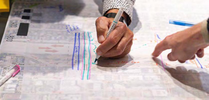
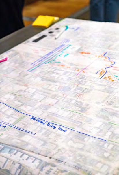
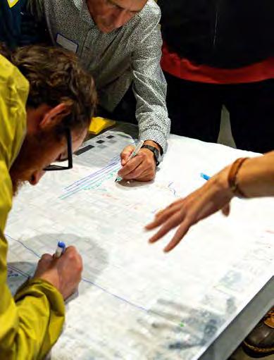
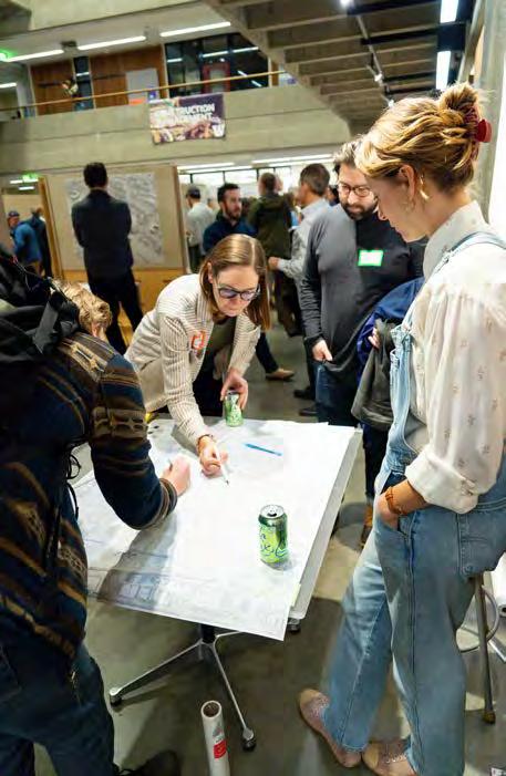
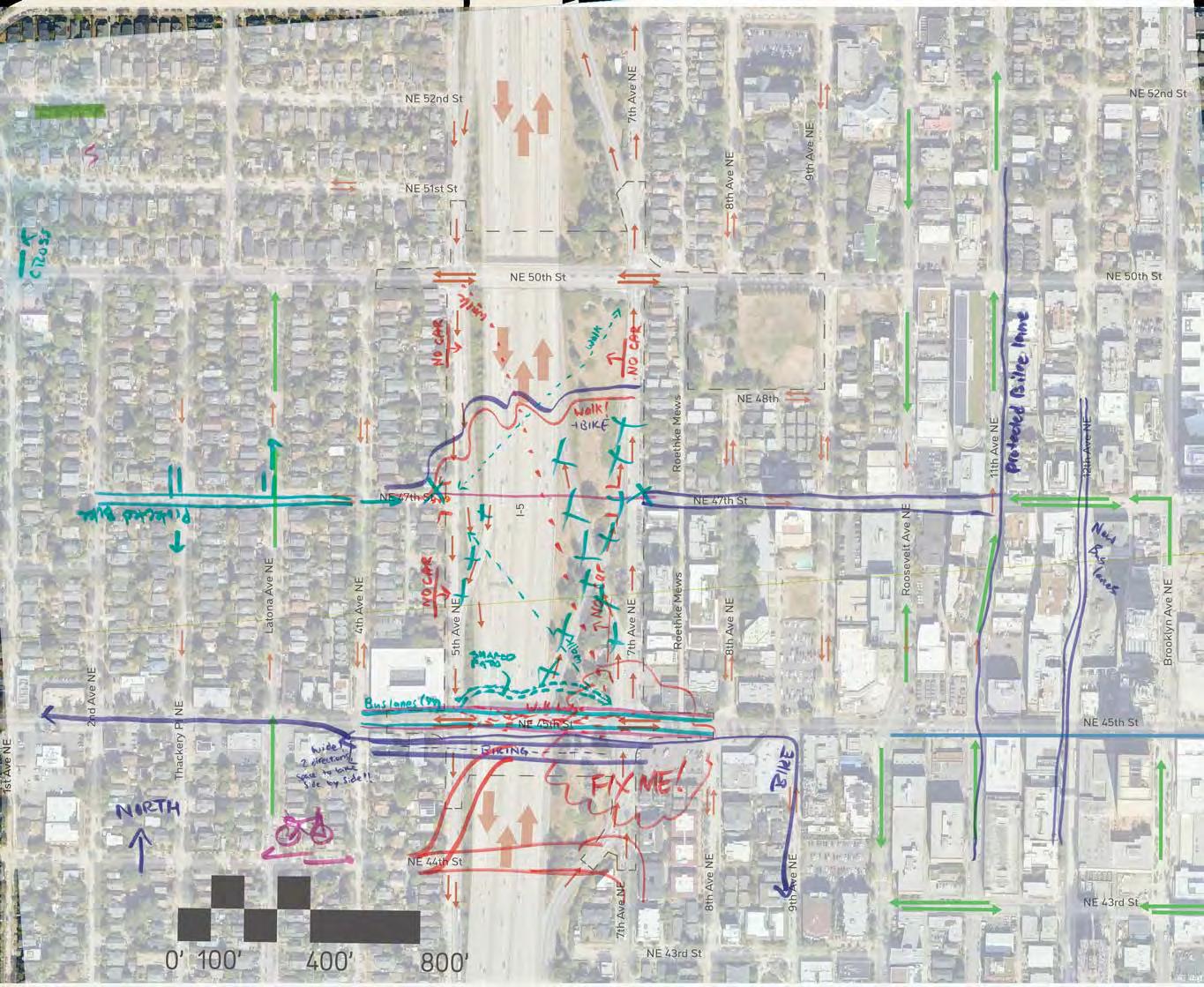
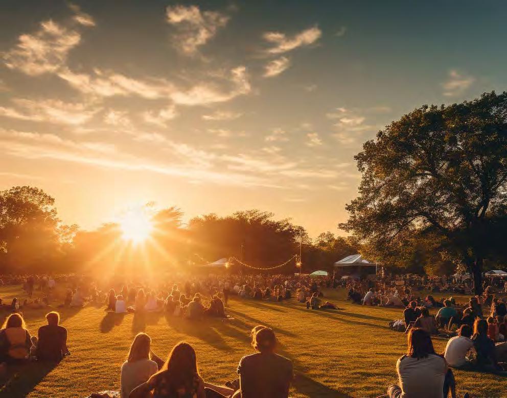
At the interactive AI Generation station, we asked the community workshop participants to describe what they would like the new space created by the lid to look and feel like. Participants were provided example prompts geared towards themes of recreation, housing, community, environment, and connectivity.
People wrote their own vision prompts that were entered into an AI image generator, Midjourney. Within one minute, four variations on their prompt appeared, which often delighted participants. A group would gather around the computer to watch the image slowly transform from blurry colors to a refined scene.
When the images were fully rendered, we asked the prompt writer to choose their favorite version which AI would iterate further. Then, the favorite of the second batch was added to a virtual whiteboard, Miro, so that all workshop participants could view all the images. It was a joy to see how people interacted with each other’s creations and built off their ideas. Some of the keywords that were used are listed to the right.
We would like to thank everyone who participated at the AI station, and wrote extremely creative prompts. A handful of the images from the workshop are included on the next page.
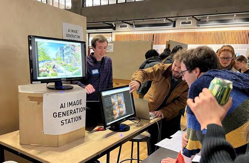
KEYWORDS:
Park
... a big green park
... a park with native plants
... like Cal Anderson Park
... a dog park
... expansive park
... waterfall play park
... city park
... futuristic park
... post-modern park
... amusement park
... antigravity park
Housing
... multifamily housing (x3)
... shipping Container house
... block residential housing
Bike
... bike paths with cyclists
... a long bike ride
... kids learn to bike
... bike and bus only travel lane
... leafy trees and bike paths
... a bicycle network
Plants
... planter box with strawberry
... plants native to the pacific northwest
... residential developments covered with plants and trees
... birch trees and strong native plants
Play
... people and dogs playing
... a lush waterfall play park
... a colorful playground and people playing outside

PROMPT: multifamily housing with patios that are adjacent to a large field filled with people lounging, bike paths with cyclists
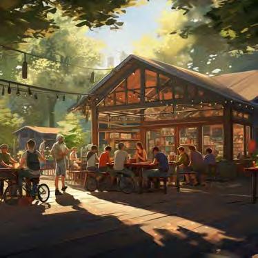
PROMPT: two people meet in a covered open air coffee shop, surrounded by trees, kids learn to bike in the background
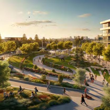
PROMPT: freeway lid in a mixed-use neighborhood with the lid supporting a big green park space with large deciduous trees and the park is full of people lounging dogs running and in the center of the park there is a 5 story tall pickleball complex with open sides and you can see the headlights and tail lights of cars in the freeway in the distance and there are people flying kites in the park and there are food trucks in the park
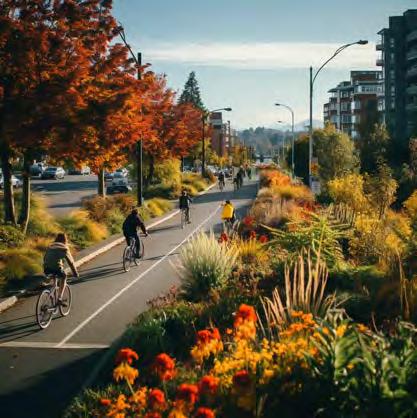
PROMPT: park with plants native to the pacific northwest, placed strategically to add to a bike network that is the fastest way to get around
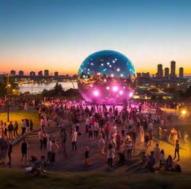
PROMPT: a large open space like Cal Anderson Park in Seattle built over a freeway with a huge nighttime disco party with a giant disco ball and drag queens
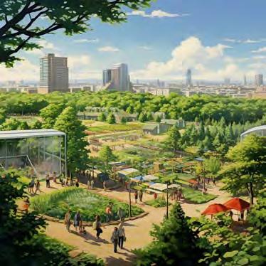
PROMPT: a post modern park with an open field and lots of greenery with a city in the background and a lively farmers market
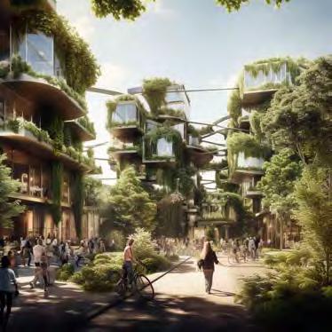
PROMPT: high density ecological residential developments covered with plants and trees with a lot of active social space at ground level
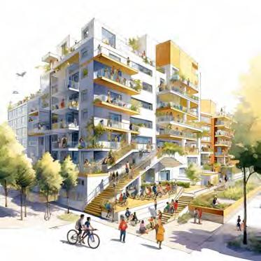
PROMPT: eight story single stair perimeter block residential housing with a bike and bus only travel lane with open grassy space that is sun filled diverse people picnicking and children playing. a community center and basketball court surrounded by five storey single stair residential perimeter block housing
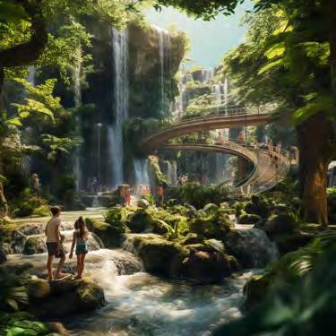
PROMPT: kids playing in a lush waterfall play park with afternoon sun filtering through the trees
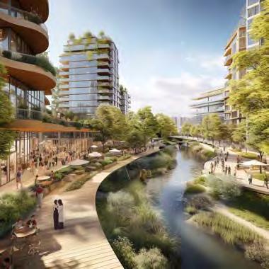
PROMPT: mixed-use neighborhood with mid-rise buildings and mass timber architecture built over a freeway with a lazy river winding through it and the river is surrounded by leafy trees and bike paths and outdoor food carts all on a partly cloudy day
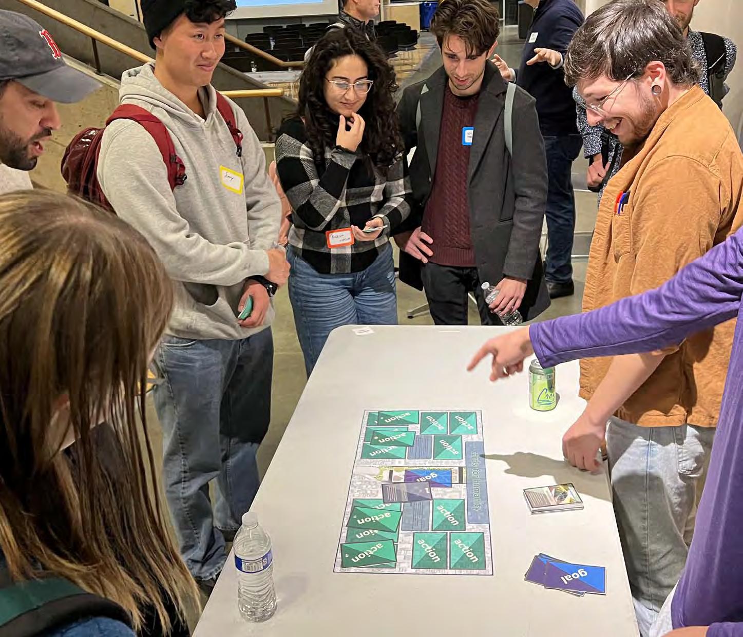
•Each player is dealt 5 Action Cards based on potential actions to happen to the highway lid!
•Don’t look at the back of the cards: the back contains the scores for how each card affects the environment
•A Goal Card is drawn, these climate goals are what the lid hopes to achieve!
•Players place down 3 of their cards in response to the goal card
•These three cards should be what the player thinks will contribute positively to the climate goal
•Once all players have played their cards, the cards are flipped over to show the score
•This is why the individual card scores should be hidden when the cards are originally drawn!
•Scores are tallied, and whoever has the most points wins!
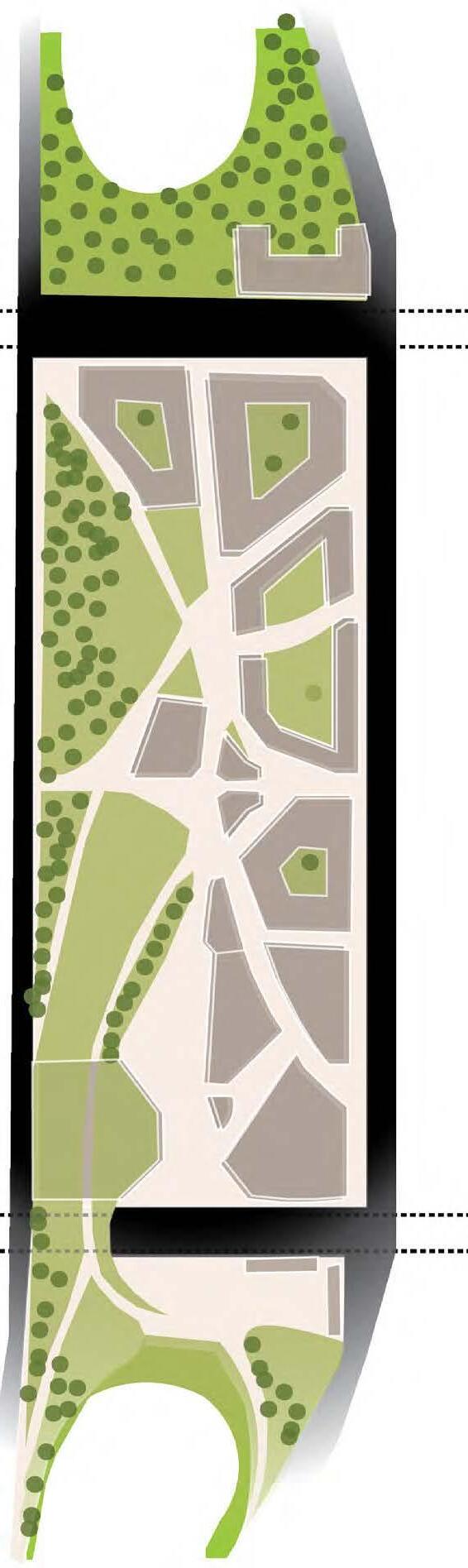
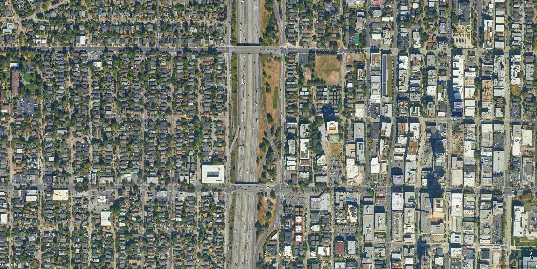


three action cards to get the highest score. The player who plays the most climate-positive cards wins.
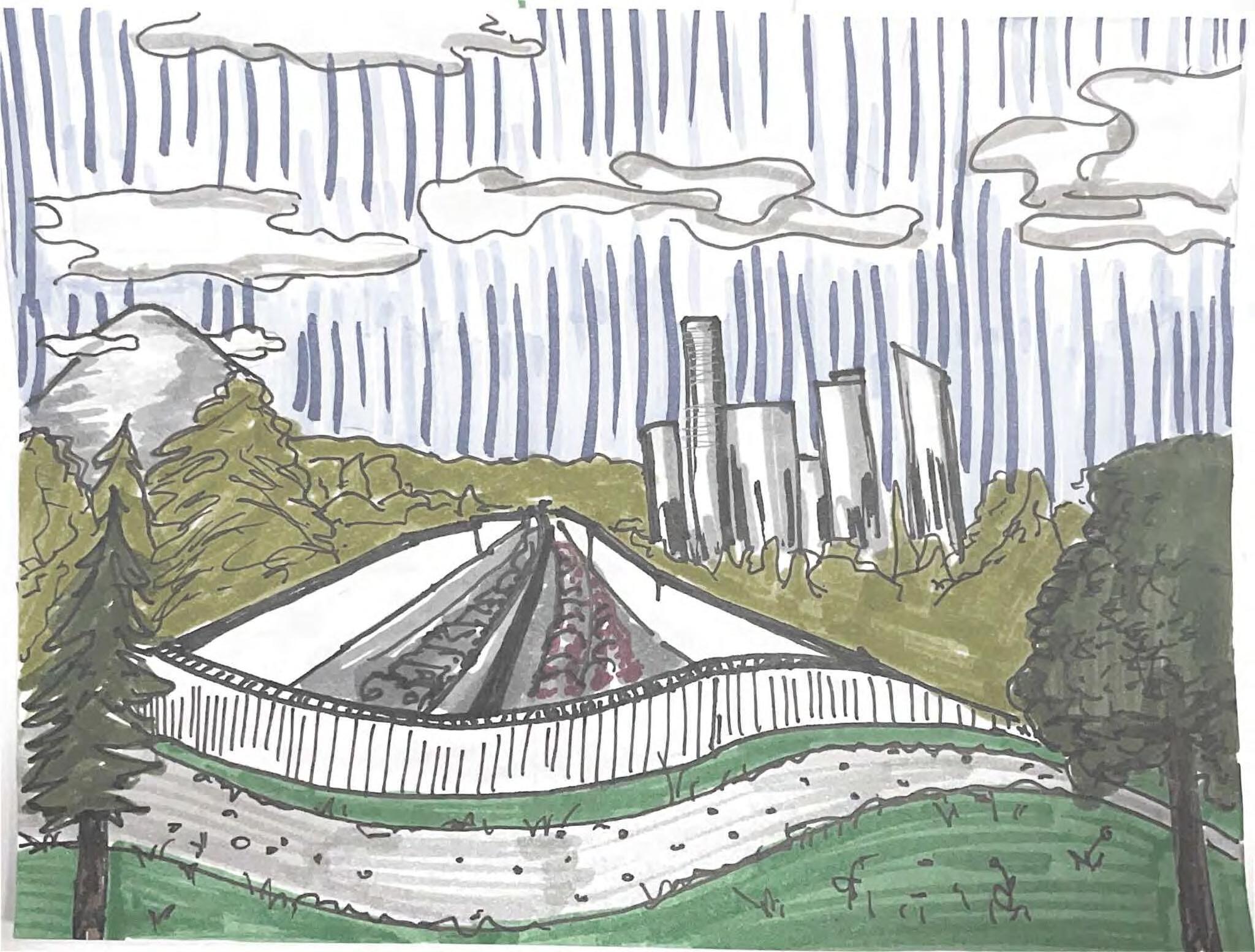
At this station, workshop attendees were encouraged to write their present-day selves a letter from the future.
The instructions posted at the station were: “Write a postcard as your Future Self! What are you experiencing in your neighborhood? How has the lidding over I-5 benefitted you or your loved ones? What do you remember from that charette on November 9th that has stuck with you? Or whatever else comes to mind! When you are done writing, decorate the backside of the postcard to your heart’s desire.”
This exercise in reflection was meant to generate aspirational visions of the highway lid over I-5. Some particularly wonderful letters from the future included:
• “The I-5 Lid is so amazing. Living here has fulfilled my dreams of living in a peaceful, quiet neighborhood. I have got every facility in living here and it has impacted my way of life so greatly. Thank you I-5 Lid!!”
• “Just went to a free outdoor concert on the Lid! It was awesome :) “
• “I live on 7th avenue with I-5 at my door. Soot, noise, and uncertainty for 20 years. The lid changed everything. From the charette I remember hope!”
• “I love walking and riding bikes on the lid. The neighborhood is so much quieter and friendlier. Wish you could see it!”
• “The 45th to 50th lid has just been completed. There’s a whole new perimeter block of 8-story midrise apartments on the Eastern side and a large park and backyard over the highway. The bus + bike land on 45th might be the best part. Save up to purchase a condo!!!”
• “Hey, remember that gaping noise canyon you used to walk over daily? I’m jotting this from a shady bench while enjoying a snack from a cart pod! Cheers!”
• “There is a new space in Seattle, and I’d love to meet you there. There’s green space and food trucks, so we could hang out and chat in the sun
for hours. There’s a flea market on Sundays, and I truly think you should sell your candles there!”
• “Just rode high-speed rail from Vancouver where I-5 used to go. So great to reconnect neighborhoods while providing a 1 hour ride to Van+PDX.”
• “Spending another great day viewing the skyline at sunset from this really cool, lush public space– surrounded by happy folks.”
• “Hello, I am still biking at 72 and finally riding the 45th street connection on the lid. It’s so cool.”
This station was a loose and fun way for community members/ stakeholders to communicate what programming and/or ambiance they would value in a north I-5 lid. It is clear that there are both collective and individual desires. From some of these postcard responses, one can derive the existing street and pedestrian conditions that are driving the desires for change in the foreseeable future.
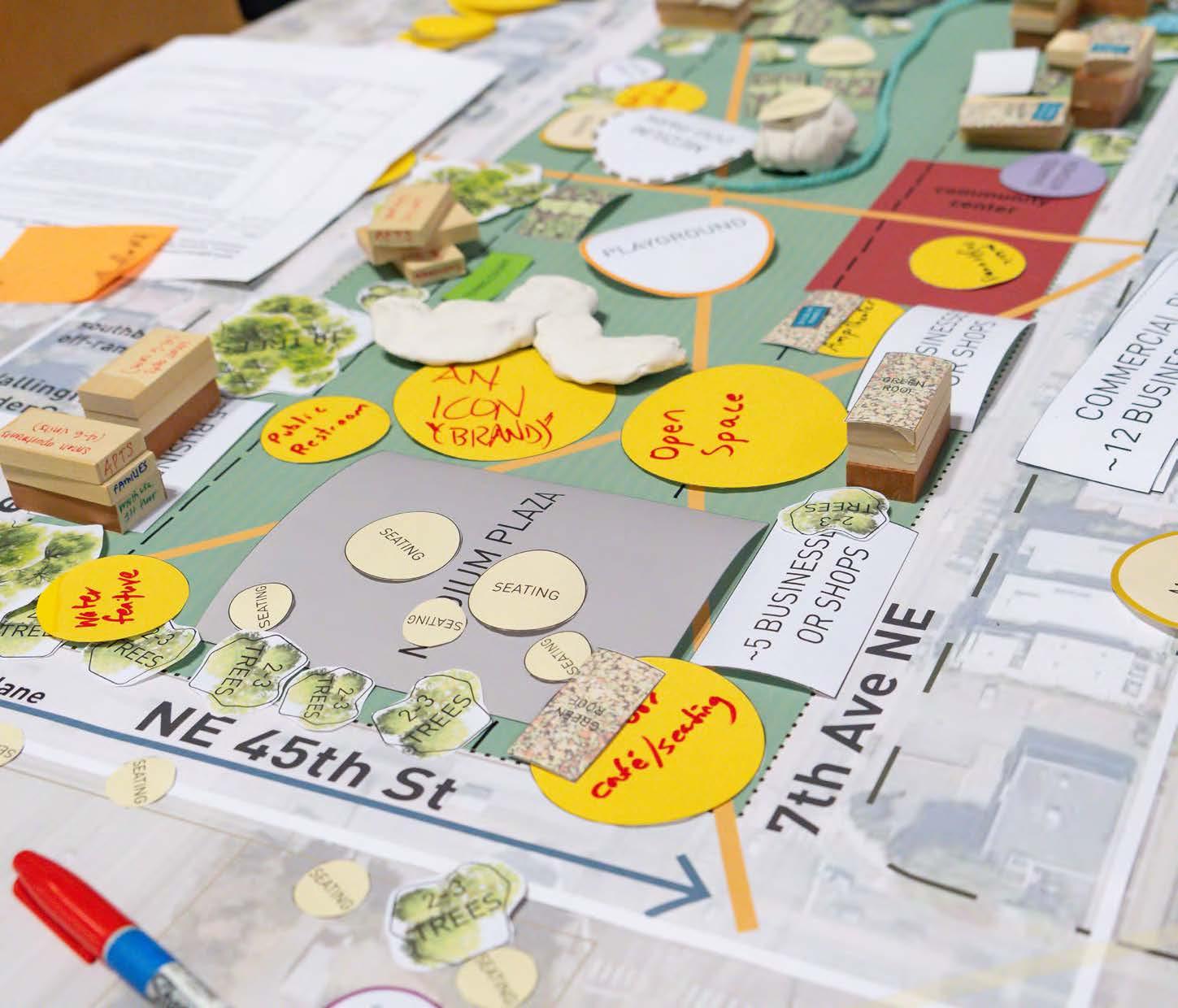
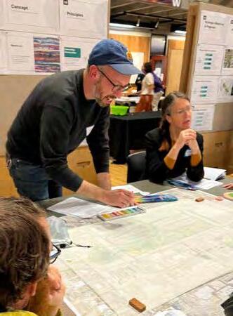
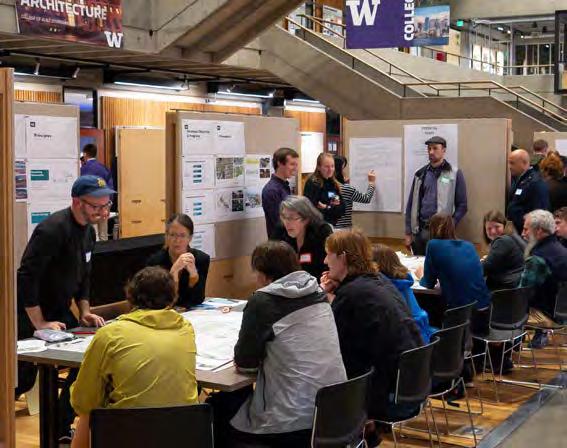
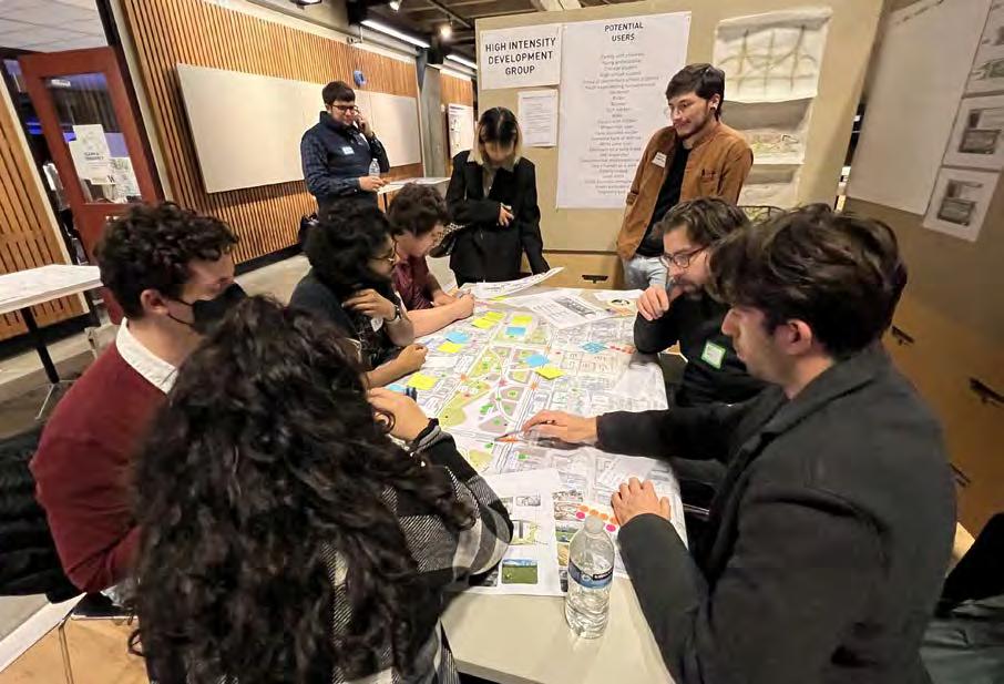
In the second part of the workshop, community participants divided themselves into four student-led design stations, where each of our design groups, organized by development intensity, facilitated meaningful discussion and visioning of the new space provided by a highway lid. This collaborative exchange of ideas provided a platform for residents to actively contribute to the envisioning process.
Feedback and new ideas introduced by community members in this design workshopping stage was taken back to the studio and thoughtfully incorporated into each design proposal.
LOW-INTENSITY DESIGN GROUP (ABOVE IMAGES) AND HIGHINTENSITY DESIGN GROUP (BELOW) WORKING WITH COMMUNITY MEMBERS IN A CHARRETTE.
Photos: Nancy Rottle (top left), Alabastro Photography
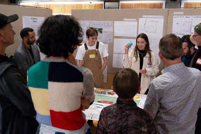
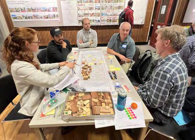
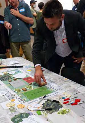
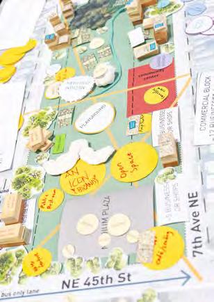
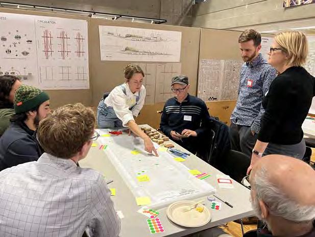 DESIGN GROUPS - RECLAIM (ABOVE) AND THE LIVING LID (BELOW) - COLLABORATING WITH COMMUNITY MEMBERS.
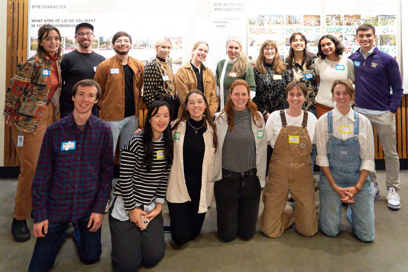 SCAN DESIGN STUDIO PARTICIPANTS WITH NANCY ROTTLE AND MASTER TEACHER LOUISE GRASSOV, POST-WORKSHOP.
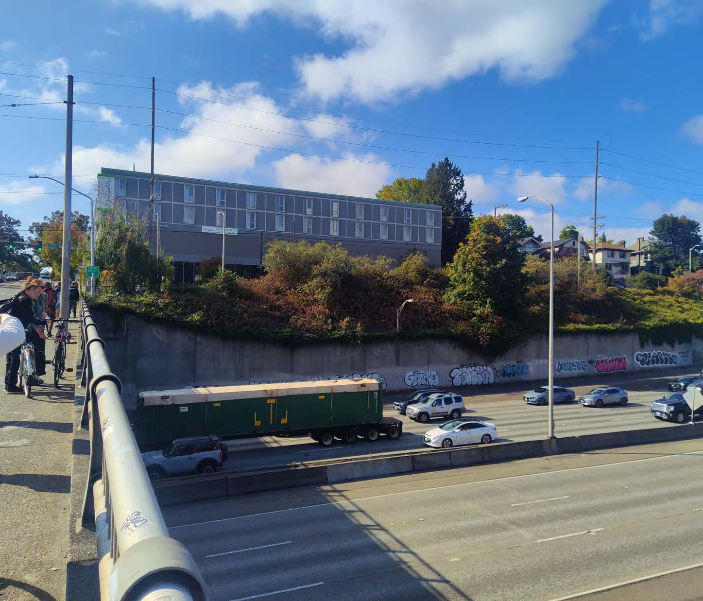
Green Seam , Low-Intensity Development
Griffin Cronk, Carmen Kwok, Tim Seed
RECLAIM , Mid-Intensity Development
Grace Brennan, Neha Chinwalla, Nat Gregorius, Katherine Magee
The Living Lid , Mid-Intensity Development
Clelie Fielding, Meredith Grupe, Emily Pressprich
Symbiosis , High-Intensity Development
Laurel Hicks, Darryl Vallejos, Austin Bass
This chapter presents design proposals for a North Seattle I-5 Lid developed by four separate groups of interdisciplinary studio participants. Each team approached their design concepts through different levels of “intensity” - understood as urban density, structural and financial load. Thoughtfully integrating multi-layered contexts and scales of use, design proposals envision possibilities for reconnecting the neighborhoods torn apart by the construction of I-5 while considering complexities of urbanity and public life and addressing both local and global needs related to climate mitigation and adaptation.
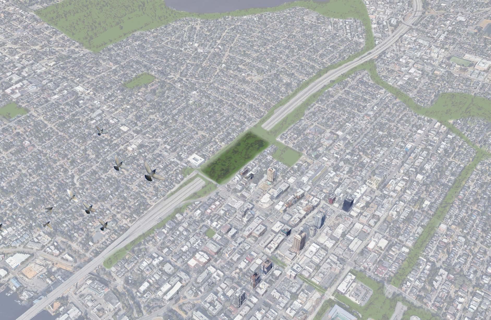
The Green Seam is a lush urban oasis. This low-intensity lid reestablishes neighborhood and natural connections that were severed in the construction of I-5.
The Green Seam concept merges community needs for highly programmed places for people to gather and play, with ecological needs for habitat connectivity and resource sensitivity. Anticipated high-density development in the UDistrict emphasizes the need for an innovative and adaptive space.

Create safe and accommodating places for all modes of transport to cross I-5, and establish a gathering space between neighborhoods torn by the highway
Encourage places for animals to pass through and rest, and plants to thrive; integrate a non-human lens to design decisions
Utilize innovative climate-positive strategies and materials in a space that can be adapted for many purposes
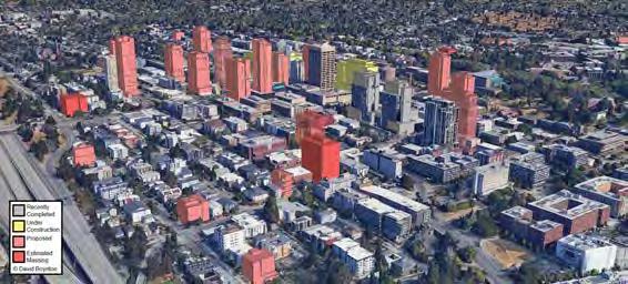
Anticipated high-intensity development in the UDistrict photo credit: Google Earth
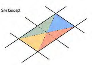

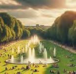
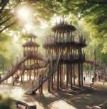
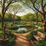
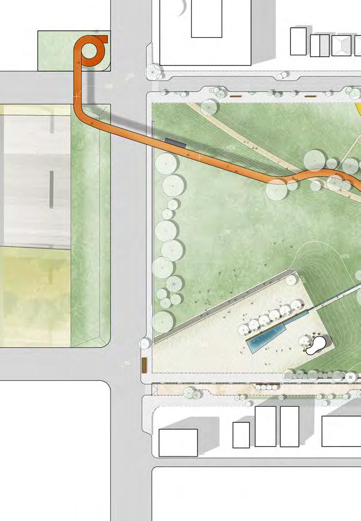
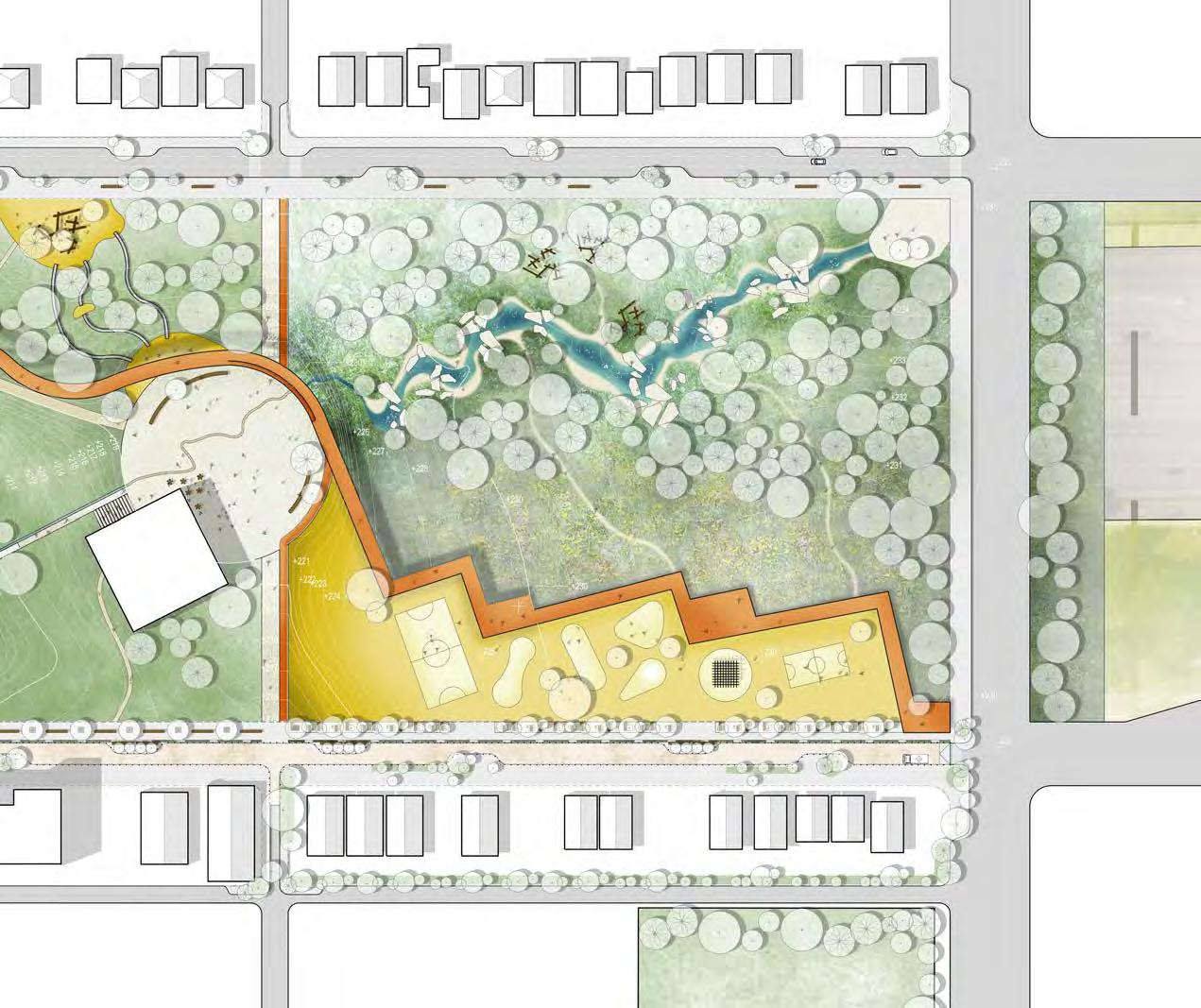
Cross section 1 (N.T.S.)
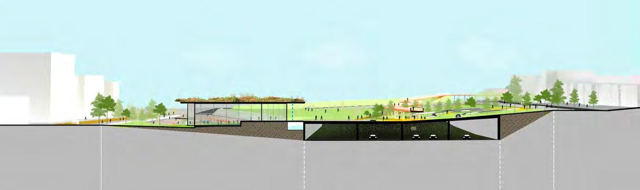
Long Section 3 (N.T.S.) Street Street Street
Elevated edges as sound barrier for busy traffic on 45th
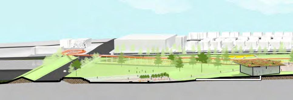
Elevated walkway (+235)
Ventilation and passive temperature regulation
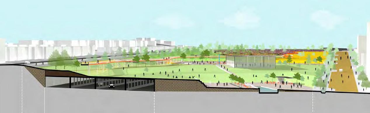
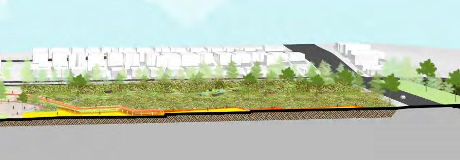
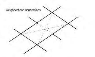
Neighborhood Connections


Bus Routes
Bike Facilities
Proposed Connections
Spiritual Organizations
Schools
Grocery Stores
Libraries
Seattle Parks
UW Campus
Bike and pedestrian connections across the site fill essential east-west gaps in existing networks. The main paths across the site follow an X pattern, connecting the corners of the site, with an additional east-west connector through the middle. This strategy links people to important community assets and existing bike and pedestrian infrastructure.
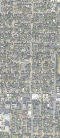

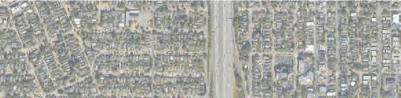

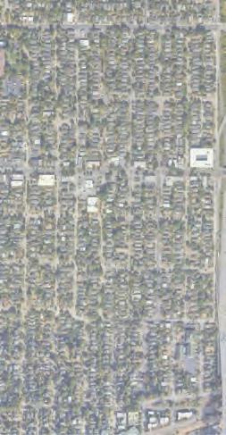
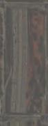
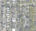
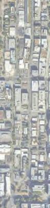

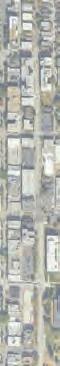

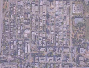
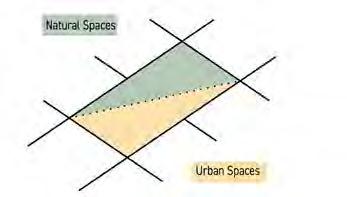
The primary connection axes bring users across the site and through an urban-nature spectrum. The main paths use the theme of a water feature and signature walkway to delineate these routes.
The waterway is a seasonal experience; rain-fed in bioswales in the winter and recycled in the channel during the summer.
The walkway brings users through play areas and open space, and then elevates above the park for spectacular views and a canopy experience.
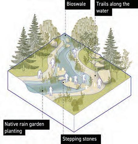
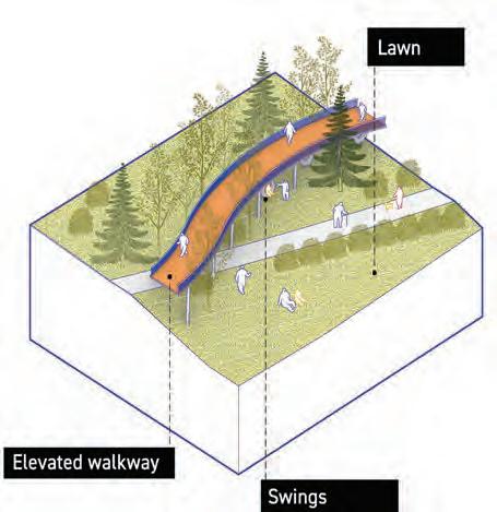
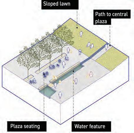
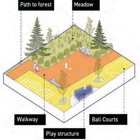
Multiple entries and paths offer many ways to move between neighborhoods. Shared streets, traffic calming, and enhanced arterials contribute to new edge conditions appropriate for a large park.
To accommodate a better sense of space on the edges of the park, the interior ramps on the site are removed. On 5th and 7th Avenues, the streetscapes use traffic calming techniques. A shared street and green promenade is proposed for 5th Ave to create a more porous transition to the neighborhood along the park edge.
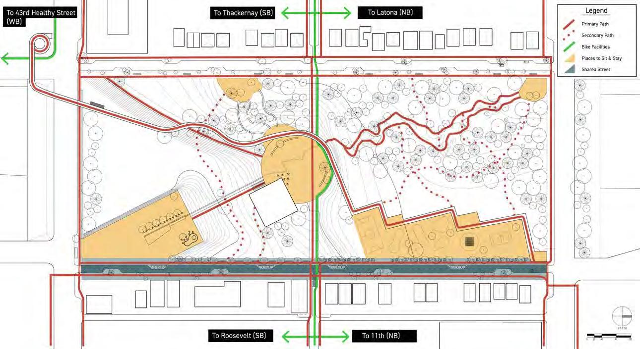
Lid park
Tree planters, benches, and multi-use path
Two-way street, elevated to curb at intersection, local parking
Sidewalk offset from single-family houses and screened with trees
Lid park
Tree planters, benches, and
Two-way street, elevated to curb at
Lid park
Tree planters, benches, and multi-use path
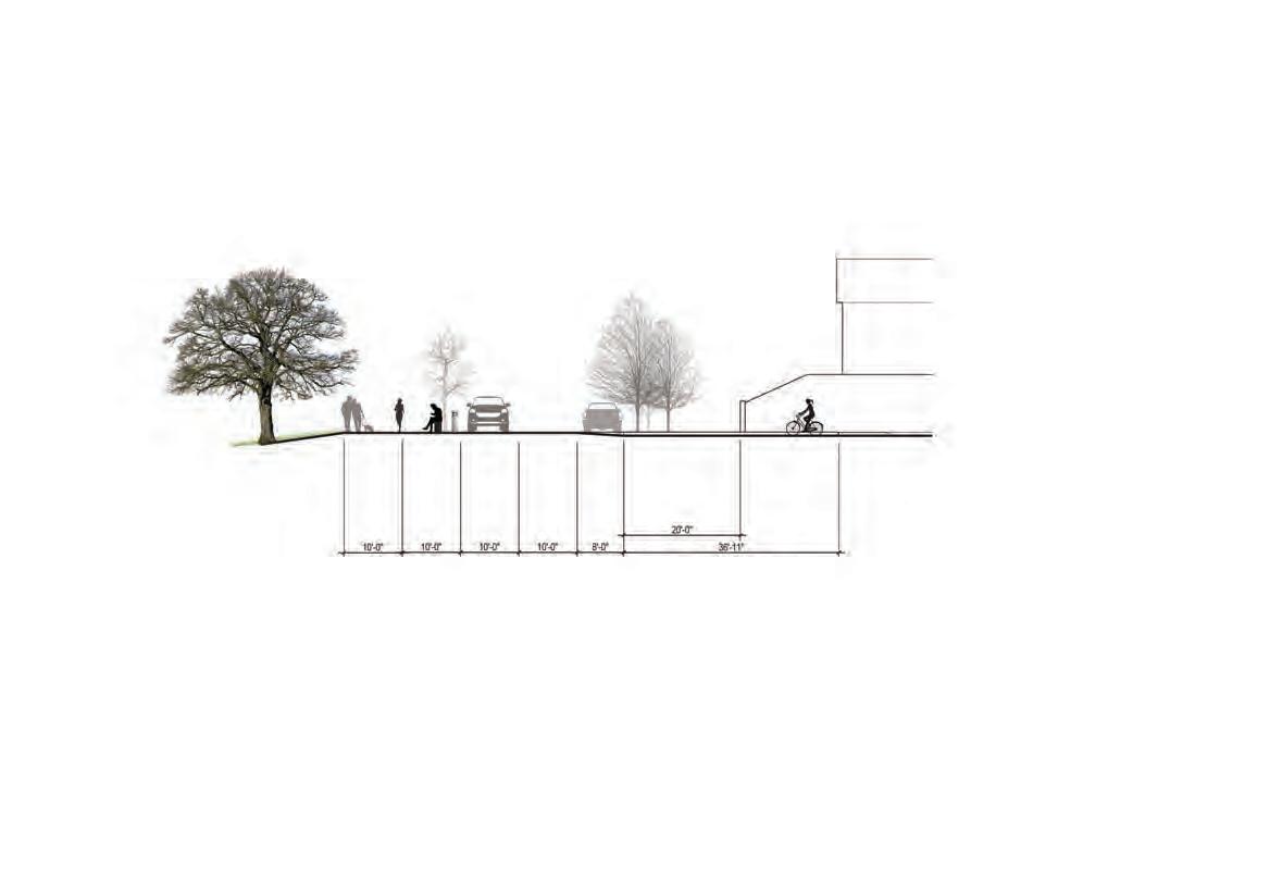

Two-way street with tree planter bump-outs and local parking
Shared street with bioswale and promenade


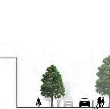
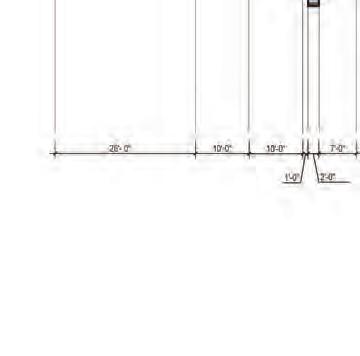
Building access and sidewalk
Shared street
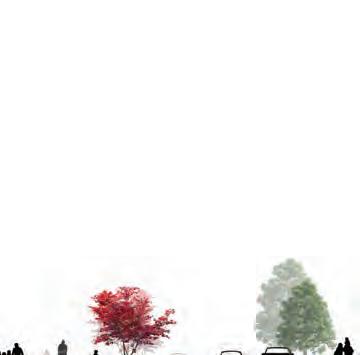
Lid park
Sidewalk offset from single-family houses

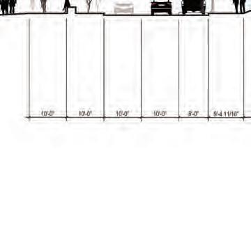
Building access and sidewalk
Shared street with bump-outs
Sidewalk offset from single-family houses
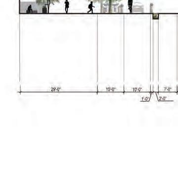
Bioswale and tree planter
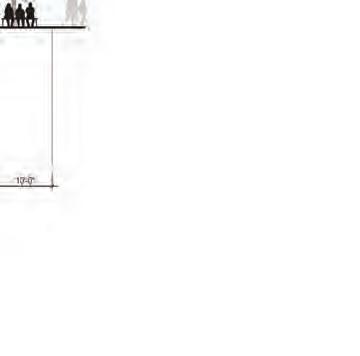
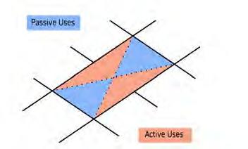
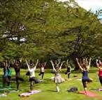
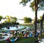
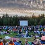
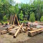
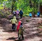
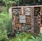
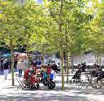
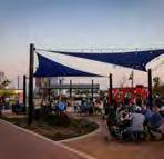
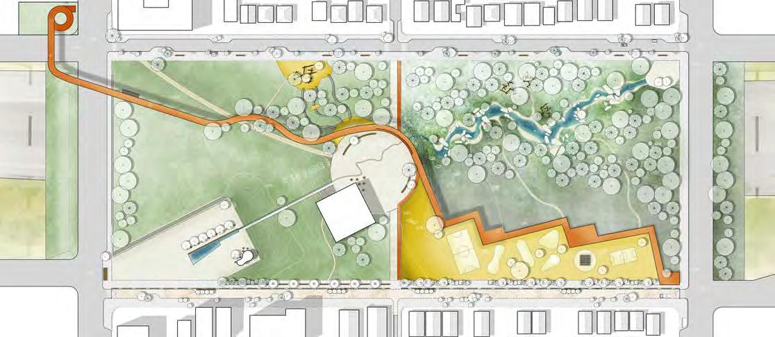
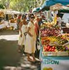
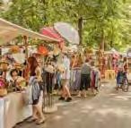
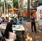
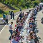

Climate impacts of the lid park can be mitigated across sectors. Strategies prioritize decarbonizing systems, creating carbon sinks, and utilizing local circular economies.
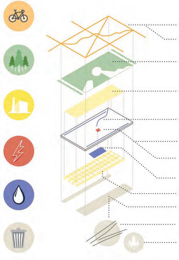
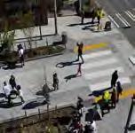
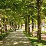
Transportation
Green Space
Industry
+3,000 feet of new multi-modal paths
prioritize low-carbon transport
~14 acres of new green space locally manufactured lightweight fill
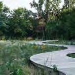

Energy
Water
bioswales and rain gardens green roof
natural ventilation
cistern for rainwater capture & reuse
low-carbon concrete, steel & rebar
recycled aggregate over old ramps
+6,000 feet of waste highway ramps
existing vegetation
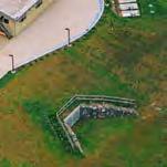
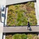

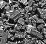
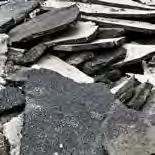
Waste
Gravel Low Carbon Concrete Reclaimed Asphalt Pavement (RAP) Biochar Urban Shade Shared Street Meadow & Forest BioswaleReimagining the area above I-5 is an opportunity to reclaim ownership and agency over the neighborhoods and resources impacted by the freeway. RECLAIM is a mid-intensity development proposal with midrise housing on existing land and new open and green space on the lid. The lid creates new connections across communities and new places to inhabit. RECLAIM proposes a regenerative space that demonstrates the world we want to live in, for all.
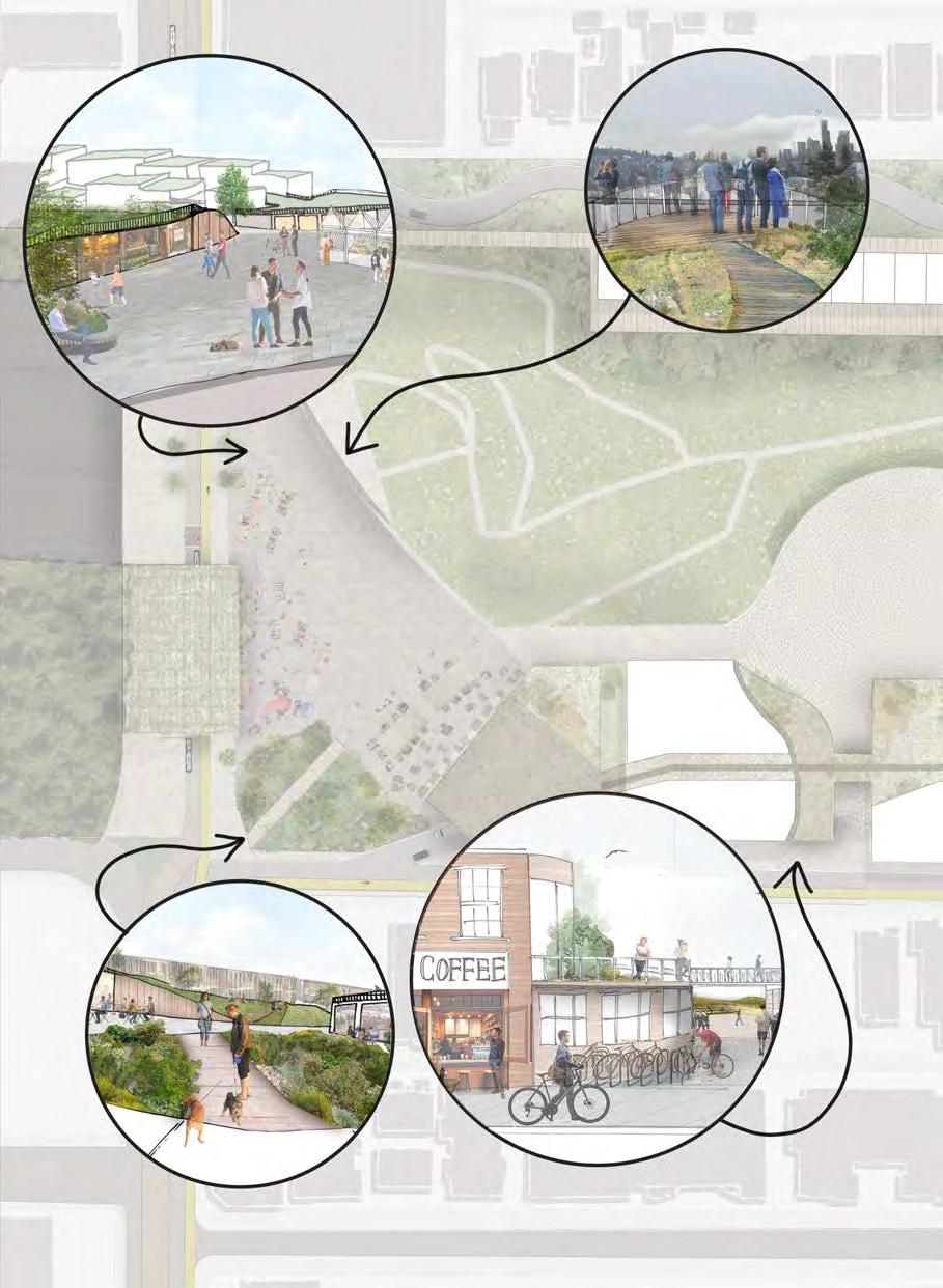
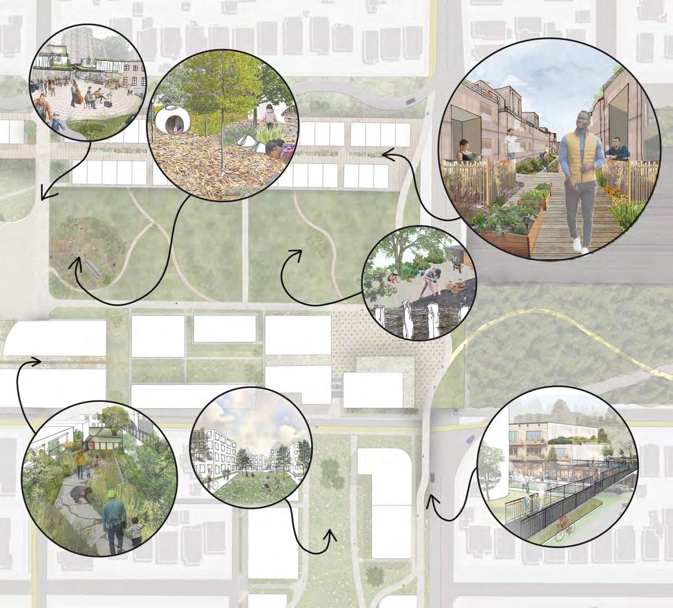
In recognizing the history of I-5 and the communities it altered, RECLAIM looks to the future to envision a lid designed for people, outside of their vehicles. RECLAIM seeks to both rejoin the UDistrict and Wallingford neighborhoods and invite new residents or visitors to enjoy a vibrant public space with community amenities and open areas. Our lid design proposal boldly imagines a more car-free Seattle, one where other modes of transportation are prioritized and places for people outnumber those for cars. The design is guided by the principles of inhabit, regenerate, demonstrate, and integrate. Together, they reclaim the land taken by I-5 to create a space for habitats, community, and people.
to feel comfortable and supported to dwell in space
to build intentional connection between communities
to practice the values of the world we want to be a part of INTEGRATE
to respect the materials we use and shift their end-of-life from waste to resource
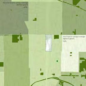
analysis of surrounding area to determine where programs, resources, and infrastructure should be placed on site
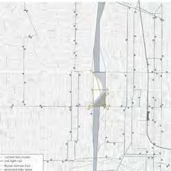
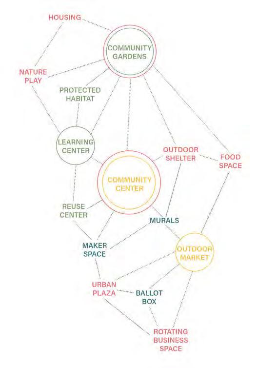
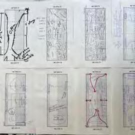
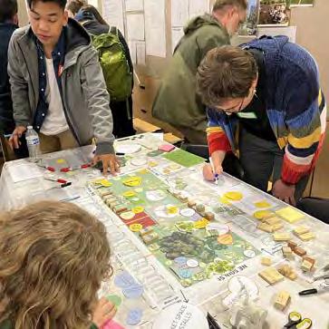
community workshop where we developed an interactive activity for participants to co-design their own lid site
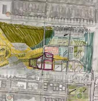
development of program adjacenies to determine central programs and spatial relationships which we transferred to the site
we combined prior analysis with workshop designs to develop a more cohesive plan
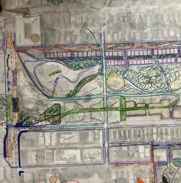
flip the page to see our ideas...
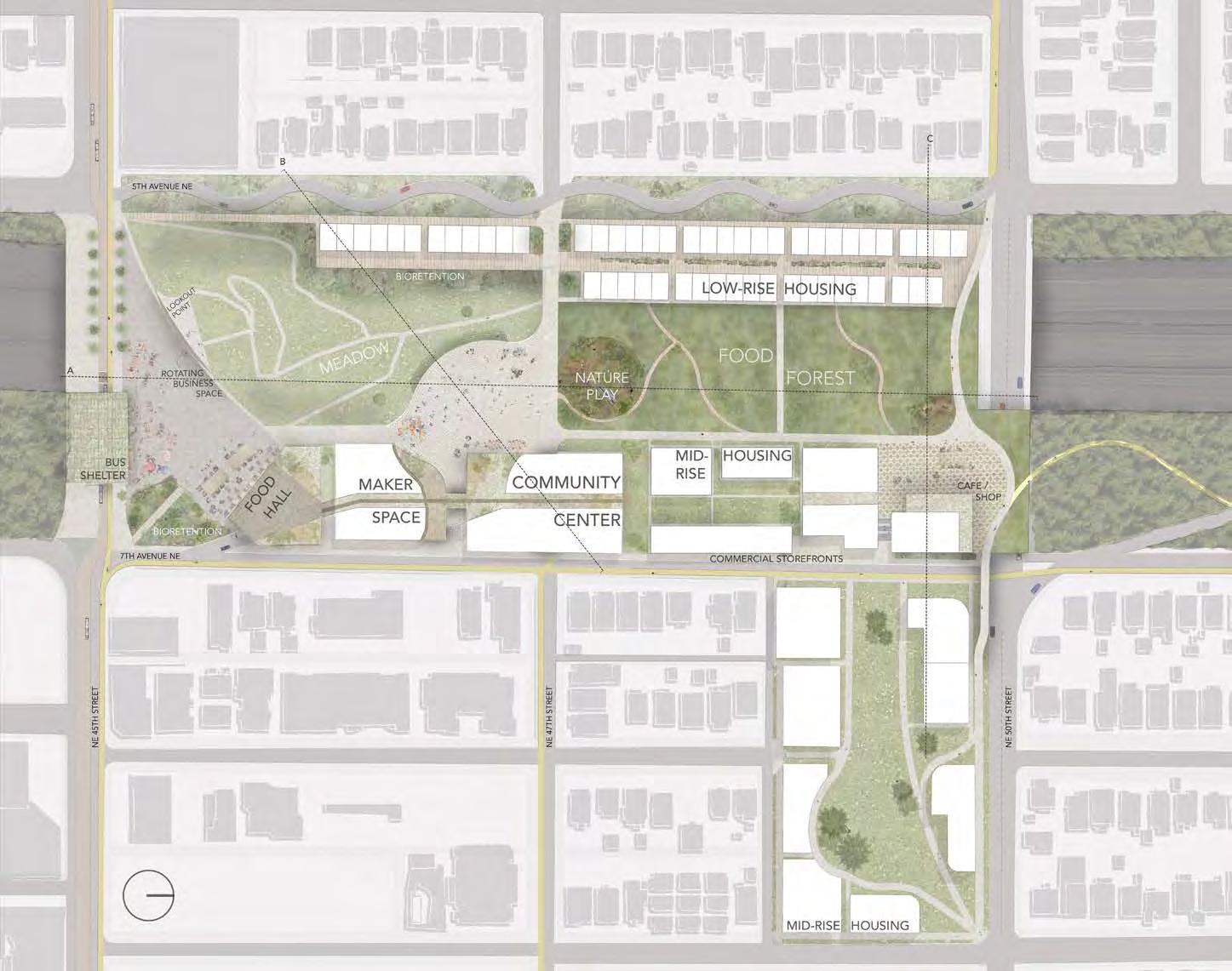
RECLAIM: SITE PLAN
a mid-intensity approach to a connective lid
INTEGRATE
new bike/pedestrian paths
public transit focus
diverse commercial spaces
nature play
DEMONSTRATE
flexible open space
community center
(green job training, youth education, makerspace & materials library)
REGENERATE
food forest
stormwater infrastructure greenroofs
collective energy sources
makerspace
INHABIT
business incubator space
community centered housing
community center
(social resources, shared kitchen, coworking space)
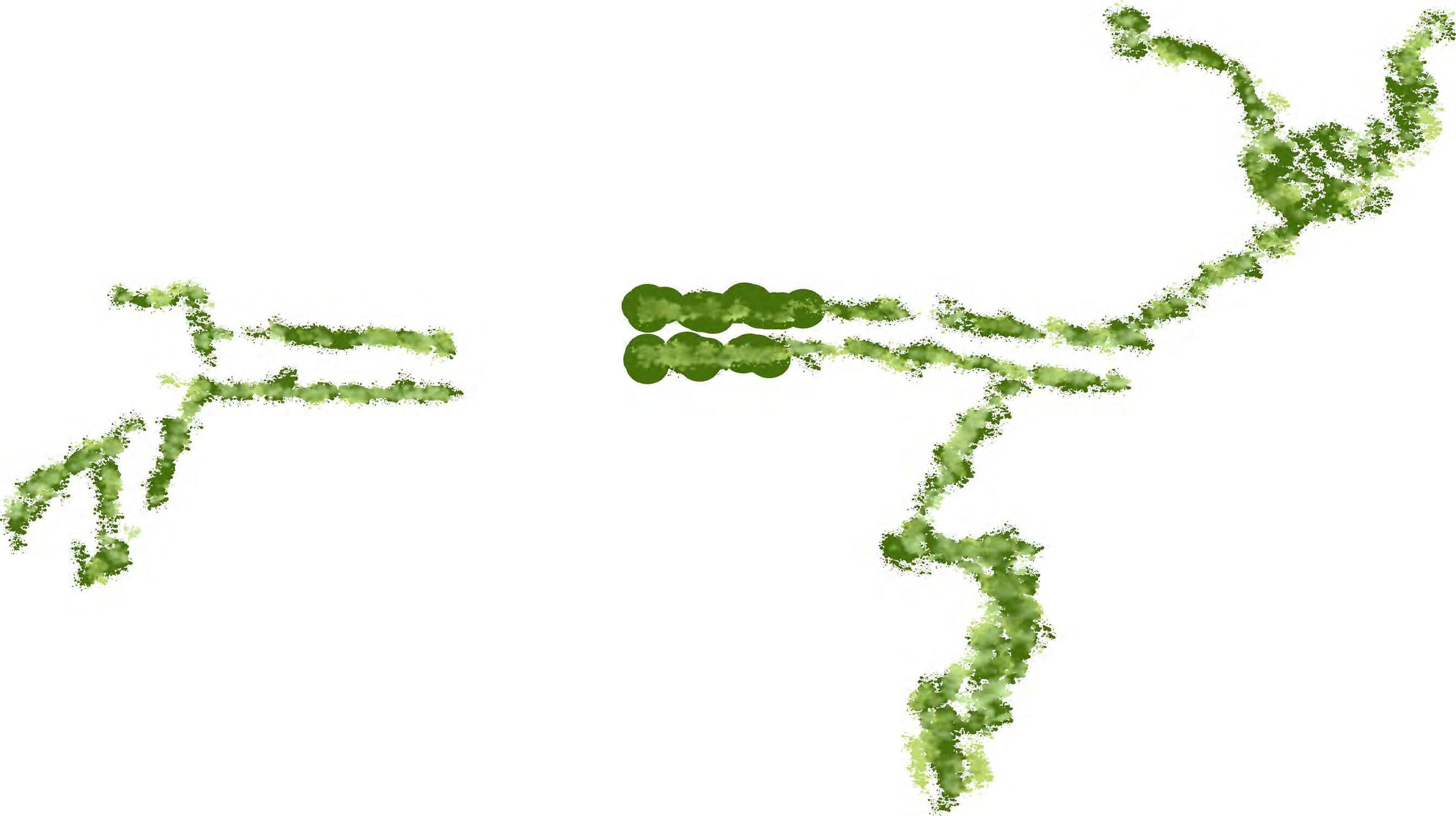
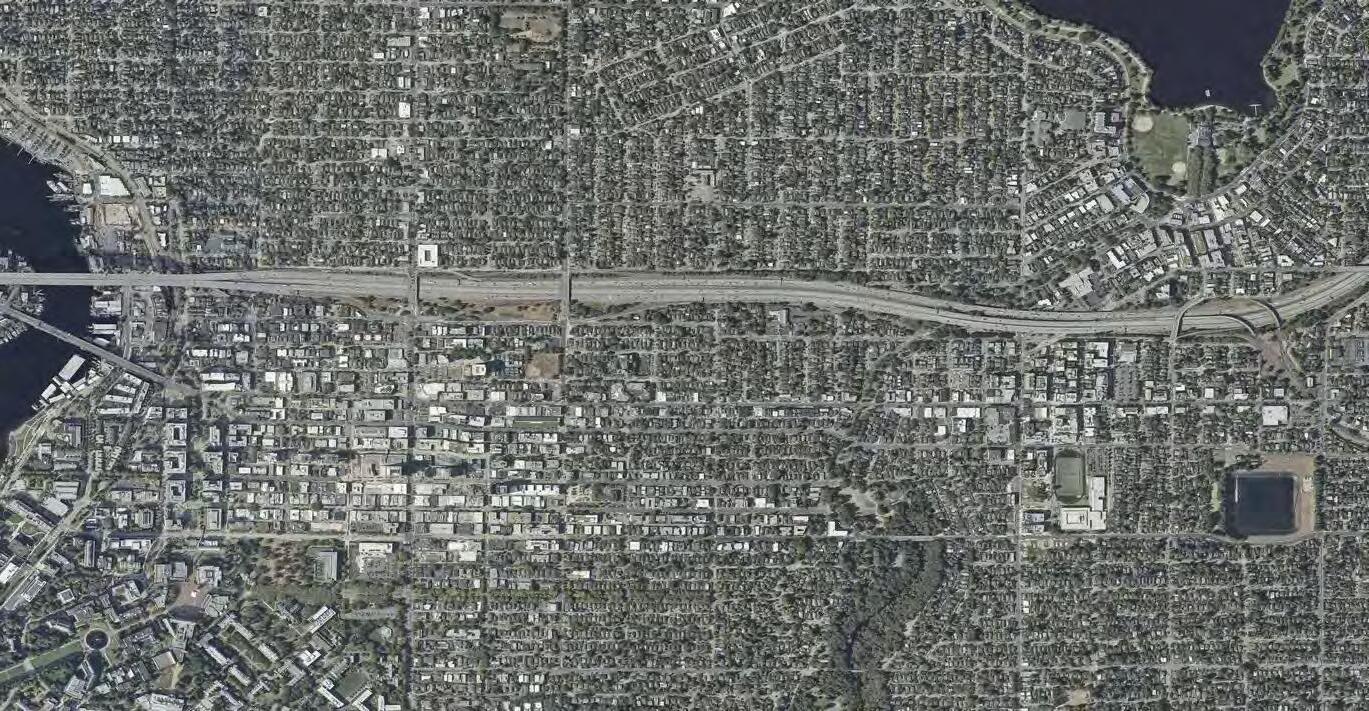
Our design creates connections at both local and regional scales. We propose a connected greenway between the North I-5 lid and Green Lake, Cowen and Ravenna Parks, and Lake Union. With lush plantings and a protected pedestrian and bike path, this greenway will enhance existing greenspace (including the open greenspace along I-5) while
building a continuous corridor through added East-West connections. Planted densely with a mix of native evergreen trees and shrubs, the greenway will provide a natural noise and visual barrier to I-5 while improving air quality and accessibility for morethan-human and human users alike, which will foster both biodiversity and community connectivity.
future & existing greenway
10-min walk radius
human movement
more-than-human movement
waterflow
pedestrian (lid level)
pedestrian (ground level)
cyclist
designated bike lanes
bus car
Our site envisions a future for Seattle centered around sustainable modes of transportation. Many layers of pedestrian paths (including winding nature trails and more direct commuter paths) flow throughout the lid, and the cycle snake provides a raised, protected
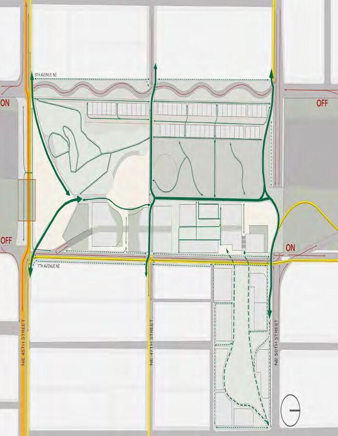
East-West connection along 50th for both cyclists and pedestrians. We propose more robust bike infrastructure along 45th and 47th and along 7th Avenue, improving safety and access between UDistrict and Wallingford as well as to the new Community Center, commercial spaces along 7th, and North to Ravenna and Green Lake. We also
propose a major transit route along 45th and a large green-roofed bus shelter integrated into our site’s public plaza. All of these bus, pedestrian, and bike routes are carefully integrated, while separated from car traffic, to provide safe, pleasant, and direct transit for all. We propose major traffic-slowing strategies on 45th, 5th, and 7th while maintaining 50th as a primary thoroughfare for cars.
ON-SITE DEMOLITON & CONSTRUCTION
ON-SITE DEMOLITON & CONSTRUCTION
r euseforfill reuseforpaving
MEADOW HILL
MEADOW HILL
HOUSING
HOUSING
excessformateriallibr a ry irrigation compost energy greywater compost irrigation food
reuse inplayfeatures
NATURE PLAY
NATURE PLAY
excessformateriallibr a ry irrigation compost energy greywater compost irrigation food
FOOD FOREST
FOOD FOREST
g r e ywater ene r yg energy
PLAZA SPACE
PLAZA SPACE
HOUSING
g r e ywater ene r yg energy
COMMUNITY CENTER
COMMUNITY CENTER
r euseforfill reuseforpaving compost harvestedfood greywater irrigation energy irrigation compost compost
compost harvestedfood greywater irrigation energy irrigation compost compost
MAKER SPACE
MAKER SPACE
FOOD HALL energ y
FOOD HALL energ y reuse inplayfeatures
HOUSING
To practice our principles of regeneration and demonstration on site, we centered our proposed plan on the framework of circular communities. This framing focuses on keeping materials from the site, on the site - a regenerative system where waste is seen as a resource and as much energy is captured on site to operate its diverse systems.
Circular thinking and design has become increasingly important as our built environments become denser, more populated, produce more waste, and in turn drive up carbon emissions. The North I-5 lid is an opportunity to advocate for a circular approach from the concept all the way to build stage, to respectfully utilize the materials and resources we already have.
organic green roof solar energy
C+D waste compost timber waste rainwater catchment food production waste water energy within system different system
We see our responsibility as designers and planners in the age of climate change to challenge traditional material uses and advocate for alternative materials to be written into building and landscape codes and implemented in construction of new infrastructure. While not exhaustive, below we share nine ideas for materials that range in their form, current use in the industry, and place in the built environment.
biochar
carbon rich solid made from burning biomass; can be used as nutrient addition to soil
cross laminated timber
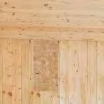
large scale prefab lightweight wood that be used for structure of building instead of concrete
reclaimed asphalt pavement
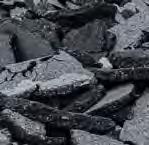
crushed reclaimed asphalt from site for fill under paths and new street pavements
mycelium panels
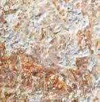
dense network of fungi root structure that can be used for insulation and acoustic paneling
climate tiles
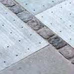
innovative paving that allows for stormwater infiltration and direction to adjacent planting or drain system
reclaimed concrete
permeable paving
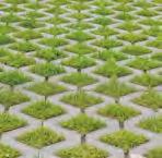
paving that allows for infiltration of water into ground to mitigate stormwater flooding
low/zero carbon concrete
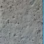
concrete that does not use portland cement to bind aggregates for structure, reducing the carbon footprint
reclaimed timber
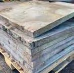

crushed or slabbed reclaimed concrete waste from site for fill or new paving and plaza features
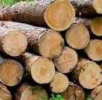
re-use of trees cut down for construction by either chipping for mulch or using whole logs for habitat or play
modular units can be arranged for variation and cooperative-style living with shared resources and space for personal outdoor use
a community of its own that is less integrated into the civic space for a more neighborhood experience
mixed-use, dense residence with varying unit options, commercial first floors, live/work units, public green roofs, and collective energy sources
a community of its own but integrated with the civic space for a more urban experience
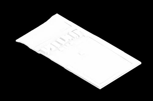
university playground under-utilized park, aging houses
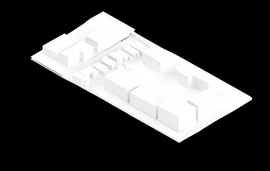
PHASE 1
university playground converted to mid-rise housing
university playground used as staging area for construction
existing houses purchased from willing sellers for market price
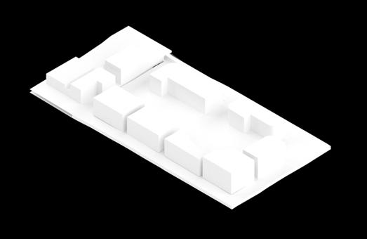
PHASE 2
modular housing expanded, green connection established
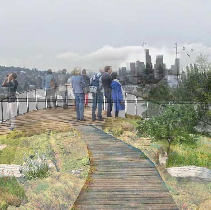


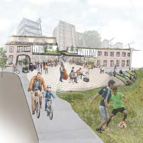
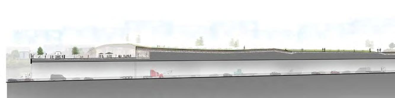

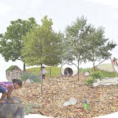
nature play area
+ sensory play elements
+ re-use of natural materials

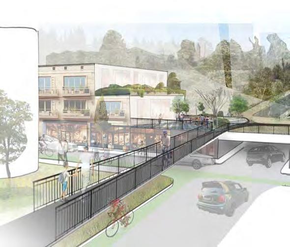
food forest biodiversity
+ urban agriculture
+community resilience
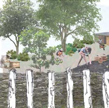
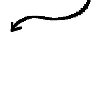

cycle snake universal accessibility + connections
+ active park edges
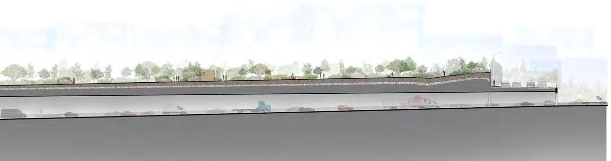
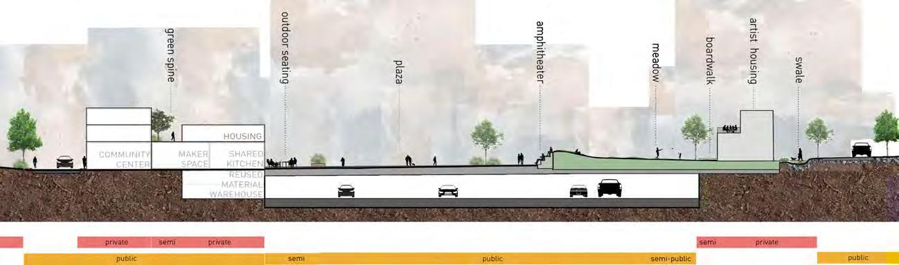
Providing a spectrum of public and private spaces is critical for making the lid activated, vibrant, and comfortable for every user. RECLAIM proposes a range of spaces from public to private to accommodate a variety of activities and uses. More public areas promote social interaction and community bonding, enhancing the quality of urban life. More private space provides residents on the lid a sense of security and ownership of their surroundings.
Private spaces are centered around residential areas, located primarily on the north end of the site along the edges. These areas are designed to be both visually interesting and functional for residents. Public spaces are threaded through the center of the site with thoughtful connections inviting users in. Emphasis has been placed on creating public areas due to a recognized need in the area.


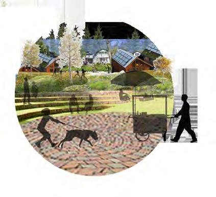
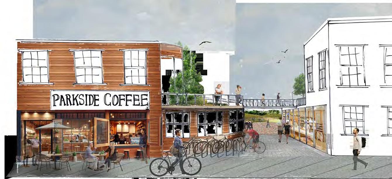
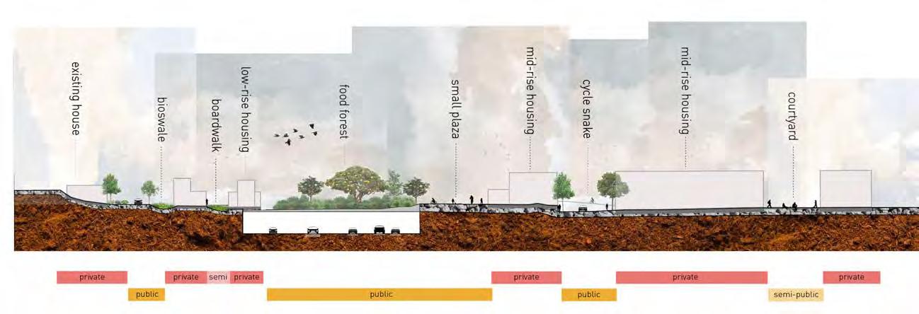
In-between spaces (semi-public, semi-private) are an essential part of our design, providing unique opportunities for social interaction, community engagement, and individual or smaller group reflection. The boardwalk between the modular housing units serves to connect residents along a pedestrian way that is semi-public, with small private garden areas for each unit. Semipublic spaces include the courtyards within mid-rise residential buildings, community gathering spaces within
the Community Center including the shared kitchen, and pockets of more enclosed greenspace within the meadow and food forest. These areas promote more intimate social interactions and community cohesion. Semi-private spaces include the green spine and the boardwalks between the low-rise modular housing rows. The semi-private features enhance quality of life for residents of the lid by providing amenities and supporting a sense of community.
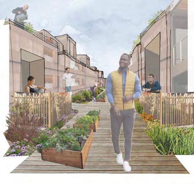
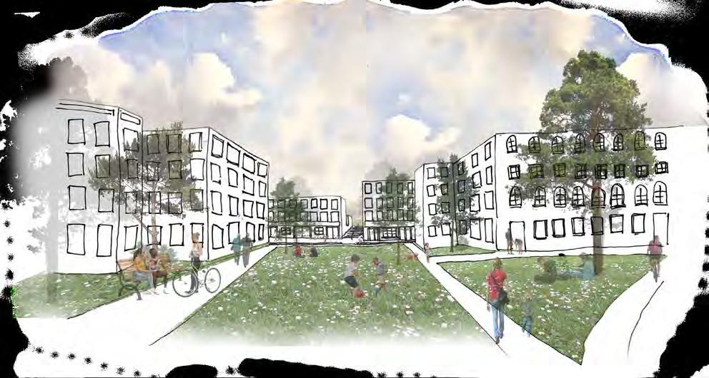
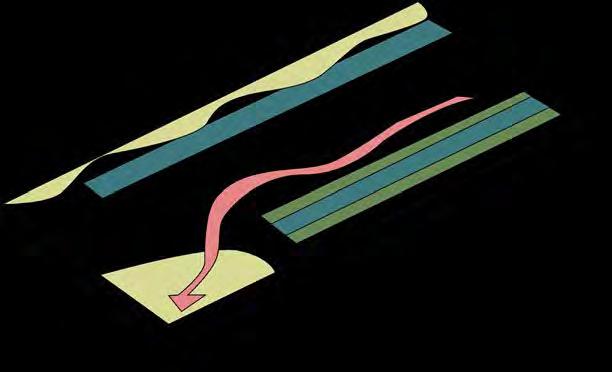
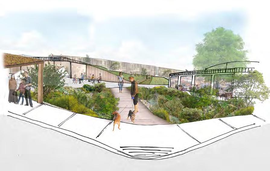
RECLAIM centers around creating circular systems that utilize resources available to us. Stormwater infrastructure is a key system within our design. Stormwater generated on and around the lid will be captured, used, treated, and infiltrated on-site to improve water quality, slow water flows, and improve resource efficiency. Features of the stormwater system include bioswales, infiltration areas, green roofs, and cisterns for water capture. Bioswales not only capture and treat water; they also provide habitat and community education. Stormwater infiltration ensures that aquifers recharge and groundwater sources aren’t depleted, keeping water cool throughout the year in local streams and lakes, which is essential for migratory fish. Green roofs provide habitat, regulate temperature within buildings, and slow and treat rainwater. Cisterns allow for water capture on-site, which will provide the park with a consistent fresh water source, enhancing resource efficiency.
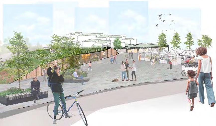
The plaza along 45th Street represents the largest flexible space on the lid. Multiple types and layers of program intersect here: the meadow and viewpoint atop the rotating business incubator space, the Food Hall, the green spine, bus shelter, bike lanes, and the boardwalk entrance at 45th and 7th. The open plaza is intended to encourage

community members to engage with the space how they see fit. The plaza can also support organized programming led by community organizations, small businesses, or residents. The flexible space unites the more defined areas of the lid with its edge on 45th Street, serving as both a connection point in transit and as an open invitation for people


connecting commuting live music rally

to linger. The central plaza adjacent to the Community Center is another example of flexible public space, with programming suggestions relating closer to the Community Center and amphitheater - community services, workshops for art or making with reused materials, performances, restaurant popups or community meals, and recreation.

recreation flea market street vendors
Throughout our site, programs are layered temporally, horizontally, as well as vertically to accommodate diverse uses and users. Vertical space is especially key along the eastern edge of our site, contributing to more dynamic public spaces as well as adding to positive environmental impact.
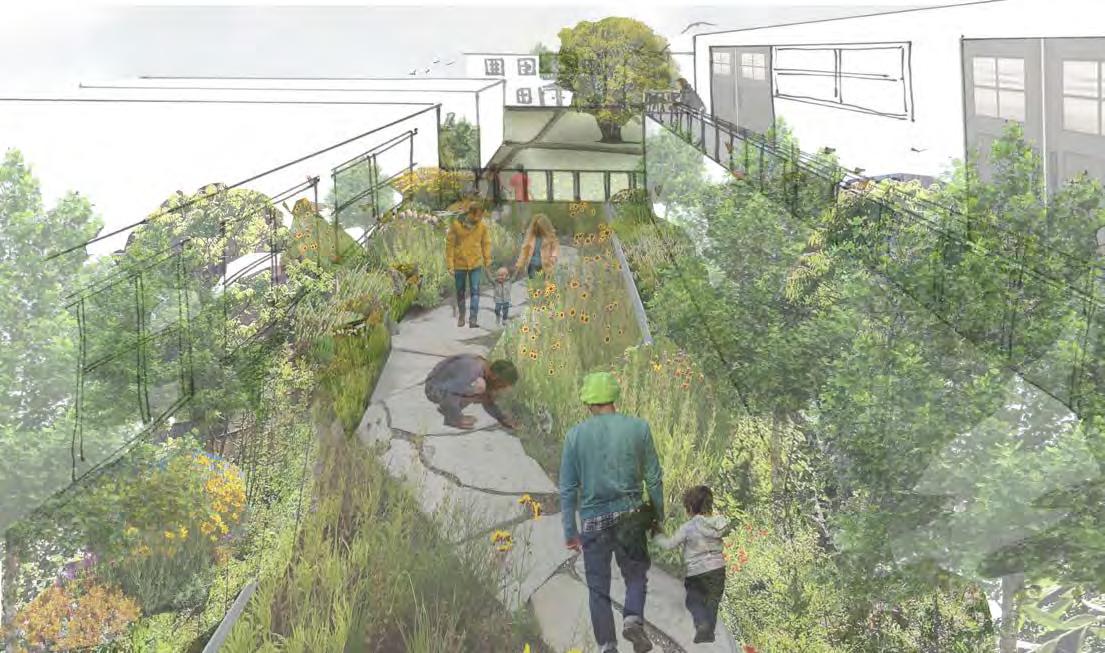
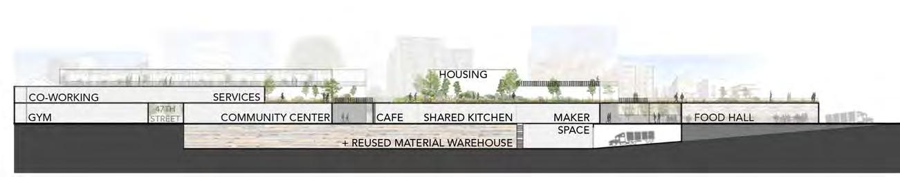

Layered throughout the green spine are community services, housing, businesses, gathering space, and the makerspace, all of which gain from the ecological, social, creative, and health benefits of nearby green space. Integrated in and under the makerspace is the Reused Materials Warehouse, accessible via the former I-5 access ramp. There, our lid can collect materials for use in the makerspace and in future creative or construction projects throughout Seattle.
The green spine runs all the way across the site, connecting to the larger greenway system with a series of green roofs and open spaces, providing habitat for more-than-human species as well semi-private greenspace for lid residents.
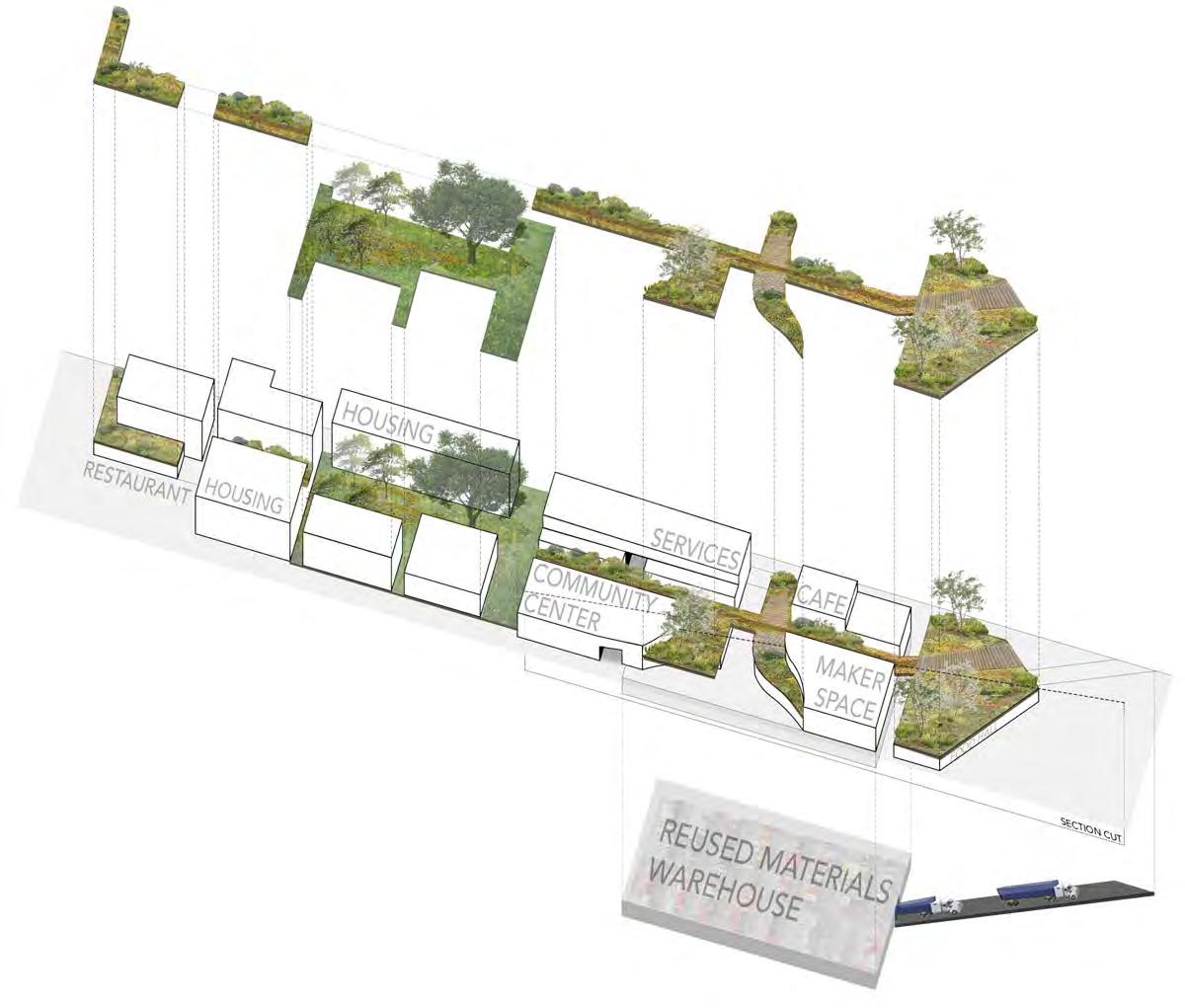

The Living Lid is a circular community, mid-intensity development with a balance of housing, green space and community services; including:
• a housing cooperative affordable to multiple income levels
• a community-run large-scale farm operation and an associated community kitchen for residents to feed and be fed
• a biochar facility to reuse waste materials and produce a lucrative and carbon sequestering resource
• a community center; various eating and drinking establishments
• a verdant pacific northwest forest and meadow habitat for human and non-human species to enjoy.
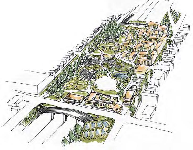
Interstate 5 was carved into the fabric of Seattle in the 50’s - 60’s, destroying homes, separating neighborhoods, and promoting the car-centric lifestyle that has been a major contributing factor to our modern climate crisis. This project seeks to stitch a community back together with much needed green space, public amenities, and nonvehicular transportation paths. In doing so, old mistakes can begin to be remedied and a new, circular community will be created as a demonstration of a more sustainable way to live going forward.
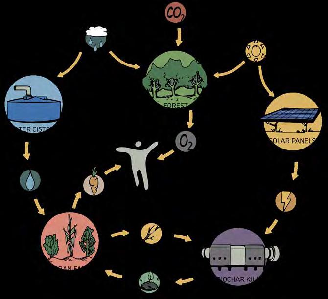
Conceptual depiction of the network of living systems and the resources they consume and produce.
The living lid is based in principles of circularity inspired by the Living Community and Living Building Challenges. These principles led to the development of a network of “living systems.” These systems provide the basic needs of the community including food, water, and energy, while also functioning as an interdependent, selfsufficient whole.
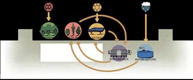
Sectional diagram explaining the locations and relationships between the living systems and external inputs.
The living lid in context of the neighborhood, showing connections to other green spaces in the surrounding area, and how improved connections east/ west will provide better pedestrian and bike circulation.
The living lid in the context of the neighborhood, showing connections to other green spaces in the surrounding area, and how improved connections east/west will provide better pedestrian and bike circulation.
connections to green spaces existing parks bike circulation adjusted highway ramps
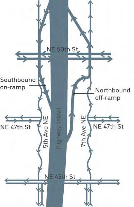
Exploded axonometric view of the living lid major site elements highlighting: habitat, circulation, community spaces and living systems. This graphic shows how the pieces fit together to create a cohesive whole.
In the proposed traffic flow, the existing ramps that feed on and off NE 45th St are eliminated for an improved bike and pedestrian experience. The remaining northbound off-ramp is hidden by the podium of a residential building that terminates in a T intersection with 7th Ave. The southbound onramp is hidden by the topographic high point on the lid. Above the highway, 50th remains four lanes of car traffic while 45th is reduced to two lanes which makes room for bike and bus lanes.
PNW forest ecosystem
Pollinator habitat
Wetland
Bioswales Bike paths
Hiking trail Streets
Community spaces
Biochar facility
Solar panel arrays
Water cistern
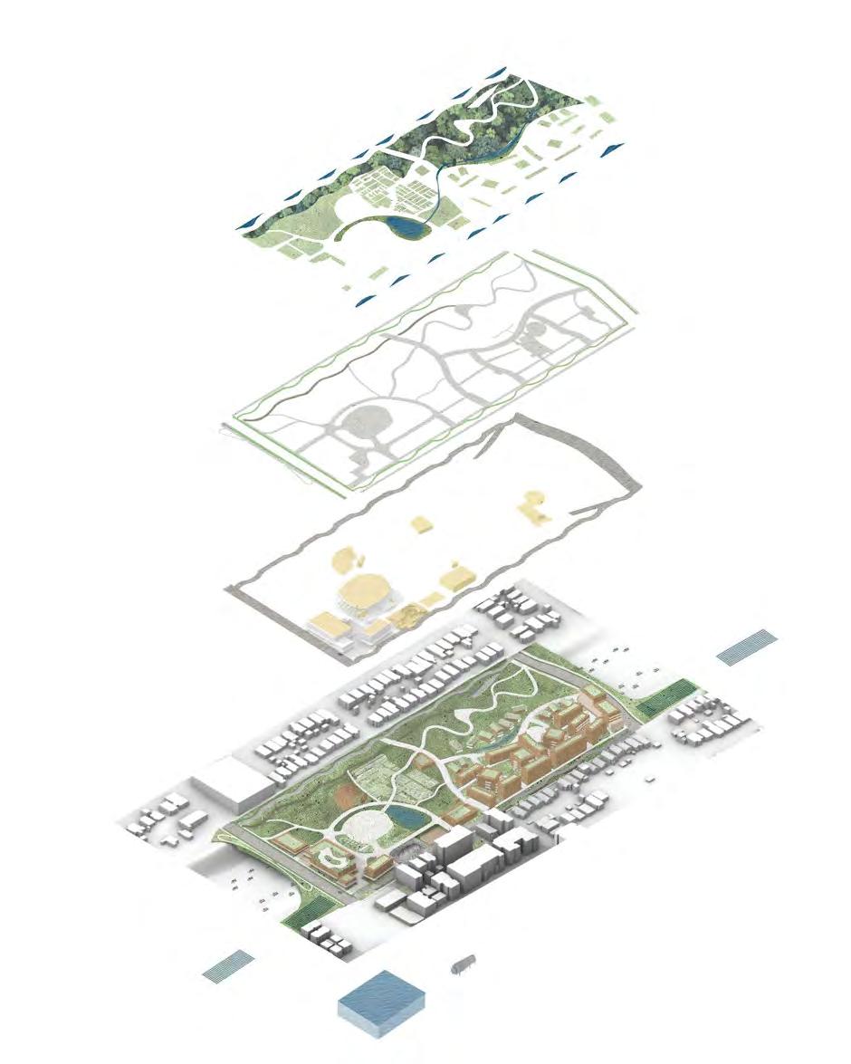
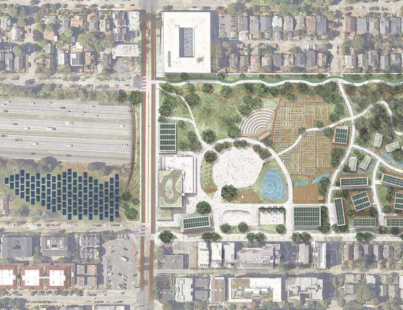
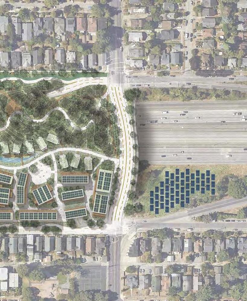
A. Solar arrays
B. Pollinator meadow
C. Cooperative bike repair shop
D. Beer hall
E. Community recreation center.
F. Community meeting & welcome space
G. Community kitchen, cooperative restaurant & food truck commissary
H. Traffic calming chicanes
I. Amphitheater
J. Plaza for food trucks, farmers market, and other events
K. Playgrounds
L. Water detention with cistern below grade
M. Skate park
N. Basketball court
O. Cooperative farm
P. Composting, chicken & rabbit coop
Q. Biochar offices & learning center with biochar kiln facility below grade
R. Farm tool shed, learning center, and tool share library
S. PNW forest ecosystem with hiking trails. High point on site.
T. Student focused co-living cottage housing, part of co-op (see W.)
U. Bioswale
V. Picnic lawn
W. Affordable housing cooporative & land trust: town homes, single loaded and point access apartments.
X. Southbound on ramp
Y. Northbound off ramp
Z. Coffee shop & retail at ground floor
Traffic key: bike bus car
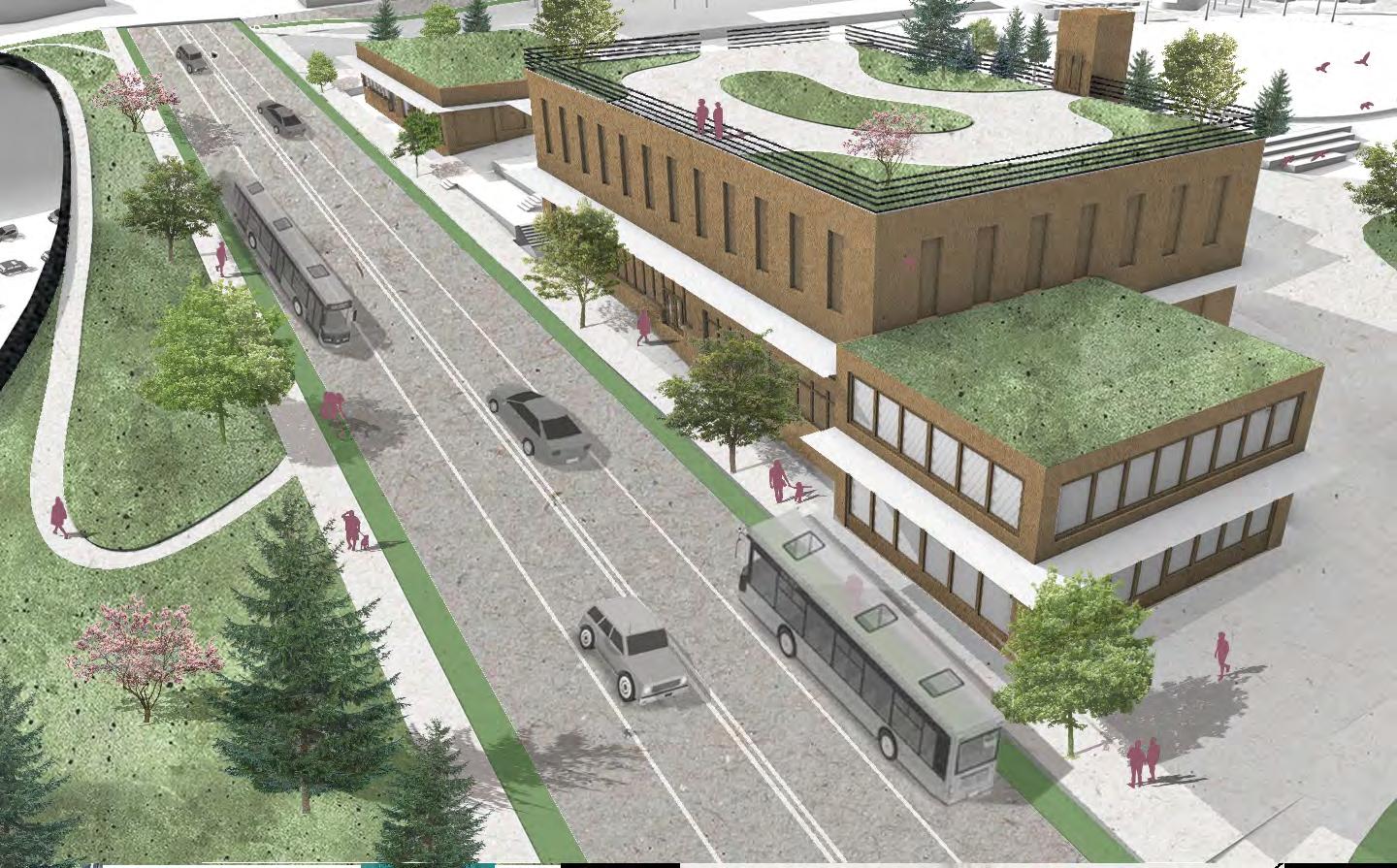


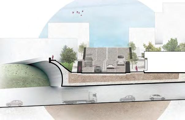
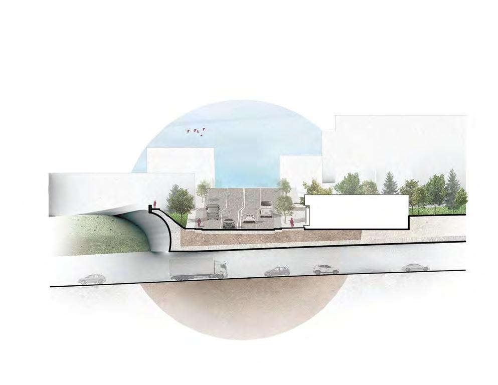
Section north/south looking west through NE 45th St and sound barrier.
The Living Lid team emphasized the importance of 45th St as a vital entryway for most users of the site; coming from Wallingford and the University District. After feedback from the community charrette, our team placed retail buildings and community spaces along the street to continue the character of 45th as a commercial corridor, and to draw people into the site through a permeable facade. We incorporated a sound barrier to block the noise of I-5, and implemented a public rooftop park on top of the community building to emphasize the viewshed of Seattle’s skyline and Mt. Rainier. We altered the traffic lanes to include two bus-only lanes and two bike lanes, to prioritize bikes, public transit, and pedestrians.
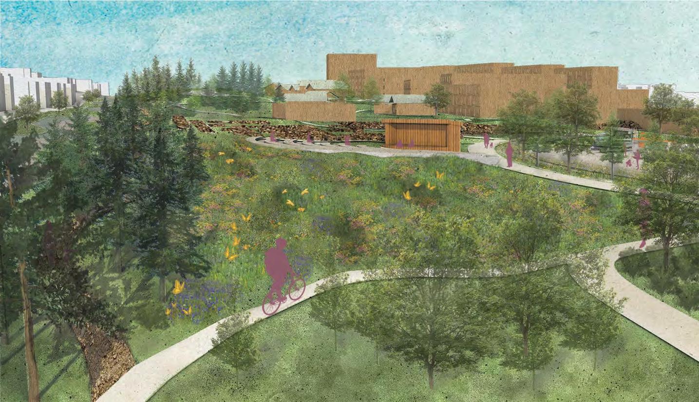

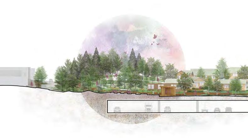
Wallingford
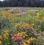
Pacific Northwest pollinator meadow

carbon sequestering evergreen forest
start of lid
south-bound I-5 amphitheater and farm evergreens 5th Ave NE
Section east/west looking north through amphitheater. Scale: 1”= 100’
At the southeast corner of the site, visitors are greeted with two pacific northwest ecosystems: the evergreen forest which borders the west end of the site (resting on a small amount of terra firma), and a lowland meadow that provides important habitat, food and shelter for pollinators. The topography of the meadow is built using the hugelkultur technique of mounding downed trees and compost to improve soil quality for plants and creatures that live in the soil. The depressions in between mounds would serve as a boggy area that attracts amphibians and other animals that need water. Beyond the meadow is the amphitheater which can host a couple hundred people. Behind the amphitheater is the one acre working farm that serves the lid community, and the plaza to the right where people can gather for the everyday interaction as well as special events.
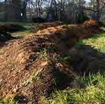
hugelkultur using trees from the site
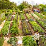
urban farm with compost from site
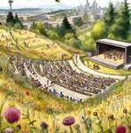
community amphitheater
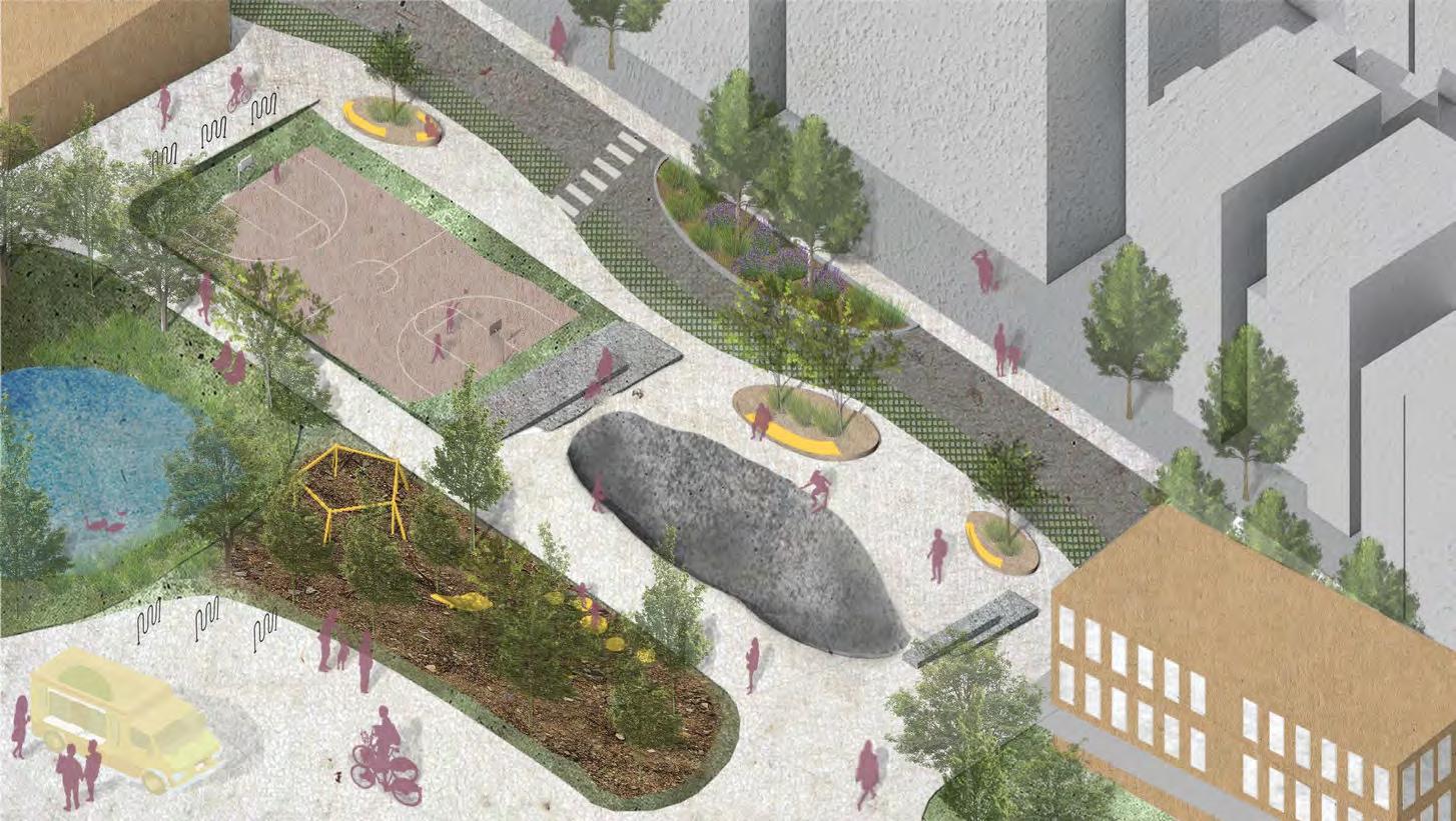

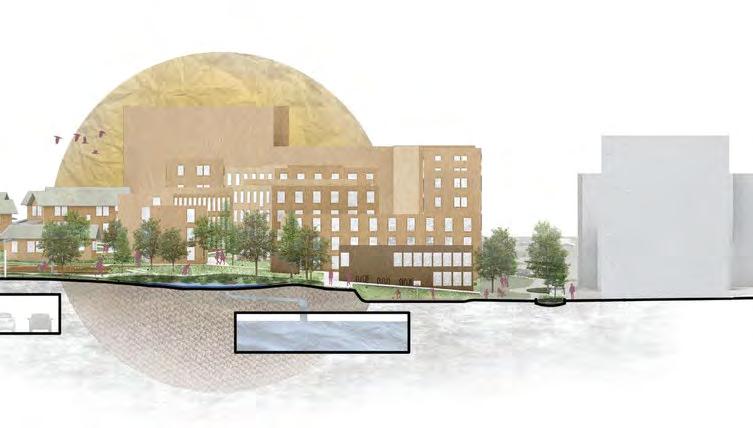

Section east/west looking north at detention pond and water cistern.
The plaza and adjoining playground invite a swarm of activity for all. The play area includes a skatepark made from recycled concrete from the site, a nature playground which will use downed trees from the site, and a sunken basketball court that can capture overflow rainwater from the lid. The goal of circularity and conserving resources is alive in every aspect of this zone. The water detention pond indicates where the lid’s bioswale culminates to filter the water before entering the water cistern below grade. The water in the cistern is reused on-site for irrigation and climate resiliency. As this area is one of the first things that people see from the southwestern corner of the site, we wanted to invite opportunity for intergenerational play and connection. The edge of the skatepark and basketball court transition into 7th Ave, which is now quieter with the addition of chicanes and bioswales. The bioswales treat stormwater from the street and sidewalk, before it enters the city’s water system.
skatepark with recycled concrete
nature play with trees from the site
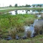
bioswales for street stormwater detention pond and water cistern
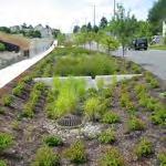
permeable pavers for fire lanes
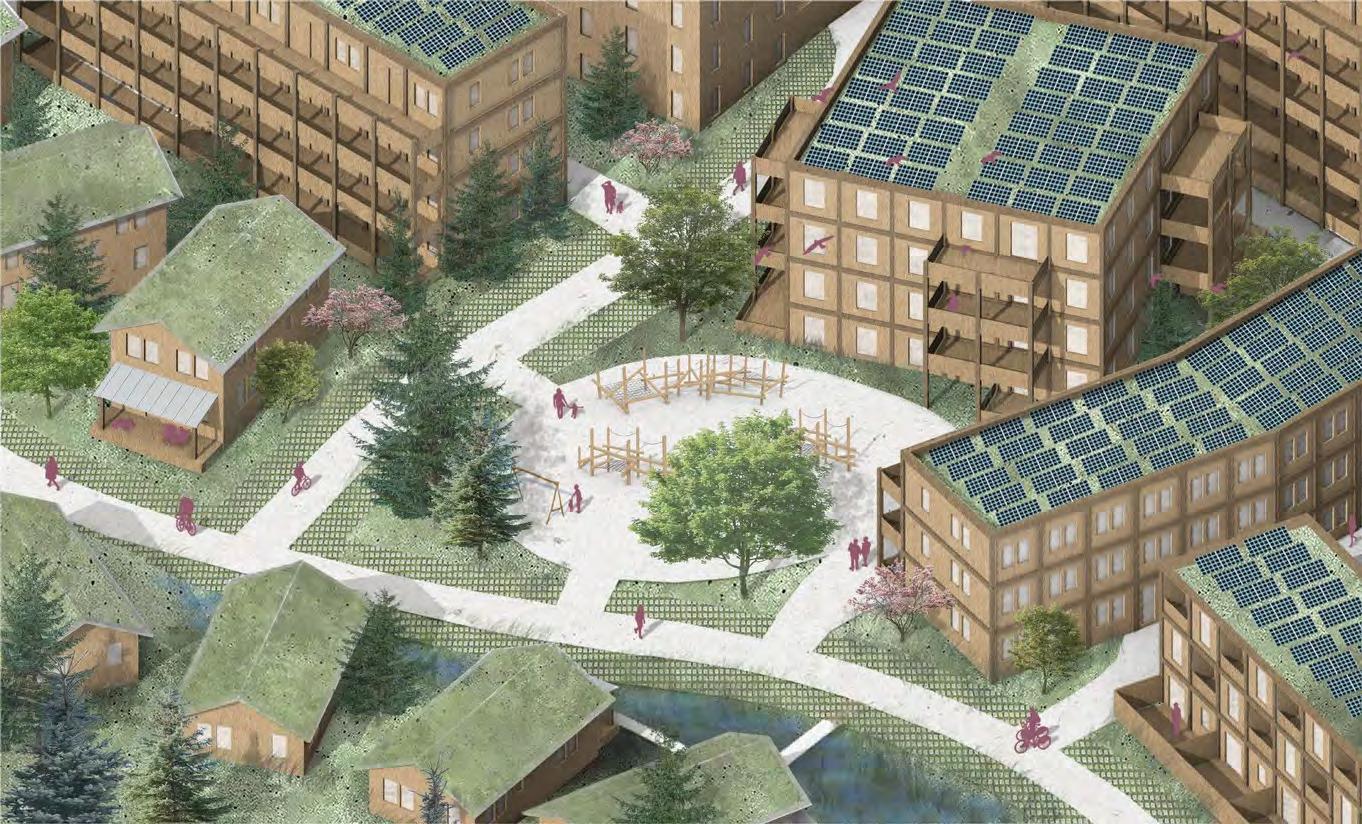
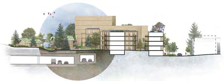
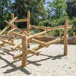
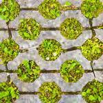
Section east/west looking north through residential area.
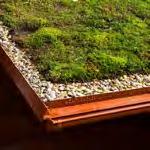
The housing on the site functions as a cooperative land trust geared towards families and students. Residents pay a monthly “rent” based on their income that goes towards maintenance and operations. The housing community includes shared green spaces with playgrounds for children and families. The mix of point access apartments, single-loaded corridor apartments with exterior circulation, and townhomes offers a variety of larger, family-friendly housing options with more bedrooms, outdoor connectivity, and access to light and air. The double-aspect units provide the opportunity for crossventilation, making them less energy-intensive. Small co-living cottages on the interior of the site offer a quieter housing option for roommates or multigenerational families. All buildings are constructed from mass timber and CLT, with green roofs. The solar array performance is enhanced by combining them with green roofs.

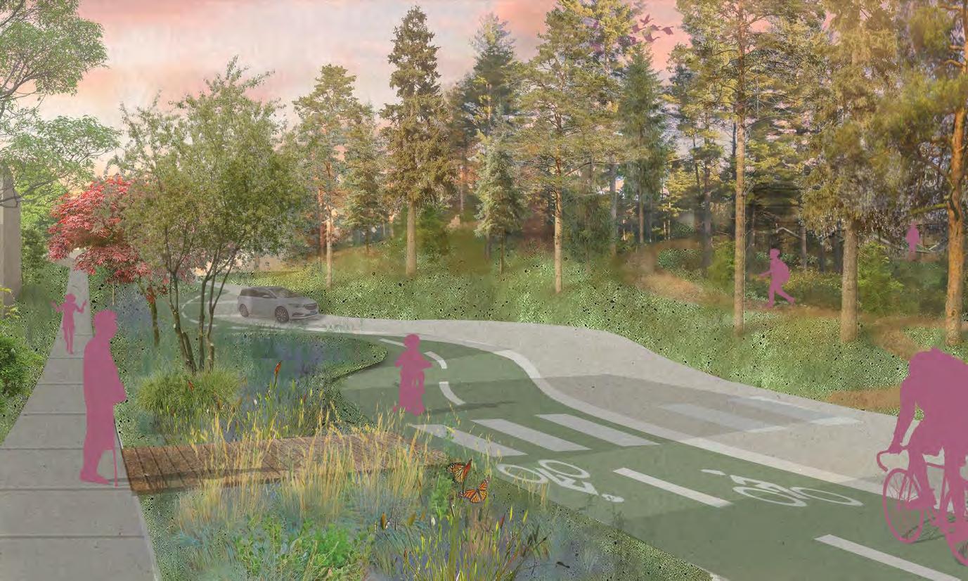


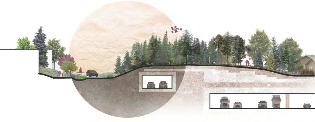
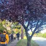
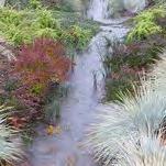
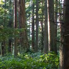
The northwest quadrant of the site is a quieter, more intimate space. A twoway bike lane running along 5th Avenue creates a north/south commuter connection for the site. Existing street trees are retained and a bioswale is added in the chicane bump-outs, which slow down the car traffic to enhance the biker and pedestrian experience and add green space to the nearby residences. The southbound on-ramp is concealed under the high point of the site, which is covered in a dense Pacific Northwest evergreen ecosystem. Pedestrian connections take the form of winding hiking trails through the forest. By narrowing the road, increasing the bike lane, and providing multiple pedestrian pathways, we hope to encourage a mode shift away from a carcentric way of life. We acknowledge that while we cannot completely erase cars, we can make it more favorable to bike, bus and walk.
Inspired by the symbiosis between mycorrhizal fungi and plant roots, this concept reflects upon the relationships that exist between neighborhoods and seeks to further connect these communities across scales, modalities, and cultures.
This dynamic high-density lid redefines city living, integrating mixed-use buildings, park spaces, and a market plaza to foster a harmonious blend of community and commerce. The proposal also includes a recreational field land swap. This multifaceted approach not only enhances the cityscape but creates a thriving ecosystem where residents can live, work, and play.

Ecological Integration
Incorporates green spaces, living walls, and ecological design to enhance biodiversity and the urban environment
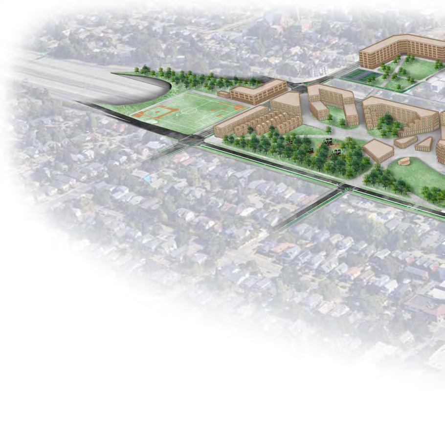
Encourages multimodal transit options to reduce reliance on personal vehicles for a more sustainable and connected community

Promotes circular food production and waste management programs to minimize waste and promote resource efficiency

Develops mixed-use development and economic incentives to foster inclusivity and community engagement
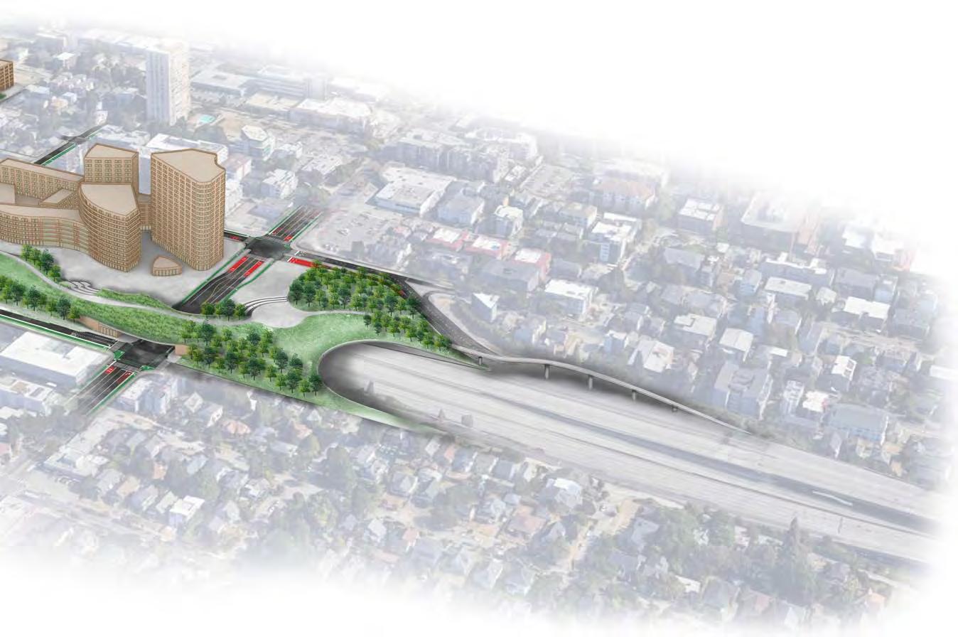
 Market Plaza
Pedestrian Bridge & Outlook
Land Swap Development
Recreation Field
Urban Forest Playground
Greenhouse/ Restaurant/ Recycling Center
Amphitheater
NE 50th St.
Market Plaza
Pedestrian Bridge & Outlook
Land Swap Development
Recreation Field
Urban Forest Playground
Greenhouse/ Restaurant/ Recycling Center
Amphitheater
NE 50th St.
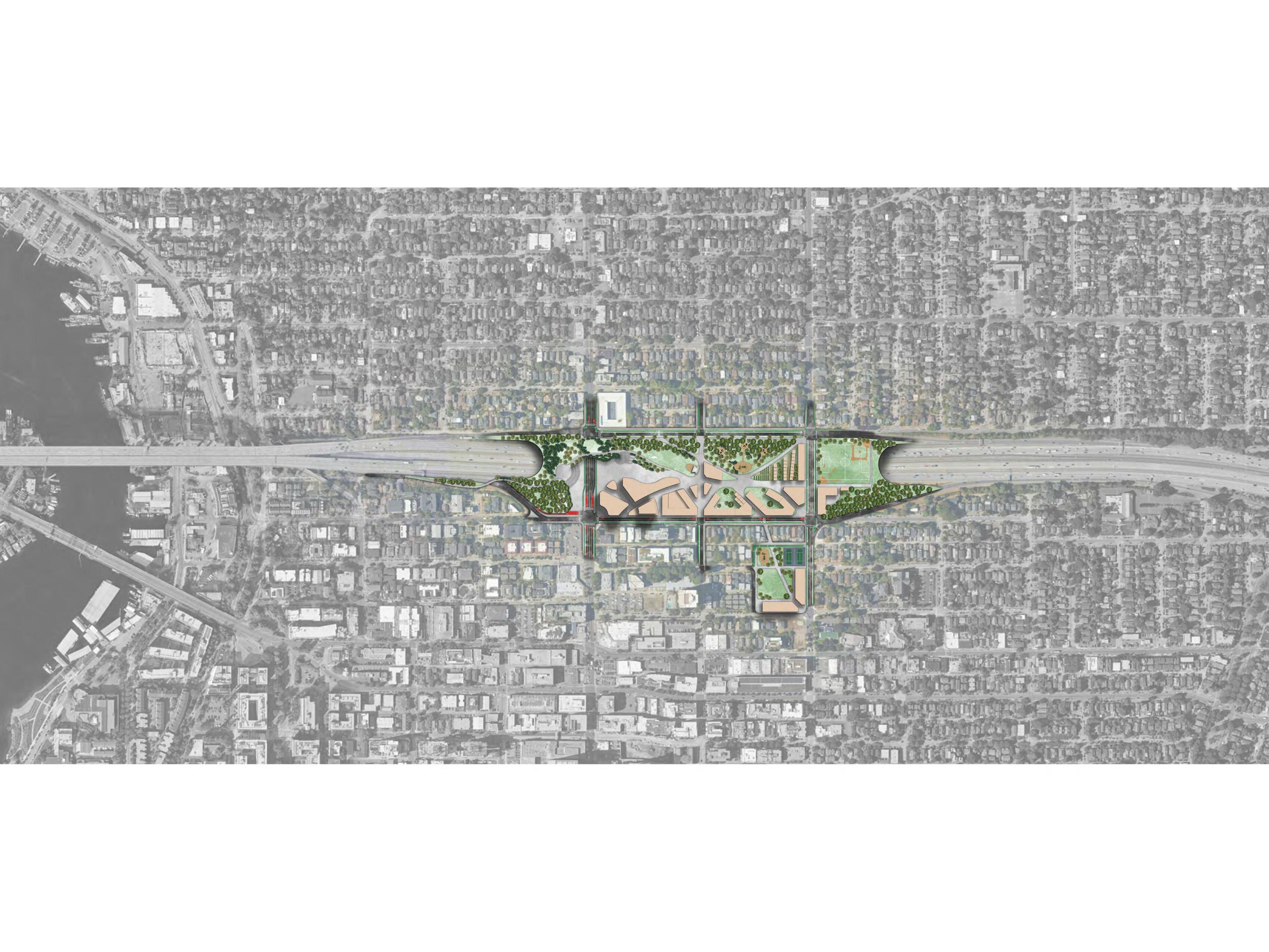
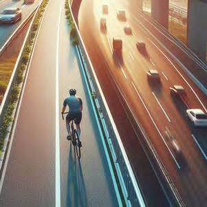
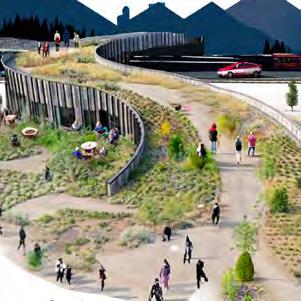
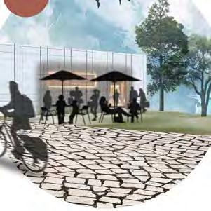

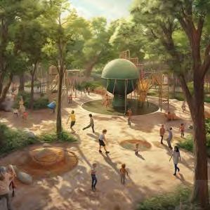
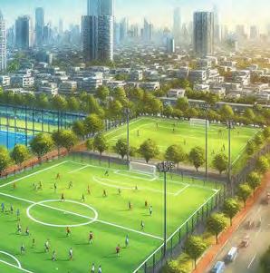
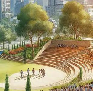
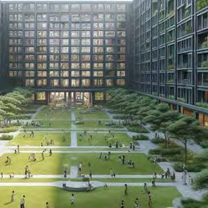
The lid design provides additional support for pedestrian and cyclist mobility, with circulation patterns mimicking natural forms of movement weaving through the site. Bicyclist movement is supported by development of the “Bicycle Snake” overpass that offers connections between the lid’s pedestrian bridge, transit center, and into the University District toward the Burke-Gilman trail.
Private Space
Public Space
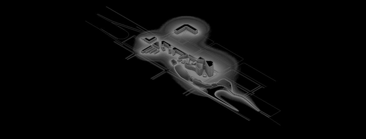
Green Space

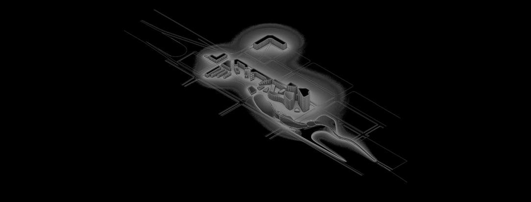


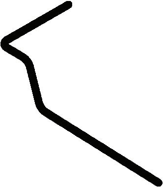


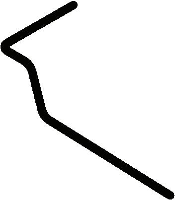
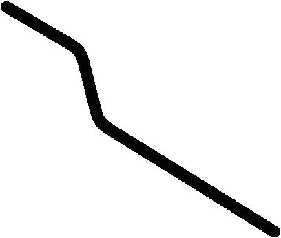
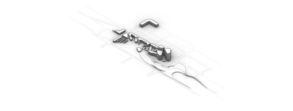


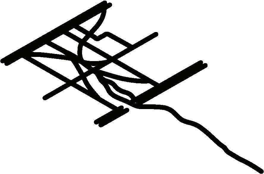


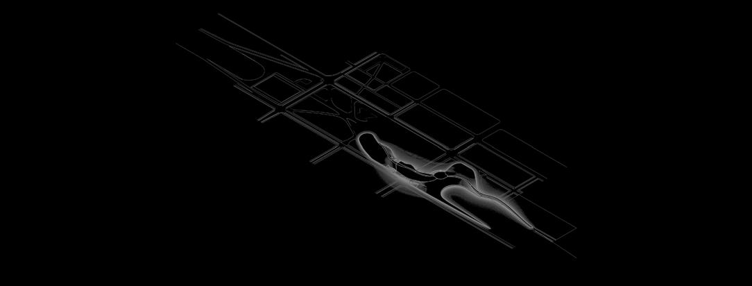
Ramp Removal*


*There are eight existing exits on the site, removal of interior ramps will retain the four exterior ramps
The market plaza is where culture and commerce converge. Its lively stalls and diverse offerings create a bustling hub, fostering connections among locals and visitors alike. This core feature of the lid breathes life into the site, embodying the spirit and vitality of the surrounding area.


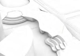
Covered open-air market space on ground floor with permanent vendor space, top-floor indoor market
Open plaza available for cross site travel, as a performance venue, or additional market space
1 2 3
Lookout spot over market plaza from pedestrian bridge, second to the Seattle skyline viewpoint
4
Ground floor entrance to retail space under pedestrian bridge with covered patio seating area
ADA Accessible Elevator available from ground floor retail under pedestrian bridge
3
4
Bridging the movement between the urban forest and the market plaza, this building is a unique haven combining a restaurant, greenhouse, and community recycling center. Diners experience locally sourced produce and exquisite dishes crafted on site, while the greenhouse offers a look into sustainable agriculture operations. The community recycling center actively engages visitors in environmental stewardship, making it a beacon of sustainable innovation on the urban landscape.
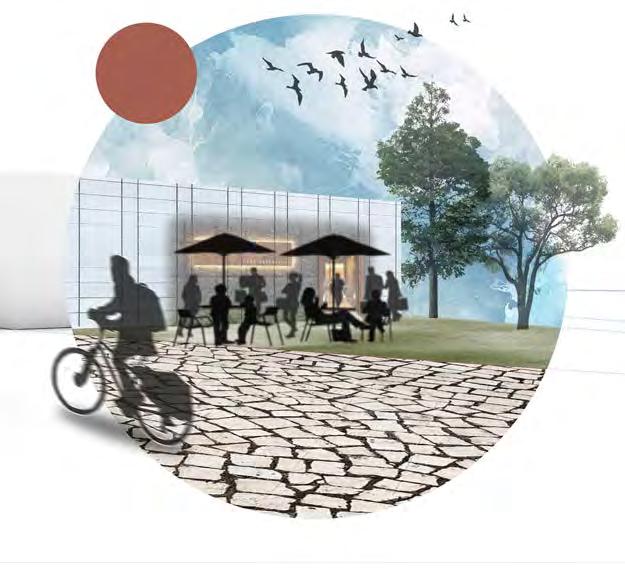
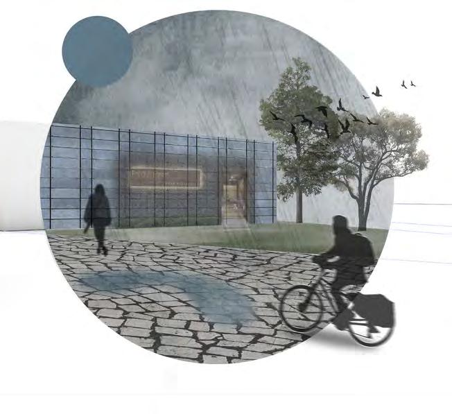
Southern facing viewpoint of the Seattle skyline from the outlook of the pedestrian bridge, connections with Bicycle Snake are shown to the left
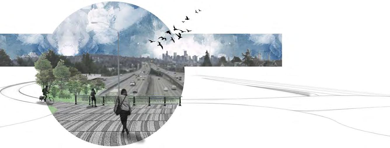
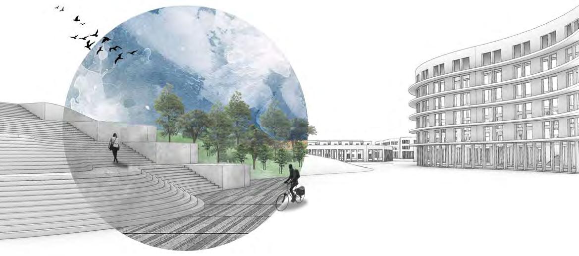
View facing North from the Market Plaza showing the pedestrian movement up to the Pedestrian Bridge or further into the lid’s developed area
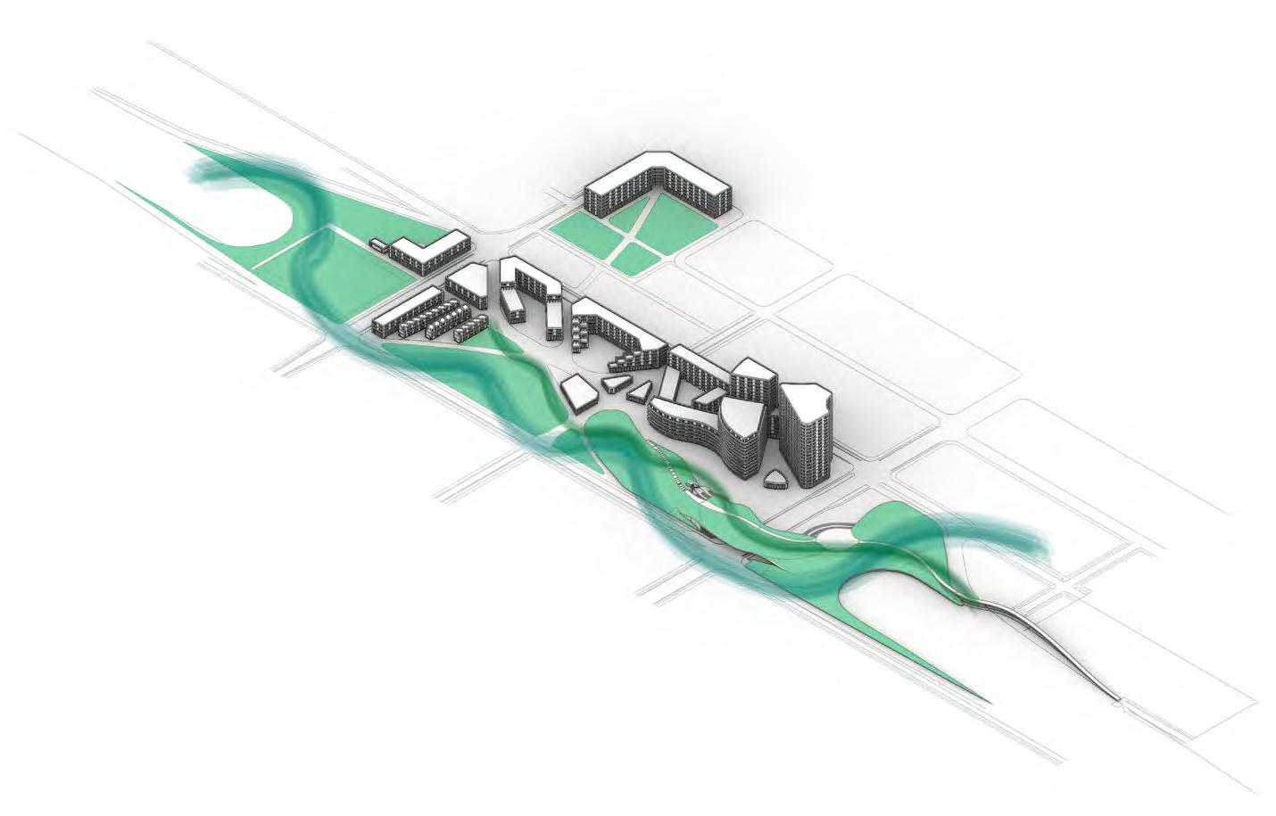
Urban Forest belt
Utilizing terra firma along sides to create an urban forest belt along the lid - creating habitat for the non-human
pollinator belt
Placed along lid proper to connect green space without access to deep soil & utilize native plant species
Central gardening space in close proximity to residents & placed along pollinator corridor to provide ease of access 1 2 3 4
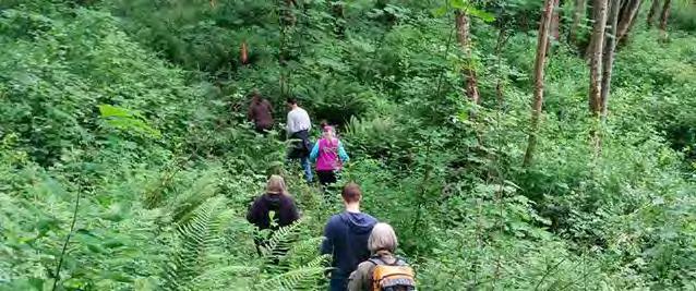
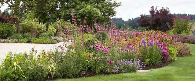
Community garden nature playground
Urban nature playground built into forest belt, with types of play varying from traditional playgrounds to rugged nature play
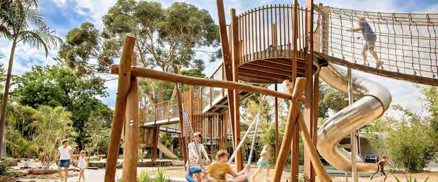
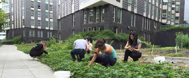
The high-intensity lid features an abundance of buildings with programming including large mixedincome residential communities with amenities including commercial space and both indoor and outdoor communal spaces.
Residential buildings range from:
• 3 story townhomes
• 3-8 story mid-rises
• 10-20 story high-rises
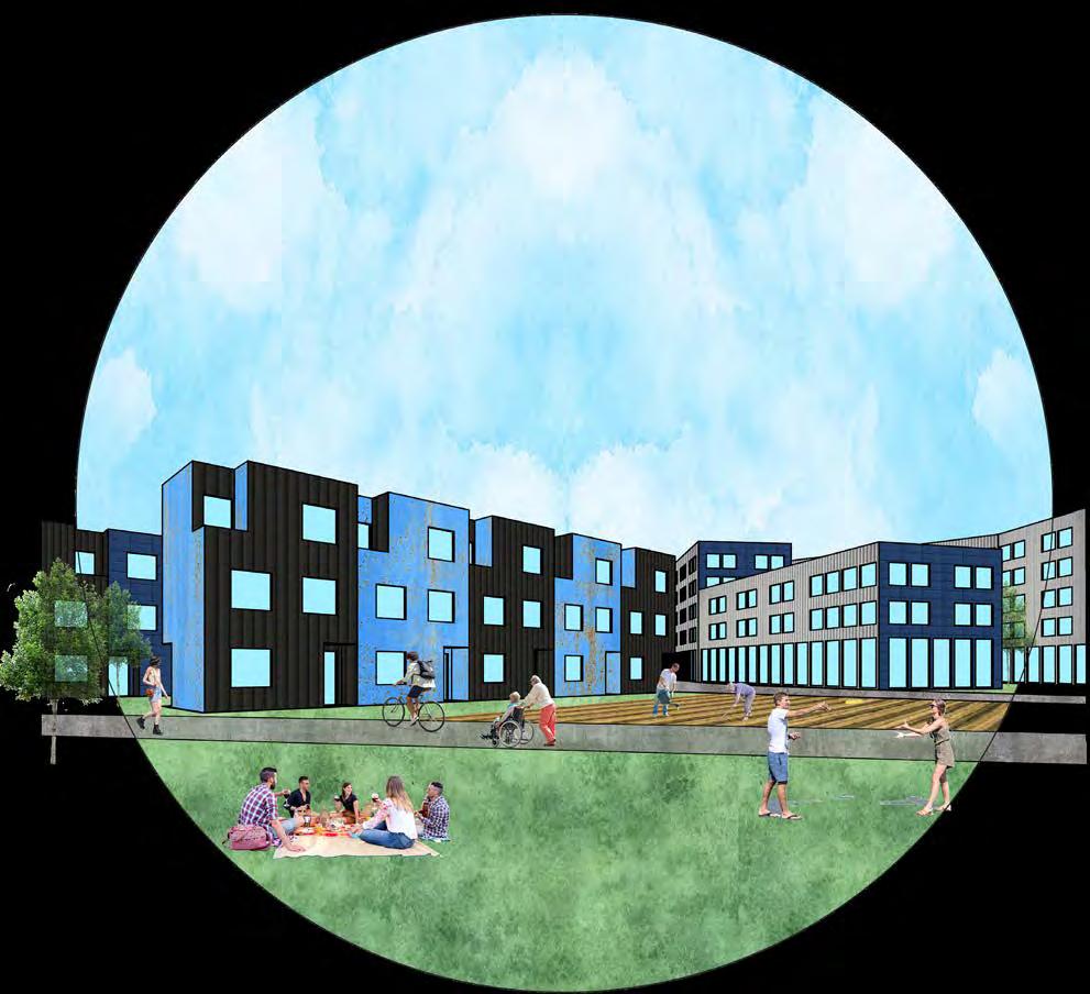
Each building features groundfloor commercial and/or communal space (including community gardens), and rooftop communal space and/or photovoltaic arrays.
The residential building heights in the image below reflect the adjacent zoning designated by Seattle’s latest Comprehensive Plan.
U-DISTRICT
RESIDENTIAL
COMMUNAL
7TH AVE NE
PEDESTRIAN
RESIDENTIAL
COMMERCIAL COMMERCIAL
TERRA FIRMA - HEAVY BUILDINGS ABOVE
WALKING STREET
MARKET PLAZA
I-5
NORTH
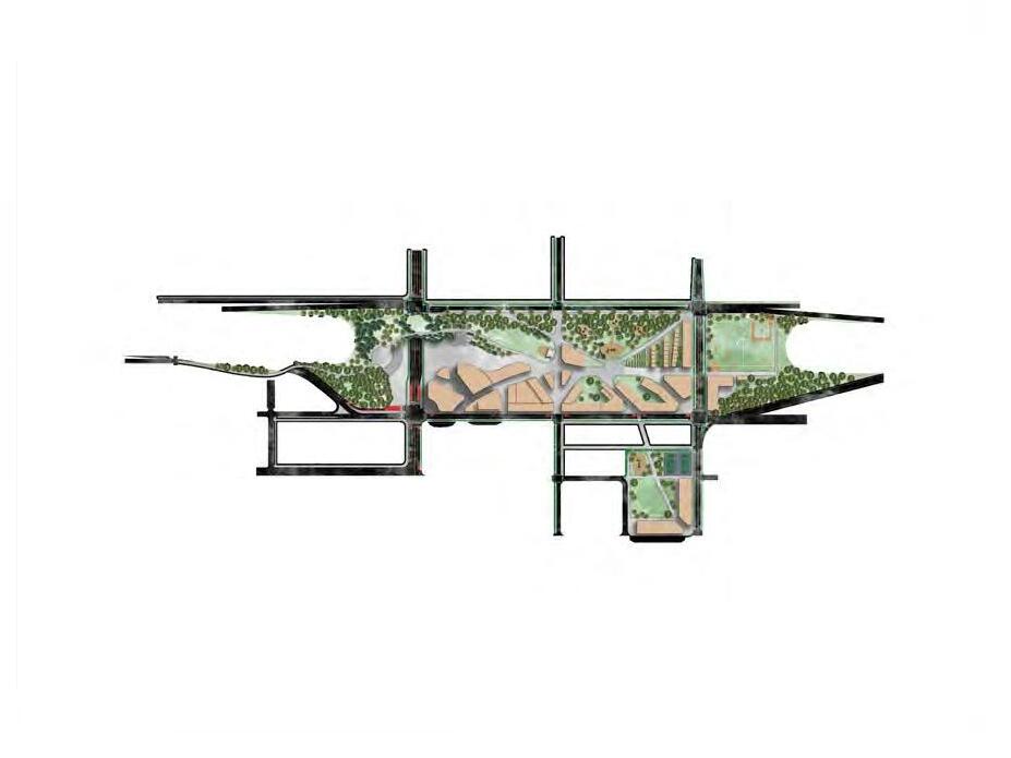
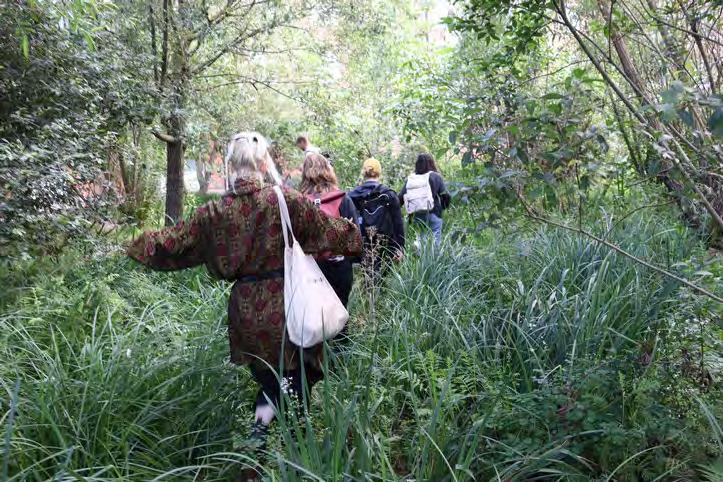
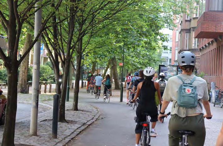
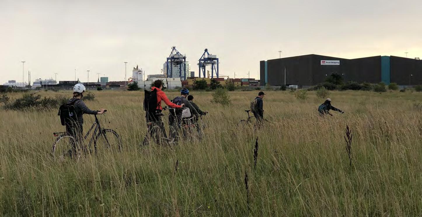
Image Source (above): Darryl Vallejos
Image Source (below): Clelie Fielding
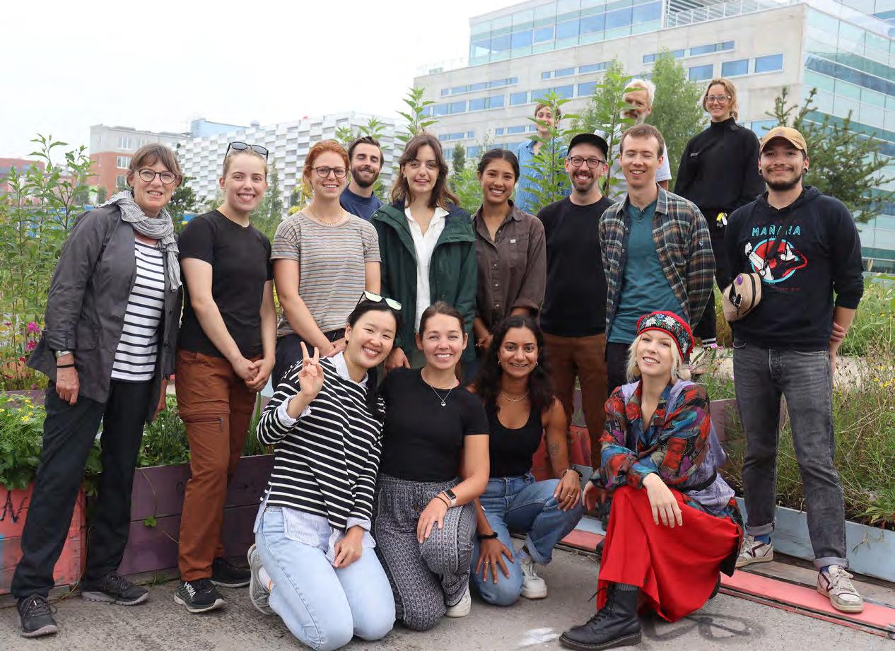
A business-as-usual approach is not how the global community will achieve the UN’s ambitions to reduce global carbon emissions. This will take radical change – and brand-new original solutions, which must be included in process planning from the first link of the value chain.
–Lene Dammand Lund, Roy al Danish Academy in Climate