4 minute read
HENRY’S AVALANCHE TALK


SNOW REPORT
off-piste skiing conditions, although we’ll be choosing our low slope angles, <30° (the steepest part of a red run) to start with, and keeping a wary eye out for any signs of recent avalanche activity.
Advertisement
Brought to you by Henry’s Avalanche Talk www. henrysavalanchetalk. com Unsettled weather and plenty of snowfall in the Northern French Alps next week. After a mild sunny start to the current week, it’s now back to winter with a vengeance! From Tuesday night, we had another period of extremely stormy weather, with howling NW winds and snowfall and much lower temperatures. 198 km/hr gusts were recorded at the Pissaillas glacier on Wednesday afternoon! After Thursday’s snowfall, we have a sunny Friday morning and avalanche danger rating 3 with fresh wind blown snow on all aspects. This means it is easy for a skier to trigger an avalanche on all aspects. Recent history of the snowpack 1. Before recent snow storms the snowpack had become extremely stable, certainly up to 2500m or so. This settling was because of the warm weather and rain humidifying the snowpack, followed by its subsequent refreezing and becoming very solid. Some days the avalanche danger rating had even been down to a 1/5. 2. Check out what the avalanche danger ratings mean.
3. However, now with all the new snowfall, and more expected next week, we will be seeing increased avalanche activity. What is the current avalanche risk in the Savoie? As we write, the avalanche risk is currently 3/5. Avalanche activity is very likely, both spontaneous and skier triggered. This will be true with each fresh snowfall. For any specific points about snow stability, you need to check the daily avalanche bulletins, particularly when any fresh snow comes. Credit: Wayne Watson
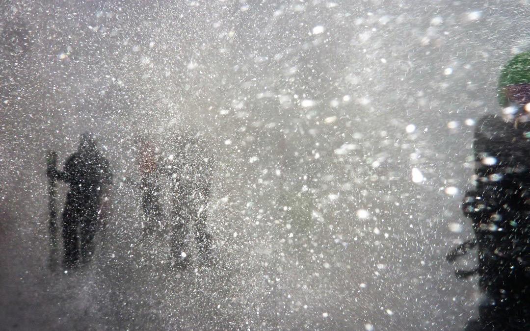
Off-piste skiing conditions are very varied at the moment, largely due to the wind. Snow’s been blown all over the mountain, causing some deep drifting to occur, and some very bare areas where the snow’s been scoured off altogether. Despite poor visibility and strong winds, thanks to lower temperatures and fresh snow, we advise you to wrap up warm and get out there. There are some fantastic fresh light powder snow conditions to be found if you brave the elements. With more fresh snow expected next week, we’re looking forward to some fantastic Where is most at risk at the moment? Steep slopes with terrain traps beneath them are always going to be particularly at risk. When we receive 75 cm to a metre of new snow (which can also mean accumulations of wind-transported snow), this can produce some very large avalanches due to the increasing load of snow, pushing through to some isolated old weak layers which still exist. The best way for you to keep track of snow stability (which is even difficult for the experts) is to look out for evidence of avalanche activity. How does the forecast look for the
coming week? SATURDAY 29: Cloudy sky becoming overcast later. Snow starting in the afternoon at the Italian border. Snow/ rain limit 1700m in the afternoon, falling to 1350m in the evening. Maximum temperatures: +1 to +4°C at 2000m. Snowfall forecast at 2000m: 7-15cm. Wind at 2000m and 3000m: S to SW, 60/80 km/h. SUNDAY 1: Clouds and storms, return of snow in the evening with 5-10 cm at 2000m, (locally 15 cm). Maximum temperatures: 0 to +2°C around 2000m. Wind at 2000m: SW 10/30 km/h, increasing to 50km/h at the end of the day. MONDAY 2: Snowy in the mountains. Snow/rain limit- 1400/1800m, down to 1000m later. Snow forecast: 15-30 cm at 2000m. Wind at 2000m: S 50/70 km/h TUESDAY 3: A weak current turns to the NW and accelerates. A little more sun with snow becoming scattered in the morning.

WEDNESDAY 4: The WNW current remains rapid. Many clouds and heavy precipitation. 0°C Isotherm: rising to 1600m during the day, then falling to 1000m. THURSDAY 5: The WNW current slows down. Many clouds, precipitation becoming less marked. 0°C Isotherm: 900-1000m. FRIDAY 6:The WNW current slows down a little more and turns to WSW. More sun and less precipitation. 0°C Isotherm: 1500m. Tip of the week This week’s tip comes from avalanche expert, Alain Duclos, from data-avalanche. org in his advice to professionals during and after the upcoming snowstorms in the N French Alps in the next week or so: “The best clue about avalanche danger is avalanches!!”. Or ‘recent avalanche activity’ as we call it at HAT.


N E W F I N E F O O D S D E L I C A T E S S E N I N T H E T O U R I S T O F F I C E S Q U A R E . O R D E R O N L I N E A T l m d l m . c o m O R VISIT THE STORE