1. Introduction The Village of Buffalo Grove (the “Village”) seeks to establish a Tax Increment Financing (“TIF”) district to serve as an economic development tool and promote the revitalization of a portion of the Village including the Town Center area, Chase Plaza and other nearby properties. The Village engaged SB Friedman Development Advisors (“SB Friedman”) to conduct a TIF District Eligibility Study (the “Eligibility Study”) and prepare a Redevelopment Plan and Project (the “Redevelopment Plan”). This document serves as the Eligibility Study and Redevelopment Plan (the “Report”) for the proposed 2020 Buffalo Grove Lake Cook Road TIF District Redevelopment Project Area (“Lake Cook Road RPA” or the “RPA”). Section 2 of the Report, the Eligibility Study, details the eligibility factors found within the proposed RPA in support of its designation as a “blighted area” for vacant land and a “blighted area” for improved land, within the definitions set forth in the Illinois Tax Increment Allocation Redevelopment Act, 65 ILCS 5/11-74.4‐1 et seq., as amended (the “Act”). Section 3 of this Report, the Redevelopment Plan, outlines the comprehensive program to revitalize the RPA, as required by the Act.
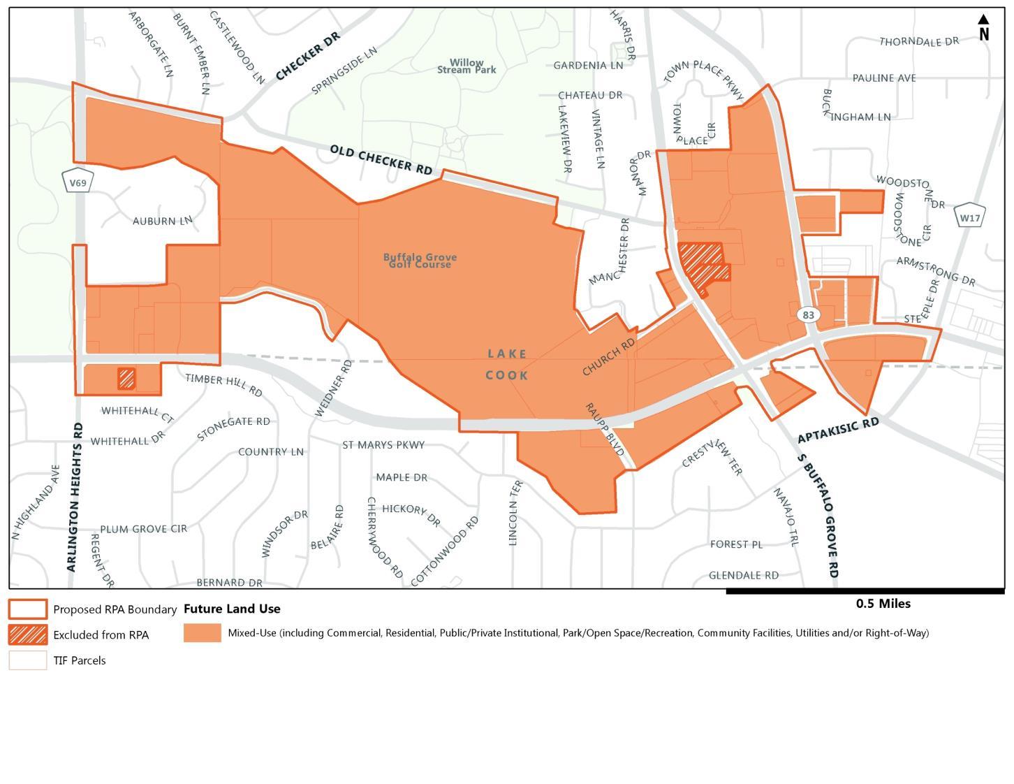
Redevelopment Project Area The proposed Lake Cook Road RPA is located within the Village of Buffalo Grove, with portions in both Lake and Cook Counties (the “Counties”), as shown on Map 1. The proposed Lake Cook Road RPA consists of approximately 109 tax parcels (58 improved parcels, 8 vacant parcels and 43 prescriptive right-of-way and utility parcels) and 38 buildings. It comprises approximately 330 acres of land, of which approximately 141 acres are vacant, 135 acres are improved, and approximately 53 acres are right-of-way or utilities. The parcels included in the proposed RPA are roughly bounded by Arlington Heights Road to the west, McHenry Road to the east, Old Checker Road to the north and Lake Cook Road to the south, as illustrated in Map 2. SB Friedman’s analysis was completed for both vacant parcels and improved parcels, as shown in Map 3. Based upon SB Friedman’s research, the RPA currently consists of a mix of commercial, residential, public institutional, park/open space, and vacant land uses, as shown in Map 4.
Determination of Eligibility This report concludes that the proposed Lake Cook Road RPA is eligible for designation as a “blighted area” for vacant land and as a “blighted area” for improved land, per the Act. Vacant land is any real property without industrial, commercial or residential structures, and has not been used for commercial agricultural purposes in the past five years. For the purposes of analysis, in a previously developed area, parcels that include side yards, detention ponds or parking lots related to an adjacent building are considered improved.
VACANT PARCELS: BLIGHTED AREA FINDINGS Per SB Friedman’s analysis, the vacant portion of the RPA is eligible as a “blighted area” under both the onefactor and two-factor tests as outlined in the Act. For both one-factor and two-factor findings, these factors are defined under the Act at 65 ILCS 5/11‐74.4‐3 (a) and (b) and are more fully described in Appendix 2.


