4 minute read
Hoover Dam’s Historic Railroad Tunnel


By Cliff & Ilene Bandringa
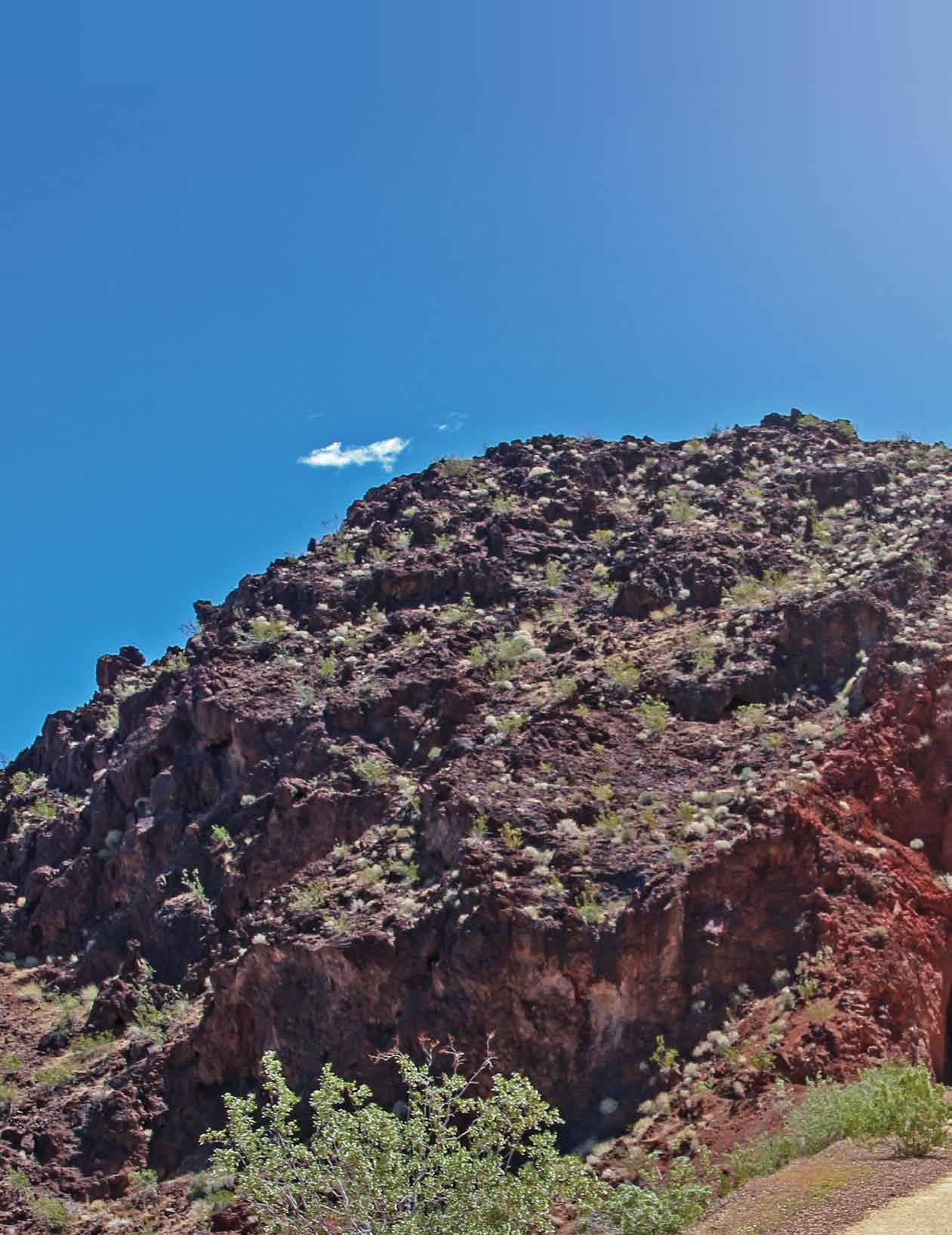
Hoover Dam is a major attraction for the Las Vegas area. This engineering masterpiece is accessed by vehicle via two other masterpieces of engineering, a roadway that clings to the rugged landscape and the new bypass bridge (Mike O’Callaghan–Pat Tillman Memorial) perched high above the dam itself. But many don’t know of another way to visit Hoover Dam. That other way is an easy and scenic hiking trail. Designated a “National Historic Trail” in 2015, the Historic Railroad Tunnel Trail (HRTT) takes you through five uncommon tunnels and offers outstanding views of Lake Mead along the way. Because this hike is on an old railroad bed, it is flat
Advertisement
Hiking Trail
and level most of the way, making the 6-7 miles round trip (depending on where you go) easy to walk, bike, or even push a baby stroller on.
Using the HRTT to hike to the dam is a great alternative to dealing with the ever-present traffic congestion that awaits anyone approaching the dam. The trail ends at the Hoover Dam Visitor Center and, if you walk a little further, you can be out on the dam itself. It’s also a nice bonus that, since you left your car at the trailhead, you won’t have to pay the $10 (or more) parking fee at the Visitor Center.
Once at the Visitor Center, it’s only another one-mile round trip to walk over the bypass bridge, which will give you the best view of the entire Hoover Dam facility. This is a good option if you have the energy (making the hike a total of 8 miles roundtrip) and want to walk on the bridge. There is a small parking area available for those who want to drive to this point and then walk on the bridge, but it fills up quickly.
Getting to the trailhead is easy. From Las Vegas, take I-515/I-11 to Boulder City. Follow the signs to Boulder City but don’t stay on I-11. Follow the main road as it turns left in the center of Boulder City. From the turn, the entrance to the trailhead is 3.7 miles on the left. Look for a sign that points to the Lake Mead Visitor Center. The trailhead parking lot is located just past the Visitor Center.
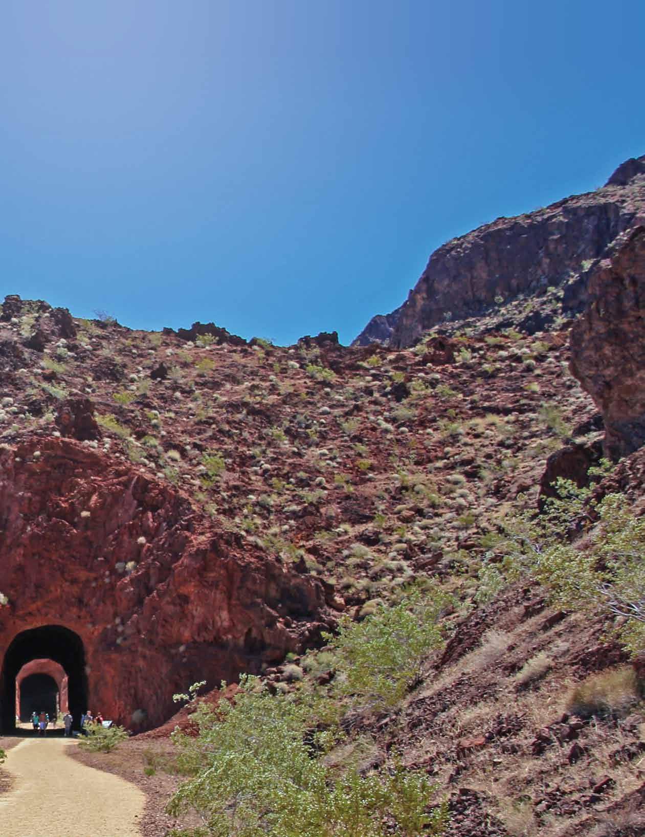
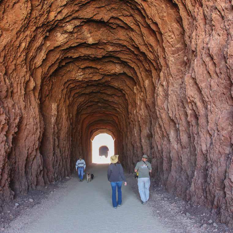
Walking through one of the tunnels. Construction of the railroad began in 1931. Between Boulder City, the Hoover Dam construction site, and places that are now under the waters of Lake Mead, almost 30 miles of railroad lines were built. Most of the building material used to build the dam, including cement and gravel, as well as all the electrical generating hardware, was transported over the railroad bed that you are now hiking on. Think of that as you walk along – everything it took to build this incredible dam once took the same trek you are taking now. The railroad was last used in 1961 to transport the last generator that was installed that year, and then the rails were pulled up a year later.
As you walk through the tunnels, take a good look. These are not your ordinary railroad tunnels. They were built much wider and taller so that they could accommodate the huge pieces of equipment being transported to the dam. Walking through the tunnels is a delight. Although some of the tunnels have “shotcrete” to help stabilize them, other tunnels still look as they did when the trains passed through. You can easily see the colorful and complex rock formations that the tunnel builders had to bore through.

The trail continues through five tunnels and passes by several interpretive signs pointing out historical places. It goes through a utility area for the dam where there are muchwelcomed restrooms, a water fountain, and a shaded picnic table. Then the trail passes through an equipment “boneyard”, which is like a museum. Various kiosk signs explain the assorted pieces you’ll see lying around.
As you exit the boneyard, the road to the right leads down to the bridge. If you want to add that extra mile to your hike, follow this road, and you’ll be rewarded with a breathtaking view of the dam. Otherwise, continue straight to the Visitor Center and the dam itself.
When we took this hike in April, we saw a good mix of wildlife along the trail, including desert bighorn sheep. We also saw several large lizards, including chuckwallas that, like the bighorn sheep, thrive in the rocky landscape here.V
To learn more about this hike, visit our travel blog at www.BackRoadsWest.com/ blog, then search for “Hoover Dam”. On YouTube, take our virtual hike by searching for “Hoover Dam Historic Railroad Trail” by BackRoadsWest1.
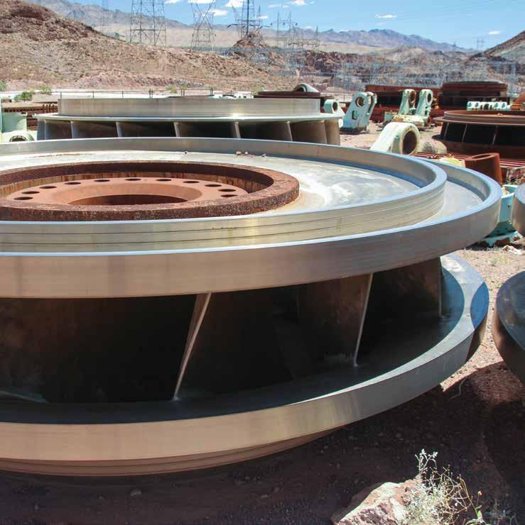
Above: Generator turbine in the boneyard. Below: View of Hoover Dam from the end of the trail.


