
6 minute read
Attractions around the Region

from Visit Hughenden

PORCUPINE GORGE NATIONAL PARK Known as Australia’s ‘Little Grand Canyon’ with its cool, clear, flowing creek, towering cliffs of vibrantly coloured sandstone and dense vegetation. The Gorge provides a striking contrast to the sparsely wooded, dry, flat plains which surround it. This impressive canyon reveals strata of sedimentary rocks spanning hundreds of millions of years of geological history.
Porcupine Gorge National Park is a canyon hidden away approximately an hour’s drive north of Hughenden. Explore the numerous points of interest along the fully sealed road. The Gorge has been carved over time revealing layers of basalt and coloured sandstones, creating the beautiful soft colours of the cliff walls that tower over the creek below.
The Gorge can be appreciated from two distinct areas. The first point is a lookout giving a view deep into the Gorge below. There is no access to the base of the Gorge from this point. The second is a National Park campsite area. Walking tracks take visitors either along the rim or down to the base of the Gorge where the Pyramid formation is a prominent feature. Intermittent waterholes line the base of the Gorge, a perfect place for a cool swim.
The Gorge is a great spot for bird watching with bird, flora and fauna lists available from the Flinders Discovery Centre. There are picnic shelters and eco toilets at the campsite available for day visitors.
Camping sites must be booked in advance as there is limited mobile reception at Porcupine Gorge. Boasting a variety of caravan and tent sites, some of which have fire pits, they can either be booked online, by telephone or in person at the Flinders Discovery Centre.

WHITE MOUNTAINS NATIONAL PARK White Mountains National Park is characterised by white sandstone formations and complex gorge systems that cover 108,000 ha of rugged terrain. For much of the year this vast area is an arid landscape but during the wet season it becomes a water catchment for streams and rivers. These eventually feed into Lake Eyre in South Australia and the Gulf of Carpentaria in North Queensland.
Encompassing a total of 14 different ecosystems, winter and early spring transform the landscape as the native plants bloom into a palette of colour. White Mountains National Park is very remote and undeveloped and is only suitable for well equipped, experienced bushwalkers and campers. Campsite access is from the Flinders Highway 107 km east of Hughenden or 140 km south west of Charters Towers where it is recommended for

4WD vehicles only. Campsite bookings are available by phone or online, or at the Flinders Discovery Centre.
MOORRINYA NATIONAL PARK 90 km south of Torrens Creek, along a partially sealed road in the heart of the Desert Uplands, the 32,607 ha Moorrinya National Park protects 18 land types in the Lake Eyre Basin, one of Australia’s most important water catchments.
This historic sheep station, previously known as Shirley Station, still contains the old shearing shed and workers quarters amongst other historical features.
BLACKBRAES NATIONAL PARK Blackbraes National Park and three associated resource reserves cover an area of approximately 52,000 ha. This park straddles
the Einasleigh Uplands and the Gulf Plains biogeographical regions. Access is via the Kennedy Developmental Road 170 km north of Hughenden, which has sections of unsealed gravel road. The vegetation is largely open eucalypt woodland dominated by ironbark trees with spear and kangaroo grasses populating the grassy understorey.
Visitors who enjoy geology, dense woodlands or bird watching should find Blackbraes National Park of interest. The park is particularly diverse in birds, with over 150 species of birds recorded. Camping is available at a shady bush camp near Emu Swamp Dam, which is rich in birdlife.
Access to the campsite is along an unsealed road and is recommended for 4WD and high clearance vehicles only and is not suitable for caravans.
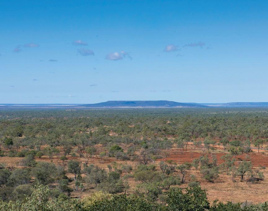
MOUNT WALKER Once you reach the top of Mount Walker you will be greeted with sensational 360° views of Hughenden and surrounds from six lookout points.
Named by explorer William Landsborough after Frederick Walker, Mount Walker is 478 m above sea level, making it 152 m above the township of Hughenden.
Located 10 km south of Hughenden with a steep sealed access road to the top, this road is unsuitable for motorhomes or towed vehicles. Sunrise and sunset on Mount Walker is a must for any keen photographer.
Picnic tables and shelters, free BBQs and public amenities are available at the top for visitors. No camping is allowed at Mount Walker. GENERAL INFORMATION Always check road conditions before travelling, as weather circumstances can change road conditions quickly.
NATIONAL PARK CAMPSITE BOOKINGS Please ensure campsites are booked before arrival at these national parks. Visit www.qld.gov.au/camping or phone 13 74 68 (24 hours, 7 days), or staff at the Flinders Discovery Centre can book your site for you.


KOOROORINYA NATURE RESERVE Travelling south of Prairie brings you to an oasis in the desert. Kooroorinya has a spectacular waterfall during the wetter months of the year and retains a secluded billabong during the drier months. Kooroorinya offers bushwalking, swimming, bird watching, fishing and some excellent photographic opportunities. Camping sites offer modern toilet facilities, hot showers and wood fired barbeques. Campers must call into the caretaker’s office prior to setting up.
This area comes alive each year at the Oakley Amateur Picnic Races held each May.
BASALT BYWAY The Basalt Byway is a 4WD track that takes you on a journey between the landscapes north of Hughenden through some amazing country featuring rolling landscapes of basalt walls (ancient lava falls, typically formed from the first lava to be issued from a volcanic eruption), creating deep meandering valleys. This soil is highly nutritious and is classed as prime grazing land.
This track crosses the Flinders River, boasting wonderful waterholes to swim in throughout the wetter months and excellent lookouts to view the length and depth of the valleys of the upper Flinders catchment.

There is an abundance of native flora and fauna to look at. Spotting the odd kangaroo, dingo and emu is always a feature of the drive. The birdlife is abundant and in the wetter months of the year the wildflowers and flowering gums are spectacular. Amongst the downs area the flower called the Flinders Poppy (Pimelea decora), which Hughenden is well known for, blooms in the drier months of the year, creating rivers of red along the open plains.
EROMANGA SEA BYWAY Running parallel to the Flinders Highway, 50 km south of Hughenden, this drive takes you through the prehistoric Eromanga Sea and the Desert Uplands.
Views from the scenic lookout gaze across the open sparse Mitchell Downs region. Take this picturesque 180 km 4WD loop from Hughenden and Prairie.
FLINDERS RIVER BYWAY The Flinders River Byway connects the Flinders Highway and the Kennedy Developmental Road, north of Hughenden. This impressive 4WD track crosses the sandy base of the Flinders River, and travels through rugged country with views of basalt walls running along the horizon.


