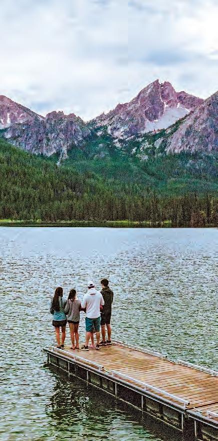
A Guide to Historic, Backcountry & Scenic Drives Across the Gem State
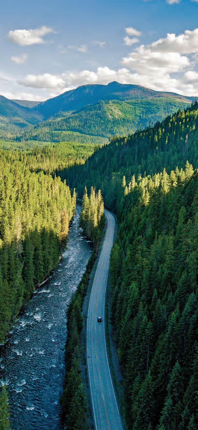
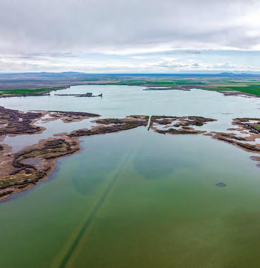
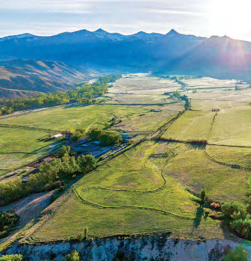
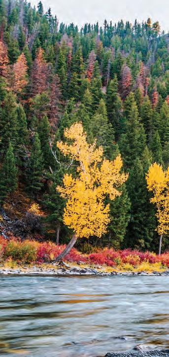
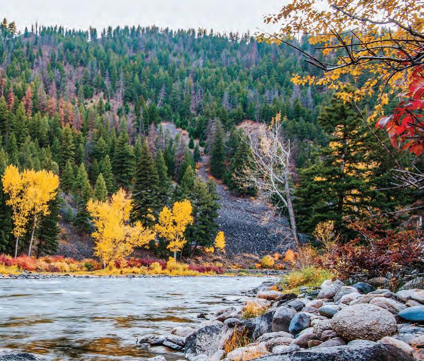
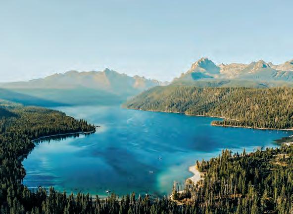
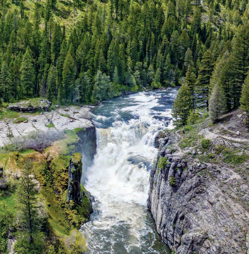
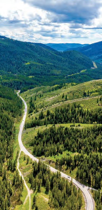
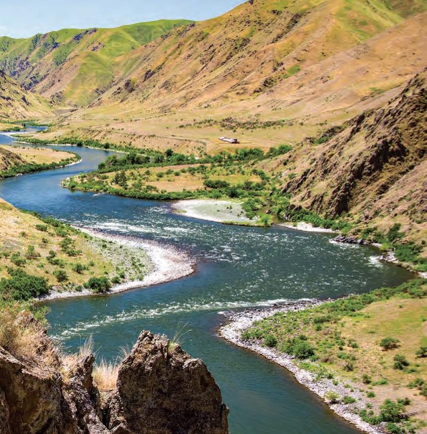
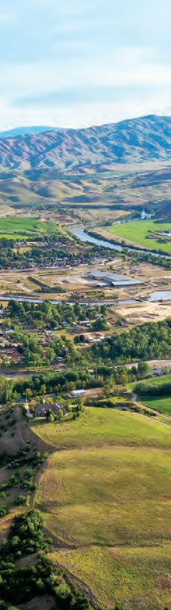
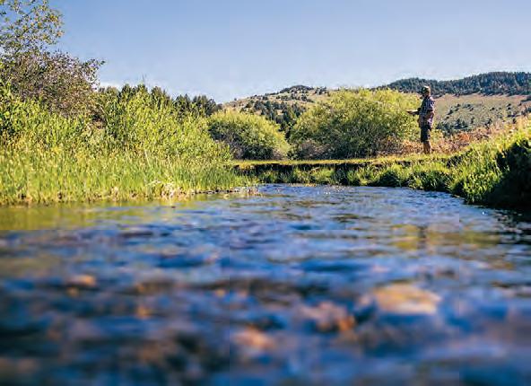
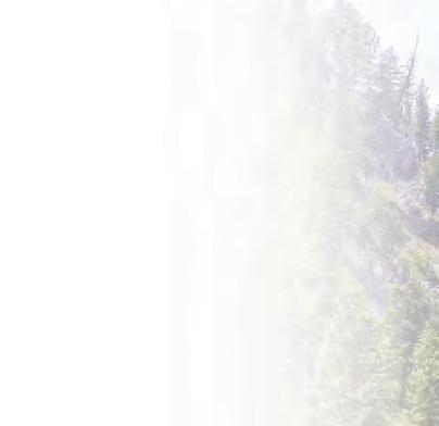
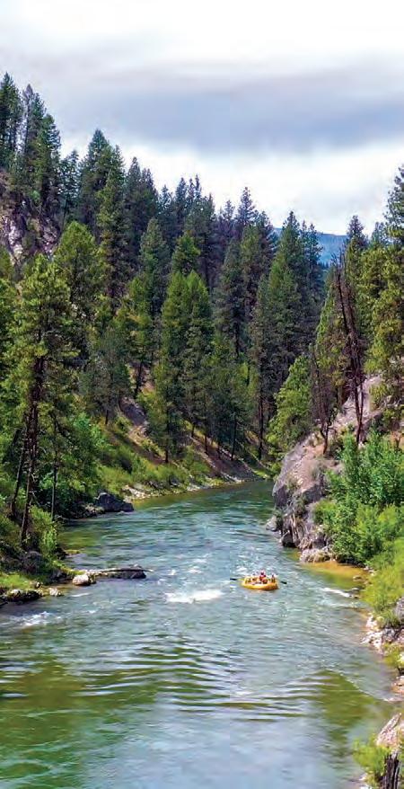
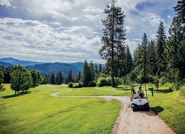
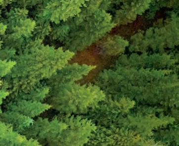
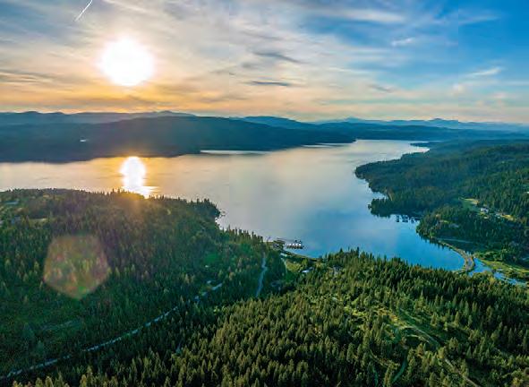
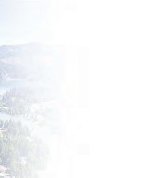
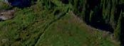
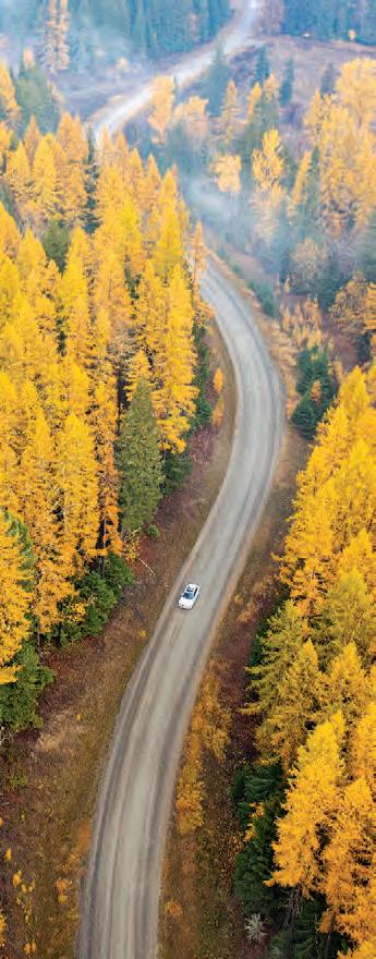
PAYETTE RIVER SCENIC BYWAY, NEAR SMITHS FERRY.
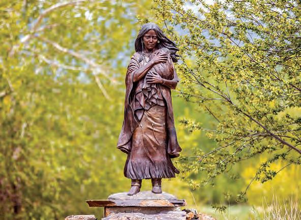
Sacajawea
Byway
Lewis and Clark
Byway
Peaks to Craters
Byway
Salmon River Scenic Byway
Sawtooth Scenic Byway
Mesa Falls Scenic Byway
Teton Scenic Byway
Lost Gold Trails Loop
Fort Henry
Byway
Byway 32 Oregon Trail–Bear
Thousand Springs
Byway
City of Rocks
Byway
Hells Canyon
Byway
Byway
Owyhee Uplands
Byway
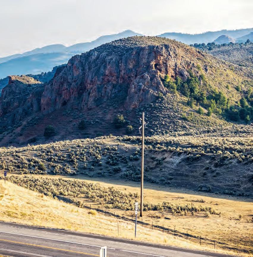
Payette River
Byway
52 Ponderosa Pine Scenic Byway 54 Snake River Canyon Scenic Byway 56 Western Heritage Historic Byway
58 Wildlife Canyon Scenic Byway
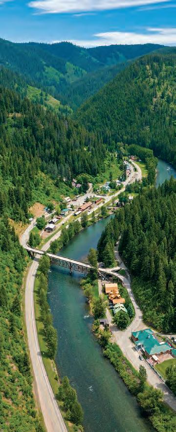
60 Northwest Passage Scenic Byway 64 Gold Rush Historic Byway 66 Elk River Backcountry Byway 68 Pend Oreille Scenic Byway 72 Lake Coeur d’Alene Scenic Byway 74 Panhandle Historic Rivers Passage 76 St. Joe River Scenic Byway 78 White Pine Scenic Byway 80 Wild Horse Trail Scenic Byway 82 International Selkirk Loop
RESOURCES
THE COVER
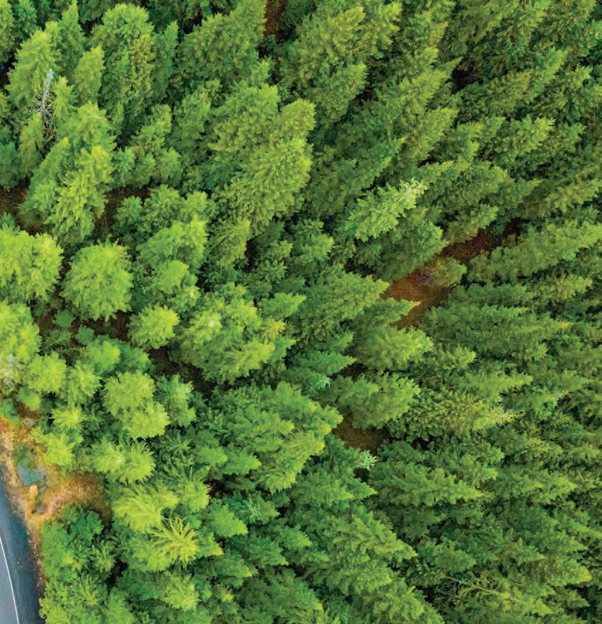
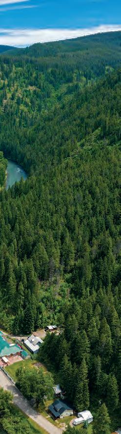
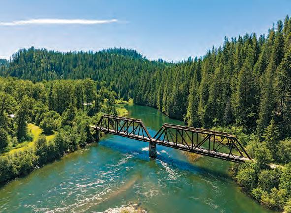
Passage Scenic Byway, near Kooskia.
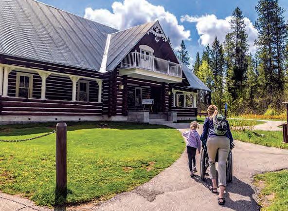
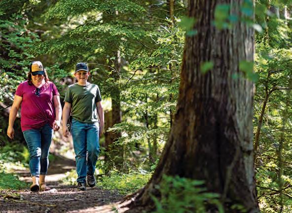
Your Adventure BEGINS HERE
Read these tips …
before you hit the road, and keep this brochure handy as you embark on your adventure.
Keep in mind that Idaho is a four-season destination, so check weather and road conditions before heading out. Cell service may be limited along some of these routes.
WHAT’S A SCENIC BYWAY?
Scenic byways are roads recognized by the United States Department of Transportation for one or more of six “intrinsic qualities”: archeological, cultural, historic, natural, recreational and scenic.
HOW TO USE THIS GUIDE
Each scenic byway is listed with its length, drive time, region and seasonality. Turn-by-turn directions and amenity availability are included in the road-trip tips section.
• Full Services
When gas, food and lodging are available
• Partial Services
When gas and a few other facilities are available
TRAVEL WITH CARE
Caring for the Gem State is one of the cornerstones of Visit Idaho’s mission. Travel safely and courteously with these tips.
• Care for Idaho
Do your part to keep Idaho beautiful for years to come. If you stop somewhere with no garbage services, bring all your trash with you. Keep nature wild—photos should be the only souvenirs you take.
• Care for Others
On the road and at any pit stops along the way, be respectful and kind to fellow adventurers. Remember to be patient during busy seasons, as outdoor spaces belong to everyone.
• Care for Yourself
Buckle up and observe posted speed limits. Also, be sure to tell someone where you are going, check road conditions and pack wisely, including extra layers of clothing, a printed map and a compass.
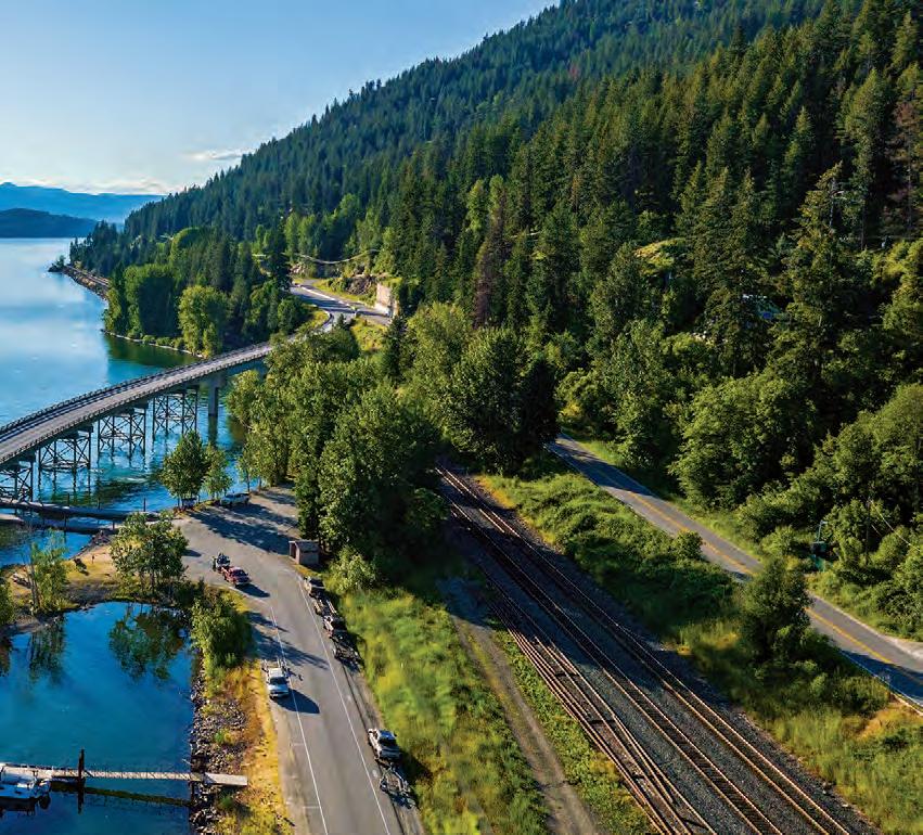
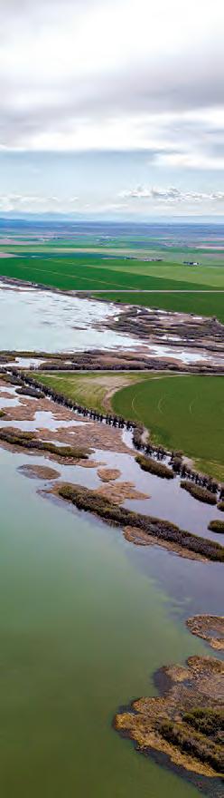
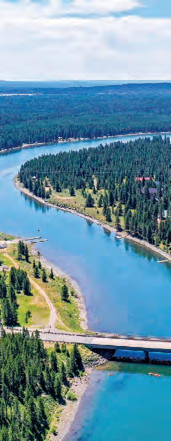
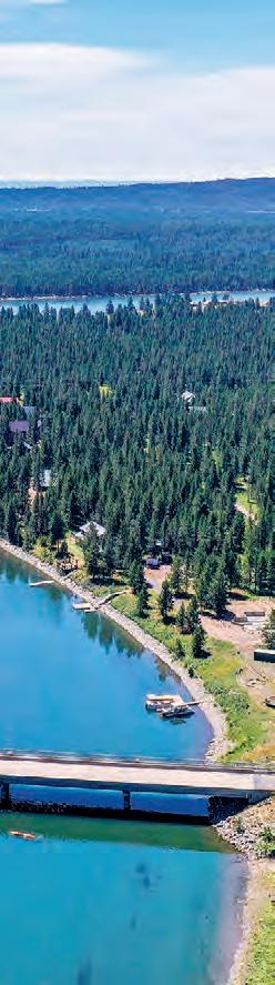
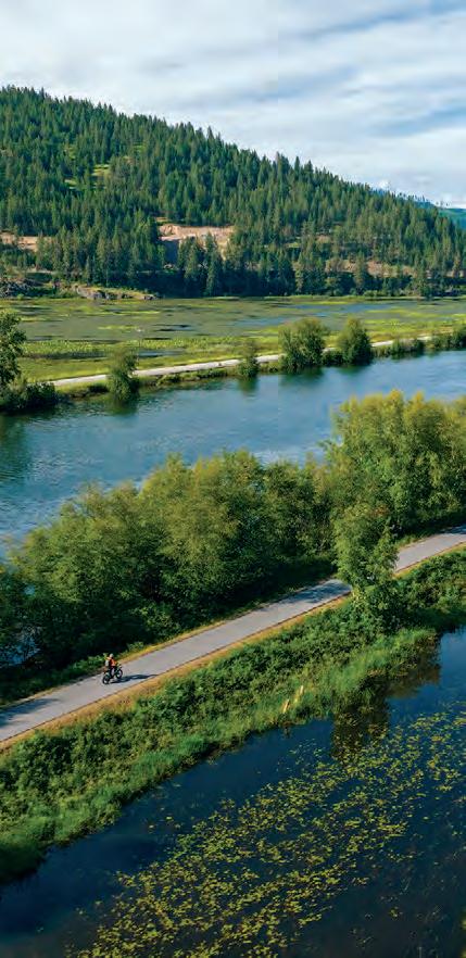
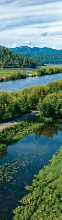
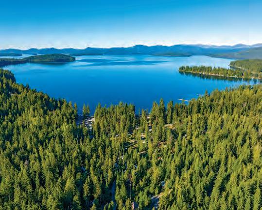
TRESTLE CREEK RECREATION AREA, PEND OREILLE SCENIC BYWAY, NEAR BOYER.
Idaho’s 31 scenic byways— plus one multinational drive—are grouped into seven regions: central, eastern, southeast, south central, southwest, north central and northern.
CENTRAL
1. Sacajawea Historic Byway PAGE 6
2. Lewis and Clark Backcountry Byway PAGE 10
3. Peaks to Craters Scenic Byway PAGE 12
4. Salmon River Scenic Byway PAGE 14
5. Sawtooth Scenic Byway PAGE 16
EASTERN
6. Mesa Falls Scenic Byway PAGE 18
7. Teton Scenic Byway PAGE 22
8. Lost Gold Trails Loop PAGE 24
9. Fort Henry Historic Byway PAGE 26
SOUTHEAST
10. Pioneer Historic Byway PAGE 28
11. Oregon Trail–Bear Lake Scenic Byway PAGE 32
SOUTH CENTRAL
12. Thousand Springs Scenic Byway PAGE 34
13. City of Rocks Backcountry Byway PAGE 38
SOUTHWEST
14. Hells Canyon Scenic Byway PAGE 40
15. Lower Payette River Heritage Byway PAGE 44
16. Main Oregon Trail Backcountry Byway PAGE 46
17. Owyhee Uplands Backcountry Byway PAGE 48
18. Payette River Scenic Byway PAGE 50
19. Ponderosa Pine Scenic Byway PAGE 52
20. Snake River Canyon Scenic Byway PAGE 54
21. Western Heritage Historic Byway PAGE 56
22. Wildlife Canyon Scenic Byway PAGE 58
NORTH CENTRAL
23. Northwest Passage Scenic Byway PAGE 60
24. Gold Rush Historic Byway PAGE 64
25. Elk River Backcountry Byway PAGE 66
NORTHERN
26. Pend Oreille Scenic Byway PAGE 68
27. Lake Coeur d’Alene Scenic Byway PAGE 72
28. Panhandle Historic Rivers Passage PAGE 74
29. St. Joe River Scenic Byway PAGE 76
30. White Pine Scenic Byway PAGE 78
31. Wild Horse Trail Scenic Byway PAGE 80
BONUS ROUTE: International Selkirk Loop PAGE 82
SCALE Interstate Highway 90 U.S. Highway 95 State Highway 55
APPROX. 20 MILES
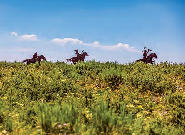
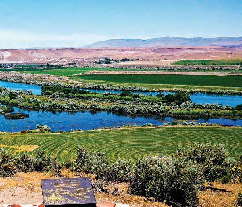
Sacajawea HISTORIC BYWAY
Tales of the past surround you on every side as you drive the Sacajawea Historic Byway. Parallel to the Continental Divide, this byway makes its way through the Lemhi River Valley, summits the Lemhi Pass and then drops onto the Snake River Plain. Discover rich Native American history and learn more about Sacajawea’s story and her impact on the Corps of Discovery and Idaho.
The Rundown
MUD LAKE, NEAR TERRETON.
ROAD-TRIP TIPS
Turn-by-Turn Directions:
The byway begins at the intersection of Interstate 15 and State Highway 33 at Exit 143. Follow SH-33 for about 12 miles west to its junction with State Highway 28. Finally, take SH-28 northwest for 120 miles to Salmon.
Road Conditions:
This byway consists of two-lane paved roads with areas for passing. Watch for icy conditions and snow drifts in winter.
Full Services: Salmon
Partial Services: Terreton, Mud Lake, Lone Pine, Lemhi and Tendoy
Terreton
SACAJAWEA INTERPRETIVE, CULTURAL & EDUCATIONAL CENTER, SALMON.
BIRCH CREEK, BETWEEN MUD LAKE AND LONE PINE.
Sacajawea HISTORIC BYWAY
NEARBY ADVENTURES
Pull o the road for a deep breath in wide-open Idaho—explore Camas
National Wildlife Refuge, drive into Mud Lake Wildlife Management Area or hike one of the many historic trails that wind through the Sacajawea Historic Byway area.
POINTS OF INTEREST:
Camas National Wildlife Refuge
This haven for birders, photographers and hikers o ers an essential habitat for diverse mammals and migratory birds.
Continental Divide National Scenic Trail
Hike Idaho’s 180-mile section of this 3,100-mile national trail, traversing historic lands and dramatic mountain scenery.
Mud Lake Wildlife Management Area
Enjoy birdwatching, fishing, boating or camping at this nearly 12,000-acre protected habitat for waterfowl and shorebirds.
Sacajawea Interpretive, Cultural & Educational Center
Located in Sacajawea’s homeland, this center pays homage to the Lemhi Shoshone explorer with artifacts and educational exhibits.
Scan Me!
Take a virtual tour of this byway before you start your engine.
Did You Know?
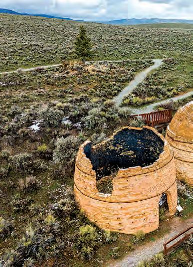
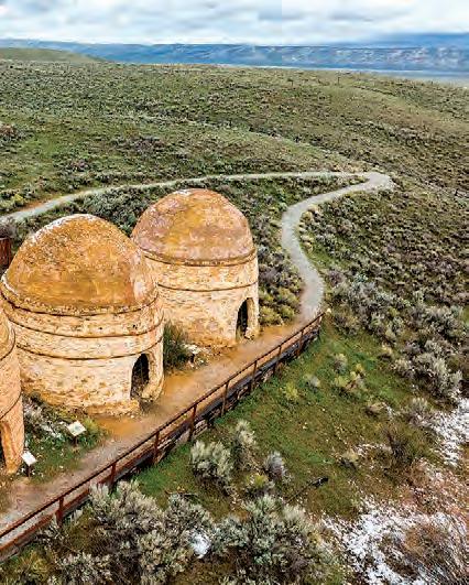
You can admire beehiveshaped kilns built for processing charcoal down a dirt road o of SH-28, near Birch Creek. In the 1800s, 16 of these kilns were constructed from local clay, and the charcoal produced within them was used in the Viola Mine located 10 miles across the Lemhi Valley.
BEAVERHEAD MOUNTAINS, NEAR BAKER.
Lewis and Clark BACKCOUNTRY BYWAY
Take a drive on the breathtaking Lewis and Clark Backcountry Byway. This remote route recognizes the area where Meriwether Lewis and William Clark began their explorations of the Pacific Northwest. Visitors will find that many of the forests, meadows and scenic views on this drive look much the same as when these explorers journeyed to the area in 1805.
The Rundown
NEARBY ADVENTURES
Enjoy the beauty of the byway on foot via the Continental Divide National Scenic Trail, make historical connections and overlook the Lemhi Pass from your Lewis and Clark Backcountry Byway drive.
POINTS OF INTEREST:
• Continental Divide National Scenic Trail
• Lemhi County Historical Museum
• Lemhi Pass
• Lewis and Clark National Historic Trail
• Sharkey Hot Springs
ROAD-TRIP TIPS
Turn-by-Turn Directions:
The byway begins 20 miles southeast of Salmon o of State Highway 28. Turn east from SH-28 at the Tendoy Store.
Road Conditions:
This byway is a singlelane gravel road with pullouts. Buses, RVs and trailers are not recommended on sections of the byway.
Full Services: Salmon
Partial Services: Tendoy, Lemhi and Leadore
LEMHI PASS.
Peaks to Craters
SCENIC BYWAY
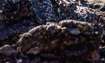
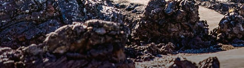
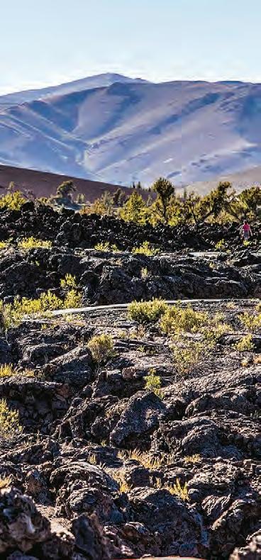
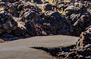
This extraordinary byway is said to be the most diverse stretch of road in the Gem State—boasting everything from sky-piercing peaks to captivating craters. Hike around a vast ocean of lava flows at Craters of the Moon National Monument & Preserve, visit the tallest mountain in Idaho at Mount Borah or learn the history of the first city lit by atomic energy in Arco.
The Rundown
ROAD-TRIP TIPS
Turn-by-Turn Directions:
The byway begins at the junction of State Highway 75 and U.S. Route 20 and goes on to Carey. From there, take U.S. Route 93 to Arco, continuing on U.S. 93 to the junction of U.S.
LostRiverMountains
POINTS OF INTEREST:
• Carey Lake Wildlife Management Area
Byway are only the beginning.
• Craters of the Moon National Monument & Preserve
• Experimental Breeder Reactor-I Atomic Museum
• Land of the Yankee Fork State Park
• Mount Borah
• Salmon–Challis National Forest
• Silver Creek Preserve
• USS Hawkbill
Sawtooth National Forest
Craters of the Moon National Monument & Preserve
Borah Peak 12,662'
Land of the Yankee Fork State Park & Interpretive Center
Silver Creek Preserve
Salmon–Challis National Forest
Challis
Carey Arco Mackay
Picabo Carey Lake Wildlife Management Area
CRATERS OF THE MOON NATIONAL MONUMENT & PRESERVE, NEAR ARCO.
Salmon River SCENIC BYWAY
Explore Idaho’s wild and scenic side along the Salmon River Scenic Byway. This 163-mile route follows the Salmon River, providing access to jaw-dropping outdoor opportunities as well as a chance to visit ghost towns and other historical sites. Add in wonderful views of the rugged Sawtooth Mountains, and it’s easy to understand why this is a must-see scenic byway.
The Rundown
3.25
NEARBY ADVENTURES
Discover pristine forests, wild whitewater, historic trails and more during your road trip along the Salmon River Scenic Byway.
POINTS OF INTEREST:
• Bayhorse, Bonanza and Custer ghost towns
• Challis Hot Springs
• Frank Church–River of No Return Wilderness
• Land of the Yankee Fork State Park
• Lewis and Clark and Nez Perce National Historic Trails
• Middle Fork of the Salmon River
• Redfish Lake
• Salmon–Challis National Forest
• Salmon River
• Sawtooth National Forest
SALMON RIVER, NEAR STANLEY.
ROAD-TRIP TIPS
Turn-by-Turn
Directions:
Follow the Montana state line south on U.S. Route 93 to Challis, and then head west to Stanley on State Highway 75.
Frank Church–River of No Return Wilderness
Full Services: Stanley, Challis, Salmon and North Fork
Sacajawea Interpretive, Cultural & Educational Center Bayhorse Bonanza Custer Lewis and Clark
Partial Services: Clayton and Gibbonsville
Salmon–Challis National Forest
Land of the Yankee Fork State Park & Interpretive Center
Sawtooth SCENIC BYWAY
Rugged mountain peaks are the star of the show on the Sawtooth Scenic Byway. This route carves its way through the Boulder Mountains, delivering adventurers to the base of the iconic Sawtooth Mountain Range. Keep an eye out for deer, elk and pronghorn antelope, and plan stops along the way to take advantage of stellar recreation. When the sun sets, the night skies will take your breath away.
The Rundown
NEARBY ADVENTURES
Discover some of Idaho’s most breathtaking landscapes, or treat yourself to a stargazing experience. The Sawtooth Scenic Byway o ers plenty of opportunities to explore.
POINTS OF INTEREST:
• Bald Mountain
• Central Idaho Dark Sky Reserve
• Dollar Mountain
• Magic Reservoir
• Redfish Lake
• Sawtooth Botanical Garden
• Sawtooth Mountains
• Sawtooth National Recreation Area
• Shoshone Ice Caves
• Silver Creek Preserve
• Sun Valley Resort
BIG WOOD RIVER, NEAR KETCHUM.
Full Services:
From Shoshone, take State Highway 75 north to Stanley.
Bellevue, Hailey, Ketchum, Sun Valley and Stanley
Partial Services: Shoshone
Sawtooth
SawtoothMountains
Shoshone Ice Caves
REDFISH LAKE, NEAR STANLEY.
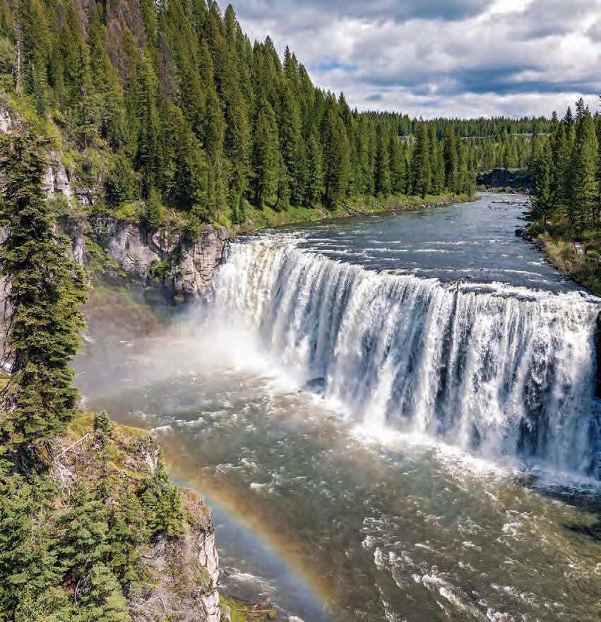
Mesa Falls SCENIC BYWAY
Discover the lush landscape of the Caribou–Targhee National Forest and two of the most spectacular waterfalls in the West—Upper and Lower Mesa Falls. Get an up-close experience of the cascading water on viewing platforms, or stop at the historic Mesa Falls Visitor Center to learn about the area’s geology.
The Rundown
UPPER MESA FALLS, NEAR ASHTON.
ROAD-TRIP TIPS
Turn-by-Turn Directions:
This byway starts in Ashton on State Highway 47. Travel northeast for 12.5 miles to the old Bear Gulch Ski Area site and then continue northwest along Forest Service Route 294 to where the byway ends at U.S. Route 20.
Road Conditions:
Both SH-47 and FSR294 are two-lane, paved roads. In winter, FSR-294 is closed to automobiles and becomes a Forest Service snowmobile route.
Full Services: Ashton and Island Park
BIG SPRINGS, NEAR ISLAND PARK.
MESA FALLS VISITOR CENTER, NEAR ASHTON.
Island Park
Ashton
Harriman State Park
Falls
Mesa Falls SCENIC BYWAY
NEARBY ADVENTURES
Spend a day picnicking or exploring hiking, biking and horseback riding trails. Visitors can sleep under the stars in area campgrounds during the warmer months.
POINTS OF INTEREST:
Ashton to Tetonia Trail
See the remarkable 29.6-mile Ashton to Tetonia Trail on foot, by bike or by snowshoe in the winter.
Big Springs
More than 120 million gallons of water flow out of Big Springs daily, making this spring one of the 40 largest in the country.
Caribou–Targhee National Forest Recreation, historic landmarks, wildlife watching and stunning scenery await in this forest.
Harriman State Park
Hiking, horseback riding, fly-fishing and mountain biking are popular in this 16,000acre wildlife refuge within the Greater Yellowstone Ecosystem.
HARRIMAN STATE PARK, NEAR ISLAND PARK.
Scan Me!
Take a virtual tour of this byway before you start your engine.
Did You Know?
The Mesa Falls Visitor Center, housed in the former Big Falls Inn, was built around 1915 and is now on the National Register of Historic Places. The inn was a social gathering hot spot as a hotel, café and dance hall.
LOWER MESA FALLS, NEAR ASHTON.
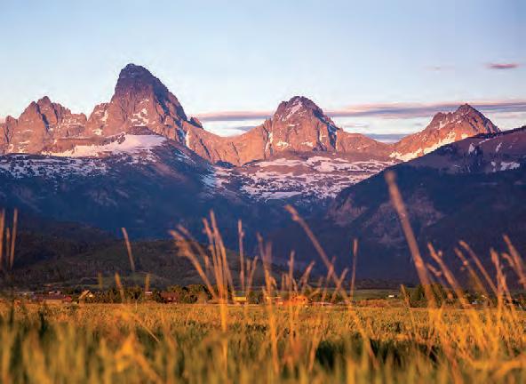
Teton SCENIC
BYWAY
Boasting rugged, panoramic views from “the quiet side of the Grand Teton Mountains,” the Teton Scenic Byway grants visitors plenty of opportunities to immerse themselves in Idaho’s natural beauty. Sweeping vistas transition to far-reaching fields as you continue along the byway. From waterfalls and wilderness to wideopen spaces, your adventure in eastern Idaho will be an unforgettable one.
The Rundown
NEARBY ADVENTURES
Explore Idaho’s pristine wilderness via horseback or bask in the beauty of a waterfall. These adventures and more await you along the Teton Scenic Byway.
POINTS OF INTEREST:
• Ashton to Tetonia Trail
• Caribou–Targhee
National Forest
• Fall Creek Falls
• Grand Targhee Resort
• Grand Teton Brewing Company
• Grand Teton Distillery
• Grand Teton Mountains
• Linn Canyon Ranch
TETON SCENIC BYWAY,
ROAD-TRIP TIPS
Turn-by-Turn Directions:
The byway begins on State Highway 31 at Swan Valley. Travel northeast to State Highway 33 at Victor, then north on SH-33 to State Highway 32 and finally north on SH-32 to State Highway 47 at Ashton.
Full Services:
Swan Valley, Victor, Driggs, Tetonia and Ashton
Looking f M e Info?
Get inspired for your journey with this video.
TETON MOUNTAINS, NEAR DRIGGS.
LINN CANYON RANCH, NEAR VICTOR.
L t Gold TRAILS LOOP
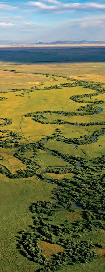
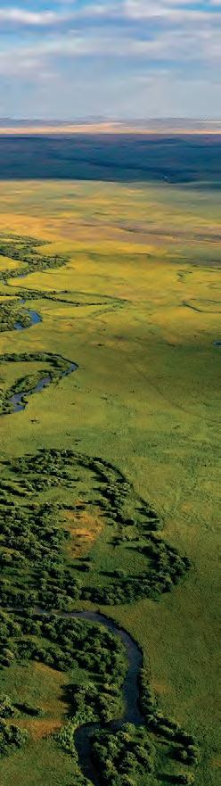
Follow the Lost Gold Trails Loop in eastern Idaho. This byway runs along an early Gold Rush route, historic sites like the Heritage Hall Museum and the gateway to the Nez Perce National Historic Trail. When the gold near Spencer disappeared, opals took over, and you can still dig for opals in this area today. During the spring and fall, this route often features wild game grazing.
The Rundown
NEARBY ADVENTURES
Exploring this notable byway o ers interpretive sites, outdoor recreation and even the chance to mine for opals. In the wintertime, several roads become snowmobiling routes in this scenic setting.
POINTS OF INTEREST:
• Beaver Canyon
• Caribou–Targhee National Forest
• Heritage Hall Museum
• Nez Perce National Historic Trail
• Spencer Opal Mine
Looking f M e Info?
Get inspired for your journey with this immersive video.
PRAIRIE LAND, NEAR KILGORE.
ROAD-TRIP TIPS
Turn-by-Turn Directions:
The byway begins on A-2/Red Road Junction at the “Y” Junction east of Dubois. It follows this route to Old Highway 91 north of Dubois to Spencer. The route heads east on Spencer–Idmon Road, connecting to Idmon/A-2 Junction and Fort Henry Historic Byway. Continue north toward Kilgore and east to Island Park, or turn south and return to the “Y” Junction at the start of the route.
Road Conditions:
Two roads (A-2 and Spencer–Idmon Road) close during winter. Check weather conditions before your trip.
Full Services: Dubois
Partial Services: Spencer and Kilgore
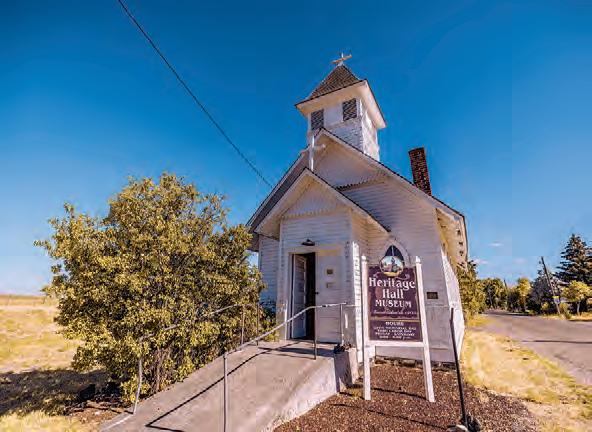
HERITAGE HALL MUSEUM, NEAR DUBOIS.
SPENCER OPAL MINE, SPENCER.
Kilgore
Dubois Spencer Idmon
F t Henry HISTORIC BYWAY
Taking its name from the first European settlement in Idaho, Fort Henry Historic Byway displays the rugged beauty of eastern Idaho. Hike or ATV the 400-foot-high dunes at St. Anthony Sand Dunes, try your hand at the renowned fishing opportunities along the Henry’s Fork of the Snake River or spend time learning about the Indigenous history in this area.
The Rundown
NEARBY ADVENTURES
Fort Henry Historic Byway is a great way to explore history firsthand, with a wide variety of outdoor recreation options to stop and enjoy.
POINTS OF INTEREST:
• Camas Meadows Battle Sites
• Caribou–Targhee National Forest
• Fort Henry Historic Monument
• Henry’s Fork of the Snake River
• Island Park Reservoir
• St. Anthony Sand Dunes
• Yellowstone Bear World
Looking f M e Info?
Get inspired for your journey with this immersive video.
HENRY’S FORK OF THE SNAKE RIVER, NEAR ISLAND PARK.
ROAD-TRIP TIPS
Turn-by-Turn Directions:
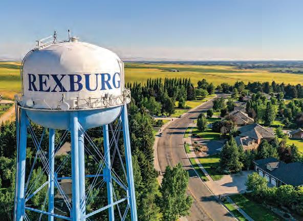
This byway begins at the North Rexburg U.S. Route 20 exit onto Salem Highway toward St. Anthony Sand Dunes on Red Road. From there, it continues on to the A-2 Road Junction. Follow A-2 north, then head east to Island Park on U.S. 20. From the intersection of Salem Highway and 500 North, go east to St. Anthony on U.S. 20. Turn at the Fun Farm Sportsman Access and follow old U.S. Route 191 past Chester to Ashton.
Road Conditions: This byway is a two-lane road with no mountain passes. During the winter, A-2 is not plowed and becomes a snowmobiling trail.
Full Services:
Rexburg, St. Anthony, Ashton and Island Park
Partial Services: Kilgore
NEZ PERCE NATIONAL HISTORICAL PARK (CAMAS MEADOWS BATTLE SITES), NEAR KILGORE.
TOWN OF REXBURG.
Rexburg
St. Anthony
Battle Site
ny Sand Dunes
Pioneer HISTORIC BYWAY
The Pioneer Historic Byway takes visitors on an adventure through southeast Idaho. Marvel in the rugged beauty of Red Rock Pass, discover the world’s only captive geyser in Soda Springs or journey to the ghost town of Chesterfield. The Pioneer Historic Byway o ers both scenic and history-filled stops of interest for road-trippers of all ages.
The Rundown
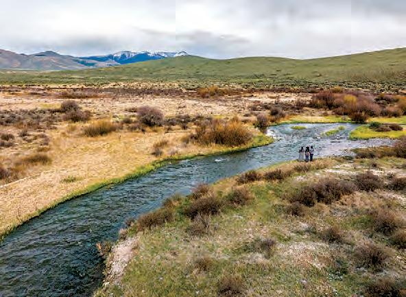
TINCUP CREEK, NEAR WAYAN.
ROAD-TRIP TIPS
Turn-by-Turn Directions:
This byway begins from the Utah state line and follows U.S. Route 91 and State Highway 34 north to U.S. Route 30. Continue east on U.S.-30 to Soda Springs where it meets the Oregon Trail–Bear Lake Scenic Byway. From there, go north on SH-34 toward the Wyoming state line.
Road Conditions:
This is a heavy snowfall area. The section of SH-34 between Soda Springs and the Wyoming border may occasionally close during the winter.
Full Services:
Preston and Soda Springs
Partial Services:
Franklin and Grace
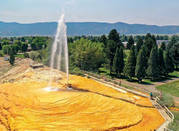
GEYSER PARK, SODA SPRINGS.
BEAR RIVER, NEAR GRACE.
Pioneer HISTORIC BYWAY
NEARBY ADVENTURES
Take to the trails on a thrilling ATV ride, enjoy an afternoon of birdwatching or explore a historic town. See more of southeast Idaho on the Pioneer Historic Byway.
POINTS OF INTEREST:
Hooper Springs Park
The clear, bubbling soda water at Hooper Springs Park is free and has been an attraction since 1882.
Niter Ice Cave
A basalt lava tube formed in the Pleistocene era, the Niter Ice Cave is a chilly cavern that was once used as a natural ice box.
Red Rock Pass
Once an ancient dam on Lake Bonneville, a geologic shift prompted a catastrophic flood that helped shape this low mountain pass.
Soda Springs Geyser
Stop in and see the world’s only captive geyser as it erupts 70 feet into the air every hour on the hour.
BLACKFOOT RESERVOIR, NEAR SODA SPRINGS.
Scan Me!
Take a virtual tour of this byway before you start your engine.
Did You Know?
Dating back to the 1880s, the Chesterfield Historic Town Site contains 27 structures on the National Register of Historic Places and o ers visitors a glimpse of pioneer life.
RED ROCK PASS, NEAR SWANLAKE.
Oregon Trail–Bear Lake SCENIC
BYWAY
Natural splendor and the promise of adventure lure travelers to southeast Idaho and the Oregon Trail–Bear Lake Scenic Byway. Bear Lake boasts shimmering turquoise waters, sandy beaches and great views. Check out the world’s only captive geyser, Minnetonka Cave, historic sites and a variety of experiences tied to the Oregon Trail’s impact on this area.
The Rundown
NEARBY ADVENTURES
Examine stalactites in a limestone cave or saddle up for some Wild West history and tour the last standing bank robbed by Butch Cassidy and his gang. The Oregon Trail–Bear Lake Scenic Byway awaits.
POINTS OF INTEREST:
• Caribou–Targhee National Forest
• Bear Lake State Park
• Butch Cassidy Museum at The Bank of Montpelier
• Hooper Springs Park
• Lava Hot Springs Hot Pools
• Minnetonka Cave
• National Oregon/ California Trail Center
• Soda Springs Geyser
BEAR LAKE STATE PARK, ST. CHARLES.
ROAD-TRIP TIPS
Turn-by-Turn Directions:
The byway begins at Bear Lake on U.S. Route 89, near Fish Haven. Drive north on U.S. 89 to Montpelier, where U.S. 89 meets U.S. Route 30. Merge onto U.S. 30 and continue heading north. Remain on U.S. 30 as it winds through Soda Springs and toward Alexander. Moving westbound through Alexander, turn north onto Blazer Highway. Follow the highway through Bancroft and on to Lava Hot Springs, where Blazer Highway ends and U.S. 30 resumes. Merge onto U.S. 30 and continue west, approaching Interstate 15
Full Services: McCammon, Montpelier, Soda Springs and Lava Hot Springs
Partial Services: Paris and Georgetown
McCammon Lava
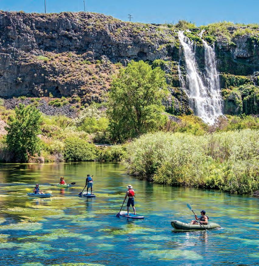
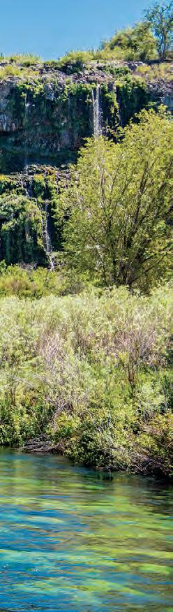
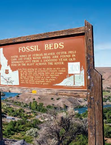
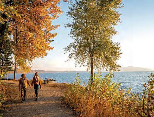
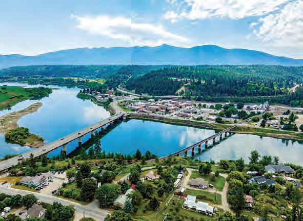
Thousand Springs SCENIC BYWAY
Thousand Springs Scenic Byway gives road-trippers a glimpse of some of Idaho’s remarkable geological wonders and natural beauty. Starting near Bliss, this route features canyon views, quaint small towns and Thousand Springs State Park—an expansive park made up of six separate park units with stunning waterfalls, hiking trails, wildlife, fishing and more.
The Rundown
ROAD-TRIP TIPS
Thousand Springs State Park
Hagerman Fossil Beds National Monument
Minidoka National Historic Site
Balanced Rock
Perrine Bridge Shoshone Falls
Falls
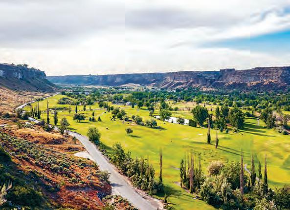
CANYON SPRINGS GOLF COURSE, TWIN FALLS.
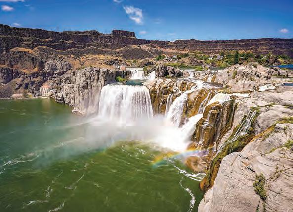
SHOSHONE FALLS, NEAR TWIN FALLS.
Thousand Springs SCENIC BYWAY
Did You Know?
See the world’s largest collection of Hagerman horse (Equus simplicidens) fossils—Idaho’s state fossil— at the Thousand Springs Visitor Center, home to Hagerman Fossil Beds National Monument. After viewing the fossil displays at the visitor center, enjoy Hagerman Valley’s scenic vistas, historic trails and picnicking spots.
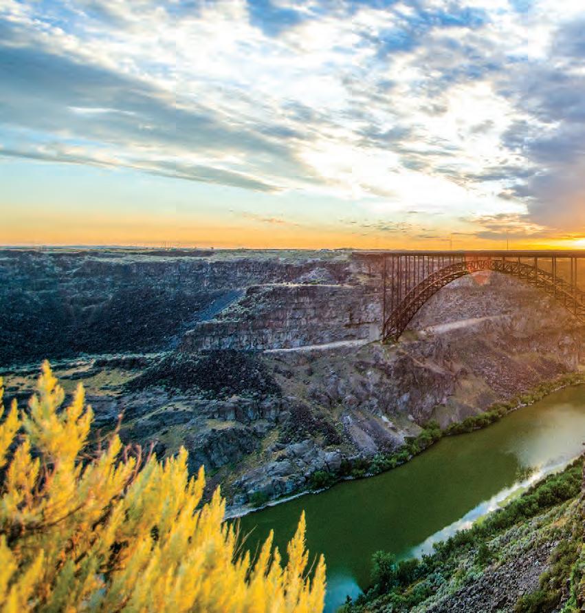
PERRINE BRIDGE, NEAR TWIN FALLS.
HAGERMAN FOSSIL BEDS NATIONAL MONUMENT, NEAR HAGERMAN.
Scan Me!
Take a virtual tour of this byway before you start your engine.
NEARBY
ADVENTURES
Discover wondrous waterfalls and wide-open spaces on the Thousand Springs Scenic Byway.
POINTS OF INTEREST:
Balanced Rock
Coming in at 48 feet tall and weighing 40 tons, Balanced Rock is a wind-carved rock that balances precariously on a pedestal only 3 feet by 17 inches.
Minidoka National
Historic Site
Preserving the former Minidoka War Relocation Center, the Minidoka National Historic Site educates visitors about the 13,000+ Japanese Americans who were held there from 1942 to 1945 during World War II.
Perrine Bridge
Spanning the impressive Snake River Canyon on the northern edge of Twin Falls, the Perrine Bridge o ers walkways with views of the river and nearby lakes and waterfalls. You might even see BASE jumpers!
Shoshone Falls
At 212 feet, Shoshone Falls is higher than Niagara Falls. Located along the Snake River near Twin Falls, Shoshone Falls Park o ers hiking trails, picnic areas and a scenic overlook.
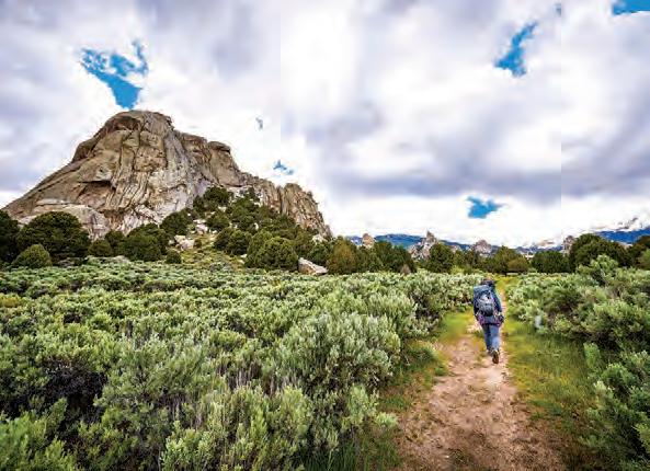
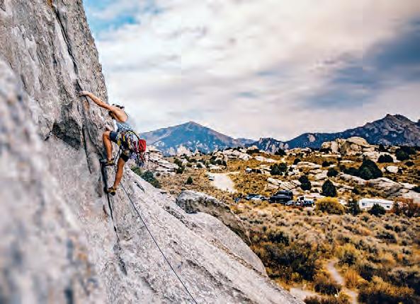
City of Rocks
BACKCOUNTRY BYWAY
City of Rocks Backcountry Byway weaves through the Albion Mountain Range and rural landscapes dotted with unusual rock formations. Beginning in Albion, the byway passes the Pomerelle Mountain Resort and Lake Cleveland Recreation Area heading south. The City of Rocks National Reserve and the neighboring Castle Rocks State Park o er unparalleled access to the area’s unique geological features.
The Rundown
NEARBY ADVENTURES
From rock climbing and camping to hiking and mountain biking, City of Rocks Backcountry Byway is the place in Idaho to explore the Earth’s natural arches and other formations.
POINTS OF INTEREST:
• Albion Mountains
• Castle Rocks State Park
• City of Rocks National Reserve
• Lake Cleveland
• Oakley Historic District
• The Oregon Trail historic sites
• Pomerelle Mountain Resort
Looking f M e Info?
Get inspired for your journey with this immersive video.
CITY OF ROCKS NATIONAL RESERVE, NEAR OAKLEY.
ROAD-TRIP TIPS
Turn-by-Turn Directions:
This byway begins in Albion, heading south to Connor Creek Junction along State Highway 77, then continues south through Elba and Almo before reaching the City of Rocks National Reserve. From the Reserve, the byway heads north and follows Birch Creek to the city of Oakley, where it joins State Highway 27.
Road Conditions:
Almo to Oakley is a gravel road until it joins SH-27.
Full Services: Burley and Albion
Partial Services: Oakley and Almo
Albion Almo
Oakley
City of Rocks National Reserve
Pomerelle Mountain Resort
Castle Rocks State Park
Sawtooth National Forest
Oakley Historic District
Burley
CASTLE ROCKS STATE PARK, NEAR ALMO.
ELEPHANT ROCK, CITY OF ROCKS NATIONAL RESERVE, NEAR ALMO.
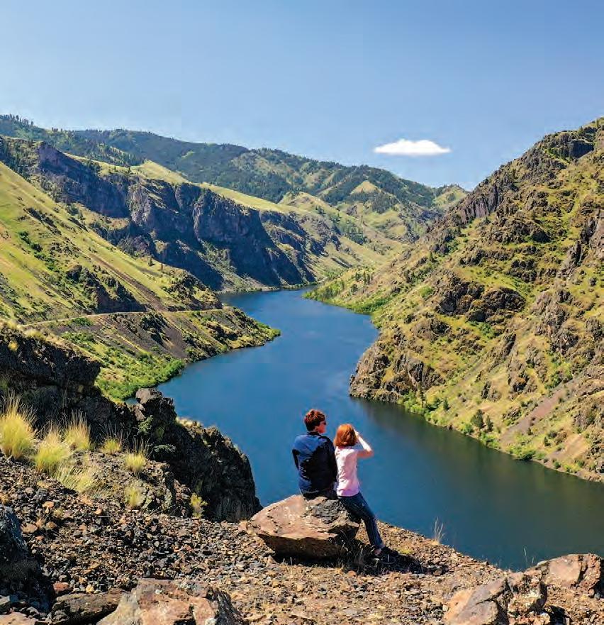
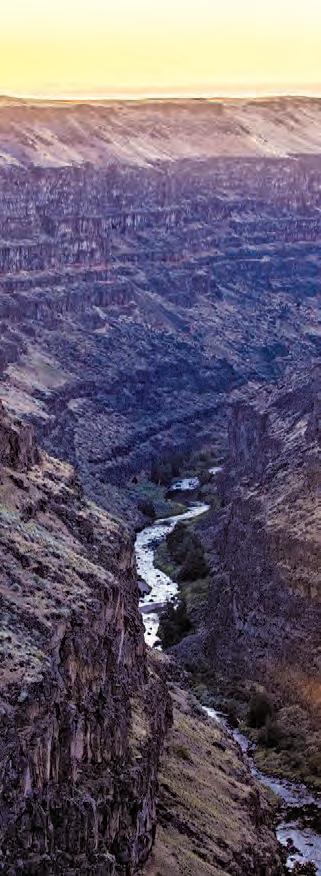
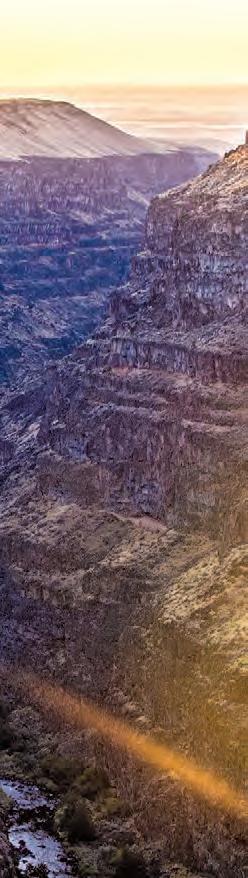
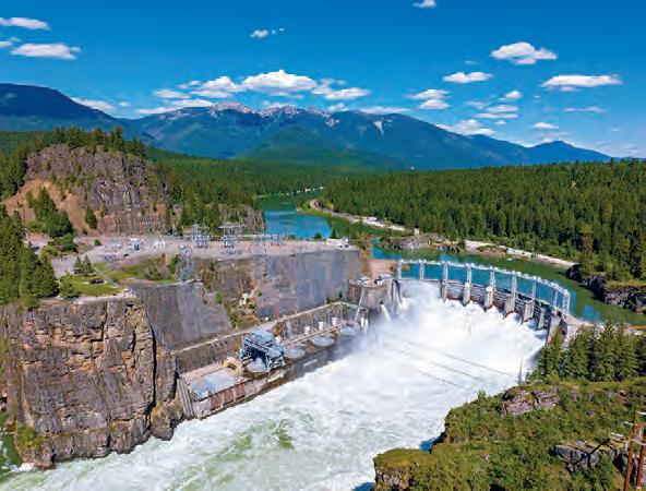
Hells Canyon SCENIC BYWAY
Get ready for an unforgettable journey on the Hells Canyon Scenic Byway. This route winds its way along the impressive east side of Hells Canyon—North America’s deepest river gorge—providing travelers with stunning views and ample opportunity to see wildlife on the drive. Make the most of your trip with a guided float trip, whitewater rafting adventure or jet boat tour.
The Rundown
HELLS CANYON, NEAR BIG BAR CAMPING AREA.
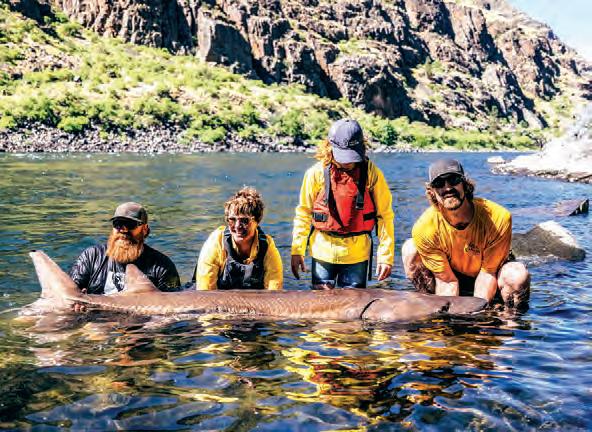
STURGEON FISHING, NEAR HELLS CANYON DAM.
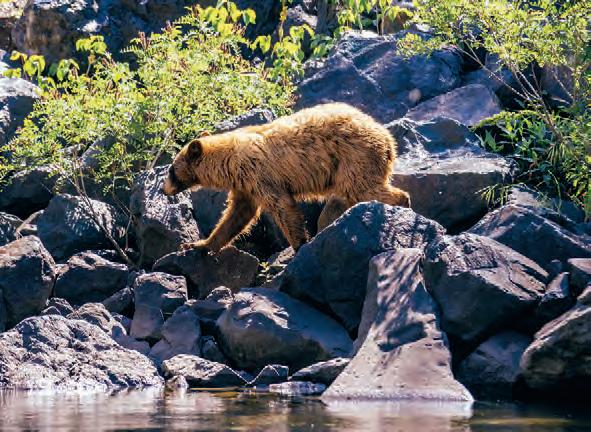
BLACK BEAR, BESIDE THE SNAKE RIVER.
Hells Canyon SCENIC BYWAY
Did You Know?
At 8,000 feet deep and 10 miles wide, Hells Canyon is 2,000 feet deeper than the famed Grand Canyon. Experience it from the water by jet boat or whitewater raft, or explore the rugged trails.
HELLS CANYON, NEAR SHEEP CREEK RANCH.
Scan Me!
Take a virtual tour of this byway before you start your engine.
NEARBY ADVENTURES
Head out on an epic whitewater trip, hike peaceful trails, spot wildlife and follow your sense of adventure on Hells Canyon Scenic Byway.
POINTS OF INTEREST: Hells Canyon Dam and Oxbow Dam
Stop at either of the two dams found along the Idaho–Oregon border and encounter boating, fishing, camping and history.
Mundo Hot Springs
Relax in the pools found at Mundo Hot Springs and even stay overnight in a tent, RV or cabin.
Payette National Forest
The Payette National Forest is a great place to find scenic views, recreation and campgrounds.
Snake River
The iconic Snake River flows through a canyon carved from basalt lava flows with access for boating, fishing and day use.
Weiser River Trail
Hike or ride the Weiser River Trail for 84 miles of wildlife habitat and public lands through diverse terrain.
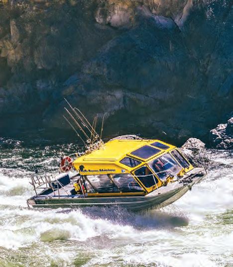
JET BOATING, NEAR HELLS CANYON DAM.
Lower Paye e River
HERITAGE BYWAY
Winding through the charming towns of Payette, Emmett and Horseshoe Bend, the Lower Payette River Heritage Byway is 57 miles of rural views on Highway 52. While you’re exploring, take some time to soak up the hometown hospitality that this area has to o er. As you meander along the Lower Payette River, stop o for local cuisine, historical museums, picturesque parks and more.
The Rundown
NEARBY ADVENTURES
From thrilling river excursions to wildlife adventures, Lower Payette River Heritage Byway o ers plenty to explore on your southwest Idaho road trip.
POINTS OF INTEREST:
• Black Canyon Reservoir and Dam
• Emmett City Park
• Lower Payette River
• Montour Wildlife Management Area
• Payette County Museum
• Snake River
Looking f M e Info?
Get inspired for your journey with this immersive video.
TOWN OF HORSESHOE BEND.
Main Oregon Trail BACKCOUNTRY BYWAY
The Main Oregon Trail Backcountry Byway follows the route of the pioneers who journeyed through the Idaho desert. Spend the afternoon exploring historic Oregon Trail sites or visit Three Island Crossing State Park. Learn about the emigrants who dared to take on one of the most challenging river crossings along the Oregon Trail and about the Native Americans who mastered this di cult terrain.
The Rundown
NEARBY ADVENTURES
Get ready to take a trip back in time—explore historical sites, museums and even see replica Conestoga wagons along the Main Oregon Trail Backcountry Byway.
POINTS OF INTEREST:
• Bonneville Point
• Bruneau Dunes State Park and Observatory
• Canyon Creek
• Community Canvas of Mountain Home
• The Oregon Trail historic sites
• Snake River
• Three Island Crossing State Park and the Oregon Trail History and Education Center
• Y Knot Winery
ROAD-TRIP TIPS
Turn-by-Turn Directions:
The byway begins at Glenns Ferry (Exit 121 of Interstate 84), 75 miles southeast of Boise. Follow Old Oregon Trail Road and then Hot Springs Road. At the T-intersection, take Sun Valley Road to the city of Mountain Home. From there, take Canyon Creek Road/Mayfield Road to Bonneville Point. Follow byway directional signs to stay on course.
Road Conditions:
One-third of the route is a paved roadway, and twothirds is a gravel road.
BOISE
Full Services: Glenns Ferry and Mountain Home
Snake R.
Three Island Crossing State Park and Visitor Center
Bonneville Point
Glenns Ferry Mountain Home Mayfield
Owyhee Uplands
BACKCOUNTRY BYWAY
Take a trip on the Owyhee Uplands Backcountry Byway and embark on a one-of-a-kind desert adventure. Journey through picturesque landscapes and juniper woodlands, all while taking in the views of the Owyhee Mountains. Plan a little detour and shred some sand dunes at Bruneau Dunes State Park, or spend the day exploring Silver City—one of Idaho’s fascinating ghost towns.
The Rundown
NEARBY ADVENTURES
As you’re cruising along Owyhee Uplands Backcountry Byway, enjoy the mountain views and consider taking a detour to check out Silver City, Bruneau Dunes State Park and other nearby attractions.
POINTS OF INTEREST:
• Bruneau Canyon
• Bruneau Dunes State Park
• C. J. Strike Reservoir
• Jordan Creek
• North Fork Owyhee Wild and Scenic River
• Owyhee Mountains
• Silver City Historic District
Looking f M e Info?
Get inspired for your journey with this immersive video.
BRUNEAU CANYON OVERLOOK, NEAR BRUNEAU.
ROAD-TRIP TIPS
Turn-by-Turn Directions:
The byway begins 80 miles southwest of Boise and can be reached from the east on State Highway 78 near Grand View or from the west through Jordan Valley, Oregon. Follow byway road signs to stay on the byway route.
Road Conditions:
This byway is mostly onelane and one-and-a-halflane gravel roads.
Partial Services: Grand View and Jordan Valley, Oregon
North Fork Owyhee Wilderness Area Bruneau Canyon Overlook
NORTH FORK OWYHEE CAMPGROUND, NEAR FAIRYLAWN.
JORDAN CREEK, NEAR FLINT.
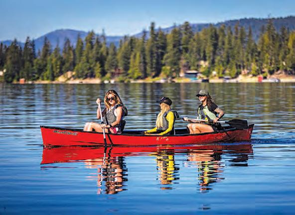
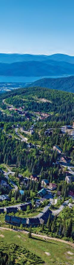
Paye e River SCENIC BYWAY
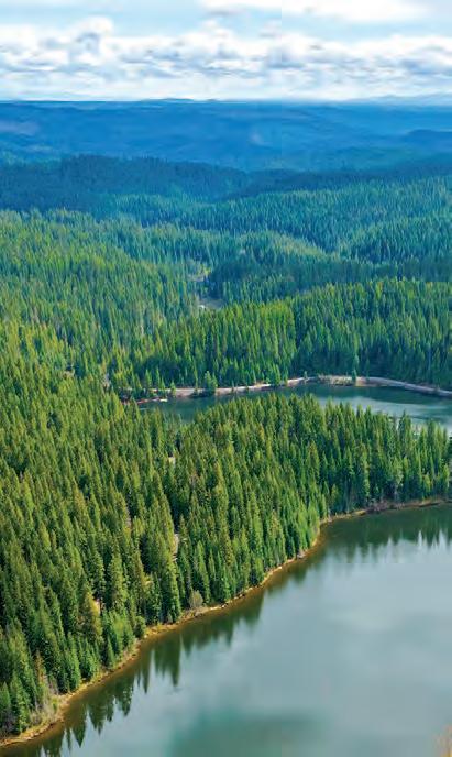
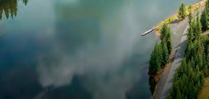
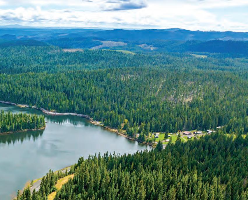
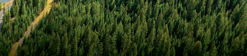
Find whitewater adventures and outdoor thrills along the Payette River Scenic Byway. Begin this route west of Boise in Eagle and follow the beautiful Payette River through the Boise and Payette National Forests. This drive is packed with stunning scenery year-round and plenty of opportunities to pull over and hop out for some fun in the fresh air.
The Rundown
The byway starts west of Boise, then heads north on State Highway 55 to where the byway ends at the junction of U.S. Route 95 in New Meadows.
NEARBY ADVENTURES
From picturesque state parks to lively mountain biking and ski destinations, there are so many fun experiences to discover along the Payette River Scenic Byway.
• Brundage Mountain Resort
• Jug Mountain Ranch
• Lake Cascade State Park
• Payette Lake
• Boise National Forest
Tamarack Resort
POINTS OF INTEREST:
• Payette National Forest • Payette River • Ponderosa State Park
RAINBOW BRIDGE, NEAR SMITHS FERRY.
Ponder a Pine SCENIC
BYWAY
Beginning in Boise, the Ponderosa Pine Scenic Byway meanders through historic Idaho City, up to Lowman and on to the mountain town of Stanley at the base of the Sawtooth Mountains. This route is packed with outdoor adventure and stunning scenery, following a portion of the South Fork of the Payette River and passing the Sawtooth Wilderness and Boise, Salmon–Challis and Sawtooth National Forests.
The Rundown
NEARBY ADVENTURES
Visitors on the Ponderosa Pine Scenic Byway can hike through stunning forests, learn about the local Gold Rush history and experience peaceful nature.
POINTS OF INTEREST:
• Arrowrock Reservoir
• Banner Summit
• Historic Idaho City
• Kirkham Hot Springs
• Lucky Peak State Park and Reservoir
• Salmon–Challis National Forest
• Sawtooth National Forest
• Stanley Lake
STANLEY LAKE, NEAR STANLEY.
Snake River Canyon SCENIC BYWAY
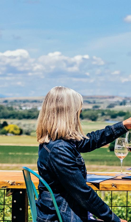
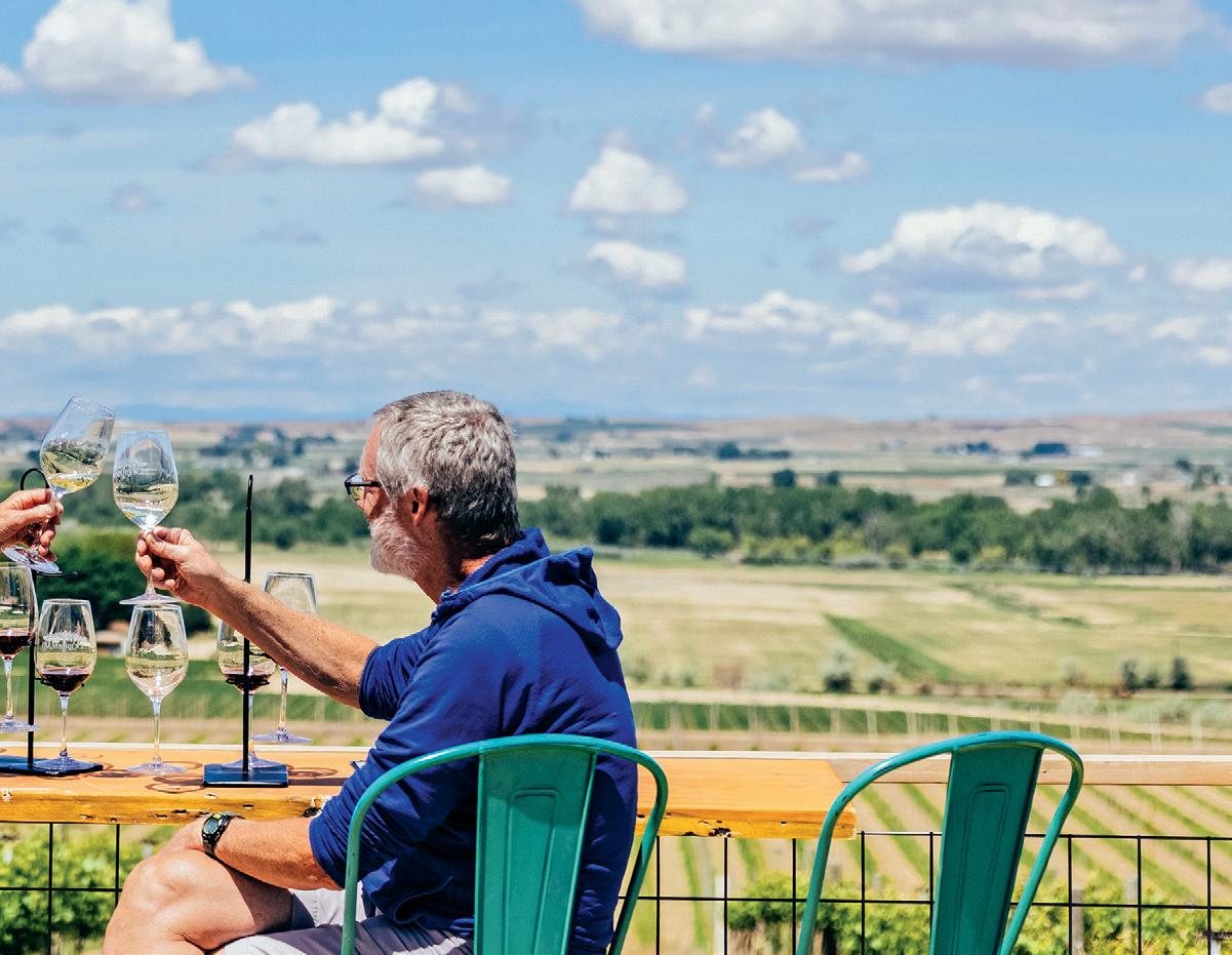
This 53-mile route meanders through some of southwestern Idaho’s rich agricultural lands, showcasing orchards, vineyards and a variety of rural experiences. Sample Idaho’s award-winning wineries as you sip your way through the Sunnyslope Wine Trail within this unique wine-growing region, or explore historical sites like Map Rock while enjoying the scenic vistas found on this drive.
The Rundown
NEARBY ADVENTURES
Whether you’re looking to unwind or do a bit of birding or wildlife watching, there are plenty of stops along the Snake River Canyon Scenic Byway that will make your Idaho road trip truly unforgettable.
POINTS OF INTEREST:
• Celebration Park
• Deer Flat National Wildlife Refuge
• Map Rock
• Morley Nelson Snake River Birds of Prey National Conservation Area
• Old Fort Boise Park
• Snake River Canyon
• Sunnyslope Wine Trail
PARMA RIDGE WINERY, NEAR PARMA.
ROAD-TRIP TIPS
Turn-by-Turn Directions:
route begins on State Highway 45 at Walters Ferry, to Map Rock Road, to Chicken Dinner Road, to Lowell Road, to Plum Road, to Homedale Road, to Allendale Road, to Ustick Road, to Fargo Road, to Dixie Road, to Wamstad Road, to Apple Valley Road, to the intersection with U.S. 20/26, to the Nyssa, Oregon bridge, back along U.S. 20/26, to Highway 95-N, to Echo Lane, to Elmore Road, to Highway 30-N, rejoin Highway 95-N, to Pennsylvania Avenue, to 3rd Street, to Highway 95-N, to NW 16th Street, to Allen Avenue, to Washoe Road, to 6th Avenue S, to S 18th Street, to 2nd Avenue S, to S 7th Street becoming Highway 52, ending at Centennial Park on the Snake River.
Road Conditions: Canyon overlooks may not be accessible during winter.
Full Services: Nampa and Caldwell
Partial Services: Melba, Marsing, Homedale, Wilder, Greenleaf, Notus and Parma
Western Heritage
HISTORIC BYWAY
Once a route for miners and homesteaders, the Western Heritage Historic Byway passes through farmland and rocky terrain, providing visitors with a unique frontier adventure. Dig into history at Celebration Park, catch fish at Swan Falls Reservoir or check out Morley Nelson Snake River Birds of Prey National Conservation Area— home to the greatest concentration of nesting raptors in North America.
The Rundown
NEARBY ADVENTURES
From breathtaking birds of prey to amazing archaeological adventures, the Western Heritage Historic Byway is a must while exploring southwest Idaho.
POINTS OF INTEREST:
• Celebration Park
• Dedication Point
• Initial Point
• Morley Nelson Snake River Birds of Prey National Conservation Area
• Owyhee County Museum & Library
• Snake River
Looking f M e Info?
Get inspired for your journey with this immersive video.
SWAN FALLS DAM, SWAN FALLS.
Dedication Point
From Ferry Road, go south on State Highway 45 to the Snake River.
Full Services: Meridian, Kuna and Melba
MORLEY NELSON SNAKE RIVER BIRDS OF PREY NATIONAL CONSERVATION AREA, NEAR SWAN FALLS.
Wildlife Canyon SCENIC
BYWAY
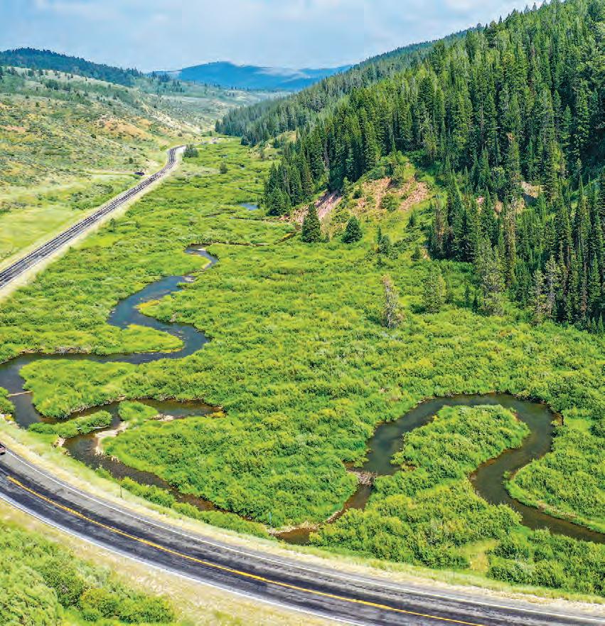
Following the South Fork of the Payette River, the Wildlife Canyon Scenic Byway o ers plenty to do for outdoor adventurers—from whitewater rafting and wildlife viewing to fishing and hiking. If you’re not ready for the road trip to end, you’re in luck! This route joins up with the Ponderosa Pine Scenic Byway and the Payette River Scenic Byway, with an abundance of ways to continue your explorations.
The Rundown
36 MILES
1 HOUR
58 KM YEAR-ROUND
NEARBY ADVENTURES
From relaxed resort getaways to legendary rafting trips, discover your next adventure on Wildlife Canyon Scenic Byway.
POINTS OF INTEREST:
• Boise National Forest
• Payette River
• Starlight Mountain Theater
• Terrace Lakes Golf Course and Resort SOUTHWEST
SOUTH FORK OF THE PAYETTE RIVER, NEAR GARDEN VALLEY.
N thwest Passage SCENIC BYWAY
Recognized as Idaho’s longest byway, Northwest Passage Scenic Byway follows the route Meriwether Lewis and William Clark took through north central Idaho in 1803. Traverse the winding Clearwater River Canyon and visit the numerous Nez Perce historical sites along this vibrant route to understand the importance of Indigenous people in this region.
The Rundown
SELWAY RIVER, NEAR SYRINGA.
ROAD-TRIP TIPS
Turn-by-Turn Directions: This byway begins in Lewiston and follows U.S. Route 12 northeast toward the Idaho–Montana border for 175 miles. The byway also includes the drive on State Highway 13 from Kooskia to Grangeville and the junction of U.S. Route 95, where the route ends.
Road Conditions: SH-13 and U.S. 12 are winding, twolane, paved roads with occasional passing lanes and slow vehicle turnouts. Winter driving conditions may include black ice in the canyons and snow-covered roads at higher elevations.
Full Services: Lewiston, Orofino, Kamiah, Kooskia and Grangeville
Partial Services: Stites, Syringa, Lowell and Powell
Kooskia
Kamiah Lowell Syringa Grangeville
Dworshak State Park
Dworshak Reservoir
Hells Gate State Park
Nez Perce National Historical Park Visitor Center Lolo Pass
Snowhaven Ski & Tubing Area
DeVoto Memorial Cedar Grove
HELLS GATE STATE PARK, NEAR LEWISTON.
HEART OF THE MONSTER, NEZ PERCE NATIONAL HISTORICAL PARK, NEAR KAMIAH.
N thwest Passage SCENIC BYWAY
Did You Know?
You can follow the footsteps of the Lewis and Clark Expedition on the Lewis and Clark and Nez Perce National Historic Trails. Witness significant places that invite visitors to picture the epic journey west.
DEVOTO MEMORIAL CEDAR GROVE, NEAR LOWELL.
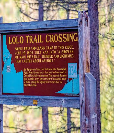
LOLO TRAIL CROSSING, NEAR LOLO PASS.
Scan Me!
Take a virtual tour of this byway before you start your engine.
NEARBY ADVENTURES
Follow the paths of historical expeditions and explore the ancestral homeland of the Nez Perce people while experiencing Idaho’s natural beauty.
POINTS OF INTEREST:
Dworshak State Park
Situated on the western shore of Dworshak Reservoir, this park o ers fishing, swimming, camping, hiking and disc golf.
Heart of the Monster Stand in awe at the legendary Heart of the Monster site and learn more about the creation story of the Nez Perce.
Hells Gate State Park
Discover scenic recreation and history at this state park, once the site of a Nez Perce village.
Nez Perce National Historical Park
Spread across four states, the park consists of 38 important places to learn the history and culture of the Nez Perce (Nimiipuu) people.
Gold Rush HISTORIC BYWAY
Steeped in mining history with a wealth of scenic views, Gold Rush Historic Byway showcases the beauty and history of north central Idaho. Travelers will find panoramic views of the Clearwater Valley and access to recreation in the Clearwater National Forest. Stay awhile in Pierce—where gold was discovered in Idaho— or visit historical sites of Lewis and Clark and the Nez Perce (Nimiipuu) people.
The Rundown
NEARBY ADVENTURES
Summertime along Gold Rush Historic Byway means camping, fishing, riding and hiking, while winter adventures include skiing and snowmobiling.
POINTS OF INTEREST:
• Bald Mountain Ski Area
• Camas lilies at Weippe Prairie
• Clearwater National Forest
• Lewis and Clark historical sites
• Nez Perce historical sites
• Weippe Discovery Center
• Weippe Hilltop Heritage Museum
NORTH CENTRAL
The byway begins at the junction of U.S. Route 12 and State Highway 11 at Greer and continues north until it
Weippe
Greer
Pierce Headquarters
Clearwater
National Forest
Bald Mountain Ski Area
GOLD RUSH HISTORIC BYWAY, NEAR HEADQUARTERS.
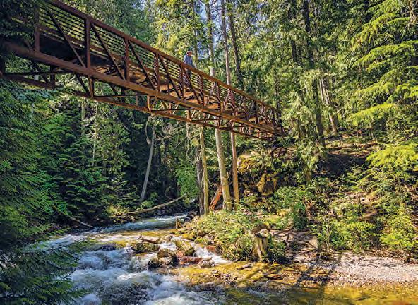
Elk River BACKCOUNTRY BYWAY
Elk River Backcountry Byway is an o -the-beaten-path adventure. The drive crosses Idaho’s tallest bridge— the Dent Bridge, spanning Dworshak Reservoir—and winds through the vast forests of the Clearwater Mountains. Stop at Dworshak State Park for fishing, hiking and camping. Keep an eye out for elk, bears and small woodland creatures as you continue on to the community of Elk River.
The Rundown
NORTH CENTRAL
NEARBY ADVENTURES
Hike out to towering waterfalls, explore a peaceful state park and revel in the beauty of Idaho’s stunning backcountry along Elk River Backcountry Byway.
POINTS OF INTEREST:
• Canoe Camp
• Clearwater Historical Society Museum
• Dent Bridge
• Dworshak State Park and Reservoir
• Elk Creek Falls
• Elk Creek Reservoir
• North Fork of the Clearwater Corridor
• Orofino Farmers Market
DWORSHAK RESERVOIR, NEAR OROFINO.
ROAD-TRIP TIPS
Turn-by-Turn Directions:
The byway begins in Orofino at State Highway 7 and the junction of Wells Bench Road, and then crosses the North Fork of the Clearwater at Dent Bridge. From there, the route goes to Elk River, where it joins State Highway 8 to Bovill.
Road Conditions:
Check conditions before traveling in the winter.
Full Services: Orofino and Elk River
Partial Services: Bovill
Looking f M e Info?
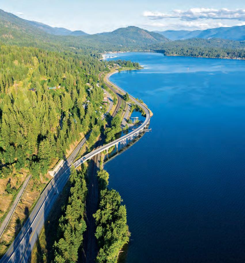
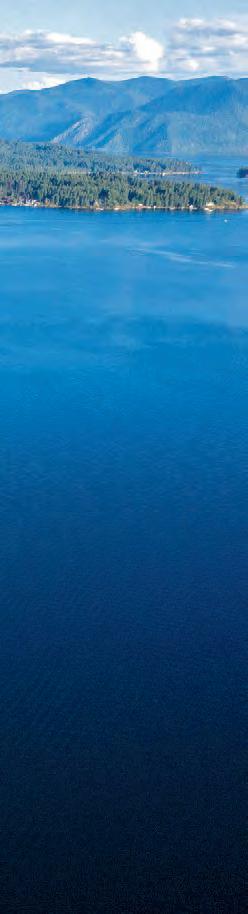
Pend Oreille SCENIC BYWAY
The rocky northern shoreline of Lake Pend Oreille— Idaho’s largest and deepest lake—sets the route for the Pend Oreille Scenic Byway. Revel in impressive alpine vistas, far-reaching forests and sparkling water as far as the eye can see with a handful of stops to get out and walk around. Accessible year-round, this byway o ers marvelous winter views and dramatic fall colors.
The Rundown
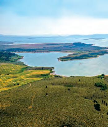
LAKE PEND OREILLE, NEAR BOYER.
ROAD-TRIP TIPS
Turn-by-Turn Directions:
This byway begins at U.S. Route 95 north of Sandpoint and follows State Highway 200 to the Montana state line.
Road Conditions:
This is a two-lane paved road with numerous scenic turnouts. If driving during winter, be prepared for changing road conditions, including ice and snow.
Full Services: Sandpoint, Clark Fork and Ponderay
Partial Services: Hope
CABINET GORGE DAM, NEAR CLARK FORK.
PEND D’OREILLE BAY TRAIL, NEAR SANDPOINT.
Pend Oreille SCENIC BYWAY
Did You Know?
Lake Pend Oreille is the largest and deepest lake in Idaho, reaching 43 miles long and 1,158 feet deep. Plan to enjoy the area’s beaches and campgrounds as well as fishing and wildlife viewing spots. Try a lake cruise to experience Lake Pend Oreille from the water.
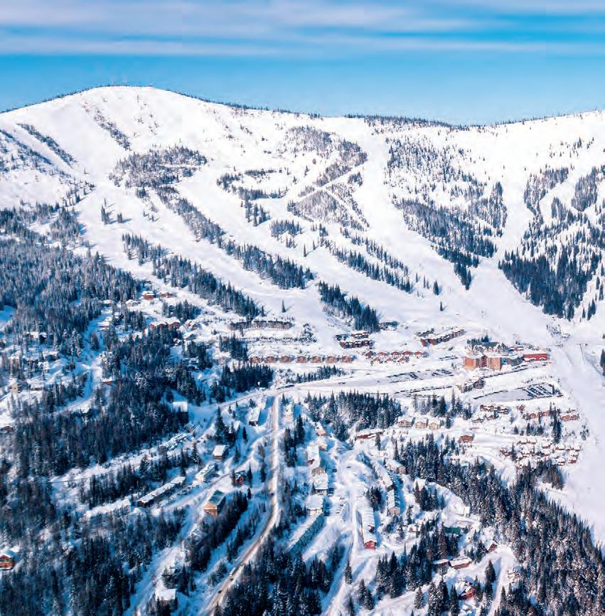
SCHWEITZER, NEAR SANDPOINT.
WESTERN PLEASURE GUEST RANCH, NEAR SANDPOINT.
Scan Me!
Take a virtual tour of this byway before you start your engine.
NEARBY ADVENTURES
Four seasons of recreation await you on the Pend Oreille Scenic Byway. Spend a day on the waters of Idaho’s biggest lake or hit the slopes at Schweitzer in the winter.
POINTS OF INTEREST:
Clark Fork River
This scenic river runs through Montana and Idaho, o ering fishing, floating and kayaking access.
Idaho Panhandle
National Forests
Grab a map and adventure into five ranger districts with beautiful lakes, rivers and forests to explore.
Schweitzer
Schweitzer is Idaho’s largest ski resort and has epic runs, snowshoe trails and snow tubing. Recreational trails draw visitors during summer.
Western Pleasure
Guest Ranch
Find activities yearround at this guest ranch with horseback riding and hiking, as well as Nordic skiing and sleigh rides.
Lake Coeur d’Alene SCENIC BYWAY
With rugged mountains, wildlife and year-round access, the Lake Coeur d’Alene Scenic Byway showcases panoramic views and all types of outdoor adventure in northern Idaho. While cruising the forested shoreline, make a pit stop to trek across trails with serene waterfront scenery. Be on the lookout for nesting osprey, as the lake is home to the largest population of this raptor in the West.
The Rundown
NORTHERN
NEARBY ADVENTURES
Scout out peak eagle watching November through February, dramatic colors in the fall and outdoor summer recreation like water sports and cycling along Lake Coeur d’Alene Scenic Byway.
POINTS OF INTEREST:
• The Coeur d’Alene Resort Golf Course
• McEuen Park
• Mineral Ridge National Recreation Trail
• Thompson Lake Wildlife Refuge
• Timberline Adventures
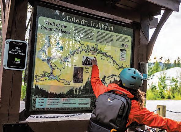
• Trail of the Coeur d’Alenes
• Tubbs Hill
TRAIL OF THE COEUR D’ALENES, NEAR HARRISON.
ROAD-TRIP TIPS
Turn-by-Turn Directions:
This byway begins at the junction of Interstate 90 and State Highway 97 and follows SH-97 south and east along Lake Coeur d’Alene to State Highway 3.
SH-97 is a two-lane, paved winding road with few passing lanes.
Coeur d’Alene and Harrison
Carlin Bay and Squaw Bay
Coeurd’AleneR.
Coeur d’Alene
Lake Coeur d’Alene
Harrison Plummer Mullan
Trail of the Coeur d’Alenes
Panhandle Hist ic RIVERS PASSAGE
Encompassing the southern leg of the International Selkirk Loop, the Panhandle Historic Rivers Passage follows the northern shore of the Pend Oreille River and passes scenic forests and farms. Expect to see a variety of wildlife, birds of prey and waterfowl depending on the season. Along the byway, learn how the Ice Age and the Lake Missoula Flood shaped northern Idaho.
The Rundown
INDIAN CREEK BAY, PRIEST LAKE STATE PARK.
GRAFFITI ALLEY, SANDPOINT.
ROAD-TRIP TIPS
Turn-by-Turn Directions:
The byway begins at the Washington state line by Oldtown and follows U.S. Route 2 to Sandpoint.
Road Conditions: Check conditions before traveling in the winter.
Full Services: Oldtown, Priest River and Sandpoint
NEARBY ADVENTURES
During the summer, take advantage of the river’s gently flowing waters and swim, boat or paddle along this water trail. In winter, enjoy snow sports, ice fishing and skiing at Schweitzer.
POINTS OF INTEREST:
• Albeni Falls Dam Visitor Center
• Lake Pend Oreille
• Farmers’ Market at Sandpoint
• Pend Oreille River
• Laughing Dog Brewing
• Pend Oreille Wildlife Management Area
• Schweitzer Looking f M e Info?
Get inspired for your journey with this immersive video.
Schweitzer
Albeni Falls Dam
Pend Oreille River
TOWN OF PRIEST RIVER.
Selkirk Loop
St. Joe River SCENIC BYWAY
Tracing the cottonwood-lined St. Joe River, this byway is a picturesque haven for birdwatchers and anglers. Bald eagles and osprey call the cottonwoods home and feast on fish from the waters below. Continuing along the byway, the crystal-clear waters become shallower and are ideal for all sorts of trout species. Along the river’s edge, keep an eye out for deer, elk, moose and bear.
The Rundown
NEARBY ADVENTURES
O ering some of the best trout fishing in the region and an abundance of camping, picnicking and hiking opportunities, the St. Joe River Scenic Byway is the perfect place to unplug and recharge. POINTS OF INTEREST:
• Historic Avery Ranger Station
• Idaho Panhandle National Forests
• Marble Creek Historical Site
• St. Joe River Cruise
• St. Joe Wild and Scenic River
Looking f M e Info?
Get inspired for your journey with this immersive video.
TOWN OF AVERY.
ROAD-TRIP TIPS
Turn-by-Turn Directions:
From St. Maries, at the junction of State Highway 3 and Forest Highway 50 (FS-50), head east along the St. Joe River for 75 miles. At the intersection with Road 218, FS-50 heads north (left) and climbs 14 miles to the Idaho–Montana border.
Full Services:
St. Maries and Avery
Partial Services: Calder
Joe
St. Maries
Avery
St. Joe R . Marble Creek St. Joe National Forest Coeur d'Alene National Forest
St. Joe Wild and Scenic River
ST. JOE RIVER, NEAR ST. MARIES.
IDAHO PANHANDLE NATIONAL FORESTS, NEAR THE IDAHO–MONTANA BORDER.
White Pine SCENIC BYWAY
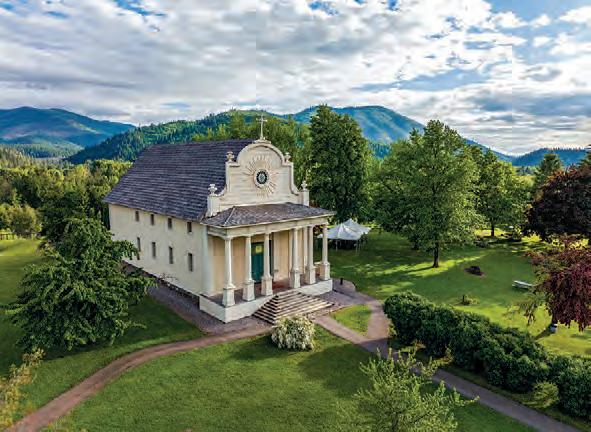
Passing through the towering forests of Idaho’s historic timber country, the White Pine Scenic Byway takes road-trippers through marshland spotted with lakes before crossing the St. Maries and St. Joe rivers. Dive into the history of Coeur d’Alene’s Old Mission State Park, where the 19th-century Cataldo Mission stands, and the town of Potlatch, once home to the world’s largest white pine mill.
The Rundown
ADVENTURES
The White Pine Scenic Byway fuses history and natural wonder around every bend. Visit historic sites that focus on logging, or enjoy camping, hiking, fishing and biking the Trail of the Coeur d’Alenes.
POINTS OF INTEREST:
• Coeur d’Alene River Wildlife Management Area
• Coeur d’Alene’s Old Mission State Park
• Giant White Pine Campground and Trailhead
• Heyburn State Park
• 1910 Fire Memorial
• Palouse Divide
• St. Joe National Forest
• Trail of the Coeur d’Alenes
ROAD-TRIP TIPS
Turn-by-Turn Directions:
From the junction of Interstate 90 and State Highway 3, head south on SH-3 to State Highway 6, then southwest to U.S. Route 95 at Potlatch.
Full Services: St. Maries
Partial Services: Potlatch
Coeur d’Alene’s
Coeurd’AleneR.
Get inspired for your journey with this video.
COEUR D’ALENE’S OLD MISSION STATE PARK, NEAR CATALDO.
CATALDO
Wild H se Trail SCENIC BYWAY
Part of the International Selkirk Loop, the Wild Horse Trail Scenic Byway begins in Sandpoint’s scenic downtown, located on the shores of Idaho’s largest lake, Lake Pend Oreille. With the dramatic backdrop of the Selkirk Mountains, the route follows the “Wild Horse Trail,” which was crucial for the Kootenai Tribe and settlers alike as this area of northern Idaho grew through the Gold Rush era.
The Rundown
NEARBY ADVENTURES
The Wild Horse Trail Scenic Byway showcases year-round outdoor recreation in the Selkirk Mountains and o ers a wealth of historical stops to explore.
POINTS OF INTEREST:
• Boundary County Museum
• Kaniksu National Forest
• Kootenai National
Wildlife Refuge
• Kootenai River
• Lake Pend Oreille Cruises
• Schweitzer
Looking f M e Info?
Get inspired for your journey with this immersive video.
ROAD-TRIP TIPS
Turn-by-Turn Directions: This byway begins on U.S. Route 95 in downtown Sandpoint and follows it north through Bonners Ferry to the junction of U.S. 95 and State Highway 1, then proceeds north on SH-1 to the international border at Porthill.
Full Services: Sandpoint and Bonners Ferry
TOWN OF BONNERS FERRY.
KOOTENAI NATIONAL WILDLIFE REFUGE, NEAR BONNERS FERRY.
International SELKIRK LOOP
The International Selkirk Loop—North America’s only multinational scenic drive—is a 280-mile journey around the Selkirk Mountains of Idaho, Washington and British Columbia. With nearly the entire Idaho portion following crystal-clear rivers and lakeshores, the International Selkirk Loop is a road trip of a lifetime dotted with a plethora of scenic pull-o s and historical sites.
The Rundown
NORTHERN
NEARBY ADVENTURES
Known as one of the top 10 scenic drives in the Northern Rockies, the International Selkirk Loop is a haven for outdoor recreation and wildlife viewing.
POINTS OF INTEREST:
• Kootenai National Wildlife Refuge
• Lake Pend Oreille
• Myrtle Falls
• Sandpoint City Beach Park
• Schweitzer
• Selkirk Mountains
Looking f M e Info?
Get inspired for your journey with this immersive video.
ROAD-TRIP TIPS
Turn-by-Turn Directions:
This byway begins in Oldtown. From there, head north on U.S. Route 2 through Sandpoint toward Bonners Ferry. Continue north on U.S. Route 95, take the left fork onto State Highway 1 and then cross the Idaho–Canada border in Porthill.
Road Conditions: Check conditions before traveling in the winter. Roads can become icy, and some portions may close at times.
Full Services: Oldtown, Priest River, Sandpoint and Bonners Ferry
INDIAN CREEK BAY, NEAR PRIEST LAKE.
RILEY CREEK RECREATION AREA, NEAR PRIEST RIVER.
Resources
Travel Inspiration & General Information
VisitIdaho.org
1-800-VISITID
Travel Tips
visitidaho.org/travel-tips
Things to Do
visitidaho.org/things-to-do
Camping
visitidaho.org/things-to-do/camping
Culture
visitidaho.org/things-to-do/culture
Accommodations
visitidaho.org/places-to-stay
Dining
visitidaho.org/eat-and-drink
Parks & Recreation
parksandrecreation.idaho.gov
Connect With Us
TRAFFIC INFORMATION
For the latest travel updates, including road conditions, detours and closures, visit 511.idaho.gov or download the free app.
PLAN YOUR TRIP
Build your own incredible itinerary with the help of the Visit Idaho Travel Assistant at visitidaho.org/travel-assistant.
M e Online
Access more scenic byway information online, including videos of the routes and filters to help you get started, at visitidaho.org/things-to-do/scenic-byways.