
 This project is part-financed by the European Union’s INTERREG IVA Cross border Programme managed by the Special EU Programmes Body


 This project is part-financed by the European Union’s INTERREG IVA Cross border Programme managed by the Special EU Programmes Body
Downpatrick is the historic county town of Down and one of Ireland’s oldest towns. It has been known variously by Irish, Latin or English names – Dun, Dunum or Downe. The early medieval Irish name Dun Lethglaise could mean ‘fort of the green-sided place’. It was John de Courcy and the Normans who added ‘Patrick’ to ‘Down’ to claim ownership of the saint. The town is built on three drumlins and until very recently almost entirely surrounded by water and marshes. This made it an excellent defensive site in prehistoric and medieval times.
This booklet will guide you through the town, where you can see many interesting buildings – from churches to gaols, and almshouses to Hunt Clubrooms. Please note that some of these buildings are privately owned and can only be viewed from the outside. You can find out about the sites from our information plaques.
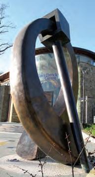
Brooch’
This bronze sculpture was created by artist Alan Burke, from Newcastle, Co Down, in 2010. Such brooches were used by Early Christian people to fasten their cloaks.
You can see a real brooch in the ‘Down Through Time’ display in Down County Museum.
Circular plaques around the Downpatrick area placed in accessible areas. 1
Name of the historical event, current or past landmark.
Brief description of the interesting history of the event or landmark. 3
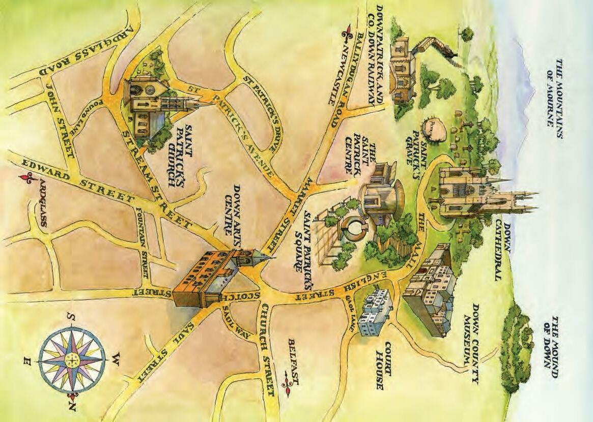
The self-guided tour starts at the Downpatrick Visitor Information Centre, which is housed in The Saint Patrick Centre on St Patrick Square.
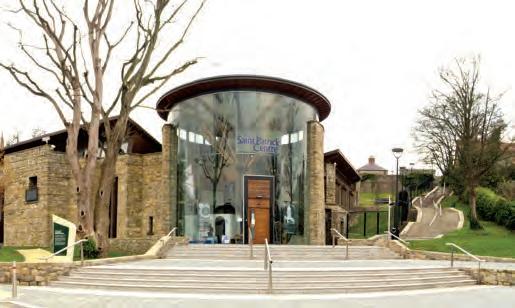
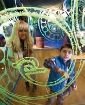
The Saint Patrick Centre opened in 2001 and is the only purpose-built interactive exhibition in the world telling the story of St Patrick’s life and legacy in his own words.
The exhibition includes a journey through St Patrick’s life in the 5th century. A series of interactive screens and films allow visitors to explore St Patrick’s world and how we perceive him today. There is also a tearoom and at the rear a sensory garden with a view of Down Cathedral.
Outside The Saint Patrick Centre you can see a large bronze sculpture, Penannular Brooch, which was created by artist Alan Burke, from Newcastle, County Down, in 2010.
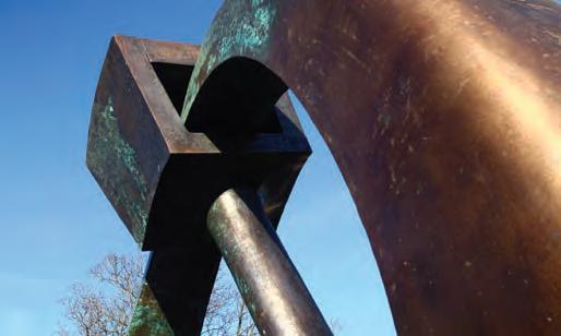
People in Early Christian times used penannular brooches to fasten their cloaks. A real brooch can be seen in the Down Through Time exhibition in Down County Museum.
Turn right outside The Saint Patrick Centre, walk along the path by the road, with the Grove and Hill of Down on your right, until you reach the Downpatrick and County Down Railway.
This is Northern Ireland’s only working heritage railway, operating between Downpatrick, Magnus Barefoot’s Grave and Inch Abbey.
The Belfast and County Down Railway served Downpatrick from 1859 until it closed in January 1950.
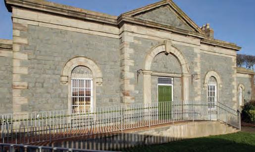
of the Viking King, Magnus Barefoot (1073-1103). He was killed here in 1103 while taking cattle to feed the crews of his ships.
Another railway line goes to Inch Abbey, the site of an earlier monastery raided by the Vikings in 1001.
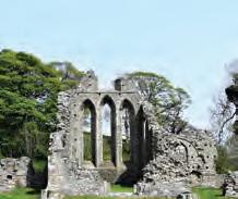
The ruins you see today are of a Cistercian abbey founded in 1180 by John de Courcy. He was an AngloNorman knight who conquered parts of Ulster between 1177 and 1204.
The Abbey is one of the earliest buildings constructed in the Gothic style in Ireland. Here the monk Jocelin of Furness wrote a life of St Patrick, including the legend about Patrick banishing snakes from Ireland.
The Grove Walk back towards The Saint Patrick Centre and take the path up to the left, through the wooded area on the slope below the Cathedral, called ‘The Grove’.
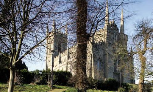
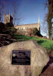
This area was planted by Edward Southwell in 1740. In the 18th and 19th centuries it was a place of recreation and a fashionable resort in the summer. Here there were statues of Roman gods.
John Wesley (1703-1791), the founder of Methodism, preached in ‘The Grove’ on several occasions. A stone with an information plaque has been placed here as a memorial to this great preacher and theologian.
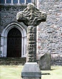
When you arrive on the Mall to your left is the Cathedral of the Holy Trinity. In front of the Cathedral is a replica of a High Cross carved in about AD 900. The original will be placed on display in Down County Museum after conservation in 2015.
The Cross has been moved several times and formerly served as the Market Cross in front of the Assembly Rooms, now Down Arts Centre.
The surviving remains were re-assembled here in front of the Cathedral in 1897 under the guidance of the antiquarian Francis Joseph Bigger.
The Cross head clearly displays the Crucifixion of Christ on one side, with the two thieves on the side-arms, each flanked by two soldiers.
If you look up at the east end of the Cathedral, you can see three empty niches, in which statuettes of Saints Patrick, Columcille (Columba) and Brigid were once placed.
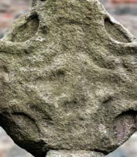
These are the three saints whose remains John de Courcy’s bishop, Malachy, claimed to have discovered here in 1185, arousing renewed interest in the site as an important place of pilgrimage in Ireland.
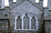
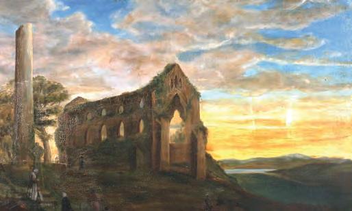
Just as you reach the flat area at the top of the hill, you are walking on the site of the 1000 year old Round Tower of Down. This was a monastic bell-tower or cloigtheach demolished in 1790, but which is known to have stood here since at least the 11th century.
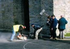
Channel 4’s Time Team investigated this site in 1997 and some of the finds from their excavation can be seen in the Museum.
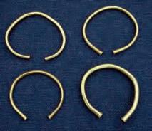
Now take the left-hand road around the Cathedral. Two hoards of gold bracelets were found during grave-digging in the graveyard in the 1950s. They date back about 3,000 years. One of these hoards can be seen in the Down County Museum displays, on loan from National Museums Northern Ireland.
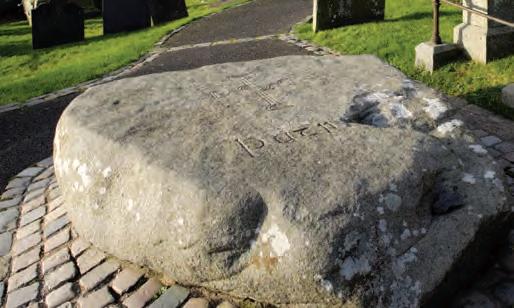
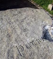
Follow the steps on the left which lead to the traditional site of St Patrick’s Grave. This is possibly the site where John de Courcy’s bishop, Malachy, claimed to have rediscovered the remains of St Patrick, St Columcille (Columba) and St Brigid in 1185.
A large memorial stone of Mourne granite was placed here in 1900 by the Belfast Naturalists’ Field Club to mark the burial place of St Patrick.
The stone was quarried at Slieve-nalargie, two miles west of Castlewellan. It took 12 men 14 days to cut the stone.
From the centre of the car park in front of the Cathedral, there is a fine view of the Mountains of Mourne on a clear day.

You are probably standing on the site of the original timber and later stone churches, which surmounted the Hill of Down in the Early Middle Ages. These were burnt down on a number of occasions.
Straight ahead was the trackway leading up from a landing-place on the River Quoile, the route followed by most medieval pilgrims, who arrived by boat.
An entrance way across the deep boundary ditch existed here, with a guest-house for pilgrims.
Important archaeological excavations were carried out in this area in the 1980s and 1990s. Many of the finds, and decorated medieval floor tiles from the Cathedral itself, can be seen in the Museum.
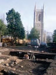
Looking back, the impressive Down Cathedral, restored between 1790 and 1818, dominates the skyline.
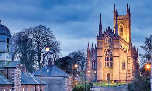
John de Courcy founded a Benedictine monastery on this site and it underwent a number of changes during the medieval period.
The Cathedral was burnt in 1538 and remained roofless for several centuries before its restoration. The tall western tower was added in 1829. Just to the left side of the entrance to the Cathedral, near the ground, you can see a medieval carving built into the wall.
As you walk down the other side of the Cathedral, you can see some foundations protruding from the church wall. This could be the outline of a transept, suggesting that the church at one stage, probably in the 12th century, took the shape of a cross.
On the left hand side of the Mall you can look down into the fields below. They are at a lower level because the Mall was built up in the 1790s when the Cathedral was restored and the Gaol constructed. This area was probably once occupied by medieval crafts and industries, outside the boundary ditch of the monastery, partly to avoid fires spreading.
Looking down to the left, the second field was the location of a medieval pottery kiln, one of only two known in Ulster. Pottery from this kiln, dating to the 13th century, is on display in the Museum.
Mon–Sat 9.30am–4.30pm Sun 2pm–5pm
Down Cathedral, Church of the Holy Trinity
On the right hand side of the Mall, you will see the Southwell School and Almshouses, built in 1733 by Edward Southwell.
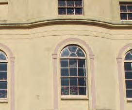
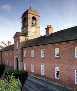
This is one of the best examples of Early Georgian architecture in Ulster and originally stood at road level.
It provided a place of residence for six poor elderly men and six women in the central building, as well as schools for ten poor boys and ten poor girls.
The Southwell arms can be seen on the central gates. The Southwell buildings are not accessible to the public.
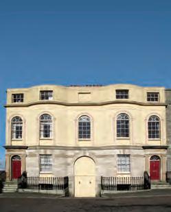
Opposite the Southwell building are two Regency-style houses of the 1830s. The house on the right was sometimes used as lodgings by judges presiding at the Courthouse.
Please note these are private houses.
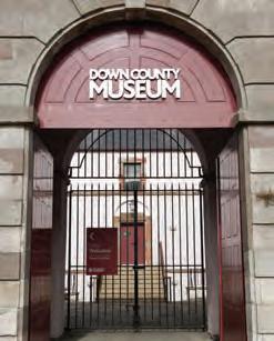
Down County Museum is located in the historic buildings of the late 18th century County Gaol of Down. The Gaol was opened in 1796 and until its closure in 1830 housed many thousands of prisoners. It was also a convict gaol and many hundreds of transportees were imprisoned here prior to their journey to the convict colonies of New South Wales, via the port of Queenstown in County Cork. The best known prisoner in the gaol was the United Irishman, Thomas Russell, who was hanged at the gateway in 1803. His remains are buried in the parish church (St Margaret’s) graveyard near the bottom of the street. The Gaol was built in what was previously known as Sessions House Park. This was almost certainly the site of the Monasterium Hibernorum or Monastery of the Irish, founded by St Malachy in 1138.
From the late 1830s the gaol site was used by the South Down Militia and troops were also billeted here during the First and Second World Wars. Today the Museum collects, conserves, researches and exhibits objects relating to the history of County
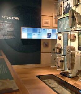
Down from 7,000BC to the present day. It preserves about 10,000 objects and an estimated 40,000 photographs, collected since the museum was established in 1981. You can see almost 1,200 objects in the central Governor’s Residence building, in an interactive exhibition entitled Down Through Time. There are also changing temporary exhibitions in other galleries and a tearoom with a view of the Mound of Down and the River Quoile.
You can now take Detour 1 (lasting 20 minutes) or carry on down English Street, turning to page 17.
Detour 1: Mound of Down
Turn left at the corner of the Museum and walk along until you see a sign to the Mound of Down. Follow the lane on the left, downhill past Downpatrick Primary School, keeping to the right until you come to a car park. After reading the interpretation panel in the car park, go through the kissing-gate and down the path by the entrance to the car park, so that you can approach the impressive early medieval site known as the Mound of Down. This may have been the royal fortress of Niall, King of Ulaid, between 1016 and 1063.
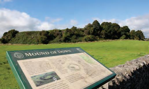
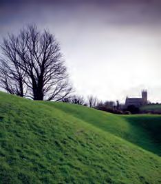
Circling around the ditch to the right, you will find a set of modern steps leading up to a large oval enclosure. Within this at the far end you will see a Norman motte with a massive ditch around it, probably built by John de Courcy when he captured Downpatrick in 1177.
On a good day, there are fine views of the Cathedral and the Mountains of Mourne.
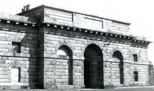
If you return to the road and turn left you will see a large stone gateway on your left. This is all that remains of the New Gaol, opened in 1830 to replace the Old Gaol, on the former site of a windmill. The lead letters GAOL, from the name above the entrance, can be seen in the Museum today. This gaol was under the management of the Grand Jury until 1878, when it was taken over by the Government as a Convict prison, until closure in 1891.
Notable prisoners here were William Johnston of Ballykilbeg, imprisoned here for two months in February 1868 for leading an illegal march on 12 July 1867 and James FitzHarris, the coach-driver of the Phoenix Park Murders in Dublin, in 1882.
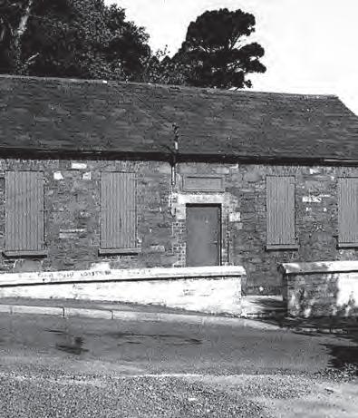
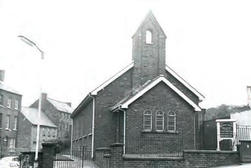
If you wish to see a 19th century chapel and the site of a medieval gateway to the town, carry on round the wall of the gaol and down Bridge Street. When you are a little way past the wall of the New Gaol, now Down High School, you will see the small Union Prayer Meeting Chapel on your left.
This Chapel was built by Aynsworth Pilson, who wrote an important diary between 1799 and 1866 and lived just down the road in Rathdune House. Now known as the Pilson Hall, this building is used by the Baptist Fellowship of Downpatrick.
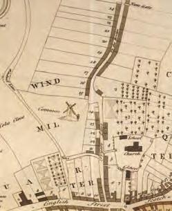
Now carry on down the hill to see the site of one of Downpatrick’s medieval gateways, at the junction with Pillar Well Lane.
Nothing survives today, but the Nuns’ gate once stood here at the lower end of Bridge Street until the year 1746. The gate was close to the Convent of Cistercian nuns in Downpatrick. A plaque on the wall marks the likely location of the gate.
Now return to the T-junction on the Mall next to the Museum to continue the tour.
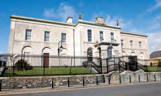
As you begin to walk down English Street, you will see the Courthouse on your left, originally built in 1735 by Hugh Darling of Dublin on Sessions House Hill. It had two court rooms, one for Crown business and one for civil business.
Near the entrance in two arches were placed lead statues of Justice, holding scales, and Plenty, holding a sheaf of corn. The statues now stand on the parapet above.
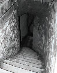
In the centre of the parapet you can see the Coat of Arms of George II, who was king in 1735. The Courthouse was enlarged and improved in 1834, but burnt down in 1855 with the loss of many records. After the fire, it was rebuilt by George Stockdale, a local builder and in 1857 a 130-yard long tunnel was excavated from the cells to the basement of the gatehouse of the ‘New’ Gaol, now part of Down High School.
The Courthouse was most recently renovated between 1988–1991.
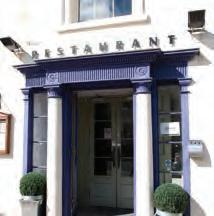
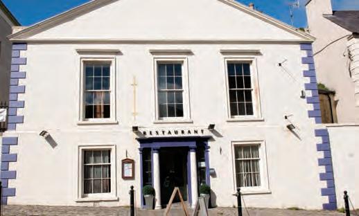
Downpatrick CourthouseBeside the Courthouse, Justine’s Restaurant is located in the former Downe Hunt Rooms, opened originally in 1746 as a ‘house of correction’, with vaulted cells on the ground floor.
A disastrous fire here in 1783 led to the opening of the County Gaol in 1796 and the conversion of the building for the use of the County Grand Jury.
The manager of the County Rooms for many years was Nicholas Coates, who had previously served as house steward to a noble family in Worcestershire. He made his name as the ‘inventor’ of Worcestershire sauce.
The County Rooms later became the clubrooms of the Downe Hunt, the oldest existing Hunt Club in Ireland and Britain.
Opposite the Courthouse and County Rooms is a block of four two-storey houses with basements.
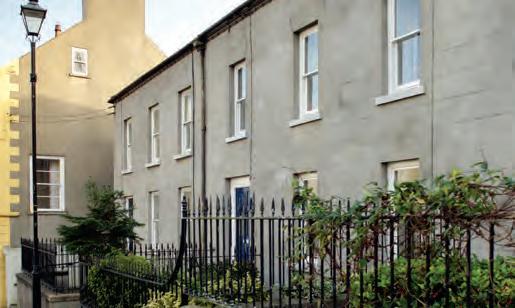
These are the Clergy Widows’ Houses which were built and endowed in the mid 18th century for the widows of Church of Ireland clergymen from the diocese.
Please note these are private houses.

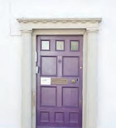
Further down English Street, number 26 was the Customs House, built in 1745 by Edward Southwell.

About this time the excise and customs of Downpatrick were said to amount to £8,000 per year, chiefly from imports of wine and spirits, timber, iron and foodstuffs, and exports of corn, linen, raw hides and tallow.
This trade, carried on through the port of Downpatrick at the Quoile Quay, about a mile from the town centre, finally came to an end in the 20th century.
Please note this is a private house.

Proceed down English Street towards the junction with Scotch Street and Irish Street. On your right is Denvir’s, Downpatrick’s oldest surviving coaching inn. A worn stone tablet in the gable bears the inscription John and Ann McGreevy 1642
A 17th century fireplace survives inside although the exterior appearance has been altered over the centuries.
Denvir’s was the starting point in 1809 for the first passenger coach service from Downpatrick to Belfast. Fares on the coach, named St Patrick were eleven shillings and fourpence ha’penny (57p) for an inside seat and seven shillings and sevenpence (38p) for an outside one.
There is a tradition that the recess between the front door and the box room window was once a debtor’s sanctuary. The large room upstairs was used in 1829 to accommodate a dinner for Daniel O’Connell, who made a speech to the crowd below. In 1842, the proprietor, James Denvir, was also the agent for the steamer ‘Eclipse’, which plied between Downpatrick, Liverpool and Dublin.
Opposite Denvir’s Hotel was formerly the entrance to Bridge Street which provided the exit route from the town to the north before Church Street was constructed in 1838. Bridge Street was formerly known as Friar’s Lane because it led past the site of a medieval Franciscan friary.
Now turn left along Church Lane, on the lower side of the small square. This was previously known as Linen Hall Lane, recalling that Downpatrick once shared in a thriving linen trade. The lane leads to the Down Parish Church (St Margaret).
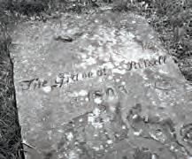
The tower dates to about 1560 and the nave probably dates to 1735. In the graveyard, on the left of the pathway leading to the church, is the grave of the United Irishman, Thomas Russell, executed in 1803 at the gate of the County Gaol (now Down County Museum).
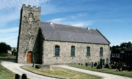
It is marked by a stone bearing the words The Grave of Russell which was placed there by his friend Mary Ann McCracken, sister of the Belfast United Irishman, Henry Joy McCracken, who was executed in 1798.
 Down Parish Church (Church of Ireland)
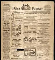
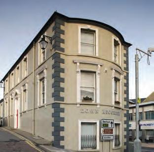
The building on the corner of English Street and Church Street dates from about 1860 and previously housed the Post Office and telephone exchange. The Down Recorder now has its offices in this building – a company first founded in Downpatrick by Conway Pilson in 1835.
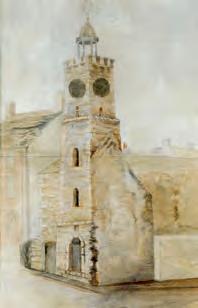
Prior to this, a medieval stone tower known as ‘Castle Derras’ stood here. This was used as a prison in the early 18th century and was demolished in 1848.
Looking to the right of Down Arts Centre, you will see Irish Street. Before the construction of Market Street across the marshes, Irish Street was the way out of the town to the Dublin Road.
Most of the houses in the street are late 18th and early 19th century in date and many have had their ground floors converted into shops.
Near the top of Irish Street was ‘The Shambles’, a name derived from the Old English word scamul, a ‘stall’, where street trading was carried on until the early part of the 20th century.
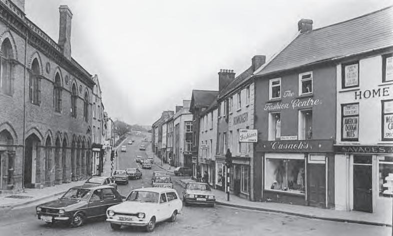
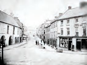
At the junction of English, Irish and Scotch Streets, Down Arts Centre occupies the old red-brick Assembly Rooms in the centre of town.
Built in 1882, they were designed by the celebrated Belfast-based architect William Batt in a Victorian gothic style.
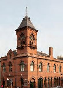
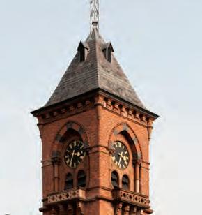
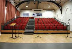
The building remains an important architectural focus in the town centre, replacing a Market House of 1660 on the same site. It was in the large upper room of the Market House that the Seneschal (or steward) of the Manor of Down used to preside over the Manor Court. Markets were held on the ground floor.
Down Arts Centre was established here in 1984 and the building was refurbished in 2011-12. Its programme offers a wide range of performances, workshops and activities for all ages.
Mon–Sat 10am–4.30pm
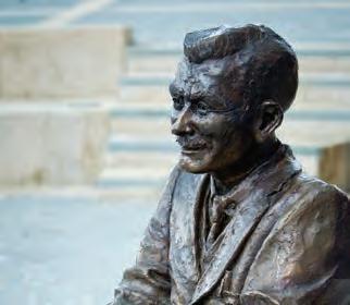
Walk up Scotch Street and you will find TheSilentDog, installed in 2011 to commemorate the work of Lynn C Doyle, whose real name was Leslie Montgomery, an author born in Downpatrick.
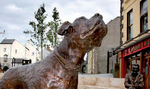
The sculptures of Mr Harrington, Mr Anthony, Pat and the ‘silent’ dog are from one of his short stories.
The artist is the renowned Scottish sculptor, David Annand.
From here cross the new road, Saul Way, into lower Saul Street. Here you can see the Methodist Church.
The first Methodist Church here was erected in 1777 and John Wesley preached here the following year. The present building succeeded the original in 1955.

Saul Street leads to Saul, where St Patrick is said to have begun his Christian mission in Ireland in AD 432.
A few steps along will bring you to the site of the old infirmary. Numbers 14-18 are a fine block of Georgian houses, where Down County Infirmary was established in October 1767.
The Infirmary was located here for only seven years before it moved, first to Fountain Street and then on to the site in Pound Lane where it was to become the first Downe Hospital.
Go back to Scotch Street and walk up the hill to the left to the junction with Fountain Street. Here you can climb up to Gallows Hill.
You may find it difficult to believe that this lane beyond the surfaced area was once one of the three main routes into Downpatrick.
On your left, as you look up the hill, was the site of a cattle market, while near the top of the lane on the right is the site of the gallows used before the erection of the late 18th century gaol (now Down County Museum). Also on the right was a well dedicated to St Patrick, but it is now covered over.

The gallows structure consisted of three pillars, called ‘the three sisters’, on top of which was laid a wooden beam from which the rope was suspended. Crimes such as horse or sheep stealing, forgery and theft were then punishable by death.
From the Gallows Hill you have a good view of the town, with Down Cathedral on the opposite hill. At the bottom of the hill, turn left into Fountain Street. The houses on the left (numbers 2-14) occupy the site of the old Horse Barracks which was a late 17th century

rectangular building with projecting gable wings at each end. In 1774 the Barracks were purchased for £150 for use as the Down County Infirmary. They served this purpose for 60 years until the opening of the new Infirmary (the former Downe Hospital) in 1834. The Barracks were demolished in the 1970s.
You can now take Detour 2 starting on page 29, which will take you approx 30 minutes to walk and see more of Downpatrick’s heritage, or alternatively you can go back down Scotch Street, the way you came, turn left along Irish Street, and then right along Market Street, where you can rejoin the main tour on page 33.
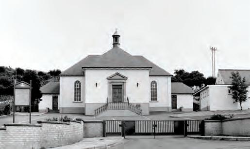
Further along Fountain Street is Downpatrick Presbyterian Church, originally built in 1826 following a split in the Downpatrick congregation. It was rebuilt in 1955 in a Georgian style.
Cross over John Street and go round the lower end of the facing terrace into Mary Street, which used to run straight from John Street to Irish Street before its realignment in 1984/85. The original Mary Street was opened in 1778, the right side being built for Mrs Mary Trotter after whom it was named.
In this area stood the Priory of St John the Baptist, referred to in the 14th century as the Hospital of St John of the English and in 1634 as Cillin Seon, ‘the little church of St John’. In 1728 Mr John Trotter, agent for the Southwell Estate, found vast quantities of human bones here when he was laying out his new garden.
From Mary Street turn left into the upper part of Irish Street. There are particularly
interesting Georgian houses here, built on the probable site of a tower house known as Cromwell’s Castle, which belonged to Edward, Baron Cromwell, appointed Governor of Lecale in 1605. This castle was destroyed in the wars of the 1640s but its foundations were discovered when these houses were being built. No. 97 is now Teach Naomh Michil, St Michael’s Parish Centre.
On the opposite side of the street is a group of Georgian buildings (numbers 110-116 Irish Street, and numbers 2-4 Stream Street). No. 114 served as a convent when the Sisters of Mercy first came to Downpatrick in 1855. In the early 1930s No. 116 accommodated the first classes of St Patrick’s High School, now on Saul Street. Behind is the new monastery for the De la Salle brothers, opened in 1961. Opposite is part of the Convent of Mercy, which closed in 2011.
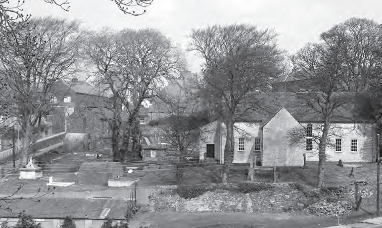
Near the bottom of Stream Street are the gate-pillars, surmounted by garlanded urns, of the First Presbyterian (NonSubscribing) Church, Downpatrick. It is a T-shaped building built in 1711 and was the first Presbyterian Church in Downpatrick, although there was an earlier Meeting House in the Flying Horse area, to the south of the town. The interior of the church is still 18th century, with box pews and a wooden octagonal pulpit set on a high pedestal.
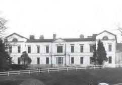
Continue to the traffic lights at the bottom of the street. Immediately to the left is Pound Lane, where there was formerly a pound, an enclosure for stray animals, in the area of the present car park. The Infirmary above was built here in 1834, and in 1948 became part of the National Health Service as the Downe Hospital, now closed. This was replaced in 2009 by a brand new hospital on the Ardglass Road.
At the traffic lights turn right into St Patrick’s Avenue, which was constructed in 1851 as
the Circular Road, to connect Market Street to Stream Street. It was re-named in 1932 to mark the 1,500th anniversary of the arrival of St Patrick at Saul. The low-lying land to the left, where the cinema complex is now located, was prone to flooding until the first half of the 20th century. Before the drainage schemes of about 1745 the land on which you are standing was high water mark for the branch of Strangford Lough which then almost encircled the town.
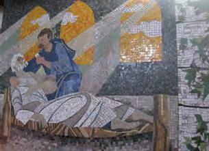
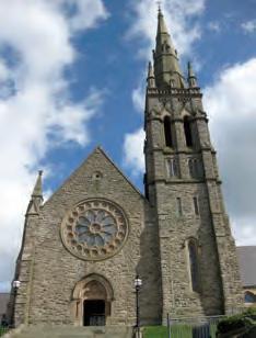
On the right you will come to St Patrick’s Roman Catholic Church with its splendid rose window, interior decoration and tall spire.
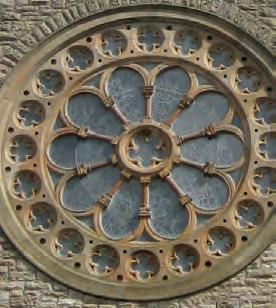
In 1750 the site was the stackyard of Mr John Trotter. He leased it for the erection of a Catholic Church dedicated to St Patrick which was erected in 1787. It was replaced by the present church which was opened in 1872. The spire was added in 1895 and a transept in 1992-3.
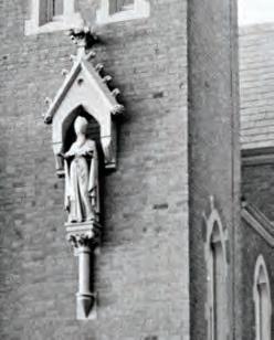
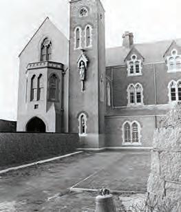
Walking through the grounds of St Patrick’s Roman Catholic Church to the left of the church is the Convent of Mercy.
The Congregation of the Sisters of Mercy was founded in Dublin by Catherine McAuley in 1831. On 21 June 1855, three Sisters arrived in Downpatrick to establish a school to provide education for the children of the area. Until 2011, the Sisters of Mercy were a constant presence, providing educational opportunities to all ages from 3 to 18.
The splendid gothic-style building, positioned beside the Parish Church, which was designed by Mortimer H Thompson of Belfast, was home to the Sisters from 1873 until the Convent closed in July 2011.

Continuing on, you will arrive at Market Street, opened in 1846 during the Famine to facilitate coach and horse traffic to Dublin, thereby avoiding the hill on Irish Street. Market Street is now a busy thoroughfare but before the early 19th century this area was covered by water at every high tide and small vessels were able to land their cargoes here. Severe flooding remained a problem until the mid 20th century.
A local rhyme began ‘The floods are up in Market Street, the station’s like the shore’ – the railway station was across the street on the site of the present Grove Shopping Centre. Market Street is now the main shopping street of the town.
Continuing up Market Street past St Patrick Square, you will see Downpatrick Library on the right, located next to the Grove Shopping Centre. The Heritage Gallery in the library holds a reference collection covering all aspects of life in County Down and includes: historical maps, postcards
and photographs, journals, local and regional newspapers on microfilm and a selection of specialised and antiquarian books for family history.
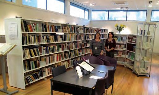
These include street directories, volumes of Griffith’s Valuation, gravestone inscriptions, Ordnance Survey parish memoirs from the 1830s, Ireland’s memorial records and Grand Jury Records of the county administration prior to 1898. The Library staff would be pleased to help you with your enquiries or research.
www.ni-libraries.net/libraries/ downpatrick-library/ Access
Mon, Wed, Fri & Sat 10am–5pm Tues & Thurs 10am–8pm
For further information
Returning to St Patrick Square, you are now back in front of The Saint Patrick Centre, where the tour began.
We hope you have enjoyed discovering Downpatrick’s rich history and will come back to explore the town again another day.
All photographs courtesy of Down County Museum except for: Page 23 Downpatrick Market House, National Library of Ireland Published by Down District Council, 2013
Historic Walking Tour of Downpatrick