The Poets Trails and other walks

A selec tion of routes through exceptional countr yside rich in folk lore, archaeology, geology and wildlife


A selec tion of routes through exceptional countr yside rich in folk lore, archaeology, geology and wildlife

The Ring of Gullion lies within a region long associated with an ancient frontier that began with the earliest records of man’s habitation in Ireland. It was along these roads and fields, and over these hills and mountains, that Cúchulainn and the Red Branch Knights, the O’Neills and O’Hanlons roamed, battled and died. The area, which has always represented a frontier from the ancient Iron Age defences of the Dorsey, through the Anglo Norman Pale, and latterly the modern border, is alive with history, scenic beauty and culture.
This area reflects the mix of cultures from Neolithic to the present , while the rolling countryside lends itself to the enjoyment of peaceful walks, excellent fishing and a friendly welcome at every stop


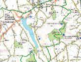
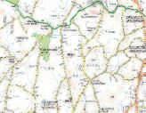
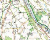

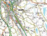
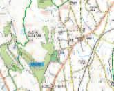
Creggan
Creggan graveyard is a truly ecumenical place as members of both Catholic and Protestant denominations still bur y in its fragrant clay. I t contains the remains of poets; scribes; clergymen; raparees; militia; magistrates; revolutionaries; landlords and tenants; labourers; housekeepers; wives and husbands; beggars and bankers
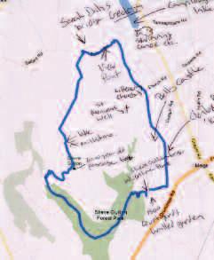
This route is a series of minor roads and countr y paths winding through South Armagh into Nor th Louth and back again. You can follow the folklore and life and times of the Poets and Scholars of the area.


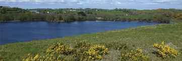
Start at Creggan Churchyard (Information Board 1) and turn right heading south along the Glassdrummond Road for roughly 4km passing Glassdrumond Church and onto Glassdrummond Lake where the O’Neills sited their Castle (Information Board 2). Take the first right past the lake onto the Leeter Road, and continue for roughly 1km. Following the Poets Trail signs take the left turning to Mounthill, and continue for roughly 2 5km until you see Roche Castle Straight ahead (Information Board 3)
Turn left at the cross roads and continue for roughly 1km before turning left towards Ballsmill. Continue for roughly 1km before veering right through Ballsmill Village past the amenity site (Information Board 4). Continue for roughly 1.5km and take the first left onto the Cortreasla Road, after roughly 1km (Information Board 5) walk through the tight bend
in the road After a further 1km turn right onto the Lurgan Road and continue for roughly 1.5km, past Hearty’s Folk Cottage on the left and take the first turn on the left at Murrays Road.
Continue for roughly 1.5km taking the first turn to the right , Cregganbane Road, then continue for roughly 0.5km and at the junction turn left always following the waymarkers. At the bottom of the road turn right back to Creggan Parish Church
This route is series of minor roads and countr y paths winding around Croslieve star ting in the historical village of Forkill.
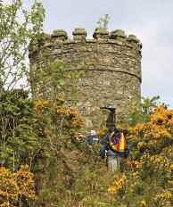
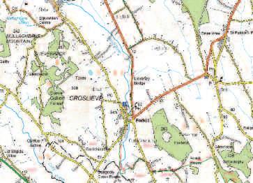
Start at the Welcome Inn on Main Street, renowned for its traditional music sessions (Information Board 1) Head south and continue for roughly 0 5km and take the first turn left down a country track, part of the Ring of Gullion Waymarked Way.
Continue for roughly 1.5km along this track, which was the old funeral road to Urney Graveyard (Information Board 2)
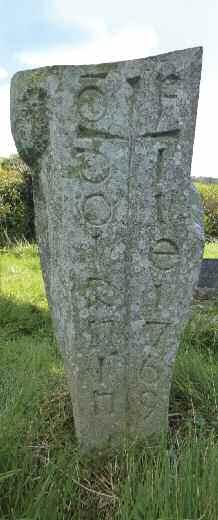
After visiting the grave of Peadar Ó Doirnín follow the track south for roughly another 0.5km. At the end of the lane turn right and continue for roughly 1km straight through the crossroads
Continue for roughly 1.5km to the next junction and turn left onto the Carrive Road and after roughly 300m turn right. Continue for roughly 3km along Glendesha which provides magnificent views of Slieve Gullion
At the end of this road turn right and continue for roughly 0.5km to Forkill Church of Ireland which is now a residential property (Information Board 3)
Continue along this road into Forkill Village.
I t was the folk belief that there was a special indulgence earned by being buried at Urnaí. Those buried here are thought to have a more direct line to heaven.
Did You Know?

Townlands Tullymacrieve means Rice’s ‘field’ or ‘grassy hillock ’ . The name Ó Maolchraoibhe is anglised as Rice, Mulcrevy and Mulgrew.
Cashel means ‘the stone ring for t ’ .
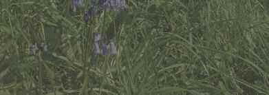
There was formerly an old graveyard k nown locally as the ‘reilig’ in Tullymacrieve and a cairn in Cashel.
This is a circular route following minor roads leaving from the Ti Chulainn Centre. This walk takes in the last working flax mill of the area, Ballykeel Por tal Tomb and Cloverhill Golf Course.
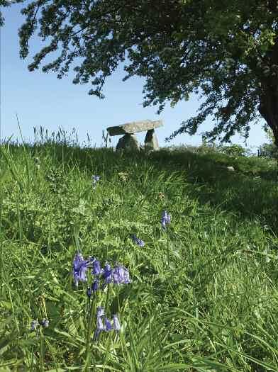
Begin at the Ti Chulainn Cultural Activity Centre in Mullaghbane (Information Board 1). Turn right down the Bog Road away from Mullaghbane. Continue for roughly 1km before turning left onto the Longfield Road After roughly 150m take the first left onto the Mill Road After 1 5km (Information Board 2), continue on for roughly 1km You can take a right detour to see Ballykeel Dolmen.
Continue for roughly 0.5km across the main road and take the second left following the Poets Trail’s signs. Cross the main road again and turn left along the Tullymacrieve Road to Information Board 3 at Ballinasack Turn right onto the Ballinasack Road Keep left after roughly 0 5km and continue along this road for roughly 1 5km Turn left onto the Cashel Road and take the first left into Mullaghbane Area of Special Scientific Interest . The rocks found at Mullaghbane show the geological processes that were present here 60 million years ago.
Continue along this small road for roughly 1km before turning left following the Poets Trial sign After roughly 200m turn right onto the Lough Road for great views of Mullaghbane Mountain. Continue along the Lough Road for roughly 1.5km past Cloverhill Golf Course and the Enchanted Spa and Retreat . Turn left (Information Board 4) onto the Glendesha Road. After 500m turn left and left again towards Mullaghbane with views of Slieve Gullion on your right . Cross the stone bridge on the right after roughly 0.5km and turn right back towards Ti Chulainn on the Bog Road where you should recognise your surroundings from the start of your journey

The walk star ts and finishes at the Slieve Gullion Forest Adventure Park.
Follow an uphill path from the top left of the car park The path continues uphill through deciduous woodland for about 1km until arriving at a log bench opposite a way marker post . Turn right on to the forest drive and continue uphill through a stand of beech trees for 800m. Turn right onto a short section of forest track to the forest drive. Turn left on the forest drive and continue for about 2km until the upper car park on the left
This section of the trail has magnificent views of the Ring of Gullion peaks of, Slievebreac , Slieve na Bola, Slieve Mór and the Dhaichalmór.

Turn right fifty metres beyond the car park up an initially steep mountain path. Continue through a kissing gate until a stone shelter is reached. The views in this section expand to include the peaks of Slievenacapple and the Fews to the North west

Passing to the right of the stone shelter the path becomes steeper, traversing rocky ground. After 500m the path arrives at the summit of Slieve Gullion and the Neolithic
Passage Grave, which you can enter from just below the summit . Panoramic views from the summit take in the Mourne Mountains, Carlingford Lough, The Cooley Peninsula, the Armagh Drumlins and beyond.
The path continues North West along the summit plateau arriving at Calliagh Berra’s Lough after 800m. Continue past the lough to the North Cairn which is also a Bronze Age burial chamber.
Continue on the path and descend for about 2km down the North side of the mountain until reaching the Ballard Road. Turn right along the country lane and follow it as it undulates through the countryside. Keep right after 2km where the road forks and continue to Killeavy Old Churches dating from the 5th Century. St Moninna is buried in the churchyard.
Continue along the country lane, past Clonlum Portal Tomb on the left and Killeavy Castle on the right for a further 2km before turning right at a cross roads. Continue through gateposts on to the exit from the car park .
I t ’s all in the name, Camlough Mountain’s real name is Slieve Girk in, its translation is a little more complex but most take it to mean ‘mountain of the cocks comb’ as the crag resembles a comb. The village name Camlough doesn’t come from any townland, it ’s taken from the nearby lake The village lies in the townlands of Cross and Carrickcroppan
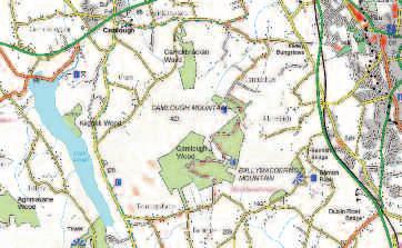

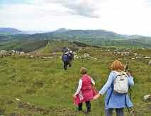
The walk star ts and finishes in the Village of Camlough.
Follow the Quarter Road to the right of Doyle’s Pub. Continue along this road for about 50m then turn left onto the Church Road. Continue along this narrow country road for about 2 5km until you reach a road on your right opposite large green gates. Turn uphill and continue past the house on your right . After about 200m keep right and continue along this road for about 1km.
Enter through the Forest Service gate and keep almost immediately to your left . This Forest Service track continues for roughly 3km through dense pine and heather along the summit and plunges back into pine before exiting into open fields. At the junction turn right onto the Tamnaghbane Road. Continue for about 2km before turning right again onto the Keggall Road where you can have a picnic overlooking Camlough lake at the amenity site The Keggall Road can be busy, please exercise caution here
After roughly 1km Camlough Quarry will rise out of the mountain on the right . The rocks of the Camlough area were born from fire. Over 400 million years ago molten rock cooled under ground to form granadiorite. Then again 58 million years ago molten rock was

present in this area and as it cooled it became dolerite You can see the darker coloured dolerite intruding into the much older lighter coloured grandiorite.
After 200m keep to the right onto the Mountain Road. Continue on this route for roughly 1.5km before turning left down towards Camlough. At the junction turn right and after 300m the trail comes to an end where you should recognise your surroundings from the start. Camlough Village is the perfect place to stop off and have lunch or dinner after a day’s walking
the Napoleonic wars and had great reverence for The Duke of Wellington. Chambre’s residence was surrounded by extensive woods which were reputedly planted in the formation of Wellington’s army at the Battle of Waterloo Hawthorn Hill is now a Forest Nature Reserve owned by the Forest Service.

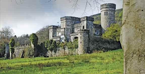
The owner of Killevy Castle in the 1830s, Powell Foxall, was involved in the Newry bank at what now is the Arts Centre on Bank Parade. There is still a plaque on the building. The bank eventually failed. In 1830 he built this impressive mock gothic castle to rival the new house of his neighbour and cousin Hunt Chambre.
Begin at the Slieve Gullion Courtyard and walk up towards the Adventure Park and take the first track on the left and continue straight uphill through deciduous woodland for about 750m until arriving at a forest track with a log bench on the right hand side of the path.
From this point magnificent views can be had of the the Ring of Gullion near Forkill. Keeping to the right , continue on the path back into the woodland. The path continues for 850m, first uphill, before descending directly to the Slieve Gullion Forest Adventure Park and start point

This circular woodland walk takes in magnificent views of the Ring of Gullion peaks, and you can find red squirrels on this side of Slieve Gullion as well as smooth newts, jays, pine martins and many others!
The Courtyard was originally constructed as farm buildings about 1820 by the Landlord Hunt Chambre. Chambre was fascinated with
For fur ther information on the Area of Outstanding Natural Beauty, places of interest Archaeology, Biodiversity, Built Heritage, Cultural Heritage, Geology and lots more downloadable maps and brochures visit www.ringofgullion.org and to keep up to date with announcements and projects ‘like’ Ring of Gullion on Facebook.
For fur ther information on these walks, other walks in the Ring of Gullion and all other walks across Nor thern Ireland, please visit www.walk ni.com. Here you will find shor t, medium and long distance walks, as well as downloadable maps, suggested itineraries and ever ything you need to k now when planning a walk ing trip in Nor thern Ireland. Gap ‘O the Nor th Walk ing Club also run guided walks, to get in contact email them on info@gaponor th.co.uk You can also find guides on w w w.bluebadgeireland.com
The Ring of Gullion is renowned for its natural beauty, culture, tradition, folk lore, heritage and its outdoor recreation. In addition to walk ing, a wide variety of activities and attractions are on offer, including c ycling, horse riding, ar ts and crafts markets, castles, dolmens and ruins to explore. To find out more visit Newr y or Crossmaglen Tourist Information Centre (contact details below).
Newr y Tourist Information Centre
Bagenal's Castle, Castle Street, Newr y, BT34 2DA w w w.visitnewr yandmourne.com E newr ytic@newr yandmourne.gov.uk
T (028) 3031 3170
Crossmaglen Tourist Office
O’Fiaich House, 25 26 O’Fiaich Square, Crossmaglen, BT35 9HG w w w.visitnewr yandmourne.com & w w w.ringofgullion.org
E info@newr yandmourne.gov.uk
T (028) 3086 8900
In order to minimise your social and environmental impacts on the outdoors, please follow the principles of Leave No Trace. Leave No Trace is an outdoor ethics educational programme designed to promote and inspire responsible outdoor recreation through education, research and par tnerships. For more information please visit w w w.leavenotraceireland.org.
Weather conditions in the Slieve Gullion area can be changeable even during summer months. Waterproof and windproof clothing are essential and strong walk ing boots are advised.
In the event of an emergenc y call the police on 999, or Police Ser vice NI (central switchboard) +44 (0)845 600 8000; or Daisy Hill Hospital A&E, Newr y +44 (0)28 3083 5000
Translink operates a number of ser vices from Newr y Bus centre; 40a, 41, 42, 43, and town ser vices to Camlough and Bessbrook; 338E and 41B. Timetables are available from Bus Stations or Tourist Information Centres across Nor thern Ireland.
The main Belfast to Dublin train stops off in Newr y and there is pedestrian access into Camlough, or Town Ser vice 341 will bring you down to the bus station.
For more information call (028) 9066 6630 or visit w w w.translink.co.uk. Over 60’s travel free on presentation of a valid Smar tPass.
Please be aware that Slieve Gullion and Camlough Forest Parks are work ing environments. Sections of the trail may close from time to time to facilitate forestr y and other essential operations. Please take care on forest tracks as some are used as bridle paths and all are used by forestr y vehicles
Every care has been taken to ensure accuracy in the compilation of th s guide. The information provided is, to the best of the promoter’s knowledge, correct at the time of going to print The promoters cannot accept responsibility for any errors or omissions but if any are brought to their notice, future publications wi l be amended accordingly
Some popular walking routes in Northern Ireland are not formally designated public rights of way. Access is on a de facto basis and depends on the goodwil and tolerance of local landowners Walkers are advised to respect that they may be walking on private land and are encouraged to make themselves aware of and adhere to the principles of 'Leave No Trace' www.leavenotraceireland.org
For any questions on walking in Northern Ireland contact Outdoor Recreation NI
The Stableyard, Malone Road, Barnett's Demesne, Belfast BT9 5PB
Tel: +44 (0)28 9030 3930
Email: info@walkni com
This guide is available in English and Irish.
Ring of Gullion Red Squirrel Group: Watch out for squirrels around the Ring of Gullion and if you see any we would ask that you report your sighting by clicking the Red Squirrel Logo on www.ringofgullion.org You can also find out more about the group and information on how to become a member