13 minute read
New Zealand Walks: Walking through old forest in

Walking through old forests in Whirinaki
Advertisement
Whirinaki Te Pua-a-Tāne Conservation Park is a publicly accessible conservation park in the North Island of New Zealand. The park is centered on the town of Minginui and part of the eastern boundary flanks Te Urewera. The Whirinaki Forest is one of the world’s last prehistoric rainforests.
Whirinaki has an interesting and varied history. Within the forest, are historic pa sites of the Ngati Whare, and wooden bird traps have been found high in the trees. In early days
By Barbz Lowther the forest provided timber for housing, canoes, weapons and fortifications. Bark was used for roofing; and vines for lashings and eel pots. Fern root was a staple food and many forest plants were used for medicine.
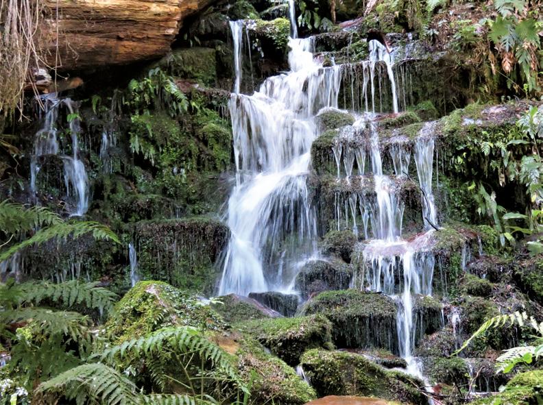
The 1920’s saw the beginning of Abov right: One of the waterfalls on the loop track. Below left: A kaka nibbles away.
Ouch! Sore feet while walking?
Hikers Wool is 100% New Zealand wool. Cushion your feet to prevent pain, rubbing and blisters.
Buy online or at selected stockists
For more info visit www.hikerswool.co.nz


Walking through old forests in Whirinaki

Above left: Tall trees on the track. Above right: Looking back at Moerangi Hut. Below left: On the Sanctuary Trail.. the forestry industry in this area, with removal of totara for fencing, and kahikatea at lower levels.
From 1930’s-70’s, logging was extensive and 14 sawmills were working. When the forest service made plans to log this area in the 1970’s it met public up- roar.
After five years of debate, Whirinaki Forest Park was formed in 1984 and all felling stopped.
The park was managed by the State Forest Service until 1987 when DOC was created to protect our precious places.
Ngati Whare now co-govern the park with DOC, and have established a native plant nursery in Minginui to replant areas lost to logging. Many bait stations are regularly checked, and the breeding success rate of native birds has improved considerably. Podocarp forests were extensive in New Zealand but most have disappeared. Whirinaki is one of the best examples left, with 155kms of walking, tramping and mountain biking trails.
All tracks are through old forest, with lots of punga and tawa, but dominated by the giant five podocarps - totara, timu matai, miro and the tallest New Zealand tree kahikatea. Wound around them, and


often strangling their host, is the giant Rata.
A group of ‘Pack n Boots’ from Tauranga recently spent a long weekend exploring Whirinaki. The park is 90kms from Rotorua, off Te Whaiti Road, via SH 38.
The most popular entrance is past Minginui Village and up River Road to the car park. Basing at ‘Whirinaki Forest Lodge,’ we walked a mix of short loops, and longer tramps.
Above left: Rata strangling its host.
Above right: The group stop at the
H Tree.


Walking through old forests in Whirinaki
On Day 1 we walked on a well maintained track, through tawa, punga and podocarps into the rainfedArohaki Lagoon. Native clematis was blooming along the track, and the vegetation was clearly reflected in the lagoon. It’s a really good place for ‘echoes’. With a platform, seating, and total tranquility it was a Above left: Watching kakas up in the trees. Above right: Good sign posts along the way. Below left: Verns Camp a shelter on the Whirinaki Track. perfect picnic spot.
Next we drove to River Road carpark and went into Waiatiu Falls. The bench track was supported with timbers and lovely and dry and springy to walk on. A viewing platform, and in places, little wooden steps, were built to make it a very accessible waterfall.
On a large rock beside the falls, a woman’s face was peering behind the spray. Our 3rd walk was to the H tree, where a large rimu had grown into an interesting shape. We heard tuis and bellbirds, and saw wood pigeons and robins. The kaka here were really noisy, and we saw lots flitting from branch to branch, giving quite a display.
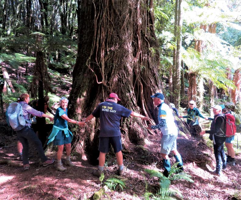
Our last walk was the one hour Sanctuary Track, off Sanctuary Road. It was just stunning. The podocarps were so tall and so straight. But we did find one enormous tree that took 12 people to measure its girth.
Again we heard tuis, wood pigeons and kakas, and saw little robins on the track. – a lovely end to our first day.
On Day 2 a longer tramp was planned. We started from River Road again, this time walking 10 minutes to Te Waiti Nui o toi Canyon – a narrowing of the Whirinaki River and quite noisy.
We continued on the Whirinaki Falls Track, an undulating trail beside the river. It was incredibly beautiful.
At times we were high above the river looking down on punga tops; at others we were beside the crystal clear water, with good sightings of whio – apparently this shows that the


river is very healthy because these ducks prefer clean water. The tracks were well formed and maintained, streams were bridged and track entrances and junctions were clearly sign-posted.
We wandered on up the Whirinaki Track, stopping to check out Verns Shelter, then returned via the waterfall loop. That was such a pretty track with several other
On day 3, a group walked up to Moerangi Hut, and others peeled off on the way. This is a shared tramping Above left: Colourful fungi on a tree. Below left: On the Moerangi Track. Below right: In Wiremu Merito Reserve.


Tramping Socks


Features: * Double ribbed cuff – prevents sock slippage * Added cushion and elastic support of Achilles tendon and arch * Mesh ventilation zones – temperature and moisture control * Nylon heel and toes reinforcements – increased durability plus added cushioning for comfort * Flat toes seam – prevents toe irritation * Cotton 66.2%, Spandex 14.8%, Dry Zone 19%
Men’s size: 9-13, Leg Length 17cm Colours: Black, Blue, Brown Womens size: 6-11, Leg Length 24cm Colours Black, Brown
$26.95 plus $7 Shipping

Available now from: Walking New Zealand Shop
P O Box 1922, Palmerston North Phone 0800-925-546 email walkingnz@xtra.co.nz. www.walkingnewzealand.co.nz
Walking through old forests in Whirinaki
/mountain biking trail, through tall dense podocarps, and unrelentingly uphill to the saddle at 955meters. It is beautiful, but quite rugged, with lots of roots and a few tree falls to negotiate.
Near the saddle, the vegetation changed to beech and opened up to give spectacular views of the Rangitaiki Plains. The hut was downhill from here, which meant a climb, to begin the return journey. It was a challenging but very rewarding day.
On the last day, we visited Mangamate Falls, a lovely picnic or camping spot, then walked the Wiremu Merito Reserve and The Lookout Track – near the recreation camp. The forest was magnificent, and interpretation panels meant we could identify all the big trees.
I have never heard such amazing bird song. It’s hard to describe it - a choir of so many birds. We could see lots of flitting, and couldn’t identify all the birds, but just listened with wonder.
It was a perfect ending to a magic four days in Whirinaki Te Pua a Tane.
Above top: In Wiremu Merito
Reserve.
Middle right: Lichen and moss in
Wiremu Merito Reserve.
Below right: Moerangi track signs.


If you are looking to do some short walks, hikes or rides this holiday season there’s no better place to start than the small town of Ohakune nestled in a spectacular setting at the base of Mount Ruapehu, located in the heart of the Tongariro National Park in the North Island.
Ohakune walks for all fitness types
Here are nine short and long walks to keep you busy while in Ohakune:
Mangawhero River Walk
Distance: 2km
Time: 30 minutes
Start Point: Burns Street, southern end of Ohakune, or Old Station Road, The Junction, Ohakune. Difficulty: Easy
Meandering along the banks of the Mangawhero River, this easy, wellmaintained path connects the main town centre with ‘The Junction’ area at the foot of the mountain and is a pleasant family-friendly walkway. Ohakune 2000 Inc. volunteers maintain the route and are re-introducing native plant species to attract birds and animals to the area.
The river itself has its origins high on the slopes of Mount Ruapehu and follows a fault line down the mountain, through the volcanic landscape and over two waterfalls before it reaches Ohakune. From here it continues on until it joins the Whangaehu River. The Mangawhero River Walkway can be easily combined with the Jubilee Walkway for a longer trail if desired.
Family-friendly Above: Waitonga Falls Track. Below: The Mangawhero Falls.


Walking New Zealand
magazine is available at all


Freephone 0800 walking
to subscribe to Walking New Zealand magazine Only $84.50 for 12 months
Ohakune walks for all fitness types

Rimu Walk
Distance: 1.5km
Time: 15 minutes round trip Start Point: DOC Visitor Centre at the foot of the Ohakune Mountain Road Difficulty: Easy
This well-constructed walkway is suitable for wheelchairs and pushchairs and is a side loop from the Mangawhero Forest Track. The loop crosses a peaceful mountain stream and passes through native ferns and kamahi providing a nice easy family walk.
Family-friendly
Mangawhero Forest Walk
Distance: 3km
Time: 45-minute loop track
Start Point: Foot of the Ohakune Mountain Road
Difficulty: Easy
Within easy walking distance of the township, Mangawhero Forest Walk is a great introduction to the native forest of central North Island - an abundance of species including broadleaf, kahikatea, kamahi, matai and rimu trees surround the track. Crossing the Mangawhero River, from which it takes its name, the trail descends through the towering kahikatea trees to a swamp-like volcanic crater.
Jubilee Walkway
Distance: 1.5km
Time: 20 minutes
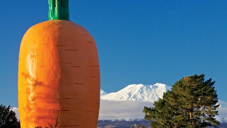
Start Point: Ohakune Giant Carrot, Rangataua Road, southern end of Ohakune
Difficulty: Easy
Starting at the famous Ohakune Giant Carrot, this pleasant 20-minute stroll through the Jubilee Park Scenic Reserve loosely follows the path of the Mangateitei Stream and is a leisurely track suitable for all abilities. The trail winds through the forest and finishes at Burns Street at the southwestern entrance to Ohakune. From here it is easy to link with the Mangawhero River Walkway and continue on to the northern end of the township.
The track is quite steep in places and often becomes very muddy in rainy weather so it is advised that you wear sturdy footwear when walking this trail.
Family-friendly
Hapuawhenua Viaduct Walk

via the Ohakune Old Coach Road
Distance: 7km (Marshall Road carpark)
Time: one and a half to two hours return
Start Point: The official start is at the Ohakune Train Station on Thames Street, but if you wish to shorten it, you can drive the first 3km to Marshalls Road car park (add another 8km to the round trip, approximately 90 minutes, if walking from Goldfinch St, central Ohakune) Difficulty: Easy-Moderate
Following the first stage of the Ohakune Old Coach Road, the Hapuawhenua Viaduct Walk takes in the Hapuawhenua Tunnel and both the old and new Hapuawhenua Viaducts.
These impressive curved lattice structures span the valley side by side and the original viaduct, built-
Above: Mangawhero Forest Walk. Left: Hapuawhenua Viaduct Walk.
in 1908 and holding World Heritage Engineering status, is testament to the ingenuity and perseverance of those who were responsible for its construction.
It is possible to walk the full length of the original structure, from which you can occasionally watch the trains crossing its replacement further down the valley.
Waitonga Falls Track

Distance: 4km
Time: One and a half hours round trip
Difficulty: Easy some steep sections
This easy walk through beech and kaikawaka forest and across scenic marshland brings you to the Tongariro National Park’s highest accessible waterfall and the alpine stream below. With picture-perfect views of the mountain reflected in the Rotokawa tarn (a shallow mountain pool) and the chance to fully appreciate the valley vistas, this trail is well worth a visit.
The route winds along the wooded slopes of Ruapehu and crosses the Rotokawa marshes on a raised boardwalk finally descending to the base of the falls. The falls are beautiful at all times of the year, but during the winter months, the volume of water passing over the falls makes them particularly remarkable. Green hooded orchids and white sun orchids can also be seen along this track.
Family-friendly
Mangawhero Falls Walk
Distance: Less than 1km Time: 10 minutes
Start Point: Mangawhero Falls car park, 13km from Ohakune on the Ohakune Mountain Road Difficulty: Easy
A great short track if you happen to be in the area, the Mangawhero Falls was used as the location for Ithilien, where Gollum catches fish, in The Lord of the Rings: The Two Towers. Easily accessible from the Ohakune Mountain Road, this beautiful waterfall is best viewed in the winter months when a greater volume of water passes over the volcanic formations and leaving sparkling icicles surrounding the area.
Family-friendly
Lake Rotokura Track

Distance: 5km
Time: One-hour return
Start Point: Rotokura car park on Karioi Station Road – Look for the sign on SH49, left hand side, 12km from Ohakune in the direction of Waiouru.
Difficulty: Easy
Lake Rotokura is sacred to the local Māori iwi (tribe) who believe its waters have healing powers. The pretty surroundings, easy access and picturesque reflections of the mountain in the waters make this a popular track.
The route begins at the car park and heads through the ancient beech forest, past the man-made Dry Lake, which is home to a variety of native and exotic waterfowl, and then loops around Lake Rotokura. The area is part of Karioi Rahui, a DOC ecological reserve developed in conjunction with the local iwi, and is home to an increasing population of native bird species including the North Island Brown Kiwi. If you wish to picnic on this track, please use the grassy area by Dry Lake as eating near Lake Rotokura is disrespectful in the Māori culture. Fishing here is also strictly prohibited.
The Lakes Reserve
Distance: 2km
Time: 30 minutes
Start Point: Ohakune, Mountain town
Difficulty: Easy
Located 2.5km from the main Ohakune town area on the LHS along the road to Raetihi brings you to this 1.8km loop off Lakes Road. Park at the locked gate area and walk the 4WD track from there, the entrance to the loop is on the right about 100meters up Lakes Road.
The road/track is a combination of metal and dirt and is a great stroll in the bush around a small lake. The loop is easily driveable if you prefer, and is also a favourite detour for mountain bikers. This lake is the southernmost blowhole (or vent) of The Pacific Rim. Above: Lake Rotokura Track. Below: In the Lakes Reserve.


