
1 minute read
GRIMSBY TOWN CENTRE


OSBOURNE STREET & GEORGE STREET
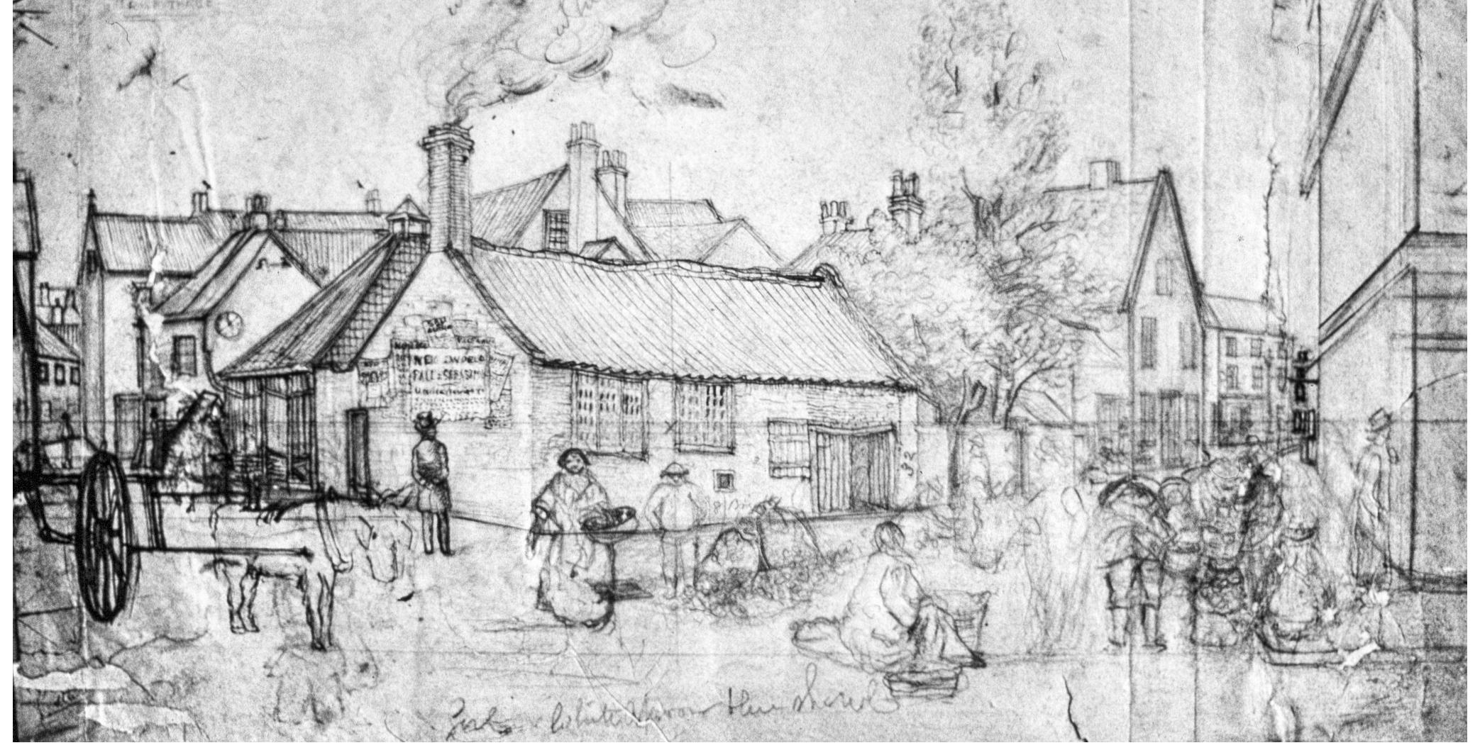
Pencil Sketch of Osbourne Street (now Osborne Street) and George Street.


Robert Bates’ House
Pictures 12 and 13 show Robert Bates’ House, which stood on the corner of George Street and the present day Victoria Street. Robert Bates was a ‘Chair Turner and Spinning Wheel Maker’ as indicated by the sign on the side of the building.
On picture 13 are two figures, one on either side of the fence, appearing to be deep in conversation. The male figure is possibly Robert Bates himself.
Water colour titled ‘Market-Place 1855, J. Jillott’. The
Market Place

Inscribed ‘This part fell down Christmas Eve between 10 & 11 December 24 1868’.
BETHLEHEM STREET & THE BULL RING
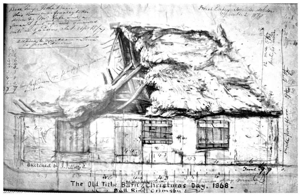
Tithe Barn, Bull Ring

The Tithe Barn stood in the Bull Ring next to St. James’ Church House which was demolished as part of the redevelopment of the area. The Tithe Barn was used latterly as a shop selling besoms, which can be seen leaning by the doorway.
This drawing shows the Fruit Market and is looking towards the Market Place (image 14).
The Town Hall is to the left of the building. The figure beside the low building is standing in Butchery Lane reading about the fall of Sevastopol in 1855.
The Old Queen’s Head, Victoria Street
Pencil, pen and ink with colour wash.

The Old King’s Head
The Old King’s Head stood between the River Head and Haven Street and was replaced in the Victorian era by an up-to-date building. This is the earliest sketch we have by Jillott and also shows the keen interest he had in recording many of the old buildings in the town. He would have known this building very well as his father’s bakery was on the opposite side of the road.

VICTORIA STREET & SILVER STREET
The pencil sketch from 1822 shows the public house described in 1891 by Anderson Bates (a prominent Grimsby townsman and local historian) as the “Old King’s Head”. Adjoining it, on the present day Victoria Street, are several 18th century cottages.


