
4 minute read
Peak viewing time

from algarvePLUS June '23
by Martin

YOU CAN TAKE A STROLL ALONG THE BEACH, OR WALK THE STREETS OF A CHARMING TOWN, OR BRAVE IT AND HEAD UP TO THE HILLS AND THE MOUNTAINS BEYOND FOR A BREATHTAKING EXPERIENCE. THE HIGHER YOU GO, THE HEADIER IT GETS
Words: CAROLYN KAIN
YOU WOULDN’T expect to find Portugal’s highest mountain stuck out in the Atlantic Ocean, but there it is, a magnificent free-standing peak rising 2,351 metres out of the sea.
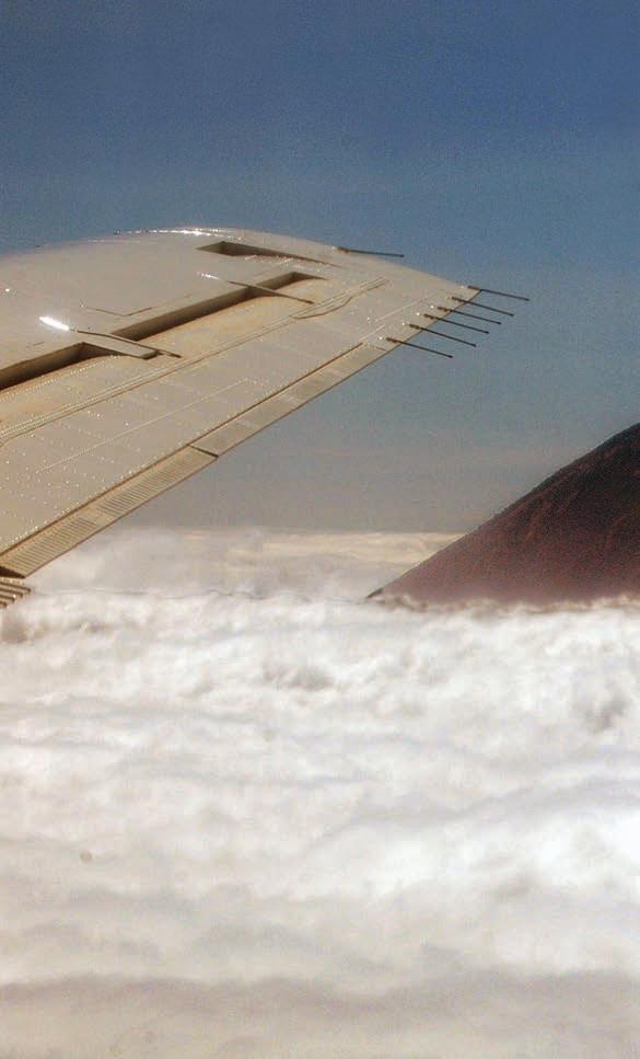
We came across it quite unexpectedly on a flight between São Miguel and Faial, two islands of the Azores. Its tip looming out of the cloud cover was frighteningly close to the wing tip of our plane but the pilot confidently informed us, “É Pico”.
Meaning sharp point or peak, Pico is 1,675 kilometres from Lisbon and located on an island of the same name. Our destination was Horta, the capital of Faial, but although our hotel was just across the water from Pico, the mountain’s peak was mostly shrouded in clouds so that during our stay we only saw it one more time.
Curious to have a look around the port of Madalena, the capital of Pico island, we took the 30 minute ferry ride that crosses the straights between the two islands. Located beneath the shadow of the mountain, this small town has a population of 6,000. Under different circumstances, that’s to say if we were younger and fitter, we might have hiked up to Pico’s summit. It’s feasible to do so even in misty weather and without a guide. It takes between three to four hours to ascend and about the same amount of time to return to the base.
Think big
The entire trail from the starting point at the Mountain House is a distance of almost four kilometres. It is steep. There are 47 wooden posts that act as guides and after reaching marker 44 climbers are on a path called Quinta da Regaleira way that follows the edge of the mountain’s volcanic crater. Not to worry, the mountain hasn’t erupted since 1720!
Nevertheless , there are fumaroles that permanently vent steam and suddenly the atmosphere is hot. The rocks are hot and the surrounding air is hot. Geothermal tourists are in for a treat, admiring the moon-like floor of the crater, the lava flows and volcanic rocks.

The most intrepid climbers reach marker 47 and then a final hike to the ultimate destination where there is an exceptional view. One third of them won’t make it, but even those who do might be disappointed and see nothing due to inclement weather.
There is a further optional stretch of 70 metres to Piquinho which is an additional summit. The rocks here are especially slippery and there is a warning that due to the gradient and sheer drop it is unsuitable for anyone suffering from vertigo. Personally, I don’t know how they would have got that far in the first place! The achievement factor for those make it up Piquinho is said to be an exhilarating adrenalin rush!
On a high
On the other hand, this challenge is a complete contrast to Torre, the highest mountain on mainland Portugal. Basically, there is a concrete road that climbs up 1,997 metres to a roundabout at the top! The thrill of reaching it is akin to finding a space in a Lidl car park. That’s not to say that there are no other peaks to climb but none of them is as high as Torre.
Located in the Serra da Estrela, a mountain range in the north east of the country, it is 100 kilometres long and 30 kilometres at its widest point. Three rivers, the Mondego, Zezere and Alva, originate in the range, which is a series of ancient glacial valleys, sparkling lakes and beautiful granite rock formations.
Almost 550 kilometres from Faro, the Serra da Estrela is a National Park and nature reserve. There are four tourist offices directing climbers and walkers to suitable peaks, and skiers and snowboarders to a ski resort. Open from mid December to late March, it has three lifts and six kilometres of ski runs advertised as suitable for people of all abilities. People suffering from tachophobia, fear of speed, are warned to stay on the nursery slopes!
Closer to home, but way up there and
Snow in the Algarve’s Serra de Monchique is a rare natural spectacle, but when occasionally it does you can expect to see it on the highest points, Foia at 902 metres and Picota at 744 metres.
Foia is easily reached by car, unless it happens to be snowing. The Algarve is reputed to have 300 sunny days per year and when it’s clear, views to the south from the ‘miradouro’ and the visitors’ centre are wonderful. Caution! Staying polite amongst busloads of visitors might be the major challenge of this mountain peak.
Although Picota is lower and described as Foia’s little brother, reaching it is more complicated. A marked trail uses small local roads and steep footpaths that wind through eucalyptus and cork woods. Other than a fire watch tower at the top, there are no amenities, and as a bonus no tourists either.
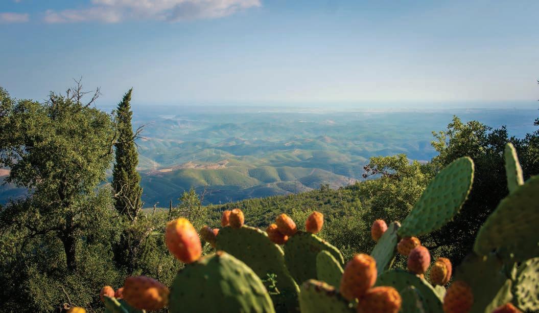
The Serra de Monchique is the mountain range that mostly determines the weather in the western and central Algarve. It shelters the lowlands from northerly winds and traps rain blown inland from the west coast. Weather in the eastern Algarve is similarly influenced by the high hills of the Serra do Caldeirão. When looked at from the coast they appear to be mountains but they are modest in height. The highest point at Pelados is 589 metres.
At Alcaria do Cume, 525 metres, there is one of the Algarve’s most difficult circular hikes. Remote moorland and panoramic views that extend out to sea and to the horizon beyond the Spanish border can be disorientating. It is definitely not recommended for those with mazeophobia, fear of getting lost!


Do you have unwanted items? We would like to buy them from you. Home visits are available.


