

Welcome


www.northwestwisconsin.com • 715-416-32562
Northwest Wisconsin is a mecca for recreational opportunities offering four seasons of fun. The history, culture and beauty of these counties are marvels that must be experienced, not just witnessed. A variety of trail activities including mountain biking, snowshoeing, horseback riding, motorcycling, birding, paddling – even downhill skiing – are plentiful. Northwest Wisconsin has an unbelievable variety of trail settings. Enjoy secluded trails in some of the most pristine wilderness areas in the Midwest. Travel road routes that run along Lake Superior’s sculpted shores, cross raging rivers, and follow winding river valleys. This publication is made possible through funding provided by the NW-ITBEC Tourism Advisory Committee. “TRAVEL NORTHWEST WISCONSIN” • ASHLAND COUNTY 800-284-9484 www.travelashlandcounty.com • BARRON COUNTY 800-529-4148 www.visitbarroncounty.com • BAYFIELD COUNTY 715-373-6125 www.travelbayfieldcounty.com • BURNETT COUNTY 800-788-3164 www.burnettcounty.com • PRICE COUNTY 715-339-4505 www.pricecountywi.net • RUSK COUNTY 800-535-RUSK www.ruskcountywi.com • SAWYER COUNTY 715-634-4801 www.haywardlakes.com • WASHBURN COUNTY 800-367-3306 www.washburncounty.org • CHIPPEWA COUNTY 866-723-0331 www.chippewacounty.com • DOUGLAS COUNTY 800-942-5313 www.travelsuperior.org • IRON COUNTY 715-561-2922 www.ironcountywi.com • POLK COUNTY 800-222-POLK www.polkcountytourism.com To obtain specific maps, trail condition reports and more detailed information on any of the trails listed in this guide, contact the corresponding County. Bayfield County/James Netz WELCOME TO THE OUTDOORS of Northwest Wisconsin


www.northwestwisconsin.com • 715-416-3256 3 Osceola Amery St. Croix Falls 18 7 6 22 28 15 26 15 19 15 8 11 25 12 1617 20 27 14 26 1 9 5 13 2 3 4 15 23 24 21 10 1 3 9 8 8 8 118 6 2 45 12 7 10 13 10 5 3839 50 30 33 20 2452 48 8 7 48 25 27 15 19 3 54 56 44 22 11 12 1 4 1726 45 42 51 9 36 13 32 34 6 40 47 18 14 2 53 55 37 21 35 23 46 43 16 28 41 31 29 16 1 3 14 16 16 15 13 178 2 11 4 5 7 12 10 6 17 9 35 24 12 1 34 27 21 11 23 16 33 30 22 3 31 14 2 17 5 109 13 26 29 4 25 20 7 6 32 1836 28 16 8 16 24 24 19 16 24 14 3912 33 43 43 34 30 29 5 42 4121 2 31 2416 40 43 7 15 13 3 9 32 45 2237 23 27 44 26 1 4 6 10 17 25 28 35 36 20 8 19 46 47 38 18 51 52 50 49 48 11 853 20 9 8 12 18 17 14 15 3 21 196 11 5 16 2 10 1 4 13 7 Outdoor Activity Guide by County Adventure Sports & Downhill Skiing . . . . .4-5 Bicycling, Mtn. Biking & Fat Biking . . . . .6-10 Fishing & Hunting* . . . . . . . . . . . . . . . . . . . .11 Hiking & Birding . . . . . . . . . . . . . . . . . . . .12-14 ATV, UTV & Snowmobile Riding* . . . . . . . . .15 Horseback Riding . . . . . . . . . . . . . . . . . . .16-17 Cross Country Skiing & Snowshoeing . .18-21 Canoe & Kayak Paddling . . . . . . . . . . . . .22-23 Waterfall Touring . . . . . . . . . . . . . . . . . . .24-25 Motorcycle & Auto Touring* . . . . . . . . . .26-27 TABLE OF CONTENTS YOUR ESCAPE. YOUR ADVENTURE. *Activity available in all counties; not designated on map. Cover photos (clockwise from top): Travel Wisconsin, Travel Wisconsin, Washburn County Tourism/James Netz, Travel Superior/Joe Polecheck Photography Travel Superior
Dog Sled
6
North Park
Polk County
CALLING ALL THRILL SEEKERS!
From easy to difficult, we’ve got the challenges and that adrenaline rush you seek. Year-round adventures are offered throughout Northwestern Wisconsin like rock climbing, skijoring, skydiving, and disc golf. Check out these amazing opportunities solo or bring the whole family!
Rock Climbing
Christie Mountain Rusk County
Wolfsong Adventures in Mushing
Bayfield County
Nestled in the wooded hills overlooking Lake Superior, Wolfsong offers dog sledding trips for all ages and abilities. Drive your own team or ride along with an experienced musher. Harness, hook-up, feed, and love the dogs!
Disc Golf
2
Elk Lake Park Price County
9-holes. No fee. PDGA approved. Professional-quality chain baskets. Course is relatively flat, ranging from 210' to 378'.
3
Highbridge Hills
Ashland County
Highbridge Hills is the largest disc golf complex in the World! 18 hole & 22 hole. Host of the 2007 Disc Golf World Championships.
1 4
Lake Superior View Golf Course
Bayfield County
36 holes. Fee. Two 18-hole courses; one is more casual through wooded trails and the other is a more challenging course for experienced players. Practice hoops on the driving range. Course map and layout on the UDisc App.
5
Namekagon National Disc Golf Course
Washburn County
9-hole & 24-hole. Fee, parking, lodging on site, disc rentals available.
Over 5 acres of land located along Highway 46. The sports section of the park features a large open field that can be used for many different activities. The park has a baseball backstop, horseshoe pits, frisbee golf, and a basketball court. It also has 2 lighted tennis courts and the only skate park in Amery.
7

Riegel Park

Polk County
9 hole. No fee. The nine fairway course is just east of Jerusalem Road along the Interlink bike path in St. Croix Falls. Four fairways in the woods lead to a rustic bridge, and then to prairie.
Repurposed materials have been generously used for the project.
Spooner Disc Golf Course
Washburn County
9 hole. Located on the grounds of the Spooner High School. No fee; bring your own equipment.
9
Superior Municipal Forest
Douglas County
18 hole. No fee. The course was constructed by the local disc golf association and brings you through the municipal forest that also houses hiking, biking, and ski trails as well as a dog park.

Tjader Acres Disc Golf
Burnett County
18 hole. Tightly wooded course in the north woods of Wisconsin. Made by a Disc Golfer, for the Disc Golfer. Donation to play is suggested for course maintenance; bring your own equipment, parking.
UW-Barron County
Barron County
18 hole. The front 9 is fairly long (3348') and open, running on the edges of the prairie. The back 9 is shorter and requires more accuracy, finishing along the Red Cedar River behind campus.
Natural rock wall on Christie Mountain, featuring 4 different climbs. Indoor climbing wall for practice and instruction. Trained instructors. For children and adults.
13
Interstate Park
Polk County
Rock climbing is allowed in areas not closed to public use. No special permit is required. Designated hiking trails and walkways must remain free of ropes and other climbing equipment.
Skijoring
14
High Point Trail
Price County
Trail Length: 9 miles/14 km. Bordered by hardwood and hemlock trees, this single track trail at Wisconsin’s highest natural point traverses rolling terrain with steep hills. Moderate/Difficult.
15
Holy Cross Trail
Price County
Trail Length: 6 miles/9.6km. Scenic, wide twin track trail, moderately hilly with a variety of forest types and a small lake.
16
Mt. Ashwabay Recreation Area
Bayfield County
Sugar Bush Trail Trail Length: 6 km. The Sugar Bush trail offers fairly level terrain out to the Nourse Sugarbush State Natural Area, a beautiful stand of old growth maple and hemlock. Easy. Jolly Long Loop (4km) and Birch Hill (3km) have also been added to the skijoring system. Both are intermediate.
12 9
Superior Municipal Forest

Douglas County
Orange Trail - 7.4 km loop. This scenic trail takes you around the scenic Chase's Point in the Superior Municipal Forest. Portions of the trail are shared by the multi-use blue trail. Skijorers may also use the Millenium Trail to connect to the parking lots.
11 10 8
www.northwestwisconsin.com • 715-416-32564 ADVENTURE SPORTS & DOWNHILL SKIING in Northwest Wisconsin
Timm’s Hill National Trail
Price County
Trail Length: 10 miles/16.1 km. Scenic trail following the path of a c.1885 tote road, a supply route for logging camps. It connects the High Point Trail to the Ice Age Trail. Moderate/Difficult.
Skydiving
Skydive Wissota
Chippewa County
Offering the best instructors, equipment, and a great clubhouse and drop zone with plenty of amenities. Take in beautiful views of Lake Wissota and the surrounding area. A fantastic adventure you’ll remember your whole life.
Zip Lining
Trollhaugen Aerial Adventure Park
Polk County
Trollhaugen’s Adventure Park is a 112 element aerial challenge course and a guided 6 zip line tour. The park provides the thrill of playing on a giant, floating playground - climbing trees, hanging from tires, and swinging on ropes.
Downhill Skiing
YOUR ESCAPE. YOUR ADVENTURE.

With five different mountains to choose from you won’t be disappointed. There are drops as high as 310 feet and plenty of runs that are also great for snowboarding and tubing.
Christie Mountain
Rusk County
Length: 30 runs. Ski, snowboard, and snow tubing. 23 lighted runs with 4 terrain parks, rentals, full service bar and food. Ski patrol and instructors on site. Fee/Pass Required: Yes.

Mont du Lac Recreation Area
Douglas County
Length: 12 Runs. Mont du Lac’s 310 foot vertical drop will provide an exhilarating rush for all. Beginner, Intermediate and Expert runs available. Fee/Pass Required: Yes.
Mt. Ashwabay
Bayfield County
Length: 11 runs. Chairlift and rope-tow, 317 foot vertical drop. Longest run is 1,500 feet with a skiable area of 65 acres. Small terrain park. Fee/Pass required: Yes.
Trollhaugen Outdoor Recreation Area
Polk County
Length: 23 runs and 4 terrain parks. Alpine skiing on 23 runs, also cross-county skiing, snowboarding and snow tubing, rentals, full service bar and food. Ski patrol and instructors on site. Full service ski and board shop for gear and tune ups. Fee/Pass Required: Yes.
Whitecap Mountain
Iron County
Length: 43 runs. Whitecap Mountain is in the heart of Big Snow Country offering 200 inches of snow annually with views of Lake Superior and the Penokee Range. Fee/Pass Required: Yes.
To obtain specific mapsand detailed informationon any location, contactthe corresponding County.See page 2.
www.northwestwisconsin.com • 715-416-3256 5 Osceola Amery St. Croix Falls 20 9 8 12 18 17 14 15 3 21 196 11 5 16 2 10 1 4 13 7
12 20 16
19 21
19 18 17
Bicycling
1Around the Horn Loop
Bayfield County
Length: 49.8 miles. Very scenic with spectacular views of Lake Superior. Services available in towns along the route. Roads good to excellent; paved shoulder along most of route. Traffic moderate. Trail Difficulty: Moderate to difficult – gently rolling to very hilly.
2Barron County Roads
Barron County
Length: Varies. 600 miles of mapped routes on mainly low traffic scenic roads throughout Barron and surrounding Counties. Trail Type: Paved/Unpaved Roads. Fee/Pass Required: No.
BICYCLE ENTHUSIASTS
have a wide selection
of riding options including paved and unpaved trails where you can enjoy a leisurely spin or a cardio pumping work out! Bikers also have plenty of trail difficulty levels to choose from. Bring the kids along for a relaxed ride on a paved trail or push yourself to the next level with a mountain bike ride. Whichever you choose, biking is a great way to enjoy nature and stay active!

Challenge yourself with a wide range of exhilarating mountain bike and fat bike trails! From singletrack to multi-track, there are plenty of trails to test your endurance with burning climbs and screaming descents.
City of Hayward Bike Trail
Sawyer County

Length: One way 6.6 miles. Paved path is flat to slightly sloped, is separated from traffic and has safety signals at road crossings. Parking at Hayward Wesleyan Church, Walmart, Hall of Fame, Hayward H.S. and Sevenwinds Casino. Trail Difficulty: Easy. Fee/Pass Required: No.
Drummond-Iron River Loop
Bayfield County
Length: 47.6 miles. Great variety of scenery – woods, vistas, lakes, hills & straightaways. Food and services in Iron River & Drummond; food in Delta. Roads good to excellent; traffic low to moderate. Trail Difficulty: Moderate to difficult.
Duncan Creek Trail Chippewa County
3 4
Big Falls County Park & Campground Tour
Price County
Length: 20 miles. From Kennan go S on County N to Big Falls Road. A park/campground near the Jump River. Hike to view the river cascade over granite boulders. Trail Difficulty: Easy. Trail Type: Paved Road. Fee/Pass Required: No. Camping Fee is required.
Burnett County Roads

Burnett County
Length: Varies. Push yourself up hills on County Rd B for a moderate ride. Stop and relax at Clover Meadow Winery on Thompson Rd. Restaurants, lakes, rivers, forests, vistas. Trail Difficulty: Varies. Trail Type: Paved/Unpaved Roads. Fee/Pass Required: No.
Length: 5 miles. Paved loop through Chippewa Falls ideal for biking and in-line skating. This trail connects to the Old Abe State Trail northeast of County Highway I. Portions of this trail are shared with motor vehicle traffic. Trail Difficulty: Easy. Trail Type: Paved. Fee/Pass Required: No.
Gandy Dancer Trail
Burnett & Polk County
Length: 21 miles in Burnett Co. (98 miles total). Former railroad bed. Bridge trestles, scenic vistas, lakes, rivers, forests, wildlife. Restaurants, lodging, retail, and services available. Trail Difficulty: Easy. Trail Type: Crushed Limestone/Dirt. Fee/Pass Required: Yes. Length: 28 miles in Polk County. Starts at the Polk County Information Center, 98 miles along old railroad grade between St. Croix Falls and Superior. 47 miles from St. Croix Falls to Danbury is surfaced with crushed limestone and is a state recreational trail. Hiking and biking; bikers 16 and older need a bike pass or DNR patron license.
Highpoint/Rustic Road #62 Tour
Price County
Length: 20 miles. From Ogema take Highway 86 east over rolling hills, turn south on County C to Rustic Road 62 leading to Timm’s Hill County Park, home of Wisconsin’s highest geographical point.
Trail Difficulty: Easy/Moderate. Trail Type: Paved Road. Fee/Pass Required: No.
Lake Owen Loop
Bayfield County
Length: 22.9 miles. Beautiful winding route through the Chequamegon-Nicolet National Forest near Lake Owen. Food and services in Drummond. Roads good to excellent, traffic low. Trail
Difficulty: Moderate – rolling hills and straightaways.
Mercer Bike Trails
Iron County
Length: 7.2 miles. Paved. Fee/Required: No.
Millennium Trail
Douglas County
Length: 1.6 miles out and back. 10 foot wide paved trail that meanders through the Superior Municipal Forest. Trail difficulty: Easy. Type: Out and back trail. Fee/Pass Required: No.
9 10 11 12 13
Old Abe State Trail Chippewa County
Length: 31 miles. New connection through Chippewa Falls, Lake Hallie to Chippewa River State Trail. This old railroad grade has been developed into a trail for bicyclists, snowmobilers, hikers, horseback riders and in-line skaters. Trail Difficulty: Easy. Trail Type: Paved. Fee/Pass Required: Yes.
5 6 7 8 www.northwestwisconsin.com • 715-416-32566 BICYCLING, MTN. BIKING & FAT BIKING in Northwest Wisconsin
Osaugie Trail
Douglas County
Length: 5.2 miles. Asphalt paved trail along Superior Bay towards the Intersection of Hwy 2/53 to Moccasin Mike Road. Trail Difficulty: Easy. Trail Type: Out and back Trail. Fee/Pass Required: No.
15
Riverview Reserve
Chippewa County
Length: 2.5 miles. Paved and unpaved trails criss cross through the Reserve and provide great viewing opportunities of the Xcel Energy Dam. This trail connects to Duncan Creek Parkway Trail and the Old Abe State Trail. Trail Difficulty: Easy. Trail Type: Paved/Unpaved. Fee/Pass Required: No.
Rusk County Roads
Rusk County
Length: Varies. A variety of loops or out and back routes ranging from a couple miles to 20 miles. Including the popular Dam and PIG routes. All on paved roads. Fee/Pass Required: No.
St. Croix Falls Trails
Polk County
City of Trails: Biking and hiking trails within scenic, hilly city limits.Wooly Mountain Trail: Length: 6.8 miles. A variety of riding and landscapes to experience on this 6-mile loop. The trails are fast, flowy and tight, twisty single track using rocks left behind by the last glacier that formed the beautiful St. Croix River Valley.
16 17 18
Sawyer County Roads
Sawyer County
Length: Varies. The county roads of Sawyer County offer roadbicycle enthusiasts a scenic tour of the Hayward Lakes Area. Trail Difficulty: Varies. Trail Type: Paved/Unpaved. Fee/Pass required: No.
ESCAPE. YOUR ADVENTURE.
19
Stower Seven Lakes Trail
Polk County
Length: 14 miles. Built on a former railroad corridor, the trail begins in Amery and travels through the communities of Deronda, Wanderoos and Nye, ending about one mile from Dresser at 90th Avenue. The trail passes through maple and oak forests, wetlands, prairies and farmlands and past seven picturesque lakes. Fee/Pass Required: Yes.
20

The Ashland Waterfront Trail

Ashland County
Length: 10 mile loop. Parking at all waterfront beaches & parks. Paved walking, running, and biking trail, along Ashland's lakefront from east to west and through the city via the underpass of Highway 2 that joins the trail with the historic downtown area.
www.northwestwisconsin.com • 715-416-3256 7 Osceola Amery St. Croix Falls 14 3912 33 43 43 34 30 29 5 42 4121 2 31 2416 40 43 7 15 13 3 9 32 45 2237 23 27 44 26 1 4 6 10 17 25 28 35 36 20 8 19 46 47 38 18 51 52 50 49 48 11 853 To obtain specific mapsand detailed informationon any location, contactthe corresponding County.See page 2.
14
YOUR
21
Washburn County Roads

Washburn County
Length: Varies. The county roads of Washburn County offer road bicycle enthusiasts a scenic tour of the area. A guided map is available at the visitor center. Trail Difficulty: Varies. Trail Type: Paved/Unpaved Roads. Fee/Pass Required: No.
Wisconsin Concrete Park Tour
Price County
Length: 27 miles. Loop route along lightly-traveled, paved roads through scenic forest and panoramic farmland in central Price County. Begins at the Wisconsin Concrete Park, an outdoor sculpture museum. Trail Difficulty: Easy. Trail Type: Paved Road. Fee/Pass Required: No.
Mountain Biking
Big Island Trail
Iron County
Length: 6.5 miles. Explore Big Island on the Turtle Flowage. This trail has rolling terrain and is intermediate in difficulty through wooded areas. It is maintained annually for Mountain Biking. Fee/Pass Required: No.
Blue Hills Trails
Rusk County
Length: 5 miles. The west side of the Blue Hills Trail system provides suitable terrain for off-road biking. About 5 miles total on this side of the system. Trail Difficulty: Moderate difficulty. Trail Type: Wooded, grass, untracked. Fee/Pass Required: No. Donations appreciated.
29
Gravel Pit Road Trailhead
Sawyer County
Length: 9 miles one-way. 7.2 miles to OO; 5 miles to Mosquito Brook. 100% single-track, moderately technical through glaciated terrain for intermediate riders. A thirty foot wide grass trail with a worn-in single track. Use other routes when wet. Trail Difficulty: Intermediate. Trail Type: Single Track. Fee/Pass Required: Yes.
Burnett County Trails
Burnett County
Length: Varies. Any non-motorized trails including scenic county forest land, enchanting woods trails, logging trails, fire lanes, etc. Trail Difficulty: Varies. Trail Type: Dirt/Grass/Unpaved roads. Fee/Pass Required: No.
Copper Falls Mountain Bike Trails
Ashland County
Copper Falls has two one-way mountain bike trails. Trail Difficulty: Intermediate/Advanced. Trail Type: Grass. Fee/Pass Required: Yes
Deadhorse Trail Iron County
Length: 4.6 miles. This is located in a Ruffed Grouse Management Area with interpretive signs on management practices. Maintained for mountain biking. Trail Difficulty: Intermediate. Fee/Pass Required: No.
CAMBA Trails –Drummond Bayfield County
2 trailheads accessing 8 different trails ranging in length from 1.9 miles to 18.2 miles. Forest, wildflowers, lakes and wildlife. Some gravel, some paved, some two-track. Trail Difficulty: Easy.
Gandy Dancer Trail Burnett County
Length: 21 miles in Burnett Co. (98 miles total). Former railroad bed. Bridge trestles, scenic vistas, lakes, rivers, forests, wildlife. Restaurants, lodging, retail, and services available. Trail Difficulty: Easy. Trail Type: Crushed Limestone/Dirt. Fee/Pass Required: Yes.
Hatchery Creek Trailhead
Sawyer County
Length: 8.9 miles. Forest lined dirt road that parallels the Birkie Trail. Access to all Hayward Cluster trails. Rolling singletrack, moderately technical through glaciated terrain. Not a beginners trail, but a thoroughly fun singletrack romp. Good early-season choice when other trails are wet. Trail Difficulty: Intermediate. Trail Type: Single Track. Fee/Pass Required: Yes.
Hickory Ridge Recreation Area
Chippewa County
Length: 11 miles. This off-road mountain biking trail is 11 miles in length and winds through the quiet and scenic oak and aspen forest and consists of 3 challenging loops and 4 trails. Trail Difficulty: Intermediate/Expert. Trail Type: Single-track. Fee/Pass Required: No.
Holy Cross Trail
Price County
Length: 6 miles/9.6 km. This well-marked, twin-track, forested trail has a grass surface and offers moderately hilly and rolling terrain through a variety of timber types. Trail Difficulty: Easy/Moderate. Trail Type: Twin Track; grass surface. Fee/Pass Required: No.
Mont du Lac
Douglas County
Length: 5+ miles. Various single-track mountain bike courses consisting of leg burning climbs and screaming descents. Enjoy gorgeous views of Jay Cook State Park and St. Louis River Valley. Trail Difficulty: Intermediate to advanced. Trail Type: Single track loops. Fee/Pass Required: Yes.

Mosquito Brook Trailhead
Sawyer County
Length: 9 miles point to point Mosquito Brook to OO. World famous ski trail, grass, 30 feet wide with a worn-in single track. Use other routes when wet. Trail Difficulty: Intermediate. Trail Type: Double Track. Fee/Pass Required: Yes.
30 31 32 33 34 35
CAMBA Trails – Mt. Ashwabay
Bayfield County
Approximately 7 miles of newly constructed single-track on Mt. Ashwabay. Trail Difficulty: Moderate to Advanced (hills, tight turns).
22 23 24
26 27 28 8 25 www.northwestwisconsin.com • 715-416-32568 BICYCLING, MTN. BIKING & FAT BIKING in Northwest Wisconsin
CAMBA Trails –Namakagon
Bayfield County
Length: Varies from 2.4 to 15 miles. Incredible riding accesses the Rock Lake Non-motorized Area. Extensive singletrack and IMBA Epic route. Trail Difficulty: Moderate to very difficult. Trail Type: Easy two-track to hilly singletrack. Fee/Pass Required: No (parking fees at some trailheads)
Phillips School Forest Trail
Price County
Length: 3.5 miles/5.6 km. A scenic trail winding through a diverse forest and open meadow consisting of 5 loops ranging from gently rolling to steep hills offering options for every skill level. Trail Difficulty: Easy/Difficult. Trail Type: Single track; loop. Fee/Pass Required: No.
Pipestone Quarry
Barron County
Length: 5 miles.Pipestone Quarry is a new trail system being developed in the beautiful Blue Hills of Wisconsin. Existing trails include over 5 miles of single track built from old logging roads wandering up and down the beautiful rocky hills. Trail Type: Single-track. Fee/Pass Required: No.
Pokegama Trail
Douglas County
Length: 6 miles. Obstacle-ridden trail in the Superior Municipal Forest. Trail Difficulty: Intermediate. Trail Type: Single-track. Fee/Pass Required: No.
40
Sisters Farm Trails Rusk County
Length: 7 miles. Single and multi-track trails on a variety of terrain. Trail Difficulty: Moderate. Trail Type: Single and Multi-track. Fee/Pass Required: No.
Spooner City Park Trail Washburn County
Length: 6 miles. Multiple loops. Offers miles of twisting single track that features bridges, log piles, steep climbs and descents. One section is coined the “Fastest 2 Minutes” where riders will wind down hills for close to two minutes. Trail Difficulty: Varies. Trail Type: Single & Double Track. Fee/Pass Required: No.
Wildcat Mountain Bike Trail Washburn County
Length: 20 miles. A combination of single track, double track, portions of snowmobile/ATV trails and gravel roads provide for a wide variety of riding skills and experiences. The trail utilizes thousands of acres of Washburn County forest land. Trail Difficulty: Varies. Trail Type: Single & Double Track. Fee/Pass Required: No.
Wild Rivers Trails
Barron, Douglas & Washburn Counties
Length: 104 miles (total). A well maintained, highway-grade compacted gravel and railroad ballast trail that stretches into 3 counties. The trail is rich in natural resources and wildlife habitat. Trail Difficulty: Easy. Trail Type: Gravel former railroad grade. Fee/Pass Required: No.
Wilson Hills Trail Iron County
Length: 5.5 miles. This is a favorite among mountain bikers with 5.5 miles of maintained trails. Trail Difficulty: Easy to intermediate. Fee/Pass Required: No.

Wintergreen Trail Price County
Length: 7.15 miles/11.5 km. A wide, twin track trail featuring rolling terrain that passes through a diverse forest of pine, aspen, birch, balsam fir, and northern hardwoods. Trail Difficulty: Easy/Moderate. Trail Type: Twin track; wide. Fee/Pass Required: Yes, parking fee.
37 38 39 36 www.northwestwisconsin.com • 715-416-3256 9 Osceola Amery St. Croix Falls 14 3912 33 43 43 34 30 29 5 42 4121 2 31 2416 40 43 7 15 13 3 9 32 45 2237 23 27 44 26 1 4 6 10 17 25 28 35 36 20 8 19 46 47 38 18 51 52 50 49 48 11 853 To obtain specific mapsand detailed informationon any location, contactthe corresponding County.See page 2.
42 41
45 44 43 YOUR ESCAPE. YOUR ADVENTURE.
Fat Biking
MTN. BIKING & FAT BIKING in
Big Fat Loop
Sawyer County
Length: 14 miles. Winter-only trail linking Makwa and Seeley Pass to Seeley Hills Trails. Moderately technical with some climbing. Access: Hwy OO and Old OO Trailheads. Level of difficulty: Moderate to Advanced (distance). Fee: No. Groomed: Yes.
Burnett County Roads
Burnett County
Length: Varies. Enjoy an easy ride through Crex Meadows Wildlife Area beginning at the rest area on North Refuge Rd or challenge yourself with hills on County Rd B. Winery on Thompson Rd., restaurants, lakes, rivers, forests. Trail Difficulty: Varies. Fee: No. Groomed: No.
Hayward Area Memorial Hospital Trail
Sawyer County
Length: 5.5 miles. An entry-level, wide, open and flowing trail, fun for all ages and levels of ability. Access Essentia Clinic parking lot. Level of difficulty: Easy. Fee: No. Groomed: Yes.
Hickory Ridge Recreation Area
Chippewa County
Length: 11 miles. This off-road mountain biking trail is 11 miles in length and winds through the quiet and scenic oak and aspen forest and consists of 3 challenging loops and 4 trails. Trail Difficulty: Intermediate/Expert. Trail Type: Single-track. Fee/Pass Required: No.
FAT BIKES:
48 49
Hurley Eagle Bluff
Iron County
Length: 2 miles. Trail Difficulty: Easy. Fee: No.
Lincoln Community Forest Bayfield County
Length: 5 miles. Trail Difficulty: Easy to Moderate. Fee: No. Groomed: Yes.
35
Mt. Ashwabay Recreation Area
Bayfield County
Length: 4.5 miles. Trail Difficulty: Moderate (Intermediate). Fee: Yes. Groomed: Yes.
Phillips School Forest Trail
Price County
Length: 3.2/5 .1 km. This fairly narrow trail winds through a scenic forest with hills and valleys. Trail difficulty: Medium/Difficult. Fee/Pass Required: No.
Pipestone Quarry
Barron County
Length: 5 miles and growing. Pipestone Quarry is a new trail system being developed in the beautiful Blue Hills of Wisconsin. Existing trails include over 5 miles of single track built from old logging roads wandering up and down the beautiful rocky hills. Trail Type: Single-track. Fee/Pass Required: No.
Riverview Trail
Rusk County
Length: 1.5 miles/2.5km. Rolling terrain on the banks of the Flambeau River in the City of Ladysmith. Trail Difficulty: Easy. Fee: No. Groomed: No.
Rusk County Forest Roads

Rusk County
Length: 25 miles. Rusk County Forest Roads provide a fun fat tire bike experience. Gravel grind in the great forest in the summer months, enjoy the colorful canopy in the fall, and a wonderland in the wintertime. Trail Difficulty: Easy/Moderate. Fee: No. Groomed: No, but plowed in the winter.
Seeley Pass
Sawyer County
Length: 24 miles round trip (out & back). Single-track from OO to the High Point of the Birkie Trail. Trail difficulty: Moderate to Advanced. Fee: No. Groomed: Yes.
37 38 50 16 51 40
Sisters Farm Trail
Rusk County
Length: 6.5 miles/10km. Rolling terrain and passing through forest, wetland and open area. By the Flambeau River, just outside the City of Ladysmith. Trail Difficulty: Moderate. Fee: No –Donation. Groomed: Yes.
52 41
Solberg Lake/Squaw Creek Trail
Price County
Length: 3.4 miles/5.4km. The trail is very scenic and passes through both pine and aspen timber with gently rolling terrain; it is perfect for beginners. Trail Difficulty: Easy. Fee: No. Groomed: Yes.
Spooner City Park Trail
Washburn County
Length: 4 miles. A local favorite, the trail offers four miles of fat bike trails located right in the city limits. Trail Difficulty: Easy/Moderate. Fee: No. Groomed: No.

42
Wildcat Mountain Bike Trail Washburn County
Length: 11 miles. Groomed fat bike trail offers an incredible winter riding experience in a vast parcel of county forest land. Trail Difficulty: Moderate. Fee: No. Groomed: Yes.

45 53
Wintergreen Trail
Price County
Length: 7.15 miles/11.5km. Hilly, rolling terrain and passing through a diverse forest. Warming hut with a fireplace at the trailhead and an open shelter just west of the intersection of Loops B and C. Trail Difficulty: Easy/Moderate. Fee: Yes. Groomed: Yes.
Woolly Mountain Bike Trails
Polk County
Six trails of varying difficulty, distances and landscapes. Two types of ride maps available depending on the season, winter and summer. Fee: No.
www.northwestwisconsin.com • 715-416-325610
31 47 4 46 BICYCLING,
Northwest Wisconsin
Please stay off of trail surfaces which are tracked for classic cross-country skiing.
HUNTING & FISHING

Northwest Wisconsin is a premier fishing destination for both competitive anglers and for the family just looking to get out and enjoy the water. Thousands of incredible fishing lakes decorate the landscape and the region offers great Northwood’s lodging, dining, and amenities.


Game fish are abundant in Northwest Wisconsin making it the perfect place for anglers to get out and enjoy some time on the area lakes. The many inland lakes are known for walleye, panfish, bass, northern pike and even the famous Musky. Be sure to check out Lake Superior for salmon and lake trout. Guide service is available on Lake Superior as well as on most inland lakes and rivers.
A variety of resources are available for you to start planning your next fishing adventure to Northwest Wisconsin. Visit www.northwestwisconsin.com for up-to-date fishing reports, lake maps and information on licenses, regulations and fish species.


Northwest Wisconsin is a popular vacation destination for hunting enthusiasts. Thousands of acres of public land are available for outdoor recreation. Wildlife is abundant in Northwest Wisconsin making it the perfect place for hunters to enjoy the great outdoors. Ruffed grouse, wild turkey, black bear, white-tailed deer and other species provide great hunting opportunities.
A variety of resources are available for you to start planning your next hunting trip to Northwest Wisconsin. Visit www.northwestwisconsin.com for information and season dates.

To obtain specific mapsand detailed informationon any location, contactthe corresponding County.See page 2.


www.northwestwisconsin.com • 715-416-3256 11
Washburn County Tourism/James Netz
Josh Teigen
& BIRDING in Northwest Wisconsin
COME EXPLORE THE GREAT OUTDOORS

and remember to bring along your binoculars and camera while you are hiking one of the many trails throughout Northwest Wisconsin. Take the opportunity to immerse yourself in nature. These outdoor trails provide tremendous opportunities to discover the wildlife that inhabits the surrounding areas like white-tailed deer, black bear, timber wolves, beaver, fox, raccoons, rabbits, and countless species of birds. With so many places to explore, you’ll never run out of things to see.
Big Bay State Park
Ashland County
Length: 9 miles. Hiking trails take you through varied habitat. The trail goes through a northern forest of red and white pines on the Big Bay Sand Spit. Lagoon Ridge trail is a 2.6 mile trail. Bay View trail is a 1/3 mile trail. Fee/Pass Required.
Blue Hills Trails
Rusk County
Length: 20 miles. A total of 20 miles of trail in the Blue Hills provide a variety of loops with varying terrain and elevation. Through wetlands and hardwood stands, the trail system is mowed. Fee/Pass Required: No. Donations are appreciated.
Chippewa Flowage
Sawyer County

Length: 233 miles. The “Chip” is a 15,300-acre flowage with miles of rugged pine and aspen shorelines cut by numerous bays, channels, and floating bogs. Travel by boat or canoe to fully appreciate the abundant wildlife throughout the warm months.
Chippewa Moraine State Recreation Area
Chippewa County
Length 23 miles. This trail runs from the Interpretive Center in New Auburn to Burnet Island State Park in Cornell. No motorized vehicles, horses or mountain bikes are allowed off public roads in the Reserve. Trails vary in difficulty. Fee/Pass Required: No.
1 2 3 4 5
Crex Meadows Wildlife Area
Burnett County
Length: 24 miles by vehicle, additional foot-traffic-only paths. Loop trails, out-and-back trails. Spring and fall, guided birding tours available; restrooms at Education Center and rest area; sedge marsh, flowages, shrub, forest, many observation areas. Fee/Pass Required: No.
D.D. Kennedy County Park Polk County
A 106-acre preserve along the Balsam Branch flows through central Polk County. A prairie restoration area features native grasses and wildflowers. Park includes a dam, millpond, and well-maintained trails. It provides a variety of habitat for a good mix of birds.
Duncan Creek Parkway Trail
Chippewa County
Length: 5 miles. A five mile paved loop through Chippewa Falls is ideal for walking, biking and in-line skating. This trail connects to the Old Abe State Trail NE of County Hwy I. Portions of this trail are shared with motor vehicle traffic. Fee/Pass Required: No.
Forest Lodge Nature Trail Bayfield County
Length: 1.5-2.0 miles. Maintained cooperatively by the USDA Forest Service and the Cable Natural History Museum, this is one of the best interpretive trails in northern Wisconsin. Begins in a field and then leads you through the woods. Trail Difficulty: Easy to Intermediate.

Gandy Dancer Trail
Burnett County
Length: 21 miles in Burnett Co. (98 miles total). Crushed limestone. Former railroad bed. Bridge trestles, scenic vistas, lakes, rivers, forests, wildlife. Passes through Siren, Webster, and Danbury. Restaurants, lodging, retail, and services available. Fee/Pass Required: Yes.
6 7 8 9 10
Governor Knowles
State Forest Burnett County
Length: Multiple trails totaling 18.5 miles. Sioux Portage Trail (10 miles) - Primitive camping along trail. Scenic wilderness, wooded, along river and bluffs. Kohler Peet Trail (6 miles) - Out and back trail. Scenic wilderness, wooded, along river and bluffs. Fee/Pass Required: No fee for hiking.
Hidden Rivers Interpretive Trail
Iron County
Length: 2 miles. This is a two-mile trail off of Fishermen’s Landing Road in the Turtle Flambeau Scenic Waters Area. Interpretive signage explains how this area has been transformed. Fee/Pass Required: No.
Historic Old Bayfield Road
Douglas County
Length: 2.25 miles. The trail travels eastward down a hill past some old copper mine sites, and then climbs a scenic ridge to pass near the Clevedon fire tower. The trail then continues south and loops back to the parking lot. Fee/Pass Required: No.
Holy Cross Trail
Price County
Length: 6 miles. Features rolling terrain and a loop that surrounds a small lake. The trail is mowed periodically and is used by Ruffed Grouse hunters beginning in mid-September. Easy/Moderate. Fee/Pass Required: No.
Hunt Hill Audubon Sanctuary
Washburn County
Length: 600+ acres; 13 miles of hiking trails. Hunt Hill is a nature reserve with abundant wildlife, beautiful hiking trails, lakes, meadows and more. The center also provides educational programming on a variety of topics throughout the year. A nature playscape is also available for the kids!
Ice Age National Scenic Trail
Polk, Burnett, Barron & Chippewa Counties
The St. Croix River valley that hikers use on this segment was formed when the glacial lobe in the area retreated. Access to the Ice Age National Scenic Trail’s western terminus is via Interstate State Park’s Pothole Trail, a loop trail that was built after the park was created in 1900 and is one of the oldest Wisconsin recreational footpaths.
www.northwestwisconsin.com • 715-416-325612
11 12 13 14 16 HIKING
Ice Age National
Scenic Trail
Rusk County
Length: Multiple Segments (Hemlock & Blue Hills) of the Ice Age National Scenic Trail can be found in the Blue Hills of Northwestern Rusk County. Fee/Pass Required: No.
Interstate State Park
Polk County
Wisconsin’s oldest state park with campsites, showers, and a nature center. Habitat types include upland and lowland forest and a number of wetlands and encircles Lake O’ Dalles. A Bald Eagle nest and Great Blue Heron rookery are within park limits. Fee/Pass Required: Yes.
Jordan Buck Heritage Hike
Burnett County
Length 1.3 miles. Retrace Jim Jordan’s 1914 hunt near Danbury resulting in the current United States record whitetail buck. This 1.3 mile section of the Gandy Dancer Trail celebrates the legendary story that is shared through storytelling and a brochure style guidebook.
Lake Wissota State Park
Chippewa County
Length 17.4 miles. Hikers will enjoy trails within the park. Among the park's most scenic trails is the 1-mile self guided Beaver Meadow Nature Trail. A trail overlook allows visitors to view the environment and wildlife found in a beaver pond. Fee/Pass Required: Yes.
Little Turtle Trail
Iron County
Length: 5.2 miles. There are 5.2 miles of mowed trail in the Little Turtle Waterfowl Management Area. The landscape is a mix of woods, wetlands and prairie. Fee/Pass Required: No.
Lynch Creek State Wildlife Area
Sawyer County
Length: ¼ mile. The habitat is mainly cattail marsh, shrubby, bog wetland, and stream with some red pine forest. Common birds include Belted Kingfisher, snipe, flycatchers, swallows, warblers, rail, Great Blue Heron, bitterns, sandpipers, and many ducks. This is a great moonlit walk.

MECCA Trail
Iron County
Length: 18 km. The trails traverse rolling terrain with loops totaling 18 km. The trail is also excellent for biking and passes through a variety of wooded terrain. Fee/Pass Required: Donations are appreciated.

North Country National Scenic Trail
Ashland, Bayfield, Douglas, & Iron Counties
Length: 211 miles in Wisconsin, part of the 4,600 miles that stretches from North Dakota to Vermont, the longest hiking path in the US. Access from trailheads in the Superior, Solon Springs, Brule, Iron River, Drummond, Grand View, Mellen, and Upson areas. Camping available. Fee/Pass Required: No.
Reclaimed Flambeau Mine & Trails
Rusk County
Length: 4 miles. Includes upland, forested, wetland, and prairie habitats, along the banks of the Flambeau River. A prime bird watching area. 4 miles of walking trails and 10 miles of equestrian trail can be hiked on site. Fee/Pass Required: No.
Solberg Lake/Squaw Creek Trail
Price County
Length: 3.4 miles. This loop trail passes through both pine and aspen timber along rolling hills. It is used for Ruffed Grouse hunting beginning in mid-September. Easy/Moderate. Fee/Pass Required: No.
St. Peter’s Dome
Ashland County
Length: 3.6 mile round trip. 1,565 foot granite outcrop on the western edge of the Penokee Range. The trail forks from the path to Morgan Falls. From the overlook you can see Chequamegon Bay and the Apostle Islands. Fee/Pass Required: No.
17 18 19 20 21 www.northwestwisconsin.com • 715-416-3256 13 Osceola Amery St. Croix Falls 35 24 12 1 34 27 21 11 23 16 33 30 22 3 31 14 2 17 5 109 13 26 29 4 25 20 7 6 32 1836 28 16 8 16 24 24 19 16 24 To obtain specific mapsand detailed informationon any location, contactthe corresponding County.See page 2.
23 24 22
26 27 25 Doug Alft YOUR ESCAPE. YOUR ADVENTURE.
Stower Seven Lakes Trail Polk County
Length: 14 miles. Built on a former railroad corridor, the trail begins in Amery and travels through the communities of Deronda, Wanderoos and Nye, ending about one mile from Dresser at 90th Avenue. The trail passes through maple and oak forests, wetlands, prairies and farmlands and past seven picturesque lakes.
Timm’s Hill National Trail Price County
Length: 10 miles. A point-to-point, non-motorized trail, connecting the Ice Age Trail to Timm’s Hill, elevation 1951.5 feet, Wisconsin’s highest natural point. Moderate/Difficult. Fee/Pass Required: No.
Totagatic Lake State

Wildlife Area
Sawyer County
Length: 2,719-acre. The Nelson Lake Dam is located across the highway from the paved parking lot. Restrooms. At the dam, there is a wildlife viewing overlook adjacent to the highway. Red-breasted nuthatch, warblers, blue headed Vireo, eagles, waterfowl and herons.
Totogatic Trail
Washburn County
Length: 5 miles. This scenic, remote hiking trail offers multiple loops. Located just off of Highway 53, it's the perfect spot to stretch your legs. Fee/Pass Required: No.

Trego Nature Trail
Washburn County
Length: 2.8 miles. Nestled along the Namekagon River, the trail is located within the St. Croix National Park System. This trail is free to hike and follows a portion of the scenic river way. The trail offers incredible wildlife viewing. Dogs are welcome on a leash. Parking and restrooms are available.
33
Tuscobia State Trail Barron County
A mix of history and scenic beauty, the Tuscobia State Trail is a 74mile abandoned railroad grade that begins in Barron County near Rice Lake. Trailhead north of Rice Lake on Hwy SS and goes 74 miles to Park Falls. Fee/Pass Required: No.
34
Whittlesey Creek National Wildlife Refuge
Bayfield County
The Northern Great Lakes Visitor Center offers a 5-story observation tower where migrating hawks and other birds can be viewed. The center offers a boardwalk that is handicap accessible and under one mile. The Aldo Leopold Trail is a 1 mile trail and many species of warblers can be seen. Fee/Pass Required: No.
35
Wisconsin Point
Douglas County
Length: 3miles/4.8 km. The Point contains stands of old growth pine, beach dune communities and marsh open water habitats creating one of the best migratory bird areas in May and Sept at this intersection of marsh, lake and woodland. Fee/Pass Required: No.
36
York Park Polk County
The park offers 40 acres of urban, mixed hardwood forest on a hilly site, boggy wetland, and a quarter mile of undeveloped lake shores. Three miles of graveled trails and a viewing platform. A variety of birds can be seen in the forest and on the lake.

www.northwestwisconsin.com • 715-416-325614
29 30 31 32 28 HIKING & BIRDING in Northwest Wisconsin
ATVING, UTVING & SNOWMOBILING

WITH OVER 1,000 MILES OF ATV TRAILS maintained by local ATV clubs and trail managers, Northwest Wisconsin boasts some of the most enjoyable ATV riding in the Midwest. Many of the counties allow UTV’s and Off-road Motorcycles on specific trails during certain times of the year. Along the trail system riders will find easy access to businesses ready to cater to their lodging, dining, fuel and other needs.


Unique riding opportunities in the region include a 30-acre Intensive Use Area (ATV Playground) located on the Cattail Trail in Barron County, the Washburn County “ATV Scenic Tour” which features over 35 points of interest and interpretive signage traversing over 100 miles of trail and the Flambeau Trail System, located in Price County on the Chequamegon-Nicolet National Forest, which features 7 scenic and historic points of interest.
Visit our website, www.northwestwisconsin.com, to order your Northwest Wisconsin ATV & Snowmobile Corridor Map and to find information on the incredible trail systems in Northwest Wisconsin, maps, trail conditions, rental information, lodging, dining and more.

WITH OVER 4,500 MILES OF SNOWMOBILE TRAILS
maintained by local snowmobile clubs, Northwest Wisconsin is home to some of the best riding in the Midwest. Well-maintained trails wind their way through rolling hills and scenic forests, passing by lakes, rivers and ponds. Along the trail system riders will find friendly business owners ready to cater to their lodging, food, beverage, fuel and other needs.
To start planning your snowmobile trip to Northwest Wisconsin and order your Northwest Wisconsin ATV & Snowmobile Corridor Trail Map, visit www.northwestwisconsin.com where you will find links to up-to-date trail reports, maps, lodging, dining, rental information and more.


To obtain specific mapsand detailed informationon any location, contactthe corresponding County.See page 2.


www.northwestwisconsin.com • 715-416-3256 15
John Heino
Washburn County Tourism/James Netz Photography
Adam Harden
Washburn County Tourism/James Netz Photography
HORSEBACK RIDING in Northwest Wisconsin

A LEISURELY WAY to see
and experience the beauty of the northwoods is by horseback. Trails wind through incredible hardwood forests, along scenic lakes, and offer views that can only be seen by foot, or hoof in this case. Many offer trailside lodging, camping and other services.

1 2
Brule River State Forest
Douglas County
Length: 14 Miles. Horseback riders can enjoy miles of trails within the Brule River State Forest, including the Brule-St. Croix Snowmobile Trail, hunter walking trails and numerous back roads. Fee/Pass Required: Yes.
Copper Park Equestrian Trails
Rusk County
Length: 10 miles. 10 miles of equestrian trails on the former Flambeau Mine. Varied terrain including woods, prairie, agriculture, and portions along the banks of the Flambeau River. Trailhead includes a picnic area, trailer/truck parking, and tie-ups.
5
Governor Knowles State Forest
Burnett County
Length: 14 miles. Snowmobile/horseback trail in Burnett and Polk counties. Out-and-back trail in enchanted forest with stunning vistas and access to the St. Croix River and quaint, natural water pools.
6

Governor Knowles State Forest
Polk County
Length: 40 miles. Trade River Horse Trails are located on the northwest section of Polk County. There are 40 miles of maintained and marked trails, which wind through a variety of terrains and different forest types. A Wisconsin State Trail Pass is required for riders 16 and over.
3 4
Douglas County Wildlife Area/County Forest
Douglas County
Length: 15 Miles/1,200 miles. 15 miles of designated horse trails through a gently rolling prairie landscape. Corrals and stables are available for public rental. Riders may share the 1,200 miles of roads and trails meandering evergreen and hardwood forests in the 278,000-acre County Forest. Fee/Pass Required: No.
Dugan Run Horse Trails & Campgrounds

Washburn County
Length: 30+ Miles. Over 30 miles of equestrian loops through gently rolling hardwood ridges. North and South trailhead. Campgrounds, bathrooms, parking, pavilion, grills, and hand pump for water available. Fee/Pass Required: No (camping fee only).
Hay Meadow Trail Chippewa County
Length 22 miles. Gravel parking, toilets, fire pits and tie lines. The equestrian trails wind through scenic northern hardwood forests. Riders will pass many lakes, ponds, and woodland streams on the scenic trails. Bring drinking water for yourself and your animals.
Fee/Pass Required: No.
7 8
Holy Cross Trail Price County
Length: 6 miles. Trail system designed by equestrians, especially for equestrians and horse cart drivers (keyed entry). Hitching rails, shelter, picnic area, water, toilets and dispersed camping (permit required). Moderately hilly trail through a variety of timber types.
Fee/Pass Required: No.
www.northwestwisconsin.com • 715-416-325616
Washburn County Tourism/Beth Kujala
Horseshoe Lake Saddle Trail
Bayfield County
Length: 12 miles. Scenic and gently rolling, the trail passes through hardwoods and pine forests with some open areas. These two loops are easy for anyone to navigate and can be ridden in one day. Trail Difficulty: Easy to Moderate. Fee/pass required: Yes.

Lake Wissota State Park
Chippewa County
Length: 7 miles. Trails available in the park for daytime horseback riding. Horse rental is not available in or near the park.
Narrow Gauge Trail
Barron County
Length: 6 miles. Trail, parking, and primitive camp system in the Narrow Gauge area of Bear Lake township on county forest land. Offers nearly 6 miles of riding. Managed by the Barron County Horse Trail Association

Old Abe Trail
Chippewa County
Length: 6 miles. Alongside part of the paved trail is 6 miles of beautiful equestrian trail. The trail winds through agricultural and forestland while following the undeveloped shoreline of the Chippewa River.
Pine Line Rail Trail
Price County
Length: 28 miles. View the terminal moraine left by glaciers 12,000 years ago, plus picturesque dairy farms, hardwood forests, pine stands, and abundant wildlife.
Saunders State Trail Douglas County
Length: 8 Miles. The trail begins near the town of Saunders and passes through several communities. The entire trail is open to horseback riding. The trail is not groomed or surfaced and may be rough or soft in many sections. Riders must share the trail with motorized vehicles. Fee/Pass Required: Yes.
Smith Rapids Saddle Trail Price County
Length: 16 miles. Description: Along the banks of the South Fork of the Flambeau River, this trail offers open vistas and opportunities to view wildlife. Picnic area nearby with water available. The trail is peaceful, relatively flat and traverses various forest types. Fee/Pass
Tri-County Recreational Corridor
Ashland, Bayfield & Douglas Counties
Length: 60 miles. Multi-Use Trail
Hwy 2 and stretches from
to Ashland. The tri-county corridor is an abandoned rail bed trail of pea-sized limestone gravel. Many miles of forest roads and trails are open to horseback riding in Bayfield County in addition to the Tri-County Corridor.
Tuscobia State Trail Sawyer & Washburn Counties
Length: 56 miles. A reclaimed railroad trail, not groomed or surfaced and may be rough or soft in spots. Users share the trail with motorized vehicles. Fee/Pass Required: No.
Required: No. 10 11 12 9 13 14 15 www.northwestwisconsin.com • 715-416-3256 17 Osceola Amery St. Croix Falls 16 1 3 14 16 16 15 13 178 2 11 4 5 7 12 10 6 17 9 To obtain specific mapsand detailed informationon any location, contactthe corresponding County.See page 2.
parallels
Superior
16
17 YOUR ESCAPE. YOUR ADVENTURE. Washburn County Tourism
SKI &
XC Skiing
American Birkebeiner
Ski Trail
Sawyer County
Length: 51 km or 26.1 miles. Parking, pit toilet, warming building, picnic area, food/lodging and ski shop nearby; lighted sections for night-time skiing are from dusk to 10 p.m. The trails are groomed for both skating and classic skiing. Moderate to difficult skill level. Fee/Pass Required: Yes.
Balsam Branch Ski Trails

Polk County
At D.D. Kennedy Park. 11 km of trails, 4 km lighted. Groomed for classical, skate skiing and snowshoe. Open December 1st with adequate snow.
Barron Area Nordic Trail Association
Barron County
Length: 3.4 km/1.9 km/1.2 km. The trail system consists of 3.4 km of trails through a mature oak-maple forest, 1.9 km of open field skiing, and 1.2 km of snowshoe/winter hiking trails. Fee/Pass Required: No. Donations welcome.
Blue Hills Trails
Rusk County
Length: 20 miles. An extensive 20-mile trail system located in the Blue Hills in Northwestern Rusk County. Groomed for classic and freestyle skiing. Variety of loops and terrains for different skill levels. Fee/Pass Required: No. Donation appreciated.
Brule River State Forest Afterhours Trail
Douglas County
Length: 25 km. Afterhours Ski Trail includes an extensive network of some of the region’s finest and best maintained cross-country ski trails for both classical and skate skiing. Various loops provide a variety of terrain suitable for both beginning skiers and those with advanced skills. Fee/Pass Required: Yes
AFTER THE SNOW HAS FALLEN, take advantage of our winter pastimes, cross country skiing and snowshoeing. The only sound you’ll hear is the swish of your skis or the crunch of the snow
quiet

Brunet Island State Park Chippewa County
Length: 4.3 miles. This state park located in Cornell offers 4.3 miles of groomed trail for classic style skiing. Fee/Pass Required: Yes.
Copper Falls State Park Ashland County
Length: 13.7 miles/22 km-Classic; 6.5 miles/10.5 km-Skate. The park has trails to suite all skill levels from beginner to experienced skiers. Trails are groomed on a regular basis as the Lake Superior snow belt is known for constant snowfall. Fee/Pass Required: Yes.
City of Ashland Ski Trail Ashland County
Length: 5 km. Most trails provide a combination of skating and classical skiing, with two trails for classic only. The trails are gently rolling to flat terrain meandering through pine forest comprising several loops totaling 5 kilometers. Fee/Pass Required: No.
6 7 8 9
Cumberland Area Ski Trail Association
Barron County
Timberland Hills is a 24 Km trail system with gentle rolling terrain to the screaming hills of "The Ridge Run" and the "Outer Loop". Timberland West is a 2.5 Km lighted beginner-type ski trail with gently rolling terrain and no large hills. It is open daylight hours and during the ski season the lights come on at dusk and stay on until 11:00 PM.
Douglas County Trails
Douglas County
Length: 10+ Miles; 4 Loops. Trail Difficulty: Easy. Douglas County grooms and maintains over 10 miles (17 km) of cross-country ski trails between the Towns of Solon Springs and Gordon just off Hwy 53. Trails are groomed during the winter season for classic & skate skiing. Fee/Pass Required: Yes.
HASTA Hospital Ski Trail
Sawyer County
Length: 7 miles. Loops: 9. Parking, groomed for classic skiing. Easier ski trails: Buckthorn, Lakeview, Pine & Clear-cut loops. More difficult ski trails: Beaver Pond, Ox and Hilly loops. Darrell Trail for snowshoeing. Fee/Pass Required: No.
Hatchery Creek County Park Trail
Sawyer County
Length: 3 Loops - .4 km 1.15 km and 1.9 km, with access to the Birkie Trail. Parking, pit toilet, warming building, picnic area, food/lodging and ski shop nearby; Lighted sections for night-time skiing are from dusk to 10 p.m. The trails are groomed for both skating and classic skiing. Moderate to difficult skill levels.
Fee/Pass required: No.
Heartwood Ski Trails
Washburn County
Length: 20 km. Heartwood offers multiple loops and a wide range of trails. Groomed regularly, the trails wind through the 700-acre property. Ski rentals are available. Day use pass required.
Hickory Ridge Ski Trail
Chippewa County

Length: 16 miles. 16 miles of ski trails groomed for traditional or skate skiing winding through the quiet and scenic oak and aspen forest and consists of 3 challenging loops. Intermediate to expert. Fee/Pass Required: No.
Holy Cross Trail
Price County
Length: 6 miles/9.6 km. A good trail for families. Features multiple loop sections of varying lengths. Groomed for classic skiing only. Excellent for viewing wildlife. Moderately hilly through a variety of timber types. Easy/Moderate. Fee/Pass Required: No.
Hurley Eagle Bluff
Iron County
Length: 2.5 miles. Trail Difficulty: Easy. Fee: No.
12 13 14 15 16 17
Ladysmith Lighted Loop
Rusk County
Length: 1.5 miles. Relatively flat, groomed for classic and freestyle skiing. Fee/Pass Required: No. Donation appreciated.
10 11 www.northwestwisconsin.com • 715-416-325618
as you traverse the
forest and trails. Whatever your skill level, you will have incredible experiences on any of these trails.
1 2 3 4 5 XC
SNOWSHOE in Northwest Wisconsin
Lake Wissota State Park
Chippewa County
Length: 8 miles. This state park located on the north shore of Lake Wissota offers over 8 miles of groomed trails for both traditional stride and skate skiing. Fee/Pass Required: Yes.
MECCA Trails
Iron County
Length: 18 km. Several trail loops total 18 km in rolling wooded terrain. Some loops are classic and skating and some are classic only. Fee/Pass Required: Donation box is available.

Montreal Trail
Iron County
Length: 10 km. This is a 10 km classic trail that passes the remnants of the Montreal Mine with interpretive signage on mining. The terrain is wooded and intermediate. Fee/Pass Required: Donation box is available.
Mt. Ashwabay
Recreation Area
Bayfield County
40 km of classic and skate skiing in a beautiful setting through woods on and near Mt. Ashwabay. Difficulty: Beginner to Expert.
22
Nordic Woods Trail
Washburn County
Length: 15 km. Located on county forest land, this trail is a favorite with the locals and is groomed for classic. Two parking areas are available. Fee: No, membership encouraged.
North End Ski Trail
Bayfield County
13 km, skate/classic through the Bayfield County Forest and connecting to the American Birkebeiner Trail & Birkie Classic Trail. Parking, toilet, and warming cabin. Food & lodging nearby. Difficulty: Intermediate to Difficult.
Penokee Mountain Ski Trail
Ashland County
Length: 7.6 miles. Two loops, connecting with the North Country National Scenic Trail. Trail Type: Classical and skate. Fee/Pass Required: No.
Phillips School Forest Trail
Price County
Length: 3.5 miles/5.6 km. A scenic trail, groomed for classic and skate skiing, winding through a diverse forest and open meadow consisting of 5 loops ranging from gently rolling to steep climbs and winds. Easy/Difficult. Fee/Pass Required: No.
Sisters Farm Trails
Rusk County
Length: 3 miles. About 3 miles of cross country trails, groomed for classic and freestyle skiing. Fee/Pass Required: No.
Solberg Lake/ Squaw Creek Trail
Price County
Length: 3.4 miles/5.4 km. A very good scenic trail for beginners or older skiers seeking a relatively flat trail for a daily exercise routine. Groomed for classic skiing. Easy/Moderate. Fee/Pass Required: No.
Spooner City Park
Washburn County
Length: 6 miles. Located within Spooner City limits, the well-maintained trails offer classic and skate skiing. A warming house, plentifiul parking and even a lit ski trail are available. Difficulty: Easy/Moderate Fee/Pass Required: No.
Stower Seven Lakes State Trail
Polk County
Length: 14 miles. Requires a state trail pass for skiers over 16. Snowshoeing requires no pass. Groomed trail winds near 7 lakes and passes farmlands, woods, rolling hills and glacial topography.
Superior Municipal Forest Douglas County
Length: 36 km, 8 Loops. Trails are tracked and groomed seven days a week, weather permitting, for both skate and classic skiing. Difficulty: Beginning to Advance. Fee/Pass Required: Yes.
The Casper Trail on Madeline Island
Ashland County
The main trail runs from Big Bay Road to Middle Road – and the Nucy Meech Trail runs off the main trail. With towering snow covered pines around, it’s a perfect spot for snowshoeing or cross-country skiing at an easy pace.
32 33
Timberland Hills
Burnett County
Length: 15 miles. Machine groomed out and back and loop trails. Trails are 16-20 feet wide. Beginner to expert. One lighted trail. Forested, Clam River headwaters, wildlife. Picnic shelter. Warming house. Fee/Pass Required: No.
Uller Trail
Iron County
Length: 30 km; Multiple loops. This is a backcountry trail winding through the Penokee Range between Whitecap and Montreal. The total trail is 30 km but there are several spurs to shorten the distance. Fee/Pass Required: No.
www.northwestwisconsin.com • 715-416-3256 19 Osceola Amery St. Croix Falls 10 5 3839 50 30 33 20 2452 48 8 7 48 25 27 15 19 3 54 56 44 22 11 12 1 4 1726 45 42 51 9 36 13 32 34 6 40 47 18 14 2 53 55 37 21 35 23 46 43 16 28 41 31 29 To obtain specific mapsand detailed informationon any location, contactthe corresponding County.See page 2.
31
18 19 20 21
23 24 25 26
27 28 29 30 YOUR ESCAPE. YOUR ADVENTURE.
Upper Phantom Cross Country Skiing & Hiking Trail
Burnett County
Length: 3.7 miles. Crex Meadows Wildlife Education Center and throughout the Wildlife Area. 4 connected loop trails. Restrooms at Education Center. Fee/Pass Required: No.
Valhalla Recreation Area
Bayfield County
Length: 36 km total. Teuton Trails are located in an oak forest with long uphills and downhills; groomed for classic and skating. Valkyrie Trails are classic only in an open red pine stand. Chalet and warming hut with toilets. Kids practice area near main parking lot.
Webb Lake Ski Trail
Burnett County
Length: 1.25 miles/1.5 miles/2.6 miles. Loop trails through aspen, oak, and pine forests. Shelter. Fee/Pass Required: No.
Wert Preserve XC Ski Trails
Polk County
Length: 6 miles. St. Croix Falls. A 450-acre chunk of land nestled only a few hundred feet from the shore of the St. Croix River rises over 400 feet to the top of the ridge - some serious elevation by Midwestern standards. There is about 6 miles (conveniently 10 km) of trail within the preserve, perfect in length for nice cross-country skiing and snowshoeing.
Snowshoeing
Flambeau Mine Trails
Rusk County
Amnicon Falls State Park Douglas County
Length: 1.5 Miles. Trail Type: Loop. Trail doesn’t have access to the river but provides a convenient way to enjoy some of the remote areas of the park in winter. The trail is fairly flat with some steeper segments in and out of the ancient river valley. Fee/Pass Required: Yes.
Balsam Branch Ski Trails Polk County
At D.D. Kennedy Park. 11 km of trails, 4 km lighted. Groomed for classical, skate skiing and snowshoe. Open December 1st with adequate snow.

Barron Area Nordic Trail Association
Barron County
Length: 1.2 km. Trail Type: Multiple loops. The trail system consists of 3.4 km of trails through a mature oak-maple forest, 1.9 km of open field skiing, and 1.2 km of snowshoe/winter hiking trails. Fee/Pass Required: Donations welcome.
Bayfield Road Snowshoe Trail
Douglas County
Length: 2.25 Miles. This trail is historically significant. Along this route the first road between Superior and Bayfield was built in 1870. It was then used to transport freight, mail, and passengers until it was replaced by the railroad in 1885. Fee/Pass Required: Yes.
Chippewa Moraine State Recreation Area
Chippewa County
Length 23 miles. This trail runs from the Interpretive Center in New Auburn to Burnet Island State Park in Cornell. There's even more to explore on snowshoes as winter trails connect glacial throughout the park. Fee/Pass Required: No.
Copper Falls State Park
Ashland County
Length: 1.5 Miles. There are two multi-use trails at Copper Falls State Park, the Red Granite Falls Trail near the park office and the Water Falls Winter Trail at the north end of the park access road. Snowshoeing and winter hiking are also allowed off-trail in the park, except on the groomed ski trails. Fee/Pass Required: Yes.
38 2 3 39 40 7 41
Drummond Woods Trail Bayfield County
Length: .75 miles (connects to North Country National Scenic Trail) Trail Type: Easy. Trails take you through old growth hardwoods, towering hemlock and majestic white pine. Fee/Pass Required: Yes.
Length: 4 miles. 4 miles of trails on the reclaimed mine site. Includes upland, forested, wetland, and prairie habitats, along the banks of the Flambeau River. Plus another 10-mile non-motorized trail. Fee/Pass Required: No. Donation appreciated.
Frog Bay Tribal National Park Trails
Bayfield County
Length: 1.5 miles. Trail Type: Easy/Moderate. Trails meet the shoreline of Lake Superior on this beautiful 180 acre property that includes primordial boreal forest and coastal estuary. Fee/Pass Required: No.
HASTA Hospital Ski Trail
Sawyer County
Length: 1 mile Loops: 2. Parking. Dogs allowed on snowshoe trail. Snowshoe trails are marked with colored tape on trees. Fee/Pass Required: No.
Hatchery Creek Park
Sawyer County
Length: 3 miles. Snowshoeing is permitted on the singletrack during the winter, but not on ski trails. Follow marked signs. Trail Type: Intermediate. The trails are lit from dusk to 10 p.m. Fee/Pass Required: No.
Hickory Ridge Recreation Area
Chippewa County
Length: 8.4 miles. Trail Type: Loop. A 5 km groomed snowshoe trail starts and returns to the parking area on 225th Ave (Bob Lake Rd). Fee/Pass Required: No.
Hunt Hill Trails
Washburn County
Length: 13 miles. Parking; Un-groomed snowshoe trails located at Hunt Hill Audubon Sanctuary, a 600-acre nature preserve. Snowshoes available for use for no fee. Fee/Pass Required: No.
Hurley Eagle Bluff
Iron County
Length: 2.5 miles. Trail Difficulty: Easy. Fee: No.
Ice Age National Scenic Trail
Rusk County
Length: Varies. Multiple segments (Hemlock and Blue Hills) of the Ice Age National Scenic Trail can be found in the Blue Hills area of Northwestern Rusk County. Access off County Rd F. Fee/Pass Required: No.

34 35 36 37 www.northwestwisconsin.com • 715-416-325620
42 43 11 12 14 44 16 45 XC SKI & SNOWSHOE in Northwest Wisconsin
Iron County Forest Roads Iron County
Length: Varies. Iron County has many snowshoeing opportunities with 200 inches of snow each winter. Hiking and biking trails also double as snowshoe trails in the winter, and there are many unmarked forest roads that are great for exploring. Fee/Pass Required: No.
Irvine Park & Zoo
Chippewa County
Length: 2 miles. The trail in Irvine Park in Chippewa Falls is approximately 2 miles of gently rolling terrain through a mature mixed hardwood forest. The trail is routinely groomed for skiing during the winter months. Parallel to the trail is a snowshoe trail. Fee/Pass Required: No.
Lake Wissota State Park Chippewa County
This park has 1,062 acres of primarily young, rich forests and open prairie on a 6,300-acre man-made lake. It attracts hikers, campers, recreational boaters and anglers after walleyes, muskies, and bass. Winter activities including cross-country ski trails, snowshoeing, ice fishing and snowmobiling.
Newman Springs Trail
Price County
Length: 7 miles/11.2 km. A scenic Chequamegon-Nicolet National Forest trail that overlooks Newman Springs and has no exceptionally difficult sections. Please stay off tracked area of trail. Easy/Moderate. Fee/Pass Required: Yes (parking fee).
Northern Great Lakes
Visitor Center
Bayfield County Snowshoes free of charge for on-site use. 40 acres of land. Fee/Pass Required: No.
Pattison State Park
Douglas County
Pattison State Park has a number of informal trails available for snowshoeing in the winter. Fee/Pass Required: Yes.
Phillips School Forest Trail
Price County
Length: 3.2/5 .1 km. This fairly narrow trail winds through a scenic forest with hills and valleys. Trail difficulty: Medium/Difficult. Fee/Pass Required: No.
Riverview Trail
Rusk County
Length: 1.3 miles. 1.3 mile trail on the South bank of the Flambeau River in Ladysmith. Access from Hwy 27 or the Wagon Wheel Bridge. Good for hiking, biking, and snowshoeing. Fee/Pass Required: No. Donation appreciated.
Schomberg Park
Snowshoe Trail
Iron County
Length: 1.7 miles. Easy trail through wooded terrain with views of Layman’s Creek and old growth hemlock. Fee/Pass Required: No.
Length:
Solberg Lake/ Squaw Creek Trail Price County
Length:
Somers Lake Polk County
The Casper Trail on Madeline Island Ashland County
Town of Hayward Recreational Forest Trail
Sawyer County
4 miles of winding trails for snowshoeing and skiing with a couple hills, scenic, small lake; dogs are allowed. Easy/Moderate. Fee/Pass Required: No.
Wert Preserve XC Ski Trails
Polk County
Length: 6 miles. St. Croix Falls. A 450-acre chunk of land nestled only a few hundred feet from the shore of the St. Croix River rises over 400 feet to the top of the ridge - some serious elevation by Midwestern standards. There is about 6 miles (conveniently 10 km) of trail within the
for
The
Trego Lake Trail Washburn County
Length:
cross-country
Wildcat Mountain Bike Trail
Washburn County
Length: 20 miles. Multiple loops. This
and winter
dual
46 47 18 48 49 50 25 51 52
preserve, perfect in length
nice
skiing and snowshoeing.
trail is a
purpose snowshoe
fat bike trail. Located on county forest land, it offers stunning forested views. Fee/Pass Required: No. 55 37 56 www.northwestwisconsin.com • 715-416-3256 21 Osceola Amery St. Croix Falls 10 5 3839 50 30 33 20 2452 48 8 7 48 25 27 15 19 3 54 56 44 22 11 12 1 4 1726 45 42 51 9 36 13 32 34 6 40 47 18 14 2 53 55 37 21 35 23 46 43 16 28 41 31 29 To obtain specific mapsand detailed informationon any location, contactthe corresponding County.See page 2.
3.4 miles/5.4 km. A good trail for beginners and families with children. Tree-lined trail runs parallel to the ski trail. Please stay off groomed skiing surface. Easy/Moderate. Fee/Pass Required: No.
5 miles of closed loop, wooded trail. East of Frederic.
main trail runs from Big Bay Road to Middle Road – and the Nucy Meech Trail runs off the main trail. With towering snow covered pines around, it’s a perfect spot for snowshoeing or cross-country skiing at an easy pace.
3.5 miles. Located along the banks of the Namekagon River: Wisconsin's Moving National Park, this trail offers multiple loops along the Trego Flowage. Pet friendly. Fee/Pass Required: No. 27 53 31 54 YOUR ESCAPE. YOUR ADVENTURE.
CANOE
in
Wisconsin
1
Apostle Islands National Lakeshore
Ashland County
Length/Landings: Madeline Island; Access at Big Bay State Park Enjoy World Class Sea Kayaking through Madeline Island with spectacular views of the Apostle Islands. Launch at Big Bay State Park to tour mainland sea caves. Guide services available.
Apostle Islands National Lakeshore
Bayfield County
Length/Landings: Landing at Meyers Beach near the mainland sea caves and at many other locations on the Bayfield peninsula to access the Apostle Islands.
3
Apple River
Polk County
The Apple River, which flows through Amery, is famous throughout the region as a popular place for tubing, kayaking and canoeing. There is a new canoe and kayak portage around the Amery Dam. The Apple River is a 77.5-mile long tributary of the St. Croix River.

Bark Bay Slough
Bayfield County
A 552-acre shore wetland and open bog with sand spit, lagoon, springs and wetlands along a bay between two rocky headlands of the Lake Superior coast.
Bois Brule River
Douglas County
Length/Landings: 44 Miles. This unique, 44-mile-long river varies from a meandering stream in a conifer bog to a fast flowing river with numerous rapids and ledges. As it flows north, the Brule River drops 418 feet in elevation, plunging 328 feet in just the last 19 miles.
Brunet Island-Chippewa River
Chippewa County
The waters that surround Brunet Island provide an outstanding paddling experience. In addition to the main island, there are a number of undeveloped islands separated by narrow channels. Go explore.
LOOKING FOR YOUR NEXT WATER ADVENTURE?
From a peaceful flat
water float to an exhilarating whitewater experience, paddling enthusiasts from beginner to expert will find the perfect waterway. You will also find amazing scenery and excellent fishing, so pack your fishing gear, camera and maybe an extra set of clothes –just in case!
Chippewa Moraine Glacial Lakes Chippewa County
These cluster of lakes in the Chippewa Moraine State Recreation Area offers a "Mini Boundary Waters" type experience. Small in size but wonderfully wild. Great for canoe and kayak enthusiasts.
Chippewa River
Rusk County
Length/Landings: Approx. 32 miles; Multiple landings. Relatively wide and curving, with lots of deep holes. A variety of paddles with great fishing and scenery. Famous fishery for walleye and musky, as well as smallmouth, northern pike and panfish.
Copper Falls State Park
Ashland County
Length/Landings: Copper Falls State Park; Access at Loon Lake. Location: 2 miles NE of Mellen. Take State Hwy 13 to the north side of Mellen and turn (NE) on State Hwy 169. Go about 1.8 miles. The park entrance will be on your left.
Gile Flowage
Iron County
3380 acres. Four public launch sites for canoes and kayaks.
Flambeau River
Rusk County
Length/Landings: Approx. 40 miles, including North & South Fork; Multiple landings and campsites. One of the best paddling experiences in the Midwest, with whitewater and slower stretches, on a largely undeveloped river featuring deep woodland habitat.
7 8 9 10 11 12

Jump River
Rusk County
Length/Landings: 10 miles from Jump River to Sheldon. Freeflowing, pristine, and dam-free for its entire length, from its source to its confluence with the Chippewa. Much of this pristine river receives little or no fishing pressure. Expect lots of musky, sucker, some walleye and smallmouth.
Lake Wissota
Chippewa River
Chippewa County
Lake Wissota is the longest flat-water paddling opportunity on the Chippewa River. The lake can be accessed through the Lake Wissota State Park, which features a boat landing and a full range of amenities including canoeing and kayaking.
14

Manitowish River Trail
Iron County
Length/Landings: 20 miles; Multiple landings. This is a 20-mile novice trail with many options for put in and take out. The river is a clean sandy bottom with a steady current. There are common access points off of Hwy 51 south of Mercer.
Namekagon River
Bayfield, Burnett, Sawyer & Washburn Counties
Length/Landings: 99.5 miles. Part of the St. Croix National Scenic Riverway managed by the National Park Service, the Namekagon River: Wisconsin's Moving National Park offers incredible canoeing and kayaking opportunities. This well-marked river trail offers multiple landings, river-side camping, rentals and shuttle service.
North Fork Flambeau River: City of Park Falls to Nine Mile Creek
Price County
Length/Landings: 12 miles/6 hours; 4 landings. Hines Park & Campground, Saunders Avenue, Park Falls. This is a relaxing journey over calm water with excellent fishing and camping opportunities. Avoid two of the four portages by starting at the Highway 13 Bridge. Easy/Moderate.
13 15 16 17
North Fork Flambeau River: Turtle Dam to City of Park Falls
Price County
Length/Landings: 18 miles/8 hours; 4 landings. Robinson Landing, Flambeau Dam Road, Mercer WI. A mix of whitewater and wild scenery for the first 13 miles, then flat water paddling until the landing at Hines Park and Campground. Moderate/Difficult.
2
4 5 6 www.northwestwisconsin.com • 715-416-325622
& KAYAK
Northwest
Red Cedar River
Barron County
Length/Landings: 34 miles; Access in Mikana. 34 miles on the Red Cedar River starting at Mikana, in northeast Barron County, and having a variety of access points while passing through the communities of Rice Lake, Cameron and Sand Creek before joining with the Chippewa River.
Sawmill & Loyhead Portage Routes
Washburn County
Length: Varies. Two primitive canoe/kayak routes located north of Birchwood near Sawmill Campground. Offers a high density of small glacial lakes. A canoe portage system has been marked to guide paddlers through this beautiful, remote area of Northern Wisconsin.

South Fork Flambeau River: Fifield to County Road F
Price County
Length/Landings: 12 miles/5 hours; 3 landings. Movrich Memorial Community Park, N14022 Willow Ave, Fifield. The first half of this paddle has a meandering character - the second half has some challenging whitewater. Check water levels before venturing out; best in spring or early summer. Moderate/Difficult.
South Fork, Flambeau River-County Highway F to County Highway W
Sawyer County
Length/Landings: 10 miles/4 hours; 3 landings. several challenging rapids. Check water levels before venturing out; best in spring or early summer. Moderate/Difficult.
St. Croix River
Burnett, Douglas & Polk County
Length/Landings: 50 miles in Burnett County (169 total); multiple landings. National Park, camping, picnicking, fishing, wildlife. Restrooms at most official landings. Wild river, diverse terrain, mostly forested. Rapids. Historic towns. Length: 12 miles in Douglas County. Canoe landing located at Gordon Dam County Park, where the St. Croix river begins. Length: 43 miles in Polk County. Multiple landings, National Park, camping, picnicking, fishing, wildlife. Wild river, diverse terrain. Paddleboat tours available daily in summer and on weekends in fall.
Thornapple River Rusk County
Length/Landings: Approx. 20 miles total. Best paddling in higher water. The archetypal Northwoods River. Very little development along the shores. Navigable for nearly all of its length.
Turtle Flambeau
Designated Quiet Area
Iron County
Murray’s
of Mercer. This
wilderness

25
Turtle River Trail Iron County
Length/Landings: Connects 17 different lakes; Multiple landings. This trail connects 17 different lakes with many put in and take out options. There are several class I and II rapids that sometimes require a portage. The most common access is along County H in Mercer.

Yellow River
Burnett & Washburn Counties
Length/Landings: 50 miles in Burnett, 12 miles in Washburn;
landings. This beautiful river is narrow and meanders through farmland, wetland, forest and flows through two lakes.
18 19 20 21 22 www.northwestwisconsin.com • 715-416-3256 23 Osceola Amery St. Croix Falls 18 7 6 22 26 15 26 15 19 15 8 11 23 12 1617 20 25 14 24 1 9 5 13 2 3 4 15 22 22 21 10 To obtain specific mapsand detailed informationon any location, contactthe corresponding County.See page 2.
Multiple
26
This area is accessed off of
Landing south
is a voluntary quiet area for those seeking a
experience. There are many camping opportunities. 23 24 Travel Wisconsin YOUR ESCAPE. YOUR ADVENTURE.
Amnicon Falls State Park
Douglas County
The falls drop in a graceful series into the Amnicon River. Fee/Pass Required: Yes.
Big Falls County Park & Campground
Price County
Flanked by tall white and red pine, the Jump River cascades past huge granite rocks providing a wild river environment. Hike the trail along the river. Enjoy the scenic river-edge park and campground. Camping fee.
Big Manitou Falls-Pattison

State Park
Douglas County
Height: 165 ft. Pattison Park features the highest waterfall in Wisconsin and 4th highest east of the Rocky Mountains. Fee/Pass Required: Yes.
Buttermilk Falls
Polk County
This waterfall is hidden off the back roads in rural Osceola, WI. Buttermilk Creek gently flows through the rocky terrain toward the St. Croix River. At Buttermilk Falls, it slides down a textured rock face, 20 feet, before flowing to the St. Croix River. This is a steep, slippery, muddy slope, for a fantastic view, so use caution!
5
Cascade Falls and Geiger Falls
Polk County
A spectacular site in the heart of Osceola. The water drops 25 feet off the rocky cliff, as you walk closer to the falls you can feel the mist spraying the area around the falls. A walkway over the river provides good views of the waterfall. Geiger Falls are smaller falls directly above the larger Cascade Falls.
Copper Falls State Park Ashland County
Height: 30 ft, 40 ft. Handicap Accessible – Paved trails; Brownstone falls on the Tyler Forks River (30 feet); Copper Falls on the Bad River (40 feet); Red Granite Falls on the Bad River. Fee/Pass Required: Yes.
7


Houghton Falls Bayfield County
1.5 mile (round trip) A seasonal waterfall, huge, old pines and hemlocks and views of Lake Superior are highlights. Note: this is a Nature Preserve with conservation easements on private land –please be respectful and stay on the trail. Follow posted hours and rules.


Iron County Water Falls
Iron County
Height: Varies. Iron County has 18 waterfalls with an additional 15 in nearby Michigan. The waterfalls are spectacular in the spring but offer beauty any time of year. Fee/Pass Required: No.
6 8 9
Little Manitou FallsPattison State Park Douglas County
Height: 31 ft split falls. The falls drop 30 feet into the Black River. The falls are split, very scenic and a highlight of the park. Fee/Pass Required: Yes.
SOME OF WISCONSIN’S MOST SPECTACULAR WATERFALLS are in the Northwest. Scenic hiking trails lead to breathtaking views of graceful drops and roaring falls.
1 2 3 4 www.northwestwisconsin.com • 715-416-325624 WATERFALLS in Northwest Wisconsin
Lost Creek Falls
Bayfield County
A beautiful 1.5 mile trail leads you through the County Forest to a very scenic 15’ waterfall. Lots of wild berries along the trail when in season. New signage, gravel and boardwalks in 2016. Small parking area at trailhead and picnic area. Picnic area near the falls.
Morgan Falls
Ashland County
Height: 70 ft. Morgan Falls is an unnamed tributary of Morgan Creek. Fee/Pass Required: Yes.

Silverbrook Falls

Polk County
Silverbrook Falls is an 18-foot waterfall at the end of the Silverbrook Trail in Interstate Park. The trail follows part
the original road from St. Croix Falls to Osceola. You
pass by an abandoned copper mine before seeing the waterfalls.
Twin Falls
Bayfield County
Just off of the WI Lake Superior Scenic Byway in Port Wing, walk a short path to the observation deck looking down on Larson Creek flowing over the falls and the cavern beneath.

of
will
10 11 12 13 www.northwestwisconsin.com • 715-416-3256 25 Osceola Amery St. Croix Falls 1 3 9 8 8 8 118 6 2 45 12 7 10 13 To obtain specific mapsand detailed informationon any location, contactthe corresponding County.See page 2. YOUR ESCAPE. YOUR ADVENTURE.
MOTORCYCLE
AUTO
in

Ashland County Motorcycle / Auto Tour

Ashland County
Map showing several different motorcycle and auto tour options available at the Ashland Area Chamber of Commerce. All paved roads showing services available.
Blue Hills Loop
Rusk County
Length: 20 miles. Great fall color tour viewing.
Chippewa River Tour
Chippewa County
Length: 16 miles. As you travel on the Chippewa River Tour, there are a number of different things to see and do. Pass through downtown Chippewa Falls offering many historic landmarks, an array of attractions, as well as many culinary delights.
Feathers, Foliage, & Fun
Burnett County
Length: 70 miles. Loop trail with paved and gravel roads. Wildlife areas, birding, rivers, flowages, many lakes, primitive picnic areas, casino, memorable historical parks.
Flambeau Auto Tour
Price County
Length: 50 miles. Scenic roads take you to key attractions in the Chequamegon-Nicolet National Forest. Visit a wildlife management area, covered bridge, historic logging dam and old-growth hemlock forest.

Hayward Lakes Color Tours
Sawyer County

Length: 73 miles, 60 miles, 70 mile, 45 mile, 45 mile and 48 mile. Follow the directional signs that correspond to the color tour that you have chosen.
Historic Stone Bridges Tour Price County
Length: 50 miles. Single arch stone bridges built by Swedish (c. 1900), German (c. 1913) and Finnish (c. 1909) stonemasons.
Also view a double arch stone bridge (c. 1908) and several historic buildings.
Iron County Color Tours
Iron County
Enjoy varying tour lengths featuring beautiful hardwood forests and spectacular colors, vistas of the Penokee Range, Lake Superior, the Turtle-Flambeau and Gile Flowages, and hundreds of lakes.
Moquah Barrens Auto Tour
Bayfield County
Length: 23 miles. An 8,700-acre area in the Chequamegon-Nicolet National Forest that is being restored to an open pine barrens. Excellent bird watching. Follow the paved road (FR 236/Brinks Road) through the forest for a spectacular drive.
Orchard Tour (AKA: “The Fruit Loop”)
Bayfield County
Length: 10.9 miles. Tour orchard country in the hills surrounding Bayfield. Over a dozen orchards and fruit farms and 2 wineries provide a whole day of enjoyment.
Orchards Tour
Chippewa County
Length: 14 miles. While traveling through the countryside, take in breathtaking views of several apple orchards and stop to enjoy a taste of locally made wine at Autumn Harvest Winery. Enjoy the orchards all year long whether viewing the apple blossoms in the spring or a tasty apple treat in the fall.
REV UP YOUR ENGINE
and start your tour! Whether you are looking for a short ride or a longer ride, you will be able to take in the scenery and stop along the way at unique shops, historical sites, museums, wineries and wildlife areas.
Otter Lake Tour
Chippewa County
Length: 38 miles. The Otter Lake Tour is for the naturalist at heart. While traveling along winding roads and over rolling hills, you may pass by an old farm, bridge, or waterway. Stanley is located along this route and has an array of things to see and do. It is home to Chapman Park, many area restaurants, local shops, and Otter Lake.
Rustic Roads #28, #93, #101
Polk County
Length: 5.2 miles, 2.8 miles, 4.3 miles. Rolling hills, over 400 lakes, small villages, wineries and parks. Brilliant fall color from mid-September through mid-October.
Rustic Roads #15, #79, #80, #98
Burnett County
Length: 5.4 miles, 1.2 miles, 2.1 miles, 8 miles. Paved/Gravel. R15: Vistas of conifer and hardwood trees. R-79: Quiet, scenic road under a canopy of oaks. R-80: Winding road, gentle hills, and wildlife; bordering McKenzie Lake. R-98: Passes several lakes, prairie lands, and canopied trees. Stunning autumn colors.
www.northwestwisconsin.com • 715-416-325626
Washburn County
Tourism/James Netz Photography
&
TOURS
Northwest Wisconsin
To obtain Motorcycle orAuto Tour specific maps, ormore detailed information,contact the correspondingCounty. See page 2.

Rustic Road #71
Washburn County
Length: 2 miles. This beautiful ride skirts the Western shore of Stone Lake where deer, raccoons, loons and other waterfowl are often present. The trees along the route form a graceful arch overhead creating a tunnel of green over much of this two-mile rustic road.

Rustic Road #108
Sawyer County
Length: 3.4 miles. This route meanders through the Sawyer County Forest and is bordered by many species of trees which are home to many birds and mammals. This gravel road was used for logging in the 1930s and includes the old “Dynamite Shack”.
Rustic Road #111
Sawyer and Ashland Counties
Length: 25.5 miles. Near Moose Lake Rd and County Rd S there is a scenic river view. This route has rolling hills covered with many types of trees making it a popular destination to view fall foliage. Wildlife abounds with wolf packs, elk, deer and wild turkey.

Rustic Road #114
Rusk County
Length 13.3 miles: Gravel surface. R-114 is located in the scenic Blue Hills area of Rusk County, excellent for fall color viewing. The route includes access to trails for biking, hiking, skiing and hunting, along with two county campgrounds and multiple lakes.
Sites & Savouries
Burnett County
Loop trail, paved and gravel roads. Wildlife, birding, historic villages, picnic areas, award winning dairy, wine tasting, homemade breads.
Timm’s Hill Tour -

Rustic Road #62
Price County
Length: 25 miles. Stroll through town on the Prentice History Walk before driving southeast to Rustic Road 62 and Timm’s Hill County Park, home to Wisconsin’s highest natural point.
Washburn County Scenic Driving Routes
Washburn County
Nine incredible driving tours through the beautiful Northwest Wisconsin landscape. Routes vary in length and pass through incredible hardwood forests, with spectacular fall colors, alongside hundreds of sparkling lakes and offer many great stops along the way. Routes are available online or at the visitor center.
Water & Wine
Burnett County
Length: 80 miles. Loop trail, paved and gravel roads. Lakes, rivers, dams, beaches, wildlife area, wetlands, labyrinth, scenic views, picnic areas, organic winery.
Wisconsin Lake Superior Scenic Byway
Bayfield County
This 70-mile route follows the shoreline of Lake Superior along the Bayfield peninsula and features views of some of the Apostle Islands. Plenty of stops along the way in the historic fishing villages that offer a lot of culture along with big doses of nature.
Yellowstone Trail Chippewa County
The Yellowstone Trail passed 406 miles through Wisconsin from Kenosha to Hudson covering 18 counties. From the east, the road entered Chippewa County along what is now County Highway X into Stanley past this very site, onward through Cadott, westward to Lake Wissota. The road then turned onto what is now County Highway J west to Chippewa Falls along Park Avenue. The Yellowstone Trail continued its cross county route along Park Avenue and County Highway J south to Eau Claire.
www.northwestwisconsin.com • 715-416-3256 27
18,000 Acres of Water
340,000 Acres of Public Land


500 Miles of Snowmobile Trails


Miles of ATV, UTV and
Off-Road Motorcycle Trails

Miles of Silent Sports Trails


www.northwestwisconsin.com • 715-416-325628 For more information, contact: Park Falls Area Chamber of Commerce Phillips Area Chamber of Commerce 715-762-2703 • www.ParkFalls.com 715-339-4100 • www.PhillipsWisconsin.net
Flambeau River, Pike Lake Chain, Phillips Chain of Lakes and many more! Walleye, Musky, Bass, Pike, Sturgeon and Panfish.
Chequamegon-Nicolet National Forest and MFL. Whitetailed Deer, Ruffed Grouse, Bear and Wild Turkey.
Flambeau Trail System, Tuscobia State Trail, Georgetown Trail, Solberg Trail and Flambeau River State Forest Trail. 200
Tuscobia State Trail, Doc Frye Memorial Trail, Pine Line Rail Trail and Federal and County Forest Trails. 1,000
Bike, Hike, Equestrian, Canoe, Kayak, Cross-Country Ski, Snowshoe, Skijor and Fat Bike.


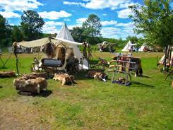


29www.northwestwisconsin.com • 715-416-3256


www.northwestwisconsin.com • 715-416-325630 The 8-block Main Street Business District, listed on the National Register of Historic Places, is the background for a fascinating walk through Ashland’s history as seen through the eyes of Asland’s mural artists Kelly Meredith and Susan Prentice Martinsen. FOR MORE INFORMATION AND A FREE BROCHURE, CONTACT: 800-284-9484 www.visitashland.com www.visitbarroncounty.com Yesteryear • Pioneer Village Museum - www.barroncountymuseum.com • Hungry Hollow Steam and Gas Engine Clubhttp://www.hungryhollowclub.com/ • Moon Lake Threshing Bee - https://moonlakeshow.org/ Silent Sports: Hike, Bike, Snowshoe, Cross Country Ski • Tuscobia Trail • Ice Age Trail • Wild Rivers Trail • Pipestone Quarry – Premier Mountain Bike Track • Tuscobia Winter Ultra Start and Finish – Rice Lake ATV Trails • Extensive trails system throughout County • ATV Playground – Tear it up and have fun – legally
Photo by Amy Luesebrink


NORTHWEST WISCONSIN is home to many competitive and fun sporting events. Whether you are interested in a cross country ski race, marathon, triathlon, mud run, snowshoe race, or mountain bike race, WE HAVE AN EVENT FOR YOU! FOURTH EDITION 2021-2022 Lake Superior Dragonboat Festival LAST WEEKEND IN AUGUST DouglasCounty Apostle Islands Sled Dog Race ANNUAL FEBRUARY EVENT BayfieldCounty Memorial Medical Center WhistleStop Marathon & Half Marathon ANNUAL OCTOBER EVENT AshlandCounty American Birkebeiner Ski Race ANNUAL FEBRUARY EVENT SawyerCounty The Color Splash Run ANNUAL JUNE EVENT BarronCounty Deer Fly Chase Hickory Ridge Recreation Area ANNUAL SEPTEMBER EVENT ChippewaCounty Shell Lake Triathlon ANNUAL JULY EVENT WashburnCounty Flambeau 40 Bike Race & Time Trial ANNUAL SEPTEMBER EVENT PriceCounty Siren Freedom Mini 5 and Freedom 5K ANNUAL JULY EVENT BurnettCounty Half Marathon - Stower Seven Lakes Trail ANNUAL MAY EVENT PolkCounty Sheldon Canoe Race - Jump River ANNUAL APRIL EVENT RuskCounty Paavo Nurmi Marathon ANNUAL AUGUST EVENT IronCounty YOUR ESCAPE. YOUR ADVENTURE. www.northwestwisconsin.com • 715-416-3256 For a full list of events, visit www.northwestwisconsin.com Photo by Bill Zaeger Photo by Charlotte Shover Photo by ABSF Please call ahead or visit your destination’s website to get up-to-date event information.


