DWELLING MONUMENTS
Interpretations of the Atlantic Wall along the Norwegian coast
from Latin monumentum ‘memorial; memorial stone’, to the verb monere ‘commemorate’
monument noun /monume´nt/ NAOB
(own translation)
AAR4990 Master thesis
Faculty of Architecture and Design
NTNU 2023
Students: Ole Flatebø
William Horstad
Supervisor: Stuart McLeod Salvay Dickson
Everything is produced by us, unless otherwise stated.
TABLE OF CONTENT
Prologue Abstract Thesis Extent Context The Linear City Ne w Use Negligence Strategy Overall Program Architectural language Projects I Tarva II Hemnskjela III Titran Epilogue Conclusion Reference list Credits 6 14 44 60 190
ABSTRACT
Dwelling Monuments formulates a strategy of how to deal with fortifications built across the Atlantic Wall during the Second World War. This strategy seeks to make them visible as monuments in a historic context, as well as structures enabling exploration of the beautiful coastal landscape.
The strategy manifests itself in three projects within three islands around Trondheimsfjorden as pilots showing the underlying potential. Each project offers different ways of dwelling by the coast.
The aim of this thesis is to create a more healthy way of coping with global trauma, while preserving a collective memory of how the impacts of war reach beyond the devastating destruction caused by violent confrontations.
6
7
How can we use architecture to cope with dark cultural heritage?
8
9
Atlantic Wall - the linear city
How do we reuse bunkers?
Turism across the coast
How can we create attraction to the coast?
Diving into three islands to test our strategies
How do we address a problematic past?
Transforming three structures within the islands
How do we move on while still remembering?
10
11
0 I II
IV PROLOGUE CONTEXT The Linear City New use Negligence STRATEGY PROJECTS EPILOGUE
CONTEXT
III
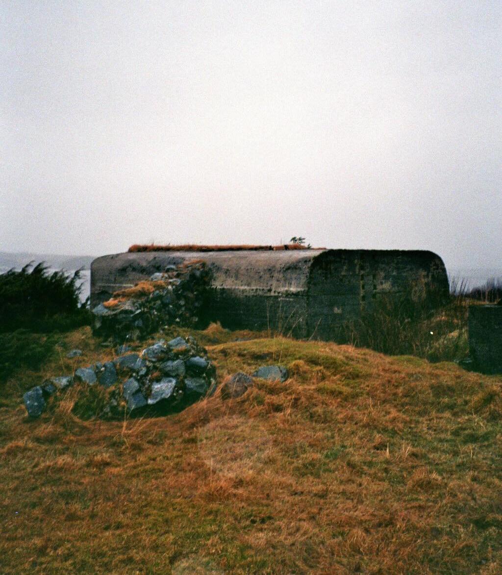
“A strong building mostly below ground and that is used to keep soldiers, weapons etc. safe from attacks”
14 the britannica dictionary
bunker noun
15
LINEAR CITY
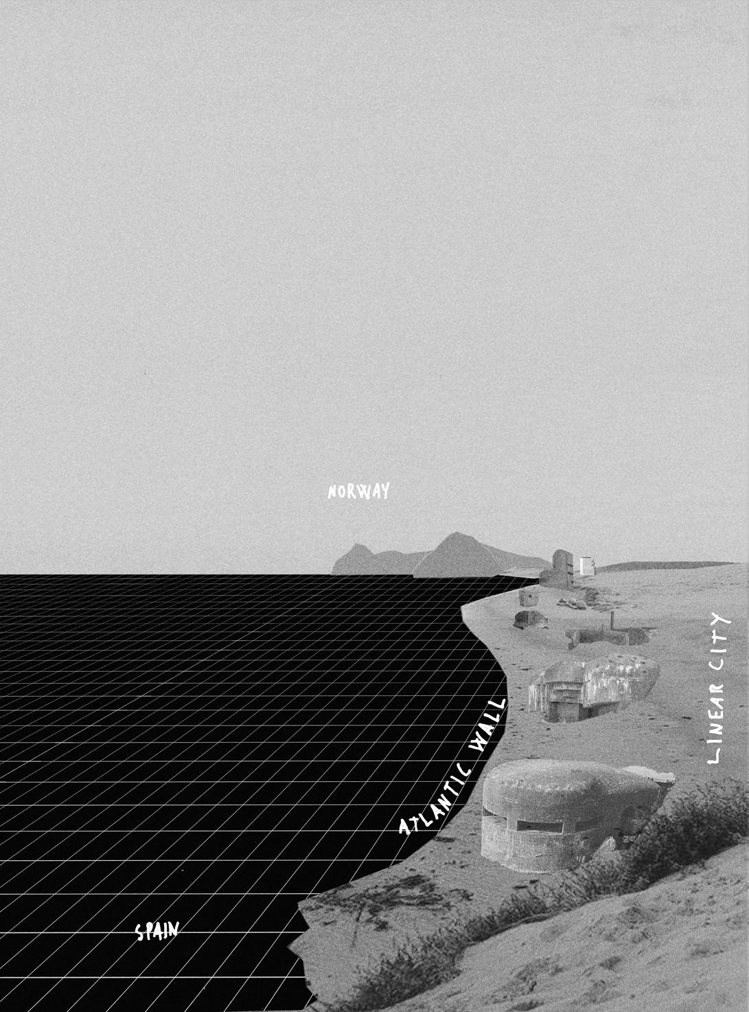
As the fascist German regime ravaged through Europe occupying countries and expanding their land, they saw the need for fortifying their new territory. In 1942 the Germans commenced work on a project named; ”Atlantikwall”. Measuring 6200 km, spanning from the northern coast of Norway to Spain in the south the interconnected bunkers were intended to be an impenetrable barrier preventing the allies invading from the west. 1
Today it lies as an abandoned linear city with its back against Europe facing the Atlantic ocean, creating a mega structure that once was designed strictly for one sole purpose; preventing passage.
16
1 500 coastal fortresses
12 000 structures
Norway Germany Denmark Netherlands Belgium France
Spain
17
diagram, atlantic wall
CONTINUOUS TERRITORY
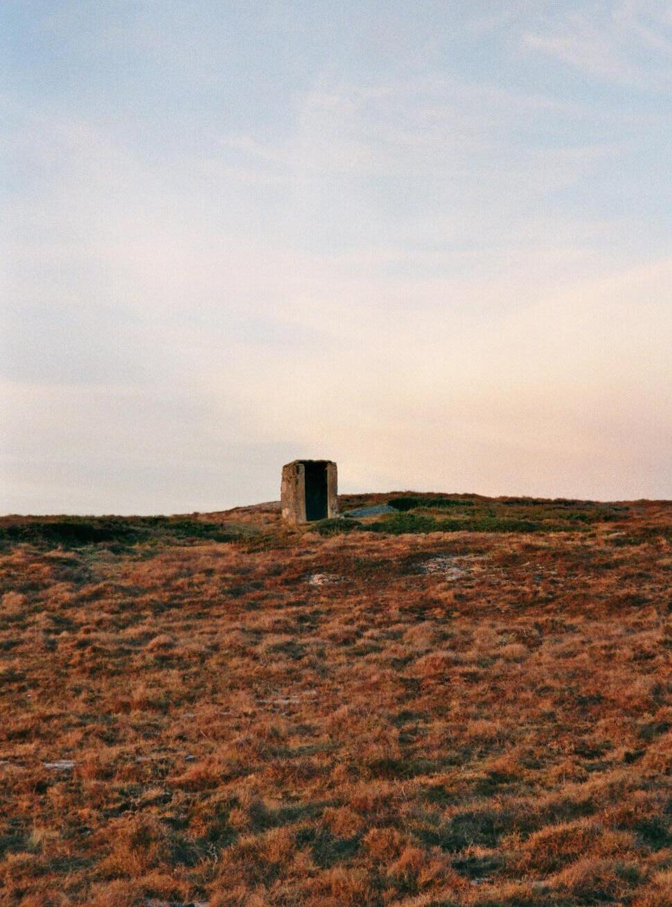
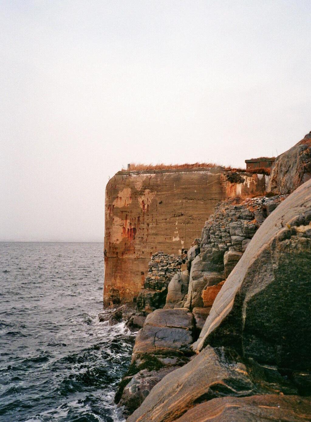
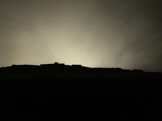
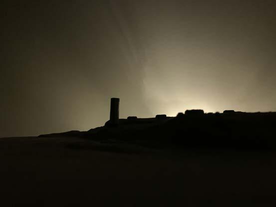
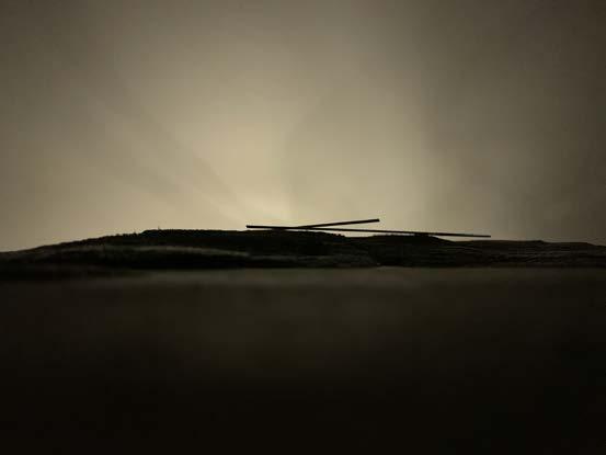
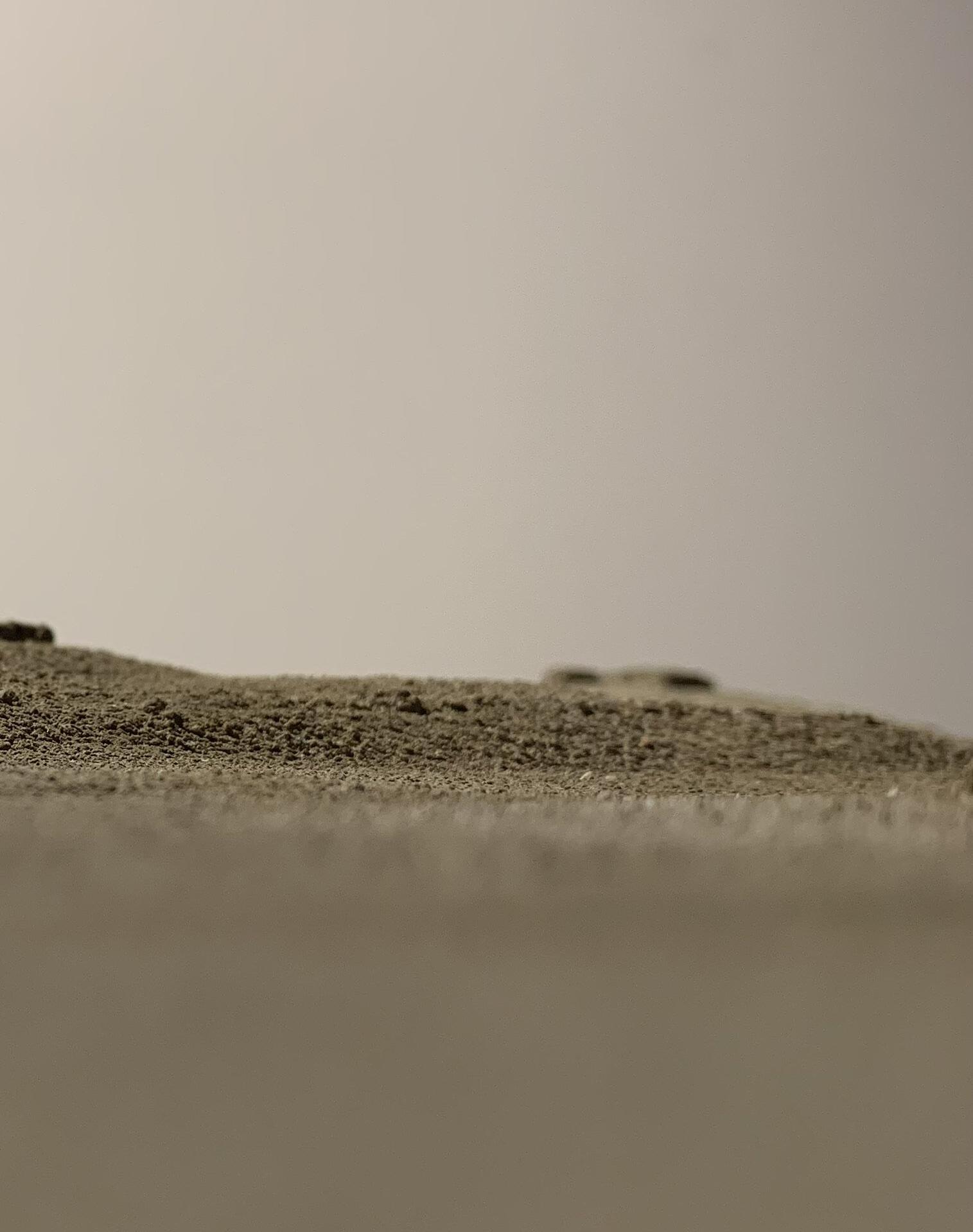
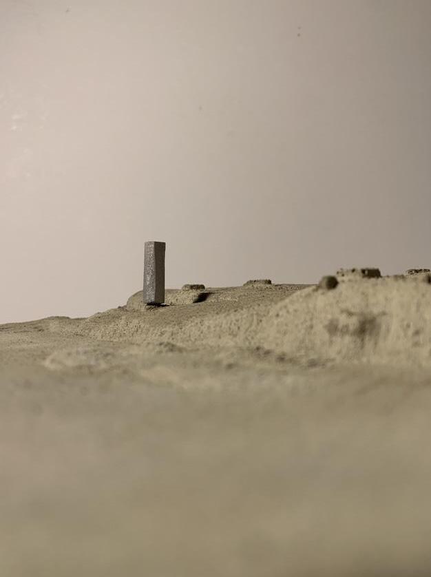
Scattered volumes of concrete replicated along a buckling line tracing the outermost border where land meets the sea. Single interconnected structures dependent on each other. Creating a territory, a slender continuous area with a variety of topography, from the sandy beaches of France to the rocky Norwegian coast. A territory that has lost its physicality, but is still occupied by monolithic monuments reminiscent of where its borders once extended. Structures that no longer lay claim to any territory, but state their presence in the landscape through their size and persistence. Though giving little indication as to why they are there and how they got there. Monuments forgotten in time, displaced by a world wanting to forget.
18
19
photo: Wette
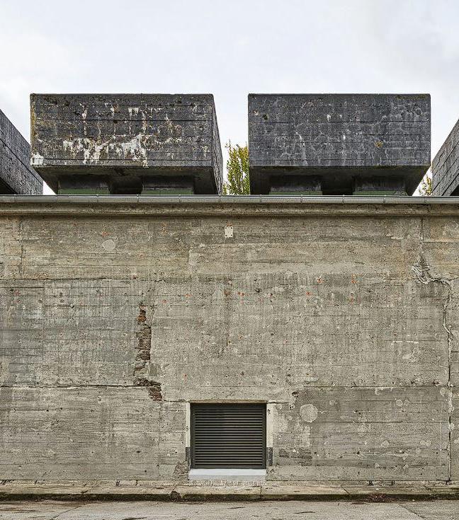
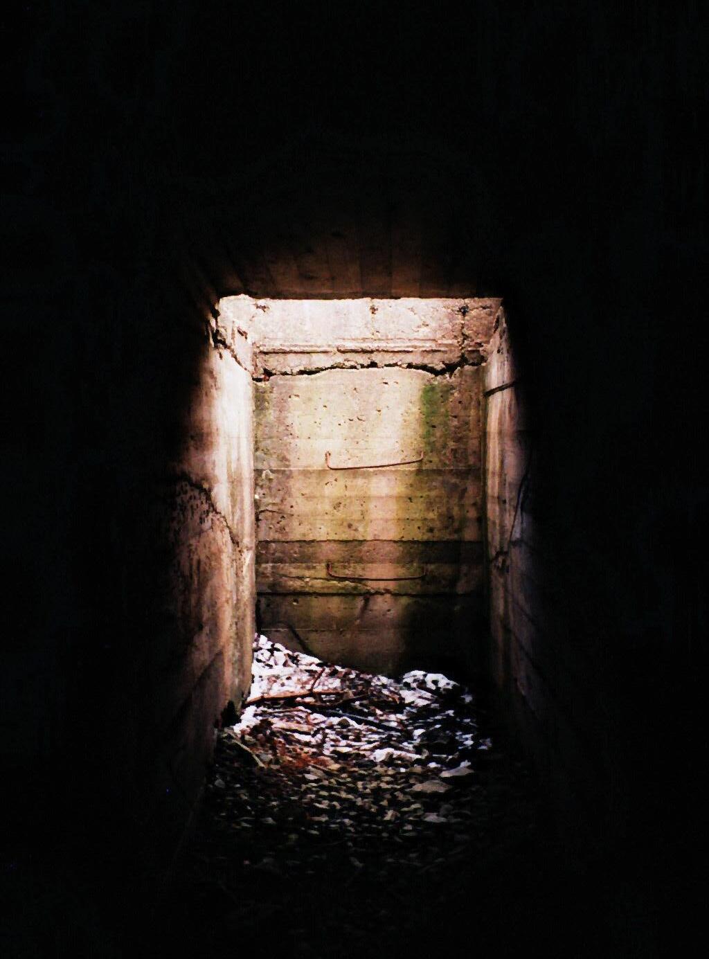
GHOST- LIKE FIGURES
The bunkers, rendered useless as their purpose no longer needs to be fulfilled. Ghost-like figures against the horizon hiding in the rugged terrain, frozen in a time of conflict. Shaped by a very special architecture, where the design is dictated solely by its function to protect its inhabitants against bombs and bullets. An architecture of contradiction, where the inhabitants feel protected while still incapsulated by an inhospitable atmosphere.
20
21
collage, the linear city
22
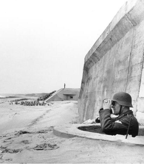
photo: Scherl / Bridgeman Images
REGELBAU
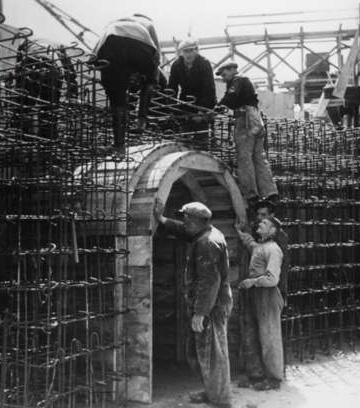
To create this architecture, a set of rules were made. The regelbau was a system for efficient bunker design with standardized measurements, design principles and detailing for ameliorating the construction of a large number of bunkers in various locations.
Following the order of a bunker to a specific area, the military branch would have an initial meeting discussing the exact position of the bunker. Finding the best position to blend into the landscape using the terrain as camouflage. Depending on the size of the bunker, the construction time was between 3-5 weeks. 2
23
24
25 mass and space
26
photo: Nic Tenwiggenhorn.
NEW USE
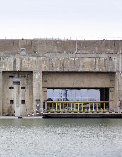
If one travels down the Atlantic wall you can see how other European countries have dealt with the bunkers. A lot of the bunkers scattered across Europe, especially the ones in cities have been demolished. Those too large to be removed or not in the way of new developments, have remained as monuments of the dark past. Some of these structures left by the German war machine have been reimagined to become spectacles and house new functions.
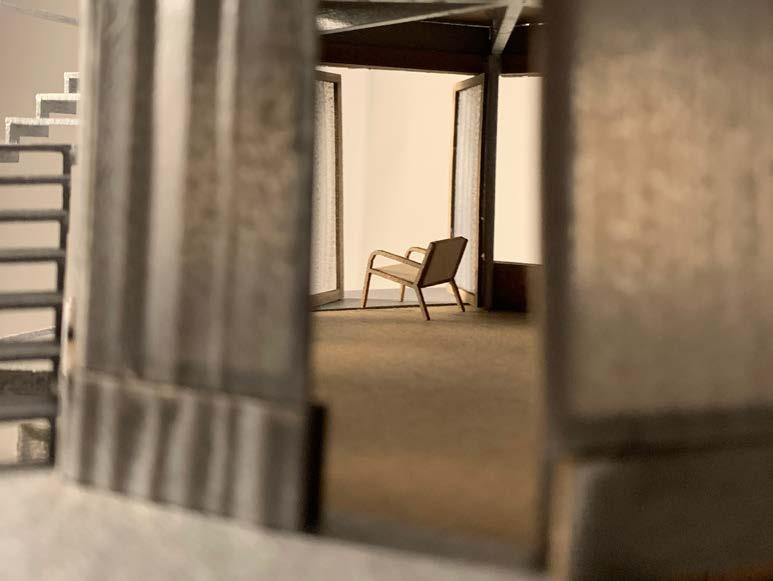
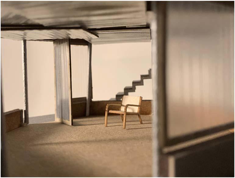
Visionaries and private investors have seen opportunity in the massive structures and are trying to look past the intangible traces left by the war. Rather than refraining to touch the bunker, they consider the monolithic structures as empty space, only limiting the possibilities to the physical limits of the structures themselves.
27
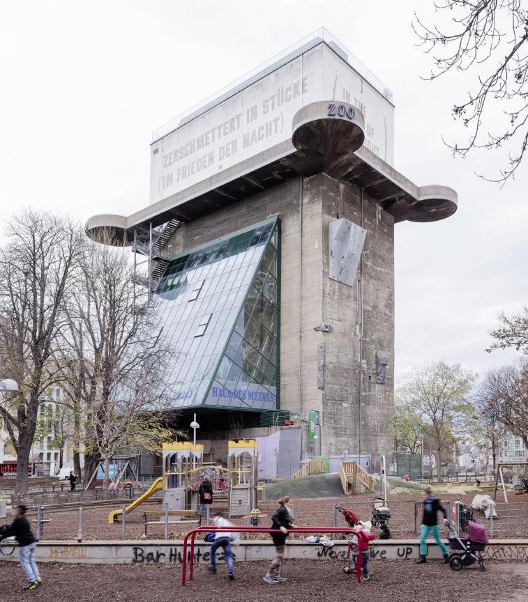
VIENNA, AUSTRIA
ARCHITECT: Pumar Architekten + Looping Architecture
HISTORIC FUNCTION: Flak tower
NEW FUNCTION: Aquarium plan, 1:500
28
29
photo: Stephen Fadinger
BERLIN, GERMANY
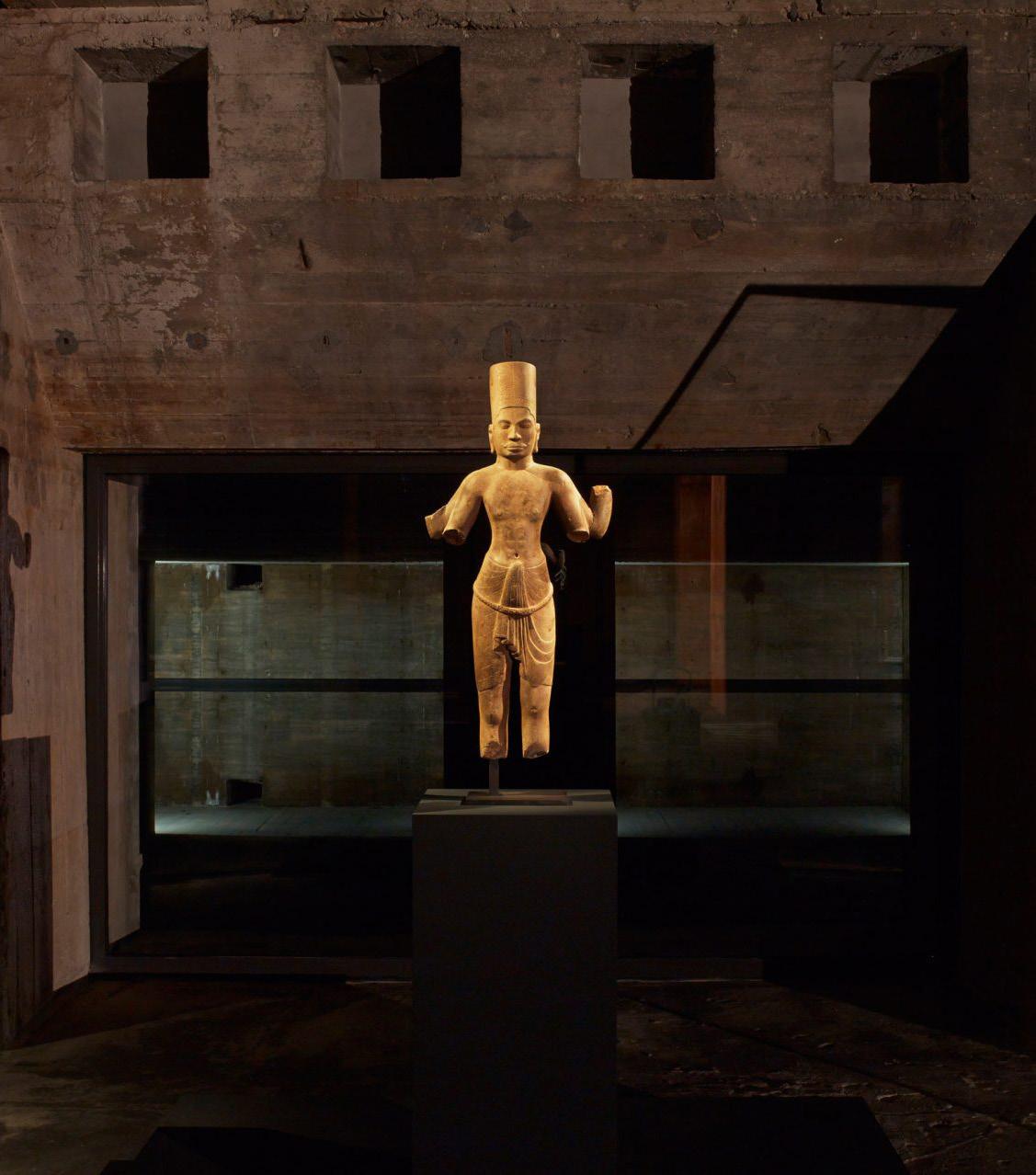
ARCHITECT: John Pawson
HISTORIC FUNCTION: Telecommunication bunker
NEW FUNCTION: Art gallery plan, 1:1000
30
31
photo: Def Image
SAINT- NAZAIRE, FRANCE
ARCHITECT: 51N4E , Bourbouze & Graindorgel
HISTORIC FUNCTION: Submarine bunker
NEW FUNCTION: Restaurant, experience centre, roof garden, concert hall + venue for experimental art
32
plan, 1:750
33
photo: Filip Dujardin
34
“It is difficult to think of places more charged with atmosphere than these monumental concrete structures”
John Pawson on the Feuerle Collection exhibition space
IMPLEMENTING FUNCTION
In Europe the monuments have become attractions. Not attractions in the form of war museums, but spaces integrated in everyday life. Spaces with social programs, inviting people together into what becomes an embodiment of difficult heritage, letting the visitors experience the atmosphere of the bunker. Playing into the underlying tension remaining in the thick walls.
The structures built for keeping people away, become places for gathering people. Creating a new relationship to spaces connected to the war, slowly replacing the grief with new experiences. Moving on while still remembering, slowly healing physical wounds by combining a new use with the bunker’s tangible presence and history.
35
36
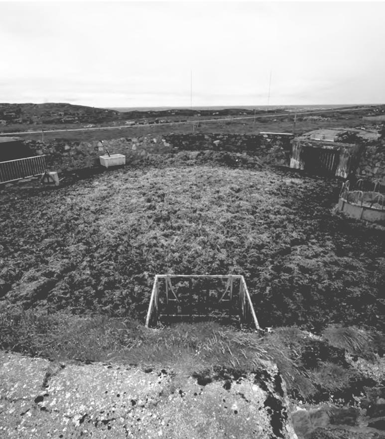
photo: sør- trønderlag fylkeskommune
A former artillery position used as a cow shed
NEGLECTION
The storytelling of the war in Norway has been centered around how the Norwegians unified, focusing on the members of the resistance and their struggle against their oppressors. There has been little attention given to the other side of history, as to why this solidarity was needed. This portrait of the war was painted as a way of forgetting and moving on from the horrible reality, a collective decision of not looking back at hardship and suffering. Somewhere along the way this coping mechanism turned into negligence. It is important to pass on a holistic picture of history to the new generations. Should we be able to choose which parts of history we want to remember?
In recent years there has been a shift in the opinion of the preservation of wartime cultural heritage. More people have become aware of their value and importance to the collective memory. 3 This is likely as a result of a newer generation growing up without having lived through the war and its aftermath. Their interaction with the bunkers differ from those of the older generation. They don’t carry the same contempt when meeting the bunkers.
Despite our way of dealing with the bunkers in the past, could this development allow a wiggle room for creating something with the bunkers? Learning from Europe by using the bunkers as places of attraction. Creating something speaking to the core Norwegian spirit, doing it in a Norwegian context?
37
300 coastal fortresses
2 400 structures
100 915 km coastline
38
diagram, Atlantic wall in Norway
ASSOSIATING WITH BUNKERS
Many Norwegians are unaware of the bunkers lining our coast, especially the magnitude and to what extent they reach.
Most of the bunkers are placed in beautiful open coastal landscapes because of the nature of their function of surveying the coast. While some may have encountered them strolling the coast, others remember playing amongst them as children. The dark cave-like structures are perfectly climbable and create an arena for enticing games and childs-play. Even though many have an impression of the single clusters of bunkers, it is difficult to fathom these as part of a much bigger context.
There exists a familiarity to the bunkers, can this relationship be utilized in a way of reusing the bunkers?
39
40
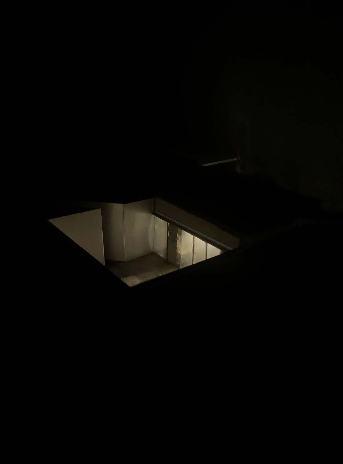
AGENDA
On the 75th anniversary of the German occupation the climateand environment department (Klima- og Miljødepartementet) issued a letter in collaboration with the directorate of cultural heritage (Riksantikvaren) to all municipality mayors inviting them to a cooperation to registering and conserving cultural heritage from the war.
“The war generation is falling away and it is important that the untold stories are documented. The work with cultural heritage of the war can affect both local and national identity.”
The government understands the importance of acknowledging this part of our past, but many of the smaller municipalities across Norway lack the necessary funding even for registering them. Meaning that they will certainly not be removed, or looked after. So why not give them a new use and preserve what’s left of the historic traces in the process rather than walking around them?
41
Krigens kulturminner, “Kulturminner fra andre verdenskrig” - Riksantikvaren (own translation)
42
"History enables us to look hard and clearly at some monsters inside us, but this is part of the project of caging and taming them."
43
Jonathan Glover
STRATEGY
0 I II III IV PROLOGUE CONTEXT STRATEGY Overall Program Architectural language PROJECTS EPILOGUE
POINTS OF INTERESTS
Dwelling Monuments propose a strategy which can be replicated in multiple locations along the Norwegian coast and possibly throughout the Atlantic Wall.
Using the monuments as elements for connecting Europe together through a common dark chapter of history. Turning the linear city into something that exceeds its dark heritage. Creating focus points along the linear city, marking entrances into the historic territory.
By interacting with the bunker, rather than marginalizing or neglecting them, gives the monuments a clearer presence. Acknowledging their existence is the first step to preserve them as objects representing the missteps of man.
46
consentration of German fortifications
47
adding layers to the linear city
48
VISIBILITY
The strategy is represented in three separate projects each in relation to a significant monument to showcase the potential of the scheme. The projects will act as beacons and will become landmarks pointing to the historical area, clearly visible in the rugged coastal landscape. The surrounding monuments will through these interventions benefit from the increased attention, sparking interest and signifying their importance as storytelling elements.
We seek to use architecture to portray history in a more elaborate way and create new understanding of the relationship between the structures, and how they connect together as a wall with multiple layers protecting itself from all angles. The addition of the project gives a clearer image of the gravity and scope of the giant line reaching to Spain.
49
50
PROGRAM
Most of the structures across the Norwegian coast are open for visitors, and the projects will offer the same accessibility. This is an important aspect; to ensure that everyone can benefit from the storytelling depicted through the architecture. Certain parts are restricted as rental spaces. Instead of laying claim to the area, the rental spaces are secondary to the existing historical landscape.
The projects will offer new ways to experience the coast both for those who rent and those who visit. Creating a foil above the monuments, protecting them by giving them a new use. The project challenges the ideas of dwelling by the coast, where the interventions differ in comfort, size and expression, offering varied ways of inhabiting the coast.
51
ARCHITECTURAL LANGUAGE
Each intervention physically appears as points of interest along the linear city, places to stop and explore. Though separated by distance, they are connected through a common architectural language, a language based on contrasts:
Old and new, expressing the overlapping layers of history withering differently but at the same pace.
Heavy and light, the appearance of the additions hovering over the heavy concrete structures buried in the landscape.
Static and dynamic, light materials swaying in the wind in relation to the solid concrete weighed down
Rough and refined, smooth materials meeting the rough weathered concrete
Temporary and permanent, moveable structures, but in place against the monuments final resting place.
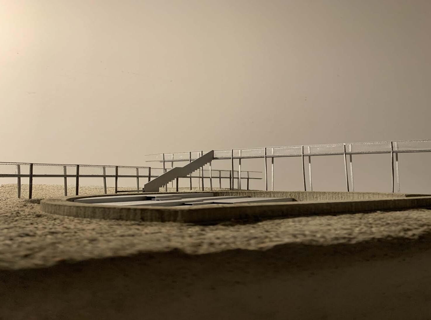
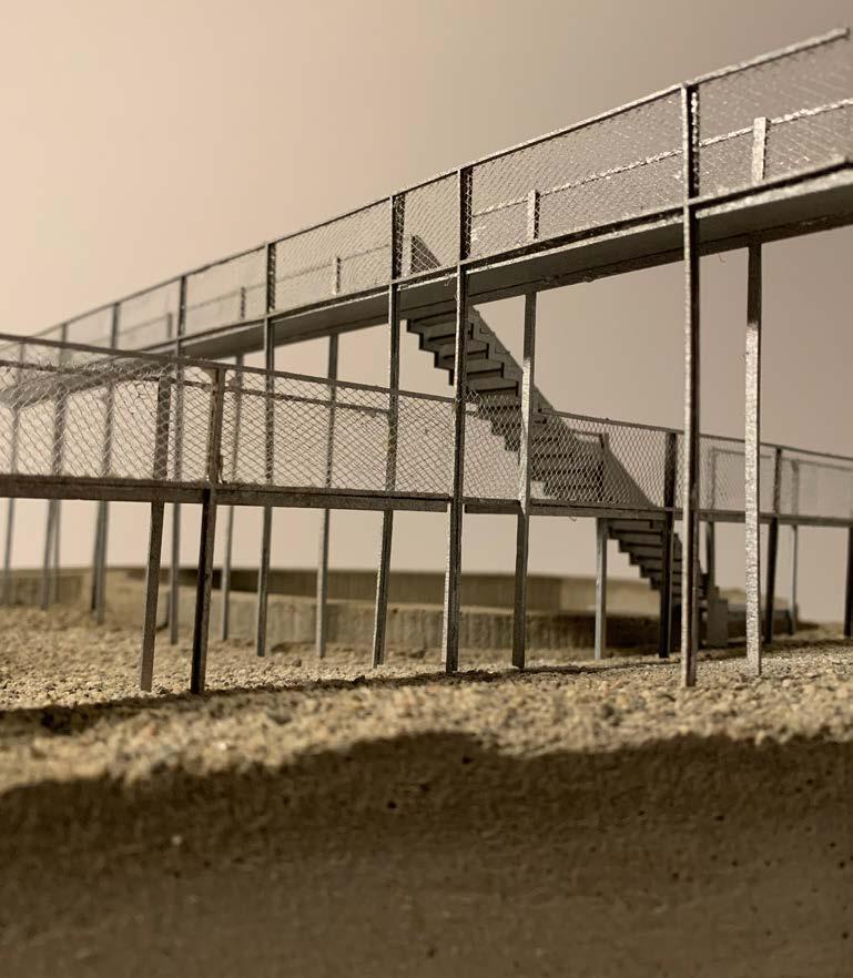
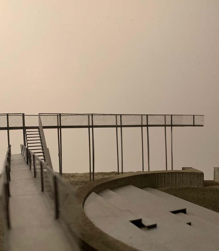
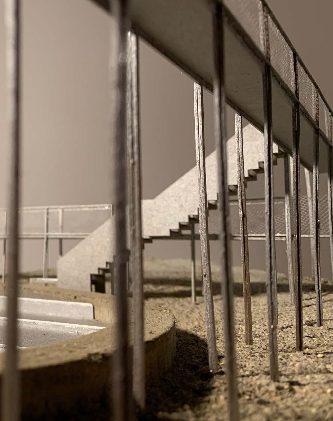
The architecture happens in between the monuments and the new structures. Creating a division, while at the same time relating to each other. Rather than idealizing them as objects, the new serve to showcase the monuments as they appear today, signifying their importance as singular vessels of history.
52
53 new and existing
TESTING GROUND
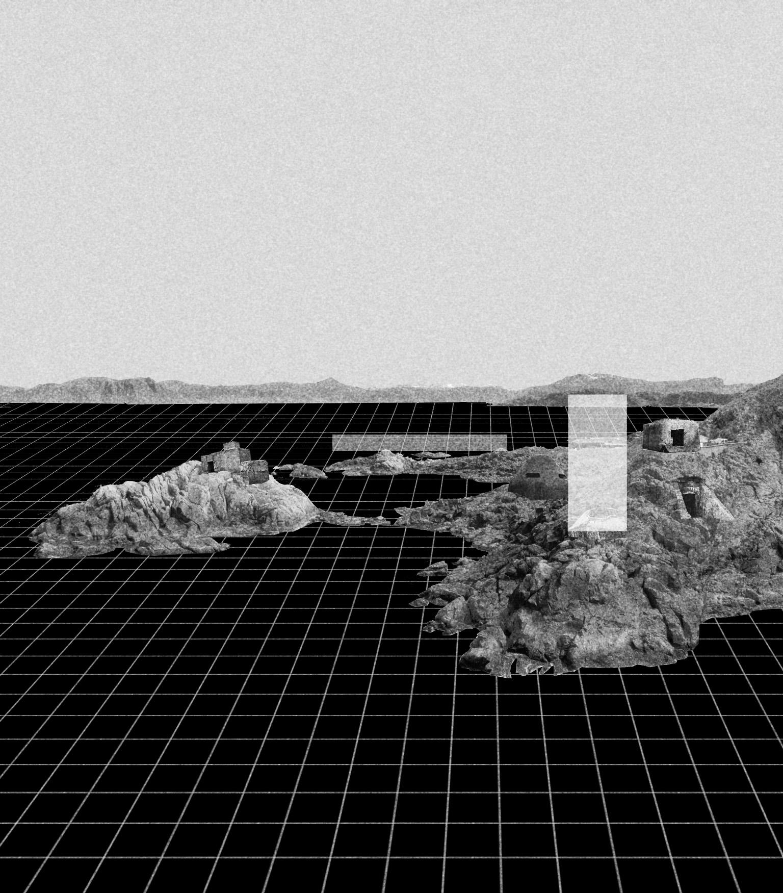
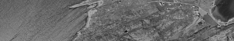
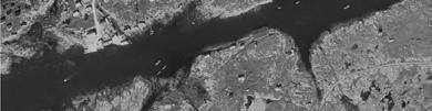
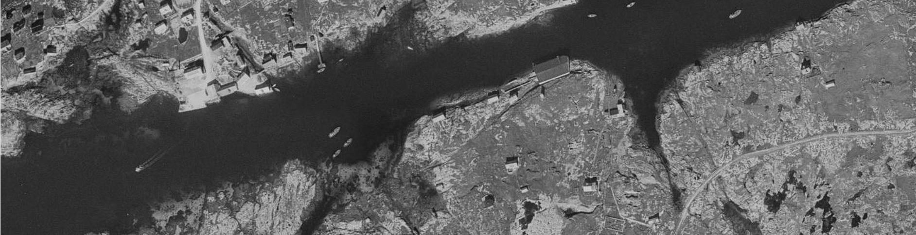
Trondheimsfjorden was a strategically important location for the Germans after the occupation. Trondheim was to become “Nordstern” (Neu Drontheim) , a new German metropolis functioning as the main naval base for patrolling the Atlantic sea. Although the large plans for “Nordstern” were never completed, the heavy fortifications for protecting the mouth of Trondheimsfjorden still riddle the coast today. 4A large variety of bunkers in different shapes, configurations and sizes offers a suitable place for testing the feasibility of replicating the strategy along the Norwegian coast.
54
artillery cannon range, preventing access
55
56
Hemnskjela
Titran
57 project areas
Tarva
Trondheim
ARCHETYPES
The projects represent three concepts. A tower; verticality reaching from the landscape, a cave; horizontality digging into the landscape, and bridges; lines connecting the landscape together. All with the overall intention of visualizing the surrounding monuments as part of the coastal landscape.
Each project is connected to activities relating to each location, strengthening the duality of being spaces to experience the coast and to understanding history. The tower, the cut and the line, will become points of attraction that will enable inhabiting the coast.
58
59
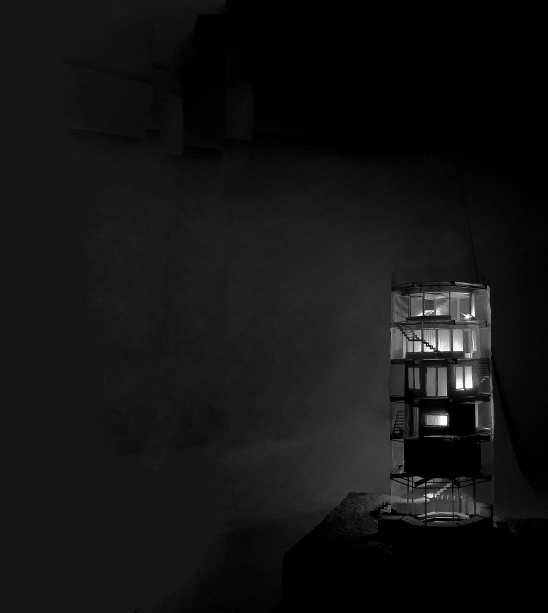
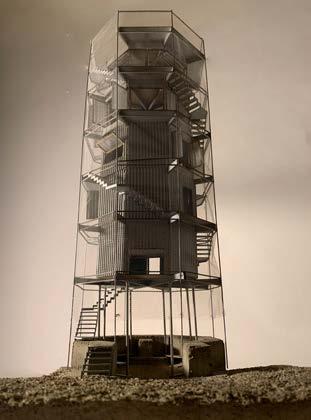
PROJECT 01: THE TOWER
0 I II III IV PROLOGUE CONTEXT STRATEGY PROJECTS The Tower The Cut The Lines EPILOGUE
TARVA
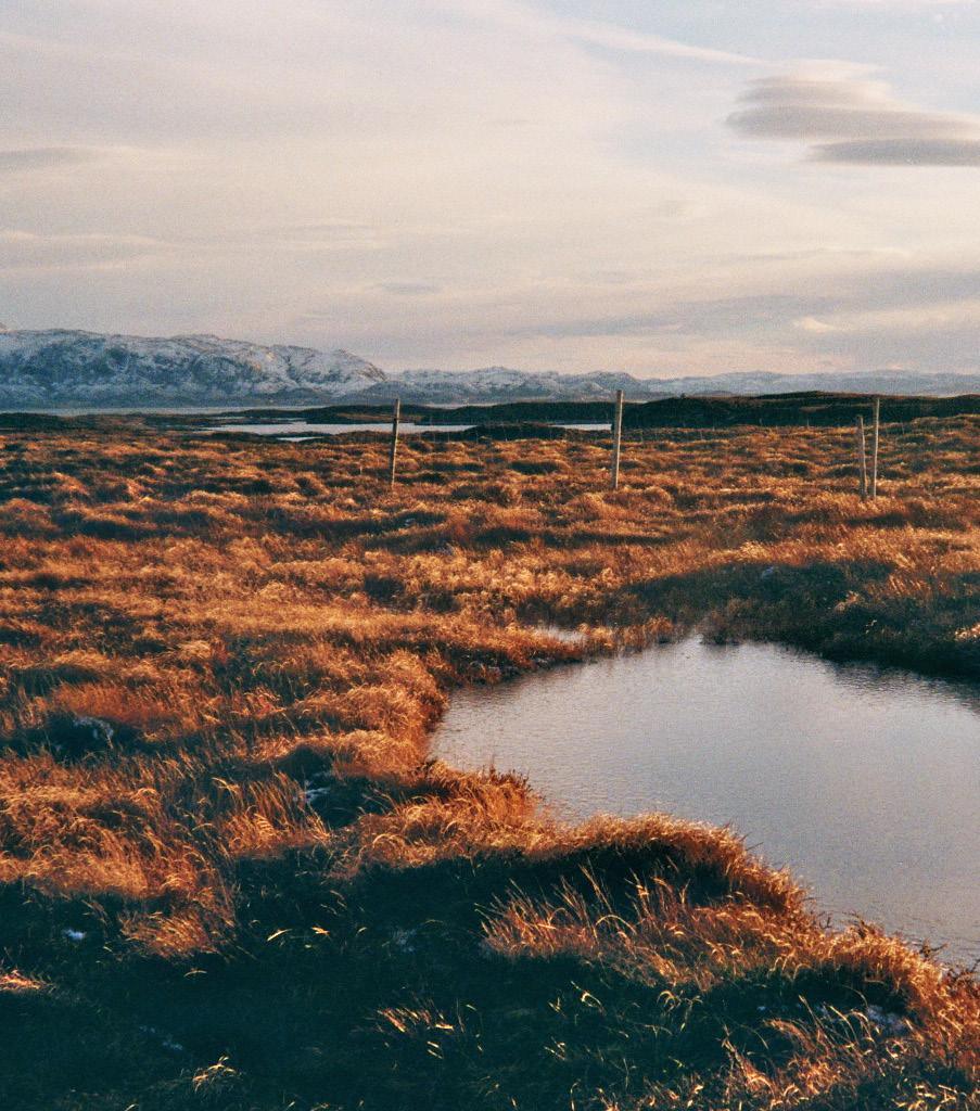
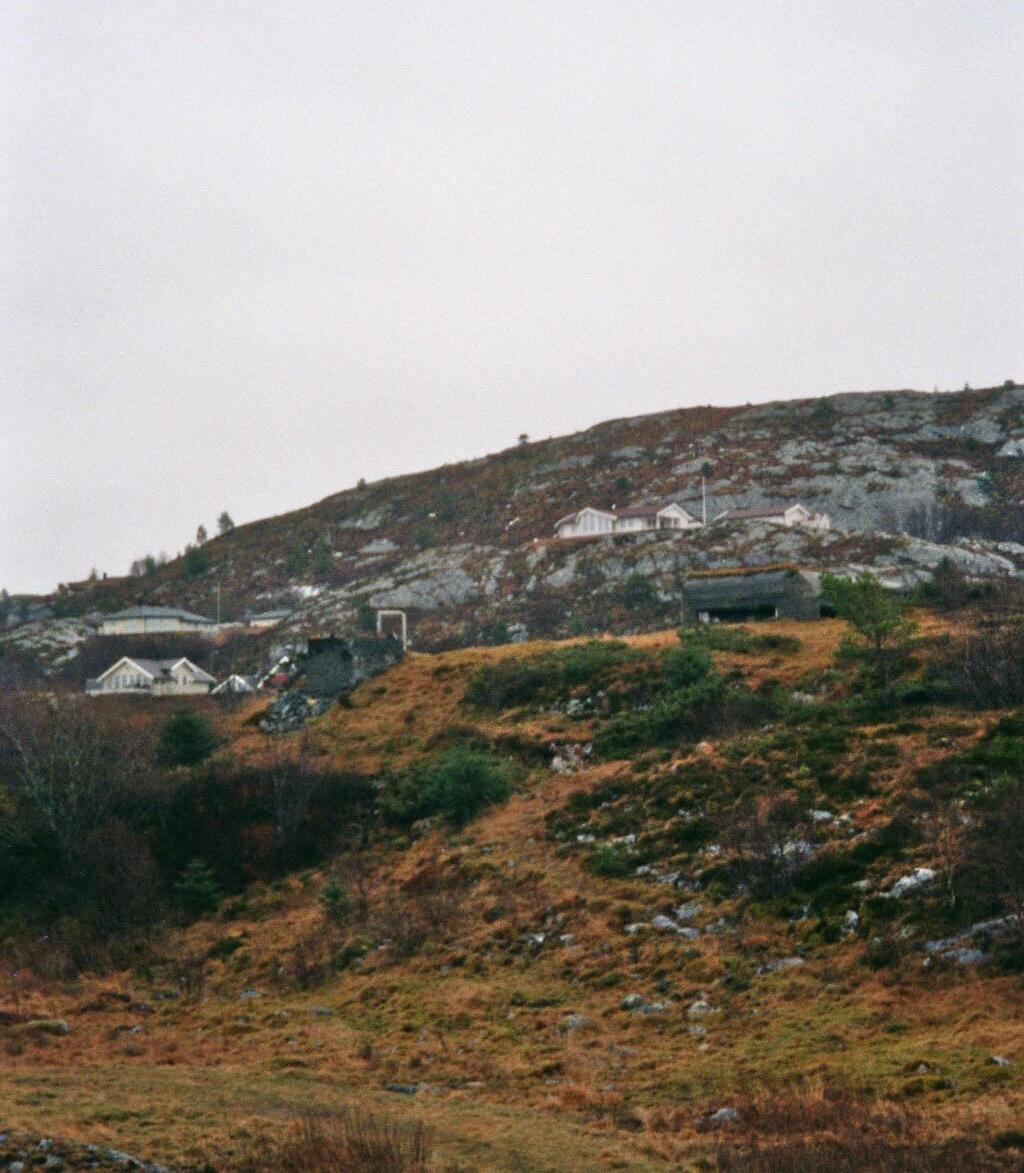
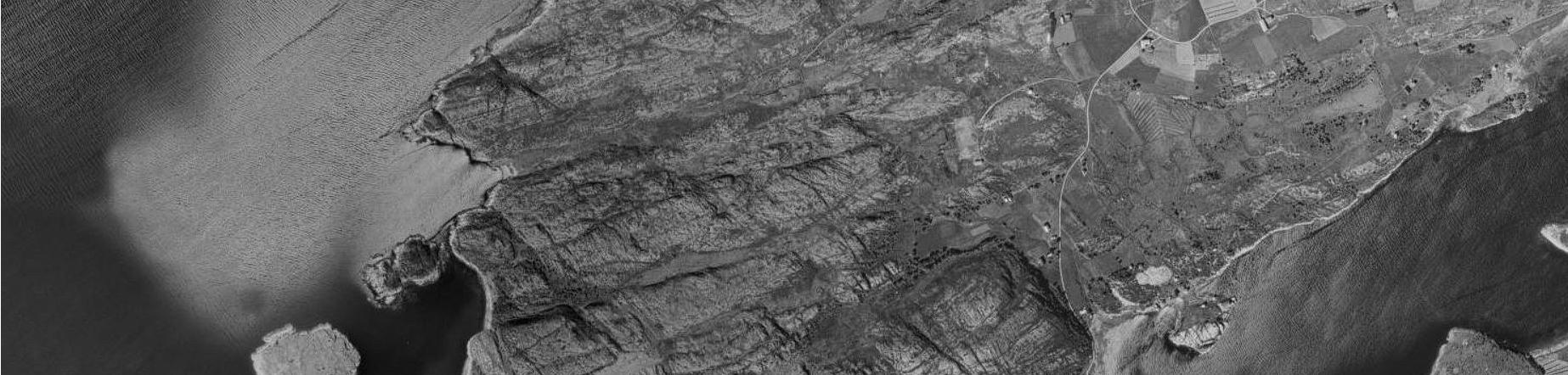
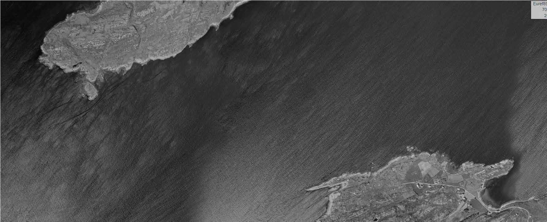
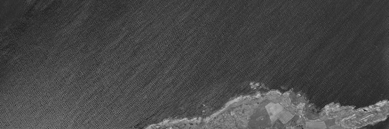
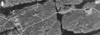
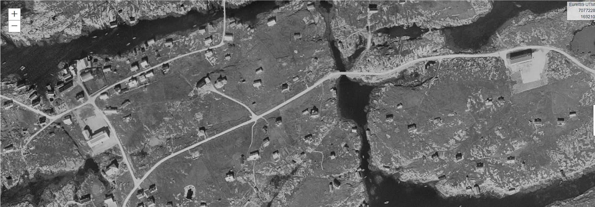
Tarva is a group of islands located west of Botngård. Husøya, the largest island of the group has 15 permanent residents, mostly farmers. Cows, sheep and reindeer are scattered within large enclosures dividing the landscape. Although there are not many permanent residents, there are a lot of vacation homes on the island, and in summer there could be more that 120 people living on the island. The military has an operating radio station along with a large shooting range on the south end of the island. Tarva is known for being a nice spot for kayaking, and with this experiences some tourism.
62
63
65

Scala: Fra 1:5000 -> :500 ganget med 1000%
The Germans started the building of Tarva coastal fort in the summer of 1940. The main artillery consisted of 3 “28 cm SKL/45 sledeaffutasje” cannons with a range of 35 km, along with this “Mammut Tanne ’’ the biggest type of radio station built during the war. 5
67
68
plan and section, existing structure, 1:200
69
BIRDWATHING IN TARVA
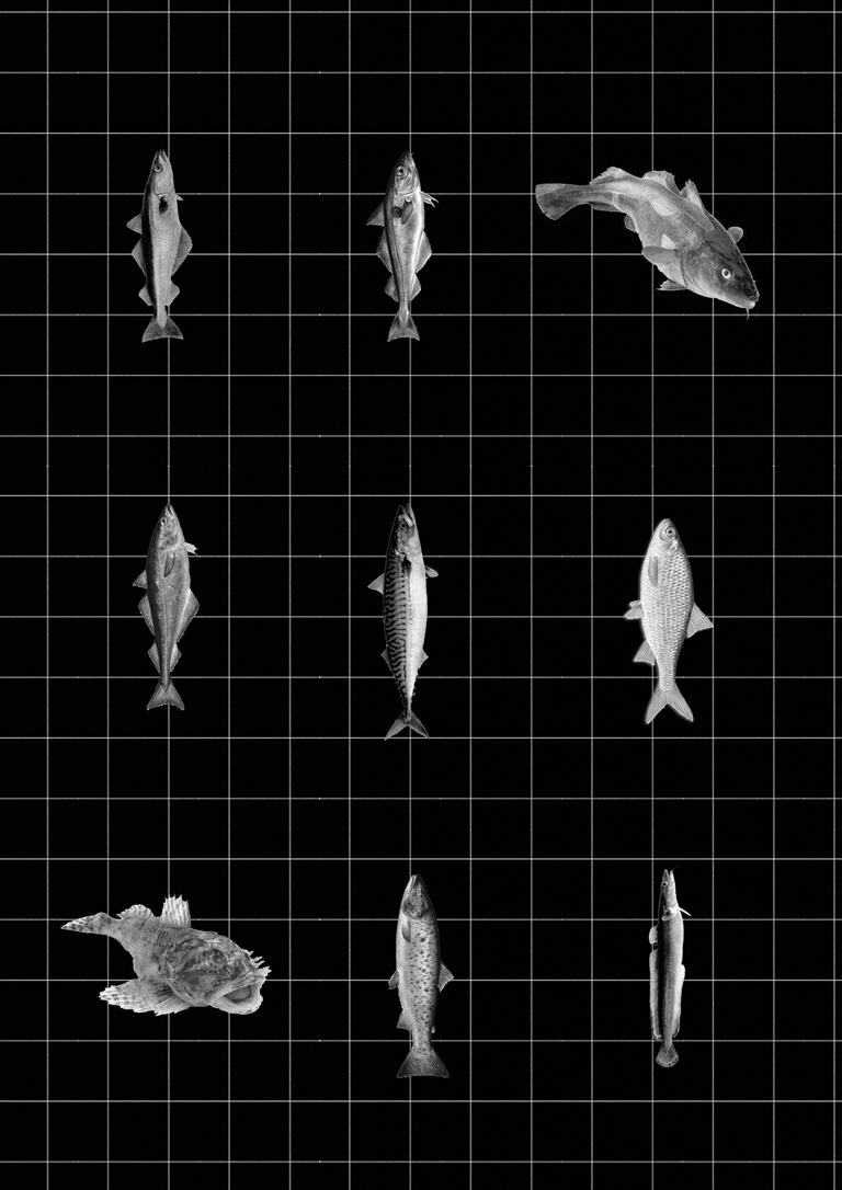
There is a large gathering of bird species within Tarva, with about 160 different species registered. In different periods during the year, some parts of the island are protected to prevent people from disturbing the wildlife.6
The Tower offers a great view of the coastal landscape, particularly interesting for avid birdwatchers. The outer layer of The Tower is lined with a steel mesh, thin steel wires woven together. The perforated skin will appear opaque in relation to the bright daylight, while it masks the visitors from a distance to prevent disturbing the more elusive bird species.
70
some of the species frequenting Tarva
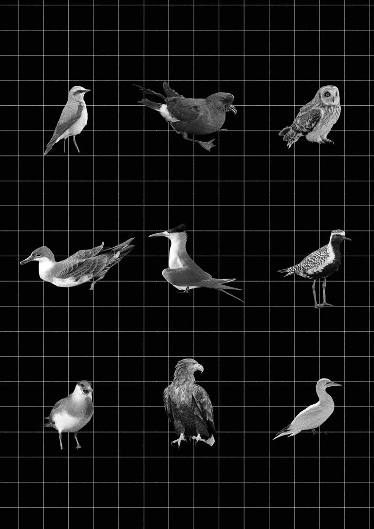 Havsule
Grålire
Havsvale
Sibirlo
Tjuvjo
Jordugle
Steinskvett
Terne
Havsule
Grålire
Havsvale
Sibirlo
Tjuvjo
Jordugle
Steinskvett
Terne
71
Havørn
collage
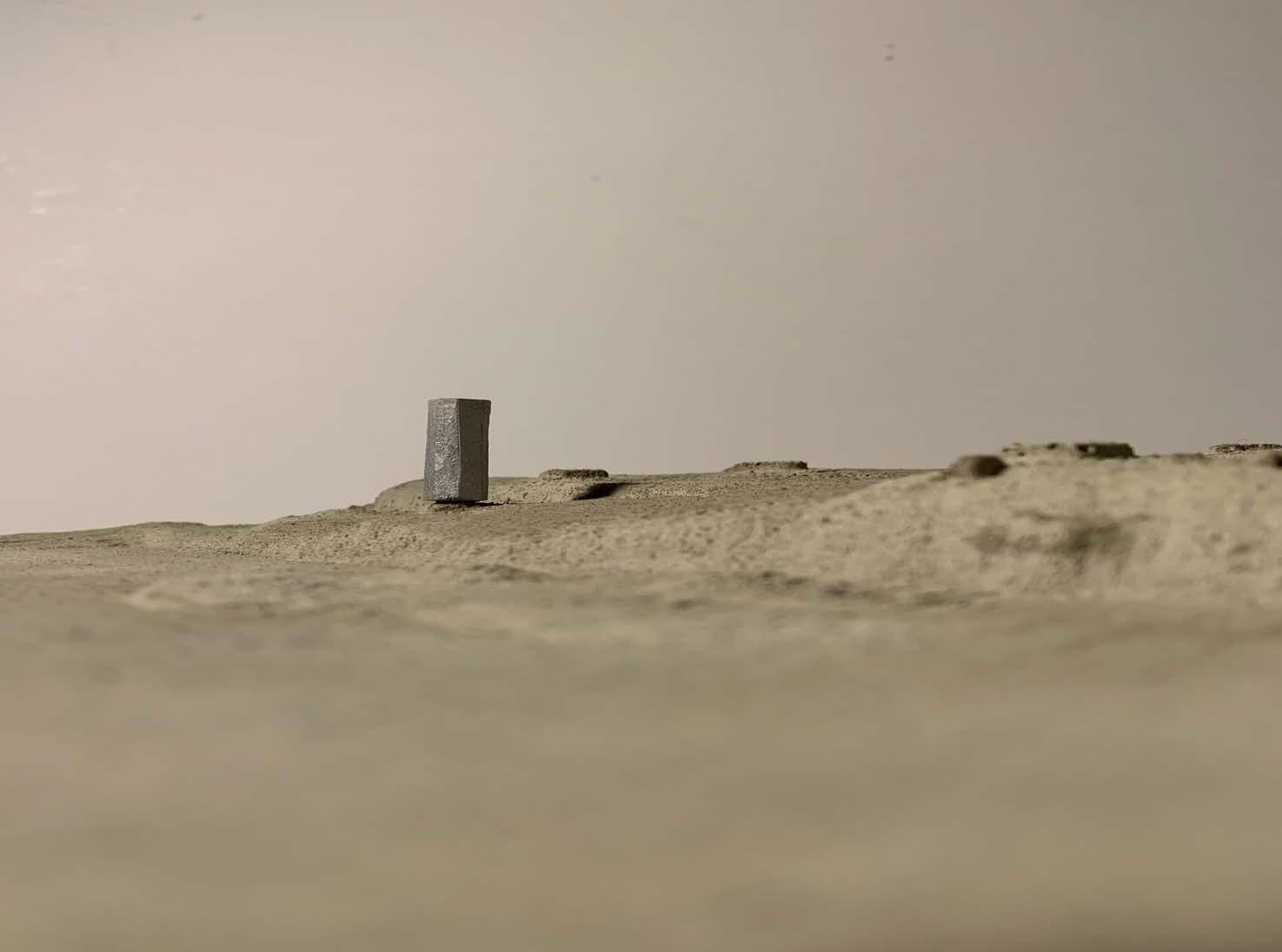
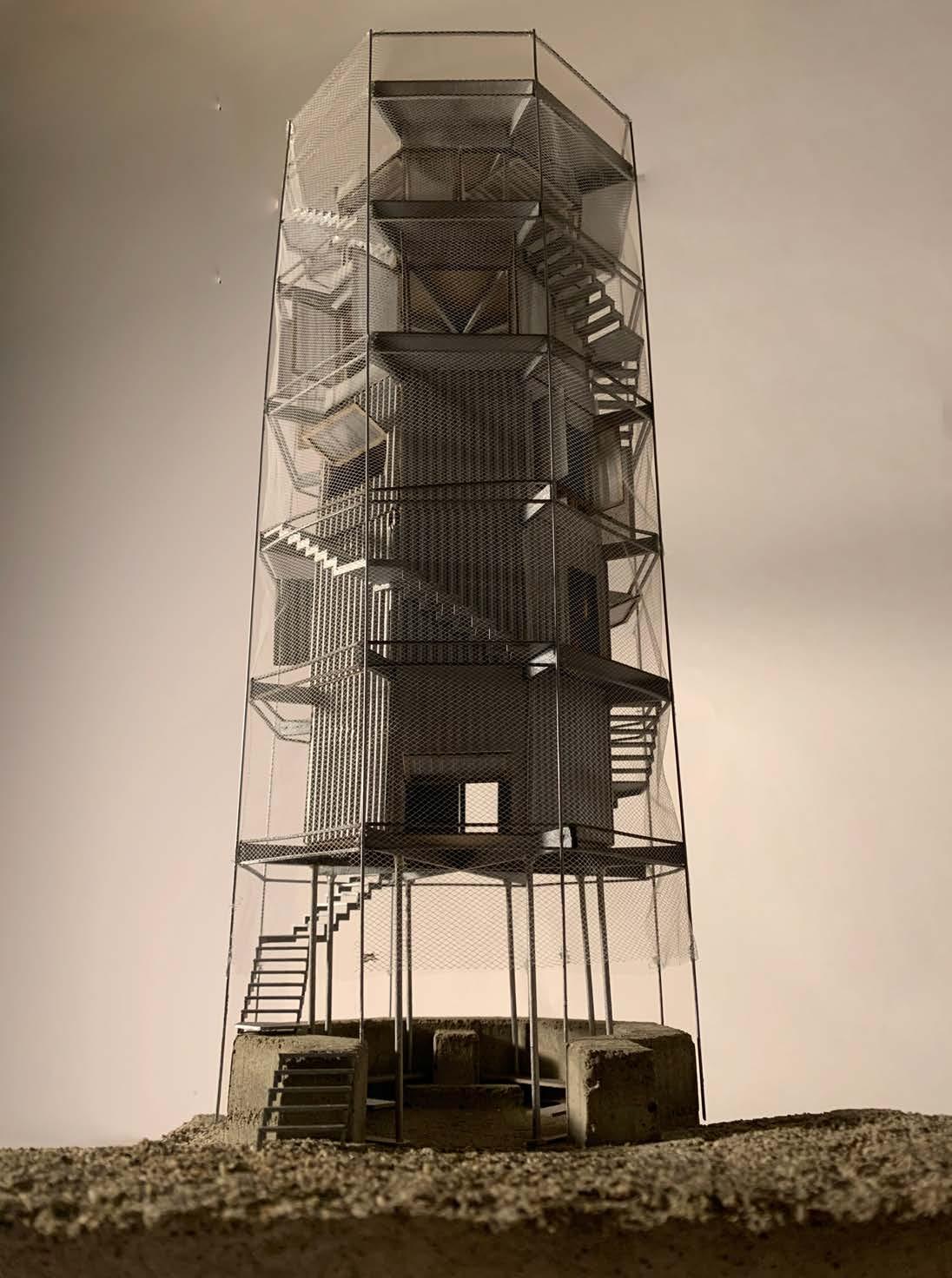
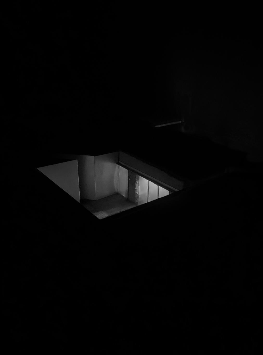
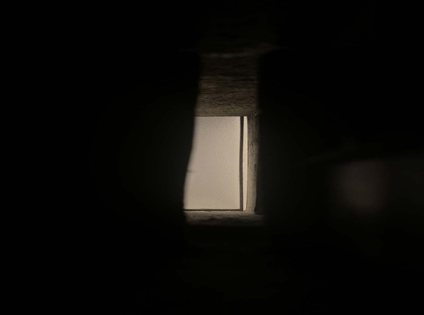
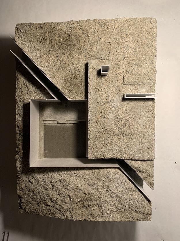
The facade extrudes from the outer edge of the bunker, visually protruding the bunker towards the sky, visualizing its footprint.
The vertical circulation of The Tower is placed to the outside of the climatized core. It is projected on top of the existing bunker.
The tower is organized after a heating scheme taking advantage of the rising heat through small operable openings in between the floors, sectioning the heat depending on which floors are in use to conserve heat.
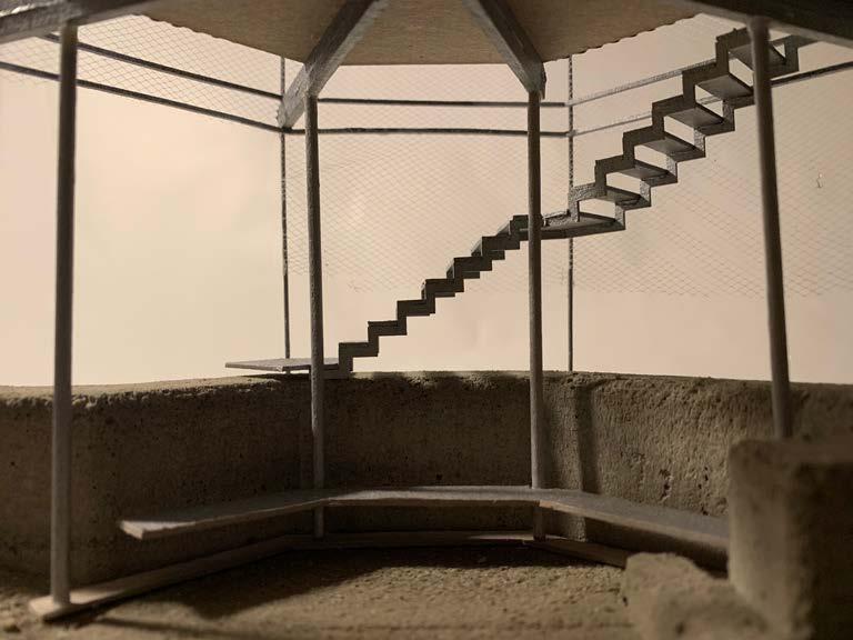
Moving up and around the tower, shifting the view and elevation, an orchestrated reveal of more and more bunkers scattered around the tower.
The tower offers rentable spaces. The opportunity to sleep vertically in the coastal landscape.
72
design principles
73
model, 1:1000
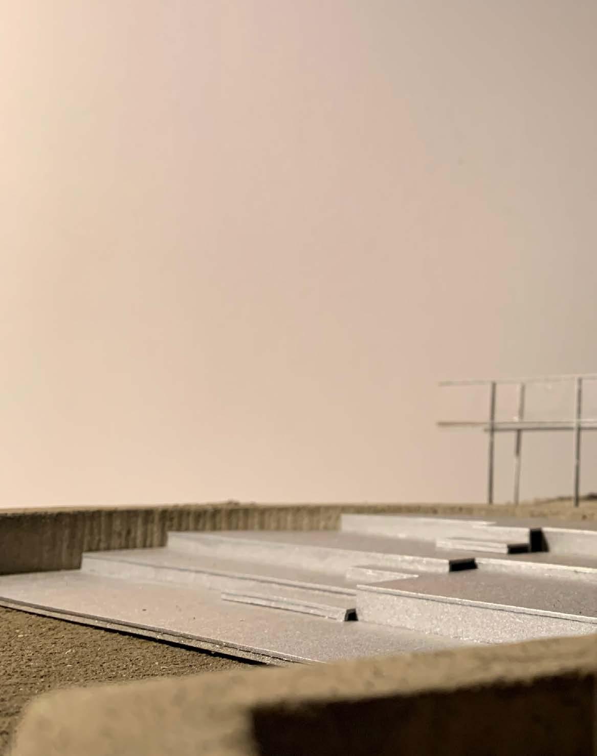
towering above the water plane, flanked by monuments on either side
76
a slender tower overlooking the bunkers behind it
situational section, 1:1000
77
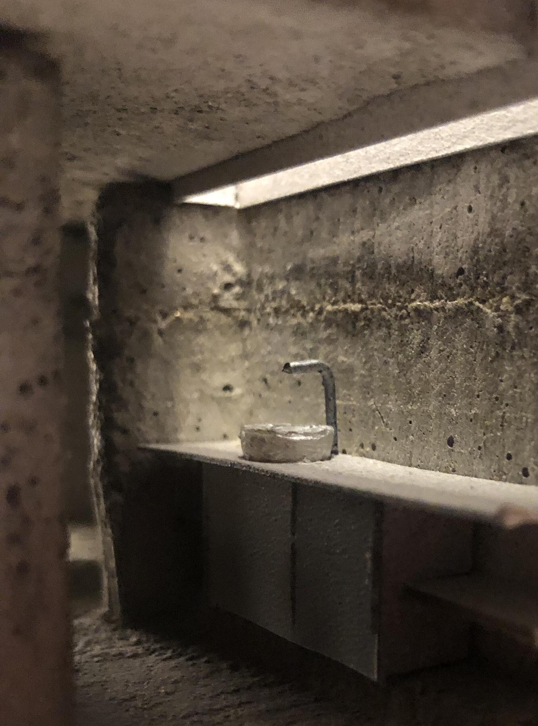
Each floor replicates the dimensions of the existing bunker space, offering different ways of experiencing the space as the tower opens with more hatches and window panes, gradually letting more light into the enclosed spaces.
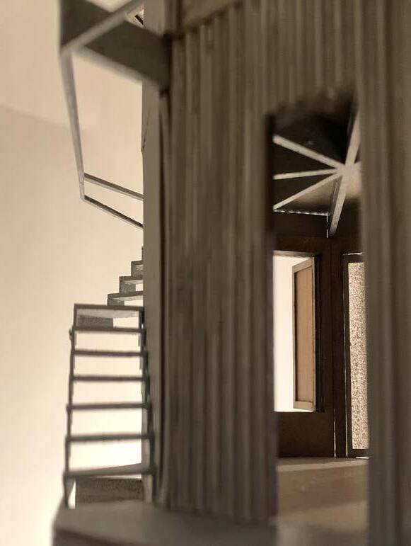
The external staircase wraps around the volume defining the boundary of the void left inside the thick concrete walls.
The interior spaces opens up more and more as you move towards the top.
78 design principles
79
model photo, 1:50
80
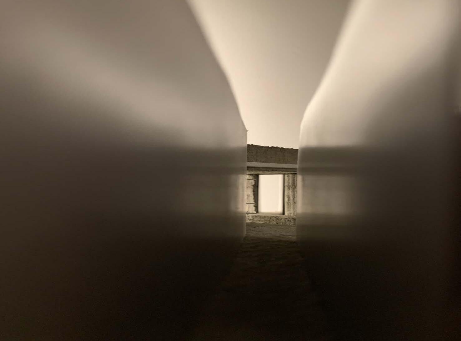
model photo, 1:50
meeting point between old and new, sheltered inside the bunker with no obstruction of the horizon
81
A A
ground floor, 1:100
82
model photo, 1:50
A warm welcome, a closed space to sit out the roughest storms.
83
A A
plan, first floor, 1:100
84
model photo, 1:50
a room to sleep in, suited for a few or many
85
second floor, 1:100 A A
plan,
86
an additional sleeping space for more visitors model photo,, 1:50
87 plan, third floor, 1:100 A A
88
model photo,, 1:50 a living room with a view
89
1:100 A A
plan, fourth floor,
90
opening up the entire floor to nature, letting the ocean breeze sift through the tower model photo,, 1:50
91
A A
plan, fifth floor, 1:50

94
axionomertry, construction, 1:100
The construction consists of 4 beam-column elements. Each construction elWement consists of 2 x (12 x 24) cm steel I-beams bolted together in the center of the construction, working as one continuous beam spanning between 2 x (14 cm) circular hollow steel columns.
To prevent buckling and to further stiffen the structure, each beam is pulled downwards by tension cords on either side. This is then stacked and bolted together on site.
95
detailed section, 1:20
96
details, 1:10
97
fork joint
steel cable corbell steel corbell steel bench
steel plate
steel plate
detailed section, 1:20
98
details, 1:10
wooden boards
solid insulation
insulation
moisture barrier
wind barrier
corrugated steel plates
wall studs
I- beam, steel
thermal breaker
steel coloumn
steel-mesh
steel cables
fork-joint
99
detailed section 1:20
v 100
details, 1:10
solid insulation
insulation
corrugated steel plates
corrugated steel shutter
wooden boards
wall studs
wooden hatch
101
102
103
model photo, 1:1000
PROJECT 02:
v
0
I II III IV PROLOGUE CONTEXT STRATEGY PROJECTS The Tower The Cut The Bridges EPILOGUE THE CUT
HEMNSKJELA
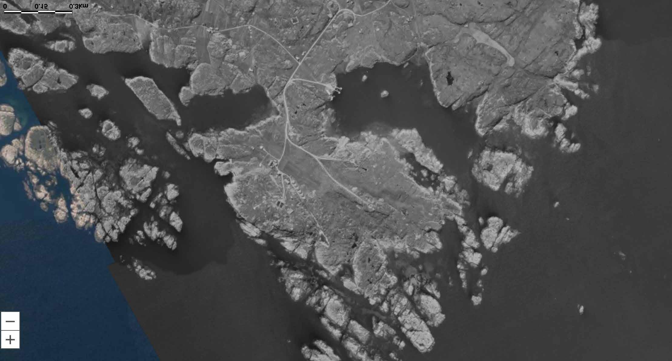
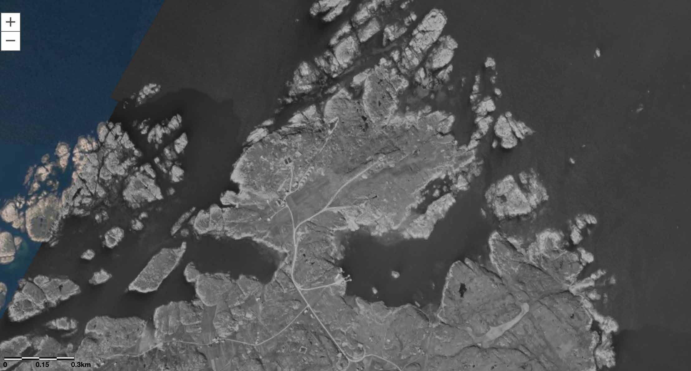
Hemnskjela is an island located in Hitra Kommune, along the county road dubbed “The salmon road” leading to the Islands Hitra and Frøya. The 79 people living on the island can easily commute to the mainland by bridge and a tunnel to Hitra.
106
107 hiding in the landscape
109
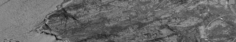
The Germans decided to create a coastal fort on the Northern part of Hemnskjela, in May 1941. 700 Germans along with 100 POW came to the small island and started building fortifications. The main artillery consisted of 6 “21 cm Mrs” cannons with a range of 10 km and 4 “15,5 cm K416” with a range of 15 km. These cannons were supported by 10 smaller connons. The main artillery were protected by multiple close defense positions with machine guns, flamethrowers and minefields. 7
111
112
observation room as part of the command bunker protruding out from the landscape
113
plan and section, existing structure, 1:200
FISHING IN HEMNSKJELA
Hitra is famous for being a hotspot for fishing. Fishermen from all across Europe, are travelling here to fish both from land or by boat.
The cut will be perfect for a group wanting to experience deep sea fishing, in close vicinity to the coast.
114
 Lange
Sei
Hyse
Mort
Ulke
Torsk
Lyre
Makrell
Lange
Sei
Hyse
Mort
Ulke
Torsk
Lyre
Makrell
115 collage
Ørret
the existing structure, lying underground
creating a cut in the landscape, pointing towards the monuments by the coast
adding a public underground atrium rental spaces, for people to explore the coast
design principles
116
117
model photo, 1:1000
pointing towards the monuments at the coast
118
creating a direct line between the command bunker and artillery position, signifying their alignment to each other
119
situation, 1:1000
120
a bunker with an ocean view, the steel plated pathway cutting through the hill
situational section 1:1000
121
adding an underground outdoor space
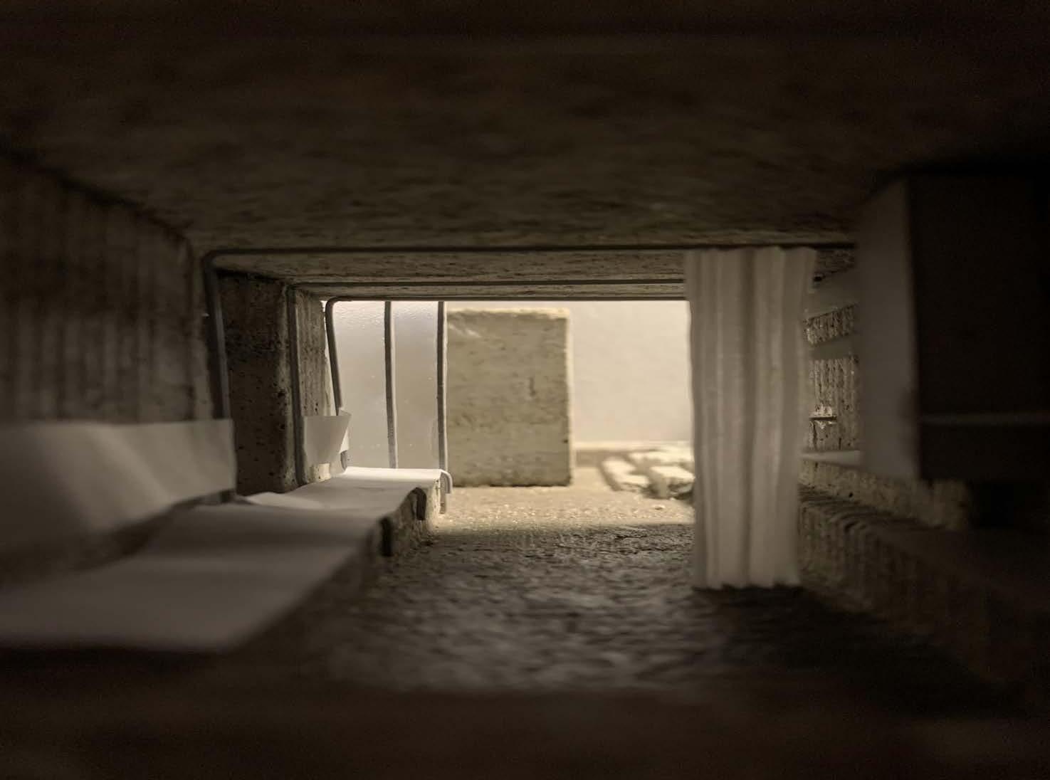
excavating the bunker, letting the light into the structure
an airflow through the openings and skylight prevent prevents moisture issues.
cutting into the bunker floor allows for different spatial situation and taller ceiling heights; creating a continous concrete landscape
122
principles
design
123
the cut at night
model photo, 1:50
observation post kept intact, open for everyone to enter and experience the enclosed space overlooking the horizon through narrow slits.
124
A B
C C
125
B
first floor, 1:100 A
126
A B
C
a fully insulated sleeping space separated from the living space
C
127
underground floor. 1:100
B
A
128
tall vertical space open to the sky cutting through the bunker pointing out to the sea
keeping the dark atmosphere of the bunker model photos, 1:50
129
130
entrance kept with the original ceiling height, experiencing the small dimensions and the existing, pragmatic design.
131
A, 1:100
section
Axionometry, 1:100
132
The dugout atrium gives room for maneuvering a cutting wagon operating a flexible diamond wire-cutter. Two holes, one in each corner of the cutout element need to be drilled through the depth of the wall, then the wire can be fed through the hole and connected to the cutting wagon through a pulley system.
The horizontal cuts are done with a smaller diamond saw blade, cutting through both the concrete and rebar. Following the cut, the floor is broken with a jackhammer before being taken out of the bunker in smaller pieces. The cut surface is leveled and insulated and covered with a floating concrete floor.
133

136
letting the light into the bunker
137
model photos, 1:50
138
139
C, 1:100
section
140
inner space seamlessly blending with the underground atrium, creating the illusion of a continuous concrete landscape extending from the bunker.
detailed section 1:20
details, 1:10
steel water board
sliding doors
floating concrete floor
rigid insulation
drainage
gravel
141
detailed section, 1:20
142
details, 1:10
a slender framework inserted in between the massive concrete shell facilitates seating on the existing floor level, lighting, storage and a curtain dividing the living space.
143
wool curtain
light fixture
steel hooks
steel sofa
144
watching the sky surrounded by earth and concrete detailed section, 1:20
details, 1:10
145
rigid insulation
steel plate
iso-chalk
146
the cut proclaims the man made horizontal lines sticking out of the landscape.
147
model photo, 1:1000
PROJECT 03:
0 I II III IV PROLOGUE CONTEXT STRATEGY PROJECTS The Tower The Cut The Lines EPILOGUE
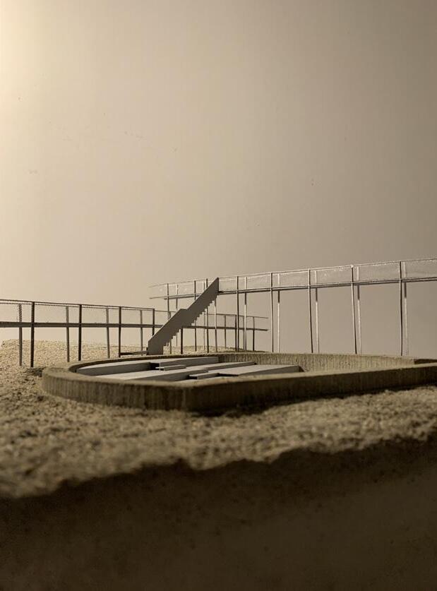
LINES
THE
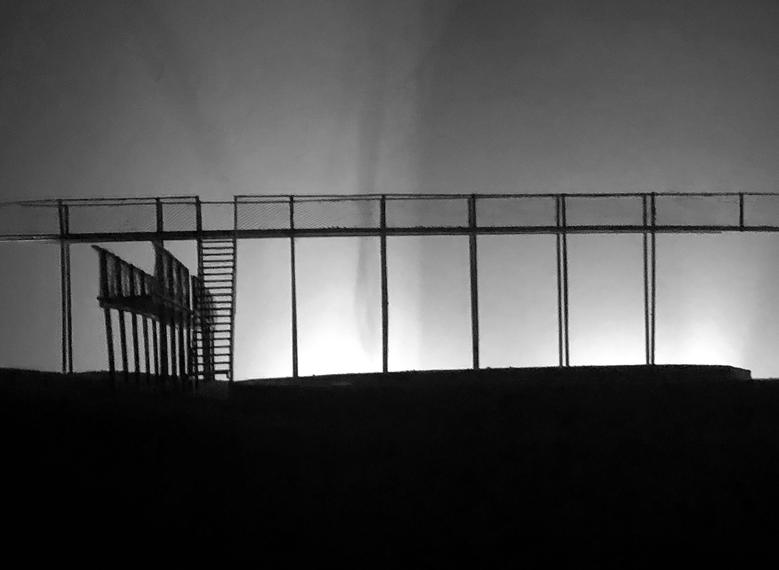
TITRAN
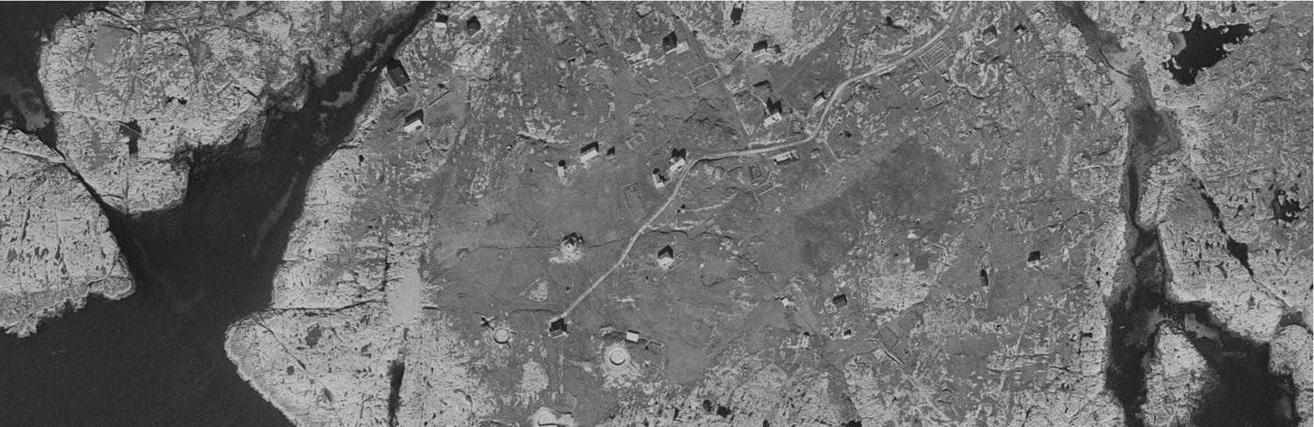
Frøya is an island north of Hitra. The island has a population of around 5200 people. Throughout history Frøya has been a safe haven for fishermen. Most people still live of the fish, but not to the same extent as in the past. The old tradition is clearly present in the fishing village of Titran with around 80 residents located on the western most point of the island.
150
the tallest lighthouse in Norway, Slettingen
151


153 Skala 1:500 Ganget med 2000 % fra 1.10 000

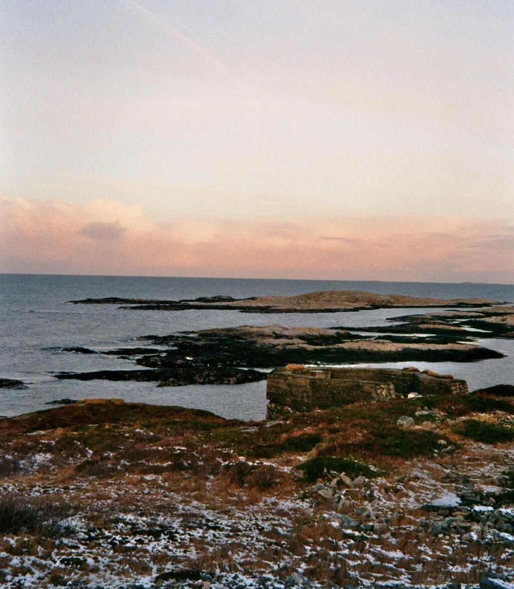
Just south of Titran lies the small islet of Stabben. The Germans started construction on the coastal fort on Stabben in May of 1941. They took over all the 14 houses situated on Stabben, the population of around 600 people in Titran doubled as the Germans occupied the small village. The fort was equipped with 4 “15 cm K16” cannons with a range of 22 km. The artillery was only used once during the war when the Germans shot one of their own ships, because they failed to identify themselves properly. The Germans planned to construct an u boat base on Frøya, but the construction never started. 8
155
Skala 1:500 Ganget med 2000 % fra 1.10 000
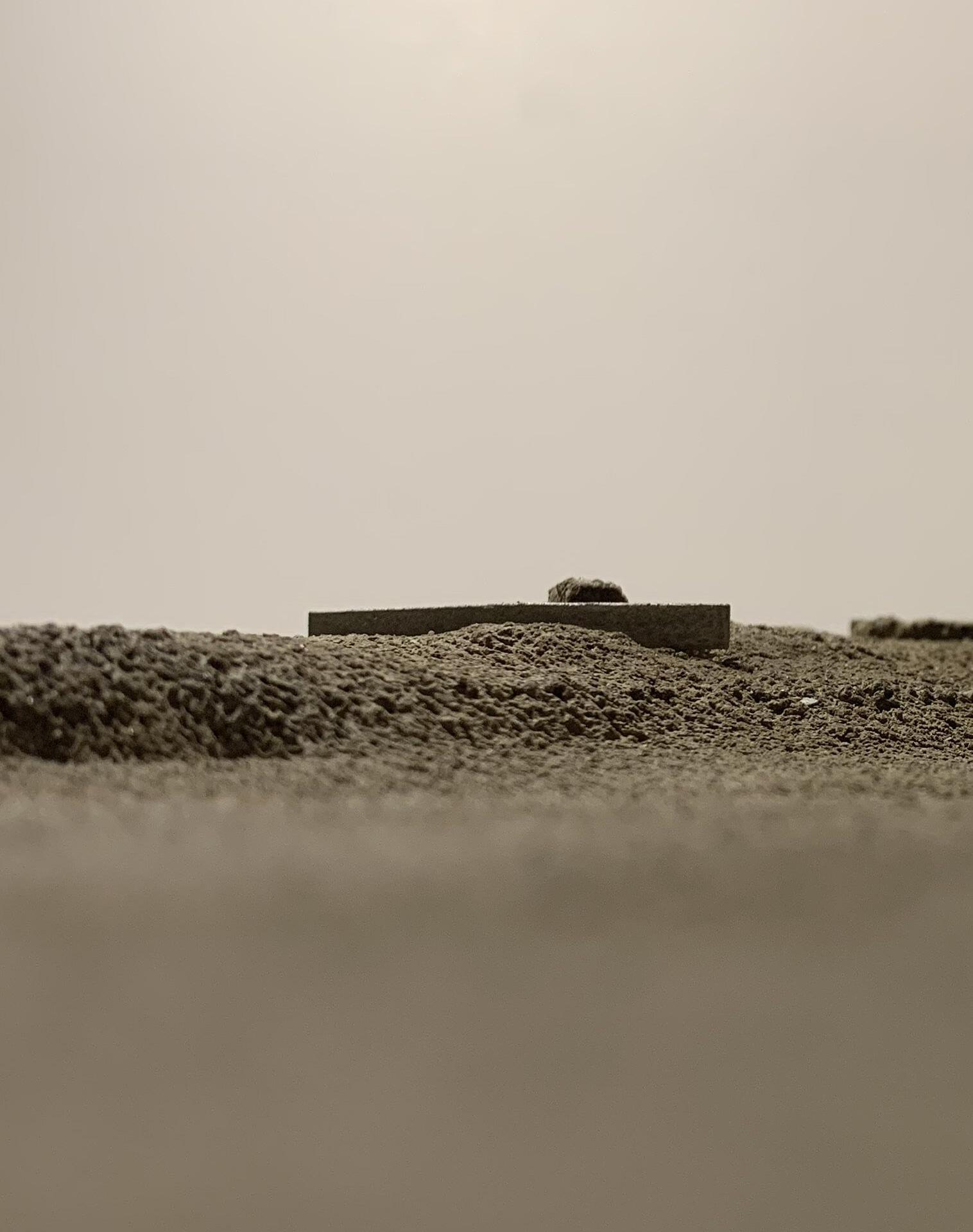
circular void pushing out against the landscape
156
clear geometric shape cut into the landscape
plan and section, existing, 1:200
157
WEATHER PHENOMENA IN TITRAN
Titran is known for its harsh weather, but beautiful summers, and experiences a lot of tourism.
a unique place for feeling the powerful forces of nature, a spectacle of big waves crashing against the bare rock-face with strong winds rushing across the barren landscape.
158
159 weather collage
connecting the monuments with bridges
entrance points to the lines
the lines meet the circular monuments at tangent; dividing the landscape into behind and in front of the monuments.
design principles
160
161
model photo, 1:50
walkway floating above the monument
162
interconnected lines marking the monuments position in the landscape
163 situation
plan, 1:1000
164
situational section 1:1000
165
lines accentuating the bulging terrain connecting the monuments together
heavy steel furniture lowered into the artillery positions, one for looking at the stars, one for observing the sea, and one for the reflection of the sky
rented canvas can be attached to the construction wherever you want to stay for a night
166
design principles
167
model photo, 1:1000
a continuous path elevated above terrain, a gathering spot for experiencing the waves.
168
A
169
A
plan extract, 1:100

172 the lines meet
173
overlooking the monument model photos, 1:50
174
B
facilities placed on the entrance of each line
175
B
plan extract, 1:200
176
177 section 1:200
178
stairs marking a break in the path
179
model photo, 1:50
load bearing railing functioning as a continuous beam, allowing for sections with bigger spans
axionometry, 1:100
180
The construction consists of repetitive frames stiffened with external diagonal tension wires, connected together by horizontal elements along with overlapping cross diagonal stiffening. The columns are fixed to the ground, while pinned in the top joint in order to reduce the buckling length, to enable a slender column construction. The column anchors can be hand drilled and chemically fixed.
The railing is a part of the construction, functioning as a truss beam spanning between each frame. This allows for slender dimensions as well as the possibility to add more trussmembers to substitute for columns supporting longer spans and cantilevers.
181
182
inner and outer canvas, one for shelter another for sleeping
detailed section, tent, 1:20
details, 1:10
4 x L-profiles
steel mesh
steel-grate
fork-connection
diagonal steel wires
steel-rod
outer canvas
steel-rod weight
outer canvas
inner canvas
steel rods
coloumn-base
steel plate
coloumn-anchor
chemical anchor
183
184
detailed section, tent,1:20
folding up the canvas, enjoying morning coffee with a view
details, 1:10
4 x L-profiles
steel mesh
fork connection
canvas connection point
outer canvas
inner canvas
steel rod connection
coloumn-base
steel plate
coloumn-anchor
chemical anchor
185
186
detailed section, 1:20
tension of almost touching the concrete, marking a transition into the space of the monument
details, 1:10
coloumn-base chemical anchor
coloumn-anchor
steel plate amfi placed on top of existing
steel plate 187
188
189
model photo, 1:1000
EPILOGUE
0 I II III IV
PROLOGUE CONTEXT STRATEGY PROJECTS EPILOGUE Conclusion
Reference list Credits
CONCLUSION
This thesis presents an alternative strategy of protecting our cultural heritage. Solving an important problem issued by governmental institutions. Creating a discussion of how to relate to problematic heritage through new architecture. Arguing the bunkers to be architecture, reflecting the potential that lies within the concrete structures. Not letting its problematic history cloud our judgment during designing, being more free in our search for pure architectural qualities. Creating architecture that can relate, but also compliment the unique concrete structures.
The bunker as a typology was completely unknown to us, and a big portion of our thesis has been spent on understanding the bunker. It has been interesting working with such a unique typology both in form and function, associated with very strong feelings. Finding a way not to limit the architecture to function as memorial sites or museums, developing architecture that can sustain a broader reach.
The structure of the thesis gave us the opportunity to work on a variety of scales. From big landscape interventions all the way down to furniture-details. By limiting the projects to simple programs, we were able to focus on the important meeting points, and spend time on refining our approach to each monument.
192
193
REFERENCE LIST
Pictures
Dujardin F. (2018) 51N4E , Bourbouze & Graindorge Alvéole saint-nazaire. (online). Available at: https://divisare.com/ projects/432599-51n4e-bourbouze-graindorge-filip-dujardin-philippe-ruaultalveole-saint-nazaire. (Accessed: 10.05.23)
Def Image. (2016) John Pawson converts WW2 bunker into museum of Southeast Asian art in Berlin (online). Available at: https://www.dezeen.com/2016/11/23/ john-pawson-conversion-second-world-war-concrete-bunker-art-museumberlin-germany/. (Accessed: 10.05.23)
Tenwiggenhorn, N. (2016) John Pawson converts WW2 bunker into museum of Southeast Asian art in Berlin(online). Available at: https://www.dezeen. com/2016/11/23/john-pawson-conversion-second-world-war-concretebunker-art-museum-berlin-germany/. (Accessed: 10.05.23)
Scherl, Bridgeman Images (1942) Construction of a German coastal fortification at the Atlantic Wall (online). Available at: https://www.bridgemanimages.com/en/ noartistknown/construction-of-a-german-coastal-fortification-at-the-atlanticwall-1942-b-w-photo/black-and-white-photograph/asset/2981312 (Accessed: 10.05.23)
Wette. (1944). Bild 1011-263-1580-13. Available at: https://fr-academic. com/pictures/frwiki/66/Bundesarchiv_Bild_101I-263-1580-13%2C_ Frankreich%2C_Atlantikwall%2C_Soldat.jpg (Accessed: 09.05.23)
Fadinger, S. (2016). File:Haus des Meeres 2.jpg. Available at: https://commons. wikimedia.org/wiki/File:Haus_des_Meeres_2.jpg (Accessed: 11.05.23)
Books
Postiglione, Gennaro. The Atlantic Wall Linear Museum. Italy: Litogì, 2005.
Fjørtoft, Jan Egil. Tyske kystfort i Norge. Norway: Agder presse, 1983.
194
Articles
Mairs, Jessica. (2018). John Pawson converts WW2 bunker into museum of Southeast Asian art in Berlin. Tilgjengelig fra: (https://www.dezeen.com/2016/11/23/ john-pawson-conversion-second-world-war-concrete-bunker-art-museumberlin-germany/ (Accessed: 11.05.23)
Isdale, I. (2017) Humanity: A Moral History of the Twentieth Century. Available at: https://www.abc.net.au/news/2017-08-20/why-remembering-wars-is-amoral-concern-for-all-of-us/8819476 (Accessed: 09.05.23)
Kystmuseet. (n.d.) Hemnskjela under krigen. Available at: https://kystmuseet.no/ hemnskjela-historie (Accessed 03.02.23)
Forsvarsbygg. (2018). Tarva fort og signalstasjon. Available at: https://www. forsvarsbygg.no/no/verneplaner/landsverneplan-for-forsvaret/trondelag/ tarva-fort-og-signalstasjon/ (Accessed: 08.05.23).
Elmar, C;K. (2017). Bør vi la deler av krigsminnene svinne hen? Available at: https://forskning.no/historie-partner-andre-verdenskrig/bor-vi-la-deler-avkrigsminnene-svinne-hen/1242196 (Accessed: 08.05.23).
Gaustad, J. (2022). Krigsårene 1940-1945 på Titran. Available at: https://www. hitra-froya.no/hfigamledager/i/8QMlrE/krigsaarene-19401945-paa-titran/ (Accessed: 08.05.23).
Holme, J. (2015). Krigens kulturminner. Available at: https://open-eye-openmind.com/wp-content/uploads/2020/10/krigens_kulturminner-jan15-fraregjeringen-til-ordforere.pdf (Accessed: 08.05.23)
Musée Mémoires (n.d.) Available at: https://museememoires39-45.fr/en/theatlantic-wall/ (Accessed: 05.05.23)
195
CREDITS
We would like to thank our supervisor, Stuart Dickson for inspiring tutorials throughout the semester
Bunji Izumi for construction-discussions
Our fellow students for nice discussions and good times
And our friends and family for all the support
196
197
DWELLING MONUMENTS
