


River Country MONTANA’S 800.653.1319 MISSOURIRIVERMT.COM MORE ROOM TO ROAM
Missouri
Printed in the USA for free distribution. All rights reserved. Reproduction in whole or in part without written permission of Missouri River Country and Northern Rockies Publishing is prohibited.
©2022
Missouri River Country and Northern Rockies Publishing
Written and produced by Rick and Susie Graetz, Northern Rockies Publishing. Design: Designworks, Kalispell, MT. Pre-Press: Digital Planet, Kalispell, MT.
Produced with accommodation tax funds in cooperation with Missouri River Country.
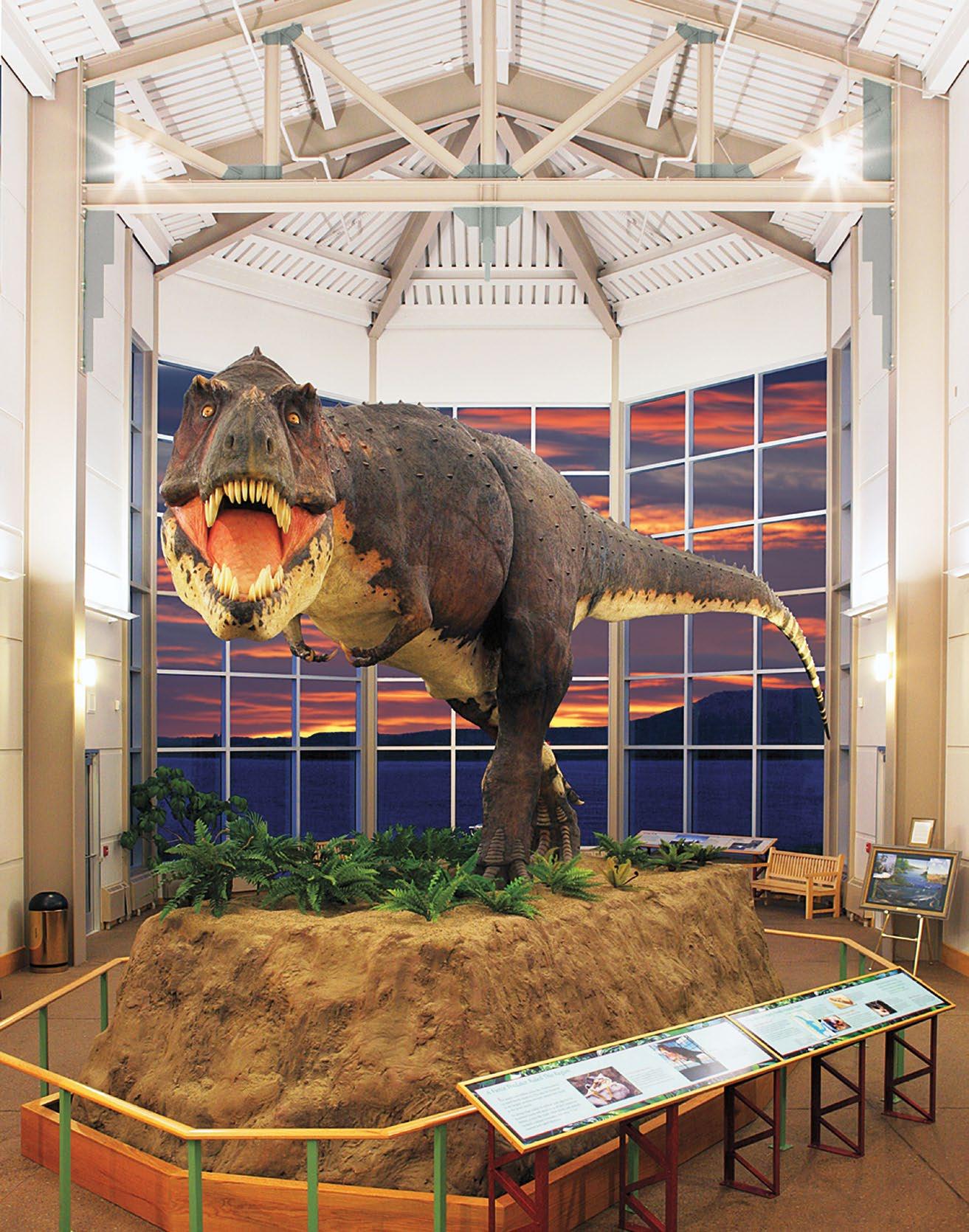
Cover photo: Pecks Rex at the Fort Peck Interpretive Center | US Army Corps of Engineers – Fort Peck Project
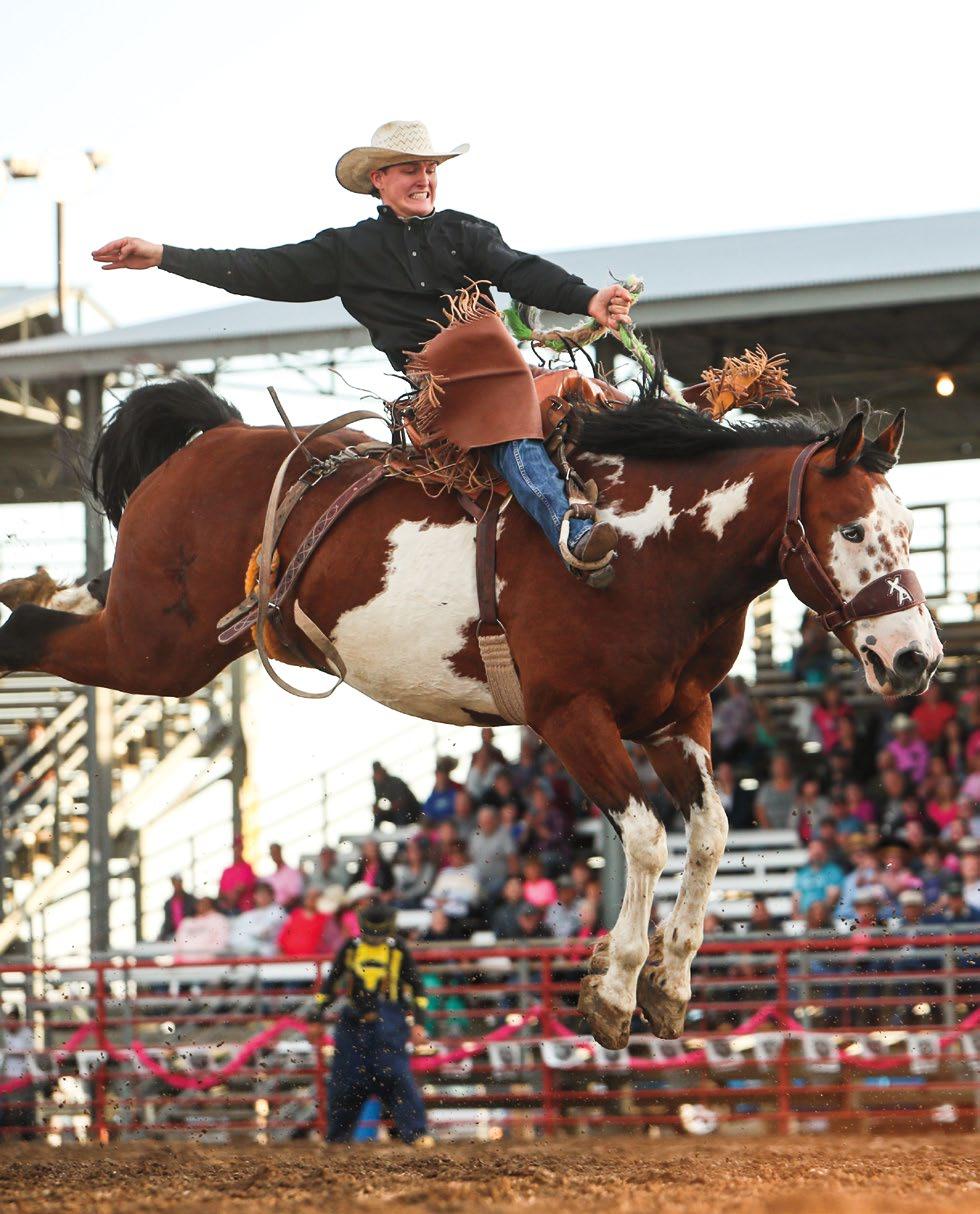
Wolf Point Stampede | Hailey Rae Photography
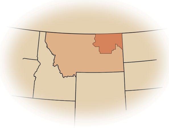
Montana’s Missouri River Country
CONTENTS
An Invitation. . . . . . . . . . . . . . . . . . . . . . . . . . . . . . . . . . 3
Under Montana’s Biggest Sky . . . . . . . . . . . . . . . . . . . 4
Montana’s Hi-Line Road US Hwy 2 . . . . . . . . . . . . . . . . 6
The Great Northeast from the Bitter Creek Wilderness to Dakota Line . . . . . . . . . . . . . . . . . .16
The Southern Passage from Sand Springs to the Yellowstone River. . . . . . . . . . . . . . . . . . . . . . . . . .24
Map of Montana. . . . . . . . . . . . . . . . . . . . . . . . . . . 34
Wildlife and Wildlife Refuges . . . . . . . . . . . . . . . . . . .36
Skies of Missouri River Country. . . . . . . . . . . . . . .42
Dinosaur Trail . . . . . . . . . . . . . . . . . . . . . . .46
Big Waters of Missouri River Country . . . . . . . . . . .48
Hunting & Fishing. . . . . . . . . . . . . . . . . . . . . .62
Tribal Lands and Original Peoples . . . . . . . . . . . . . 68
Birding Trail. . . . . . . . . . . . . . . . . . . . . . . . . . 69
Accommodations. . . . . . . . . . . . . . . . . . . .70
Information Sources. . . . . . . . . . . . . . . . . . . .72
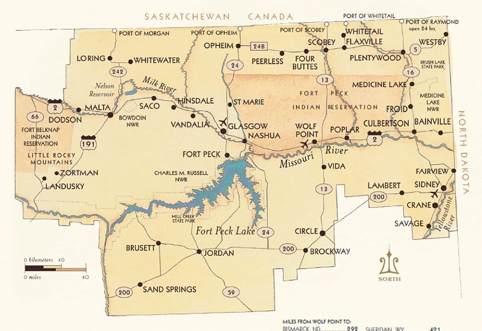
Spokane, WA 703 Sheridan, WY 421 Billings, MT 294 Helena, MT 411 Great Falls, MT 321
Missouri River Country
P.O. Box 118, Fort Peck, MT 59223
P: 1-800-653-1319
E: 2mtmrc@nemont.net www.MissouriRiverMT.com
WOLF POINT • GREAT FALLS • HELENA • BILLINGS • • SHERIDAN, WY SPOKANE, WA • BISMARK, ND • REGINA, SASKATCHEWAN •
Missouri River Country | 1
The Missouri River Country Website
Every two years, Missouri River Country publishes a new travel planner, and its website is continually updated.


Our website is an encyclopedia to Northeast Montana. The Missouri River Country site contains numerous articles on all aspects of this cor ner of Montana, spectacular photography, trip planning ideas, places to stay and eat, activities, things to do and see, and events. We welcome you to use it along with this current edition as your guide to a beautiful and undiscovered destination, Missouri River Country.
Follow us on:
2 | Missouri River Country
www.MissouriRiverMT.com
The wealth of opportunities for adventure amidst the natural treasures of Missouri River Country cannot be overstated. If you love big water recreation, wildlife sightings, prairie topography, wild country, paleontology, uncluttered views that go on forever, the romance and colorful history of the Old West, night skies brilliant with stars, and just plain being in the landscape that gives you room to breathe, then a journey to Montana’s northeast corner to explore this incredible expansive geography should be on the top of your bucket list!

The welcome mat is out, come visit us, you won’t be disappointed.
Missouri River Country | 3
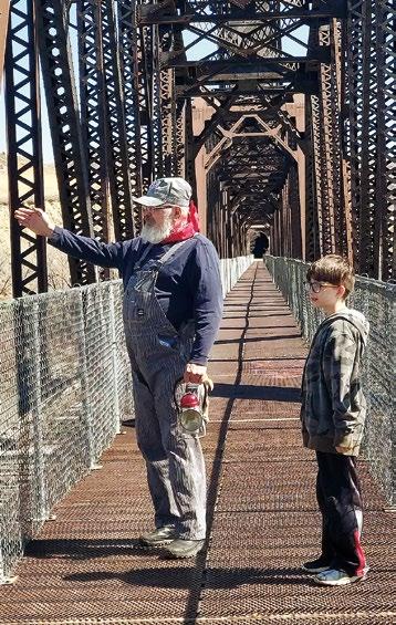
Judge Ray Trumpower President Missouri River Country Board of Directors
More Room to Roam...
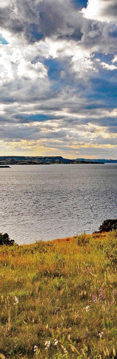
Spring on the Montana prairie near Malta | Rick and Susie Graetz
Judge Ray Trumpower and young visitor | Cheryl Trumpower
Under Montana’s Biggest Sky...

This is Missouri River Country
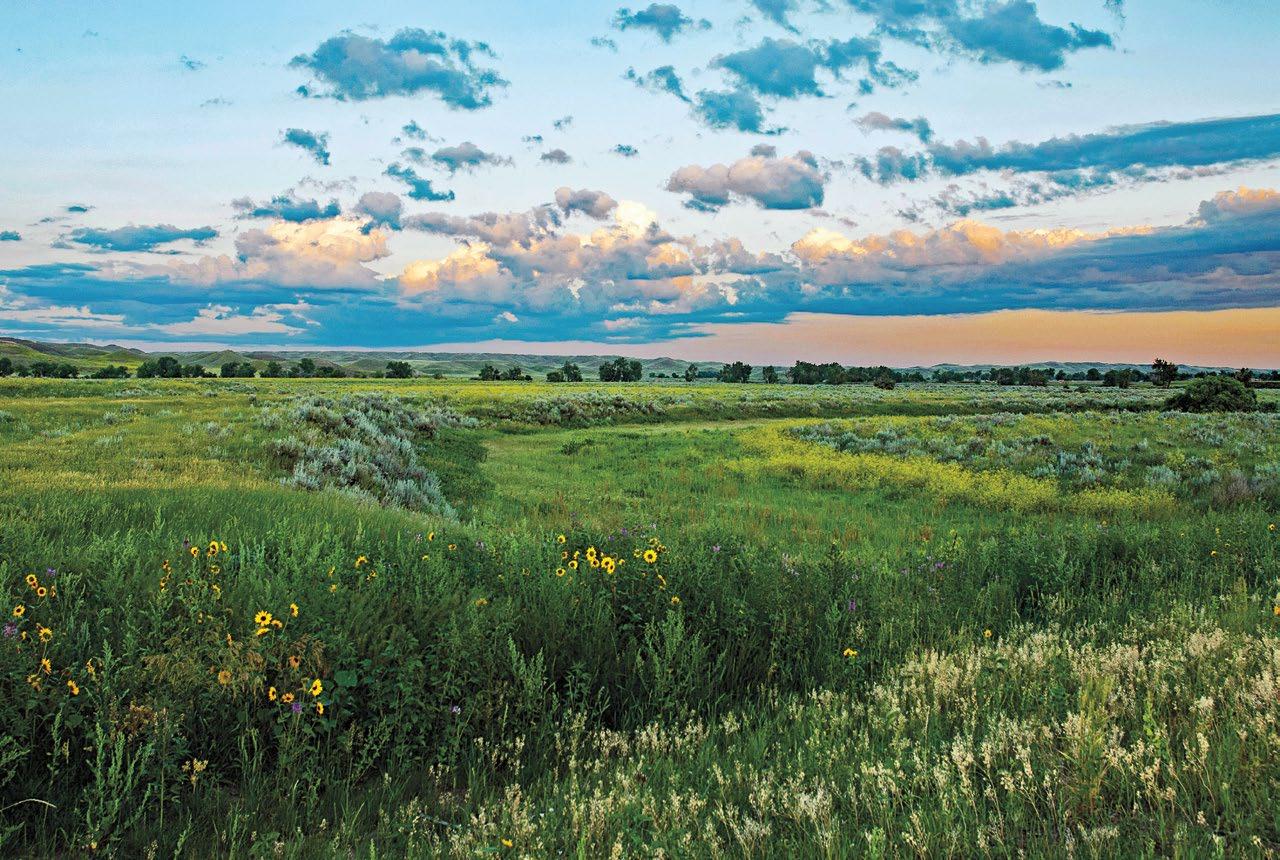
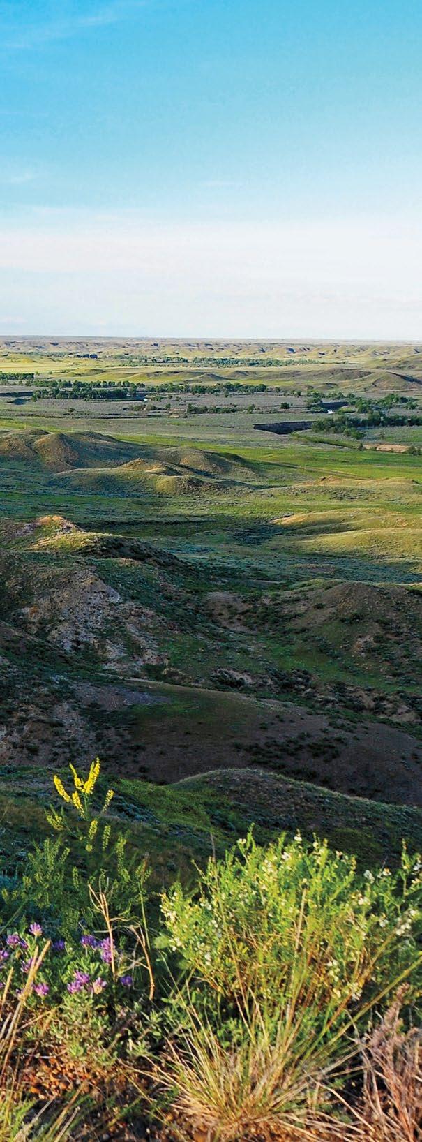
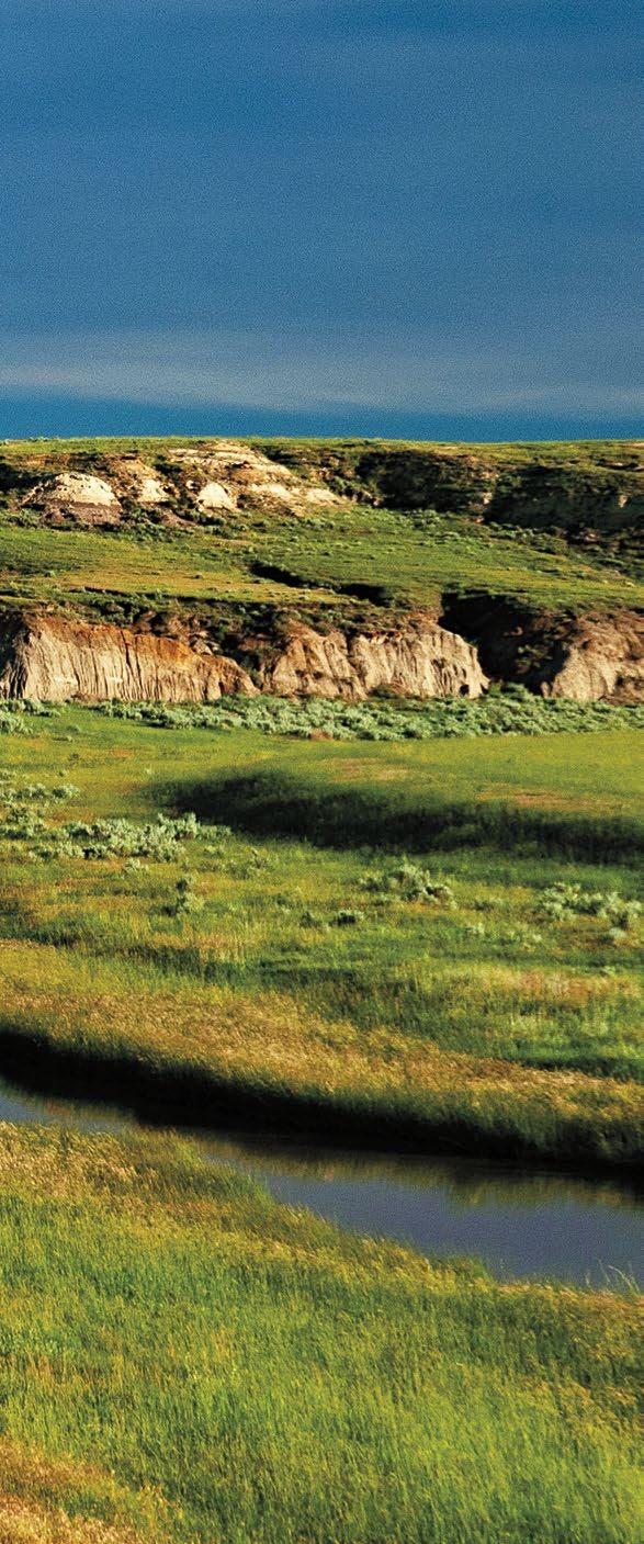
Montana’s prairie lands surging east of the Northern Rockies are the most unique and beautiful in the nation. Nowhere on the North American continent can one find such a magnificent gathering of simple grandeur— river breaks, island ranges, buttes, badlands, grasslands, wildlife refuges, and lakes—as to be found in Montana’s portion of the Great Plains.
It’s a distinct region unto itself and one of America’s great pieces of geography. Space, much of it undis turbed, is its most celebrated commodity. This vast territory of unending sky delivers a feeling of no borders or confinement—a place where a human can stretch and breathe.
At first, the openness, immensity, and distances may seem overpowering. Gradually, though, you begin to notice the beauty and splendor... cottonwoods along a small creek, a lone tree silhouetted on a hillside, waves of wheat dancing in the summer wind, the first rays of sun illuminating sandstone cliffs, delicate snow patterns drifted against a weathered barn, the northern lights shimmering across the night horizon, antelope moving quietly through a sagebrush-covered prairie, and the soft fusion of earth and sky on vistas that seem endless.
Couple this splendor with great sweeps of country unaltered through time and chronicles extending back less than two centuries, and watch one of the most fascinating places in America unfold.
This is Northeast Montana... This is Missouri River Country
Let the pages that follow take you on a journey of dis covering new territory and the people and communities that will welcome you…
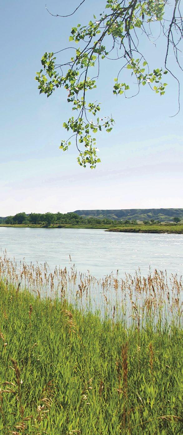
North of Malta, the Milk River Valley | Rick and Susie Graetz
Missouri River Country | 5

6 |
Missouri River Country

Montana’s Hi-Line Road— US Highway 2
Missouri
| 7
Missouri River east of Sand Creek | Rick and Susie Graetz
River Country
Montana’s
US Hwy 2
Hi-Line Road—
Malta: Zortman and the Little Rockies— Saco—Hinsdale Vandalia
Glasgow: Fort Peck—Nashua—Frazer—Oswego
Wolf Point: Poplar—Brockton
Capturing many of the landforms that accentuate Missouri River Country
Frequently used in writings on the state, the term Hi-Line refers to US Hwy 2 as it traverses the windswept glaciated plains and shallow valleys of northern Montana. From Browning, just east of Glacier National Park, its trajectory heads straight to the North Dakota state line.
MALTA
Good lodging and dining make this historic Hi-Line commu nity the place to stay while exploring the western portion of Missouri River Country. Located at the junction of US Hwys 2 and 191, the town gives easy access to the Charles M. Russell NWR, the Little Rocky Mountains, the Milk River country to the north, Bowdoin NWR, and Nelson Reservoir.
Reference the Missouri River Country map in this guide.
In Malta:
The Phillip’s County Museum holds a wealth of locally found, pre-historic dinosaur and fossil remains. Also, an extensive col lection of Plains Indians’ artifacts and tableaus depicting what life was like for Native Americans and early-day settlers on the north-central Montana prairie. Learn the story of the outlaw Kid Curry’s famous train robbery of 1901. (406) 654-1037

H.G. Robinson House and Gardens. H.G. Robinson wanted to be a cowboy and left New York for Montana at just 19 years of age. The house, shipped out on the railroad in 1898, is a prime example of a turn-of-the-century mail order home. Tours are available upon request; ask at the Phillips County Museum.
The Great Plains Dinosaur Museum and Field Station. Located in the heart of “dinosaur country,” it is a unique stop along the Montana Dinosaur Trail. Many extraordinary fossils: fish, invertebrates, turtles, plants, and crocodiles are featured. Of special note is a variety of Jurassic and Cretaceous dino saur species, such as Triceratops, Stegosaurus, new species of Sauropod and raptor, and superbly preserved juvenile and adult Hadrosaurs. Summer field dig programs for adults and children are also offered. (406) 654-5300 dinosaur@itstriangle.com greatplainsdinosaurs.org
Blue Ridge Brewing. Fine craft beers brewed locally. 320 S 1st East. (406) 654-2855
Marian Hills Golf Course. A nine-hole course and restaurant, open to the public. Located south of town off of US Hwy 191. (406) 654-1250
Places of interest near Malta:
Charles M. Russell National Wildlife Refuge. Considered the crown jewel of the nation’s wildlife refuge system, it is one of America’s great prairie wilder ness landscapes. One of the best accesses to its western edge is the Slippery Ann Elk Viewing Area
8 | Missouri River Country
on the north side of the Fred Robinson Bridge. Just south of the passage over the Missouri River and up the hill, you can get more information at the Sand Creek Wildlife Station. (406) 526-3493 fws.gov/refuge/charles-m-russell | fws.gov/refuge/charles-mrussell/fort-peck-interpretive-center
Zortman and the Little Rockies. From a distance, the moun tains resemble atolls rising from the prairie sea of north-central Montana. Although not lofty, they are visible from 75 miles away. Indians migrating through this territory called them “the Wolf Mountains.”
From 1870 to 1900, this piece of geography was the setting for the Old West. The characters of those times... cattle barons, gold seekers, outlaws, cowboys, vigilantes, wood-hawkers, trap pers, whiskey traders, rustlers, and horse thieves, went about their everyday business here.
With a quiet demeanor and photogenic white clapboard church, it is hard to believe the place was once a rip-snorting, die-hard mining town. Home to the successful Ruby Gulch gold mine, it is estimated that before the shut down in 1949, the mines at Zortman, Landusky, and Beaver Creek produced $125 million in gold. Lodging, meals, and camping are available.


Bowdoin National Wildlife Refuge. Seven miles east of Malta on old Hwy 2, the refuge is one of the best nature-viewing areas
in Montana. More than 230 different species of birds and water fowl have been identified. Home to a large pelican rookery, Bow doin is also considered a prime spot to see pronghorn antelope.
A 15-mile circular car route through the refuge’s 15,500 acres opens up superb wildlife sighting opportunities. While hiking is allowed anywhere here, a dedicated 1/2-mile walking trail loops around Display Pond. Early morning and late afternoon in the spring and fall are the best times to visit. In the autumn, waterfowl and bird hunting are permitted in designated areas. (406) 654-2863 | fws.gov/bowdoin
Missouri River Country | 9
Bowdoin National Wildlife Refuge | Rick and Susie Graetz
St. Joseph Church in Zortman, MT Burnt Image Photography

6 | Missouri River Country
Nelson Reservoir
10 | Missouri River Country
Rick and Susie Graetz
Nelson Reservoir. East of Malta, an access road leads to one of northeast Montana’s popular water recreation and fishing areas. Ranked the number one walleye spot in the state, the reservoir produces record-class walleye, yellow perch, and northern pike. Amenities include camping, swimming, boating, picnic shelters, RV sites, restrooms, showers, and year-round fishing. In winter, ice fishing is a draw. In the Nelson vicinity, wetlands near the Milk River attract white-tailed deer, upland game birds, beaver, mink, and numerous small mammals. Waterfowl, shorebirds, raptors, and songbirds come through the area to rest and feed during spring and fall migrations.
Sleeping Buffalo Hot Springs Resort. East of Malta on US Hwy 2, you’ll find mineral hot springs, sauna, swimming pool, lodge rooms, cabins, RV and tent camping facilities, and ice castles for winter ice-fishing. (406) 527-3320

Saco. In 1999, it held the Guinness World Record for making the world’s largest hamburger patty; no small feat for a town of only 197 residents. It took the beef from 16 cows to create a 6,040-pound burger that sizzled on a monster 24-foot pan for one hour and forty minutes. Lodging, meals, camping, groceries, and gas are available
The Huntley School. This is the one-room county schoolhouse where Saco student Chet Huntley, who went on to become a famous TV newscaster, once studied. Walk in, the door is open.
Hinsdale. According to local lore, about 1889 it was named for Reverend Hinsdale, a friend of James J. Hill, builder of the Great Northern Railway. In 1898, a devastating flood of the Milk River inundated the settlement and residents simply packed up and moved to safer ground about 1½ miles to the west.
Rock Creek Road. Eighteen miles up the road, you’ll find some of Montana’s most spectacular and seldom visited badlands. You are skirting the western edge of a true prairie wilderness… the Bitter Creek region. This is cowboy country. Ranches are significant, and the distance between human presence is con siderable. Looking carefully along the ridges and hills above the creek, you’ll note faint remains of trails and tipi rings used by early-day Native Americans, including Sitting Bull.
GLASGOW
Around 1887, by using the old “railroad naming method”— spin a globe and stop it with your finger, Scotland gave the new town a name. The Homestead Act and the Milk River Irrigation
Project delivered droves of folks to the area. Construction work on Fort Peck Dam in the late 1930s brought in more than 10,000 workers, allowing Glasgow to prosper during the days of the Great Depression.
Today, Glasgow is a flourishing community with an agriculture and service driven economy. Its location gives access to all the wonders of Fort Peck Lake, the C. M. Russell NWR to the south, and the prairie wildlands of Bitter Creek on the north. Excellent lodging and dining make this the place to stay while exploring the central area of Missouri River Country.
In Glasgow:
Valley County Pioneer Museum. A terrific place to study the vibrant past of lands drained by the Milk River. The collections range from Native Americans to the Homestead Era to the wild life and plants Lewis and Clark noted in their journals. Other displays include dinosaur bones, Fort Peck Dam history, the Buffalo Bill Cody bar, and the history of local aviation. Winter: Wed–Sat 10-4, Summer: Mon–Sat 9-5 (406) 228-8692
Children’s Museum of Northeast Montana. Provides handson activities for kids and has a World Wildlife Exhibit. (406) 228-4FUN nemtchildrensmuseum.com
Sunnyside Golf & Country Club. Open to the public, this nine-hole course is located on Skylark Road. (406) 228-9519
Missouri River Country | 7
Missouri River Country | 11
Sleeping Buffalo | Jamie Blotsky
Busted Knuckle Brewery. This craft brewery is a hit with a vintage car theme and a creative, fun décor. Eugene’s Pizza de livers, and a local food truck hangs out nearby in the summer. 303 1st Ave. South. (406) 228-2277
Centennial Park Disc Golf Course. On the east side of town, take Highland Drive to this nine-hole “folf course.”
Places of interest near Glasgow:
Bitter Creek Wilderness Study Area. These 59,660-acres and the surrounding Bureau of Land Management (BLM), state, and private lands harbor a vanishing prairie that once defined the Northern Great Plains. Along with Canada’s Grasslands National Park, this prairie forms one of the most extensive intact grasslands left in North America. “Not only did it escape the plow, but you can hike all day and not see an other person,” says John Carlson, BLM biologist. Hikers can wander through the vast, rolling semi-arid grasslands, broken by glaciated badlands and dotted with tipi rings. Boot-to-knee-high native grasses create a mosaic of vege tation that sustains longspurs, Sprague’s pipits, sage grouse, long-billed curlews, and other prairie birds. The Audubon Society recognizes Bitter Creek as a Globally Important Bird Area. Visitors might also spot pronghorn and, if espe cially lucky, the seldom-seen swift fox.
To access Bitter Creek from Glasgow, drive 20 miles west on Hwy 2 and turn north onto Britsch Road for 15 miles. Be aware of the weather as the gravel-then-dirt road becomes impassable when wet. This is the case with many of the off-highway routes. For more information, contact the BLM Glasgow field office. (406) 228-3750
Fort Peck. Eighteen miles south of Glasgow via Hwy 24, the town of Fort Peck is long on colorful history. In the late 1860s, the old Fort Peck trading post served as the Indian agency for

the Assiniboine, Sioux, and several other tribes until 1878, when it was moved to the current location in Poplar. By 1881, the dynamic Missouri River had severely undercut its riverbank, and the post was abandoned. In 1933, a new town named Fort Peck, located about 2 miles north of the original, was built to house Army Corps of Engineers’ employees involved in constructing Fort Peck Dam.
The Fort Peck Interpretive Center and Museum. Step through the doors into the lair of a “gi-normous,” life-like, open-jawed T-Rex named Peck’s Rex, and let the adventure begin. Get up close and personal with the inhabitants of Fort Peck Lake and the Missouri River as they swim through two enormous aquariums. Visit the skeletal cast of the T-Rex discov ered 20 miles southeast of town and other dinosaur fossils.
Animals of the CMR Refuge, hands-on interpretive displays, the history of Fort Peck Dam, and a false-fronted, early 20th-century street scene await you.
Ask about kids’ fishing and hiking trails. (406) 526-3493 fws.gov/refuge/charles-m-russell/fort-peck-interpretive-center
Fort Peck Summer Theatre. For decades, with its seating for 1,200, it was the largest facility of its kind in the state. Today, professional summer stock actors bring laughter and music back
12
| Missouri River Country
Bitter Creek northwest of Glasgow, MT | Rick and Susie Graetz
to this exotic and historic building. Open May thru Aug; show time 4:00 pm. (406) 228-9216
Kiwanis Park. Shady cottonwood trees, picnic shelters, re strooms, and grills make this perfect for hosting family reunions, BBQs, and other large or small events. Located in front of the Kiwanis Downstream Campground, it is within walking dis tance of the Fort Peck Interpretive Center. The paved, accessible three-mile Beaver Creek Nature Trail commences here and leads through wildlife habitat along the Missouri River.
The Fortress Disc Golf Course. Eighteen holes with two layouts. Open year-round, no fees. Located next to the Down stream Campground.
Fort Peck Lake. This enormous swath of geography, encompass ing more than three million acres, showcases prairie splendor. See a section in this guide for more information

Missouri River Country | 13
The Fort Peck Interpretive Center | Rick and Susie Graetz
Lewis and Clark Overlook. The viewpoint and interpretive signage are 1/2 mile east of the powerhouses on MT Hwy 24.
WOLF POINT
The most accepted version of how this town came to be named is quite colorful. During a miserable 1860s winter, wolfers killed several hundred gray wolves that froze before they could be skinned for their pelts. Carcasses stacked in high piles awaited the steamboats expected that spring. Before the river ice broke, Indians overtook the camp. The putrid, decaying piles left behind became a visible and scented landmark, especially to those traveling the water.
In Wolf Point:
Wolf Point Area Museum. Showcases artifacts of early settlers and Indians, including clothing, arrowheads, and weapons. Open May 15th through Sept 15th. (406) 653-1912
Doc’Z Missouri Breaks Brewing. Award-winning craft beer right on Main Street. (406) 653-1467
Airport Golf Club. A nine-hole course open to the public, ex cept Tues, Wed, and Thurs evenings. Off of Golf Club Rd just east of town. (406) 653-2161
Lewis and Clark Disc Golf. A nine-hole course along the Missouri River. Head south out of a town a few miles,
turn at the Lewis and Clark Fishing Access Site. www.lewisandclarkdiscgolf.com
Places of interest near Wolf Point:
Poplar. Headquarters for the Fort Peck Indian Reservation was named for the widespread stands of trees on the banks of the Poplar River. The reservation is home to the Dakota—LakotaNakota (Sioux) and Nakota (Assiniboine) nations.
Fort Peck Community College. Tribally owned and charted by the Fort Peck Assiniboine and Sioux tribes, FPCC is in Poplar and has a satellite campus in Wolf Point. fpcc.edu
Poplar City Museum. Located in the old Tribal Jail. Built in 1920, it is now on the national historic register. The old cells are used to display beadwork and quilts.
Hi-Line Community Events
Rodeos, county fairs, and pow wows are highlights of the spring and summer season in much of Missouri River Country. View each community’s website or call the chamber of commerce for up-to-date information.
Zortman: 4th of July parade through town and fireworks at night.

14 | Missouri River Country
Hinsdale and the Milk River Valley | Rick and Susie Graetz
Something ‘s brewing in Missouri River Country!

Take a break from your travels and enjoy a carefully-crafted brew at one (or more!) of these independent microbreweries:.

MALTA—Blue Ridge Brewing
GLASGOW—Busted Knuckle Brewery
WOLF POINT—Docz Missouri Breaks Brewing
SIDNEY—Meadowlark Brewing
SIDNEY—1035 Brewing
Malta: Phillips County Fair, 1st weekend in August. Pushing over 100 years, it is Montana’s longest continuous running county fair. Live concert, Demolition Derby/AMX races, Indian relay races/chariot races, 4-H displays and auction, and carnival.
Dino Days, celebrating the pre-historic animals that once roamed this part of our planet. (406) 654-1776
Saco: The 59th annual Fun Days is always over Labor Day weekend. Lots of activities… large parade, rodeo, street dance, softball, free-will BBQ, and cornhole. (406) 527-3434
Hinsdale: The lively Milk River Days and Rodeo is celebrat ed every 4th of July.
Glasgow: Milk River Catfish Classic, 1st weekend in June.
The Northeast Montana Fair with rodeo, demolition derby, car show, concerts. (406) 228–2222
Fort Peck: Governor’s Cup Walleye Tournament in July. montanagovcup@nemont.net Ice-Fishing Derby each winter.
Longest Dam Race in June. For all info, (406) 228–2222 glasgowchamber.net
Wolf Point: Wild Horse Stampede, 2nd weekend in July. A rodeo, parade, and carnival.
The Wadopana Pow Wow, 1st week in August, Montana’s oldest traditional pow-wow. (406) 653-2012
Poplar: Wild West Days Rodeo is in June.
Wahcinca Dakota Oyate Celebration, 3rd weekend in July.

Indian Days Rodeo, 1st weekend in September. (406) 768-5204
Frazer: Red Bottom Pow Wow, 3rd weekend in June.
Brockton: Badlands Pow Wow, 4th weekend in June.
Fort Kipp: Pow Wow and 4th of July celebration, 1st week end in July.
Missouri River Country | 15
Turtle Mound Buffalo Ranch | DNRC
Moonrise at Fort Peck Lake | Carla Hunsley

16 | Missouri River Country
The Great Northeast from Bitter Creek Wilderness to the Dakota Line

Missouri River Country | 17
Horses near Dagmar, MT | Rick and Susie Graetz
The Great Northeast from Bitter Creek Wilderness to the Dakota Line
The Northeast Corner: Scobey—Plentywood
Culbertson
Scobey: Opheim—Richland—Peerless—Flaxville Whitetail—Redstone
Plentywood: Westby—Medicine Lake—Froid
Culbertson: Bainville
A stock inspector speaking of the 1920s and 30s noted in his files that “Valley County (now split into Daniels and Sheridan counties) is the most lawless and crookeddest country in the union and the Big Muddy is the worst of it. It has Indians, outlaws, horse
and cattle rustlers, bootleggers, homesteaders, baseball rivalries, newspaper wars, political battles, communists, and car thieves.”
Two of its communities, Scobey and Plentywood, were the center of that colorful and lively era. Times have settled down since then, but there is still excitement to be found.

SCOBEY
Idyllic prairie town... clean, orderly, and picturesque. Known as the center of one of Montana’s most productive grain-growing re gions, it occupies a small space in the broad Poplar River Valley. Like so many places in northeast Montana, it began late in the first decade of the 20th Century, primarily because of the railroad and the accompanying homestead era. Early on, two compet ing railroads—the Great Northern and the Soo Line, running seven miles apart and parallel with each other, were vying for the area’s abundant agricultural products... at least until the years of drought and depression came along.
18 | Missouri River Country
In Scobey:
Pioneer Town. A realistic version of an early 1900’s home stead village, one of the finest museums of its kind. Forty-two original structures, some 100 years old, have been brought in from nearby towns. Strolling the boardwalks, you’ll wish you hadn’t left your boots and spurs at home. Open Memorial Day to Labor Day: 12:30-4:30. Labor Day to Memorial Day: Fri 1-4 and by appointment (406) 487-5965 or (406) 487-2061
Daniels County Museum. Focusing on local history in all forms, including archives, a collection of antique cars, tractors, and machinery. Hours and days of operation are the same as Pioneer Town.


Daniels County Courthouse. The distinctive columned struc ture, built about 1913, and located on Scobey’s main street, was known in its earlier days as “One-eyed Molly’s House of Pleasure.” Today, it is on the National Register of Historic Places.
Scobey Golf Club. Open from dawn to dusk, the 3,059-yard course has been called “the best-kept secret” in northeast Mon tana. (406) 487-5322
Granrud’s Lefse Shack. 602 Main St., Scobey (406) 487-5600
Places of interest west of Scobey:
Bitter Creek Wilderness Study Area Eastern. (This is described under Glasgow) For access directions to this portion of the area, ask in the town of Opheim.
Opheim. Ten miles from the Canadian border and near some of the wildest prairie country in Montana.
Places of interest east of Scobey:

A scenic drive along MT Hwy 5 through this rich wheat-growing region finds many coulees, rock formations, buttes, and small friendly communities.
Flaxville. A seven-mile side trip north on County Road 511 leads to Whitetail with a top-notch fishing hole and beautiful prairie scenery. Meals and gas are available.
Redstone. On back roads from here, you can get into the Big Muddy Country and the Outlaw Trail.
Missouri River Country | 19
Dirty Shame Belles at Pioneer Town | Daniels County Leader
Flaxville Waterfowl Protection Area | Rick and Susie Graetz
Pioneer Town | Rick and Susie Graetz

20 | Missouri River Country
PLENTYWOOD
The landscape around these parts hardly indicates that there is wood to be found. Back in the open days’ range, cowboys from the Diamond Ranch attempted to build a buffalo chip fire. Old Dutch Henry told them, “If you go a couple of miles up this creek, you’ll find plenty wood.” Following his advice, they found an abundance of fuel and named the creek Plentywood. In 1912, the moniker was passed on to the emerging settlement devel oped by the railroad and an influx of homesteaders. The main street is appealing and compact, with an assortment of business es... a drug store, hardware store, clothing shop, cafe, newspaper office, at least one saloon, and a couple of banks.
In Plentywood:
Sheridan County Museum. Dedicated to preserving Montana’s pioneer heritage, it holds a collection of early-day memorabilia and insight into all that came before in this distant part of Montana. View the longest indoor mural in the state and wander amongst the hundreds of antique tractors and threshers. (406) 765-2145
Plentywood Golf Course. The 5,196-yard public course is hilly, breezy, and open. Rentals are available. Tee-times from 7am-dark. (406) 765-2532
Box Elder Creek Lake. On the edge of Plentywood, you will find swimming, fishing, and picnicking under cabanas.
Places of interest east of Plentywood:
Westby. A hunter’s paradise known nationally for its upland bird hunting, it is also one of the best birdwatching hot spots in the state. Surrounded by 20-plus federally administered Waterfowl Protection Areas, more than 200 species of birds call the area home.
Brush Lake State Park. This 280-acre park offers swimming, boating, hiking, boat ramp and dock, vault toilet, picnic tables, fire rings, and has an RV campground. The lake has no fish but quickly makes up for it with a distinctive aquamarine blue color. Perfect place to see night skies.
Places of interest south of Plentywood:
Medicine Lake. Edward Stubban established a post office and store in 1906. He named this place Flandrem for his hometown
Missouri River Country | 21
Medicine Lake National Wildlife Refuge | Rick and Susie Graetz
in Norway. The community flourished until 1910 when the Great Northern Railway constructed the Bainville to Scobey branch line about 2 miles from town. The town moved to its present location and changed its name to Medicine Lake, after the nearby lake the Assiniboine referred to as “medicine water.”
This beautiful rural hamlet, 22 miles south of Plentywood, is host to those who come to visit the thousands of migratory and nest ing birds at the Medicine Lake NWR. It offers complete services.

Hutslar’s Liquor Store and Museum. A study of the local histo ry and an unusual variety of vintage toy collections and antiques. Medicine Lake National Wildlife Refuge. Summer home to more than 100,000 migratory waterfowl… great blue herons, grebes, 16 species of ducks, and a colony of 10,000 entertaining ly watchable, white pelicans, the refuge is a premier destination for birdwatchers. Fall brings spectacular flight migrations and at tracts thousands of hunters for both waterfowl and upland game birds. medicinelake@fws.gov www.medicinelake.fws.gov
Froid. An attractive agriculture-oriented town. In 2007, it
made national headlines when Governor Brian Schweitzer gave the commencement address to the high school graduating class, which consisted entirely of one student.
Culbertson. Located at the crossroads of US Hwy 2 and State 16, the town is a center for agriculture and livestock. It has a colorful history extending back to the fur trading days on the Missouri and early day ranching. Founded in 1888, it is one of the oldest towns in Montana East of the Mountains.
The Culbertson Museum and Visitor Center. Walk back through time—say 50, 70, or even 100 years ago—and witness life as it was then. A country church, one-room school, general store/post office, doctor’s office, barbershop, a country kitchen, and living quarters. Outdoor exhibits are a blacksmith shop, wagon barn, 1923 Great Northern caboose, an authentic Sioux teepee, and dozens of antique tractors. (406) 787-6320
Bainville. When the post office opened in 1904, the town was named for Charles Bain, the postmaster. The Pioneer’s Pride Museum features rooms furnished as they were over 100 years ago. An old jail and a 1929 fire truck add to the attraction.
22 | Missouri River Country
Raymond Dam | Rick and Susie Graetz
Community Events
Scobey. Pioneer Days, the last weekend in June, presents the high ly entertaining Dirty Shame Show—five family-oriented variety skits starring the Dirty Shame Belles and the Dixieland Band.
Daniels County Fair. Rodeo, demolition derby, exhibits, car nival, petting zoo, music, night show, 4-H events, commercial displays, and parade—late July. (406) 783-7371
Plentywood. Sheridan County Fair has children’s activities, livestock exhibits, live PRCA Rodeo, dog show, entertainment, music, and carnival in late July. (406) 765-3406
Opheim Rodeo. Occurs in late June. Call (406) 998-6788
Medicine Lake. For info on local events, call (406) 789-2242

Culbertson. Roosevelt County Fair in August. Judged exhibits, livestock auctions, Farmhand Olympics, a petting zoo, and a fun run. (406) 787-5821
Frontier Days happen each spring. Rodeos, parade, barn dance, and concessions. (406) 478-3118
The Saddle Club Wagon Train happens over Labor Day weekend. (406) 798-3712. An “Old West” ride through Montana foothills celebrating the working cowboy’s way of life. (406) 478-7928
Missouri River Crossing south of Culbertson, MT | John Lambing
| 23
Missouri River Country

24 | Missouri River Country
The Southern Passage from Sand Springs to the Yellowstone River

| 25
In the Sand Arroyo badlands | Rick and Susie Graetz Missouri River Country

26 | Missouri River Country
The Southern Passage from Sand Springs to the Yellowstone River
Hwy 200, The Southern Route:—Jordan—Circle—Sidney
Jordan: Mosby—Sand Springs—Brockway—Circle Lambert
Sidney: Fairview—Crane—Savage
If you are looking for the best examples of river breaks, badlands, and a landscape as unchanged as when Plains Indians followed the rhythm of the seasons and the pat terns of the great bison herds, then this needs to be your destination. You will traverse more than three million acres of public lands magnificence! And as an added bit of color, your passage will be through one of the world’s richest fossil beds—the Hell Creek Formation.
JORDAN
In 1896, Arthur Jordan settled his family in a tent on the banks of Big Dry Creek. It wasn’t long before he had a crude store and trading business set up. Upon establishing a post office, Mr. Jordan became the first postmaster and named the town after a friend from Miles City, who coincidently was also named Jordan.
The village and surrounding expanse of rangeland have re tained their cowboy heritage. False fronted buildings on Main Street belie the old west flavor of the community’s early days.
This seat of Garfield County is the entry to some of the most remote and beautiful mix of deep river canyons, badlands, and prairie wilderness. The most rugged of the terrain is is on the Charles M. Russell NWR. Here, antelope, elk, mule deer, whitetail deer, wild turkeys, sage grouse, and a variety of waterfowl make these lands their home. Many roads and trails deliver you into and through this wild country.
In Jordan:
Garfield County Museum. Dinosaur displays include a fullsized Triceratops and a T-Rex head. Vintage buildings show what prairie life was once like. (406) 557-2517
Missouri River Country | 27
Big Dry Creek east of Jordan, MT | Rick and Susie Graetz
CMR Jordan Wildlife Station. Just off the highway on the edge of town, pick up maps, brochures, directions, and helpful information about the CMR. (406) 557-6145
Places of interest near Jordan:
CMR and Fort Peck Lake access. Numerous roads lead north into the refuge and to the Lake from town. Recreation sites Gil bert Creek, Hell Creek, Snow Creek, Round Butte, and Devil’s Creek allow for boat launching, camping, hiking, and ATV use on designated trails. See the CMR map.

Hell Creek Marina. Twenty-six miles north of Jordan, Hell Creek Bay offers some of the best fishing on the lake. Walleyes, north ern pike, smallmouth bass, and lake trout will test your line. The Marina rents out cabins. In this area, hunting for elk, mule deer, and antelope in the Missouri Breaks is allowed in the fall.
Sand Creek Clydesdale Ranch. Where guests can be as involved as much as they want with the everyday operations of a working cattle ranch. (406) 557-2865
Places of interest east of Jordan:
Brockway. On Highway 200 along the Redwater River. Brockway’s economy boomed by the mid-1930s as it became a major shipping point for livestock and grain. In 1934, it shipped more livestock by rail than any other town in the United States.
CIRCLE
One of the state’s first big cattle ranches got its name from the shape of its brand—a circle. In 1884, the ranch on the Redwater River was named the Circle Ranch, and the nearby town became known simply as Circle.

28 | Missouri River Country
Hellcreek Marina at Fort Peck | Rick and Susie Graetz
Today, this small hamlet retains its agricul tural orientation. To the south of town, the Little and Big Sheep mountains, a distinct range of high sandstone hills named after the Audubon Sheep that lived there until the early 1900s, rise to a lofty 300 feet above the adjacent country.
In Circle: McCone County Museum. A collection of early-day buildings is just part of the thou sands of items of local historical interest to see. A wildlife collection of more than 200 mounted birds and animals is displayed in their natural settings. May 1–Sept 30. MonFri, 9-5. (406) 485-2414

 McCone County Museum in Circle, MT | Rick and Susie Graetz
Missouri River Country | 29
Horseback riding east of Jordan, MT | Rick and Susie Graetz


30 | Missouri River Country
Gart Side Lake | Rick and Susie Graetz
Moon Gardens north of Jordan, MT | Rick and Susie Graetz
Places of interest to see near Circle:
CMR National Wildlife Refuge and Fort Peck Lake access. From Circle, the eastern edge of the CMR and the Big Dry Arm are easy to reach via MT Hyws 200 and 24. Water recre ation, camping, and launching facilities on the Big Dry Arm of the lake are the Nelson, McGuire, Bug, South Fork Rock, and Rock creeks’ recreation areas. See the CMR map available from the CMR station in Jordan.
Lambert. Formerly a station on the Great Northern branch line, it is located near Fox Lake and Fox Creek.
Fox Lake Wildlife Management Area. Situated within an essen tial bird migratory route, its mixture of grass lands, marshes, and open water not only benefits waterfowl, but also a variety of bird, mammal, reptile, and amphibian species.
SIDNEY
Montana’s Sunshine City! This is where the sun first shines its rays on the state. Situated just 14 river miles short of the Yellowstone River’s marriage with the Missouri, it is the largest community in northeast Montana. Sugar beets, wheat, ranch ing, and oil activity form the basis for Sidney’s solid economy.
In Sidney:
Breweries in Sidney: Meadowlark Brewing 117 S. Central Ave. (406) 433-2337 and 1035 Brewing 1035 S. Central Ave. (406) 499-3055
Mondak Heritage Center Museum. One of the finest muse ums in Montana East of the Mountains! An authentic, recon structed 1910 version of the town with a schoolhouse, bank, post office, train depot, and an original homesteader’s shack sharing the limelight. Two art galleries with regularly changing exhibits, an art library, and a research library with local history, photos, and genealogical records ensure a worthwhile visit. themondak.org
Sidney Country Club. An 18-hole championship golf course, open to the public. (406) 433-1894
Places of interest north of Sidney: Fairview. Founded in 1906, the town has the notoriety of being a community with a split personality, as the Montana-North
Dakota border runs straight down “State Street.” It also is known as the Sugar Beet Capital of Montana and North Dakota.

Fort Union. In 1828, due to its access to many native tribes and rogue trappers, John Jacob Aster chose to establish Fort Union at the confluence of the Yellowstone and Missouri rivers. His American Fur Company was a lucrative business, and as it had to supply the needs of 100 to 200 employees, it resembled a small town. From 1828 to 1867, Fort Union was an enormous success in controlling the fur trade on the upper Missouri River.
Today, the Fort Union Trading Post National Historic Site is an exact replica of what it was in 1851. For anyone interested in the fabled Missouri and Yellowstone rivers and the beginnings of Montana, this should be on your trail. And over June’s third weekend the Fort Union Rendezvous is held as the days of the Fur Trade Era are relived.
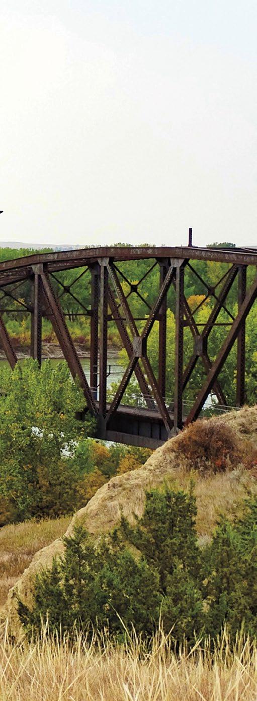
Fairview Bridge and Cartwright Train Tunnel. Both historical and unique in its design, the bridge was built to accommodate cars and trains—though not at the same time!
The 1,458-foot long tunnel was completed in 1913. While most of the digging was done by hand, horse-and-mule-drawn machinery and blasting materials were also used. The bridge and the tunnel trail are now open to pedestrians and cyclists to cross the Yellowstone River. Although located just a few miles east of Fairview, they are in North Dakota.
Missouri River Country | 31
Brockway Dairy Day rodeo | Kitty Kolden

32 | Missouri River Country
Snowden Lift Bridge. A close duplicate of the Fairview Bridge, it spans the Missouri River between Fairview and Bainville.
Note: Two bridges, only 10 miles from each other, cross two different rivers in two different states. These twin-like structures were built by the Great North ern Railroad for its Montana Eastern Railway, which was never finished.
Places of interest south of Sidney:
Savage and Crane. Two small human outposts along a 15-mile stretch of the Yellowstone River. In 1909, a diversion dam was built above Savage for the Lower Yellowstone Irrigation Project. When the work was completed, nearly 400 miles of canals and ditches carried Yellowstone water to crop lands, including sugar beet fields.
Elk Island, Seven Sisters Wildlife Management areas and Crittenden Island. A popular floating stretch of the Yellowstone is home to whitetail and mule deer, upland game birds, ducks, geese, eagles, blue heron, and all manners of birdlife.

In this area, agates, mixed among the rocks and stones along the banks and sand bars of the Yellowstone, are beautiful treasures waiting to be found.
Community Events
Brockway. Each July, the Dairy Day Rodeo, one of Montana’s oldest rodeos, brings action, excitement, and fun!
Circle. McCone County Fair and PRCA Rodeo, August each year. Town & Country Days: The largest event held in Circle every year. (406) 485-4782 for both
Sidney. Richland County Fair and PRCA Rodeo, the first week in August. Live music, carnival rides, magicians, street performers, petting zoo, and exhibits. (406) 433-1916
Fort Union. Fort Union Rendezvous celebrates the days of the Fur Trade Era. Third weekend in June.
Jordan. The Matched Bronc Ride, a sanctioned PRCA Xtreme Broncs rodeo, is every Father’s Day. jordanxtremebroncs@gmail.com Call Garfield C of C (406) 853-2731
Missouri River Country | 33
Fairview Bridge | Jeremy Krieger
Agate treasure | Rick and Susie Graetz
34 | Missouri River Country
IDAHO IDAHO to Cranbrook, BC to Cardston, AB to Lethbridge, AB to Grand Teton Natl Park and Jackson, WY to Idaho Falls, ID to Rexburg, ID to Salmon, ID to Kooskia, ID to Coeur d’Alene, ID to Sandpoint, ID GLACIER NATIONAL PARK YELLOWSTONE NATIONAL
Georgetown Lake Quake Lake PINTLER SCENIC ROUTE PIONEER MTNS SCENIC BYWAY BLACKFEET INDIAN RESERVATION FLATHEAD INDIAN RESERVATION 278 278 324 324 569 Sula Loma Dell Babb Trego Essex Grant Bynum Norris Haugan Dayton Geyser Galata Proctor Polaris Monarch Dupuyer Cameron Neihart Lakeview Garrison De Borgia Helmville Greenough Wise River St. Mary Polebridge Silver Star Nevada City Canyon Creek Jefferson City Ulm Yaak Pony Kila Elmo Pray Troy Lima Belt Logan Craig Coram Basin Alder Noxon Heron Dixon Brady Ennis Darby Arlee Wisdom Ovando Divide Conner Clancy Victor Vaughn Somers Marion Condon Valier Charlo Rollins Melrose Fortine Jackson Big Sky Big Arm Lincoln Augusta Wilsall Clinton Bigfork Rexford Chester Cascade Stockett Paradise Lakeside Emigrant Elliston Harrison Gardiner Florence Superior Sunburst Sheridan Drummond Alberton Fort Shaw Swan Lake Corvallis Fairfield Wolf Creek Raynesford Clyde Trout Creek Martin City Seeley Lake St. Regis Philipsburg Hot Springs Heart Butte Hungry Horse West Glacier Montana City Twin Bridges Virginia City St. Ignatius Gallatin Gateway West Yellowstone East Glacier Park Winston Martinsdale White Sulphur Springs Ronan Plains Eureka Bonner Choteau Boulder Browning Manhattan East Helena Three Forks Fort Benton Stevensville Thompson Falls Townsend Whitehall Lolo Libby Shelby Polson Dillon Conrad Anaconda Hamilton Cut Bank Belgrade Whitefish Livingston Deer Lodge Columbia Falls Dewey Apgar Lake McDonald Grant Village West Thumb Mammoth Hot Springs Tower Canyon Norris Madison Junction Old Faithful Lake Monida Bannack Ringling
Rudyard
Sweetgrass
CANADA
FlatheadRiver
Moiese
Marysville
Helena Missoula Bozeman Butte
CENTRAL MONTANA GLACIER COUNTRY SOUTHWEST MONTANA State Capital: Helena Montana Population: 1,005,141* *2012 U.S. Census Estimate Land Area: 145,392 sq. miles Water Area: 1,746 sq. miles Total Area: 147,138 sq. miles Map provided for general information only. Consult the Official Montana Highway Map for accurate and detailed information. N CANADA IDAHO IDAHO to Cody, to Cranbrook, BC to Cardston, AB to Lethbridge, AB to Grand Teton Natl Park and Jackson, WY to Idaho Falls, ID to Rexburg, ID to Salmon, ID to Kooskia, ID to Coeur d’Alene, ID to Sandpoint, ID GLACIER NATIONAL PARK YELLOWSTONE NATIONAL PARK FlatheadRiver Georgetown Lake Quake Lake BEARTOOTH ALL-AMERICAN ROAD PINTLER SCENIC ROUTE PIONEER MTNS SCENIC BYWAY ROCKY BOY’S INDIAN RESERVATION BLACKFEET INDIAN RESERVATION FLATHEAD INDIAN RESERVATION 278 278 324 324 569 Nye Sula Loma Dell Babb Utica Trego Essex Grant Bynum Roscoe Norris McLeod Haugan Dayton Geyser Galata Proctor Polaris Monarch Dupuyer Cameron Neihart Virgelle Lakeview Fishtail Garrison De Borgia Helmville Greenough Wise River St. Mary Polebridge Cooke City Silver Star Nevada City Canyon Creek Two Dot Jefferson City Ulm Roy Yaak Pony Kila Elmo Pray Troy Lima Belt Logan Craig Coram Basin Alder Noxon Heron Dixon Brady Ennis Darby Arlee Wisdom Ovando Divide Conner Clancy Victor Vaughn Somers Marion Condon Hobson Valier Joliet Denton Charlo Rollins Melrose Fortine Jackson Big Sky Big Arm Lincoln Augusta Wilsall Roberts Clinton Bigfork Rexford Chester Cascade Bridger Stockett Paradise Lakeside Emigrant Elliston Harrison Gardiner Florence Stanford W nifred Superior Sunburst Sheridan Drummond Alberton Fort Shaw Greycliff Swan Lake Park City Corvallis Fairfield Big Sandy Absarokee Wolf Creek Raynesford Reed Point Clyde Park Trout Creek Martin City Grass Range Seeley Lake St. Regis Philipsburg Hot Springs Heart Butte Hungry Horse West Glacier Montana City Twin Bridges Belknap Agency Virginia City St. Ignatius Gallatin Gateway West Yellowstone East Glacier Park Winston Martinsdale White Sulphur Springs Ronan Plains Eureka Bonner Choteau Chinook Boulder Columbus Browning Red Lodge Manhattan Big Timber East Helena Three Forks Fort Benton Stevensville Thompson Falls Townsend Whitehall Harlowton Lolo Libby Shelby Polson Laurel Dillon Conrad Anaconda Hamilton Cut Bank Belgrade Whitefish Lewistown Livingston Deer Lodge Columbia Falls Havre Dewey Judith Gap Apgar Lake McDonald Grant Village West Thumb Mammoth Hot Springs Tower Junction Canyon Norris Madison Junction Old Faithful Lake Silver Gate Monida Bannack Ringling Box Elder Moiese Rudyard Marysville Sweetgrass Helena Missoula Bozeman Butte Kalispell Great Falls CENTRAL MONTANA YELLOWSTONE COUNTRY GLACIER COUNTRY SOUTHWEST MONTANA CITY/ TOWN POPULATION Under 50-1,000 1,000-2,500 2,500-10,000 10,000-25,000 Over
Kalispell Great Falls
State State Capital: Helena Montana Population: 1,005,141* *2012 U.S. Census Estimate
Map provided for general information only. Consult the Official Montana Highway Map for accurate and detailed information. N Map provided for general information only. Consult the Official Montana Highway Map for accurate and detailed information. N
Census Estimate
Land Area: 145,392 sq. miles Water Area: 1,746 sq. miles Total Area: 147,138 sq. miles
State Capital: Helena Montana Population: 1,104,271* *2021 U.S.
Land Area: 145,392 sq. miles Water Area: 1,746 sq. miles Total Area: 147,138 sq. miles
Missouri River Country | 35 NORTH DAKOTA SOUTH DAKOTA WYOMING CANADA WYOMING to Gillette, WY to Belle Fourche, SD to Sheridan, WY to Lovell, WY to Cody, WY to Williston, ND to Dickinson, ND to Bowman, ND to Kildeer, SK to Assiniboia, SK to Regina, SK to Swift Current, SK to Fortuna, ND Park YELLOWSTONE NATIONAL PARK BEARTOOTH ALL-AMERICAN ROAD WARRIOR TRAIL HIGHWAY FORT PECK INDIAN RESERVATION FORT BELKNAP INDIAN RESERVATION ROCKY BOY’S INDIAN RESERVATION CROW INDIAN RESERVATION NORTHERN CHEYENNE INDIAN RESERVATION 253 253 Nye Loma Utica Otter Olive Mosby Ismay Roscoe McLeod Decker Birney Biddle Geyser Ingomar Brusett Bighorn Virgelle Rockvale Fishtail Cooke City Bloomfield Sand Springs Saint Xavier Two Dot Roy Saco Froid Crane Wyola Busby Terry Fallon Alzada Worden Turner Savage Custer Belfry Hobson Circle Wibaux Westby Poplar Plevna Jordan Joliet Hysham Dodson Denton Ashland Zortman Rosebud Roberts Broadus Winnett Ekalaka Bridger Landusky Hinsdale Stanford W inifred Melstone Fairview Greycliff Park City Fort Peck Big Sandy Bainville Absarokee Raynesford Fort Smith Reed Point Culbertson Park Grass Range Lodge Grass Fort Belknap Agency Medicine Lake Pompeys Pillar Martinsdale Baker Malta Scobey Forsyth Chinook Columbus Red Lodge Lame Deer Big Timber Plentywood Crow Agency Roundup Harlowton Hardin Sidney Laurel Glasgow Glendive Colstrip Lewistown Wolf Point Miles City Livingston Havre Judith Gap Tower Junction Silver Gate Box Elder Rudyard Pryor Brockway Lambert Whitetail Flaxville Four Buttes Peerless Lustre Opheim Saint Marie Vandalia Whitewater Loring Cohagen Nashua Garryowen Billings
MISSOURI RIVER
SOUTHEAST MONTANA YELLOWSTONE COUNTRY CITY/ TOWN POPULATION Under 50 50-1,000 1,000-2,500 2,500-10,000 10,000-25,000 Over 25,000 State Capital HIGHWAYS Interstate Route Principal Highways Other Highways ROUTE MARKERS Interstate U.S. Route State or Provincial Route Other Route State Boundary Major Airports Secondary Airports Amtrak Line Amtrak Station MAP SYMBOLS AND OTHER FEATURES
CENTRAL MONTANA
COUNTRY

36 |
Missouri River Country
Wildlife and Wildlife Refuges

| 37
Elk herd at Slippery Anne | Diane Hargreaves
Missouri
River Country
PRAIRIE WILDLIFE AT ITS BEST


38 | Missouri River Country
Ring-necked Pheasant | Tom Koerner, USF&WS
American Avocet | Diane McDuff, USF&WS
Pronghorn antelope | Erwin and Peggy Bauer
Northeast Montana’s sprawling prairie geography is national ly known as home to an enormous population of both large and small animals and winged creatures. Turkeys, burrowing owls, white pelicans, elk, osprey, deer, blue herons, pronghorn antelope, Canada geese, sandhill cranes, cormorants, mountain lions, bobcats, ducks, foxes, eagles, bighorn sheep, pheasants, coyotes, Hungarian partridge, grouse, prairie dogs and more than 200 species of birds are just some of its wild residents.
The crown jewel of the US wildlife refuge system—the 1.1 million-acre Charles M. Russell National Wildlife Refuge— holds court over ten other areas here that are part of the Na tional Watchable Wildlife program. Missouri River Country’s designated places are Bitter Creek, just 20 miles northeast of Hinsdale, Elk Island at Savage just south of Sidney, Fox Lake Wildlife Management Area at Lambert west of Sidney, the Little Rocky Mountains around Zortman, Manning Corral Prairie Dog Town also near Zortman, the Missouri River Downstream Recreation Area at Fort Peck, the Pines Recreation Area 30 miles south- west of Fort Peck, Medicine Lake National Wild life Refuge, the UL Bend National Wildlife Refuge, Bowdoin National Wildlife Refuge and the CMR.
Medicine Lake National Wildlife Refuge
Just 22 miles south of Plentywood, Medicine Lake NWR is one of Northeast Montana’s most alluring gems. And early spring

is a delightful time to explore it. Mid-May at about 5 a.m., the lifting fog, a product of a cold night, catches the first light of a mellow sunrise. The tall grass and reeds take on a gold and orange hue while the surrounding water gathers all the colors of the sky, transforming its surface into a pastel painting. The crisp air is noisy, as the entire neighborhood chats in pro fusion. Grouse, performing their mating ritual, add a distinct sound to the excitement. The previous weeks witnessed a rau cous homecoming—a tradition carried out each year as tens of thousands of geese, ducks and birds fill the spring sky on their way back to Medicine Lake creating one of the great wildlife spectacles in America.
More than 100,000 migrating waterfowl make Medicine Lake their warm weather habitat. Great blue herons, white peli cans, geese, grebes and 10 different species of ducks share this prairie ecosystem with countless other birds. Each year as many as 30,000 ducklings are produced, and every fall more than 10,000 sandhill cranes spend a week here. Foxes, raccoons, pheasants, and deer also populate the area. The refuge boasts the largest pelican rookery in Montana and third largest in the nation. More than 2,000 white pelicans are born each season.
The piping plover, a rare bird, actively breeds in the lake’s wetlands. Their flute-like call is one of the great sounds of na ture. Geese are the first to arrive. Showing up in February and March, they set up their territory and prepare for nesting even
Missouri River Country | 39
Medicine Lake at sunset | Rick and Susie Graetz
before the ice melts. It’s usually late April before Medicine Lake thaws, just in time for the summer dwellers to arrive. All the winged creatures leave by around the first of November when the lake begins to freeze.
Although wildlife is there throughout the summer, May, June and October are the best months to see Medicine Lake. July and August can get quite hot. Montana’s warmest temperature on record was documented here when the thermometer reached 117° F on July 5, 1937.
Bowdoin National Wildlife Refuge
Best known for its nesting colonies of white pelicans, this series of wetlands and lakes eight miles east of Malta, is the habitat for more than 230 different species of birds and waterfowl.

The names of all the neighbors who live here throughout the
warm days are too numerous to mention. Included though in the population are double-crested cormorants, whitetail deer, great blue herons, ring-necked pheasants, sandpipers, sharptailed grouse, coyotes, osprey, an occasional bald eagle, all kinds of hawks, falcons, numerous ducks, tundra swan, loons, owls, the yellow-rump warbler, and the yellow-billed Cuckoo.
From the time the “transient residents” arrive for the summer until they gather in autumn to begin their southern sojourn, constant chatter fills the air; there is much to “talk” about and do as new life is created.
Early morning and late afternoon in the spring and fall are the best times to visit the Bowdoin National Wildlife Refuge. Its 15,500 acres can be seen via a 15-mile circular route. This spe cial natural community is easily reached from Malta. Call (406) 654-2863 for information.
40 | Missouri River Country


Missouri River Country | 41
Bowdoin National Wildlife Refuge | Rick and Susie Graetz
Mule deer | US Fish & Wildlife Service

42
| Missouri River Country
The Skies of Missouri River Country
AN EVER-CHANGING PANORAMA OF LIGHT, CLOUDS AND STARS
 The northern lights at Fort Peck Lake | Amy Lynne Nelson
43
Missouri River Country |


44
|
Missouri River Country
Night skies, bright tents | Andy Austin
Day’s end in Missouri River Country, east of Jordan, MT | Rick and Susie Graetz
The Skies of Missouri River Country
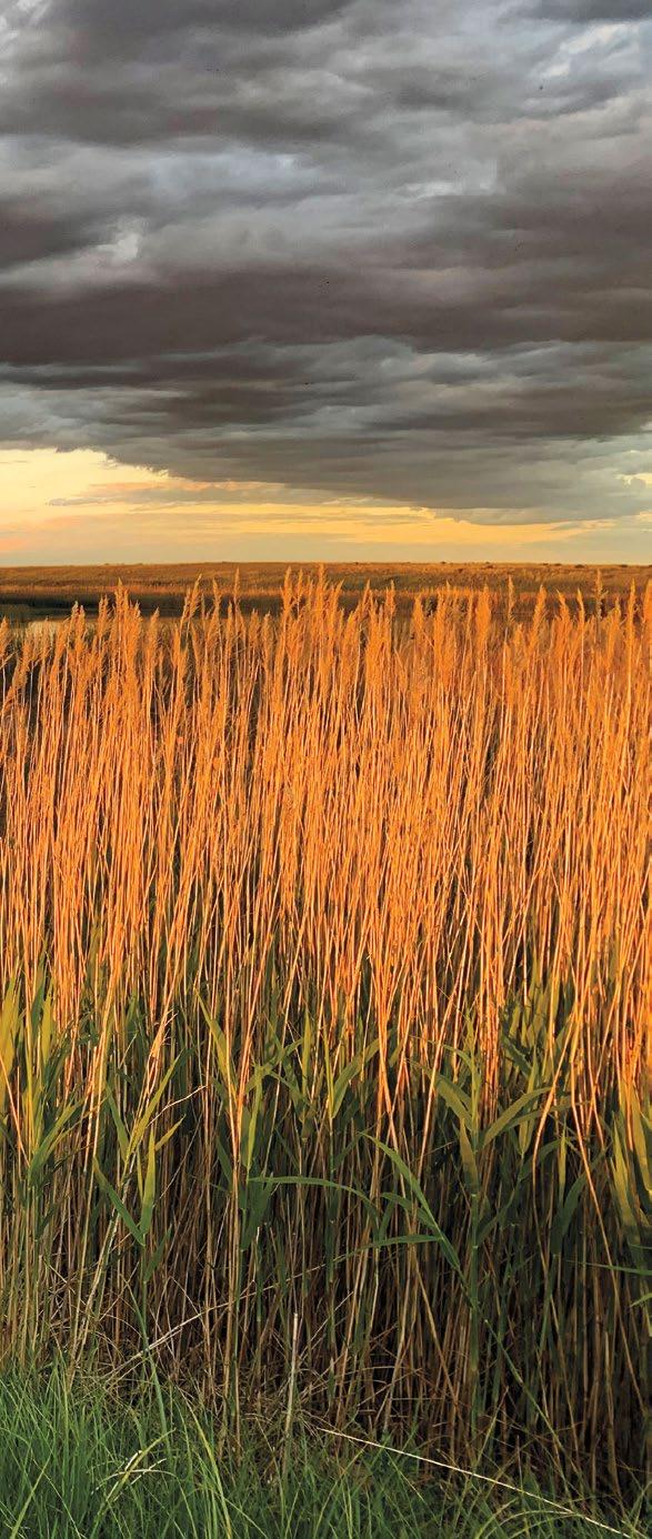
From the moment the sun bursts onto the eastern horizon of Missouri River Country, Montana’s biggest sky becomes a canvas for artful displays of billowing clouds, fast moving storms, and breathtaking sunrises and sunsets. With nightfall, an astronomer’s dream of varied nocturnal displays takes center stage. Brilliant, twinkling diamonds crown the heavens over

Fort Peck Lake, a full moon illuminates the snow-covered hills between Scobey and Plentywood, and meteors streak off in all directions. In a landscape free of competing lights, one might attend a performance of the color changing Northern Lights as they swirl and leap across the night sky.
It is as expansive a dome of sky as any on the planet and often brings an early morning and evening light so beautiful that no painter or photographer could ever duplicate it.
Subdued topography allows the sky top billing. Summer thun derstorms build to a towering collection of plump white and gray clouds that are then swept by the wind up into Canada or out onto the plains of the Dakotas, leaving glimmering sunshine over the prairie, often only to be replaced by another storm with intense lightning displays. In winter, northern born blizzards roll like turbulent waves across the uncluttered skyline depositing a quiet comforter of snow in their wake.

These are the skies of Northeast Montana!
Trail to the Stars: trailtothestars.com
Missouri River Country | 45
Billowy summer clouds west of Opheim, MT | Rick and Susie Graetz
Since the late 1800s, paleontologists have scoured across Montana searching here for fossils and clues to uncovering the ancient world of the dinosaurs. And given the wide-open spaces, river breaks, and badlands—especially here in northeastern Montana—it’s not hard to imagine these long-ago monsters living in this incredible landscape.
Millions of years before the Missouri River formed, Triceratops, Tyrannosaurus rex (T. rex), Pachycephalosaurus, Edmontosaurus, Brachylophosaurus, and numerous other kinds of dinosaurs and extinct lifeforms roamed and lived in what would one day be Missouri River Country. In 1902, the first scientifically rec ognized T. rex was found in the badlands of the Hell Creek Formation near Jordan. And one of the most complete T. rex specimens ever found was discovered around Fort Peck Lake in 1990. In fact, more T. rexes have been discovered in Montana than any other state.

A huge swath of Missouri River Country is part of the well-stud ied and explored Hell Creek Formation, an area of exposed rocks upper Cretaceous to lower Paleocene in age. For the most
part, with the exception of a portion contiguous to the Missou ri’s north side south of Malta, it is confined to the south side of Fort Peck Lake and north of Jordan. This region is considered to be one of the richest fossil localities in the world, and indeed numerous amazing discoveries have been made there.
North of the Milk River Valley, the geologically older Judith River Formation is exposed. In the summer of 2001, near Malta, a Brachylophosaurus named “Leonardo” was discovered. “Leonar do” is scientifically unique for being a Guinness Book of World Record holder for being the most complete “mummy” dinosaur. That means that the majority of “Leonardo’s” skin, muscles, and organs fossilized, giving paleontologists an intimate look into the body parts that rarely survive.
Along the western edge of Missouri River Country, on the eastern slopes of the Little Rocky Mountains near Zortman, the Jurassic Period preserves ancient marine life that once lived in a shallow seaway. During the Mesozoic Era, inland seaways occurred numerous times in the western US. These warm, shallows seas would have given the adjacent land a very humid and subtropical climate, very similar to the Gulf States today.
46 | Missouri River Country
Missouri River Country’s Dinosaur Trail
Fort Peck Interpretive Center display | Rick and Susie Graetz
Just outside of Zortman (even in the town dump!), these titled Jurassic layers reveal a plethora of ancient marine life. Oyster shells (the oyster Gryphaea, commonly referred to as “devil’s toenails”) and belemnites (the bullet-shaped internal hard part from extinct squids) quite literally litter the ground. Who knew you could visit the ocean in Montana?
North and east along the Canadian border, the old Missouri River gravels date back to the Miocene. Though being approximately 23-5 million years old, these rocks are geologically much younger than those from the Hell Creek Formation (66 million years ago).
By the Miocene, the dinosaurs were long gone, but prehistoric camels, rhinos, and elephants were among the many animals that called Northeast Montana home. Certainly, an odd menagerie when one thinks of “typical” Montana animals today!
In the eastern part of Missouri River Country, the Fort Union For mation covers much of the terrain. This was laid down following the demise of the dinosaurs and is largely devoid of animal fossils, but fossil leaves are abundant in the mudstones exposed along road cuts and in the shales used for the “red roads” in the oil fields.
Each year brings new finds and exhilarating information and en lightenment about what this land was like until an errant asteroid ended the reign of the dinosaurs 66 million years ago. The impact engulfed the Earth—darkening the sky with dust and debris, causing vast wildfires and tsunamis, and likely triggering increased volcanic activity. Certainly not a good day to be on Earth.
Museums and their displays of both ancient land and sea dwell ers are found throughout Missouri River Country. The newest, the Fort Peck Interpretive Center and Museum at Fort Peck, just south of Glasgow, is world class. Exhibits include wildlife dioramas, huge native/game fish aquariums, fossils, and stun ning mounts of T. rex, Edmontosaurus, and Ornithomimus—all dinosaurs that once lived right there!
If you would like to follow the entire Dinosaur Trail, you could begin and end anywhere, but let’s use Glasgow as a starting point. With the Fort Peck interpretive Center just 17 miles away, this would be perfect for your first introduction to the fascinating world of super-sized predator/prey species.
West of Glasgow, in Malta, the Phillips County Museum and the Great Plains Dinosaur Museum house many rare fossil di nosaurs, fish, invertebrates, and plants. They offer real dinosaur digs that participants can sign up for to learn how paleontolo gists find and excavate the fossils.

Additionally, they offer an educational program for youngsters that teaches them about regional geology and paleontology out at an active fossil locality.
For more information on all of the Great Plains Dinosaur Museum’s activities: www.greatplainsdinosaurs.org, dinosaur@ itstriangle.com, or (406) 654-5300.
Missouri River Country | 47
Dinosaur dig | Donnie Sexton

48 |
Missouri River Country
Big Waters: Lakes and Rivers OF MISSOURI RIVER COUNTRY
 Fort Peck Lake looking east from the Overlook | Rick and Susie Graetz
49
Missouri River Country
|
Fort Peck Lake
This enormous swath of geography encompassing more than three million acres, much of it public land, is a showcase of prairie splendor.
If you love big water recreation, fishing, wildlife sightings, prairie and arid land topography, paleontology and just plain being in a landscape that gives you the feeling you are the only human being for many miles around then a journey to Fort Peck Lake and its surrounding prairie geography to explore this incredible expanse of territory should be on the top of your travel wish list.
Nearly 1,600 miles of shoreline, 134 miles long, a landscape that hasn’t changed since Lewis and Clark passed this way more than 210 years ago, and some of the nation’s best warm water fishing are just a few of Fort Peck’s impressive claims!
This lake’s magnitude assures recreationists solitude if they want it. It’s possible to pull into bays rarely visited by a boat for your own private fishing, or to hike ridges and coulees above the water that experienced hooves of Indian ponies, fol low tracks of fur traders and explorers and set foot on a high point where Sioux hunters watched for clouds of dust to tell them that a huge herd of migrating bison were nearby.
Plains Indians once roamed this country following enormous bison herds. Places where they camped along the river, and later the area the Corps of Discovery walked, are now well into the waters of Fort Peck Lake. But the land rising above the waters, haven’t changed over time and it’s still possible to imagine all that took place here in the long ago.
Access
Access to the lake and its surrounding lands is from several Missouri River Coun try towns. In the north, roads from Malta, Glasgow, and Fort Peck point south. From Hwy 200 on the southern perimeter, several roads from Jordan reach deep into the Missouri River Breaks and to Fort Peck Lake. Many of the routes take you to developed campgrounds, boat launches and other conveniences. Other roads and trails deliver you into and through wild country. Before striking out, inquire at the CMR National Wildlife Refuge office in Jordan or the one in Fort Peck. They can advise you on conditions and the best routes to follow. It’s very important to get good information to make the most of your time.
While there are many places to launch a boat on Fort Peck Lake, two of the most popular are on the north side, Rock Creek Marina out of Fort Peck (signs on the road from Glasgow point the way), as well as Fort Peck Marina, and on the south side, Hell Creek Marina out of Jordan (ask for directions at any Jordan business).
50 | Missouri River Country
Big Dry Arm on Fort Peck Lake | Rick and Susie Graetz
A Montana and Prairie Treasure...

Missouri River Country | 51
But there is more to Fort Peck Lake than its waters. This prairie beauty is surrounded by the crown jewel of the nation’s wildlife refuge system, the 1.1 million-acre Charles M. Rus sell National Wildlife Refuge, a landscape that can be best described as prairie magnificence.
Fort Peck, the lake’s “capital town”
The town of Fort Peck, long on colorful histo ry and 18 miles south of Glasgow via Hwy 24, is this regions and the lake’s eastern post. One of the wonderful things about the village of Fort Peck is that it is the only town on Fort Peck Lake and the only one on the edge of the Charles M Russell National Wildlife Refuge. You can’t get any closer to two of Missouri River Country’s biggest destinations.
The Fort Peck Interpretive Center and Museum
Like Alice in Wonderland falling down the rabbit hole, from the moment you step through the museum’s doors into the lair of a “gi-normous,” life-like, hungry-looking, open-jawed, steely-eyed T-Rex named Peck’s Rex, you know you are in for an adventure. Ahead of you is 18,000 square feet of pure entertainment featuring paleontology, wild life, and the construction of Fort Peck Dam. Two of Montana’s largest aquariums show off the inhabitants of Fort Peck Lake and the Missouri River. In the phenomenal Exhibi tion Hall, a skeletal cast of the Tyrannosaurus Rex discovered 20 miles southeast of town towers over everything. Also included are other dinosaur fossils, present-day and histor ical animals of the CMR National Wildlife Refuge, hands-on interpretive displays, and a false-fronted, early 20th century street scene. Ask about kid’s fishing and hiking trails. (406) 526-3493

Fort Peck Summer Theatre
Built during the depression to help entertain the dam workers, the theater, with its seating

52 | Missouri River Country
Fort Peck Interpretive Center | Rick and Susie Graetz
Fort Peck Theatre | Rick and Susie Graetz
for 1,200, was for decades the largest facility of its kind in the state. Today, through the talent of professional summer stock actors, once again laughter and music ring from the rafters of this exotic and historic building. May thru Aug, performances Fri.–Sat at 7:30pm and Sun at 4pm. (406) 228-9216 | pecktheatre.org
Lewis and Clark Overlook
The viewpoint is 1⁄2 mile east of the dam powerhouse on Hwy 24. Interpretive signage, picnic area and restroom facilities are handicap accessible. Continue East on Hwy 24 and you will cross the dam’s spillway. Then to the left is the road to the Milk River Observation Point and Hiking Trail. This is a great chance to get out of the car, stretch your legs and see the cream-colored water of the Milk River enter and stream parallel with the Missouri.
Kiwanis Park
Surrounded by shady cottonwood trees, picnic shelters, restrooms and grills make this a perfect place to host family reunions, BBQs and other large or small events. Conveniently located in front of the Kiwanis Downstream Campground, it is within walking distance to the Fort Peck Interpretive Center.
The Beaver Creek Nature Trail
An easy three-mile-long hiking path starts at the campground downstream from the dam and leads through wildlife habi tat along the Missouri River. A self-guided wildlife-viewing autoroute... the Leo B. Coleman Wildlife Exhibit takes off from near the Fort Peck Summer Theater.

NELSON RESERVOIR
One of northeast Montana’s most popular water recreation and fishing areas, Nelson Reservoir is the number one walleye spot in the state. Stocked with yellow perch, walleye, and northern pike, it produces record class fish. In winter, ice fishing is a draw, enticing many anglers from all across the state. Camping, swimming, boating, picnic shelters, RV sites, restrooms, show ers and year-round fishing may be enjoyed.
The reservoir is reached from US Hwy 2 from Malta on the west and Saco on the east. A clearly marked turn off leads the way just a short distance to the north.
Missouri River Country | 53
Milk River Observation Point | Jamie Blotsky
BRUSH LAKE STATE PARK
Sandy beaches surrounded by grass fields and stands of spring wheat frame its sparkling waters. This 280-acre state park offers public access for swimming, boating, hiking, a day-use area, boat ramp and dock, vault toilet,
picnic tables, fire rings and has an RV campground. Due to the mineral make-up of Brush Lake, there are no fish. Aside from its distinctive aquamarine blue color, Brush Lake looks like many other lakes that dot this prairie pothole region, however beneath its surface the lake is full of superlatives.

54 | Missouri River Country
Being a deep lake (65 feet) in a closed basin, Brush Lake contains a sediment record of value to the scientific study of climate change. Since it first saw daylight 10,000 years ago, Brush Lake has accumulated 45 feet of sediments. Much like tree rings the lake annually deposits a layer of light and dark sediment that can be used to construct
a timeline. These layers contain pollen and distinct minerals that allow scientists to determine variations in climate since the ice age. Currently, sediment cores are being studied by a collaborative team of scientists who are funded by a National Science Foundation grant.
 Brush Lake | Dona Osksa
Missouri River Country | 55
Enjoying a summer day on Brush Lake | Dona Osksa

56 | Missouri River Country
The Missouri River, looking towards the Fred Robinson Bridge area | Rick and Susie Graetz
THE MISSOURI RIVER
In Missouri River Country
The Missouri
For Montana, it was a lifeline…a moving highway that gave birth to the state. On the way to the nation’s heartland, it collects the state’s memories and history. It is Montana’s great river.
Known for its prairie scenery, wildlife, fishing, hunting, and water recreation, the Missouri and the geography it touches in northeast Montana attracts folks from across the nation. Con sider that from Missouri River Country’s western edge at Fred Robinson Bridge and US Hwy 191, following a straight course, a watercraft will have eclipsed 145 miles when it reaches Fort Peck Lake and the Fort Peck Dam. Fort Peck Lake with its nearly 1,600 miles of shoreline allows the big river to rest. From here, the boat’s occupants can survey the sculptured landscape of the more than one-million-acre Charles M. Russell National Wildlife Refuge that edges the river and completely surrounds the lake.

Leaving Fort Peck Lake through the dam’s spillway, the Mis souri River runs clear again much as it did from its birthplace.
Within ten miles of exiting Fort Peck and after regaining its channel, the Missouri meets the Milk River. Strong-armed to the
side by the Missouri’s formidable flow, the overly silt-laden waters of the Milk create a light colored banner along the Missouri’s north bank until finally, the Milk gives up and succumbs to the mightier river.
Meriwether Lewis, May 8, 1805, wrote, “the water of this river posseses a peculiar whiteness, being about the colour of a cup of tea with the admixture of a tabelspoonfull of milk. from the colour of it’s water we called it Milk river. we think it possible that this may be the river called by the Minitares (Hidatsa) ‘the river that scolds at all others’.”
Lewis also noted the Milk River Hills that rise nearly 700 feet above the floodplain of the Milk and Missouri. These can be reached via MT Hwy 24 across Fort Peck Dam. From this point, one can view much of the terrain Lewis and Clark de scribed, both along the Missouri on the north side of the hills and southwest out over the lake.
As the river rolls eastward, the meanders, as well as the sand bars and islands, increase. While the Missouri is dynamic through its final 185 miles, it doesn’t have the strength it once had before Fort Peck Dam was completed. Looking a bit more civilized than the segment between Fort Benton and Fort Peck, it is still, for the most part, void of people.
Missouri River Country | 57
The Milk River | Rick and Susie Graetz
A couple of miles southeast of Culbertson, the Hwy 16 bridge crosses the Missouri. The sweeping river view from here is a favorite of photographers. Beyond the bridge, with 34 miles left before the Missouri prepares to leave Montana and take on the Yellowstone River, it rolls through a beautiful mix of bluffs, canyons, and badlands. Continually impressed with the pleasant appearance of the landscape, William Clark declared, “the Coun trey on both Sides have a butifull appearance.”
A few miles before exiting the state, the Missouri passes the historic Snowden Bridge. Near here, on April 27, 1805, Lewis and Clark and their crew spent their first night in what would become Montana. As Lewis began writing in his journals that night, the words he put on paper represent the initial written history of Montana.
Once this historic spot is passed, the Missouri appropriates the Yellowstone just beyond our border with North Dakota. As the river bids adieu, it leaves the finest landscapes of its journey behind in Montana.

The Yellowstone In Missouri River Country
The Missouri takes top billing in northeast Montana, but the Yellowstone River isn’t just a bit player. While it only logs 50 miles in the territory, it takes in some exquisite landscapes and carries much Montana history with it. Gathering some of the finest mountain and prairie topography on the planet, Mon tana’s Yellowstone drains a 70,000-square-mile piece of the west in grand fashion. The 670-milelong waterway remains the nation’s longest undammed river.
Once also serving as “a moving highway” into the wilderness, this unique river mirrored the passage of millions of bison, the travels of the Corps of Discovery, creation of the nation’s first national park, and the foundations of a state.
Savage and Crane, Montana, create small human outposts along a 15-mile stretch of the Yellowstone. Above Savage, in 1909, a diversion dam was built for the Lower Yellowstone Irrigation Project. When the work was completed, there were nearly 400 miles of canals and ditches carrying water to croplands, includ ing widespread sugar beet fields. The Yellowstone River north of Sidney | Rick and Susie Graetz
58 | Missouri River Country

Missouri River Country | 59

60 |
Missouri River Country
The Yellowstone River and the Seven Sisters area near Savage, MT | Rick and Susie Graetz
From Savage to Sidney, nearing the end of its run, the river pro vides a popular floating stretch amid the Elk Island and the Seven Sisters wildlife management areas and the state-owned Crittenden Island. Elk Island—actually three islands in high water and one in low, is near Savage, while Crane provides access to the small islands named Seven Sisters that legendary Yellowstone steamboat Captain Grant Marsh entitled in honor of his siblings.

Floating from Elk Island to the Seven Sisters is a great way to see this special length of the Yellowstone, home to whitetail and mule deer, upland game birds, ducks, and geese and since the river moves slowly here, sightings of eagles, blue heron and all manners of birdlife are a strong possibility.
Downstream from Savage, the river shows wide bottoms crowded with islands, sandbars, and a profusion of cottonwoods. The terrain on the river’s east side becomes rugged. Badlands and river breaks intermix and ascend well above the floodplain. Juniper, small ponderosa pine, and green ash give a warm color to a harsh soil.
Sidney, the main port of call for the river in northeast Mon tana, is about a mile west of the Yellowstone and 14 river miles short of its marriage to the Missouri. A few river miles north of Sidney, the Yellowstone zips across the North Dakota line, then abruptly changes her mind and rushes back into Montana. Finally, three miles from the eastern edge of Montana and Fort Union, the big, wide, silt-laden Yellowstone concedes her inde pendence. Together, under the flag of the Missouri, a mighty river lunges toward a rendezvous with the Mississippi River.
The geographic history of the Yellowstone-Missouri Confluence is also worthy of note. The original site the Corps of Discovery witnessed is about two miles to the southwest of the current junction. A huge 1930’s flood forcibly moved it.
Missouri River Country | 61
Kayaking Dredge Cuts below Fort Peck Dam | Carla Hunsley
 62 | Missouri River Country
Hunting & Fishing
BIG GAME, BIG BIRDS & BIG WATER FISHING
 Taking a break near the Breaks | Justin Sliter
| 63
Missouri River Country
Hunting
Hunters should set their sights high before taking aim in Mis souri River Country, as big game animals, upland birds and wa terfowl all make their homes in the wide-open land of northeast Montana. This is a true sportsman’s landscape. Pronghorn, mule and trophy whitetail deer wander these prairies and drainages and elk with racks six points on a side roam the million-acre CMR. From fertile river bottoms, through prairies of grass to stark badlands, this country teems with wildlife just as it did when Lewis and Clark wrote of the area in 1805.
With an abundance of waterways, CRP and cropland, here is an environment built for bird hunting. Situated right under the Central Flyway, Missouri River Country has some of the best migratory bird hunting in the nation. Grain fattened geese, more duck species than we can name, colorful ring necked pheasants, native sharp-tail grouse and Hungarian partridge and one of the healthiest populations of sage grouse in the Unites States await you.
If you have a narrow window of time to seek your animal, professional outfitters’ and guides’ services are options to insure your success. Should you choose to venture out on your own, one of Missouri River Country’s greatest attributes is the locals’ knowledge of the area and their willingness to share it with all visitors.

For Licenses and Special Permits: http://fwp.mt.gov/hunting/licenses/drawings/app deadlines.html

Hunting Information
The Montana Department of Fish, Wildlife and Parks, www. fwp.mt.gov, or the Region 6 office in Glasgow, (406) 2283700, is where to turn for the last word on regulations and license applications, but any authorized license outlet also can also help. Area offices of the Federal Bureau of Land Man agement are invaluable places for maps. Keep in mind that additional regulations also apply when hunting on the CMR Wildlife Refuge. For information on public and private land access, contact the Montana Department of Natural Resources. For regulations applying to hunting on the CMR, contact the refuge office. See the resource page in this guide for all pertinent phone numbers and addresses. Call the FW&P folks to ask about the Block Management Hunting program.
62 | Missouri River Country 64 | Missouri River Country
Woman bow-hunting in the Missouri River Breaks | Burnt Image Photography
Elk at Slippery Anne | Jackie Withchum, US Fish and Wildlife Service
Fishing
Those considering fishing in Missouri River Country should think big. Defined by sandstone formations, fields of grain and abundant river bottoms, here, shorelines go on for more than a thousand miles and fish grow to more than 100 pounds. This is the land of the Fort Peck Reservoir.
More than 50 different species of fish inhabit Fort Peck Lake, and they all have room to grow. The reservoir is 134 miles long and as much as 220 feet deep. Along its 1,600 miles of shoreline and under its 240,000 acres of surface area, walleye, northern pike, small-mouth bass, lake trout and Chinook salmon are waiting. Curious looking ling, prehistoric paddlefish and two species of sturgeon abide there too.
Fort Peck’s diverse fishery continues to gain nationwide rec ognition. Stories of five-pound bass, ten-pound walleye and 20-pound northern pike continue to pique interest. To accom modate all of the use, three marinas and nine boat ramp/access areas are scattered along the reservoir.

With the exception of space, the most profuse feature of Fork Peck may be its walleye fishery. The popular game fish can be
found throughout the reservoir, but experienced anglers suggest focusing efforts on the bays and points of the reservoir and Big Dry Arm. Trolling with bottom bouncers and spinners tipped with minnows, leaches, or night-crawlers, or using crank bait and jigs are advised as successful approaches for luring walleye from the reservoir to your net.
Anglers looking for a fight may want to target the reservoir’s abundant small-mouth bass—possibly the scrappiest freshwater game fish that can be caught anywhere. These guys are so ag gressive they will bite on just about anything…jigs, crank bait, spinners, or flies. Look for them near rocky areas around the points and islands between Devil’s Creek and Hell Creek. While most of the bass remain between two and three pounds, it is not uncommon to find a five-pounder on the line and a fight on your hands.
Another favorite among locals is the northern pike, which were first planted in the lake in the 1950s. Expect four-to-eightpound pike and hope for one of the 20 pounders in the Big Dry Arm Bay and lower parts of Fort Peck. Then there are all the rest… lake trout—more easily taken in the spring and fall, ling that look too much like eels to become too popular and Chinook salmon that continue to be stocked.
Missouri River Country | 63 Missouri River Country | 65
Family fun boating and fishing on Fort Peck Lake | Jamie Blotsky
Fishing Missouri River Country isn’t just about Fort Peck Reservoir. The Missouri and Yellowstone rivers both are thick with their own possibilities, including the chance to land more than 100 pounds of something harkening back to another time. Ancient paddlefish of enormous size can still be found in both rivers. On the Yellowstone, seek them out near Sidney; on the Missouri, look between the Fred Robinson Bridge to the head of Fort Peck Reservoir. Fishing for these creatures requires an additional state license, big treble hooks, heavy weights, and a deep-sea rod.
Sharing space with the paddlefish are two species of sturgeon. The pallid sturgeon is listed as an Endangered Species and must be immediately released if caught. The smaller shovelnose sturgeon may be kept if it weighs no more than 16 pounds. The experts’ pick for the best walleye fishing in Montana and home to record-setting pike and yellow perch is Nelson Reservoir near Malta. From one end to the other, Missouri River Country is a place of enormous fishing opportunities. Newcomers to Fort Peck are advised to seek out local fisherman for advice on where to go and what fishing techniques to use.
Fort Peck Lake is the ultimate dream come true for any fishing enthusiast, luring anglers from around the world. Make Fort Peck Lake your next destination. You’ll take home a fishing experience to last a lifetime.

Fishing Information
A Montana fishing license is required for all fishing in MRC; however a secondary special license is required for paddlefish. Two-day and ten-day fishing licenses are available for nonres idents. Before heading out on the water, check the Montana fishing and boating regulations www.fwp.mt.gov/fishing.
For information on Montana fishing licenses, regulations, areas to fish and outfitters and guides, contact: Montana Fish, Wildlife and Parks (406) 228-3700, and the CMR National Wildlife Refuge (406) 538-8706. The US Army Corps of Engineers in Fort Peck (406) 526-3411, can provide additional information on Fort Peck Lake.
In order to help keep our lakes healthy, we ask you to remember that with three steps you can help stop the spread of aquatic invasive species, like plants, mussels and whirling disease. Inspect. Clean. Dry.
Visit our Missouri River Country website for more information on the local attractions, events, and lodging: MissouriRiverMT.com
66
| Missouri River Country
Walleye catch on Fort Peck Lake | Roger Hunsley
Advisory: Some sites may be inaccessible because of weather conditions. Check local weather and road conditions befoer traveling.


Missouri River Country | 67
Fishing on the Yellowstone River near the Seven Sisters area | Andy Austin
The Original People
In the early 1600s, Europeans displaced the ancestors of the Gros Ventre, the Assiniboine, and the Sioux from the East Coast. Nomadic hunters and fierce warriors, they headed out to the north and west in search of new land. Migrations over 200 years, coupled with mandatory moves by the US government, saw the three tribes settled in the north-central and northeastern part of Montana. At the turn of the 19th century, the decimation of their numbers by smallpox and the government’s slaughter of bison forced them to consider mov ing onto reservations to survive.
In 1876, the Nations were instructed to move to the Fort Peck Indian Agency in the northeast corner of Montana to live with the Sioux. Many Assiniboine, who felt a cultural and language connection with the Sioux, did as they were told. The Gros Ventre and the re maining Assiniboine wanted no association with their oft-time rival. They refused, and it wasn’t until 1888 that they found their home when the Fort Belknap Reservation was established.
Natives had a deep spiritual relationship with the buffa lo. Central to every part of their lives, nothing was wasted. According to www.study.com, the teeth became necklaces and jewelry. Tongue: high-protein meat…the rough side was used as a comb. Horns: dishes, arrowheads, jewelry, utensils, and ground up for medicine. Brain: food, tanned hides into leather. Skull: used in sacred ceremonies. Bones: made into tools, weapons, needles, and fishhooks. Muscles: an adult bison provided 800 pounds of usable meat. Liver: food, and a tanning agent. Blood: paint, and soup thickener. Organs: dried and used as bags. Tendons: made bowstrings. Fur and hide: Used for blankets, clothing, tepee covering. Hair: braided into ropes and halters. Hoofs: glue, made into rattles. Droppings: fuel for fires.
Nearly 30 million bison once roamed free across the plains; by 1900, less than 1,000 remained. One small herd in Yellowstone National Park became today’s answer to both reservations’ quest
to return the honored buffalo to their land and re-establish its spiritual and cultural relationship with their people.
In 2012, the first genetically pure, direct descendants of the last bison saved from the mass slaughter arrived at the Turtle Mound Buffalo Ranch on the Fort Peck Reservation. A year later, 34 wild bison made a powerful entrance onto the Fort Belknap Reservation. The reintroduction of these buffalo has led to the gifting of herds to other Montana and out-of-state Indian Reservations.
Fort Peck Reservation—The Assiniboine & Sioux Nations
Poplar is the center for tribal activities and hosts the Assiniboine and Sioux Cultural Center and Museum and the Fort Peck Community College.
Powwows celebrating family, friendship, and Indian culture occur throughout the year. The reservation is home to fascinat ing artifacts and historical places, including tipi rings, buffalo jumps, and sacred sites. If you are interested, contact the tribal office at (406) 768-2300. Sensitivity issues and tribal customs must be considered and respected.
Fort Belknap Reservation—Gros Ventre & Assiniboine Nations Situated half in the Central Montana tourism region and half on the western edge of Missouri River Country, tribal celebrations and events mostly take place on the western reaches of the reservation.

32 | Missouri River Country 68 | Missouri River Country
Missouri River Country’s Birding Trail
Come encounter the diverse song, color and bird species of Montana’s Missouri River Country. From the expansive prairie, to the marshes and reservoirs, to the hills of the badlands, to the woodlands of the river breaks, a rewarding experience awaits you. Western meadowlarks with their golden-colored throats serenade travelers along roadways, and the shy and endangered piping plovers hide in the pothole regions of Missouri River Country’s northeast corner.
American white pelicans, taking off from some of the world’s largest breeding colonies, soar in military fashion over rivers and lakes. Curlews and great blue herons hunt the shorelines, hawks and grouse make their living amid the sagebrush and grass-covered prairie. While owls patrol the night sky, eagles command the day.
You can listen to the soulful call of a loon or the tap of a wood pecker, catch the brilliant flash of a lazuli bunting or, if you are very lucky, spot a rare hummingbird appearance.
There is much to delight and captivate both the amateur and the veteran birder; so grab your binoculars and get ready to discover the myriad of winged-folk who inhabit the amazing landscape along the Birding Trail of Missouri River Country.


Information on each featured stop can be found at: www.missouririvermt.com/birdwatching
 Nelson’s Sharp-Tailed Sparrow | Rick Bohn, USF&WS
Long Billed Curlew | USF&WS
Red-tailed Hawk | Rick Bohn, USF&WS
Nelson’s Sharp-Tailed Sparrow | Rick Bohn, USF&WS
Long Billed Curlew | USF&WS
Red-tailed Hawk | Rick Bohn, USF&WS
Accommodations in Missouri River Country
HOTELS AND MOTELS
CIRCLE Traveler’s Inn $ 102 B Avenue 406-485-3323
CULBERTSON Hi Line Inn and Suites $$ 781 6th Street East 406-787-5261 www.hilineinn.com
The Kings Inn Motel $$ 408 East 6th Street 406-787-6277
FAIRVIEW Korner Motel $ 217 West 9th Street 406-742-5259
FORT PECK Fort Peck Hotel $$ 175 So. Missouri Avenue 406-526-3266 www.thefortpeckhotel.com
Lakeridge Motel & Tackle Shop $$ West of Fort Peck 406-526-3597
GLASGOW Campbell Lodge $ 534 3rd Avenue South 406-228-9328
campbell-lodge-glasgow.booked.net
Cottonwood Inn & Suites $$$ 54250 US Hwy 2 406-228-8213 www.cottonwoodinn.net
La Casa Motel $ 238 1st Avenue North 406-228-9311 www.hotelmotels.info/Montana/ Glasgow/LaCasaMotel
Rundle Suites $$ 208 5th Street 406-228-2800 www.rundlesuites.com
Star Lodge Motel $ 1023 US Hwy 2 W 406-228-2494 star-lodge-motel.hotelsearchusa.com
JORDAN Motel 200 $ 643 Leavitt Avenue 406-557-2209
Garfield Motel $ 361 Main Street 406-557-6215 garfield-hotel-motel.hotelsearchusa.com
Hell Creek Marina Lodging $$ 2502 Hell Creek Road 406-557-2345 www.hellcreekmarina.net
Missouri Breaks Lodging LLC $$ 3646 Brusett Road 406-853-6420
Ryan Apartments $$ 722 Attix Street, Apt. 3 406-851-1877 www. ryanapartments.com
MALTA Country Inn $ 1568 US Hwy191 406-654-2198 www.countryinnmalta.com
Edgewater Inn & RV Park $$ 47176 US Hwy 2 406-654-1302
Great Northern Hotel $$ 2 South 1st Street East 406-654-2100
Maltana Motel $$ 138 South 1st Avenue West 406-654-2610
Riverside Motel and RV Court $ 8 Central Avenue North 406-654-2881
Royals Inn Motel $ 117 North 1st Street East 406-654-1150 www.royalsinnmotelmontana.com
Sportsman Motel $ 231 North 1st Street East 406-654-2300
MEDICINE LAKE Club Bar and Hotel $ 202 West Main Street 406-789-2208
PLENTYWOOD Gold Dollar Lodge $ 120 South Main 406-765-2730 Matilda’s Properties $$ 515 West 1st Avenue 406-765-2810 www.sherwoodinnplentywood.com
Sherwood Inn $$ 515 West 1st Avenue 406-765-2810 www.sherwoodinnplentywood.com
SACO Saco Motel $ 207 Taylor 406-527-3261
SCOBEY Smoke Creek Inn $$ 51 Hwy 13 South 406-487-5332 smoke-creek-inn.business.site Wheatland Lodge $$ 514 Main Street 406-487-2765 www.wheatlandlodgellc.com
SIDNEY Best Western Golden Prairie Inn & Suites $$$ 820 South Central 406-433-4560 www.bestwesternmontana.com/ hotels/best-western-golden-prairie-inn-and-suites
Candlewood Suites $$$$ 201 6th Street NW 406-482-9692 www.candlewoodsuites.com/sidneymt
Holiday Inn Express Hotel & Suites $$$$ 251 West Holly Street 406-433-3200 www.hiexpress.com/sidneymt
Lone Tree Inn $$$ 900 South Central Avenue 406-433-4520 www.lonetreeinnsidney.us
MainStay Suites $$$$ 1000 3rd Street NW 406-488-1000 www.choicehotels.com/montana/ sidney/mainstay-hotels/mt095
Microtel Inn & Suites $$ 1500 South Central Avenue 406-482-9011 www.microtelinn.com
Richland Inn & Suites $$$ 1200 South Central Avenue 406-433-6400
Wingate $$ 1490 South Central Avenue 406-433-3100 www.wingatehotels.com/hotels/ montana/sidney/wingate-by-wyndham-sidney/hotel-overview
WOLF POINT
ZORTMAN
BED & BREAKFAST
Homestead Inn and Annex $$ 101 US Hwy 2 E 406-653-1300 www.homesteadinnmotel.com
Sherman Inn $$ 200 East Main Street 406-653-1100 www.shermaninn.com
Buckhorn Store, Cabins & RV Park $ 143 Whitcomb Street 888-654-3162
Zortman Motel & Garage $ 302 Main Street 406-673-3160 www. zortmanmotel.webstarts.com
DODSON Stage Road Inn $$ 30730 Stage Road 406-383-4410 www.stageroadinn.com
MOSBY Hill Ranch Oasis $ 123 Hill Road 406-429-6801 www.hillranchoasis.com
WOLF POINT The Meadowlark $$ 872 Nickwall Road 406-525-3289
70 | Missouri River Country
HOT SPRINGS
SACO Sleeping Buffalo Hot Springs & Resort 669 Buffalo Trail 406-527-3320 www.sbhotsprings.com
OUTFITTER/GUIDED RECREATIONAL SERVICES
BAINVILLE Montana River Ranch 406-769-2500 www.montanariverranch.com
BRUSETT 7-V Ranch 424 Burma Road 406-557-2845 www.7-vranchoutfitters.com
CULBERTSON Timber Creek Ranch 406-798-7770
FAIRVIEW Mike Niles Outfitting 14478 County Rd 356 406-788-0803 www.mikenilesoutfitting.com
FORT PECK Hi-Line Charter Fishing 6820 US Hwy 2 East 406-262-2195 www.hi-linecharterfishing.com
GLASGOW Billingsley Ranch Outfitters 406-367-5577 www.billingsleyoutfitters.com Burke Ranch Outfitters 64 Keith Avenue 406-228-9727 www.burkeranchoutfitters.com
JORDAN Landwehr Outfitters #1 Stockyard Lane 405-219-1319 www.landwehroutfitters.com
MALTA Sagebrush Outfitters 50664 US Hwy 191 North 406-674-5271
SAND SPRINGS Kibler Outfitting & Charter Fishing 1239 North Lodge Pole Road 406-557-2503 www.kiblercharterfishing.com
GUEST RANCHES AND LODGES
MALTA Tillmans Bed & Breakfast 406-670-9788 www.tillmansofmontana.com
SACO Beaver Creek Lodge 210 Montana Avenue 406-527-3204
SAND SPRINGS IOU Ranch 1712 N. Lodge Pole Road 406-557-2544
VACATION HOMES
FORT PECK Bait & Switch LLC 80 Idlewild Drive 406-526-3241
JORDAN Twitchell’s Sportsman Rental 406-557-2554
ZORTMAN Whispering Pines Vacation Homes 720 Thompson Street 406-673-3304
PRIVATE CAMPGROUNDS AND MARINAS
CIRCLE Horse Creek Trailer Court & RV 112 B Drive 406-876-4581
CULBERTSON Culbertson RV Park 5747 Road 1022 406-314-1597 www.culbertsonrvpark.com
DAGMAR Sunset Camping 85 Brotherhood Hall Road
FORT PECK Rock Creek Marina 652 South Rock Creek Road 406-485-2560 www.rockcreekmarina.com
GLASGOW Cottonwood & Suites RV Park 54250 US Highway 2 406-228-8213 www.cottonwoodinn.net Shady Rest RV Park 8 Lasar Drive 406-228-2769 Trails West Campground 37 Skylark Road 406-228-2778
JORDAN Hell Creek Marina 2502 Hell Creek Road 406-557-2345 www.hellcreekmarina.net
MALTA Buffalo Camp at American Prairie Reserve South of Malta 406-585-4600 www.americanprairie.org Edgewater Inn & RV Park 47176 US Highway 2 406-654-1302
PLENTYWOOD AOK Camping 509 West 1st Avenue 406-765-7951 Bolster Dam Campgrounds Box Elder Street 406-765-1700
POPLAR Smith’s Mobile Park 1502 15th Avenue East 406-768-3841
SCOBEY Lions Campground 11 Railroad Avenue East 701-770-4993
WOLF POINT Homestead RV Park 7520 US Hwy 2 406-653-1940
ZORTMAN Zortman RV Park & Campground 302 Main Street 406-673-3160
SPECIAL INTEREST
MALTA Great Plains Dinosaur Museum & Field Station US Hwy 2 East 406-654-5300 www.mtdinotrail.org/great-plainsdinosaur-museum-and-field-station
FORT PECK Fort Peck Interpretation Center Yellowstone Road 406-526-3493 www.fws.gov/refuge/charles-mrussell/fort-peck-interpretive-center
VACATION PLANNING ASSISTANCE
MALTA The Travel Haven 121 South 2nd Street 406-654-1638
SIDNEY Journeys by Jan Travel Company 1050 South Central Ave. #1 406-488-4450
Missouri River Country | 71
Information Sources
State and Federal Agencies
Montana Office of Tourism 800-847-4868 www.visitmt.com
Montana Fish, Wildlife and Parks: 406-444-2535 www.fwp.mt.gov
Fort Peck Tribes Fish and Game Department: 406-768-2300 www.fortpecktribes.org/fgd/ Regional Headquarters Fish Wildlife and Parks, Glasgow: 406-228-3700
BLM-U.S. Bureau of Land Management Malta: 406-654-5100 Glasgow: 406-228-3750 www.blm.gov/
Bowdoin National Wildlife Refuge: 406-654-2863 www.fws.gov/refuge/ bowdoin/ CMR | Charles M. Russell National Wildlife Refuge: 406-538-8706 www.fws.gov/refuge/charles_m_russell/ Medicine Lake National Wildlife Refuge: 406-789-2305 www.fws.gov/refuge/medicine_lake US Army Corps of Engineers Fort Peck: 406-526-3411
Other Tourism Regions
Southeast Montana: 800-346-1876 www.southeastmontana.com
Yellowstone Country: 800-736-5276 www.visityellowstonecountry.com
Southwest Montana: 800-879-1159 www.southwestmt.com
Glacier Country: 800-338-5072 www.glaciermt.com
Central Montana: 800-527-5348 www.centralmontana.com
Ports of Entry
Port of Opheim
Year Around 9:00 a.m. to 5:00 p.m.
Port of Morgan 406-674-5248
Year Around 9:00 a.m. to 5:00 p.m.
Port of Scobey
Year Around 9:00 a.m. to 7:00 p.m.
Port of Raymond
Year Around 6:00 a.m. to 10:00 p.m.
Other Recreation Information
Fort Peck Indian Reservation: 406-768-2300
MT Outfitters and Guides Assoc.: 406-449-3578
Montana Historical Society: 406-444-4710
Chambers of Commerce
Circle C of C: 406-485-4782 www.circle-montana.com
Culbertson C of C: 406-787-5271 www.culbertsonmt.com
Fairview C of C: 406-742-5259 www.midrivers.com/~fairview
Glasgow C of C and Agriculture: 406-228-2222 www.glasgowchamber.net
Jordan/Garfield County C of C: 406-853-2731 www.garfieldcounty.com
Malta Area C of C: 406-654-1776 www.maltachamber.com
Plentywood/Sheridan County C of C: 406-765-8500 www.sheridancountychamber.org
Poplar C of C: 406-768-5204
Saco C of C and Agriculture: 406-527-3434
Scobey & Daniels County C of C: 406-487-2061 www.scobeymt.com
Sidney C of C and Agriculture: 406-433-1916 www.sidneymt.com
Wolf Point C of C and Agriculture: 406-653-2012 www.wolfpointchamber.com
Public Campgrounds
UNLESS NOTED OTHERWISE, the website for all campgrounds is: www.campgroundreviews.com/regions/ montana/fort-peck/downstream-coe-7518
Crane: Seven Sisters 406-234-0900
Dagmar: Brush Lake State Park 406-483-5455 https://fwp.mt.gov/stateparks/brush-lake
Fort Peck: Bone Trail 406-526-3411
Downstream 406-526-3411
Duck Creek 406-526-3411
Flat Lake Access Site 406-526-3411
COE Campground 406-526-3224 Floodplain 406-526-3411
McGuire Creek 406-526-3411
Nelson Creek 406-526-3411
Rock Creek Fishing Access 406-228-3700
The Pines 406-526-3411
West End 406-526-3411
Jordan: Devil’s Creek 406-526-3411
Hell Creek Recreation Area 406-557-2362
Malta: Fourchette Bay 406-526-3411 Nelson Reservoir 406-759-5077 www.usbr.gov/gp/recreation/nelrec.html Trafton Park 406-654-1251
Saco: Cole Ponds 406-228-3700
Zortman: Buffington Recreation 406-654-5100 Camp Creek 406-654-5100 Montana Gulch 406-654-5100
Transportation
Airlines
Cape Air: 406-228-8041 www.capeair.com
Charter Airlines
Richland Aviation: 406-482-1832
Wokal Field Valley County Airport: 406-228-4023
Rail | Amtrak 800-872-7245 www.amtrak.com
Car Rental
Way Out West Car Rentals
Wolf Point: 1-800-733-1310
Richland Car & Truck Rental Sidney: 406-478-4930
Weather Glasgow and Northeast Montana: 406-228-4042 www.weather.gov/glasgow Road Conditions Statewide: dial 511 www.mdt.mt.gov
72 | Missouri
River Country
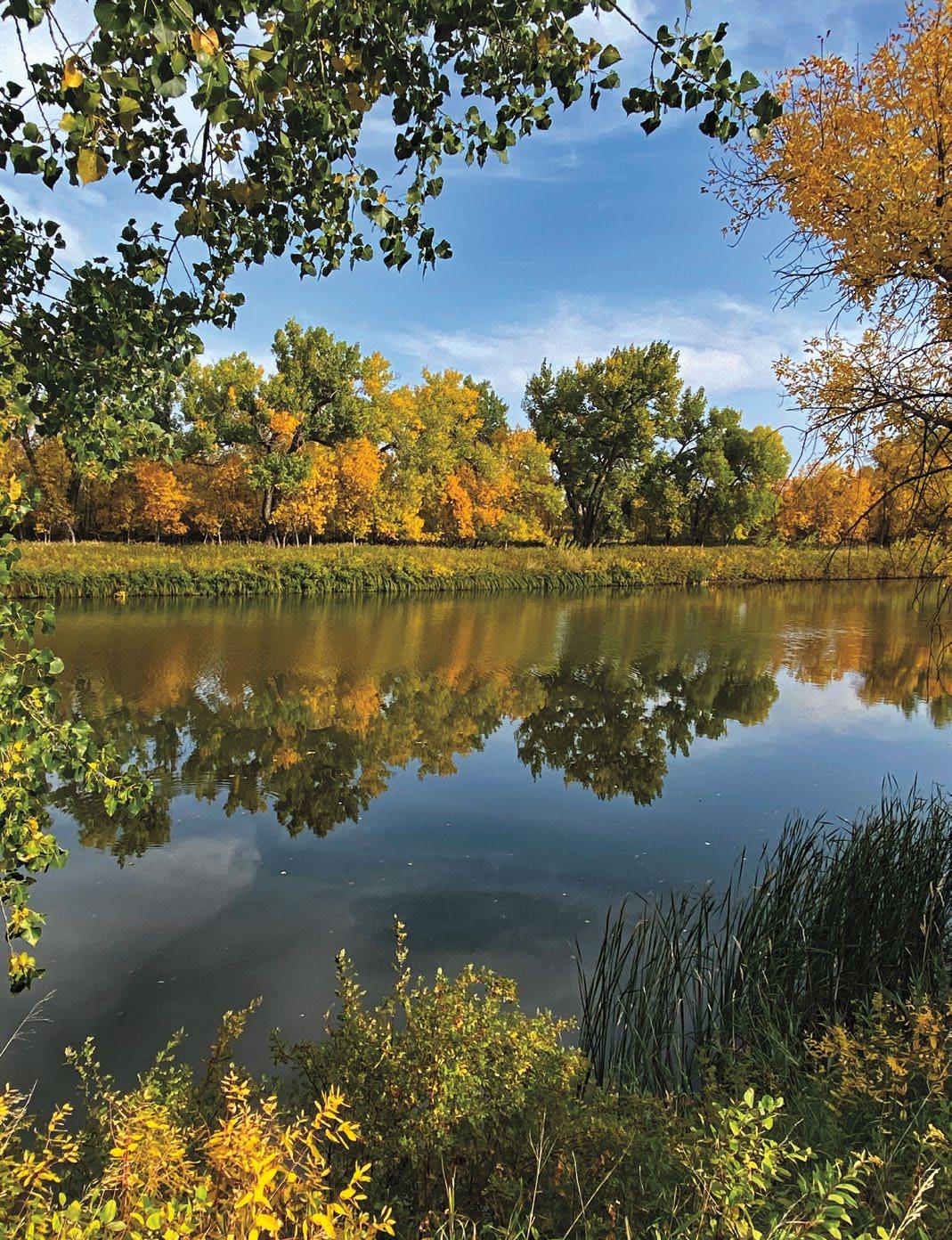 Milk River at Hinsdale, MT | Rick and Susie Graetz
P.O. Box 118
Fort Peck, MT 59223
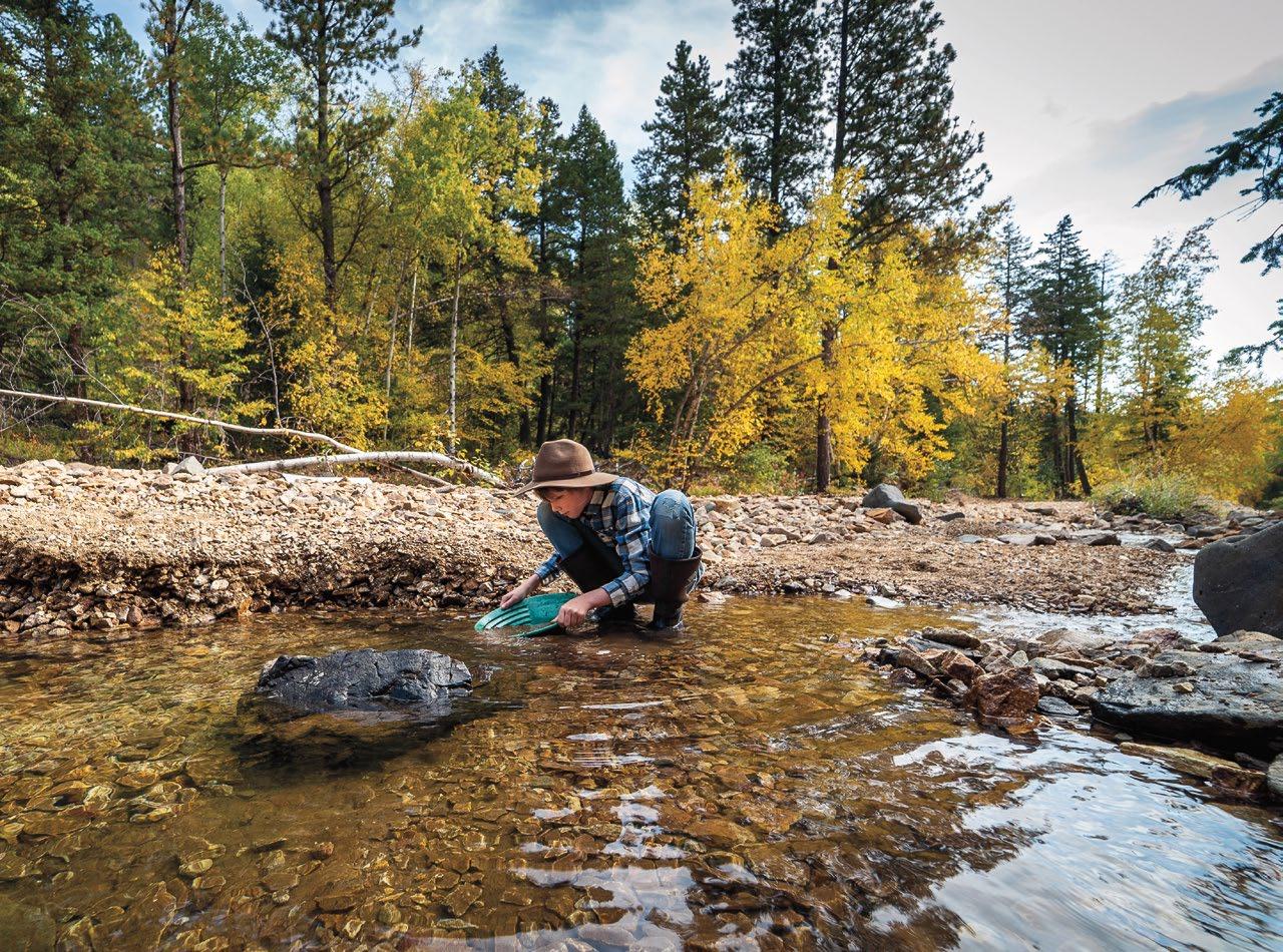 Gold-panning near Zortman, MT | Melynda Harrison
MONTANA’S MISSOURI RIVER COUNTRY
Gold-panning near Zortman, MT | Melynda Harrison
MONTANA’S MISSOURI RIVER COUNTRY
MRKTG US POSTAGE PAID PLENTYWOOD, MT PERMIT NO. 3
PRSRT

