Wolf Point Stampede | Hailey Rae Photography Printed in the USA for free distribution. All rights reserved. Reproduction in whole or in part without written permission of Missouri River Country and Northern Rockies Publishing is prohibited.
Written and produced by Rick and Susie Graetz, Northern Rockies Publishing. Design: Designworks, Kalispell, MT. Pre-Press: Digital Planet, Kalispell, MT. Produced with accommodation tax funds in cooperation with Missouri River Country.
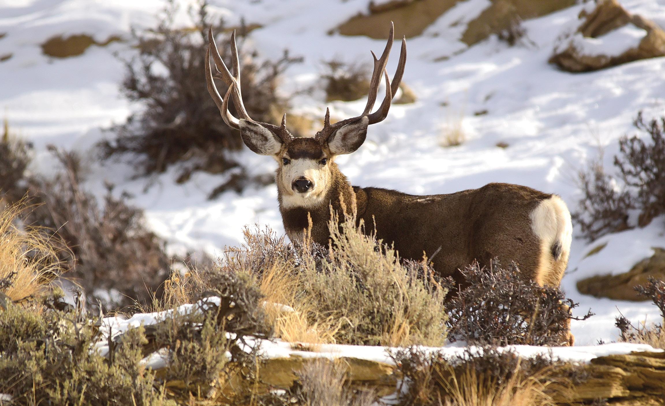
Cover photo: Elk at Slippery Ann on the Charles M. Russell National Wildlife Refuge | Diane Hargreaves
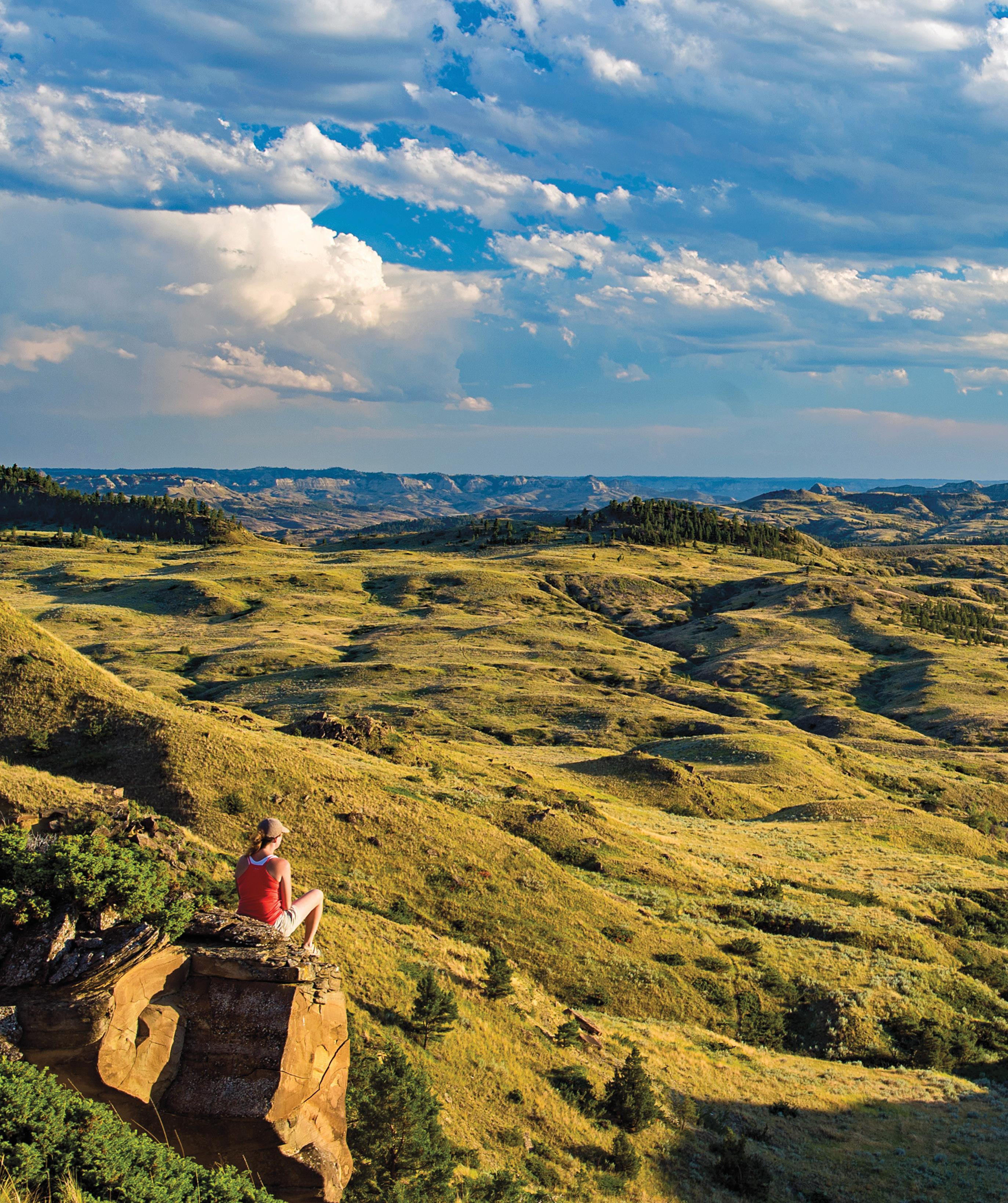
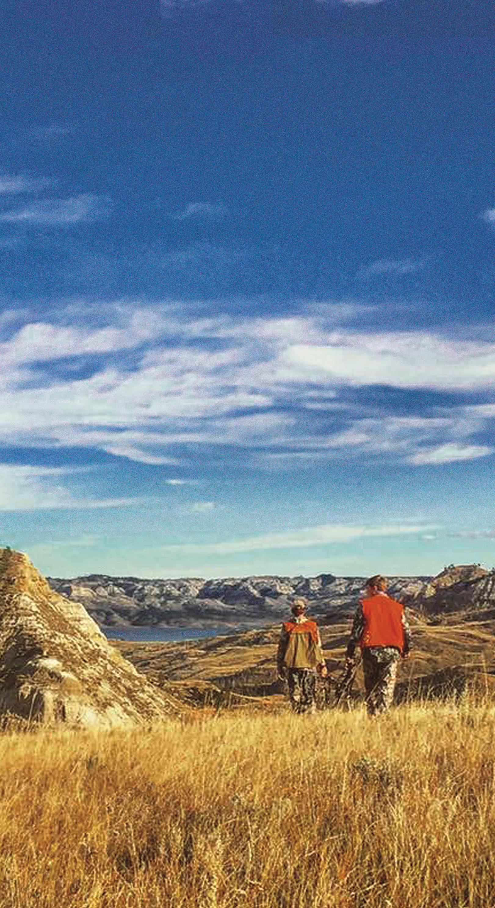
Hikers in the CMR Sand Arroyo Badlands | Rick and Susie Graetz
Montana’s Missouri River Country
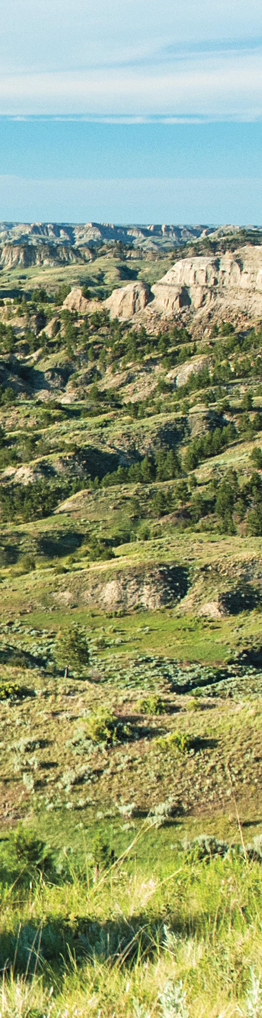
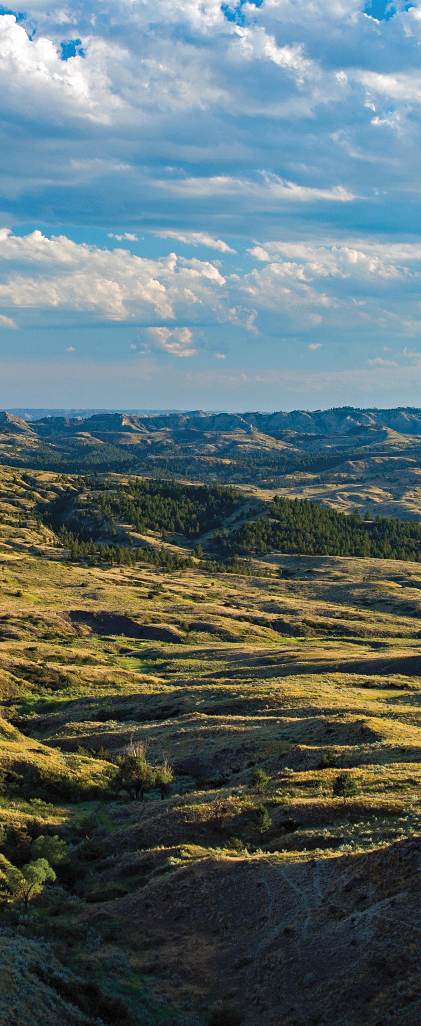
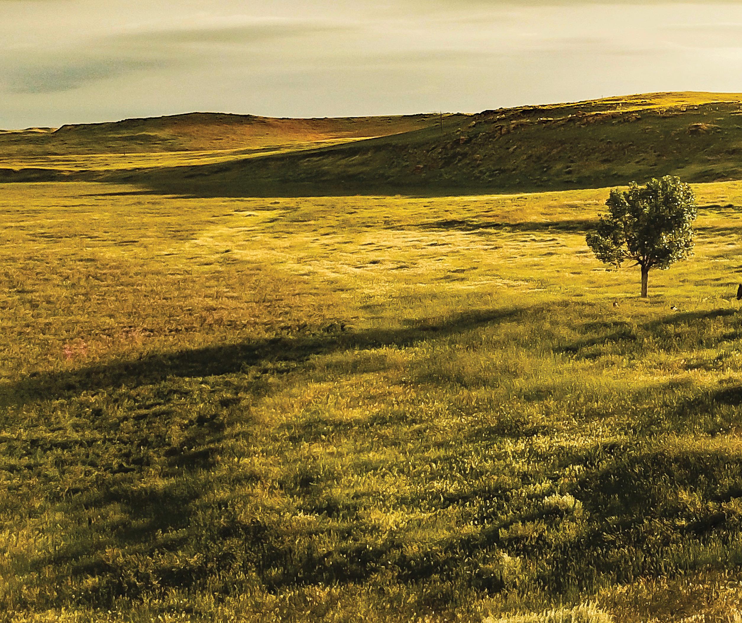
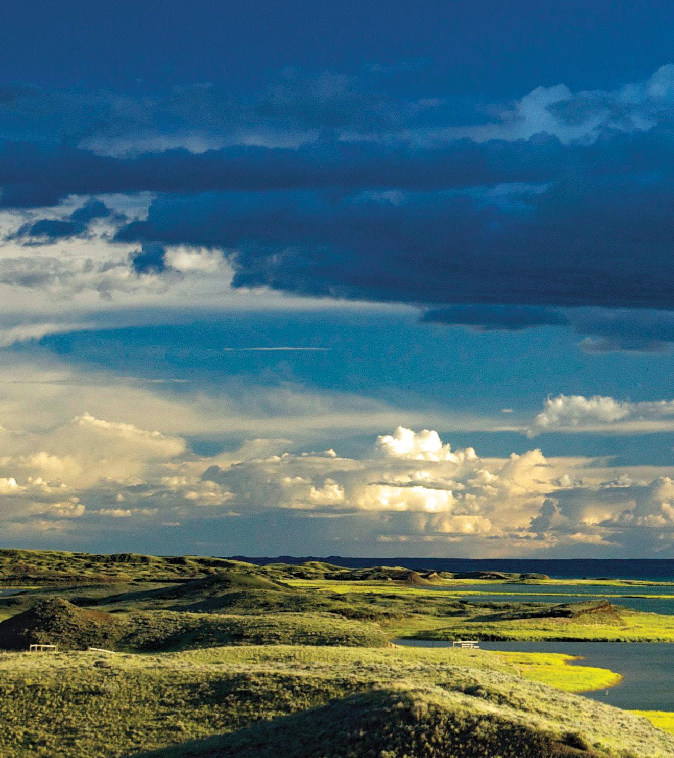
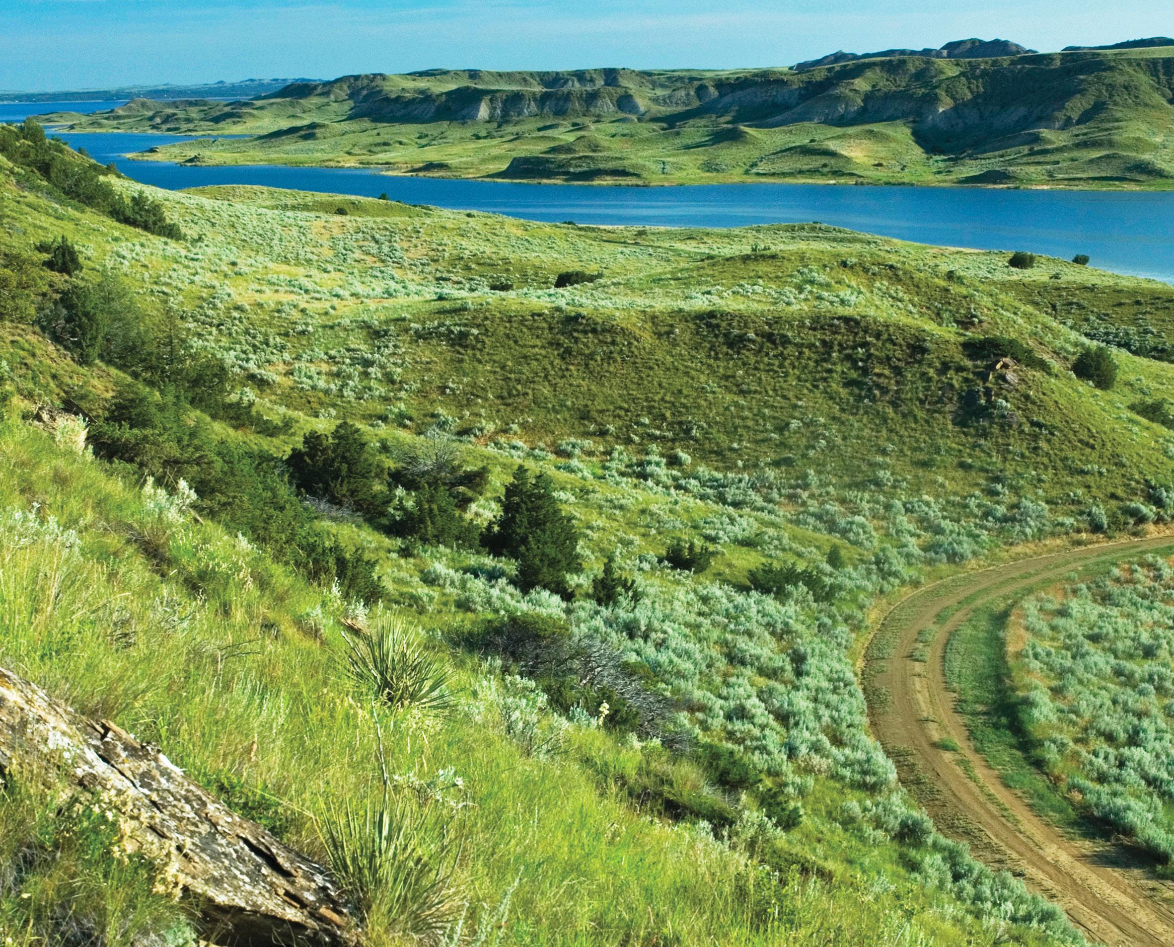
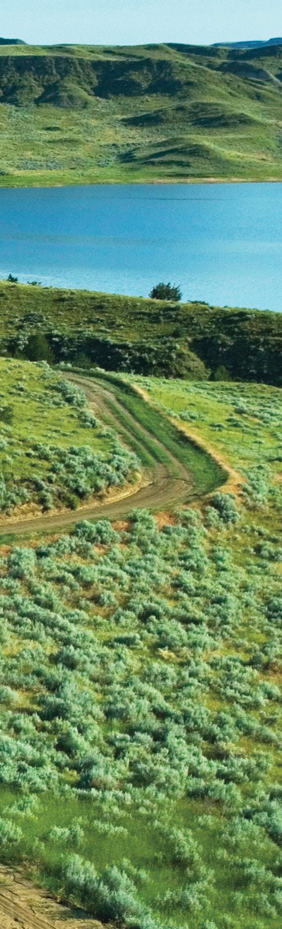
Hell Creek Badlands | Chuck Haney
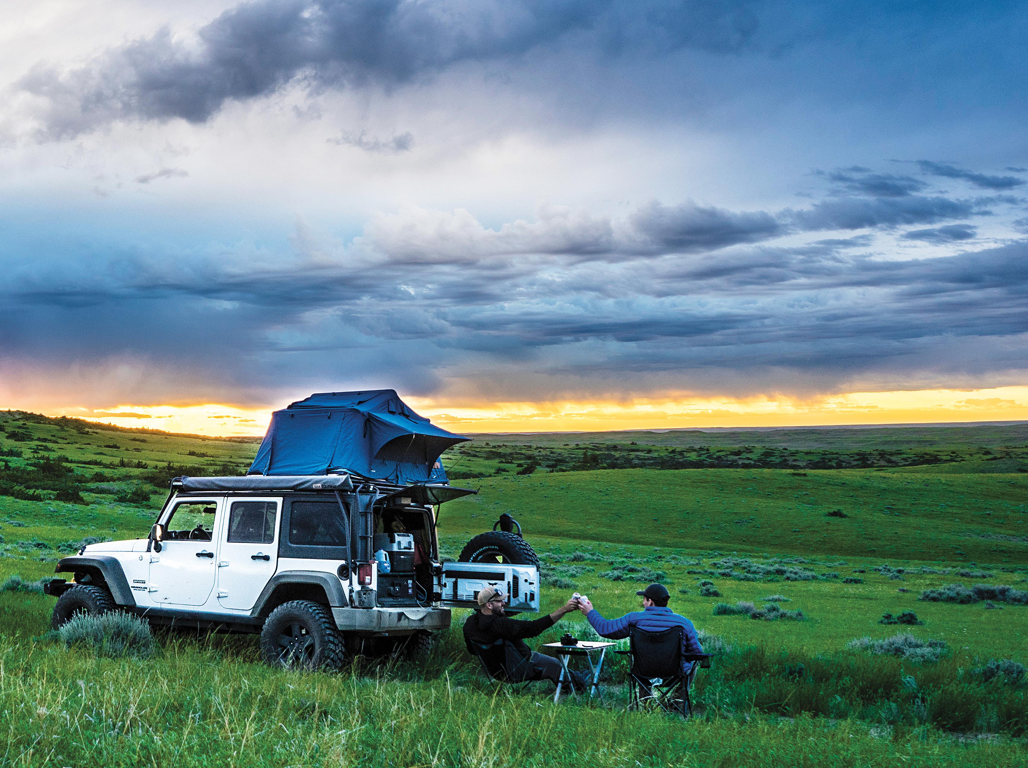
More Room to Roam...
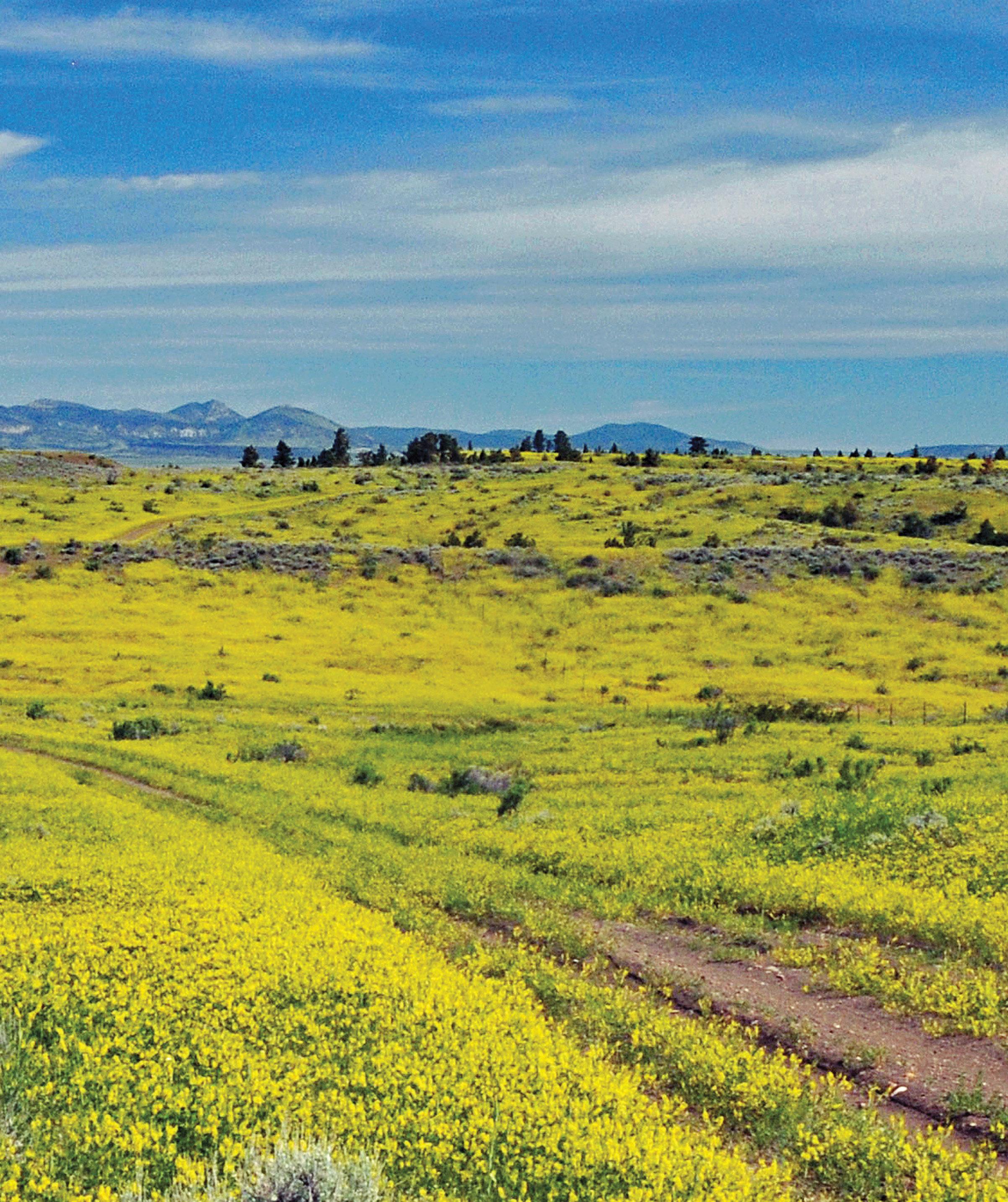
The wealth of opportunities for adventure amidst the natural treasures of Missouri River Country cannot be overstated. If you love big water recreation, wildlife sightings, prairie topography, wild country, paleontology, uncluttered views that go on forever, the romance and colorful history of the Old West, night skies brilliant with stars, and just plain being in the landscape that gives you room to breathe, then a journey to Montana’s northeast corner to explore this incredible expansive geography should be on the top of your bucket list!
The welcome mat is out, come visit us, you won’t be disappointed.
Judge Ray Trumpower President Missouri River Country Board of Directors
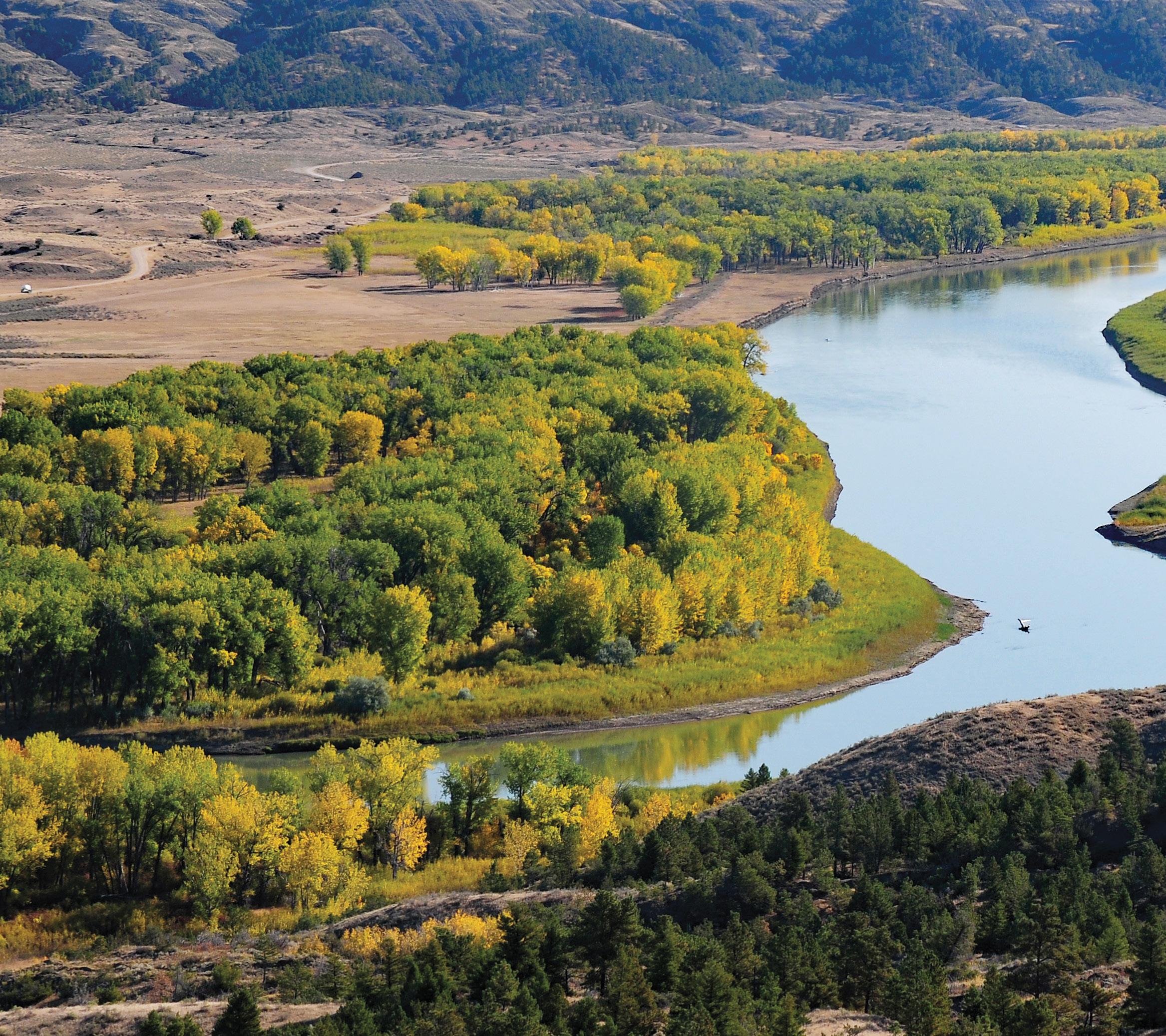
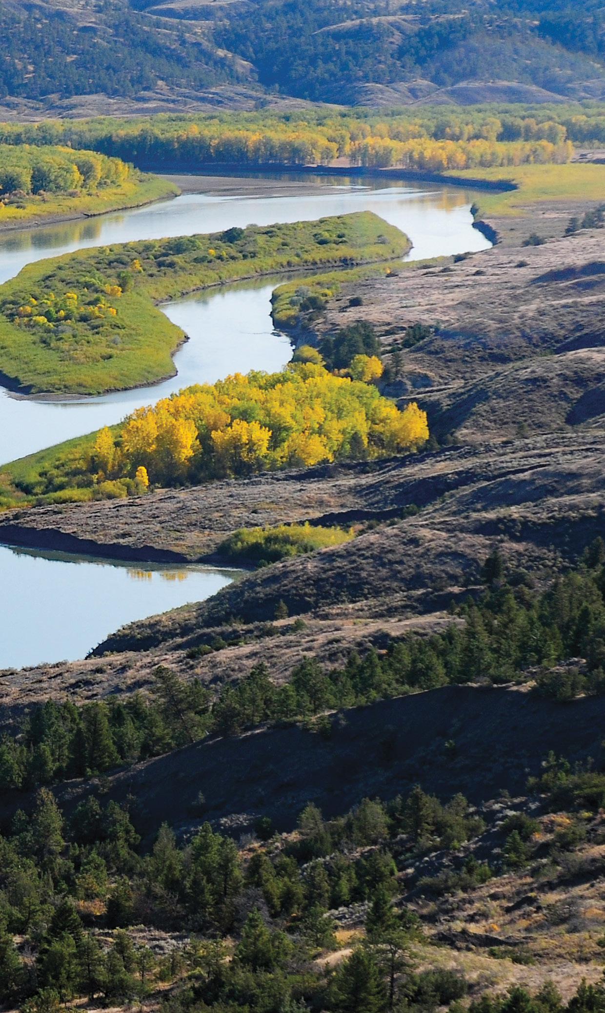
Yellowstone River near Elk Island | Rick and Susie Graetz
Ray Trumpower and grandson | Trumpower family archives
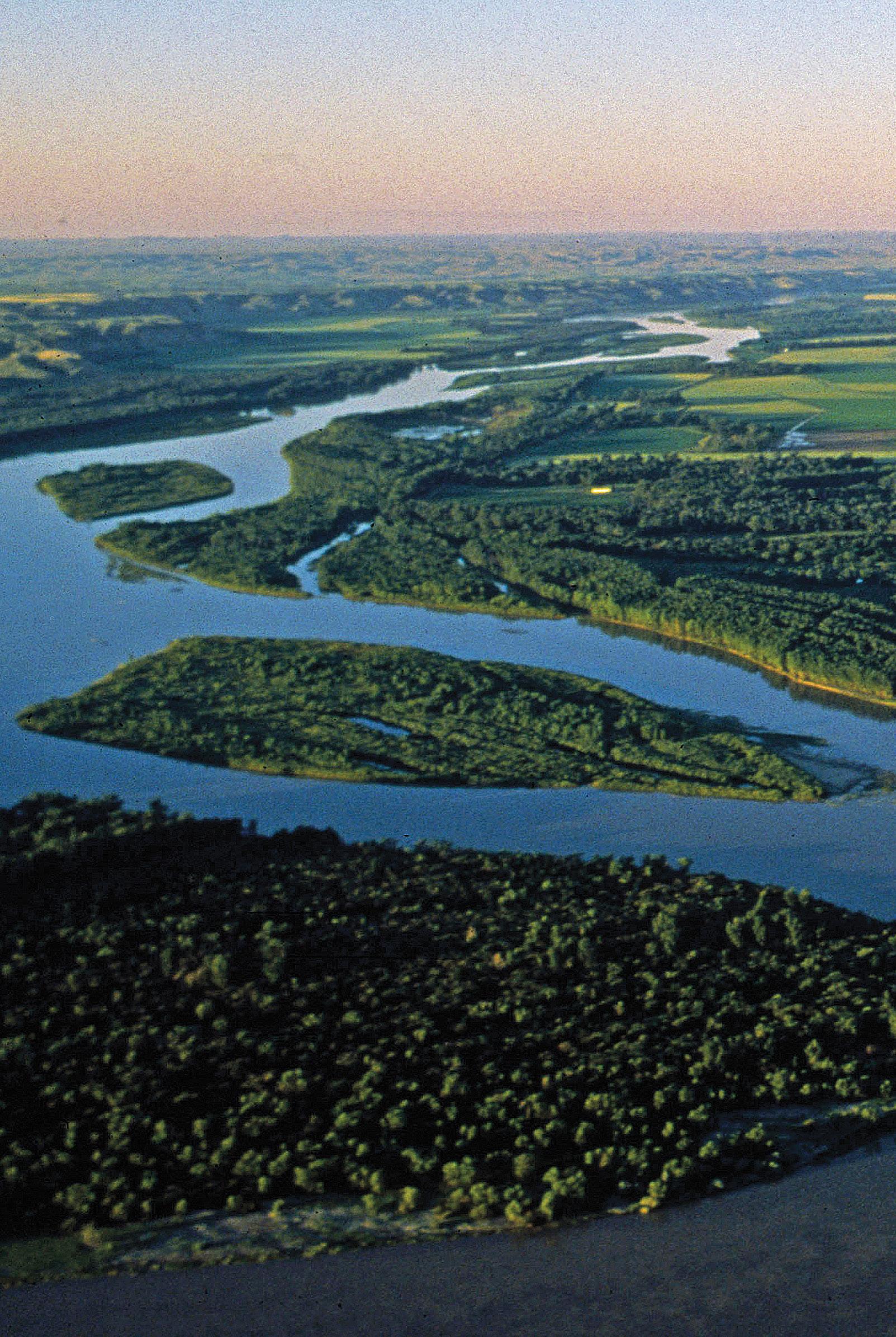
Snow Creek on the CMR National Wildlife Refuge north of Jordan | Rick and Susie Graetz
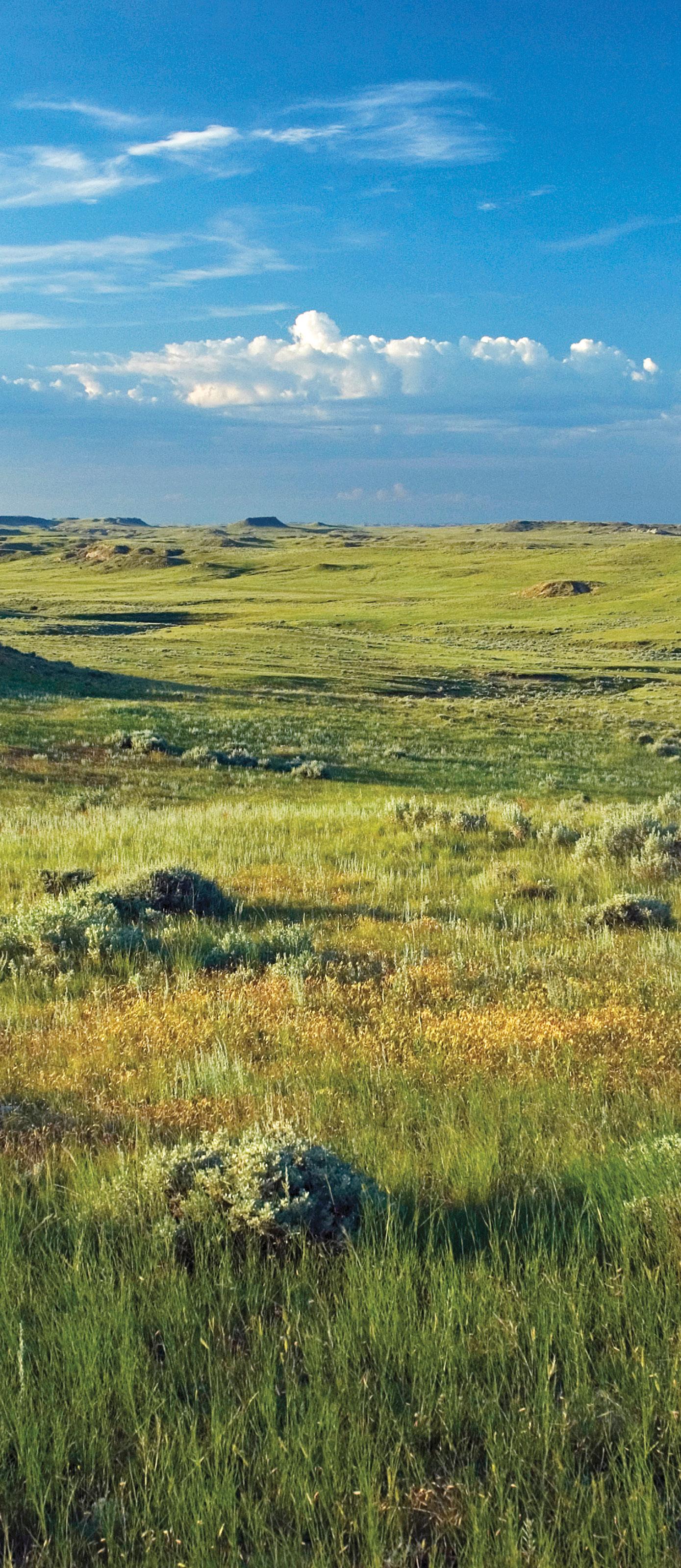
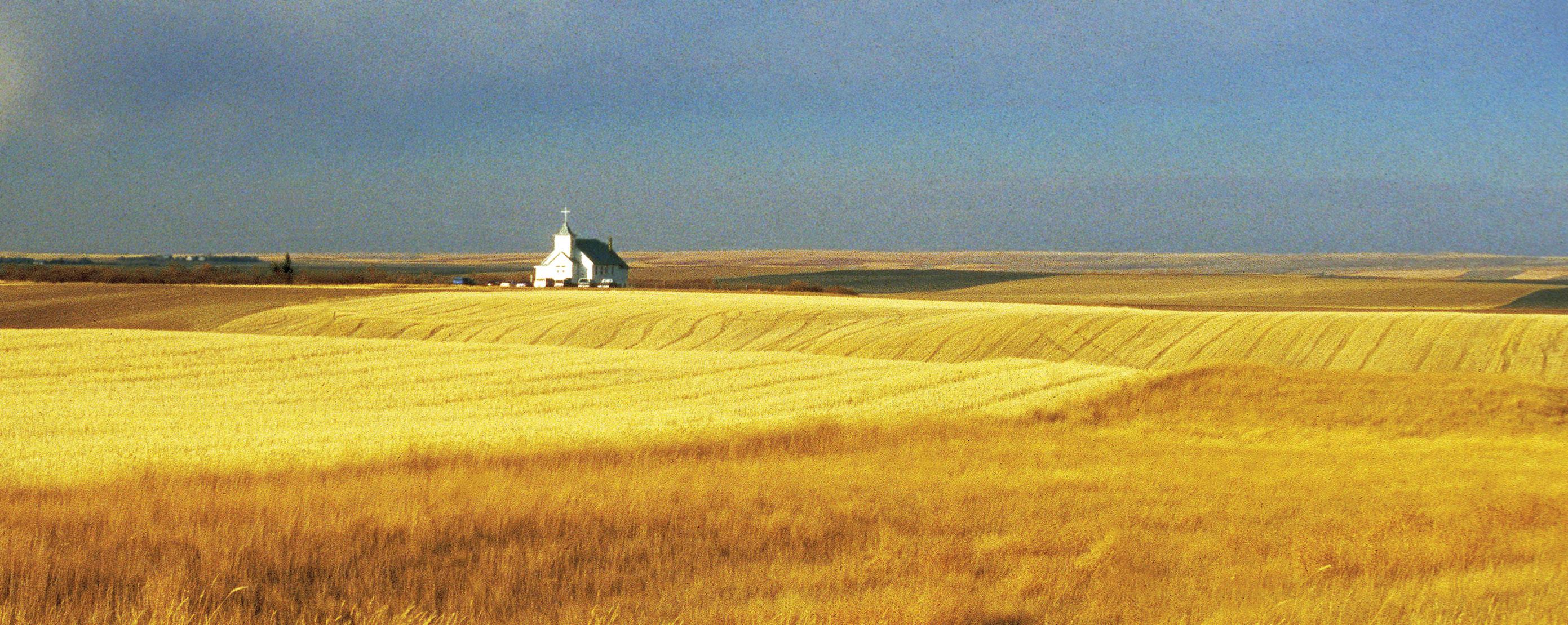
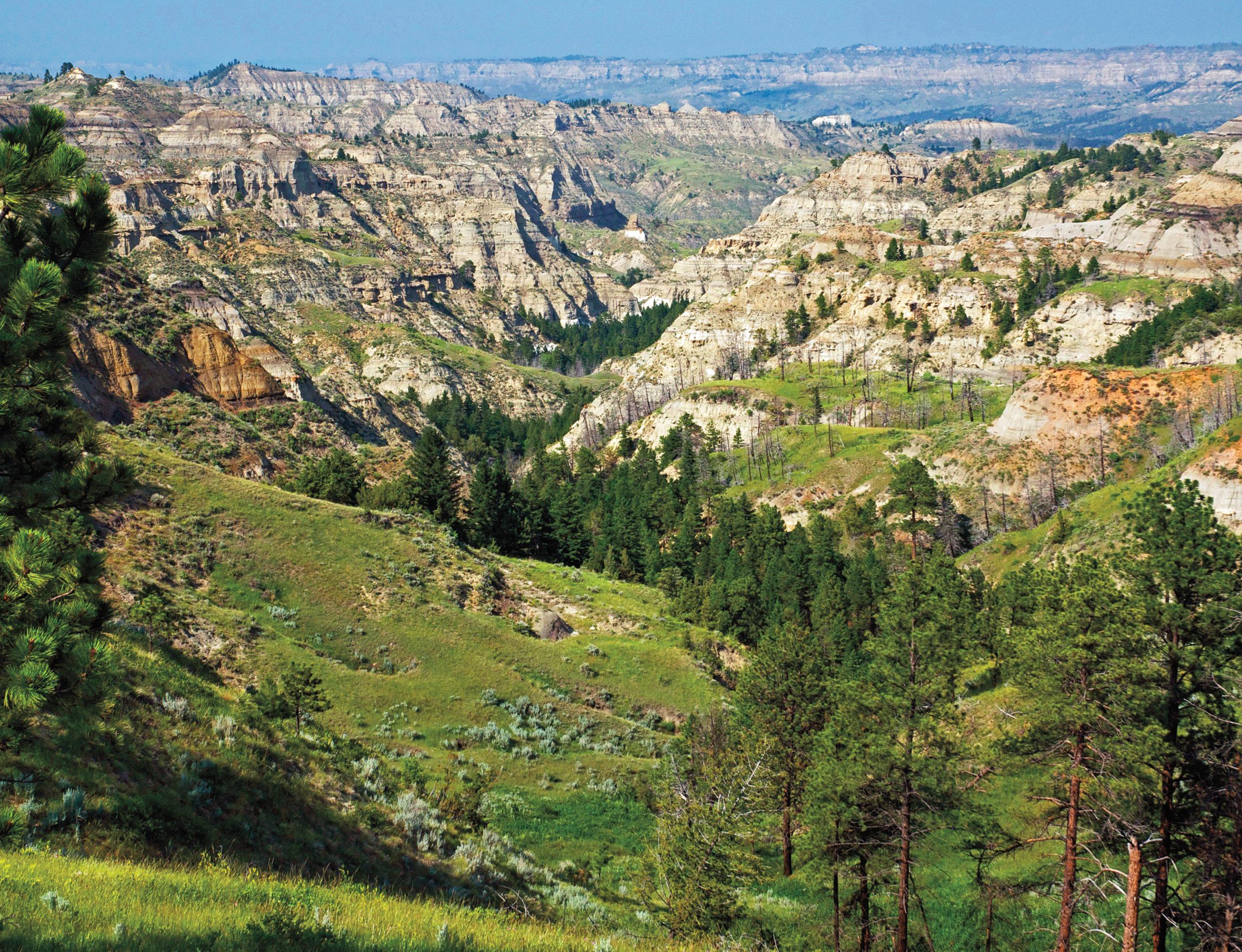
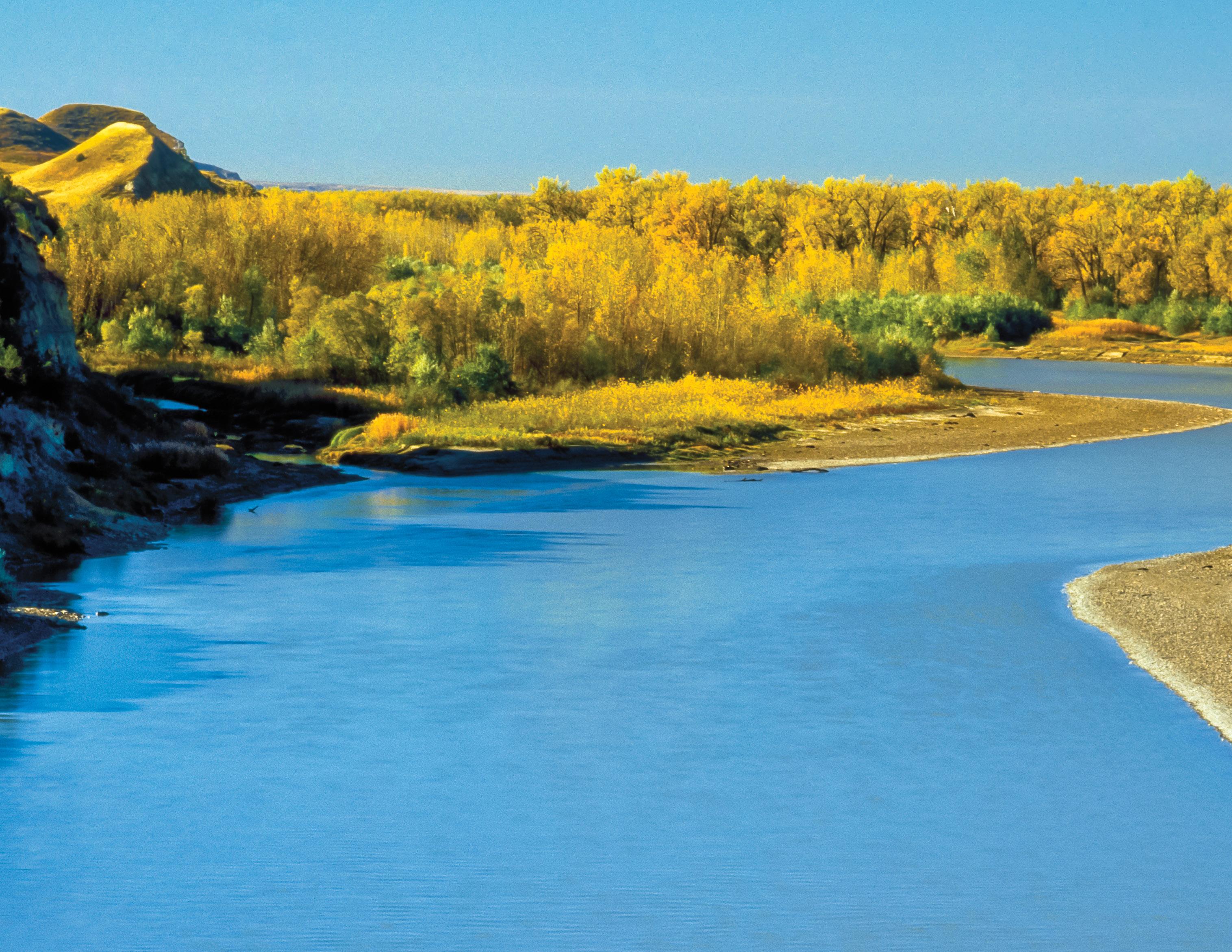
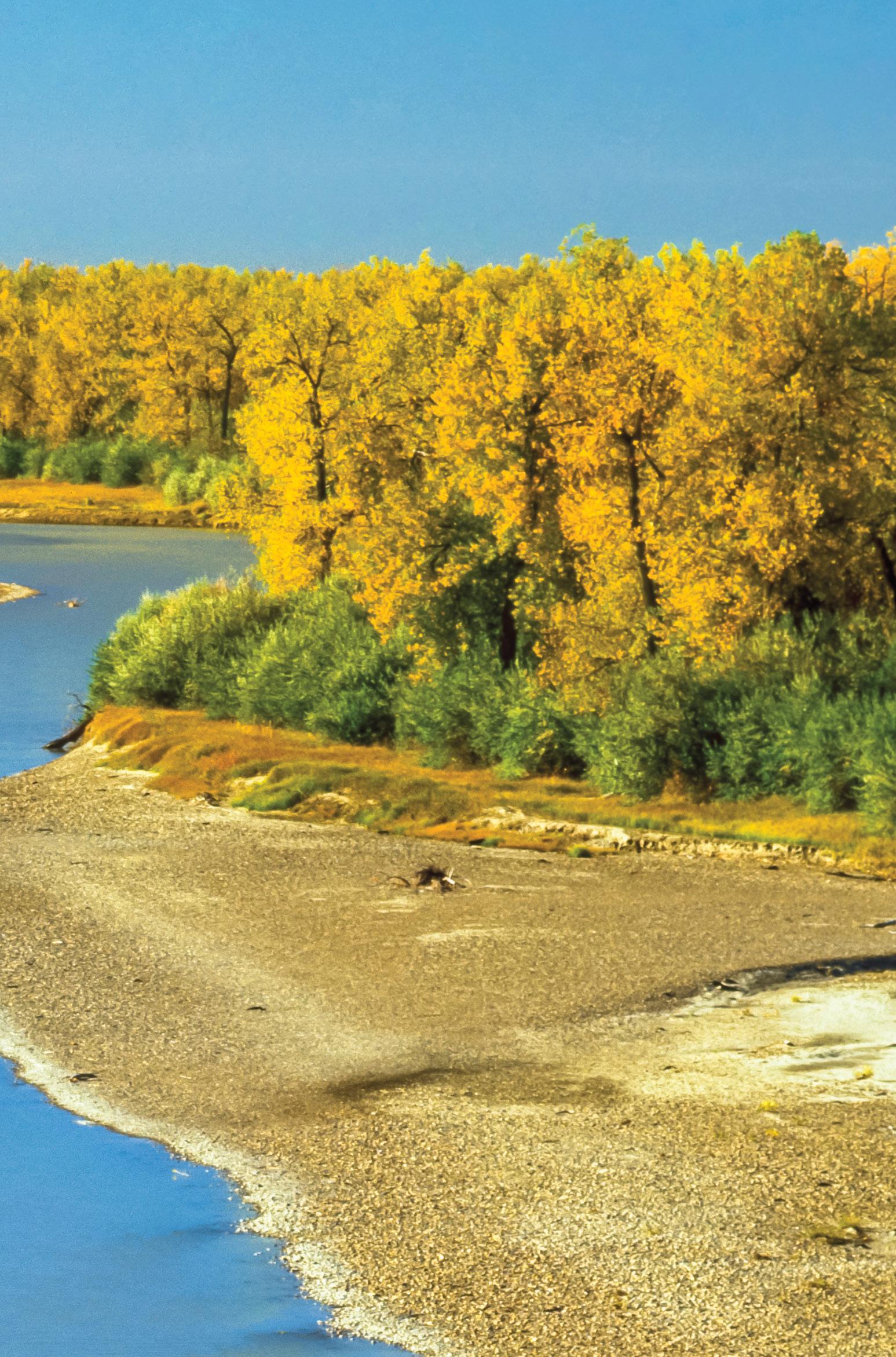
Heading towards the sunrise and leaving the abrupt wall of the Northern Rocky Mountains behind, one approaches the most magnificent prairie country in the nation…the northeast quadrant of the Big Sky—Missouri River Country—an uncommon piece of geography.
Island mountains, buttes, river breaks and canyons, badlands and a largely untouched landscape are the hallmarks of this big territory. If Lewis & Clark went up against the current of the big Missouri today, 220 years later, they would recognize much of what they viewed back then.
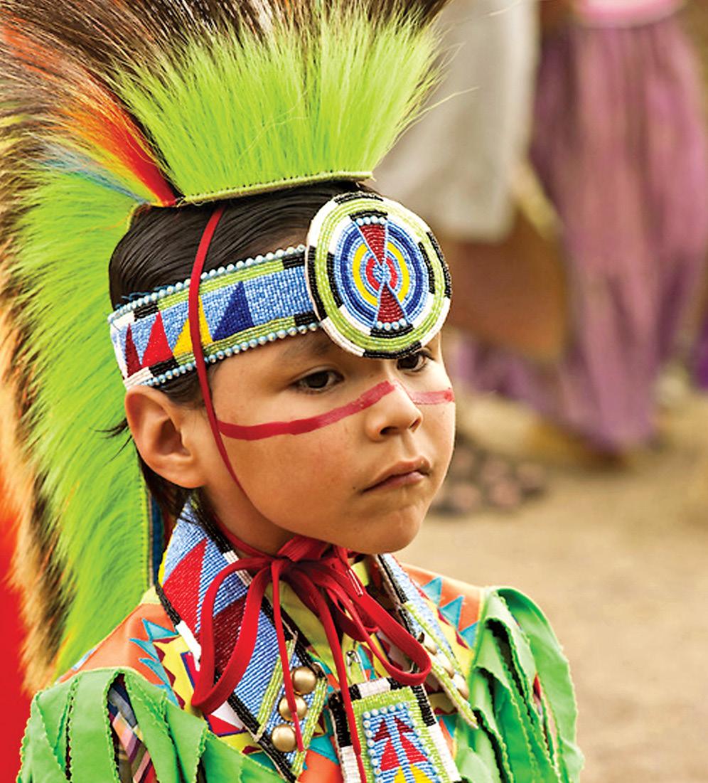
Missouri River Country is where Montana’s first known history was played out. Millions of bison migrated through the territory and nomadic Plains Indians followed them. The shaggy beasts sustained these great Indian Nations by providing food, clothing and shelter. Much of early-day Montana deserves the description the Wild West, but the Little Rocky Mountains and the country rolling south into the Missouri Breaks in the western sectors of MRC was perhaps the epitome of the Old West etched on movie screens. A little over 100 years ago, the characters of those times ... cattle barons, gold seekers, outlaws, cowboys, vigilantes, rustlers and horse thieves went about their way here.
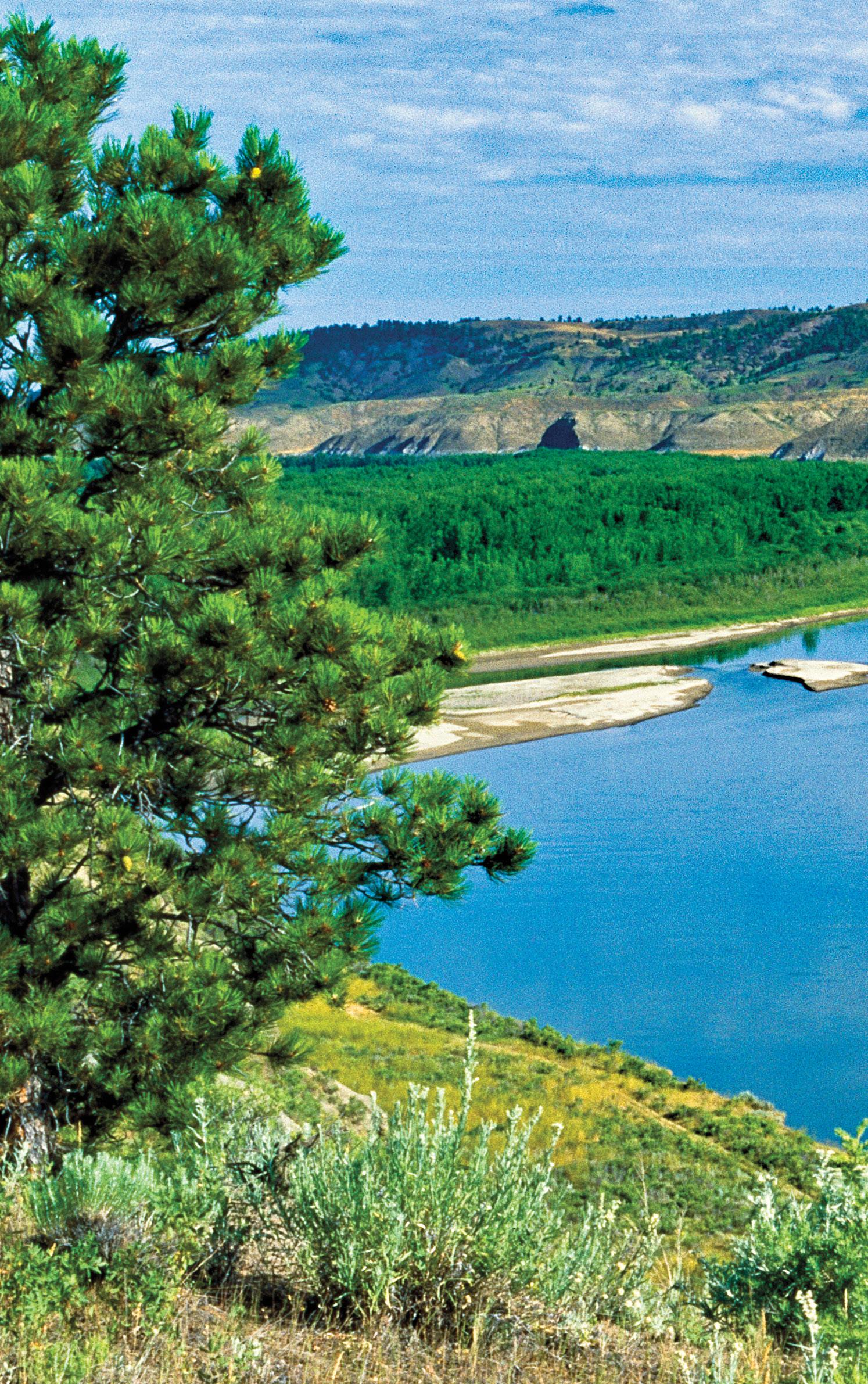
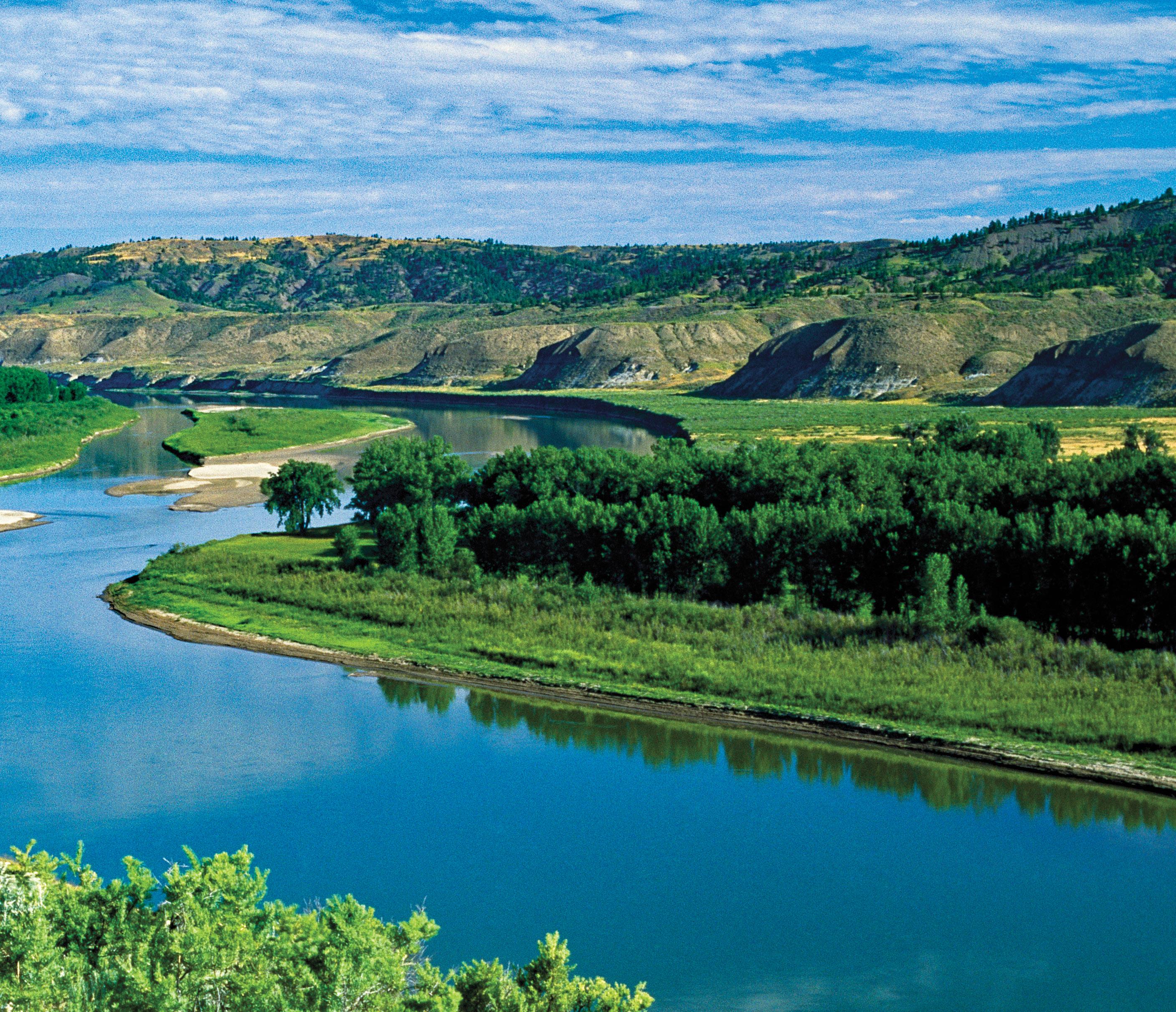
Northeast Montana’s centerpiece is the Missouri River. As a route of western expansion, it had few equals and became Montana’s lifeline.
These landscape descriptions are but a few of a territory fitted with awesome prairie scenery. And places like the sprawling Charles M. Russell and Medicine Lake National Wildlife Refuges not only encompass incredible beauty but are home to wildlife populations unparalleled on the high plains.
Towns are the essence of this territory where the natural forms capture attention. Social and commercial activities interact within them in a way that is all but disappearing across America. Cafes, hardware and grocery stores are where stockmen, farmers, and bankers meet to discuss ag-economics, their families, and the weather. You’ll still find drug stores with soda fountains and chances are you can walk in the door of any business and shake the hand of the owner. A genuine welcoming atmosphere prevails.
These descendants of sodbusters and cattle outfits that have been in the same family for generations provide the region with a sense of permanency and independence. A strong profile dictated by rural life and past experiences characterizes the folks who call the Northeast Montana prairie home.
We, the residents of this quiet corner of Montana, invite you to commence your trip of discovery through our beautiful landscape and to experience our aura of history, vibrant culture and western hospitality. Each of us will do all we can to make you comfortable. The gate is open so come join us. You will not be disappointed!
Let the adventure begin…
Notes for traveling in Northeast Montana
Traveling in northeast Montana will give you an opportunity to discover a piece of our nation that has changed little with time. Don’t rush through it, rather, savor the experience and let the peace and power of the landscape become a part of you.
Your Vehicle. An ordinary road car or camper will suffice for the main highways and the well-traveled gravel roads. However, there are many less maintained byways into the Missouri Breaks, Charles M. Russell Wildlife Refuge, Fort Peck Lake area and elsewhere where an all wheel drive rig with clearance is needed. It is best to make local inquiries as to the condition of a given road.
Weather and Roads. The paved highways and gravel back roads are passable in all but the worst winter weather. Many of the out-of-theway routes are dirt surfaced and most of the earth in these parts consists of bentonite. In dry weather they are fine to drive on, however, when snow is melting or it has been raining, these unimproved roadways turn to a “gooey gumbo,” making them impassable even with most 4-wheel drive vehicles. Listen to weather reports or check with locals before venturing too far into the backcountry. When traveling on public lands stay on numbered and established/ designated roads.
Water. Food & Gas. Carry plenty of water with you to avoid dehydration. The humidity out here in summer is low. There are enough communities along the highways with places to get gas, water and food. When venturing out into most of the lands beyond, services are non-existent so it’s a good idea to buy what you need in town.
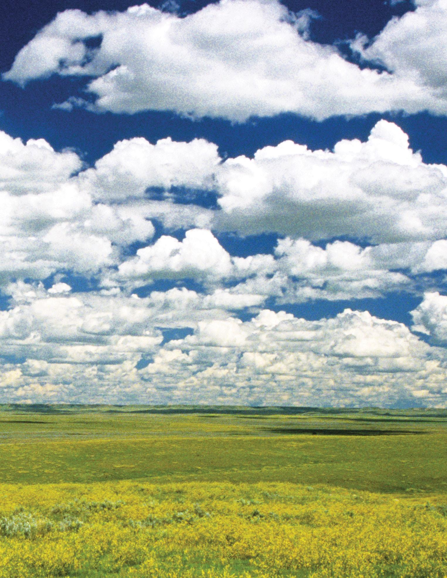
to Travel. Spring dresses the prairie in its finest brilliance ... shades of green grasses and wheat fields stretch forever, a rainbow of wildflowers dots the landscape, while cloud patterns paint the horizon and magnificent sunsets follow afternoon showers. For Missouri River Country at its best, this is the time to go ... early May until early July.
Rain subsides during the summer, grasses cure to brown and yellow, maturing grain waves golden on the wind, billowy white clouds float through the clear blue sky and many rodeos and county fairs take place. By mid-September, autumn is in the air ... low lying brush turns red and the river bottom cottonwoods take on a flame orange hue. The sky can be cloudless for days. Wheat harvest is progressing and flocks of birds and geese are gathering on the lakes and ponds to prepare for their journey south.
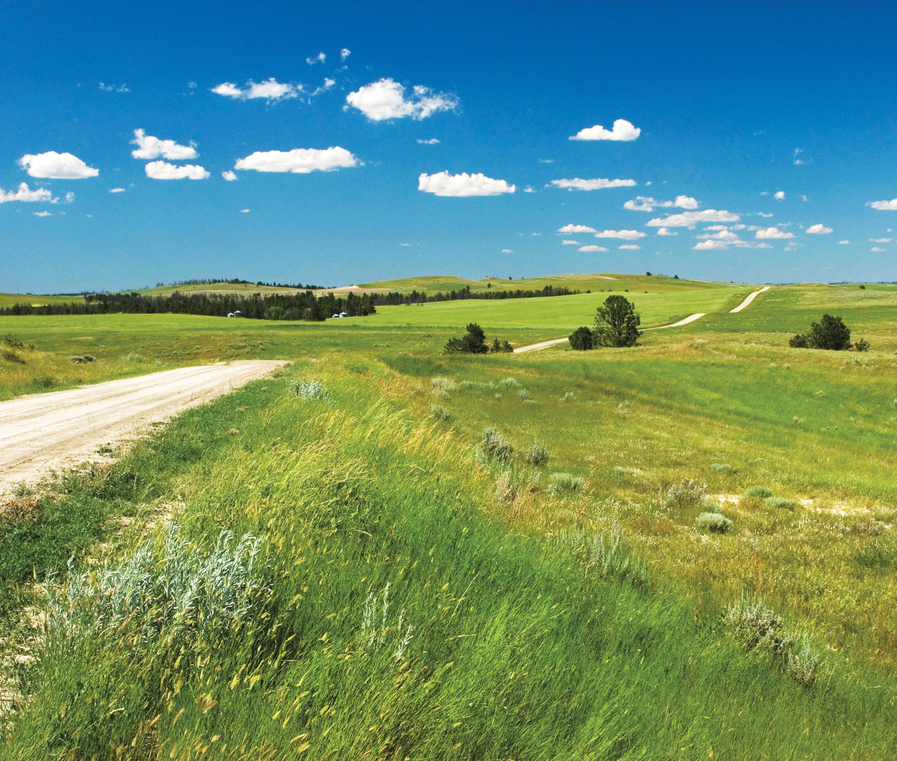
Notes on Agriculture. Agriculture is Montana’s number one industry and in Missouri River Country it is the absolute mainstay of the economy. In simple terms, most of the landscape is a mixture of grass and grains ... ranching or dry land farming ... or is undisturbed.
When
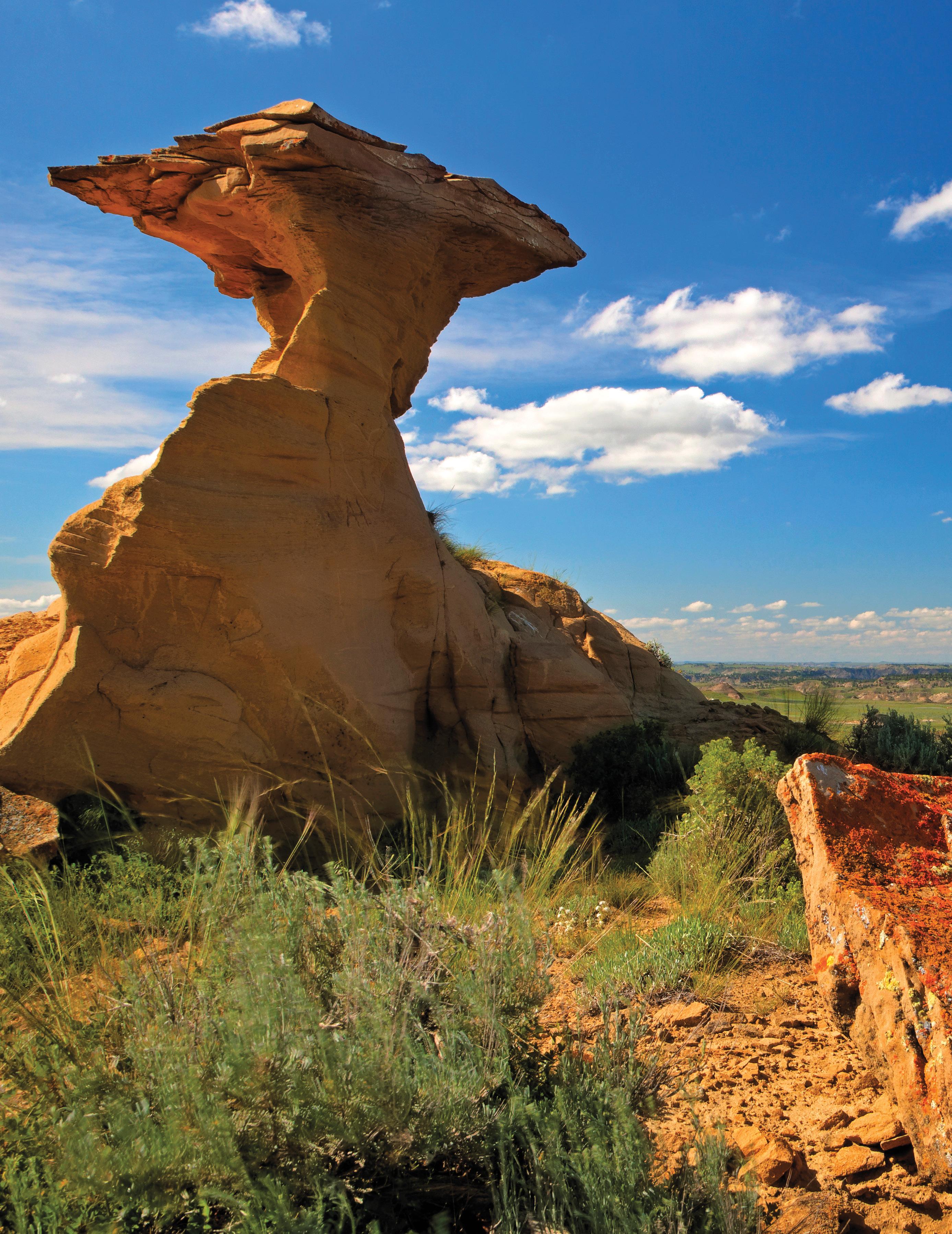
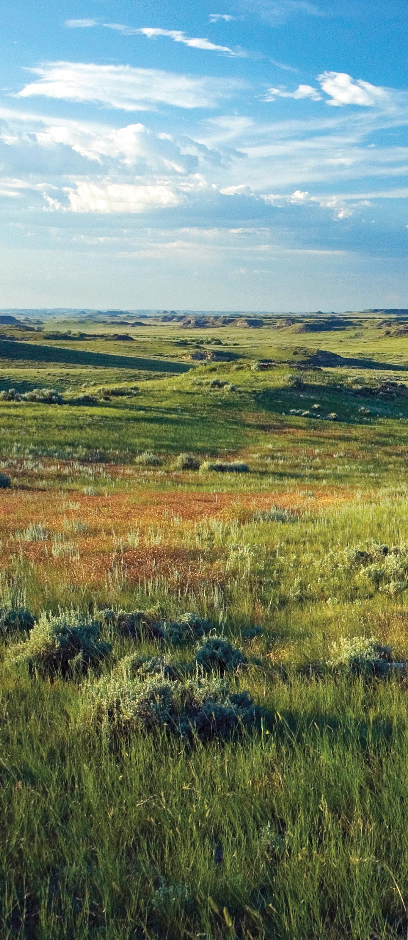
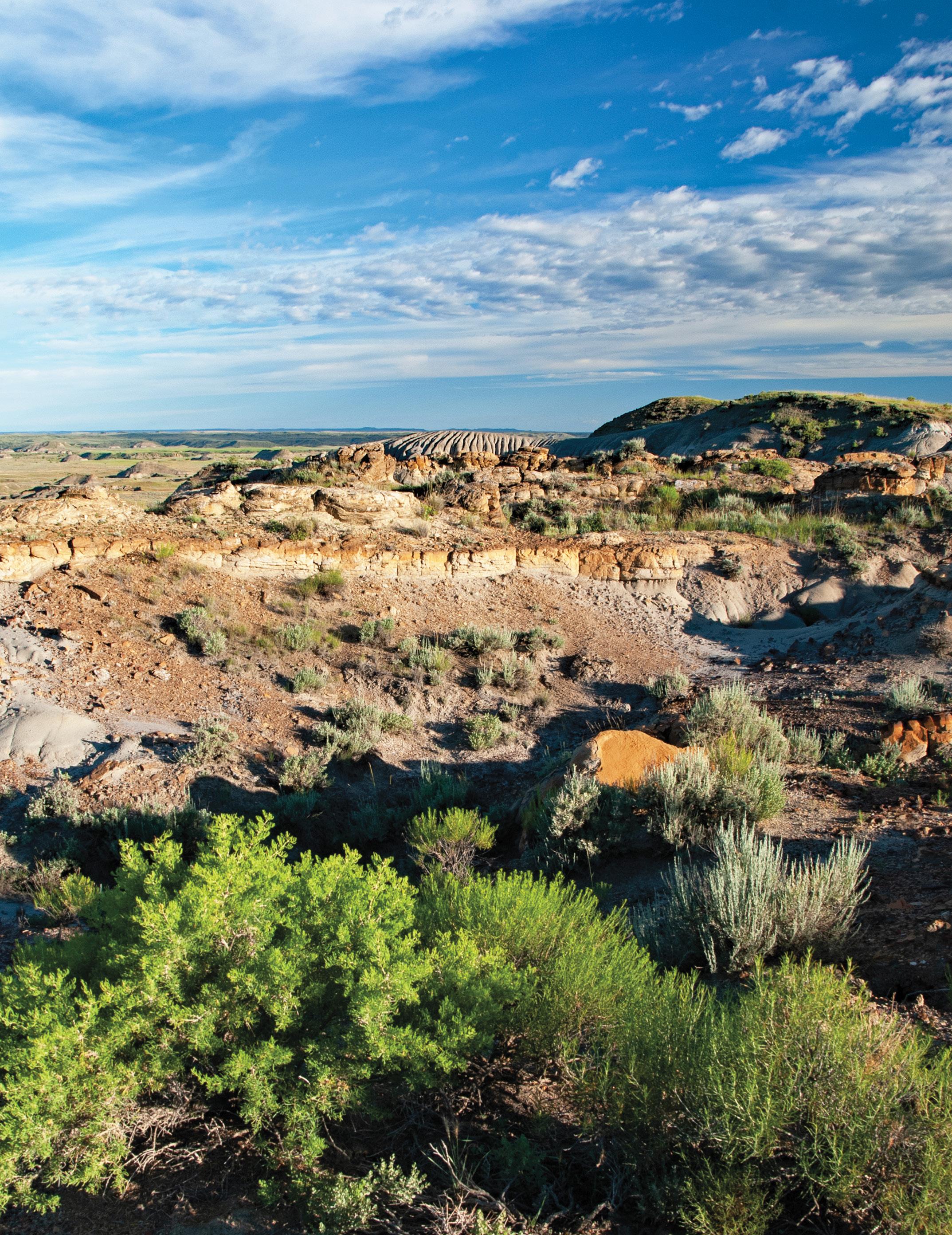
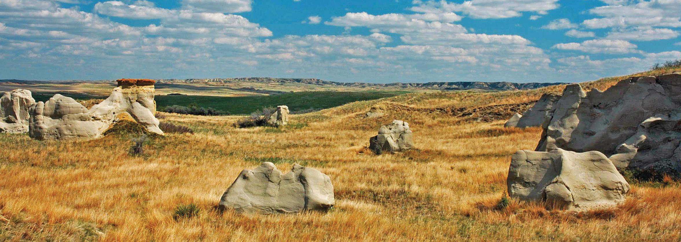
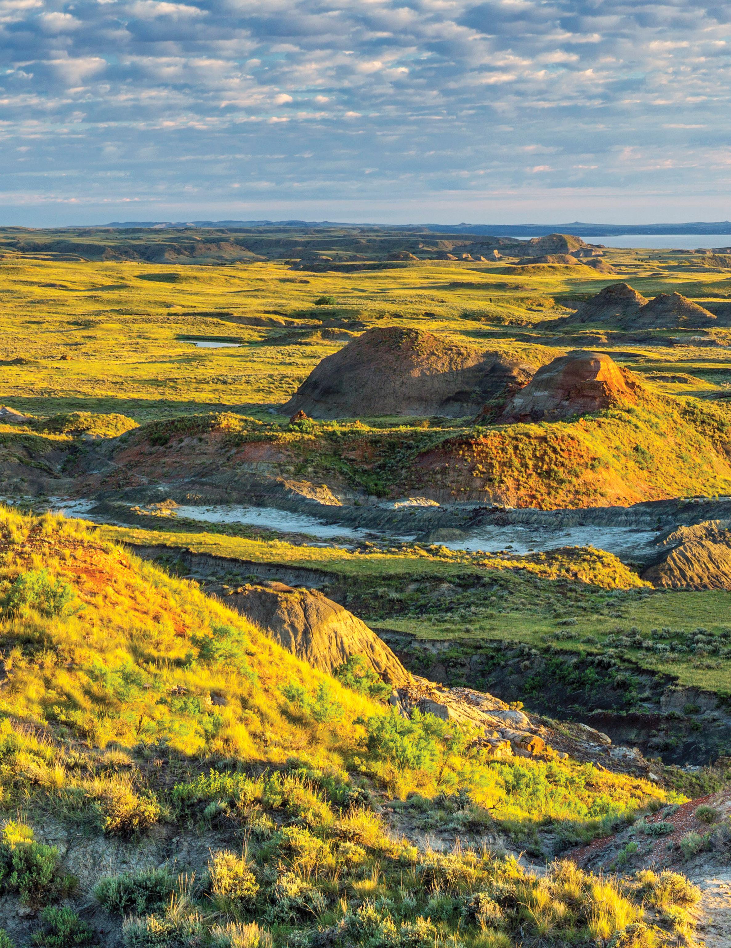
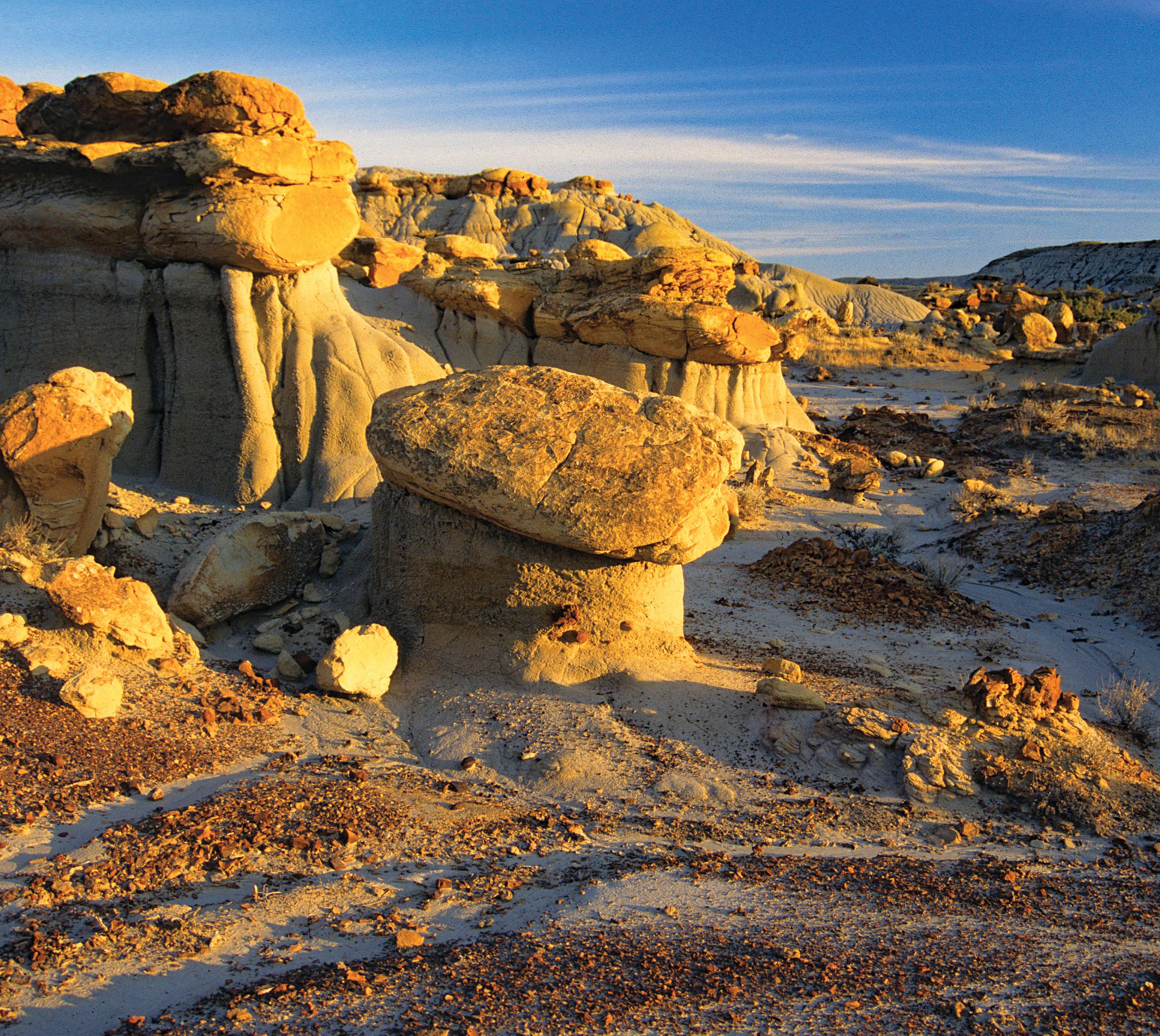
Badlands. Badlands are scattered throughout northeast Montana. This distinctive landscape is actually a small desert environment. Badlands appeared when fire or some other disruption destroyed the plant cover that would normally protect soil from being eroded. Rainwater hit the denuded surface compacting it and new seeds couldn’t take hold. Run off formed gullies and soon strange looking formations of bare earth appeared. Unusual and weird rock formations that look like toadstools or thin walls are scattered throughout the badlands. Made of sandstone they were created by wind erosion once the vegetation disappeared.
Red Rocks. In your travels throughout parts of Missouri River Country you’ll note hills that have a distinct red and yellow look to them and add color to the prairie topography. These colorful rocks are commonly called scoria, but the proper name is clinker.
Clinker or scoria is baked red sandstone and shale that at one time was lying above a burning coal seam. The coal caught fire from lightning strikes or prairie wildfires. This overlying formation is made up of literally” cooked” or metamorphic rocks. Heated to a high temperature from the burning coal, oxygen combined with iron in the rock to form iron oxide producing the bands of red rust color evident in some of these hillsides. Clinker is a very hard rock, in a part of the world where most of the rocks are of a soft nature, and is used for surfacing some roads.
Breaks. River breaks, such as the Missouri Breaks and Yellowstone River Breaks, are a major landform in Missouri River Country. Formed by the erosion of the soil and soft rocks through the action of water, small gulches and deep canyons are cut out of the higher landscape above main waterways; streams, rainwater and snow melt find their path to the river. The resulting terrain is rough, wild and spectacular.
South of Glascow | Bradley Castaneda
Experience Northeast Montana!
A visitor and writer making his first trek to Montana’s northeast corner made some observations: “You never hear about northeastern Montana because there’s nothing there. Unlike the state’s western third, there are no ski resorts, no Hollywood stars, no Wall Street moguls, and cutesy ranches. But ‘nothing’ in this case is something.
This nothing is big and bold and dramatic. A classic American landscape of immense, open, rolling space and sprawling ranches. Nothing is working cowboys in leather chaps and silver spurs herding cattle across the range. Nothing is the lush Milk and Missouri River valleys lined with cottonwood trees against a backdrop of prairie badlands and buttes. Nothing is little towns with small museums filled with teepees, eagle-feathered headdresses, and the guns of notorious
outlaws. Nothing is the White Cliffs of the Missouri River. Nothing is antelope, deer, elk, bald eagles, sandhill cranes, ring-neck pheasants, and sharp-tailed grouse. Nothing, in fact, but everything you could ever want.” This is Northeast Montana, and this is Missouri River Country!
See for yourself… the trail begins.
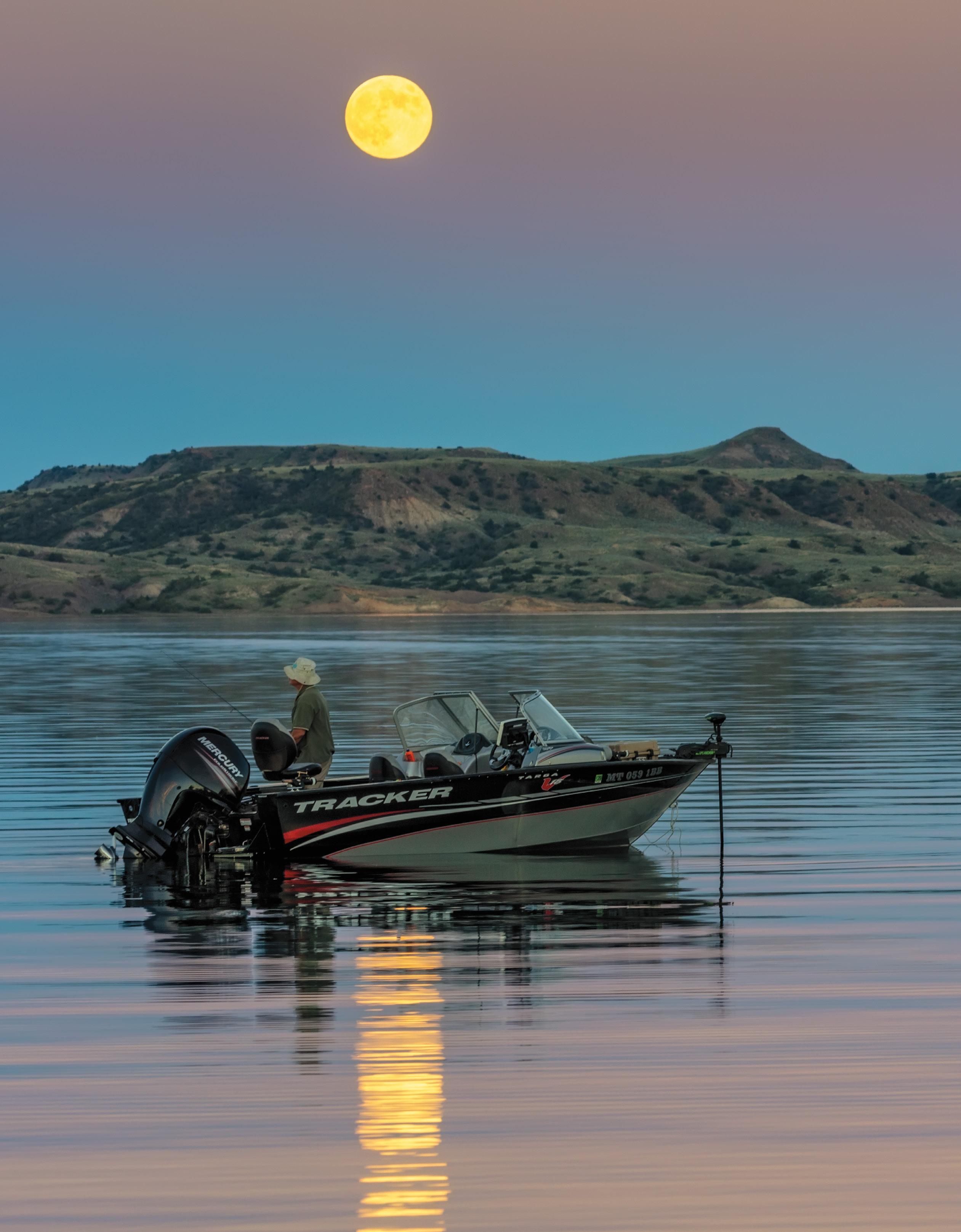
Watching the sun go down on the prairie in Missouri River Country | Tony Bynum
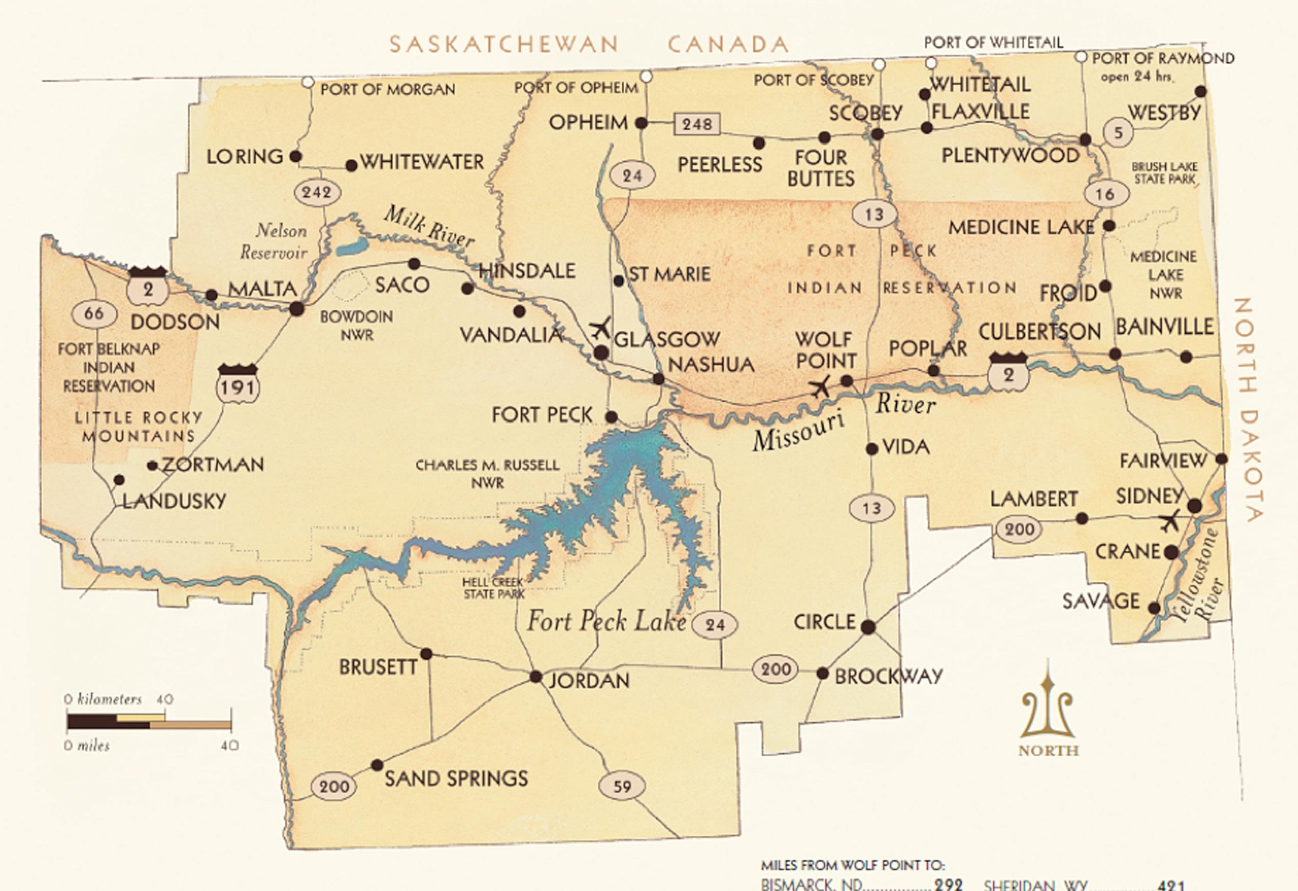
Places to Visit and Routes to Take
Trip descriptions to follow aren’t all-inclusive. Space does not allow for a detailed history and things to do and see in each place. Special sections of this planner discuss events, reservations, museums, recreation, wildlife refuges, fishing, hunting, etc. for all of Missouri River Country. Larger communities have a visitor information center and a library. Look and ask for information. Local folks are happy to help. The more knowledge you have of Missouri River Country, the better you’ll enjoy it.
On the CMR at Sand Creek | Rick and Susie Graetz
MOUNTAINS AND WILDLIFE ROUTE
All of northeastern Montana witnessed the “Old West.” This province saw it at its wildest... big ranches, outlaws, vigilantes, frontier towns, gold mining, cowboys, steamboats, Native Americans, and trappers were all part of this historic area. Seventy miles south of Malta, at the Fred Robinson Bridge, Hwy 191 crosses the big Missouri, and your exploration of the western reaches of Missouri River Country begins.
Lewis and Clark’s Corps of Discovery walked the shores and plied the river you see from the bridge.
James Kipp Park, on the south side of the bridge, has camping facilities. You can explore historic and fabled sites, take the nearby five-mile wildlife driving tour, or try your hand at warm-water fishing.
This stretch of the river is part of the Charles M. Russell National Wildlife Refuge, or CMR. The CMR contains more than 1,100,000 acres and is the second-largest wildlife refuge in the United States outside of Alaska. The refuge office and the Slippery Ann Wildlife Station are south on the highway up the hill. Folks on duty can provide ample information on the back roads, wildlife, etc. Ask about conditions before wandering off on roads other than the tour route.
One of the highlights of this part of the refuge is the 20-mile self-guided auto tour, which takes you near Lewis and Clark’s May 22, 1805 campsite and two historic frontier towns: Rocky Point and Carroll. At the refuge station, pick up a map that explains what you will encounter along the way.
Camping is allowed anywhere in the refuge, but there are certain restrictions. Whether hiking or driving, note that no drinking water is available, so carry plenty.
Leaving the Fred Robinson Bridge, head north on Hwy 191 up and out of the Missouri River Breaks. As you crest the hill, you’ll look at the Little Rocky Mountains, one of the West’s most colorful and storied mountain ranges. It’s about 13 miles from this high bench to the Hwy 66 junction, where you’ll take a left to the old mining town of Landusky.
Kid Curry and his band of outlaws roamed this country. Together with Butch Cassidy and The Sundance Kid’s Hole-in-the-Wall Gang, they held up a train at Wagner just north of here.
After visiting Landusky, backtrack to Hwy 191 and turn left for about 20 miles, following the road into the mountains to the once lively mining town of Zortman. A stroll through the quiet, forested cemetery hints at a way of life that once was.
Missouri River below Fred Robinson Bridge | John Lambing
The Little Rockies southern end | Rick and Susie Graetz
With the passing of the bison, the land became cattle country, and it is still so today. Taking Hwy 191 north to Malta, you’ll traverse the former Circle C Ranch, one of these parts’ first historic late 1800s cattle operations. A segment of the trail of the legendary cattle drives brought up 1,800 miles from Texas to winter in Montana comes through here.
En route to Malta, you’ll find several roads heading east and others southeast into the Missouri Breaks and the CMR. They are enticing, leading to and through a very remote and beautiful prairie country—backroad exploration at its best. Indeed, follow some of them if the weather is dry. Still, it is best to inquire at the BLM Office in Malta about primitive “road conditions” and obtain a map. Then go and explore.
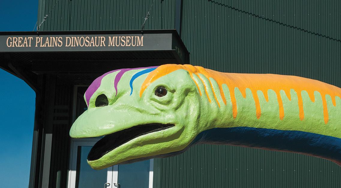
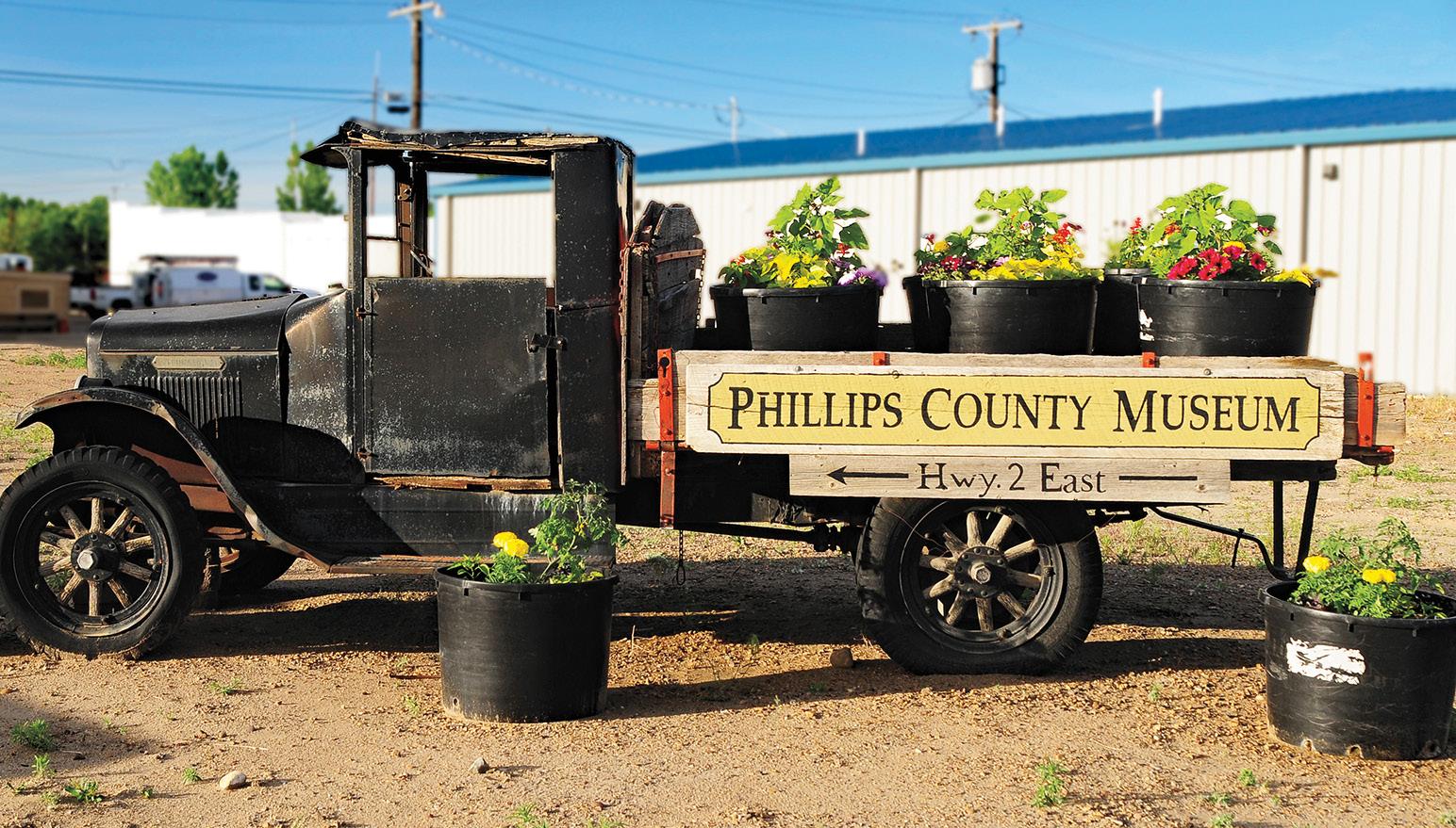
Forty miles north of the Zortman turnoff, you’ll enter the Milk River Valley and the ranching town of Malta. Make this your base to further explore Bowdoin National Wildlife Refuge, just a few miles to the east. While in Malta, make sure you see the Phillips County Museum’s collection of the region’s history. Next door is The Great Plains Dinosaur Museum and Field Station, which features exhibits of dinosaurs and other prehistoric fossils found locally.
In the Missouri Breaks, south of Fort Peck Lake | Tony Bynum
Great Plains Dinosaur Museum greeter Rick and Susie Graetz
Malta | Rick and Susie Graetz
RANCHING COUNTRY AND MILK RIVER VALLEY ROUTE
This passage through Missouri River Country’s northwest corner starts in Malta. Hwy 191, a quiet road leading north out of town, winds through beautiful river bottoms, canyons, and bench lands. It’s 38 miles from Malta to Loring, your northernmost destination.
At about mile 16, a byway veers northwest off of 191 and climbs to a high point. Here, you will be treated to a grand and distant view. The canyons of Cottonwood
Creek snake off to the west, and to the east are the Milk River and its tree-lined banks. Follow this road for about four to six miles, and you’ll reach places where you can look north into the deep gorge of Little Cottonwood Creek Canyon.
Returning to the main highway, go north to Loring, a tiny, picturesque community six miles from the Port of Morgan and the Canadian border crossing. Turn south from Loring on Hwy 191. In about 20 miles, a road stretches east through the Milk River Valley; turn left here for about 23 miles. This back road lets you approach the Milk River in several places. Human sightings will
be few, but you’ll probably encounter deer and antelope. Along the way, you’ll pass by Hewitt Lake National Wildlife Refuge and an access road to Nelson Reservoir, one of northeast Montana’s popular water recreation and fishing areas. Upon reaching Hwy 243, turn right... it’s six miles to Saco and Hwy 2.
You should spend the night if you’d like to fish at Nelson Reservoir. The closest accommodation is the Sleeping Buffalo Resort; the next is in Saco, or try Malta, 28 miles away. Allow another full day or more to enjoy the surrounding country.
Saco’s museum, located in a renovated one-room county schoolhouse—the Huntley School—is named after local student Chet Huntley, best known for co-anchoring NBC’s evening news program, The Huntley–Brinkley Report, for 14 years beginning in 1956.
Bowdoin National Wildlife Refuge, about eight miles east of Malta on Hwy 2, is another reason to spend time in this part of Missouri River Country. A self-guided driving tour gets you close to the continually changing and diverse community of waterfowl inhabitants of the refuge.
On the Harbough Ranch | Bradley Castaneda
FORT PECK LAKE ROUTE
Start in Glasgow, named for Glasgow, Scotland. It was founded in 1887 as the Great Northern Railroad pushed westward. This bustling town on the Milk River is your starting point for this and a couple of other trips through Missouri River Country.
Before leaving Glasgow, visit the Valley County Pioneer Museum. Make sure you visit the South Valley Wildlife Viewing Area for an opportunity to see antelope, deer, and other animals. The road route is about 65 miles long and can take three hours or more depending on your time and what you want to see. Inquire at the Chamber of Commerce or the Glasgow Office of the Bureau of Land
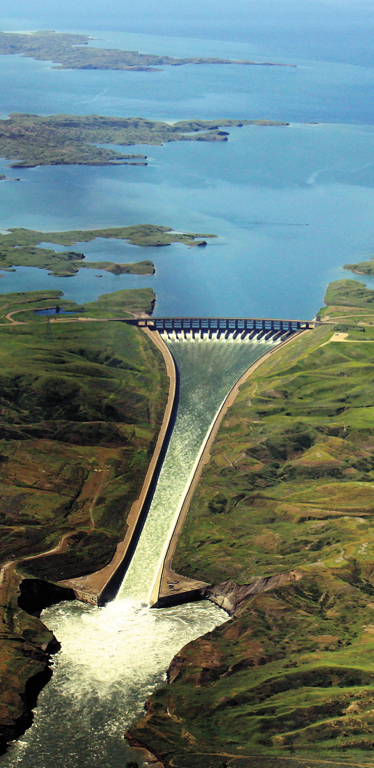
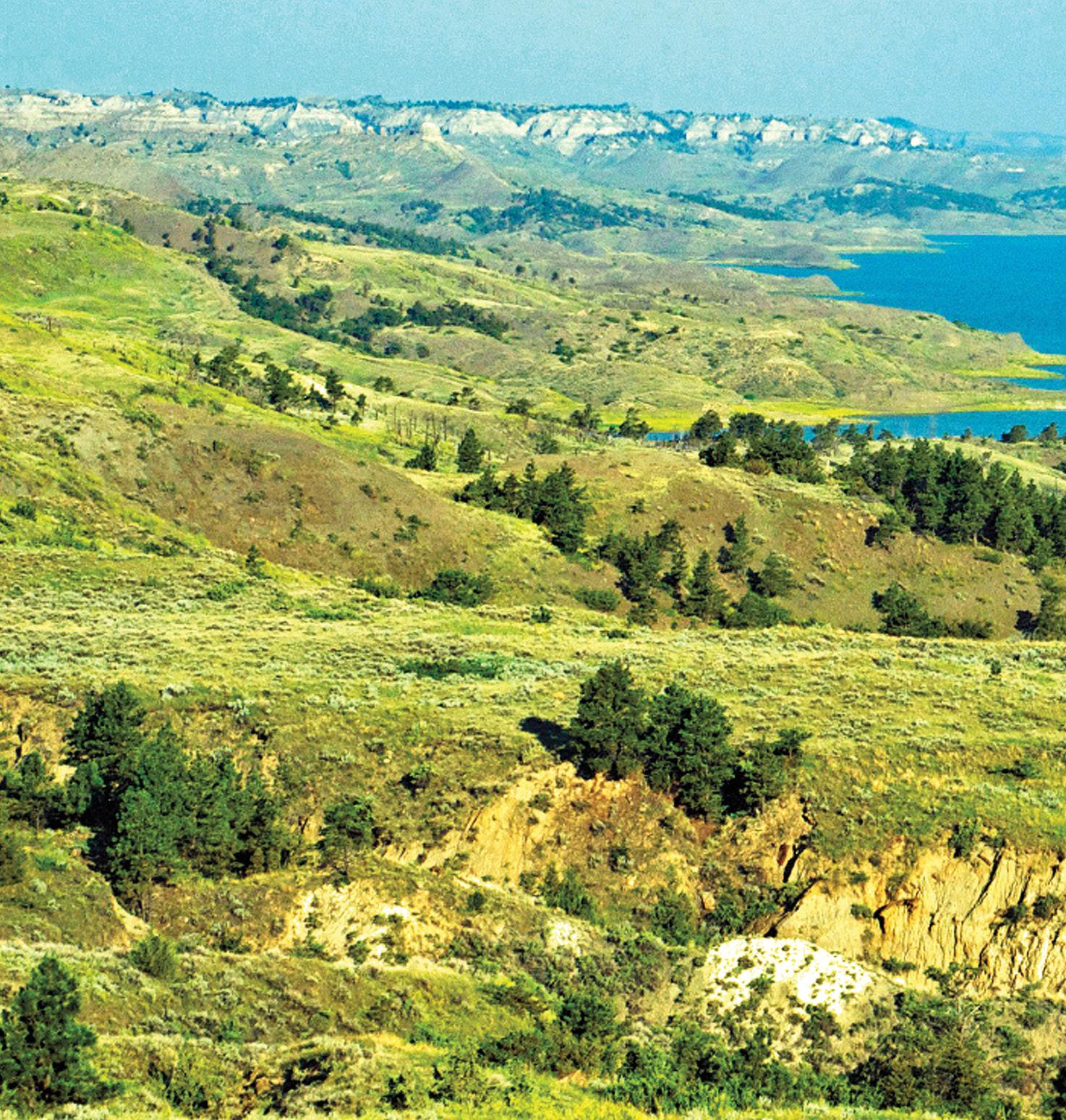
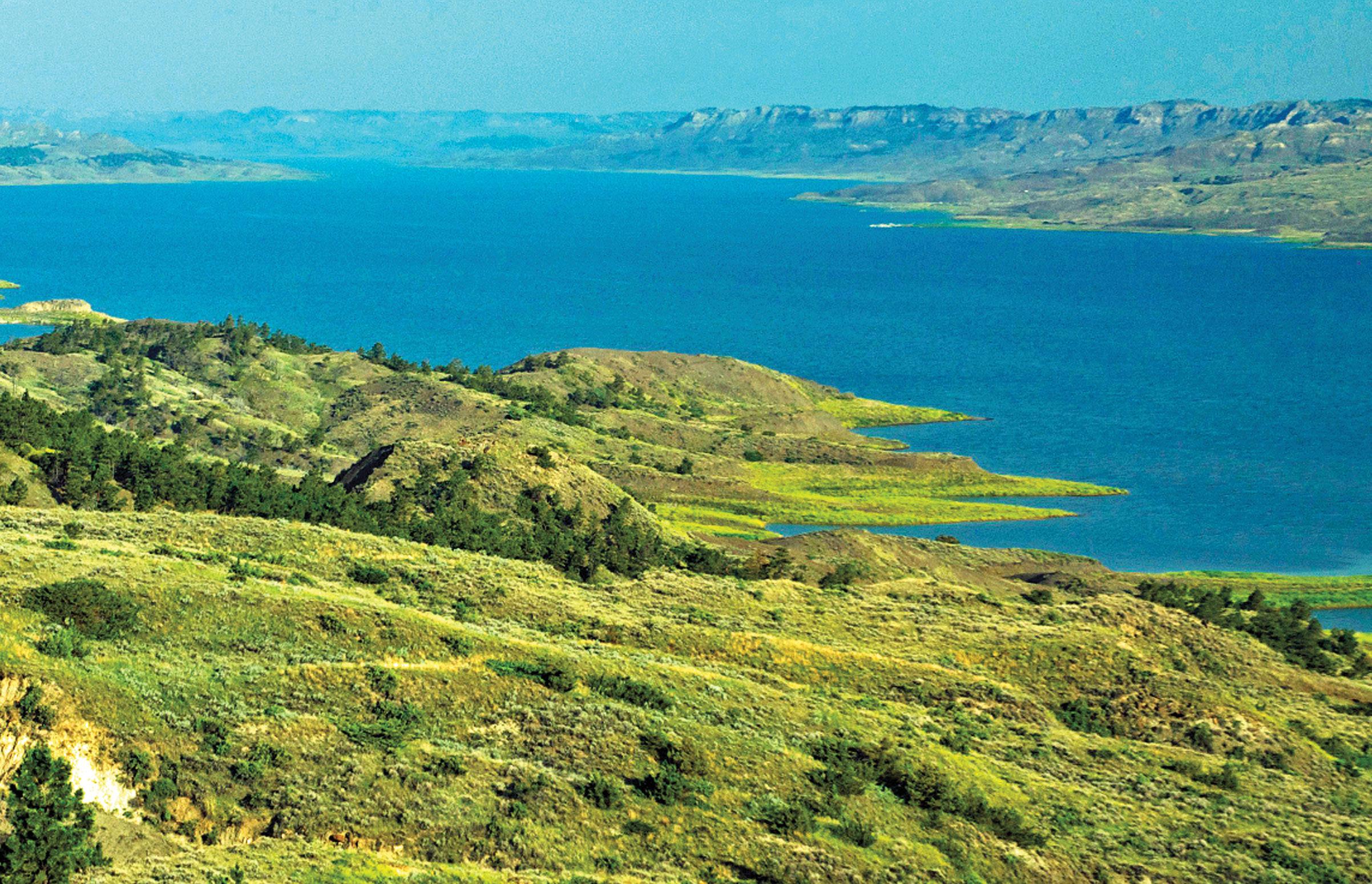
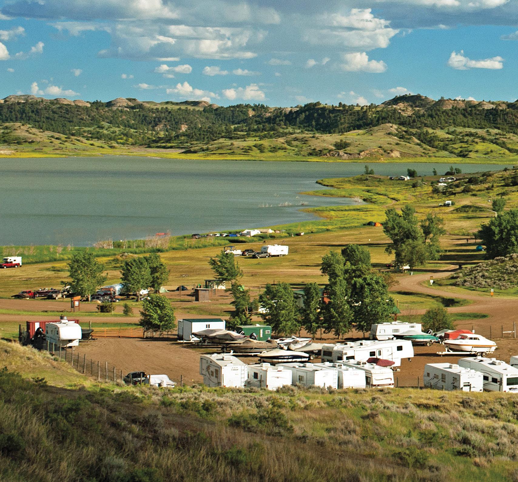
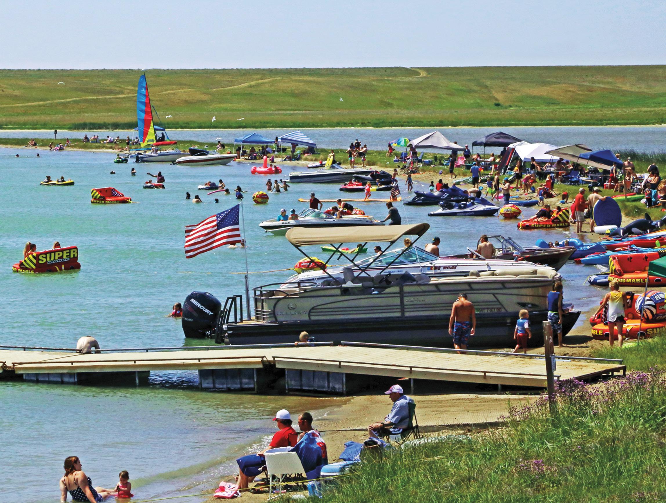
Management for maps, road conditions, and information. From town, point southeast on Hwy 24 for about 18 miles to Fort Peck Lake. You’ll traverse a mixture of rolling and level country. Once you see the lake, realize you’re looking at Montana’s largest body of water. Fort Peck Lake has almost 1,600 miles of shoreline and is backed up for 134 miles behind its dam.
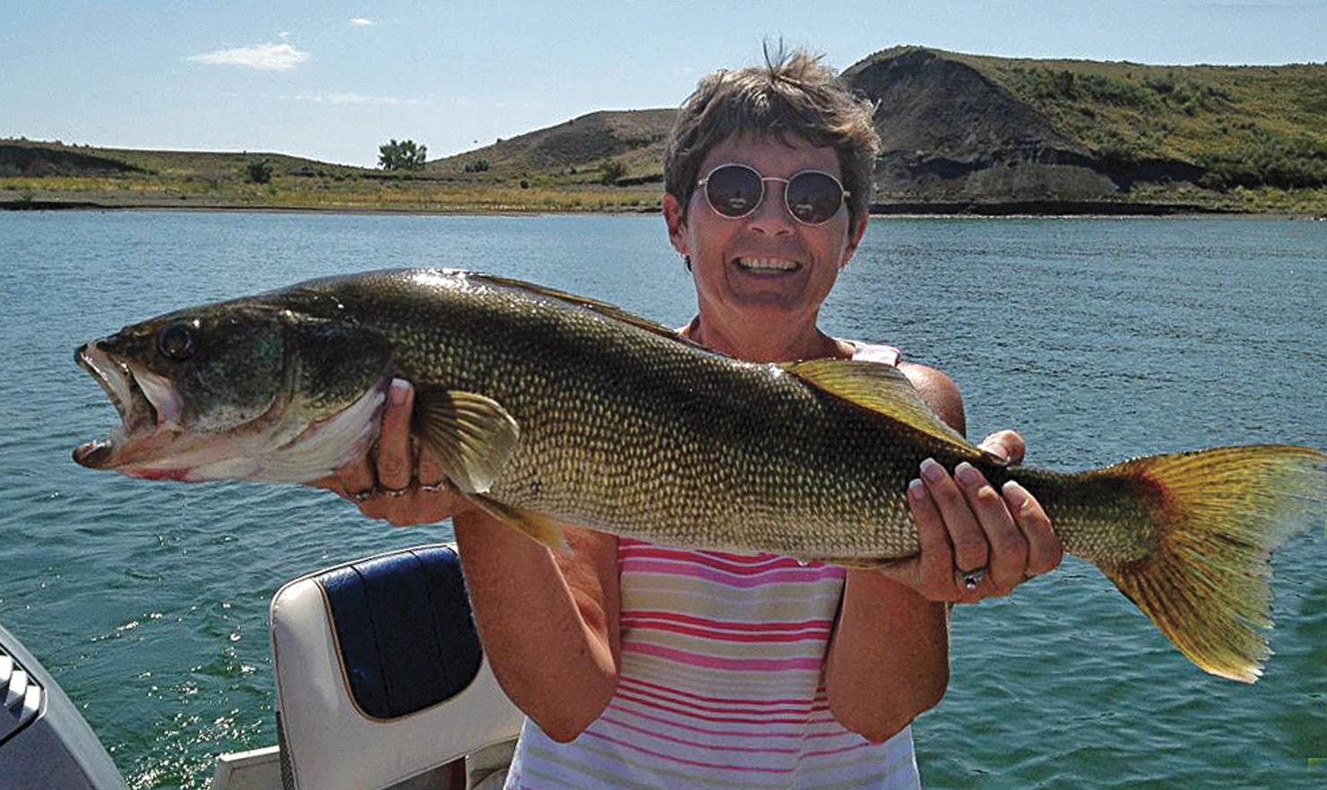
Big fish in MRC’s big lakes | Dan Enebo
Fort Peck Lake and dam | Larry Mayer
In 1871, a Native American agency and a trading post for the Assiniboine and Sioux people was established. By the fall of 1933, with the commencement of the dam project, the Fort Peck town site, planned and built by the Army Corps of Engineers to house its employees, began its orderly development.
One of the most significant earth-filled river impediments in the world, its purpose was to control floods and create jobs in a depression-saddled economy. At that time, the undertaking was the nation’s largest public works project. Completed in 1940, it provided 10,456 jobs at its peak in 1936.
Fort Peck Lake is a Montana treasure both for its size and outdoor opportunities. Six recreation areas within a few miles of the dam provide water sports, fishing, and hunting access. The Beaver Creek Nature Trail starts at the campground downstream from the dam and leads through wildlife habitat. A wildlife viewing autoroute, the Leo B. Coleman Wildlife Exhibit, takes off near the Fort Peck Summer Theater.
Montana’s Governor’s Cup Walleye Fishing Tournament, held the second weekend in July at Fort Peck, is a national event.
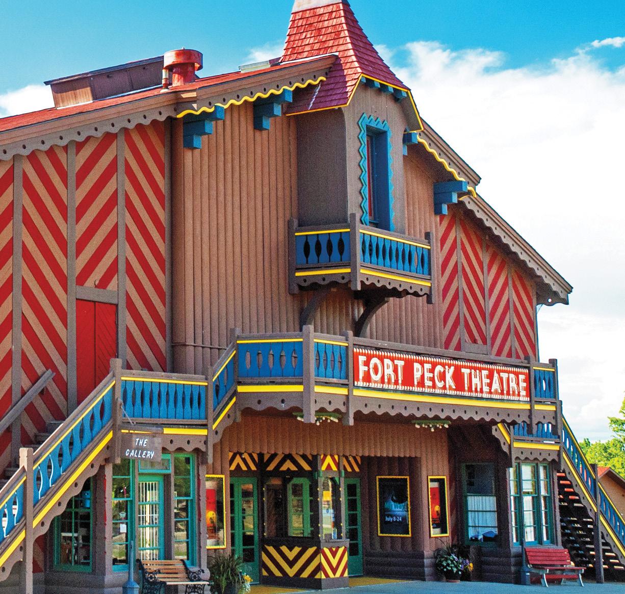
While at Fort Peck, you can camp or stay in the 1930s-style Fort Peck Hotel. If you’re there between June and August, visit the Fort Peck Museum to view its various collections, including artifacts and fossils uncovered during the dam’s construction. The Fort Peck Theater was built in 1934 as an open-round-the-clock movie house for dam construction workers. Today, it boasts a fine summer theater company. The Fort Peck Interpretive Center and Museum features excellent displays of paleontology, wildlife, and the construction of Fort Peck Dam.
The eastern unit of the Charles M. Russell National Wildlife Refuge surrounds this part of Fort Peck Lake. Many roads lead to the lake and through the CMR.
When you leave Fort Peck, strike out north on Hwy 117 for 13 miles to Nashua, then turn left on Hwy 2 for 14 miles back to your base in Glasgow.
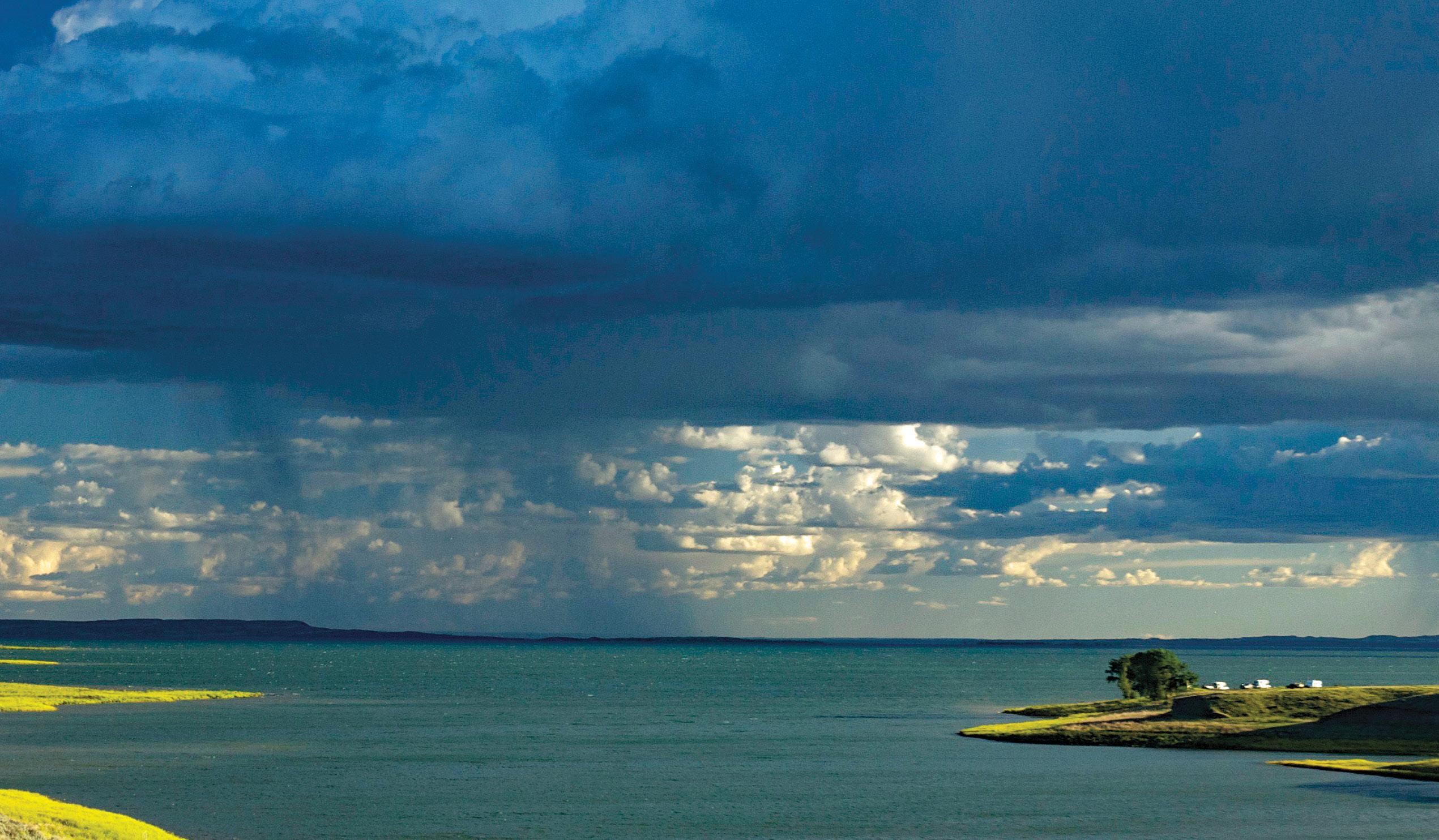
Fort Peck Lake storm | Rick and Susie Graetz
OUTLAWS, OLD TRAILS, AND THE SIOUX AND ASSINIBOINE ROUTE
Wolf Point is the start of your exploration route into the northeast corner of Missouri River Country. The highway distance covered for this circle trip is 188 miles. You can do it in one or two days, but you’ll see much more and have a chance to cover some back roads if you take several days.
Finding documentation of Wolf Point’s exact beginnings is a challenge. An 1834 map noted an “Indian Fort” at the location. As a settlement, it was first established as a trading post and then grew to a cow town when huge cattle herds came through on their way to northern Montana’s rich and tall grasses. The place was a real frontier outpost and featured a dugout hotel along the river.
Today, Wolf Point is part of the Fort Peck Indian Reservation, home to the Dakota Lakota-Nakota (Sioux) and Nakota (Assiniboine) nations.
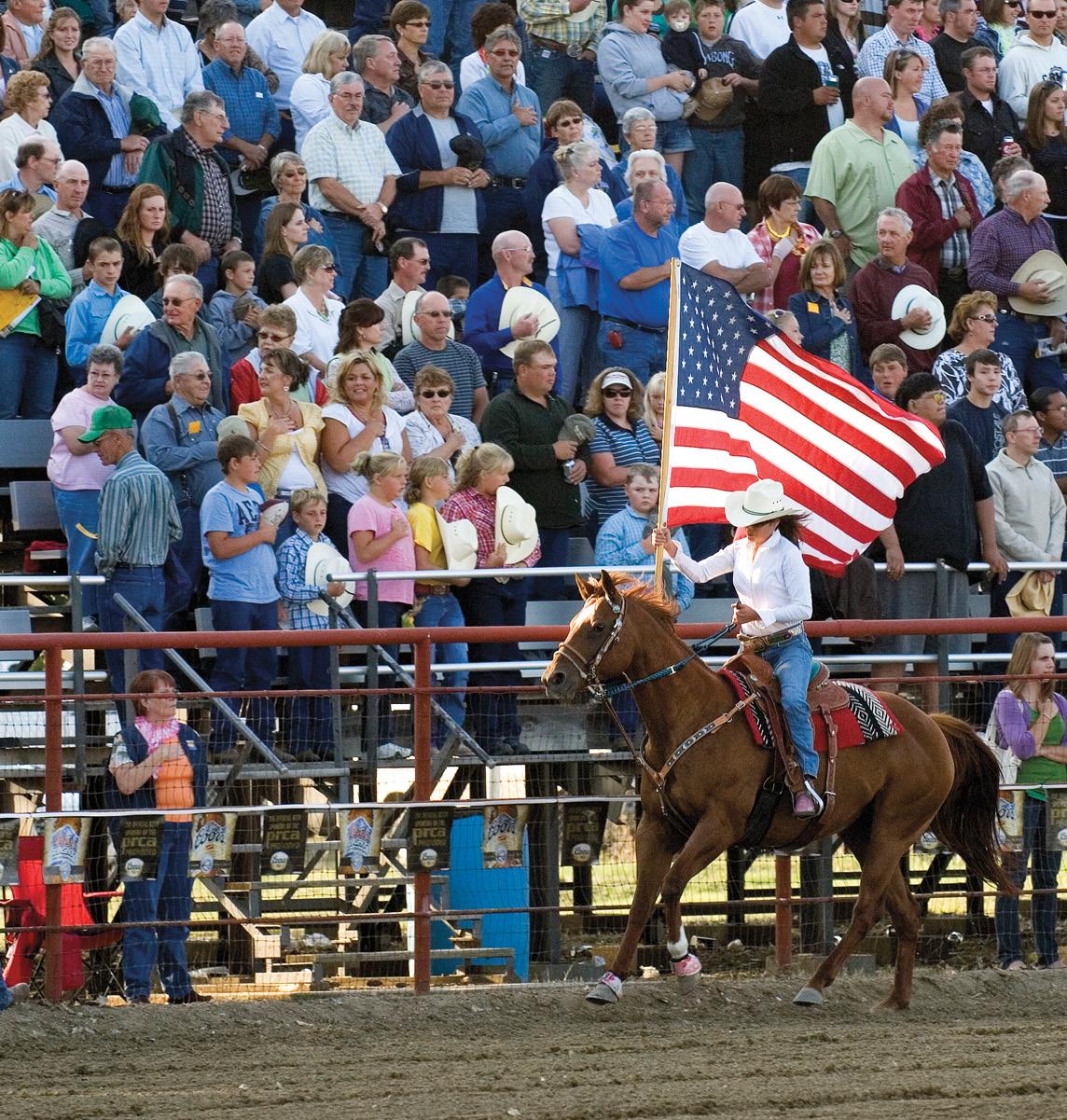
If you’re in Wolf Point during the second week of July, you’ll have a chance to witness the Wolf Point Wildhorse Stampede—the oldest pro-rodeo in Montana. Even before the term “rodeo” was coined, this was an event staged by Native Americans for wild riding skills and celebration.
Wolf Point Wildhorse Stampede | Rick Madsen
Leaving Wolf Point, head east on Hwy 2 to Poplar, 21 miles away. This community, just off the Missouri River, serves as headquarters for the Assiniboine and Sioux tribes. Make time to see the cultural center and the museum.
Six miles east of Poplar, Hwy 251 turns left. Follow it to Flaxville, 52 miles away. The route passes the Poplar River, and as you climb the rise to the north, the land is almost solid agriculture... wheat fields stretch out in every direction. It seems as if you can see forever… Big Sky Country.
Eventually, the road makes a sharp turn westward before resuming its northbound direction, ending at Flaxville. Flax was the only crop grown in the area at one time, so the name came easily.
If the afternoon is still young, continue north through town, seven miles on Hwy 511 to Whitetail, another interesting small place. On the rise, just before town, you can get good photos of Whitetail and the beautiful valley of Whitetail Creek. If you have fishing gear and a license, a public fishing pond is on the community’s edge. The place was established around 1911 with the influx of homesteaders and the railroad.
Left: Missouri River Country grasslands and fields stretch to the horizon | Rick and Susie Graetz
Below: Missouri River near Oswego, west of Wolf Point | Rick and Susie Graetz
Returning to Flaxville, also known for antique finds, turn west on Hwy 5 toward Scobey.
As a center of one of Montana’s most productive grain-growing regions, Scobey is an idyllic prairie town... clean, orderly, and picturesque. Like so many places in northeast Montana, its roots are with homesteaders and the railroad. The unique Daniels County Courthouse on Main Street was once One-eyed Molly’s “house of pleasure,” and is on the National Register of Historic Places.
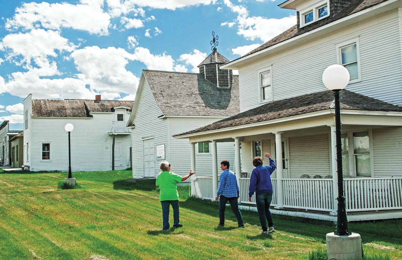
Scobey’s (and northeast Montana’s) featured attraction is Pioneer Town, one of the nation’s best re-creations of an early 1900s homestead town. Forty-two original structures, some 100 years old, have been brought to the site from nearby places such as Whitetail. This is a must-visit.
After leaving Scobey, head back east again on Hwy 5. It’s only 30 miles to Plentywood, but take your time getting there. Rise with the sun and plan on a day of working the back roads. Even if you want to drive mainly on the main highway, at least briefly poke around on some offshoots. There are few signs along the road, so your Montana map is needed here.
Stop in Redstone, established around 1900, takes its name from the red shale in the area. “Dutch Henry,” an outlaw boss, had one of his camps near here.
This now quiet section of Montana, between Scobey and Plentywood, experienced a wild and colorful past. A stock inspector noted in his files, “This is the most lawless and crookedest country in the union and the Big Muddy is the worst of it.” It had it all... Indians, outlaws, horse and cattle rustlers, bootleggers, homesteaders, baseball rivalries, newspaper wars, political battles, communists, and car thieves.
Flaxville Waterfowl Protection Area | Rick and Susie Graetz
Pioneer Town | Rick and Susie Graetz
The Outlaw Trail crossed into Canada north of here. Rustlers moved their stolen cattle and horses along this track and across the Canadian border. Butch Cassidy named the trail and established a rest station to the west in the Big Muddy Valley. At the turn of the twentieth century, the gulches around Plentywood harbored every manner of outlaw. This area was “The Old West” of legend.
At the site of present-day Plentywood, Sitting Bull and his Sioux people surrendered to the US Army.
How does a place sitting out on the high plains get the name Plentywood? In the open range era, several cowboys and a cook from the nearby Diamond outfit were attempting to build a buffalo chip fire. Old Dutch Henry told them, “If you’ll go a couple of miles up this creek, you’ll find plenty wood.” These words of wisdom were remembered when the town got its start.
Stay the night in Plentywood, now a peaceful farming town. Like Scobey, Main Street is very appealing. Make certain you visit the Sheridan County Museum. If you like being outdoors, enjoy a round of golf or grab some food and head for nearby Bolster Dam, where open-air picnic cabanas and good fishing await.
East of Plentywood is a scenic side trip to prairie pothole country and the town of Westby. Brush Lake, a unique Montana State Park, is also nearby.
From Plentywood, take Hwy 16 to your next night’s destination in Culbertson. Tour the little towns en route, but make Medicine Lake National Wildlife Refuge your main goal. Spend the major portion of your day here. This large lake, sitting in the pre-ice-age channel of the Missouri River, is the summer home of more than 100,000
migratory waterfowl. Great blue herons, grebes, 16 species of ducks, and a colony of 10,000 white pelicans share this ecosystem.
Medicine Lake is a premier destination for birdwatchers seeking a glimpse of many rare prairie songbirds, such as Baird’s sparrow and Sprague’s pipit. Fall brings spectacular migrations and attracts bird hunters for both waterfowl and upland game bird hunting.
A 14-mile self-guided driving tour around the refuge affords many wildlife viewing opportunities and the chance to visit the hilltop site of stone teepee rings, where Native American lodges were once erected. Before leaving, be sure to explore the rolling hills and sand dunes, one of Montana’s most extensive sandhill formations.
When you arrive in Culbertson, especially if the light is good, drive south for a few miles on Hwy 16 for a grand view of the “Big Muddy” and surrounding badlands. Lewis and Clark passed through here during the first few days of May 1805.
Be sure to visit the Culbertson Museum and Visitor Center east of town. It offers a great collection of artifacts and historical photographs.
From Culbertson, the distance following Hwy 2 back to Wolf Point is 47 miles. In the latter half of the 1800s, this was the Minnesota Wagon Road used by Pony Express riders from Minneapolis.
Take your time heading back to Wolf Point. Stop in a couple of towns en route, venture a side road or two down to the Missouri, and try to visualize the trappers in their dugout boats or the steamboats heading upriver to Fort Benton.
Gilbert Creek Bay on the CMR Rick and Susie Graetz
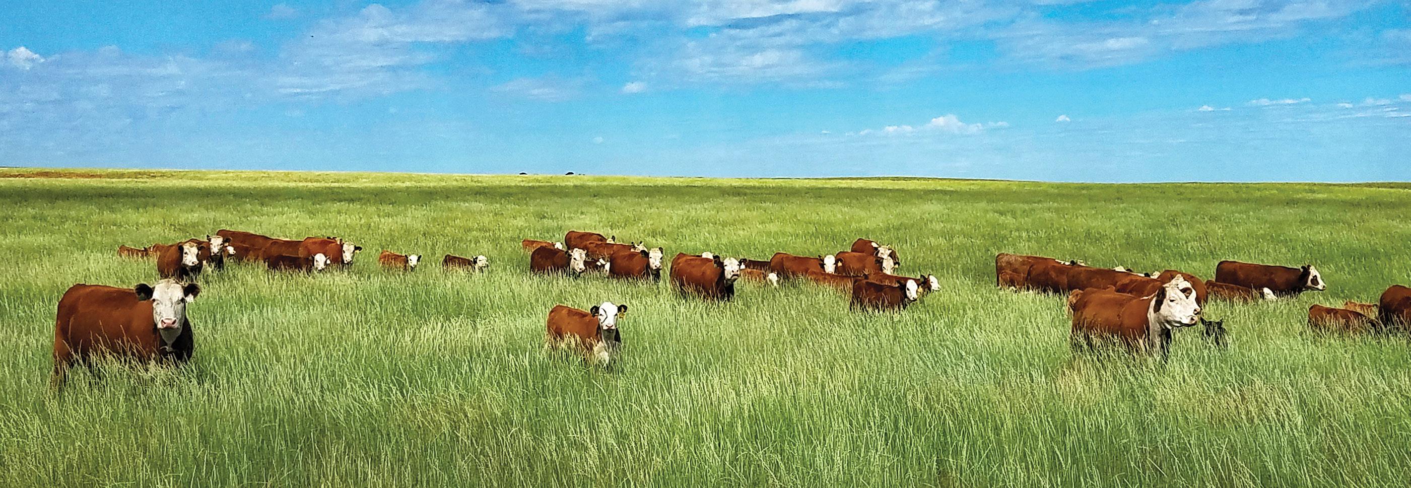
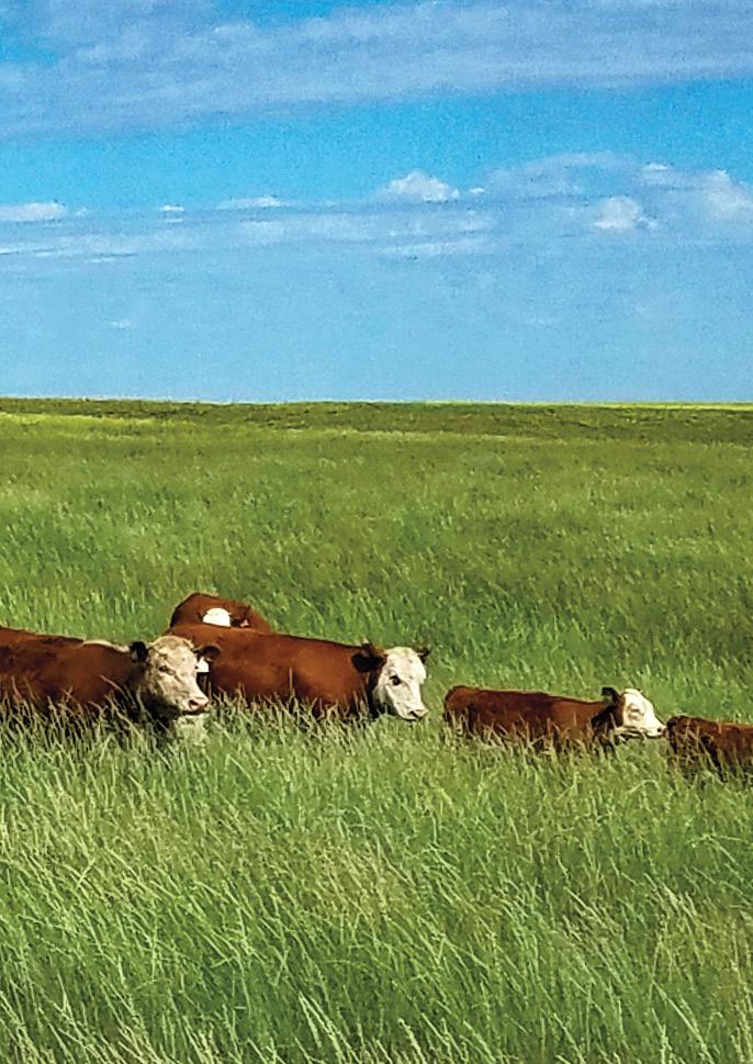
Herefords. the iconic cow of the West | Madri Blom
Badlands east of the Yellowstone River, Richland County | Rick and Susie Graetz
Sidney, the “Sunrise City,” is the largest town in northeast Montana. This agricultural community, situated on the banks of the Yellowstone River, a short distance from the North Dakota line, is your base for roaming the southeastern sector of Missouri River Country. On April 27, 1805, Lewis and Clark and the Corps of Discovery first entered what would become Montana, 20 miles to the northeast of the current-day city.
Spend several days in the area, especially if you enjoy warm-water fishing and exploring colorful back roads. As a start, visit Sidney’s MonDak Heritage Center, a history museum and regional art center in eastern Montana. This treasure includes an extensive historical library.
To get a view of some of the Yellowstone breaks and badlands: On Hwy 16, drive three miles south of town, then turn left at Hwy 23. Go another three miles until you meet Hwy 261. Turn right and head south.
This road is known locally as “The Lost Highway.” Use your Montana Atlas and Gazetteer for guidance. The most scenic approach to the Yellowstone River is about 17 miles south of Hwy 106. You’ll be traversing private land, so stay on the road. You will be surrounded by great scenery.
For another day trip out of Sidney, go west on Hwy 200 to Lambert and Fox Lake Wildlife Management Area. This is the location of the Three Buttes, sketched by John J. Audubon in 1843. Rolling hills and prairie grasslands interspersed with strip farming dominate the scenery. A network of back roads leads from Lambert south and then east to Crane on Hwy 16, eleven miles south of Sidney.
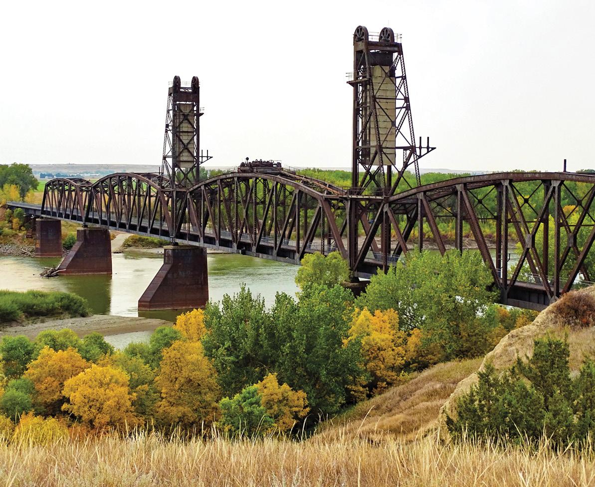
To the north of Sidney lies Fairview, the town divided by the Montana/North Dakota border. Part of the town lies in North Dakota, while the majority is in Montana. Ask locally how to reach the Snowden/Nohly Bridge, a mammoth steel structure spanning Missouri. Built in 1913 for the Great Northern Railroad, it was used by trains and cars simultaneously. Also, get directions to the Fairview Bridge and Cartwright Tunnel. They have been developed into a walking trail.
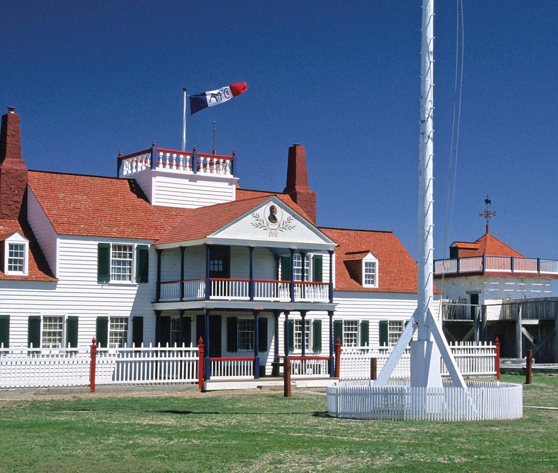
Beyond Fairview, north on North Dakota 58, along the state line, you’ll reach the Fort Union Trading Post National Historic Site. The original fort, built in 1828 by the American Fur Company, rose at the convergence of the Missouri and Yellowstone rivers. The National Park Service manages today’s reconstructed version. It’s worth seeing anytime, especially if you can make it during the Fort Union Rendezvous. Check with the Fairview Chamber of Commerce as to the dates.
For fishing access with a boat ramp, drive south of Sidney about 21 miles to Savage and the Elk Island and Seven Sisters wildlife management areas on the Yellowstone River. These havens provide habitat for waterfowl, turkeys, and whitetail deer. During hunting season, hunting is allowed.
Above: Fairview Bridge | Jeremy Krieger Below: Fort Union | Rick and Susie Graetz
FOUR BUTTES, POPLAR RIVER, AND ROCK CREEK BADLANDS ROUTE
Glasgow serves again as a point of departure for another exploration journey into a peaceful corner of Missouri River Country. This circle trip covers about 200 miles, so take at least two days to negotiate it. For most of the way, you’ll be driving through spring wheat country. Big vistas, patterns of wheat fields, and rolling grasslands will be your companions.
After your night in Glasgow, start early; the morning light is excellent for photography. Turn two miles east of town onto Hwy 24 and head north toward Opheim, 51 miles away. Out to the west of Hwy 24, beyond a few farm roads, lies some of the wildest prairie lands in the northern part of Missouri River Country—Bitter Creek.
Opheim is part of a rich wheat-growing region. During the homestead era, this community and the ones to the east were much more significant. It’s about 46 miles from Opheim to Scobey along Hwy 5. In between, you’ll pass four small towns, Glentana, Richland, Peerless, and Four Buttes, each about ten miles apart. Take the time to look in on them. Four Buttes took on the name of the stately buttes to the northwest. At one time, they were called the Whiskey Buttes, as liquor trading with the native people was a popular activity near these landmarks.
Stay the night in Scobey and visit Pioneer Town, considered one of the best museums of its kind in the West.
By roaming the buildings and collections of early-day clothing, equipment, etc., you’ll get a good understanding of the very colorful human history of Missouri River Country.
From Scobey, follow Hwy 13 south through the Poplar River Valley to the valley of the Missouri River, 48 miles away. Turn right on Hwy 2 to Wolf Point and head back to Glasgow.
Sleep here, and in the morning, drive 29 miles west on Hwy 2 to Hinsdale on the Milk River. North of town, you’ll find some of the most spectacular and seldom-visited badlands in Montana. Rock Creek Road, about two miles east of Hinsdale, heads north to Canada and leads into this region. About 18 miles up the road, you’ll be skirting the western edge of a true prairie wilderness... the Bitter Creek region. Check with the BLM Office in Glasgow for a map and a description of the Bitter Creek Wildlife Viewing Area. It’s a loop trip through these badlands. The BLM recommends using a 4-wheel drive vehicle and taking eight hours to complete the journey.
The terrain you’ll be driving through along Rock Creek is cowboy country. The ranches are significant, and the distance between human presence is far. You can camp in Hinsdale to see more of these badlands or fish the Milk River.
On the way back to Glasgow via Hwy 2, turn at the sign for Vandalia and follow Hwy 246 to Glasgow. Vandalia and Tampico, also on this back road, were thriving places during the homestead years.
North of Poplar | Rick and Susie Graetz
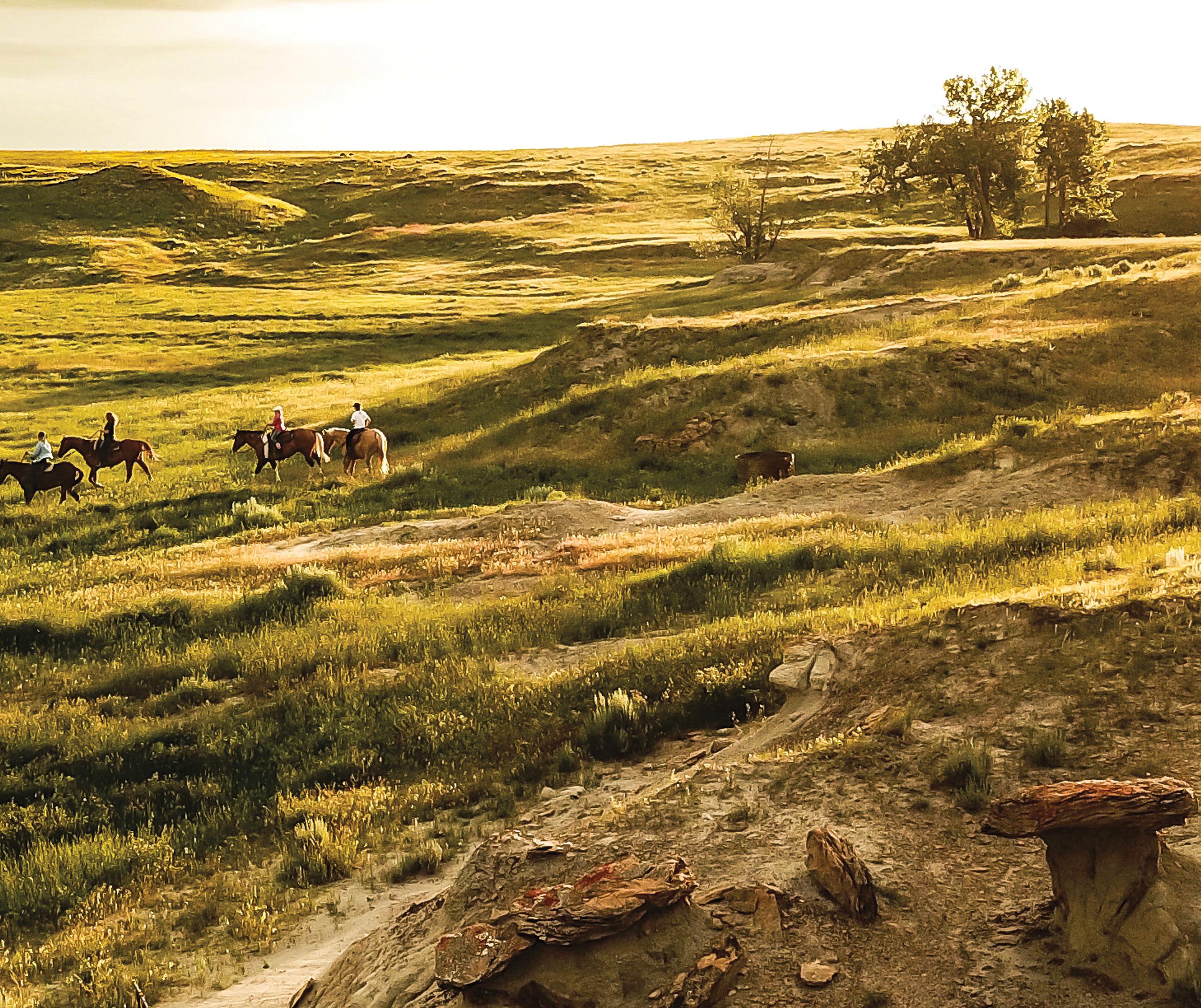
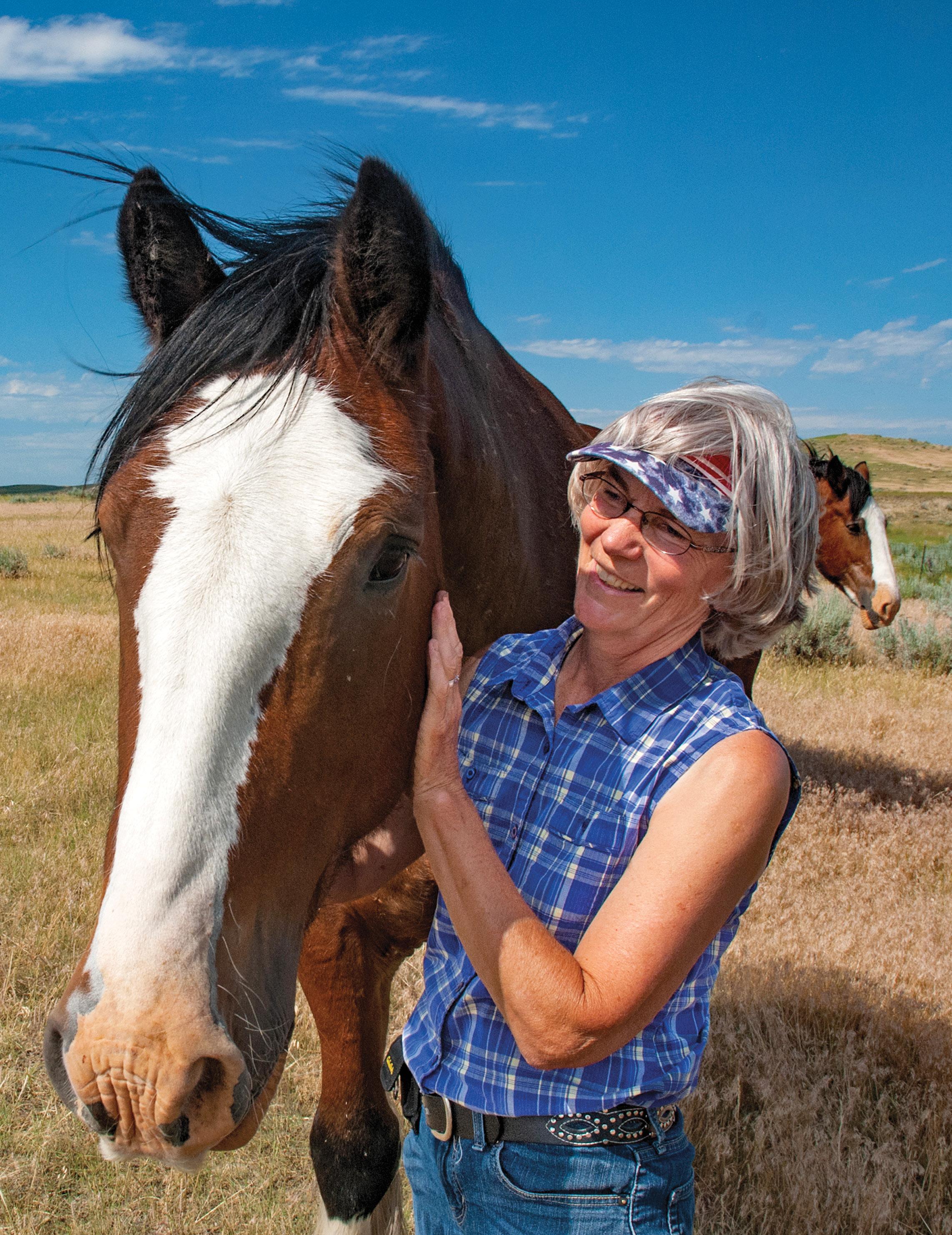
Bev Harbaugh and friend, on the Harbaugh Ranch east of Jordan | Rick and Susie Graetz
JORDAN COUNTRY, CIRCLE RANGE, & CMR WILDLIFE REFUGE ROUTE
Late 1800s photographer L. A. Huffman called it “The Big Open,” National Geographic termed it “Jordan Country,” and others named the sparsely populated country south of Fort Peck Lake “The Big Dry.” Jordan is the heart of this scenic territory and the start of your journey in the southern province of Missouri River Country.
Rising from the banks of Big Dry Creek and straddling Montana Hwy 200, Jordan was founded in about 1896. The town and surrounding expanse of rangeland are still very much cowboy country, and the place retains an old-west flavor. False front buildings on Jordan Ave have mostly stayed the same since the community’s early days... some are over 100 years old.
This seat of Garfield County is your entry to a remote and beautiful mix of deep river canyons, badlands, and airie wilderness in the West. The most rugged terrain is part of CMR. Wildlife abounds... antelope, elk, mule deer, whitetail deer, wild turkeys, sage grouse, and numerous waterfowl make these lands their home.
The loop route you’ll take is about 227 miles long. You can do it in a day, but it’s best to allow at least two.
From Jordan, drive east on Hwy 200 toward Circle 67 miles away. Fifteen miles out, you’ll enter a ten-mile stretch of spectacular views of red- and yellow-colored buttes, badlands, and distant vistas.
The terrain between Jordan and Circle is famous amongst paleontologists for its abundant fossil beds. In 1902, Tyrannosaurus rex was discovered in the Hells
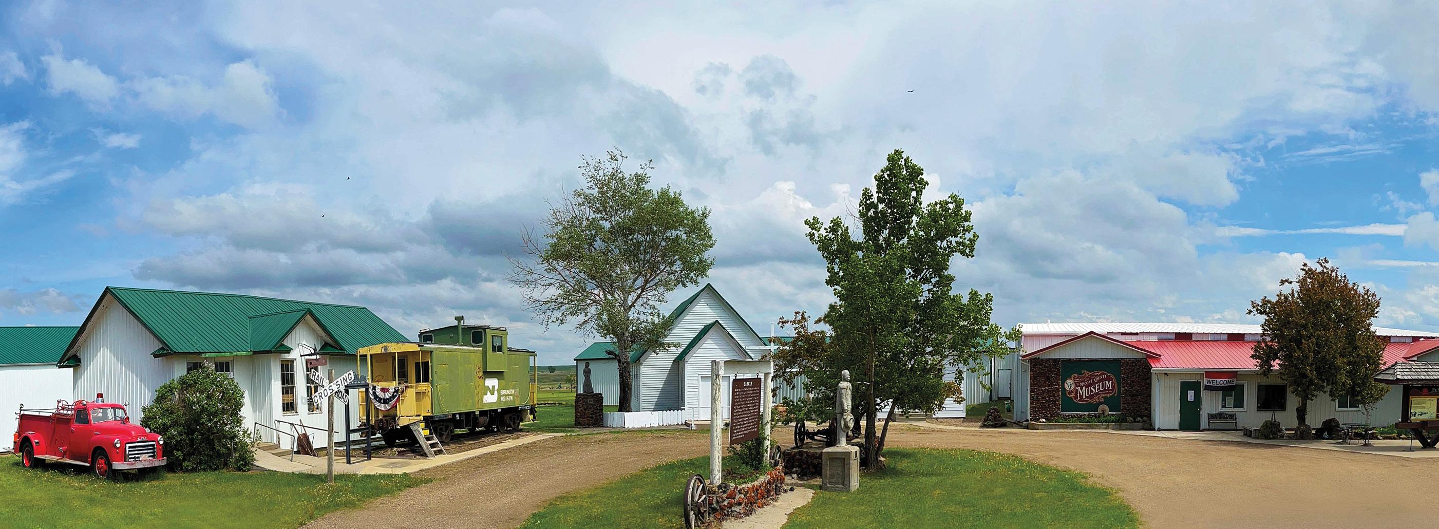
McCone County Museum in Circle, MT | Herb Allison
East of Circle, MT | Rick and Susie Graetz
Creek Formation. See the dinosaur display in the museum when you return to Jordan.
Before reaching Circle and the Red Water Creek Valley, you’ll leave the miniature desert of badlands and come upon softer, rolling high plains covered with the eye-pleasing geometric designs of grain farming.
Circle, another “cow town,” is still agriculturally oriented today. The name comes from the Circle Ranch, one of Montana’s earliest cattle outfits. While you are here, make sure to visit the McCone County Pioneer Museum. You’ll note a distinct range of high sandstone hills to the south of town. The Big Sheep Mountains were named after the Audubon Sheep that lived there until the early 1900s.
From Circle, point north for 53 miles on Hwy 13 through farming country. Along the way, you’ll see the now-closed
historic Wolf Point Bridge. The new Hwy 13 bridge runs parallel to it. Further along you will meet Hwy 2. It’s a short distance from the bridge to Wolf Point. Continue through Wolf Point and the Missouri River Valley to Nashua.
At Nashua, turn south on Hwy 117 to the community of Fort Peck. Just beyond the town, you’ll meet Montana 24. Turn left, heading across the dam. This road leads to the east of Fort Peck Lake through an area called The Dry Arm.
If you’d like to camp, put a boat in the water, or see the lake from the eastern shore, take advantage of the recreation areas here. There are several, and they are well marked, but make sure you get a map in Fort Peck or have the state-distributed Montana highway map with you for reference. Watch the weather. The roads to these places are best used in dry weather.
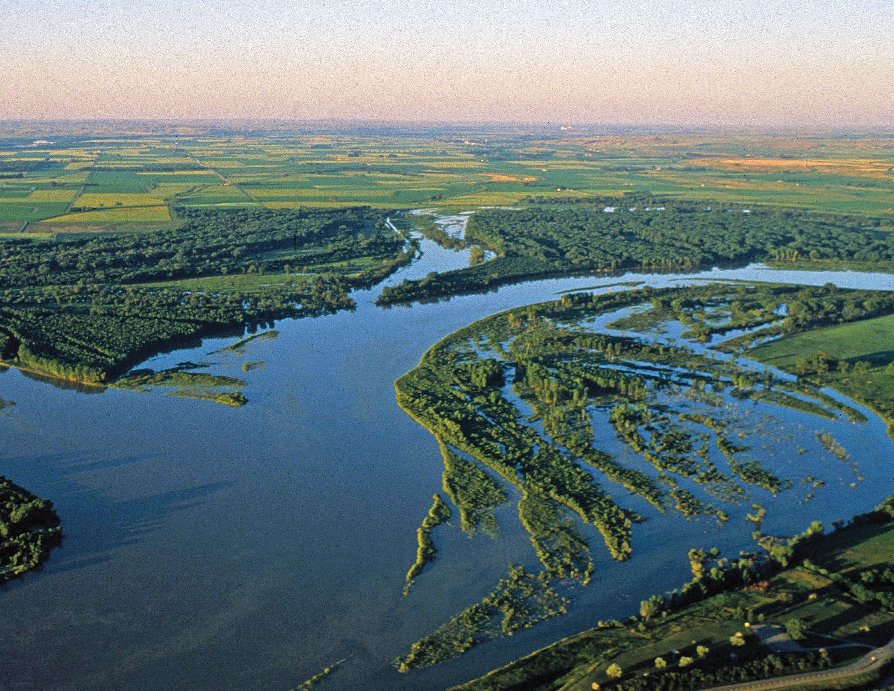
Charles M. Russell National Wildlife Refuge | Rick and Susie Graetz
Missouri River Country north of Jordan
Chuck Haney
Sixty miles from the Fort Peck town site on the scenic Hwy 24, you’ll again reach Hwy 200. Turn right toward Jordan. Stay in Jordan for a few days or camp in the Missouri Breaks. There are many roads and trails throughout this wilderness.
Before striking out, inquire at Lewistown’s Charles M. Russell Wildlife Refuge office (406-538–8706). They can advise you on conditions and the best routes to follow. Getting good information is very important to make the most of your time. This is grand territory you’ll be wandering into.
Hell Creek Recreation Area, on Fort Peck Lake, 26 miles north of Jordan, is popular. On the way, you’ll pass
through the scenic Piney Buttes. Points along the way offer excellent views of some of the upper reaches of the Missouri Breaks and the CMR Refuge.
Out of Jordan, Devil’s Creek, Snow Creek, and Crooked Creek are worthwhile places to visit. The Haxby Road, east of Jordan, reaches a long way through the badlands into the Breaks. When you talk to the CMR folks, make sure you inquire about how to see these areas.
The magical evening light in the Breaks makes for the best photographic opportunities. This place will amaze you. It is truly an uncommon landscape and one of America’s most fantastic wilderness regions.
South of Fort Peck Lake | Rick and Susie Graetz
Montana’s Missouri River Country sprawling across the state’s northeast has its own unique character and to many travelers it’s a place to discover new and fascinating territory!
Here, mesmerizing landforms shaped by wind, water and time create a grand tapestry of natural wonders. The abundance of undisturbed space becomes the defining feature, offering a sense of boundless freedom beneath an endless sky. The limitless horizons of Northeast Montana invite all to wander, stretch and breathe freely within its unspoiled landscapes.
Talking Trail is an innovative program that allows one to take a captivating journey through Northeast Montana’s Missouri River Country. It weaves a rich history with scenic prairie grandeur and serves as a personalized companion to explore uncommon geography.
Moon Gardens | Rick and Susie Graetz
How to use the app …
Choose Your Trail:
Launch the Talking Trail app and browse through the available trails in Missouri River Country. Select the trail that aligns with your interests or the specific area you wish to explore. Each trail is curated to provide a unique and enriching experience.
Prepare Your Device:
Ensure that your smartphone is fully charged before setting out on the trail. It’s recommended to bring a portable charger to extend your device’s battery life, especially if you plan on an extended exploration.
Enable Location Services:
Allow the Talking Trail app to access your device’s location services. This ensures that the app can provide you with real-time information and guide you seamlessly along the chosen trail.
Start Exploring:
Once everything is set up, start your adventure! Follow the app’s prompts as you explore Missouri River Country. Engage with the narrations, stories, and information provided by Talking Trail at designated points along
the trail. Learn about the history, geology, and unique features of the region as you progress.
Interact with Points of Interest:
As you reach points of interest marked by the app, take the opportunity to interact with the content. Listen to fascinating stories, view images, and absorb the rich cultural and natural heritage of Northeast Montana.
Share Your Experience:
Capture the moments and share your experience on social media. The Talking Trail app may also have features that allow you to share your progress or favorite discoveries with fellow explorers.
Complete the Trail:
Follow the trail to its conclusion, taking in all the sights and information along the way. Celebrate the completion of your journey and consider exploring additional trails in Missouri River Country offered by Talking Trail for a comprehensive experience.
Embark on an adventure like never before as Talking Trail transforms your exploration of Missouri River Country into an engaging and educational experience. Enjoy the beauty of the landscapes while immersing yourself in the fascinating stories that unfold along the way.
Beyond the 49th Parallel is a developing Missouri River Country program …
The vast, rural landscapes of Canada’s South Saskatchewan and Montana’s Missouri River Country hold the promise of an international travel experience like no other.
Here, there’s room to roam through the grandeur of the Great Plains terrain our nations share, and to discover unique settings for favorite outdoor pursuits and to spend time in welcoming communities where small-town charm and tradition run deep.
And there’s ample space to reflect on how much these regions have in common, as well as the ways their individual histories and cultures make them unique.
The border doesn’t limit this landscape or the stories within it, and it needn’t limit your adventures either. Start planning your Two-Nation Vacation now at: beyondthe49thparallel.com
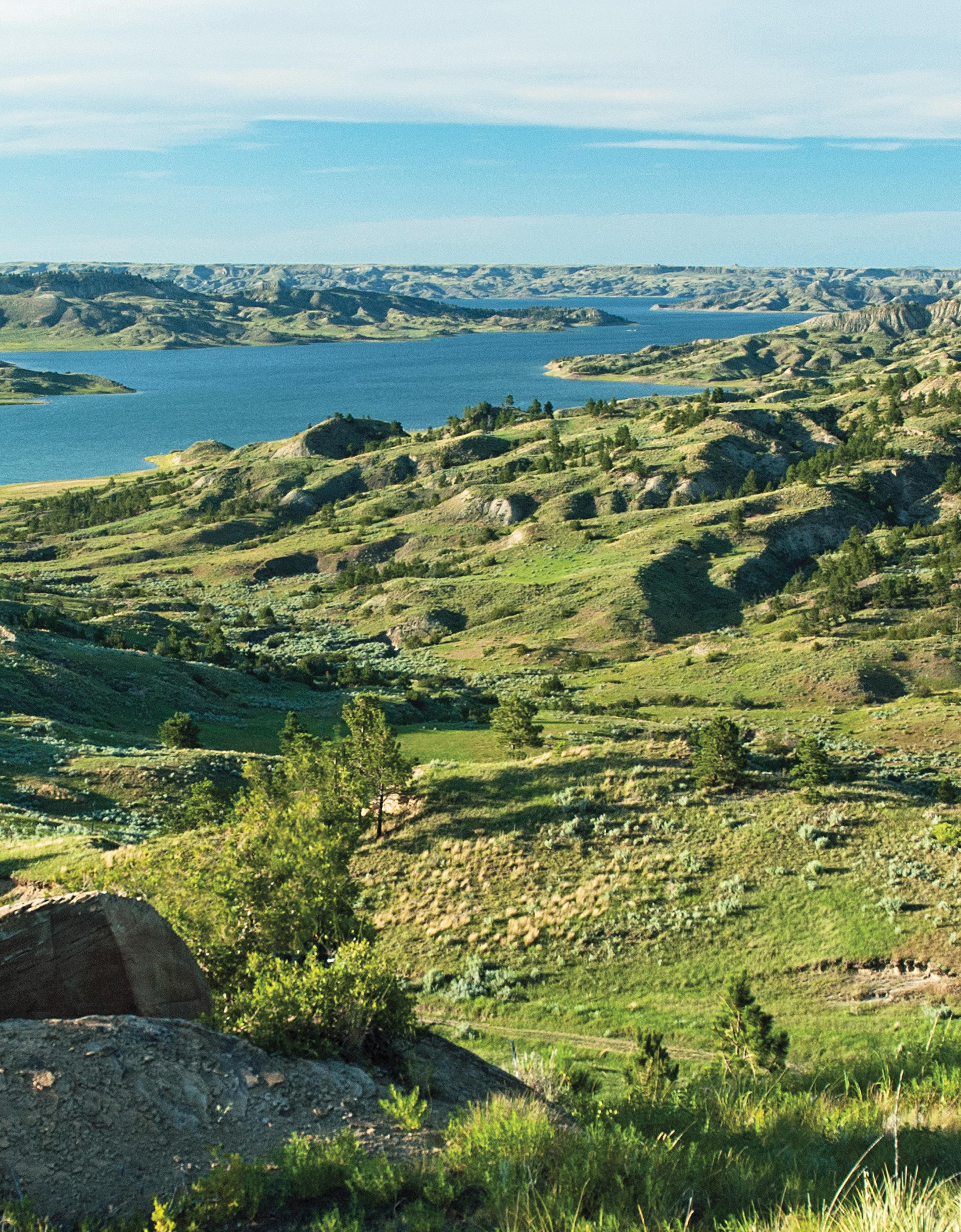
FORT PECK LAKE
A Montana and Prairie Treasure ….
This enormous swath of geography encompassing more than three million acres, much of it public land, is a showcase of prairie splendor.
If you love big water recreation, fishing, wildlife sightings, prairie and arid land topography, paleontology and just plain being in a landscape that gives you the feeling you are the only human being for many miles around then a journey to Fort Peck Lake and its surrounding prairie geography to explore this incredible expanse of territory should be on the top of your travel wish list.
Nearly sixteen hundred miles of shoreline, 134 miles long, a landscape that hasn’t changed since Lewis and Clark passed this way more than 210 years ago, and some of the nation’s best warm water fishing are just a few of Fort Peck’s impressive claims!
This lake’s magnitude assures recreationists solitude if they want it. It’s possible to pull into bays rarely visited by a boat for your own private fishing, or to hike ridges and coulees above the water that experienced hooves of Indian ponies, follow tracks of fur traders and explorers and set foot on a high point where Sioux hunters watched for clouds of dust to tell them that a huge herd of migrating bison were nearby.
Plains Indians once roamed this country following enormous bison herds. Places where they camped along the river, and later the area the Corps of Discovery walked, are now well into the waters of Fort Peck Lake. But the land rising above the waters, haven’t changed over time and it’s still possible to imagine all that took place here in the long ago.
Access to the lake and its surrounding lands is from several Missouri River Country towns. In the north, roads from Malta, Glasgow, and Fort Peck point south. From Hwy 200 on the southern perimeter, several roads from Jordan reach deep into the Missouri River Breaks and to Fort Peck Lake. Many of the routes take you to developed campgrounds, boat launches and other conveniences. Other roads and trails deliver you into and through wild country.
Before striking out, inquire at the CMR National Wildlife Refuge office in Jordan or the one in Fort Peck. They can advise you on conditions and the best routes to follow. It’s very important to get good information to make the most of your time.
While there are many places to launch a boat on Fort Peck Lake, three of the most popular are Rock Creek Marina on the east side of Fort Peck, Fort Peck Marina on the north side, and on the south side, Hell Creek Marina out of Jordan (ask for directions at any Jordan business).
Access to Fort Peck Lake
But there is more to Fort Peck Lake than its waters. This prairie beauty is surrounded by the crown jewel of the nation’s wildlife refuge system, the 1.1 million-acre Charles M Russell National Wildlife Refuge, a landscape that can be best described as prairie magnificence.
Fort Peck, the lake’s “capital town”
The town of Fort Peck, long on colorful history and 18 miles south of Glasgow via Hwy 24, is this regions and the lake’s eastern post. One of the wonderful things about the village of Fort Peck is that it is the only town on Fort Peck Lake and the only one on the edge of the Charles M. Russell National Wildlife Refuge. You can’t get any closer to two of Missouri River Country’s biggest destinations.
Above: Fort Peck Lake on the CMR | Rick and Susie Graetz Below: Hell Creek Campground on Fort Peck Lake | Rick and Susie Graetz
The Fort Peck Interpretive Center and Museum
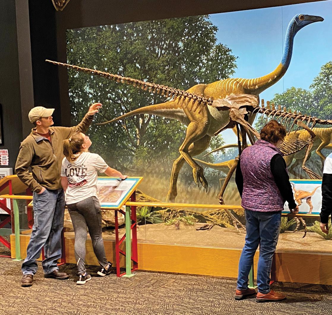
Like Alice in Wonderland falling down the rabbit hole, from the moment you step through the museum’s doors into the lair of a “gi-normous,” life-like, hungry-looking, open-jawed, steely-eyed T. rex named Peck’s Rex, you know you are in for an adventure. Ahead of you is 18,000 square feet of pure entertainment featuring paleontology, wildlife, and the construction of Fort Peck Dam. Two of Montana’s largest aquariums show off the inhabitants of Fort Peck Lake and the Missouri River.
In the phenomenal Exhibition Hall, a skeletal cast of the Tyrannosaurus rex discovered 20 miles southeast of town towers over everything. Also included are other dinosaur fossils, present-day and historical animals of the CMR National Wildlife Refuge, hands-on interpretive displays, and a false-fronted, early 20th century street scene. Ask about kid’s fishing and hiking trails (406-526-3493)
Lewis and Clark Overlook
The viewpoint is 1⁄2 mile east of the dam powerhouse on Hwy 24. Interpretive signage, picnic area and restroom facilities are handicap accessible. Continue East on Hwy 24 and you will cross the dam’s spillway. Then to the left is the road to the Milk River Observation Point and Hiking Trail. This is a great chance to get out of the car, stretch your legs and see the cream-colored water of the Milk River enter and stream parallel with the Missouri.
Kiwanis Park
Surrounded by shady cottonwood trees, picnic shelters, restrooms and grills make this a perfect place to host family reunions, BBQs and other large or small events. Conveniently located in front of the Kiwanis Downstream Campground, it is within walking distance to the Fort Peck Interpretive Center.
Built during the depression to help entertain the dam workers, the theater, with its seating for 1,200, was for decades the largest facility of its kind in the state. Today, through the talent of professional summer stock actors, once again laughter and music ring from the rafters of this exotic and historic building. May thru Aug, performances Fri.–Sat at 7:30pm and Sun. at 4pm (406-228-9216).
An easy three-mile-long hiking path starts at the campground downstream from the dam and leads through wildlife habitat along the Missouri River. A self-guided wildlife-viewing autoroute...the Leo B. Coleman Wildlife Exhibit takes off from near the Fort Peck Summer Theater.
Fort Peck Summer Theatre
Fort Peck Theatre | Rick and Susie Graetz
The Beaver Creek Nature Trail
Fort Peck Interpretive Center | Rick and Susie Graetz
NELSON RESERVOIR
One of northeast Montana’s most popular water recreation and fishing areas, Nelson Reservoir is the number one walleye spot in the state. Stocked with yellow perch, walleye, and northern pike, it produces record class fish. In winter, ice fishing is a draw, enticing many anglers from all across the state. Camping, swimming, boating, picnic shelters, RV sites, restrooms, showers and yearround fishing may be enjoyed. The reservoir is reached from US highway 2 from Malta on the west and Saco on the east. A clearly marked turn off leads the way just a short distance to the north.
BRUSH LAKE STATE PARK
Sandy beaches surrounded by grass fields and stands of spring wheat frame its sparkling waters. This 280-acre state park offers public access for swimming, boating,
hiking, a day-use area, boat ramp and dock, vault toilet, picnic tables, fire rings and has an RV campground. Due to the mineral make-up of Brush Lake, there are no fish. Aside from its distinctive aquamarine blue color, Brush Lake looks like many other lakes that dot this prairie pothole region, however beneath its surface the lake is full of superlatives.
Being a deep lake (65 feet) in a closed basin, Brush Lake contains a sediment record of value to the scientific study of climate change. Since it first saw daylight 10,000 years ago, Brush Lake has accumulated 45 feet of sediments. Much like tree rings the lake annually deposits a layer of light and dark sediment that can be used to construct a timeline. These layers contain pollen and distinct minerals that allow scientists to determine variations in climate since the ice age. Currently, sediment cores are being studied by a collaborative team of scientists who are funded by a National Science Foundation grant.
Brush Lake | Dona Osksa
THE MISSOURI
In Missouri River Country
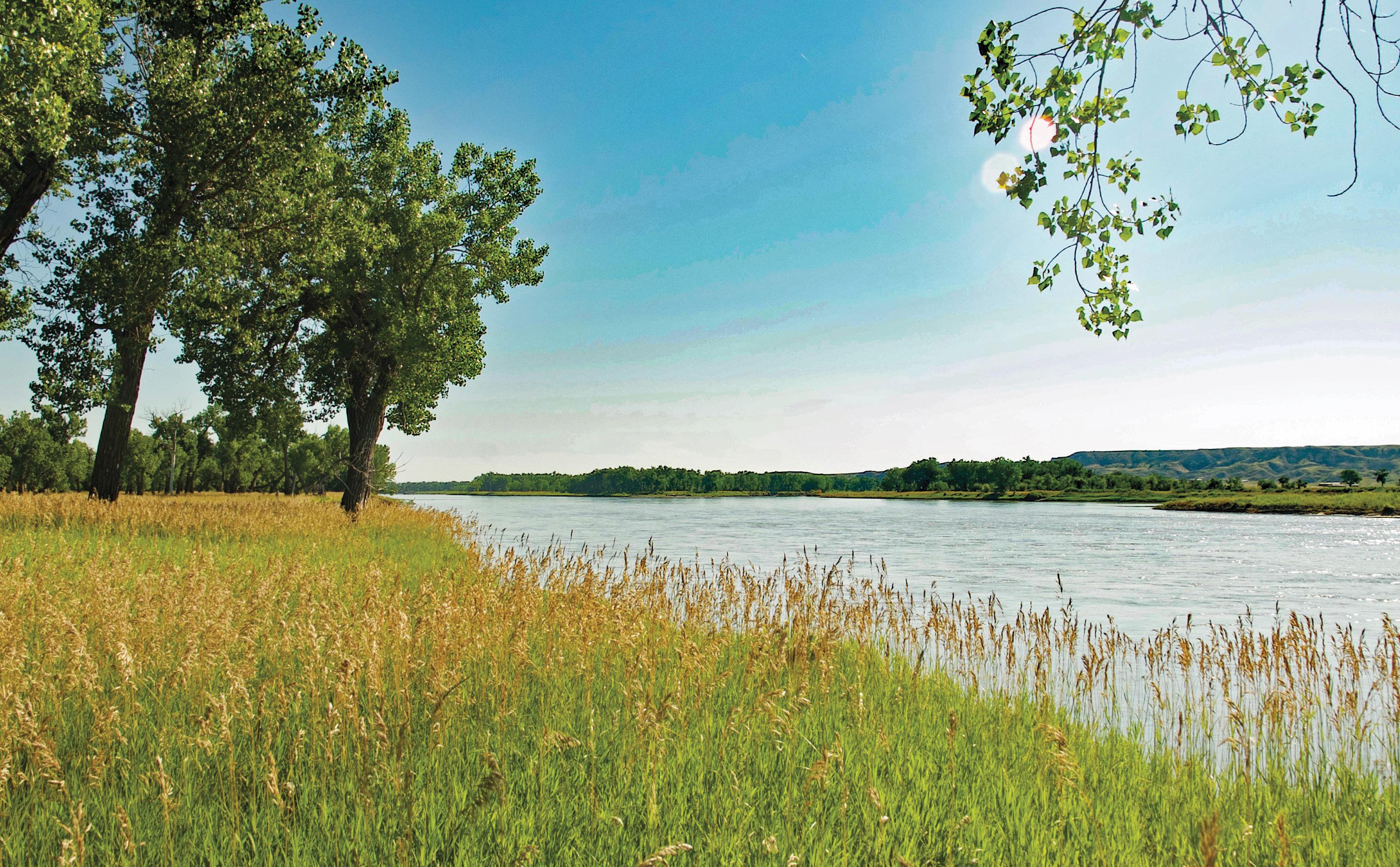
For Montana, it was a lifeline… a moving highway that gave birth to the state. On the way to the nation’s heartland, it collects the state’s memories and history. It is Montana’s great river.
Known for its prairie scenery, wildlife, fishing, hunting, and water recreation, the Missouri and the geography it touches in northeast Montana attracts folks from across the nation. Consider that from Missouri River Country’s western edge at Fred Robinson Bridge and US Hwy 191, following a straight course, a watercraft will have eclipsed 145 miles when it reaches Fort PeckLake and the Fort Peck Dam.
Fort Peck Lake with its nearly 1,600 miles of shoreline allows the big river to rest. From here, the boat’s occupants can survey the sculptured landscape of the more than one-million-acre Charles M. Russell National Wildlife Refuge that edges the river and completely surrounds the lake.
Leaving Fort Peck Lake through the dam’s spillway, the Missouri River runs clear again much as it did from its birthplace.
Within ten miles of exiting Fort Peck and after regaining its channel, the Missouri meets the Milk River. Strongarmed to the side by the Missouri’s formidable flow, the overly silt-laden waters of the Milk create a light colored banner along the Missouri’s north bank until finally, the Milk gives up and succumbs to the mightier river.
Meriwether Lewis, May 8, 1805, wrote, “the water of this river posseses a peculiar whiteness, being about the colour of a cup of tea with the admixture of a tabelspoonfull of milk. from the colour of it’s water we called it Milk river. we think it possible that this may be the river called by the Minitares (Hidatsa) ‘the river that scolds at all others’.” Lewis also noted the Milk River Hills that rise nearly 700 feet above the floodplain of the Milk and Missouri. These can be reached via MT Hwy 24 across Fort Peck Dam. From this point, one can view much of the terrain Lewis and Clark described, both along the Missouri on the north side of the hills and southwest out over the lake.
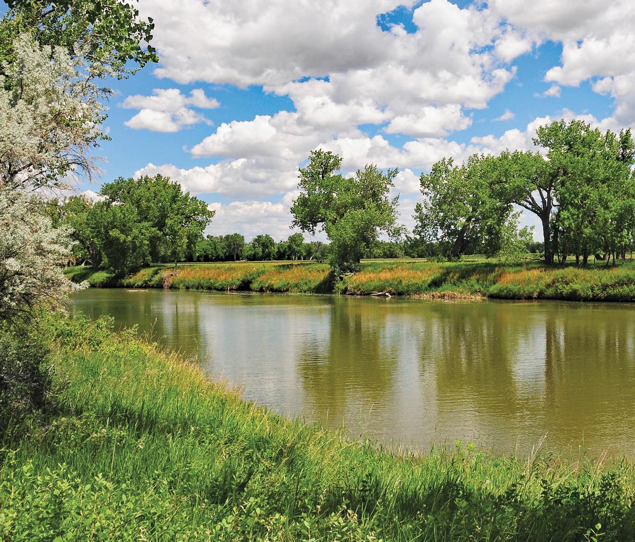
The Milk River | Rick and Susie Graetz
As the river rolls eastward, the meanders, as well as the sand bars and islands, increase. While the Missouri is dynamic through its final 185 miles, it doesn’t have the strength it once had before Fort Peck Dam was completed. Looking a bit more civilized than the segment between Fort Benton and Fort Peck, it is still, for the most part, void of people.
A couple of miles southeast of Culbertson, the Hwy 16 bridge crosses the Missouri. The sweeping river view from here is a favorite of photographers. Beyond the bridge, with 34 miles left before the Missouri prepares to leave Montana and take on the Yellowstone River, it rolls through a beautiful mix of bluffs, canyons, and badlands. Continually impressed with the pleasant appearance of
the landscape, William Clark declared, “the Countrey on both Sides have a butifull appearance.”
A few miles before exiting the state, the Missouri passes the historic Snowden Bridge. Near here, on April 27, 1805, Lewis and Clark and their crew spent their first night in what would become Montana. As Lewis began writing in his journals that night, the words he put on paper represent the initial written history of Montana.
Once this historic spot is passed, the Missouri appropriates the Yellowstone just beyond our border with North Dakota. As the river bids adieu, it leaves the finest landscapes of its journey behind in Montana.
Yellowstone-Missouri confluence | Larry Mayer
Elk Island, Yellowstone River | John Lambing
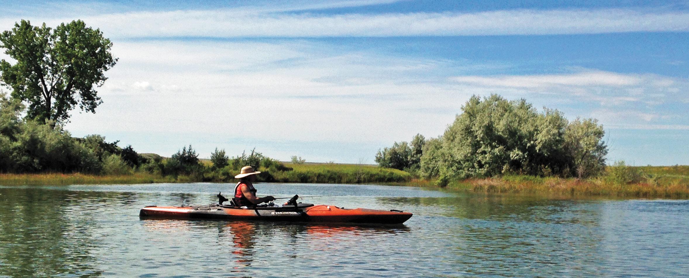
Kayaking on the river | Maggan Walstad
THE YELLLOWSTONE
In Missouri River Country
The Missouri takes top billing in northeast Montana, but the Yellowstone River isn’t just a bit player. While it only logs 50 miles in the territory, it takes in some exquisite landscapes and carries much Montana history with it. Gathering some of the finest mountain and prairie topography on the planet, Montana’s Yellowstone drains a 70,000-square-mile piece of the west in grand fashion. The 670-milelong waterway remains the nation’s longest undammed river.
Once also serving as “a moving highway” into the wilderness, this unique river mirrored the passage of
millions of bison, the travels of the Corps of Discovery, creation of the nation’s first national park, and the foundations of a state. Savage and Crane, Montana, create small human outposts along a 15-mile stretch of the Yellowstone. Above Savage, in 1909, a diversion dam was built for the Lower Yellowstone Irrigation Project. When the work was completed, there were nearly 400 miles of canals and ditches carrying water to croplands, including widespread sugar beet fields.
From Savage to Sidney, nearing the end of its run, the river provides a popular floating stretch amid the Elk Island and the Seven Sisters wildlife management areas and the state-owned Crittenden Island. Elk Island—actually three islands in high water and one in low, is near Savage, while Crane provides access to the small islands named Seven Sisters that legendary Yellowstone steamboat Captain Grant Marsh entitled in honor of his siblings.
Floating from Elk Island to the Seven Sisters is a great way to see this special length of the Yellowstone, home to whitetail and mule deer, upland game birds, ducks, and geese and since the river moves slowly here, sightings of eagles, blue heron and all manners of birdlife are a strong possibility.
Downstream from Savage, the river shows wide bottoms crowded with islands, sandbars, and a profusion of cottonwoods. The terrain on the river’s east side becomes rugged. Badlands and river breaks intermix and ascend well above the floodplain. Juniper, small ponderosa pine, and green ash give a warm color to a harsh soil.
Sidney, the main port of call for the river in northeast Montana, is about a mile west of the Yellowstone and 14 river miles short of its marriage to the Missouri.
A few river miles north of Sidney, the Yellowstone zips across the North Dakota line, then abruptly changes her mind and rushes back into Montana. Finally, three miles from the eastern edge of Montana and Fort Union, the big, wide, silt-laden Yellowstone concedes her independence. Together, under the flag of the Missouri, a mighty river lunges toward a rendezvous with the Mississippi River.
The geographic history of the Yellowstone-Missouri Confluence is also worthy of note. The original site the Corps of Discovery witnessed is about two miles to the southwest of the current junction. A huge 1930’s flood forcibly moved it.
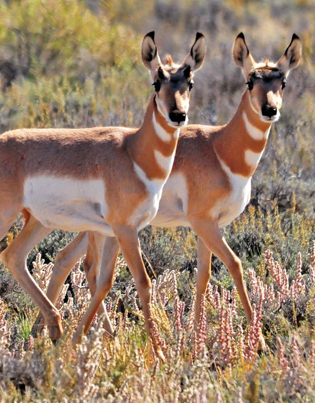
Antelope on the CMR Wildlife Refuge
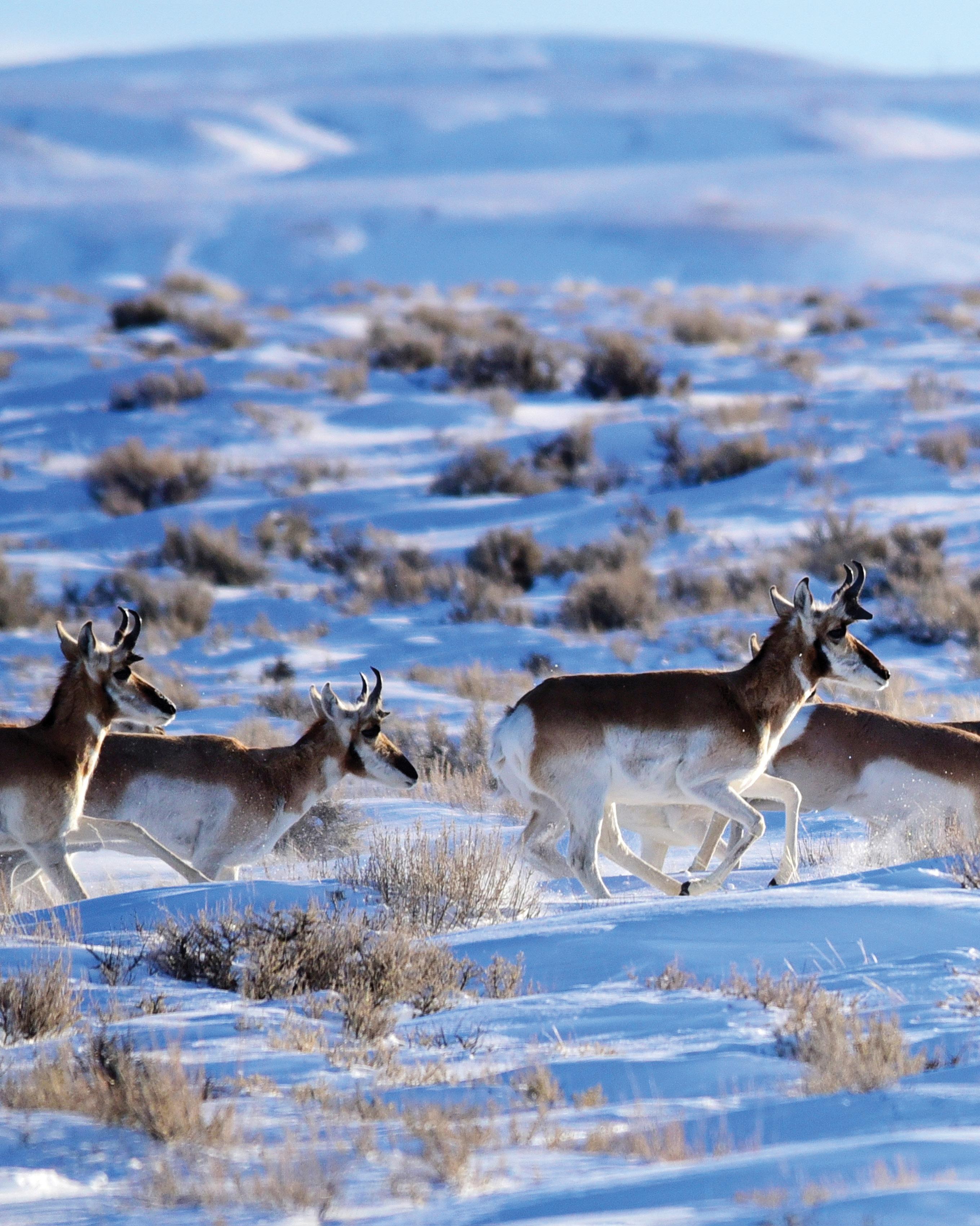
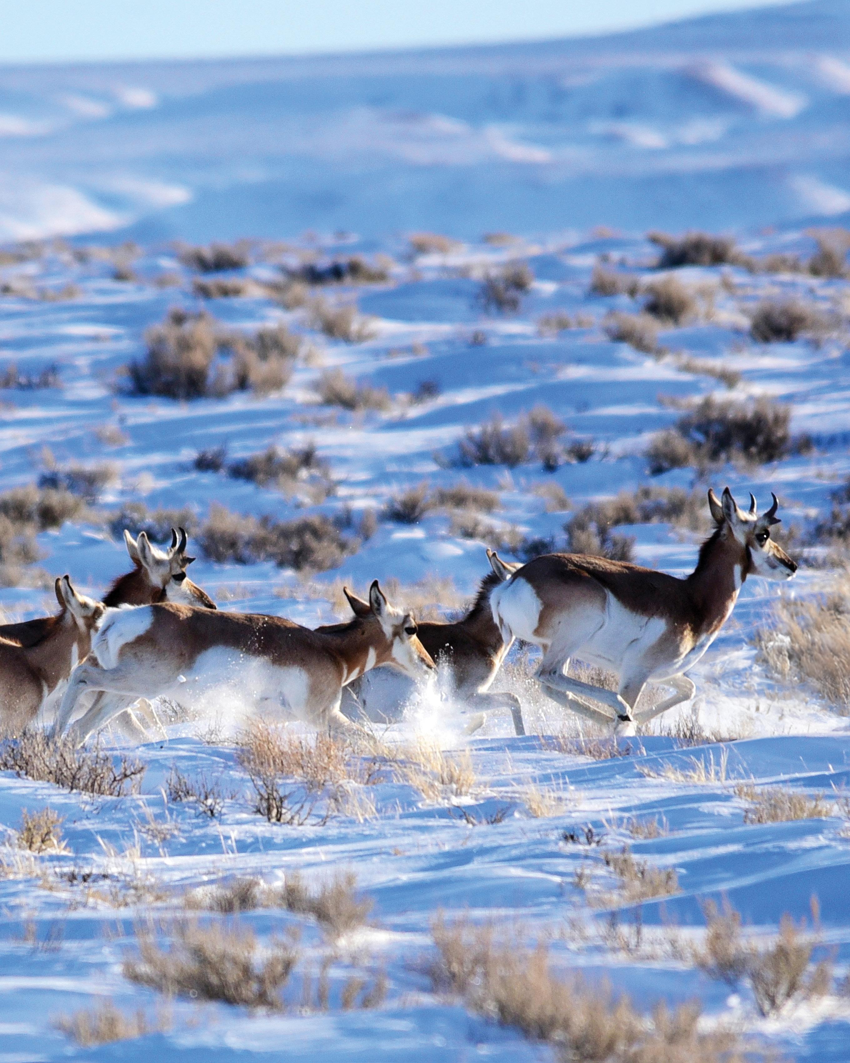
WILDLIFE OF NORTHEAST MONTANA
If wildlife viewing is the primary reason you are in Missouri River Country or planning to be our guest, then you’ll not be disappointed. This Montana prairie land is home to an enormous population of both large and small animals and winged creatures.
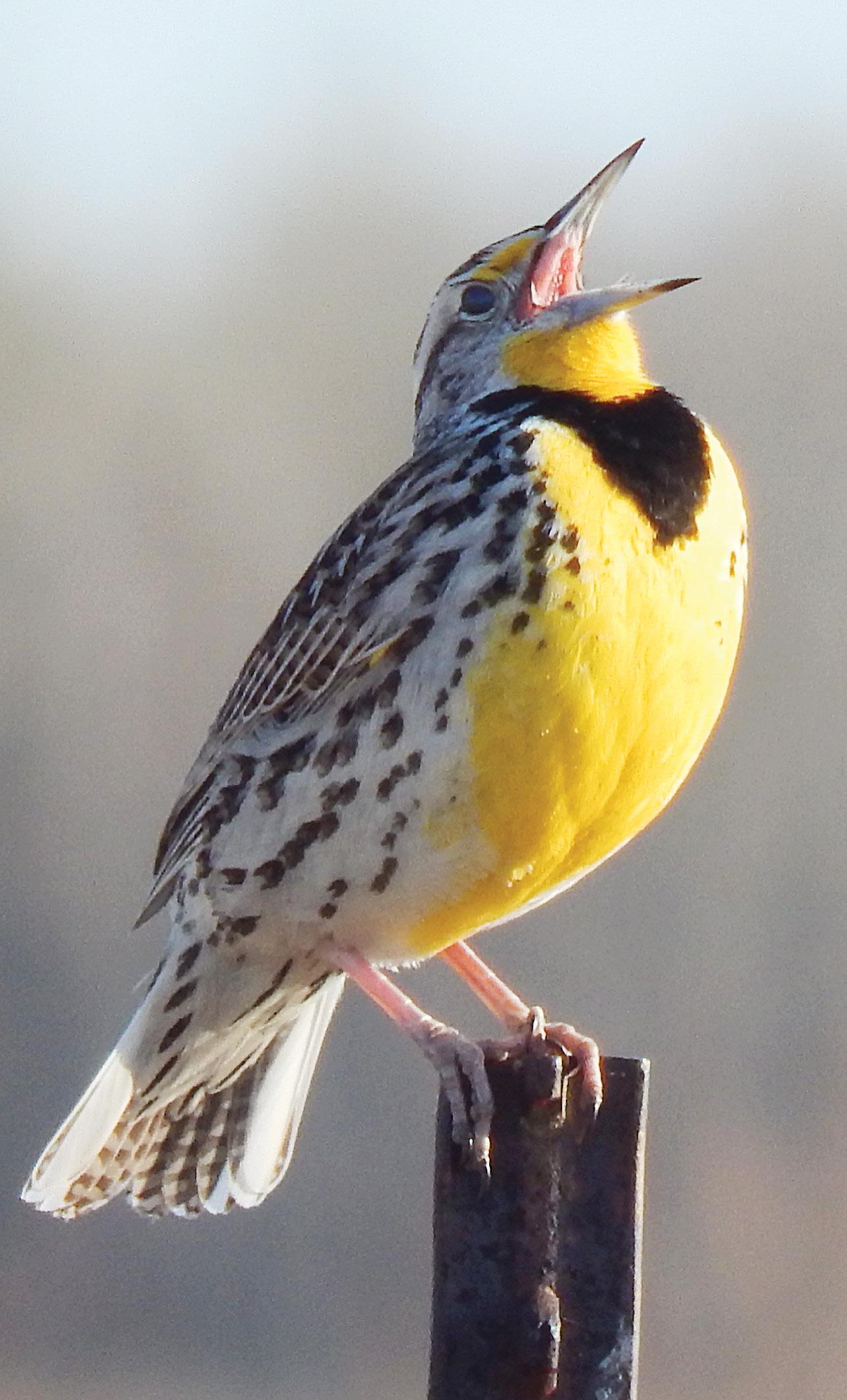
Turkeys, burrowing owls, white pelicans, elk, osprey, deer, blue herons, pronghorn antelope, Canada geese, sandhill cranes, cormorants, mountain lions, bobcats, ducks, foxes, eagles, bighorn sheep, pheasants, coyotes, Hungarian partridge, grouse, prairie dogs and more than 200 species of birds are just some of its wild residents.
Great Northeast Montana is nationally known for its wild critters. The crown jewel of the US wildlife refuge system—the 1.1 million-acre Charles M. Russell National Wildlife Refuge holds court over ten other areas here that are part of the National Watchable Wildlife program. Missouri River Country’s designated places are Bitter Creek, just 20 miles northeast of Hinsdale, Elk Island at Savage just south of Sidney, Fox Lake Wildlife Management Area at Lambert west of Sidney, the Little
Rocky Mountains around Zortman, Manning Corral Prairie Dog Town also near Zortman, the Missouri River Downstream Recreation Area at Fort Peck, the Pines Recreation Area 30 miles southwest of Fort Peck, Medicine Lake National Wildlife Refuge, the UL Bend National Wildlife Refuge, Bowdoin National Wildlife Refuge and the CMR.
Spring, early summer and fall are the prime times to see the refuges and wildlife sanctuaries. As an added benefit, all these areas gather some of the finest prairie landscapes in the nation.
While each of the 11 is worthy of visiting and will provide memorable experiences, the following four are major wildlife havens.
Mule Deer on the CMR Wildlife Refuge | Tom Koerner, USFWS
Bowdoin National Wildlife Refuge | Rick and Susie Graetz
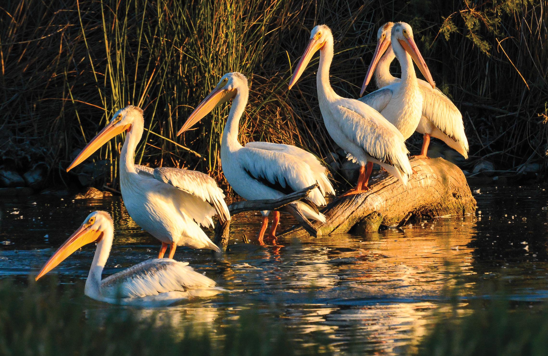
BOWDOIN National Wildlife Refuge
Best known for its nesting colonies of white pelicans, this series of wetlands and lakes eight miles east of Malta, is the habitat for more than 230 different species of birds and waterfowl. There are many entry points to the heart of the refuge and a 90-minute auto route enables you to see much of this haven.
Call 406-654-2863 for information.
THE CHARLES M. RUSSELL National Wildlife Refuge
The second largest wildlife refuge in the lower 48 states (about 1.1 million acres), the CMR is one of America’s eminent wilderness regions, as well as a wildlife refuge. It embraces about 229 of the nearly 300 Missouri River Breaks’ miles, surrounds Fort Peck Lake with its 1,600 miles of shoreline and is approximately 125 miles long.
Remote, rough and spectacular land, the canyons— some a thousand feet deep, buttes, hills, coulees and river bottoms harbor elk, bighorn sheep, antelope, deer and prairie dog towns. More than 200 species of birds and 40 species of mammals have been identified on the refuge.
Access points are spread around the vast landscape giving easy entry to your adventure. For maps and information, call the CMR (406-538-8706).
MEDICINE LAKE National Wildlife Refuge
Just south of Plentywood, this body of water is a prairie gem and a summer home to more than 100,000 migratory waterfowl. It’s a place of high wildlife activity highlighted by a pelican rookery and the thousands of sandhill cranes that stop here in October. A self-guided hiking tour and an 18-mile long driving route provide ample access to the refuge.
Call 406-789-2305 or see www.medicinelake.fws. gov for information.
UL BEND National Wildlife Refuge
Big game, as well as all the lesser critters, roam here. Isolated and beautiful, this refuge is located deep in the Missouri River Breaks about 50 miles south of Malta and 40 miles southeast of Zortman. Visitors need to negotiate rough roads to reach the UL Bend and the passages are often impassable in wet weather.
The UL Bend refuge is contiguous to the UL Bend Wilderness and the CMR. For information call the CMR (406-538-8706)
Missouri River, CMR Wildlife Refuge | Rick and Susie Graetz
Fort Peck fishing
| Chuck Haney
“If you are a hunter or angler, the Missouri River Country of northeastern Montana is heaven on earth. This area is re-known for trophy caliber elk, mule deer, whitetails and pronghorn and there is a massive amount of public land along with several large ranches that manage for big game. The fishing for walleye in particular is world class and there are opportunities for lake trout, northern pike, sauger and smallmouth bass... everything gets big in Fort Peck. What might be the region’s best-kept secret however is the waterfowl and upland bird hunting opportunities. This is a great area for pheasants, sharp-tail grouse and Hungarian partridge and the waterfowl hunting is untapped for both geese and ducks… the many communities scattered through out the region embrace hunters.”
HUNTING
Hunters should set their sites high before taking aim in Missouri River Country, as big game animals, upland birds and waterfowl all make their homes in the wide-open land of northeast Montana. On crisp autumn mornings, spotting scopes sweep the bare, rocky ridges of the CMR, duck calls sound across the placid water of wildlife refuges and pointers, anxious to flush birds from hiding search through stubble fields, ditches and brush. This is a true sportsman’s landscape.
Pronghorn, mule and trophy whitetail deer wander these prairies and drainages and elk with racks six points on a side roam the million-acre CMR. From fertile river bottoms, through prairies of grass to stark badlands, this country teems with wildlife just as it did when Lewis and Clark wrote of the area in 1805.
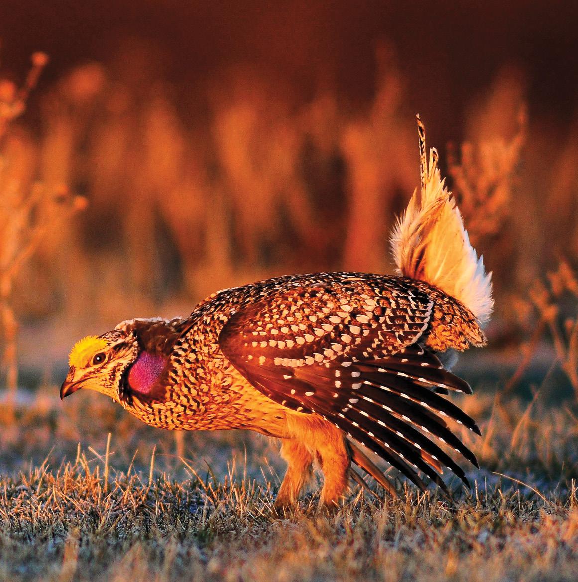
With an abundance of waterways, CRP and cropland, here is an environment built for bird hunting. Situated right under the Central Flyway, Missouri River Country has some of the best migratory bird hunting in the nation. Grain fattened geese, more duck species than we can name, colorful ring-necked pheasants, native sharp-tail
Hunting in the Missouri Breaks | Tami Burke
—Jason Mitchell, Host of the award winning Jason Mitchell Outdoors television program
grouse and Hungarian partridge and one of the healthiest populations of sage grouse in the Unites States await you. So grab your shotgun, load up your dog and set your compass for northeastern Montana.
If you have a narrow window of time to seek your animal, professional outfitters’ and guides’ services are options to insure your success. Should you choose to venture out on your own, one of Missouri River Country’s greatest attributes is the locals’ knowledge of the area and their willingness to share it with all visitors.
The Montana Fish, Wildlife and Park’s Block Management Program
More than 295 ranches are enrolled in the Block Management Program, which provides licensed sportsmen with free access to about 1.3 million diverse acres of prime, private waterfowl, upland bird, mule and whitetail deer, antelope and elk habitat. Block Management areas are accessible by either signing in at a designated box on the property or with written permission of the landowner and are generally open from the first of September through December 31. You can order a copy of a Regional Hunting Access Guide, which details all of the available ranch lands from Fish, Wildlife and Parks Region 6 in Glasgow (406-228-3700) or for Region 7 in Miles City (406-234-0900). The guides are available starting August 15 each year.
Hunting Information
The Montana Department of Fish, Wildlife and Parks (www.fwp.mt.gov) or the Region 6 office in Glasgow (406-228-3700) is where to turn for the last word on regulations and license applications, but any authorized license outlet also can also help. Area offices of the Federal Bureau of Land Management are invaluable places for maps. Keep in mind that additional regulations also apply when hunting on Indian reservations or the Charles M. Russell Wildlife Refuge.
For information on public and private land access, contact the Montana Department of Natural Resources. For regulations applying to hunting on the CMR, contact the refuge office. See the resource page in this guide for all pertinent phone numbers and addresses.
FISHING
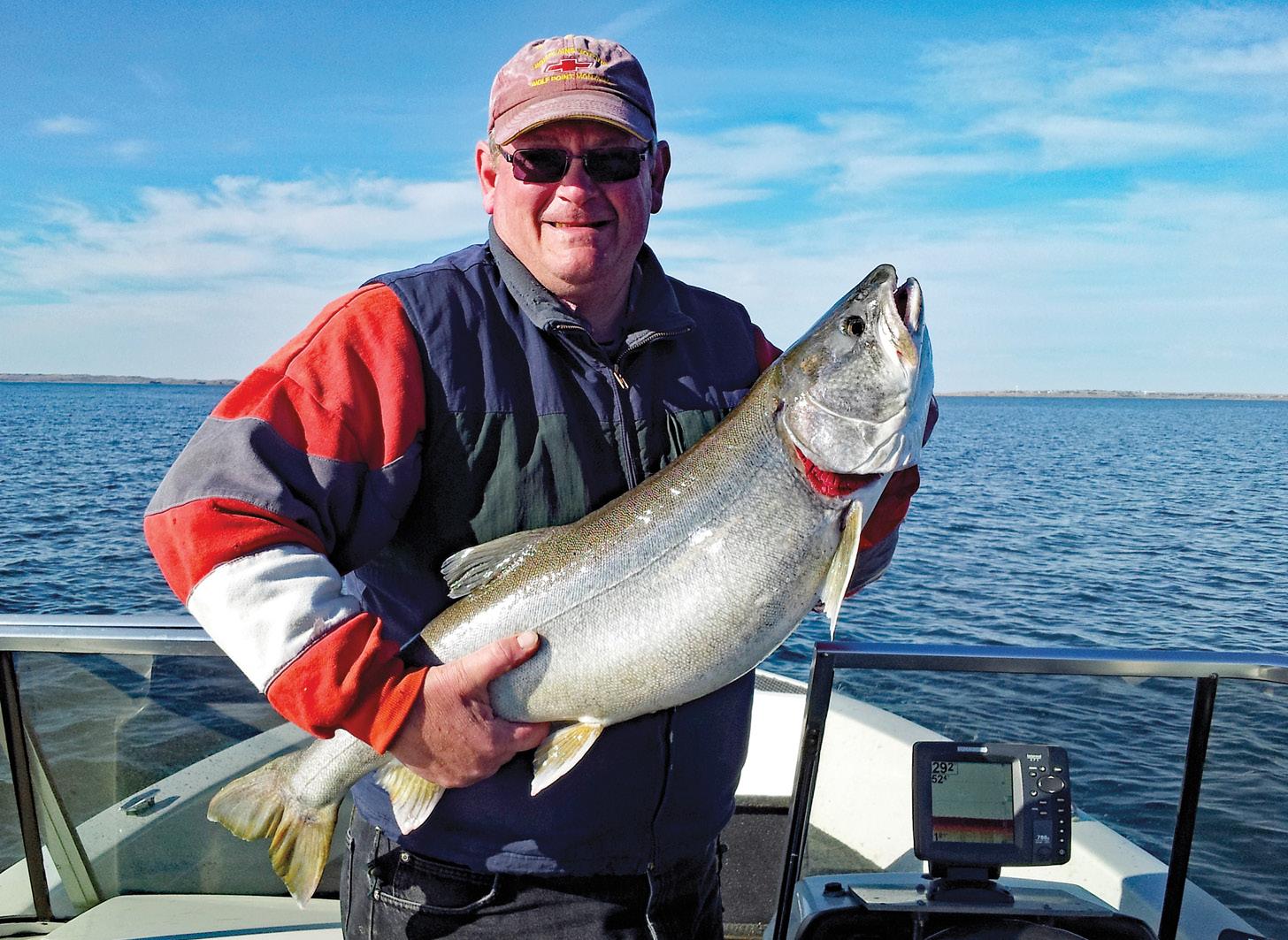
Those considering fishing in Missouri River Country should think big. Defined by sandstone formations, fields of grain and abundant river bottoms, here, shorelines go on for more than a thousand miles and fish grow to more than 100 pounds. This is the land where men built a dam across the mighty Missouri River creating the largest body of water in Montana. This is the land of the Fort Peck Reservoir.
More than 50 different species of fish inhabit Fort Peck Lake, and they all have room to grow. The reservoir is 134 miles long and as much as 220 feet deep. Along its 1,600 miles of shoreline and under its 240,000 acres of surface area, walleye, northern pike, small-mouth bass, lake trout and Chinook salmon are waiting. Curious looking ling, prehistoric paddlefish and two species of sturgeon abide there too.
Fort Peck’s diverse fishery continues to gain nationwide recognition. Stories of five-pound bass, ten-pound walleye and 20-pound northern pike continue to pique interest. To accommodate all of the use, three marinas and nine boat ramp/access areas are scattered along the reservoir. But Fort Peck remains even larger than the demand it creates and those seeking solitude and quiet waters can easily find them here.
With the exception of space, the most profuse feature of Fork Peck may be its walleye fishery. The popular game fish can be found throughout the reservoir, but experienced anglers suggest focusing efforts on the bays and points of the reservoir and Big Dry Arm.
Lake trout catch on Fort Peck Lake | Carla Hunsley
Trolling with bottom bouncers and spinners tipped with minnows, leaches, or night-crawlers, or using crank bait and jigs are advised as successful approaches for luring walleye from the reservoir to your net. Expect to catch walleye between two and four pounds but be prepared for eight to ten pound ones.
Anglers looking for a fight may want to target the reservoir’s abundant small-mouth bass—possibly the scrappiest freshwater game fish that can be caught anywhere. These guys are so aggressive they will bite on just about anything… jigs, crank bait, spinners, or flies. Look for them near rocky areas around the points and islands between Devil’s Creek and Hell Creek. While most of the bass remain between two and three pounds, it is not uncommon to find a five-pounder on the line and a fight on your hands.
Another favorite among locals is the northern pike, which were first planted in the lake in the 1950s. Expect four-to-eight-pound pike and hope for one of the 20 pounders in the Big Dry Arm Bay and lower parts of Fort Peck. Then there are all the rest… lake trout—more easily taken in the spring and fall, ling that look too much like eels to become too popular and Chinook salmon that continue to be stocked.
Fishing Missouri River Country isn’t just about Fort Peck Reservoir. The Missouri and Yellowstone rivers both are thick with their own possibilities, including the chance to land more than 100 pounds of something hearkening back to another time. Ancient paddlefish of enormous size can still be found in both rivers.
On the Yellowstone, seek them out near Sidney; on the Missouri, look between the Fred Robinson Bridge to the head of Fort Peck Reservoir. Fishing for these creatures requires an additional state license, big treble hooks, heavy weights and a deep-sea rod.
Sharing space with the paddlefish are two species of sturgeon. The pallid sturgeon is listed as an Endangered Species and must be immediately released if caught. The smaller shovelnose sturgeon may be kept if it weighs no more than 16 pounds. The experts’ pick for the best walleye fishing in Montana and home to record-setting pike and yellow perch is Nelson Reservoir near Malta. From one end to the other, Missouri River Country is a place of enormous fishing opportunities. Newcomers to Fort Peck are advised to seek out local fisherman for advice on where to go and what fishing techniques to use.
Fort Peck Lake is the ultimate dream come true for any fishing enthusiast, luring anglers from around the world. Make Fort Peck Lake your next destination. You’ll take home a fishing experience to last a lifetime.
Fishing Information
A Montana fishing license is required for all fishing in Missouri River Country; however a secondary special license is required for paddlefish. Two-day and ten-day fishing licenses are available for nonresidents. Before heading out on the water, check the Montana fishing and boating regulations www.fwp.mt.gov/fishing.
For information on Montana fishing licenses, regulations, areas to fish and outfitters and guides, contact: Montana Fish, Wildlife and Parks (406-228-3700) and the CMR National Wildlife Refuge (406–538-8706). The US Army Corps of Engineers in Fort Peck (406-526-3411) can provide additional information on Fort Peck Lake.
In order to help keep our lakes healthy, we ask you to remember that with three steps you can help stop the spread of aquatic invasive species, like plants, mussels, and whirling disease. Inspect. Clean. Dry.
Call Missouri River Country or visit our website for more information on the local attractions, events and lodging (800-653-1319) or www.missouririvermt.com.
Family boating and fishing on Fort Peck Lake | Jamie Blotsky
Fishing, Boating and Camping
Bjornberg Bridge FAS
On Milk River 7 mi E of Saco on Hwy 2, 4 mi N on Cty Rd
Bonetrail COE
x x x x
S of Glasgow on Hwy 24, to Willow Creek Rd, SW to river
Cole Pond, NNW FAS
10 mi NW of Saco on Hwy 243
Crooked Creek COE
N of Winnett via Drag Ridge Trail
Culbertson Bridge FAS
3 mi SE of Culbertson on Hwy 16
Devils Creek COE
NW of Jordan via Brusett
Dredge Cut Trout Pond FAS x x x x
3 miles northeast of Fort Peck Town site on Hwy 117
Diamond Willow FAS
On Yellowstone River, between Sidney and state line
Downstream Campground COE
N of Fort Peck Dam
Duck Creek
Fishing, Boating and Camping
Creek
N of Jordan on Fort Peck Lake
Creek Marina Private
406.557.2345 - 25 mi N of
James Kipp BLM
Lewis and Clark Bridge FAS
6 mi SE of Wolf Point on Hwy 13
Big Dry Arm of Fort Peck Lake, 41 mi SE of Fort Peck on Hwy 24
Big Dry Arm of Fort Peck Lake, 49 mi SE of Fort Peck on Hwy 24
Dredge COE
6 miles northeast of Fort Peck townsite on Hwy 117
Reservoir BOR
19 miles E of Malta, turn N off Hwy 2 at Sleeping Buffalo
Creek Marina Private
406.485.2560 - 32 mi SE of Fort Peck on Hwy 24, W at mi 27
Duck Creek FAS
2 mi SW of Fort Peck on reservoir; nearby campground COE
2 mi SW of Fort Peck on reservoir; nearby campground
1 mi N of Savage on Hwy 16, E 2 mi on Cty Rd 344
Creek FAS
Elk Island FAS x x x x
Flat Lake COE x x x x x Hwy 24 NE of Fort Peck Dam
NE of Fort Peck Town site on Hwy 117
Fort Peck Dredge Cuts COE x x x x
5 mi NE of Fort Peck on Hwy 117
Fort Peck Marina Private x x
406.526.3442 Floodplain COE
Fort Peck West 1, 2 & 3 COE x x x
1 mi S of Hwy 24 off Duck Creek Rd
Fourchette Bay COE
60 mi S of Malta on Cty Rd
Gartside Reservoir FAS x x x x
1 mi N of Crane on Hwy 16, W 1 mi on Cty Rd 116
Glasgow Base Pond FAS
20 mi N of Glasgow on Hwy 24
x x x x x x x x x FAS = Montana FWP Fishing Access Site
COE = Corps of Engineers
30 mi S of Fort Peck on Hwy 24, 7 mi W on Cty Rd
Point COE
Hwy 117 N of Fort Peck Dam
Trust FAS
6 mi NE of Fort Peck townsite off Hwy 117
Sisters FAS
1 mi E of Crane on Cty Rd 115
Bridge FAS
1-1/2 mi S of Sidney on Hwy 16, 1-1/2 mi E on Hwy 23
Bridge FAS
14 mi NW of Fairview on Cty Rd
Pines COE
S of Glasgow Hwy 24, to Willow Creek Rd to Pines Rd
End Campground COE
2 mi W of Fort Peck on Hwy 117, NW on Hwy 24, S on Duck Creek
Reservoir FAS
7 mi N of Flaxville on Hwy 511 SW of Malta on Hwy 191
Advisory: Some sites may be inaccessible because of weather conditions. Check local weather and road conditions before traveling.
Advisory: Some sites may be inaccessible because of weather conditions. Check local weather and road conditions before traveling.
FAS = Montana FWP Fishing Access Site COE = Corps of Engineers BLM = Bureau of Land Management BOR = Bureau of Reclamation
Sunrise at Fort Peck Lake | John Lambing
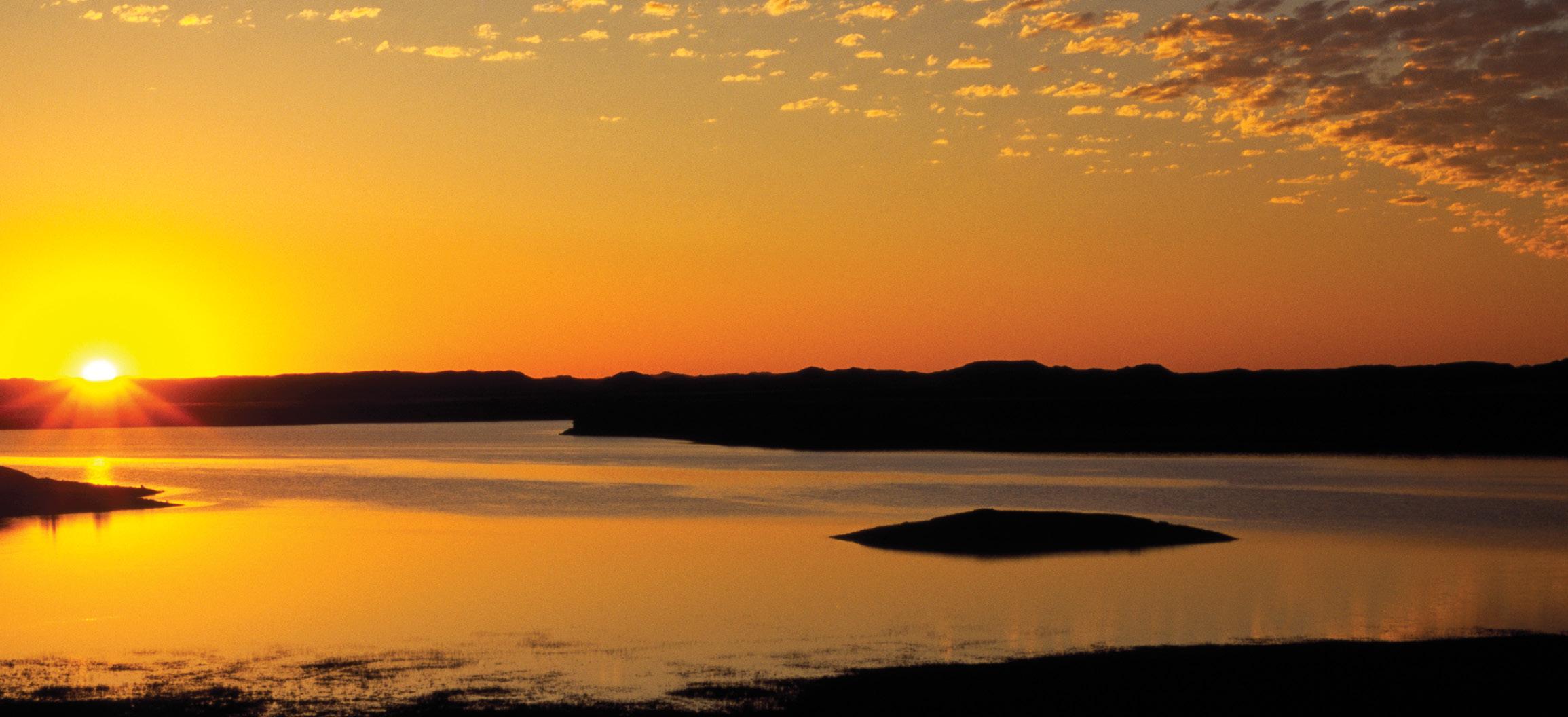
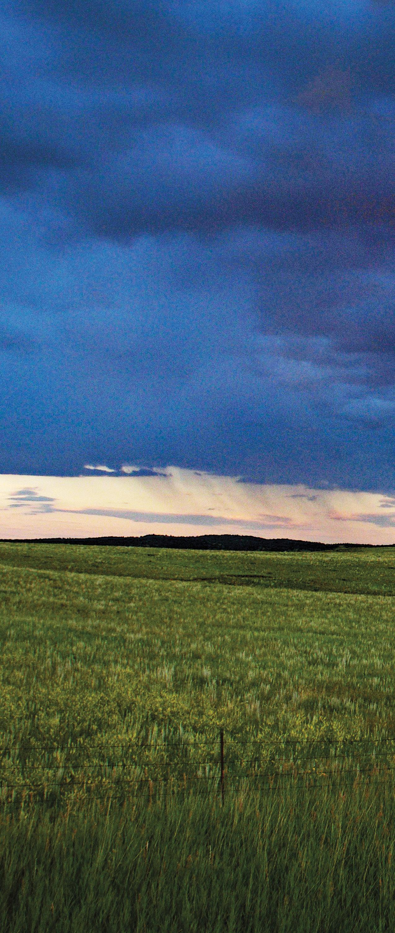
From the moment the sun bursts onto the eastern horizon of Missouri River Country, Montana’s biggest sky becomes a canvas for artful displays of billowing clouds, fast moving storms, and magnificent sunrises and sun sets. With nightfall, an astronomer’s dream of varied nocturnal displays takes center stage.
East side of Fort Peck Lake, looking towards Fort Peck townsite | Kaden Harrison
Missouri River Country sunrise | Rick and Susie Graetz
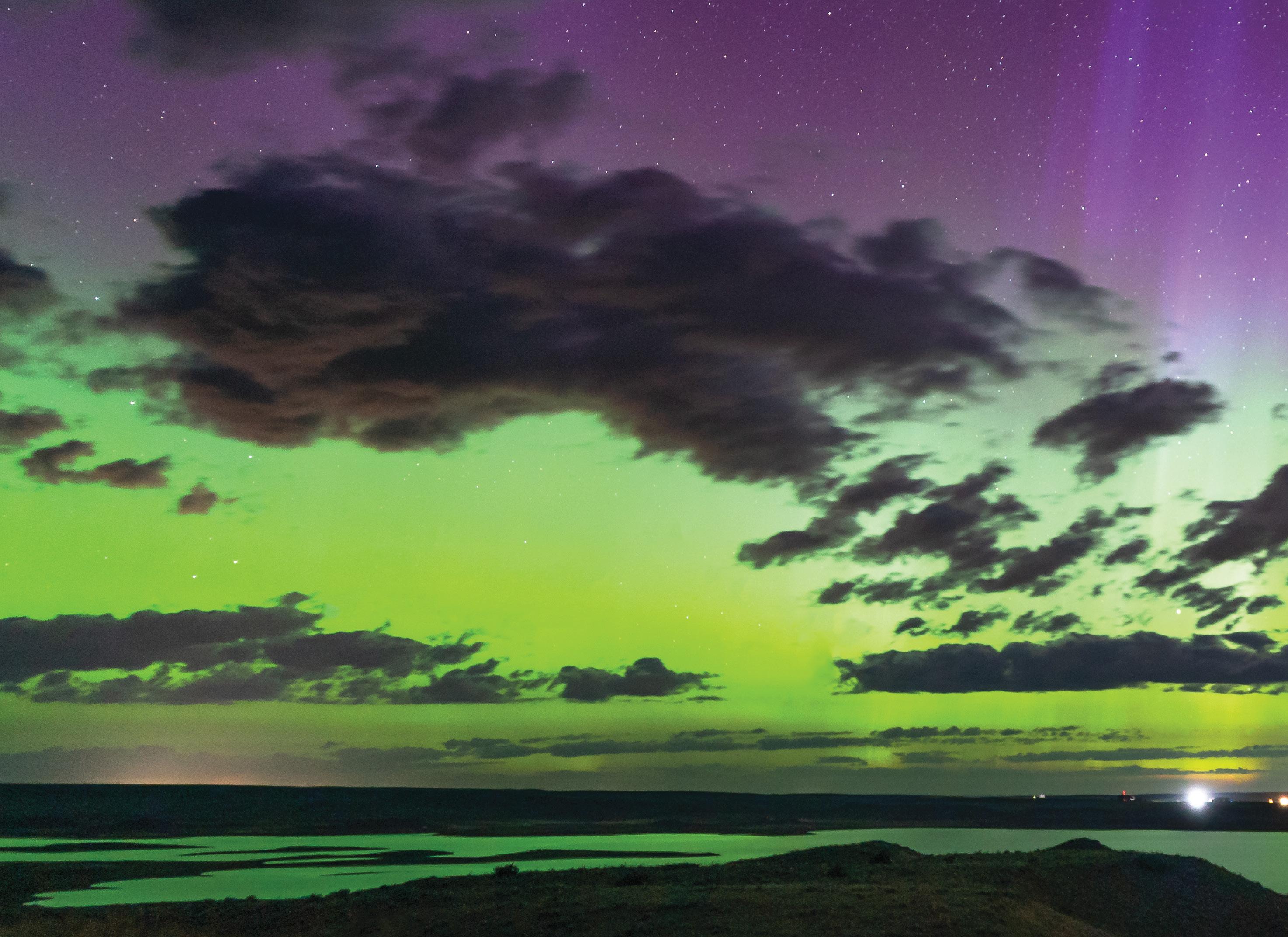
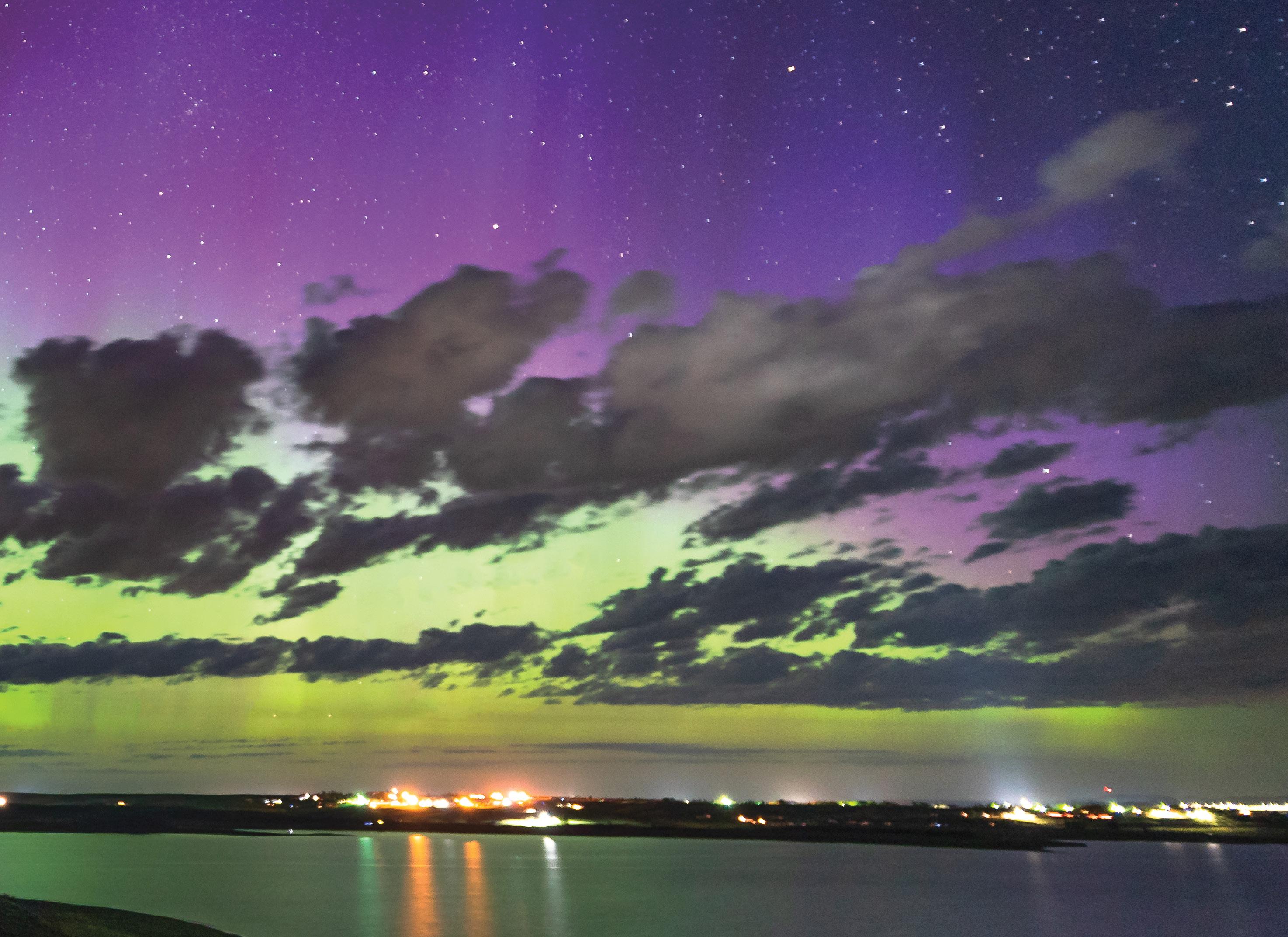
Brilliant, twinkling diamonds crown the heavens over Fort Peck Lake, and a full moon illuminates the snow-covered hills between Scobey and Plentywood. In a landscape free of competing lights, one might attend a performance of the color changing Northern Lights as they swirl and leap across the night sky.
It is as expansive a dome of sky as any on the planet and often brings an early morning and evening light so beautiful that no painter or photographer could ever duplicate it.
Subdued topography allows the sky top billing. Summer thunderstorms build to a towering collection of billowy white and gray clouds that are then swept by the wind up into Canada or out onto the plains of the Dakotas, leaving glimmering sunshine over the prairie, often only to be replaced by another storm with intense lightning displays. In winter, northern born blizzards roll like turbulent waves across the uncluttered skyline depositing a quiet comforter of snow in their wake.
TrailsToTheStars.com
Billowy summer clouds west of Opheim | Rick and Susie Graetz
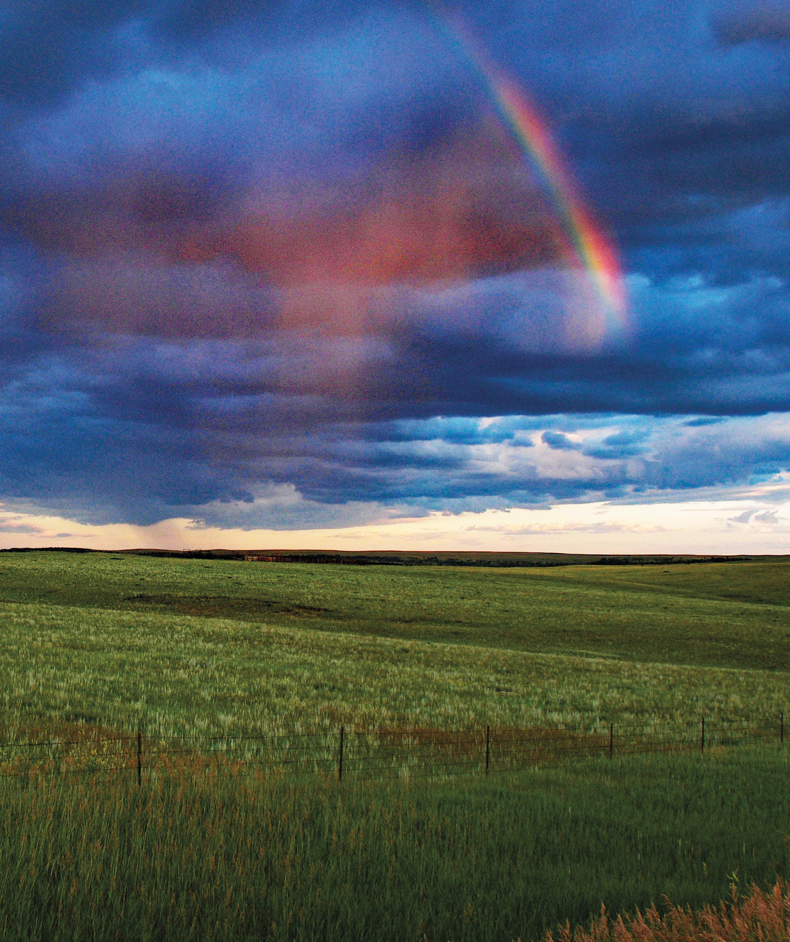
Rainbow east of Malta
| Rick and Susie Graetz
MISSOURI
RIVER COUNTRY DINOSAUR TRAIL
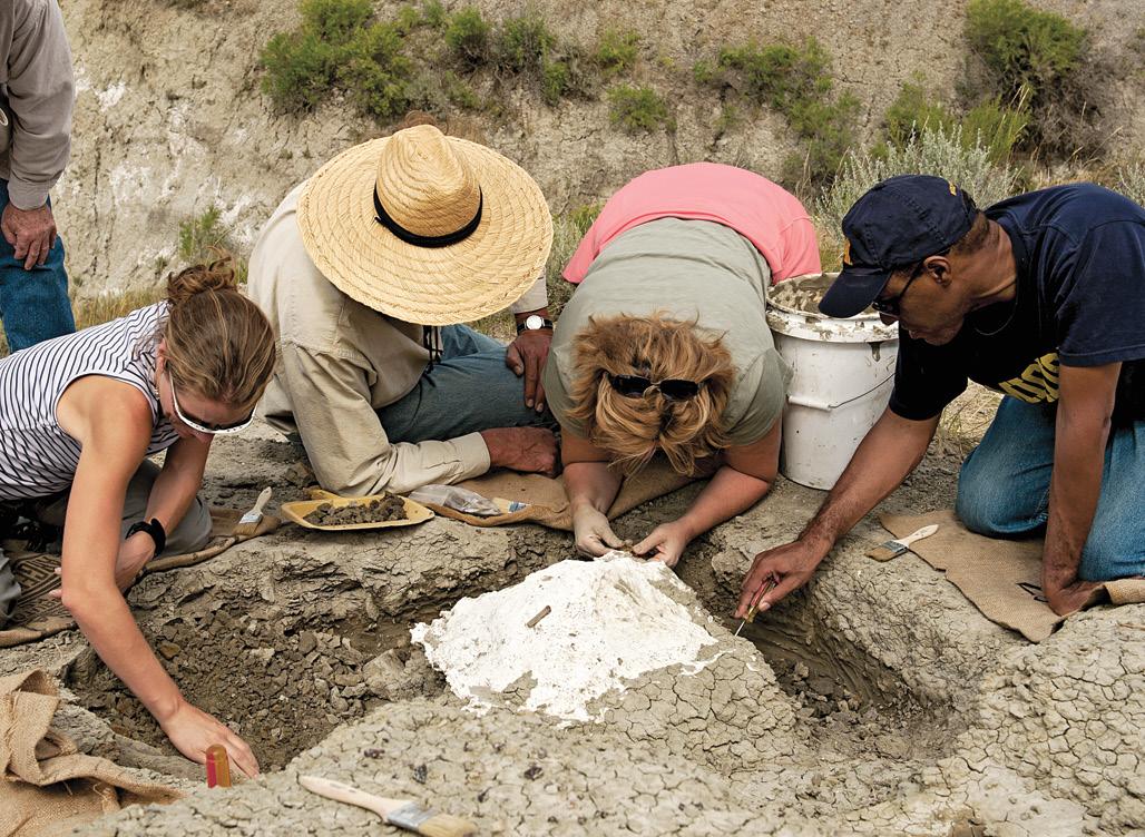
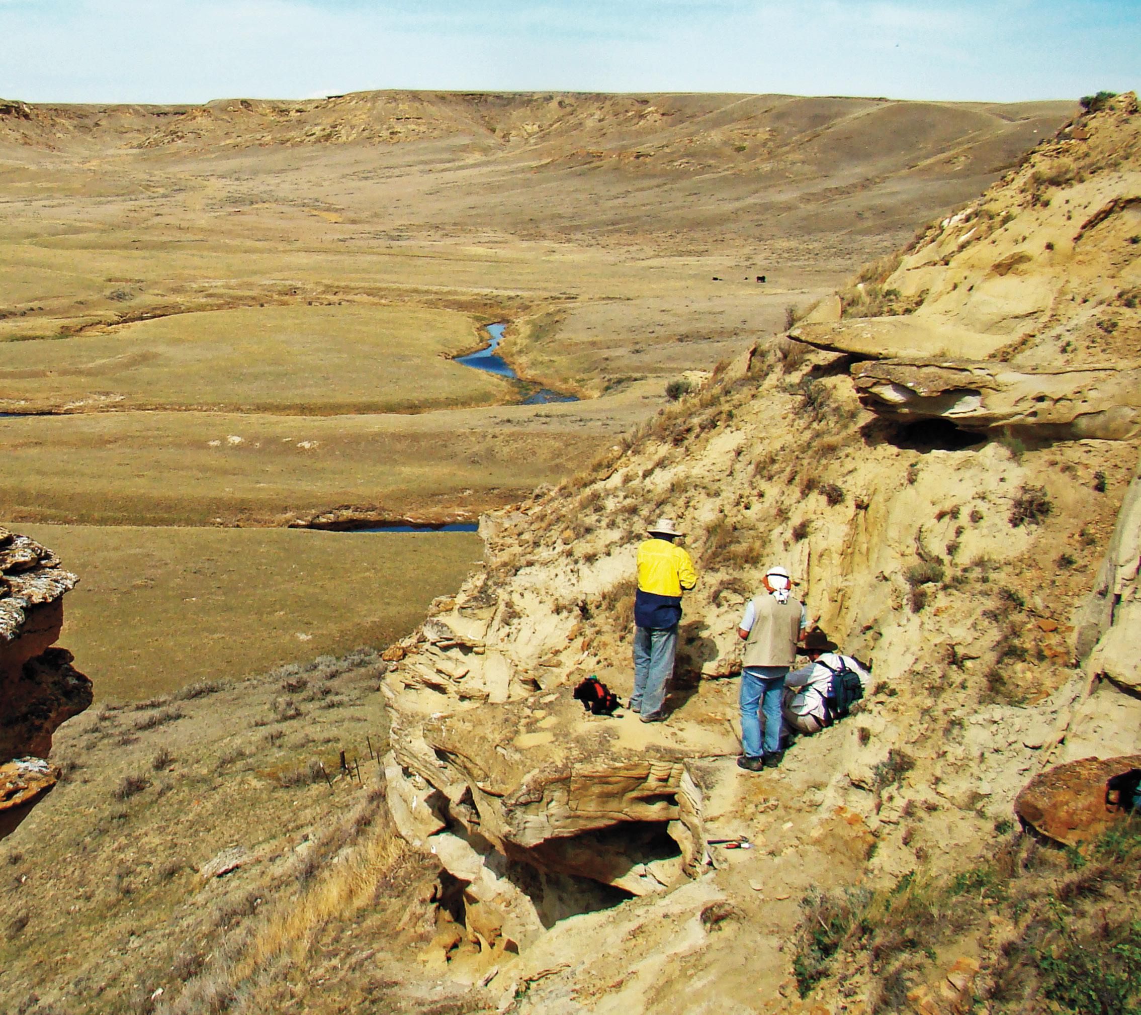
More dinosaurs have been discovered in Montana than in any other state, and it isn’t difficult to imagine them stomping and pounding their way across the wide-open spaces, river breaks and badlands of this northeastern part of the state.
Millions of years before the Missouri River formed, Triceratops, Albertosaurs, Stegosaurs, duck-billed dinosaurs, and aquatic monosaurs roamed, fought, and populated Missouri River Country. In 1902, the first Tyrannosaurus rex (T. rex) fossil was discovered near Jordan in the badlands of Hell Creek. In 1990, one the most complete T. rex ever was uncovered near Fort Peck.
A huge swath of MRC is part of the well-studied and explored Hell Creek formation, named after Hell Creek, an area of exposed rocks dating to the upper Cretaceous to lower Paleocene geologic eras. For the most part, with the exception of and area contiguous to the Missouri’s north side south of Malta, it is confined to the south side of Fort Peck Lake and north of Jordan. This region is considered to be one of the richest fossil beds in the world and indeed great discoveries have been made there.
North of the Milk River Valley, the older Judith River formations are exposed. In the summer of 2001 near Malta, excavation of Leonardo, a duck-billed Brachylophosaurus who holds the distinction of being the best-preserved dinosaur ever recovered, was found. Several other duckbilled dinosaurs have also been uncovered.
Along the western edge of Missouri River Country and south of Malta, on the east slopes of the Little Rocky Mountains, a the Jurassic configuration shows fossilized marine life that lived in the once shallow inland sea that inundated this area. Inland bays of the Pacific Ocean during Jurassic times and the Atlantic Ocean during the Cretaceous period provided Montana with a hot and humid subtropical climate.
Just outside of Zortman at the town dump, a Jurassic mudflat is tilted up at a 45-degree angle exposing a jumble of fossils that have tumbled down the slope. Creatures such as “devils toenails” (oysters) and belemites (the bullet shaped hard cores of squids, and crinoids) with their stacked button shaped stems.
North and east along the Canadian border the old Missouri River terrace gravels of Miocene times are evident. Generally only the hard fossil parts of mammels and their relatives survived the stream tumbling action, but the teeth and bones of camelids, rhinos, and protohorses are commonly found in road cuts and gravel pits. On these Miocene grasslands there was also a curious burrowing critter with small-pronged horns called a dicroceras, better known today as a jackalope!
In the eastern part of Missouri River Country the Fort Union formation covers much of the terrain. This was laid down following the demise of the dinosaurs and is largely devoid of animal fossils, but fossil leaves are abundant in the mudstones exposed along road cuts and in the baked clay “scoria” used for the “red roads” in the oil patch.
Each year brings new finds and exhilarating information and enlightenment about what this land was like until possibly an errant asteroid ended the reign of the dinosaurs 65 million years ago. The impact engulfed the earth in a massive shroud of dust and debris that blackened the skies, produced widespread fires, and perhaps increased volcanic activity. So the theory goes.
Museums and their displays of both ancient land and sea dwellers are found throughout Missouri River Country. The Fort Peck Interpretive Center and Museum at Fort Peck, just south of Glasgow, is world class. Exhibits include fossils, scenes of the powerful surrounding landscape as well as wildlife and historical exhibits, and a cast of a giant T. rex.
Dinosaur dig
| Donnie Sexton
While in Montana visit the Montana Dinosaur Trail, https://mtdinotrail.org/ with 14 different locations across the state. The Garfield County Museum in Jordan is one of the locations on the trail that features a fullsized Triceratops and a T. rex skull (406-557-2517).
If you would like to follow the entire Dinosaur Trail, you could begin and end anywhere, but let’s use Glasgow as a starting point. With the amazing Fort Peck interpretive Center just 17 miles away, this would be perfect for your first introduction to the fascinating world of super-sized predator/prey species and view a life-sized model of “Peck’s Rex,” a skeleton of a Tyrannosaurus rex found near Fort Peck in 1996.
West of Glasgow, in Malta, The Phillips County Museum and The Great Plains Dinosaur Museum house many rare fossil dinosaurs, plants, invertebrates and fish. The Great Plains Dinosaur Museum offers Dinosaur Digs. Dig for dinosaurs and explore Montana with their paleontologist. They also offer a Junior Paleontology Program. A hands-on experience for kids ages 5-11.
Check out their website for more information: greatplainsdinosaurs.org. Registration for all programs: (406-654-5300)
Looking for fossils south of Malta | Erin Blatzer Hammon
THE ORIGINAL PEOPLE
In the early 1600s, Europeans displaced the ancestors of the Gros Ventre, the Assiniboine, and the Sioux from the East Coast. Nomadic hunters and fierce warriors, they headed out to the north and west in search of new land. Migrations over 200 years, coupled with mandatory moves by the US government, saw the three tribes settled in the north-central and northeastern part of Montana. At the turn of the 19th century, the decimation of their numbers by smallpox and the government’s slaughter of bison forced them to consider moving onto reservations to survive.
In 1876, the Nations were instructed to move to the Fort Peck Indian Agency in the northeast corner of Montana to live with the Sioux. Many Assiniboine, who felt a cultural and language connection with the Sioux, did as they were
told. The Gros Ventre and the remaining Assiniboine wanted no association with their oft-time rival. They refused, and it wasn’t until 1888 that they found their home when the Fort Belknap Reservation was established.
Natives had a deep spiritual relationship with the buffalo. Central to every part of their lives, nothing was wasted. According to www.study.com, the teeth became necklaces and jewelry. Tongue: high-protein meat… the rough side
was used as a comb. Horns: dishes, arrowheads, jewelry, utensils, and ground up for medicine. Brain: food, tanned hides into leather. Skull: used in sacred ceremonies. Bones: made into tools, weapons, needles, and fishhooks. Muscles: an adult bison provided 800 pounds of useable meat. Liver: food, and a tanning agent. Blood: paint, and soup thickener. Organs: dried and used as bags. Tendons: made bowstrings. Fur and hide: Used for blankets, clothing, tepee covering. Hair: braided into ropes and halters. Hoofs: glue, made into rattles. Droppings: fuel for fires.
Nearly 30 million bison once roamed free across the plains; by 1900, less than 1,000 remained. One small herd in Yellowstone National Park became today’s answer to both reservations’ quest to return the honored buffalo to their land and re-establish its spiritual and cultural relationship with their people.
In 2012, the first genetically pure descendants of YNP bison safely arrived at the Turtle Mound Buffalo Ranch on the Fort Peck Reservation. A year later, wild bison made a powerful entrance onto the Fort Belknap Reservation. The reintroduction of these buffalo led to the gifting of herds to other Indian reservations. Both reservations organize special bison hunts to commemorate the occasion.
Fort Peck Reservation—The Assiniboine and Sioux Nations
Poplar is the center for tribal activities and hosts the Assiniboine and Sioux Cultural Center and Museum and the Fort Peck Community College.
Powwows celebrating family, friendship, and Indian culture occur throughout the year. The reservation is home to fascinating artifacts and historical places, including tipi rings, buffalo jumps, and sacred sites. If you are interested, contact the tribal office at 406-768-2300. Sensitivity issues and tribal customs must be considered and respected.
Fort Belknap Reservation—The Gros Ventre and Assiniboine Nations
Situated half in the Central Montana tourism region and half on the western edge of Missouri River Country, tribal celebrations and events mostly take place on the western reaches of the reservation.
MISSOURI RIVER COUNTRY’S BIRDING TRAIL
Come encounter the diverse song, color, and bird species of Montana’s Missouri River Country. From the wideopen prairie to the marshes and reservoirs, to the hills of the badlands, to the woodlands of the river breaks, an experience awaits you.
Western Meadowlarks with their golden-colored throats serenade travelers along roadways, the shy and endangered Piping Plovers hide in the pothole region, American White Pelicans soar in military fashion over rivers and lakes while curlews and Great Blue Herons hunt the shorelines, hawks, and grouse make their living amid the sagebrush and grass-covered prairie and while owls patrol the night sky while eagles command the day.
You can listen to the soulful call of a loon or the tap of a woodpecker, catch the brilliant flash of a Lazuli Bunting or if you are very lucky, spot a rare hummingbird appearance. There is much to delight and captivate both the amateur and the veteran Birder, so grab your binoculars and get ready to discover the myriad of winged folk who inhabit the amazing landscape along the Birding Trail of Missouri River Country.
Information for each stop on the trail can be found at: www.missouririver.com/birdwatching
Red-tailed Hawk | Rick Bohn, USF&WS
Meadowlark | Dan Dusch
Sharp-tailed Grouse | Rick Bohn, USFWS
Accommodations in Missouri River Country
HOTELS AND MOTELS
CIRCLE Traveler’s Inn
CULBERTSON Hi Line Inn and Suites
The Kings Inn Motel
FAIRVIEW Korner Motel
FORT PECK Fort Peck Hotel
GLASGOW Campbell Lodge
Cottonwood Inn & Suites
Highway 2 Inn
Rundle Suites
Star Lodge Motel
JORDAN Garfield Motel
$ 102 B Avenue
406-485-3323 trvlinn@midriver.com
$$ 781 6th Street East 406-787-5261 www.hilineinn.com
$$ 408 East 6th Street 406-787-6277
$ 217 9th Street 406-742-5259 trumpwer@midrivers.com
$$ 175 So. Missouri Street 406-526-3266 www.thefortpeckhotel.com
$ 534 3rd Avenue South 406-228-9328 info@campbelllodge.com
$$$ 54250 US Hwy 2 406-228-8213 www.cottonwoodinn.net
$ 54207 US Hwy 2 406-230-2273 highway2inn.com
$$ 208 5th Street 406-228-2800 www.rundlesuites.com
$ 1023 US Hwy 2 W 406-228-2494 shirlf@nemont.net
$ 361 Main Street 406-557-6215 garfield@midrivers.com
Hell Creek Marina Lodging $$ 2502 Hell Creek Road 406-557-2345 www.hellcreekmarina.net
JORDAN Landwehr Outfitters #1 Stockyard Lane 405-219-1319 www.landwehroutfitters.com
MALTA Sagebrush Outfitters 50664 US Hwy 191 North 406-674-5271
SAND SPRINGS Kibler Outfitting & Charter Fishing 1239 North Lodge Pole Road 406-557-2503 www.kiblercharterfishing.com 7W Ranch & Outfitting 2532 N. Lodge Pole Road 406-852-6816
GUEST RANCHES AND LODGES
MALTA Tillmans Bed & Breakfast 406-670-9788 www.tillmansofmontana.com
SACO Beaver Creek Lodge 210 Montana Avenue 406-527-3204
SAND SPRINGS IOU Ranch 1712 N. Lodge Pole Road 406-557-2544
VACATION HOMES
FORT PECK Bait & Switch LLC
80 Idlewild Drive 406-526-3241
JORDAN Twitchell’s Sportsman Rental 406-557-2554
PRIVATE CAMPGROUNDS AND MARINAS
CIRCLE Horse Creek Trailer Court & RV 112 B Drive 406-876-4581 www.horsecreekrvpark.com
CULBERTSON Culbertson RV Park 5747 Road 1022 406-314-1597 www.culbertsonrvpark.com
DAGMAR Sunset Camping 85 Brotherhood Hall Road
FORT PECK Rock Creek Marina 652 South Rock Creek Road 406-485-2560 www.rockcreekmarina.com
GLASGOW Cottonwood & Suites RV Park 54250 US Highway 2 406-228-8213 www.cottonwoodinn.net
JORDAN Hell Creek Marina 2502 Hell Creek Road 406-557-2345 www.hellcreekmarina.net
MALTA Buffalo Camp at American Prairie Reserve South of Malta 406-585-4600 www.americanprairie.org
Edgewater Inn & RV Park 47176 US Highway 2 406-654-1302 www.edgewaterinnrv.com Riverside Motel & RV Court 8 Central Avenue North 406-654-2881 barbngar@mtintouch.net
PLENTYWOOD AOK Camping 509 West 1st Avenue 406-765-7951
Bolster Dam Campgrounds Box Elder Street 406-765-1700
POPLAR Smith’s Mobile Park 1502 15th Avenue East 406-768-3841
SCOBEY Lions Campground 11 Railroad Avenue East 701-770-4993 surveytool@mt.gov
WOLF POINT Homestead RV Park 7520 US Hwy 2 406-653-1940 ranchorvpark@nemont.net
ZORTMAN Buckhorn Store, Cabins and RV Park 143 Whitcomb St 406-673-3162 buchrns@tcc-cmc.net
Zortman RV Park & Campground 302 Main Street 406-673-3160
SPECIAL INTEREST
MALTA Great Plains Dinosaur Museum & Field Station US Hwy 2 East 406-654-5300 www.mtdinotrail.org/great-plainsdinosaur-museum-and-field-station
FORT PECK Fort Peck Interpretation Center Yellowstone Road 406-526-3493 www.fws.gov/refuge/charles-mrussell/fort-peck-interpretive-center
VACATION PLANNING ASSISTANCE
MALTA The Travel Haven 121 South 2nd Street 406-654-1638
SIDNEY Journeys by Jan Travel Company 1050 South Central Ave. #1 406-488-4450
Information Sources
State and Federal Agencies
Montana Office of Tourism
800-847-4868 www.visitmt.com
Montana Fish, Wildlife and Parks: 406-444-2535 https://fwp.mt.gov
Fort Peck Tribes Fish and Game Department: 406-768-2300
https://fishandgame.fortpecktribes.org
Regional Headquarters Fish Wildlife and Parks, Glasgow: 406-228-3700
BLM-U.S. Bureau of Land Management Malta: 406-654-5100
Glasgow: 406-228-3750 https://blm.gov/ Bowdoin National Wildlife Refuge: 406-654-2863 https://fws.gov/refuge/ bowdoin/
CMR | Charles M. Russell National Wildlife Refuge: 406-538-8706
https://fws.gov/refuge/charles_m_russell/
Medicine Lake National Wildlife Refuge: 406-789-2305
https://fws.gov/refuge/medicine_lake
US Army Corps of Engineers Fort Peck: 406-526-3411