MLA APPLICATION FOR UCL
WORKS
YUHUI SHI / PORTFOLIO Zhejiang University yuhui_shi@outlook.com +86 19883156001 YUHUI SHI
number: 23153186
2019-2022 SELECTED
/
Application
CONTENTS
Follow the Voice of Land
I consider landscape design as a process of responding to voices
These voices are about the need for the form, ecology, culture and industry of the land. Therefore, shaping the landscape can draw from these elements and is intended to help the creatures that live on the land.
In my portfolio, I show how I think and design from this idea. Depending on the characteristics of the site my projects are approached from different thinking perspectives.
get inspiration from the original process
REMNANT CULTURE
learn from regional agricultural texture
Landscape architecture design
Site location: Shanghai
Scale: 6 ha Time: 03.2022
Type: Academic work, Individual work
Instructor: Chunmei Li
POSITIONING CRISIS
respond to larger urban demands start thinking by combing the water flow
Landscape architecture design
Site location: Huzhou, Zhejiang
Scale: 14 ha Time: 10.2022
Type: Academic work, Individual work
Instructor: Yunlan Deng
Urban design
Site location: Hongkong
Scale: 295 ha Time: 07.2022
Type: Academic work, Collaborative work with Ruijuan Zheng
Role: concept-70%, analysis-60%, modeling-60%, drawing-50%
Instructor: Hao Hu
Urban design & Landscape design
Site location: Hangzhou, Zhejiang
Scale: 100 ha Time: 12.2022
Type: Academic work, Individual work
Instructor: Yi Zhang
RE-STACK CONNECT C.O.D. WAVE
03 08 13 17 20 riverside stockyard renewal mine pit fish ponds renovation carbon neutral oriented urbanization a square matrix buffer belt for flood control field pavilion design and solid model making 01 02 03 04 05
OTHERWORK
STOCKYARDS ALONG THE HUANGPU RIVER
Site location: Shanghai Scale: 6 ha Type: Individual work Instructor: Chunmei Li 03.2022






A large number of stockyards along the Huangpu River are abandoned in the process of urban renewal, which left a place either friendly to ecology nor people. However, the machines, tracks and materials on the sites can be good landscape elements for the site to regenerate.

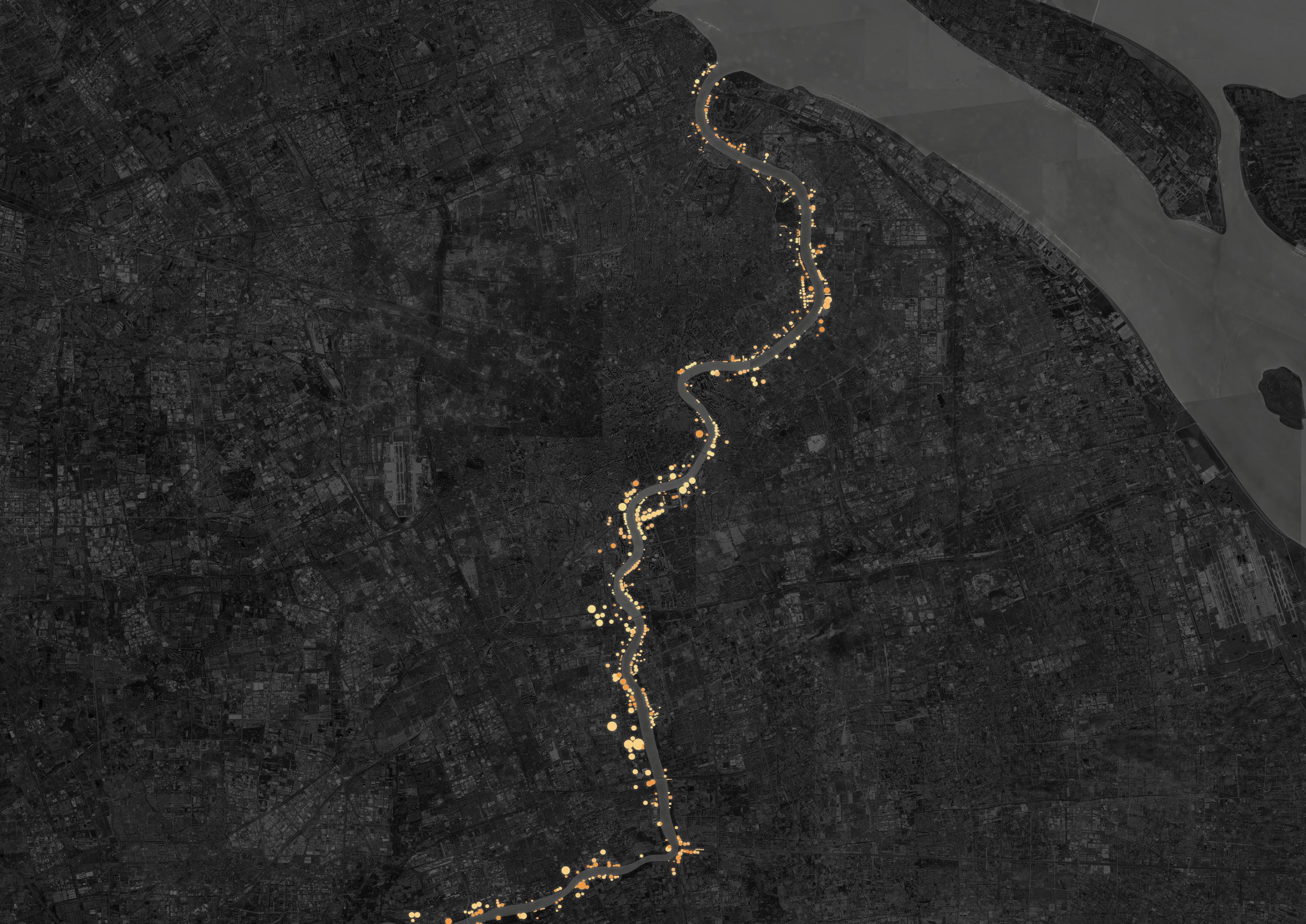
MORE AND MORE STOCKYARDS ARE BEING ABANDONED
WHAT'S IN A STOCKYARD ?



2005 2010 2015 2020 MACHINE TRACK MATERIAL
Smaller Type
01
Bucket-Wheel Stacker-Reclaimer bucket wheel bob weight travelling mechanism swing mechanism forearm conveyor belt pulley track material storage area machine area material storage area Sand Gravel Coal angle of repose diameter height 3
STACKING-RECLAIMING STUDY
I hope to form the landscape space of the site by exploring the possible units formed by using the original machines, tracks and materials of the site. I paid special attention to the brushes formed by different movements of the machine.





MACHINE BEHAVIOR


reclaiming
basic form vertical planar
basic form earth sand (dry) sand (water filled) sand (wet) gravel (crushed stone) gravel (natural w/ sand) coal 30–45° 34° 15–30° 45° 45° 25–30° 45°
Pile Maximum Height of Different Materials under the Same Area
point line stacking
circle
point line circle
SPACE GENERATION 4
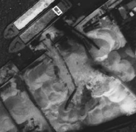
Different Shapes of Stockpiles Observed on Satellite Images
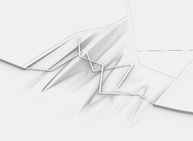
OVERALL LANDFORM DEDUCTION
Extract Shape
between city and water supposed spine of stocks bank streamline
water flow

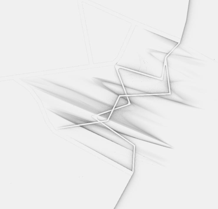
interweaving of waves and traces

Implement
track of machine stroke edge splicing enriching smoothing accessibility enhancing


FRAMEWORK
storm drainage waste of land


lack public space industry waste
low density of vegetation tide emerge

existing material reuse

topographic organization ecology treatment


sand play shoal area sandpile
water play wetland boats
SUPPOSED LAND MODEL
ANALYSIS LAYER TREATMENT SECTION GOAL
Site Image
city stockyard river
activity habitat view
5
FROM ABANDONED STOCKYARD TO ECOLOGICAL PARK
SECTIONAL DRAWING


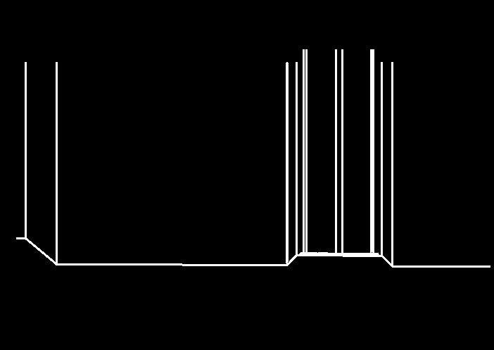
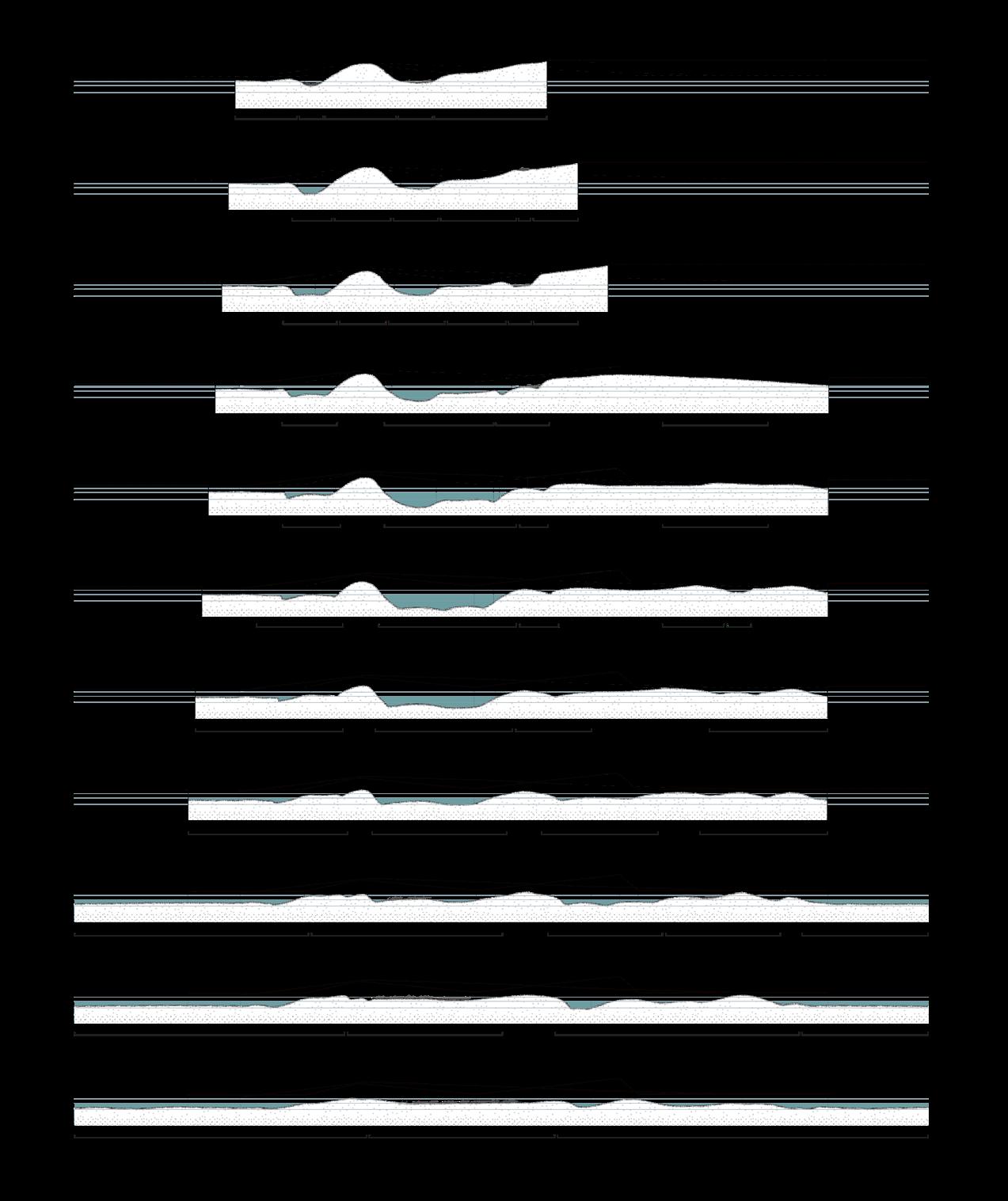
From cities to rivers, sand piles are combined into different heights, forming different ecological spaces and human activity spaces under constant water level.


OF FORMATION
PHASING
CONSTRUCTION
STEPS
/
AND
N 0m 10m 30m 80m main entrance secondary entrance sand play area viewing spot wetland shoal area pool island bridge 1 3 5 7 2 4 6 8 9 1 3 5 8 2 4 6 9 7 viewing shoal area shoal area shoal area shoal area shoal area shoal area shoal area shoal area shoal area shoal area shoal area shoal area shoal area shoal area pool pool pool pool shoal area viewing wetland viewing shoal area wetland sandplay wetland wetland wetland wetland wetland wetland wetland wetland wetland wetland wetland sandplay sandplay viewing viewing wetland wetland viewing viewing wetland wetland wetland viewing viewing A B C D E F G H J K A B C D E F G H J K A F A' F' keep the tracks and machines dig out the ditch, form basic terrain stack and reclaim, generate space remove the track, fill the land complete the topography, place plants build the bridges finish 6
MODEL PERSPECTIVE VIEW
春夏秋冬,不同水位产生的不同景观/生态的分析~


People feel different landscape atmosphere in different weather when they visit the site. 3D printing


ANALYSIS
In rainy days, people enjoy the beautiful wetland landscape.
View 1 On sunny days, people play happily on the sand and grass
View 2
7
Water flows into the site, creating an ecological space.
MINE PIT FISH PONDS RENOVATION
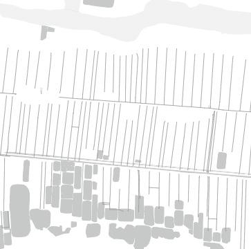
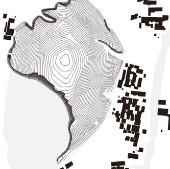
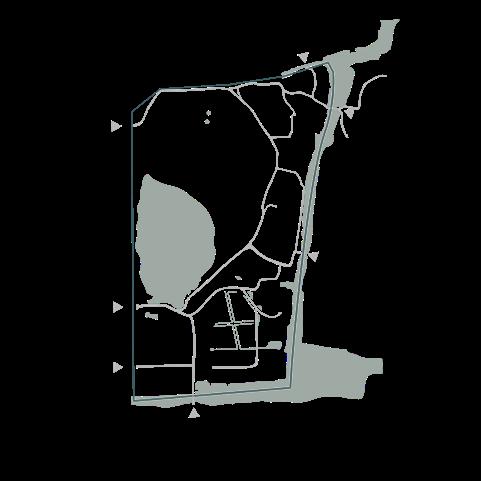
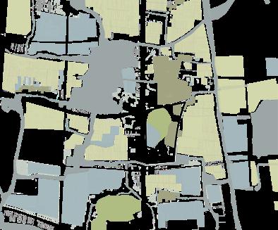
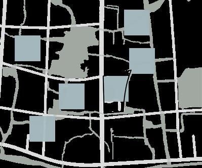
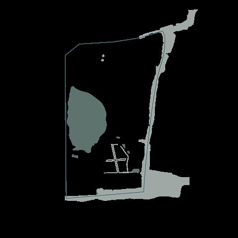
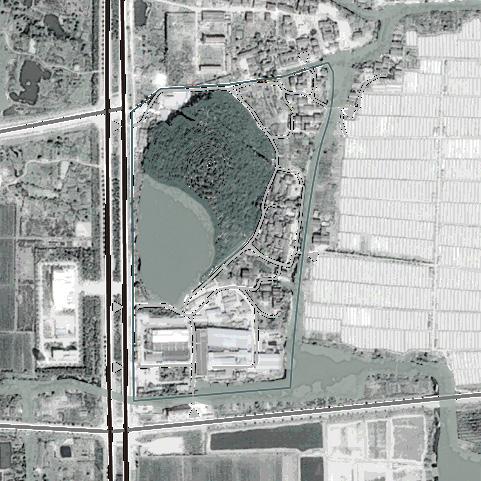
The combination of villages, fish ponds, cropland, low mountains shaped the style and features of Huzhou's water town. By analyzing the texture of the site area, I extracted 6 kinds of landscape texture. I will restore the landscape of the site by studying the relationship between the elements, natural formation and cultural connotation.


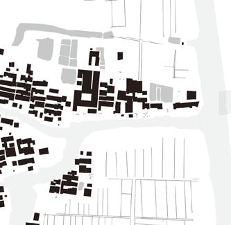
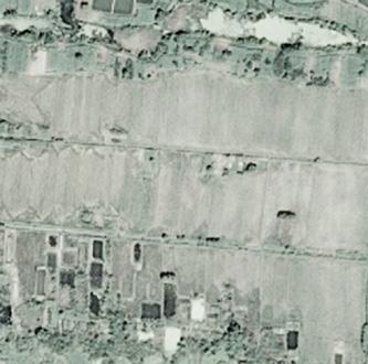
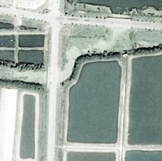


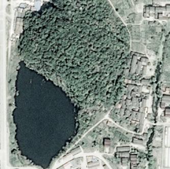


SITE MEMORY



REGIONAL LANDSCAPE TEXTURE STUDY
Village with fish ponds and cropland by the mountain.
People filled fish ponds and built factories
Because of mining, the mountain has formed huge mines.

with ditches cropland with small ponds
The water in the pit forms a pond. Factories were gradually abandoned.
cropland with fish ponds

The pond became a fish pond.
People lived in the village moved away.
large fish ponds
02
site selected A B C D E F
1990 1996 1998
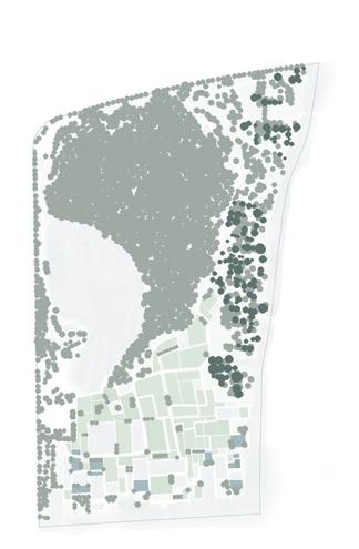
SITE CONDITION entrance mountain factory village 1 m contour line 5m contour line top: 45.48m existing road building river ditch pool building cropland grassland woods road mining pit wasteland moutain village cropland fish pond
2000 2020
mountain
village cropland
A B C D E F water planting
location: Huzhou, Zhejiang Scale: 14 ha Type: Individual work Instructor: Yunlan Deng 10.2022 8
LANDSCAPE TEXTURE MAPPING FEATURES
Site
DECOMPOSE NATURAL SOCIAL EXTRACTION
unit boundary texture landform water flow technique production activity
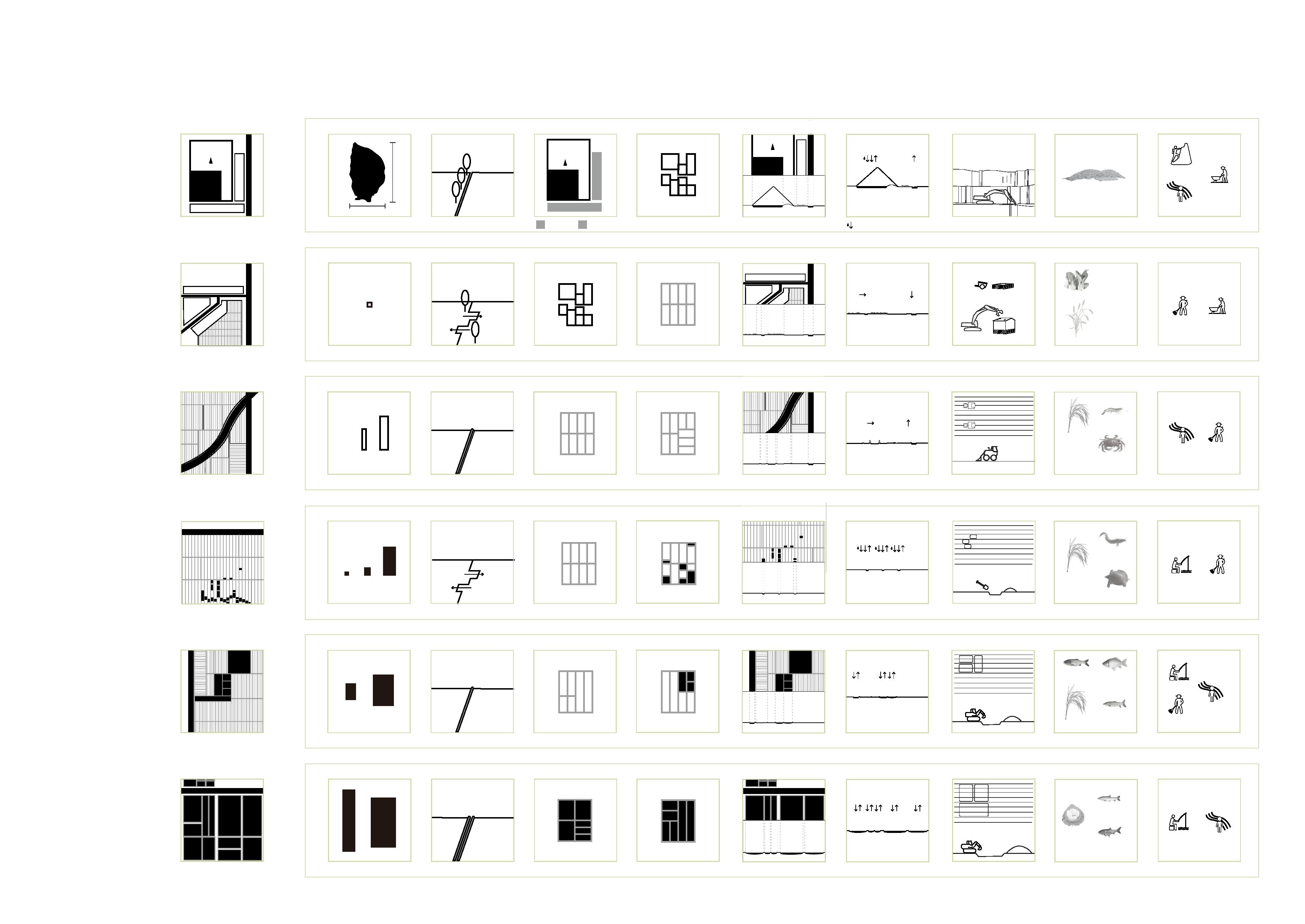
A B C D E F mountain village cropland with ditches cropland with small ponds cropland
with fish ponds large fish ponds
mining pit village cropland small fish ponds middle fishponds large fishponds 10*10 10*50 / 20*80 10*10 / 15*20 / 30*70 25*40 / 50*75 3*150 / 60*120 120m 220m mountain village village cropland cropland cropland cropland S ponds cropland M ponds L ponds L ponds factory village village cropland cropland cropland fishponds village cropland cropland with fishponds cropland fishponds rainfall ponding E E S N rape shrimp loach crucian black carp silver carp silk wheat crab turtle grass carp bighead carp rice rice rice building stones 9
STRATEGIES TO EVOKE THE MEMORY AND ACTIVATE THE SITE


Strategy 1 - Connect the route and create sightseeing spots


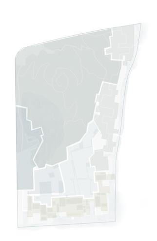

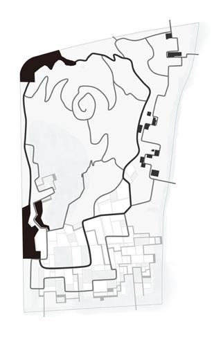
pit wall scenery mountain climbing river crossing
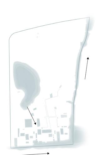
Strategy 2 - Connect the water and enrich waterfront space


leisure lawn agriculture landscape boundary extension
Strategy 3 - Continue the village memory
resting space open space walking & sightseeing
ecological
economic increase social activity
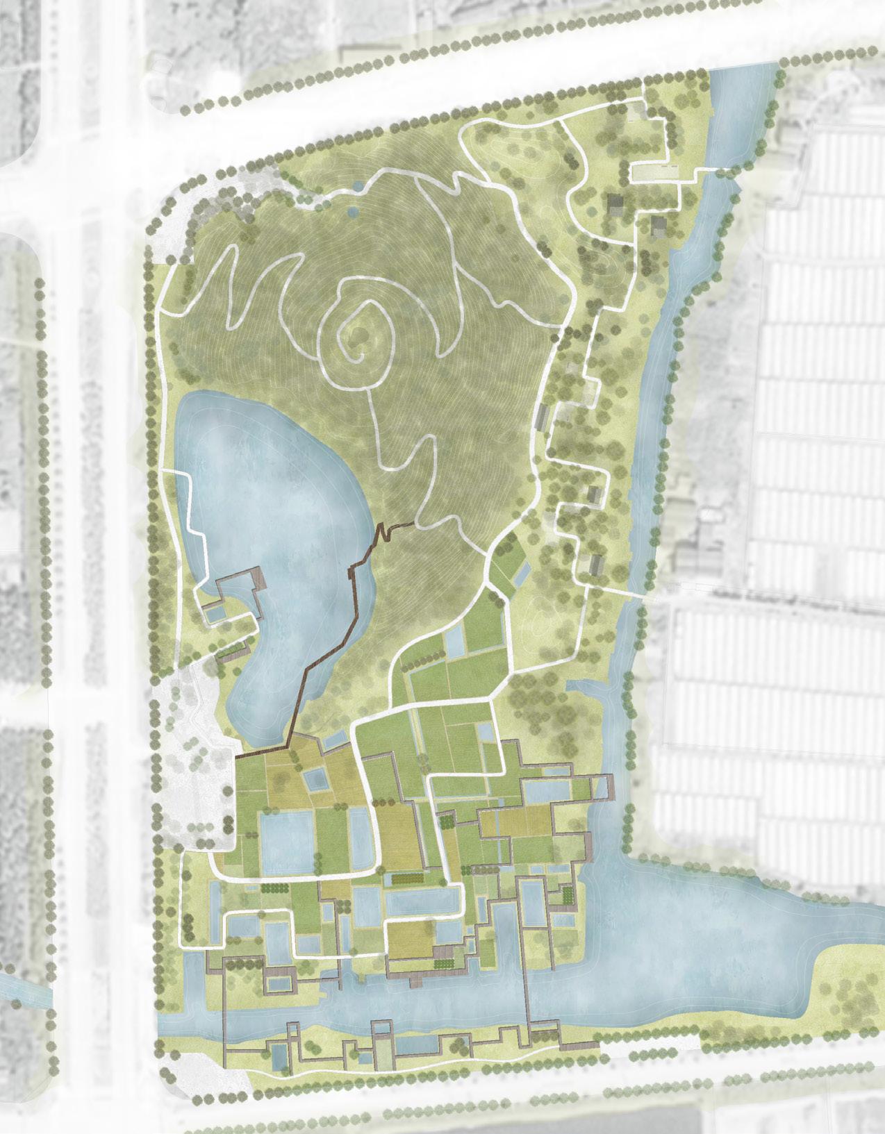
N 0m 30m 80m 1 2 3 4 5 6 7 8 9 10 11 12 13 14 15 16 17 18 19 20 entrance mountain entrance cherry blossom lawn resting square pavilion activity square lawn wooden platform wooden path vegetable field wetland small ponds middle fishponds grassland entrance square mine pit trestle resting lawn stone trestle mountain road mountain platform 1 2 3 4 5 6 7 8 10 11 12 13 14 15 16 17 18 9
open
aquatic plant wooden walks wooden
cropland secondary road platform under
arbors main road pavilion village marking trees -2 m F: large fish ponds 3m -1 m E: cropland with fish ponds 4m 0 m D: cropland with small ponds 5m 1 m C: cropland with ditches 6m Circulation Theme View Spots Topography Planting Hydrology -3 m B: village A: mountain A B B C D E F 2m 19 20 10
restoration
MASTERPLAN
ANALYSIS ridge of field
space
platform
canopy
PHASING AND CONSTRUCTION
A: mountain B: village
Area
Phase 1
the wasteland at the foot of the mountain
C: cropland with ditches
D: cropland with small ponds
E: cropland with fish ponds
F: large fish ponds
abandoned villages
abandoned ditches abandoned factory site next to the river
abandoned factory site fishponds in the mine pit
Phase 2




use the waste from demolished villages to form the topography

Phase 3
Phase 4
form the lawn and plant trees
demolish buildings and leave foundations


groom ditches and dig farmland expanding the boundaries of rivers and dig small ponds
dig fish ponds form the land, expand waterfront space
people can come to the lawn in spring to see cherry blossoms
Leave part of the foundation, planting plants, change the building to a pavilion
plant the crop form the lawn and plant trees
plant the crop and trees form the lawn and plant trees
people can rest and do activities here
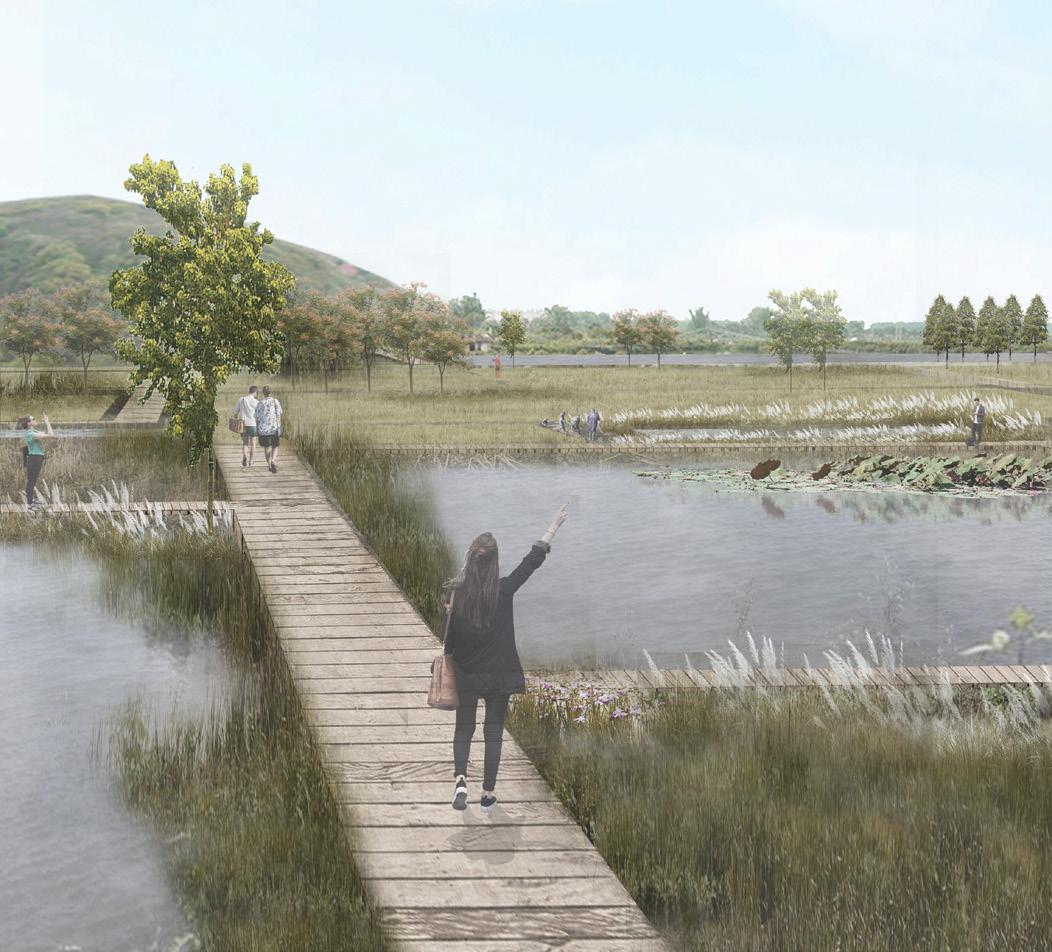
farmers grow rice here and people can enjoy the agricultural landscape
people can enjoy aquatic plants here
farmers can cultivate land and raise fish here
People can see the aquatic plants, fish and mountain here
11
GRASSLAND AT THE FOOT OF THE MOUNTAIN TRANSFORMED VILLAGES

POND AREA NEAR THE RIVER

Plant species


Spring Summer Autumn


Winter
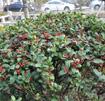
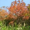
Ulmus parvifolia Jacq. Koelreuteria paniculata Laxm. Prunus subg. Cerasus sp. Yulania denudata (Desr.) D. L. Fu Ligustrum × vicaryi Rehder
Ilex cornuta Lindl. et Paxt. Sapindus saponaria Linnaeus Cinnamomum camphora (L.) Presl


PONDS SECTION

Large fishponds
Products
Activity
Pinus massoniana Lamb. Liquidambar formosana Hance Viola tricolor L. Rhododendron simsii Planch. Wisteria sinensis (Sims)Sweet
Metasequoia glyptostroboides Hu & W. C. Cheng


Hydrocharis dubia (Bl.) Backer
Iris wilsonii C. H. Wright


Arundo donax L. Nelumbo sp. Scirpus validus Vahl Phragmites australis (Cav.) Trin. ex Steud


Middle fishponds
Small ponds

River

12
THE CONFLICT BETWEEN URBANIZATION AND CARBON NEUTRALITY


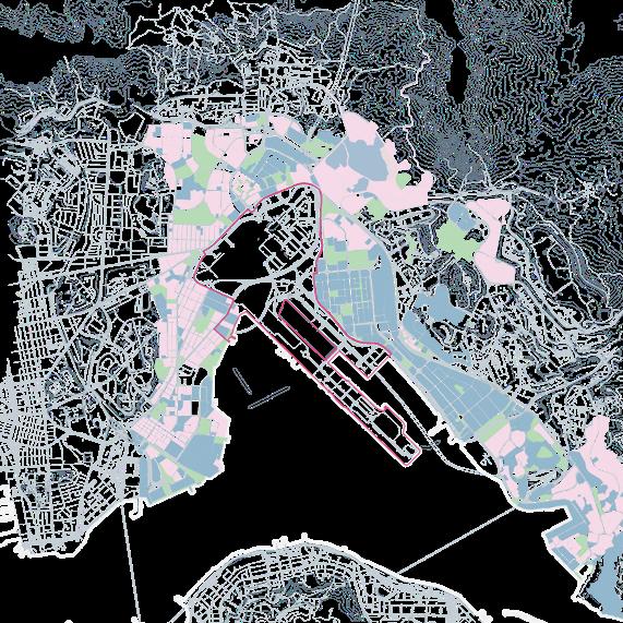
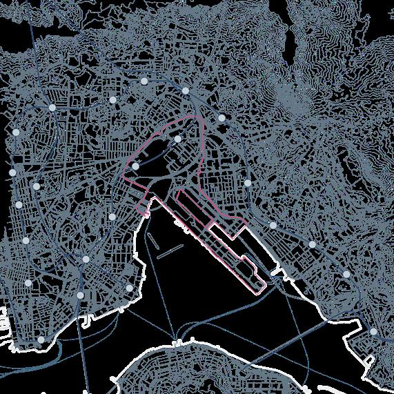
The increasingly severe ecological and environmental problems and the attention of international organizations show the urgency of the development direction and the urgency of the goal of "carbon neutrality". As a developed city with the highest annual carbon emissions in the world, in addition to the contradiction between land resources and population density, Hong Kong's energy structure has a shortage of local energy and excessive dependence on imported fossil energy.

FOSSIL ENERGY IMPORT 99.5% RENEWABLE ENERGY USE <1%


Site location: Hongkong Scale: 295 ha 07.2022

Type: Collaborative work with Ruijuan Zheng Instructor: Hao Hu
Role: concept-70%, analysis-60%, modeling-60%, drawing-50%
Circulation Green
The Origin of Carbon Neutrality and The Progress of Global Climate Governance & Urbanization Process of Kai Tak,

Intergovernmental Panel on Climate Change (IPCC) The earliest consensus on global climate control

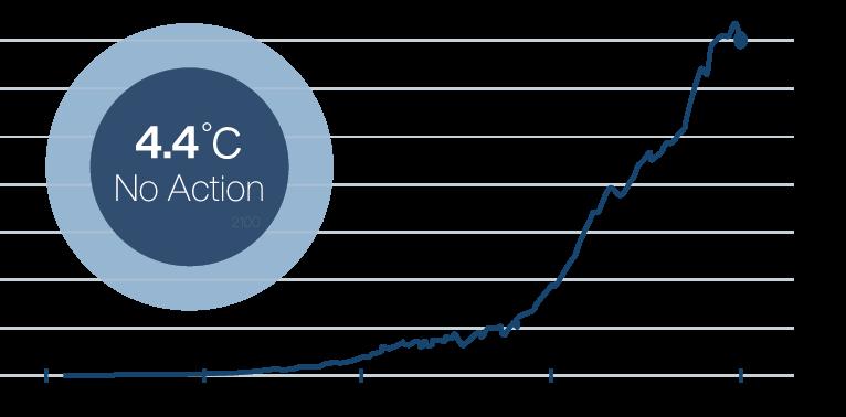
The United Nations Framework Convention on Climate Change

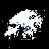
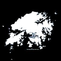

Kai Tak Airport completed its final expansion.
Kai Tak Airport was grounded and prepared for sea port reclamation.
The Hong Kong government took "no reclamation" plan and distinguish the economy-oriented development mode
high way
waterway
subway station the site
Function Building
The Paris Agreement came into force
green/ openspace the site building the site
Government released the "Hong Kong Climate Action Blueprint 2030+" report
office/ commercial 13
residential
03
295 ha
SITE: KAI TAK
THE
Hongkong
1988 1994 1998 2004 2015 2020 1992 Global CO2 Emissions from
million tons )
Fossil Fuels ( Unit:
CARBON+ HONGKONG SHENZHEN ecological unbalance iceberg melts sea level rise global warming arid displaced LOCAL IMPORT Relative size of carbon emissions per capita in major metropolises Global energy consumption intensity Energy import routes of Hong Kong 1887 1945 1979 2014
water agriculture/ forest park the site
subway
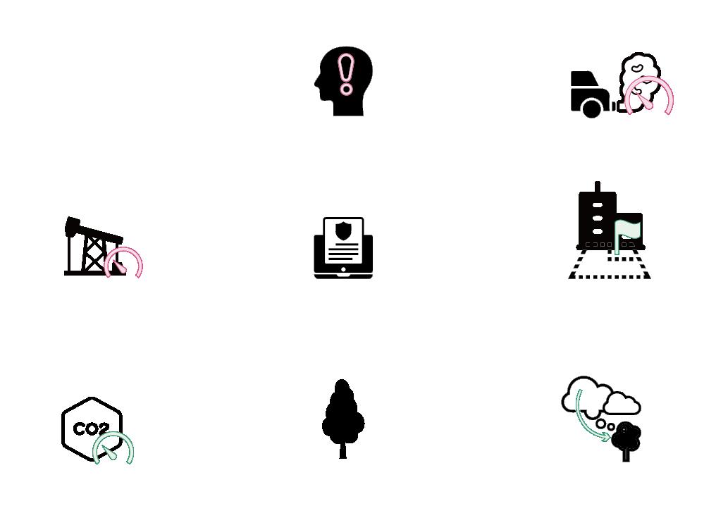
The core principle of Carbon Nuetural Oriented-Development (C.O.D) is to reconcile the need for urban development with the need to achieve carbon neutrality by planning the carbon neutrality index of the land in advance and then incorporating it into the specific use plan.
Meeting
Improving
Mitigating


Optimising


Current Situation Traditional Methods C.O.D Methods Awareness Awareness Awareness Policy Policy Policy Environment Environment Environment Increase air pollution Increase air pollution Development of vertical greening Weak awareness of emissions reductions and outdated planning policies have created a harmful and unsustainable approach to development Investing new construction costs to improve urban sustainability indicators based on existing problems somewhat effective but not comprehensive
carbon neutral capacity indicators for energy, greening, buildings, etc. from the early stages of planning to form an urban planning and development system that meets the benefits of all aspects Lack of green space Site regreening Green space planning Lack of clean energy facilities Restricting the use of fossil fuel Clean energy facility placement Unable to absorb CO2 Able to absorb CO2 Maximising CO2 absorption Rising CO2 concentrations Lower CO2 concentrations Maximising energy conversion Economic benefit 2 Economic benefit 1 Economic benefit 3 Ecological benefits 1 Ecological benefits 1 Ecological benefits 3 Carbon neutrality 2 Carbon neutrality 1 Carbon neutrality 3 MODEL COMPARISION Problem Carbon Removal Reduce fossil fuels energy use Mitigating global warming
Conceiving
the demands of urbanisation
economic efficiency
sea level
rise
urban design approach Increase greenery in three dimensions Safeguard flat green areas Increase the proportion of renewable energy use High overall energy consumption, high fossil energy consumption and low share of renewable energy use Carbon Absorption Land scarcity, high population density, high-rise buildings and limited green space resources on the ground
Reduction Methods Benefit C.O.D URBAN DESIGN METHODS INNOVATIVE URBAN DEVELOPMENT MODEL - C.O.D Traditional Urban Design Approach Carbon Neutral Oriented Development Carbon Neutral Oriented Development
Carbon
Economic Carbon Traffic Traffic House House Green Green Economic Services Services Neutral 14
CITY OPERATING MODEL

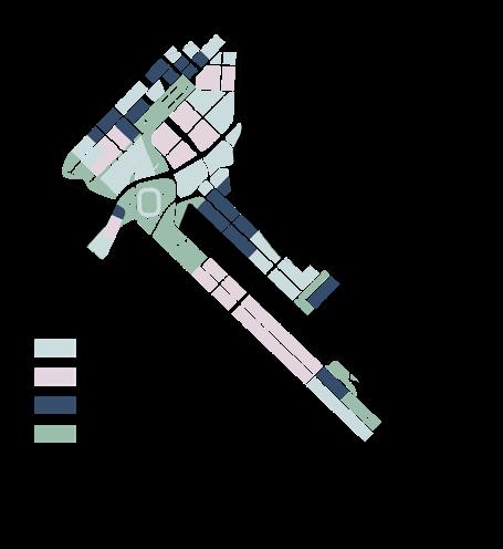

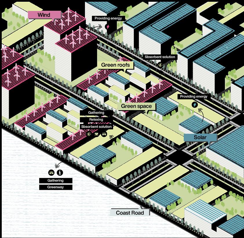


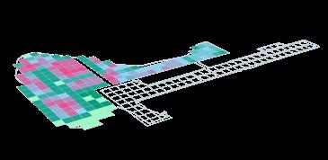


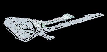





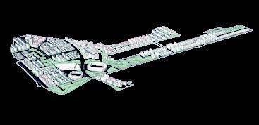
In residential areas, it is more appropriate to install solar panels on the roof, because the operation is more convenient and it is also conducive to the coordination among residents.



ZONE A ZONE B
PHASE

All energy facilities in urban cluster 1 have been completed. Plants have higher carbon absorption capacity as they grow.
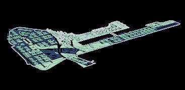
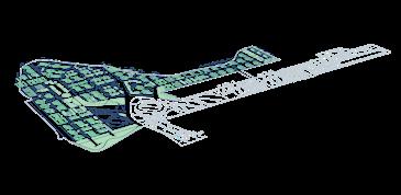
All facilities in urban cluster 2 have been completed. The construction of carbon reduction facilities in urban cluster 2 began.
Building Planting Energy Composite Ratio
16


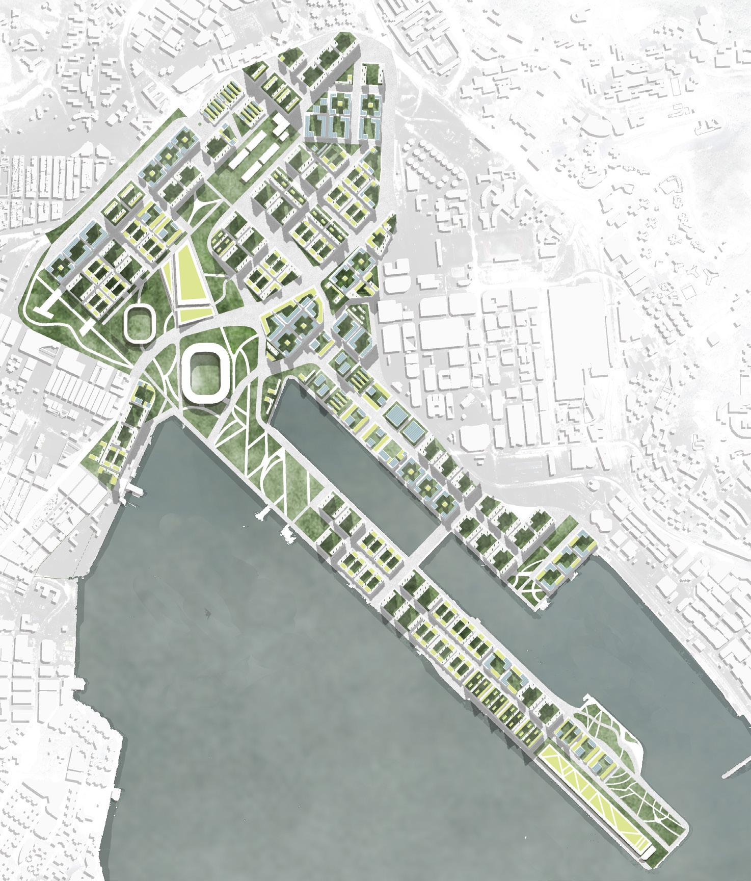
MASTER PLAN
Zone A Zone B N 0m 500m Business Class Ⅱ roads Residential Office Green space Class Ⅰ roads Land Use Traffic 10% Carbon Neutral Ratio 20% 70% 30% 80% 40% 90% 50% 100% 60% carbon22.7% +207,506,000 kg/a 31.4% 50.3% +207,506,000 kg/a +61,797,000 kg/a +162,420,000 kg/a -36,658,250 kg/a -39,986,250 kg/a -6,260,000 kg/a -23,739,000 kg/a -51,208,875 kg/a -64,318,875 kg/a -7,791,375 kg/a -27,272,375 kg/a 42.3%
1
2
PHASE ANALYSIS - CARBON NEUTRAL RATIO INCREASE WITH CITY DEVELOPING PHASE
PHASE
PHASE 3
4
The buildings, energy facilities and green spaces of urban cluster 1 have been partially built. Carbon neutral ratio is low
The ratio gradually increase with urban construction. After the construction is completed, it will reach the regional target.
Carbon emissions in areas dominated by commerce are large, and wind energy should be selected as much as possible under the condition of floor height, because it can offset carbon emissions to the greatest extent.
04 FLOODING IN NANHU, HANGZHOU
Site location: Hangzhou, Zhejiang Scale: 100 ha Type: Individual work Instructor: Yi Zhang 12.2022
SOUTH LAKE DETENTION AREA
The site is within the submergence range of a once-in-a-decade flood.
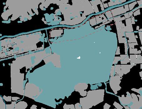


the site
North side – South Tiaoxi River flooding
The section of East Tiaoxi River in Yuhang is called South Tiaoxi River, which has a large rainfall catchment area in the upper mountainous area and is under great flooding pressure during the rainy season.
planned river bottom elevation: 6.6m the river bottom width: 50m the maximum water level: 7.27m in 5 years, 8.28m in 10 years, 8.4m in 20 years and 9.64m in 100 years
Key flood control works in East Tiaoxi River basin. a controlled catchment area of 603km2 an average annual precipitation of 1564 mm an average annual runoff of 482 million m2
South side – South Lake flood control

South Lake Flood Control Zone covers an area of 4.7km2 Reconstructed in 1993, the existing flood gates are 6 holes×6m, with a design flood flow of 650m3/s and a flood control volume of 0.24 billion m3
Flood opening level: Yuhang 8.4m
AREAS EASY TO BE FLOODED AFTER THE WATER LEVEL RISES
According to incomplete records of historical data, there were 198 years of floods from 278 to 1727, including 11 years of floods from 1987 to 2005, which occurred once every 2 years. In the 55 years from 1951 to 2005, the major waterlogging occurred once every 10 years, the moderate waterlogging occurred once every 8 years, and the minor waterlogging occurred once every 6 years. The South and North Lake detention areas were diverted 27 times.
Upstream - Qingshan Reservoir flood storage
9-11m 6-8m
Oxyge Producing Factory Technology industrial
dyke 10m 4-7m
area & Residential
Xixian
Dyke Yuhang Downtown
Mt. Bantian
Mt. Chuanqiao
Mt. Dadi
Mt. Shaojian
Mt. Banqiao
Qingshan Reservoir
South Tiaoxi River
Flood Diversion Sluice Escape Sluice
1 m 4m 7m 10 m
17
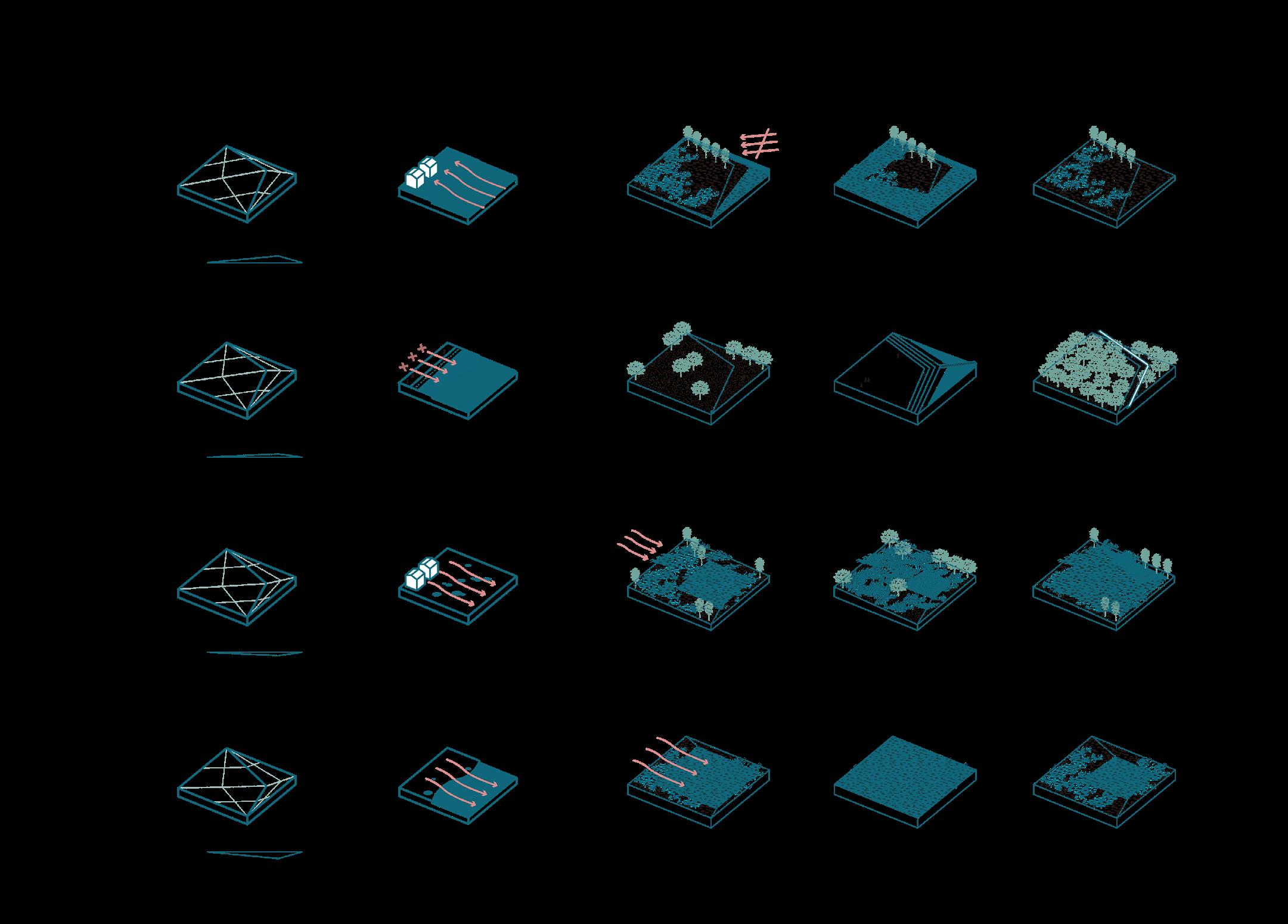
TERRAIN OPERATING
STRUCTURE
Drainage direction & Shore shape Corresponding Elements


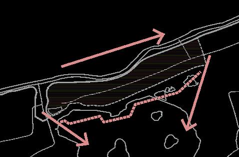
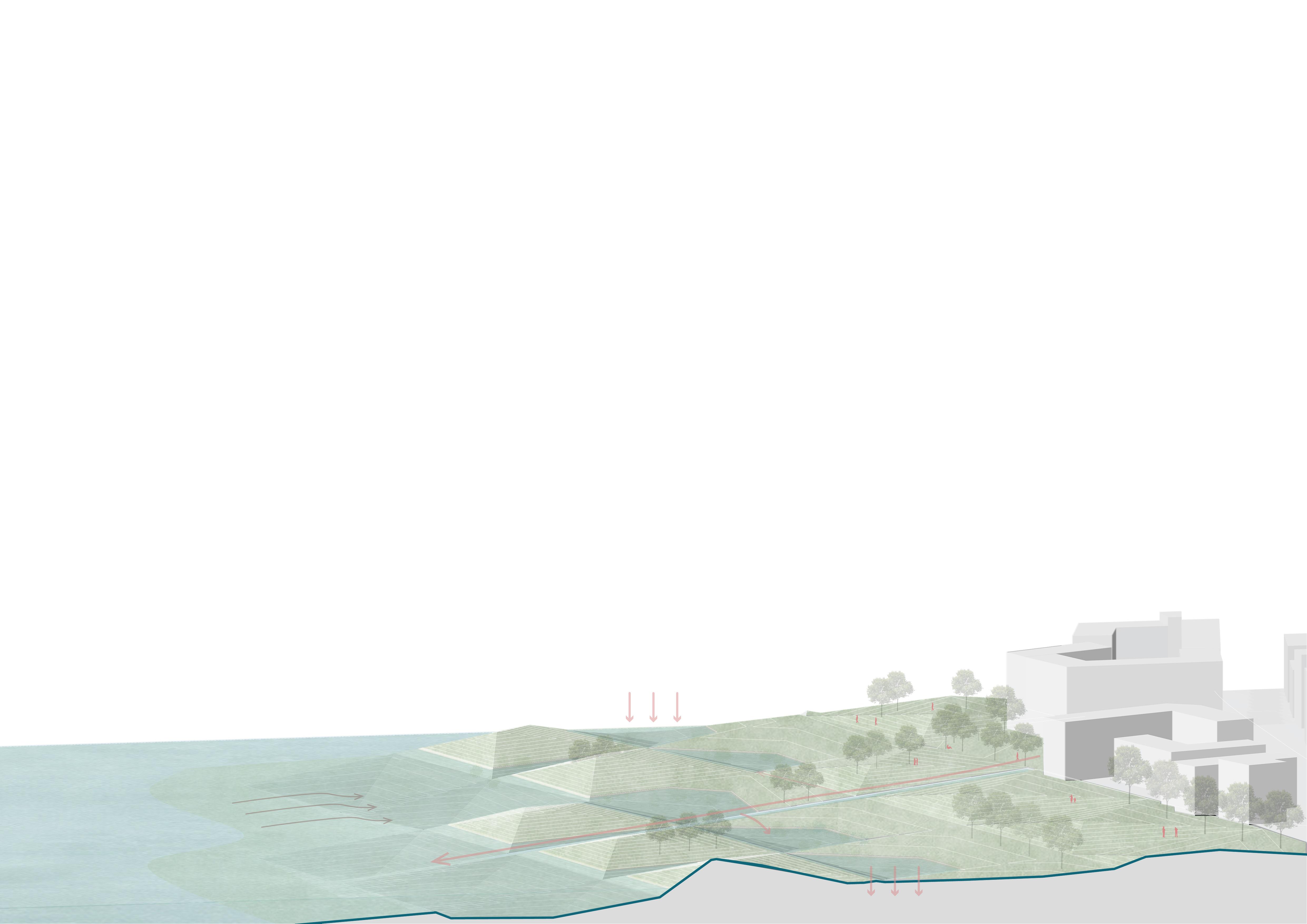
direct water flow
external changes
viarable add wave
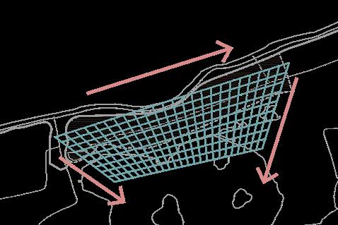
ELEMENT
ISSUE FUNCTION


seasonal flood defend against floods buffer island plant grow
lack waterfront space green space square & platform forest
internal changes
interaction
runoff pollution impoundment rain garden wetland purification
sediment loss capture sediment pool water detention
SECTION 1
10m 5m -5m -10m
Phase 1 sediment collection & resist the flood
Phase 2 water purification
Phase 3 activity space
18
Explain how the site works through a section of the site.
BUILDINGS


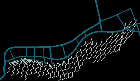

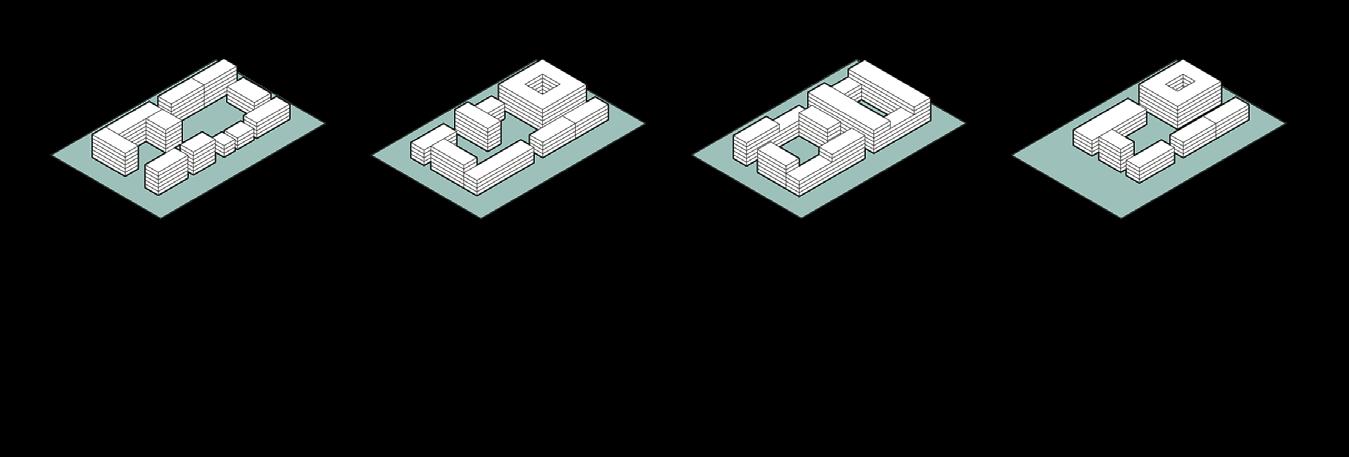


N 0m 250m
SECTION 1 A ' A Roads Function Residential Office & Education Commercial Park
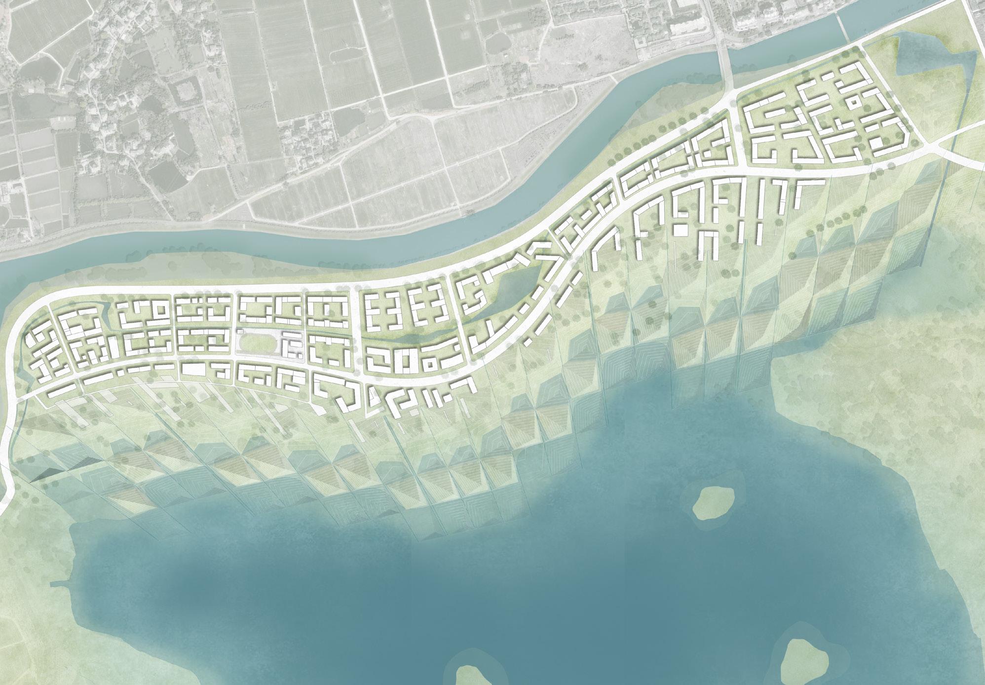
MASTERPLAN
FROM CITY
LAKE FAR: 1.49 Residential FAR: 0.41 Residential /Office FAR: 1.20 Office FAR: 0.86 Commercial /Office FAR: 1.20 Residential FAR: 0.63 Office /Commercial /Mixed Use FAR: 1.42 Office /Residential FAR: 0.60 Commercial /Office FAR: 1.52 Residential FAR: 0.78 Office FAR: 1.35 Office /Residential /Commercial FAR: 0.95 Office lake lake detention pool shoal area island island wetland rain garden green space square roads roof garden permeable pavement retention pool rain water collection roads pool river FAR: 1.20 Mixed Use FAR: 1.00 Commercial /Office FAR: 1.10 Office /Commercial FAR: 0.50 Commercial /Office
remote from the lake Section A - A' Section B - B' Near the lake B B ' 19
TO
Relatively
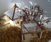
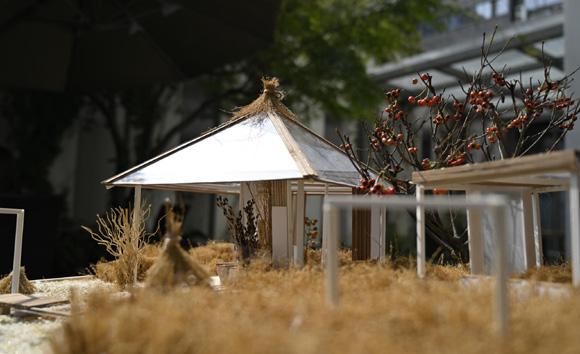
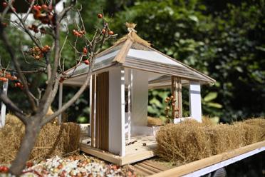
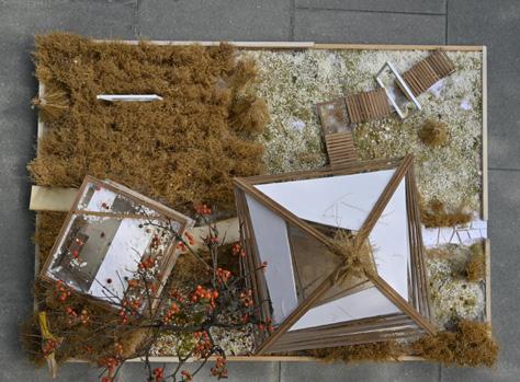
OTHERWORK - FIELD PAVILION DESIGN AND SOLID MODEL MAKING




Course: Integrated Design of Building and Landscape
Date: Oct. 2021
Type: Team Work
Team members: Xiangjing Chen, Yuxin Gong, Kaiyun Zhu
Role in team:
Case analysis
Concept generation
Selection of materials
Solid model construction
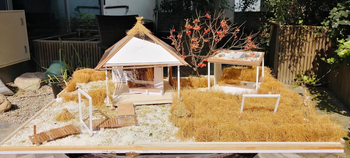
FINISHED MODEL PHOTO
ENVIRONMENTAL DECORATION

SHADOW EFFECT

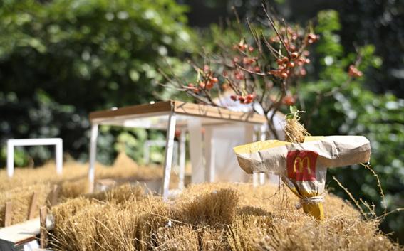
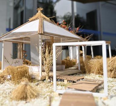
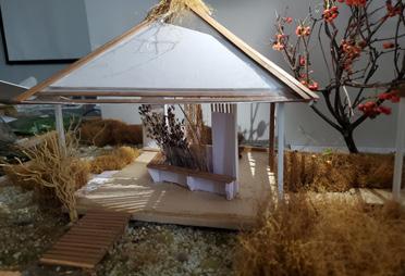
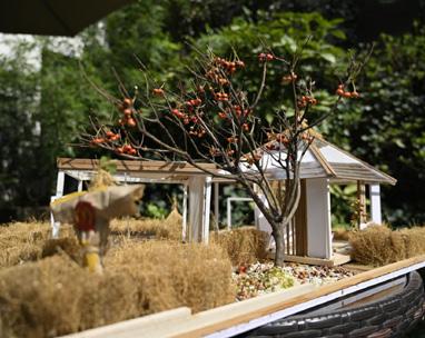
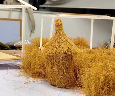
-With the rice fields as the background, we added straw bales, persimmon trees and scarecrows to enrich the surrounding environment and make the pavilion more integrated with the rice fields. -Inside the pavilion, we also placed straw bushes and plant walls.








HAYSTACK
LANDSCAPE VIEW
VIEW FROM THREE ENTRANCES
PAVILION CONSTRUCTION
TRAILS AND TRESTLES
PLANTS
-The light amplifies the irregular light-transmitting design of the surrounding eaves and roof.
-With this design, we wanted to bring the light from nature into the pavilion with shade function, so that the shadows and the light can mingle in the same space.
-At the same time, the various forms of the roof and wood slats allow the floor of the pavilion to be filled with light and shadow changes over time, following the changing angle of sunlight throughout the day, like a natural performance that enriches the unique experience of the users.
SPACE SEPERATION
-Through the placement of seating and the separation of low wall grids, the space guides users to choose between resting and talking and walking activities.
VIEW FROM SURROUNDING AREAS
ROOF
-By increasing the twists and turns and height differences of the path, using transparent stacks, and adding structures to frame the scenic frame, users can reap the pleasure of entering the pavilion
-Through the design of wooden strips and light transmission, we present a modern but natural top structure.
05
20


