YUKIE TAKASU
lalalayke@icloud.com
+818011308352
Personal Details
Date of Birth
18/10/1993
Nationality
Education
Tokyo, Japan
2017-(2021)
Keio University (Graduating on March 2021)
Master of Engineering - Science and Technology, School of Science for Open and Environmental System
Dedicated student and practitioner of architectural design spetializing in Computational Design, currently working on First-Class Japanese Architect License accreditation.
Studying in Japan and the UK have given me a global and diverse experience. I was involved not only in the architectural design but also in the construction of the built pavilion.
Strong interest in digital fabrication technology and conputation for design at the human scale.
Japanese, American Japanese Native
Urban and Architectural Design and Research in co+labo
Language
London, UK 2018-2020
English Fluent
Architectural Association
Master of Architecture - Emergent Technology and Design Computational Design and Digital Fabrication
Skills
Software
Rhinocerous, Revit, Grasshopper, Python, VRay, Keyshot, Vectorworks, AutoCad, Adobe(Photoshop, Indesign, Illustrator After Effects), Computational Fluid Dynamics(CFD)
Tokyo, Japan
2013-2017
Keio University
Bachelor of Engineering - System Design Engineering
Urban and Architectural Design and Research in co+labo
Award, Competition
Fumiko Yonezawa Scholarchip Award

Shortlist of Quin Fan Dao International Competition
Shortlist of Europan 14
Final 30 works in Sendai Design Legue Best of Geaduation Work in Japan 2017(in 357 works)
Final 5 works in Keio University Thesis Design Competition
Computation and Fabrication skills
Robot Arms(KUKA), 3D printing, Laser cutting, Solar Analysis, CFD, Evolutionaly Optimisation, Agent Based Simulation, Generative Algorithm
Reference
Elif Erdine (EmTech, AA school) elif.erdine@aaschool.ac.uk
Darko Radovic (Keio University) radovic@sd.keio.ac.jp
Experience
June 2018 - August 2018
Internship:Toshimitsu Minami Architects
In charge of physical model making, 3D modeling, and visualization
April 2018 - August 2018
Teaching Assistant: Keio University
Working as an assistant at the architecture design studio in Keio Graduate school in Japan from April 2018
March 2017 - July 2018
Part-time Job: Nihon Sekkei
Physical model making
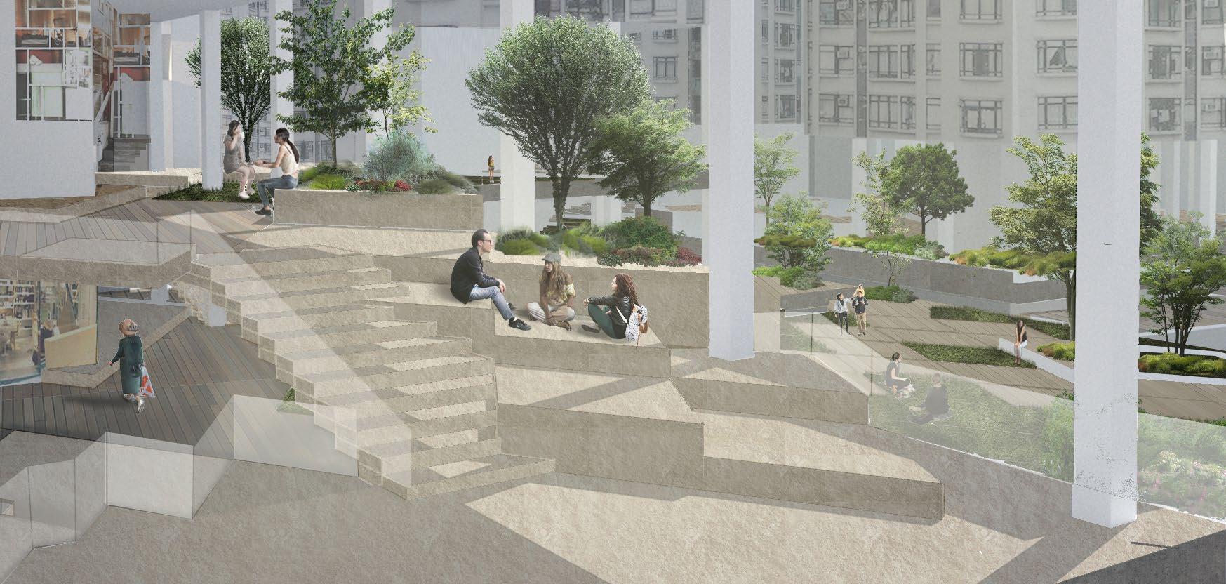
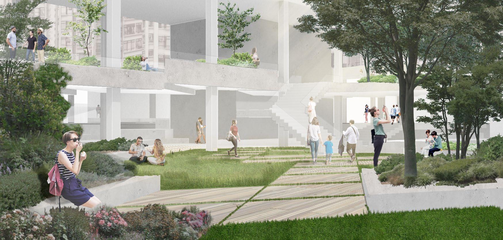
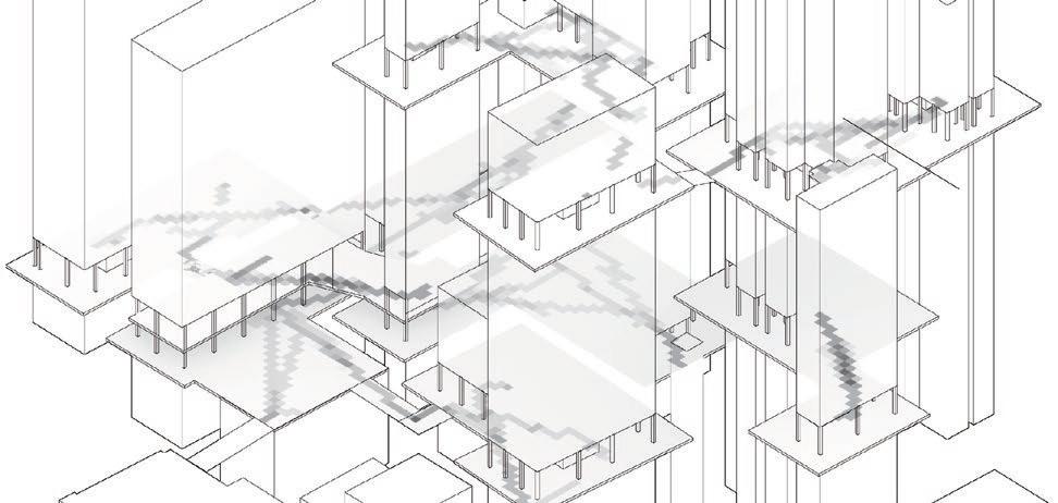
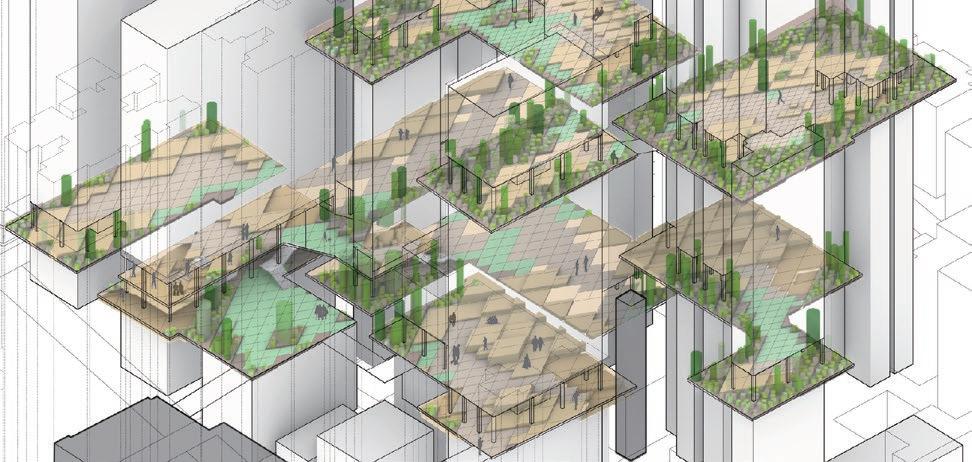
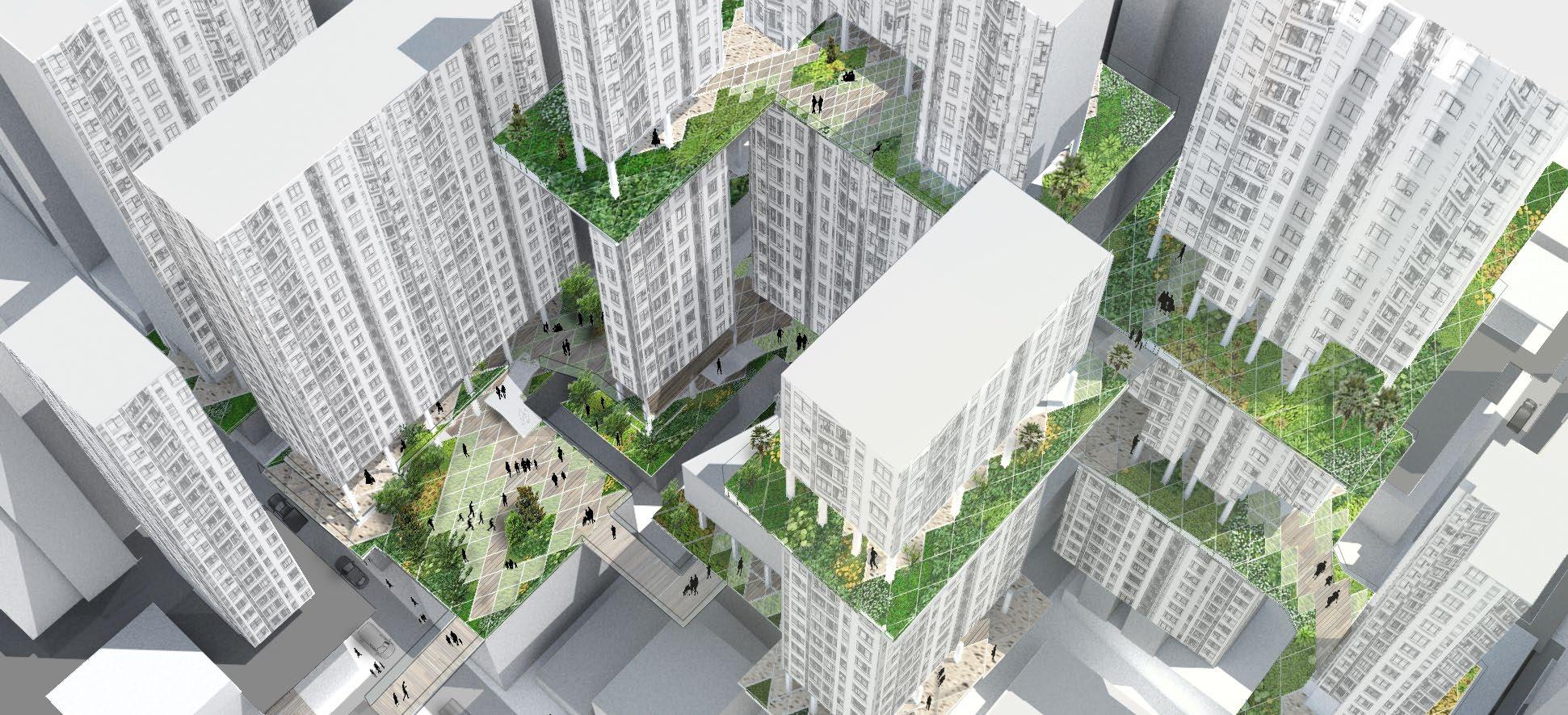
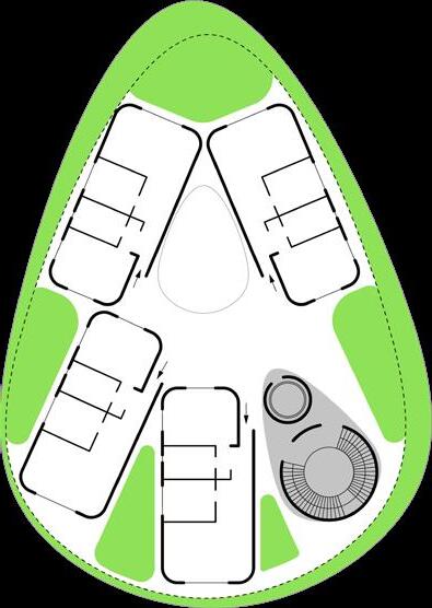
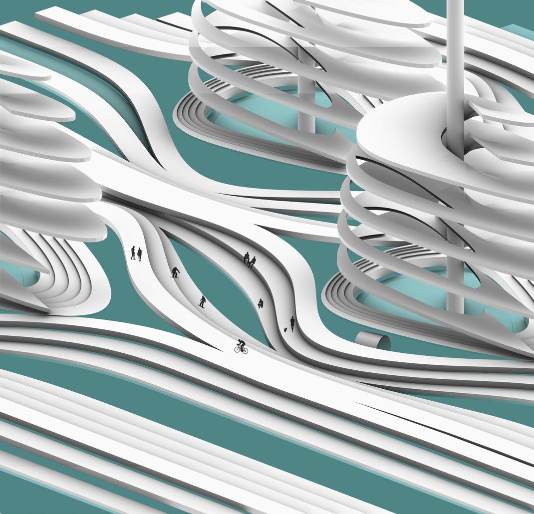
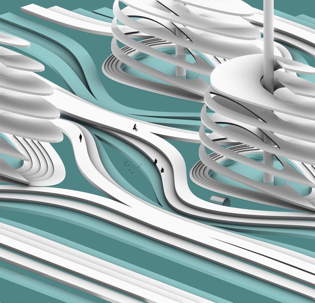
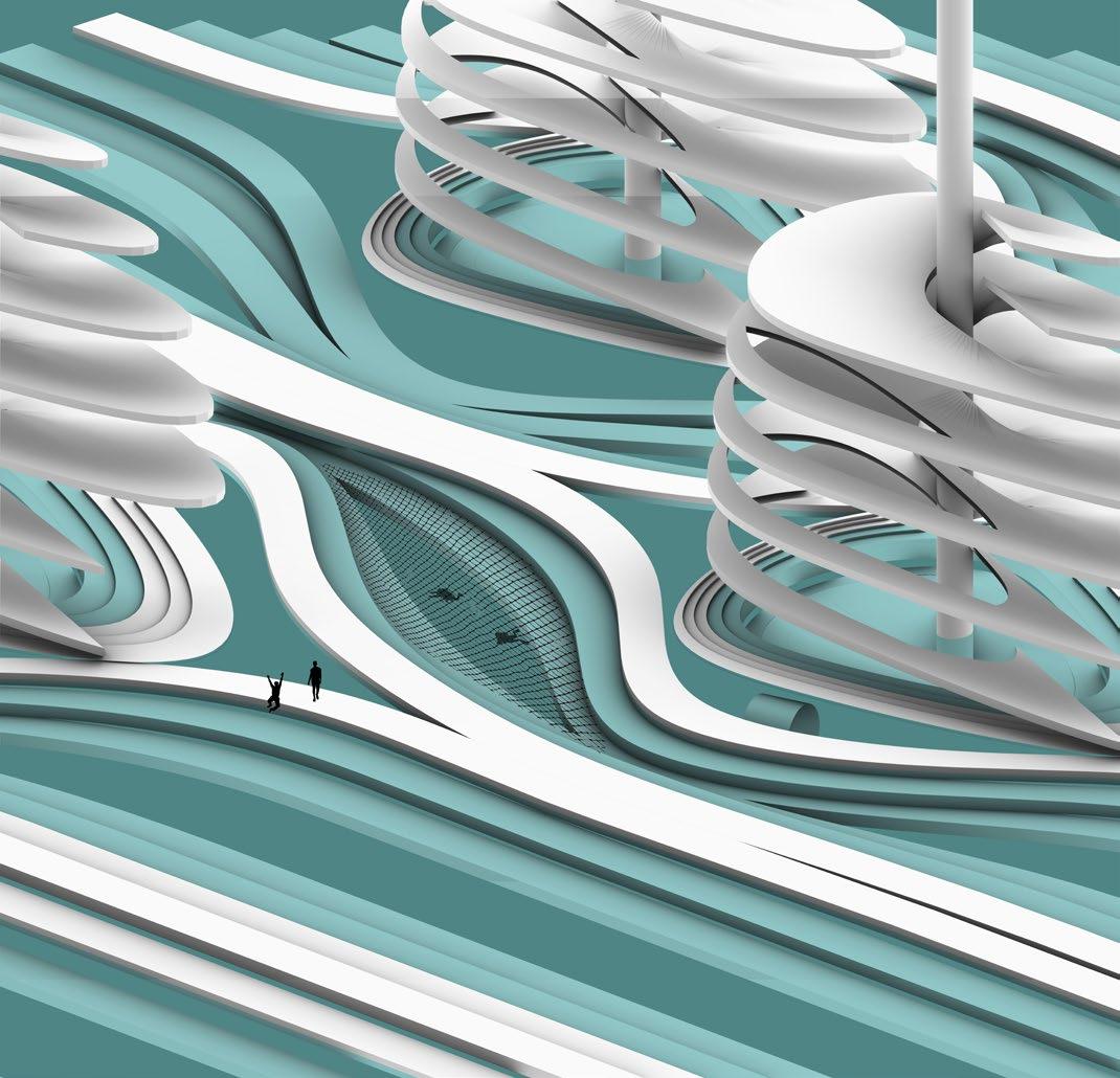
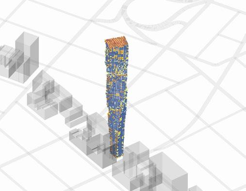
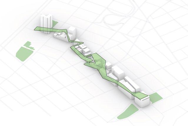
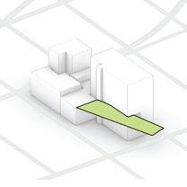
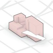
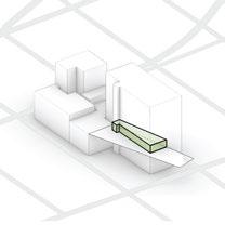
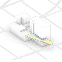
2-9-14, Higashihara, Mito, Ibaraki, JapanMulti-level Ecology
Project type/ Dissertation
Year/ 2020
Role in the project:
Overall computational experiment setup Management and scheme of project Diagrams and concept visualisation Rendering
Digital tool used:
Rhinocerous, Grasshopper, Photoshop, Illustrator, Indesign
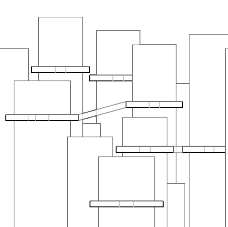
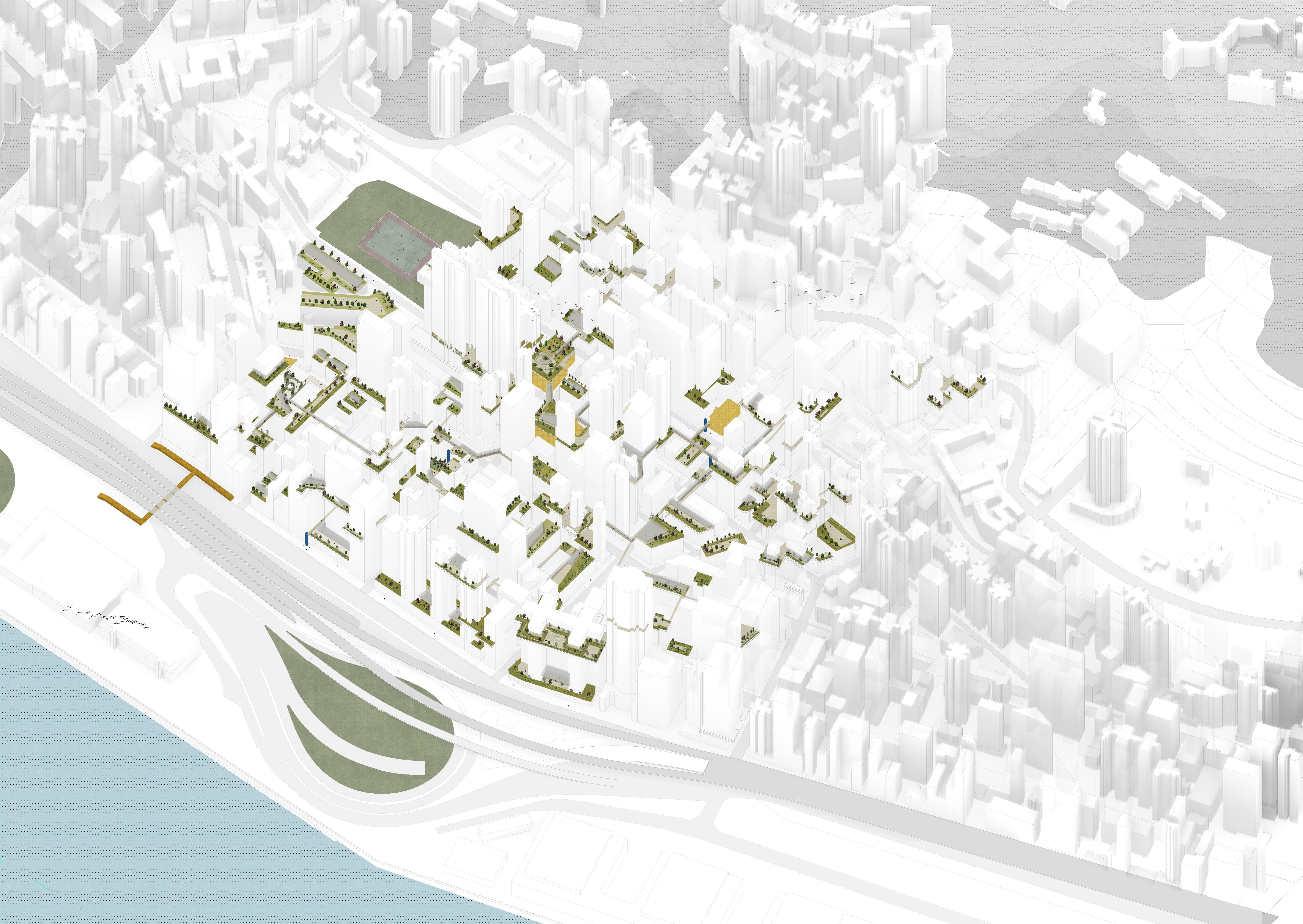
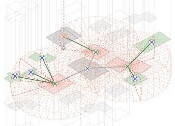
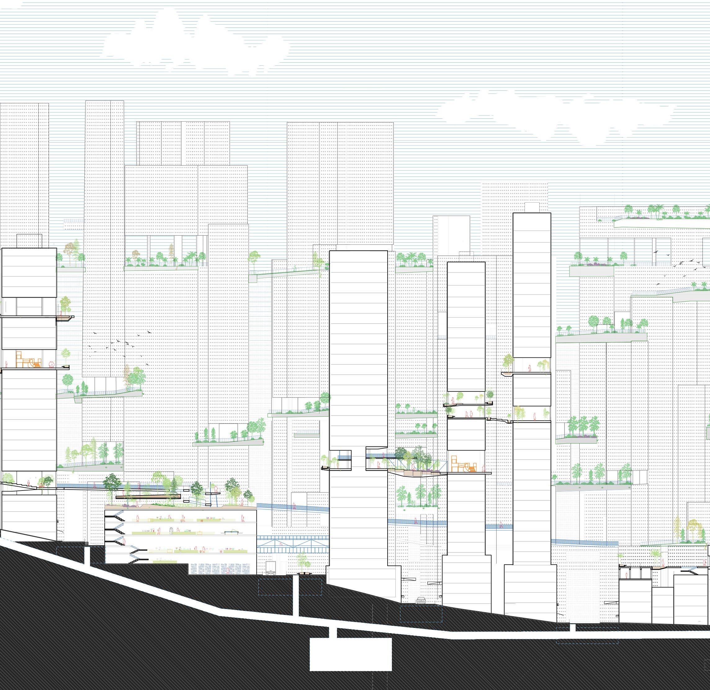
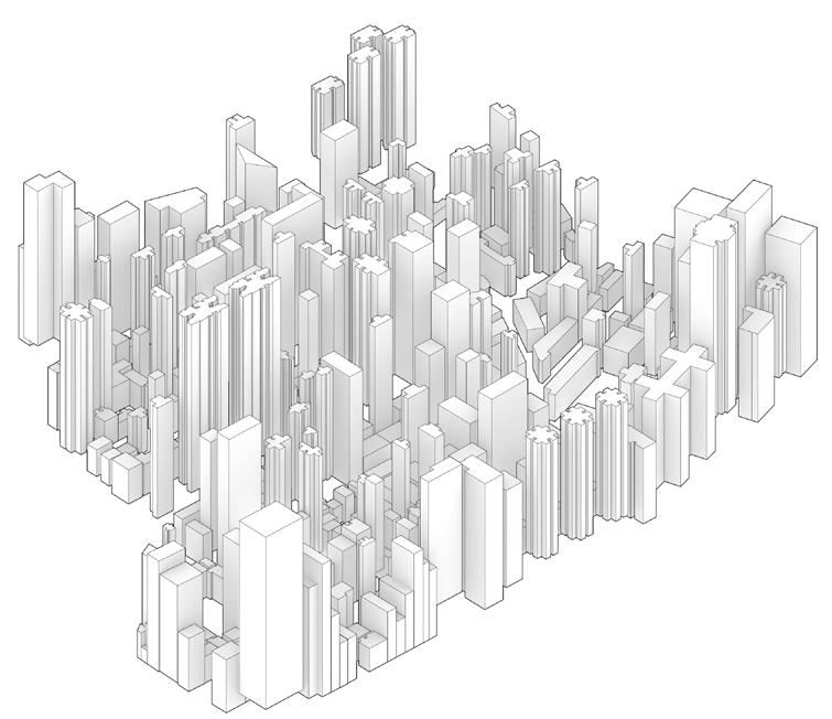
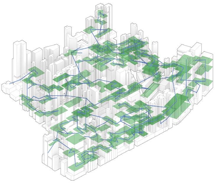
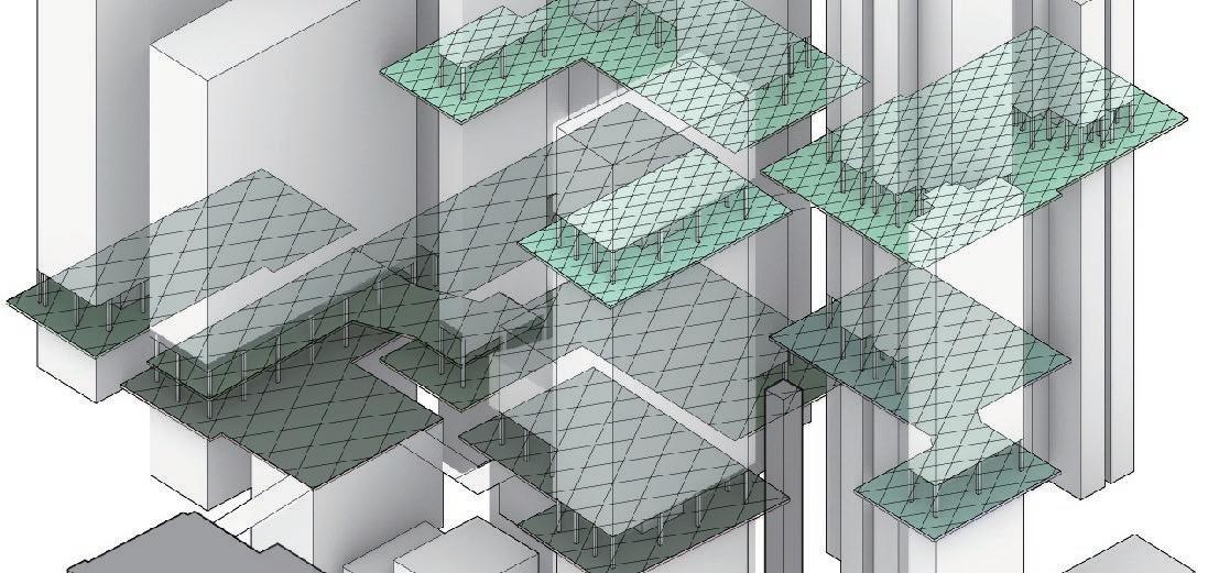
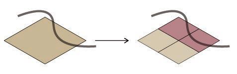
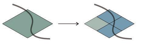
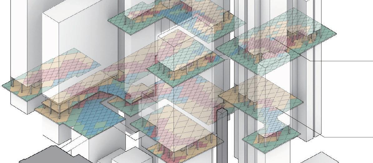
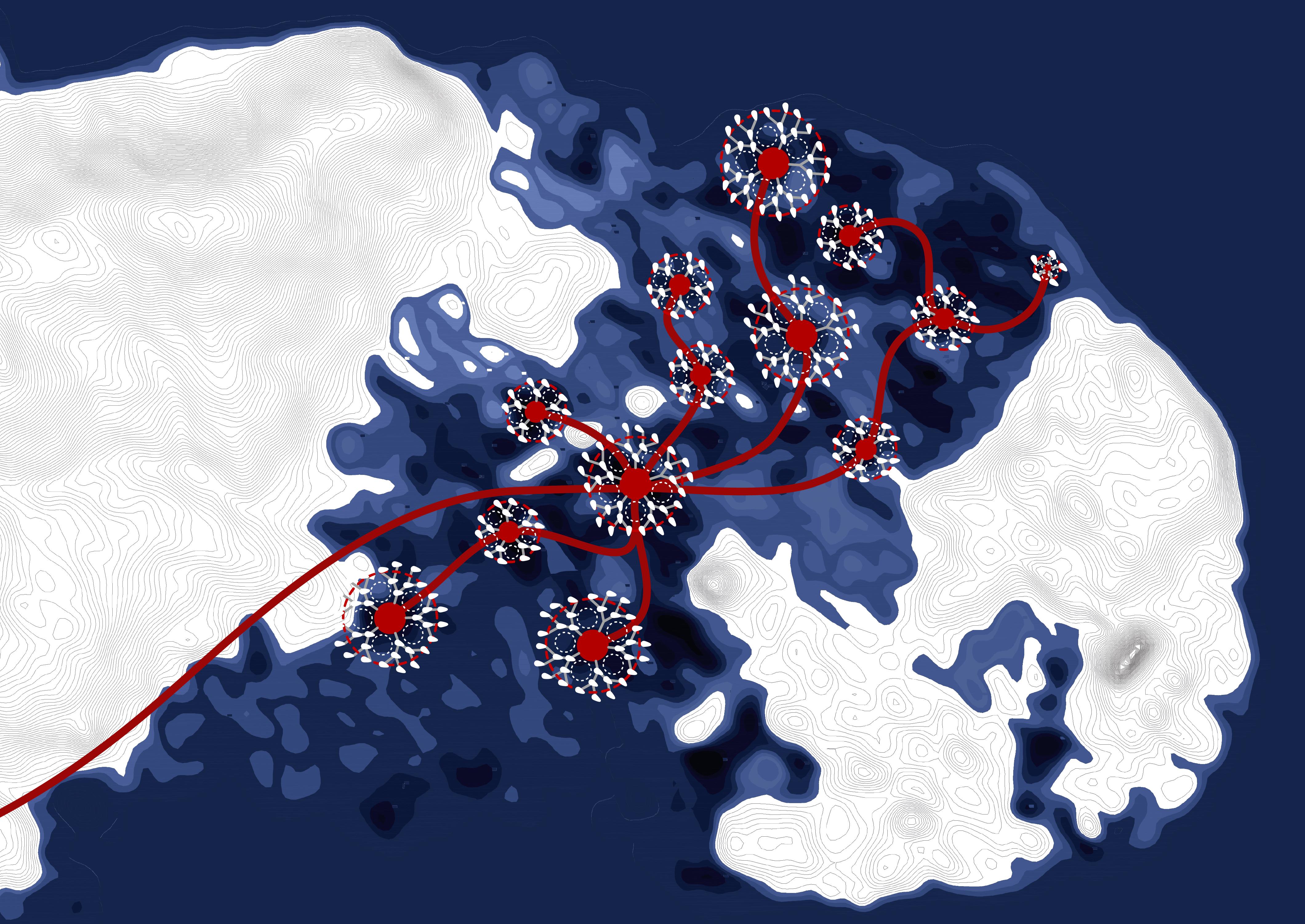
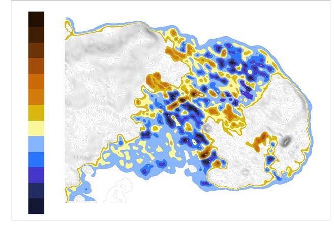
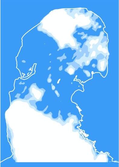
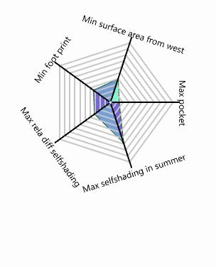
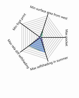
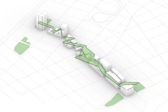
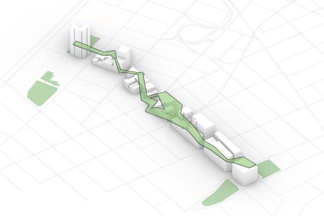
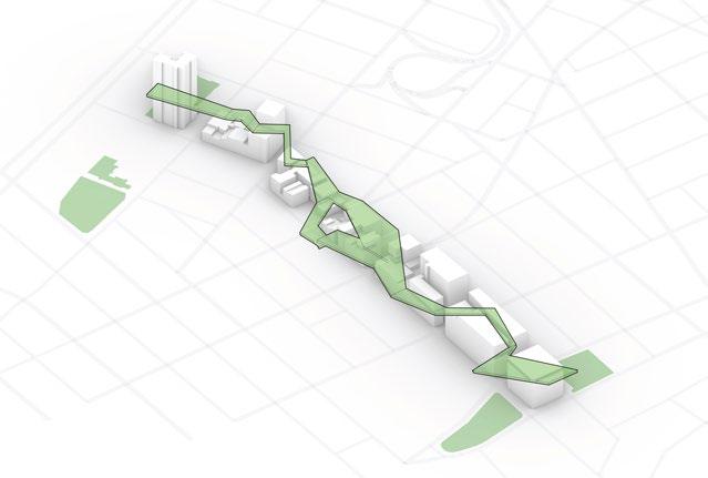
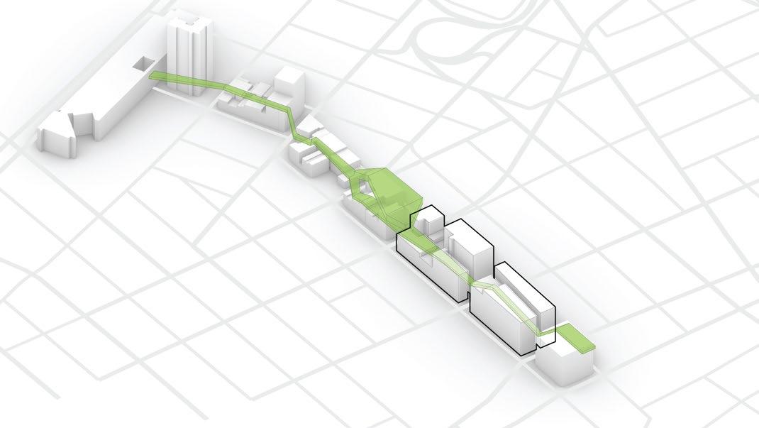
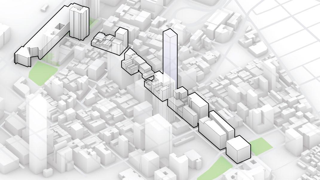
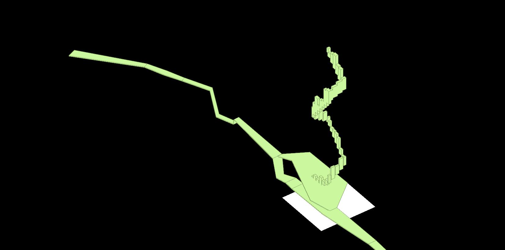
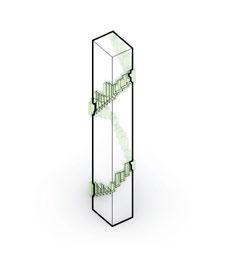
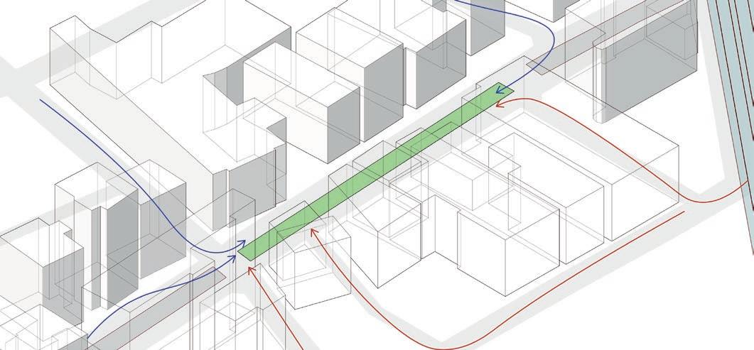
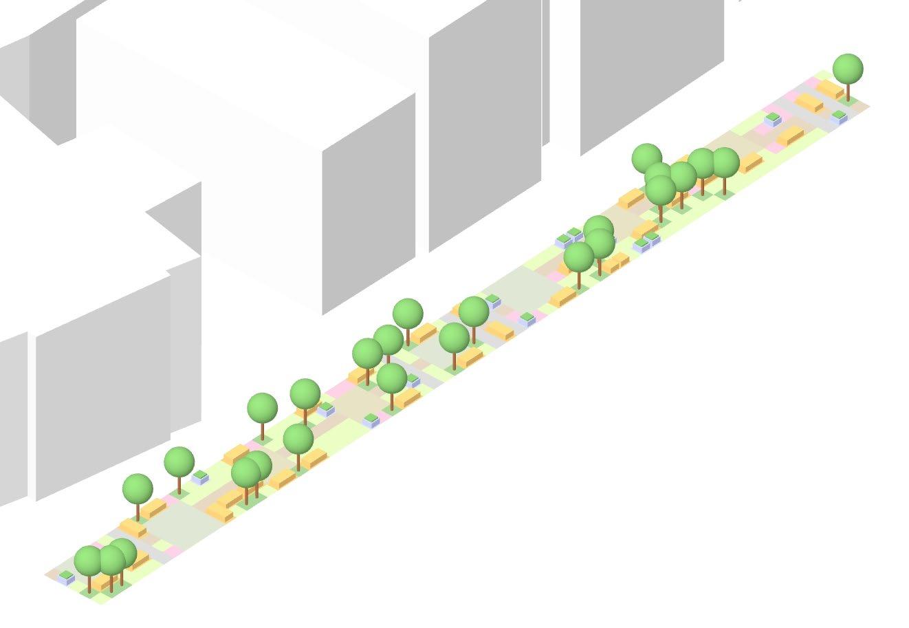
Multi-level Ecology is an exploration to develop a network of multi-levelled open spaces in highdensity urban environments. The lack of public spaces in contemporary cities is a pressing concern as it correlates to physical and mental illnesses and social isolation. An alternate circulation system at higher levels is proposed to enhance urban connections where the population density increases vertically.
The research aims to incorporate more than the provision of spaces, by enhancing programmatic variation, where once isolated institutions - residential, commercial, office, leisure, now overlap through these spaces, creating multi-layered opportunities in the urban area. Exploring varying sets of urban conditions, this research proposes an integrated response that generates spatially diverse public spaces.
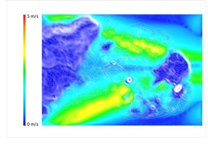
The work is contextualized in the urban area of Sai Ying Pun located in the city of Hong Kong. The high-rise high-density urban fabric of the city is characteristic of the issues of social deprivation. Additionally, the research deals with seasonal climatic conditions and local hydrological problems of self sustainability and flooding that are pertinent to Hong Kong.
A multi-scalar approach incorporated in addressing the problem at the urban as well as the local scale establishes the need to accommodate a layered network of recreation, culture and wellness.
Access Point Types
Market (existing)

Water storage tank location
under the existing open space and the residue space
Post Analysis
Plant&fixtures
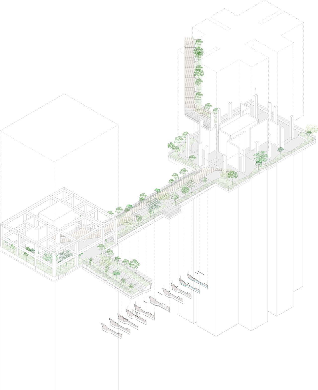
SurfaceMaterials
Tree/shrubsstabilisation

stormSubstrateforplant+ watercontrol Structure Cladding
Planting
Fromfold

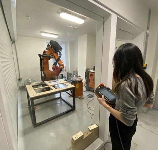
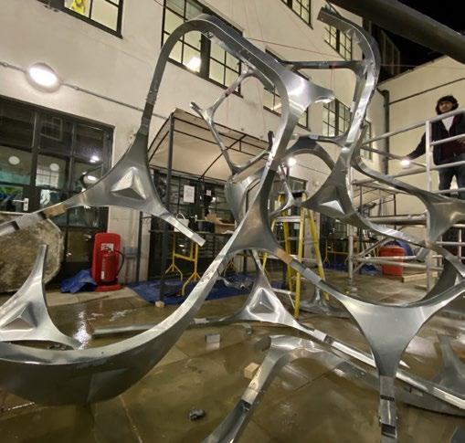
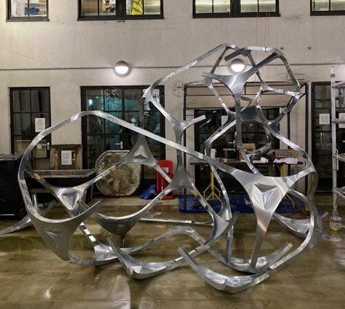
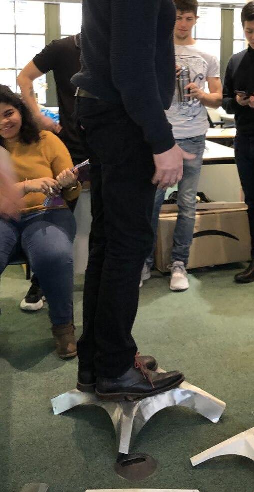
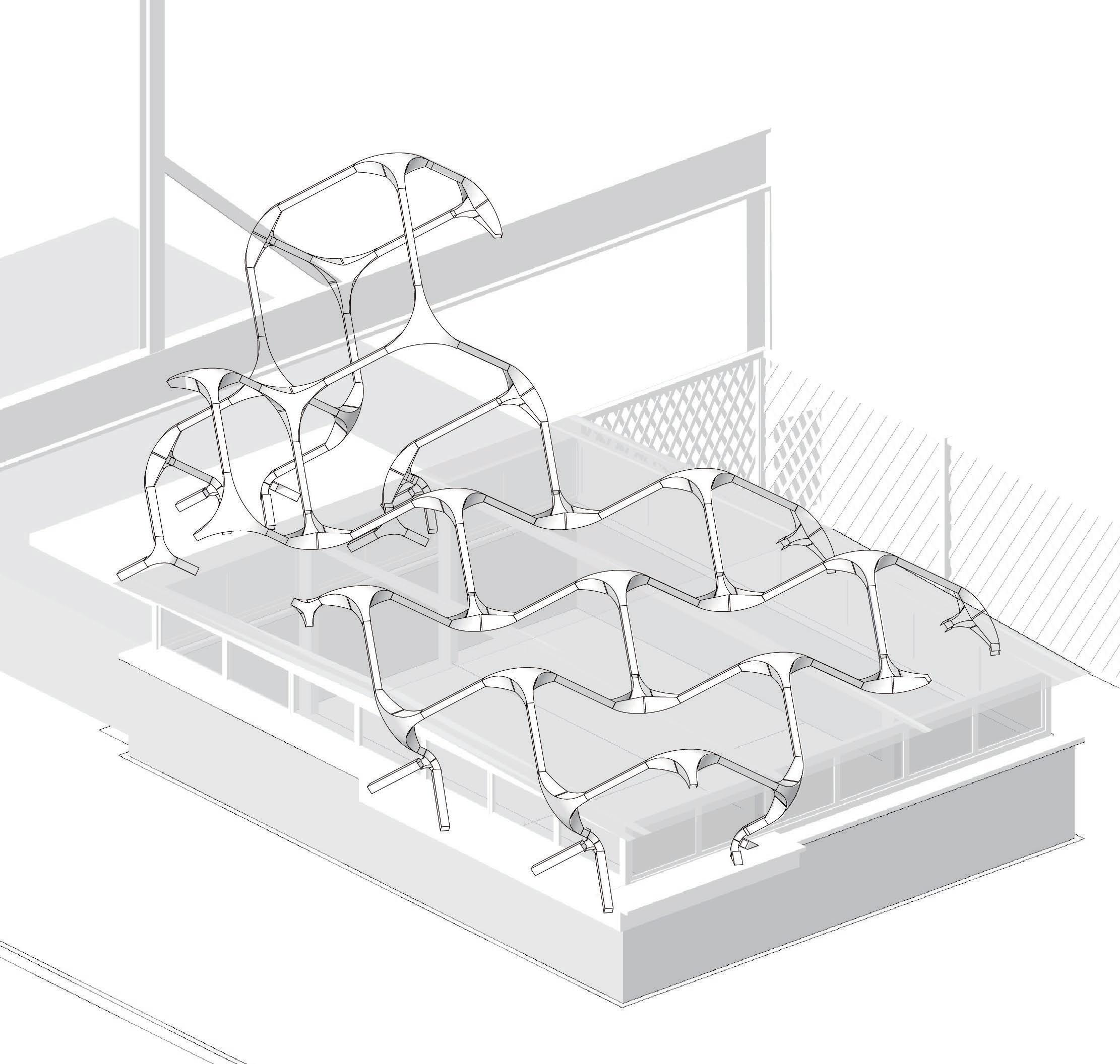
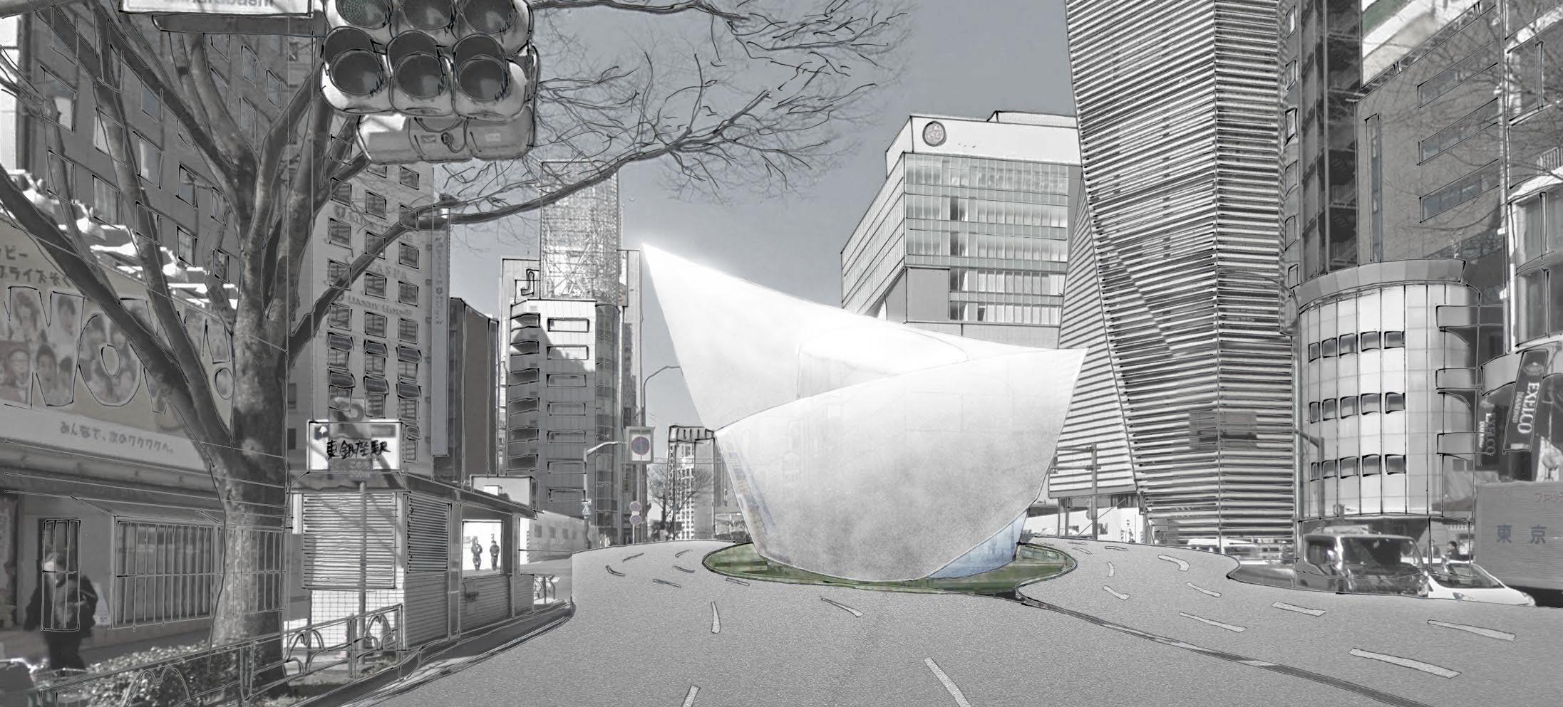
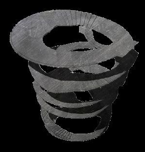
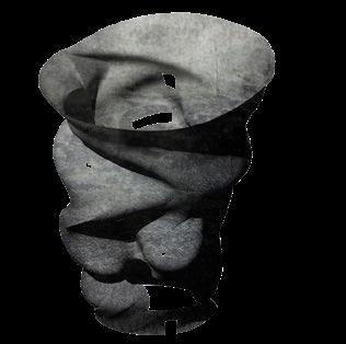
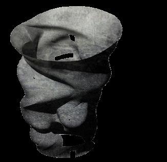
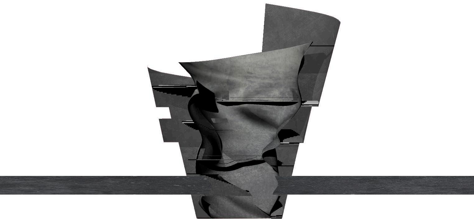
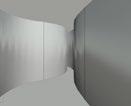
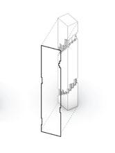
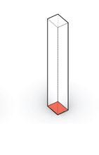
Project type/ Academic built project
Year/ 2020
Role in the project /
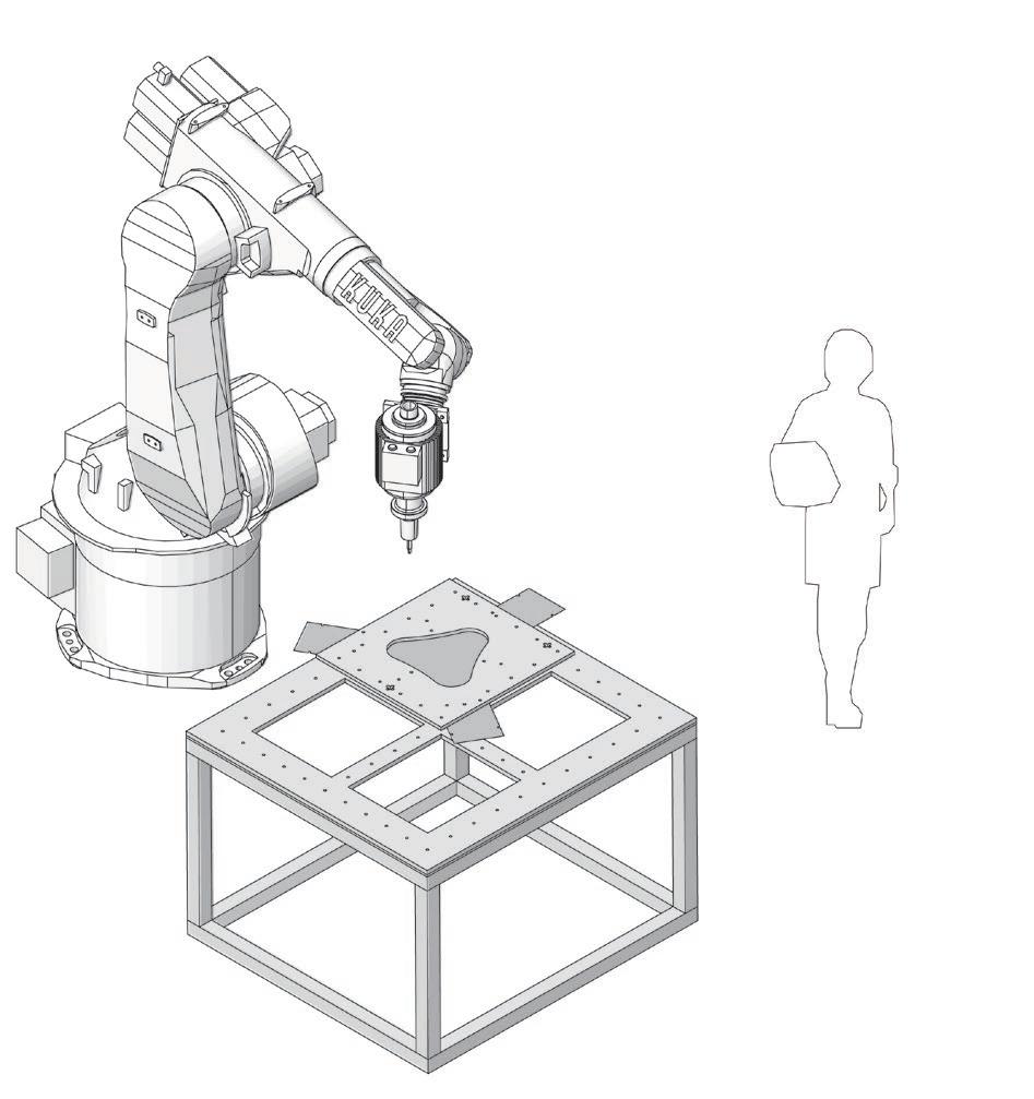
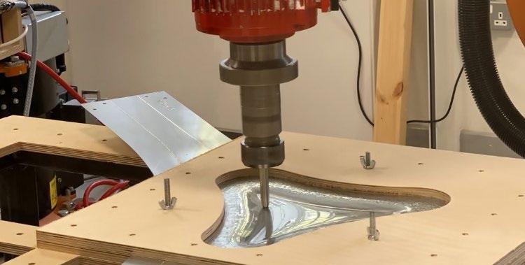
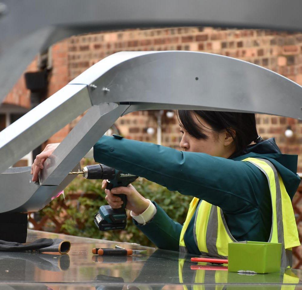
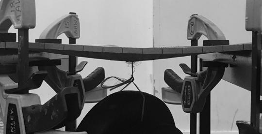
A member of the core management team, In charge of Robot arm (KUKA) fabrecation, Scripting for the robot arm fabrication, Construction
Rhinocerous, Grasshopper, Robot arm (KUKA), CNC, Digital tool used /
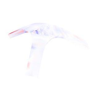
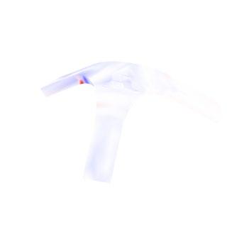
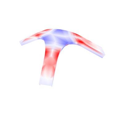
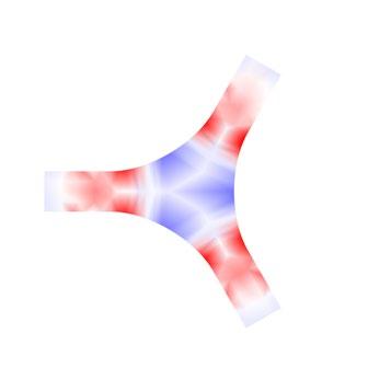
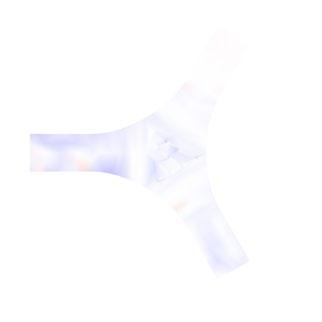
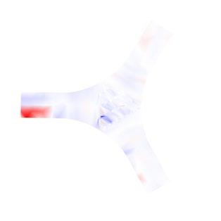
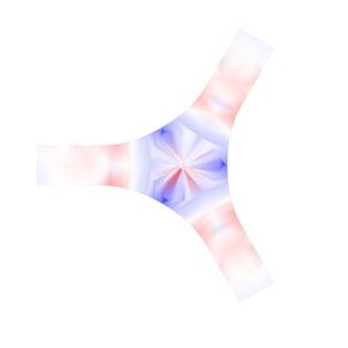
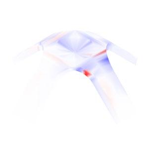
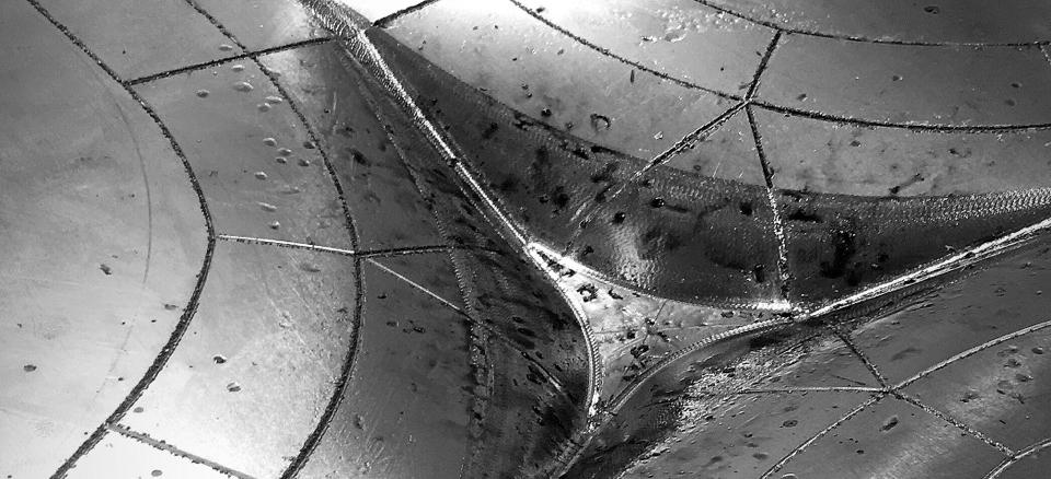
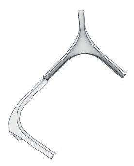
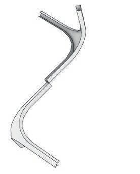
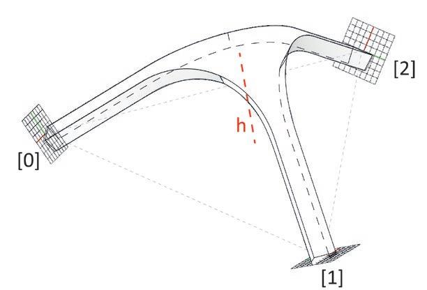
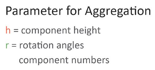
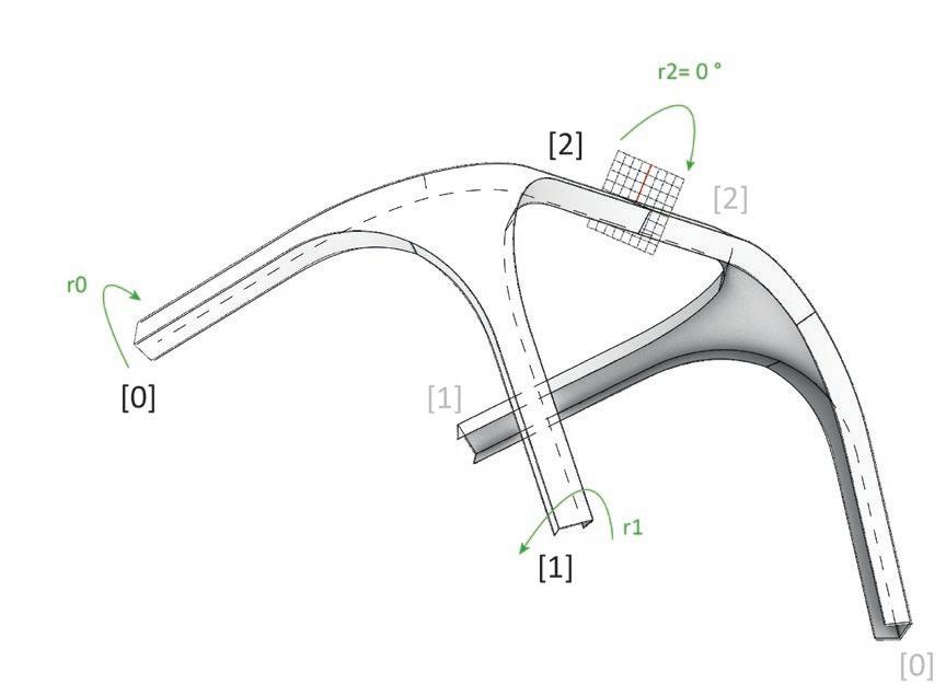
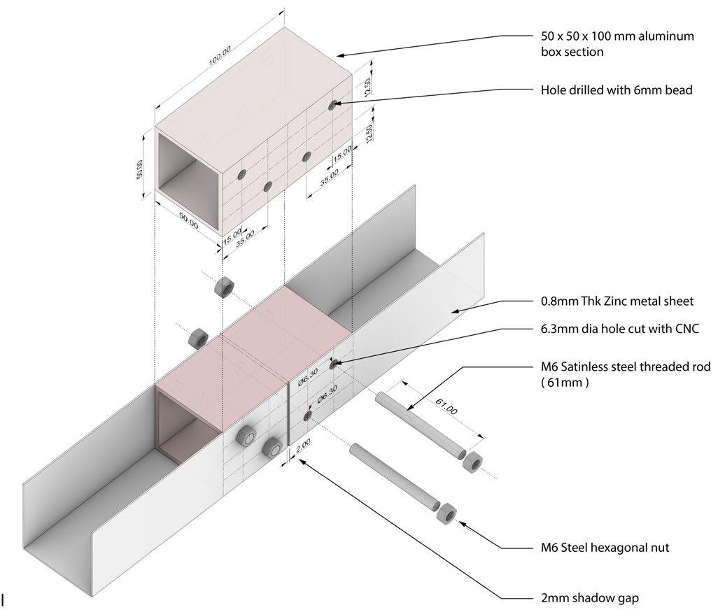
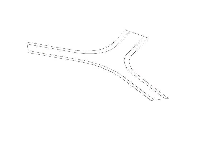
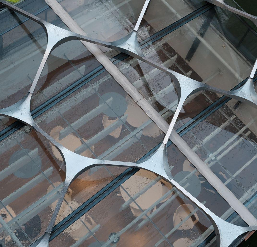
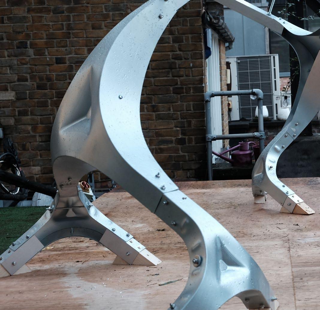
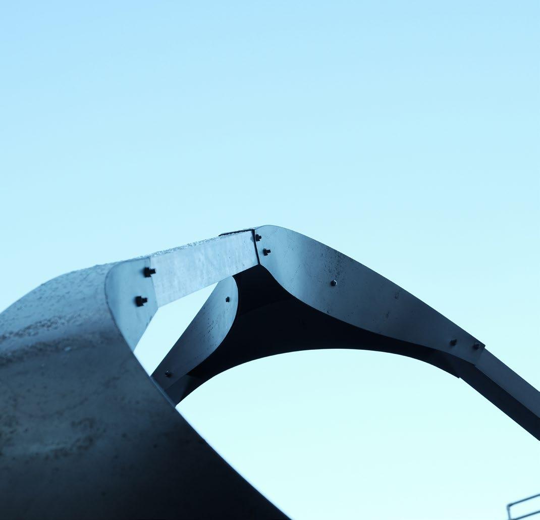
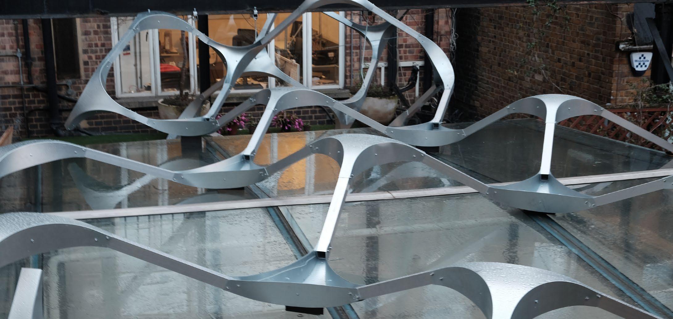
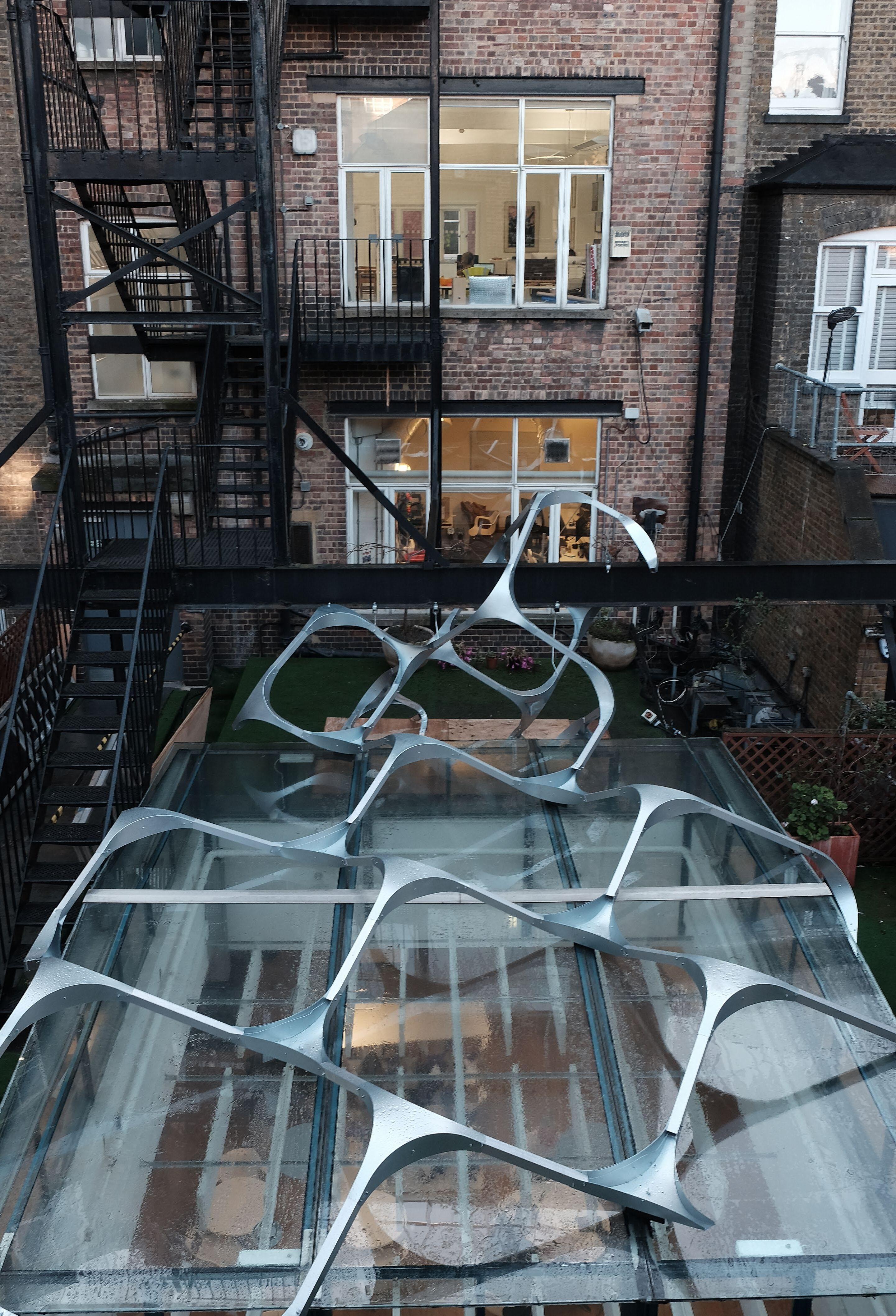
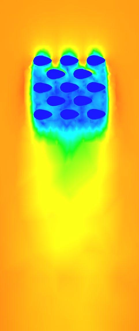
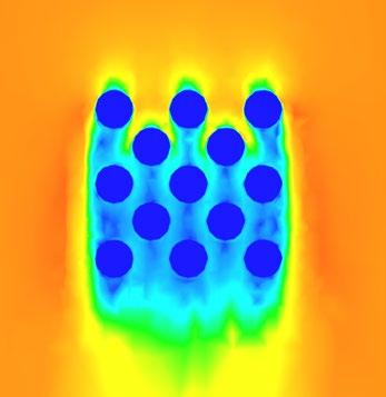
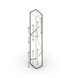
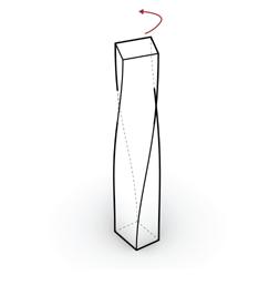
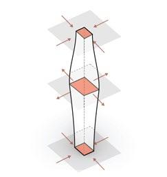
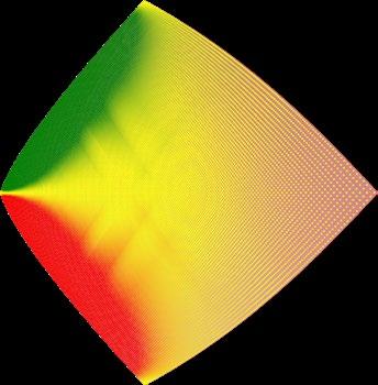
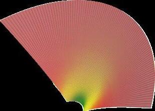
This construction project is collaboration with BuroHappold Engineering. The research agenda focuses on the sustainability of material economy by devising a lightweight structure from sheet metal that is stiffened via robotic incremental sheet forming and curved folding to cover the terrace skylight of BuroHappold. By utilising these two techniques, triangular connector components from a single sheet of 0.8mm Zinc were fabricated and assembled, with minimal complexity at the joints. The geometric properties of the folds were adjusted to control the degree of curvature and strength of the joints and a robotic arm was then used to progressively dent patterns into the sides and top faces of the components around the base to further stiffen up the areas with the highest stresses. The global geometry was designed to be assembled in sections without formwork.
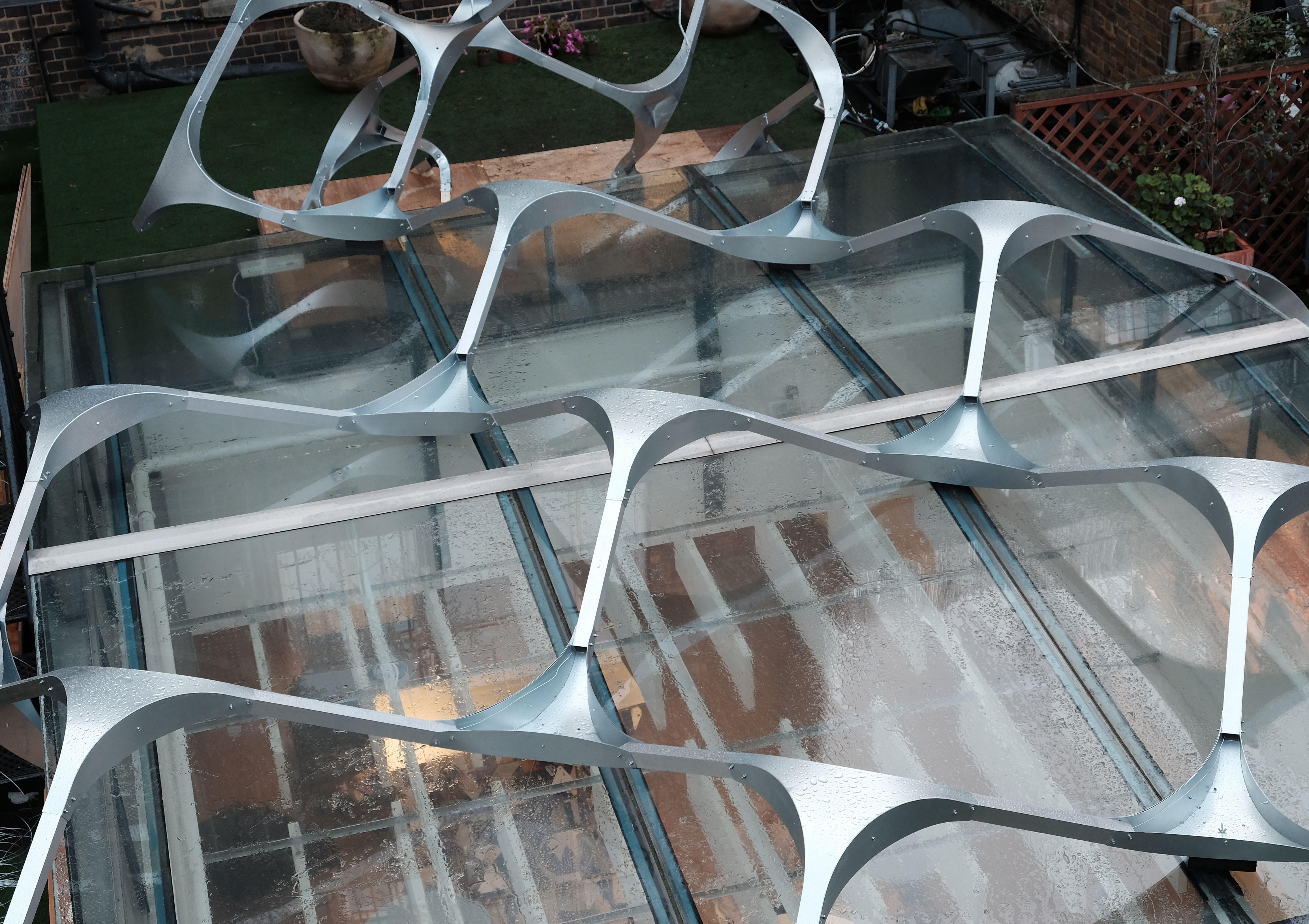
SPIF (Single Point Incremental Forming)
Ecological Urban Design
Project type/ Academic design studio
Year/ 2019
Role in the project /
Concept making, Overall computational experiment setup, Overall 3D modeling, Overall coding for the simulation, Diagram making
Digital tool used /
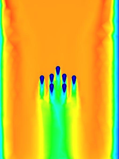
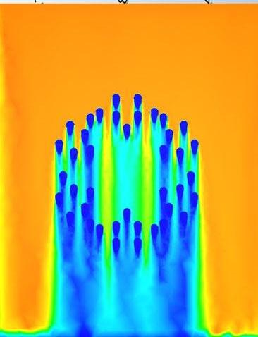
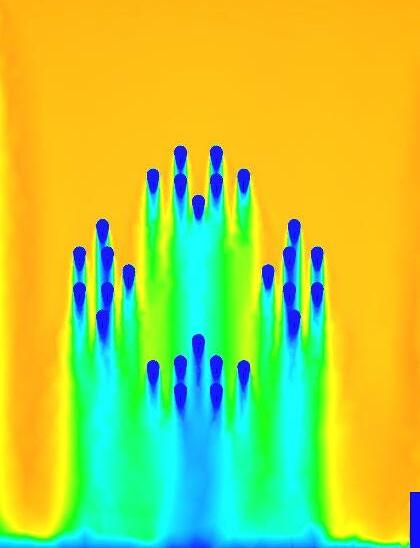
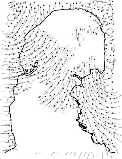
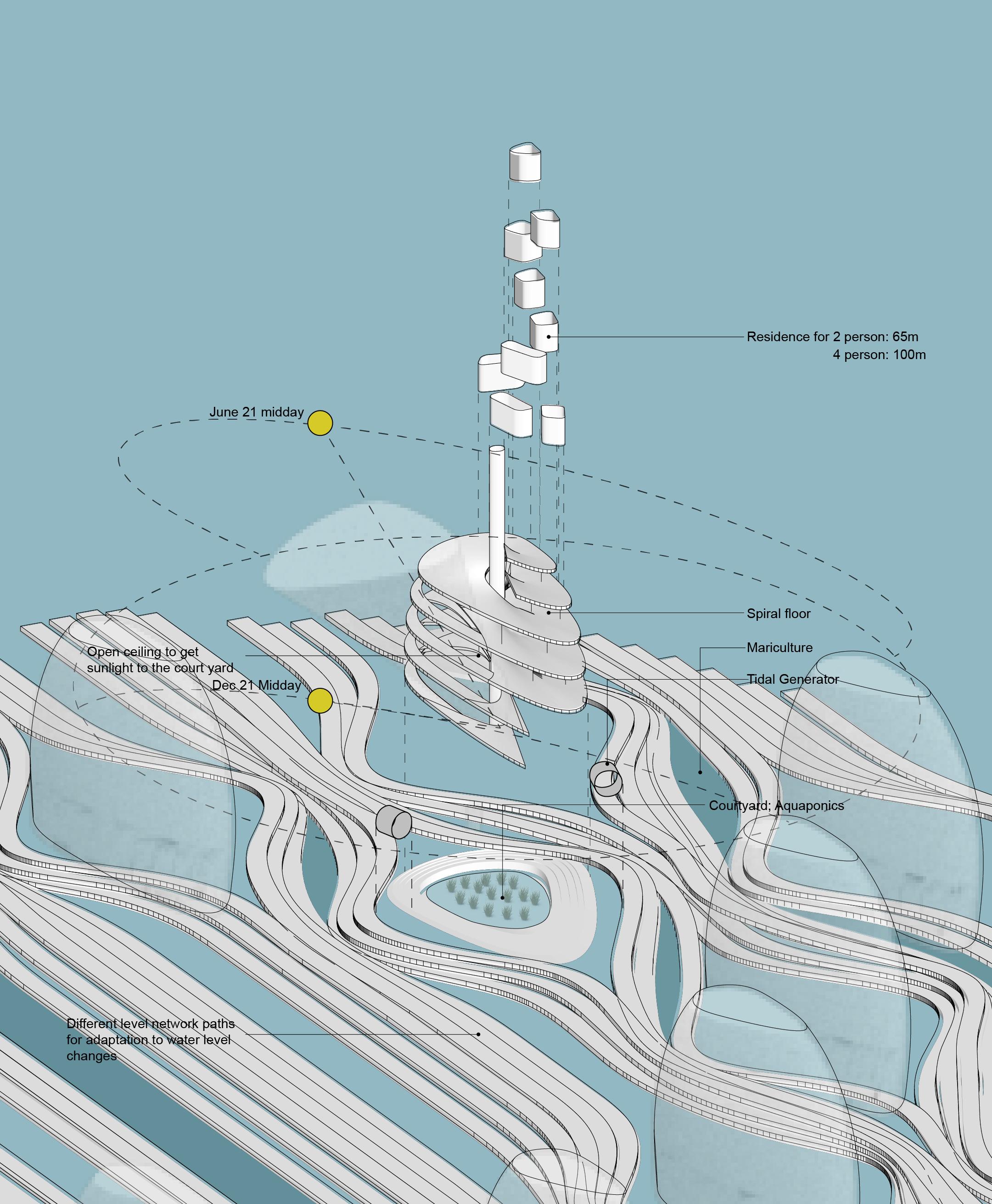
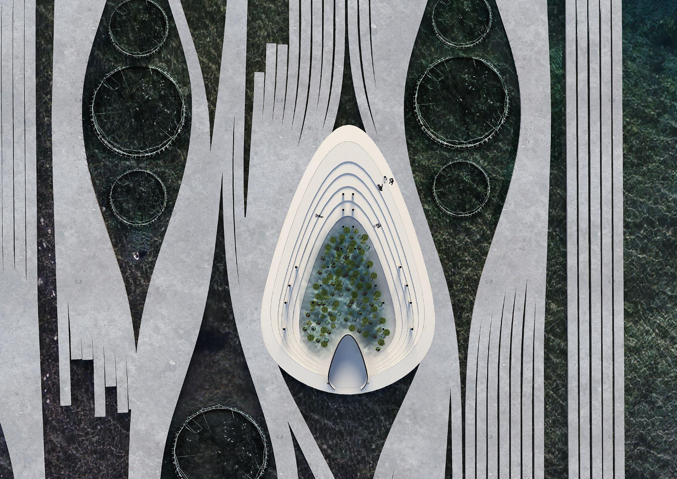
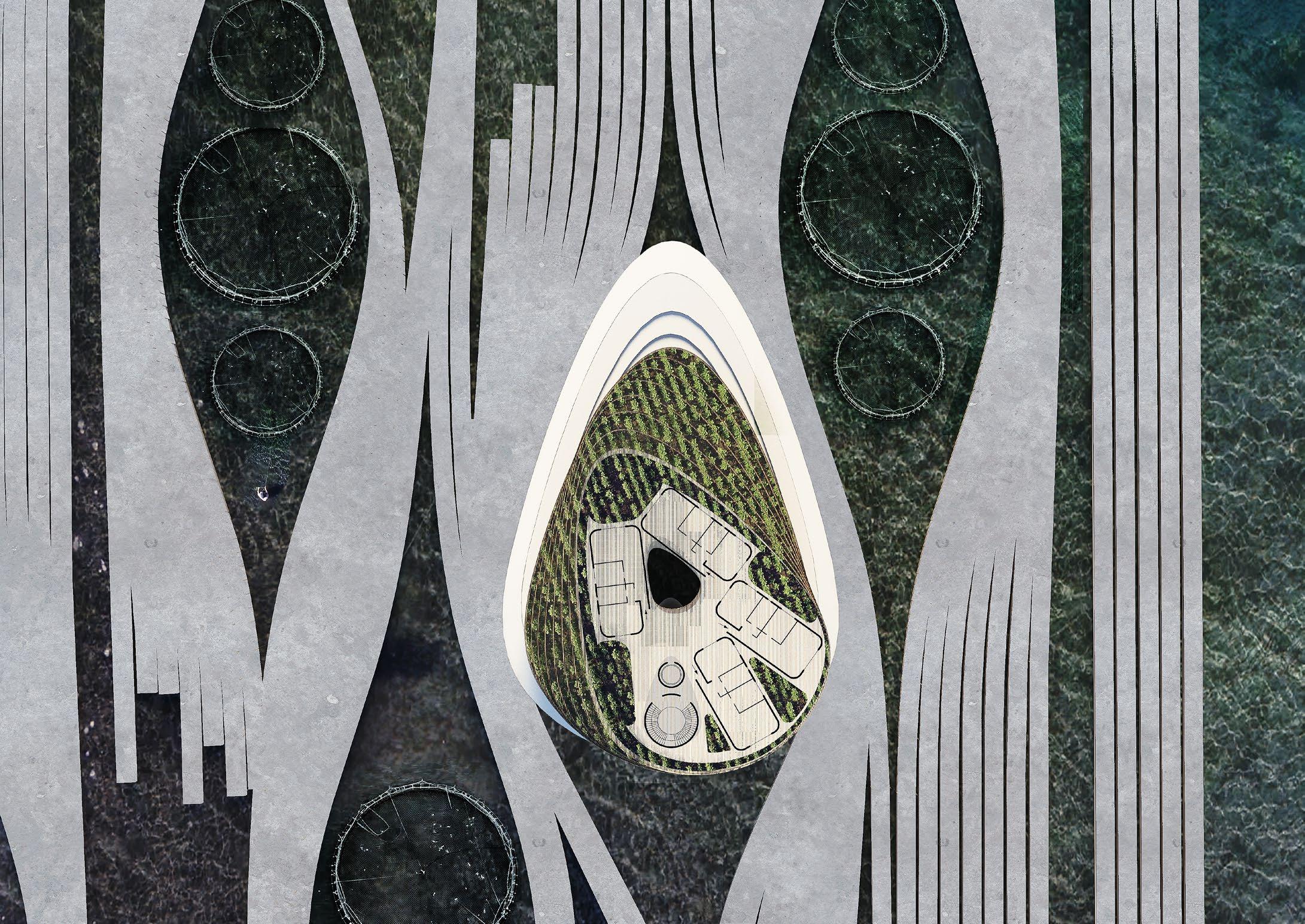
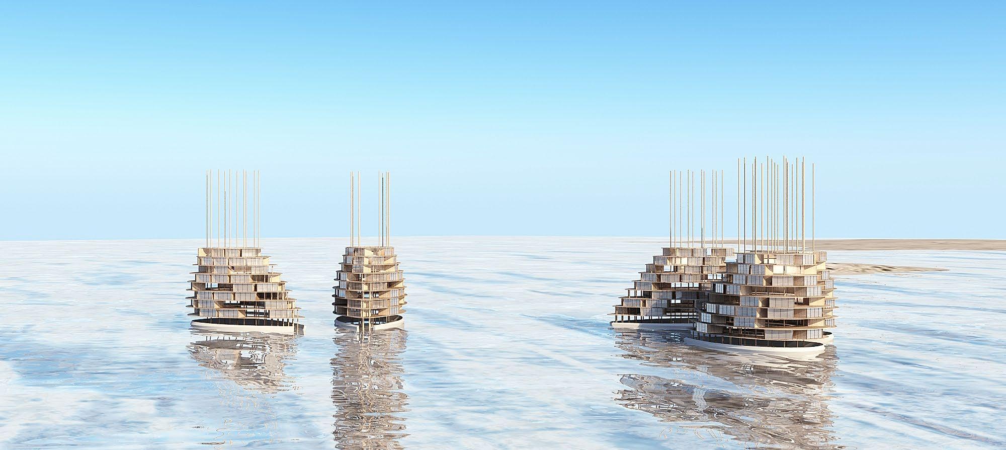
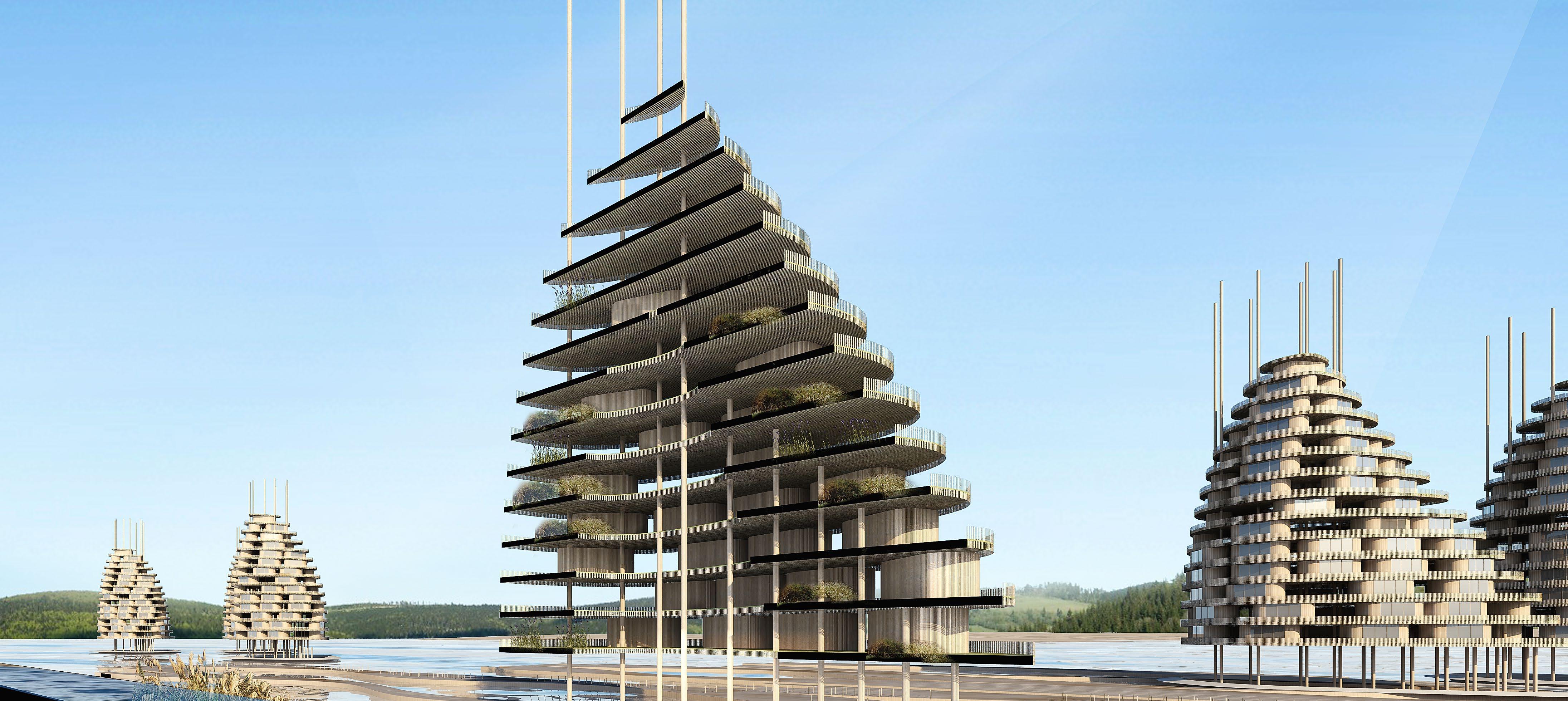
The purpose of this project is to develop an integrated urban tissue for an ecologically sensitive site on the Thames Estuary. Regular intertidal flooding on the peninsula protects the mainland from potentially destructive storm surges. Over the next century, however, the site will become increasingly vulnerable to sea-level rise, leading to coastal erosion which can no longer be inhibited strictly by means of hard engineering. In response to this eventuality, the design proposes an adaptive urban strategy for the development of a coastal community consisting of productive landscapes, generating energy systems, infrastructural networks, and residential towers.
Rhinocerous, Grasshopper, GHpython, Revit, 3Dmax, Photoshop, Illustrator, Indesign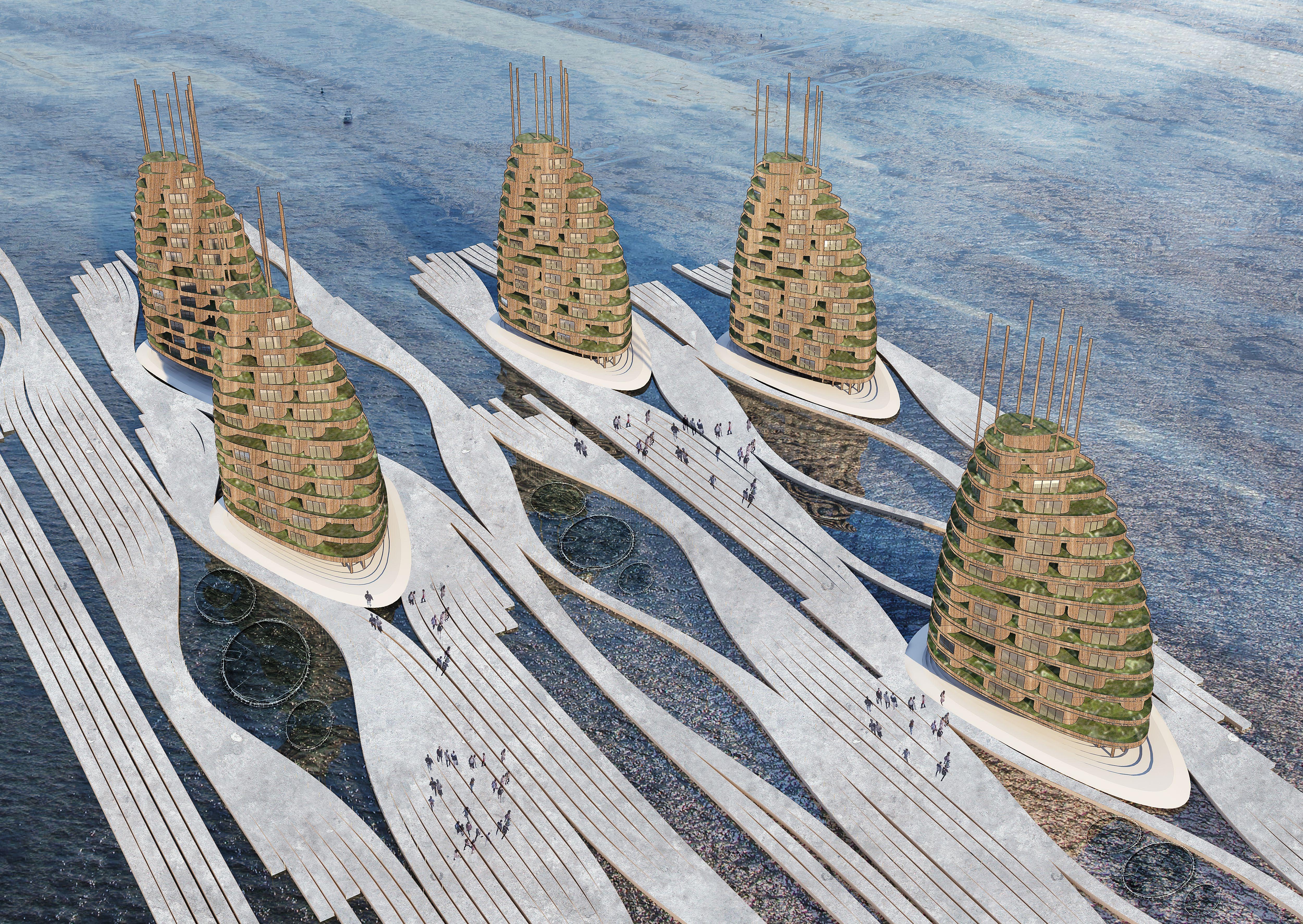
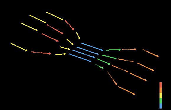
Tidalflowdirectionstudy
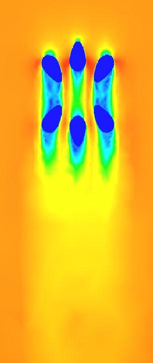
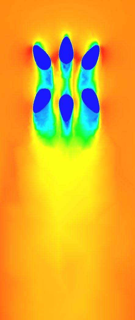
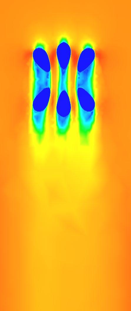
Building orientation according to the water direction
Mariculture field in between the buildings and center area
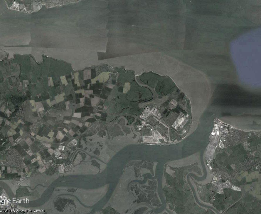
hight < 2m appropriate for mariculture

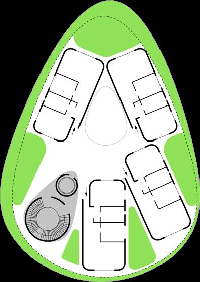
 Ground Floor Plan
4th Floor Plan
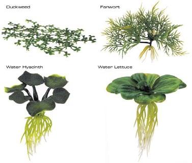
Aquaphonic Plants
Core
Mariculture area
Walk path
Elevated gardens
Ground Floor Plan
4th Floor Plan
Aquaphonic Plants
Core
Mariculture area
Walk path
Elevated gardens
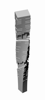
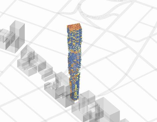
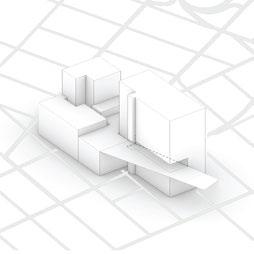
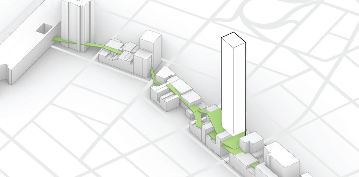
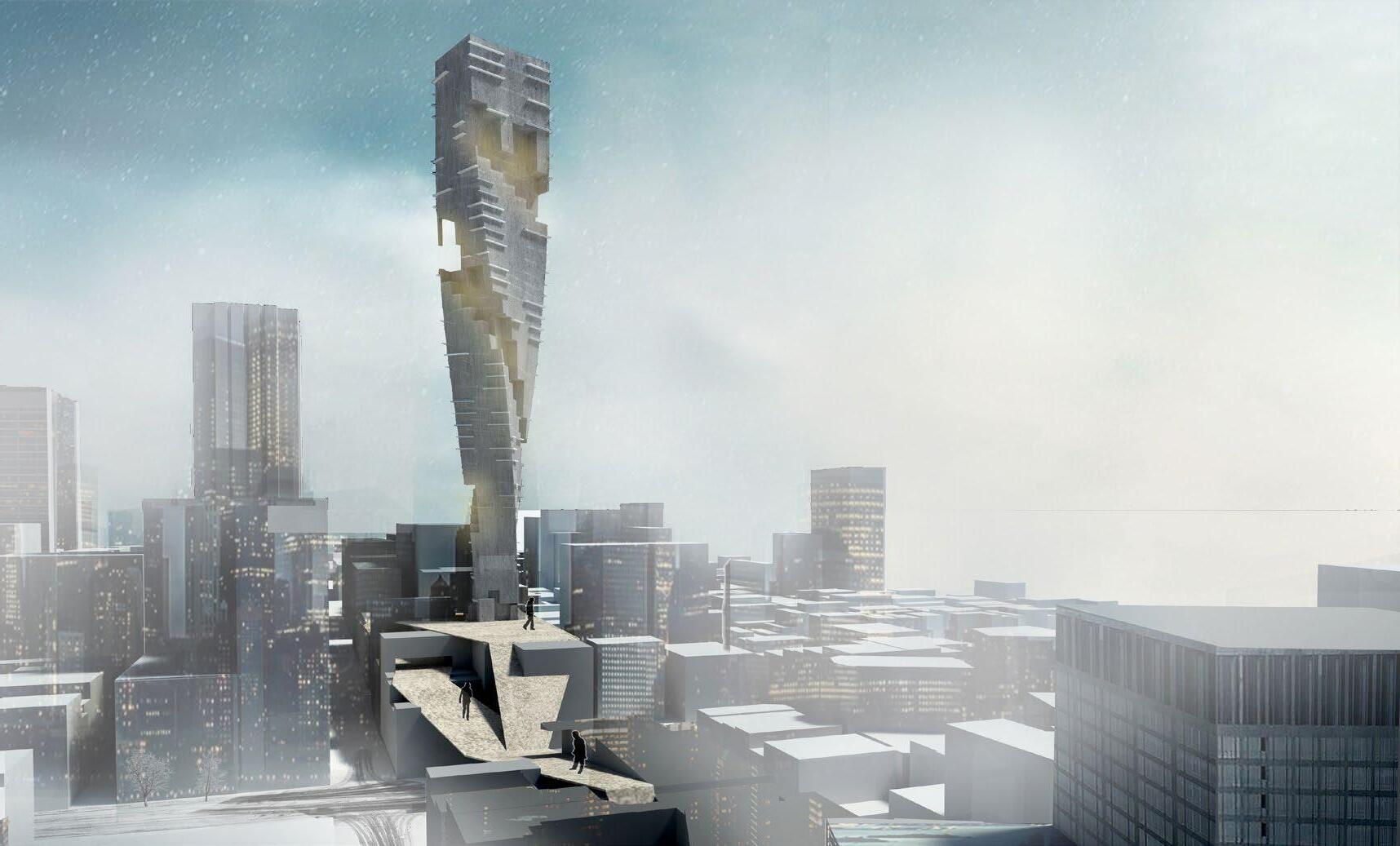
City of Nostalgia
Project type/ Bachelor Design Thesis
Year/ 2017
Role in the project / All (individual Project)
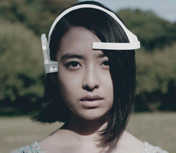
Rhinocerous, Kensei Analyser(EEG Device), Digital tool used /

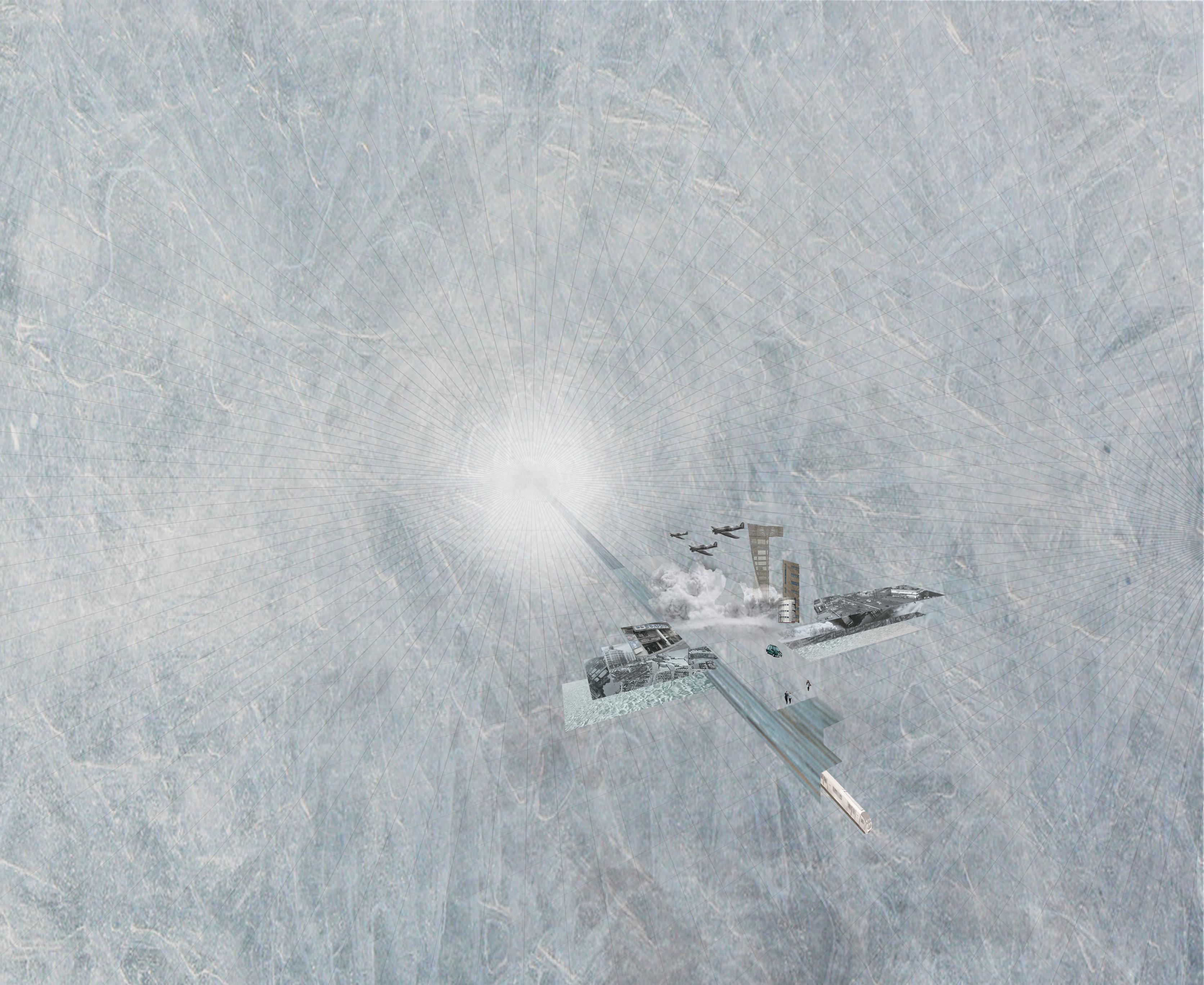
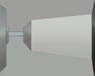
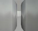
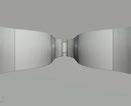
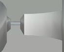
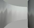
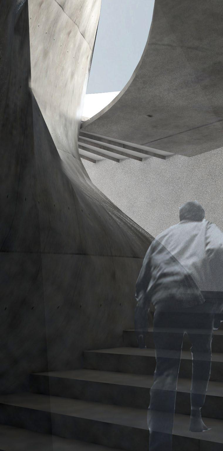
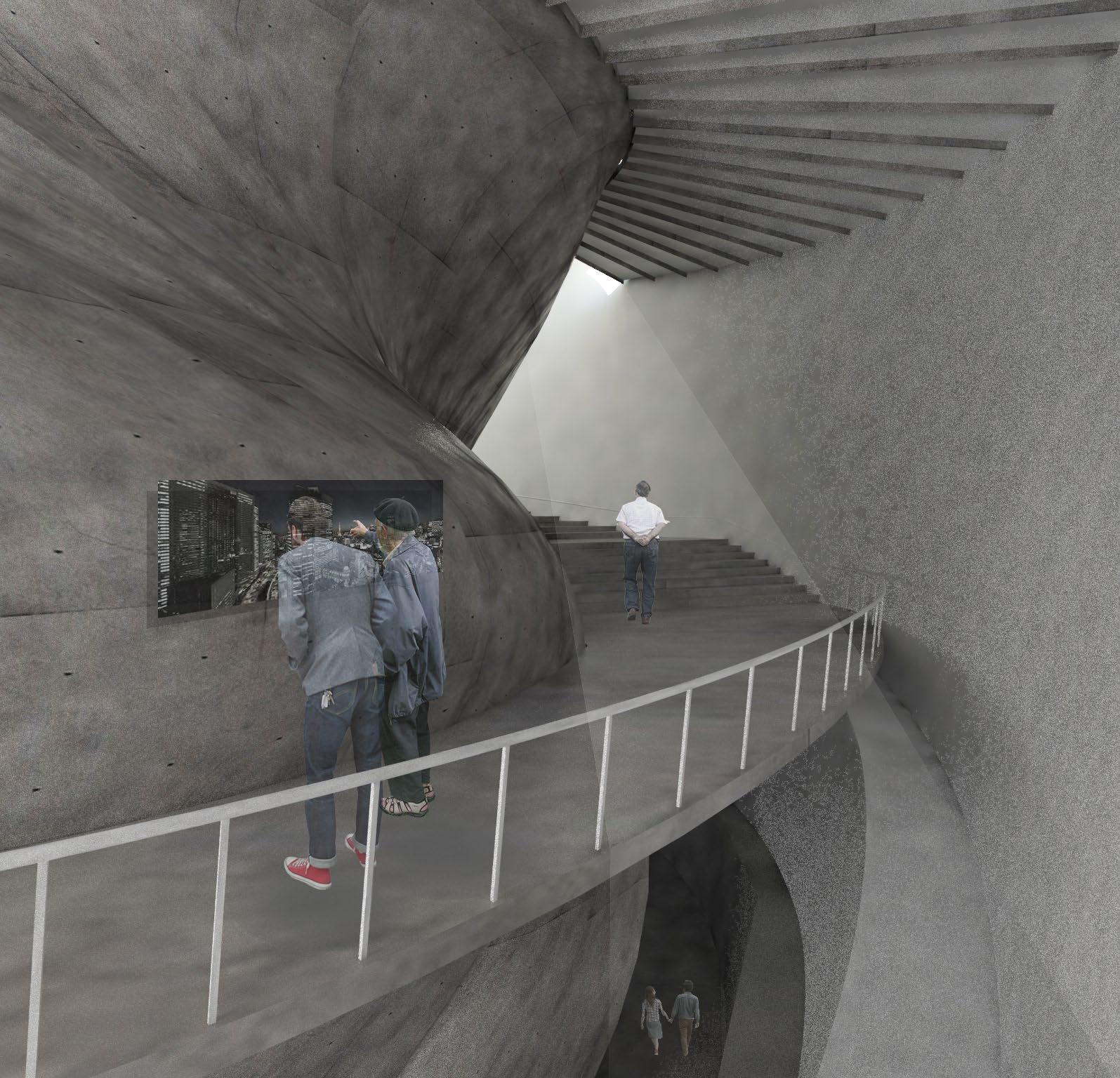
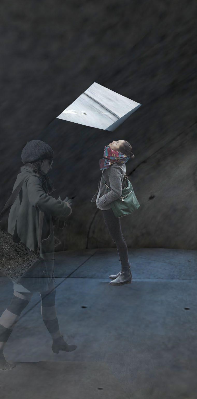
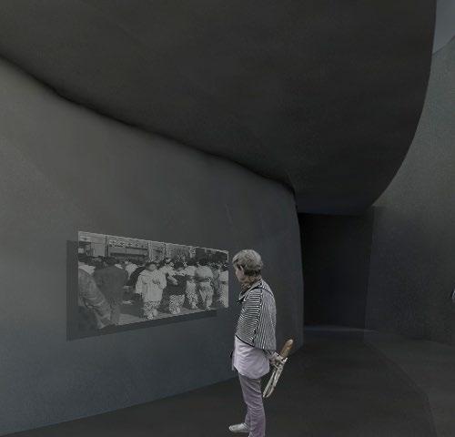
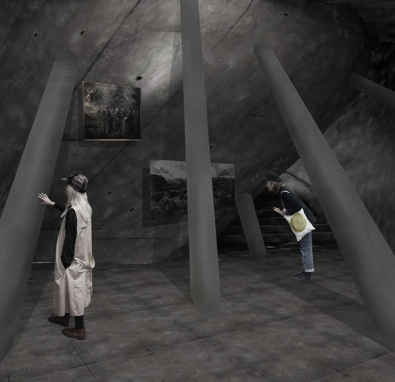
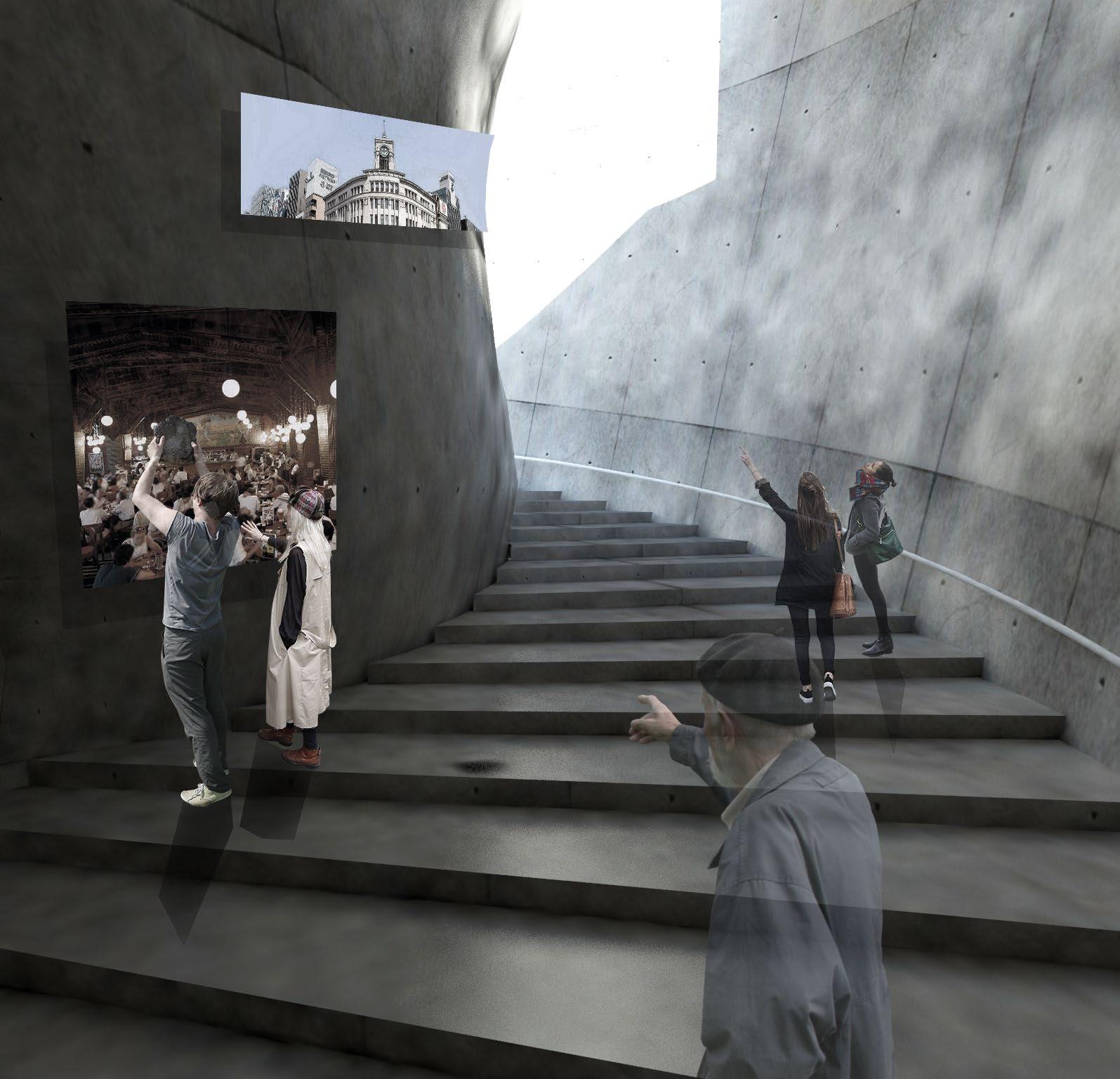
This project aims to inherit the historical value of the land by spatializing memories and emotions targeting the highly capitalized and symbolized urban space where people and places are alienated and to develop a method to treat human emotions as a design parameter.
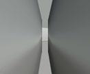
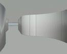
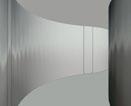
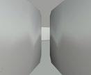
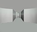
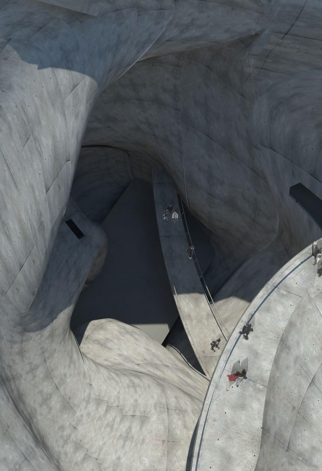
This project is a void as a deep bored hole from the ground to the ground and pulls people who just passed the underground passage into the interior of the building to experience space for the people to recall the history and memories of the site.
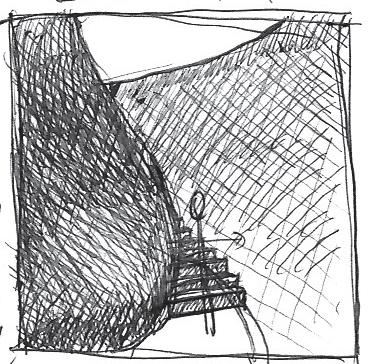
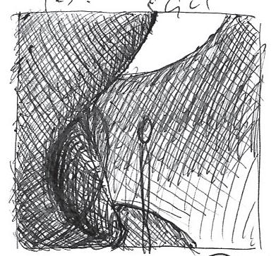
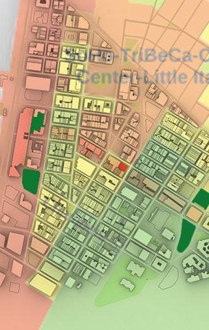
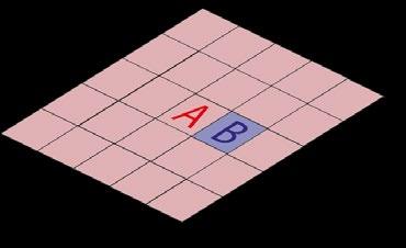
Site: Intersection of History and Infrastructure
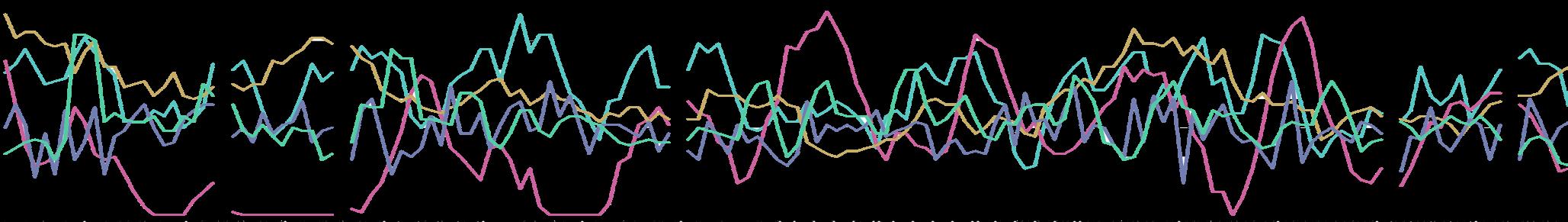
EEG Experiment


Representing history through space

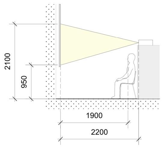
Sectional Drawing


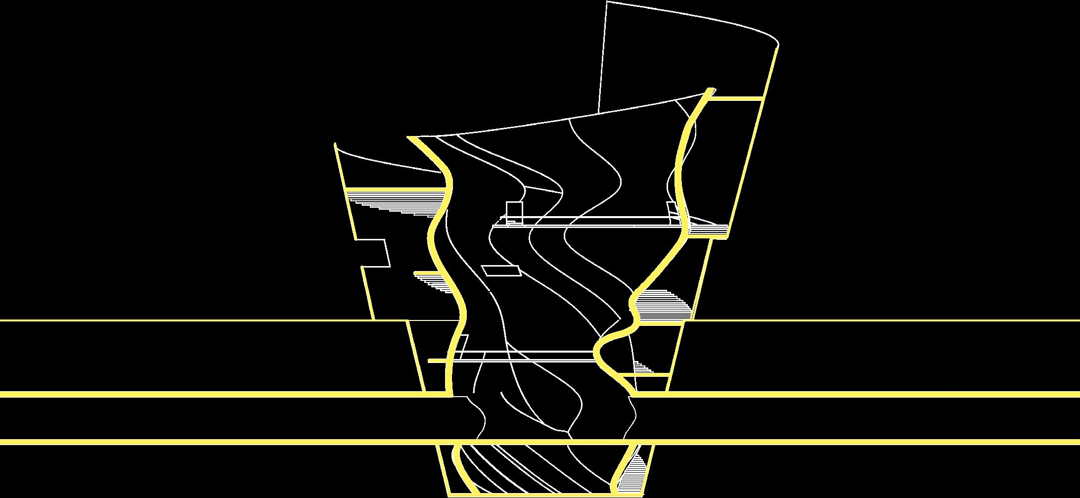


 GL-6200
GL-15000
GL+6700
GL+7200
GL+1500
GL+5000
GL-1500
GL-6200
GL-15000
GL+6700
GL+7200
GL+1500
GL+5000
GL-1500
Other Projects
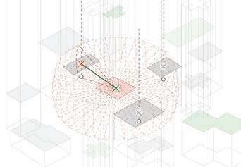
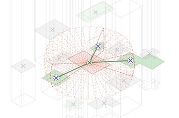
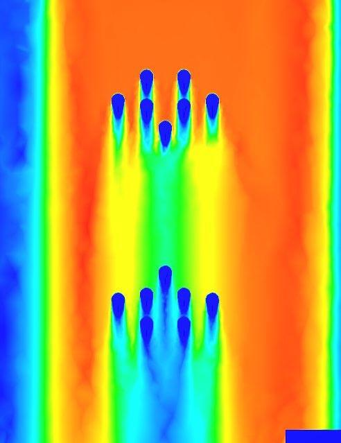
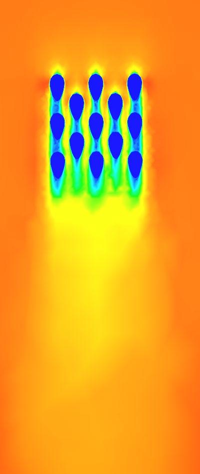
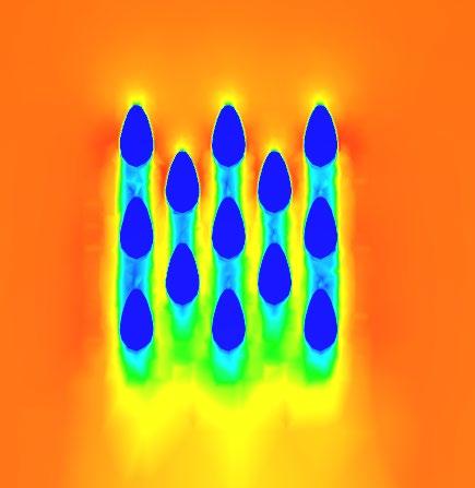
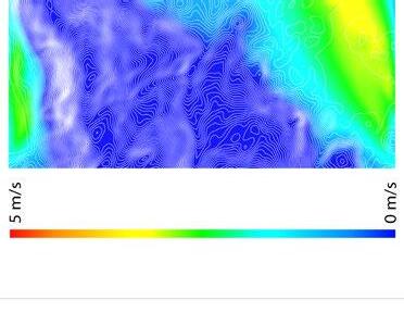
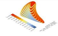
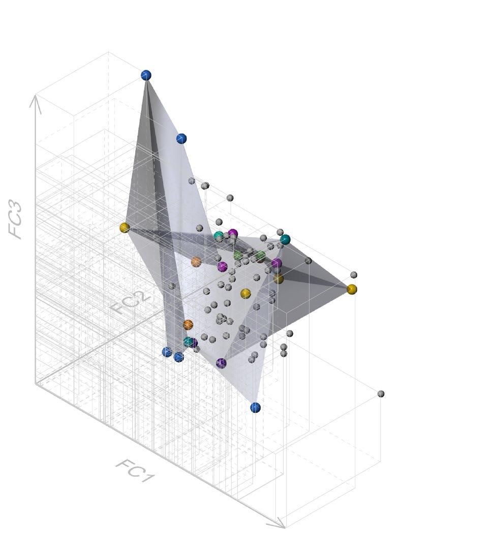
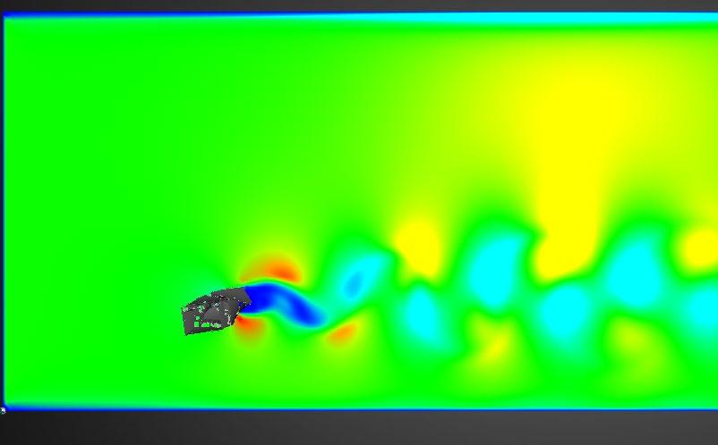
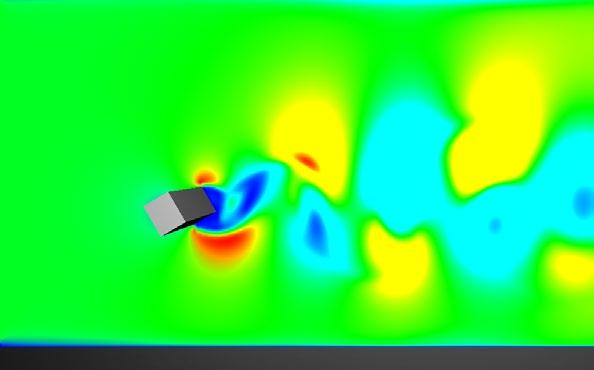
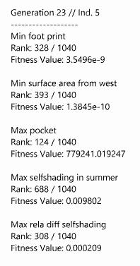
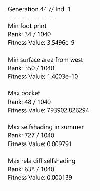
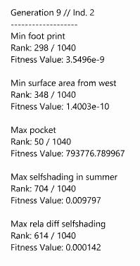
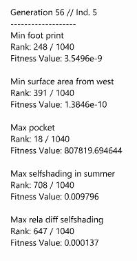
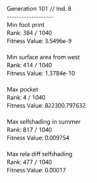
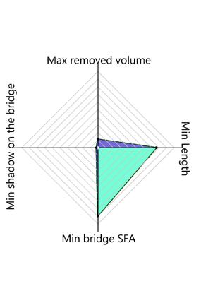
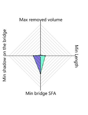
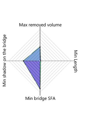
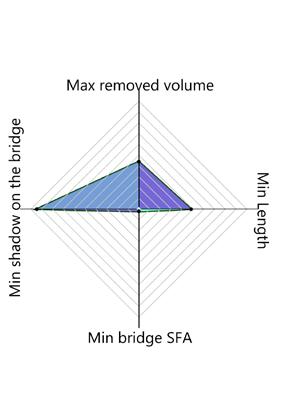
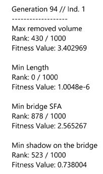
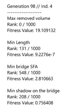
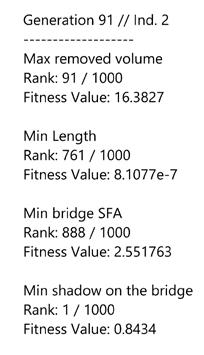
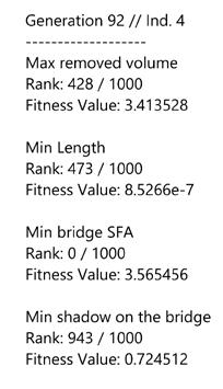
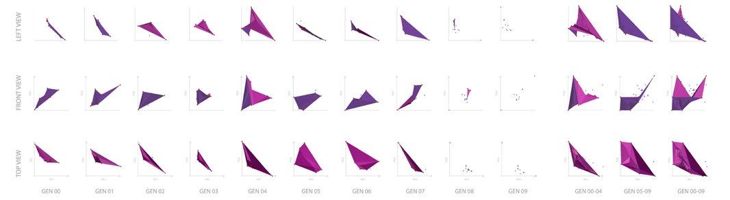
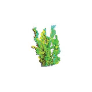
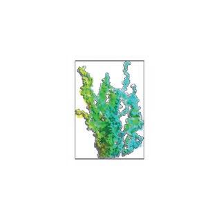
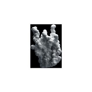
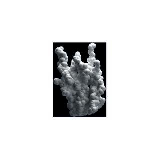
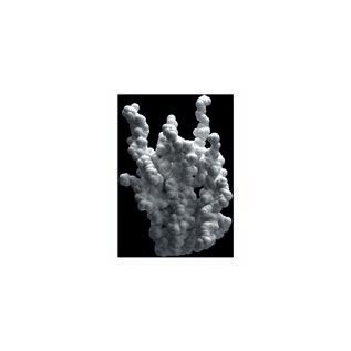
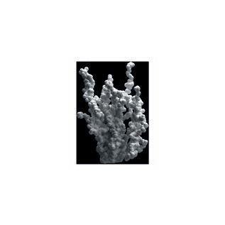
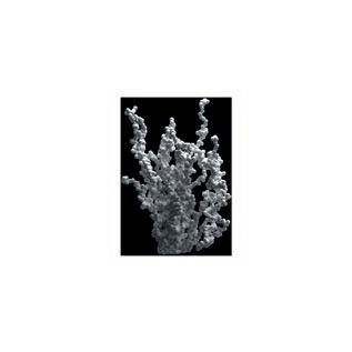
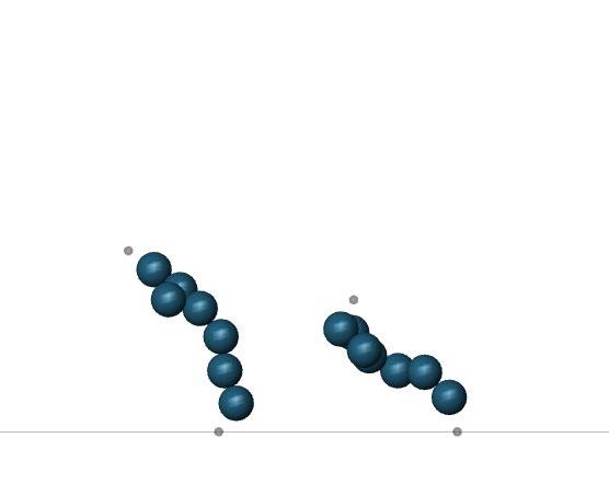
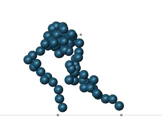
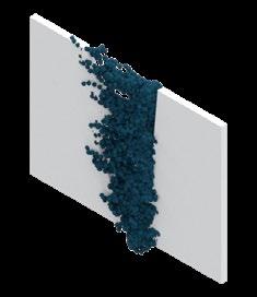
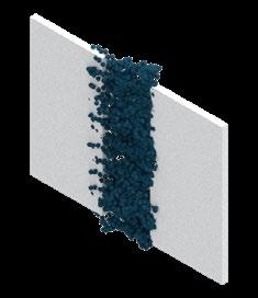
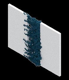
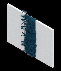
Emergence & Evolutionary Computation
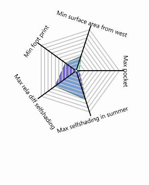

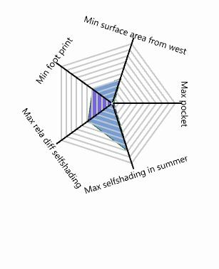
Year: 2019
Type: Design Studio(EmTech, AA school)
Role of the Project: Overall Computational experiment and 3D modeling, Visualisation, Concept making


Post Anaslysis
Water Flow Analysis
Systematic Design Method
Contextualizing Algorithm

Year: 2021
Type: Master Research Thesis (Keio University)
Role of the Project: All (Individual Project)
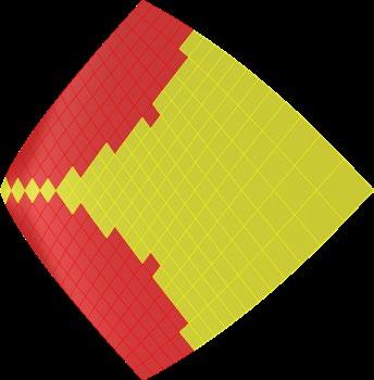
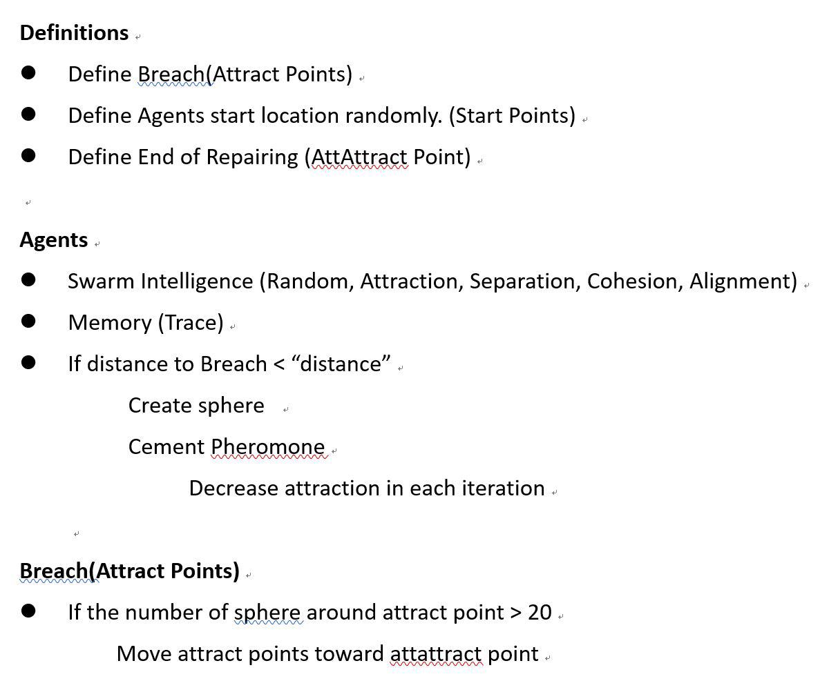
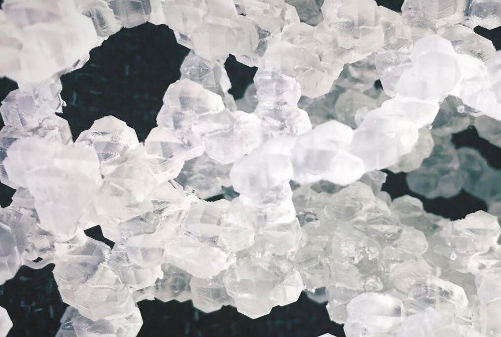
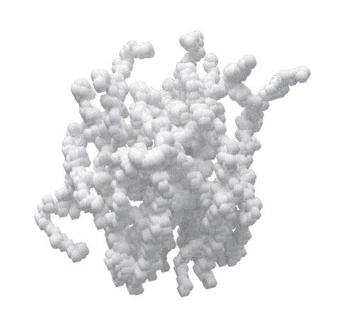
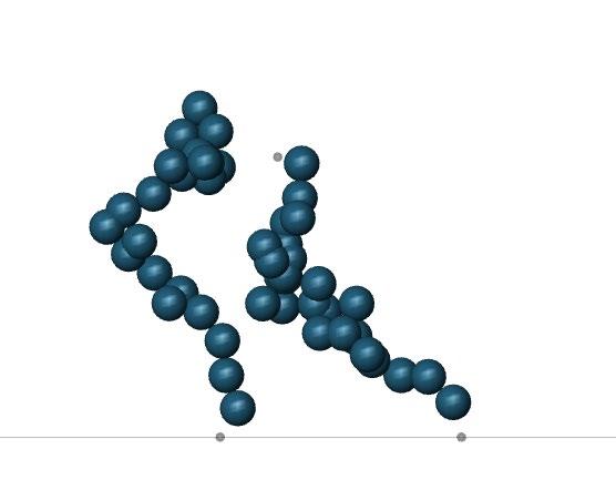
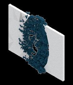
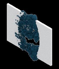
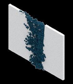
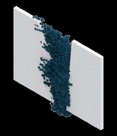
Agent Based Repair
Year: 2019
Type: Design Studio(EmTech, AA school)
Role of the Project: Overall Computational experiment and 3D modeling, Vidualization
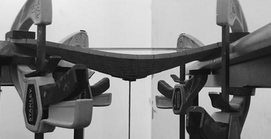


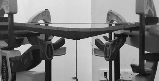
Bendable MDF Pattern
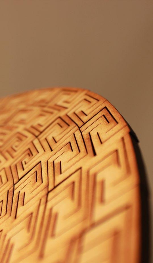
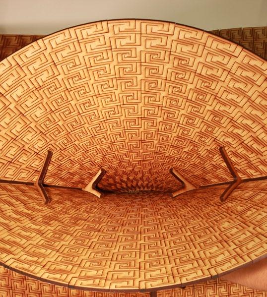
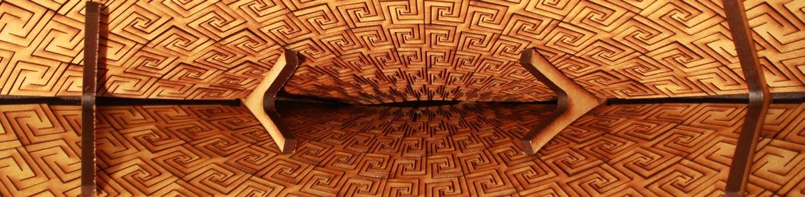
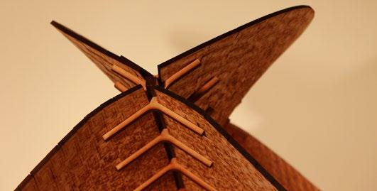
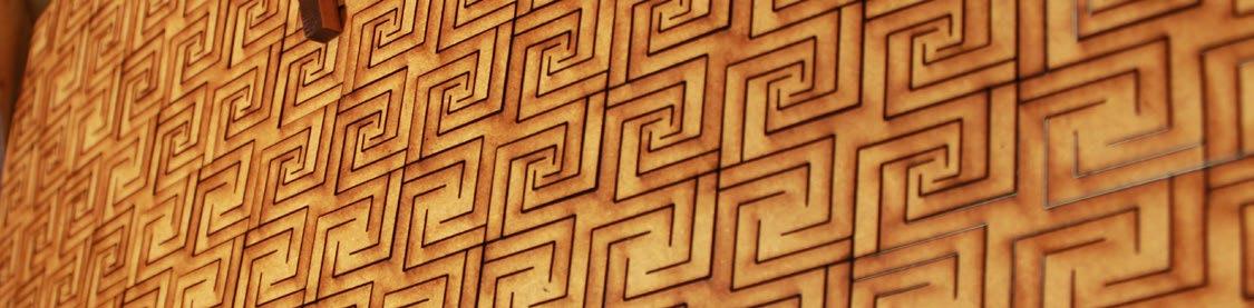
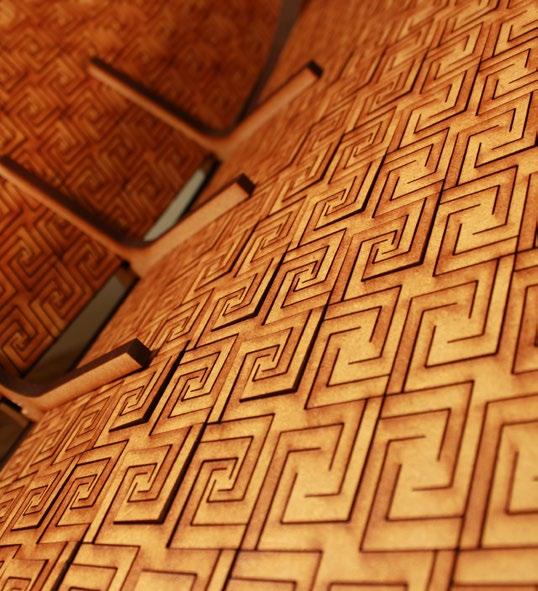

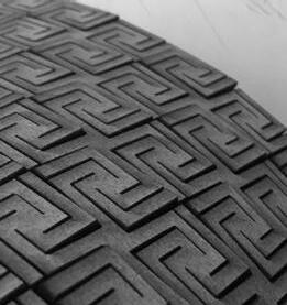
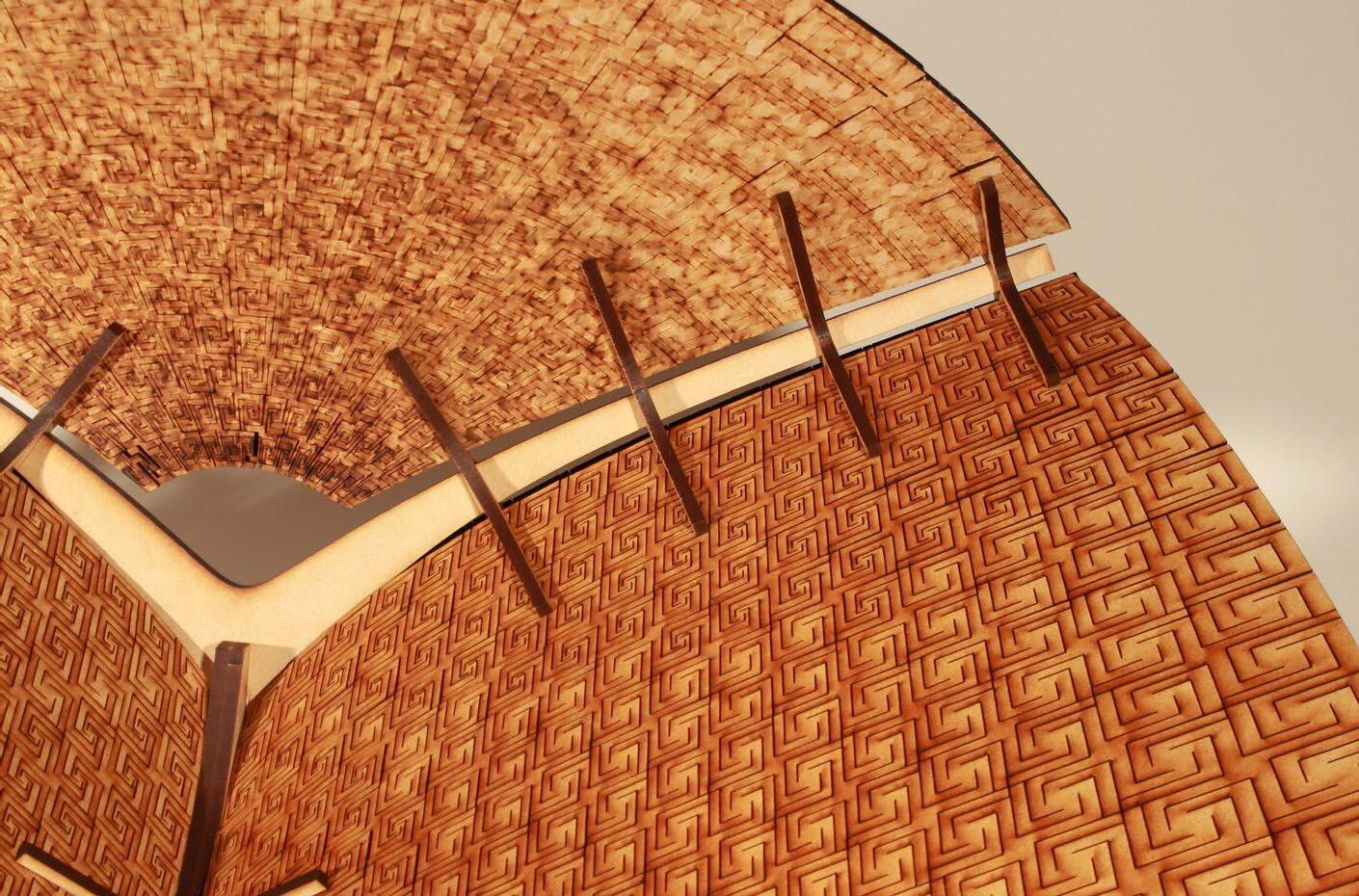
Year: 2019
Type: Design Studio(EmTech, AA school)
Role of the Project: Overall Computational experiment and 3D modeling, Pattern experiment, Physical model making