Selected Works since 2017
Bachelor of Landscape Gardening Beijing Forestry University
yunyitsien@gmail.com
+86-18810908286
P O R T F OL I O
YUNYI QIAN


CHAPTER 2 CHAPTER 3 CHAPTER 1 REMINISCENCE THE MOMENT VISIONARY 01 CUBE COMBO Equity & Security & Urbanism Group & Individual work Mar. 2022 - May 2022 Community Renovation 02 RESONANCE History & Geology & Emotion Individual work Nov. 2022 - Dec. 2022 Experimental Memorial Landscape 05 TREE-RINGS CENTER Culture Individual Work Setp. 2019 - Dec. 2019 Campus Deisign 08 OTHER WORKS Color Aesthetics & Art Reflection 2017 - 2022 Hand-Drawings 06 DANCING LION Technique & Construction Group Work Oct. 2021 - Nov. 2021 Digital Modeling of a Traditional Image 03 SUPERCHARGED FARMLAND Climate & Agriculture & Education Individual work Dec. 2020 - June 2021 Country Park Design 04 TRASH TO TREASURE Health & Infrastructure & Material Group & Individual Work Nov. 2020 - Dec. 2020 Urban Design XX THE FUTURE Equity & Health & Aesthetics 2023 - ? To be Explored 07 PROFESSIONAL WORKSAug. 2021 - May 2022 Design & Planning & Research Exploration of Life Justice L S I C F A E PE
Chapter 1 - THE MOMENT
CUBE COMBO
Community Renovation
3 / 2022 - 5 / 2022
Child-Trafficking Focused
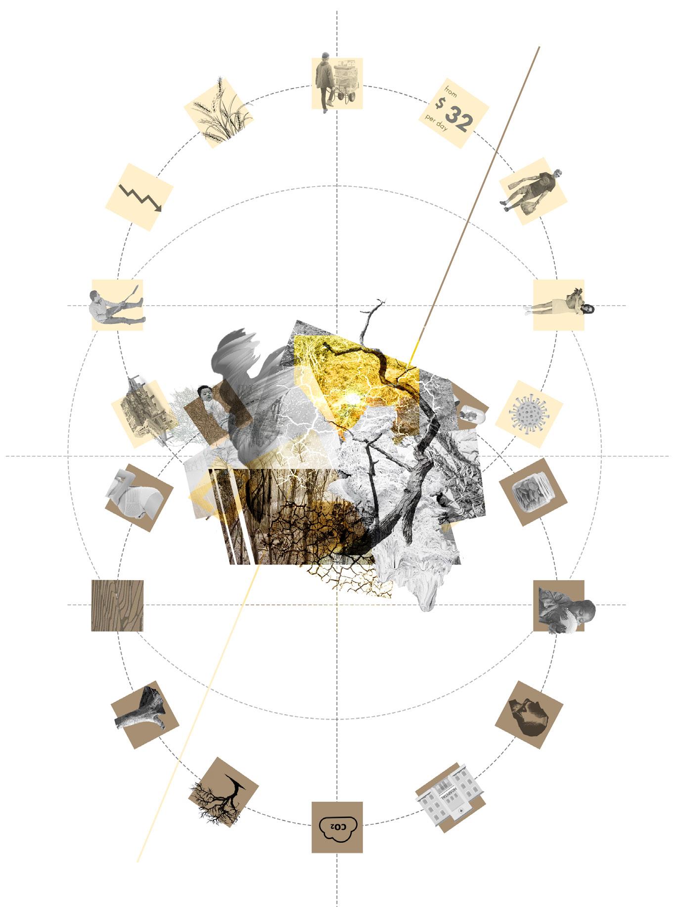
Equity / Security / Urbanism
Cube System implement
Based on Crime Prevention through Environmental Design (CPTED), formulated by criminologist C. Ray Jeffery
Crime Prevention / Vibrant Community / Safe Childhood
01 CUBE COMBO
Modular Landscape Approach to Reduce the Risk of Child-Trafficking

[LOCATION] Yuzhong District, Chongqing, China
[DURATION] Mar, 2022 - May, 2022

[TUTOR] Zhicheng Liu, Yu Ye
[GROUP & INDIVIDUAL WORK]
[COLLABORATOR] Yun hao, Jinjie Ren
[ROLE] Group Field Research, 100% Conceptual Design, 100% Detailed Design
Human trafficking is one of the three major crimes in the world, of which children are one of the main victims. Statistics show that southwest China has been a hot spot for trafficking crimes for the past 30 years and there existed more than 500 such cases only in 2021. After a detailed analysis of the geospatial characteristics of the southwest region, I focused on Yuzhong District, Chongqing, a mountainous city with a high crisis.
To prevent crimes , I conducted the Cube System based on the theory of crime prevention through environmental design (CPTED). The strategy includes four phases . Firstly, sites at risk are surveyed and their geospatial characteristics are categorized. In the second phase, a short and efficient intervention will be carried out on dangerous sites to achieve initial crime prevention. Almost a year later, sites will be progressively renewed, allowing for a further improvement of the overall space. The final stage is the activation of sites, creating natural surveillance and protection for local children. This system provides a possibility of crime prevention through landscape architecture, creating a joyful, safe, and vibrant community for vulnerability.
4
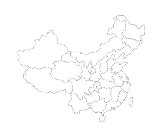
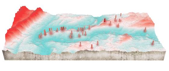
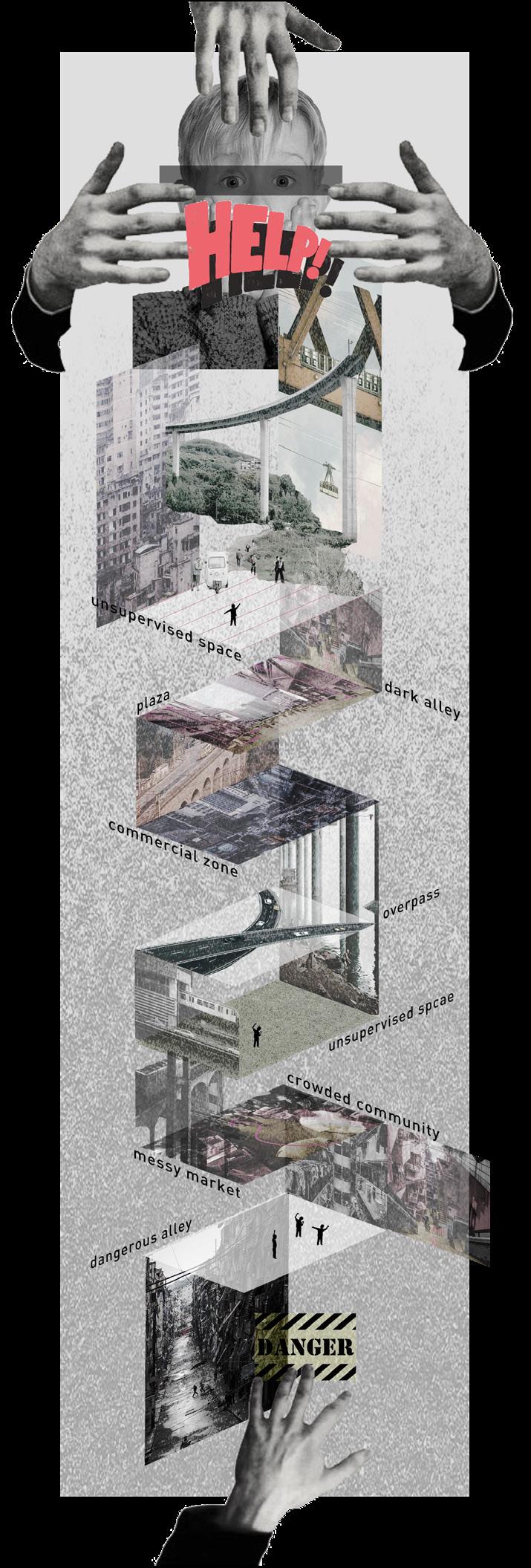
The mountain city Chongqing in China with dead corners has created a lot of cases of child trafficking.
DRAWING BY MYSELF
[LEGEND]
Histogram of child trafficking
Trafficking hot spots
Water system
Provincial borders
Age-Sex Chart of Trafficked Children


Plots with High Rate of Child Trafficking
Age distribution of abducted children when trafficking occurs in different locations.
In general, the abducted children show younger age characteristics. The children are mainly aged 0-6 years old , and the probability of being abducted decreases with the increase of age.
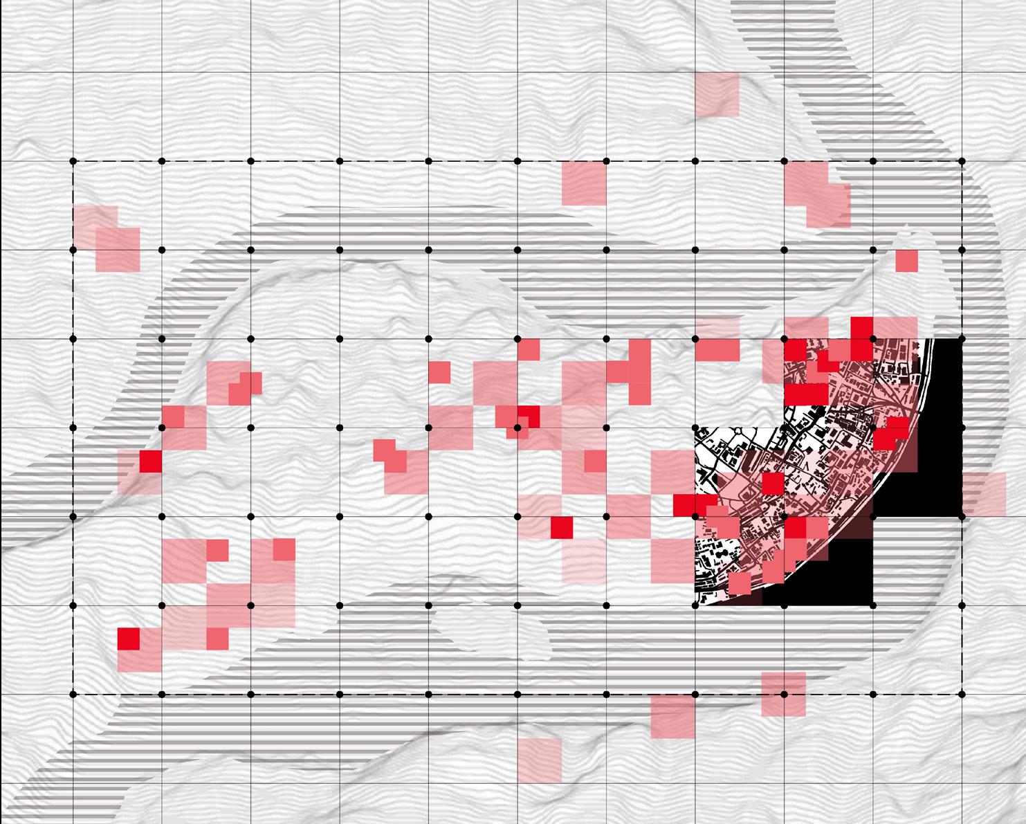
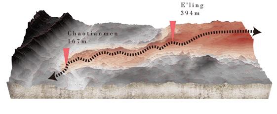
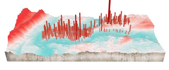
Complex Topography Gives Rise to Criminal Hideouts

5
CommercialZoneVehicle CountryFair PublicToiletsPlaza RiversidePark Tourist Attraction SpaceunderBridge Alley Community Railroad CinemaWayToSchool FactoryShips WorkspaceSmallShops Hotel Field RailroadSideNearTheSchoolHospitalEntertainment TransportStation 100% Other ages Children 0-6 years old 75% 25% 50% 0
<Age> <Numbers> <Numbers> [GROUP] [GROUP] Child-Trafficking Location in Yuzhong District Hot Spots in Yuzhong District Geomorphology of Yuzhong District Hydrology of Yuzhong District BAIXIANG COMMUNITY PEOPLE'S PLAZA BAIXIANG MARKET CHONGQING BUS STATION URBAN AREA HIGH RISKY AREA HIGH RISKY PLOT YANGTZE RIVER SHIBANPO OVERPASS 200m 600m 1000m 1400m 1800m 2200m 2600m 3600m 4000m BUSINESS ZONE PUBLIC TOILETS CHAOTIAN ARC L M S The darker the color, the higher the degree of insecurity. (29.35N, 106.33E) 5 4 3 2 1 Evaluation of High-Crime Areas N [INDIVIDUAL] [INDIVIDUAL]
{ IDEA & STRATEGY: THE CUBE SYSTEM }
A new interpretation of Crime Prevention through Environmental Design (CPTED) for a child-safe city
PHASE 1: IDENTIFICATION PHASE 2: INVITATION
PHASE 3: RENOVATION
PHASE 4: ACTIVATION
- Identify dangerous spaces as important redesign locations through site investigation, online research, and reading relevant papers.
- Based on the new generation of crime prevention through environmental design (CPTED), I prevent child trafficking by practicing its five dimensions - territoriality, surveillance, access control, activity support, image maintenance - into reality.
- Add mechanical surveillance such as street lighting which allows initial crime prevention accomplishment.
- Using fences, chairs, plants, etc. as a method of separating public, public-private and private space.
- Follow a program promoting rapid repair and rehabilitation of vandalized equipment.
- Greenery brings vitality to the site.
- Updated Roof gardens allow vertical surveillance.
- Build up kids-friendly sky corridors based on identified children ’ s movements to guarantee access control.
- Add identification to increase site recognition.
Unassigned spaces are eliminated and all spaces have been clearly defined and designed purposely. Places dangerous in the past are activity supportive now. Crimes are replaced by energetic activities, such as reading salons, shopping stores, art shows, playgrounds, etc., all of which will be a source of inspiration for the local future economy.
During the identification period, dangerous spaces are incorporated into a grid system . Cubes as basic design element are placed in some grids for the next crime-prevented process.


During the invitation period, cubes for safety are invited as the most direct and straightforward measure. They include emergency equipment such as alarms, locators, medical kits, flashlights, etc. to ensure the personal safety of children.
During the renovation period, some cubes with seeds and dirt have the potential to be newlife cubes. Plants full of vitality not only revive negative spaces, but also symbolize that the ecology of the entire society has been reborn.
A variety of spontaneous activities is activated by cubes. Instead of the government passively investing in the early stage, the spontaneous activities revive the economy of the entire area. Eventually, the city is free from crime and becomes a garden of Eden for children.
6
[ CUBE: BLANK ] [ CUBE: SAFETY ] [ CUBE: NEW LIFE ] [ CUBE: EDEN ]
1-3 months> 3-9 months> 9-12 months> 1-2 years> [INDIVIDUAL]
- S / Tangible Scale - - M / Regional Scale - - L / Urban Scale -






Vegetable Market
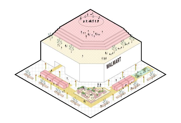

Shopping Mall


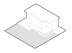
Public toilets are easy to form the transmission chain of trafficking crimes because of the lack of parental supervision.
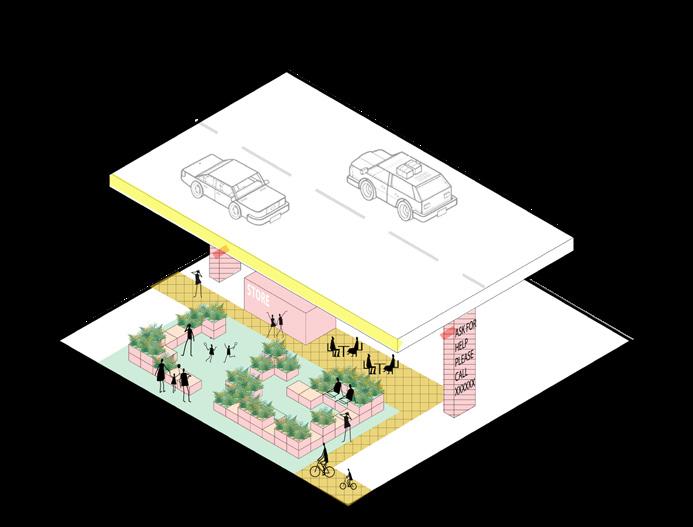
Space under Overpass
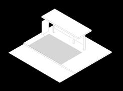
Spaces under overpasses are classic zones as gathering points where crimes take place.
Transport Station
Transport stations are important transit hubs for child trafficking.
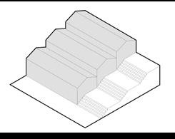
A wet market with a cluttered environment and high traffic is a high-risk area for children to lose.
Community Alley
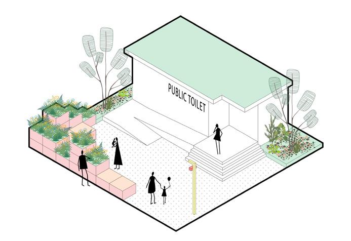
Narrow and dark alleys create high insecurity.
Riverside Park
Overgrown riverside parks are high crime areas.
Empty and high-traffic exteriors of commercial buildings can easily lead to children's loss.

Tourist Attraction
Tourist attractions with rich terrain form multiple dead corners, which are easy to breed crimes.


Plaza
Traffic chaos in squares causes a high risk of children's loss.
7
natrual surveillance lightening lightening environmental attraction
Public Toilet
natrual surveillance building facade transparency business activities live concert live concert open air stage open air stage ecological development sky corridor for access control sky corridor for access control roof garden open air cafeteria kids's playground roof garden identify space vertical natural surveillance open air exhibition open air exhibition environmental attraction business activities emergency number emergency number security bag bike route natrual surveillance vertical natural surveillance vertical natural surveillance vertical vegetable garden [INDIVIDUAL] {
THE CUBE SYSTEM IN THE CITY }
Parents
Rooftop Farm

Natural cognition
Vegetable cultivation
Fruit market
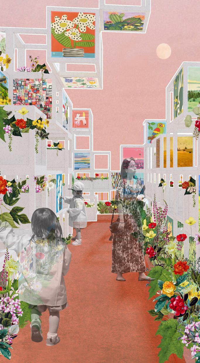
Children's Painting Exhibition
Children's art exhibition
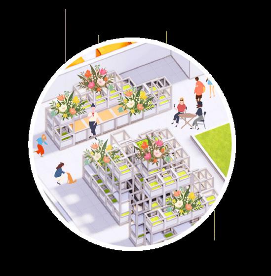
Flower border display
Serpentine Gallery
PROSPEROUS COMMUNITY FOR SAFE CHILDHOOD [INDIVIDUAL]
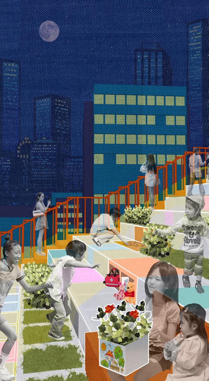
Proposed View of Child-Trafficking Prevention Cubes in Baixiang Community

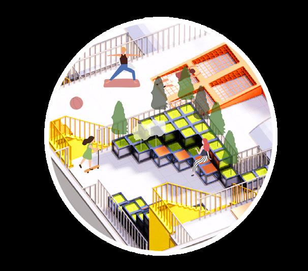


Through a whole year, passive spaces are clearly defined and designed purposely, and become activity supportive now. Crimes are replaced by energetic activities, such as family farms, art exhibitions, playgrounds, etc. Originally scattered flows of people also converge as a result of activities, thus serving to control the population movements. More community residents are mobilized to participate in planting, and the sense of social responsibility will be improved. Moreover, excellent drawings on Eden cubes are collected and exhibited in the children's painting exhibition, attracting visitors and art buyers , which will be the biggest stimulus for developing community commerce and economy.
Botanical Garden
Horticultural activity
Communication
Pet game
Crime Prevention
Vibrant Community
Safe Childhood
Community Infrastructure
Terrace Playground
Plant cultivation
Health care
Communication
8
previous view of the flowing line of children ideal view of the flowing line of children
BLANK NEWLIFE EDEN SAFETY
CUBE SYSTEM
GARDEN OF EDEN IN NEW GENERATION
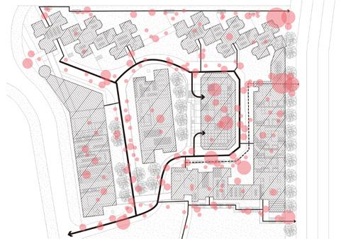
Birdview of Baixiang Community after Design


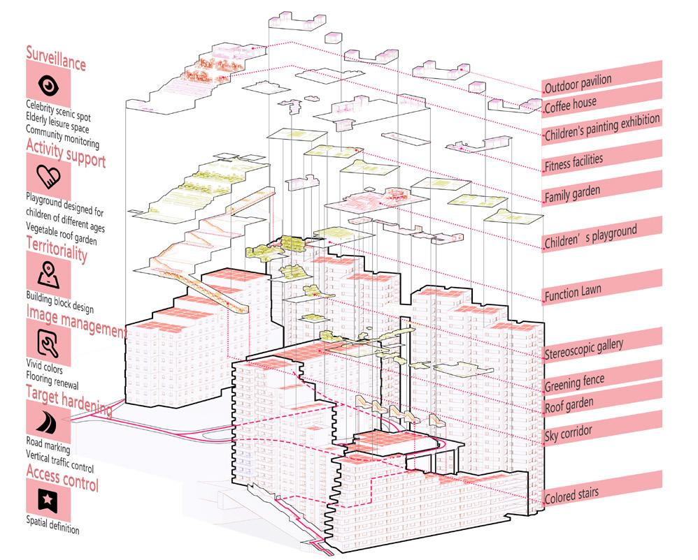
The old and dangerous Baixiang Community has been reorganized by the Cube System . Through the control of intervention degrees and the combination of multi-functional modules, I created a variety of activity spaces that meet needs of residents. At the same time, a childcare system is formed, turning the community into not only a crime-free zone but also a paradise for children ’ s playing.
AXONOMETRIC EXPLOSIVE VIEW
[INDIVIDUAL] [INDIVIDUAL]
5m 10m 15m N
MASTER PLAN [INDIVIDUAL]
Children's Painting Exhibition Terrace Playground

Rooftop Farm Outdoor Theater
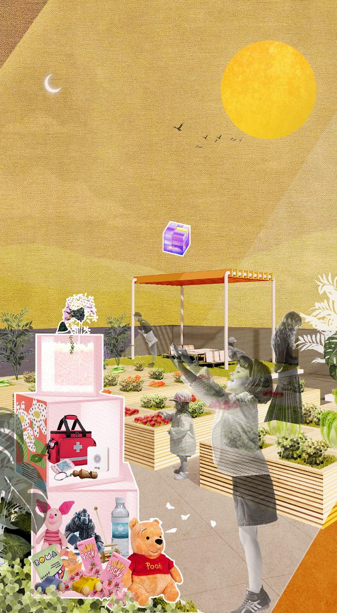
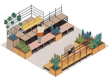
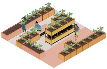

COMMUNITY ACTIVITIES FROM DAY TO NIGHT [INDIVIDUAL]


Baixiang Community provides a template for high-rise building areas with complex terrain, and the design takes full advantage of the terrain to construct an iconic child-safe community. The "Cube System" has built a community surveillance system , which has become a prominent symbol of "anti-trafficking". The "Cube System" aims to provide free public spaces so that more children from low-income families can enjoy playing fairly . By participating in community supervision and building, people will turn their attention to "Cubes" around them. As a result, more and more citizens will become aware of the safety of children , and reduce the occurrence of child abduction.
10
The rooftop farm is so convenient that can learn something about nature with my kids. Let me check if my kid is safe... love those toys in cubes! Hey! Guess what 've found! The cube is our treasure. A variety of cubes has become a landmark here, and a lot of people come for interest. They are so cute! These are flora cubes! Look! It's my drawing! should buy one. Kids' drawings are so adorable. Honey, you should know how to protect yourself by these tools. Let's start drawing! Let me draw something on the lovely cube...
Chapter 1 - THE MOMENT
RESONANCE
Experimental Memorial Landscape
11 / 2022 - 12 / 2022
Underserved Life Focused
History / Emotion / Geology
Acoustics Resonance implement
Based on basic physical pinciples of wind instrument
Intangible Emotions Expression / Disappearing Inscriptions / Memory Evocation
02 RESONANCE
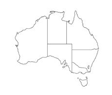
Ancient Aboriginal Monumental Landscape Based on Resonating Acoustics
[LOCATION] Shark Bay, Western Australia [DURATION] Nov. 2022-Dec. 2022
[INDIVIDUAL WORK]
Underserved Ancient Lives
Stromatolites

Indigenous Australians
History
Emotional Connections
Identification Acoustic Principles Disappearing Inscriptions
Application of Landscape
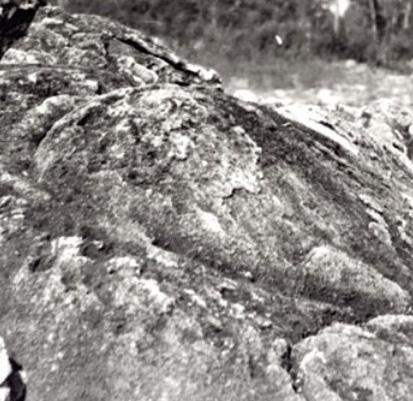
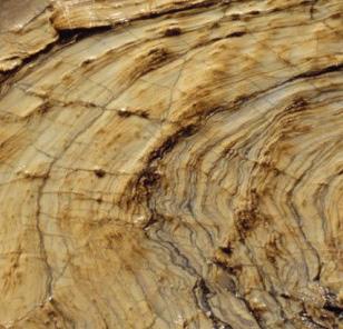
The stromatolites - rocks that record the oldest life - have themselves undergone this process: from the infinite expansion of life at its origin, to the crisis that now exists only on coasts of western Australia. On the other hand, Australia also has a painful history - countless indigenous Australians were killed during the colonization period.
With the similarity of those ancient lives - both flourished and declined due to the greed of humans - I made a comparison between stromatolites and indigenous Australians and tried to connect their emotions.
I explored the possibility of translating the imperceptible emotion to the perceptible one. Then, I discovered that the sea wind was strong enough to make people feel. Therefore, Shark Bay, located in western Australia, is an ideal site. And by transforming the structure of the stromatolites into space, I maximized the influence of sea wind. The landscape would produce a wide range of tones through different air flows created by various scales of space. As a result, the monumental landscape would translate the sounds of those ancient beings into perceptible forms.
Through the memorial landscape, lives that have been forgotten will be re-remembered and resonate with the modern age, ultimately creating a new emotional connection.
12
"Every stain, every dent, every mark of the knife and axe is the echo of a ancient life crying out to the world."
WHERE LIFE CAME FROM?
"Stromatolites are organogenic, laminated, calcareous rock structures, the origin of which is clearly related to microscopic life, which in itself must not be fossilized." stated Krumbein. It has become clear that prokaryotes, both photosynthetic and nonphotosynthetic, are the dominant mat-forming organisms that contribute to stromatolite accretion.


TRACES OF LIFE IN STROMATOLITES
grey and black shale
micritic allochemical
crystalline solostone
sparry slostone
crystalline solostone
interbedded siltstone and sandstone
amygdaloidal basalt

interbedded haematite siltstone and sandstone
sparry slostone
interbedded haematite siltstone and sandstone
sparry slostone
interbedded haematite siltstone and sandstone
domed biostromes
stratiform stromatolite
interbedded haematite siltstone and sandstone

dissolution, collapse breccia
hat-shaped stromatolites spheroidal stromatolite microdigitate stromatolites
stromatolite column
laterally extensive biostromes hemispherical stromatolites

microspherical stromatolite
STROMATOLITES - THE EARTH'S OLDEST LIVING LIFEFORMS
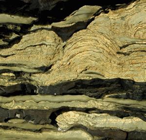
micritic, crystalline and stromatolitic magnesite
dissolution, collapse breccia
sparry slostone
dissolution, collapse breccia
micritic, crystalline and stromatolitic magnesite
herringbone cross-stratified sandstone and siltstone
sparry slostone sparry slostone
crystalline solostone
micritic allochemical dolostone
crystalline solostone
micritic allochemical dolostone
crystalline solostone
micritic allochemical dolostone
dissolution, collapse breccia
crystalline solostone
cross-stratified quartz sandstone
micritic, crystalline and stromatolitic magnesite
interbedded siltstone and sandstone
crystalline solostone
micritic allochemical dolostone
dissolution, collapse breccia
sparry slostone
crystalline solostone
micritic allochemical dolostone
sparry slostone
micritic allochemical dolostone
sparry slostone
micritic allochemical dolostone
cross-stratified quartz sandstone
sparry slostone
crystalline solostone
dissolution, collapse breccia

micritic, crystalline and stromatolitic magnesite
crystalline solostone
Biochemical fingerprints stored in the ancient rock record indicate the presence of traces of life back to some of the oldest sedimentary rocks on the planet. The Earth has thus harbored life throughout most of its geologic history, and biological processes have contributed significantly to shaping the environmental conditions on the surface of the planet.
Sources from Traces of Life written by Aivo Lepland

13
0m 40m 80m 120m 160m 200m 240m 280m 320m 360m 400m 440m 480m 520m 560m 600m 640m 680m 720m
"When we ask where life came from and what it looks like, we are asking which qualities define the contours of life pattern or structure, simplicity or complexity, form or information, metabolism or reproduction."
Sources from Traces of Life written by Aivo Lepland
CONTOURS OF THE PROTO-LIFE PATTERN
Research and summarize stromatolites for a deeper understanding of original life.
BASIC FORMS OF STROMATOLITES FORMATION OF STROMATOLITES
A new layer of sediment was trapped, and the process repeated to develop a laminated structure over time.
Micro-organisms required light and respond by growing upwards.
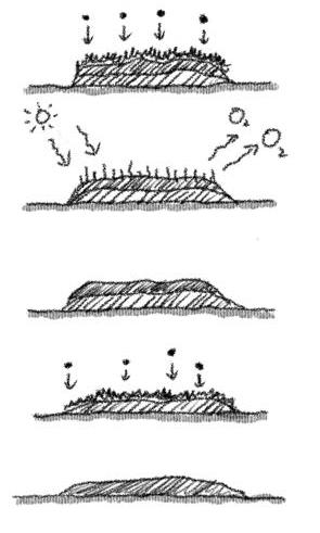
Microbially mediated precipitation of calcium carbonate.
Sediment particles accumulated on top and were bound into a layer by micro-organisms.
A thin mat of microbes was on sediment surface.
Stromatolites are stony structures built by colonies of microscopic photosynthesizing organisms called cyanobacteria. As sediment layered in shallow water, bacteria grew over it, binding the sedimentary particles and building layer upon millimeter layer until the layers became mounds.
RELATIONSHIPS BETWEEN DEPOSITIONAL FACIES AND STROMATOLITES SHAPES

According to their macroscopic morphology, stromatolites can be divided into four basic forms: stratiform, columnar, conical, and domal (spherical or hemispherical).
Flat-layered "linear" Domical "circular"


The most common type of stromatolites.
Most of the basic layers are domal, strong domal, and gentle domal, wavy.
Columnar "circular" Conical "triangular"
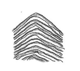

The most widely developed type. They are micro-domed, strongly domed, and cone-shaped.

14
Grain Shoal Oncolites Sea Level Columnar Micro Columnar Stratiform Columnar Stratiform Supratidal Intertidal Subtidal
Carbonate Ramp
Biostrome Shoal
Lagoon behind Shoal
RESONANCE OF ANCIENT LIVES
With the similarity of those ancient lives - both flourished and declined due to the greed of humans - I made a comparison between stromatolites and indigenous Australians and tried to connect their emotions.
1789
In April 1789, a major outbreak of smallpox killed large numbers of Indigenous Australians.
1788
65,000 yrs ago
1790
On the mainland, prolonged conflict followed the frontier of European settlement. An estimated minimum of 40,000 Indigenous Australians and between 2,000 and 2,500 settlers died in the wars.

1880
Indigenous workers in the north were allowed to find jobs, though they were not paid in wages and were abused.
The children of Australian Aboriginal and torres strait islander descent were removed from their families during the Stolen Generation.
Women's groups became advocates for indigenous issues in the 1920s.

The aboriginal and torres strait islander counted in the Australian Census for the first time.
1971 1972 1976
The Aboriginal Land Rights Act established the basis upon which aboriginal people in the northern territory could claim rights to land based on traditional occupation.
3.5 billion yrs ago
3.5 billion years ago
stromatolites dominated shores around the world and reigned as the Earth’s first visible-to-thenaked-eye life form.
Rising sea levels could threaten the future survival of stromatolites.
HISTORY OF INDIGENOUS AUSTRALIANS
RESONANCE
All Indigenous Australians were given the right to vote.
EMOTIONAL CONNECTION WITH ANCIENT LIVES
HISTORY OF STROMATOLITES IN AUSTRALIA
Human activities, such as trampling, have caused direct damages to stromatolites.
Increases in human population density, and extensive application of superphosphate to agricultural areas over the last few decades, have affected stromatolite growth adversely.
The Aboriginal Tent Embassy was established on the steps of Old Parliament House in Canberra, the Australian capital.
15
Human
Devastation
Invasion
Conservation
Stromatolites are currently under assessment for listing as an endangered ecological community under the Australian Environment Protection and Biodiversity Conservation Act. ? ?
1910 1920 1962
1998 British colonization of Australia began at Port Jackson in 1788 with the arrival of Governor Arthur Phillip and the First Fleet.
As a result of the Bringing Them Home report on the forced removal of Indigenous children, a National Sorry Day was instituted.
EXPERIMENTS OF EMOTIONAL RESONANCE




Experiment with different forms and structures for emotional expression. I tried to keep it as brief as possible.

LAMELLAR STRUCTURE


Advantage: Apply and amplify the characteristics of the coastline

Disadvantage: The level of simplicity can be improved
DYNAMIC LINEAR SPACE
Advantage: Narrative linear space
Disadvantage: Lack of integration with the surrounding environment
TERRESTRIAL LANDSCAPE
Advantage: Simplicity
Disadvantage: Large amount of work and possible ecological damage
BIOTIC IMITATION
Advantage: Imitation of a stromatolite mechanism

Disadvantage: Over-complication and artistry

16
[ picked ] [ tested ] [ tested ] [ tested ]
section section section elevation elevation elevation section elevation
VISIBLE AND INVISIBLE


Over time, inscriptions on the monument , recording the history of injustice , will be gradually buried by the sand blown by the sea breeze , going from a visible state to an invisible one. This also symbolizes that the painful history and the injustice done to these ancient lives have been forgotten.


17
N 2m 4m 6m 10m Stromatolites Stromatolites Stromatolites Sea Wind Sea Wind Sea Wind Monument Disappearing Inscriptions Time and Sand [ 2025 ] [ 2035 ] [ 2055 ] [ 2095 ]
Shark Bay, Western Australia
ACOUSTICAL RESONANCE





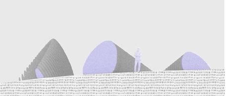





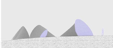
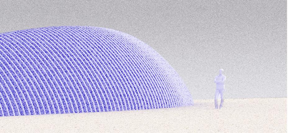
The structure translates the ancient cries into perceptible sounds , thus resonating emotionally with those passing by. The sea breeze passing through the stromatolites creates different air currents that collide with the landscape monument. Due to different sizes of the lamellar structure , the length of each airflow path is not uniform. Therefore, one will hear different soundscapes when walk through this structure. Through the memorial landscape, lives that have been forgotten will be re-remembered again, and resonate with the modern age, ultimately creating a new emotional connection.

18
[ 1500Hz / 1296mel ]
[ 1750Hz / 1428mel ]
[ 1250Hz / 1154mel ]
[ 900Hz 929mel ]
[ 800Hz 854mel ]
[ 1000Hz / 1000mel ]
Chapter 1 - THE MOMENT
SUPERCHARGED FARMLAND
Country Park Design
12 / 2020 - 6 2021
Food Security Focused
Climate Change / Agriculture / Education
Supercharged Crops implement
Based on engineering plants discovered by plant biologist
Joanne Chory
Carbon Fixation / Greenhouse Effect Alleviation / Food Security / Economic Growth
03 SUPERCHARGED FARMLAND Country Park Design Based on Low Carbon Farmland

[LOCATION] Rizhao City, Shandong Province, China

[DURATION] Dec. 2020 - Jane 2021
[ACADEMIC YEAR] Year 4, Semester 2
[TUTOR] Jianning Zhu
[INDIVIDUAL WORK]
[AREA] 25 Hectares
[SUBMISSION] Graduation Design
Rizhao is an important city for the surroundings' food supply. However, It has been severely affected by global climate change in the last 30 years. Global warming, rising sea levels, and increased rainfall have led to shorter food-growing cycles, resulting in a year-by-year decline in food production and quality.
A site that is going to be a country park has features of farmland. It is a good opportunity to turn it into an experimental field with a new type of crop - the Supercharged Crop. These genetically modified crops have deeper root systems that fix atmospheric CO2 into the soil. As the soil becomes fertile, the carbon dioxide content of the atmosphere will be reduced and the greenhouse effect will be alleviated. Eventually the growth cycle of crops will return to normal and food security will be ensured.
The country park will attract various visitors, allowing the new crops more accessible to everyone. In order to give the public a better understanding, a scientific trail is formed. As a consequence, more people will get involved in addressing climate issues. Moreover, more farmers who are struggling with crop yield will get to know new ways of growing food, which can save them from the economic crisis.
20
MAPPING OF FOOD SUPPLY

Rizhao City has a number of farmlands where cash crops and cereal crops are grown to provide food support for the surrounding areas.
Extreme Climate is Threatening Crop Production
Fertilizer
Agricultural plastic film
Agricultural machine
Gasoline burning

Pesticide
Climate change
Global warming Shortened crop fertility period Quality decline Yield decline Floods and droughts
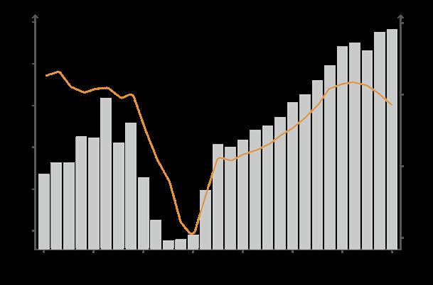
Trend of temperature and rainfall in Rizhao of Shandong Province in China
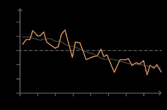


Trend of crop production in Rizhao of Shandong Province in China
Shorter Crop-Growing Duration Leads to Food Decline
Rising temperatures shorten the time taken for crops to reach maturity (ie, reduced crop growth duration), thereby leading to reduced seed yield potential Crop yield potential continues to follow a consistent downward trend , adding additional pressure to already strained food systems around the world.
Annual global area-weighted change in growth duration
The running mean over 11 years (5 years forward and 5 years backward) in growth duration
12km 24km 36km 48km 60km 60km 72km 84km 96km 108km 0km 22km 44km 66km 88km 110km 132km 154km 176km 198km 220km
Wheat yield (10,000 tons) Rainfall (mm) Area under wheat (1000 hectars) Temperature (Celsius degree)
Change in growth duration (days) Maize Rice Wheat Soybean Change in growth duration (days) Change in growth duration (days) Change in growth duration (days)
21
Farmland-Featured Country Park
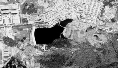
In order to better study the agricultural structure of Rizhao, I chose the most typical site for investigation. According to the on-site research and survey, the structure of the production value lacked rationality. Meanwhile, the planting patches were fragmented and lacked linkage among them. Moreover, the types of crops planted were unreasonable and could not maximize the production value.


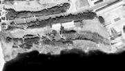
TYPE 1 - CONSERVATION



These places are expected to be preserved or upgraded, mainly for farmlands and economic woodlands.


wheat, Chinese herbs
TYPE 2 - INTERVENTION


Tobacco


Minor interventions and modifications to these places.

Ponds are prone to water shortage and are monofunctional Forest-species diversity is low and species are mainly black pine Natural

forest Irrigation and aquaculture
The village has a single economic source, mostly low-income families
High-income farming professionals
These places are insufficient in ecological value and not used for a long time.
streams and rivers covered by jungle


22 Toxic Circulation from Food to Health AVALIABILITY yielddecline intense labor quantity fewer energy expanding arable land deforest fireforest carbon emission healthcare mental health famine low income growthfailure food delivery risingprices food purchases grabbing goods pssts FOOD INSECURITY
CATASTROPHE BIRTH RATE DECLINE ACCESS FAMINE IN LOWINCOMING FAMILIES STABILITY ECOLOGIAL DETERIORATION UTILIZATION MENTAL AND PHYSICAL DISEASES
SERIOUS HEALTH ISSUES
Waterfront Platform Abandoned Buildings Reservoir Bank The view of reservoir is blocked by some
trees. The bare ground is open and not
The biggest waterfront platform Buildings are not used for a long time and their styles do not fix in the site Local administration Parking lot Not clear Activity center Activity center Waterfront activities Waterfront activities Not clear Bare Ground TYPE 3 - CONSTRUCTION
Pattern Slope Farmland Regular Farmland Economic Woodland Black pine, poplar, chestnut Blueberries, cherries, apples, peaches, pears Tea Tree,
Near
Family
Part commercial Family sustenance Part commercial Family sustenance Part commercial Family sustenance Part commercial Family
Part commercial Commercial Commercial Orchard Plantation Original Orientation Expected Orientation
dispensable
fountional.
Peanuts,
Family sustenance
subsistence
sustenance
sustenance
Expected Orientation Expected Orientation Pattern Pattern Pond
Village
Woodland
Mountain
Landscape
Crop irrigation Crop Irrigation Villages
living on farming economy
Water activities Stream Characteristics Characteristics Original Orientation Original Orientation
NORMAL CROPS SUPERCHARGED CROPS
37 gigatons of carbon dioxide is released by humans every year. Plus 727 gigatons that are naturally released. The Earth currently produces 18 more gigatons of carbon dioxide than it can reabsorb.
More suberin captures carbon dioxide More roots produce suberin Deeper Roots store carbon in deep soil
Carbon Dioxide Emission
It estimates that a plantbased approach has the potential to achieve a 20 to 46 percent reduction in excess carbon dioxide emissions produced each year by human activity.
MORE SUBERIN = LESS CO2
Suberin is higher plant epidermis and periderm cell-wall macromolecule, forming a protective barrier. All of these molecules are characterized by this middle portion, which is carbon after carbon after carbon. That's the part that doesn't break down. It's called refractory or recalcitrant. So that carbon will stay in the soil.

Normal root systems decompose, releasing carbon dioxide back into the atmosphere.
The plants make soil more productive by restoring lost carbon.
An enlarged system of suberin-rich roots stores carbon deep in the soil and resists decomposition to release significantly less carbon dioxide.
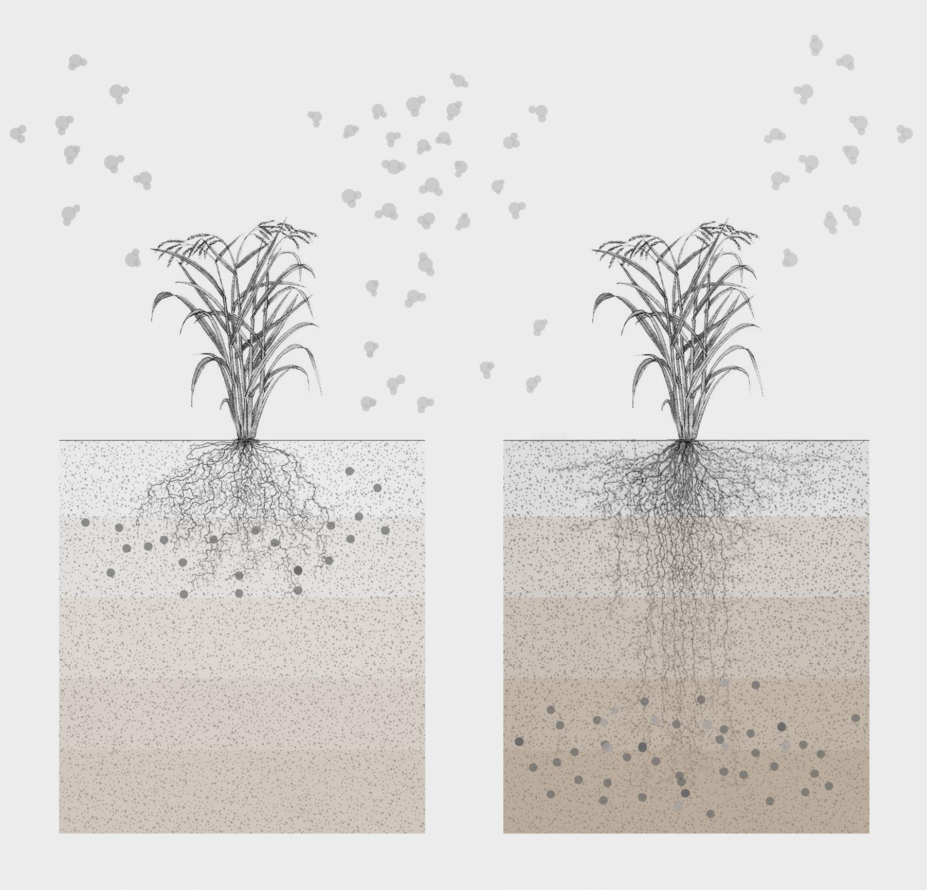
CARBON-RICH SOIL
Carbon-rich soil is full of molecules that are looked like suberin. If people put carbon back into soils, that would be a co-benefit of the sequestration process that we're expanding. In addition, the suberin will break up into little particles and give the whole soil a new texture. Therefore people can get more carbon in the soil which will get darker.

23
Small amount of carbon Medium amount of carbon Large amount of carbon
CURRENT FUTURE
General agricultural cultivation
Greenhouse effects
Carbon dioxide absorption
Low-carbon farming using supercharged crops
Alleviation of greenhouse effects
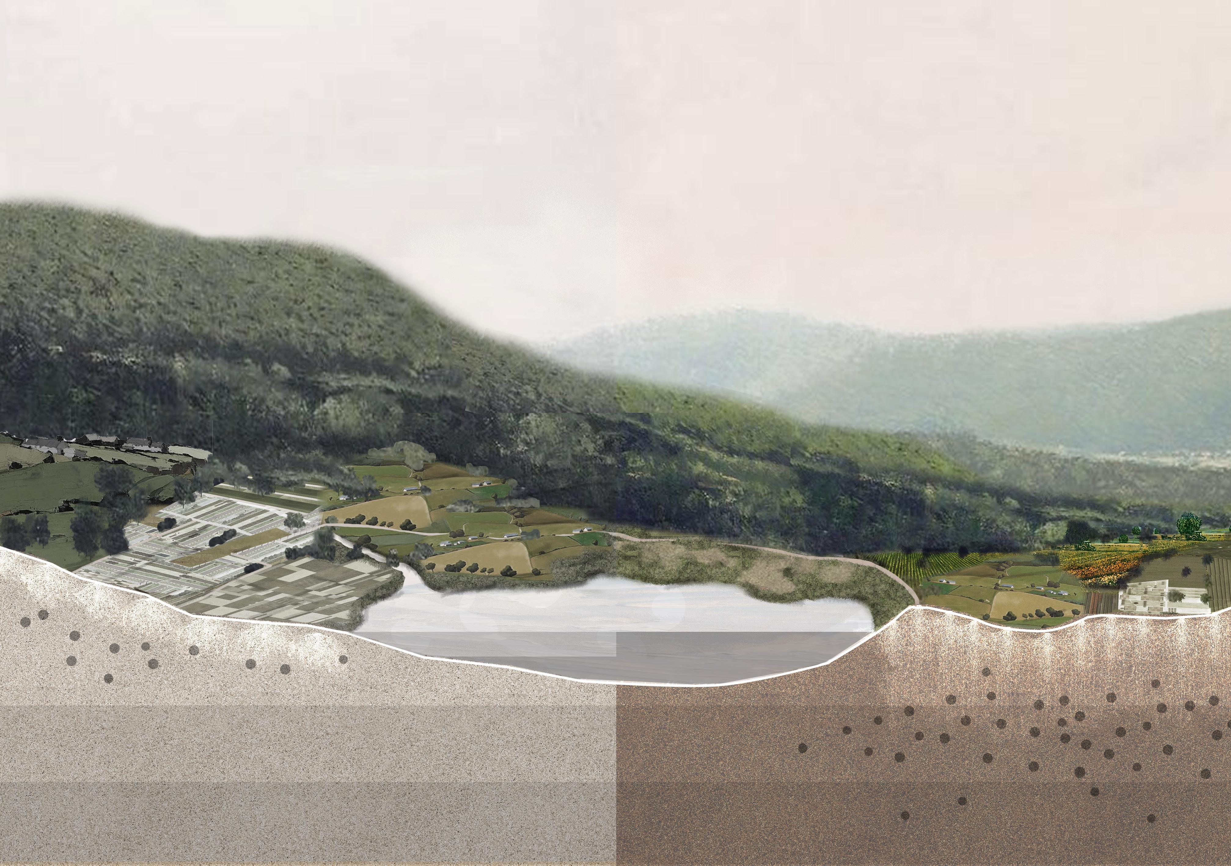
Carbon dioxide absorption
Carbon Emission
Global Warming
Extreme Temperatures
Food Shortage
Economic Downturn ...
Carbon Fixation
Greenhouse Gas Reduction
Drop in Temperatures
Increased Food Production
Economic Growth
...
Carbon dioxide emission
Carbon-rich soil
Barren soil
Fewer carbon dioxide emission
Water evaporation
Reservoir level dropped Reservoir level maintained
Greenhouse gases accumulation
Fewer greenhouse gases
WETLAND LANDSCAPE RESERVOIR VIEW
The frequency of extreme weather will decrease and the water level of the reservoir will be secured due to the supercharged farmland. Combined with the surroundings, it will create a perennial reservoir landscape.


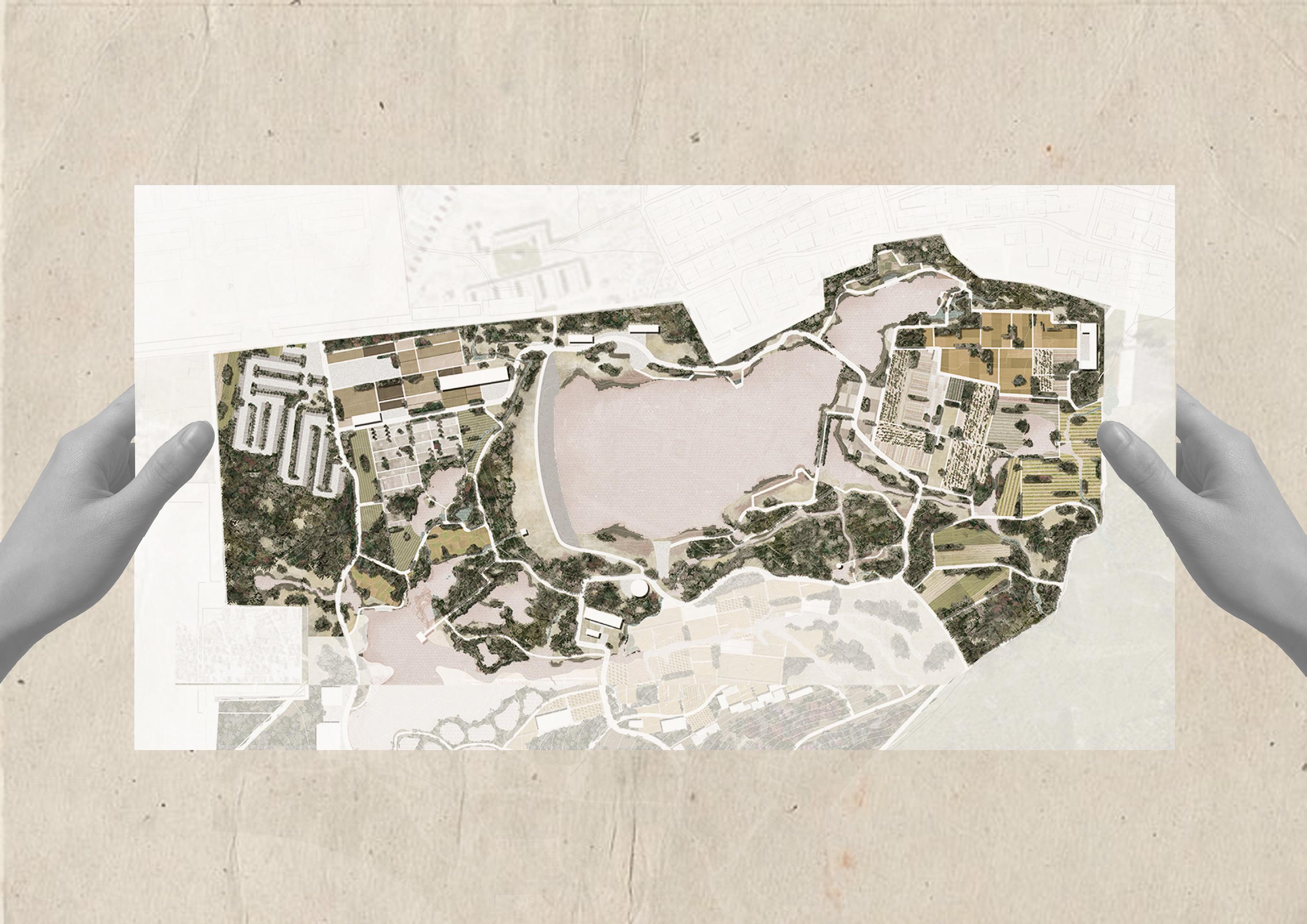
SUPERCHARGED CROP SCIENCE TRAIL
SUPERCHARGED FARMLAND DISPLAY
The wetland of the site will gradually be restored as the global warming is mitigated. The recovered wetland landscape will further exist as a moderating influence on climate.
The science trail aims at getting more people involved in addressing climate issues. Moreover, farmers struggling for crop yield will get to know new ways of growing food, which will save them from the economic crisis.
ORCHARD
 This area is used for the display of new farmland and also serves as a beautiful landscape.
Visitors can pick fruits in the orchard and try them at the farming station.
Supercharged Plants Research Center
Supercharged Crops Display
Meteorological Station
Visitor Scientific Education Center
Carbon Emission Checkpoint
Farming Participation Area
Experimental Farming Station
Museum of Agriculture and Climate Change
Public Main Entrance
25
Chapter 2 - REMINISCENCE
TRASH TO TREASURE
Urban Design
11 / 2020 - 12 / 2020
Public Health Focused
Health Infrastructure / Material
Trash to Treasure implement
Based on the theory of Urban Metabolism
Mature Waste-Recycled System / Clean Environment / Environmental Justice / Economic Growth
04 TRASH TO TREASURE
Establishing Public Space System in Dharavi Slum through Waste Recycling

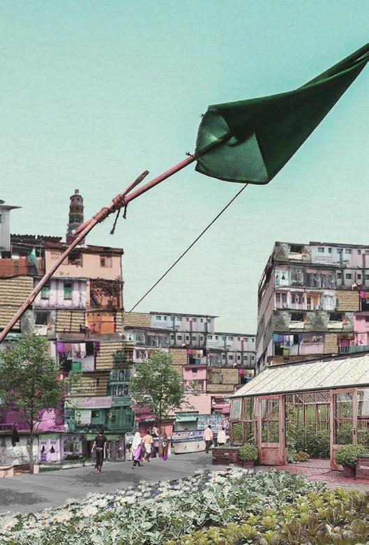
[LOCATION] Dharavi, Mumbai, India
[DURATION] Nov. 2020 - Dec. 2020
[ACADEMY] Year 4, Semester 1
[TUTOR] Wei Guo, Xiyue Wang
[GROUP & INDIVIDUAL WORK]
[COLLABORATOR] Yutong Ji
[ROLE] Group Field Research, 100% Conceptual Design, 90% Detail Design [SUBMISSION] Cities for All
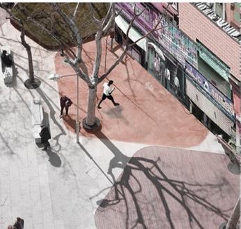
In the context of climate change and the global pandemic , Dharavi, the largest slum in Mumbai, India, has unprecedented challenges. People living here are suffering from a variety of unfair treatments and threats, such as frequent pandemics and infectious diseases, fewer employment opportunities, low incomes, illegal residences, and poor living conditions.
Through a comprehensive analysis and evaluation of Dharavi, we concluded that waste, as a key element of various problems, had a lot of unexplored value This design put public health first in the collective imagination and activates the potential value of Dharavi through the effective use of waste. There are three stages of evolution, from waste treatment, infrastructure construction, to health guarantee.
Waste can be recycled under specific conditions in Dharavi. Through rationally resetting and redesigning resources, we will realize a reasonable transformation from garbage to public wealth. As a result, everyone living in Dharavi will have access to public spaces, forming a general health system.
CYBERDHARAVI 2035 [INDIVIDUAL]
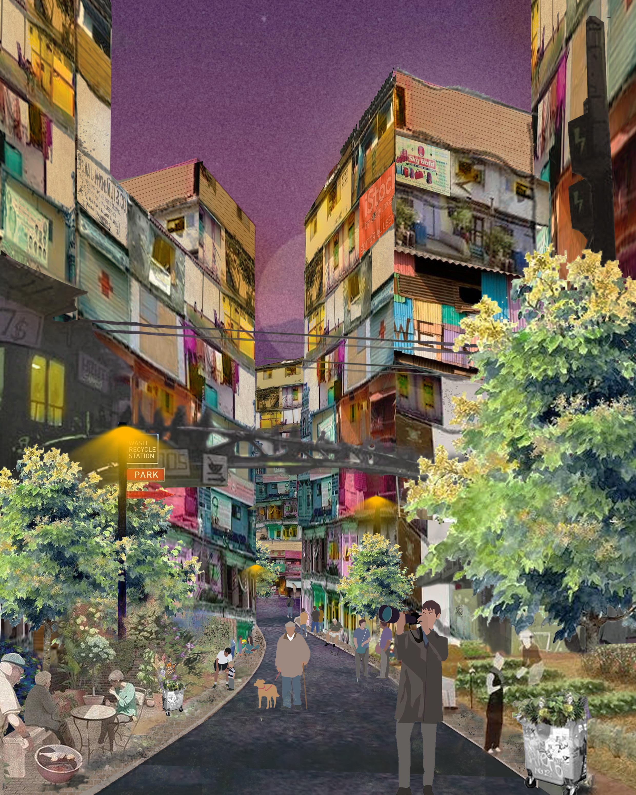 Real photos repainted Inspired by Contested Urbanism in Dharavi The Bartlett | Development Planning Unit
[INDIVIDUAL]
Slums are More Vulnerable to Pandemic Waste is the Distinctive Culture of Dharavi
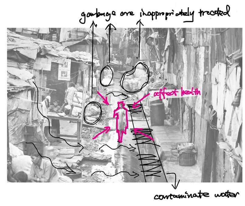


The WHO confirmed the pandemic outbreak of COVID-19 on March 11, 2020, and announced the guidelines to limit the transmission of the virus which focused on lockdown, social distancing, and the use of facial masks for the general public. As COVID-19 infection was highly susceptible to densely populated areas such as slums and informal settlements in cities, the situation became worst when these slums emerged as hotspots of COVID-19 virus.
Dharavi is known for its recycling. The estimate is that it recycles about 80% of Mumbai’ s dry waste (Mumbai has a population of 19 million
22%
7%
19%
11%
28%

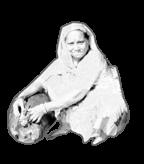
Glass in Dharavi is collected from various parts of Mumbai by ragpickers and consists of liquor bottles, surgical vials, ketchup and sauce bottles, jam bottles, and small medicinal bottles. If
Drink cans are good sources of aluminum. The items are broken down into shards and smelted into ingots to be sold into bigger aluminum companies that deal with products made from metal.


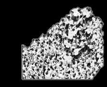


Compared to the amount of plastic recycled in Dharavi, the amount of Tetra Pak that comes into Dharavi is much less as recycling options are limited in the case of this material and thus recyclers would not get much price reselling it.

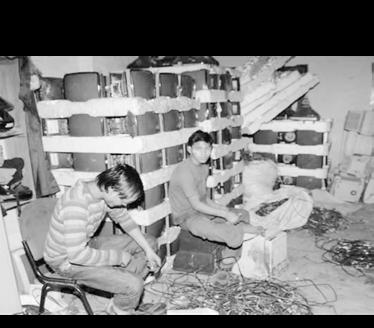
Mumbai is the largest e-waste generating city in India followed by Bangalore, Chennai, and Calcutta. 70% of electronic waste comes from the government, public, and industrial sectors, while the rest are being contributed by the manufacturers.
They are sold to stationery and packing companies, while some are usually sent to various paper recycling industries where they are turned into pulp to make folders and furniture.

The plastic recycling industry is a major recycling industry in Dharavi. Piles of waist height plastic are being sorted by people in tiny warehouses according to color, density, and grade.

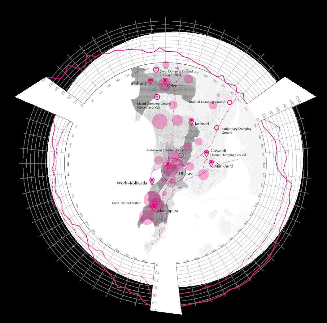
28 1.5m Dharavi Challenges to Public Health
DENSE POPULATION IMPROPER WASTE MANAGEMENT ILLITERACY INADEQUATE WATER SUPPLY MINIATUR HOUSES A LARGE NUMBER OF INDUSTRIAL UNITS COMMUNITY TOILETS PAUCITY OF HEALTH CARE SERVICES 01 03 04 05 06 07 08 02
less than 15 15-25 35-45 25-35 more than 45 population density (in thousand people/sq km) slum location dumping ground transfer station dumping ground (closed) CFR/CRR of Mumbai CFR/CRR of Dharavi number of positive Covid-19 cases 491 cases 18 days doubling rate APRIL 1771 cases 43 days doubling rate MAY 2304 cases 78 days doubling rate JUNE 2556 cases 430 days doubling rate JULY
Metal
citizens).
13%
Tetra pack
E-waste
Cardboard
Plastic
Glass
people treat them appropriately?
(future)
(current) Serious health problems
and Equality
Poor structural quality of housing
Inadequate access to sanitation and other infrastructure
Inadequate access to safe water + Overcrowding
Insecure residential status
[INDIVIDUAL]
Yes
No
Health
+
+
+
+
[INDIVIDUAL]
[INDIVIDUAL]
STRATEGY OF 'TRASH TO TREASURE'
STEP 1: WASTE TREATMENT
Analyze types of garbage and industrial distribution from inside and outside Dharavi. Then, clarify the garbage classification standard and recycling requirements in Dharavi. Next, establish two scales of waste treatment stations and form an informal waste management framework.

STEP 2: INFRASTRUCTURE CONSTRUCTION STEP 3: HEALTH GUARANTEE
Based on the needs of residents in Dharavi, the recycled waste will be used to create a sound system of public space , including different types of spaces at different scales.
A well-developed infrastructure system will enhance the quality of life and safeguard the physical and mental health of residents.
WASTE FLOW IN DHARAVI TRANSPORTATION PRODUCTS UTILITY
waste from Dharavi waste from Mumbai
PUBLIC SPACE CONSTRUCTION HEALTH IMPROVEMENT
Products made from waste will be main factors to help develop the whole slum. under-ground transportation
up-ground transportation Recyclable waste will be processed into certain types of products.
Public spaces are classified into three scales to form a health system in Dharavi.
This process is aimed at sloving local health problems.
29
[INDIVIDUAL]
Potential Spaces for Public System Construction










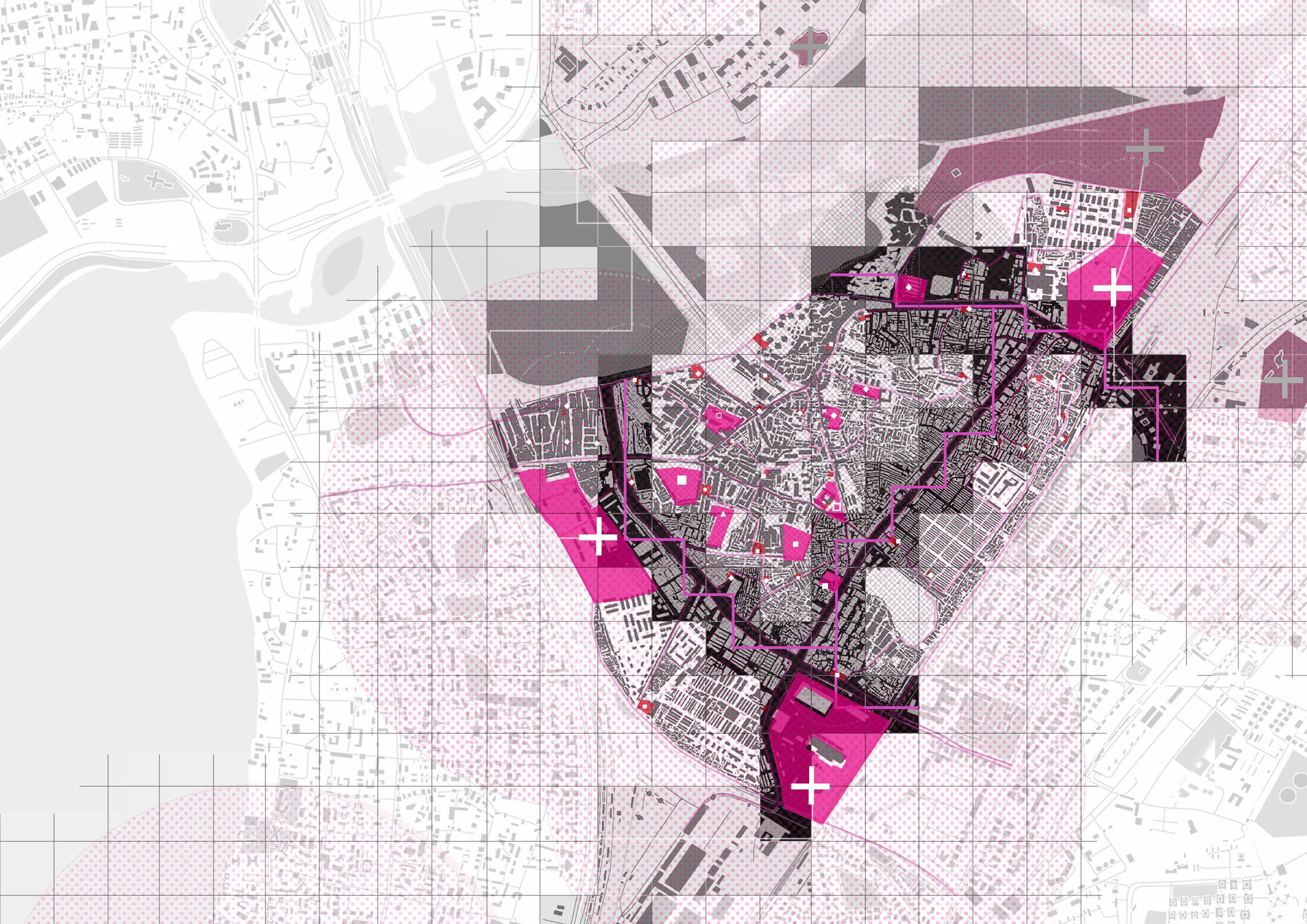
OVERVIEW OF PUBLIC-SPACE SYSTEM FOR ENVIRONMENTAL HEALTH [INDIVIDUAL]

Population density Activities Transportation Infrastructure Existing public space moving flow number of people flowrate of people industrial activities commercial activities forks of highway forks of main road forks of path basic infrastructure advanced infrastructure large-scale public space middle-scale public space small-scale public space density commercial activities industrial activities connection path railway main road waterway highway school hospital railway station toilet temple public space Tangible-scale public space Community-scale public space City-scale public space
[GROUP] 30
Recycled waste will be developed and transformed into construction materials such as bricks, beams, and pillars.

Streets will be broadened to hold more activities.
Advanced waste treatment
Primary waste treatment
Transportation
waste sorting
wet garbage
e-waste/metal
e-waste/metal
cardboard/glass/clothes
processing...
[ HOUSE CONSTRUCTION ] [ BUSINESS ] [ BRODEN STREET ] [ WASTE PROCESSING INDUSTRY ]
Glass textile is used as the decoration of facade.
Residents sell Artifacts made from waste.
The entrance of collecting waste helps prevent garbage from scatterring.
DRAWING BY MYSELF
05 TREE-RINGS CENTER
Beijing Forestry University (BJFU) Campus Landscape Renovation

Campus Culture Focused
Tree-Rings implement

based on the biological structure of trees
Honor of the Legacy / Integration of Intent / New Foundation
[LOCATION] Beijing, China [DURATION] Sept. 2019-Dec. 2019 [ACADEMY] Year 3, Semester 1 [TUTOR] Fang Wei [INDIVIDUAL WORK]

Beijing Forestry University (BJFU) is based on biology and ecology, with forestry and landscape architecture as its specialties. Therefore, the campus offers a wide range of biological species and specimens for teaching purposes. Among them, the school is famous for its diverse tree species and the fossilized trees that can be found everywhere on campus. This is a memory for every generation of students and faculties. The theme of 'trees' is therefore used to deepen the memory of the site and to transform the landscape, in relation to the spatial layout of the campus and the functional needs of students and faculties.
TIMELINE HISTORY OF BJFU
TREE IS THE FOUNDATION OF BJFU
The school's experimental woodland covers an area of 12,480 acres
Over 10,000 wood specimens
107 species of first-class protected plants
Nearly 200,000 plant specimens
" Know the mountains, know the water, know the trees, know the people."
Chapter 2 - REMINISCENCE 1952 Location: Shanxi Dajue Temple Plant: Amygdalus davidiana Jasminum nudiflorum 1954 Moved to current address in Beijing Building: Biological building Plant: Salix matsudana f.pendula Amygdalus triloba f.multiplex 1969-1979 Moved to Yunnan to reopen the school 1985 Changed its name to Beijing Forestry University officially. Building: The main building 2008 Became a pilot university for the National Advantageous Academic Innovation Platform Construction Project Plant: Acer truncatum Bunge Malus micromalus Building: Academic Research Building Plant: Styphnolobium japonicum (L.) Schott/ Ginkgo biloba L. Campsis radicans (L.) Seem. 2017 Selected as one of the top universities in the world Building: Eastern dinning hall Plant: Ginkgo biloba L./Hibiscus syriacus Linn. Hosta plantaginea Plant: Paeonia x suffruticosa Andr. Camellia japonica L. Plumeria rubra 'Acutifolia' 32
CONCEPT DEVELOPMENT
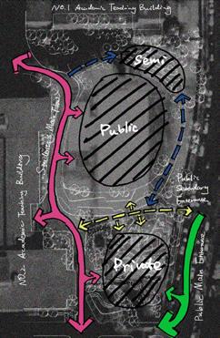
Trees are extracted as elements and trunks are sliced. Using the trunk structure as inspiration, it is divided into two main spaces: public space and semi-public space. Tree rings are also used as the design element throughout the site.



TREE
BIRDVIEW AND RENDERINGS
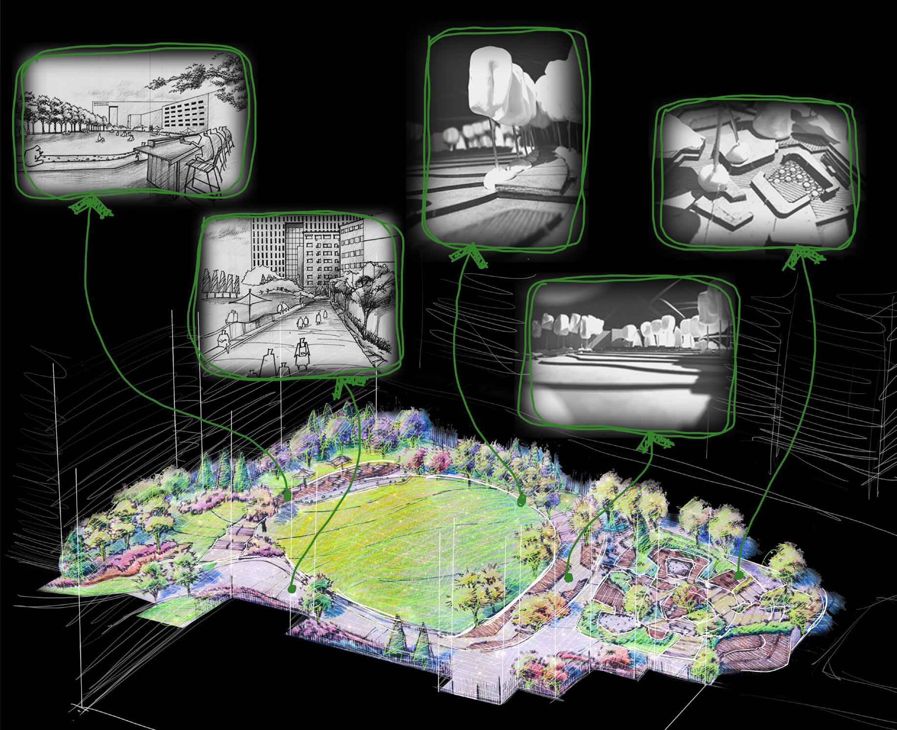
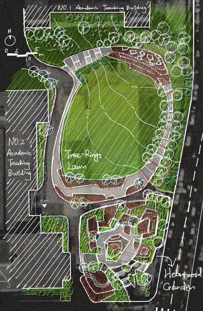
THE TRUNK STRUCTURE DESIGN EVLOVEMENT

MAIN WAY TO THE ACADEMIC BUILDING
VIEWING PLATFORM
The lawn has been specifically designed to create a range of functions, including information days and orientation events, concerts, moonlight cinema, garden parties, barbecues and other union events and programmed uses.
Raised turf platform that can be used for both special events and informal daily activities. The sculptural edges of the green are also informal seating areas.
The Avenue forms a deep space with tall ginkgo trees.
The changing scales of spaces create many opportunities for day and nighttime use, for individuals and groups, and for ceremonial and celebratory events.
Each space contains facilities ranging from tables, moveable chairs, power outlets for laptops and BBQ facilities.
TREE-RINGS LAWN
GINKGO AVANUE HEARTWOOD GARDEN
1 Tree-rings Lawn 2 Viewing Platform
2 1 4 3 plantation connection space height 33
3 GinKgo Avenue 4 Heartwood Garden
[GROUP]
"Flower Bay Dream" Guangzhou Garden Design Expo

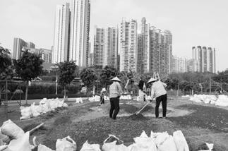


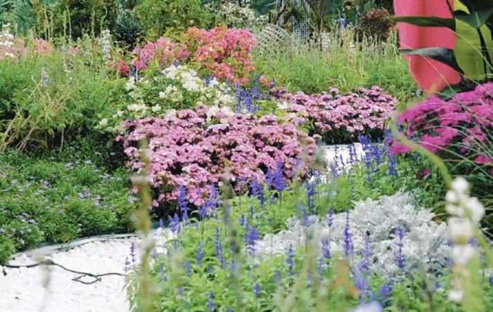


[LOCATION] Guangzhou, Guangdong Province, China
[DURATION] Oct. 2021 - Nov. 2021
[TUTOR] Cong Dong, Li Dong
[GROUP WORK]
[COLLABORATOR] Yun Hao, Jinjie Ren, Yiwei Hu, Junlun Pan


[ROAL] 100% Modeling, 80% Concept Design, 20% Construction

[AREA] 12M*9M


[HONOR] Bronze Award & Creativity Award
CONCEPT DEVELOPMENT
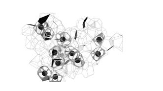
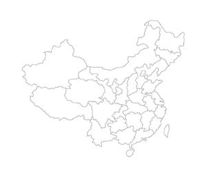
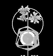
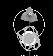
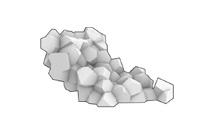
The concept of the design comes from the traditional cultural image of Guangdong - the dancing lion. It is not only a symbol of good fortune, but also a symbol of masculinity, courage and strength, expressing the confidence and pride of Chinese people. At the same time, 11 units containing seeds of 11 cities in the Great Bay Area are embedded in the structure to further strengthen the regional character.
DAY VIEW AFTER CONSTRUCTION
The dancing lion is Cantonese traditional image
MODELING PROCESS WITH GRASSHOPPER
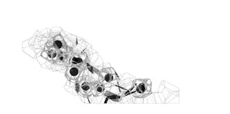


SEEDS IN UNITS REPRESENT LOCAL TRADITIONS


Chapter 2 - REMINISCENCE [INDIVIDUAL] [INDIVIDUAL] [INDIVIDUAL] [GROUP]


STRUCTURE SIZE


34
Ritual location
The abtract form of the dancing lion
Lion eyes Dancing style
Original body form of the structure Generation of Tyson polygons Selection of Tyson polygons Model refinement External environment and control of the size
CONSTRUCTION PHOTOS
Macao
Dongguan
Zhaoqing Guangzhou
Foshan Huizhou
Hongkong Jiangmen
Shenzhen Zhuhai 5m 4m
8m
06 DANCING LION
Digital Modeling Combined with Traditional Image
Qingdao Shilaoren Seaside Park Ecological Research & Habitat Creation
[COMPANY] Shenzhen Layout Planning & Design Consulting Co.
[COLLABORATOR] Greenfield Qingwei Beijing Ecological Technology Co., Mlaplus Studio, and Qingdao Tourism Planning and Architectural Design Research Institute Co.

[LOCATION] Qingdao, Shandong Province, China
[DURATION] Dec. 2021 - Apr. 2022
[AWARD] Second Place in the Final Bid
[ROAL] 100% Ecological Diagram Drawing, 80% Ecological Research
[PROJECT DESCRIPTION]
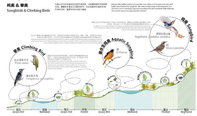
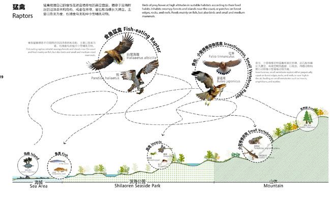
From the original habitat, to the fishing village, to the golf course, Shilaoren has gradually lost its unique and diverse mountain and sea habitat.
The project aims at enhancing the diversity of the system, strengthening the practicality of the habitat and restoring the shoreline by adhering to the principle of Habitatisation of the Whole Area.
Through Spatial Reconfiguration and Operation and Maintenance, we optimize natural space management. As a result, the twelve types of mountain and sea habitats will be recreated.

Guanlan River Ecological Corridor Planning

[COMPANY] Shenzhen Layout Planning & Design Consulting Co.
[LOCATION] Longhua District, Shenzhen, China
[DURATION] Dec. 2021 - Mar. 2022
[ROAL] 100% Diagram Drawing, 30% Concept Design
[PROJECT DESCRIPTION]
The total length of Guanlan River is 14.2km. The planning scope is bounded by the core functional area along the 500-1000m range of Guanlan River. The total scope of the study is about 17.3 square kilometers.
The planning content aims to create the Guanlan River as a world-class urban waterfront promenade: a typical demonstration area for ecological development and digital water governance, a unique cultural charm of the urban IP, and a diverse and vibrant public space on the waterfront.

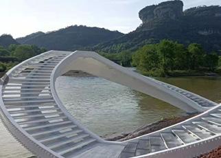
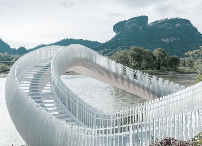
Wuyi Mountain Landscape Platform Design
[COMPANY] Shenzhen Layout Planning & Design Consulting Co.
[COLLABORATOR] Construction Team
[LOCATION] Wuyi Mountain, Fujian Province, China
[DURATION] Oct. 2021 - Dec. 2021
[CONSTRUCTION ] Already Constructed
[ROAL] 100% Digital Modeling, 80% Conceptual Design, 70% CAD Drawing
[PROJECT DESCRIPTION]
Wuyi Mountain is located at the junction of Jiangxi and northwestern Fujian provinces, with a total area of 999.75 square kilometers at the southeastern foot of the northern section of the Wuyi Mountain Range, and is a famous scenic tourist area and summer resort in China. The platform concept came from the natural landscape of Wuyi Mountainm. Since it is based on the famous meteorological landscape here, it is named after the auspicious cloud. The white platform shaped like a cloud is located at the foot of Wuyi Mountain, with different shapes from different angles and different heights.
Guanlan Youth-Themed Park Landscape Design
[COMPANY] Shenzhen Layout Planning & Design Consulting Co.
[LOCATION] Longhua District, Shenzhen, China
[DURATION] Aug. 2021 - Oct. 2021
[CONSTRUCTION ] Under Construction
[ROAL] 100% Rendering, 100% Modeling, 50% Concept Design
[PROJECT DESCRIPTION]
The site is located on Guanlan Street, Long Hua New District, Shenzhen, Guangdong Province. Shenzhen, as a key development city of reform and opening up, is led by an innovation drive. Therefore, to increase the core competitiveness of the city and to attract the talent, it is particularly important to improve the environmental quality of the city.
The park design is based on the positioning of youth and focuses on "youth" as the core, taking needs of youth space and the site's background conditions into account. Then, it forms three thematic areas: "Vitality", "Exploration" and "Ideal", to create a variety of activities for youth.

35
07 PROFESSIONAL
Chapter 3 - VISIONARY
Design & Planning & Research
WORKS
Constructed
Already
Construction
Under
Tower
Urban Design of Wetland Area
Landscape
Internal Structure of the Landscape Tower
Urban Design of Luhu Area
Food Chain in Shilaoren
07 OTHER WORKS



Hand-drawings
Color

36
Copy of Woman Seated under the Willows, Claude Monet
Drawing by Yunyi Qian 10/12/2020
Chapter 3 - VISIONARY
as Excellent
Watercolor Painting 2019 Exhibited in Campus Gallery
Watercolor Rendering 2018 Selected
Student's Work
Aesthetics & Art Reflection
Chapter 3 - VISIONARY
THE FUTURE
To be Explored...
xx / 2023 - ?
Environmental Equity / Public Health / Life Aesthetics
-
Life Justice Focused -
Healthy Environment / Prosperous Community / Thriving Life / Freedom and Equity


 This area is used for the display of new farmland and also serves as a beautiful landscape.
Visitors can pick fruits in the orchard and try them at the farming station.
Supercharged Plants Research Center
Supercharged Crops Display
Meteorological Station
Visitor Scientific Education Center
Carbon Emission Checkpoint
Farming Participation Area
Experimental Farming Station
Museum of Agriculture and Climate Change
Public Main Entrance


 Real photos repainted Inspired by Contested Urbanism in Dharavi The Bartlett | Development Planning Unit


