CONTACT
+31 6 5766 7111 yutomiyazono@gmail.com 1171DS Badhovendoop
BIO
Yuto Miyazono is an interdisciplinary landscape architect and urban researcher.
SKILLS
CAD : Vectorworks, AutoCAD BIM : Archicad, Revit 3D CAD : Rhinoceros Render : Lumion, Twinmotion GIS Applications: QGIS, ArcGIS Adobe Creative Cloud, Movie Edit: After Effects, Premiere Pro Programming: Python, SQL Spaceial Graphic: Touch Designer
LANGUAGES
English (fluent), Japanese (Mother language ), Dutch (Beginner)
Apr 2020 - Aug 2024
Assistant Garden Landscape Designer Urban Design Centre UJI, Kyoto, JAPAN
Apr 2024 - Aug 2024
Project Researcher for Urban Engineering Hitachi and University of Tokyo Joint Research Unit, Tokyo, JAPAN
May 2021 - Mar 2024
Project Specialist for Urban Engineering Research Center for Advanced Science and Technology, University of Tokyo, Tokyo
May 2023 - Sep 2023
Geographic Information Systems Technician Tetor. Inc, Tokyo, JAPAN
Aug 2023 - Dec 2023
Assistant Landscape Designer / BIM and 3D modeler PLACE MEDIA. Inc, Tokyo
Sep 2024 - Present
Master of Landscape Architecture Academie van Bouwkunst Amsterdam Amsterdamse Hogeschool voor de Kunsten, Amsterdam
Oct 2021 - Mar 2024
Master of Urban Engineering (Urbanism and Landscape ) University of Tokyo, JAPAN grade 3.9/4.0
Apr 2019 - Mar 2021
Bachelor of Urban Engineering, University of Tokyo, JAPAN Department First prize at Graduation Project
GRANTS & AWARDS
2024 NL Scholarship
2023
Research Grant
“Reinterpretation and updating of the Experience Map” WINDOW RESEARCH INSTITUTE
Jun 2021
First prize: Undergraduate Graduation Project, Department Best Award
Jun 2020
Jury’s Special Prize: Sotonoba (Public Openspace Design) Award
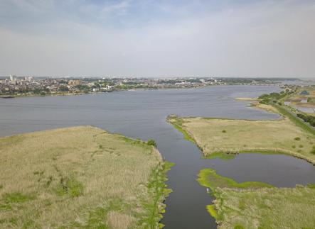
Teganuma Lake Revitalization Project
Aug 2019
Guest Jury Award: Kyushu Design Charrette 2019
Apr 2016
Freshman’s Leave Year Program(FLY Program), University of Tokyo
ACADEMIC AND RESEARCH ACTIVITIES
Apr 2024 - Present Editor-in-chief
“Alternative Landscape” a publication project for the 100th anniversary of the Japanese Institute of Landscape Architecture
Sep 2024 - Present Curator
Shinjuku 1975: The Phenomenal City EXHIBITION project in 2025
EXHIBITION
Nov 2023
Artist
“Dear Tree Project” , Koishikawa Botanical Festival
Mar 2023
Artist, Director
“The Potential of Urban Sciences: The Current Situation of Urban Science and Technology” (Numazu Venue)
Mar 2023
Artist, Director
“The Potential of Urban Sciences: The Current Situation of Urban Science and Technology” (Uji Venue)
Aug 2022
Artist
“The Science of Cities: Digital Matière of the Historic Zenkoji Temple District”
Mar 2022
Artist, Director
“The Potential of Urban Sciences: The Current Situation of Urban Science and Technology”, University of Tokyo New York Office Event (New York + Tokyo)
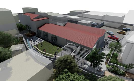
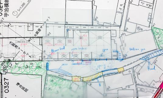
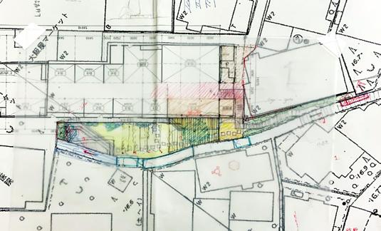
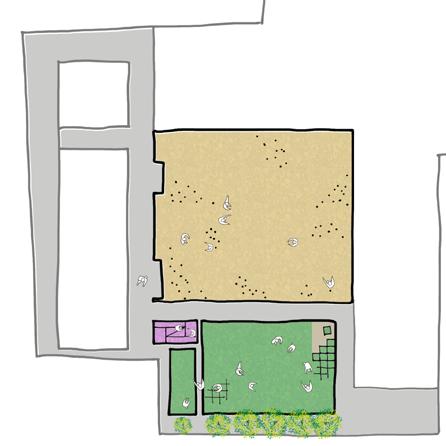
First prize/ Department Best Award for Undergraduate Graduation Project
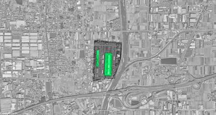
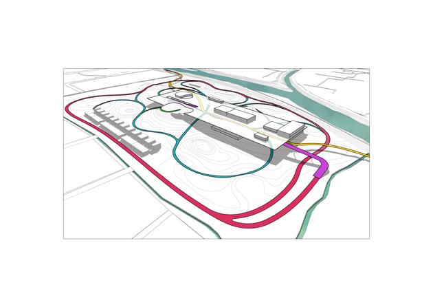
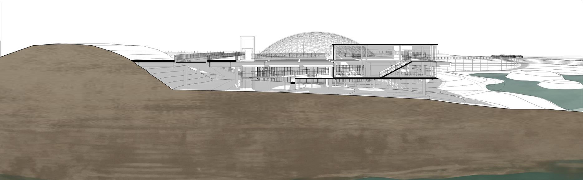
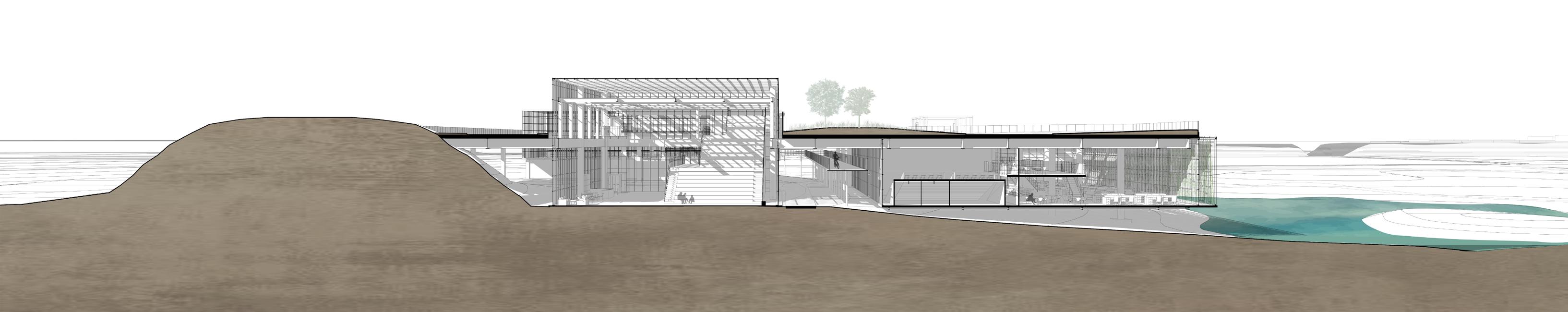
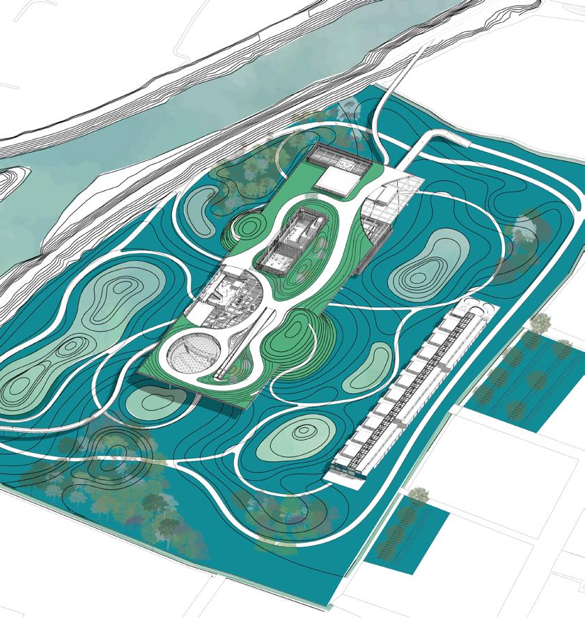
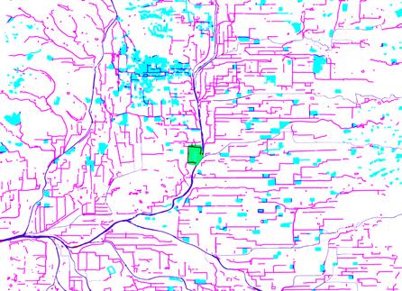
location: Nara, Japan
duration: Oct 2020 - Jan 2021
scale: 35 ha
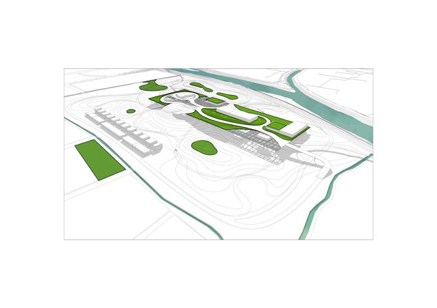
type : Climate-Adaptive Conversion of Gray Infrastructure in Watershed Systems
category: Academic Design Project
team: Individual
supervisor: Miyagi Shunsaku (Harvard University
Graduate School of Design) Naoto Nakajima (University of Tokyo)
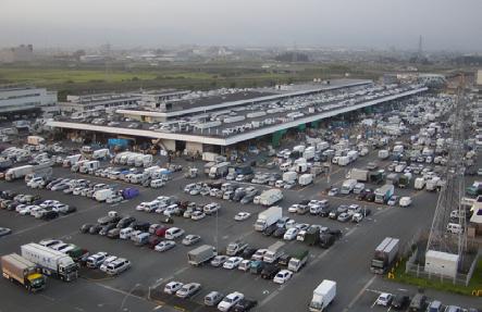
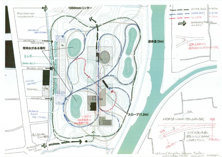
The Saho River, being the largest main stream of the Yamato River, experiences significant damage during heavy rainfall.
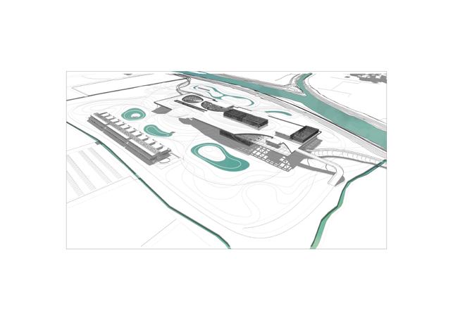
By installing an overflow-type levee at the confluence of the rivers, the site will serve as a retention pond when the water level reaches a dangerous point.
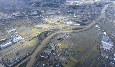
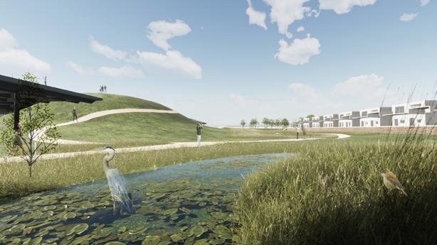
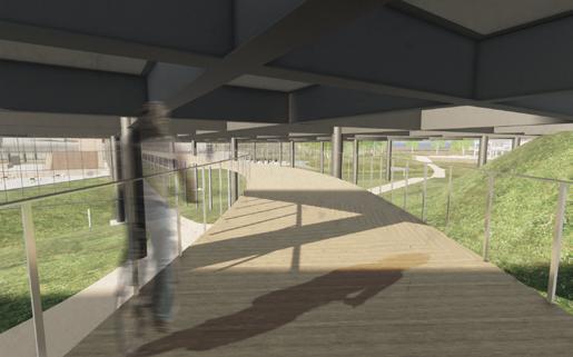
This project aims to convert an ageing wholesale market into a retention pond as a countermeasure against heavy rainfall caused by typhoons, which have intensified due to climate change.
The Saho River, being the largest main stream of the Yamato River, experiences significant damage during heavy rainfall.
By installing an overflow-type levee at the confluence of the rivers, the site will serve as a retention pond when the water level reaches a dangerous point.
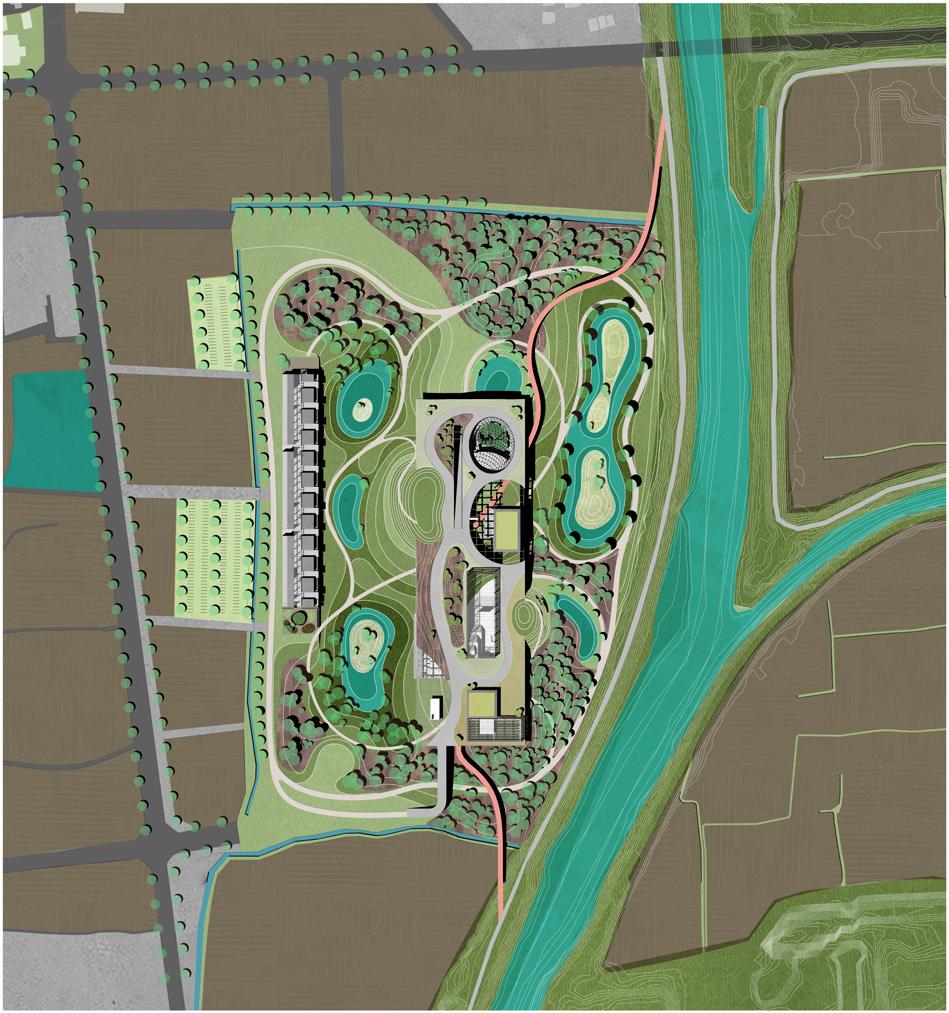
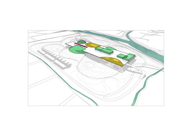
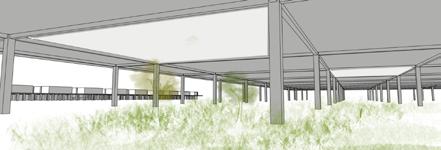
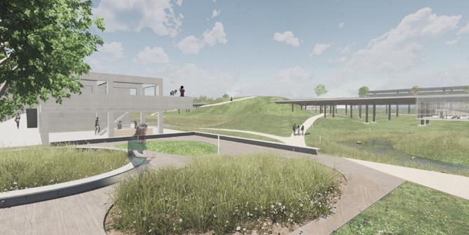
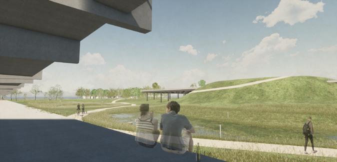
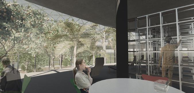
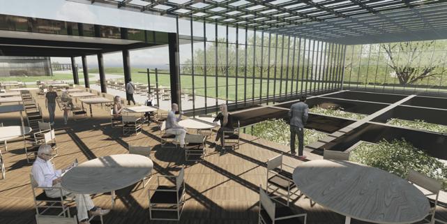
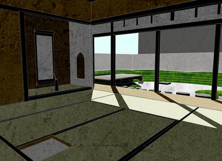
The building portion is renovated and becomes a facility for environmental monitoring of the Nara Basin, serving as a climate observatory for the Nara Institute of Science and Technology. Rooms are inserted through the large slab, creating a botanical garden, library, offices, restaurant, plant factory, and bookstore, with an herb and medicinal plant garden on the rooftop.
In a separate building, accommodation for researchers is provided, also catering to the hosting of international researchers.
800-1880
Unused wetlands
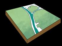
Design Phase 0
Current Situation
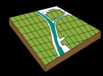
Design Phase 1 Restoration
Design Phase 2 Land Formation
1880 - 1965
Drainage and paddy fieldisation
1965 - present
Embankments and pavements from wholesale market construction
Design Phase 3 Circulation
Design Phase 4 Space Formation
Phase 5 Revegetation
Design Phase 6 Water Management
Development of the water system in the Nara Basin
2-11 C
Development of rivers along the topography
12-14 C
Development of an irrigation network for rice cultivation
15-19 C
Construction of small-scale reservoirs through flood control projects
Initial Sketch (Stripping asphalt, Restoring water absorption)
Contour line design and revised sketches
Academic Deisgn Project
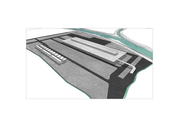
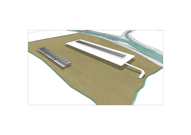
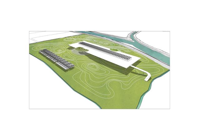
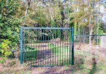
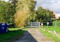
location: Hembrug, Zaanstad
duration: Oct 2024 - Dec 2024
scale: 49ha
category: Academic Deisgn Project (8 week)
type : Alternative Cartography and NonAnthropocentric Landscape Design: Utilizing Existing Environmental Assets
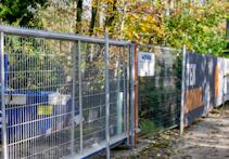
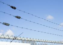
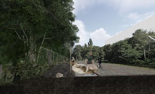
The former weapons factory site in Hembrug, Zaanstad, which still bears many traces of its military past, is now undergoing transformation through a new masterplan. The landscape is characterized by a layered fencescape: historical barbed wire fences and barricades remain alongside new construction barriers. This project reimagines these fences as cultural landscapes that continue to tell
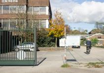
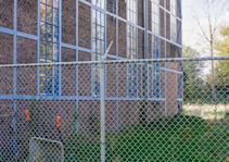
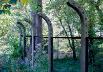
the site’s story through its next phase of development. By hacking these barriers—originally designed to restrict human movement— we transform them into new habitats for non-human species. This intervention redefines the meaning of these boundary elements, shifting them from tools of exclusion to platforms for ecological integration.
team: Individual
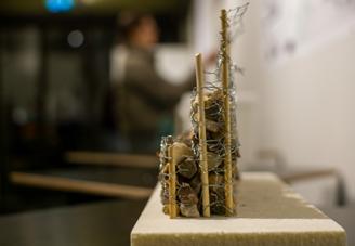
Rgenerative track
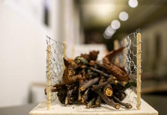
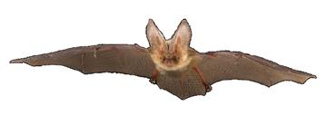
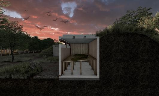
Bat storage
Plastic barriccade
Path and Territoty
Territory of Hedgehogs
Territory of Bats
Route of Water birds
The current redevelopment of Hembrug poses potential risks to the nesting sites and foraging grounds of its existing wildlife. Based on published ecological surveys, we decided to focus on three representative species: bats, hedgehogs, and waterfowl.
To understand the potential ecological dynamics across Hembrug, we created a wildlife masterplan that maps out how different species might interact with proposed interventions at Sites A, B, and C. This mapping exercise visualizes the broader ecological network that could emerge when designing specific spaces for these animal actors, helping us understand how local interventions might influence movement patterns and habitat use across the entire site.
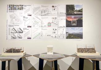
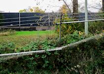
A linear intervention transforming former railway traces into ecological corridors.
Construction fencing, arranged in parallel to historical track patterns, establishes new pathways for urban wildlife. The design preserves the site's industrial memory while creating contemporary biological infrastructure.
0 1 2 4m
160 - 260 mm
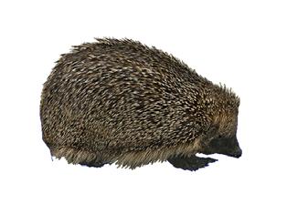
100 - 160 mm 4:00 21:00
Hibernation 1700 mm
Former construction fences
New fences relocated from the site
Hibernate among fallen leaves and between branches
Breeding and Active Season
Primarily feeds on earthworms and various insect larvae
The movement extends over a range of 2-4 km.
Waste materials from forest and garden
Due to residential development, the decrease in old-growth trees is leading to a predicted decline in bat roosting sites. Holes are being created in ammunition warehouses to serve as alternative hibernation sites for bats. The stored bat guano will be returned to the forests.
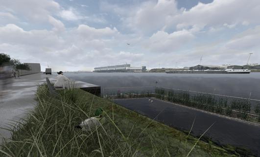
Plastic waste from the major city of Amsterdam and new residential areas has a significant impact on waterfowl. A new barrier for birds is installed by o setting the existing factory fences by 30m and placing them in the riverbed. By installing mesh from the existing fences, it creates both a filtering function and a habitat for birds.
Breeding
Active at night, feeding on aquatic plants, seeds, and shellfish 500 - 650 mm 320 - 450 mm 6:00 18:00
Builds shallow, dish-shaped nests from gathered grass on the ground near waterways
Recycled planting beds for aquatic vegetation
SITE_A Regenerative Track Scale 1:10
SITE_B Bat Storage Scale 1:10
SITE_C Living Barricade Scale 1:10
a+u Architecture and Urbanism Magazine
2021:09
Urban Science and New Design Tools
location: Tokyo, Japan
duration: May 2021
scale: 10m2
category: Commitioned Work
type : Art Installation
role: Installation Development, Creation, and Setup
collaboration: Eri Kawamura (Photo) Chiho Sato (Art Producer)
client: Shinkenchiku-Sha Co., Ltd.
team: Urban Sciences Lab.
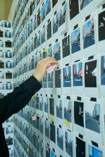
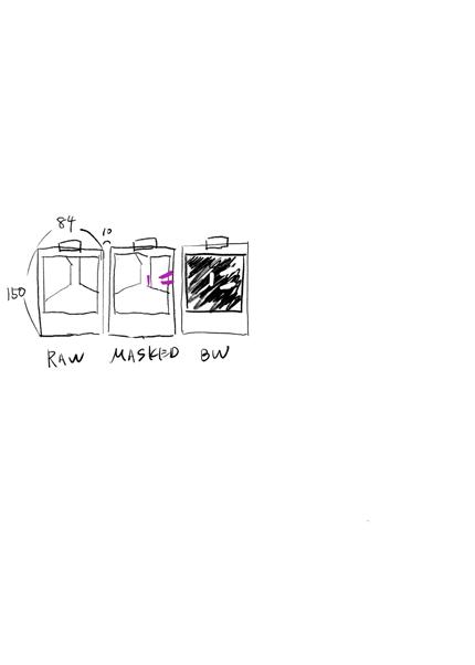
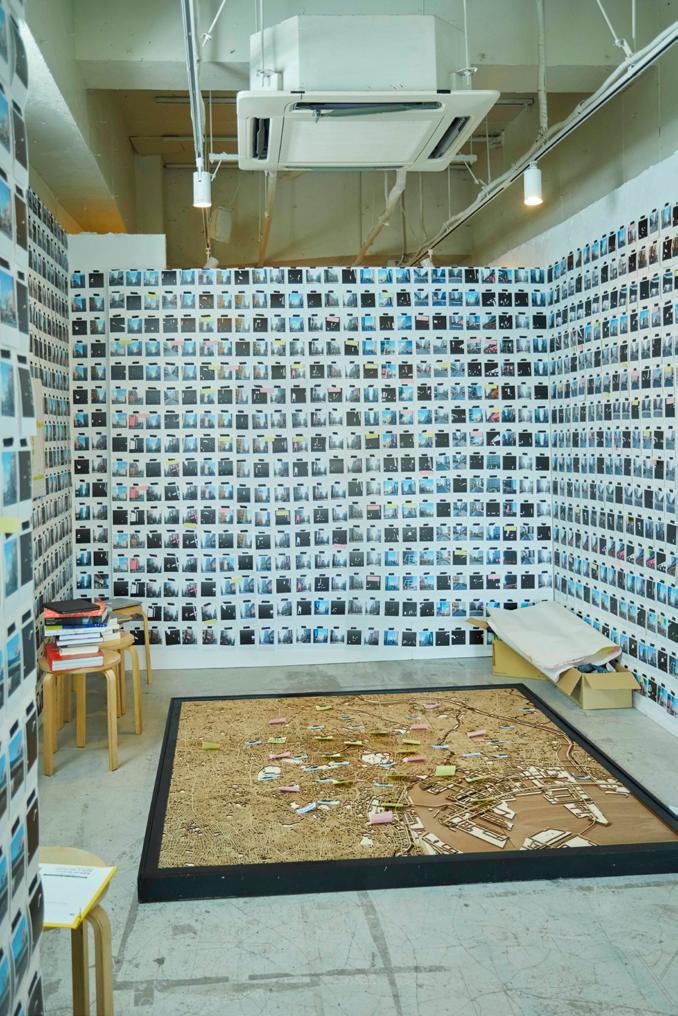
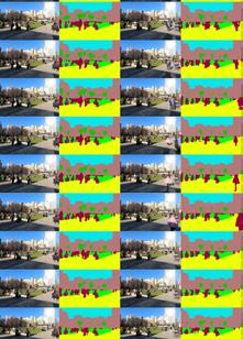
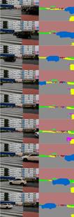
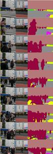
While machine learning-based urban landscape analysis may appear to proceed smoothly with just the press of a button, the reality involved a yearlong manual process of creating training data by hand-labeling images for sign detection algorithms.
The installation aims to demonstrate how machine-assisted landscape analysis exists as an extension of traditional research methodologies, while simultaneously expressing the vast scale of big data processing.
The gallery walls display three different types of images extracted from identical locations, featuring approximately 2,000 photographs across roughly 600 distinct points. This arrangement allows viewers to comprehend both the methodological progression and the sheer volume of data involved in contemporary urban analysis.
Exhibition Work (2021)
Data visualization of landscape typology by using point cloud data and section
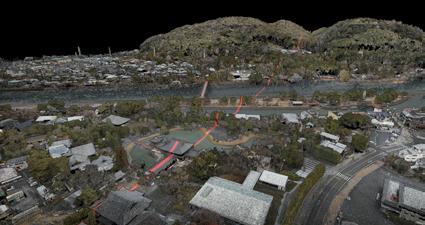
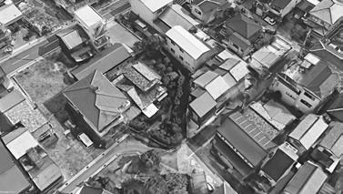
locatioin: Uji, Kyoto, Japan
duration: Oct 2022 - Feb 2023
scale: 35ha
category: Commitioned Work
type :
Data Visualization Short Film
role:
Planning and Research for Scanning Creating Continuous Cross-sections and Short Films
client: Urban Design Centre UJI
collaboration: Flightsurvey. Ltd (drone scanning)
team: Urban Sciences Lab.
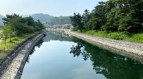
Uji is a city situated on river terraces formed by the sedimentary action of the Uji River.
The Uji River is the waterway through which all water from Lake Biwa, Japan’s largest lake at 670.4 km², drains, making it one of the rivers with significant water level fluctuations.
Given its history of flood damage, understanding the city through cross-sectional analysis becomes necessary for developing future urban visions.
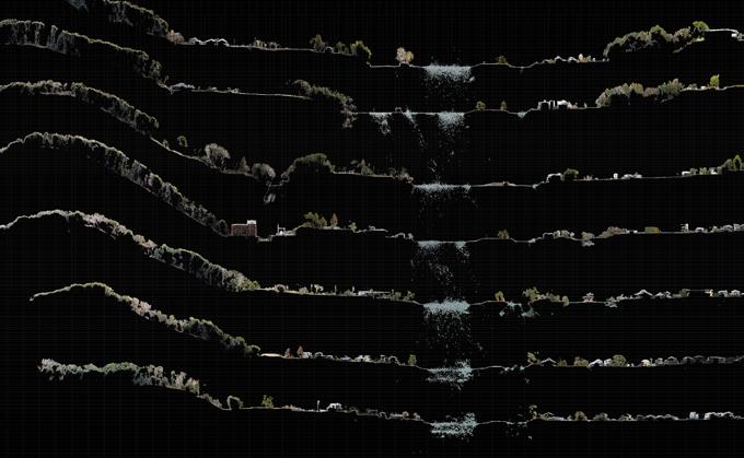
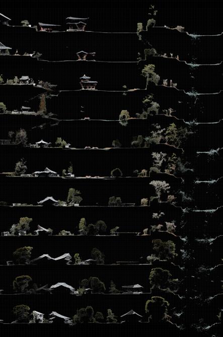
The Uji River consistently presents both beauty and risk to its surrounding urban areas. In Japan, landscape architects carry an important mission to read and visualize terrain, including its historical records, and to tell the story of the land. This work was created with the aim of helping non-experts understand the land by scanning an entire city using drones to create point cloud data of the whole urban area. Through the medium of video, it becomes possible to directly demonstrate elevation differences and show how public facilities and private homes are positioned on the river terrace, illustrating the level of risk associated with different locations. At the exhibition, this video served as the opening piece to provide essential background context about Uji.
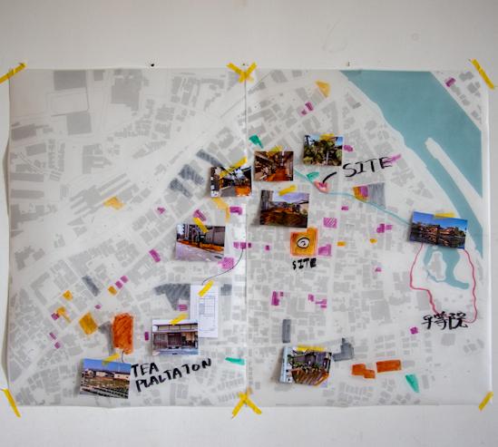
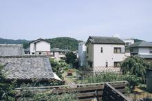
Pilot project of Gardenizing City Project
location: Uji, Kyoto, Japan
duration: 2022 - Ongoing
scale: 77.5ha
Economic Activities
While tea shops cluster along main roads, the interior faces development pressure for apartment complexes, and vacant lots are converted into tourist parking
type : Design Master Plan Development and Research
category: Commitioned Work
role:
Design Project Leader from Initial Launch in 2021 through Phase 1 in 2024
Led the investigation of open spaces and developed the conceptual framework for the regenerative master plan.
client / collaboration: Municipality of Uji
team: Urban Deisgn Centre UJI
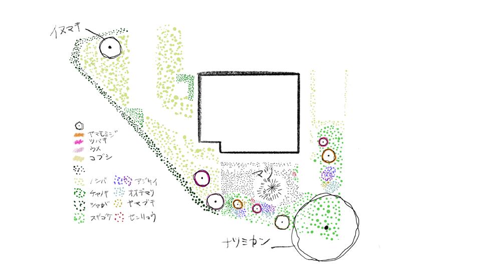
Plantation
Fertile soils for tea production were chosen as cultivation sites and remain under traditional farming methods
Street Network
Paths following micro-topography remain after 700 years, while road widening for housing developments allows cars to easily penetrate the interior
Water Network
Clear springs from wells in the area were used for tea ceremonies, and Japanese gardens were supplied by the river
The depositing action of two rivers formed overlapping alluvial fans, creating land suitable for tea cultivation
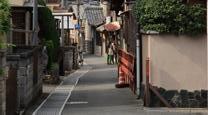
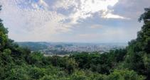
Uji, an historic urban district established in the 8th century, faced serious overtourism issues despite its status as a World Heritage site. Parking lots built to accommodate tourists occupied most of the open spaces, resulting in the loss of traditional tea fields and gardens, thereby degrading the urban environment. Following reduced parking lot usage during COVID, a redesign initiative was launched targeting 250 open spaces, primarily consisting of unused parking lots and vacant lands. This led to the implementation of a design master plan and pilot projects aimed at creating a more livable environment for local residents.
■ Parking lots
■ Vacant Houses
■ Tea Plantation
■ Parks
■ Plaza
�� Nakauji Living Room
�� Nakauji Community Centre
�� sho-ko-an
おもてにわ
Omote- Niwa (Front Garden)
とおりにわ
Tori - Niwa (Path Garden)
おくにわ
Oku - Niwa (Back Garden)
庭屋一如 : Open Space Typology for Gardenizing City
A traditional garden design concept called teioku-ichinyo, which emphasizes the unified consideration of open spaces (gardens) and architecture. This concept was adopted as an overall urban design principle and applied to contemporary open spaces. The design framework established three fundamental typologies, allowing open spaces to be combined and redesigned to modulate privacy and intimacy levels.
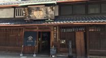
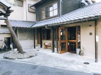
Pilot project of Gardenizing City Project
location: Uji, Kyoto, Japan
duration: 2022 - 2024
scale: 400m2
category: Commitioned Work (individual)
type : Japanese Garden Redesign for Vacant House Revitalization
role: Design and Planning of Japanese Gardens as an Independent Designer
client: 松香庵 (sho-ko-an tea studio)
team: Urban Deisgn Centre UJi
Transforming Vacant Houses into Community Public Gardens and Tea Studios
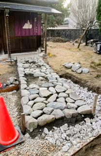
Sho-ko-an is a tea house being renovated by a young tea master from Uji, who wants to have his own tea room. The garden will be created following three design typologies. The front garden facing the road will feature a lawn, while the central area will combine an existing pine tree with a rock garden. In the back, there will be a tea flower field where the tea master will grow flowers to be used in tea ceremonies.

Design Program
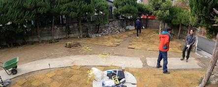
Pilot project of Gardenizing City Project
location:
Uji, Kyoto, Japan
duration:
2021 - Ongoing
scale:
240 m2
category:
Community Involvement
type : Renovation Design for Underutilized Open Spaces
role:
Concept, Functional Design
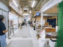
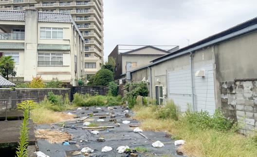
Nakauji Living is a project that revitalizes unused land behind a local market as a garden, serving as the landscape component of the Osakaya Market renovation project. The design aims to reconnect the community with nature by transforming the previously overlooked riverside into a plaza space that can be accessed while moving through the area.
With the renovation of the market building, the back entrance became accessible, necessitating its redesign as a new entrance point.
client: Municipality of Uji
collaboration: Cui Suirei, Miyu Tanimoto
team: Urban Deisgn Centre UJi
Study sketches for the relationship between outdoors and indoors
Design study sketches of exterior areas

Final Functional Plan
Pilot project of Gardenizing City Project
location: Uji, Kyoto, Japan
year: Apr 2022 -Ongoing
scale: 1709 m2
category: Community Involvement
type : Landscape Design Participatory Design and Consensus Building
role: Design and Preparation (Individual Work) Workshop Design (As Team Member)
client: Municipality of Uji
team: Urban Deisgn Centre UJi Functional Plan for
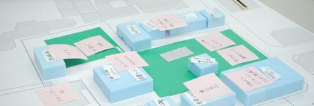
Design Management Across Different
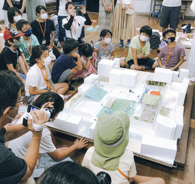
Located at the center of the area, this former elementary school site had been used as a community hall. As Uji City planned to develop a new community center, the project simultaneously conducted workshops for designing both a temporary park for immediate public use and the final design concept. In the short term, the design incorporated a plaza with perennial plants and a lawn area, creating flat spaces suitable for hosting markets and other events. For the long-term vision, design discussions with residents focused on integrating social housing, a community center, and public parks.
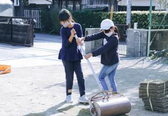
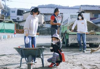
Design Workshop with Local People
The workshop process incorporated budget considerations and community engagement for the facility planned in 2027.
From the perspective of fostering local attachment and community building, the construction of the lawn plaza and temporary park was carried out together with local residents. The design team prepared the basic design, procurement, and materials, organizing construction workshops and future planning meetings designed for parent-child participation.
Academic Urban Design Studio
location: Sumida RIver, Tokyo, Japan
duration: May 2023 - July 2023
scale: 4km
category:
Academic Design Work (individual)
type :
Adaptive Reuse Strategies for Postmodern Urban Infrastructure
client: Asahi Beer (hypothetically set as a major patron of local art events)
team: Individual
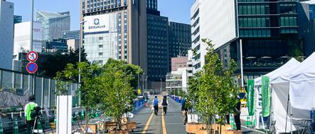
Hack the Grey Infrastructure to Reclaim the Iindigenous Landscape!
The Sumida River was once a vital open space for transportation in the Edo period. However, since the 1960s, motorization led to the construction of the Metropolitan Expressway along the riverbank, dramatically transforming the landscape.
This infrastructure severed people’s connection to the riverfront space, which had been central to cultural traditions like the spring cherry blossom festivals and summer fireworks for over 300 years.
Reflecting on the impacts of motorization, Tokyo is now moving to partially remove highways and redesign them as parks. This studio project aims to hack infrastructure to design new urban spaces for people.
Temporary Highway Repurposing for 1,000,000 People
Tokyo’s urban space has primarily evolved through a process of scrap-and-build development. However, Japan also maintains a traditional practice of temporarily transforming roads into spaces for festivals and ceremonies.
The Sumida River Fireworks Festival exemplifies this tradition with over 300 years of history. This festival stands as one of Japan’s largest momentary gatherings, drawing 1,000,000 people to a single area. This proposal suggests opening the Metropolitan Expresswaytypically reserved for vehiclesas an elevated walkway during the fireworks festival. This transformation would create a new dimension to the urban festival experience.
The design incorporates terraced decks at strategic locations to create vertical connections between ground level and the expressway. These connections would effectively transform the highway into a grand urban deck for festival celebrations.
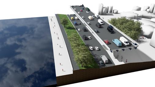
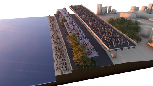
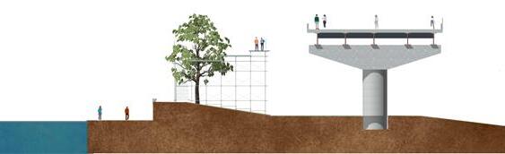
Connect the three level differences of the ground, temporary deck, and expressway through the temporary deck
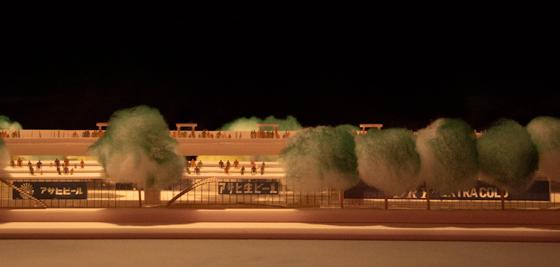
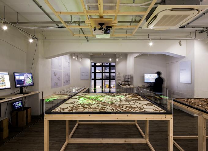
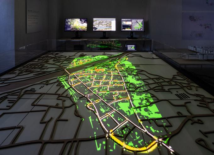
Pilot project of Gardenizing City Project
duration: 2022 -2023
location: Shibuya, Tokyo / Uji, Kyoto / Numazu, Shizuoka
category: Commitioned Work
type :
Art Exhibition Development: Spatial Design, Art Production and Research
role: Directed and curated exhibitions Exhibition Space Design Created artworks as an exhibiting artist
client: Urban Sciences Lab
collaboration: Takahiro Oyama, Tetsuya Takahashi (Artworks)
team: Rcast/Urban Sciences Lab
New methods of interpreting the urban landscape
This project was conducted to showcase the research results of companies and groups collaborating with the Urban Science Lab to the public, and to promote understanding of data science and community development.
The projection mapping was adopted as a presentation tool for government officials, engineers, residents, NPOs, and others involved in each project to gather around and engage in discussions, using the projection mapping and displays.


Studies of Movie-esque / Dynamic Landscape
Master Thesis Research
Oct 2023 - Jan 2024
The visual value assessment of cities has been considered through photographs and still images, with the building outlines and the size of outdoor advertisements being regarded as the top priority elements that define beauty. However, the crowds of people overflowing due to overtourism and the facades with digital signage likely have a significant impact on the appearance of cities.
Alternative Landscape
Commissioned Work from the Japanese Institute of Landscape Architecture(JILA)
Editor-in-Chief / Graphic Design
Apr 2024 - Ongoing
The role of Editor-in-Chief was served for “alternative landscape,” one of JILA’s official 100th anniversary commemorative projects. This initiative aims to reexamine the role of landscape architects in addressing increasingly complex social challenges, incorporating discussion events with U35 (under 35) editorial members.
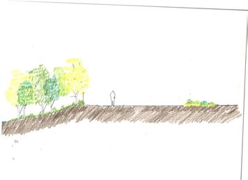
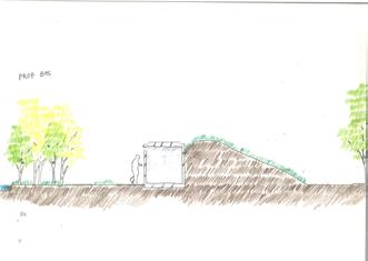
Tega-numa Fishing Center
Renovation Design
Landscape Design Practice
Commissioned by Municipality of Kashiwa City Period: 2018-2020
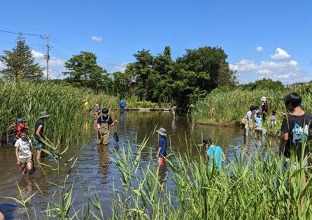
A renovation project for the Tega-numa Fishing Center, a multi-purpose leisure facility located along Tega-numa, a freshwater lake in Japan. The team’s scope included converting concrete fish tanks into biotopes, managing vegetation and ecosystem maintenance, redesigning the entrance area, and designing and implementing an interim park within the embankment area. The project responsibilities specifically covered vegetation management, interim park design, and entrance area redesign. Tega-numa faced a temporary ban on edible fish catching in 2011 due to nuclear plant issues, and was once known as Japan’s most polluted freshwater lake. While recent environmental improvements have enhanced water quality, the connection between the surrounding residential areas, local residents, and the lake remained severed. The renovation design aimed to bridge this gap, both spatially and psychologically.
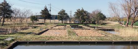
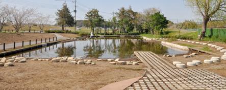
Due to the high number of non-native species and the artificial nature of the pond, its ecosystem undergoes rapid changes. In response, an educational program was developed to engage local residents in maintaining the designed pond. This photograph, taken in 2021, shows children working alongside ecologists to count the proportion and number of invasive species, learning about ideal ecosystem balance for the future.