To me, every city has a thickness, a unique personality, and every street corner tells a di erent story. I want to feel the pulse of the city, carefully explore its history, experience its current life, and at the same time use the guidance of advanced technology to give more possibilities for its future.
I rst developed an interest in urban design during my undergraduate thesis. I chose my hometown Quanzhou as the objective of my study and reconstructed the local water system. is city has shown me that urban design can also be overlaying without necessarily changing completely. Watching the original streets being given multiple meanings, both old and new, and the residents and tourists having their own rewards from being there, I realized the value of being an urban designer, which is to optimize people's lives by always putting them at the center.
As a multi-professional applicant with both architectural design ability and urban design practice, I would like to contribute more urban design works bene cial to the environment and humans themselves.
TABLE OF CONTENTS
I. Academic Design Works
Continuation of Atlas
-Reconstruction of the Relationship Between City and Water System
2019 THU thesis research&design - individual work
'Re-Wilding' Downtown Peachtree
- Atlanta A er Property
2022 GSAPP Fall design studio - team work
Network of Care and Water Visibility
- Bringing Back the Sanaba
2023 GSAPP spring design studio - team work
New Interface
- Posibilities of the New Typical
2017 THU x CUHK Collaborative studio - individual work
II. Professional Practices
Te Gong 2021HP02 Lot Residential Project
CGDG Xiamen New Era Plaza
Banmei Folk Garden
Zhongdi · One Riverside
Youxi County Public Security Bureau
ANTA Integrated Smart Industrial Base
III. Research
Research on Pedestrian Behavior Patterns in Public Space Using Real-time Webcam
-A Revisit of Jan Gehl's Human-oriented Theory and Method in Urban Public Space Design
2022 Smart City Workshop - team work
Cats Welfare Space Generator
- Generative Design and Optimization
2023 GSAPP Elective Course - team work
Manhattan Tra c Collision Map
- A Practice of Operating Urban Data and Machine Learning
2023 GSAPP Elective Course - team work
Environmental Richness + Attention Focus
- A Practice of Crowdsourcing Tool for Physiological and AI Data Collection in VR
2023 DigitalFutures "Context+Intelligence" Workshop - team work
IV. Other Works
1.1 2.1 2.3 2.5 2.2 2.4 2.6 3.1 3.2 3.3 3.4 1.2 1.3 1.4
Reference_1
Dr. David Smiley
Associate Director and Adjunct Associate Professor Graduate School of Architecture, Planning and Preservation, Columbia University
Email: ds210@columbia.edu
Tel: (+1) 917-704-9715
Reference_2
Prof. Mauricio Rada Orellana
Adjunct Assistant Professor Graduate School of Architecture, Planning and Preservation, Columbia University
Email: mer2245@columbia.edu
Yaoze Yu Email: yy3282@columbia.edu | yyz11848@gmail.com
Tel: +1 929-452-9446
https://issuu.com/yyz11848/docs/portfolio_yaoze_yu
https://www.linkedin.com/in/yaoze-yu-035850289/
EDUCATION
Columbia University in the City of New York
Master of Science in Architecture and Urban Design
• Relevant coursework: Urban Design Studio, Digital Techniques, Urban Analytics&Decision Making, Generative Design, Urban Data- Machine Learning, Design&Difference
Tunghai University
Bachelor of Architecture
• Relevant coursework: Architectural Design Studio, The Conservation and Reuse of Cultural Heritage, City Planning, Introduction to Urban Design, Theories of Urban Studies
• Award: Second-round selected of "Wen-hsiung Hong Memorial Architecture Competition" in 2018
Tsinghua University
Student of Continuing Education
• Completed course: Big Data and Urban Planning
EXPERIENCE
Hordor Design Group | Architectural Designer | Xiamen, CN
• Developed the slides for presentation; participate in the design of residential facades to win the bidding of Lunhou Resettlement Housing project with a site of 28800 m²
•Completed urban design for Banmei Folk Culture Park; designed the tourist service center of the park.
•Produced construction drawings of elevations and sections of Xiamen Tegong commodity housing HP02 project.
Columbia GSAPP | Social Media Content Production Assistant | New York, US
•Assisted in editing student work and event information for GSAPP's Instagram feed at the end of the semester.
Tongji Architectural Design Co., Ltd | Architecture Intern | Shanghai, CN
• Collected data and conducted research on substations in China; designed the blueprint of national substations in the Xiongan New Area of Beijing and presented final draft to STATE GRID Corporation of China.
Nanyang Architectural Planning and Design Institute | Architecture Intern | Henan, CN
• Redesigned the entrance to a basement parking garage at the Cultural Center of Nanyang City; summarized the image of the city, extracting elements suitable for the cultural center; utilized sketching and 3-D modeling.
ACTIVITIES
Workshop & Exhibition
• Participated in 2023 digitalfutures summer workshop "context+intelligence" as a team leader assigned work and responsible for building VR environment, collecting GSR test data, drawing diagram and editing final video.
• Enrolled as a Visiting Student in the 2017 Rome Architectural Design Workshop co-sponsored by Tunghai University and Cornell University; analyzed architecture and urbanism of Rome and Florence.
• Enrolled as a representative of THU in 2017 design studio co-organized by Tunghai University and The Chinese University of Hong Kong; researched the historical transition of urbanization of Taichung City through mapping the Taichung History Yearbook; edited a publication entitled "Possibilities of the New Typical" about the urbanization process.
• Assisted FIELD DIREKTOR in the development of the physical model of the "Social Towers" project which was exhibited at the 2015 Taipei Design And City Exhibition.
Research
• Researched factors contributing to the frequency and severity of traffic collisions at intersections in Manhattan and used machine learning to predict the risk of collisions at different locations in the Urban Data- Machine Learning course 2023 at GSAPP.
• Completed a comparative study between data from the NYC Department of Transportation and third-party vendor data to develop an accurate volume estimation of bicycles on NYC streets through Urban Analytics&Decision Making 2023.
• Conducted a study in the Design&Difference 2022 at GSAPP on the living environment of sex workers in Thailand and proposed a program to improve the quality of the space in Bangkok's red-light districts including several prototypes to increase the transparency and privacy of the space in order to protect the human rights of sex workers.
• Studied the history and future plans for Madison Square Garden in the Reading New York Urbanism 2022 at GSAPP, and visualized the research results in ArcGIS Storymap.
SKILLS
• Techical: Photoshop, Illustrator, Indesign | QGIS, ArcGIS | Revit, Rhino, SketchUp, AutoCAD | Grasshopper, Python | V-ray, Enscape, Lumion | Premiere, Aftereffect | Unity, Unreal | Hand-modeling, Hand-drawing
•Languages: English, Chinese
New York, United States 2022-2023
Taiwan 2014-2019 Beijing, China 2021 2020-2022 2023 2018 2016 References
Taichung,
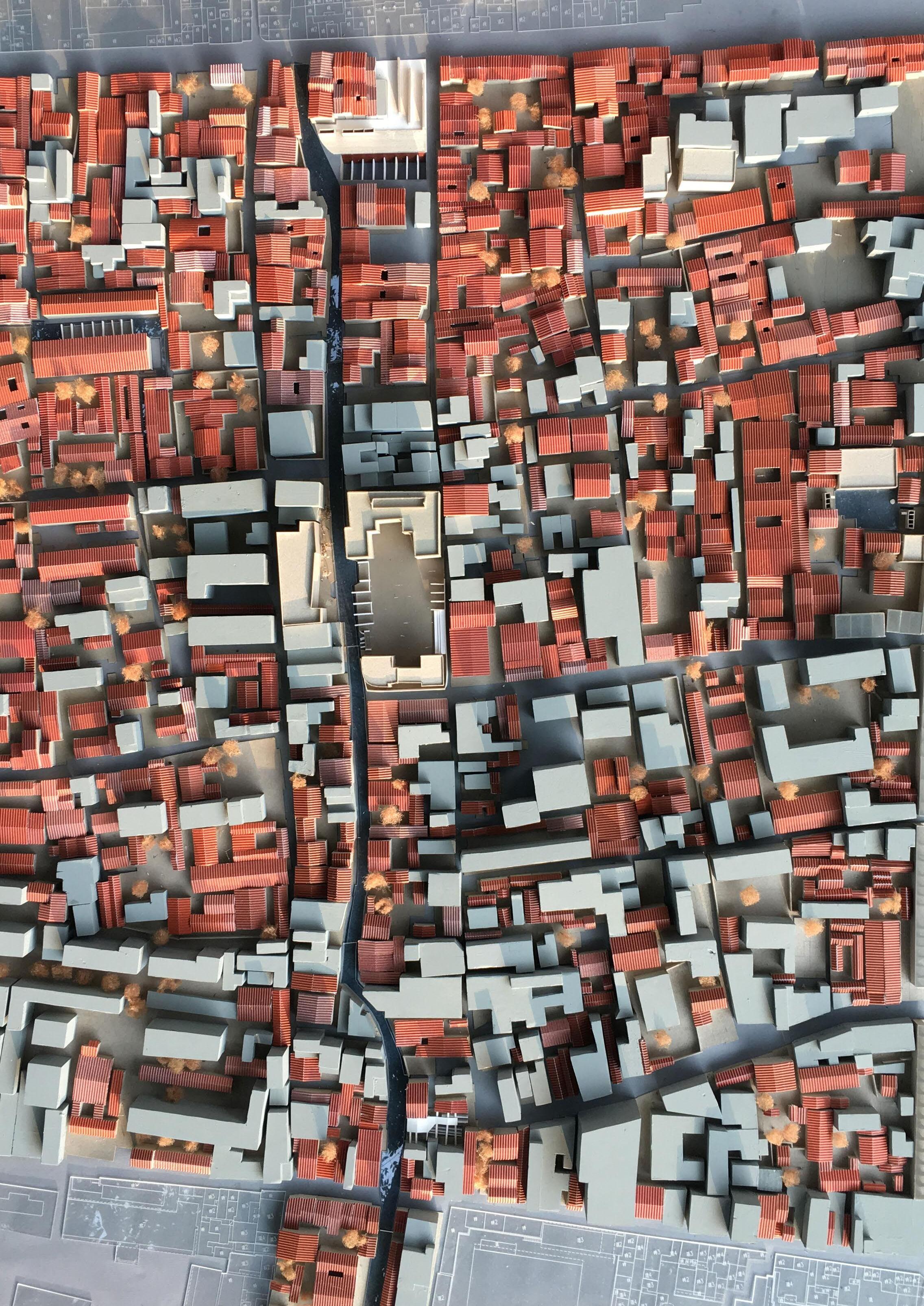
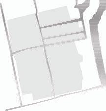
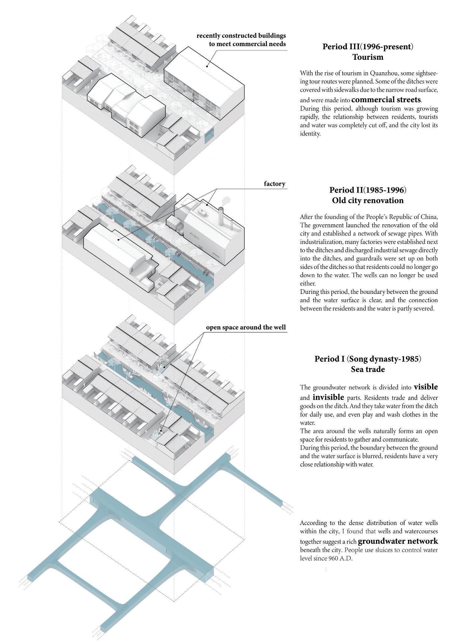
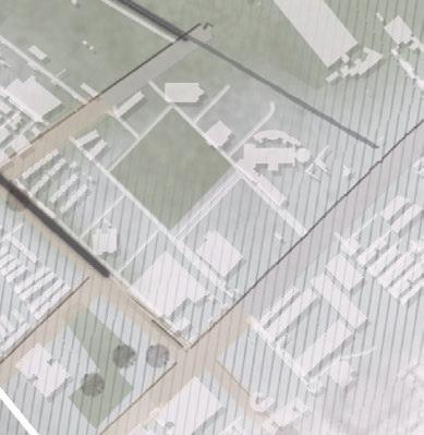
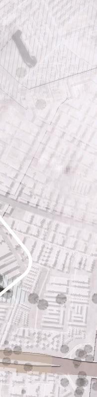
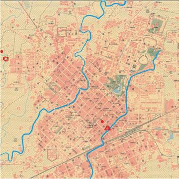
Continuation of Atlas
Reconstruction of the Relationship Between City and Water System
2019 THU thesis research&design - individual work Instructor: Chijeng Kuo
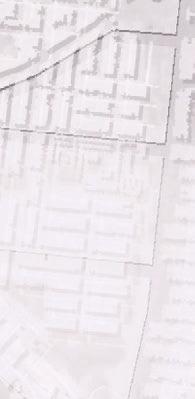
Program: community space, water management Site: Quanzhou, China
Area: 157,800 sq m
Quanzhou is a city of residents, not administrators.
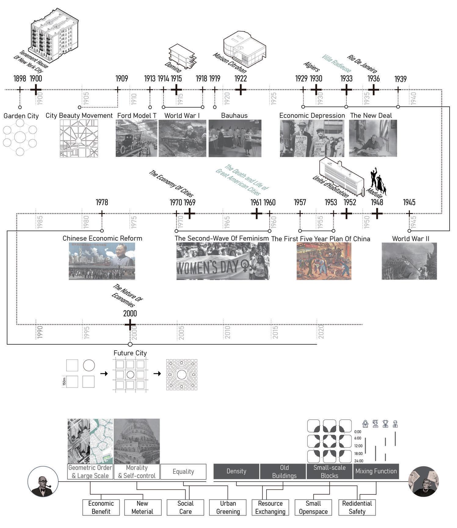
e concept of ancient city protection has gradually become an important proposition of urban planning a er the Venice Charter. For a long time, cities around the world have been carrying out experiments of protection mode, and gradually developed the current protection mode of ancient cities through learning lessons and following the trend of time : "Protection" and "Development" are combined. e global commodity drives the ancient city to build a business model with history and culture as its selling point. With the continuous increase of commercial streets and cultural parks, the character of the city is gradually being assimilated.
Moreover, the existing issues are discussing the importance of "Conservation" versus "Development", which means we cannot escape from the myth of ignoring the character of a city.
What today's ideal city should be?
The time line summarizes the different views and practices of Le Corbusier and Jane Jacobs on cities from the beginning of modernism, helping me to think about what poisition a urban design should be when it comes to today'city we live in.
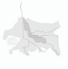
Evolution of the spatial form of ancient Chinese cities


"Particular attention must be paid to vertical boundaries or walls that are decisive in the character of an urban environment."
- Spirit of Place: From the Perspective of Architectural Phenomenology

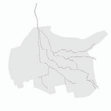
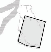
From the perspective of the identity of the city, I referred to the point made in Spirit of Place and took serveral examples to observe the evolution of urban spatial patterns in ancient Chinese cities from the appearance and disappearance of city walls. I found that the logic of urban development is that factors a ecting city boundaries tend to shi from city walls to water resources, and cities move in the direction of having water course and rivers
I then turned my research to Quanzhou, digging into the logic and factors of several di erent periods of urban expansion.
Changhua
In the early Qing Dynasty, city had no wall and was o en attacked by aborigines.
Taipei
In the Qing Dynasty, the city wall was built and ve gates were set up.
Tainan
e wall and four gates were set up.
In 1920, city wall was completely demolished, leaving only the East gate due to Japanese colonial government's policy.
In 1935, the East gate was demolished for road construction.
From 1900, the city wall was demolished for urban correction. e removal of West gate was opposed so that other doors remained.
In 1788, the city wall was set up with two gates on each side.
Suzhou
In 1835, walls were expanded to protect market outside the city gates on west and east side.
In 1966, the East gate, South gate and Small South Gate were demolished and rebuilt in order to rectify the city's appearance.
From 1907, the city wall was demolished for urban correction. Only Big East Gate and Small West Gate remained.
ree of the rebuilt city gates were unrecognizable. e North gate was preserved by municipal planning.
In 1977, the Big South Gate was rebuilt on its original site.
Lijiang
In the early Yuan Dynasty, the city wall was demolished and the urban layout was preserved. In the Song Dynasty, the original city wall was demolished due to the dangerous terrain and commercial development.
Guangzhou
From the comparison between Le Corbusier and Jane Jacobs, my view is that today's ideal urban form should be both economic and innovative while retaining a sense of the site's regional identity. erefore, the following is a conclusion, the beginning of my urban research on Quanzhou, and the position I have maintained throughout this project:
In the Tang Dynasty, foreigners' market was separated from the main city, and Guangzhou was one of the biggest ports in China.
During the Ming Dynasty, the walls were rebuilt to prevent war. e city was rich in water system development.
In the early 1990s, tourism was the main business for the city. e size of the city did not expand signi cantly.
During the Song Dynasty, the city developed into a commercial area in the west, administrative areas in the middle, and residential areas for o cials in the east.
During the Republic of China, the wall was removed due to its loss of function. Only three gates remained.
From 1997 to 2003, the tourism industry developed rapidly. e ancient city was expanded and the South gate was built as the main entrance.
e three parts of the city were merged and expanded southward to build a commercial and entertainment center.
A er the reform and opening up, the city wall and water system were reorganized to add the functions of landscape and tourism.
From 2004 to 2013, the ancient city was expanded in all directions, with the East and North gates built.
A er 1918, the wall was completely demolished according to the city plan, except for a section of the Ming Dynasty wall.
5
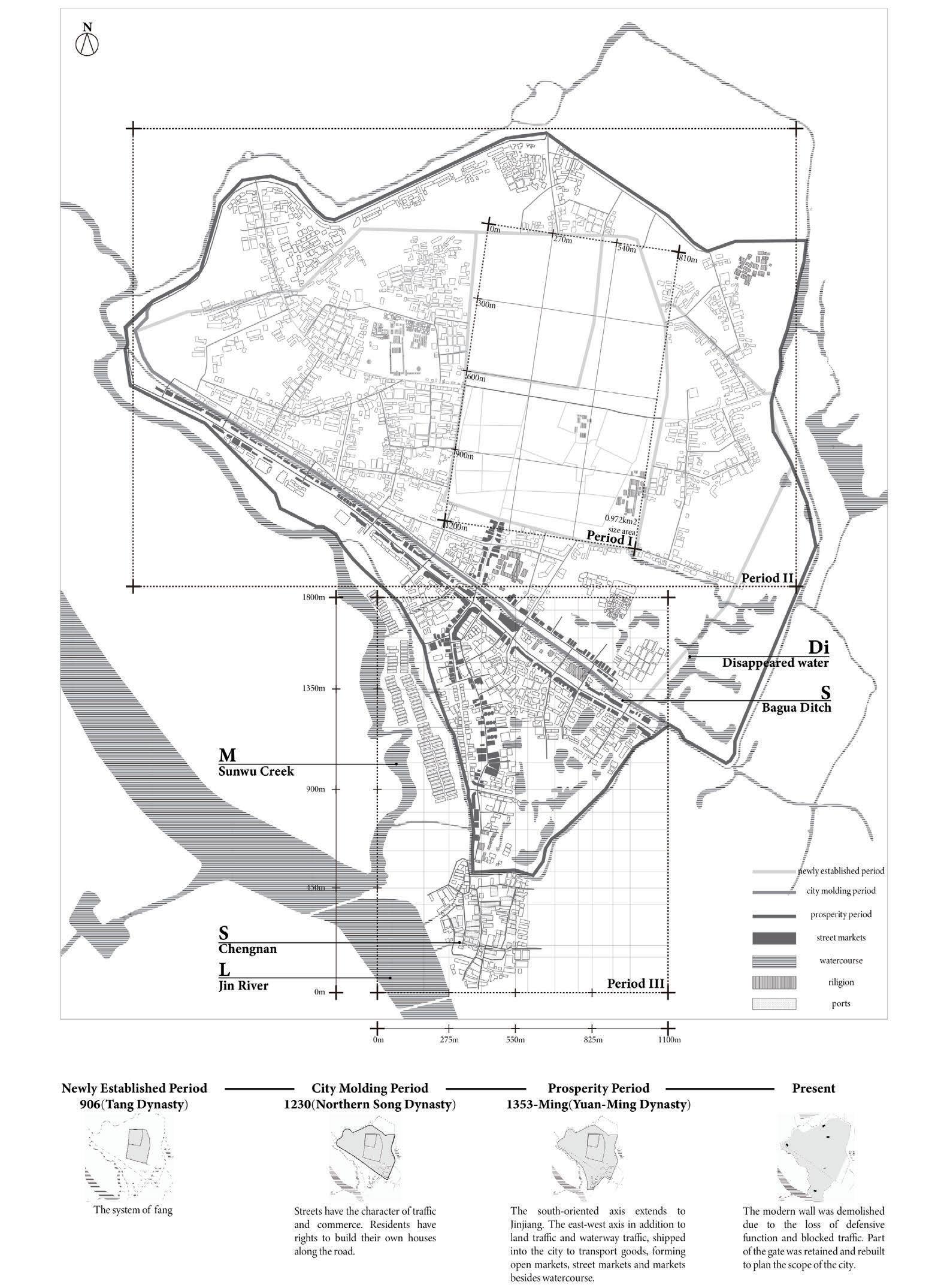
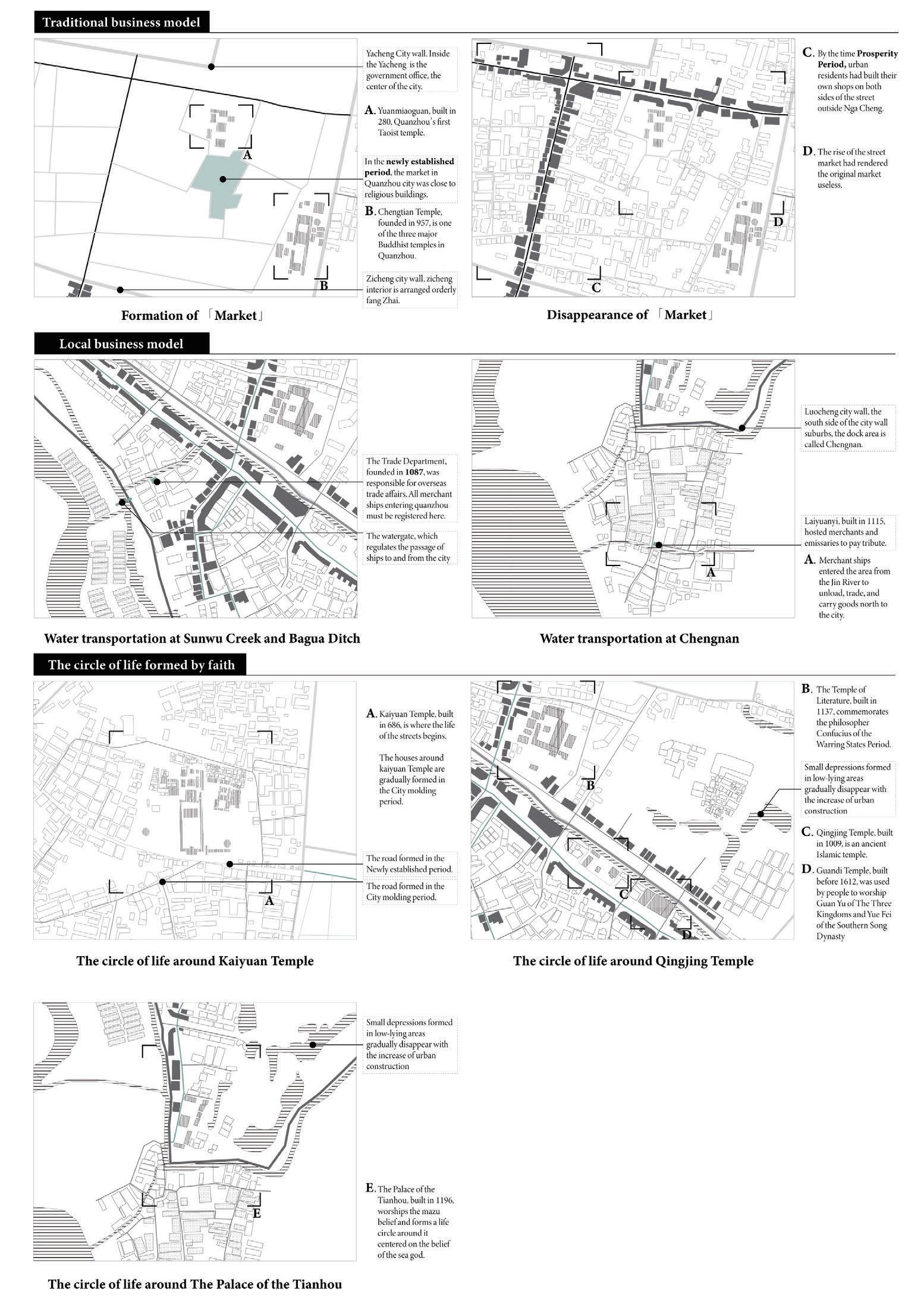
ree Periods of Quanzhou City Expansion 6
Collage of Daily Life Scene in Prosperity Period of Quanzhou City
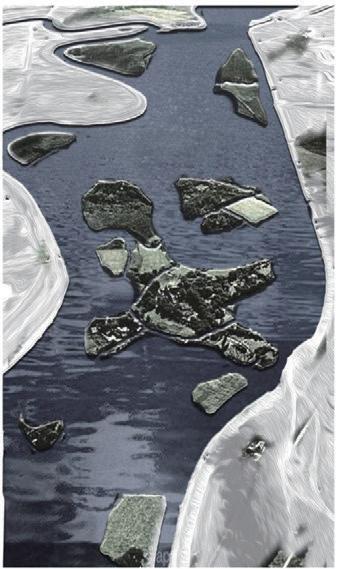
According to the above research on the scope and water system of Quanzhou city, we can infer the scenes of daily life in the prosperity period of Quanzhou city.
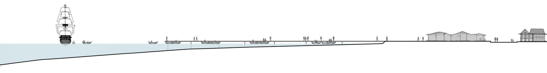
e mode of water trade is: freighters were moored in the Jin River(L) and small boats transported goods to Chengnan(S) or into the Sunwu Creek(M), along which they entered the Bagua Ditch(S) (main city area). Traders moved the goods from the small boats in the dock or ditch to the stores. e daily lives of the residents were closely tied to such a business model. By researching the housing typologies of Quanzhou City at that time, I drew di erent scales of urban life section to restore the maximum possible scenes of life at that time based on history.
A speical type of house inhabited by the general class of residents. It consists of units in long strips in order to transport goods from boats to street market.
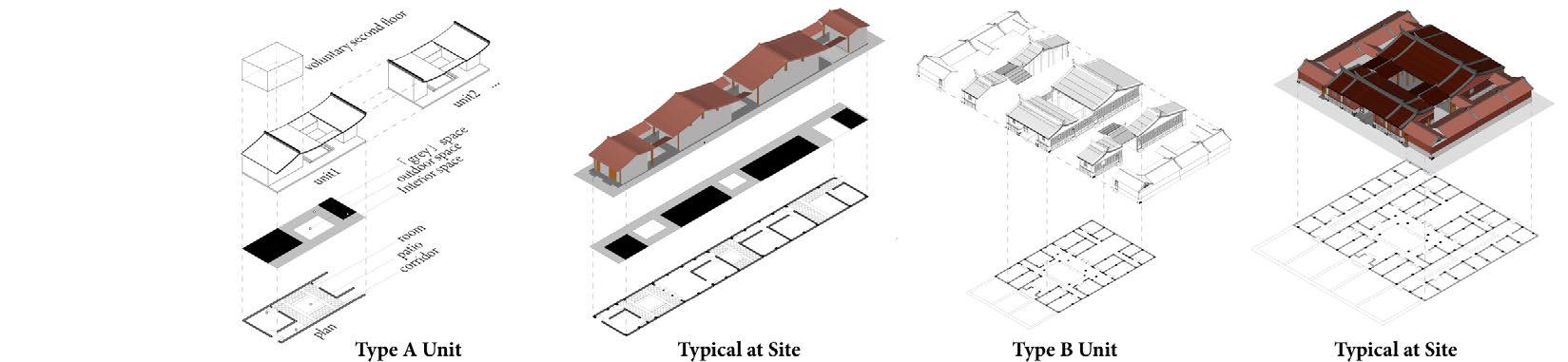
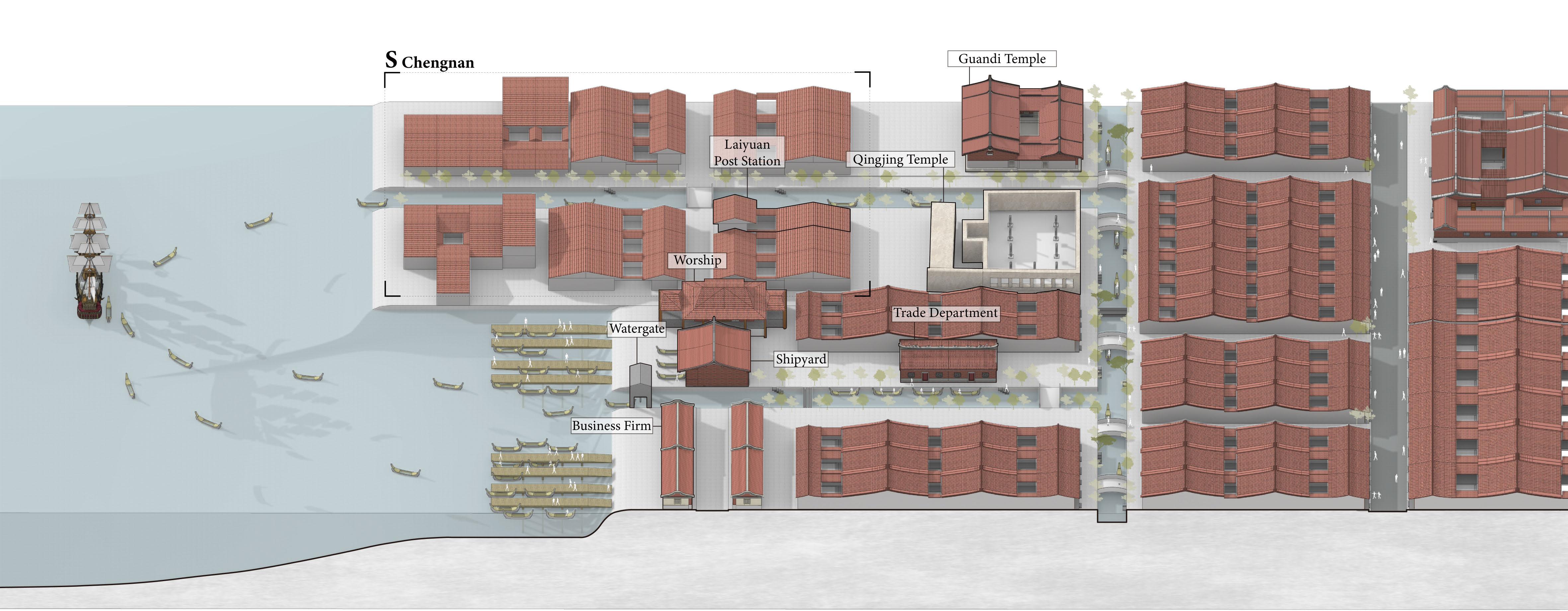
Type B: Dacuo
The traditional form of dwelling in southern Fujian inhabited by big families. S-Chengnan 5m
Ditch
Business Firm Business Firm
Jin River Bagua Ditch
Chengnan
L-Jin River M-Sunwu Creek
Dock Dock Shipyard Worship 50m 150m
Temple Street Market Floating Market
Business Firm
Type A: Shoujinliao
S-Bagua 4m
Sunwu Creek
e Changing Relationship between Residents and Water in Quanzhou City
Extraction of Context of Quanzhou City through Patterns


...It is also possibale to put patterns together in such a way that many many patterns overlap in the same physical space: the building is very dense; it has many meanings captured in a small space; and through this density it becoms profound.
- A Pattern Language (Christopher Alexander)
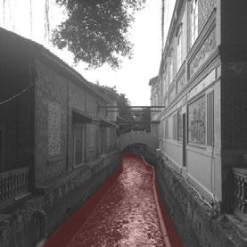
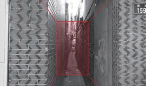
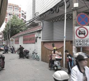
The ancient city of Quanzhou has many such small-scale alleys, only enough for one person to pass.
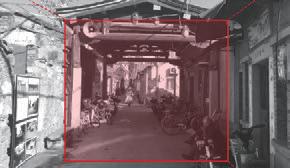
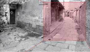
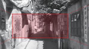
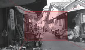
When the alley is spacious, the stores on both sides will appear to occupy the street selling.
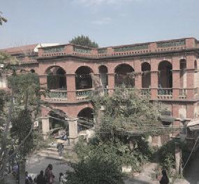
Some old mansions are separated from the street by a courtyard.
It is not rare to see ancient wells when walking in the alleys of the old city. Usually the area around the ancient well is relatively spacious.
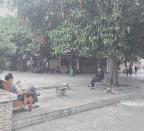
Residents can rest and chat under the pavilion built spontaneously in the middle of the alley.
In the more spacious alleys, residents also move their tables and chairs outdoors to rest and chat.
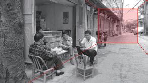
In the more spacious alley, some households will have a height difference between the courtyard in front of the house and the street.
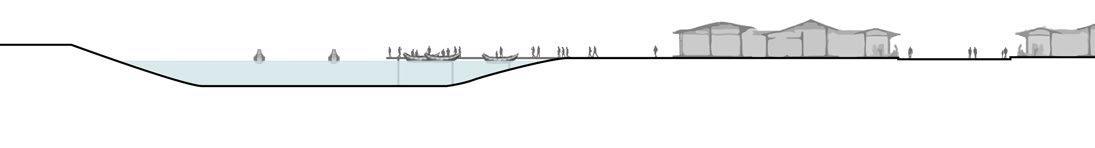
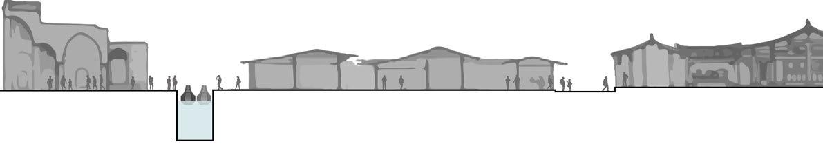
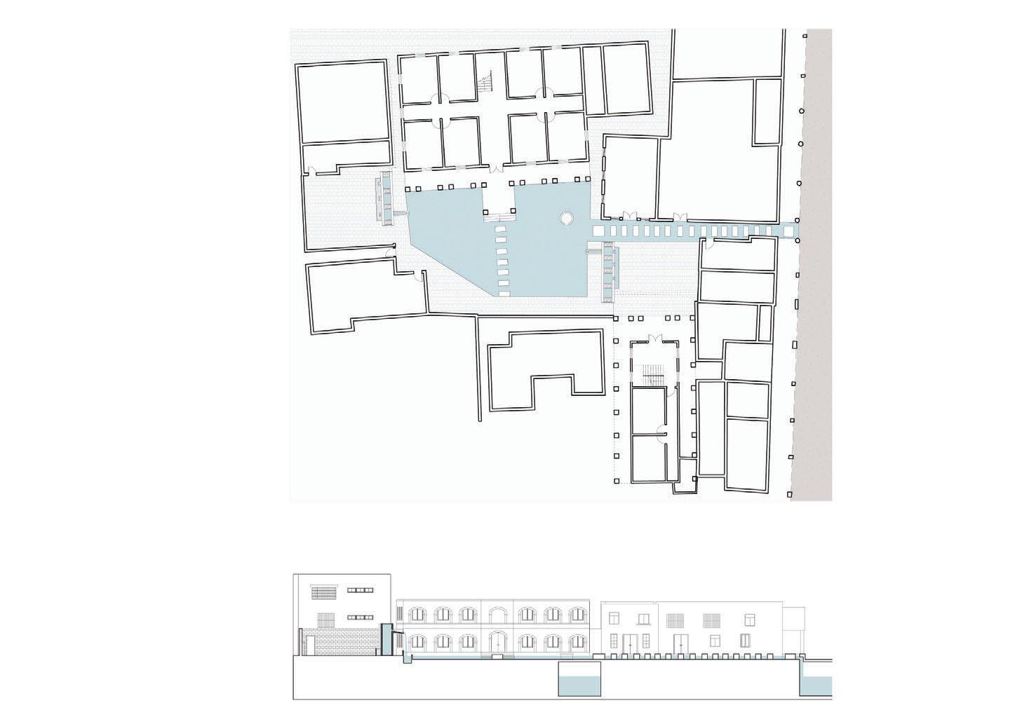
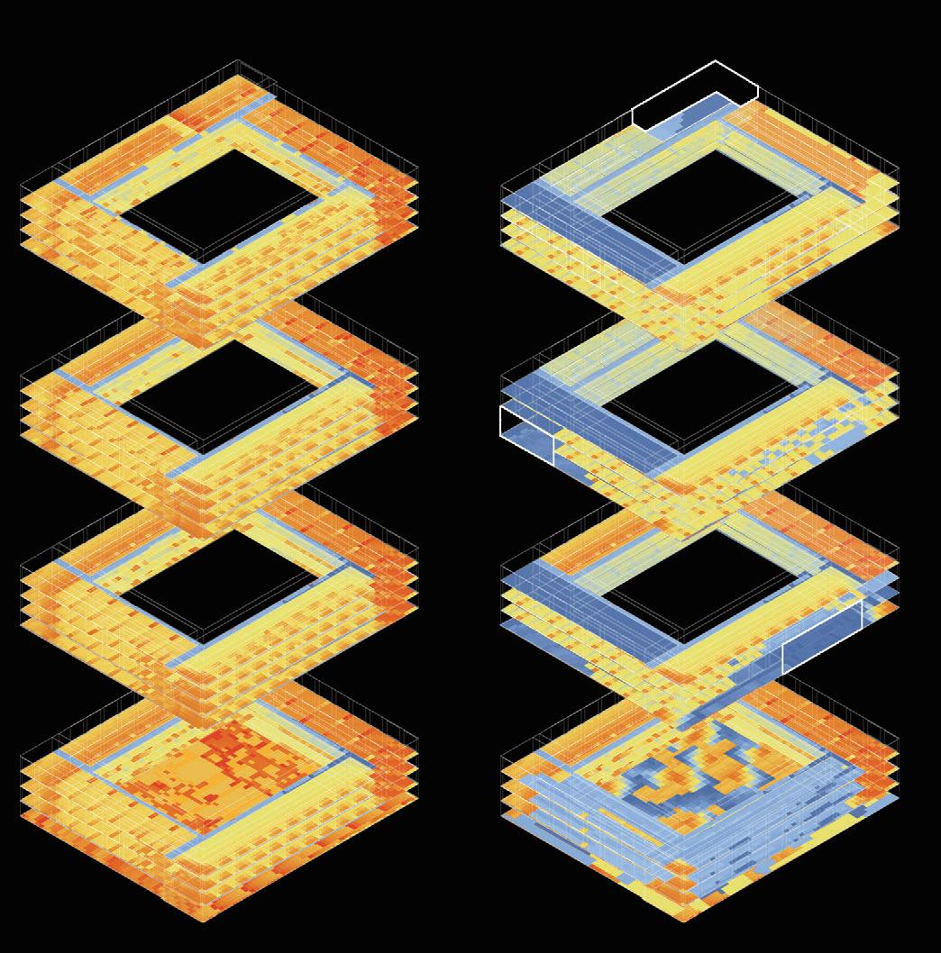
The section of pattern at various scales in the ancient city are overlapped to define the hierarchy of height. The hierarchy represents the intimate connection between the inhabitants and the water in the daily life, and serve as the basis for the decision on the height of the design.

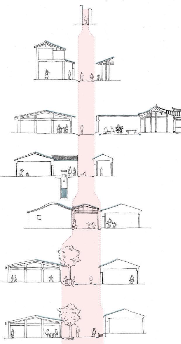
120 300 650 ±0 +560 2F eave +340 fence +360 2F basin +280 1F eave -15 trench -180 highest tide line -380 lowest tide line -480 bottom of the ditch +260 canopy +40 steps +60 1F basin
8
Diagram of Quanzhou's context through level of water
Zoning for Rainwater and Domestic Water Management


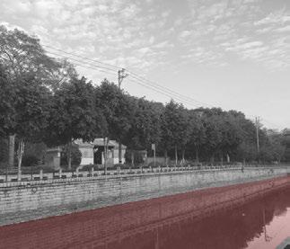
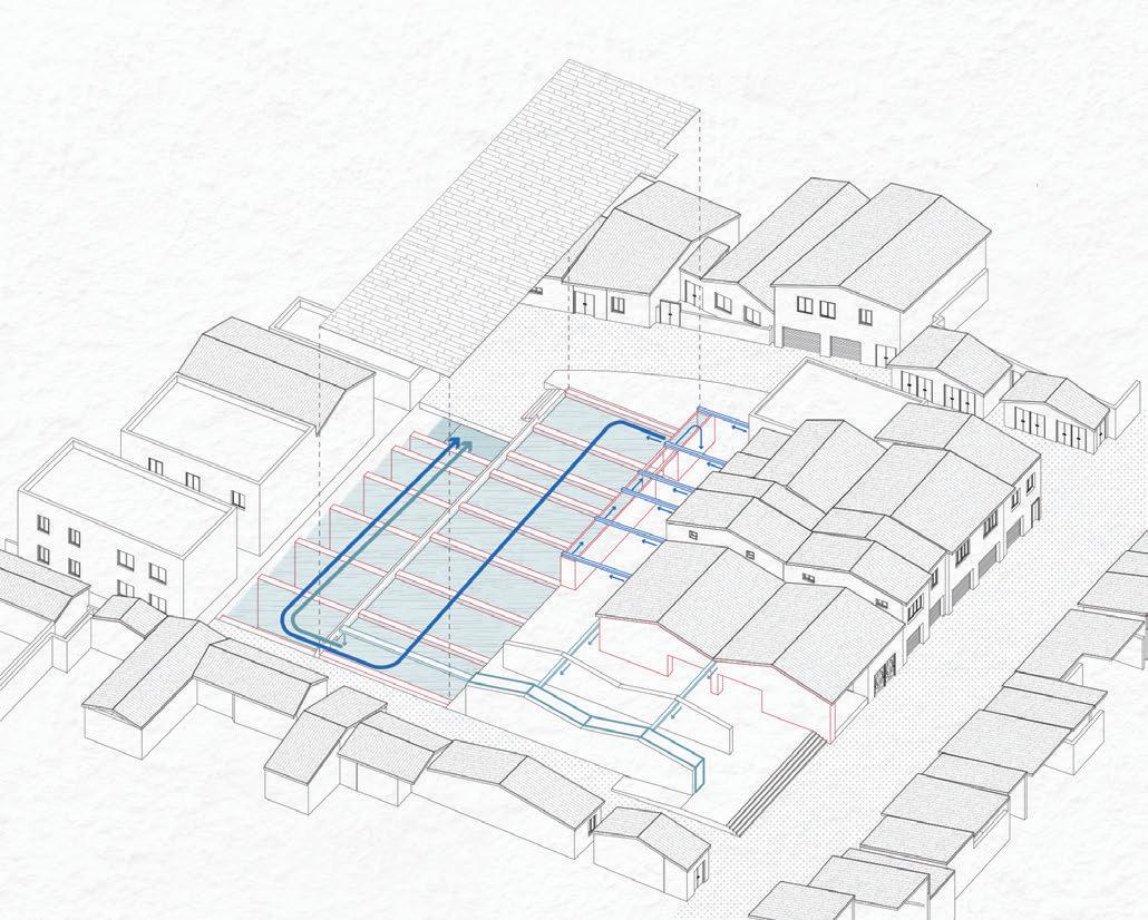
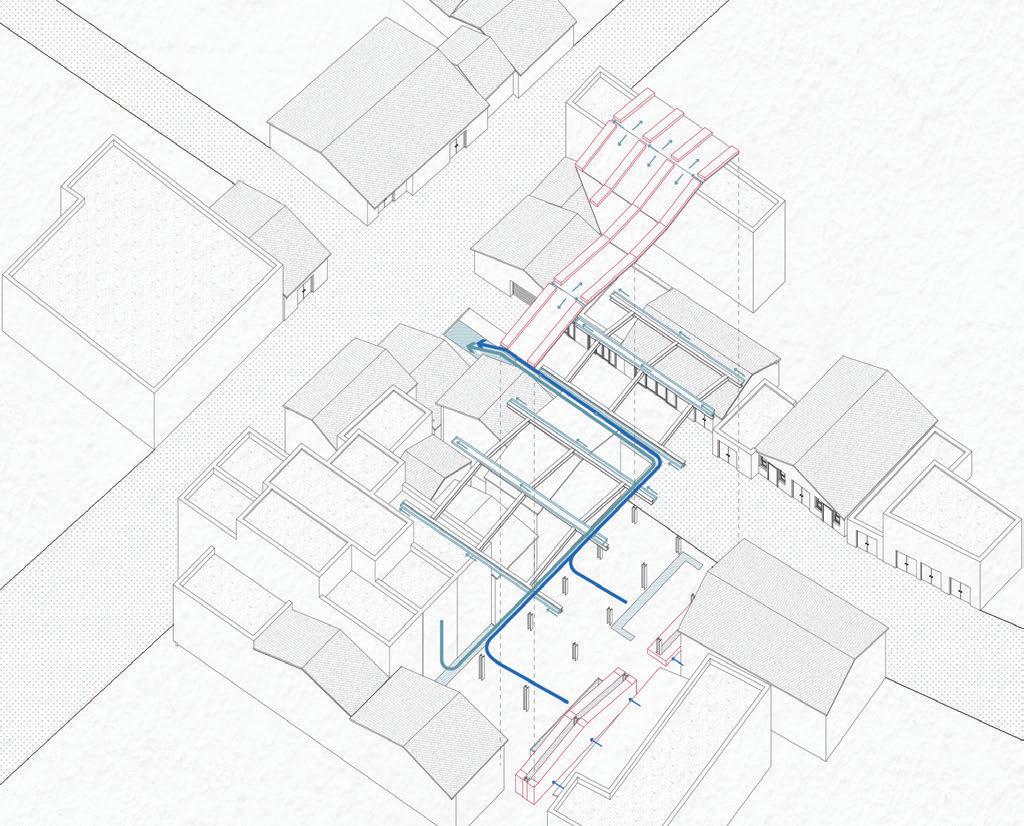
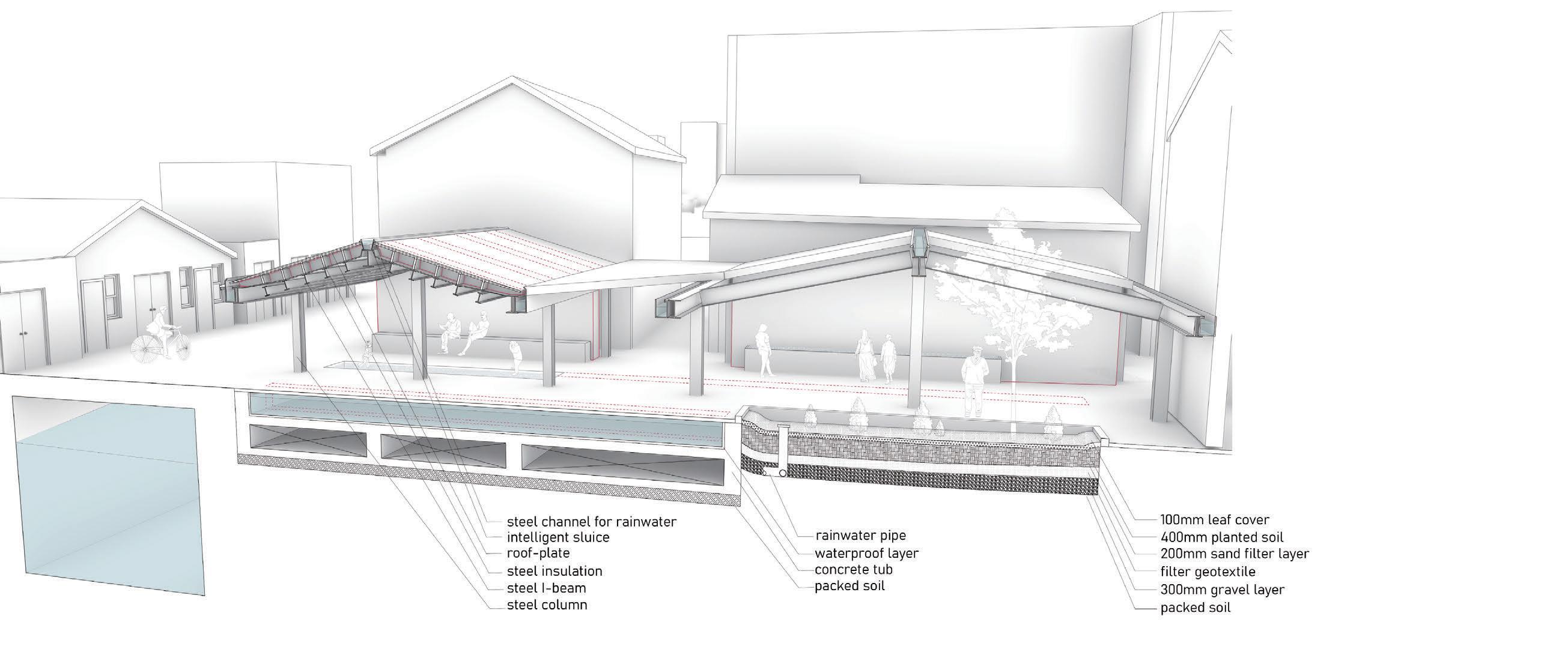
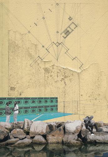
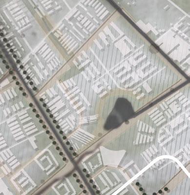
Besides research on heritage protection and archaeology, I paid more attention to improving residents’ lives with modern science and technology from the perspective of the pratical value of progress of ideal city, so as to combine with history to achieve the purpose of calling on the collective memory of the place. Referring to the concept of sponge city, I supplemented the current drainage system with a few small landscape design, which divert, collect and purify rainwater. For domestic water, these landscape could play the role of reclaimed water treatment system, allowing domestic water to be collected and puri ed by regions. At last, the design was re ned in human scale to interact with residents.
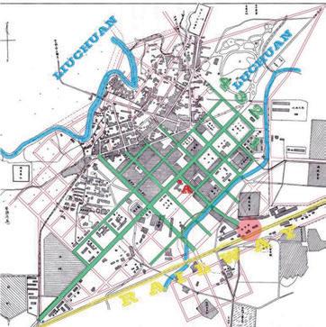
S-Bagua Ditch

M-Sunwu Creek
Haogouqian L-Jinjiang
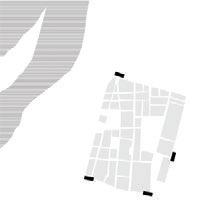
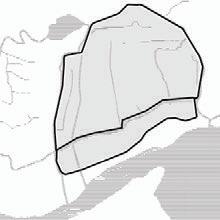
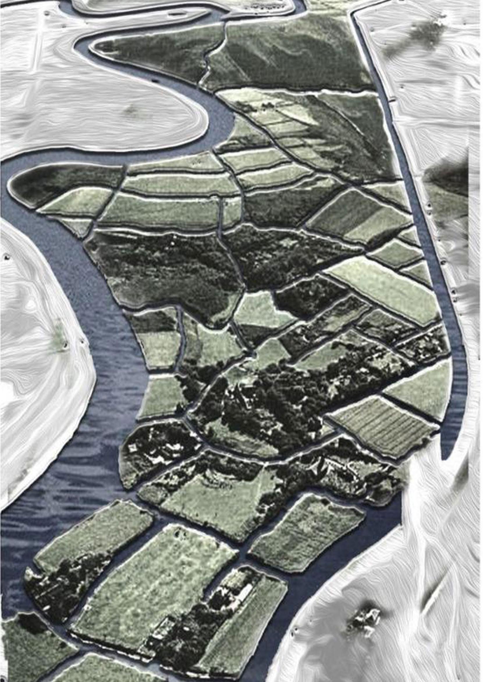
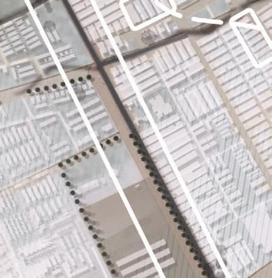
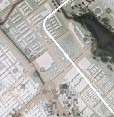
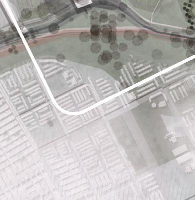
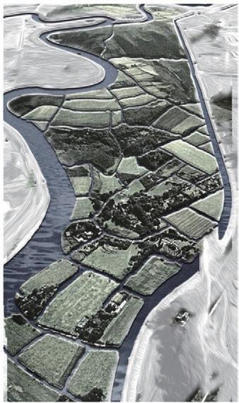
157804 ㎡

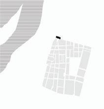
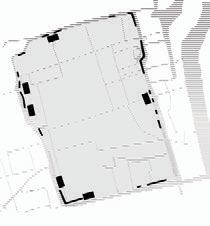
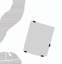
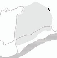
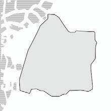
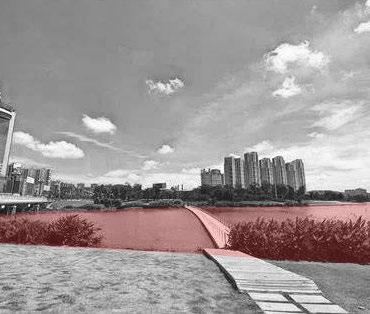
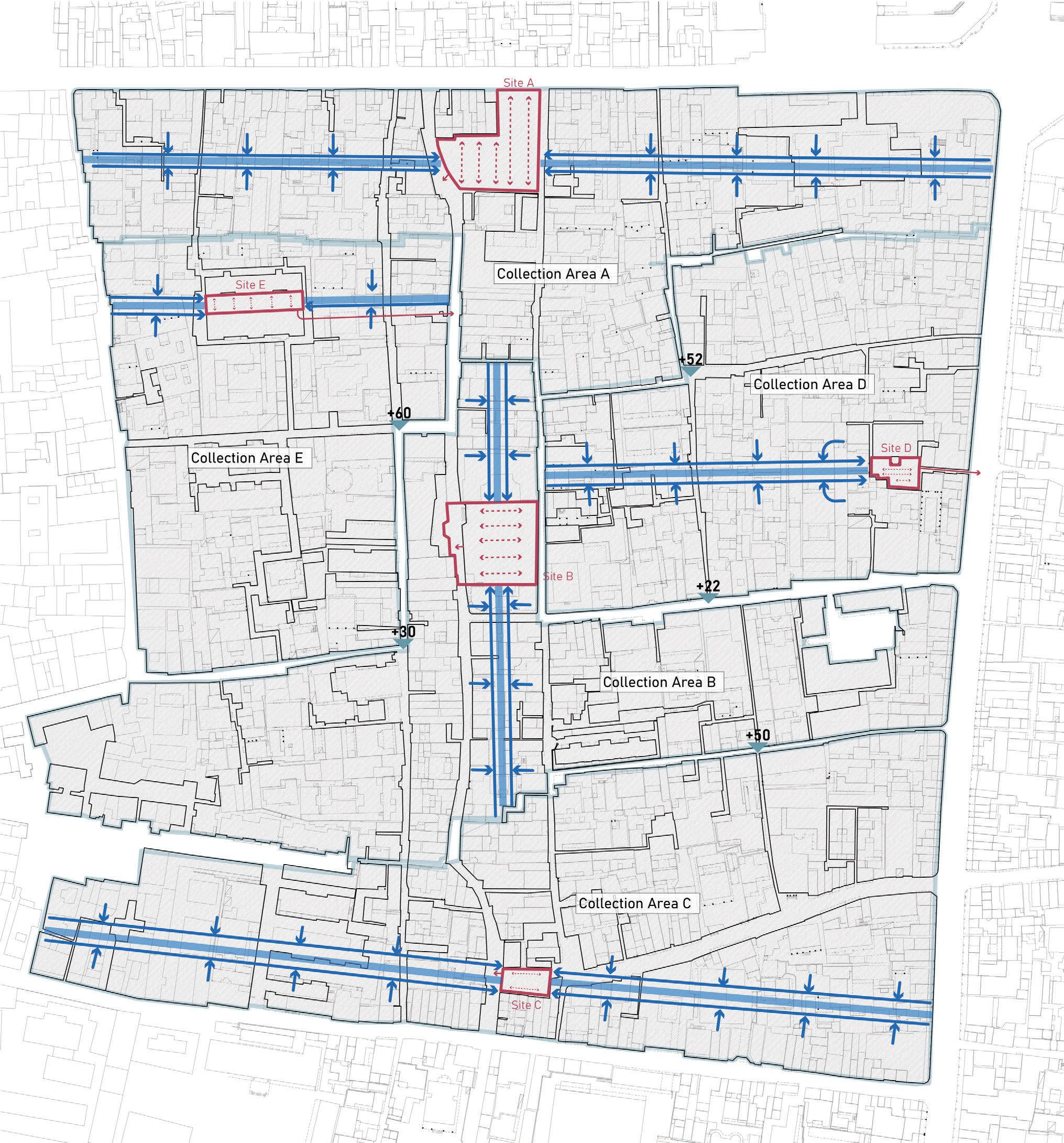
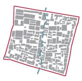
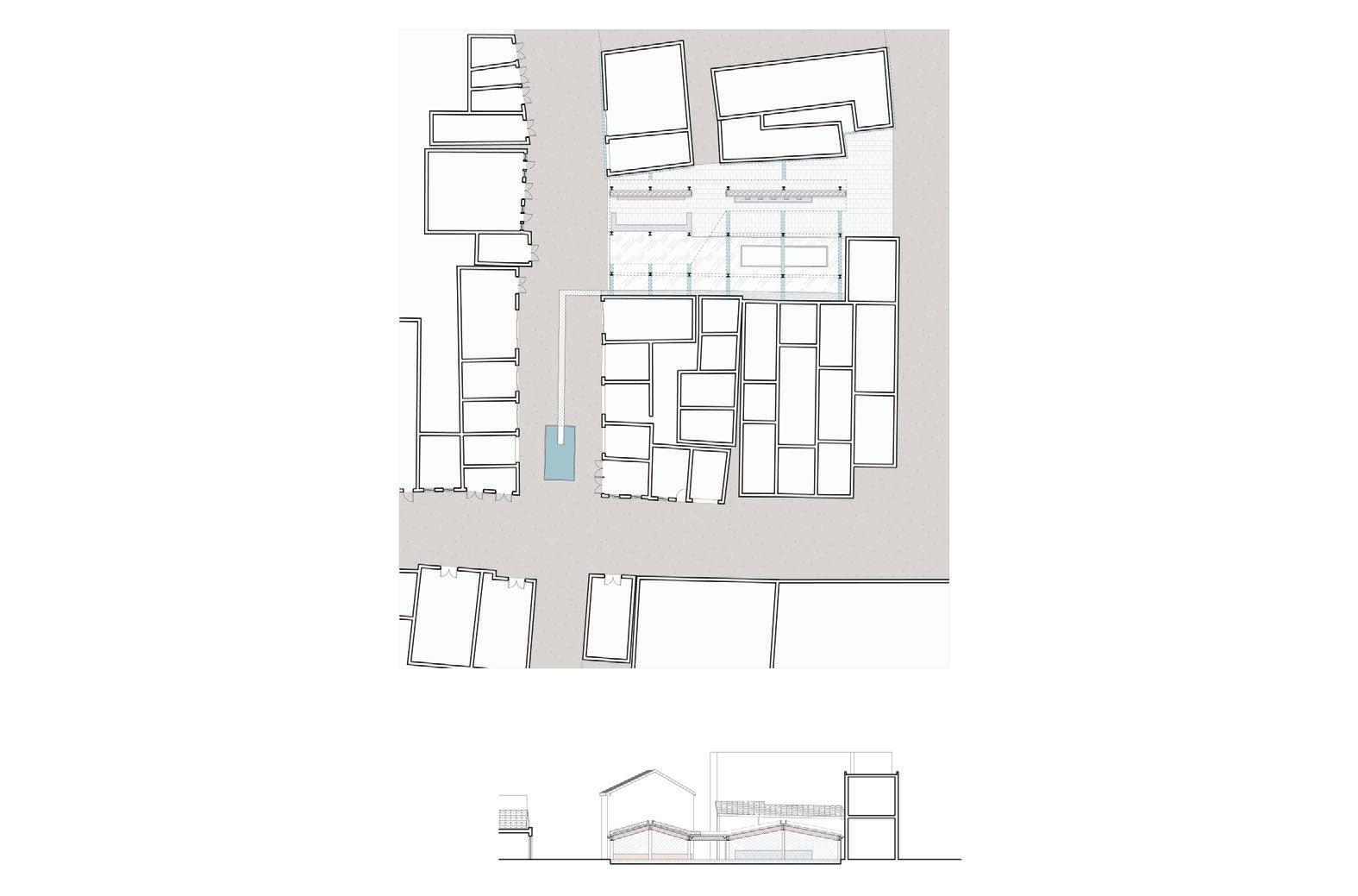
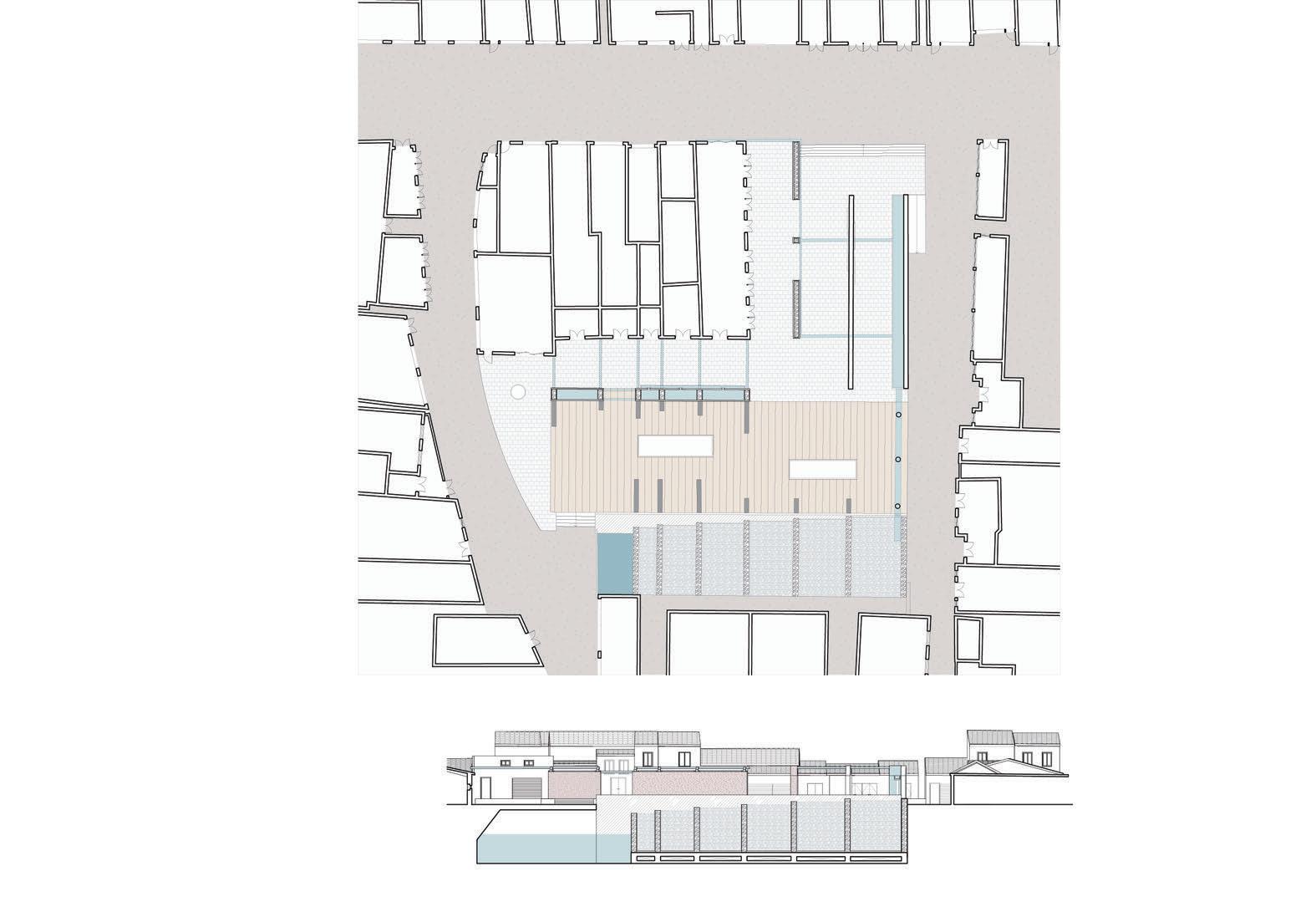
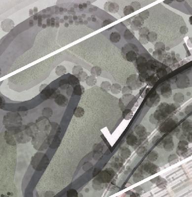
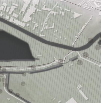
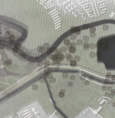
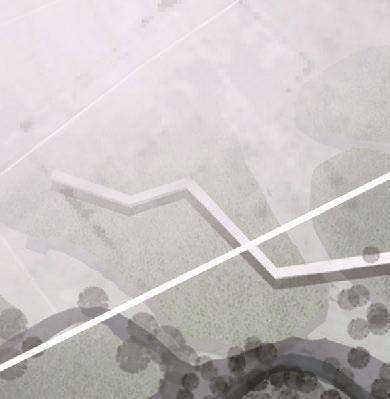
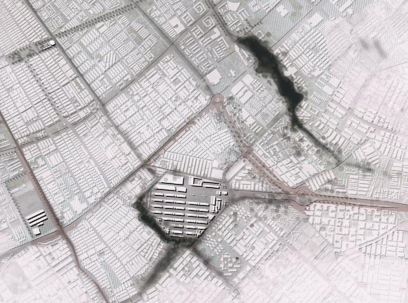
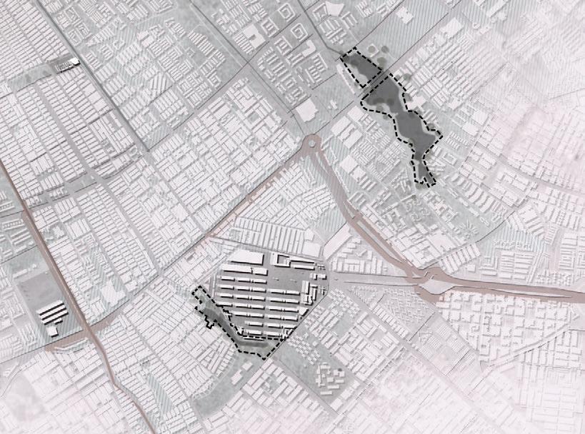
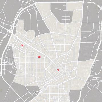
Water from Jin River- Sunwu Creek- Bagua Ditch, gradually apporach the ancient city. Haogouqian, In Chinese, it means the front of the ditch, which joins the Bagua Ditch system, but the whole ditch is now covered by municipal roads. I chose an area of 157804 ㎡ centered on the Haogouqian as a demonstration area to re-establish the intimate relationship between residents and water.
How Much Rainwater Can be Used for Design in is Area ?

Quanzhou is in uenced by the monsoon climate, with a very clear distinction between wet and dry seasons. e gure below counts the monthly precipitation in Licheng District, where the design is located, for the period 2018-2019. e average monthly rainfall is calculated to be about 86.9mm. From this, the volume of rainfall per day in the area can be calculated.
e paving throughout the area is divided into designed permeable paving, normal paving, normal roo ng, and sites. Runo Factor were obtained from the Sponge City Design Manual, from which the Runo Volume for the di erent paving were calculated.
How Much Domestic Water Can be Used for Design in is Area ?


e estimated number of households in the area is 2230. Assuming an average of 3 people per household, the water consumption per person per day is 0.1 ton according to China's Per Capita Water Consumption Report, the amount of domestic water available in the area per day can be calculated.

Average Rainfall Per Day = 86.9/30 = 2.9mm/day Rainfall Volume Per Day in this area = 2.9*10 3*157804 = 457.6 m3 Runo Volume(m3) = Rainfall Volume (m3)*Runo Factor Rainfall Volume(m3) = 2.9*10 3*Area(m2)
(Monthly Precipitation/mm) 1 2 3 4 5 6 7 8 9 10 11 12 50 167.4 208.8 287.8 29.4 59.2 58.7 99.9 80.3 Monthly Average:86.9 19.5 13.9 7.6 46.0 24.2 100 150 200 250 300 1 2 3 4 5 6 7 8 9 10 11 12 2018 2019 212.6 154.6 201.1 154.3 71.0 75.4 90.2 20.2 0.10.0 50.3 Surface Permeable Brick Paving 0.3 2.2 2548 32304 116295 0.8 0.8 74.9 269.8 Normal Paving Normal Roofing 6657 Sites Area(m²) Runoff Volume(m³) Runoff Factor Volume of Rainwater Available = Rainfall Volume - Runo Volume =457.6-2.2-74.9-269.8=110.7(m³) Volume of Domestic Water Available = 2230*3*0.1(m3) = 669(m³) Domestic water pipeline Direction of domestic water ow Direction of rainwater&domestic water ow a er reuse Site Rain water collection area
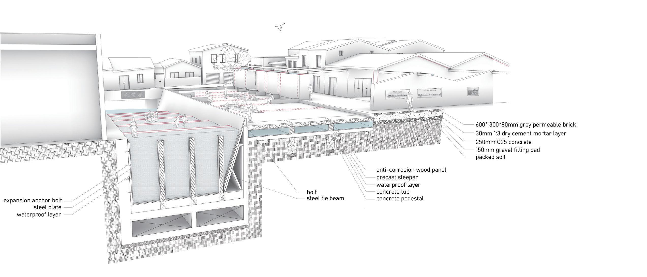
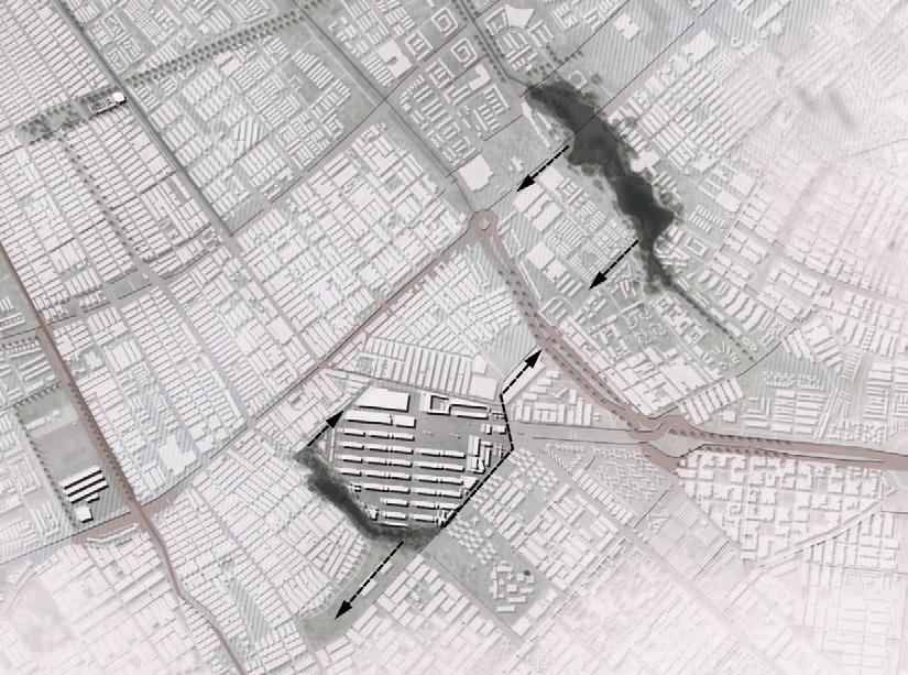
The present situation in the area is that rainwater is discharged through trenches and pipes to Haogouqian Ditch. There is no difference between domestic water and sewage: they are both discharged through sewers to sewage treatment factories, treated and discharged into rivers. I redesigned the drainage system in the area, which directs part of the rainwater to the Gravel Contact Oxidation System and separates part of domestic water from the sewage. Dometic water is also directed to five sites in the area where I establish the Gravel Contact Oxidation System as domestic water treatment station, so that it can be puri ed and reused by residents.
ere is no domestic water treatment station available for Quanzhou City now, so the establishment of dometic water treatment system is a relief and supplement to the existing drainage system of the city.
Flow Chart of Rainwater and Domestic Water Collection Gravel
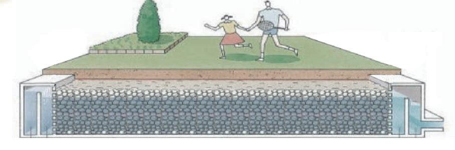
Gravel contact oxidation removes pollutants mainly by sedimentation, adsorption and biodegradation. e core of the structure is a gravel tank e contact time is usually a few hours, and the puri cation e ect is profound, with BOD and ammonia nitrogen removal rates generally between 50% and 60%, and suspended matter removal rates between 75% and 85%.
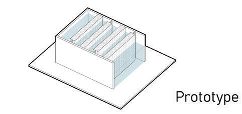
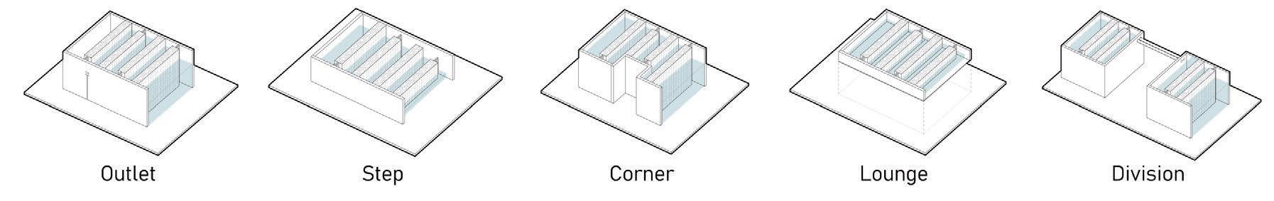
Multiple gravel tanks are combined to form a designed space system that meets the functional needs of water storage and multiple purification. Combined with the Context of Quanzhou, the space system can be changed to meet the needs of life and interact with people.
Intelligent sluice automatically detects the water level. If the water level exceeds the tank's height, the gate opens to let water pass quickly.
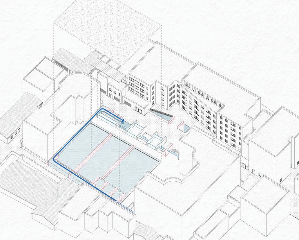
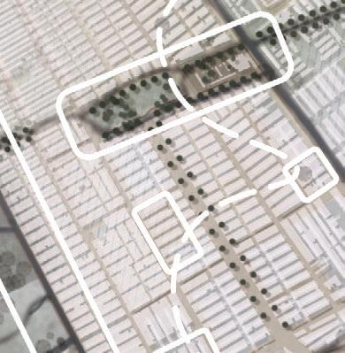
Ground Water Collecting Roof Water Collecting Rainwater Domestic Water Haogouqian Ditch River System Site Site Site supplement to rainwater Rainwater Pool Drain/Trench Road Surface +280 1F Eave +560 2F Eave Surface Runoff Surface Runoff +60 1F Basin +360 2F Basin Permeable Brick Paving Normal Paving Channel/Trench Drain Surface Runoff Roof Runoff Gravel Contact Underground Gravel Contact On The Ground Sunken Green Space Site A-Suqingmen Square Site B-Tongzheng Primary School Site C-Zhenji Temple Square
Analysis on Flow of Rainwater and Domestic Water at Site Direction of rainwater ow Pipes divert rainwater to the site Direction of domestic water ow Gravel contact oxidation tank Pipes divert domestic water to the site
Contact Oxidation Process
10
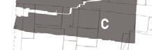
This site was originally a city gate, which was later demolished for use as a square. Many events related to the old city are held here.
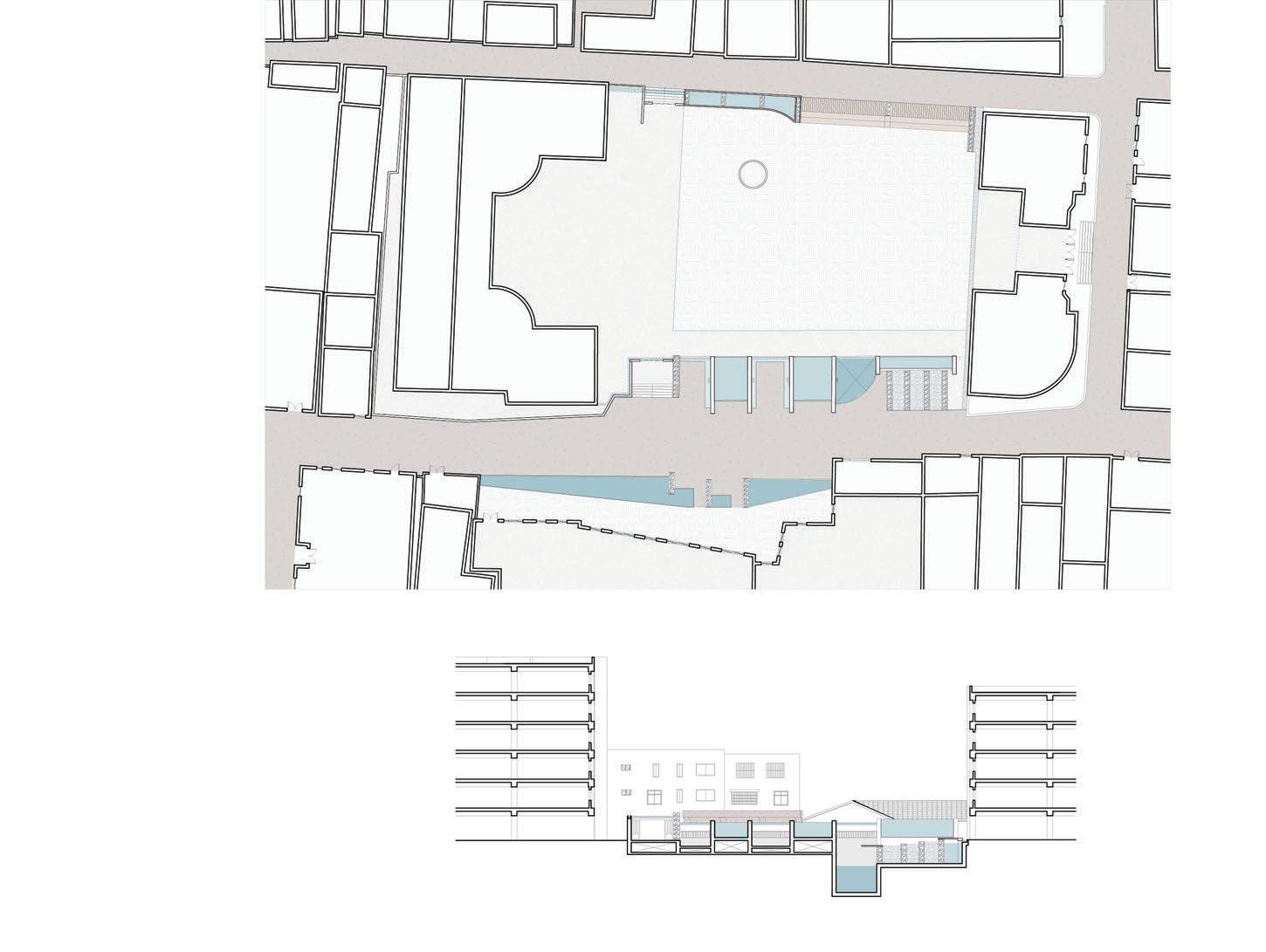
Tongzheng Primary School is located at the junction of Tongzheng Alley and Haogouqian. It was founded in 1908 and has a 100-year history of operation.
Zhenji Temple was established in the Republican period. It is for residents to worship various folk beliefs. e original house opposite it was broken and demolished, and now it is a small square.
Chen Guangchun is a patriotic overseas Chinese who is eager for the prosperity and strength of his country. He used to live here.
Site A-Suqingmen Square
Site C-Zhenji Temple Square
Site B-Tongzheng Primary School
Site D-Guangchun Chen's former residence
11
Site A-Suqingmen Square
12
Site C-Zhenji Temple Square
Storyboard

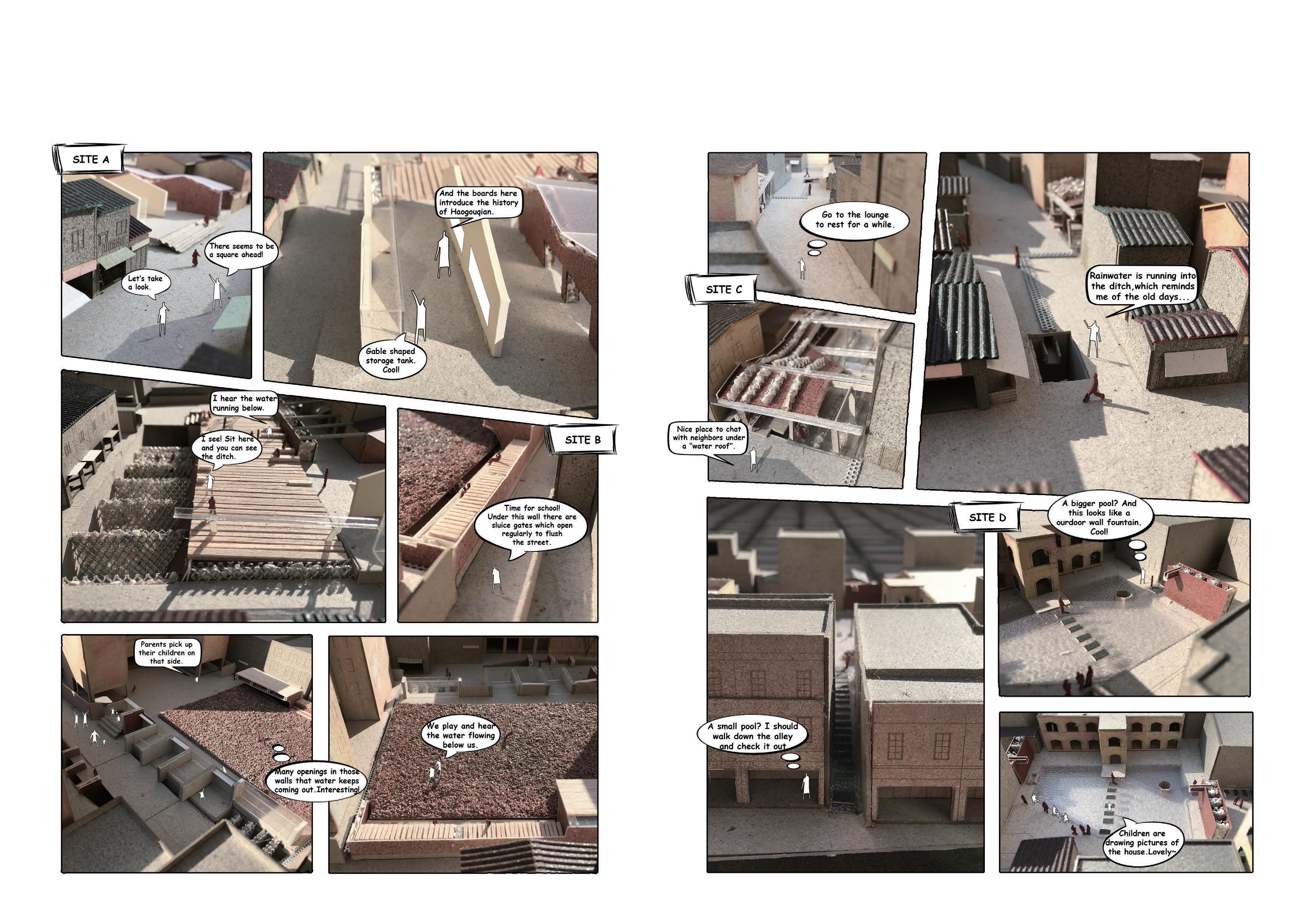
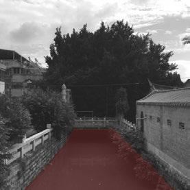
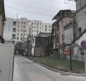
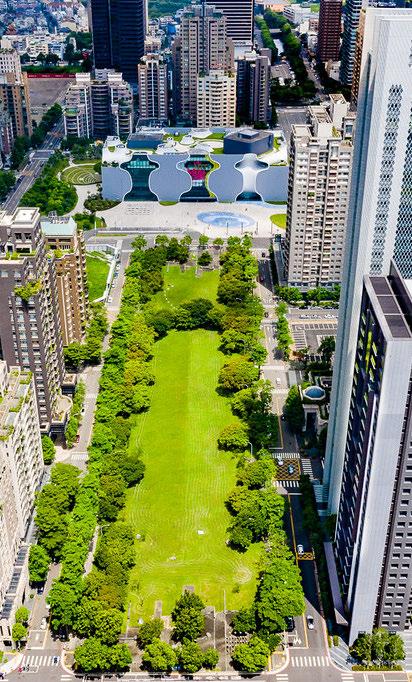
For me, a person who grew up in the ancient city of Quanzhou, it is romantic for both residents and tourists to be aware of the existence of water in the process of exploring the ancient city. erefore I also focus on the creation of storytelling and narrative in the presentation of the design results. e Quanzhou government has been planning a series of renovations, restorations and redesigns of the ancient city center since 2017 in order to become a World Intangible Cultural Heritage site. On July 25, 2021, the application of "Quanzhou: World Center of Maritime Commerce and Trade in Song and Yuan China" to become a World Intangible Cultural Heritage site was successful.
e photo on the right was taken on January 7, 2022. I saw it while I was preparing to submit my application, when I inadvertently passed by Suqingmen Square. I was moved to see that my proposal to reconstruct the relationship between people and water is being realized in a real site. I believe that such a study will make the relationship between people and the city better.

13
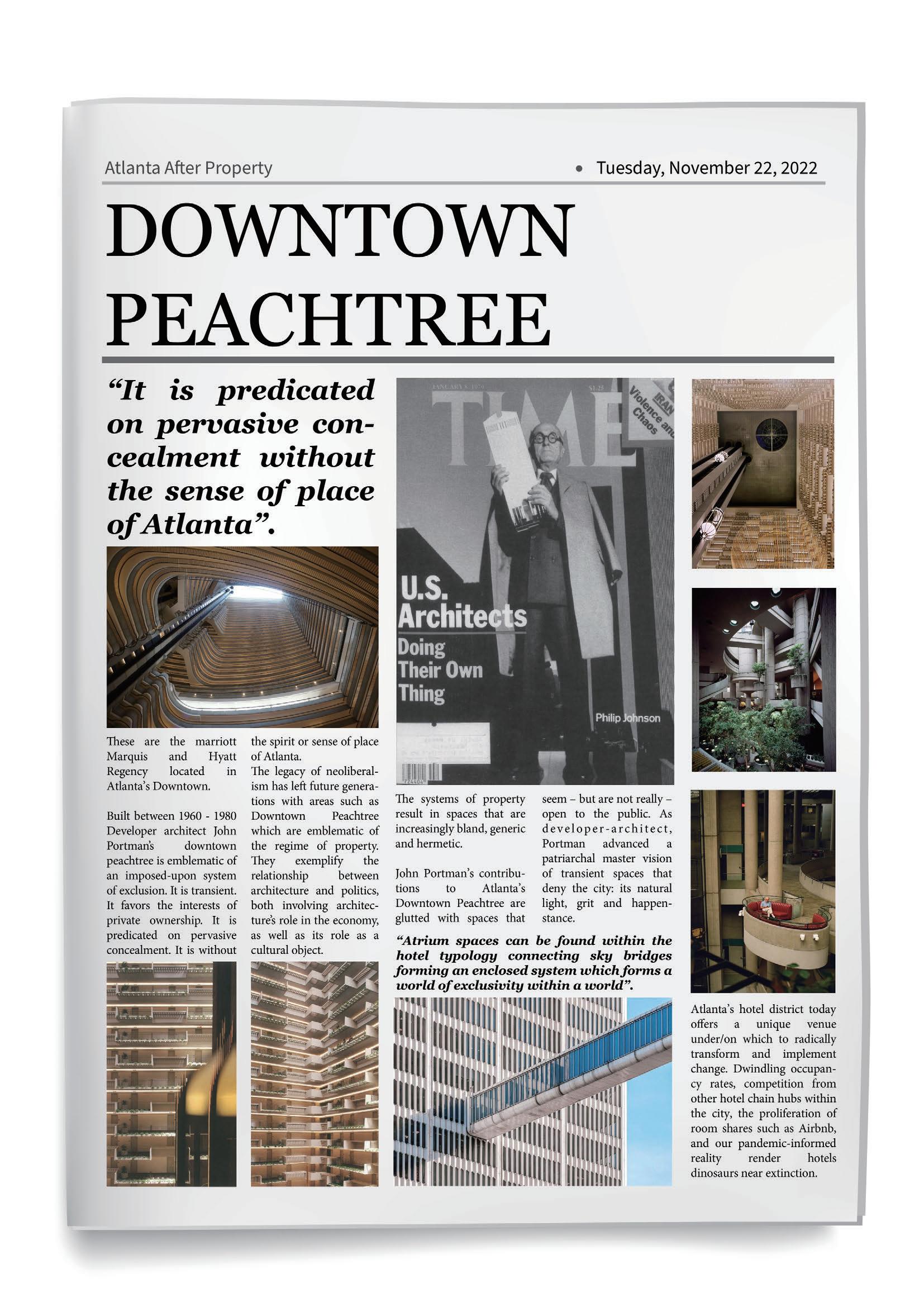
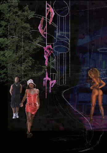
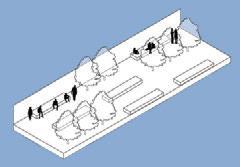
'Re-Wilding' Downtown Peachtree
Atlanta A er Property
2022 GSAPP Fall design studio - team work In collaboration with Heer Shah, María Gabriela Flores, Tippi Huang
Instructor: Emanuel Admassu, Nina Cooke John, Chat Travieso, Jelisa Blumberg, A.L.Hu,
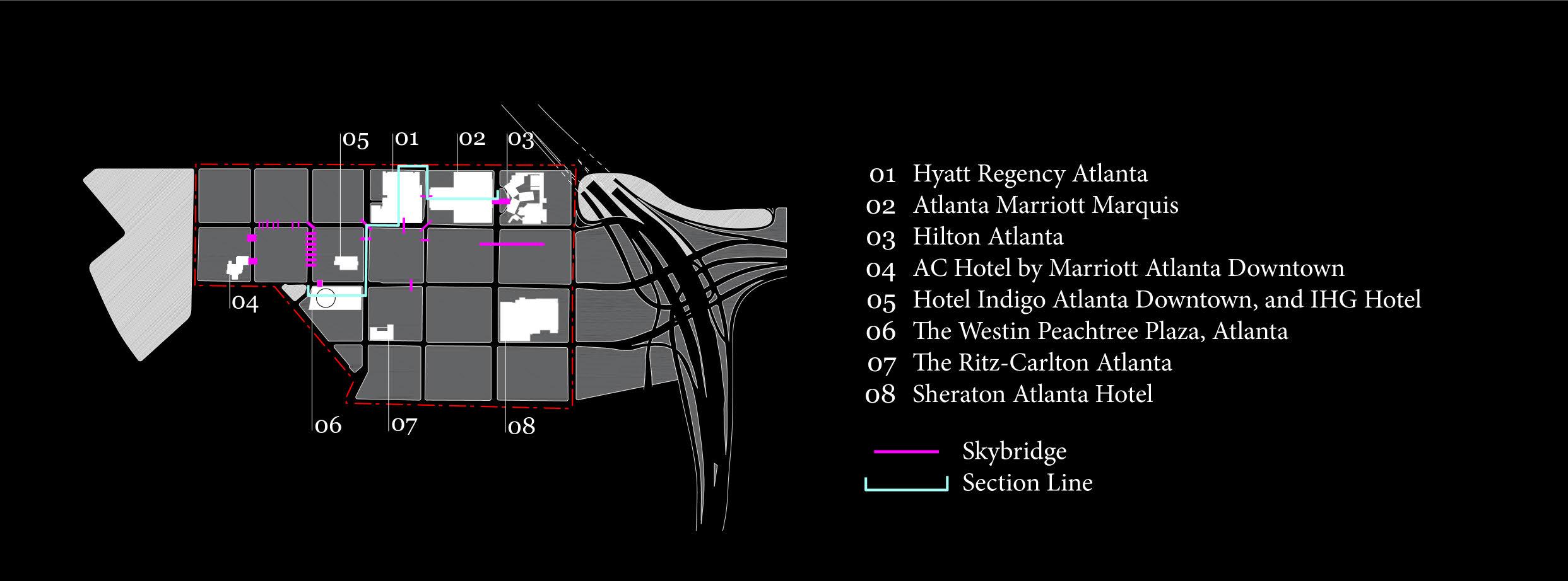
Program: public space, architectural design Site: Atlanta, the United States Area: 782,000 sq m
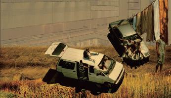
Located in the heart of Atlanta, Downtown Peachtree, is a consolidated hotel district. Its boundary to the East is the highway and to the West Centennial Park. It consists of hotels like westin, hyatt, Marriott and many more. Each hotel is carefully cra ed and internally connected by various skybridges by our man Portman, in line or in trend with the demands of the times.
We imagine a post apocalyptic neolibreal world where the hotel interiors are no longer to be the isolated and property-oriented space, and bring the element of Atlanta back into Peachtree:
• To develop an enclave of resistance beyond privatized enclosure working towards mutual aid.
• To render visible the invisible social ecosystems, peoples and patterns of a place.
• To dissolve objectivity in favor of dynamic, uid and a multi-perspective way of seeing.
Peachtree Center: Legacy of Neoliberalism / Regime of Property

15
Atlanta: Culture and Diversity outside Downtown
Existing Downtown Peachtree
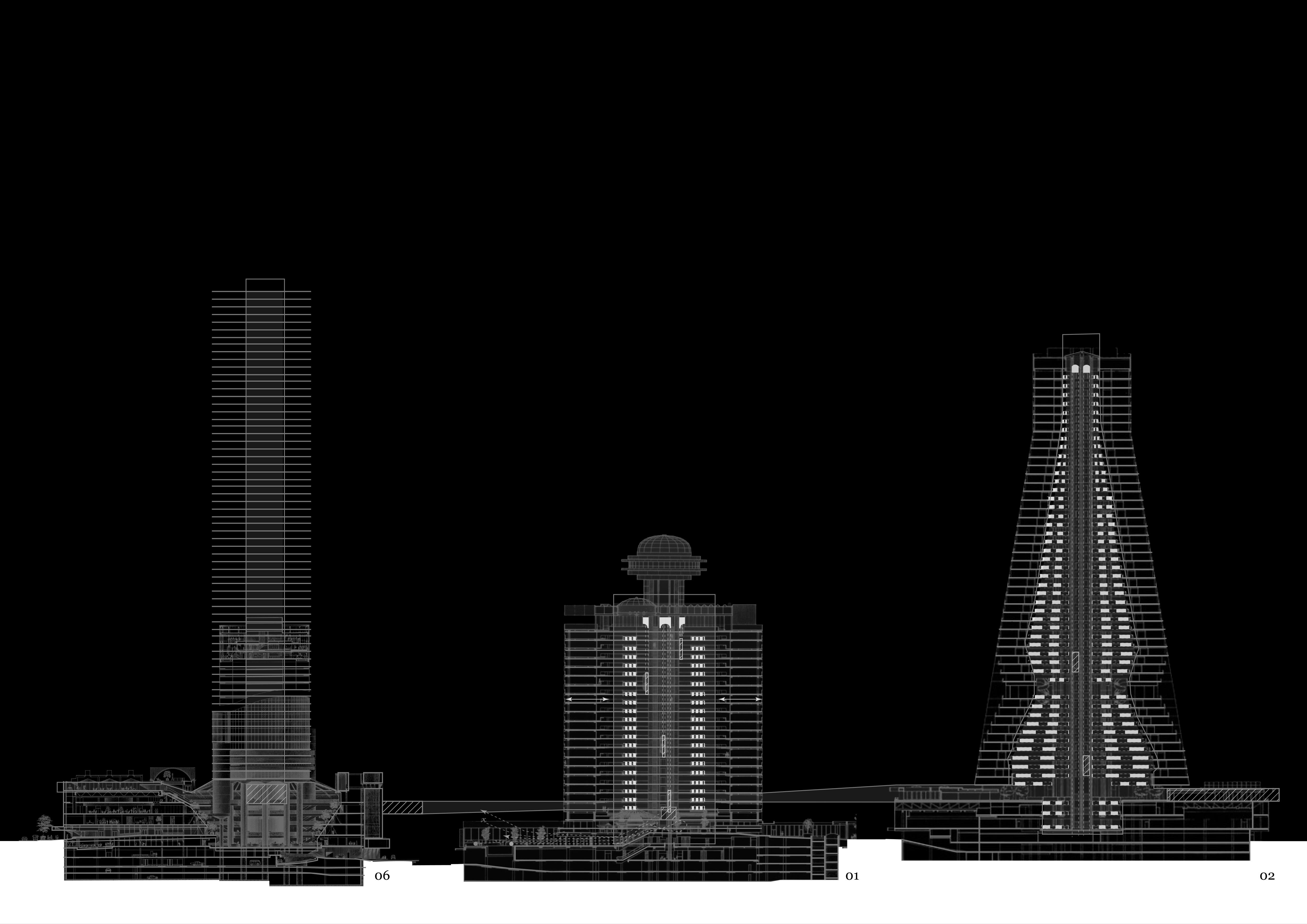
To enter the Marriott Marquis, Westin Peachtree and Hyatt Regency, whether by car or by MARTA, a network of escalators and skybridges unite separate buildings o ering a seamless and continuous experience. We believe there are three factors that can be an opportunity for change in the region today:
1. By taking advantage of leasing the land rather than front-loading initial project costs with land purchases, developers avoided owning a non-depreciable asset (land) and could also expense future lease payments. Developers entered into 99-year lease agreements with land owners; in this case, the City of Atlanta. ese 99-year leases will expire and have to be re-negotiated in the next 40 years. When considering a future a er property, land tenure becomes a powerful tool towards an equitable future.
2. Dwindling occupancy rates, competition from other hotel chain hubs within the city, and the proliferation of room shares such as Airbnb, have kept Atlanta's downtown Atlanta's downtown hotel industry continues to decline. Finding another way out is bound to happen in the near future.
3. The pandemic also allowed us to envision an alternate future for hotels. Grassroots collectives worked with city officials and hospitality businesses across Atlanta to help the unhoused. We envision these to be among the stakeholders of our proposal.
Learn
from Two Samples to Rewilding Peachtree
Queering the City
'Queering the City' represents a multi-perspective view of space as well as a Day to Night Activation since different activities can occur in the same space at di erent times. is concept is a good way to describe and analyze the activities of di erent users in three hotels: Hyatt, Marriott and Westin hotels.
Desert Foraging

In a world of foraging, people can also be free to “take what you need”, which address a resilient and sustainable natural ecosystem as a sample of collective mutual aid. Moreover, the fullness differentiate from day to night provides demographic diversity and more interpretations of the way the space is used.
Elements across Atlanta
To break this site's current enclosure, we have adopted the concept of foraging. For some to forage the land is to see possibility. We observe the natural existing conditions and like the foragers nd possibility even in smallest of the things.
We identify these elements from across Atlanta. These elements will be used in hotel buildings and exterior street spaces to form new social ecosystems.
ese objects start to form a catalog of the everyday.
We begin to explore the possibilities of moving away from the unit condition of the hotel room. e combinations of everyday elements now start forming spaces of daily use and activation. As you can see in the diagram below, using Hyatt Regency Atlanta as an example, each element has its own envelope of in uence and starts impacting the spaces around, forming spaces of collective care for our stakeholders.
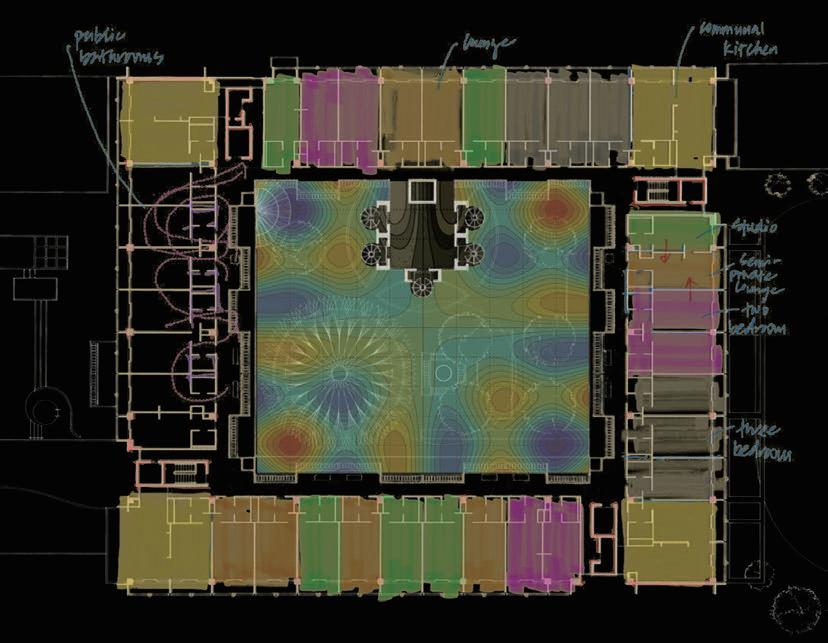
We envision a future for the interior urbanism of atrium spaces that supplants the oppressive cartesian regime of property. We reject the current, exclusive, and proprietary building owner and embrace longterm tenure of the land by welcoming the systemically overlooked and dispossessed. The unhoused, the housing-insecure, the sex worker, and the student come together in spaces of collective care to re-imagine spaces of transgression, ecology and the senses.
Let the Outside In!
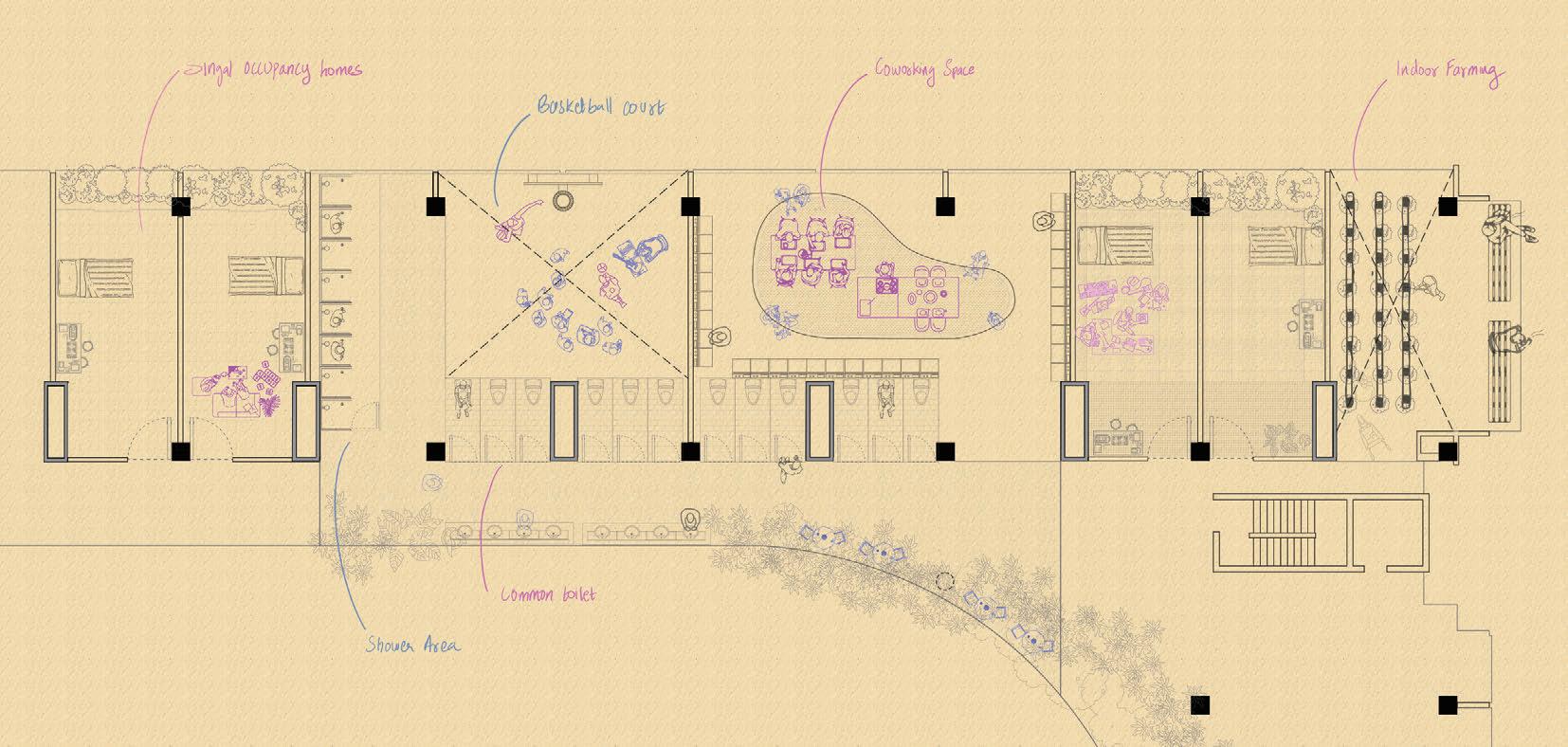
Elements across Atlanta are placed into the downtown pearchtree, forming a new social ecosystem. It disturbs the original indoor-outdoor boundary. At the URBAN SCALE the design intervention includes:
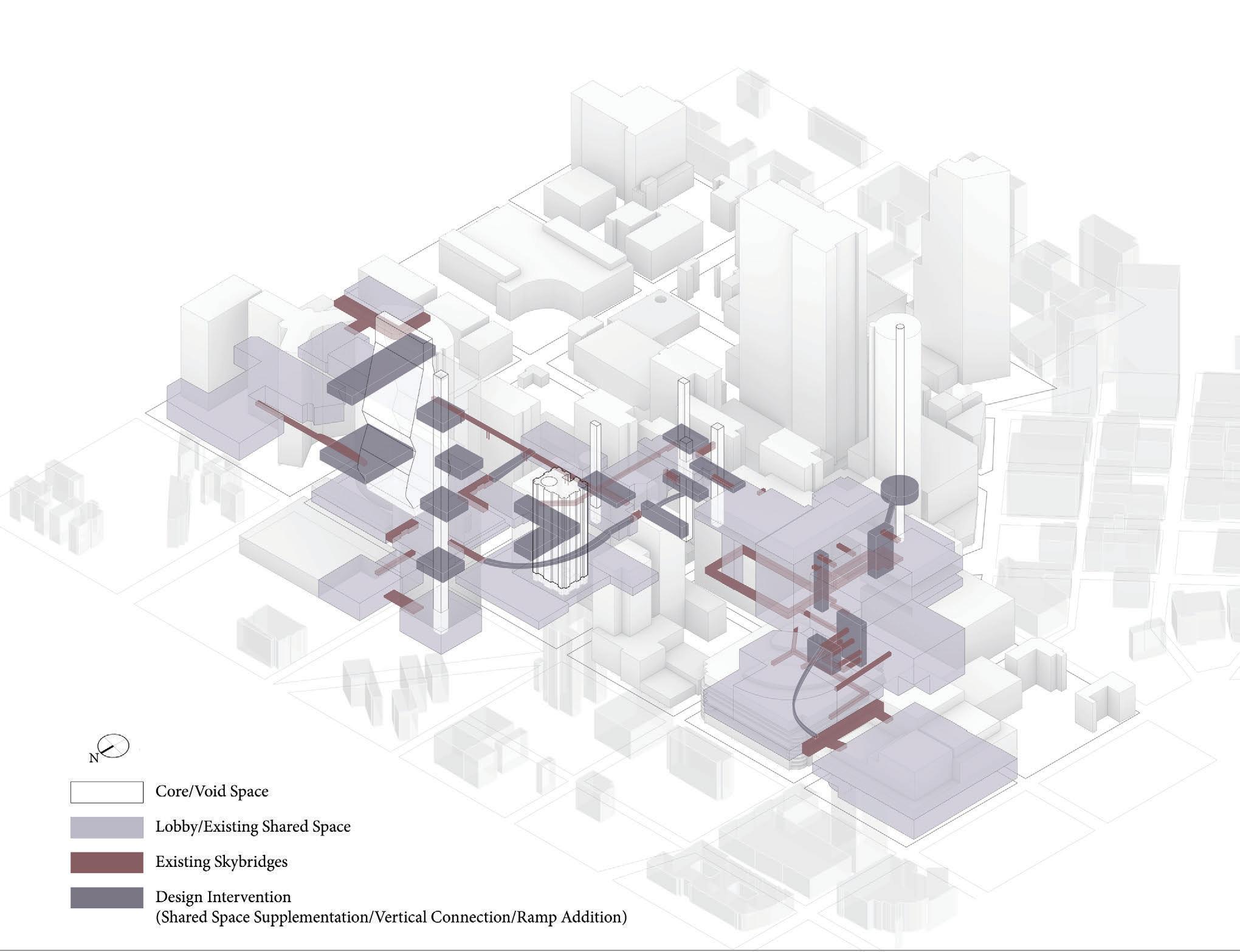
1. New ramps and vertical walkways connecting to the neighboring bridges to enhance the accessibility of the indoor pedestrian system and to form a clear and continuous spatial system;
2. e removal of some oor slabs to release the space and to form a new shared space, which together with the existing shared space forms the shared system of the area;

3.Open up the ground oor of the hotel buildings to create a public life in this district.

We are interested in creating gradients of activities that begin to challenge the conventional notions of comfort within the building envelope. We envision the a er property of the Hotel district through turning o the air conditioner and making it open to the city.
One of our strategies was to remove the roof of the building to allow sunlight to come in and also to create a wind tunnel e ect in the atrium. In terms of ecology, landscape and Some planting behavior, indoor farming can be brought inside the building.
 Architectural Scale - Collective Care
Architectural Scale - Indoor Comfort
Architectural Scale - Collective Care
Architectural Scale - Indoor Comfort
Conceptual
Collective Care Day & Night Shi
Interior Ecology Day & Night Shi
Interior Ecology Indoor Comfort Heatmap 18
Model
ing/
ing/
A World A er Property

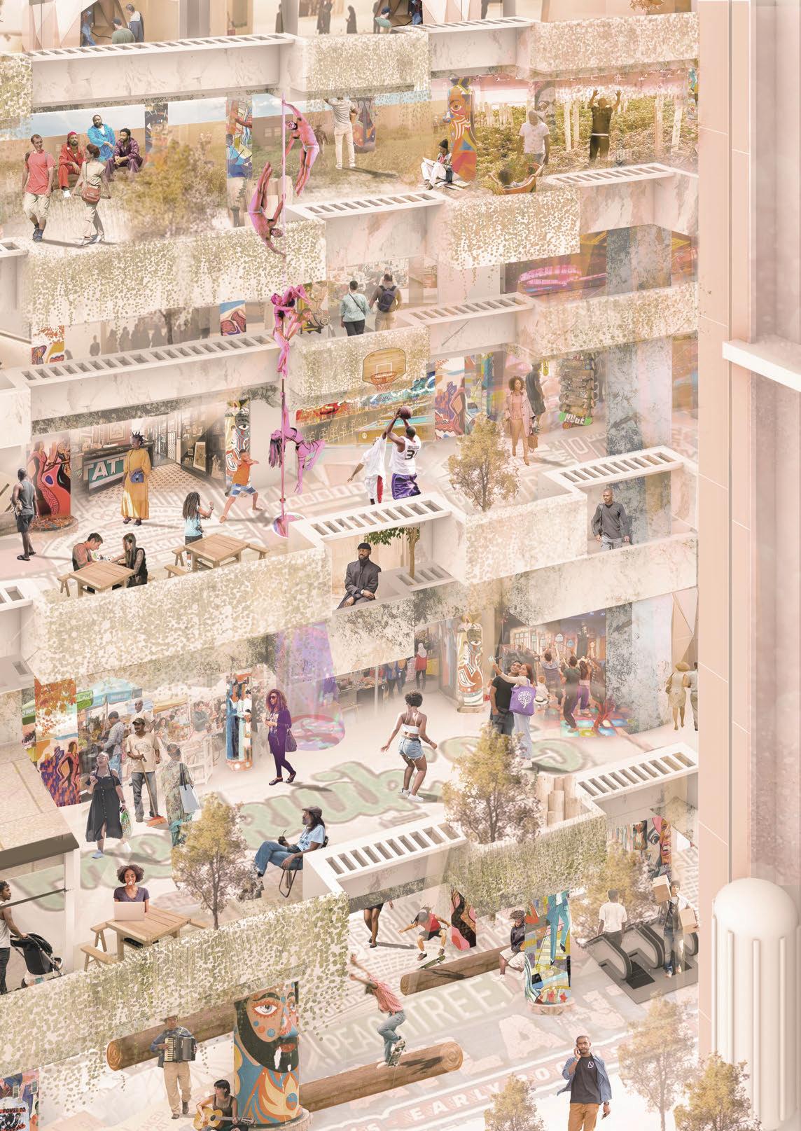
We begin imagining a multiplicity of activities generated across spatial geometries. Not just in space but in time. We imagine a day in downtown where activities start wrapping themselves around and in the spaces as they appear, expand and or disappear throughout the day. Activities of trade, maintenance, shelter, community and celebration.
e zoomed in plans of a wing shows the di erent ways in which it has been occupied across di erent levels. Starting to have collective spaces rather than individuals. Imagining in pink the day activities and in blue the night activities.
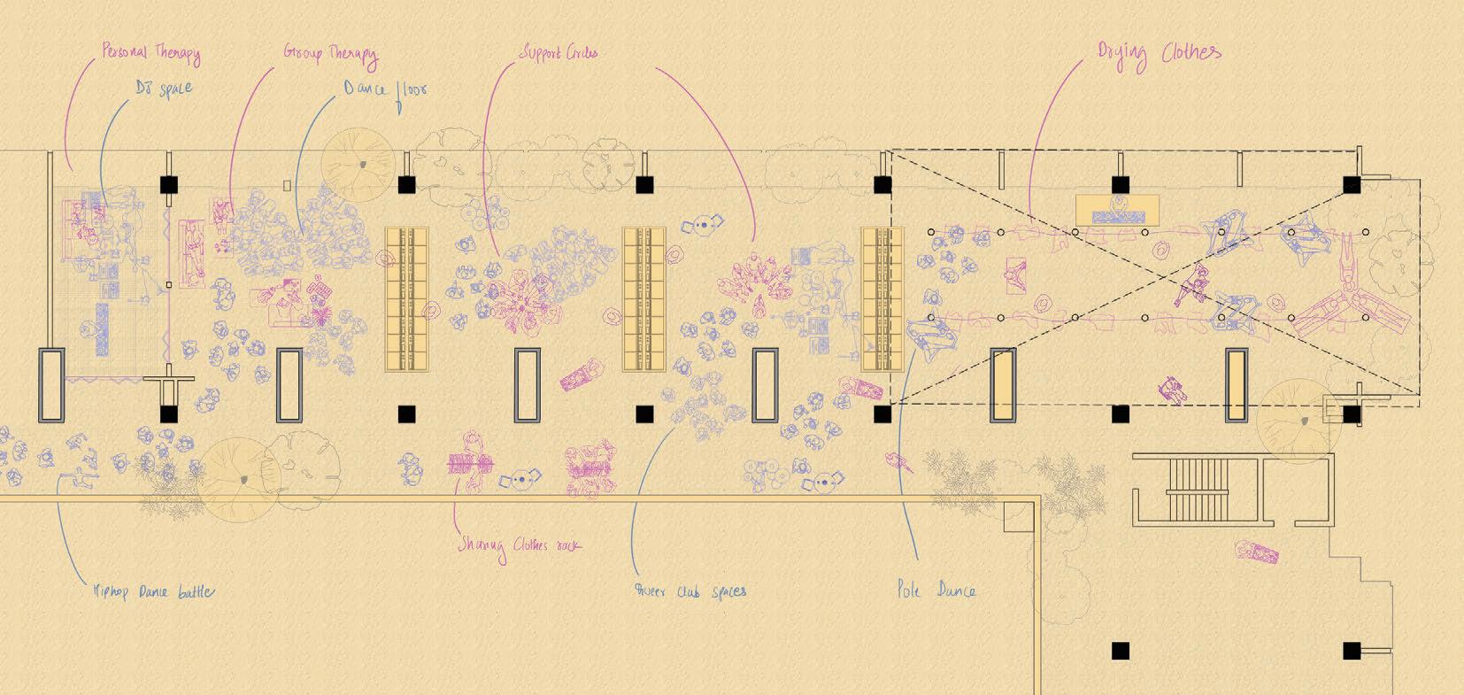
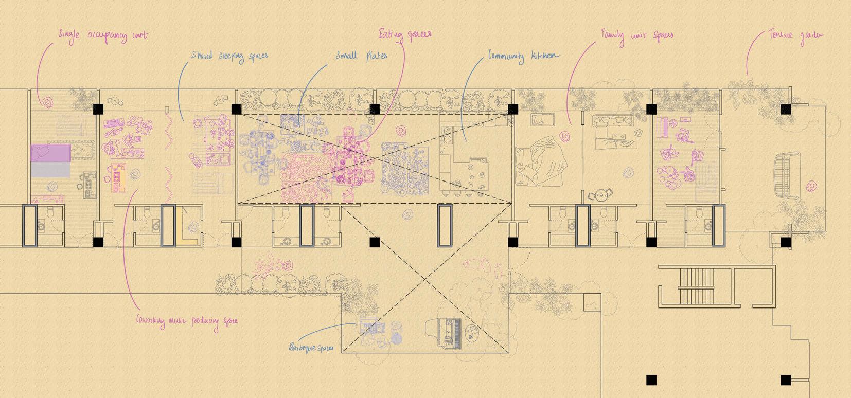
Introducing spaces for activities like talk therapy, some units converted to housing for the housing insecure. All these activities are imagined temporally where during the day when the poles are used to hang clothes, at night they are used for pole dancing. Combinations of elements like a series of washing machines are used to form enclosures where in the middle support groups gather.
Very rigid notions of activities are re-imagined In the world a er property there is no single use of the building. We imagine housing units as also spaces used by the people as spaces to work, We introduce common community kitchens and spaces to gather and eat as well as organize small plates.
 6F
6F
18F
12F
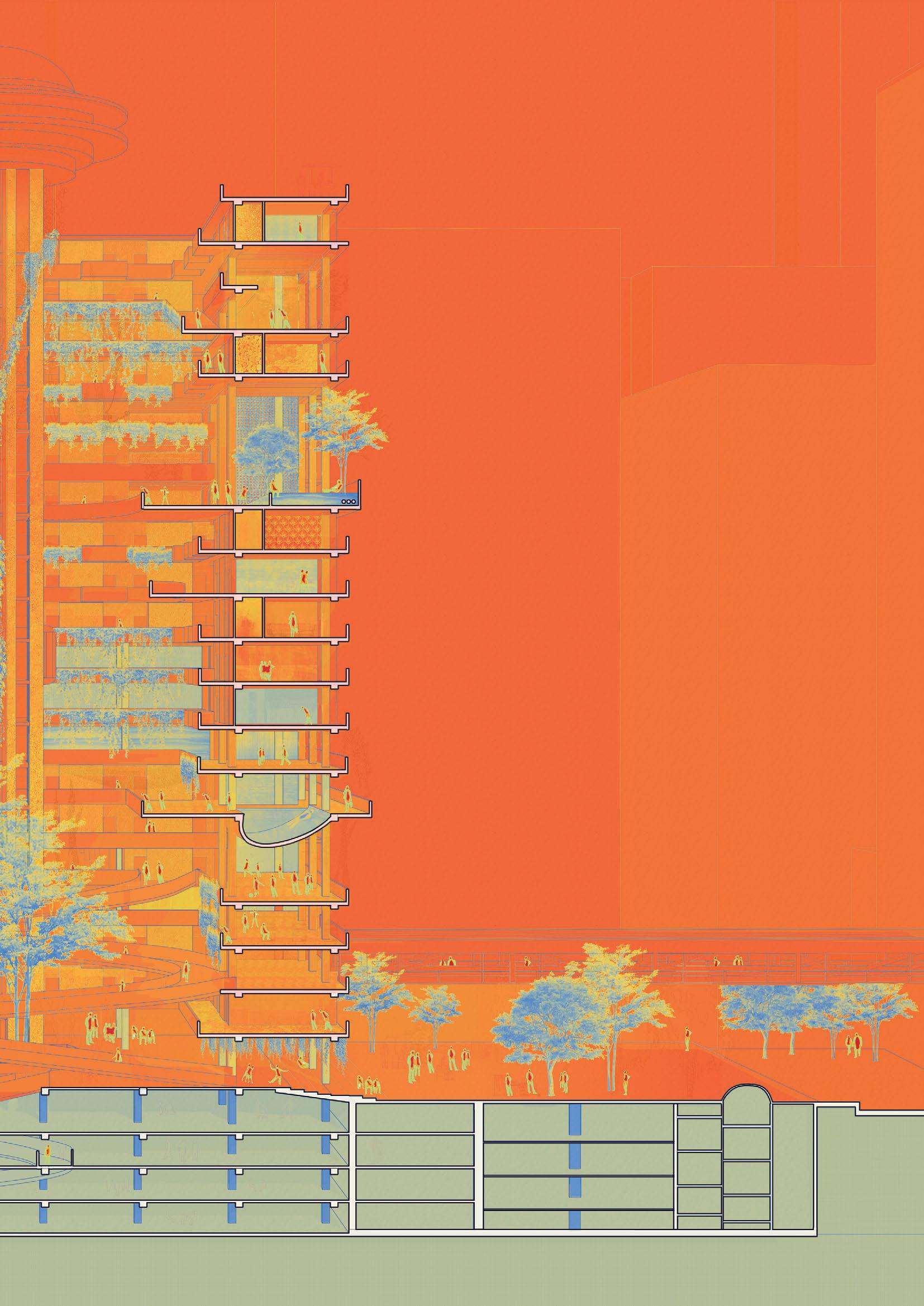
In this section, we would like to show all of our spatial strategies:

1. We open the roof to let the natural light in and embrace nature.
2. We eliminate oor slabs at strategic moments of public spaces throughout the building.
3. We add two central internal ramp to emphasize mobility, to connect skybridges, the ground floor with height difference, make it a clear and continuous public space system.
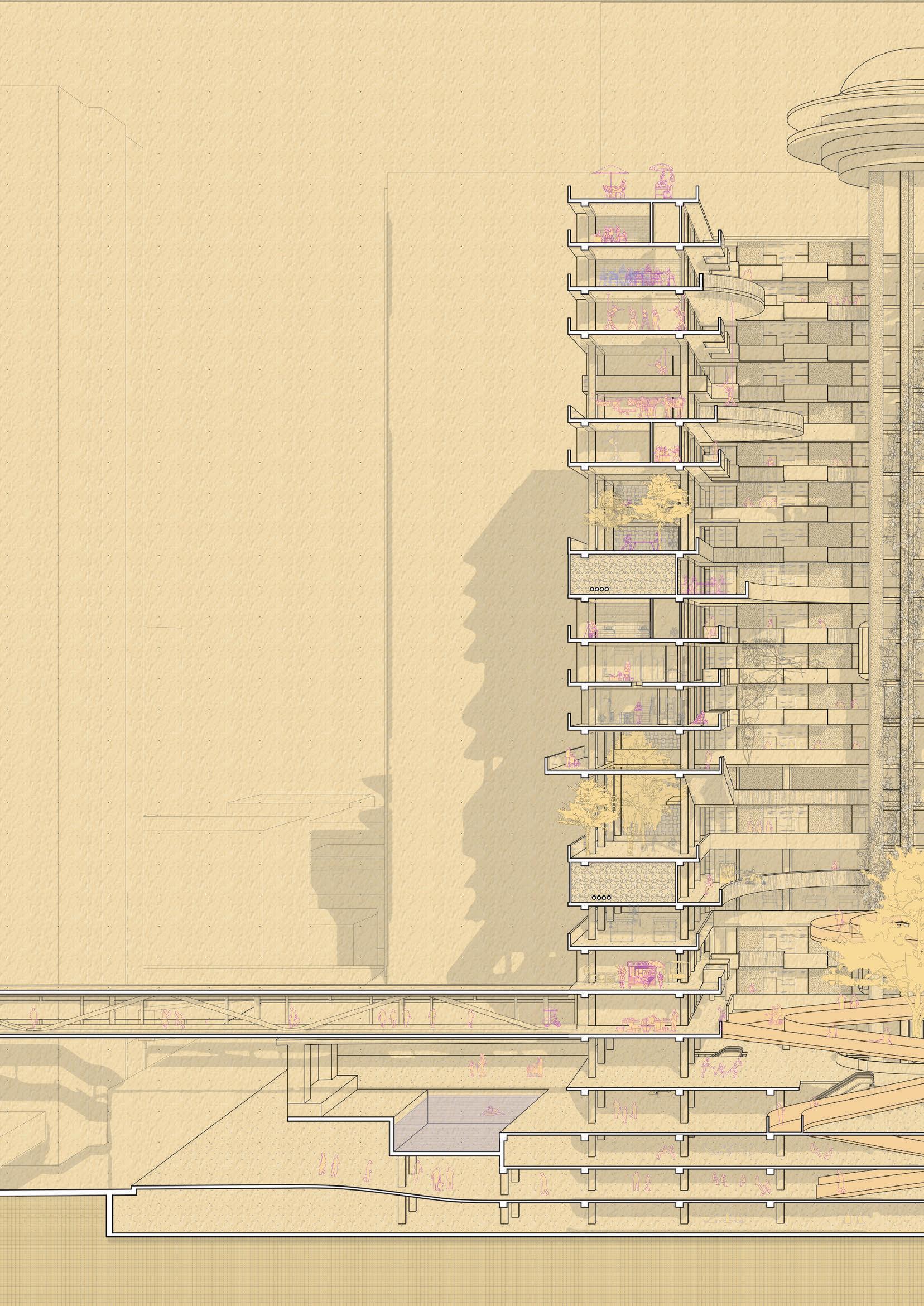
4. We add shade and shadow to talk about temporal aspects of the space.
This building can be explored more deeply in terms of carbon output and temperature. The building will start have mixtures of textures as the users start occupying the space. Provocation can be explored in a deeper way between the interior and exterior of the building. We shut the air conditioning system of the building and start to create comfort across the building by introducing water, vegetation, ceiling fans etc.
In a world a er property, we embrace comfort, the existing, the temporal use of activities and let the haptance of the city into portmans top down built environment!
20
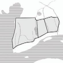
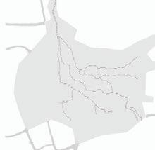
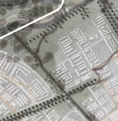
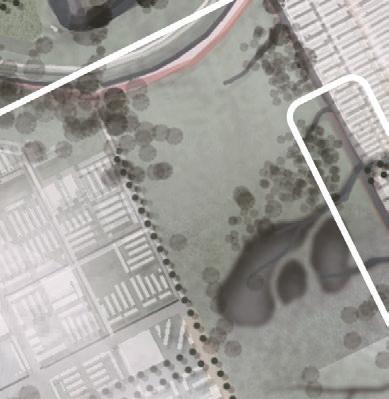
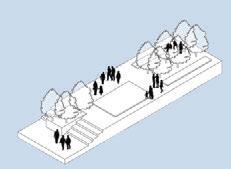
Network of Care and Water Visibility
Bringing Back the Sanaba
2023 GSAPP spring design studio - team work In collaboration with Xu Cheng, Devanshi Gajjar, Rutwik Karra
Instructor: Kate Or , addeus Pawlowski, Dilip da Cunha, Geeta Mehta,Maria Palomares
Program: community space, water resilience, urban renewal Site: Bogotá, Colombia
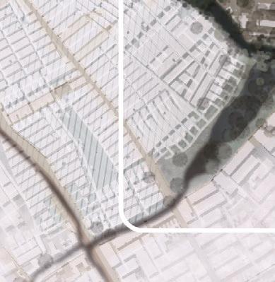
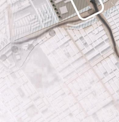
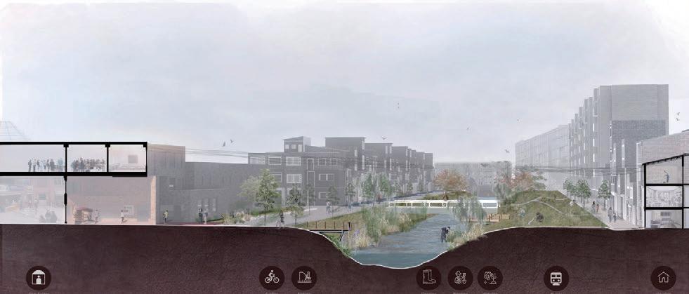
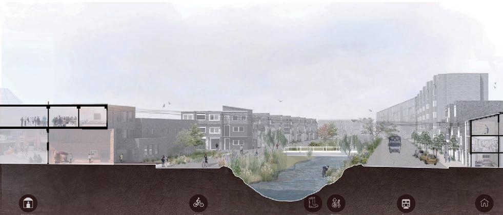
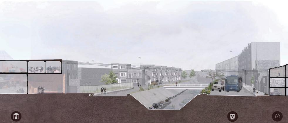
This studio explored watery landscapes and contested urban terrain in Colombia, with a special focus on climate justice in Cali, Cartagena, and Bogotá I was involved in the urban planning and design of Bogotá, providing solutions for the disappearance of its wetlands, the ditching of its rivers, and other issues.
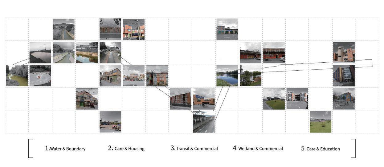
With Lavaca wetland as the main site, my team worked on the transect 4 and proposed Bogota's Collective Initiative: Recuperando la Sabana de Bogotá (Reclaiming the Bogotá Savannah) together with Group Fucha River. The key measures are:
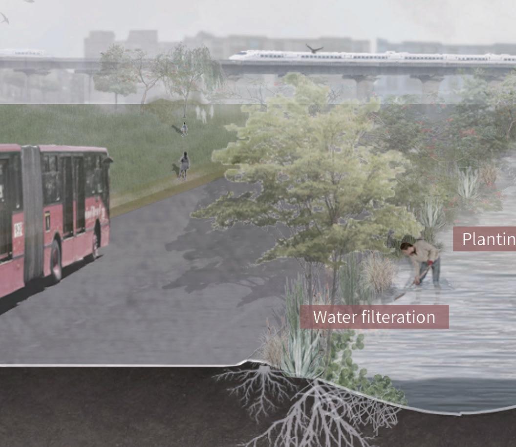
• Softening the urban landscape along the Bogotá river and its tributaries.
• Looking at industrial pollution and opportunities for new housing.
• Integrating new forms of mobility, structures of care and landscape into the urban fabric.


22
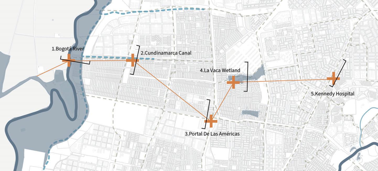
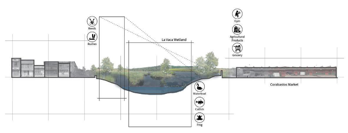
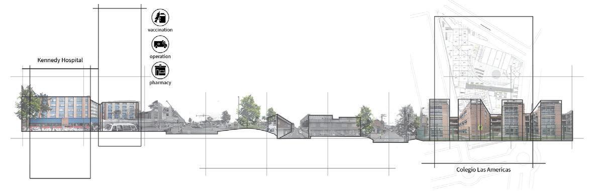
Mapping of water network
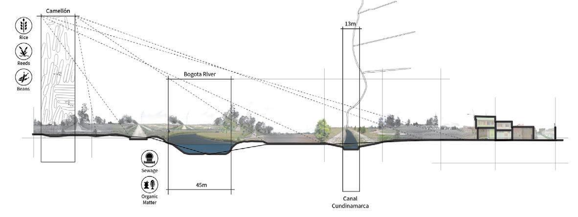
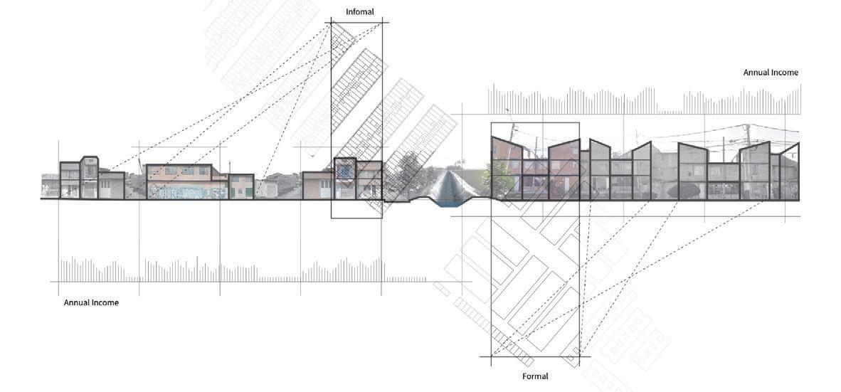
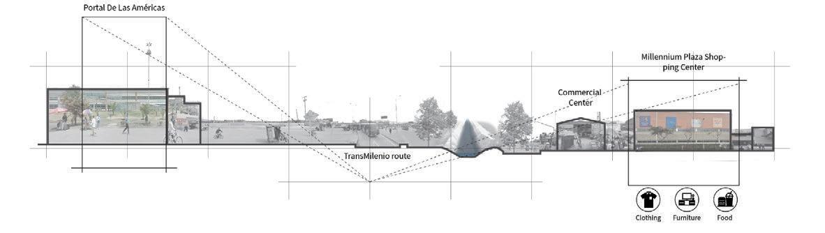
Cross-section of 5 pivots
1.Bogotá River
2.Cundinamarca Canal
3.Portal De Las Américas
4.La Vaca Wetland
5.Kennedy Hospital
major riverwet areas & wet lands tributaries arti cial canals drainage
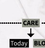
Possibility of linking water network with CARE and TRANSIT
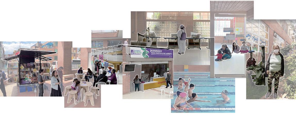
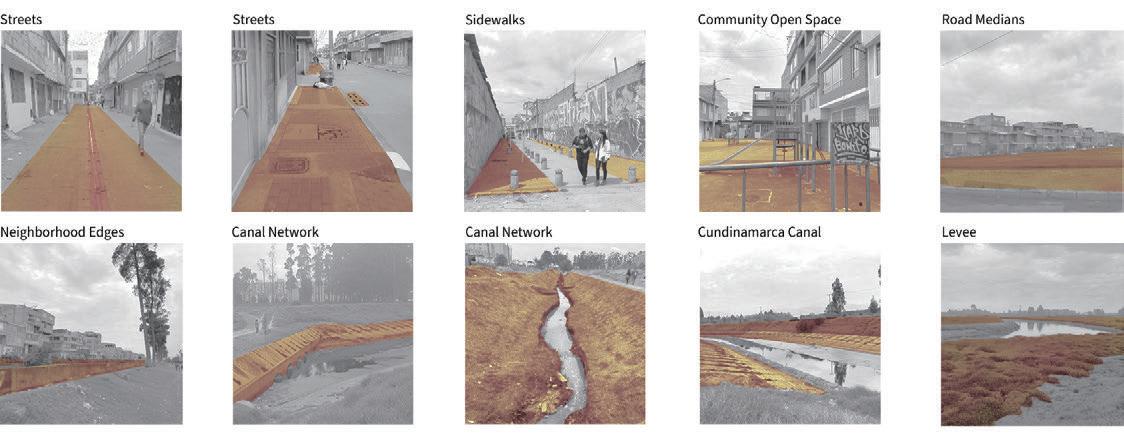
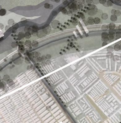
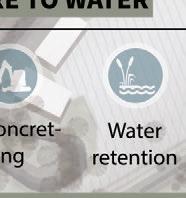
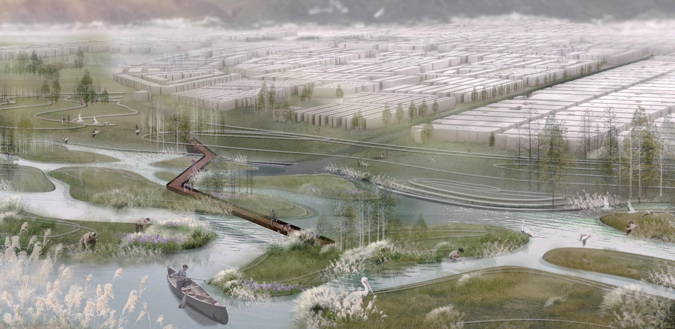
When zoom in to transect 4, we identi ed 5 pivotal points in the regionas as site analysis techniques. Every intersection where the transect pivots are has an importance in changing geographies of the region. We emerge at a series of cross-sections dissecting these 5 pivots to understand and analyze the absolute environment and circumstantial evolution of the subregion. We found that there is ubiquitous HARDNESS here causing much of the water to become invisible. From streets to the community spaces, even the streams are concreted into a canal and the river is held behind a levee, thus preventing the water network from being a complete system. Meanwhile, the concept of the "Care Block", which was mentioned repeatedly during the site visit, and the future growth of the population in the area with the Protal De Las Americas as a transit center, made us feel that in addition to physical water, we should pay more attention to how the concept of care and the transportation network will be connected to the water network in the future.
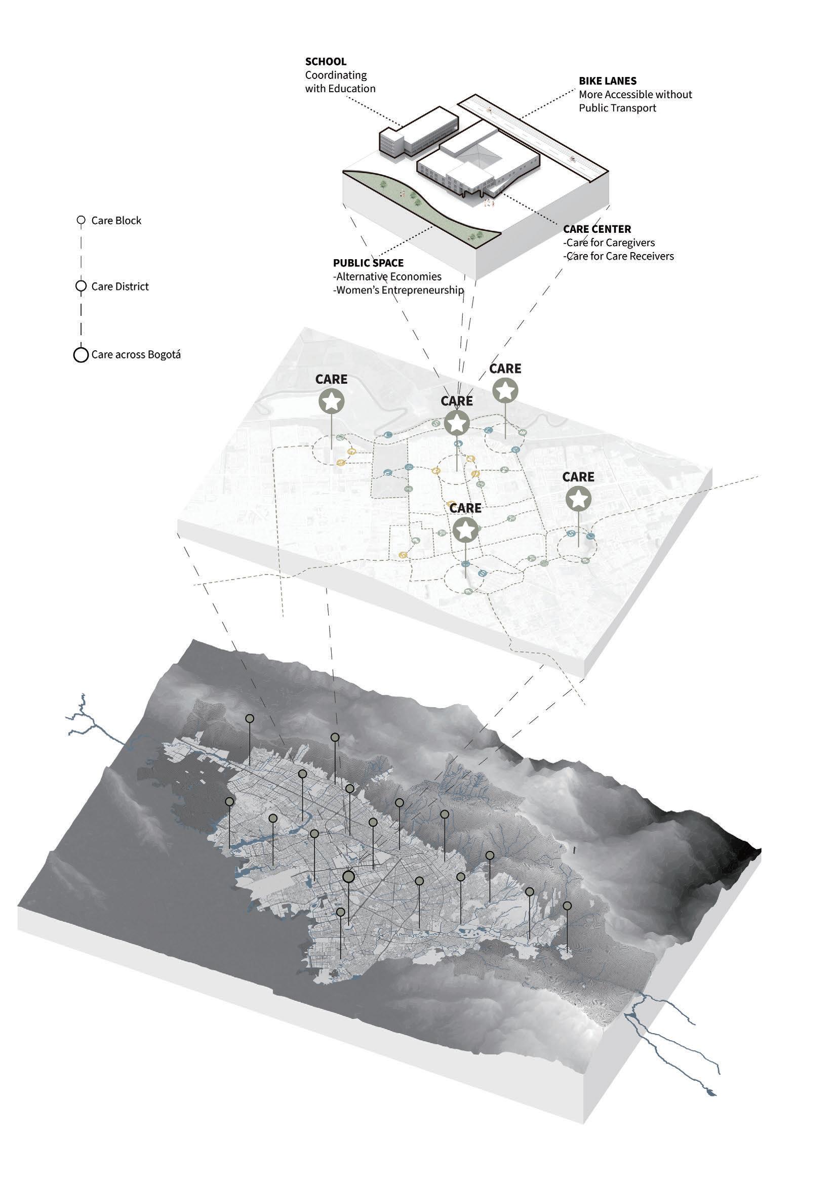
A vision for Bogotá - Network of Care & Water Visibility

With a Network of Care and social capital, ecology is reclaimed. An interdependent community thrives to live with water. What’s designed for Kennedy, can expand into the entire city. An urban design shi of a regional identity from water fear, back to water trust
On our trip to Bogota, we visited a Care-Block. Seated in an existing community building, Care block is the city’s flagship social infrastructure project that liberates care-givers. It is the women of the households who are occupied with all the chores, care block regards their contribution as revindication of the city with their care work. Care is a Bank of Time, the Block takes care of their responsibilities, while women in their free time, liberated from the burdens of their responsibilities, are encouraged to learn new skills (get certi ed) that can make them employable, building an interconnected social capital.
Care has a few elements. The block itself as an anchor with all the necessary infrastructure, a connected school to extend education, Open space for encouraging Urban farms, and trains for Green Jobs, and all of this connected with a bike and walking path. e city plans to have 44 such blocks and we are inspired by it.
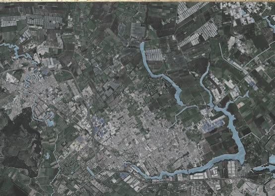
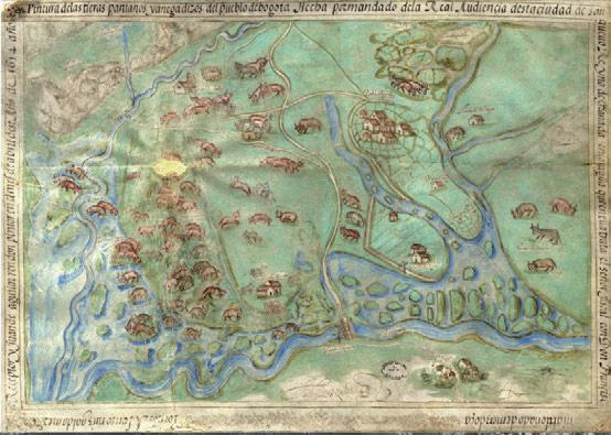
e Bogotá savanna is a montane savanna, located in the southwestern part of the Altiplano Cundiboyacense in the center of Colombia. e Bogotá savanna is crossed from northeast to southwest by the 375 kilometres (233 mi) long Bogotá River, which at the southwestern edge of the plateau forms the Tequendama Falls (Salto del Tequendama). Other rivers, such as the Subachoque, Bojacá, Fucha, Soacha and Tunjuelo Rivers, tributaries of the Bogotá River, form smaller valleys with very fertile soils dedicated to agriculture and cattle-breeding.
As we look into this historic map of the Savannah, we wonder, wasn’t ‘CARE’ intrinsic to the lives and lifestyles of the indigenous Muiscas? If we regard water in the shades of Blue and Green, Care was not only between the people, but it was also in the ways they lived with water. From here we got the project statment and strategies for design
Our project celebrates care blocks and intends to extend care to water, and from a block to a Network of Care To envision a city in stewardship of a Care Network in Water Visibility with a shi from Water Fear to Water Trust
23
Map of the Sabana of Bogotá Archivo General de Indias (1614) Map of the Northwest region of Bogotá Google Earth (2023)
Evolution of Care Activities


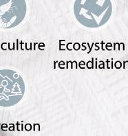
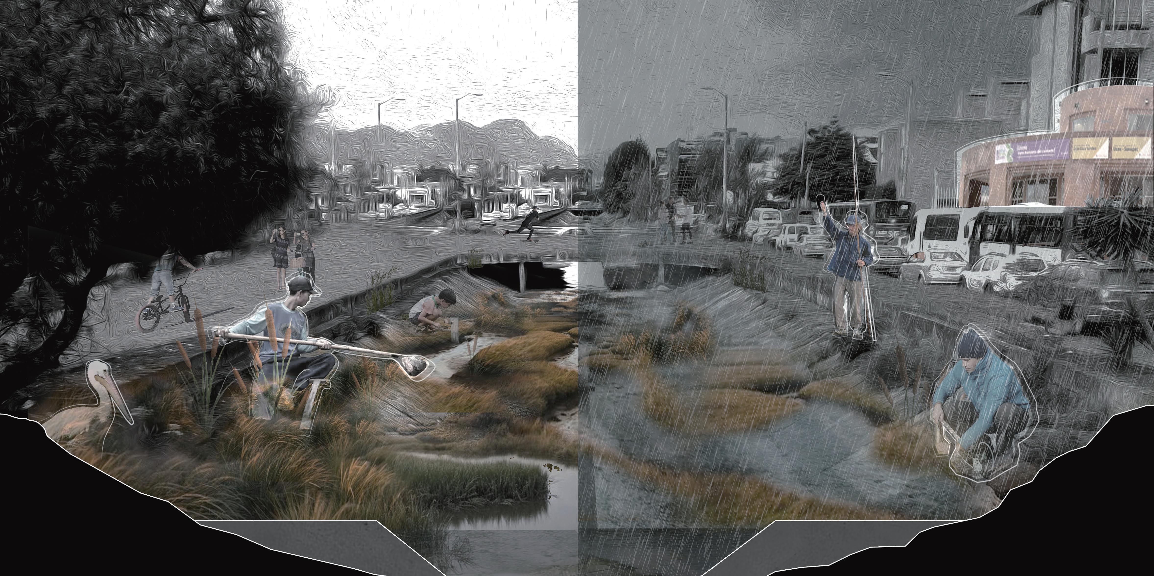
The network seeds from 3 scales of existing care. Care for community, Care for Wetlands, and Care for Rio Bogota.

- Today


Anchored at the Kennedy Care block, the social capital is utilized to reclaim the ecological capital.

- 2050


Wetlands extend into the neighborhood, while canals and communities are de-hardened.
- 2070


Canals become ditches of biofiltering streams, and water is visible in a network of interconnected ditches, gardens, and pocket parks.


Care for Community starts at the Care Block. Diego and Diana, who walked us through their neighborhood, talked about how in a complex community, agriculture could be a meeting point of nature, culture and economic growth.
Care for Wetlands starts with the care work of Guardians of Wetlands. Dora talks about how indigenous people lived with the water and how women carry forward the legacy.
Care for Rio Bogota begins with the aqueduct company’s interest to revitalize the river capacity for ood mitigation.


RíoBogotá
Wetlands ElBurro Wetland
for Wetlands La Vaca Wetland CareforCommunityatPatioBonito
Landfill
Transit
Carefor
Carefor
Care
Co-existence
Co-existence
24
Caretakers & Caregivers
Care for Community

This is a scenario when Care extends to water. Care becomes an aspect in design that promotes community in stewardship of water and maintenance.
The community of care thrives intergenerationally, with Urban Farms, aquaculture, and with no fear of ooding.
 Today, the neighborhood is almost impervious in the tight knit fabric. With concrete canals and trash along the ow, there is an absolute neglect of the ecology.
30 years from now, the designed vision is to restore the stream in the de-concreted ditches, with growth of vegetation and an attempt to create a community maintained green belt, where care activities extend.
Eventually in 2070, an active stream maintained with sill dams and bio ltering plants informs the stream as it takes the water into the river.
Care Center
Today, the neighborhood is almost impervious in the tight knit fabric. With concrete canals and trash along the ow, there is an absolute neglect of the ecology.
30 years from now, the designed vision is to restore the stream in the de-concreted ditches, with growth of vegetation and an attempt to create a community maintained green belt, where care activities extend.
Eventually in 2070, an active stream maintained with sill dams and bio ltering plants informs the stream as it takes the water into the river.
Care Center
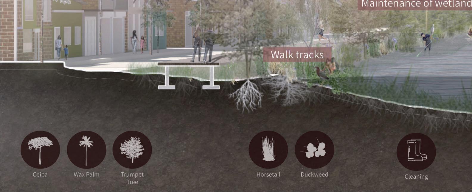
Care for Wetlands

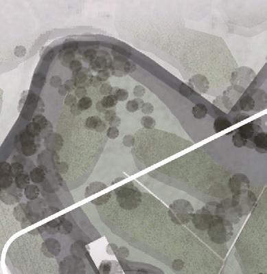
Our design intends to expand the wetland for increasing the water holding capacity, by expanding its boundaries, extending the ditches by connecting the La Vaca and El Burro Wetlands, and providing these women the agency to operate and maintain the site.


Unblock - Expand Extend Agency


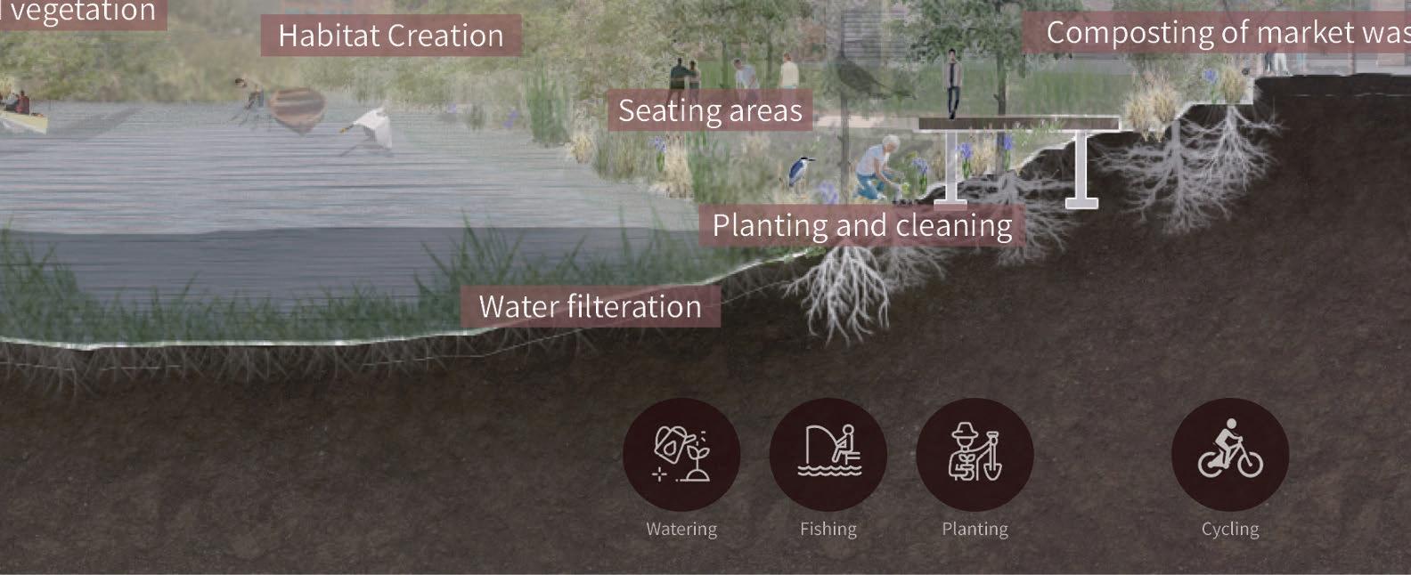
is is a sectional view of a vision of the Expanded La Vaca, negotiating edge with the Corabastos Market. A large low ground with water retaining plants along the edges, and bio ltration plants in the water is created to let for a habitat creation, and bird watching. Fishing, Aquaculture, Urban Farms, while also locally composting the waste, evolve with the housing and density.
 Guardians of Wetlands
Fundacion Humedales Bogota Care Network
Guardians of Wetlands
Fundacion Humedales Bogota Care Network
Today 2050 2070
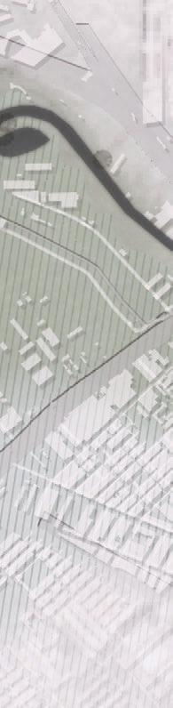
Care for Río Bogotá
Today the river is behind the levee and a subsidiary canal is along the river. We were deeply inspired by the Camellon system in the Sabana ecosystem. is farming strategy is an ancient wisdom of getting more cultivated areas. In our design, the camellon system helps us make hydraulic interchange of water between the de-concreted stream of the canal and the river in a series of low and high grounds. In this way, the levee, which lies between the river and the canal, is naturally dissolved. We can also direct the fragmented lands into the desired form according to the needs of the Care Activity
A water-side is created for the community. From recreation to the Sabana ecosystem, a large low ground that has the capacity to hold, absorb and facilitate the ow of water downstream without ooding the region is imagined.
Principle of the Camellon system: from fragmented lands to ideal design form

Co-existence
Development, transit and the in ux of people can coexist with the water! A Green-Blue Bogota is imagined.
A typical avenue in this vision for Bogota is a modest network of various systems of transit, housing, and visible water. With walkways, cyclepaths, and a direct connection to water, a city is envisioned with water as its identity.

 A vison of of care activities on the Bogotá River
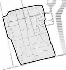
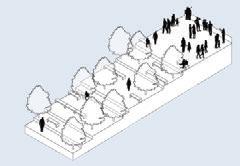
New Interface
Posibilities of the New Typical
2017 Collaborative Studio
e Chinese University of Hongkong x Tunghai University - individual work Instructor: Joe Wu
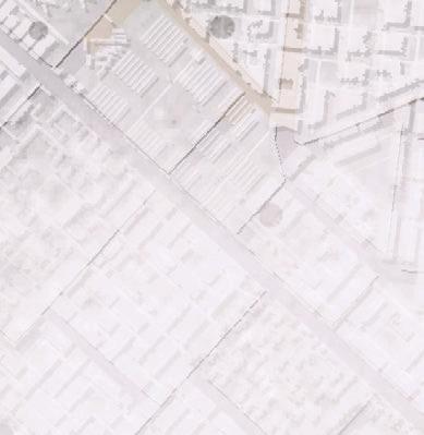
Program: collective housing Site: Taichung, Taiwan, China Area: 3,000 sq m
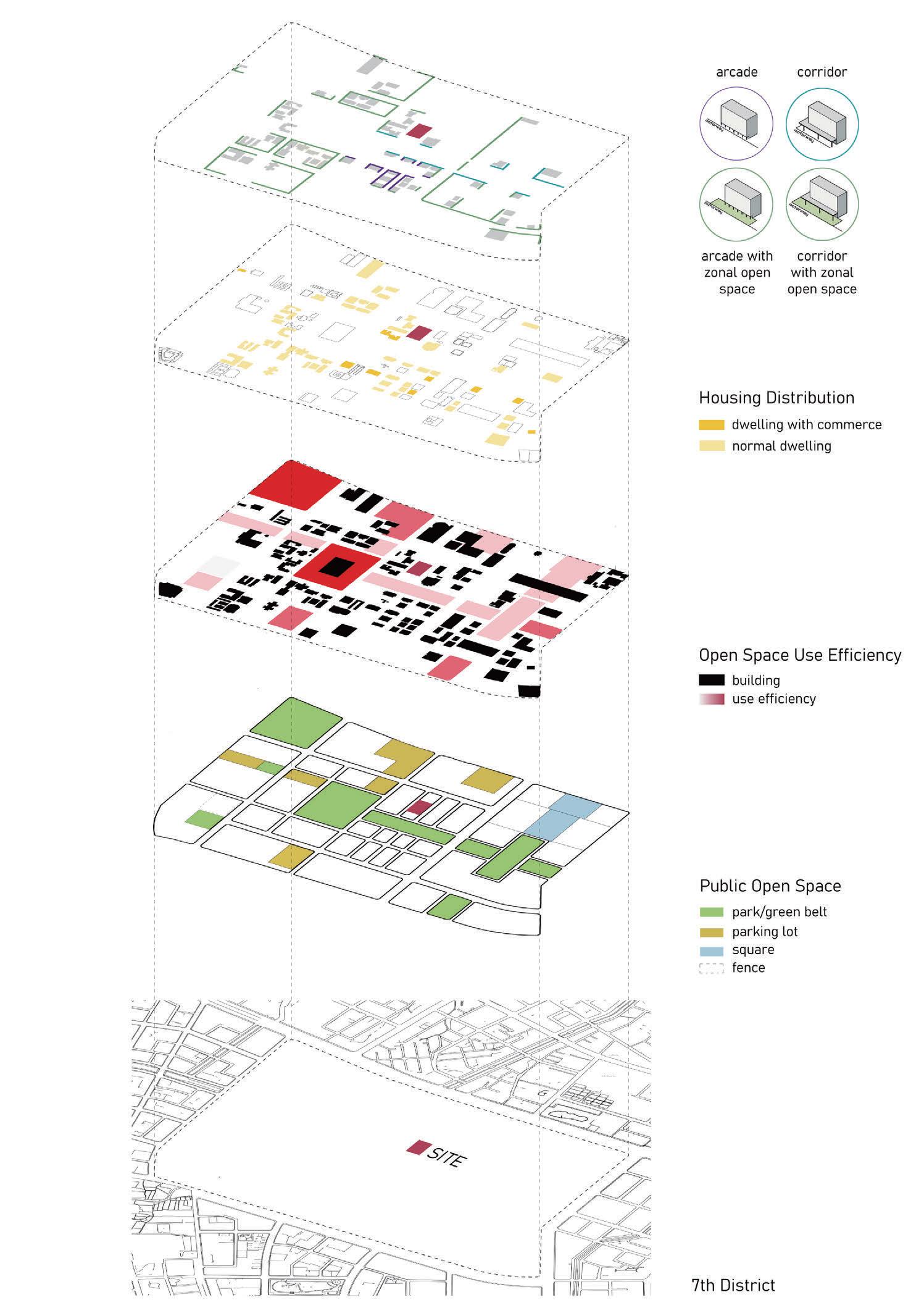
In fall semester of 2017, CUHK and THU together initiated a collaborative design studio on urban housing. Collective housing has long been the most important building type for hundreds of years. From low-income public housing to highrise residential towers, the masses and typologies of housing at differernt ages reflect how people imagine their individual and social lives. Design was originated from a question that I kept asking myself: Why isn't there more open space for housing?
I did some research about relationship between "Capacaty reward" and "Open space" in order to understand this particular site which is located within the commercial and political center of Taichung. I think it is important to reconsider the "Pro t" of construction companies in relationship to the "Living quality" for residents.
Urban Development of Taichung City
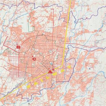
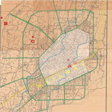
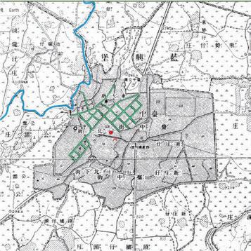
rer are 3 sites(Site A, B ,C) for students to choose in the joint studio. Introducing sites to the CUHK students, we should actually zoom out to see the entire history of Taichung's urbanization. In the process of research I also found the entry point for developing design.
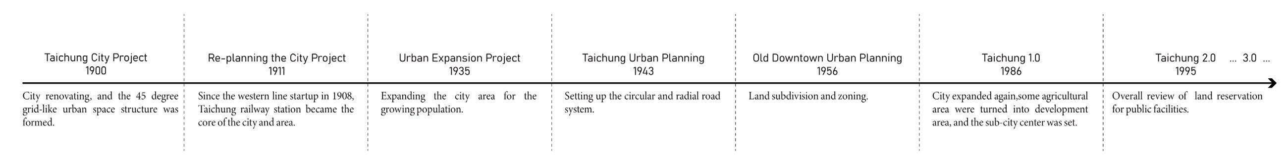
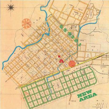
Site B is located in the 7th District of Taichung City, which is the most important replanning part of Taichung because it becomes the politic and commercial center of city. As we know before, Taichung city has expanded several times since 1957. Nowadays there are more than 14 replanning districts in Taichung city.
In 1900, city renovating and the 45 degree gridlike urban space structure was formed which is the beginning of Taichung urban planning. In 1935, government expanded the city area for the growing population. In 1943, Taichung urban planning was started to set up the circular and radial road system. Before it comes to 1986(Taichung 1.0), Taichung city was carried out 4 times urban expansion projects form 1957-1977 because of the increase of population. And then the city expanded again, some agricultural areas were turned into development areas, and the sub-city center was set. We can see the second circle of the city was planned. When it comes to Taichung city planning 2.0 in 1995, the sacle of city planning is not quite di erent from the planning 1.0. At last we have Taichung 3.0 plan. Developed area was adjusted and the living-to-commerce zoning transformation was started.
Pro t V.S. Living quality?
I did some research about open space for public and private at this site. For public, Some of them change their ground oor into commercial space, and make di erent types of public open space like arcade or corridors, but they are usually along the street and follow the street scale, which means this kind of open space is a little bit narrow so that people still have di culty staying to have some activities. And then for private open space, we know that some big spaces like gym or lobby is usually on the ground oor of buildings, it is still very narrow when you come up to the oors which people live in.
Why? It has to do with the Capacity reward
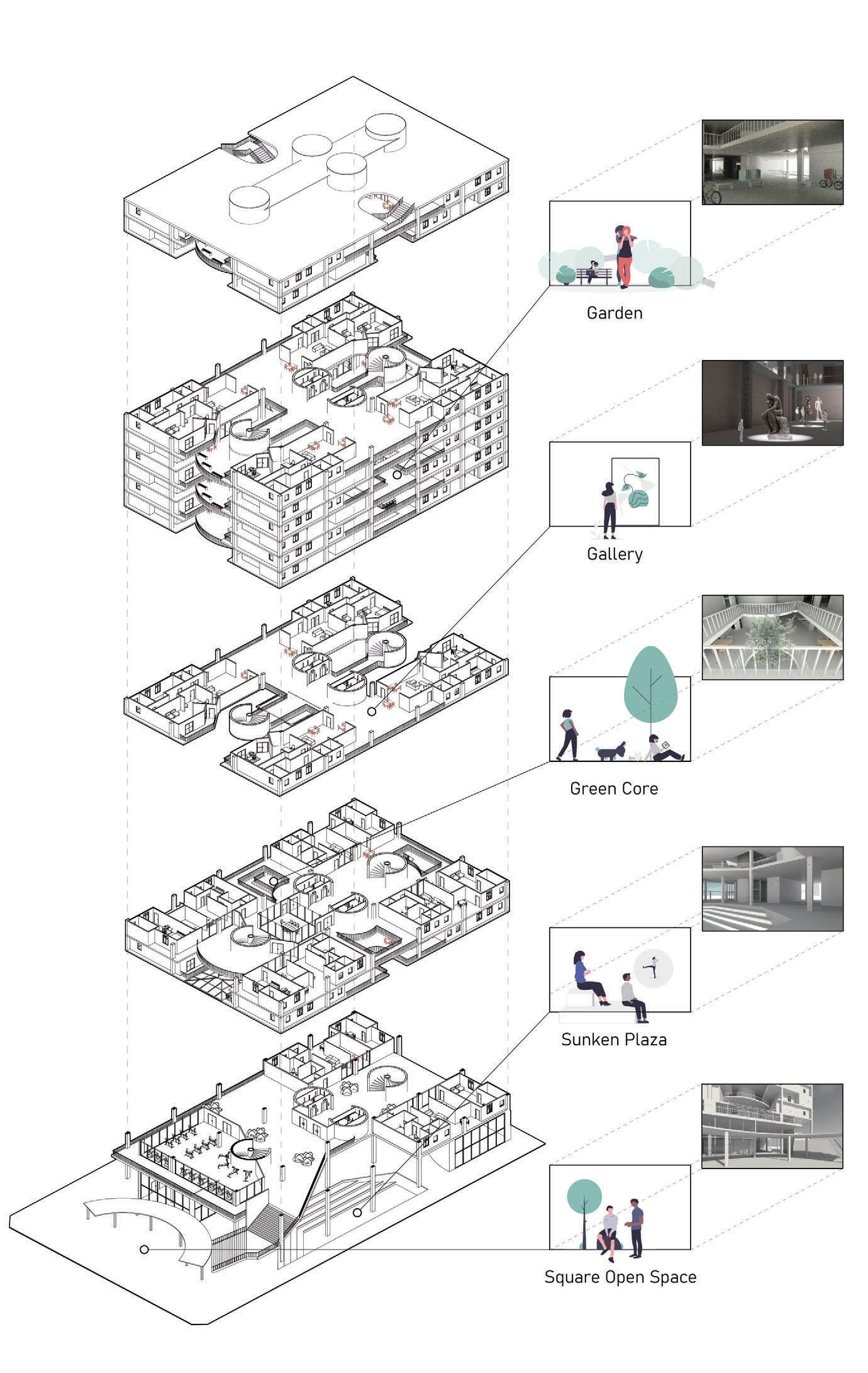
Strategy for Enlarging Private Open spaces of Collective Housing
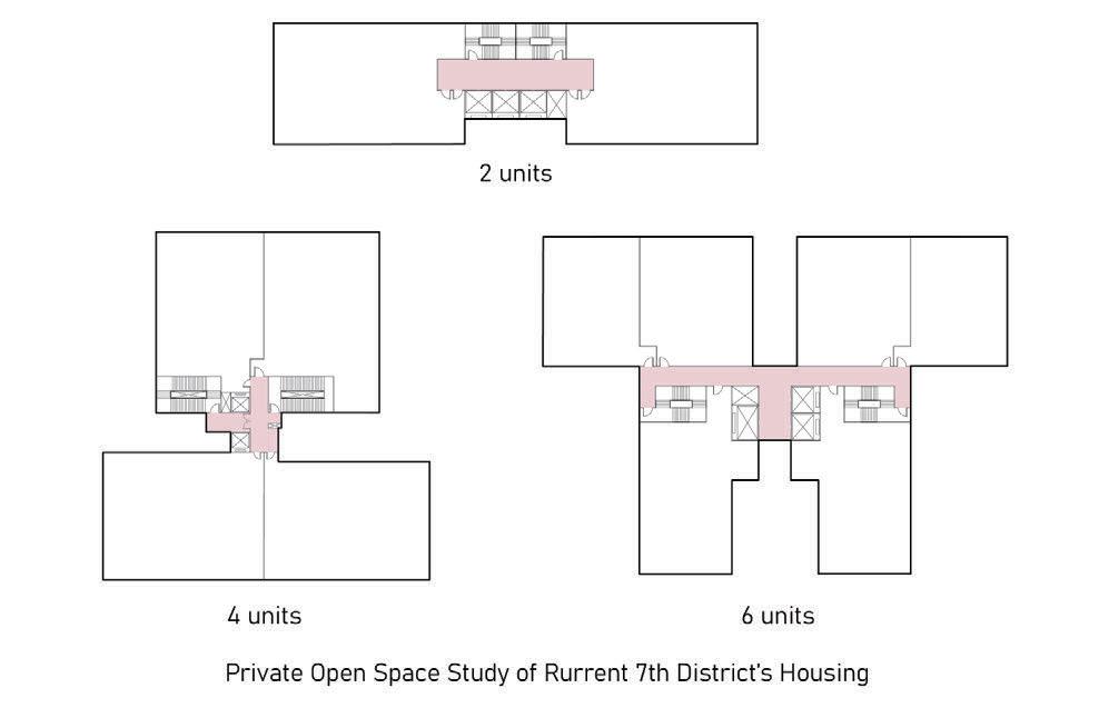
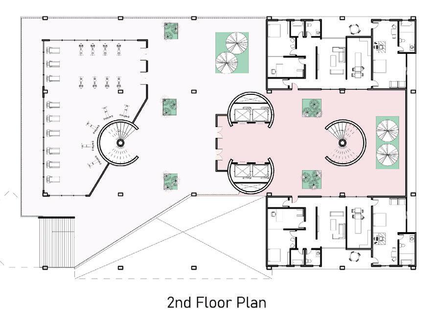
In this design, I orientated units facing other units, to create a new housing relationship for residents. e size of private open spaces will be designed to be bigger than commonly provided. In the interiors, residents can pull a table out from units to expand the area of kitchen and living room. e oors are raised to make people feel like walking in an indoor garden with a roof. I put core space in the middle to create more opportunity for communication. Residents are welcomed to use all these open spaces for gardening, exhibiting, performing and other social activities. e division of open space for public and private won’t be very clear, ground oor can be entirely public and people can still go up stairs to the gym, meeting rooms and gallery.
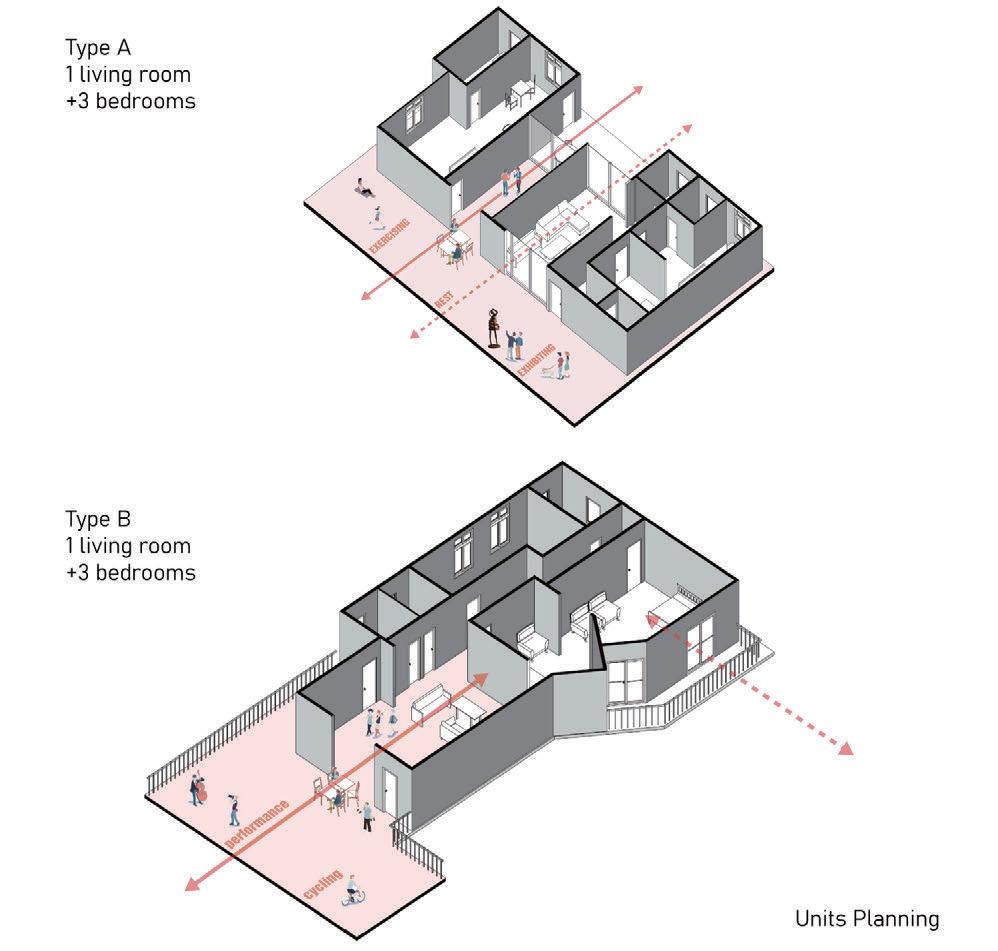
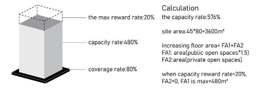
I get some data about capacity reward referred to the regulation from urban planning of government. e capacity rate of this site is 480%, and the maximum capacity reward rate is 20%, so we could make the capacity rate comes to 576% at most. The area of increasing floor equals to FA1(X*area of public open space, X ranges from 0.5 to 1.5)+FA2(area of private open space). From the former calculation I conclude that construction companies are able to making a building get the maximum capacity rate only by planning 480m² oor area to be public open space. is means that they could get the most pro t. is is one of the most important reason about why we seldom see housings at this stie contain public open space that could be used by people.
So I think the problem of housings in the area is that people ignore living quality for chasing the most profit. And I try to offer a solution to change this housing type, to make housings in this area get more open space while construction companies could still make pro t.
29
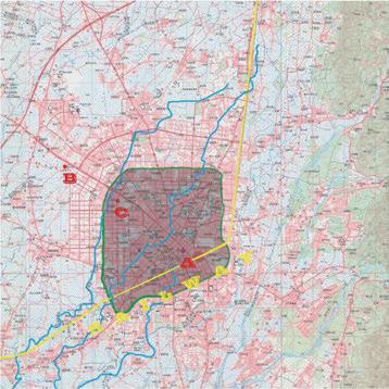
e mapping represents the scale of open spaces around the site: the red blocks indicates locaitons of square open space and street-scale open space. In my opinion, these open spaces can be considered as a series of urban experiences connected through residents' activities and visual contact.

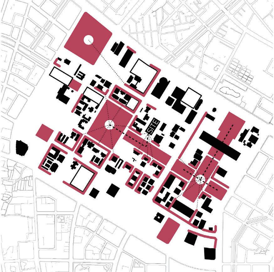
ere are 3 popular public spaces around the site: Maple Garden, National Taichung eater and New Municipal Park. I intend to orientate the design to face toward the Green Belt as an additional public space to link with them.


Ground Floor Plan


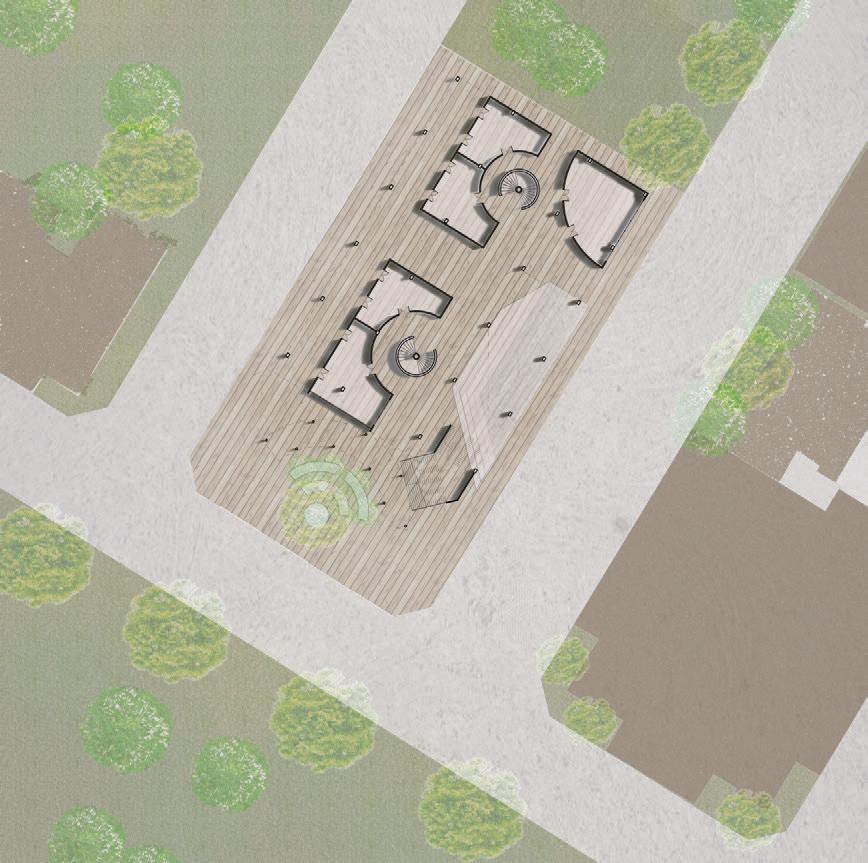
It is supposed to have a square open space in front of the collective housing. According to government's regulation, the area of a square open space should be more than 200m² and the width from the road boundary should be longer than 6 meters, which means I can use more than 480m² to create a big square, not just a street-scale open space, so that people can gather in front of the housing to stay and play. Moreover, considering the green belt and parks around the site have no seatings and shelters, the ground oor of this building o ers people a place with a roof to rest.


Site Open Space Analysis Scales of Open Space
30
31
Te Gong 2021HP02 Lot Residential Project
Construction Drawings for a Residential
A1-1# Building Axis 1 - 20 Elevation 1:100
Light beige gray granite water-based paint color sample number details "common building color" national standard 02J503-1(14-5-10)
Light beige gray stone color sample number detailed "common building color" national standard 02J503-1(14-5-10)
Dark gray stone color sample number details "common building color" national standard 02J503-1(14-5-3)
Gray-blue texture paint color sample number details "common building color" national standard 02J503-1(14-1-3)
Bronze stainless steel plate color sample number details "common building color" national standard 02J503-1(14-4-1)
Type: Residential Construction Drawing Team: Jing Chen(supervisor), Jiaxing Lin, Jiahao Ye Contribution: Elevation Construction Drawing, Section Construction Drawing of 9 buildings(A1-1, A1-2, A2-1, A2-5, A3-1, A3-6, A3-7, A3-8, A3-9)
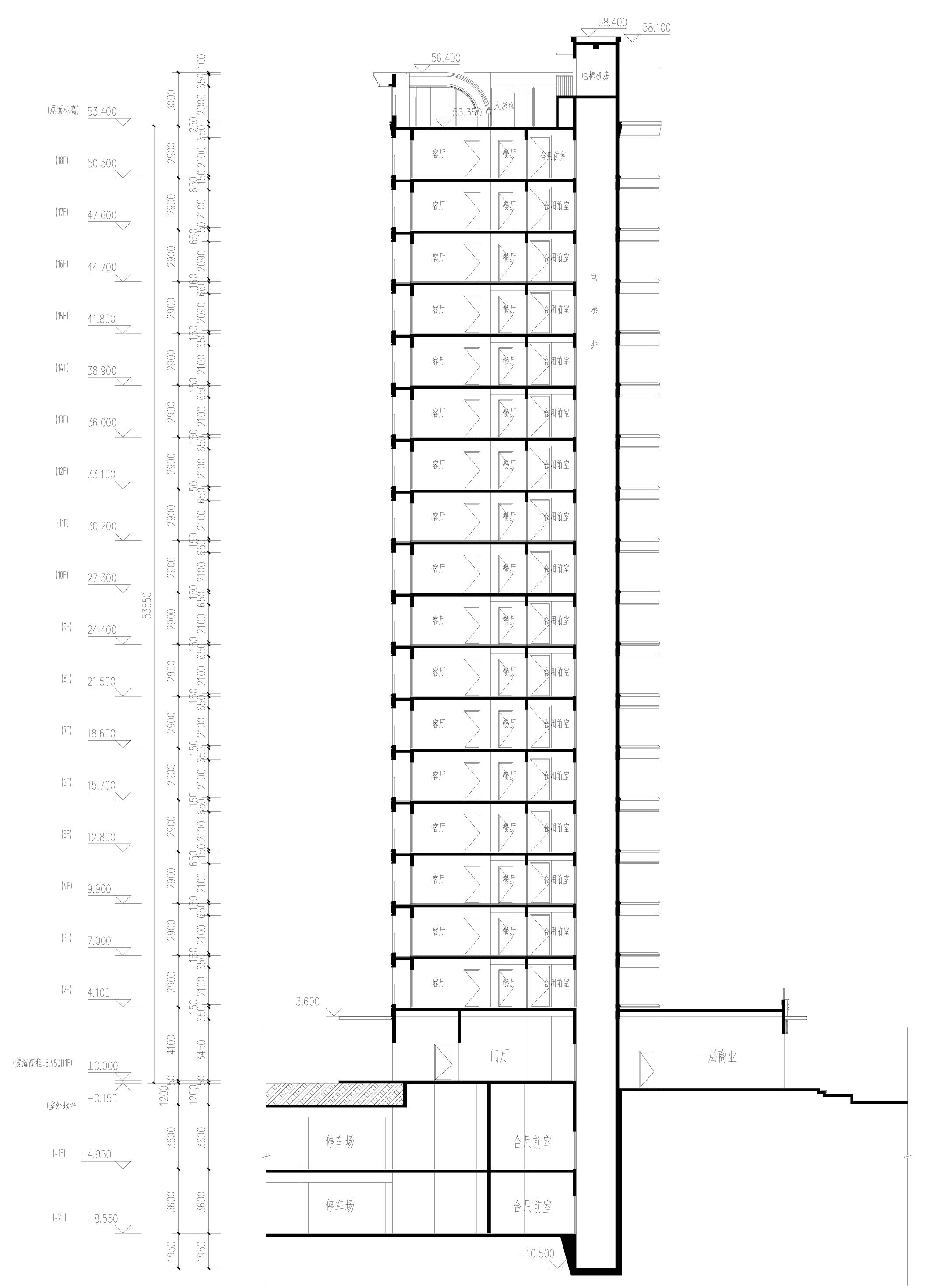
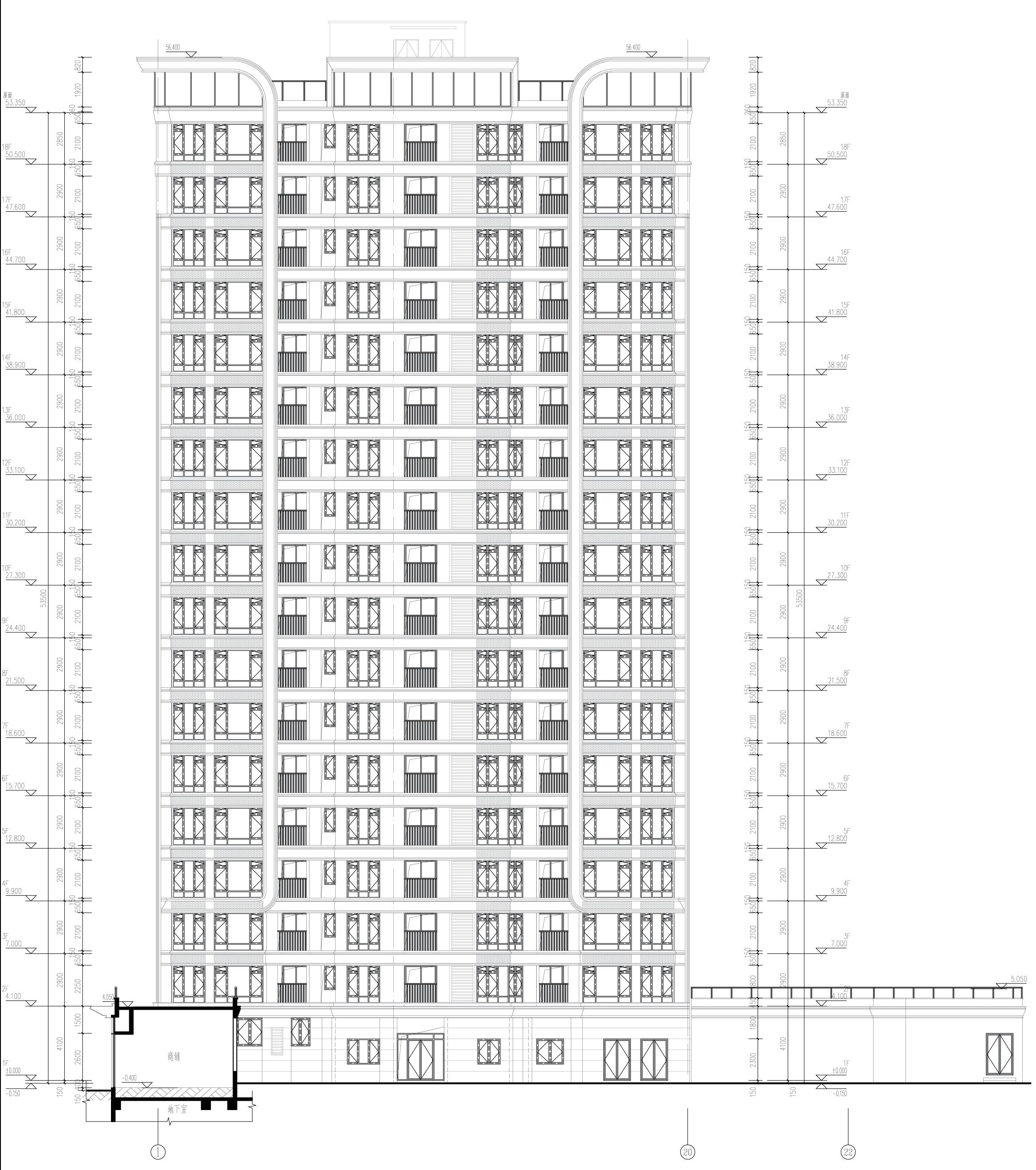
Site Location: Xiamen, China
Program: Residential
Status: Under Construction
Time: 2021- present
A1-1# Building Section 1:100
32 Professional Practices
CGDG Xiamen New Era Plaza
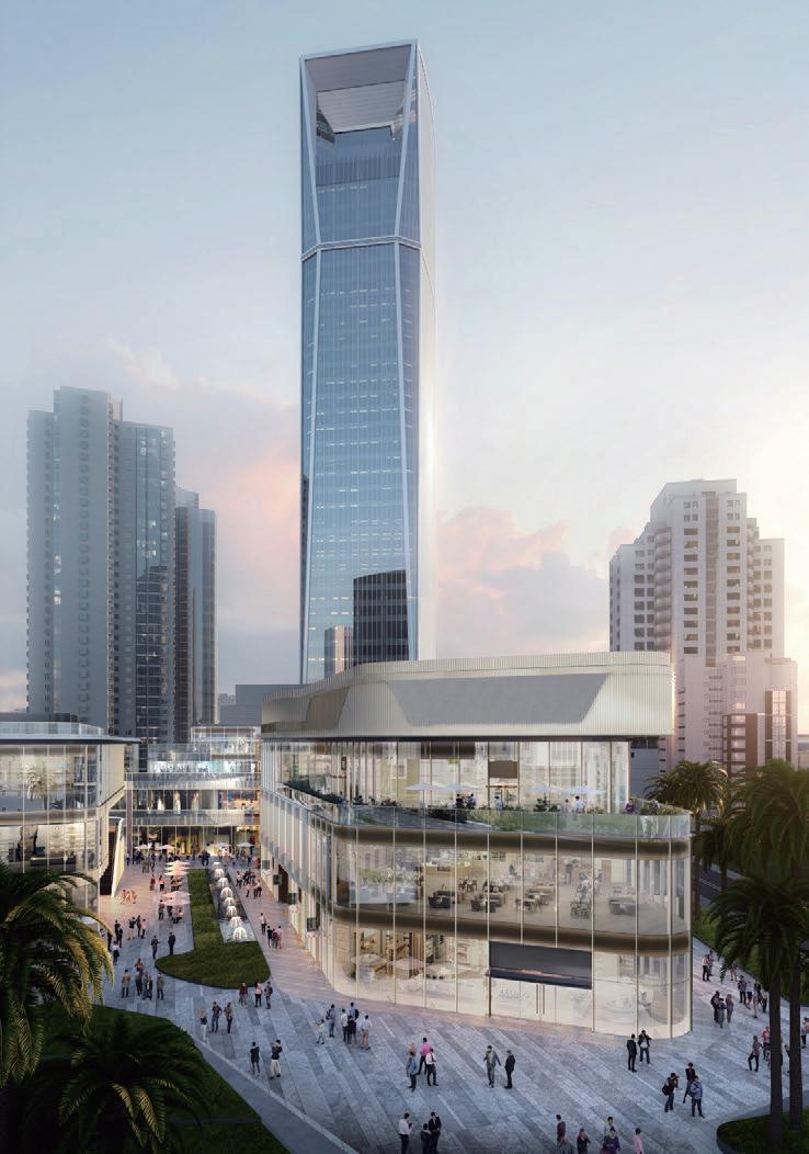
Construction Drawings for a Commercial Complex
Type: Commercial Construction Drawing
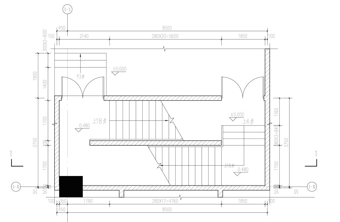
Team: Chenyi Ye(supervisor), Chaojie Chen
Contribution: Plan Construction Drawing, Section
Construction Drawing of podium escape staircase for Tower B, Collation of reports for Planning Department review
Site Location: Xiamen, China
Program: Commercial Complex
Status: Under Construction
Time: 2021- present
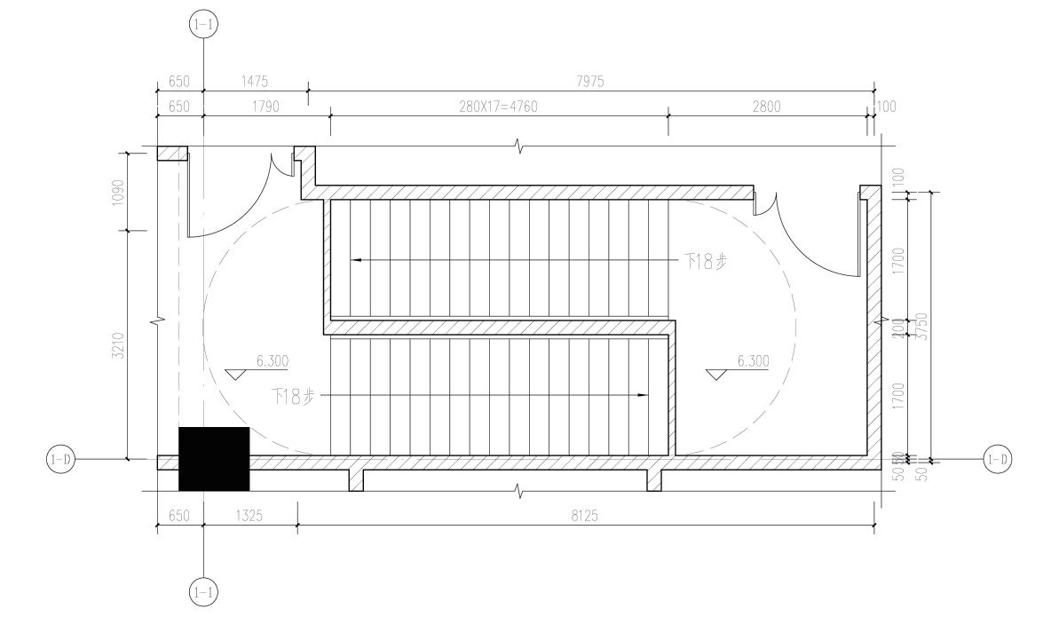
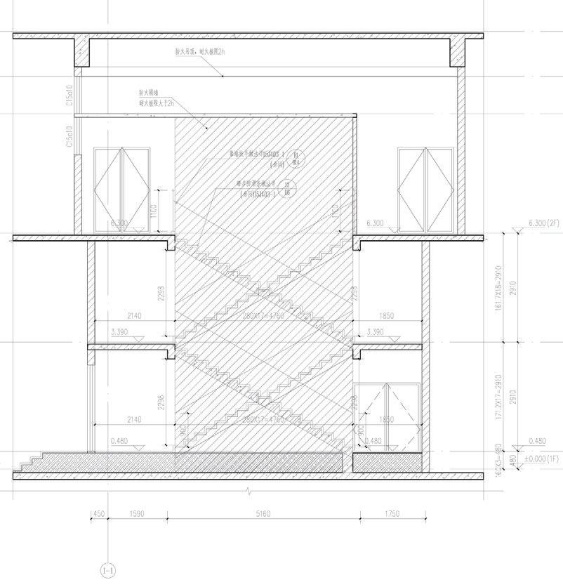
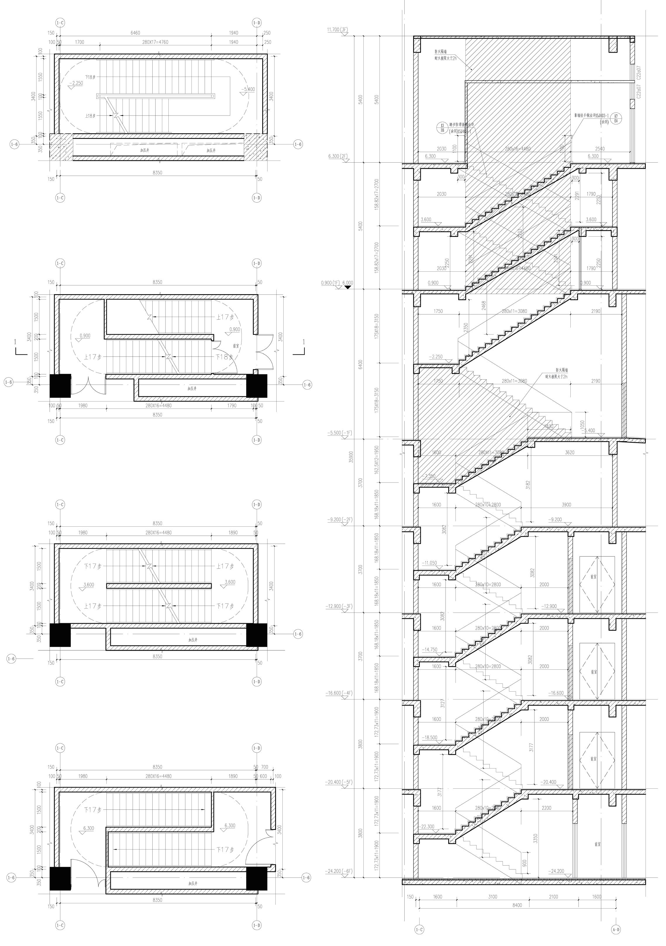
Tower B has a 4-story podium building containing banquet halls, a community center, and other functions, including a 6-story basement parking garage. ere are 11 re escape staircases in the podium, and I was responsible for the construction detail drawings of these staircases, both in plan and in section.
A B 1-8# Core Second Floor Plan 1:50 1-8# Core First Floor Plan 1:50 1-8# Core A-A Section 1:50 1-6# Core Second Floor Plan 1:50 1-6# Core First Floor Plan 1:50 1-6# Core +3.600 Plan 1:50 1-6# Core -2.250 Plan 1:50 1-6# Core A-A Section 1:50 33 Professional Practices
Banmei Folk Garden
Designing Folk Culture Experiences in Southern Fujian of China
Type: Regional Planning and Design
Team: Chenyi Ye(supervisor), Zhixian Li, Jiahao Ye
Contribution: Modeling, Rendering, Master Plan Design, Landscape Design, Constrution Drawing of Basement
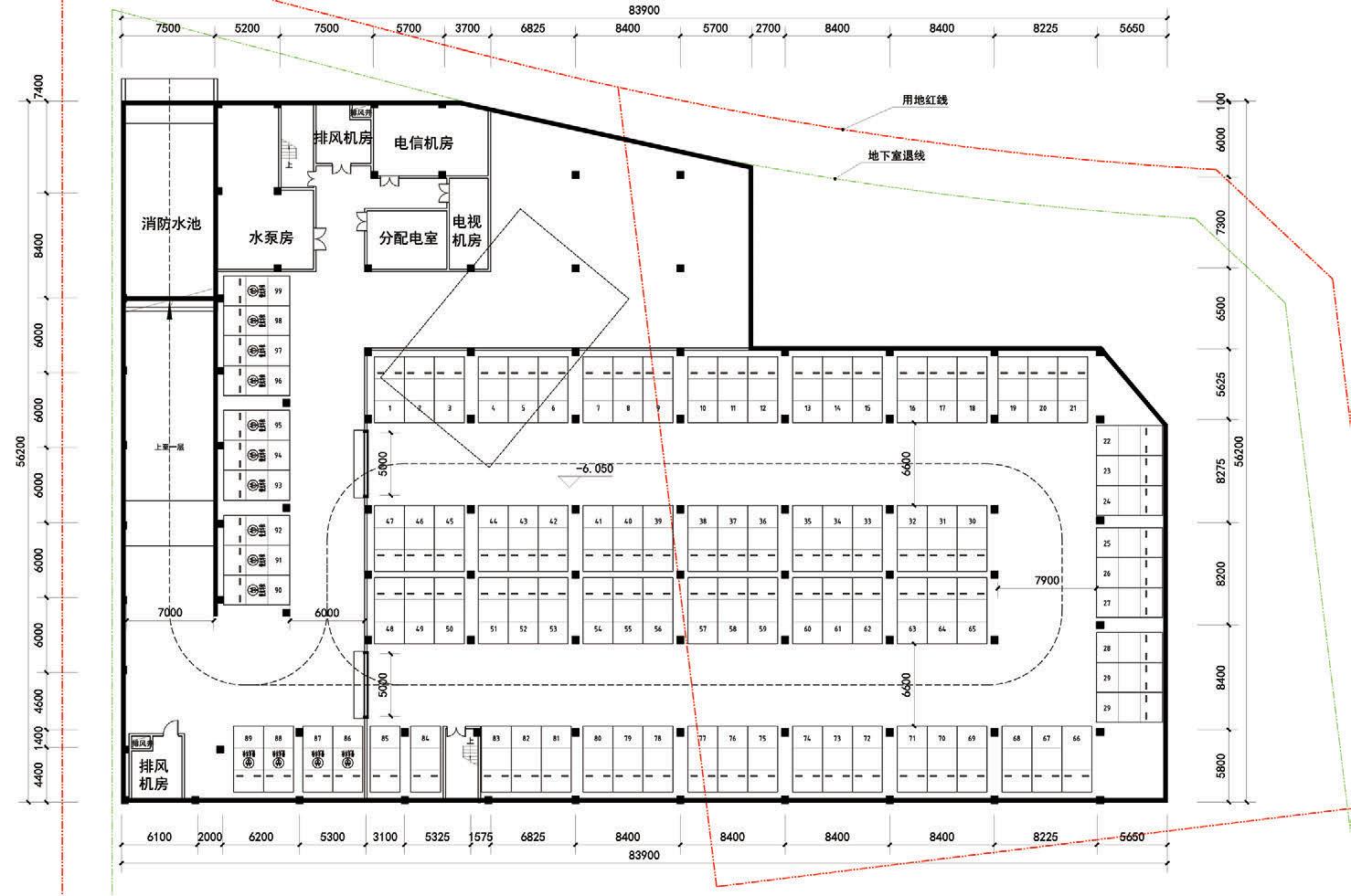
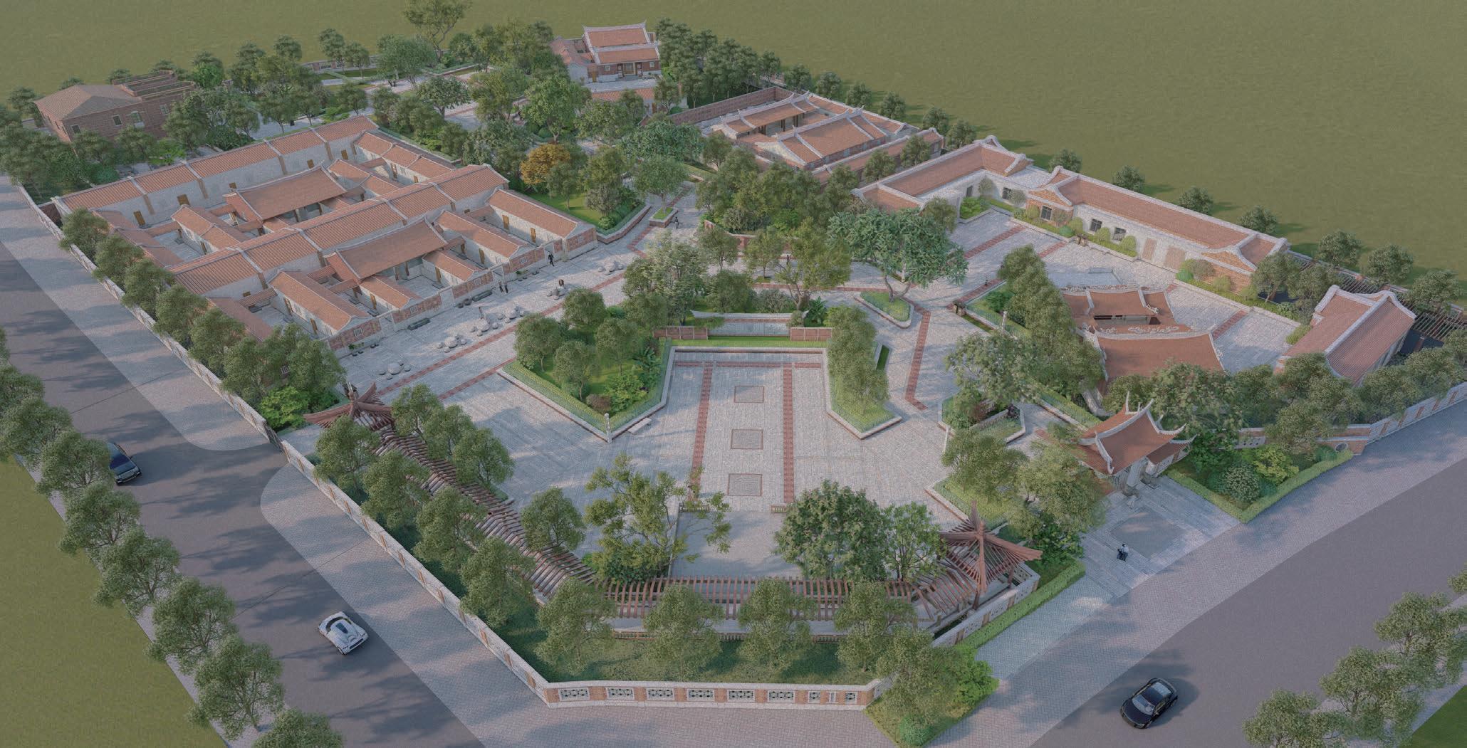
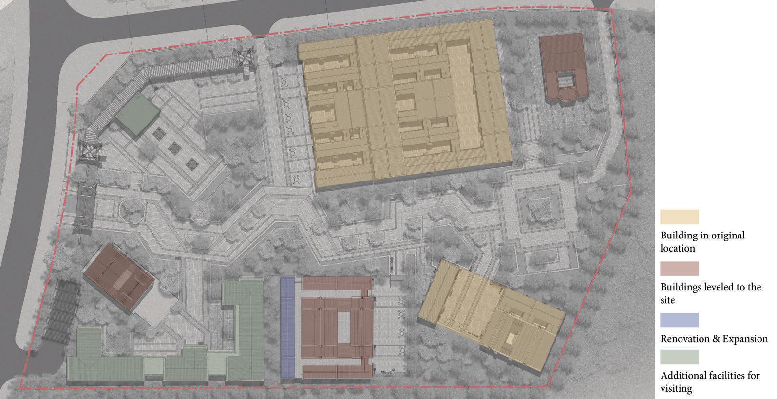
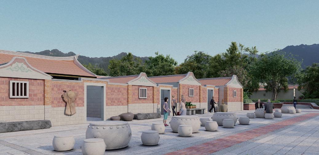
Site Location: Xiamen, China
Program: Cultural Park
Status: Under Construction
Time: 2021.3- present

First Basement Floor Plan 1:300
Remarks: 3,980.1 square meters, 99 vehicles
34 Professional Practices
Zhongdi · One Riverside
Type: Residential Schematic Design Drawing
Team: Chenyi Ye(supervisor)
Contribution: First Floor Plan Design& Drawing
Site Location: Qinzhou, China
Program: Residential
Status: Being reviewed by the government
Time: 2021- present
ANTA Integrated Smart Industrial Base
Type: Schematic Design of Industrial Base Team: Jingren Zhan(project manager), Chenyi Ye(supervisor), Shuangjuan Li, Zhixian Li
Contribution: Conceptual presentations production, analytical drawing production
Youxi County Public Security Bureau
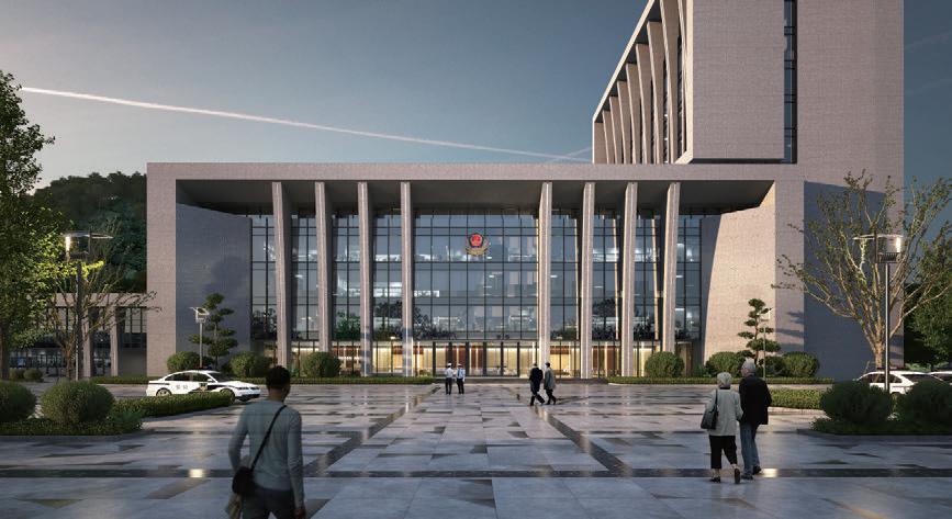

Type: Schematic design of public buildings
Team: Jianqun Zhao(project manager), Chenyi Ye(supervisor), Chaojie Chen, Jiahao Ye
Contribution: Massing design and Façade design

Site Location: Youxi, China
Program: Public Building
Status: Being reviewed by the government
Time: 2022- present
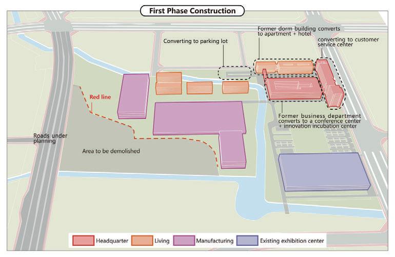
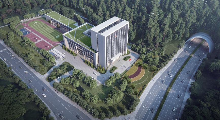
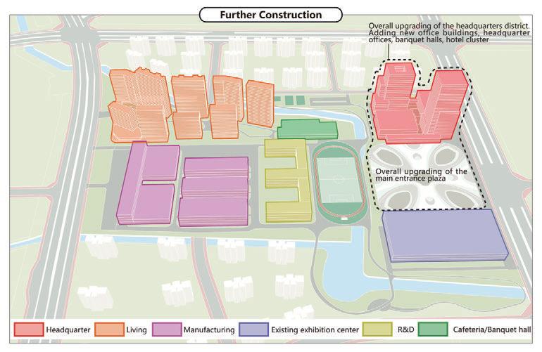
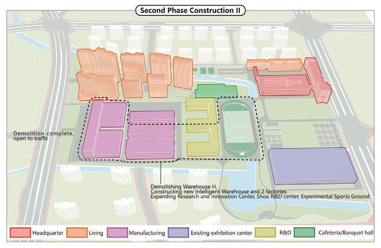
Phasing strategy diagram
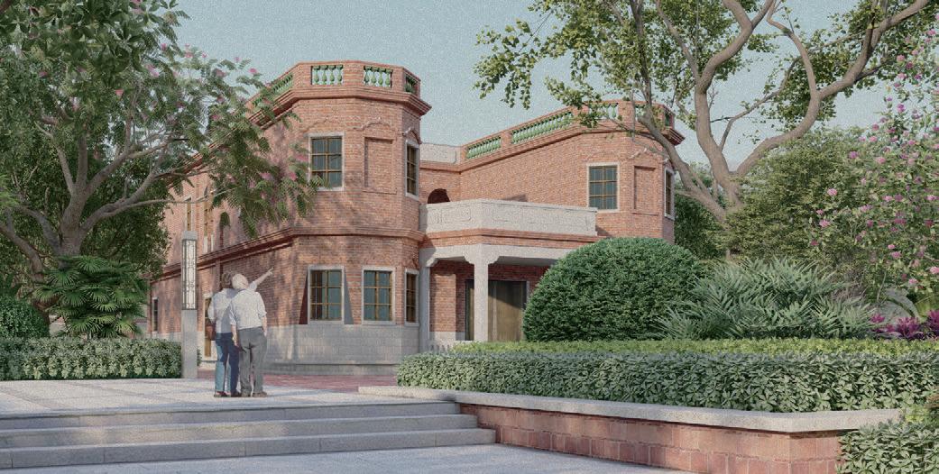
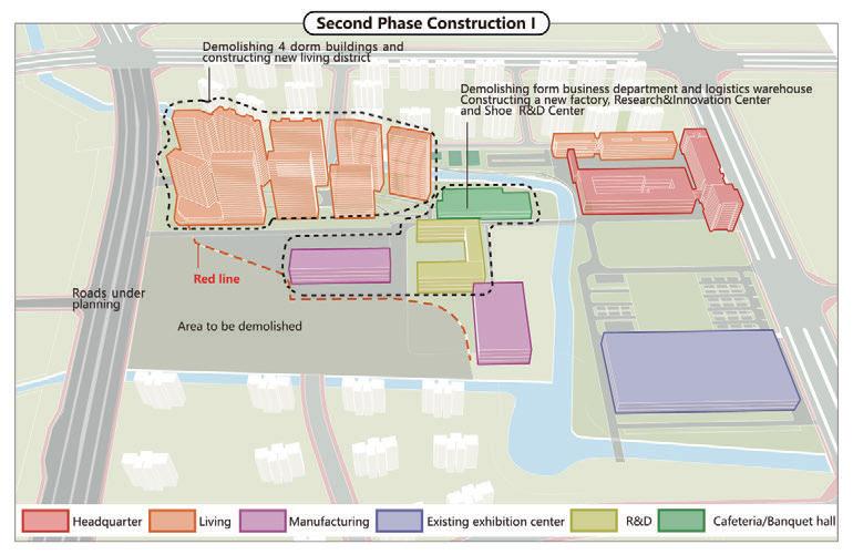
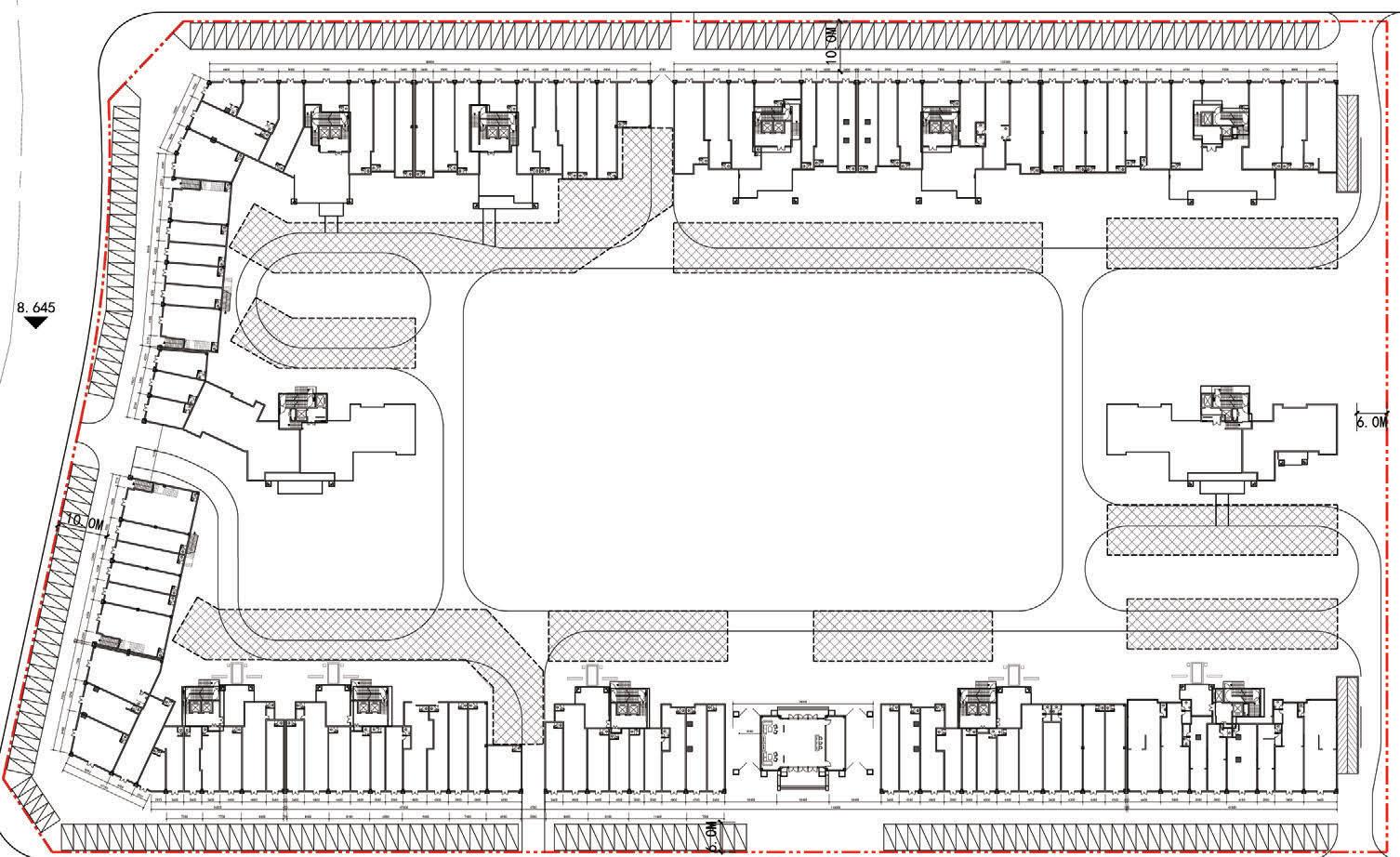
Site Location: Quanzhou, China
Program: Headquarter of enterprises
Status: Communicating with Party A
Time: 2022- present

35 Professional Practices
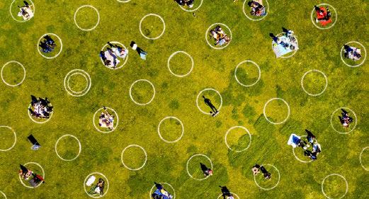
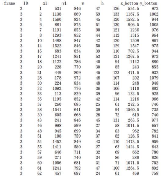
Research on Pedestrian Behavior Patterns in Public Space Using Real-time Webcam
A Revisit of Jan Gehl's Human-oriented Theory and Method in Urban Public Space Design
Research Background
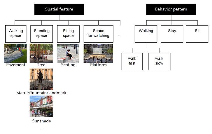
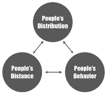
Jan Gehl is a Danish architect and urban design consultant based in Copenhagen whose career has focused on improving the quality of urban life by re-orienting city design towards the pedestrian and cyclist. In his 1971 book "Life Between Buildings: Using Public Space", he proposed "Human-oriented" theory and method in urban public space design. e unique methodology of Jan Gehl is based on the principle that people are the most important priority of public space in the process of planning cities. The book presents the Spatial features that good public spaces have, and the Bahavior pattern of people that corresponds to them.
Research Question
How does the spatial feature a ect pedestrian behavior pattern in public space nowadays(Post-epidemic period)?
This research is not about simply refuting or varifing Jan’s original findings. Rather, the study is intended to identify new patterns of public social life especially with the background of global pandemic.
How is spatial feature of public space related to these patterns?
How can we provide safe, healthy and vital public space?
We further summarized some of the theories, ndings from Younger, such as:
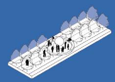
• People prefer to stay in space with backing and shelter, while also able to observe the surroundings.
• People prefer to keep a distance of about the length of arm with other people while sitting.
• People prefer to keep a distance of about 25m while watching performance and other activities.
•...
Research Framework
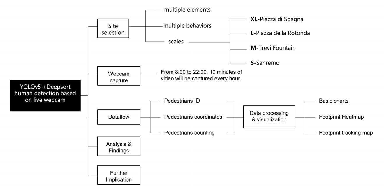
 2022 Smart City Workshop - team work
In collaboration with Qinru Hu, Kanxuan He, Haoxuan Li, Hengjia Zhang
Instructor: Waishan Kew, Xun Liu, Wenjing
Program: people tracking, guidelines for public space design Site: Rome, Italy
Figure 1. Jan Gehl's human-oriented theory and method in urban public space design
Figure 4. Work ow
Figure 3. White circles at Mission Dolores Park in San Francisco to encourage social distancing
Figure 2. Dimensions of public space description
2022 Smart City Workshop - team work
In collaboration with Qinru Hu, Kanxuan He, Haoxuan Li, Hengjia Zhang
Instructor: Waishan Kew, Xun Liu, Wenjing
Program: people tracking, guidelines for public space design Site: Rome, Italy
Figure 1. Jan Gehl's human-oriented theory and method in urban public space design
Figure 4. Work ow
Figure 3. White circles at Mission Dolores Park in San Francisco to encourage social distancing
Figure 2. Dimensions of public space description
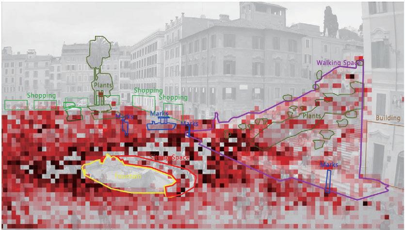
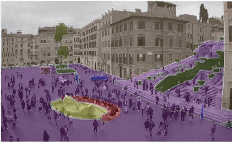
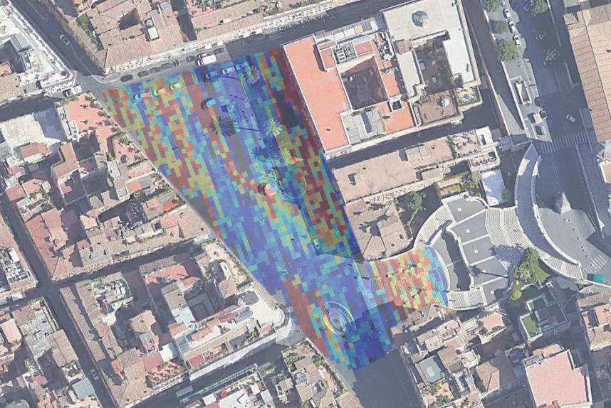
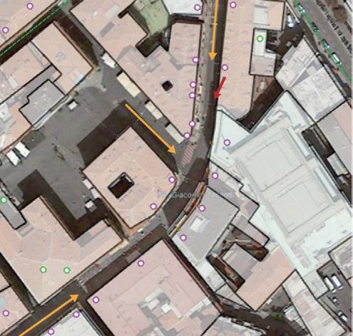
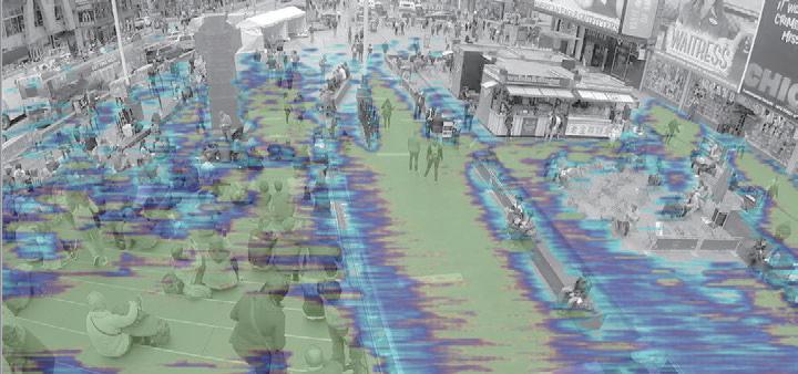
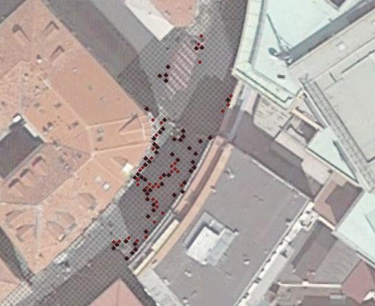
Four sites of di erent scales are expected to be taken as samples for this research: the Piazza di Spagna (0.6ha), the Piazza della Rotonda (0.3ha), the Trevi Fountain (0.2ha), and the Sanremo (8m wide street).
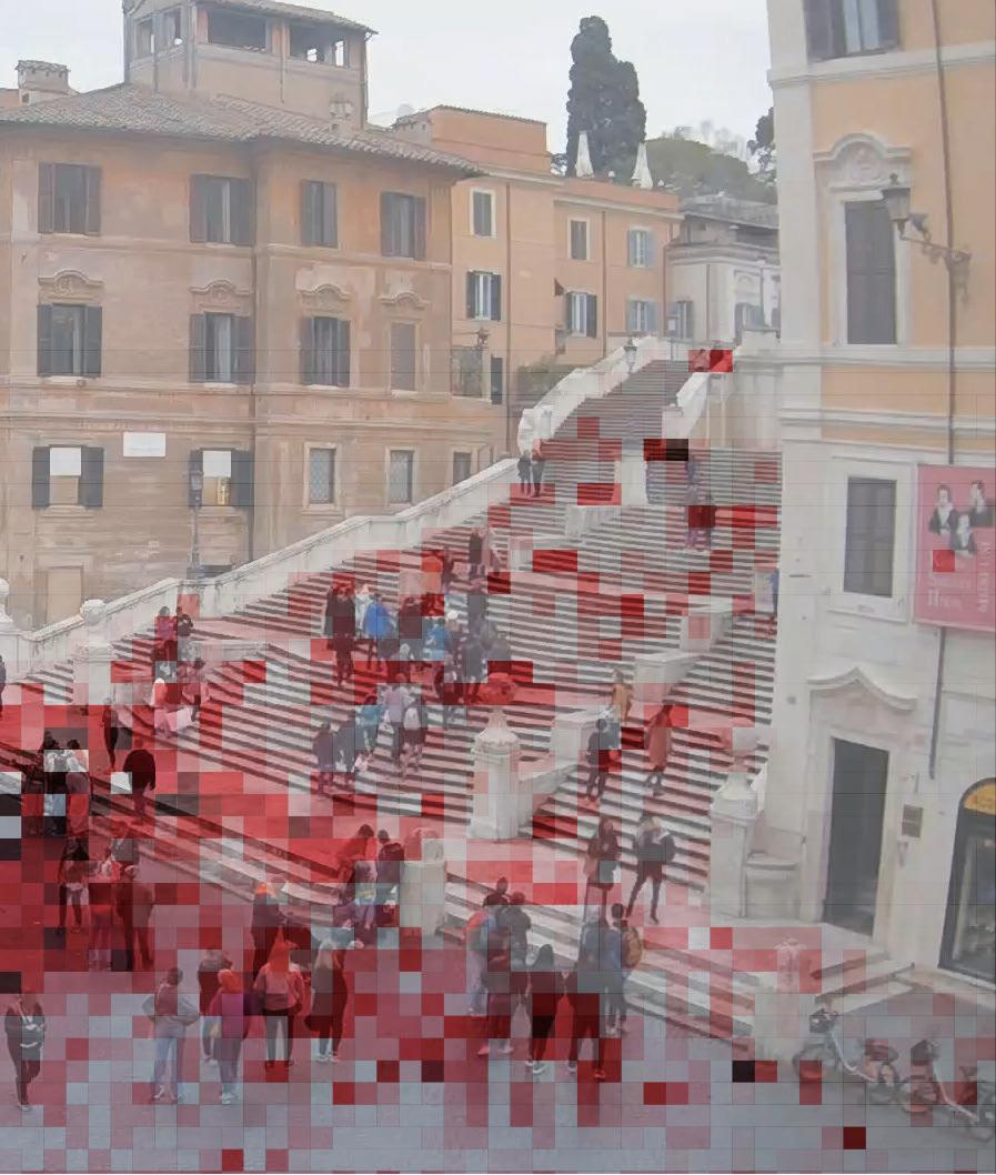
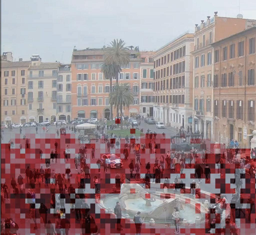
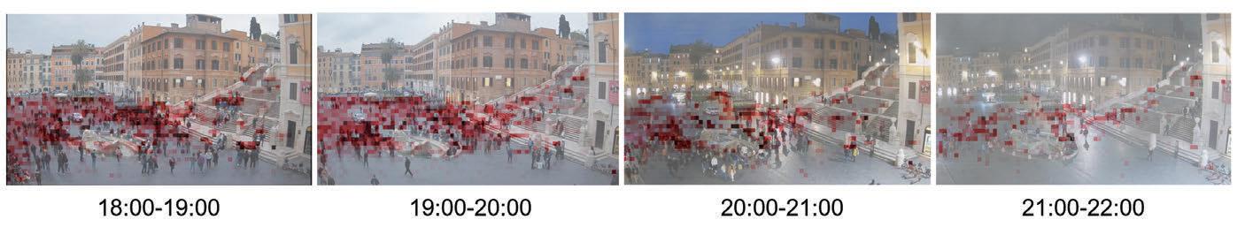
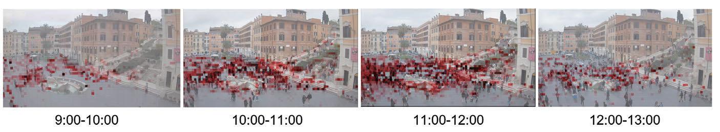
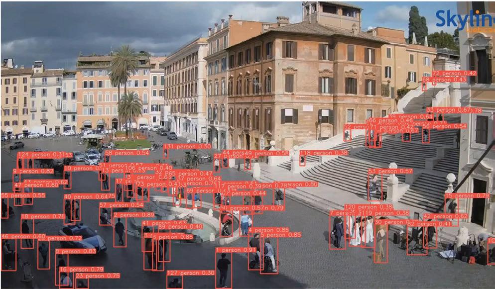
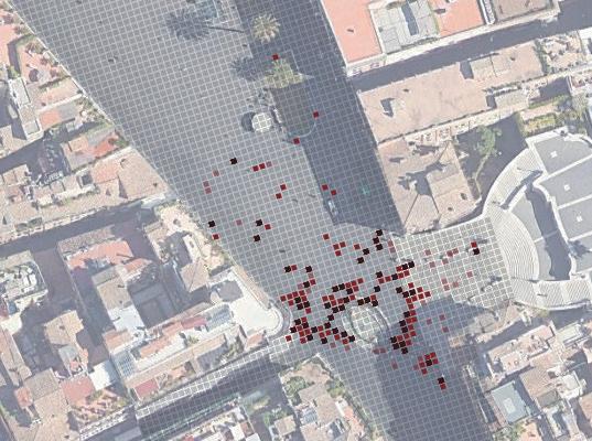
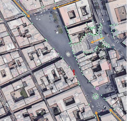
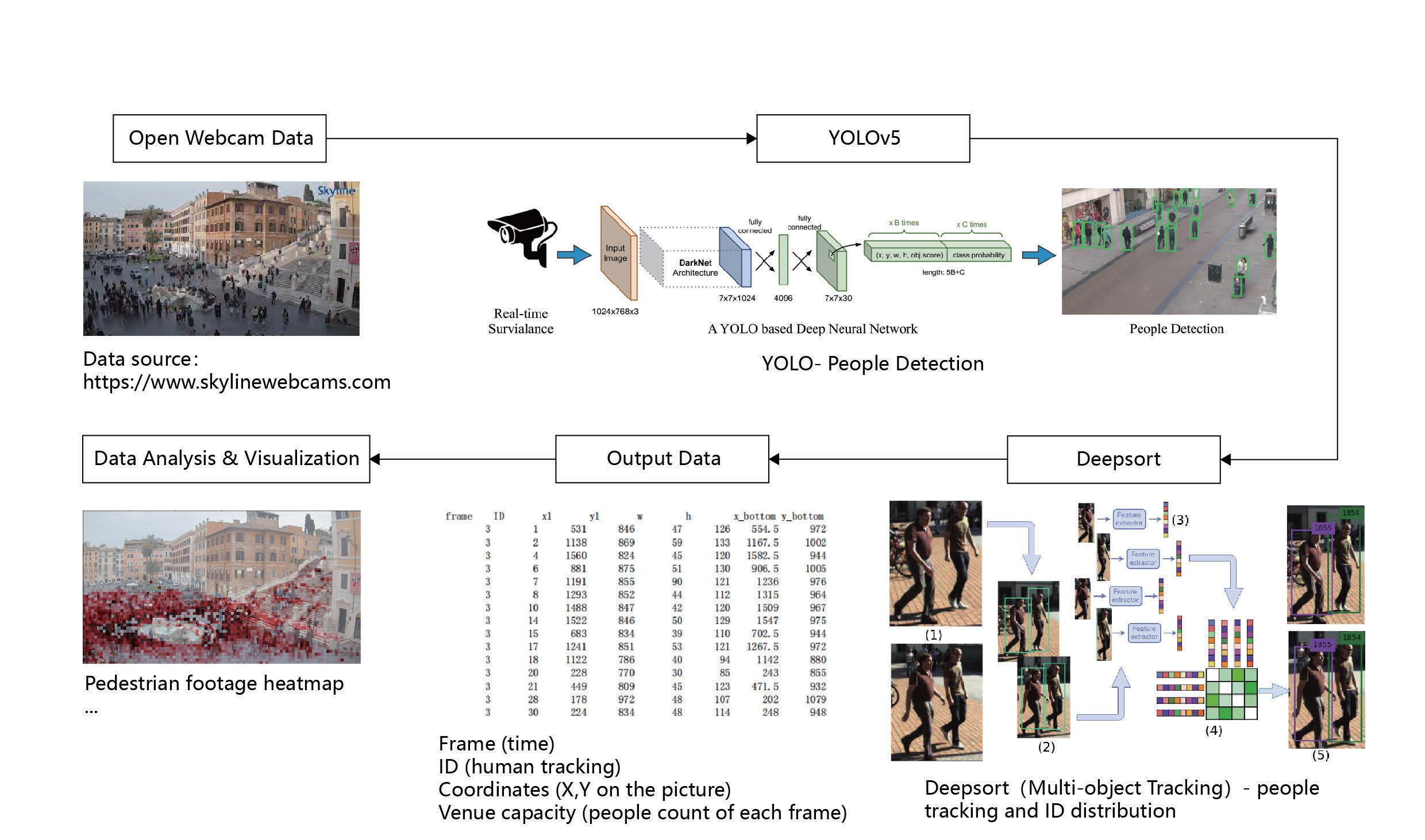
We take a 10-minute sample of webcam footage in each hour, and use x_bottom, y_bottom as the basis for counting the point distribution of all frames in each hour to visualize the footprint heatmap in each hour.
Research Process
 Figure 5. Data ow
Figure 6. Spatial feature in Piazza di Spagna
Figure 7. People detection output in Piazza di Spagna
Figure 8. Footprint heatmap in one day
Figure 9. Heatmap of total footprint for the day
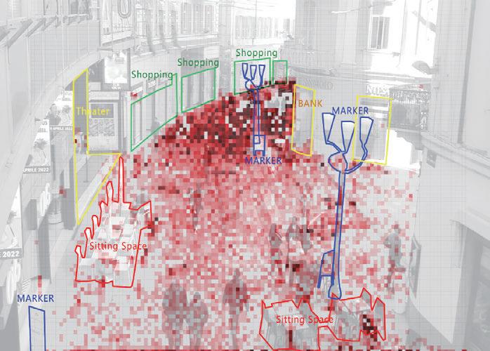
Figure 10. Footprint heatmap plan Figure 11. Footprint heatmap and spatial feature overlap
XL- Piazza di Spagna
Figure 5. Data ow
Figure 6. Spatial feature in Piazza di Spagna
Figure 7. People detection output in Piazza di Spagna
Figure 8. Footprint heatmap in one day
Figure 9. Heatmap of total footprint for the day
Figure 10. Footprint heatmap plan Figure 11. Footprint heatmap and spatial feature overlap
XL- Piazza di Spagna
37 0 4 8 12 16 20 Research
Findings
• With a dominant spatial axis, people tend to walk slower in the middle(and taking photos), while passing faster along two sides.
• People tend to sit at a higher place with a better view.
• People prefer to sit at places with backing which faces an open space.
• Most conversations observed were seperate from the tra c ow.
• Groups of people tended to congregate around objects, even if they were not using them.
• People tend to gather around places with higher diversity of activity.
• With smaller scale there is no obvious tendency of people to walk along the edge or in the middle, while with bigger scale people tend to walk in the middle.
• informal platforms can be created to allow for more spontaneous activity in the intersection of roads.
• ...
Expected Result
e data obtained in this study can be more useful in the next step in terms of "distance", in addition to obtaining an accurate footprint heatmap on the plane.
For example, by tracking the movement of pedestrians, we can calculate the Social Distance Risk Map of an area;
by counting the time and mode of use of objects in public space, we can calculate the elements attraction rate (the ratio of the number of people staying in the area to the total number of people staying in the area walking slowly at the same time).
Further Implication
Inspired by SWA's research "Field Guide to Life in Urban Plazas - A Study in New York CIty", this research is based on a focus on the types of spatial features that in uence pedestrian clusering patterns during a pandemic, and can be further developed into "Field Guide to Life in Urban Plazas During the Pandemic".
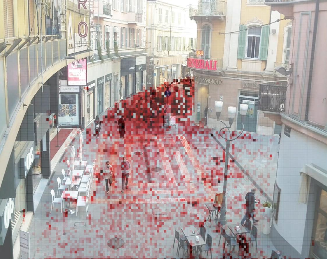
Figure 12. Spatial feature in Sanremo Street
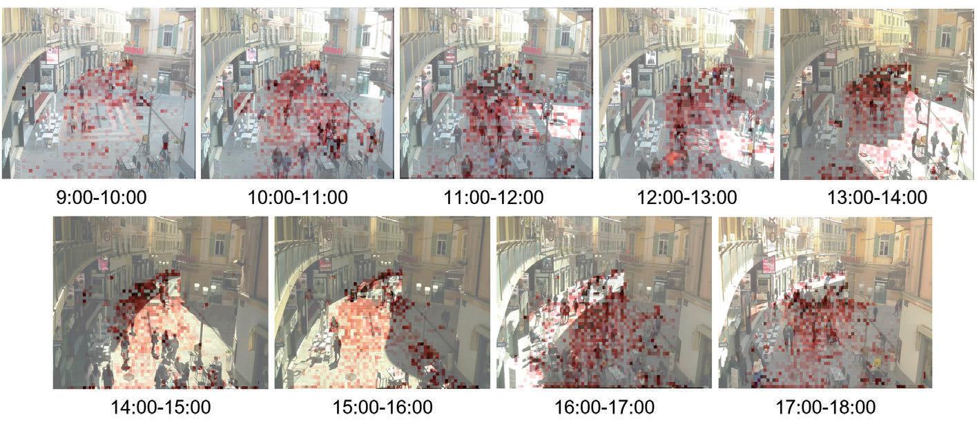
Figure 13. Footprint heatmap in one day
Figure 14. Heatmap of total footprint for the day
Figure 15. Footprint heatmap plan
Figure 17. Social distance risk map of Piazza di Spagna
Figure 18. "Field Guide to Life in Urban Plazas - A Study in New York CIty" by SWA
S- Sanremo
Figure 16. Footprint heatmap and spatial feature overlap
38 0 2 4 6 8 10 Research
Cats Welfare Space Generator
Generative Design and Optimization

2023 GSAPP Elective Course - team work
In collaboration with Xu Cheng, Haoyu Hu
Instructor: Danil Nagy
Research Background
Having a kitten is a particularly common thing in New York and even around the world. But for the most part, they only live under the same roof: our apartment/room. ey have their own emotional ups and downs: they can get bored or frustrated by the con nes of space and the limitations of their activities, especially when we’re out at work and play. erefore, we designed a generator to help cat owners decide the layout of the cat's activity space to make the cat's life more enjoyable. Using design interventions and generative design simulations, object related to cats were placed in the bedroom/apartment correspondingly.
•variation in the height
•expression of leaving territorial marks
•Hunting behavior
These five factors actually correspond to the cat's behaviors of A-eating, B-sleeping, and C-playing, so we decided to study a total of 4 behaviors plus D-excretory behavior for a total of 6 corresponding prototypes.

Program: "Ikea" for cats
Online Publication: https://medium.com/generative-design-course/catswelfare-space-generator-f07d20c613fc
We did some background research for basic activities to make up the cat's natural routines and combine it with another study on the e ect of environment on stress levels in cats. e result is that for those Cats housed in enriched environments had lower stress levels (CSS). ere will be 5 main microenvironmental factors to be concerned:
•availability and presentation of food
• partial isolation
Methodology
Figure 1. Natural behavior of cats (image taken from the internet)
Figure 2. Cat's behaviors and corresponding prototypes
Figure 3. Work ow
Cat Dish Cat House Cat Signing Ball
Rays
Cat Tree
Litter box
Research Process
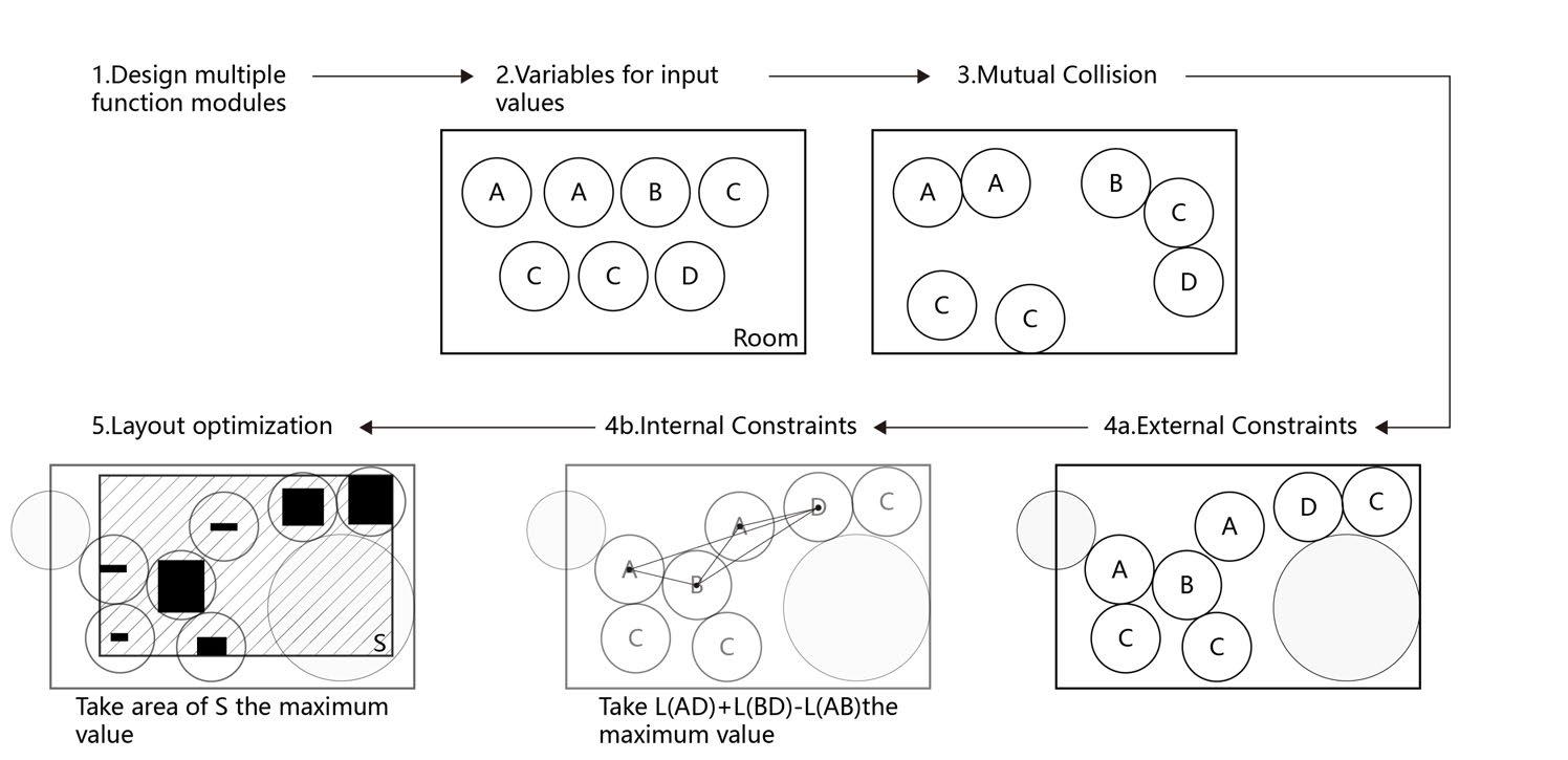
1. Design multiple function modules
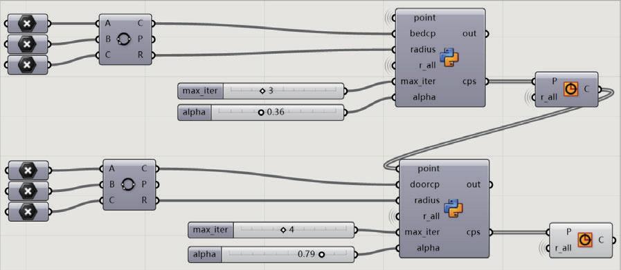
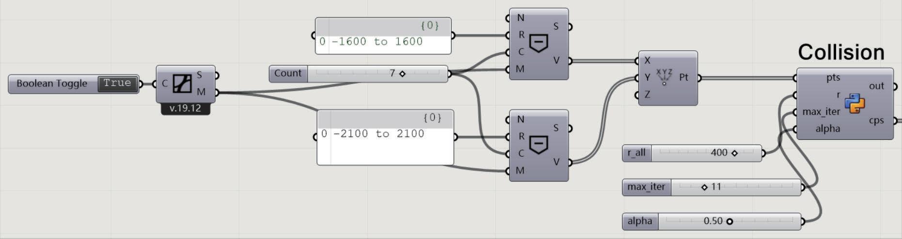
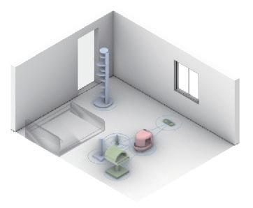
According to the daily life and general conditions of cats, we mainly set up the space cats need to eat, sleep, excrete and play Depending on their actual object size and using situation, we add the condition of in uence range for them. To facilitate the calculation, we xed this sphere of in uence as a circle with a radius of 400mm.
2. Variables for input values
As different cat owners have different needs, cats can have different sleeping, eating and playing spaces. We use A-eating, B-sleeping, C-playing and D-excreting.
In this demo, we use the following requirements as a reference: 2A+1B+3C(C1,C2,C3 represents items of the same function but of different types and sizes)+1D seven items.
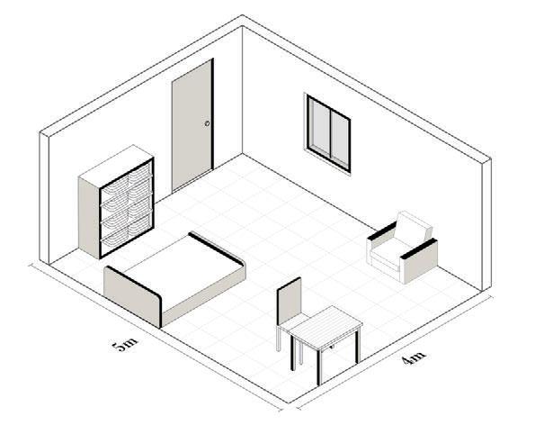
The design starts with the room of one of the authors, the size of which is 4m*5m, and considers for the time being only the e ect of the door and the bed on the arrangement of objects.
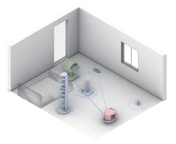
4b. Internal constraints
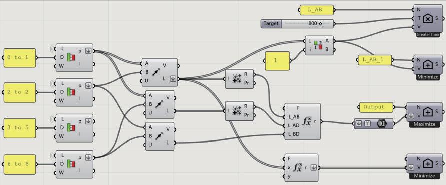
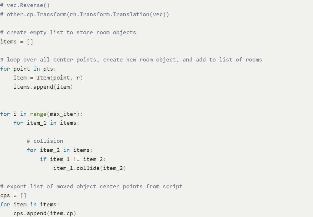
e points currently generated are a series of outputs that are disjoint in a stable space and do not overlap with the range of beds and doors we have set. ey currently satisfy the basic conditions, but we still need to place constraints on the spacing between the objects of ABCD. In practice, we need put eating space and sleeping space closer, and let the excretion space far away from these spaces if possible. This is the internal constraint.
3. Mutual Collision
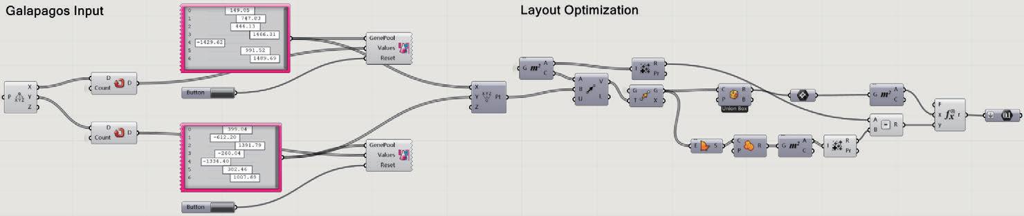
To ensure that the areas of objects placed in the limited space of this room do not overlap and that each object has its own spere of in uence, we have to move away from (repel) each object. We use the area of in uence as the repulsion area. e list of items’ data is then converted into randomly generated point positions using Discover.Continuous as input. e range of these parameters is a ected by the distance between objects, i.e., the length in space is not greater than the diameter of the affected range, and these point positions are then output to determine their output positions for evaluation.
5. Layout optimization
In reality, we are unlikely to place objects in the middle of an empty part of the room. So we also have to add the optimization condition: have a tendency to lean against the wall.
e output iterated with Discover has a tendency to favor the optimal solution according to the output points in the battery pack corresponding to the di erent ABCD items. And we can choose the favorite type of spatial arrangement from it.
We can express the constraint of the condition with the expression: make l_AB as small as possible and l_AD, l_BD as large as possible by distance between centers of circles. (l represents the length of the line segment between two points)
In this step, we obtain the arrangement of objects whose mutual in uence ranges do not overlap under the intrinsic constraints. We use the weighting coe cients as coe cients for each of the two and add them together for calculation. e higher the value of the result, the more it matches the condition we set.
4a. External constraints | Fixed objects
Doors and bed, as non-moving assets, will have settings for their reminder size and sphere of in uence: the established sphere of in uence and size is shown below.
Based on the previous step, the current positions of the seven ranges are then made to repel the doors and beds so that they do not overlap each other.
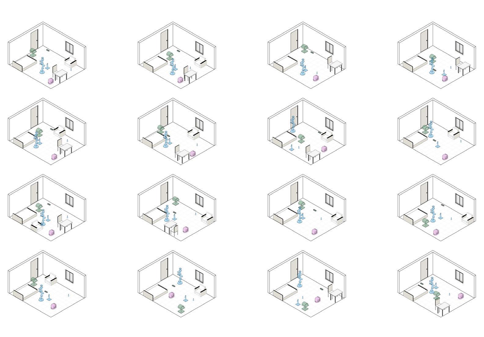
Finally, we visualize the process. Users can select the required objects and number of objects in the room of their own set size, and the system will also produce several types that tend to be the best according to the input situation for the user’s reference, which greatly saves the user’s time and e ort in arranging them by themselves.
 Figure 4. Prototype object size
Figure 5. Prototype object in uence range
Figure 6. Room axonometric drawings and dimensions
Figure 7. Mutual Collision
Figure 10. External Constraints
Figure 11. Internal Constraints
Figure 12. Grasshopper Optimization
Figure 13. Discover Optimization Figure 14. Several suitable solution options
Figure 8. Python Codes of Collision
Figure 9. Size of the door and bed with the range of in uence.
Figure 4. Prototype object size
Figure 5. Prototype object in uence range
Figure 6. Room axonometric drawings and dimensions
Figure 7. Mutual Collision
Figure 10. External Constraints
Figure 11. Internal Constraints
Figure 12. Grasshopper Optimization
Figure 13. Discover Optimization Figure 14. Several suitable solution options
Figure 8. Python Codes of Collision
Figure 9. Size of the door and bed with the range of in uence.
40 Research
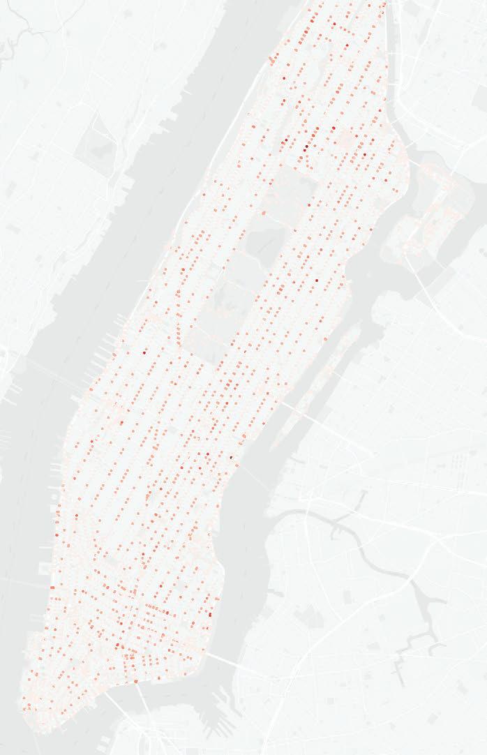
Manhattan Tra c Collision Map
A Practice of Operating Urban Data and Machine Learning
2023 GSAPP Elective Course - team work
In collaboration with Junling Zhuang, Chongyang
Ren Instructor: Mauricio Rada Orellana
Problem De nition
Traffic collisions are a major concern in urban areas, and can lead to severe injuries or fatalities. Manhattan is known for its high-density road network and heavy tra c, making it important to understand the factors that contribute to traffic collisions in this area. In order to reduce the frequency and severity of collisions, it is necessary to identify the intersections that are most prone to accidents and determine the factors that contribute to their danger.
Research Question
What factors contribute to the frequency and severity of tra c collisions at intersections in Manhattan, and how can this information be used to predict the risk of collisions at di erent locations?
Literature Review
1. Luis F. Miranda-Morenoa, Patrick Morencyb, Ahmed M. El-Geneidyc. (2011). e link between built environment, pedestrian activity and pedestrian–vehicle collision occurrence at signalized intersections
Exploratory Analysis
2. Ayesha Sha que, Guo Cao, Zia Khan, Muhammad Asad, Muhammad Aslam. (2022). Deep Learning-Based Change Detection in Remote Sensing Images: A Review.
3. Xiaojiang Li, Chuanrong Zhang, Weidong Li, Robert Ricard, Qingyan Meng, Weixing Zhang. (2015). Assessing street-level urban greenery using Google Street Viewand a modi ed green view index.
Data Sources
1. Motor Vehicle Collisions - Crashes
(https://data.cityofnewyork.us/Public-Safety/Motor-Vehicle-Collisions-Crashes/ h9gi-nx95 - From NYC Open Data)
2. Land Cover Raster Data (2017) – 6in Resolution
(https://data.cityofnewyork.us/Environment/Land-Cover-Raster-Data-2017-6inResolution/he6d-2qns - From NYC Open Data)

e Motor Vehicle Collisions crash table contains details on the crash event. Each row represents a crash event. e Motor Vehicle Collisions data tables contain information from all police reported motor vehicle collisions in NYC.
This dataset contains records of crash date, crash time and crash location and further detailed description. We extract number of persons injured and number of persons killed as the most important variable.
Program: road intersection collision risk prediction
Site: New York, the United States
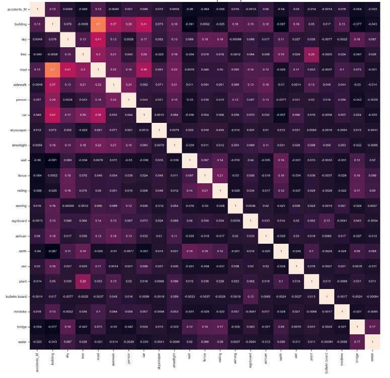
Figure 4. Correlation heatmap of Psp-Net Figure 5. Correlation heatmap of Mask R-CNN
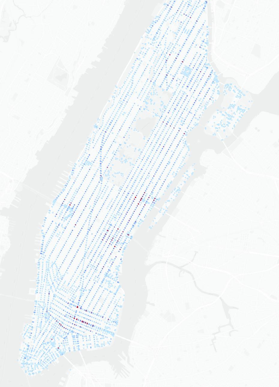
Figure 1. e number of tra c collisions in the bu er
Figure 2. Citation from the paper
0 33
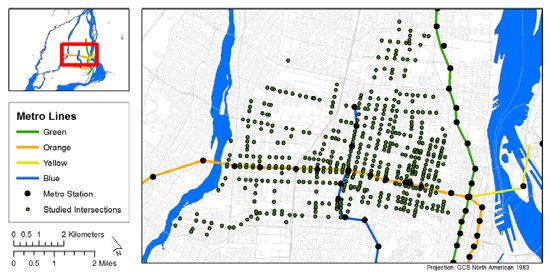
Figure 3. Signalized intersections in the study area from the paper
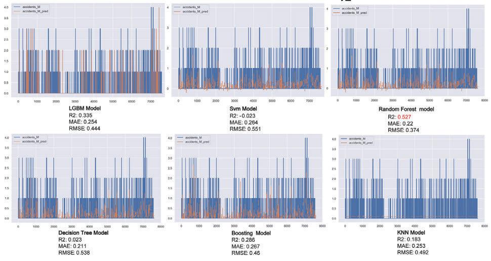
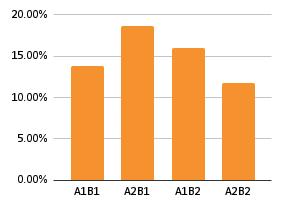
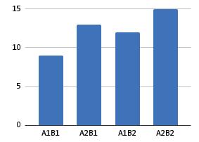
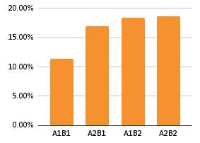
1. Firstly, for Micromobility, we conducted a regression analysis between the number of accidents events within the traffic intersection buffer, considering only GSV data, and the street-level built environment features segmented by Mask R-CNN and PSPNet. The LightGBM, Gradient Boosting, and Random Forest models all achieved an R2 score greater than 0.2. e MAE and RMSE values were centered around 0.2 and 0.4, respectively.

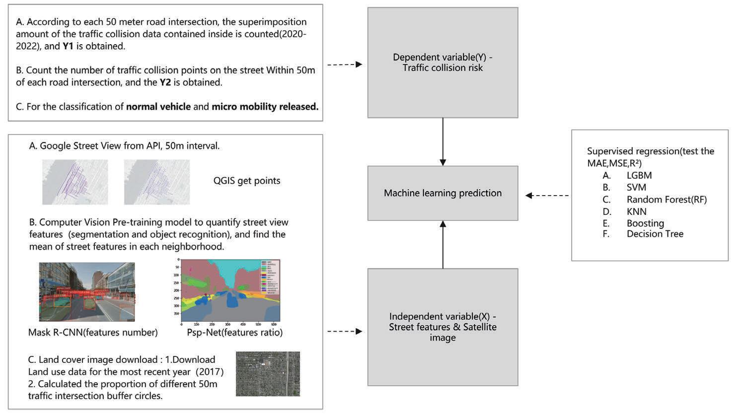
1. De ning the Tra c Collision Risk
(Dependent Variable Y)
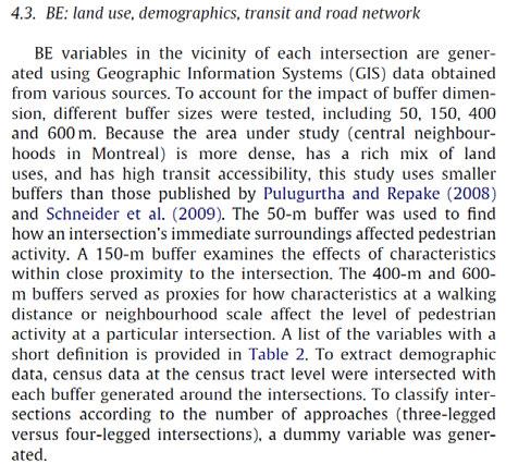
a. According to the paper“The link between built environment, pedestrian activity and pedestrian–vehicle collision occurrence at signalized intersections”: Section 4.3 we referred to(Figure 2), the 50-m bu er was used to nd how an intersection’s immediate surroundings affected pedestrian activity, which fit our demand of researching how people get affected by traffic collisions happening around the intersections.
b. According to each 50 meter road intersection, the superimposition amount of the tra c collision data contained inside is counted(2020-2022), and the Y of the neighborhood scale is obtained.
c. Count the number of tra c collision points on the street Within 50 meters of each road intersection.
d. Bu er zone analytical visualization.(Figure 1 and Figure 7)
2. Measuring the street views + Satellite Image (Independent Variable X)
a. GSV collection
i. Download street pictures through google Api, 50m interval, 800x600 pixels.
ii. Use Mask R-CNN to get the type and number of features.
iii. Use Psp-Net to get the ratio of features.
iv. Calculate the mean of street features in the same bu er circle.
b. Land cover image download
i. Download 2017 NYC land cover image.
ii. Calculated the proportion of di erent 50m tra c intersection bu er circles.
3. Machine learning prediction
a. Use the training data of Manhattan 2020-2022 to predict the risk of collisions at di erent locations.
b. Supervised regression(test the MAE,MSE,R2) to select a model of best performance.
i. LGBM
ii. SVM
iii. Random Forest(RF)
iv. KNN
v. Boosting
vi. Decision Tree
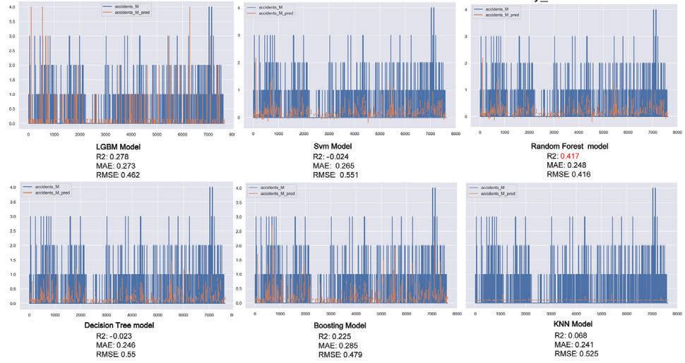
2. However, when we incorporated Land Cover into our analysis, the overall R2 scores experienced a signi cant improvement, particularly for the Random Forest model, which increased from 0.41 to 0.52. The RMSE values for each model also decreased by approximately 0.5 to 0.1 when compared to the cases considering only GSV data.
3. We employed the same approach for normal vehicles as well. When considering only GSV data, the Decision Tree Model, LightGBM Model, and Random Forest Model all exhibited relatively high R2 scores, though the Decision Tree Model displayed a negative correlation overall. At the same time, the MAE and RMSE values, in comparison to those for micro mobility, increased signi cantly, reaching 1.5 and 2.3, respectively.
4. Upon incorporating Land Cover into our analysis, the overall performance of the models improved considerably. Among the six models, the Random Forest model demonstrated the best performance.
5. We then ranked the features' importance during the regression of the Random Forest model using GINI importance. We found that, without considering Land Cover, parameters such as traffic light, tree, car, buildings, sky, and person had a relatively high impact. However, a er including Land Cover, the road percentage became the most in uential factor.
Conclusions
• Random Forest (RF) model takes the slowest time but has the highest R2 and the best performance among all models.
• After debugging the model with relatively optimal performance again, it is hoped that in the future, the risk of tra c collisions at road intersections in other low data areas can be predicted.
Research Framework Results
Figure 6. Methodological framework
Figure 8. Micromobility_GSV result
Figure 9. Micromobility_GSV+Land Cover result
Figure 7. e number of injured persons in the bu er (killed included)
12 0 42 Research
Research Background
How can we empower the context in virtual environments with our understanding of the real world? is workshop aims at the daily home with a comprehensive focus on the context experience of our study. We will use state-of-art technologies(Photogrammetry, eye tracking, and Arduino) to conduct VR experiments. e workshop will begin with 3D model scanning of an MIT Baker House Studio environment(By Alvar Aalto) and continue experimenting with the urban context's influence on physiological responses.
Statement
Key words:
Attentional focus, Environment Richness (Ambient Sound, Material Expression)
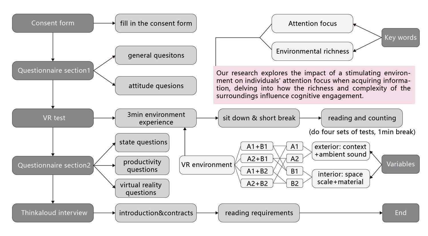
One-sentence statement: We study on how richness of environment could a ect people's attentional focus when getting information.
Context
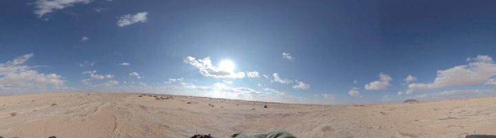
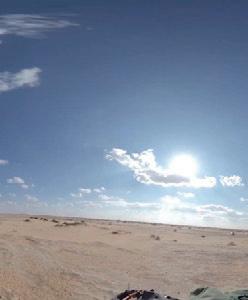
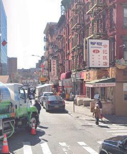
Based on the keywords of environmental richness, we first chose two outdoor environments that are on the extreme end of the spectrum, eo Goncalves in Saudi Arabia (natural environments, vast, white noise) and Mott Street in New York's Chinatown (man-made environments, crowded, vocal noise) to cover outdoor environments that a person can experience.
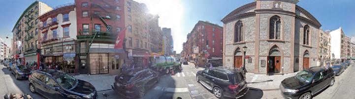
Next import the 360 degree panoramic photos of the two contexts to build the exterior environment for VR in Unity.
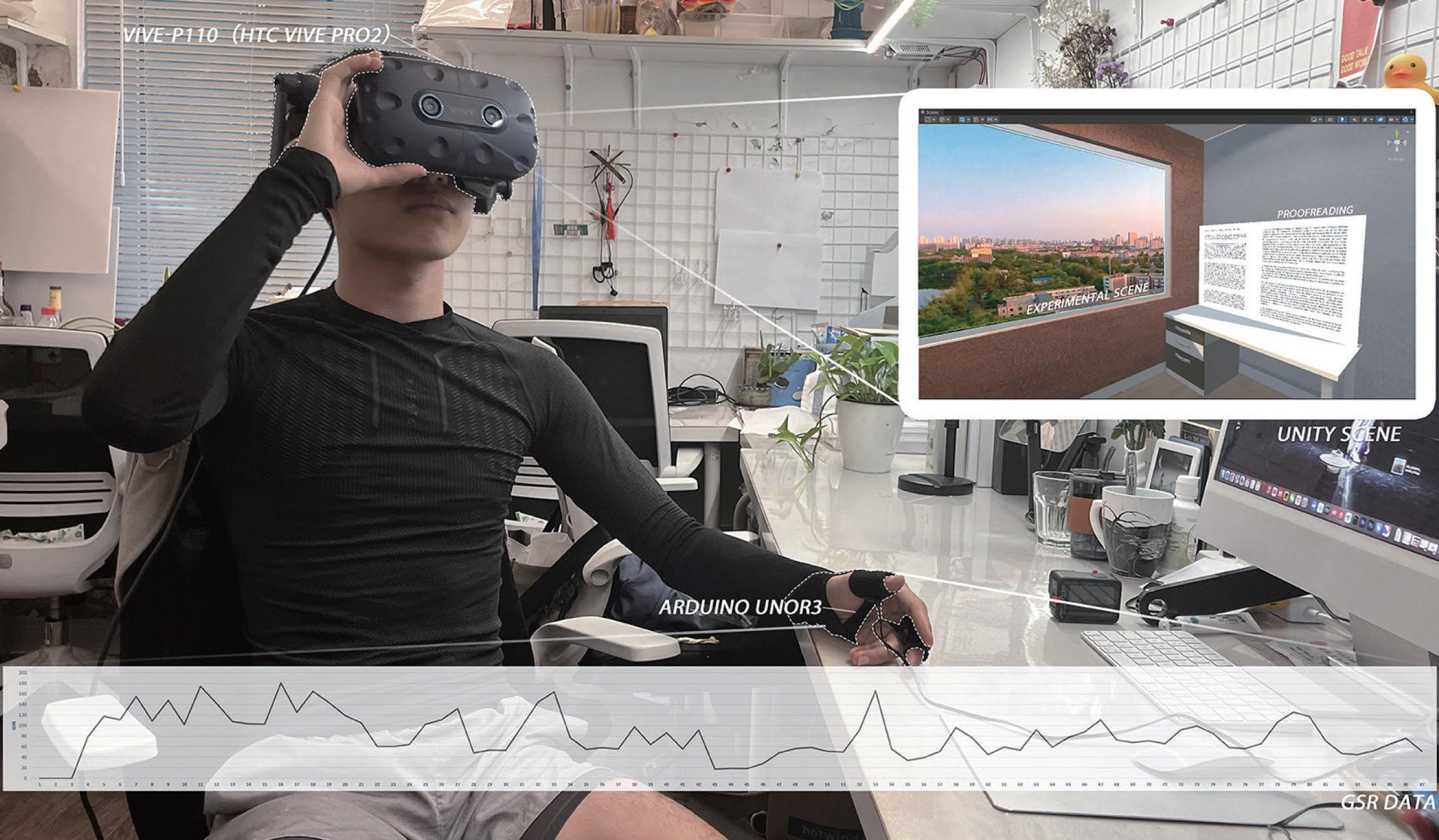
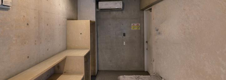
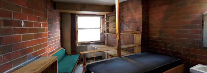
e next step is to build the interior environment, the material and scale of the room are the variables we choose. We chose the single dormitory of MIT Baker House (red brick walls, warm color vision) and the single dormitory of TIT Midorigaoka House in Tokyo (concrete walls, cool color vision) and 3D scanned them, and imported the results of the scanning into Unity to build the interior environment. e next step is the designing the experiment!
Environmental Richness + Attention Focus
A Practice of Crowdsourcing Tool for Physiological and AI Data Collection in VR
2023 DigitalFutures
"Context+Intelligence" Workshop - team work
In collaboration with Mingyang Sun, Guannan Jiang, Hanzhi Zhang, Xiaohan Gao, Daoxin Chen, Weichen Zhang, Zihao Zhang
Instructor: Guzden Varinlioglu, Han Tu, Yiqing Wang, Senqi Yang Program: virtual environment construction, perceptual data collection
Methodology
Figure 5. Experiment procedures
Figure 1. Panoramic photo of eo Goncalves
Figure 2. Panoramic photo of Mott Street
Figure 4. 3D scanning result of TIT Midorigaoka House dorm
Figure 3. 3D scanning result of MIT Baker House dorm
Experiment Procedures/Research Process
1. Consent form
Since the test data will be disclosed and counted later, it is necessary for the tester to sign a consent form before starting the test.
2. Questionnaire section 1
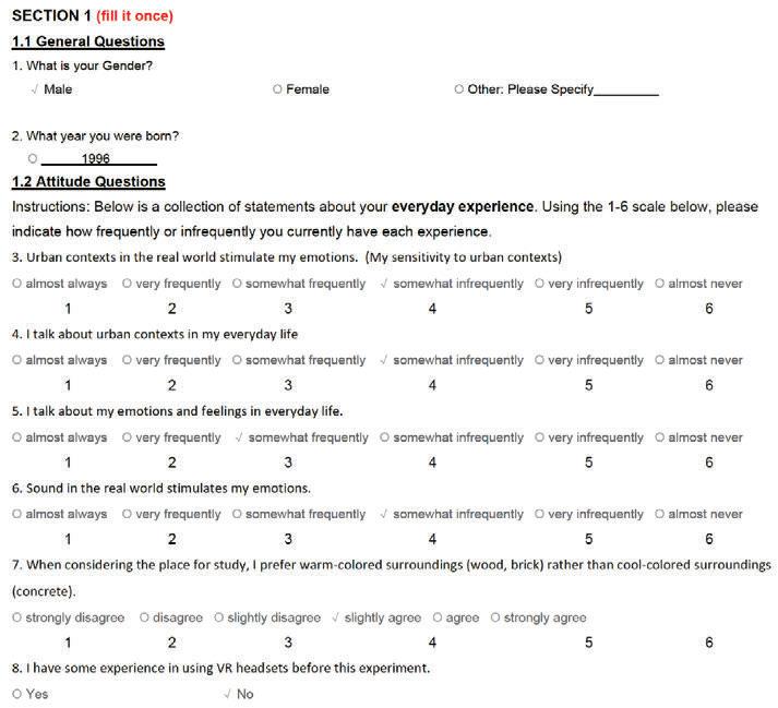
e rst part of the questionnaire was lled out by the test taker before coming to the start of the test. e main concern is the degree of sensitivity of the tester's perception of the internal and external environments in his life, and the degree of in uence caused by the environmental sounds and tones of the environment that we are concerned about on the tester.
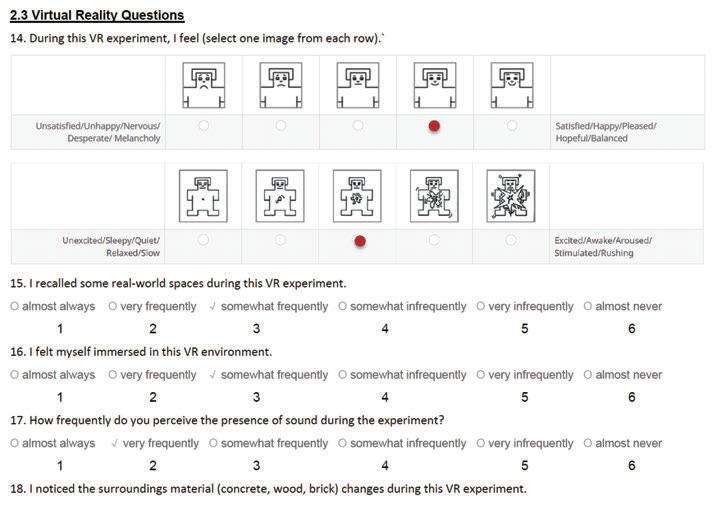
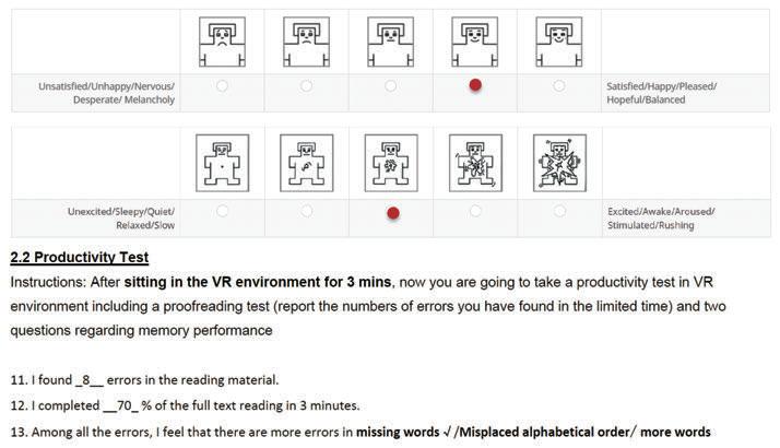
The main test of our experiment is to have testers read a text in 4 different environments and identify the speech defects in it.The four environments' proofreading are all di erent, but the number of speech defects in each reading is almost the same.
3+4. VR test + Questionnaire section 2

A total of 4 vr environments used for testing were generated by combining 2 interior and 2 exterior environments each previously built. A1
Procedures:
1. the test taker is given three minutes to freely explore and acclimatize to the environment.

2. begin to sit down for a three-minute reading session.
3. inform the recorder of the number of speech defects at the end of the session. 4. ll out section 2 of the questionnaire(Questionnaire asking about People's Feeling and Perceptions towards ambient sound and room materials).

5. take a one-minute break to begin the next setting.
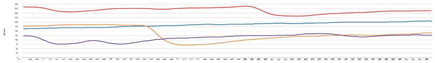
Let's consider test_01 as an example. e GSR results demonstrate signi cant emotional changes during the test in a rich outdoor environment (A1). This indicates that the tester required more time and effort to maintain focus. Conversely, in a controlled indoor environment like the TIT room (B2), the GSR values consistently exhibit a lower level, suggesting that a less stimulating
Questionnaire Analysis Result
is study aimed to explore the impact of di erent environmental contexts and room settings on user productivity, measured by the ability to identify reading errors and the e ciency of reading. Our results show that the same participants performed signi cantly better in a quiet, desert-like environment as compared to a noisy, Chinatown-inspired environment when placed in the same household setting. is suggests that noise and busyness may have a detrimental e ect on user productivity, impacting both their accuracy and speed in reading tasks.
Moreover, our research found significant differences in user performance between two room settings within the same context. Participants performed notably better in the Technology-Intensive Temperature (TIT) room compared to the Baker House room. The TIT room was characterized by a cool environment, implying that such conditions may enhance focus and thereby boost productivity compared to warmer environments.
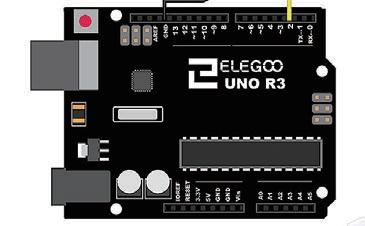
In addition to testing ATTENTION FOCUS by identifying speech defects in proofreading, we had the testers wear an Arduino GSR Sensor during the process. it showed how the testers' moods were changing by testing skin currents.

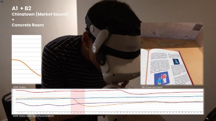
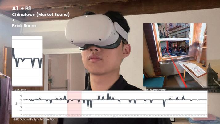
indoor environment promotes a sense of calm. However, the most pronounced fluctuations are observed in the TIT room with a desert context (A2, B2), suggesting potential emotional instability in both outdoor and indoor lowstimulation environments.
 Figure 6. Questionnaire section 1
Figure 7. Arduino gsr Sensors
Figure 8. Arduino uno R3
Figure 6. Proofreading in VR view
Figure 9. Experiencing the environment before doing reading
Figure 10. Doing Proofreading
Figure 10. GSR result of tester_01
Figure 6. Questionnaire section 1
Figure 6. Questionnaire section 1
Figure 7. Arduino gsr Sensors
Figure 8. Arduino uno R3
Figure 6. Proofreading in VR view
Figure 9. Experiencing the environment before doing reading
Figure 10. Doing Proofreading
Figure 10. GSR result of tester_01
Exterior Environment Richness Interior Environment Richness
Chinatown (market sound) B1 Brick Room A2 Desert (wind sound)
B2 Concrete Room
red-A1,B1 blue-A2,B1 orange-A1,B2 purple-A2,B2
errors been found errors found / Reading completion ratio 44 Research
See rough - Design
Intervention for Sex Workers in Bangkok's Red Light District
- Research
- Team work with Anchalinad
-
2022 GSAPP
Anuwatnontaket
Seminar
- Visualized research content and design solutions
e proposed design intervention aims to address the challenges faced by sex workers in Bangkok's red light districts, particularly in Soi Cowboy. By recognizing sex work as a form of labor and advocating for the rights of sex workers, the intention is to create a safer and more supportive environment for them.
e project seeks to shi societal perspectives away from viewing sex work as a moral issue and towards recognizing it as a legitimate form of work. It advocates for the use of the term "sex worker" rather than "prostitute" to reduce stigmatization and enable access to health, legal, and social services. The design intervention focuses on promoting consent, setting boundaries, and preventing physical and sexual harassment during working hours. Through careful site selection in prominent red light districts, such as Soi Cowboy, the project engages with the existing urban fabric. By creating designated spaces that facilitate consent and boundary-setting, it aims to empower sex workers to assert control over their interactions with customers.
The design intervention is rooted in the understanding that criminalization of sex work forces it underground, jeopardizing the safety and well-being of sex workers. By acknowledging the existence of sex work and providing support rather than rescue, the project aims to enhance the quality of life for sex workers, allowing them to work with dignity and autonomy.
New Interface Above Eave, Below Eave
- Publication
- Team work with Tung Chen, Bozhong Yang
- 2017 Collaborative Studio with CUHK
- Organized project results and layout of publication
In fall semester of 2017, CUHK and THU together initiated a collaborative design studio on urban housing. e book is divided into SIDE A and B. SIDE A contains the director's introdution, site analysis and projects from THU students in this collaborative studio. SIDE B contains the whole record of CUHK students' visit to Taichung and four acts of the U5 studio because ACT 3(Taichung mapping and urban investigation) and ACT 4(architectural design and articulation) are vital parts of this collaborative studio.
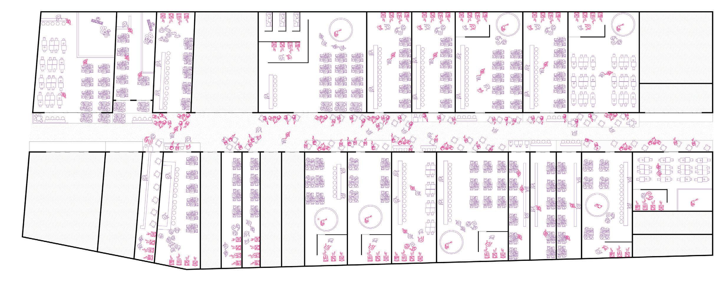
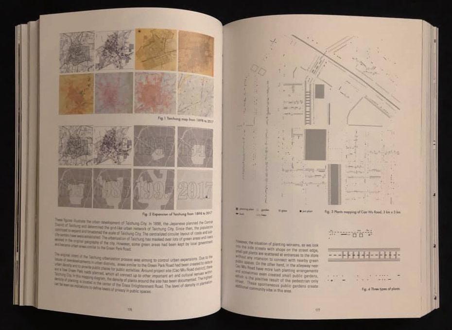
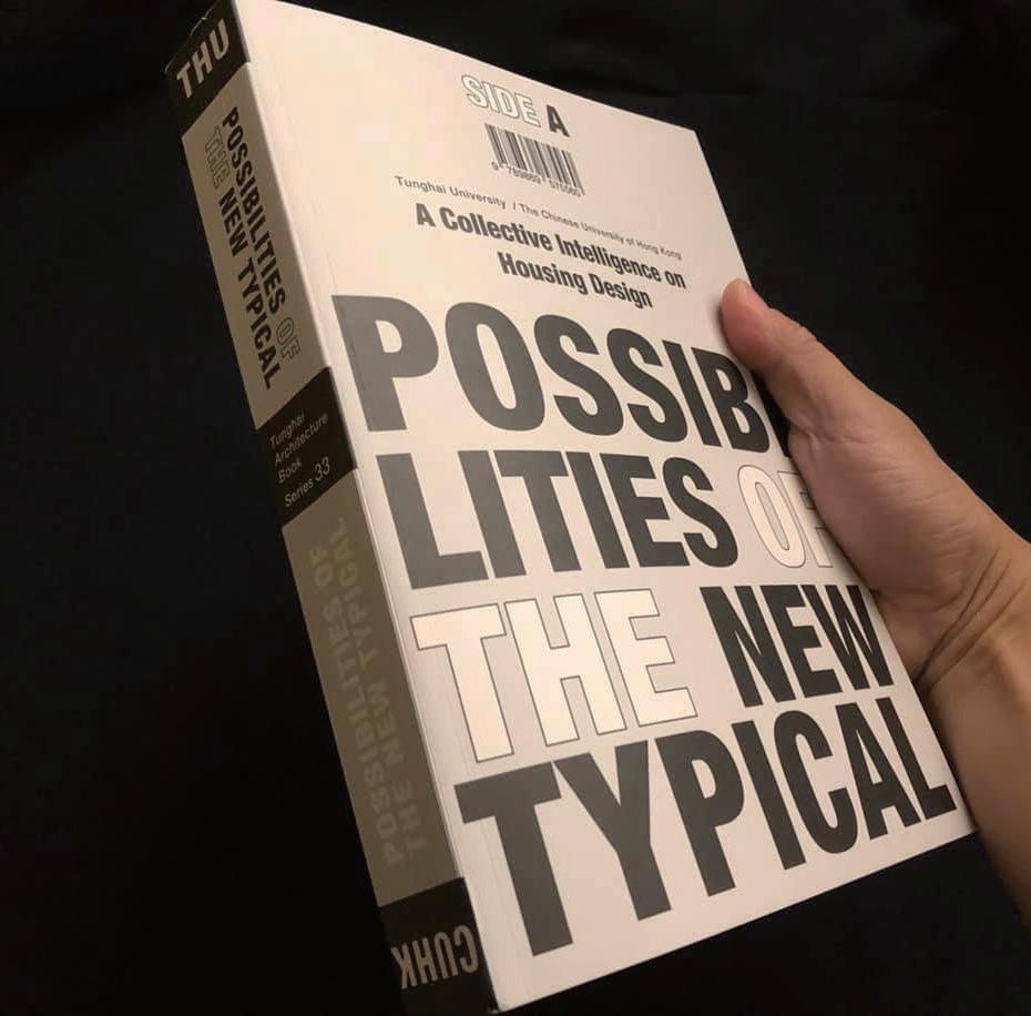
- Exhibition
- Team work with peers in design studio
- 2017 THU Optional Design Studio
- Designing individual works and participating in curating and setting up exhibitions
As I walked among the arcades and traditional houses in Tainan, I gradually discovered a regional lifestyle for residents. Under the guidance of my instructor, I stepped out of the sterotype of regularly observing and recording, coming up with a new design approach, which really opened up a new perspective for me as a city designer. My teammates and I planned the entire process of displaying the design results, from selecting the site, setting up the site, to constructing the site. is show was on display in the architecture department pavilion for a month, attracting the attention of students inside and outside the department and sparking some meaningful discussions.
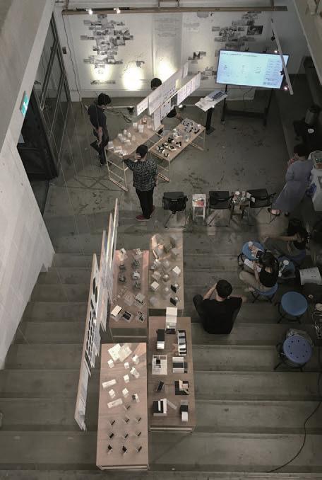
a
45 Other Works
Tourist Sex Workers Shut Down/Not
Bar