


19 / 20 ERIC TING EN WU
/ 01 / 02
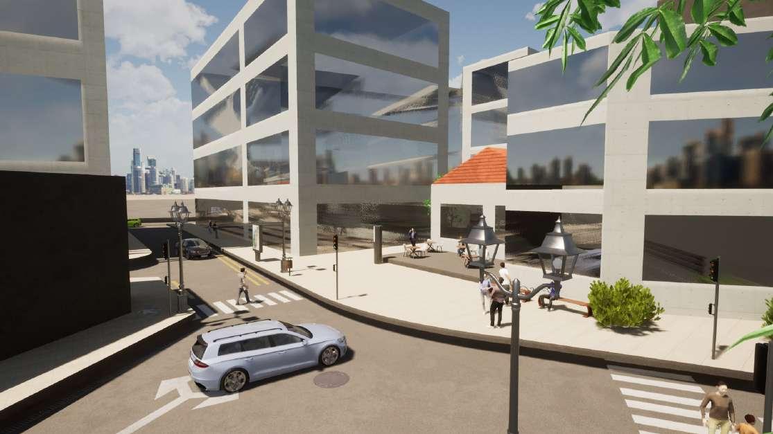
REDEFINING THE URBAN PARCEL - THE MAYFIELD REGENERATION
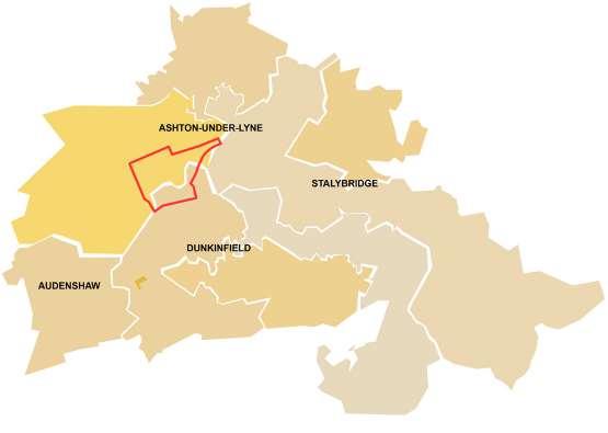
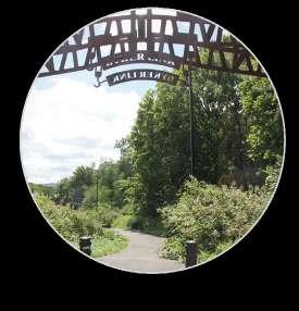
BASIN - THE HISTORIC QUARTER
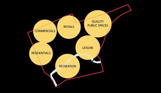
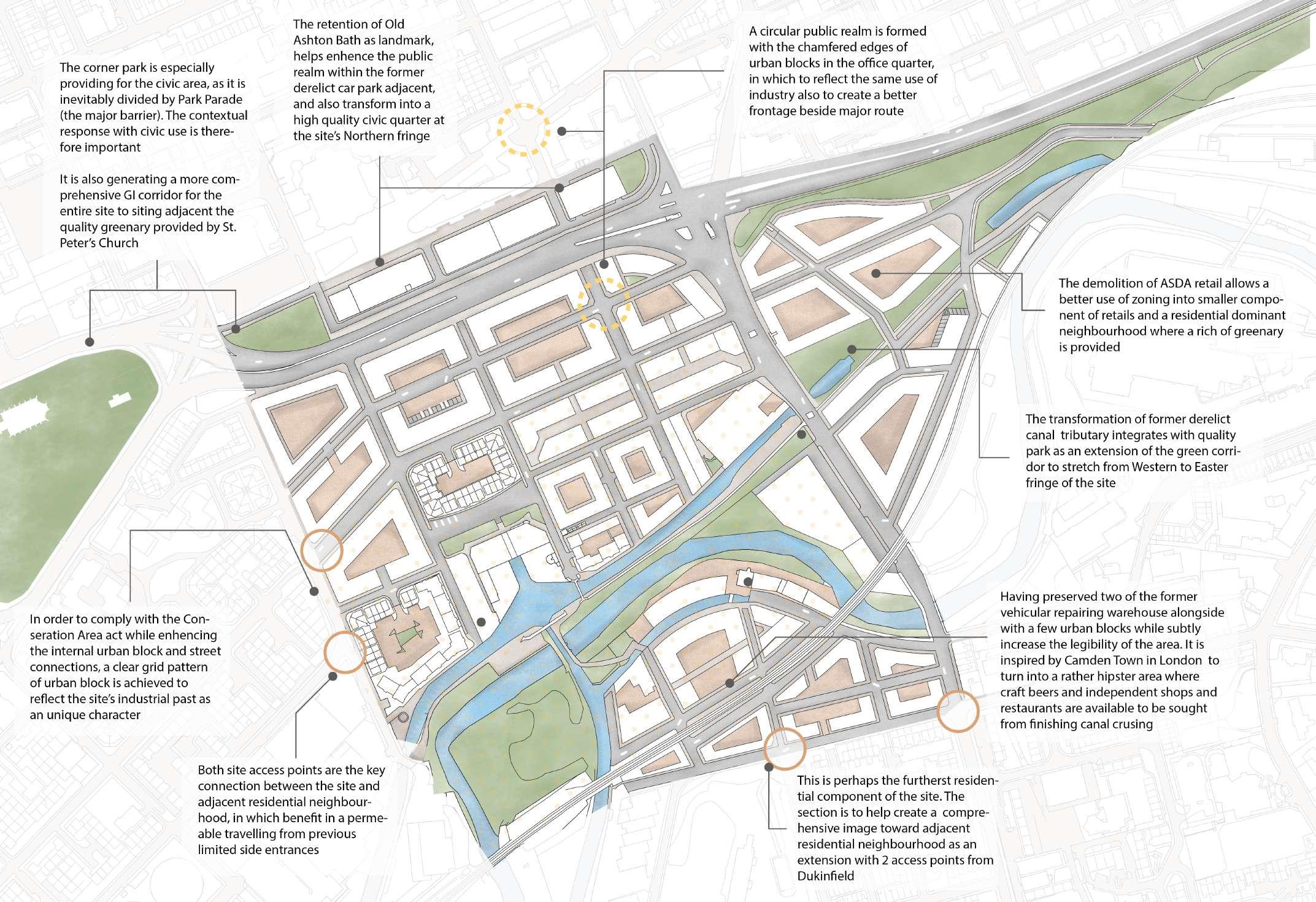
Delivering a distinctive and a vibrant community with restored public realm in becoming a catalyst of mixed- used neighbourhood
Redefining the integration of historic and natural value in portland basin that delivers a mix use of community with high quality of public realm
Restructing the urban fabric and identity in realising an inclusive, vibrant and sustainble neighbourhood with urban regeneration process / 03
THE CO-EXIST SUSTINABLE AND INCLUSIVE NEIGHBOURHOODOUSEBURN & BYKER
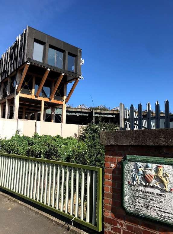
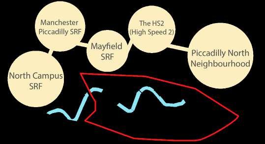
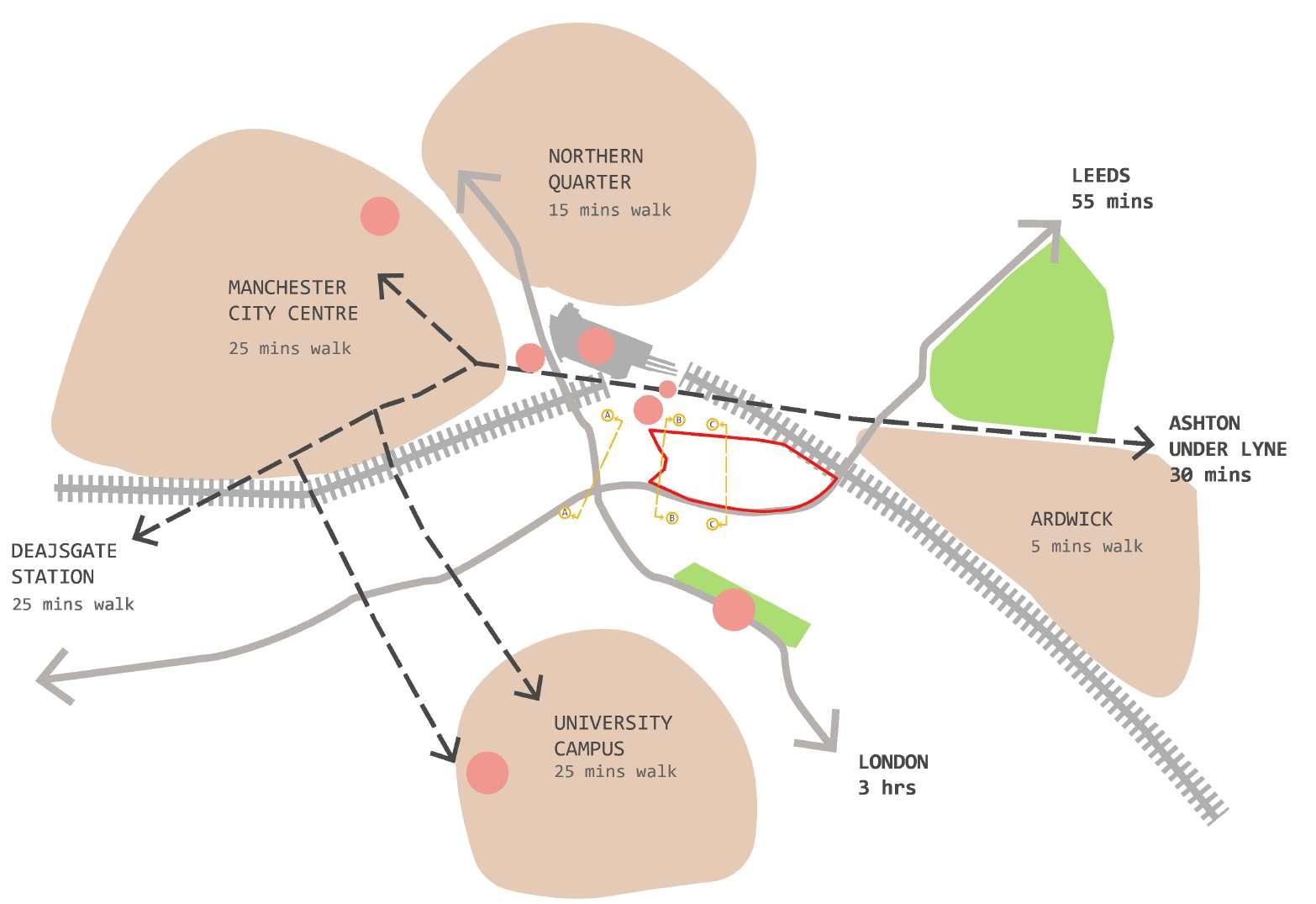
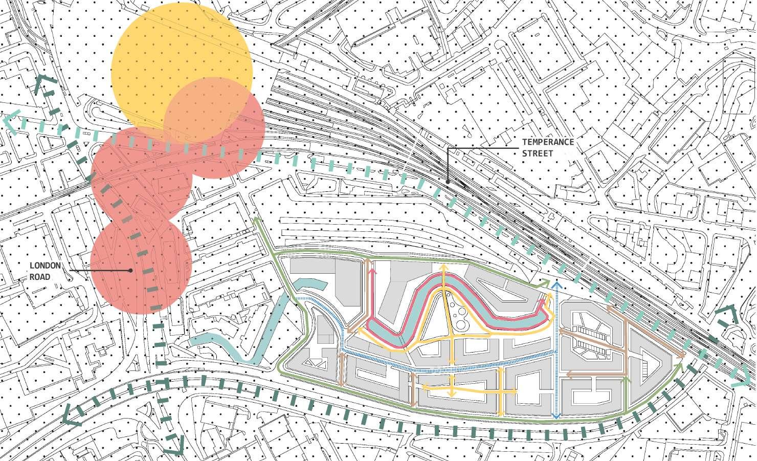
Locating in close promixity to several key districts aroud the urban core of Manchester. North to the site is the Picadilly Station where HS2 is envisioned to help providing higher volume of traffic and ease congestion and overcrowding.
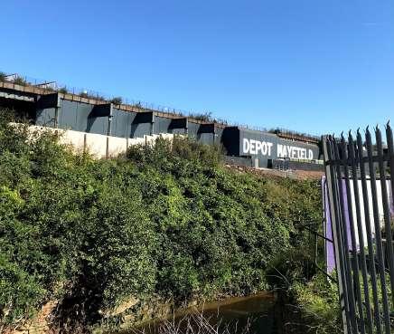
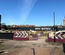
Currently a vast vacant land with existed heritages- Mayfield Depo (previously the Mayfield Station) and the Garter Bar, which are two Grade II Listed Buildings
Its location provides potential establishment in close relationship to the transport corridor and urban core such as city centre, and the Northern Quarter
Delivering a distinctive and a vibrant community with restored public realm in becoming a catalyst of mixed- used neighbourhood
PRESERVING HERITAGE ASSETS

MINIMISE IMPACTS ON BARRIER AND PROVIDE POTENTIAL CONNECTION

ENCOURAGE MIXED USE OF SPACES
ACTIVATIE INTERNAL SITE WITH LINKAGE OF FRONTAGES

REVITALISE PUBLIC REALM WITH EXTERNAL ROUTES
ENHENCING NORTH & SOUTH CONNECTION & ACCESSIBILITY


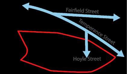
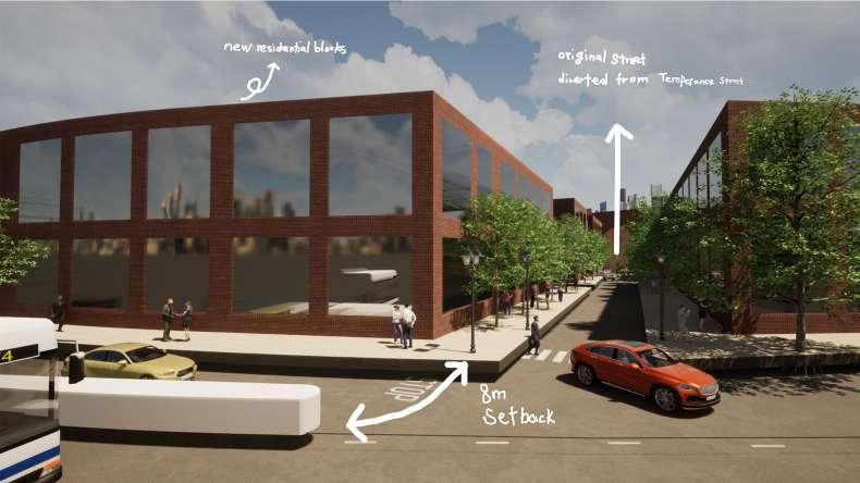
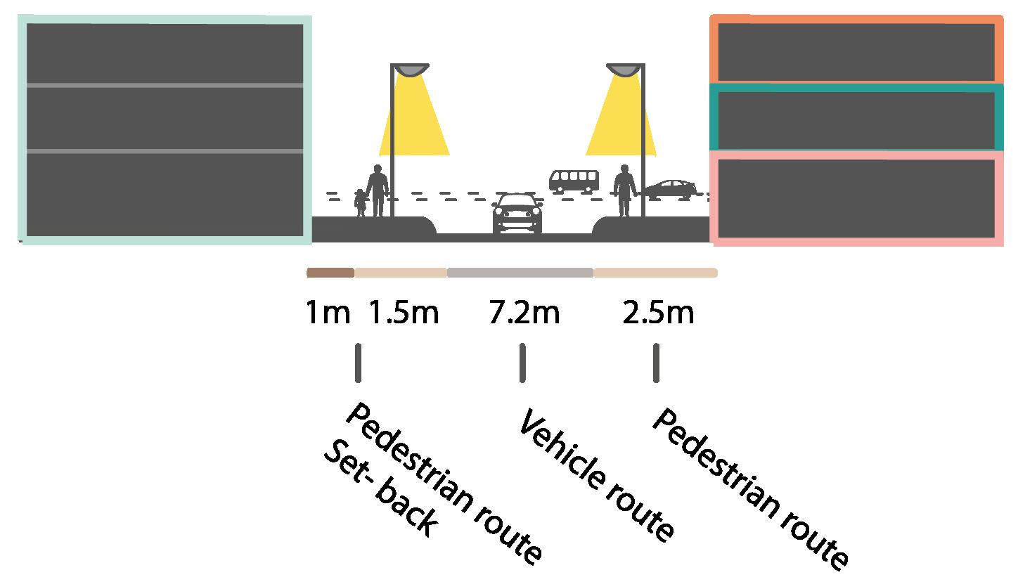
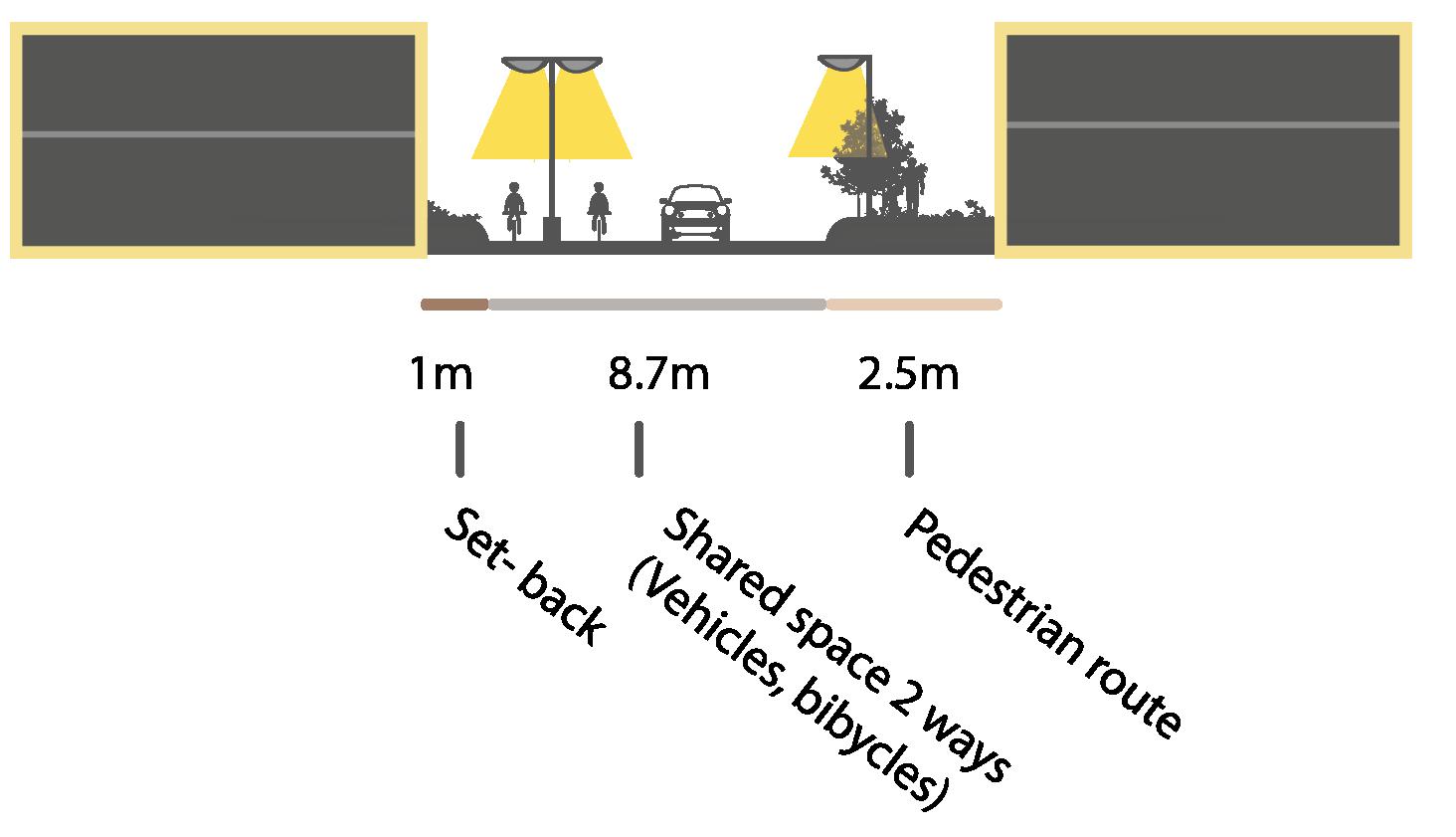
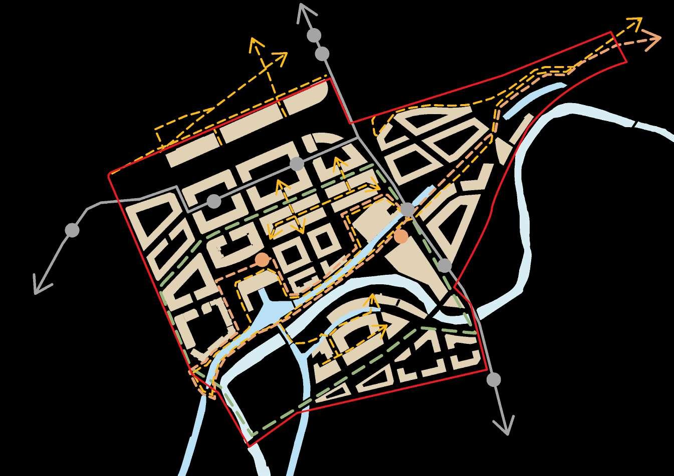
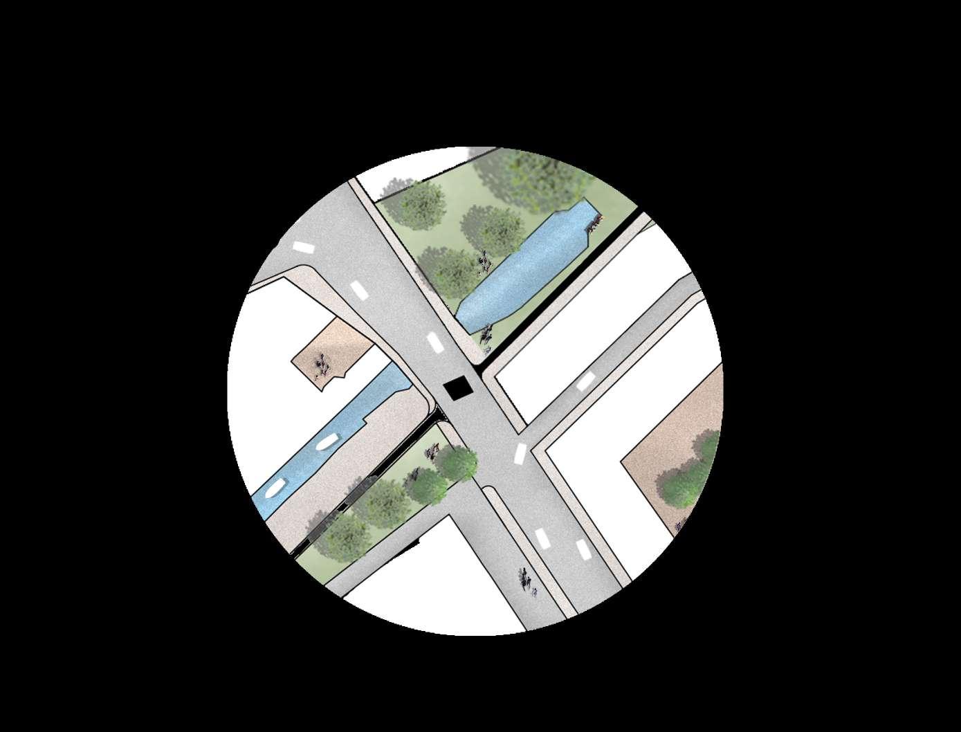
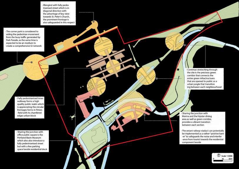
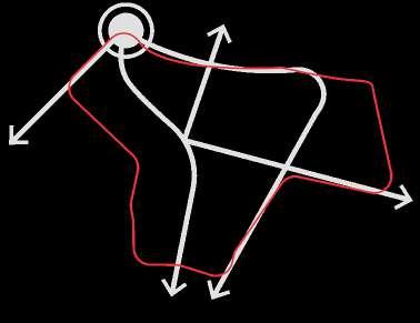
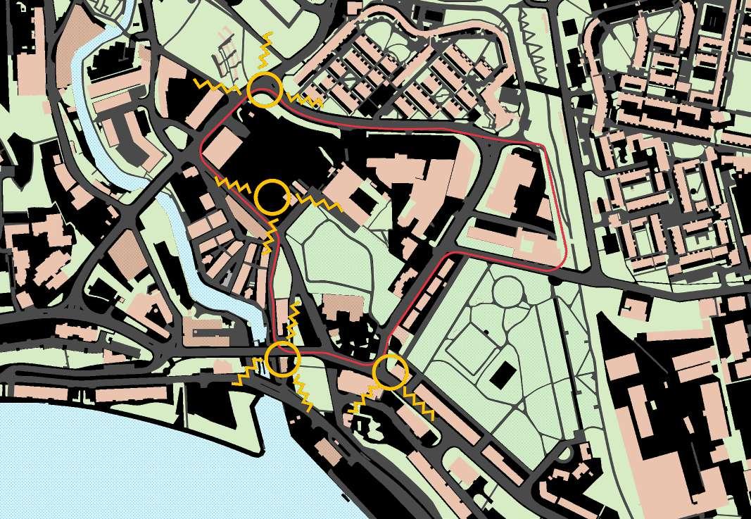
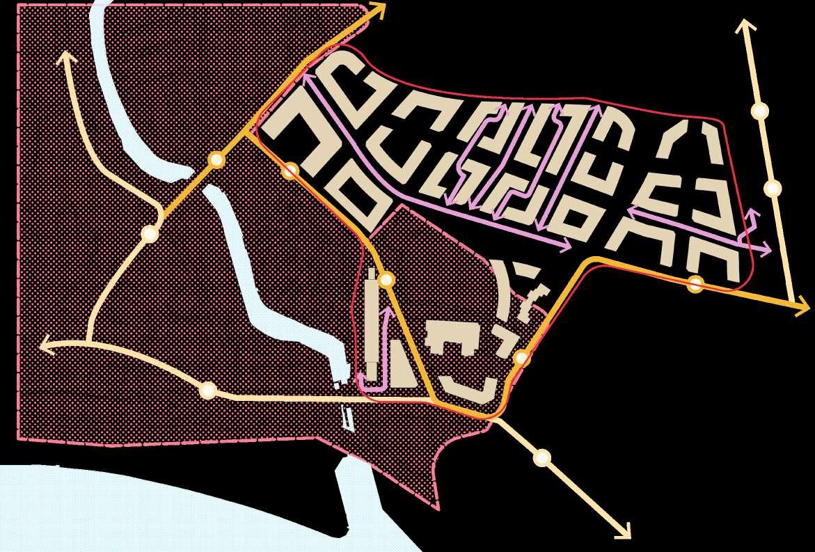
TheSouthern fringe of the site is set back 7 meters to create an soft distinction between the site and the barrier (Ring Road). This street also act as a slip road that connects with majority of secondary and service routes in the site and to Ring Road
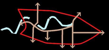
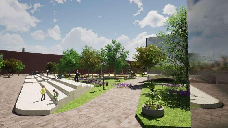
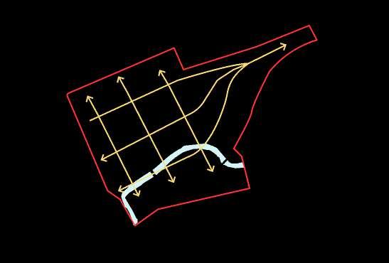
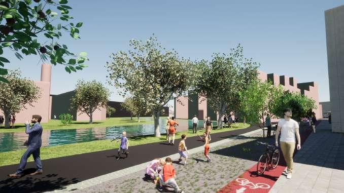
The internal connection is also achieved with the interlinked streets that link up the Northern and Southern fringe of the site. Distinction of pedestrian and cycling routes around the central park also safeguard the mobility of users
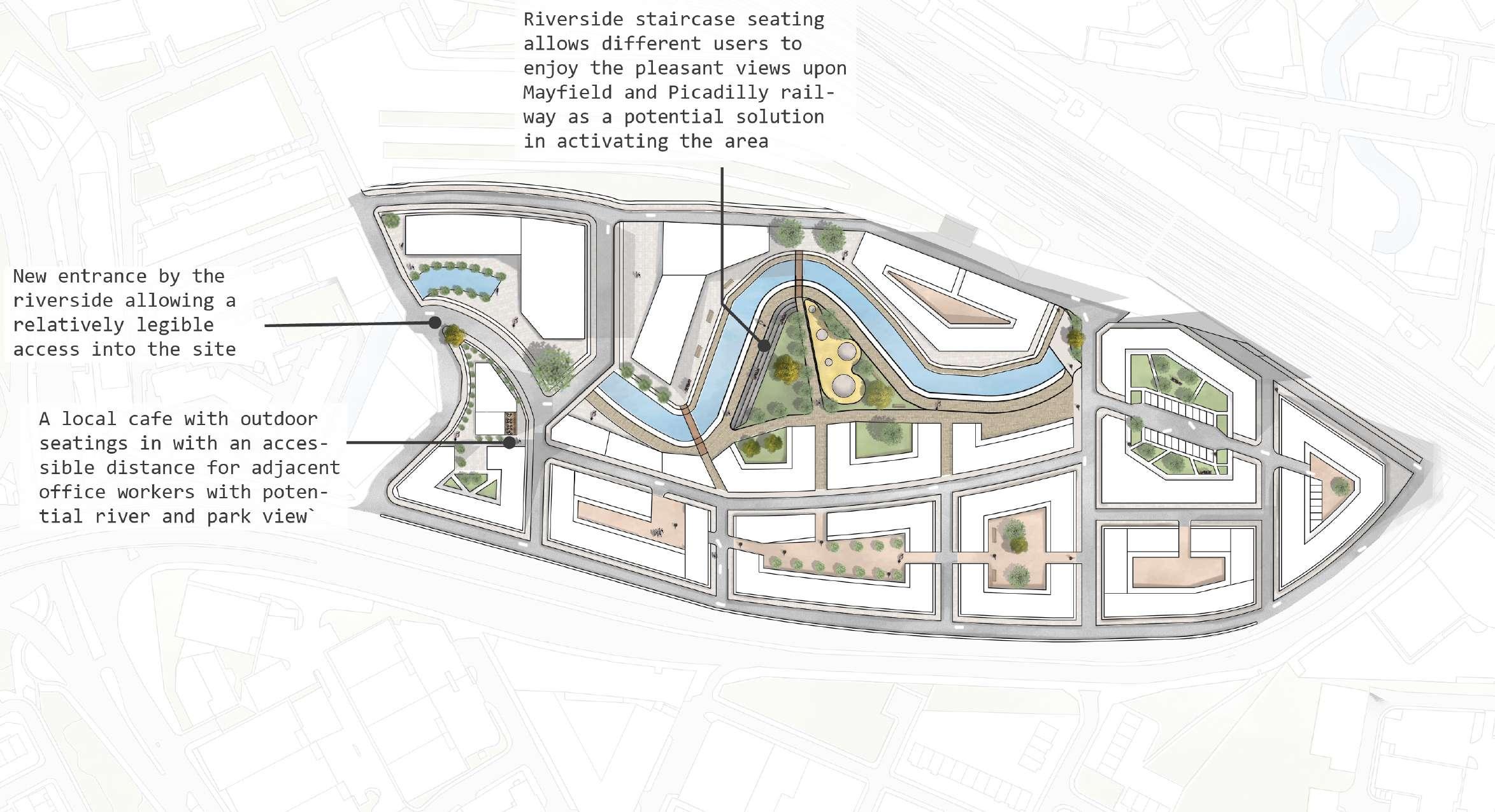
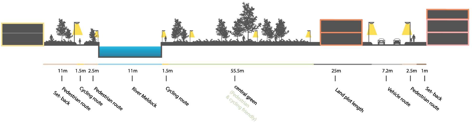
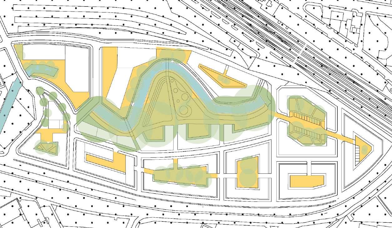
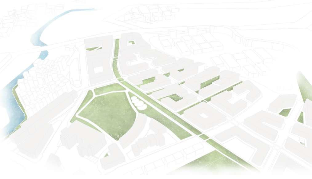
The central green accomplishes with the river to miximise as a getaway for surrounding buildings
An integration of semi-public GI in front of both offices to strengthen the connection of GI, also to crteate as a transition between two spaces
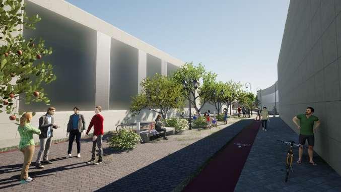
Primarily used as a service route between both sides of buildings (offices and a few restaurants and cafe)
Setting 7m back to operate as primary route to connect as a slip road with Ring Road
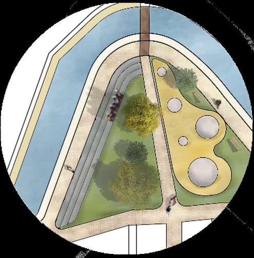
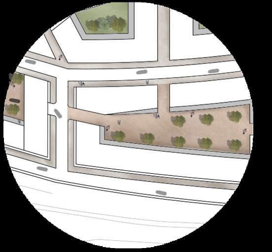
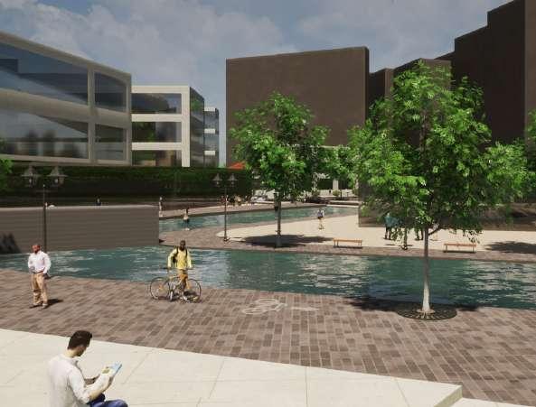
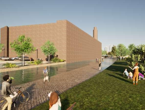
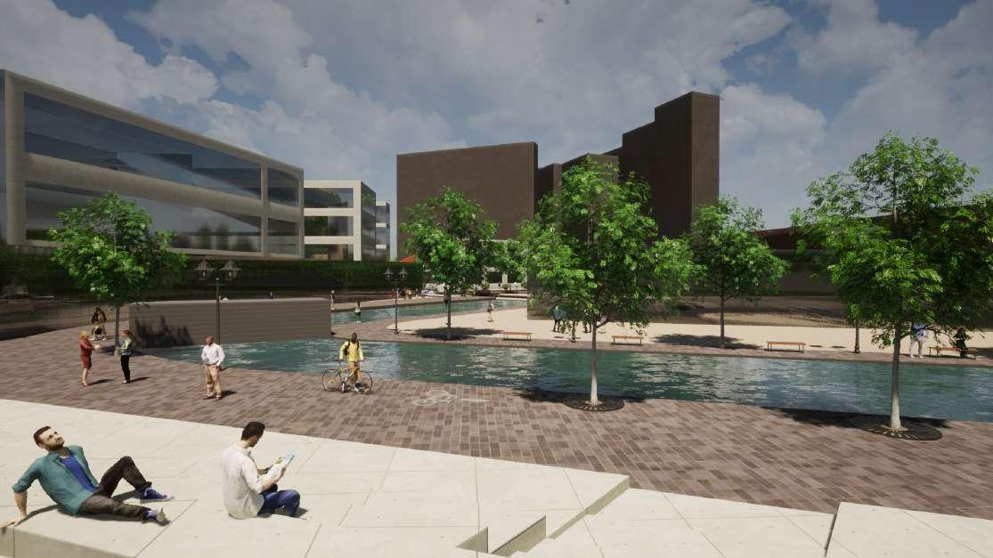
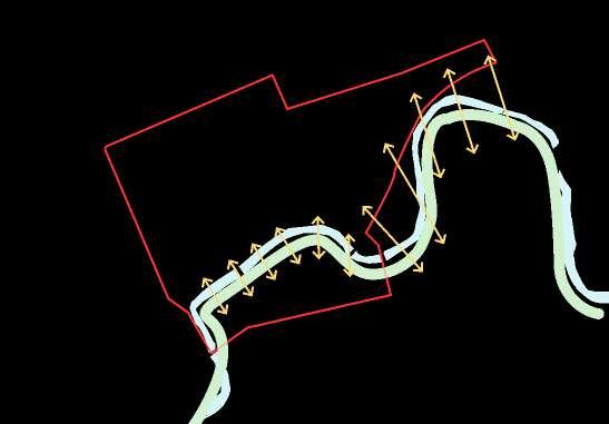
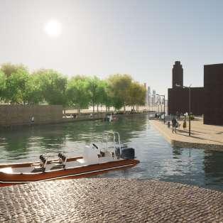
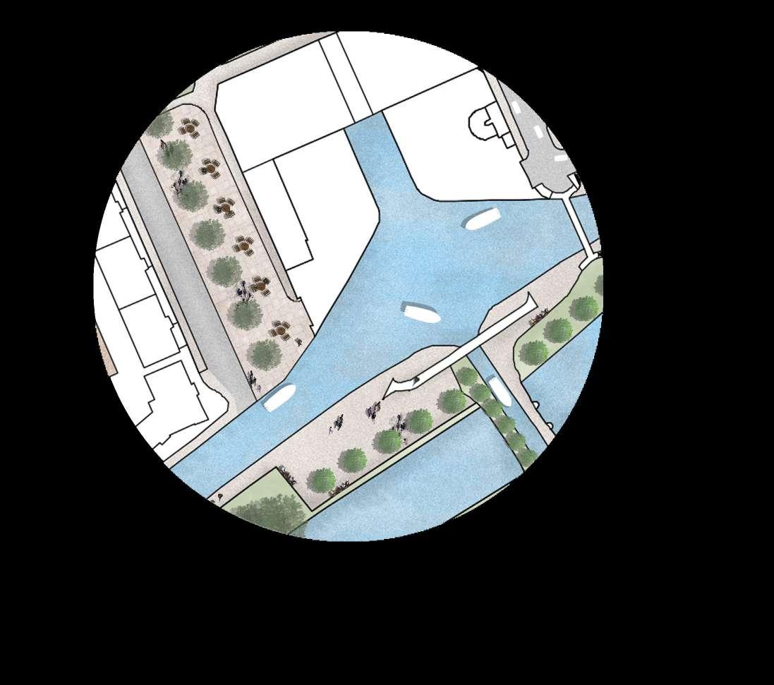
River Meldock provides key vistas and views without obstruction within the site that promote higher engagement into the public space
The diversity of building typology allows better and direct access between each building, and eventually towards the central green
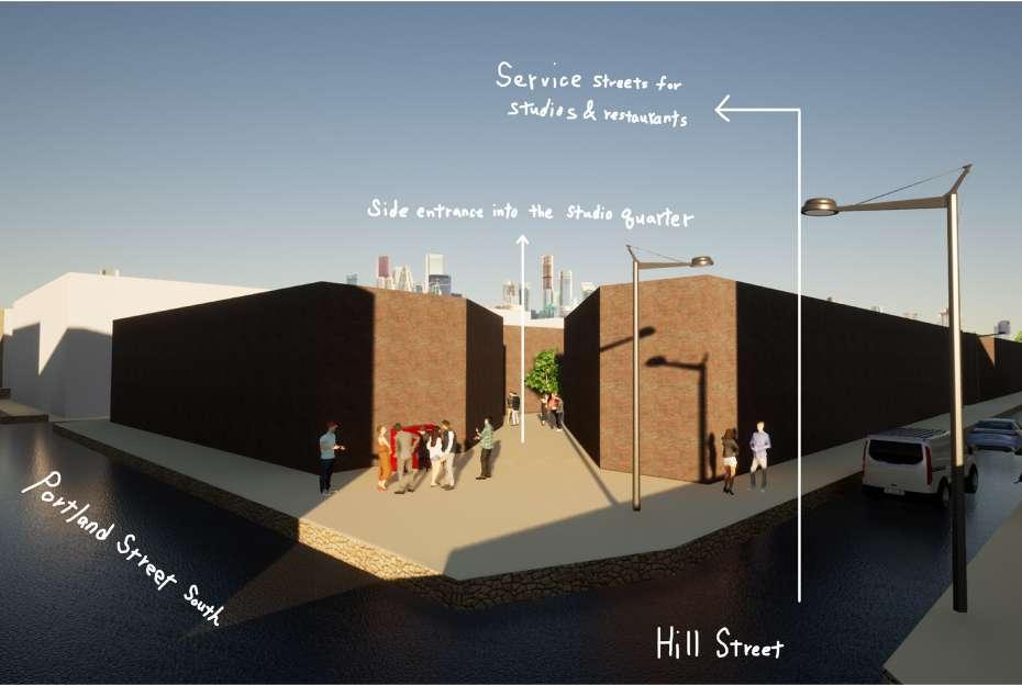
Taking the side entrance as an advantage to provide active frontage to help mitigate the noise and traffic from the barrier (Ring Road)
Aprominent public realm is delivered jointly with adjacent residential blocks that provide natural surveillance around railway viaducts throughout the day
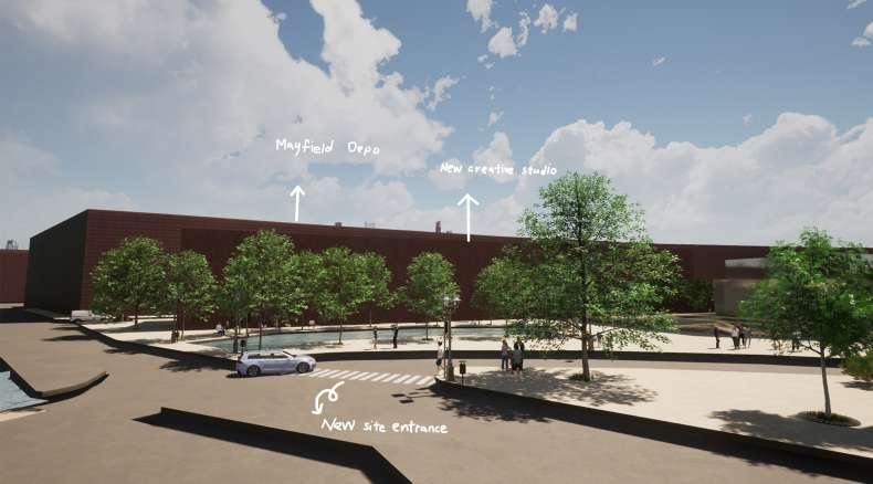
Two site entrances are proposed at the Western fringe of the site. In which the route between the creative clusters and office area, is also designed for servicing use especially. However, it can also be taken as a secondary routes for drivers


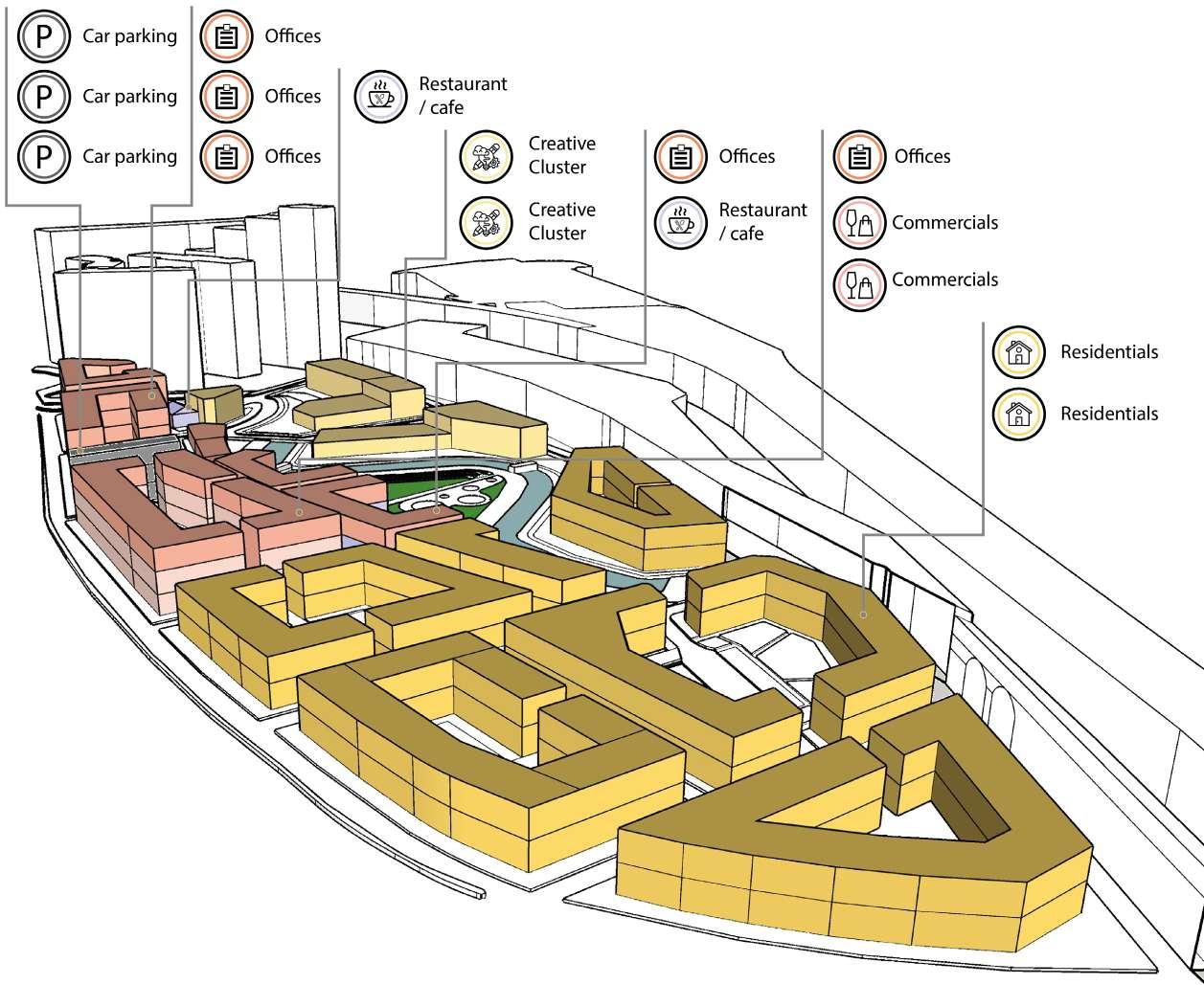
Majority of urban blocks West to Ring Road are of residential purpose, while the office quarters are integrated with commercial and car park with the advantage of view and vistas over the park
The central green is undoubtedly the major public realm linking to pedestrian routes that connect to each semi-public realm
The green corridor in this neighbourhood acts as a semiprivate walkway directing to the central green diagonally
The retention of River Meldock also compliments the surrounding GI, thus generating as a excellent outdoor space
The integration of commercial and office link up with the connection of GI. Also creates a sense of enclosure for its users inside the semi- private courtyard
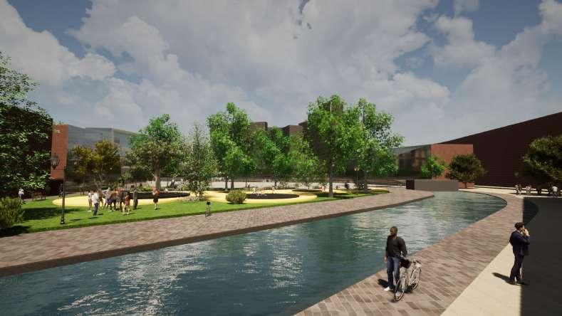
Integration of central green with the River Meldock promote a relatively legible public space for its surroundings
Accommodate the ground level difference as a feature to provide public seatings overlook to River Meldock
pearmeable access promptly offer immediate mobility for office workers and visitors to navigate their next destination to and from Piccadilly Station
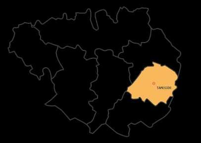
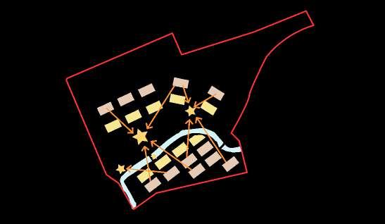
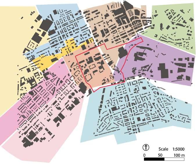
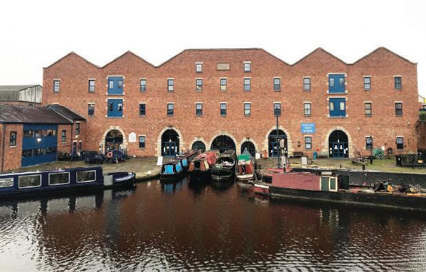
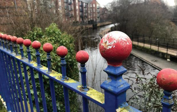
Portland Basin shares various heritage assests and among them are 3 Grade II Listed historic significances that amplify the importance of this area
Currently benefit from the incusion of Conservation Area Act from Tameside Council, safeguards the potential development and preservtaion ranges from its ecology to infrastructure development
Prominent integration of green environment and historical significances potential establish the future design guideline
Redefining the integration of historic and natural value in portland basin that delivers a mix use of community with high quality of public realm
ENCOURAGE A MIXED-USE AND BETTER USE OF SPACES
ENSURE A PERMEABLE AND LEGIBLE ACCESS INTERNALLY
IMPROVING FRONTAGES AND PUBLIC REALM

OVERCOMING NEGATIVE IMPACTS FROM BARRIERS

ENHENCING HERITAGE ASSETS TO ENABLE POTENTIAL VIEW POINTS
REVITALISING GI CONNECTION INTERNALLY & EXTERNALLY

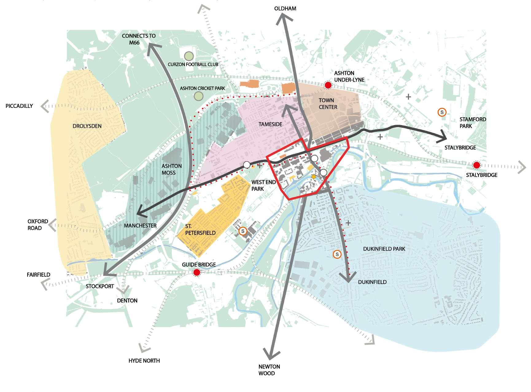
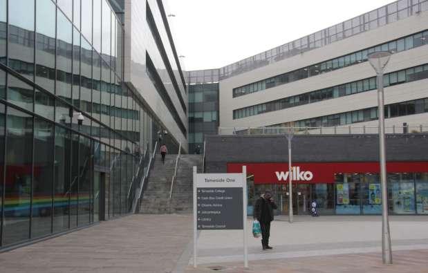
Adjacent to the site is Ashton town centre where a rich of retails and groceries are offered in ASDA & IKEA
The transport networking is very permeable, but there’s only one active frontage on the North East node to the site
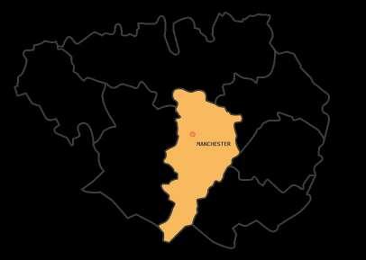
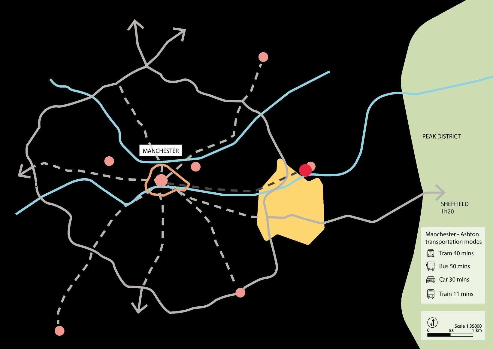
The site is locating at Eastern sides of Manchester, where takes roughly about 40 mins on bus to reach and return
Potentially has a good connection with wider regions and especially to Manchester, as it is clost to Ring Road which make its connection much more approachable, such as airport
The Northern part of the site has significant lower earning than other counterparts resulting potential crime activities


1970-1980
2019-2020
Significant transition from heavy to light industry with car manufacturing and retail as the majority in recent days
Heritages are preserved over times especially within the Conservation Area, now have become either landmakrs or listed buildings
Warehouses beneath railway viaduct also indicated the of the industrial past of th site
The site had most of vacant lands on the Northern fringe where several warehouses for heavy industry can be found
The urban morphology was in grid pattern and with a relatively narrow streets in between each urban block
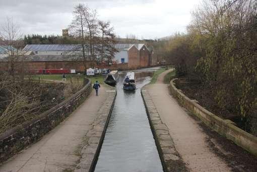
The canal was built in 1972 for delivering coal from Oldham, and upgraded to crusing waterway in 1983

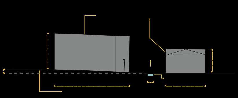
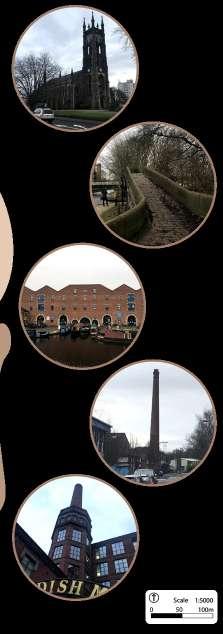
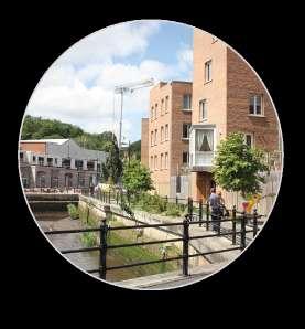
Red bricks, defined and detailed Victorian bronze bricks arcs at the doors
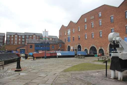
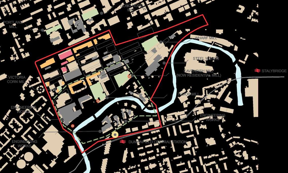
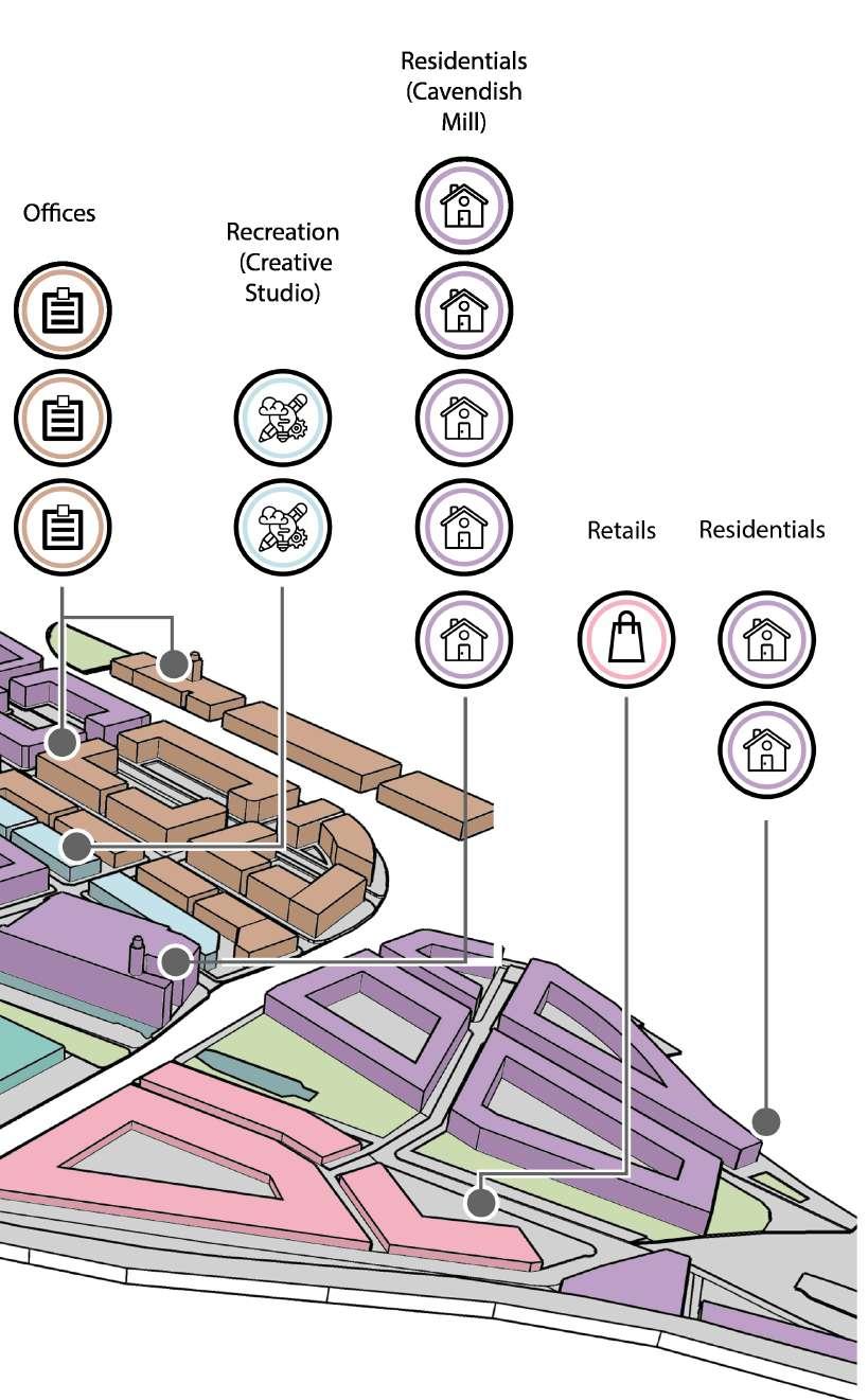
PORTLAND BASIN MUSEUM
Blue window frames that accompany with timber and glass as well as roofing features in polygonal shapes for aestheics
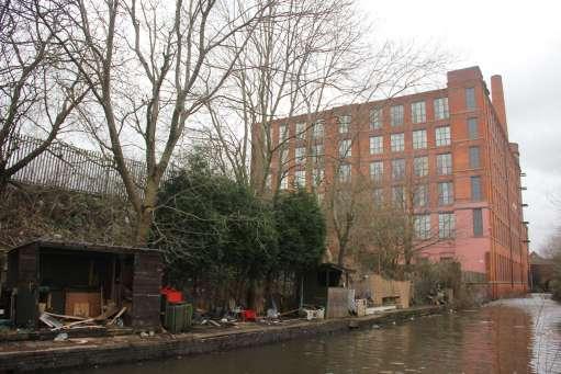
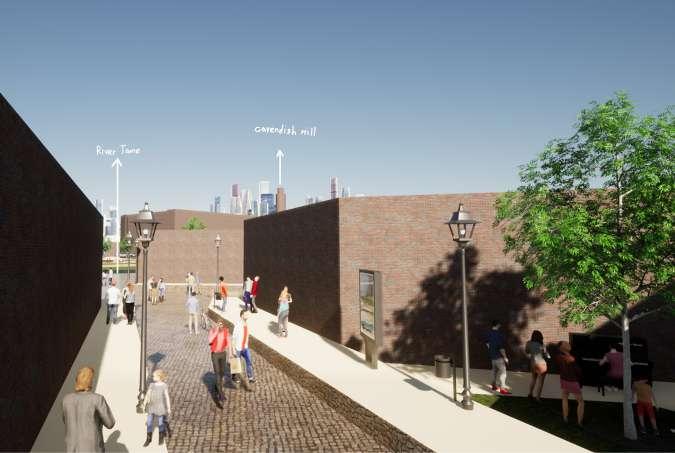
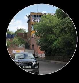
CAVENDISH MILL
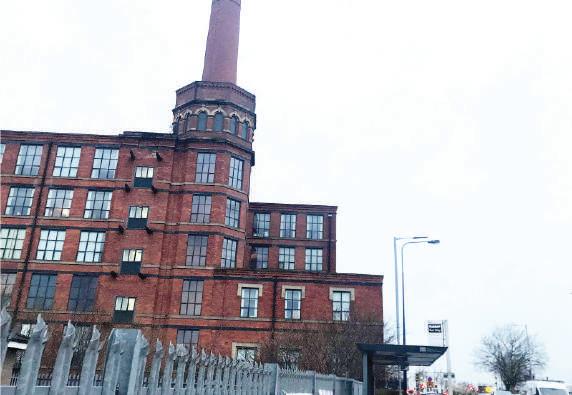
Grade II Listed former mill converted to residential flats
Retained red bricks as the dominant material for the building
RESIDENTIAL BLOCK
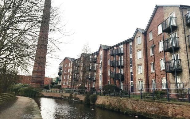
Triangular gable tiled roof projected vertically with overhangs
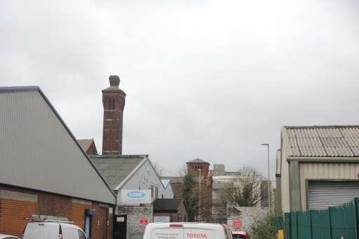
Potential key view over the Junction Mill Chinmeny
RESIDENTIAL BLOCK
Glass windows with white frames, metal rail detail in high density, similar buildnig height
Similar street ratio, 2-storey max with simple brick detailing and concrete finish
Old blue and red painted picket fence used as a boundry marker and safguard for the canal
Rather modern materials such as glass and steel could be spotted around the town centre
STONE PAVING FEATURE

Paving that could be found around surfaced carpark with cobblestones finish
ENTRANCE FENCE
Wrought metal rail fence providing continous contour for the property boundry and acting as a barrier
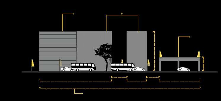
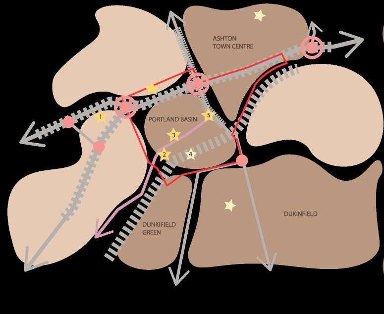
The setback street for vehicular use to ensure a stronger fontages in relation to its pedestrianised routes in the front
Potentially a exit for the primary street that serves as a short cut allowing people leave the neighbourhood
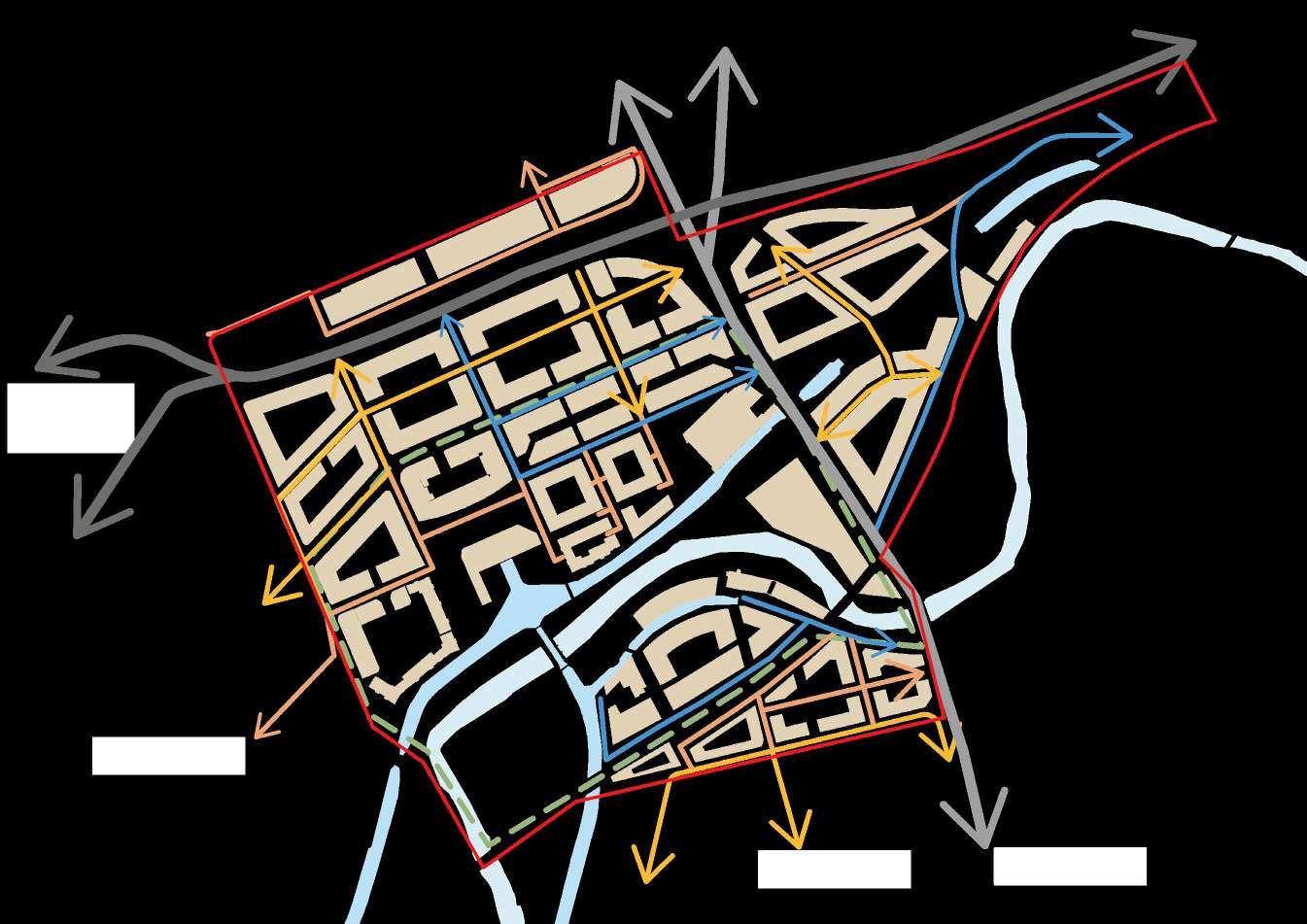
Both entrances allow users travel to the site easier from Dukinfield in junction of Wharf Street and Railway Street
Considered as the main junction of King Street and Cavendish Street to the site and town centre from Dukinfield

Although the vehicular routes were designed primary in accordance to the industrial use before, many are however disjointed and of illegible for achieveing better movement
The primary routes for the site are designed next to the office quarter at the Northern fringe of the site, in which also actas an approach to ensure a prominent frontage with the enclosures of urban blocks
The setback street for vehicular use to ensure a stronger fontages in relation to its pedestrianised routes in the front
MANCHESTER CITY CENTRE
Multiple selections of pedestrian routes integrated with green corridor alongside Park Parade to minimise the negative impacts of noise pollution and the heavy traffic during day time
Two additional bus stops are introduced alongside the street for both residential and office area to provide relatively convenient way of travelling

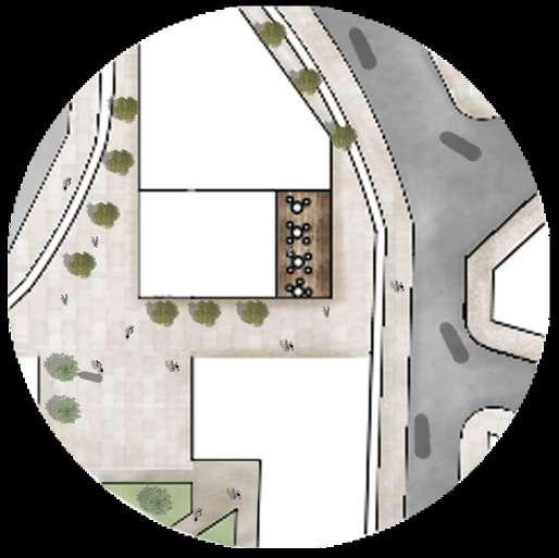
This bike storage offers plenty of indoor parking for cyclist and also reapiring and rental services

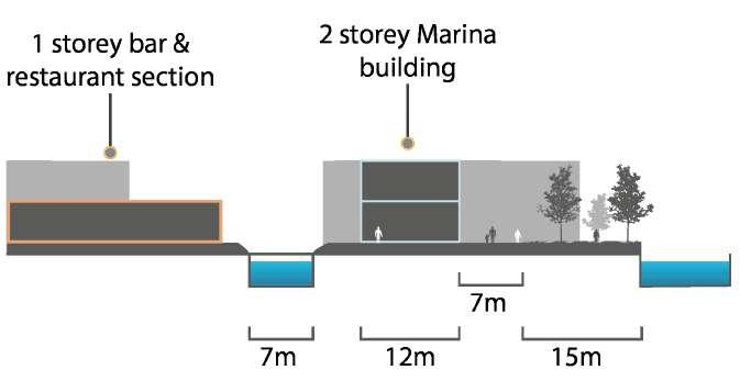
Fully pedestrianised stree allows users to move around the hipster Marina area without being interferred with vehicles
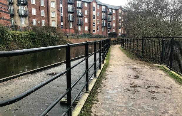
Pedestrian routes are permeably designed along river side and continue across Cavendish Street
Safeguarding the mobility of users moving around the site
The green corridor is extended with the integration of canal tributary beside the major route, also provides with cycling, pedestrian routes as a continous path for exercise and outdoor activities
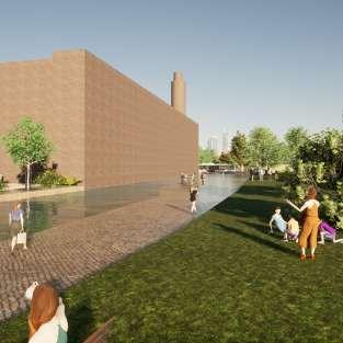
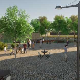
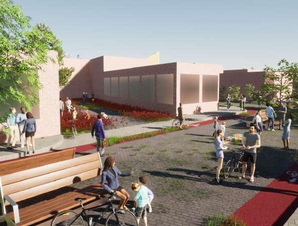
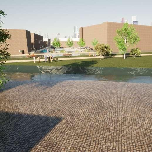
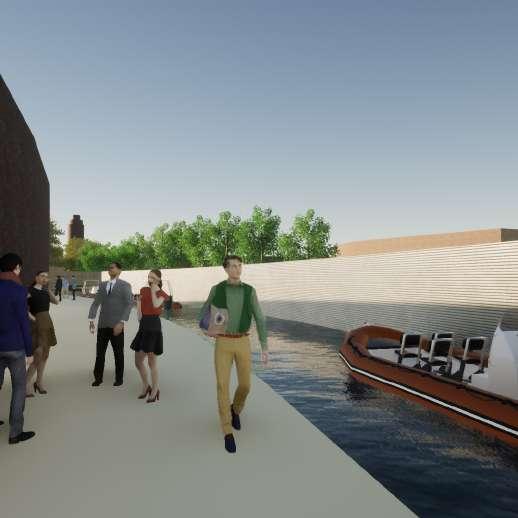
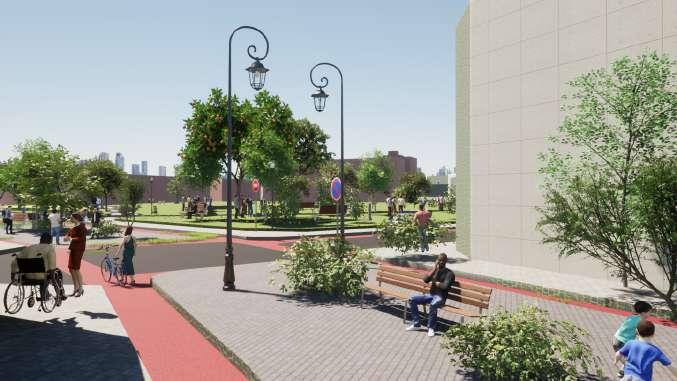
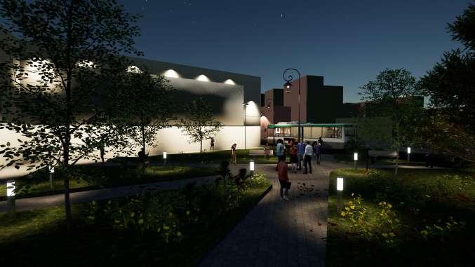
Extant surface car park beside Portland Basin Mu seum, is transformed into an outdoor seatings for the cafes, accompanies with the advantages of key vistas towards the canal where the enhencment of frontage is also achieved
Two overhead bridges are also retained for better accessibility across River Tame

Accompanying with the views from heritages preserved as well as scenery from River Tame, offers adequate high quality green spaces for visitors and office workers around the area


Maximising the advantage of extant green spaces around River Tame to create an interconnected green infrastructure network to promote integration of sustainable environment and to provide a pleasant walking experience within the site
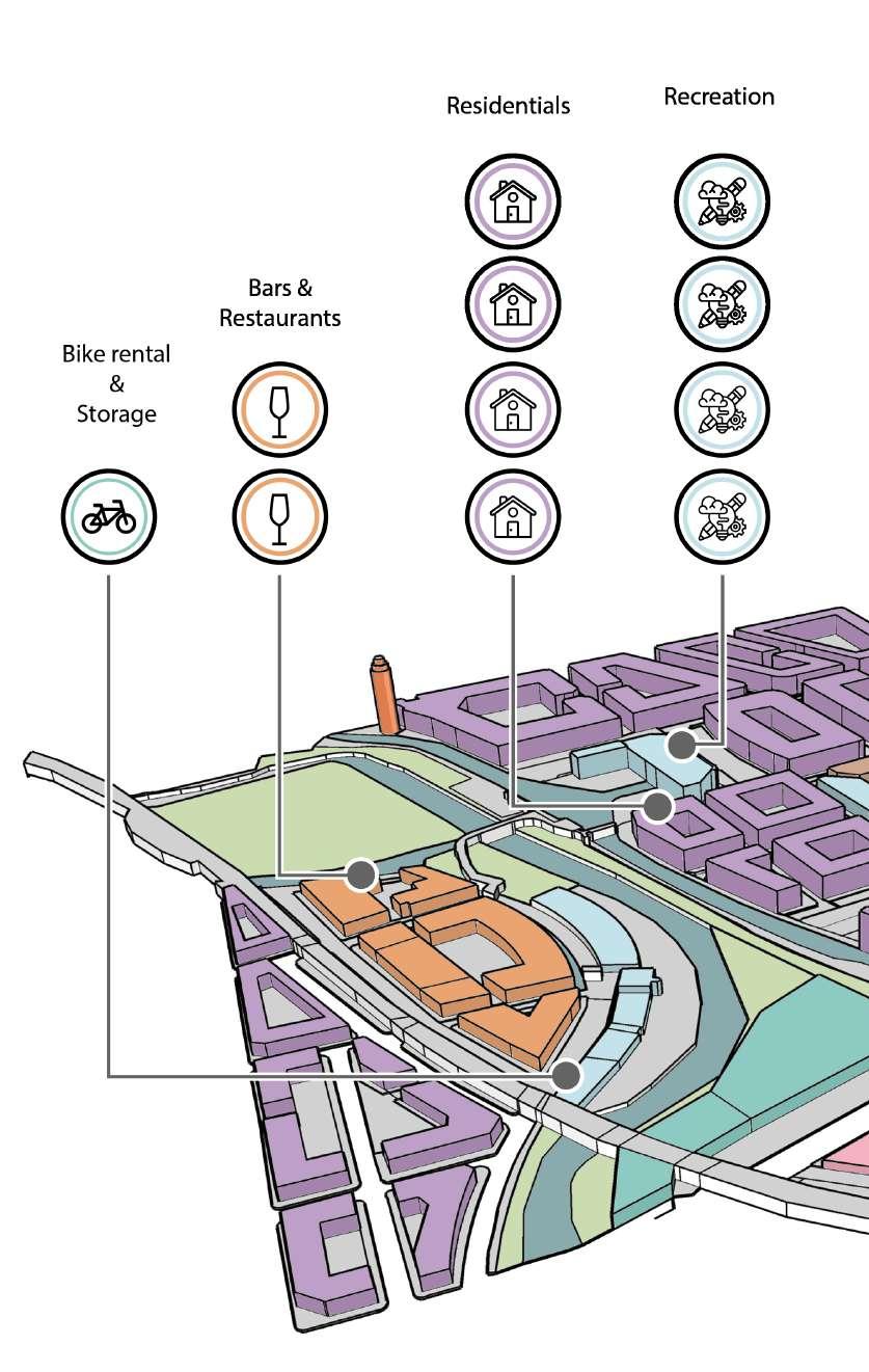
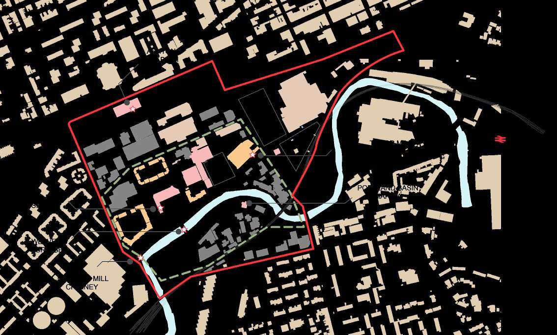
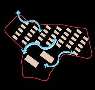
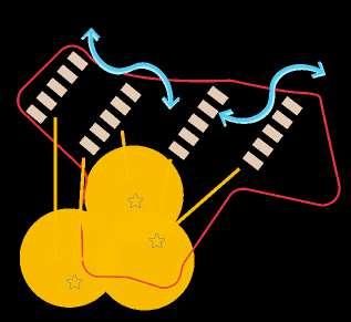
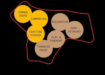
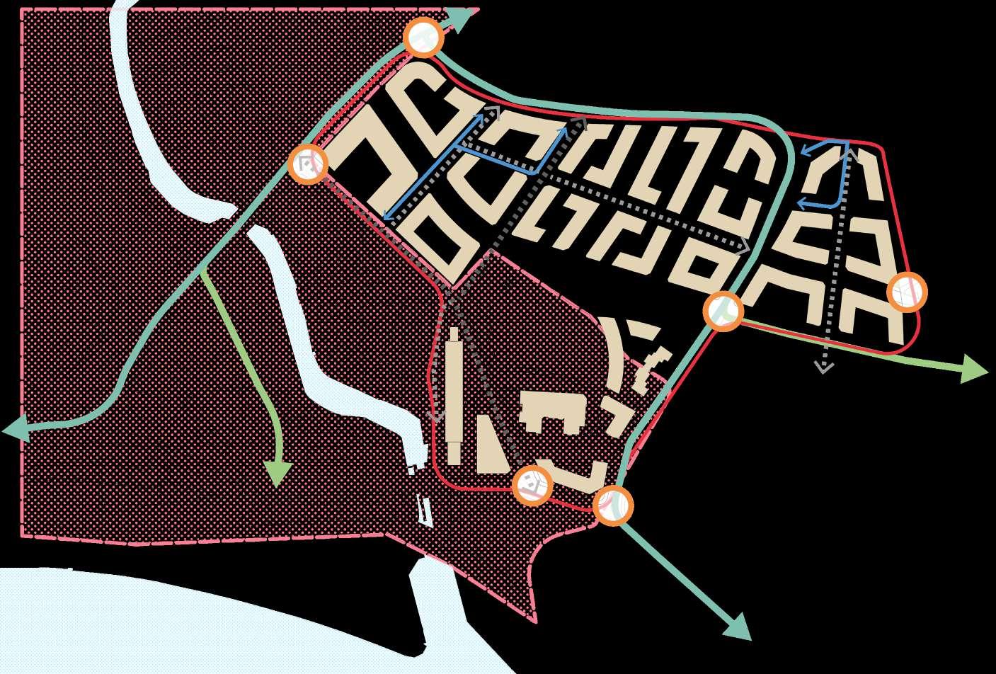
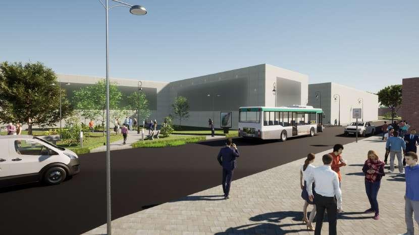
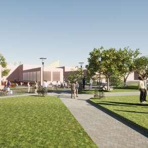
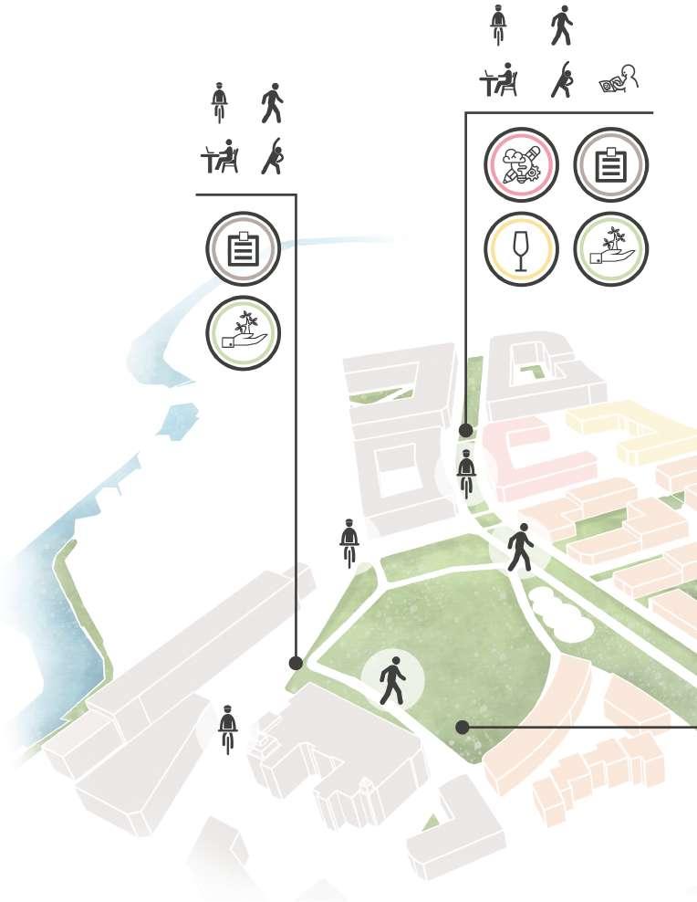
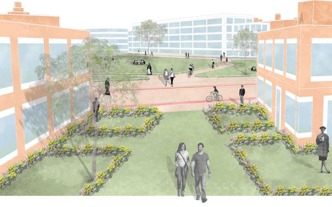
The site delivers 4 distinct public realms among the site- Civic Core, Green Space, Office Quarter and Restaurant and Pubs
Effectively help establish high quality and legible public spaces with adjacent neighbourhoods


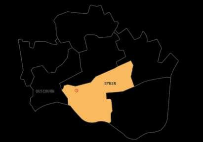
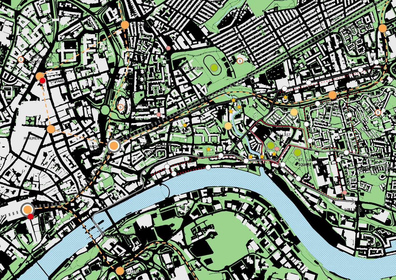
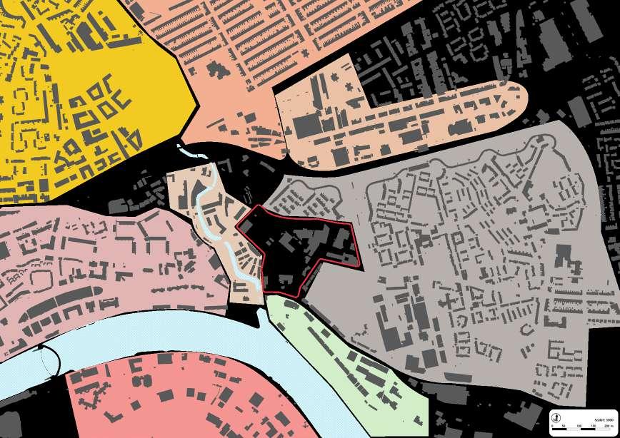
Sandwiched between Byker and Ouseburn in Newcastle Upon Tyne (North East of England) is the site that interlinks with several transport modes such as metro and bus stops
The site finds itself unfit between the newly gentrified neighbourhood (Ouseburn) and the working class neighbourhood (Byker), result it remains a vast vacant urban parcel with warehouses for industrial purposes
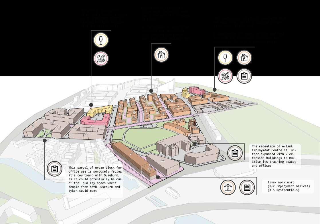
Potential social upgrading and integration for mixed purpose of offices and residential blocks are proposed
RESTRUCTURING THE URBAN FABRIC AND IDENTIY IN REALISING AN INCLUSIVE, VIBRANT AND SUSTAINABLE NEIGHBOURHOOD WITH URBAN REGENERATING PROCESS
DIVERTING STREETS TO ENHANCE SITE’S INTERNAL CONNECTION
REFLECT HISTORIC SETTINGS AND ACHIVE VENTILATION WITH GRID PATTERN
RESTRICTING BUILDING HEIGHTS FOR VIEWS AND VISTAS AND VENTILATION
MIXED USE DEVELOPMENT AND MIXED HOUSING TYPOLOGIES
ESTABLISHING CONNECTION OF EXISTING GREEN INFRASTRUCTURE AS PUBLIC REALM
INTERLINKED PEDESTRIANISED AND CYCLIST CENTRED ROUTES
MAXIMISE LANDMARKS AND HERITAGE ASSETS TO IMPROVE SENSE OF IDENTITY

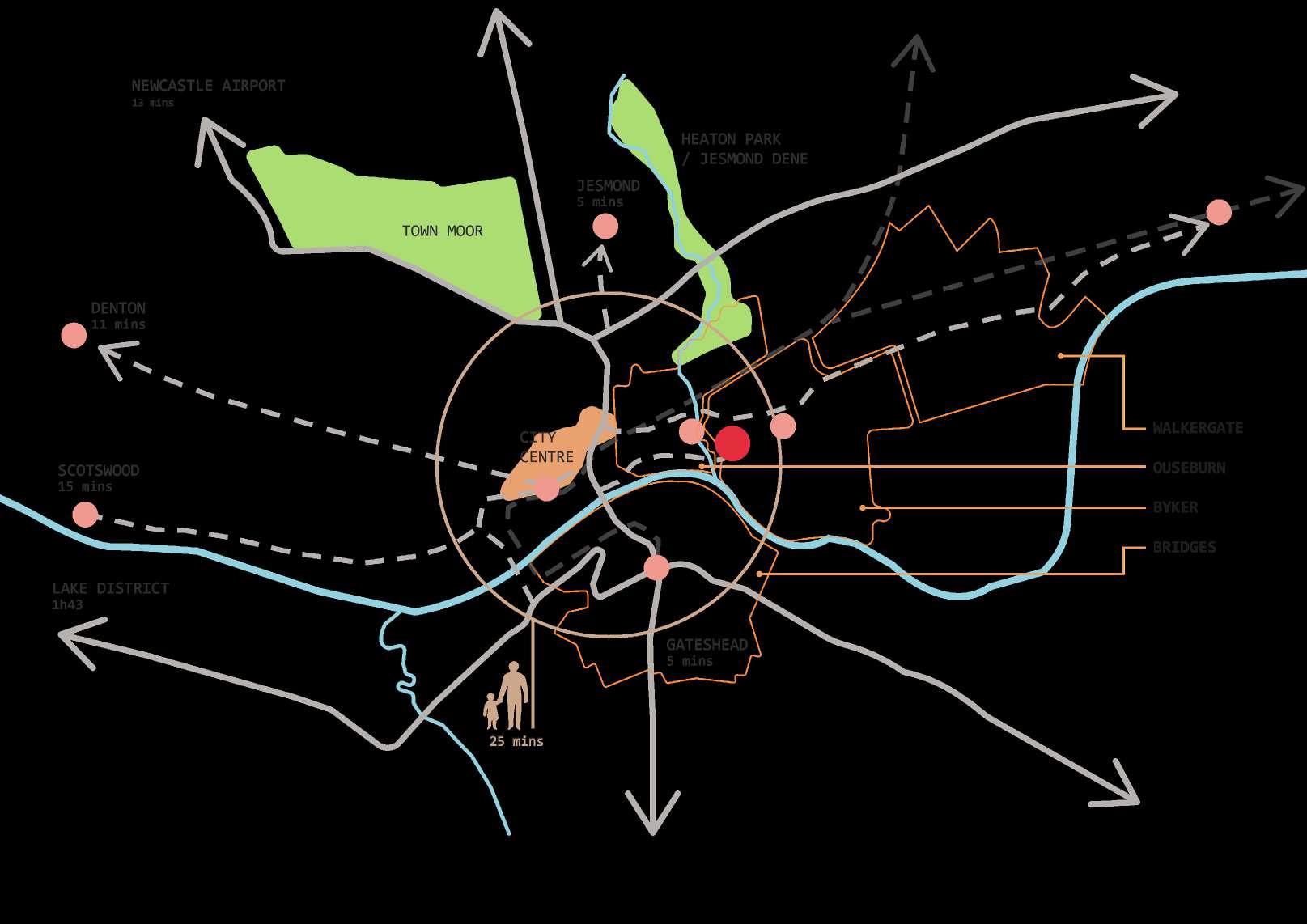
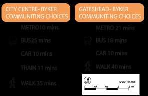

Benefits from the relatively smaller city centre, the site requires less time communting to desired destination
However, the inaccessbility to public transport , especially bus, due to its significant steep slope across the site has reportedly resulted difficulities for those without cars or vulnerable groups of people
Several transport modes such as metro, bus and train allow immediate connection and travel from and to the site
Due to lack of bus stops around the site, result in poor opportunity accessing buses without crossing one of the busiest roads


Byker is the fourth most population ward within Newcastle where the majority of population falls into the mid-age group
Byker is widely recognised with its working-class dominant social group where still scroll a relatively positive rate of employment


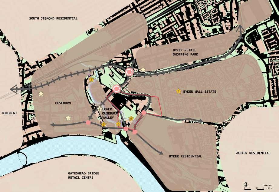


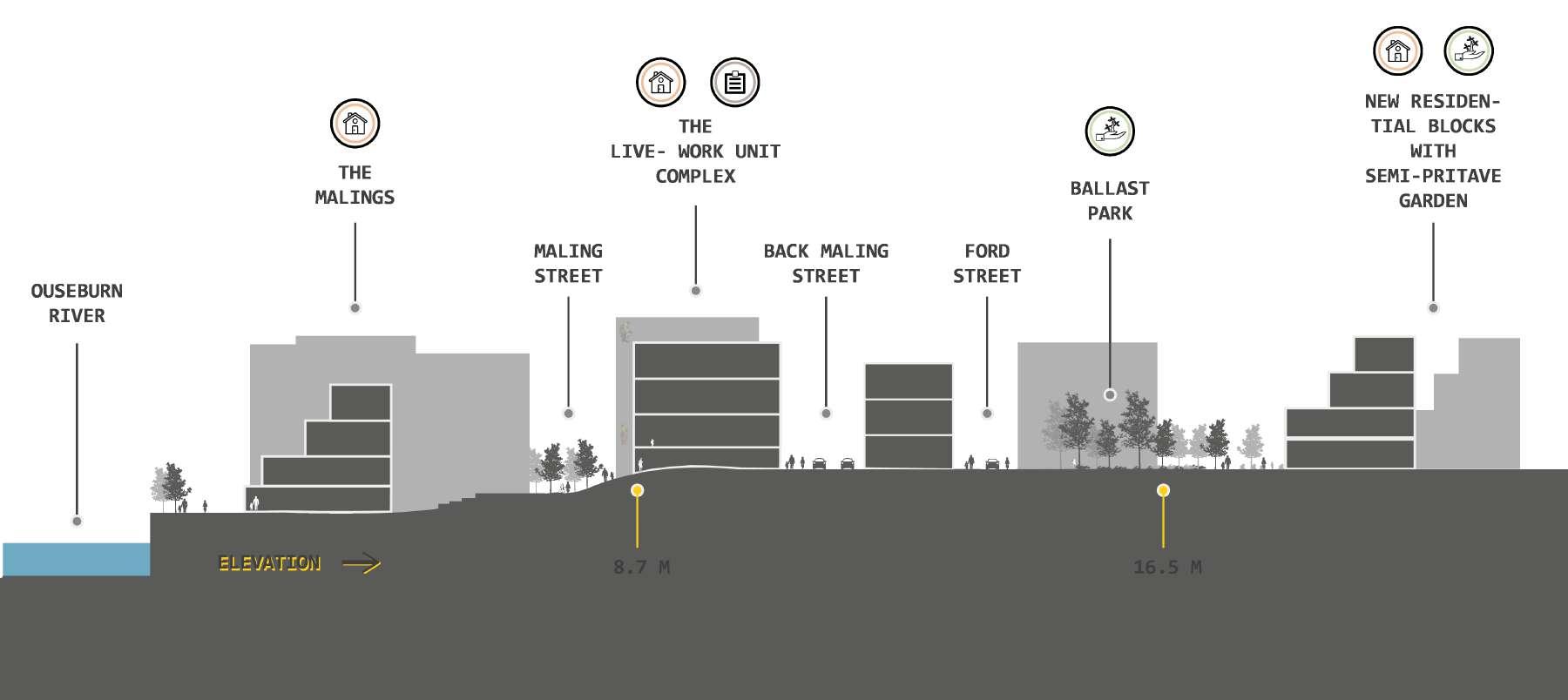
A significant inclined topography slope at Byker Bank looking towards part of Byker Wall
The slope at the SE side of the site sees a relatively gradual inclined slope comparing to the one at Byker Bank
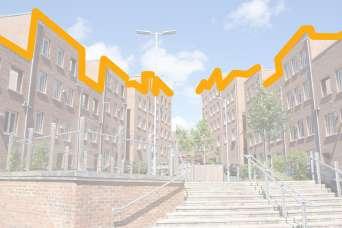
Terraced houses and student accommodation dominant accommpany with some retails

Grid pattern of residential neighbourhood where mostly are of 3 storey max with its building heights

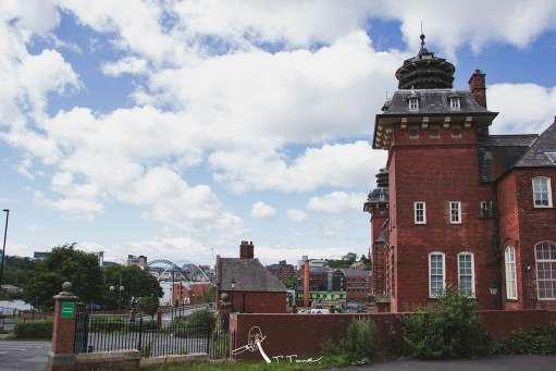
A newly developed creative cluster trans formed from warehouses dominately comprises with red bricks and steel beams

Mixture of retails, transport hub that interlinks with bus and metro stations

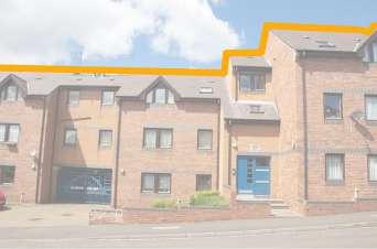
Mixed use of residential and commercial at upper and lower storey respectively

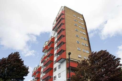
A residential neighourhood comprises the world- known Byker Wall estate that has been recognised as Grade II Listed building

Comprising a tremendous size of surfaced car park beside river Warehouses and residential blocks

Retail dominant area with larger warhouse and surfaced parking Limited accessbility for pedestrian to travel from the site
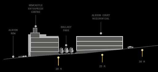
NEWCASTLE ENTERPRISE CENTRE
MARKETING GROUP


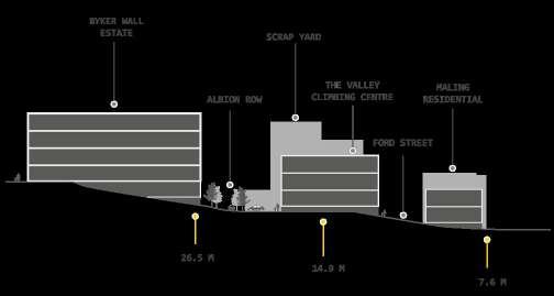
Views from Malings and Albion co-op residential showing the decending roof in response to the topographical factor around Byker Bank and Albion Row with its unique features
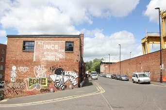
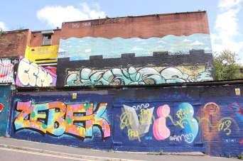
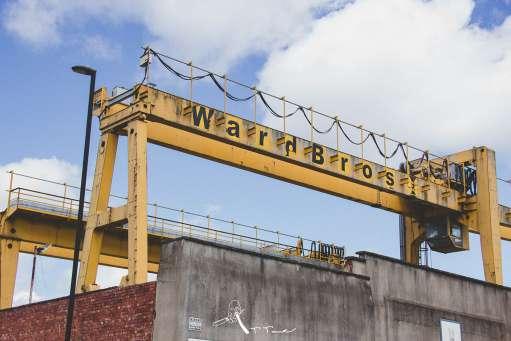
Murals on Ford Street showing the dedication from groups of artist and represent the spirit of creative and organic that majority of residents and visitors consider positive with these arts, and beside the yellow crank is where the scrap yard is
Views over the enterprise centre from Albion Row and Hadrian’s Wall Path indicates the slope that begins from Tyne Bar at the South Eastern of the site, and this also provide a certain vistas toward Tyne River when standing uphill


This priamry route that connects with Byker Bank (Major route) is essentially to help divertify the traffic from peak hours and achieve safer accessibility for users in the neighbourhood
This two secondary routes connects directly with Ballast park, jointly operating with the pedestrianised route that runs underneath to provide secured walking environment for pedesrians and cyclist
This access differs from the other 5 as it is the vehicular free route that is adjoined with Byker Link pedestrian trail
Reamined from original settings with respect to the Conservation Area Appraisal, also to help reflect the site’s historic patterns to help shape more solid grid pattern in its urban morphology


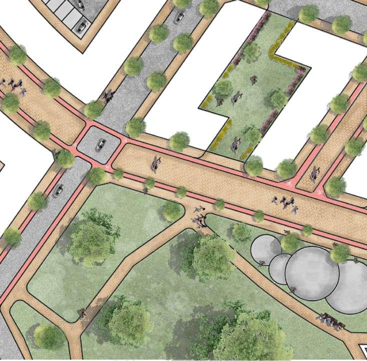
An iconic diagonal pedestrian and cycling lane that runs through the middle of the site connects with the crossing point from Byker Bank towards the end of Albion Row
The diagonal street helps remove the physical barriers from vehicles and achieve a secured, walkable environment that is linking with each doorstep from residential blocks
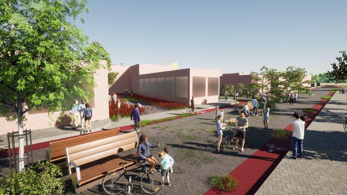
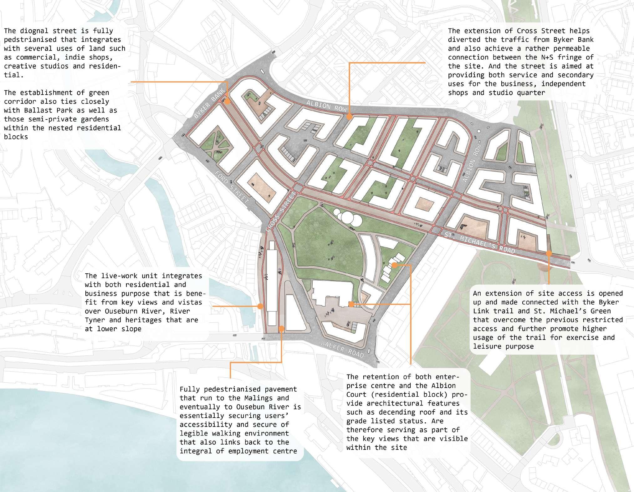
Around the site boundry is the conjunction between Ouseburn and the site itself, previous Maling Street is being pedestrianised for achieving legible pedestrian crossing and better walking environemnt
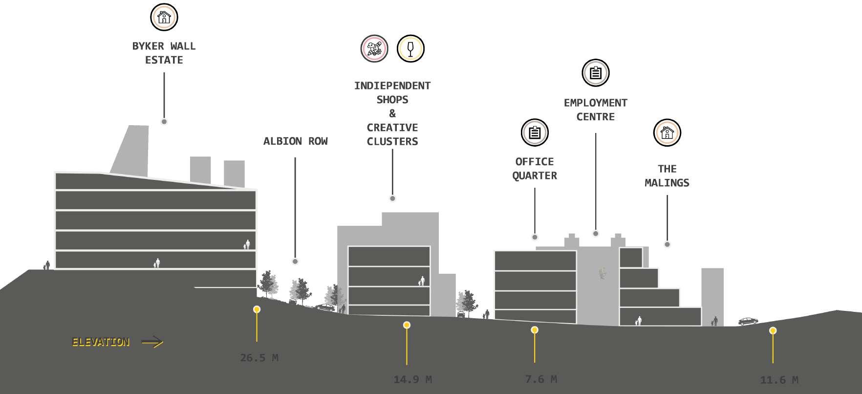

Locating on Ford Street are the newly organised office quarter that is jointly operated with the Employment Centre, this urban parcels were transformed from the original scrap yard providing a courtyard with leisure purpose for local business and young professions
19 / 20
