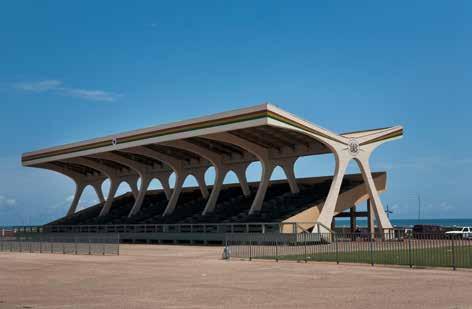
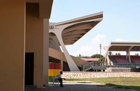
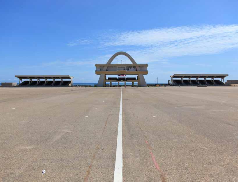
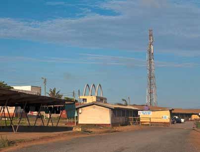
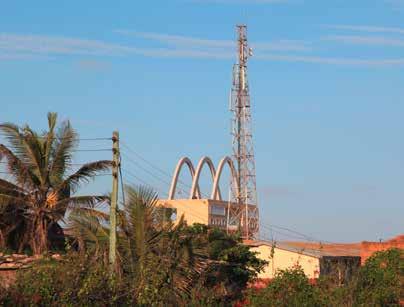
1 - 3. ceremonial stands and arch
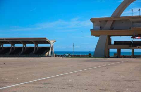
4. parade ground
5 - 6. view of ceremonial arch from periphery
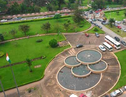
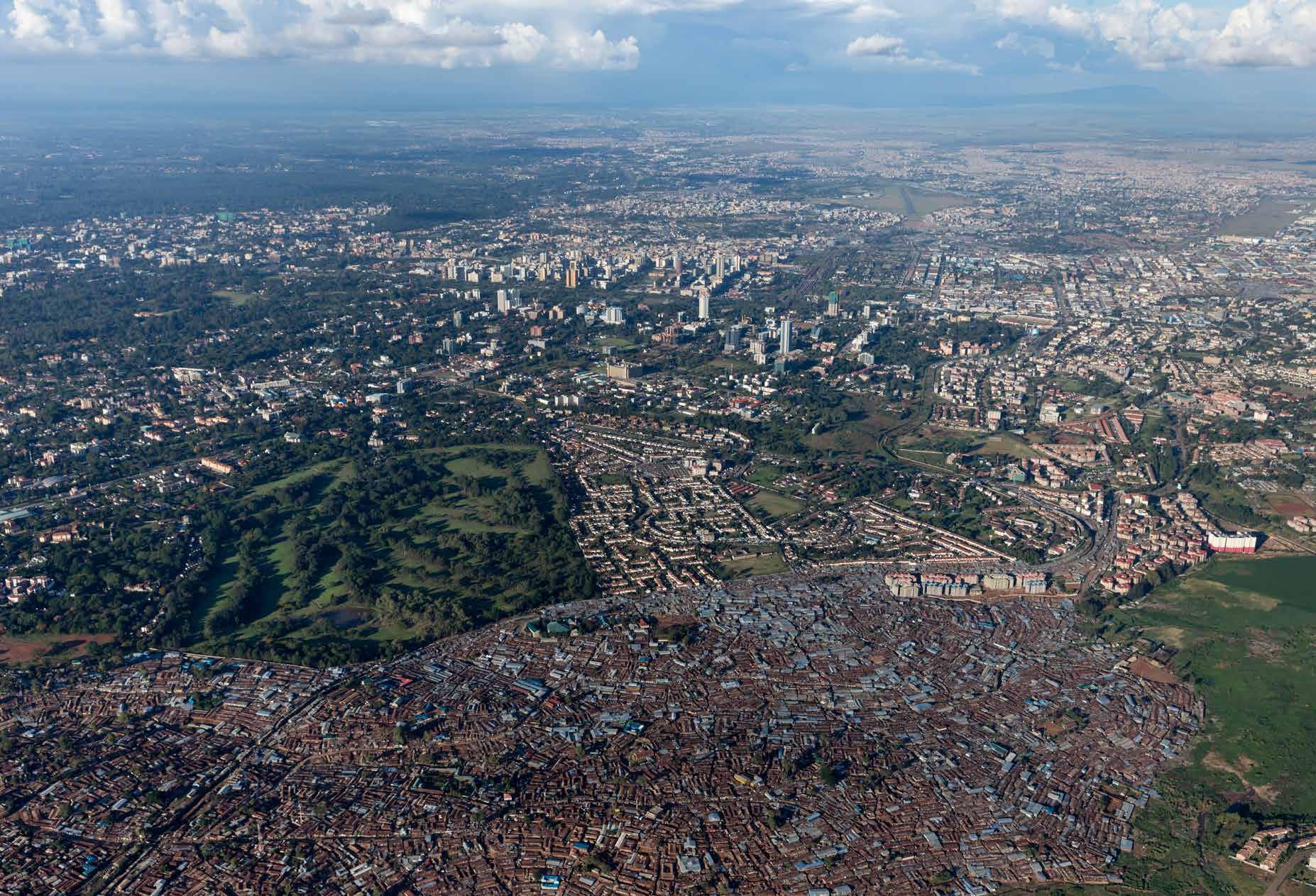
The current government district is found between the two areas of Accra, the original town and the growing settlement around Christianborg. Here, just south of the main traffic junction, lies the expanse of Independence Square. Its extent is almost inconceivable and the pale paving in the bright sunshine enlarges its impression still further. The site was carved out of the coastal land just south of the colonial government district. This was the neighborhood of the race course and the cricket oval and it is perhaps apt that this substantial representation of Ghanaian collective will displaced the colonial leisure grounds.
While the site commemorates Ghana’s Independence, it was completed in 1961 by the Public Works Department in time for the cer-
emonial visit from Queen Elizabeth II. Her arrival with Prince Phillip and Princess Anne, complete in kilts for the occasion, was met with mass participation, parades, and an impressive celebration. The scale of Independence Square suits this scale of event. The stands, made permanent later in the 1960s, can hold 30,000 while the parade ground itself can contain many more.
The wide Independence Arch is placed at the edge of the square, where it meets the ocean. This is both the ceremonial framework for the President’s box, but also a sort of triumphal arch positioned at the edge of the African continent. This places the square and its scale within a particular context.
The reasons for the exact proportions of the
square are not certain. Its perimeter was determined when the site was quite empty and, in the original images as late as 1965, Independence Arch, holding the presidential box and Black Star Arch, are the only visible constructions in a wide plain adjoining the sea. But one can assume that the monumentality of such a space pointed to Kwame Nkrumah’s broader aspirations for Ghana as leader in the independence movement within Africa. Here, the PanAfrican dream advocated by Nkrumah found a space matching the significance of such a vision.
Date: 1958
Architect: Fry & Drew and Partners
Under the direction of F.I.D.E.S.
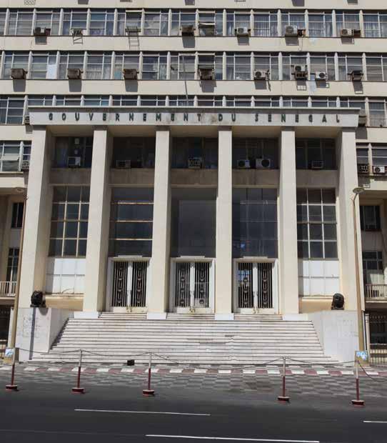
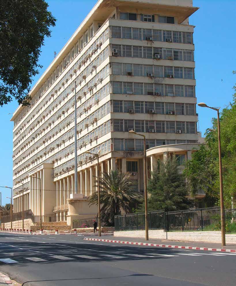
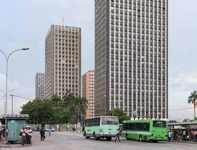
Located on the main thoroughfare that marks the eastern edge of the Plateau district of the city, this broad administrative building typifies the city’s transition from colonial grandeur to the stripped order of mid-century modernism. The project was never completed as planned and has been the focus of a continuing debate regarding the potential for recovering the environmentally sensitive design principles that had informed many structures of this late colonial period in West Africa.
As built, the sheer façade has become populated by a spread of air-conditioning units that stand in place of the deep extended floor plates that were intended to shade the bands of glazing, and to allow for natural ventilation across the building’s shallow plan. However, in its current state, the building’s main long elevation attains an unusual degree of simplicity, played against the edited classicism of its entry porticoes.
To some degree the austerity of this administrative block reinforces its position within the city. The building is oriented to the east, facing the Presidential palace compound and the port beyond. The original residential quarter of the colonial civil service, the cité jardin, extends behind along a series of diagonal, tree-lined avenues. The confinement of this district, flanked at one edge by the government building and the broad Avenue du President Senghor, presents this part of the city as a clear colonial urban project.
When built, the administrative block would have sat midway along a main artery linking the
early colonial core, the Hotel de Ville, and port authority to the central rond point that came to house the new National Assembly. The form and orientation of the administrative block reinforces the ceremonial nature of the avenue and extracts the monumental scale of the buildings of the Place Independence to the north into the more dispersed urban plan of the Plateau. In this respect, the position and scale of the government building represents one aspect of the late colonial period’s attempts to reinforce the unity, coherence, and authority of this administrative district.
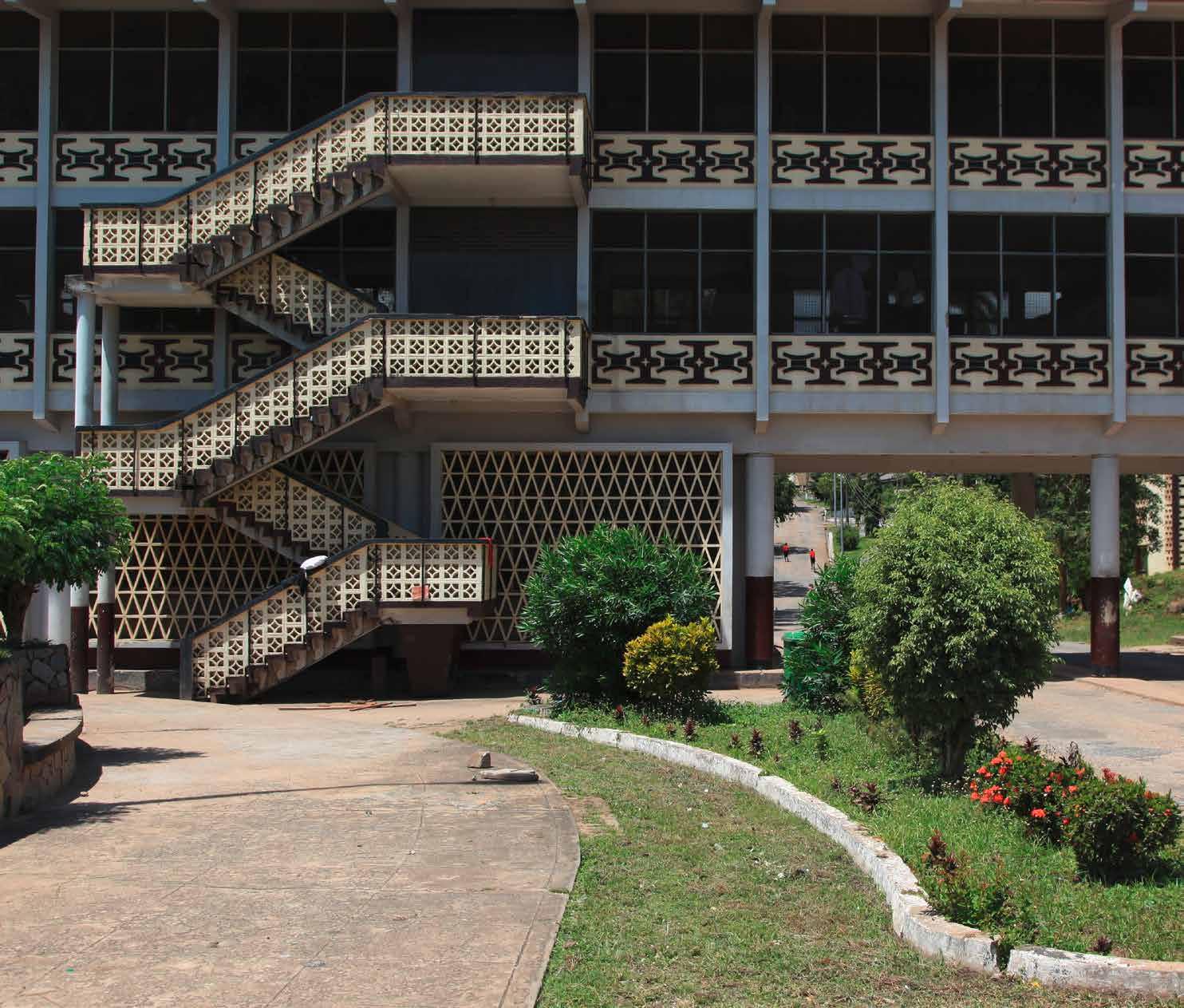
1 Entrance portico
2 Oblique view from Avenue du President Senghor
1
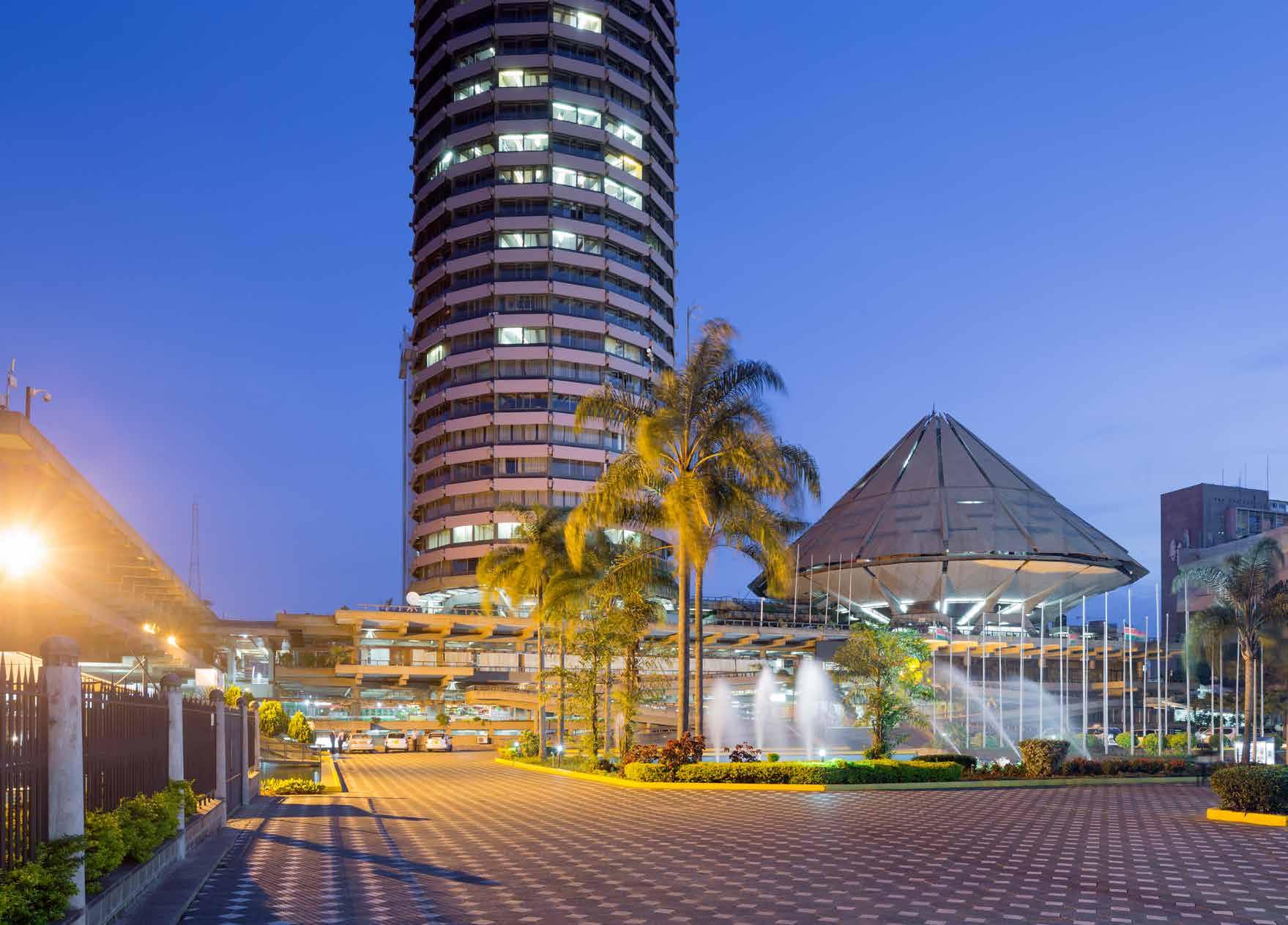
Date 1973-1978
Architect: Renard et Semichon
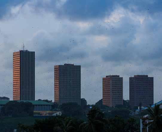
1View at dusk with a sky full of bats
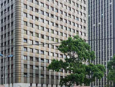
2Facade detail of Tower B
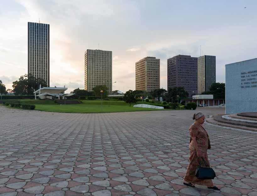
3View of the ensemble from Cathedrale St. Paul
4Western perimeter of the compound along Boulevard Carde, named after colonial administrator, Jules Carde
5Facade detail of Tower C
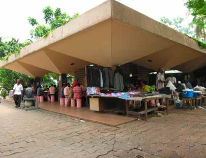
6, 7Apart from landscape features such as water fountains the exterior space includes small shops and food stalls for the employees, creating a character of a campus.
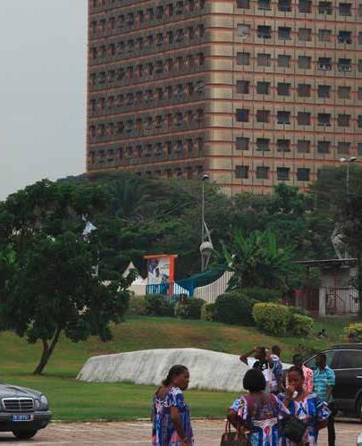
Cité de Administrative is a complex of five highrise buildings containing governmental agencies and administration offices, located in the northern part of Le Plateau. The master plan and design of the buildings was developed by the architects Renard et Semichon, an architectural office based in Abidjan. The complex is conceived as a gated campus that is separated from the city. It offers restaurants, post offices, shops, and recreational facilities laid out in its park-like setting for the employees working in one of the five high-rise buildings.
Developed in two phases in the early and late 1970s, the buildings figure very prominently in the skyline of Abidjan, are representative of the country’s modernistic aspirations and
represent a key marker of Côte d’Ivoire’s economical miracle of that era.
The first two towers have 20 floors, a height of 75 meters, and were completed in 1977. The three additional towers have 24 and 30 floors, are between 90 and 112 meters in height, the latter representing the county’s tallest building, and were completed in 1984, just at the time when Côte d’Ivoire’s economy was collapsing.
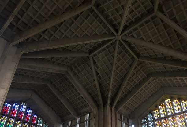
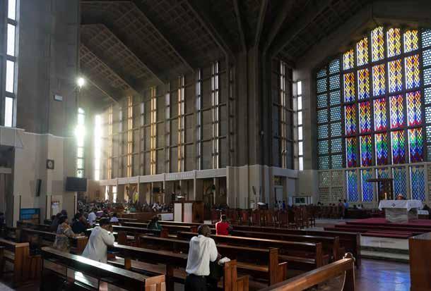
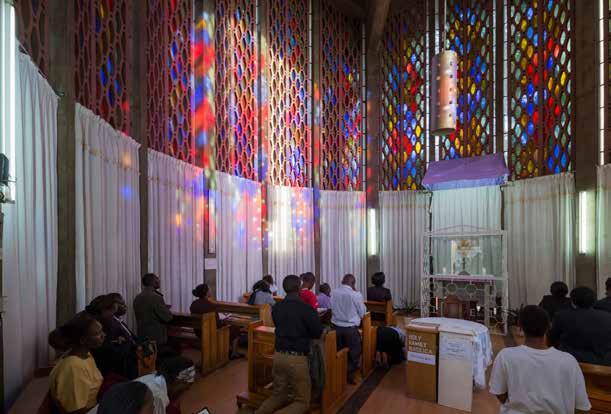
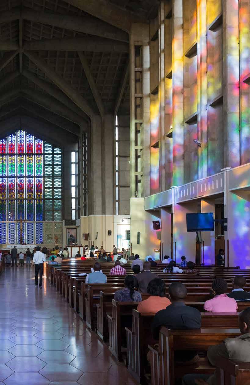
3. 4. Interior views of the cathedral showing the expressive concrete structure.
5. Standing in the small chapel, that has a hexagonal floor plan.
6. Sunlight falls through the stained glass windows colouring the concrete in a rainbow of hues.
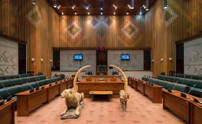
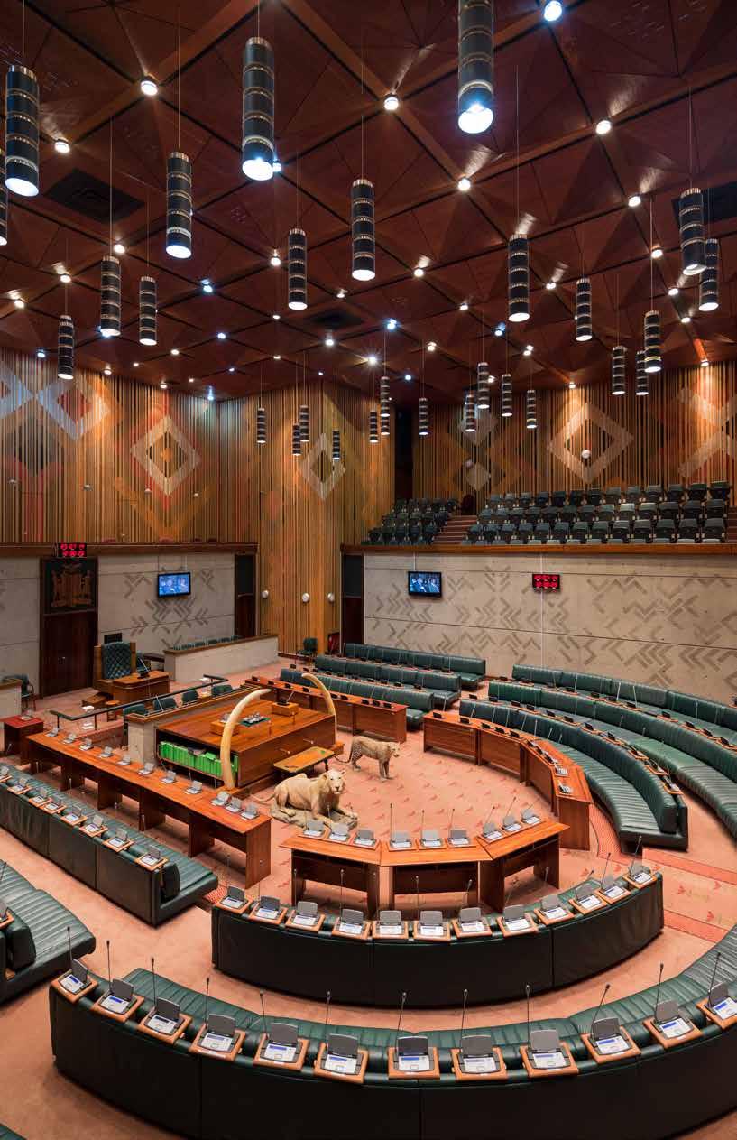
12Raised public chamber in Assembly hall showing detail of layered wall decoration
13Centrla floor of Assembly chamber
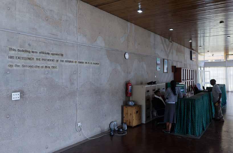
14Entrance hall
15Dedication inscription in entrance hall
16Overview of Assembly chamber
overleaf
17floor of assembly chamber
1976-1977
Montgomery,
Oldfield & Kirby
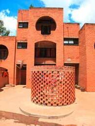
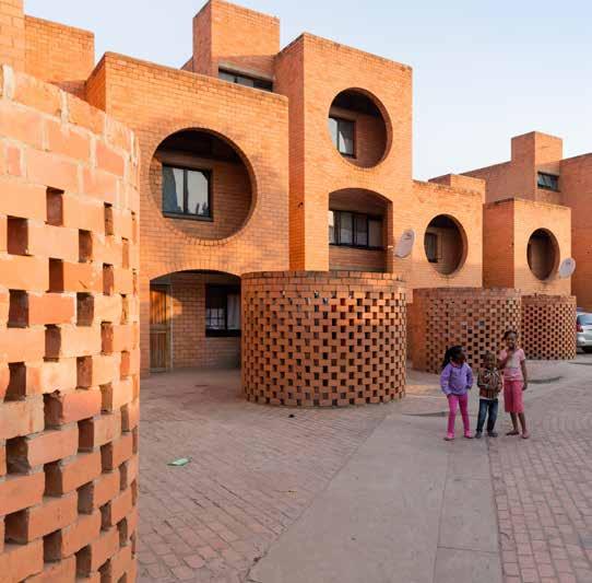
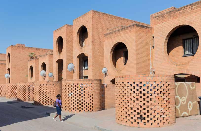
The Maisonnettes for the Bank of Zambia were built to provide housing for employees of the country’s national bank. The urban layout consists of one linear, snaking group of row houses with two smaller groups separated and oriented perpendicular to the main group. The central area features large trees and a playground and the whole arrangement is meant to reference traditional Zambian villages with their differentiation of private, semi-private and public spaces.
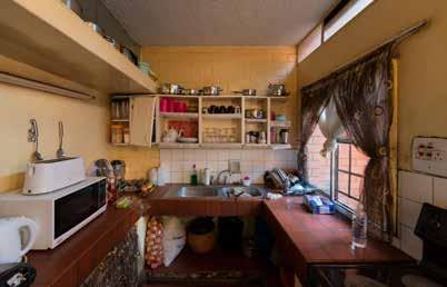
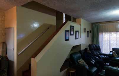
The complex consists of twenty-nine units of different sizes, having two, three, or four bedrooms. The basic arrangement is identical for all units, with kitchen and living room on ground floor, and the bedrooms in the upper floor(s).
The dominant material is brick masonry,
which is either employed conventionally to form walls, or as a lattice screen to create courtyards, partially exposed to the public space. The use of brick has a certain tradition in Zambia and this project shows novel ways for its application and use. The upper floors feature large circular openings that act as a shading device to the windows behind and bring to mind Louis Kahn’s Indian Institute of Management in Ahmedabad, built in the early 1960s. Nevertheless, in sculptural quality, architectural detail, and creation of public space it is one of the finest examples of housing estates that can be found in Zambia.
1View of site from exterior
2House elevation
3Elevation showing volume grouping and laundry screen
4 - 5House interior
6Long elevation showing repeat of the housing unit.