ARTICLE
The Collective Memory of a Chinese Community Survives in a Concrete Forest: Chinatown in Kuala Lumpur, Malaysia 4
NG Shi Qi, GONG Xiao Lei
How Does Street Art Affect a City’s Social Identity? 16
Rozanne Jojo VALLIVATTAM, Ar. Ramneet KAUR
An Investigation of Youth Homelessness and the Principles of Transitional Space Design 26 Kai, ZHOU, Greg MISSINGHAM
PROJECT
Kids Smile Labo Nursery 33
Hibinosekkei, Youji no Shiro
Sukagawa Community Center 40
Ishimoto Architectural & Engineering Firm and Unemori Architects
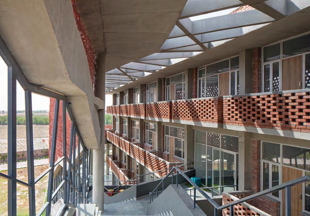
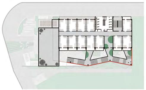
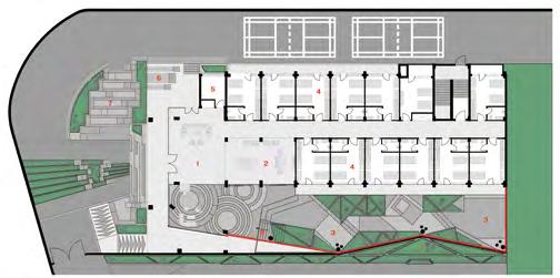
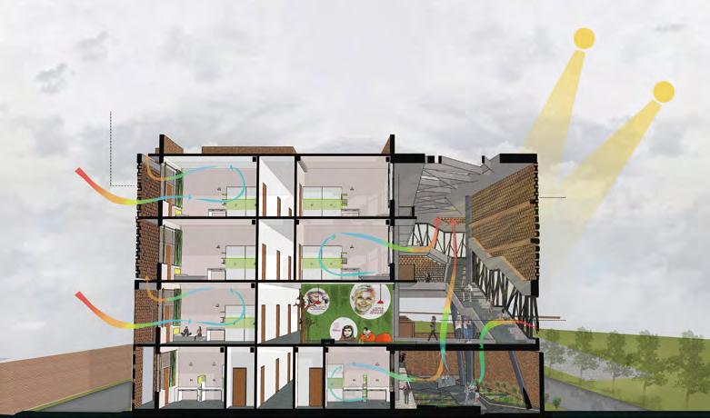
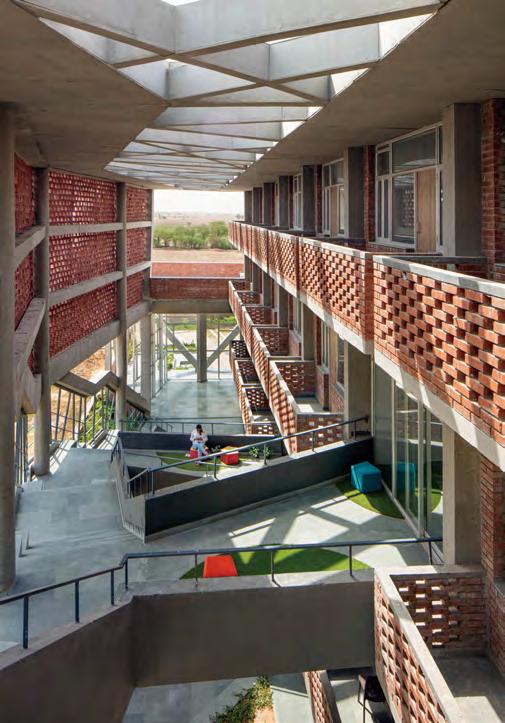
St. Andrews Institute of Technology and Management: Boys’ Hostel Block 50 Zero Energy Design Lab (ZED Lab)
St. Andrews Institute of Technology and Management: Girls’ Hostel Block 56 Zero Energy Design Lab (ZED Lab)
The Northstar School 63 Shanmugam Associates
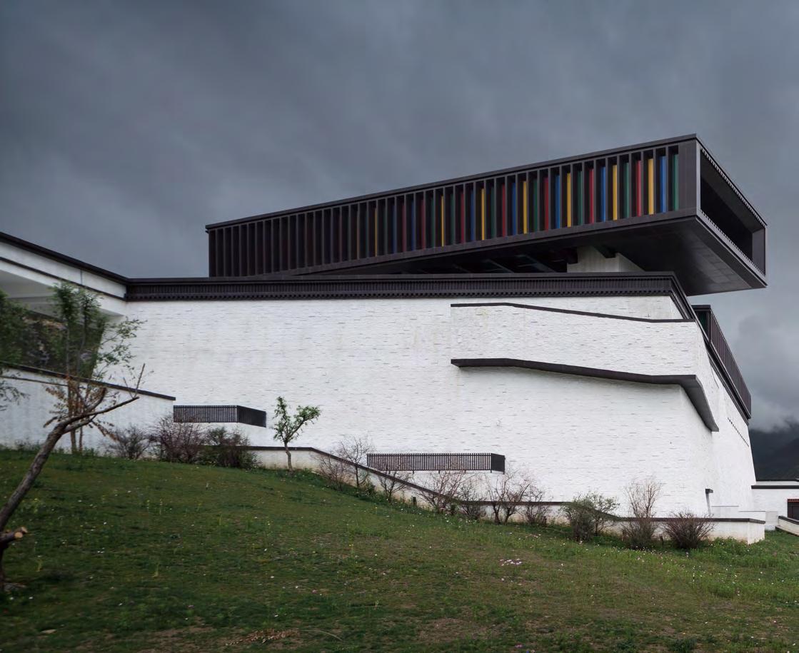
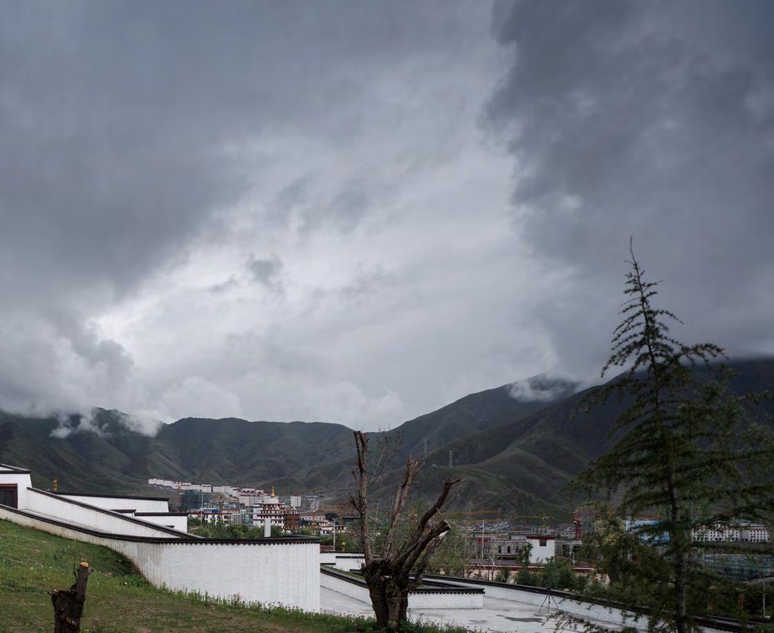
Tibet Intangible Cultural Heritage Museum 70 Shenzhen Huahui Design Co., Ltd
Majiabang Cultural Museum 77 Tongji Architectural Design (Group) Co. Ltd
Visitor Center of Changping Future Science City 84 Huyue Studio
Morse Park Amphitheatre 92
Architectural Services Department, HKSARG
VORA (Vorasombat Plaza) 98
Space | Story | Studio
Striated House at Rajagiriya 105 Palinda Kannangara Architects
Contents Editorial 3
Asian countries have different cultures, with various religions, traditions, and perceptions. Cultural identity is particularly important for regions and cities, where different groups of people live. Sense of identity is often related to nationality, ethnicity, religion, social class, generation, place of settlement, or even a social group with its unique culture. At the same time, whether based on homogeneous or heterogeneous cultures, social responsibility and social care are indispensable to maintain the balance between economic development and social welfare, and to remove barriers between people imposed by region, distance, economic conditions, and so on. The three articles in this issue take these points as a starting point for discussion. Chinatown in Kuala Lumpur, Malaysia, carries the collective memory of the Chinese diaspora, which is always ignored in development and regeneration. Through examining past images and official blueprints of the area’s layout, evaluating the spatial configuration in Chinatown, and reviewing the literature, Ng Shi Qi and Gong Xiao Lei’s article analyzes and evaluates the conceptual structural framework of the connections among the communities, place, and time that sustain the collective memory of a place and their influence. Rozanne Jojo Vallivattam and Ramneet Kaur’s article examines how street art can affect a city’s social identity, in terms of the parameters of location, physical attributes (color, design, and scale), user activities, and conception. To deal with the global issue of youth homelessness through social care, Kai Zhou and Greg Missingham’s article identifies the principles of transitional space design by redefining how a shelter functions, and by considering how humanizing spatial design characteristics could create a more holistic solution.
Asian architectural practice started to explore cultural identity from a rising of national consciousness in the early twentieth century. With the modernization of social civilization, the responsibility of building Asian societies has been increasingly reflected in the development of architecture and cities; architecture plays an important role in cultural cohesion and transmission. From a nursery to school, the projects in this issue explore enlightenment of the new generation, from discipline to personality cultivation. From a museum to community center, they reflect various forms of cultural communication, from elite output to grassroots interaction. From a service facility to landscape architecture, they demonstrate the form transformation of urban spectacle in public space. Architects from Japan, China, India, Thailand, and Sri Lanka keep on experimenting with space, structure, and materials, which show an infinite imagination of Asian wisdom in expressing the theme.
3
Editorial
The Collective Memory of a Chinese Community Survives in a Concrete Forest: Chinatown in Kuala Lumpur, Malaysia
NG Shi Qi, School of Architecture, Tianjin University, Tianjin, China
GONG Xiao Lei (corresponding author), School of Architecture, Tianjin University, Tianjin, China Author Information
NG Shi Qi: berry941@hotmail.com
GONG Xiaolei: gongxiaolei@tju.edu.cn
Abstract
Chinatown in Kuala Lumpur, Malaysia was formed by the Chinese tin-mining community before Malaysia was established. It has managed to sustain its collective memory rooted in the past, while embracing widespread development in the country. This ongoing study investigates the survival of this collective memory under the pressure of regeneration. The research examines the conceptual framework of collective memory, which is influenced by the citizens and their surroundings, diachronicity, and synchronicity. The methodology comprises examining past images and official blueprints of the area’s layout, evaluating the spatial configuration in Chinatown, and reviewing the literature. It is, therefore, crucial to analyze and evaluate the conceptual structural framework of the connections among the communities, place, and time that sustain the collective memory of a place and their influence, rather than turning them into a memorial that is frozen in time.
Keywords
Collective memory, spatial configuration, Chinatown, Chinese community, Kuala Lumpur.
4
ARTICLE
Figure 1
1. Introduction
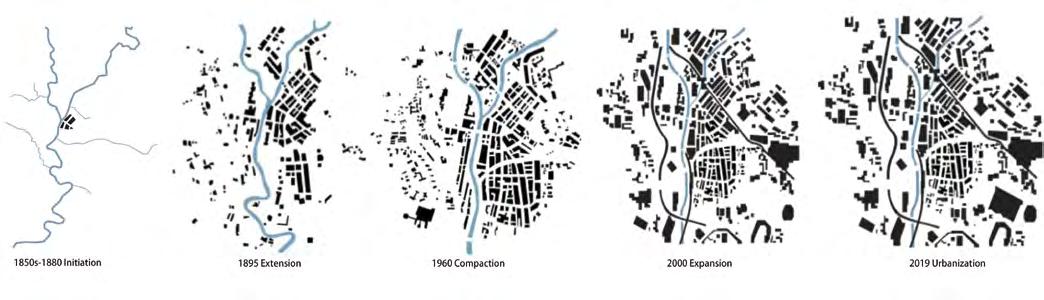
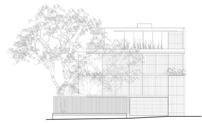
Malaysia is a multiracial country comprising different languages, cultures, religions, types of fashion, and foods. The history of its capital city, Kuala Lumpur (KL), can be divided into several communities. The Malay, and British colonial seculars are represented along (and separated) by the Klang River, with the Indian community joining the area after to form little India. As communities developed, shophouses1 were built to meet the functions of commercial and residential use and are common in South Asia. In Malaysia, the shophouses in Penang and Melaka are well-known, and in 2008, were recognized by UNESCO as a “World Heritage Site.” However, the shophouses in KL have received less attention. The research for this paper took place in KL’s oldtown Chinatown, which contains the majority of shophouses from the past, starting from 1895 (Figure1)—the the Chinese community zone has drastically expanded—to the early development of KL. Chinatown has witnessed the forming of Malaysia beginning the British Malaya period2 and, thus, offers a moment in time from which to begin examining the transformation and sustainability of the Chinese community’s collective memory. Memory preserves and inherits past events that sustain it for the future. Hence, collective memory plays a crucial role on sense of belonging because it allows new generations to understand the past and their origins, and, thereby, reinforce this sense of belonging.
While several researchers have highlighted Chinatown in KL, they tend to mention the conservation and preservation of its historical buildings (for example, Petaling Street) and the lost and vanishing identity of its community, but not the collective memory of daily community life there. Chinatown is located in the
downtown area of the city, with urbanization occurring right beside it, just outside its perimeter. In this research, we aim to analyze the site (Chinatown) and materialize its collective memory as a gathering spot of the Chinese community, to enhance the sustainability of the collective memory in the face of changes due to urbanization. This article does not address political, financial, conservation, or preservation issues in Malaysia.
The paper is divided into four parts: The history and background of Chinese immigrants and Chinatown in KL; the methodology, which uses urban planner Kevin Lynch’s3 constructs of “legibility” and “imageability” to come up with a spatial configuration of shophouses, circulation, and gray space in Chinatown, and the overlapping of the analysis map to examine collective memory in Chinatown; a discussion of “fading,” “sharing,” and “regeneration” in Chinatown; and a concluding discussion with suggestions for further research.
2. Background: The History of Chinatown in Kuala Lumpur
2.1 Migration of Chinese People Chinese culture, language, food, religion, and customs have been maintained well by Chinese people in Malaysia, also known as Malaysian Chinese.4 According to historical records, Chinese migrants started arriving in KL from the middle of the nineteenth century; most of them were Cantonese speakers from Southern China. The peak period of migration was from 1880 to 1940. Prior to this, most of the earliest Chinese migrants were merchants, however later, working in the Malaysian tin-mining industry became the main reason for Chinese people migrating to Malaysia. In the past, the Chinese in Malaysia had dominated the rubber
5
The changing topographies of Kuala Lumpur beginning 1850
1850s–1880: initiation 1895: extension 1960: compaction 2000: expansion 2019: urbanization
estates and tin mines, but during the British colonial period, the Chinese became more distributed toward business and tin mining.
2.2 Forming of Chinatown
Kuala Lumpur began as a small jetty at the junction of the Klang and Gombak rivers that were surrounded by jungle. In 1857, Rajah Abdullah, the chief of the capital of Klang, sent a party of eightyseven Chinese prospectors on an expedition to look for potential tin-mining locations, which they found in Ampang, 2 miles from Klang. Chinese miners began to settle there (Figure 1, page 5) and the town expanded5 and became known as Kuala Lumpur, or KL for short. Subsequently, the British moved their residency, including their government offices, from Klang to KL when they discovered that the natural landscape—particularly the Klang River— had the makings to potentially divide the community according to race, thereby better enabling them to control the area. Thus, they pushed the development of the city—such as the rail system to deliver goods from the Klang harbor to KL—and this cultural shift contributed to the vibrant city we see today. The river, by way of its very nature and course, separated the communities along it according to race and this helped shape the cultural transformation and rich architectural heritage styles of today that are noticed across this River of Life (RoL).6
In 1895, the colonial territory on the west bank was extended, as were the Malay enclave to the north and the Chinese settlement on the east bank, the three divided by the Klang and Gombak rivers (Figure 1, page 5). In 1960, development expanded to include the southern edge of the east bank—Brickfield area—which largely comprised the Indian community. It was also during this period that KL experienced a wave of uncontrolled development to
accommodate the rise in migration to the city. In 2000, the traffic network expanded, crossing the parcel boundary; high-rise buildings were built, pushing the outskirts further to provide affordable housing for the growing population. Urbanization made more of the city accessible, as highways, railways, and public transport expanded, creating a node of juxtaposition where different architectural heritage elements are surrounded by the newer concrete forest.
There is no clear record of the origins of the name “Kuala Lumpur,” but there are two common explanations:
1. It was translated from “lampang,” the Hakka word for “a muddy unclear forest;” and
2. It originates from the Malay word, “kuala,” meaning “the junction of two rivers,” and the word, “lumpur,” meaning “muddy.”
Regardless of which is the more accurate version, both express the idea of a muddy river junction. The name continued to be used even during the British colonial era in Malaysia because the intention was to represent the power of two different races—Malay and Chinese—and retain “associationism with the native system”7 rather than rename the new capital with an English name.
One man who cannot be ignored in discussions of Chinatown’s development is Yap Ah Loy, the founding father of KL. He was the third captain of the Chinese8 of the city from 1868 to 18859 and was the most powerful owner of a mining business in KL during that period. Additionally, he owned many of the shophouses along the Klang River and developed a large area of the land beside the Klang and Gombak rivers. The community even named a street after him, and founded the Yap Clan Association in his honor, and built the Yap Sze Ya Temple to memorialize his contributions.
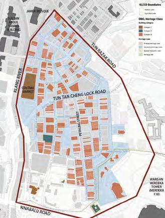
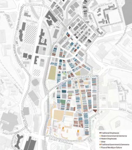
Figure 2 Chinatown in Kuala Lumpur Figure 3
Building typology of Chinatown, Kuala Lumpur
6
2.3 Topology of Shophouses
According to Dewan Bandaraya Kuala Lumpur (DBKL)10 Heritage Class,11 Chinatown is in the historic area of KL and is categorized as a secondary heritage zone (Figure 2, page 6); a majority of the buildings are categorized as secondary class. Of the 393 building units in Chinatown, 152 are traditional shophouses and 241 are modern shophouses, which shows that shophouses comprise the majority of the area’s building typology (Figure 3, page 6).
The construction of shophouses boomed during the mid-nineteenth century to meet the needs and demands of a growing society during the tin-mining period, specifically, the need for both business and residential spaces. In the early stages, the shophouses were constructed with two storys, and later, three storys, with the first floor used for retail purposes (primarily for the family business) and the upper floors for dwelling. Buildings were typically made of timber, with attap12 used for the roof; all materials were gathered from the nearby jungle. However, after several destructive fires and floods, construction material gradually made the shift to the more durable brick. The fire of August 187213 was attributed to the close distance between the buildings, and another, in January 1881 (a flood also occurred in 1881), to the flammable building materials. To address these flaws, town planners of the British Colonial rule instituted a mandate to rebuild all timber shophouses and buildings with durable materials, construct a 5-foot-wide covered walkway14 in front of the shophouses, and construct a back lane that allowed passage for the fire brigade and bullock carts collecting sewerage.15
Shophouse typologies in KL differ slightly from those in Penang and Melaka, owing to the relatively later influence of Western design in KL. Kuala Lumpur was part of the Federal Malay States (FMS),16
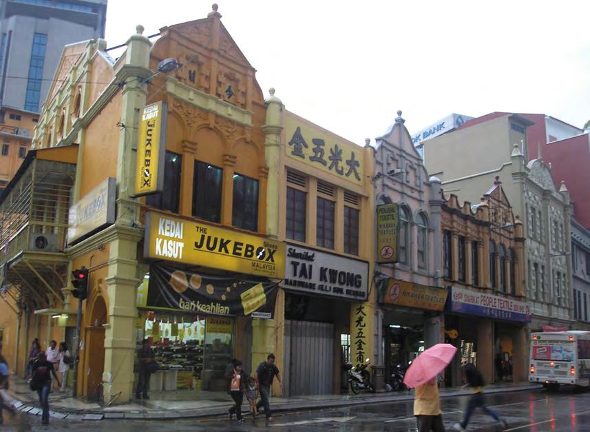
which comprised Selangor, Perak, Negeri Sembilan, and Pahang; therefore, the names of the typologies are different. Shophouse were designed beginning the 1880s, in the Straits eclectic typology, which was very similar to the Straits Settlement (Penang)17 typology, followed by the early FMS eclectic design when the British took over the administration. Thus, building façades on shophouses beginning the second period were ornamented with, and heavily influenced by European styles. By the 1920s to 1930s, the late FMS eclectic style emerged, when façade decorations reduced and evolved into a linear decoration style, and by the 1930s, the art deco style gained presence, with clean façades, vertical or horizontal lines, and the wide use of steel and glass.18 Though the shophouses in KL’s Chinatown have survived to date, they severely lacked maintenance through history, and have suffered great disrepair, owing to loose building regulations. Therefore, many shophouses have been renovated, demolished, or, disappointingly, even replaced by modern high-rise buildings. These actions have caused disorder in the urban fabric, building heights, and architectural elements.
3. Methodology
Several steps have been taken in this research project to analyze KL’s Chinatown. Preliminary data was derived from reviewing the literature and collecting data from previous researches online, and from an ongoing site analysis in Chinatown using the “five elements” conceptualized by Lynch;19 site analysis includes the shophouses and the gray space spatial configuration of the shophouses in Chinatown. After collecting this data, we began overlapping the literature review results and other text-based data with the site analyses.
7
Figure 4 Shophouses in Chinatown, Kuala Lumpur
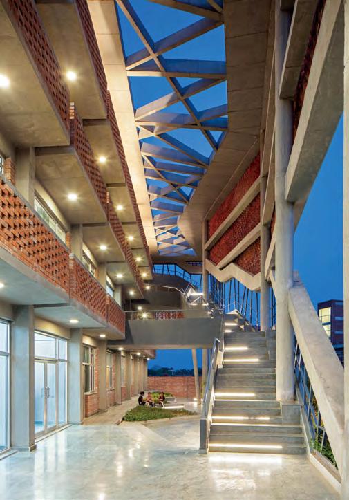
Sukagawa Community Center
Architect Firm: Ishimoto Architectural & Engineering Firm, Unemori Architects
Location: Sukagawa City, Fukushima Prefecture, Japan
Total floor area: 13,698 square meters
Completion date: August 2018
Photography: Kawasumi | Kobayashi Kenji Photograph Office, Kai Nakamura Ph
otography: Hoang Le photography
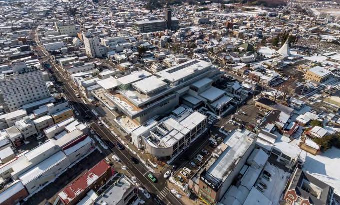
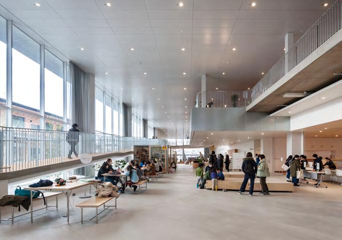
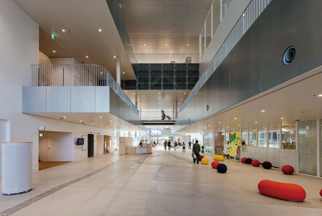
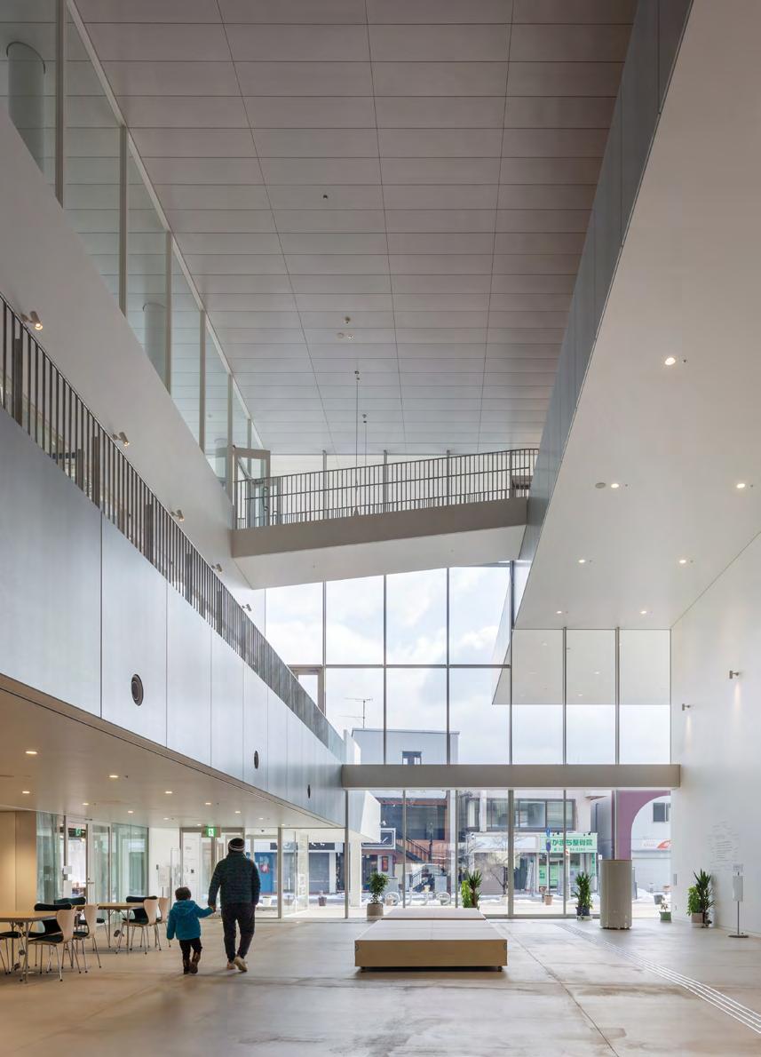
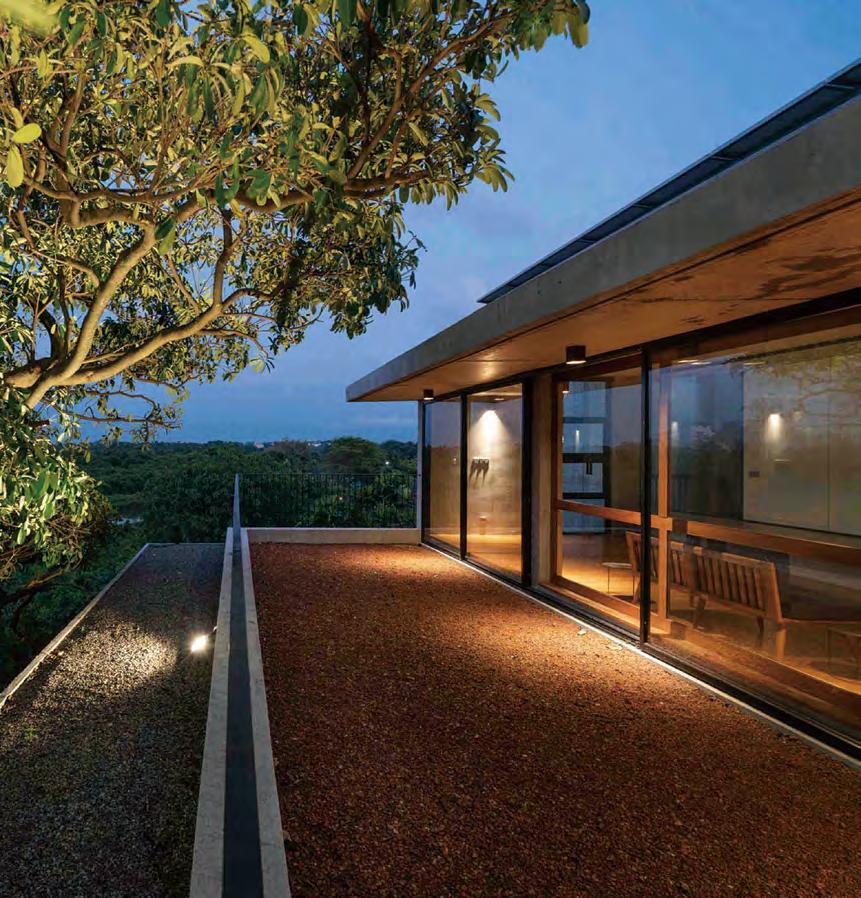
The Sukagawa Community Center in Fukushima is a part of a municipal reconstruction project to revitalize the severely damaged city center after the Great East Japan Earthquake in 2011. Following a series of citizen workshops, the architects developed a multipurpose building complex extending five floors. Built in collaboration with Ishimoto Architectural & Engineering Firm, the community center’s architecture by Unemori Architects is characterized by open floor setbacks, cantilevered slabs, and an activity-based floor plan, transcending the building typology of a public community center, thereby, successfully connecting the city and its people.
Revitalizing the City Center
The community center aims to regenerate community life and revitalize the severely destroyed city center. By incorporating the public’s request—
gathered through citizen workshops—in the design of the multipurpose community building, the Sukagawa Community Center is created as a public forum, connecting the city and its citizens.
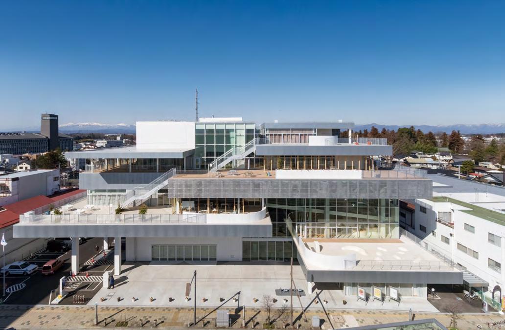
The center includes a library, childcare services, and a three-dimensional play space, as well as a museum, a lecture hall, and a café, among other facilities and amenities. With a total floor area of 13,698 square meters, extending over five floors, the center offers various socializing spaces and rental rooms for studying, as well as several inner and outer terraces that surround the whole building.
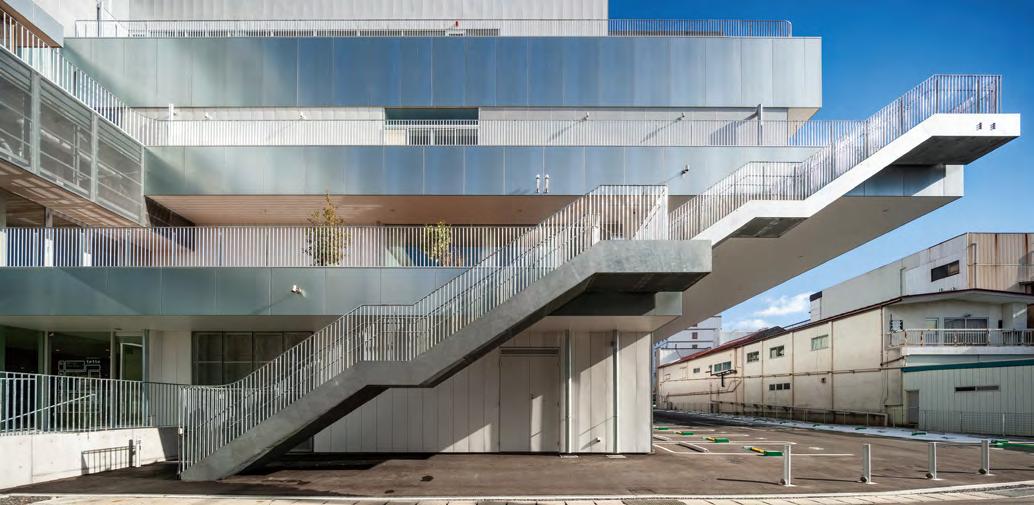
A Complex Structural System
The center is designed as an interlocked structure based on different floor slabs, divided into small sections and staggered, to form an incremental setback on the site facing the historic main street. The building’s architecture, thus, offers many terraces, providing further outdoor activity and socializing spaces, while the recessive façade of the building allows sufficient distance from the neighboring houses.
The interior structure is characterized by an open floor plan and offset floor levels that partly appear to float freely in the cavity of the center, creating various voids and dynamic open views throughout the different
floor slabs. In order to realize this complex structural system, a megastructure comprising the third and fourth floor—that entails a steel frame composed of trusses— was designed. The cantilevered slab of the lower floor is suspended from the megastructure and supported by columns on the upper floors, the positions of which are shifted accordingly to bear the load. Further, the trusses provide space for the installation of air-conditioning equipment, as well as smoke exhaust routes in case of a fire; it also serves as a sound-absorbing layer protecting the quiet environment of the library on the upper floors from noise filtering in from the lower floors. The upper floors are connected by gentle slopes and stairs, which allow visitors to walk around the entire building as if taking a walk around the city.
The first floor, which serves as the main entrance to the facility, is a sloping space integrating the 2.5-meter elevation difference of the site. The waiting area, café, and event space located on the first floor are connected with the outdoor space, and seamlessly integrated into the hilly cityscape of Sukagawa. The second floor houses children-focused amenities, such as a kids’ library and an open, two-story playground. Located on the third floor is the main library, as well as a number of rental rooms and inner terraces which allow for
40 PROJECT
External appearance
view quiet working, and which also provide socializing spaces , respectively. The library extends across the fourth floor, where more rental rooms and an open community space are located. The museum is located on the fifth floor of the facility.
Connecting the City and its Citizens
The Sukagawa Community Center offers a wide range of cultural and recreational activities that are assigned different activity themes, such as “Raise,” “Play,” “Create,” “Learn,” and “Meet.” The facility is divided into different areas of action offering various opportunities for people to meet, to
engage in activities, and to interact with knowledge. The Sukagawa Community Center is designed to transcend functional boundaries and enable a complex experience by reinterpreting the building typology of a public community center. With the complex structural layout of the community center, as well as the reclassification from conventional categories into activity-oriented themes, an architectural solution that addresses the need for a public forum, and which simultaneously creates a long-lasting and versatile relationship between the city and its citizens is provided.
41
of the walkway
View
Aerial
42 Entrance street
Entrance street
43
Entrance street
60 Interesting play of light and shadow 1 1 3 3 3 3 2 2 2 2 4 4 4 5 6 First-floor plan 1. Lounge 2. Connecting bridges 3. Rooms 4. Restrooms 5. Terrace 6. Stairs Ground-floor plan 1. Double-height reception 2. Recreational area 3. Landscape court 4. Rooms 5. Pantry 6. Outdoor sitting area 7. Landscape 8. Stairs N 5 6 7 7 8
Brick jaali (thermal mass)
Summer (81 °Fahrenheit) Winter (60 °Fahrenheit)
Section
Night view Hierarchy of spaces
hub
Brick jaali (thermal mass) Social
It
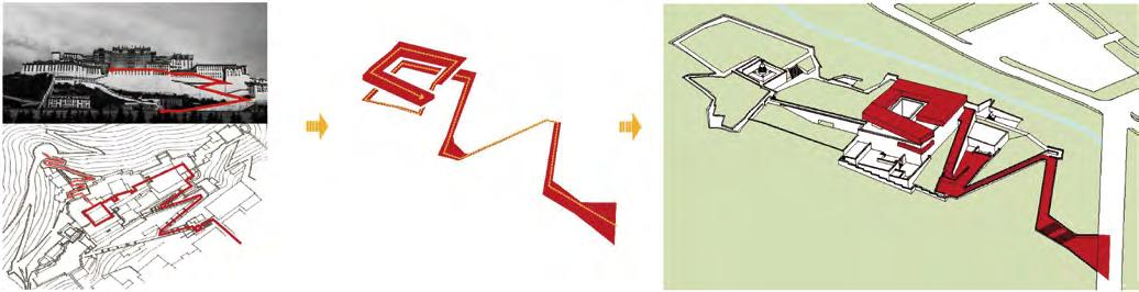
Generating “heavenly road”
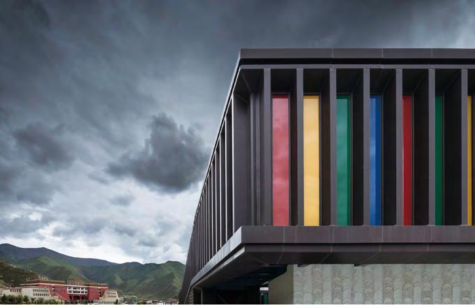
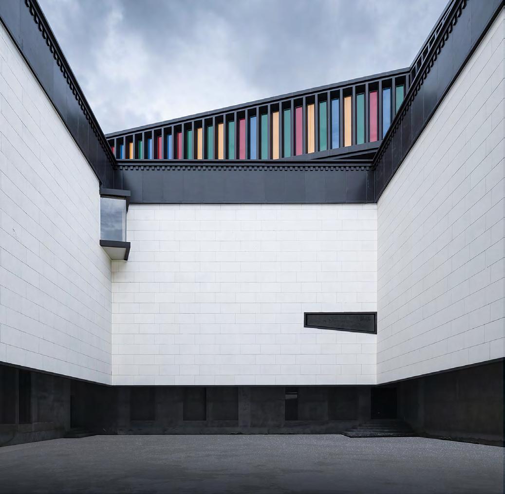
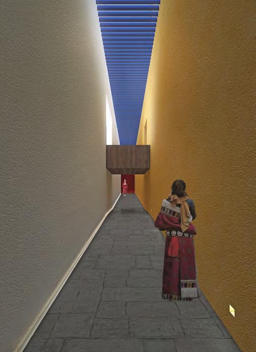
72
“Heavenly road” is based on the zigzag footpath of Potala Palace
forms a spatial circulation from the entrance of the site to the building, and spirals up inside the museum
“Heavenly road” combines with the functional space to create a diversified spatial experience between people and the building
Building and the river valley
Close-up views
74
Courtyard
Second
Outdoor theater Hall Report hall
Exhibition hall
Invited artist studio/research room Business/souvenir retail Purchase tickets/service Patio/Gesar ruins exhibition hall

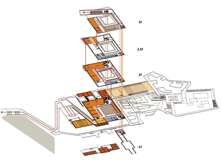
75 Functional layout
floor Mezzanine Third floor Basement
ramp
First
Indoor
Multimedia hall Parking Administration Storage area Auxiliary space floor
106
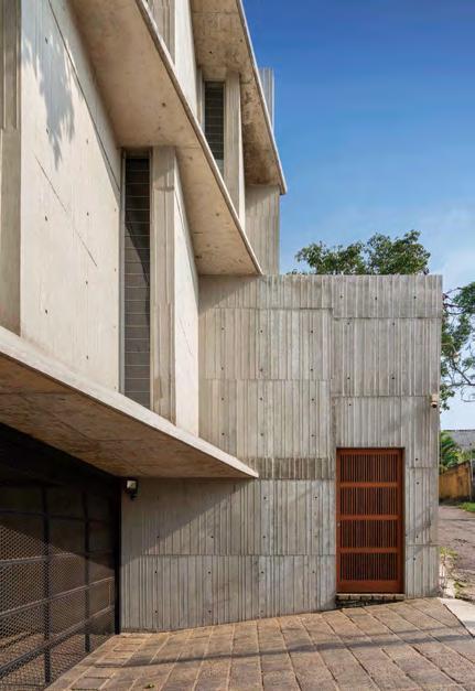
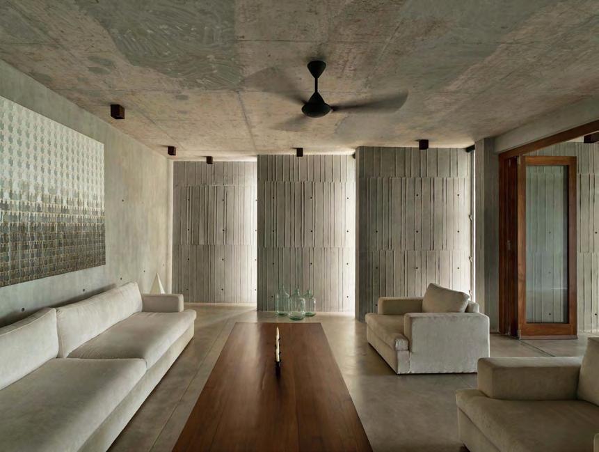
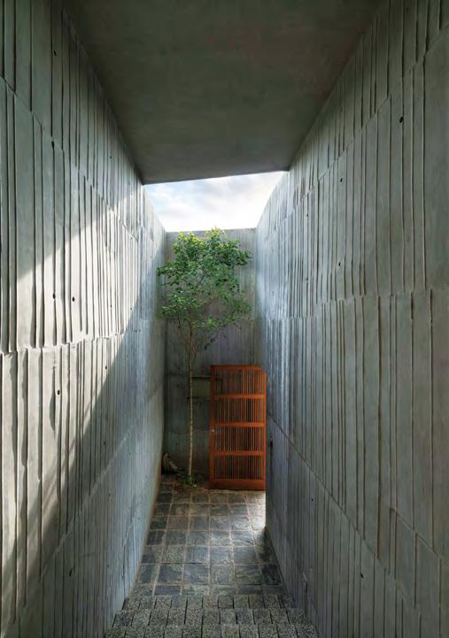
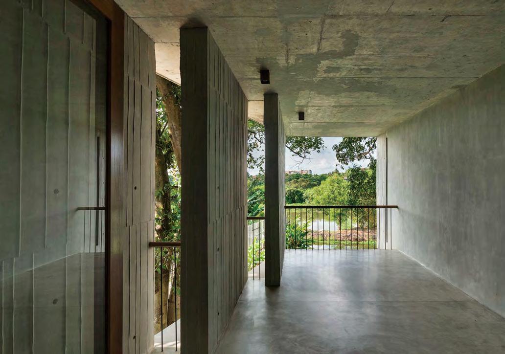
View of the living room
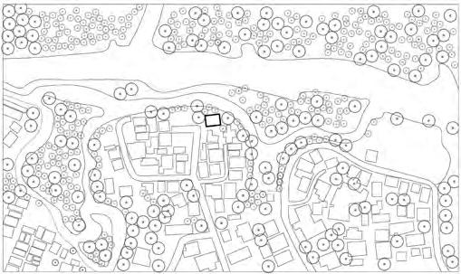
Location
0 20 60 100m N
View
of the front entrance
plan
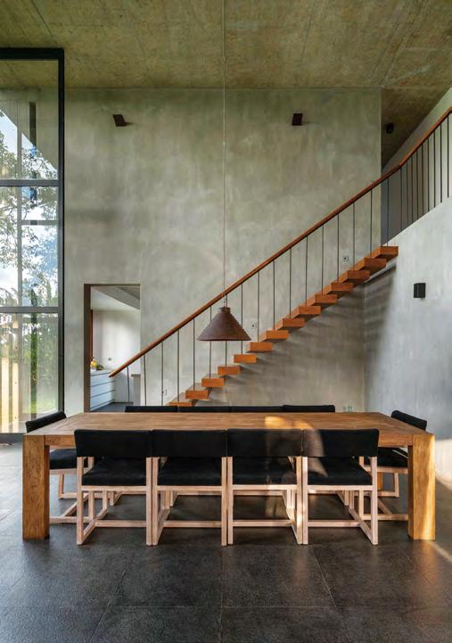
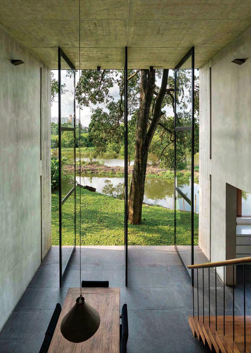 View of the double-height dining area
108
of the double-height entrance court
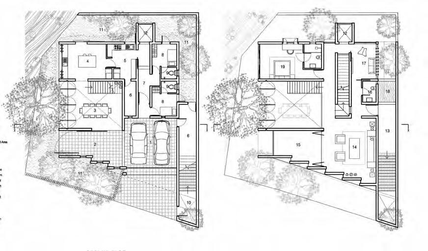
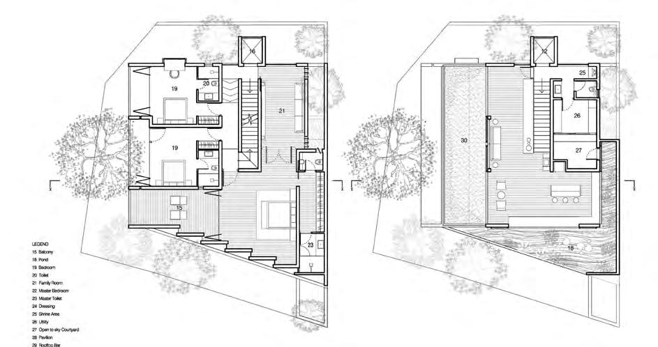
of the double-height dining area Ground-floor plan First-floor plan 1 3 2 4 5 6 6 7 10 11 11 11 12 12 13 15 16 18 19 20 17 14 8 9 9 1. Parking 2. Outdoor paved area 3. Dining area 4. Pantry 5. Kitchen 6. Store room 7. Service passage 8. Helper’s room 9. Helper’s bathroom 10. Entrance court 11. Garden 12. Passenger elevator 13. Entrance 14. Living room 15. Balcony 16. Powder room 17. TV room 18. Pond 19. Bedroom 20. Bathroom 21. Family room 22. Main bedroom 23. Main bathroom 24. Dressing room 25. Shrine/altar 26. Utility room 27. Open-to-sky courtyard 28. Pavilion 29. Rooftop bar 30. Rooftop garden
View
View
109
Second-floor plan Roof terrace plan 15 16 19 19 20 21 22 23 23 24 0 1 3 5m N 12 18 28 29 30 20 25 26 27
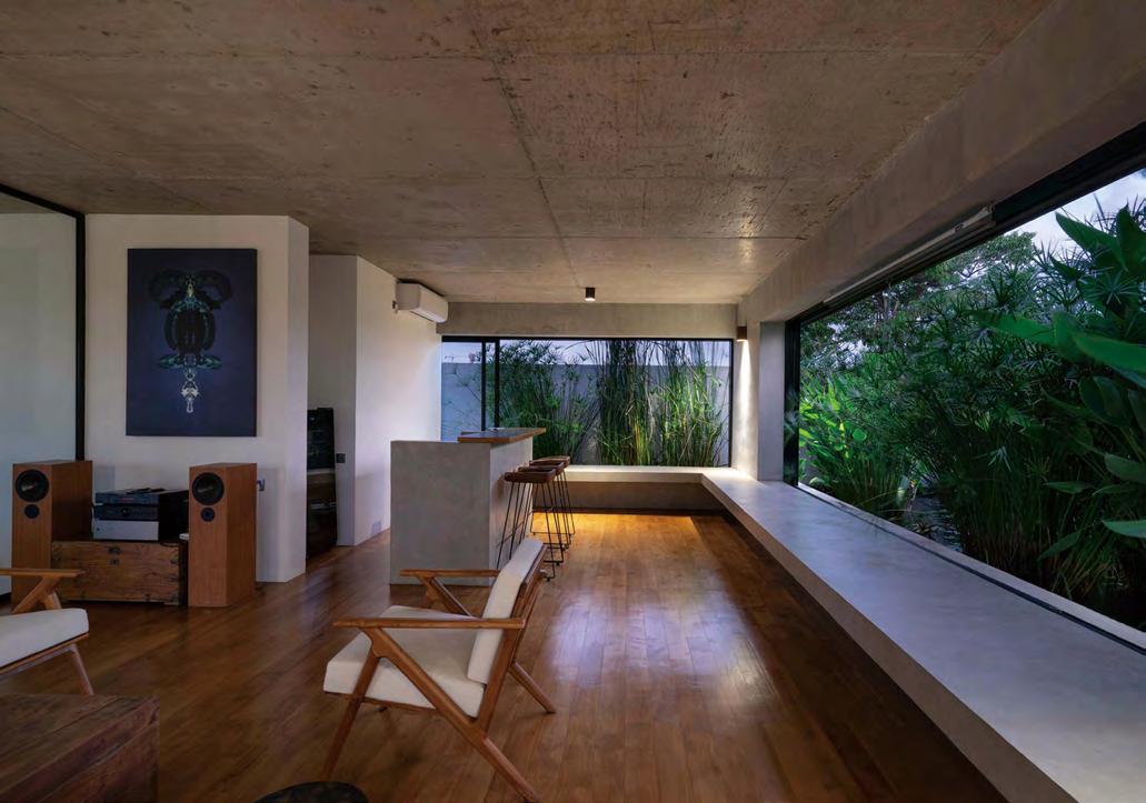
View of the balcony from the living area
 View of the rooftop entertainment pavilion
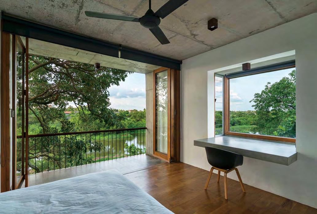
View of the bedroom
View of the rooftop entertainment pavilion
View of the bedroom
111
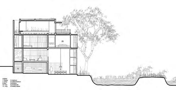
elevation 0 1 3 5m 1 3 2 4 5 6 7 10 8 9 Section 1. Parking 2. Dining area 3. Store 4. Pond 5. Living area 6. Bedroom 7. Main bedroom 8. Dressing room 9. Rooftop bar 10. Rooftop garden
View of the rooftop terrace Front

