EMBARK
Adirondack Adventure Guide
Summer 2024

• CATS leads hike at the Adirondack Harvest Festival
• Exploring the Paul Smith’s VIC Butterfly House


Adirondack Adventure Guide
Summer 2024
• CATS leads hike at the Adirondack Harvest Festival
• Exploring the Paul Smith’s VIC Butterfly House
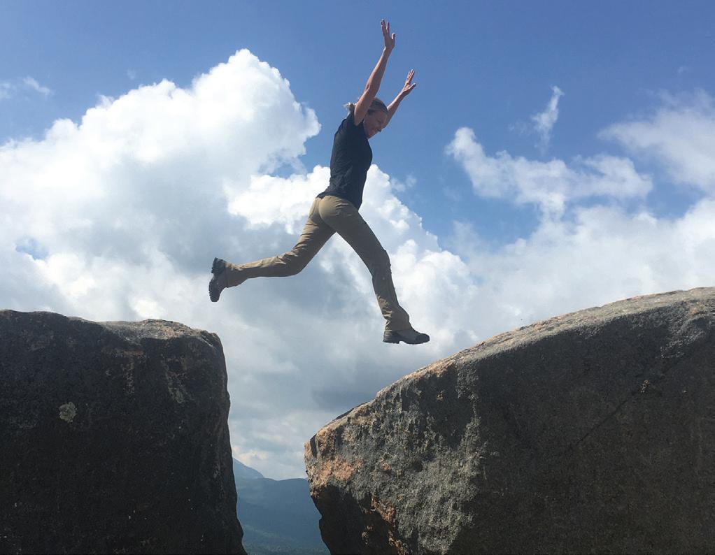
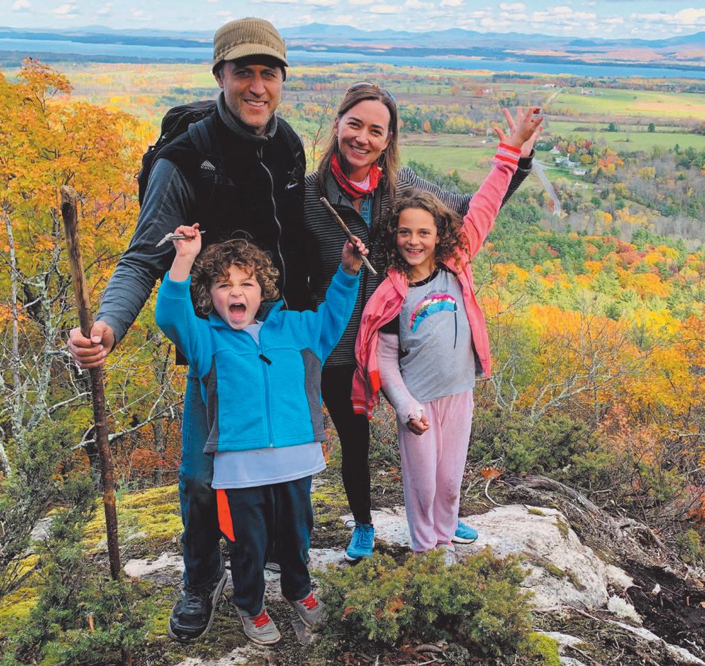
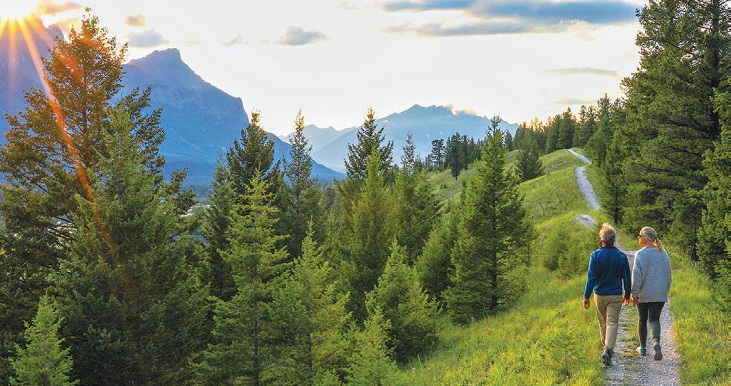
With summer in full force in this neck of the woods, it’s time to get outdoors.
During this season, outdoor enthusiasts have a variety of activities from paddling, mountain biking, bird watching, exploring and even playing disc golf.
In this edition of EMBARK, we hope to give you, the reader, some fun ideas to engage in this summer. We’ve included a list of the fire towers in the Adirondacks, paddling challenges and some places to mountain bike.
Or maybe you want a more relaxed outdoor adventure and want to find a good place to walk your dogs, or observe what nature has to offer at the Paul Smith’s College’s Visitor Information Center’s butterfly house.
Hopefully, you’ll learn something new within this edition — whether about loons or ways to enjoy the Adirondack Rail Trail in its first summer following the completion of Phase One.
We’d love your feedback. Send it to Embark, P.O. Box 318, Saranac Lake, NY 12983 or sports@ adirondackdailyenterprise.com.
Get up and get out!


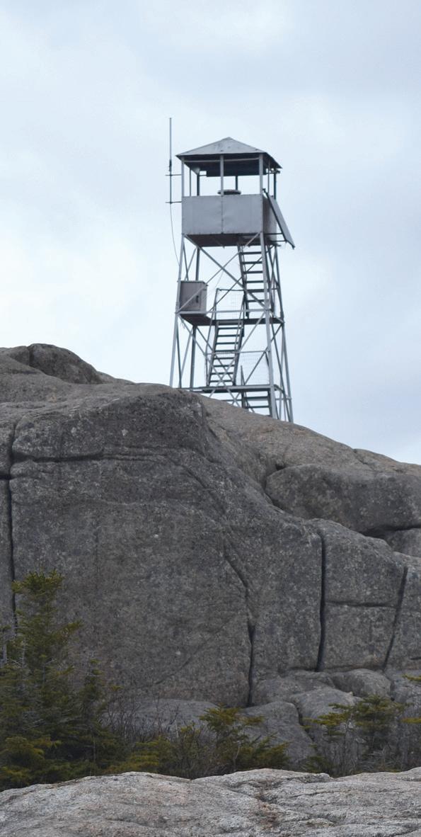
Mountain Elevation County Built Open
Adams .........................3,584 ................Essex ...................1917 ....................Yes
Arab .............................2,545 ...............St. Lawrence ......1918 .................... Yes
Azure ..........................2,518 ................Franklin ..............1918 .....................Yes
Bald (Rondaxe) ...........2,350 ...............Herkimer .............1917 ....................Yes
Belfry ..........................1,820 ................Essex ..................1917.....................Yes
Black ............................2,646 ...............Washington ........1918 ....................No
Blue .............................3,759 ................Hamilton .............1917 ...................Yes
Cathedral Rock ............1,700 ...............St. Lawrence .......1919 ....................Yes
Goodnow .....................2,685 ................Essex ..................1922 ....................Yes
Gore .............................3,583 ...............Warren .................1918 ...................No
Hadley .........................2,675 ................Saratoga ..............1917 ...................Yes Hurricane .....................3,694 ................Essex ..................1919 ...................Yes Kane .............................2,180 ...............Fulton ..................1925 ..................Yes
Loon Lake ....................3,279 ...............Franklin...............1917 ....................No Lyon .............................3,830 ...............Clinton.................1917 ...................Yes Owls Head ...................2,780 ...............Hamilton .............1919 ...................Yes Pillsbury .......................3,597 ...............Hamilton..............1924 ...................Yes Poke-O-Moonshine ......2,170 ...............Essex ...................1917 ..................Yes
Snowy ..........................3,899 ...............Hamilton ..............1917 .................Yes
Spruce ..........................2,005 ...............Saratoga .............. 1928 ..................Yes
Stillwater ......................2,264 ...............Herkimer...............1919 .................Yes
St. Regis .......................2,882 ...............Franklin ...............1918 ..................Yes
Vanderwhacker ............3,386 ...............Essex ....................1918 .................Yes
Wakely .........................3,744 ...............Hamilton...............1916 .................Yes
Woodhull .....................2,362 ...............Hamilton...............1916 ..................Yes

By SCOTT VAN LAER
Paul Smith’s College VIC Director
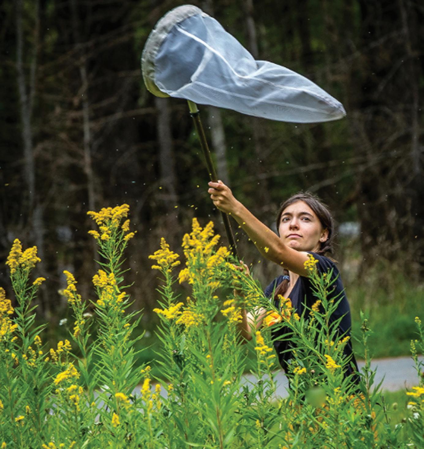
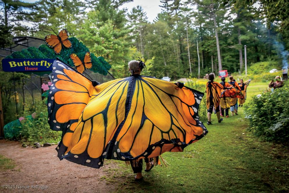
Have you ever slowly crept up on a butterfly as it suns itself on a perch, eager to get a closer look, only to have it fly off the moment you get close? Butterflies and moths are notoriously difficult to observe in their natural habitats, much to the dismay of curious observers. The Paul Smith’s College Visitor Interpretive Center (VIC) provides a helpful remedy to this problem by featuring the only Butterfly House located within the boundary of the Adirondack Park.
Spearheaded by a group of dedicated volunteers, the Butterfly House was constructed in 1993 and has since educated thousands of visitors on butterflies and the importance of protecting pollinators and their food sources.
Surrounding the structure is the Frank M. Hutchins Butterfly Garden, which attracts a wide variety of pollinating insects and butterflies to the area. Walking through the colorful, lively garden pathway leads visitors to the large, netted hoop house that makes up the Butterfly House. After passing through the two sets of doors (a sort of airlock to prevent insects from escaping), you find yourself immersed in a microcosm dedicated to
Continued on page 5
native pollinators. Bordering the gravel pathway winding through the building are a variety of host plants that cater to each species of butterfly or moth. Make sure to bring plenty of pollinator-related questions because the Butterfly House is staffed full-time by knowledgeable stewards.
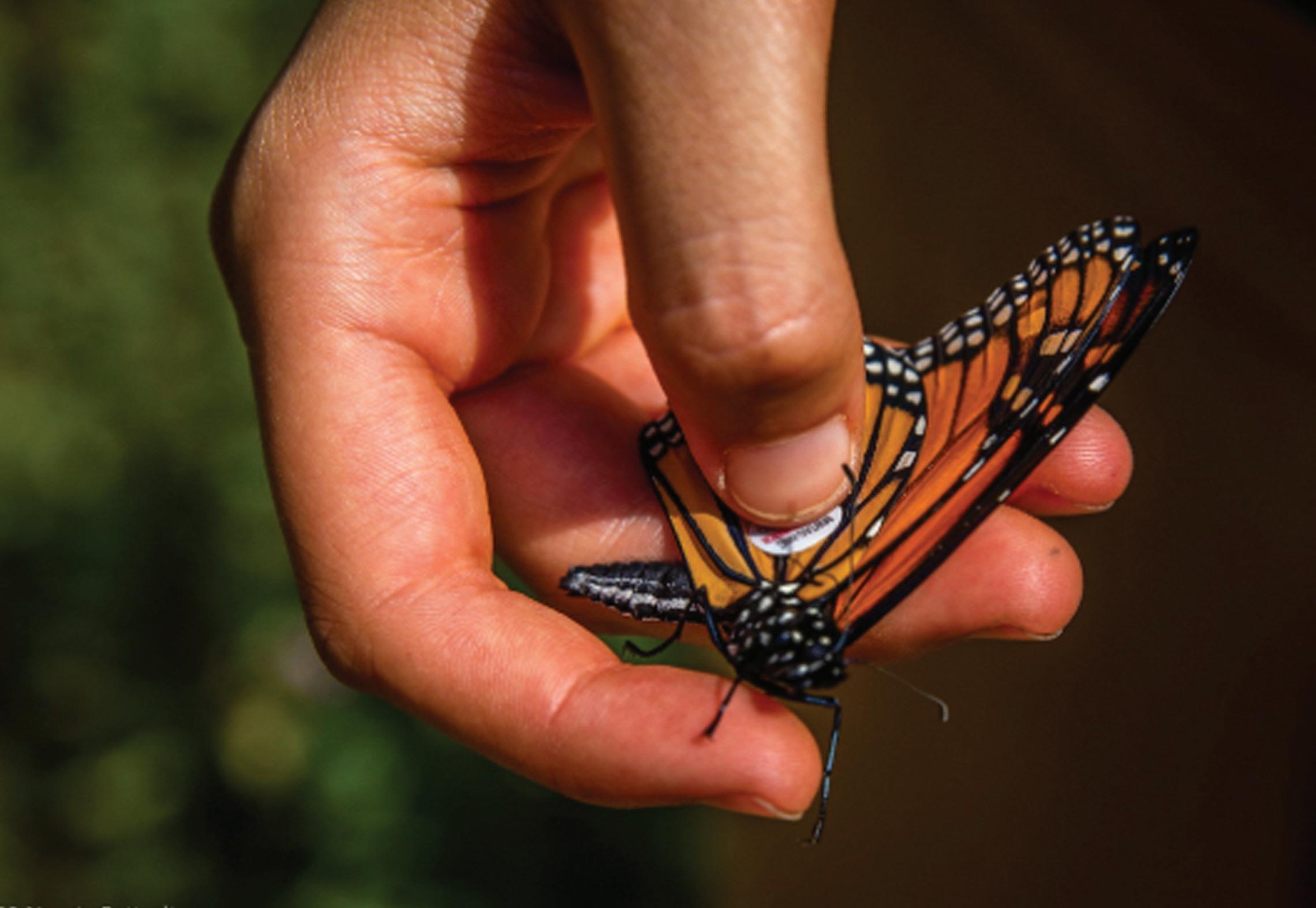
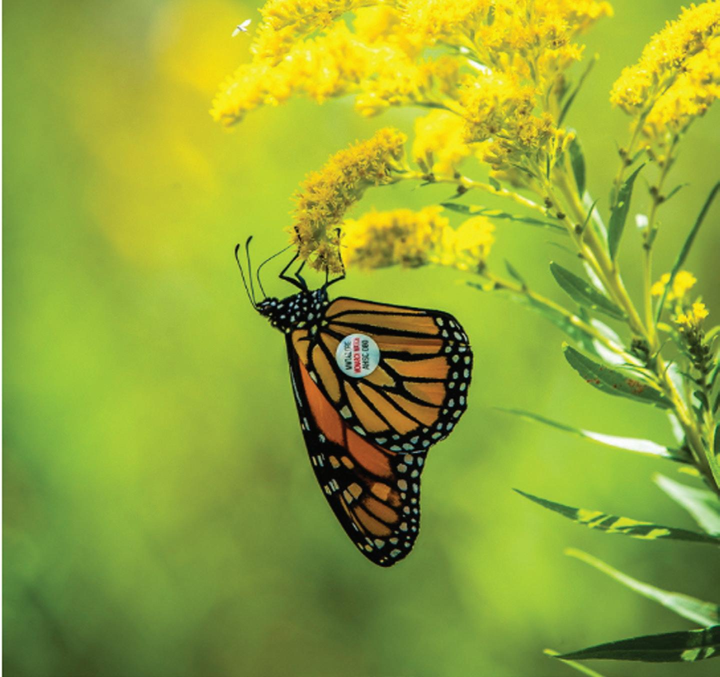
One of the most exciting things that a visitor may be lucky enough to witness during a trip to the Butterfly House is monarch tagging. The VIC partners with Monarch Watch to combat declining monarch populations by promoting research and stewardship based on our favorite pollinator. Monarch Watch provides numbered tags that we place onto the wings of our monarchs towards the end of the season before their release. These tags allow researchers to better track and understand the migration patterns and life cycles of monarchs to aid in conservation efforts. In 2021, one of the VIC’s tagged monarchs was even captured by researchers 3,000 miles from the Butterfly House in El Rosario, Mexico.
The VIC’s Butterfly House is open this summer from 11 a.m. to 4 p.m. every day until Labor Day. In the event of bad weather, a steward will still be available to chat and provide information, along with various butterfly-related indoor displays and activities. Continued from page 4


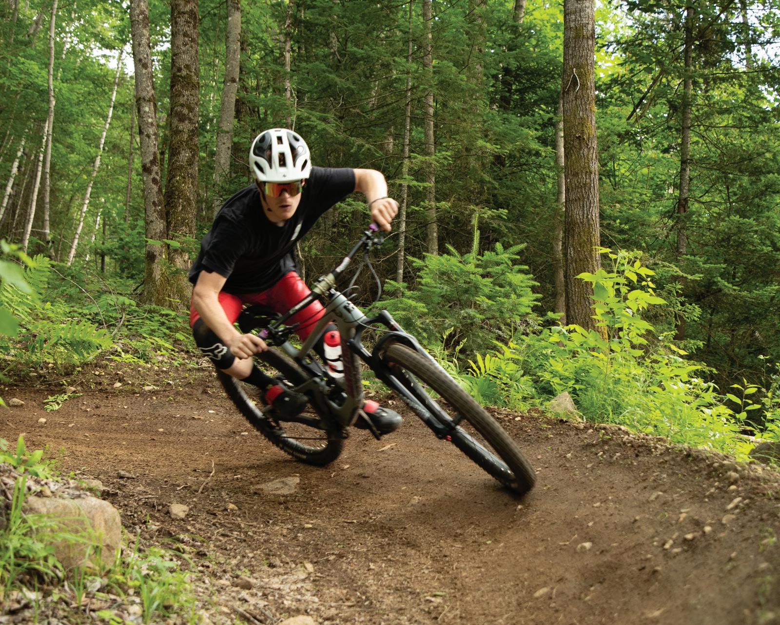
By PARKER O’BRIEN Sports Editor
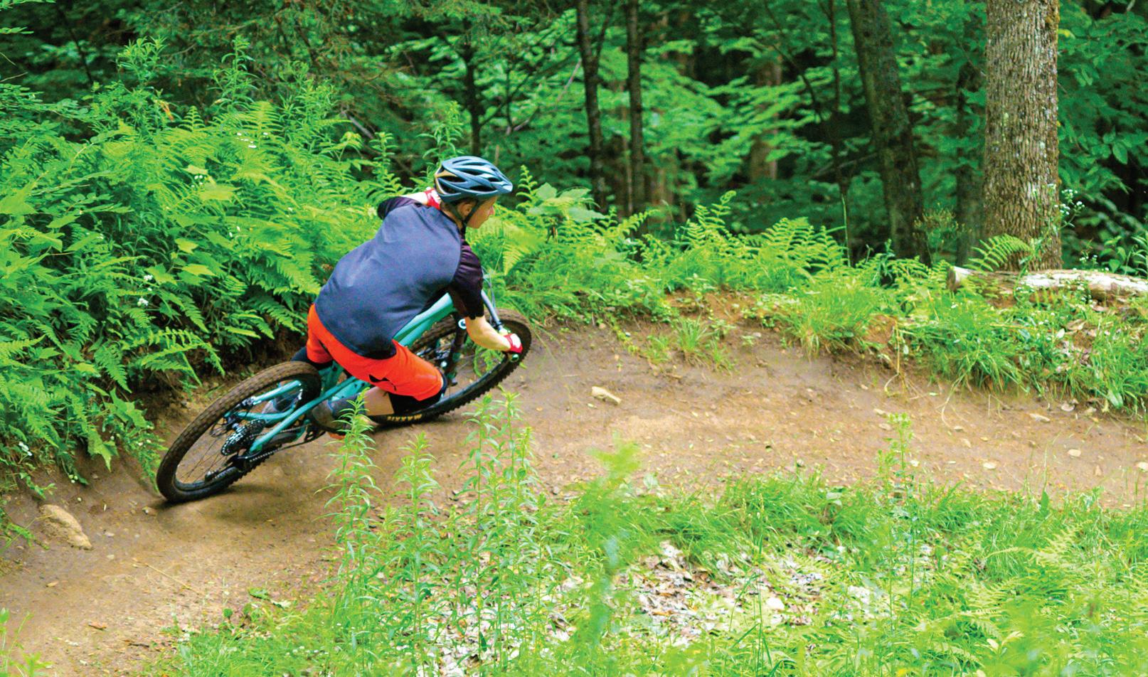
With the Adirondack Rail Trail coming to life, mountain biking is becoming more popular across the Tri-Lakes region — Lake Placid, Saranac Lake, Tupper Lake and their surrounding hamlets. Below are just some of the trails to enjoy this summer.
Lake Placid
In Lake Placid there is a variety of mountain biking trails. The village will host the WHOOP UCI Mountain Bike World Series race in September as it hopes to bring more attention to mountain biking.
Below are some popular spots:
Craig Wood Trails: These trails are located behind the Craig Wood Golf Course off state Route 73. There are two access points — off River Road and just before the entrance to the golf course on Country Club Lane. On the River Road, park at the pull-off next to the steel deck bridge (Intervale Way). Follow the Jackrabbit Trail signs toward the red barn (toward the ski jumps) to find Birds Song Lane. Then take the Jackrabbit Trail to head toward Craig Wood Golf Course. This trail system is over 7 miles long with 16 different trails. They are for more for
experienced riders looking for a relatively moderate mountain bike trail.
Lussi and Logger Trail Loops: This network is located next to the Lake Placid Club driving range on state Route 86
in Lake Placid. When heading toward Wilmington, the venue will be on the right just after the Alpine Motor Inn. The Lussi and Logger trails are one of the biggest mountain biking systems in the Tri-Lakes region, with
around 19 miles across 33 different trails. These trails showcase a wide range of difficulty from new mountain bikers to long-time veterans.
Continued on page 7
Mount Van Hoevenberg: These trails are located near the state Olympic Regional Development Authority’s Mountain Pass Lodge. When leaving Lake Placid and heading toward Keene on state Route 73E, you’ll see the sign for Mount Van Hoevenberg on your right. Turn right onto Bobsled Run Lane and drive down until you find “Lot 3,” this is where you’ll want to park. There are a total of 51 trails that cover around 36 miles.
Saranac Lake
Saranac Lake also offers a solid variety of mountain biking trails.
Dewey Mountain Recreation Center: This venue is located at 277 George H. LaPan Memorial Highway, just 1 mile west of the village — heading toward Tupper Lake. The trail system is about 5.5 miles with 11 different trails currently open. Dewey, which is also a cross-country ski center during the winter, has a solid mix of both difficult and easy trails.
Fowler’s Crossing: This access point on the Adirondack Rail Trail is located at state Route 86 just outside of Saranac Lake. The trails are about 2 miles long and were built in 2019. While the trail system is usable, they are still being developed by the Barkeater Trails Alliance, which helps build, maintain and advocate for a system of community and backcountry trails. The goal is to make these trails around 7 miles long. The trails are more on the side for newer mountain bikers.
Mount Pisgah: This mountain is located at 92 Mount
Pisgah Drive in Saranac Lake. When leaving the village on state Route 86, heading toward Paul Smiths, there is a big sign for Mount Pisgah just past the Adirondack Medical Center on the right. Take a right on to Trudeau Road before turning right on to Mount Pisgah Drive to reach the destination. There are about 5 miles of trails at Mount Pisgah. The venue is home to the area’s only machine-built flow trail, the Cure, which happens to be the most difficult trail.
Tupper Lake is home to two different mountain bike trails on different sides of the village.
Deer Pond Loop: This trail system is located just east of Tupper Lake on state Route 3/30. To get to this trailhead you’ll need to follow Route 3/30 toward Saranac Lake for about 5 miles. The entire trail system is about 7.3 miles. When riding around the Deer Pond Loop, be prepared for muddy conditions.
Low’s Upper Dam Mountain Bike Trail: This mountain bike trail is located just outside of Tupper Lake in a town called Piercefield. This trail system is at the Horseshoe Lake Wild Forest. To get to this trail, drive south on state Route 30 toward Long Lake, take a right on County Route 421 (access for Bog River Falls and Horseshoe Lake). After 1.6 miles, Route 421 will turn left, and follow the road for another 3.9 miles. There is a large parking area on the right. The total round-trip length is around 8.2 miles. This trail is a great spot for families and beginner mountain bikers.
For more information on mountain bike trails, visit betatrails.org.


General emergencies: Call 911 Backcountry emergencies: 518-891-0235
The New York State Department of Environmental Conservation operates a dispatch center at the DEC Region 5 office in Ray Brook 24 hours a day, 7 days a week. It should only be contacted to report backcountry emergencies (lost or injured people and wildfires).
Non-emergencies: The New York State Police Troop B, 518-897-2000, Clinton, Franklin, Essex, St. Lawrence, Hamilton counties; Troop D, 315-3666000, Lewis, Herkimer, Oneida, counties; Troop G, 518-783-3211, Fulton, Hamilton, Saratoga, Warren, Washington counties.


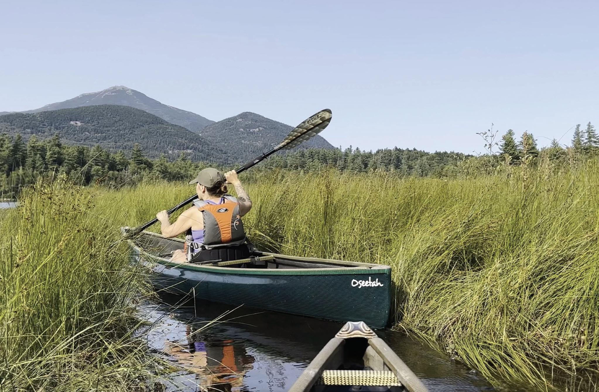
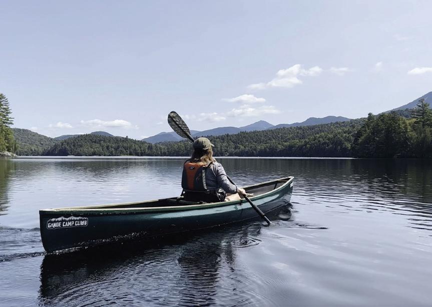
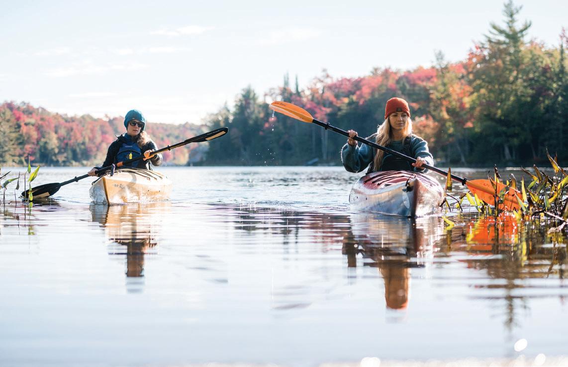
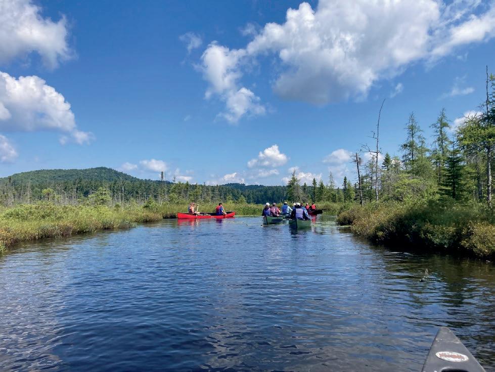
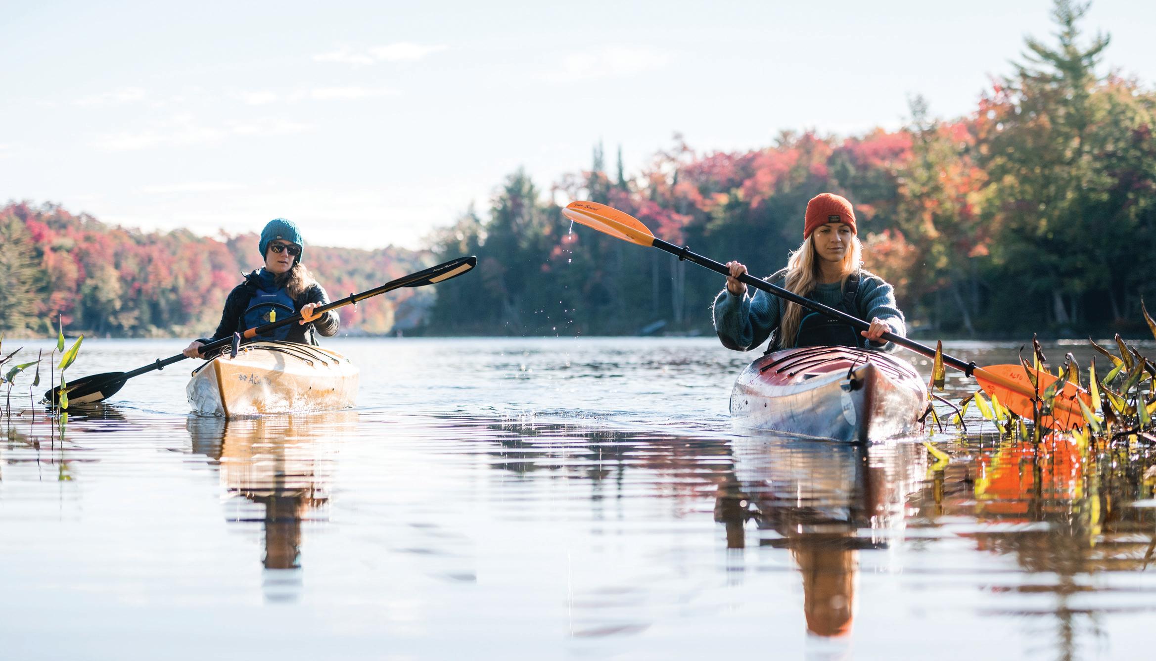
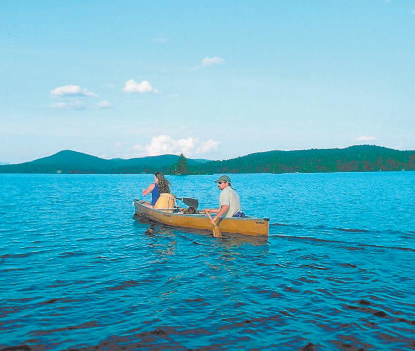
Enjoying a paddle.
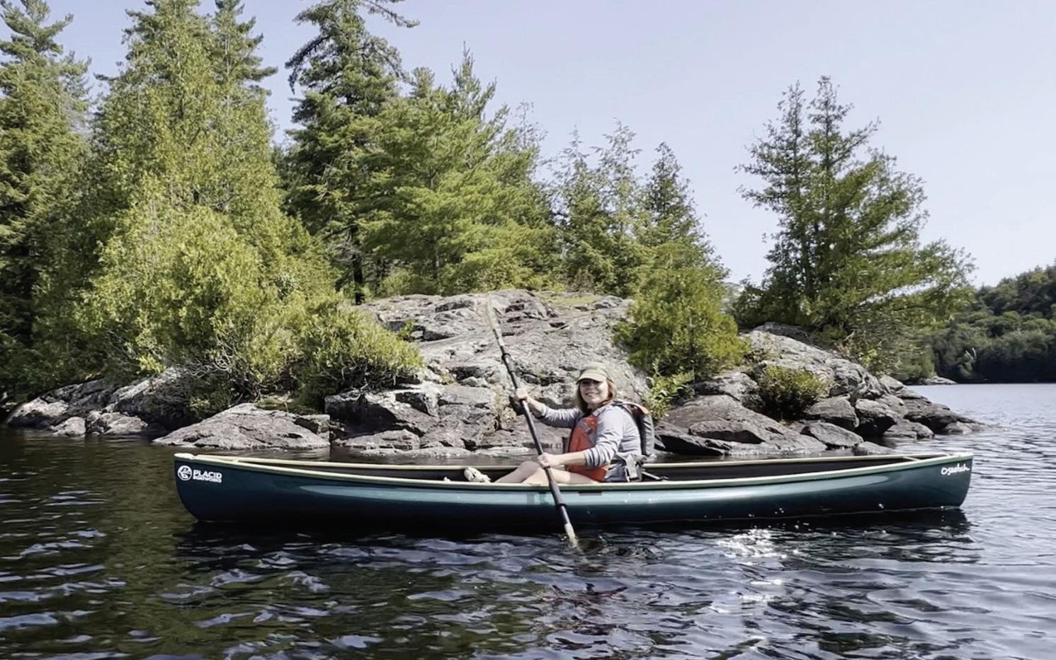
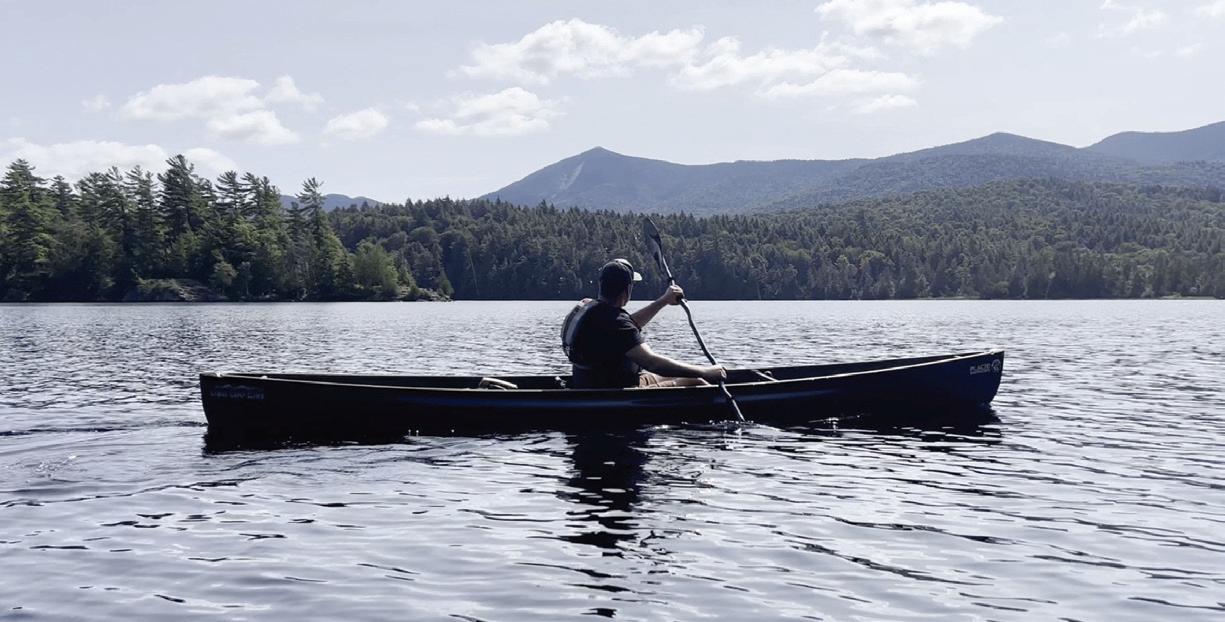
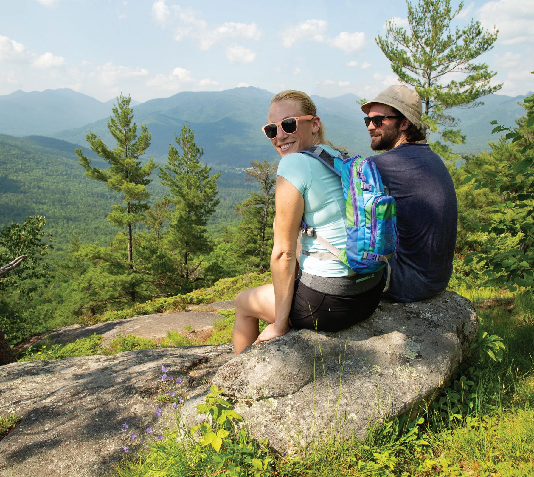
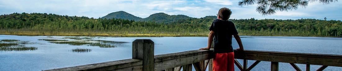
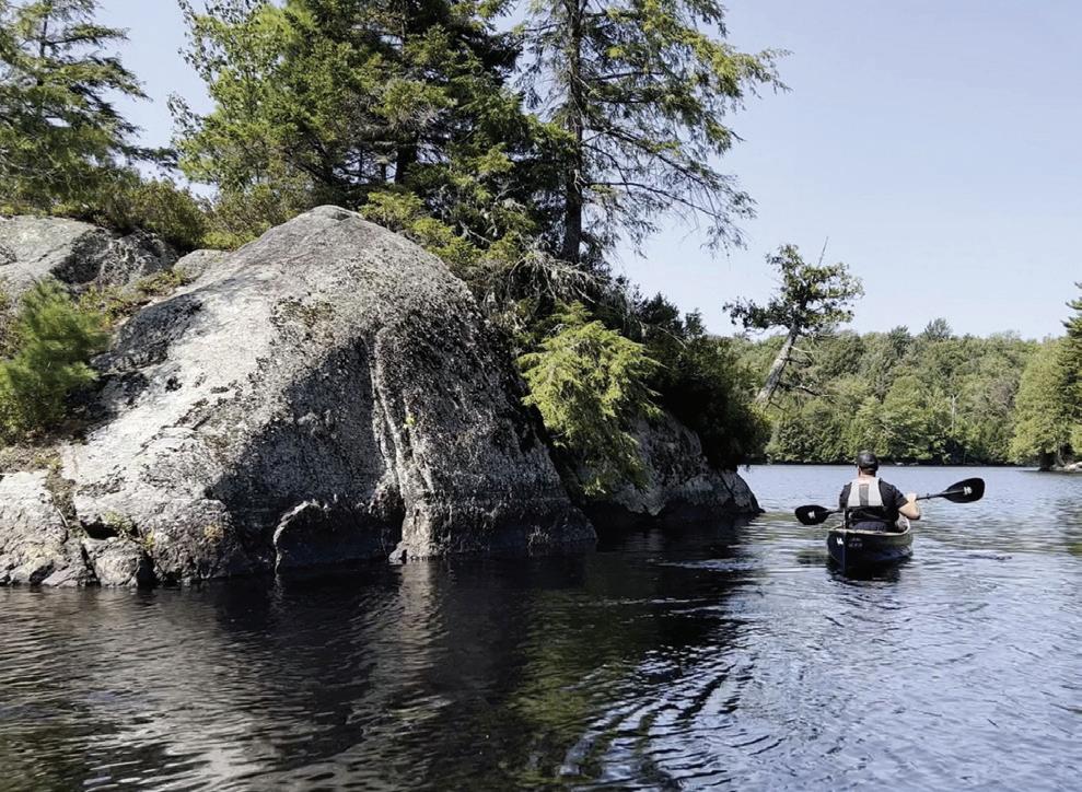
Taking in the views.
By AMBER ADAMSON Development and Communications Director at Champlain Area Trails
In the heart of New York’s scenic Champlain Valley, a movement is growing — one that intertwines the love of nature with community spirit and economic vitality. Champlain Area Trails is at the forefront of this movement, a land trust dedicated to creating and preserving recreational trails since its inception in 2009.
With over 98 miles of trails under its stewardship and 992 acres of land safeguarded, CATS has become an integral part of the region’s landscape and a beacon for outdoor enthusiasts.
The Adirondack Harvest Festival, a celebration steeped in local tradition and showcasing the region’s agricultural bounty, highlights this connection with nature. Set against the backdrop of the Essex County Fairgrounds on Saturday, Sept. 21, from noon to 5 p.m., the festival is not just a day of local food, crafts and community engagement but also a platform for CATS to extend its mission of connecting people with nature.
In a special pre-festival event, CATS is inviting adventurers and nature lovers to lace up their hiking boots for a guided trek through the picturesque landscape that defines the Champlain Valley. The hike, scheduled to depart from the Fair-
grounds at 10 a.m., promises an immersive experience through forests and farmlands, epitomizing the theme “ADIRONDACKS IN BLOOM.”
For those who crave independence or find themselves running on a different schedule, CATS offers the flexibility to embark on this journey solo anytime until noon. This self-guided option ensures that everyone has the chance to participate, regardless of their pace or preference for solitude.
After traversing the trails in their autumn glory, participants are welcomed back to the heart of the Harvest Festival to unwind and relish in the fruits of their labor. Whether it’s savoring a local craft beer, indulging in a glass of wine, or simply enjoying lunch amidst the festival’s buzz, the experience is designed to celebrate the community’s spirit and natural beauty.
Parking for the event is conveniently located at the Essex County Fairgrounds, with overflow options available. Attendees are encouraged to meet the friendly CATS team at the entry area to join the guided hike, where they can register and sign waivers. Further details about the hiking route and registration information can be found on the CATS website at champlainareatrails.com, a valuable resource for those interested in exploring trails in New York’s Champlain
Valley.
Through initiatives like the guided hike at the Adirondack Harvest Festival, CATS continues to weave the fabric of community engagement, environmental stewardship and economic vitality into the rich tapestry of the Champlain Valley. It’s an invitation to explore, connect and cherish the natural world — a journey that begins with a single step on a trail.
And CATS’ 80+ miles of uncrowded, family-friendly trails. For maps of all the trails in the Champlain Valley visit:www.champlainareatrails.com

By ARTHUR MAIORELLA Lake Placid News
(Editor’s note: This story was first published in the Lake Placid News on Aug. 3, 2023.)
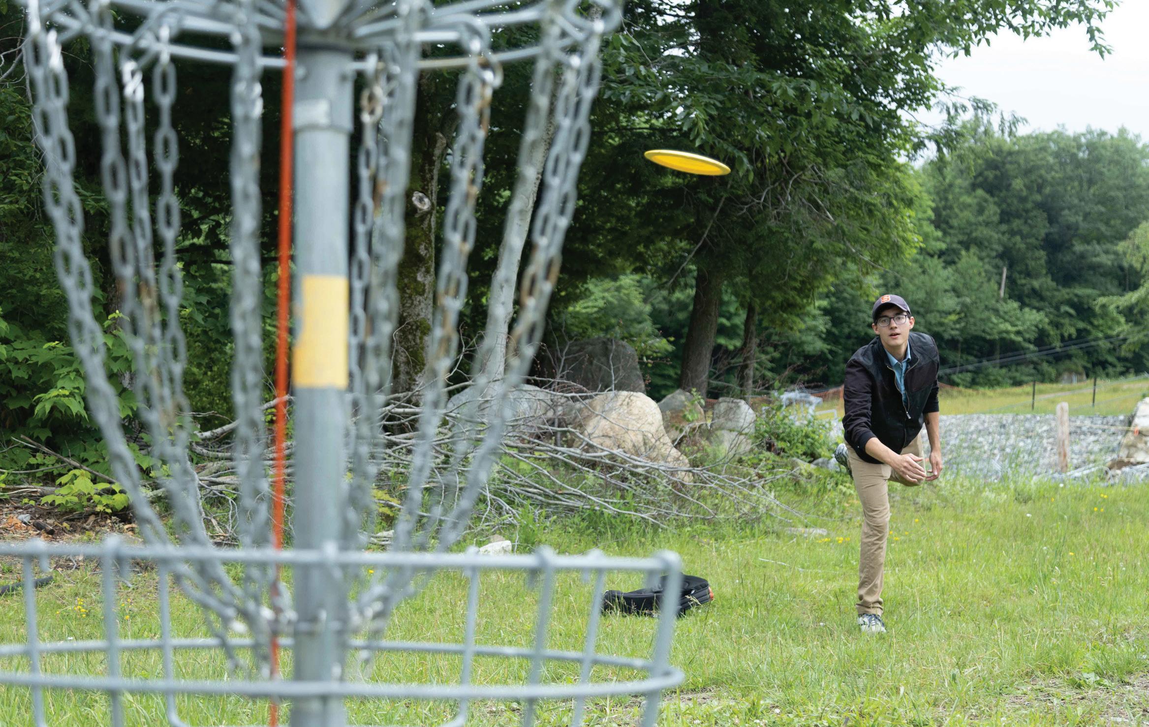
With summer in full swing, our Lake Placid News summer intern and disc golf enthusiast, Arthur Mariorella, took a trip to three different disc golf venues in the Tri-Lakes, to see which course caters to disc golf lovers.
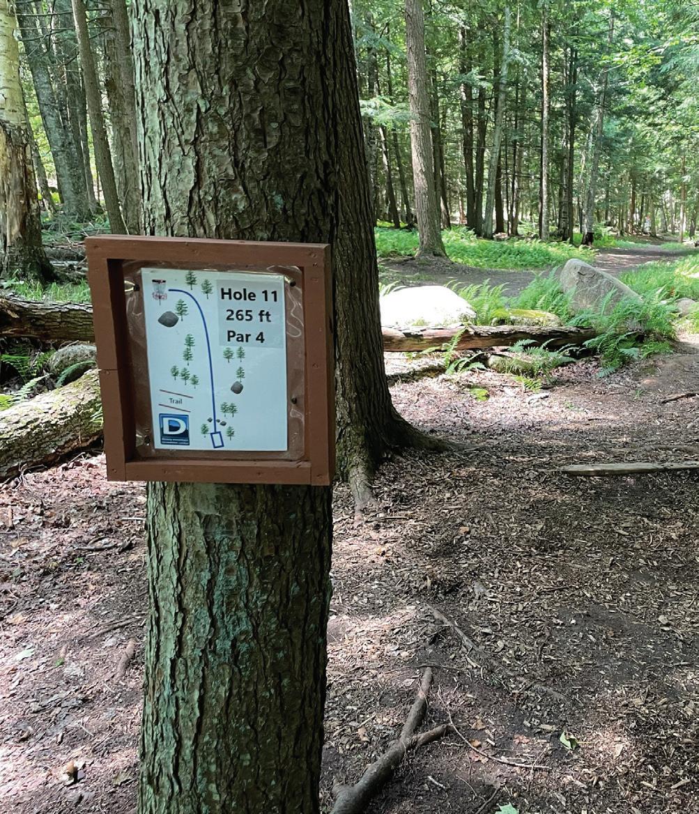
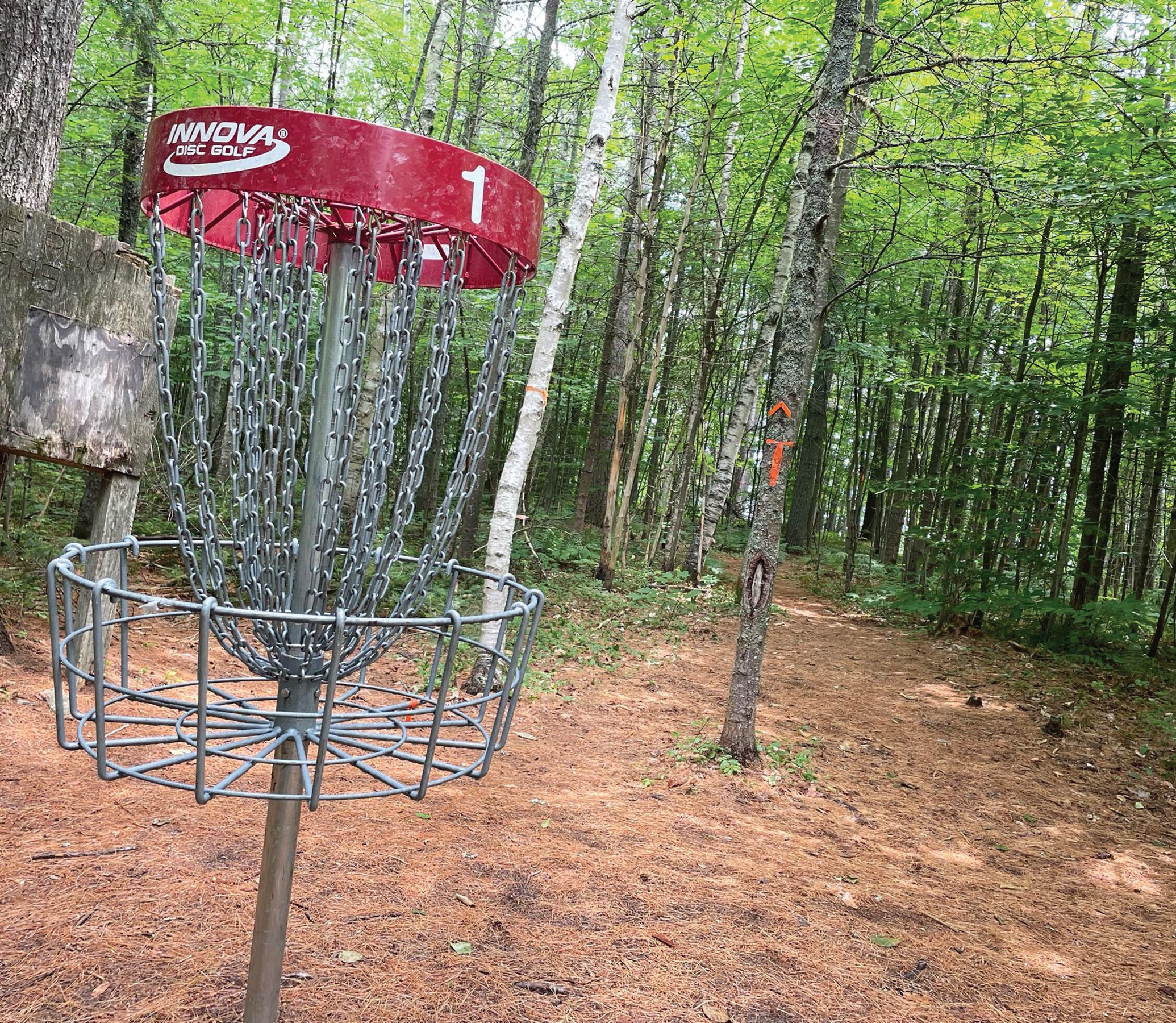
BarkEater Disc Golf Course
I muttered to myself, “Mama didn’t raise a coward.” Stepping up to hole 16 at the BarkEater Disc Golf Course (on Osgood Pond) in Paul Smiths, I grabbed a driver from my bag and ignored the shorter tee box. Shorter tee boxes are for cowards. Thus reassured that it was nothing less than my self respect at stake, I prepared to throw. The feeling that came next is something seemingly every elite athlete or Fortune 500 CEO has credited with driving them to the top — something forever drilled into my head by my own mama who often quoted it from ABC’s “Wide World of Sports” — the agony of defeat. I spiked that poor disc straight as an arrow through the branches of a small pine tree about 15 feet away, which blocked the speeding projectile from view. From there, I can only speculate as to the flight path.
Location: Paul Smith’s College
Address: State Route 30 in Paul Smiths, .6 miles north of the junction of Routes 30 and 86 (on the right)
Admission: Free
Year established: 2016
Season: Year-round (park across the road at the Paul Smith’s College VIC in the winter)
Website: paulsmiths.edu/barkeater-dgc
UDisc user rating: 4.2 (out of 5)
Holes: 18
Judging by the noise I heard, I’d say the flight path was short.
About 20 minutes of picking through the underbrush later, I declared my disc MIA. Bowing my head for a brief moment of silence in its honor, I took a mulligan, retreated to the coward’s tee and threw three cowardly layup shots and a cowardly putt. If you don’t count the opening horror, I shot for a cowardly par.
“If you don’t count all the mistakes I made, I did well” is, of course, a pretty dumb philosophy. It’s right up there with “I credit my victory to all my failures.” Alas, I’m still looking for victory.
Disc golf is a sport much like regular golf. Instead of hitting a golf ball from point A to B, a player throws a disc (think of a Frisbee) around a nine- or 18-hole course. Instead of a cup on the ground,
each hole is finished in a raised metal basket. Like regular golf, the aim is to get from the start of each hole to the end of it in as few strokes (or throws) as possible. Unlike regular golf, courses require minimal upkeep, are usually free to play, and the space is often mixed-use as a dog park or just a public green area.
The BarkEater course is a joy to play. It was even a joy to play badly on. It’s 18 wooded holes that all seem like they have a personality to them. Sometimes, however, they share that personality with a sort of vengeful disc golf god. Hole five, for example, is 169 feet and nearly straight; it’s perfect to try to ace. Except, miss that hole-in-one, and suddenly a sharp dip in elevation leaves your drive hanging in space to fade into the woods.
Hole nine, too, is particularly sinister. It is 514 feet long, a moderate uphill, a rolling downhill, and then a steeper uphill act as breaking waves. Throw too low and it’ll take you a dozen shots to make it to the basket, too high and you’ll go careening into the trees.
Sensing a pattern of ending up in the brush? I don’t think there is a single tree within 10 feet of any fairway I didn’t hit.
The real signature hole of the course is hole four. It’s a short 218 feet, a distance
Continued on page 11
nipping at the edge of holein-one territory. On paper, the par of four strokes makes no sense. In actuality, the fairway on four goes straight for about 100 feet, then turns almost 90 degrees left and marches straight another 100 to the basket. In that time, players lose and then gain 30 to 45 feet of elevation.
To keep anyone from attempting to get too crafty and bushwhacking their way through the woods to skip the dip, there’s a tree at the bottom marked “Mando” and a little sign explaining that the tree is the “mandatory right” tree and that everyone must get around it.
It was on the Mando Tree that I picked up the first of the seven bogeys (and one double bogey) I would collect. I would go on to finish eight over par, not finding a birdie until hole 18.
Eight over par, a lost disc, rain and being bit by a gajillion mosquitoes seems like a recipe for a bad afternoon.
No way. I loved every second of the course.
You see, BarkEater is everything a disc golf course can aspire to be. It’s four-season friendly (courageous players can play in the winter); all the holes are unique; the paths are well-maintained and not rocky; and it features a nice bench overlooking Osgood Pond. Also, crucial to what makes disc golf so popular and in contrast to Whiteface’s course, it’s free to play. The Paul Smith’s College VIC, which is right across the road on state Route 30, will even loan you discs for free.
The only thing left on my
wish list is tee pads. Currently, most pads are just marked squares of cleared ground — which is fine but not optimal. A few have rubber mats — which is actually worse as the mats wrinkle and are a fall hazard. The best tees are concrete, which offer traction and never get muddy or destroyed by use.
Like most courses, BarkEater is not run for profit. It doesn’t even have a park district looking after it. Paul Smith’s College houses the course, but everything is maintained by volunteers who spend their own time picking up litter and doing any pruning. It makes sense that concrete pads are not a priority.
All told, I loved the BarkEater course. But like a cliche country song, she did not love me back. The mark of a truly terrific course is

that I already want to play again.
If you want to play BarkEater, you can find it near the Paul Smith’s College VIC. If you want to get involved with the course, join the BarkEater Play Group on Facebook. There’s also a tournament at BarkEater in August called Barksmanship Throwdown — information can be found online at https:// tinyurl.com/5xww3jkc.
Staring at the sign at the Dewey Mountain Disc Golf Course in Saranac Lake, I started to philosophize.
What does “NEXT TEE” really mean? Maybe I was taking the sign too literally. There certainly weren’t any
Location: Dewey Mountain Recreation Center
Address: 238 George LaPan Highway, Saranac Lake
Admission: Free
Year established: 2020
Season: April through November
Website: deweymountain.com
UDisc user rating: 3.8 (out of 5.0)
Holes: 18
tees around. Could it be some sort of statement on my choice of clothing? Or maybe it was deeper, a comment on the universe’s impermanence? What is life but just a series of tee boxes? Maybe the point was it didn’t make sense, it was just an invitation to wonder about the cosmos for wondering’s own sake.
So, on a Wednesday morning, with the sun beaming down through a leafy canopy, I had the pleasure of standing and wondering about Dewey Mountain’s disc golf course. Yet the signage and my own lack of a map were making it hard. Instead of doing much wondering, I was doing a lot of wandering around trying to find the next disc golf tee.
In addition to getting lost more than once, and doing all that philosophizing, I was having a great time at Dewey Mountain. The course is so magnificent to walk that I didn’t mind being lost.
And the scenery is just one of many reasons to play at Dewey. A big reason is the time commitment involved. I drove from my office in Saranac Lake to the course, played a leisurely 18 holes, and got
Continued on page 12


back to work in 90 minutes. The course is ideal for a long lunch break or an “I just got off work, haven’t been outside all day, and it’s sunny out” play-through.
The course is also extremely fun and free — with only a few issues standing out to me.
One: There are no tee boxes, just dirt squares with a marker on the front of them. This wasn’t a huge problem for me — playing in boots on a nice day — but I imagine any rain will turn the tees to soup.
Two: The area is all mixed-use, which is fine and normal for disc golf. But it’s mixed-use with mountain biking. Mountain bikers plus flying objects equals extreme mountain biking? Disc golf homicide? Players just need to exercise caution.
Three: Players practically need a divining rod to figure out where to walk. I have a GPS-enabled disc golf course app (UDisc), and I still spent significant time trying to emulate Meriwether Lewis searching for the Pacific Ocean.
Finally, and the only thing that can’t be chalked up to some degree of user error, is the reason the course plays quickly. It’s short, really short. The longest hole is only 301 feet (an average hole elsewhere might run from 350 to 500 feet). The shortest hole at Dewey will take you only 168 feet. For reference, it is 196 feet from my desk to the bathroom and back in the newspaper office.
Playing Dewey is like playing half-court basketball but on an ice rink — the lack of scale is made up for in the extreme violence and eclectic skills required. Sharp corners, tight throws and high bushes guarantee this.
Hole 17 is a great example. The hole wants you to chase a dogleg by throwing to the right and letting your disc finish left, something only a glide-y backhand will accomplish. However, the course also adds a hill to punish you, just in case your backhand tends to sail a little bit.
Hole seven is the opposite of 17. It runs totally straight and stays narrow before finishing to the right, asking players to now throw a forehand that’ll get around the corner and then fade into the basket area.
All said, my favorite hole was four. Despite only clocking at a measly 233 feet, players have an open area to throw from, a tight pinch to hit between some trees, and then a sharp right turn into a wide landing.
I’m a big fan of wide landing areas, especially when blind corners are involved. Searching for your lie is something every golfer, disc or regular, dreads. And while I’m tempted to say it builds character, it really just sucks.
“Little Shop of Horrors,” when they sense a disc is nearby, it’s swallowed — gone forever. I actually watched where my disc went in, but 20 minutes of searching that green sea produced no luck.
In times of extreme sorrow, such as when I lose a disc golf disc, I turn to writer John A. Shedd for his wise words: “A ship in harbor is safe, but that is not what ships are built for.”
The same is true with disc golf discs. They are just as useful sitting in our bags as they are eternally marking a bad shot.
Thanks to David Gualtieri, who found and returned my ROC disc two days after it first found the bushes. Since then, I lost and found it once more — again on hole nine. Gualtieri and his group play Monday at the BarkEater and Tuesday/Thursday at Dewey, at 5:30 p.m. All are invited.
All told, go sail away to play Dewey Mountain. It’s easy to get to, it’s not over difficult if you aren’t chasing birdies, and it’s a great way to get in a quick 18 holes.
Just as I threw the disc at the Whiteface Mountain Disc Golf Course in Wilmington, the wind picked up. Like watching a train derailment in slow motion, my drive carried to the left and seemed to hover there for one painful instant. The first hole was 385 feet away, and I seemed to be on track to barely cover half that distance.
It’s really bad when your second disc in three rounds goes the way of a poor magician, disappearing and never reappearing.
It’s hard to overstate my distaste for the ferns that litter hole nine. They look nice from afar; but, like something from the
Then, as quick as it picked up, the wind died and my disc dipped back right and dropped only 40 or 50 feet away from the basket. A stone-cold shooter would have been able to drop that putt in like butter; sadly, a stone-cold shooter I am not. I settled for par.
As a regular disc golf player, and the only member of the Lake Placid News
newsroom under 25 years old, I was — as the kids say — stoked to hear about disc golf at Whiteface Mountain, which is operated by the Olympic Regional Development Authority.
So I went. There was no way I was passing up the opportunity to play a mid-afternoon round.
I brought my personal stash of discs from my college room at Syracuse University a few weeks ago, and after chatting with ORDA Communications Specialist Morgan Ryan, I was all set to play the course two days before the official opening on June 30. I was even assigned two guides for my expedition, who I jokingly thought of as my minders: Lauren Barnes, a Whiteface marketing and development employee, and Pat Bly, one of the Whiteface content managers.
I met Barnes and Bly, shook hands and asked some reporter-type questions. Despite the white undershirt and the tastefully brown khakis, I didn’t feel like a reporter. I was getting paid to stand on a gorgeous mountain and play disc golf. (Everyone should get into journalism.) After a few questions, I learned that neither of my guides had played disc golf before. This worried me at first. I’ve played over 100 rounds on dozens of courses from South Carolina to Wyoming. But I shouldn’t have been worried; Barnes and Bly were excellent partners, and we made great small talk throughout. They even displayed all the hallmarks of burgeoning disc golf talent, which even non-players may recognize from regular golf: They both did an excellent job looking nonchalant while searching out bad shots — and at least one of them displayed Continued from page 11
Continued on page 13
master-level form in turning away from the group before cussing into the wind after one such shot. (Admittedly, I haven’t played a lot of regular golf; but my dad has sworn he could’ve gone to the PGA tour and he has mastered these two skills.) My guides excused themselves on the seventh hole to attend to other matters, and I finished out the final two holes solo.
As for the course itself? I had high hopes. An excellent disc golf course — located on grounds that hosted the Alpine events during the 1980 Olympic Winter Games — would be worth traveling hours to play. Throw in the potential for crazy elevation changes brought by the namesake mountain, and the course could really be something special.
Despite these hopes and the terrific view, I didn’t find the course that special. Much like regular golf, disc golf courses thrive when they have interesting obstacles: doglegs, trees or water carries, to name a few. Most holes at Whiteface lacked any obstacles. Players just throw straight once or twice, then putt. Even distance isn’t an impediment; the longest hole is 423 feet, and the shortest is 213 feet. The only break in the malaise were holes seven and nine, which feature enough of a dip in elevation to provide an interesting feature to play through; and hole eight, where players throw down a narrow, gravel access road that cuts above the “Face Lift” ski lift.
Location: Whiteface Mountain Ski Center
Address: 5021 State Route 86, Wilmington
Admission: $7, age 7 and older; free, age 6 and under Notes: Includes use of three discs per person (driver, mid-range, and putt/approach), which must be returned upon completion of the course. $5 fee for any lost discs.
Year established: 2009
Season: June 28 to Oct. 14, 2024
Website: whiteface.com
UDisc user rating: 2.1 (out of 5)
Holes: 9
Despite having no obstacles, I played badly at Whiteface. If the color beige — or the taste of flat soda — was a disc golf course, it would be this one, and it’s pretty hard to stay engaged when that’s the case.
I understand why this is. The mountain is, first and foremost, a world-class ski center. The resort’s considerable resources are pointed squarely at winter sports, with the summer activities being mainly gravy. However, I think it is possible to have a nice disc golf course without upsetting the balance. Whiteface has the potential of rating higher than the current UDisc user rating of 2.1 (out of 5).
A good start might be concrete tee pads. Currently, the tee pads are wooden boards laid on the ground. Concrete offers much better footing, and players who step over the box are much less likely to catch the lip
of a 2-by-4 board and face plant. During the ski season, it wouldn’t be hard to bury the pads under snow or dirt.
Trails would be another nice addition. By cutting footpaths through the trees, disc golf players would get more interesting holes and better walking. Currently, every shot is wide open with little to no “punishment” for players who throw errantly left or right.
Obviously, the most dramatic of obstacles — the water carry — would be nearly impossible at a ski center. Luckily, these hazards are incredibly easy to fake. Just some spray paint, a couple of flags, or a little fencing can pretty easily create an out-of-bounds or penalty zone. That would be especially fun on some of the downhill shots, adding finesse to what is otherwise incredibly easy to play for par or better.
My final takeaway? A solid 18-hole offering on an Olympic mountain would be a must-play destination course for serious disc golfers. However, the resort has to build a course worthy of the location by having more creative layouts and putting in more holes — actually investing in the course. I’d love to see this. Whiteface spends millions in skiing improvements, and disc golf courses are cheap. With only a sliver of their budget, ORDA could create something truly special.
You can find Whiteface Mountain in the usual spot this summer. The medley of gondola rides, scenic views from the Whiteface Veterans’ Memorial Highway, a restaurant and the beautiful hiking trails promise a good time for anyone.


By ANDY FLYNN Editor/Publisher and PARKER O’BRIEN Sports Editor
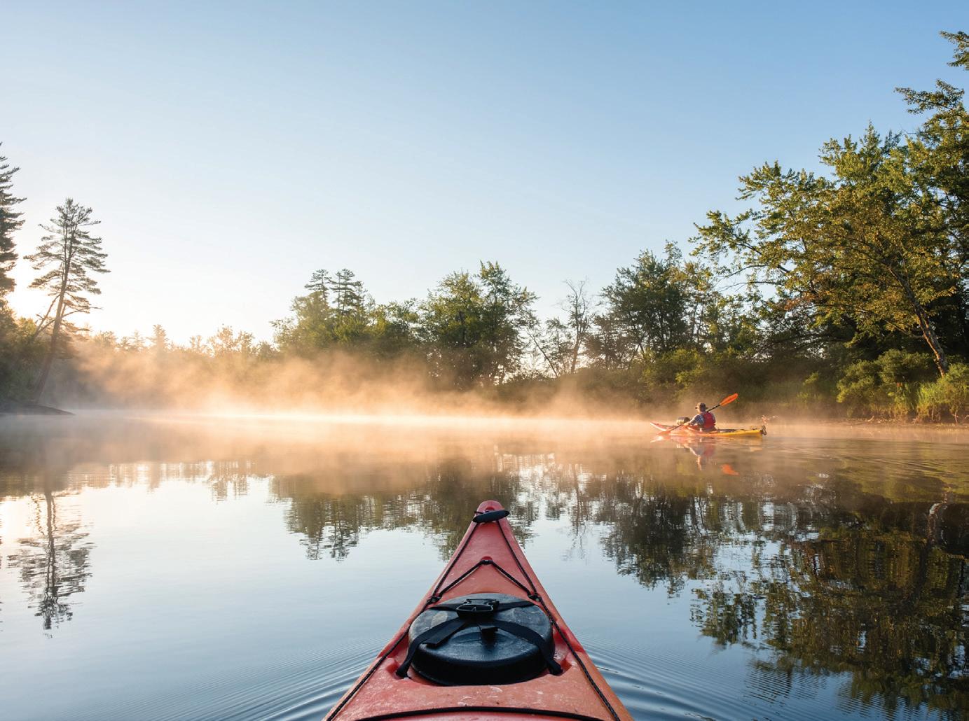
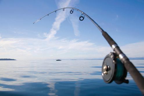
The Adirondack Park is full of challenges for paddling. If taking on some of the rigorous events like the 90-miler in September is a little too much for you there are some paddling challenges in Tupper Lake, Schroon Lake and Saranac Lake.
Tupper Lake Paddling Triad
The Tupper Lake Paddling Triad involves three paddles. Earn a patch by completing them all. For more information, including registration for the challenge, visit www. tupperlaketriad.com.
¯ Stony Creek Pond to Axton Landing: 3.25 miles one way through the Stony Creek Ponds and to the Raquette River to Axton Landing. The launch is at the intersection of state routes 3 and 30 in Tupper Lake, and follows Route 3 toward Saranac Lake. Paddlers should keep right on Route 3 at the “Y.” In about 2.5 miles, Coreys Road will be on the right. Turn here and continue down to the state boat launch at Stony Creek Ponds.
¯ The “Crusher” boat launch to Big Tupper: 7.75 miles one way on the Raquette River, Simon Pond and Big Tupper Lake. The challenge starts at the intersection of state routes 3 and 30 in Tupper Lake, and follows Route 3 toward Saranac Lake. Before approaching the “Y” you will see a state boat launch for the Raquette River on the right hand side of the road. Organizers recommend leaving a car at the Big Tupper boat launch for when you finish. To get to this boat launch, head out on Route 30
toward Long Lake. A quarter mile after crossing Moody Bridge, you will see the boat launch on your right.
¯ Raquette Pond to Setting Pole Dam: 3.25 miles one way on Raquette Pond and Raquette River. Launch starts at the intersection of routes 3 and 30 in Tupper Lake, and follows Route 3 toward Piercefield. The boat launch is located in the Tupper Lake Waterfront Park. Park in the lot at the park and launch right there. Organizers recommend leaving a car at Setting Pole Dam. To get to Setting Pole Dam, head toward Piercefield on Route 3. Just outside of Tupper Lake, you will find Setting Pole Dam Road on your left after about 4.5 miles. Continue down this road until you meet a stop sign, then turn right. This will take you right to a parking area at the dam.
Similar to the Tupper Lake Paddling Triad, the Schroon Lake Paddling Challenge also involves three paddles. Completing all of these paddling challenges within the Schroon Lake Watershed also earns you a patch.
For more information, including registration for the challenge, visit www.adirondackhub.com/schroon-paddle-challenge.
¯ Schroon River Paddle: A 4.25 mile one-way challenge. It begins at the state Department of Environmental Conservation boat launch and follows the Schroon River past waterfront homes and a cattle ranch toward the Starbuckville Dam. Since this is a one-way journey, organizers recommend spotting a car at the Starbuckville Dam, or plan to take the return paddle to the Horicon
boat launch.
¯ Schroon River to Schroon Lake Paddle: 4.5 miles in length, starts at the state access point on the Schroon River just past the bridge on Alder Meadow Road. Paddlers will follow the winding river one way toward the northern end of Schroon Lake. The paddling challenge ends at the Schroon Lake boat launch on the west side of the lake.
¯ Paradox Lake Paddle: While there is no minimum distance or time required, this portion of the paddling challenge begins and ends at the DEC boat launch within the Paradox Lake public campground. Paddlers head west through the Narrows and into lower Paradox Lake and circle past Birch Island, before heading back.
The Saranac Lake Paddling Challenge requires challengers to take on five different paddling adventures. Those who complete all of the challenges earn a patch as well.
For more information, visit www.saranaclake.com/saranac-lake-paddling-challenge.
¯ South Creek to Second Pond: The 7 mile challenge starts at the South Creek access site or the Middle Saranac Lake boat launch, on the south side of State Route 3, about 10 miles west of Saranac Lake. Once paddlers launch, they’ll follow the creek into Middle Saranac Lake. and enter a section of the Saranac River that passes through quiet marshlands, and then on to the Upper Locks. The locks are manually operated, so for those traveling solo, or those that want
to avoid going through the locks, there is a carry around them. From there the challengers will continue their way down the river until making their way onto Lower Saranac Lake. From there they will paddle into the Saranac River once again and paddle to the Second Pond boat launch.
¯ Second Pond to Lake Flower: 6 miles of flatwater paddling starts at the Second Pond boat launch and takes paddlers down the Lower Locks and through the open waters of Oseetah Lake. Challengers will continue to make their way down the river — using the boat channel markers — before reaching Lake Flower. The final destination is at the Lake Flower boat launch.
¯ Saranac River: Pine Street to McCasland Bridge: A 5-mile long journey that starts at the Pine Street bridge hand launch site, on the west side of the bridge, heading towards Bloomingdale. The challenge takes paddlers downstream past the Saranac Lake Fish and Game Club to the McCasland Bridge.
¯ St. Regis Chain of Lakes: This journey has a varying distance for each paddler and starts at the public access on Lower St. Regis Lake, formerly known as Akwesasne Lake at Paul Smith’s College. There is parking in the large lot to the right of the library on the college’s campus, 12 miles northwest of Saranac Lake. The campus entrance is located at the intersection of Route 86 and Route 30. From the public
access point, paddlers will travel down to the dam where Paul Smith generated electricity for his hotel complex. Participants will paddle across the lake through Spitfire Lake and paddle out into Upper St. Regis Lake before completing a lap back to the Paul Smith’s campus.
¯ Follensby Clear Pond Loop: This 4-mile long challenge starts at the Follensby Clear Pond boat launch on Route 30
near the Fish Creek Pond Campground, where Spider Creek and Follensby Clear Pond meet. After launching, challengers will paddle the length of the lake to a short carry over to Polliwog Pond. Once, they’ve done that they will continue across Polliwog Pond to a short carry over to Little Polliwog Pond, before a short paddle across to the carry to Horseshoe Pond to a a short carry back to Follensby Clear.


By LISA GENIER Adirondack Council Program Analyst
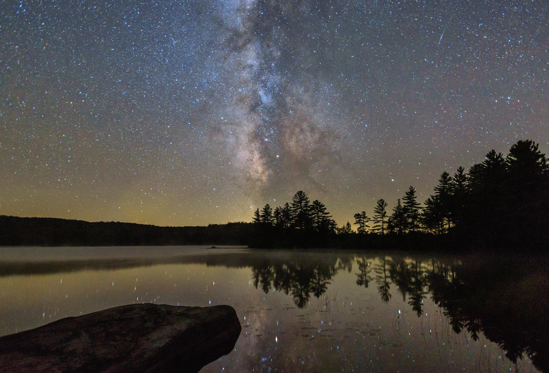
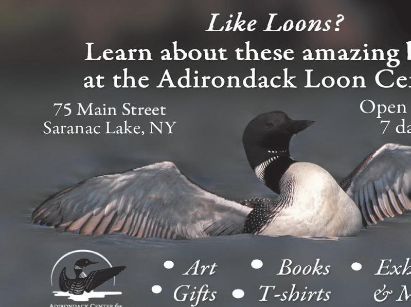
Loons. We all love them. We all get a thrill when we see a loon or hear their haunting cries. A bit of research further expanded my appreciation for these creatures I have enjoyed my entire life. Here’s what I learned about this great symbol of wilderness.
There are five species of loons in North America: the Pacific Loon, the Arctic Loon, the Yellow-billed Loon, the Red-throated Loon, and the Common Loon (Gavia immer) ... the one I talk about in this column and the one that makes the Adirondack Park its summer home.
The Common Loon is a large bird, weighing between six to 14 pounds, and has an average wingspan of 41-52 inches. Their legs are situated way back on their bodies which helps them propel and swim easily underwater, but makes it difficult to walk on land. In fact, loons only go on land to mate and incubate their eggs.
Loons are great swimmers. They swim underwater to catch and eat their prey. Unlike other birds whose bones are air-filled (pneumatized), loons have dense bones. This extra weight helps them dive deep underwater ... sometimes as deep as 250 feet to search for food. Loons can stay underwater for up to five minutes.
And what exactly do loons eat? Fish. Lots and lots of fish ... about two pounds a day. Loons also eat invertebrates like crayfish and aquatic insects like dragonflies.
One might think that a bird that is such a good underwater swimmer may not fly very
well. Not so. Loons move very well in the air too. They are strong flyers and can cover hundreds of miles in a straight flight. Loons can fly rather fast too. In fact, a migrating loon was tracked at 70 miles per hour!
However, because of their weight and the unique positioning of their legs, loons can’t take off from land. Like an airplane, loons need a long runway, but one on the water, to help them take flight ... 30 yards or more. They flap their wings and run on the water until they reach lift-off. But once they’re airborne, the loon is a great flyer.
In the spring and summer months, loons breed and raise their chicks in the Adirondack Park’s freshwater lakes and ponds. Usually, around May and early June, the loons begin nesting. They build their nest on the shoreline in anticipation of their forthcoming new family members. Generally, the female lays two olive-green eggs with darkbrown spots about three inches long.
Both the male and female incubate the eggs, and in about a month — usually lateJune to mid-August — loon chicks emerge. The fuzzy chicks leave the nest and go into the water within a couple of days.
For the first few weeks of their lives, the loon chicks are entirely dependent on their parents. The young chicks often ride around on their parent’s backs for protection and warmth.
The adults will feed the chicks insects and small fish until the chicks are able to make short dives and catch small fish on their
own, in about three weeks. As the summer progresses, the chicks grow and are ready to fend for themselves at about three months.
Loon migration
In the late fall, loon parents leave the juveniles on the lake as they begin their migration southward to winter on the Atlantic coastline. The juveniles will migrate a few weeks after their parents, and once they reach the coast, the young loons stay there for two years. In the third year, they return north, but may not breed for several more years.
Before they make the flight south, loons “raft” or congregate on large, fish-heavy bodies of water in incredibly big groups. It is thought that they do this so they can feed more efficiently, and don’t have to fight off predators, or other loons from their feeding space.
Studies have shown that Adirondack loons migrate to Cape Cod, Long Island, New Jersey and even as far as North Carolina and the Gulf coast of Florida. It is likely that they return to the same area each year.
As you can imagine, winter migration to the coast can take a toll on the loons. Not only do loons fly long distances, they have to get used to the change in their diet from freshwater prey to saltwater. Also, because loons now eat saltwater prey, they ingest large amounts of saltwater as well. The loons have to excrete that excess salt or they will die. So they have the ability to secrete the salt through glands near their eyes. Who knew?
Also, during the winter, adult loons experience a full body molt and lose all their feathers, including the feathers on their wings. They are unable to fly until their new feathers grow in, which takes about a month. This leaves them very vulnerable to prey.
Their eye color also changes with the seasons. In the summer adults have red eyes, but in the winter their eyes are brown.
Much like us, once the winter is over, loons can’t wait to get back to their favorite Adirondack pond or lake again! They usually return to the same water bodies year after year.
Loon calls
And if you’re like me, one of my favorite things about sharing a pond with loons is hearing their awesome call. Yes, the call of the loon ... so haunting, almost eerie. I’m sure you’ve noticed that loons have a few different vocalizations, but did you know they are for different reasons?
One call is the tremolo, which a loon gives to announce its presence or when it is alarmed. Another call is the yodel, which is the male loon’s territorial call that is unique to every male loon. The wail is the call that loons give back and forth to figure out each other’s location, and hoots are short calls given by family members to keep in contact with each other.

populations
Just like other creatures, loons have predators that threaten their survival. Loon eggs are eaten by raccoons, otter, mink, gulls, crows, ravens and eagles. Loon chicks are most often eaten by eagles, muskellunge, northern pike and snapping turtles.
In addition, environmental pollutants, like acid rain and mercury, water quali-
threaten the loons’ long-term survival. Although great progress has been made that has allowed the Common Loon to again call the Adirondack their summer home, more needs to be done.
The Adirondack Council is dedicated to working to ensure the loon population will be able to grow so will continue to hear the haunting call of the loon for generations to come.

By PARKER O’BRIEN Sports Editor
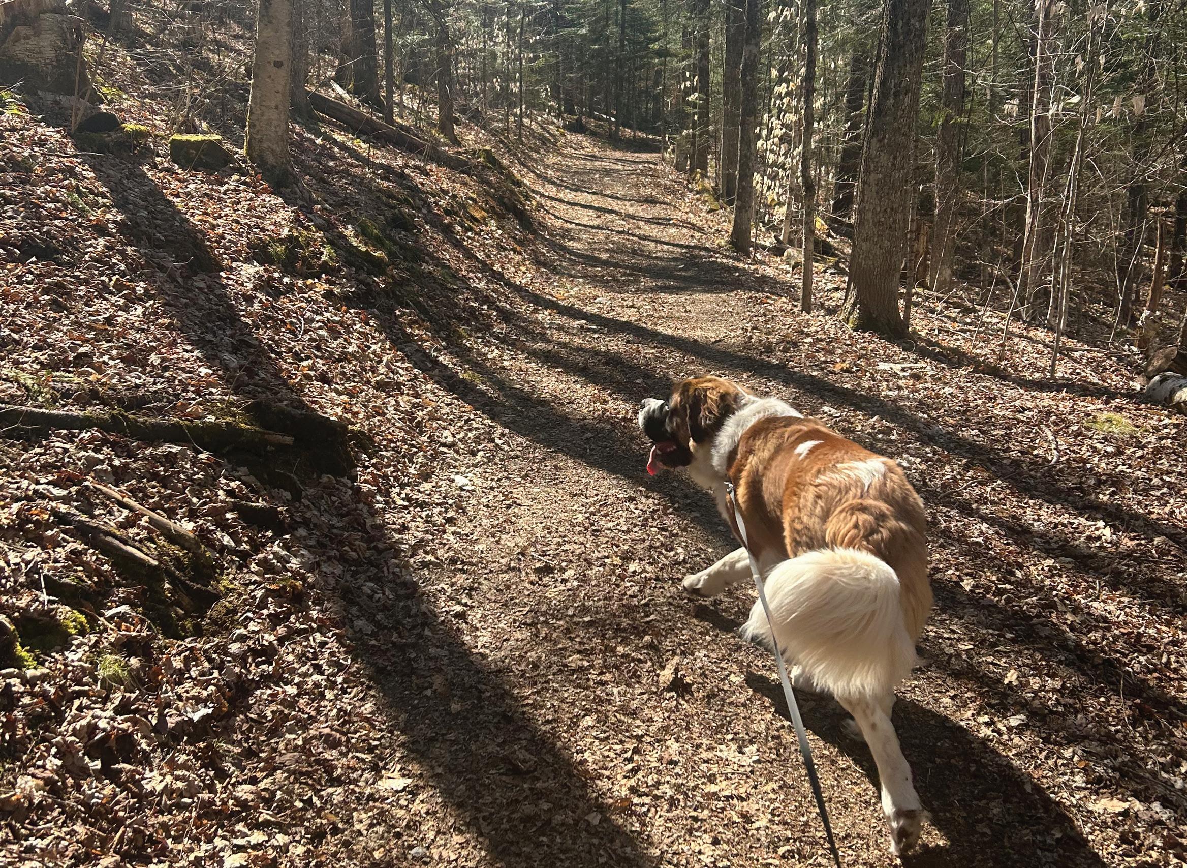
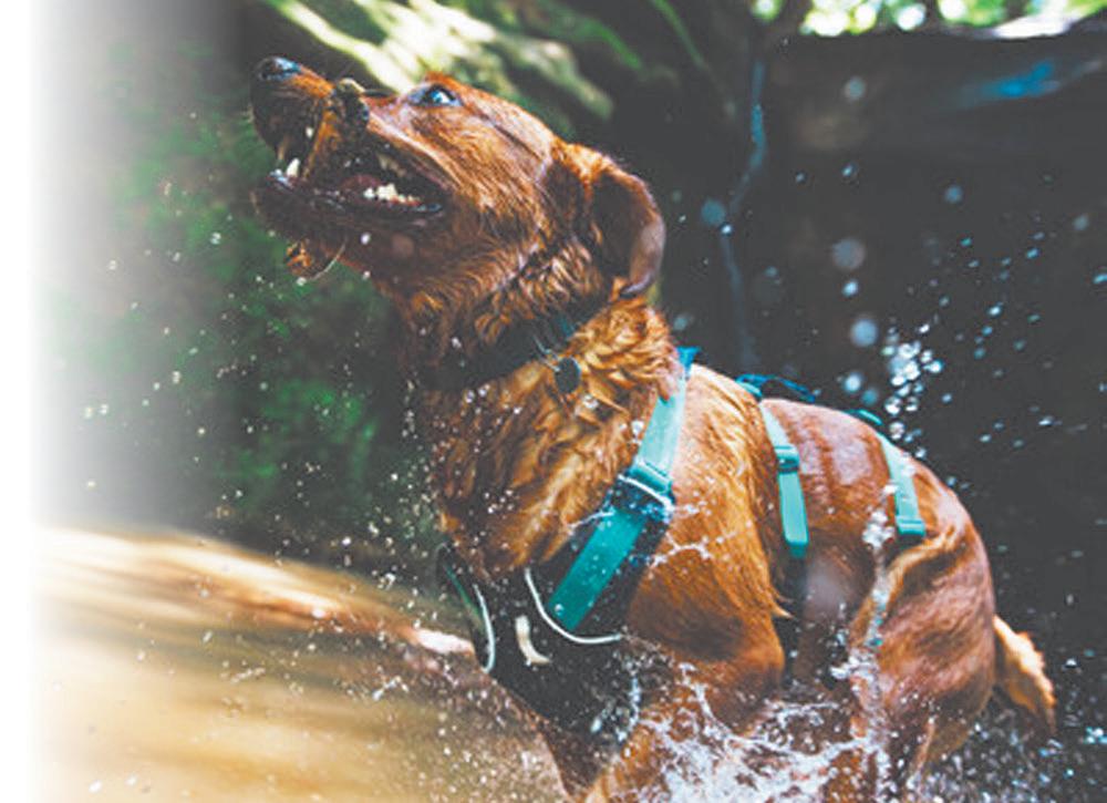
While still in my mid-20s, I recently decided it was the perfect time to get a dog.
Of course, I didn’t decide to get a small dog that’s easy to take care of, like some sort of terrier or an English bulldog. Nope, I decided I’d get a very large 1-year-old St. Bernard.
Go big or go home, am I right?
In my defense, my parents had a St. Bernard when I was growing up, and to this day my mother still says he was one of the best dogs she has ever owned.
Well, my dog Bentley is a pretty well behaved dog — for the most part — but he still is a young puppy, who needs some space to move around.
Now, my apartment isn’t necessarily small, but I still need to find an open space to wear down my dog.
I decided on this brilliant idea to start taking him for walks, along the sidewalks toward downtown Saranac Lake. Until I ran into a bit of an issue.
I’d say my dog is friendly ... but a little too friendly. He thinks it’s OK to randomly jump on people and, worst of all, on other dogs. Obviously, I stop him from jumping on to people and other dogs, but
¯ Aggressive dogs and dogs in heat are not allowed.
¯ No more than three dogs per person.
¯ License and rabies tags must be valid and displayed on dog’s collars.
¯ Keep your dog in sight or under voice control at all times.
¯ Owners must leash/remove dogs during signs of aggressive behavior.
¯ Prevent sudden confrontations by your dog with people/dogs.
¯ Owners are required to assist in investigation of incidents of aggression by providing appropriate identification and contact information.
¯ Owners are liable for any injury or damage caused by their dog and are fully responsible for their dogs actions.
it’s not necessarily that much fun to hold back a 100 pound dog.
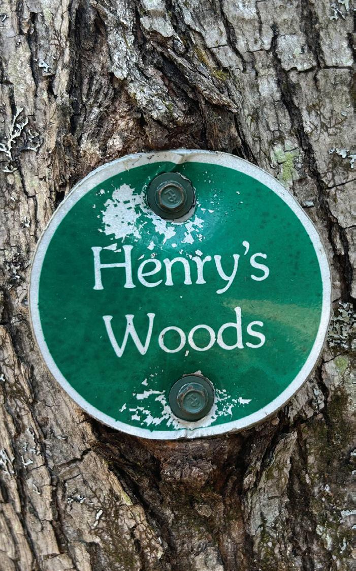
So with the sidewalk seeming to be not the best option — for now — I decided the next best spot would be to take him down the Henry Woods trails on Bear Cub Road in Lake Placid. The trails are owned by the Uihlein Foundation and are open to the public.
Henry’s Woods is the first turn on the right, off Old Military Road, heading
down Bear Cub Road. There’s two loops, so it’s really hard to miss it.
Just a few steps past the Henry’s Woods sign, you’ll notice a giant kiosk to your left. Henry’s Woods has five different trails:
¯ Connector: A crushed stone surface, which connects to the loop trail. It’s 0.3 miles.
¯ Loop: Also a crushed stone surface, is the longest of the three trails at 2 miles.
¯ Plateau: A low impact trail that has scenic views. It’s 0.9 miles.
¯ Switchback: An “S” turn that connects to Loop and Plateau. It’s 0.25 miles.
¯ Rocky Knob: The steepest most demanding trail. It’s 0.9 miles long.
Connector and Plateau are the two easiest trails. Loop and Switchback are slightly difficult, nothing that serious. Rocky Knob, however, is labeled “strenuous.”
I can’t comment too much on the Rocky Knob trail, because I didn’t walk up the trail and still haven’t. I wasn’t sure how steep it would be and didn’t want to risk bringing my dog up there.
The kiosk also had rules, rules for dogs and trail etiquette, which you would think were self explanatory, but there’s just
Continued on page 19
Continued from page 18
some people that can’t seem to follow rules. Oh, and the kiosk had poo bags!
When I went the trails were perfectly fine, nothing to really complain about, and there wasn’t anybody really around — which is typically abnormal. These trails are used as a dog park, family meeting place, hiking trail and mountain bike, so understand that when you come, you most definitely won’t be alone.
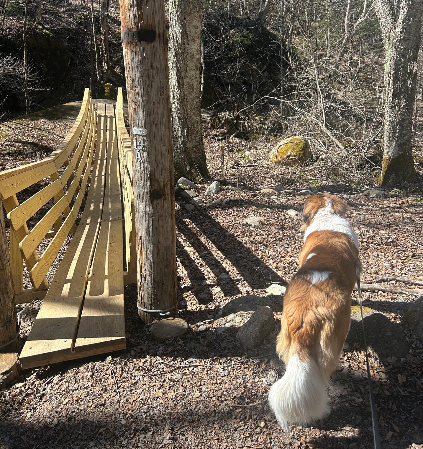
I spent most of my time enjoying the trails with my dog, and just taking in the environment. The views on Plateau were by far the best. While the trail itself is a
¯ Be respectful of all other trail users; bikers (and skiers) yield to walkers.
¯ Stay on the marked trails to avoid vegetation and erosion on the hills.
¯ Clean up your trash, including dog waste.
¯ Keep your pets under control at all times.
lot of ups and downs, the views of Lake Placid were definitely worth it. Plus this trail had plenty of benches for those who wanted to take a break and enjoy scenery.
Henry’s Woods definitely has a little more elevation gain than your typical stroll, but it’s nothing too serious. There’s

Trail rules:
¯ No motorized vehicles.
¯ No horseback riding.
¯ No fires, camps, overnight visits, hunting and trapping.
¯ No smoking and/or alcohol use.
¯ No disturbing or removing plants, animals, rocks and firewood.
¯ No broadcast sounds — music and radio — other than earphones.
solid views, a couple of creeks that pass by, you can also see the maple sap lines and of course the bridge to nowhere.
The trails are pretty easy to follow and are marked pretty well with small circular trail markers that read “Henry’s Woods,” with the corresponding color to each trail. The one issue I had in terms of walking was that the trails were a bit narrow, so it was a bit difficult to move my dog off to the side if someone was passing by, but I still was able to do it.
When I went back to Henry’s Woods the following day, I noticed that there was about five or six cars at the entrance, so I decided to drive down the road to another trail system: Heaven Hills. After just one trip down the Heaven Hill trails, I found that they are better suited for my dog, or even dog walkers in general. The area is way more open. As you immediately walk into Heaven Hill trails, you’re greeted by a giant map, which shows you the list of rules and trail etiquette. Both of which are the exact same as the Henry’s Woods signage, that’s because it is also owned by the Uihlein Foundation.
The Heaven Hill trails offer a wide variety of distances, and most of the terrain is relatively flat, making for a good spot to take kids, strollers or people who wouldn’t go hike a mountain.
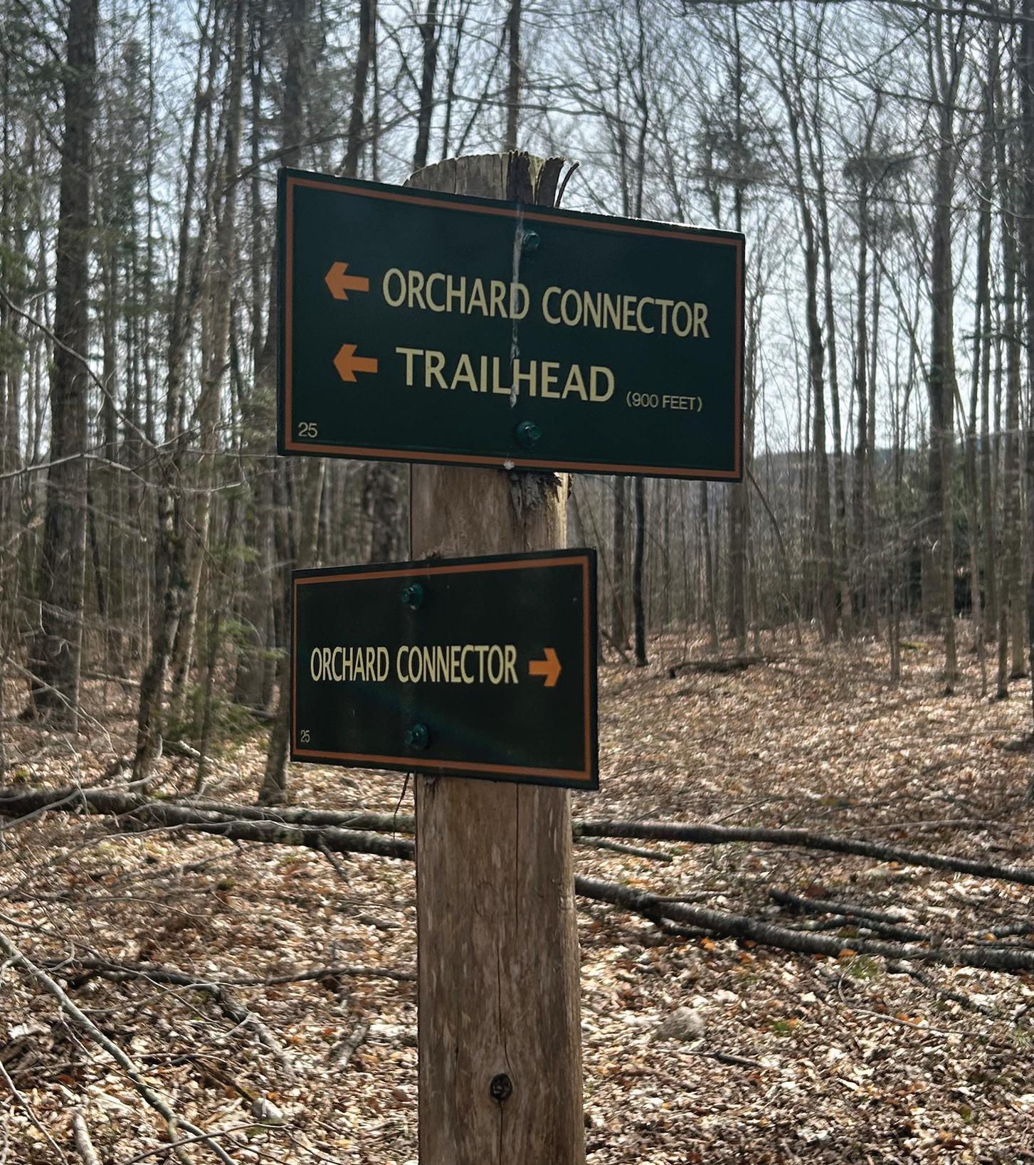
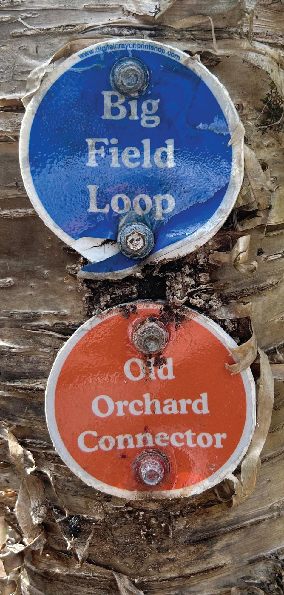
From the parking area, you can either go left or right. The left side contains the Old Orchard Loop and the Big Field Loop as well as the Maple Loop. On the right is the Bear Cub Loop.
¯ The (Sugar) Maple Loop: Steep to moderate terrain. It’s 1.2 miles.
¯ The Big Field Loop: Moderate terrain
on page 20
Continued from page 19
and views of Whiteface. It’s 0.9 miles.
¯ The Old Orchard Loop: Moderate terrain in an orchard field with views. It’s 1.5 miles.
¯ The Bear Cub Loop: A flat woodland terrain. It’s 1.4 miles.
When I got to Heaven Hill, I decided to take the left toward the Old Orchard loop. I found the Old Orchard loop is one of the easier walks, despite being the longest trail at Heaven Hill. The walk that goes through old farm fields and around the edges of an old orchard. There’s a bench to stop at that’s basically in the middle of the field — still on the trail — for those who want to take a break.
On my first trip down that trail, I encountered some wild life: Birds, squirrels, chipmunks and even a snake. There wasn’t anything big, but the open fields and visible wooded areas definitely make for a great birding spot.
The Big Field loop was pretty great, too. I really enjoyed the views and the cool looking tree. I’m not an arborist, so I can’t exactly tell what type of tree it is.
For people who aren’t exactly sure how far they want to walk before entering Heaven Hill, I recommend walking down the Bear Cub Loop. There are six different turn connecting trails within the loop, so if you decide you really don’t want to make the entire 1.4 mile trail, you can easily cut
down to one the of the
My biggest takeaway from the Heaven Hill trails was the trail markers. Unlike Henry’s Woods, the trail markers weren’t just coordinated, but they actually said the trail name that you were on. It makes it way easier to determine which path you’re on having to keep reverting to the map.
I enjoyed that the Heaven Hill trails seemed much more spacious, which allowed me to quickly move my dog off to the side of the trails. It’s pretty easy to see what’s ahead of you on almost every single trail, so it definitely helped me to make sure I could push my dog off to the side before it was too late.
I eventually returned back to Heaven Hill and I decided that I wanted to complete an entire lap around Heaven Hill. I started by taking a right, followed by an immediate left down the Big Field loop. Once I was on that trail, I decided to only take right hand turns.
I passed by the Big Field loop tree, before turning to the Maple Loop. I walked up hill, which had the most elevations — again, nothing too daunting. I eventually reached the Upper Orchard loop and walked that all the way down to the Orchard loop trail.
I eventually reached the Orchard connector and headed until I hit the Big Field loop trail and headed out back to the kiosk. My journey didn’t end once I could see my car; I walked down the entire Bear Cub loop, without taking one of the shorter side trails, before inevitably reaching my car.
In total, I walked well over 3 miles and it’s safe to say, my dog was pretty worn out — and I might’ve been, too. So, I’ll definitely be returning in the future.
Both Henry’s Woods and Heaven Hill are open all-year round. For inquiries and/ or comments about the trails, you can contact the Uihlein Foundation at 518523-3061 or email them at trails@heavenhillfarm.org.
By ANDY FLYNN, SYDNEY EMERSON and AARON MARBONE
SARANAC
LAKE
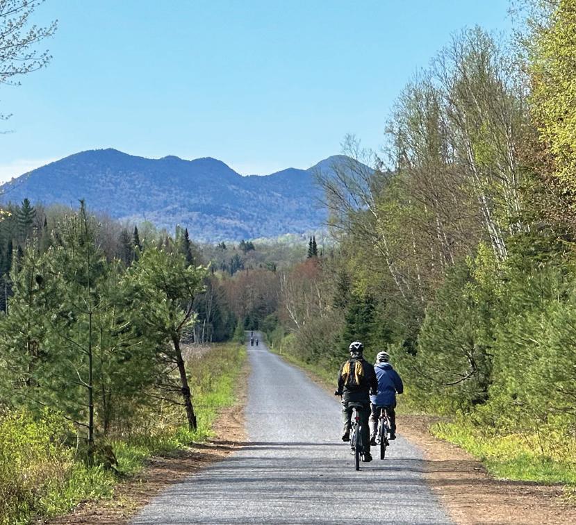
— The first phase of the Adirondack Rail Trail — 10 miles from Lake Placid to Saranac Lake — opened on Dec. 1, 2023 and is now available for outdoor recreationists.
Warm-weather activities on the rail trail include bicycling and walking, and winter activities include cross-country skiing, snowshoeing, fat-tire biking and snowmobiling. Class 1 is the only type of e-bike allowed on the trail.
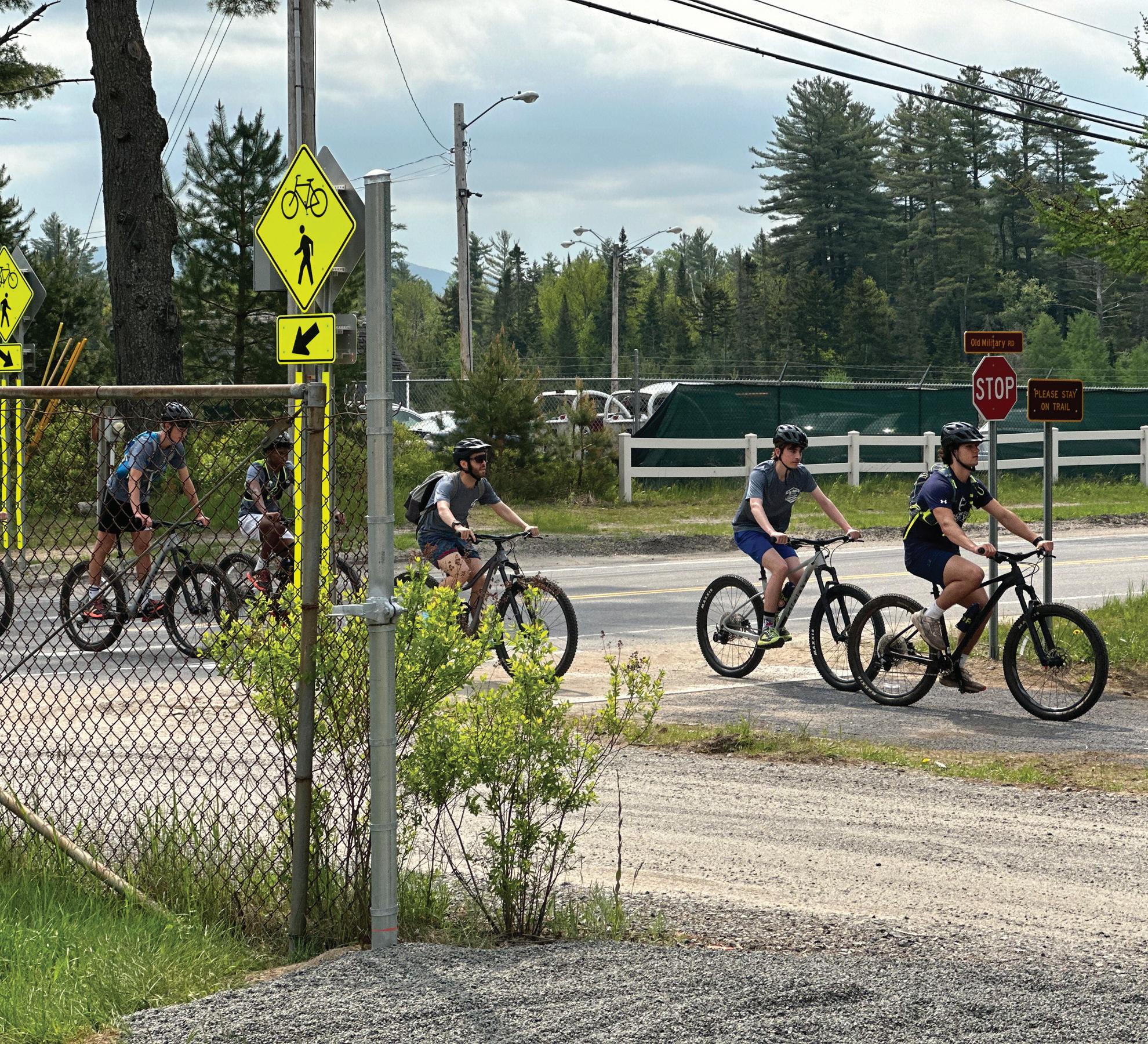
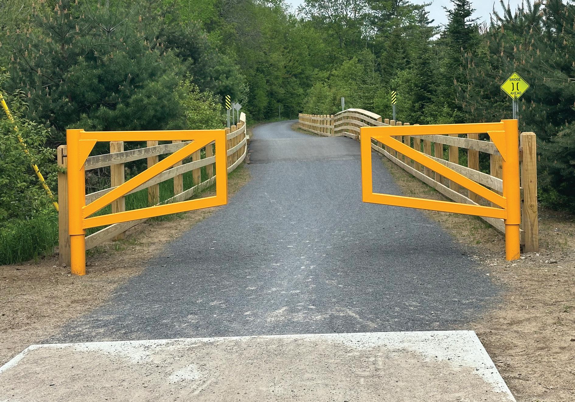
Accessible features are currently located at the Fowler’s Crossing parking area on state Route 86 just outside Saranac Lake and at the Union Depot parking area in Saranac Lake, which both have wheelchair accessible parking spaces. The 2-mile portion from Fowler’s Crossing to Broadway in Saranac Lake is paved. The rest of the completed trail is a firm surface of compacted stone. The trail has a shallow grade (typical slope of 2%, maximum slope of 5%) and a wide tread (typically a width of 5 feet).
The second phase of the rail trail, from Saranac Lake to Floodwood Road, is currently being constructed and is
Continued on page 22

Continued from page 21
expected to be finished by this fall. The third phase, from Floodwood Road to Tupper Lake, is expected to be complete by the fall of 2025. The public is not allowed to use the trail sections while they are under construction.
When complete, the 34-mile Adirondack Rail Trail will stretch from Lake Placid to Tupper Lake. Parking lot amenities in Lake Placid on Station Street will eventually be built, and the train stations in Tupper Lake and Saranac Lake will see upgrades.
Tupper Lake is the western terminus of the Adirondack Rail Trail and the northern terminus of the Adirondack Railroad, which operates tourist trains from Utica to Thendara to Tupper Lake. The Adirondack Railway Preservation Society currently operates the Adirondack Railroad and formerly operated an excursion train — the Adirondack Scenic Railroad — from Lake Placid to Saranac Lake in the summer and fall from 2000 to 2016.
The Remsen-Lake Placid Travel Corridor is in the New York Central Railroad, Adirondack Division Historic District, part of the National Register of Historic Places.
The train station in Tupper Lake is located in a section of town called the Junction because it was once the junction of the New York Central’s Adirondack Division from Remsen to Malone (continuing to Montreal) and the New York Central’s New York and Ottawa Railway from Tupper Lake to Ottawa.
¯ The Adirondack Division was originally built as the Mohawk and Malone Railway and opened in 1892, and the New York Central soon acquired the line.
¯ The tracks from Lake Clear to Malone were abandoned in 1961.
¯ The section from Lake Clear Junction to Lake Placid was a spur of the New York Central in 1965, although the section from
Saranac Lake to Lake Placid had been part of the Delaware and Hudson Railroad, which opened the line from Plattsburgh to Saranac Lake in 1887.
¯ The Saranac and Lake Placid Railroad Company opened its passenger service between Saranac Lake and Lake Placid in 1893.
¯ In 1903, the rail line from Plattsburgh to Lake Placid was first placed under the operation of the Chateaugay and Lake Placid Railroad Company and later that year transferred to the Delaware and Hudson. In 1946, the New York Central took over the line.
¯ The New York Central ended its regular passenger train service from Utica to Lake Placid in 1965, and freight service
ended in 1972.
¯ The state of New York bought the line and its right-of-way in 1974.
¯ Passenger trains were temporarily operated during the 1980 Olympic Winter Games and were abandoned in 1981.
¯ From 1977 to 1991, the Adirondack Railway Corporation leased the corridor then went bankrupt; the state retained ownership throughout but regained operational control in 1991.
¯ In 1992 and 1993, a group of railroad enthusiasts operated the four-mile Adirondack Centennial Railroad from Thendara south to Minnehaha. In 1994, the excursion line became the Adirondack Scenic Railroad, operated by the Adirondack Railway Preservation Society.
¯ By 2000, railroad tracks were restored south to Snow Junction, six miles north of Thendara to Carter station, and between Saranac Lake and Lake Placid.
¯ In 2010, the Adirondack Recreational Trail Advocates was established to push for the creation of an Adirondack Rail Trail along the 119-mile Remsen-Lake Placid Travel Corridor.
¯ On July 9, 2014, the state Departments of Environmental Conservation and Transportation proposed creating a 34-mile multi-use recreational trail between Lake Placid and Tupper Lake and boost rail service along the travel corridor as far north as Tupper Lake.
¯ On Feb. 12, 2016, the state Adirondack Park Agency approved the plan to split the travel corridor into two sections: one for the rail trail between Lake Placid and Tupper Lake and one with enhancements for trains from Tupper Lake south.
from page 22
¯ On May 17, 2016, Gov. Andrew Cuomo made it official with a press release, announcing the state’s plan to split the state-owned Remsen-Lake Placid Travel Corridor into two sections: a 34-mile rail trail from Lake Placid to Tupper Lake and a 45-mile upgraded railroad line for scenic excursions between Tupper Lake and Big Moose.
¯ The Adirondack Scenic Railroad train left the Union Depot for the last time, heading south, on Oct. 26, 2016.
¯ In May 2020, the APA approved the unit management plan for the Remsen-Lake Placid Travel Corridor.
¯ In 2020 and 2021, the rails were removed from the 34-mile stretch from Lake Placid to Tupper Lake.
¯ The state DOT had jurisdiction of the 119-mile Remsen to Lake Placid railroad corridor until 2022.
¯ In 2022, that section of the line was transferred to the DEC for the creation of the Adirondack Rail Trail.
¯ In 2022, the Adirondack Recreational Trail Advocates changed its name to the Adirondack Rail Trail Association.
¯ On Nov. 2, 2022, state officials announced that Kubricky Construction had begun building Phase 1 of the rail trail, a 10-mile section from Lake Placid to Saranac Lake.
¯ On June 1, 2023, Rifenburg Construction began building Phase 2 of the rail trail from Saranac Lake to Floodwood Road.
¯ In the fall of 2023, the DEC officially named ARTA the stewardship group of the Adirondack Rail Trail.
¯ On Dec. 1, 2023, the state
of New York officially opened Phase 1 of the Adirondack Rail Trail from Lake Placid to Saranac Lake.
Lake Placid trailhead
A new trailhead for the Adirondack Rail Trail is set to go up on Station Street in Lake Placid, featuring a picnic pavilion, year-round restrooms, interpretive signage and a parking area.
The Lake Placid Village Board of Trustees is working
Continued on page 24


Continued from page 23
with the Open Space Institute, a New York-based conservation organization, to build the trailhead on an almost two-acre plot next to the Lake Placid-North Elba Historical Society’s museum at the train station. Village Mayor Art Devlin said that the state government ushered in the partnership between the village and OSI.
The village is close to finalizing the $249,000 purchase of the land on which the trailhead will be built. The 1.77-acre plot, a former railyard, currently belongs to the Lake Placid-North Elba Historical Society, which has been in the former Lake Placid Railroad Station since 1967. The village’s purchase, along with associated fees, is funded by $300,000 from the 2023 state Environmental Protection Fund, which funds capital projects that also promote conservation.
“June 1 was the date we were supposed to buy the property,” Devlin said on June 2. “I’m under the understanding it’s imminent.”
While OSI is handling most of the improvements to the property, the village will be helping out in any way it can, Devlin said. Some of the anticipated work includes bringing water and electricity to the property for the restroom facilities. The parking area will open as soon as the property is in the village’s hands, according to Devlin, and should be able to serve those using the Rail Trail throughout the summer.
OSI’s Senior Vice President for Communications Eileen Larrabee said that construction on the trailhead’s amenities will likely not begin until next year, as OSI is still $300,000 away from its $1.55 million fundraising goal for the project.
Lake Placid-North Elba Historical Society board member Peter Roland Jr. said that the new trailhead is going to drive traffic to the historical society’s museum.
“When you operate a facility like ours, your biggest challenge is having people find you — getting residents to take the time to come and visit you and visitors to find you,” he said. “Since we’ll be immediately adjacent to what is already a really popular attraction ... it’s going to
give us exposure to an audience that we’ve been hard-pressed to reach.”
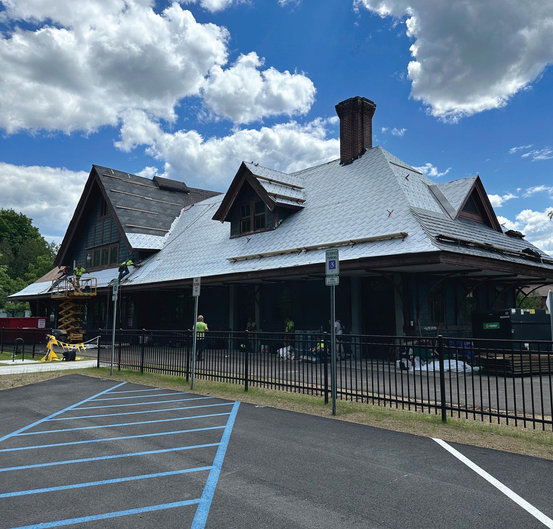
Saranac Lake’s Union Depot
Work on rehabilitating the historic Union Depot on the Adirondack Rail Trail in Saranac Lake began in May, and the parking lot is currently open. The building is planned to be a central spot on the trail, and the state is seeking partners to operate amenities inside the building as a rest stop with public restrooms. It will sort of be like a thruway rest stop and visitor center, but on a rail trail and in a historic location.
Officials envision the building as a place walkers, bikers, snowmobilers, skiers and other users can get refreshments, rent or buy recreation equipment and get information about recreation opportunities around the area. The section through the Union Depot corridor is paved.
In the fall, the DEC sent out a request for information asking people to propose ideas for what should go in the building. The site needs an estimated $2 million of improvements.
In early May, Saranac Lake village Mayor Jimmy Williams said the depot has been “missed.”
Built in 1904 by the Delaware and Hudson Railroad, the Union Depot is a one-story, 3,900 square-foot wood-framed structure. It became the largest station on the Adirondack Division line north of Utica, handling up to 20 trains a day. It was operated as a passenger station until 1965.
In 1979, it was renovated for use during the 1980 Olympic Winter Games in Lake Placid.
Historic Saranac Lake did a renovation in the early 1990s. Most of the wear and tear has come since then. It is the only train station on the Adirondack Rail Trail that is owned by the DEC.
In 1997, the state Department of Transportation oversaw another multi-million-dollar renovation of the depot. The building was used intermittently for excursion rail trips by the Adirondack Scenic Railroad from 2000 to 2016.
More information
For more information about the Adirondack Rail Trail, visit the state Department of Environmental Conservation’s website at dec.ny.gov/places/adirondack-rail-trail or the Adirondack Rail Trail Association (friends group) at adirondackrailtrail.org.
High Peaks Adventure Cycling
Dirt Camps, Bikepacking, Bicycle Touring, Mountain Biking, Lake Placid to Tupper Lake Rail Trail Tours
Shuttles, Tours, Guides, Lessons, Support Multi Adventure Days with Bike, Hike, Paddle, Overnight Trips, Private, Group, Clubs, Family, Schools
Brian Delaney
High Peaks Cyclery
High Peaks Adirondack Outfitters
Fly Fishing
High Peaks Mountain Guides
“True to Our Roots” Since 1983

(518) 523-3764
www.highpeakscyclery.com
2733 Main St., Lake Placid, NY 12946
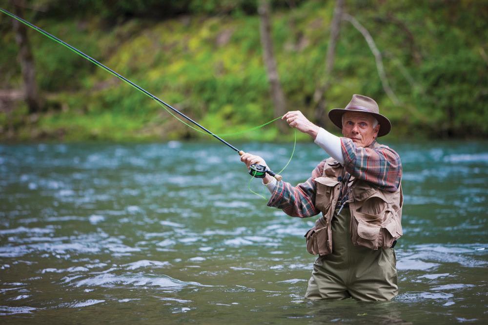
Having spent my life in the outdoors, there is nothing more enjoyable than spending time in nature with others. Mountain Roots Guide Service provides guiding for fishing, ice fishing, hunting and other outdoor activities that you want to enjoy. Let's make memories that will last a lifetime!
Mountain Roots Guide
603-455-2416
5812 NYS Rte 86 • Wilmington, NY mountainrootsguideservice@gmail.com
High Peaks Adirondack Outfitters
Fishing (3 Tracker Bass Boats) Fly Fishing, Spin Fishing, Guide Service, Rentals, Shuttles, Sales, Lessons, Canoe Trips
Sage, Rio, Patagonia, Hardy, Fenwick, Cortland, Wenonah Canoes and more
Experience Adirondack Fly Fishing and Small Pond Brook Trout Fishing
Brian Delaney
High Peaks Cyclery
High Peaks Adirondack Outfitters
Fly Fishing
High Peaks Mountain Guides
“True to Our Roots” Since 1983

(518) 523-3764
www.highpeakscyclery.com
2733 Main St., Lake Placid, NY 12946
Since 1924

The 138-mile trail has given hikers—whether through segments or a thru-hike—the chance to immerse themselves in the outdoors: an adventure and an experience that celebrates our public lands. Enjoy many remote and quiet lakes and ponds, abundant rivers and streams, as you hike this fairly moderate terrain.
Year Established 1924
Trail Length in Miles 138
Registered Patch Holders 2000+
Lean-tos on the Trail 24