
FIASCOS: YOUR STORIES BIG WALL CLIMBING IN YOSEMITE SLOVENIAN MTB-ING MAROONED IN THE ARTHURS CAUGHT IN AN AVALANCHE


FOOTWEAR FOR MOUNTAIN ATHLETES
OBSESSIVELY DESIGNED SHOES FOR PERFORMANCE IN THE VERTICAL WORLD


FIASCOS: YOUR STORIES BIG WALL CLIMBING IN YOSEMITE SLOVENIAN MTB-ING MAROONED IN THE ARTHURS CAUGHT IN AN AVALANCHE


OBSESSIVELY DESIGNED SHOES FOR PERFORMANCE IN THE VERTICAL WORLD


FCS Australia is a leader in surfing fins, covers, traction, leashes and accessories.


1%
An Aussie favourite in fishing since 1920. Alvey Side Cast Reels have been and continue to be made in Australia with quality & expertise in mind.





SPRING 2024
The Fiasco Issue

Spero-Wanderer Region

Photo Essay: Parts Unknown
The Cover Shot 14
Readers’ Letters 18
Editor’s Letter 20
Gallery 24
Columns 32
Getting Started: Knots to Know 52
WILD Shot 146
FEATURES FIASCOS
Green Pages 38
Invasion of the Fire Ants 42
Tasmania’s Spero-Wanderer Region 76
Opinion: Volunteering for Trouble 46
Fiasco Short Stories 54
Marooned in the Western Arthurs 58
Tent Fiasco Stories 66
Profile: Kerry Lowe 48
Climbing Yosemite’s El Cap 68
Caught in an Avalanche 84
Photo Essay: Parts Unknown 88
MTB-ing in Slovenia 96
Off track in the Warrumbungles 106
Skiing and Climbing NZ’s Big Peaks 116

116 Memory Games
48
Profile: Kerry Lowe
In the heart of NSW’s Pilliga region, one man is quietly working on creating a trail network that is not only home to the Pilliga Ultra runnning festival, but that will help the campaign to protect the area.
58
Marooned in the Western Arthurs
When things go wrong, they can go really wrong. In the winning entry of our Fiasco Stories Competition, Chris Newman tells the sorry tale of a gastro-hit traverse of Tasmania’s challenging Western Arthurs.
106
WILD BUNCH
TRACK NOTES
GEAR
Daywalks in QLD’s Sunshine Coast 124
Wilsons Prom Lighthouse Circuit 126
Unsung Heroes 134
Talk and Tests 136
Support Our Supporters 140
Heading back to NSW’s iconic Warrumbungle NP for the first time in more than a decade, Ryan Hansen discovers that, sadly, not everything is once as it was. But that doesn’t mean the ‘Bungles have lost their capacity to inspire.




AUSTRALIAN MADE. AUSTRALIAN PRINTED.


wild.com.au @wildmagazine @wild_mag
subscribe.wild.com.au
EDITOR: James McCormack
EDITOR-AT-LARGE: Ryan Hansen
GREEN PAGES EDITOR: Maya Darby
PRODUCTION ASSISTANT: Caitlin Schokker
PROOFING & FACT CHECKING: Martine Hansen, Ryan Hansen
DESIGN: James McCormack
FOUNDER: Chris Baxter OAM
COLUMNISTS: Megan Holbeck, Tim Macartney-Snape, Dan Slater
CONTRIBUTORS: Grant Dixon, Daygin Prescott, Geoff Law, Anzhela Malysheva, Jenny Stansby, Shaun Mittwollen, Emily Scott, Callum Hockey, Alistair Paton, Bruce Paton, Martin Bissig, Gerhard Czerner, Chris Newman, Johan Augustin, Jeremy Shepherd, Kerry Trapnell, Reid Marshall, Christian McEwen, Craig Pearce
By Ryan Hansen
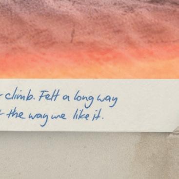
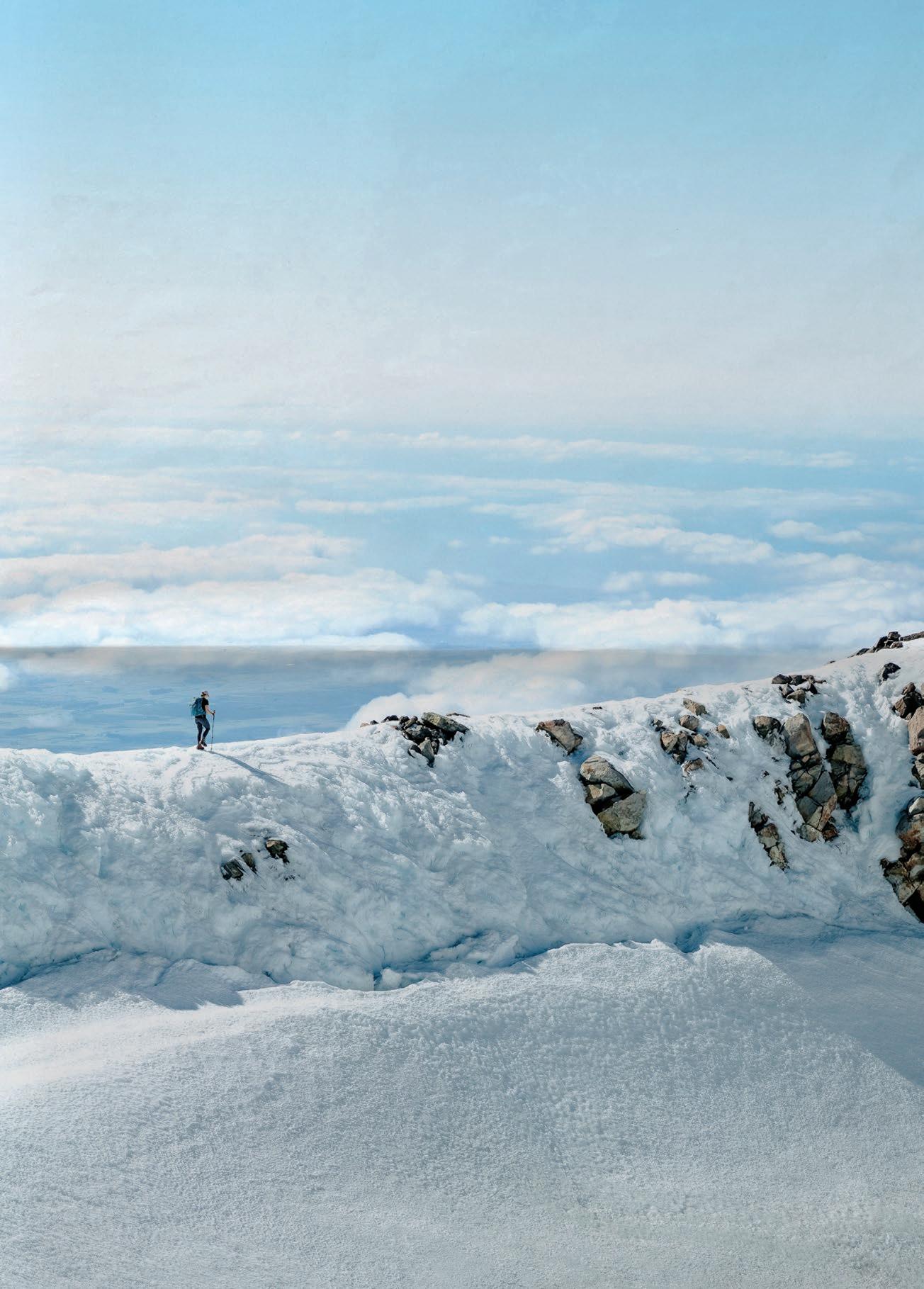
For some time, it’d been our objective to stand where Martine stands in this photo. We’d first spied the mountain a year ago from Mt Exmouth (Ed: Because of the square aspect ratio used for cover images, Exmouth is unfortunately just off the right of frame on the cover; you can, however, see it in the image above), and then we saw it again yesterday from a new for us viewpoint. The peak had occupied our vision for much of today, too; initially as an almost-touchable target, and then, as the regrowth scrub had thickened, as an unattainable, faraway goal. But we’d persisted bashing, stumbling, battling our way ever onwards until, demoralised, we’d slumped to the ground in a clearing below, peering up at its enticing cliffs.
Undeterred, I’d found a way up with surprising ease. Thoroughly impressed by its substantive views, I’d laced it back to camp, refuelled with a rapid cuppa, and returned back up in a proverbial flash for sunset, this time with Martine. As we admired the last of the evening’s rays with a resident rock wallaby, the full-circle nature of our experience hit home: There, just to the right of the setting sun, was Mt Exmouth, where it’d all begun.
You can read more about Ryan’s adventures in the Warrumbungles in the accompanying feature story ‘Times of Change’ starting on p106.

PUBLISHER
Toby Ryston-Pratt Adventure Entertainment Pty Ltd ABN 79 612 294 569
ADVERTISING AND SALES
Toby Ryston-Pratt 0413 183 804 toby@adventureentertainment.com
CONTRIBUTIONS & QUERIES
Want to contribute to Wild? Please email contributor@wild.com.au Send general, non-subscription queries to contact@wild.com.au
SUBSCRIPTIONS
Get Wild at wild.com.au/subscribe or call 02 8227 6486. Send subscription correspondence to: magazines@adventureentertainment.com or via snail mail to: Wild Magazine PO Box 161, Hornsby, NSW 2077
This magazine is printed on UPM Star silk paper, which is made under ISO 14001 Environmental management, ISO 5001 Energy Management, 9001 Quality Management systems. It meets both FSC and PEFC certifications.
WILD IS A REGISTERED TRADE MARK; the use of the name is prohibited. All material copyright Adventure Entertainment Pty Ltd. All rights reserved. No part of this publication may be reproduced without obtaining the publisher’s written consent. Wild attempts to verify advertising, track notes, route descriptions, maps and other information, but cannot be held responsible for erroneous, incomplete or misleading material. Articles represent the views of the authors and not the publishers.
WARNING: The activities in this magazine are super fun, but risky too. Undertaking them without proper training, experience, skill, regard for safety or equipment could result in injury, death or an unexpected and very hungry night under the stars.
WILD ACKNOWLEDGES AND SHOWS RESPECT to the Traditional Custodians of Australia and Aotearoa, and Elders past, present and emerging.


[ Letter of the Issue ] OH, THE MEMORIES
Hello James,
Well, I went into town today, and guess what I saw on the rack in the newsagency ... Wild Magazine #191. So I broke down and bought it to check it out. Moving here from Colorado thirteen years ago was a huge culture shock for me, especially as I used to ski back in Colorado twenty times a season.
While I was going through the magazine, I came across your Ed’s Letter on page 18 with the title ‘Great Expectations’, and on it there was a very beautiful photo you took of a skier riding down a nice slope with the sun going down (Ed: It was of Shaun Mittwollen on the Sentinel, Kosciuszko NP). That photo brought back memories of me skiing in the back bowls of Vail, when the sun was going down. My years of skiing all over Colorado, from Keystone (where there is night skiing) to Loveland Ski Resort on the Continental Divide, would make your mouth water, with hip-deep cotton-candy powder, and orange and violet sunsets. The sounds of my skis making turns up in the Rocky Mountains seemed to stop time.
I never thought all that would stop upon moving down here thirteen years ago. But seeing your Ed’s Letter photo made me think back to all the great memories I have of skiing with my friends in Colorado. I’ve wanted one day to go skiing somewhere as nice as that here in Australia, but have had little motivation ... until I saw your photo.
Yeah, we all are aware of global warming and climate change and the effect it has had on our skiing season. But no amount of climate change will ever halt my dreams of making some fresh turns in some beautiful location in Australia.
Keep skiing or stay home, Eddie Prados
Tottenham, NSW
PS I hope you can use this photo of me solo climbing on The Diamond on Long Peak, Colorado. (Ed: We sure can!)

Dear Wild, The article about Hinchinbrook Island (‘Australia’s Jurassic Park’, Wild #192) brought back great memories of our honeymoon in 1990. We kayaked from Lucinda up the east coast of the island and around to Missionary Bay in our 1932 Klepper folding kayak, complete with sail. After packing up the kayak, the ferry from Cardwell to Ramsay Bay picked us up, dropped us off at the start of the Thorsborne Trail, and then took our kayak back to Cardwell, where it was stored until our return.

We then walked the trail, with a day trip up Mt Bowen. Not carrying heavy packs, we did the return trip in about ten hours, arriving back at camp at roughly 4PM. We had no issues with navigation either up the creek or along the tops, as there had been a recent bushfire, but we did end up scratched and covered in black from the banksias.
Not your average honeymoon!
Janette Asche
St Lucia, QLD
(Ed: Thanks for the lovely story, Janette. And you’re right; paddling around in 1932 folding kayaks and climbing Mt Bowen is far from the average honeymoon.)
Dear James,
In reference to ‘Letters to the Editor’ in Wild #192 that just arrived, I don’t think the Social Climbers featured further in Wild because it became the topic of a book; see amazon.com/Social-Climbers-Chris-John-Darwin /dp/0725106808
The book was actually a great ‘everyman’s’ insight into mountaineering, and offered the rest of the country a look into things that Wild readers love! I hope I still have my copy up the back of the bookcase somewhere.
Brian Farrelly Canberra, ACT

SEND US YOUR LETTERS TO WIN!
Each Letter of the Issue wins a piece of quality outdoor kit. They’ll also, like Eddie in this issue, receive A FREE ANNUAL SUBSCRIPTION TO WILD. To be in the running, send your 40-400 word letters to: editor@wild.com.au
QUICK THOUGHTS
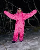
On Wild’s Facebook post about Editor James McCormack being in Kosciuszko NP in the snow, testing out his Aldi OneZ sleeping bag suit (featured on p137 of this issue):
“I was also out there [that] weekend, and I sure would’ve run screaming if I’d seen that looming out of the night at me!!” DS

EVERY published letter this issue will receive a pair of Smartwool PhD crew hike socks. Smartwool is well known for their itch-free, odour-free Merino clothing, and their technical PhD socks have seamless toes and are mesh-panelled for comfort.
Eddie’s Letter of the Issue will get something special: A Smartwool sock drawer. It’ll include hiking, running and lifestyle socks, enough for anyone to throw out all those old raggedy, holey and often stinky socks they’ve been making do with.

When I first began thinking about a fiasco theme for this issue, I decided my Ed’s Letter should chronicle some of my own outdoors fiascos. Man, I thought, this will be a rich vein for me to tap into. I sat at my desk, fingers hovering at the keyboard, ready to tap out a long list of bungled adventures that had gone preposterously south.
But nothing came. Zip. Zilch. Zero. Give it time, I figured, something will come. But days turned into weeks, weeks into months, and still nothing came. Sure, I have an endless stream of outdoors injury stories: Broken arms, punctured lungs (yes, lungs), a triple-fractured pelvis, a torn ACL ... . The number of broken ribs is up in the double digits. So, too, is the number of times I’ve fractured vertebrae.
But injuries alone do not a fiasco story make. It needs an element of debacle. Or at least, multiple things to go wrong and to compound on each other. And, ideally, things should not just go wrong; they should go comically wrong.
After four months of nothing, a dark thought, decades old, bubbled to the surface. It involved a bright yellow Dolphin torch, you know, one of those massive things the size of a brick. I remembered not using it for illumination, however; I was using it as a pillow. And when I say pillow, it wasn’t in the usual sense of a pillow; I just needed something to raise my head out of the water of the literal stream that had begun flooding where we slept. Flooding. That’s exactly what happened, because once I remembered the Dolphin, all the memories I’d seemingly repressed from that trip came flooding back. I was in first-year uni, and the winter break had arrived. Stuey, Oov and myself had decided to set off to the snow; there was loads of precip forecast, and the skiing looked excellent. But as the date to depart loomed, it became apparent none of us had given this any serious thought. We were students. We had no vehicle. We had no accommodation. And we were broke. The cost of lift tickets, even back then when
they were a fraction of today’s cost, was out of the question. We needed an alternative.
As young Sydneysiders have for generations, we looked to the nearby Blue Mountains for inspiration. The forecast was grim. And being winter, the temps weren’t balmy. The heavy precip down south was heading this way, too; in what proved to be a dramatic underestimate, more than 200mm over two days was predicted. For three young, testosterone-fuelled, foolish teenagers, heading into this maelstrom ludicrously under-equipped—being flat broke, none of us had decent gear— seemed an occasion ripe with adventure. And so we set off to the Grose Valley on what we’d dubbed ‘The Real Man’s Camping Trip’ (and yes, we were being ironic).
We jumped off the train at Blackheath, and set off into the deluge. (We later learnt that nearby Katoomba would receive more than 160mm today; tomorrow it would get 275.) By the time we’d walked the few kilometres to Govetts Lookout, we were already soaked. I had a GoreTex jacket, but Stuey’s and Oov’s jackets were pathetic. None of us had the money for rain pants, either; we wore jeans or trackie dacks.
At the lookout, little of the mist-shrouded valley was visible, but we could at least see Govetts Leap Falls lunging impressively out of the clouds. Down we went, negotiating the steps carved into the cliff; so much water flowed onto us it felt we were in Govetts Leap Falls themselves. But it was only once we reached the base of the falls that we realised we’d bitten off something serious. The creek was truly thumping. Actually, it was raging. It wasn’t long until, at one of the creek crossings, Stuey got swept downstream. A little further on, where the creek flowed through a narrow rock channel, I used a two-metre-long stick to test the water’s depth; it didn’t hit the bottom.
We ended up stopping shy of the Blue Gum Forest. None of us owned an actual tent, so we huddled under my 3x4m tarp. Nor did we have a proper stove; just a tiny solid-fuel tablet one that struggled to warm the instant noodles we brought for dinner.

Meanwhile, the rain pelted down. In the midwinter cold, we were freezing, but a fire was out of the question. Not long after we lay down for sleep, a stream began flowing right under the middle of the tarp. In hindsight, we could have moved position; instead we stayed put, and I simply placed my head on the brick-sized Dolphin torch to keep it out of the water.
We slept more-or-less on the ground, with just cheapie closed-cell mats between us and the dirt. Oov did not have a sleeping bag either, and I shared mine with him, with it unzipped like a quilt. It was saturated, though, with the down clumped into a handful of sodden lumps. We lay there shivering; sleep was impossible. Well, nearly impossible. There were three delicious minutes when I dozed off, until an antechinus scurried in and bit me on the toe. There was no chance of sleep after that. It was the longest night I’ve ever had. By morning, the pounding rain had not let up. We set off, heading back now via Rodriguez Falls. Creek crossings at times seemed almost terrifying. There was one spot where we had to cross fast water above a waterfall. It was genuinely dangerous. Stuey—having been swept downstream yesterday—baulked, pacing the banks like a caged tiger. Coaxing him across took thirty minutes.
Late that afternoon, we dragged ourselves into the pub at Blackheath, where we spent the night recovering. One of us, not me, was so dog-tired and beaten he soiled himself during the night. But here’s the thing: Do I regret this outing? Not one teensy bit. In fact, I recommend everyone have their own fiasco at some stage. I have never learnt more about adventuring in a single trip than this one, and despite it being an utter debacle, I look on it now with fondness. Such fondness, in fact, it seems strange I repressed it so deeply that I almost couldn’t recall it. But it does make me think: What other outdoors fiascos have I repressed? I’m sure there are many. And boy, they must be doozies.
JAMES MCCORMACK


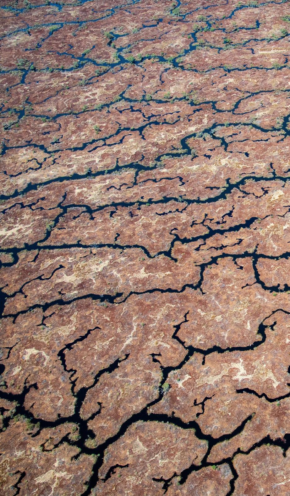
Traditional Owners and graziers have recently won a campaign to stop new oil and gas infrastructure in western Queensland’s Channel Country, which contains some of the last free-flowing desert rivers left on Earth. It’s extremely flat country where any interruption can dramatically alter the water’s path. This image, taken in March 2024 after a wet summer in the tropical north, shows the monsoonal rains as they travel hundreds of kilometres down the Georgina and Diamantina Rivers and Cooper Creek to the Lake Eyre Basin. From the air, these unique braided channels resemble arteries, which is fitting for the life they bring to this typically dry and isolated area.
by KERRY TRAPNELL


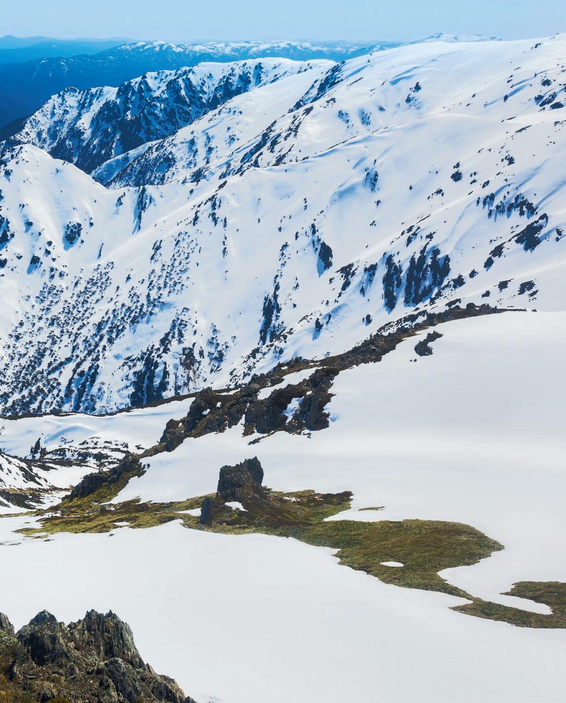
Shaun Mittwollen starts down Mt Carruthers’ north face, September, 2023. Despite this being one of the worst Aussie snow seasons on record, if you were willing to head into the NSW backcountry and earn your turns, quality skiing could still be found, even in spring. And don’t be fooled by those bare patches; the snow ran unbroken all the way to James Macarthur Creek deep in the valley below. by JAMES MCCORMACK


meganholbeck.substack.com meganholbeck.com @meganholbeck
[MEGAN HOLBECK]

The wonderful four-day Yuraygir Coastal Walk deserves, even in the depths of winter, a AAA rating: Accessible; Adventurous; Amazing.
Four days, seventy-odd kilometres of stunning coastline, five kids aged nine to fifteen, two adult twins, a strong southerly headwind, and an iffy July forecast. It doesn’t sound like a classic school-holiday good time. But then throw in the magic: Perfectly positioned tiny towns with accommodation ranging from budget to boutique; supplies from pub grub to pasta packets; light packs; warm beds and showers at each day’s end. Giving people—people who mesh—the time and space to talk about the things that get crowded out in normal life, aided by the rhythm of movement, exercise and nature, and supplemented by shell finding, ball throwing, singing … and lollies.
The Yuraygir Coastal Walk in northern NSW traverses coastal heath, rock ledges and kilometres of hard-packed sand from Angourie to Red Rock. It feels more remote than it looks on the map, especially in the middle of winter. Although it passes through three towns, and four-wheel drives are allowed on some beaches, we only saw four other walkers—mostly we had the whole place to ourselves.
There was plenty of other life. Rosella flocks decorated the coastal shrub like bright baubles, pelicans clumped on beaches, and pairs of oystercatchers chased each other in the receding waves, reflected in the thin mirror of water. Whales and dolphins swam in the distance; massive cuttlefish lay washed up on the beach, bone-white and alien.
The southerly headwind whipped both the clouds and the sand into changing shapes, transforming the ocean into messy, pounding surf. The atmosphere switched from foreboding to inviting with the clouds and light. One moment the scene had the stark beauty of an approaching storm; the next it looked benign and swim-worthy.
There were hours of talking; connection in every combination. The teenagers passed kilometres holding hands, talking, singing. Whenever a camera appeared, they turned around and walked backwards, bums first, an effective protest against photos. The twelve-year-olds raced, ignored advice, splashed through waves, listened to music, and generally tried out their new, high-school selves. Jasper floated: He strolled along uncomplaining, stopped to examine stuff, ran ahead, then joined a group for games, comic relief or to prod for reactions. Laura
GIVING PEOPLE THE TIME AND SPACE TO TALK ABOUT THE THINGS THAT GET CROWDED OUT IN NORMAL LIFE .. .”
and I talked about all the things we don’t get a chance to usually, and learned who the other was again, how we each are now.
Despite the forecast, we stayed mostly dry, except for a good soaking at lunch on the second day. A couple of soggy, cold hours of walking brought us to Minnie Waters, where Guy—my slow-arriving husband/ fellow walker/driver/caterer/logistical support—dispensed hot chocolate, beer and the keys to caravan park cabins, followed by kilograms of Yamba prawns, hot chips and Sara Lee cake.
We stayed in a beautiful apartment overlooking Brooms Head Beach and a huge room at the Wooli Hotel Motel; had pizza in the pub and prawns on a picnic table. Jasper reached for his ball and fell in the Wooli River, minutes after the
boatman told him about the resident sharks. “Help!” he squealed, clambering uneaten onto the rocks seconds later.
Except for the ten minute burst of competitive whinging that began each day’s walk, there was surprisingly little complaining. Even when I added three kilometres to our longest day by following the beach past the motel, there wasn’t a meltdown. Instead, there was muttering about my navigation, demands to see the map, then all was forgotten during negotiations for the best bed.
The walking was not difficult and rarely boring. Some sections along rock ledges took care, time and thought; the NPWS notes give warnings about the dangers of big seas and high tides. The upside of winter’s wind and rain meant the sand was firm and we kept moving. In warmer weather, it’d be a different experience: You’d stop for swims; the sand would be soft. But in general, this walk would be fine for keen, fit(ish) walkers from eight to 78, depending on how it was done. Staying in the beautiful national parks’ campsites along the way would make it feel wilder and more adventurous, while doing our way made it fun, possible and amazing for our ragtag mob.
This accessible adventure wasn’t expensive, and the money we spent went straight into the local economy. It didn’t require much organising, equipment or effort; we used existing infrastructure; and we had next-to-no environmental impacts. (A few shells may have been taken—I tried.)
If we’re looking for ways to introduce a wide range of people to the joys of nature, while allowing them to test themselves gently and develop a connection and appreciation for the world around them, experiences like these are a good place to start.

It’s always tough to decide what gear to take out on any given adventure, but especially so when you’re a participant on the reality show Alone.
We go into the wild to immerse ourselves in nature. To shrug off the stress and routine of everyday life by reconnecting to our primal home. For many of us, it’s also to break out and challenge ourselves on different levels. However, hardly any of us take the challenge as far as having to rely solely on foraging and hunting for food as the participants in the popular TV franchise Alone must do. (Ed: If you’re not familiar with Alone, which is available online for free on SBS at sbs.com.au/ondemand, ten people choose ten items, and then head into the wilds to see how long they can survive). I find the series mildly fascinating, but ultimately frustrating.
Despite the foreboding soundtrack to the repetitive camera pans, a signature of all episodes, the initial overseas episodes held me with the landscapes, plants, wildlife and those participants who were competent. But my frustration levels grew with the antics, and the apparent lack of mental preparation and self-reflection of the less-capable participants.
An ability to handle loneliness is obviously critical for anyone getting close to lasting the distance, as—also obviously— is their ability and luck in gleaning enough sustenance. Not so obvious to success is the choice of which ten items they are allowed to take from the specified list (Ed: One of my frustrations with Alone is that they don’t tell us explicitly on the show what ten items have been chosen by each participant. You can, however, find out what the specified fifty items are that participants get to choose from at history.com/shows/alone/articles/gear-list)
For someone with a practical bent and a fascination with gear, I find this a timeless dilemma, as indeed I do for any
outdoor escapade. While such decisions aren’t usually make or break for personal adventures, they can certainly be for Alone participants. I’ll now do my best choosing what I would take.
Quick, waterproof shelter is vital, so a big tick for the tarp. Securing it well, and for numerous other tasks, parachute cord also gets the tick. Staving off hypothermia and ensuring adequate sleep is also vital, so in goes an appropriate sleeping bag and—because you don’t have to carry it—I’d go for the heavier, bulkier but more functional when wet,
HARDLY ANY OF US TAKE THE
CHALLENGE AS FAR AS HAVING TO RELY SOLELY ON FORAGING AND HUNTING FOR FOOD.”
option of a synthetic one. While comfort is also important for a good sleep, I’d reluctantly leave out a sleeping mat and make do with dry vegetation for padding my bony hips and insulating me from the cold ground.
Fire is essential for cooking and warmth, so the fire lighting flint must go in, and that brings in a difficult choice. For long-term wood supply—in the hopefully cosy and confined space of my more permanent shelter—I’d need to cut firewood. Of the choice of permitted cutting implements to choose from—axe, two choices of saw, a hunting style knife (limited practicality) and a multitool— the axe is the first item I’d choose. But
After all, that is our natural heritage. [TIM
axes have the downside of requiring a lot more energy to use, so if the location favoured the making of a log cabin-type shelter, I’d be tempted to also include a saw. Finally, for its usefulness in performing other tasks, a multitool would be a must. A steel cooking pot completes the list of essentials needed whatever the environment.
That leaves two items, and they would have to be purposeful for catching food. As all locations seem to be located by large bodies of water, a fishing line and hooks go in for aquatic hunting, leaving the choice for terrestrial hunting between a bow (with arrows) and snare wire. Neither are particularly humane, but before making this choice I think I would have to do a lot of practice with them to see what worked best for me. Having hunted and trapped in my youth, I know for sure that a rifle is by far the least cruel means of hunting, but that’s off the list. So, there’s my ten.
But wait, when you’re all alone, darkness is not your friend. So out goes the saw, and in its place is a thing that doesn’t warm, nourish or shelter you, that would only be used occasionally but could be very handy when you really needed it during those long, lonely hours of darkness: a headlamp.
The show is contrived for sure, and for all the drama of each individual’s successes and failures in using their limited resources, it’s inevitable to conclude that one thing that would make the task a lot easier, more than any amount of equipment, would be to do away with the biggest contrivance of all, that of being alone, and instead be allowed to have a compatible companion or better still a tribe of them.
[DAN SLATER]

Back in 2017, in his very first column, Dan wrote about the use of PFCs within the outdoor equipment industry. In this first of a two-part column, he’s checking back in to see what progress has been made.
When I first started this column in 2017, 36 issues ago … well, for a start I had no idea it would still be going beyond 2018, never mind 2024. You see, I originally made a list of 16 hot topics related to environmental responsibility within the outdoor-equipment-manufacturing industry, and I assumed that once I’d covered those topics, I’d return from whence I came, leaving this page available for more deserving text. Back then, Wild was bi-monthly, so my issue plan would last until about the end of 2018. During that time though, the role of editor changed, and when I chatted to the new helmsman James in 2018 regarding the impending closure of my body of work, he got on his knees (over the phone) and literally begged me (Ed: Yes, it’s true! ) to extend it to keep writing about gear in general. I was surprised, and it took me a little while to re-programme my brain and pivot from strictly environmental considerations to a broader gear chat.
I digress. The very first topic on my original list, and subject of my second column (the first being of an introductory nature) was Durable Water Repellency (DWR), and the widespread use of perfluorocarbons (PFCs) in their manufacture. PFCs break down into toxic PFAS (per- and poly-fluoroalkyls) but no further, and stay in the environment forever, primarily reaching humans through our drinking water. The health risks aren’t fully understood, but ingested carbon has long been linked to cancer. Indeed, the World Health Organisation has declared PFOA, a type of PFAS, a Group 1 human carcinogen.
Acceptable PFAS levels are regulated in different ways globally, with different types (there are thousands) having different levels. For instance, PFOA is regulated in Australia at 560 nanograms per litre (ng/l). To the average consumer, this may be just a bunch of acronyms and what seems like a very tiny number, so perhaps the best way to judge this is by comparison. In the US, the limit for PFOA and PFAS combined is 4 ng/l, and this is still well above the US advisory health limits. In Canada, the limit for all PFAS combined is 30 ng/l. So why is Australia’s limit so high? That would
YOU’D BE FORGIVEN FOR THINKING THE CURRENT ACCEPTABLE LEVELS ARE UNACCEPTABLE.”
be beyond the scope of this column, but you’d be forgiven for thinking the current acceptable levels are unacceptable.
I also talked about Greenpeace attacking the industry’s use of PFCs in a 2015 report, and the industry’s optimistic response as they promised, company by company, to reduce the length of the offending carbon chains from eight molecules to six. The shorter-chain molecules are less damaging when they break down in the environment, but they break down quicker so are less effective on the garment. In fact, C6 solutions were quickly also deemed unacceptable. What I didn’t mention back then was a ‘hidden’ source of PFCs—the waterproof
membrane itself. The original Gore-Tex membrane was ePTFE (expanded polytetrafluoroethylene), which requires PFCs in its production. Greenpeace released another report in 2021 applauding Gore’s intention to introduce a new membrane based on ePE—PFC-free expanded polyethylene—to replace ePTFE by the end of 2023. Gore unfortunately didn’t meet this deadline due to “product development and scaling challenges”, so their ePE membrane is currently running alongside the old ePTFE one in their range. However, their new deadline—end of 2025—seems more promising. It should also be noted that since 2016, many companies have moved away from Gore-Tex in favour of their own proprietary membranes, many of which use alternative PFC-free technologies.
I went on to list some greener alternatives to carbon-based DWRs that were being considered, among them Schoeller’s Ecorepel and Archroma’s Smartrepel Hydro. According to the Schoeller website today, Ecorepel is used in products by Black Diamond, Vaude and Icebreaker, however none of their websites returns any results for ‘ecorepel’. Archroma does not list any outdoor brands as partners on its website.
I finished up with an optimistic “Hopefully a safe and effective solution is not far away.” Well, was it? This column has been very science-based, and if you’ve made it this far, I applaud your staying power, but how does this translate to the brands we know and wear every day? How have they evolved over the past decade to combat the problem? We’ll find out in Part II, next issue.

Introducing the new Australian Made XRS™ Connect Handheld UHF CB Radio, XRS-660
Building on the market-leading innovation of GME’s popular range of XRS™ Connect UHF CB Radios, the Australian Made XRS-660 offers several exciting new features, including being the first Handheld UHF CB Radio to feature a Colour TFT LCD screen, providing the ultimate Handheld radio display for all environmental conditions – even in full sunlight.
Boasting Bluetooth® audio connectivity the XRS-660 can wirelessly connect to an extensive range of third-party audio accessories, providing users with new and improved ways to stay connected and built-in GPS functionality ensures the XRS-660 offers true location awareness without relying on a smartphone to provide GPS location data.
Also featuring rugged IP67 Ingress Protection and a MIL-STD810G rating, the XRS-660 is our toughest and most advanced Handheld UHF CB Radio yet.


SUBSCRIBE FOR 2 YEARS &
WILD IS NO ORDINARY MAGAZINE. Since its establishment in 1981, Wild has been the inspiring voice of the Australian outdoors. It is a magazine of self-reliance and challenge and sometimes doing it tough. While it is not necessarily hardcore, what it certainly is not is soft-core. It is not glamping. It is not about being pampered while experiencing the outdoors. Wild does not speak down to experienced adventurers. And Wild does not look on conservation as a mere marketing tool. For over four decades, Wild has actively and fiercely fought for the environment. Campaigning to protect our wild places is part of our DNA. Show that you care about stories that matter by subscribing to Wild.
(RRP $299.95)
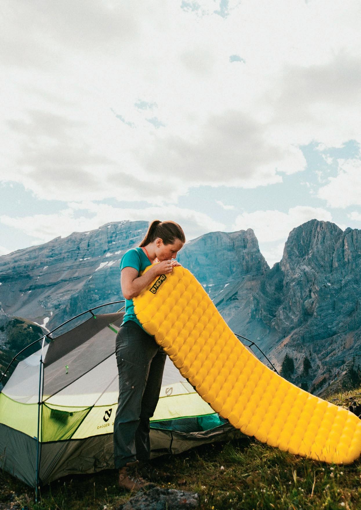
On the trail, sleep is a must. For the best experience, you need enough rest. The Tensor™ pad’s Spaceframe™ construction and internal design provide stability, quiet comfort, and weight distribution. The new internal layer helps minimise drafts and add warmth.
• Spaceframe™ baffles offer unparalleled stability and weight distribution, using low-stretch, die-cut trusses that eliminate springiness
• A new ultra-thin film within internal architecture adds R-value (R 2.5)
• 100% bluesign® certified, 20D premium recycled polyester fabric
• 7.6 cm of quiet and supportive cushioning without the usual ‘waterbed’ feel
• Included Vortex™ pump sack provides easy and fast inflation, saves breath at elevation, and minimises moisture entering the pad
• Laylow™ zero-profile, multifunctional, micro-adjustable valve is flush to the pad and allows fine-tuning of comfort
• Packaging is made from recycled materials and is 100% recyclable
For just a one-time payment of $95, you’ll get a Nemo Tensor Sleeping Mat worth $299.95 plus 8 issues of the magazine worth $119.60, for a total value of $419.55! TERMS & CONDITIONS
Offer available for Australian and New Zealand residents only. Offer is available while stocks last.


- Never miss an issue - Great gift idea - FREE delivery to your door - Save up to $49.45 - Get the mag before it hits the newsagents
A selection of environmental news briefs from around the country.
EDITED BY MAYA DARBY

Wayilwan Country
Resource companies questing for gold threaten a precious wetland ecosystem.
Healthy rivers and wetlands are essential for native wildlife, Aboriginal cultural heritage, local communities, and a diverse range of industries—from floodplain grazing to tourism and recreational fishing. The rivers and wetlands of NSW are under extreme stress after decades of catchment degradation, water-course diversion, unsustainable water extraction, and climate change.
Over the past century, the Murray-Darling Basin has experienced a dramatic decline in wetlands, waterbirds and native fish populations due to a massive increase in the volume of water extracted for irrigation.
The iconic Macquarie Marshes—home to the Wayilwan People, who know the wetlands as Wammerawa—are one of the only semi-permanent inland wetlands in the Murray-Darling Basin, and are teeming with life. Unique, rare and endangered water birds like brolga, magpie geese and painted snipe find abundant nesting spots and fertile foraging grounds in the intricate patchwork of ecosystems that make up this complex, interconnected landscape. These incredibly biodiverse ecosystems regularly support 20,000 water birds, and can sustain hundreds of thousands of birds after flooding.
Recognised for its importance as a breeding site for migratory birds which fly from Alaska and Siberia to breed there, almost 20,000ha of the 200,000ha
Macquarie Marsh area is designated as a Ramsar Wetland of International Significance.
But there is something shiny under the heavyclay marsh soil that mining companies want—gold. Mining-exploration licences were issued by the NSW Government in the heart of the fragile wetland. The Nature Conservation Council put pressure on the decision maker and were hours away from serving court papers to challenge the exploration. Thankfully, the regulator overturned their decision to allow exploratory drilling, and while this came as a relief, Australian Consolidated Gold Holdings have been asked for more information to support their application. The fight isn’t over yet.
It is unthinkable that mining can even be considered in this critically important site. The Nature Conservation Council is calling on the NSW Government to cancel all current mining-exploration licences within the 200,000ha designated as the Macquarie Marshes, to ban the granting of miningexploration licences in this area in the future, and to improve public notifications so that communities are informed and aware of exploration applications in their area and of what their rights are.
To learn more, head to nature.org.au/protect_the_ macquarie_marshes
ANNA GREER
Nature Conservation Council
IT IS UNTHINKABLE THAT MINING CAN EVEN BE CONSIDERED IN THIS CRITICALLY IMPORTANT SITE.”
At peak population, the Macquarie Marshes support as many as 500,000+ birds.
Credit: Leanne Hall
WAMMERAWA/ MACQUARIE
MARSHBY THE NUMBERS: Total area: 200,000ha
Ramsar—year declared: 1986
Ramsar criteria met: 6 (out of 9)
Ramsar site area: 19,850ha
Native species:
Birds: 233
Mammals: 29
Frogs: 15
Reptiles: 60
Fish: 11
Nationally threatened species: 5
Credit: M Hrkac
Regular bird population: 20,000
Peak bird population: 500,000+
GunaiKurnai Country

Snow gums (Eucalyptus pauciflora) are an iconic species of the Australian High Country. These stunning trees are culturally and ecologically significant and are a keystone species of the alpine region. Unfortunately, snow gums are facing a double threat to their survival from both changing fire regimes and dieback. Friends of the Earth Melbourne are hosting a Snow Gum Summit in Feb 2025 that will bring together land managers, academics and anyone interested in the future of this iconic species. The summit will explore what’s required to ensure the survival of snow-gum woodlands, and put the issue firmly on the state-government agenda. To get involved, head to melbournefoe.org.au/snow_gum_summit_2025
CAM WALKER, Friends of the Earth Melbourne

Gadigal, Malijangapa & Wangkumara Country Soil microbes are microorganisms like bacteria, fungi, archaea, viruses, and protozoa, and are crucial in maintaining healthy, balanced ecosystems. In dryland ecosystems—think 70% of Australia—soil functions are particularly critical in maintaining the wellbeing and resilience of the landscape from the ground up. As part of her research at UNSW, PhD candidate Jana Stewart is working alongside Wild Deserts to better understand how trophic rewilding (reintroducing locally extinct ‘ecosystem engineers’ like bilbies and bandicoots) may influence below-ground soil diversity. Stewart’s investigations offer exciting findings in an under-researched field and will provide crucial insights on management approaches in ecosystem restoration. Follow along on Instagram @loveyouleafyou or email jana.stewart@student.unsw.edu.au
JANA STEWART, University of New South Wales
Meanjin
The Queensland Government’s South East Queensland Regional Plan will see up to 40,000 new homes built each year to accommodate six-million people by 2046. Urban sprawl threatens critical habitat for koalas, owls, gliders, quolls and other endangered species. Our housing solutions need not mow down their homes for ours. Queensland Conservation Council is calling on the government and opposition to take urgent action to protect this native habitat prior to the election. New development needs to build up, not out, to ensure our precious ecosystems are safeguarded. To learn more, head to: queenslandconservation.org.au
JEN BASHAM, Queensland Conservation Council

takayna
Readers of Wild will remember Al Bloom’s story earlier this year about endangered Tasmanian masked owls in takayna/Tarkine. Well, for now at least, some masked owls in takayna can be at peace, thanks to the pausing of logging in late June in a remote area of forest at the junction of the Arthur and Frankland Rivers. The pause is a result of 39 days of courageous defenders staging the largest community defence against logging in Tasmania in over a decade, with 29 citizens being arrested. But with logging and mining continuing elsewhere in takayna, masked owls—along with eagles—are still losing their forest homes. Masked owls have been consistently recorded and even photographed (which is incredibly rare) in the proposed toxic tailing dam site by Chinese Government miner MMG, as well as in recent protest sites in the Florentine Valley and Frankland River forests. Calling pairs have been heard in these forests almost every survey night, underscoring how essential these forests are to their territories. Head to @bobbrownfoundation on Instagram to hear the calls of the masked owls, or to bobbrown.org.au to learn more.
ADAM BURLING & JENNY WEBER
Bob Brown Foundation

lutruwita
Tasmania’s national parks have long been in developers’ sights. Here’s the latest on how their alarming proposals are progressing.
Development in national parks is an ongoing issue around Australia, with private developers proposing projects on public lands that are ecologically damaging, that frequently restrict public access, and that reduce wild character. Nowhere is this more so than lutruwita/Tasmania. The island state’s World Heritage-value wilderness has long been eyed off by developers as the holy grail— free or cheap land that is incredibly spectacular.
In 2014, the Tasmanian Government launched an “unlock the parks” policy, creating an expression of interest (EOI) process for developers to propose projects on reserved land. To counter the perception of land-banking by proponents, the process requires proponents to give regular updates on their proposals’ progress. Despite this, much information remains hidden. But a recent Right to Information (RTI) request revealed a plethora of errors from the agency overseeing this EOI process, and a number of projects have been either radically altered, withdrawn and resubmitted in secret or withdrawn altogether. Despite heavy redactions, some information has been revealed. Here’s what we learnt:
CRADLE BASE CAMP EXPERIENCE: The Office of the Coordinator General’s (OCG) website showed this project had been withdrawn. However, in reality a deal was made between the Tasmanian Walking Company (TWC) and the OCG to withdraw the original project on the proviso another project in the same place with a different name be accepted. The Cradle Base Camp Experience was out, the Lake Rodway Hut Walk was in. A decade on though, and the project’s details remain swathed in secrecy. Leaked plans, however, show the accommodation and living nodes will spread out over an area of 400m2, joined by boardwalks with other associated infrastructure. All private, and all on public land.
WALLS OF JERUSALEM LODGE WALK: The RTI indicates this EOI has “minor variations” to reduce the project’s scale and impact. Details of these variations were hidden, however it’s rumoured the proponent, TWC, has reduced the number of planned lodges within the Walls of Jerusalem NP from two to one, presumably due to ballooning construction costs.

OVERLAND TRACK LODGE EXPERIENCE: No progress for these five luxury lodges has been demonstrated, other than the claim that a market-research project is underway. That’s right, a decade in, and the TWC is only now doing market research—this is a case of land-banking, pure and simple.
MARIA ISLAND EXPERIENCE: The RTI indicates the Adkins House project has been withdrawn and replaced with a revised EOI, the ‘Maria Island Experience’. Wild Bush Luxury has been silent on why the Adkins House rebuild was removed from their plans.
SOUTH EAST CAPE LODGE WALK: A letter in the RTI shows that Wild Bush Luxury withdrew this proposal for a lodge-based experience in the wilderness zone at South Cape Bay over six months ago. The OCG website failed to inform the public of this withdrawal, presumably to save face for the government.
SOUTH COAST TRACK LODGE WALK: The proponent claims “targeted consultations” have occurred; none have been with the Aboriginal community, who have ancient spiritual connection to this stunning area. The project is for six luxury lodges—some within metres of Tasmania’s most significant cultural sites. Wild Bush Luxury claim they’ll submit documentation for assessment in the next 6-9 months.
HALLS ISLAND/LAKE MALBENA: The proponent has a requirement under the EPBC Act to complete a comprehensive landscape-wide assessment, to be done in consultation with relevant land owners and Aboriginal groups. Despite this, the Aboriginal Land Council of Tasmania has not been approached since this was made a condition of assessment.
In sum, not one project of consequence has begun operations in the Tasmanian Wilderness World Heritage Area due to staunch opposition from community groups and conservationists. Despite the lack of progress, however, the Tasmanian Government maintains their policy is a success while obsessively hiding information from the public. Learn more at protectournationalparks.org
DAN BROUN
Protect Our National Parks
THE TASMANIAN GOVERNMENT MAINTAINS THEIR POLICY IS A SUCCESS WHILE OBSESSIVELY HIDING INFORMATION FROM THE PUBLIC.”
MORE INFO:
LAKE MALBENA
Lake Malbena is a pristine lake in the Walls of Jerusalem NP, formed by glacial activity in the last ice age. It has remained largely unchanged since, other than through Aboriginal landscape management and the odd fire.
In the middle of the remote lake lies 10ha Halls Island, which has experienced no development other than a small, 70-year-old heritage-listed shack used by bushwalkers for decades. But there’s a proposal for an exclusive, helicopter-accessed ‘standing camp’—cute wording for luxury huts—on the island, which would allow at least 270 helicopter flights a year into a wilderness area that currently has none. The skies here are the domain of the endangered wedgetailed eagle, and that’s how it should remain.

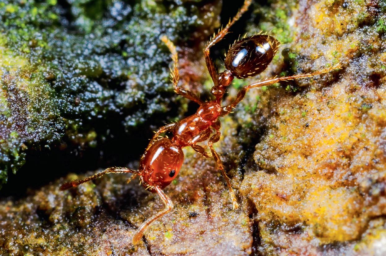
The red fire ant is described as one of the world’s worst invasive species. In Australia, the ants are taking over new areas, and experts fear that the battle to control them has already been lost. It’s bad news not just for the country’s ecology, but also for bushwalkers and anyone else who engages in outdoor activities.
Words JOHAN AUGUSTIN
Photography JOHAN AUGUSTIN (unless otherwise noted)


Atruck speeds down the highway, creating a gust of wind that makes the sugarcane stalks quiver. These fields of sugarcane stretch as far as the eye can see, and a closer look reveals mounds of earth near the robust stalks that bask in the sunlight around the road.
“They use the stalks as a ‘body’ to get direct heat from the sun,” says Greg Zipf. ‘They’ refers to an unwelcome guest that Greg’s sugarcane fields outside Brisbane have received, one that’s proving tough to get rid of: the red fire ant.
An insect native to South America, the red fire ant (Solenopsis invicta) has spread to many new areas, including Australia, over the past few decades, hence why it’s also called the red imported fire ant.
Greg, who is carrying a container of the ant poison Indoxacarb, provided by the Queensland Government, walks with me along the cane field’s edge; within about 100m, he spots six ant nests.
“Six months ago, there were no nests here,” he says, adding that the significant floods earlier in the year likely helped the ants—which clustered together to form ‘rafts’—move over long distances.
We’re accompanied by Reece Pianta from the Invasive Species Council, an environmental organisation founded in 2002 with a mission to raise awareness about the widespread problem of imported pests and weeds that run amok, threatening Australia’s native species. The group now advocates for far stricter biosecurity laws.
“We’re pressuring the government to do more about fire ants,” says Reece, adding that the ants are “the worst invasive species in Australia. They’re a superpest!”
The problem is that ants are capable of quickly spreading to new areas, and just because an area is deemed ‘ant-free’ doesn’t mean colonies aren’t living underground where they’re out of reach of ant-tracking dogs.
Reece explains that the queens can fly up to 32km to form new colonies, while humans—through transportation activities—unknowingly assist the ants, for instance, transporting them via trucks. It’s crucial, therefore, that compost material from, for example, sugarcane, is treated to prevent further spread of the pest.
These treatments are subsequently expensive—a cost that farmers like Greg must bear alone. “It’s not our fault that the ants spread. It’s the government’s responsibility, and they should pay us for spending our own time on this,” he says.
The ants have been present around Brisbane for about twenty years, so it’s not a new problem, but it has proven to be a persistent and challenging one—one requiring relentless work.
“We must treat the land twice a year, and never give up if the ants are not to return,” says Greg.
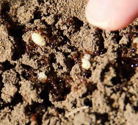
Despite the numerous mounds on Greg’s sugarcane fields, no ant activity is visible. However, this quickly changes when Reece kicks a nest with his boot. The nest swarms with ants and eggs just beneath the dried layer of earth. To better observe the ants’ activity, Reece places a white piece of paper within the nest.
By the time Reece lifts his hand again, about thirty ants have swiftly climbed onto it. As he attempts to brush them off, they sting him en masse; the resultant ‘fiery’ pain Reece experiences
shows why the ants have the name they do. “Aargh, it hurts a lot,” says Reece, wincing. His hand quickly swells up with numerous red marks.
The attack illustrates why it’s crucial to combat this new invasive species in Australia. “They are very aggressive,” says Reece. “[And they] continue to sting until they have exhausted all their venom,” hence the importance of removing red fire ants quickly. What’s more, the ants attack anything edible in their path, including insects, bird eggs, even other ant species, and they also pose a threat to larger native animals and livestock.
“Our iconic animals,” says Reece, “like koalas, platypuses, and echidnas will be on the fire-ant menu.”
The unwelcome guest also poses a danger to humans, who can suffer allergic reactions from the venom. In the United States, many people have died from fire ant stings in recent years (see sidebar), a trend that experts don’t want to see in Australia.
Anthony Young, a lecturer in crop protection at the University of Queensland, walks with me through a park on the outskirts of Brisbane, pointing out ant nests in a few sunny spots. Children play in a nearby schoolyard, and some visitors have a picnic on the grass in the park. The few fire-ant colonies previously seen in other states, such as New South Wales and Western Australia, have been eradicated, but in Queensland the problem is so widespread that it may be too late to reverse the trend. “My son has already been stung by fire ants,” he says.
According to Anthony, the government has realised too late that the ants are a serious threat. “We really need to act now,” he says. Large, coordinated campaigns are necessary, but currently it appears the ants are winning the race. “It looks hopeless—we need a game changer.”
That game changer is more funds.
“The current eradication program needs to double or triple, at least”, says Nigel Andrew, an entomologist at Southern Cross University. The funding required, he says, to eradicate the red fire ants needs to be “200 to 300 million a year. We are at half of that currently.”
First discovered around Brisbane in the early 2000s, red fire ants (Solenopsis invicta) are believed to have arrived by ship from South America. Despite the name, they’re not red, but more copper-brown in colour, and are relatively small, just 2-6mm. Nonetheless, they’re extremely aggressive, and can cause significant harm to humans, wildlife, and livestock.
The species has spread to other countries such as South Korea and China, and in the United States, the invasive ant is now present across one-third of the country, costing it around $7 billion USD annually. More than 80 people have died in the US as a result of stings.
The species can spread approximately 5km annually in Australia, and there are currently ant nests on 8,000km2 in Queensland, of which 7,000km2 have been treated so far. If left undisturbed, the species could potentially spread over 97% of Australia’s area.
Modelling by the Queensland Government indicates that in southeast Queensland alone, fire ants would impose costs of about $45 billion over 30 years. In Australia, they could cause an extra 140,000 medical consultations and 3,000 anaphylactic reactions a year.
Sources: Invasive Species Council, National Fire Ant Eradication Program
IMAGES - CLOCKWISE FROM TOP
Anthony Young finds ant nests in a park just outside Brisbane
Ants and eggs
Pustules resulting from imported-red-fire-ant stings.
Credit: Murray S Blum
A raft of fire ants floating on floodwater. Credit: Invasive Species Council


Nigel explains that due to the nature of the aggressive ant, it will “dominate other species, kill off pollinators and remove predators.” That can also lead already-endangered species to go locally extinct.
The current eradication plan ends in 2027, and it must demonstrate its effectiveness before receiving additional funding, according to Reece Pianta. At the moment, the funds are being distributed by federal and state governments via the National Fire Ant Eradication Program.
“The goal is to eradicate fire ants by 2032,” a spokesperson for the National Fire Ant Eradication Program told me, without clarifying what will happen when the program runs out in three years. “Eradicating fire ants is no small feat,” the spokesperson said, “but our dedication remains steadfast. While many countries have given up, Australia continues its fight.”
The effort to keep aggressive fire ants at bay is crucial if Australia’s outdoor lifestyle is to remain the same, according to David Bell, President of Bushwalking NSW.
“Fire ants have the potential to be one of the worst pests ever seen in this country, worse than cane toads. If they break containment lines, they [could] spread to nearly all of the continent. It has the potential to radically change the way we recreate in outdoor areas,” David says.
And any outdoor activity would be at risk. “Bushwalkers camping near fire-ant nests would be affected, as would people walking through areas where ants are present. We’ve already seen outdoor activities cancelled or suspended on the Gold Coast.”
What can be done to lower the risk of being stung by fire ants when out in the bush? Is there anything one can do to treat the skin, if stung?

“The best way to avoid being stung,” says David, “is to leave the area immediately and report the infestation to the relevant authorities as soon as possible. If the stings worsen, people should go to a GP or a hospital immediately, particularly if they develop an allergic reaction.”
One aspect that makes fire ants particularly problematic for bushwalkers and other outdoor enthusiasts is that fire ants prefer to build their nests in open areas, and not so much in closed forests. “Unfortunately, these open areas,” says David, “are also where people like to camp. If in an open area where fire ants could occur, [it’s] best to conduct a careful ground sweep before setting up tents.”
But those ground sweeps only help if members of the public know what they’re looking for. “Education for the community on how to recognise fire ants and what to do is also very important.”
This isn’t going to be an easy problem to tackle, and most other countries have failed in their efforts. It’s going to take commitment, and hard work. “Governments need to keep up with eradication efforts,” says David Bell, “and not drop the ball ... with funding and regional support.” It’s also crucial that landowners report known or possible sightings of nests and cooperate with the authorities.
Time will tell whether these efforts will prove successful. One thing we do know, however, is that inaction will prove costly for farmers, for outdoor enthusiasts, for the broader public, and for the environment in general. W
LEARN MORE: Head to the Invasive Species Council website at invasives.org.au/insect-watch/red-imported-fire-ant
CONTRIBUTOR: Sydney-based journalist Johan Augustin focuses on environmental and travel-related topics.

We Use the Gear We Sell.
Whether it is bushwalking, climbing, trail running, or exploring the world’s great mountain ranges we are out there doing it and can’t wait to help you choose the right products for your next adventure.
Head out into the bush enough, and eventually you’ll find what you’re looking for: strife.
Photography
It’s not like, when we wander into wilderness, disaster is the objective. But it’s tempting to think that, sometimes, maybe it is. Particularly when you consider the ironic, wry, and weirdly twisted psyche we Made-in-Oz bushwalkers are afflicted with.
What better story to tell, after all, than an utter fiasco encountered, then escaped from? The drama! The hilarity! Beer and skittles!
But then there’s death. “People die out here all the time,” said the driver taking my group to a West MacDonnells eight-day offtrack wander in Central Australia. Later, I did a Google search for death on the Larapinta. Sadly, sure enough.
Unfortunately, the line between the catastrophe averted—the fiasco—and the catastrophe not good and not averted—Lucifer’s trilogy of death, disaster and destruction—like the line between love and hate, can be very, very thin indeed. There but for the Grace of God—or Satan or whoever makes the decisions—is a phrase that has ricocheted around my brain many a time post-fiasco.
But life is lived more fully when we push the envelope, go for the PB, broach the unknown, live on the edge a little: Live life, don’t scroll through it on TikTok.
Both God and Satan know I’ve had my fair share of fiascos. None have veered into the truly life-threatening, though my wife might argue the point. Top of her mind could be a nationalpark-rangers’ evacuation of my teenage son and I from Kosciuszko National Park in 2020 (see Wild 175), due to a massive bushfire raging its way towards us.
Plenty of these fiascos were characterised by some excruciatingly bad decision making. Not that I knew they were vapid at the time (hindsight being such a clever dick). I didn’t have the experience, or perhaps the wit, to know that. I am, after all, a ‘people’. Yes, people are at the heart of nearly all fiascos. That’s because people are stupid. That includes me; it’s not like I’m immune to the type of stupidity that results in fiascos. Of course, not every fiasco is borne of stupidity; sometimes it’s sheer dumb luck. Here are some examples of both the stupid and unlucky varieties that I’ve witnessed or been at the heart of:
THAT IS THE DARK ALLURE OF THE EXISTENTIAL PACKAGE WE PURCHASE: GAMBLE WITH EXISTENCE, THEN CHEAT IT.”
It is inevitable, then—if we are doing it properly, that is— that this approach will lead to mistakes; to, ultimately, fiascos. Maybe that is the dark allure of the existential package we purchase: Gamble with existence, then cheat it. That feels like a very short-term game to me, however. Russian roulette.
Which is where risk management steps in. Every excursion into nature involves risk. The more off the beaten track we go, the greater the risk, hence the greater the likelihood of fiasco— it lurks, as we know, around every snake-infested, loose-rock‘paved’, precipitous, radically exposed corner. Our risk appetite is balanced by what we do to mitigate risk: Some good shoes and some waterproof kit, maybe; having various means of navigation; route choices (eg doing the Eastern Arthurs but not, if we aren’t feeling up to it, climbing Fed Peak).
- Kosciuszko National Park: An early-days-in-my-outdoors-education bushwalk with my then four-year old son, in what is a relatively benign part of the park. Because it was a supposed marked trail in Nichols Gorge near Blue Waterholes, I thought, “No need for a map.” But as I lost the track (missed some barely-there trail markers), the map (and some not-yet-acquired common sense) would have been handy. I ended up carrying my son on my shoulders through off-track trash until I found my way, gratefully following a bemused but kind young couple who I clung to like a life raft. Getting my four-year old back to the trailhead was a deeply emotional relief that I will never forget. Scars, these being scars my son and wife are more than happy to poke a sharp stick at, too.
- Kanangra-Boyd National Park: One winter, many years ago, I was all excited about going lightweight, but a summer sleeping bag in sub-zero temps, where snow wafted down, water bottles froze and butane stoves went cactus, was easily the least-comfortable night I’ve ever spent outdoors #gearfailure #never_again. It

felt like I was freezing to death. I now sometimes over-compensate but I’ve never been cold since. More scars.
- Mt Kaputar National Park: I went on an escapade with, let’s call them, Cain and not-so-Able. The latter took a 5-star, heavy, metal Trangia with full accoutrements, metal drink bottle, alcohol and about the heaviest boots I’ve ever seen. The boots ended up delaminating, the walker ended up dehydrating, half his pack went into Cain’s and mine, and the walk was aborted, with me left shaking my head asking “How did I end up here?”
- West MacDonnells: After five days of wandering, the group I was in ascended the Giles Massif (see Wild 189). It didn’t go well for one walker. He blew up big time as we approached the peak. We split his pack, allowing him to walk carrying close-to-zero weight, which seemed to do the trick. But the following day, on the plain, he said, “All good to carry weight.” That didn’t last long. Luckily, we weren’t on the hard scrabble rock that dominates the area, because he soon fainted face-first into a sandy beach. Cue ye olde splitting-of-the-pack-contents strategy. Scars, although this time not mine.
- Western Arthurs (potentially Australia’s single biggest repository of fiascos, rivalled only by the West MacDonnells): Towards the end of a massive day, fatigued and clearly in diminishing-concentration mode, I—in a strategy decided on to evade a brutal storm about to hit the range—made a significant error, leaping rather than stepping down some rocks, and sprained my ankle in an excruciatingly pain-full—literally breath-taking—fashion (see Wild 190). Somehow, I managed to regather and hobble my way down Moraine K. It’s the closest I’ve come to pressing my Garmin inReach’s SOS button. Painful scars. (Oh, and speaking of calling for help in the Western Arthurs, over a couple of days around Xmas 2023, there were about five evacuations. A failed one was when the chopper was called in by a concerned party who saw an ‘’old man’’ struggling (no, not me). The chopper duly flew in, found the guilty ancient person, who said thanks for your concern, but all good, and marched right on.)
- South West Cape: Bamboozled in a prison-like maze of melaleuca, I tried to squeeze and fight my way through the thicket up the back of Noyhener Beach. The SW Cape track is not marked
on its western and northern sides, however in the melaleuca, some kind souls have taped a path through it. But the route is bedlam, deceiving and very navigationally demanding. All pad options need to be interrogated before committing to them. In one section, I did the classic loop de loop, exiting the jungle precisely where I’d entered it. Frazzled and, yes, scarred.
- Bimberi Wilderness/The Legend of Faceplant Dave (see Wild 186): Mired in the wilderness, at the tail-end of a five-day on/offtrack Brindabellas excursion, Dave and I not so much lost as battled a snarling, utterly ferocious set of vegetal tsunamis. Sometimes we made 600m in an hour. Oh, and we were pummelled by rain, too. If we stopped, we’d freeze, and we sure as hell wouldn’t reach the trailhead. While the wild was beautiful, our senses of humour were stretched taut. Scarred, but soothed somewhat by medicine provided that night in a Cooma pub.
THERE IS AN EXISTENTIALIST PARADOX in wilderness immersion. We are born in freedom. Freedom to make choices. Freedom to stuff it up. And we do so, willingly, rapturously even, like moths compelled by the allure of the wild’s brightness. And we are compelled also, thanks to the sick voyeur in us, to hear the stories of fiasco. We find them riveting, like watching a car crash.
What we sometimes forget, though, is that they are always there. They, the fiascos, roil underneath us on every adventure. Like sharks in the surf, they move in silence, benign until they are not. Their threat is also their wonder, however, and there is a thrill attached to the revelations of the unknowns faced, negotiated, resolved.
Ultimately, I wonder if the real fiasco is made up of the episodes where the proverbial hits the fan, or if the real delusion we carry into the wilderness is that we think we are off for adventure, when, actually, we are just volunteering for trouble. W
CONTRIBUTOR: Sydney-based Craig Pearce escapes, whenever possible, the wilderness of the corporate canyons for the non-anthropocentric society of snakes, snow gums and wallabies.
fees
In the heart of NSW’s Pilliga region, one man is quietly working on creating a trail network that is not only home to the Pilliga Ultra running festival, but that will help the campaign to protect the area.
Words EMILY SCOTT
Photography CALLUM HOCKEY
Kerry the caretaker? Kerry the trail maker? Kerry the bushwalker? Kerry the local legend? Kerry the humble, quietly spoken and dedicated friend of woodland forests in the Pilliga?
I was first introduced to Kerry Lowe, 72, President of the Tamworth Bushwalking and Canoe Club, not in person but in story, the type of story that evokes senses of intrigue and of awe and of mythic out-of-this-world-ness. For some time, until I’d actually met the man, I forgot most of the events and contents of these stories. The feelings associated with them, however, remained, and Kerry seemed to me like a faraway mystical character, almost difficult to believe in, but heart-warming to hear of.
I could, at this point, write some fun facts about Kerry’s history, his life—and I will get to that. But the nub of the story, in short, is this: Over fourteen years, Kerry has created approximately 54km of trails through Barkala Farm, a nearly 5,000ha property, some of which is farmland, but most of it wild Pilliga woodland in the heart of Gomeroi/Kamilaroi Country in NSW’s North West Slopes region. These trails are home to the annual Pilliga Ultra, a festival of running and sports activism designed to support local people in their efforts to attract tourists and to protect this environmentally significant area.
Given the fact Kerry doesn’t live here—he divides his time between a camp on the farm and his home on the outskirts of Tamworth, which is roughly a 200km drive away—and given the rocky, chossy terrain and scattered escarpments of the Pilliga, this trail building is quite a feat.
On the map, the Pilliga lies where the green near the coast, the green of the hinterland, the green of rain, slowly fades out west and becomes scarcer. The land turns vaster, more desert-like. The Pilliga is not the thick bushland of the Wollemi, nor the boundless plains of the Strzelecki Desert. It’s the woodland in-between, and has its own unique beauty. “Most of it’s wilderness,” says Kerry, which is what has driven him here, and what keeps him driving back.
Kerry describes the Pilliga as similar to the Blue Mountains but on a smaller scale. Small, however, doesn’t mean insignificant; in fact, it can emphasise the microsystems at play, and the intricacies and the delicate in life. Kerry describes gorges, canyons, and cliffs, and estimates there are 1,000 caves on Barkala Farm.

But the Pilliga is under threat. Mining-exploration permits and underground disruption began here in the 1990s; ever since, the unheard voices of the Gomeroi people, and of others who oppose mining here, have been suffocated and drowned out by the broad reach of the resources giant Santos. In fact, trying to understand the campaign to protect the Pilliga is like stepping inside Tara June Winch’s fictional-yet-realistic story The Yield, a story that almost uncannily mirrors what’s happening here, a story of the politics of black and green relations, of the blurry ethics of much-needed funding for the local footy field available only by the same companies destroying the local environment, of the history of colonised Aboriginal nations, of the narrative of creating local jobs.
AFTER THAT INTRODUCTION TO KERRY that had more to do with storytelling and less to do with the actual man, I finally met him in person at Pilliga Pottery, a café and working ceramics studio on Barkala Farm. It was early May, 8AM sharp; the leaves had already turned, the fire was still smouldering, the rain was soft.
We crammed into Kerry’s LandCruiser, and then travelled down a dirt track into the bush. Kerry had set up his camp for a few weeks on a transition between cleared farming land and dense bushland. We collected metal rakes and gloves and set off on foot for some trail maintenance. With Kerry in front, he showed us—rather than telling us—how to clear the paths.
Kerry’s presence exudes modesty; I quickly learned that as much as Kerry is a character, he is understated and unassuming.

MOST OF IT’S WILDERNESS,” SAYS KERRY, WHICH IS WHAT HAS DRIVEN HIM HERE, AND WHAT KEEPS HIM DRIVING BACK .”
As such, he creates a sense of ease, trust and confidence. We trailed the trails attempting to mimic his use of the tools, noting the attention to detail he takes, from the use of dead wood to line a particular side of the path, to the building of mounds for erosion prevention, to raking the looser rock to the side, and to the general clearing of overgrown plants from the singletrack.
As we moved, Kerry explained how feral goats damaged the land, how their movements, mass-reproduction rates, and migration have thinned out the bush of what once was—up until recently—dense scrub. I saw our role as humans here as being one that sits somewhere on the spectrum between enabling destruction (from goats, from mining, from tree clearing) and accessibility (of witnessing the wild, of breathing it in, of sitting in it). We are often destroying, or often well-meaning and good intentioned yet still somehow destroying.
Environmentally, culturally, recreationally and historically significant, the Pilliga sits in Gomeroi country and borders the Wayilwan nation. The word ‘Pilliga’ is thought to have derived from the word bilaar meaning spear, or balaar meaning sheoak (casuarina) in Gamilaraay language; both seem relevant given the woodland is scattered in she-oak—a dense wood with straight growth—which is ideal for spearmaking. Native white
cypress and ironbark forests blanket the landscape, thickened with dense lower scrub covering the floor of the forest.
The Great Artesian Basin, one of the world’s largest underground freshwater resources, lies under the Pilliga; mining for fossil fuels here has the capacity to pollute it and jeopardise its health, thus threatening local ecosystems. Now I could at this point bang on about the Pilliga being home to many threatened bird species, like the barking owl, glossy back cockatoo, greycrowned babbler, brown treecreeper, speckled warbler, varied sittella, little lorikeet and turquoise parrot. It’s home to threatened mammals, too: the koala, squirrel glider, black-striped wallaby, Corben’s long-eared bat and the Pilliga mouse.
As I said, I could bang on about all these species, but I won’t. Instead, I’ll tell you what Kerry—a man of fewer words than me—said when I asked how he started creating trails at Barkala: “Walking around.”
I pried for further details, and he mentioned exploratory bushwalks, during which he wandered and pondered. He looked over topographic maps and created routes; the contour lines and his knowledge of high points and potential lookout locations meant he knew the cliffs, tabletops, caves and areas of special vegetation. In steeper parts, he chose routes that had less chance of erosion, using zig-zag techniques to slowly climb to higher peaks.
Kerry is no amateur trail creator, having created trails for thirty years. After spending just a few hours with him on the trail with a metal rake, I realised how much manual labour building these trails must have entailed. Even Kerry acknowledged this himself, admitting he’s “starting to slow down these days.”
Beyond Cradle Mountain, Tasmania’s Overland Track winds south, providing public huts for all walkers, without sky-high fees
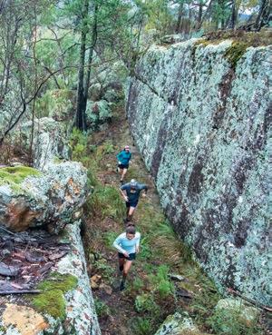
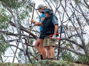
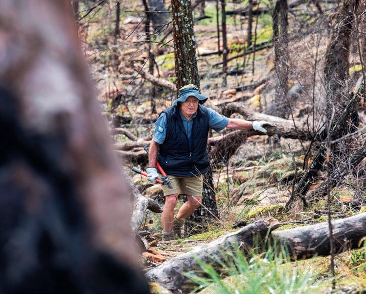
Kerry maintaining the trails
Kerry and Hilary McAllister (For Wild Places CEO) pausing for a breather while discussing the Pilliga Ultra
On 13-15th September, 2024, a weekend of running, community and sports activism will occur at Barkala Farm, a roughly 33km drive north of Coonabarabran, NSW.
Run in one or all of the events (10K, 20K or 50K). And take in the Pilliga’s beauty and diversity, and learn from the local community about why this landscape is so special. Learn more at pilligaultra.com
THE BITS ABOUT KERRY I SAID I’D GET TO are as follows: He first arrived at Barkala Farm fourteen years ago, when his girlfriend was captured by the potter’s studio. Since that time, Kerry hasn’t ever properly left, and has been camping in the bush there nearly every second week. After my first meeting with him, we spoke again over the phone; he told me he’d set up camp at ‘Split Rock Valley’. His setup was clean and cosy. Kerry is a man you can still write a letter to; in any case, he doesn’t have an email. He spends most of his time out of range; we contacted each other on a landline graciously facilitated by the property’s owner.
Kerry has been bushwalking for fifty years. During that time, his paid work has differed across varying roles in conservation and consulting, computer business and tour guiding. Since retiring ten years ago, Kerry has kept himself busy; when not at home in Tamworth and president-ing the local bushwalking and canoe club, he is often touring; K’gari island, and Kangaroo Island have been recent destinations.
SANTOS’S FACT SHEET ON THE NARRABRI GAS PROJECT in the Pilliga makes no mention of the Gomeroi people in its ‘about’ section; instead, it offers a narrative of the area’s history as a ‘working forest,’ using language that suggests a pre-existing path of destruction, and it alludes to an idea that adding mining to the mix of farmland and forestry isn’t that far-fetched or controversial. It wouldn’t be that disruptive, it seems to say, because it’s disrupted already.
But the multi-layered significance of the Pilliga represents environmental and cultural aspects worthy of protection. That doesn’t mean, however, that environmental and cultural significance alone should be a prerequisite for protection. This idea speaks to the lens of a capitalistic, post-colonial world—prove to me it’s worth something, or I’ll damage it, take it, exploit it, sell it.
When I asked Kerry about the mining in the area, I could hear the distinguishable trait of disgust in his voice: “It’s not warranted,” he said. He’s written multiple letters to government departments voicing concerns about the ongoing mining and the attempts to expand it in the area. Noting that the mining will impact valuable resources, including sources of water, Kerry quoted from a document on the gas project, stating the impacts will continue to affect the Great Artesian Basin for 1,400 years. That takes a bit to sink in.
CONTRIBUTOR: Linking the personal to the political, Emily Scott hikes and bikes but can never seem to escape the day job social worker in her.
To me, Kerry reflects the essence of responsible exploring. He seems to acknowledge that this land is not completely untouched, that there are many years of connection with country here that is not ours. That we can use this privilege to campaign against the exploratory permits of the mining industry that propose to tear down the sense of wild that exists here. That the ‘wild’ isn’t necessarily our wild; that we can explore quietly and respectfully. W


with Christian McEwen

Knowing how to tie the right knot for the right occasion is a skill every adventurer should know. Wild Earth Ambassador Christian McEwen shares six of his favourite knots.
Knot-tying is one of those skills that will never go out of fashion, especially in the outdoors. You'll become more resourceful and ready to jump into action when you have the knowledge to tie a bunch of super versatile knots.
The following knots have stood the test of time and are extremely useful for those camping trips and outdoor adventures where you may need to set up an emergency shelter, reinforce your tent during a freak storm, or even help an injured companion in a rescue situation. Knowing the right knot to use can mean a world of difference and can really build your confidence in the outdoors. Here are my top six knots for the outdoors and some of their important uses to consider getting familiar with before your next outdoor adventure.
1. THE FIGURE 8 KNOT (SEE TOP IMAGE)
The figure 8 knot is most commonly used in rock climbing to tie the rope to your harness. This is an inherently safe and secure knot that adventurers trust their lives with every day. It can be tied on a bite (through a loop in the rope), or re-threaded. It's very effective when you need to tie off the end of the line, or need it to be well secured to a post or tree. Particularly in a rescue situation where it's essential the knot does not slip, you just can't go past this one.

The alpine butterfly may just be the most useful knot in my books! It lets you create a loop that does not slip anywhere you require in the line. It's super useful when you need to hang a bunch of equipment up on a single line. It can be used similarly to a trucker's hitch as well to create extra leverage, like when tying down camping gear on rough roads. It can also be used to isolate a damaged section of rope. If you ever decide to take your outdoor adventures into the world of climbing and mountaineering, this knot will be a very helpful one indeed.

The flat overhand knot is an extremely simple yet incredibly useful knot. Have you ever needed to join two pieces of rope together? Well, the flat overhand is the knot of choice, especially when you need to tie it quickly. This knot is also very easy to untie afterwards and is often used for rappelling by climbers because its relatively low profile reduces the chances of the

knot getting stuck when you pull the rope down once you finish. Though rare, this knot can slip in some cases, so for added security, remember to leave nice long tails and cinch tight on all ends and directions when tying this knot.

4. THE DOUBLE FISHERMAN KNOT
The double fisherman knot is another knot used to tie two ropes together. It’s extremely strong and generally considered more secure than the flat overhand. However, it’s extremely difficult to untie after it’s been loaded. Climbers often use this knot to create Prusik loops, since they know the knot won’t need to come untied once the Prusik has been created.

5. THE CLOVE HITCH KNOT
The clove hitch is a handy way to tie an anchor to the middle of a line and to tie something down to a post or stake when you need the ability to easily adjust the tension. It’s a classic knot for lashing down a load of camping gear. It's also a standout for securing tent guy-lines or for a tarp setup when assembling an emergency bivvy or shelter. The clove hitch is used extensively in climbing, but it’s also a great easy knot to learn even if you’re just starting out.

6. THE PRUSIK KNOT
The Prusik is a type of friction hitch that is used in a variety of rescue scenarios as well as a rappel backup. Due to the fact that this knot grips the rope until you loosen the wraps with your hand, it's an excellent emergency hitch to learn in case you need to use a rope to hoist yourself or somebody else up from a glacial crevasse, cliff ledge, or whitewater.
Like anything, mastering a knot takes practice, but the time you put in can pay off enormously when adventuring outdoors— when the elements are bearing down on you. You and your buddies will be glad you spent the time learning them. W
CONTRIBUTOR: Climber and snowsports enthusiast Christian McEwen is a Wild Earth Ambassador who has spent decades engaging in global exploration and adventure. He now calls QLD's Gold Coast home.


The absolute best all season ‘do it all’ ultralight air sleeping pad


- A complete and ignominious failure. - An embarrassing disaster.
- A ludicrous or humiliating situation.
When things go spectacularly wrong in the outdoors, it may not be fun. Funny, though; that’s another matter, because reading about the trials and tribulations of others can be, if not interesting, well, downright humorous. We asked the Wild community to send in their stories of when things haven’t worked out precisely to plan, with the promise of cool prizes from some of Wild’s advertising supporters to sweeten the pot. Here are our faves.
RUNNER UP
Years ago, our family of four (Dad, Mum, and two teenage daughters) embarked on our ‘Very First Multi-Day Hike’ as we launched ourselves into hitherto unknown territory on the Thorsborne Trail, Hinchinbrook Island.
Fledglings of the hiking world, we donned our tonne-weight backpacks, and with buckled knees, headed along the beach to start our new adventure.
At this stage of our hiking career, we had brought 1.5L plastic water bottles, not only for water, but also for the methylated spirits we’d use to power our Trangia stove. With plenty of cooking in mind, we also carried potatoes, onions, carrots, oranges and apples. And a chopping board, for how else do you chop all this veg? (Dehydrated meals are in the future at this stage).
Some hours later, with relief, we arrived at Nina Bay Campsite (heaven, but with mosquitoes).
Dividing the chores, hubby and elder daughter set up the tents and sleeping gear. Myself and younger daughter prepared the dinner, a mighty task with all this sand and all these mosquitoes, not to mention the amount of vegetables to chop.
We got out the water and methylated spirits. Chopped the veg on our trusty chopping board. Got spices and lentils ready to make dhal. The mosquitoes were driving me crazy.
I GRABBED THE WATER BOTTLE ... WHILE SLAPPING THE GODDAMN MOSQUITOES ... KKAPPOWWW! A TWO-METRE WALL OF FLAME SHOT SKYWARDS.”
With the Trangia lit, and the pan full of food cooking, all we needed now was a good half-litre slosh of water to get the dhal going. While slapping the goddamn mosquitoes, I grabbed the water bottle and poured some in. KKAPPOWWW! A two-metre wall of flame shot skywards from the stove.
Oh ##*##*###**###! That’s not the water bottle!!!!!
We had a meths/fire emergency on our hands, but thankfully, adrenaline had us putting out the flames in no time.
I was suddenly weeping with relief that my eyebrows were intact, and that no one was burnt. I was weeping that we had no dinner and that we were all hungry. I was weeping at my stupidity. And I was weeping more because the mosquitoes were in a frenzy.
This dinner debacle pulled the family together. Our daughters had never seen their mother lose it like this. But none of us felt like meths-infused dhal for dinner, so we scrubbed the black off the pan, and made some soothing tea and biscuits instead. With a darkening sky, we could at last see our glaring mistakes in the uncharted waters of the ‘Very First Multi-Day Hike’.
We will be wiser and better from here.
NICKI THOMAS


HONOURABLE MENTION
Many moons ago, I was working in a bar at a ski town in Japan. At the end of the season, I was trying to figure out the best way to travel around the country on the cheap when one of my regulars suggested bike touring. An interesting idea, I thought: Adventure, challenge, and taking life in the slow lane—these were all things that greatly appealed to me in my early twenties. Of course, I hadn’t ridden a bike in over a decade, and had about 15kg of stuff with me … but why get bogged down in those kinds of details? Sometimes you have to just give it a crack.
So the week after lifts closed, I went to Sapporo and did some research, by which I mean I read exactly one blog on bikepacking. I remember the blog’s ethos: “Just get out there and do it, and sort out the problems on your way.” Sounded good to me. I bought a used hybrid flat-bar bike, a portable pump and a puncture-repair kit for $400. The next day, I tied my backpack to the rear rack of my bike (see upper left pic; yes, I am retrospectively aware this was one of the whackest bike touring set-ups ever!) and was on the road. The first day, I cycled 120km to beautiful Lake Toya in southern Hokkaido. As it turns out, this was hard going having not been on a bike in ten years, with 15kg MacGyvered to the back. But oh well, I made it.

Day Two was when things started to go wrong. My plan was to ride 170km to Hakodate, in the far south of Hokkaido. The problem was that I was well and truly buggered, and really feeling all the muscles in my body that hadn’t been worked since I was 14. By about midday, it became obvious I wasn’t making it all the way before nightfall. But I didn’t
want to give up. “Worst-case scenario,” I thought, “I rock up in town late in the evening. No biggie, I’m not afraid of the dark.” At about 6PM, the sun was setting and I was still on the road. But I was only about 30km and one last hill from my goal. The end was in sight! However, I was cycling up this hill and feeling pretty slow … actually, I was feeling very slow … possibly too slow. “Bit weird,” I thought. So I looked down and noticed, oh shit, my rear tyre had gone flat. As darkness settled in that springtime evening in Japan, so too had the light of my spirit been extinguished, and my soul turned to black. I gave up.
UNFORTUNATELY WHAT I DIDN’T HAVE WAS A LEVER … OR ANY KNOWLEDGE OF HOW TO FIX A PUNCTURE.”
Luckily, I was near a small town, so I walked the bike a couple of kilometres back to civilisation and checked into a hotel, where I crashed hard and slept for twelve hours. The next day, I attempted to fix the puncture. Being the prepared bikepacker that I was, I was chuffed that I’d had the presence of mind before starting the trip to pick up a puncture-repair kit. Unfortunately what I didn’t have was a lever … or any knowledge of how to fix a puncture. So I used whatever items I could find—namely a fork. Unsurprisingly this did not work; I’m pretty sure I only succeeded in giving the tube more punctures. In the end, I had to wait an extra day for the local bike mechanic to open up, where the nice man kindly patched my tube. You beauty! I was on my merry way.
The only problem was the tyre went flat again about 10km down the road. Luckily it was only a slow leak, so I was able to persevere—getting off to pump every couple of kilometres or so until finally I limped into Hakodate. I was exhausted and quite frankly embarrassed, but I was at my goal. So what did I learn? Give everything a crack. I now had confidence to overcome any challenge ahead of me, because at least I probably wouldn’t fuck up that badly again. And I’m happy to say I never did *
*That’s a lie. I’ve been fucking up since ‘91, baby.
MICHAEL BODNARCUK
HONORABLE MENTION
No tent, no map, no compass, and just one orange and two sausages to share between fourteen people in a night to remember.


II REMEMBER WAKING TO THE SMELL OF BURNING RUBBER DURING THE NIGHT. SOMEONE’S BOOTS HAD CAUGHT FIRE. THEY STILL HAD THEM ON THEIR FEET.”
DARN VARMINTS!
set out to climb 1,286m Wylds Craig mountain with my local Tasmanian bushwalking club in winter 1968. There were eighteen of us, and after breakfast on a Saturday morning, we started out on a day walk, planning to get back to camp after lunch on top of the mountain. Even though it was winter, the weather was fairly warm. Some people wore shorts. It was a tough walk—we had to climb over lots of logs and bash our way through horizontal scrub—but most of us were young, energetic and fit. We walked through lots of pandani. The mountain climb was pretty steep. I remember at one point sitting down in some snow to have a rest, and half thinking maybe I could wait there ‘til the others reached the top and came back down.
I kept going, though, and we all reached the top, apart from four walkers who turned back early on. The weather changed on the way up, and by the time we summitted, it started to rain heavily, and thick mist came down the mountain. There are supposed to be magnificent views of the Florentine Valley and mountains nearby, but all we could see were clouds.
After a quick lunch, we were keen to get down off the snow-covered peak. It was very cold up there. I always thought it was the leader’s fault that we descended the wrong way, but I was recently talking to my old friend Christine. She said it wasn’t his fault. She said the group took off down the mountain, and he had to follow so the group wouldn’t be separated. When we got down out of the mist, we realised we were on the wrong side of the
You may remember that last year, in Issue #190’s Ed’s Letter, and on social media too, I spoke about having my $1,000 GPS watch stolen by a rat while I slept at Bluff Hut in Victoria’s high country. The Wild community shared some animal fiasco stories of their own on our social media pages; mine, it turned out, was far from the first watch to be nicked. But as well as watches, we learnt about thefts of boots, overpants, glasses, stoves, toiletries, torches, and even a coffee plunger. And that’s besides the stuff critters had destroyed or vandalised. JAMES MC

I had a similar experience in Bluff Hut when ski touring there last year. Throughout the night I heard some little critter munching away on something next to me. I couldn’t work it out as I had hung up all my food. The next day I discovered that the protective cover on my phone was chewed through where the buttons are positioned. I had to ditch the cover (an expensive Otter Box) as I now couldn’t turn the phone on. Clearly the salt/sweat content from our skin is very appealing to these creatures! SIMON MENTZ
I HAD A SIMILAR EXPERIENCE IN BLUFF HUT SKI
TOURING THERE LAST YEAR.”

mountain. Nothing looked familiar. We spent hours climbing up and down ridges looking for the way back, but when it started to get dark, we knew we had to spend the night out in the bush.
It was the first and only time I’ve ever had to sleep out in the open. We gathered lots of bracken ferns to lie on. One of us had a box of matches, so we gathered wood and lit a huge fire. We all lay down in a circle, snuggled up to each other to try and keep warm, and tried to sleep. At one point in the night, I remember waking to the smell of burning rubber. Someone’s boots had caught fire. They still had them on their feet.
It rained during the night, but not too heavily. We woke at daybreak. We hadn’t eaten since lunch the day before, and no one had any food except for one girl, who had leftovers from lunch: an orange and two cold sausages, which we shared between fourteen of us for breakfast.
We then started walking again. We were tired and weak. Eventually we found the Florentine River, and walked in the freezing water up to our thighs. I don’t know if the leader or any of the others had any idea where we were, because they didn’t have a map or compass. I remember at one point, as we walked along through a freezing-cold river, someone at the front of the line said, “Don’t worry, if we’re not back by tonight, they will send out the search and rescue.” I was a bit dismayed when I heard someone at the back of the line say, “We are the search and rescue.”
By lunchtime, we were all getting very hungry and weak. I began to worry if we would ever get out.
Eventually after crossing the river and climbing up another ridge, we found a forestry road, which led back to our camp. Camp was deserted when we arrived. The four men who were there had gone out looking for us. They seemed disappointed when they returned and saw us; they were hoping we wouldn’t get back so they could get a day off work to continue searching for us.
I’ve done lots of bushwalks since that trip, but I’ve never been lost again, or had to spend another unanticipated night out in the bush. I’ve never forgotten that memorable Wylds Craig walk.
ROZ GLAZEBROOK
A Tassie devil once stole my Prius key, left in what I thought was a secure place. It turned what promised to be an uneventful car shuffle at
the end of a packrafting trip into another adventure! YASON MHIC LEOID
A TASSIE DEVIL ONCE STOLE MY PRIUS KEY...”
I was camping in the Budawangs, and in the middle of the night, we saw a light flashing on and off in the top of a tree above camp. It had us completely freaked out. It didn’t help that we’d had some postdinner ganja. Turns out that it was the torch I’d used for making dinner; a possum had grabbed it, and it was being turned on and off as he nibbled it! I kept that torch for years after that, and chuckled each time I used it. IAN CROUCHER
We lost a stove to a fox once, on the first night of a three-day trip. We tracked it in the snow to no avail, but recovered it when we had all but given up and I went for a pre-walk pee. DARREN BOWMAN
Not only did each of these three fiasco story writers win a prize, as did the overall winner Chris Newman whose story starts on p58, everyone else who submitted stories (published or not) went in the draw for some of the great prizes listed below that can help you avoid, or at least get through, your next outdoor fiasco.


So you won’t go hungry: (4x) OFFGRID SOLO ADVENTURE PACKS (RRP $65.95) offgridprovisions.com.au
To stop you getting blisters: (2 x) ARMASKIN SOCKS (RRP $49) armaskin.com
To clean up your drinking water: (4x) BEFREE 1L WATER FILTERS ($RRP 119.95) katadyngroup.com
To soothe the aches & pains: (2x) FISIOCREM RECOVERY PACKS (RRP $170) fisiocrem.com.au
To while away the hours while you recover: (4x) WILD MAGAZINE SUBSCRIPTIONS (RRP $55) subscribe.wild.com.au
If things go wrong: (2x) LIFE SYSTEMS SURVIVAL PACKAGES (approx. RRP $50) lifesystems.co.uk
If things go really horribly wrong: (2x) GME PERSONAL LOCATOR BEACONS (RRP $399) gme.net.au
Many thanks to everyone who submitted. Sorry we couldn’t print them all; there were some great entries we couldn’t fit in.
- OFFGRID SOLO ADVENTURE PACKS: Roz G; Darren B; Ian G; Brian C
- BEFREE 1L WATER FILTERS: Chris N; Vanessa B; Pamie C; Jeremy S
- FISIOCREM RECOVERY PACKS: Michael B; Chris N; Roz G; Nicki T
- ARMASKIN SOCKS: Michael B; Andrew D
- LIFE SYSTEMS SURVIVAL PACKAGES: Sean H ; Niels S
- WILD MAGAZINE SUBSCRIPTIONS: Ben D; Chris N; Simon M; Yason ML
- GME PERSONAL LOCATOR BEACONS: Chris N; Nicki T
When things go wrong, they can go really wrong, as Chris Newman tells the sorry tale of a gastro-hit traverse of Tasmania’s challenging Western Arthurs.
“CWords & Photography CHRIS NEWMAN
ould they helicopter us out sitting on the fly-out pod toilets?” I wondered. “That might be the cleanest option for both us and our rescuers.” We were stuck in Tasmania’s incredibly scenic—and unfortunately for us, spectacularly gut-wrenching—Western Arthurs, deep in the process of getting to know those 1-star fly-out toilets better than anyone in Arthurs’ history. We had, at that stage, already spent two full days marooned in 35°C heat, forced to drink muddy water out of a tiny soak. There had also been double-ended gastro action, fevers, and debate about activating the PLB. Toilet paper had, of necessity, been scrounged from other parties.
But that was in the past. Still to come was the ignominy of being overtaken by a 71-year-old hiker who told us we moved so slowly that, from a distance, we looked like high-altitude climbers battling up Everest. Still to come was a tent-flattening rainstorm, and our struggle back to the trailhead on only electrolytes and a muesli bar each. And still to come was my furious ditching of a half-cabbage that, despite my weakened state, I’d thought a good idea to lug around.

In yet another fiasco on this trip, one of those hiking poles—after being thrust into a rock during a desperate balancing attempt—didn’t survive past Lake Oberon

CUT BACK TO A WEEK EARLIER. In what perhaps should have been a warning of things to come, I take a group photo at Scotts Peak Dam trailhead before we set off. My digital ‘tough’ camera clicks … and goes blank. We haven’t even left the car park, and the flip-up screen is kaput. The camera still takes photos though; I just can’t see them, and so the images of the rest of the trip—including the ones you see here—will have to be taken film-style, in that I won’t know how (or if) they come out until after I get home.
Our plan is to do the classic Western Arthur Range traverse at a pleasurable pace, with two days’ spare as backup. Our trio consists of trip leader Sam, an experienced Tassie bushman now separated from his native state and living on the mainland; Jezza, my best mate with an Olympic physique from his work as a landscape gardener in Hobart; and myself, from Adelaide. We spent our teenage years hauling 25kg rucksacks loaded with soft drinks and cookies through the Flinders Ranges and Victorian Alps with a youth group. Having learned a thing or two (or nothing) since, we still, in our late twenties, take the same approach to trip catering. Somebody near the trailhead reminds us that the Arthurs are more fun with a lighter pack, but it’s too late; besides, I’ve already packed the half-cabbage, which is the usual treat for lunch.
The tall gums of Junction Creek get closer, and we stumble upon a park ranger straddling a log above the creek. It’s the only decent log within twenty metres, and we’ll need it to reach the campsite. The ranger is keen—and I mean poop-in-a-tube keen— to know every detail about our plan to cross the Arthurs, and won’t let us over the log until he’s satisfied we’ll make it out of the mountains alive. I feel babysat. Sam and Jezza tell me later that they found it informative.
It’s the middle of summer, and Junction Creek is near-full tent capacity, with some dudes bathing nude in the creek right next to the ranger’s log. Maybe that should have been another warning. We move on, fending off dragonfly-sized mossies to find a place to camp among the trees.
Over the next few days, we grunt up the 800 vertical metres of Alpha Morain, relax a night each at Lakes Cygnus and Oberon, and giggle when, at Square Lake, we too get caught skinny-dipping. The weather is great; cloudless blue skies—we’re lucky—and in the sun, it must be 30°C or more. Apart from #regrets about our heavy packs, the trip is going well indeed …
It goes rapidly downhill, however, when my energy starts to falter ascending Mt Capricorn. I assume my body is merely bargaining for a post-lunch siesta, so I continue pushing through the scrub to the campsite on High Moor.
Somebody warned us that water would be difficult to get here—their exact words were: “You’ll be drinking from a muddy puddle.” Sam and I go off searching for the puddle while Jezza
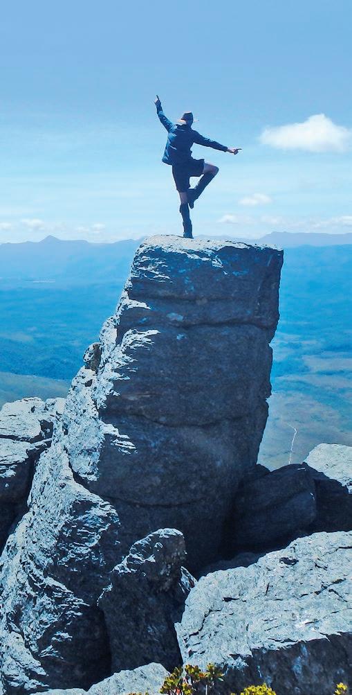
NOW IT’S REALLY NOT LOOKING GOOD. I SWEAT ALL NIGHT IN A FOETAL BUNDLE WITH FEVER DREAMS AND HOT FLUSHES.”
prepares dinner: a fiery curry with rice, which is very inappropriate after a day of sweltering hiking.
I wolf down my portion of curry, but soon after dinner, something doesn’t feel right. Is that my stomach? I sprint the exact distance of ‘not-far-enough’ metres from camp before projectile vomiting the entire meal into a bush next to the boardwalk. “That’s not good,” I think. “Hopefully the curry was just too hot.” Returning to the others, I say, “Guys, I might have picked something up. Let’s see how it goes in the morning.” We then enjoy the sunset together. Suddenly, though, I need the amenities. Now it’s really not looking good. I sweat all night in a foetal bundle with fever dreams and hot flushes. The zipper on my sleeping bag glows molten-red as I vacate the tent at full speed, running desperately to the pod toilet again and again.
The next morning, it’s clear we won’t be going anywhere with me in this state. Jezza and Sam indulge themselves exploring


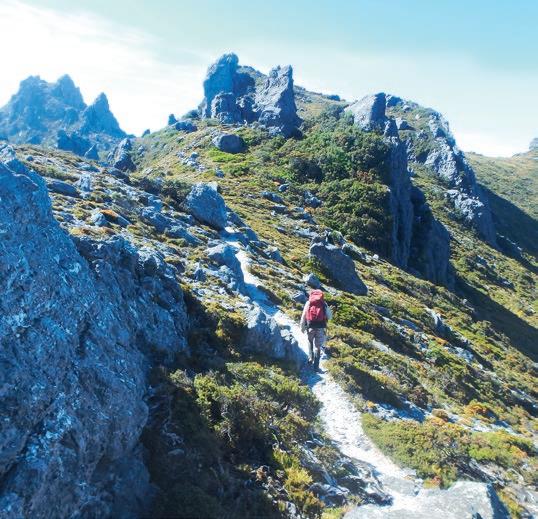
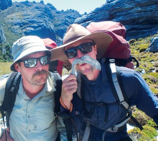


nearby peaks, while I lay all day inside the tent to avoid the sun. Fire sporadically shoots from both ends, until my insides feel like I’ve been ab-crunching at the gym on a gutful of Fireball whisky. Going for a chunder, one of my lowest points comes when I’m struck by the impossibility of multitasking on a pod toilet. I’m forced to holler across the Moor: “Jezza! Get me a fresh pair of undies.” In the early evening, just as I’m perking up, Jezza dashes off down the boardwalk. Sam and I find him half an hour later, hunched over in a gully, alternating between chucking his guts and gazing forlornly into the mountains. As we approach, he looks up through watering eyes. “Sorry fellas, it got me too.” He’s soon probably wishing we hadn’t had such a blazing curry the night before. Now we are two squatting, one standing, at High Moor—arguably the most difficult-to-access camp on the Arthurs’ traverse, with a decent few days’ scrambling to get out in either direction.
IT’S THE MORNING OF DAY SIX. Other walkers depart early to avoid the heat, and High Moor becomes our deserted tent shanty for a second day. Jezza has had a rough night and is completely knackered. I regain some energy, and try to walk with Sam to reconnoitre the Tilted Chasm; I retreat almost immediately, cheeks-a-clenchin’. Time passes slowly, and our trio enters full marooned mode in the alpine sun, laying prostrate under tarps rigged up for shade. It may sound strange, but hopefully Jezza and I have gastro; I say hopefully, because we don’t want it to be anything more sinister. We spend the day brainstorming the cause. The High Moor drinking puddle? No, too soon after we arrived. Pollution in one of the lakes on the range? We were filtering and tabletting everything. The curry dinner? Unlikely. And that wouldn’t explain why only me and Jezza have been struck down, but not Sam. Through the fog of my fever, a memory emerges of the park ranger lamenting to us about all the toilet paper he’d been picking up near Junction Creek. Jezza and I hadn’t treated our drinking
IMAGES - CLOCKWISE FROM LEFT
On top of the world on Day Two, unaware of the evil brewing in our bellies
Sam, a renowned practitioner of camouflage techniques, blending in with the landscape
An Olympic physique on full display at Square Lake
Dinner at Junction Creek on the walk in; there were no smiles when we returned walking out
Thumbs up for hydration from small flowing streams
Formerly known as the Moustachio Brothers ...
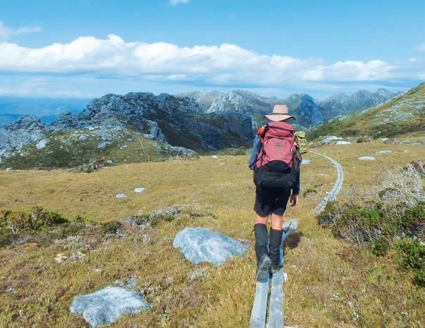

water there; we’d filled our bottles from a spot we judged as sufficiently upstream of the campsite. Sam had tabletted all his water from the start. That must be it! But while it’s our fault, and we should have taken more precautions, we suddenly feel much less amicable towards overcrowding on Tassie’s walking trails in general, and at Junction Creek in particular.
Now the question is whether to stay put and wait to recover, or to bail as soon as possible. Jezza and I are struggling to stand, let alone scramble over the infamously steep Beggary Bumps. But Sam could catch whatever bug we’ve got from us, given our limited ability to hand wash properly with soap; alcohol sanitiser, as we found out later, isn’t too effective against gastro. (Ed: I didn’t know this either! But I’ve researched it, and it’s true.) And if we stay, while we’ve brought extra back-up days of food—in any case, Jezza and I won’t be eating much—the poor water source at High Moor isn’t ideal, especially with the hot weather. And, at our new rate of usage, supplies of toilet paper and electrolytes are running uncomfortably low.
“Tassie residents get the chopper ride for free,” Jezza declares. I don’t know if this is true, but pressing the PLB’s rescue button plays on our minds as we lay baking in the sun. Then Sam finds a mobile signal. It’s an odd feeling, being stuck in a remote place but able to contact family and friends. I can’t decide if I like the connection or not: It’s a chance to find sanctuary in the digital realm, but eventually we have to face the reality of being sick and stuck. Our parched, desert-island brains start to dream up some fantastic ideas. Sam comes close to patenting a method of


JEZZA AND I CURSE EVERY CRUSHING KILOGRAM IN OUR RUCKSACKS, CLENCH OUR SPHINCTERS, AND BUCKLE IN FOR A SUFFERFEST.”
dehydrating beer for hiking, a kind of beer-Berocca tablet which you drop into a cup of icy mountain water. This sounds like the best thing I’ve ever heard.
In the late afternoon, a big university group arrives, closely followed by two hardy Victorians, Tess and Sally, who squeeze in next to us on the tent platforms. We alert them to our predicament; they graciously offer gastro-stop tablets and toilet paper. With all these new people around, rushing to the amenities feels more embarrassing than before; I preferred solitary shanty camp.
As we greet a third night at High Moor, I’m surprised how quickly my mental resolve has deteriorated. A disconcerting mixture of fear and boredom grips me, and I feel the need to get hiking again as soon as possible, if only to regain some control. The constant uncertainty—bail, or stay and wait to recover—is exhausting. We make a final decision, based on when Jezza and I got sick, that tomorrow is our best chance to get off the range before we almost inevitably infect Sam.
Overnight, the fine weather that’s blessed us so far is chased away by a furious wind. When daylight comes, I poke my head


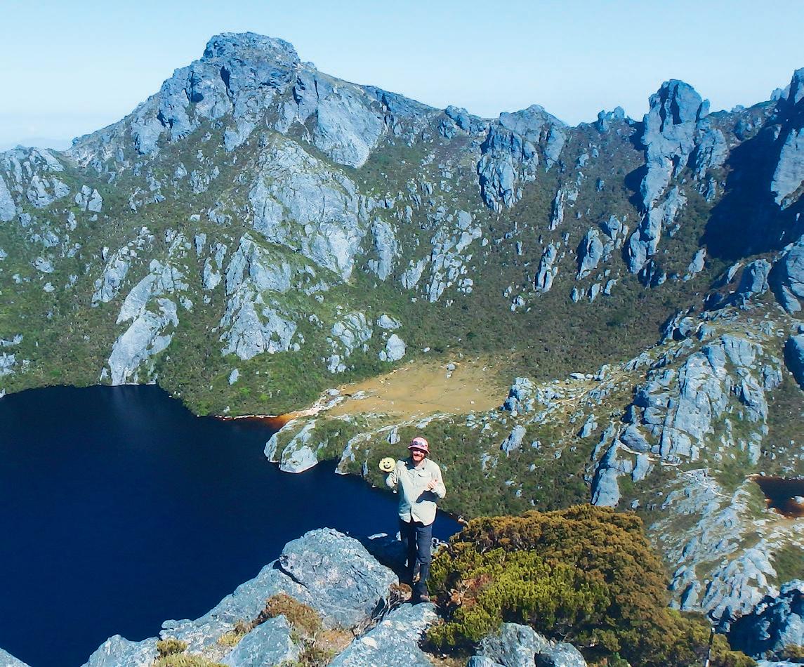
outside the tent to find the campsite completely fogged in. A rain squall blasts through. The stronger gusts must be 150km/h, and are blowing the neighbouring tents flat. I look over to see the shape of Sam, still inside his tent, holding the collapsed frame and fabric off his face. It’s tempting to stay in the warmth of the sleeping bags, but we have to leave High Moor today. Morale is low. We don’t want to spend another two days marooned here if Sam gets sick. So we pack up the tents with freezing hands and bail.
Sustenance for the day involves trying to hold down a soggy Cadbury Favourite, plus a sip of electrolytes. Jezza and I curse every crushing kilogram in our rucksacks, clench our sphincters, and buckle in for a sufferfest. Thankfully the rain eases, and with temps in the low 20s, there’s less risk of dehydration. Not far from High Moor, we descend into the Tilted Chasm, where someone shouts up at us, “Are you the Gastro Brothers?” Word of our plight has spread across the range.
Reaching the Beggary Bumps, Jezza is imbued with a rush of energy (probably from the chocolate-only diet) and powers away in front. Sam stays with me. We succumb to a leisurely pace, and are overtaken by—as he proudly tells us—a 71-year-old walker, who says that from a distance we looked like climbers battling up Everest. To justify our speed, we introduce ourselves as the Gastro Brothers and he replies, “I never take a bottle to drink from when I’m in Tassie. Just dip my mug in and off I go.” My insides grumble; surely that’s not true. And by “mug”, does he mean an enamel cup, or like, his head? I picture him in a TV commercial: ol’ Guts of Steel, a twinkle in his eye as he sips the water straight out of Junction Creek—“Mmm, that’s the good stuff”.
We reach Haven Lake, tonight’s camp, and I realise the entire half-cabbage is still in my pack. Earlier in the trip we’d drawn on a face with a sharpie, and Carl the Cabbage had become the honorary fourth member of our group. But Carl weighs at least a kilo; we’ve barely eaten any of him, and I’ve carried him for six days. I throw him onto the track in disgust. “You can’t leave Carl there,” says Sam, and puts the cabbage in his pack. Later on, Jezza visits the dunny and returns laughing but slightly shaken. “I looked down and Carl was looking right back up at me!” Sam had jettisoned our beloved brassica into the pod toilet.
In the morning, we hold down a muesli bar each for breakfast, and continue the slog. The walk
After perfect weather on our walk in, things turned very ...
Wet! Bail-out day was more sliding than hiking
Chris meets Carl the Cabbage
Excited to be bailing from High Moor
Shanty camp at High Moor
That way to the nearest pub meal


out almost breaks me and Jezza, and ultimately gives us chronic-fatigue symptoms for most of the year to follow. At the saddle, Sam receives a text from a local friend: “Need help or will you get out OK?”
The Gastro Brothers were all smiles for
Jezza demonstrating our general feeling for the walk out
HERE’S WHAT CHRIS SCORES AS OVERALL WINNER OF OUR FIASCO STORIES COMP:


“He could bring us a pub dinner!” I say. I’m only half joking. We could wait a night on the plains, and Sam’s mate could walk in with good food and more electrolytes. “But do we genuinely need help?” asks Sam. Jezza looks towards the horizon and says stoically, “Let’s just go as far as we can today. I’ll be alright.” Tess and Sally, who we shared a tent platform with during our darkest hours at High Moor, overtake us and offer a multi-course dinner with wine if we make it out to the trailhead tonight. The decision is made: march/struggle onwards, and reassess at Junction Creek.
The adventure gods bless us with blue skies and light winds. Jezza digs up energy out of nowhere and roars away again. I finally arrive at Junction Creek, slightly ahead of Sam, and find Jezza relaxing with his boots off, strapping a blister. I ditch my pack, dig out some scroggin, hear a rumbling, and watch as Sam powers straight past us, leaving a cloud of dust and mosquitoes in his wake. He flies over the log creek-crossing, and vanishes into the undergrowth with a muffled “Meet you at the car, boys.”
“We’re stopping here!” shouts Jezza, and turns to me. “We’re in this together, he has to consult the group.”
“Doesn’t think he’ll make it out unless he keeps going now,” I answer. The thought of another night sick in the tent without any appetising food, trapped here at Junction Creek— the origin of our woe—isn’t appealing to me, either. We push on. The final, brutally long hours are a blur. I stumble on tree roots and chicken wire lifting from the well-worn boardwalk over the buttongrass plains. My singular focus is making it to our Camry parked at the trailhead. How much further?
Emerging from the forest at the trailhead car park is glorious. We drive around to nearby Edgar Dam campground, and meet up with Tess and Sally who have wine and mi-goreng noodles as promised; decadence compared to what we’ve been forcing down over the past four days. And just like that, our unexpected marooning on the Arthurs is over. Sam never ends up coming down with the bug, but a few weeks later catches gastro anyway from the smaller folk in his family. For Jezza and me, it takes twelve months before we truly return to full health. Tassie water now seems a little less friendly than in the past, but we’re already planning a redemption trip. Next time, though, we’ll use that water filter. W

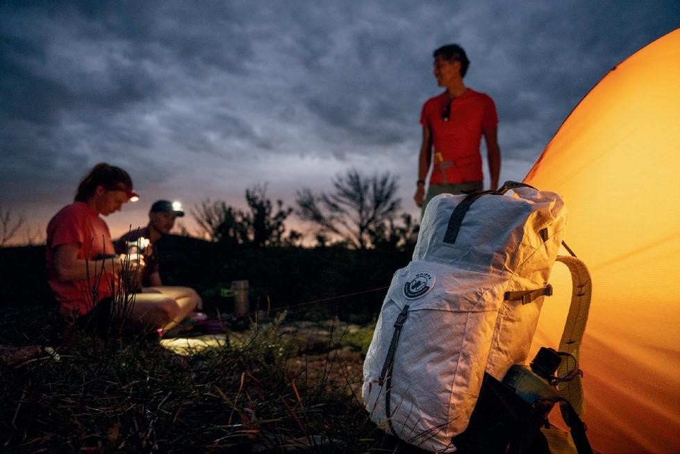


In our callout to the Wild community for fiasco stories, we used the tent picture adjacent. Many people wondered what had actually happened. “You can’t put that photo up and not tell the story,” said Marcus Foley, for example, on our FaceBook page. “Well, the truth is,” says Wild ’s Editor, James McCormack, “I have absolutely no idea what happened. It came from a stockphoto image library, but it cracked me up when I saw it, and it seemed to sing ‘fiasco’.”
So we went back to the Wild community, and asked them to put their imaginations to work, and to tell us what they think happened here. The North Face stepped in to offer an awesome prize of a Trail Lite 2-Person Tent as well. Out of the 100+ responses, here’s a selection of explanations that cracked us up the most.
“I had read the sign on the petrol bowser many times—do not use mobile phones while filling your vehicle. I did not realise the same applied to my new, discount, no-name brand butane canister camp stove, and foolishly began uploading my day’s hiking highlights to FaceBook.”
IAN FOLLY
HONOURABLE MENTION
Husband and wife went camping. Wife asked husband: “Do you need the instructions?”
Husband mansplained that “Real men don’t need instructions.”
Wind came up over that night, and wife said, “I told you so.”
BEN DAWSON wins a Wild subscription

“The second helping of freeze-dried curry was, in hindsight, a mistake ...”
SEAN HILL
“When keas turn bad on a blue moon.”
SHANE WHITE
“When you over-inflate your mattress...”
KIRSTIE ROSS
“For rent in Newtown: light and airy studio apartment. Semi-furnished. $600pw. No pets.”
SAM KAY
“I would tell you what happened ... but the tale is too in tents for FaceBook.”
CRAIG FISHER
“Some Aussie mates are still adamant that throwing goannas into other mates’ tents is much funnier than lighting farts in confined spaces.”
ROBERT
MACFARLANE
“Morning after thoughts: “Welp, I guess I shouldn’t have put so much hot sauce on the beans last night.”
AARON DOBBS
“My kids were in this tent, separate from ours, when a huge storm hit during the night. It was too windy and wild to get out, but when I eventually did, I found our kids still wrapped up in their sleeping bags, in the destroyed tent, sound asleep. Kids are so resilient!”
GEOFF LOCKHART

“We tear the roof up, now we up out of here …” This tent belonged to Miley Cyrus, and this particularly wild adventure inspired Do My Thang Miley reported, however, that she did leave no trace, taking everything with her from the campsite, and now cares for her tents, committed to reducing consumption and waste.”
ZIPPYOCRACKERS
“The possum tag-team tent-wrestling tournament ended just as expected.”
ANDREW DONNELLY
“A mob of seagulls, because they left a bucket of chips in the tent.”
CHRISTINE HAMILTON
“Three sleepless nights. Two slugs of Irish nectar. One mission.
Human - 0. Mosquito - 1.”
ROHAN L
Chris and their climbing partner were acclimatising well in Peru’s Ishinca Valley, an oasis of oxygen and greenery at 4,000m asl, ringed by the glaciated high peaks of the Andes. They had forgone the refugio in favour of a self-supported camp, and their small tent sat on the far side of the meadow, across a meandering stream that they hoped would provide a disincentive to the cows who were eating, shitting and pursuing the salty residue from the grey kitchen water around the hut. Next to the tent, a natural rock shelter provided a small cave ideal for cooking, and they had passed a couple of days bouldering and climbing to 5,000m in preparation for an attempt on one of the 6,000m peaks.
With their small, grassy area constrained by the creek and rock face, they were surprised to return from a morning’s climb up Ishinca to find several other tents squeezed into the tiny area, while the remainder of the meadow lay green and undisturbed. In fact, there was so little space that the tent’s occupants had decided to tie into their existing tent pegs.
The two looked somewhat incredulously at each other, and wondered who the agoraphophic visitors might be. An hour later, the sound of brash Californian accents heralded the arrival of two guides with their two clients. “This is where we always camp,” the guides announced loudly, as if that settled the issue; they seemed acclimatised not only to altitude, but also veneration, and they promptly ignored further attempts at social interaction with a couple of scruffy Antipodeans.
Chris hoped the group would be a little more flexible with climbing itineraries than camping arrangements, though perhaps they felt they could also control the elements. One of their tents certainly looked like a cheap replacement that wouldn’t survive going any higher. At least the clients had the grace to look embarrassed about the imposition.
The guided party got off to a noisy start early the next day, while Chris and their partner had a later start, with the intention of moving to advance base camp for their final objective of Tocllaraju. At breakfast, Chris opened what they presumed was sugar: a market purchase with a picture of sugarcane on the front. However, the crystals looked unusual, and now scrutinising the Spanish, it was clear they had in fact picked up monosodium glutamate. It was unlikely that flavour enhancer improved the taste of oats, so with the disaster of contaminating their dwindling rations averted, they were left with the quandary of what to do with the two small packets of MSG that would surely approach gravitational singularity with each step up the mountain.
Procrastination could only work for so long; they hung their tent in the nearest patch of insipid sun to dispel the heavy condensation from the night, then packed it away. They looked at each other and laughed as the remaining tents, with the shared pegs removed, were now wilting like days-old-bouquets. Taking the useless packets, they sprinkled the contents above the remaining camp, where the MSG settled like dandruff over the dewy tents. In full view of the curious cows, and to prevent bladder pressure from their waist belts, it was time for a final pee, much closer to their camping area than they had considered prudent over previous days.
With the herd on the move, Chris and their partner hefted packs and headed towards the mountain as the first salt-crazed cow started across the stream ...
VANESSA WILLS
Vanessa has won a tent that, unlike the destroyed tent she’s written about, is actually awesome and spacious and strong:
THE NORTH FACE’s Trail Lite 2-Person Tent, valued at $650 RRP. It’s user-friendly, with oversized doors, two huge vestibules, ample height, and pre-bent poles that maximise the internal living space. Check it out at: thenorthface.com.au


How big a goal are you willing to set for yourself?
Daygin Prescott, who started climbing less than two years prior, set off to California to attempt an ascent of one of the planet’s most famed big walls—El Capitan.

Words & Photography Daygin Prescott
Dare to dream.
Dare to try.
Would it be so hard to try?
One year and nine months after first tying into a rope, you’re at the intersection of flat ground and a vertical sea of granite at one of climbing’s hallowed spaces—California’s Yosemite Valley.
Standing at the base of El Capitan, the towering wall—warping into the space above you—is overwhelming. Seemingly endless. You’re uncertain of your chance of success. It is not your technical ability; you can climb, haul, and set up a portaledge. It is the commitment to new experience and to reliance on yourself and your climbing partner. Perhaps your dream is too big?
But what if your dream was half the size; would you do it then?
+++++
The Nose of El Cap is often referred to as the best rock climb in the world. 35 pitches. 3,000ft of flawless granite soaring into the Yosemite sky. This is not just a dream; this is The Dream. For some, it’s climbed in mere hours; for others, it’s days; most, however, will never complete or even attempt the vertical voyage.
As a team, you have cut your teeth on Ozymandias (Australia’s ‘Big Wall’), and on Yosemite Valley classics like Washington Column, Lurking Fear and Leaning Tower. Experience is in your favour for a successful ascent. Yet still, the granite sea looms above; its scale is daunting.
You won’t be the first to the summit. Nor will you be the fastest. Nor will you do it in the best style. You’ve seen photos of the wall, the summit and the valley. So what, then, is the point? Climbing for the sake of climbing? A potential moment of elation at the summit?
Climbing leaves you with a physical displacement of zero. Whether you summit or bail, you end up where you started. Back at the base, back at the trailhead, back at the car. Climbing is not about the final destination. Instead, the essence of climbing lies in the lessons it offers in suffering, in commitment, and in trust. It allows glimpses into experiences unknown and into new perspectives about yourself.
+++++
After your first night on the wall, you are awakened at 4AM by distant echoes of “ready to haul!” and the clanging of a climbing rack. Peering out of the portaledge, you see the faint light of another party starting their journey, jugging and hauling up to Sickle Ledge. Inspired by the early start, you begin a symphonic process. You


IMAGES - CLOCKWISE FROM TOP
Jamming up the megaclassic Boot Flake pitch
James Hurrey leading out from Sickle Ledge
First night on the wall, just below the Stovelegs pitch. We set up just in time for a storm front to come through
The gear explosions around Camp 4 each morning got me so psyched. James making some important decisions on how many bagels to pack
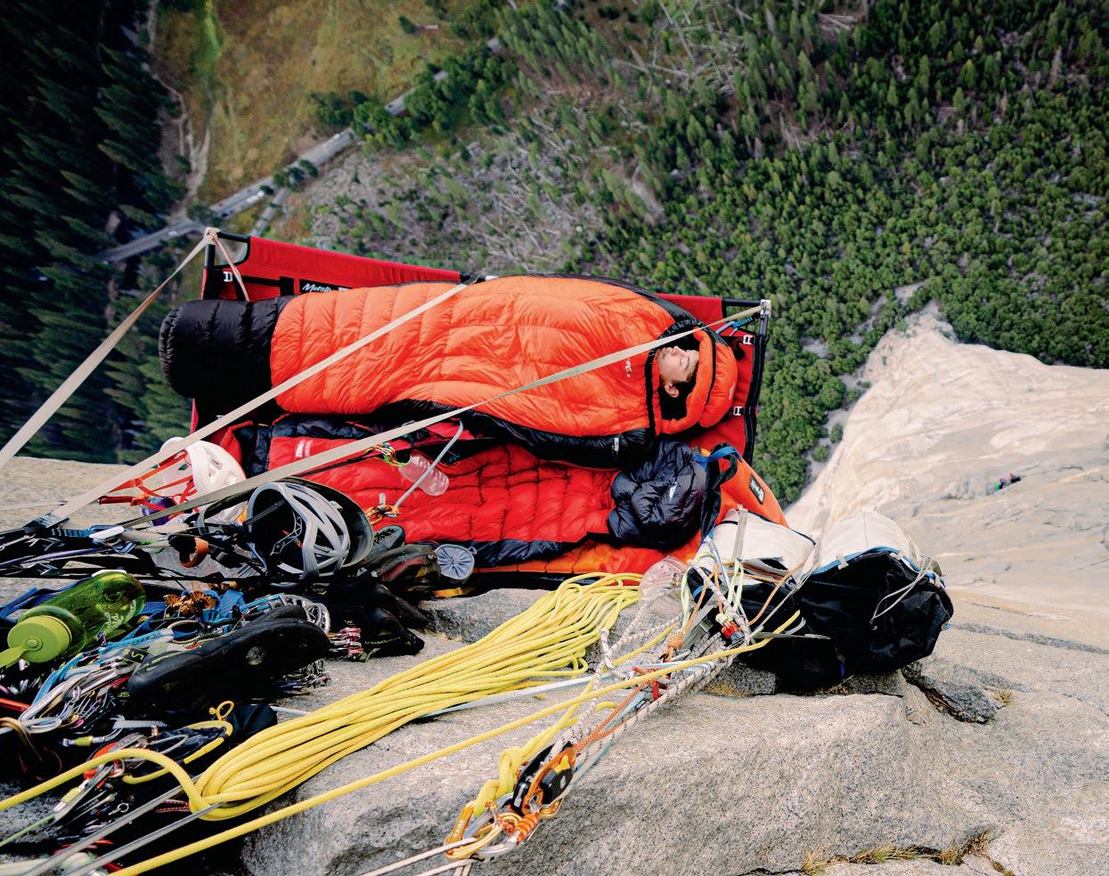
IMAGES - CLOCKWISE FROM TOP
The wildest of bivvy spots. Hanging 800m above the valley floor beside the Great Roof
You constantly feel dwarfed by El Cap; granite engulfs you from every direction
Instant bonds form between climbing parties.
Bivvy party on El Cap Tower
Big-wall climbing requires a solid climbing rack
Friendly German fella preparing dinner next to us on El Cap Tower


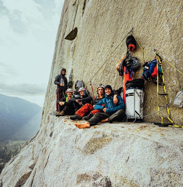

YOU ROLL OVER IN YOUR SLEEPING BAG, DIPPING YOUR HEAD OVER THE EDGE. THERE IS A VOID OF AIR BELOW YOU, WITH GRANITE ENGULFING ITS BOUNDARIES.”


pour cold water in the zip-lock bag of plain oats. You add sachets of honey pocketed from the Valley Lodge. You stuff the sleeping bags. Reload the haul bag. Slip on your shoes. Pack down your hanging bed.
A headlamp compliments the pre-dawn glow, casting dancing shadows across the dimly lit granite. Orchestrated movement starts you up the Stovelegs pitch. You jam up the stellar 5.8 splitter crack, 250m off the valley floor. This is really what you came here for: World-class climbing in an incredible location, with your best mate. Hand jam, foot jam, pull on a #3 cam. Step in your aiders, place some gear. Do whatever you need to do to keep moving up; efficiency is key here. Free climb until it’s too hard, French free while you can, and then aid climb when you need.
You say it again: Efficiency is key. Keep moving. Climbing, aiding, building a belay, fixing, hauling, jugging, again and again. The process is simple, yet the undertaking still seems overwhelming and complex.
Climbing The Nose is a journey across iconic pieces of rock: the Boot Flake, the Great Roof, Changing Corners. You glimpse defining moments in the history of rock climbing, clipping the same pitons as early ascensionists, aiding through moves that Lynn Hill first free climbed, and using the same belays as Alex and Tommy did on their speed record.
The days are long. They are physically and mentally exhausting. But after just one or two days, you adapt to life on the wall and to the ebb and flow of the valley. You eat flavourless cous cous, communicate over the Rocky Talkies, haul heavy loads, and poop next to your mate on a portaledge.
The wall is busy. Everyone is on their own journey, moving at their own pace. A NIAD (Nose In A Day) team passes. You wait for the party ahead; meanwhile, the party below is having major rope faff. Everyone is exactly where they want to be.
Night swallows the wall. You climb on, passing fellow climbers who have retired to their portaledges. Climbing through the Great Roof, you bivvy 800m above the valley floor; it’s the most beautiful and exposed night’s sleep of your life. The morning is magnificent, and you roll over in your sleeping bag, dipping your head over the edge. There is a void of air below you, with granite engulfing its boundaries. The previous evening may have been The Dream, but it was not a dream.
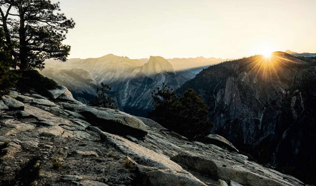


IMAGES - CLOCKWISE FROM TOP
Sunrise atop El Cap. Rays striking through the valley, illuminating Half Dome and beyond
Topping out at midnight, we crashed on the nearest flat rock we found James Hurrey. Handsome man. Beaten
Slow start on El Cap Tower. Sharing moments like this with your best mate, creating lifelong memories
You were not sure if you could. In fact, you thought you could not. Yet you tried. And now, four days in, here you are, standing atop El Capitan. It is midnight. In the darkness, you see a few trees, but there is nothing new at the summit. Perhaps The Dream was everything that happened before the summit?
The East Ledges descent takes you back to the valley floor. It is a return to what is familiar to you. Yet it is no longer familiar with you. In this emotional journey of extraordinary experience, you have gained new wisdom, new perspectives.
Your days on the wall were everything you hoped for. There was music. Sour worms. Sore feet. New friends in unnerving places. The relationship with your climbing partner deepened through every pitch of climbing, your friendship strengthened by the bond that runs through a climber’s rope.
But what happens when your dream is complete?
Do you walk away satisfied?
Do you stop climbing?
CONTRIBUTOR: Adventure and commercial photographer Daygin Prescott is based in NSW’s Blue Mountains, and is a selfproclaimed sour-worm connoisseur.
Or do you look onto the next? Do you look for something harder, longer, colder, more remote?
Approach. Climb. Summit. Descend. Back to camp.
A displacement of zero. An experience immeasurable. W

Tasmanian wilderness-conservation advocate and photographer Grant Dixon first visited the Spero-Wanderer region forty years ago. A resurgent interest in enhanced protection for the area among a new generation of Tasmanian environmental activists inspired Grant to expand his collection of imagery of the area to assist in any campaigns. The remoteness of this country necessitates extended trips, and over three long visits during late 2022 to early 2024, he spent more than fifty days, often solo, criss-crossing the region by foot and packraft. What follows are some of the amazing photographs he took on those trips of the area’s diverse landscapes and cultural values.
TASMANIA’S Southwest Conservation Area—sometimes referred to as the Spero-Wanderer region after two of its main rivers—occupies over 138,000ha of wild country south of Macquarie Harbour. With its long, rugged, undeveloped coastline—full of headlands, beaches, lagoons and islets; a coastline that extends undeveloped beyond the Spero-Wanderer region to take in the well-known landmarks of the famed South Coast Track—the World Heritage qualities of the Southwest Conservation Area are clear. Unfortunately, however, when the Tasmanian Wilderness World Heritage Area (TWWHA) was declared in 1989 (which was an expanded version of the Western Tasmania Wilderness National Parks World Heritage Area declared in 1982), it did not include the adjacent Spero-Wanderer region to its west, despite the area’s natural and cultural values being an extension of the TWWHA. Conservation groups and others, however, have ever since been campaigning for the Southwest Conservation Area’s inclusion into the TWWHA. The Southwest Conservation Area represents a bit under 10% of the area of the adjacent Tasmanian Wilderness World Heritage Area. The area is managed by the Tasmanian Parks and Wildlife Service (PWS) but its low-level conservation tenure means that mineral exploration and mining (for example) are permitted. Furthermore, for a long time PWS has had minimal staff and resources that can focus on the area, so management of the area’s natural and cultural values is limited. For example, all-terrain vehicle (ATV or quad bike) use is a problem in parts of the area.


The D’Aguilar Range and other mountain ridges in the region owe their existence to conglomerate bedrock that is resistant to erosion
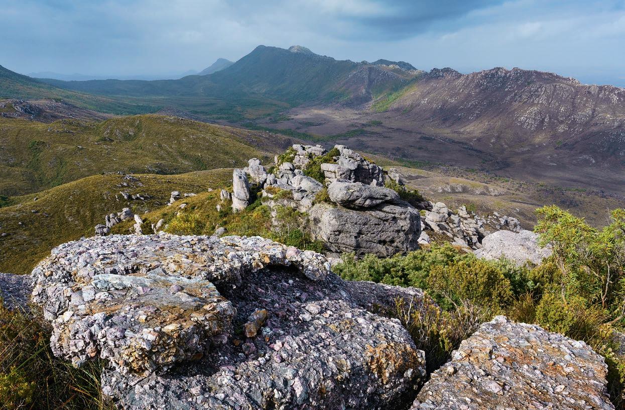

The Spero-Wanderer region’s river catchments are blanketed in ancient Gondwanan life forms, including Huon pine, and its buttongrass moorlands—a uniquely Tasmanian phenomenon, internationally recognised for their flora, fauna, fire-adapted ecology and peatlands—are extensive. The heritage of the Tasmanian Aboriginal people is abundant, in the form of coastal middens, rock art, former hut sites and the influence of fire on the landscape.
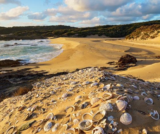
Special mention should be made of the coastal vegetation, where thick forest alternates with green ‘marsupial lawns’, manicured by grazing wallabies and wombats, and patrolled by Tasmanian devils isolated from the facial-tumour disease that has ravaged populations to the east. Coastal rainforest, pruned and stunted by the wind, appears impenetrable from the outside; once under the canopy, however, it’s often hard not to be impressed by thick tree trunks in an open setting.


As the tussocky slopes of Hibbs Pyramid loomed, it was as if we’d suddenly been transported to the subantarctic islands. But no, this was part of Tasmania’s southwest, a rugged stretch of coast pounded by the breakers of the Southern Ocean. It had been a two-hour trip in a wave-tossed boat to get here from Strahan, an expensive voyage that entailed negotiating the notorious Hells Gates and then 50km of choppy swells on the open sea.
This coast and its hinterland are part of the Southwest Conservation Area—a tract of the Tasmanian wilderness that’s yet to receive the World Heritage status it deserves. Thanks to the Wilderness Society, seven of us arrived at Sanctuary Bay. Protected from the waves by Hibbs Pyramid and associated reefs, this is one of the few safe landing points along this part of Tasmania’s west coast.
The next day, heavily laden, we walked to the mouth of the Spero River, one of the features we had come to explore. Paddling upstream in packrafts, we made short work of the estuary, a deep channel fringed by thick coastal forest. Next came a stretch of dark pools punctuated by shallow beds of shingle through which we walked, towed or carried the rafts. The river’s flow was gentle. The catchment is not huge, and the summer had been dry.
Eventually, in steadily increasing rain, we stowed the rafts on the riverbank, and explored further upstream on foot. Amid the riverside rainforests are Huon pine, an ancient species unrelated to most Australian trees. One specimen we located measured 5.6m in circumference (‘at breast height’, one of those quaint forester terms) and so was estimated to be at least 1,500 years old.
Back at the mouth of the Spero, we made forays further south to Endeavour Bay. We had easy walking along rocky beaches, and then some not-so-easy tangles with thick, wet scrub. The reward for engaging in these struggles was the presence of some ancient dogwood trees. Normally, these are nondescript in appearance, but here they’d grown to prodigious proportions, becoming contorted in the process.
Endeavour Bay itself is as remote a beach as you can find, bordered by thick forest and wild ocean. Two of our group met up with a crew from the South West Marine Debris Cleanup, who were hard at it retrieving flotsam and jetsam from the beach: drink bottles, nets, ropes, bait boxes, twine, toothbrushes and lengths of tough black tubing from fish farms. Such debris is scattered along all of Tasmania’s shorelines. At Endeavour Bay, the Cleanup crew documented and bagged these items, almost all of it plastic, ready for pickup by helicopter. Then they boarded their boats again and headed for more sheltered waters in anticipation of a cold front. When we arrived the following day, the beach was cold, wet, windy and deserted—but clean.
Back at Sanctuary Bay, our explorations continued. The coast here is characterised by limestone that’s been weathered into scalloped patterns with razor-sharp edges. In other places, the rock had been undercut by the waves at high tide, leaving fantastic, free-standing monoliths. Whether close-up or distant, Hibbs Pyramid was always a dominant offshore feature. By now, persistent westerlies had built the swell to a mesmerising violence. With the ocean in this kind of mood, it was no surprise our pickup had been delayed. We started auditing our remaining food supplies, and we settled in for a long stay. And then suddenly, while it was still breakfast time, the boat was there. Within half an hour, we were all aboard and ready for the rough ride back to Strahan.
WE HAD EASY WALKING ALONG ROCKY BEACHES, AND THEN SOME NOT-SO-EASY TANGLES WITH THICK, WET SCRUB.”

During negotiations arising from the LaborGreen Accord of 1989 (which laid the foundations for a minority Labor government in Tasmania), strenuous efforts were made to have this great tract of wild country become part of an extension to the TWWHA. The mining industry forcefully resisted those efforts due to the existence of rock types in which the discovery of commercial ore bodies is said to be prospective. Traces of valuable metals have been found at several places, and, due to increased metal prices, mining has become a greater threat recently. Despite this, after over fifty years of exploration, no proposed mines have yet emerged. Nonetheless, prospective mining means the TWWHA boundary in this area is often defined by geology, not landforms or river catchments that would make more practical sense for land management.
So far, this part of Tasmania’s southwest has been protected from major development by one of its most important attributes—remoteness. There are no permanent settlements, apart from a smattering of shacks (which should be excluded from any World Heritage extension) at Cape Sorell’s northern tip (opposite the town of Strahan). And while rough tracks to enable mineral exploration and ATV recreation have been scratched across parts of this world-class wild landscape, the cumulative damage from these impacts has been relatively superficial. Large tracts remain completely intact.

IMAGES - CLOCKWISE FROM TOP
Harbinger of a clearing storm, a rainbow arcs over the inland plains. Comprising ancient river terraces, the plains can be remarkably flat
Martin Hawes contemplates rainforest in the rain on the lower Wanderer River
The geological diversity of the hinterland is manifest in cobble and gravel beaches around Spero Bay
Native pigface provides a colourful display at Varna Bay in early summer
Coastal fern forest offers a brief interlude of easy travel near Hartwell Cove
The D’Aguilar Range rises beyond the Sorell River catchment; the foreground ridges lie within national park boundaries, the distant range does not


Spero-Wanderer


ITilted
and tors
CONTRIBUTOR: Long-time Wild contributor Grant Dixon is an earth scientist, nature photographer, wilderness researcher and recreationist.

n 1975, the Australian Conservation Foundation (ACF) included this wild area in its proposal for an extended Southwest National Park, as outlined in its publication The Wonderful South-West, and it proposed World Heritage listing of the entire southwest wilderness. This was a visionary move, given that the 1972 World Heritage Convention was completely new and untested. The Wilderness Society has included the Spero-Wanderer region in its proposals for the expanded protection of the Tasmanian Wilderness WHA going back to 1984. In 1990, the Tasmanian Department of Parks, Wildlife and Heritage included the Spero-Wanderer region in a report on the most suitable boundaries for the Tasmanian Wilderness World Heritage Area. Senator Bob Brown published a proposal for an expanded World Heritage property in 2009 that included this area and, in 2015, the Wilderness Society took this proposed extension to the meeting of the World Heritage Committee in Bonn, Germany. But the area’s values are still not widely appreciated, and it remains poorly protected and managed.
The case for adding this part of the Southwest Conservation Area, the Spero-Wanderer region, to the World Heritage listing of the Tasmanian Wilderness is compelling. W
The Spero-Wanderer Wilderness on Lutruwita/ Tasmania’s remote south-western coastline is unique, spectacular and right next door to the Tasmanian Wilderness World Heritage Area.
But being outside the boundary means means its natural and cultural values are also unprotected—mining and logging are still allowed here.
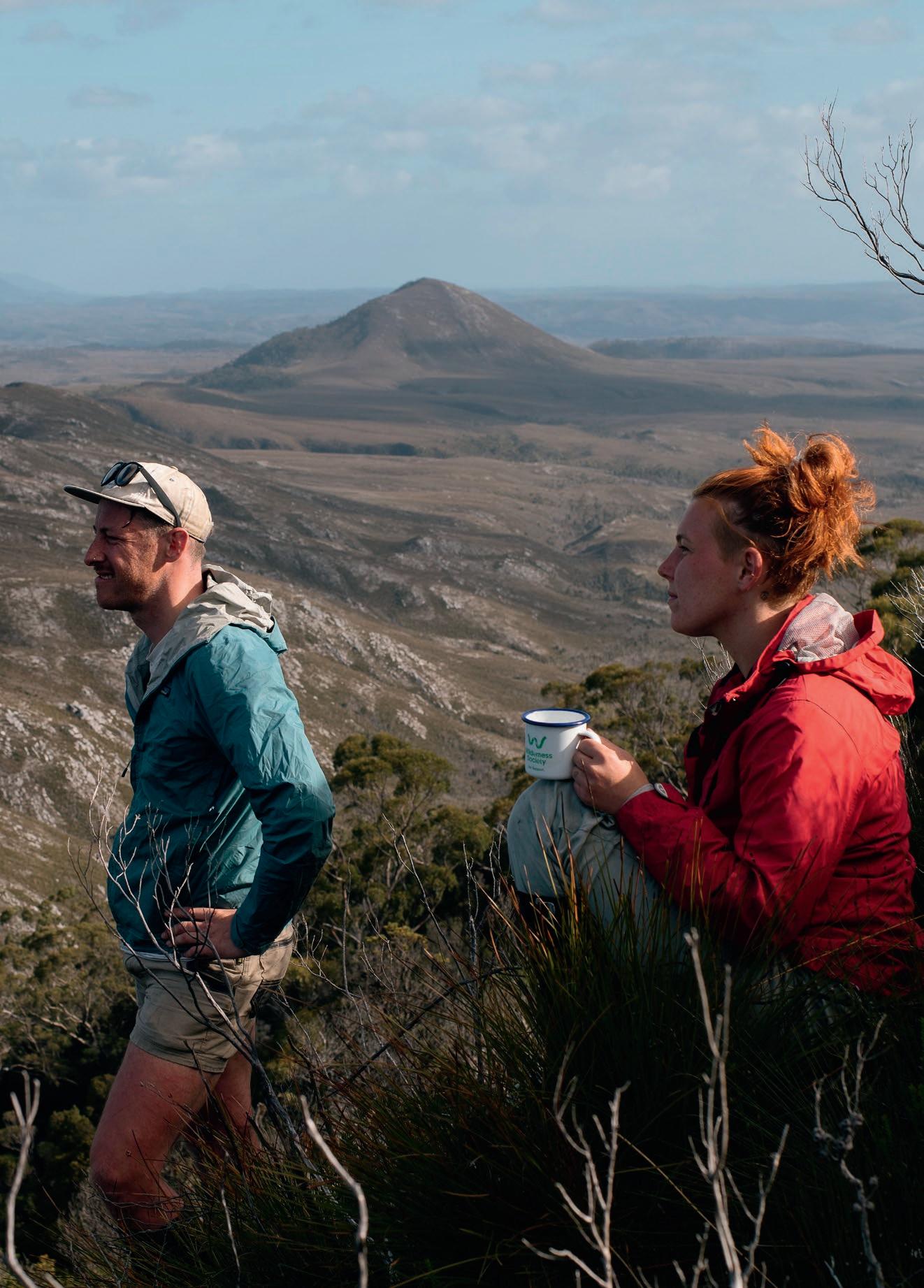
Discover the Spero
wilderness.org.au/spero World Heritage-grade wilderness—but you won’t find it in the Wilderness World Heritage Area.

Image: Tobias Burrows
Anzhela Malysheva deals with the fallout of being caught in an avalanche.

Words Anzhela Malysheva
Photography Jenny Stansby & Anzhela Malysheva
“They are not coming.”
My stomach dropped. I said it out loud not because Jenny hadn’t heard my conversation with Search and Rescue (SAR), but because I needed to expel those words, to let them break the silence and twirl between us like the snowflakes rapidly loading the slopes above. And just like the snowflakes, to lose their significance in the greater whiteness of the storm.
“I think there’s a weakness under us,” Jenny had said a few hours earlier. I’d noticed at that time the cracks running along the sides of the deep steps she punched across the steep slope. She swung her axe one more time, testing the supportiveness of the snowpack. Suddenly, we both knew it. Oh shit!
For a moment, everything was suspended, as if someone pressed the pause button, or the video was lagging to load. Stretched through the time-space continuum, the motion infinitely trended towards zero: The world … suspended; us … suspended.
I felt something hard softening, and something soft hardening at the centre of my chest. I felt the bulk of the windslab detaching from the weak surface and softly gliding downwards, following the directional vacuum of gravity’s pull, taking us with it. That moment lasted way too long. Long enough to consider the untethered tools in my hands, to wonder whether being unroped would become a good or a bad thing. Long enough to envision the terrain traps along the runout, and to realise that sliding headfirst would definitely be a bad thing. Tumbling in the gentle wash of the debris, I couldn’t be scared, or worried, or disappointed. All I could do was let go of an ice axe, and try moving my body within the bulk of the snow moving with it.


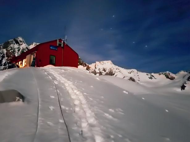
THAT MORNING, AT PIONEER HUT, just a few kilometres west of NZ’s South Island’s Main Divide, which runs down the island’s sharp central spine, we had made a plan. We’d packed our bags the night before, and then slumped into soft unconsciousness in our sleeping bags. Nestled in, we’d been hopeful of waking up to a clear sky. Having spent a few days around the hut resting and recovering, we’d been waiting for a weather window—even a short one—to cross to the east side of the divide and establish ourselves at Plateau Hut for the few remaining days of our trip.
The weather had been anything but reliable. It had snowed, but not enough. Then it had cleared, but not for long enough. Then it hadn’t been cold enough, and visibility hadn’t been good enough. With a dose of cabin fever, a touch of uncertainty, a generous serve of commitment bias, and a pinch of ambition thrown in, it was a recipe for a perfect disaster. And so, with us itching to leave the safety of the hut, we’d decided to give it a go, to “at least have a look at the conditions.” We didn’t stick to the plan.
THE AVALANCHE CARRIED US for 150m, before we were deposited at the base of the slope we were traversing. We were less than ten metres away from a gaping mouth of the crevasse. I tried to conceptualise the situation. Were we alive or not? Disconnected from reality, cut off from the world, disoriented spatially and emotionally, my muddled mind settled into a state neither dead or alive, but a limbo in between. Weighing the options and wading through a series of paradoxical truths, I concluded that we were both safe … and in extreme danger. We could not move up or down, yet exiting the runout zone was an urgent necessity. We had nothing but time, and also had to act quickly.

I FELT LIKE SOMETHING BIG HAD JUST BEEN TAKEN AWAY AND SOMETHING SMALL AND VERY FRAGILE HAD BEEN PUT IN ITS PLACE, SOMETHING I HAD TO PROTECT AT ALL COSTS.”
Apart from the surreal circumstance of having just emerged from an avalanche, our surroundings appeared mostly unchanged; they did, however, stand before us with an increased intensity. The ice shield we’d climbed across just minutes ago looked forebodingly vertical. The colloid of milky air felt uncomfortably thick. The buttress sticking out of the east ridge of Grey Peak looked dark and jagged, and the crevassed steepness below us seemed unforgivingly threatening. Our losses, meanwhile, accounted to one ice tool and an inReach with a flat battery. They were not coming to get us.
With reduced visibility and a forecast of snow for the next 48 hours, Aoraki Alpine Rescue Team had no real access to the Great Divide. We were stuck. We were on our own. The correspondence with SAR took time. Time that allowed for the debris to settle, for us to get cold and damp, for more snow to deposit on the overhead slopes with a fresh layer of wet, weakly bonded, premium avalanche material. After a few hours of collecting information from us, looking at weather charts and brainstorming in a dry cosy room somewhere in Mt Cook Village, Dave from SAR gave a deliberation: “If you go for a ride, at least you’d hope the picket will stop you both.”


I felt like something big had just been taken away, and something small and very fragile had been put in its place, something I had to protect at all costs. These were big feelings, immense and heavy, with more weight and volume and thermal capacity than the windslab looming overhead. I had to stop feeling and start doing. Suddenly, with a blinding clarity, I knew that we would get out. By which route or by what means—the details would come together, they didn’t matter. We’d called for help, and did not get help, but now I had the answer.
Climbing up the avalanche debris to regain elevation, and then out on the rotten shoulder of Grey Peak—amid the wind’s howling symphony, of which I heard every individual note— my whole existence was reduced to a single collapsing step, and the next one, and the next. Every step was made with anticipation and clarity, every step so deeply meaningful, as if … no! It could not be the last.
The light shadow of Jenny’s jacket, almost a rope length below me, was visible—in the whiteout, it was the only indication of life. Life so fragile and fleeting, life so complex and wonderful, life so important and yet dependant only on the fortuitous bonding of the snowpack and on being secured to 40cm of aluminium. I turned the lip of the snow chute, and the shadow disappeared.
I moved for hours or maybe eons; I thought I was the only person alive in the world. I saw every snowflake and its unique faceted pattern. I saw every fraction of space occupied by movement. I saw all the falls that happened and the ones that didn’t. I saw the darkest blackness of the bottom and the brightest blueness of the top. I saw the weight of the glacier pushing against the crust of the Earth, grinding it away with a crunchy, disjointed cacophony.
I saw all the people that came back and the ones that did not.
Before we got to the base of the ridge, in a half-dream state, there were no unnecessary words, no superfluous actions. I climbed—mechanically—the trench in the collapsing snow. I downclimbed—mechanically—the rimed-up western slope of the ridge. I threaded—mechanically—some cord around rocks and belayed Jenny. I set up the rope for the abseil. Sixty metres. It was our last stake in this poker game. As I abseiled down to Pioneer Pass and stood on the flattest spot I’d stood on in the last eight hours, I felt something frozen melting, and something hard breaking inside my chest. We were safe. We were back. We were fine. W
IMAGES - LEFT TO RIGHT, TOP TO BOTTOM
The summit of Tasman, visible at sunrise from Central Gully of Douglas Peak
Pioneer Hut at sunset
Navigating seracs towards Lendenfeld Peak
Daggering up the gully behind Mt Haast
Looking towards the route we climbed the previous day: Central Gully on Douglas Peak
Downclimbing the summit ridge of Lendenfeld in a storm
CONTRIBUTOR: Anzhela is a Blue Mountains-based guide, instructor and rock climber. If you see her wandering along the sides of remote cliffs, she’s not lost, just searching for quality cracks.
A three-day exploratory adventure somewhere in NSW’s New England region.

By JAMES MCCORMACK
(With a little help from Dave McLoskey)
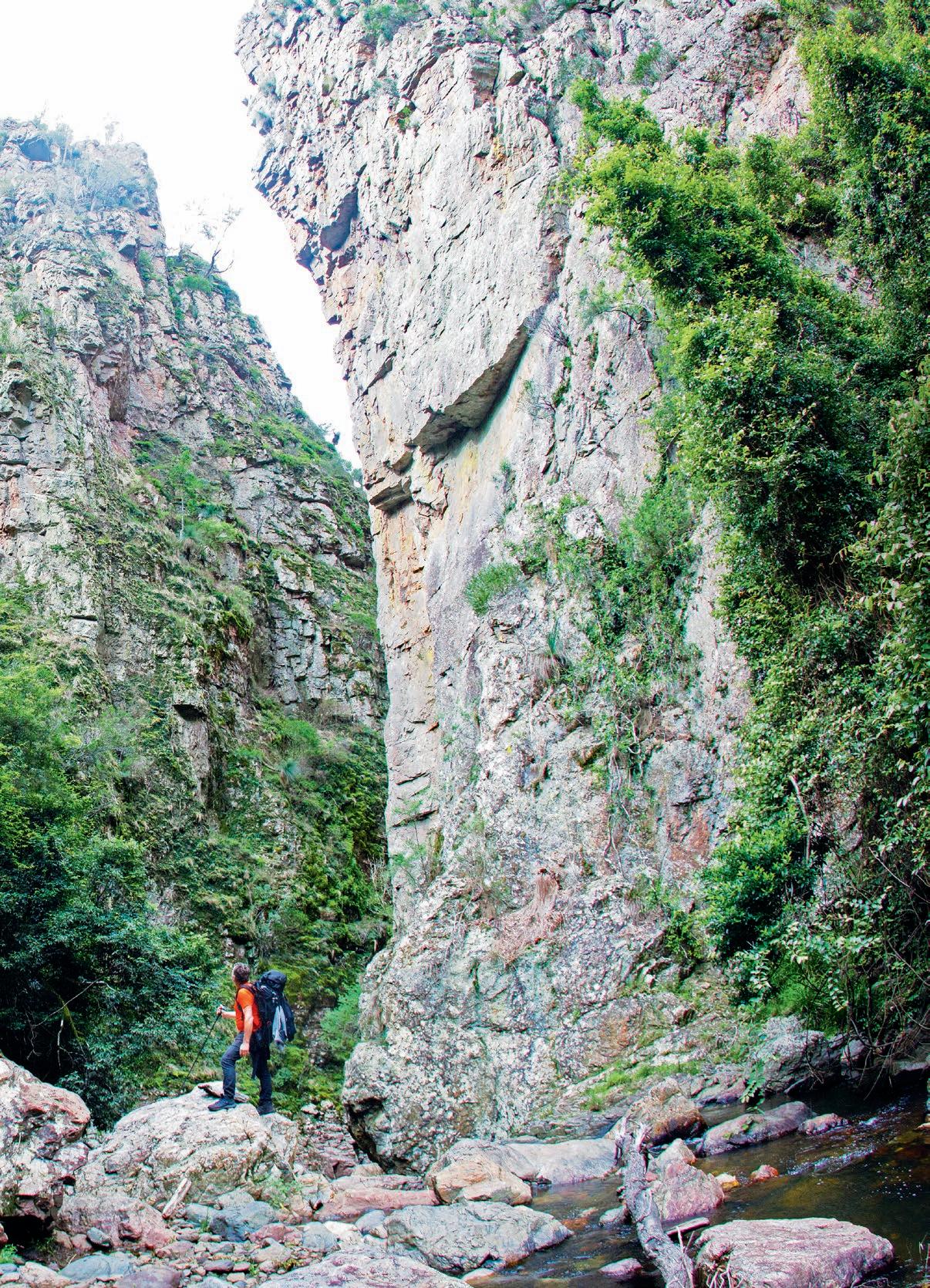
WE KNOW TOO MUCH. WE ALL KNOW TOO MUCH. In this day and age, where everything is written and blogged about, explained or analysed in hyper-detail, it seems there are few places you can go where you are truly engaging in discovery. And the outdoors is no exception. Usually, this is a good thing; knowing where you’re going and what to expect is, well, darn useful, and it’s why some of the earliest books ever made were travel guides, dating back to the Second Century AD when Pausanias wrote a guidebook offering insights into travelling through Greece. It’s also for this same reason that ever since Wild’s inception, track notes have been a key feature of the magazine.
In fact, it was searching for somewhere to write up as track notes that I first stumbled across this patch of New England, although when I say “stumbled across”, it was in fact someone else (you know who you are) who first mentioned it to me as a place I should consider checking out. They hadn’t been deep in there themselves, though, and weren’t able to offer much in the way of information. Nor, for that matter, could the internet. It appears there are no accounts (or at the very least, exceedingly few accounts) of anyone heading into this area; likewise for trip reports or track notes or anything similar. It is a trackless place the internet has simply missed.
This place had been on my radar for a little while, and earlier this year, I finally had a chance to get in there and explore for three days with my mate Dave. With little to go on, we didn’t quite know what to expect. But whatever expectations we did have, they were exceeded. There were tumbling rivers and soaring cliffs; lush rainforest and open, grassed woodlands; thick, impenetrable scrub and easy-going ridges; dark, moss-riddled brooks; and views from rocky crags. It was all a discovery. But Dave and I barely scratched the surface. We spent three days here, but the opportunity for considerably more extended trips abound, all into areas where route-finding is mandatory, as is the desire for exploration.
Now here’s the thing: I’m not going to caption this photo essay, nor tell you where this place is. Yes, it’s in New England, but that doesn’t narrow it down that much because that’s a big patch of land; the region is literally two-thirds the size of Tasmania. And it’s chock full of incredible country, from dramatic and deeply incised gorges to peaks in excess of 1500m, with vegetative communities ranging from rainforest to Antarctic beech to subalpine snowgum communities. Guy Fawkes River NP, New England NP, and Oxley Wild Rivers NP are three of the best-known reserves, but there are dozens of lesser known areas.
And if you do happen to know where this particular spot is—perhaps you’re one of the few that I told; perhaps you’ve been there and recognise it—keep the location secret. Let others have the joy of finding it for themselves, let them have the joy of exploration, the joy of heading into the unknown.
So why, then, share these pics at all? The answer is that so often we forget what an incredible country we live in, where there are areas ripe for adventure that even in this day and age have flown completely under the radar. Social media, we keep hearing, has ruined everything. But that is simply not true. As these pics remind us, exploration is still possible. And not just in New England; across the entire country, there are so many places where you can head into the unknown. You just need to look.


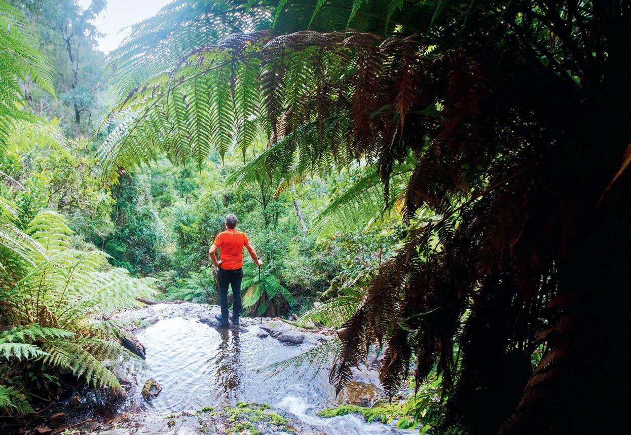





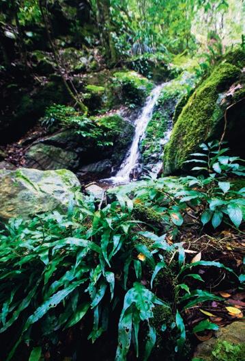


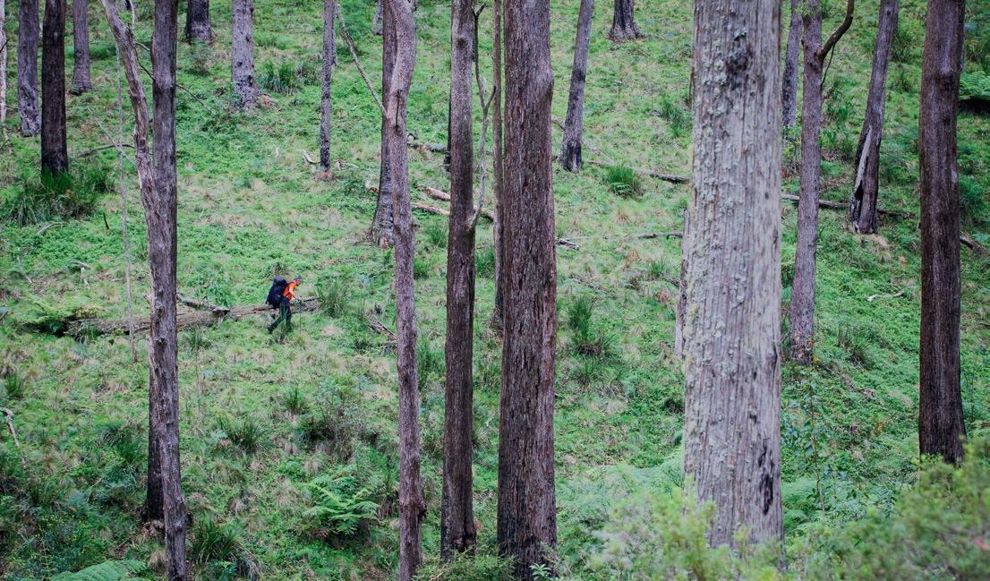

WE NEED THE TONIC OF WILDNESS … AT THE SAME TIME THAT WE ARE EARNEST TO EXPLORE AND LEARN ALL THINGS, WE REQUIRE THAT ALL THINGS BE MYSTERIOUS AND UNEXPLORABLE, THAT LAND AND SEA BE INDEFINITELY WILD.”
Henry David Thoreau
ADVENTURES DON’T COME CALLING LIKE UNEXPECTED RELATIVES; YOU HAVE TO GO LOOKING FOR THEM.”
Mark Jenkins



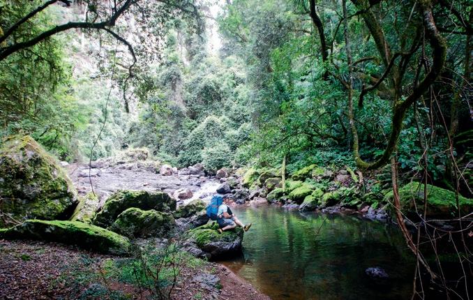


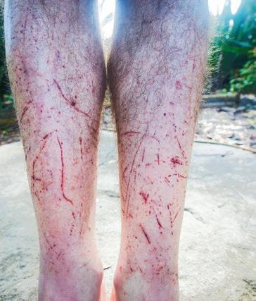

CONTRIBUTOR: James McCormack is the Editor of Wild. Between wearing gaiters or wearing long pants or getting his legs shredded by spiky vegetation, he believes the latter is the lesser of three evils.


Slovenia is arguably one of Europe’s best-kept adventure secrets, and its mountain biking is no exception.
Words Gerhard Czerner
Photography Martin Bissig
“The ladder here was the only part of the trail you couldn’t bike,” says Anej, laughing. “Until Elliot Heap showed up. This crazy guy just rode down it.”
We’re underground with Anej Stručl in northern Slovenia, and Anej has such energy he almost outshines his headlamp. Then he continues: “I’ll give you a rope that you’ll then tie around your seat post. I’ll climb down first, and you can lower the bikes down.” He turns around and disappears into the ground. We try to follow him with the light of our headlamps while we stand in the narrow mining shaft. The hole has a diameter of about two metres. A ladder leans to the right of it. An almost-vertical rock ramp lines the left. We can’t discern where exactly it ends or if it has a runout. “Yeah, OK. Really, someone rode down that?” I take a step back, deeply impressed. Franziska slowly lowers her bike into the depth of the mine.
Franziska and I and photographer Martin Bissig are in Slovenia’s Carinthia region, or as the locals say, Koroška. At about 1,000 km², it’s one of the country’s smaller regions, and most of it is forested. The green, hilly landscape in the valleys away from the urban settlement areas is a picturesque idyll where time seems to have stopped. Age-old farms on large acreages (well, large for Europe, anyway; maybe not Australia) lie strewn far apart from each other.
It’s on one of these farms that Slovenia’s first mountain bike hotel was established: the Eco-Hotel Koroš. The family-run accommodation is blessed with a spectacular panoramic view thanks to its location atop one of the countless hills, and you can see far across the lush green countryside all the way to Austria.
Nearby sits the towering peak of a mountain called Petzen. Dixi Stručl moved here in 2008 with his nature- and-bike-enthusiastic family, and, together with his son Anej and the help of the local biking community, they established a fine bike trail park here. Today, the Jamnica Trail Park offers 24km of singletrack, including a beautifully built ten-kilometre-long flow trail, which I know about from my last visit here. “Wow, the view is amazing”, says Franziska, looking excitedly towards Petzen. We park in an orchard between ancient, gnarled trees. Anej comes down the wooden steps even before we can make it out of the vehicle. “Great to see you,” he says. It’s a heartfelt welcome.
After we get all our things in order, we walk past some clucking chickens to dinner. Practically all the delicious food, from the vegetables to the meat all the way to the grains, are from the hotel’s own garden or surrounding farms. The finest locally, organically grown food you can imagine! After Anej finishes clearing the table, we make a quick plan for the next day.
The next morning, fog mystically wafts across the landscape
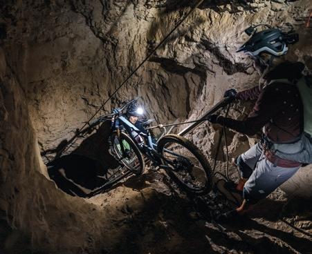
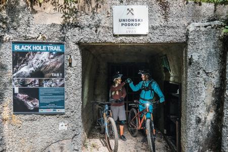


BEHIND AN S-CURVE IN THE DARK. FRANZISKA LOOKS AT ME: “THIS
DOESN’T LOOK EASY TO RIDE AT ALL.”
outside of our van. We start off on a narrow trail almost right behind the breakfast buffet. The grass is still heavy with morning dew, and the forest swallows us shortly after our departure. Anej knows every turn and corner and speeds along. From far ahead, he suddenly yells: “Stop!”
I take a look around our group, and all I see are broadly grinning faces. “Well, that was just sweet,” says Franziska, beaming. Anej begins pointing out the many possibilities. “You can see more trails over here. There’s one coming down from there. We can turn left or right further down. If you turn around, you can see two more back there.”

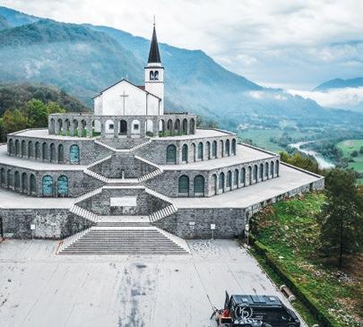

We decide to take the left junction. The ‘Bomb Trail’ takes us past a crater caused by an aircraft bomb during World War II. We continue along a root-packed ridge, before the trail, two steep ledges further on, spits us out onto a road. We high-five, our spirits are up. And while it’s about 500m in altitude gain back to our front door, we don’t have to pedal this distance along a boring road: two kilometres of climbing trail await us. Riding uphill is rarely this fun. We pedal our way back to the farm along pleasant curves that are never really steep but are gratifyingly varied.
In fact, each and every trail here has its own character. We ecstatically ride the ‘Golden Gate Bridge of Jamnica’, and then follow the densely growthed ‘Jungle Trail’ along a small creek, which we cross at one point by balancing across wobbly tree stumps. We end our day in the late afternoon, comfortably sitting in the backyard, thrilled by the many possibilities right near our accommodation. We clink glasses with a Lasko, a Slovenian beer, and a Cockta, a non-alcoholic beverage made from rose hip: “Na zdravje —Cheers!—to the trails.”
TIMAGES - CLOCKWISE FROM TOP LEFT
Some sections of the mine are unridable—at least for us. Abseiling is the solution
Playful trails with magnificent views lead us to the mine
The landscape is characterised by farms with lots of land, forest and charming architecture
The Church of Saint Anthony of Padua—consecrated in the 17th Century—is located above Kobarid. The surrounding octagonal structure is a memorial to the more than 7,000 soldiers buried here
We have to slowly get used to the cramped conditions. We’ve never ridden anything like this before
At the entrance to the mine and the ‘Black Hole Trail’, we are tense but full of anticipation
he next day, a truly unique bike experience awaits us. This region has been well-known for centuries because of its mining industry; in one of its abandoned lead and zinc mines—deserted for 25 years—Anej and a couple of visionary bikers began to dig and blow a challenging trail within the catacombs and tunnels: the ‘Black Hole Trail’.
Riding the trail requires some mandatory gear, though: a helmet, knee pads, backpack, and back protector, as well as, of course, a headlamp. After getting our gear checked, we step through a gate and head underground.
The ride starts leisurely enough, along old tracks used to transport rocks out of the mine with carts, some of which are still where they were left. Our eyes slowly grow accustomed to the limited field of vision offered by our headlamps. Then Anej stops. “The first big cave,” he says, “is right around the corner.” We make our way on foot to explore. The trail vanishes steeply behind an s-curve in the dark. Franziska looks at me: “Oh, I wasn’t expecting this. This doesn’t look easy to ride at all.”
The ground is slippery, the space is narrow; this isn’t
comparable to anything I’ve ridden before. We ride the first steep metres in teams of two. Nobody wants to slip or fall down here. Once we reach the bottom, Anej asks: “Everything alright?” We nod, impressed. “That’s just the beginning!” he continues. This really is no adventure for beginners. We keep stopping to inspect each section, and everyone decides for themselves if he or she wants to ride the passage or walk it. Sometimes what we see is so bizarre it seems unbelievable that it’s actually possible to ride your bike here.
At one point, we all get off our bikes and make our way down a rope, handing our bikes down from one to another. A few sequences later, we reach the infamous ladder that was, until
WE DECIDE TO START OFF WITH ... A SPIN AROUND THE VALLEY ALONG THE SOČA. THE CLEAR WATER LOOKS ALMOST UNNATURALLY GREEN.”
recently, the only part of the tunnel system you couldn’t ride ... until Elliot Heap, a pro enduro rider, came along. We, on the other hand, lower our bikes down the aluminium steps via a ladder.
“The mountain is completely perforated with holes,” Anej tells us. We ride on five levels, deeper and deeper into the Earth. While it’s only about 150m in altitude drop, it feels like so much more. Meanwhile, we lose complete track of time in the dark. Although we spend close to four hours in the depths of Slovenia, it feels like it could have well been eight hours, too. Never have I ever biked in such unique surroundings.
We say goodbye the next morning to Anej and Dixi; we want to visit the emerald-green Soča River. Our 180km route to get there leads us through three countries—Slovenia, Austria and Italy—and the romantic road snakes past Lago del Predil up to a pass with the same name, back across the border into Slovenia.
Dense clouds build in front of us. The weather forecast is terrific, though, and we still want to try our luck and ride one of the many alpine tours around the Soča Valley. We head to Kamp Koren near Kobarid, where a spacious camping ground offers small wooden cabins—glamping!—as well as spots for tents and campervans; there’s also a sauna area and a small restaurant.
But by the time we get there, while we try to find our camping spot in the dark, the rain pounds on the roof of our van. The next morning, it keeps raining. A few rays of sunshine are forecast for around noon, then more thunderstorms. Our plans for big tours in the mountains are squashed.

Instead, we decide to start off with an easy ride and to go for a spin around the valley along the Soča. The clear water looks almost unnaturally green. The area is, to use a cliché, nature’s paradise. With gushing waterfalls and dizzying hanging bridges, the region is not only especially popular with kayakers, it has also has so many possibilities for hiking, canyoning, climbing and, of course, swimming.
We roll into Kobarid—a small town with a beautiful mix of Mediterranean and alpine styles—to get some tips from the locals. Old weaponry by the side of the road reminds us of the atrocious conflicts during the so-called Isonzo Battles—‘Isonzo’ is Italian for Soča—during which over a million soldiers lost their lives. Above the town, there is an impressive, octagonally built monument known as the Italian Ossuary; erected in three concentric circles around the Church of Saint Anthony, the remains of over 7,000 soldiers lie buried here, a reminder of the terrible past wars.
The Soca River’s trademark is its bright blue water. For us, though, merely enjoying a few hours of dry weather in the valley was special too

In the town, we meet Blaz, who not only runs a bike shop there, but he offers tours and runs an outdoor agency. Blaz strongly advises us against going up into the mountains the next day. The trails there are challenging for the most part, and they get so slippery during rain that some become unrideable. “We go to Robidišče when the weather is like this,” he says. “They built five different trails there during the past five years. None of them have more than 300m altitude gain, but they’re really nicely built. It’s enough for half a day at least.” This sounds like a good alternative for us.
Thanks to the heavy rainfall, the emerald-green of the creeks in the valley has turned light brown. We follow along the river Nadiža, considered to be one of the warmest rivers in the Alps. Its water is supposed to have healing powers, according to old lore, and it’s no surprise this place is busy during summer. After a 30-minute car ride, we reach the tiny mountain village of Robidišče, Slovenia’s western-most settlement, almost right on
the border with Italy. Over-300-year-old stone houses with rotting, wooden window shutters radiate an historic, alpine charm.
The entrance to the trails is marked with obvious signs just a short distance before the few houses begin. ‘Fat Hans’, ‘Logyeah’ and ‘Fit Helga’ start directly at the village’s entrance. “Should we start with Fat Hans or Fit Helga?” I ask Franziska. “Fat Hans sounds chill.” She steps into her pedals and rides into the forest full of fog. The muddy ground is slippery. But the berms catch us well, and the bumps, jumps and wooden bridges are fun. Just like that, the bad weather is forgotten; broad smiles make their way onto our muddy faces.
We have no clue if we’re on Hans, or already on Helga, or somewhere else completely. The trails often cross each other, and we let the flow lead our way. Once the fun ends at the road we drove up earlier, we shout “Let’s go for another round!” We high-five, and don’t hesitate for even a second. Saddles up, on we go back to the top. The ascent warms us up.


The longest trail here, ‘Napoleon’, is just two kilometres long and offers only 300m in descent. Sure, it’s not the alpine experience we’d hoped for, but the muddy battles on the well-built paths are fun. Still, we want to escape the rainy weather and pedal a few dry kilometres. We remember that Anej and Blaz both gushed about trails with ocean views in a rocky karst landscape, where there are picturesque towns with Mediterranean flair and culinary delicacies. Go to Vipava Valley, they said. We look online: The weather forecast is good; the drive is only 1.5 hours. We start the van, and head south.
We follow the Soča downriver, pass Nova Gorica, the City of Roses, and end up in Vipava, where the ruins of a mighty 12th-Century castle towers above, and the sun shines through the countless grapevines. They feel very comfortable here, judging by the looks of them; the region isn’t considered to be one of the best wine-growing districts in Slovenia for nothing.
The high Trnovo Plateau, formed of karst—the very term comes from the Karst region of Slovenia, where the geology predominates—builds a barrier towards the north. This lets the Mediterranean climate of the south take effect, keeping

WE
REMEMBER THAT ANEJ AND BLAZ BOTH GUSHED ABOUT
TRAILS WITH OCEAN VIEWS IN A ROCKY KARST LANDSCAPE, WHERE THERE ARE PICTURESQUE TOWNS WITH MEDITERRANEAN FLAIR.”
the annual average temperature at 12°C. Perfect conditions for biking all year! That said, the Bora wind, called the Burja here, can dim the joy. It can easily reach 200km/h or more; it’s no surprise that the tiles of the old roofs are weighed down with stones, and even house entrances lie on the lee side.
The trails in the valley mostly huddle against the steeply dropping hillsides of the Trnovo plateau, along Ajdovščina and the highest point of the 1,313m peak of Nanos further to the east. Nearby, the monumental Hieronymus Church, dating from the late 16th century, is perched atop an impressive spot on one of the side peaks. The views, meanwhile, reach far across


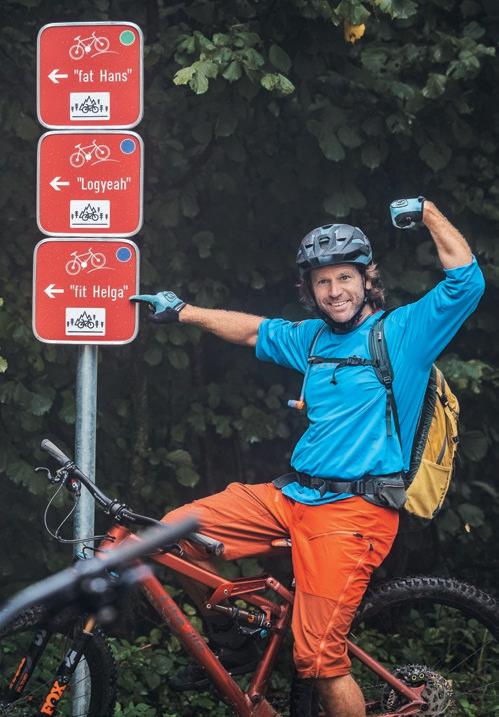
the valley all the way to Trieste and the Adriatic Sea. A visit to the Italian coast is a mere thirty-minute drive away.
But then a loud rumbling noise tears us out of our daydreams, and away from our cappuccinos on the beach. Franziska turns her head inland: “That doesn’t look good.”
We race back to the van, where we decide we can’t pass up a visit to the wine cellar of the Tomažič family. Wine has been maturing here in old, vaulted cellars for more than a hundred years, and few regions offer as many old native grape varieties; some varieties go all the way back to 1844. The vinicultural secrets here have been passionately passed on from parents to children until this day.
But at least as many secrets are behind the production of black cheese, which we are offered that evening at 1,000m altitude at the restaurant ‘Sinji vrh’, which can be translated as ‘skyblue peak’. The location is surely one-of-a-kind, and the cheesemaking absolutely unusual: cheese here is stored to mature in absolute darkness under constant temperature and humidity in deserted Italian Army tunnels. The taste is guaranteed to be as unique as where it is stored.
The next day brings sunshine and pure trail pleasure. We’re beneath the Nanos again, where local bikers have rejuvenated old paths in the valley, refining them with small, banked curves and jumps. None of it seems artificial or overly developed.
IMAGES - LEFT TO RIGHT, TOP TO BOTTOM
The stone bridge over Nadiža Gorge was built around 1812; the site has been an important transit area since Roman times
Robidišče, located in the heart of the Julian Alps, doesn’t only have beautiful trails; the 300-year-old stone cottages are full of charm, too
We can’t get enough of the Soča’s beaches
From the summit of Nanos, you have views of the Vipava Valley, the Karst, the Adriatic Sea, the Ljubljana Basin and the Julian Alps
The trails at Robidišče start at an altitude of around 700m
‘Fat Hans’ and ‘Fit Helga’ are just two of the five MTB trails at Robidišče; all are around two kays long with 300-400m vert

IMAGES - CLOCKWISE FROM LEFT
The Otlica Rock Window (Otliško okno) offers an exceptional, if unusual, view of the valley
Even the approaching thunderstorm can’t wipe the smiles off our faces as we sample the trails at Nanos
Friendly winemakers in the Vipava Valley are happy to invite guests in
Fuel for hungry riders: Golden ring cheese at the Sinji vrh Restaurant above Ajdovščina, 1,000m asl
CONTRIBUTORS: Gerhard Czerner is a German mountain-biking author and speaker. Swiss-based Martin Bissig traded banking for biking and balance sheets for breathtaking shots. In the process, he’s become a Canon ambassador and one of Europe’s most published outdoor photographers.


The cycling infrastructure here is still in its infancy. We don’t encounter packed shuttle buses anywhere, and we’re mostly the only ones on the trails. Maybe that’s because you have to bike to the beginning of the trails yourself. Maybe it’s because you need to gain 500 to 700m in altitude on sparsely used side roads to enjoy the fun of biking downhill. Maybe it’s because there are few signs; you have to keep an eye out for coloured markings on trees, or look on the app Trailforks, or ask in a bike shop.
But after the third round of high-speed singletrack descent through forest suffused with light, we end up in the town square of Podnanos. “Now I know why Anej spends his bike holidays here!” I shout. “It’s unbelievable,” replies Franziska, “how varied and diverse Slovenia is despite the short distances.” She’s spot on: The atmosphere is relaxed, the food good, the trails cool, and there’s proximity to the ocean. All kinds of trails wait here.
Before making our way back home, we take another look through a hole in some rock. This time, though, it hasn’t been dug by humans, nor do you look into the daunting darkness like we did back at the Black Hole Trail. The 12m-high, tear-shaped rock window Otliško okno—which lies in the forest close to the village of Otlica—was caused by mighty tectonic shifts. We peer through the hole far out into the often windbeaten Vipava Valley, which has welcomed us so warmly. Looking back, we’re even a little glad about the rainy weather in the Soča Valley. Otherwise, we would have probably never ended up here. W


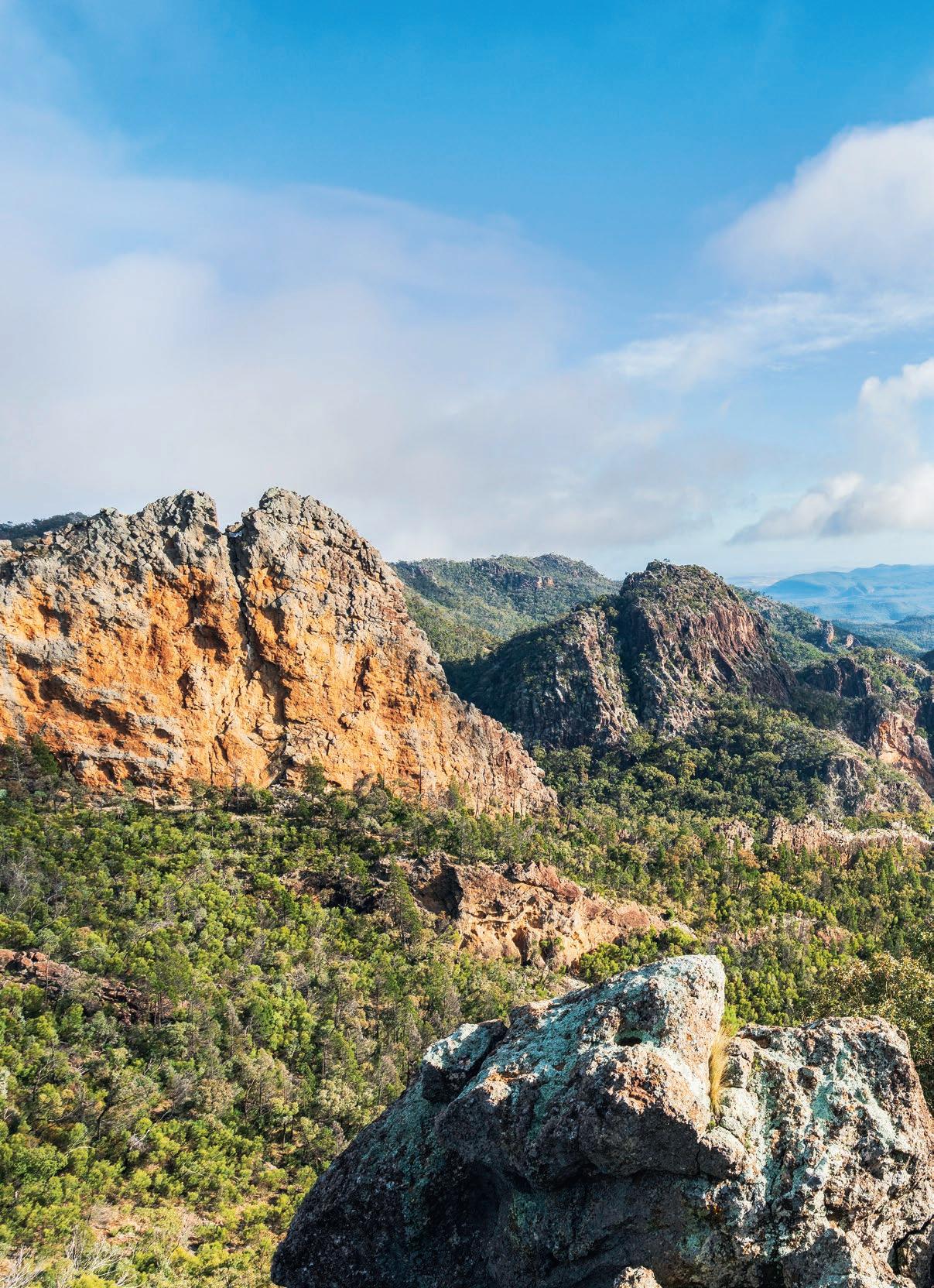
Heading back to NSW’s iconic Warrumbungle NP for the first time in more than a decade, Ryan Hansen discovers that sadly, not everything is once as it was. But that doesn’t mean the ‘Bungles have lost their capacity to inspire.
Words & Photography Ryan Hansen
(With a little help from Martine Hansen)
Martine appreciating the

Warrumbungle NP
NSW’s Warrumbungle NP was, as a child, the source of many early memories. Like touching my first-ever volcanic rock (“Dad, this thing was part of a volcano?!”). And seeing rock climbers for the first time (“Mum, how do they get to the top?”). Not to mention strolling along a real-life, notso-yellow-brick road that was an actual walking track (“Dad, why aren’t all walking tracks made from brick?”). Then there was that time near Dows Camp when, innocently doing a poo, I narrowly avoided being nipped on the bum by a scorpion (“Muuum!”). I didn’t even know Australia had scorpions … Growing up in nearby-ish Tamworth, the ‘Bungles were a no-brainer: They were mega accessible. Mum would—shh, don’t tell anyone—pick Dad up from work by lunchtime Friday, then me from primary school, and our trio would whiz off to the mountains, making it to camp on dusk. Those were the days! Countless weekends were devoted to exploring the uniquely dramatic peaks of the Grand High Tops and surrounds. My personal favourite—though not technically included in this muchfamed loop—was Mt Exmouth, with its striking grass trees and expansive views, including of NSW’s version of Frenchmans Cap: the iconic Bluff Mountain.
But for all those occasions—there must’ve been more than a dozen, but who’s counting?—spent wandering the Warrumbungles during my formative years, more than a decade had lapsed since my last walk there. I’d since graduated high school, moved houses four times, switched uni degrees, had five different jobs, got hitched … There’d been a raft of changes. And not just for me; the bush, too, had undergone its own radical transformation.
In 2013, the Wambelong bushfire—the largest and most intense fire recorded in the Warrumbungles—razed almost 90 per cent of the park, with 72 per cent of its area burnt at an ‘extreme’ or ‘high’ fire severity. Recovery time was essential. Not just for the land, but for us too.
Now, the question was this: How much had changed?

IT WAS A GIVEN: THE DESTINATION for my return to the Warrumbungles, and my wife Martine’s first visit, would be Mt Exmouth. Pausing at the Visitor Centre en route, the memories blazed back. How many times had I, in my younger days, been mesmerised by its 3D map—bigger than a billiards table— of the mountain ranges, with the tiny red LEDs on each summit that lit up like a beacon? (“Mum, we climbed that one!”) How long had I marvelled at the multitude of taxidermied birds and mammals and snakes preserved in jars? (“Dad, are you sure they’re real?”)
The starkness of the brand-spanking-new building, reconstructed post-fires, jarred me back into reality. Pushing back intrusive thoughts of park developments, I reminded myself why we were here: to register our walking intentions. But as
MORE THAN A DECADE HAD LAPSED SINCE MY LAST WALK THERE ... NOW, THE QUESTION WAS THIS: HOW MUCH HAD CHANGED?”
we excitedly described our planned walk to the friendly Parks officer, our conversation—and, indeed, our situation—rapidly nosedived.
I’ll admit it: I haven’t always been aware of national parks’ plans of management, the legal documents which—among many other things—stipulate permitted recreational activities. Now you, dear Wild reader, may be better informed than I was, because I used to think, in the blissful ignorance of youth, that you could camp wherever you pleased if you respected the environment. No. Or, at least, not now. There are, in fact, usually restrictions or special conditions around camping outside designated areas, which vary dramatically between parks. Most often, it’s a requirement to camp a certain distance from roads and established picnic or camping zones. Though sometimes, increasingly so, remote camping is banned entirely for cultural or environmental reasons. (Ed: And while often these reasons are valid, sometimes it’s banned for entirely spurious reasons, too. Sometimes for no reason at all. And sometimes, regrettably, simply because there’s expensive paid camping or lodging nearby that national parks don’t want free camping to compete with.)
Fortunately, in the Warrumbungles, self-reliant bush camping is currently permitted in locations more than 500m from roads. Technically, however, you’re asked to register your intentions at the Visitor Centre. Hence, our visit. But in trying to do the right thing—how many walkers would either be unaware of this requirement, or would plain disregard it?—we plunged ourselves into a bottomless hole. Initially, the Parks officer
How good’s nature? As if the arch isn’t marvelous enough, have a go at that fine specimen of a gum tree growing on top


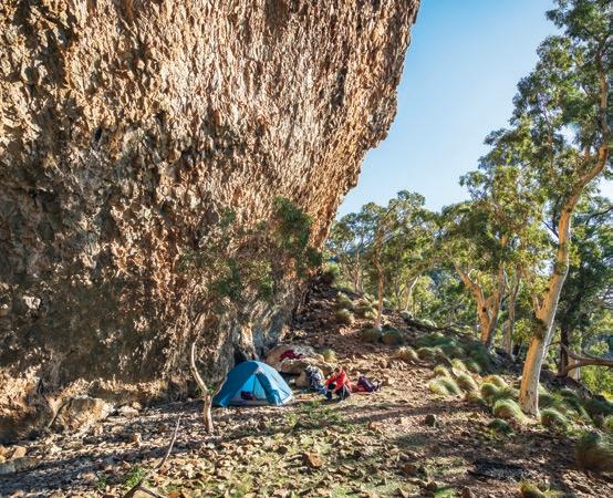
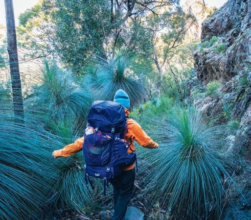
struggled to comprehend that we weren’t intending to camp in a designated walk-in campsite. Now it was my turn to be baffled. I respect that we’re in a minority group: those who prefer the senses of isolation, self-sufficiency, and discovery that multiday off-track bushwalking affords. But is wild camping now so uncommon, so rarely spoken about, that even Parks officers are confused when two walkers declare such intentions?
The surprises weren’t finished with yet. Despite our intended destination being separate from the Grand High Tops circuit— where camp bookings are necessary—we were asked to reserve the nearest site, Danu Camp, even though we’d be camping more than two kilometres away. With Danu Camp being comprised of just a solitary tent site, our booking, technically speaking, then prevented anyone else from staying there, meaning it would stay unnecessarily empty. Nevertheless, we cut our losses, refrained from asking further questions, paid the money, and hastily set off, relieved that we could still camp where we liked.
Packs and boots donned, the sweet wintery scent of the bush

AS THE SUN’S FINAL RAYS STREAKED ACROSS THE LANDSCAPE, THE JAGGED SUMMITS OF UNFAMILIAR MOUNTAINS PULSED LIKE TEMPORARY BEACONS, GLIMMERS OF LIGHT BECKONING US TOWARDS THEM.
proved calming. How good it was to be back! Creeks I’d rarely seen flowing now gushed and bubbled merrily. And the fire damage? Vibrant olive-emerald growth narrated the story of a land defined by its resilience. Charcoaled tree trunks remained, battle scars from bygone trauma.
Weaving our way along the trails, slowly zig-zagging onwards and upwards, snippets of times past resurfaced. Over there was the campsite among the kurrajongs, on the terrace Dad had
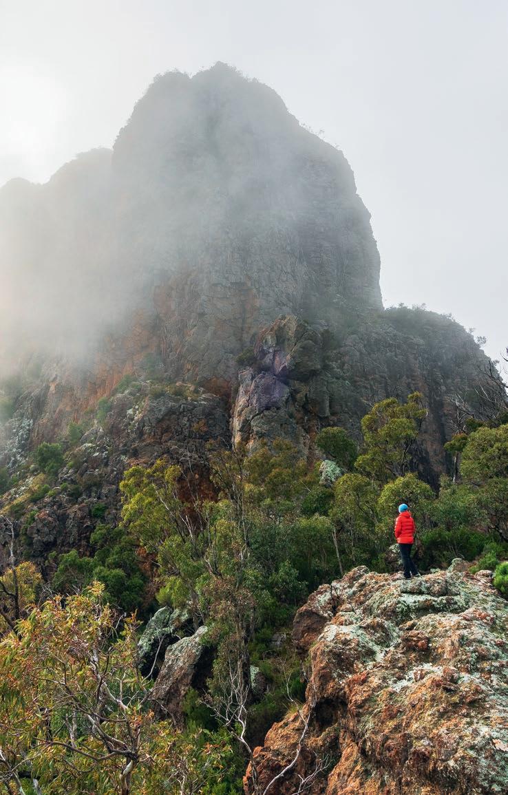


discovered, with the private outlook of Bluff Mountain. Ahead were the giant xanthorrhoea, the old rickety cable-handline around a small bluff, and the gum tree that served the focal point of many a sunset photo.
With the final sidle and semi-scramble complete, our tucked-away private plateau revealed itself. And it was just as speccy as I remembered. Unending views of dramatic volcanic peaks, rising abruptly from the flat farmlands. As the sun’s final rays streaked across the landscape, the jagged summits of unfamiliar mountains pulsed like temporary beacons, glimmers of light beckoning us towards them. The spark was ignited.
FLUX. THE OXFORD DICTIONARY DEFINES IT as a state of continuous change. It’s something that, as I’ve grown and matured, my approach to bushwalking has undergone. Where my adventures used to be defined by walking tracks, notes, and recognised destinations, I now frequently seek new locations away from human establishments. Final destinations have become more vague, more open-ended. Scouring satellite imagery and topo maps for interesting natural features has become an infatuation. This shift, this burning desire to discover different places now more than ever before, has been multi-faceted. Fundamentally, I’m inquisitive, constantly wondering what’s out
Overlooking the vast southern expanses of the park, envisioning future adventures
The best of campsites, much better than sloping spots in the trees. Just don’t look up …
Xanthorrhoea aplenty
No notes, no crowds. The reward for being inquisitive
From flat farmlands all the way to volcanic peaks
The Warrumbungles: bluffs, bluffs and more bluffs
there, what it’ll look and feel like. Even if I did prefer to walk on tracks, there’s a finite number of multi-day bushwalking options. And as I continue to become more acutely aware of man-made impacts on our environment, I find not only solace but hope, too, in wild places free from obvious signs of human visitation.
TWELVE MONTHS LATER, MARTINE and I returned to the ‘Bungles for a four-day mission, this time accompanied by my parents Nikki and Steve. Our plan encapsulated all that was different between my past and present bushwalking approaches. No info. New destinations. No distinguished campsites. Curiosity was our guiding light.
Saddled up, and propelled by the comfortable-yet-uncomfortable acknowledgement that we didn’t know where we’d be
THE FIRE DAMAGE ... WAS DEVASTATING. [THE SITE WAS] UNRECOGNISABLE FROM MY CHILDHOOD DAYS. DECIMATED GUMS HAD BEEN CHAINSAWED DOWN, THE PREVIOUSLY OPEN SPACE NOW SUFFOCATED BY REGROWTH.”
that night, our first literal junction with the unknown materialised. Leaving behind the assuredness of the main trail, we speared off into the bush towards a seemingly open saddle spied on the previous walk. Naturally, the path I took was not clear or straightforward, but it was nonetheless fruitful: The saddle was indeed clear, and a nearby rocky promontory provided the reward for our efforts: a unique perspective of a famed feature. Save for the knowledge of its name, it was unrecognisable.
The frigid evening morphed into a misty morning. In awe, we watched the landscape continually transform. Volcanic spires burst through enshrouding clouds, lending themselves a monolithic appeal. Embraced by the sun’s warmth, the fog lifted, revealing burnt-orange walls of rock.
Re-joining the track, discussion turned towards social media, spurred by an earlier observation. As we’d neared the base of the Breadknife the previous day, no more than five metres from a ‘No Drones’ sign, there’d been someone flying—any guesses?—a drone.
“Probably an influencer,” Martine suggested.
“A what now?” That was Steve. Social media’s a foreign world to the big guy. We’d barely had a computer and the internet when we began bushwalking here all those years ago. Back then, bushwalking information wasn’t available at the click of

a button. Wild, hard-copy guidebooks, and others’ verbal anecdotes were the primary sources of intel.
“It’s a different world, isn’t it Dad?” I offered, slightly changing tack. “Social media’s getting more people out here, though. That’s gotta be a good thing, right?”
The debate soon turned to bush etiquette, and it was still raging when we stopped for lunch at a family-favourite campsite. I wasn’t mentally prepared for its sad state. To Martine, who had no context of the site’s former glory, the fire damage was saddening. To me, it was devastating. Unrecognisable from my childhood days. Decimated gums had been chainsawed down, the previously open space now suffocated by regrowth. Valiantly attempting to restore and regenerate its surrounds, the creek flowed defiantly. Uncomfortable, I felt a churning desire to leave behind the destruction.
Loading up with two-and-a-half-days’ water, we set off across new, untracked territory. The going proved easier than expected, and we quickly reached the base of our objective: a mountain we’d eyed off from Mt Exmouth. Logic said to camp

ONCE YOU LEAVE A TRACK BEHIND, ASSUMING YOU CAN’T SEE OR HEAR ANYTHING HUMANMADE, YOU DON’T HAVE TO TRAVEL FAR TO FEEL LIKE YOU’RE IN THE MIDDLE OF NOWHERE. ”
down low, rather than traipsing to the top to potentially find nothing camp-able. Even down here, the options were scant. An hour of deliberation ensued: A thorough search of nearby rock slabs proved futile, followed by much umming and ahhing over slopy sites in the trees. These make-do spots would have to suffice. Stubbornly, with a final bout of determination, I pleaded: “Just give me five to check over there.”
As I topped out over a small crest, the grandest of campsites revealed itself: a near-100m-high overhanging cliff with a perfectly flat gravelly base. Home.
ONCE YOU LEAVE A TRACK BEHIND, assuming you can’t see or hear anything human-made, you don’t have to travel far to feel like you’re in the middle of nowhere. There we were, roughly 500m as the crow soars from a popular walking track, and we’d discovered our own slice of heavenly beauty.
Would it satisfy a formal definition of ‘wilderness’? Definitely not. Did it matter we weren’t aeons away from signs of civilisation? No. The key was that it felt wild. It felt secluded. It felt undeveloped.
These cup-filling sensations—for me, at least—cannot be equivalently achieved by solely walking on a track or camping at a recognised site. Nor can this most life-enriching of skills: self-sufficiency. Working it out for yourself, without guidance or information. For me, the comfort and control inherent with walking on-trail pales in comparison.
It pains me to think that these primal experiences are, in some locations, at risk of being—or have already been—lost. Camping restrictions are the new precedent. Yes, there’s a hangover from
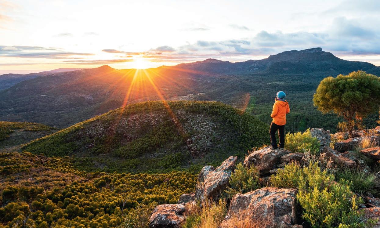


IMAGES - CLOCKWISE FROM TOP
Do we need a booking system to seek solitude like this?
It’s just as speccy as I remembered Uh oh, the wedgies are circling …
A pretty way to finish: Burbie Creek
CONTRIBUTORS: Educator, photographer and outdoor enthusiast Ryan Hansen relishes any opportunity to get out bush, even if it means slogging litres of water up a mountain just for the sunrise.
COVID. But it extends deeper than that. Systematically, it’s becoming harder to legally seek solitude in the bush, in a respectful and minimal-impact manner, by camping remotely. Here, in the Warrumbungles, the booking-system logic is pervasive. But it’s not just confined to NSW. Similar booking requirements apply in QLD’s Girraween NP, and the ACT’s Bimberi Wilderness Zone, where remote bushwalking and camping numbers are capped. And these are just the locations where we’ve directly experienced restrictions; the list continues elsewhere. (Ed: Victoria’s Grampians/Gariwerd NP being a troubling case in point.) As revised plans of management continue to be released, I hope that the inherent value of wild camping is acknowledged and maintained.
If nothing else, the scrub we battled on Day Three’s ridgeline route—likely bushfire regrowth—added to our walk’s raw character. That’s how I tried to spin it to myself, anyway. I don’t recall a time when my shoulder, chest and forearm muscles have been so fatigued as this day, when they relentlessly fought against vegetation. The sunset views we received—adding to Day Two’s majestic sunset/sunrise combo—certainly felt hard-won and well-deserved.
Even though Day Four’s home stretch, like earlier sections in between, were along a combination of management trails and walking tracks, we’d still experienced a fulfilling off-track dose. And, much to my relief, there were no further scorpion encounters.
As much as change is inevitable, there’s one thing I sincerely hope never changes: wild camping remains exactly that. Wild. W


Shaun Mittwollen has spent recent seasons skiing some of Tasmania’s wildest peaks. But when he went to NZ last year to tackle the high alpine in the Southern Alps, he found he’d entered a whole-new ball game.

Words & Photography Shaun Mittwollen

Christchurch
Queenstown
The snow collapsed like we were walking on a stiff trampoline, as if it was hollow underneath. A dense whomp of falling snow emanated directly under my feet; loud at first, then cascading with a fading echo into the unknown oblivion. Was it twenty metres? More? Perhaps thirty? It reminded me of the disconcerting sound of underground movement I’d once heard while abseiling into a deep cave system in Tasmania, when the low-frequency tumbling of rocks was felt not through my ears but through my feet.
A cheery nylon rope tugged my thoughts back to reality, as Lewis, ahead, perhaps noticing my potential impending doom, took up the slack. If the snow bridge over the crevasse collapsed, I should be safe with him as my human anchor, a counterweight on the other side of the ridge. Should be safe, but nothing here is ever definite. Lives lost in the mountains are a constant reminder that there is no such thing as risk-free.
For several mentally taxing hours now, we had been in the clutch of an unstable steep slope on New Zealand’s 3,109m Mt Elie de Beaumont, its instability exacerbated by climatic shifts. Overhanging seracs at night, vertical ice cliffs at dawn, and warm hanging snowfields riddled with meandering crevasses for morning tea. Over on the western horizon, the Tasman Sea—which two days earlier had been sparkling and cerulean— was obscured by a sea of clouds; twisted summits peered above the inversion.
I paused momentarily. Then, as light on my feet as possible, I eased back to known ground. With just two steps in reverse, I was back outside the grasp of the hidden chasm. I worked my way left, where the snow bridge appeared thicker and crested the triangular ridge, with Woody ten metres or so behind. Safety at last, for the first time in hours. I had a distinct combination of relief, adrenaline fatigue and subdued stoke.

BUT I FELT LIKE AN IMPOSTER on this mountain. What was I doing here? What gave me the right to enter this high-consequence terrain? I had virtually no high-alpine experience. I remembered a story Hugh Newell, who was with me on this trip, told me of highly experienced mountaineers he’d met in Kazakhstan dying a few months after he’d met them. They’d done all the right things, and they‘d been at the pinnacle of their field. Yet it hadn’t mattered. Even more worryingly, it wasn’t uncommon. It was just a matter of luck. No matter how skilled you are, or how many right choices you make, you only need to make one wrong choice. Or maybe not even that; you only need your luck sooner or later to run out.
So now, here on the side Elie, I began asking myself some questions. Yes, I’d spent time skiing some of Tasmania’s wildest terrain, including making the first descent of Federation Peak, but just because I’d skied some steep couloirs down there, did that make me worthy?
Heck, even fifty-degree slopes in Tassie are low consequence by comparison. On the approaches, there are few uncontrolled hazards, and on the descents, if you hook up your skis in the wet Tasmanian snow, it doesn’t matter. It’s so dense and well supported that most of the time you just create a giant bomb hole and stop.
And so, just because I’d walked really far carrying skis through tangled, icy Tassie scrub, did that mean I was ready to enter the big leagues of alpine mountains? I felt awfully exposed.
IT ALMOST WASN’T MEANT TO BE. Getting this point had involved negotiating a string of hurdles, each as ridiculous as the last. I suffered one loss at a time, with each—like evenly spread-out cars at an intersection that make crossing impossible—gradually spaced to bring an accepting annoyance, but not quite enough to call it quits. At first it was my ski bag, last sighted at Melbourne Airport. After it failed to make the connection, we were told by the airline, “Your skis are gonna be on the next flight.” Which they weren’t. “Oh, they’re gonna be on the next flight.” Which, again, they weren’t.
Meanwhile, we’d booked a heli to whisk us up from Mt Cook Village to Tasman Saddle Hut, from where we could launch ourselves at any number of nearby peaks. I decided that even if I didn’t have skis, I may as well go up to the hut. That seemed better than nothing. But heavy fog meant the chopper flight kept getting cancelled. And then, just at the point that we got word the flight might happen, we were told my skis were actually arriving. We raced off on an eight-hour night mission from Queenstown to Mt Cook and then to Christchurch Airport, where we fell asleep in the terminal. Suddenly, we were woken by ground staff; they were wheeling the bulging black Armada ski bag straight off the morning Air New Zealand flight. Was this a dream? No, it was real. Woody and I lead-footed it back to Mt

THE HIGH ALPINE, FOR YEARS NOTHING MORE THAN TEASED PHOTOGRAPHS AND LINES MARKED IN GUIDEBOOKS, HAD FINALLY PROVED ATTAINABLE .”
Cook with an ecstatic stop on the way at Lake Tekapo, where we dunked our heads in the frigid clear-blue water; the sharp shock proved this was definitely not a dream.
Boarding the heli, though, Hugh—the mastermind behind our expedition, and the team member with by far the most experience in the mountains—had a certain disconcerting look about him. It seemed the look that only someone with COVID could give. But no, it was, as we were to discover later, something even better: bacterial pneumonia. Hugh was fine once we landed, but his condition worsened. Eventually he was hut-bound, waiting for a miracle recovery that never came. We were left with our three least-experienced members: Woody, Lew and myself. None of us had any real experience in the high alpine. We did, at least, have some relevant skills between us, but only separately: Lew was a climbing nerd; Woody an avalanche nerd; and myself a weather nerd. Combining our skills, along with being armed with some local beta from others in the hut, plus some hut-based mountaineering lessons from Hugh, we decided we had enough knowledge to continue with the mission.
OUR FIRST ASCENT, THAT OF MT GREEN, was sublime. Climbing above the immense Tasman Glacier as dawn light crested the summits, it was excruciatingly hard to not spend too long taking photos. I loved how a wide-angle lens accentuated our height above the valley floor far below, with its meandering rivers of ice.
The highlight, though, was a mixed climb through a steep ice-filled gully. Jamming our skis into weathered greywacke, we eased under overhead roofs and scratched upwards while balanced precariously on a few millimetres of pointed metal on rock and shallow ice.
And then the summit ridge topped it off—icing on the proverbial cake. A precipitous snow slope rose to a knife-edged ridge right on the spine of the Southern Alps, and it was so steep that at times my helmet brushed the snow surface in front of my face. Below us westwards, I could see surf—feathered by a light onshore sea breeze—breaking at the mouths of high-energy, braided rivers. And dead ahead, beckoning for a future adventure, Aoraki’s icefalls gleamed below a pastel-blue sky.
The ski descent was superb, down a steep alpine face which, despite having a layer of softer snow over death cookies, was in great condition, and we then weaved through electric-blue hanging seracs. But as great as the descent was, the climb proved most memorable. The high alpine, which for years had seemed out of reach, for years nothing more than teased photographs and lines marked in guidebooks, had finally proved attainable. I felt I’d reached a pinnacle in my life of adventure.


BUT IF MT GREEN HAD BEEN the pleasant introduction, then Mt Elie de Beaumont was the rude reality. Elie used to be an easy snow climb the entire way to its 3,109m summit, however climate change has broken up the flanking Anna Glacier into a maze of icefalls and hanging seracs. You now either risk it through the unstable seracs, or you ascend a steep ice bulge that is nearly beyond vertical. None of us had led an ice pitch before, and ice climbing’s number-one rule is “Do not fall.” (Ed: So true!! ) But Lew, armed with an abundance of ice screws, was confident.
The night air was crisp on the exposed skin of our faces, almost as invigorating as a good, strong cup of coffee. Guided by our head torches and the moonlight, we followed our tracks from previous days on a long but gradual ski descent to the base of the Anna Glacier. Roping up, the climb passed under the huge cliffs of Mt Walter. Later that afternoon, we would return along the skin track to find the snow peppered with fallen rocks, some the size of our backpacks, thrown from the warming cliff face.
Our first real taste of mountaineering exposure, however,
THE DAGGERED TEETH OF THE SERACS REACHED HIGH, BEYOND THE BEAMS OF OUR TORCHLIGHT
AND INTO THE INKY NIGHT.”
came when we passed directly under towering seracs to reach the ice cliff. We snaked around the debris of previous collapses, and the daggered teeth of the seracs reached high, beyond the beams of our torchlight and into the inky night. As we made our way up to the ice bulge, the first pale-blue illumination of dawn crested the eastern skyline, and we could see the lights of the bright-red hut perched on the edge of a hundred-metre cliff. Lew set to work. He climbed the bulge with ease, disappearing from view over the lip. Woody and I were left alone listening to Accept, a headbanger band that’s usually totally not my style—I can only describe it as a German version of ACDC—but


that seemed to perfectly amp me up for the climb ahead. Woody scaled the route, just as the golden light of dawn glistened on the face, plasticising the initially brittle surface layer. Then it was my turn. I had a few tentative steps up on the hard glacial ice and was soon at the lower screw. Then the second. I removed each screw awkwardly. Before I knew it, though, I was rounding the bulge, with our thin snow corridor ten metres below. Working my way left to avoid a slight overhang, the slope eased up to where Woody and Lew were waiting on belay. The stoke was maxing. Lower me, down let’s go again!
But there was no time for that. In the hot morning sun, the slope was showing signs of life; left of Lew’s belay, huge seracs creaked under strain. More alarming still was the fact that our route up to the ridge traversed a steep, warming windslab above significant exposure. Even a little icefall could have triggered an avalanche that would sweep us back over the ice bulge, likely to our deaths. Oh, and then there were the crevasses. At least three bisected the slope. The stoke I’d had earlier was replaced by terror—we had to climb, and climb fast. Crossing the first snowfield, we moved in mechanical rhythm; our only words were either stop, go, or a combination of expletives. The entire climb was a blur, totally gripped on adrenaline and fear. The scenery was spectacular, but if we were to stay alive, there was no time for photos. It was a real fear of death, at least until we reached the ridge above. It didn’t seem worth this risk. “This is too gnarly,” I said out loud. Everyone agreed.

IMAGES - FROM LEFT TO RIGHT, TOP TO BOTTOM
Crossing the Anna Glacier at 4AM
Spectacular views on the lower slopes of Mt Green
Lew leads the ice bulge above Anna Glacier
Lew belays Woody to the top of the mixed pitch on Mt Green
Shenanigans on a storm day spent in the hut
Sometimes the outside loo looked a long, long way away
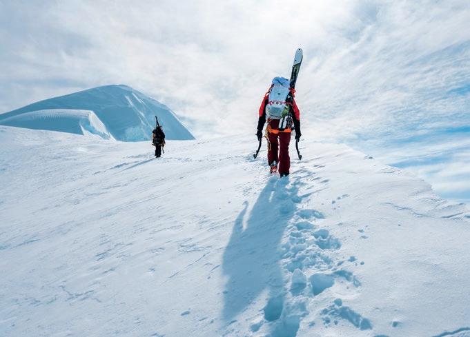

An almost-pleasant section of the climb on Elie after most of the danger had passed
The windslabs on the Elie ridge were precarious at times. Woody digs for a solid placement above a windlip
Occasionally during the storm, the landscape would entirely clear out, revealing an incredible mountain landscape under a fresh coat of snow

The older you get, the less risk you take. I wondered if I would have been OK with this risk at a younger age. But even back then, I had been similarly nervous on skis. During one of my first few trips to Japan in my early twenties, I linked up with some very good skiers despite only having just learnt to ski. I was on 80mm full camber carving skis, standing at the top of a steep chute filled with very deep powder despite having very average abilities, internally terrified and unable to visualise how I could place a single turn on such terrain. But I felt obliged as a just-appointed ski photographer: How would I get shots without skiing the terrain too?
Unfortunately, it didn’t end well; I rag-dolled a few metres through the pow on almost every turn. But I wasn’t deterred. I kept at it, and eventually bought some fat skis to help. Pushing through the boundary may have been reckless at the time, but it also gave me a new skill and indeed a new lifestyle. My huge fear of heights disappeared entirely; my life changed positively forever. Who knows where I would have been if I hadn’t dropped into that steep chute? As they say, without risk you do not grow.
CONTRIBUTOR: Shaun Mittwollen is a permanently stoked adventurist and photographer who gets far too excited about remote ski lines. He usually forgets how difficult the access was within 24 hours of returning and is already thinking about going back.
It occurred to me now on Elie de Beaumont that perhaps this may be a moment where I should take the risk. Ultimately, we didn’t turn around. Not even that whoompf in the snow I talked about the start of the piece deterred us. In any case, descending at this point seemed dodgier than continuing upwards. Scaling the final few metres to the summit, the views were exquisite. A steep cornice overhung the eastern face, and behind us, the impossibly steep, knife-edged west ridge cut towards the horizon. Snow-capped mountains were far below our feet, and clouds lapped ever higher through the gullies. The blustery winds could hardly wipe the smile off our faces.
The sense of achievement swept away the still-raw memories of the exposure on the climb, those memories overshadowed by the elation of our great adventure. I remembered one line from Jimmy Chin in the movie Meru: “The best alpinists are the ones with the worst memories.” Perhaps that proved true of my time in the Southern Alps. Because standing there on that summit, I was already eager for more. W

Comfortable and reliable trekking boot, designed for those who want to experience nature and make conscious choices. 45% of the upper is made from recycled yarn, the Gore-Tex Bluesign membrane contains 98% recycled fabrics and the Vibram Ecostep Evo outsole uses up to 30% recycled rubber.


A quick lowdown on
Words Reid Marshall
Photography Miranda Fittock & Reid Marshall
QUEENSLAND’S SUNSHINE COAST STRETCHES FROM the coastal city of Caloundra through world-class beaches, bluffs and headlands to the rainbow-coloured sands of the Great Sandy National Park. But the Sunny Coast’s pristine coastline is just one aspect of this region. In the nearby Glasshouse Mountains, remnants of extinct volcanoes extrude out of the ground in towering pillars and cones of rhyolite and trachyte. Boisterous cockatoos and rock climbers alike are juxtaposed with the serene walking tracks that weave around the base of these imposing peaks. And further inland lie subtropical rainforests: Kondalilla, meaning rushing water, encapsulates this area perfectly—pools of frigid water offer idyllic swimming holes before feeding the tall and powerful waterfalls of the Blackall Range. From the spectacular coast to the rainforested and mountainous hinterland, the Sunshine Coast offers walking for everyone.
THE VOLCANIC TRACHYTE CIRCUIT, GLASSHOUSE MOUNTAINS NP 5.8KM; 1.5-3 HOURS; 132M ELEVATION GAIN
The Traditional Owners, the Jinibara people and Gubbi Gubbi people, request that visitors not climb Tibrogargan and Beerwah, the most iconic of the Glasshouse Mountains. But these ancient volcanic remnants can still be thoroughly enjoyed from nearby lookouts and the well-maintained trails that wind through dry-sclerophyll forest at the base of Tibrogargan. The Trachyte Circuit offers a quieter, more interesting, and slightly more challenging hike than the neighbouring Tibrogargan Circuit. The Trachyte Circuit gains a bit of elevation to reach Jack Ferris Lookout atop Trachyte Ridge, and it looks back at Tibrogargan and surrounding peaks. The trail itself seems to be made of the very trachyte that composes these volcanic plugs, and the carved stone steps that are placed thoughtfully atop the water crossings only add to the vibe.
THE ARTSY ARTISTS CASCADES, CONONDALE NP 10.8KM; 3-4 HOURS; 353M ELEVATION GAIN
Just following Booloumba Creek upstream through piccabeen rainforest alone would make this a great walk. But let’s add in the breathtaking and secluded Artists Cascades at the end— great for swimming and picnicking with only a little bit of rockhopping involved. Okay, we’ll chuck in the short side trail to the bat-filled gold mine as well. Now, what if I told you there was the most singular piece of art along the way too—a 3.7m-tall
stone-mosaic egg laying in a clearing? And what if I told you someone had planted a strangler fig seedling atop this three-dimensional mosaic to create an ever-changing, living work of art, a fig that will one day envelop the entirety of the egg, or perhaps smash it open from the inside? A gem of the Sunshine Coast Hinterland, Artists Cascades is full of surprises (although sometimes the surprises are leeches). And here’s a tip: While a 4WD is necessary to get you to the trailhead, you can park before the first creek crossing with a 2WD, and then walk the extra 800m each way (with wet feet).
Gheerulla Circuit is a moderately challenging section of the larger Sunshine Coast Hinterland Great Walk, and can be hiked in either a single day, or over two days, stopping to camp at the Thilba Thalba or Ubajee walkers’ camps. I always recommend a counterclockwise approach from the Sam Kelly Road entry, so that hikers can tackle the arduous climb up to Thilba Thalba Viewpoint on fresh legs. With the hard part out of the way, you can then enjoy the grass-tree filled ridgeline (sunnies will help here to avoid getting poked in the eyes) with views over the densely vegetated valley carved by Gheerulla Creek flowing below. Descending from the ridgeline leads you to Gheerulla Falls, with swimming in the rock pools at their base best enjoyed after recent rain. The circuit continues by following Gheerulla Creek downstream, with many stream crossings, rock hops, and picnic spots along the way.


THE RELAXING
POONA LAKE, GREAT SANDY NP
4.4KM (RETURN); 1.5-2.5 HOURS; 168M ELEVATION GAIN
Ideal for families or a relaxing afternoon, this gentle, undulating jaunt takes you to arguably the best picnic and bathing destination on the Sunny Coast. The soundscape here is full of green catbirds screeching, brush-turkeys rustling, and occasional ‘wollack-a-woos’ of the colourful wompoo fruit-doves found in this area. 2.2km of sandy trails littered with foliage lead you through coastal rainforest brimming with kauri, hoop pines, and piccabeen palms to the white-sand shores of this tea-coloured lake. The water at Poona Lake is steeped in the oils and leaves of the surrounding paperbark trees, resulting in its signature colour. T E SURPR
THE WHALE WATCHER COASTAL TRACK, NOOSA NP
10.6KM; 3-4 HOURS; 237M ELEVATION GAIN
From July to October along the scenic Coastal Track, you can expect to see humpback whales in droves as they make their way north to warmer waters. You are, however, also likely to encounter locals and tourists in droves, at least for the first few kilometres past Boiling Pot, Dolphin Point, and Picnic Cove. Most people’s journeys terminate at Hell’s Gates—one of the most rugged and spectacular bluffs on the Sunny Coast. Here, turtles, rays, and dolphins are often sighted among the crashing waves below.
Continuing from Hell’s Gates, descend to and traverse Alexandria Beach, scratching that toes-in-the-sand itch, and maybe even spying a rainbow bee-eater amid the more common birds of prey. At the beach’s far side, stone steps climb the headland to equally impressive views over Devil’s Kitchen, followed by a lookout over the dog-friendly Sunshine Beach and the coastline to the south. Inland tracks weave throughout Noosa NP to create a series of interesting alternatives to the classic coastal route. These tracks are abundant with wildlife (koalas, superb fairy wrens and eastern whipbirds) and lead you through groves of palms, paperbarks, hoop pines and figs, with the sound of waves never too far away.
IMAGES - CLOCKWISE FROM TOP LEFT
The imposing Tibrogargan, father of all the other Glasshouse Mountains
Sit on the sandy shore or take a relaxing dip in Poona Lake
Vibrant rainforest on the Gheerulla Circuit
The Strangler Cairn, made by renowned environmental artist Andy Goldsworthy, is a must-visit
Grand views over the Gheerulla Valley from Thilba Thalba walkers’ camp
CONTRIBUTORS:

Guidebook authors Reid Marshall and Miranda Fittock don’t just know the trails around the Sunshine Coast; they literally wrote the book on them. Overnight Hikes in South East Queensland and Day Hikes SEQ are two of the Challenge and Beauty guidebooks covering the region; they’re available at adventure-shop.com.au
LIGHTHOUSE CIRCUIT
Words Alistair Paton
Photography Bruce Paton & Alistair Paton
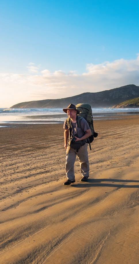
Wilsons Promontory
IN JANUARY 1886, nature lover, algae expert, and mathematics and science teacher Arthur Lucas arrived at the Wilsons Promontory Lighthouse with a friend, JB Gregory, to be informed they were the first Europeans to reach it travelling overland. Lucas later wrote of the experience, “We had now moonlight (sic) nights, and the outlook was sublime ... with the higher peaks in the background and with the beating of the surf and roar of the breakers a quarter of a mile on the other side ... We may safely commend the promontory as full of interest to naturalists of all persuasions.”
The lighthouse had been built by convicts in 1859, one of seven that came into service that year along the Victorian coast. It was arguably the most important, sitting atop 90m cliffs on a rugged granite outcrop that juts 40km into Bass Strait—an obvious obstacle to passing ships.
The overland journey to the lighthouse is much easier now than it was in Lucas’s day (there were no tracks then, although he did have the benefit of a pack horse). But the impression is no less striking: densely forested slopes and granite cliffs falling to crashing waves, pristine beaches and secluded coves. And the lighthouse keepers’ cottages now provide—if you don’t feel like camping—accommodation for long-distance walkers, with historic charm and the comforts of a warm bed and hot shower.
Today, the lighthouse is the perfect centrepiece of a classic fourday hike that encompasses the highlights of one of Australia’s great national parks.
Activity: Hiking
Location: Wilsons Promontory NP, Victoria
When to go: November-April
Duration: Four days
Difficulty: Moderate
Permits required: Yes
Maps: Vicmap Wilsons Promontory
Special 1:50,000
Contact info: Tidal River Visitor Centre (03) 8427 2122 or online at parks.vic.gov.au/places-to-see/parks/ wilsons-promontory-national-park
CLIMATE: WILSONS PROM LIGHTHOUSE

The spectacular mountains, forests and beaches we call Wilsons Promontory are part of the traditional country of the Bunurong/ Boonwurrung and Gunaikurnai people. They know it as Yiruk Wamoon.
First Australians have been visiting this area for thousands of years to feast on the abundant shellfish, and some would have passed through on their way to lutruwita/Tasmania when the Prom was part of a land bridge that disappeared after the last glacial period ended about 8,000 years ago, isolating lutruwita and its inhabitants.
The first-known European to visit was explorer George Bass, who sailed from Sydney to Western Port in a whaleboat in January 1798 and noted the ‘high, hummocky land’. On his return voyage, gales forced him to shelter in a quiet bay Bass named Sealers Cove. He returned later that year with Matthew Flinders, and the pair made several important discoveries including the existence of Bass Strait (confirming the land to the south was an island), and that the Prom was connected to the mainland. Governor John Hunter named the channel after Bass, and for reasons lost to history, the promontory was named after Thomas Wilson, an obscure London merchant.
Whalers and sealers were already active in the area (which perhaps explains the name Bass chose for the bay) and as white occupation expanded, the land was exploited for timber, tin and cattle grazing. The Bunurong/Boonwurrung and Gunaikurnai people were pushed out of their traditional hunting grounds, and eventually confined to missions such as Lake Tyers in East Gippsland.
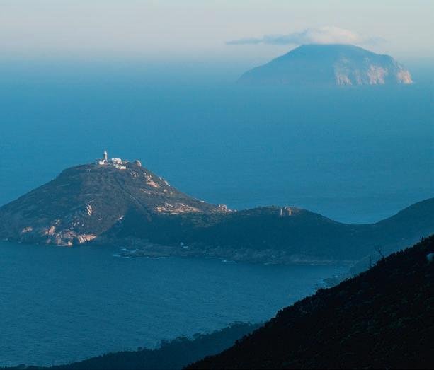

Their descendants still have a strong connection to the Prom, and today play a key role in its management.
The Prom, declared a national park in 1905, holds a special place in the hearts of Victorians, who have defeated proposals for private development over the past 120 years, including plans for a 600-guest hotel, golf course and mini railway in the 1960s, and a multi-story hotel in the 1990s, when nearly 2000 people lay on Norman Beach to spell out the words ‘HANDS OFF’. Today it is one of the state’s most popular and beloved natural destinations, with easily accessible beaches and camping on the west coast attracting over 200,000 visitors every year. The vast majority of the park—to the east and south—is reserved for walkers and, in Arthur Lucas’s words, “lovers of nature, lovers of scenery”.
The rich plant life at the Prom includes orchids, wattles and banksias, with environments ranging from forested mountain slopes to patches of warm-temperate rainforest and coastal heathland. After his 1886 visit, Lucas wrote enthusiastically about plants he found on his lighthouse trek, noting their close links to Tasmanian flora, and the delightful colours of the wildflowers.
This is a great place for bird or wildlife spotting; commonly seen species include kangaroos, emus, echidnas, cockatoos, fairy wrens, hooded plovers and a variety of lizards and snakes—be alert on hot, sunny days. In winter, you might see whales. Most visitors won’t leave without a wombat encounter. They have been known to bulldoze tents, but are usually found placidly grazing in the Tidal River Campground and the river flats late in the day.
Sealers Cove
FINISH
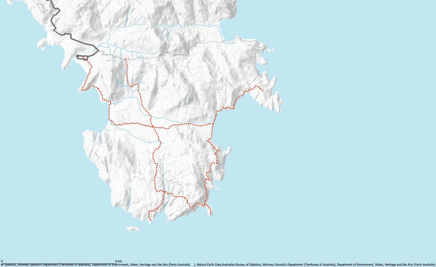
Mt Oberon (558m)
Little Oberon (275m)
Oberon Bay
Day 3 Camp (Oberon Bay)
Telegraph Saddle
Mt Ramsay (686m)
WILSONS PROMONTORY NATIONAL PARK
Mt Wilson (705m)
Creek
Mt Norgate(420m)
WILSONS PROMONTORY NATIONAL PARK
LIGHTHOUSE CIRCUIT
Kersop Peak (217m)
Day 2 Camp (Little Waterloo Bay)
Waterloo Bay
Halfway Hut
Day 1 Camp (Roaring Meg)
South Point
Wattle Island
Weather is generally mild year-round; spring or autumn are quieter and offer pleasant walking conditions. Summer is extremely popular—everything has to be booked well in advance, and car parks can be full. If you’re wanting to tweak this itinerary to include accommodation at the lighthouse (see Fees/Costs/Permits) be aware it is closed mid-week in May and June, and closed completely from July to mid-September.
The Prom is about three-hours’ drive from Melbourne. Follow the Monash and South Gippsland Freeways to Meeniyan, where a sign points you towards the Prom. Take this road for 18km to the small town of Fish Creek, turning right again at the signposted turnoff just on the other side of town. Drive another 9.5km before turning right one final time, passing through the village of Yanakie before reaching the park entrance. From there, it’s 30km to Tidal River via a winding road that takes in increasingly spectacular views. Drive slowly, especially at night—wildlife is common here. And remember to fill up at Meeniyan; there’s no fuel inside the park.
Park entry is free, but overnight walkers must obtain a permit (check in at the Visitor Centre) and bookings are required for all
Wilsons Promontory Lighthouse
Refuge Cove North Waterloo Bay Map data © OpenStreetMap
overnight campsites and the lighthouse accommodation. Get in early especially if you’re visiting in peak periods like school holidays. Hikers are limited to a maximum of two consecutive nights at each campsite and the lighthouse, with a maximum of 12 hikers per group. To book a campsite at Oberon Bay, Roaring Meg, Little Waterloo Bay or Refuge Cove, go to parks.vic.gov.au/ places-to-see/parks, then navigate to Wilsons Promontory NP. The camping fee is $7.70 per night.
If you want a more laid-back hiking experience and are happy to pay upwards of $150 per person, you can also book accommodation at the lighthouse on the same webpage. There are three refurbished cottages that all feature a fully-equipped kitchen and hot showers, though you will need to bring your own sleeping bag and towels. There is no camping at the lighthouse.
The walk involves some long days and moderate climbs—the final walk up to the lighthouse will get the calves burning—but the tracks are all well graded and easy to follow.
The Southern Circuit is graded Level 4 based on the most difficult sections, but anyone with a good level of fitness should have little difficulty completing the walk. The hike involves sections of beach walking and some creek crossings at the end of Oberon Bay, Waterloo Bay and Little Waterloo Bay. Check tide times.


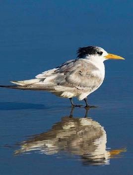

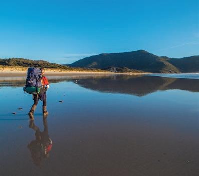
Water is piped into Refuge Cove and Little Waterloo Bay campsites, and there are tanks at Halfway Hut and the lighthouse. You can also get water from Roaring Meg Creek, and the path up the east coast crosses a number of small creeks. Rangers recommend treating all water before drinking. There is no fresh water at Oberon Bay.
No special equipment is needed; just your usual hiking kit, and, especially, don’t forget your camera. You can get basic supplies at the Tidal River General Store, but best to bring everything with you.
Book a night at Tidal River at the beginning and/or end of the trip to allow for an early start or relaxing finish to the hike … and to enjoy the beautiful location. There are almost 500 campsites at Tidal River along with more comfortable—and expensive—accommodation options including cabins. Bookings are essential. There is a long list of short walks nearby if you feel energetic enough, or just take a stroll along the river or Norman Beach.
If you’re doing a car shuttle, you will need to park in the dedicated overnight hikers car park, which is on the left as you head into Tidal River. During the peak summer period, and on weekends from Melbourne Cup to the Easter long weekend, a free shuttle bus takes visitors to Telegraph Saddle from Tidal River and the overnight-hikers’ car park. Telegraph Saddle car park is closed to all other vehicles during these times.
You will find good mobile-phone reception at Tidal River, but don’t rely on it in the southern section of the park, although you can get lucky in some spots.
IMAGES - CLOCKWISE FROM LEFT
Outstanding coastal views are a regular highlight of the circuit
Oberon Bay reflections
A lunch break at the lighthouse
The Prom is home to a wide array of bird life including Caspian terns
Signs like this one at North Waterloo Beach make it very hard to get lost
DAY 1
Telegraph Saddle to Roaring Meg (with sidetrip to South Point) 18.5km; approx 7 hours
Having taken the shuttle bus from Tidal River (see Other Tips & Tricks), start by following Telegraph Track, which leads south through the middle of the Prom. As the name suggests, this follows the route of the old telegraph line, which in the days before radio was the only means of communication between the lighthouse and the outside world. After a steady 45-minute descent followed by another 45 minutes of mostly level walking, you’ll reach the junction with the tracks to Oberon Bay and, 100m further on, to Waterloo Bay, which you‘ll return on in three days’ time. Continue south on Telegraph Track for another 1.3km to the short access track to Halfway Hut. The hut was constructed as a shelter by the linesmen, and it makes for a welcome, if draughty, break on a rainy day. There are also some pleasant campsites in the surrounding forest, which make for a nice alternative to Roaring Meg if you’re planning to start later in the day.
After the hut, the track abruptly heads uphill, ascending 170m in the next two kilometres, before reaching Martins Hill, where you can say goodbye to the road and take the walking track for the remaining 1.7km to Roaring Meg. Ahead of you looms an impressive triangular granite peak, but don’t be fooled—this mountain isn’t on Wilsons Promontory. In fact, you’re looking at the upper part of Rodondo Island, which is located in Tasmanian waters off the southern coast of the Prom. The final part of the walk leads through lush eucalypt forest to a campsite split into two levels, with most sites located in clearings in the forest, and space for a few tents next to Roaring Meg Creek.
Once you’ve settled in, leave your packs at the campsite for a side trip to South Point, the southernmost point of mainland Australia. Take the signposted track through eucalypt forest for 3.7km to reach the unassuming rocky headland. Don’t expect vast coastal vistas here though, since the most prominent landscape feature is nearby Wattle Island, 500m away across a narrow channel. After taking some happy snaps and planning how you’ll tackle the other three geographical extremities of mainland Australia (you know you want to), head back to Roaring Meg.
Roaring Meg to Little Waterloo Bay (via Lighthouse) 17km; approx 5.5 hours
Follow the track as it crosses Roaring Meg Creek and traverses a pair of low but steep ridges before climbing again to meet up with Telegraph Track 2.3km from the campsite. Then turn right

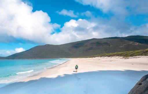

(south) and walk along the track for 200m before departing it again on the track to the lighthouse. The next 3.8km is one of the hike’s highlights, as the track winds through attractive coastal forest with grand views out to Bass Strait, particularly from two rocky lookout points that provide fantastic views of Rodondo Island and the lighthouse.
Shortly after this point, you come to a junction with the track to the lighthouse heading off to the right. Leave your packs at the junction and take the sidetrack, which crosses the low isthmus connecting South East Point to the mainland before one last steep but thankfully short climb to the lighthouse. This also marks one of the most incongruous transitions in any Australian walking track, as after spending two days trekking across a rugged coastal wilderness, you find yourself among whitewashed stone cottages that make it feel like you’re in a quaint English village.
From this highpoint, you can sense just how hazardous this area must have been for passing ships. The view encompasses over two-dozen rocky islands. These include the tiny 40-foot rocks which contain the only land border between Victoria and Tasmania; on the eastern horizon, Hogan Island (which is the first stop for sailors and sea kayakers as they traverse Bass Strait); and to the west, Kanowna Island, named for the unlucky TSS Kanowna which fell victim to the treacherous coastline in 1929.
The lighthouse is still operational; at night, its beams sweep across the ocean, providing a vivid impression of what it must have been like on such a lonely outpost 150 years ago.
Retrace your steps to the junction, pausing at the helipad to take a brief detour down the short track to the eastern landing,

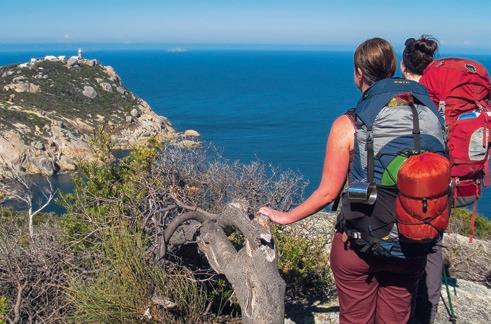
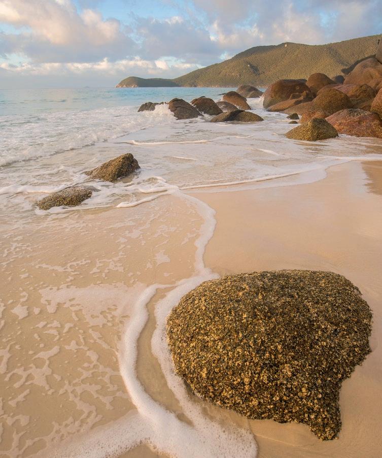
where not too long ago, ships docked to transport all the supplies for the lighthouse. At the junction, turn right and follow the track to Waterloo Bay. You wind uphill through magnificent forest—including some patches which feel like they’re transported straight out of tropical North Queensland— until, about 2.5 hours from the lighthouse, the track reaches a large granite boulder with grandstand views. Descend steadily from there to the beach of Waterloo Bay.
This is another highlight of the walk, as you trek along pure white sand backed by aquamarine water. A kilometre along the beach, you pass the track that will take you west tomorrow to Oberon Bay. Stick to the beach, fording the outlet of Freshwater Creek at the northern end of the bay and following the short track over the headland to reach Little Waterloo Bay, your camp for the night.
Little Waterloo Bay to Oberon Bay, with side trip to Kersop Peak 18.6km; approx 7 hours
The traditional Prom Circuit route from here would take you north through Refuge Cove and Sealers Cove, before turning inland to return to the car park, but a 2021 storm washed away sections of the track between Sealers Cove and Telegraph Saddle. This route still appears on maps, but work on a replacement track is not scheduled to begin until 2025. However, you can still walk around the east coast to Sealers Cove, and it’s well worth going at least as far as Kersop Peak for one of the park’s best views.
To access the peak, take the track north from Little Waterloo Bay following signs to Refuge Cove. The track contours along the coastline for about an hour before dropping to the beach at North Waterloo Bay. Picking up the path again at the bay’s northern end, climb steadily for about 45 minutes to reach the peak, six kilometres from Little Waterloo Bay and 217m above the waves.
The views from the summit, which is accessed by a short side path from the main track, encompass almost the entire eastern coastline of Wilsons Prom, from the lighthouse in the south to the sweeping arc of Five Mile Beach in the northern section of the park. After soaking up the epic vista, return to Little Waterloo and pick up your packs for the trek to Oberon Bay.
IMAGES - CLOCKWISE FROM TOP LEFT
Alistair hitting the sand at Waterloo Bay
Morning light at the southern end of Waterloo Bay
Approaching the lighthouse on Day Two
The wide beach at Waterloo Bay
FROM THIS HIGHPOINT, YOU CAN SENSE JUST HOW HAZARDOUS THIS AREA MUST HAVE BEEN FOR PASSING SHIPS.”


Setting up camp at Little Waterloo Bay
Coastal track near Norman Point
THE GRANITE BOULDERS ON THE SLOPES ABOVE HAVE BEEN WORN INTO FANTASTIC SHAPES, APPEARING LIKE STATUES EMERGING FROM THE MOUNTAINSIDE.”
Retrace your steps from the day before to the northern end of Waterloo Bay, where you have the option of walking on the sand or a short side path that runs behind the beach. At the junction, turn right to head inland, heading back west across the Prom. The track undulates between eucalypt forest and paperbark swamp (crossed on boardwalks) before climbing to an exposed ridge between Mt Wilson and the aptly named Boulder Range. The granite boulders on the slopes above have been worn into fantastic shapes, appearing like statues emerging from the mountainside (one has even been fancifully named Mussolini Rock). The track then descends again, passing over more low ridges to meet Telegraph Track at the junction you passed three days ago. Turn right, then left again after 100m, onto the track to Oberon Bay. An hour of easy walking through tea tree leads to the beach on the Prom’s western side. The campsite isn’t obvious, but the toilet block is impossible to miss—follow the track past the toilet to a series of pleasant sandy campsites nestled in coastal scrub.
Oberon Bay to Tidal River
7.6km; approx 2.5 hours
The last day of the hike is quite short, which gives you the opportunity to explore the beach for a few hours (rocky outcrops at the southern end make for a fun scramble with great views). Once you are ready to get going, head onto the beach from the campsite and walk north along the wide, sandy bay which is dominated by the steep, rocky peak of Mt Oberon, while out to sea are yet more islands. The most prominent of these include long and low Great Glennie Island, where Blackbeard once reputedly buried treasure, and Cleft Island—more dramatically known as Skull Rock—which is dominated by a cave in which modern explorers were surprised to find cannon balls, possibly from 19th-Century ships using it for target practice. Head north up the beach towards the slopes of Mt Oberon, crossing Growlers Creek then following the track around the headland to the pure white sands of Little Oberon Bay. After leaving the beach, the track rounds Norman Point, providing one last scenic highlight as the view opens up to reveal much of the western coastline of the Prom. Continue down to the beach and follow it north, until you reach the ramps leading down from Tidal River Campground. Take the first ramp and follow tracks through the campground back to the Visitor Centre and the overnight-hikers’ car park.
CONTRIBUTORS: Twin brothers Alistair and Bruce Paton started overnight hiking in their university days. They try to get away together from their respective homes in Melbourne to somewhere amazing at least once a year.
If you have the energy, and you’re interested in doing some more exploring after your hike, you can check out some of the many great shorter walks that the west coast of the Prom has to offer. The 5.2km Lilly Pilly Gully Circuit takes you to a delightful patch of warm temperate rainforest—with an optional 3km detour up Mt Bishop for more fantastic views if you’re really feeling energetic—while Squeaky Beach, Picnic Bay and Whisky Bay all offer more rugged coastal scenery and are accessible by short tracks from their respective car parks. Or you can just take a lazy stroll down to Tidal River itself to soak up the tranquil views to the surrounding ranges and say goodbye to the Prom (and quite possibly a wombat or two), at least until next time! W
We all have our go-to products. Kit we turn to time and again, trip after trip, year after year, simply because it’s the best gear out there. Those products aren’t necessarily big, though. Often, they’re the little, simple things; products you’re never likely to actually read a review about, or hear promoted. But let’s cheer on our unsung heroes. Here’s a collection of the lightest, cheapest, most durable or useful swag as recommended by some of Wild’s regular contributors.
MSR
Over the years, we have used many methods for lighting fuel stoves: matches, cigarette lighters, flints ... By far the easiest and most reliable has been a piezo lighter; a simple click strikes a quartz crystal which generates a spark. While most models are designed for kitchens and barbeques, the best models for outdoor use come from MSR and Optimus. They have no batteries and weigh around 10g, about the same as a box of matches, but last a lot longer.
JOHN CHAPMAN

The ultimate piece of gear for lovers of spoonerisms (Ed: Haha! That’s quite funny) but very useful for carrying and storing water at camp. At just 28g, it weighs virtually nothing, and packs down to almost nothing as well, but it carries up to 10L water. The regular one is pretty good too.
TIM MACARTNEY-SNAPE

KULA CLOTH
This one’s for the ladies, and it reduces waste in the outdoors. One side is ‘waterproof’; the other has a slightly absorbent material. If you usually use toilet paper when you pee (and after discussing it on my last hike with other women, not all do) then you can use the absorbent side instead. There are buttons on it so you can either have it hanging on your backpack to dry and get some UV on it, or fold it over to have the waterproof side fold together for mess-free transport. ANJA FUECHTBAUER

BUNNINGS ET AL
Over the years, I’ve accumulated a collection of cheapie, no-name, accessory carabiners. The ones that explicitly warn: “Not for climbing”. (Come to think of it, my first one came as an add-on to The Butterfly Effect’s first LP Begins Here ... winning!) They only cost a couple of bucks, if that, but gee they’re handy. Among other uses—like attaching water bottles to pack straps—mine have securely held my camera bag throughout hundreds of trips. I never go bush without them, except that one time I unintentionally left them clipped to a different pack at home. I won’t make that mistake again.
RYAN HANSEN


Life is too short to drink bad coffee, and there is no place for instant, even in the great outdoors. For this reason, my go-to camping setup for a morning brew has long been the Finum stainless steel brewing basket. Tipping the scales at just 18g, it’s available for about 20 bucks on Amazon. The basket is tough, tiny, and (with about two minutes of stirring) makes an absolutely cracking brew. It’s so good, I’ll sometimes use it at home when I just want a single cup.
MATTHEW CROMPTON

Nalgene bottles are an outdoors’ staple, but many of us have found ourselves weighing up the pros and cons of wide-mouth and narrow-mouth versions. Having a narrow-mouth bottle means slower filling times in streams, plus you can’t pop in any reasonable-size ice cubes. But drinking from the widemouth bottle isn’t the most user-friendly experience, especially in a moving vehicle. Enter the ‘easy sipper’. This little piece of plastic conveniently converts your wide-mouth into a narrow-mouth, so you won’t spill water all over yourself trying to drink from it. I just wish one came with every bottle, not as a separate accessory. NATHAN MCNEIL
The range of mini Nalgene containers was a chance discovery at a local hiking store a few years back. At a couple of dollars each, I now have a full quiver of mini nalg’s. This 30ml version (18g) is the smallest that fits the head of a toothbrush, and is now my go-to toothpaste holder for hiking, travelling and general life (along with my sawn-in-half bamboo toothbrush). I frequently use a combination of these to carry food-related liquids or metho while hiking (Ed: Just don’t mix it up; see the winning fiasco story on p58) or for containing a delicious mix of olive oil with balsamic vinegar.
SHAUN MITTWOLLEN

When choosing meals for multi-day trips, my wife and I are predisposed (even if my tummy says otherwise!) to selecting curries. Whether it’s a home-made dehy or the constituents for a full-scale culinary creation, curries are our go-to (ooph, I’m excited just thinking about it). We’ve come to realise it’s a safe bet to chuck in a packet of Ayam’s coconut milk powder, you know, in case of emergencies. Maybe we’ll need a pinch of extra flavour, or a quick way to tame the heat and avoid a midnight dash to the loo ... and, at 50g, it doesn’t break the back. You should try it.
RYAN HANSEN
NB10000 GEN II POWERBANK: NITECORE
We use our mobile devices seemingly everywhere nowadays, and that’s true outdoors as well. GPS’s, maps, guidebooks, compasses, and yes, even copies of Wild Mag, can all be either used or downloaded on our phones … if that is, and it’s a big if, we can keep them charged. Powerbanks have long been a solution, but they can be heavy and a little bulky. Not so Nitecore’s NB10000 Gen II, which weighs just 150g (40% less than most other powerbanks with similar capacities). It’s super slim too, just 10mm, far less than most powerbanks and smaller (and lighter) than my phone. Speaking of which, mine gets two full charges from the NB10000.
JAMES MCCORMACK


The pump sack even shows the folding instructions
Product class:
Four-season ultralight sleeping mat
R-value: 8.5
Weight (as tested): 459g
Inflated height: 10cm
RRP: $419.95
More info: nemoequipment.com
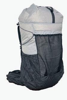
REVIEW
AS TECHNOLOGY ADVANCES, for certain products, there seem to be headline figures that sum up the continued progression in a nutshell. It could be megapixels for cameras, CPU speeds for computers, or resolutions for TVs. The outdoors industry is no exception, be it the lowest weights for tents, most lumens for headlamps, and for sleeping mats, highest R-values. And, for that last example, the latest salvo has been fired by Nemo Equipment, whose new Tensor Extreme Conditions (EC) Ultralight Insulated Sleeping Mat has a highest-in-themarket-for-ultralight-mats R-value of 8.5. That’s right, an incredible 8.5! Yes, there are mats with higher R-values still, but they’re not ultralight, and are far too heavy and bulky for anything but car-based camping.
Now, in case you’ve forgotten exactly what R-value means, it’s a measure of resistance to heat flow through a given thickness of material. It’s not only used for sleeping mats; all through the construction industry, it’s used to indicate the thermal resistance of insulation, windows, fibreglass, etc (Wild Autumn 2020, #175, had a detailed discussion about R-values if you want to learn more). Anyway, it wasn’t that long ago we were seeing some ‘winter-rated’ sleeping mats with R-values as low as three (for reference, an uninsulated air mattress might have an R-value of one). In warmer climates, the R-value of your sleeping mat really doesn’t matter; it’s only as temps drop that it becomes important. Especially once you’re snow camping. And it’s here that the Tensor EC mat truly shines. When I’ve taken it out on the snow, in nights dropping down to roughly -8 °C, I’ve literally not been able to feel the slightest hint of cold coming through the mat. That’s

not true of some ‘winter’ mats I’ve used in past years. The thing is, though, it does this at minimal weight; a regular mummy version tipped my scales at 459g. How did Nemo manage this? The key is the four layers of free-floating, insulating Thermal Mirror film suspended within the mat. Using what Nemo calls its Apex baffle system, trapezoidal baffles narrow slightly towards the top, with each layer of thermal film having progressively smaller holes. This allows Nemo to control how high each layer sits, without the need for welding. And by having the thermal film layers free-floating, the ‘crunchy’ sound associated with many insulated sleeping mats is eliminated. I haven’t heard so much as a peep from the Tensor EC while sleeping on it.
Despite the light weight, the mat is extremely comfortable, with roughly 10cm of cushioning. Even when I’d done an extremely rudimentary job of boot-packing down the snow, with lumps and bumps everywhere under the tent floor, I couldn’t notice the unevenness at all.
A few more things worth knowing: It uses Bluesignapproved nylons on the top and bottom, with a heavier duty 40D bottom for puncture resistance, and a lighter 20D top for weight saving. It also comes with a Vortex pump sack that you blow into first, and then squeeze into the mat, thus reducing moisture (OK, spit) entering it. (I found 2.5 sackfuls filled the mat). It has just a single valve, but dual caps allow for easy inflation and rapid deflation. All in all, this would be a great mat even were it heavier. But at a scant 459g (scant for a winter mat), the Tensor EC is genuinely impressive.
JAMES MCCORMACK
REVIEW
The price is light, ahem, right. NEVE GEAR
‘ULTRALIGHT’.
WHERE GEAR IS CONCERNED, it’s the big backpacking buzzword. It usually equals big dollars, too. For some, these price points are a turn-off; for others, the costs make lightweight products downright unattainable. I’m glad to say, however, this is where Neve Gear are making a difference: quality products at a more affordable price.
Neve Gear’s Wallaroo V2 pack is a case in point. At $299 for an 830g roll-top backpack, its price caught my eye.
How good would it be, though? After twelve days of hiking in Tas, and three overnighters since, I can confidently say this: It’s better than good.
Perhaps its most surprising feature is its usable volume; you get stacks of practical, packable space. Despite it being just 45L, my wife and I have managed to fit six-days’ worth of kit in our Wallaroo packs. (Granted, it was summer, so we had slightly less gear, but I mean very slightly.) The volume is expanded externally by the front mesh pocket, the Y-shaped top strap, and the generously sized drink-bottle pockets (both easily stashed our 1.5L Nalgene bottles). There are other roomy pockets, too. Both shoulder straps have mesh pockets large enough to accommodate my 7-inch phone, which also fits in both of the hipbelt pockets. And for those of us who use hip pockets for snack storage, the Wallaroo delivers in spades; I managed to fit six muesli bars in each pocket. Impressive.
ALDI
Snuggly warmth at a ridiculous weight and size penalty.
IT WASN’T LONG AFTER I thought about making this issue of Wild a fiasco-themed one that I wandered into an Aldi and spotted a OneZ sleeping bag suit, not just on sale, but at a reduced price ($49.99 down to $34.99). Perfect! What better product to review for this particular issue. I proudly took it to the checkout, where the middle-aged lady there raised an eyebrow as she scanned it through. Presuming it was the hot-pink colour that caused her do so, I said, “It says it’s unisex.” “I guess that makes it OK then,” she replied flatly. Was she being sarcastic? Playful? Or just to the point? Regardless, given that these suits are a ‘Special Buy’ available just once a year, reviewing this seemed too good an opportunity to pass up.
So let’s start with the colour. Although some might disagree, I like the hue of this particular version. While there’s a blue version available (boring!), any company that says hot pink is unisex gets a tick in my opinion. Unfortunately, though, as fashionable as the colour is, the cut is anything but. The proportions are crazy. The legs and arms in the medium size, supposedly for anyone between 170-184cm, (I’m 177cm) are ludicrously short. The crotch sat barely higher than my knees, and I couldn’t extend my arms fully. The midriff, meanwhile, was ridiculously huge. I don’t know who Aldi body-modelled the OneZ on; perhaps a womble.
But let’s dive to the question you all have: Was it warm? The answer is yes. And no. And it depends. As a sleeping bag, its comfort rating is just 9°C, and I found it easily exceeds that mark. But given it weighs 1.9kg, and is, well, fricken huge (see top-right pic), you’d expect far better. I took it out in sub-zero temps in the snow, and lasted a few hours, but in the end, had to pull an extra bag over

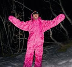


me. What’s more, I couldn’t roll around in it without getting caught up. Unlike a sleeping bag, which you can move inside, I kinda felt surprisingly trapped.
But at a bbq, it came into its own. It was genuinely toasty warm while sitting around a fire drinking some shandies. Speaking of which, going to the boys’ room in it was surprisingly easy, thanks to the near-full-length side zips. That said, I can only imagine the girls’ room would be a nightmare; there’s no easy way to squat in this. I guess number twos would be awful as well.
The two exterior hip pockets aren’t great either. They have literally zero depth; whatever you put in them invariably falls out. On the plus side, though, the suit does have removable feet, and you can tuck your hands into the ‘paws’.
Ultimately, though, Aldi’s OneZ is too big, far too heavy, and the sizing is ridiculous. But the price is low, and it is snuggly. And it comes in hot pink. I give it 2.5 stars.
JAMES MCCORMACK
So how comfy is it? For me, very. Assuming you pack smartly and avoid having hard objects (gas canisters, cook pot, etc) directly against your back, the back panel quickly moulds to your body’s contours, while the inverted U-frame provides structural stability. Load lifters also help to customise the fit, and the shoulder-strap padding is long and wide, which I’ve found reduces pressure points. On the topic of pressure, the Wallaroo’s hip-belt design is also clever: It’s well padded, and dual tensioning clasps on each hip strap allow you to finely adjust tightness. While I wouldn’t say I never had sore hips (which I regularly suffer from), my pain was certainly minimised. This is especially notable given that I often carried large volumes of water for a dry camp. Neve claims the Wallaroo’s comfort load limit is 18kg; from what I’ve experienced so far, I don’t disagree. The Wallaroo is available in small, medium and large
sizes (which each vary in weight, volume and frame length), but bear in mind that the minimum hip-belt circumference of 70cm is standard across all sizes (this may be a factor for slim individuals). While sufficiently large and strong, it can be difficult to store and remove items from the front pocket when the main compartment is fully loaded. The position of the chest strap is also fixed, and as is often the case with packs, you’ll also need a rain cover or dry bags, as 210D HDPE gridstop nylon isn’t waterproof. Some stitching on the pull loop (the one you can use to pick up the pack) also ripped when I—in a blasé fashion—hauled it up fully laden.
All things considered, for a lightweight pack under $300, you can’t expect any more from the Neve Wallaroo. It’s better than good. And hey, it can stash bulk muesli bars, too.
RYAN HANSEN


NEED TO KNOW
Weight (Medium unisex, as tested): 1,901g
Packed dimensions: 40cm (H); 25cm (W)
Warmth ratings: Comfort: 9°C Extreme: -8 °C
Removable feet: Yes
RRP: 49.95
More info: aldi..com.au

NEED TO KNOW
Volume (M) : 45L
Load capacity : 18kg
Weight (M; as tested): 830g
RRP: $300
More info: nevegear.com.au

Hollow fibre filters work by bundling hundreds of porous straw-like fibres together
A primer on how this efficient, weight-saving technology makes your water safe to drink.
AHH, THE JOY OF BEING in the mountains. The pure scenery, the pure air, the pure water. Oh, actually, scratch that last bit, because all-too-often the enticing, cool water in that apparently clear and beautiful stream is not exactly pure. It’s often full of all kinds of unseen microbes, protozoa, bacteria and more, and if you’ve ever suffered the ill-effects of gastro out bush, you’ll know it’s an experience you won’t want to repeat (read the winning entry in our Fiasco Stories Competition as a case in point).

QuickDraw Filter, for example, weighs just 69g, despite being able to have a throughflow rate of up to three litres a minute. And it’s so small that, while you can attach it to a Platypus bladder, you can attach it to any drink bottle with a 28mm opening—ie most standard soft-drink or bottledwater containers—and drink straight from it. MSR is another company with an equally light and small hollow fibre filter, the 71g Thru-Link Inline Filter.
All-too-often the enticing, cool water in that apparently clear and beautiful stream is not exactly pure.”

While hollow fibres may break if dropped, MSR’s Guardian Purifier has been tested to withstand a six-foot drop to concrete
There are many ways of treating water so that it’s safe— boiling it, using tablets, UV radiation, filtration and more; they all work, but they have their cons, too, among them time, cost, weight and effectiveness in turbid water. One of the most convenient and weight-effective methods is filtration using hollow fibre technology. Like ceramic filters, hollow fibre filters rely on size exclusion to make water safe to drink. Essentially, pathogens are too big to pass through the filter, but water still can. Unlike ceramic filters, though, hollow fibre filters tend to be lighter, often much less so. And unlike, say, UV filters or chemical tablets, their effectiveness isn’t compromised when the water is heavily contaminated or full of sediment.
But what exactly is a hollow fibre? Essentially, it’s a less-than-a-millimetre-in-diameter, straw-like tube, with the outer walls of the ‘straw’ being a membrane made porous by the presence of thousands of tiny holes. These holes are literally microscopic, although exactly how small they are depends on the filter model and the quality of hollow fibres being used. But for reference, MSR’s Guardian Purifier, for example, which is at the upper end in terms of filtration effectiveness (it incorporates technology adapted from kidney dialysis) has hollow fibres with pores less than 0.02 of micron. If you’ve forgotten how small a micron is, this equates to 1/50,000th of a millimetre. That’s small enough to not only filter out protozoa and bacteria, but viruses as well.
You don’t always need that level of protection, however. While a purifier that gets rid of viruses may be necessary in populated areas or more heavily visited spots out bush, for less-trafficked or more remote areas—where viruses and chemical contaminants are rare—a filter will usually suffice. In these circumstances, hollow fibre filters with larger-pore diameters—say like 0.1 or 0.2 micron—allow for extremely lightweight, compact filters. Platypus’s
It takes more than one hollow fibre, however, to provide protection; a filter has hundreds of hollow fibres bundled together, through which water flows. One key advantage with hollow fibres, besides their light weight, is that water can flow through the filter in both directions. Let the water flow in reverse, and you can ‘flush’ any trapped contaminants and/or sediments back out of the filter. This not only keeps the filter clean, it keeps the flow rate high.
Speaking of flow rate, that’s one other advantage of hollow fibres, and it’s not merely that they have a high throughflow; the flow rate—when it drops and cannot be restored by back flushing—gives a useful end-of-life indicator for the filter. Many other filter types don’t offer such an easy gauge.
There is a drawback to hollow fibre filtering, though. If the filter is dropped, or even if it freezes, the hollow fibres can break, thus compromising the filter’s integrity. Worse yet, it’s not immediately obvious this has happened. Some hollow fibre filters and purifiers, however, like the Platypus QuickDraw and the MSR Guardian mentioned earlier (in fact, this goes for all hollow fibre filters from both companies) allow you to perform integrity tests in the field that indicate if damage has occurred. And the Guardian— which was initially designed for military use—is unique in that it can withstand sizeable impacts; apparently, a six-foot drop onto concrete won’t damage it.
So there’s a rough guide to hollow fibre technology. For me personally, the weight advantages of hollow fibre filtering is key. There have been instances in years prior, before hollow fibre filters were widely available, where I’ve simply avoided taking a filter because of the weight penalty. I’ve also, it should be noted, suffered from giardia and dysentery on extended trips. And on those trips, the bottom fell out of my world. And vice versa. Try and avoid the same happening to you.
JAMES MCCORMACK
lightweight tent with a stable waterproof handlebar bag for the ultimate on-off
• 30cm DAC Poles
• 0.9kg Minimum weight
• Handlebar spacers free up space for hands Designed for life on two wheels.


We get it; we know ads aren’t the primary reason you read Wild. But without our supporters, Wild simply wouldn’t exist*. If you love what we’re on about here at Wild, if you’re passionate about both adventure and protecting our natural heritage, if having a magazine that’s full of well-written, crafted stories means something to you, a magazine that fights hard for our environment, then support our supporters; without them, Wild wouldn’t exist.
We know that our advertising supporters aren’t, of course, your only options when it comes to choosing what gear you purchase. But if you’re in a situation where you have a few cool options to choose from, and one of them happens to be from one of our advertisers, then show them their support means something by choosing their product. No-one’s asking for handouts, here; we genuinely believe that everyone who advertises in the mag offers something great. But if everything else is equal, please support those who support us. Here’s a selection of new and interesting gear that our advertisers think Wild readers should know about.
Lightweight without sacrificing durability, the Terra Peak Hoodie was made for those who refuse to let weather slow them down. ThermoBall™ insulation provides warmth even when wet, while abrasion-resistant Pertex® Quantum fabric helps blocks wind. Engineered for mobility, the underarm gussets with four-way stretch pave the way to a dynamic day outside. Packs down small and stows into its pocket. RRP: $400 THENORTHFACE.COM.AU


YETI: ROADIE 15 HARD COOLER
Meet the most compact hard cooler in our lineup. This small but mighty version of the classic Roadie® Family still packs all your favourite essentials, cans, and wine bottles, but in our most portable design yet. It’s the perfect fit for any ATV, paddle, board, or kayak, and easy enough to carry down to the beach or fishing spot.
RRP: $300 AU.YETI.COM
Fully featured without weighing you down, the Yacuri 55 is a highly versatile pack that takes you wherever you want to go. The adjustable V-TRAX™ carry system, and thermoformed dual density of foam harness, ensures full contact with your back while delivering cushioning support where it’s needed with reduced bulk. The result is a construction that keeps weight down and offers you instant comfort which endures over long distances.
RRP: $459.95 LOWEALPINE.COM.AU
MAMMUT:
CONVEY TOUR HARDSHELL JACKET
Functional hiking jacket for a lighter weight, more comfort and performance. Gore-Tex® Paclite gives the Convey Tour comprehensive weather protection. Waterproof. Windproof. Breathable. The high-quality, lightweight and breathable material makes the jacket feel more comfortable to wear. Mammut Easy Combine makes it possible to pair it with various insulated jackets and mid-layers. More flexibility when hiking. RRP: $449.95 MAMMUT1862.COM.AU

Big River Dry Backpacks are durable and abrasion-resistant, perfect for rugged water sports and motorcycle touring. Made from 420D nylon, they feature adjustable straps, a white interior for visibility, lash loops for secure attachment, a non-wicking roll-top closure, and an oval base to save space and prevent rolling.
RRP: $199.99 SEATOSUMMIT.COM.AU

Balancing the fit and performance of a trail running shoe with the stability required for long, technical approaches, the Vertex Alpine redefines approach footwear. Made for all-day mountain travel, it’s light, fast, and delivers the support and protection required for rugged, varied terrain. The sticky Vibram XS Flash 2 outsole is designed for edging, on-trail performance, and grip in wet and dry conditions. RRP: $300 ARCTERYX.COM.AU
A gear guide from our advertisers
FUTURA AIR TREK 50 PACK

Long distance hikes are exactly your thing? Then the Futura Air Trek is your ideal companion, for maximum comfort on long tours. Our VariSlide back length adjustment system allows infinite adjustment to any body size, while padded and ergonomic VariFlex hip fins make for comfortable wearing, day-in, day-out. All the while, an Aircomfort Sensic mesh back system is designed to keep you optimally ventilated, whatever the conditions.
RRP: $499.99 DEUTER.COM/AU-EN

Made from 100% recycled materials, the Takayna is a highly technical, super lightweight 2.5 layer rain shell with a PFC-Free DWR coating for maximum protection. Its fully seam sealed construction boasts a HydroVENT20+ Waterproof shell and a 20k breathability rating. It sports all the features you would expect from a premium rain jacket including a double storm flap, fully adjustable hood and easily stows into its own front pocket. Eco-friendly and certified carbon neutral.
RRP: $219.99 XTM.COM.AU

Soak up every moment you have outdoors, and not a drop more, with Osprey’s new Downburst 26 daypack. The Downburst pairs Osprey’s highly breathable, gendered fit AirSpeed™ suspension with an IPX5 waterproof main compartment and quickdry external materials. Delivering the capable fit and stability Osprey is known for while the gear you carry with you will still stay completely dry. Made with bluesign® approved 100% recycled nylon main body fabric. RRP: $479.95 OSPREY.COM/AU/EN
Lightweight and highly packable chair great for ultralight camping. The HEX 2.0 rolls up compactly to a 10cm diameter with an attached strap for easy carrying and can be clipped to a pack with a hang loop. Ideal whenever space and weight are a factor, the chair is perfect for day hikes and can double as a short sleeping mat for backpacking. RRP: $129.90 SPELEAN.COM.AU


SUMMIT GEAR: WOLLEMI 90 PACK
Need an ultralight pack that carries a load? The Wollemi 90L is the perfect pack! This pack is ideal for expedition hikes or pack rafters. All materials are waterproof, and all seams are taped sealed to make the entire pack weatherproof. It’s designed to carry 25+kgs, and has a larger area hip belt with greater padding for additional comfort. Despite having a 90L capacity, it weighs just 1.23kg. And there’s an optional 10L with the Wollemi Expedition hood, if you need to carry more. RRP: $679 WHIPPA.COM.AU


The New Zealand-made Tui 42 is among the lightest multiday packs in the world and stands out like its namesake. As the capstone of your ultralight kit, it’s the perfect pack for any adventure from day trips to thru-hikes. This frameless pack is available in 8 patterns and features 7 external pockets, a rolldown top, plus an adjustable, removable hip belt. Weighs only 300-420g. RRP: $425 KIWIULTRALIGHT.CO.NZ
ENLIGHTENED EQUIPMENT: REVELATION -6°C QUILT
The Enlightened Equipment Revelation -6°C 850FP Duck Down Hiking Quilt is a must-have for any gram-counting hiker. Weighing only 669g, this sleeping quilt will keep you cosy on chilly nights with its 1/4 zip footbox and it opens up to a blanket for mild, shoulder season temps. The duck down is ethically sourced and is Responsible Down Standard (RDS) certified.
RRP: $599.95 WILDEARTH.COM.AU

* We also wouldn’t exist without our amazingly talented and tireless contributors, either. One of the best ways you can help reward them is simply to subscribe to Wild. The more subscribers we have, the more we can pay our contributors. wild.com.au/subscribe
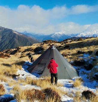
WILD & CO
GEOQUEST ADVENTURE RACE
A PASSION FOR THE OUTDOORS, CONSERVATION AND CREATIVITY
PAST Outdoors offers a carefully selected range of hiking, camping and expedition equipment tailored to meet the needs of your next adventure. They also manufacture a range of ultralight shelters that can be heated with a titanium wood stove. When you visit the retail store south of the Royal National Park in Helensburgh, NSW, you can expect personal, expert advice from Dave and the team. Drop in to the store or shop online at PASTOUTDOORS.COM
Mountain Designs GeoQuest 48hr Adventure Race is the ultimate test of your physical and mental limits. There is no question, the race is tough and it is real adventure. Your body will be totally exhausted, your brain will be begging you to stop and you’ll have had little or no sleep for 48 hours. This is certainly not your average weekend! Why do it? Because for anyone who crosses the finish line, will come an elation and sense of achievement like nothing else. You will have taken your body and mind past anywhere you have been before. You will have shared incomparable experiences with your team mates. Ultimately you will have found that your limits are just an illusion. Register for the experience of a lifetime at GEOQUEST.COM.AU
FISIOCREM: DESIGNED TO KEEP YOU MOVING
Fisiocrem Solugel is for the temporary relief of muscular aches and pains. fisiocrem Solugel is a topical anti-inflammatory that assists with all things muscle pain relief. Fisiocrem Solugel helps in the healing of minor muscle injuries, relieves symptoms of sprains and strains, and helps improve muscle recovery time. Always read the label and follow the directions for use. FISIOCREM.COM.AU

ALSO, PLEASE CHECK OUT OUR CLASSIFIEDS PAGES OVERLEAF, AND SHOW OUR SMALLER COMMUNITY SUPPORTERS YOUR LOVE
Not all of our supporters make gear, and they deserve our support, too. Please check out what they’ve got to offer.

LARAPINTA TRAIL TREK SUPPORT YOUR TREK STARTS HERE
Larapinta Trail Trek Support (LTTS) provides top tier trek, trail and field support services for independent and self-guided hikers and trekkers taking on extended-day treks on the Larapinta Trail or off-track, cross-country treks across not just Central Australia, but right around the entire country, including now in the Victorian High Country. TREKSUPPORT.COM.AU

WE USE THE GEAR WE SELL
Since 1989, Bogong Equipment—Australia’s leading outdoor equipment store—has provided our fellow outdoor adventurers with the latest gear. With our long history and expert staff members, we strive to make your buying experience as smooth as possible. Whether it is bushwalking, climbing, trail running, or exploring the world’s great mountain ranges, we are out there doing it, and we can’t wait to help you choose the right products for your next adventure. BOGONG.COM.AU


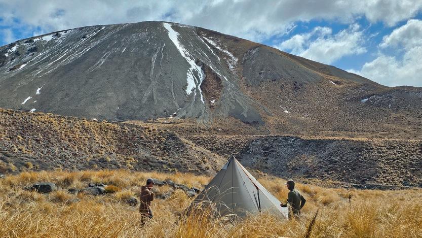


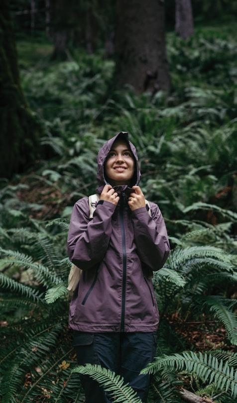


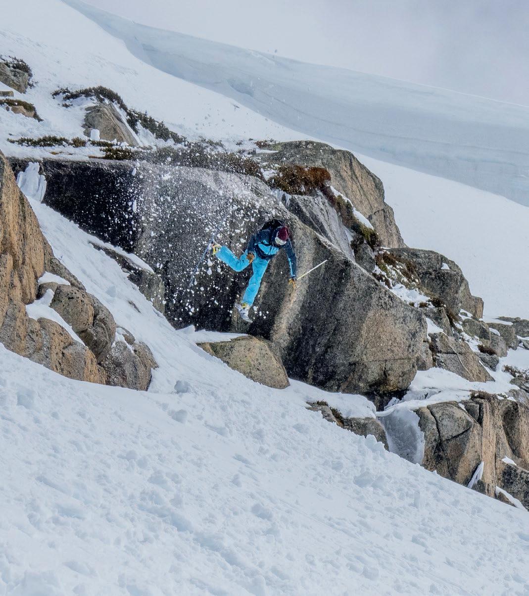
Thirty centimetres of fresh pow in November had us ransacking our winter gear in a mad rush to get up into Kosciuszko NP’s Main Range for some ‘almost’ summer pow turns. The visual fiasco on telemark skis (Ed: I think it makes this shot even funnier that you can barely see them) you see unfolding here has only one outcome. There’s no questioning the likelihood of Steve riding out of this one; it’s blatantly obvious, he is about to eat it big time.
AARON DICKFOS Jindabyne, NSW
Aaron wins an awesome Nemo Equipment MOONLITE reclining camp chair valued at $249.95. The chair brings comfort to the backcountry, and is barely noticeable in your pack. A unique pulley system allows you to adjust your sitting position on the fly, and oversized tubes create exceptional strength and stability despite the chair’s light weight. nemoequipment.com

SEND US YOUR WILD SHOT TO WIN GREAT GEAR! For a chance to win some quality outdoor kit, send your WILD SHOT and a 50-100 word caption to contributor@wild.com.au

Tried, trued and proven on some of the most iconic end-to-end hikes in the world, Exos/Eja is a performance ultralight backpack through and thru. Lightweight construction eases every mile while a remarkably comfortable, stable and ventilated suspension system adds joy every step of the way.
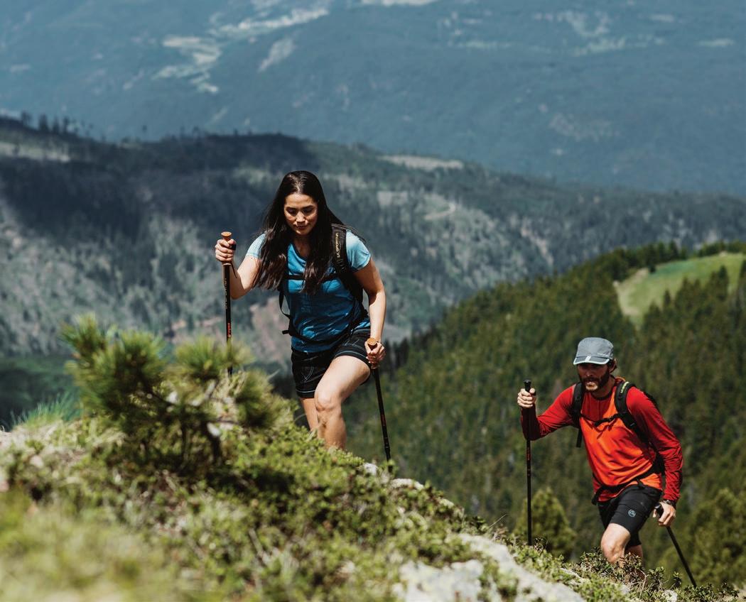


DISCOVER THE MOUNTAIN RUNNING COLLECTION
