


I am a landscape architect who is passionate about bridging design with community engagement and ecological research for soil and water restoration. I design with an ethics of care, in harmony with dynamic processes, and believe that healing land is directly tied to healing communities and cultivating placemaking among displaced, marginalized groups. My work strives to develop resilient, sustainable, and diverse spaces, welcome to all species while holding frontline communities at the forefront of how we design.
My design intention stems from who I am as a person. I am a queer, firstgeneration Latinx immigrant from California who in my spare time likes to read about mycology and explore the built environment through skateboarding.


My work with landscape thus far has been interdisciplinary and is always research-driven, utilizing environmental and sociological frameworks. The projects span across design and strategy, while addressing ecological and socio-cultural issues at different scales.


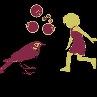
Sustainability without justice is just sustained injustice.
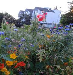
Brooklyn, NYC, 2023
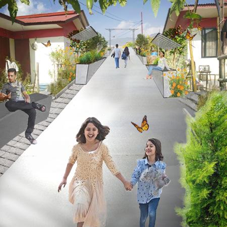
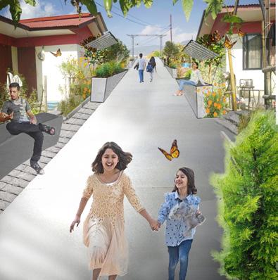
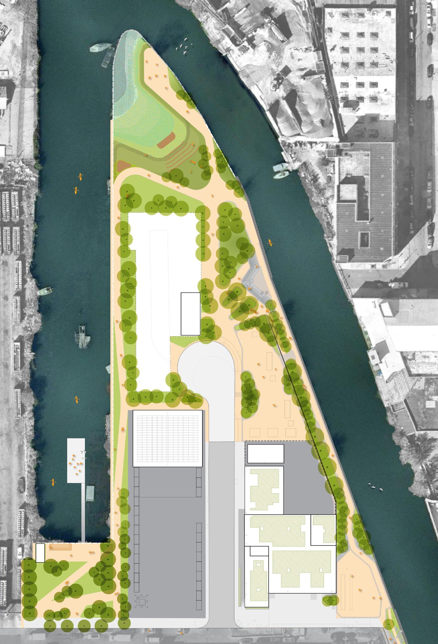
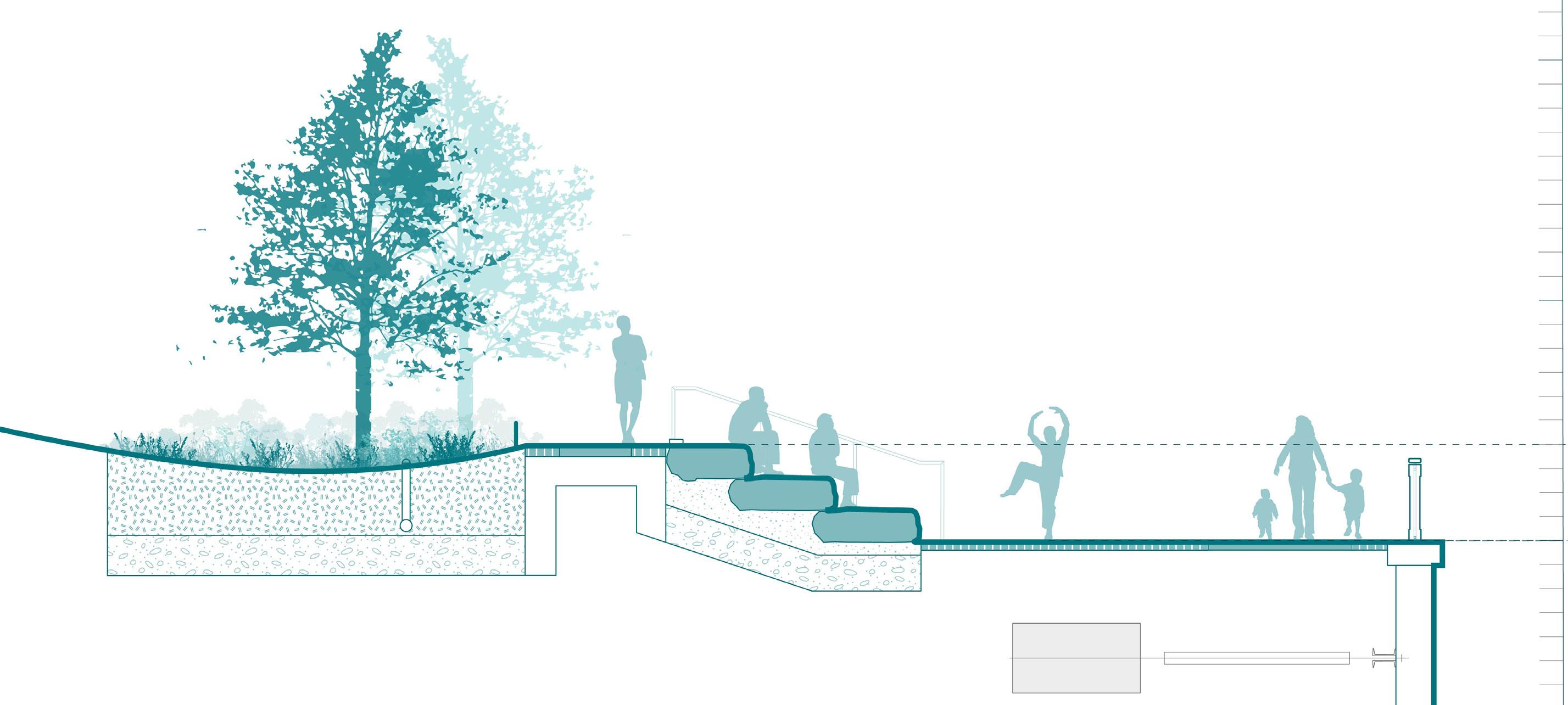
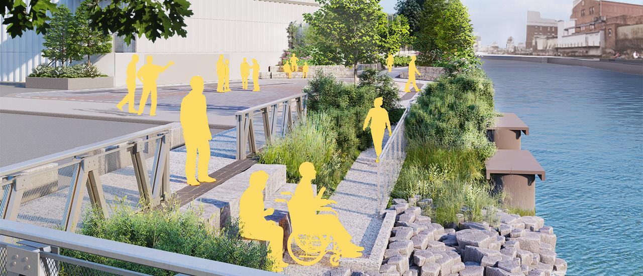
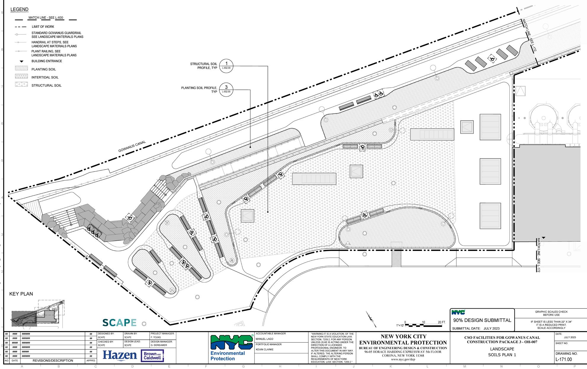
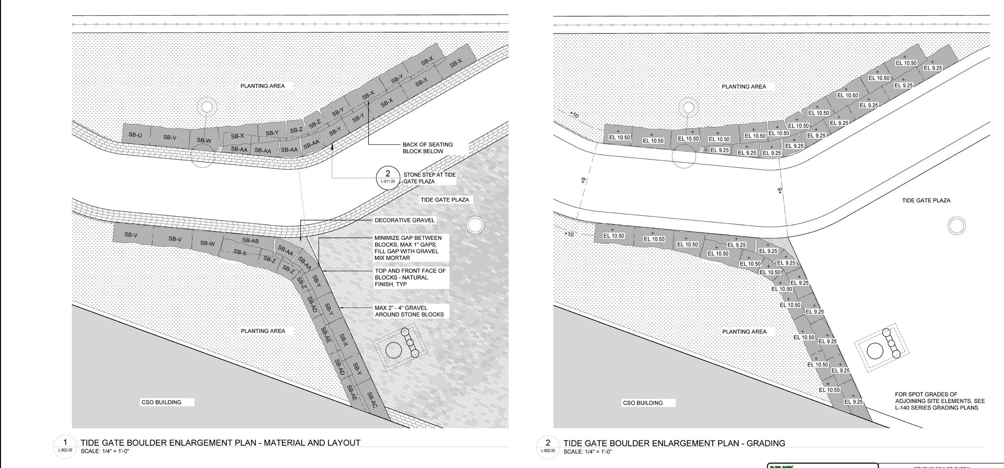
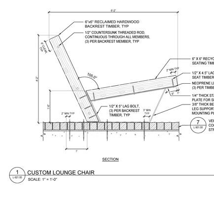
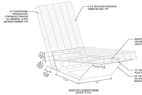
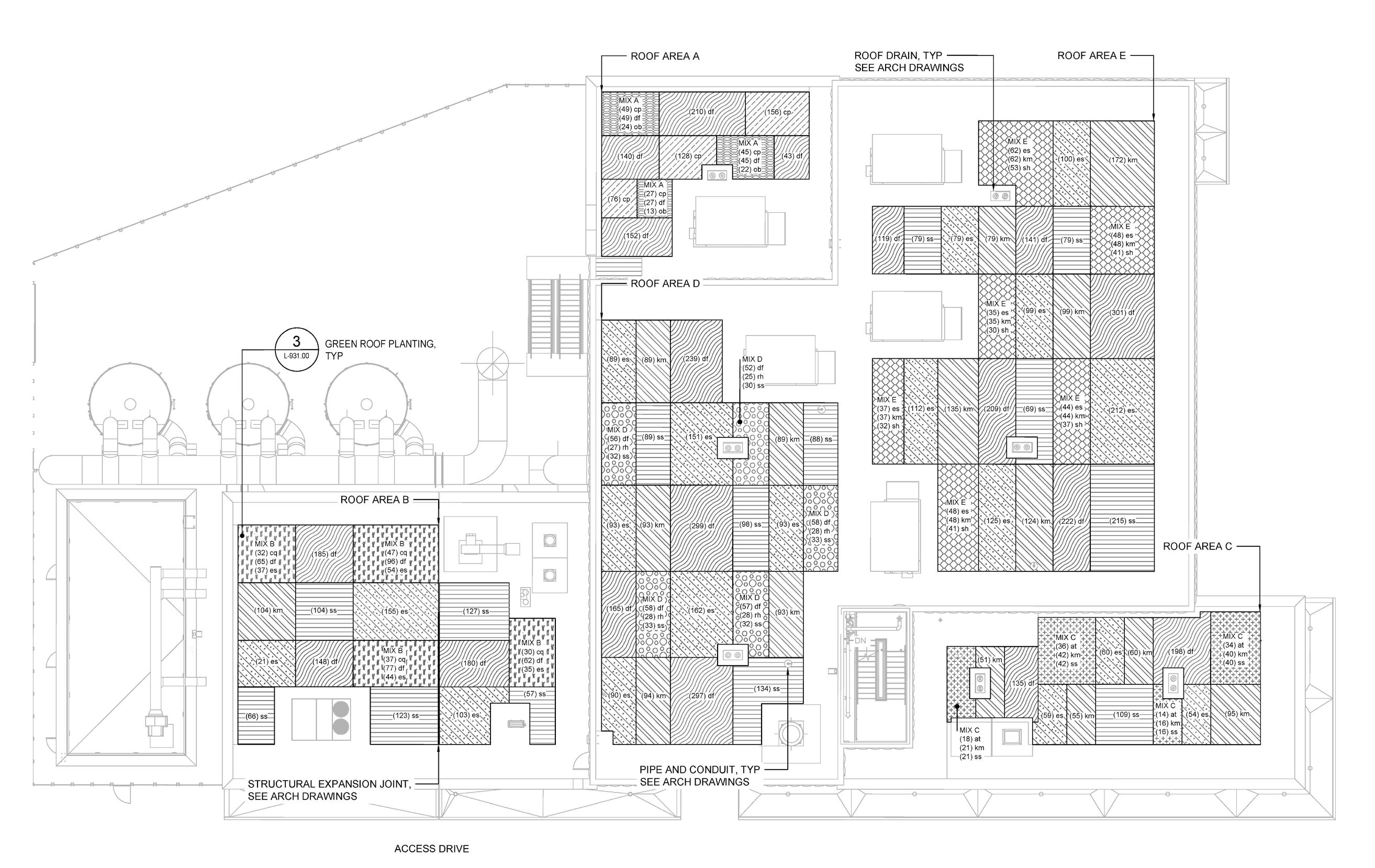
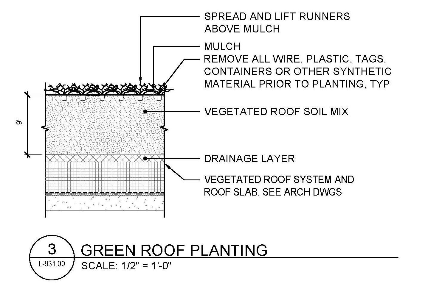
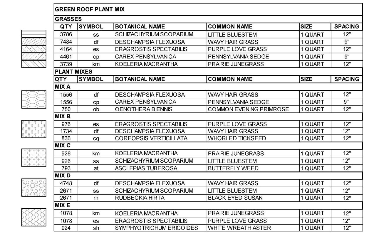
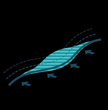
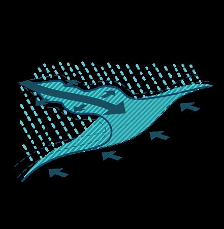
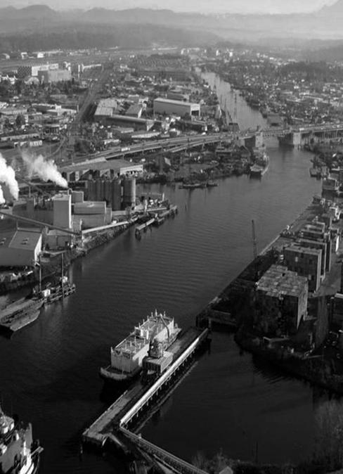
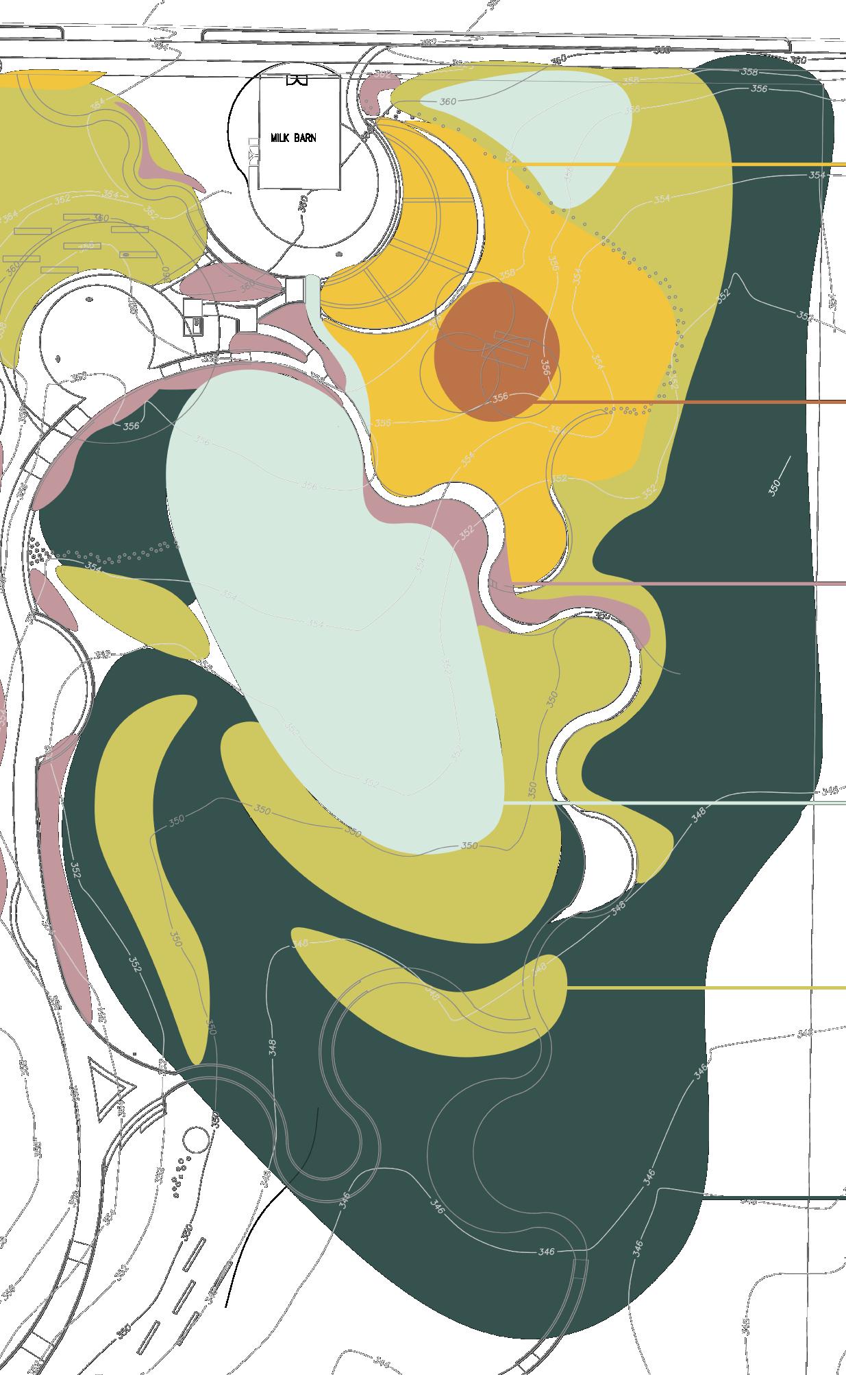
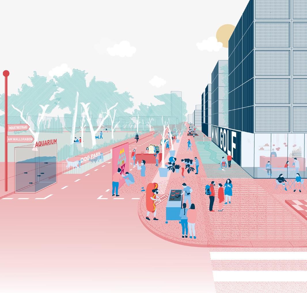
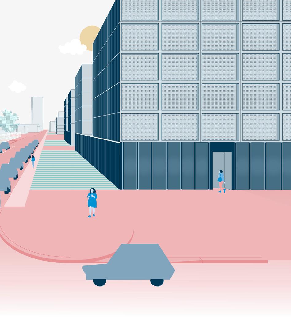
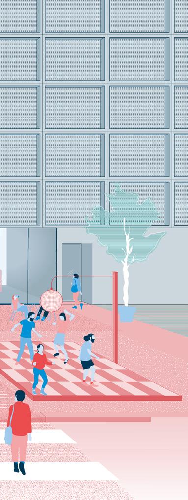
In 2010, the US Environmental Protection Agency (EPA) designated the Gowanus Canal a Superfund site. The EPA has required the City to remediate petroleum-based contaminants at the canal and reduce combined sewer overflows (CSOs) into the canal. To do this, two combined sewer overflow facilities will be constructed, and the one at this site will store as much as four million gallons of combined sewage until it can be rerouted for treatment at the Owls Head Wastewater Resource Recovery Facility in Bay Ridge. While satisfying an EPA mandate, the project creates an opportunity to provide meaningful open space to the community. The project goals are to design a resilient and sustainable facility, provide a welcoming and valued community asset, and create an open space informed by public engagement and evaluation of water access. My role in this project was to work with the community engagement lead to create deliverables for public design meetings, research and design the bioretention wall, research and locate local material options, design the green roof on site, and complete the construction documentation process.
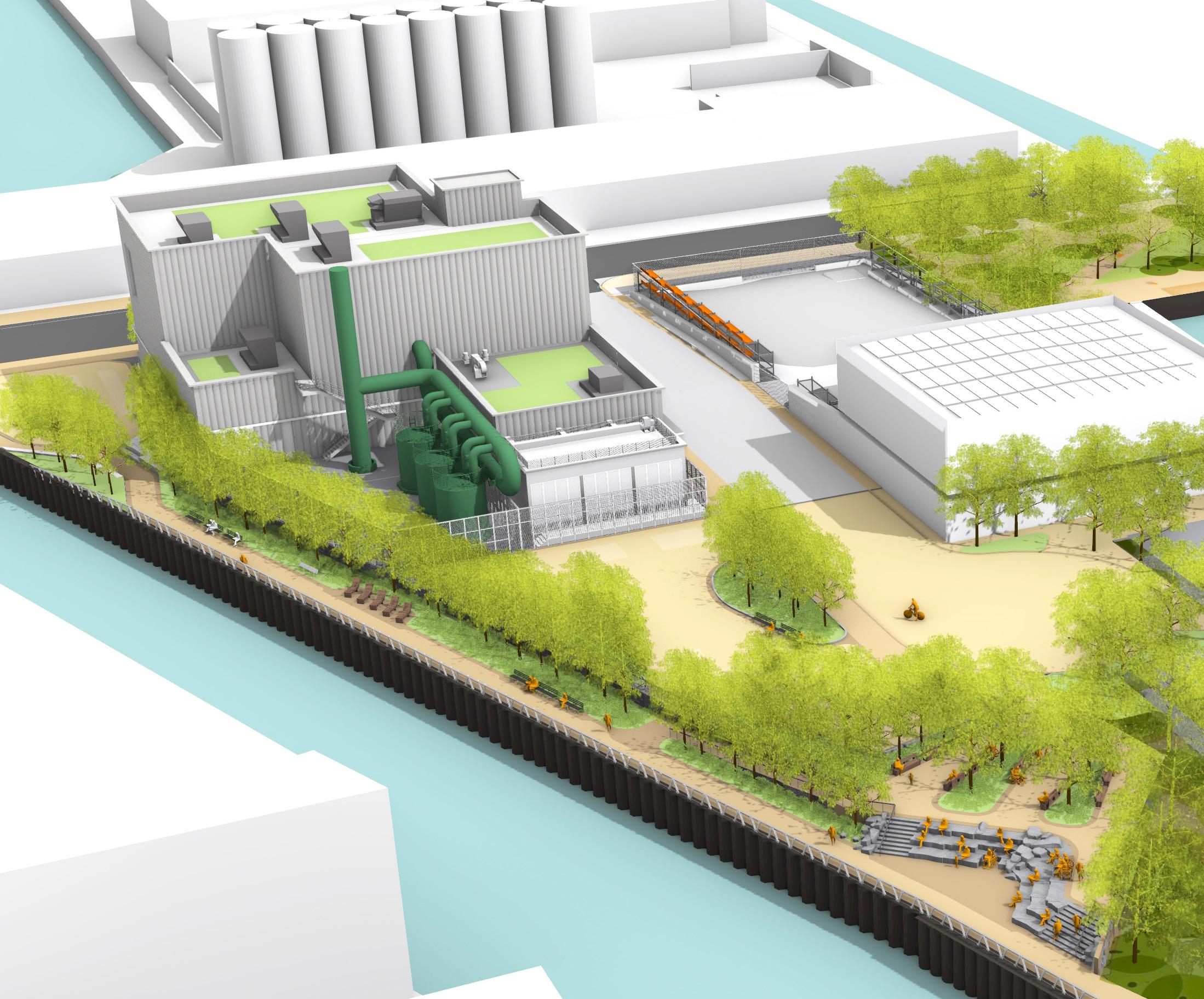
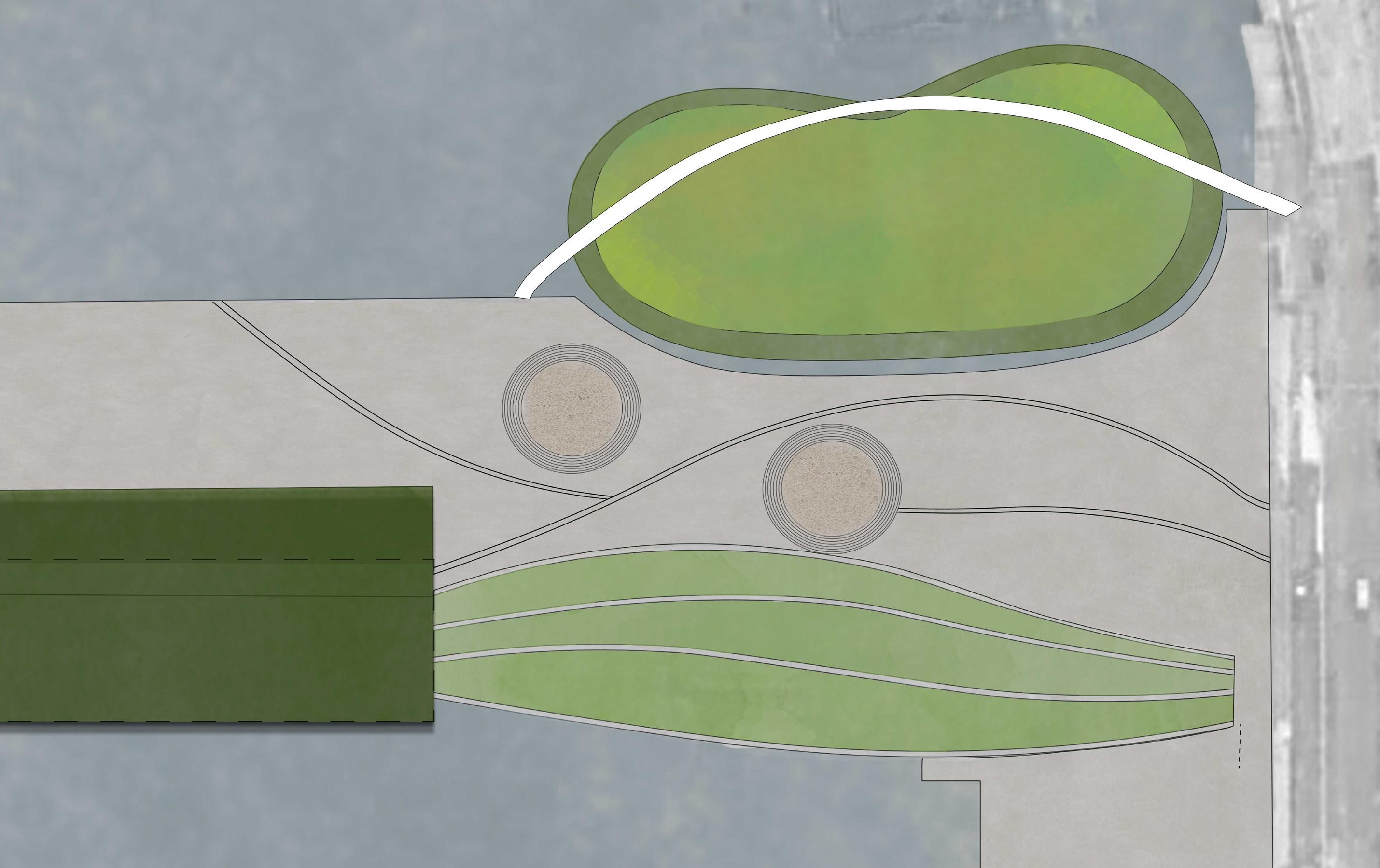
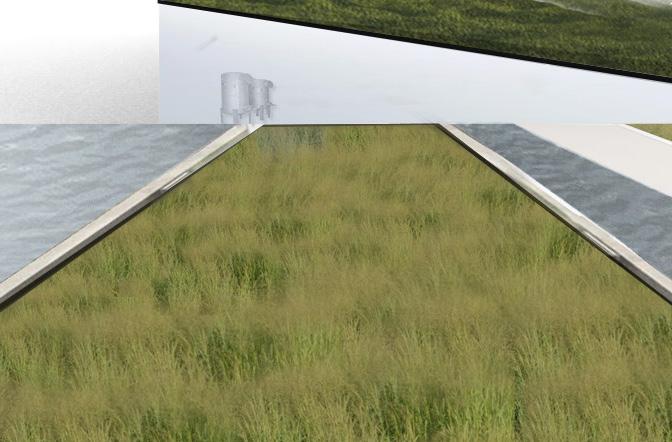
MULTI-STORY PLANTING
STRUCTURAL WALL WITH GABION CLADDING
HANDRAIL
BIORETENTION
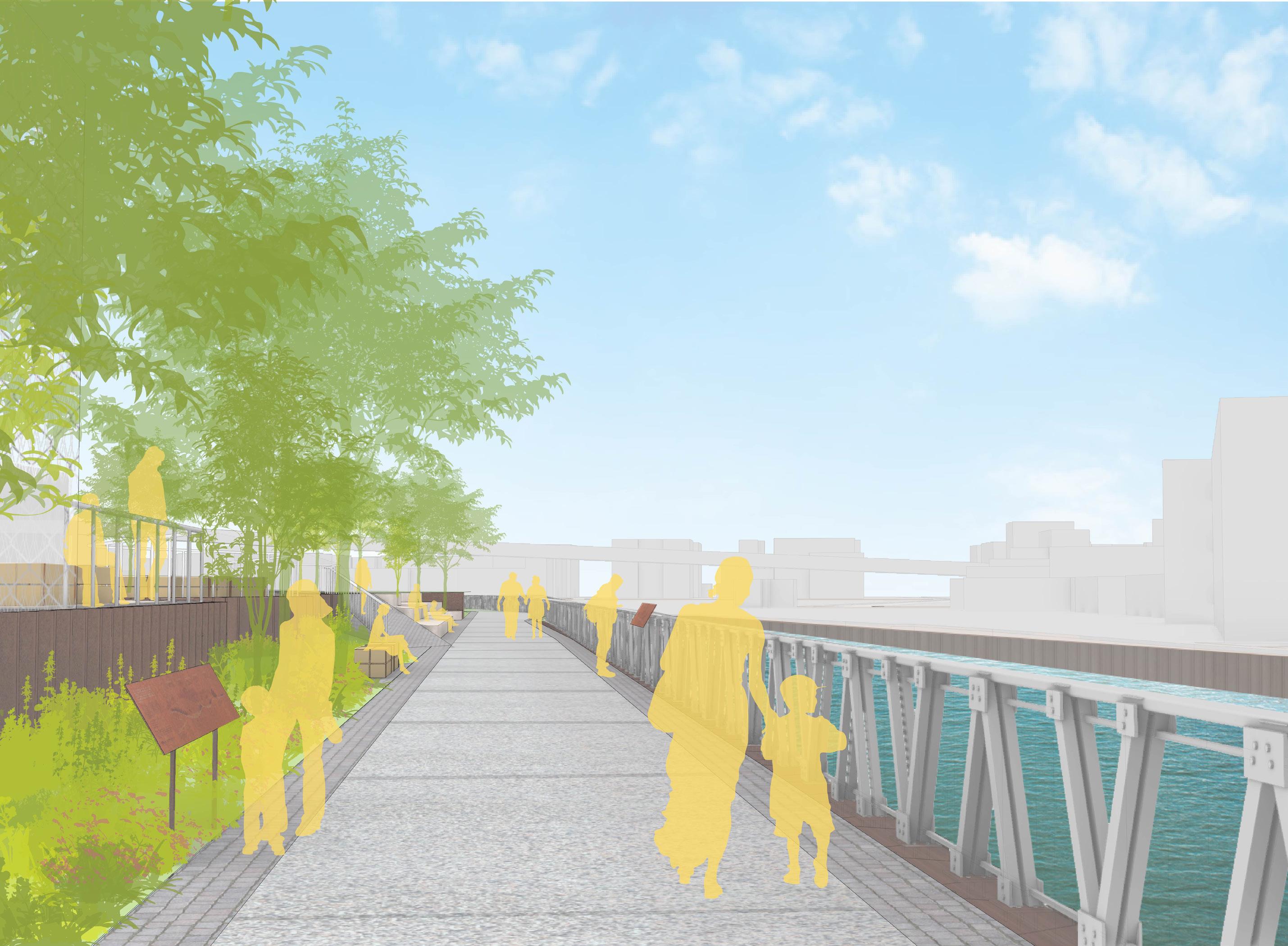
INTERPRETIVE SIGNAGE
EXPOSED AGGREGATE CONCRETE SIDEWALK


New York City, NY, 2023
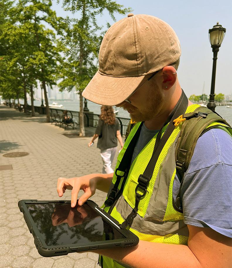
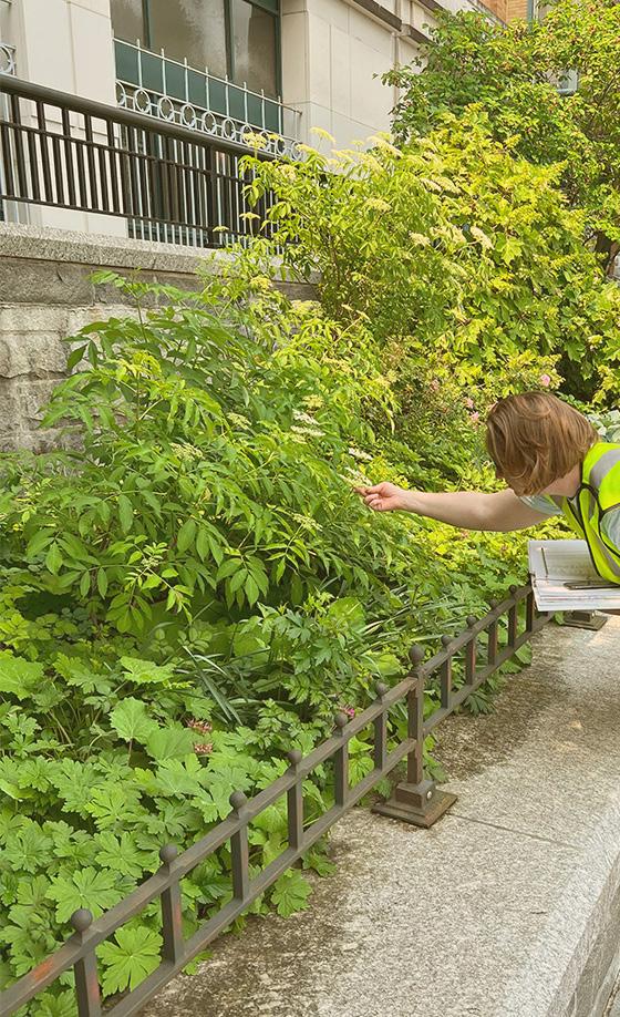
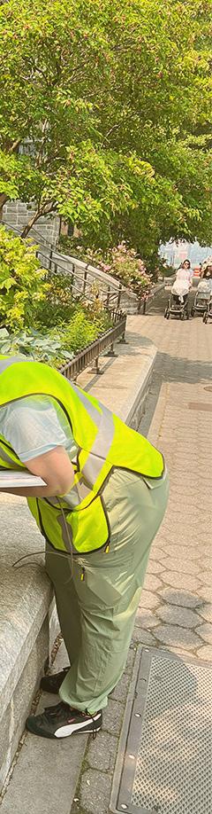
The Battery Park City Sustainability Plan is a comprehensive ten (10) year plan with a high-level vision to enhance environmental sustainability in Battery Park City (BPC). The Plan puts forth a holistic vision of environmental sustainability, including health and wellness, environmental quality, and education. One task for this plan was the Biodiversity Audit and Data Collection. Its strategy is to enhance the biodiversity of plant and animal life at BPC and ensure that the wildlife is resilient to the changing climate. By increasing biodiversity where appropriate in BPC, we will improve habitat resilience to different climatic conditions, improve their ecological health, and provide and support broader ecosystem services. For this task I assisted with developing a biodiversity data collection methodology and developed an inventory of all plant species within BPC. In addition, we began to measure and assess the BPC tree canopy as a response to mitigate urban heat island effect. Overall, the goal is to provide recommendations on ways to enhance local biodiversity as well as contribute to the larger urban ecosystem.

As part of the Urban Tree Canopy Assessment, SCAPE worked with Treeplotter to develop an online platform to use as part of the assessment and for ongoing management of the tree canopy data.
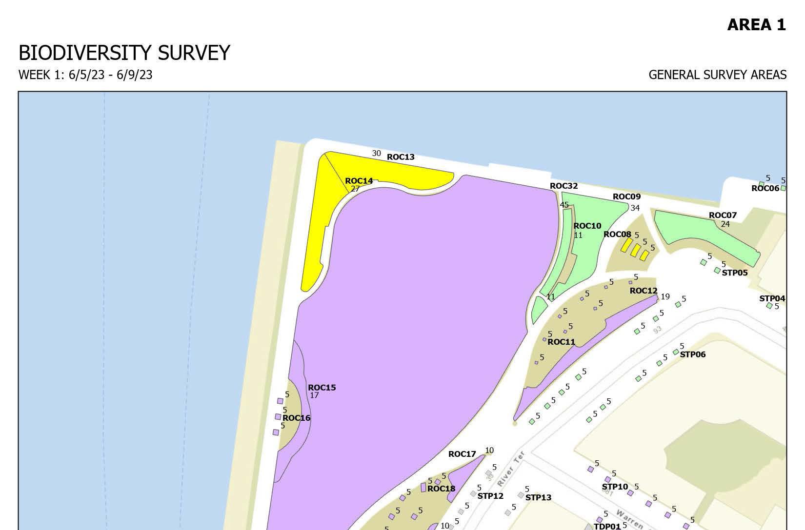
Top and Bottom: Examples of BPC biodiversity data inventory and survey.
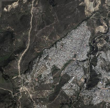
Jacksonville, FL 2023
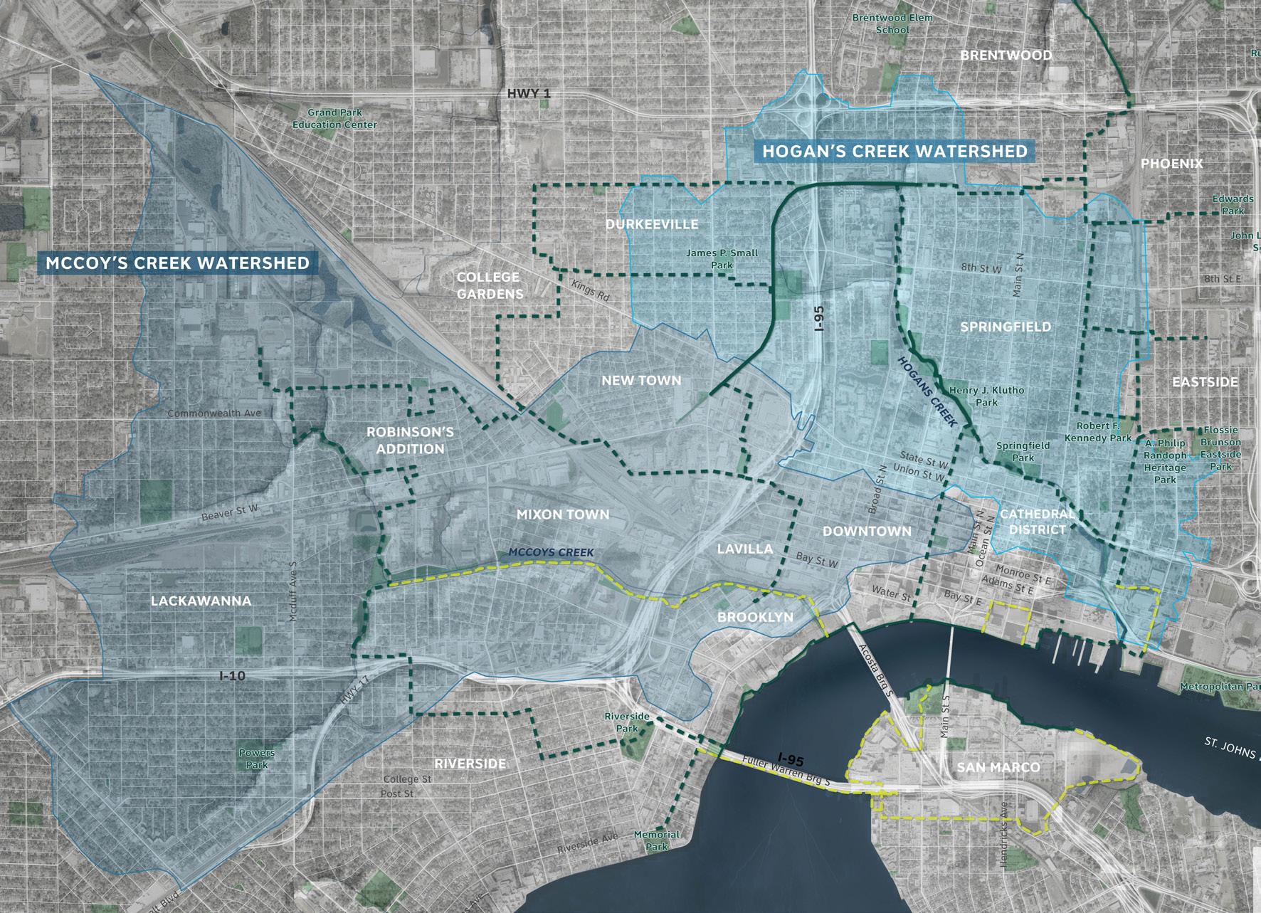
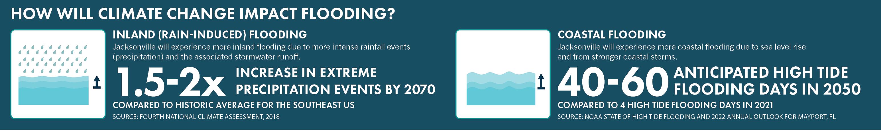
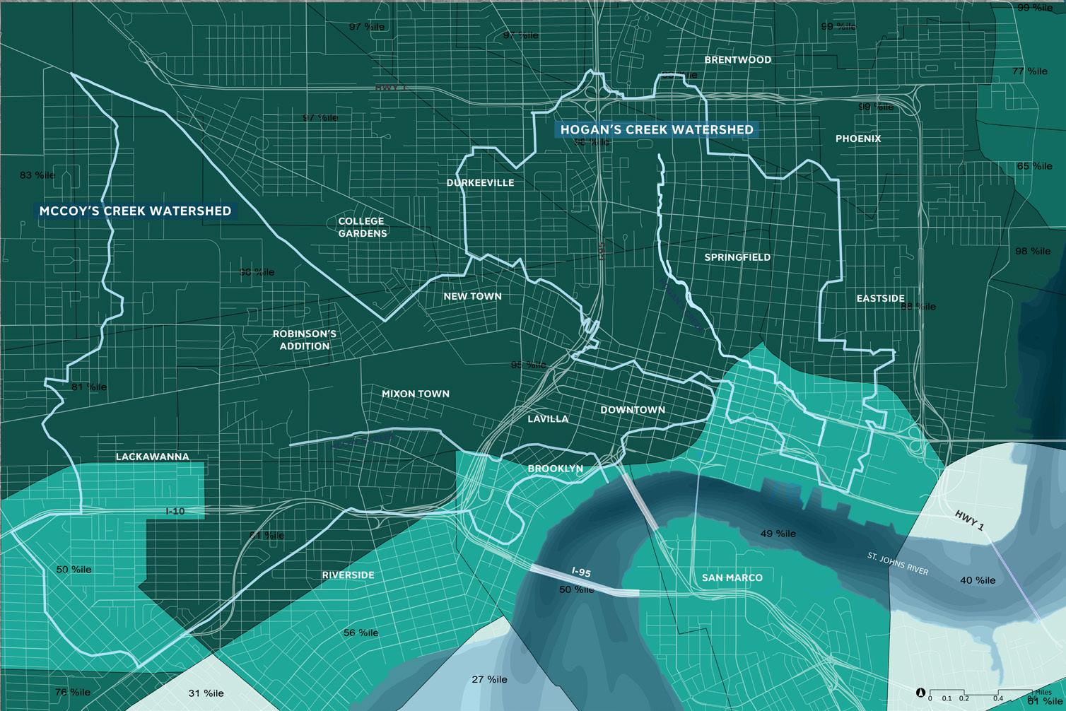
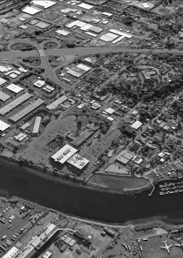
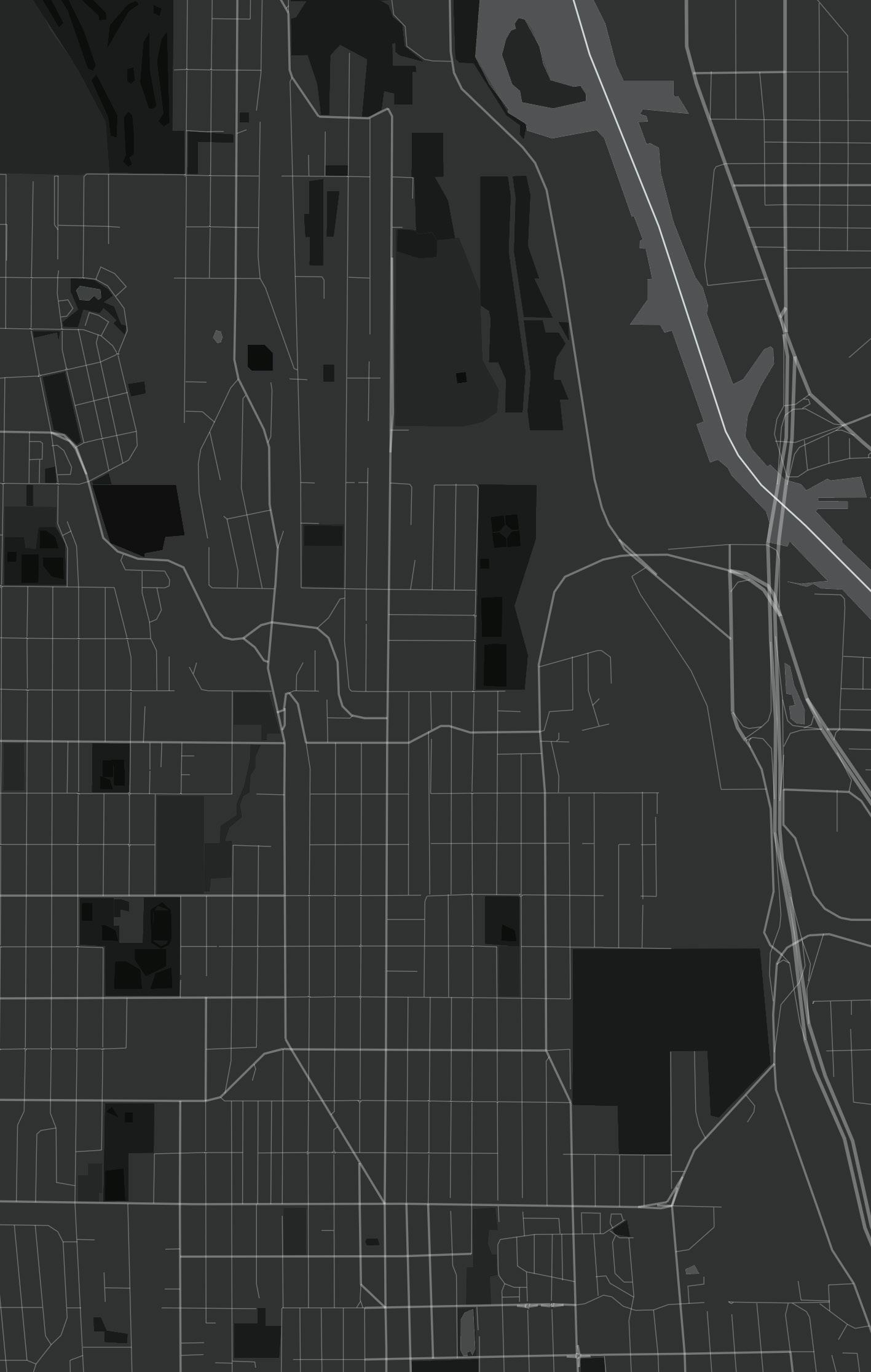
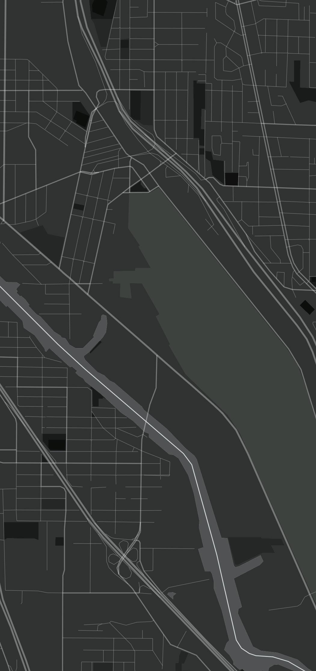
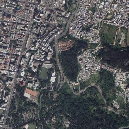
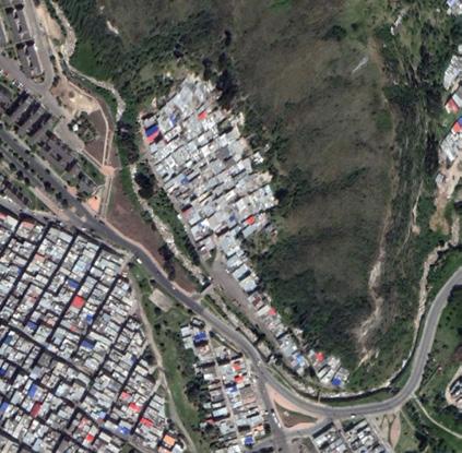
The Emerald Trail is a planned 30-mile bicycle/pedestrian trail and linear park system that connects 14 urban neighborhoods, downtown, and the St. Johns River. The Emerald Trail project includes flood mitigation, creek and habitat restoration, improved water quality, park development, bike and pedestrian trails, art, and more, with the goal of revitalizing Jacksonville’s urban core and creating more stable neighborhoods by adding economic diversity. The core mission is to build capacity for approaches to urban resilience that are shaped and led by community-based organizations, and in which advancing social equity and building social cohesion. It is important that proposed projects and solutions are as green as possible, and explicitly protect social as well as ecological sustainability. My role in this project was to understand the flood risks in Jacksonville and analyze the environmental injustices climate crises are causing vulnerable communities through historical research and spatial mapping. This research will be used for SCAPE to develop an equitable watershed resilience plan.
JACKSONVILLE WATERSHEDS
WHAT ARE OUR GOALS, VALUES, & OPPORTUNITIES?
RESILIENCE OPPORTUNITIES
RESILIENCE PRIORITIES & ACTIONS ALTERNATIVE ANALYSIS
HOW, WHERE & HOW MUCH CLIMATE CHANGE THREATENS THE VISION? WHO & WHAT IS THE MOST VULNERABLE?
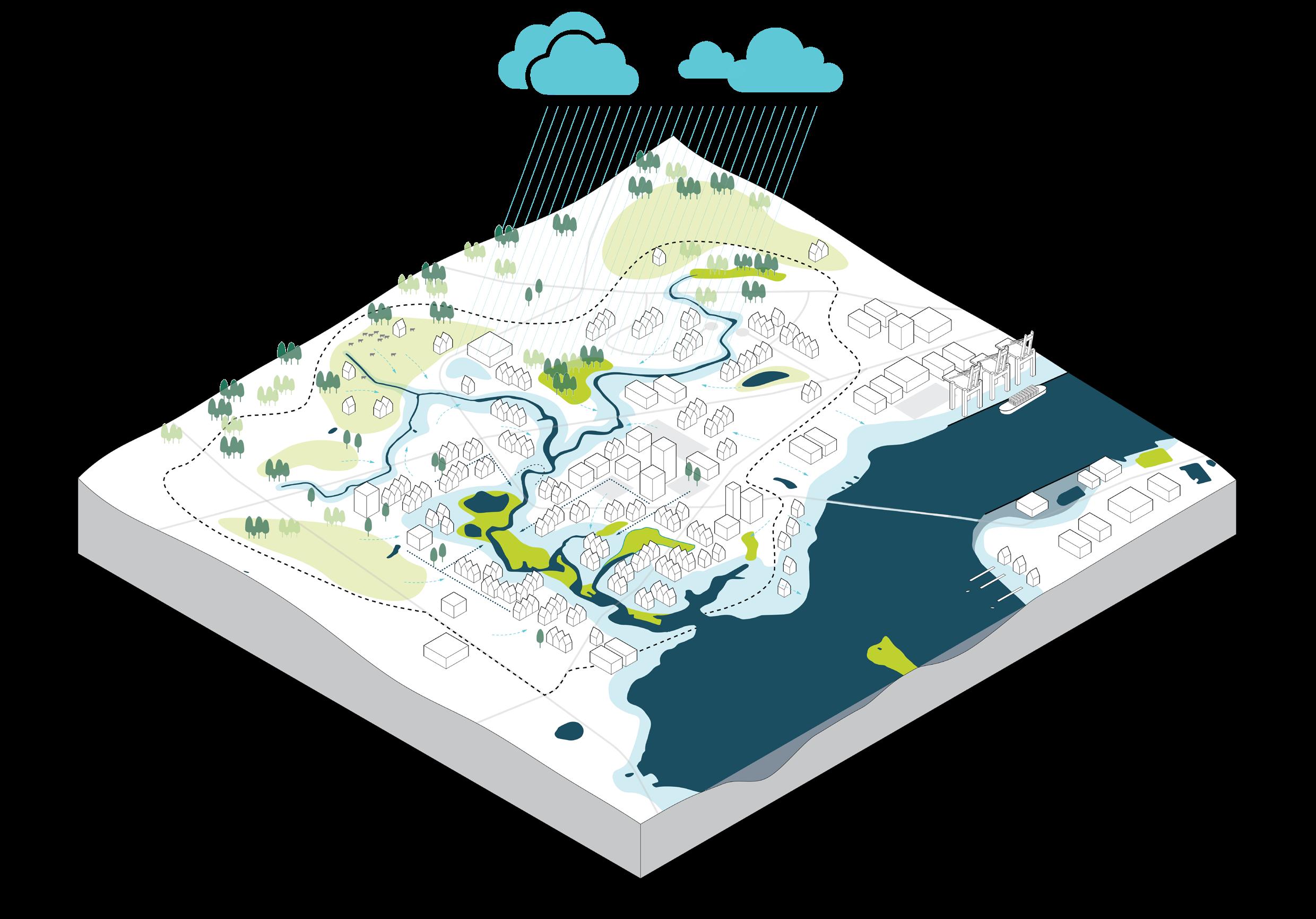
Resilience planning framework. Diagram of how watersheds flood in Jacksonville.
WATER FLOWS SLOWLY IN UNDERDEVLOPED AREAS
FRESHWATER WETLANDS STORE RAINWATER
STORMWATER FLOODING

RIVERINE FLOODING
DEVELOPMENT CAN DISRUPT DRAINAGE PATTERNS
PAVED AREAS INCREASE RUNOFF
LIMIT OF TIDAL INFLUENCE
WETLANDS ABSORB FLOW
PIPES & DRAINS HAVE LIMITED CAPACITY
FLOODPLAIN DEVELOPMENT INCREASES RISK
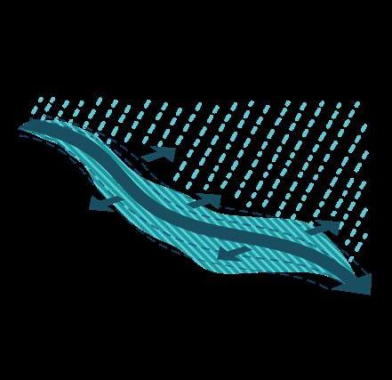

STORM SURGE PUSHES WATER UPRIVER
COMPOUND FLOODING
COMPOUND FLOODING
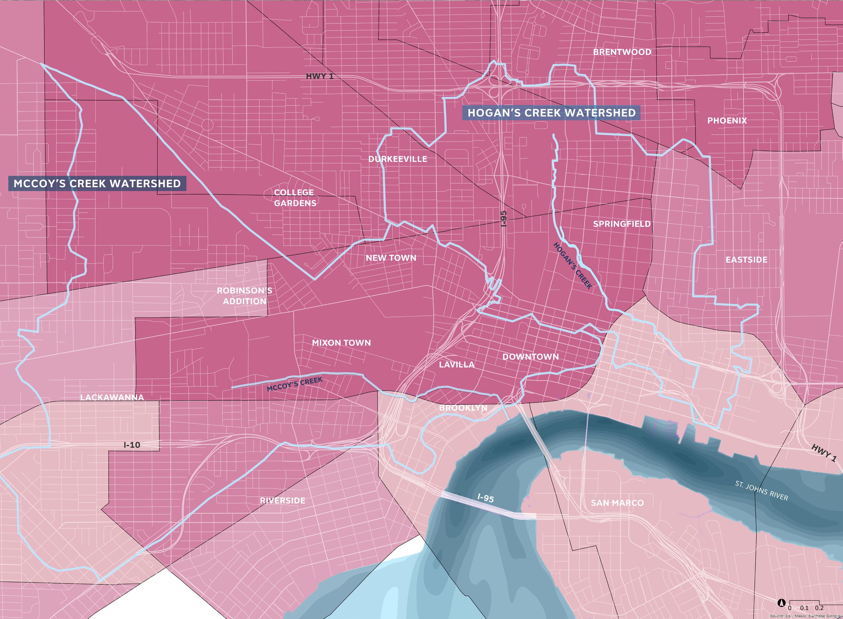
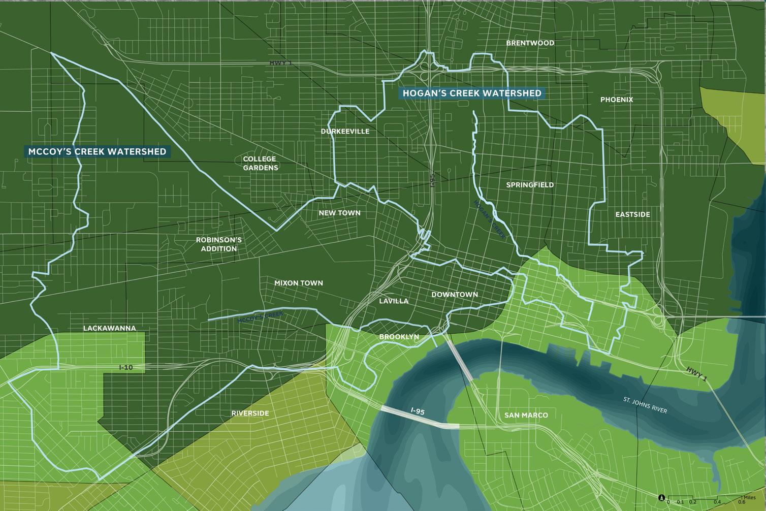
Mapping spatial justice through social, health, and environmental conditions in Jacksonville, FL. In mapping spatial justice we can assess that the flooding of the McCoy’s and Hogan’s Creek directly impacts the surrounding neighborhoods that are predominantly people of color.
These vulnerable communities are within close proximity of hazardous waste sites and have an alarmingly high risk of cancer.
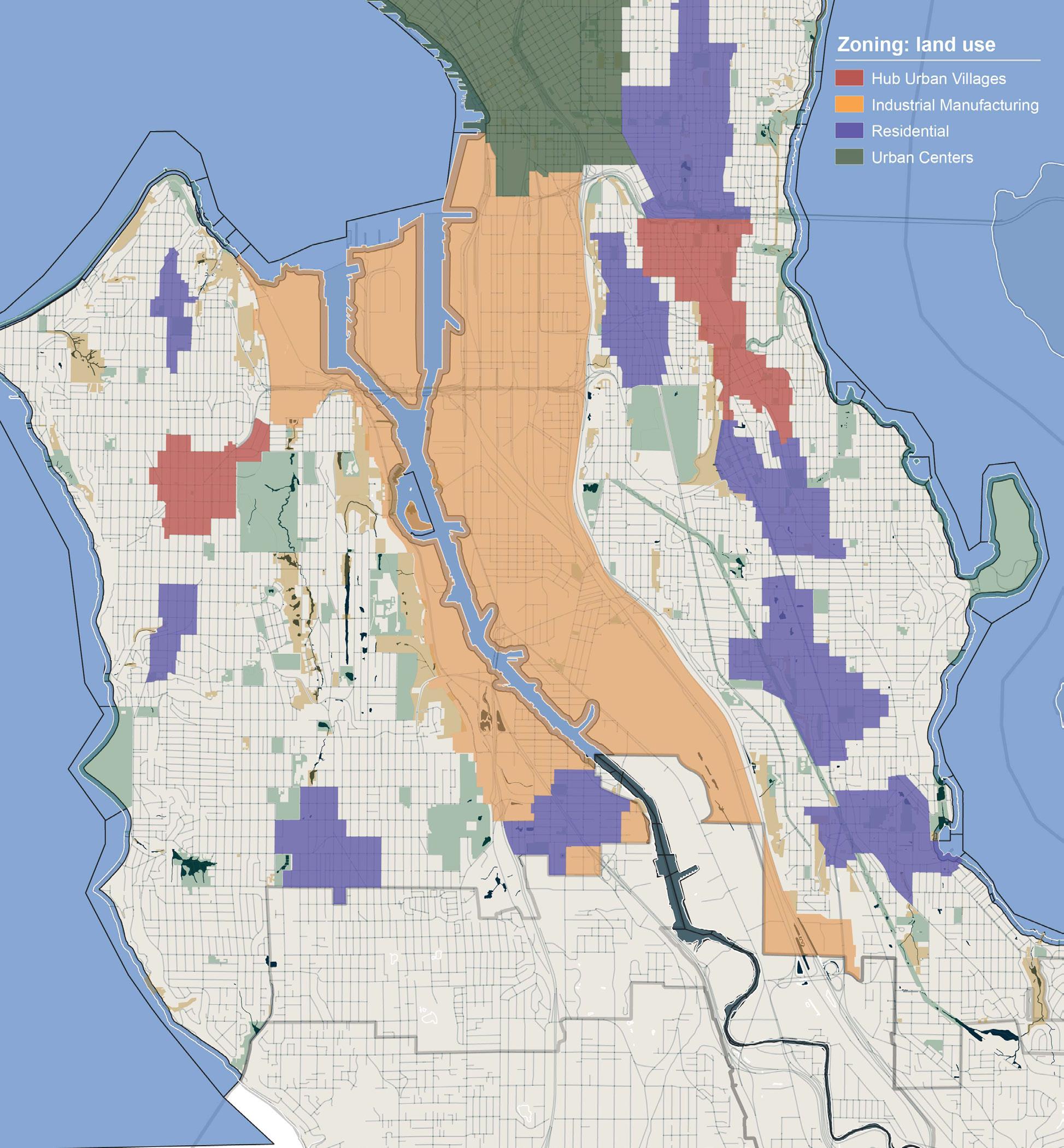
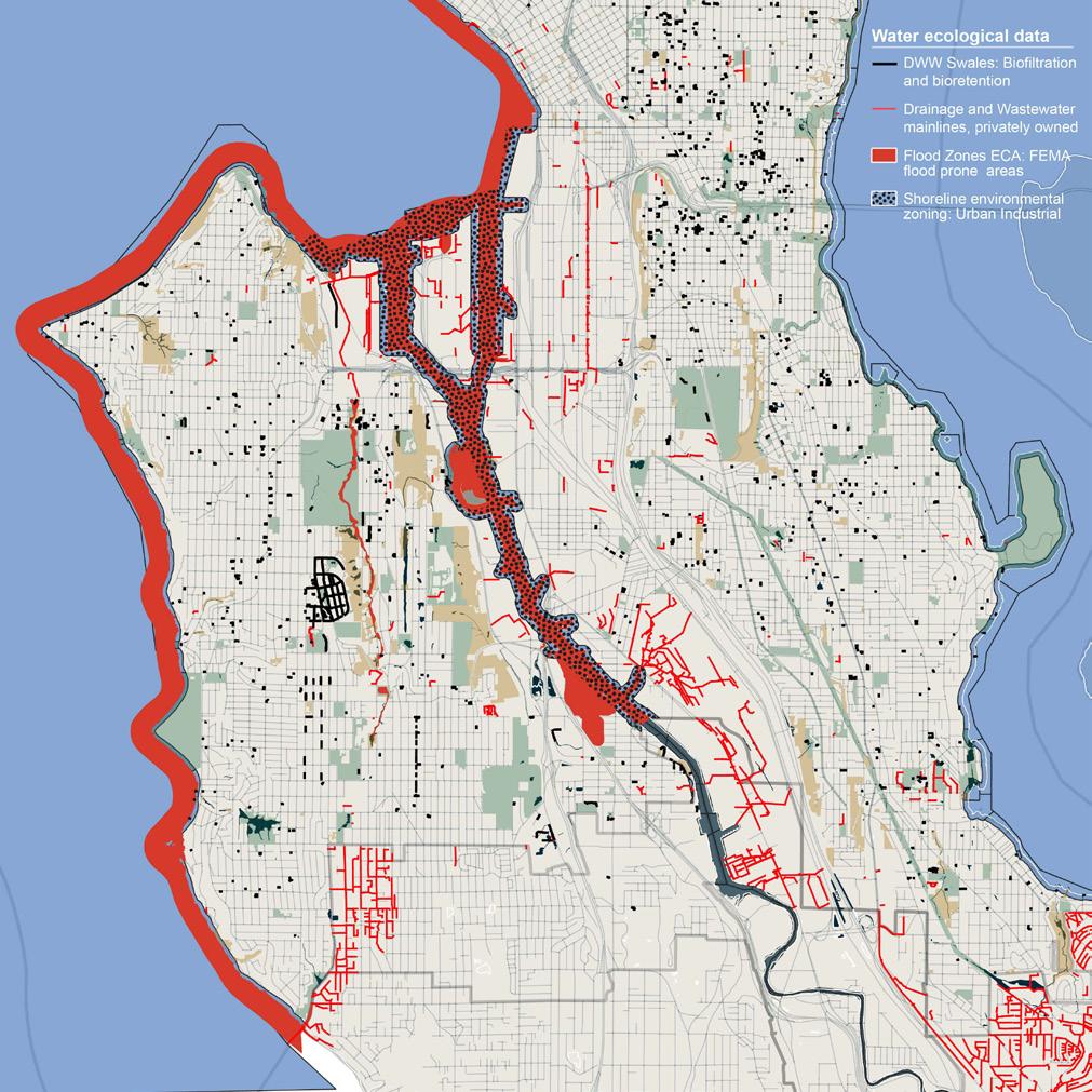
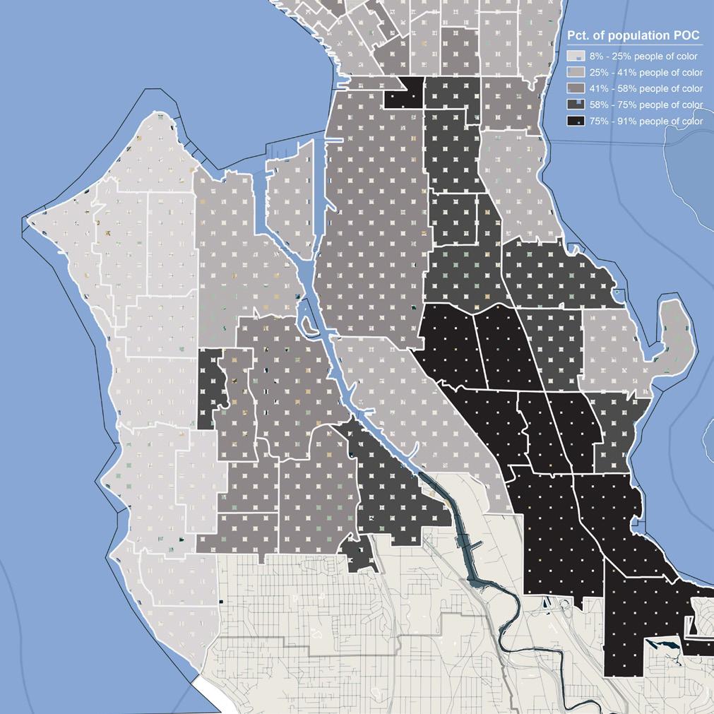
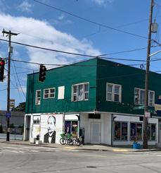
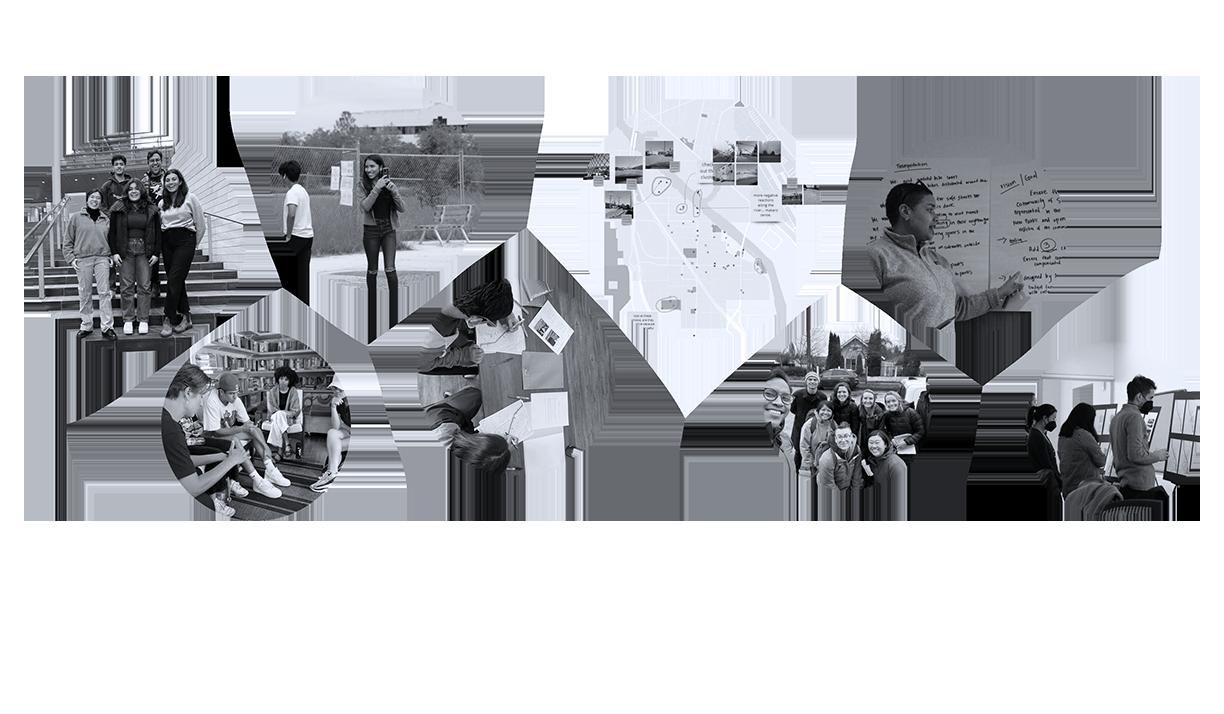
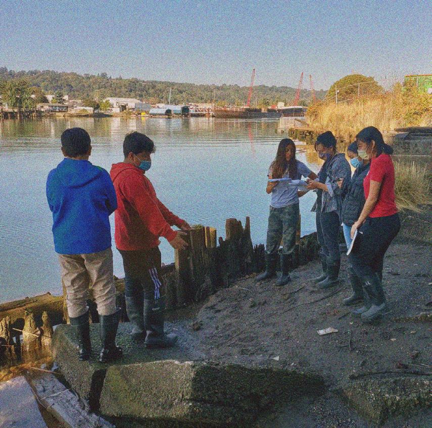
The South Park Youth Vision Project was an interdisciplinary, community-based resilience project commissioned by the City of Seattle’s Office of Planning and Community Development.
ENVIRONMENTAL INJUSTICES
• A HISTORY OF REDLINING
• HIGH LEVELS OF POLLUTION
• HEALTH CONCERNS
• LIMITED ACCESSTO GREEN SPACE
South Park, Seattle, WA 2023 ZONING
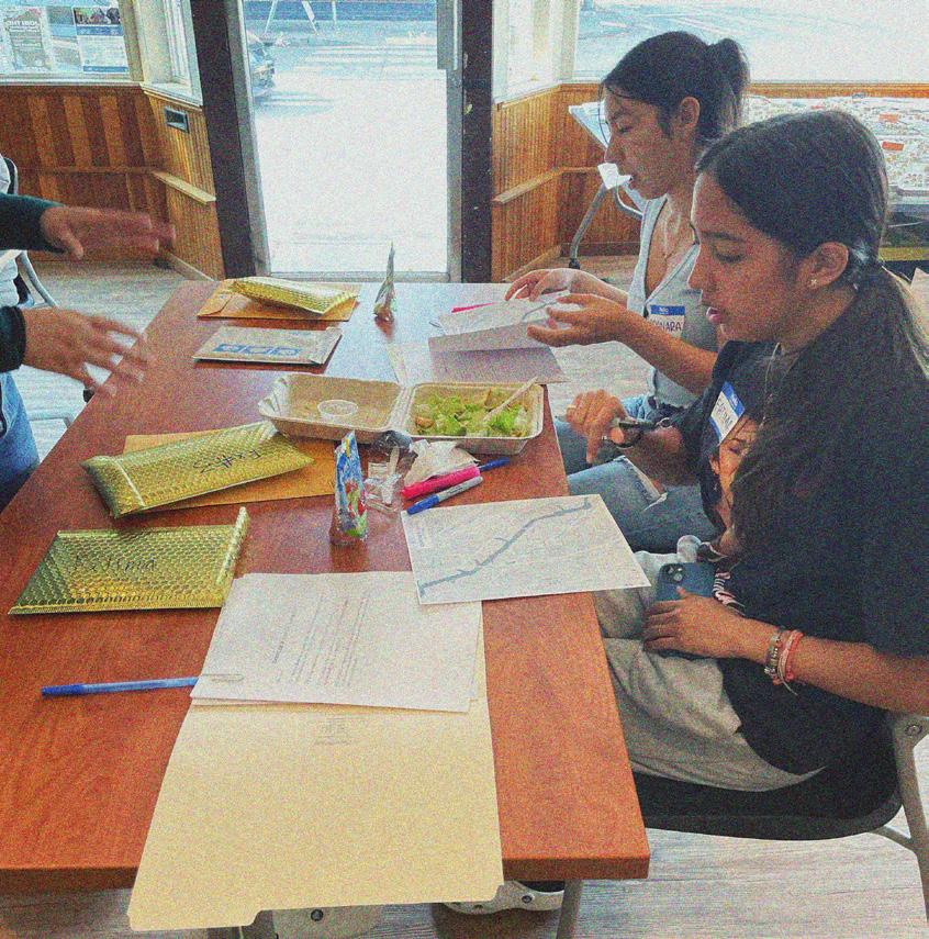
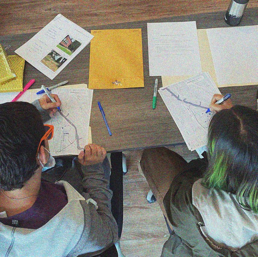
Based in Seattle, Washington, with a focus on the neighborhood of South Park, the project centered three BIPOC youth as leaders of community engagement and policy design to inform policy changes in Seattle’s Growth Strategy and Comprehensive Plan. Using the Urban Belonging app provided by Gehl Architects, the three youth leaders utilized photovoice methods and equitable data gathering/analyzing processes to understand the community’s needs and challenges. The result of this year-long process were policy recommendations that responded to issues such as climate change, public transportation, housing, parks and open space, economic development etc. and a strategy to protect and restore the neighborhood’s native ecologies and local biodiversity, preserve its culture, and prevent further displacement; overall planning for a more equitable, sustainable, and resilient community.

SHOW US SOUTH PARK THROUGH YOUR LENS AND CAPTURE WHAT IS MEANINGFUL TO YOU.
20
WHAT WOULD YOU LIKE TO IMPROVE, AND WHAT WOULD YOU LIKE TO PRESERVE IN YOUR COMMUNITY?

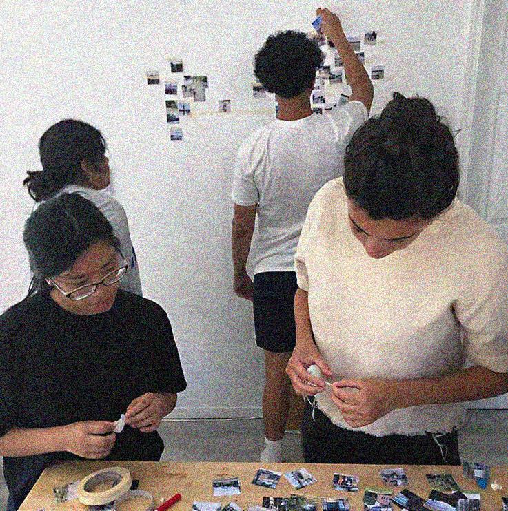
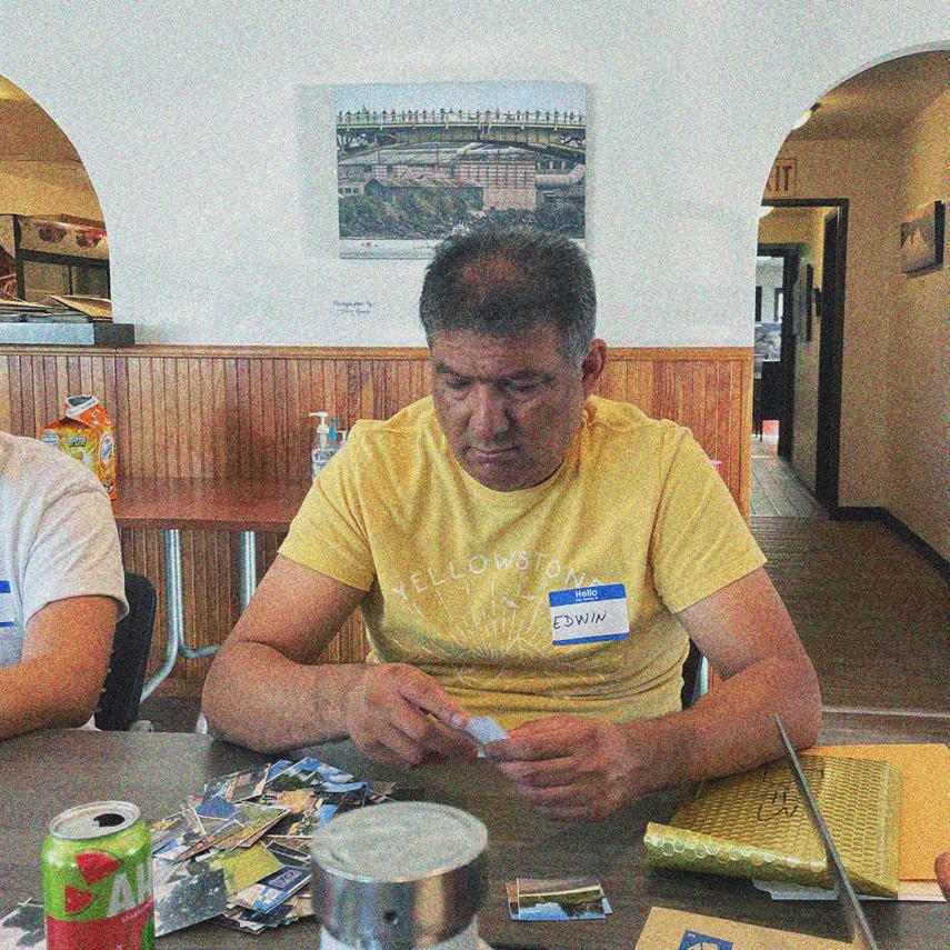
Participants map their personal experiences of South Park by taking photos responding to the prompt
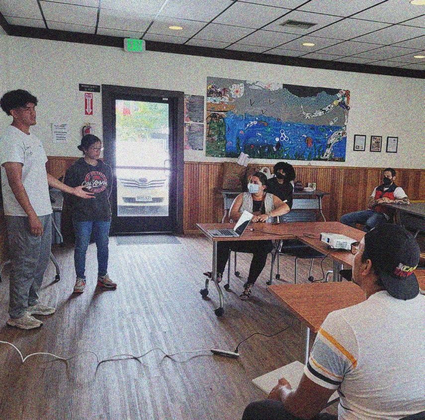
Youth leaders are trained by consultant, enabling them to teach the wider community photovoice and mapping methods
DVSA work together to frame photovoice task, prompt and annotations
Informed by community-led data workshops, DVSA gathers key insights
Community members interpret data together in multigenerational groups
Consultants train DVSA in policy making in preparation of policy workshop with city
City officials go on walks in South Park guided by the photovoice data collected by community
POLICY WORKSHOP WITH THE CITY
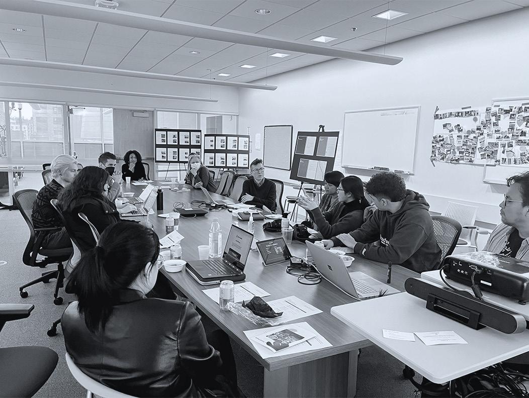
DVSA meet with city officials at Seattle City Hall to make policies for SP for comprehensive plan
CAPACITY BUILDING
COMMUNITY-LED STRATEGY
DATA-DRIVEN STORYTELLING
FUTURE VISIONS MATRIX
INTERGENERATIONAL KNOWLEDGE SHARING
SPATIAL MAPPING
• PRIORITIZE THE COMPELETION OF CURRENT PROJECTS TO INCREASE ACCEESS TO GREEN SPACES
• COLLABORTIVELY DEVELOP A PLAN FOR A MAINTENANCE SCHEDULE THAT MEETS COMMUNITY NEEDS AND STANDARDS
• PROVIDE OPPORTUNITIES TO TAKE OWNERSHIP OF SPACES AND GIVE LAND BACK
• PRIORITIZE THE DEVELOPMENT OF EQUITABLE EMERGENCY RESPONSE MEASURES THAT ADDRESS EFFECTS OF CLIMATE CHANGE SUCH AS SEA LEVEL RISING
• IMPLEMENT SUSTAINABLE INFRASTRUCTURE AND ENERGY RESOURCES IN COMMUNITY SPACES
• ESTABLISH POLICY TO REDUCE THE ASTHMA CRISIS IN SOUTH PARK AND TO REDUCE LIFE XPECTANCY GAP
• CREATE A REMEDIATION PLAN FOR FORGOTTEN SPACES
• DEVELOP POLICY WITH MORE STRINGENT CODES FOR POLLUTANT EMISIONS/WASTE DISPOSAL FROM INDUSTRIES
• NEVER MAKE A POLICY OR DECISION WITHOUT COMMUNITY INPUT
• DEVELOP AN ACCOUNTABILITY CRITERIA
• PRIORITIZE AFFORDABLE HOUSING FUNDING TO PREVENT FURTHER DISPLACEMENT OF SOUTH PARK RESIDENTS
• DIRECT FUNDING FOR BUILDING RESUSE PROJECTS
• CREATE HOUSING AND RENT SUPPORT PROGRAMS IN COLLABORATION WITH COMMUNITY BASED ORGANIZATIONS WHO ARE CURRENTLY LEADING THE ADVOCACY FOR HOUSING SECURITY
Remediation Site, Research Facility, Cultural Center, Public Park
Spring 2020 | Individual | Seattle, WA
SOUTH PARK & GEORGETOWN ARE AMONG SEATTLE’S LOWEST INCOME NEIGHBORHOODS, AND SOUTH PARK, IN PARTICULAR, IS ONE OF THE CITY’S MOST ETHNICALLY DIVERSE NEIGHBORHOODS.
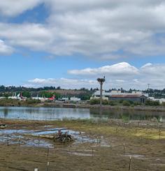
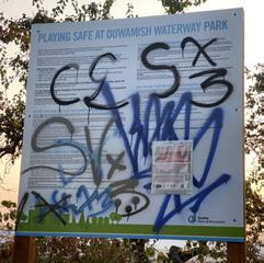
The lower waterway of the Duwamish River is a Superfund Site whose muddy bottom includes high levels of toxic sediment, a result of the river’s long history of industrial use and the continued pollution from stormwater runoff and Combined Sewer Overflows (CSOs). The Duwamish Valley’s riverfront neighborhoods of South Park and Georgetown are home to residents who are among those most impacted by the Superfund Site. With educational programming and participatory design, Pier 48 Laboratory will not only act as a public park, but a functional landscape that engages local communities in cleaning the polluted sediment of the Duwamish River. Pier 48 will become an inclusive space that connects communities with one another as well as the water.
Dredge from the Duwamish is not deemed valuable for cleaning and reusing as is the case with most dredge. This park is asking for a paradigm shift in the way we think about dredge to understand it as a crucial and limited resource to restore shorelines, beaches, and wetlands. This project is an overall strategy that bridges design with plant science to clean water and soil.

LIFE EXPECTANCY IS 8 YEARS SHORTER IN THE DUWAMISH VALLEY THAN THE CITY OF SEATTLE AND KING COUNTY AVERAGES, AND A FULL 13 YEARS SHORTER COMPARED TO MORE AFFLUENT NEIGHBORHOODS


CONTAMINANTS: POLYCHLORINATED BIPHENYLS (PCBs), DIOXINS, ARSENIC, CANCERCAUSING POLYCYLIC ARMOMATIC HYDROCARBONS (CPAHs)


TOXIC CHEMICALS THAT ORIGINATE FROM HUMAN-MADE SOURCES
FORMERLY USED INDUSTRIAL CHEMICALS
ACTIVATED CARBON PLANT + MIXING SPACE
PHYTOTECHNOLOGY TEST PLOTS
A Constructed Wetland
Wetland reserve constructed from dredge material. This is not only for educational purposes of how dredge material is beneficial, it is rhizofilitraion for the surrounding water body.
B Mudrooms
Carved “mudrooms” are spaces to connect visitors with cleaned dredge material, as well as the processes happening underwater. Mudrooms can not only act as outdoor classrooms but more spaces for cultural events.
C Activated Carbon
Activated carbon can be used to prevent PCBs and other pollutants from entering the food chain. It is created from biomass materials such as wood, coconut shells, and coal. The harvested plants from the phyto test plots will be
burned and reused for biomass material. Activated carbon will be generated on site, mixed into clean sediment, as well as shipped to other parts of the contaminated Duwamish Waterway for Natural Enchanced Recovery efforts.
MOWED + HARVESTED ANNUALLY TO REMOVE ANY POLLUTANTS EXTRACTED
PLANTING MIX CAREFULLY SELECTED TO EXTRACT & STABILIZE


THICK PLANTED LAYER WITH NO EXPOSED SOIL
A mixed herbacious planting utilizing phytotechnology mechanisms. Provides maximum amount of phytotechnology benefit over large area using low-height species with minimum exposure to risk.


Zone of contamination (0-5 ft. deep)


1. Helianthus annuus Sunflower
2. Panicum virgatum Switchgrass
3. Carex aquatica Sedge
THICK VEGETATION PREVENTS SOIL EXPOSURE TO PEOPLE & ENVIRONMENT
SPECIES SELECTION HELPS BIND CONTAMINANTS TO SOIL
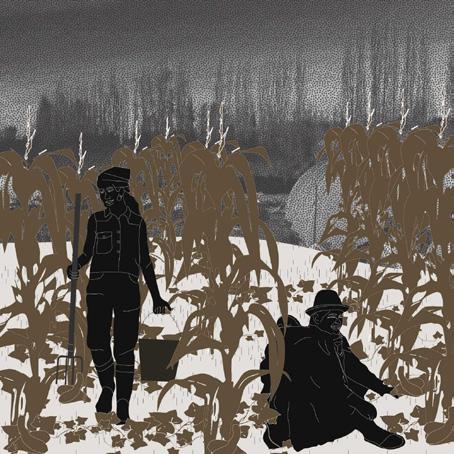
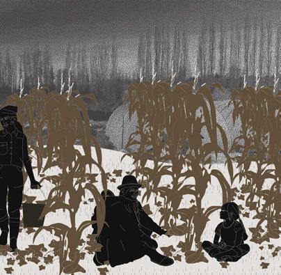
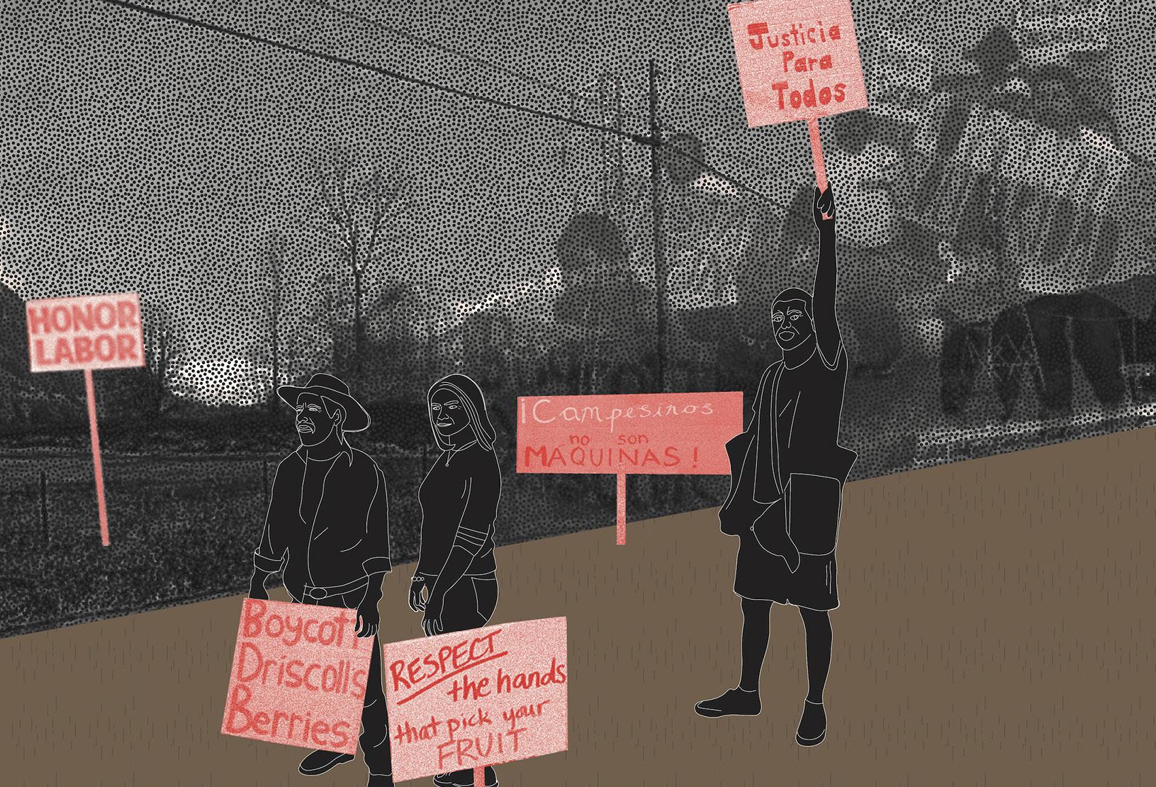
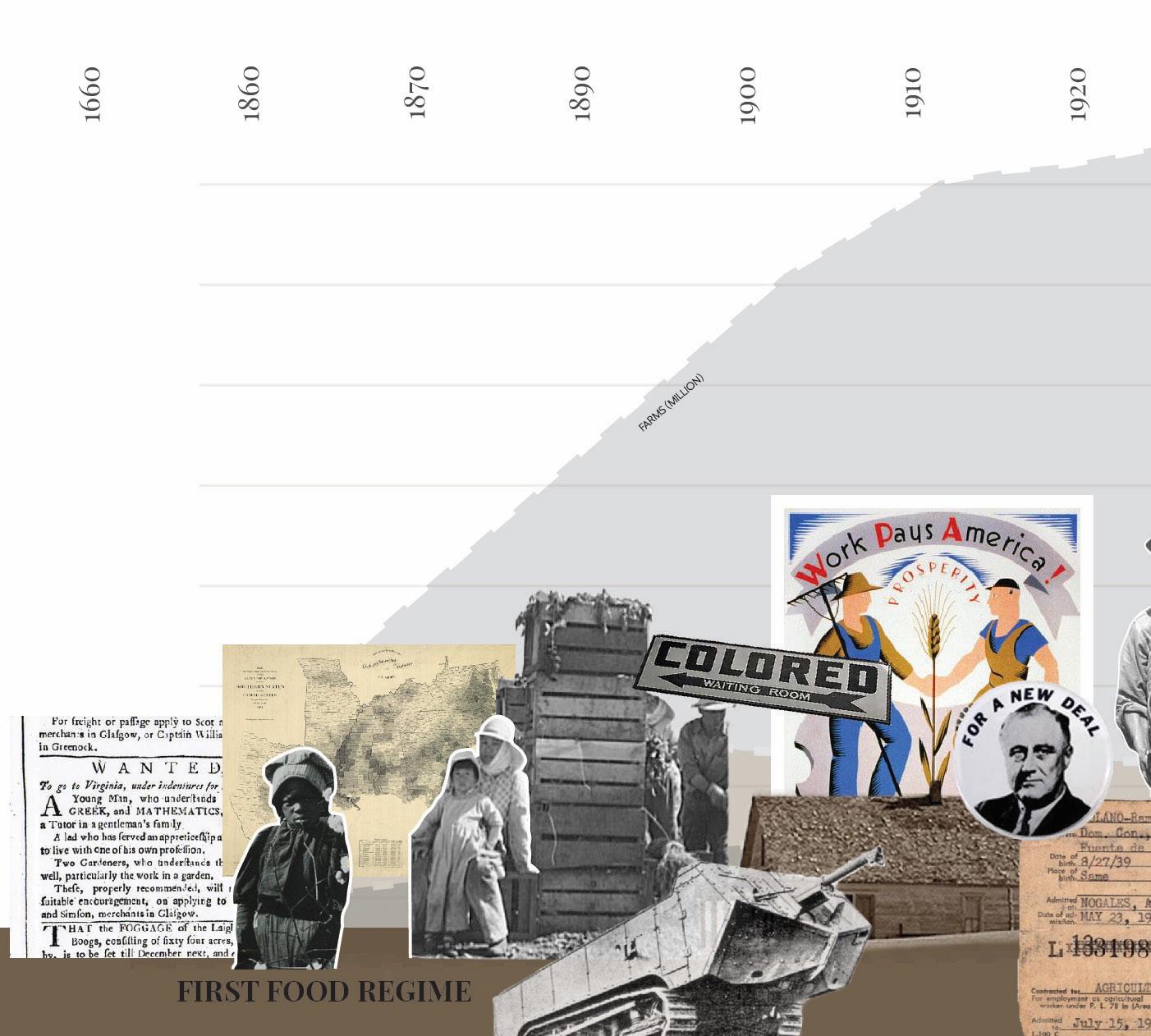
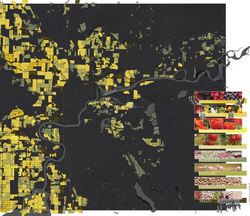
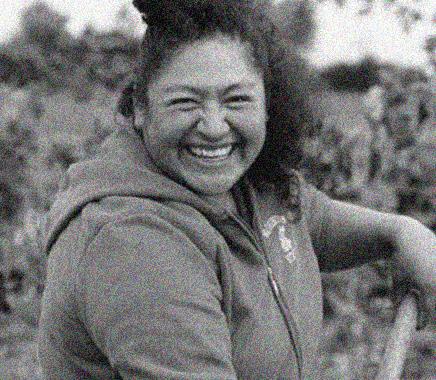
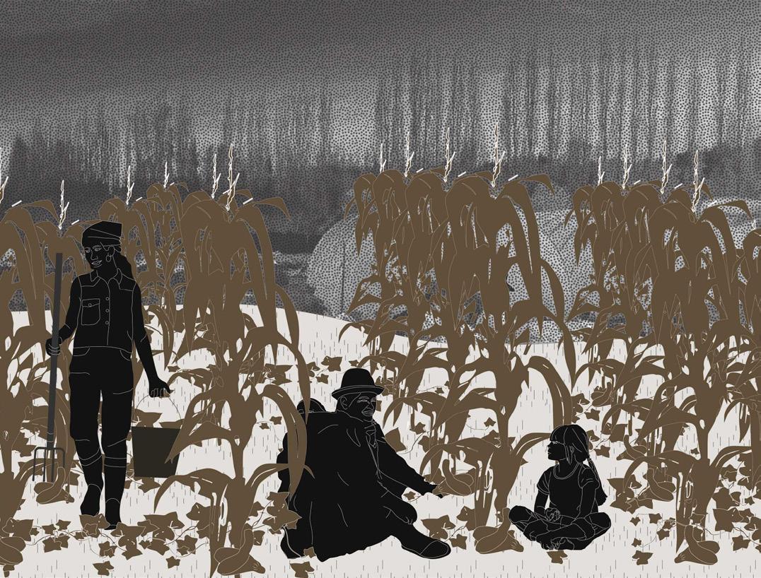
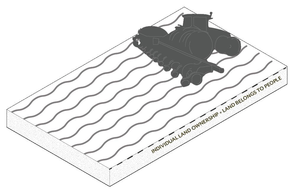
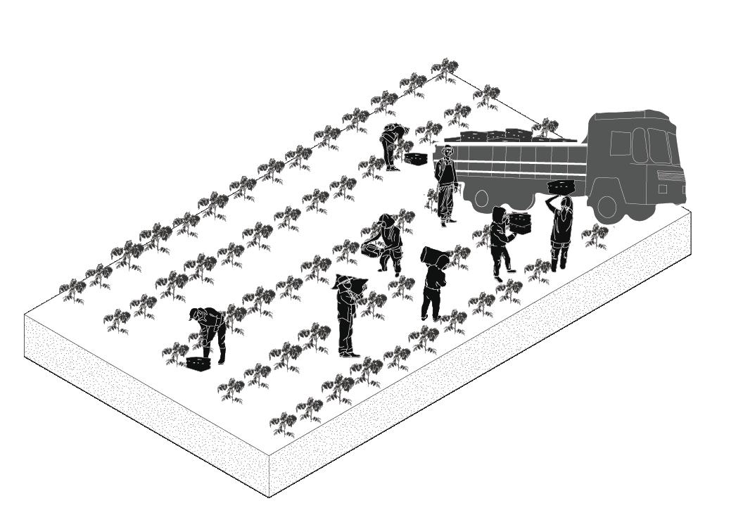
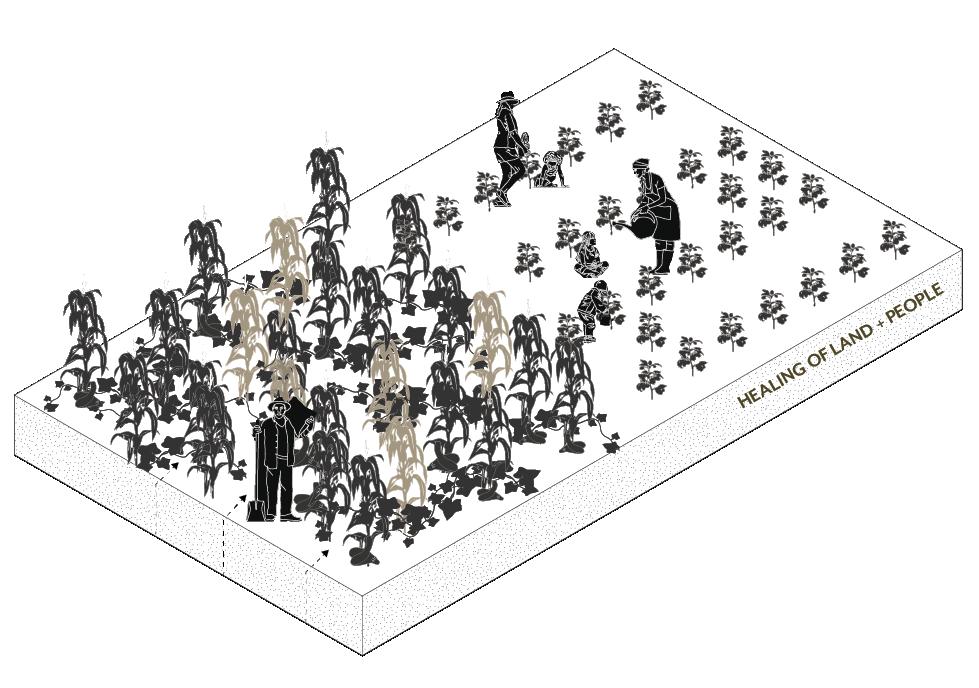
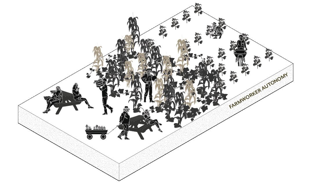
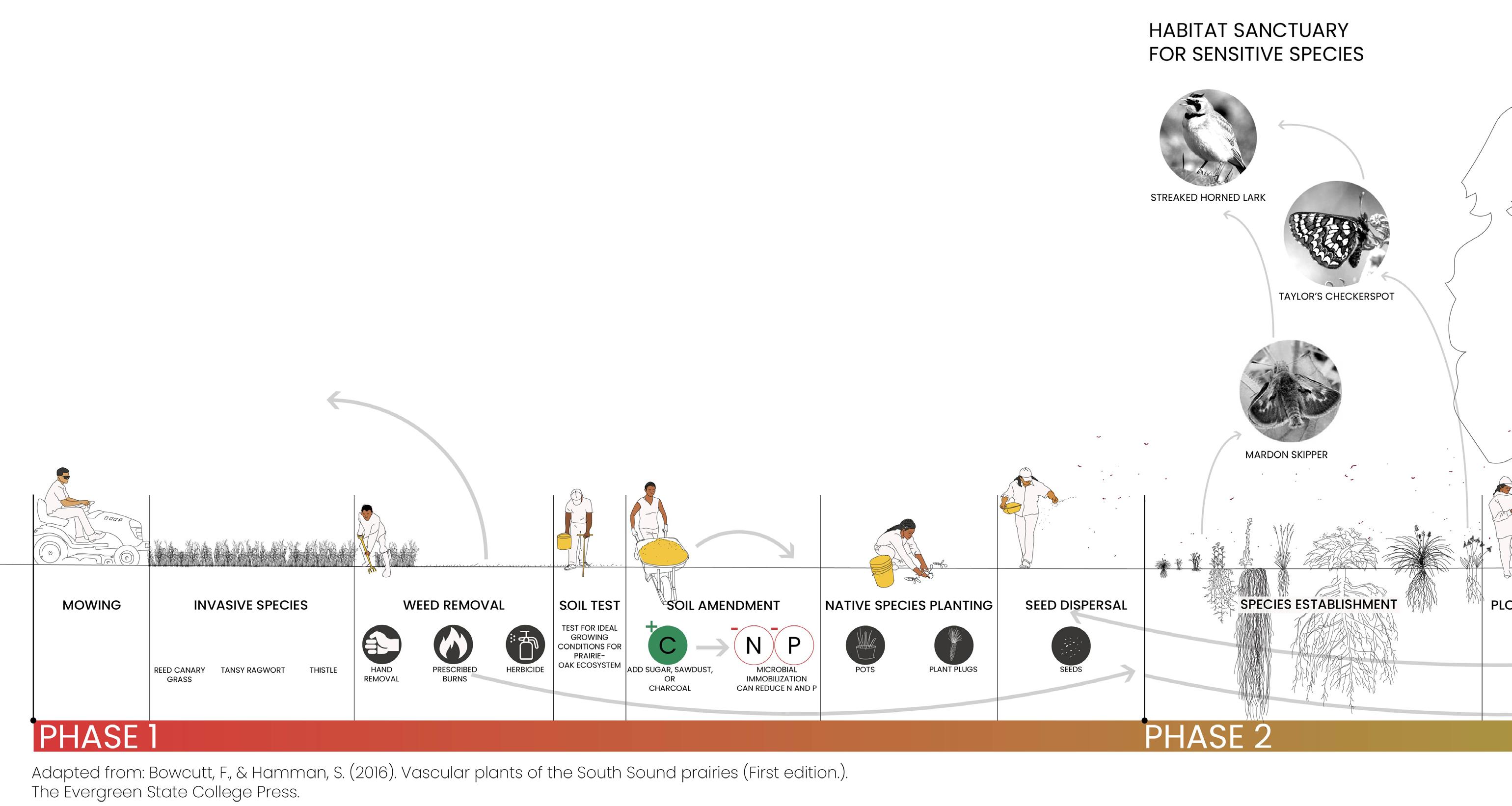
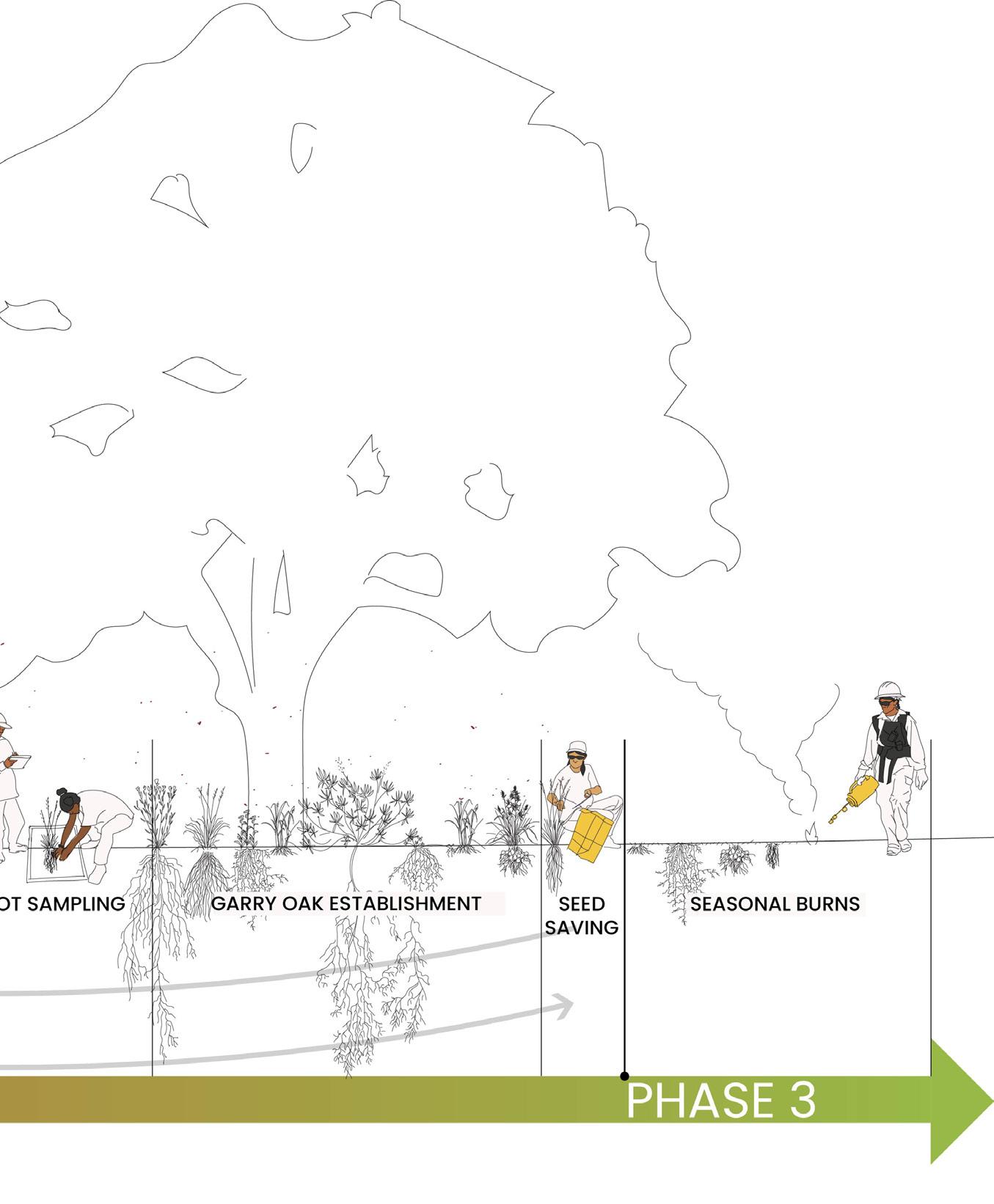
My thesis was a speculative design project about rethinking the future of the U.S’s current industrialized agricultural system to one that is a community-based, reciprocal system led by the very people who are currently exploited in current paradigms, Indigenous Latinx farmworkers. Immigrants from Mexico, many embody and bring traditional ecological knowledge of tending to the land with them, which is a term I call displaced ecologies. To imagine an alternative future with full farmworker autonomy I applied methods of historical analysis, community outreach, mapping, interviews, and contemporary archival research to learn from the perspectives of different disciplines, amplify the voices of Latinx farmworkers and activists, and leverage traditional ecological knowledge from Latinx farmers. I first ground this project in a historical analysis of the U.S. agricultural complex then zoom into the Skagit Valley of Washington State to explore stories of resilience from six indigenous Latinx farmers to learn from their methods of place-making, preserving biodiversity, and protecting agroecosystems in the face of hegemonic structures as Indigenous sovereignty must be at the forefront of how we address climate crises.
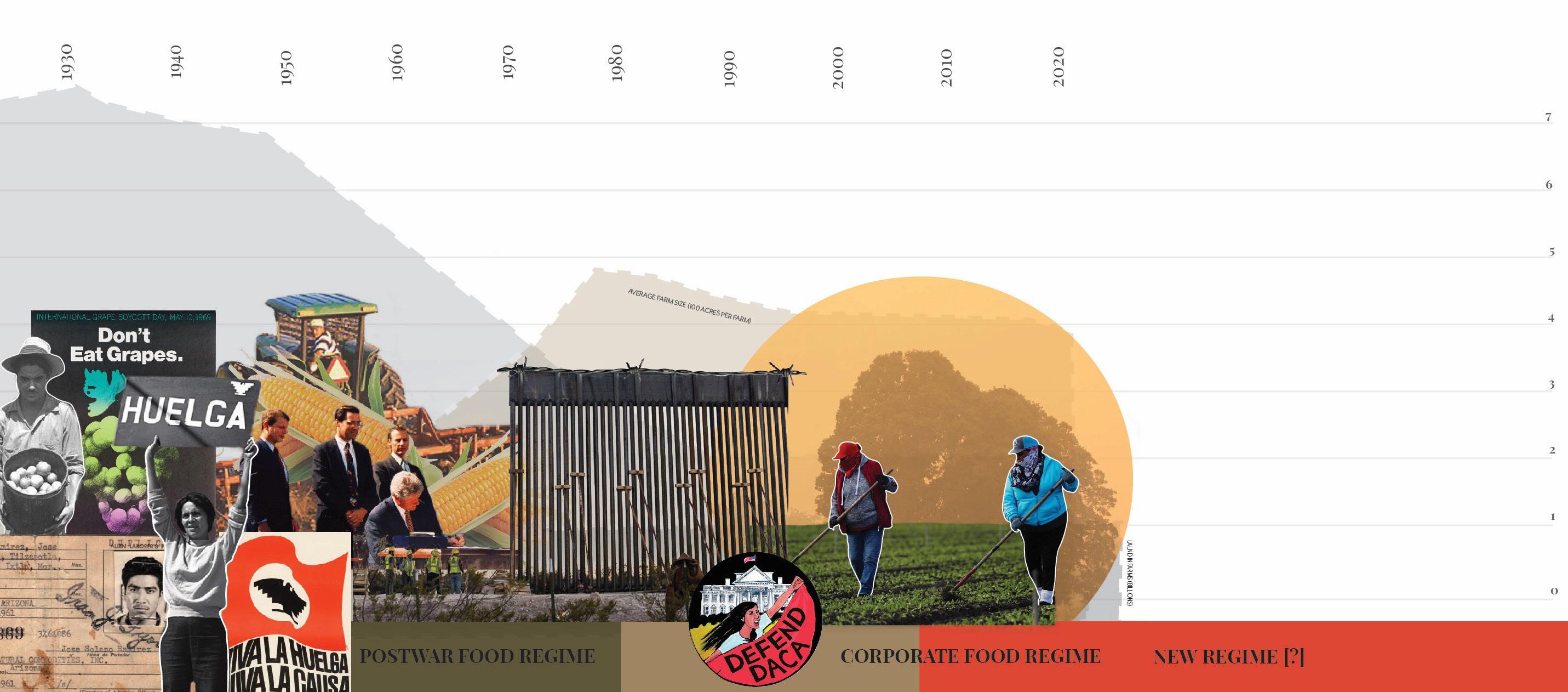
+ IMMIGRATION AND CUSTOMS ENFORCEMENT
NAFTA
FARMWORKERS ARE HIRED ON TEMPORARY WORK PERMITS AT THE BEGINNING OF THE SEASON AND SENT BACK TO THEIR HOMELANDS ONCE THEY ARE NOT NEEDED
PESTICIDES’ HEALTH EFFECTS H-2A
RESPIRATORY
• PHLEGM
• COUGHING
• WHEEZING ACUTE SYMPTOMS
• STINGING EYES
• DIARRHEA
• NAUSEA
• BLISTERS CHRONIC HEALTH EFFECTS
• CANCER
• INFERTILITY
30
• BRAIN + NERVOUS SYSTEM DAMAGE
• ASTHMA
These models depict the current industrialized agricultural system and its contribution to environmental crisis. It is a model that people at the top of the hierarchical business structure use to base their decisions solely on profit, leaving those at the bottom (people, land, and water) to suffer.
AIR POLLUTION

SOIL EROSION + DEPLETION
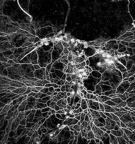
TILLING KILLS + DESTROYS CRITICAL MYCORRHIZAL FUNGAL NETWORKS
NO CROP ROTATION / COVER CROPS
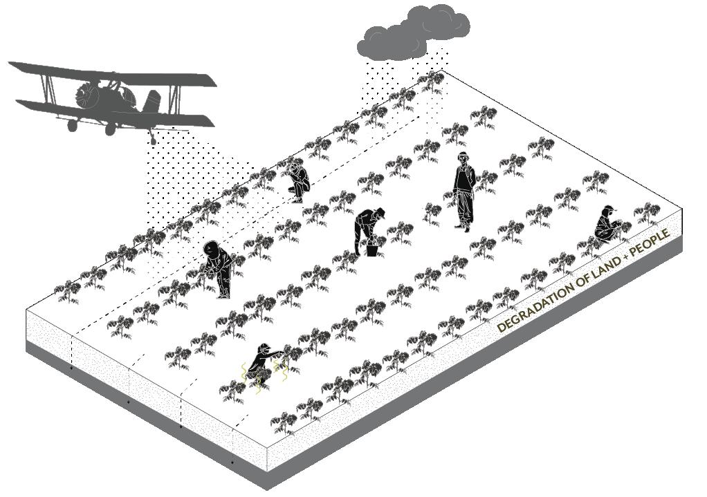
THE AGRICULTURAL PRACTICE OF PRODUCING OR GROWING A SINGLE CROP, PLANT, OR LIVESTOCK SPECIES IN A FARMING SYSTEM AT A TIME. LACK OF DIVERSE CROPS REQUIRES INCREASE PESTICIDES AND FERTILIZERS

WILDFIRE SEASON
DESPITE HAZARDOUS AIR QUALITY, FARMWORKERS CONTINUE TO WORK DURING WILDFIRE SEASON, PROVIDING US WITH OUR FOOD IN DANGEROUS CONDITIONS
MAXIMIZING PROFIT
LAND SOVEREIGNTY
THE RIGHT OF WORKING PEOPLES TO HAVE EFFECTIVE ACCESS TO, USE OF, AND CONTROL OVER LAND AND THE BENEFITS OF ITS USE AND OCCUPATION, WHERE LAND IS UNDERSTOOD AS RESOURCE, TERRITORY, AND LANDSCAPE
These drawings show sustainable and just ways of growing food, displaced ecologies being grounded into organic methods, and examples of how embodied knowledge can positively change the food system. These methods foster a collective community, a stronger connection to the land by elements of indigenous ecology and agrobiodiversity. These are the ways that strengthen ecological and economic resilience in the face of today’s climate, water, and energy crises, ones where the land and people are no longer oppressed, and offer a path forward for growing food for us all.
FOOD SOVEREIGNTY
THE RIGHT OF PEOPLES TO HEALTHY AND CULTURALLY APPROPRIATE FOOD PRODUCED THROUGH ECOLOGICALLY SOUND AND SUSTAINABLE METHODS, AND THEIR RIGHT TO DEFINE THEIR OWN FOOD AND AGRICULTURE SYSTEMS
SOLIDARITY ECONOMY
AN ECONOMY THAT IS IN SOLIDARITY WITH THE EARTH, MEANING WE RELEARN OUR SKILLS AND LISTEN FOR THE LOGIC, RHYTHM, REASONING, AND METHODS THAT THE EARTH COMMUNICATES TO US
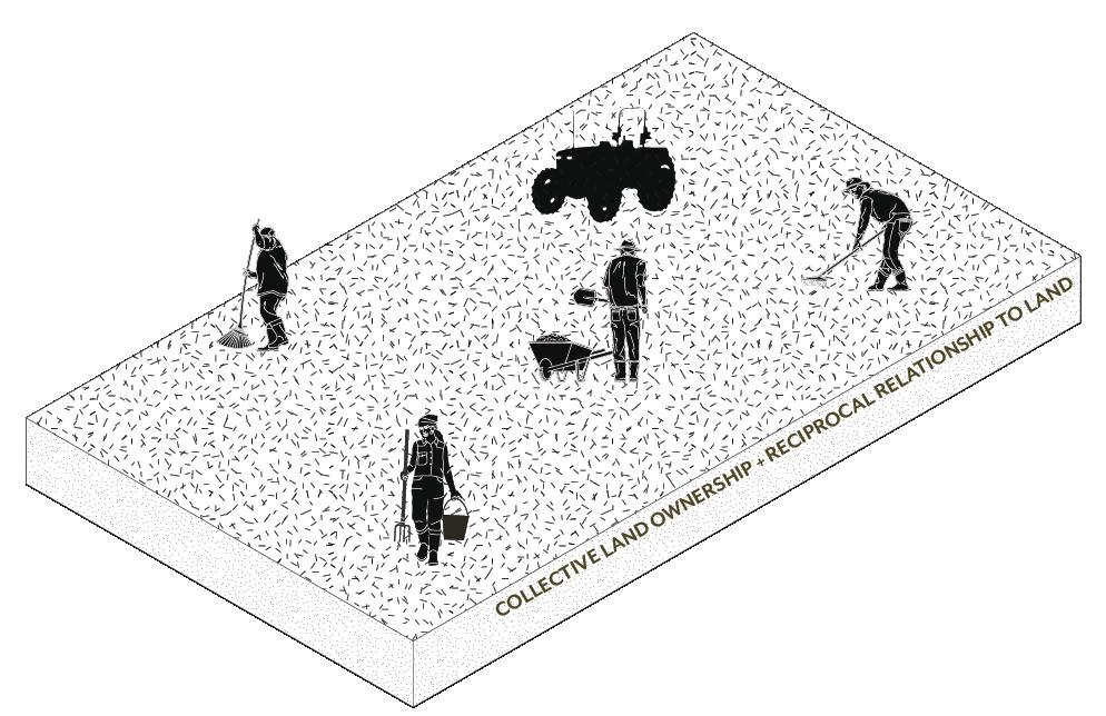
SOIL HEALTH
NO TILLING PROTECTS MYCORRIHZAL FUNGI + ENTIRE SOIL ECOSYSTEM + REDUCES EROSION
IMPROVES SOIL FERTILITY, SOIL STRUCTURE, WATER INFILTRATION, AND MODIFIES CLIMATE AROUND PLANTS
REDUCES WEED INFESTATION BY TAKING THE SPACE WEEDS WOULD NEED TO GROW
MAINTAINING A FUNCTIONAL BALANCE, AGROECOLOGICAL SYSTEMS ARE BETTER ABLE TO RESIST PEST AND DISEASE ATTACK
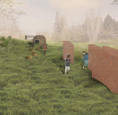
Reciprocal Landscapes
Autumn 2020 | Group | Vashon Island, WA
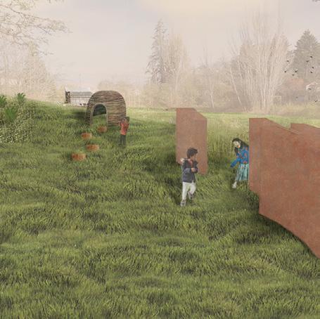
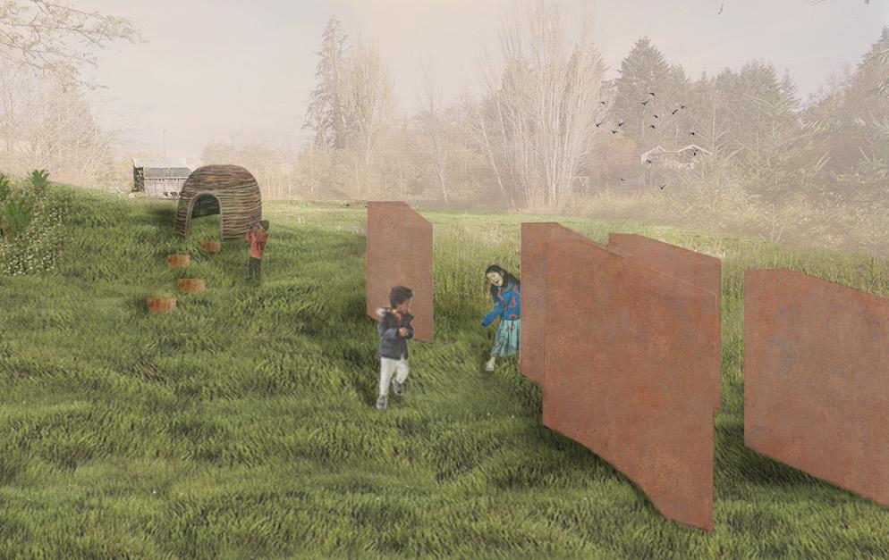
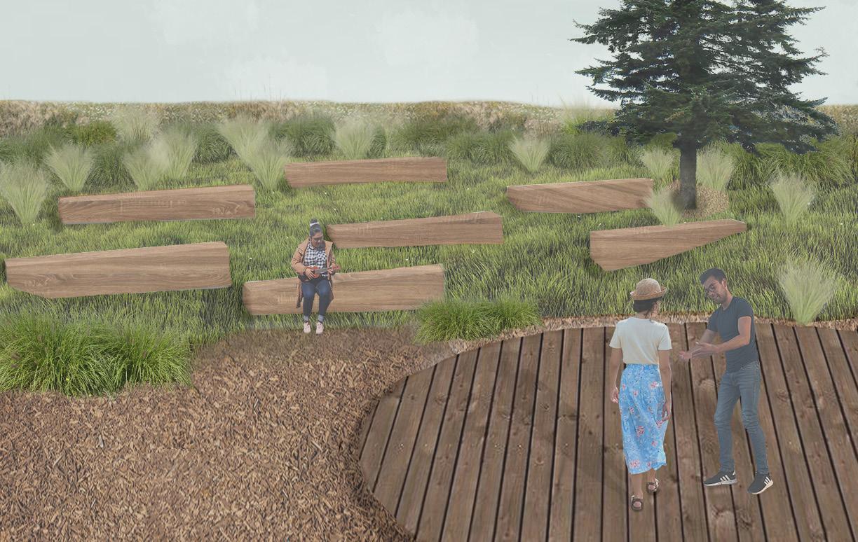
Our site proposal looks at prairie landscapes both as a precedent typology and as a symbol of generosity. Prairies were once abundant in the total original native landscape of Western Washington, but are increasingly fading as a natural environment of the region. To reintroduce this typology to the Heron Meadow, we promote four themes of generosity with our design: sanctuary, connection, biodiversity, and access for all that visit and dwell on the site. Because the meadow is loved already, we approached the site with a light touch, responding to the programs, features, and the ecologies that already exist. Studying the plant and wildlife habitats of Vashon Island, we proposed a design that embraces the landscape, cultivating a welcoming landscape to all species. Our proposal includes a boardwalk that loops around the site, nature play elements, an amphitheater and other performance spaces, a prairie restoration and management plan and a new wetland in the NE corner of the site. Ultimately, our site design is a bridge between local ecology and community, connecting people with nature.
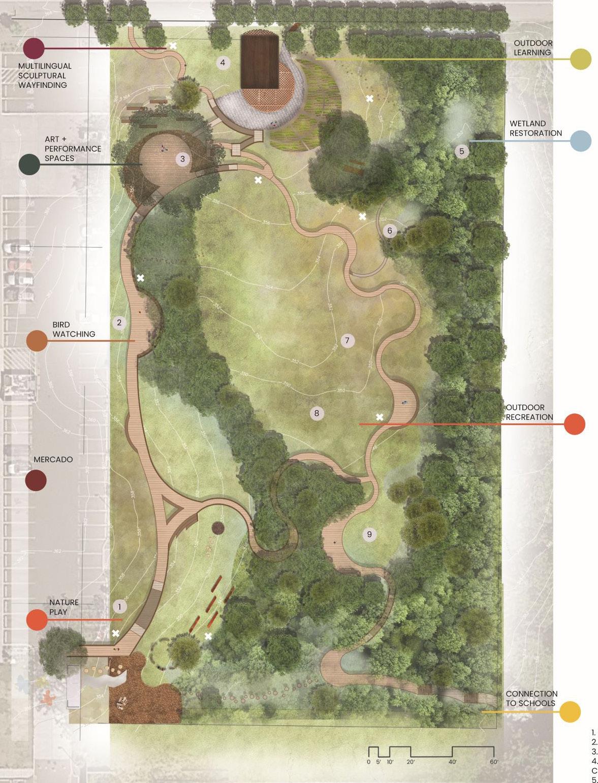
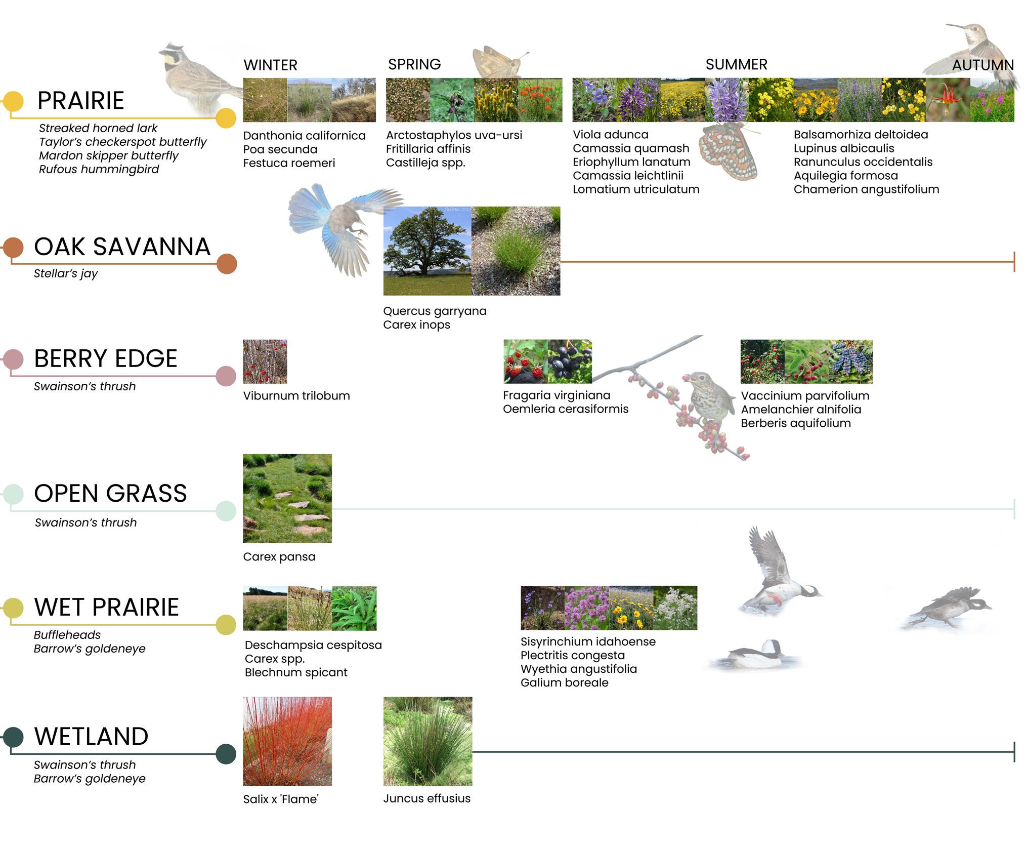
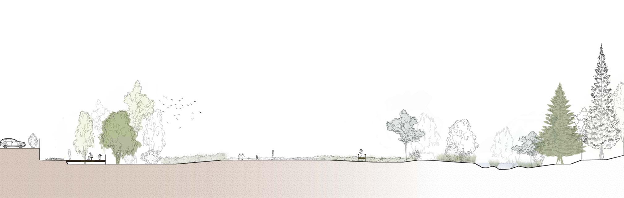
Top-right: Kids playing through the sculptural garden in the SW area of the site.
Bottom-right: People playing music and dancing in the grove in the NW area of the site.
Thrive zone pilot projects all three pilot projects have been built and continue to monitor UPF levels.
Design recommendations to combat air pollution in cities
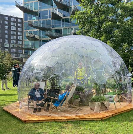
Copenhagen, Denmark 2021
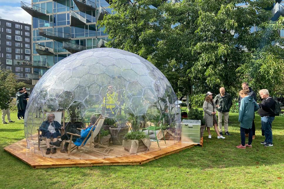
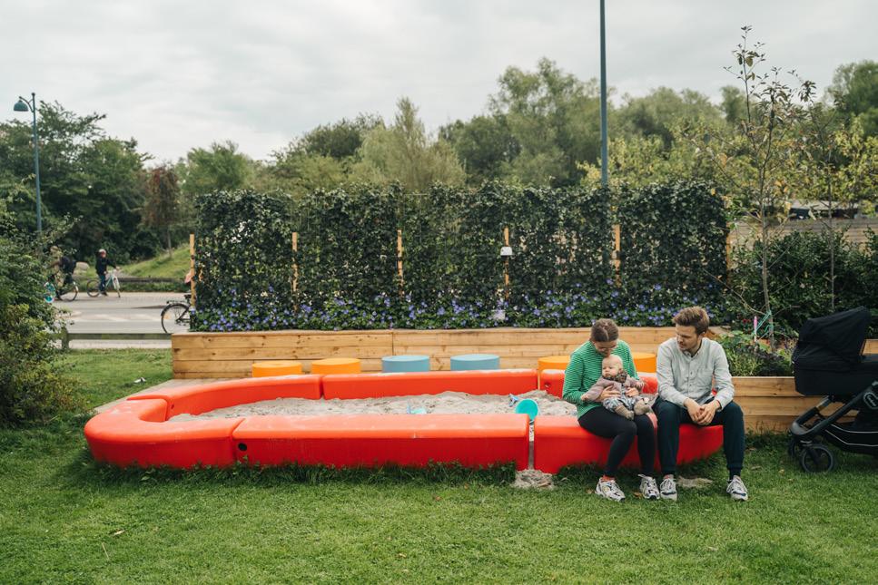
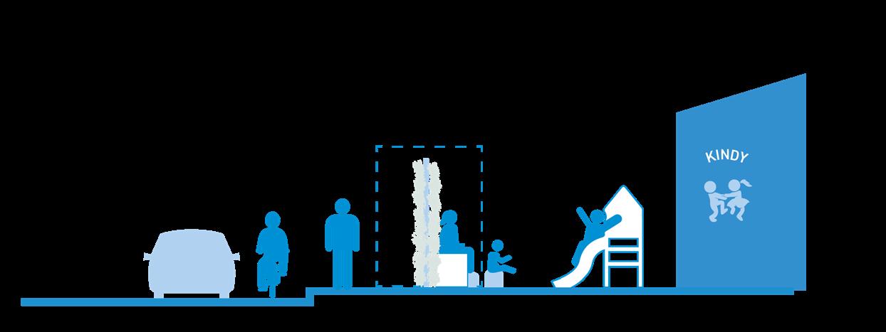
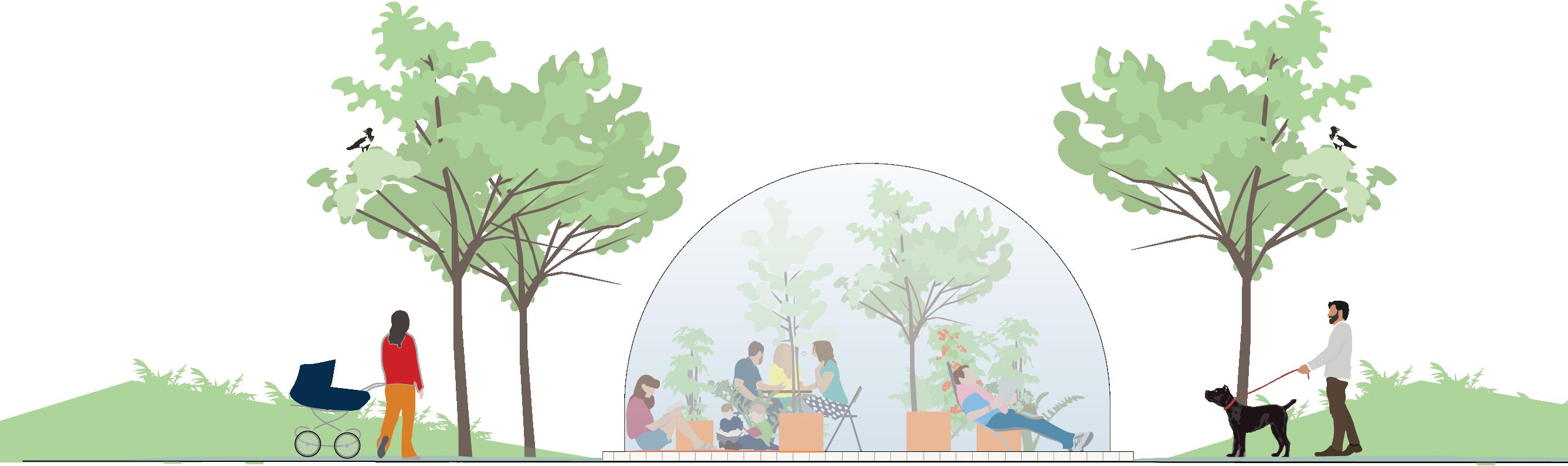
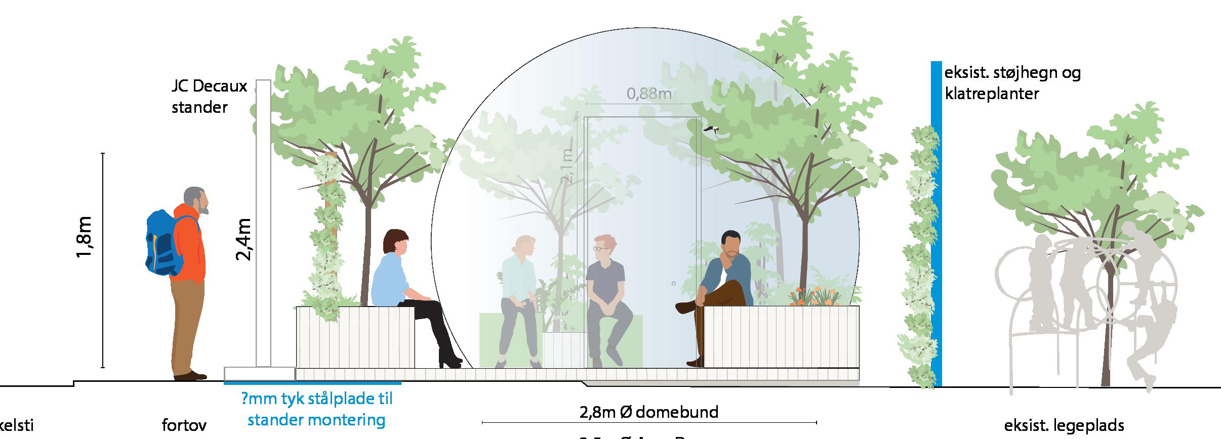
The Thrive Zone Amager project used temporary pilot installations as a realistic test of how to address air pollution in cities. The project investigated how Ultra Fine Particles (UFP), Black Carbon and PM2.5-PM10 particles behave in city-specific contexts, whilst also exploring ways of reducing exposure and creating inviting public spaces for people through ecological design. One pilot included a vegetation barrier along a busy road with integrated seating, sandpit, colourful plantings and lighting. Two other pilots tested non-permeable dome barriers. We used a Measure-TestRefine methodology to enhance our understanding of urban design and its impact on air pollution by measuring UFP-levels in and around the pilots, while simultaneously studying how the installations affected people’s behaviour. This led to refined urban design recommendations for cities aiming to reduce citizen exposure to air pollution. In addition, the three pilots also proved to have positive social impact by providing different types of social meeting spaces, inviting people to spend time outside, and encouraging use of green areas for a range of activities.

1. Conduct wind analyses prior to design to evaluate the most problematic wind directions for local air quality.
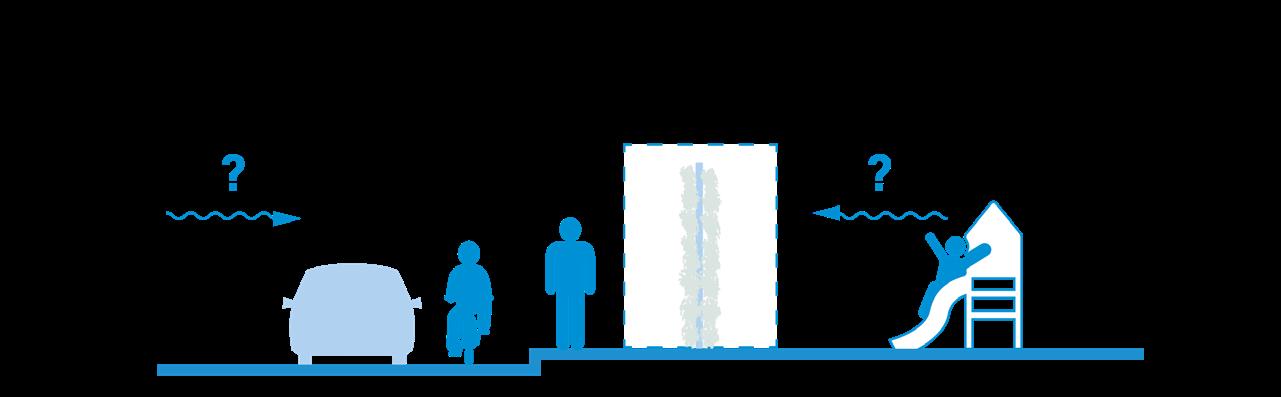
2. Ensure proposed vegetation barriers protect against the most problematic wind directions at the specific site
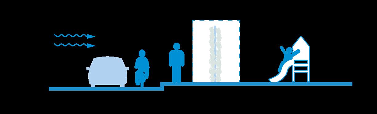
3. Design with thicker Type 3 Vegetation barriers where space permits (and incorporate nonpermeable barriers if feasible)

Non-permeable barriers
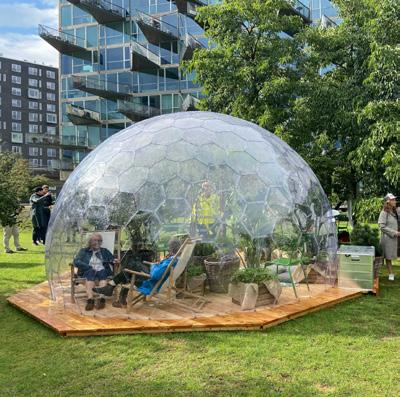
Due to high levels of air pollution and poor microclimatic conditions experienced in public places around Ørestad, the Thrive Zone team created a series of human scale protected semi-outdoor meeting places for locals in the form of polycarbonate domes. The domes created protected places for bus passengers who can wait up to 20 mins on polluted roadsides.
Vegetative barriers
Our research highlights the effects of a new type of vegetative structure (on open roads): Type 5. Open road with an evergreen, thin green wall (without a non-permeable barrier).
4. Where space is tight, incorporate non-permeable barriers (ie. 3mm polycarbonate) with thinner Type 5 Vegetation Barriers to improve their effectiveness

5. Consider surrounding communitiess/facilities and incorporate in-built seating (or other social furniture) within air pollution barriers to improve social environments
a semi-controlled laboratory environment
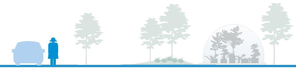
Ørestad Dome, Prisemhaven
Havnestaden Park, Islands Brygge

Planting plan
Thrive Zone Plant Matrix
In the pilots, we used many of the specific species that are recommended for deposition of air pollution particles (in Kumar et al. 2019, Kumar & Barwise 2020), as well as new species which added a more biodiverse mix to the existing palette, and seasonal interest for people using the pilots in the summer months. The plant matrix also highlights the greenhouse tolerant plants that successfully survived the warm summer inside the polycarbonate Domes.
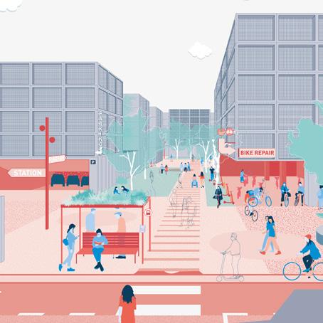
This project is the result of a seven month collaboration with Cities Changing Diabetes (CCD). In Bogotá, Colombia, we studied four sites to explore two questions: 1) What is the relationship between the food system and urban environment ? 2) How might we achieve a positive dietary shift at neighborhood level through local interventions and strategies? The foodscape study combined an analysis of the food places, the public life, and the public space that makes up a specific environment. It works at a ‘systems thinking’ level with understanding three realms of influence over a foodscape; how individual people, businesses, and institutions shape the foodscape. Developing methodology to collect such data was key to bringing human stories and people-centered data into the conversation. The project concluded by offering recommendations to CDC about ways to implement, design and program activities to improve the food environment. These came in the form of pilot project concepts, and a pathway for how these can lead to achieving bold visions and lasting impact.
Four neighborhoods studies each neighborhood offers different food experiences.
The components of a foodscape one’s surrounding environment, and defines the food experience of neighborhoods and communities.
Intervening in the foodscape
By building upon data and human stories, and using pilot projects, we create lasting change in the foodscape.
Data Collection Understanding User Experience
A data driven approach to understanding the local context of where everyday life happens through a multistakeholder planning process.
Rather than things and artefacts, we engage with experiences, stories and narratives.
Test With Pilot Projects
Interventions that start to achieve the foodscape strategy on a small scale at the neighborhood level. Pilots can help make the case for the larger, longer-term investments needed.
Use success criteria and momentum from the pilot to attract larger infrastructure investment, policy change, & more.
Based on the stories we find from observation and engagement, we develop a series of strategies to achieve 'lasting impact’ in a neighborhood.
Evaluate success of local projects against long-term value creation indicators together with local stakeholders.
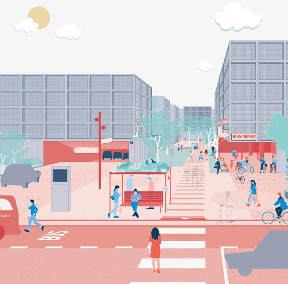
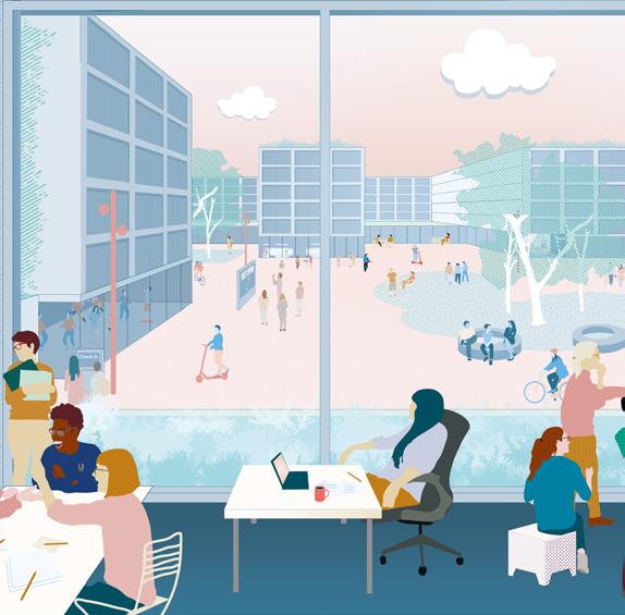
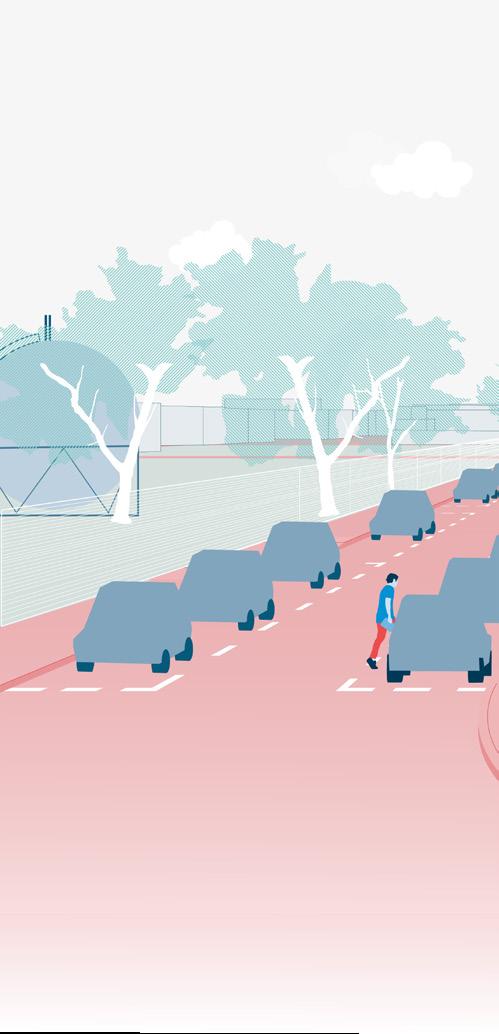
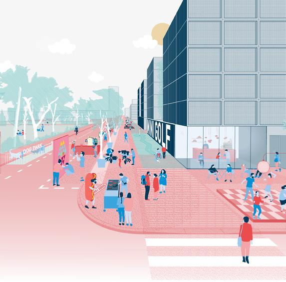
Synergiepark, Stuttgart 2021
In this project an interdisciplinary team of architects, urban anthropologists and landscape architects advised German motorcompany Daimler on how to turn a 120 Ha office campus, Synergiepark, into a ‘circular city’, optimising the use of urban assets such as vehicles, buildings, parking lots and roads. With 25.000 people working in the office campus, the Synergiepark comprises its own small city. Being located a 13 min train ride from Stuttgart, the Synergiepark sees almost all its employees return to the city immediately after work. While the majority of workers commute singly in cars, 90% of parking spaces on campus stays empty post-covid as people are continuing to work from home. Combining research and design, we delivered conceptual design proposals for how to turn under-utilised car park spaces into public areas that invite for a richer life, while transforming the car-intensive mobility into a circular economy in which commuters combine train, micromobility and carpooling. Working with the ‘15 minute city’ we proposed ways to connect campus with Stuttgart, reduce waste, and combat air pollution.
Synergie Park
Current Daimler campus misses opportunity to programme spaces for what could be the natural heart of the Synergiepark.
AMENITY CLUSTER
Buffers represent the walking distance “as the crow flies”
1.25km TRAINS SUPERMARKET
5 MIN AMENITIES
TRAMS
An isochrone takes into account the irregularity of the street grid. Each contour represents how far you can walk in 5 minutes.
From the ‘Gehl’ toolbox we combined public life observations at three selected sites with facade analysis, and parking data collected by Daimler, revealing 22,225 square meters of unused space. Adding to the research, we did a spatial amenities study of campus as the ‘15 minute city’ with which we were able to geomap that the biggest amenity cluster is a 20+ walk away from campus. Meanwhile, GIS mapping revealed that the nearest programmed green space is 10 minutes walking from campus.
The existing mobility offer ‘opened up’, establishing a mobility hub for the district.
Available, accessible and translatable data unlocks the potential to scale
Daimler’s assets leveraging existing assets to optimise performance.
Present day an above ground experience is dominated by parking, whilst the underground facility is near empty.
Under-performing spaces work harder to create a more coherent, walkable urban experience.
Utilising space
By allowing cars to park underground, campus quality is improved with more space for pedestrians, greenery, and public life.
A resourceful approach can contribute to a holistic vision of circularity. Over time, impact can be scaled from the parking spot to the district.

Thank you for your consideration