Design Diagramming
So ware Workflow
Development: Lumion
Grading & Drainage
Materials Research & Sourcing
Tools: Revit • Photoshop •
Lumion • AutoCad • InDesign • Hand Drawing


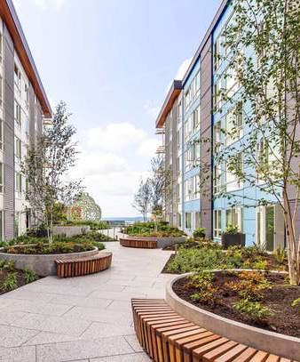
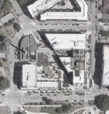
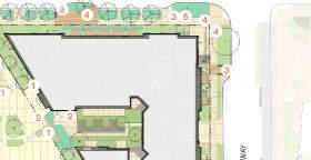
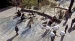
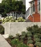
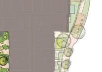
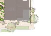
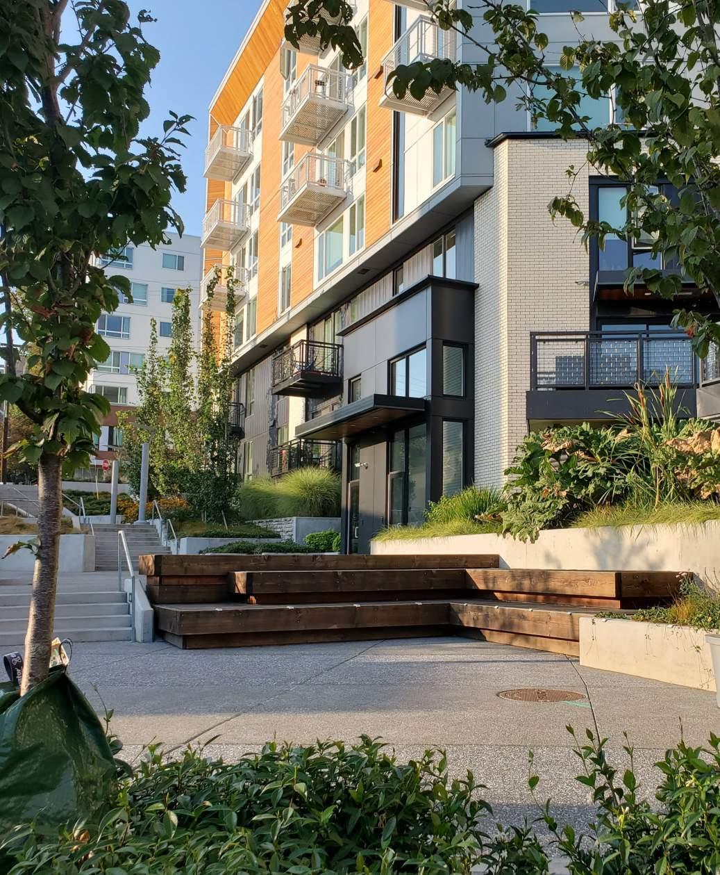
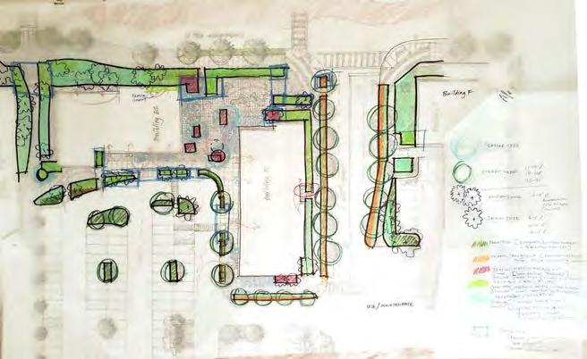
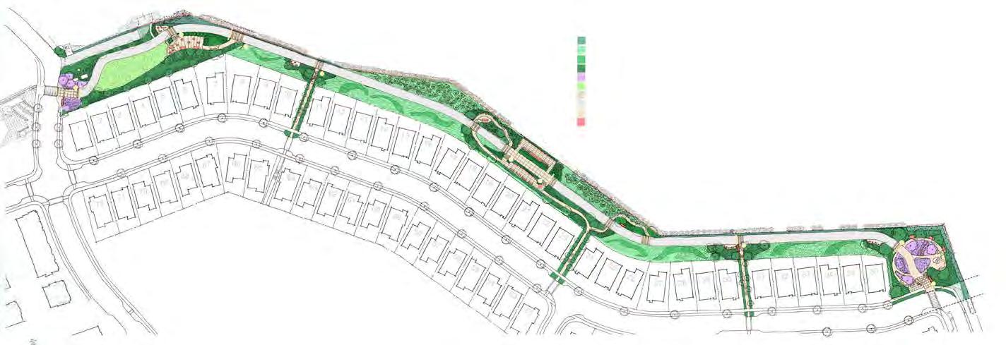
Development of 400+ apartment units, 10,000+ SF commercial space, public hillside climb, and a pocket park a few minutes from downtown Sea!le.


Replacing 1940s-era low-income housing units, the project maintained a substan"al affordable housing component. The landscape por"on of
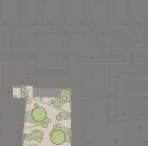
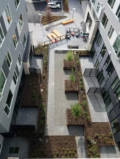
Blocks 2E and 3 - hill climb, sidewalks, pocket park, and several large onstructure courtyards - was composed of networked public spaces at grade and a variety of sea"ng and circula"on spaces at private residen"al areas.
During the course of this project my responsibili"es included, among others:
• Produce technical documents for en"re set following design direc"on
• Handle Revit modeling and graphics
• Check and contribute to grading solu"ons at stairs, ramps, plazas, etc.
• Assemble conceptual plan"ng and more detailed on-structure plan"ngs
• Assist with site walks/plan"ng and irriga"on punch list
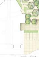
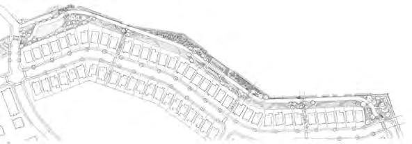
Diagrams and plans are from a DRB package fairly early in the design. While significant changes followed, especially on structure, these concept images remained relevant.
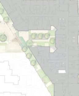


Diagrams and plans are from a DRB package fairly early in the design. While significant changes followed, especially on structure, these concept images remained relevant.


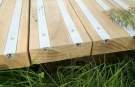


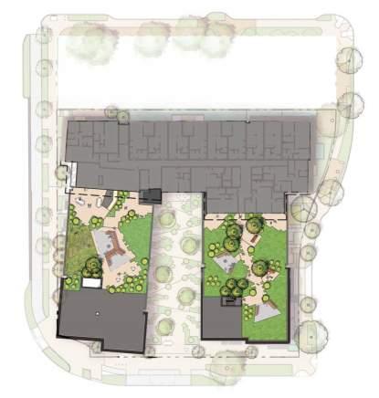
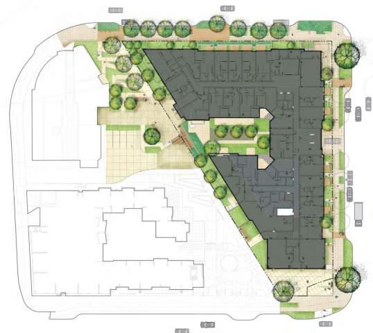
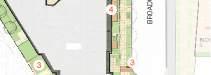
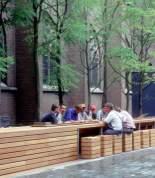
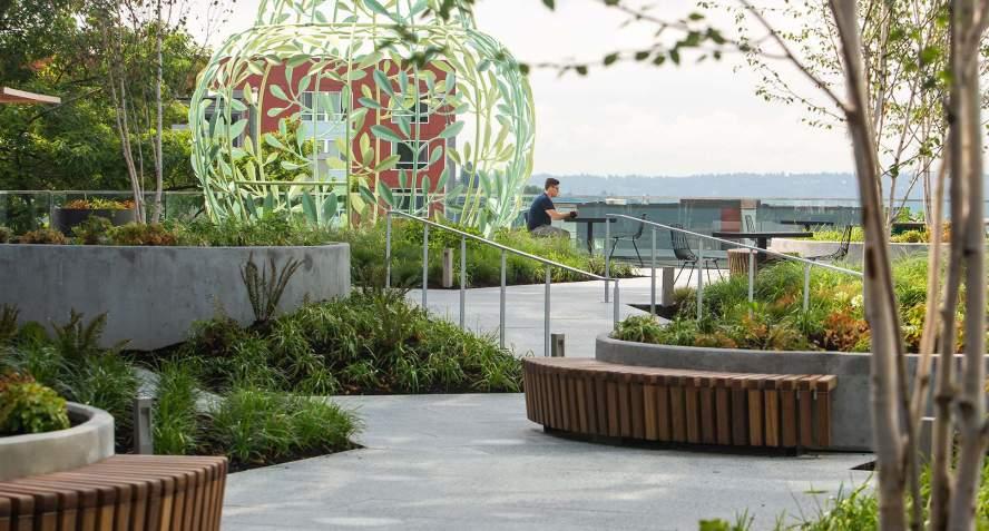
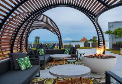
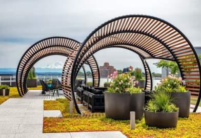
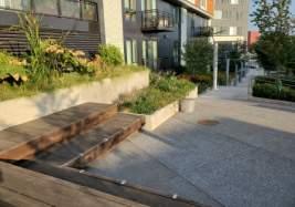
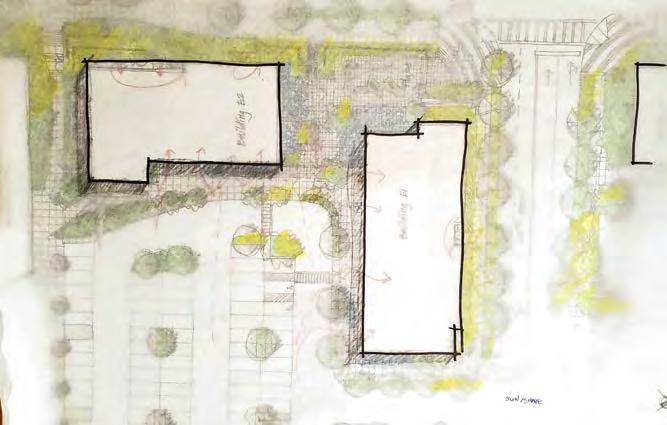
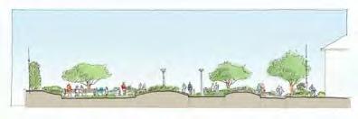
The roo!op decks promimently feature on Cypress and Ba k’s apartment leasing home pages as the top building amenity offered. Challenges I tackled in working on this design included a complex grading situa on involving ramps on the YT3/Cypress courtyard, coding a consistent plan ng schema across 68 large pots, and detailing custom curved benches.
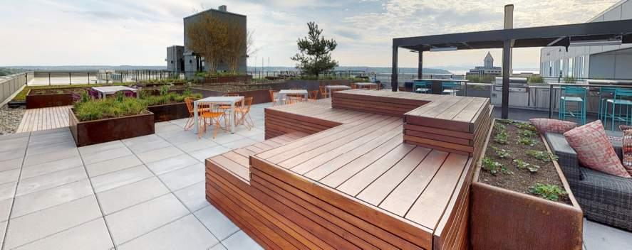
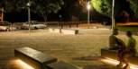
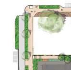
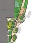
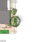
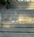
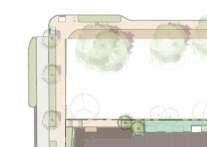
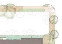
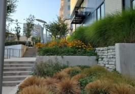
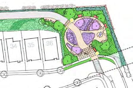
Preserved sightlines
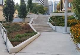
Stairs and ramps zig-zag between terraced plan ngs
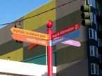
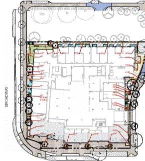
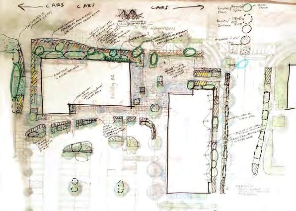
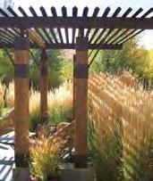
The Hill Climb Extension con nues the work of the 10th Ave Hill Climb in crea ng a vital, vivid pedestrian link between LiÅle Saigon along Jackson and the Yesler Terrace neighborhood 108 feet above. The desire for a delighçul, family-friendly environment combined with steep topography led to a complex network of ADA-accessible ramps, angled stairs, terraced sea ng, bioreten on planters, open spaces, and touchable plan ngs. As my first major project working in Revit and producing a complete set of technical construc on documents, the learning opportunity was tremendous.
Design
Planting
Tools
at https://www.shorelineplace.com/leasing/ .
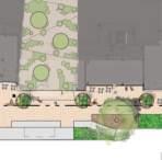
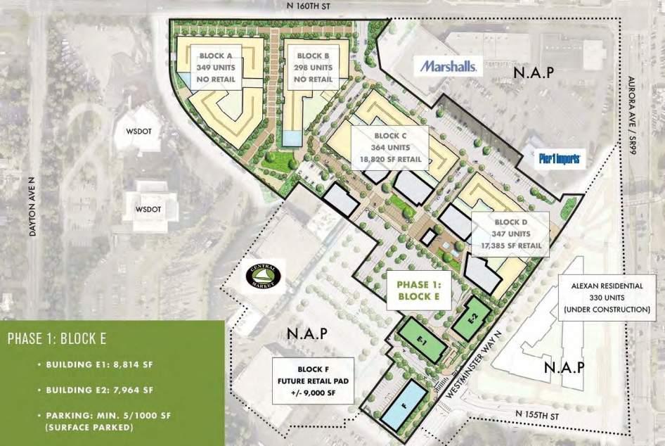
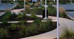
Phased multi-block redevelopment project within a few blocks of a future (2024) light rail station. The entire development encompasses multifamily housing, an open green space, promenades, and areas for dining and retail.
These pages focus on Phase I / Block E, where I took on a shared project manager role and handled most planting design and site design questions.
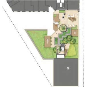
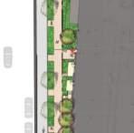
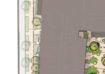
BLOCK E
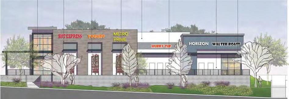
Block E, the closest to the future light rail and situated along high-traffic
Westminster Way N, functions as a gateway to the commercial portion of the project. It required designing for a threshold experience for both vehicles and pedestrians. With an open space for outdoor dining, the design buffers shoppers from traffic and parking and provides a richly textured outdoor room for lingering.
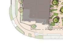
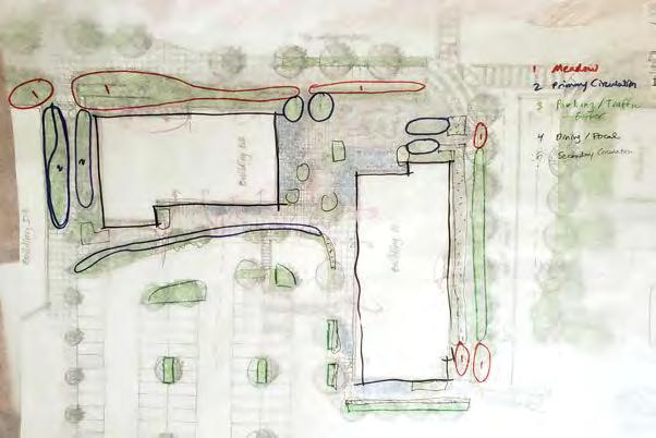
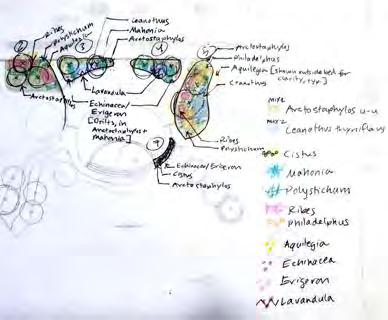
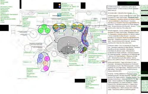
After review and design sessions with the principal, the planting scheme I developed independently proceeded with minimal revisions. Shown below is the final concept plan. On the following pages are concept sketches as I worked out the design, and sample pages from the planting package that was ultimately submitted to the client and
prime architect. CONCEPT
Levels of planting intricacy and texture were determined by the primary use of each site zone. Sturdier, lowmaintenance and streamlined planting combinations were placed along the parking and low-visiblity zones. Colorful, low-height plantings were placed at the threshold areas along the
street to maintain good visiblity to store frontage. Lusher planting combinations, with richer textural detailing, were placed at the pedestrian-centric seating and feature areas.
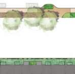
TYPE 1: URBAN MEADOW
TYPE 2: INTERNAL PEDESTRIAN CIRCULATION
TYPE 3: ENTRY DRIVE / PEDESTRIAN SIDEWALK
TYPE 4: VEHICULAR / PARKING BUFFER
TYPE 5: FEATURE / DINING AREAS
The following sketches, while reviewed in person with the design principal, were drawn and digitized by me at my home office. These working iterations were done in about 4 hours.
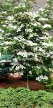
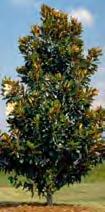
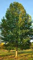
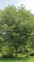
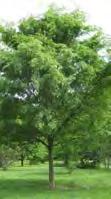
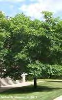
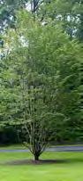
As part of the design package shown to the client and prime architect, I provided pages illustrating key species for each planting with some alternatives listed. Shown here is the page of proposed tree species, along with a diagram demonstrating their heights to alleviate concerns from the client about obscuring the retail signage.


Design Diagramming
Software Workflow
Development: Lumion
Grading & Drainage
Materials Research & Sourcing
Tools: Revit • Photoshop •
Lumion • AutoCad • InDesign •
Hand Drawing
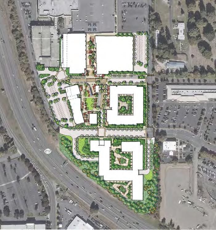
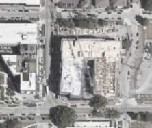
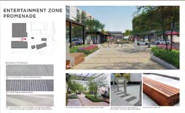
An otherwise successful shopping mall in suburban Portland, OR, has an empty anchor tenant store. The owners, with a slate of properties in the southwest and midwest, are looking to replace that struture and adjacent surface parking lots with mixed-use buildings and a publically accessible
park-like space. With a high priority on keeping the space flexible for events and programming, the project is also intended to be a regional attractor with a fairly
MY ROLE
level of materiality.
In addition to being responsible for the model, coordinating documents and requirements from collaborating
disciplines, and generating graphics, I also dug deeply into the new-to-ourteam City of Tigard code to ensure our compliance with an additional set of documents. I also used a new workflow to collaborate with the MG2 architects on Lumion models for client presentations, which had the effect of requiring early resolution of grading.
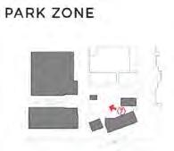
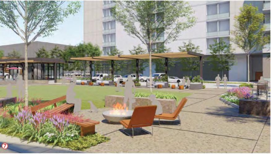
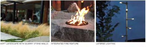
The site was arranged along a basic concept of a rectilinear, controlled structure at the existing mall (Entertainment Zone) transitioning to a looser, naturalistic theme at the steep southern end beyond the Park Zone. I put together imagery and research on the local ecosystem of the Willamette Valley and assembled images representing the influences and materiality of the conceptual gradient.
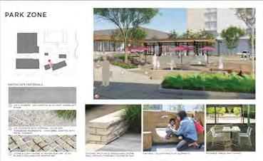
showing changing seat wall types and scoring patterns across the gradient
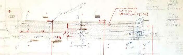
Grading exercise on trace: I worked out the sidewalk and stair connecting temporary parking to the north-south road


Imagery demonstrating the transition along the conceptual gradient
Grading plan from the technical documentation set showing the context of the grading exercise above
Community Engagement
Data Analysis
Trail Design
Park Design
Concept Research
Tools Used: Hand Rendering
• Photoshop • InDesign •
Illustrator • Excel


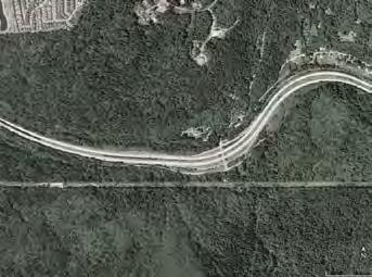


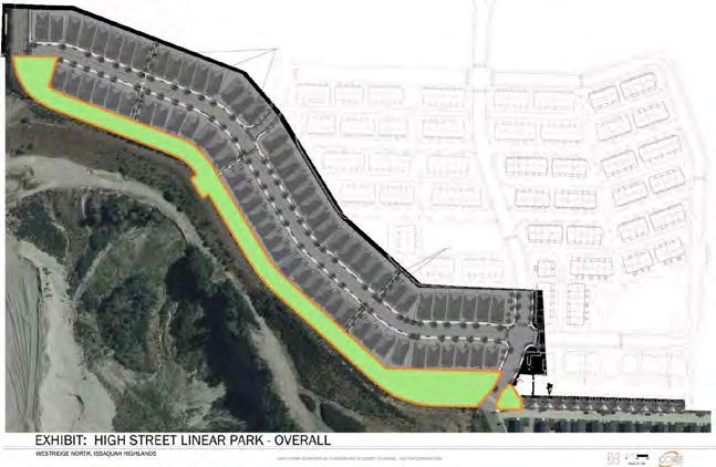

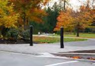
Hewitt has worked on several large community planning projects in the Issaquah Highlands area over the years. The High Street Trail Conversion project converts 1/3 mile of a neighborhood street, fronting a new housing development, to a linear park along a multi-mode bike/pedestrian trail with
A key element of this project involved our team developing questions, options, graphics, and post-survey feedback analysis for a communitywide survey administered by the City of Issaquah in November 2018. The final site plans delivered to the client and
DD phase, were heavily influenced by the results of this survey.
MY ROLE
I played an active role in the design and set up of the survey, as well as created all graphics and multi-platform variations, and worked extensively with the PM in final site plan creation.
•


Sample page of analyzed survey results, from Small Scale Active Recreation category Section by other and drew up a list of observations and recommendations.


COMMENTS:
• Space issues / amount of activity proposed relative to space available (7)
• Lack of use of any features shown besides courts/all-age play (5)
• Maintenance challenges (2)
• Recent removal of fitness stations from Black Nugget Park (2)
• Overly

Survey respondents were asked to respond to several categories regarding which features were most and least important to them in a new community park space. They were shown a page of images per category of researched and recommended amenities. Our analysis visually charted the results
Our design contract did not include construction phases, so the final site plan was kept loose and friendly, with accompanying photos of selected amenities for each park node.
Issaquah, WA 2018-19


A colorful, hand line drawing with digital color shows all 5 primary areas along the path as well as 3 public stair connections through the housing development to the parallel vehicular street. Areas 2 and 4 are small nodes, joining the stair connections to the romain path via a small seating area. Areas 1 and 5, entrances to the linear park, offer a garden experience and flexible park/picnic space, respectively. Area 3 provides a children’s nature walk and plaza overlook to the valley and hills beyond.
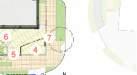
NOTES: 1.Domesticwaterlineutilitiestohaveaminimumoftwofeetofcoverpercityrequirements. 2.Treeplacementlocationtobecoordinatedwithallutilitiesandmeetcityminimumoffsetfrom utilitiesincludingundergroundwetanddryutilityaswellasvaultlids. 3.Treeplacementtobecoordinatedwithutilitymaintenancevehiclestoensureproper clearances for vehicle trucks. 4.Soildepthsandsoiltypesforallplantingtypestobecoordinatedwithcityminimum requirements. 5.Finaltreespeciesselectiontobecoordinatedwithcity.Selectiontobereviewedandapproved betweencity,HOAandPolygonasitrelatestomaintenanceandprotectingviewsheds.
ExistingTrees: AllexistingtreesoffpropertylimitstobenegotiatedbetweenPolygonandpropertyownerto reviewandimplementavegetationmanagementplantoproperlyprovideandmaintainaview shed.


Site Design
Technical Documentation
Irrigation
Tools Used: Revit • Photoshop •
InDesign • Illustrator


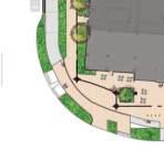
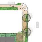
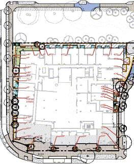
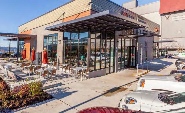
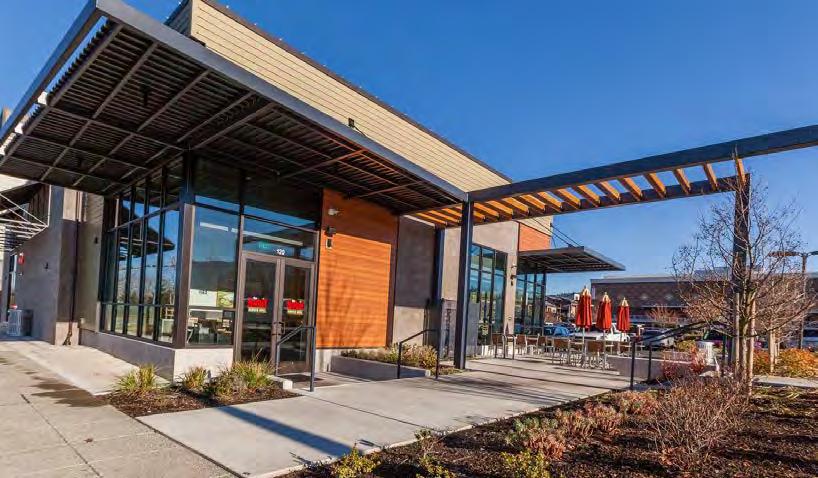
This small project, a late-phase addition to the larger Grand Ridge Plaza and Issaquah Highlands comunity developments, required a different set of documents and calculations for the City of Issaquah jurisdiction from the more familiar Seattle requirements. Project challenges included resolving


a grading oddity at the SE corner ramp access to the new building, tying into irrigation controlled at the existing retail building, and providing a pleasant outdoor dining area for the new Habit Burger tenant within a limited budget.


Space is reserved for 9 2-top tables with optional shade coverage.
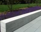
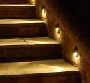
Plantings, shown here in winter shortly after installation, buffers between the seating area and parking to the south.
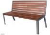
Concrete seat walls, an additional bench, and seat wall lighting enhance the usability of the space.
Technical Documentation
Illustrative Rendering
Street Design
Park Design
Lighting
Tools Used: Revit • AutoCad
Photoshop • InDesign
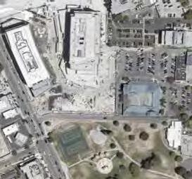
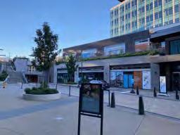
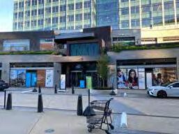
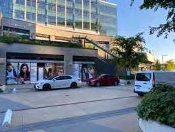
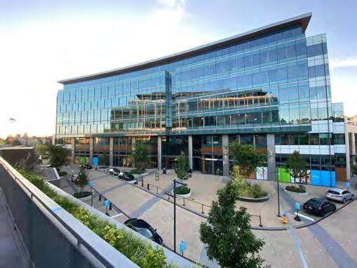
This Google campus next to Kirkland’s Peter Kirk Park was beginning the Phase III / South Building when I joined the project. As part of the site development project, the road configuration leading into the entire site and a section of the park were also slated for redesign.
Kirkland Urban South (Phase III)
I handled the model, coordinated incoming CAD files from other disciplines, drafted design changes, produced technical documents, did irrigation schematics, and took on initial grading passes at stairs and the entry plaza.
Park Improvement
I took on similar tasks as at the South Building, and was more directly involved in developing the grading schematic, as well as generating the initial planting concept diagrams and carrying them through to CD-level drawings.
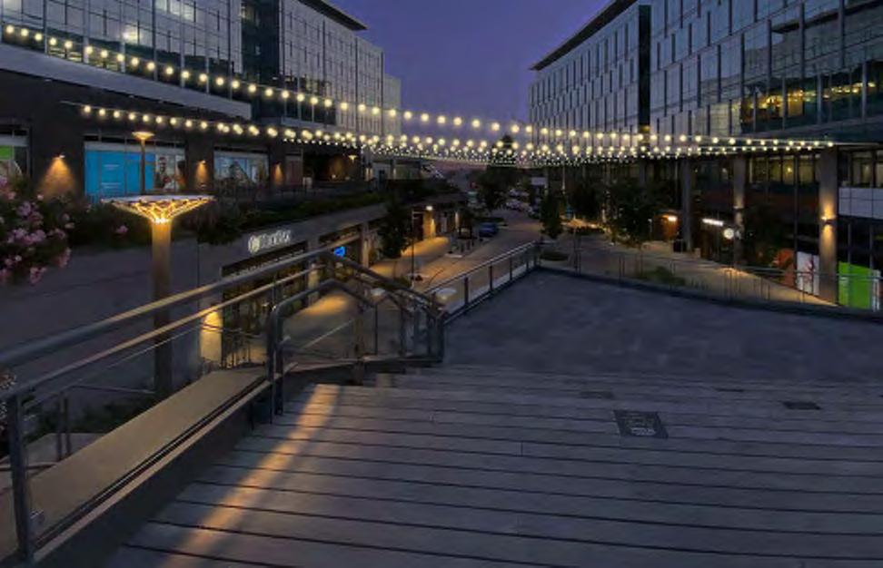
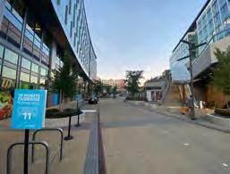
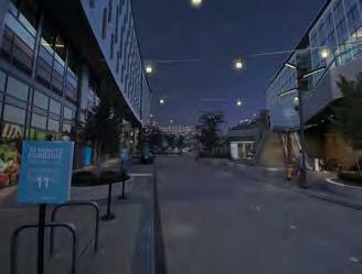
The client requested an Added Service to improve the lighting and festive quality of the woonerf between thealreadyconstructed North and Central Buildings. I set up a system for identifying catenary light cable attachment points to constructed buildings and took design direction from the design principal’s alternate stringing/fixture concepts to create these diagrams and renderings.
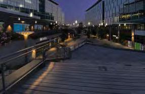


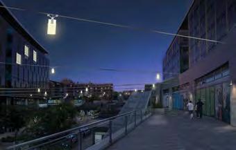


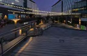
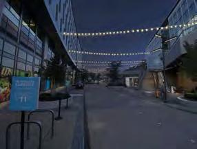


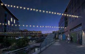
I created these renderings solely in Photoshop, based off photos taken by a team member in the late afternoon. The process required setting up a system of perspective lines and file management layers to compare the effect of two different lighting packages from within the same image file.
Option B: Lanova fixture by Selux
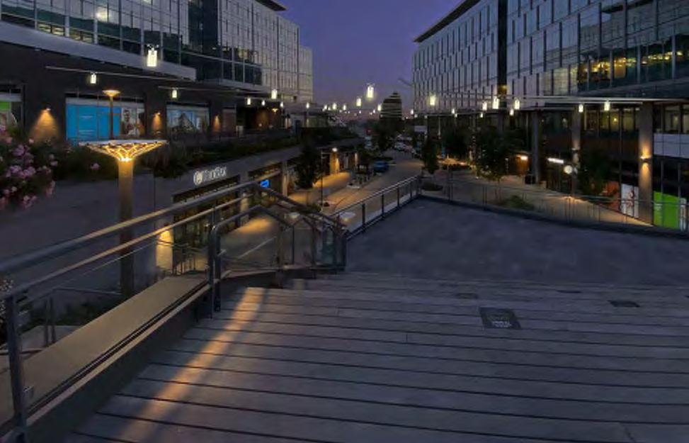
Option A: Duraled Stargazer fixture by Targetti Comparison