Portfolio Audrey Maloney


Rhodesworks Design Studio Landscape Designer April 2014–present
Draft design changes and proposals for hardscape installations. Prepare grading and drainage plans and pattern layout for stone pavers. Assist with other graphic, administrative, archival, and project-related tasks.
University of Washington Graduate Student Assistant 2012–2014
Perteet, Inc. / Seattle, WA Administrative Assistant Summer 2011
ECC & Tezukayama Jr. High School, Osaka/Nara, Japan English Instructor 2006–2010
Oregon Zoo, Portland, OR Media Relations Internship Summer 2003
Bird of Prey Handler 1999-2000
Coordinated author contributions and copy edited manuscript drafts for publication of Transcultural Cities by Dept. Chair Jeff Hou. Lectured on Japanese gardens and land art; prepared and graded class materials as Teaching Assistant for three landscape history/theory courses. Assisted in the office; served on program admissions committee.
Civil engineering office organization and management; edited and assembled construction documents in Photoshop, Word, and Acrobat; assisted with streetscape project management.
Prepared and taught lesson plans; wrote tests; taught children and adults; managed classrooms of about 20 students at junior high and university levels.
Wrote and distributed information published and broadcast in over 50 media organizations across the Pacific Northwest; participated in conservation programs; directed a PSA shot by a middle school group. As a handler, fed and weighed birds and participated in summer shows.
Proficient Basic
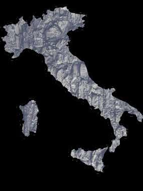
I aim to design environments that support vivid, human-scaled experiences. I believe that by integrating art, materiality, movement, and restorative space, contemporary cities can have a visible/experiential connection to the texture and systems of earth. I am inspired by connections between modern design and traditional craft and by sustainable lifestyles in the urban cores of countries like Japan and Italy. I am interested in developing regionally relevant, highly livable and walkable urban spaces.
University of Washington Master of Landscape Architecture / Certificate in Urban Design Graduated June 2014
University of Shiga, Japan Special Research Student (Architecture) 2009–2010
Wheaton College, IL
B.A. Communications (Journalism) Grad. 2005
Focus on urban design, with coursework in Urban Planning. Co- served 2011-2012 as UWASLA Officer of Technology.
Enrolled in a third-year undergraduate Architecture studio program; participated in a charrette on an exchange trip to University of Ulsan, South Korea.
Minor in Art. Study abroad in Italy; additional coursework in environmental sciences.
Adobe Photoshop/Illustrator/ InDesign, AutoCad, SketchUp, ArcGIS, Rhino, hand illustration, laser cutting
Revit, MS Excel/Access, Wordpress, HTML/CSS, CNC milling, 3D printing
WASLA Merit Award: Graduate Thesis 2014
Harold Kawaguchi Memorial Scholarship
Nellis Endowment Scholarship
Top 3 in Design Charrette--Exchange between University of Ulsan and University of Shiga
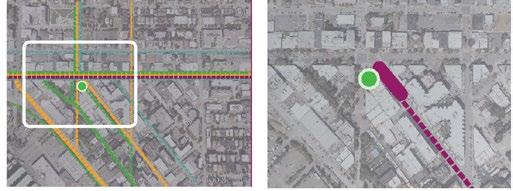
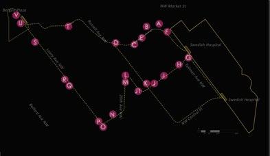
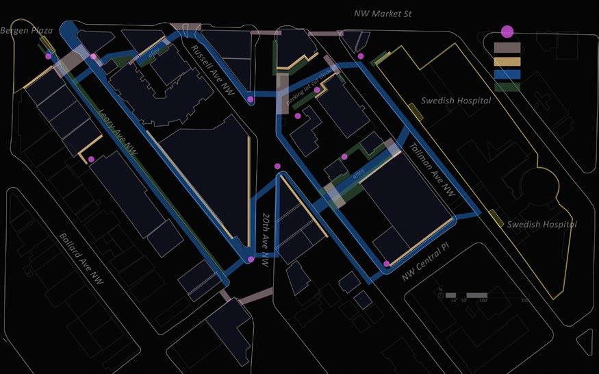
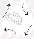
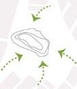
For this study around a hypothetical light rail or streetcar stop in Ballard, I looked at the potential walking routes between the proposed station and the Swedish Hospital 1/4 mile away. I identified several categories of interventions to make these routes safer and more appealing to pedestrians at nighttime.
Goals:
• Increase perceived and actual safety of pedestrian paths near the hospital
• Increase social presence on the street
• Make public transportation easier to access at night
• Create a typology of interventions that could be applied to other routes and public spaces proximate to transportation
Major features:
• Use of light art to increase visiblity and street presence
• Identification of better connection points and intuitive wayfinding
• Materials, plantings, textures, colors, and patterns that take advantage of night conditions for unique design
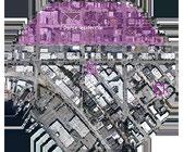
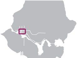
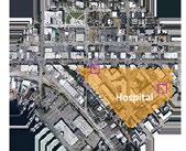
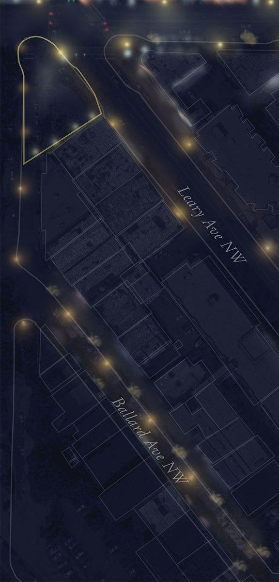
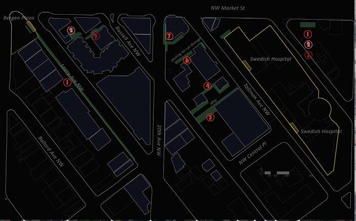
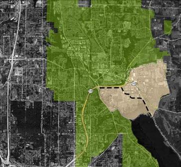
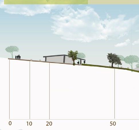
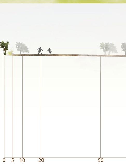
The site area is in Ballard, a historically industrial waterfront neighborhood that is rapidly densifying and in great need of more effective transportation connections to other neighborhoods. For this project, I proposed an HCT station at the current site of Bergen Plaza. I identified the surrounding subdistricts and focused on the area between the proposed stop and the hospital, a likely source of nighttime commuters.
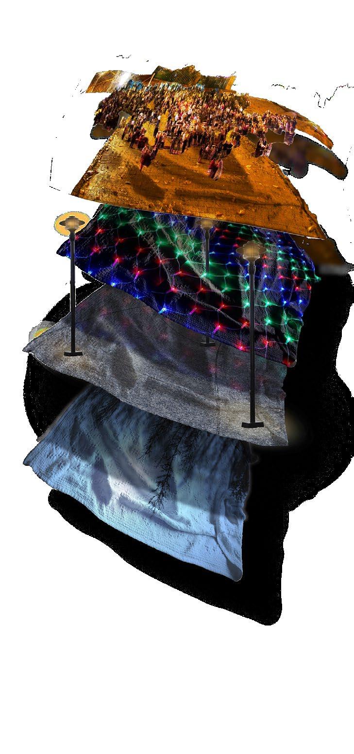
Four primary concepts guided the design process, represented here as blankets.
Social: Festivity, arts, night as the time for social and cultural activity. Technology, Craft: Experimental technology, light, color, texture, interactive art.
Safety & Infrastructure: Practicalities: CPTED principles, structural design to increase perceived and actual safety.
Nature & Mystery: Staying true to the inherent qualities of night.
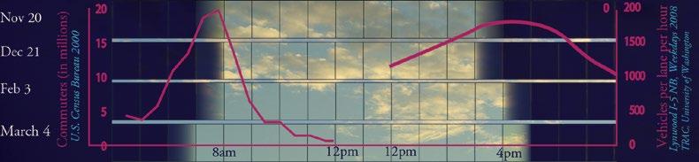
I combined data from local and national sources comparing peak commute hours with hours of darkness in Seattle between November and March. The resulting graph demonstrates the need to design for the urban nightscape in order to encourage use of public transit.
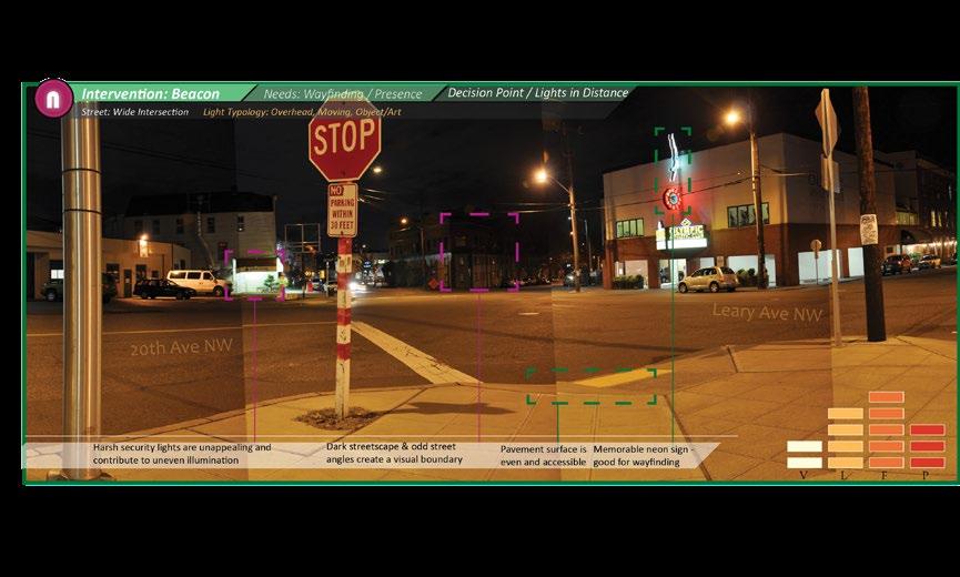
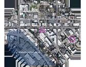
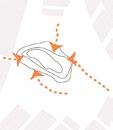
I identified around 20 points along two primary pedestrian routes to analyze in greater depth (based on perceived issues with visibility, wayfinding, underutilized space, etc.). I conducted a photographic documentation of these points. I then analyzed them according to a metric of characteristics that indicated the current conditions/challenges and suggested an intervention type to apply at each point.
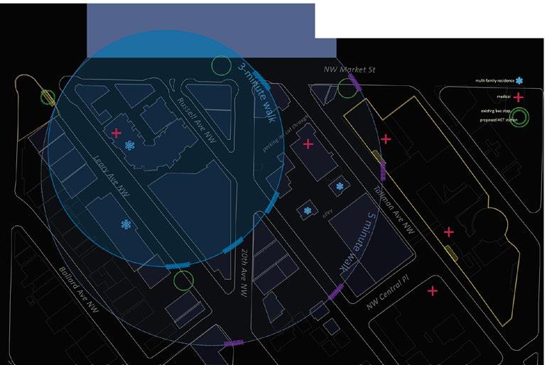
I conducted a detailed survey noting lighting fixture types, placement, spacing, gaps in coverage, and approximate color temperature across the 1/4 mile-wide site. I then translated the results of the survey into this image of the current state of illumination between Swedish Hospital and Bergen Plaza (outlined in yellow).
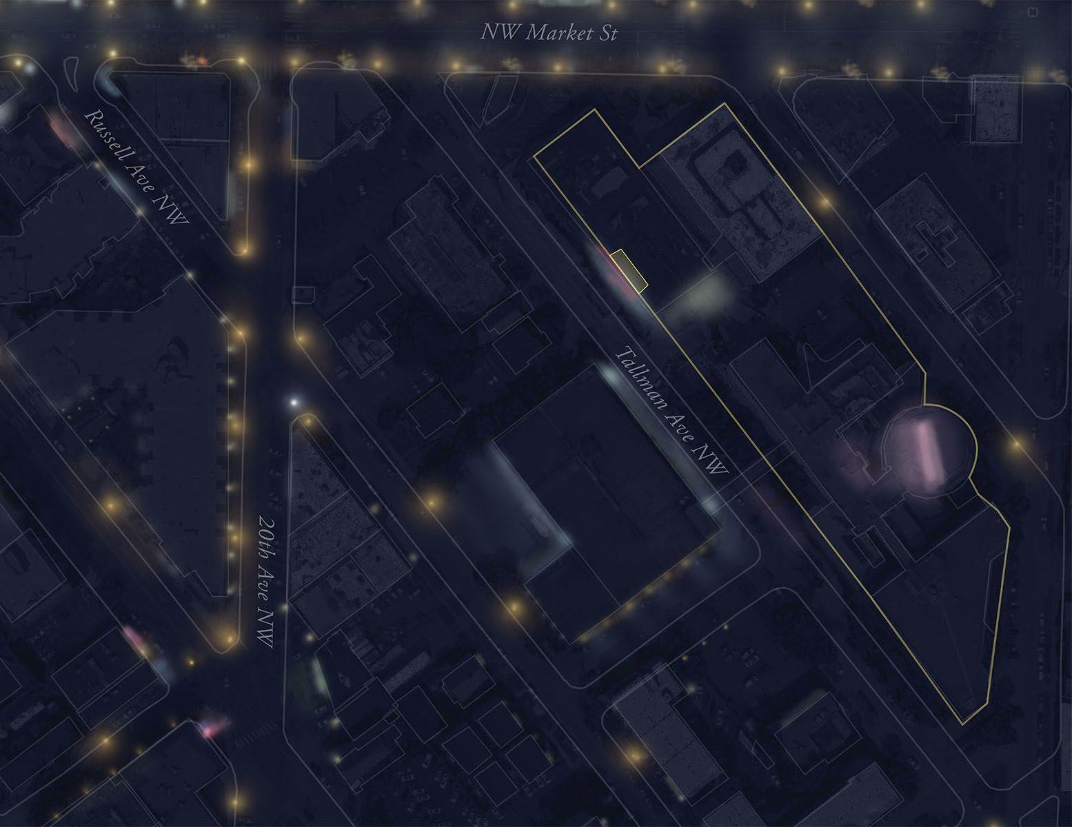
Landmarks
Placemaking Information
Visibility Play
Natural
Mystery Wayfinding
Nature/Climate
Texture
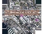
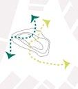
I developed 5 primary intervention typologies based on structural forms and street conditions in the district. I also proposed a catalog of parts, or ideas and strategies applicable to each typology that could be drawn on for a customized but consistent approach to this and other districts with a need for nighttime improvements.
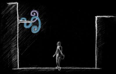
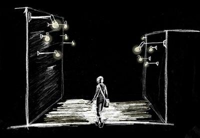
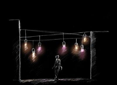
3 strategies for the Threshold typology. From top to bottom: neon icon; grouped light fixtures; strings of lights.
Analysis of pedestrian street conditions by level of lighting and presence/speed of vehicular traffic.
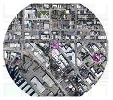
Locations of typologies

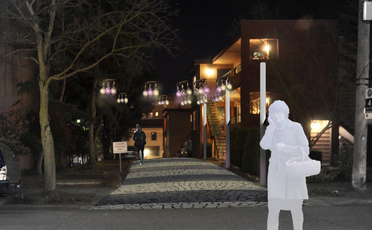
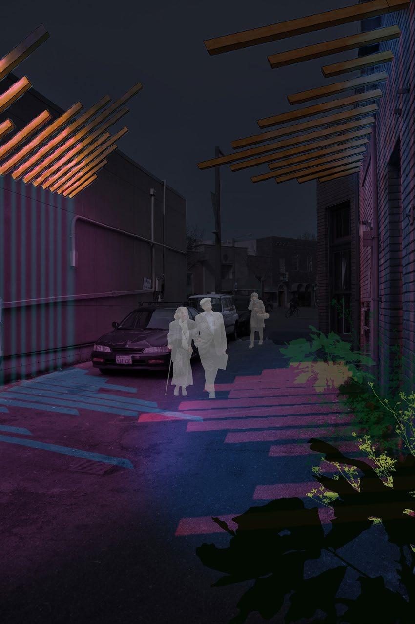
with low light and visibility levels and an unimproved road surface (footing) has been made safer and more attractive by creating a canopy of lights inspired by the form of squid fishing lamps (string of lights) and by marking the space as one that is maintained and navigable with a
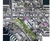
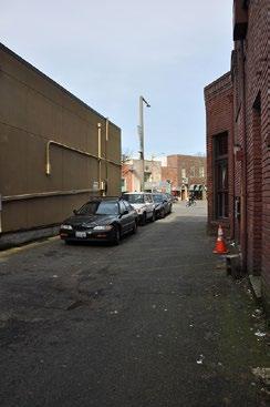
I developed a route-based plan for each intervention typology and proposed specific installation ideas for important points along the route. Several options are available for implementing each, although a limited palette of ideas should be used across each district or subdistrict. Here, an alley (threshold) light-colored, striking paving pattern (light paver pattern). These strategies, while helpful to pedestrians, are also low-key in order to minimize glare and intrusiveness on the bordering residential property.
Space: Alley bordered by blank facades in a commercial area. Space is narrow but a potential connector.
Scale: Overhead, mounted 12-15’ high, casting light and shadow patterns underfoot. At least half the length of the alley.
Materials: Wood, colored lights.
Function: Replaces high powered security lights with a more mysterious but still bright form of lighting.
Light: Playful, colorful, informative; the two colors of lights aimed at the wood beams create interesting overlaps and extensions of colored shadows that shift as pedestrians walk along them.
Redmond` SE Redmond` I-520 (15 miles to Seattle)
Marymoor Park Lake
Need for connections
Existing green areas
Low-density development has room for infill, increased ecologic/social function Vegetated areas on periphery could be more connected
Neighborhood context

• Goals:
• Design for resilience in case of natural disaster
• Strengthen community social ties
• Create transportation options within the neighborhood and to other parts of the city
Major features:
City context
Sammamish
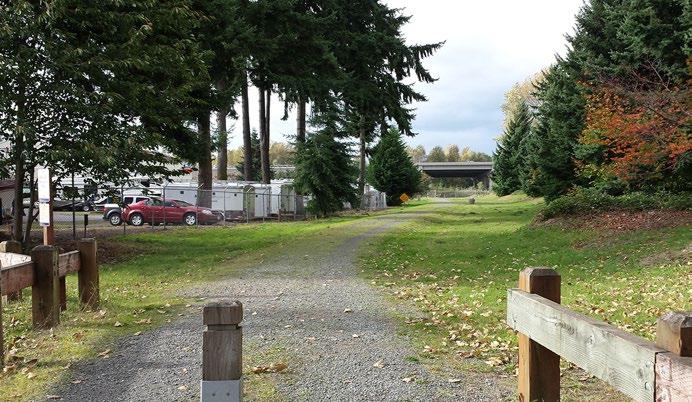
No non-vehicular access out of neighborhood: path is blocked by freeway, local businesses are inaccessible, and path is unimproved for bicyclists.


• Biocorridors connect fragmented habitat, protect water sources and stabilize soils, serve as buffer/refuge from damage in an earthquake scenario, and facilitate creation of a non-motorized transportation network
• Trails and paths connect the neighborhood to goods & services and reduce reliance on roads & highways

• Open public spaces and productive landscapes foster a sense of place and social interaction
• Phased design serves both emergency and daily needs
• Potential to accelerate implementation of plan postemergency
To be removed in Marymoor Park expansion
To be removed in development of green network
Buildings/areas to be changed. Yellow areas are adjacent to Marymoor Park and on former marshland (at increased risk of liquefaction in an earthquake).
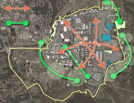
The green fingers running through the center of Redmond connect the existing highly vegetated areas on the outskirts of the community, while creating a strong structure for organizing bicycle and pedestrian transit, opening up space for community and public assset, integrating stormwater management, and providing SE Redmond with a stronger visual identity rooted in its natural history. The open space and connections established by the green fingers will be a valuable resource in times of emergency, and a major amenity as Redmond adds population.

Habitat Corridor/Buffer, min. 50’ wide
Stormwater Bioengineering
Open Public Space

Pedestrian/Bicycle Path
Corridor/Buffer, 20’ feet wide
Productive Landscape
Green Corridors: Bicyclists and pedestrians navigating the vegetated network of paths will be connected physically and symbolically to a representation of the historical landscape of Redmond and to the current landscape of the park and agrarian environments on the city’s borders.
Pocket Plazas: Open space where paths come together will provide good access points to the paths, create public space for gathering, and link to origin and end points via a hardscape transitional space between the paths and the architectural environment.
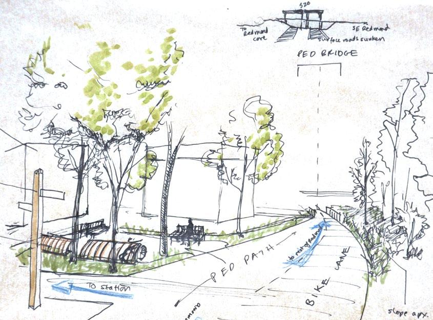
Pedestrian bridge: At the southwestern edge of the neighborhood, the bridge will cross existing barriers to create a much-needed transit link to the rest of Redmond. It will take people under and past the elevated 520 deck, and on to downtown Redmond, or conversely, from downtown Redmond to the future commercial area in SE Redmond adjacent to the light rail development.
Wetland: The wetland under the 520 deck, part of the Bear Creek hydrological system, will be re-established and expanded with a retention pond connected to stormwater features throughout SE Redmond.


These goals are drawn from the work of emergency and urban planning professionals at FEMA, Greater Christchurch Urban Development Strategy, LEED Neighborhood, SSI, Safe Routes to School, LID, SITES, FEMA Comprehensive Plan Goals & Hazard Strategies, City of Redmond.
Provide convenient, safe, environmentally friendly transportation for all demographics.
Increase transportation options and connections within SE Redmond and to other neighborhoods.
Increase social connectivity through transport and neighborhood planning.
Increase use & appreciation of greenspace via local communities’ participation and management.
Reconnect to a pre-development land type.
Improve surface water quality and protect aquifers and subsurface water.
Provide ecological corridors with resources for native flora and fauna to spread.
Increase equality of opportunity for people to access natural and recreational areas.
Maximize the experience of natural heritage in the area.
Increase the variety of open places and spaces in the neighborhood.
Transport
Community Connection
Ecology
Refuge
Culture & Identity

These functional categories reflect goals for a resilient green network in Redmond. They take into account best practices and actions that will leave Redmondites better off in the long run
regardless of geologic calm or chaos. Goals that prepare an urban place for potential, eventual emergency should be equally beneficial to the public on a daily, business-as-usual basis.


A well-connected, healthy, socially and civically engaged community is a resilient one.

I worked with five major typologies for creating resilient space, which can each be broken down into numerous features. The typologies interact and affect the function of each of
Update zoning, designate features in long-term plan, test short-term solutions.
the others for a cohesive, large-scale intervention. Taken together, these applied typologies support community resilience now, for future growth, and in emergency scenarios.


Complete paths/open spaces across currently available space.
Redevelopment complete; an extensive green
in place.


Due to soil instability in a large portion of what is currently the light industrial and commercial district of SE Redmond, it is probable that a fair number of structures will need to be demolished following a large regional earthquake. Rather than rebuild in a demonstrably unsafe area, these areas should be integrated into the resilient green network, where they will provide habitat, recreational/community space, and sites for food production. Since this is also the end goal of the 20-year plan in a scenario where no earthquake happens, the main effect of an earthquake somewhere in this time frame would be to speed and expand the rate of conversion of geologically unsound properties into community resources. Property owners of such parcels will be able to rebuild in denser, more dynamic zones of industrial/ commercial productivity that will be more accessible than ever to local employees and clients.
Bicycle and pedestrian oriented paths connect across SE Redmond to parks, recreation, neighborhoods, TOD, work areas, and the rest of Redmond, through a mix of urban and vegetated environments.
Lake Sammamish TrailMarymoor edge NE 65th, from LST to boundary
- urban portion
-
Open public spaces–from large terraces to pocket plazas–are distributed throughout the path network and placed at path intersections to provide social interaction and community event space.
Redmond Way + 185th Ave
188th Ave + South of Cadman
188th Ave + Bear Creek Trail Redmond Way + Lake Sammamish Trail
185th Ave + NE 68th St
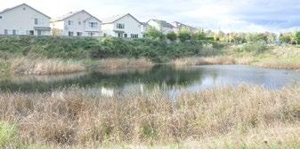
Bioswales and retention ponds along slopes and low-lying areas redirect water, clean it of pollutants, and take advantage of the area’s natural history as a wetland.
Bioswale - 185th (65thpost office)
The key feature of the proposal, the habitat corridors/buffers give mobility to plant and animal species. They also function as urban beautifiers, a healthy and restorative infrastructure.
SE edge of Marymoor
185th to Marymoor
185th, west side (65th to post office)
Cemetery to Cadman pond
Lake Sammamish Trail from 520 to 65th
188th to urban boundary
188th to Bear Creek Trail
Tying into work by other students, the productive landscapes in SE Redmond use rooftops, shared yards, and community gardens for building social connections and establishing food resilience.
Shared-yard gardens, residential neighborhood (Lana Alisdairi)
rooftop food
(Abigail Weber)

community
project
summary Neighborhood context
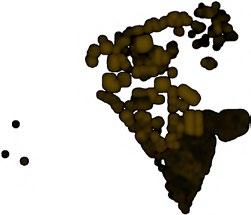
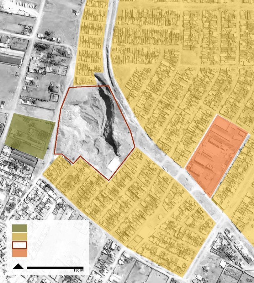
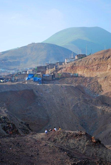
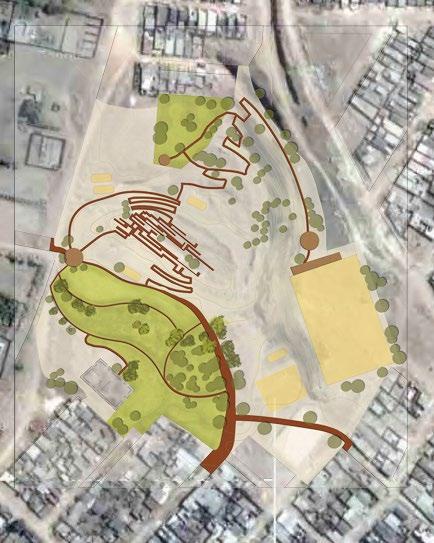
Context: Lomas de Zapallal, an urban slum settlement on the outer fringe of Lima, is in an ecologically fragile desert and resource-poor area outside city services. Within it is a decommissioned pit mine, avoided by residents except as a trash bin, a marginalized space in a marginalized community.
Goals:
• Make this unsavory gap not only approachable but engaging and crossable.
• Stabilize the slopes and reintroduce native vegetation.
• Establish a multi-phased program that takes advantage of precious
open space for community activities and recreation.
• Engage the community in salvaging the pit space. Bring a wounded topography from marginality to wholeness, using limited resources to create a more livable place and reveal the value in an overlooked place.
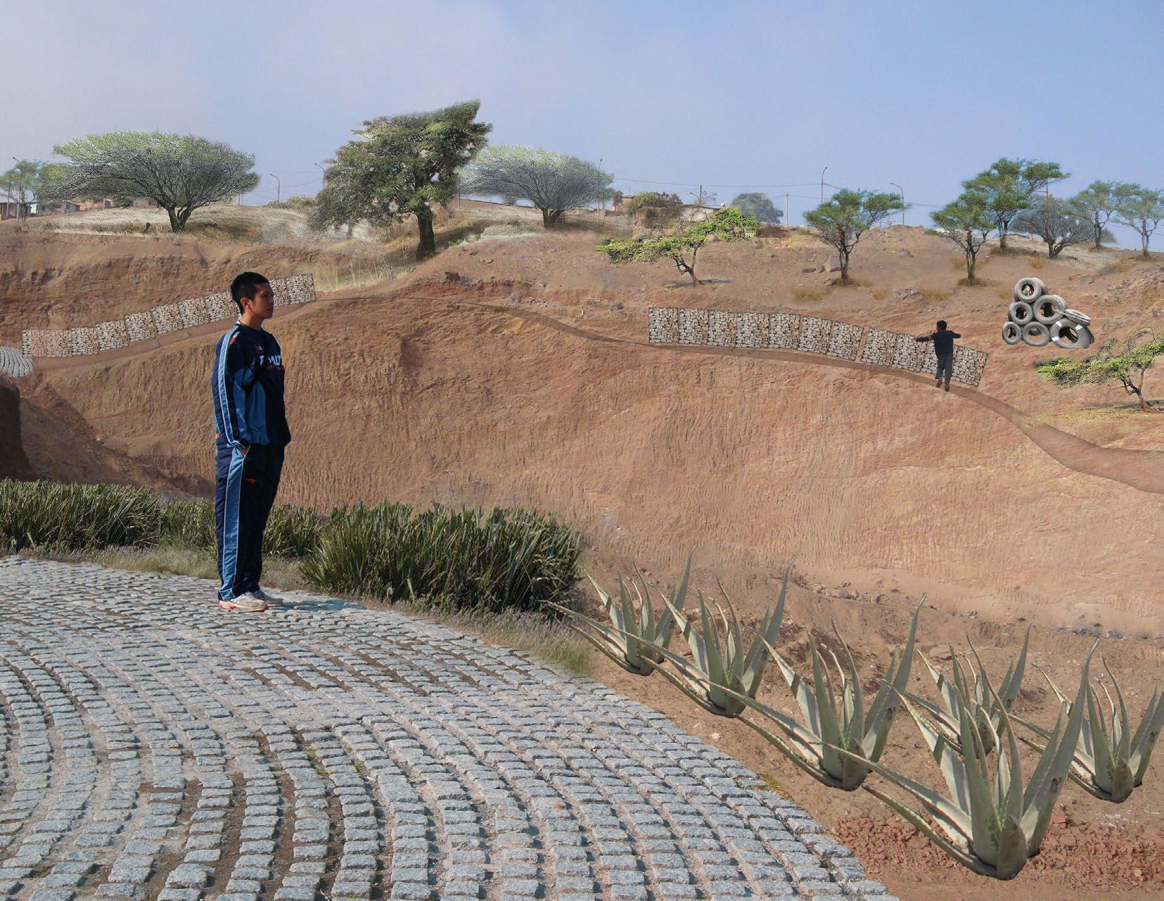
• Gabions are created from salvaged material (rebar, chicken wire) and filled with weighted plastic bottles (a major element of the current dump contents) to stabilize and give form to the slopes.
• A community craft/education facility constructed on site can be used to create the gabions in the early stages of the project.
• A plant nursery area is established for light agriculture, profit (e.g. through commercially valuable species such as agave), and ww the pit.
• Upper areas of the site are leveled for sports fields.
• Paths and lookouts along the slope edges connect residential, school, and recreational areas.
• Winding paths lined with gabions form a walkable labyrinth across the pit in the project’s final stages.
Since the site is currently dirty and dangerous and consequently avoided by residents, development is planned to progress from the periphery inwards to gradually increase familiarity and comfort with the site.
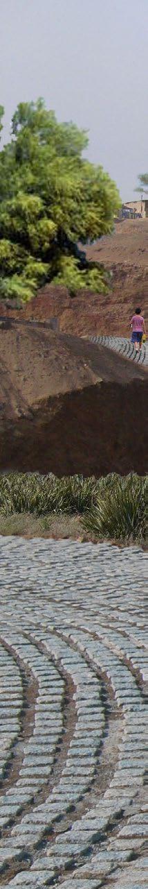
Thick fog blankets are an essential part of lomas climate and the main source of water for plants and humans in this arid environment.
design/build


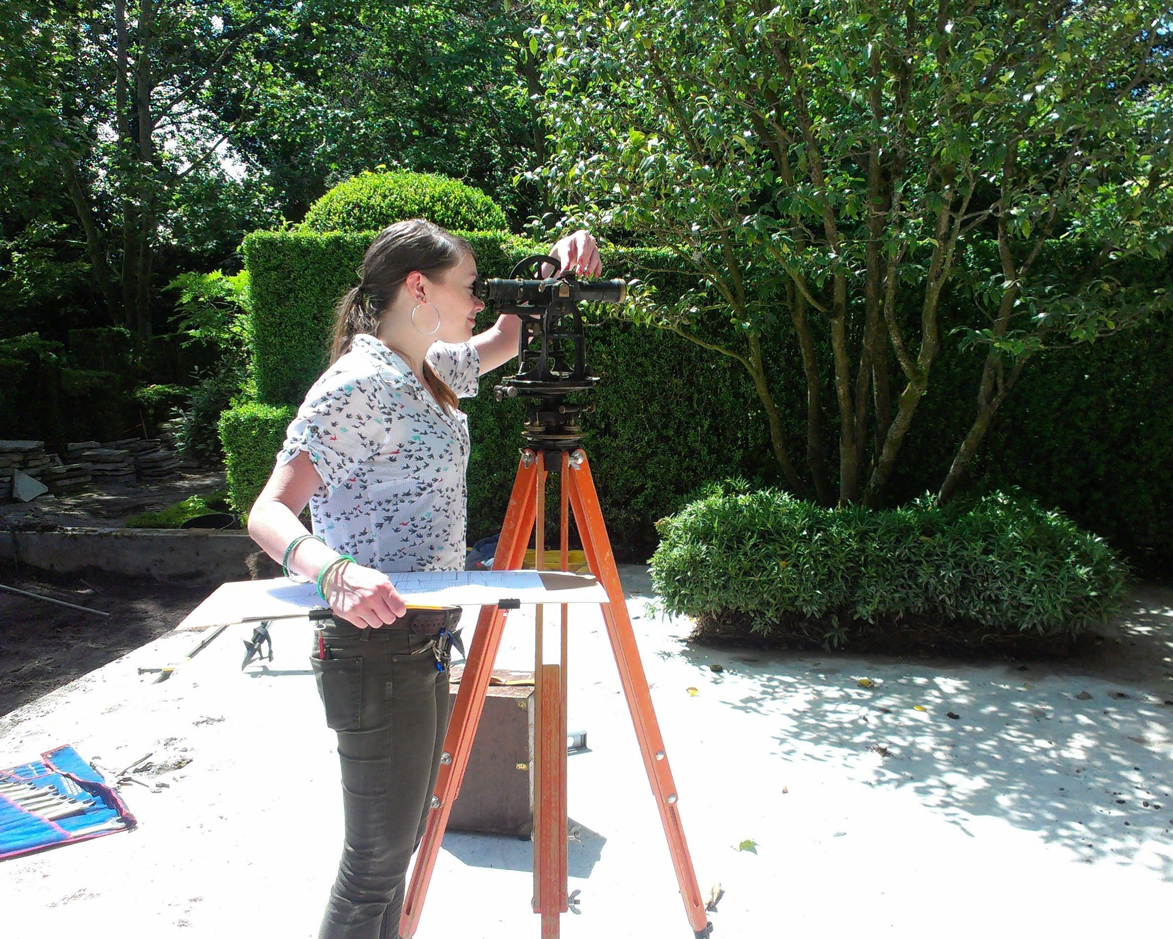
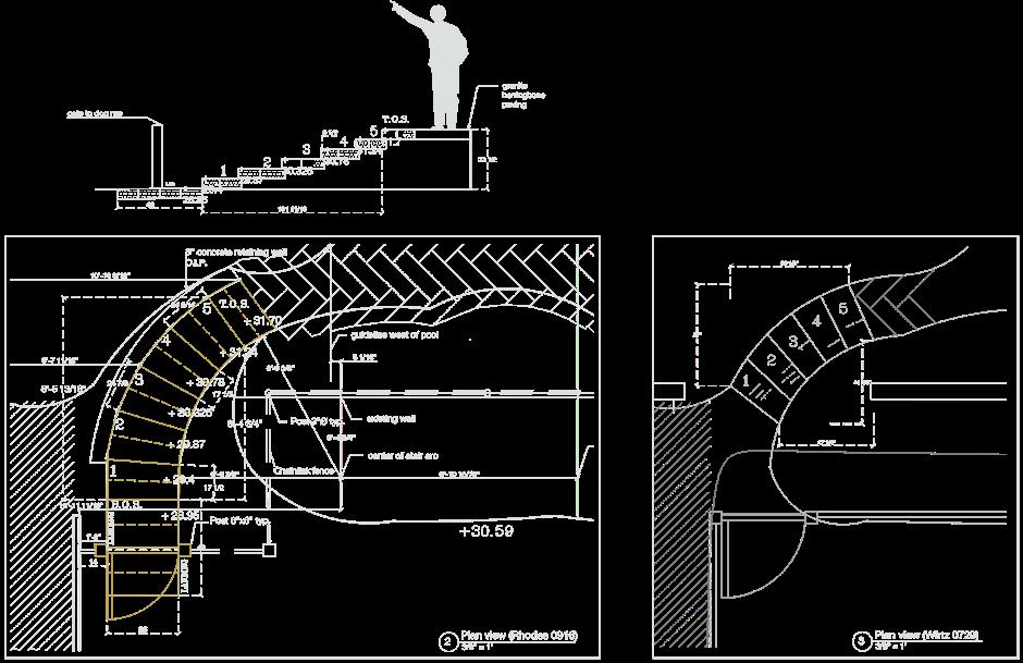
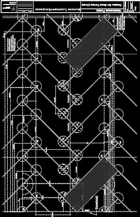
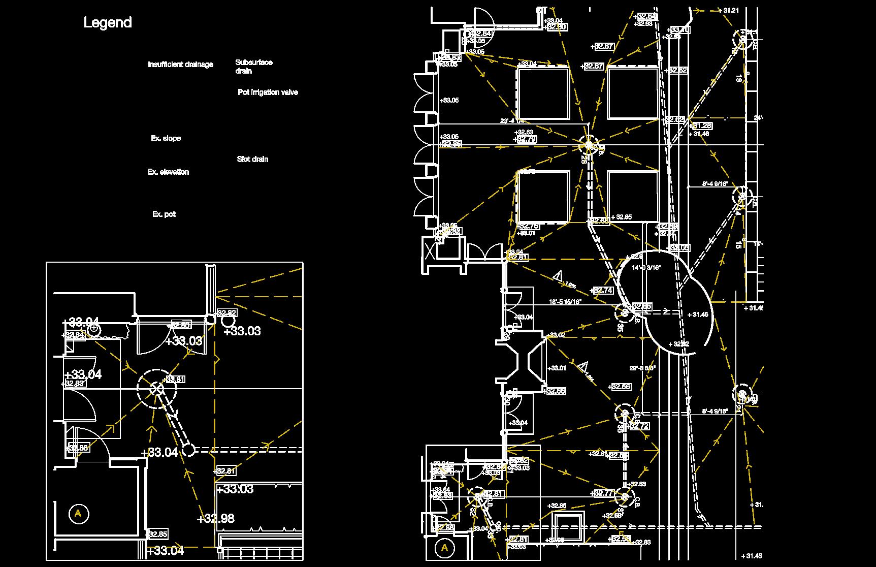
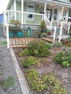
A private waterfront terrace of approximately 8000 sq ft was redesigned to incorporate changed stair and side yard geometries, an updated drainage system, and a new paving pattern with granite imported from China. My primary roles were product research, drafting CDs, calculating slopes, stairs, and grading, conducting basic site surveying, and pattern layout.
Building on initial drafts by Wirtz, I adjusted, smoothed, graded, and dimensioned numerous flights of stairs and specified inventory pieces to use for treads and landings.
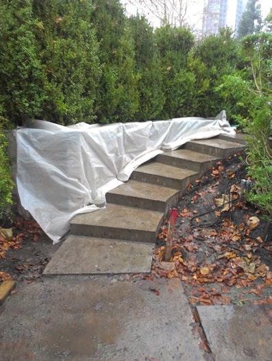
Formwork cast in place (December 2014)
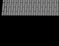
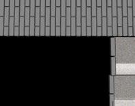
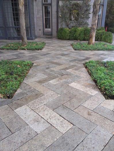
Detail showing pattern layout and placement of paver pedestal settings allowing for drainage
patterning
I drafted all documents illustrating and dimensioning layout of the herringbone pattern as well as the underlying settings.
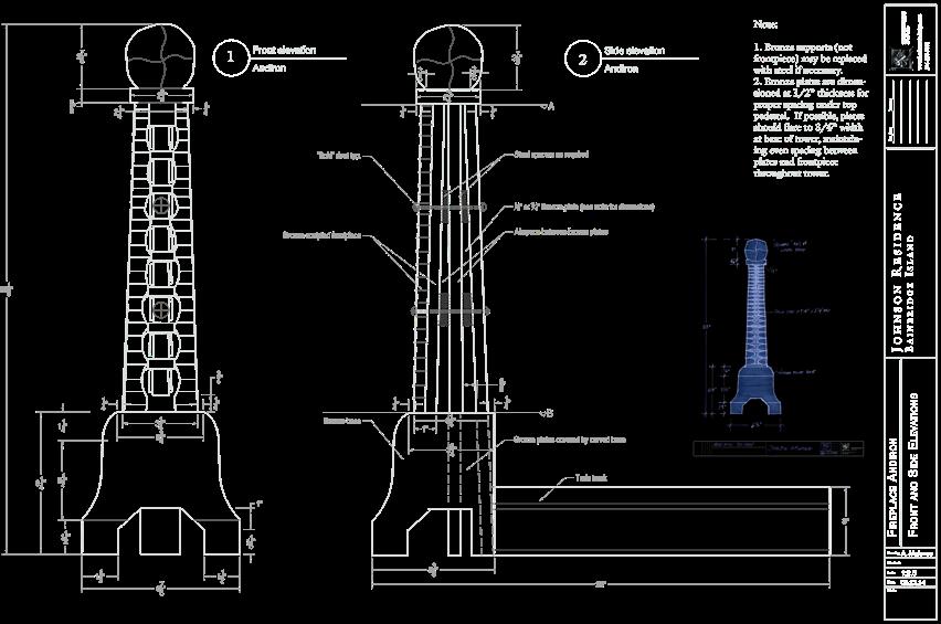
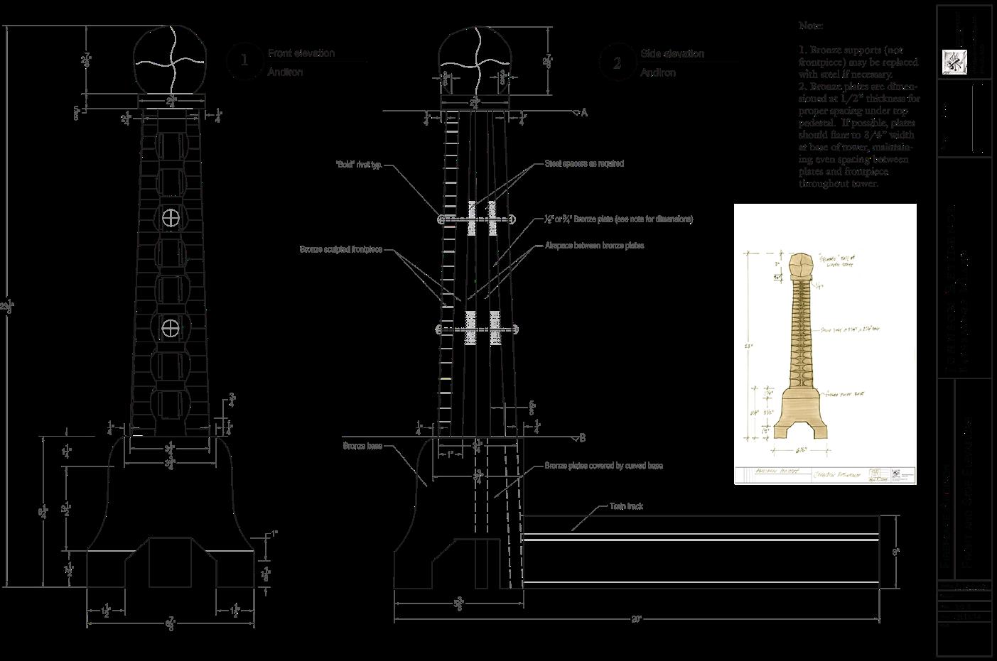
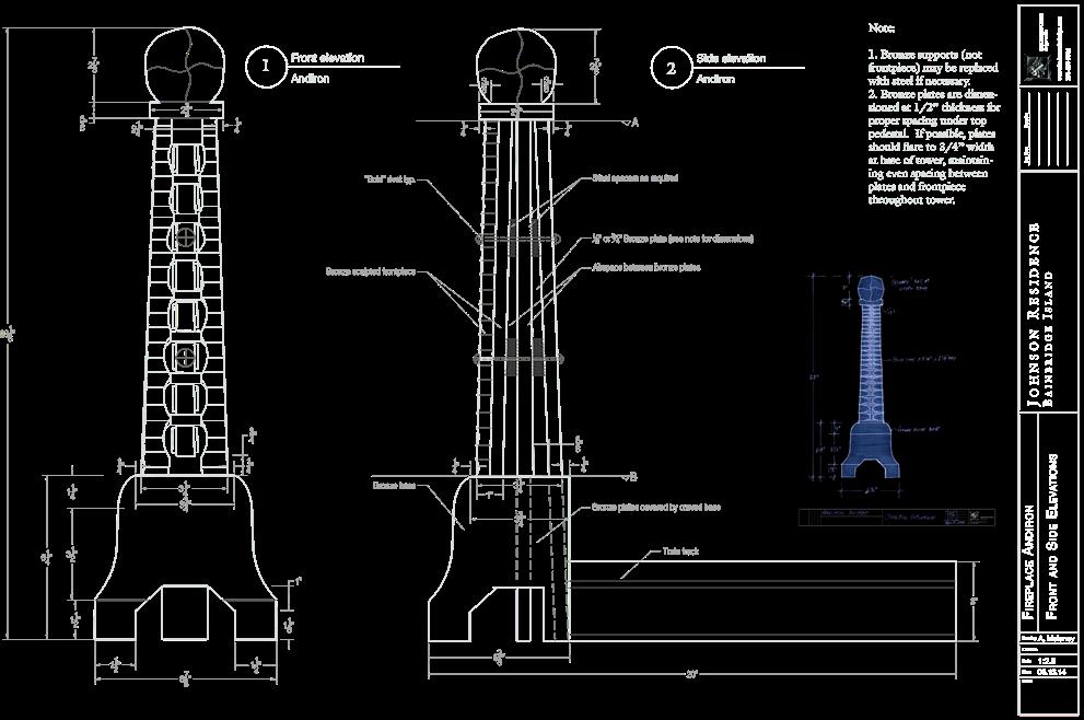
A pair of bronze andirons for a private client was created using drawings I drafted.
The subslab on the upper terrace, between the house and first course of stairs, was completely regraded and a new drainage system was established.
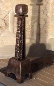
Creative work, hand drawings, photo, supervision by Richard Rhodes. Metalwork by Steve Lopes.Copyright Rhodesworks Design Studio
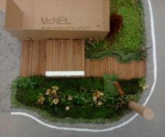
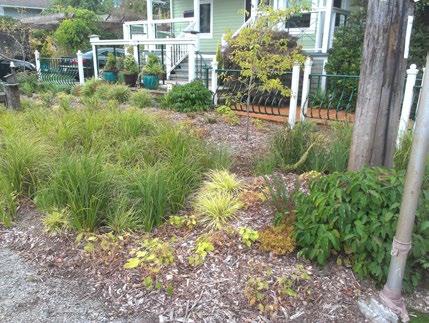
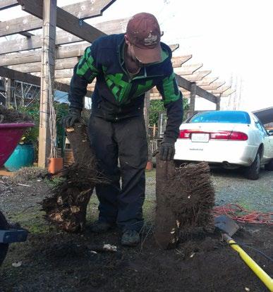
We selected a limited palette of all-native plants for use at all four properties. Plant suitability was determined by rain garden zone hardiness, ornamental qualities, property owner preference, etc.
Early planting plan showing naturalized grouping of plants.
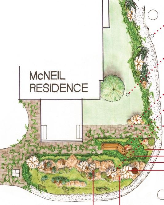
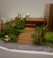
Rain gardens were constructed for all four property owners at an intersection one block from the Duwamish River.
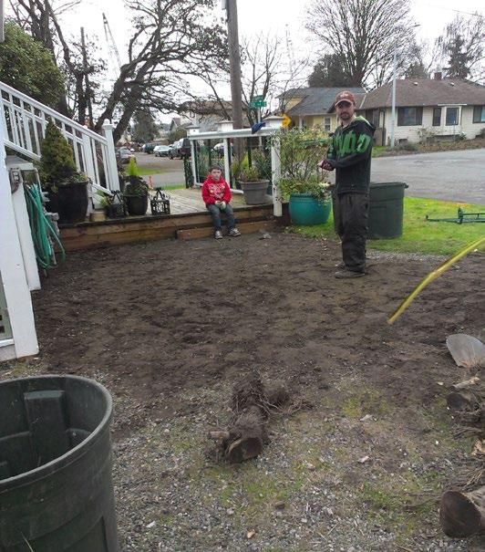
Awarded a Top 3 Finalist place for Transforming Spaces in the 2013 Sustainable Seattle Leadership Awards, this design/build project was one of the first completed raingardens in the neighborhood and has been followed

by many others. Our portion of the project - neighborhood meetings, design concept, material specification, working drawings, garden excavation, and complete installation of a deck, was conducted over 9 weeks.

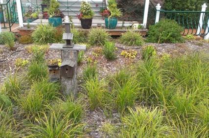
• Plants: Selecting for roots tolerant of moist conditions has resulted in wellestablished plants.
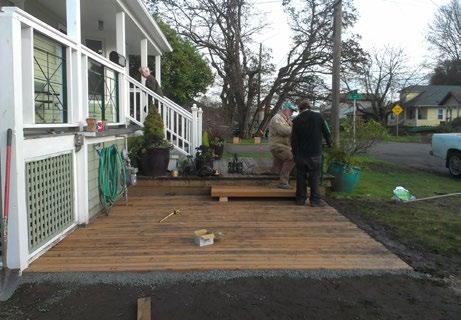
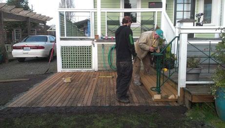
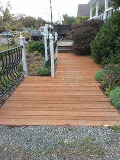
• Second deck/walkway: I proposed in the final working drawings that this be constructed in alternating offset sections. The deck has since been completed as shown.
The rain garden project was to increase the sociability and enjoyability of residents' yards in addition to functioning ecologically. In keeping with that principle, we constructed a ground-level deck for this house's elderly resident.
• Community art: We provided salvaged untreated logs and proposed using them as wildlife attractors and as standing sculptural elements reminiscent of nearby abandoned pier supports. The logs have been incorporated, with birdhouses, into all four gardens.
temporary art installation public space activation place identity pedestrian engagement waterfront
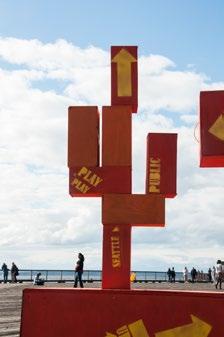
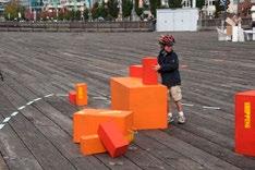
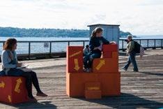
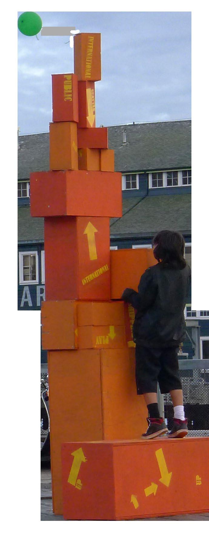
Context: Pier 62/63 on the Seattle waterfront is generally a wide-open, unprogrammed space that goes underutilized by the pedestrians walking along the top of the seawall. Goal: Create a one-day art installation to change passerby perception of the pier’s potential. Activate the pier with compelling projects that would draw people through the whole space and briefly change circulation patterns along the waterfront.
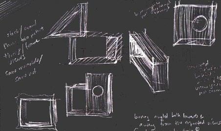
During the initial concept stage, I proposed that we build a series of lightweight, stackable frames for positioning at the edge of the pier. The movable frames would invite play and interaction and the framing device would take advantage of the
The “shipping crates” were in nearly constant use over the day as photo ops, seating, toys, and pedestals by children, adults, and dogs.
spectacular setting and encourage a new way of looking at the surroundings. Through group process, the connection to the industrial waterfront was eventually made through imitating the form of the shipping containers in the distance, but the playful, stackable element remained.
project
summary
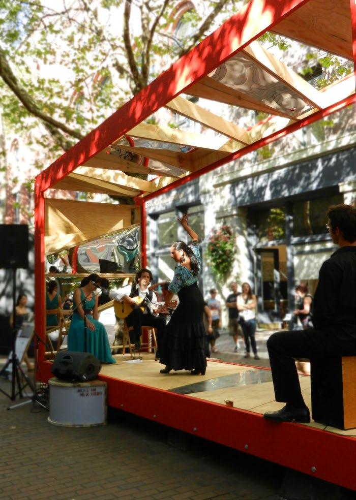
Context: The stage was installed in Occidental Square for one weekend during the 2014 Seattle Design Festival: Design in Motion. It hosted flamenco performances and other musical acts. The stage was also selected for use at the 2014 AIA Honor Awards. Goals: The stage needed to be resuable, freestanding, and interactive for the public. It had to hold a band and accentuate the acoustics of the performance, as well as be easy to disassemble without leaving any mark.
design
A modular system based on the traditional form of a flamenco drum was used to create an acoustic base for the stage and form the panels of the side and top of the stage. I advocated for the asymetry of the design, assisted in drafting dimensions and layout of the modular panels, and contributed to construction and materials/color decisions.
How do headway changes impact ridership?
Which demographics are more sensitive to frequency increases?
Is a decrease or increase in headway followed by a corresponding decrease or increase in ridership and if so, which demographics have greater or less response?
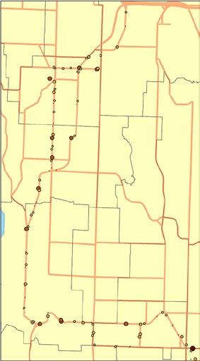
Bus routes with boarding data by bus stops were spatially joined with 2010 census tracts. Demographic characteristics of those tracts were equalized over the area of those tracts and a numerical subset of the population corresponding to an area within a quarter mile of stops along the routes was used as the base for comparing ridership increase with with neighborhood demographic characteristics.
Ridership along the 54 and 174 lines clearly increased with the rise in frequency, which went from 30 minute to 15 minute intervals. However, correlation with income demographics (and others) was inconclusive, largely due to limited data availability and shortness of time frame analyzed.
Part
Schools
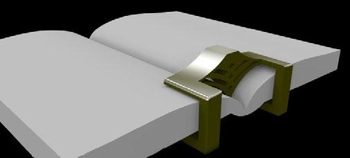
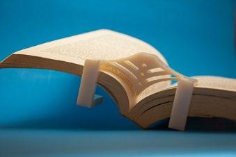
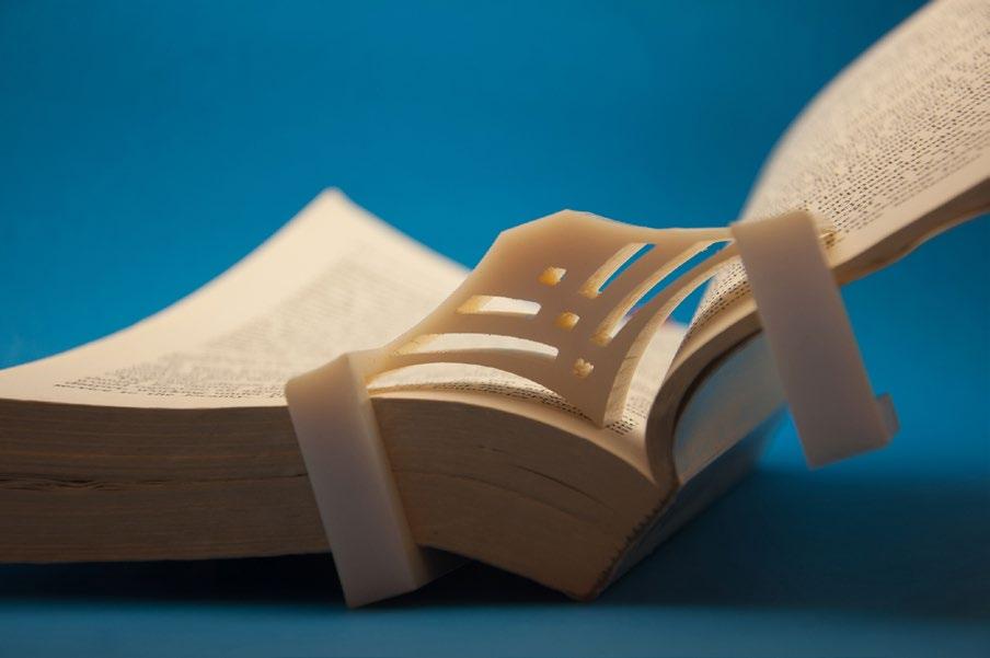
Materials: ABS plastic
Tools: Rhino, Flamingo, 3D printer, 3D digitzer
Process: I scanned the physical form of a textbook into a Rhino model space using a digitzer. I then modeled the clip to fit the curves of the book, raising the underarches somewhat to allow for flexibility in book size. I reduced material needed for the clip by creating hollow curves that echoed the physical shape of the page.
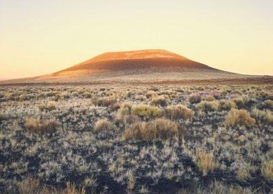
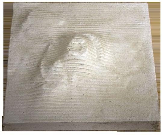
Materials: Plaster, styrofoam
Tools: Rhino, CNC router
Process: To create a model of artist James Turrell’s Roden Crater, I extracted topographic curves from a 2D map and created a surface model in Rhino. I then used the CNC router to create a mold from styrofoam. This mold was used to create the plaster model.
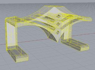
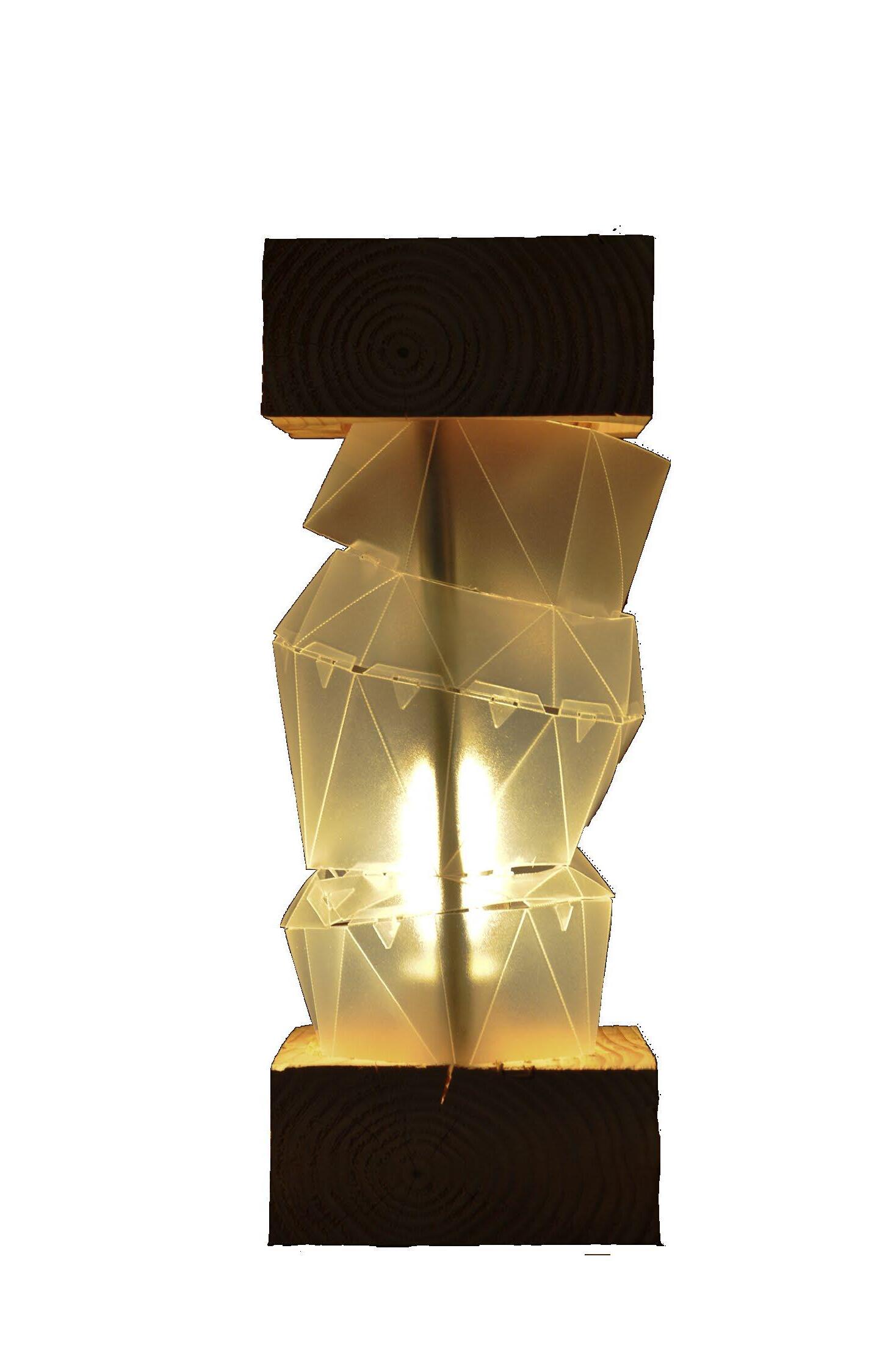
Materials: wood, steel, polyethelene.
Tools: Rhino, RhinoCAM, CNC Router, laser cutter, metal cutter.
Concept:
• Create a light object that would combine a smooth, evenly luminescent glow in the center with solid end caps that would appear to float/be supported by the delicate shade.
• Experiment with origamilike folds and an irregular geodesic-style shape.
• Start with the form of a broken geometric egg.
Process: Many iterations of simplifying and refining were required both during digital modeling and prototyping on the laser cutter.


Concept sketches
place observation sketching pen/pencil/watercolor
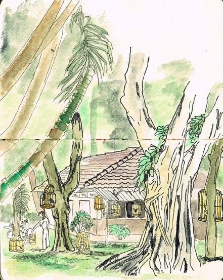
Birdcage Cafe, Ho Chi Minh City, Vietnam, 2009. Linework done on site. Pen and acrylic watercolor in moleskin notebook.
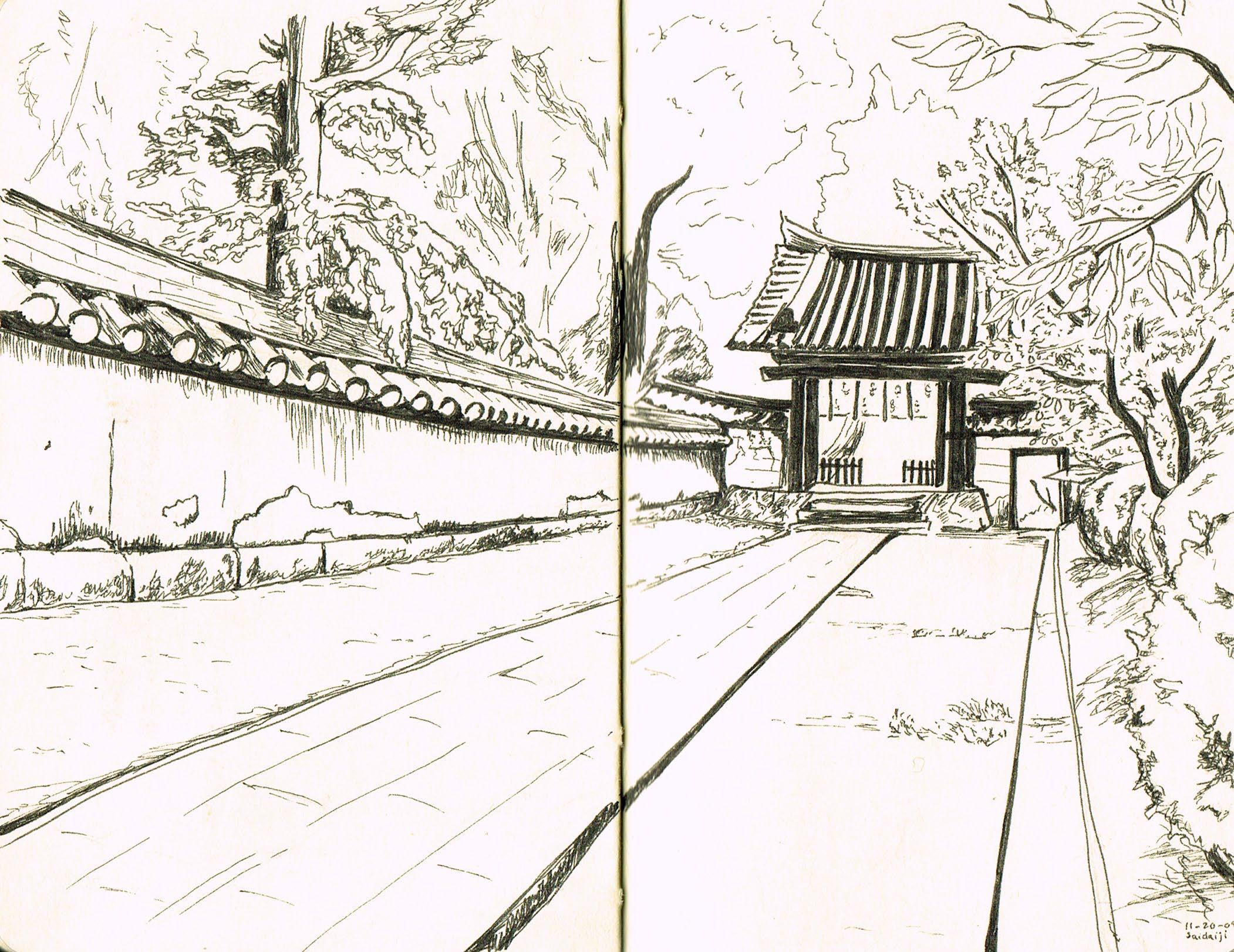
The Office Lady Really Wanted Me to Come Here, Saidaiji, Nara, Japan, 2010. Done on site. Illustration pen in moleskin notebook. Japan
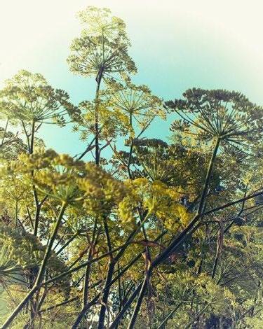
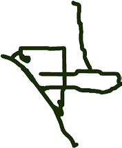
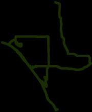
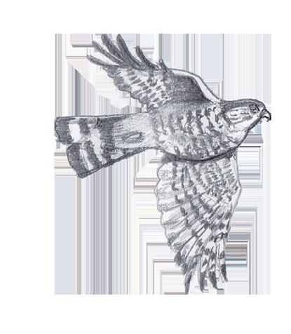
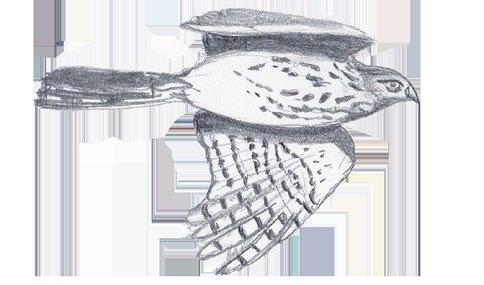
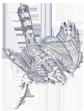
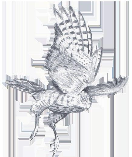
Sharp-shinned Hawk Flight Pattern through Sitka Spruce Forest, Seattle, 2011.
Done as part of a poster for an ecological design class.
information design visual design principles
Photoshop/Illustrator/InDesign
M L A
Master of Landscape Architecture
Join us for a Graduation Celebration!
Pre-dinner snacks provided. Please bring a bottle of wine to share!
RSVP: uwmla2013@hotmail.com
I designed and circulated this invitation for a group of graduate students having a graduation celebration with friends, professors, and family. graduation invite
Special requests
Individual
Class of June 13 2013 • Thursday • 6-8pm 10 Degrees Performance Art Space 14th and Union • Capitol Hill Washington of University
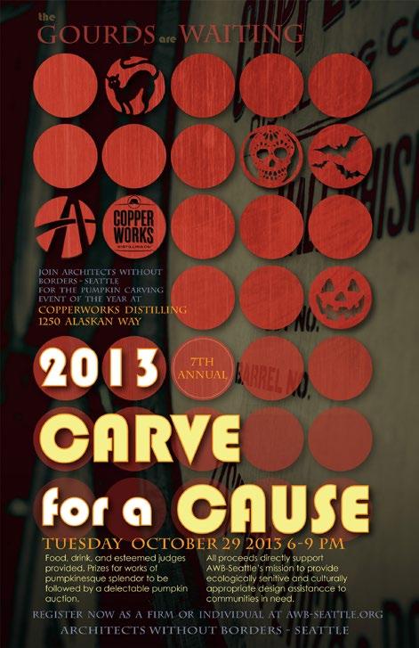
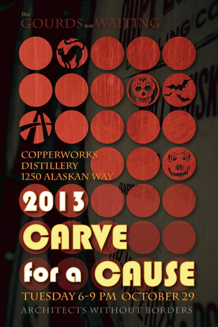
Designed for a fundraising event at a new distillery facility on the Seattle waterfront. I met with both AWB and distillery personnel to coordinate and create a design that would appeal to both entities.
Architects Without Borders