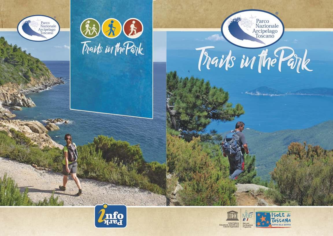
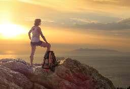
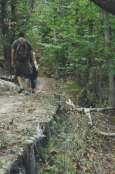
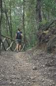
trails in the Park – a brief guide to the hiking trails of the Island of Elba published by the Arcipelago Toscano National Park
Editorial coordination:
Giacomo Montauti, Giuliana Gillone, Giovanna Amorosi
Texts:
Giacomo Montauti, Giuliana Gillone
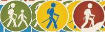
easy trail
family-friendly trail challenging trail travel time between two points
00 min.
outward trip
round trip
00 min. A/R
Photos:
Antonello Marchese, Gipodesigner, Giuliana Gillone, Francesca Tribocco
Graphic design and layout: Gipodesigner.it
Printing: Fotolito Moggio s.r.l.
Trunk road
Main paved road
Secondary paved road Dirt road
Paths not managed by the Park
Park trail
Park trail on dirt road
Park path on paved road
Mountaineering trail (experienced hikers)
Great elban crossing (grande traversata elbana, gte)
Park border
Archaeological site Sanctuary, hermitage, mausoleum Ruins Museum M
Viewpoint Napoleonic museum N


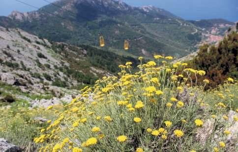
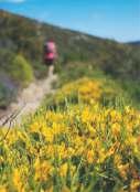
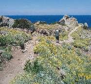
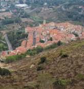
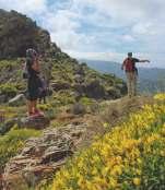
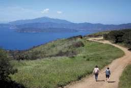
This small guide presents a selection of 16 routes among the many that are part of the rich network of trails on the Island of Elba. Its conformation enables you to enjoy extraordinary views of the coasts and hills, while its geographical position ensures a mild climate that enables you to hike almost all year round. The trails have been selected according to their degree of difficulty, incorporating types ranging from the simplest and most familyfriendly to those suitable for more experienced and trained hikers. The description, in addition to the views and various natural environments, illustrates historical and architectural features with references to local peculiarities. The best seasons to fully enjoy nature are spring, due to the presence of lush blooms, and autumn for the passage of migratory birds moving south across the Mediterranean. The incredible variety of tracks contained in a small area like this one allows for the satisfaction of the
needs of all those who love mountain biking, from families with children to professional athletes
The itineraries are divided as follows:
! 5 routes suitable for families: routes characterised by a wide and well levelled walking surface or an uphill difference in height of less than 200 m, average walking time of less than 2 hours;
! 7 easy routes: routes characterised by not always wide and well levelled walking surface or uphill difference in height from 200 to 500 m, average travel time between 2 and 3 hours and 30 minutes;
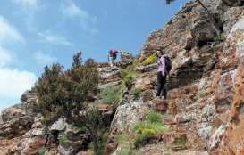
! 4 challenging routes: routes suitable for hikers accustomed to walking or characterised by the presence of more difficult passages, rough walking surface or uphill difference in height between 450 and 800 m.
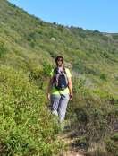
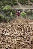
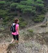
Clothing must be suitable for the season, comfortable and durable, with not too bright colors in order to blend into the environment and not disturb the fauna, so you can more easily make sightings. Shoes suitable for hiking are recommended, such as high ankle hiking boots, a backpack to carry everything needed for the hike and an adequate reserve of water, especially in the warmer season. If you want to better observe the area and the fauna that populates it, it is recommended to bring binoculars, which are ideal for birdwatching. To remember the encounters made with animals and plants, it is useful to take photos and write down observations in the notebook.
During the visit, you are encouraged to follow principles of good behaviour and common sense in order to experience the Park by silently listening to the wind and the sounds of nature and following its rhythms, discovering it with the help of the Park Guides, who will make the experience unique. In order to enjoy nature, you are required to follow these simple rules:
● take your rubbish home;
● respect flowers and plants by not picking them;
● when you spot animals, keep your distance: you risk frightening them;
● do not collect minerals and fossils, they are our history;
● don't light fires. If you see one, report it to the competent authorities;
● don't camp, you risk damaging fragile

balances;
● pick mushrooms by following the instructions provided by law.
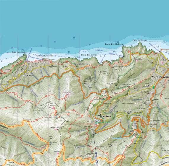
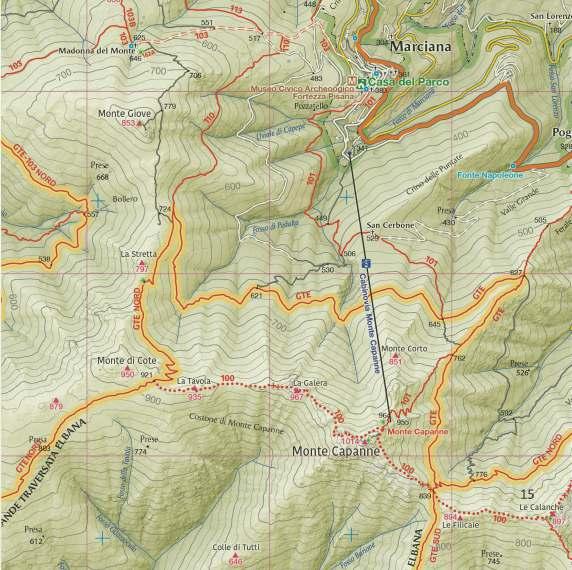
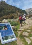
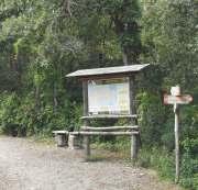
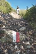
The National Park manages a very extensive trail network. On the map of the Park, which can be purchased at the information points, the trails managed by the Authority are highlighted in red. The numbering of the trails gives an indication of the area where they are located: sector 100 in the western part of Elba, sector 200 in the central and eastern parts. There are also other trails in the area that are not managed by the Park, which are marked on the official map.
The Great Elban Crossing (Grande Traversata
Elbana, GTE) is the backbone of the island's hiking network. It is a long-distance ridge trail that connects most of the trails in the area. The route starts from Cavo and crosses the island from east to west, splitting into two stretches near Mount Capanne: GTE north, which ends in Patresi, for a total of 56 km, and GTE south, which ends in Pomonte, for a total of 46 km. In order to appreciate this challenging itinerary, it is advisable to divide it into 4 stages to be covered in 4 days with detours to Porto Azzurro, Procchio and Poggio, where you can spend the night. On top of that, you have to add about 8 km due to the connections with the towns.
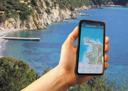
Those who have a minimum knowledge of smartphone apps can use the maps of the Tuscan Archipelago's trails for free. Thanks to georeferencing, you can see exactly where you are on the trail network. Indeed, the Park Authority constantly updates the trails and makes them available to hikers on the Avenza Maps platform, which can be downloaded and is compatible with the various operating systems
To download the maps of the Island of Elba, once the application is open, you must go to the store and select the official "4land Isola d'Elba" map. At this point, it will be possible, wherever you are, including areas not covered by the 4G network, to view your position precisely, using offline mode, and
then orient yourself with great ease. The application has several functions: tracking, navigation and the collection of technical data, which can then be shared with friends.

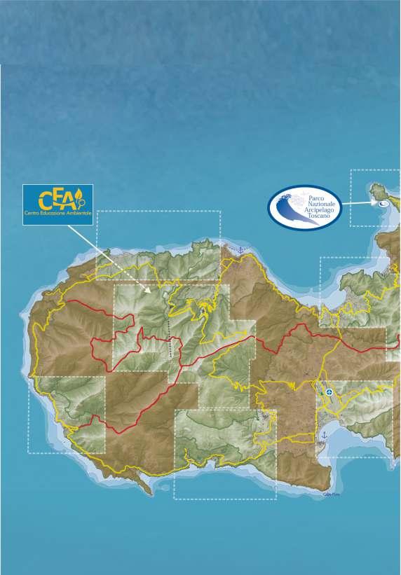
The MAB Unesco Isole di Toscana Reserve, managed by the Park Authority, comprises not only the land already included in the protected area, but also the other islets and the stretch of sea between the Tuscan coast and Corsica. These lands have been inhabited by man since prehistoric times; indeed, in the
Tuscan islands, there are about 30 prehistoric sites, numerous Etruscan sites linked to mining activities and some remains of Roman maritime villas. Over the centuries, man has integrated with nature, thereby shaping it and exploiting its resources. Thanks to its exceptional geodiversity and extraordinary biodiversity, the Archipelago is home to rare endemic plant and animal species, as well as a rich benthic and fish population.
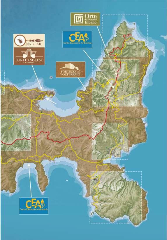
Marciana and Rio nell'Elba have seen the establishment of the first visitor centres in the Park, the aim of which is to represent the environmental and cultural values of the Protected Area. Here, visitors can get to know the protected area also thanks to the presence of specialised Park Guides. The
Lacona Environmental Education Centre, located near the last dune system of the Tuscan Archipelago, has also been active since 2018. NatLab, a small naturalistic museum with a valuable collection of insects, was also set up in the English Fort of Portoferraio in 2019 to illustrate the great biodiversity present in the Archipelago. All the centres are open from April to October and, upon reservation, it is possible to take part in the workshops and excursions offered by the Park Guides (some activities are available for a fee).
Nelle vicinanze di Rio nell'Elba si trova un piccolo orto botanico situato nei pressi dell'Eremo di Santa Caterina. Vi si accede dalla strada per Nisporto e Nisportino; dopo
In the vicinity of Rio nell'Elba, there is a small botanical garden, located near the Hermitage of Santa Caterina. It can be accessed from the road to Nisporto and Nisportino; After leaving the car in a small clearing with a notice board of the Park, you take a short unpaved pedestrian walkway, shaded by a row of cypress trees. Once inside, you are greeted by a pergola vineyard that leads into a maze of walls and walkways that delimit eleven thematic sections. Some of these reproduce the different natural environments of the Archipelago and the plants that characterise them, also showing

rare endemisms. In one area, the magic of the ancient Elban gardens is recreated, whereas in another, an orchard containing precious ancient autochthonous species, identified through a long research started in 2000, has been planted. The garden can be visited from April to November. Admission is subject to payment of a fee.
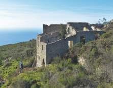
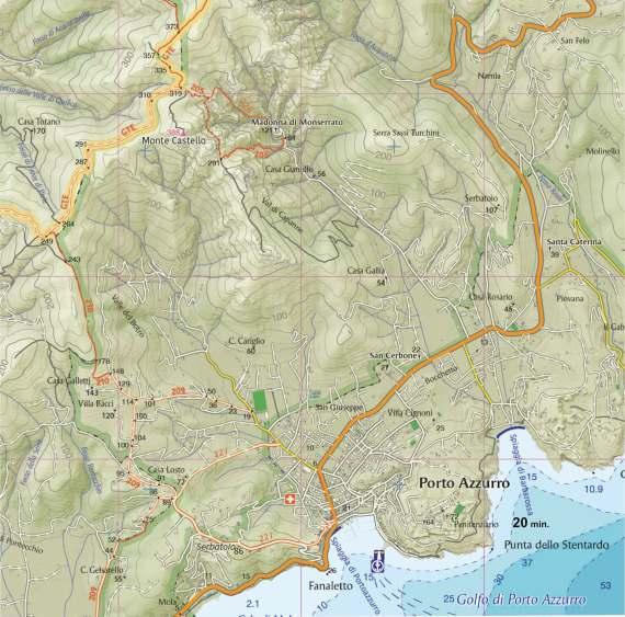
The trail that goes up to the fortress starts from Provincial Road no. 32, called "del Volterraio", which connects Rio nell'Elba to
Provincial Road no. 28 in the direction of Bagnaia or, for those coming from Portoferraio, from the road that connects Ottone with Volterraio. It is a fairly steep and challenging trail, suitable for trained hikers which starts near a dirt clearing identifiable on the left, for those going up, thanks to two military ruins; for those coming from Rio nell'Elba, the entrance is on the right. Upon payment of a fee, it is possible to visit the fortress in the presence of a Park Guide. There are two ways of visiting the fortress: on fixed days (ask Info Park), you can arrive at the entrance of the building on your own and join small groups that, at regular intervals, are accompanied by a guide who is already on site; alternatively, you can take advantage of the complete service offered by
the park, with dedicated buses from Portoferraio or Rio nell'Elba, and enjoy the guided tour as soon as you get to the fortress.
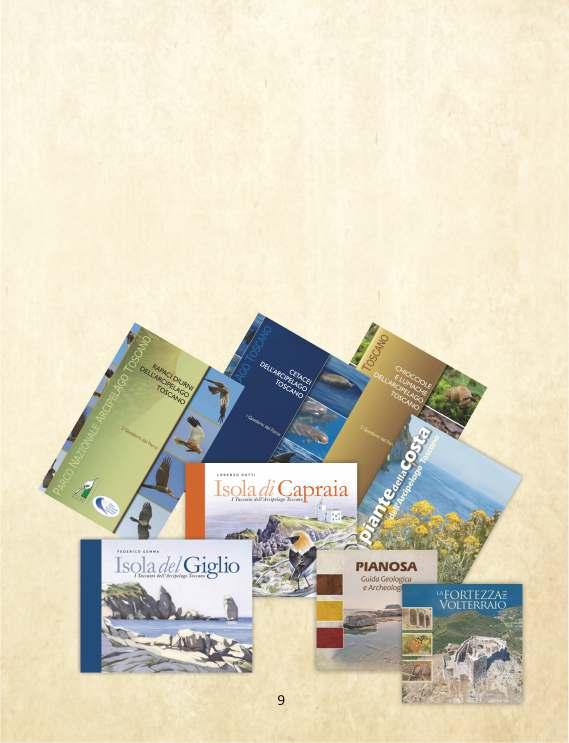
The Arcipelago Toscano National Park, in addition to this guide, has produced many other publications useful to deepen knowledge about the islands of the Archipelago. Nature lovers can buy them in the Park's points of sale: the Environmental Education Centres of Marciana, Lacona and Rio nell'Elba, the Info Park in Portoferraio and Pianosa and also the English Fort in Portoferraio, as well as in specialised bookshops.
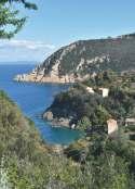
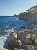
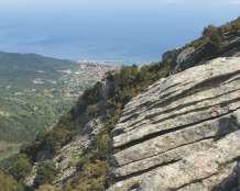
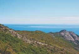
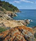
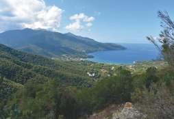
In Marciana Marina, near the Fenicia beach (a toponym derived from the Elban word "feno", i.e. hay), take trail no. 150, which follows the north-western coastal section of the island. The trail, which is cool and shady, enters a thick Mediterranean scrub. It is hard to believe that these slopes, like others on the island, were, until a few decades ago, entirely covered with terraces and vineyards arranged in geometric rows called "ordini" and "centi". The spontaneous vegetation quickly regained the spaces that man had deprived it of for centuries by building an imposing collective work of art made up of tens of kilometres of dry-stone walls. This way, even the steepest slopes had been made cultivable. Along the way, you can listen to the blackbird's chirping and the chatter of the blackcap, recognisable also by the unmistakable black top of the head. If you walk in silence, you can spot some mouflons. On the dry-stone walls, it is easy to observe reptiles such as the harmless green whip snake, the leaping wall lizard and the emerald green lizard. The cooler and shady areas are covered with mosses and lichens, flanked by the false maidenhair, a small and elegant fern, while the sunny places are populated by a specialised flora of small plants with fleshy

leaves such as Venus' navel. Trail no. 150, after an initial short uphill stretch, joins a paved road. After about 500 metres, you reach the junction with short path no. 150A, which leads to a vantage point. From here, you overlook the coast near Punta della Madonna and Punta del Nasuto, an important nesting site for the rare Corsican Seagull, the symbol of the Park. In this place, the Park Authority has intervened with important nature conservation initiatives. Once past the junction with trail 150F, you reach trail 150B, which descends to the peculiar Ripa Barata beach; in the local language, "barata" means "steep" or "collapsed", formed by rounded stones. After a short while, the road ends, and the trail creeps between a few rural houses, reachable only on foot, used in the past for agricultural activities. Shortly after, you reach La Cala, which takes its name from an inlet with a wild pebble beach. The track then climbs up the slope as far as Maciarello, where it joins a short stretch of paved road, and then reaches the pretty little beach of Cotoncello. The trail finally goes over the cliff and ends at the beach of Sant'Andrea. Path no. 150 continues to Patresi Mortaio
Place of departure and arrival: Marciana Marina
Length (round trip): 12 km
Average travel time (round trip): 5 ore
Total height difference uphill: 633 m panorama levelness shade
 north-western coastal area
1
3 oreA/R
2 oreA/R
150F
north-western coastal area
1
3 oreA/R
2 oreA/R
150F
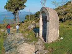
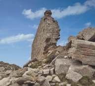
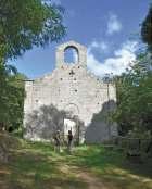
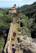
This suggestive route, which consists in a round trip on trail no. 103, starts in Marciana, near the Casa del Parco. As soon as you take the uphill road, you realise that you are walking along an ancient granite pavement, and in a few minutes you reach the first of the 14 chapels of a Via Crucis, where you find the junction with trail no. 157 to Marciana Marina. Path no. 113 to La Zanca and path no. 110 to Mount Capanne branch off from the trail, which follows the northern flank of Mount Giove. The low vegetation enables the eye to notice, almost at the end of the climb, observing the ridge in front of it, a majestic rocky eagle perched on a boulder that stands out threateningly against the sky. On the Mount Capanne massif, in several cases, the rock shaped by millenary erosion takes on bizarre shapes that have inspired, since the eighteenth century, evocative toponyms such as "The Eagle" or "Rock Man". Once back on the road, the slope becomes steeper and, upon reaching the Sanctuary of the Madonna del Monte, there are four majestic chestnut trees that in September 1814 welcomed Countess Maria
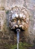
Walewska, who came to Elba to visit her lover, Napoleon Bonaparte, in exile. This sanctuary, named after Our Lady of the Assumption, is the oldest on the island, dating back to the 12th century. Legend has it that the church was built following the miraculous discovery of a boulder on which the image of the Virgin was painted. In this place, it is possible to drink the water that flows from one of the three masks of the wonderful granite exedra fountain, called Teatro della Fonte and built in 1698. Follow the trail up to trail no. 103B to L'Aquila, not far away. Here, by climbing on large granite boulders, you can admire the marvellous panorama. Go back in your footsteps and take the main trail, which is flat up to Serraventosa, where you can also enjoy the view of the eastern side of Mount Capanne. Here you can find some of the main species of Mediterranean scrub, such as the Scotch broom, strawberry tree, helichrysum, genista desoleana, Gallipoli rose, Montpellier cistus and hoary rock-rose. To return to Marciana, follow the same route as on the outward journey.
Place of departure and arrival: Marciana
Length (round trip): 5,2 km
Average travel time (round trip): 3 ore
Total height difference uphill: 322 m panorama levelness shade
Madonna del Monte area
2
2 oreA/R
40 min.A/R
del Monte Madonna
20min.A/R
Via Crucis M
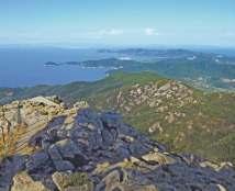
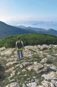
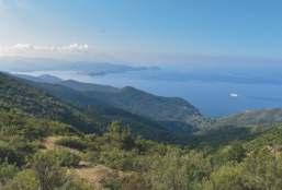
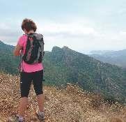
This selection of the most evocative hiking trails on the Island of Elba could not do without the ascent to Mount Capanne, the roof of the Tuscan Archipelago. The trail starts in Marciana, at an altitude of 375 m, and, after reaching the summit (1,019 m), returns to the starting point using a partially different route. Take challenging path no. 101 at the gate of Sant'Agabito. The trail immediately enters a chestnut grove. The fruits of this forest have fed entire generations of local inhabitants. At the end of the climb, you reach the Hermitage of San Cerbone, visible only from the outside and built in 575 A.D. in honour of the Saint who, according to tradition, lived in a nearby cave. The slope is still not too steep. The steepest part of the route begins just before crossing GTE north, and only trained hikers can climb from here to the summit. The trail, after crossing GTE north a second time, joins it for a few metres and then continues uphill, leaving GTE north on the left. Once you reach the summit, the effort is greatly rewarded by the panorama, which embraces Corsica, the archipelago and the Tuscan coast. This
is the ideal place to observe a particular geological structure as a whole: granodiorite plutons. This is magma which, instead of flowing out in a fluid state as it does from a volcano, has solidified inside the earth's crust and then emerged into the open following complex tectonic phenomena. This is how the Mount Capanne massif was formed; on its sides, at lower altitudes, it is possible to observe the so called "recessing rocks" that covered it. For the return trip, you can use the cableway, or go back from trail 101 to the 645-metre fork, where you take GTE north to the left. The trail, now flat, has a peculiar floor made of large granite slabs. Near the junction with trail no. 110, which leads downhill, there are numerous specimens of strawberry tree, locally known as "èrbitro". In autumn, this small tree, which is typical of the Mediterranean maquis, grows red and yellow berries accompanied by clusters of white flowers in the shape of small wineskins. Once on trail no. 103, you can quickly return to Marciana, where you can visit the Casa del Parco.
Place of departure and arrival: Marciana
Length: 8,3 km
Average travel time: 5 ore e 40 min.
Total height difference uphill: 785 m panorama levelness shade
30 min.
1 ora e 30 min.
106
50 min.A/R
1 ora e 40 min.A/R
106
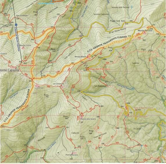
The is dedicated to Ornella Butterfly Sanctuary
Casnati, a passionate naturalist from Elba who died a few years ago. It is located on Mount Perone, the innermost area of the Mount Capanne massif, which can be reached by car by taking Provincial Road no. 37. If you come from the east, specifically from Marina di Campo, you have to pass through Sant'Ilario (12 km); if you come from the north, you have to depart from Poggio and drive 4 km. The trail starts from the picnic area and winds along the stretch of the GTE near Mount Maolo, from which trail no. 107 to San Piero, which is another area of interest in terms of butterflies, branches off. The Park's contribution enables the monitoring of lepidoptera, trying to favour in particular the development of plants of the genus Aristolochia, on which the caterpillar of a rare butterfly species called southern festoon feeds. The trail continues on the northern slopes of the Calanche, where it twice crosses trail no. 100, which is for experienced equipped hikers. Just before the last junction, upon arriving on the north-eastern flank of the summit of Mount Capanne, the GTE splits into two branches (north and south). There are essentially three environments in the Butterfly Sanctuary. The first part of the trail passes through a pine forest. Here, despite being in an
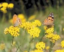
artificially planted wood, many species of butterflies find a cool, bright environment full of flowers where, especially in the summer months, they can shelter and feed away from the heat. In this place, there are three species that are practically absent on the smaller Italian islands: southern festoon, southern small white gatekeeper and . At the end of the climb in the pinewood, just after the fork with path no. 107, the road becomes narrower before reaching the socalled "ridge meadows", where the wood and the scrub are replaced by clearings and outcrops of rock covered with herbaceous plants, brooms and a kind of helichrysum locally known as "giuderba". Most of the endemic species feed on the nectar of these plants. Thanks to this particular environmental mosaic, the butterflies found in the Sanctuary are able to reach a very high density. After a short stretch at a high altitude, the trail enters a wood of Mediterranean maquis. In this latter environment is possible to see the famous foxy emperor, thanks to the strawberry tree, very common here. However, you can also find species such as the purple hairstreak. Once you reach the fork in the GTE, you can retrace your steps to reach the starting point.
Place of departure and arrival: Monte Perone
Length (round trip): 5 km
Average travel time (round trip): 2 ore e 20 min.
Total height difference uphill: 279 m panorama levelness shade
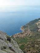
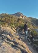
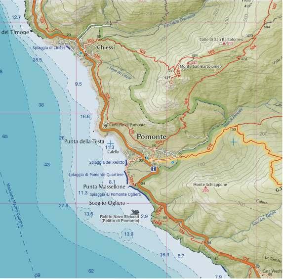
By following Provincial Road no. 25, which runs around the Mount Capanne massif, you reach the hamlet of Pomonte. Trail no. 104 starts from the ring road of the village. The trail quickly leaves the town centre and climbs up to an area with an ancient agricultural tradition. The southern flanks of Mount San Bartolomeo, which dominates the landscape with its monolithic presence, have always been terraced in order to reclaim land to cultivate from the granite mountain. Vegetable gardens and orchards were closer to the village, whereas the terraces housed the vineyards. The trail goes up and enables you to observe the entire Pomonte valley, which is like a large amphitheatre facing the sea, for the most part still covered by vegetable gardens and vineyards. In the highest area, the cultivations have been abandoned and the Mediterranean scrub has reclaimed what had been taken away from it. Around the trail, the flora mainly consists of shrubby vegetation comprised of cistuses, heather and broom. Near some rare springs and small watercourses, almost dry in summer, one can find rushes, eagle ferns and nepitella, which love fresher and wetter soils. The dry-stone walls facing south are the preferred habitat for lizards basking in the
sun, but they can also host the long green whip snake and, near the wettest places, even vipers. The kestrel and buzzard fly overhead, scanning the ground in search of reptiles and rodents, ready to swoop down on their preys. The climb continues up to an altitude of 473 metres, where the junction with trail no. 103 is located, which turns left and leads to Chiessi; the landscape over the Pomonte valley is worth the hard climb. On the way to Chiessi, after descending a little and seeing the pretty hamlet on the western side characterised by the white houses overlooking the sea, there is a detour (trail no. 103A) to the plateau close to Mount San Bartolomeo, which houses the ruins of the Romanesque church of the same name. From up here you can enjoy the view of the two valleys. To go back to Chiessi, retrace your steps and start the descent. Here too the panorama bears the signs of the old abandoned crops, and the dry stone walls are covered with lush vegetation. The point where the trail that leads back to Pomonte (no. 126) begins is near the small square of Chiessi, on the way to the upper part of the town where the Cotoni ditch (a toponym deriving from the Elban word "cote" , meaning boulder) is situated.
Place of departure and arrival:
Pomonte
Length: 7 km
Average travel time (round trip): 2 ore e 30 min.
Total height difference uphill: 548 m panorama levelness shade
30min.
20min.
15min.A/R
45min.
SUD Pomonte - Chiessi area 5

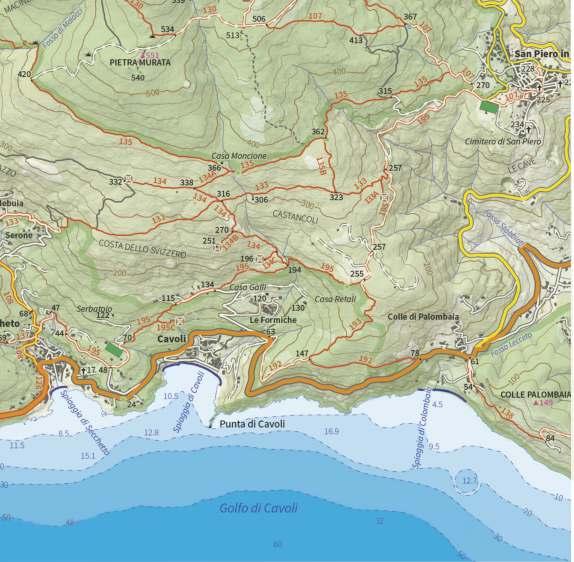
The trail, which is particularly interesting from a historical and archaeological point of view, winds its way along the south-eastern slopes of Mount Capanne. In this area, there are several ancient granite artefacts and prehistoric sites, which can be seen by following a complex network of trails. The journey back in time starts from San Piero, where the last stonemasons are still engaged in granite mining activities. From the large car park of the sports ground, take flat trail no. 195 on the left, which coincides, in the initial section, with the access road to the still active granite quarries visible below. After the last quarry, leave the road and take trail no. 133 on the right, which immediately takes a detour (no. 133A) leading to Sasso , where a panoramic prehistoric site is located. Take the main trail again as far as the junction with path no. 135B, which you take by turning right and heading north. In this area of low Mediterranean scrub, the most important species is the Montpellier cistus, with delicate white flowers and resinous leaves rich in essential oils. As soon as you start the ascent, you find yourself in front of four menhirs that give the name to the place called I Sassi Ritti . When you reach flat trail no. 135, turn left up to the
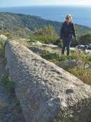
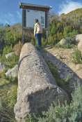
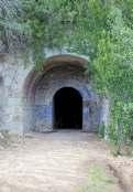
Mill of Moncione , the largest mill in Elba, in use until 1910. From here, you go down to trail no. 134A where, with a detour to the right, you can reach, in Lo Spino, a box tomb built with granite slabs that some believe dates back to 900 BC. Go back on your footsteps until you reach trail no. 133 on the left, where it is possible to observe, on the side of the track, the construction technique of a “domolito” , a small stone structure once used by shepherds. Go back downhill along trail no. 134. Along the path you can see a block of semi-finished granite . The trail continues downhill, where there is a peculiar shepherd shelter, and crosses two other detours: trail no. 134B to the "Cave Antiche" , where you can see the various phases of the extraction of granite, and trail no. 134C to the "Macina" . Once back on the main trail, you go down again until you cross trail no. 195, which you take to the right for a last detour to path no. 195C, where there is an imposing hewn column belonging to Opera della Primaziale Pisana, as can be seen from the inscription "OPE" on it. Finally, you go back uphill, never leaving trail no. 195 until you return to San Piero.
Place of departure and arrival: San Piero
Length (round trip): 9 km
Average travel time: 3 ore
Total height difference uphill: 346 m panorama levelness shade
The cultural-informa�on network of the Na�onal Park
Portoferraio info park - in front of the ferryboats. Tel. 0565 908231
CEA – home of the Marciana Park at the Pisan Fortress in the upper part of the town of Marciana Tel. 0565 901030
CEA – home of the Rio nell'Elba park at the old washhouse of the village, near the historical centre, in I Canali. Tel. 0565 943399
CEA – of the Lacona dunes along Provincial Road 30 near the beach of Lacona. Tel. 0565 908231
Portoferraio English Fort Via Giagnoni 5, Portoferraio (near the hospital, going up via San Rocco). Tel: 0565 908231
Orto dei Semplici Elbano
Municipal road between Rio nell'Elba and Nisporto, at the hermitage of Santa Caterina
GTE - Percorso della Grande Traversata Elbana / Route of the Great Elba Crossing
The beginning and the end of this trail are located on Provincial Road no 37 of Mount Perone and are 8 km from Marina di Campo. It starts from the Church of San Giovanni, the main of the sixteen Romanesque churches built on the Island of Elba between the 11th and 12th centuries. These buildings are typically simple and sober, characterised by a sail-shaped bell tower, a single body and the rest of the structure placed above the cruciform window on the front. Take flat trail no. 124, which enters a chestnut grove created by men of the past, now part of the natural landscape. This tree, which has been cultivated in the mountains of Elba since the 14th century, was used both for the production of fine wood and for the harvesting of fruit. Indeed, chestnuts, whether fresh, dried or ground into flour, have been for centuries the main source of sustenance for the inhabitants of the western side of Mount Capanne. Walking in silence at sunset, it is not rare to see mouflons or wild boars that, as soon as they notice the presence of hikers, flee into the bush. When you reach the junction with trail no. 107 that goes up from San Piero,
turn right. In spring, the white blooms of the tree heather and Montpellier cistus and the yellow blooms of Spanish broom abound. At the end of the ascent, at the 506-metre crossroads, take trail no. 111 on the right, which is a short forest trail characterised by a sandy floor, the result of the action of atmospheric agents on the surrounding granite rock. This is the realm of granite. The large round boulders that can be seen all around are the result of complex geological phenomena that have captivated scholars all over the world and generated extraordinary minerals preserved in the most prestigious museums. At the roadside, eagle ferns, which are typical of degraded environments, grow luxuriant in spring. In fact, man, through cultivation, pastoralism, fires and reforestation, has modified the original vegetation. What we see today, though apparently natural, is the result of those processes. In this area particular, thanks to the presence of flat land, sheep were grazed and wheat was cultivated. At the end of the trail, you walk downhill along a short stretch of paved road to return to the starting point.
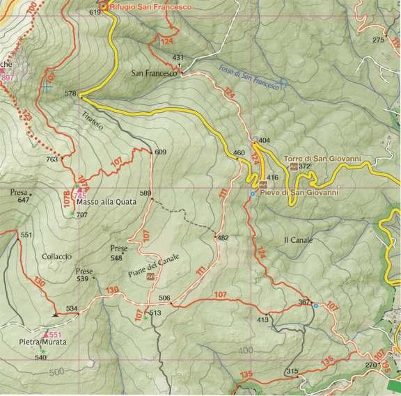
Place of departure and arrival: SP n. 37 del Monte Perone
Length (round trip): 3,2 km
Average travel time (round trip): 1 ora e 5 min.
Total height difference uphill: 174 m panorama levelness shade
20 min.
5 min.
20 min.
20 min.
San Giovanni area 7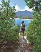
The trail, which is very short and easy, starts at La Foce, at the eastern end of the beach of Marina di Campo, where, after walking along a cliff for a few metres, you take trail no. 248, which leads through the houses. The trail, after a short stretch in Via Ischia, turns right. The characteristic of this route is the possibility to enjoy the open view over the whole wide gulf of Marina di Campo. Looking from the end of the beach to the south, you can see in sequence: the 16th century tower guarding the port, the bay of Galenzana, Mount Poro with the lighthouse, the island of Montecristo on the horizon and finally, near the coast, the small Scoglio della Triglia. If you look to the right, you can see the ancient villages of San Piero and Sant'Ilario overlooking the bay from above. This was the setting for an important page in Elba's history: at dawn on 17 June 1944, 220 ships and 12,000 men of the allied troops left Corsica to free the island of Elba from German occupation, landing on the beach of Fonza. On the way back, accompanied by the scent of the lush rosemary bushes, just before arriving at Casa Ischia, you

descend to a small pebble beach. Here the vegetation changes completely: it is the realm of rocky coast plants, which are true examples of adaptation due to their ability to capture and exploit nocturnal humidity and withstand high salinity, strong winds, drought and heat. These are small precious plants such as the fragrant sea fennel, with fleshy leaves and umbrella-like inflorescences, and the delicate Limonium, which develops in the rocky ravines with roots that run in search of something to grip, nourishment and moisture. On the bare rock, you can see the orange, green, brown and white concretions of lichens. Completing the picture of this environment, witness the naturalistically interesting bushes of the spiny rush, used in the past for weaving work. The trail will lead you back in your footsteps to the starting point. The more trained and equipped hikers can instead reach the beach of Fonza in about half an hour, facing a greater difference in height and the more insidious terrain. Trail no. 248 continues to the northern coast of the island.

Place of departure and arrival:
Loc. La Foce, Marina di Campo
Length (round trip): 2,7 km
Average travel time (round trip): 50 min.
Total height difference uphill: 53 m panorama levelness
shade
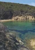
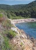
This itinerary allows you to combine a pleasant walk with the discovery of two pretty little uncrowded beaches: Porticciolo and Lamaia. At the eastern end of Procchio beach, take trail no. 245. The trail crosses some private properties, where the right of way is guaranteed. After a short while, the itinerary turns into a road, Via della Cicala. The trail follows the coast through a holm oak wood, which is a typical coppice forest, that is, a forest resulting from man's use of a cutting technique that takes advantage of the ability of some plants to grow back if cut. Indeed, it can be seen that from the base of the cut trunk, new close stems have developed which allow the forest to grow again despite its exploitation. On the trail there are also circular spaces where, until a few decades ago, charcoal kilns were built, which allowed, using an ancient technique, to transform wood into charcoal. At the end of the holm oak wood, the road, after crossing trail no. 245A, descends to the small beach of Porticciolo. If you are lucky, here you can observe the acrobatics of the European shag. This sea bird, quite widespread on the cliffs of Elba,
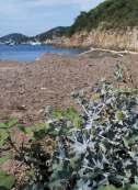
approaches the shore, where it can more easily catch small fish using its wings to swim. Following the trail along the coast, you can reach the larger beach of Lamaia in a few minutes. The impluvium that ends in the bay creates a small wetland with a lush reed thicket. In the immediate vicinity, there are plants typical of beaches such as the Italian eryngo, which forms low bushes with very leathery and thorny leaves, the clotbur, a remarkable species easily recognisable by its thorny and hooked oval fruit trees, and the European searocket, with small pink flowers. This last pioneer plant, which is able to live in the part of the beach closest to the sea, produces floating fruits which, enclosing seeds for a long time, are able to propagate by sea, at great distances. From here, those who do not like heights can retrace their steps. Otherwise, you continue following a rather steep and not too easy climb that ends on trail no. 245A. This trail, which can be driven on in the first section, then goes downhill through the vegetation, drawing a ring route with path no. 245, through which you can return to Procchio.
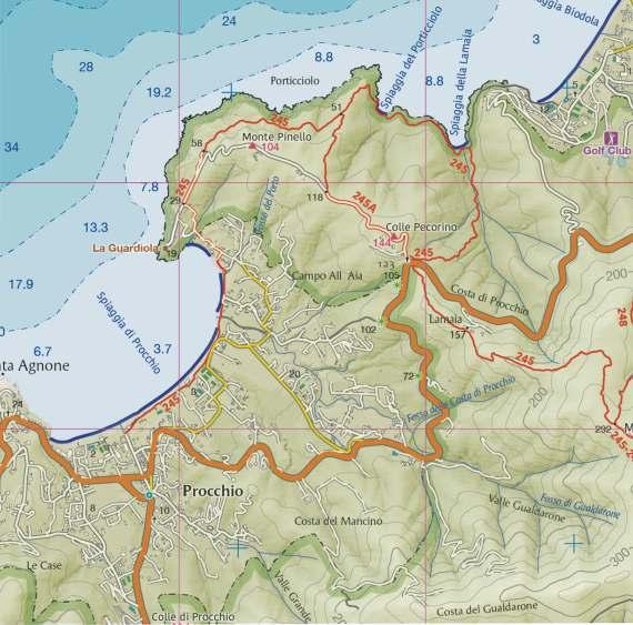
Place of departure and arrival: Procchio
Length (round trip): 5 km
Average travel time (round trip): 2 ore e 45 min.
Total height difference uphill: 237 m panorama levelness shade
1 ora e 30 min.A/R
15 min.
30 min.
30 min.
Procchio - La Biodola area 9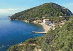
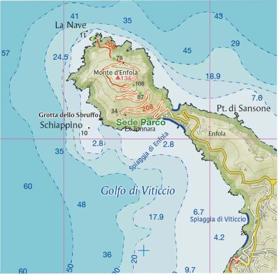
The Enfola peninsula is 6 km from Portoferraio; you can park your car in the square located on the isthmus that connects it to the rest of the island. The Enfola is one of the most characteristic promontories of Elba due to its high landscape value and its natural and historical richness. Here you will find the Tonnara building, a testimony to the ancient tradition of tuna fishing, which began on Elba in the 16th century at the behest of Grand Duke Ferdinando I dei Medici, and ended with the closing of the tuna canning factory in 1958. The square housed the sheds for the storage of the boats, and the current building, which houses the Park Authority, housed the fishing and tuna processing equipment. Once you leave the building to the left, you begin to climb up along an easy dirt road, at the edge of which you will find rosemary, mastic trees, myrtles, brooms, phillyrea, holm oaks, strawberry trees and heather. This is the realm of the Mediterranean maquis, with its scents and colours. The road goes up the hillside, offering surprising views of the Gulf of Viticcio, the Gulf of Procchio, Mount Grosso and the Piombino Canal. Going up, there are some ruins, the remains of what once was the imposing defensive system of the De Filippi coastal artillery, built by the Italian
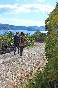
Royal Navy between 1920 and 1930. Near the top of the hill was the firing station that controlled large caliber cannons, while further down were the military quarters, the transformer room, the power station and the tanks. Once at the top of the promontory, a narrower trail than the previous one begins, which draws a circular loop around Mount Enfola and is recommended for its panoramic and environmental features. At the end of the road, once you have passed what used to be the artillery armory, the trail enters the scrub. Further on, after one of the shooting pitches, the vegetation becomes higher and you pass through a wood of pines, holm oaks, heather and strawberry trees. Here is the descent to the cape of Enfola, a more challenging trail that leads to the cliffs overlooking the sea and close to the Nave rock, at the end of which there is a panoramic clearing. Going along this trail you cross a low scrub of heather, juniper and dewflower, until you reach a garrigue of helichrysum, silver ragwort and sea medick, the preferred nesting place of a colony of seagulls. Going back, you enter again the ring that goes around the mountain and that, going uphill, ends on the same trail.
Place of departure and arrival: Loc. Enfola, Portoferraio
Length (round trip): 4,4 km
Average travel time (round trip): 2 ore
Total height difference uphill: 278 m panorama levelness shade
30 min.A/R
10 min.
60 min.A/R
20 min.
Area of the Enfola Peninsula 10
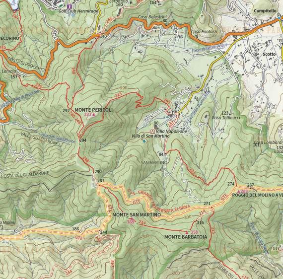
The ring-shaped trail, which begins and ends in San Martino, near Portoferraio, runs along the upper part of the green valley of the same name, an amphitheatre dominated by the San Martino, Barbatoia and Pericoli mountains. The walk starts from the car park of the Napoleonic Museum: leave the access road on the right and take trail no. 221. You will retrace the steps of Napoleon Bonaparte who, according to some historical reconstructions, walked the initial trail of this path to his summer residence. The paved road, referred to as "Strada maestra" in the Leopoldine cadastre of 1840, forks twice in a few hundred metres. In both cases, you go straight on, leaving the detours first on the left and then on the right. Immediately after the second fork, the trail leaves the historical road system, entering the vegetation with a steep climb on the left. The holm oak forest, now present only in limited areas, once covered the entire island, before man began to systematically cut woodland for fuel. The original holm oak forest, characterised by the presence of majestic trees, such as those you can see in the central part of the trail, used to create a dark environment
where few other species of woody plants grew, such as heather and strawberry tree, with specimens with long stems protruding in search of light. Trail no. 121, after the short initial ascent, has a flat central part and a short final ramp that leads to the crossroads with the GTE, which must be followed by turning right. The trail is once again wide and interesting from a historical point of view. Indeed, it is a military road built during the Second World War. Granite finishes such as the milestones, silent witnesses of some pages of local history related to the last world war, are worth noting. Continuing on the GTE, which remains flat, you cross a first junction with trail no. 214 until you reach the point where, along a wide bend to the left, you cross trail no. 214 again. Here, take trail no. 248 on the right, which runs parallel to a fire stop (a point where vegetation is cut to prevent the spread of fires). At the foot of Mount Pericoli, before taking trail no. 245 on the right, the panorama opens up westwards on the Gulf of Procchio. The trail, going downhill through the vegetation, takes you back to the starting point.
Place of departure and arrival: loc. San Martino, Portoferraio
Length: 6,3 km
Average travel time (round trip): 2 ore e 40 minuti
Total height difference uphill: 251 m panorama levelness shade
min.
min.
Cavo is a lovely seaside resort on the northeast coast of Elba. It can be reached from Rio Marina by the coastal road (Provincial Road n. 26) or from Rio nell'Elba, by the so-called Parata road (Provincial Road no. 33). The trail begins and ends at this small and pretty seaside resort. From the beach of Capo Castello, also known as Frugoso beach, when you reach a car park, follow the road of the same name on the left, taking trail no. 260. You walk immersed in the Mediterranean Bush, which is sometimes so luxuriant that it almost seems to form a tunnel. Here you will find an extraordinary flora composed of Mediterranean shrubs and trees. In spring, the trail is rendered colourful by the flowering of cysts and brooms; in early summer, myrtle blooms; in autumn and late winter, it is the turn of the blue blooms of rosemary. In the cooler areas, in the middle of winter, the laurustinus in the dense foliage produces small fruits with an unusual metallic dark blue colour. The road climbs gently with wide zigzags on the slopes of Mount Lentisco up to a holm oak forest, where the forest becomes thicker and the road becomes shadier. Near Capo Vita, i e. the northern end of the island, the trail overlooks the two sides of the promontory: to the west, in the
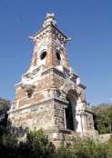
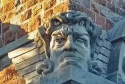
distance, there are the fortified walls of Portoferraio, and to the east are the islets of Topi and Palmaiola. The trail then reaches a crossroads near a rest area. Here, where trail no. 260 ends, you can take the GTE by going straight on or turning right. If you turn left, you soon reach a stone building with a peculiar shape: the Tonietti Mausoleum. Said building, which dates back to the early 1900s, was designed in neo-Gothic style by architect Adolfo Coppedè for the Tonietti family as a monumental family tomb. The lack of cemetery authorisation prevented it from being used according to the will of the clients and caused its abandonment. The square Mausoleum consists of an imposing tower that recalls the shape of a lighthouse. The structure is degraded, therefore it is absolutely not recommended to enter inside. From here, by returning to the main path and turning left, you can follow the GTE eastwards to quickly return to Cavo. At the end of the trail, there is another building constructed by the Tonietti family: Villa Bellariva, called Il Castello. The imposing building, with its eclectic style, was built at the end of the 19th century and was also a symbol of the power and economic strength of the family
12
Area ofthe Tonietti Mausoleum
Place of departure and arrival:
Cavo
Length: 5,2 km
Average travel time: 2 ore
Total height difference uphill: 139 m panorama levelnesse shade
1 ora e 20min.
25min.
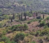
The short loop trail begins and ends at Aia di Cacio, in a panoramic spot 2 km from Rio nell'Elba. Trail no. 201 to the beach of Nisporto also starts from here and crosses the GTE. The itinerary, which follows circular trail no. 202 anticlockwise, is initially flat and parallel to the access road to the Orto dei Semplici, near the hermitage of Santa Caterina, which can be seen further down the valley. After a few minutes' walk, you can see, among the cypress trees, the bell tower of the little church of the same name. You walk on the south-eastern side of Mount Serra, where the low, sparse vegetation adapts to the rocky terrain. The eye can sweep over the wide valley that joins the town of Rio nell'Elba to that of Rio Marina; here, until the 19th century, there used to be a sign of the intense agricultural activity: 22 mills, now in ruins. In the summer season, among the few species in bloom, the daphne bushes stand out with their small white flowers; their presence indicates that the area was previously damaged by fire. The peculiar feature of this ichthyotoxic species, known in Elba as the "patello", comes from the fact that in the past it was used to fish eels in the ditches, hence the expression "appatellare l'acqua". Before the beginning of the ascent, Torre del Giove suddenly emerges. After a
short ridge, you reach the top of Mount Serra, one of the most panoramic points of the whole island: Looking southwards, you can see the Volterraio fortress; on the two sides, there are Mount Strega and Cima del Monte; in the background, behind Mount Calamita, there is the island of Montecristo; to the east, there is the island of Giglio, the Piombino Canal with the islets of Cerboli and Palmaiola and, in the foreground, Mount Grosso. If you look westwards in the distance, you can see Capraia and Corsica; closer, there is the roadstead of Portoferraio, the Enfola peninsula stretching out towards the sea and the Mount Capanne massif. This trail is interesting from a naturalistic point of view as, in late summer, you can observe birds of prey migrating south. In particular, it is frequent to observe the passage of honey buzzards, marsh harriers and sparrowhawks. The kestrel and peregrine falcon, which nest in the nearby cliffs, can be seen all year round. The journey continues along a watershed. Here you can notice, before returning to the starting point, the particular rounded shape of the canopies of the low mastic trees, which are sheltered from exposure to the wind. On the northwestfacing slopes, there is a holm oak forest.
Place of departure and arrival: Loc. Aia di Cacio, Rio nell'Elba
Length: 2,4 km
Average travel time: 1 ora
Total height difference uphill: 140 m panorama levelness shade
20min.
40 min
Area di Monte Serra 13
This short loop trail begins and ends on Provincial Road no. 32, known as Volterraio, at Le Panche. The panoramic starting pitch, where you can park your car, is located in the immediate vicinity of Rio Elba and is 13 km from Portoferraio. You enter a wood where you can see that the trees are arranged in an orderly and unnatural way, which is the result of reforestation carried out in the past. In the past, the concept of nature conservation was not the same as it is today; indeed, these are domestic pine trees that were planted from the 1930s onwards with the aim of creating jobs for the people of Elba who were experiencing the consequences of the post-war economic crisis. After a few minutes' walk along the GTE, you arrive on the ridge, near a fire-fighting tank. Keeping to the right, you climb up the watershed to the top of Mount Capannello, at an altitude of 405 m, where a few telecommunication antennas can be seen. You must stop for a break here, as the panorama opens up all around, revealing the valley of Bagnaia, which climbs up towards the Volterraio Fortress, and the island of Capraia, suspended between the sky and the sea. If you look
east, you can recognise Mount Strega in the foreground, Mount Grosso in the background and the islet of Cerboli in the Piombino canal. Going downhill, you have to pay attention to the insidious floor. The trampling surface is characterised by thinly stratified and heavily fractured reddish rocks: these are jaspers or radiolaritis, rocks formed 180 million years ago as a result of the deposit of the siliceous shells of microscopic marine organisms on the seabed. Continuing along the trail, you arrive at a pass where a power line runs; at this point, the GTE intersects trail no. 253, which you take by turning right, the same direction to keep at the next junction. In this stretch, the road increases in width; in the valley, you can see the buildings of the village of Rio nell'Elba, typically leaning against each other. Here there is the National Park visitor centre, with the old public wash houses next to it. At the end of the descent, the trail connects with an asphalt road. This is Via Galletti, which leads back uphill to the starting point in a few minutes. The steep descent leads directly to Rio nell'Elba.
14
Place of departure and arrival:
Loc. Le Panche, Rio nell'Elba
Length: 2 km
Average travel time: 1 ora
Total height difference uphill: 134 m panorama levelness shade
35 min.
25 min.
M
Monte Capannello area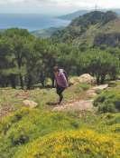
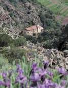
The starting point of the loop trail is in Porto Azzurro, in the heart of the old Porto Longone, an ancient fortified landing place built by the Spanish in the 17th century to control entry to the Gulf of Mola. Most of the trail is wide and easily accessible, but near Mount Castello there are some exposed passages, suitable only for expert hikers. Trail no. 222, known as the Carmignani promenade, starts at the foot of the ancient fortress of San Giacomo, which currently houses a penitentiary, and continues along its southern and eastern ramparts until it descends to the sea near the beach of Barbarossa, the name of which comes from the famous Turkish pirate who raged along the Mediterranean coast in the first half of the 16th century. From the trail, you can see the beach of Naregno, Forte Focardo and Mount Calamita. Once you reach the beach of Barbarossa you continue on the road that goes in the direction opposite to the sea, namely trail no. 224. After crossing Provincial Road no. 26, take the road that leads into the Monserrato valley, up to a centuries-old pine tree. From here, trail no. 226 leads to the Sanctuary of the Madonna del Monserrato, built in 1606, which is located on a rocky spur in the
centre of the valley. Steep mountains rise in the background, giving the place a certain austerity. Near the Sanctuary, there are two very steep trails. This itinerary, on the other hand, goes back to the monumental pine tree to take trail no. 225 to the west, which enters a thick pine forest and gently rises to the watershed between the Botro and Monserrato valleys. The trail, once reached the foothills of Mount Castello, goes out into the open and has an insidious trampling surface due to the presence of crumbly rocks, therefore some passages must be approached with due caution. Here the trail forks: by turning left, you continue on trail no. 225 to reach the cross that dominates the valley, where you can stop to admire the magnificent panorama. Returning to the junction and turning the opposite way, you take trails no. 218 and then 205 to tackle the most difficult section. When you reach a plateau at an altitude of 319 m, cross the wide GTE carriageway and proceed in a southerly direction. The road, which offers beautiful views of the gulf of Portoferraio, descends slightly to the junction with trail no. 210 and ends in Porto Azzurro.
Place of departure and arrival:
Porto Azzurro
Length: 9,6 km
Average travel time: 4 ore
Total height difference uphill: 443 m panorama levelness shade
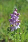
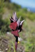
Trail no. 230 starts from Piazza del Cavatore, in Capoliveri, and goes to the top of Mount Calamita. At the junction with trail no. 231, which you take by turning right, you begin the loop trail. The road climbs with a considerable gradient to Poggio del Pozzo: this is the only challenging climb of the itinerary. Overall, the trail is wide and well levelled, easy to follow, even though it is characterised by considerable difference in height and a length The view sweeps from the gulf of Portoferraio to Mount Orello up to the massif of Mount Capanne. You continue uphill, surrounded by the blooms that follow one another over the course of the seasons. In spring, the white and pink of the cysts, the yellow of the brooms and the violet of the lavender make for a unique spectacle. Here there is no shortage of different types of wild orchids that colonise the glades at the edge of the scrub, and it is not uncommon to see hares red-legged partridges. You reach a crossroads. The road that goes up leads to the top of Mount Calamita, where there is a weather station and an Air Force beacon, an important reference point for air traffic. Continuing on trail no. 231, keeping to the right, you can see the great valley of Fosso del Pontimento, formerly Pentimento, from the Elban "pente",
or slope. Over the blossoms of the scrub and the clearings, fly various species of butterflies, small passerines in search of food and, higher up, kestrels and buzzards, which look down into the ground in search of prey. After passing the junction with trail no. 233, you reach Poggio Fino, where you find a crossroads that marks the easternmost point of the trail; turn left and take trail no. 230, which is located on the northern slope of Mount Calamita. On the northern slope the vegetation is higher, with numerous tree species linked to past reforestations, such as mimosas, robinias and pines. Near Mount Rotondo, at the junction with trail no. 232, you have to be careful and, once you leave the flat road, continue downhill on trail no. 230, which becomes a lane and descends further by crossing a mule track. Here you can see: to the east of the promontory, the Gulf of Porto Azzurro, and to the west, the Stella Gulf. Keep left in the direction of the village of Capoliveri. After passing through a small chestnut grove, an unusual presence for this part of the island, the loop trail ends and reaches again the junction with trail no. 231. From here you can reach the starting point in a few minutes.
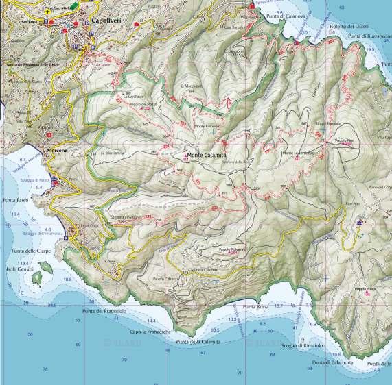
Place of departure and arrival: Capoliveri
Length: 11,4 km
Average travel time: 3 ore e 30 minuti
Total height difference uphill: 292 m panorama levelness shade
50 min.
25 min.
25 min.