MADURAI
Madurai or Madura is a historic city with a cultural legacy that goes back to more than two millenniums. It is located in the south-central Tamil Nadu, with the river Vaigai flowing through it. Its major landmark and significance lies in the Meenakshi Amman Temple that acts as the heritage core, from where the city developed in a radial grid.
The city of Madurai has been home to one of the oldest civilizations, the Dravidians who still live there, and literary periods like the Sangam Age from 1300 BCE. The various rulers, kingdoms and people have always evolved with the city’s setting in a planned and organic form, with a extensive trade and commerce, religious activities, cultural influences and political reforms.
3rd Largest Commercial Hub Cultural apital
The city follows Chennai and Coimbatore in trade and commerce in both retail and wholesale.

Unlike the capital Chennai, Madurai was born Tamil and rooted in Tamil. It’s the most Tamil city in the world.
ATHENS OF THE EAST
RECREATION & NIGHTLIFE CULTURE & TRADITION
TRADE & COMMERCE
TOURISM & PILGRIMAGE
COMMUNITY SPACE RICH
HERITAGE
The Greek Parthenon was located on an elevated platform in the ancient city of Athens, designed to be seen from all parts of the city.
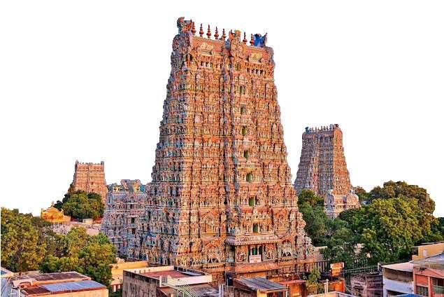
The Meenakshi Temple’s towers were also constructed with the same impression of being seen from all of the city.
THOONGA NAGARAM
Greeks and Romans built their cities allowing efficient pedestrian movement, and laned roads for their vehicles. Madurai’s original planning too was preferential to pedestrians. While two-laned roads were located on the outskirts.
The city’s name as ‘Sleepless’ is because the people are known to be awake through the night, thanks to the rich nightlife of Madurai from ancient times. The streets of Madurai are forever awake with buzzing commercial activity and people enjoying the with no boundaries between day and night.
The ancient trade with giants like Greeks and Romans asked for the markets to be open through the day and night for the incoming visitors and tourists along with the merchants, earning the name from around the globe
Also, the city’s very existence without decaying and decline for more than 2600 years, has also played its part in the naming of the city as never sleeping.

One of the few cities in the Eastern Hemisphere to have come in contact with Greeks and Romans with trade relations.
The Greek explorer Megasthenes had also visited the city, and referred to it in his accounts.
The Greeks had a rich cultural heritage and mythology that is still known, studied and explored.
Madurai too has been known for its rich culture and history through more than 2000 years.
CURRENT SITUATION
In recent times, the people of Madurai are slowly withdrawing from its history and their traditional ways of recreation and leisure.
The meaning of the titles like Thoonga Nagaram or the Athens of the East is clearly lost in today’s generation. The dance forms, folk songs, food delicacies and other culturally potent elements are slowly vanishing from the streets and are being displaced by traffic, congestion and pollution at the very historic core of the Temple City. This can be attributed to various factors influencing the people’s everyday lives and new needs in the name of recreation that the city’s markets aren’t able to satisfy to the new geeky generations.
While there are heritage structures that are seen in every nook and corner of the city, proper care and maintenance is lacking from both the stakeholders as well as the government.
Madurai’s ancient planning as the Koodal Nagaram was primarily for the pedestrian movement and only specified roads on the outskirts were meant for the vehicular movement. The congestion in these streets now, accompanied by the encroachment by the shopkeepers have decreased the pedestrians right of way.
With the onset of western goods facilitating needs of the people, the heritage markets around the Temple are now found changing into a more modern outlook, loosing the traditional façade it was once known for.
As communication and transportation has been improved over the years, often the traditional goods that were only available in Madurai can now be found in other neighboring cities as well.
Madurai is known in the state for its gangs and the gang fights that follow. This can be also be one of the reasons why people have retreated away from the streets as night sets in.
In 2018, a fire in the East Tower due to electric short circuit damaged the structure and destroyed over 30 shops that were lined there. LOSS OF NIGHTLIFE INSECURE & UNSAFE DECLINE
The people have slowly moved towards western practices that have loosened their connect with the city and its nightlife. Their recreational needs have now been fulfilled by technology and discotheques.
THESIS PROPOSAL
My aim for this project is to reconnect the people of Madurai to its age-old name of Thoonga Nagaram and its legacy. I aim to bring the people back to the streets and enjoy their time together as a community with a history older than many other civilizations on the planet. The project will be purposed hold on to the remaining of the 2000 year old lifestyle of the people and the city.
KEY OBJECTIVES
Propose spaces and activities that are feasible in the ongoing pandemic as well as in normal times.


Propose policies and interventions for easy movement of pedestrians, motorized & non motorized vehicles.


Enhance and restore the heritage façade of the market streets as well as the neglected heritage structures.
Enhance the shopping experience in the heritage market streets and also work towards the city’s economy.
Ensure safety and security with concepts like ‘eyes on street’ through design interventions and policy drafting.
Restore the nightlife and recreation on the streets at the heritage core.
 NAAN MAADA KOODAL (CITY OF FOUR TOWERS)
KOIL MAANAGAR (TEMPLE CITY)
MALLIGAI NAGARAM (CITY OF JASMINE)
KOODAL NAGARAM (CITY OF JUNCTIONS)
ATHENS OF THE EAST
introducing
THOONGA NAGARAM (CITY OF SLEEPLESS)
IN SHOPPING
& CONGESTION
TRAFFIC
HERITAGE
IN TRADITIONAL FRONT
NEGLIGENCE OF
DROP
NEED FOR STUDY
01
Presented by Ar Aynul Inaya Roll no. 20MRA004, Sem IV, M.Arch (RA) Guided by Ar Asma Hamid Jamia Millia Islamia, New Delhi
MADURAI
One of the ancient cities that has defined the South Indian historical timeline, Madurai was home ground to the Third Sangam Age and the great Pandiyan kings. Maduraites take pride in the rich culture, literature, valor and traditional practices that have crossed millenniums.
LITERATURE AND SOURCES
The Sangam Ages were literary periods where scholars grouped together to preach about life, philosophies and politics. The presentday Madurai emerged during the Third Sangam Age in around 300 BCE. The proofs and sources for the ancient life, history and architecture of Madurai is obtained from the works of these scholars in the Third Sangam Age, preserved in palm leaf manuscripts, megaliths, etc.
TOLKAPPIYAM
oldest surviving literary works of the Sangam Age.
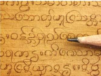
written by Tolkappiar. divided into three chapters. While the first two chapters codify language, the third chapter, Porul, refers to people and their behavior.
TIRUKKURAL
two line poems that were shorter in length as compared to the other Tamil works belonging to this period.
written by Tiruvalluvar. talks about the Dharamshastras, the Arthashastras and the Kamasutras, preaching simplicity and truth.
MADURAIKANCHI
a detailed description of life and bustle in the ancient city of Madurai. the poet, Mangudi Marudhanar, praises and counsels the king for all his accomplishments, rulings and strengths through the poem.
THOONGA NAGARAM
SILAPPADIKARAM
greatest epic, that describes the city’s trade, lives of merchants, architecture and Pandiyans.
written by Illango Vadigal, it tells tale of a wife’s revenge against her husband’s killer.
MANIMEGALAI
written by poet Sattanar of Madurai. deals with the ideals and teachings of Buddhism.
an important source of the development of fine arts during the Sangam Age.
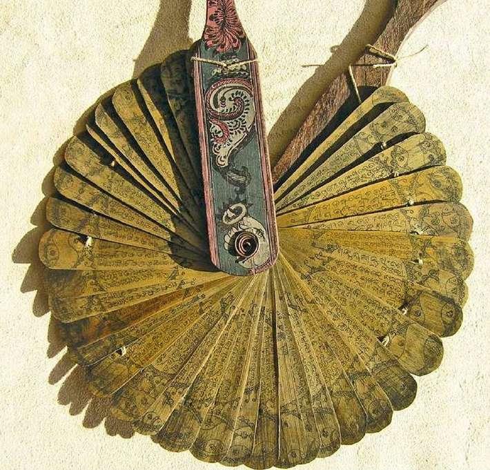
SIVAGA CINDAMANI
written by Tiruttakkadevar, a Jain monk, dealing with the story of a superman who becomes a Jain monk in the end.
information source for the life of people in Madurai.
TRADE & COMMERCE
Trade, both inland and foreign, was brisk in ancient Tamil Land. Madurai played an important role in the world’s trade routes like the Spice Route. Trade was carried out by barter system. Madurai cotton, spices and jasmine flowers were traded for gold with merchants from Rome, Greece, Indus valley, Central Asia, Malaysia, China and Arab countries. The exposure of Madurai through trade is also one of the important reasons for the spread of Tamil as a language and also the various titles given to the city.
ALLANGADI: Evening/night markets. The Tamil ancient literature and novels has a separate terms to identify the markets that are set up in night and day.
NALANGADI: Day Markets.
Thoonga Nagaram is a title given to the city of Madurai to refer to its night long commercial and recreational activities that brought the community together to interact and socialize at the end of their day’s busy work schedule. This rich night life and bustling night streets continued for more than two millenniums. Each era had a similar yet distinct outlook and definition for Thoonga Nagaram.
REASONS FOR THE TITLE THOONGA NAGARAM
TRADE: Merchants in ancient Madurai, traveled from one city to another continuously. These merchants reached the active port cities of the time Tondi near present day Rameshwaram, Korkai, and Musiri in present day Kerala, at odd times of the day.
From the ports, it usually took a day’s travel time to reach the Commercial Capital of Madurai. They traveled in groups, carrying their goods on bullock carts.
So, the traders and residents of Madurai kept their shops, eatery joints and lodgings open for the incoming merchants throughout the day and night. Hence, the city remained open and awake at all times, earning the title of Sleepless City.
RECREATION: The residents who stayed up all night, started holding cultural performances like theater art, dance galore, etc. describing the legends of the kings, religious stories, epics and writings of Sangam poets. Their literary works were in the form of poems that could be sung and danced to.
CULTURE: When the merchants entered in the city for the night, from long journeys, they were not only interested in the goods and commodities that the city sells, but also the rich culture and folklore Madurai poses. Sometimes, the performances were held to treat theses foreigners. and on some occasions the King used to come down to the market streets to watch the performances. Eventually, it became a cultural practice, that lived fro over two millenniums.
MADURAI STATS AND DETAILS
TOURISTS
Sources of Sangam age. (2021, August 21). Home of Learning.

History of Madurai District. (n.d.). Government of Tamil Nadu.
General Info/Zones & Wards. (n.d.). Corporation of Madurai.
Census India 2011

Nielsen India Pvt. Ltd. (2015). Tourism Survey for Tamil Nadu (Jan – Dec 2014). Ministry of Tourism, Government of India.
(RA)
Guided by Ar Asma Hamid
Millia Islamia, New Delhi
briefing
Muslin
Ginger
Turmeric Monkeys
Cardamom Coriandum
Rice Cinnamom
Cotton
Ivory Deers Sandal Wood Beryl Pepper
Ahil Pearls Peacocks
Presented by Ar Aynul Inaya Roll no. 20MRA004, Sem IV, M.Arch
Jamia
02 NTS 500 m 1 km 2 km 3 km 4 km Madurai Heritage Core 23,051 17,753 NO. OF HOUSEHOLDS Madurai: 89,635 Heritage Core: 68,006 POPULATION AREA Madurai: Heritage Core: 148 km²
2.13 km²
(36,571 acres)
(526 acres)
FOREIGN: 2016: 2017: 1.22 lakhs 2.17 lakhs DOMESTIC: 2014: 2018: 1.16 crores 2.09 crores Tondi Korkai Musiri Madurai Heritage
Markets Malls Railway Station
Airport Bus Stands Corporation Boundary
Monuments
&
Source:
EVOLUTION OF MADURAI CITY
Madurai is known to be the capital of the Pandiyan kingdom, the largest of the three mega powers of South India. The city is historically rich in literature, religious and cultural practices, art forms, politics and judiciary, and trade and commerce. To understand the evolution of Madurai as a city and its important to know about the Kumari Kandam, the submerged continent in the Indian Ocean.
Indian
Subcontinent
KUMARI KANDAM
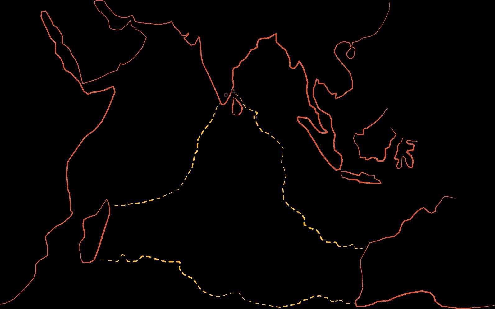
Kumari Kandam or the Lemuria was the name of an extended India which connected Madagascar in the West and Australia in the East by land, forming a triangle.
It was home to the First and Second Sangam Age. It was a literary era rich and advanced in all spheres of life. Its trade relations was very vast and extensive. This land-form was primarily inhabited by the Tamils.

The capital of the First Sangam Age is said to have been set at Thenmadurai (Southern Madurai). This was around c. 9000 BCE lasting 4440 years.
However, with the rising sea level, Thenmadurai became the Kadal Konda Thenmadurai (Southern Madurai conquered by Sea).
Africa
Madagascar

The Pandiyan King Mudattirumaran, who rule in Kavatapuram led his surviving subjects to Korkai and set up the capital city of Madurai.
Post Sangam Age when literary works like Silapadikaram were produced, which described the Madurai fortress as well.
Australia
The capital for the Second Sangam Age ( a span of 3700 years) was shifted to Kapatapuram. The remaining of the Pandiyans who used to rule in the first Sangam Age warred and won over parts of the Chola and Chera lands on the present day Indian and Sri Lankan mainland. This too submerged with rising sea levels and tsunamis.
The survivors settled down in Korkai, a seaport.
For the capital city of the Third Sangam Age (c. 300 BCE, lasting 1850 years), present day Madurai was finally chosen which was close by. Thus starting the long legacy of the city of Madurai.
Source: B.F. (2016, January 14). Lemuria Continent Kumari Kandam, Ancient Tamil Kingdom, Facts - Mysteries. BooksFact - Ancient Knowledge & Wisdom.
Nadivarman Pallava III conquers parts of Pandiyan Kingdom near Vaigai River.
KUMARI KANDAM
THIRD SANGAM AGE / EARLY PANDIYANS
She both fought multiple wars and maintained political ties with the Mughals, and contributed to the architectural legacy of Madurai.
Regent Queen Mangammal of the Nayakkars was the strongest and prominent ruler of Madurai after the death of Thirumalai Nayakkar. She ruled for 17 years till 1706.
1689
Neduncheliyan Pandiyan I rules the city. He is known as Aariya Padai Kadantha Pandiyan (Pandiyan who defeated the Aryans).
CHOLA PANDIYANS
LATER PANDIYANS
Maravarman Sundara
Pandiyan conquers parts of Cholan Empire and reaches Madurai
Pandiyans seek the help of Vijayanagara Kingdom.
Internal conflicts and corruption in Pandiyans, leads to their decline and Madurai Sultanate is established in 1311 CE
Malik Kafur, a general of Allaudin Khilji invades Pandiyan Empire and attacks Madurai.
He lived here for some 40 years, and worked in restoring and adding important structures and architectural elements to Madurai city, which can still be seen dotted around the heritage core.
Thirumalai Nayakkar rules shifts his capital to Madurai, and constructs his massive Fort around the remains of the Pandiyan fort.
Aparajita Pallava conquers Madurai with the help of Aditya Chola I
Aditya Chola soon overthrows Aparajita and rules over the whole of Pallava and Pandiyan Kingdom. Pandiyans were exiled to take refuge in the Lankan island.
Jatavarman Sundara
Pandiyan conquers northern half of Lanka and Telugu countries. The most brilliant century of Pandiyan rule.
Marco Polo visits Madurai, notes Pandiyans as one of the richest in the world, and also states their unproportionate military strength.
King Bukka of Vijayanagara Kingdom and son capture the whole Tamil Country, defeating the Delhi Sultanate.
MADURAI SULTANATE
NAYAKKARS
British rulers appointed Collectors under the Madras Province to oversee Madurai.
Mahatma Gandhi came to Madurai and stayed at 175-A, West Māsi Street on September 21, where he shed his clothes and started wrapping a Khadi loin cloth for the rest of the world.
Cholan Viceroys called the Chola Pandiyans ruled Madurai on behalf of the Cholas in Thanjavur
Dindigul was declared a separate district in 1984 and later in 1997, Theni was also separated from Madurai.
CE 1781 CE 1921 CE 1997 CE
c.

1700 CE c. 1840 CE
After the death of Mangammal, there was hardly any rulers who could keep up with the British (1639) and French (1746) who had invaded Madras after the Dutch (1609).
1947 CE
An onset of Cholera struck Madurai, due to the water in the moats of the Nayakkar Fort. The British took this opportunity to demolish these massive fort walls to fill it up, forming the Marret Street.
Madurai slowly slipping under British East India Company Thus Madurai finally flowed out of the fort walls and expanded, and in 1900s crossed the Vagai River in the North.
After Independence, Madurai was put under the Madras Presidency, which was later renamed as Tamil Nadu (Country of Tamils) in 1969.
Pandiyans (c. 300 BCE)
Sultanate (c. 1350 CE)
Nayakkars (c. 1640 CE)
British Rule (c. 1850 CE)
Kadal Konda Thenmadurai Madurai Kapatapuram Korkai
Kumari Kandam (Lemuria)
evolved
Source: Chronology of Tamil History. (n.d.). tamilnation.org. The Pandyan Dynasty. (n.d.). tamilnation.org. Shrikumar, A. (2019, January 4). In search of the forts of Madura. The Hindu. History | Madurai District, Government of Tamilnadu | India. (n.d.). https://t.nic.in/history/ Sahgal, K. N. (2021, September 27). Rani Mangammal: The Fierce Queen of Madurai | #IndianWomenInHistory. Feminism In India. The Hindu. (2016, October 18). ‘Once Upon A Madurai.’ The Hindu. Desk, O. (2018, October 2). The house in Madurai where Gandhiji turned into the ‘fakir’. . The New Indian Express. The Hindu. (2016, July 31). Tales of the lanes. The Hindu.
RULE POST INDEPENDENCE
BRITISH
c. 300 BCE c. 300 CE c. 850 CE c. 1210 CE c. 1310 CE c. 1620 CE c. 200 CE c. 900 CE 1251 CE 1370 CE CHRONOLOGICAL
Madurai Kanchi, a poem of 780 lines, describes the massive Madurai fortress.
EVOLUTION OF MADURAI CITY
03
Presented by Ar Aynul Inaya Roll no. 20MRA004, Sem IV, M.Arch (RA) Guided by Ar Asma Hamid Jamia Millia Islamia, New Delhi
Thirumala Naykkar Palace
The palace of the Nayak king who lived in the 17th century. The palace now entertains tourists as a museum in the day and sound and light shows in the evenings.

Shri Koodal Azhagar Temple
Originally built by the Pandiyans, the Nayaks later expanded the grandeur of the temple in the 16th century. This temple is dedicated to Vishnu.
Meenakshi Sundreshwar Temple
One of the renowned temples in the Hindu religion. The temple was once a shrine in the middle of the forests, it was first constructed by the Pandiyans, and later expanded by the Nayaks. It is dedicated to Goddess Parvati.
St.

Mary’s Cathedral
Constructed in 1916, the church is one of the most well known structures of the British rule.

Victoria Edward Hall
Set up in 1908 AD, it was the first closed auditorium in the city. Post independence, it functions as a cinema theater called Regal Talkies. Its rich library is still open to public in the mornings.

Raya Gopuram
This was one of the supposed additions to Meenakshi Amman Temple by the Nayaks. However it was left midway, after cracks (inauspicious) were noticed in its construction phase.

Pudhu Mandapam
A successful addition of the Meenakshi Amman Temple complex by the Nayaks, built in 1630s. Later, it was used as a shopping plaza for more than a century till 2021, when the shopkeepers have been evacuated to preserve heritage.

Kazimar Mosque

Oldest mosque in the city, dated to 1284 AD. It is named after the first Muslim family who settled here from Yemen.
HERITAGE STRUCTURES AND THEIR VALUE

The city of Madurai is historically important and rich in tangible heritage like temples, palaces, gateways and a few memorial pillars. Also, there are some privately owned residences, shops and offices that retain the heritage value from the 1800s.

WONDER
IDENTITY
CONTINUITY/ INTEGRITY
SPIRITUAL/ RELIGIOUS
SYMBOLIC VALUE


HISTORIC AGE
SCARCITY
AESTHETIC / SYMBOLIC
TOWN SCAPE

LANDSCAPE
TECHNICAL VALUE
SCIENTIFIC VALUE
FUNCTIONAL VALUE
ECONOMICAL VALUE
SOCIAL VALUE
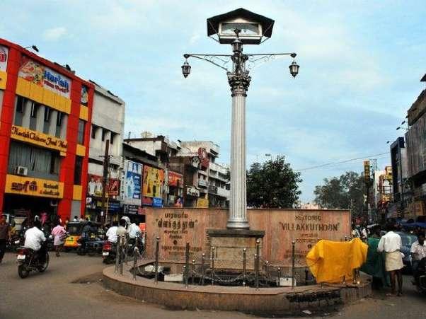
A pillar erected in 1840 as a memory to the then Collector of Madurai, Blackburn. The pillar remained neglected and acted as a junction marking device till 2000s when the government tried to preserve it.

Pathtu Thoon


Literally the ten pillars, they were a part of the Nayak Palace. The king’s elephants to them. With urbanization, they are now located in a 5 feet wide alleyway named after it.
ANALYSIS OF THE PRESENT SITUATION
In the present, a lot of these monumental structures are being commercially exploited. With commercial set-ups and electrical wirings, plumbing pipes that run along their façade, their value in architectural, historical and cultural aspects is becoming extinct.
For instance, the Ten Pillar Street is now in the midst of a residential settlement, that has commercial name-plates, wires, and hangers pinned on and around it. Same goes for the Raya Gopuram in Ezhu Kadal Street. Pudhu Mandapam which had gone through the most commercial exploitation for more than a century, has been evacuated from all the shops in 2020, and is going through restoration and preservation as a monument of heritage value.
Under the State Protected Monuments, the government has only listed two monuments: Thirumala Nayakkar Mahal, Pathu Thoongal. (None listed under ASI).
documenting heritage Source: Historical Monuments in Madurai-Historical Monuments in Madurai Tamil Nadu. (n.d.). IHPL. Madurai Tourism, Places to Visit in Madurai, Tourist Spot Madurai. (n.d.). Madurai Online. Department of Archaeology. (n.d.). Monuments - District wise. Government of Tamil Nadu: Department of Archaeology.
Aynul Inaya Roll no. 20MRA004, Sem IV, M.Arch (RA)
Asma Hamid Jamia
Islamia, New Delhi 04
Presented by Ar
Guided by Ar
Millia
Vilakku Thoon
MEENAKSHI AMMAN TEMPLE THIRUMALA NAYKKAR MAHAL ST. MARY’S CATHEDRAL KAZIMAR MOSQUE VILAKKU THOON PATHU THOON PUDHU MANDAPAM EMOTIONAL VALUE CULTURAL VALUE USE VALUE VICTORIA EDWARD HALL
EDUCATION VALUE POLITICAL VALUE PUBLIC VALUE
Heritage Monument Heritage Monuments with commercial exploitation Locations of privately owned heritage structures like residences, shops, etc. No Value Presence of Value Considerable Value Intense Value VALUES MAP
0 50 100 200 m
documenting culture
CULTURAL HERITAGE
Madurai is known as the Cultural Capital of Tamil Nadu for its rich heritage that involves centuries and millenniums.
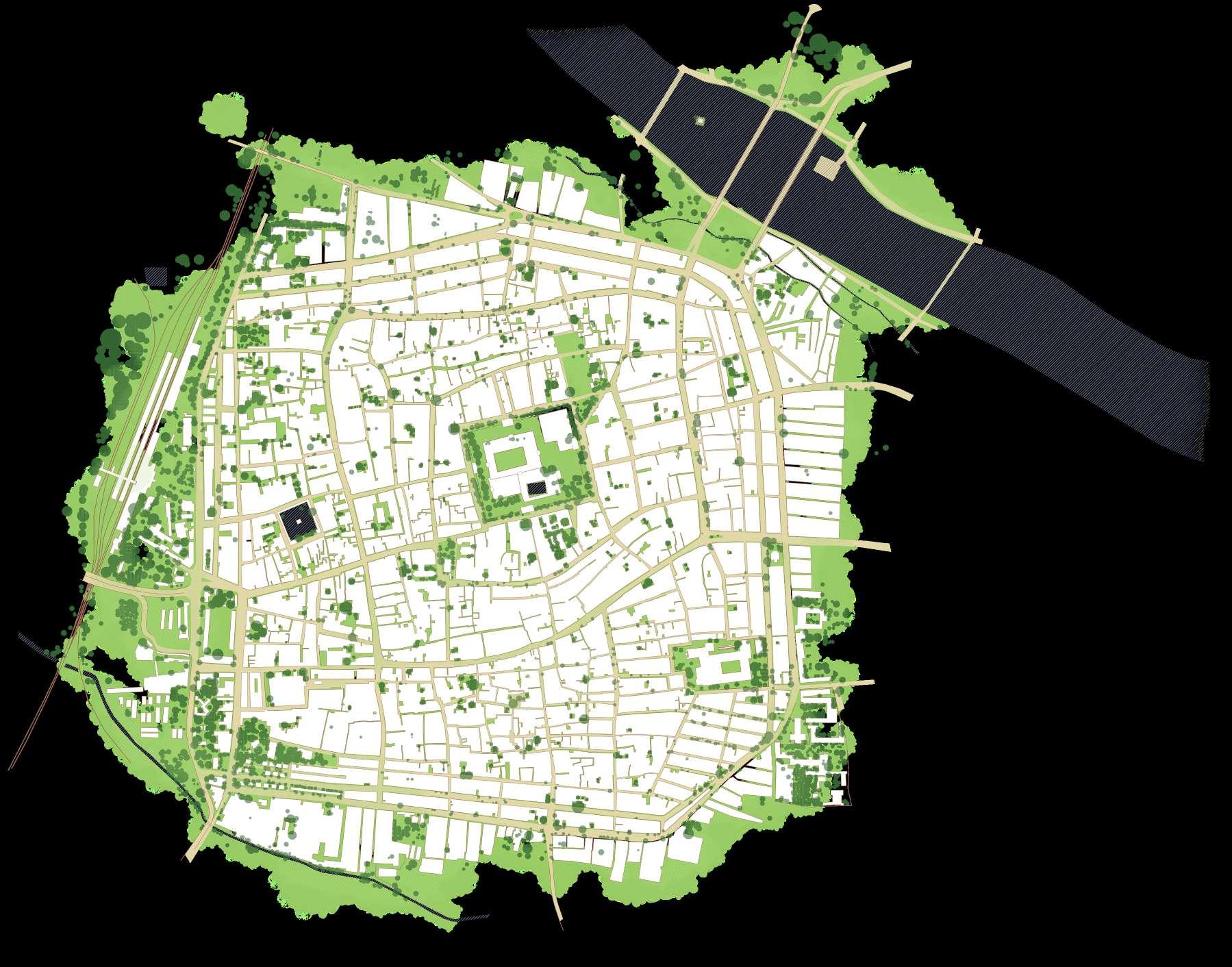
There are around 20 dance forms, more than 6 theater arts, around 25 sports and martial art forms and up to 5 musical styles. All of these are basically street art forms, that are enjoyed during festivals, marriages and special occasions.

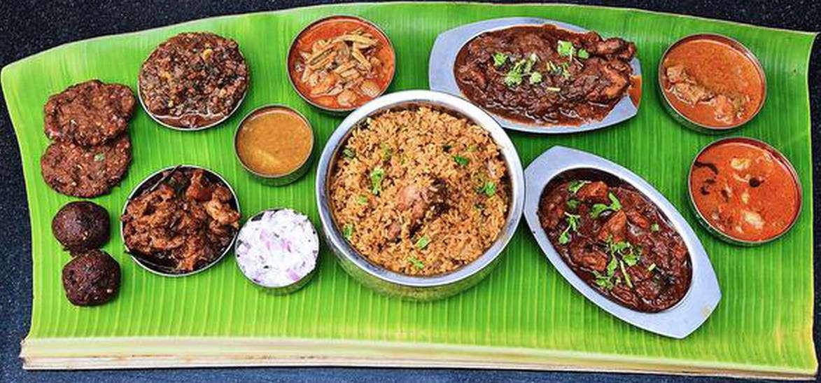
Other than this, the city is known for its cuisine. Some of the dishes are unique to Madurai, making it a hot-spot for food bloggers


Silk Sarees, Cotton Sarees, Dhotis, etc. make up the most traditional outfits for any function, accessorized with jewelery. Textiles and jewelery is so prominent in the lives of the Maduraites that there are certain streets that exclusively deal with them.
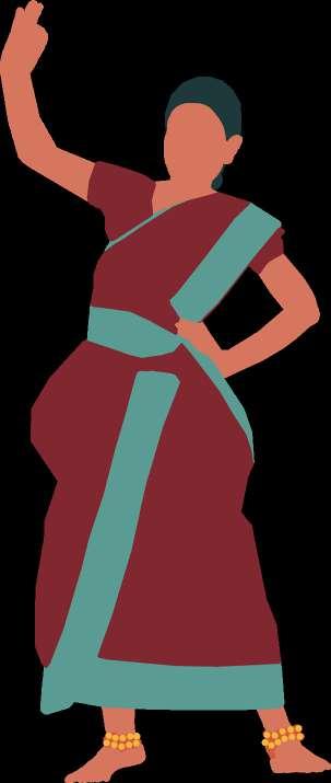
# Jallikattu

# Poikkal Kudurai
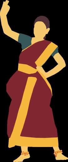
Attam
A dance performed on false horse legs impersonating a king or queen riding their horse.
A traditional event where a large bull is let loose in a group of men, who try to hold it’s hump, without getting injured or killed.
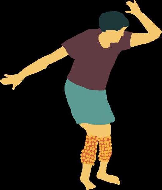
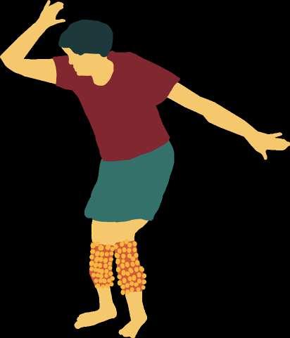
# Salangai Attam

A dance form where men tie huge anklet bells to their legs and dance in unison with the wild beat of drums. Each anklet weighs around 8 kg.
# Oyil Kummi Attam
Groups of men or women perform a narration of tales while dancing with bells tied at their anklets. The dance involves no music except the bells.
The palette is a staple breakfast: Dosa, Idli, Uthppam, Upma, Paniyaram, Pongal and Vada. @ anywhere in MDU

Madurai’s Biryani is eaten as lunch. It is one of the top 5 Indian Biryanis. @ anywhere in MDU
A weapon-based martal art form, involving a bamboo staff. The staffs strike against each other to create battlefield sound effects.

# Karagattam
Women dance while balancing pots on their heads, in praise of the rain goddess. A very ancient dance form, women carry flowers and spinning paper parrots, while men carry uncooked rice in their pots as they dance.


Filter Coffee is a hot beverage drunk in the early mornings and evenings. @ anywhere in MDU

Jigarthanda is a hand churned ice cream mixed with condensed milk and tree gum.
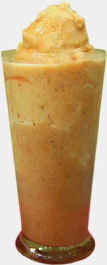

@ Famous Jigarthanda, Villaku Thoon
Kari Dosa is a non-veg uthappam made from mutton chukka. It can also have eggs.

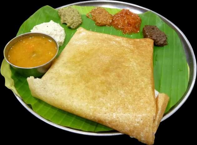
@ Konar Mess, Simma Kal
Paruthi Paal: a warm sweet drink made from cotton seeds, jaggery and coconut milk. @ anywhere in MDU


# Bommalattam
Largest Indian puppets. Made of wood, showcase historical tales, religious stories, in the form of a dance and music.

# Kolaattam

An ancient village dance accompanied by striking of sticks to match the steps.
# Kavadi Attam

Literally the ‘burden dance’. A religious dance performed by carrying weights or piercings as an offering.


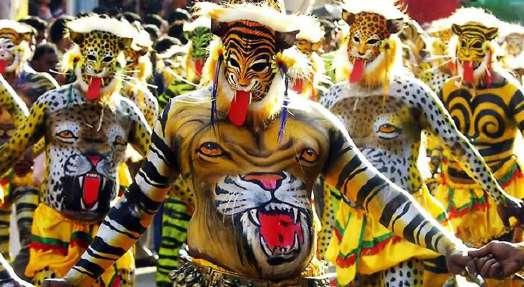
# Pulliattam


A very ancient dance form with costumes, gestures impersonating tiger’s graceful movement.
# Theru Koothu
‘Street Theater’, it is a street play about religious stories and everyday life, depicted through dance and music
# Porkaala Koothu
Another street theater that show-cases battles, stories of kings, etc. through dance, music and martial arts.

Source: Tales from Maduraites, Madurai Street Photography. (n.d.). Flickr.
Presented by Ar Aynul Inaya
Masala Dosa is a stuffed variant of Dosa.
@ Konar Mess, Simma Kal
Bun Parotta is native to Madurai. In the size of a palm, its a flaky bread relished with
@ anywhere in MDU
curry.
Kalkandu Sadham is a Saurashtrian dessert made from rock sugar, rice and dry fruits.
@ anywhere in MDU
Halwa made by cooking wheat till translucent.
@ Prem Vilas, Town Hall Rd.
Roll no. 20MRA004, Sem IV, M.Arch (RA)
05 NTS
Guided by Ar Asma Hamid Jamia Millia Islamia, New Delhi
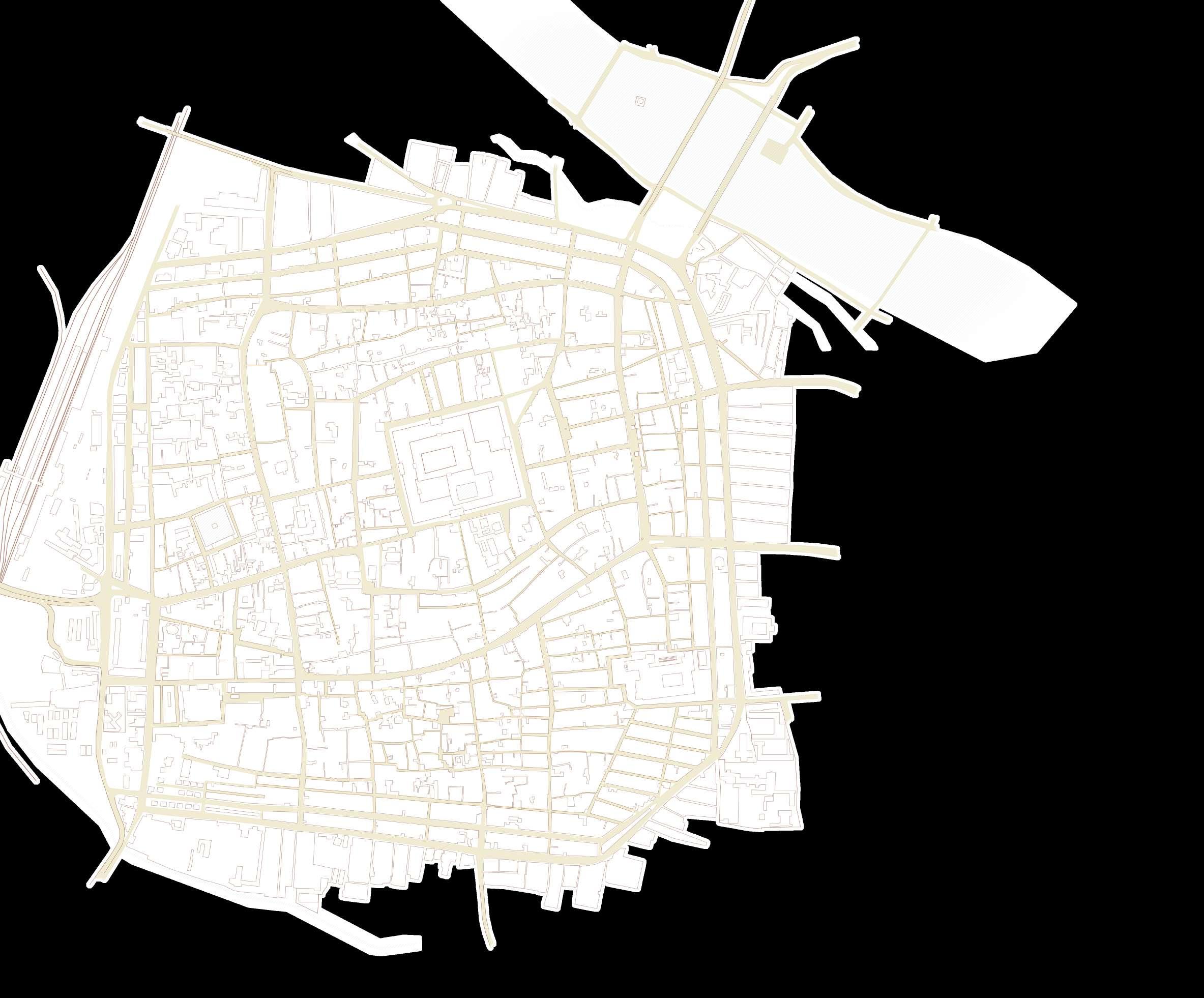
PLANNING OF THE HERITAGE CORE

Madurai’s fort city was planned following the Shilpa Shastras from the Vedic times. The city can be easily identified to have designated areas for the various castes and communities, some of which still inhibit the same place. The city is also observed to have a combination of grid planning inside its radial plan. This can be attributed to its quadrilateral form instead of the regular circle.

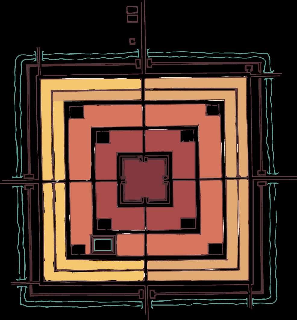


SHILPA SHASTRA: MANASARA
In Vedic India, towns were planned as per Vastu Shastra, allocating spaces according to castes and communities, defining the roads and entrances to the town, location of temples, palaces, etc.
RADIAL PLANNING

Also called as co-centric planning, is when the city is planned around a central point, with the roads leading outward like rays from the city center.
COMMUNITY MAPPING
There are some prominent distinctions in the residential communities in the core city. As seen previously, it is very similar to the ancient town planning systems. The adjoining map shows the approximate settlement pattern observed in the present.
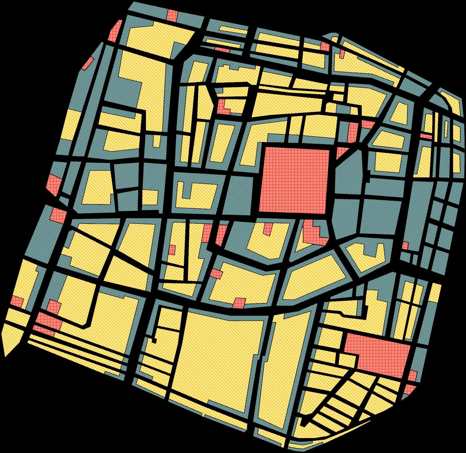
Vaishnavites Vaishyas
Brahmins Jewelers
Kshatriyas Sourashtriyans
Palaces Sutras
Source: Smith, J. S. (1976, January). Madurai, India: The Architecture of a City. Massachusetts Institute of Technology.
While the ancient city of Madurai was built millenniums ago and has undergone a lot of changes, it is noteworthy that the community distribution in the core city has hardly changed. The area occupied by the Brahmins, Vaishiyas and others has remained the same as seen.
Temple
Brahmins
Kshatriyas
MASTER PLAN 1992
Vaishiyas
Shudras
The last Master Plan for Madurai was summed up in 1992. Not much has changed in the heritage core though, in the terms of the built use on-site. Almost all the blocks are observed to have a commercial front with shops and godowns, and residences on the inner side.
The commercial land-use is noted to occupy mostly on the West and East of the old city. This can be due to the fact that the cater to the people visiting the city on one side and Maduraites on the other side respectively.
The southern part is clearly mostly residential. Similarly, the North too, which faces the Vaigai is not very commercially influenced either.
Residential = 53%
commeRcial = 38%
Public / semi Public = 9%
GRID PLANNING
This planning involves parallel and perpendicular lines to create streets, that tend to spread out like a
North Gate Street
East Gate Street
Meenakshi Temple
Chitrai Street
Āvani Moola Street
Māsi Street
Marret Street
Veli Street
Source: R. (2014, April 18). Madurai Master Plan Map 1992. Master Plans India.
STREET NOMENCLATURE
To understand the planning of Madurai’s heritage core and for easy commute, it is important to understand its road network. The core starts at Meenakshi Amman Temple and the streets start running around it in co-centric squares.
These streets are named after the Tamil calender months. The street that runs right around the walls of the Temple is the Chitrai. The second circle is the Āvani Moola Street, followed by Māsi. After that, comes the Marret Street and finally the Veli Street.
All of these streets are designated by the compass directions, like East Māsi Street, North Māsi Street, East Chitrai Street, etc.
There are also other streets that run around in circles like Perumal Maistry Street, however these are the five main street systems in which Madurai moves.
Also, there are cross roads that run perpendicular to these rings. The important ones are the ones that used to lead directly to the fort gates in the olden days. They are simply called the South Gate Street, etc.
planned
NTS
06
Presented by Ar Aynul Inaya Roll no. 20MRA004, Sem IV, M.Arch (RA) Guided by Ar Asma Hamid Jamia Millia Islamia, New Delhi
Schools
Hospitals
Post Offices
Restaurants
Transit Centers


Police Stations
Religious Places Parks
Hotels
ACCESSIBILITY & SERVICES


The heritage core is well facilitated with public services like schools, hospitals, post offices, etc. The Meenakshi Amman Temple sits at the center of the core. Towards the south-east, is the Palace of Thirumala Nayakkar and a little farther is the St. Mary’s Cathedral in Gothic style.

The precinct is well connected to other cities through the Central Periyar Bus Stand and the Railway Junction. Also, the bridges across the river connects the core to the Madurai North.
There are some 200 year old schools that are functioning in the area like St. Mary’s, St. Joseph’s and Sethupathi, that age more than a century. Hospitals like Vadamalayan and Christian Mission also carry a huge legacy.
There are Post Offices at every corner of the core, while the Head Post Office is located in the northwest.
OPEN SPACE TYPOLOGY
The 55% open space in the precinct consists of blue, green and brown spaces. Blue open space refers to the water bodies, green is the vegetation and brown marks the barren open space that can be constructed upon.
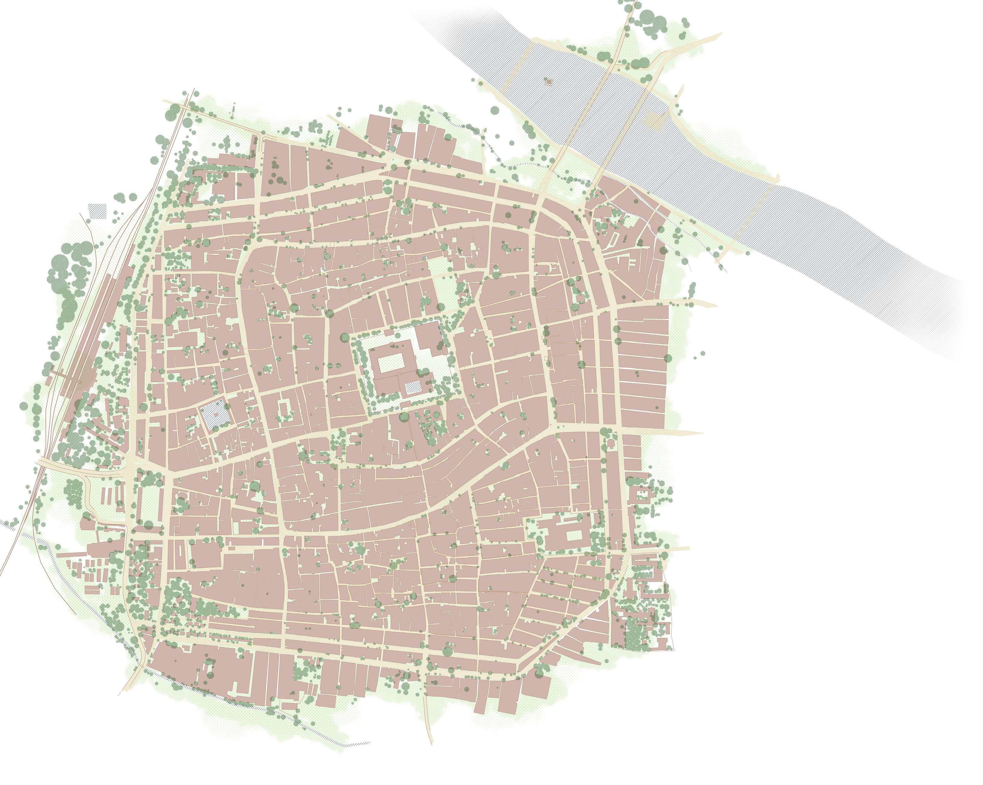
FIGURE GROUND
The precinct was found to have 55% of open space including all the streets, green, blue and brown spaces. The built area comprised of 45% area marked in grey.


PRECINCT SPATIAL ANALYSIS - PART 1
The precinct is found to be densely built with a mere 18% of vegetation. The precinct has a medium to dense urban grain as noted from the satellite images. The density due to the linear divisions of ancestral property for attaining equal street fronts for all the siblings. There are only two public playgrounds in the precinct, both of which were found to be degraded and poorly maintained during the site visit. The staff quarters of the Crime Branch, the St. Mary’s school complex, the bounding green area of the Meenakshi Temple are some of the other mediumly vegetated areas.
A major part of the blue spaces is accounted to the Vaigai River. There are two water bodies, both a part of religious buildings, hence closed to public.
As seen from the donut chart above, majority of the open spaces is occupied by brown spaces. These are mainly the streets and junctions of the precinct. The tightly knit road network is the reason for this.


MEENAKSHI AMMAN TEMPLE RIVER VAIGAI nel pettai yannai kal villaku thoon east gate pudhu mandapam crime branch thavittu sandhai simma kal GORIPALAYAM PERIYAR BUS STAND MADURAI RAILWAY JUNCTION THIRU MALA NAYAKKAR MAHAL 0 50 100 200 m south gate west gate simmakal sandhai MUNICHALAY ST. MARY’S 45 % BUILT accessing
Blue Green Brown-20% 33% 47%
Presented by Ar Aynul Inaya Roll no. 20MRA004, Sem IV, M.Arch (RA)
07 0 75 150 300
Guided by Ar Asma Hamid Jamia Millia Islamia, New Delhi
moving through
ROAD NETWORK

The outer most rings, the Veli Street and the Marret Street connects the heritage core to the rest of the city and witnesses most of the inter-city and inter-state traffic. The inner rings like the Māsi Street and Āvani Moola Street act as the main roads inside the core. These rings are connected by cross roads like Netaji Road, Town Hall Road, Amman Sannathi, etc.

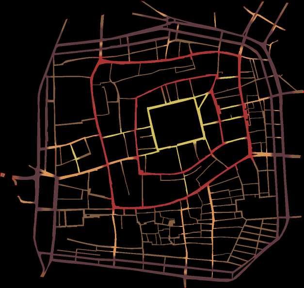

TRAFFIC MOVEMENT


The heritage core is controlled by the Madurai Traffic Police. They have eliminated most of the traffic signals and checkpoints, and employed strict one-way route plan on most of the arterial roads.
HIGHWAYS
The precinct is well connected to other cities and states through a network of national (orange) and state highways (yellow) that run through the East and a part of the North, South and West Veli Street.

ONE-WAY ROUTE
Due to the heavy traffic flow as seen in the maps, the streets follow an alternate one-way route plan throughout the precinct. This helps with traffic calming and controlling at all times of the day and night.
The con of this plan is, it makes all the streets to be vehicular and less pedestrian friendly.
VILLAKUTHOON NODE


The node at the junction of East and South Māsi Streets experiences traffic as follows.

AMMAN SANNATHI NODE

The node at the cross-section of Amman Sannathi ad East Āvani Moola Street.


TRAFFIC ANALYSIS
It was found that there are the flow of vehicular traffic during the daylight hours and after sunset is quite similar inside the core while a drastic difference is noted on the outskirts.
This can be possible due to the presence Central Bus Stand or the Periyar Bus Stand in the West Veli Street, as well as the highways that run on the Veli and Marret Street.

Inside the precinct, the East Māsi, South and East Āvani Moola, and East Marret Streets seem to be most active at all times, along with the cross roads like Netaji Road. The Amman Sannathi and Ezhu Kadal Street in the eastern side, become active as evening sets in.

MEENAKSHI AMMAN TEMPLE RIVER VAIGAI nel pettai yannai kal villaku thoon east gate pudhu mandapam crime branch thavittu sandhai simma kal PERIYAR BUS STAND MADURAI RAILWAY JUNCTION THIRU MALA NAYAKKAR MAHAL south gate west gate simmakal sandhai ST. MARY’S Light Congestion Minor Nodes Direction of Flow Major Nodes Religious Node Monumental Node Transit Node Commercial Node Traffic Node Traffic Node Recreational Node Service Node Service Node Heavy Congestion
MAJOR ARTERIAL MINOR ARTERIAL MAJOR COLLECTOR MINOR COLLECTOR LOCAL ROADS Veli Street Māsi Street Netaji Road Amman Sannathi Pandiyan Agzha Street Marret Street Āvani Moola Street Town Hall Road Ezhu Kadal 10 Pillar Street NIGHT TIME DAY LIGHT HOURS Major nodes Minor nodes Light Congestion Vehicular Flow Pedestrian Flow Heavy Congestion VELISTREET MARRET STREET MĀSISTREET ĀVANIMOOLASTR E E T Presented by Ar Aynul Inaya Roll no. 20MRA004, Sem IV, M.Arch (RA) Guided by Ar Asma Hamid Jamia Millia Islamia, New Delhi 08 0 50 100 200 m 0 50 100 200 m Vehicles per minute in Day Vehicles per minute at Night MEENAKSHI AMMAN TEMPLE RIVER VAIGAI nel pettai yannai kal villaku thoon east gate pudhu mandapam crime branch thavittu sandhai simma kal GORIPALAYAM PERIYAR BUS STAND MADURAI RAILWAY JUNCTION THIRU MALA NAYAKKAR MAHAL south gate west gate simmakal sandhai ST. MARY’S
PUBLIC TRANSPORT
The precinct is easily accessed from all parts f the city through a well connected public transportation system. The buses run in the Veli and Marret Street, with the Central Bus Stand on the West Marret Street. The auto stands are dotted around the precinct, at walkable distances. Also, the Madurai Railway Junction is located on the West Veli Street, a few blocks away from the bus stand.
WAY-FINDING AND IMAGEABILITY OF THE PRECINCT


VEHICULAR ROUTE OF PRIVATE OWNERS


The precinct is home to both residential communities as well as commercial set-ups. Everyday, the roads are used by residents to go out to their respective places of work and by shoppers who come in to purchase.
The residents usually use the Veli Street or the Marret Street to go out, which is usually free-flowing and is void of major traffic congestions. In case they need to go to the inside of the core, they prefer the Māsi Street. The shoppers however, use the Māsi Street to navigate which is also a major commercial street.
PATH
Imageability is a theory of perception devised by an American Urban Planner Kevin A. Lynch. The theory explains the mental mapping that humans use in identifying with the area and/or for way-finding. He portrayed his idea with the help of 5 elements - paths, edge, district, node and landmark.
It was observed that these elements play a great role in perceiving the spatial arrangement of the heritage core of Madurai.
PRECINCT SPATIAL ANALYSIS - PART 2
The precinct has a well connected network of public transport. The Veli and Marret Street are noted to be accessible to buses. The buses also run on the East Māsi Street, due to the one-way route system.
The auto stands are located quiet close to each other. Clearly the entire precinct is easily accessible by foot from any bus stop or auto stand.
Also, the imageability and way-finding of the precinct is quiet easy due to the radial grid planning and the clear network of streets and nodes, with the Meenakshi Amman Temple at the center of all. The imageability so easy that one can say,


“All roads lead to the Temple”
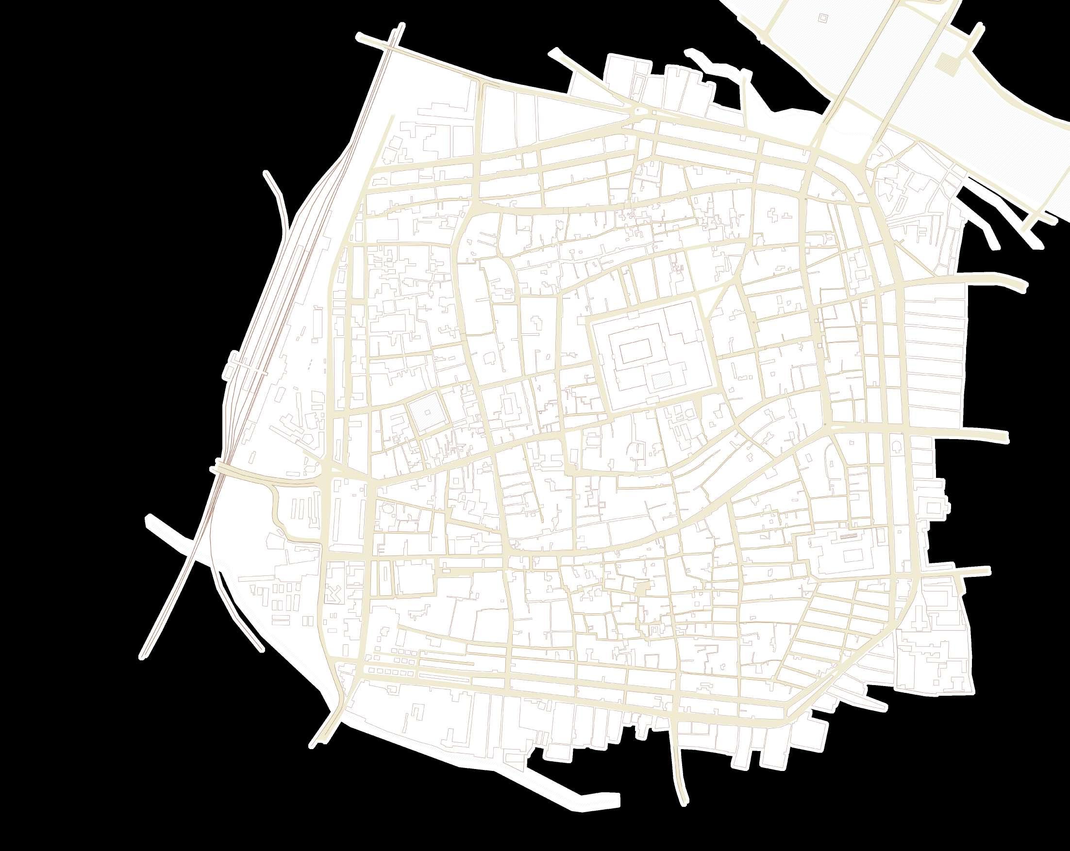
The map on the left analyses the walkbility (400 m radius) of the precinct from major nodes.
Presented by Ar Aynul Inaya
Roll no. 20MRA004, Sem IV, M.Arch (RA)
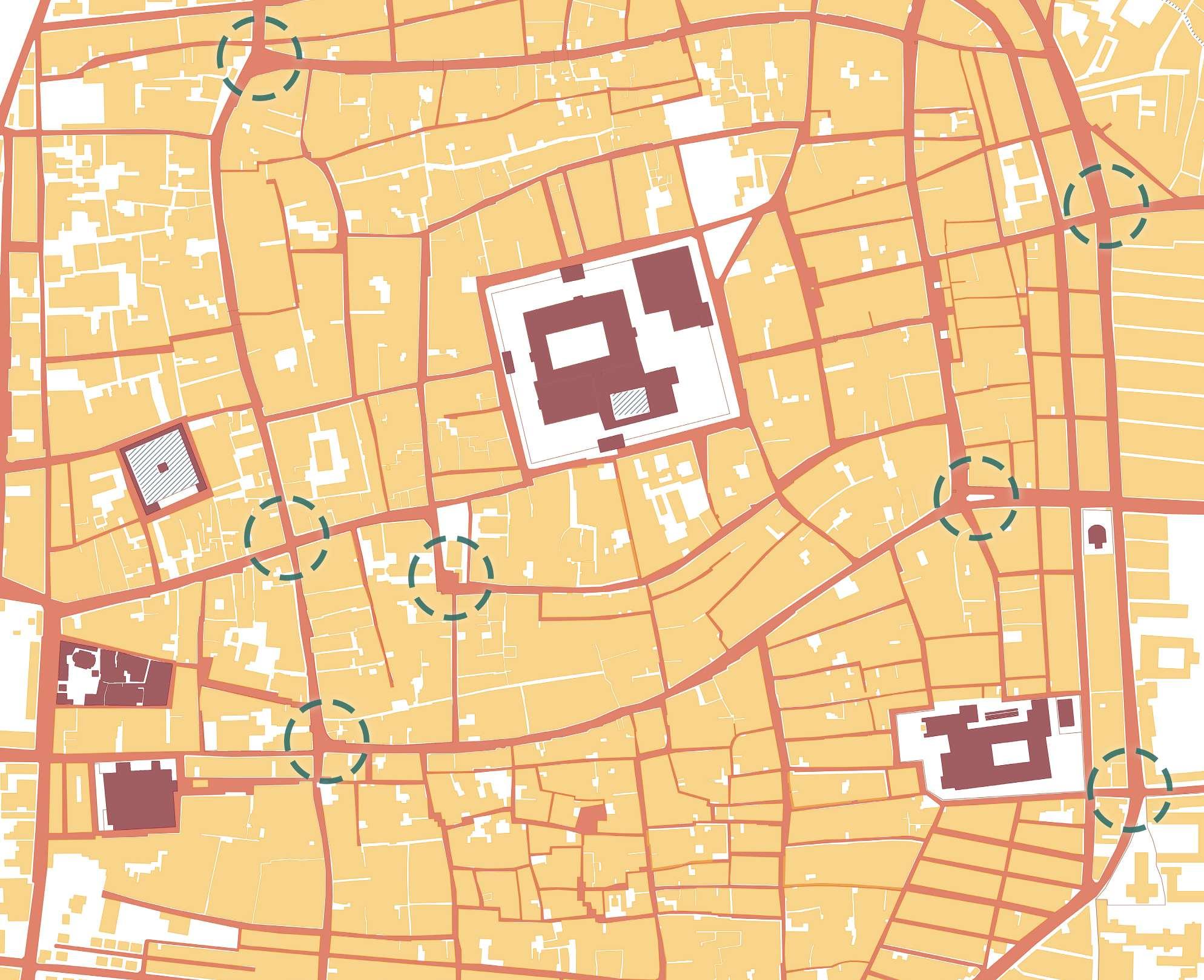
The streets and pathways (orange) that wind through the entire precinct, lead people from one place to another, influencing them to pause at the various facilities along the way.
NODE
The paths converge and form junctions (blue circles) at specific points, making them a catalyst for activities where people of all routes meet and disperse.
DISTRICT
The nodes and paths surround blocks of built mass (yellow) that provide the main character to them. A market street, a residential street, etc.

LANDMARK
Some buildings or services in the districts act as landmarks (dark red) that are easily remembered and help in way-finding in the future.


09
Guided by Ar Asma Hamid Jamia Millia Islamia, New Delhi
moving in Periyar Bus Stand Bus Stops Bus Route Railway Station Parking Spaces Auto Stand Route taken by Residents Unauthorized Parking Route taken by Shoppers
NTS SOUTH MĀSIWEST MĀSI NETAJI ROADWEST MĀSI WEST MĀSINORTH MĀSI KOODAL AZHAGAR PERUMAL KOIL THEPPAM SHRI KOODAL AZHAGAR PERUMAL KOIL AL - MASJIDTHUL AKSA MEENAKSHI AMMAN TEMPLE VILLAKU THOON MUNICHALAY ST. MARY’S THIRU MALA NAYAKKAR MAHAL CSI CHURCH JEWELERY STREET
Religious Nodes Monumental Nodes Commercial Nodes Transit Nodes Traffic Nodes
Source: Kingmabry. (n.d.). Madurai Meenakshi Amman TempleDrone view [Photograph]. Tumblr.
Food & Beverages
Accessories & Clothes
Toys & Utensils
MARKET TYPOLOGY
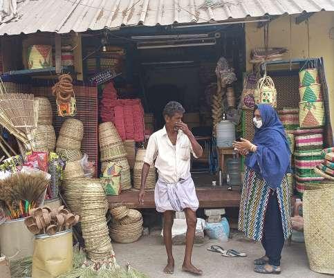
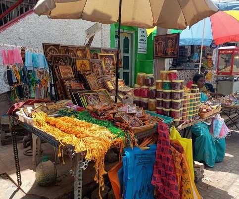
The market streets in the heritage core have a distinct character based on the type of goods sold. These streets have been operating with these commodities for more than a few century. Most of the shops in the markets have been handled by multiple generation of the same family.
Fruit Market
Jewelery Eatery Joints
Police Stations
Vegetable Market Textile
Coconut Utensils
Onion Market Handicrafts

Flowers Hardware & Utilities
Fish Market Books & Papers
Spices Hotels & Lodgings


PRECINCT TRADE ANALYSIS - PART 1
The markets have a true heritage value, that has influenced in the city’s operation as a commercial capital for more than two millenniums.
The type of commodity plays an important role in the amount of traffic, both pedestrian and vehicular, these market streets cater and at what times of the day and week. Thus, when we study the traffic movement of the streets in the precinct, it is essential to take note of the markets and goods sold here, and vice versa.
VENDORS & HAWKERS
The heritage core of Madurai, like all other cities is full of hawkers and street vendors.


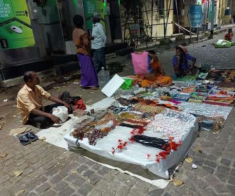


Madurai, being the home to Jasmine flower, has a lot of women selling garlands and flower buds. Also, there were street vendors selling small versions of kitchen utensils as a play-kit. The street food is usually vada, pakodas, raw fruits, hot milk beverages like badam milk, coconut milk, wheat milk, etc.

Coconut Water/ bark & Jack fruit
Flower Sellers

Fruit Sellers
PRECINCT TRADE ANALYSIS - PART 2
Police Checkpoints
The hawkers and street vendors take up the street corners or line up outside important monuments, religious structures or commercial and transit hubs.
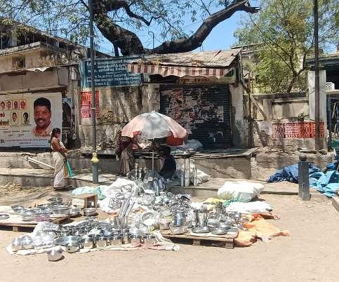
The flower sellers dotted the streets everywhere around the city, true to the City of Jasmine. Utensils, kitchen set and accessories are mainly sold near the Temple Complex on the Chitrai Street and some parts of the Āvani Moola Street. The vendors selling food and beverages are found everywhere in the precinct except in the Chitrai Street. There is invisible and unsaid barrier that makes the area around the Temple Complex void of food sellers, which plays a major role in the cleanliness and up-keeping of the Chitrai Street.
Presented by Ar Aynul Inaya
Roll no. 20MRA004, Sem IV, M.Arch (RA)
Guided by Ar Asma Hamid
Jamia Millia Islamia, New Delhi
10
documenting trade
0 50 100 200 m
celebrating / documenting religion
RELIGIOUS PLACES AND CELEBRATIONS
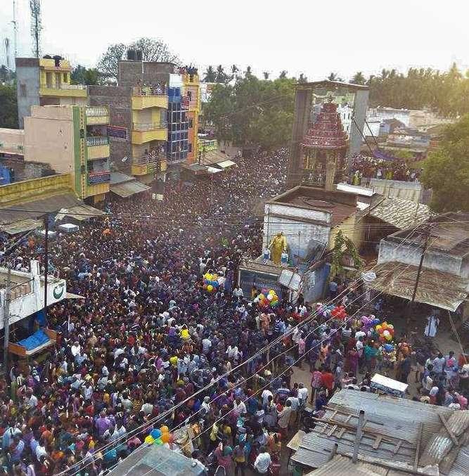
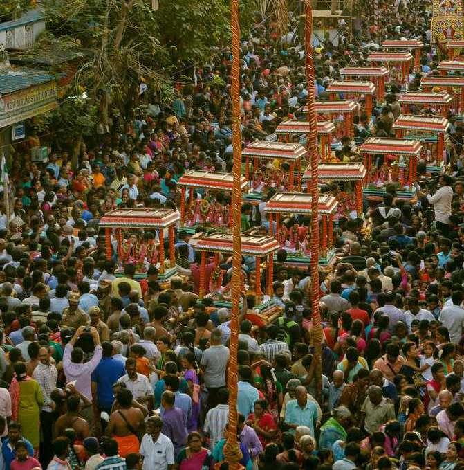
The heritage core is dotted with a mosques, churches and a number of big and small temples (map on the right). While each of these religious places have a history and a tale to tell, the Meenakshi Amman Temple, Shri Koodal Azhagar Temple, St. Mary’s Church and Kazimar Big Mosque play the most important role. The celebrations are brought out of the premises with people flooding the streets. The celebrations and festivities continue throughout the year, as processions of the deities, as depicted below.
Churches (13)


Temples (74)
Mosques and Madarsahs (14)
Meenakshi Amman Temple
The Holy Rosary Church
Thai Theppam (Thai)
- mid Jan to mid Feb -
The deities are taken outside to the Mariamman Theppakulam on a full moon night. It also marks the BIRTHDAY of Thirumala Nayakkar.
Māsi Therottam (Māsi)
- mid Feb to mid March -
A huge procession of the deities in the Māsi Street. The festival is celebrated for one day and witnesses a crowd of more than a couple lakh people.
Panguni

Shri Koodal Azhagar Temple
Kazimar Big Mosque
St. Mary’s Cathedral
Thasildar Jumma Mosque

Kazimar Santhanakoodu (Āni)
- mid June to mid July -
he Kazimar Mosque celebrates a sandal anointing festival in remembrance of the old Saint.
Kolāttam (Aippasi)
- mid Oct to mid Nov -
Meenakshi takes the form of a small girl and UNJAL FESTIVAL is celebrated for 10 days.

NTS


- mid March to mid April -
The festival welcomes the Kodai Vasantham or the Summer Spring. It is also called the Full Moon of Divine Marriages as many Hindu deities are known to married on this day.
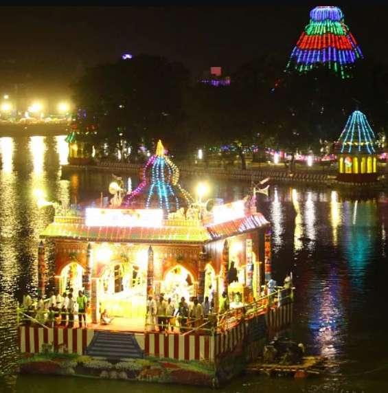
Chitrai Thiruvilla (Chitrai)
- mid April to mid May -
The month of Chitrai signifies the 10 day marriage of Meenakshi and Sundereshwarar. The next 15 days is dedicated to the AZHAGAR VAIGAI ELENTHUARULAL.
Vaikāsi Visagam (Vaikāsi)
- mid May to mid June -
The deities in the Meenakshi Temple leave to stay in the Pudhu Mandapam for 10 days. At Koodal Azhagar Temple, the annual Brahmotsavam takes place.
Ādi Mulai Kattu (Ādi)
- mid July to mid AugustMeenakshi is taken in a procession in the Adi Street located on the inside of the Temple Complex.
Āvani Moolam (Āvani)
- mid August to mid Sep -
Sundereshwar finally takes a joint rule of Madurai with Meenakshi, 4 months after their marriage.
Navarātri (Purattāsi)
- mid Sep to mid OctDeities stay inside the Complex. Stepped display of deities called Golu are created like the Gopurams of Dravidian Temples.
Mārgazhi Maha Utsavam (Mārgazhi)
- mid Dec to mid JanMeenakshi is taken on a procession on the Chitrai Street and for a single round in the Veli Street to bless the people outside the fort walls in olden times. Also, for CHRISTMAS, the St. Mary’s Cathedral is visited by nuns and Christians from two days before.
Kārthigai Deepam (Kārthigai)
- mid Nov to mid Dec -
The Temple is lit with diyas and lanterns afloat the pond inside, making a beautiful scene.
Uththiram (Panguni)
Presented by Ar Aynul Inaya Roll no. 20MRA004, Sem IV, M.Arch (RA)
11
Guided by Ar Asma Hamid Jamia Millia Islamia, New Delhi
documenting people and activities
USERS AND USER ACTIVITIES
The precinct is easily identified to have a rich residential, commercial as well as religious community. The users vary from the residents to shop keepers, visitors, tourists to pilgrims, bloggers and vloggers to shoppers.
Some nodes and junctions are more prominent with activities than others. The adjacent map shows the user type and their respective activity.

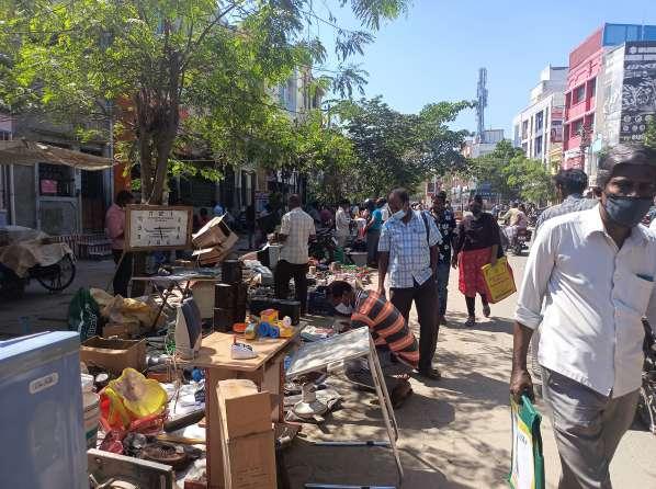
An extension of South Chitrai Street, it witnesses recreational activties involving local street food, accessories, toys, delicacies, etc.
Women shopping for jewelery while men cool outside drinking coconut water.


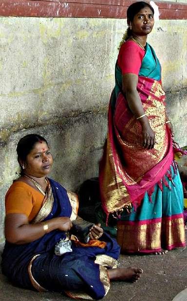
Women wearing bright colored silk sarees, with their male family members, walking barefoot in pilgrimage to and around the Temple.



Saurashtrians are commonly observed to inhabit here. Women wait for govt. water lorries for drinking and cooking water supply.


Autos waiting in the stand as women shop for clothes, spices, etc. The node also serves the pilgrims going to the Temple. 0400 hrs
An extension of South Chitrai Street, it witnesses recreational activties involving local street food, accessories, toys, delicacies, etc.

The Regal Talkies Theater is one of the few cinema halls in the precinct. There are always some activty going outside the theater all day.
Horses, elephants and their mascots stand near the Palace, offering

Fruit vendors line up in the entrance of East and North Masi street. The people pause their vehicles or come by foot to buy the fruits.
CLASSIFICATION OF ACTIVITIES
The streets witness a range of activities, that can be classified into overall tags as shown below.
Temple Visits

Tea Stalls Cleaning


0900 hrs 1400 hrs 2200 hrs

Waste Collection Institutional Activities


Water Distribution Patrolling
Commercial Activities Loading/ Unloading


includes regular commercial activities, patrolling, religious activities, etc.
Occasional Activities comprises of the flea markets, political meetings and festivals.
Social Activities involving community interaction and coming together of different groups of people.

FACTORS AFFECTING THE ACTIVITIES
The observed activities have occurred due to certain factors.


Food, Markets, Monuments, Accessibility, Amenities and Shade


Shoppers Traffic Police
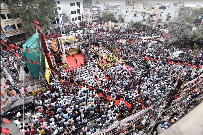
Political meetings are occasionally held at Simmakkal that cause traffic congestions, noise pollution, etc. Lack of proper seating, vending and parking spaces is observed during these meetings



Source: Author
Street vendors Laborers
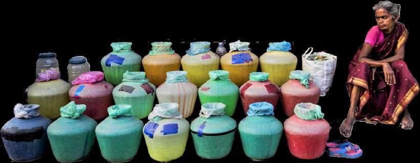
Priest and Pilgrims Sweepers and Cleaners
Political Meetings
01 02 03 04
Cultural & Religious Activities Monumental Activities Commercial Activities Recreational Activities Traffic Activity Nodes
0000 hrs
02 03 01 04
Hawkers Flea Market Dustbins
12 0 3 6 9 m 0 75 150 300 m
Presented by Ar Aynul Inaya Roll no. 20MRA004, Sem IV, M.Arch (RA) Guided by Ar Asma Hamid Jamia Millia Islamia, New Delhi
analyzing the precinct
STREET-WISE ANALYSIS OF THE PRECINCT
The streets in the heritage core of Madurai play an important role in the everyday life of the people living and visiting the precinct. They influence the markets, trade, recreational activities, type of influx, pedestrian and vehicular movements, user typology, etc. Hence, understanding these streets is an important part of the study.
So far, it has been observed that there are five main streets: Veli Street, Marret Street, Māsi Street, Āvani Moola Street and Chitrai Street. These streets are named after the Tamil calender months and hold a lot of cultural, historical and religious significance. Also, these streets are co-centric, implying them to be named as North, South, East and West.
North Veli Street
South Veli Street
Margazhi Maha Utsavam (mid Dec - Jan)
Christmas (Dec 24)
West Marret Street
(mid June - July)
Eid-ul-Fitr; Eid-ul-Bakr
Masi Therottam (mid Feb - Mar)
Chitrai Thiruvilla (mid Apr - May)
South Āvani
FINAL REMARKS
set up their practices for almost a century. Otherwise, no particular presence is noted.


Prominently a residential street (mostly Islamic), the street is home to one of the oldest Mosques in the city.
called the Palace Road, part of the street is occupied by the Onion Market, where loading and unloading activities go on till late.
too is mostly influenced by the Railway Station and Central Bus Stand in the West Veli Street.


Avani Moolam (mid Aug - Sep)
Vaikasi Visagam (mid May - Jun)
Kolattam (mid Oct - Nov)
Karthigai Deepam (mid Nov - Dec)

Thai Theppam (mid Jan - Dec)
The table shows the typology of buildings, street edges, activities and users found in each of the streets that define the heritage core of Madurai. The highlighted streets are observed to have more influence in the precinct’s functioning.
ACTIVITY CONCENTRATION
It was observed that some streets in the North and South are majorly residential, while the streets in East and West have a lot of commercial activities happening. Similarly, it is observed that more activities take place inside the core than on the outer edges of the precinct.


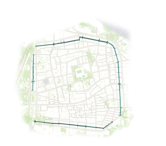
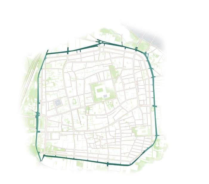
COMMERCIAL VS RELIGIOUS SIGNIFICANCE


It is permissible to say, that the Temple Complex plays a huge role in influencing the activities. Also it can be noted that, the activities around the Temple Complex are not supposedly religious. There are more of commercial activties than religious. This proves that, although Madurai is called the Temple City, its main attraction is trade and commerce. Which is also the reason, why it played an important role in the Spice Trade with Romans and Greeks millennials ago.
used to be one of the buzzing streets before its pedestrianization. Now it lies mostly shut down and silent throughout.
The street sees pilgrims, tourists and shoppers throughout the day.
main


to the Temple, the street is the most active of all the Chitrai
Like the North Chitrai Street, this too has lost its charm as pilgrims rarely visit this part of the Chitrai Street.
11 m to 12 m 8 m to 12 m 10 m to 12 m
Location Nodes & Junctions RoW; Public Transit; Parking Edges & Use Heritage Structures Religious Activities Trade & Commercial Activities Other Individual Activities & Users Remarks
Moola Street West Chitrai Street North Marret Street East Māsi Street North Chitrai Street East Veli Street North Māsi Street East Āvani Moola Street South Marret Street West Māsi Street South Chitrai Street West Veli Street South Māsi Street West Āvani Moola Street East Marret Street North Āvani Moola Street East Chitrai Street Presented by Ar Aynul Inaya Roll no. 20MRA004, Sem IV, M.Arch (RA) Guided by Ar Asma Hamid Jamia Millia Islamia, New Delhi 13 1. Simmakal 2. Yannaikal 1. Simmakal 2. Yannaikal 1. Miscellaneous 2. Sunday Flea Market 1. Miscellaneous 2. Fish Market 1. Hotels 2. Restaurants 1. St. Mary’s Cathedral 1. Victoria Edward Hall 1. Kazimar Mosque 1. Thirumala Nayakkar Mahal 1. Remains of Madurai Fortress 1. Ther 2. Villakuthoon 3. 10 Pillar Street 1. Raya Gopuram 2. Nandi Statue 1. Pudhu Mandapam 2. Meenakshi Amman Temple 10 m to 12 m Commercial The street mainly functions as a carriageway for vehicular traffic with close to no prominent activities. Residential This part of the precinct is prominently residential, with no commercial activities. Commercial & Institutional The street has a commercial and institutional presence, along with its use as a transit street. Commercial & Institutional It acts as a major entrance to Madurai from other cities and states of India, influencing the activities and use of the street. Commercial & Institutional Part of the street is home to advocate and lawyers who have
1. Miscellaneous 2. Lawyers Residential & Religious
Residential, Commercial & Institutional Also
1. Vegetable Market 2. Flower Market 3. Onion Market 4. Notary Offices Residential & Commercial This
1. Textile 2. Hotels Commercial The street
various
hardware shops here. 1. Fruit Market 2. Hardware & Utilities Commercial The street is one of the
sought after markets for textile Textile Commercial & Religious The street can
an all-rounder,
rich heritage,
commercial, religious, pedestrian and transit activities 1. Fruit Market 2. Coconut market 3. Utensils 4. Spices 5. Handicrafts Commercial & Religious The street
a
commercial
church and temple all located in close proximity. 1. Textile 2. Hardware & Utilities Residential Majorly a residential street, it has close to zero traffic movement. Commercial The most sought after street for jewelery shops that date centuries Jewelery Commercial Another mixed commercial street with important heritage and religious structures, like the East Masi Street. 1. Utensils 2. Spices 3. Books & Papers 4. Textile Residential & Commercial The street is mostly residential except for the furniture stores that are open here. The street experiences minimal traffic as only particular shoppers visit it. Hardware & Utilities Residential, Commercial & Religious The street
Textile 2. Utensils 3. Handicrafts Commercial & Religious
Miscellaneous Commercial & Religious The
Streets. 1. Textile 2. Miscellaneous Residential, Commercial & Religious
1. Textile 2. Jewelery 3. Miscellaneous 6 m to 8 m 10 m to 11 m 5 m to 6 m 9 m to 11 m 8 m to 10 m 8 m to 9 m 4 m to 6 m 8 m to 10 m 7 m to 8 m 8 m to 10 m 6 m to 8 m 8 m to 10 m 5 m to 6 m 12 m to 13 m 8 m to 10 m 9 m to 10 m 1. North Tower 1. Thevattu Sandhai 2. South Gate 3. Crime Branch 1. Entrance to Jadamunivar Temple Street 1. South Tower 1. Nelpettai 2. East Gate 3. Munichalay 4. St. Mary’s Jn 1. Famous Jigarthanda Jn 2. Palace Entry 1. Fruit Market 2. Ther Muttu 3. Entry to Amman Sannathi 4. Villakuthoon 1. Nandi Statue 1. East Tower 2. Amman Sannathi 1. West Gate 1. Town Hall Road and West Tower Street Jn 1. End of Netaji Road 1. West Tower MAJOR ARTERIAL COLLECTOR ROAD MINOR ARTERIAL PEDESTRIAN Santhanakoodu
is known for the truck booking services available here, along with the
electrical, plumbing, paint and
well
be called
with
buzzing
has
good
as well as religious presence, with a mosque,
1.
entrance
MINOR ARTERIAL North-South streets Heritage Structures Bus Route Christian Friends Children Woman/ girl shopping Traffic Police Street vendor Laborer Priest People sitting Bus Stand Residential Institutional Religious Commercial Space for Parking Bus Stop Islamic Family Couple Man shopping Manual Check Busker Sweeper Railway Station No Parking Space Auto Stand Hindu Elderly Transgender Mother shopping Mechanical body check Hawker Dustbin Shop promoter East-West streets Nodes & Junctions 0 200 400 800 m
studying east maasi
MĀSI STREET
The Māsi Street is the third concentric street grid from the Meenakshi Amman Temple. It is also the most wide of all the street grids within the heritage core. Each of the four Māsi Streets have a distinct character, typology and use that makes them different from the other streets in the core.


1. NORTH MĀSI STREET:
It has most of the hardware stores, paint shops, metal works, electrical and plumbing accessories, goods and cargo godowns, and also lorry booking offices. The street has a Temple that plays bhajans, songs, etc. throughout the day.
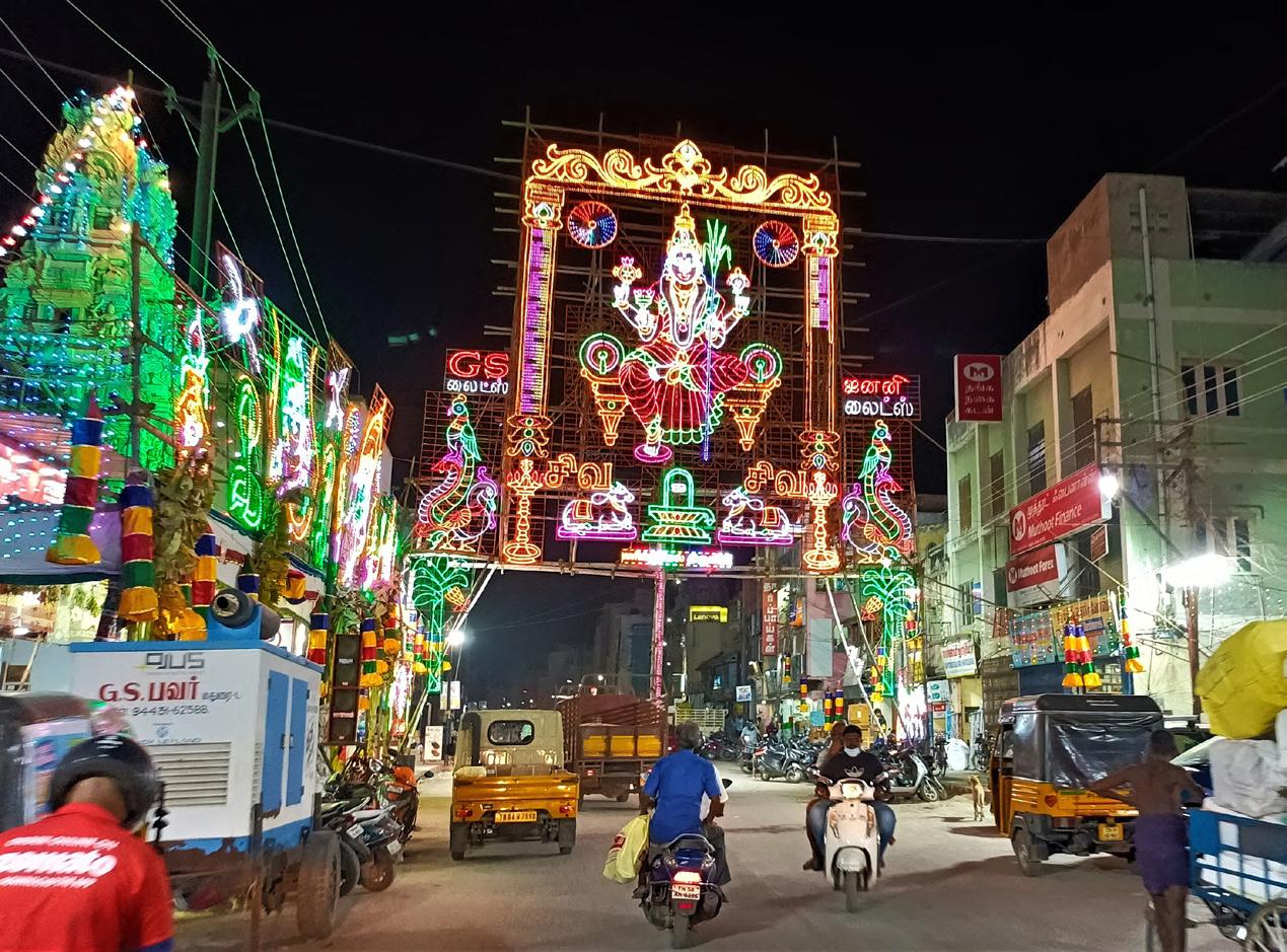
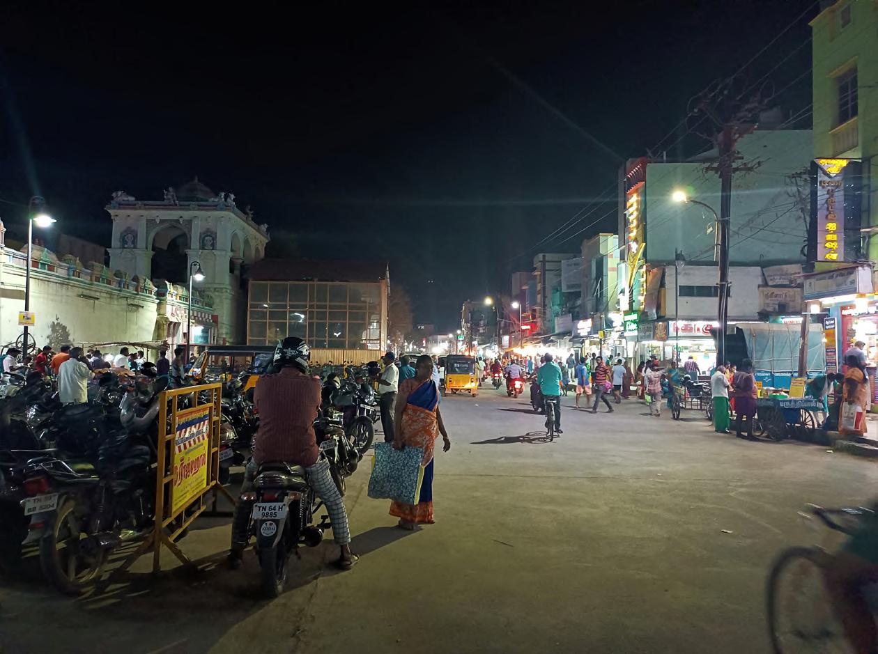

2. SOUTH MĀSI STREET:

This has textile showrooms and big brand names in clothing, jewelry and accessories. The street gives access to the South Āvani Moola Street that is also called the Jewelry Street.


3. EAST MĀSI STREET:
The Street is the most used of all the streets, during normal times, festivities as well as by tourists. The huge temple cars that are used in the festival processions are housed here. The street is also the most connected according the current traffic route plan. The spice market, handicrafts fruit market and utensils are the major trade commodities on the street.
4. WEST MĀSI STREET:
The street has a mosque, church and few temples, making it religious diversity. The street acts like a connecting street between the cross roads like Town Hall Road, West Tower Street and Netaji Street. It just acts like an extension of the market typology from these streets, with no distinct character and use.


EAST MĀSI STREET
The most used and most frequented streets in the whole core is the East Masi Street. Anyone who comes to the core enter this street, pass this street or park their vehicles here in further.


The fruit market witnesses a permanent hawker and squatter set up throughout the day, selling mostly fruits and very rarely vegetables. This is often seen as a hindrance to the vehicular movement in the area.
The alleyways are usually very narrow with a width of 1 to 3 meters. The small alleyways do not have access to road but rather open into the sidewalk, making them inaccessible to two wheelers of the residents of the alley.
E. HEIGHTS & ENCLOSURE RATIO
The buildings were observed to be of random heights ranging from one storey to four storeys, right next to each other, leading to a huge variation in enclosure ratios, every few meters.
F. COLORS & PATTERNS
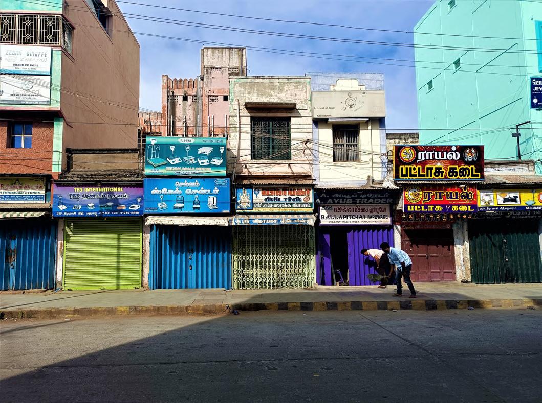
The entire street dominated bright and lively color palette their buildings, gates, windows and shop shutters. Also gates, grills, windows, shutters were also found to have shapes and patterns.
1 2 1 2 3 4 3 4 Spice Market Ezhu Kadal Street Thasildar Pallivasal Street G H F E Spice Market Temporary battens used as bridge Hawkers on both sides Two wheelers one side Sidewalk under construction Hawkers Two wheelers parked Temporary mid-block Makeshift ramp for loading and unloading Trash Can North Marret Street East Marret Street Towards Munichalay Ezhu Kadal Street Amman Sannathi Street From South Avani Moola SouthMasiStreet Towards East Veli North Masi Street Two wheelers Villaku Thoon Hawkers 2m 2m 2.5 m 2m 1m 5.5 m 2 m 3 2m 7.5 m 4.5 m 10 m 8.5 m A C D D E C B B A
E
B. HAWKER ZONE
D. ALLEYWAYS
15
whole heritage core has to here for going
ODOR, NOISE
wheelers parked on
Four wheelers parked in the alleyway
First Temple Car
Hawkers
Second Temple Car at distance
wheelers parked
Temporary
PATTERNS
dominated a palette for windows the shutters different
HAWKER ACTIVITIES

Hawkers and vendors take up spots on the street and stay in the same spot for the whole day.

VEGETATION
The street has almost no trees, open space and greenery on its premise.
The activities in the street and affected by and certain sensory elements like noise in the Utensil Market, spicy odor from the Spice Market, etc.. SERVICES
The street has two traffic police watch towers, big trash cans. There is also the Villaku Thoon Police Station.
RELIGIOUS PLACES
There are two big Temple cars near the center, and a Madarsa in the North.
SHOP USE
The street has two traffic police watch towers, big trash cans. There is also the Villaku Thoon Police Station.


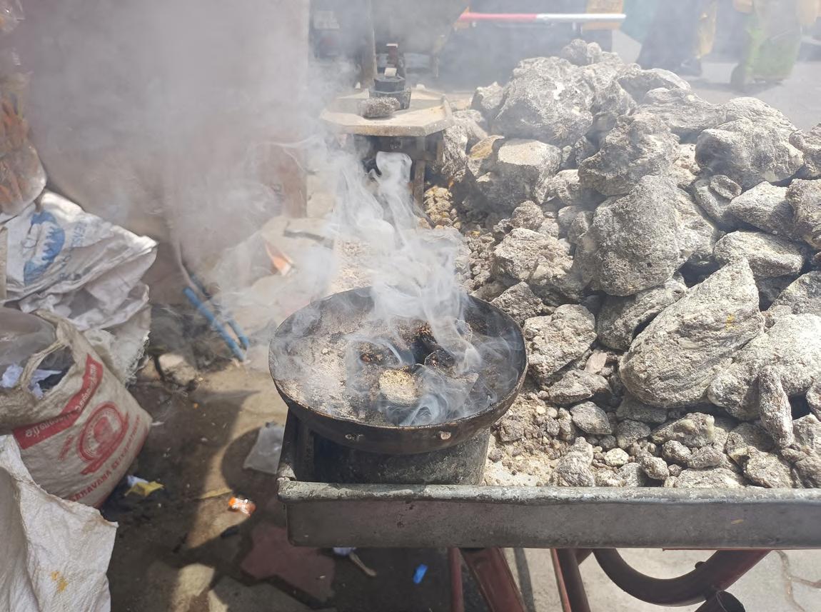
Sambrani, a type of local incense is sold in the Spice Market. The image shows the incense being burnt.
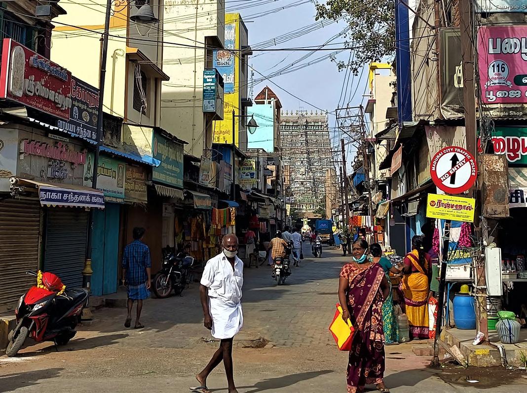
H. VIEWS AND VISTAS
The East Masi Street is visually connected to the East Tower and Amman Sannathi. The streets have been planned and evolved in such a way that it entirely encloses the view of the Temple Tower, making it a major point for photography, etc.
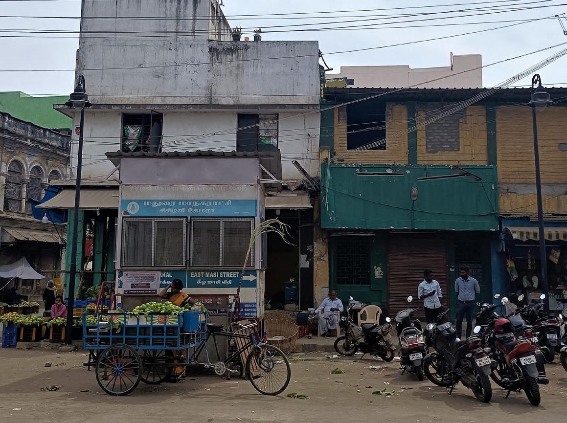
Traffic Police Check-posts are located at both the entrance to the streets, often observed to be unmanned. Howsoever, the crime rate or the occurrence of any tiny mishaps in the markets was found zero.
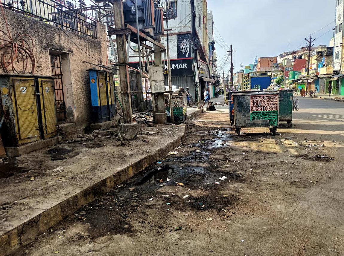
Ironically, the East Masi Street has three large dumping bins at appropriate distances, and yet the area surrounding the bins give out a nasty stench and make the whole street look shabby.
Two huge Temple Cars sit in the middle of East Masi Street. These wooden Cars carry the idols during processions pulled by tens of hundreds of devotees. On all other days they are housed here under temporary sheds. It is also for the movement of these Temple Cars, that the Masi Streets are wider than others
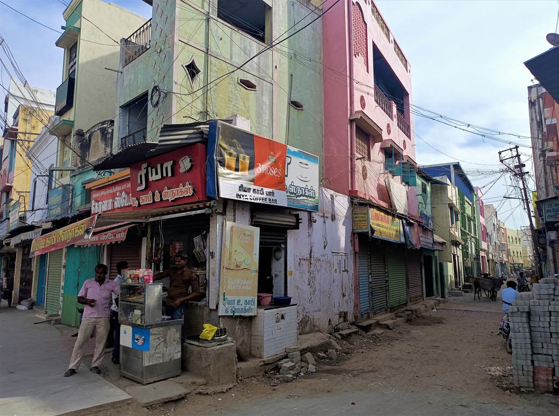
Tiny tea stalls in the street corners open throughout the day and night, service the people, shopkeepers and others.
The Spice market near the middle of the East Masi Street sends out a welcoming smell of sandalwood and turmeric. The markets being located right at the entrance to the street leading to the Temple Towers, also have a auspicious religious significance.

Thasildar Pallivasal Street North Masi Street North Marret C D A B Madarsa Fruit Market
Fruits Fruit sellers Fast Food Foul odor Fruit smell Flower smell Spice smell Noise from utensil makers Grass smell Temple Cars Police Station Trash can Coconuts Eateries Textile Utensil Spice Flower sellers Handicrafts Madarsa Authorised Parking Unauthorised Parking
m
Villaku Thoon Police Station, one of the major ones in the precinct is located in the street.
Presented by Ar Aynul Inaya Roll no. 20MRA004, Sem IV, M.Arch (RA) Guided by Ar Asma Hamid Jamia Millia Islamia, New Delhi
14 exampling Istanbul
CONSTANTINOPLE

The present day Istanbul, the capital of Turkey is home to one of the richest heritage, political history, cultural influences and religious monuments. The heritage capital called the Istanbul’s Historic Peninsula, earlier the Constantinople, has been at the center of the 8500-year-old capital city through the Byzantine and Ottoman empires and modern times.
IMPACTS OF URBANIZATION AND NEED FOR REDESIGN

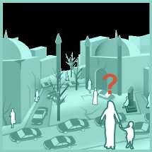
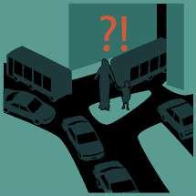
In the mid 1900s with rapid urbanization, industrial growth and population increase due to migration made it nearly impossible to create holistic plans for the area. Traffic and vehicular movement along the roads and the coastlines surrounding the peninsula was observed to be growing with a serious demand for parking space. By early 2000s, the peninsula’s daytime volume of pedestrians and traffic flow became a huge concern for the transportation and urban planning departments of Fatih. By 2011, the heritage preservation department warned that the vibrations from the traffic on the roads could damage historic monuments like the Basilica Cistern.


POTENTIALS CHALLENGES
METHODOLOGY OF SURVEYS AND DOCUMENTATION
In 2010, a study was conducted by the Istanbul Metropolitan Municipality that mapped the public spaces in the peninsula, the relationship between the pedestrians, vehicles, the challenges, opportunities and framed a people-oriented planning approach.


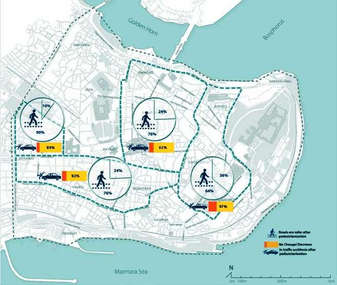
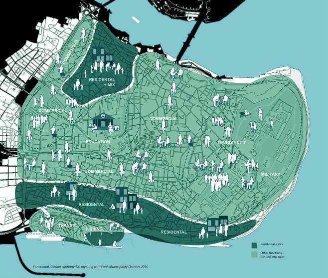

This report formed the baseline data for various transformations and design interventions that followed over the years. The pedestrianization project was jointly executed by Istanbul Metropolitan Municipality , EMBARQ Turkey and Gehl Architects.
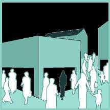
Istanbul Public Space and Public Life

The Istanbul survey encompasses 22 streets and connections besides 13 squares and parks; Recording of pedestrian traffic

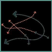


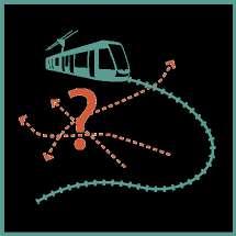


• Registration of staying activities occurring
Historical Peninsula Design Concepts for Safe Accessible Streets


• Road Safety inspections

Pedestrianizing Istanbul’s Historic Peninsula: Perspectives from Local Businesses
• Business Survey

New Traffic Rules
RESULTS
Nearing the end of this pedestrianization expedition, there was a lot of positive reflections and changes in the habits and working of the city and its people. There was also a notable change in the area’s air quality, almost paralleling with the European cities.
During daytime hours (10:00 – 18:00), the streets and roads are accessible to pedestrians only. During the rest of the day, vehicular traffic is limited;
Only official vehicles, such as embassy, police, postal service, bank, fire service and hospital vehicles are allowed access during daytime hours;
Vehicles with commercial licenses are allowed access for loading/unloading outside the hours of 10:00-18:00;

Street vendors are prohibited from accessing some streets and roads;
Inspections and enforcement are conducted by the municipal police forces of Fatih Municipality;
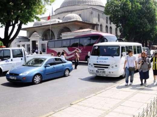
Tourist buses will use only specially designated routes and stops.
63% local businesses benefited.
76% pedestrians felt more safe on roads.

58% residents felt connected to the visual quality.
56% heritage tourism was strengthened. 52% walk-ability was enhanced.
 Presented by Ar Aynul Inaya Roll no. 20MRA004, Sem IV, M.Arch (RA) Guided by Ar Asma Hamid Jamia Millia Islamia, New Delhi
Location Public Transport A Good Climate 2005 - 2009 2011 - 2012 2010 2013 Traffic Congestion Difficult Crossings Lack of Benches & Facilities History and Heritage Sensory Experiences Interesting Walking Routes Tick off Tourism Parking on Foot-ways Barriers Neglect and Decay Insufficient Public Transport CITY QUALITIES WALK-ABILITY RECREATION Topography Liveliness Need for Seating Steep Grades Lack of Legibility Poorly Maintained Foot-ways Un-integrated Parks Unclear Pedestrian Network
DOCUMENTATION MAPS PEDESTRIANIZATION PROGRESS
Assessment of Pedestrianization Project in Historic Peninsula Business Survey Resident Survey Student Survey 2010 2012 2013 2014
Source: Gehl, 2010. Public Spaces and Public Life Embarq Turkey, 2014. Istanbul Historic Peninsula Pedestrianization Project Embarq Turkey, 2013. Perspectives from Llocal Businesses
identifying plus minus
CONSTRAINTS AND POTENTIALS
The city’s core is full of historical structures and architecture. But it is scattered all over the precinct, unattended and neglected to decay.
Most of the heritage structures are owned by the government and used as offices, museums, etc. But the govt. also ignores its slowly degrading process.


500m
1000m 1500m 2000m
Lack of proper lighting, CCTV surveillance and patrolling has made walking in the late hours unsafe.

Culturally rich streets
Streets where locals shop

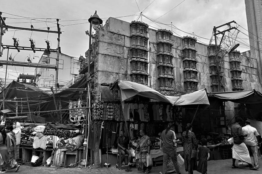
Streets with heavy traffic at all times
Congestion points of people and vehicles
Accident prone zones

Religious buildings
Heritage buildings
Public Transit
Commercial areas
Residential areas
Rapidly modernizing areas
The junctions and important nodes do not have proper round-abouts, mid-blocks, etc. leading to confusion and accidents.
The RoW of all the Masi streets are wide and pose great opportunity for interventions and proposals


There is no place for hawkers and vendors to practice their trade, forcing them to crowd the streets, sidewalks and limit the movement of others.

owned
structures
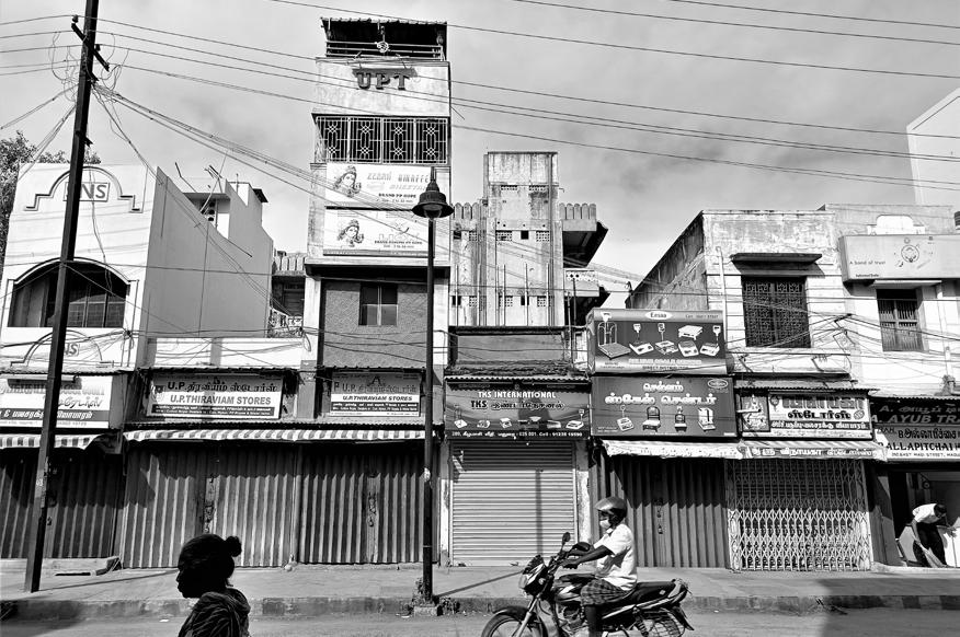
The shops and setups are destroying the heritage front, as well as the political or movie posters, banners, electric lines.
The city is rich in tangible and intangible cultural practices and skills that can boost its tourism, economy and global significance.


The precinct’s markets are grouped together according to commodities and services, directly influencing the visitor’s activities and perspective.
The entire precinct is observed to have hardly any greens and shading devices.
The building heights vary a lot within consecutive building distances, making it difficult to understand and analyze enclosure ratios.
Advancements in technology and communication have made the native goods to be available everywhere, affecting the local shops and trade. The shopper influx to the city has decreased over the years.
The lack of parking spaces, congestion, improper side-walk, absence crossing devices affect the locals’ shopping experience.
The city witnesses a very hot weather for most part of the year. The direct sunlight can be used as a source of energy.
The Chitrai streets’ pedestrianization has negatively impacted its trade and activities. The North and West Chitrai remain abandoned for most of the days.
The right of way of most streets vary a lot within a few meters, leading to congestion in the carriageway.
17
Presented by Ar Aynul Inaya Roll no. 20MRA004, Sem IV, M.Arch (RA) Guided by Ar Asma Hamid Jamia Millia Islamia, New Delhi
The residential areas have been indirectly segregated from the commercial areas, creating an opportunity in itself.
The privately
heritage
like villas, bungalows, etc. are being transformed and renovated to suit the styles of the modern era.
The tourists influx to Madurai is influenced by the commercial front it poses more than its religious and cultural front.
The precinct has rich historical and socio-cultural value. Architecture, handicrafts, cuisine, textile, music, art and dance forms. NTS
STREETS FOR CONTEXT
Every site has a specific characteristic that helps identify the uses and functions that the street must support. Streets should satisfy the natural, social, cultural, and economic environments. Designing streets must consider its context in all aspects like changing the configuration of an existing roadbed or planning new neighborhoods. Streets have the power to drastically catalyze change in neighborhoods, or to enhance, protect, and improve what is already there.
Some key factors influencing contextual street designing and planning are:
TACTICAL URBANISM
Tactical Urbanism is a bottom-up action or approach done in big cities as an experiment before making it a policy on a big scale. It can be defined as ‘a city and citizen-led approach to neighborhood building using shortterm, low-cost, and scalable interventions intended to create long-term change’.

Source: Tactical Urbanism: Creating Long-Term Change in Cities Through Short-Term Interventions (2020, July 31). parCitypatory.
DESIGN HOUR


TRAFFIC EVAPORATION
TEMPORARY PEDESTRIANIZATION
Streets are completely blocked off vehicular access for certain hours of the day or days of the week, allowing only pedestrian access, holding events and enjoying carfree, people-friendly streets.
KEY
TO DESIGN STREETS FOR GREAT
Different streets function differently at different times of day, at different times of year, and over longer periods of time. Their usage, pace and flow of life varies, expanding and contracting with people, vehicles, vendors, cafés, markets, etc. throughout the day and week. Design Hour, or activity levels during an hour, is used to determine the appropriate street dimensions.
TRAFFIC CALMING
Shifting of road capacity to other modes like public transport, cycles and walking, can help evaporate a certain amount of privatized vehicular traffic from the roads, giving way to more cleaner, greener and people friendly streets in the city. This makes the drivers change their mode of transit, or change destinations or change their travel times.

SHARED STREETS
When the pedestrian traffic is higher, the streets are made to be shared by everyone, the pedestrians, bikers, cars, etc., by removing the physical divisions like curbs, hence providing right-of-way to all and indicating vehicles as mere guests. Shared streets become an extension of front yards, shop fronts, etc.
STREET DESIGN ELEMENTS

A direct German translation that refers to a system of design and management strategies that aim to balance traffic on streets with other uses. These are universally used techniques that aim to decrease vehicular traffic by slowing it down, or literally ‘calming’ it, and hence building an environment that is inviting to the people on foot.
COMPLETE STREETS
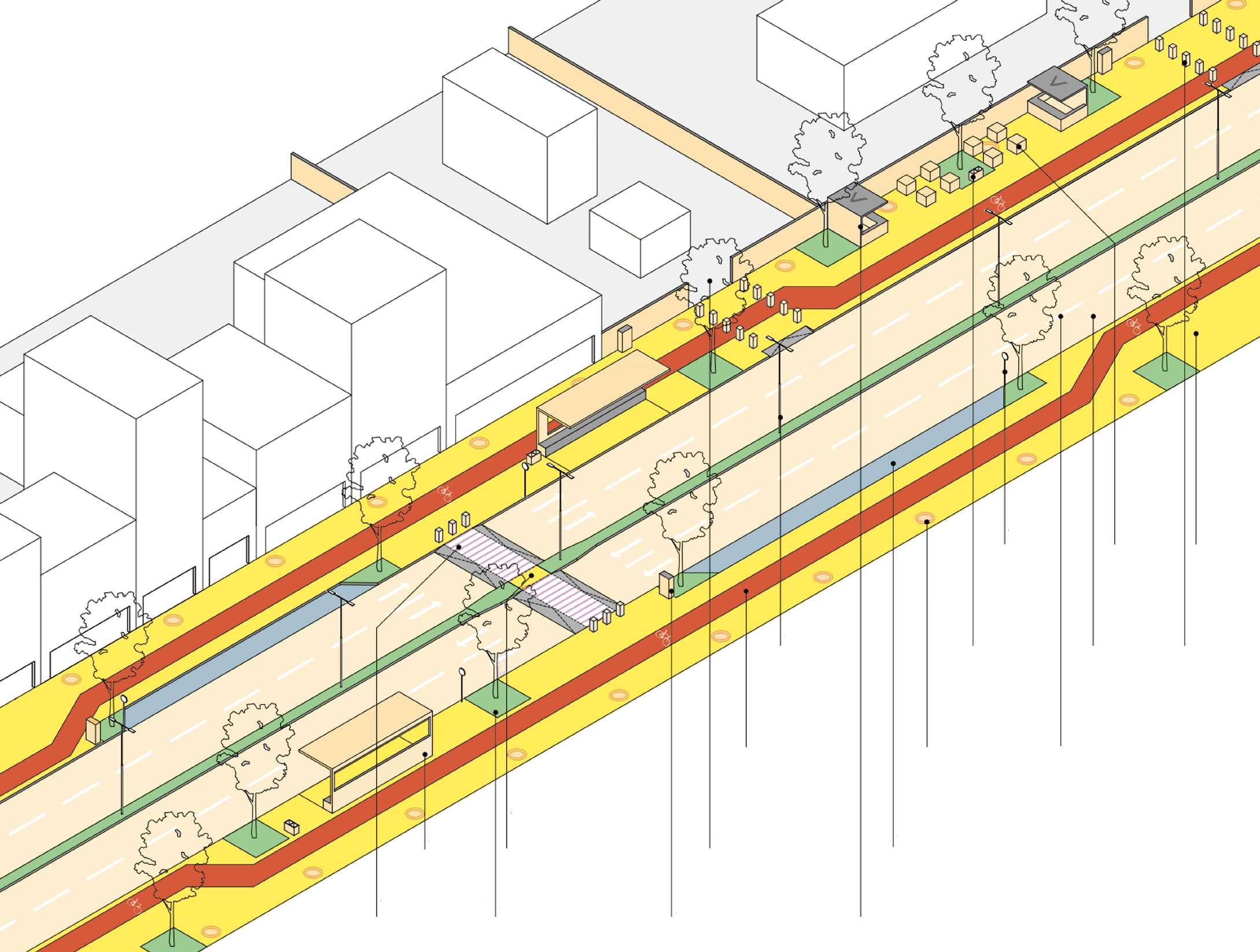
ITDP states that when a street is planned and designed such that it can cater to the needs of all its users and their respective activities by the means of allocating equitable road space for everyone, then the street is ‘complete’.
The diagram shows the common elements that are used in street design in the Indian context. Presented
Pedestrian Crossing Landscaping Utilities: Junction Box Street Vending Bus Stop Pedestrian Refuge: Mid-block Property Entrance Cycle Track Street Lights Dustbins Signage Seating Footpath Carriageway Bollards Utilities: Manhole Lane Marking On-street Parking
defining Density History and Culture Mix of Uses and Destination Road Safety Demography Access and Mobility Street Networks and Connectivity Block Sizes Ecosystems and Habitats Public Health Geographic Features Natural Disasters Streets for Everyone Streets are Public Spaces Streets as Ecosystems Streets for Safety Streets as Multidimensional Space Streets for Health Streets are Multimodal Great Streets create Value Streets for Context Streets can Change
DIY URBANISM URBAN ACUPUNTURE URBAN PROTOTYPING PLANNING-BY-DOING Source: Bogdan, J. (2017, August 26). Public space design. Behance. Source: Barnett, B. (2018, June 19). Calming Effect: Apply to Calm Your Residential Street. SFMTA. 4. Park it right 1. One street, one width 5. Put the shades on 2. One footpath, one level 6. Liven it up 3.Make complex intersections compact AM Peak: Signals are adjusted to accommodate rush-hour traffic during the peak hour, metering traffic to prevent gridlock. Midday: Downtown pedestrian volumes reach their peak intensity at lunch hour. Evening: Traffic volumes begin to dip after rush hour, while pedestrian traffic in certain areas rises. Source: Global Street Design Guide. (2021, June 14). Global Designing Cities Initiative. Traffic Calming 101. (2008, December 31). Project for Public Spaces. Complete Streets Framework Toolkit. (n.d.). Institute for Transportation & Development Policy.
PRINCIPLES
COMPLETE STREETS
PRINCIPLES
CITIES
DESIGN
FOR
18
by Ar Aynul Inaya Roll no. 20MRA004, Sem IV, M.Arch (RA) Guided by Ar Asma Hamid Jamia Millia Islamia, New Delhi
VISION STATEMENT
To enhance, revive and restore the cultural practices, historical and architectural values in people-friendly streets by regenerating trade and commerce as catalysts for community interaction and ecosystems, health and safety, accessible and multi-modal streets.

Where? Streets
Culture & Heritage
GOAL ONE: Design People Streets
1.1. COMPLETE STREETS
1. The streets will be redesigned to influence more people to use than the vehicles.
2. The streets should be incorporated with facilities like toilets, drinking water facities, etc. ensuring convenience for the users and their activities.
3. The sidewalk will be transformed and designed with including the following:
• The sidewalk and entrances to alleyways should be made accessible to everyone through ramps and other such devices.
The width of the sidewalk will need to be increased where possible for influencing more pedestrian movement.
The sidewalk height will be maintained as low floor or up to 150 mm.
• Sidewalk width will be interchanged and designed to accommodate parking bays and vegetation wherever possible.
4. Street lights, signage and traffic calming strategies will be implemented near junctions, nodes and important intersections to ensure easy flow of vehicles and pedestrian safety.
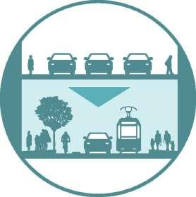
1.2. FAҪADE TREATMENT
1. The street edge will be redesigned to give a heritage overview.
2. Shading devices will be designed at uniform heights with the use of heritage and architectural elements and materials.
3. The shading device will be hollow from above according to the local construction detail and provide space for vegetation and facilitate in rain-water harvesting.
4. The facade treatment will also involve a color palette that matches the local context and will be street-wise.
1.3. TEMPORARY STREETS
1. The streets will have temporary and shared uses, to improve the quality of community interaction and act as a multi-dimensional space.
2. The streets will function as a regular vehicular shared street during the day and be open only to pedestrians during the nights.
3. This will be achieved gradually in phases and will vary with the local ecosystem of traffic, market typology, activity and user index.
GOAL TWO: Revive Culture and Heritage
MISSION 02: Revitalize the intangible heritage of Madurai to restore the city’s nightlife.
2.1. CHITRAI STREET
1. Chitrai Street should be transformed to accommodate cultural and recreational activities that should in turn work towards enhancing the night life of the streets.
2. The traditional dance forms, folk songs, theaters and other cultural arts will be organized in the Chitrai Street.
3. A non-profit committee, titled MADURAI CULTURE REVIVAL TRUST, comprising of representatives form the Meenakshi Amman Temple, the commercial set-ups on the street, from the residential community of the street, the representatives of the performers and theater groups and last but not the least, representatives from the local police.
4. Due to the proximity to the Temple, the eatery joints and the food joints will be strictly vegetarian.
5. The performances will be organized starting from 20:00 hrs up to 01:00 hrs on Friday and Saturdays for the first three months. Further the performances will be extended till later in the night and also to weekdays in the coming months gradually.
2.2. MASI STREET
1. East Masi Street will be developed to transform into a ‘temporary street’, i.e., it will continue to function as a vehicular street in the day as now; but its function will change as night sets in into a fully pedestrian street.
2. The street will work towards restoring the intangible aspects of the city’s heritage like cuisine, trade and commerce as well as traditional practices like folk performances and theater groups.

3. The street will developed to accommodate these performers, and commercial set-ups in the night through a series of design strategies and policies as elaborated in MISSION 04.
4. The performances and all the night set-ups will be organized and approved by the above mentioned MADURAI CULTURAL REVIVAL TRUST.
5. On the Masi Street, the Trust will closely work with the Traffic Police as it includes a significant amount of vehicular transit during the day.
6. After the daylight hours, precisely at 20;00 hrs to 05:00 hrs, the vehicular traffic will be directed towards North Masi Street and West Masi Street. The clock-wise one-way movement will be reversed to become anticlockwise in the night.
7. The nightlife and change in traffic route will implemented on Fridays and Saturdays for the first four months, before gradually extending to the rest of the week gradually in the upcoming months.
2.3. MADURAI CULTURE REVIVAL TRUST (MCR Trust)
The duty of the committee will be as listed below:
1. The committee will take care of the organizing these performances.
2. The committee will also be responsible for the wellbeing and in understanding the rights of the performers and the theater groups.

3. The committee should under all circumstances follow the guidelines and restrictions that are set by the local authority, including traffic department, and crime and civil departments.
4. The committee will function on the basis of public-private partnerships and will be active in heeding to the requirements of all the stakeholders connected to the streets
5. To keep in mind the context of the street, any performance or act that disrespect the interests of the Temple or any religion, caste, community, etc. will not be tolerated and will be immediately prosecuted. It is the duty of the committee to ensure such activities do not take place under any circumstance.
6. A series of walks will be held by the MCR Trust throughout the week, once in the day and once in the evening connecting the historical structures and culture-rich areas of the precinct, to enhance tourism and promote the city’s heritage.


3.1. RESTORATION AND DEVELOPMENT
1. The heritage monuments and structures and the area around them should be restored and developed so that the mentioned MADURAI CULTURAL REVIVAL TRUST can organize performances.
2. The restoration and the development will be overlooked by a body called the CULTURE AND HERITAGE DIVISION, that will be set up under the District Town and Country Planning Department in the Madurai Corporation.
3. The Division’s duties are as listed below:
• The Division will publish a report in the public interest every month about the progress.
• It is responsible for promoting the monuments and enhance tourism and pilgrimage through advertisements in both on-line and off-line platforms. It will hold workshops, conferences and talk sessions with students, stakeholders, professional groups and other agencies regularly to further its restoration and revival methodologies.
GOAL THREE: Revive Trade and Commerce
MISSION 04: Strengthen the economy of the city, with active markets streets as a catalyst for cultural revival and restoration of nightlife.
1. The trade and commerce in the market streets: Chitrai and Masi, should actively participate in enhancing the nightlife of the city.
2. The regular shops and offices must close down in the streets by 21:00 hrs and give way to temporary set-ups in the street.
3. Only eatery joints will be allowed to function throughout the night in these streets.
4. Other shop owners are allowed to shut down their shop and set up temporary stalls selling their goods and services.
5. All the temporary set-ups providing any service or selling goods will be registered and charged with a reasonable fee by the MCR Trust.
6. The temporary set-ups should strictly follow the guidelines given by the committee and should function as secondary services in the street, while the cultural arts and performances will be the primary function.
7. Due to the proximity to the Temple, the eatery joints and the food joints will be strictly vegetarian in the Chitrai Street, while Masi street can service in all cuisines.
8. Other temporary services like mobile swings and rides that are seen in fairs and Melas are allowed on these streets during the night.
9. The streets’ temporary commercial set up will function from 20:00 hrs to 05:00 hrs. They will only be set up in the night when cultural arts and performance are organized, i.e., Friday and Saturday for the first three months in Chitrai and four months in Masi, and gradually extended with them.
conceiving
19
Presented by Ar Aynul Inaya Roll no. 20MRA004, Sem IV, M.Arch (RA) Guided by Ar Asma Hamid Jamia Millia Islamia, New Delhi
What?
MISSION 01: Transform streets to accommodate people and their activities as primary users and as a sense of place for restoring the almost extinct culture How?
Thoonga Nagaram
Madurai Trade & Commerce
MISSION 03: Develop the area around the heritage structures to accommodate the restored cultural nightlife of the city.
STRATEGIES AND INTERVENTIONS
CULTURE
A one-day tourist trail is proposed for enthusiasts with a strict schedule. The trail aims to cover all the major heritage monuments, streets with rich culture, native delicacies, etc.

04
WALK OF CULTURE
Selected nodes and activity hot-spots will be revitalized to provide better facilities and amenities to the users.

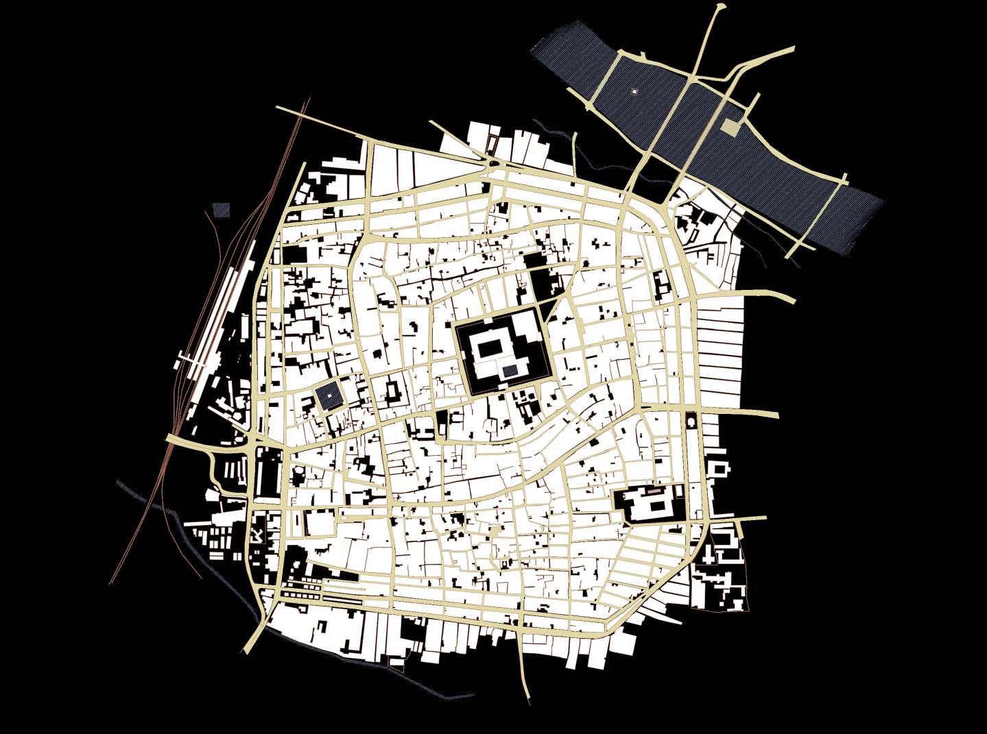

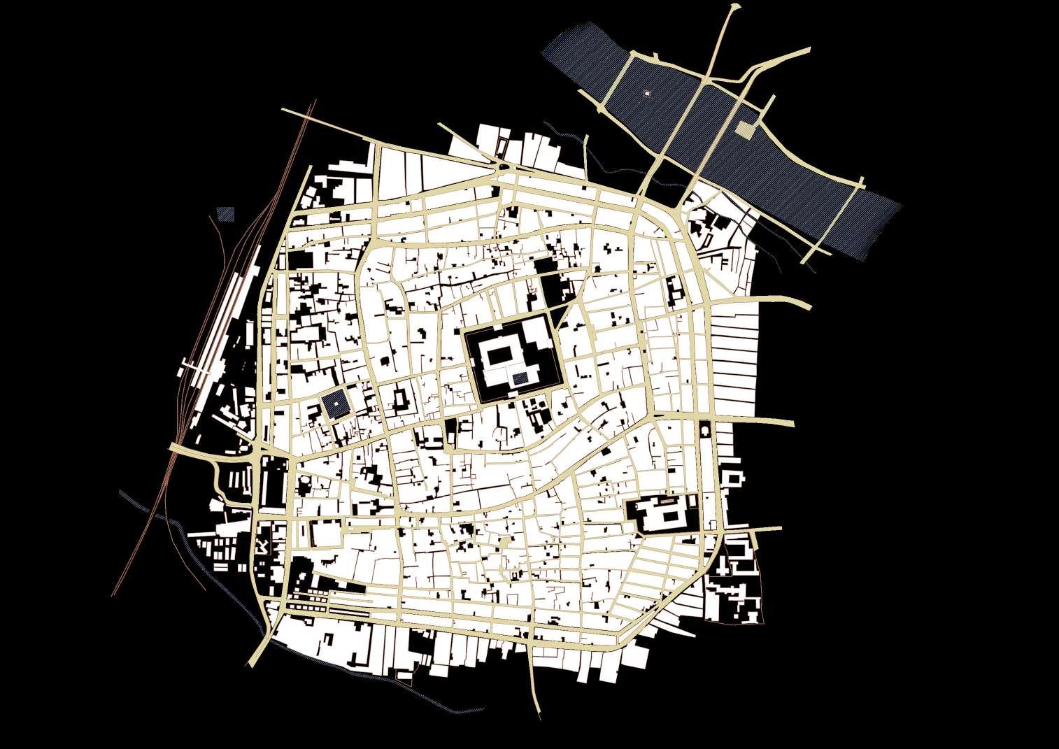


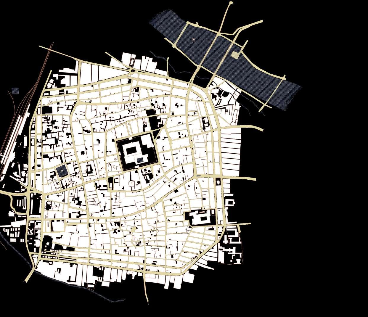

07
SHARED STREETS
Vehicular traffic on the roads is proposed to be reduced. One alternative is to bring back the rented cycle culture of Madurai. Cycles will be rented at certain points across the precinct for visitors and residents alike.
CULTURE
Certain streets are proposed to be open to pedestrians only traffic as night sets in. Cultural performances, street food and other recreational activities are proposed as the street night life.
05
GREEN ALLEYWAYS
Certain alleys that do not allow vehicular traffic are proposed to be converted into green alleyways. And the Meenakshi Triangular Park will be refurbished to allow the visitors and the residents a breathe of fresh air.
08
MULTI-LEVEL PARKING
Multi-level car parkings are proposed at three places.
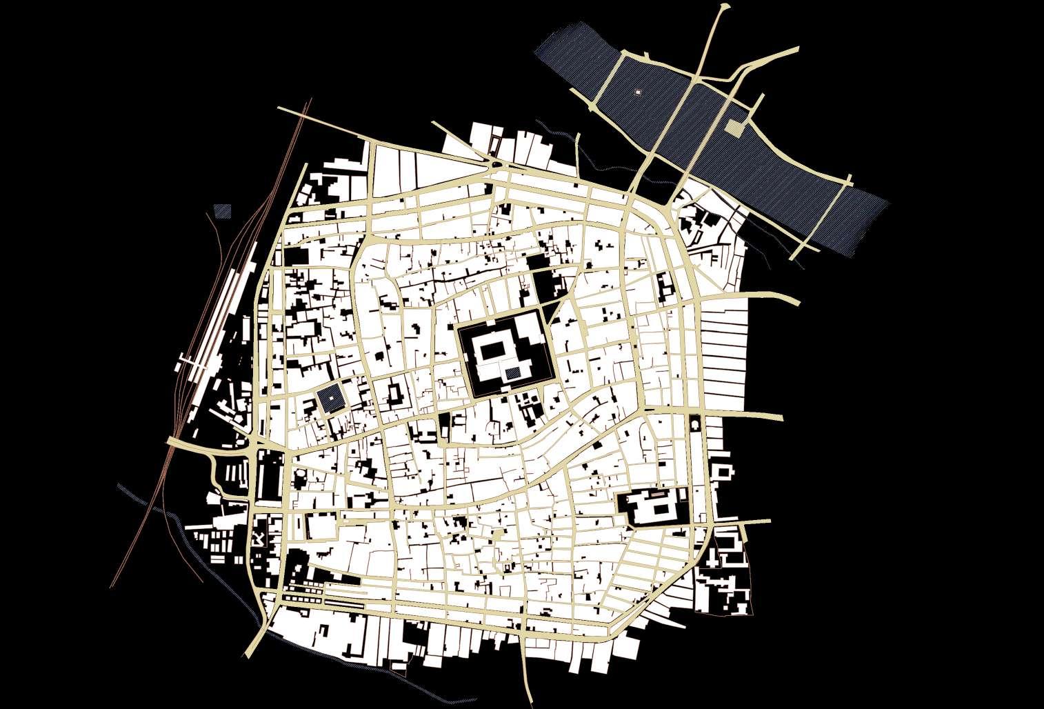
STREETS
To facilitate the pedestrian only night life on some streets, they will be converted into temporary streets, and vehicular route diversion will be employed for the said hours.
06
INTERPRETIVE CENTER
A center for interpretation of the culture and heritage of Madurai will be designed and constructed to help the tourists, visitors and pilgrims understand the city better.
STRUCTURE PLAN
20 strategizing
Presented by Ar Aynul Inaya Roll no. 20MRA004, Sem IV, M.Arch (RA) Guided by Ar Asma Hamid Jamia Millia Islamia, New Delhi
proposing the tour
WALK OF CULTURE
A tour around the precinct is proposed covering all the important destinations with historical importance, cultural significance, commercial hubs for traditional goods, food hot-spots, etc. The tour will be start from 8:00 AM in the morning to midnight. All the walks rides and pause points will be scheduled as per the typical agenda given.
AMENITIES AND FACILITIES


The route will be fully facilitated with amenities to provide convenience to the visitors. Also, certain streets edges will be treated to present a heritage outlook.

SCHEDULE
TIME VENUE ACTIVITY
0800 hrs Madurai Railway Junction Gathering Point
0830 - 0900 hrs Hotel Supreme in West Marret Street Breakfast
0900 - 1000 hrs Victoria Edward Hall Library Visit


1000 - 1100 hrs Simma Kal Flea Market
1100 hrs Vakeel Street (North Marret Street) Architectural Experience (Walk)


1130 hrs Fruit Market Experiencing Local Fruit Delicacies
1200 hrs East Masi Street Spices & Handicraft Shopping (Walk)
1230 hrs Ezhu Kadal Street Temple View Photography
1245 -1330 hrs Raya Gopuram & Pudhu Mandapam Heritage Experience (Walk)


1330 hrs Naveen Bakery and Restaurant Lunch


1400 - 1500 hrs Meenakshi Temple and Chitrai Street Temple Visit and Shopping
(15 min) Amman Sannathi to East Marret Street Auto or Cycle (Ride)


1515 - 1530 hrs Villaku Thoon Snacks: Jigarthanda and Coconut Boli


1530 - 1630 hrs Thirumala Nayakar Mahal Palace Visit
1645 hrs Pathu Thoon Heritage Experience (Walk)


1700 hrs Villaku Thoon Heritage Experience

1700 - 1900 hrs South Masi Street & East Avani Moola Street Textile and Jewelery Shopping


(2 min) Villaku Thoon to Palace Auto or Cycle (Ride)


1900 - 2000 hrs Thirumala Nayakar Palace Light and Music Show
(5 min) Palace to Yannai Kal Auto or Cycle (Ride)


2000 - 2100 hrs Kal Paalam Experiencing the River and Fish Market
2100 - 2300 hrs East Masi, Amman Sannathi and Chitrai Street
Cultural Night and Street Food for Dinner
(2 min) West Avani Moola Street to Nethaji Road Auto or Cycle (Ride)


2300 hrs Nethaji Road - TPK Road Junction Experiencing Fort Remains
2315 hrs Prema Vilas in Town Hall Road Shopping for Sweets
2330 - 0000 hrs Mangamma Sathiram Souvenir Shopping


0000 hrs Madurai Railway Junction End of Walk

Restaurants Rest Areas Cycle Points Drinking Water Toilets Seatings and Benches Information Centers
23 0 50 100 200 m Tour on foot Architecture Tour by cycle Heirtage Structures Tour via auto Kal Palam Bridge Flea Market Traditional Shopping Local Beverage and Drinks Folk Theater Arts Gathering Point Fruit Market Follk Music and Dance Views and Vistas Pedestrian only Zone Heritage stylized façade
AGENDA Presented by Ar Aynul Inaya Roll no. 20MRA004, Sem IV, M.Arch (RA) Guided by Ar Asma Hamid Jamia Millia Islamia, New Delhi
CONCLUSION


Madurai's heritage core is one of a kind, with well defined street pattern and planning principles. Its architecture, value of heritage and culture that has seen and grasped the beauty of every era in a homogenous urban fabric. The city's main aspect are the people, the shoppers, residents, visitors, tourist, shopkeepers and vendors all play an individual and important role in the city's functioning as a mass.
The study was based more on the cultural and intangible aspect of Madurai and its history. These were fulfilled by the booming trade and commerce, religious beliefs and practices, cultural activities and last but not the least, the movement of vehicular and pedestrian traffic in the area. Through detailed research and understanding, it was found that the core covers a radius of 600 meters, only 200 to 300 meters from the center is inhabitantly active with cultural signficance. The rest is peaceful residential areas.
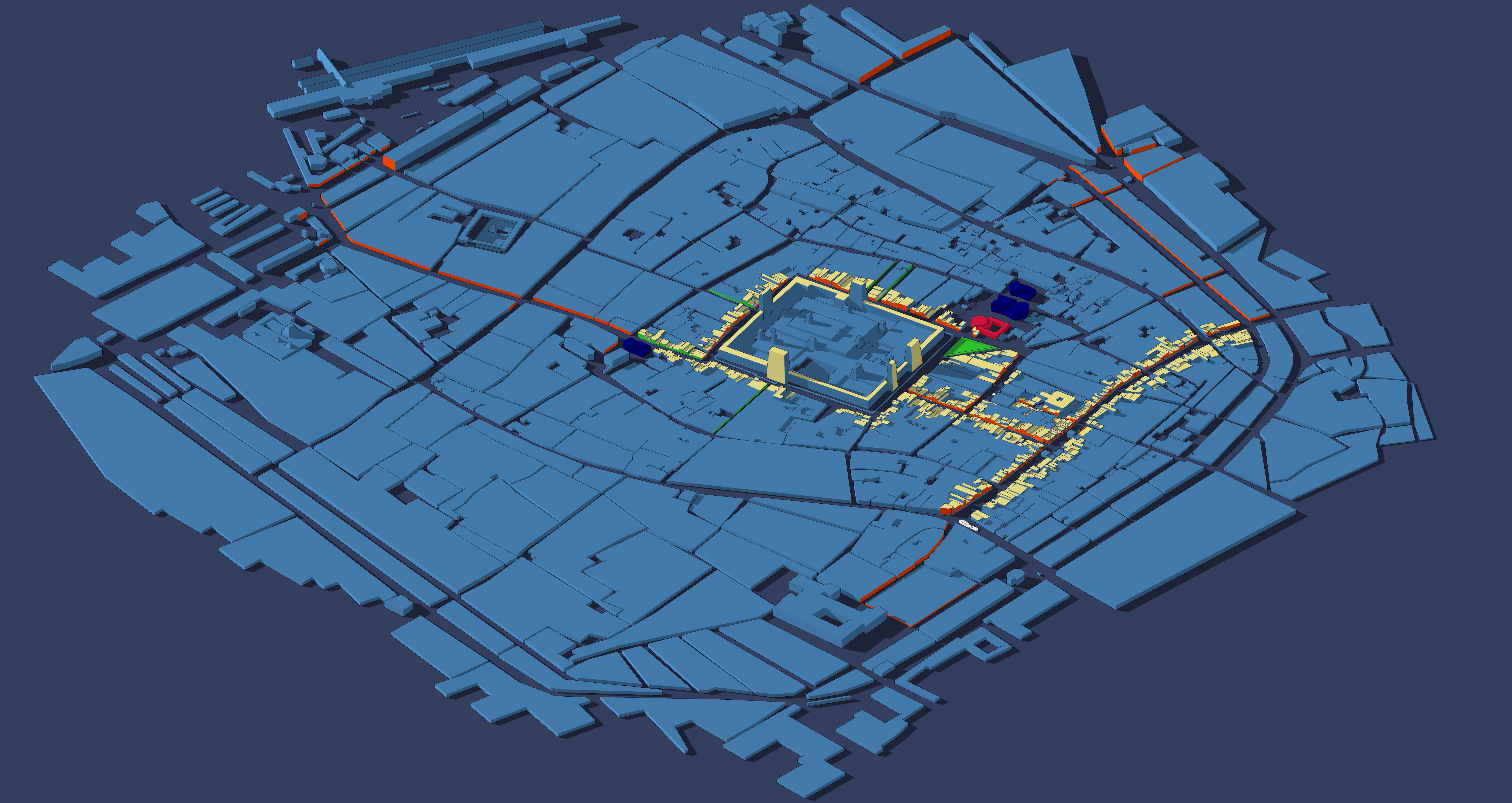
Thus, during the proposal stage, careful considerations were made to avoid the residential areas so as to not disturb their calmness, all the while exploring the areas aound the Meenakshi Amman Temple and the North.




Althugh the river was not in the scope of the study, the lower bridge of the two-tier bridge, which is usually closed off and neglected after the construction of the upper tier, has been explored as an extension of the major propoosals in the heritage core. The bridge has been used as a future development opportunity.
The proposed Walk of Culture and Thoonga Culture are the two priimary strategies that have been brainstormed and are believed to enhance the declining cultural identity of the city to its visitors as well as the residents and shop keepers who have been living here. The proposals will bring back the forgotten essence of THOONGA NAGARAM.
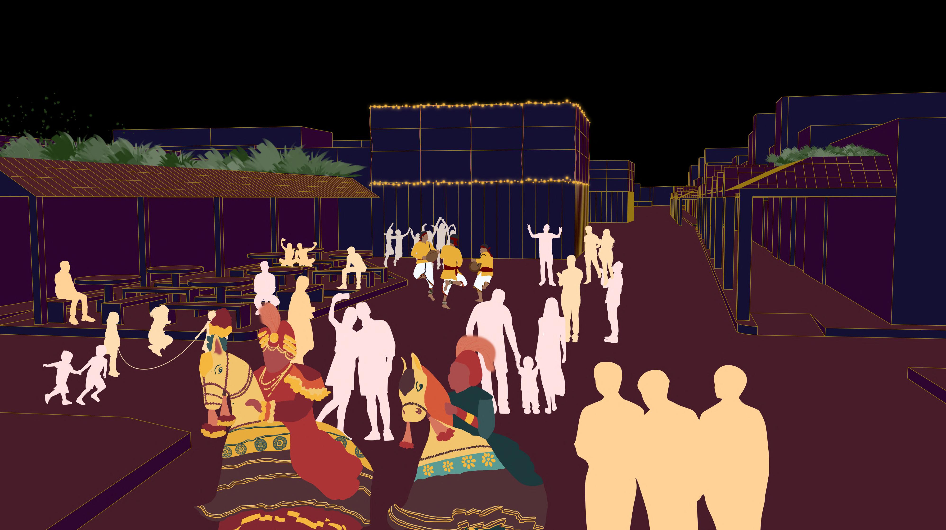


bringing about the proposal MASTER PLAN
Presented by Ar Aynul Inaya Roll no. 20MRA004, Sem IV, M.Arch (RA)
24 Cultural Tour trail Architecture Cultural Nightlife Heirtage Structures Green Alleyways Kal Palam Bridge Flea Market Traditional Shopping Local Beverage and Drinks Folk Theater Arts Bus Stand Tour gathering Points Cycle Points Parking Seating Toilets Fruit Market Follk Music and Dance Views and Vistas Railway Station Pedestrian only Zone Auto Stands Rest-area Drinking water facilties Park Treated facade
Guided by Ar Asma Hamid Jamia Millia Islamia, New Delhi
Netaji Road, Walk of Culture
Flea Market, Walk of Culture
East Masi St., Walk of Culture
Vakeel Street, Walk of Culture
Chitrai Street, Walk of Culture
East Masi St., Thoonga Culture Nayak Palace, Walk of Culture
Railway Stn., Walk of Culture
Chitrai Street, Thoonga Culture South Masi St., Cycle Point
Crime Branch, Cycle Point
Flea Market, Cycle Point
Kal Palam, Future Extension Proposal


 NAAN MAADA KOODAL (CITY OF FOUR TOWERS)
KOIL MAANAGAR (TEMPLE CITY)
MALLIGAI NAGARAM (CITY OF JASMINE)
KOODAL NAGARAM (CITY OF JUNCTIONS)
ATHENS OF THE EAST


