
IN
March 2023 Complimentary PM #40069240 EXPLORATION TRENDS & DEVELOPMENTS
ADVANCES
GEOPHYSICAL TECHNOLOGY
Acelerating the discovery of critical raw materials to support the energy transition

ELECTROMAGNETIC, GRAVITY, MAGNETIC AND RADIOMETRIC DATA TO EXPLORE YOUR WORLD


is an annual publication prepared by Sean Walker
16 Forth Street, Edinburgh Scotland, U.K. EH1 3LH
Phone: +44 131 550 3707
Email: walker@cwgeophysics.ca
Published in co-operation with The Northern Miner
225 Duncan Mill Rd. Ste 320 Toronto, ON
M3B 3K9
Phone: (416) 510-6789
E-mail: tnm@northernminer.com
Editor:
Marilyn Scales
Writers:
Sean Walker and Tanya Boughtflower
Creative/Layout: Mark Ryan
Production Manager: Jessica Jubb
Advertising Sales: Robert Hertzman

Michael Winter
Publisher: Anthony Vaccaro
MINERAL EXPLORATION TRENDS AND DEVELOPMENTS IN 2022
By Sean Walker geophysical consultant at Campbell & Walker Geophysics in Edinburgh, Scotland
The 2023 edition of Exploration Trends & Developments (ETD) marks a significant milestone as the review celebrates its 60th anniversary. ETD originated with the Geological Survey of Canada (GSC), where for more than 50 years, GSC scientists prepared an unbiased annual publication on trends and new developments in geophysical exploration for minerals. Marking another significant milestone, after 30 years of service to the mineral exploration community as the author of the ETD, Patrick Killeen has decided to pass the torch. As the person receiving said torch, I would like to take this opportunity to thank Pat for all he has done. He has set a high bar in terms of the quality and impartiality of the review, and I will strive to maintain those standards. A more extensive reflection on Pat’s contributions can be found on page 15.
This is the seventh year that Decennial Mineral Exploration Conferences (DMEC) has served as the patron for ETD. DMEC was formed in 2005 to formalize the organization of the decennial exploration conferences which began in 1967 and will continue in 2027. In addition to the exploration conferences, DMEC encourages workshops and conference forums that promote the better integration of technology in exploration. This year ETD support came from the sponsoring companies listed on pages 16 and 18.

MARCH 2023 | EXPLORATION TRENDS & DEVELOPMENTS 3 EXPLORATION TRENDS & DEVELOPMENTS
Printed
All rights reserved. The contents of this publication may only be reproduced with the written consent of Sean Walker. EXPLORATION TRENDS & DEVELOPMENTS EXPLORATION TRENDS & DEVELOPMENTS 4 EXPLORATION TECHNOLOGY IN 2022 BUSY, BUT NOT TOO BUSY 5 CORPORATE HIGHLIGHTS 12 AIRBORNE GEOPHYSICAL SURVEYING Airborne Data Acquisition and Processing Airborne Magnetics Airborne Electromagnetics Airborne Gravity Airborne Radiometric 21 GROUND GEOPHYSICAL SURVEYING Ground Data Acquisition and Processing Borehole Geophysics Ground Electromagnetics Ground Gravity Resistivity and Induced Polarization Magnetotellurics 26 Companies and Websites 26 Abbreviations 16 Sponsors ADVANCES IN GEOPHYSICAL TECHNOLOGY EXPLORATION TRENDS & DEVELOPMENTS EXPLORATION TRENDS & DEVELOPMENTS
Canadians
Credit: Phoenix Geophysics CONTENTS EXPLORATION TRENDS & DEVELOPMENTS
in Canada.
Cover photo:
search the world for the next generation of minerals.
EXPLORATION TECHNOLOGY IN 2022: BUSY, BUT NOT TOO BUSY
Throughout 2022, Covid-19 restrictions eased in most parts of the world. While some countries and companies still require protocols as part of operations, they have become a manageable part of our new normal. This has resulted in reports of increased activity from almost every airborne and ground company in almost every region on the planet. This increase has required the addition of new staff and equipment.
All signs point to the fact that the default answer to the tradeshow floor questions “How’s business? Are you busy?” might be true again. However, it also appears that in conjunction with being busy collecting, processing and interpreting data, most companies have also managed to improve upon existing technology and in some cases make some new developments.
Over the years, themes emerge and recede within our industry. These are often driven by technical requirements for discovery. However, they can sometimes be influenced

by the public. A good example of this is the growing concern about the ongoing climate crisis and the concept of the energy transition and decarbonization.
The reality is that the public is becoming aware of the demand for critical minerals and battery metals. And while they might not understand mining and exploration’s role in the green transition, the effect can be seen in activity reports from both ground and airborne companies who reported completing surveys targeting critical minerals, battery metals, and geothermal energy. These were in addition to the usual targets of base metals, gold, uranium, iron ore, and diamonds. There were also reports of airborne geophysics being used for regional geological mapping, methane mapping, geoid improvements, and carbon storage and capture.
Another theme that appeared throughout the year was developments aimed at seeing deeper. This is by no means a new trend, and as such most developments could be seen as
4 EXPLORATION TRENDS & DEVELOPMENTS | MARCH 2023 EXPLORATION TRENDS & DEVELOPMENTS n EXPLORATION TECHNOLOGY
n NRG’s Xact magnetics-radiometrics system mounted on a Pilatus PC6. CREDIT: NEW RESOLUTION GEOPHYSICS
incremental improvements at best. However, it is interesting to note the prevalence of this topic within reports from both airborne and ground companies. Enhancements to equipment focused on lower base frequencies, lower noise and higher power. It was not that long ago that 25-30 Hz was considered a low base frequency for an airborne EM survey, yet now 15-12.5 Hz is becoming more common, and surveys are even being flown at 7.5-6.25 Hz.
Developments aimed at decreasing noise in all types of EM receivers (airborne, ground and borehole) were reported in 2022. This included both coil and SQUID-based sensors. While the race to have the highest-power airborne EM system on the market seems to have subsided, a significant amount of ground geophysical transmitter development appears to be focused on increasing power and maximizing portability. Airborne companies have also been working on decreasing the weight of their systems.
The improvement of the data being acquired was another theme to emerge this year. Two companies reported working on developments to improve the performance of magnetometers operating close to airborne TEM transmitters. Improved bandwidth airborne gravity through the acquisition of conventional and gravity gradiometer measurements in a single survey is now widely available. The increased development and use of ‘smart’ receivers and data loggers have resulted in contractors offering surveys consisting of 3D resistivity and IP distributed arrays.
The use and availability of drones continued to increase throughout 2022. The most common application still appears to be a ground magnetics replacement. However, there are updates on both time (airborne) and frequency domain EM (semi-airborne), VLF, and radiometric systems. Not to be outdone by the airborne companies, one ground contractor has successfully deployed a gravity meter on an autonomous vehicle.
Consulting groups and software companies described developments related to inversion, modelling and interpretation. While the use of AI is still very much a hot topic, the value of more traditional approaches is evident in their ongoing development. Developments related to quality control software is not something that a client or the data’s end user will usually know about, but it is important. Any improvement to the quality of the data coming out of the field should speed up the processing and improve the final products. The result will be better data to feed into interpretations.
The ETD review tends to focus on developments that are available for use, but two research topics that address long-standing issues within geophysics were of particular interest. First, it is of note that two ground contractors mentioned developments related to mineral discrimination from spectral IP. Secondly, safety concerns when using active downhole probes such as the security of nuclear sources and the environmental risk of a probe being lost in the hole, are being addressed by one supplier developing a non-nuclear neutron logging tool.
New developments from the world leaders in slimline borehole geophysics
NEW TOOLS
QL40-nGEN | Non-chemical source neutron tool for in-situ porosity
QL40-IP | User-definable injection–release time full waveform induced polarization
QL40-ABI43-2G-HT | New 175 C high resolution acoustic televiewer
NEW CAMERAS
MSICAM360-2G | High resolution fully digital borehole camera that runs on any geophysical wireline from a cell phone

NEW WINCHES
PATHFINDER and EXPLORER high capacity, small footprint, lightweight geophysical logging winches for remote projects and easy-to-ship rentals
NEW SOFTWARE
WellCAD work-flows that enhance well log presentations and analysis
MARCH 2023 | EXPLORATION TRENDS & DEVELOPMENTS 5 EXPLORATION TECHNOLOGY n EXPLORATION TRENDS & DEVELOPMENTS
Find out more at alt.lu Expect the Best...From the Best!
Find out more at mountsopris.com
CORPORATE HIGHLIGHTS
Abitibi Geophysics of Val-d’Or, Quebec, reported high activity levels in eastern Canada during 2022 as exploration ramped up. Internationally, Abitibi continues to grow its business successfully conducting geophysical surveys using Abitibi’s exclusive technologies and 100% local field crews supported by Abitibi’s Canadian-based geophysicists. Abitibi established a partnership with Geo-Resources Consultancy International (GRCI) in Oman and the Middle East. Abitibi is continually improving the ARMIT-3 TDEM sensor. A low-noise borehole ARMIT B-Field and dB/dT sensor has been successfully field-tested and will be available commercially in 2023. Abitibi is a sponsor of Amira’s spectral IP project and will be a sponsor in the upcoming EM inversion research project at Memorial University.

ClearView Geophysics of Brampton, Ontario, has expanded depth-to-bedrock investigations to include waterway and river crossings, primarily for HDD applications. Geophysical methods such as dipole-dipole IP-resistivity arrays with premade water-tight multi-conductor cables stretched out across the bottom of waterways can acquire data that are subsequently presented as inversion modelled chargeability and apparent resistivity depth sections. This often highlights potential faults or alteration zones that could have serious implications for the HDD work. Seismic hydrophones are also stretched across the waterway bottom to acquire seismic refraction and MASW data which complement the IP-resistivity data. Customdesigned and built seismic guns are lowered to the bottom of waterways from a boat to allow the continuation of landbased seismic data.
In 2022, Condor Consulting, with offices in Lakewood, Colorado, and Vancouver, B.C., added staff in both offices. Although Condor’s project work was focused largely in North and South America, they also carried out several projects in Scandinavia and returned to Alaska after a several-year hiatus. Condor also returned to the uranium-rich Athabasca Basin, where gravity gradiometry is being increasingly employed, to support several clients on new and pre-existing projects.
In South America, Condor’s clients in Chile and Ecuador have been testing geophysical results over porphyry copper deposits. On the Filo del Sol project that straddles the ChileanArgentinian border, the client, Filo Mining, recorded the best single-hole result worldwide for 2022, with 1,356 meters at 1.09% copper-equivalent. The primary geophysical method used was a Dias 3D IP survey, with enhanced 3D modelling using Seequent Voxi IP software. In Ecuador, Condor’s re-processed ZTEM, EM and magnetic results sharpened focus on the best zones of mineralization. Now having worked on a number of surveys employing the MobileMT AFMAG system, Condor has been pleased with the data from Expert Geophysics, giving clients a valuable alternative service provider.
Based in Mississauga, Ontario, Crone Geophysics &
Exploration celebrated its 60th year in business and enjoyed a busy 2022. With increased production of their CDR4 receivers, auto-levelling surface fluxgate sensors and auto-clock synchronization units, Crone saw growth in equipment rentals. More user-friendly interfaces and procedures have increased client production while requiring less training. Updated training manuals, virtual training options and processing software have also simplified equipment rentals for clients.
DGI Geoscience marked its 25th year of operations in 2022. The company served its clients on seven continents on over 800 projects, working directly with mines, engineering, and exploration companies, as well as civil and infrastructure projects. Best known for their televiewer work under almost any conditions, they also provide many other borehole services. In 2022, DGI located and mapped historical mine workings; identified sources of fluid flow in an underground salt mine; and assisted a client in determining stress orientations. Additionally, they modernized several core facilities to eliminate lifting and improve workflows. They installed Spector Optics high-resolution, standardized core photography integrated with cloud-based logging software. Their geoscientists logged core in person and remotely, working with KORE Geosystems to predict rock type and RQD.
Dias Geophysical finalized the establishment of its subsidiary in Mexico, completed the renovation of its corporate headquarters in Saskatoon, Saskatchewan, and opened an office near Toronto. Dias was active in North, Central and
6 EXPLORATION TRENDS & DEVELOPMENTS | MARCH 2023
n The VAMPair UAV-borne magnetic platform is the industry’s smallest.
CREDIT: EXPERTISE IN GEOPHYSICS (EXIGE)
EXPLORATION TRENDS & DEVELOPMENTS n CORPORATE HIGHLIGHTS
South America, and Africa. However, operations in Asia were curtailed by the tail end of the Covid-19 pandemic. The main exploration commodities were copper, gold, diamonds, nickel, iron ore, and lithium. Most of Dias’ survey activity is 3D IP and resistivity, but MT and airborne magnetics using the QMAGT full tensor magnetic gradiometer system now represent a significant and growing portion of its activity. Dias looks forward to the same growth with the QAMT airborne MT system in 2023.
Saskatoon-based Discovery International Geophysics had a busy year of low-frequency B-field TEM surveying using the Supracon Jessy Deep low-temperature (liquid helium) and high-temperature (liquid nitrogen) SQUIDs. Fortunately, Supracon manufactures their own non-magnetic, ceramic cryostats, hence there have been no embargo issues due to the Russian conflict in Ukraine. Demand for the highest sensitivity, low-temperature SQUID technology has been robust with the availability and cost of liquid helium becoming more favourable in 2022.
Discovery continues to offer the DIAS32 CVR technology for its Multipole IP surveying technique which combines forward and reverse pole-dipole and pole-pole data acquisition in one pass down a survey line. Last year saw a significant increase in borehole TEM surveys using the EMIT Digi Atlantis B-field fluxgate downhole system. The hybrid ground and airborne B-field TEM and MMR HeliSAM technology from Gap Geophysics Australia continues to be provided by Discovery
in North America as an alternative method for rapid reconnaissance surveying, but with the depth of penetration of ground techniques. In 2022, Discovery started offering Gap’s SAMson ground survey mode at very low-frequency. This technique provides high-sensitivity B-field TEM data, like a SQUID, but with increased survey speed.
EON Geosciences of Montreal continued to provide airborne high-resolution magnetic, gamma-ray spectrometric, gravity, and EM surveys using fixed-wing aircraft and helicopters. In 2022, EON once again added additional aircraft (Piper Navajo and Cessna Caravan) to its growing fleet of fixed-wing aircraft that includes a Piper Cheyenne II, a multitude of Piper Navajos, a Cessna Caravan, and a Cessna 206. EON’s aviation company offers aircraft operation services for all survey industries (geophysics, LiDAR, aerial photography, etc.).
Exige of Australia and South Africa, partnering with Coleoptera of France, developed a true rucksack transportable, ultra-light, quick-to-deploy, easy-to-use, one-person operated, affordable, UAV-borne automatic magnetics mapping platform – the VAMPair (versatile automatic magnetic probe). This is the industry’s smallest UAV-borne magnetic platform. The hardware integration is complete, and the tool is available for sale. It is composed of an off-the-shelf DJI Mavic 3, a DAS and a single-fluxgate magnetometer. Software for fluxgate magnetic sensor calibration is provided. A similar fluxgate magnetic system is also available as a plug-in for other UAVs.
Expert Geophysics, an Aurora, Ontario-based airborne

Loupe is a new portable time-domain EM system for mapping of conductivity variations in the top 40m. Applications include mineral exploration for sulfides and graphite, environmental monitoring including TSFs, groundwater studies and geological mapping. Loupe is carried on two backpaacks and is designed to be operated at normal walking speed. Transmitter frequencies from 25 Hz up to 1000 Hz and higher. Receiver sampling at 500,000 samples per second. Three component broadband receiver coil. Full time-series data storage, real-time processing and GPS navigation. Excellent rejection of interference in urban and industrial areas. Additional deliverables include VLF and powerline monitors. Loupe is designed to be carried for extended periods and operates in hot and cold climates. It is lab-tested to conform to international standards of magnetic field exposure for the transmitter operator. Systems available for purchase and rental.
MARCH 2023 | EXPLORATION TRENDS & DEVELOPMENTS 7 EXPLORATION TRENDS & DEVELOPMENTS
CORPORATE HIGHLIGHTS n EXPLORATION TRENDS & DEVELOPMENTS Loupe
| info@loupegeophysics.com.au | www.loupegeophysics.com.au
Geophysics Pty Ltd
loupe
geophysical survey company, reported an active 2022. The highlight of the year was the completion of the development of a new patent pending high-power TD system with a three-component receiver – TargetEM. By the end of 2022, three TargetEM systems had been built. To meet the growing demand for MobileMT surveys worldwide, Expert Geophysics built two additional MobileMT systems, bringing the total number of operational MobileMT systems to ten. The company is also operating two MobileMT systems – lightweight versions of MobileMT with two magnetometers in the horizontal gradient configuration, and one mTEM system – a TD system designed for precise near-surface exploration.
Last year, Expert Geophysics established a permanent presence in South Africa resulting in the first MobileMT survey flown in Africa (Gabon). Expert Geophysics Pty (a subsidiary of Expert Geophysics) was active in Australia flying MobileMT surveys for mining clients.

Gap Geophysics’ primary development in 2022 was a miniaturized TM7 total field magnetometer fit for SAM (MMR and EM) applications. Trials were completed in Canada in conjunction with Discovery International Geophysics in late 2022. These developments also facilitated a compact version of the helicopter-slung HeliSAM system. The smaller footprint allows all helicopter racking to be placed in an encapsulated and completely slung bird. This system has completed commercial work in Greenland and is available for customers.
Gap also completed production of the mid-range MVTX transmitter capable of 500 V and 180 A output, and the PS30MV power supply which can achieve up to 30 kW using a threephase locally supplied generator.
This year Geonics Limited completed development of its patented TD sensor (dual-coil). It simultaneously measures outputs from a large bandwidth section for precise early time measurement and a section with a large true effective area for accurate late time measurement using the standard Geonics receiver. In 2022, Geonics also developed a lightweight version of its highly popular EM38-MK2 ground conductivity meter for
drone applications – EM38 Lite. The instrument will be available for purchase in 2023.
In 2022, Aurora, Ontario-based Geotech was awarded several airborne geophysical surveys for government agencies in Canada and around the world. The surveys included a 4,400-line-km TDEM and magnetic survey using its VTEM Max system of the eastern Wollaston area, in northern Saskatchewan on behalf of Natural Resources Canada Geotech continued its multi-year VTEM survey in Rajasthan and Madhya Pradesh for the Government of India’s Atomic Minerals Directorate.
Geotech, along with its subsidiaries Geotech Airborne (Johannesburg, South Africa) and UTS Geophysics (Perth, Australia), offered worldwide airborne geophysical surveys and consulting services using its helicopter borne VTEM and ZTEM natural field EM systems. The company also offers fixed-wing and helicopter magnetic, radiometric and gravity surveys throughout the world. The company mourned the loss of its owner and founder, Edward Tracy Morrison, who passed away on Jan. 22, 2022. Ed’s son, Jimmy Morrison, has now taken over as company president.
Formed in 2020, Geotexera, based in St. John’s, Newfoundland, uses software (MAGNUM) developed by the research groups of Colin Farquharson (Memorial University) and Peter Lelièvre (Mount Allison University) in its 3D geophysical modelling and inversion services. The software uses unstructured meshes that allow high-resolution topography, geological contacts and surfaces, and borehole information to be exactly added to the models to increase the accuracy of the results. The software works with magnetic, gravity, gravity gradiometry, seismic refraction (first-arrival travel times), IP and DC resistivity, magnetotelluric (ground and airborne), and muography methods. Other electromagnetic methods will be added to the software by the end of 2023. Geotexera has successfully provided services using the software in various projects worldwide for porphyry copper, gold, silver, iron, and uranium exploration.
In 2022, IRIS Instruments focused its efforts on developing its TD high-power transmitters for deep exploration including mineral resources, geothermal energy, and geological knowledge. With the boom in mining exploration in the second half of 2020, supporting geophysical service companies with smart and modular solutions has become an important part of the IRIS Instruments R&D division’s agenda. In particular, the operation of two transmitters in series to double both voltage and power in high-contact resistance environments has been appreciated by customers using the TIPIX 3000, 3-kW highpower transmitter range and will soon be available for the TIP 6000 range.
Loupe Geophysics is a joint venture between Andrew Duncan and Greg Street, based in Perth, Australia. With the assistance of the engineering team at Electromagnetic Imaging Technology, Loupe has developed the portable Loupe TEM system for near-surface electrical conductivity mapping. Based on two backpacks, the Loupe TEM system is designed to collect data continuously while the operators move at a normal walking pace. As a result, the system can go anywhere that the operators can walk, and productivity gains are substantial compared to a system that needs to be stationary to take a measurement.
The Loupe transmitter backpack contains a single horizon-
8 EXPLORATION TRENDS & DEVELOPMENTS | MARCH 2023
n Greg Street (left) and Andrew Duncan walk their portable Loupe TEM system through terrain inaccessible to other modes of transport.
EXPLORATION TRENDS & DEVELOPMENTS n CORPORATE HIGHLIGHTS
CREDIT: LOUPE GEOPHYSICS
BOLDLY DISCOVER
Welcome to Xcite™
AXIOM GROUP presents Xcite™, a new generation of helicopter-borne time-domain electromagnetic (HTDEM) systems that has successfully flown over 250,000 line km on several continents.
• Incredibly high-quality data.
• Co-collection of four systems at the same time: LiDAR, Radiometrics, Magnetics, Time Domain Electromagnetic (TDEM).
AXIOM is proud to exclusively offer this service in North America. This state-of-the-art technology provides an efficient alternative to all prior HTDEM technologies for the minerals exploration and geoscience mapping community—helping you boldly discover.
Powered by:
METALS MINERALS ENVIRONMENT
Find out more and book your survey now:

tal loop, and the receiver backpack contains a set of three-axis broadband coils. The backpacks are tethered by a cable, normally at a spacing of 10 meters. A GPS navigation system is built into the TEM. Processing of the data is done in real time with a dynamic display of profiles and decays on a tablet or phone wirelessly linked to the acquisition system. Raw data is stored on the system and can be post-processed as required. Loupe TEM generates clean TEM data in difficult environments including proximity to power lines in urban or industrial settings. Data is typically processed to generate a three-component TEM reading every few meters. The system has been used successfully in a range of applications: exploration for conductive minerals, geological mapping, and groundwater studies.
In its normal mobile configuration, Loupe TEM is capable of mapping conductivity variations in approximately the top 40 metres; this can be extended in other configurations. Measurements can be made during short stops to increase S/N if required. To extend the depth penetration, the signals from a fixed loop can be measured, and this can be done in conjunction with simultaneous measurement of the signals from the backpacked transmitter using GPS synchronization and transmitter frequencies that do not interfere with each other.
In 2022, Mira Geoscience continued to develop its geophysical modelling and inversion software through its industry-supported consortium. Most major mining companies, in addition to numerous mid-tiers, juniors, geological surveys, and universities, now rely on the software for geophysical modelling and inversion. Mira’s Geoscience Analyst Pro geophysics platform provides low-cost access to UBC-GIF, VP, and SimPEG codes, covering a complete range of non-seismic methods. Tensor, ocTree, and vertical prism model structures are all supported. Inversions can now be run on a local workstation, an on-premises HPC cluster, or in the cloud with a simple menu selection. Extensive data handling, gridding, filtering, survey design, and display capabilities complement the modelling and inversion software. Data and models continue to be written in an open, standard file format (Geoh5) that can be
accessed and visualized with Mira Geoscience Analyst’s free 3D viewer or through an open-source Python API.
Mobile Geophysical Technologies (MGT) is a geophysical service company specializing in the use of drones. Based in Celle, near Hanover, Germany, in 2022 it carried out droneborne surveys in Germany, Norway, Alaska, and Indonesia with the main targets being graphite, copper, iron ore, nickel, and gold. MGT also had the opportunity to conduct a droneborne EM survey using a 25 kg octocopter in Hamburg to image paleochannels which act as preferred pathways for groundwater flow and solute transport.
In January 2022, MGT and Hanseatic Aviation Solutions, a drone manufacturer based in Bremen, Germany, partnered to diversify MGT’s portfolio of unmanned platforms, ranging from 10 kg multicopter up to 25 kg fixed-wing UAVs. By offering a variety of different platforms the client can choose the one most suited to the specifics of their project.
New Resolution Geophysics (NRG) continues to fly high-resolution helicopter magnetics and radiometrics (Xplorer), fixedwing magnetics and radiometrics (Xact), fixed-wing gravity and magnetics (Xtract), and state-of-the-art helicopter TDEM (Xcite) throughout Africa, the Middle East, Australasia, Europe, and North America. NRG has expanded its footprint by partnering with Axiom Group, who has exclusive use of the Xcite system in North America.
A further two aircraft have been added to NRG’s fleet, namely a H125 helicopter and two Air Tractors, bringing their large fleet of company-owned, dedicated survey aircraft to a total of 11 helicopters and five fixed-wing aircraft. All aircraft have been demagnetized and specially configured for high-accuracy and resolution surveys and are available globally.
Toronto-based consulting firm Paterson, Grant & Watson Limited (PGW) completed the geophysical compilation and interpretation for the northern half of Botswana. The project report, as well as the new geological map of Botswana and the bulletin, will be published by the Botswana Geoscience Institute in early 2023.
PGW completed the interpretation of a 320,000-line-km magnetic and radiometric survey of Togo in partnership with Xcalibur Multiphysics, for the Ministry of Energy and Mines’ World Bank project. The nationwide survey incorporated a 1:200,000 scale interpretation of basement lithology and structure. Nationwide mineral favourability maps for gold, magnetite-ilmenite, nickel-copper-chromite, phosphate-manganese-iron, rutile, uranium-thorium, and diamonds were prepared with machine learning and prospectivity mapping.
PGW is part of a consortium with IGS, Datacode and MSA Group undertaking a five-year, state-wide mineral exploration and resource definition program for a variety of commodities and deposit types on behalf of the Odisha Mineral Exploration Corp. in India. PGW is leading the geophysical component for the IGS-GTK technical partner consortium of the regional geological survey program for the Saudi Geological Survey, incorporating quality control of a 2.3-million-line-km magnetic/radiometric survey and follow-up EM surveys. These data volumes have required improvements in efficiency and presentation using Oasis montaj scripts and Python code.
With IGS and BRGM, PGW is leading a consortium for the quality control of a 1.35-million-line-km magnetic and radiometric survey for the MinDiver World Bank project in Nigeria.

10 EXPLORATION TRENDS & DEVELOPMENTS | MARCH 2023 EXPLORATION TRENDS & DEVELOPMENTS
EXPLORATION TRENDS & DEVELOPMENTS n CORPORATE HIGHLIGHTS
n Simcoe added to its team of earth science professionals. CREDIT: SIMCOE GEOSCIENCE
PGW has developed a new workflow for the compilation of drone magnetic data incorporating calibration, de-noising, compensation, and conventional compilation and is working with several providers in Canada and India.
In 2022, Quantec Geoscience partnered with Australian Geophysical Services to provide its leading deep imaging technologies on the Australian continent. Both TITAN and SPARTAN programs were successfully carried out last year with upcoming work for the Australian government pending. In South America, there has been high demand for TEM applications in lithium salars and more recently deeper seeing MT resistivity with active projects in Argentina, Bolivia, Chile, Peru, and Ecuador.
To increase capacity, Quantec has deployed an additional new QRT-160 data logger, which offers full-frequency MT data recording for SPARTAN survey systems. New to the QRT-160 is a Wi-Fi interface that allows the data logger configuration via any browser-enabled device. Also, there are many quality control features built into the new QRT-160 such as sensor impedance, self-potential, on-demand state of health reporting, and data transfer. The new interface will be retrofitted to 65 existing data recorders as they return from service through Quantec’s manufacturing facility in Toronto. Quantec is in the process of permanently importing QRT-160s into Argentina to provide clients with several options for deep-earth imaging. In Brazil, the company has mostly been involved with shallow engineering applications.
In 2022, Ronacher McKenzie Geoscience (RMG) grew its geophysical inversion and modelling services, including 3D potential field (gravity and MVI) inversions, and 3D DCIP inversions, and now offers expertise in magnetotellurics, which is rapidly becoming essential as explorers investigate increasingly deeper systems. Expanding the geology team has allowed RMG to take on more field projects, as well as to offer enhanced integrated structural interpretation and Leapfrog modelling. RMG has offices in Toronto and Sudbury and associates across Canada, the United States, Europe, and southern Africa.


Sander Geophysics (SGL) had a busy 2022. Surveys included combined gravity and magnetic surveys, combined radiometric and magnetic surveys, and standalone gravity surveys for geoid mapping. The year also saw the start of a large multi-parameter mineral exploration survey for Minerals Development Oman involving the simultaneous acquisition of gravity, EM, radiometrics and magnetics, using SGL’s unique Twin Otter platform. The company also made good progress in flying the previously announced very large airborne magnetic gradient and radiometric survey in Saudi Arabia.
Seequent, the Bentley subsurface company, provides solutions in mineral exploration geophysics, including Oasis montaj, AGS Workbench and Leapfrog Geo. In 2022, the interoperability of Seequent software improved significantly. For example, Oasis montaj now includes integration with Seequent Central, which enables users to publish data to a Central server from Oasis montaj projects. In addition, Oasis montaj

MARCH 2023 | EXPLORATION TRENDS & DEVELOPMENTS 11 CORPORATE HIGHLIGHTS n EXPLORATION TRENDS & DEVELOPMENTS
and AGS Workbench, as well as Res2DInv and Res3DInv, now have improved interoperability, allowing users to import and export data between the two programs. Seequent also released updated 2.5D algorithms in Voxi TDEM, a cloud-powered inversion solution.
Last year, Simcoe Geoscience added new capabilities, most significantly Simcoe grew the physical size of its headquarters just north of Toronto in Stouffville, Ontario, from 370 m3 to over 930 m3. This enhanced space is accessible and accommodating for Simcoe’s growing team of earth science professionals with new team members added in the summer. Late in the year, the company formed a new division focused on engineering applications, such as tailings dams, and other critical engineering and geotechnical investigations for work across Ontario and elsewhere in the world.
In 2022, SJ Geophysics, based in Vancouver, provided ground-based geophysical data acquisition and consulting services, specializing in the acquisition of 2D and 3D DCIP, EM (surface and borehole), MT, gravity, and magnetic surveys.


Southern Geoscience Consultants (SGC) is headquartered in Perth, Australia, with consultants based in Canberra, as well as Toronto and Vancouver. In February, SGC expanded its capacity to offer services with a focus on the integration of seismic data. Having presented 10 public and client-specific workshops over the last year, SGC’s ‘Integration of Aeromagnetics and Geology’ workshop remains very popular. The workshop aims to inform attendees of the range of applications of aeromagnetic data and
the key steps involved in an integrated interpretation. Several workshops are already planned for 2023.
American-based TechnoImaging focused its research efforts in 2022 on several areas. Three-dimensional inversion of airborne EM data for chargeability and conductivity was one. This technique was commercially applied to several areas in Canada, West Africa, and Australia with some outstanding results. Gold mineralization was identified both by the chargeability and the conductivity of geophysical models.
A second research thrust was the separation of susceptibility and remanence effects in magnetic vector inversion. This was investigated using a multi-stage inversion process. These processes were applied to airborne TMI surveys in West Africa and developed new targets of interest for gold exploration. TechnoImaging is bringing these advanced airborne inversion methods to bear on lithium exploration.
TechnoImaging also continues to develop joint inversion techniques to combine all types of ground and airborne data. The most recent development is a probabilistic joint inversion, which produces better convergence and higher resolution of the jointly recovered inversion parameters than existing methods.
After exploring the properties of the magnetic tensor for many years, Tensor Research has developed an AI process, RPD mapping, for converting magnetic surveys into rock property models of the basement surface. The procedure is applied to full tensor magnetic surveys acquired by Dias Airborne and Spectrem Air, or conventional total field and gradient-enhanced total field surveys. The geological information generated by the AI process includes magnetic susceptibility, magnetization vectors, strike direction, depth, and geological boundaries. Importantly, it also estimates a quality parameter for each segment in the model. The final dataset is a parametric model of the geology and a suite of exploration parameters that help sift through the vast amounts of geological information that are contained in most magnetic surveys. The point data can be used in any GIS or geophysical mapping system to explore the properties in the context of other datasets. However, Tensor Research uses ModelVision to convert the parameters to a 3D realization of the geological model.
Terraplus and Georent of Richmond Hill, Ontario, continued to expand their inventory of rental equipment, adding new instruments for UAV, surface, and borehole logging applications. These include the DRONEmag and DRONEgrad UAV potassium magnetometer and gradiometer systems, the D230A UAV gamma-ray spectrometer with dual 50 x 50-mm BGO detectors, the GSM-90AVU AirVLF EM bird system, and the GEM-2 UAV multi-frequency EM sensor. Other new additions include the next-generation Elrec Terra 20-channel receiver and TIP 6000, 6-kW transmitter for IP surveys, as well as the QL40-SGR-2G spectral gamma downhole probe with CeBr3 detector and the BHG-3 three-component borehole geophone.
During 2022, Xcalibur Multiphysics followed up on the 2021 purchase of CGG Multiphysics by forming a partnership with the Aurora Minerals Group in Kazakhstan and acquiring a majority stake in McPhar International in India. Furthermore, five additional aircraft were purchased (AT502s and C208s), to bring the global fleet up to a total of 30. Xcalibur also announced an exclusive partnership with Monte Aircraft Leasing to convert Xcalibur’s fleet of aircraft to electric, hybrid or hydrogen.
12 EXPLORATION TRENDS & DEVELOPMENTS | MARCH 2023
EXPLORATION TRENDS & DEVELOPMENTS n CORPORATE HIGHLIGHTS
AIRBORNE GEOPHYSICAL SURVEYING
AirGeoX, headquartered in Perth and Brisbane, Australia, began operating drone magnetometer surveys in May 2021. The two bases allow AirGeoX to offer surveys to clients throughout Australia. AirGeoX flew 30,000 km of data for major mining companies, as well as juniors, in the last year.
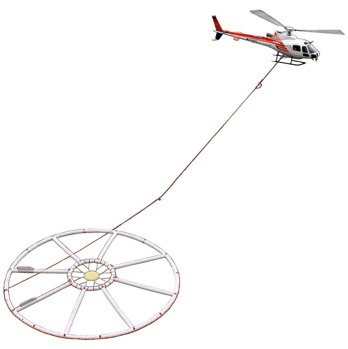
Bell Geospace has upgraded the LiDAR system on the Basler BT-67 in response to market demands. The LiDAR data is used to create a high-resolution DTM to perform a terrain correction in airborne surveys with tight line spacing particularly in dense forest and rugged terrain. The Riegl VUX-240, a lightweight airborne laser scanner, has a wide field view of 75° and a fast data acquisition rate of up to 1.8 MHz. By making use of Riegl’s unique waveform-LiDAR technology, the VUX 240 allows for echo digitization and online waveform processing. Multi-target resolution is the basis for penetrating even dense foliage.

Bell Geospace has combined full ten-
sor gravity gradiometry with the new GTz gravimeter onboard a Basler BT-67 aircraft for multiscale, multiphysics airborne exploration. GTz is a 5-km full wavelength gravimeter, designed and manufactured by Transparent Earth Geophysics, upgraded from the GT-2A. It is significantly smaller and lighter than the GT-2A, (60 kg compared to 175 kg as mounted in the aircraft) while still using the same GT-2A three-axis stabilized platform. In addition, the GTz incorporates an improved thermal stabilisation system. Running a gravimeter of this calibre simultaneously with FTG provides the means for genuine full spectrum gravity, and combines high-resolution FTG, with regional scale gravity exploration, providing unprecedented results from wide line spacing. Flying the two systems side by side in the same aircraft, along with a magnetometer, and LiDAR when required, delivers a multiscale and multiphysics solution to explorers.
Dias Airborne specializes in SQUID-
based airborne systems using low-temperature (liquid helium) sensors developed by Supracon AG. The QMAGT full tensor magnetic gradiometer system surveyed throughout the year, and the QAMT passive EM system flew surveys in Germany and the United States. The principal exploration commodities were diamonds, nickel, iron ore and lithium for the QMAGT system, and CCS and iron ore for the QAMT system. Dias will be deploying a second QMAGT system early in 2023.
EON Geosciences of Montreal experienced another exceptionally busy year. Crews flew large aeromagnetic, gamma-ray spectrometric, and VLF-EM surveys in Quebec, Labrador, Alberta, several American states, and Norway for the Ministère de l’Énergie et des Ressources Naturelles, Natural Resources Canada, the Alberta Energy Regulator, the U.S. Geological Survey, and the Geological Survey of Norway, as well as a private off-shore survey over the North Sea.
MARCH 2023 | EXPLORATION TRENDS & DEVELOPMENTS 13 AIRBORNE GEOPHYSICAL SURVEYING n EXPLORATION TRENDS & DEVELOPMENTS
n The DAQNAV system from SHA offers for real-time integration with existing data acquisition systems. CREDIT: SHA GEOPHYSICS
Expert Geophysics reported an active year with MobileMT, its helicopter borne EM and magnetic technology. Utilizing naturally occurring electromagnetic fields in the frequency range of 25 Hz to 20,000 Hz, the MobileMT system combines advances in electronics, airborne system design, and sophisticated signal processing techniques. MobileMT surveys were flown in Africa, Australia, North America, South America, and Asia to explore for gold, porphyry copper, silver, REE and uranium.
Expert Geophysics started commercial
surveys using the newly developed patent pending TD system, TargetEM, with its powerful and low-noise engineering structure. The TargetEM system is designed to provide VLF and AFMAG data along with TDEM data. The system is comprised of a transmitter loop with a diameter of 21 meters, four turns of wires; a three-component balanced receiver located in the middle of the transmitter loop; and a total field magnetometer. The TargetEM system is towed by helicopter with the total field magnetometer located 20 meters above the
transmitter loop that is suspended 50 meters below the helicopter. The system is ideal for the precise targeting of discrete conductors and for differentiating contrast stratigraphy.
Precision GeoSurveys, based in Vancouver, specializes in low-level airborne geophysical surveys in remote and mountainous terrain. In 2022, Precision flew TDEM, FD-EM, magnetic, and radiometric surveys across western and central Canada and the western United States.

Sander (SGL) flew airborne surveys in North America, Australia, and the Middle East. Highlights include starting a large fixed-wing multi-parameter survey in Oman, starting a large fixed-wing gravity survey designed to improve the geoid in Australia, and making good progress on another, completing several helicopter and fixed-wing magnetic and radiometric surveys for critical mineral exploration in the United States, and several fixed-wing gravity and magnetic surveys in North America for geological mapping and resource exploration. In addition, SGL was awarded another large fixed-wing magnetic gradient and radiometric survey in India, and a couple of large fixed-wing magnetic and radiometric surveys in the United States.
SGL has been conducting airborne methane sensing surveys for several years using a unique SGMethane system in support of petroleum exploration and for environmental mapping and monitoring. Advanced methane processing provides clients with accurate information about source locations and methane flux.
Markham-based Terraquest continued to provide fixed-wing and helicopter geophysical surveys throughout North, Central and South America. Its newest Piper Navajo has been a productive addition to the fleet servicing the U.S. government contracts. Outfitted with horizontal gradient magnetics, radiometric and digital Matrix VLF-EM, it is now enhanced with 2D and 3D resistivity products.
In late 2022, Vision 4k introduced its new heavy-lifting drone, capable of three times the autonomy of its previous platform. Testing is still underway, but it should be deployed to all their survey crews in 2023, which will lead to increased efficiency. Magnetic surveys relying on the Aim Low collision avoidance system have allowed Vision 4k to
14 EXPLORATION TRENDS & DEVELOPMENTS | MARCH 2023
EXPLORATION TRENDS & DEVELOPMENTS n AIRBORNE GEOPHYSICAL SURVEYING Barry Bourne BSc (Hons), FAIG, MSEG, MAICD Principal Consultant +61 409 493 485 | b.bourne@terraresources.com.au 5/51 Forsyth Street, O’Connor, Western Australia, 6163 www.terraresources.com.au • Petrophysical data acquisition and analysis • Geological review andforward modelling • Specialty 2D and 3Dsurvey planning • Supervision and QA/QC of data acquisition • 2D and 3D modelling and imagery • Geological integration and interpretation • Target generation and prioritization • Drillhole database management For fixed wing gradient or Heli mag airborne survey, we provide our services on a: ➠ Daily basis ➠ Partial contract basis ➠ Full contract basis ➠ ➠ Try Us! Info@fluxgeo.com www.fluxgeo.com Flux Geophysics Limited 3-304 Stone Road W, Box 416 Guelph Ontario Canada N1G 4W4 (519) 362-5307 - (519) 767-1767
n The DAQNAV system from SHA offers for real-time integration with existing data acquisition systems. CREDIT: SHA GEOPHYSICS
offer unmatched low-altitude, high-resolution data since 2018.
The company has also delivered its first drone-based LiDAR surveys in the second half of 2022, giving clients valuable datasets identifying outcrops beneath the canopy. The technology produces dense point clouds at 3.0-cm vertical accuracy while capturing RGB images at 24 megapixels.
In Australia Xcalibur found the demand for airborne geophysical surveys was exceptionally high. This included large government sponsored AEM and airborne gravity surveys, as well as supporting the mineral exploration industry. Falcon AGG surveys were concentrated around the Victoria goldfields, while low-base frequency (6.25 Hz) Helitem² surveys explored for conductive nickel targets under cover.
Besides the ubiquitous gold and base metals exploration in Ontario and Quebec, Xcalibur’s Falcon AGG systems were busy with many uranium exploration projects in the Athabasca Basin. Frequency and TDEM systems explored for diamonds, base metals, lithium, and geothermal resources. Additionally, Xcalibur was involved in several government-sponsored projects in both the United States and Canada. Helicopter surveys dominated activity in Brazil, with multiple large Helitem² and helicopter magnetic surveys flown. In Colombia, work continued for the government in mapping the Cordilleras with magnetic and radiometric data to enhance understanding of the country’s mineral prospectively. In Africa, Xcalibur continued with large government-sponsored projects with predominantly magnetic and radiometric surveys for mineral industry growth. Several Falcon AGG and GT-2A gravity and AEM surveys were also flown.
Xcalibur’s Madrid office flew a combination of Falcon AGG and Helitem² surveys in Finland, Spain, Portugal, and Turkey in 2022. However, as mineral exploration in Europe picks up, it is interesting to note that several large magnetic and Falcon AGG surveys were also completed in Greenland for mineral exploration companies. Activities in Kazakhstan included Helitem² and helicopter magnetic surveys.
AIRBORNE DATA ACQUISITION AND PROCESSING
AirGeoX has successfully developed a compensation routine for the drone mag-
netic system TotalMAG. The compensation uses an extremely accurate IMU to compensate for the 1.0 nT amplitude manoeuvre noise exhibited by the magnetometer. Post-compensated heading/manoeuvre noise is reduced to 0.1 nT.
Bell Geospace’s newly developed processing method, source body migration (SBM), provides an effective method of separating gravity gradient data based on depth. SBM offers an alternative and more robust, approach to depth separation that makes use of the approximate FFT-based inversion methodology. SBM offers a distinct separation of the signals from shallow features and deeper geology. On a recent lithium exploration project with FTG, SBM methods clearly delineate shallow fault complexity containing mineralization trends separate from imaging felsic granitoids at depth.
Dias Airborne’s QMAGT full tensor magnetic gradiometer system produces the five independent tensor components. As these rich data sets are relatively new to the industry (outside of the Anglo-De Beers Group), little work has been done on the processing, imaging, and interpretation of them. Using a portion of a data set acquired by Vale, Dias has been working with interpretation groups such as Intrepid Geophysics, Mira Geoscience, TechnoImaging, and Tensor Research to explore and develop software routines to draw full value from these FTMG data sets. Tensor gridding, tensorially consistent filtering, parametric inversion, and constrained and unconstrained 3D inversion are a few of the routines developed for this data.
The DAQNAV is SHA Geophysics’ turnkey, purpose-built airborne data acquisition, 3D navigation and magnetic compensation system. The 3D navigation module enables users to load and view in real-time a flight plan, background map and drape surface grid. SHA rolled out DAQNAV-I+ for clients who require a 3D navigation system without the data-acquisition functionality. The navigation data, including flightpath and altimeter data, can be written to file for post-flight analyses and sent to a serial port for realtime integration with existing data acquisition systems.
AIRBORNE MAGNETICS
AirGeoX completed field trials of the prototype TotalMAG drone magnetometer bird in 2022. TotalMAG contains a mag-
A Thank You to Dr. Pat Killeen
Dr. Pat Killeen graduated from the University of Western Ontario in 1971 and joined the Geological Survey of Canada (GSC) in 1973, retiring in 1998, whereupon he took on a role as Emeritus Scientist and then assumed a role as a ‘Visiting Scientist’, which he maintains to the present.
During his career with the GSC, he was involved with a wide range of scientific studies in radiometrics and borehole geophysics. One of his major accomplishments was his leadership role in establishing radiometric calibration sites for borehole, ground and airborne surveys, first in Canada and then in a number of other countries. He served as an adjunct Professor at the University of Ottawa for 10 years during which he presented a course in Geophysical Exploration. He has given lectures in short courses around the world for the IAEA (International Atomic Energy Agency), including India, Thailand, Malaysia, Venezuela, Egypt, Indonesia and Iran. He authored over 230 papers, posters, and presented over 300 oral presentations.
In 1992, he took on the role of editor and lead writer for a GSC-inspired contribution to the minerals industry called the Minerals Exploration Trends and Developments. This report had been started by a another GSC scientist, Dr. Peter Hood in 1963 and has been published annually since then. The purpose of the ‘ETD’, as it is referred to informally, is to summarize the major developments in minerals exploration technology in terms of services and instrumentation. Each year, Dr. Killeen would canvas companies late in the year for input into the next edition of the ETD, usually published the following February. While much of the input came from Canadian companies, the ETD was open to any group with a relevant story to tell. Killeen was quite stringent about insuring that for each edition of the ETD, new material was being offered up by the companies. A contributor expressed surprise when on one occasion, Dr. Killeen contacted him and asked why the same material from the year before was being submitted again!
In 2022, Dr. Killeen decided to step down from his role in producing the ETD, which had lasted 30 years. On behalf of the Decennial Minerals Exploration Conferences (DMEC) and the Canadian Exploration Geophysical Society (KEGS) the long-term patrons of the ETD, we wish to express our collective thanks on behalf of the entire minerals’ exploration community.
Dr. Killeen’s incredible professionalism over the past three decades in sustaining a unique Canadian-centred initiative (but with a global reach), truly earns the award of ‘best in class’.
Thank you Pat.
DMEC-Ken Witherly; Farzaneh Farahani-KEGS
AIRBORNE GEOPHYSICAL SURVEYING n EXPLORATION TRENDS & DEVELOPMENTS
GOLD SPONSORS


EXPLORATION TRENDS & DEVELOPMENTS
netometer with 1.0 pT/rtHz sensitivity, GPS, IMU, laser altimeter, data acquisitions system and a battery for two hours endurance and weighs only 500 grams. TotalMAG has been designed to be stable in low air speeds, from 10 km/h, but with a single tow rope, TotalMAG can be flown at any maximum speed. AirGeoX will manufacture the second version of TotalMAG and lease it to companies who are interested in operating the platform around the world in 2023.
During the Covid-19 pandemic, Dias introduced the QMAGT low-temperature SQUID-based FTMG system to the general market. The QMAGT system produces unrivalled magnetic gradiometry data, which provides heightened sensitivity, and directional information for improved interpretation of remanence magnetization and source geometry.
RMS Instruments’ continuing R&D in magnetometry yielded improvements across the DAARC500 family of data acquisition and magnetic compensation systems. This included enhancements to proprietary mechanisms to allow concurrent operation with EM systems. The careful gating of magnetometer readings, to replace those affected by EM activity with suitable estimates, requires processing tailored to the timing characteristics of the EM system, as well as a flexible firmware infrastructure to facilitate customization. Other developments included new firmware releases incorporating a two-fold increase in output (compensated) sampling rates for UAV-targeted models, enhanced support for real-time monitoring and recording of a variety of high-accuracy radar and laser altimeters for contour flying, and mechanisms tailored to autonomous underwater applications to synchronize system time to GPS and to facilitate automated calibrations.
A new hardware revision of RMS’s popular PDU500 power distribution unit was also released. A magnetic-survey payload comprising RMS Instruments’ AARC52 adaptive aeromagnetic real-time compensator and a Scintrex CS-VL magnetometer was integrated into FlyingCam’s Discovery UAV (turbine-engine, three hours flight time). This is the successor to the well-established SARAH platform (electric, one hour flight time), also a single-rotor helicopter with fixedmount magnetometer installation. Both systems have consistently yielded com-
pensated residual errors in-line with those of industry-leading well-compensated manned aircraft, in fully automated calibration flights. Importantly, the latest results have shown that the calibration solutions obtained are highly robust across data sets.
Last year Sander (SGL) flew several combined magnetic and gravity surveys in North America for mineral exploration using fixed-wing aircraft and helicopters. SGL also completed several large magnetic and radiometric projects in the United States to aid in the discovery of strategic minerals and made good progress on the previously announced


(>800,000-line-km) fixed-wing horizontal gradient magnetic and radiometric survey in Saudi Arabia.
AIRBORNE ELECTROMAGNETICS
Dias Airborne’s QAMT technology, a passive EM (airborne MT) system, was upgraded to a flux-shifting methodology. This new technique improves the slew rate of the system for improved performance in high-signal environments and enhances the performance of the system in active source applications by employing three-component, low-temperature SQUID sensors. As a B-field system, the response is less affected by rotational
MARCH 2023 | EXPLORATION TRENDS & DEVELOPMENTS 17 AIRBORNE GEOPHYSICAL SURVEYING n EXPLORATION TRENDS & DEVELOPMENTS
UTEM5 – BHUTEM real time 3C data from multiple loops wide-band/deep penetration system ISR – Induced Source Resistivity full 3D interpretation lamontagnegeophysics.com GEOPHYSICS LTD GEOPHYSIQUE LTEE LAMONTAGNE
n SkyTEM Canada flew a survey for the USGS over the Kilauea volcano in Hawai’i. CREDIT: SKYTEM
noise, and the component responses can be used individually in the interpretation of the data sets.
In an agreement with Brisbanebased Gap Geophysics Australia, Discovery International Geophysics offers the HeliSAM technology for hybrid ground-airborne TEM and MMR surveys in North America. Discovery’s patented HeliWinder is used to deploy
transmitter wire 90% faster than traditional ground wire methods with corresponding added safety. A range of HeliWinder units are now available based on helicopter capacities and terrain conditions. The HeliWinder is particularly useful in mountainous and heavily forested terrain.
Discovery began offering UAV magnetic survey capability using a
Geometrics MagArrow and a Skyfront Perimeter 8 hybrid gas-electric, heavylift drone. This system is designed for extended sortie surveying in difficult terrain conditions. The Skyfront heavylift drone will also be used to fly UAVSAM surveys at a lower frequency and lower cost than HeliSAM surveys.
Gap Geophysics will continue commercialization for the UAVSAM (MMR and EM) system in Australia where they are seeking industry partners for final testing. It is anticipated that the UAV system will be able to achieve hovering stationary EM measurements with an active source (loop) and transmitter on the ground, using frequencies as low as potentially 0.5 or 1.0 Hz and above. Final testing will confirm these specs.
EXPLORATION
TRENDS & DEVELOPMENTS
SILVER SPONSORS
Condor North Consulting
Mira Geoscience
Nuvia Dynamics
Paterson, Grant & Watson
Phoenix Geophysics
Radiation Solutions
Scintrex
SJ Geophysics
GEM Systems
BRONZE SPONSORS

AGCOS
ClearView Geophysics
Computational Geosciences
EMIT
Eon Geosciences
Geonics
MPX Geophysics
New Resolution
Geophysics

Precision Geosurveys
RMS Instruments
Sander Geophysics
SisProbe
SkyTEM Canada
Technoimaging
Tensor Research
Zonge International
With nearly all its airborne systems busy throughout the year, Geotech continued to dedicate a portion of its time to R&D testing. This included the successful introduction of a new generation of programmable VTEM TDEM transmitters, which permit adjustable transmitter waveform pulse width, shape, turn-off, and dipole moment. The new programmable VTEM transmitter system is currently deployed overseas.
Research continues on Geotech’s new high-speed, full waveform, streamed VTEM DAS capable of recording full-time series transmitter and receiver VTEM TDEM data. The new streamed VTEM data acquisition systems are slated for introduction in 2023. Geotech also re-engineered its VTEM ET (early time) helicopter TDEM system, originally introduced in 2013 for near-surface high-resolution groundwater and engineering work. The new re-engineered VTEM ET system is targeted for re-introduction in late 2023.
Encouraged by the demand for EM data acquisition at extreme altitudes, Geotech completed extensive field testing of a new modular version of the ZTEM Lite helicopter natural field EM receiver. ZTEM Lite features a new modular design that is more transportable than its single-piece, ZTEM Lite system. The new ZTEM Flyer is currently being flown commercially in South America with plans for additional systems to be deployed for porphyry copper and epithermal gold exploration in Argentina, Chile, and Peru in 2023. Flight testing continued in 2022 of Geotech’s next-generation ZTEM 3D system that aims to combine its AirMT prototype and full
18 EXPLORATION TRENDS & DEVELOPMENTS | MARCH 2023 EXPLORATION TRENDS & DEVELOPMENTS n AIRBORNE GEOPHYSICAL SURVEYING
three-axis AFMAG tipper measurements in the 22 Hz to 20 kHz frequency band.

In 2018, Mobile Geophysical Technologies (MGT) introduced the first commercial drone-borne EM system weighing less than 25 kg, which is considerably lighter than AEM systems on manned aerial platforms. The MGT AEM system is an active frequency domain system employing a three-axis induction coil receiver transported by the drone and a powerful horizontal electric current source located on the ground. Signals are generated and transmitted over a wide range of frequencies, typically from 10 Hz to 50 kHz, providing information from near surface down to a depth of 1,000 meters.
The MGT VLF system estimates the tipper from simultaneous measurements of different transmitters. It also makes use of the concept of the peaker, which is a response that does not depend on the relative location of the VLF transmitters. The peaker provides an excellent measure of the strike direction of a conductive structure. In 2022, for the first time, MGT used this concept in an airborne project in northern Norway to delineate graphite prospects in a future mining area. Both drone-based EM systems developed by MGT include a low-weight magnetometer (<700 g). Since drones are sources of magnetic noise, the sensors are either mounted on a boom or towed behind on a special mount.
New Resolution Geophysics (NRG) continues to innovate its TDEM Xcite system with the addition of its patented receiver suspension system. This has resulted in a two-to-10-fold decrease in noise levels, dependent on which base frequency is selected. Additionally, the system is now capable of field switching from 25 Hz to 12.5 Hz. The main advantages associated with lower base frequencies are increased depth of investigation and improved conductor discrimination and detection in the high conductance range.
NRG has also developed a propriety fast sampling and recording algorithm which allows the magnetic sensor to be mounted on the same plane as the EM transmitter bird. This unique configuration ensures that the magnetic sensor is close to the geological source resulting in a larger signal-to-noise ratio. Both the EM and magnetic sensors are at the same height above ground level.
SGL continues to offer its unique four-frequency EM system (SGFEM) for high-resolution EM surveying. Since the transmitter and receiver are mounted on the wingtips, it does not require a towed bird, making the SGFEM ideal for highspeed, high-resolution mapping. It is well suited to mineral exploration, general geological mapping, and overburden determination. The SGFEM system can also be used in combination with any other sensors (gravity, magnetic, radiometric, methane, etc.) to provide a unique multi-parameter geophysical survey.
Southern Geoscience (SGC) has recently collaborated with Sensorem to provide UAV magnetics. SGC has advised on pre-survey calibration and planning, acquisition logistics, technical specifications, and data processing. Through involvement in these surveys, SGC has been a significant contributor to the Guidelines for Drone Geophysics which was presented to the SEG Near Surface Inter-Society Committee on UAV Geophysics Guidelines.
In 2022, the Heli-GT georeferenced three-axis magnetic gradiometer system, developed by SHA Geophysics, was selected for high-resolution magnetic gradient mapping over gold and battery metal properties in Canadian exploration regions including the Ring of Fire, Atikokan gold camp, Golden Triangle, and Abitibi greenstone belt. The Heli-GT’s unique combination of four high-sensitivity caesium magnetometers and accurate pitch roll and yaw determination allows the measurement of total field, as well as magnetic gradients in the true east, north and vertical directions, fully independent of towed bird orientation. The entire sen-

sor package – magnetometers, a radar altimeter and GPS – are housed in a bird that is towed 25 meters below the helicopter for added safety and greatly reduced magnetic interference. The noise level and accuracy of the measurements are significantly better than for other towed bird, boom, or stringer configurations.
SkyTEM, headquartered in Denmark, marked its busiest year in 2022 flying at full capacity and reaching a backlog of six months. The company saw increased interest in new generation systems, the SkyTEM360HP multi-moment system and the SkyTEM312HP single/multi-moment system. SkyTEM Canada flew several projects across the United States for the U.S. Geological Survey and in partnership with Ramboll for the Department of Water Resources. In South America,
MARCH 2023 | EXPLORATION TRENDS & DEVELOPMENTS 19 AIRBORNE GEOPHYSICAL SURVEYING n EXPLORATION TRENDS & DEVELOPMENTS
EXPERIENCED DRILL CREW FOR YOUR NEXT PROJECT. Corewest Diamond Drilling Ltd Info@corewestdiamonddrilling.com 306 873 9082 Rick Erickson 306 220 5187 Brian Murray
n One of the surveys flown by Terraquest was over Newfoundland. CREDIT: TERRAQUEST LIMITED
SkyTEM has developed partnerships to offer clients more services. In collaboration with MPX Geophysics, SkyTEM recently completed a large groundwater mapping survey in Saudi Arabia.
To meet the growing demand for the Tempest fixed wing TDEM system, Xcalibur is building two additional systems for a total of three. One of the additional systems was delivered in 2022, with the third system becoming available in early 2023. In Australia, the Tempest system continued to work on the vast regional coverage of the AusAEM series of surveys for Geoscience Australia. An additional 840,000 km2 of coverage was added across Western Australia, Northern Territory and South Australia.
AIRBORNE GRAVITY
Since its introduction in 2021, NRG’s split ring laser gyro, airborne gravimeter NxT system has flown multiple successful commercial surveys. The processed gravity data is of a high standard and compares favourably to the existing ground gravity data. The processed results indicate that it is possible to collect helicopter and fixed-wing sub-mGal gravity data simultaneously with low-level magnetic radiometric and electromagnetic data, without reducing the normal production rates achieved in conventional airborne magnetic and radiometric surveys.
NRG’s Xtract system offers fixed-wing airborne gravity surveying. The system is based on the Canadian Micro Gravity (CMG) gravimetric technologies (GT) gravimeters (e.g. GT2A) and the new NxT laser ring gyro. The combination of the GT gravimeters with NRG’s active thermal control system (ATCS) technology ensures high-quality data. The gravity sensor is a custom-designed accelerom-
eter mounted inside a gyro-stabilized unit. The ATCS installations also provide additional isolation from environmental influences such as temperature, pressure, and vibration, improving the performance of the GT meters. In addition to the above, the NxT gravity system is flown simultaneously with the GT-2A gravimeter resulting in gravity data that is not adversely affected by turbulence and rigorous drape flying.
SGL continues to provide the processed x and y horizontal gravity components for gravity surveys, in addition to the traditional z component, with its AIRGrav system. The horizontal components have been shown to be useful for mapping and geoid applications. SGL has 12 AIRGrav systems operating worldwide, and these systems can be flown in all of SGL’s survey aircraft and in almost any type of third-party aircraft. For all these surveys, airborne magnetic data were recorded simultaneously with gravity data.

Xcalibur deployed its GT-2A gravity meter in the Democratic Republic of Congo for a government-sponsored regional geological mapping project. Their six Falcon systems were flown in Australia, Africa, Europe, North America, and South America targeting a range of commodities. HeliFalcon AGG systems were deployed on high-resolution mineral exploration programs in Canada and Australia. Xcalibur flies a Falcon AGG system to acquire shortto-medium wavelength gravity data simultaneously with an sGrav airborne gravimeter to acquire long wavelength gravity data. These data streams are integrated to obtain a gravity signal over a broad bandwidth, which can improve imaging at depth and increase spatial resolution for near-surface geology.
AIRBORNE RADIOMETRIC
In 2022, Mississauga, Ontario-based Radiation Solutions (RSI) experienced increased demand for their airborne and handheld gamma-ray spectrometers. Globally, RSI provided instrumentation to clients in Africa, Australia, Eurasia and North and South America. RSI dedicated great focus and effort into the development of the RS-500 system, its proprietary advanced digital spectrometer (ADS) module. The newly enhanced ADS II module offers high- and low-power modes resulting in high energy efficiency or high throughput. It is now possible to store increased volumes of information on the ADS II board. Additionally, the firmware inside the ADS II can be updated from anywhere using RadAssist software and no longer requires a return to factory to achieve this. Improvements were also to the RS-530 UAV-mounted spectrometer, RS-500 series and handheld instruments.
Sander continues to routinely use its SGSpec radiometric system, a modern, full-spectrum (1,024 channels per crystal) digital spectrometer, which includes an onboard computer for real-time signal processing and analysis. SGL flew several radiometric surveys including an ongoing, >800,000-line-km fixed-wing horizontal gradient magnetic and radiometric survey in Saudi Arabia, a new survey in Oman that is part of a multi-parameter fixed-wing survey with gravity, EM, magnetics, and radiometrics, and several magnetic and radiometric surveys in North America using helicopters and fixed-wing aircraft. SGL also started flying a large fixed-wing radiometric and horizontal gradient magnetic survey in India.
20 EXPLORATION TRENDS & DEVELOPMENTS | MARCH 2023
EXPLORATION TRENDS & DEVELOPMENTS n AIRBORNE GEOPHYSICAL SURVEYING
GROUND SURVEY TECHNIQUES
Crone Geophysics has started commercial production of its new auto-clock synchronization units after initial field testing and successful production surveys throughout 2022. The system allows for quick set-up and calibration, and it works well in all conditions, including underground and in dense canopy where synchronization is difficult. Unlike other systems, the timing system is unaffected by temperature variants and/or shock vibrations.
In the past year, Dias Geophysical was active in the


Americas and Africa with fully distributed 3D IP and resistivity surveys for copper and gold exploration. While most of the surveying comprised 3D surveys using the DIAS32IP resistivity system, Dias also carried out several MT surveys in a variety of environments. In 2022, Dias expanded its fleet of DIAS32 systems to field up to seven full 3D crews and is planning further expansion in 2023.
Simcoe Geoscience’s wireless Alpha IP mineral exploration system got a next-generation upgrade. The Alpha IP fleet

MARCH 2023 | EXPLORATION TRENDS & DEVELOPMENTS 21 GROUND SURVEY TECHNIQUES n EXPLORATION TRENDS & DEVELOPMENTS WorldView-3 THE WORLD’S MOST ADVANCED EARTH IMAGING RESOURCE SATELLITE 5-Day Revisit Time • 90-Min Polar Orbit • 680,000 km2 / Day • 17 Spectral Bands • 15cm Pixel Size WorldView-3 THE WORLD’S MOST ADVANCED EARTH IMAGING RESOURCE SATELLITE US FOR A FREE IMAGE SEARCH info@ExplorationMapping.com | www.ExplorationMapping.com GLOBAL LEADERS Precious and Battery Metal Geological Remote Sensing WorldView-3 THE WORLD’S MOST ADVANCED EARTH IMAGING RESOURCE SATELLITE •5-Day Revisit Time •90-Min Polar Orbit •680,000 km2 / Day •17 Spectral Bands •15cm Pixel Size CONTACT US FOR A FREE IMAGE SEARCH info@ExplorationMapping.com | www.ExplorationMapping.com • 680,000 • 17 • 15cm GLOBAL LEADERS Base, Precious and Battery Metal Geological Remote Sensing GLOBAL LEADERS Base, Precious and Battery Metal Geological Remote Sensing CONTACT US FOR A FREE IMAGE SEARCH info@ExplorationMapping.com | www.ExplorationMapping.com CONTACT US FOR A FREE IMAGE SEARCH info@ExplorationMapping.com | www.ExplorationMapping.com
n Quantec carried out an extensive MT program for potential geothermal resources in Yukon. CREDIT: QUANTEC GEOSCIENCE
was also expanded with new systems and additional survey technicians. New ore discoveries were made for TRU Precious Metals on the east coast of Canada; and on the west coast in British Columbia, a recent Alpha IP discovery became a new mine for Ascot Resources last year. With critical metals discoveries an imperative for the future, Simcoe launched its new ground gravity fleet and augmented that with a new ground magnetics fleet – both designed for rapid, high-definition mineral drill targeting and mapping.
In 2022, Southern Geoscience’s (SGC) field services division expanded to six crews and with the purchase of a new CG-6 gravimeter now offers gravity surveying. SGC’s seismic offerings also expanded with the addition of a three-component nodal acquisition system facilitating the collection of thousands of stations of HVSR passive seismic. In December, the nodes were also used to collect SGC’s ANT dataset in the middle of an active mine site. In addition, reflection seismic design, processing and interpretation services have been conducted for 2D and 3D seismic surveys on projects for gold and base metals.
GROUND DATA ACQUISITION AND PROCESSING
Dias enhanced its DC resistivity and IP transmitter. A single GS5000 transmitter delivers 25 kW of power at 5,000 V and 20 A. When two of these units are paired, they can deliver 50 kW at 5,000 V and up to 40 A. This enhanced power provides a flexible system that is effective in either resistive or conductive environments.
Caravel is Dias’ cloud-based processing and inversion environment. This system supports the ongoing QC, processing and inversion of survey data sets using custom software. AI algorithms are used routinely in the processing of DIAS32 data, and a new 3D inversion capability that uses a ‘decoupled mesh’ strategy for 3D DCIP data sets has delivered an order of magnitude improvement in inversion time for large data sets.
DGI Geoscience specializes in structural and geotechnical interpretation, providing true dip and dip direction of features in situ. This includes the orientation of veins, bedding, folia-
tion, contacts, shear zones, joints, and fault zones. Rather than relying on algorithms, the geologists and geophysicists at DGI complete all geological interpretations. They also work with in situ physical rock properties, help clients understand their geology, and constrain geophysical inversions.

Discovery International Geophysics continues to offer its popular low- and high-temperature SQUID TEM surveys. Despite the difficulties and increased cost posed by liquid helium, low-temperature SQUID has grown in popularity due to its greater sensitivity. Most customers work at a frequency of less than 1.0 Hz and as low as 0.125 Hz, with 0.25 Hz being the most common. Discovery also provides higher frequency 3D coil and fluxgate TEM surveys, borehole coil and fluxgate TEM surveys and a wide range of IP surveys, including 3D enhanced borehole IP utilizing the DIAS32 CVR technology. The advantage of the DIAS32 CVR technology is its ability to survey in any terrain and even across open water.
Kingston, Ontario-based Lamontagne Geophysics reported a busy 2022 for both UTEM5 surface and borehole surveys. They completed building three new UTEM5 transmitters, and the testing and safety certification process is now underway. In June 2022, Lamontagne presented results of their enhanced matched filter processing software, SLProc (Step Loop processing), for the imaging of multi-fold Step Loop UTEM5. The processing was ported to an in-house HPC cluster that increased the processing speed by a factor of 330 from the previous year. Joint processing of multiple Step Loop traverses to obtain sections over a strike length of several kilometres was completed.
Phoenix Geophysics’ EMpower V2 data processing software now supports CSAMT and ultra-wideband MT. A new licensing scheme allows clients to enjoy unlimited QC installations on computers and permits field crews to configure equipment, run field QC, and confidently make critical decisions.
BOREHOLE GEOPHYSICS
Abitibi Geophysics continues to be the only full-service provider of borehole gravity. By providing partners with a compre-
22 EXPLORATION TRENDS & DEVELOPMENTS | MARCH 2023 EXPLORATION TRENDS & DEVELOPMENTS n GROUND SURVEY TECHNIQUES
hensive set of training videos and manuals developed for local operators, the company has expanded the Gravilog borehole gravity market. Abitibi’s proprietary GeoTk inversion software combines gravity data acquired in multiple boreholes and on the surface, with and without constraints, to detect excess mass and estimate tonnage, providing the opportunity for clients to forward model the expected response prior to acquiring data and to subsequently reduce exploration and drilling costs.
Advanced Logic Technology of Luxembourg released version 5.6 of WellCAD, their borehole visualization, processing, and interpretation software. It features the new Lineation log for interactive picking of the orientation, presentation, and classification of linear structure features. Additional enhancements include partial picks and the Terzaghi correction for the ISI module, a new borehole image data import process for the LIS/DLIS module, a new script editor, and more.
DGI Geoscience has extensive experience working underground and survey holes drilled in any orientation, from straight down to straight up. For technologies that require fluid in-hole, DGI has developed a system to retain fluid in up-dipping holes during the survey.

In response to many applications that do not allow the use of AmBe geophysical logging due to radioactive source liability, Mount Sopris Instrument Company, along with partners Starfire Industries and Advanced Logic Technology are entering the final phase of R&D of a new, non-chemical source, slimline downhole pulsed neutron tool. This logging tool utilizes Starfires’s nGen D-D neutron generator for AmBe replacement. The new sidewall tool produces fast neutrons at about 2.5 MeV, which provides a suitable diameter of investigation for most slimline applications. In early 2023, the prototype tool will be calibrated at newly constructed porosity models at the Starfire campus in Illinois. Further validation will continue at sites around the world where the nGen log response will be compared to AmBe tools.
SJ Geophysics’ 32-mm Volterra borehole system underwent multiple incremental hardware improvements in 2022.
The borehole probe has been simplified to two-components, consisting of a combined data logger and battery section and a sensor section. Power is now provided by a removable lithium-ion battery replacing the earlier integrated NiMH battery. Individual sections have been shortened to increase portability and usability.
Improvements have been made to the Volterra hardware filters to achieve more stable fluxgate magnetometer calibrations where there are large temperature variations which are typical in borehole environments. The system can be configured with a high-sensitivity axial induction magnetometer or a three-component fluxgate magnetometer. Two independent units can be connected to collect data from both sensors in a single survey pass for greater efficiency, or for a “beyond the bit” survey where there is only one opportunity to collect data as the rods are removed from the hole. Borehole EM surveys were carried out globally in 2022, both by SJ Geophysics directly and through rental and training agreements with third parties.
GROUND ELECTROMAGNETICS
In the latter half of 2022, Abitibi Geophysics had success with the field testing of the ARMIT borehole TDEM sensor. The ARMIT survey measures the three components of the B-field with a noise level order of magnitude less than a fluxgate and, simultaneously measures dB/dt with a noise level similar to that of a borehole coil sensor. The initial testing has been successful, and commercialization is expected in 2023.
In 2022, Advanced Geophysical Operations and Services (AGCOS) continued to develop EM exploration technologies, as well as upgrade existing multifunction EM receivers, transmitters, sensors, and software. The recently introduced high-sensitive integrated NCSEM allows for the mapping of geological structures and sources of mineralization and, with a proprietary field array, can identify high- and low-contrast anomalies in a single pass in wide depth intervals (0 to 2.0 km). In 2022, data acquisition and processing algorithms for NCSEM
MARCH 2023 | EXPLORATION TRENDS & DEVELOPMENTS 23 GROUND SURVEY TECHNIQUES n EXPLORATION TRENDS & DEVELOPMENTS
were optimized for REE, VMS veins and dikes, low-contrast pegmatites, nickel, uranium, and geothermal, as well as engineering applications.
Development was also completed on a new generation of wideband multifunction EM receiver, G8-M, with deliveries scheduled to begin in early 2023. Like its predecessor, GEPHARD-8, the instrument supports all main EM methods but has significantly improved data acquisition density, data storage, transfer, as well as telemetry functions allowing remote data acquisition parameter setting, live remote monitoring of DAQ metrics, and QA-QC, via modern intuitive GUI. Incremental upgrades were also made to multifunction and specialized EM current sources AT-300 and AT-3000/AT-3000R to increase current waveform recording density, improve live metrics output and monitoring, as well as to improve safety and simplify field operation.
Supracon AG and Leibniz Institute of Photonics Technologies, located in Germany, achieved a technical breakthrough in the development of the SQUID HTS system called Jessy Deep HTS, as an ultra-sensitive receiver for ground-based TEM measurements. The new system incorporates the next generation of quantum magnetometers and novel read-out electronics. The magnetic field resolution, particularly at low frequencies of
DC up to 10 Hz, was improved by one to two orders of magnitude compared to the previous HTS SQUID receiver. The first very successful case studies were performed in Australia and Canada. The Jessy Deep HTS will be made available in 2023.
GROUND GRAVITY
Scintrex Limited, in co-operation with the De Beers Group Exploration of Toronto, Ontario, and Clearpath Robotics of Kitchener, Ontario, has successfully carried out an initial trial of the RG-1 remote operating gravity meter deployed on various Clearpath autonomous and remotely operated all-terrain vehicles using Clearpath navigation software. The RG-1 is currently being assessed by De Beers for possible use for specific exploration projects in select remote areas. (Photo)

RESISTIVITY AND INDUCED POLARIZATION
Abitibi Geophysics offers a variety of IP methods including OreVision2D, OreVision3D and DasVision 3D IP and H2H borehole IP solutions. The 3D IP methods improve the resolution between the lines, increase the depth of investigation, and help resolve complex geology. Angus Gold reported a drill discovery in the BIF area of the Golden Sky project in Ontario from the OreVision 3D targets with intercepts up to 8.9 grams gold per tonne. DasVision 3D IP, a distributed array system, allowed companies such as MacDonald Mines Exploration to identify structurally complex sulphide mineralized lenses within a folded diabase unit. The 3D acquisition helped to resolve the orientation of the mineralization which was unknown prior to the survey.
In 2022, Advance Geophysics made a few improvements to its IP-TD, IP-FD and CIP technologies, data acquisition and processing algorithms to effectively detect and map pegmatite dikes containing REE, hosted in graphite and sulphide veins, and each having its own unique phase-frequency response. Field deployments were carried out with multifunction EM receivers GEPARD-8, new G8-M and portable multifunction EM current source AT-300.
SJ Geophysics completed many Volterra 2D and 3D IP surveys in North America in 2022, including a notable number of large, month-long 3DIP MT surveys. An increasing percentage of Volterra 3DIP surveys are being acquired with accompanying MT data through the addition of induction magnetometers. The MT data is utilized to detect electric dipole wiring mistakes made in the field by applying an automated detection algorithm within the data QC workflow. With 100% duty cycle transmitters, the acquisition of spectral IP data is now possible and is being improved. The next-generation data loggers for the Volterra acquisition system have reached the advanced development stage with field tests expected next year.
MAGNETOTELLURICS
AGCOS introduced two new dedicated wideband AMT MT receivers – G5-MT and G8-MT – with five and eight channels respectively. These specialized instruments support standard AMT/MT DAQ functions, storage, telemetry, and GUI. They are more cost-effective than the multifunction EM receiver G8-M for applications utilizing only AMT, MT, LMT and MVP methods. Both G5-MT and G8-MT integrate seamlessly with dedicated AMT, MT, HAMT and wideband induction coils produced by AGCOS, as well as fluxgate sensors for long-period MT.
24 EXPLORATION TRENDS & DEVELOPMENTS | MARCH 2023
EXPLORATION TRENDS & DEVELOPMENTS n GROUND SURVEY TECHNIQUES
n The Scintrex RG-1 remote operating gravity meter is deployed on various Clearpath autonomous and remotely operated all-terrain vehicles. CREDIT: SCINTREX LIMITED
In 2022, Dias Geophysical completed several ground MT surveys, both 2D and 3D, in Canada, Mexico, and the United States using a combination of the Metronix MFS-07e broadband coils and receivers, and Dias’ DIAS32 receiver. Dias uses its own processing, QC and visualization software.
Phoenix Geophysics continues to add features and improvements to its MT platform. The MTU-5C and RXU-8A receivers now support both CSAMT, in addition to ultra-wideband MT. The TXD-1 transmitter driver drives a transmitter and delivers a full CSAMT cycle from 10 kHz to 5.0 Hz in less than 15 minutes, or to 1.0 Hz in less than 30 minutes. The weight of the whole receiver system has been reduced to 20 kg. During a survey conducted in November 2022, all data production was covered by one worker who managed to occupy 40 high-quality recording points from 10 kHz to 5.0 Hz every four hours.
Phoenix released an improved version of its MTC-155 and MTC-185 induction sensors, with a new path of digital communications to the receiver. The sensors now produce metadata such as model number, serial number and health check. A digital compass that reports the azimuth of the sensor is the next obvious step and is currently being worked on. As with any sensors from the Phoenix family, these are compatible within the same receiver. All Phoenix receivers have an Ethernet port that permits the receiver to stream time series and metadata externally. By plugging in a standard off-the-shelf router, a user can easily upload data in real-time to a server of their own. Cellular
modems or satellite modems can be used in the field to establish permanent remote reference and monitoring stations. A group of researchers led by Graham Hill from Prague Academy of Sciences deployed four MTU-5C systems as permanent MT stations by the crater of Mount Saint Helen volcano in the United States in September 2022. The data will be used to study the variations of the MT signals over an active volcano.
In 2022, Quantec carried out an extensive MT program for the Yukon government related to their geothermal initiative. SPARTAN MT continues to lead Quantec’s MT offering, though they have seen an increase in the use of TITAN MT to collect high-resolution resistivity to great depth. TITAN MT can be deployed at 25-metre and 50-metre dipole spacing. This rivals Quantec’s CSAMT surveys for detail but provides enhanced depth capability to 1,500 meters and beyond, far deeper than standard CSAMT approaches of 500 to 700 meters.
SJ Geophysics continues to improve the Volterra MT system to carry out standalone MT and combined 3DIP MT surveys. Software improvements and data processing improvements have led to more robust data QC tools and more efficient processing. New software has been developed adding automatic detection of electric dipole wiring and connection issues in the field reducing data errors and improving the quality of the processed data. Volterra AMT and MT data acquisition is offered in scalar and tensor configurations with high-bandwidth (B-field) induction magnetometers utilized to acquire the magnetic field data.
EMVisionTM - 3D large-scale geophysical inversion


The only large-scale 3D AEM inversion with moving sensitivity domain
3D inversion of entire surveys to models with millions of cells, delivered in industry standard formats
RESOLVE - DIGHEM - VTEM - AEROTEM - HELITEM - SkyTEM - TEMPEST - GEOTEM - MEGATEM – SPECTREM - NuTEM
The largest joint 3D gravity and magnetic inversion
3D inversion of regional surveys to models with hundreds of millions of cells, delivered in industry standard formats Gravity
- Gravity gradiometry - Magnetics - Magnetic gradiometryJoint inversion with Gramian constraint
The largest joint 3D magnetotelluric and ZTEM inversion
3D inversion of entire surveys to models with millions of cells, delivered in industry standard formats Principle component -
Full tensor - Tipper - MT - AMT - ZTEM
3D CSEM inversion
3D inversion of entire surveys to models with millions of cells, delivered in industry standard formats
Frequency-domain CSEM - Time-domain CSEM - Towed

Streamer EM - Downhole EM
The only 3D inversion with focusing regularization
To produce sharp images of geological structures
Contract R&D
MARCH 2023 | EXPLORATION TRENDS & DEVELOPMENTS 25 GROUND SURVEY TECHNIQUES n EXPLORATION TRENDS & DEVELOPMENTS
+1 801 264 6700 www.technoimaging.com contact@technoimaging.com
EXPLORATION TRENDS & DEVELOPMENTS
Companies and Websites
Abitibi Geophysics Inc.: https://www.ageophysics.com/
Advanced Geophysical Operations & Services Inc.: https://agcos.ca/
Advanced Logic Technology: https://www.alt.lu/
Airgeox (Airborne Geo Exploration Int’l Pty Ltd,): https://airgeox.com/
Alberta Energy Regulator: https://www.aer.ca/
Amira: https://amira.global/
Anglo American: https://www.angloamerican.com/
Angus Gold Inc.: https://www.angusgold.com/
Ascot Resources Limited: https://www.ascotresources.com/
Aurora Minerals Group LLP: https://aurora.kz/
Australian Geophysical Services Pty Ltd.: https://www.australiangeophysicalservices.com/
Axiom Group: https://axiomgeophysics.com/
Bell Geospace Limited: https://www.bellgeo.com/
Botswana Geoscience Institute: https://www.bgi.org.bw/
BRGM: https://www.brgm.fr/
CGG Multiphysics: https://www.cgg.com/geoscience/multiphysics
Clearpath Robotics: https://clearpathrobotics.com/
Clearview Geophysics Inc.: http://www.geophysics.ca/
Condor Consulting: https://www.condorconsult.com/
Crone Geophysics & Exploration Ltd.: https://www.cronegeophysics.com/
Datacode International (Pvt) Ltd: https://datacodeintl.com/
DeBeers Group: https://www.debeersgroup.com/
DGI Geoscience Inc.: https://www.dgigeoscience.com/
Dias Geophysical and Dias Airborne: https://www.diasgeo.com/
Discovery International Geophysics Inc.: https://discogeo.com/ Dualem Inc.: https://dualem.com/
Electromagnetic Imaging Technology Pty Ltd.: https://www.electromag.com.au/ EON Geosciences Inc.: http://www.eongeosciences.com/
Exige Australia (Pty) Ltd.: http://exigesa.com/
Expert Geophysics Limited: http://www.expertgeophysics.com/
Flying-Cam Limited: https://www.flying-cam.com/
Fullagar Geophysics Pty Ltd. (VP software): https://www.fullagargeophysics.com/
Gap Geophysics Australia Pty Limited: https://www.gapgeo.com/ Geological Survey of Norway: https://www.ngu.no/ Geonics Limited: http://www.geonics.com/ Geopros Oy: http://www.geopros.fi/
Geo-Resources Consultancy International (GRCI): https://grc-international.net/ Geoscience Australia: https://www.ga.gov.au/ Geotech Ltd.: https://geotech.ca/ Geotexera Inc.: https://www.geotexera.com/ Geotron Systems (Pty) Ltd.: http://www.geotron.co.za/ GF Instruments, s.r.o.: http://www.gfinstruments.cz/
Government of India’s Atomic Minerals Directorate: https://www.amd.gov.in/
Hanseatic Aviation Solutions GmbH: https://www.hanseatic-avs.de/ International Geoscience Services (IGS Ltd.): https://www.igsint.com/
Intrepid Geophysics: https://www.intrepid-geophysics.com/ IRIS Instruments: http://www.iris-instruments.com/ KORE Geosystems: https://www.koregeosystems.com/
Abbreviations (for acronyms used in the text)
A Ampere
AEM Airborne electromagnetic
AFMAG Audio-frequency magnetic
AGG Airborne gravity gradiometry
AI Artificial intelligence
AmBe Americium-beryllium
AMT Audio-frequency magnetotelluric
ANT Ambient noise tomography
API Application programming interface
ATCS Active thermal control system
B Magnetic field
BIF Banded iron formation
CIP Common image point tomography
CCS Carbon capture and storage
CSAMT Controlled-source audio-frequency magnetotellurics
CVR Common voltage reference
DAQ Data acquisition
DAS Data acquisition system
dB/dt
DC
DCIP
Rate of change of B with time
Direct current
Direct current resistivity and induced polarization
DLIS Digital log information standard
DTM Digital terrain model
EM Electromagnetic
FD Frequency domain
FFT Fast Fourier transform
FTG Full tensor gradiometry
FTMG Full tensor magnetic gradiometry
GIS Geographic information system
GPS Global positioning system
GUI Graphical User Interface
HAMT Hybrid source audio-frequency magnetotelluric
HDD Horizontal directional drilling
HPC High performance computing
Lamontagne Geophysics Ltd.: https://www.lamontagnegeophysics.com/ Leibniz Institute of Photonics Technologies: https://www.leibniz-ipht.de/en/homepage/ Loupe Geophysics Pty Ltd.: https://www.loupegeophysics.com.au/ MacDonald Mines Exploration Ltd.: https://www.macdonaldmines.com/ McPhar International: https://www.linkedin.com/company/mcphar-international-pvt-ltd/ Minerals Development Oman: https://mdo.om/ Ministère de l’Énergie et des Ressources Naturelles: https://mern.gouv.qc.ca/ Mira Geoscience Ltd.: https://mirageoscience.com/ Mobile Geophysical Technologies GmbH: http://www.mgt-geo.com/ MONTE Aircraft Leasing Limited: https://www.montecleantech.com/ Mount Sopris Instruments: https://mountsopris.com/ MPX Geophysics: https://www.mpxgeo.com/ MSA Group: https://msagroupservices.com/ Natural Resources Canada: https://www.nrcan.gc.ca/ New Resolution Geophysics (NRG): https://www.nrgex.co.za/ Odisha Mineral Exploration Corporation: https://omecl.in/ PGW Ltd.: https://www.pgw.ca/ Phoenix Geophysics Limited: http://phoenix-geophysics.com/home/ Precision GeoSurveys Inc.: https://precisiongeosurveys.com/ Quantec Geoscience Ltd.: http://quantecgeo.com/ Radiation Solutions Inc.: https://www.radiationsolutions.ca/ Ramboll Group A/S: https://ramboll.com/ RMS Instruments Limited: http://www.rmsinst.com/ Ronacher McKenzie Geoscience Inc.: https://www.rmgeoscience.com/ Sander Geophysics Ltd.: http://www.sgl.com/ Saudi Geological Survey: https://sgs.gov.sa/ Scintrex Limited: https://scintrexltd.com/ Seequent: https://www.seequent.com/ Sensorem: https://sensorem.com.au/ SHA Geophysics Inc.: http://www.shageophysics.com/ Simcoe Geoscience Limited: https://www.simcoegeoscience.com/ SimPEG: https://simpeg.xyz/ SJ Geophysics Ltd.: http://www.sjgeophysics.com/ SkyTEM Canada Inc.: https://www.skytem.com Southern Geoscience Consultants: http://www.sgc.com.au/ Spectrem Air: https://spectrem.co.za/ Starfire Industries, LLC: https://www.starfireindustries.com/ Supracon AG: http://www.supracon.com/ TechnoImaging, LLC: https://technoimaging.com/ Tensor Research Pty Ltd.: http://www.tensor-research.com.au/ Terraplus Inc.: http://www.terraplus.ca/ Terraquest Ltd.: https://www.terraquest.ca/ Transparent Earth Geophysics: https://www.transparentearth.com.au/ TRU Precious Metals Corp.: https://www.trupreciousmetals.com/ UBC-GIF: http://gif.eos.ubc.ca/ United States Geological Survey: https://www.usgs.gov/ Vale S.A.: https://www.vale.com/ Vision4K: https://www.vision4k.ca/ Xcalibur Multiphysics: https://www.xcaliburmp.com/
HTS High temperature SQUID
HT High temperature
HVSR Horizontal-to-vertical spectral ratio
Hz Hertz (cycles per second)
IMU Inertial measurement unit
IP Induced polarization
LiDAR Light detection and ranging
LIS Log information standard
LMT Long‐period magnetotelluric
LT Low temperature
MASW Multi-channel analysis of surface waves
MMR Magnetometric resistivity
MT Magnetotelluric
MVI Magnetization vector inversion
MVP Magnetovariational profiling
NCSEM Natural and controlled source
electromagnetic
NiMH Nickel–metal hydride
QA Quality assurance
QC Quality control
REE Rare-earth elements
RGB Red, green, blue
RPD Rock property and depth
RQD Rock quality designation
SAM Sub-audio magnetic
S/N
Signal-to-noise ratio
SQUID Superconducting quantum interference device
TD Time domain
TDEM Time domain electromagnetic
TEM
Transient electromagnetic
TMI Total magnetic intensity
UAV Unmanned airborne vehicle (drone)
V Volt
VLF Very low frequency
VMS Volcanogenic massive sulphide
W Watt
26 EXPLORATION TRENDS & DEVELOPMENTS | MARCH 2023 EXPLORATION TRENDS & DEVELOPMENTS
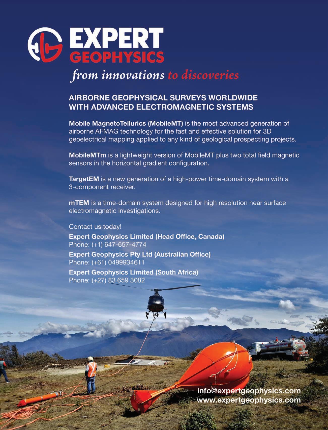

Your Exploration Advantage Find out more www.geotechairborne.com VTEM™ | ZTEM™ | Gravity | Magnetics | Radiometrics | Data Processing | Interpretation T: +1 905 841 5004 E: sales@geotechairborne.com

