LANDSCAPE ARCHITECTURE SELECTED WORKS

CARL VALDEZ

LANDSCAPE ARCHITECTURE SELECTED WORKS
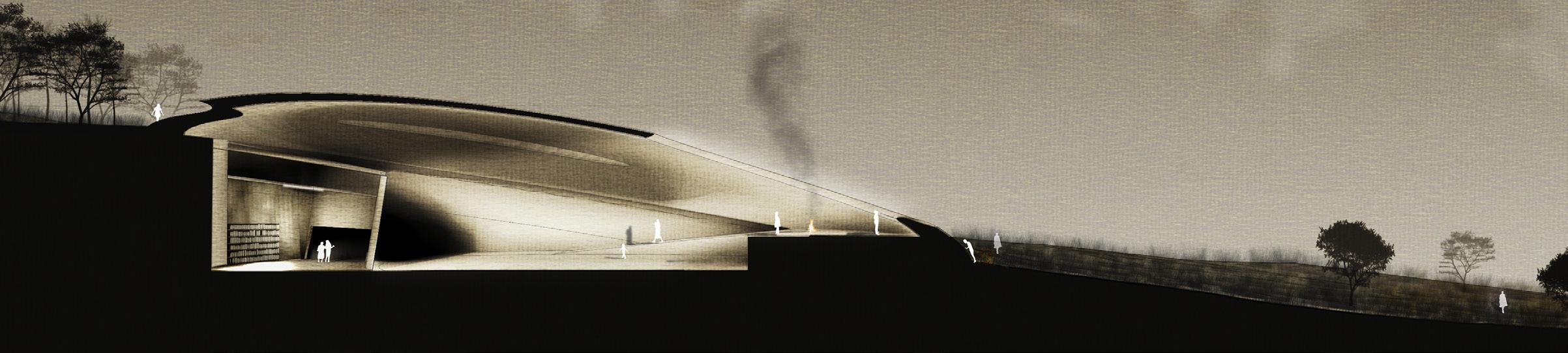
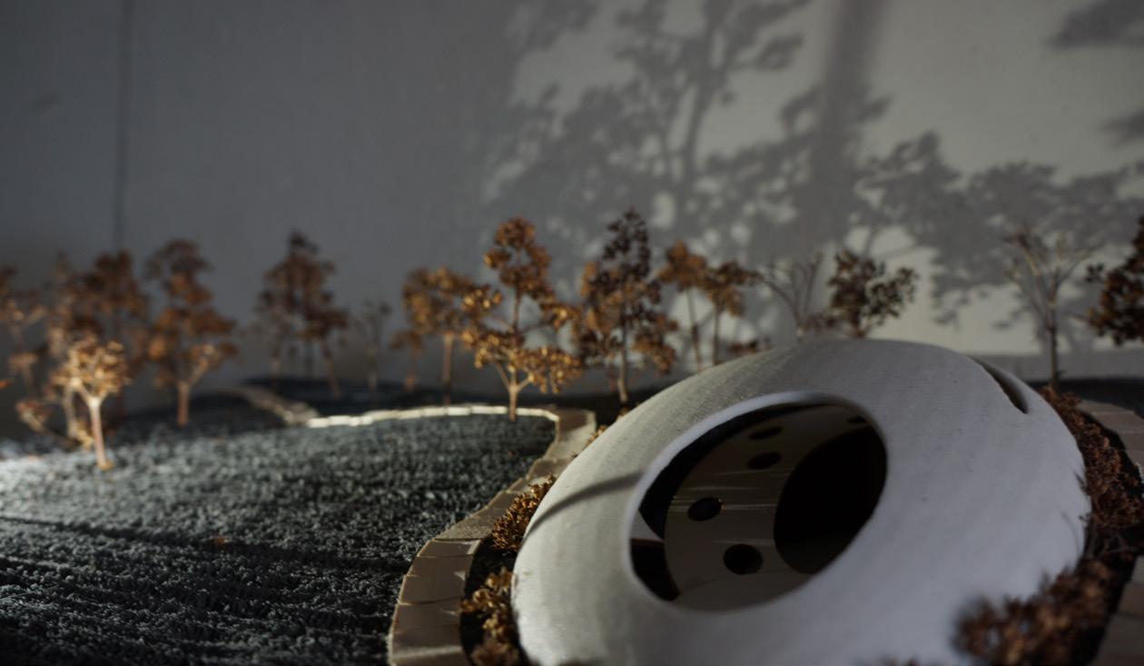
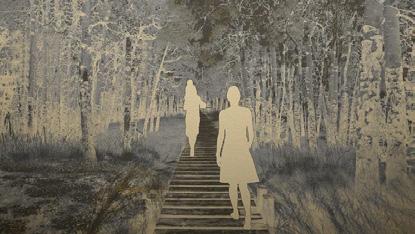
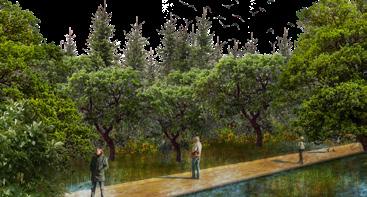
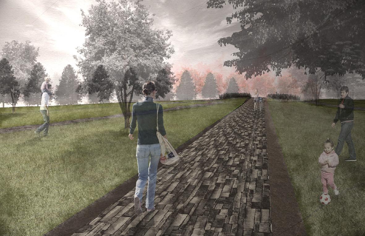
The Trail of Memory, a conceptual idea of an interpretive path that subtly represents the history of the site using landscape design and vegetation through a journey, aims to serve as part of the survivors’ healing process towards hope and release from all the scars left by the residential schools. A dome building with an open hole in the ceiling, will serve as the heart of the healing lodge. Along the walls of the building, names of the victims will be engraved and will serve as a memorial space for them. The space between the wall and the path will serve as a space for prayer and commemoration of the residential school victims. The design of the building aims to be a simple and subtle representation of hope and looking into the future by taking in the beauty of the surrounding landscape, looking away from the place where the school used to stand. Located inside the building is a museum where visitors can learn about the history of the Brandon Industrial Residential School, and a community centre for people, both survivors and visitors, can come together and help each other through the process of healing and reconciliation.
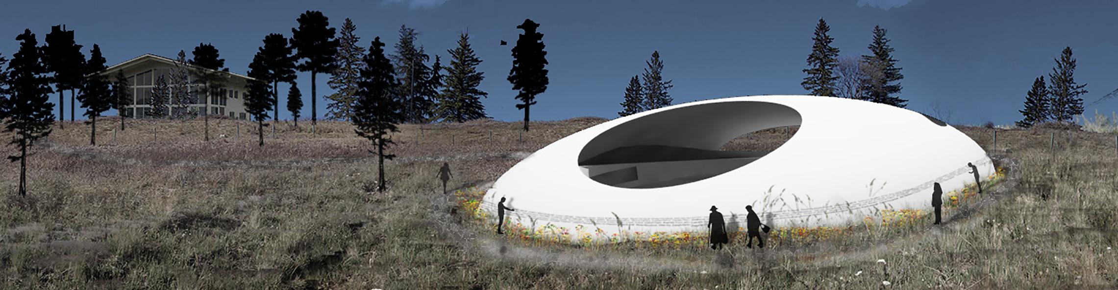
 Term Winter 2017 Project Haunted Houses : Healing Landscapes | Location Brandon, MB, Canada Course Studio 4 individual project Instructor Dr. Karen Wilson Baptist
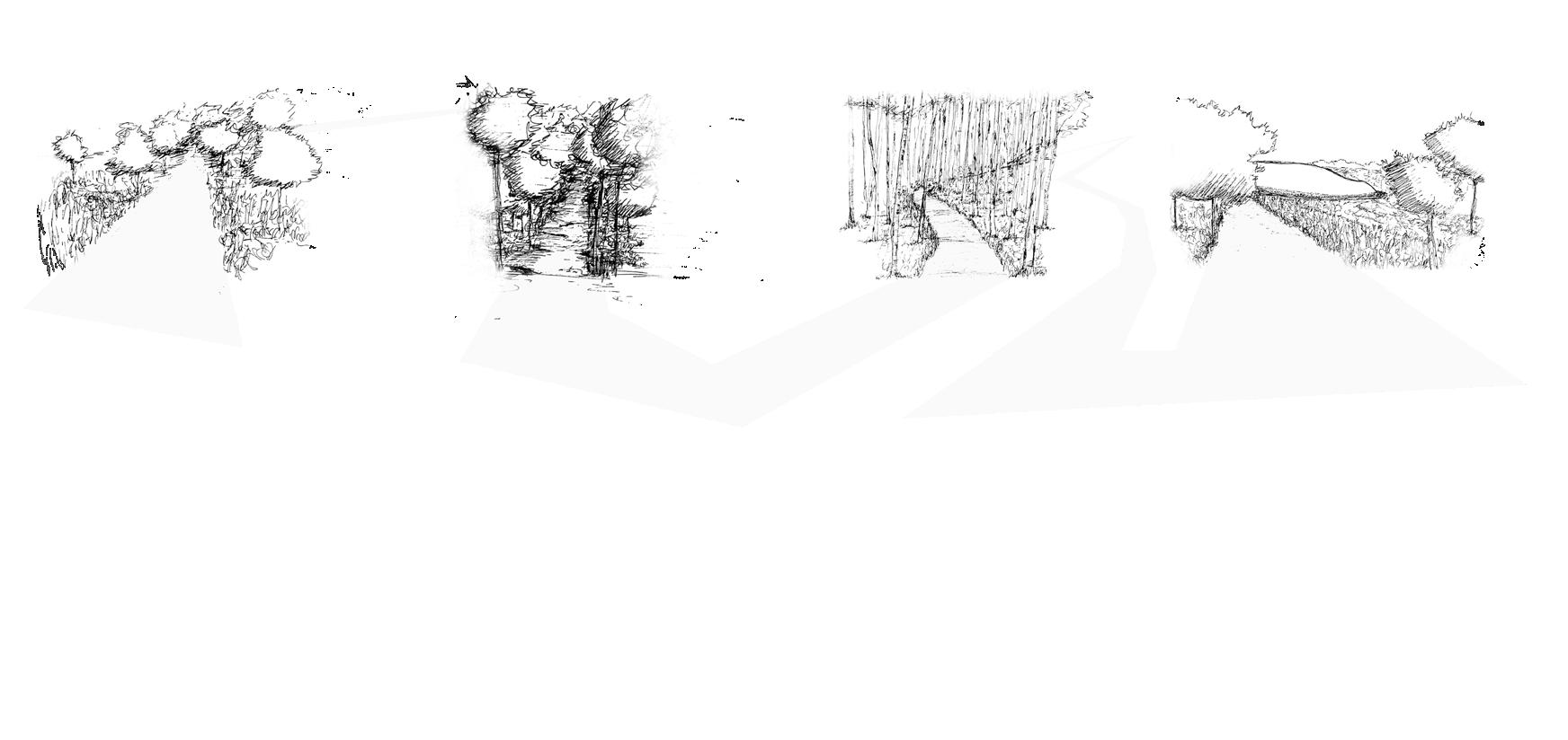
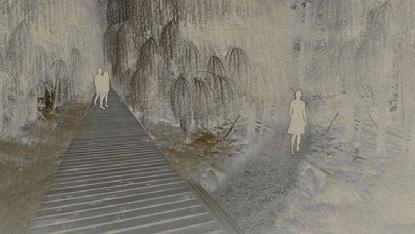
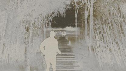
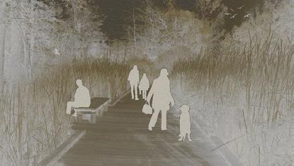
FREEDOM openness / prairie CONTROL narrow / dark / rough CONFUSION winding / dense / high canopy HOPE openness / high vantage point entrance
library + rooms
event space ceremonial space memorial wall interpretive path
Term Winter 2017 Project Haunted Houses : Healing Landscapes | Location Brandon, MB, Canada Course Studio 4 individual project Instructor Dr. Karen Wilson Baptist
FREEDOM openness / prairie CONTROL narrow / dark / rough CONFUSION winding / dense / high canopy HOPE openness / high vantage point entrance
library + rooms
event space ceremonial space memorial wall interpretive path


Term Winter 2018 | Project Regional Studio | Location Fort Qu’Appelle, SK, Canada Course Studio 4 individual project Instructor Brenda Brown, Ryan Coates, Rob Zonneveld
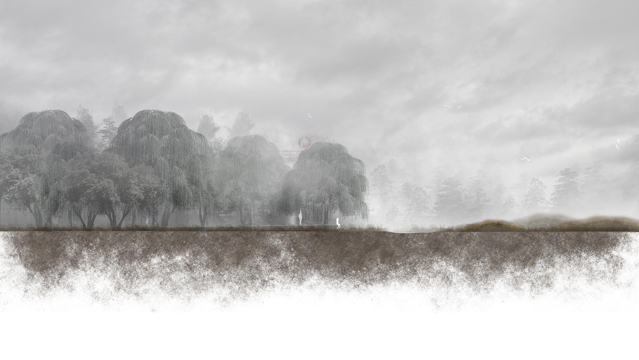
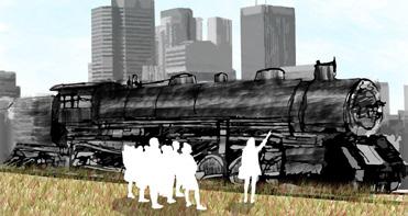
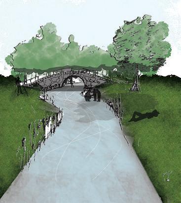
The site is an abandoned delta in Fort Qu’Appelle in Sasksatchewan. The abandoned delta used to be part of Echo Creek that once flowed into Echo Lake before it was diverted to flow into Mission Lake in the 1980’s. The delta used to be a source of living and a place for natural diversity. However, the diversion of the creek destroyed its ecosystem. A place once full of stories and life and was considered an important site in the community is now dead and bandoned.The concept of Echoes of the Void is to use the a strong narrative in developing a new connection between the abandoned delta and the people of Fort Qu’Appelle. The relationship of the people with the delta and the effects of its destruction to the community of Fort Qu’Appelle is analogous to the myth The Legend of the Qu’Appelle Valley by E. Pauline Johnson wherein the death of the young Cree protagonist’s lover changed his perspective about the the ‘beautiful vale’. The design aims to deliver an open interpretation of the different stories with the narrative as the common language, while subtly conveying the relationship between the destruction of the once important landscape and human interventions.
YEAR 1
YEAR 10
YEAR 20
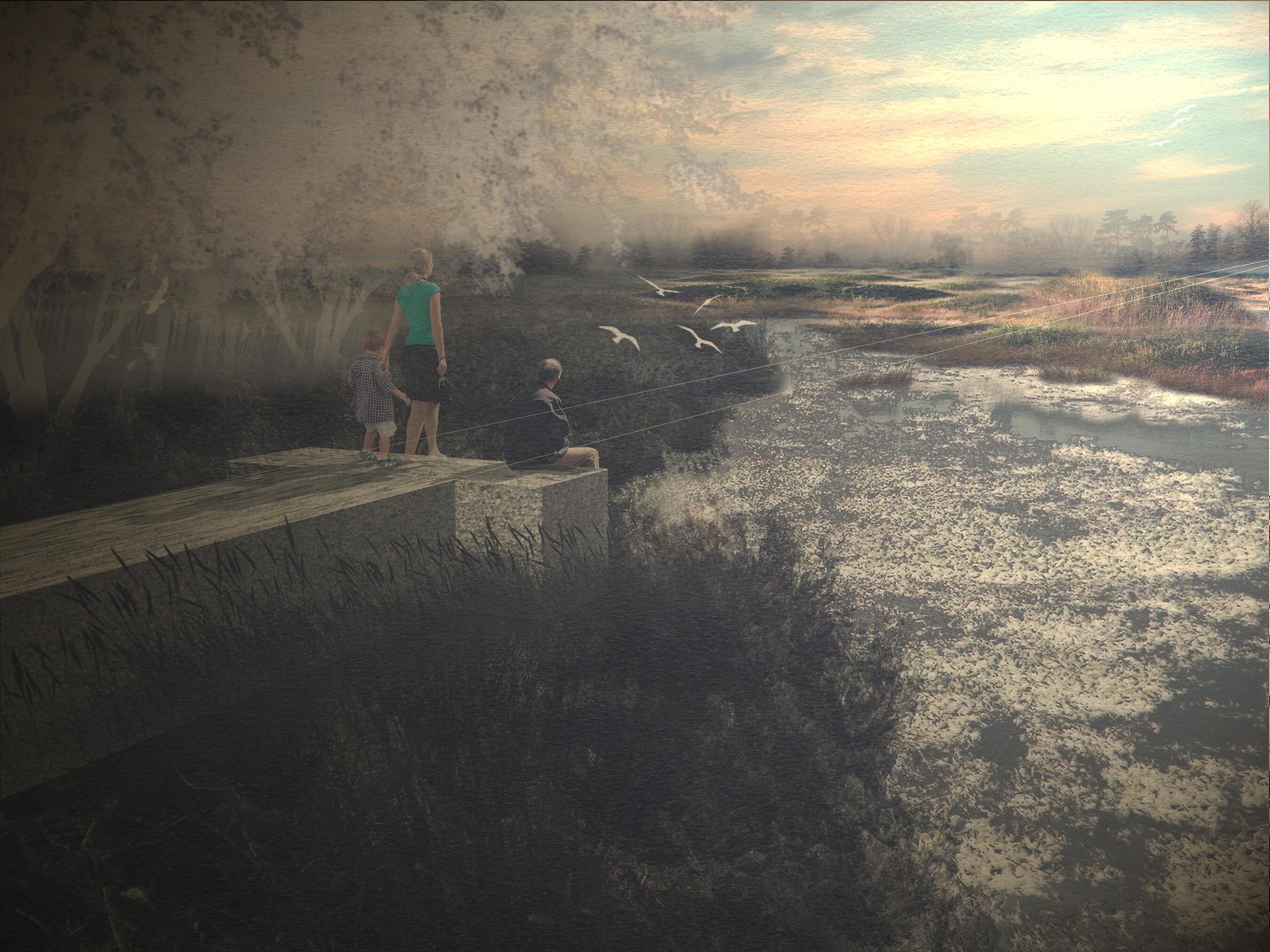
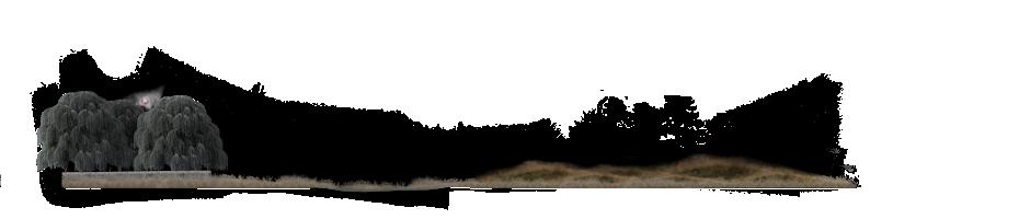
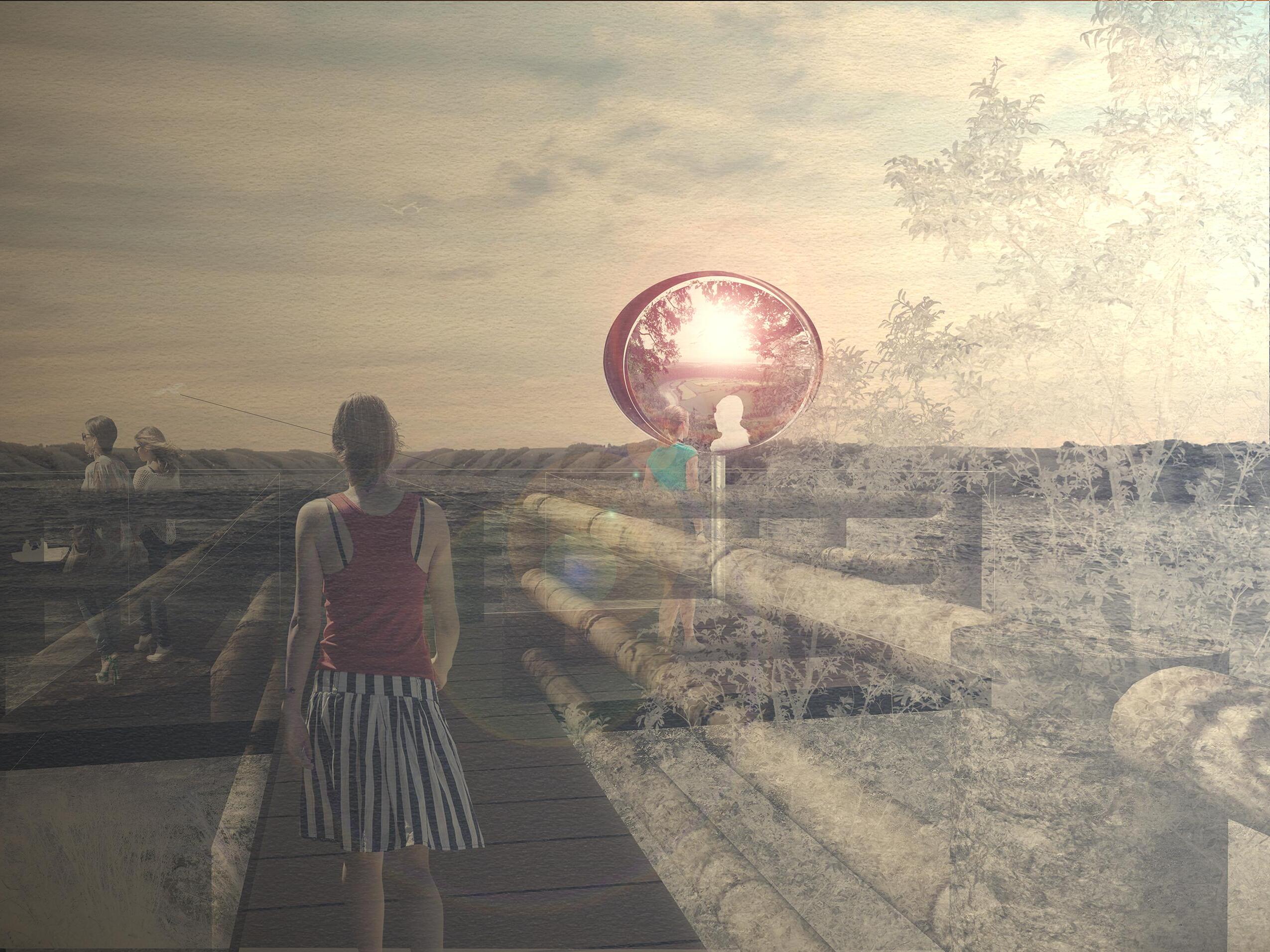
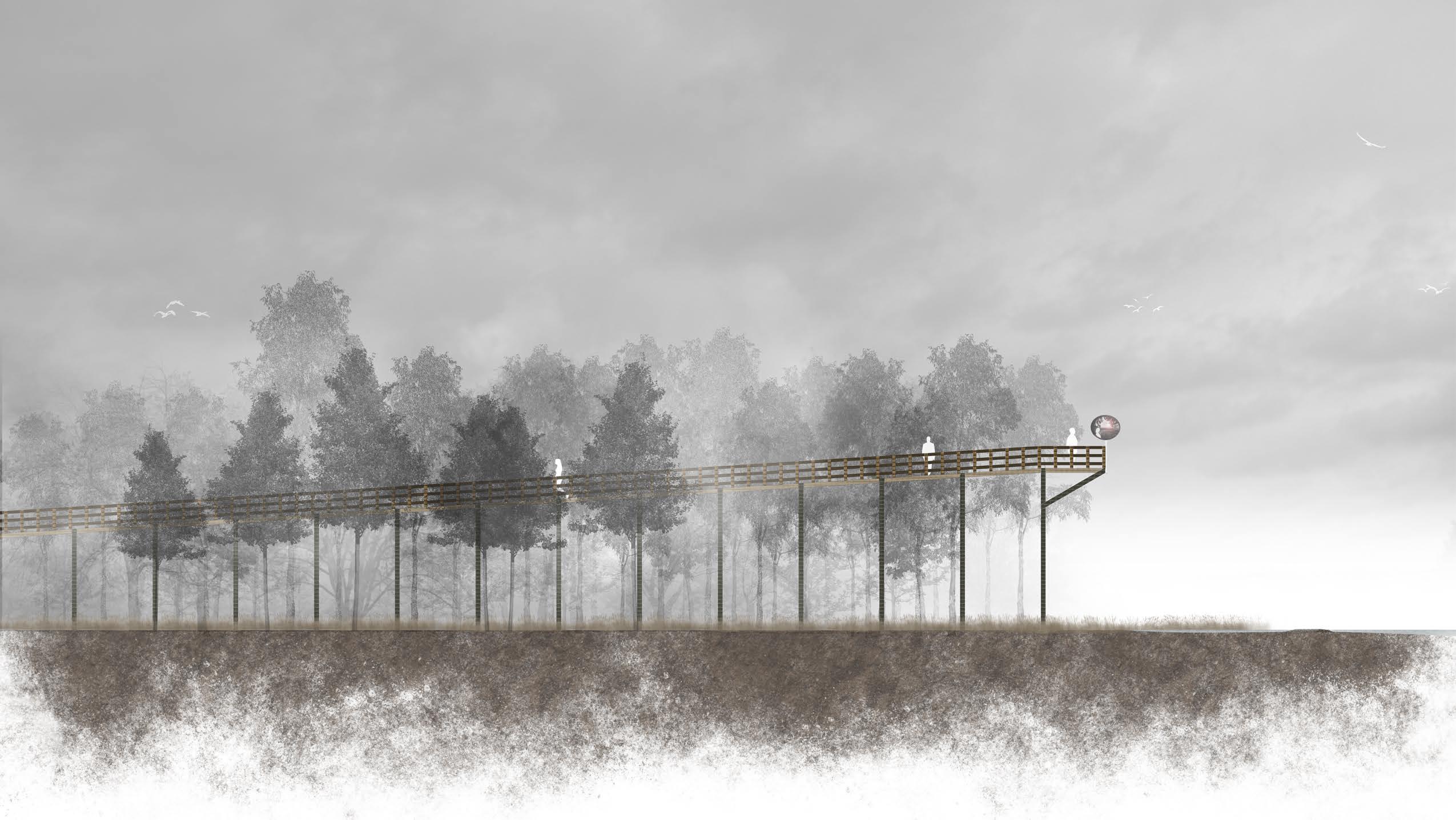
The 160 meter long wooden boardwalk leads to the main terminus of the interpretive wetland trail – a 10 meter high elevated platform overlooking Echo Lake and the rolling hills of the Qu’Appelle Valley. This stretch of the trail elevates the users upon the abandoned landscape revealing them to the beach ridge that lines up the lake caused by the deposition of sediments that destroyed the delta, as well as the significant relationship of people with water. The funnelling wind from the lake and the high elevation brings forth a sublime experience as you are revealed to life and death – a metaphor of the death scene in the myth wherein the lover’s death causes the man to change
 aspen forest
wetland
elevated platform claude glass installation
Echo Lake beach ridge
aspen forest
wetland
elevated platform claude glass installation
Echo Lake beach ridge
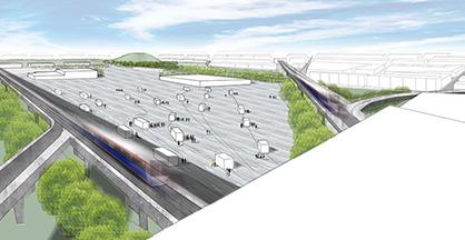
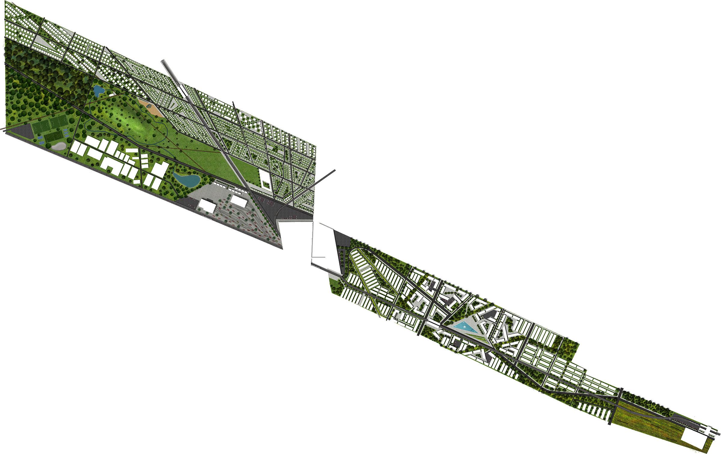
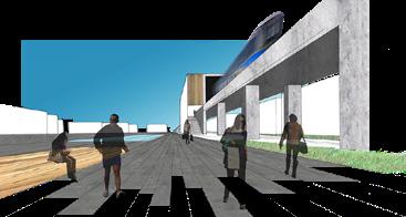
Term Fall 2016 | Project Dwelling Precinct Life - Resilient City Location Winnipeg, MB, Canada Course Studio 3 group + individual project | Instructor Dr. Richard Perron & Leanne Muir
The project dealt with revitalizing the Weston and Dufferin Industrial railyards. These industrial areas served as important economic nodes of the city of Winnipeg. Neighbourhoods grew around them to house workers and
functions
green spaces
pedestrian + cycling amenities
ECOLOGICAL RECREATIONAL CULTURAL SOCIAL EDUCATIONAL
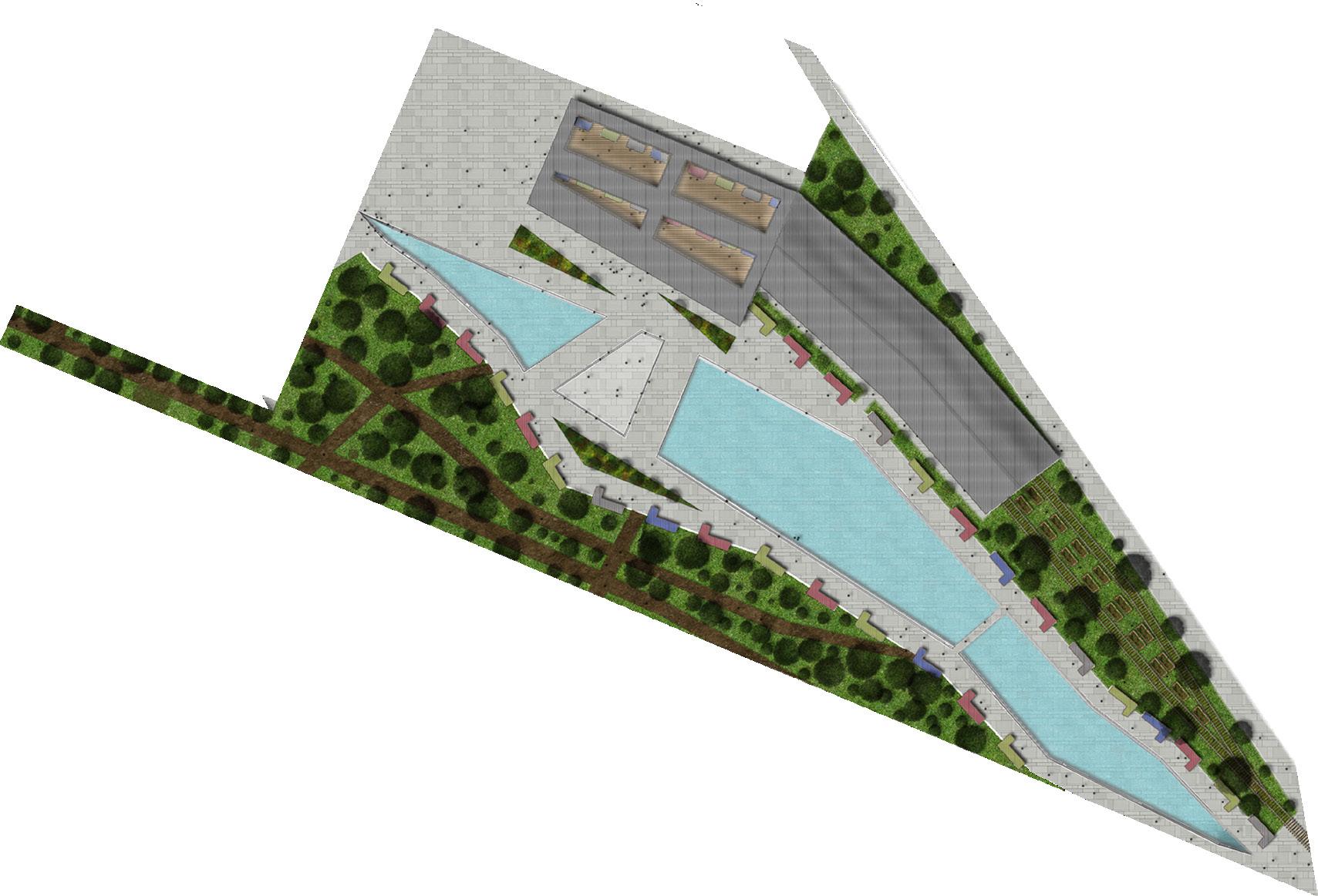
For the individual part of this project, I chose to focus on the design detail of the plaza that my group proposed. This will serve as a cultural hub for the city where remnants of old the old railyard will be preserved throug the form of shipping containers that will house local businesses and parklets for shoppers. A water drainage feature with water flowing from the ecological area will serve as an attraction to the site. A public market which becomes indoor and outdoor depending on the season will be housed in an old railyard shop. Lastly, an ‘active trail’ will serve as a connecting / transitional space between the nearby industrial and forested areas. The site aims to have these spaces work together to encourage social cohesion and the celebration of Winnipeg’s diversity.
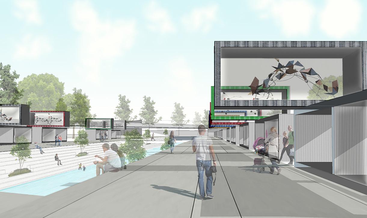
‘Art boxes’ which are stacks of shipping containers containing art from different cultures within glass boxes. As shoppers walk along the promenade, these art pieces would be visible above them which would promote the diverse culture that the city has.
 indoor market
outdoor flea market
active trail
event space
community garden
CULTURAL ‘ART BOXES’
indoor market
outdoor flea market
active trail
event space
community garden
CULTURAL ‘ART BOXES’
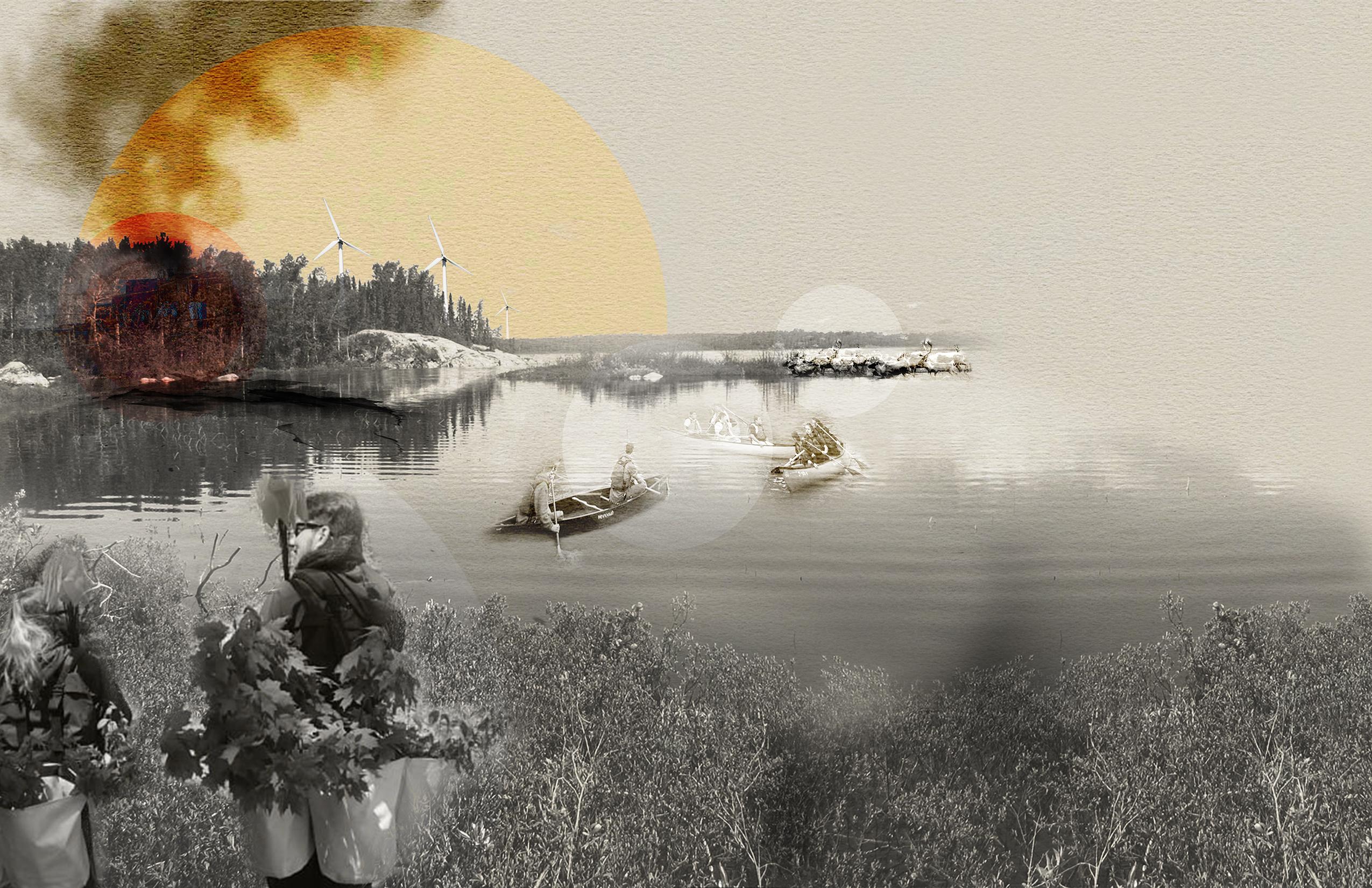
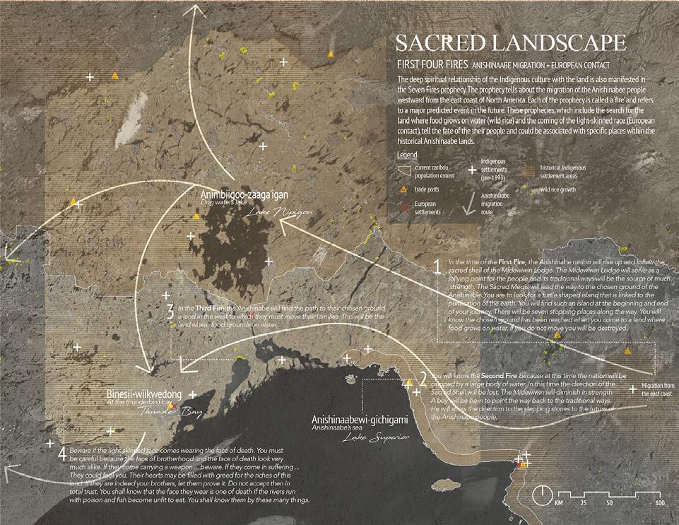
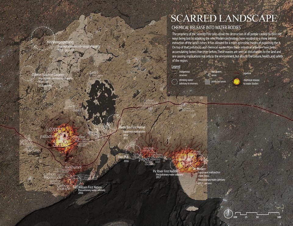
The Ningobianong Healing Reserve becomes a new regional ecoyststem management strategy that integrates human dimensions and acknowledges that people are part of the ecosystems. The values and necessities of both Indigenous and non-Indigenous cultures have, and will continue to influence ecosystems. Traditional knowledge and management of important cultural resources to the Anishinaabe, as well as the inclusion modern knowledge creates a path to reconciliation that envelops the sacred landscape of Lake Nipigon area and protects if from further exploitation – becoming a core and antidote to greed.
INDIGENOUS COMMUNITIES & LAND-BASED EDUCATION
STEWARDSHIP & RECONNECTION WITH THE LAND
Term Winter 2019 Project Urban Studio Location Thunder Bay, ON, Canada Course Studio 4 individual project Instructor Dr. Alan Tate
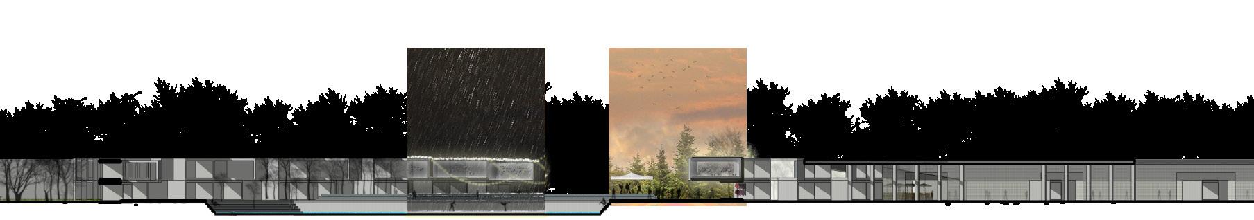
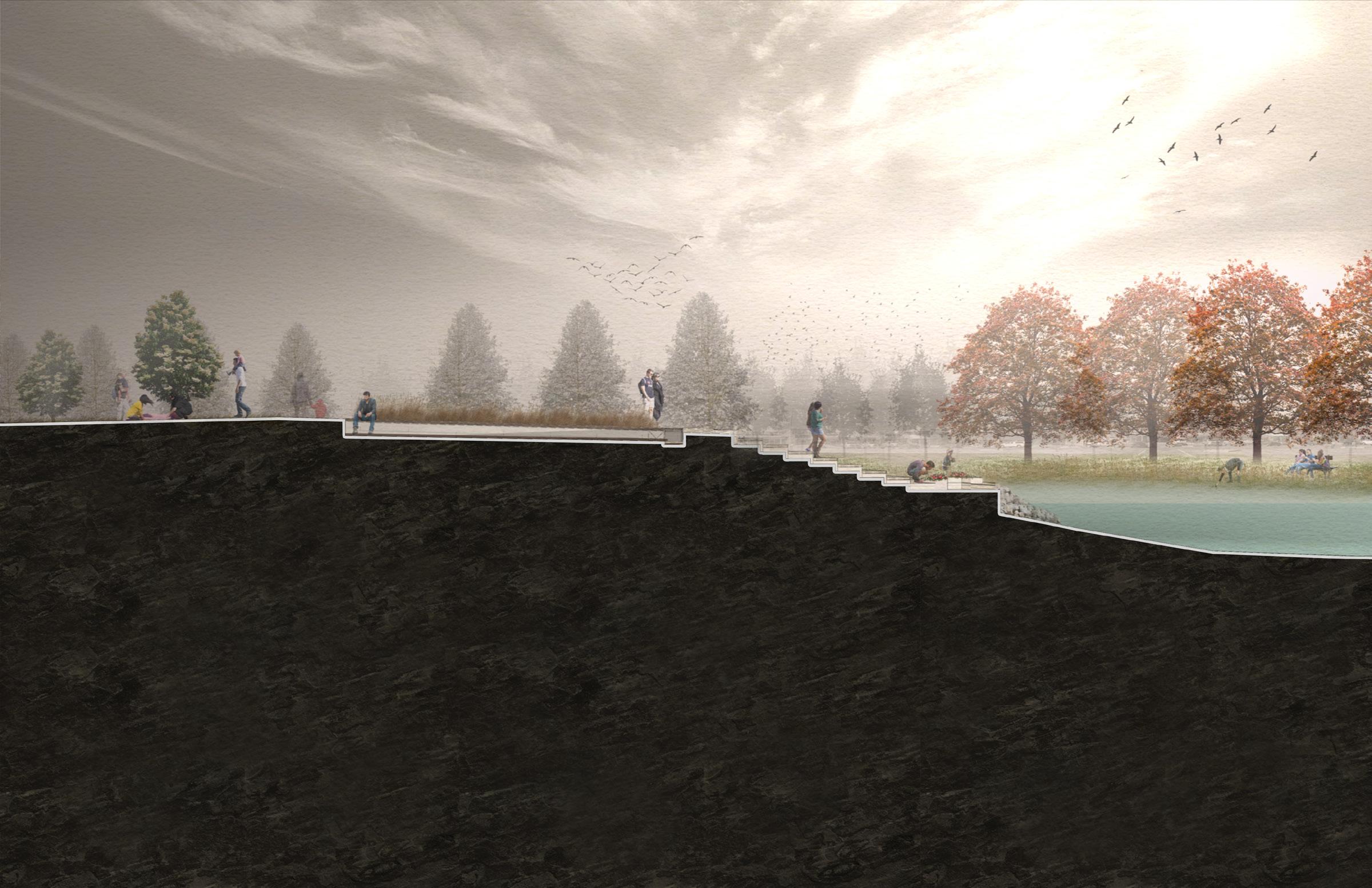
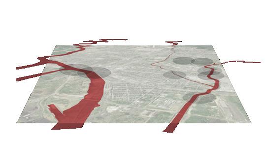
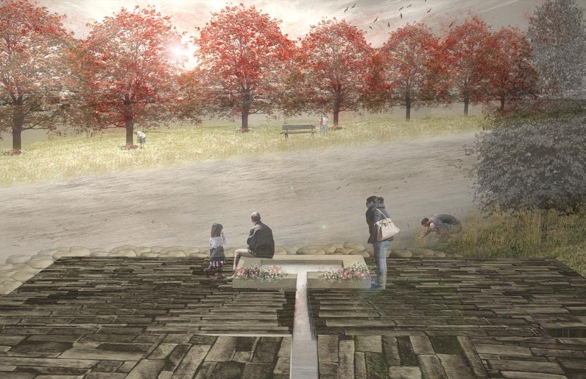
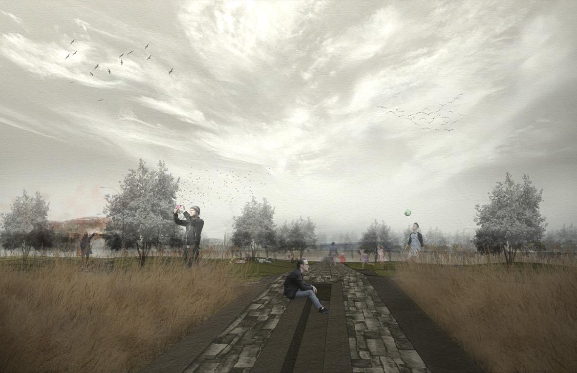
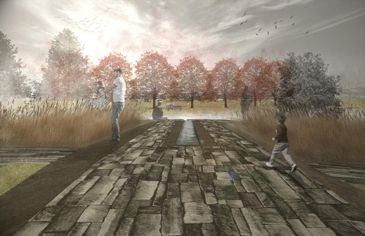
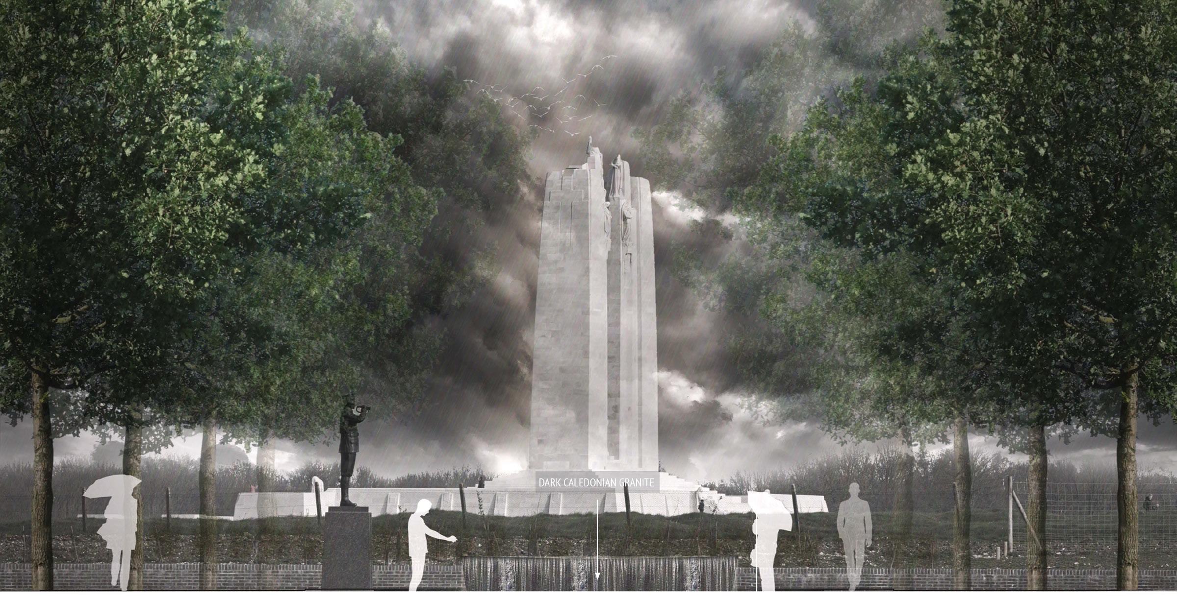
The River of Tears Memorial Park aims to commemorate the lives of the Indigenous kids of Thunder Bay that have died or gone missing within its vast network of waterways, as well as remove the notion that the rivers of the city have become places for death and violence by reconnecting the community back to the the water and revealing its importance - water as life. The memorial park aims to invite people in through a plaza and gathering space, offer a public-to-private transitional place of journey to the water where visitors could interact with it and allow for memorial ceremonies & rituals, and lastly, reveal a secluded place for people to be isolated from the city and contemplate. A series of Northern Pin Oak marker trees located on the other side of the floodway from the memorial aims to represent the lives of the children that have been taken away. A water feature that leads the eye to the marker trees across the water framed by native prairie grass aims to add a temporal element to the memorial by working with the seasonal change in water levels, creating a space for people that adapts with the regular flooding within the site.
recovered bodies
nodes of reconnection reconnection with land & water
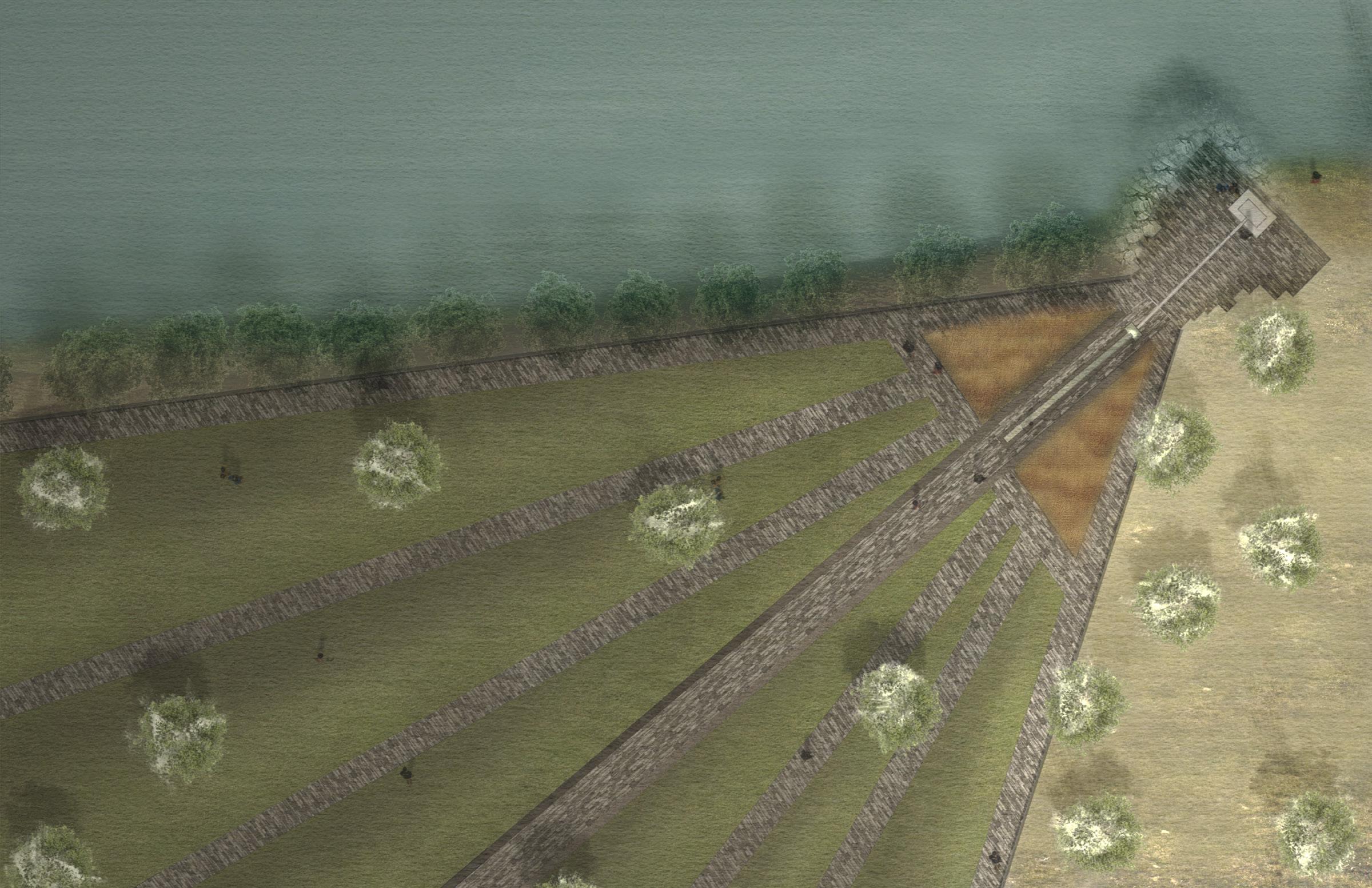
RILL + STEPS
PRAIRIE GRASS
Most of the Indigenous children who have gone missing within the city’s waterways went missing in the months of May and November. This story is subtly revealed through the water feature located at the highest point of the park which aims to be a dynamic gathering space and a play area that works with the conditions of the floodway’s rising and receding water levels. The
months when the water level is the highest in the floodway coincides with the months of the year the children have gone missing. A catchment basin at the end of the rill adjacent to the water collects water from the floodway. At low water levels, the feature is a seating area. During high water levels, it becomes a water feature, creating a temporal element to the space.
INDIANGRASS
MAIN PATH
WATER FEATUERE
MODEL + ISOLATED SPACE
NORTHERN
+187 m
highest point
+185 m
maximum water level (spring & fall)

+183 m
minimum water level (summer & winter)
 MAIN PATH + LAWN AREA
WATER FEATURE + RED TREES
MAIN PATH + LAWN AREA
WATER FEATURE + RED TREES
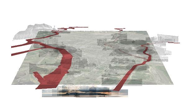
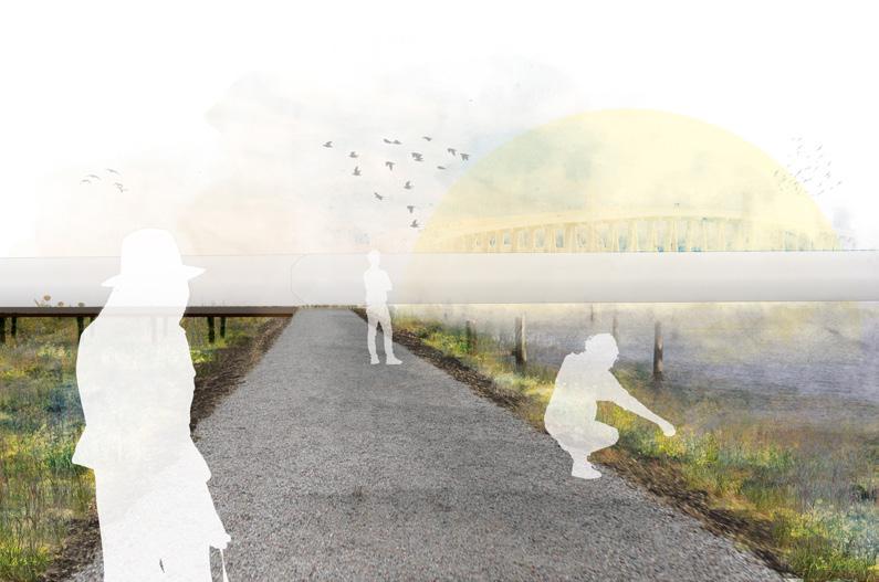
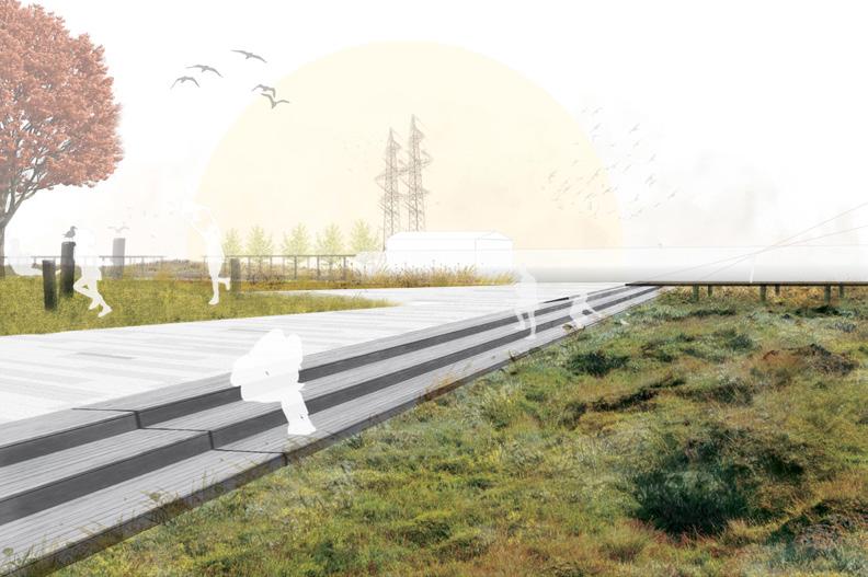
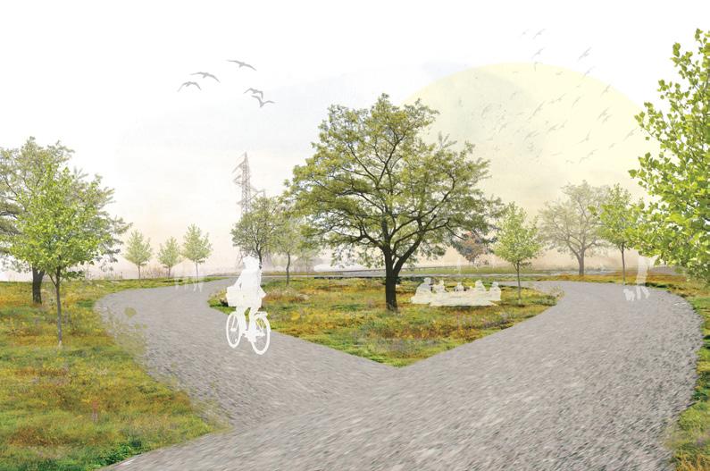
Term MLA Thesis + Practicum Project Location Menlo Park, CA, USA
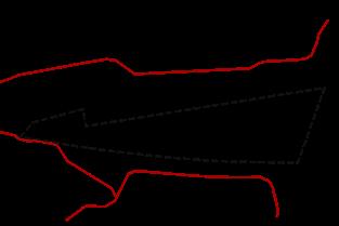
Research Adviser Dr. Karen Wilson Baptist Internal / External Adviser Brenda Brown / Alexandra Boese
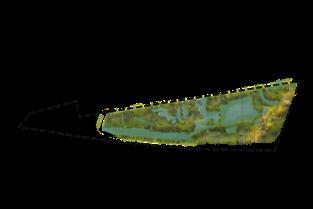
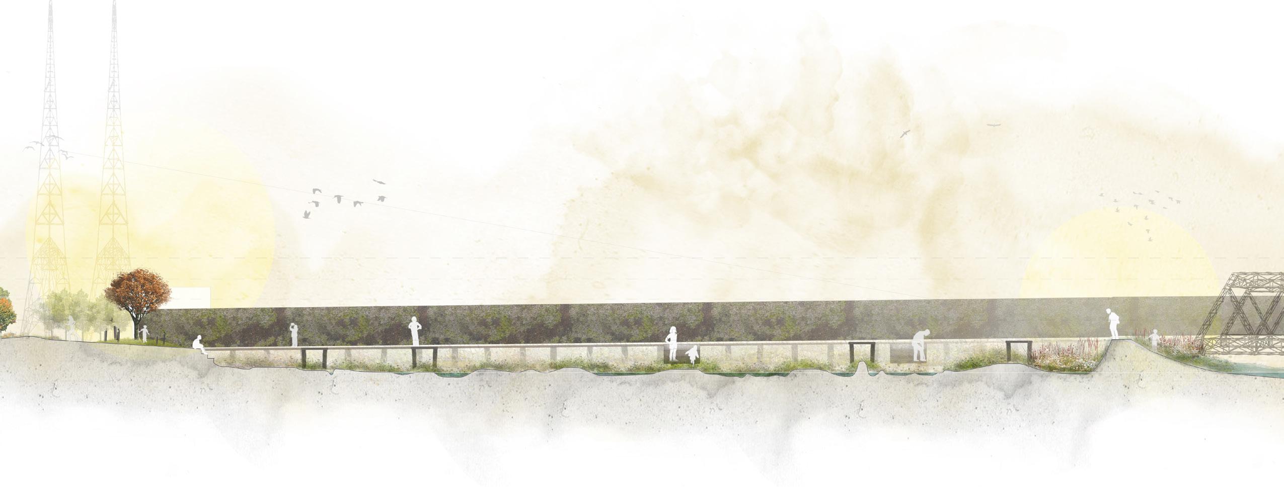
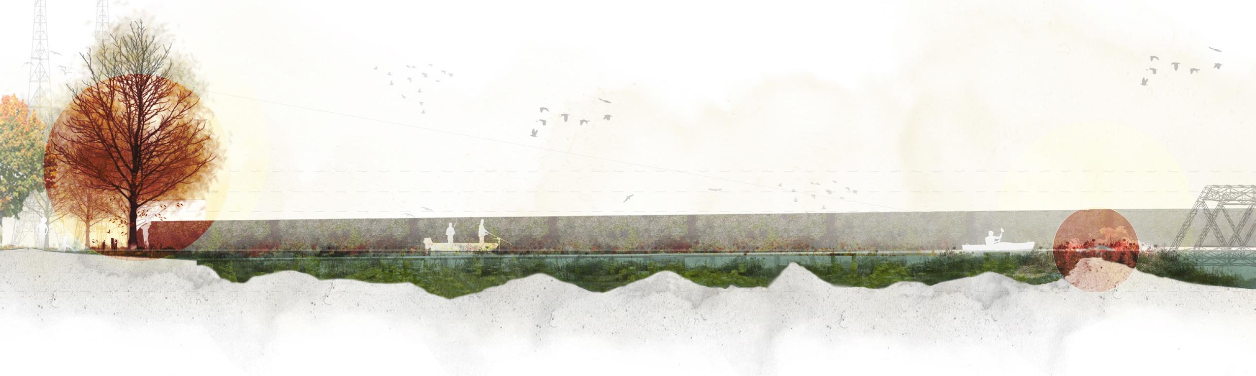
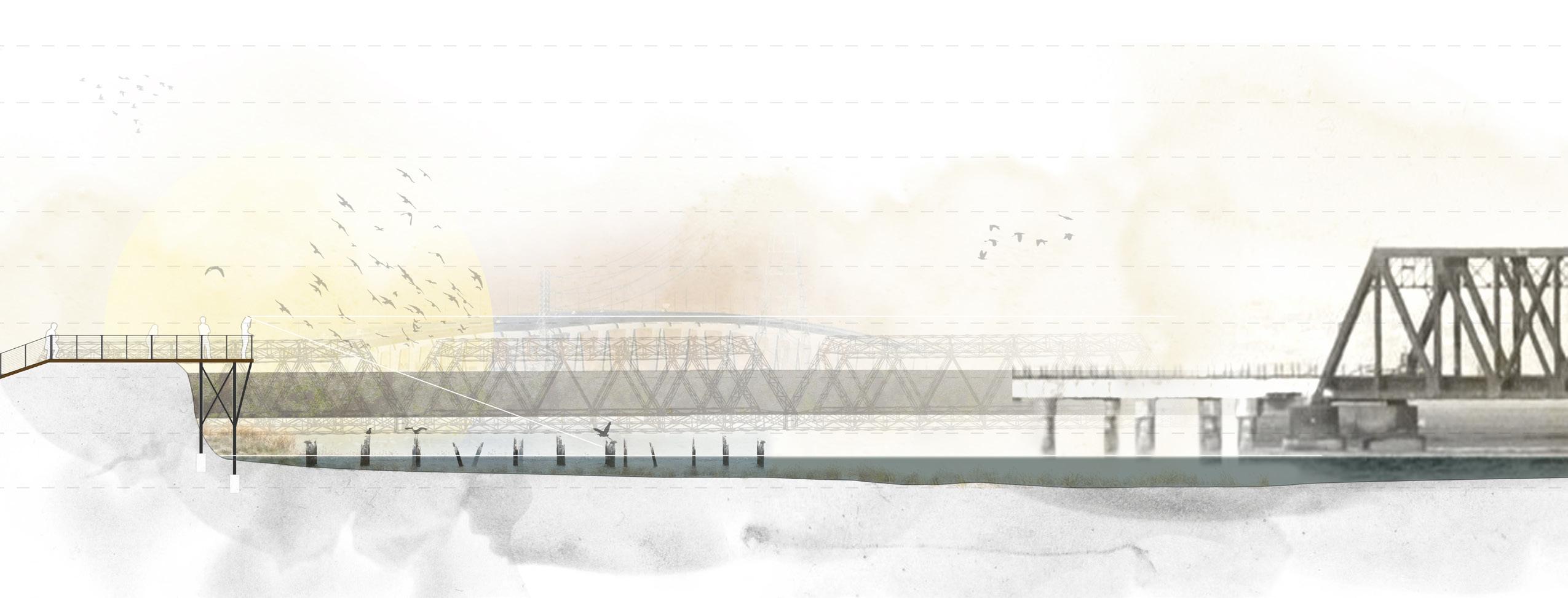
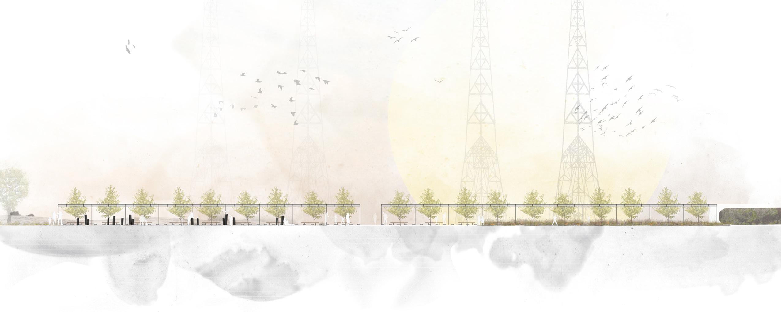
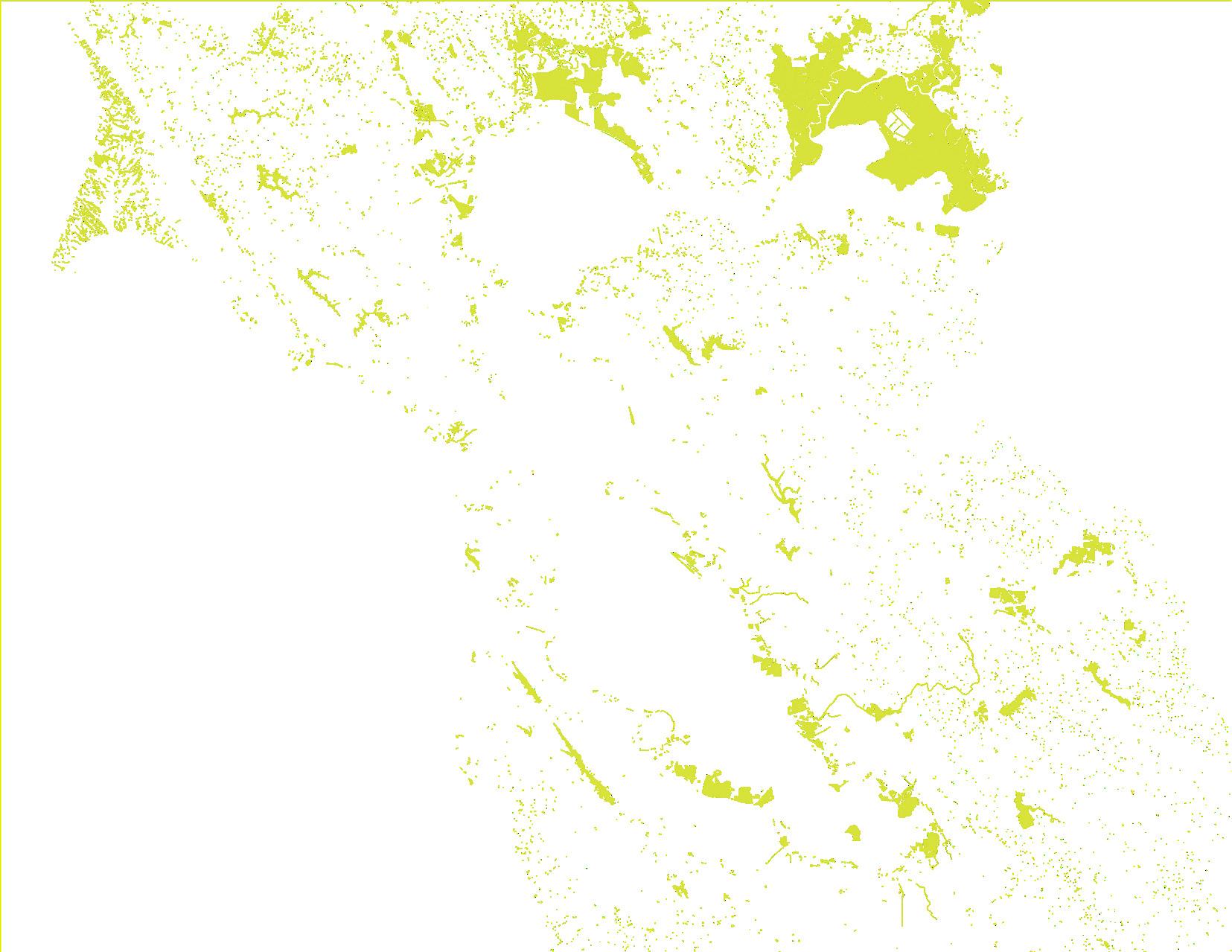
The park is designed to be experienced on a pedestrian level with various site elements and distant views working with each other to create a meaningful experience that unfolds the history and importance of the Bay’s tidal marshlands. As one walks towards the Bay using a series of paths and boardwalks, the dynamic forces of the water reveal the shifting coastline through overlapping timelines and how materials reacts to its slow but certain movement inland. The rusty metal on the aqueduct pipes, the decaying wood planks of abandoned salt pond infrastructure and farm houses, the wires and poles of nearby power lines, and the diverse plant life of California’s coast - as these materials respond to the Bay water, the landscape changes – becoming the chronograph itself. And as the chronograph is revealed, curiosities are heightened, raising awareness about the Bay, the tidelands, and the rising sea levels.
 existing public access existing industrial elements proposed access / paths
chronograph / wetland pedestrian / community engagement
existing public access existing industrial elements proposed access / paths
chronograph / wetland pedestrian / community engagement
The end of the century marks the ultimate return of the Bay within the site. By 2100, the water level will have increased by 1.5 to 3m which would completely submerge a significant part of the park. Moss start to inhabit the crevices of decaying materials. Similarly, rust start to take over the metal structures that characterize the site. The Bay levels out with the top of the levee structure, over topping it and completely breaking through the land . The marker tree then becomes constantly submerged in salt water and dies, marking the destruction of the park and signifying that the Bay has completely taken back the land. The remnant of the marker tree, and ultimately the elements that once made-up the site, denotes the shifted coastline and the new edge of the Bay. The only part of the site that will remain will be the Bay lookout as it becomes the site for contemplation and memorialization of a lost landscape.
ROADS + HIGHWAYS
URBAN AREAS

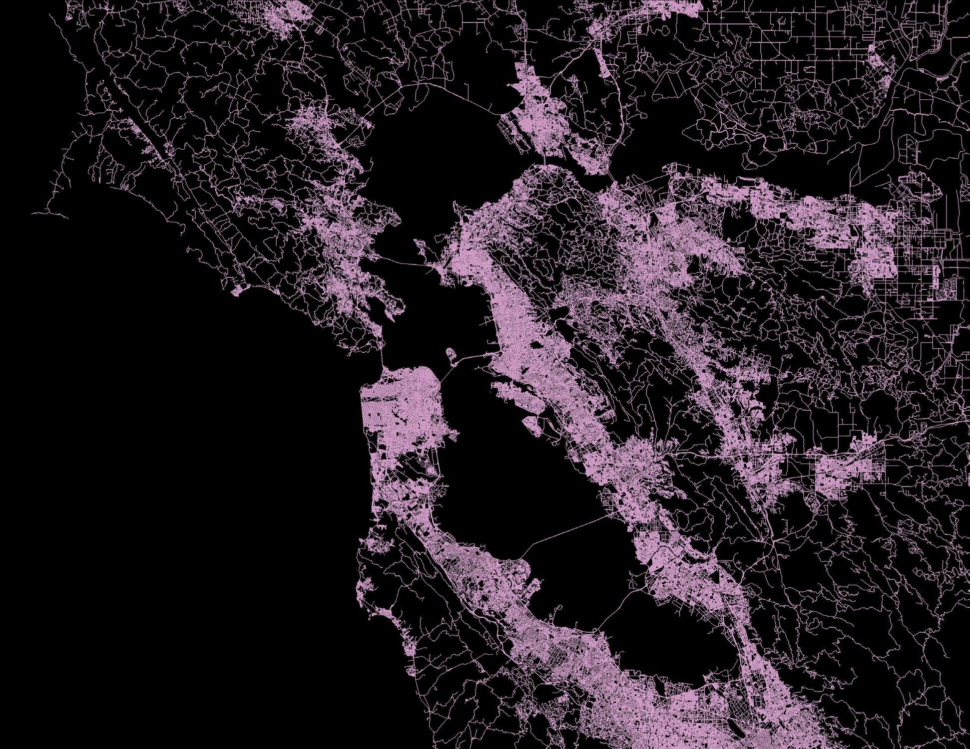

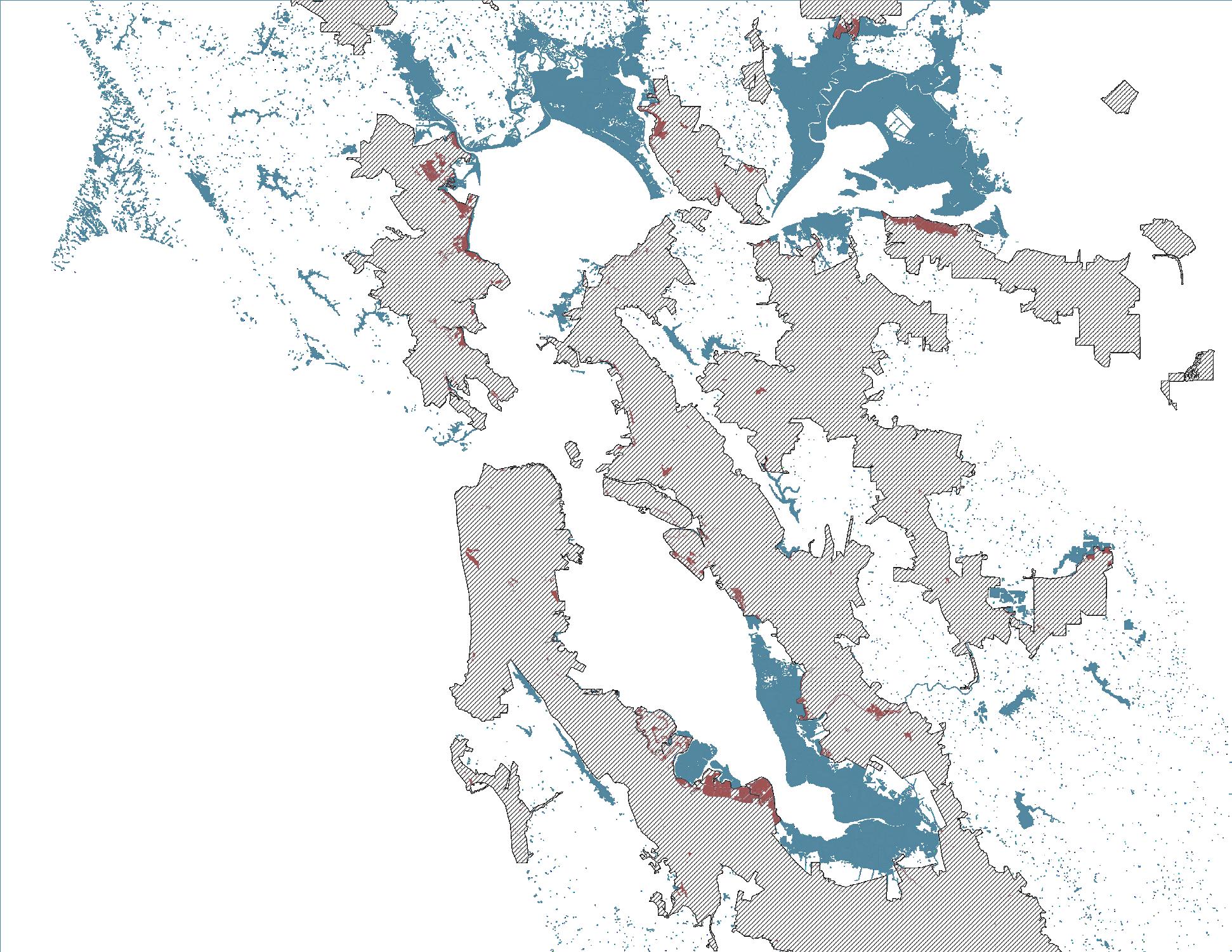
WETLANDS
WETLANDS


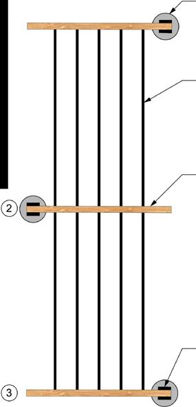
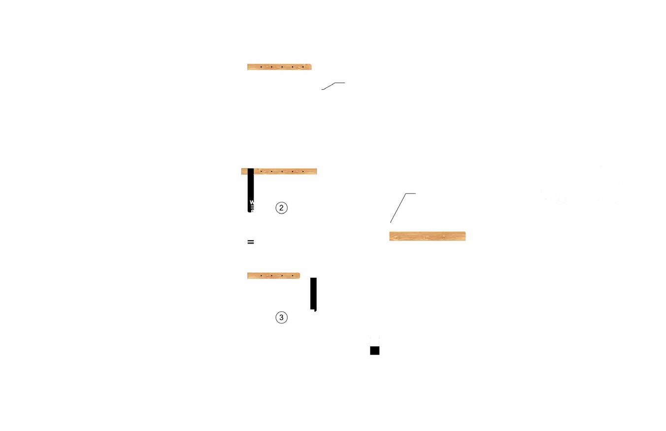
SEE PLANS FOR JOINTING. EXPANSION JOINTS AS NEEDED.
SUBGRADE, AS
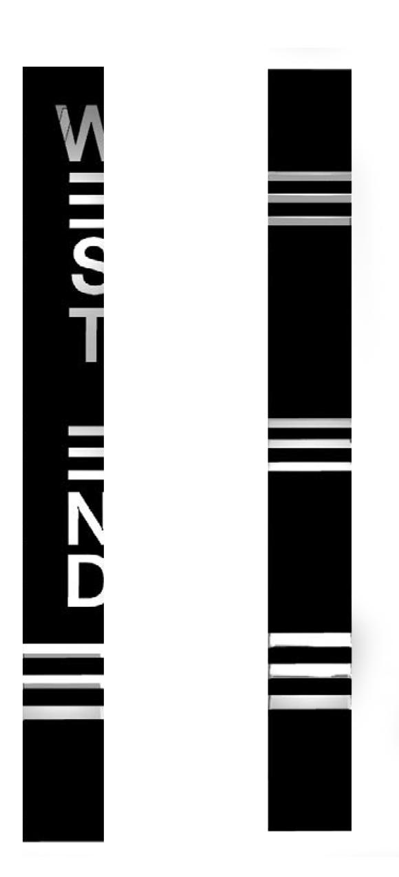
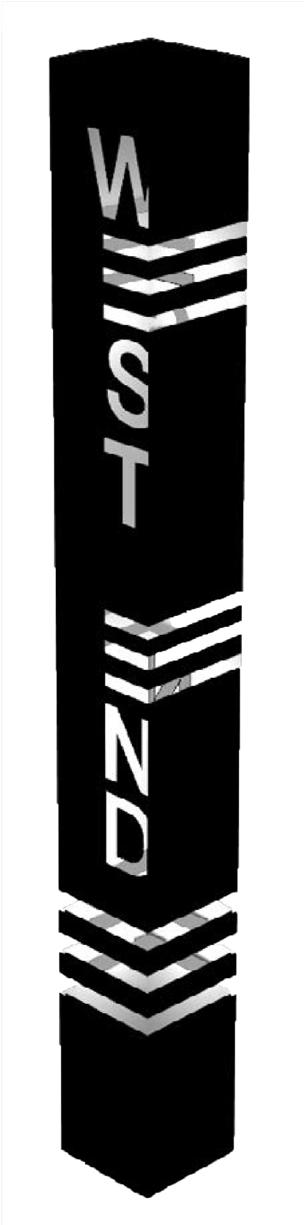
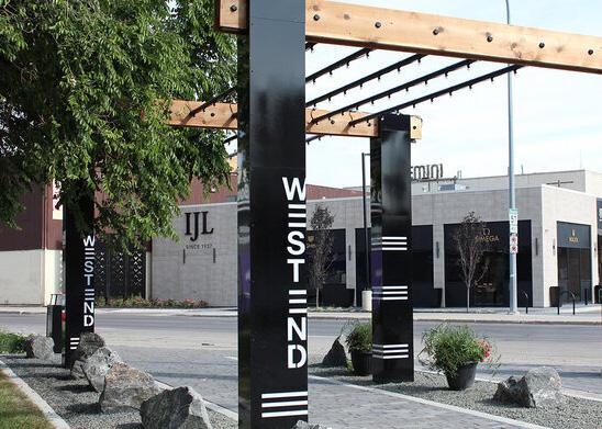
BRANDING + PLACEMAKING

RHINO / SKETCHUP / ILLUSTRATOR
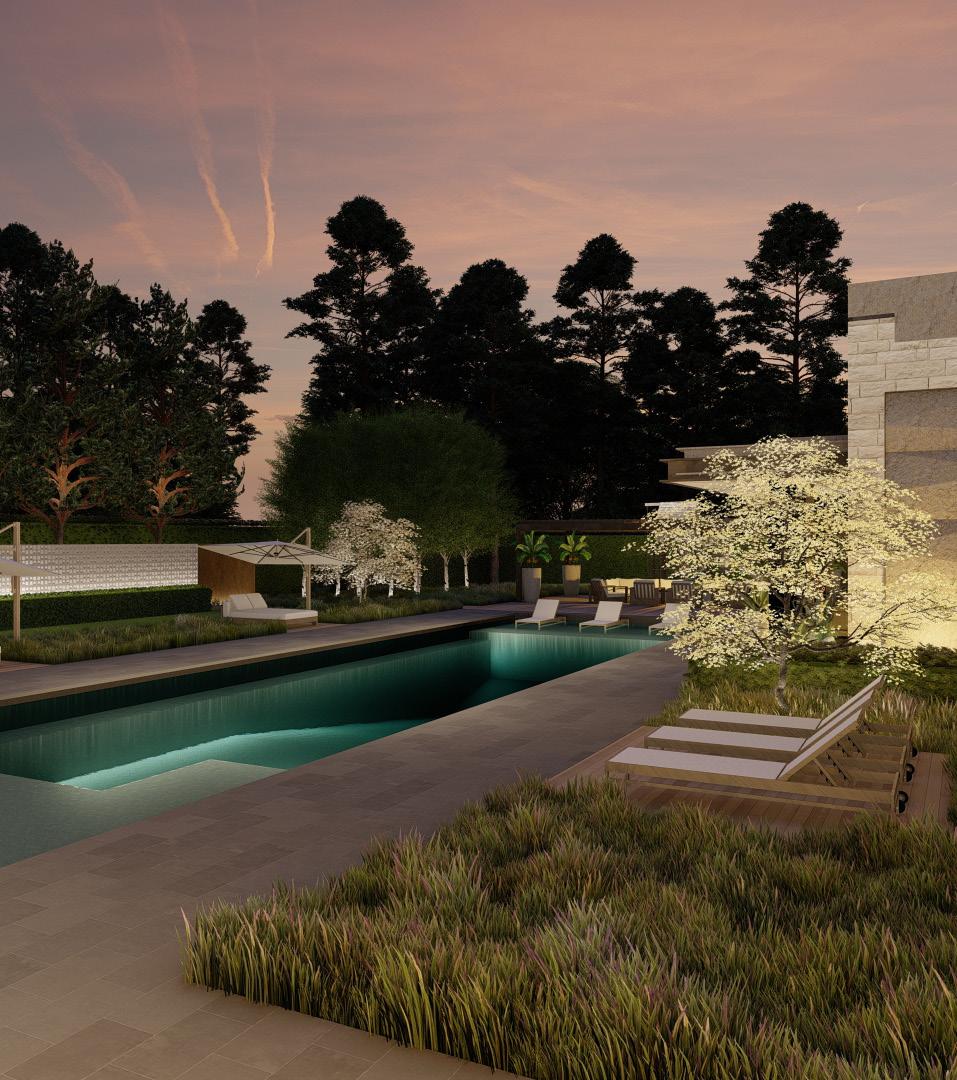
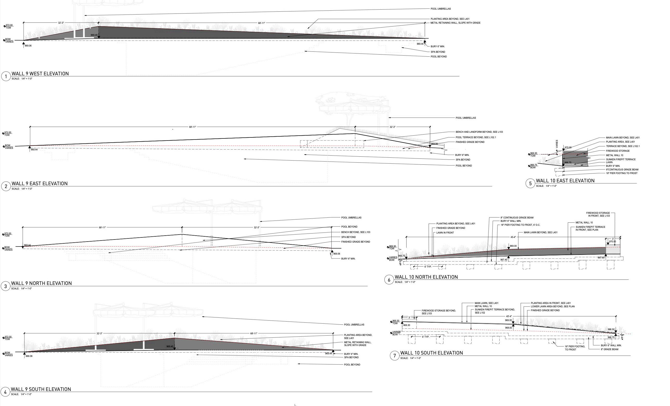
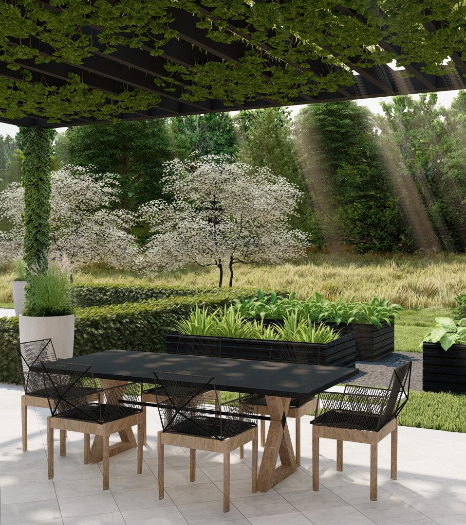 HIGHCROFT RESIDENCE
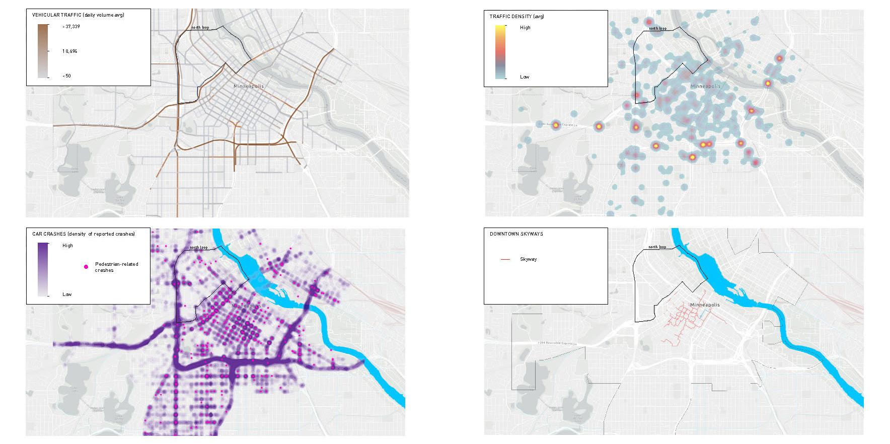
MINNEAPOLIS DOWNTOWN INVENTORY RESEARCH
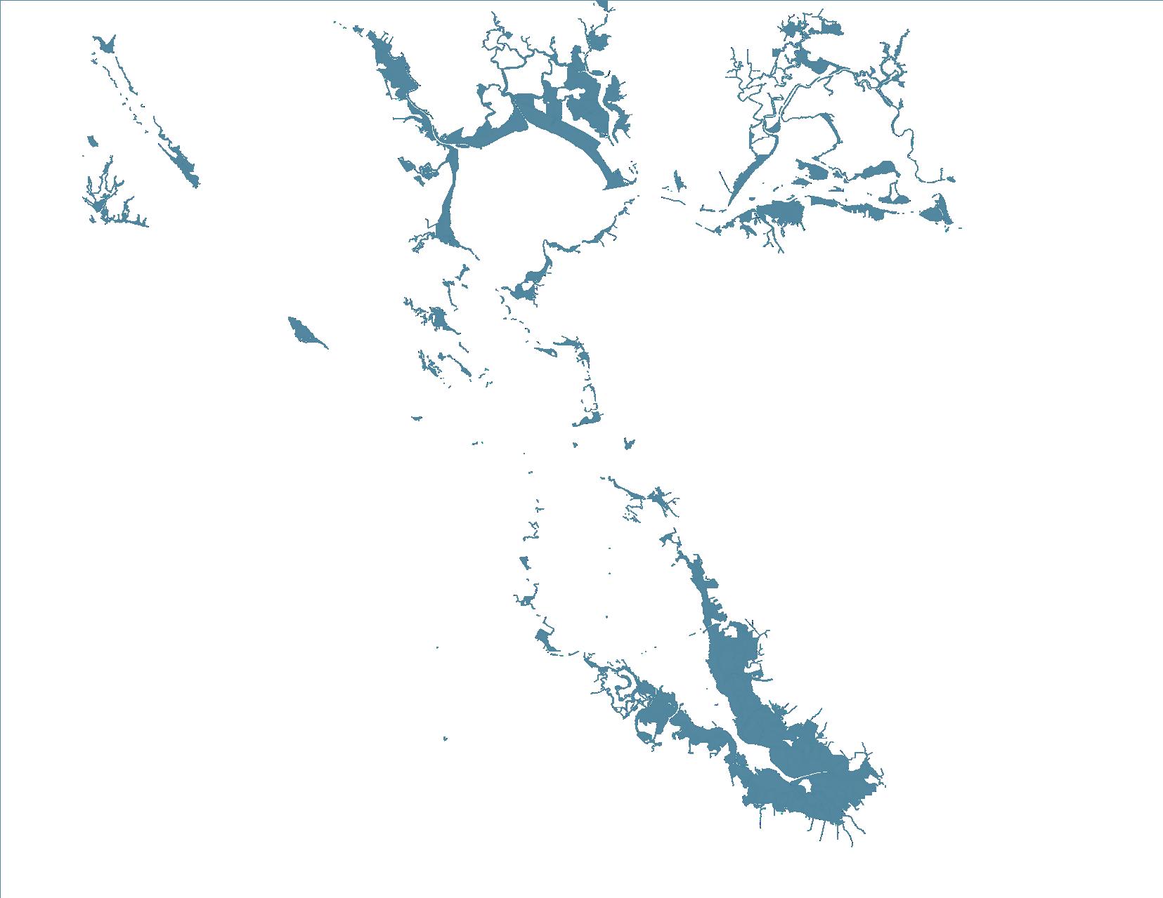
WETLAND / TIDELAND
Carl Valdez (Thesis + Practicum)
Carl Valdez (Thesis + Practicum)


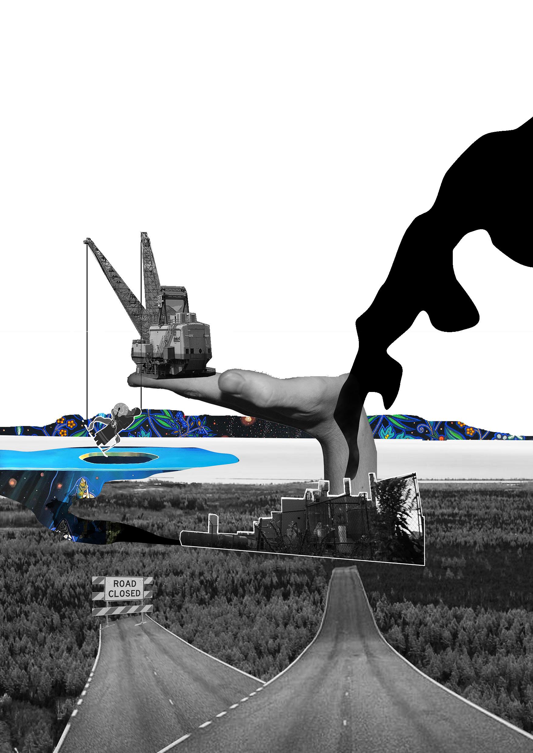
 DIGITAL COLLAGE PHOTOGRAPHY + PHOTOSHOP
COLLAGE EXPLORATIONS
THE EMERGING CITY
DIGITAL COLLAGE PHOTOGRAPHY + PHOTOSHOP
COLLAGE EXPLORATIONS
THE EMERGING CITY