Catia Martins De Sousa
Portfolio
Urban Planning and Urban Design


Catia Martins De Sousa

Academic Background
Newcastle University - Urban Planning BA
2019-2022
Certificate in Planning Placement
2022-2023
Professional Experience
Property and Development Management, Urban Planner-Royal Borough of Greenwich
2022-2023
Email: Catia.martinssousa@outlook.com
University email:b2095335@newcaste.ac.uk
Memberships
RTPI student membership
2022-2024

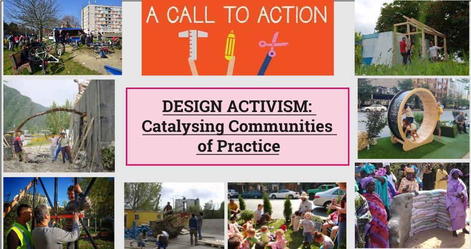
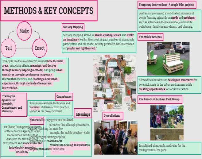
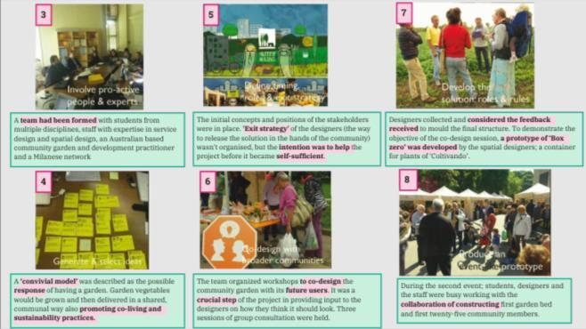
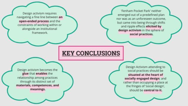
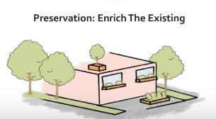
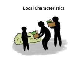
1.Design Activism
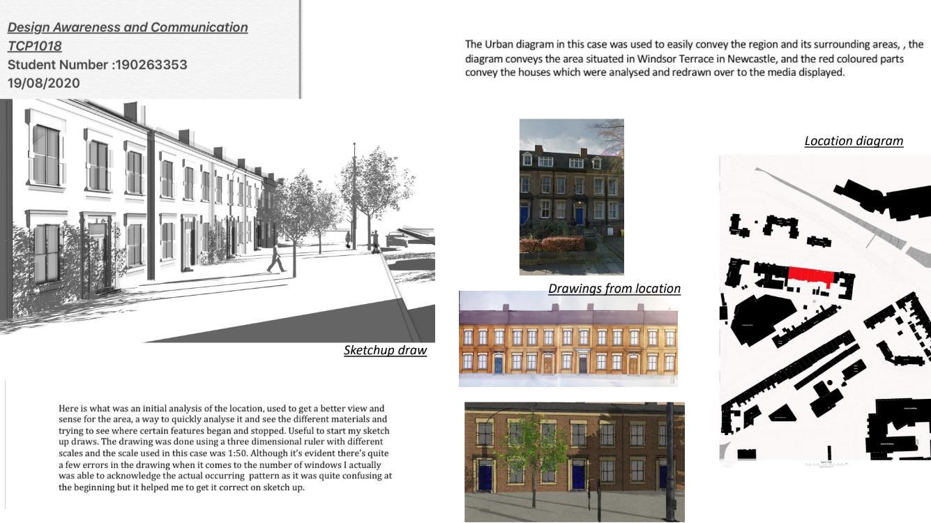
2.Street Design awareness and communication personal research
2.Redesigning Sheinmoor Neighborhood street planning
3.Smith Docks Development Masterplan

For this all members of the community, children, and adults alikewere all included however, we kept a closefocus on the participation of the local children, with the aimof not only encouraging them to implement these changes now in the present but also with the hope of influencing the younger community to continue these acts and state of mind postthe events have taken the place.
As presented in the next page, the project was divided into five different phases of which three incorporatechild-focused participatory methods.These includean interactivemapping activity, followed by an informativecard-play session and a recycling DIYproject.
The interactivemapping activity was mainly aboutexploring and identifying the most frequented spaces by the locals, particularly children. Oneof our first objectives (when firstbegan to get acquainted with the study) was to identify what sortof concerns, the locals personally, specifically children, faced due to the state of their streets- what sort of impacts and/or limitations was the state of their surroundings having on their lives, mobility, health, and behavior- and with this method, I considered it to be ideal to identify these very key challenges and local views.
Moreover, the place cards activity was another interactive and informative participatory approach created for the children to get acquainted with the basics and the importance of recycling, alongside the many ways these can take place.
For this project, me and my team developed aset of participatory processes with agoal to tackle and address the safety and well-beingissues within the WestEnd community. The team created these processes with the purpose of enablingthe youngercommunity to create real impact change while simultaneously encouragingthe creation of cleanerand saferspaces within theirpresentand future local areas.
The mapping activity was intended as an initial interactive, sortof ‘communicativeaction space’, as originally termed by Kemmis (2001), for both children and adults presentto express themselves and I believe this method was undeniably necessary atthis stageas the conducting team was trying to, in an open and safemanner, understand how these younger individuals viewed and interpreted the state of their current streets. With this method, the participants would be ableto communicate and interact with each other, sharetheir thoughts and individual or collectiveviews on the surrounding areas whilesimultaneously openly documenting and informing us of these very ideas. Important for the process as it would also allowus to also better explore how these individuals communicate, while allowing us to acknowledge what sort of limitations therecould be in the future when trying to implement and/or influencecertain permanent changes.
The DYI project, the more visual and designing influenced method, is one which I personally believe was of great significance to the learning and reflectionary process part of the study. This method was selected with the purpose of creating a process which could be easily communicated and understood by the children. In this part of the process, following up from the previous recycling cards activity, the children (as the local experts, creative inspirers, and learners of this study) have the liberty to come up with something inspired from the precious sessions- reflecting on what they have learned from the impacts of recycling and the basis of sustainability–spot and identify between the many existent good and bad approaches to recycling and help us acknowledge whether the information provided has fully been understood and processed by the children correctly- while also exchanging their own knowledge and understanding of the informed topic. This method is extremely vital for the study as it is what will later contribute to the bigger picture and future actions of these individuals.
Overall, the methods chosen proved to be relevant to the study as they all promote interaction, co-design, and communication opportunities for the children, while also endorsing free and open spaces where the younger participants can communicate and contribute to envision a cleaner and safer environment, while reflecting on the impacts that their action can and are having on their built environment.

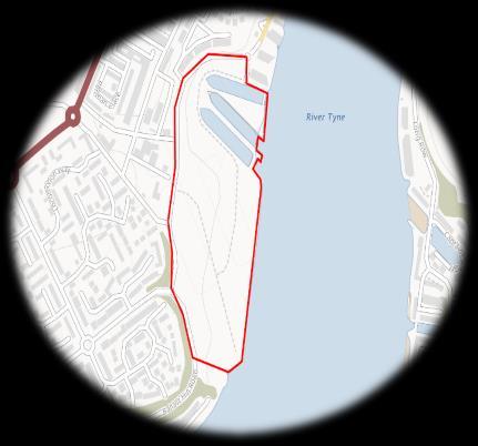
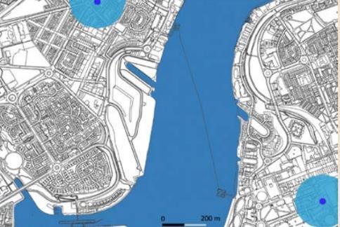
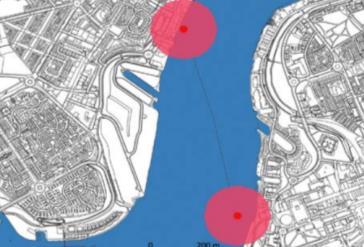
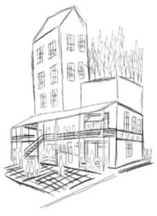
• North Tyneside, Fish Quays, North East of England
• Year 3 Bachelor's Final Interim Assessment
Location:
North Shields is a coastal town situated on the north bank of the River Tyne. It is close to the mouth of the river in North Tyneside which is located within the North East of England. North Shields is situated 8 miles (13km) to the north-east of Newcastle Upon Tyne. The site is very well linked via ferry to South Shields, situated on the south side of the River Tyne. North Shields is also the site of a famous fish quay and many of the houses in North Shields owe their origin to the Georgian era.
Project Brief:
North Tyneside Council have recently unveiled a master plan for the rejuvenation of the brownfield Smith Dock’s site located in North Shields.
The planning scheme allocated will follow the urban regeneration of the Fish Quays. The scheme has been created in collaboration with North Tyneside Council and Newcastle University to create a place with innovative social housing and mixed used retail and hospitality opportunities to create new employment. Community Land Trust’s will aid the development and overall, these concepts and planning arrangement aim to change and improve economic growth and prosperity of Smith Docks.
1. Designinglively and sustainable communityspaces
This planning focuses on the physical elements allocated to the masterplan to ensure the overall conceptual vision for the site and its community is able to deliver a scheme that is diverse, sustainable and appealing in nature.
2. Delivering diverseand goodquality social housing
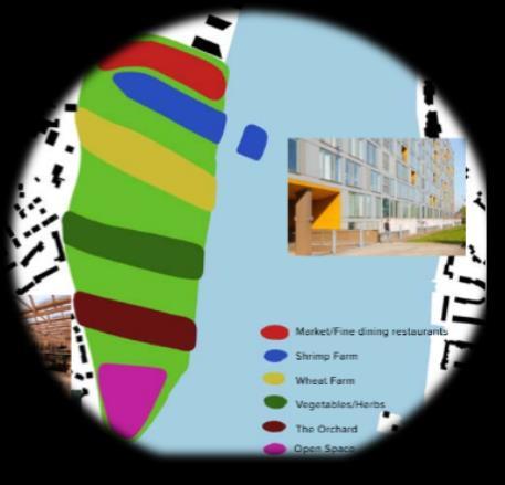
3. Creating employmentopportunitiesby allocating mixed-useddevelopment(e.g. retail, farming and hospitality areas).
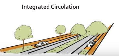
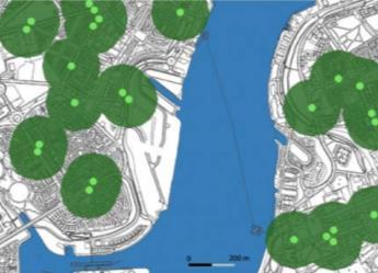
This map illustrates the main pedestrian and cycling routes (blue dotted lines) to the site as well as the access points (blue arrows).
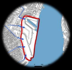
Ensuring the site can be accessed by pedestrians and cyclists is key to the scheme as sustainable movement to and from the site is a main objective.
The development being pedestrian and cycle friendly was to better the overall health and well-being of the residents. These paths will connect residents to different sections of the farms and creates access to the North and South of the site. It is hoped this will reduce the carbon footprint of the development by encouraging less reliance on private cars and other vehicles. This helps the development to abide by the UNs Sustainable Development Goals.

The development will also provide these spaces for the residents and with community involvement these spaces will then be tended to and cultivated.
These green spaces have been placed throughout the concept in such a way that green infrastructure is smartly integrated with the public realm. Residents (both young and old) are encouraged to interact with these places on a daily basis, as well as to care for and preserve them.
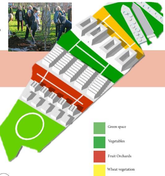
Delivering a diverse mix of affordable housing and in generating a unique, interactive and restorative green and sustainable system around these very living spaces. This is a development where the community can take ownership and collectively contribute towards the improvement of their health and well-being, alongside the opportunity to create strong community bonds and acquire many other enjoyable and crucial societal benefits through the provided public realm.
 Pedestrian + Cycling routes
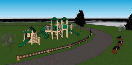
The local amenity of North Shields will be preserved in the proposed development through building materials and design retrospective of the site’s industrial heritage. Amenities central in the success of the development encourage social interaction and are catered towards attracting visitors from surrounding neighborhoods such as the playground, restaurantand marketstalls.
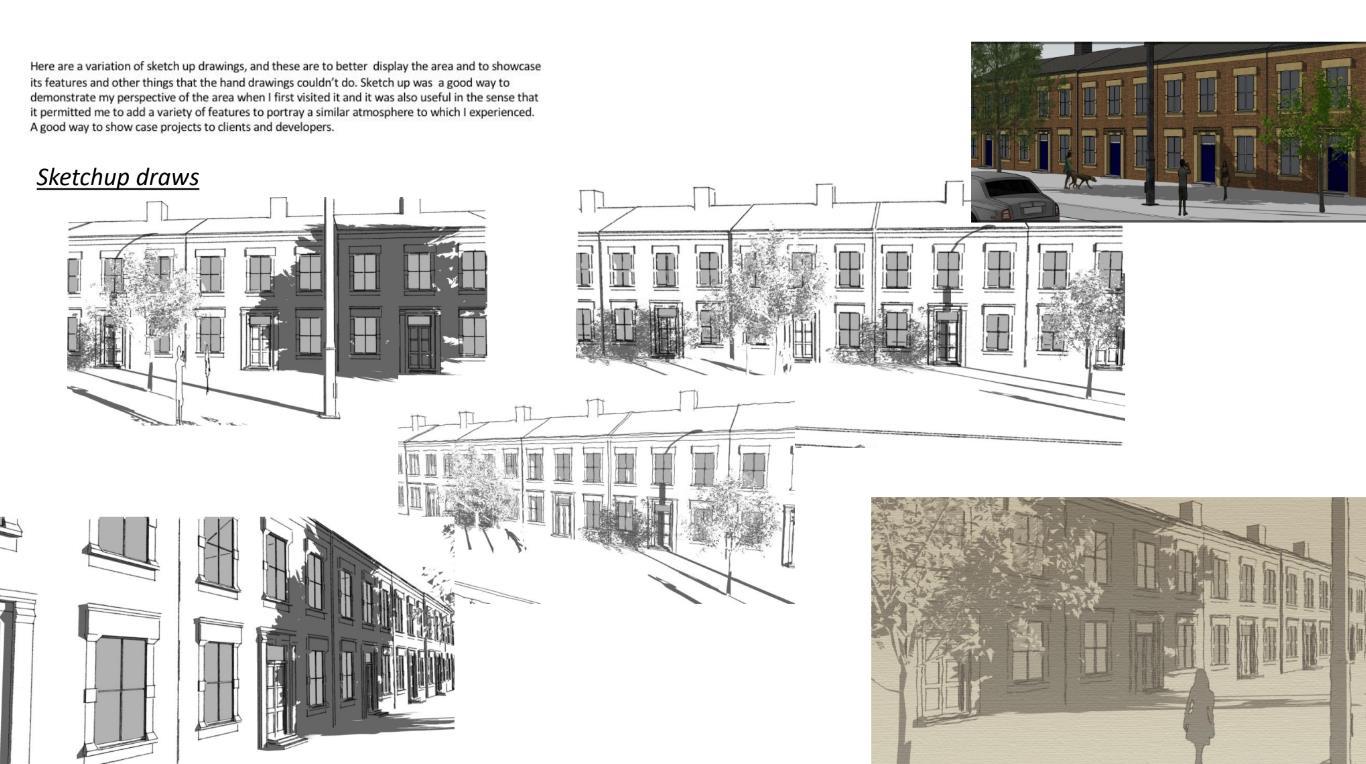
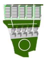
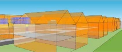
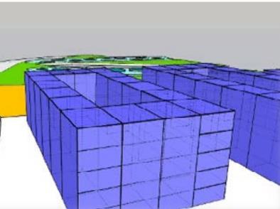
The following Sketchup models demonstrate how the affordable housing scheme will feature flats, terraced and semi-detached housing types. Each housing type is to have access to the community infrastructure offered on site.
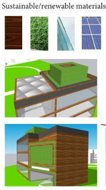
A number of renewable infrastructures will be implemented throughout the site such as solar panels and kinetic tiles. The sites energy will in future be provided by offshore wave and tidal stream energy technologies, which will enable electricity to be provided to the site all year round, including when energy demand is at its highest in the winter (when the sea is at its roughest).
This is housing which would not only contribute towards its current and future community essence but also which would contribute towards a stronger community feel while having little to no impacts in the surrounding areaand its environment.
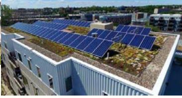
Throughout the site there will be a number of instalments of solar panels which will provide the development with renewable energy.
There is an understanding for the need to incorporate sustainable infrastructures into the Smith’s Dock development to ensure that it can be prosperous for both current residents and future residents. As demonstrated, we will therefore be including a number of renewable energy sources within the Smith’s Dock development.
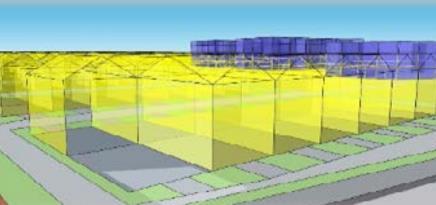
They will be located on top of the apartment blocks as well as the roofs of some terraced housing units. Solar panels are an extremely efficient way of saving energy and in turn harness the suns energy to generate usable electricity. The UKs solar installations have recently risen past the 10 million mark and currently meets around 40% of the country’s electricity needs (Solar Feeds, 2019). Through the use of solar panels, we at Homage believe our Smith’s Dock development will have a positive contribution to the local environment, increasing the sustainability levels found in North Tyneside and the UK more generally. Figures 17 and 18 below provide examples of solar panel designs incorporated onto apartment buildings and communal living areas.
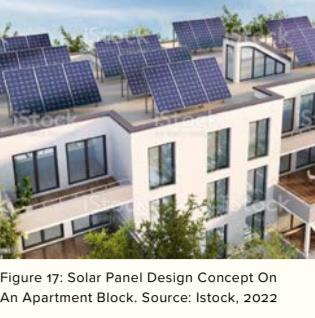
The illustrations also show the Homage's strongfocus on creatingcleaner, more modern, and open spaces, as well as the inclusion of vegetation and green infrastructure in many othercommunity-based spaces, all of which contribute to the creation of more inclusive areas in the location site as well as the future wellbeingof Smith Dock's community. Imposed housingin the area also transmits the wide and differentrange of residences in the neighborhood- amix of full flats to semi-attached dwellings, all of which brilliantly embrace the very surroundings of Smith's docks and which have efficiency and sustainability attheircore.
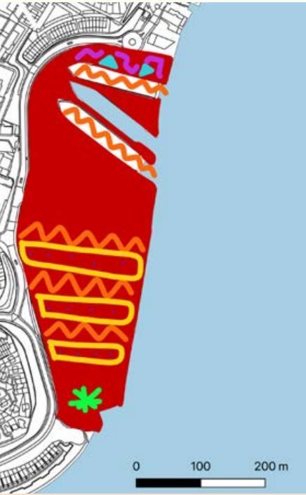
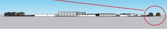
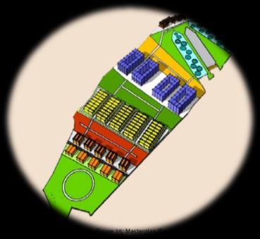
The SketchUp generated drawings provide a conceptual and elemental portrayal of the site's integration of distinct development boundaries on site.
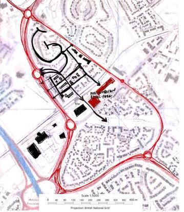
•Northumberland Retail Park, Shiremoor, North East of England,
•Year 2 Bachelor's Interim Assessment
•Individual Work
Factors noted during site visits that appeared to contribute towards the enrichment or decline of the community’s movement within the area
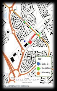
Transport accessibility; the area provided a good accessibility and was within a good proximity to both the motorway and public transport such as Northumberland train station and public bus stations This is a good factor as the easy accessibility to transport links within the area means a wide range of residents, retailers and leisure operators are able to travel to and from the area for work and other purposes, plus it helps to also diversify the area as it allows for more people to come in and increase the locations population, along with its number of amenities.
Studying a new retail development
For this assignment I was required to analyze the neighborhood's layout design and expected to cover the positive and negative factors within each, particularly how these residential neighborhoods and their designs compliment or further complicate its surrounding environment, its community, and other future developments
Furthermore, I will also be exploring and analyzing the impact of these layouts on their surrounding communities and what alternative concepts and layouts should be adapted to further enrich these societies and make them better
The location is Northumberland retail park development which is situated in Shiremoor, North east of England, in a very popular and desirable residential area The location is surrounded by great transport links which allow for great connections to Tyne and Wear, Northumberland and the national road network, and its nearby residential homes are no further than a 15-minute drive
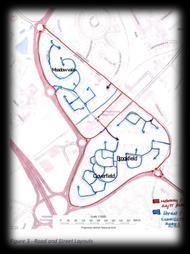
The study area is separated into five neighbourhood's including Meadow Vale, Fenwick Close, Heathfield, Cloverfield and Brookfield All five areas are presented in a modern urban design concept and residential neighbourhoods' layouts Moreover, there is also a clear difference in the layout design presented within these areas in the location site.
All five residential neighborhoods are within a good distance of Northumberland Park, plus community benefits from a good proximity to the study area with its nearby transports which provides easy travel accessibility from one area to another especially with the railway links to Newcastle Individuals can also easily access the Northumberland Park Metro Station and bus interchange for more local accessibility within a 15minute walk
The layout of the neighborhoods which seemed to be built around the amenities and other local shops in the area, especially the residential neighbourhoods of Cloverfield and Brookfield, which are located just below Aldi and JD sports and within an excellent proximity to the mall which has been divided into separate retail shops including a big Sainsbury’s and Subway takeaway restaurant Again, there is a diverse use in buildings within the area, both for residential and retailing use, which is great, as it was evident on my fieldtrip to the location site that there was a good activity between the locals and the surrounding retail shops
In regard to the negative factors faced, these also included road layout (which was noticeable in the closed in layout of the streets in Cloverfield and Heathfield), plus the standard of the new expensive houses which lacked sustainable features- their price point means it was not affordable to many. Moreover, the most concerning aspect was the car orientated routes/paths in some of these areas.

With conducted footfall surveys within Cloverfield’s road, the results conveyed this street's community to be more active, Its layout was visually and physically pedestrian orientated, and proved there perhaps to have a higher diversity of residents from different backgrounds as conveyed within public residential data on digimap. As conveyed by the group ‘Secured by Design’ (a UK national police crime prevention organisation) high permeability “creates communities which are more walkable and inclusive” and Figure 3, does show there to be more chances for people to meet and connect on the streets as the area can be accessed through more than route Also comparing comparing both- Meadow Vale’s and Cloverfield community’s’ diversity and inclusivity in relation to their design, although both are predominantly white, Meadow Vale appears to have a less diverse community with 93% of its residents being white and 7% from another ethnic background, whereas Cloverfield has a slightly more diverse community with 88% of its community being white and 12% being from another ethnicgroup.
Another example which can be used to convey the positive correlation between permeable designs and diversity is with the age difference within the two areas. The highest age concentration of people living in Meadow Vale is between 30-50, whereas in Cloverfield the age concentration is more fairly dispersed between the ages of 10 to14 and 25 to 50 years old,suggesting it also has a slightly more diverse community in terms of age and qualifications Furthermore, low-permeable, closed road designs provide an excellent level of passive surveillance for a low crime zone However, such layouts have a higher risk in creating anti-social communities where there is decreased activity and connectivity with the outside community. Meadowvale in the study area site map in fact, does appear to be the most secluded area of the five provided in the study area.
Figure 4, further illustrates the difference in the number of local streets between the north and south side of Northumberland Retail park and it is worth also considering the accessibility of both areas in relation to the pedestrian’s paths. Although, not very clear in figure 4, the pedestrian path Cloverfield Meadow vale Figure 3 –Road snd Street layout Brookfield circulates from Heathfield, through Northumberland retail park to the bottom of Meadow Vale and towards Harle Road.
Overall Concerns:
There is not much mobility, street designmostly appear to be car orientated, which although good for safetyreasons, the lackof more streets and other residential primaryroutes, signifiesthe communityis more likelyto utilize their vehicles instead ofwalkingdue to long distance to get where theyneed to. North residential streets also have no permeabilitywhich means car ridesare prioritized. On the other hand, good because it ensures safetyplus the layout creates a natural surveillance format, and this usuallydiscourages crime.
Concept for improving the neighborhoods and their current connections:
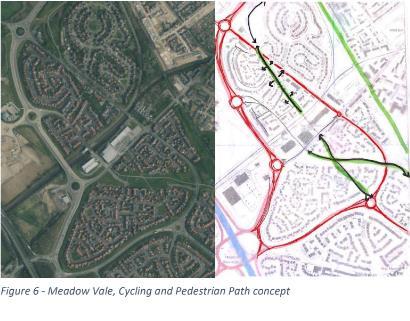
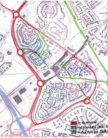
Meadow Vale’s design lacks permeability and therefore it has a decreased connectivity with the rest of the communities. Adding more routes would give the residents a way of reconnecting with the other nearby neighbourhoods while also providing them with the choice to walk, instead of just utilising their cars. This would be a way of enabling the neighbourhood to be more connected with the other communities while also still providing a safe and low crime environment. This concept would also be a good way for locals and other individuals from the motorway to quickly access Northumberland retail park and other new future developments in the area- it would make accessibility better and faster, more efficient, inclusive, and not so secluded anymore.
Additionally, Increasing current or adding more cycling and pedestrian pathways (instead of residential streets within Meadow Vale) in the study area would also have a great impact on the community and other future developments. The study area clearly has great transportation links in terms of vehicles such as cars, trucks and buses but it lacks is cycling paths with good pedestrian links. Doing such, would definitely bring a positive change and have great impact on the neighbourhood as it would allow residents to prioritise a cleaner, more efficient, and less polluting method of transportation and activity while discouraging the locals to prioritise their cars in future trips. A way of doing this could be by expanding the pedestrian path which already runs through the left edge of Meadow Vale. Expanding the area and creating a better cycling and pedestrian path would have a much better impact on the community, environmentally and socially.
These additions would also make the neighbourhoods more efficient by reducing the carbon emissions released by previous car usage. Walking not only is more efficient but allows for communities to form and create connections while influencing them to be more active. Increasing the number of pedestrian paths around the study area would encourage residents to be more socially outgoing and aware of their environment and others on their day-to-day.