DUNDEE
In this booklet we talk about Dundee City as a whole in terms of how it has evolved over the years, and analysising the streets and typology of what exists today. In a few chapters there are comparisons between the UK and China along with explorations into how our research of the existing city can inform design decisions today.
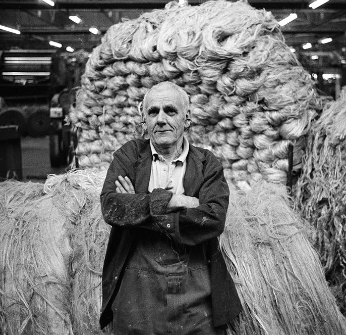 Figure 1 : Tay Spinners, Dundee - Colin McPherson (1998)
DUNDEE
CONTENTS 02 Introduction WHAT THE BOOKLET IS AND OUR ATTITUDE TOWARDS MOVING FORWARD WITH DESIGN 06 Studio THE FACES BEHIND THE WORK 08 Demographics WHO PEOPLE ARE, WHERE THEY LIVE, WHY THEY LIVE THERE 22 Morphology THE HISTORIC INFLUENCES ON THE EVOLUTION OF THE CITY 48 Natural Assets IDENTIFYING KEY AREAS IN AND AROUND THE CITY AND QUESTIONING THEIR SUCCESS 54 Spacial Hierarchy LOOKING AT THE SCALE OF ENVIRONMENT IN WHICH WE FIND OURSELVES SURROUNDED BY 80 Legibility RESEARCHING AND ANALYSING THE CHARACTER OF THE CITY 86 Potential Future HIGHLIGHTING ABSENT OPPORTUNITIES AND CREATING URBAN SOLUTIONS 172 Precedent A COLLECTION OF BUILT EXAMPLES OF HOUSING DESIGNED AND BUILT FOR THOSE WITH ASD 192 Conclusion AGREED CONCENSUS OF ATTITUDE 196 References + Bibliography WHERE ALL THE IMPORTANT INFORMATION WAS FOUND
 Figure 2 : Dundee City with River Tay and Tay Railbridge
WHAT THE BOOKLET IS AND OUR ATTITUDE TOWARDS MOVING FORWARD WITH DESIGN ‘‘first life, then spaces, then buildings - the other way around never works’ - Jan Ghel
Introduction
The Studio E Urban Analysis booklet comprises an in-depth study of Dundee and communicates an understanding of the city – venturing into its typologies, demographics, morphology and other aspects which define its nature. In framing and displaying the historical development of the city and its natural assets, the booklet acts as an extensive culmination of knowledge which can be used to develop contextual strategic proposals which engage the problems of city enclaves and urban spaces.
The studies focusing on urban theory and contemporary design contained within the booklet act as a general basis to cultivate an understanding of the shape of the urban city. References to social, economic, political and cultural contexts are provided with their respective connections to ASD in the city, as well as how this has affected planning, management and contemporary design.
DUNDEE
03 | 04


 Chelseigh Buchanan
Joshua Coniah
Cameron Devine
Laura Greenshields
Hestia He
Callum McLean
Mayya Potvar
Nick Puxley
Gong Quanzhou
Nurul Safuhah Suhaidi
Yijing Wang
Huiting Xie
THE FACES BEHIND THE WORK
Studio

Demographics
WHO PEOPLE ARE, WHERE THEY LIVE, WHY THEY LIVE THERE ‘‘Dundee is Scotland’s sunniest city’’ - Visit Scotland
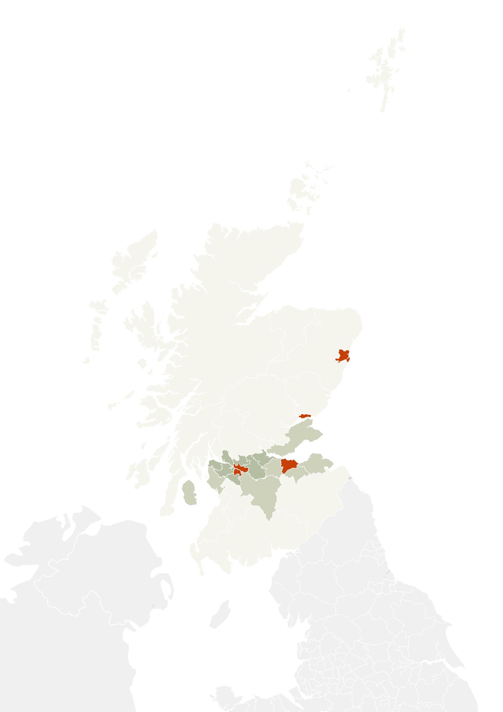
POPULATION DENSITY IN SCOTLAND
Population density (people per km2)
Less than 100 p/km2
100 to less than 500 p/km2
500 to less than 1, 000 p/km2
1, 000 or more p/km2
Dundee
1, 200 people per km². 2, 461 people per km².
1, 810 people per km².
Aberdeen Edinburgh Glasgow
3, 396 people per km². DUNDEE
POPULATION DENSITY IN THE CITIES
Glasgow City Centre
Area= 4.99km² Population = 35,323 Population density = 7,079 people per km²
Edinburgh City centre
Area= 6.03km² Population = 32,410 Population density = 5,375 people per km² Aberdeen City Centre


Area= 4.10km² Population = 20,672 Population density = 5,042 people per km²
Dundee City Centre
Area= 3.94km² Population = 18,591 Population density = 4,719 people per km²
Looking briefly at the population density of Scotland as a whole, we can see that about 70% of the population (3.5 million) lives in the central belt.
Moving closer into the cities, the estimated population in Scotland in 2020 is 5,463,300 with 1,078,771 people living in the 4 main cities.
09 | 10
Less than 3, 000 p/km2
3, 000 to 6, 000 p/km2
More than 6, 000 p/km2
While Dundee as a whole may be the second most densely populated of the 4 major cities, analysis of the city centres tells a different story. This shows that the population in Dundee is spread out to the periphery of the city, while in the other 3 cities, the population is concentrated in on the centre.

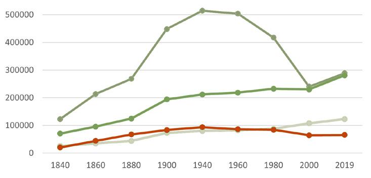
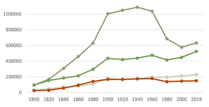
When looking at the diagrams to the right, the first thing to take note for both diagrams is the increase across all cities between 1880-1960. This was mainly due to the industrial revolution, with the influx of new machinery and transport, more jobs were available compared to before. Getting past this increase, there was a sudden drop – which we had to question why? Not knowing too much about the other cities, we can only comment on Dundee, and say that around 1980, there was the
collapse of the jute industry, where many lost their jobs. It is suggested by the graphs that a lot of those people in Dundee moved away to larger cities where the employment rate was going up and there were more jobs available. Since the 2000s both Dundee’s population and employment rates have stayed steady whilst the numbers have increased across all other cities.
Brings the question why?
Is it that Dundee’s transport systems are not as good as other cities?
The job opportunities are just not there to begin with so people are going to other cities?
demographics POPULATION DENSITY (people per km2)
DUNDEE
Glasgow Edinburgh Aberdeen Dundee
TOTAL EMPLOYMENT
Glasgow Edinburgh Aberdeen Dundee
73% 64% 67% 75%
TOTAL POPULATION
11 | 12
Glasgow
3800 people living in Glasgow with ASD.
0.6% of total population.


Dundee
Edinburgh
1,131 people living in Dundee with ASD. 0.8% of total population.

2,681 people living in Edinburgh with ASD. 0.6% of total population.
Aberdeen
1,293 people living in Aberdeen with ASD. 0.6% of total population.
= 500 people
The average percentage of population living with ASD in Scotland is 0.6%, Dundee has 0.8% of its population living with ASD. This puts it above average across the other major cities in Scotland. This shows that the city has more demand than anywhere else for purpose built, ASD supportive housing.
These statistics also brings the question why?
It could be argued that Dundee is more of a large town than a city, being surrounded by fields and the sea and it is also the least populated of all Scottish cities, so it could be because of its close proximity to rural areas to the north that is a draw for individuals with ASD and the families that surround them.
demographics
DUNDEE
ASD POPULATION
16-34 years old


35-64 years old

65 and over years old
0-15 years old PERCENTAGE


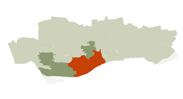
This study of the age density within Dundee highlights the urban sprawl to the northern city limits. The 0-15 diagram highlights the spread of families to the suburban areas, while the 16-34 range is predominantly clustered around the university and city centre. The 35-64 range again shows the shift out towards the edge of the city and the 65 and overs are mostly out to the east towards retirement destination, Broughty Ferry.


0% to 30.0%
40.1% and above
AGE DENSITY
OF POPULATION
30.1% to 40.0% 13 | 14
ASD LIVING ARRANGEMENTS
LIVING ARRANGEMENTS IN DUNDEE (%)
LIVING ARRANGEMENTS FOR INDIVIDUALS WITH ASD IN DUNDEE (%)

demographics
DUNDEE
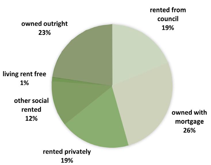
The diagram at the top shows the general living arrangement of people in Dundee compared to the living arrangement of those with ASD. It can be noted quickly that individuals with autism do not own/have a mortgage so creating housing which is shared and rented is the better way to go.
The vast majority of young adults living with ASD live in unsuitable social housing or at home with their parents. As these people reach young adulthood and older, it gets harder and harder for their parents to look after them. Combine this with the rising number of people who are diagnosed with autism it is clearly important that these people are getting the support they need through purpose built accommodation.

15 | 16
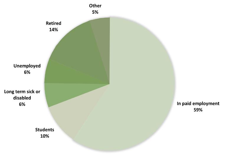
EMPLOYMENT STATISTICS IN DUNDEE (%)
EMPLOYMENT STATISTICS FOR INDIVIDUALS WITH ASD IN DUNDEE (%)
DUNDEE
ASD EMPLOYMENTS STATISTICS
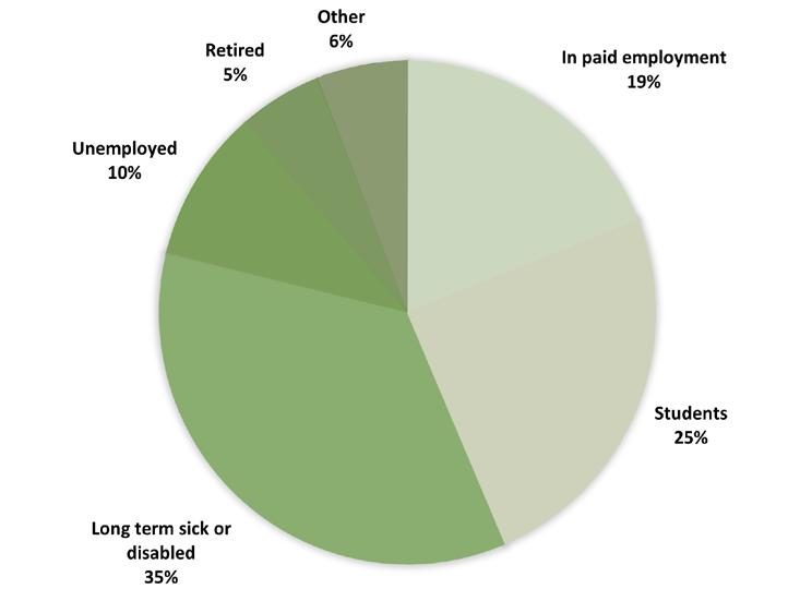
The diagram at the top shows that almost 50% of Dundee’s ASD population are either retired or in full time employment or education, which highlights how broad the autistic spectrum is and reinforces the point that it is important that any potential developments cater for this high level of functionality, as well as the 35% who are long term disabled and need a higher level of care.
17 | 18
SPREAD OF POPULATION WITH LONG TERM DISABILIES
Law
Population: 4793 834 people living with disabilities 17% of population
Douglas East
Population: 2925 465 people living with disabilities 15.9% of population

Lochee The Glens
Population: 5504 831 people living with disabilities 15% of population
Population: 4648 702 people living with disabilities 15.1% of population
PERCENTAGE OF POPULATION WITH LONG TERM DISABILITIES
demographics
2.6% and 7.5%
0.0% and 2.5% 7.6% to 12.5%
12.6% to 15.0%
15.1% and above
DUNDEE
Analysing the spread of population with long term disabilites can help towards identifying a potential site. It also shows that these people do not necesserily follow the same pattern as the rest of the population, who are spreading out towards the northern edge of the city, but rather are spread across the centre of the city. Away from the chaos of the city centre but not completely isolated from it. This is a good indicator to what living conditions are preferred by people with long term disabilities.

19 | 20
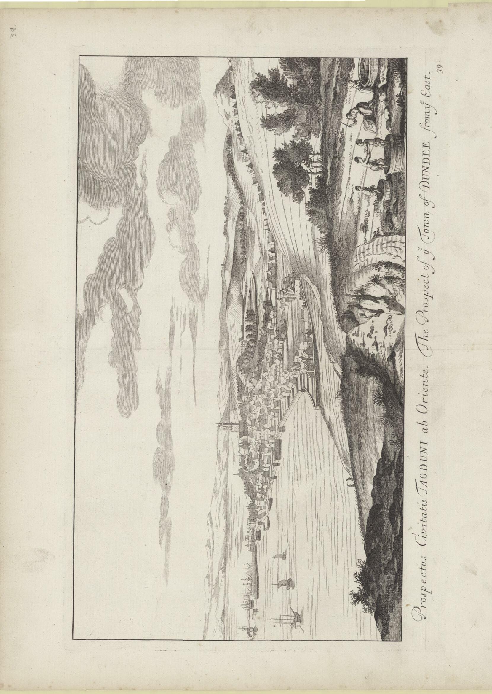
Figure 4 : dundee
Morphology
THE HISTORIC INFLUENCES ON THE EVOLUTION OF THE CITY
‘‘you can’t escape the influence of architectural history’’ - Richard Meier
1500s 1600s
HISTORY OF DUNDEE
1100
Dundee establishes itself as a small trading port.
1191
Dundee recieves a royal charter from King William.
A royal charter is a formal document issued by a monarch as letters patent, granting a right or power to an individual or a body corporate. They were, and are still, used to establish significant organisations such as cities (with municipal charters) or universities.
1300s
Dundee’s population rises to 4000 as the city establishes itself as one of Scotlands most important towns.The trading port expands and exports wool and hides in large quantities.
1520
Dundee’s population reaches 7000.
1548
Dundee is attacked and partially burnt by the English.
1592
A protective wall is built around the city.
1607
The plague grips dundee.
1651
The English attack and capture the city again.
1657
The English general orders the demolition of the coty walls.

1658
A storm hits Dundee, destroying the harbour. This causes the city to fall into financial hardship for the rest of the century.
Figure 5
The Wishart Arch, the only remains of the city walls that once surrounded Dundee.

1100s 1300s
DUNDEE
1700s
Dundee booms again, mainly due to the massive new industrylinen (jute). This industrial boom also includes the thread making, leather production and whaling industries. In the late 1700s, marmalade is discovered and produced in Dundee.
1798
The Dundee infirmary is opened.
1801
The population of Dundee has now soared to 26000.
1832
Cholera strikes in Dundee. (And again in 1849, 1852 & 1866)
1845
A water company is formed and provides Dundee with piped water for the first time.
1870 Sewars begin to be implimented into the city as Dundee begins to deal with its sanitary issues.
1876
Horse drawn trams begin to run in Dundee.

1902
The horse drawn trams are replaced with electric ones. 1905 DC Thomson is founded by David Coupar Thomson. 1920 Dundee begins to build council houses. 1920 DC Thomson begins to publish comics in Dundee.

1930
Dundee industries start to rapidly go into decline.
1945
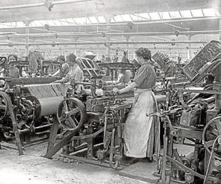
Working conditions in one of Dundee’s many jute mills.
One of Dundee’s horse drawn trams.
Council houses are built north of the Kingsway for the first time as Dundee continues to expand.
1966
The Tay Bridge is constructed. 1967 Dundee University becomes independant. 1974 Ninewells Hospital opens.
The founding of Dc Thomson completes Dundee’s industrial “3 J’s”; Jute, Jam & Journalism
2014 Dundee becomes a UNESCO city of design.
2016 The population of dundee is now 148,000.
2018
The V&A museum opens in Dundee.
1700s 1800s 1900s 2000s
23 | 24
Figure 6 Figure 7
CEMETERY
The linear nature of the burgage plots allowed everyone house to have a garden for growing food, where the backs were called ‘cowgate’ due to their literal use of being the entrance for animals. The streets formed inbetween allows the plots to become ‘blocks’ which translate into later years.
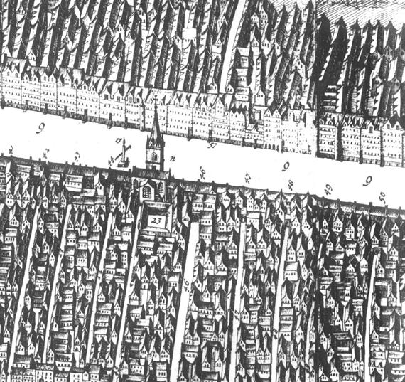
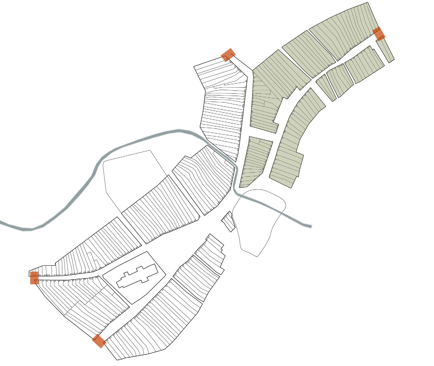
Being located between 2 burns, the North-East area of the medieval town formed first as ‘seagate’ was no accident. Scouring Burn and Dens burn both provided a ready water supply for drinking, washing and carrying out jobs for trades. A natural beach where the scouring burn met the river tay allowed for a place where boats could be brought on to shore and stored.
The formation and expansion to the South-West of the burgage plots allowed for what we still know now as the ‘high street’ of Dundee, originally acting as the connecting spine of the medieval town. The gated routes opened out towards different directions and allowing for travel to neighbouring towns - explored more in the 19th century.
HIGHSTREET morphology DUNDEE
CASTLE
GATE
GATE GATE SEAGATE(PRE13thCENTURY)
GATE
Figure 8 : Burgage Plots - Tron Kirk, Edinburgh
CHURCH

25 | 26
13th CENTURY | Formation of Royal Burghs
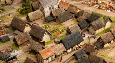
A narrow strip of land with a house at one end and usually a shed at the other for keeping animals and growing crops was a common way of city development all across the UK. The fronts of houses faced the market or high street of the forming town, which would often include the ground floor being a shop with upper levels being the living areas. As people needed more internal space, they extended out the backs, reducing their garden space but increasing internal spaces as families/shops increased.
The way the blocks were divided up meant that roads formed in between. The increase of burgage plots meant an increase in roads/lanes inbetween and overtime the town increased in size.

THE
BURGAGE PLOT
morphology
DUNDEE
Figure 9 : Burgage Plots - Tron Kirk, Edinburgh

27 | 28
Figure 10 : Burgage Plots - Tron Kirk, Edinburgh
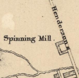
The beginning of what we know now as the industrial revolution where the first spinning mill was noted on a map dated 1821. Analysing the plan, the mill’s location appears random at first but it’s close proximity to scouring burn makes sense. The need for water to power the steam machines within the factory was a must. Along with its relationship to the harbour (for supplies being shipped in and trading), yet its distance from the centre as to not encroach on the day to day living conditions..
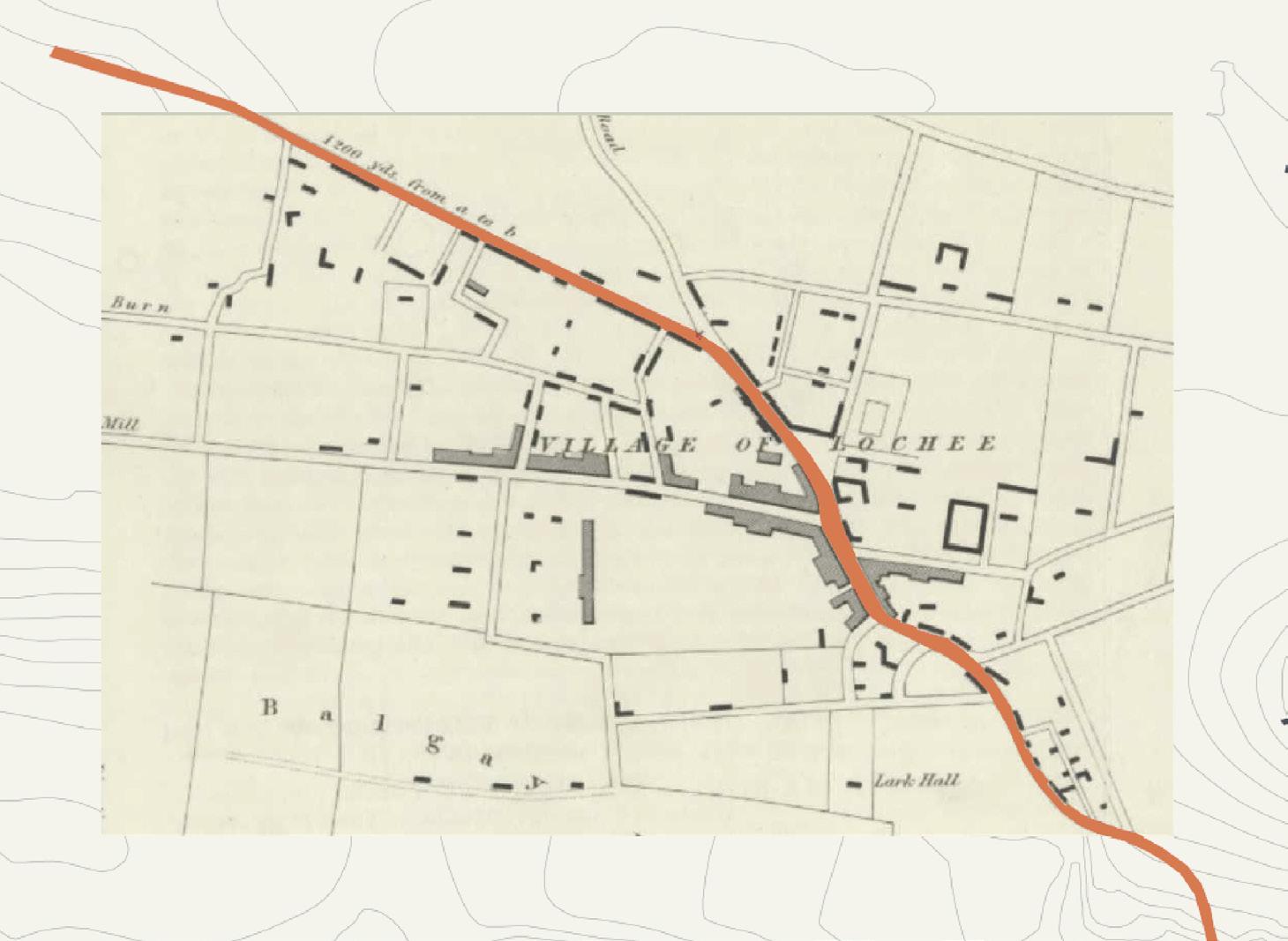
Looking up towards Lochee Burn another area of dundee was starting to form. A cluster of buildings (thought to be cottages of weaver’s) were positioned at the eye of a loch which the burn used to flow through: eye of the loch or Loch E’e, therefore Lochee
As suggested on the previous plan, another key point to note are the 4 routes which shoot off in all directions away from the city, each going to a seperate town/city and allowing for the beginnings of trading
Along with the roads, its is also important to note the appearance of Camperdown Dock which appeared as a trading port for the developing city in 1825
morphology
DUNDEE
Figure 11 : first spinning mill on old map

19th CENTURY | Pre-Industrial Revolution 29 | 30
The centre became a lot more dense compared to previous years as the jute industry was on the rise. Following 1830, Dundee (which had previously been a trading port) transformed into the world centre for the jute processing industry and as a result the docks became more than double the size, with the addition of Victoria docks which opened in 1875. The appearance of
Mills were being built left, right and centre - quite literally.
Early 19th Century Plan

In 1831, the first railway opened (Newtyle-Dundee) to the North of Dundee. This was opened solely as a goods rail, allowing for transportation from the fertile lands of the Sidlaws to Dundee.
The rise in mills brought more workers and therefore more accommodation was needed, so the city was really exanding in all directions. Between 1850 and 1900 the population of Dundee increased by more than double, going from 79,931 to 160,836.
With this great expansion came greater need for access to and from the city by visitors and locals, so then appeared the second railway in 1847, providing a connection between Perth and Arbroath.
Railway Line


morphology DUNDEE
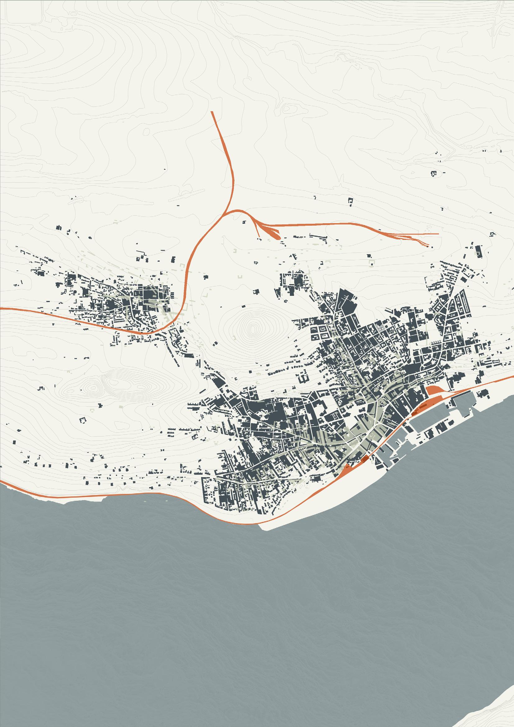
MID 19th CENTURY | Industrial Revolution 31 | 32
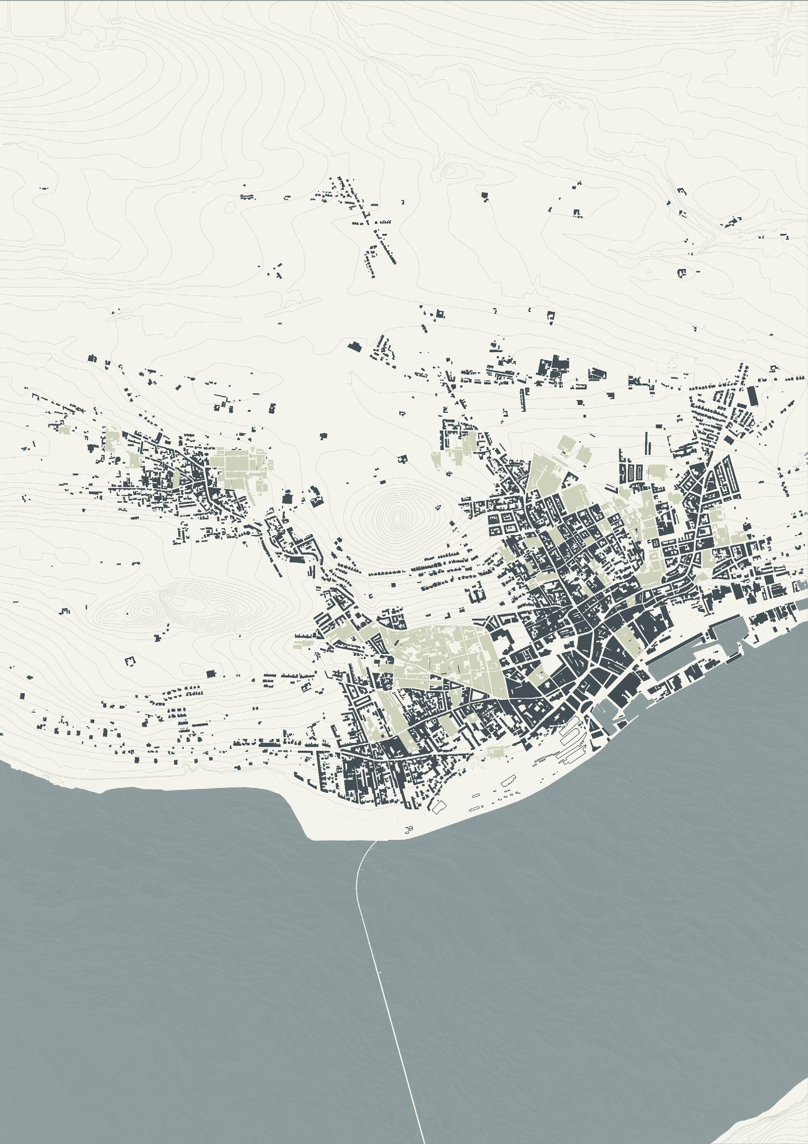
THE JUTE MILLS

Along with the population increasing by more than double in a 50 year period, the Jute Imports measured in Tons drastically increased over the same years. In 1851 16,928 tons were imported compared to 321,331 tons in 1901, which is approximately 19 times more - meaning better transport had to become available (and soon) to keep up with the trading.
The plan to the right shows the jute mills in green.
morphology DUNDEE
Figure 12 : Old Tay works mill at Marketgait, Dundee
33 | 34
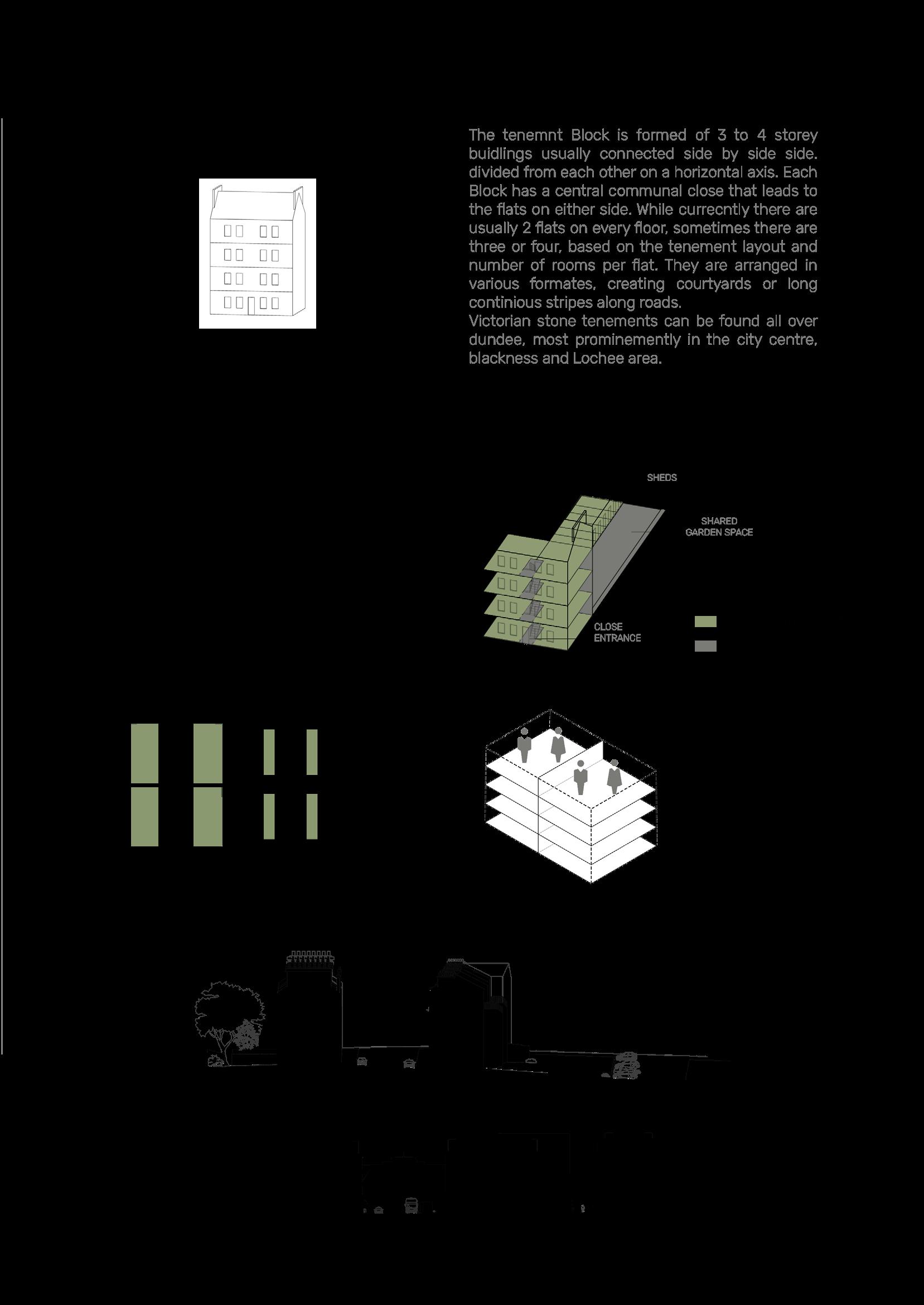
The increase of Dundee’s population in the very centre of the city meant that accommodation had to be altered to suit so comes the tenement blocks which were built slightly further out of the centre.
To minimise costs of accommodation for the mill workers, buildings were extended up rather than out into the garden (like the burgage plots) meaning that the living situation between different families was more confined – people were literally living on top of each other.
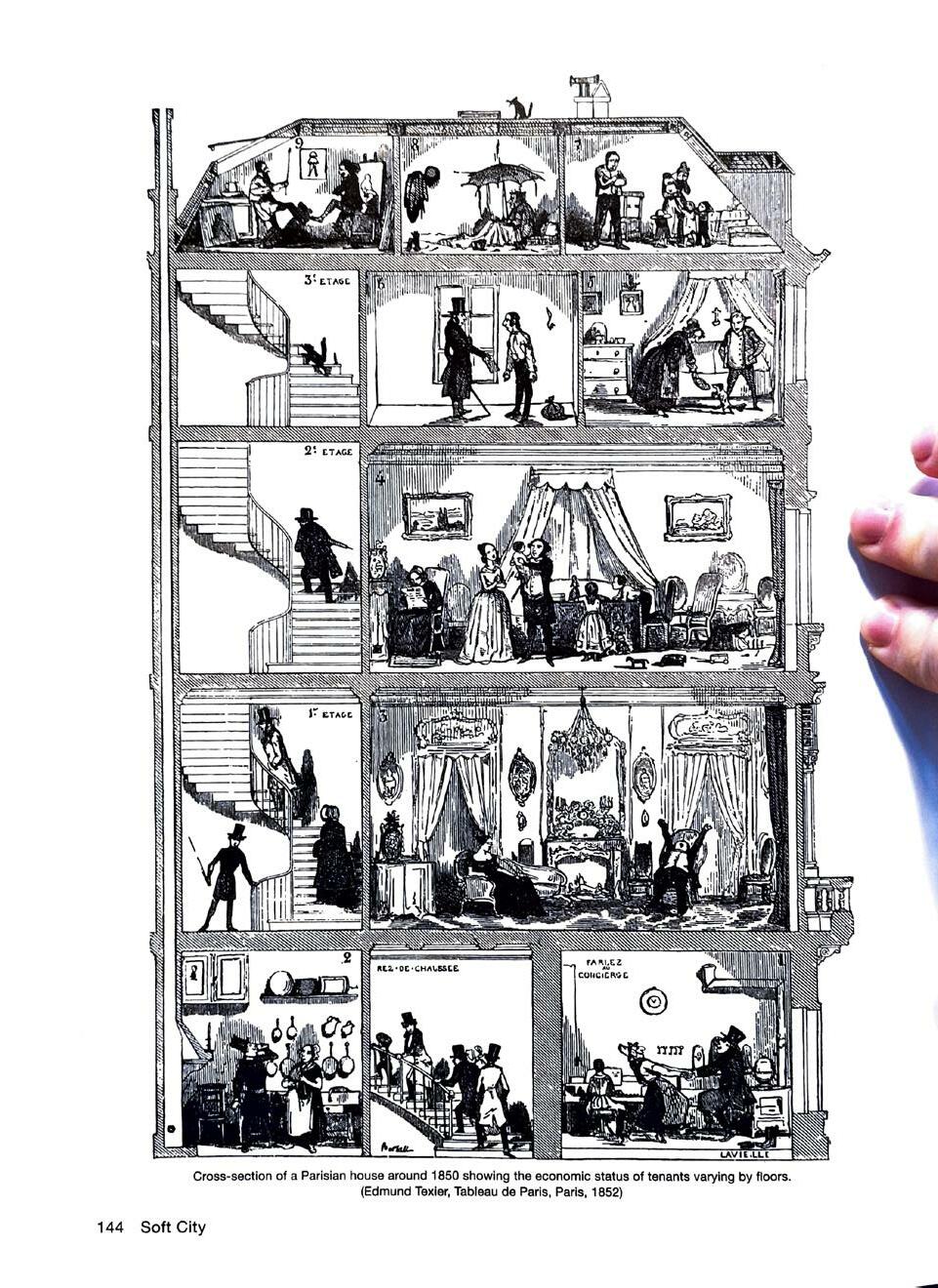
In 1860, 72% of Dundee’s families lived crammed in one or two room houses, leading to insanitary conditions and spread of diseases, giving tenements a bad name and were discouraged after the war.
Small local middle class fled outwards to the suburbs, to get away from noise and pollution.
THE TENEMENT BLOCK
morphology
DUNDEE
Figure 13 : Traditional Tenement Block Section

35 | 36
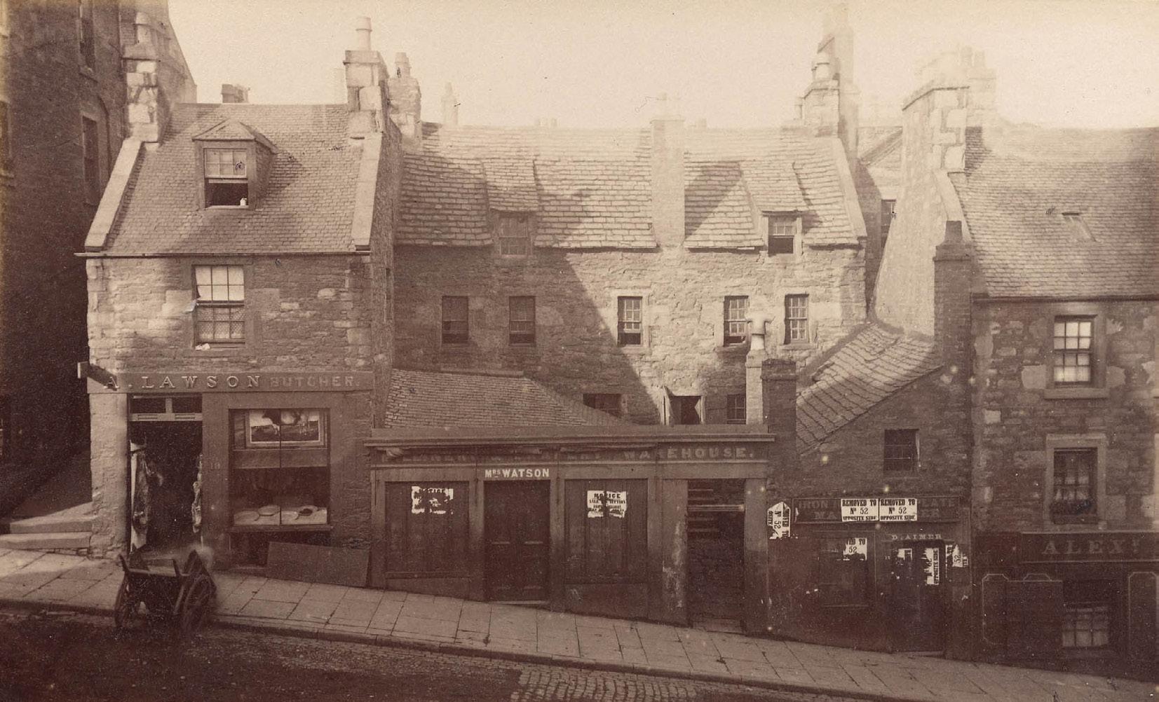
Figure 14 : image of old housing block in Dundee
After the first attempt at the rail bridge crossing the tay in 1879 tragically collapsed, a new one was built in 1887 which has remained standing since. Allowing for a much faster connection to fife and further South of Scotland. The Newtyle railway line also became most important by the 1900s as there was an ever growing population in Dundee. In addition to this, the city itself was starting to expand further North.

By the 20th Century, the trams were in full speed ahead as they switched from being horse lead to electricaly powered, allowing connections between areas in the expanding city.
The expansion of the Dundee West Railway Station at the water front along with the introduction of the bridge provided more scope for those wanting to visit Dundee and outwith. At this point it can be briefly noted that whilst the dock itself was not increasing the streets around it were. Dock Street was becoming more populated in terms of shops and offices. With the increase in retail came more jobs and therefore again more people. The Dundee West Railway Station was expanded to cope with the influx of workers.

morphology
Tram Routes
DUNDEE
Figure 15 : rebuilding of the tay railbridge

20th CENTURY | Pre WWI + WWII 37 | 38
LOGIE HOUSING ESTATE
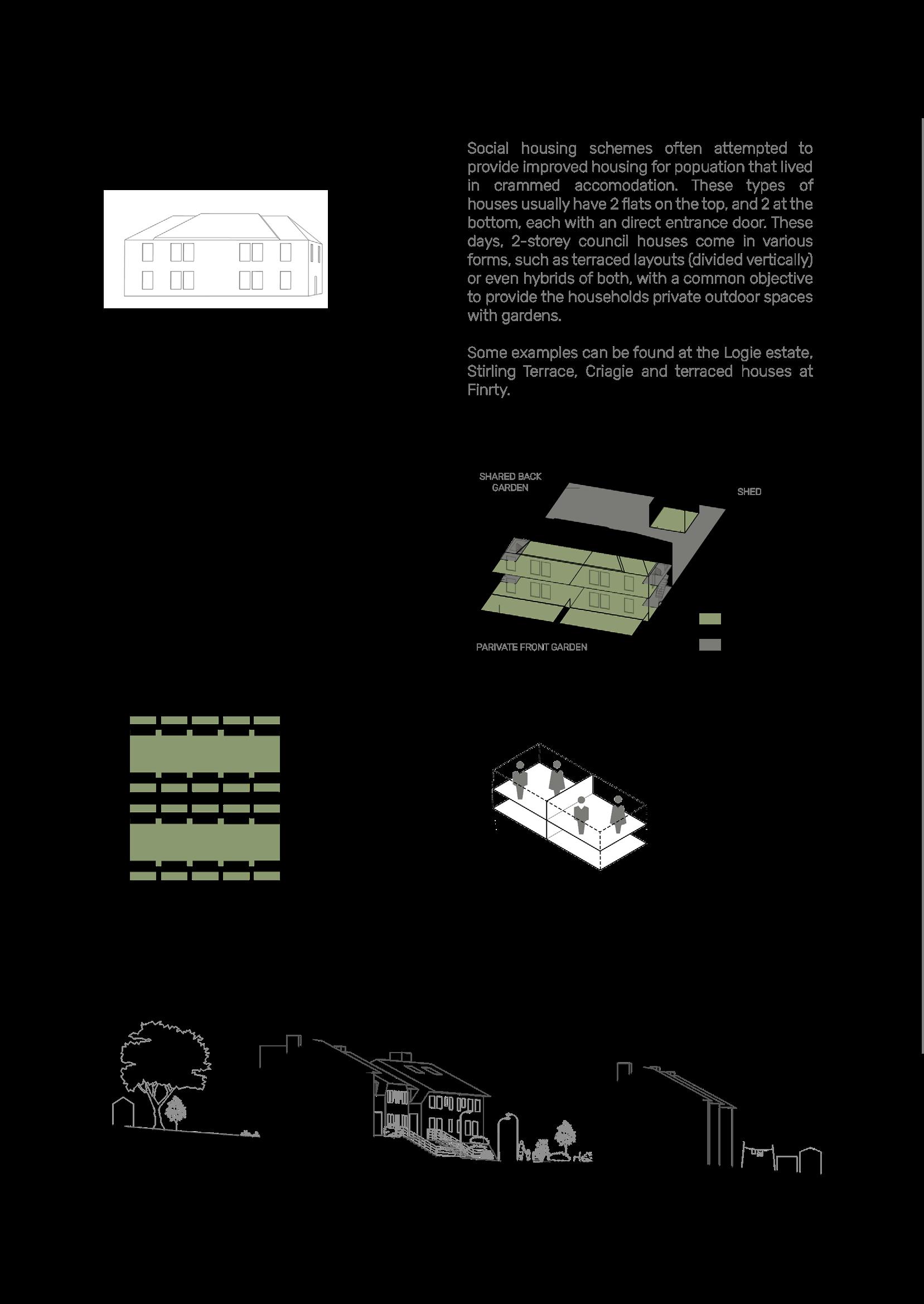
The housing after WWI was changing thanks to Ebenezer Howard’s Garden City Movement. The Logie Housing Estate was proposed and built as a way of getting away from the horrible conditions of the tenement block. Completed in 1920 by Architect James Thomson, it was the first public/ council housing estate in Scotland to be built. Being built over scouring burn the estate had easy access to running water. The scheme was the first in Europe to have central heating with hot water being provided to each house.
The idea of a ‘self sustaining micro community’ followed on from Patrick geddes’ proposal for how cities should expand, where the housing was surrounded by amenities and buildings for education, belief and work. Just sitting off of blackness, it also have easy access to shops so there was no need to go further than 5 minutes from the estate to live.
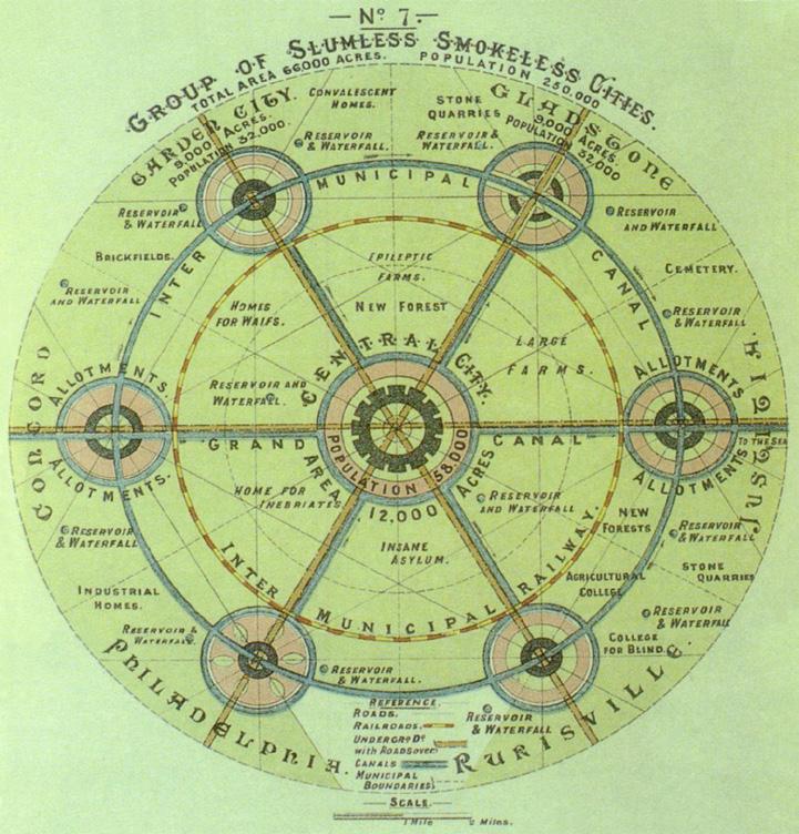
This estate influenced not only other estates in Dundee (such as Flemming Gardens) but across the country.
When designing for ASD, a scenario like this microcommunity would be very suitable. With a combination of communal and private spaces, and close amenities combined create a community environment where there is familiarity and a feeling of ‘togetherness’ which is a good place for anyone to be, but especially those who are seen as different in society.
morphology
DUNDEE
Figure 16 : Garden City Diagram
TENNIS COURT + BOWLING

FACTORY CHURCH
SCHOOL

39 | 40
Figure 17 : Logie housing Estate
With the first car being invented just 20 years before the 20th Century, the need for roads was recognised and the frequency in which they were being used was noted - so, comes the Kingsway in 1919 (just a year before the logie housing estate mentioned on the previous page). This road, running along the North of the city creating a boundary and allows road users to completely bypass the centre. It was another aspect of J. Thomson’s plans for the city after WWI.
WWII came and went.
During both wars, India who were the source of Dundee’s raw jute material, had caught up with technologies and were now starting to work with the jute they were exporting to other countries. The jute industry
in Dundee was therefore rapidly declining (due to it being cheaper to import the finished products straight from india) meaning the need for trades at the city front was no more. The docks were no longer being heavily used, meaning they were reduced by half and the Tay Road Bridge took its place in 1966.
Along with cars, planes were also beginning to take their place in the city. After the first plane was built in early 20th Century, it was an industry that was becoming more popular and common - and so followed the airports needed to fly them from and to. 1963 Dundee airport opened and 1966 saw the first commercial flight Dundee to Glasgow from the airport on reclaimed land where there was a 900m grass runway.
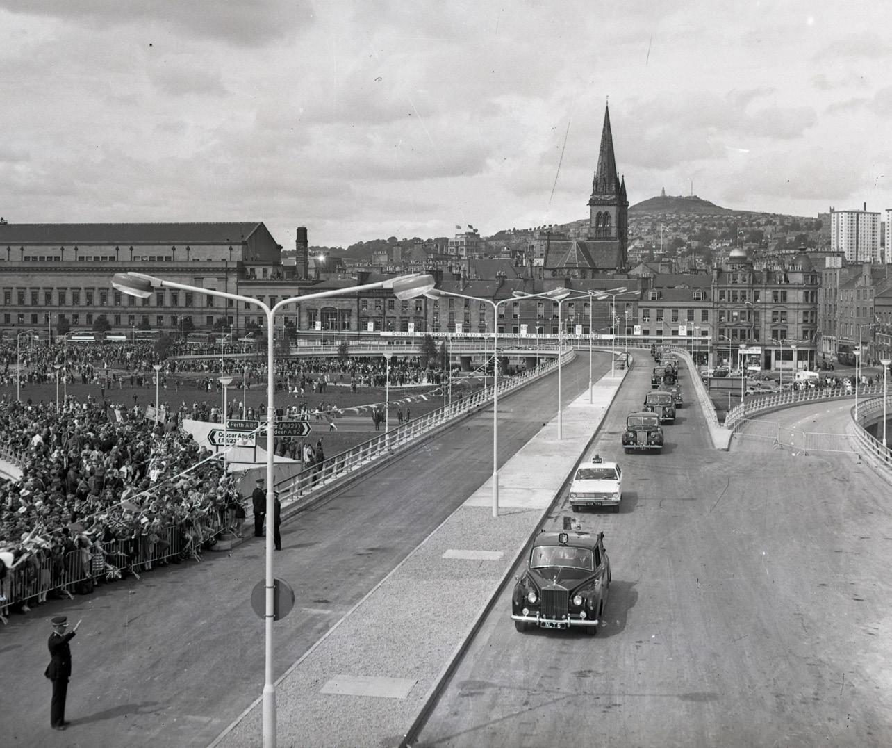
morphology DUNDEE
Figure 18 : Tay Road Bridge at Dundee side - 1966

MID 20th CENTURY | Post War Reaction
41 | 42
AIRPORT
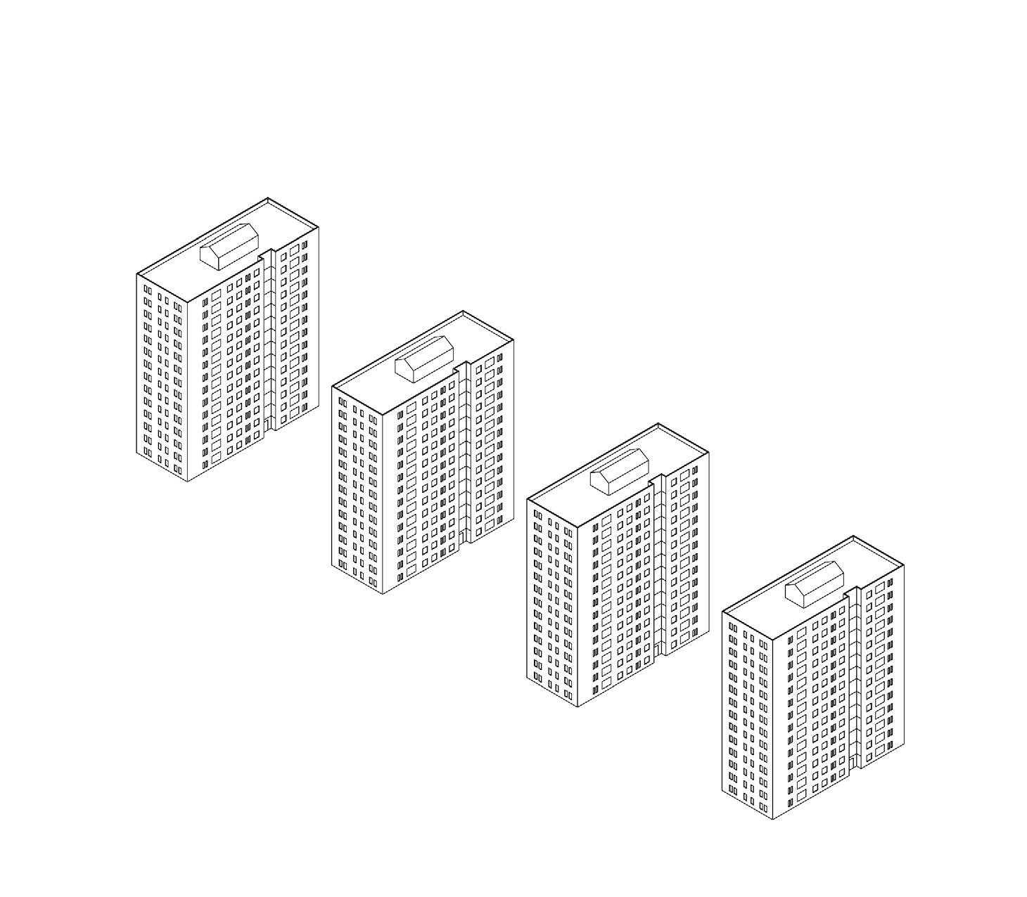
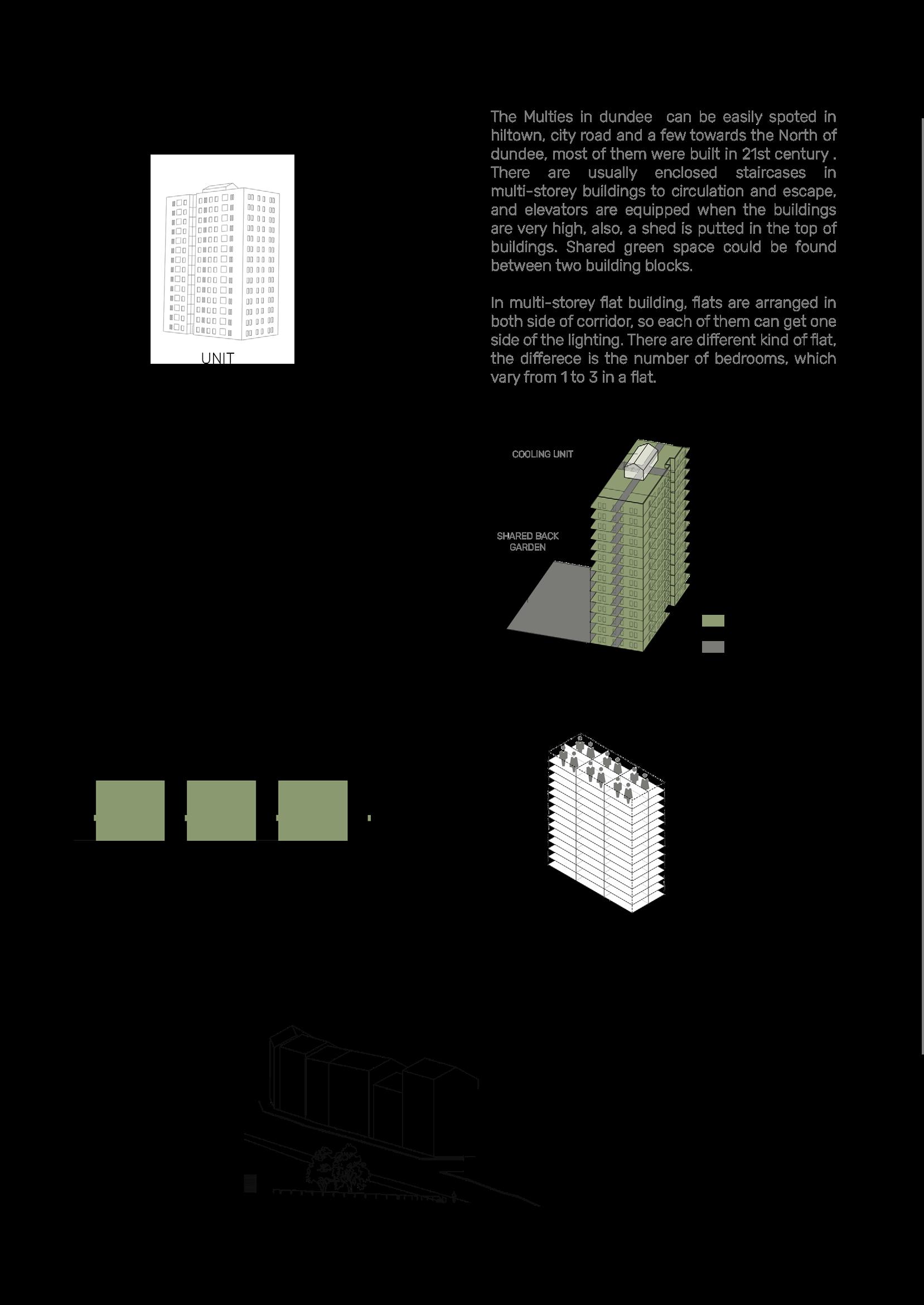
‘‘As standards of living changed, more of the older tenements were torn down as unfit for habitation. In the 1960s Dundee looked to the multi-storey tower block to solve its housing needs, and the skyline of Dundee changed dramatically as ever-larger multis were built in the Hilltown, Ardler and other areas.’’ - University of Dundee [2019]
The multis popped up in the 1960s as another device to get people out of the bad tenement block conditions but in a more cost effective way compared to the Logie Housing Estate.
However, there would a lack of general aesthetics and social emenities, there were issues with isolation in terms of location of the buildings and also in terms of how the flat at the top had a long way down to the daily street life of the city. The lack of community caused several issues, but especially with the up-keep of the building. People were not caring for their accommodation as much as there was a lack of community involvement with keeping it a nice place to live.
It has been realised in more recent years that the tower blocks were not suitable for this city. The function of them may be the biggest problem where there are taller buildings within the centre that still exist and are used for offices/ work places rather than residential accommodation.
In terms of ASD also, this typology would not be suitable for our designs due to the isolation of flats and lack of community environment being able to form. The spaces between the towers also have to be large as to not over shadow each other which create uncomfortable green spaces that people do not spend any time in.
THE MULTIS
morphology DUNDEE

43 | 44
More land was reclaimed at the airport which now has a tarmac landing strip, acting as more of a feature in Dundee than ever before. However the airport is now used more as a convenience for individuals with private jets rather than for the benefit of the entire city. Whilst there are still a few commercial flights to Amsterdam, England and Dublin, it attracts the minority who enjoy a game of golf at St. Andrews, Carnoustie or Gleneagles every other weekend. Aside from private jets, the airport is also used for flight training.
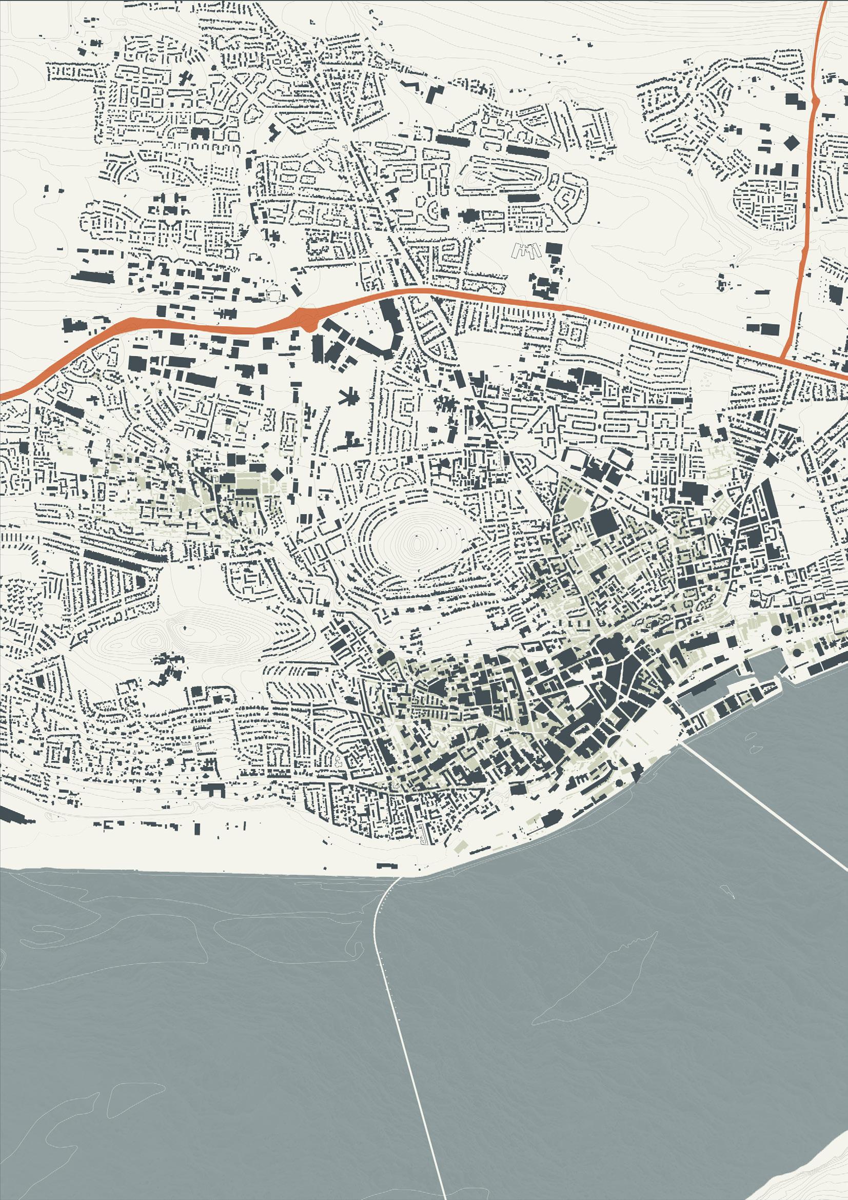
It can be noted at this point that the Kinsgway was made more dominant compared to previous years. The way James Thomson envisioned this road as the North Boundary has not worked and the city is still expaninding north so now all the road does is divide the city in to centre adn suburbs rather than contain it. Another dividing element to take note of is the A90 to Aberdeen which is bringing people either into the city just to work or taking them out to spend a day shopping elsewhere.
Along with the introduction of larger roads, the density in the centre reduced after the closing of the last Jute Mill in 1999 (Taybank Works) and other factories being demolished and housing moving further out the centre, an attempt to recreate what was started with the Logie Housing Estate.
An attempt however is all it is, with new estates being formed side by side brings no amenities. It could be argued that only 1 aspect from the Logie Estate has been brought forward to the present day and that is just the housing, garden area and winding streets to create a more ‘natural’ environment.
WIth people moving further out and away from the city centre, the V&A was another attempt to repair the centre and the waterfront. With the idea of bringing tourists, the city is forming into something of an entertainment city. To keep visitors occupied whilst and almost disregrading those who live in there.
Comparing the grain of the city now to when it was first formed it is hard to see the history. The burgage plots still exist but only faintly as the more changes to plots are made the more diluted the original ones become. There are no bones of history left just the sad ruins of unused factories that are listed and off putting to potential developers. The once differentiation between Lochee (which could be seen as a 20 minute neighbourhood) and the city is no more, it is all just merging into one spread out housing estate with holes in between.
morphology DUNDEE
21st CENTURY | Present 45 | 46
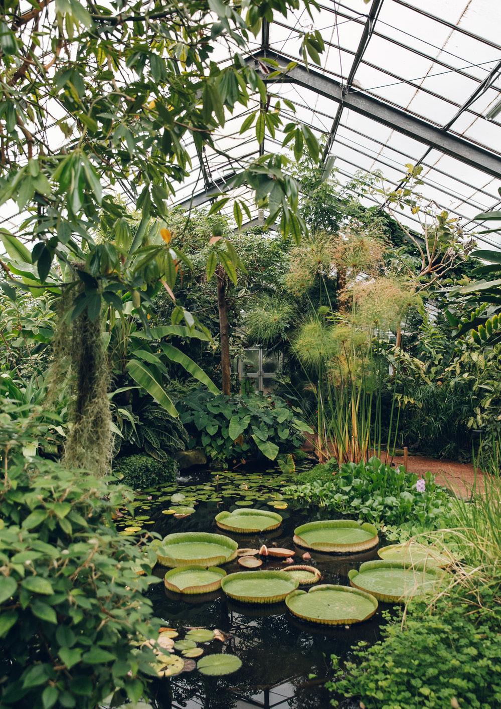 Figure 19 : Botanical Gardens, Dundee
Natural Assets
IDENTIFYING KEY AREAS IN AND AROUND THE CITY AND QUESTIONING THEIR SUCCESS ‘‘we borrow from nature, the space upon which we build.’’ - Tadao Ando
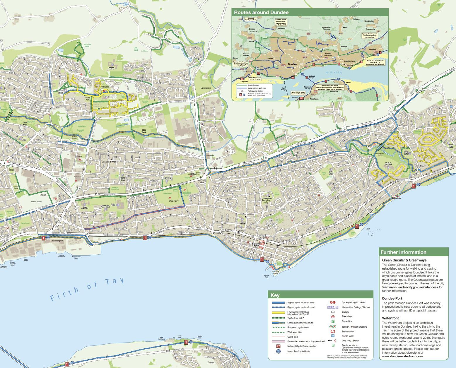
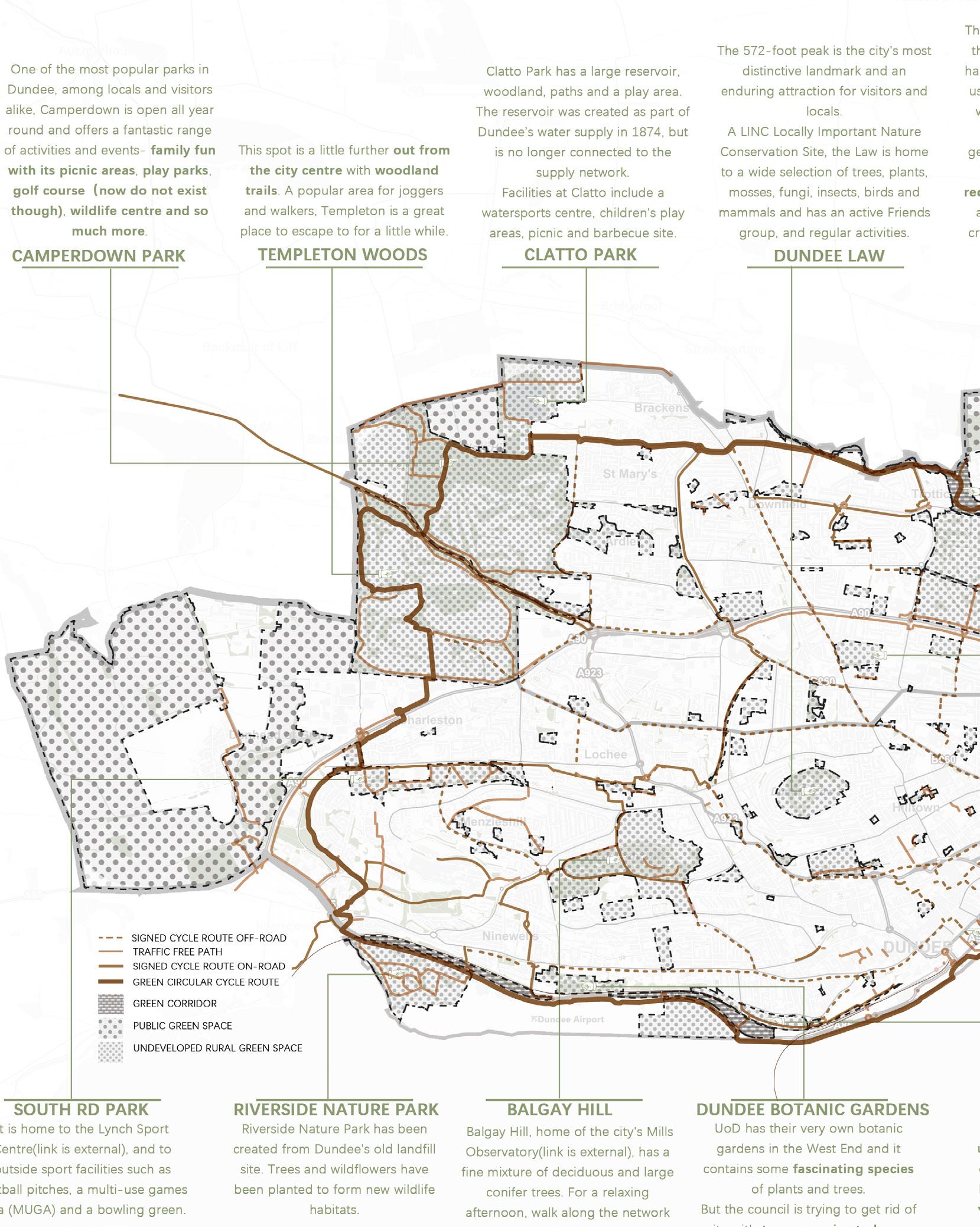
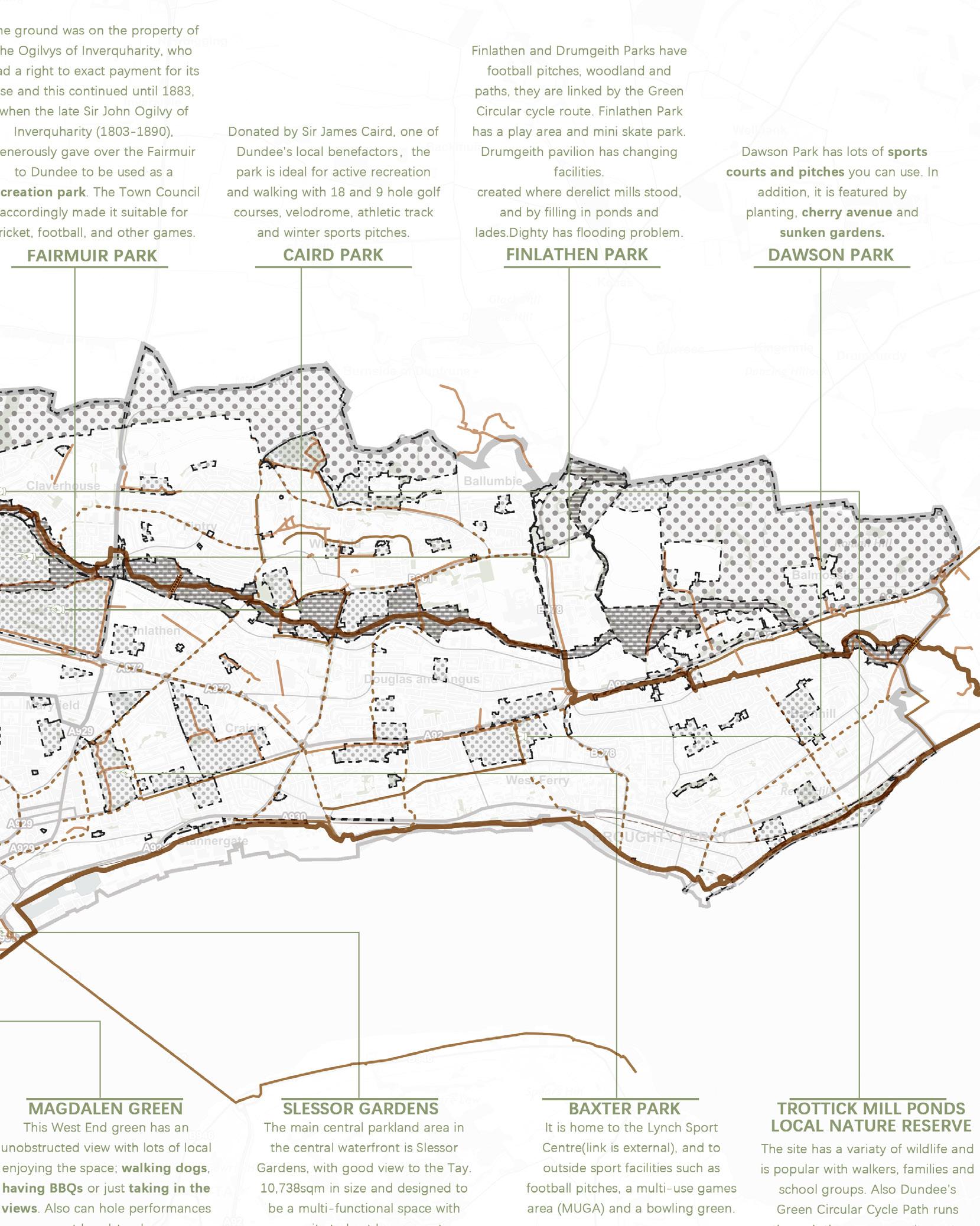
DCC green connections plan is the councils attempt at encouraging healthy living in the city where residents can walk/cycle between green spaces in the city.
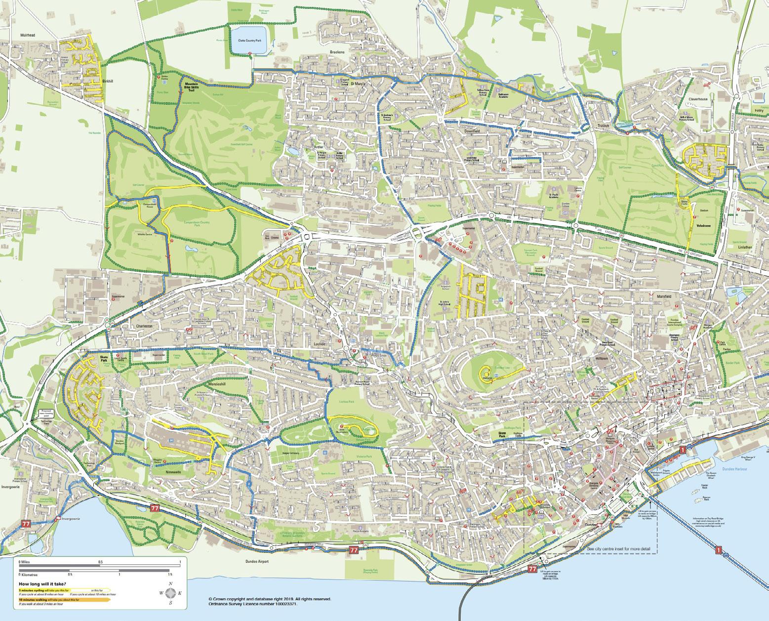
This plan is overlayed on to out green spaces plan on the following page.
When comparing the road connection plan and cycle connection you can see how the roads provide connections outwith the city to other places and the cycle map provides routes for the residents to walk within the city. Encouraging people to exercise means that the green spaces should be functional, but realistically they are not. With the council trying to actually get rid of some of them it all seems very contradicting when they are trying to encourage health and wellbeing within the city at the same time but not providing the spaces for that. natural assets
DUNDEE


49 | 50
Figure 20 : Dundee Cycle Map
natural assets DUNDEE
51 | 52
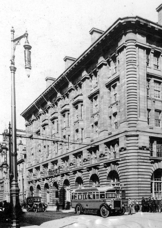
Figure 21 : DC Thompson Building
Spacial Hierarchy
LOOKING AT THE SCALE OF ENVIRONMENT IN WHICH WE FIND OURSELVES SURROUNDED BY
Figure 23
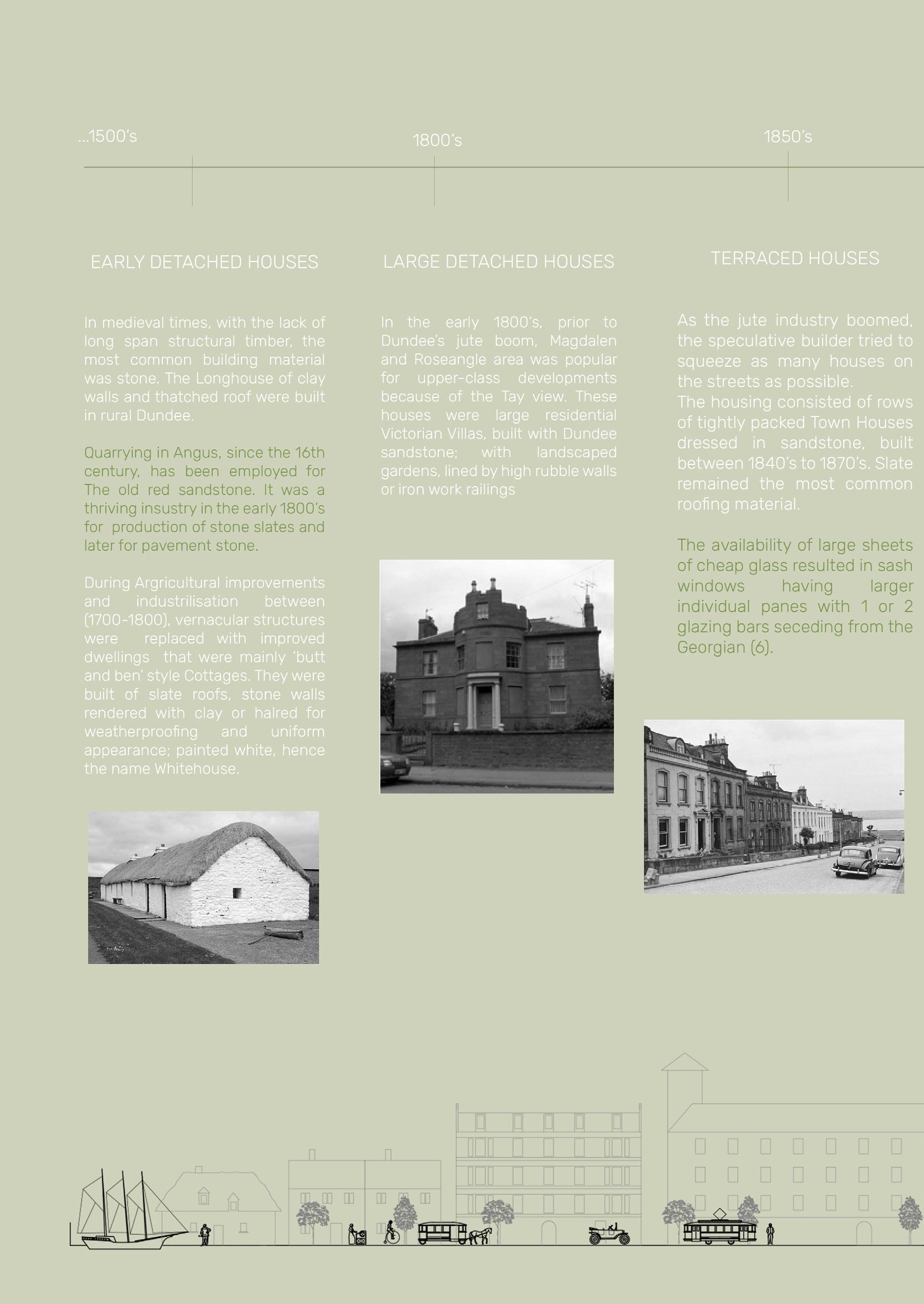
Figure 24
Figure 22
spacial hierarchy
DUNDEE
Figure 27
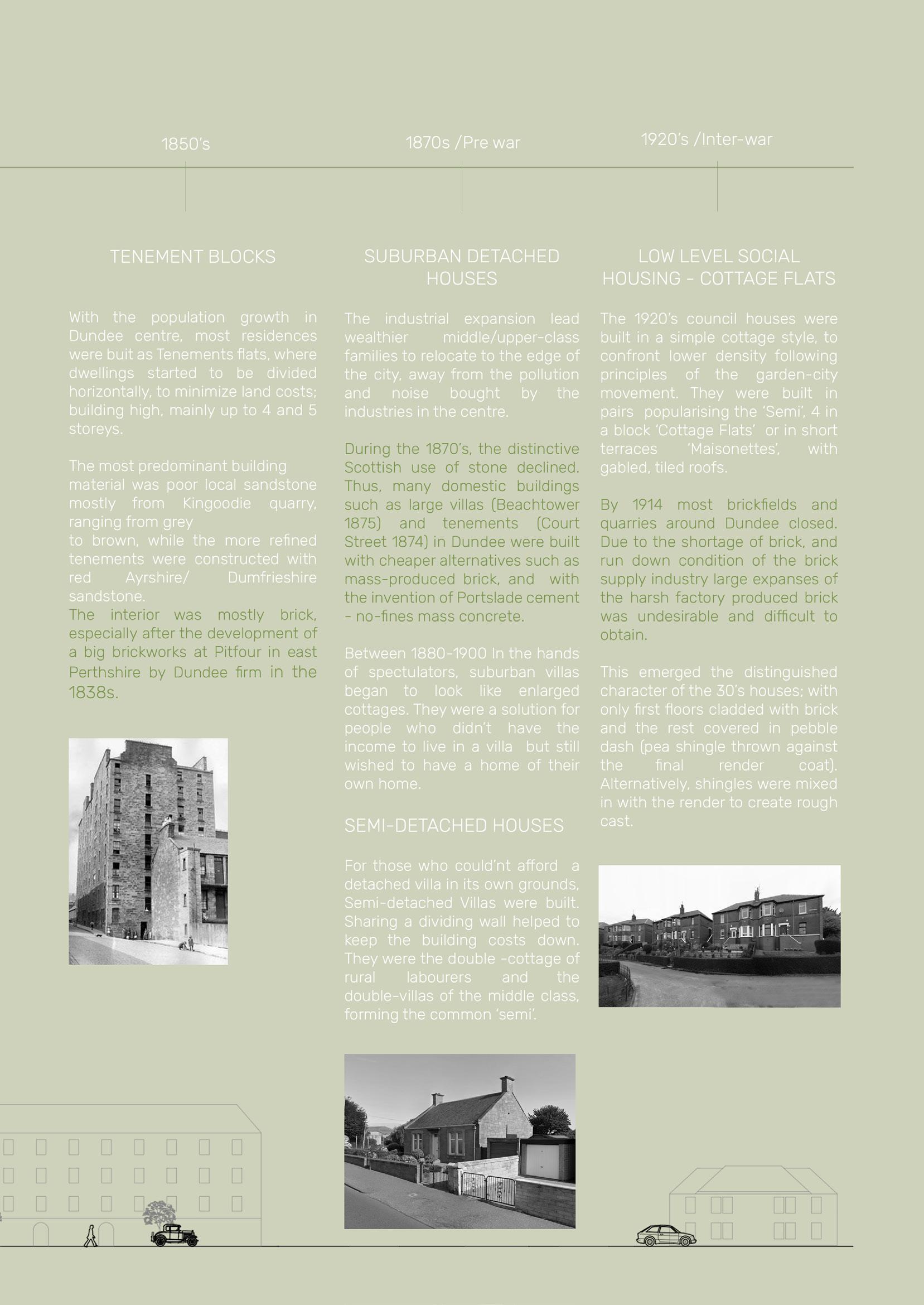
Figure 26
Figure 25
55 | 56
Figure 28
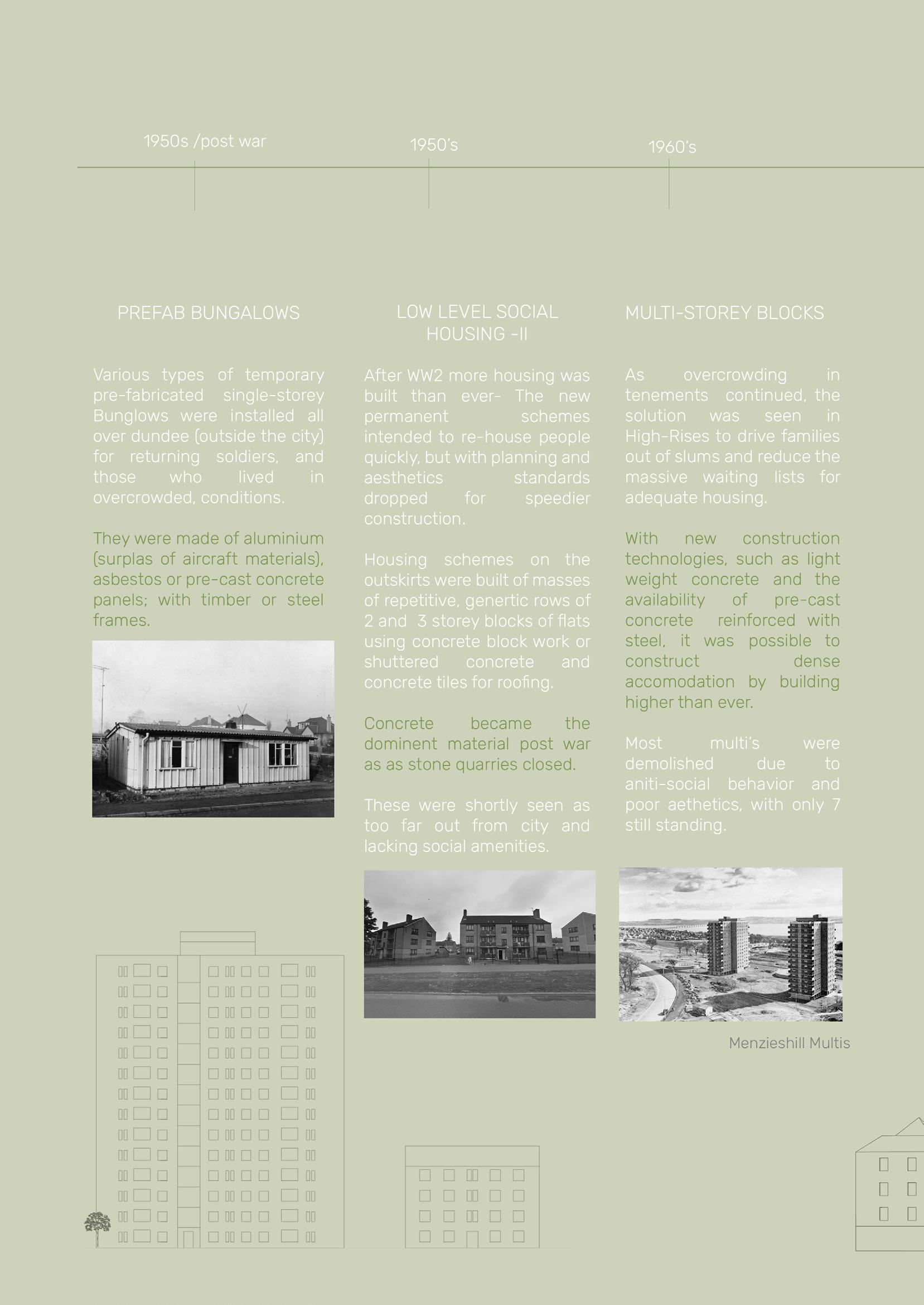
Figure 29
Figure 30
spacial hierarchy
DUNDEE
Figure 32
Figure 33
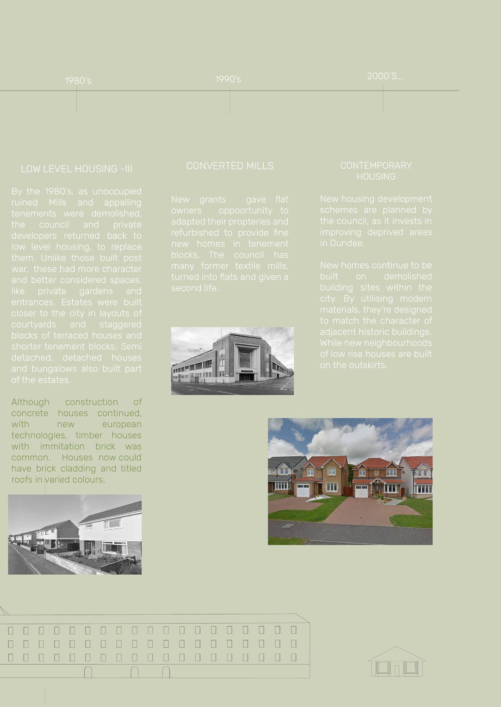
Figure 31
57 | 58
TYPOLOGIES
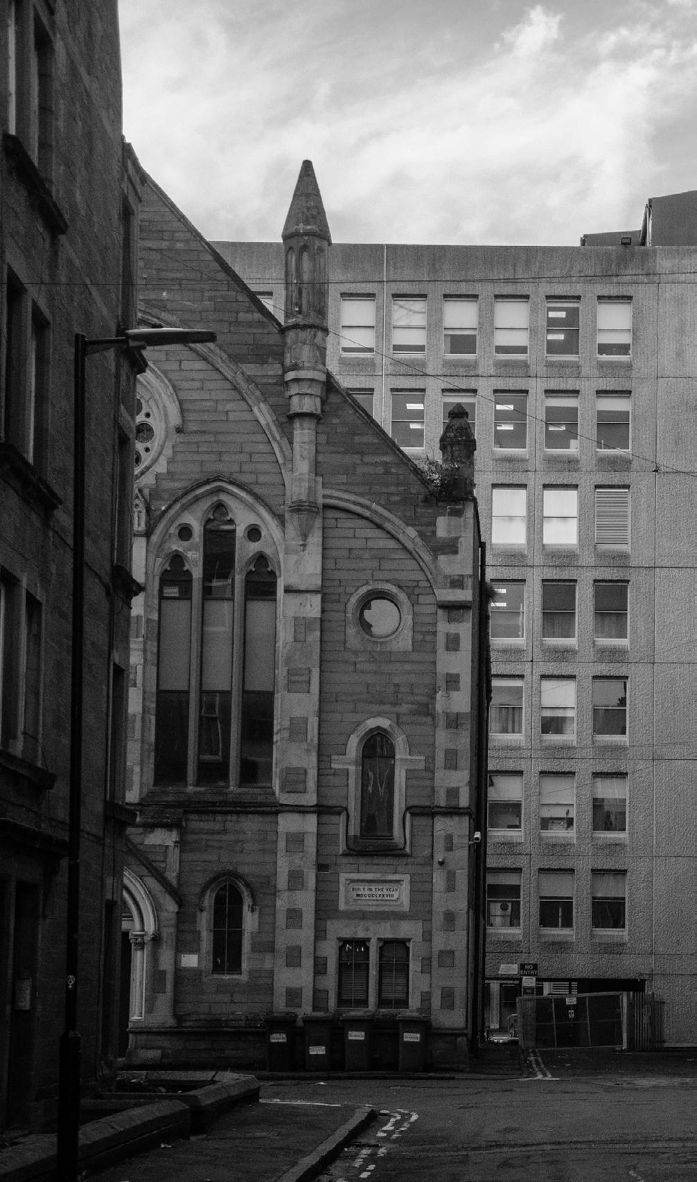
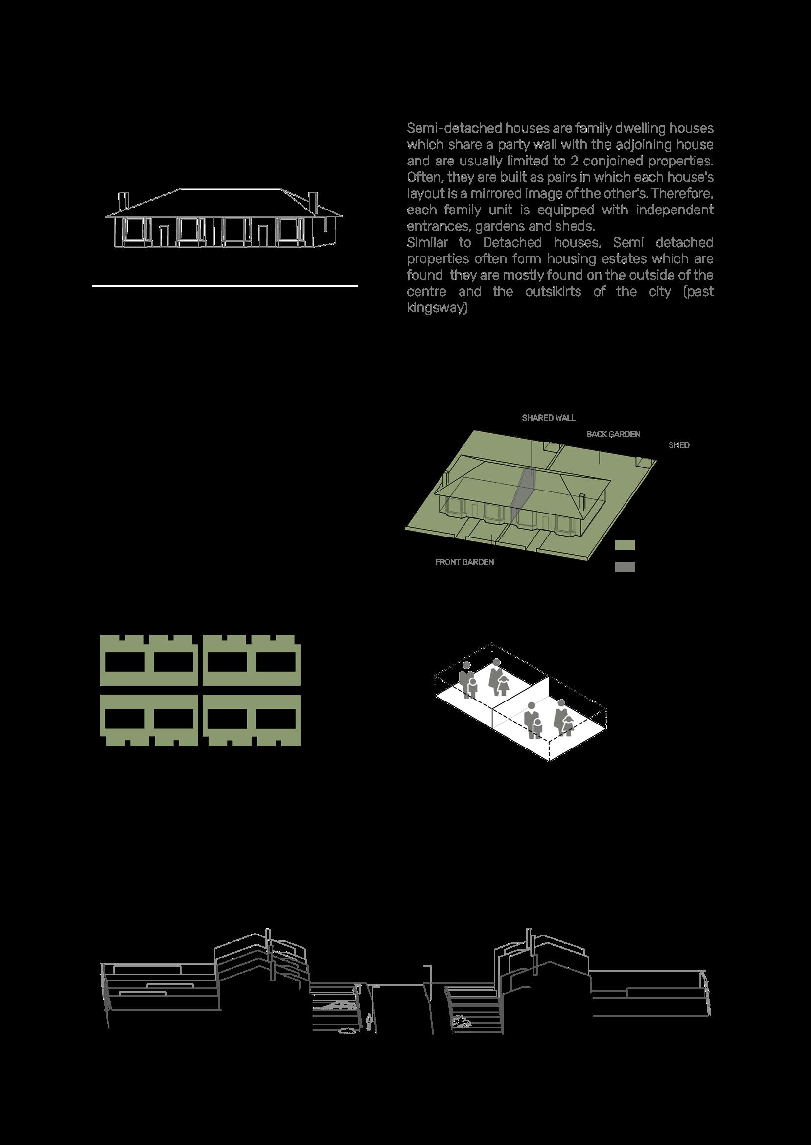
The historic events that lead the evolution of housing from Victorian stone villas to high-rise blocks have largely shaped the image of Dundee today.

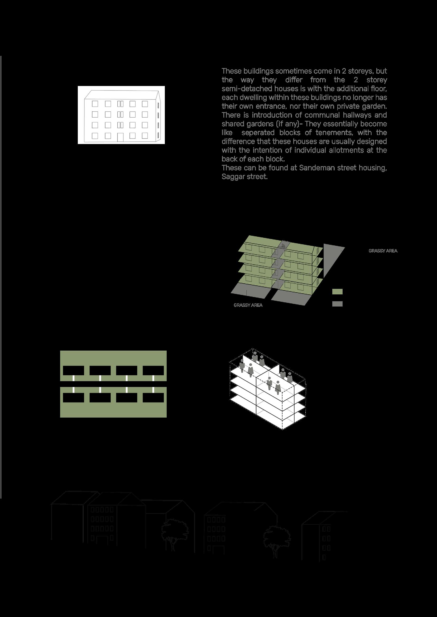
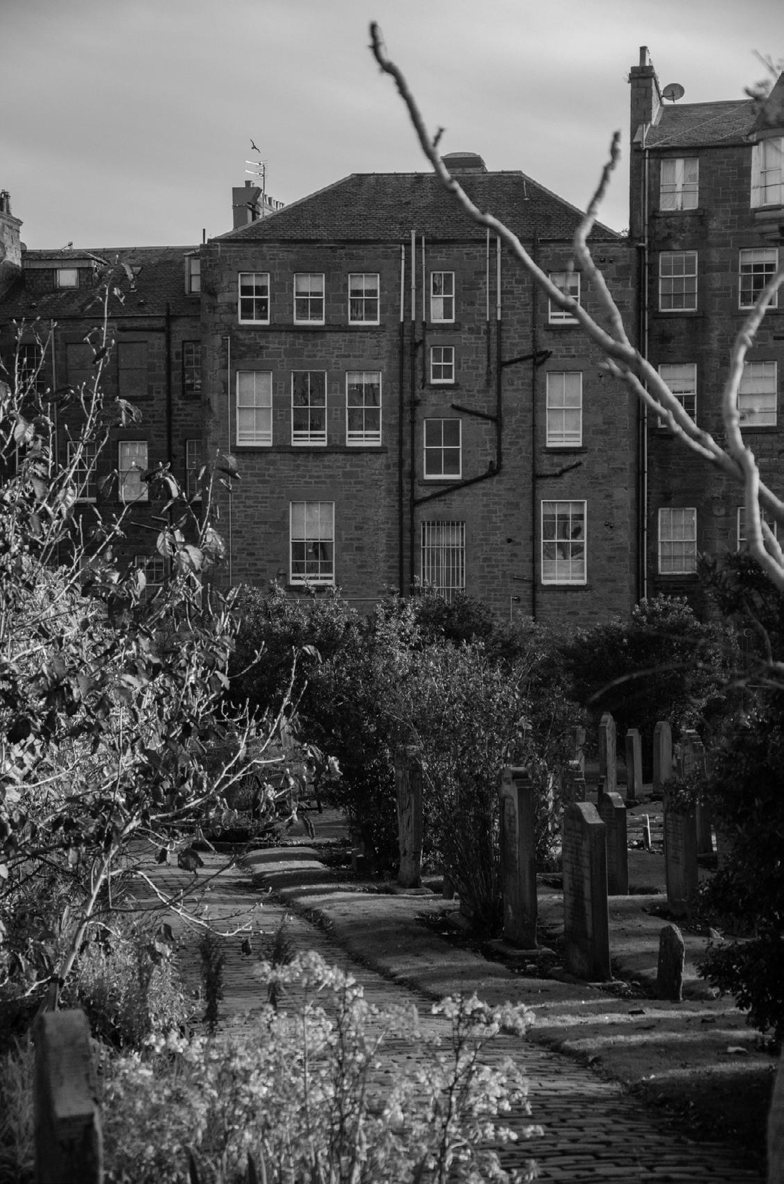
Upon closer inspection at the build of the City, there are historic cues that inform us of certain attitudes towards construction. For example, the front elevation, facing the street, would be used to promote the status. This principle elevation would be dressed with more articulated and higher quality stone materials, while the rear was dressed in brick, with a blank elevation. This negligence of the rear elevation is echoed throughout the city, resulting in the backs of buildings becoming dumping grounds of undisposed furniture and rubbish.
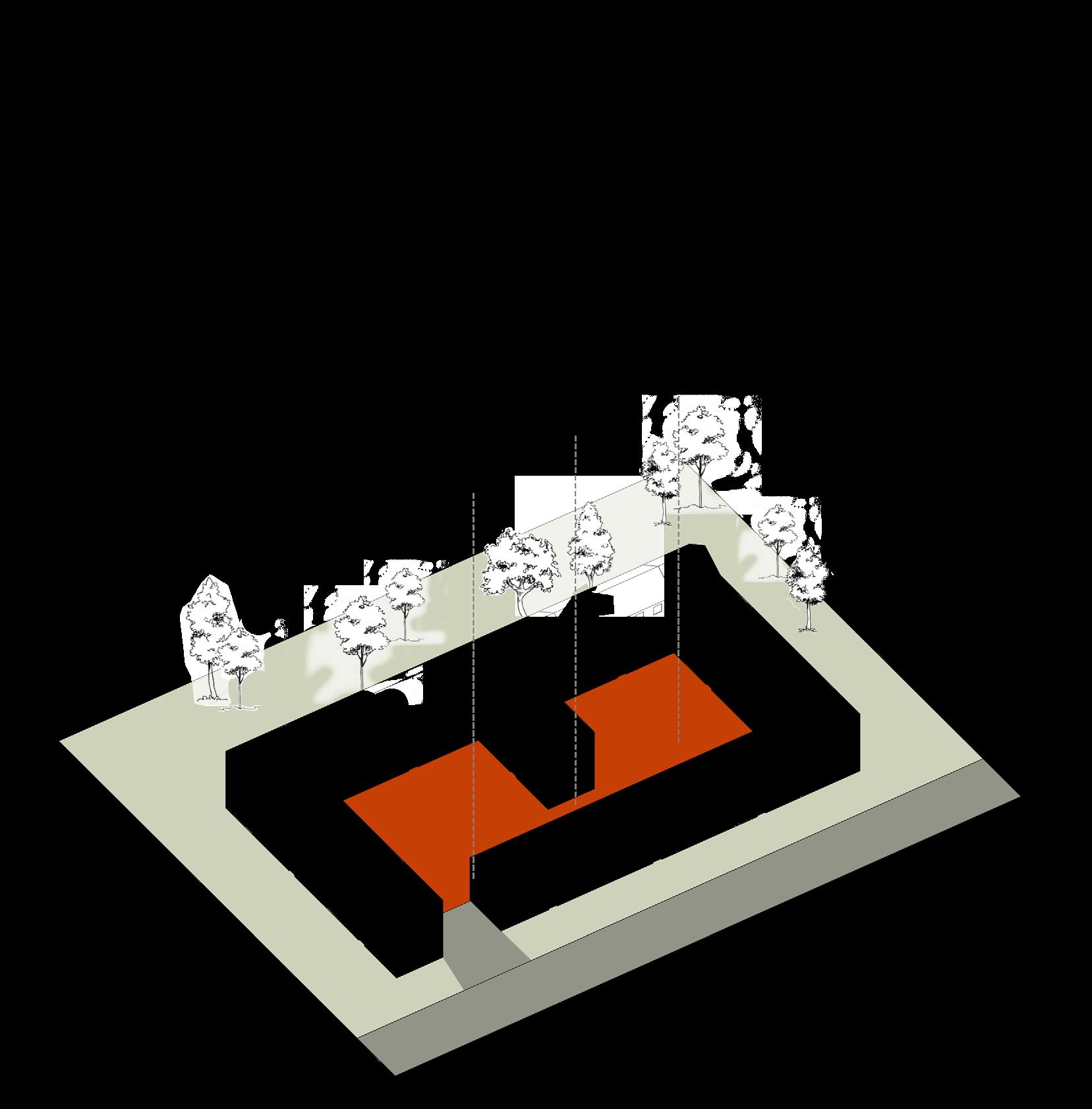
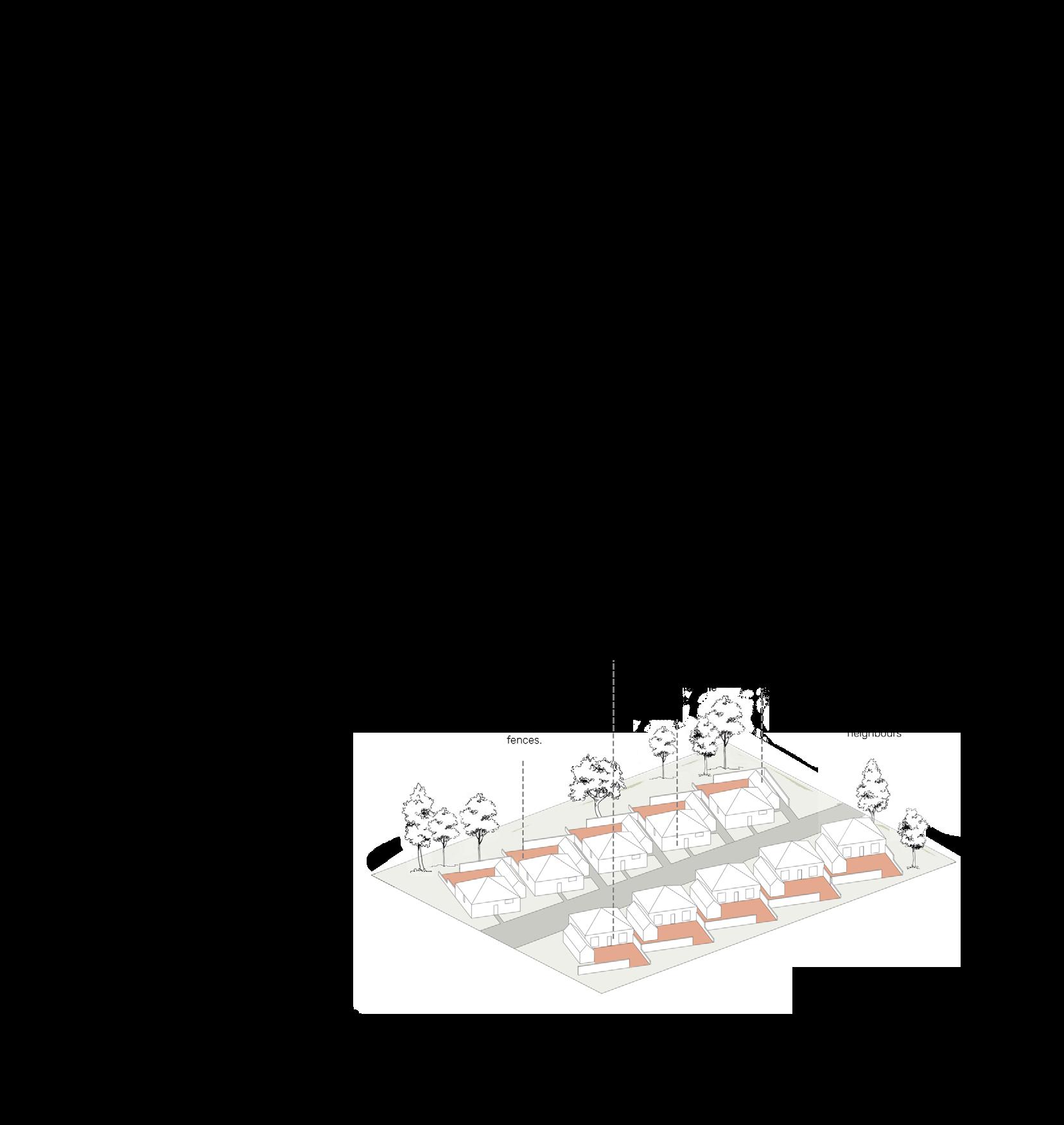
This situation led us think of a way to address the backs of the buildings equally (if not more) than to the front of them. The proposal of courtyards suggests an adaptation to the back of the building as the new front for the community within it. The existing building blocks in the city could be repurposed to provide an external space that is shielded from the noise and chaos of the city, which can then provide with a strong precedent to replicate within our ASD focused designs.
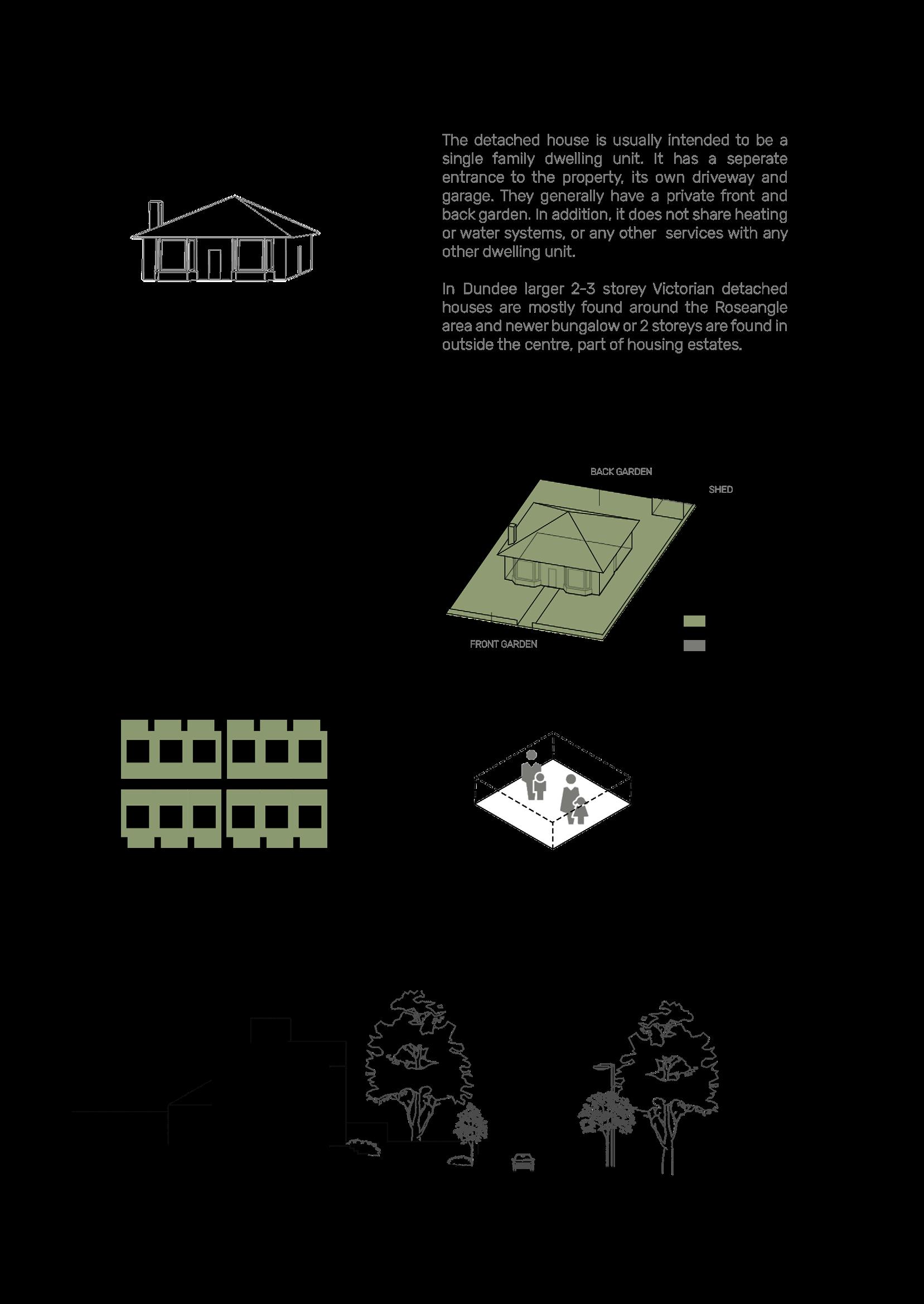
This section demonstrates the change of mainstream typology due to the key events within the period of time. A typology study then analyses the the most commonly found residential housing in Dundee. They are distinguished by the number of households, communal space, type of construction, materials, arrangement and how they sit in the urban grain etc. This study helps to better understand what makes up most of Dundee’s urban fabric, from which we can take inspiration to develop into our designs, to compliment the existing built environment.
spacial
DUNDEE
hierarchy
59 | 60
DUNDEE
61 | 62

DUNDEE
63 | 64
DUNDEE

65 | 66
DUNDEE
67 | 68
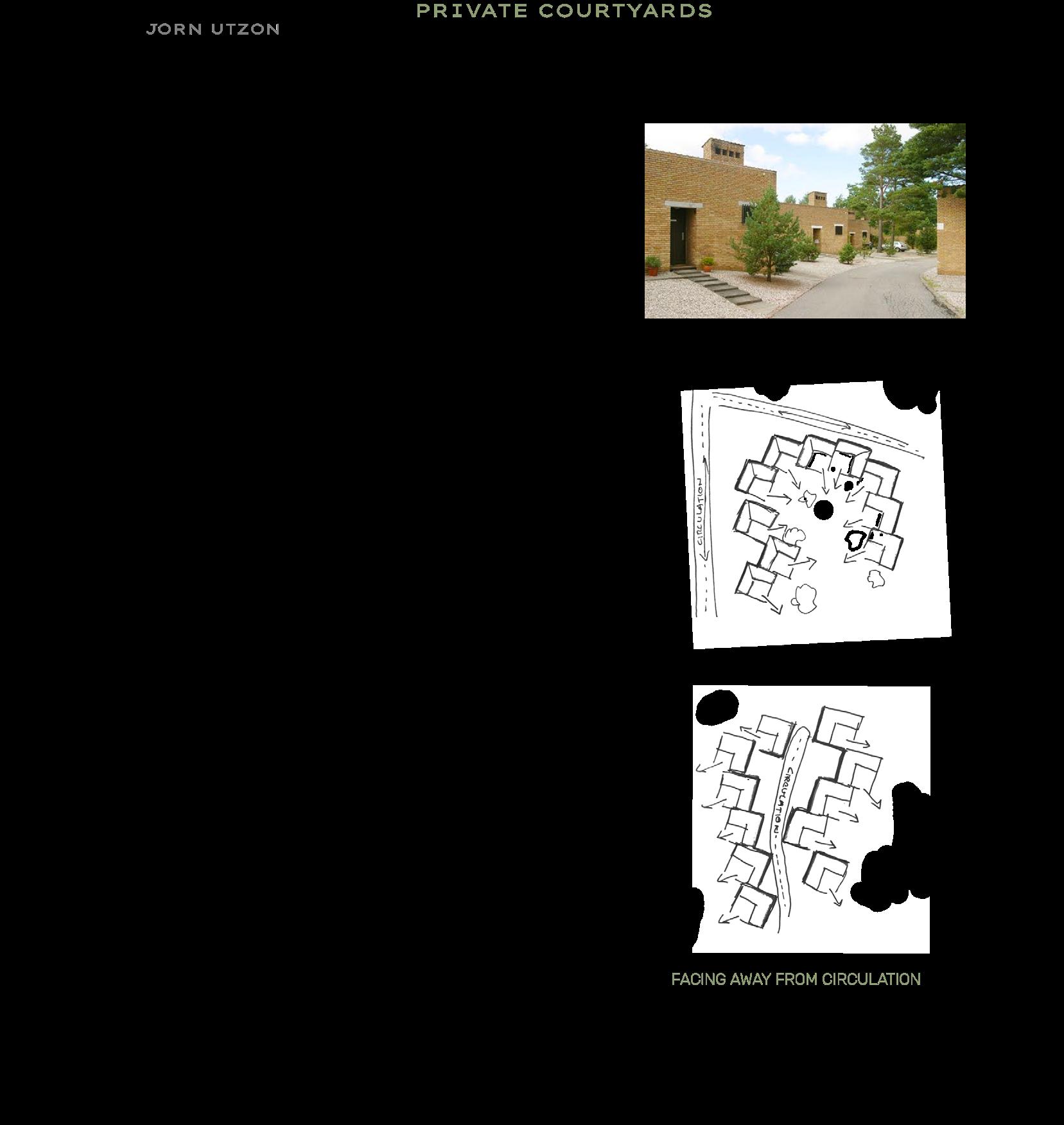
The pattern ‘House cluster’ focuses on the importance of land and houses that surround one’s home.
“It is the source for gradual differentiation of neighbourhood land use and it is the natural focus of the neighbourly interaction.” To create well-functioning clusters, Alexander suggests a size between 8-12 homes each; this is because anymore than 12, may create an unbalance.
When thinking about designing homes for individuals with ASD, we have to think about if this number might be too large. This is based on the logic that the more people a cluster consists of, the more presence of life is brought to the attention of others within the cluster.
Whilst this might be precisely the reason why such clusters create a strong community bond, for an individual with Autism, it might seem be too chaotic. However, to contrast this, making a cluster that is too small might make them feel too claustrophobic, or could seclude the groups from a ‘whole’. Therefore, the ideal approach is one taking the middle ground, of 5-7 homes within a cluster.
Another factor to consider, when thinking of community, is the degree of privacy these clusters have from the general pubic. This section explores cluster of homes that are organised to form a protective enclosure, some of which, are more private than others. The ultimate aim is to gain an idea of what level of privacy and cluster format would best suit housing for ASD inhabitants. This is done by looking at built examples of courtyard houses, how they form their enclosed space, and then adapting them to Dundee’s existing typology to form an enclosed space of similar intention.
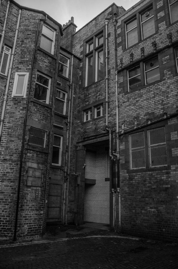
Figure 34 : a pattern of language book cover
spacial hierarchy

[ privacy ]
COURTYARD STUDIES
DUNDEE
69 | 70

LOW LEVEL PRIVACY spacial
DUNDEE
hierarchy
71 | 72

MEDIUM LEVEL
spacial
DUNDEE
PRIVACY
hierarchy

73 | 74
Figure 35
HIGH LEVEL PRIVACY
spacial
DUNDEE
hierarchy
75 | 76

MIXED LEVEL PRIVACY
DUNDEE
spacial hierarchy

77 | 78
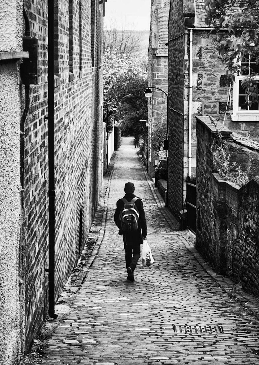
Figure 36 : Westfield Lane
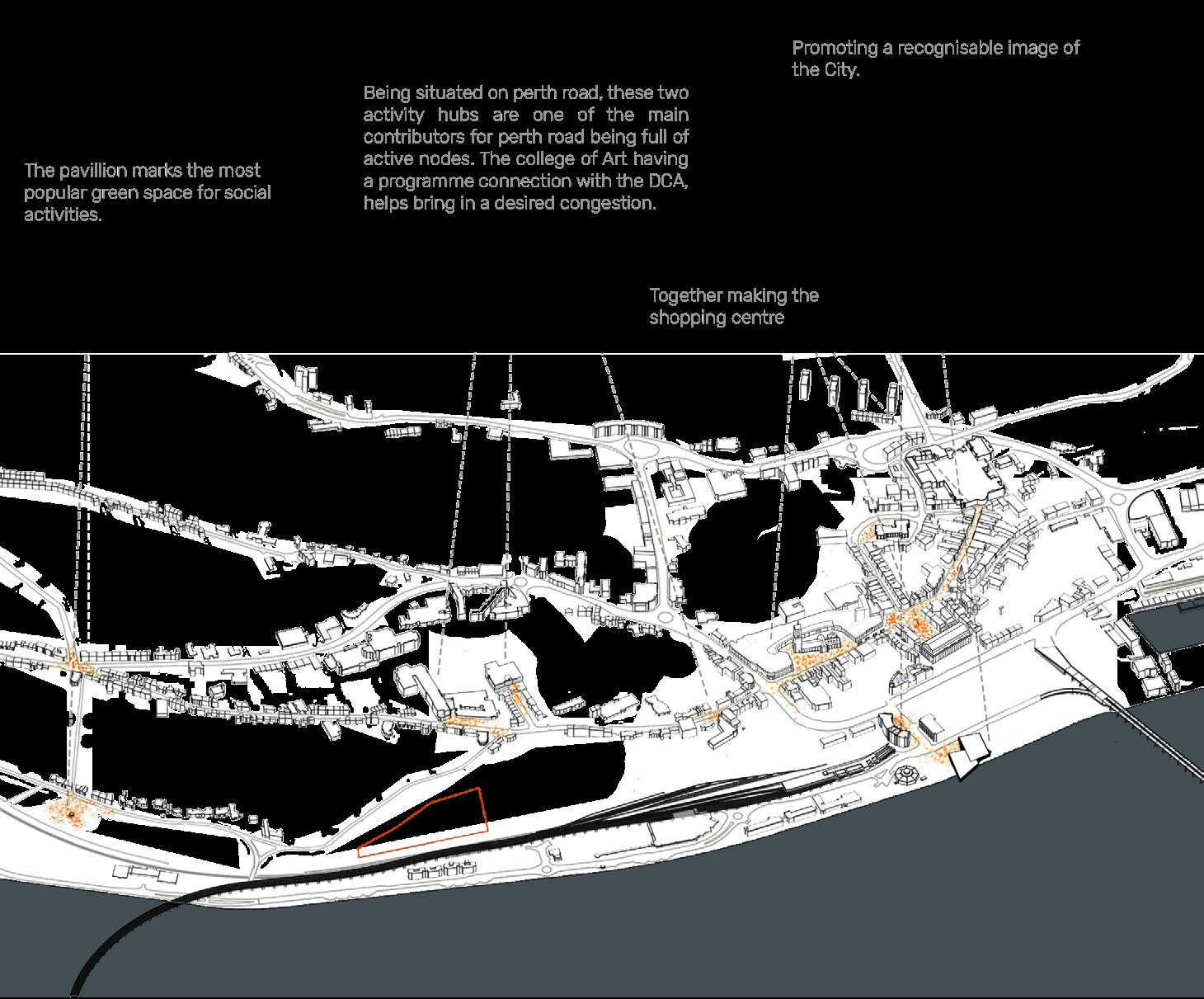
RESEARCHING AND ANALYSING THE CHARACTER OF THE CITY
‘‘...a city is more than a place in space. It is a drama in time.’’ - Patrick Geddes
Legibility


legibility
DUNDEE
Figure 37 : The Image of the City book cover
81 | 82
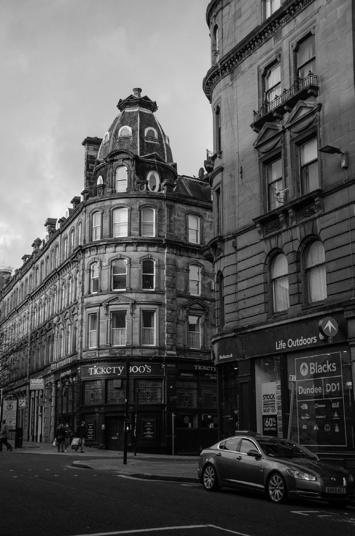
legibility DUNDEE
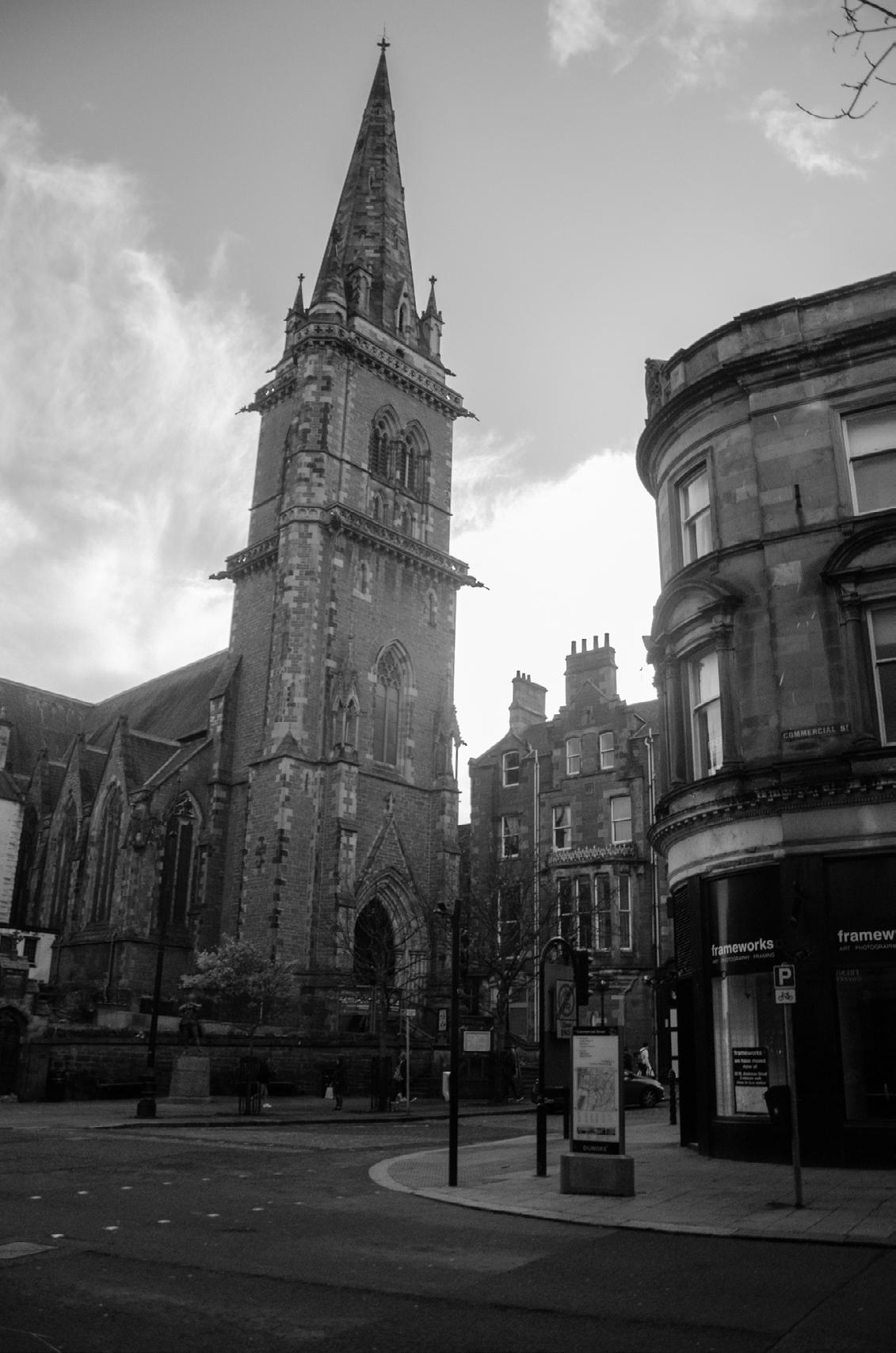
83 | 84

Figure 38 : V&A Dundee
Potential Future
HIGHLIGHTING ABSENT OPPORTUNITIES AND CREATING URBAN SOLUTIONS
Site Scoring Matrix
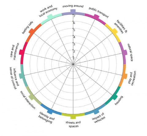
Taking reference from the Scottish Government’s Place Standard diagrams we have combined areas from this with ASD specific requirements to score existing potential sites. The sites have been taken from the Dundee City Council’s Development Plan as these sites have already been allocated for housing development. However we wish to challenge this by using the points system to create sustainable mixed use communities which allow those with ASD to integrate better within society.
potential
future
DUNDEE
Figure 39 : Governments place standard diagram
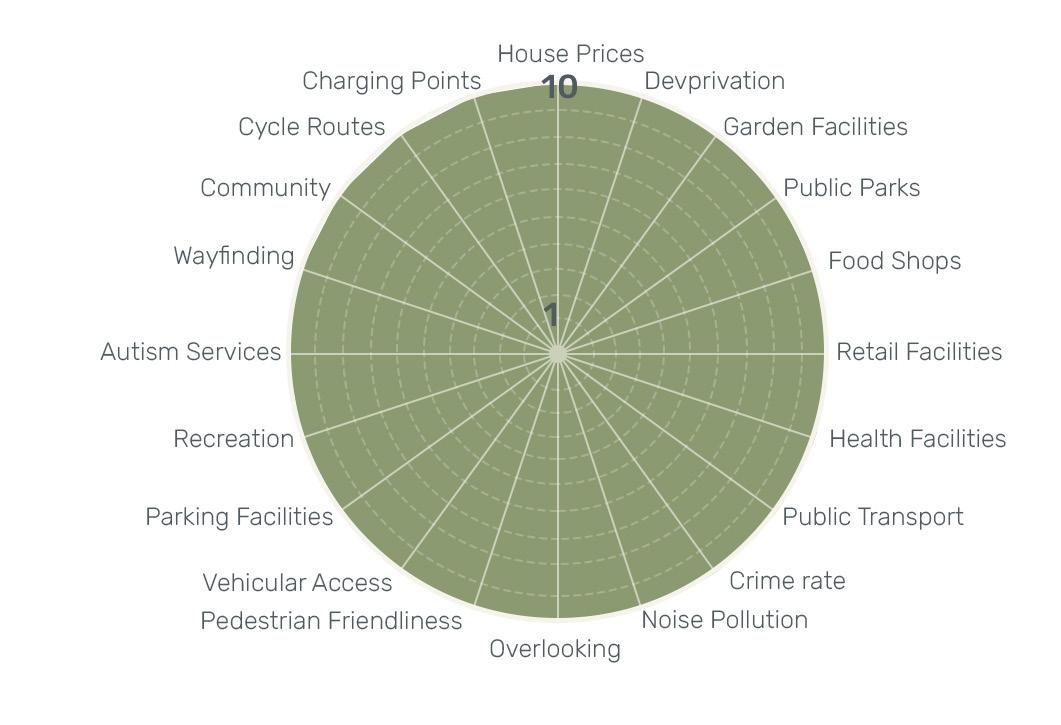
Currently the scoring is developed as a place specific system to Dundee however it could be adapted to suit another place with a few easy adjustments to the scoring system.
The scoring takes into account wider urban themes from deprivation to cycle routes, public parks, amenities and way finding. Down to site specific aspects such as community, noise and overlooking, as well as autism specific factors such as autism services and health facilites.
In its current stage the scoring is in early development however it will be refined as the site analysis progresses.
How it Works
87 | 88
Scoring System
house prices: prices dont reflect conditions of area, but rather the lower the house prices the higher the probability of anyone being able to afford to live there
1 = above £300 000 6 = £160 000 2 = £300 000 7 = £140 000 3 = £260 000 8 = £120 000 4 = £220 000 9 = £100 000 5 = £180 000 (Average in Dundee) 10 = under 100 000
deprivation (SIMD): used SIMD statistics/points garden facilities/allotments: determined by walking distance and measured by an average walking time, howver it is understood that this may be different with an autistic person. can use google maps.
1 = 50 minutes or more 6 = 25 minutes 2 = 45 minutes 7 = 20 minutes 3 = 40 minutes 8 = 15 minutes 4 = 35 minutes 9 = 10 minutes 5 = 30 minutes 10 = 5 minutes or less
public park: same as above food shops: same as above retail facilities: same as above health facilities: same as above public transport: same as above sense of security (crime rates): Average number of reported crimes over a 1 year period
1 = 9+ 2 = 8 3 = 7 4 = 6 5 = 5 6 = 4 7 = 3 8 = 2 9 = 110 = 0 incidents
noise pollution: Number of areas which we believe to have an impact on noise level (subjective)
1 = 9+ 2 = 8 3 = 7 4 = 6 5 = 5 6 = 4 7 = 3 8 = 2 9 = 1 10 = 0 areas/buildings
overlooking: number of buildings over looking site
1 = 17-18+ 2 = 15-16 3 = 13-14 4 = 11-12 5 = 9-10 6 = 7-8 7 = 5-6 8 = 3-4 9 = 1-2 10 = 0 pedestrian friendliness: designated pedestrian feature (pavements, crossings, zones, volume of car traffic)
same as noise pollution vehicular access: number of existing and proposed access points (show in different colours) wide enough for service vehicles. 1 = 0 5 = 2+ 10 = 4+
parking facilities: number of parking nearby and potential on sites recreational activities (sports and arts): walking distance to - refer to garden facilities/allotments scoring
autism services: same as above potential future
DUNDEE
wayfinding (recogniseable features): number of recogniseable features (eg. sign, landmarks, etc)
1 = 0 2 = 1 3 = 2 4 = 3 5 = 4 6 = 5 7 = 6 8 = 7 9 = 8 10 = 9+
community: number of community groups wthin 2 km radius - use same scoring as above
cycle routes: proximity to council designated cycling route - same as garden facilities/allotments scoring
charging points: same as above
89 | 90
Density Studies
Taking influence from the housing design booklet by David Levitt and Jo McCafferty we used their optimised density figures for low, medium and high for each site to determine how dense we can make sites in conjunction with designing suitable spaces people with ASD.
Using a combination of looking at precedent in the ASD Booklet and the spacial requirements with look at the surrounding context we can immediately see that not all densities are suitable, however it may be that there is a combination of density on sites where there is housing specifically for people on the spectrum and other accomodation/public aspects.
Each precedent has been drawn in plan to be arranged on the site with the typical unit isolated.
Figure 40 : The Housing Design Handbook book cover

1 hectare = 10 000m2
All stackable units would have additional stair core as there are no stair included within the blocks shown.
All notes beside heading of sites eg (Land at Clatto | H03 [60 units]) refers to Dundee City Council’s recommended number of housing units per site. The council document does not describe whether this is houses, flats, or maisonettes etc.
potential future
DUNDEE
Low Density


35-90 dph (density per hectare: units/hectare]

2 storey 3 bed - no parking or private terrace/courtyard
3 storey 4 bed - parking and private terrace
2 storey 3 bed - no parking or private terrace/courtyard
3 storey 4 bed - no parking or private terrace/courtyard
2 storey 3 bed - parking and private terrace
3 storey 4 bed - parking and private terrace

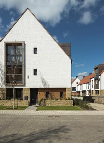

91 | 92
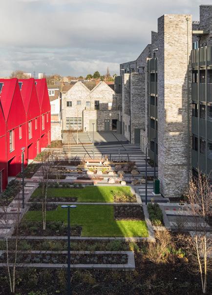
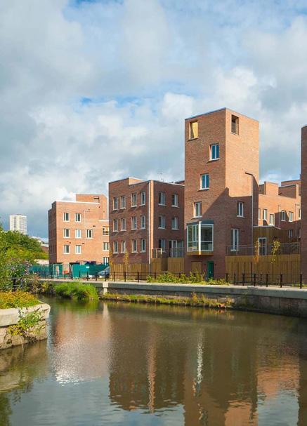
Medium Density


[90-250 dph (density per hectare: units/hectare]

2 storey 4 bed - underground parking does have private garden
3 storey 5 bed - underground parking does have private garden
1 storey 1 bed - stackable single units to 10 storey with private terrace
1 storey 2 bed - stackable single units to 10 storey with private terrace
2 storey 4 bed - stackable to 4 storey with no parking does have private garden
6 storey 3 bed - no parking does have private roof terrace
2 storey 3 bed - no parking does have shared gardens
1 storey 2 bed - stackable to 5 storey withno parking does have private balconies
potential future
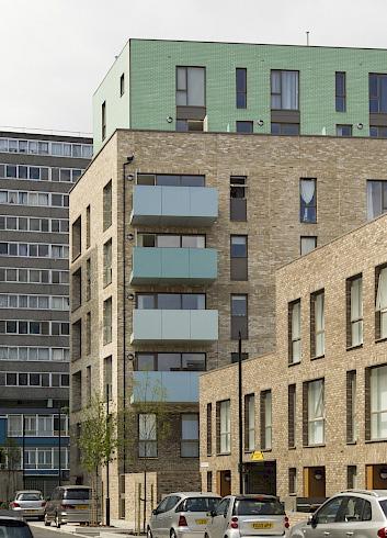
DUNDEE
High Density
[250-350+ dph (density per hectare: units/hectare]
2 storey 2 bed - stackable to 8 storey with no parking does have private balcony
1 storey 2 bed - stackable to 8 storey with no parking does have private balcony


2 storey 2 bed - stackable to 8 storey with no parking does have private balcony
same as above - interlock with each other, so 2 storey = 4 bed 2 units


1 storey 1 bed - stackable to 5 storey with no parking does have private balcony
1 storey 2 bed - stackable to 5 storey with no parking does have private balcony
1 storey 3 bed - stackable to 5 storey with no parking does have large private balcony

93 | 94
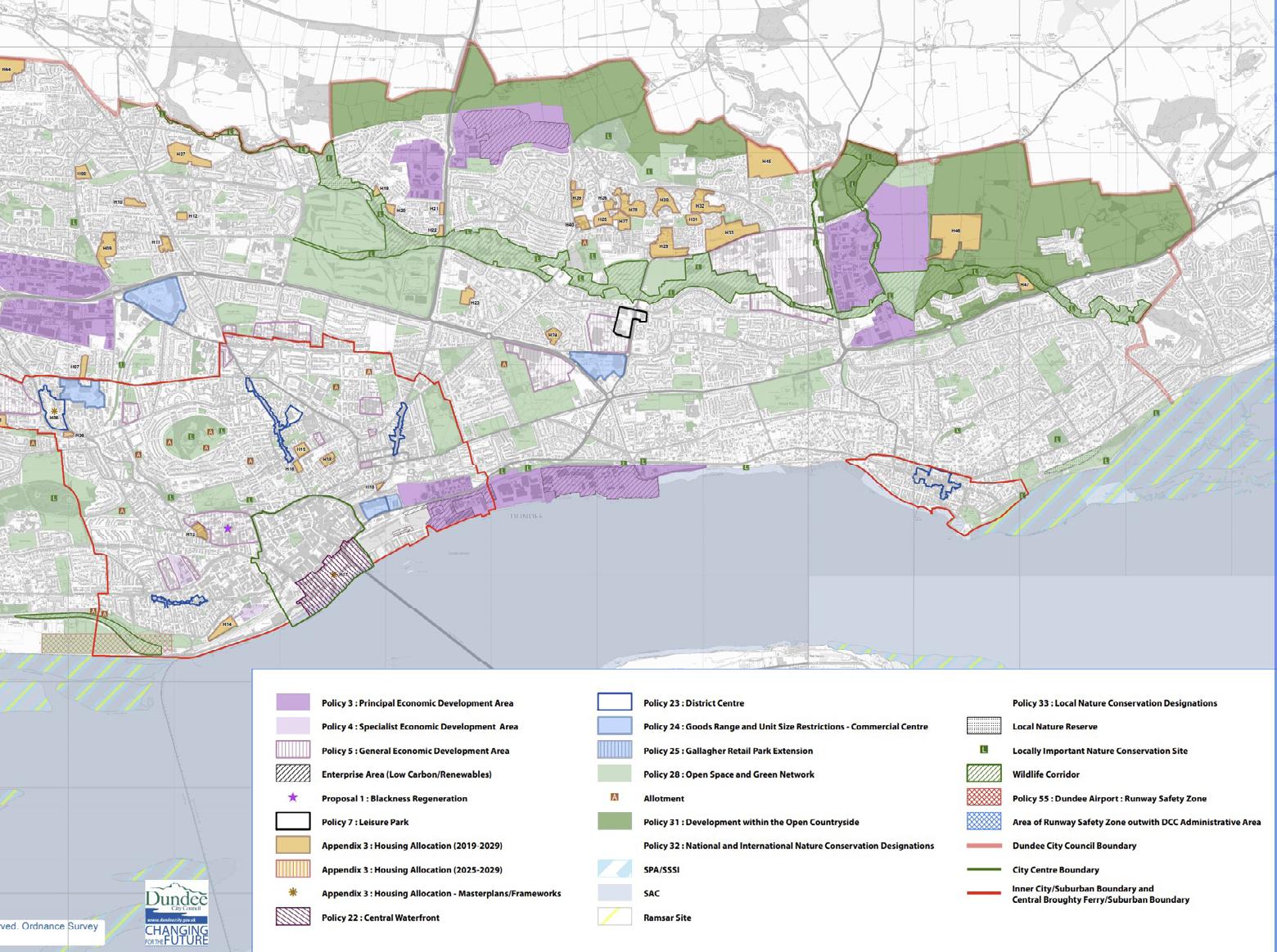
DUNDEE CITY DEVELOPMENT PLAN
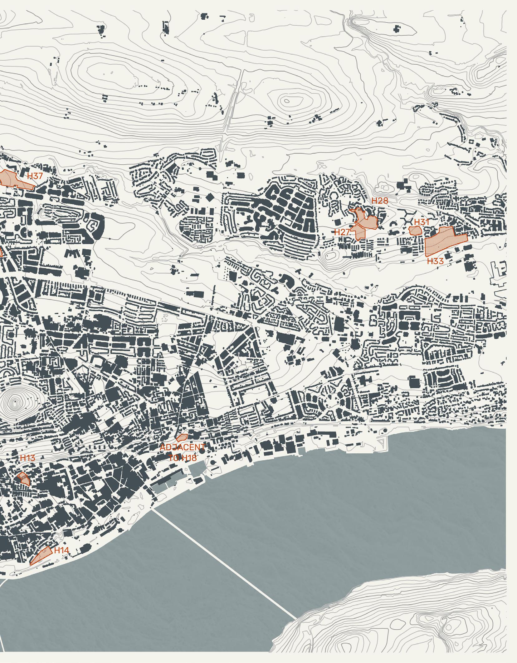
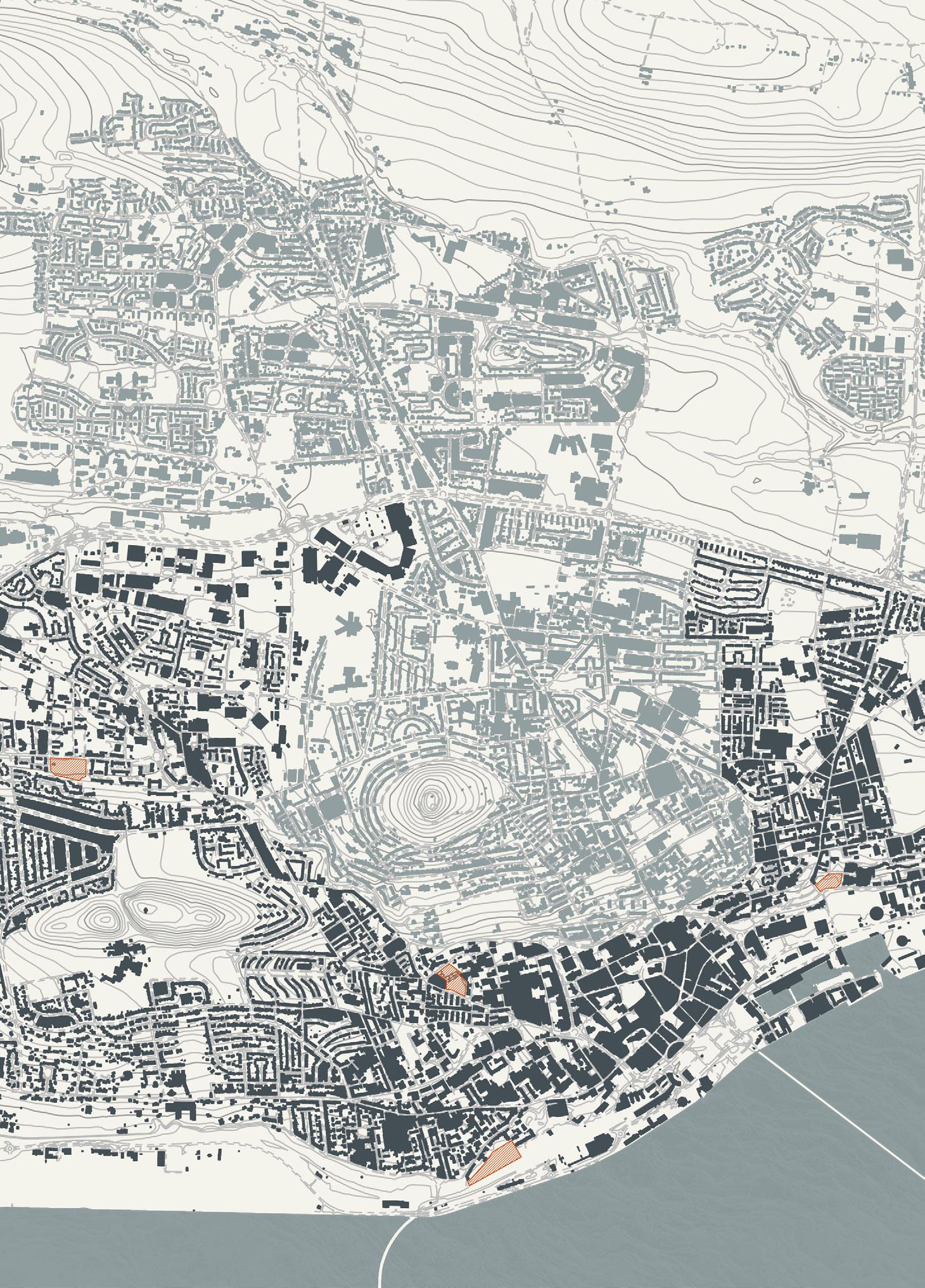
Started off by choosing potential sites by looking at the Dundee City Council Development Plan and recognising the sites allocated for housing.

We then split into sub-groups where we looked at areas in Dundee (north, east, south (centre) and west).
Many of the sites were immedietely taken off the list due to unsuitability for our design intentions and we were left with 16 sites (4 for each area).
potential future
DUNDEE
2019 95 | 96
Figure 41 : DCC Dundee Local Development Plan

potential
DUNDEE
future
97 | 98

potential
DUNDEE
future
North of the City
The north side of the Dundee landscape is mostly defined by the Kingsway which runs along the northern border of the main city. Residual spaces below the Kingsway consist of industrial areas, the Kingsway shopping center and some housing estates directly north of Harefield Road. The Downfield/Camperdown nature areas to the west and the Caird Park near Trottick to the east define the remaining borders of the north side.
Going north of the main city, historic context quickly begins to fade from the typology of the area. With the exception of Strathmartine road, which has retained Victorian stone housing and structures along the main road, the north is almost completely void of pre-war construction which promotes a more modern stance towards emerging developments.
The north is Dundee balances repetitive clusters of dense 2 - 3 storey estate housing separated by either main roads leading in and out of the main city, or by green spaces converted into parks and fields for public use. While clusters are divided by larger public green spaces, individual homes are also provided gardens and larger estates are given more private shared green spaces directly in front of residences. Between estates, sites are confined by roads and buildings, while sites to the outermost parts of the north have access to larger nature reserves such as Clatto.
Transport in and out of the north is considerably well provided given the nature of the area (strongly focused on housing and residential). Public transport is provided via buses running through the main roads (Strathmartine road, Macalpine road etc.) and immediate deviating roads (Camperdown road, Turnberry avenue etc.) around central connected residential clusters or schools. While a basic public transport system exists, it does not service the outer areas of the north directly and non-driving residents/ visitors will ultimately need to rely on walking to access certain estates or parks.
Provision of amenities to the north are is very limited. The Kingsway shopping area is shared between the north and central areas and the north is heavily reliant on this resource. Asda and Lidl supermarkets are located in the southern and south-eastern areas of north Dundee, with only corner shops and take-aways servicing the remainder of the areas. A hospital can be found in the southern area with mostly primary schools and churches acting as the notable buildings through the areas.
Unlike the center area, the north is mostly filled with residential estates and plots of greenspace with little access to mainstream amenities or direct access to all areas. While space is more largely provided, access to it is limited.
99 | 100
P
potential future DUNDEE
P

Land at Clatto | H03 [60 units] 101 | 102
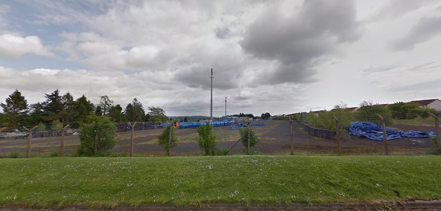
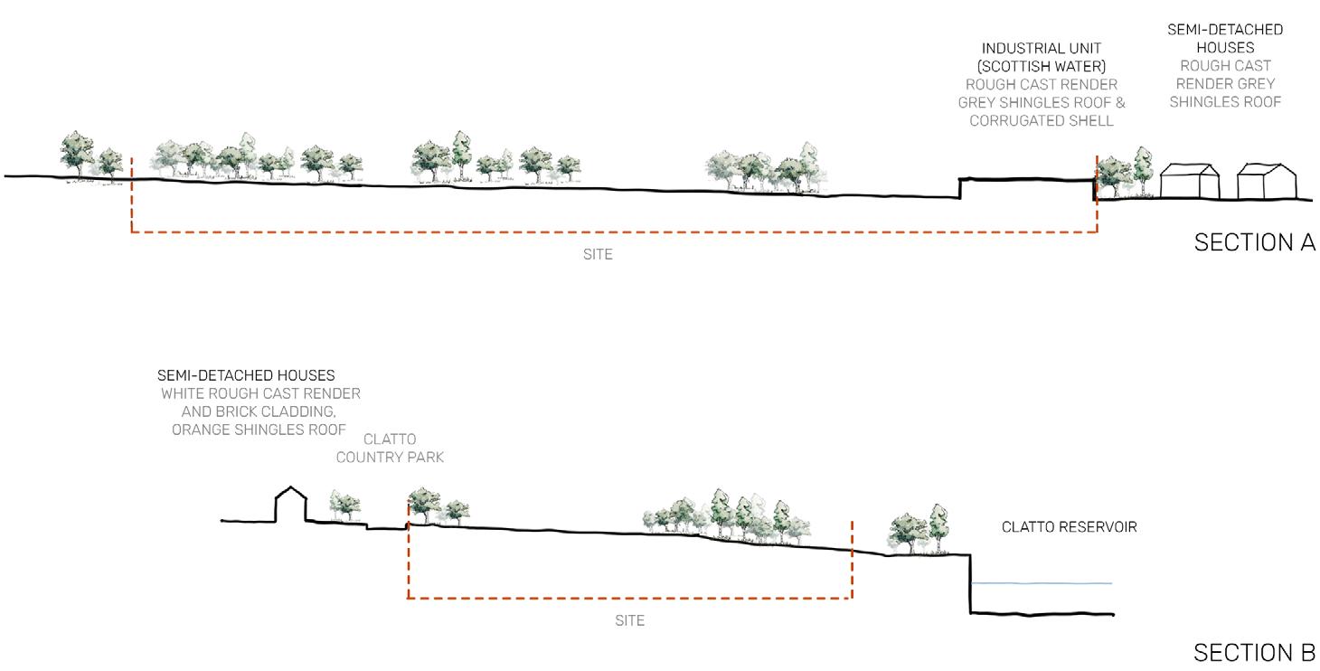
34261 m2 | 3.43 hectares
The site is located at the very north extents of the city, on the edge of the Clatto Nature park. The location means that the site is fairly disconnected from the city, however, when designing for ASD this could potentially play to its strengths. Residents of the site would most likely own cars, so this must be factored into design, however this is not necessarily relevant to carers as there is a strong public transport connection in the local area. In terms of amenities the site is isolated, there are no shops close by, but this creates the opportunity to incorporate social enterprise element into the scheme.
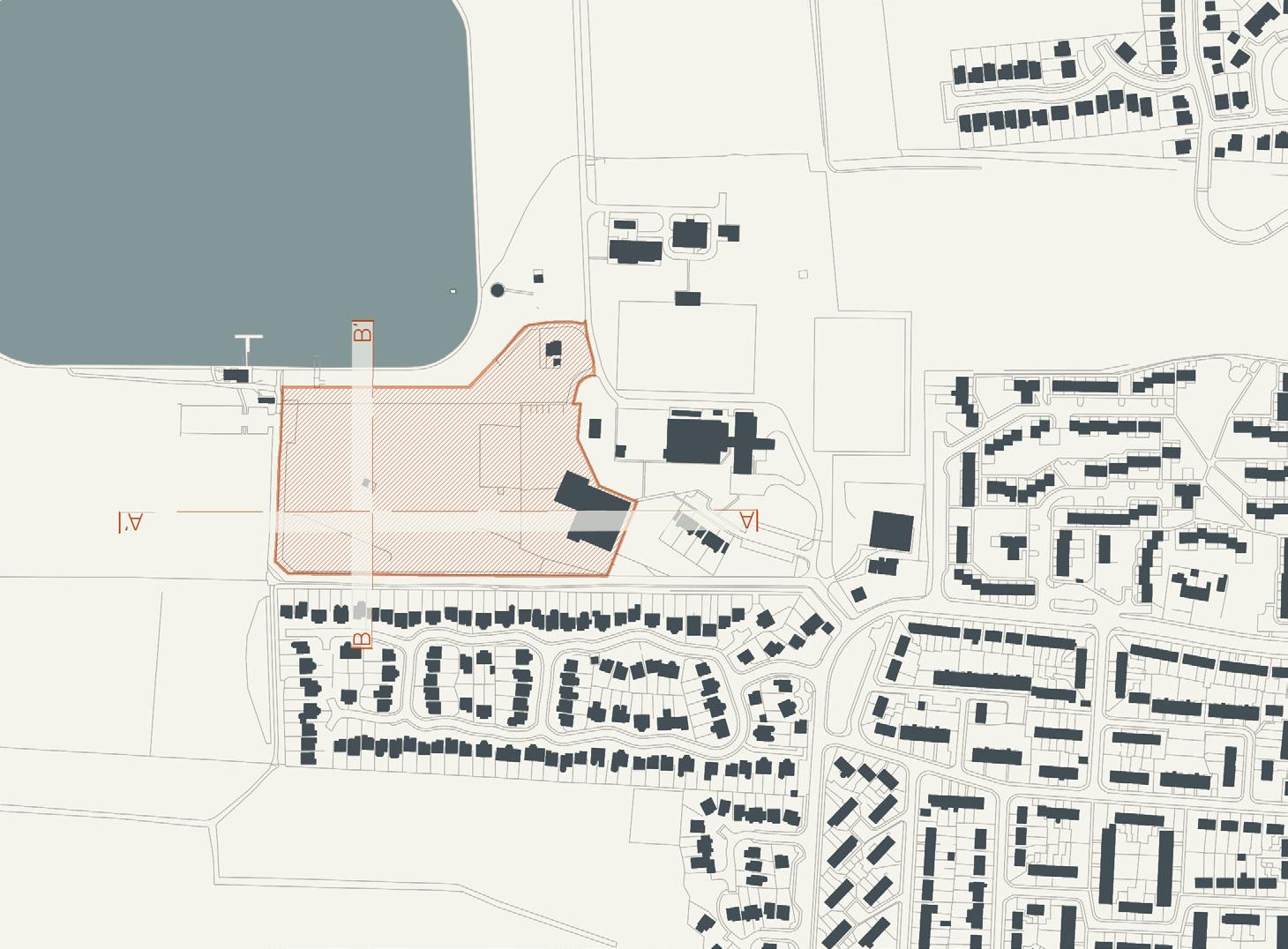
The size of the site means that a range of densities can be applied. Where the scheme is ASD focused, the density should remain low and spread out, however the rest of the site could be used for regular, higher density accommodation. The sites location on the edge of the nature park provides another opportunity for work for the residents as well as giving them an abundance of local green space to enjoy.
potential future
DUNDEE
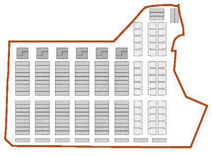
LOW DENSITY
potential 120-308 units

158 units shown on site (2-3 storey)
HISTORY SECTIONS
MEDIUM DENSITY
potential 308-857 units
390 units shown on site (1-4 storey)

HIGH DENSITY
potential 857-1200+ units
857 units shown on site (5-8 storey)

DENSITY
103 | 104
P P P P P P P P P P PP P P P P P P P potential future DUNDEE

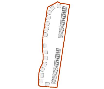
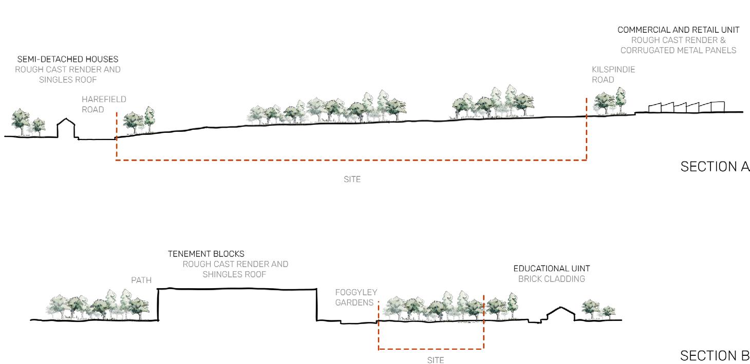
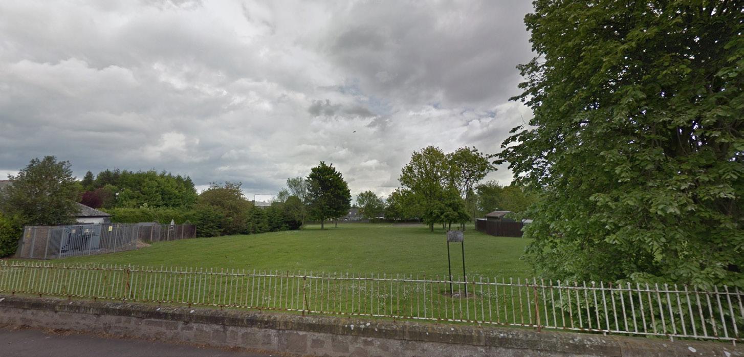
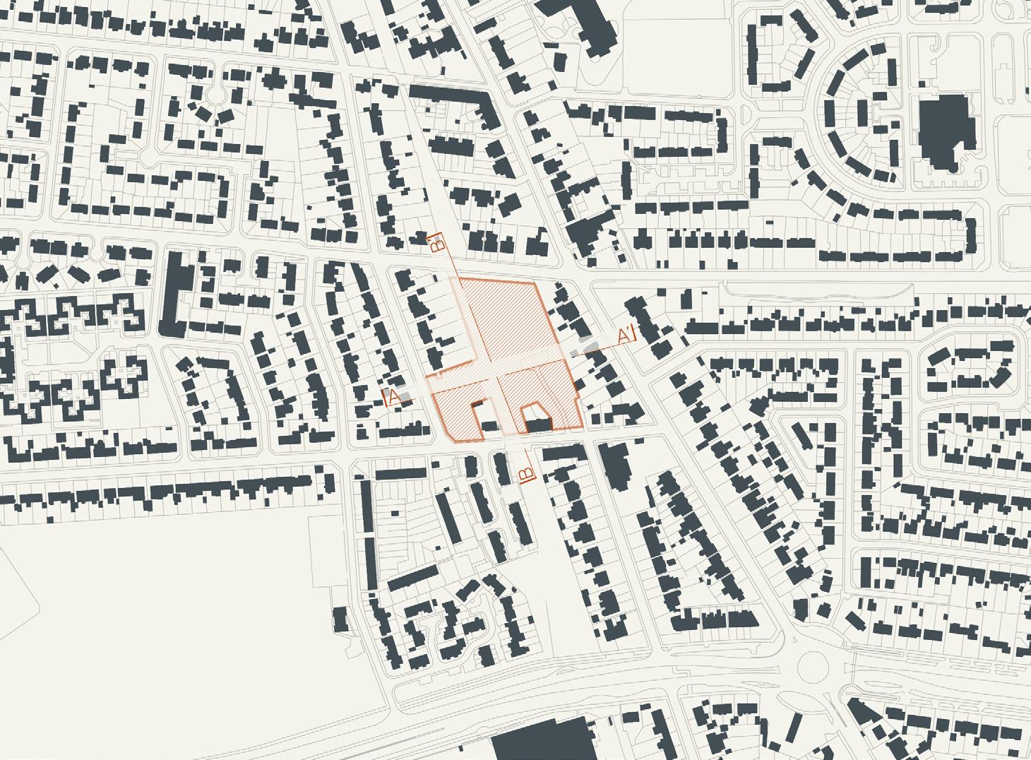
Foggyley Gardens | H07 [40 units] 105 | 106
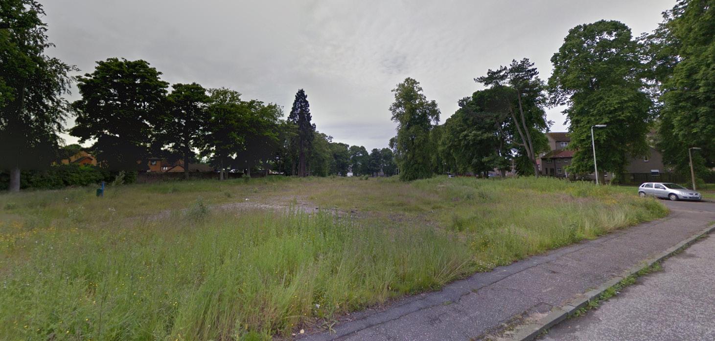
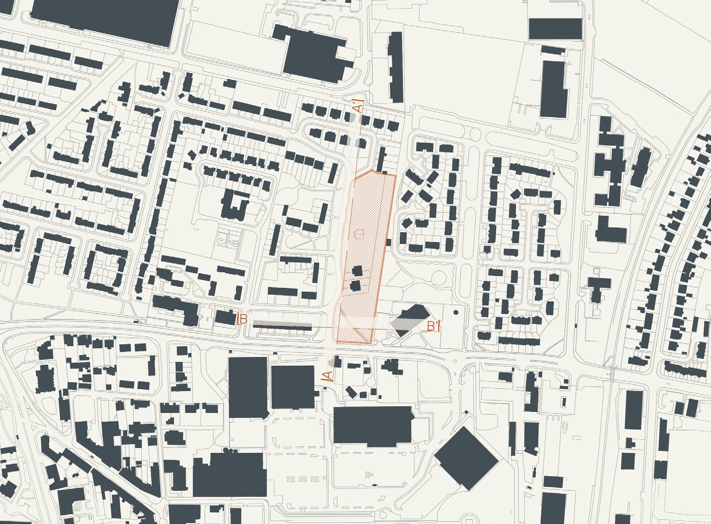
11783 m2 | 1.18 hectares
With the proximity of a nursery school and a small retail park, this site provides many opportunities to integrate people with ASD into everyday life. Through attaining jobs and being around young people, the idea of autism can be normalised. The site is close to the centre of the city which means it has strong public transport links and an array of local amenities, however it suffers when looking at green space as travel will be required for outdoor activities. To the south east, there is a depot for garbage trucks which could potentially create a lot of noise and pollution and make it an undesirable location for people with ASD. This size and shape of the site makes it act as a gateway between the industrial area to the north and the commercial area to the south, while to the east and west it is open to the community.
The site should probably focus on low density due to its size and context, meaning there is more opportunity to focus on ASD specific design. potential future
DUNDEE
LOW DENSITY
potential 120-308 units
158 units shown on site (2-3 storey)
HISTORY
SECTIONS


MEDIUM DENSITY

potential 308-857 units
390 units shown on site (1-4 storey)
HIGH DENSITY
potential 857-1200+ units
857 units shown on site (5-8 storey)
DENSITY
107 | 108
P P P P P P P P P P PP P P P potential future DUNDEE

Former Downfield PS, East School Road | H11 [25 units] 109 | 110
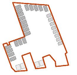
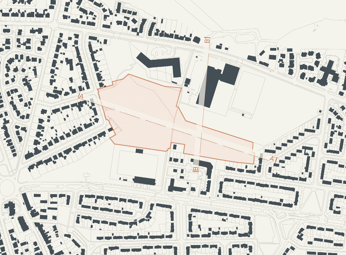
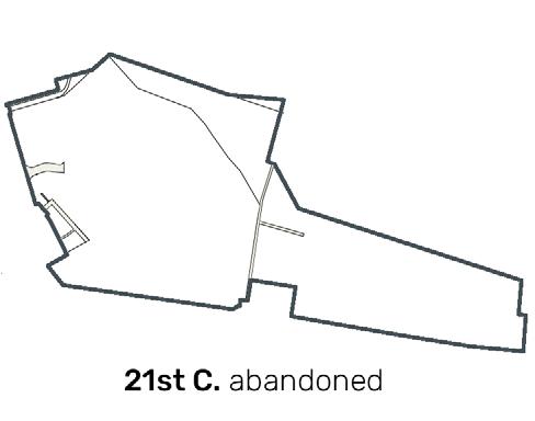
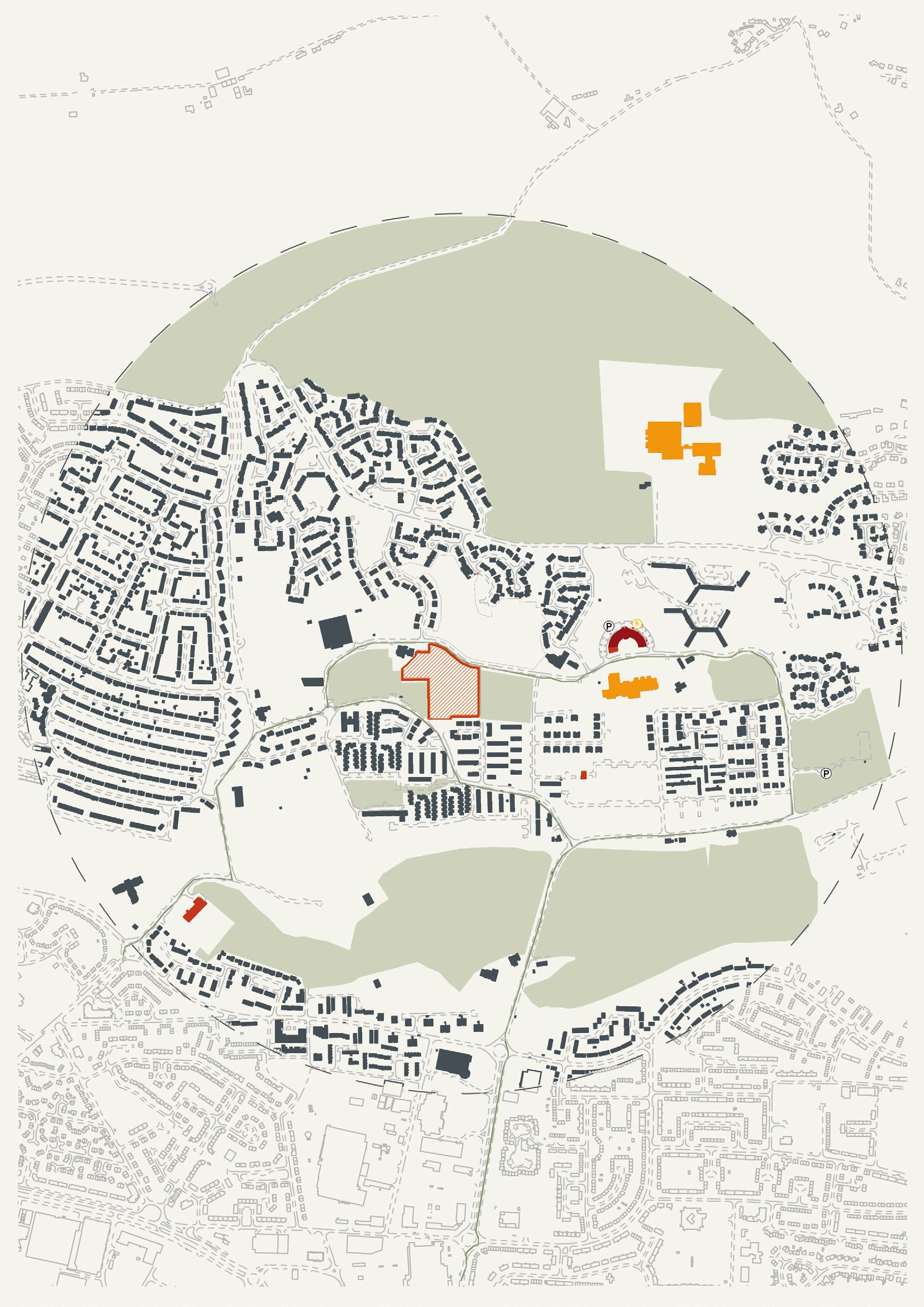
12391 m2 | 1.24 hectares
The sites proximity to the main road north out of Dundee gives it a strong connection to the city however this could also create a lot of noise and pollution making it an undesirable location for individuals with ASD. There is an abundance of amenities in the within a 10-minute walk, including Kingsway retail park to the south and an Asda superstore to the west, and a good public transport connection with the Strathmartine road. Due to the site’s location close to the Kingsway, there is a lack of local green space, meaning travel would be necessary for outdoor activities.
The size of the site and local context leans towards sticking to low density and being mainly focused on the ASD facility.
future
DUNDEE
potential
LOW DENSITY
potential 43-111 units
45 units shown on site (2-3 storey)
HISTORY
SECTIONS


MEDIUM DENSITY
potential 111-310 units
132 units shown on site (1-6 storey)

HIGH DENSITY
potential 310-434+ units
320 units shown on site (1-8 storey)

DENSITY
111 | 112
P P P P P PP P P potential future DUNDEE


Former Baldragon Academy, Burn Street | H37 [70 units] 113 | 114
12391 m2 | 1.24 hectares
The location of the site right against the new Baldragon academy could cause some problems in terms of autistic residents due to the excessive noise and overcrowding at certain times of the day. The site is well connected in terms of amenities and public transport, with an Asda superstore within in a 10-minute walk and bus routes within a 2-minute walk. The proximity to the city’s green belt also provides the opportunity for outdoor activities and physical exercise.
The shape of the site creates two distinct areas which will likely inform the design. This allows for a split in density from spread out 2 storey dwellings in the ASD specific area, to a multi storey flat block typology for standard housing.
future
potential
DUNDEE
LOW DENSITY
potential 174-448units

177 units shown on site (2-3 storey)
HISTORY
SECTIONS


MEDIUM DENSITY
potential 448-1245 units
457 units shown on site (1-6 storey)


HIGH DENSITY
potential 1245-1743+ units
1312 units shown on site (8 storey)
DENSITY
115 | 116

potential
DUNDEE
future
East of the City
Whitfield is located in the north east of Dundee outside of the Kingsway ring road. The construction of Whitfield started in the 1960’s as a means to accommodate the increasing population of Dundee. Most of the housing was low rise housing falling into the categories of Terraced houses, Semidetached houses and Semidetached bungalows, most having private gardens to the rear and a garden threshold to the streets at the front these properties are mostly made from brick with some having timber cladding or render. However, there was an extensive use of Skarne blocks most of which have been demolished, making the remaining sections isolated by green space. The houses are split between social and private at almost 60% to 40% making it a more affordable to live in however, there is a lack of shops and leisure facilities as there is only a golf course, BMX course and athletics club with in the communities reach and the closest shop is outside the community The benefits of the Whitfield sites are that they are larger in comparison to the sites available in the city centre giving more possibilities in type of development. The noise levels are low as well as the area only get morning and evening traffic limited to 20 miles an hour in most cases. Easy access to busses as they pass through most of Whitfield connecting the community to the rest of Dundee. Access to open green space and the countryside is within walking distance of all sites although there are plans to develop some of these areas into housing. Based on the Whitfield development plan the local council is looking to create new housing with the goal of moving the spilt between social and private housing closer to 50/50 while also focusing on affordability and sustainability.
117 | 118
potential future DUNDEE
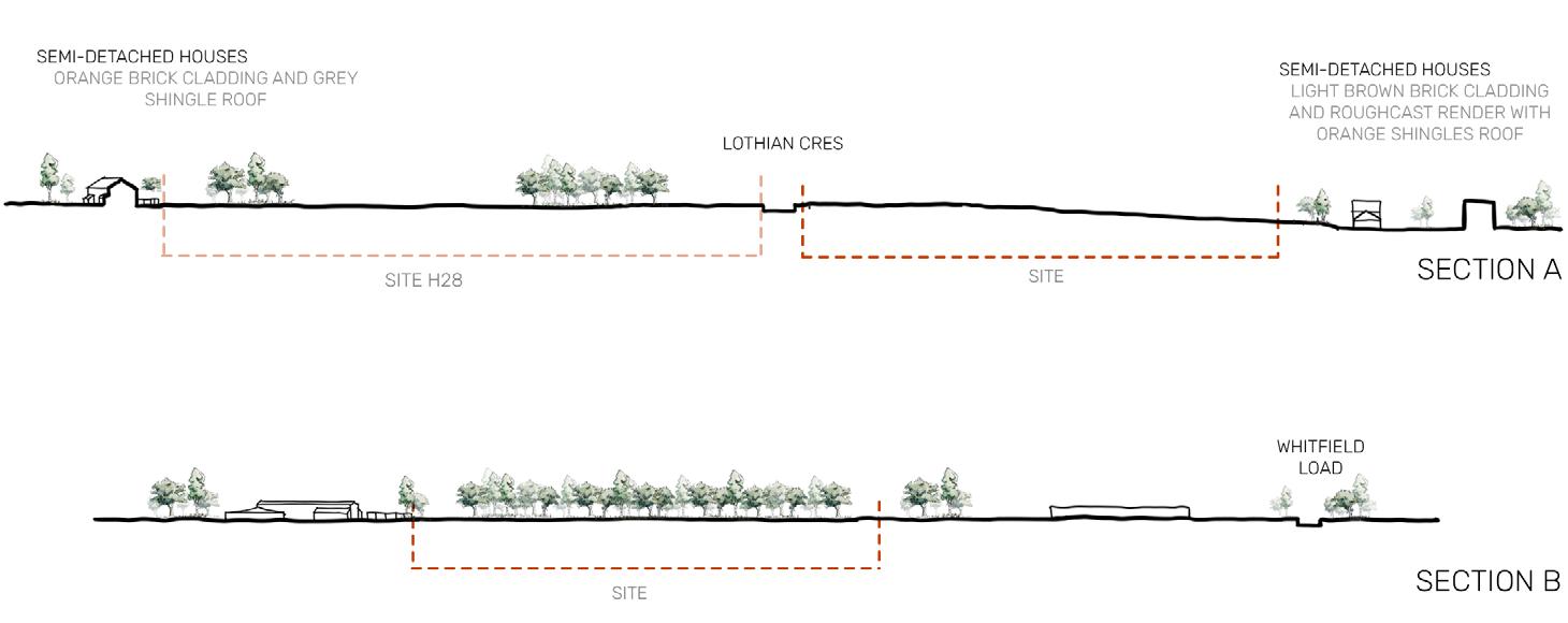
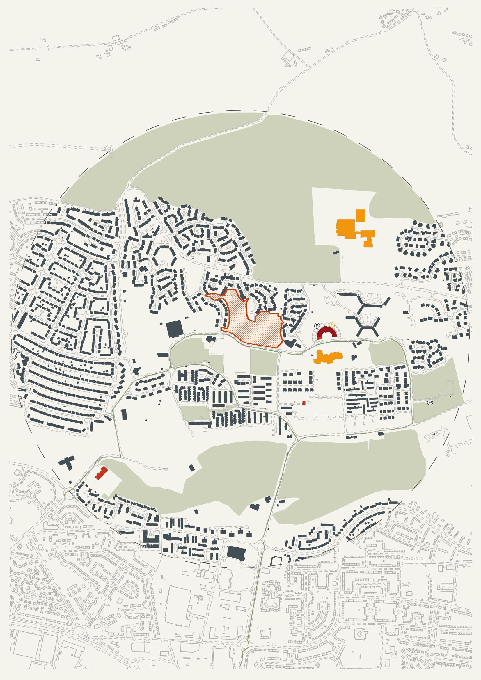
Former Whitfield PS, Whitfield Drive | H27 [25 units] 119 | 120
With close proximity to the primary school, help centre and local shops this site provides many opportunities to integrate people with ASD into everyday life. If autistic people were in the school this would allow autism to be normalised at an early age reducing the stigma. This site also has good transport links to the city which links the site to the wider community. As this site is not city centre there is ample green space this allows nature to surround the site.
The site should probably focus on low density due to its size and context, meaning there is more opportunity to focus on ASD specific design that can connect to the community.
potential
future
DUNDEE
LOW DENSITY

potential 58-173 units
58 units shown on site (2-3 storey)
MEDIUM DENSITY

potential 173-480 units 192 units shown on site (3-6 storey)
HIGH DENSITY
potential 480-672+ units

576 units shown on site (3-5 storey)
19th C 20th C 21st C
H27 H28
19th C
DENSITY
121 | 122
HISTORY SECTIONS
potential future DUNDEE

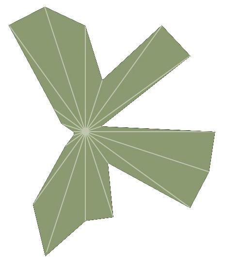
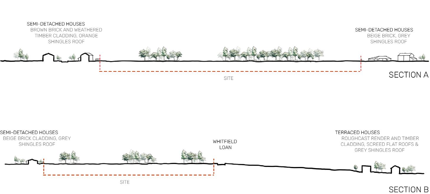
Tranent Grove | H28 [70 units] 123 | 124
With close proximity to the primary school, help centre and local shops this site provides many opportunities to integrate people with ASD into everyday life. If autistic people were in the school this would allow autism to be normalised at an early age reducing the stigma. This site also has good transport links to the city which links the site to the wider community. As this site is not city centre there is ample green space this allows nature to surround the site.
The site should probably focus on low density due to its size and context, meaning there is more opportunity to focus on ASD specific design that can connect to the community.

potential
future
DUNDEE
LOW DENSITY

potential 113-338 units
113 units shown on site (2-3 storey)
MEDIUM DENSITY
potential 338-938 units


375 units shown on site (3-6 storey)
HIGH DENSITY
potential 938-1313+ units
1125 units shown on site (3-5 storey)
H28 H31
C 20th C 21st C
19th C 20th C 21st C 19th C 20th C 21st C 19th
DENSITY
125 | 126
HISTORY SECTIONS

potential future DUNDEE

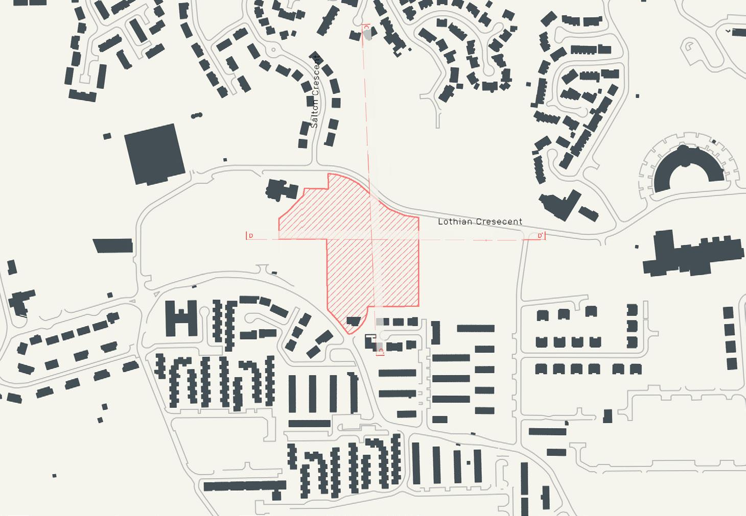
Bowling Green East, Lothian Crescent | H31 [30 units] 127 | 128
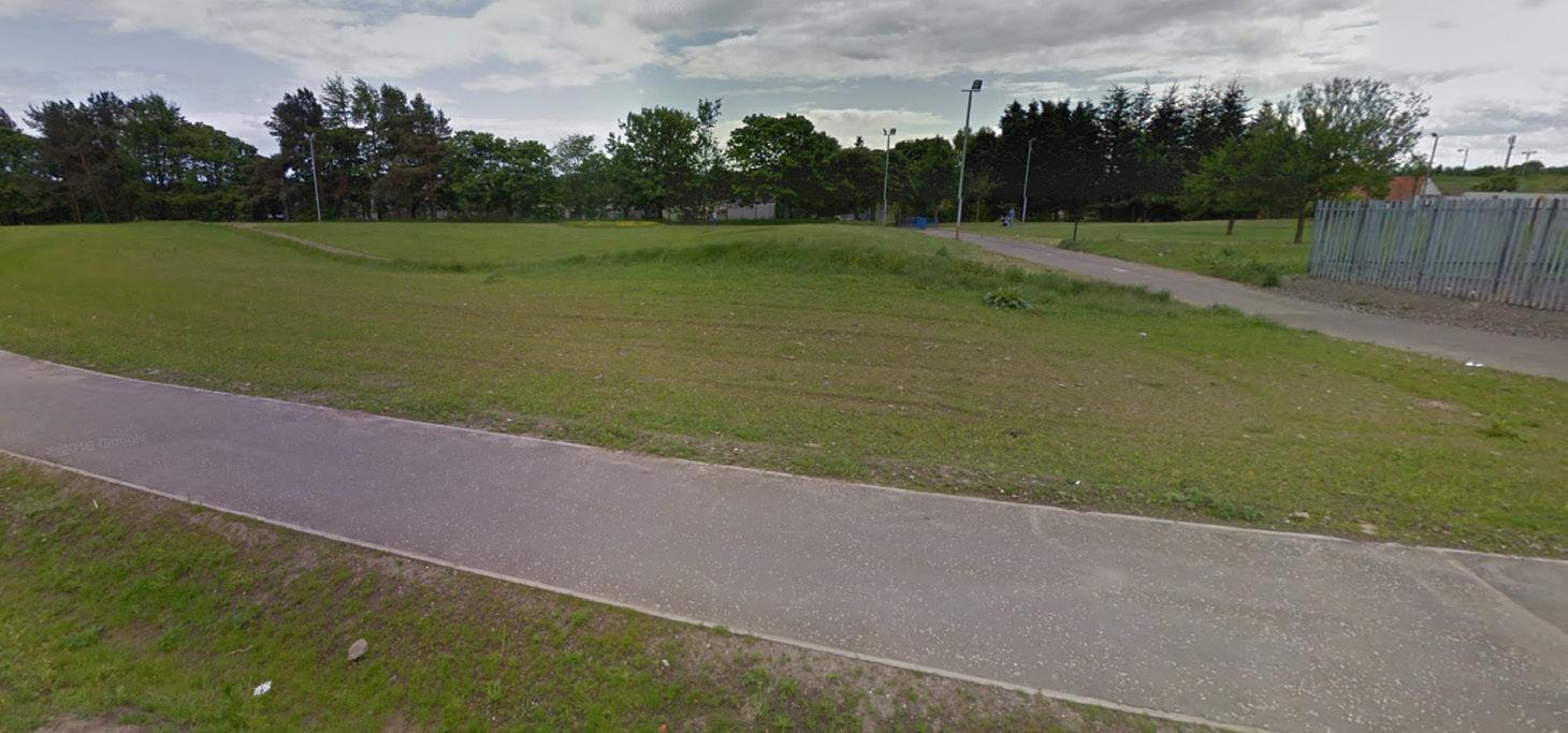
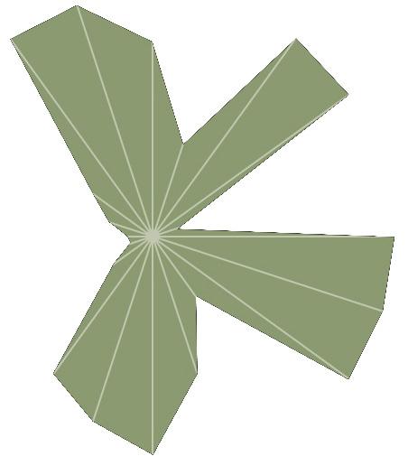
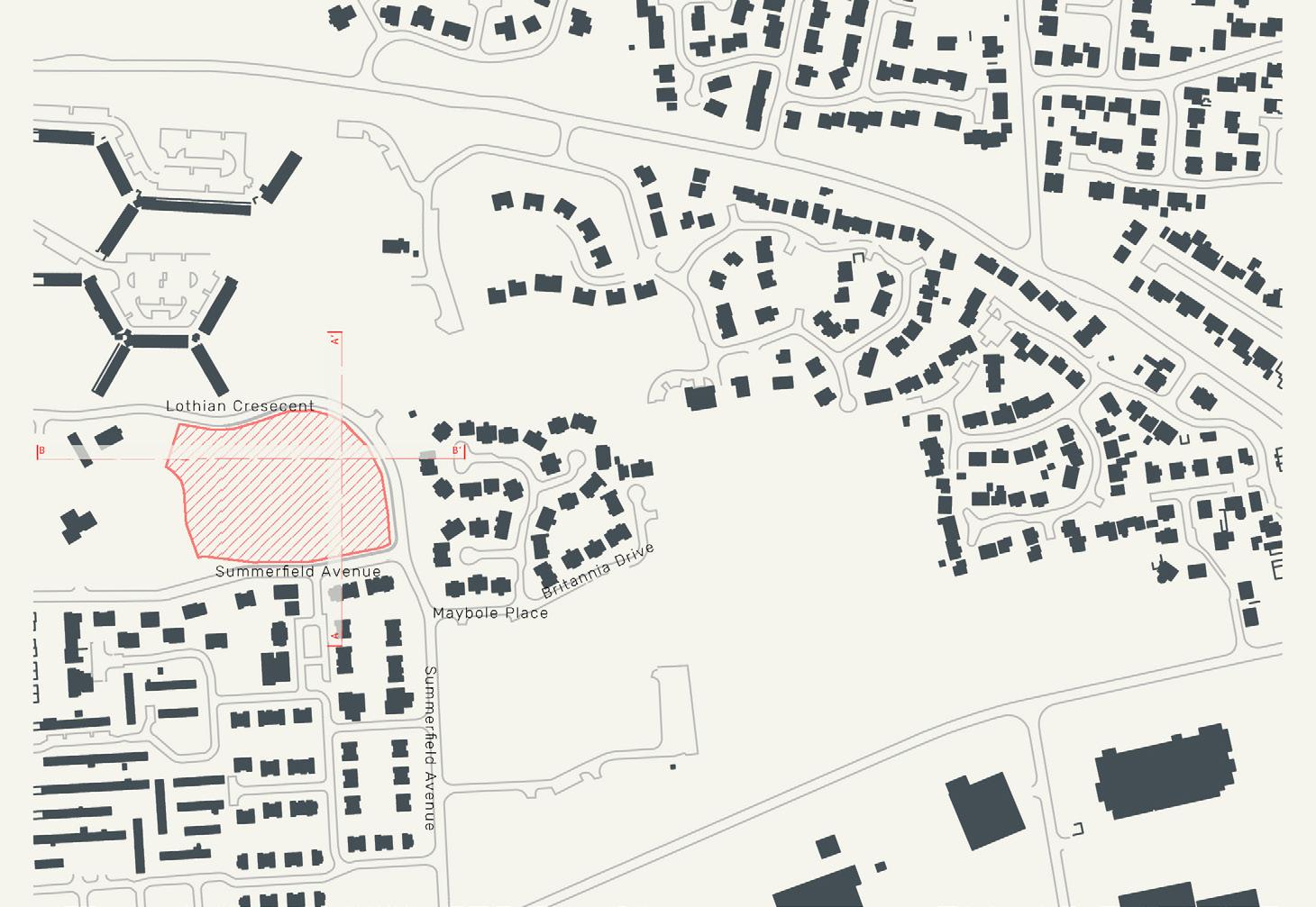
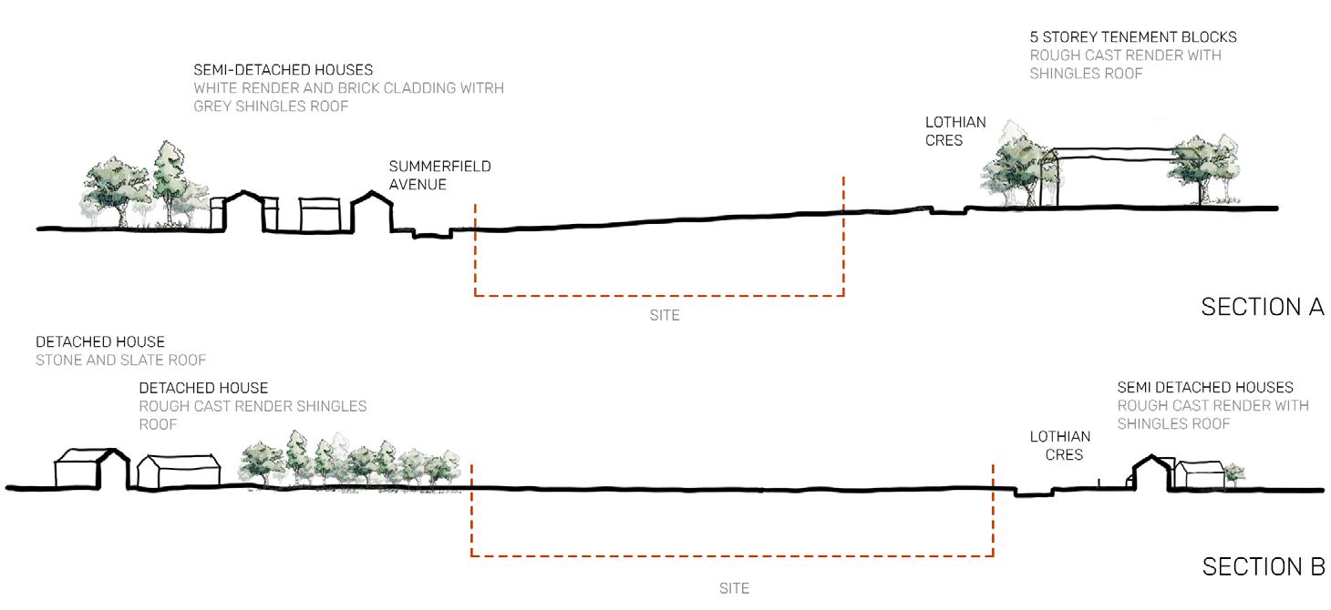
With close proximity to the primary school, the crescent centre with the doctors, library, café, and community centre this site provides many opportunities to integrate people with ASD into everyday life. If the autistic people were in the school, this would allow autism to be normalised at an early age reducing the stigma. This site also has good transport links to the city which links the site to the wider community. As this site is not city centre there is ample green space this allows nature to surround the site.
The site should probably focus on low density due to its size and context, meaning there is more opportunity to focus on ASD specific design that can connect to the community and also have green space left around or within the site.
potential future
DUNDEE
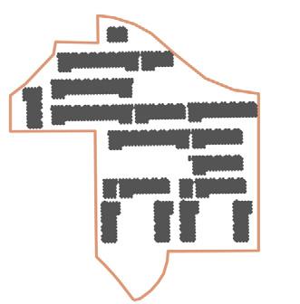
LOW DENSITY

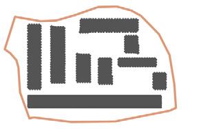
potential 40-120 units
40 units shown on site (2-3 storey)
MEDIUM DENSITY

potential 120-333 units
133 units shown on site (3-6 storey)
HIGH DENSITY
potential 333-466+ units

399 units shown on site (3-5 storey)
19th C 20th C 21st C
19th C 20th C 21st C
H28 H33
19th C 20th C 21st C
H31
DENSITY
129 | 130
HISTORY SECTIONS

potential future DUNDEE

[100
131 | 132
Kellyfield, Drumgeith Road | H33
units]
With close proximity to the primary school, the crescent centre with the doctors, library, café, and community centre this site provides many opportunities to integrate people with ASD into everyday life. If the autistic people were in the school, this would allow autism to be normalised at an early age reducing the stigma. This site also has good transport links to the city which links the site to the wider community. As this site is not city centre there is ample green space this allows nature to surround the site.
The site should probably focus on low density due to its size and context, meaning there is more opportunity to focus on ASD specific design that can connect to the community and also have green space left around or within the site.
potential future

DUNDEE
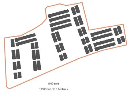
LOW DENSITY

potential 303-909 units

303 units shown on site (2-3 storey)

HISTORY
MEDIUM DENSITY
potential 909-2525 units
1010 units shown on site (3-6 storey)
HIGH DENSITY
potential 2525-3535+ units 3030 units shown on site (3-5 storey)
19th C 20th C 21st C 19th C 20th C 21st C
SECTIONS

H33
DENSITY
133 | 134
potential
DUNDEE
future
(centre) of the City
Based on the Dundee City Council development plan, the boundary of the inner-city sites includes the areas of: West end, Lochee, Coldside, and Maryfield. Each area has slightly differing characteristics but the most notable would be the Maryfield area which includes the city centre itself. Dundee city centre is small in comparison to other Scottish cities such as Glasgow and Edinburgh.
The majority of the buildings within the inner-city area were constructed post nineteenth century. With the tenement block being the most prevalent typology. Many of Dundee’s iconic city centre buildings were demolished in the 1960’s, including the Victoria Arch. Now the city centre is primarily used for shopping and commerce. Along with demolition so too came construction. Large high rise, high density, affordable housing blocks were built to accommodate the rising population. This can be seen in Lochee and Hilltown.
With all inner-city sites having a strong connection to the city centre public transport links are strong. With the train station at the waterfront, access for carers travelling from out with the city is easy. From the train station Public transport to each of the sites is provided via buses running from the city centre to all areas such as Perth road, Lochee high street, the Hilltown and Stobswell. Each site is no more than a two-minute walk to the closest bus stop. As some of the sites are smaller, they will not be able to provide as much on-site parking as some of the more rural sites, therefore they will be more reliant on the public transport network.
Other amenities are also easily reached due to the sites being located in urban centres. Supermarkets and grocers are easily accessible. Each area has medical centres, and all areas are linked to the city’s main hospital via the public transport system. Primary and secondary education facilities are located within all areas. Scottish Autism’s Tayside facility is located on Lindsey street in the city centre.
The four sites chosen within the Centre of Dundee all explore the idea of re-purposing disused land. Although the sites vary in location and size, all share a commonality of proximity to urban centres highlighted within the Dundee Development Plan. This provides each site with immediate access to amenities such as transport, medical care, education, food, and retail. The contiguity of all sites to already established urban communities allows the opportunity to increase social engagement and enterprise and challenge the social stigma’s that sometimes surround ASD.
South
135 | 136

potential future DUNDEE


Former Lochee PS, South Road | H05 [30 units] 137 | 138
16570 m2 | 1.67 hectares
The site’s boundaries are defined by two streets to the East and the West of the site, and a main road to the North of it, which allows the possibility of vehicular access from 3 sides. While a pedestrian path that runs to the North of the site guarantees a quieter corner. The North of the site is also currently sheltered by a wall of tall pine trees providing it privacy from nearby over-looking houses that sit up to 5 meters higher than the site level. These houses that surround the site are mainly concrete semi-detached and terrace dwellings. The path connects the site and the adjoining houses to several green space. The site being on a slight slop itself has potential views of neighborhood houses.

For this site, high density alone would simply not work. The height and lack of space between buildings would not allow for pleasant external spaces to be created which goes against the needs for people with ASD. Low density is almost allowing too much space on the site so even though that that would allow for alot of green space they would almost be too large to be inviting. A combination of low an medium appear to be the best option allowing for smaller pockets of area between spaces (courtyards) to be created along with the potential for a larger public building if required.
future
DUNDEE
potential
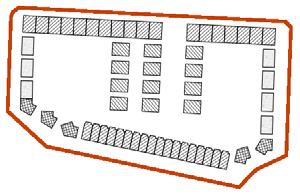
LOW DENSITY
potential 58-150 units
60 units shown on site (2-3 storey)
HISTORY
SECTIONS


MEDIUM DENSITY
potential 150-417 units
242 units shown on site (3-6 storey)
HIGH DENSITY
potential 417-584+ units
388 units shown on site (3-5 storey)

DENSITY
139 | 140
potential
DUNDEE
future


Queen Victoria Works | H13 [50 units] 141 | 142
12453 m2 | 1.25 hectares
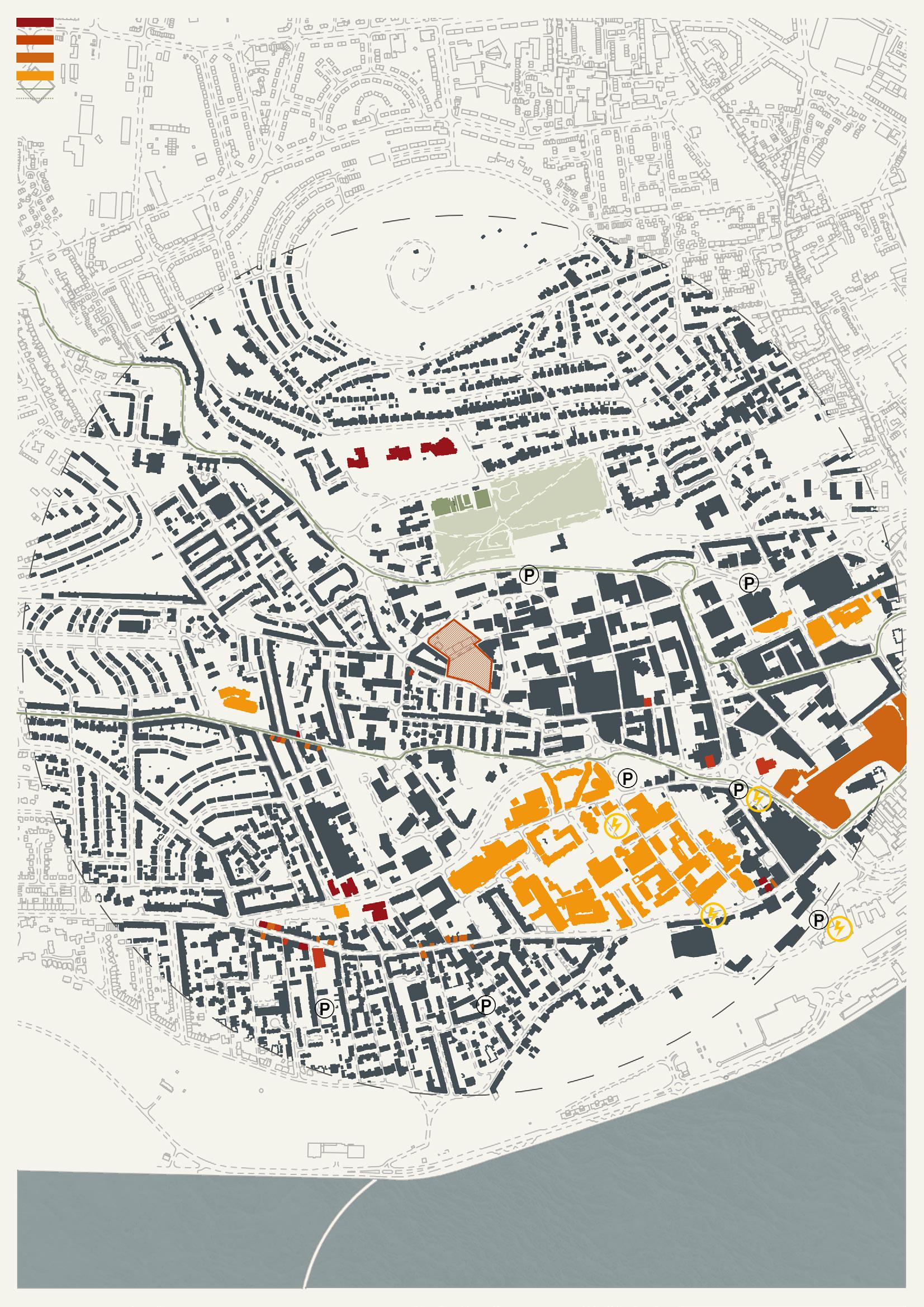
This site being a former mill is situated in an industrial area of Dundee. Sitting along Brook’s street, a road connecting series of main roads, the traffic here is contributed by large vehicles moving to/from their industrial units. The site is currently left with remains of abandoned structure and overgrown trees. It is neighbored by two converted Mills while buildings to the south across the street are residential houses popular amongst students. The council has plans to change the area from being solely industrial by introducing modern live-work spaces, studios and other creative spaces.
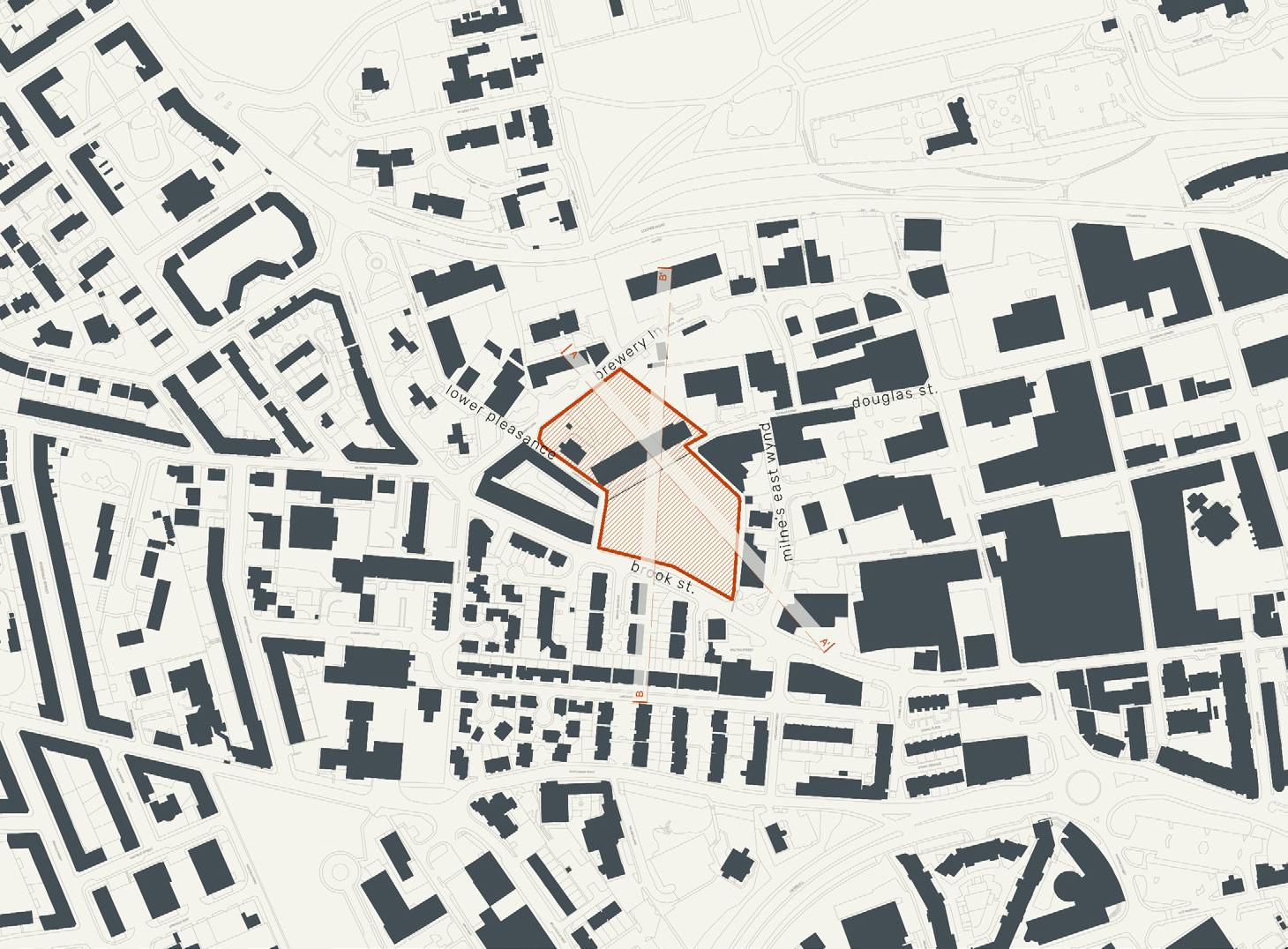
The nature of this site may provide the opportunity to be divided into two quite naturally. This idea is started to form in the low density diagram where there may be a more public aspect to the south of the site with allotments and cafes with the north becoming a more secluded and private area with accomodation kept to under 4 storeys, creating small streets similar to the medium density diagram. High density it could be argued that it could work due to the surrounding buildings being taller, howver again it might be preferred that there is a mixture all 3 densities each providing a different level of security and different types of residential units.
potential future
DUNDEE
LOW DENSITY
potential 43-112 units
61 units shown on site (2-3 storey)
HISTORY
SECTIONS

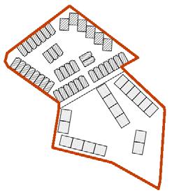

MEDIUM DENSITY
potential 112-312 units
121 units shown on site (2-3 storey)

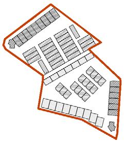
HIGH DENSITY
potential 312-437+ units
332 units shown on site (4-6 storey)
DENSITY
143 | 144
DUNDEE
potential future


Railyards | H14 [110 units] 145 | 146
19816 m2 | 1.98 hectares
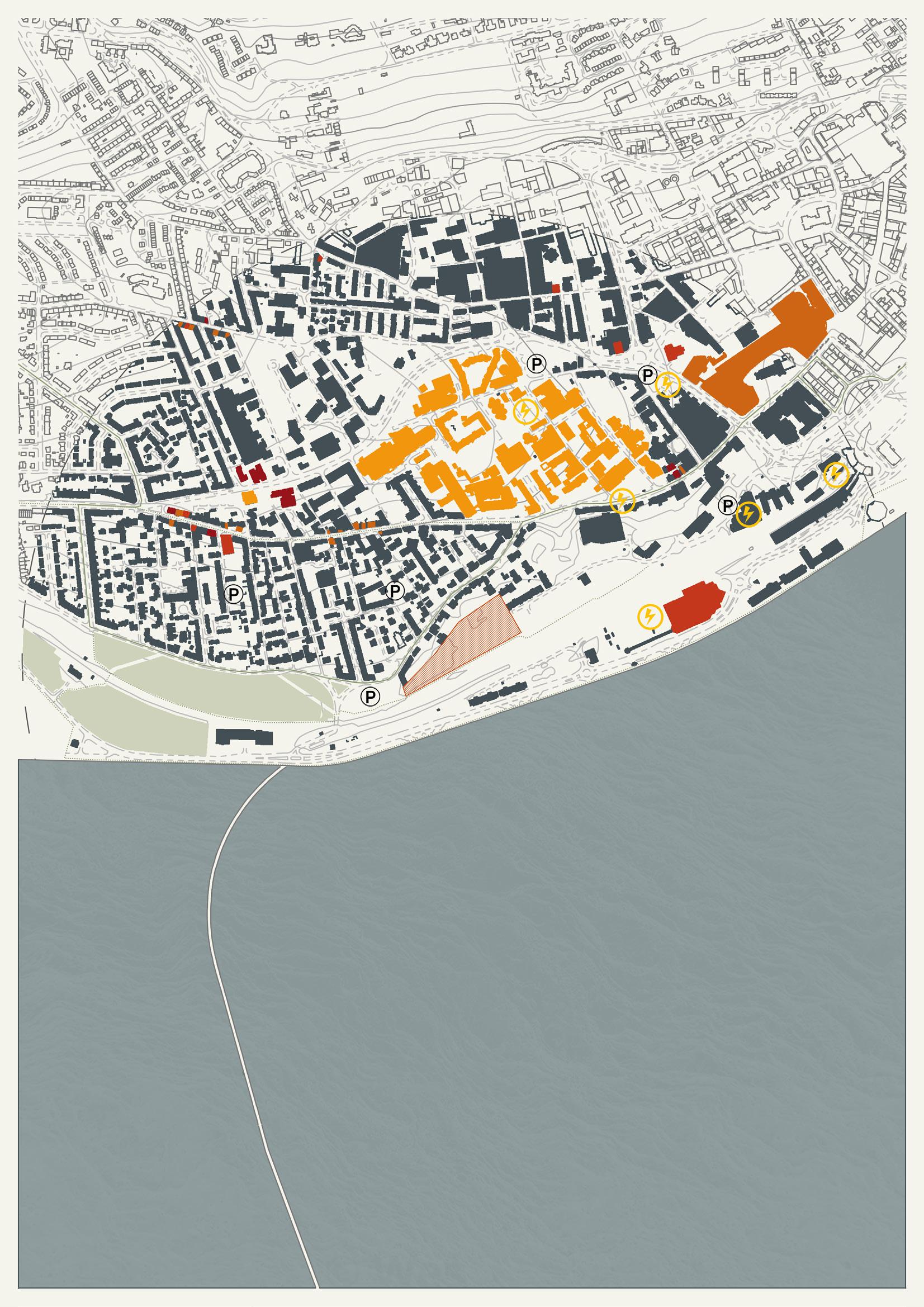
This site is a fairly open area having existing buildings only to the North of the site. It currently has one direct vehicle access lane from the West, which is built to cater for Seabreas University Halls. On the North of the site are the backyards of terrace houses while on the on the south, runs a cycling/pedestrian lane. The lane connects the site and to Magdalen green park. Although the site doesn’t have any adjoining roads, the train track runs side by side to the site. Majority of neighboring houses are Victorian Semidetached houses, terrace houses and tenement blocks.
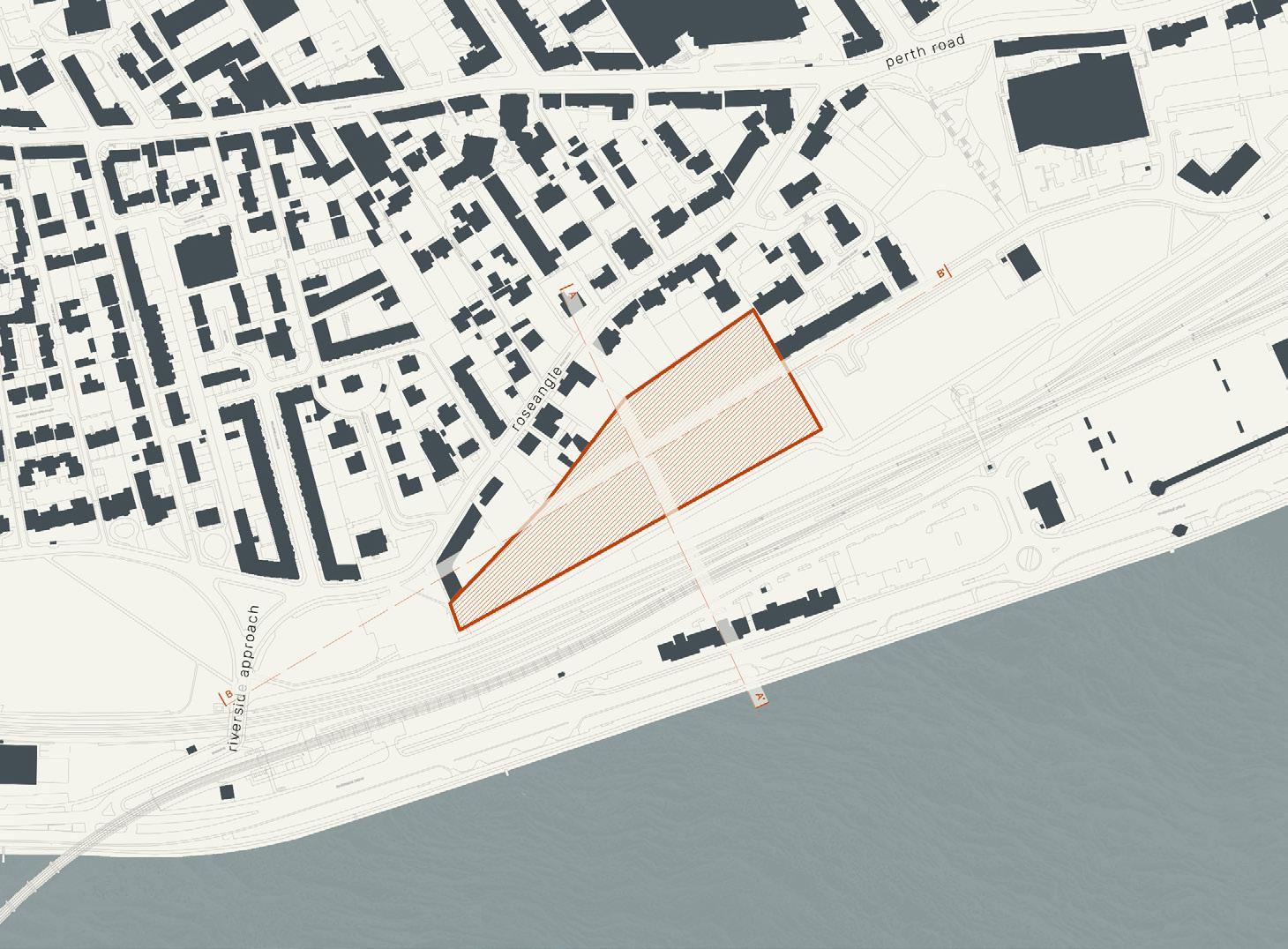
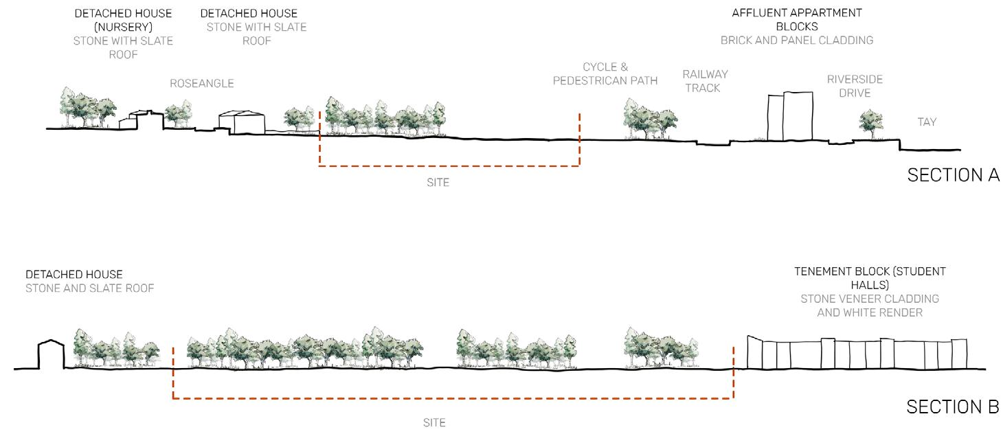
The relationship of this site to the River Tay is something to be noted at this point. The ihgh ensity units may not be suitable due to interfearing with surrounding accomodation’s views on the street to the north. Low density demonstrates how half the site can be allowed for accomodation, again creating streets, with the opportunity to have a more organic situation the west. The west side could be used for garden/allotment, or events such as markets where the residents could have easy access to this area when they want to but it would not be forced.
future
potential
DUNDEE
LOW DENSITY
potential 69-178 units
93 units shown on site (2-3 storey)

HISTORY
SECTIONS
MEDIUM DENSITY

potential 178-495 units
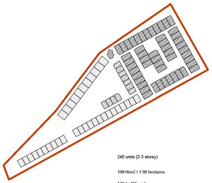

240 units shown on site (2-6 storey)
HIGH DENSITY
potential 495-693+ units
520 units shown on site (4-5 storey)
DENSITY
147 | 148

potential future DUNDEE
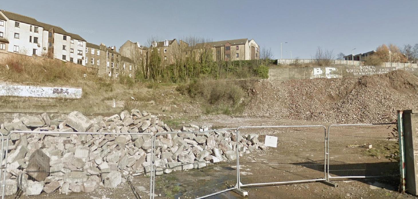

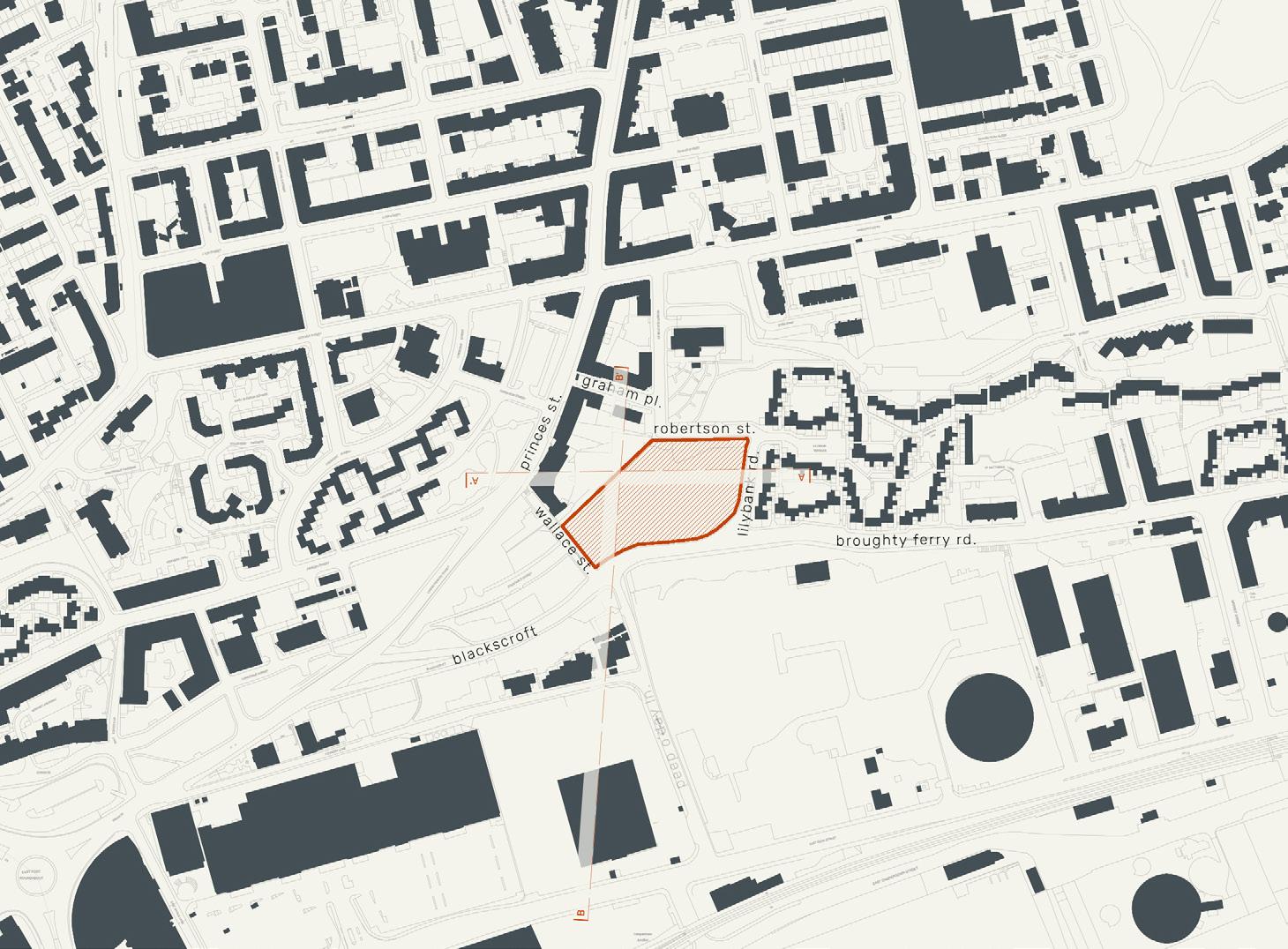
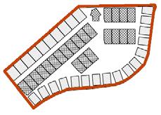
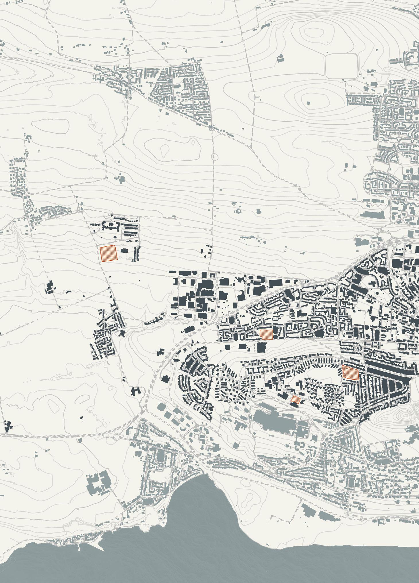
Princes Street | north east of H18 [20 units] 149 | 150
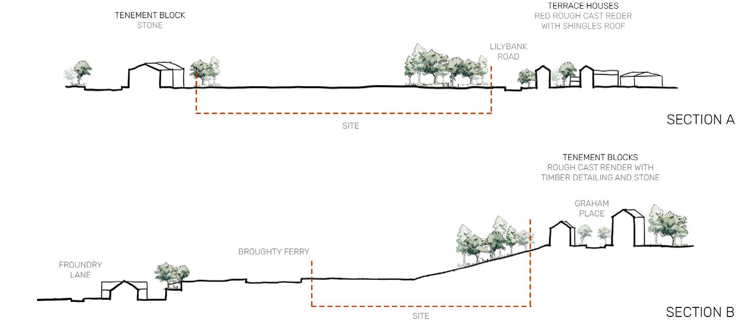
The site is situated between two major routes: Princess Street and Broughty Ferry Road with another street running North of the site. It previously houses a factory building which was recently demolished. The site sits on a slope, descending 23 meters from adjoining tenement blocks to the East of the site. To the west and the east of the site is a housing estate of terraced houses. Right to the North of the site is an area with allotments.
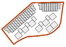
With this site being located between roads on all sides and the south facing slope being a prominant feature would allow for a higher density by using terraced housing. The housing to the norths views would not be effected as easily due to the sudden change in level. The low denisty would not provide enough privacy/protection from surrounding element being overlooking nieghbours and traffic noise so the sight does almost lend itself to being bedtween medium and high density. If it was to be mostly medium then this would also provide larger (but still protected) external areas for garden space.
future
7666
m2 | 0.77 hectares
DUNDEE
potential
LOW DENSITY
potential 27-63 units
42 units shown on site (2-3 storey)
HISTORY
SECTIONS


MEDIUM DENSITY
potential 63-192 units
99 units shown on site (2-6 storey)
HIGH DENSITY
potential 192-270+ units
215 units shown on site (5-6 storey)
DENSITY
151 | 152
potential future DUNDEE
West of the City
The west part of Dundee includes Charleston, Menzieshill, West End suburbs and the Western Gateway. Within the four potential sites we chose from the west area, three of them are located in or at the edge of Menzieshill and a remote one far away from urban area in Denhead of Gray.
The houses in the west of Dundee are majority private housing, and most of council housing are located in the west of Menzieshill. West part is a low-density area, which gives an opportunity for the people to have a more private life than in the city. Housing typologies here are mainly detached house and semi-detached house, which have private gardens in both front and back of the house. Council houses are more 3 to 5 storeys tenements. The Grand mansion can be found along the Perth Road, most of them were built by wealthy workers in Victorian, and their architectural style is classical, using sandstone material. For other housing typologies, they are more modern building but still indicate a relatively high standard of design, which are mostly constructed with brick, timber cladding or other modern building materials.
It gives great benefits to have a site on the west of Dundee as it has two hospitals within the neighbourhood. The most prominent hospital in that area is the Ninewells Hospital. All the chosen sites are highly accessible to Ninewells Hospital both by walking distance and public transportation. The West side also provides a great number of facilities to the communities despite being away from the city centre. The location of all the sites is fairly strategic as they are close to the neighbouring amenities such as food shops and retails.
Based on the council plans for the west part, we are aware that the government has desire to provide high quality medical services as well as co-located community facilities within Menzieshill. And for the Western Gateway they developed a high quality village concept with a range of housing and supporting community facilities to provide more housing choices for city dwellers in the future.
153 | 154


potential future DUNDEE
Former Charleston PS, Dunholm Place | H01 [40 units] 155 | 156
14131 m2 | 1.41 hectares
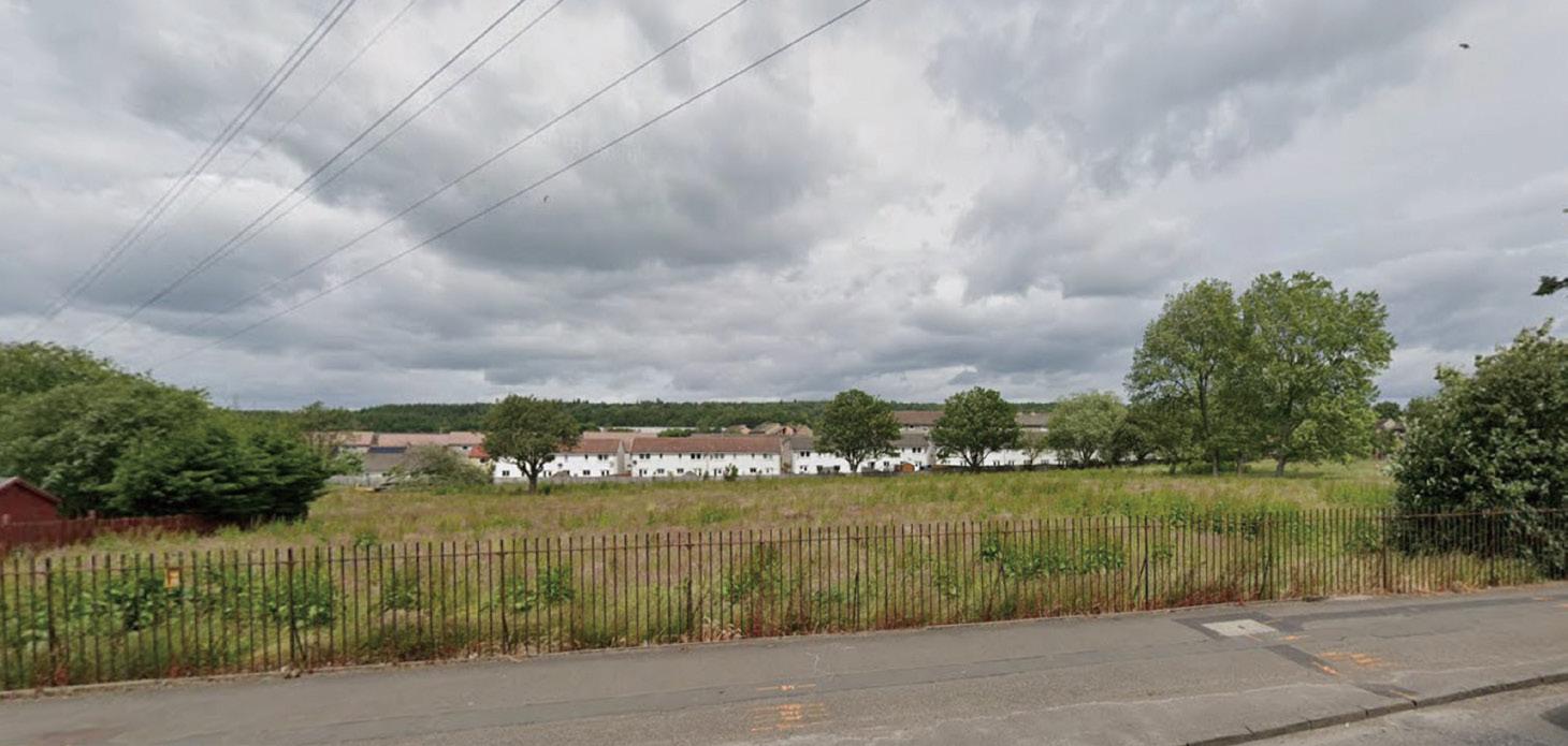
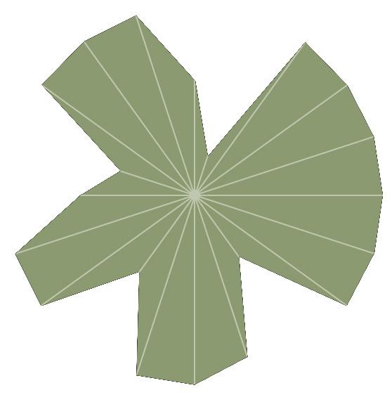
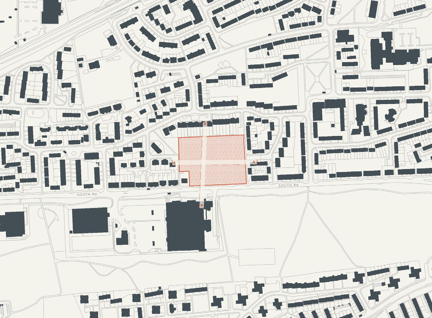
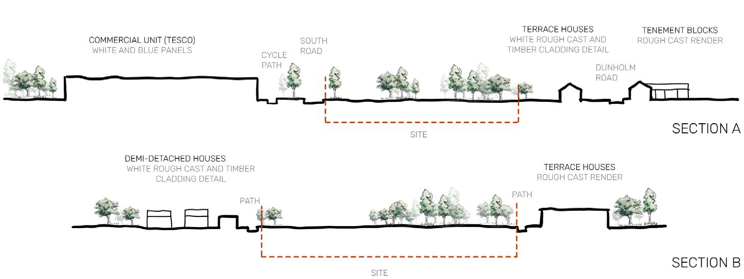
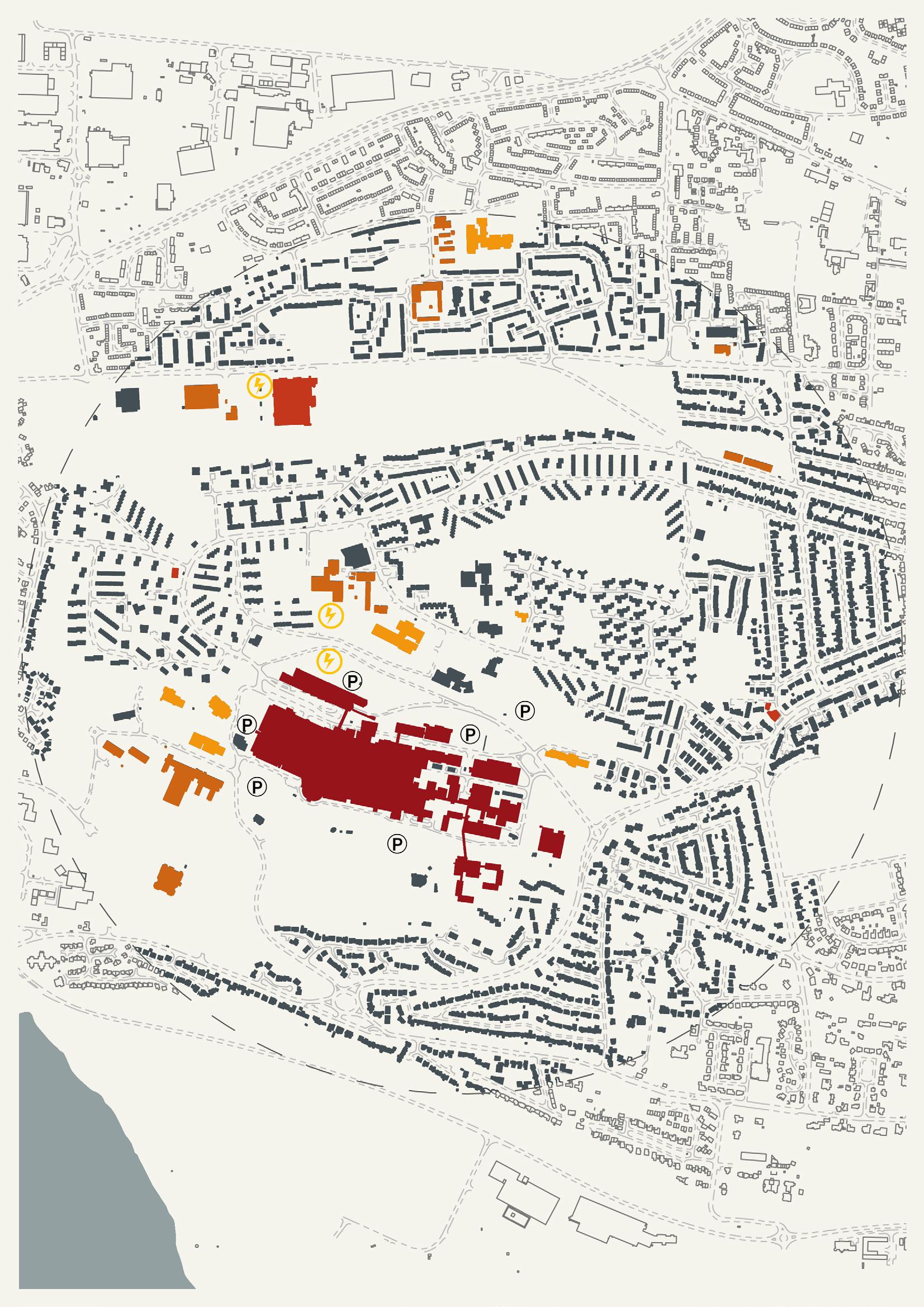
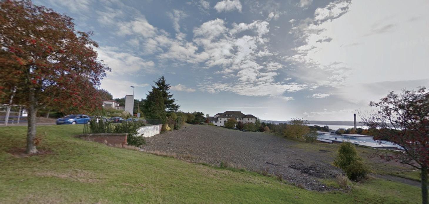
Located at the edge of Charleston, site H01 is not far from Charleston Community centre as well as recently built Menzieshill community centre.The location is really convenient for the carers as the essential facilities are on walking distance and can be reached by public transport. There is just a TESCO immediate across the south road. The site is surrounded by private gardens of houses on three sides and is just facing the South Road Park and is accessible by public transport with several bus stations within a walking distance.
The site itself is featured by sufficient and quit neat boundary of land area, which can be accessed through one main road on the south side and three pedestrian paths on other three sides. Also the site has great possibility to engage in its neighbourhood activities as it is in a low dense community area. Noise coming from the main road on the south side might lead to stimulation for austistic people. An inward facing building could be one of the strategies to handle with this issue. potential future
DUNDEE
Mid
19th
Field H01 H02 H35 H42 21st C.
21st C. Abandoned Late 20st C. Housing 20st C. Field 14131m 2 / 1 41 hectares 20701m 2 / 2 07 hectares 5523m2 / 0 55 hec ares 49 t 126 t 19 to 49 units 72 to 186 units 14131m 2 / 1 41 hectares 20701m 2 / 2 07 hec ares 5523m2 / 0 55 hecta es 126 t 352 t 49 to 137 un ts 186 to 517 un ts 14131m 2 / 1 41 hectares 20701m 2 / 2 07 hecta es 5523m2 / 0 55 hectares 352 493+ t 137 o 192+ un ts 517 to 724+ un ts 50 uni s 3 sto ey) 156 un ts(3-5 stor es) 352 un ts(5-8 sto ies) 23 t (3 y) 74 uni s 2-3 s orey) 80 un ts(2-10 sto es) 270 un s 3-10 stor es) 146 un ts(5-8 sto ies) 520 un ts 8 sto ey) 33544m 2 / 3 35hectares 117 t 301 t 33544m 2 / 3 35hec a es 301 t 837 i 33544m 2 3 35hec ares 837 1172 t 856 units(5-8 storey) 440 units(8-10 storey) 119 units(2-3 storey) 14131m 2 / 1 41 hectares 20701m 2 / 2 07 hec a es 5523m2 0 55 hectares 49 t 126 t 19 to 49 units 72 to 186 uni s 14131m 2 / 1 41 hectares 20701m 2 2 07 hectares 5523m2 / 0 55 hec a es 126 t 352 it 49 to 137 un ts 186 to 517 un ts 14131m 2 / 1 41 hectares 20701m 2 / 2 07 hec a es 5523m2 / 0 55 hecta es 352 t 493+ t 137 to 192+ un ts 517 to 724+ un ts 50 uni s 3 storey) H01 H02 H35 H42 156 un ts(3-5 sto es) 352 un ts(5-8 stories) 23 t (3 y) 74 un ts 2-3 s orey) 80 un ts 2-10 sto ies) 270 uni s 3-10 s or es) 146 un ts(5-8 stories) 520 uni s 8 sto ey) 33544m 2 / 3 35hectares 117 t 301 t 33544m 2 3 35hectares 301 837 33544m 2 / 3 35hectares 837 1172 it 856 units(5-8 storey) 440 units(8-10 storey) 119 units(2-3 storey) 14131m 2 1 41 hectares 20701m 2 / 2 07 hectares 5523m2 / 0 55 hectares 49 126 t 19 o 49 un ts 72 to 186 un ts 14131m 2 / 1 41 hec ares 20701m 2 / 2 07 hectares 5523m2 / 0 55 hectares 126 t 352 49 o 137 un s 186 o 517 un ts 14131m 2 / 1 41 hec a es 20701m 2 / 2 07 hectares 5523m2 / 0 55 hectares 352 t 493+ i 137 to 192+ units 517 o 724+ un ts 50 un ts(3 storey) H01 H02 H35 H42 156 un s 3-5 s or es) 352 un ts 5-8 stor es) 23 i 3 t y) 74 un ts(2-3 sto ey) 80 un ts(2-10 stor es) 270 un ts(3-10 sto es) 146 un ts 5-8 stor es) 520 un ts(8 s orey) 33544m 2 / 3 35hec a es 117 t 301 it 33544m 2 / 3 35hectares 301 t 837 t 33544m 2 / 3 35hecta es 837 t 1172 t 856 units(5-8 storey) 440 units(8-10 storey) 119 units(2-3 storey)
20th C. Primary School
C.
Vacant
50
LOW DENSITY potential 49-126 units
units shown on site (3 storey)
156
site
352
site
DENSITY HISTORY SECTIONS 157 | 158
MEDIUM DENSITY potential 126-352 units
units shown on
(3-5 storey) HIGH DENSITY potential 352-493+ units
units shown on
(5-8 storey)

potential future DUNDEE

Land at Earn Crescent | H02 [20 units] 159 | 160
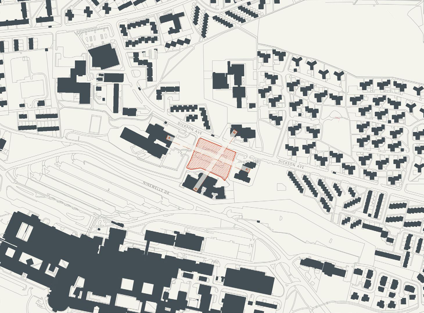
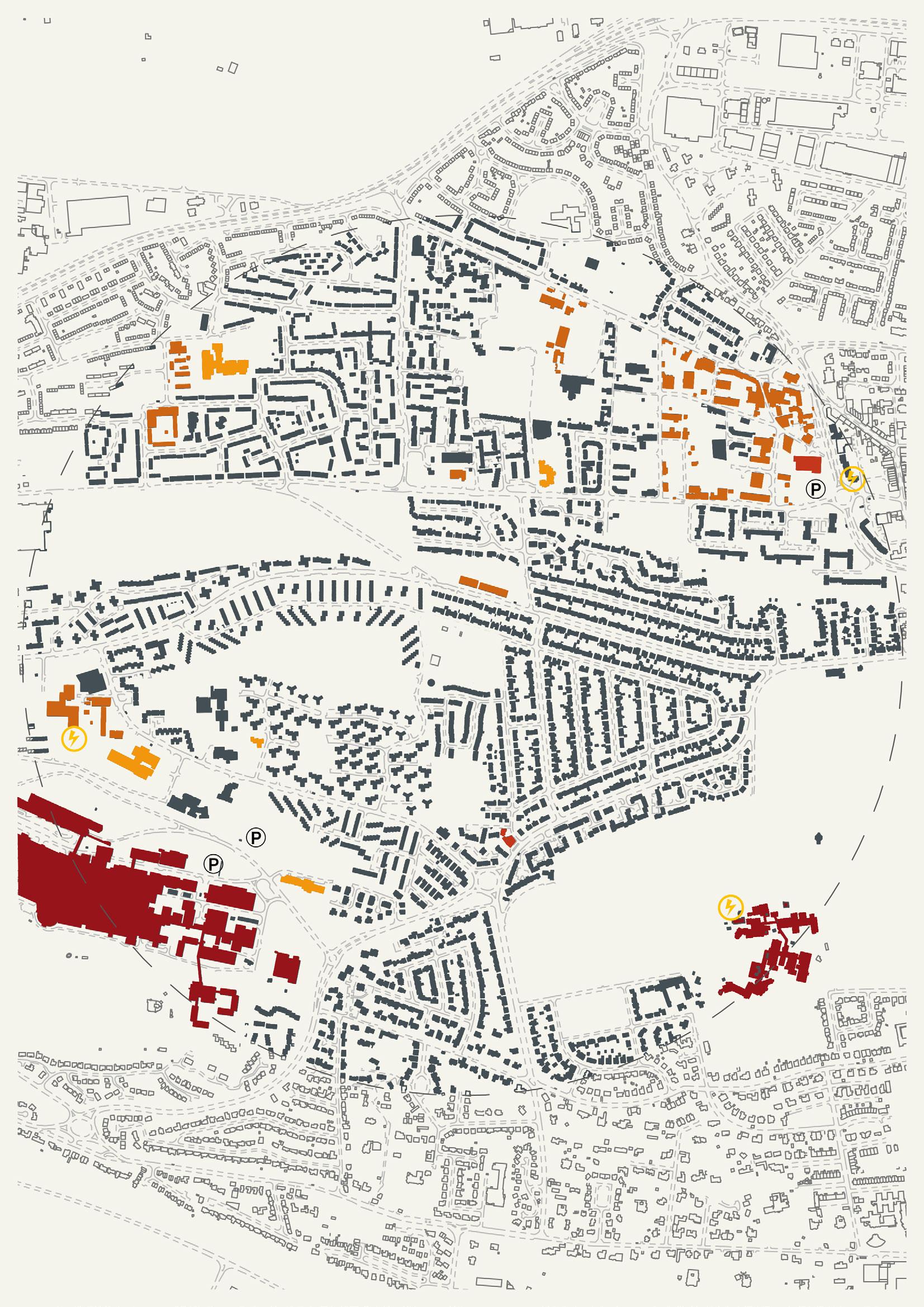
Located in Menzieshill and next to Earn Cres and Dickson Ave street this site is close to the essential amenities which give benefits to this site. For example, the Ninewells Hospital is only 8 minutes’ walk from the site while Tesco is just 11 minutes’ walk.There are a few play parks nearby such as St Ninian’s upper playground within 5 minutes’ walk from the site. with the nearest bus stop being within a minute walk from this site which makes it convenient for the visitors and carers.
Site H02 is located next to the main road where it has a moderate traffic during peak hours due to adjacent primary and nursery school which can contribute to loud noise. However, there is a potential to tackle this site condition by incorporating noise reduction strategies to its landscape. One way is by planting noise reducing plants such as bushes and shrubs. potential future
5523 m2 | 0.55 hectares
DUNDEE
LOW DENSITY
MEDIUM DENSITY
HIGH DENSITY
potential 137-192 + units 146 units shown on site (5-8 storey)

Mid
School 20th C. Road and field 21st C. Vacant 19th
Field 19th C. Field H01 H02 H35 H42 21st C. Vacant 21st C. Abandoned Late 20st C. Housing 20st C. Field 14131m 2 / 1 41 hec ares 20701m 2 / 2 07 hectares 5523m2 / 0 55 hectares 49 o 126 un s 19 o 49 un ts 72 to 186 un ts 14131m 2 / 1 41 hec a es 20701m 2 / 2 07 hectares 5523m2 / 0 55 hectares 126 to 352 un ts 49 o 137 n s 186 o 517 un s 14131m 2 / 1 41 hec a es 20701m 2 / 2 07 hectares 5523m2 0 55 hectares 352 to 493+ units 137 to 192+ nits 517 o 724+ un s 50 un ts(3 storey) 156 un ts 3-5 s or es) 352 uni s 5-8 stor es) 23 un s 3 sto ey) 74 un ts(2-3 sto ey) 80 un ts 2-10 s or es) 270 t (3-10 t s) 146 uni s 5-8 stor es) 520 un ts(8 s orey) 33544 2 / 3 35he 117 to 301 units 33544 2 / 3 35he t 301 to 837 un ts 33544 2 / 3 35he t 837 to 1172 un ts 856 units(5-8 storey) 440 units(8-10 storey) 119 units(2-3 storey) 14131m 2 / 1 41 hec a es 20701m 2 2 07 hectares 5523m2 / 0 55 hectares 49 o 126 un s 19 to 49 un ts 72 to 186 un ts 14131m 2 / 1 41 hecta es 20701m 2 / 2 07 hectares 5523m2 0 55 hectares 126 o 352 un s 49 to 137 nits 186 to 517 uni s 14131m 2 / 1 41 hectares 20701m 2 2 07 hectares 5523m2 0 55 hec ares 352 to 493+ un ts 137 to 192+ n ts 517 to 724+ uni s 50 un ts(3 s orey) H02 H35 H42 156 un ts(3-5 stories) 352 uni s 5-8 s or es) 23 un ts 3 storey) 74 un ts(2-3 sto ey) 80 uni s 2-10 s or es) 270 t (3-10 t s) 146 un s 5-8 s or es) 520 un ts(8 s orey) 33544 2 / 3 35he t 117 to 301 un ts 33544 2 / 3 35he t 301 to 837 un ts 33544 2 / 3 35he t 837 to 1172 un s 856 units(5-8 storey) 440 units(8-10 storey) 119 units(2-3 storey) 14131m 2 1 41 hectares 20701m 2 / 2 07 hectares 5523m2 / 0 55 hec a es 49 to 126 un ts 19 to 49 un ts 72 to 186 un ts 14131m 2 1 41 hectares 20701m 2 / 2 07 hec a es 5523m2 / 0 55 hectares 126 to 352 un ts 49 o 137 n ts 186 to 517 un ts 14131m 2 1 41 hectares 20701m 2 / 2 07 hectares 5523m2 / 0 55 hectares 352 o 493+ un s 137 to 192+ n s 517 to 724+ un ts 50 un ts 3 sto ey) H02 H35 H42 156 uni s 3-5 s or es) 352 un ts(5-8 sto es) 23 uni s 3 storey) 74 un ts 2-3 sto ey) 80 un ts(2-10 stor es) 270 t (3-10 t i s) 146 un ts(5-8 sto es) 520 un ts(8 storey) 33544 2 3 35he 117 o 301 un s 33544 2 / 3 35he t 301 to 837 units 33544 2 / 3 35he 837 to 1172 un ts 856 units(5-8 storey) 440 units(8-10 storey) 119 units(2-3 storey)
20th C. Primary
C.
potential 19-49 units 23 units shown on site (3 storey)
potential 49-137 units 80 units shown on site (2-10 storey)
DENSITY
SECTIONS 161 | 162
HISTORY

potential future DUNDEE

Former Hillside PS, Denoon Terrace | H35 [45 units] 163 | 164
20701 m2 | 2.07 hectares
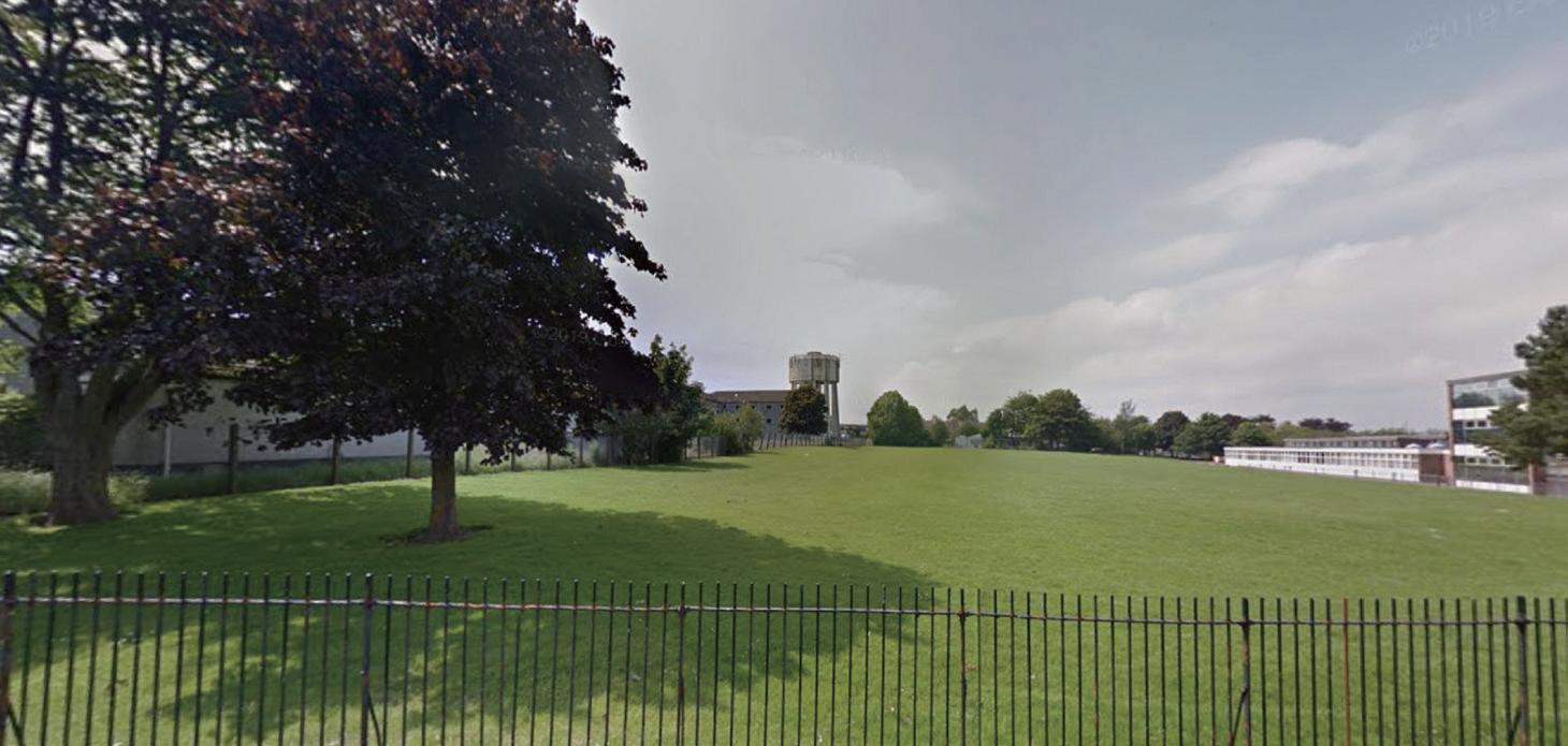
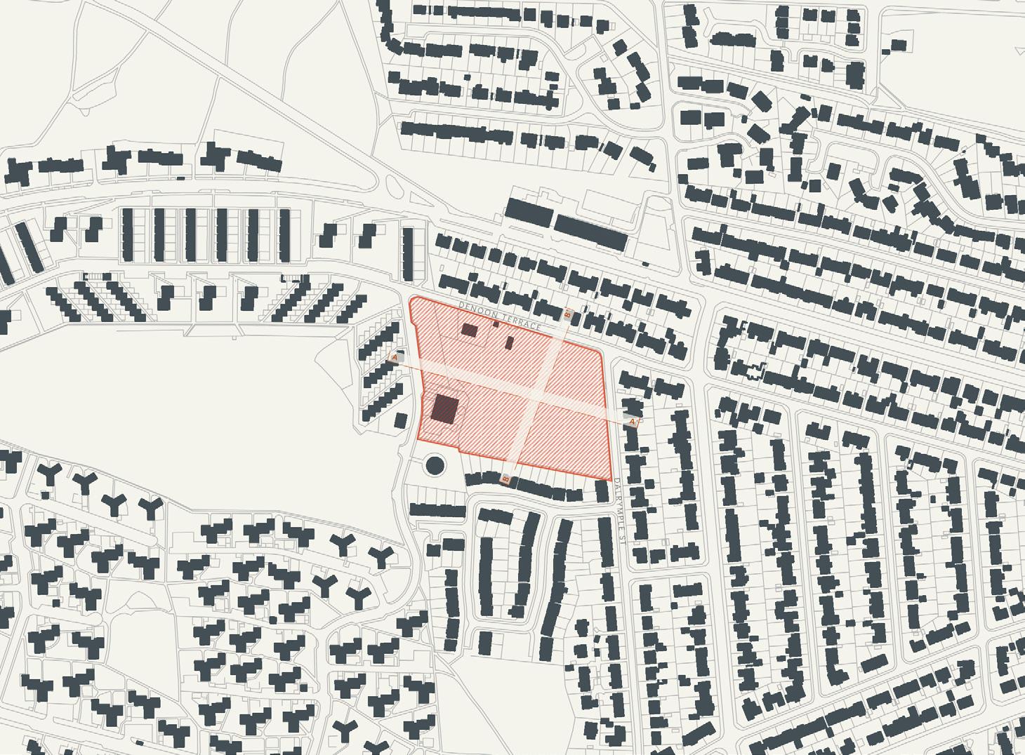
Located in Menzieshill on Dalrymple St, all the essential amenities such as groceries shops and medical facilities are easily accessible from this site. SPAR convenience store is only 6 minutes away by walking. The site is well connected to a few green spaces with only 8 minutes’ walk to the nearest playground which is St’ Ninian’s upper playground. The site is easily accessible by public transportation as there are a few bus stops on Charleston Dr within 2 minutes’ walk from the site.
It is situated away from the main busy road which has a high level of noise and traffic. Located within the neighbourhood with surrounding low density houses give an opportunity for the new housing of ASD people to be a part of the community. A few green spaces nearby are good places for gathering point. Medium to low density housing typology will complement with the other housing typologies within that area. These types of housing typologies also will help creating a private courtyard space to be shared among the residents. potential future
DUNDEE

Mid 20th C. Primary School 19th C. Field H01 H02 H35 H42 21st C. High school Late 20th C. School 19th C. Field 21st C. Vacant 21st C. Abandoned Late 20st C. Housing 20st C. Field 20701m 2 / 2 07 hec a es 5523m2 / 0 55 hectares 19 to 49 un s 72 o 186 un s 20701m 2 2 07 hectares 5523m2 / 0 55 hec a es 49 to 137 un ts 186 to 517 units 20701m 2 / 2 07 hec a es 5523m2 / 0 55 hec a es 137 to 192+ un ts 517 to 724+ un ts 23 un ts(3 storey) 74 t 2-3 t y) 80 un ts 2-10 stories) 270 uni s 3-10 s or es) 146 un ts 5-8 stor es) 520 uni s 8 storey) 33544m 2 / 3 35hectares 117 to 301 un ts 33544m 2 3 35hectares 301 o 837 un s 33544m 2 / 3 35hectares 837 to 1172 units 856 units(5-8 storey) 440 units(8-10 storey) 119 units(2-3 storey) 20701m 2 / 2 07 hec a es 5523m2 0 55 hectares 19 to 49 uni s 72 o 186 un s 20701m 2 2 07 hectares 5523m2 / 0 55 hec a es 49 to 137 un ts 186 to 517 un ts 20701m 2 / 2 07 hec a es 5523m2 / 0 55 hecta es 137 to 192+ un ts 517 to 724+ un ts H35 H42 23 un ts(3 s orey) 74 t 2-3 y) 80 un ts 2-10 stories) 270 uni s 3-10 s or es) 146 un ts(5-8 stories) 520 uni s 8 sto ey) 33544m 2 / 3 35hectares 117 to 301 un ts 33544m 2 3 35hectares 301 o 837 un s 33544m 2 / 3 35hectares 837 o 1172 units 856 units(5-8 storey) 440 units(8-10 storey) 119 units(2-3 storey) 20701m 2 / 2 07 hecta es 5523m2 0 55 hec ares 19 to 49 units 72 to 186 units 20701m 2 2 07 hectares 5523m2 / 0 55 hecta es 49 to 137 un ts 186 to 517 un ts 20701m 2 / 2 07 hec a es 5523m2 / 0 55 hecta es 137 o 192+ un ts 517 to 724+ un ts H35 H42 23 un ts(3 s orey) 74 i 2-3 y) 80 un ts(2-10 sto es) 270 uni s 3-10 stor es) 146 un ts(5-8 sto ies) 520 un ts 8 sto ey) 33544m 2 / 3 35hectares 117 to 301 un ts 33544m 2 3 35hec ares 301 o 837 un s 33544m 2 3 35hectares 837 o 1172 un ts 856 units(5-8 storey) 440 units(8-10 storey) 119 units(2-3 storey) LOW DENSITY potential 72-186 units 74 units shown on site (2-3 storey) MEDIUM DENSITY potential 186-517 units 270 units shown on site (3-10 storey) HIGH DENSITY potential 517-724 + units 520 units shown on site (8 storey) DENSITY HISTORY SECTIONS 165 | 166

potential future DUNDEE
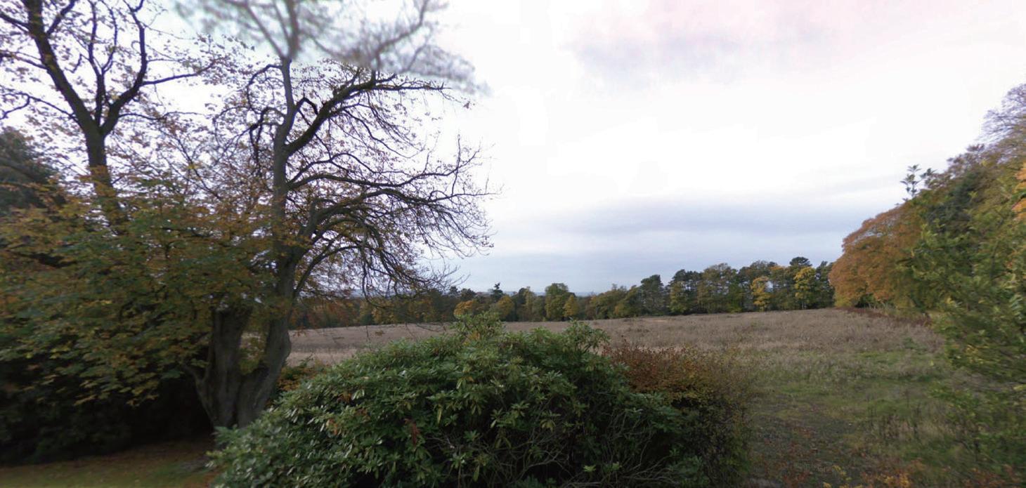

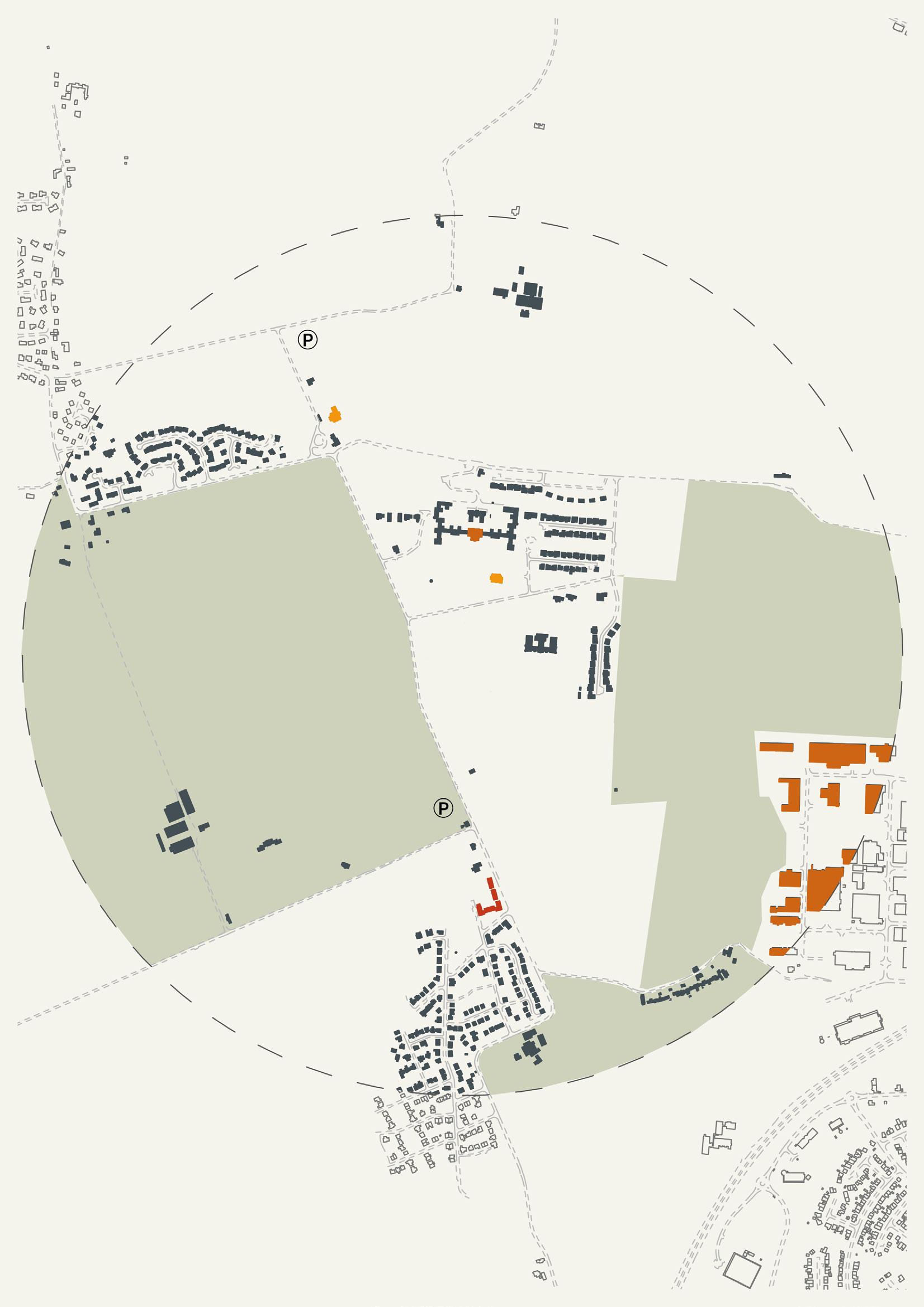
Western Gateway Liff | H42 [30 units] 167 | 168
33544 m2 | 3.35 hectares
Site H42 is located outside the Kingsway, which means it is far away from the existing urban and even suburban communities, but it is adjacent to a small community of Liff, with a church and school nearby. For now, H42 has the least number of facilities located around the site. At present, the site is located in a countryside location, there were some footpath and cycle connections to and from the City and surrounding open countryside. But according to Dundee Western Gateway Development Framework, Developers should seek to enhance the green network through connecting existing and proposed green infrastructure components such as street trees, open spaces, watercourses and walking and cycling routes. The site is also about 500 metres away from the bus station, within there are several buses that lead to the city center and nearby countryside.
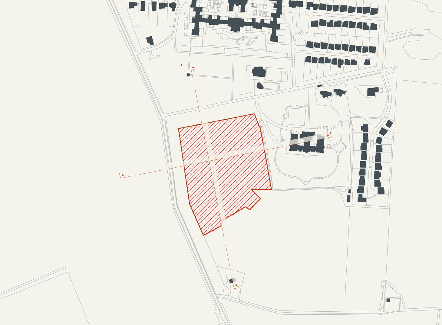
Density/opportunities- H42 is a little far away from the city, but it has a large area and quiet environment, where can design a community with enough support infrastructure and a more suitable environment for Autistic people. When they live, study or even work here, their social ability may be enhanced. Maybe they will have a desire to go to further places and participate in social life. In addition, in the government’s development plan of Western Gateway, high quality residential areas
will be built near H41, including infrastructure such as health care and education, so as to attract and accommodate more residents. Therefore, the future development here will probably bring autism patients well to the whole society. For now, H42 has the least number of facilities located around the site. But all those facilities can easily be reached by public transport.
DUNDEE
potential future
LOW DENSITY
potential 117-301 units
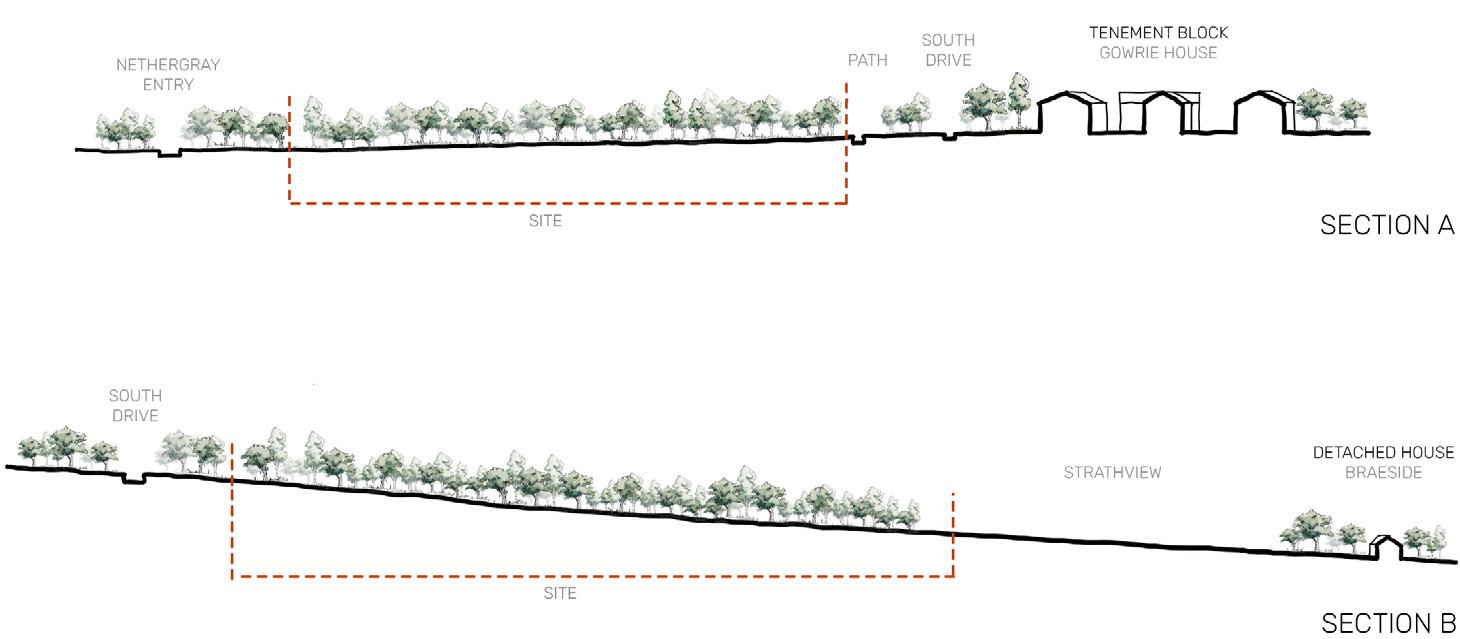
units shown on site (2-3 storey)
MEDIUM DENSITY
potential 301-837 units
units shown on site (8-10 storey)
HIGH
DENSITY
potential 837-1172 + units
shown on site (5-8 storey)
C. Road and field 21st C. Vacant 19th C. Field
Mid 20th C. Primary School
H02 H35 H42 21st
21st
Late 20st
20st
20701m 2 / 2 07 hec a es 72 o 186 un s 20701m 2 2 07 hectares 186 to 517 units 20701m 2 / 2 07 hec a es 517 to 724+ un ts 74 un ts 2-3 storey) 270 uni s 3-10 s or es) 520 uni s 8 storey) 33544m 2 / 3 35hectares 117 t 301 t 33544m 2 3 35hectares 301 837 33544m 2 / 3 35hectares 837 t 1172 it 856 units(5-8 storey) 440 units(8-10 storey) 119 units(2-3 storey) 20701m 2 2 07 hectares 72 o 186 un ts 20701m 2 / 2 07 hectares 186 to 517 uni s 20701m 2 2 07 hectares 517 to 724+ uni s H42 74 un ts(2-3 storey) 270 un ts(3-10 stor es) 520 un ts 8 storey) 33544m 2 / 3 35hecta es 117 t 301 t 33544m 2 / 3 35hectares 301 t 837 t 33544m 2 / 3 35hectares 837 t 1172 856 units(5-8 storey) 440 units(8-10 storey) 119 units(2-3 storey) 20701m 2 / 2 07 hecta es 72 to 186 units 20701m 2 2 07 hectares 186 to 517 un ts 20701m 2 / 2 07 hec a es 517 to 724+ un ts H42 74 uni s 2-3 s orey) 270 uni s 3-10 s or es) 520 un ts 8 sto ey) 33544m 2 / 3 35hectares 117 t 301 t 33544m 2 3 35hec ares 301 837 33544m 2 3 35hectares 837 1172 t 856 units(5-8 storey) 440 units(8-10 storey) 119 units(2-3 storey)
20th
C. High school Late 20th C. School 19th C. Field
C. Abandoned
C. Housing
C. Field
119
440
856
DENSITY
169 | 170
units
HISTORY SECTIONS
A COLLECTION OF BUILT EXAMPLES OF HOUSING DESIGNED AND BUILT FOR THOSE WITH ASD
‘‘quote’’ -
Precedent
name
LOCATION: Housing | Cambridge, UK
ARCHITECT: Proctor and Matthews Architects
AREA: unknown
VALUE: unknown
COMPLETION DATE: 2014
With housing and mixed-use units this design shows how it is possible to integrate residential accommodation of different types and styles together in the one area. Small lanes are created between them with larger relief spaces, where a community environment is able to form.
There is a mixture of materials and density which creates the feeling of walking through different neighbourhoods.
With Dundee lacking in high quality housing, the precedent is key to informing our own designs and in relation to ASD the community environment is something which should be aimed for to allow residents and their families to feel involved and safe when living and visiting.
ABODE AT GREAT KNEIGHTON
precedent DUNDEE
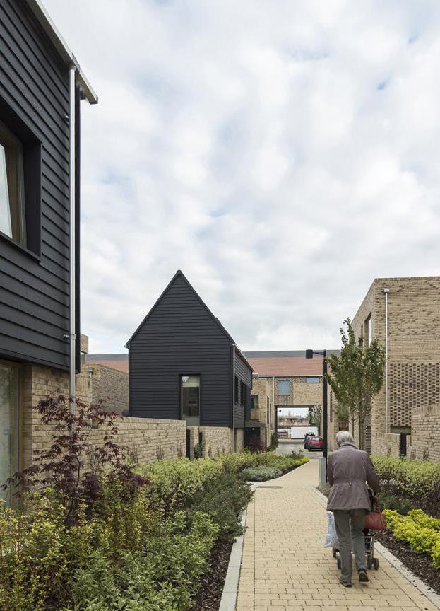
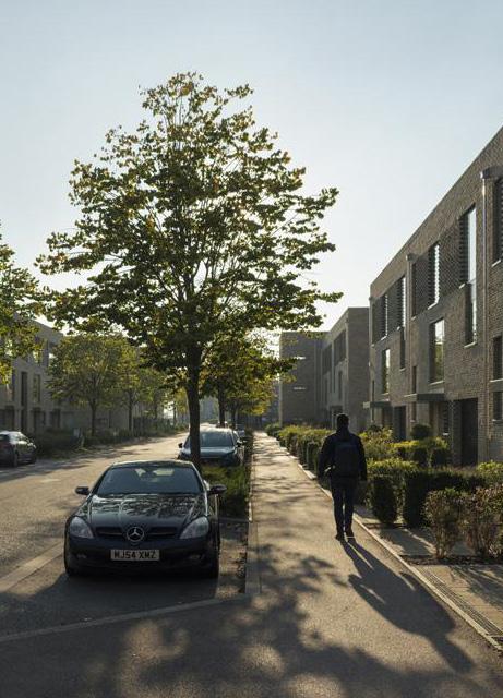

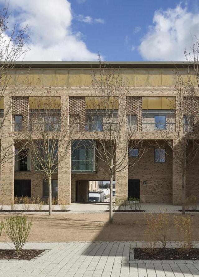
173 | 174
Figure(s) 42 : collection of precedent images
LOCATION: Housing | York, UK
ARCHITECT: Studio Partington
AREA: unknown
VALUE: unknown
COMPLETION DATE: 2019
This project is an extension to a Village in North Yorkshire. The streets created from the layout of houses gives pedestrians priority and ensures the safety of children. With the landscaping including a large pond, the sustainability of the design is obvious. The pond allows for a wildlife to breed and is also a key part of the SUDS which protects the housing area from being flooded.
With strong connections to York city centre, the site sits similarly to the 4 sites in the South of Dundee city which we have recognised as potential areas for our designs.
The sustainable approach to drainage and the inclusion of bringing in wildlife if an iea which could be brought forward, with wildlife acting as a place of work, education and leisure, it could be a way of bringing nature into the urban environment which is currently an area of weakness at the moment.
DERWENTHORPE
precedent DUNDEE
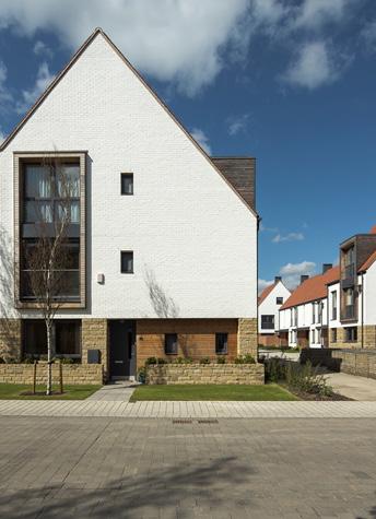
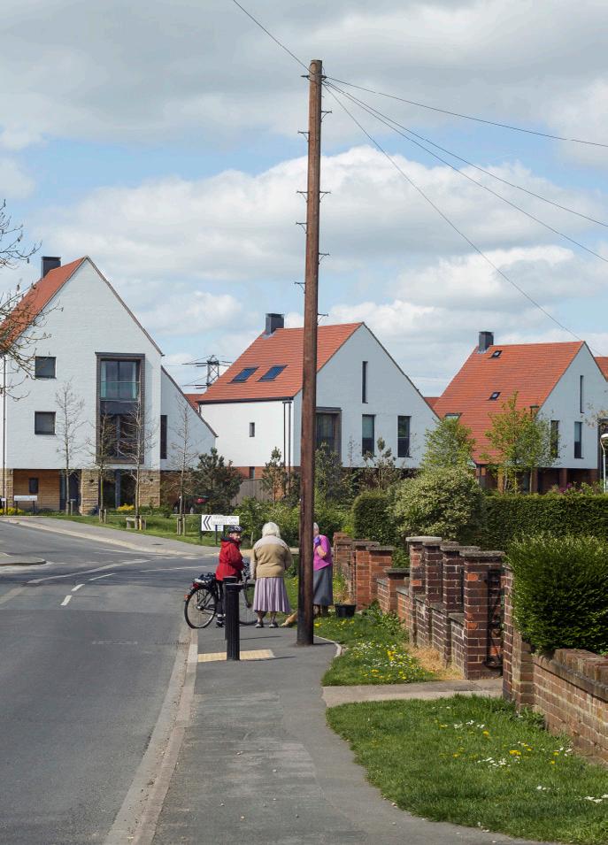


175 | 176
Figure(s) 43 : collection of precedent images
LOCATION: Housing | Somerset, UK
ARCHITECT: Feilden Clegg Bradley Studios
AREA: unknown
VALUE: £35 000 000
COMPLETION DATE: 2009
This neighbourhood design is a good example of how we can introduce high quality housing whilst at the same time having a balance between cars and people. There is a range in privacy of relationship with the external and internal environments which creates a rich urban atmosphere with the layering of private, semi-public and public areas.
Along with a balance of vehicular and pedestrian access, there is also a cycle path which has been introduced to the overall scheme with bike storage with each residential unit, encouraging users to cycle.
With some of the Dundee sites having direct access to an existing cycle path layout, it might be an idea to include adequate bike storage to allow residents to use the devices already in place within the city and further enhances on sites.
LIME
TREE SQUARE
precedent DUNDEE
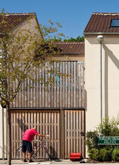
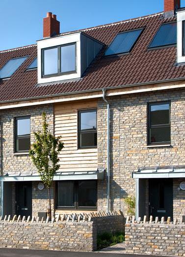
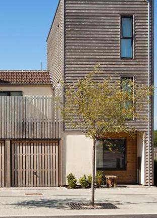

177 | 178
Figure(s) 44 : collection of precedent images
LOCATION: Housing | Southwark, London, UK
ARCHITECT: Polllard Thomas Edwards
AREA: 8800 m²
VALUE: unknown
COMPLETION DATE: 2017
The aim of this design was allow the existing urban site to fit better with its surroundings, filling in a gap within the existing grain.
A mixture of house types and scales provides interests to the area and allows for different environments to be suited to the housing types whether than is family houses or 1 bedroom flats.
Between the buildings, streets are formed, mostly pedestrianised, where the idea of creating a town like feeling is obvious. There is also reference to the existing and historic mews house lanes which are at a low scale and are quiet, paved/cobbled streets.
With reference to the historic environment, the scheme sits naturally in its location and is welcoming to pedestrians due to its familiarity. This is something which is important when deisgn for ASD where familiarity and comfort is important.
HARVARD
GARDENS
precedent DUNDEE
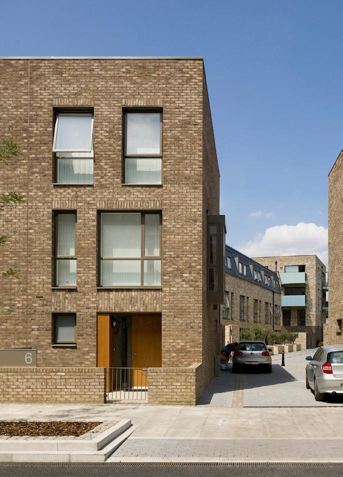
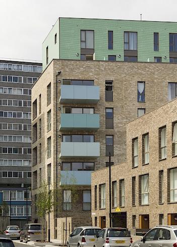
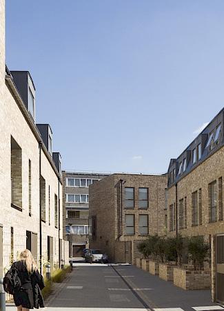

179 | 180
Figure(s) 45 : collection of precedent images
LOCATION: Housing | Newcastle-upon-tyne, UK
ARCHITECT: Ash Sakura
AREA: 6806 m²
VALUE: £10 000 000
COMPLETION DATE: 2015
This mixed use re-development sits on the bank of a river and consits of terraced housing due to the sloped nature of the site.
The design does not only included residential housing but there are also 3 buildings which introduce comercial, community and social enterprise uses which enliven the waterside.
There is a mixture of private terraces, gardens and allotmments where people are encouraged to grow fruit and veg.
All elements within this design could be useful for taking forward to the integrated design stage in Dundee where there is a lack of functional green spaces, active public areas and community facilities.
THE
MALINGS
precedent DUNDEE

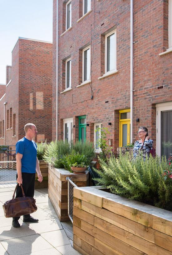
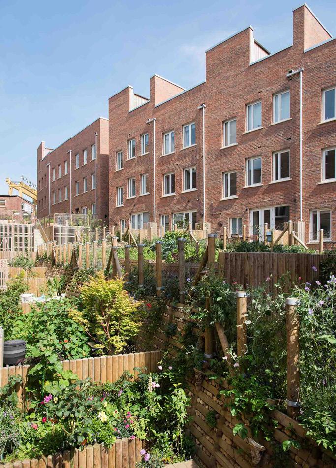

181 | 182
Figure(s) 46 : collection of precedent images
LOCATION: Housing | Walthamstow, London, UK
ARCHITECT: Levitt Bernstein
AREA: unknown
VALUE: £14 000 000
COMPLETION DATE: 2017
With this residential design including a health centre, it acts as a key precedent when designing for ASD. The residential units themselves are of mixed use and scale, which is important to a scheme of this size to provide visual interest and variety. Combination of scales (in terms of plan, section and elevations) acts as a good response to the surrounding context, meaning it sits well within the existing community. Using a combination of high quality hard and soft landscaping, along with small planting beds, there is an outdoor space for anyone for almost any task.
The building form a protective courtyard, meaning in a safe environments is created - which is useful especially when designing for residents which need extra care and security. The courtyard also provides passive surveillance where the community can keep an eye on each other.
There are good thresholds between communal spaces with the entrance doors to the houses being inset into the plan - providing a space for shelter when finding keys and adds an extra layer of security.
Almost every unit has either access to a person garden/balcony and they all have access to a shared external space (courtyard).
The houses have private parking spaces, which could be useful in shared accommodation where there could be a car per house that several individuals could share and use.
SUTHERLAND
ROAD
precedent DUNDEE
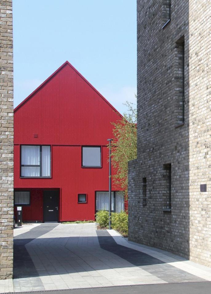
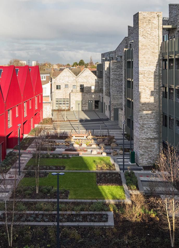
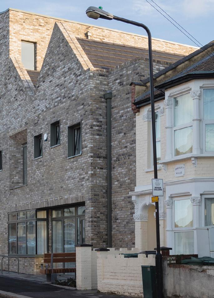

183 | 184
Figure(s) 47 : collection of precedent images
LOCATION: Housing | London, UK
ARCHITECT: Sheppard Robson
AREA: 15 000m²
VALUE: £40 000 000
COMPLETION DATE: 2017
The scheme tackles the idea that the provision for affordable housing should be minimal, by proposing a 50/50 split between high quality private and affordable homes. The building forms two enclosed courtyards, one surrounded by the private homes and the other by the affordable ones, and all the units have a private balcony overlooking the courtyards. This idea of giving space to affordable and high density is a very important condition to learn from. The scale of the high density is also kept human by having 7 cores and eliminating long corridors.
The scheme takes into consideration the different need of the residents in affordable and private homes, for example as its likely to be younger families in the affordable area, there is an extra provision for a children’s play area. This is the kind of human consideration that should be driving architecture.
CAMDEN COURTYARDS
precedent DUNDEE


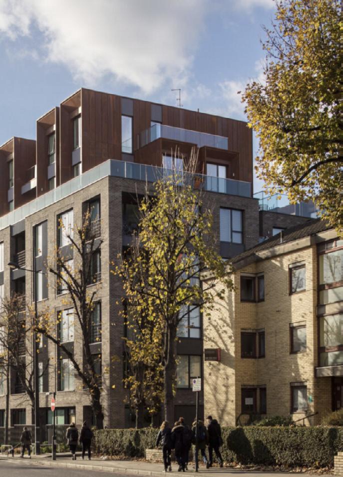
185 | 186
Figure(s) 48 : collection of precedent images
LOCATION: Apartments | New York, US
ARCHITECT: Grimshaw + Dattner Architects
AREA: 294 000m²
VALUE: unknown
COMPLETION DATE: 2012
By utilising the underlying communal elements of a neighbourhood, Via Verde creates a strong sense of community. By offering a mix of housing options, the diversity of the residents increases as it becomes more accessible, enriching the community. The mixed-use nature of the scheme encourages footfall and creates a lively influence in the street.
This design strategy would be very beneficial in Dundee due to the huge potential for regeneration within the city.
The scheme also heavily focuses on green construction and encouraging an active life, by mixing the public elements with the private dwellings, the residents are encouraged outside, to interact with neighbours and participate in the community.
VIA VERDE
precedent DUNDEE


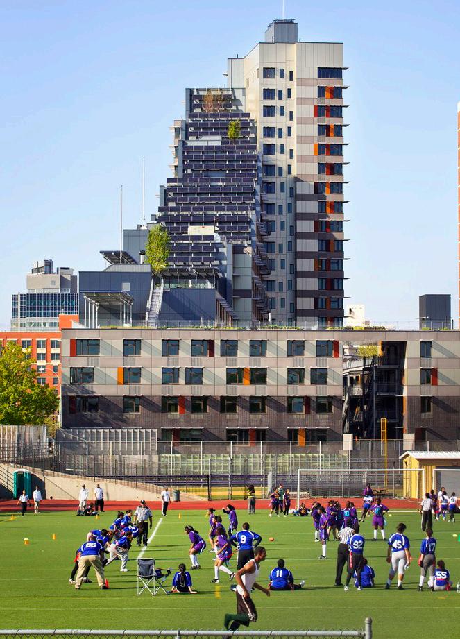

187 | 188
Figure(s) 49 : collection of precedent images
LOCATION: Apartments | Kennington, London, UK
ARCHITECT: Panter Hudspith Architects
AREA: unknown
VALUE: £12 500 000
COMPLETION DATE: 2013
The scheme at Royal Road manages to create high-quality, high density accommodation by making the buildings and the landscape work together. The scale of the building has been disguised by several tricks such as designing the building form so to preserve the existing mature trees that line the site, giving the maisonettes their own front door onto the street and introducing texture into the elevations. The communal garden gives the scheme a sense of community which is very relevant to designing for autism.
While building at high density may seem counter-intuitive when designing for autism, by applying the same approach as at Royal Road the effect of the scale can be lessened. If high density can be achieved at a seemingly human scale, a greater diversity of people and uses will be attracted to the place and therefore the sense of community grows stronger.
ROYAL
ROAD
precedent DUNDEE
Figure(s) 50 : collection of precedent images

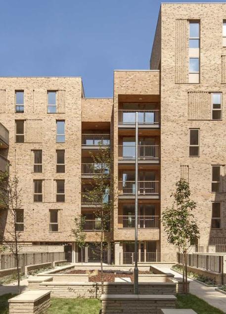
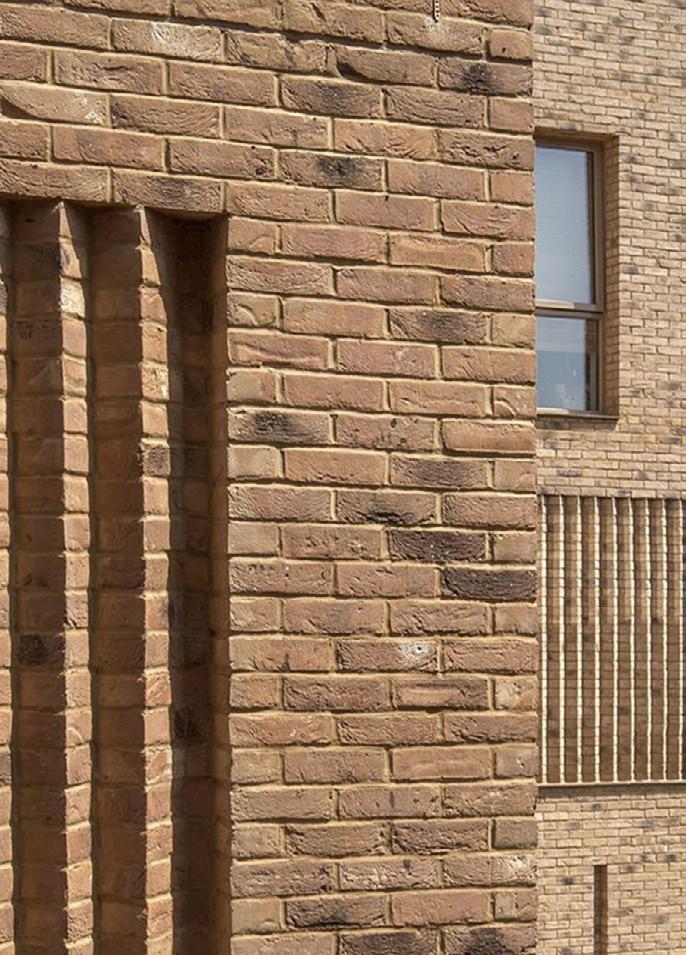
189 | 190
AGREED CONCENSUS OF ATTITUDE
Conclusion quote
By looking at the morphology of the city, existing typologies along side precedent it becomes clear what is missing in Dundee and what opportunities are available in terms of ASD design. There is a lack of unity, with the urban grain being lost outwith the ring road. Green spaces, whilst there are plenty of them, are not utilised to their full potential so trying to combat this by introducing our own public external areas might be an idea that individuals could take forward to the next stage of researching and designing. The scale of existing green spaces within the city is big, where apart from the Botanical Gardens, the majority are large expansive open grassed areas where you might find dog walkers or students drinking. Lime Tree Square and the Malings are precedents which are good examples of how we can begin to introduce focussed green areas which are activited and used with layering of public and private areas being key to enrich neighbourhoods.
Whilst there are care units within the city, there are none solely for ASD or housing for individuals with Autism, so by introducing this we are enabling a group which are currently neglected by the city to be involved within the city life. The idea is that its not just about integrating people with ASD into the urban environment, but also about integrating those already in the city within the design. By adding public aspects (whether internal external or both) we can help existing communities to utilise the design and therefore its residents on any of the 16 sites.
Moving on from this booklet, we can view it and use it as a sort of atlas which acts as the backbone to our designs. Due to varying opinions across the studio (which have developed throughout the process of analysising the city), individuals have taken these into their own journals and developed ideas there.
DUNDEE
193 | 194
WHERE ALL THE IMPORTANT INFORMATION WAS FOUND quote
References + Bibliography
BOOKS
Evans, Bonnie. “How Autism Became Autism.” History of the Human Sciences, vol. 26, no. 3, 8 May 2013, pp. 3–31, 10.1177/0952695113484320.
Alexander, C., Ishikawa, S., Silverstein, M., Jacobson, M., FiksdahlKing, I. and Shlomo, A., n.d. A Pattern Language.
Kevin Lynch., 2014. Image Of The City. Boston: Birkhauser.
READING [ no particular order]
DUNDEE
197 | 198
Dundee City Council. (n.d.). Planning & Building. [online] Available at: https://dundeecity.gov.uk/services/planning-&-building [Accessed 15 Nov. 2020].
dundeecity.maps.arcgis.com. (n.d.). ArcGIS Web Application. [online] Available at: https://dundeecity.maps.arcgis.com/apps/webappviewer/index. html?id=ddb29c5768a0451cbe48aa800e80e3e4 [Accessed 15 Nov. 2020].
david.matthews (2010). About Dundee 2010. [online] Available at: https://www.dundeecity.gov.uk/dundeecity/uploaded_publications/ publication_2005.pdf [Accessed 25 Oct. 2020].
Edina.ac.uk. (2018). Digimap. [online] Available at: https://digimap.edina.ac.uk/roam/map/society [Accessed 27 Oct. 2020].
Gov.scot. (2011). statistics.gov.scot | Maryfield. [online] Available at: https://statistics.gov.scot/atlas/ resource?uri=http%3A%2F%2Fstatistics.gov. scot%2Fid%2Fstatistical-geography%2FS13002549 [Accessed 5 Nov. 2020].
Gov.scot. (2016). statistics.gov.scot | Anderston/City/Yorkhill. [online] Available at: https://statistics.gov.scot/atlas/ resource?uri=http%3A%2F%2Fstatistics.gov. scot%2Fid%2Fstatistical-geography%2FS13002976 [Accessed 5 Nov. 2020].
Gov.scot. (2016). statistics.gov.scot | City Centre. [online] Available at: https://statistics.gov.scot/atlas/ resource?uri=http%3A%2F%2Fstatistics.gov. scot%2Fid%2Fstatistical-geography%2FS13002929 [Accessed 5 Nov. 2020].
Gov.scot. (2016). statistics.gov.scot | George St/Harbour. [online] Available at: https://statistics.gov.scot/atlas/ resource?uri=http%3A%2F%2Fstatistics.gov. scot%2Fid%2Fstatistical-geography%2FS13002842 [Accessed 5 Nov. 2020].
Information and Research Team, D.C.C. (2018). About Dundee 2018. [online] www.dundeecity.gov.uk. Available at: https://www.dundeecity.gov.uk/sites/default/files/publications/ about_dundee_2018.pdf [Accessed 20 Oct. 2020].
Scottish Learning Disabilities Observatory. (2011). Aberdeen City | Census 2011 Information. [online] Available at: http://www.sldo.ac.uk/census-2011-information/autism/localauthorities/aberdeen-city [Accessed 13 Nov. 2020].
Scottish Learning Disabilities Observatory. (2011). City of Edinburgh | Census 2011 Information. [online] Available at: http://www.sldo.ac.uk/census-2011-information/autism/localauthorities/city-of-edinburgh [Accessed 13 Nov. 2020].
Scottish Learning Disabilities Observatory. (2011). Dundee | Census 2011 Information. [online] Available at: http://www.sldo.ac.uk/census-2011-information/autism/localauthorities/dundee/ [Accessed 13 Nov. 2020].
Scottish Learning Disabilities Observatory. (2011). Glasgow City | Census 2011 Information. [online] Available at: http://www.sldo.ac.uk/census-2011-information/autism/localauthorities/glasgow-city [Accessed 13 Nov. 2020].
Visionofbritain.org.uk. (2011). Aberdeen City City through time | Industry Statistics | Total employed in all industries. [online] Available at: https://www.visionofbritain.org.uk/unit/10192985/cube/INDUSTRY_ TOT [Accessed 16 Nov. 2020].
Visionofbritain.org.uk. (2011). Aberdeen City City through time | Population Statistics | Total Population. [online] Available at: https://www.visionofbritain.org.uk/unit/10192985/cube/TOT_POP [Accessed 16 Nov. 2020].
Visionofbritain.org.uk. (2011). Dundee City City through time | Industry Statistics | Total employed in all industries. [online] Available at: https://www.visionofbritain.org.uk/unit/10150553/cube/INDUSTRY_ TOT [Accessed 16 Nov. 2020].
Visionofbritain.org.uk. (2011). Dundee City City through time | Population Statistics | Total Population. [online] Available at: https://www.visionofbritain.org.uk/unit/10150553/cube/TOT_POP [Accessed 16 Nov. 2020].
Visionofbritain.org.uk. (2011). Edinburgh City through time | Industry Statistics | Total employed in all industries. [online] Available at: https://www.visionofbritain.org.uk/unit/10211104/cube/INDUSTRY_ TOT [Accessed 16 Nov. 2020].
Visionofbritain.org.uk. (2011). Edinburgh City through time | Population Statistics | Total Population. [online] Available at: https://www.visionofbritain.org.uk/unit/10211104/cube/TOT_POP [Accessed 16 Nov. 2020].
Visionofbritain.org.uk. (2011). Glasgow City through time | Industry Statistics | Total employed in all industries. [online] Available at: https://www.visionofbritain.org.uk/unit/10217751/cube/INDUSTRY_ TOT [Accessed 16 Nov. 2020].
Visionofbritain.org.uk. (2011). Glasgow City through time | Population Statistics | Total Population. [online] Available at: https://www.visionofbritain.org.uk/unit/10217751/cube/TOT_POP [Accessed 16 Nov. 2020].
www.scotlandscensus.gov.uk. (2013). Interactive Maps | Census Data Explorer | Scotland’s Census. [online] Available at: https://www.scotlandscensus.gov.uk/ods-web/datavis. jsp?theme=Population_v4_September_2013 [Accessed 10 Nov. 2020].
Dundee City Council.West End Lanes Conservation Area Appraisal: 5 Character Areas [online] Available at: https://www.dundeecity.gov.uk/sites/default/files/publications/ West%20End%20Lanes%20CA%20Appraisal.pdf [Accessed 18 Oct. 2020].
Emerton, G. and Historic Scotland. Technical Conservation Research And Education Division (2000). The pattern of Scottish roofing. Edinburgh: Historic Scotland. Lenman, B. and Carroll, W.D. (1972). Council Housing in Dundee. Town Planning Review, [online] 43(3), p.275. Available at: https://www.jstor.org/stable/40102867?seq=1#metadata_info_ tab_contents [Accessed 16 Dec. 2020].
Mackie, A. (n.d.). Edinburgh Geological Society. [online] www. edinburghgeolsoc.org. Available at: http://www.edinburghgeolsoc.org/edingeologist/z_08_05.html#fig1 [Accessed 18 Dec. 2020].
WEBSITES
DUNDEE
Regnier, V. (2002). Design for assisted living : guidelines for housing the physically and mentally frail. New York: J. Wiley. Strachan, G. (2020). Safe as prefabs: The post-war Dundee houses that were marvels of compactness. [online] The Courier. Available at: https://www.thecourier.co.uk/fp/nostalgia/1587115/safe-asprefabs-the-post-war-dundee-houses-that-were-marvels-ofcompactness/ [Accessed 18 Dec. 2020].
Uwe.ac.uk. (2009). Domestic Architecture 1700 to 1960. [online] Available at: https://fet.uwe.ac.uk/conweb/house_ages/flypast/print.htm.
Britanica, E. (2020). Dundee | History, Facts, & Points of Interest. [online] Encyclopedia Britannica. Available at: https://www.britannica.com/place/Dundee.
Bbc.co.uk. (2014). BBC - History - Scottish History. [online] Available at: http://www.bbc.co.uk/history/scottishhistory/victorian/trails_ victorian_dundee.shtml.
Lambert, T. (n.d.). A History of Dundee. [online] www.localhistories. org. Available at: http://www.localhistories.org/dundee.html.
Paul Harris (2018). Post-industrial Dundee is reinventing itself as a hub of creativity. [online] City Monitor. Available at: https://citymonitor.ai/economy/business/post-industrial-dundeereinventing-itself-hub-creativity-3481.
www.sath.org.uk. (n.d.). Dundee jute mills - Making of industrial and urban Scotland - Scotland’s History. [online] Available at: http://www.sath.org.uk/edscot/www.educationscotland.gov.uk/ scotlandshistory/makingindustrialurban/dundeejutemills/index.html
Burgageplots.info. 2020. [online] Available at: <https://www.burgageplots.info/a-planned-approach> [Accessed 18 December 2020].
Dundee, U., 2020. Living Together : Museum : University Of Dundee. [online] Dundee.ac.uk. Available at: <https://www.dundee.ac.uk/museum/exhibitions/housing/> [Accessed 18 December 2020].
Britanica, E. (2020). Dundee | History, Facts, & Points of Interest. [online] Encyclopedia Britannica. Available at: https://www.britannica.com/place/Dundee.
Bbc.co.uk. (2014). BBC - History - Scottish History. [online] Available at: http://www.bbc.co.uk/history/scottishhistory/victorian/trails_ victorian_dundee.shtml.
Lambert, T. (n.d.). A History of Dundee. [online] www.localhistories. org. Available at: http://www.localhistories.org/dundee.html.
Paul Harris (2018). Post-industrial Dundee is reinventing itself as a hub of creativity. [online] City Monitor. Available at: https://citymonitor.ai/economy/business/post-industrial-dundeereinventing-itself-hub-creativity-3481.
www.sath.org.uk. (n.d.). Dundee jute mills - Making of industrial and urban Scotland - Scotland’s History. [online] Available at: http://www.sath.org.uk/edscot/www.educationscotland.gov.uk/ scotlandshistory/makingindustrialurban/dundeejutemills/index.html
199 |200
Figure 1 : National Galleries of Scotland. 2020. Tay Spinners, Dundee. [online] Available at: <https://www.nationalgalleries.org/art-andartists/89378/tay-spinners-dundee> [Accessed 28 October 2020].
Figure 2 : Wallace, D., 2020. Danny Wallace On... The Renaissance Of Dundee. [online] CN Traveller. Available at: <https://www.cntraveller.com/article/dundee-scotlanddanny-wallace> [Accessed 28 October 2020].
Figure 3 : Stevenson, S. and profile, V., 2020. Old Photographs Wellgate Dundee Scotland. [online] Tour-scotlandphotographs.blogspot.com. Available at: <https://tour-scotland-photographs.blogspot. com/2015/06/old-photograph-wellgate-dundeescotland.html> [Accessed 28 October 2020].
Figure 4 : Digital.nls.uk. 2020. Dundee - ‘The Prospect Of Ye Town Of Dundee’ - John Slezer’s Engravings Of Scotland. [online] Available at: <https://digital.nls.uk/slezer/engraving/?sl=38> [Accessed 21 October 2020].
Figure 5 : Figure 6 : Figure 7 :
Figure 8 : Educalingo.com. 2020. BURGAGE - Definition And Synonyms Of Burgage In The English Dictionary. [online] Available at: <https://educalingo.com/en/dic-en/burgage> [Accessed 21 October 2020].
Figure 9 : Neubau.uk. 2020. Borough High Street | NEUBAU Architecture Ltd. [online] Available at: <http://neubau.uk/?works=borough-high-street> [Accessed 18 December 2020].
Figure 10 : sarahhayes.org. 2020. Burgage – Sarahhayes.Org. [online] Available at: <https://sarahhayes.org/tag/burgage/> [Accessed 4 November 2020].
Figure 11 : Maps.nls.uk. 2020. Town Plans Of Dundee - National Library Of Scotland. [online] Available at: <https://maps.nls.uk/towns/dundee.html> [Accessed 21 October 2020].
Figure 12 : The Courier. 2020. Seeking Public Help To Celebrate The History Of The Dundee Jute Industry - The Courier. [online] Available at: <https://www.thecourier.co.uk/fp/news/local/ dundee/284153/seeking-public-help-celebrate-historydundee-jute-industry/> [Accessed 3 November 2020].
Figure 13 : Gomez-Moriana, R. and Gomez-Moriana, R., 2020. Housing Thinking | Politics/Letters Live. [online] Politics/Letters Live. Available at: <http://politicsslashletters.org/commentary/criticalista/ housing-thinking/> [Accessed 11 November 2020].
Figure 14 : BBC News. 2020. New Exhibition Digs Deep Into Dundee’s Housing History. [online] Available at: <https://www.bbc.co.uk/news/uk-scotland-taysidecentral-50418337> [Accessed 11 November 2020].
Figure 15 : Leisureandculturedundee.com. 2020. Building Of The Second Tay Rail Bridge | Leisure And Culture Dundee. [online] Available at: <http://www.leisureandculturedundee.com/buildingsecond-tay-rail-bridge> [Accessed 11 November 2020].
Figure 16 : En.wikipedia.org. 2020. Garden City Movement. [online] Available at: <https://en.wikipedia.org/wiki/Garden_city_movement> [Accessed 11 November 2020].
Figure 17 : The Dundee City Archives Blog. 2020. Logie: Scotland’s First Council Housing Scheme. [online] Available at: <https://dundeecityarchives.wordpress.com/2019/06/20/ logie-100-how-it-started/> [Accessed 4 November 2020].
Figure 18 : Evening Telegraph. 2020. Right Royal Occasion As Queen Mother Opened £6Million Bridge Across River Tay - Evening Telegraph. [online] Available at: <https://www.eveningtelegraph.co.uk/2015/07/30/rightroyal-occasion-as-queen-mother-opened-6millionbridge-across-river-tay/> [Accessed 3 November 2020].
Figure 19 : Haarkon Adventures. 2020. The University Of Dundee Botanic Garden — Haarkon Adventures. [online] Available at: <https://www.haarkon.co.uk/explore-blog/the-universityof-dundee-botanic-garden> [Accessed 28 October 2020].
Figure 20 : Dundeecity.gov.uk. 2020. [online] Available at: <https://www.dundeecity.gov.uk/sites/default/files/ publications/dundee_2019_map.pdf> [Accessed 18 December 2020].
Figure 21 : Stevenson, S. and profile, V., 2020. Old Travel Blog Photograph DC Thomson Building Dundee Scotland. [online] Tour-scotland-photographs.blogspot.com. Available at: <https://tour-scotland-photographs.blogspot. com/2018/01/old-travel-blog-photograph-dc-thomson. html> [Accessed 28 October 2020].
Figure 22 :
Figure 23 : Dundeecity.gov.uk. 2020. [online] Available at: <https://www.dundeecity.gov.uk/sites/default/files/ publications/West%20End%20Lanes%20CA%20Appraisal. pdf> [Accessed 11 November 2020].
Figure 24 : Flickr. 2020. Dundee City Archives. [online] Available at: <https://www.flickr.com/photos/dundeecityarchives/> [Accessed 11 November 2020].
Figure 25 : Leisureandculturedundee.com. 2020. Streetwise: High Land | Leisure And Culture Dundee. [online] Available at: <http://www.leisureandculturedundee.com/streetwisehigh-land> [Accessed 27 October 2020].
Figure 26 : Dundee. 2020. Dundee. [online] Available at: <https://www.google.com/maps/place/ Dundee/@56.4703948,-3.0010775,8266m/>data=!3m1!1e3 !4m5!3m4!1s0x48864144ab639cd3:0x94e43b1e384be52a! 8m2!3d56.462018!4d-2.970721> [Accessed 11 November 2020].
IMAGES
[ unless otherwise stated, all images/graphics/sketches are author’s own ]
DUNDEE
Figure 27 : Dundee. 2020. Dundee. [online] Available at: <https://www.google.com/maps/place/ Dundee/@56.4703948,-3.0010775,8266m/>data=!3m1!1e3 !4m5!3m4!1s0x48864144ab639cd3:0x94e43b1e384be52a! 8m2!3d56.462018!4d-2.970721> [Accessed 11 November 2020].
Figure 28 : The Courier. 2020. Safe As Prefabs: The Post-War Dundee Houses That Were Marvels Of Compactness - The Courier. [online] Available at: <https://www.thecourier.co.uk/fp/nostalgia/1587115/safeas-prefabs-the-post-war-dundee-houses-that-weremarvels-of-compactness/> [Accessed 11 November 2020].
Figure 29 : Dundee. 2020. Dundee. [online] Available at: <https://www.google.com/maps/place/ Dundee/@56.4703948,-3.0010775,8266m/>data=!3m1!1e3 !4m5!3m4!1s0x48864144ab639cd3:0x94e43b1e384be52a! 8m2!3d56.462018!4d-2.970721> [Accessed 11 November 2020].
Figure 30 : DUNDEE, R., DUNDEE, R. and profile, V., 2020. MENZIESHILL MULTI’s IN THE 60’S. [online] Retrodundee.blogspot.com. Available at: <https://retrodundee.blogspot.com/2010/01/menzieshillmultis-in-60s.html> [Accessed 11 November 2020].
Figure 31 : Dundee. 2020. Dundee. [online] Available at: <https://www.google.com/maps/place/ Dundee/@56.4703948,-3.0010775,8266m/>data=!3m1!1e3 !4m5!3m4!1s0x48864144ab639cd3:0x94e43b1e384be52a! 8m2!3d56.462018!4d-2.970721> [Accessed 11 November 2020].
Figure 32 : 2020. [online] Available at: <https://www.premierpropertymanagement.co.uk/ property/lilybank-mews-dundee/> [Accessed 11 November 2020].
Figure 33: Dundee. 2020. Dundee. [online] Available at: <https://www.google.com/maps/place/ Dundee/@56.4703948,-3.0010775,8266m/>data=!3m1!1e3 !4m5!3m4!1s0x48864144ab639cd3:0x94e43b1e384be52a! 8m2!3d56.462018!4d-2.970721> [Accessed 11 November 2020].
Figure 34 : Amazon.co.uk. 2020. [online] Available at: <https://www.amazon.co.uk/Pattern-LanguageBuildings-Construction-Environmental/dp/0195019199> [Accessed 17 December 2020].
Figure 35 :
Figure 36 : Thephotograbber.com. 2020. Stephen Salvona Photographer In Scotland - Street Shooting. [online] Available at: <https://thephotograbber.com/street-shooting> [Accessed 28 October 2020].
Figure 37 : PDF, B., 2020. The Image Of The City (Harvard-MIT Joint Center For Urban Studies Series) - Kevin Lynch -. [online] Issuu. Available at: <https://issuu.com/dylyjyxa74107/docs/0262620014the_image_of_the_city__by_kevin_lynch> [Accessed 17 December 2020].
Figure 38 :
Figure 39 : Placestandard.scot. 2020. Place Standard. [online] Available at: <https://www.placestandard.scot/> [Accessed 11 November 2020].
Figure 40 : Amazon.co.uk. 2020. [online] Available at: <https://www.amazon.co.uk/Housing-Design-HandbookGuide-Practice/dp/1138568929> [Accessed 17 December 2020].
Figure 41: Dundeecity.gov.uk. 2020. [online] Available at: <https://www.dundeecity.gov.uk/sites/default/files/ publications/ldp2019_proposalsmap_approved_lr_a. pdf> [Accessed 17 December 2020].
Figure(s) 42: Proctorandmatthews.com. 2020. Abode At Great Kneighton | Proctor & Matthews Architects. [online] Available at: <https://www.proctorandmatthews.com/case-study/ abode-great-kneighton> [Accessed 11 November 2020].
Figure(s) 43: studio partington. 2020. Derwenthorpe — Studio Partington. [online] Available at: <https://www.studiopartington.co.uk/derwenthorpe> [Accessed 11 November 2020].
Figure(s) 44: Fcbstudios.com. 2020. Work | View. [online] Available at: <https://fcbstudios.com/work/view/lime-tree-square> [Accessed 11 November 2020].
Figure(s) 45: Pollard Thomas Edwards. 2020. Harvard Gardens Pollard Thomas Edwards. [online] Available at: <https://www.pollardthomasedwards.co.uk/projects/ index/harvard-gardens/> [Accessed 11 November 2020].
Figure(s) 46: Ashsak.com. 2020. The Malings | Ash Sakula Architects. [online] Available at: <https://www.ashsak.com/projects/malings> [Accessed 11 November 2020].
Figure(s) 47: Levittbernstein.co.uk. 2020. Sutherland Road — Levitt Bernstein. [online] Available at: <https://www.levittbernstein.co.uk/project-stories/ sutherland-road/> [Accessed 11 November 2020].
Figure(s) 48: Robson, S., 2020. Camden Courtyards, NW1Architecture - Sheppard Robson. [online] Sheppard Robson. Available at: <https://www.sheppardrobson.com/architecture/view/ camden-courtyards-nw1> [Accessed 11 November 2020].
Figure(s) 49: ArchDaily. 2020. Via Verde / Grimshaw + Dattner Architects. [online] Available at: <https://www.archdaily.com/468660/via-verde-dattnerarchitects-grimshaw-architects> [Accessed 11 November 2020].
Figure(s) 50: Panterhudspith.com. 2020. Panter Hudspith Architects |. [online] Available at: <http://panterhudspith.com/project/royal-road/> [Accessed 11 November 2020].
201 | 202
 Figure 1 : Tay Spinners, Dundee - Colin McPherson (1998)

 Figure 2 : Dundee City with River Tay and Tay Railbridge


 Chelseigh Buchanan
Joshua Coniah
Cameron Devine
Laura Greenshields
Hestia He
Callum McLean
Mayya Potvar
Nick Puxley
Gong Quanzhou
Nurul Safuhah Suhaidi
Yijing Wang
Huiting Xie


 Figure 19 : Botanical Gardens, Dundee


