5 minute read
2.5. National approval process of indicator 6.6.1 data

from Global status on water-related ecosystems and acceleration needs to achieve SDG6 target 6 by 2030

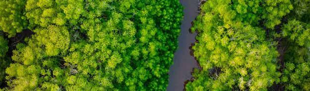
The European Commission’s Joint Research Centre (JRC) uses the historical Landsat archive of more than 3 million satellite images to analyse and quantify global surface waters, which are disaggregated into permanent, seasonal and reservoir data sets (Pekel and others, 2016). The JRC also provides information on the water quality of the world’s largest or most strategically important inland water bodies, including reservoirs. It assesses three recent years (2017–2019) and compares them with five historic years (2006–2010). The Global Mangrove Watch consortium provides global geospatial information on the extent of mangrove changes since 1996 (Bunting and others, 2018). Recently, DHI GRAS globally mapped vegetated wetlands in high resolution using a combination of optical, radar and thermal imagery (Tottrup and others, 2020).
Advertisement
In March 2020, UNEP directly engaged with each of its Member States to obtain national approval of indicator 6.6.1 data. National statistics per ecosystem type were sent to confirmed focal persons for SDG 6 and indicator 6.6.1, as well as national statistics offices. At present, 160 countries have confirmed national focal persons for indicators. In the 33 countries where there were no such focal persons, communications were directed either to the national focal persons for SDG 6 or the SDG national statistics office.
A UNEP help desk for indicator 6.6.1, which has a dedicated United Nations email address, was set up to manage the national data approval process and respond to technical questions and queries from countries about indicator data. The indicator help desk team comprises staff within UNEP’s Freshwater Unit (Ecosystems Division), technical specialists from dataproviding organizations (including the JRC and its partners Plymouth Marine Laboratory and Brockmann Consult), the Global Mangrove Watch consortium and DHI GRAS. A no-objection approach was adopted for the national data validation.
More than 60 countries raised questions on specific ecosystem data, with most technical clarifications resolved. However, some technical queries could not be resolved, such as the lack of alignment of lake water turbidity data with Finland’s national data (due to the shallow nature of the country’s numerous lakes, which influenced the accuracy of turbidity measurements captured by satellite imagery) and the inaccurate national data set for surfacewater extent in the Netherlands (where saline seawater, which is used in the canal and inland waterway system, were captured as part of national freshwater surface-area data). In these cases, the specific ecosystem data were reported with explanatory notes and were not included in the national data series.
In February 2021, nationally approved data for 190 countries were submitted to the United Nations Statistics Division. Data were not available for three small island developing States.
Figure 3. Workflow for monitoring and reporting SDG indicator 6.6.1
Source: DHI GRAS / UNEP

Saksun, Faroe Islands by Marc Zimmer on Unsplash
3. Global and regional freshwater ecosystem trends derived from indicator 6.6.1 data
Understanding the state of the world’s freshwater ecosystems is an essential first step in their protection and restoration. This section of the report and its associated online story maps6 present the extent of freshwater changes, linking these to known pressures and drivers.
Recognizing how multiple pressures interact to cause changes in freshwater ecosystems is complex. For example, growing populations drive ecosystem changes through increased demand to generate locally stored fresh water, which alters hydrological systems, or by deforesting and urbanizing areas, which increases run-off, flooding rates and nutrient and sediment loss, thereby degrading water bodies. Draining inland wetlands and removing costal mangroves lowers these ecosystems’ capacity to moderate the effects of extreme weather events and also reduces freshwater habitats and biodiversity. Climate change-induced rainfall variations are altering the geographical distribution of permanent surface water. At the same time, increased temperatures may result in drought and less surface water, while also contributing to increased glacial melting and permafrost thawing, thus leading to increased surface water. The analysis presented in the following subsections uses evidence from global and regional single-pressure statistical correlations to confirm co-variability with respect to time and locations. The statistics are then supported using published scientific literature, with causality established. All results have been validated with domain experts. The analysis uses river basins to assess freshwater ecosystem trends, mapping the basin-level analysis at the global and regional levels. River basins are naturally connected hydrological systems where local freshwater changes (related to abstraction, drought, flooding, degradation and pollution) may affect larger connected freshwater ecosystems within the catchment, including across national borders. Although river basins experience a degree of natural variation in water quantity and quality, they are increasingly exposed to climate change, population growth and land-cover change from deforestation, urbanization and dam and reservoir construction.
6 See https://mango-river-0ac1c3d03.azurestaticapps.net/.
The impacts of changes in freshwater ecosystems are presented in a series of downloadable case studies and online story maps. These case studies and story maps observe changes in different freshwater ecosystems (as reported under indicator 6.6.1) and link them to impacts on the ground. The story maps also highlight the wide array of freshwater ecosystem pressures, the complex interaction between natural and anthropogenic stressors, and how different pressures act over large areas and across long timescales. These complex and hierarchically-linked interactions must be considered when designing approaches and taking action to protect and restore affected freshwater ecosystems, and ultimately make them more resilient to future changes. It is hoped that the findings of the analysis will accelerate action towards improved management and protection of freshwater ecosystems.
Each case study includes data on the degree of integrated water resources management (IWRM) implementation in the country, as reported by the countries under indicator 6.5.1.7 The importance of implementing IWRM for ecosystem protection is discussed in chapter 4 of this report on accelerating actions towards target 6.6.
The ecosystem trends analysis maps freshwater changes, aggregated at the regional level, using the SDG regional delineation shown in Figure 4.
Figure 4. Map of SDG regions

Source: DHI GRAS / UNEP
7 For more information on indicator 6.5.1 on IWRM implementation, see http://iwrmdataportal.unepdhi.org/.