FOCUS AREA 1: Increase connectivity and the amount of publicly accessible foreshore
GOALS AND ACTIONS
LOCATION / DETAILS
RESPONSIBILITY/ TIMING KEY STAKEHOLDERS
PRIORITY
Work with land owners/developers to require new, Identified sites include, but not limited to: publicly accessible foreshore connections as part of – 4-18 Deakin Street, Mortlake any future development and/or urban renewal projects. – 33W, 33R Hilly Street, Mortlake – 24-28 Hilly Street, Mortlake – 2-4 Bennett Street, Mortlake
Strategic Planning
Short
High
Ensure a connection between the future Leeds Street Park and the pedestrian underpass under Ryde Bridge.
NSW Government (delivery)
Ongoing
High
Ongoing
High
Council
Short / Long term
High
Roads and Traffic
Medium term
High
Parks and Recreation
Medium term
High
Goal 1.1: Facilitate/Provide foreshore access in new redevelopment areas adjacent to the Parramatta River. 1.1.1
1.1.2
Leeds Street, Rhodes East
Statutory Planning
Council (stakeholder) 1.1.3
Ensure that the planned park upgrades, as part of the Rhodes East Rhodes East Planned Precinct provide improved access with new foreshore paths and create new foreshore spaces.
NSW Government
Goal 1.2: Work with private property owners, strata groups and community associations to increase public access to the foreshore. 1.2.1
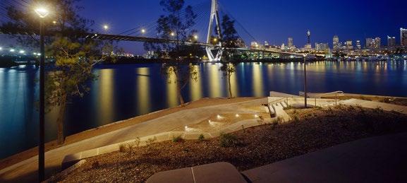
The foreshore is one of our greatest natural assets. Creating new connections and spaces, provides increased and equitable access for everyone, encourages healthy, active lifestyles and increases the enjoyment for both residents and visitors.
GOALS Goal 1.1: Facilitate/Provide foreshore access in new redevelopment areas adjacent to the Parramatta River. Goal 1.2: Work with private property owners, strata groups and community associations to increase public access to the foreshore. Goal 1.3: Deliver new foreshore paths through Council owned parks and open space.
–
–
Short Term: Engage in “without prejudice” – discussions with the Chair of the Body Corporate for 30-34 Hilly Street, Mortlake, with a view to obtaining public access over the foreshore walkway (this property is the only hindrance to access between Wangal Reserve and Northcote Street Mortlake) Long Term: If discussions are unsuccessful, investigate feasibility of creating a boardwalk to circumnavigate this property and complete the Mortlake Peninsula walk.
30-34 Hilly Street, Mortlake
Goal 1.3: Deliver new foreshore paths through Council owned parks and open space. 1.3.1
1.3.2
Create a new council owned pedestrian bridge over St Luke’s Canal when access is available through Barnwell Park Golf Course
St Luke’s Canal
Create a shared, publicly accessible foreshore path along the Barnwell Park Golf Course, re-orient the fairways or consider redeveloping the site as a 9-hole course to also create a new public foreshore park
Barnwell Park Golf Course
Parks and Recreation
Goal 1.4: Create new connections between existing paths and places. 1.4.1
Support a future pedestrian bridge over Concord Road McIlwaine Park to Rhodes Station to connect to McIlwaine Park identified for Rhodes East Planned Precinct Plan by DPIE
DPIE
Ongoing
Medium
1.4.2
Investigate, design and create a shared, publicly accessible elevated shared path/boardwalk extending the Bay Run beneath the Iron Cove Bridge
Transport for NSW Parks and Recreation Road and Traffic
Medium
Medium
Bay Run to Birkenhead Point (Iron Cove Bridge)
Goal 1.4: Create new connections between existing paths and places.
37


