


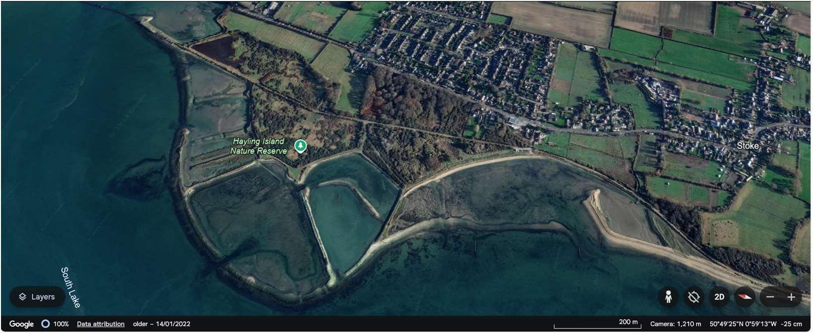
ODU15extendsfromStoketotheLangstonebridgecarpark.Thisunitis complexgiventhetidalfloodrisk,andvaryinglanduses.Thefrontageincludes agriculturalland,theOysterBeds,formerlandfillsites,thewidelyusedHayling BillyTrailwhichisaNationalCycleRoute,theA3023mainaccessroadonto HaylingandresidentialpropertiesatStoke.
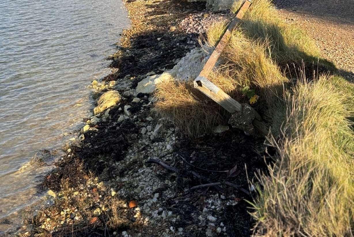
Defencesconsistofamixofrevetments,embankmentsandgabionwithtypical residuallivesofbetween10and15years,althoughlocallysomesectionsareless than10years.Thesedefencesarecurrentlyownedandmaintainedby HampshireCountyCouncilorHavantBoroughCouncil,withtheexceptionofa smallsectionofrevetmenttothesouthoftheunitwhichisownedbyHampshire CountyCouncilbutmaintainedbytheEnvironmentAgency.
Thefrontageiscoveredbysignificantenvironmentaldesignations,including SSSI,Ramsar,SPAandSACinintertidalareasandtheOysterBeds,aswellas SSSI,RamsarandSPAontheformerlandfillsites.Thesiteisalsoidentifiedas animportantSolentWaderandBrentGooseSiteintheHavantBorough CouncilDraftLocalPlan.Therearetwolocalnaturereserveshere,TheWest HaylingLNRwhichextendsovertheformerOysterbedsandmanagedbythe RSPB,andtheHaylingBillyLNR.
HoldtheLineforthenext100years,butwithfurtherdetailedstudiesto considerManagedRealignmentatWestNorthneyandRegulatedTidal ExchangeatStoke.
Erosionriskislow,althoughtheOysterBeds,formerlandfillsitesandpartsoftheHaylingBillyTrailmaybeatriskin thefuture.BothresidentialpropertiesandtheA3023however,areatriskoftidalfloodingwherethereisacoherent floodcellacrossthewholefrontage.Overthenext100yearsitisexpectedthattherewillbeupto268properties andsignificantsectionsoftheA3023atriskoftidalfloodingacrosstheunitwithoutprotection.
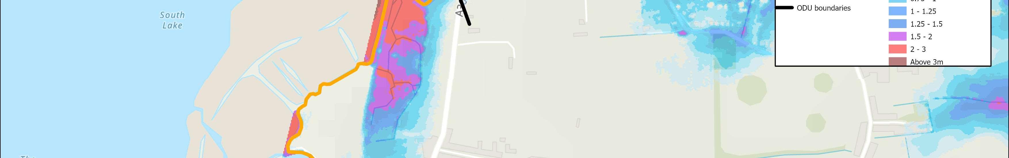
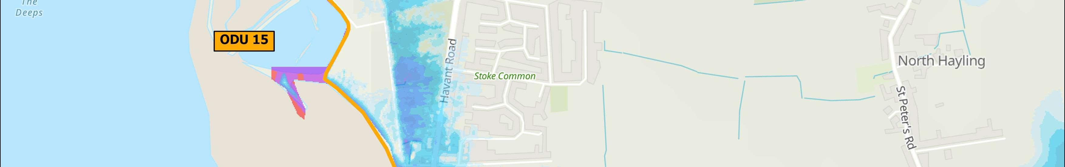
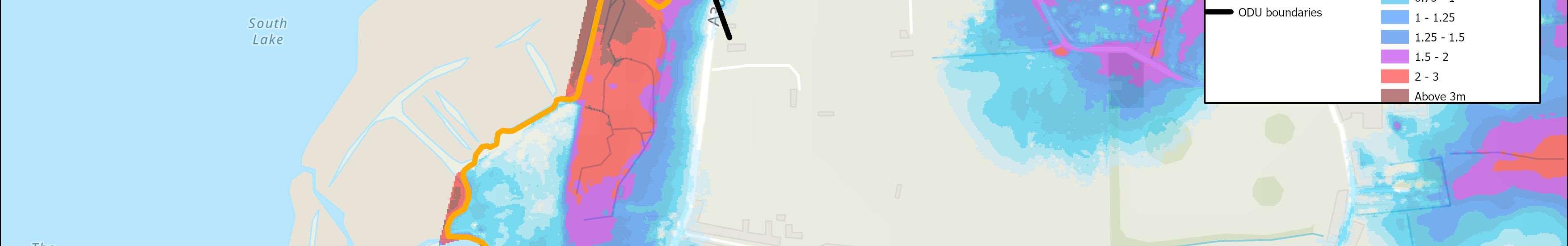
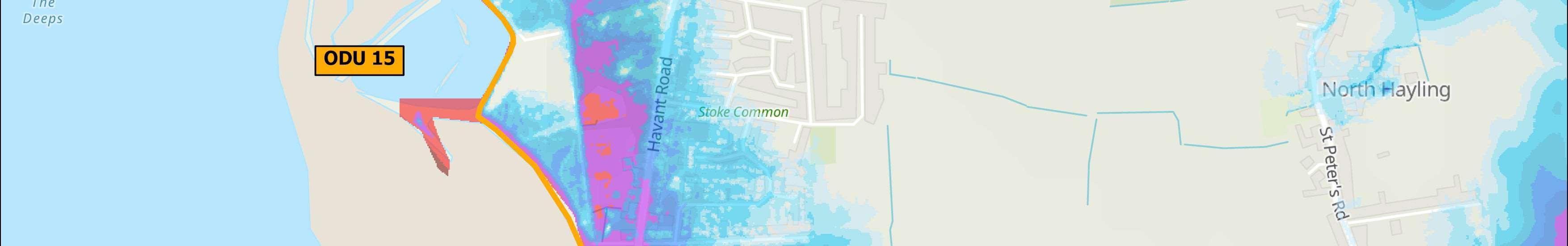
Themapsbelowshowthemodelledextentanddepthsofanextremetidalfloodevent(1in200year,0.5%annual probability),withoutanydefences,todayandin100years,allowingforsealevelrise.
Erosionrisk
Numberofpropertiesatrisk,withnodefences
Tidalfloodrisk
Numberofpropertiesatrisk,withnodefences


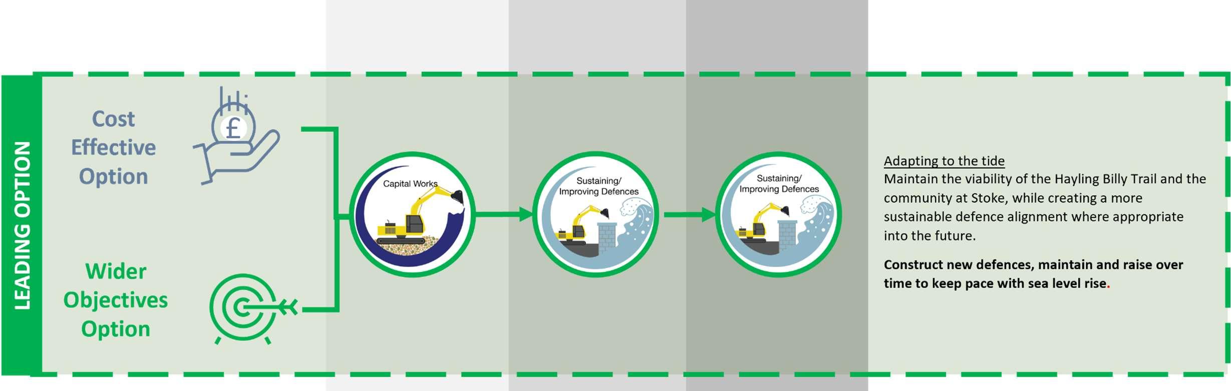

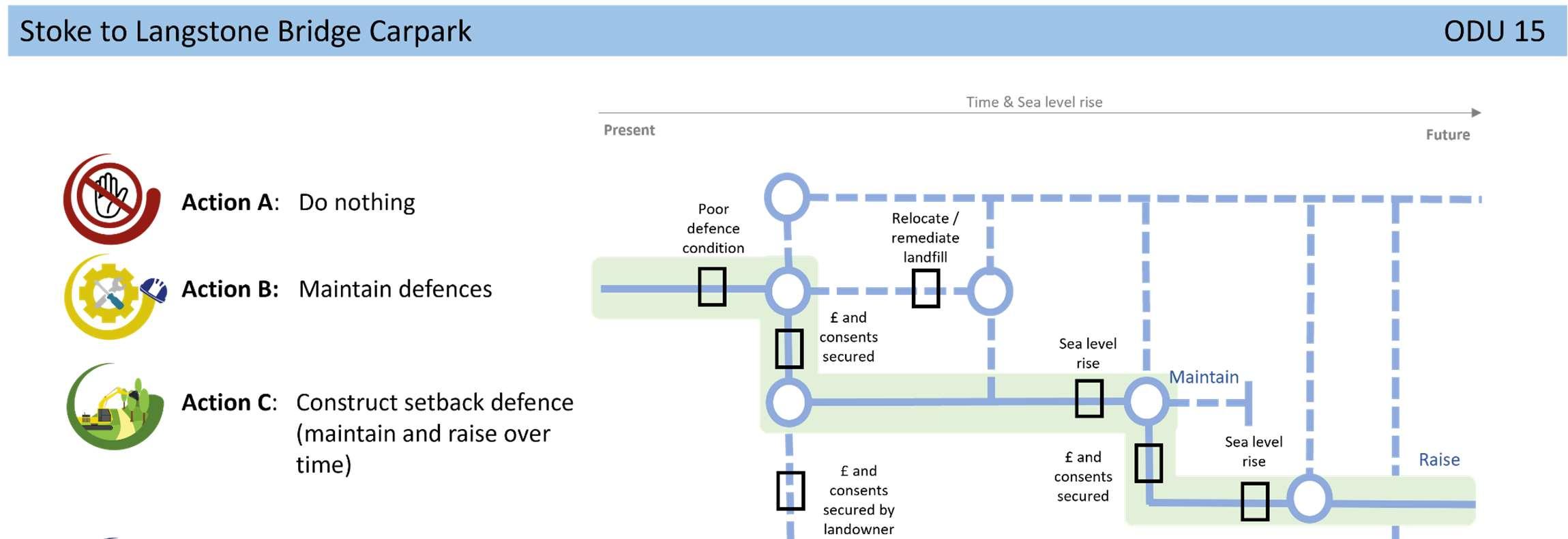
TheStrategicintentfortheunitistoconstructnewset-back defencesinaphasedapproach,tomaintaintheviabilityofthe A3023,theHaylingBillyTrailandthecommunityatStoke,protect formerlandfill,whilstmakingspacefornaturewhereviabletodo so.Intheareaofthehistoriclandfill,theexistingfrontlinedefences wouldbemaintainedtopreventerosionuntilfurtherstudiesare completed.Ifformerlandfillisfoundtobeinert,theoptioncould considerremediationandsetbackdefences.
AFloodandCoastalErosionRiskManagementStudyfortheA3023has beenproposedintheStrategy’sshorttermactionplan,subjectto securingfunding.