


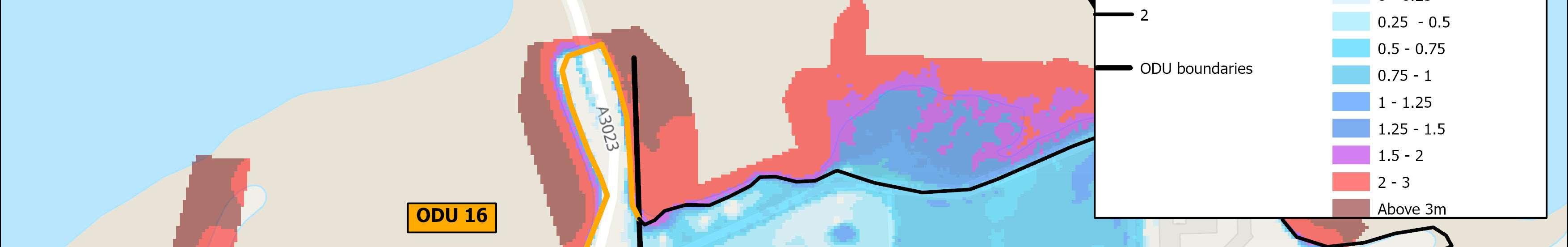
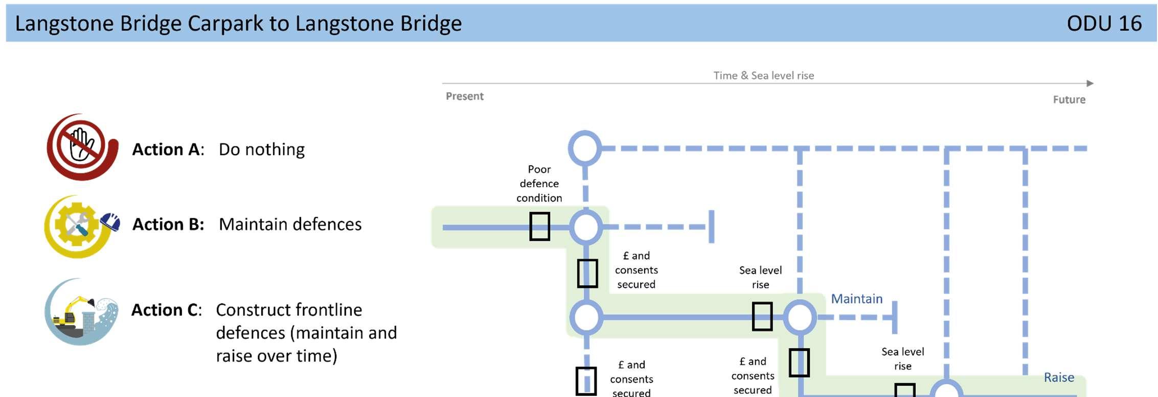
ODU16extendsfromtheLangstoneBridgecarparktoLangstoneBridge, withHaylingIsland’smainaccessroad,theA3023,runningcloselyalongside. ThemainrisktotheA3203,identifiedasacriticalpieceofinfrastructurein HavantBoroughCouncil’sdraftlocalplan,isfromtidalflooding.
Thereisamixofdefencesalongthisshortunit,includingsheetpilinganda revetment,ownedandmaintainedbyHampshireCountyCouncil.Residual lifeofthesedefencesisbetween10and20years.
Environment
TheHarbourintertidalareaadjacenttothisfrontageisheavily environmentallydesignatedasaSSSI,Ramsar,SPAandSAC.
ShorelineManagementPlanPolicy
HoldtheLineforthenext100years.
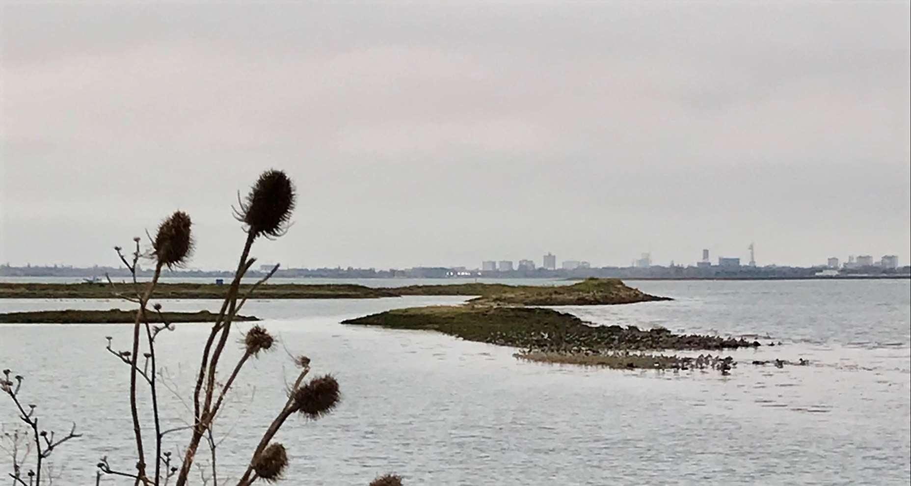
Lookingbackatthe OysterbedsfromODU16
ODU16location


Themainriskhereisfromtidalflooding.Withoutdefencesinplace,thefloodcellcouldmergewithadjacentflood cellstotheeast(inODU1)andwest(inODU15)duringlargerreturnperiodevents.Inthisscenario,safeaccessand egressontoandofftheislandwouldbeseverelycompromised.
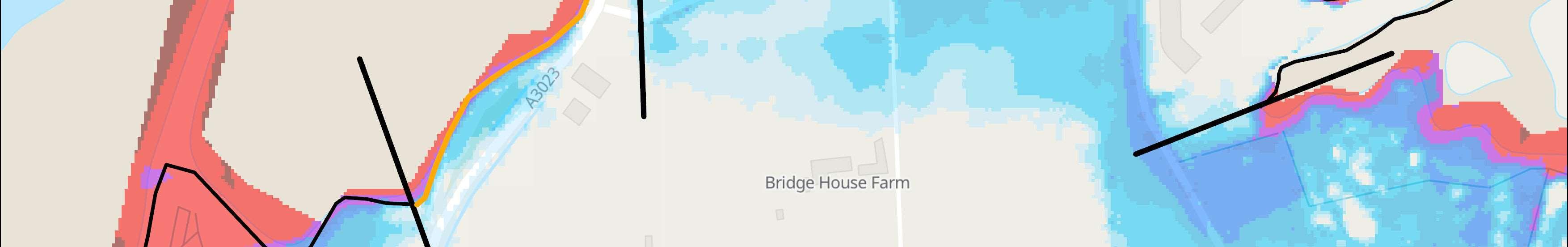
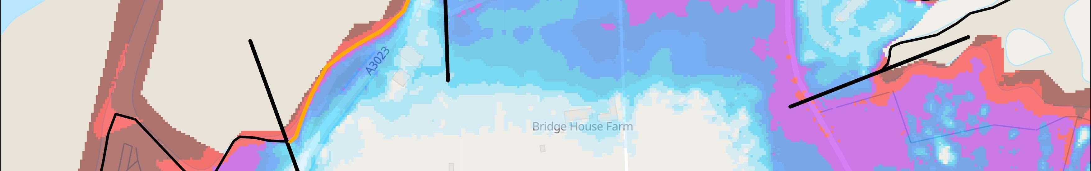
Themapsbelowshowthemodelledextentanddepthsofanextremetidalfloodevent(1in200year,0.5%annual probability),withoutanydefences,todayandin100years,allowingforsealevelrise.
Erosionrisk
Numberofpropertiesatrisk,withnodefences
Tidalfloodrisk
Numberofpropertiesatrisk,withnodefences


StrategicIntent
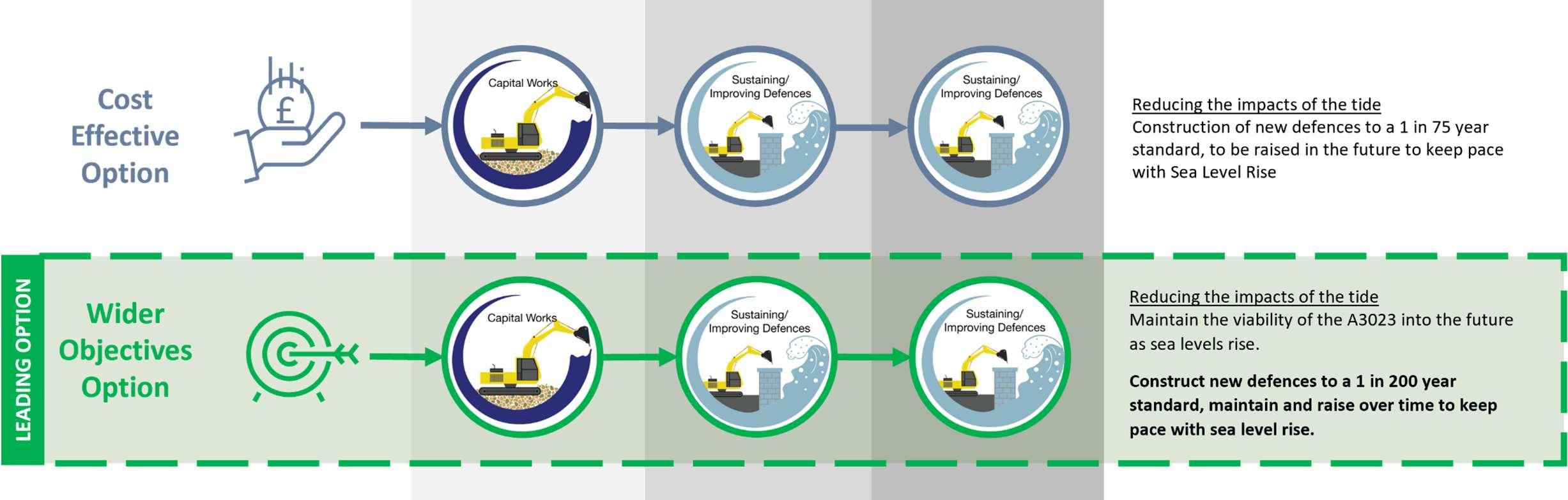
TheStrategicintentfortheunitistoprotectandmaintainthe viabilityoftheA3023intothefuture,ascriticalroadinfrastructure ontheisland.
NextSteps
AFloodandCoastalErosionRiskManagementStudyfortheA3023has beenproposedintheStrategy’sshorttermactionplan,subjectto securingfunding.