


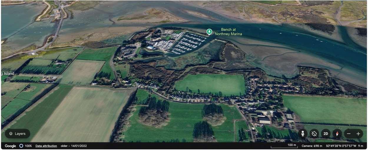
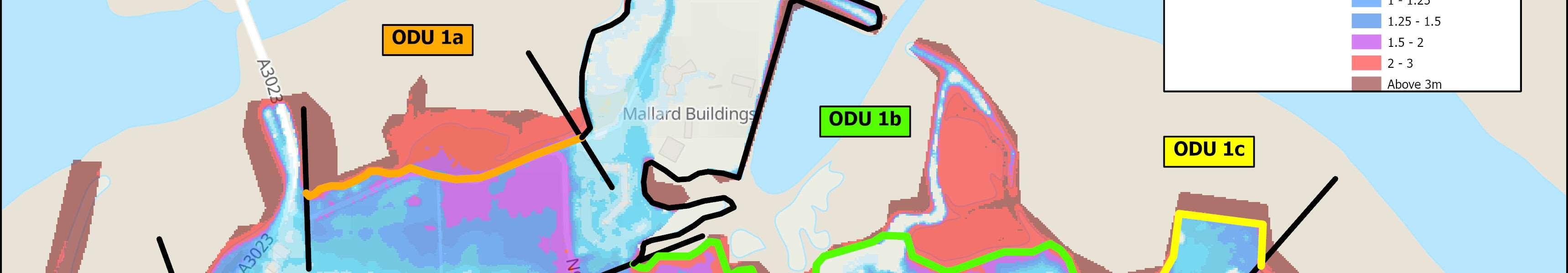
ODU1islocatedbetweenLangstoneBridgeandNorthneyFarm.This frontageiscomplexgiventhetidalfloodrisk,varyinglandusesandland ownership.ODU1isdividedinto3sub-units.Sub-unit1Aisboundedby NorthneyRoad,andimportantagriculturalland,sub-unit1Bincludesapublic recreationalareafrontingresidentialpropertiesandsub-unit1Cisaformer landfillsite.Sub-unit1Aand1BareseparatedbyNorthneyMarinainODU2.
Theexistingembankmentsareexpectedtohaveshortremainingliveswhere theyexist,withresiduallivestypicallybetween10and20years,butinsome localisedareas,lessthan10years.Thesedefencesarecurrentlymaintained byHampshireHighways,HavantBoroughCouncil,theEnvironmentAgencyor privately.
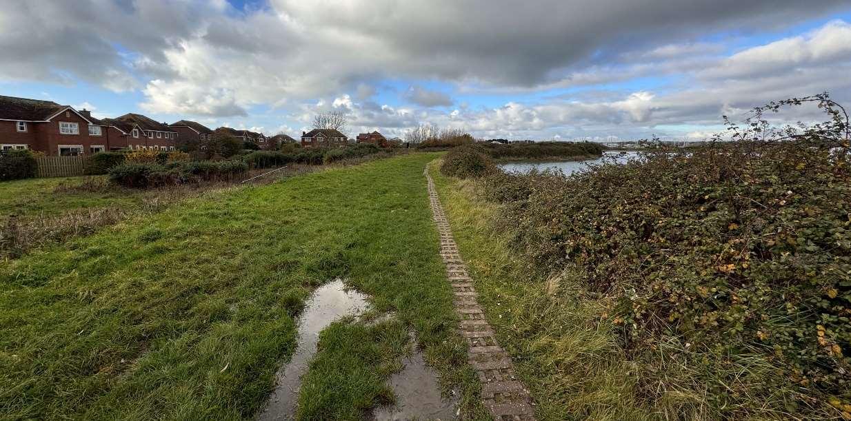
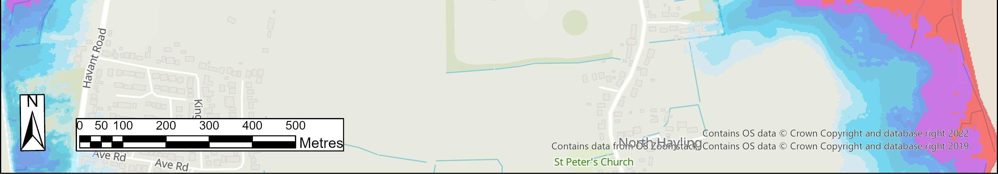
NorthneyroadisidentifiedasacriticalpieceofinfrastructureinHavant BoroughCouncil’sdraftlocalplanprovidinganalternativeemergencyaccess routeontotheisland.ItisalsocrucialtoaccessNorthneyvillageandmaintain theviabilityofNorthneyMarinaandtheLangstoneQuaysResortaswellas potentialfuturedevelopmentproposalsinthearea.Theroadisregularly inundatedthroughouttheyearandimpassableforhoursatatime.Thiswill becomemorefrequentinthefuturewithclimatechangeandsealevelrise.
Thefrontageiscoveredbysignificantenvironmentaldesignations,including SAC,SPA,RamsarandSSSIdesignationsonintertidalareas,aswellasSPA, RamsarandSSSIontheformerlandfillsite,andaNationalLandscapebothon landandintertidal.Thelandwardagriculturalandrecreationallandis importantasfunctionallylinkedhabitatforbirds,beingcore,primaryand secondarysupportareasintheSolentWadersandBrentGooseStrategy.
HoldtheLinepolicyalongthewholeofthisfrontageoverthenext100years.
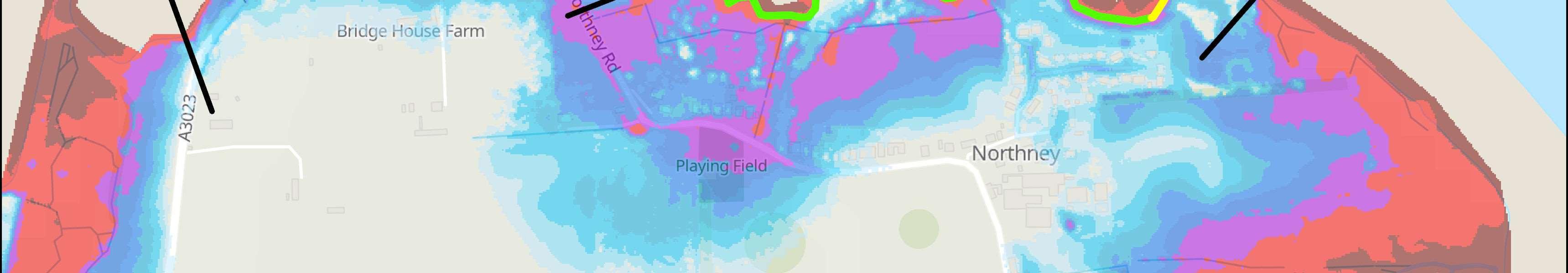
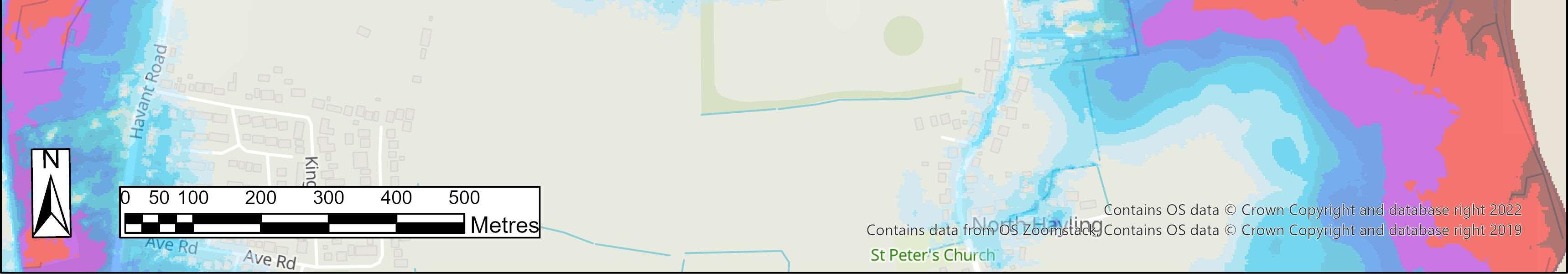
Themainriskhereisfromtidalflooding,wherethefloodcelllinksODU1A,BandC.Overthenext100years,without defencesinplace,itisexpectedthatinadditiontotheregularinundationandlossofNorthneyRoad,therewillbeup to87propertiesatriskfromtidalfloodingacrosstheunit.
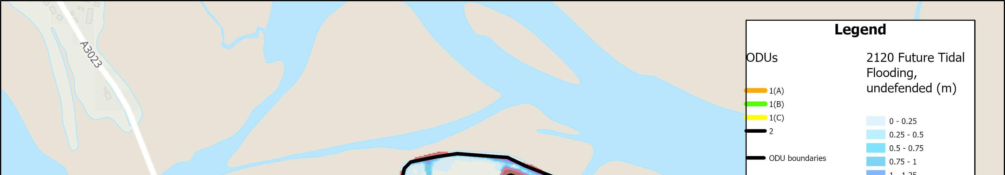
Themapsbelowshowthemodelledextentanddepthsofanextremetidalfloodevent(1in200year,0.5%annual probability),withoutanydefences,todayandin100years,allowingforsealevelrise.
Erosionrisk
Numberofpropertiesatrisk,withnodefences
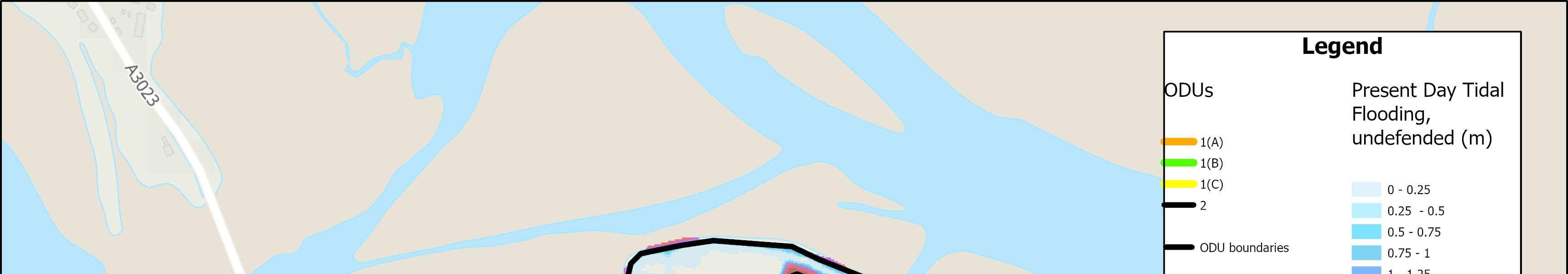
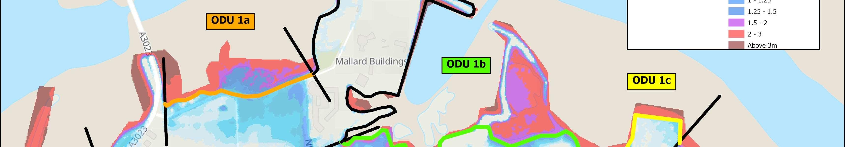

Tidalfloodrisk
Numberofpropertiesatrisk,withnodefences
OverallStrategicOption
Sustain0.5%AnnualExceedanceProbability (AEP)withmanagedrealignmenthybrid
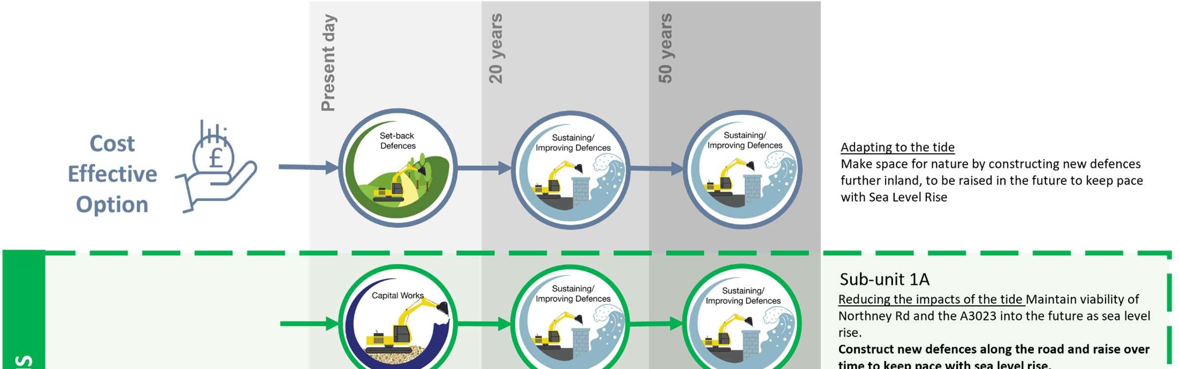
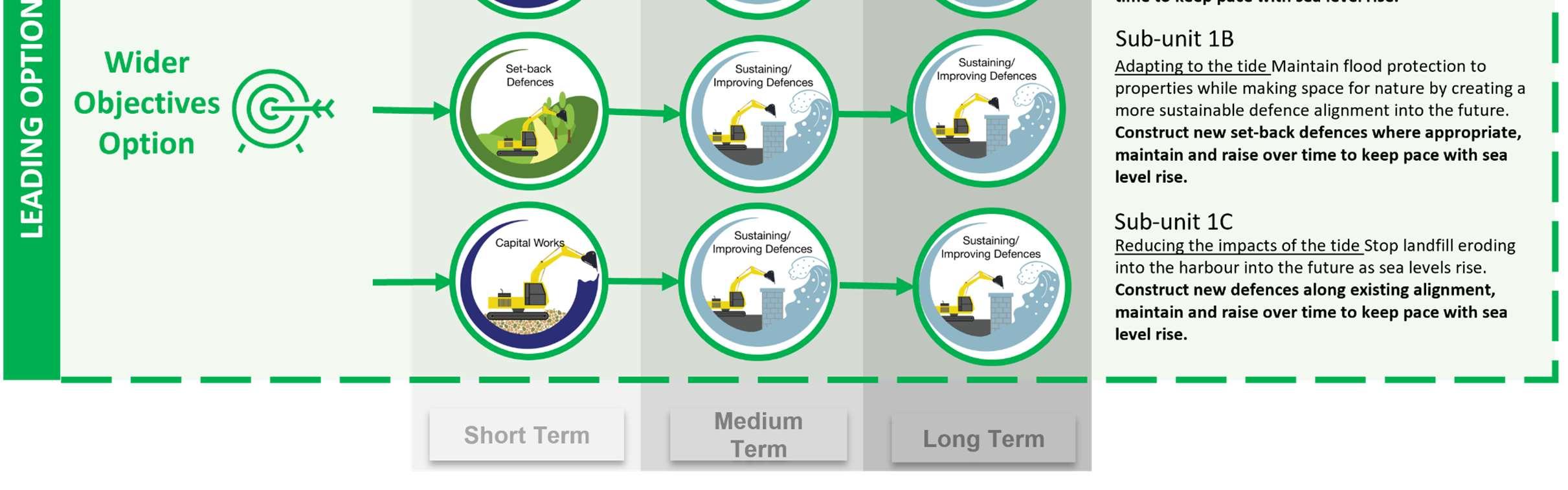
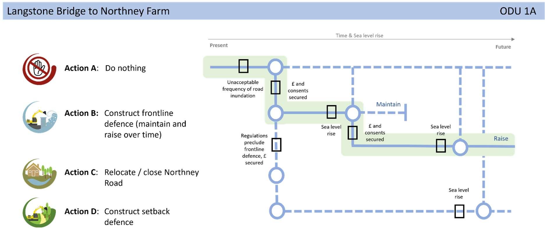
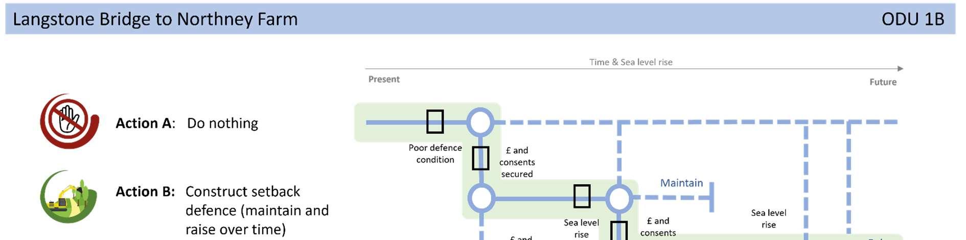
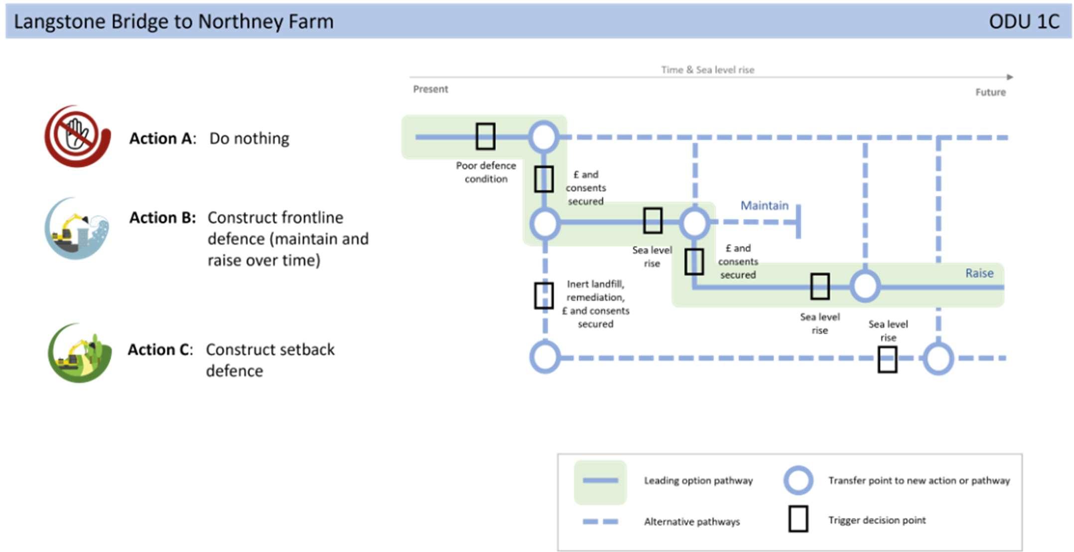
TheStrategicintentfortheunitistoimplementafrontlinedefence toprotectNorthneyRoadsubjecttoobtainingconsents(ODU1A); setbackdefencesalongthecentralsectiontoallowforhabitat creationandnaturalevolutionoftheshoreline(ODU1B)and continuetodefendtheformercoastallandfill(ODU1C).Notonly doesthisprovidefloodriskprotectiontothepropertiesbyclosing thefloodriskcell,butitalsoprotectsthecriticalroad infrastructureandformerlandfillsitewhilstmakingspacefor naturewhereviabletodoso.IffrontlinedefencesalongNorthney Roadarenotlikelytobeconsented,thenset-backdefences combinedwithrelocationoftheroadshouldbeinvestigated.Also, ifthelandfillisfoundnottobeharmfultotheenvironment,then opportunitiestosetbackdefencesshouldalsobeinvestigated here.ItisworthnotingthatsomepartsoftheStrategicintent deviateawayfromtheSMPpolicytoHoldtheLinefor100years.
AFloodandCoastalErosionRiskManagementSchemeforNorthney hasbeenproposedintheStrategy’sshorttermactionplan.Subjectto securingfunding,thiswillstartwithafeasibilitystudytoappraise appropriatecoastalmanagementoptionsandalignmentsfordefences alongthisfrontageandinvestigatethepropertiesoftheformercoastal landfillsite.