


Mapdata:Google©2016-2022,DataSIO,NOAA,U.SNavy,NGA,GEBCO,IBCAO, Landsat/Copernicus
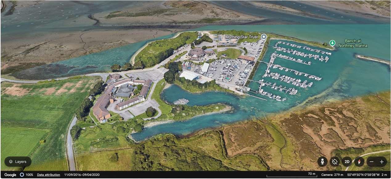
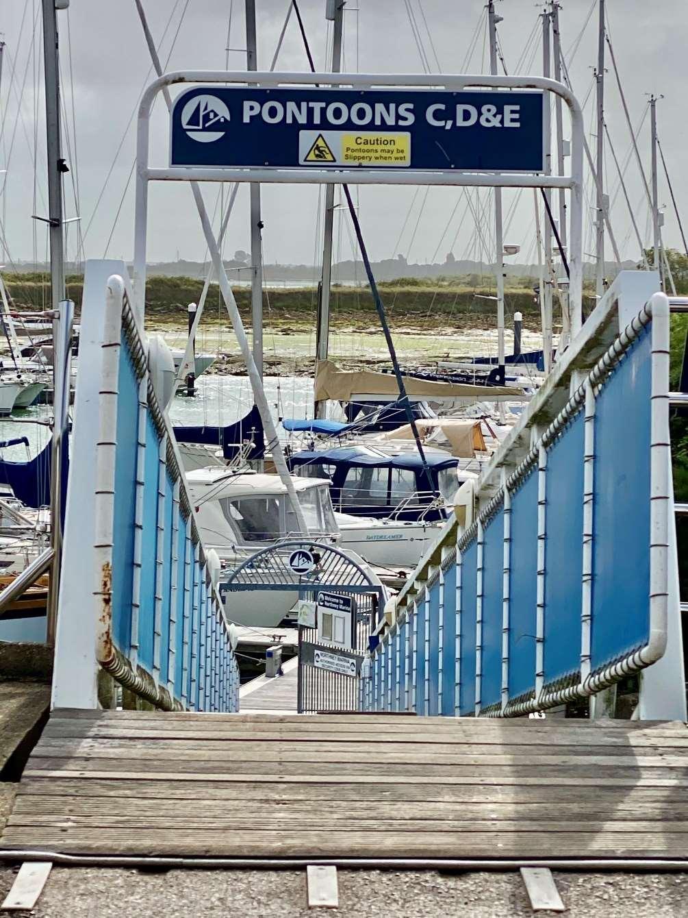
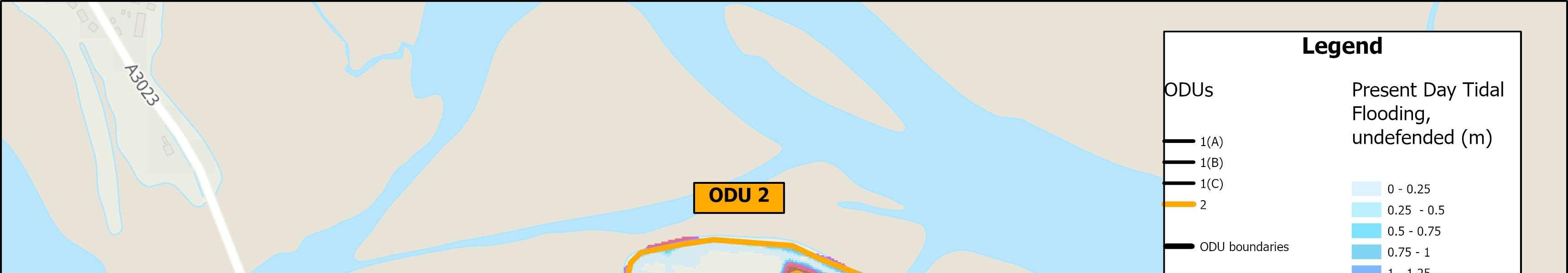
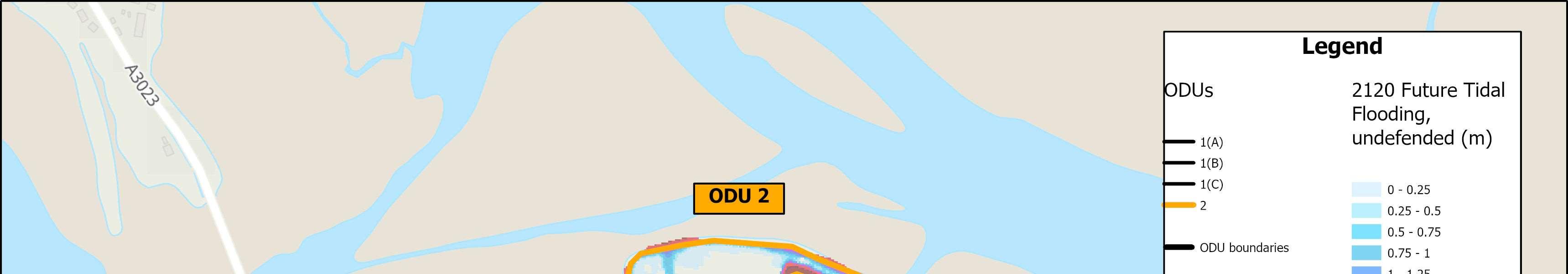
ThisunitislocatedbetweenODU1Aand1BandencompassesNorthneyMarina andtheLangstoneQuaysResort.TheMarinacomplexincludesamixof businessesandmorerecently,anumberofresidentialproperties.Thereis potentialforfurtherdevelopmenthereinthefuture.
Defences
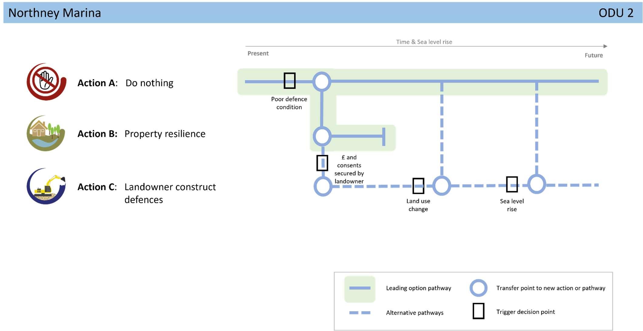
Existingdefences,wherepresent,areprivatelyownedandmaintainedinformal embankmentsandlocalisedrockarmour.Residuallivesofthesedefencesare typicallybetween15and20years.Thereareveryfewpropertiesatriskasthe marinaisonrelativelyhighland.
Environment
Thefrontageissurroundedbyasuiteofenvironmentaldesignations(Ramsar, SPA,SAC,SSSI)whichcovertheintertidalareasoutsideofthemarinaitself. Landward,themarinaandhotelfallwithintheChichesterHarbourNational Landscape.
ShorelineManagementPlanPolicy
HoldtheLinealongthewholeofthisfrontageoverthenext100years.
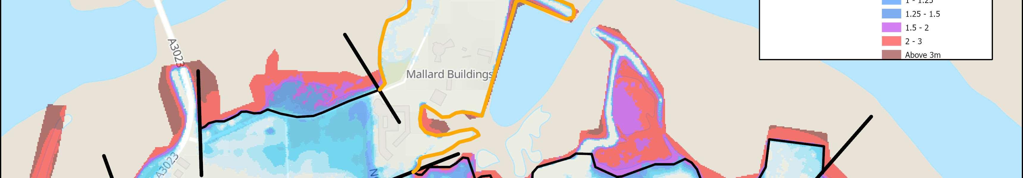
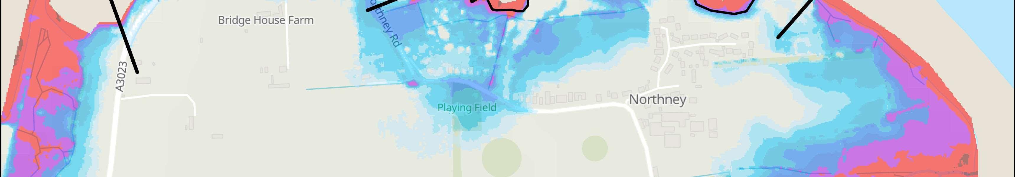
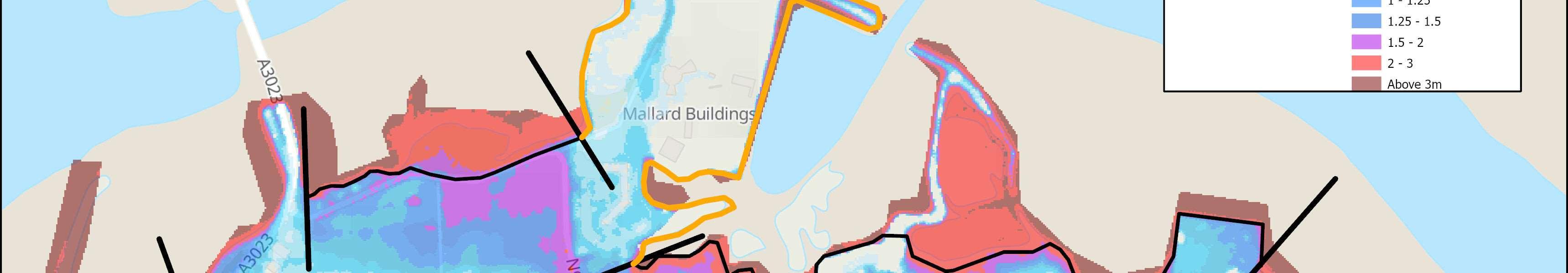
Floodanderosionriskislowonthesiteitself,howevertheaccessroadtothefrontagealongNorthneyRoad (ODU1A)isatsignificantfloodrisknowandintothefuture.TheviabilityofNorthneyMarinaandsurrounding businesseswillthereforebehighlydependentonmaintainingaccesstothesiteviaNorthneyRoadintothe future.
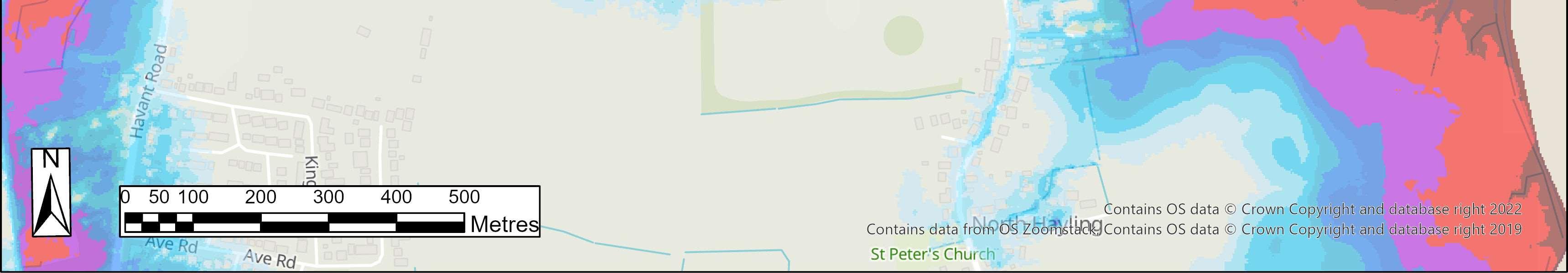
Themapsbelowshowthemodelledextentanddepthsofanextremetidalfloodevent(1in200year,0.5% annualprobability),withoutanydefences,todayandin100years,allowingforsealevelrise.
Erosionrisk
Numberofpropertiesatrisk,withnodefences
Numberofpropertiesatrisk,withnodefences


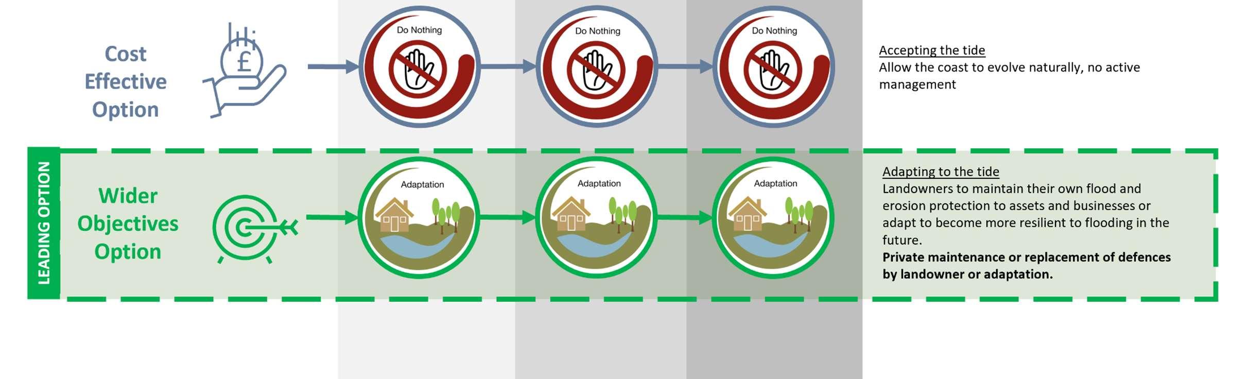

StrategicIntent
TheStrategicintentfortheunitisadaptationofassetstobecome moreresilienttoclimatechangeimpactsinthefutureasfloodand erosionriskisverylow.Iflandownerswishtomaintain(andfund) theirexistingdefencesinthefuture,theywillneedtoobtainthe relevantlicencesandconsentsfirst.
NextSteps
Noneidentifiedforthisfrontageintheshort-term,otherthanongoing conversationswithcommunitiesinrelationtolevelsofriskandwhat todointheeventofaflood.