


TheStrategywasproducedforHavantBorough CouncilbyCoastalPartnerswithtechnicalassistance fromtheengineeringconsultantAECOM.

ThisprojectwasfundedbytheEnvironmentAgency fromFDGiA(FloodDefenceGrantinAid)andby HavantBoroughCouncilthroughLocalLevy.
GlossaryandAcronyms
Chapter1:Introduction
Introduction
StrategyObjectives
TheShorelineManagementPlanHierarchy
ShorelineManagementPlanPolicies
TheNeedforaStrategicApproach
PurposeandStructureofthisDocument
Chapter2:WhatisatRiskifweDoNothing?
BaselineScenario–DoNothing
WhatisatriskifweDoNothing?
SeaLevelRiseandIncreasingRisk
Erosion
Chapter3:HowTheStrategyhasbeendeveloped
OverviewoftheStrategyarea–keyfeatures,issuesandopportunities
CoastalProcessesOverview
CoastalLandfillSites
EnvironmentalDesignations
HeritageandRecreation
StakeholderEngagement
ExistingDefences
ABriefHistoryofCoastalManagementonHaylingIsland
BeachManagementonHaylingIsland
StrategyDevelopment
Chapter4:StrategyOverview
Aphasedapproachtomanagementbasedonrisk DeliveringMore–broaderoutcomesandcontributions Adaptation
Chapter5:CoastalManagementStrategy
WhatcanIexpecttoseeforeachODU?
AdaptivePathways
ODU1–LangstoneBridgetoNorthneyFarm
ODU2–NorthneyMarina
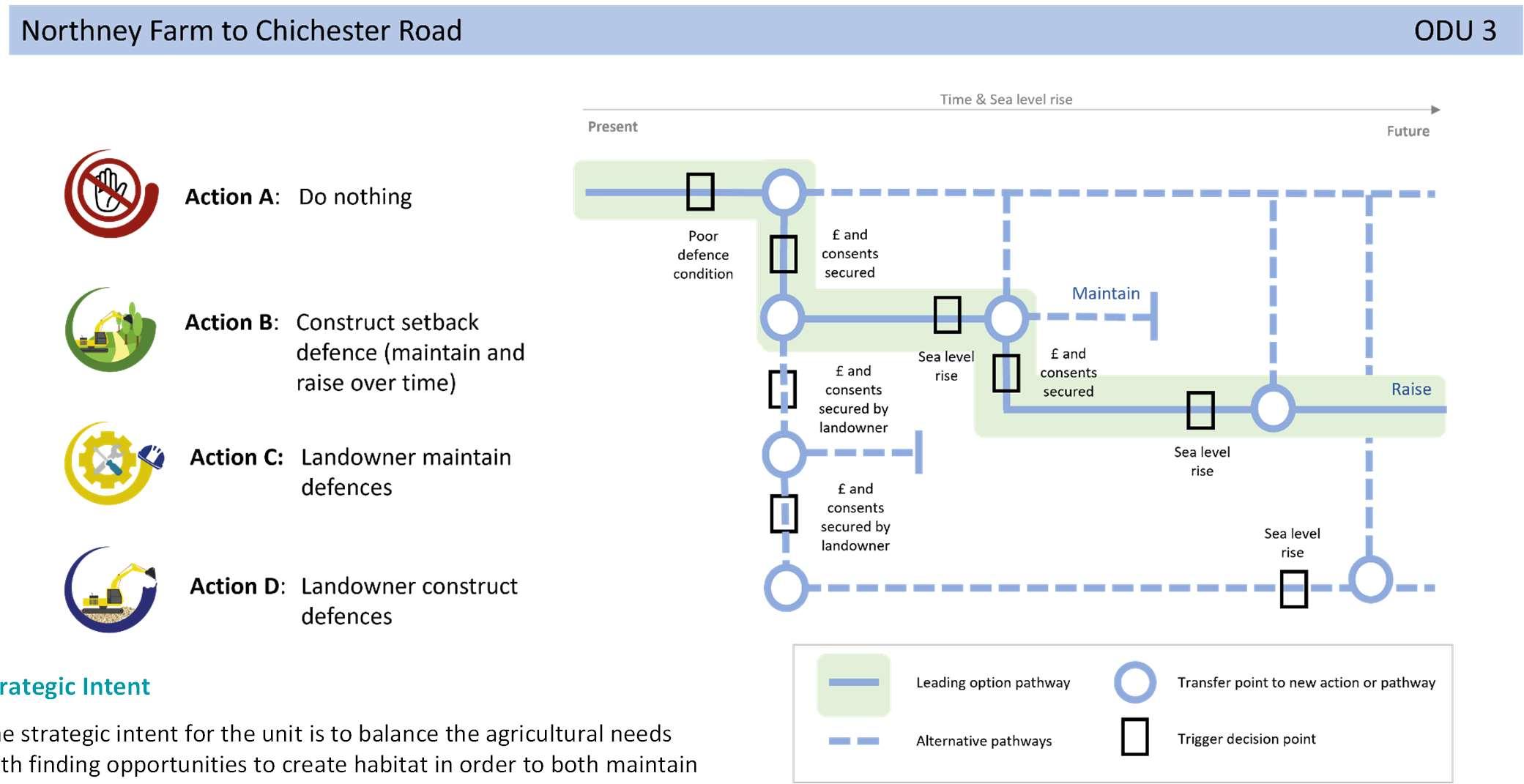
ODU3–NorthneyFarmtoChichesterRoad
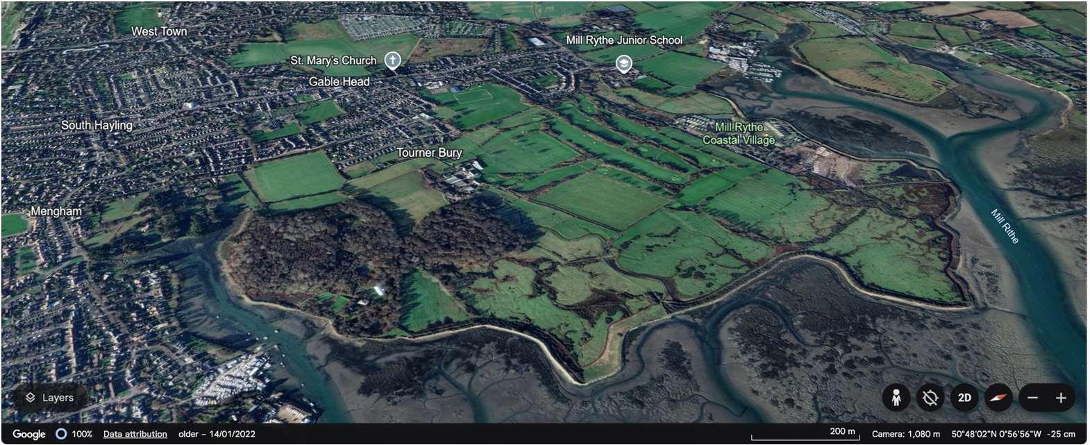
ODU4–ChichesterRoadtoMillRytheJuniorSchool
ODU5–MillRytheJuniorSchooltoSalternsLane
ODU6–SalternsLanetoWilsonsBoatYard
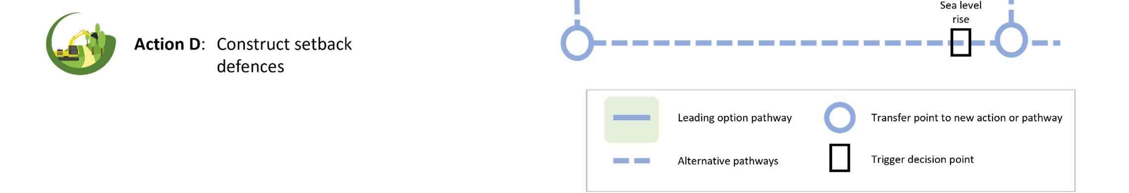
ODU7–WilsonsBoatYardtoFisheryCreek
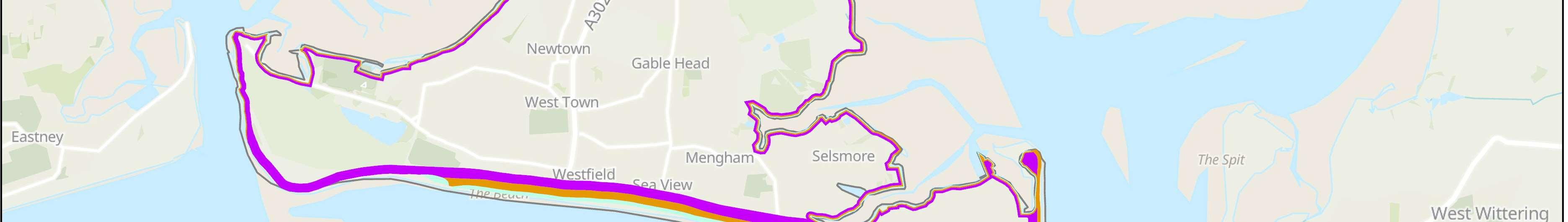
ODU8–Eastoke
ODU9–EastokeCornertoInnontheBeach
ODU10–InnontheBeachtoNorthShoreRoad
ODU11–NorthShoreRoad
ODU12–NorthShoreRoadtoNewtown
ODU13–Newtown
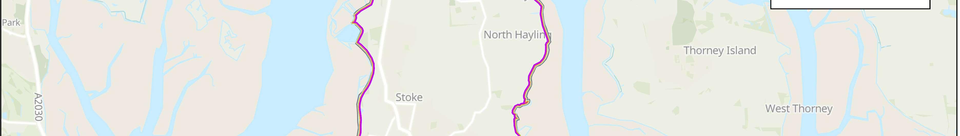
ODU14–NewtowntoStoke
ODU15–StoketoLangstoneBridgeCarpark
ODU16–LangstoneBridgeCarparktoLangstoneBridge
Changingourlifestyles,economy,infrastructureandlocalplacestomakeus moreresilientandadaptabletofutureconsequences.Ref:NationalFCERM StrategyforEngland(2020)
https://www.gov.uk/government/publications/national-flood-and-coastalerosion-risk-management-strategy-for-england--2
Adaptivepathwaysapproach
Adaptivepathway’sisadecision-makingapproachthatallowsdecision-makers totakeactionstomanageriskunderuncertaintyandchangingconditionsnow andintothefuture.
Isthepercentageofoccurrenceinanyyear.Forexample,a0.5%AEPfloodhas a0.5%or1in200chanceofoccurringinanygivenyear.
Baseline
Definesanexistingcondition/situation(usuallyDoNothing)againstwhich optionsorscenariosarecompared.
Bi-modalwaves
Abimodalseastateoccurswhenbothswellwaves(lowerinheightbuthavea longerwaveperiod)andlocallygeneratedstormwaves(highwaveheightsbut shorterwaveperiod)arepresent.Theyresultinaveryenergeticwave spectrumthatcanbeverydamagingtothecoastline.Formoreinformationon howthesewavesimpactHaylingIslandvisitBimodalSummary—Coastal Partners.
Undiscountedcostsordamages(presentedintoday’scashterms).
IsastrategicprogrammerunbytheEnvironmentAgencytodeliverhabitat compensationforlossesasaresultofShorelinemanagementPlanpolicies.
Apolicywithanoverarchingintenttobuildormaintaincoastaldefencessothat thepositionoftheshorelineremainswhereitcurrentlyis.
Thisisatermwhichreferstoraisingexistingdefencelevelsorbuildingnew defencesataraisedheighttoaddressfuturesealevelriseriskstoday.
Aliquidthatabsorbscontaminantsfromthesoilasitpassesthrough.Leachateis relevanttocontaminatedlandstudiesandcantransportcontaminatedmaterials (i.e.heavymetals)totheshoreline.
Thisisatermwhichreferstoproactivelymaintainingdefencesatthecurrent defenceheight.
Allowingtheshorelinetomovenaturallybutmanagingtheprocesstodirectitin certainareas.Thisisusuallydoneinlow-lyingareasbutmayoccasionallyapplyto cliffs.
Areplaceswithnationalimportance,protectedforthenation'sbenefit.Formally knownasAreasofOutstandingNaturalBeauty.
Noplannedinvestmentindefendingagainstfloodingorerosion,whetherornot acoastaldefencehasexistedpreviously.
Asectionofthecoastlineinwhichlocalscaleoptionstomanagefloodand erosionriskaredeveloped.
Costsordamageswhichincludediscountingthroughtime.PresentValuecosts anddamagesareadoptedinthebenefitcostratioandfundingassessment.
Floodmitigationmeasuresappliedtoindividualpropertiesthatreducetherisk offloodingonapropertylevel(i.e.doorflooddefendersetc).
Thetimeleft(typicallyinyears)thatadefencestructurehasbeforeitcomesto theendofitsservicelife.Theresiduallifeisestimatedfromadefence conditionsurveyandassumesthatnomaintenanceworkswillbecarriedoutin thefuture.
Thecapacityofpeopleandplacestoplanfor,betterprotect,respondto,and recoverfromfloodingandcoastalchange.Ref:NationalFCERMStrategyfor England(2020)https://www.gov.uk/government/publications/national-floodand-coastal-erosion-risk-management-strategy-for-england--2.Resilience measurescanincludeinitiativessuchasCoastalChangeManagementAreas (CCMAs),PropertyFloodResilience(PLR)andpolicychanges.
Ameasure,orcombinationofmeasuresundertakentoincreasethelevelof protectionagainstfloodinganderosiontoalocalarea(i.e.anewfloodwall structure).
Ahigh-levelnon-statutoryplanningdocumentwhichprovidesabroadscale assessmentoftheriskassociatedwithcoastalfloodinganderosionand presentsalong-termpolicyframeworktoreducetheseriskstopeopleandthe developed,historicandnaturalenvironmentinasustainablemanner.
Theleveloffloodriskthatacoastaldefencestructureisdesignedtoprotect against.Thelikelihoodthatacertainleveloffloodingwilloccurisdescribedas the'chance'thatalocationwillfloodinanyoneyear.Thisriskcanbeexpressed asa1in100(1%)chanceoffloodinginanyoneyear,ora1in200(0.5%) chance,andsoon.Inanyoneyearalarge(0.5%)floodeventhaslesschanceof happeningthanasmaller1%or2%floodevent.
Thisisatermwhichreferstooptionsthatkeeppacewithchange(e.g.sea levelrise).Thisisachievedbyraisingorupgradingdefencesinthefuture.
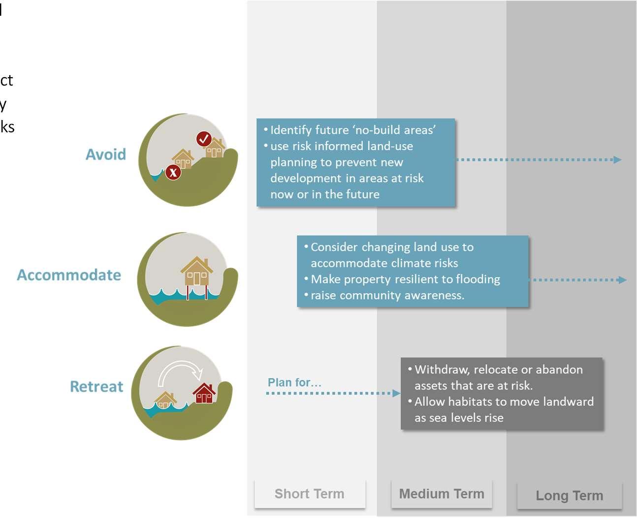
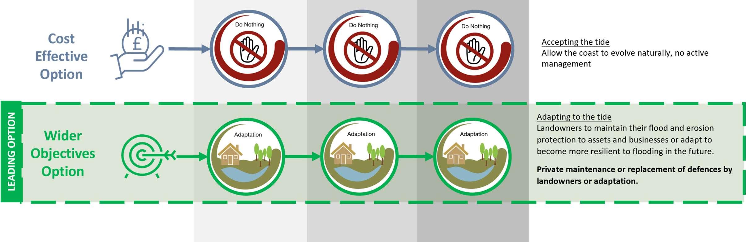
•AcceptingtheTide:Allowingthecoasttoevolvenaturally,noactive management.
•KeepingOuttheTide:Controllingnaturalprocesseswithharddefences, toprotectpropertiesbehindthedefence.
•WorkingwiththeTide:Workingwithnaturalprocessesandreinstating naturaldefencessuchassaltmarshes.
•AdaptingtotheTide:Adaptingtoachangingenvironment,forexample bymovingdefenceslandwardorrelocatingproperty.
AEP AnnualExceedanceProbability
BMP BeachManagementPlan
EA EnvironmentAgency
HBCHavantBoroughCouncil
FCERM Flood&CoastalErosionRiskManagement
HCCHampshireCountyCouncil
HCRP HabitatCreation&RestorationProgramme
HTLHoldTheLine
LNR LocalNatureReserve
MRManagedRealignment
NAINoActiveIntervention
NENaturalEngland
ODUOptionDevelopmentUnit
PLRPropertyLevelResilience
PV PresentValue
SACSpecialAreasofConservation
SEAStrategicEnvironmentalAssessment
SMPShorelineManagementPlan
SoPStandardofProtection
SPA SpecialProtectionAreas
SSSI SitesofSpecialScientificInterest
UKCP UnitedKingdomClimateChangePredictions


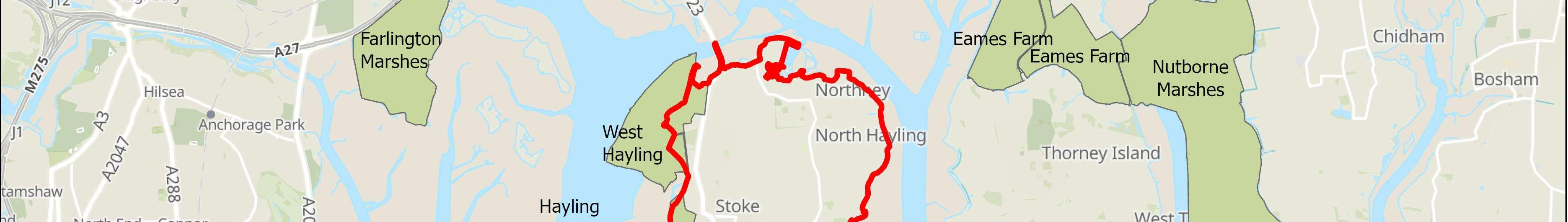
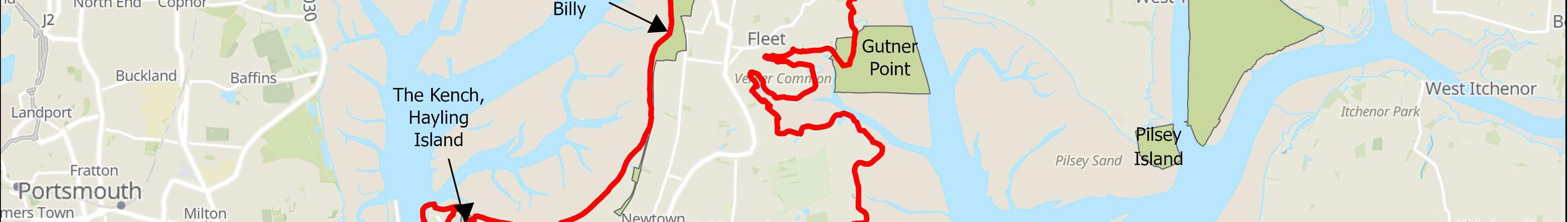
CoastalPartnersandEngineeringandEnvironmentalConsultancyAECOMhas developedaCoastalFloodandErosionRiskManagementStrategyforHayling Island(hereafterreferredtoasTheStrategy)onbehalfofHavantBorough Council(HBC).
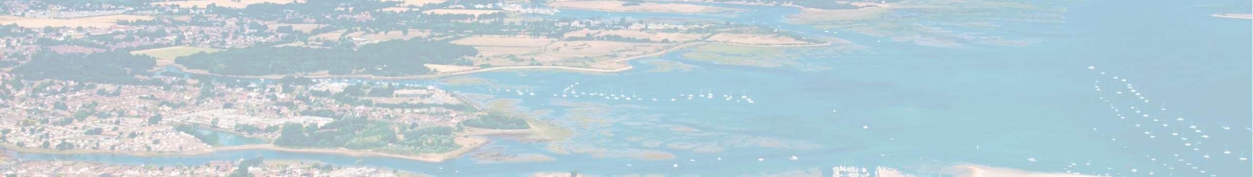
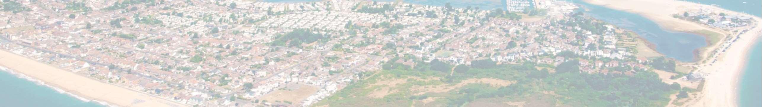
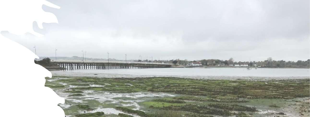
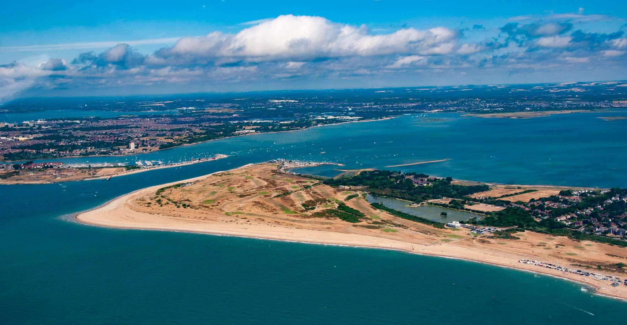
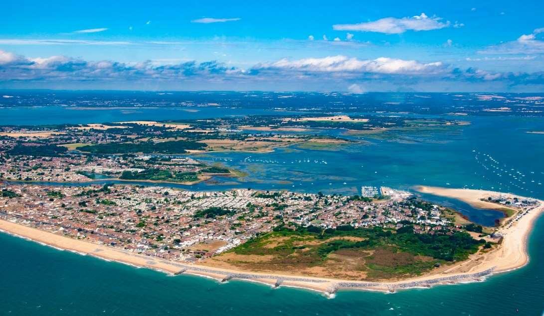
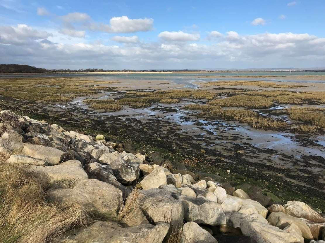
HaylingIslandhasapopulationofmorethan17,000andislocatedonthesouth HampshirecoastwithintheBoroughofHavant.Theislandhasa38kmcoastline, characterisedbybothahighlydynamicwavedominatedopencoastareaand moreshelteredtidallydominatedareaswithintheharbours.Theislandislow lyingwithamixoflanduseincludingrural,agriculturalanddenselypopulated urbanareas.Accessandegressonandofftheislandisviaasoleroadbridge connectiontothemainland(A3023).
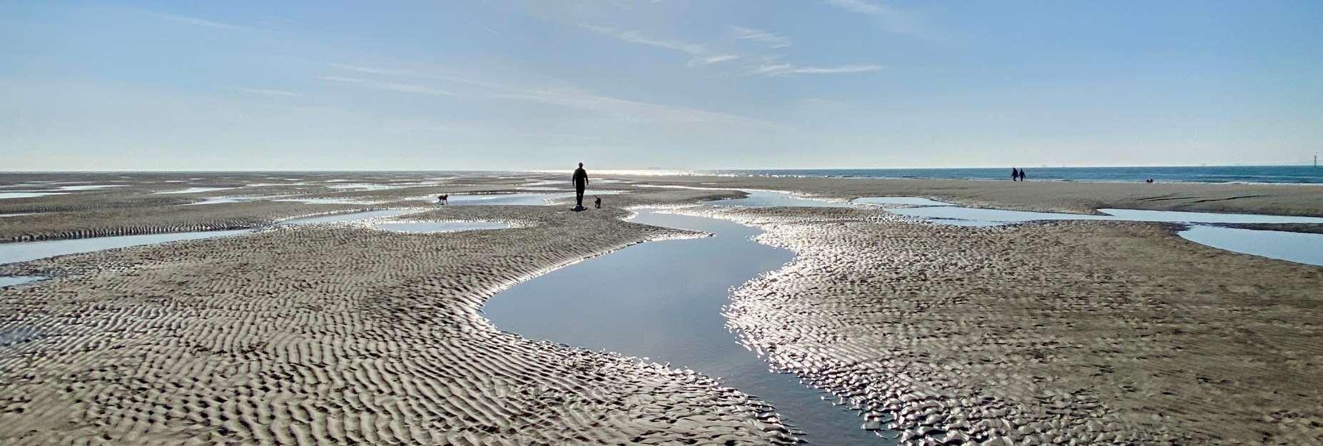
TheStrategyareacontainsamixofresidentialandcommercialproperties. Therearelargeareasofopenspaceandsitesofsignificantenvironmental importancearoundmuchofthefrontage.Inaddition,therearehistorical landmarksandhigh-gradeagriculturalland.Thisdiverseandinterestingcoastal environmentprovidesextensiveaccessandrecreationopportunitiesandis widelyusedforleisurebyasignificantnumberofvisitorseachyear.Hayling Island’sbeachesarepopularwithswimmers,surfers,sailorsandwalkersalike, withtheseafrontstretchingover5kilometres,plustheshorelinesofLangstone andChichesterharbours.BeachlandsisaEuropeanBlueFlagbeachandisthe maintouristattraction.Withuninterruptedviewsacrossthesea,itispossible toseetheIsleofWight,andtowatchtheferriesastheypassenrouteto continentalEurope.
ManypartsofTheStrategyfrontagearealreadydefended;however,the condition,StandardofProtectionagainstfloodingandexpectedlifeofthese defencesishighlyvariable.Thismeansthatsignificantareasoflandacross HaylingIslandareatriskoffloodingfromlargestormevents.Partsoftheopen coastarepotentiallyatthreatfromcoastalerosion.
Inthefuture,withtheincreasedstorminessandrisingsealevelsthatare predictedasaconsequenceofclimatechange,theriskofcoastalfloodingand erosionislikelytoincreasesignificantly.

WITHOUTACTIVELYIMPLEMENTINGMEASURESTOMANAGE
FLOODANDEROSIONRISKS,OVER3,000PROPERTIESARE LIKELYTOBEATRISKBY2120.
Justover40%oftheislands’flooddefencesareprivatelymaintainedwithan assortmentofdefencestructuretypes.Theremainderaremaintainedbythe EnvironmentAgency,HBCandHampshireCountyCouncil(HCC).HBCalso undertakebeachmanagementalongtheopencoastsectionatEastokewith nourishmentandrecyclingactivities.Manyoftheseassetsarecomingtothe endoftheirresiduallife,requiringsignificantinvestmenttowithstandthe impactsofclimatechangeinthefuture.
Withalloftheinteractingandcompetingpressuresonthecoastlinethe primaryobjectiveofTheStrategyistoprovidealong-termplantoreducethe riskofcoastalfloodinganderosiontopeople,thedevelopedandnatural environmentforthenext100years.
Itachievesthisbyidentifyingasuiteofleadingoptionstomanageandreduce theserisksinacosteffective,holisticandsustainablemanner.

Implementationoftheseoptionsgoingforwardwill,however, besubjecttofundingavailabilityandtogainingrequired consents,sothereisnoguaranteethatoptionspresentedinthis Strategywillbeprogressed.
Pleasevisithttps://coastalpartners.org.uk/project/hayling-island-coastalmanagement-strategy-16/forfurtherdetails.
TheaimoftheHaylingIslandCoastalManagementStrategyisto:
•DevelopstrategiccoastalmanagementoptionsforHayling Islandforthenext100years.
•Outlineaprogrammeofinvestmenttoreducetheriskof coastalfloodinganderosiontopeoplelivingontheisland.
•Identifythepotentialfundingsourcesandpartnersrequired todeliverthatinvestmentprogrammeandbeopenand honestaboutwherefundingislikelytobeachallenge.
•Incorporateadaptationstrategies,asdefenceimprovements willnotbepossibleinalllocations.
•Beholistic,yetflexibleforbothpeopleandnature.
•Respondtofuturechanges,supportsustainabledevelopment oftheislandandtakeintoaccountpredictedsealevel riseandclimatechange.
•Makeapartnershipapproachcentral,betweenHBC, EnvironmentAgency,NaturalEngland,landowners, businessesandlocalcommunities,makingsurelocalneeds andprioritiesareatitscore.
ShorelineManagementPlans(SMPs)sitatthetopofthehierarchyofplansfor managingcoastalfloodinganderosion.
AShorelineManagementPlan(SMP)isahigh-levelnon-statutoryplanning documentwhichprovidesabroadassessmentoftherisksassociatedwith coastalprocessesandpresentsalong-termpolicyframeworktoreducethese riskstopeopleandthedeveloped,historicandnaturalenvironmentina sustainablemanner.
AnSMPaimstomanageriskbyemployingarangeofmethodswhichreflect bothnationalandlocalpriorities,to:
•Reducethethreatofcoastalfloodinganderosiontopeopleandtheir property;and
•Benefittheenvironment,societyandtheeconomyasfaraspossible,inline withtheGovernment’s‘sustainabledevelopmentprinciples’.
TheStrategyareafallswithintheboundariesoftheNorthSolentSMP(2010).
ThisSMPpresentsthehigh-levelpoliciesforfuturemanagementofthe coastline.Thesepolicieswerefinalisedfollowingaperiodofpublicconsultation andwereformallyapprovedbytheEnvironmentAgencyandadoptedby HavantBoroughCouncilin2011.
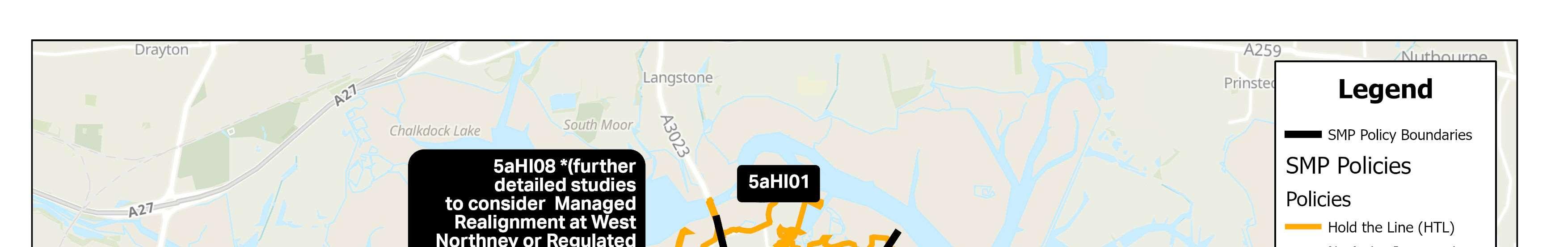
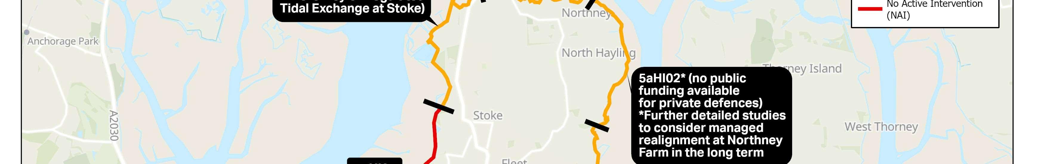
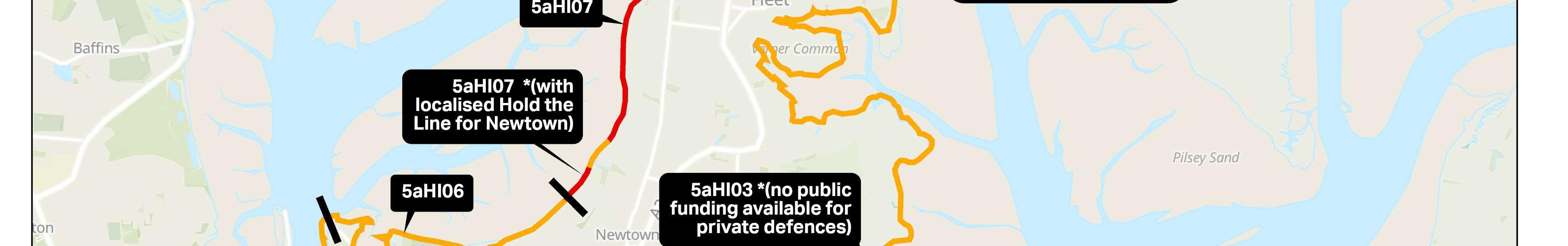
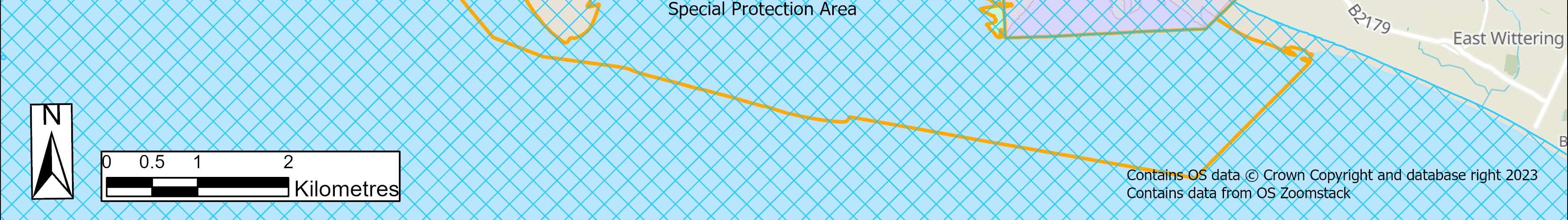
TheSMPpolicyforthemajorityofthecoastlinealongthenorth,eastandsouth ofHaylingIslandistoHoldtheLineforthecomingcentury.Thesesectionsof coastlineincludethepotentialthreatoferosionandcoastalfloodingtothe mainurbanareas,landimportantforagricultureandaccessto/fromtheisland. Thispolicymeansthatthereisanoverarchingintent,subjecttomoredetailed studiesandfunding,istocontinuetodefendsothatthepositionofthe shorelineremainswhereitiscurrently.
Inordertomaintainkeyhabitatsandenhancethenaturalenvironmentthere arealsoareasinthewestofthefrontagewheretheSMPpolicyistoallow naturalprocesstocontinue(NoActiveIntervention).Thispolicymeansthatthe shorelinewillcontinuetoevolvenaturallyinthefutureandthatnonew defenceswillbebuilt.
TheSMPpoliciesforHaylingIslandareshownoverleaf.Whilsttheseindicatea HoldTheLinepolicyforthemajorityoftheHaylingIslandfrontage,thisdoes notmeanthatthispolicyappliesforthenext100years.TheSMPpoliciesfor thedifferentepochsarefurtherdetailedforthedifferentfrontagesin Chapter5.
TheNorthSolentSMPisavailabletoviewatShorelineManagementPlanShorelineManagementPlan(northsolentsmp.co.uk).
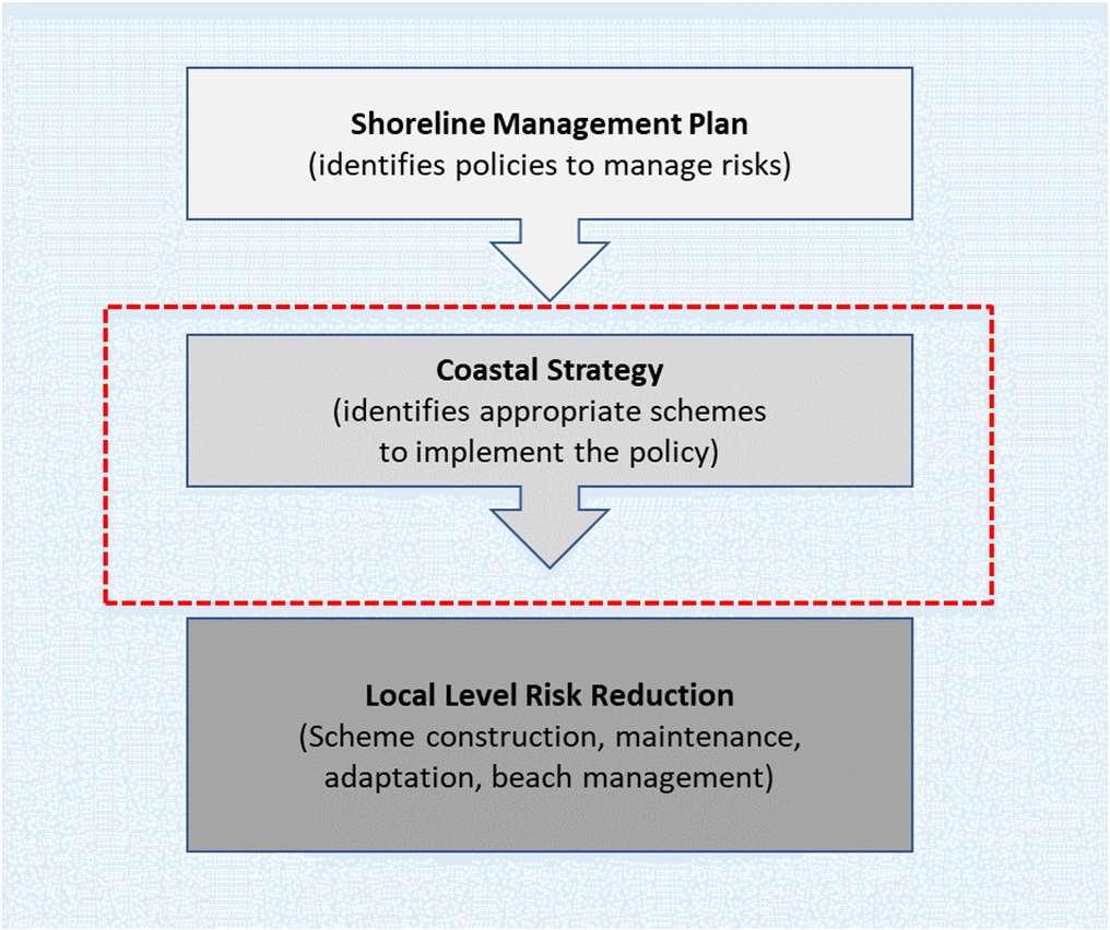
Coastalstrategiessitatthesecondtierinthehierarchyofcoastalmanagement anditistheroleofstrategiestoidentifytheappropriateschemeorrisk mitigationoptionforimplementingtheSMPpolicies.TheStrategyreviewsthe SMPpoliciesinmoredetailtoensurethesehigh-levelpoliciesremain appropriateatthelocalscale.
TheStrategyconsidershowfloodanderosionriskislikelytochangeinthefuture inresponsetochangesinclimateanddevelopssustainableandrobustoptionsto managetherisksassociatedwithcoastalfloodinganderosion.Thisapproach ensuresthattechnicallyfeasible,environmentallyacceptableandeconomically viableoptionsarerecommendedtoreducetherisksfromcoastalfloodingand erosiontopeople,theirpropertiesandtheenvironment.Thisalsoensuresthat theoptionsarecompatiblewiththethoseofadjacentareas.
Withoutsuchanapproach,itislikelythatcurrentmanagementapproaches wouldcontinueintheshorttermandfuturecoastaldefenceworkswouldbe managedonan‘ad-hoc’orreactivebasiswhichwouldleadtopoorcost efficiencyandageneralincreaseinthefloodanderosionriskovertime.A Strategyisalsoimportanttodeliveranintegratedapproachtothemanagement ofourcoastline.Holisticwider-levelthinkingbehindStrategydecisionsensures thatthemanagementoptionsimplementedinoneareadonotincreasetheflood anderosionriskinadjacentareas,andthatopportunitiestodeliverwider benefitsarenotmissed.

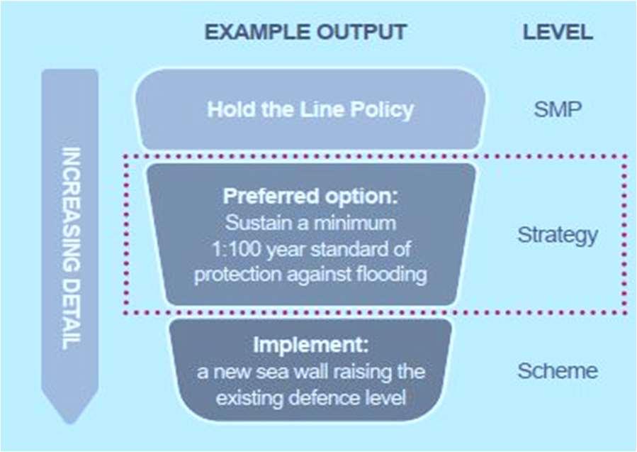
HowTheStrategyfitsinthemanagementofcoastalfloodanderosionrisk
TheStrategyisrequiredinordertohelpusgainapprovalforfuture schemes.However,itisimportanttonotethatthereisnoguaranteethat anyoftheoptionsrecommendedinTheStrategywillbeprogressed. Implementationofoptionswillbesubjecttofundingavailabilityandto gainingrequiredconsents.Publicfundsforcoastalmanagementarenot widelyavailable,sosignificantfundingfromavarietyofsourceswillbe neededtoprogressanyoptionsinthisStrategy.
FollowingaStrategy,avarietyofoutputscanresult,dependingonthelevelof riskandthepreferredoptionsputforward.Todeliverastrategicoptionitmay benecessarytoimplementascheme(e.g.buildnewdefences)toaddress coastalfloodanderosionrisks.Beforeworkshappenontheground,afurther elementofworkiscarriedouttodesigntheschemeanddeliverthebusiness caseforfunding.Wewillworktodevelopbusinesscasestoprogressschemes ifthereisfundingandifitisinthepublicinterest,wherethereisatechnical, environmental,socialandeconomicsolution.
Inotherareas,thefutureactionmayincludemaintenance,beach managementorevento‘DoNothing’ifappropriate.Theremayalsobeactions suchasmonitoring,planningandfurtherstudiesinordertogainevidenceto helpmakerobustmanagementdecisionsinthefuture.Thiscouldincludethe needforadaptationwhichfocussesonadjustingto,andmanaging,theimpacts offloodingandcoastalerosion.
Thisdocumentsetsouttherecommendedoptionsformanagingcoastalflood anderosionriskonHaylingIslandforthenext100years.IndevelopingThe Strategy,anunderstandingofthepresent-dayriskhasbeendevelopedalong withhowitmightchangeinthefutureandthewaysinwhichwecanmanage andadapttothesechanges.Specifically,thisdocumentincludes:
Chapter2–Understandingwhatisatrisk
•Asummaryofwhatisatrisknowandinthefuture(definingthebaseline). Includinganassessmentofwhatwouldhappenifwe‘donothing’andhow theriskschangeovertimeasaresultofpredictedclimatechangeandsea levelrise.ThissetsthecontextforwhyweneedTheStrategy.
Chapter3–DevelopingTheStrategy
•Overviewofthestudyarea-KeyFeatures,IssuesandOpportunities.This identifiesthekeyaspectsandcharacteristicsofthestudyareawhichThe Strategyhasconsidered.Thisincludescoastalprocesses,potentially contaminatedland,theenvironment,stakeholderengagementand aspirations,andasummaryoftheexistingdefences.
•Adescriptionoftheoptiondevelopmentandappraisalprocess.Includinga summaryofhowthestrategicoptionsweredevelopedandappraised consideringtheireconomicandenvironmentalsustainability.
•AsummaryofTheStrategy–therationalebehinddecisionsanddiscussion ofthekeyprinciples.
•Anoverviewofthekeyeconomic,environmentalandbroaderoutcomesof TheStrategy.
•Howiscoastalfloodanderosionriskmanagementfunded–Thisincludes detailsofhowpartnershipfundingworksforFlooddefenceschemesinthe UKandthelikelihoodoffundingforthepriorityschemesidentifiedinThe Strategy.
•Deliveringmore.Howwehavebeenworkingwithotherorganisationsto tryanddelivermoreforyourcoastline.
Chapters5–HaylingIslandCoastalManagementStrategyoptions
Providesarea-by-areasummariesofwhatisatrisk,theleadingstrategic optionstoreducefuturecoastalfloodanderosionriskalongsideroutemaps andadaptivepathwaysforeacharea.
Atimelineoftheshort-termfutureprojectactivitiesandindicativemilestones.


Gaininganunderstandingofthefloodanderosionriskalongtheshorelineis imperativeinordertodefineabaselinefordevelopingTheStrategy.Itallows comparisonstobemadebetweenthepotentialstrategyoptionsandisan essentialstepinTheStrategydevelopmentprocess.Thebaselinewasestablished byconsideringa‘DoNothing’scenario.
The‘DoNothing’scenarioisdefinedas:“Wherethereisnofurtherinterventionof anykind,includingnoemergencyresponseorwarningsystem.Wherethereare assetsatpresentorwheremaintenanceactivitiesorotherinterventionsare carriedout,theoptionwillbetowithdrawallactivities,allowingnaturetotake itscourse”.
Inessence,the‘DoNothing’scenariorepresentsahypotheticalsituation wherebyallexistingdefencesareabandonedintermsofmaintenanceorrepair, andnoremedialoradditionalprotectionworksarecarriedout.Inaddition, adaptationtosealevelriseorotherclimatechangeresponsesarenotaddressed.
ForthepurposeofTheStrategy,therisksposedbycoastalfloodinganderosion overthenext100yearshavebeenestablishedusingEnvironmentAgency approvednumericalfloodmodellingandCoastalPartnerserosionpredictions.It shouldbenotedthatevenwiththeexistingdefencesinplace;futurefloodrisk willincreasesignificantlyduetoclimatechangeandrisingsealevels.
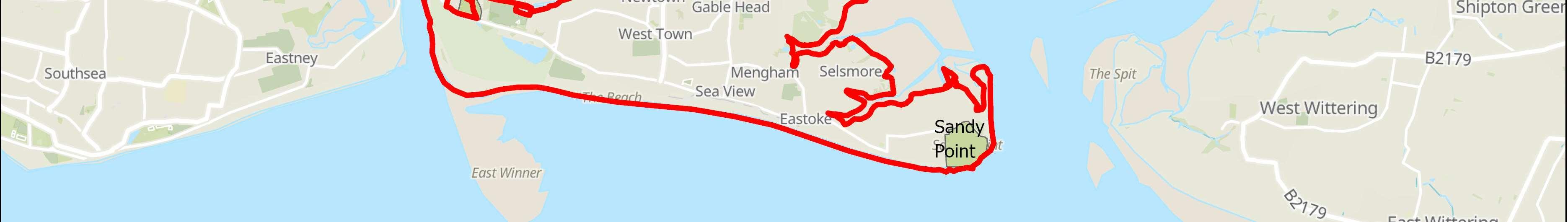
Throughdeterminingthepresentandfuturefloodanderosionrisksundera‘Do Nothing’scenario,theproperties,features,assetsandkeyinfrastructurethatare atriskofdamageoverthenext100yearshavebeenidentifiedandvalued,after whichtheleadingstrategyoptionstomanagetheserisksweredeveloped.The assetsatriskinclude(butarenotlimitedto)servicesasvariedascropproduction andraisinglivestock,climateregulation,coastalhazards,tourismandrecreation, aestheticvaluesandwildspeciesdiversityandhabitats.FloodingatLangstone BridgewouldaffectaccesstoandfromtheIsland,andpopulartrailssuchasthe HaylingBillyTrailwouldalsobeunderthreat.Areasoflandfillcoulderodeand causeharmtotheenvironment.
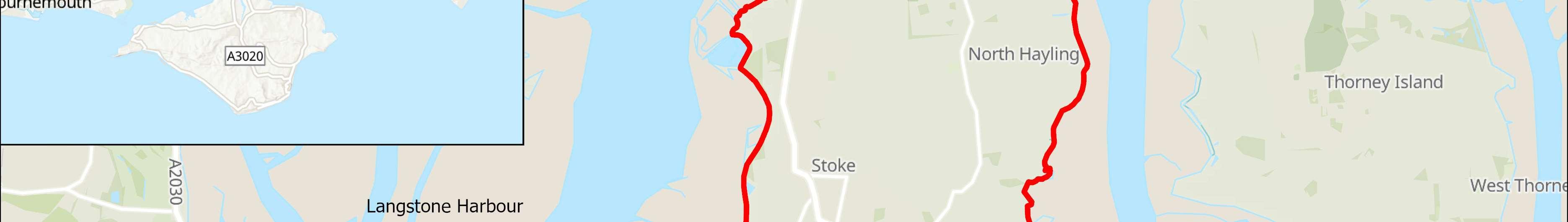
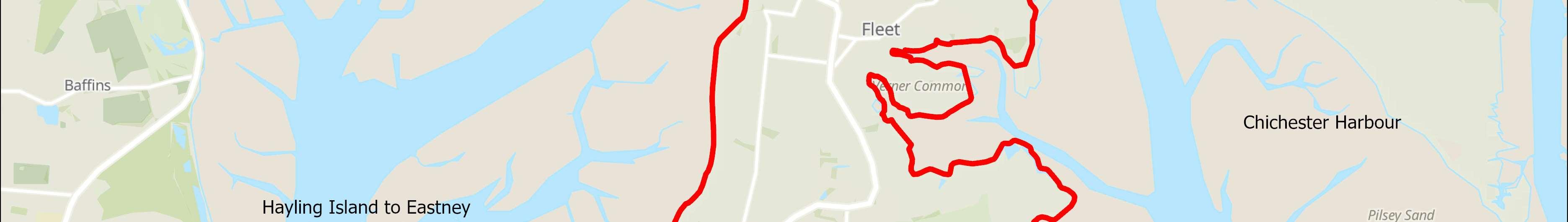
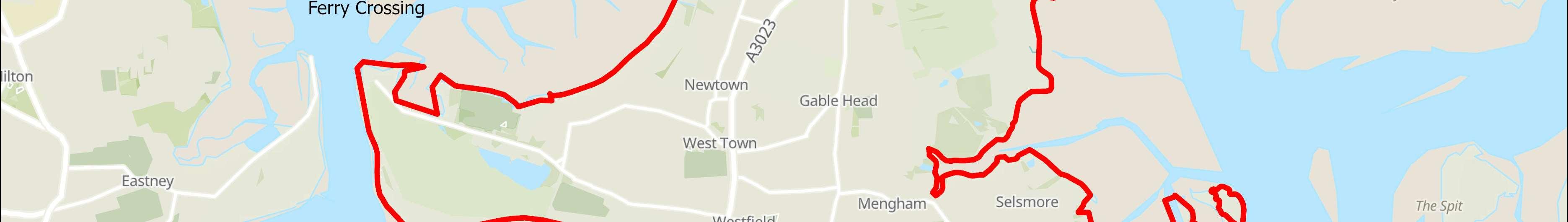
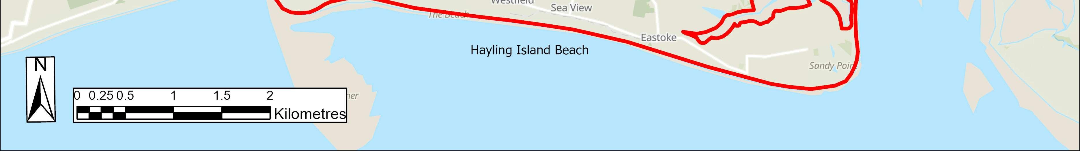
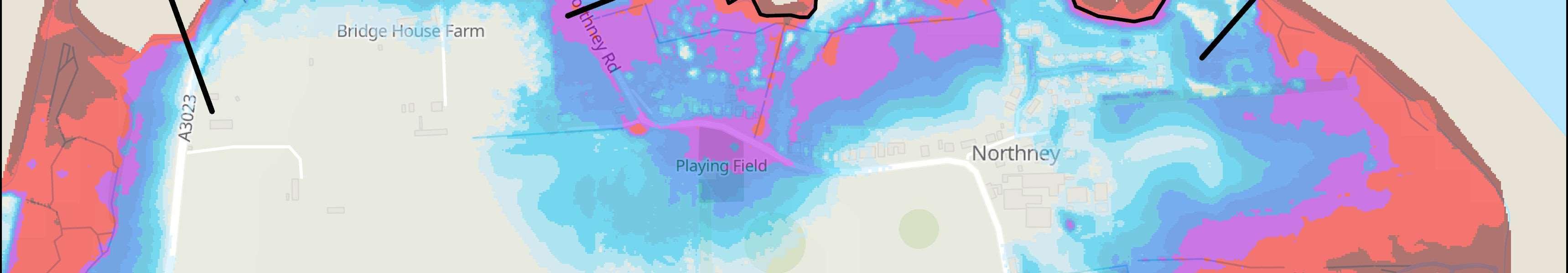
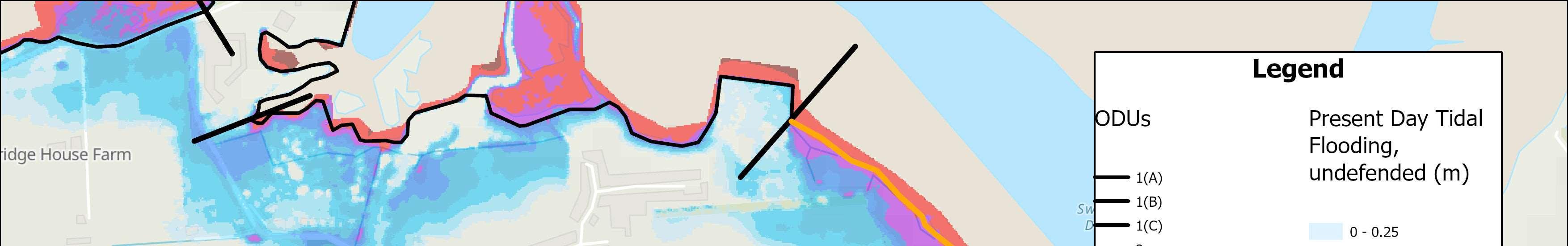
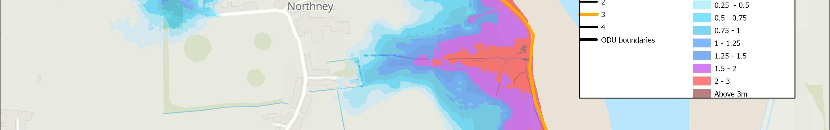
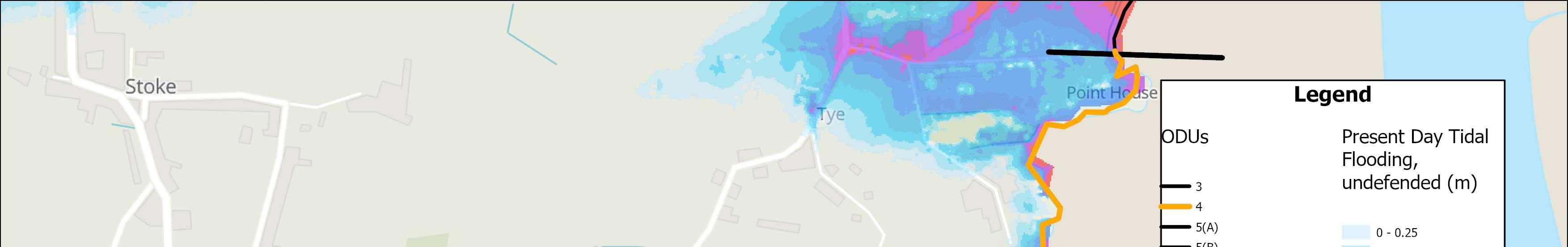
Propertiesatriskofcoastalfloodingoverthecomingcenturyifwe‘DoNothing’. Basedon1:200year(0.5%annualchance)floodevent.

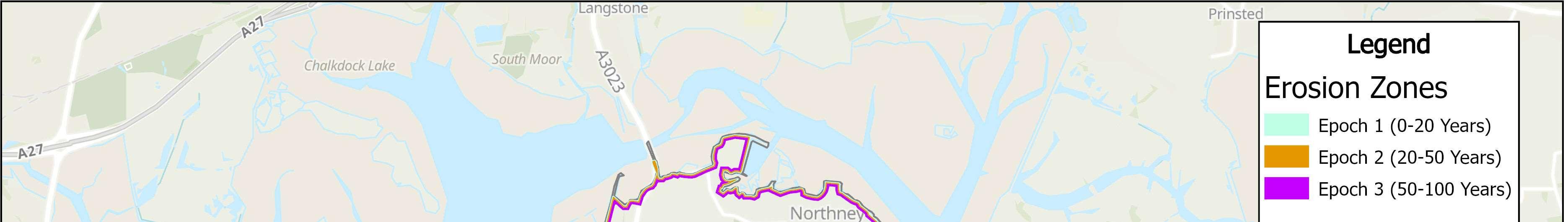
Propertiesatriskofcoastalerosionoverthecomingcenturyifwe‘DoNothing’.

ThereareanumberofstrategicissuesforcoastalmanagementonHayling Island,includingtheinfluenceofclimatechange,landfillsiteswhichareactively erodingandopportunitiesforhabitatcreation.Inordertomanageandaddress theseissues,itisconsideredimperativetodevelopanFCERMStrategy.Joinedupstrategicthinkingisrequiredtodevelopacohesive,efficient,longtermplan. TheStrategythereforeoutlinestheforwardprogrammeofworkstomost effectively,holisticallyandsustainablymanagethecoastalfloodanderosion relatedrisksfacingtheislandoverthenext100years.

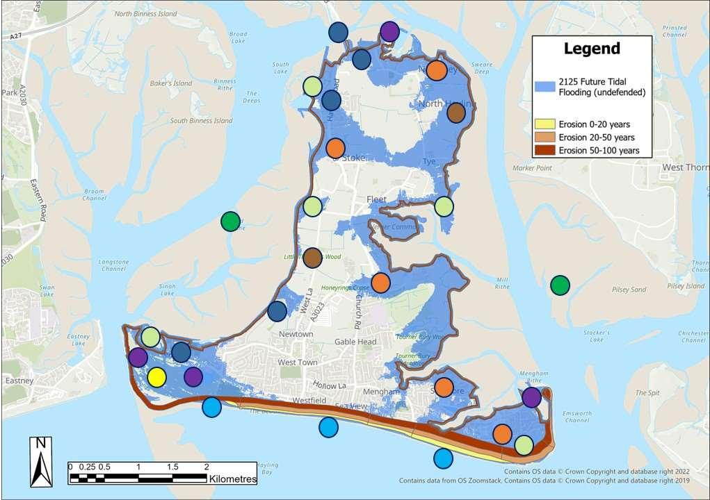
Keyassetsatriskfromfloodinganderosion
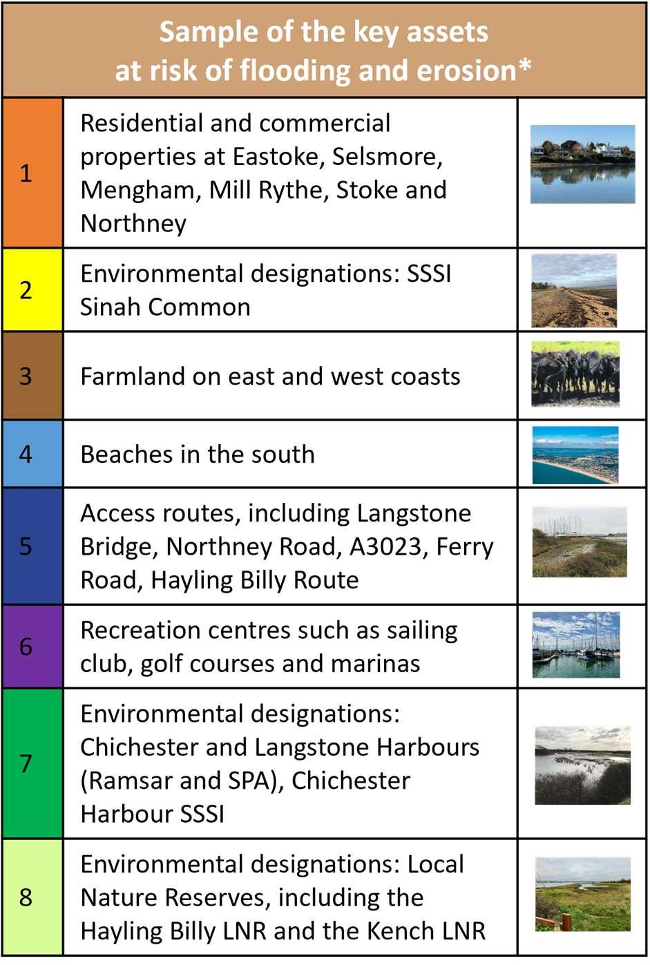
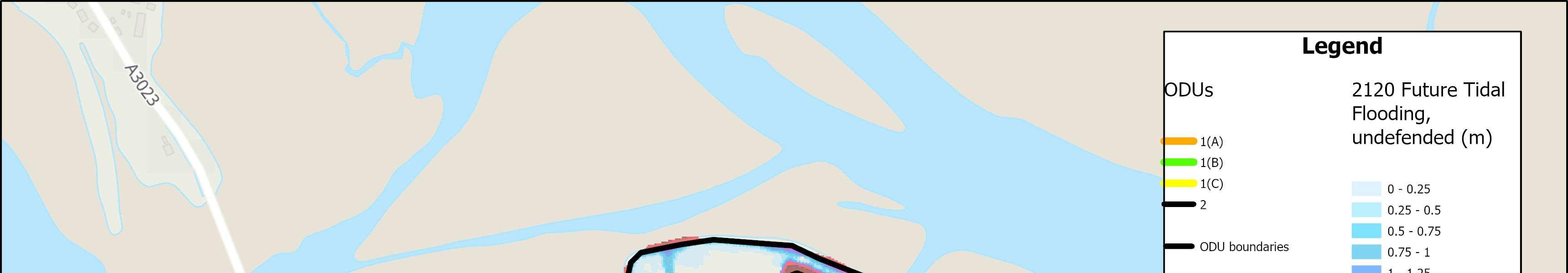
*2125FutureTidalFlooding,assumingnodefences.
Pleasenote,thislistcontainsonlyasampleofassets atrisk,andisnotexhaustive.
Asaconsequenceofclimatechangeandcontinuedwarmingoftheglobal oceans,sealevelsareexpectedtoincreaseinthefuture.Thiswillsignificantly increasetidalfloodandcoastalerosionriskacrossTheStrategyfrontageover thenext100years.
Toconsidersealevelrise,TheStrategyhasincorporatedthelatestsealevelrise projections(UKClimateProjections2018UKClimateProjections(UKCP)-Met Office)intothefloodmodellingtoproduce‘DoNothing’floodscenariosfor 2045,2075and2125.Followingthelatestguidelines,underthe‘medium emissions’sealevelrisescenario,meansealevelsacrossTheStrategyfrontage areexpectedtoincreasebyapproximately1moverthecomingcentury.
Aswellasproperties,therearemanyotherimportantfeaturesandvaluable assetsatrisk.Thisincludesschools,churches,publichouses,nationally importantenvironmentallydesignatedsites,heritageassets,militaryassets,key servicesinfrastructure,majorroads,coastalfootpathsandcyclewaysand shinglebeaches.Thereisalsoariskoferosiontoformerlandfillsiteswhich couldposeafurtherthreattohumanhealthandtothequalityofthe harbours.
Floodriskreferstothepotentialforexperiencingflooding.Thisriskisoften describedbythelikelihoodorchancethatacertainleveloffloodingwilloccur atanygivenlocation.Thisriskcanbeexpressedintermsofanaveragereturn periodinyears.Thisriskcanbeexpressedasa1in100(1%)chanceof floodinginanyoneyear,ora1in200(0.5%)chance,andsoon.


Chanceisalsorelatedtothescaleoftheflooding.Inanyoneyearalarge(1in 200year)floodeventhasstatisticallylesschanceofhappeningthanasmaller 1in50or1in20yrfloodevent.Itisimportanttounderstandthata1in100 chanceoffloodingdoesnotmeanthatafloodwillonlyhappenonceevery 100years.Thechanceremainsthesameeveryyear.Throughoutthis documentthescaleoffloodriskisdescribedintermsoftheaveragereturn periodinyears. TheStandardofProtection(SoP)offeredbyadefenceisalsodescribedin termsoftheeventthatitisdesignedtopreventfloodingfrom.Forexample,if aschemeprovidesa1in100year(1%annualchance)StandardofProtection itmeansitwillbedesignedtopreventfloodingfromalleventsuptothis magnitude.

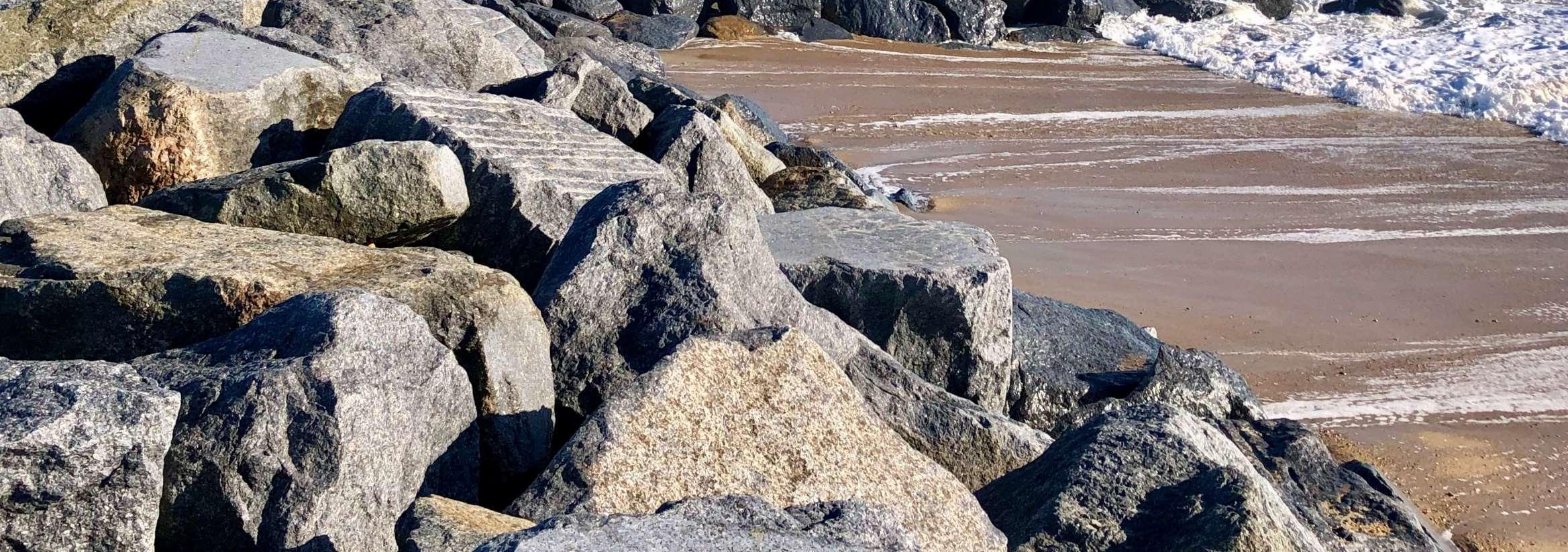
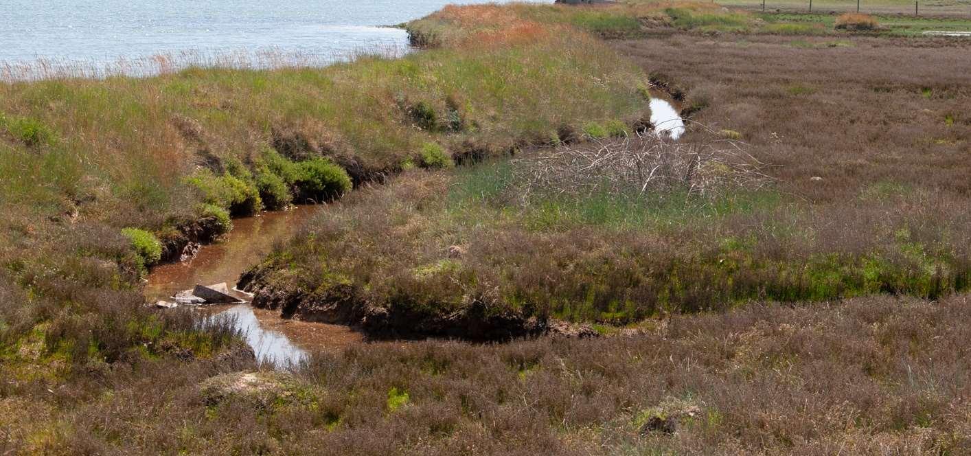
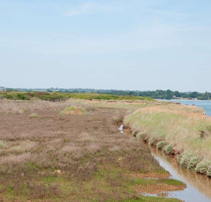
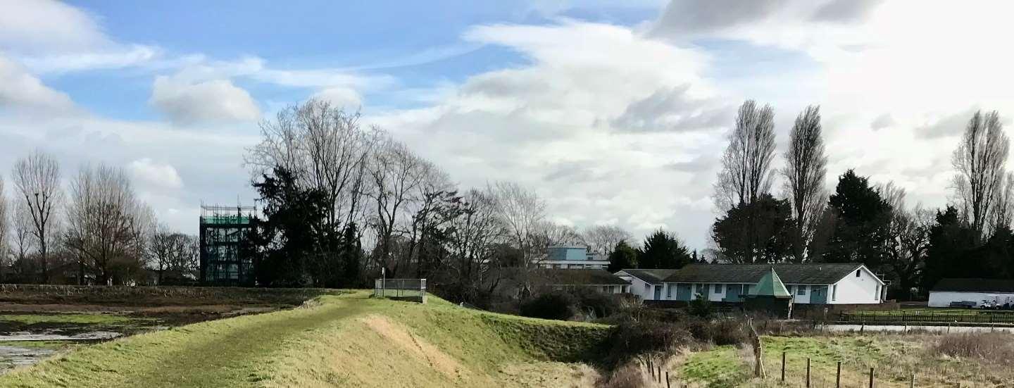
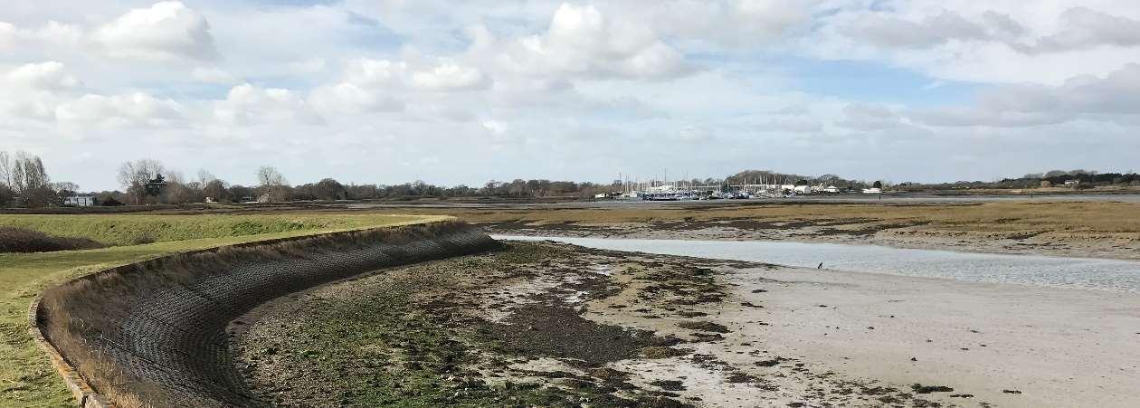
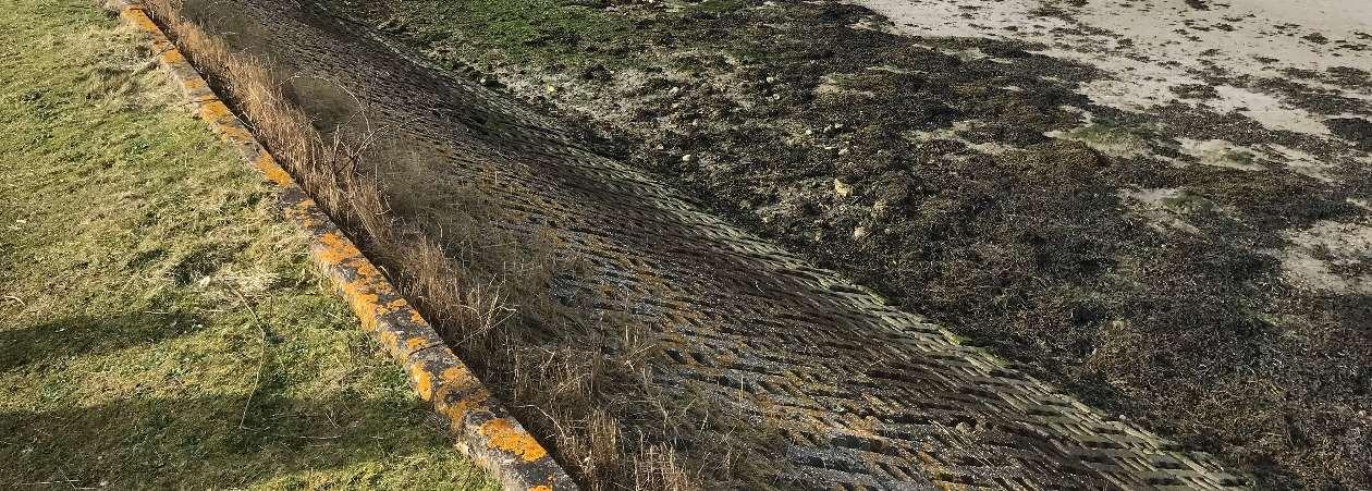
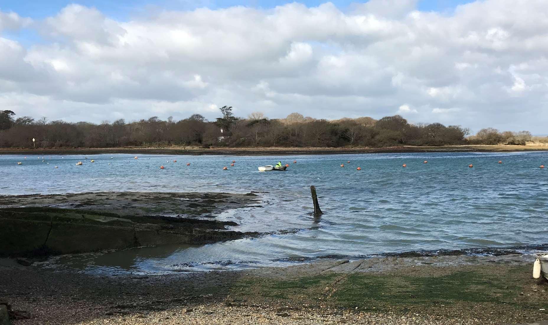
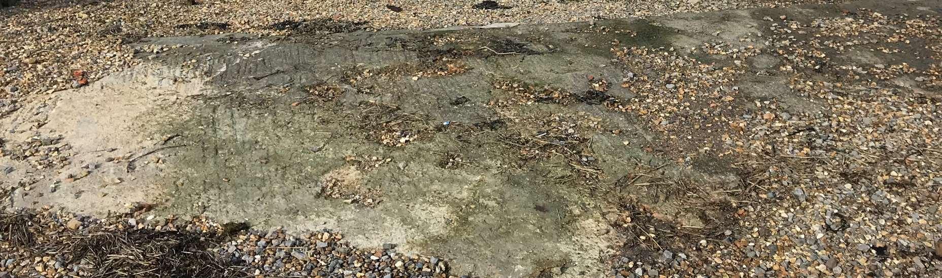
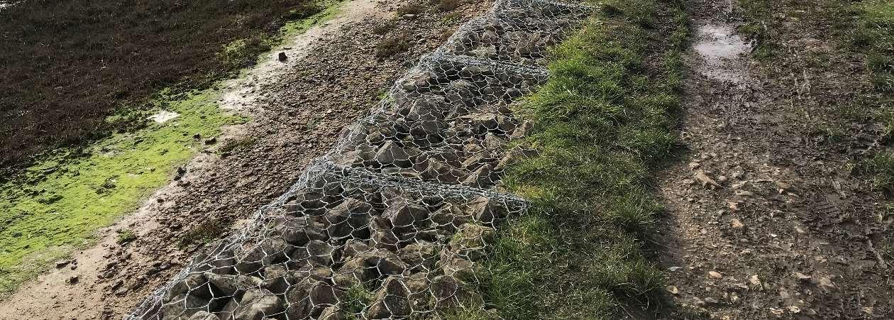
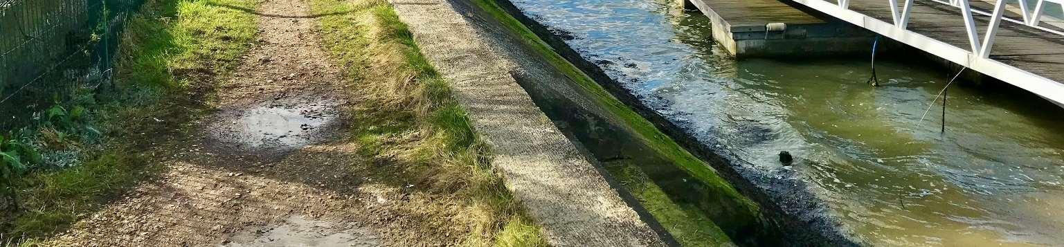
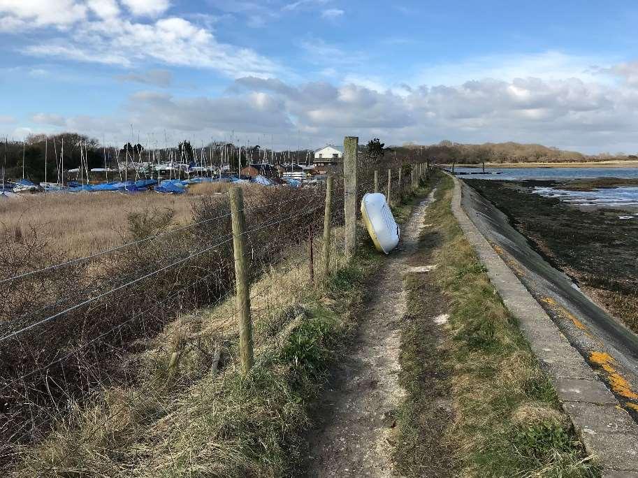
MuchofthefrontagealongHaylingIslandisprotectedbyman-madecoastal defences.Theseareoftenfrontedbyinter-tidalmudflats,saltmarshesand beacheswhichworktoreduceerosionriskalongthecoastline.Without theseman-madeandnaturalseadefences,theislandwouldbeunderthreat fromerosion,mostnotablyontheopencoastcomparedwiththeharbours.
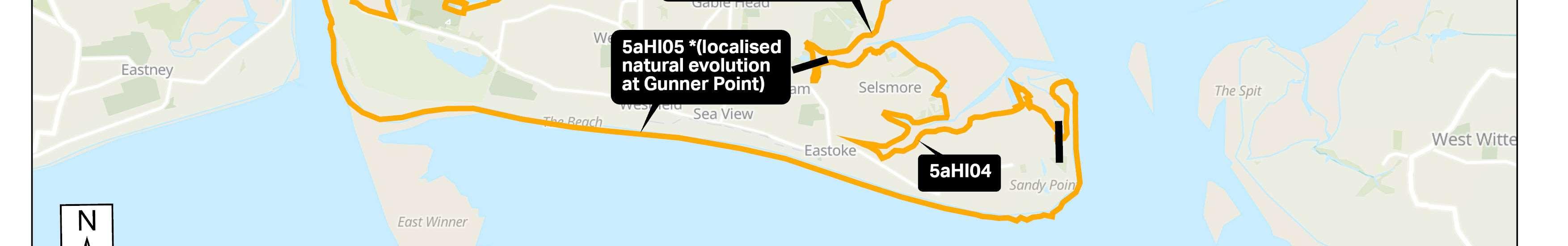
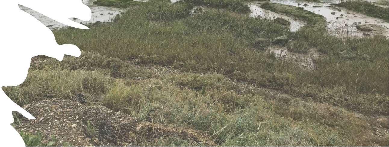
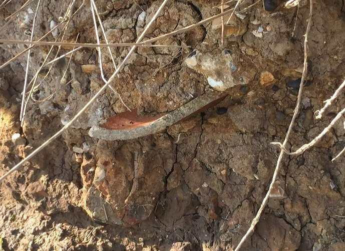
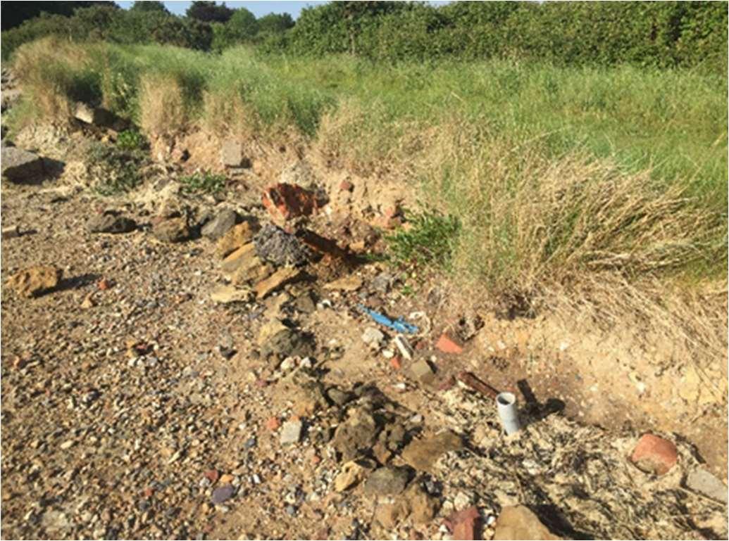
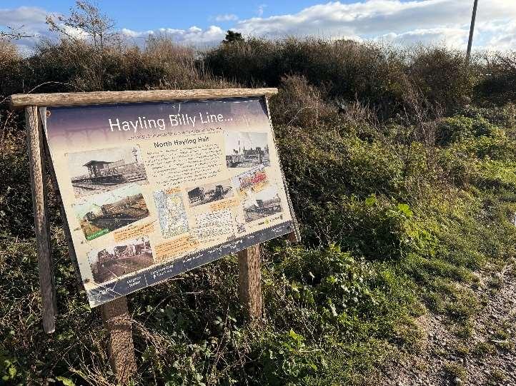
SeveralsitesaroundHaylingIslandarealreadyeroding,andmoresitescould becomevulnerableduringthenext100yearsifnoactionistaken.For example,partsoftheHaylingBillytrailmayhavetoberelocateddueto futureerosion.Thereisariskthatformerlandfillsitesalongthecoastline, bothdomesticandindustrial,couldwash-outasaconsequenceofsealevel riseandcoastalerosionwithoutsuitablemanagementorremediation.
Erosionalongthewestcoastwouldalsoimpactsiteswhichareimportantfor over-winteringbirds;alongthesoutherncoast,propertiesandbusinesses alongtheseafrontcouldbeaffected.

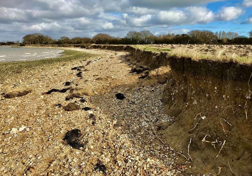
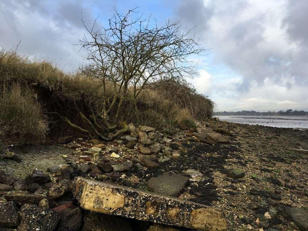
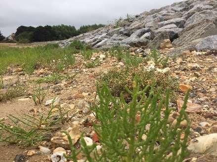
Erosiononthewestcoast(ABOVE)andeastcoast(BELOW)ofHaylingIsland
ForthepurposesofTheStrategy,propertiesorassetsatriskoferosionare thosewhichcouldpotentiallybelosttotheseathroughshorelineretreat duetotheactionofwaves,currentsortides.Theriskhasbeenestimated assumingnofurtherworksaredonetorepairormaintaindefenceswhich currentlyprovideprotection.
Understandingthepotentialerosionriskunderahypothetical‘DoNothing’ scenario’isimportantforcomparingtherelativemeritsofoptionsto maintainorimproveprotection.


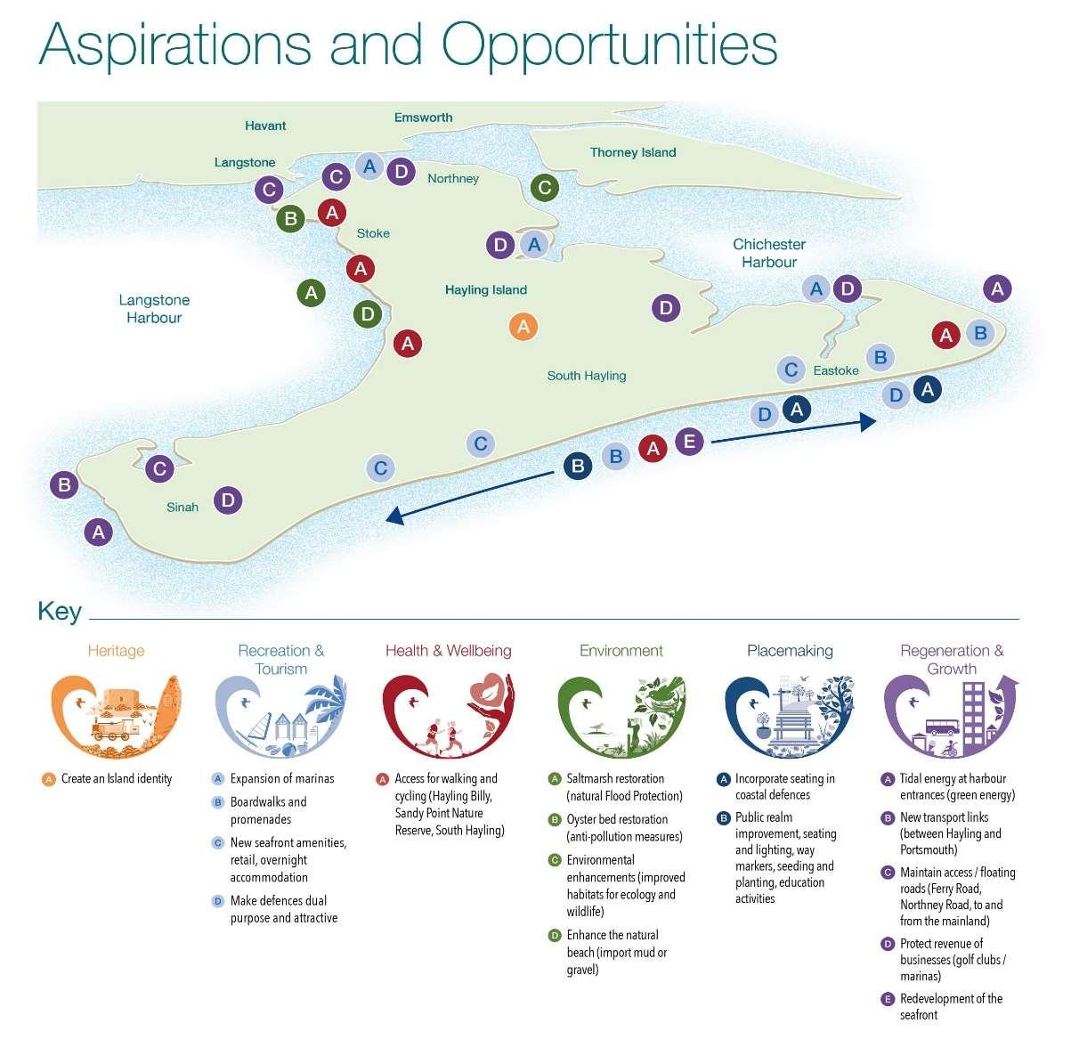
Beforestrategicapproachestomanagingfloodanderosionthreatscanbe identifiedandevaluated,itisimportanttounderstandthekeyfeatures,issues andopportunitiesthatexistwithinTheStrategyarea.Inordertoachievethis,a numberofstudiesandactivitieswereundertakenduringtheearlystagesof developingTheStrategy.
Theseincluded:
•Engagementwithkeystakeholders,residentsandthewidercommunity–meaningfulengagementwithlandowners,communitygroups,organisations andindividualstounderstandtheiraspirationsandconcerns,tohelpshape TheStrategy;
•Sitewalkoversandvisualassetinspections–todeterminethelocation,type andconditionofcoastaldefencesandassets;
•Astudyofcoastalprocesses–requiredtounderstandwaves,tides,sediment movementsandtolookatthelonger-termfloodanderosionrisktoboththe openandharbourcoastlines;
•Desktopassessmentoflandfillsites–toidentifyareasalongthefrontage whichmayrequiredefendingtopreventthemerodingandharmingthe environment;
•Identificationofimportantenvironmentalandheritagefeaturesaroundthe Island–sothatkeyenvironmentalobjectivesandlegalrequirementsto protecttheenvironmentcanbeaccountedforinTheStrategy;

•Identifyingpotentialbroaderoutcomesandopportunities–inorderto captureideasastohowTheStrategycanbefundedaswellasdeliverwider benefitstocommunities.
Asummaryofthefindingsoftheseactivitiesrequiredtounderstandthebaseline forTheStrategyisprovidedinthischapter.

MuchofHaylingIslandhasbeenreclaimedovertheyears,resultinginlow lyinglandwithsignificantareasatriskoftidalflooding.Thisisexacerbated ontheopencoastwhenstormandswellwavescombinetoproducebimodalwaveconditions.
ManyofthefloodeventsexperiencedinthepastonHaylingIslandhave occurredinthesouth-easterncorneroftheislandwherethecoastlineis mostexposedtotheimpactsofwaveconditions.Theshelterednorthern partsoftheislandinsidetheharboursarepronetofloodingfromtidalsurges ratherthanlargewaveaction.Residentialroadsandextensiveareasof grazinglandhavefloodedinthepast.Floodinghasalsohistoricallyoccurred adjacenttotheA3023approachtoLangstoneBridge.Thesituationwillbe exacerbatedinthefuturewithsealevelrise.
Theopencoastisalsomorevulnerabletoerosion,duetowaveaction.
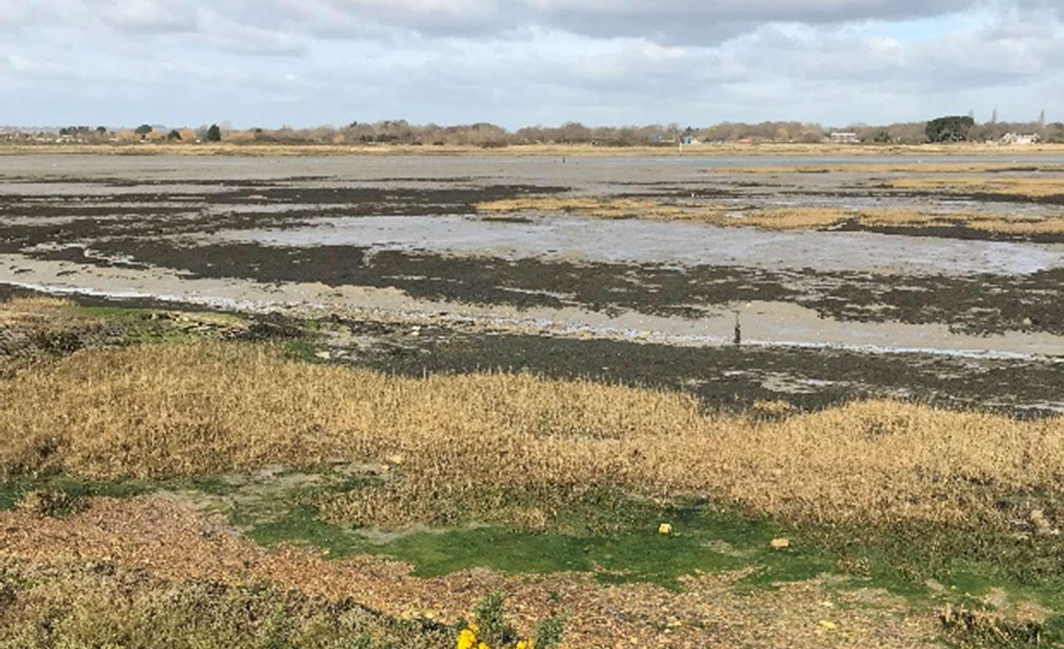
TheHaylingIslandcoastlinethatsitswithinChichesterandLangstone Harboursiscomprisedofmostlymudflats,withsomesaltmarsh.Saltmarsh habitathasbeenerodinginbothharbourssincethe1940s,althoughtherate oflosshasslowedsincethemid-1980s.Duetothenarrowharbour entrances,largeswellandwindwavesarenoteasilyabletopropagatealong theentrancechannelsintotheharbours.Therefore,theriskofcoastal damage,floodinganderosionfromwaveattackinsidetheharbourislimited. Fortheharbours,thegreatestriskisfromextremewaterlevels,ratherthan fromwaveaction.
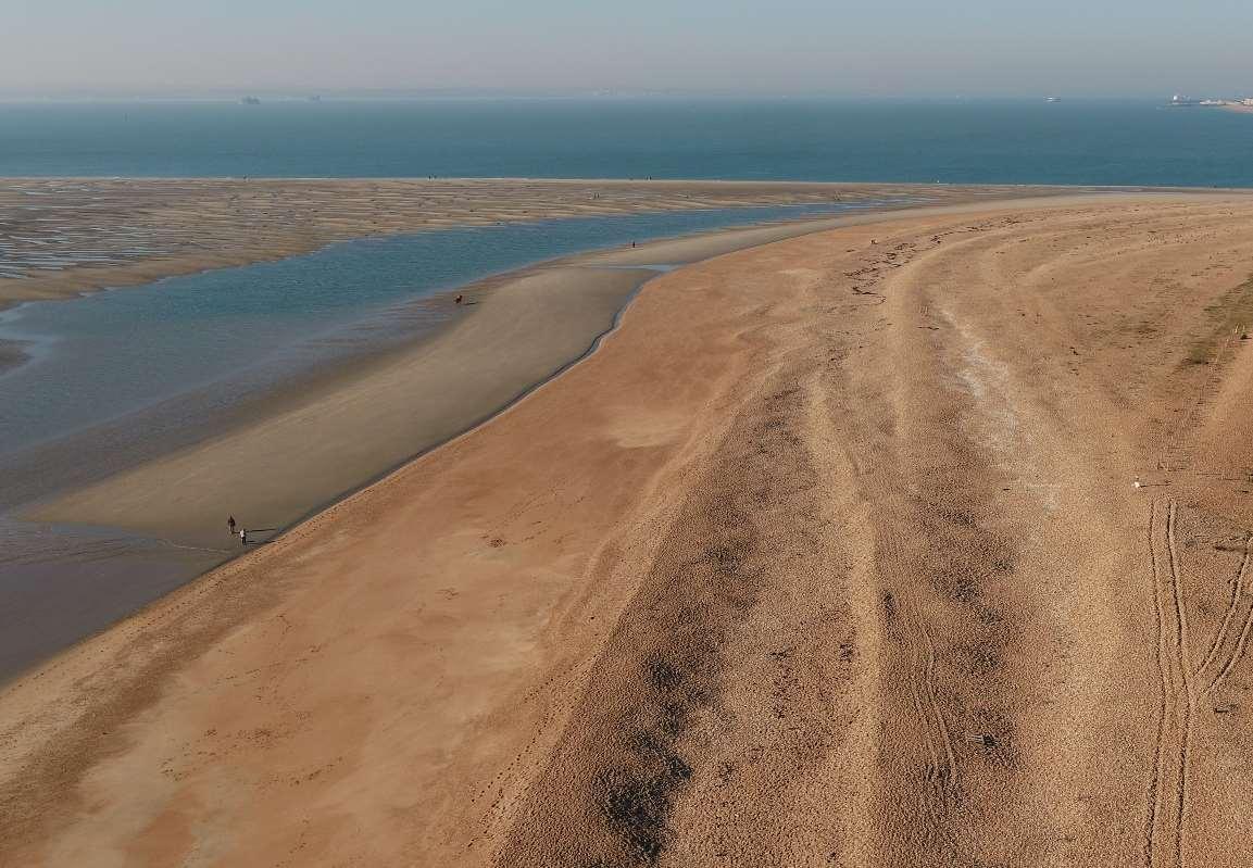
TheopenbeachalongthesouthcoastofHaylingIslandoffersavery differentsituation.Ithasalonghistoryofhighenergywaveaction,which resultsinsignificantbeachdrawdown,cutbackandlossofmaterial.
HaylingIslandisunusualtootherlocationsinthatitsbeachesaresusceptible tobi-modalwaveconditions,whenlongperiodswellwavesrefractaround theIsleofWight,coincidingwithlocalstormconditions.Theyresultinvery energeticwaveconditionsthatcanbeverydamagingtothecoastline.
TheStrategyrecognisestheimpactsofbi-modalwavesinrelationtofuture management,butmoredetailedresearchonbi-modalwaveswillneedtobe undertakentoinformthedesignofanynewdefencesalongHayling'scoast.
Inthecoastalzonethepresenceoflandfillisariskbecauseerosionoftheshoreline,or flooding,canreleaselandfillintotheenvironmentthroughexposureandleaching.Ifnot dealtwithadequately,thismaterialcanposeathreattotheenvironment.
ThereareeightformercoastallandfillsitesonHaylingIsland.Adesktopstudywas undertakeninordertoclassifyeachofthesesitesasbeingeitherhigh,moderateorlow risk.
Theriskwasbasedontheprobabilityandconsequenceoflandfillbeingreleased througherosionorasaresultoftidalflooding.TwositeswereclassifiedasbeingatHigh Risk,fouratModerateRisk,andtwoatLowRisk.
TheevidencefromthisstudywasconsideredduringthedevelopmentoftheLeading StrategyOptions.Optionstomitigatetheseriskswereidentifiedandconsideredinthe appraisals.

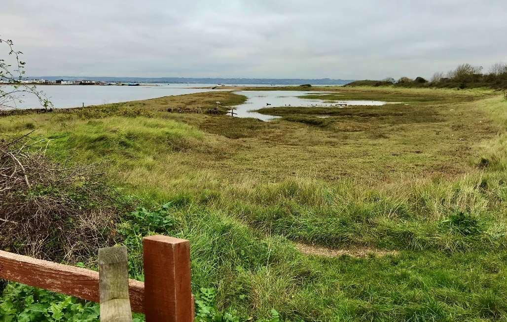
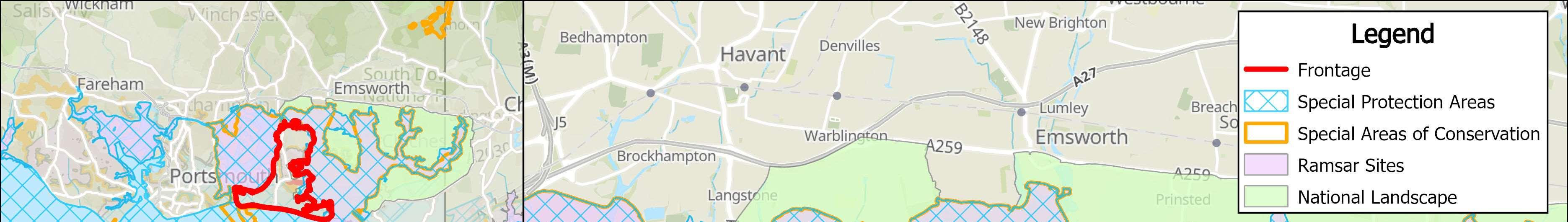
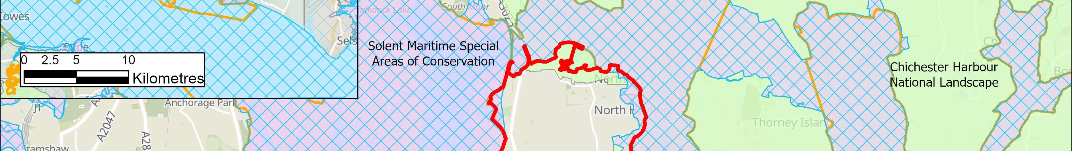
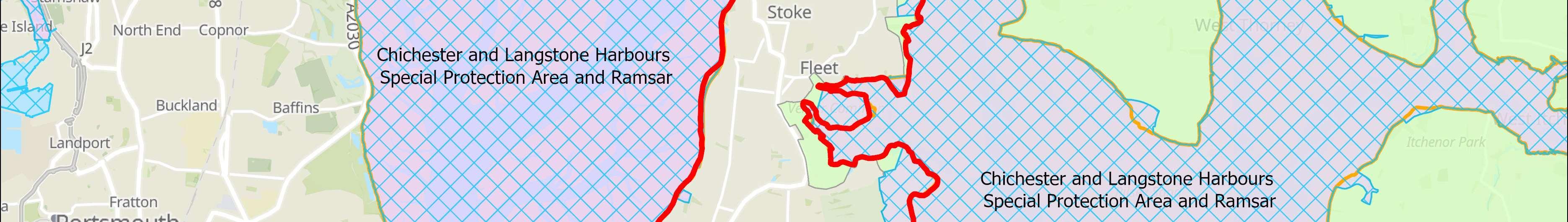
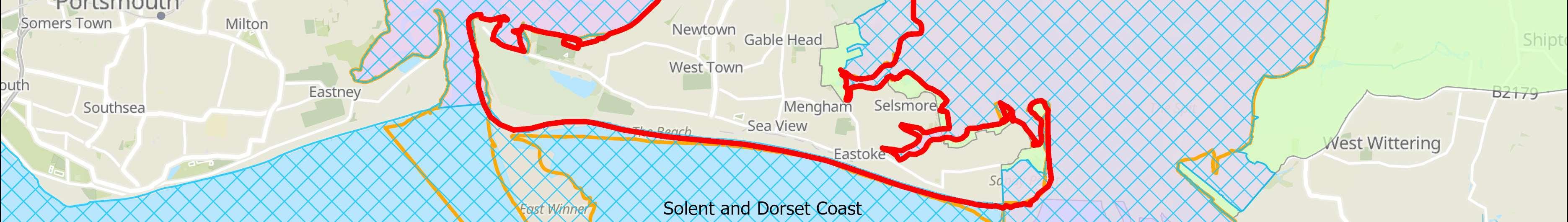
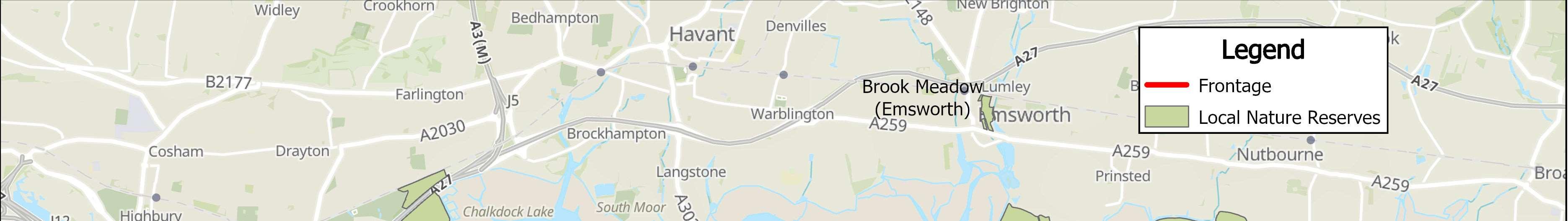
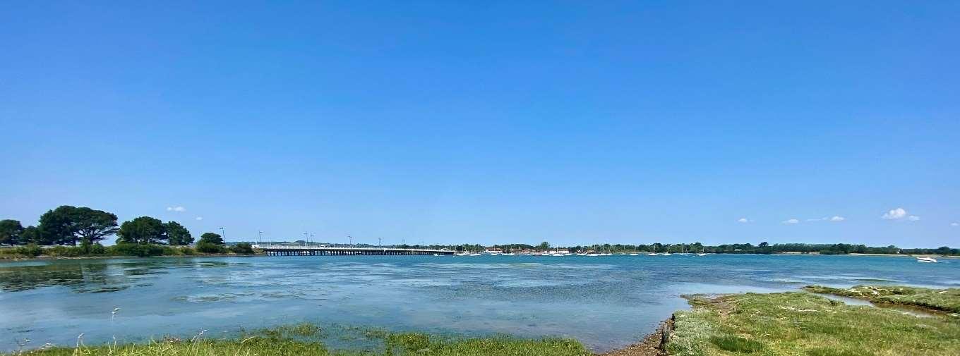
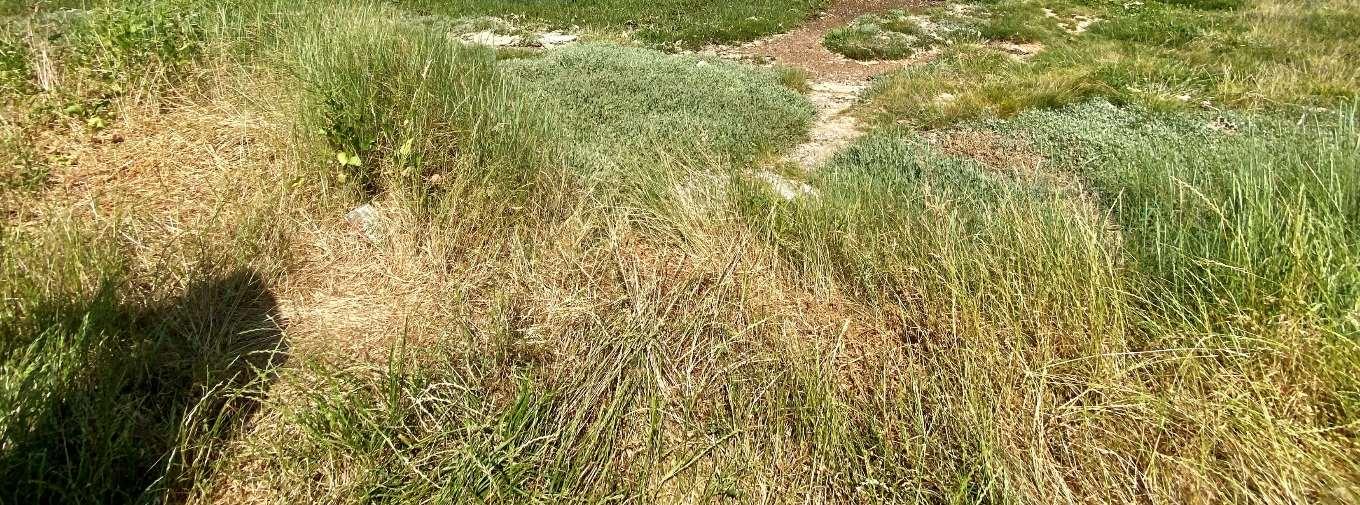
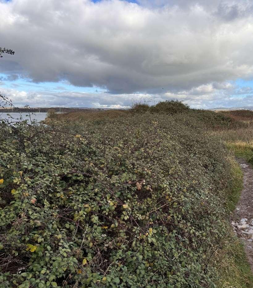
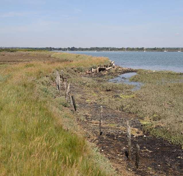
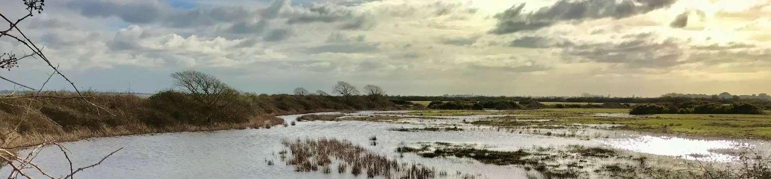
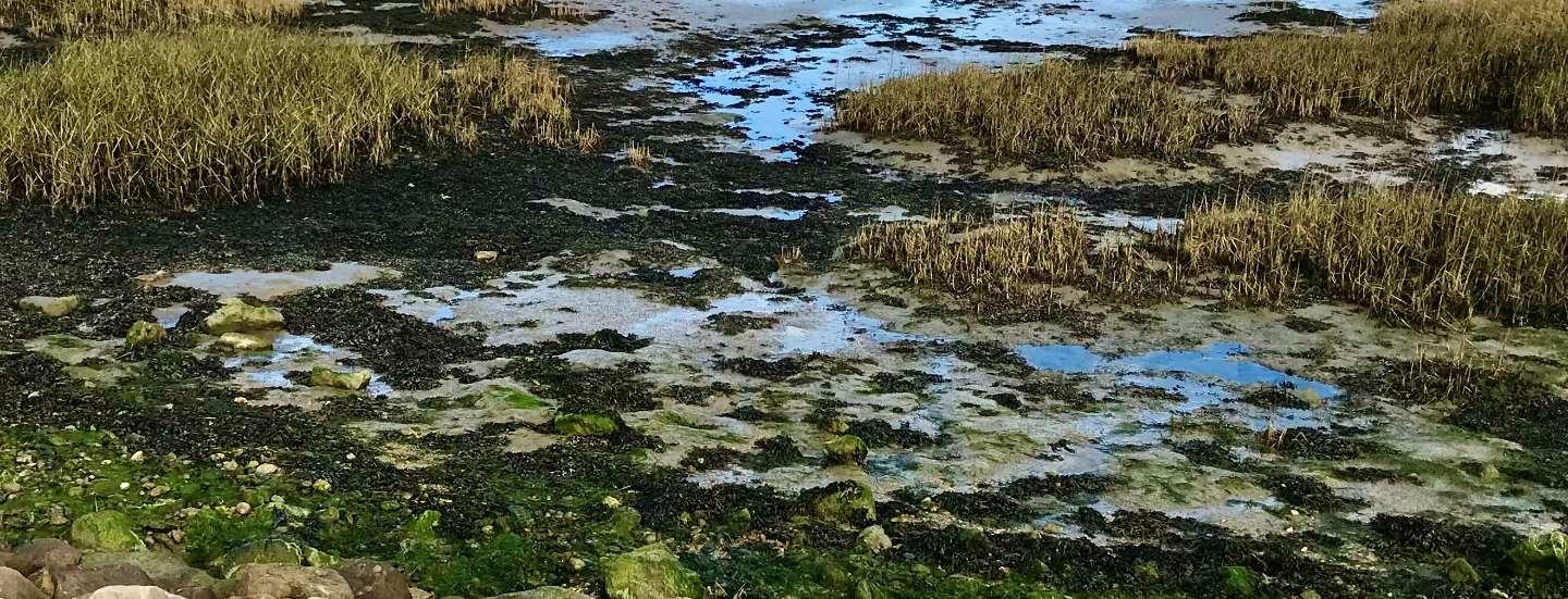
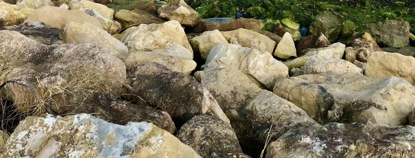
HaylingIslandissurroundedbydesignatedsites,includingtheChichesterand LangstoneHarboursSpecialProtectionArea(SPA)/RamsarsiteandtheSolent MaritimeSpecialAreaofConservation(SAC).ChichesterHarbourisalso designatedasaNationalLandscapeandSinahCommonisadesignatedSSSI (SiteofSpecialScientificInterest).HaylingIslandalsosupportsfiveLocalNature Reserves(LNR),includingTheKenchandtheHaylingBillyLNR.Manyofthese importantsitesaresituatedalongTheStrategycoastlineandassuchitis essentialtoconsidertheseareaswhendevelopingTheStrategy.
Withinmanyoftheseimportantsitesthereareanumberofdifferenthabitats suchassaltmarshesandmudflatswhichsupportawidediversityofwildlife. Theintertidalmudflatsprovideaparticularlyimportantfeedinghabitatfor birds.PartsoftheislandarealsoidentifiedasBrentGooseandWaderfeeding androostingsites.
Unfortunately,withpredictedsealevelrise,itisthoughtthatmanyofthe importantintertidalhabitatswillget‘squeezed’againstcoastaldefence structuressuchasseawalls.Thiscandecreasethesizeandhealthofthe intertidalhabitatsandplaceadditionalstressesonthespeciesthatrelyupon them.
ThereisalegalrequirementundertheHabitatCompensationandRestoration Programme(HCRP)tocreatenewintertidalhabitatwithintheNorthSolent ShorelineManagementPlanarea,tooffsetthelossofexistingintertidal habitatsviacoastalsqueezeinfrontofalltheHoldtheLinepolicyareas.To helpoffsettheseanticipatedlossesinthefuture,itisessentialforTheStrategy toconsiderenvironmentalimprovementoptionsandinvestigateopportunities tocreatenewareasofhabitat.
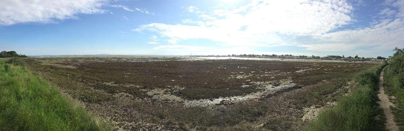
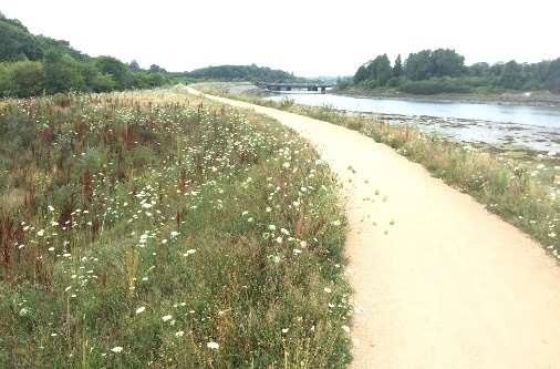
ViewsofSolentMaritimeSACandChichesterHarbourSPA,RamsarandSSSI (ABOVE)andKenchLocalNatureReserve(BELOW)
TheIslandplayedavitalroleduringWorldWarII,whenitbecameanimportant militarybasewithasignificantroleinthedefenceofPortsmouthandinthe build-upto,andexecutionof,theD-DayLandings.Theseactivitieshaveleft theirmarkonthecoastallandscapeofHayling,andpillboxes,gunsitesand memorialscanstillbeseentoday.
HaylingIslandisoftenconsideredasoneoftheUK’slasttraditionalseaside resorts.ThelistedRoyalHotelbuiltin1825,alongwithanearbyBathHouse andbathingmachinesattractedwealthyholidaymakerstotheIsland.By1909, beachhutsandbathingtentswereestablishedalongtheHaylingIslandbeach.
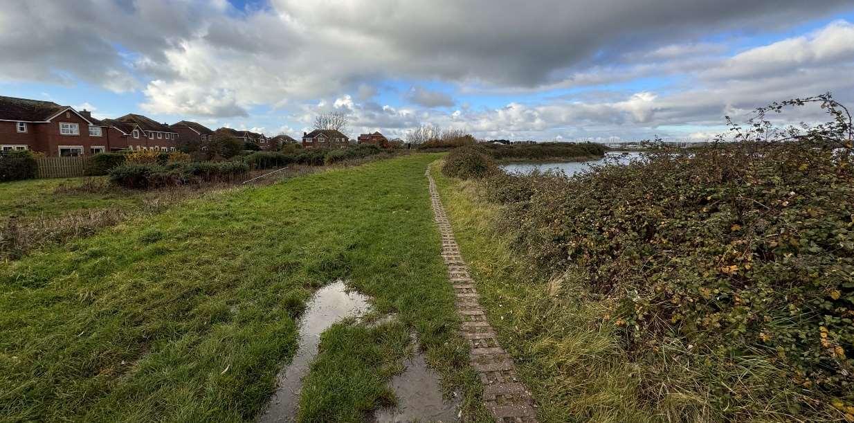
TheHaylingBillyLinewasanimportantconnection,bringingtouriststothe island.Asaresult,holidaycampsflourishedduringthe1950s.Today,the HaylingBillytrailrunsalongtheoldrailwaylinefromthenorthoftheIsland downtoSinahLane.Itiswellusedbywalkers,cyclistsandhorseriders.
HaylingIslandoffersarichcultural,historicandenvironmentallegacyasa leisuredestinationwhosegenesisasapre-Victorianexclusivehealthresort evolvedintomasstourismandthedevelopmentoftheholidaycamps.This formedthefoundationofawater-sportsoffer,basedaroundbeingthe worldwidehomeofwindsurfing,followinglocalresidentPeterChilvers’ inventionofthefirstwindsurfboardin1958.Haylingisideallysituatedfora varietyofwatersports,duetoitbeingshelteredbytheIsleofWight.Such sportsincludesailing,windsurfing,powerboating,jetskiing,paddleboarding, kitesurfingandkayaking.

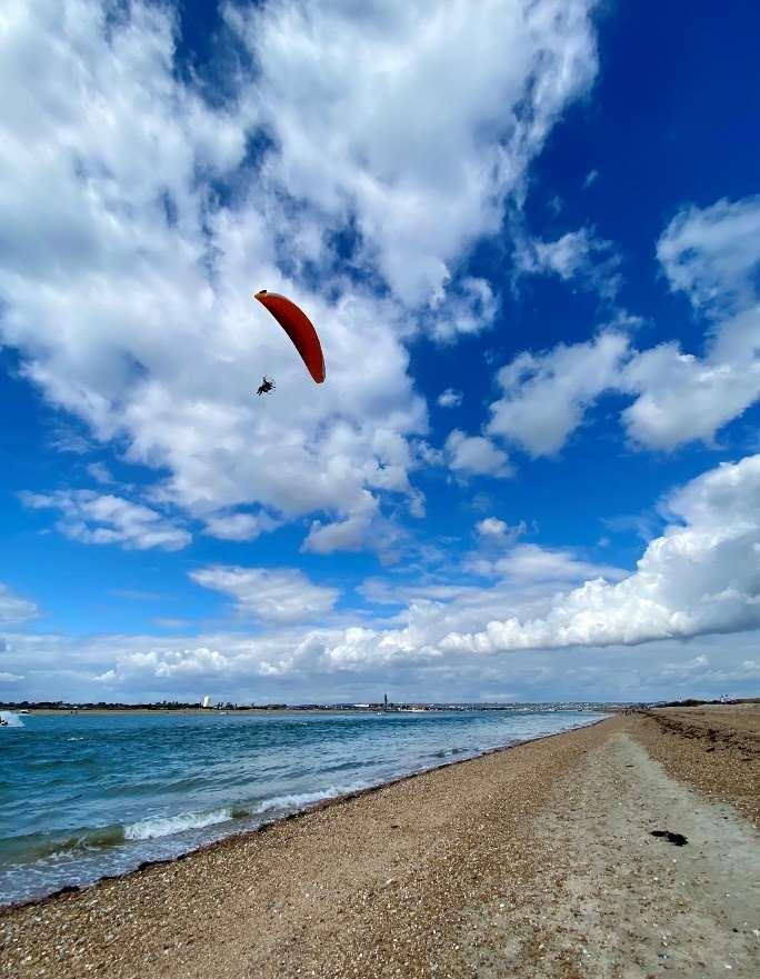
Paragliding-oneofthemany activitiesonofferonHayling Island’sbeaches
ManyindividualsandorganisationshaveakeyinterestorstakeintheHayling Islandcoastlineformanydifferentreasons.Eachstakeholderisthereforelikelyto haveauniqueviewonitsuse,developmentandfutureprotection.Assuch stakeholderengagementisfundamentalandcanbeasourceofindispensable informationwhichcanbeusedtodefinecoastalissuesandobjectives,steer Strategydevelopmentandachieveconsensusonthefuturemanagementofthe coastline.
Strategydevelopmentsetoutandimplementedaclearmethodologyforengaging withlocalcommunities,businessesandpublicbodieswithavestedinterestinthe HaylingIslandcoastline.Thisapproachensuresthatthosewhomayaffectorare influencedbythedecisionsofTheStrategyareactivelyinvolvedandinformedat therighttime.TheaimsofTheStrategyengagementprocesswere:
•toraiseanawarenessandunderstandingofcoastalfloodanderosionrisknow andintothefuturewithclimatechange
•toidentifythechallengesandconstraints
•toidentifybroaderoutcomeopportunities
•todevelopcommunityinvolvementinthedecision-makingprocessfor managingourcoastline.
•tolistentotheircommentsandconcerns
Stakeholderandpublicengagementhasinformedthecoastalmanagement optionsbearinginmindwhatistechnicallyfeasible,publiclyacceptable, economicallyviableandenvironmentallyacceptable.
Atthelaunchoftheproject,apublicsurveywasinitiatedtoseekthecommunity’s viewsoncoastalmanagementofHaylingIsland.Respondentswereaskedabout theirconcerns,whatisimportanttothemwhenusingthecoastlineandtheir aspirationsfortheisland.Theresultsofthesurveyhelpedusunderstandthe communities'viewsoncoastalfloodanderosionriskontheisland,wherethe mainareasofconcernwereandwhatwidercoastalopportunitiespeoplewould liketosee.
FourvirtualsessionswereheldduringdevelopmentofTheStrategy,withthe projects'KeyStakeholderGroup,madeupofrepresentativesofthelocal community,including;residents,localbusinesses,landowners,andcommunity groups,organisationsandlocalCouncillors.Thefirstsessionprovidedan introductiontotheproject,opportunitytomeettheteamandtofindoutwhya Strategyisneededandwhatisinvolved.Thenexttwovirtualworkshop sessionshelpeddetermineaspirationsandopportunitiesrelatingtoHayling Island’scoastline.Thefinalvirtualsessionprovidedanopportunitytopreview thedraftStrategyandaskquestionsbeforethestartofpublicconsultationin October2022. Theprojectteamhavealsoheldanumberofvirtualmeetingswithlandowners alongHayling'scoastlinetounderstandhowtheyusetheirsectionofcoastand establishtheirshortandlong-termaspirationsfortheirfrontages.
Throughpresentations,questionandanswersessionsandothervirtual meetings,TheStrategyteamhaslearntahugeamountabouthowpeoplewish toseetheshorelineevolve.Alloftherelevantfeedbackreceivedtodatehas beenusedtoinformthedevelopmentofTheStrategytoensurethatit accountsforandcaptureskeystakeholderinputandideas.
Apublicconsultationperiodranforthreemonthsbetween3October2022and 30December2022.Thefeedbackreceivedduringthistimewasassessedand whereapplicableandrelevantusedtoupdateoramendthefinalStrategy. Whilstmanyofthecommentsreceivedwerenotdirectlyrelatedtothe Strategyproposalstheyhavebeenextremelyusefultohighlightmanyother communityissues,concerns,opportunitiesandsuccesses.
Inaddition,theStrategysupportingenvironmentalreportsweresubjectto statutoryconsultationwithNaturalEngland,theEnvironmentAgencyand HistoricEngland.TheStrategyhasbeenupdatedtotakeaccountofthe statutoryconsulteecommentsreceived.
TohelpestablishthebaselinefloodanderosionrisksalongTheStrategy frontageitwasnecessarytoidentifytheconditionoftheexistingdefencesand howlongtheyarelikelytolastwithoutmaintenance.Thiswasdoneby undertakingawalkoveroftheentireStrategyshorelineandvisuallyassessing defenceconditioninlinewiththeEnvironmentAgency'sassessmentmanual.
Thereisawiderangeofdifferentdefencetypes,fromearthembankmentson muchoftheeastandwestcoasts,toseawallsandrevetmentsalongthemore exposedopencoastwhichprotectagainsterosionandwaveovertopping.In addition,theopencoastisaffordedprotectionbythebeacheswhichactasa barriertothewaves,however,theyrequireregularmanagementtomaintain thebeachlevelsastheyareanintegralpartofthedefencesystem.
ApproximatelytwothirdsofthedefencesaroundHaylingIslandareownedand maintainedbyprivatelandowners.

Landownersareultimatelyresponsibleformaintainingorimprovingtheir owndefences.Therefore,wheremaintenanceorupgradeofdefencesis referredtoinTheStrategyitisassumedthatthiswillcontinuetobethe Landownersresponsibility.
Whoisresponsibleformanagingthecoastline?
CoastalProtectionAuthoritiesandtheEnvironmentAgencyhavepermissive powerstocarryoutworkstoprotectagainstcoastalfloodinganderosion. However,thisisnotalegalobligation.ThismeansHBChasthe'power'tocarry outcoastalprotectionworksbutisnotdutyboundtodosoandwillnotbeliable forthefailuretoexercisethesepowers.
Ingeneral,LocalAuthoritiesandtheEnvironmentAgencywillonlyactwhere thereisawidepublicbenefitand/oranappropriateengineeringsolutionthatis achievable.ThisiswhyHBCarecommittedtothisStrategytounderstandwhat canbedonetoprepareHaylingforamoreresilientfuture.
Approximately70%ofthedefencesaroundtheislandareestimatedtobeina fair,poororverypoorconditionwithashortresiduallifeorprovidealow standardofprotection.Consequently,thereareanumberofcriticalareas aroundtheIslandwherethedefenceshavefailedorarebeginningtofail,some frontingareasoflandfill.
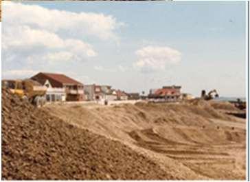
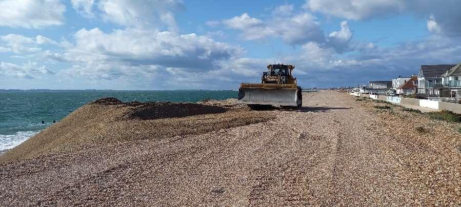
Duringthe1940s,HaylingIsland becameatouristdestination. Initialdefenceswere constructedinorderto maintainthelineofthebeach. Overtime,naturalretreatand lossofmaterialfromthebeach meantitwasnecessarytobuild moresubstantialdefences,to protectthepropertiesbehind.
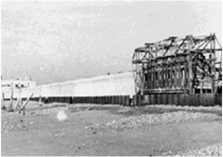
1947:constructionofnew seawall,Eastoke
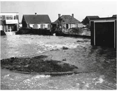
1960sand1970s:floodingandproperty damageinEastoke
The1960sand1970ssawlargewaves overtoptheseawall,andcause extremefloodingandsignificant damagetoproperties.Upgraded concretedefenceshadcausedthe drawdownofthebeachinfront, underminingthedefenceand increasingtheincidenceandseverity offlooding.Significantrepairswere carriedouttotheseawallin1978to repairstormdamage.

Priorto1985,lowbeachlevelsledto morerunupofseawatertothe seawall.Significantovertoppingby wavesoverthedefencesledtolarge floodingeventsatEastoke.In1985, 510,000m³ofshinglewasplacedon thebeachasthefirstcampaignof beachmanagementonHayling,ata costofapproximately£4m.Thisbuilt upthebeachlevelsandreducedthe riskofwaveovertoppingand flooding.
1985:thefirst campaignofbeach management
The1990ssawthestartofannual beachmanagement,whichwas carriedoutasthepreferred managementoption.
Beachmanagementoperations involvingrecyclingaswellas importingmaterialhavecontinued. Thisactivityhelpsmaintainbeach levelswhichreducestheimpactof stormwaves.Somebeach overtoppingoccurs,whichis retainedonthepromenadewitha controlledflowtotheroad drainage.In2013,theEastokePoint Scheme,involvingtheconstruction ofthreerockgroynesandrock revetment,wasimplementedto addressbeachloweringand increasedfloodrisk.
£5.1millionhasbeensecuredfromtheEnvironmentAgencytoimplementa BeachManagementPlan(BMP)alongtheHaylingIslandfrontageforthenext fiveyearsto2029.
TheSouthHaylingBMPhasidentifiedastrategyfordeliveringthebeach managementapproachalongtheopencoast.Itsetsouttherequirementsfor maintenance,monitoringandinterventiontomaintainthebeachand structurestoensuretheycontinuetoprovideanadequatestandardof protectionalongtheEastokefrontage.
TheCouncilimplementstheBMPtoretainahealthybeach,withoutwhichwe wouldseethereturnofregularseriousfloodingatEastoke,asoccurredbefore the1985beachrechargeworks.
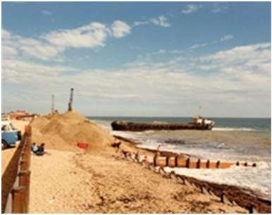
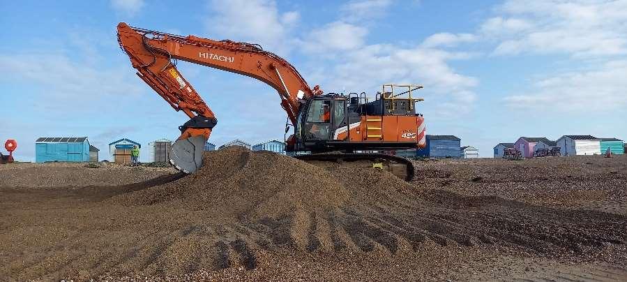
Oneofthemethodsappliedtothebeachmanagementactivitiesisbeach nourishment,whichisthereplacementofsedimentlostfromasectionof beach.Thisisachievedprimarilythroughusingeitherbeachrechargeorbeach recycling.Thiswillhelptorestoreadepletedbeachbacktoacceptablelevels.
Restoredbeachlevelscontributetoreducingtheimpactofstormwaves,which inturnhelptomanageflooding.
Beachrecharge:materialissourcedfromoutsidethenormalbeachsediment systemandintroducedtothesamenearshorezone.
Beachrecycling:Materialismovedfromanareaofaccretiontoanareaof erosion,torestoreadepletedbeachbacktoacceptablelevels.
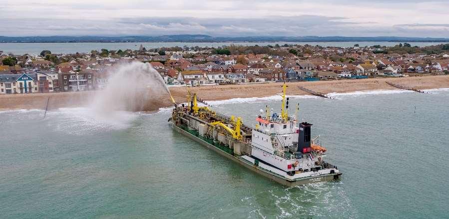
Beach recharge, 2019
©SolentSky Services, 2019
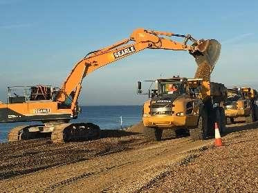
Beach recycling, 2023
Ondefiningthebaseline,andhavinggainedadetailedunderstandingoftheprocesses,featuresandissuesoperatingalongthecoast,thedevelopmentandappraisal ofstrategicmanagementoptionswasundertaken.
TheoptiondevelopmentprocessreferstothetasksinvolvedtoselecttheleadingstrategyoptionsalongTheStrategyfrontage.Theprocessfollowedthe EnvironmentAgency’sNationalFloodandCoastalErosionRiskManagementguidelines.
Definebaselinescoping anddatacollection
Defineoption developmentunits(ODUs)
Identifyalonglistof possiblemeasuresfor eachODU
Selectpreferredpackages ofmeasuresfromthe ODUshortlistto implementthestrategic options
Developpotential strategicoptionsforeach ODU
Definethebaselinefor eachODU
Conceptuallyappraisethe longlistofmeasures
Detailedappraisalof strategyoptionsbyODU
Selectionand confirmationofthedraft leadingoptions
ProjectBoardapprovalof draftstrategyfor consultation
Identifyshortlistoptions foreachODU(atoolbox ofviablemeasuresto implementstrategic options)
Publicandregulator consultation
EnvironmentAgency reviewandapprovalof thefinalstrategy
HBCapprovalofthefinal strategy
Review,feedbackand updatethestrategy
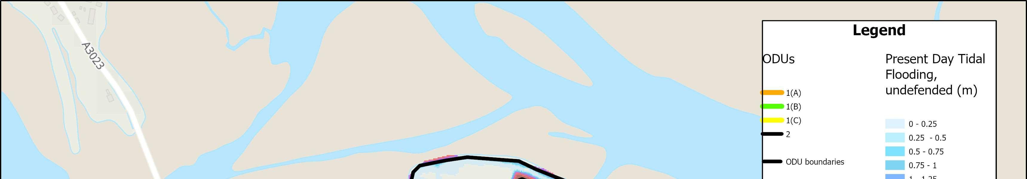
Floodanderosionrisks,coastaldefencetypes,landuses,landownershipandissuesandopportunities varyalongTheStrategyfrontage.Foreffectivefloodanderosionriskmanagementoptionstobe developeditisimportanttoconsiderandrecognisethislocalvariability.Withthisinmind,thefirst stageoftheoptiondevelopmentprocesswastodividethefrontageintosmall,localsections.These sectionsareknownasOptionDevelopmentUnits(ODUs).
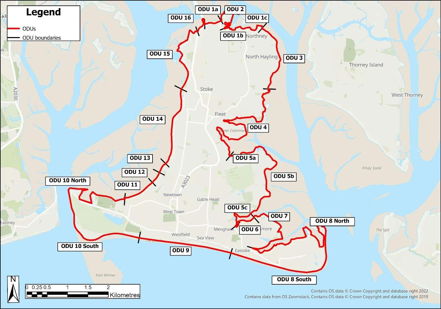
OptionDevelopmentUnits
ODU1:LangstoneBridgetoNorthneyFarm(split into3sub-unitsa-c)
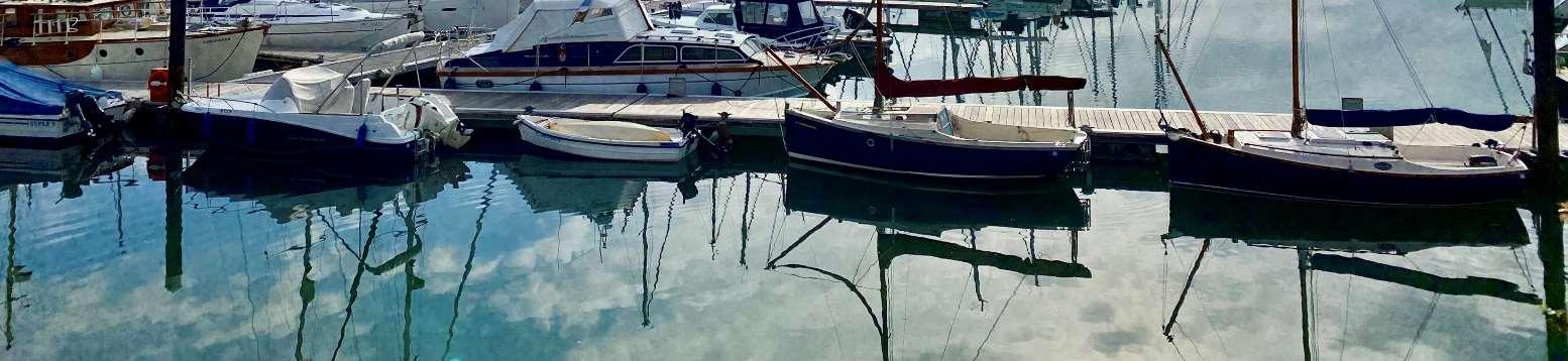
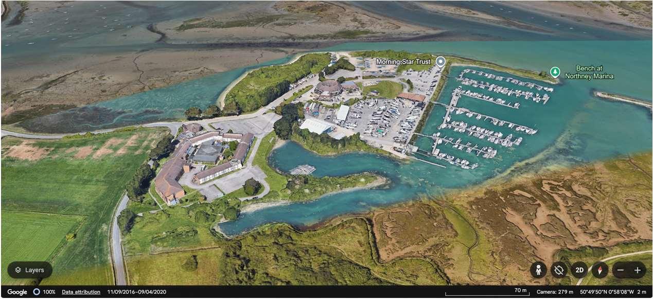
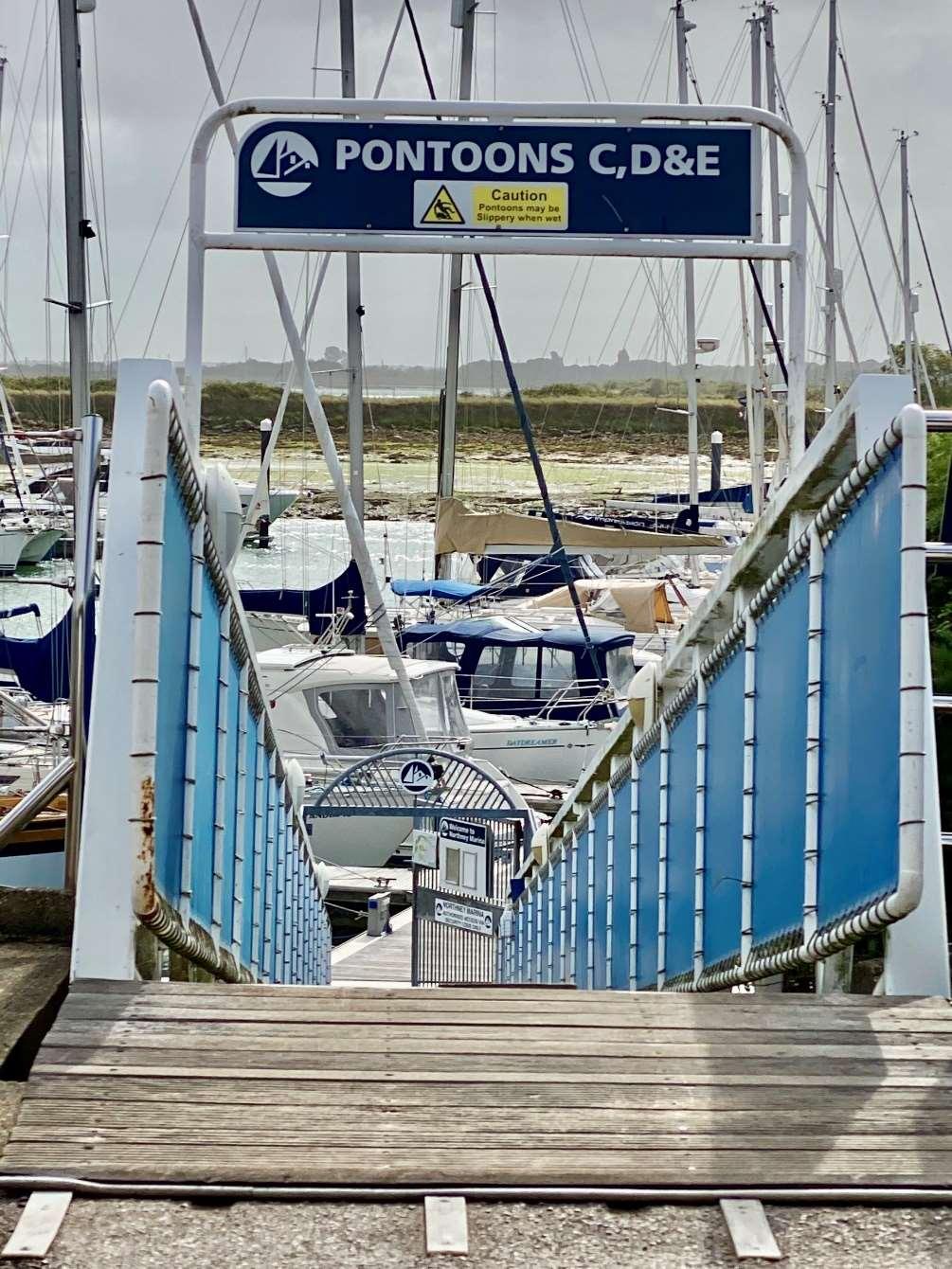
ODU2:NorthneyMarina
ODU3:NorthneyFarmtoChichesterRoad
ODU4:ChichesterRoadtoMillRytheJuniorSchool
ODU5:MillRytheJuniorSchooltoSalternsLane (splitinto3sub-unitsa-c)
ODU6:SalternsLanetoWilsonsBoatYard
ODU7:WilsonsBoatYardtoFisheryCreek
ODU8:Eastoke
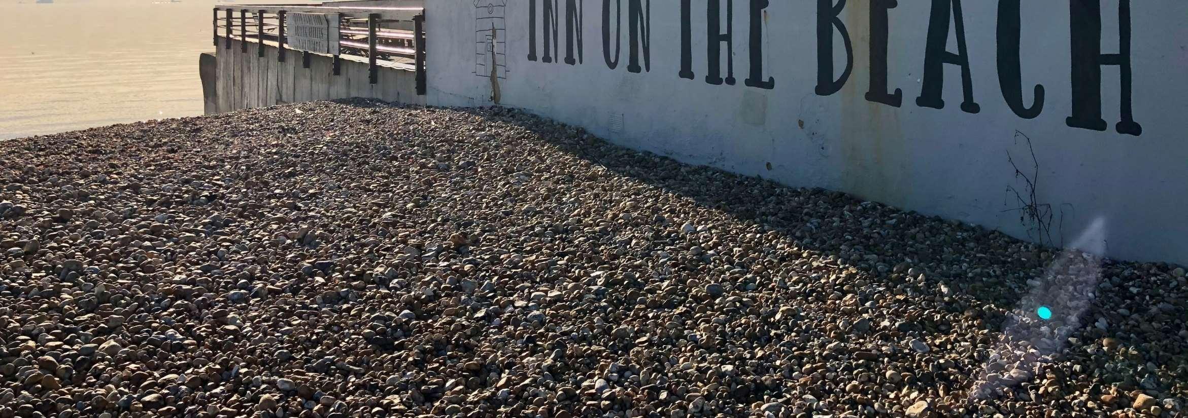
ODU9:EastokeCornertoInnontheBeach
ODU10:InnontheBeachtoNorthShoreRoad
ODU11:NorthShoreRoad
ODU12:NorthShoreRoadtoNewtown
ODU13:Newtown
ODU14:NewtowntoStoke
ODU15:StoketoLangstoneBridgeCarPark
ODU16:LangstoneBridgeCarParktoLangstone Bridge
Thelonglistofoptionsfallwithinthefollowingstrategicapproaches.
AcceptingtheTide
Allowingthecoasttoevolvenaturally,noactivemanagement
ThisapproachisconsideredasthebaselinefortheHaylingStrategy.Itinvolves nointerventionormanagement,wherethecoastisallowedtoeffectively evolvenaturally.Beachesandsaltmarshhabitatsareabletomovelandward naturallyassealevelsrise,erosionisunconstrained,andfloodingwillbecome deeperandmorefrequentovertime.
Thiswillnotbeappropriateeverywhere,especiallyinbuiltupareas,butis moreaboutacceptingtheriskofflooding.
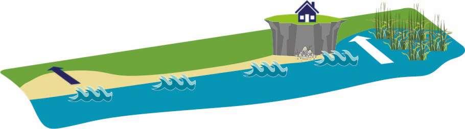
Controllingnaturalprocesseswithharddefences
Thisapproachinvolvesbuildingartificialstructureswhichtrytocontrolnatural processes.Theseoften‘hard’defencesaredesignedtoreduceerosionorhold backthetide. Theycannotprotectagainsteverystormeventualityandsodonotstop floodingcompletely,thereisalwaysstillarisk.Theyareallbuiltwithadesign lifeandwillnotbesustainableforever.Overtimeandassealevelsrise, beacheswilldisappear,andnaturalsaltmarshwillreduceasitissqueezed againstdefences(knownascoastalsqueeze).
Saltmarshhabitats movelandward
Morefrequent floodingBeachesmovelandward
Erosioneventsmorefrequent
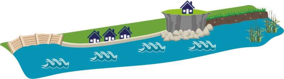
Acceptingthetide
Keepingoutthetide
Methodsofkeepingoutthetideinclude:
•Seawalls–asseeninfrontofInnontheBeach,HaylingBillycarparkin thenorthandMenghamRythesailingclub;
•Timberorrockrevetments–asseenatthecoastguardstationandjust southofMenghamRythesailingclub;
•Embankments–asseeninvariouslocationsonboththeeastandwest coastsofHaylingIsland.
Underthisapproach,thelevelofchangeinriskovertimewithdifferent optionsisalsoconsidered,inordertofindthebestsolution.Optionsthat Maintain,SustainorImprovethecurrentlevelofprotectionareconsidered.
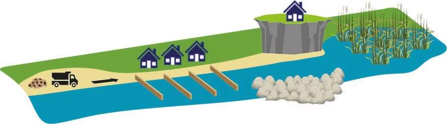
Workingwithnaturalprocessesandreinstatingnaturaldefences
Byworkingwithnaturalprocessesratherthanagainstthem,thisapproach takesamoresustainableandnaturalapproachtomanagingthecoast.
Methodsofworkingwiththetideinclude:
•Beachmanagement–bymovingmaterialfromareasofaccretiontoareasof erosionandbuildingupthebeachafterstorms.Thisneedstobecarriedout frequently.ThismethodiscurrentlyinusealongHayling’sopencoast.
•Beachordunenourishment–wherenewmaterialisplacedonthebeach,or plantingtostabilisedunes.ThebeachatEastokeisnourishedregularly, usingdredgedmaterialfromaboat.
•Groynes–totrapsedimentandbuildupabeach.Thismethodcanhave negativeeffectsbystarvingotherareasofmaterialcausingerosion elsewhere.TherearerockandtimbergroynesalongHayling’sopencoast.
Maintain:Proactivelymaintaindefencesatthecurrentdefenceheight ortomanageerosion.Sealevelriseriskisnotaddressed.
Sustain:Adaptdefencesovertime,byraisingorreinforcingdefences instages.Addressessealevelriseriskinanadaptiveway.
Improve:Raiseexistingdefencelevelsorbuildnewdefences. Addressesfuturesealevelriskrisks,today.
•Offshorebreakwaters–helpstrapbeachmateriallandwardofthe breakwater.Thismethodis,however,onlyeffectiveforwaveovertopping, notfloodinundation.
•Saltmarshrestoration-reinstatinganaturaldefenceagainstfloodingand erosionbyrestoringsaltmarshhabitats.Thisoptionwillappealmoretothe harbourcoasts.
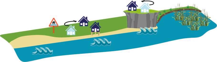
AdaptingtotheTide
Adaptingtoachangingenvironment
Thisapproachfocusesonmanagingchange,tominimisethenegative consequencesoffloodinganderosion,whereadaptationtoachanging environmentoccursbymakingcommunitiesmoreresilienttoclimate change.
Itcaninvolve:
•Makingspacetoallowbeachestorollbacklandwardnaturallyassea levelsrise;
•Adaptingpropertysoitismoreresilienttoflooding;
•Makingmodificationsinsideandoutsidetoreduceimpacts;
•Floodwarningandfloodplans;
•Relocatingpropertyorotherassetssuchascarparks;
•Changinglanduses.
Thisapproachhasthepotentialtoprovidenewopportunitiessuchas creatingnewhabitatswheredefencesaremovedbacktomakespacefor thetide.
ToassesstherelativemeritsofdifferentStrategyoptions,thebaselinefloodand erosionriskimpactsassociatedwitha‘DoNothing’approachwerederivedineach ODUforthepresentday,2045,2075and2125.Thisallowedforidentificationof theriskareaswithineachODU,andthetimingofrisksdefined.Thisformeda basisfromwhichtodevelopanumberofpotential‘strategicoptions’forfloodand erosionriskmanagement.Theoptionsconsideredincluded:
•DoNothing(baseline–developedineachODU)
•DoMinimum–e.g.maintenanceandrepairs–leastrequiredtoimplement theSMPpolicy
•Maintain–e.g.continuetoprotectagainsterosion
•Sustain–maintainaminimumstandardofprotection(SoP)byraising defencesovertimetokeeppacewithsealevelrise
•DelaySustain–maximiseexistingdefencesthenraiseSoPofdefencesata laterdate
•ImproveSoP–improveSoPcomparedtopresentday
Foreachstrategicoption,anappropriate‘packageofmeasures’foreachODUwas selectedforeachODU.Each‘package’wasproducedinconjunctionwiththeshort listofoptionsandoutlinedthetypeofcoastaldefencestructureandtimingof worksrequiredoverthenext100yearstoimplementthestrategicoption.
StrategyOptionsAppraisal
AppraisalofthestrategicoptionsineachODUincludedeconomicappraisal(Benefit:Costanalysis),anumberofenvironmentalassessmentsandatechnical appraisalofeachstrategicoption.Thismulti-variateappraisalofoptionswasundertakentoensurethattheleadingoptionsputforwardmeetTheStrategy objectivesandarerobustandsustainableintechnical,social,environmentalandeconomicterms.
Assess options againstkey criteria


AprimaryconsiderationinthedevelopmentofaStrategyistoknowwhatoptionsbeingrecommendedaretechnicallyviable.Thereislittlepointinundertaking detailedeconomicandenvironmentalappraisals,orputtingtheoptionforward,iftheoptioninquestioncannotreasonablybeimplementedontheground. Technicalconsiderationsincludeaspectssuchasthedefencetypeinquestion,timingofworks,spaceandheightrequirements,allinthecontextofthelocation andpresentconditionofthesiteinquestion.Forexample,foracurrentlyundefended,openspacelocation,therearefewtechnicalissues,andarangeofoptions arelikelytobetechnicallyviable(e.g.revetments,seawalls,landraising,floodwallsearthbundsetc.).However,foramoreconstrainedsite,suchasadenseurban environmentwherespacemaybeverylimited,significanttechnicalchallengesmaybepresentformanyoptions(e.g.landraisingorearthbundswhichrequires space)andmaylimittechnicallyfeasibleoptionstothosesuchasafloodwallwhichrequireasmallerfootprinttoimplement.
TwoonlineworkshopswereheldinNovember2020withkeystakeholders representingorganisations,communitygroupsandlandownersonHayling Island,focussingonunderstandingandcapturingaspirations,ideasand opportunitiesforHayling’scoastalandharbourfrontages,todayandinthe future. Theseresultshelpedustounderstandwhatisimportanttothosethatlive onandvisitHaylingIsland.Theideas,suggestionsandaspirations identified,directlyinformedthedevelopmentofthestrategicoptions alongsidewideropportunitieswhichcouldpotentiallybedelivered alongsidefloodanderosionriskmanagementschemesinthefuture.The optionappraisalprocessaccountedfortheseaspirationsandthereisan intentthatthepreferredoptionsbeingputforwardshouldsupportand facilitatethesewherepossible.
Thekeyenvironmentalconsiderationsandobjectiveshelpedshapethestrategy options.ThiswasachievedthroughaStrategicEnvironmentalAssessment(SEA) whichwasundertakenasanintegralpartoftheoptionappraisalprocess.AnSEA Scopingreportwasconsultedonduringtheearlypartoftheproject,andthekey environmentalobjectivesfortheprojectwereconfirmedandthesewererelated tothefollowingcategories:
•Biodiversity
•Culturalheritageandarchaeology
•Landscape
•Populationandhumanhealth
•Soil
•Water
•Air
•Climate
•Materialassets
•Andtheinterrelationshipbetweentheabovefactors
Theoptionswerethenappraisedinrelationtoeachcategory’sobjectivesandthe environmentalimpactsoftheoptionsweredetermined.Thisinformationwasthen includedaspartoftheevidenceforselectingthepreferredoption.Wherepossible itisintendedthatthepreferredoptionsshouldnotsignificantlydetrimentthe achievementoftheenvironmentalobjectives,butiftheydo,suitablemitigationor compensationmustbeidentifiedinordertoensuretheoptionsare environmentallyacceptable.
Theeconomicassessmentformedanimportantpartoftheselectionofthe leadingstrategyoptions.Althoughtheleadingoptiondoesnotnecessarilyhave todeliverthemostcosteffectiveoption,becausetherearemanyother determiningfactors(e.g.socialandenvironmentaldrivers),itishowever importanttomakesurethepreferredoptionmakeseconomicsense(i.e.the benefitsofdoingsomethingoutweighthecosts).
Thestrategyoptionsweresubjecttoeconomictestingduringtheappraisal.The assessmentinvolvedanestimationoftheBenefit:Costratioofeachoption.

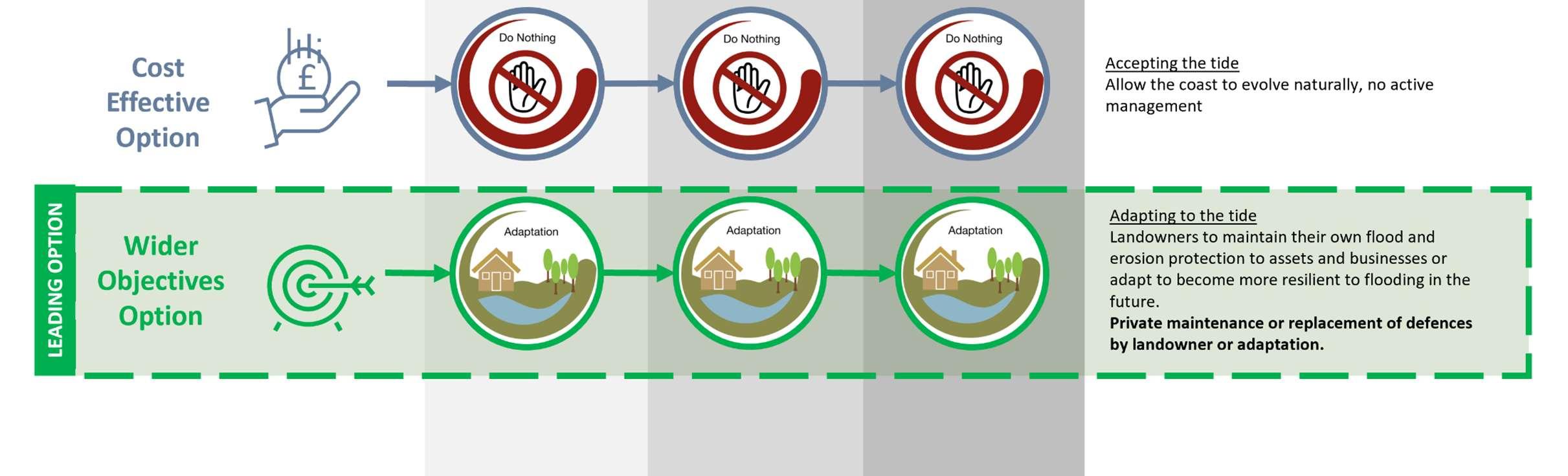
Thecostsofanoptionwereestimatedaccordingtothedefencetypes(as indicatedbythe‘packageofmeasures’),andthedefencelengthsandheights. Thefloodanderosionbenefitsofastrategyoptionweredeterminedby calculatingthedamagesavoidedcomparedtothebaseline‘DoNothing’ scenario. Generallyspeaking,thehighertheBenefit:Costratio,themoreeconomically viablethestrategyoption.TheBenefit:Costratiowasusedasatooltohelp informthedecision,andforStrategypurposesaslongasanoptionhada Benefit:Costratiogreaterthan1(i.e.thebenefitsoutweighthecost)itwas deemedaCostEffectiveOption.Sometimesmorecostlyoptionsprovide additionalbenefits,andiftheserepresentbettervalueoveralessexpensive option(i.e.theadditionaldamagesavoidedoutweighthecosts),thenitmay havebeenpreferabletochoosethismorecostlyoption,knownastheWider ObjectivesOption.
ForeachODUanoverall‘leadingoption’hasbeenselectedastheoption whichscoredthehighestintheappraisal.ForthemajorityofODUsthe leadingoptionwillbeeitherthe‘costeffectiveoption’ORthe‘wider objectivesoption’,butinasmallnumberofODUs,thecosteffectiveoption andthewiderobjectivesoptionarethesame,astheyhaveequalscores.


Thisistheoptionwhichprovides bestvaluefortaxpayers’money inlinewithgovernmentpolicy andguidance.
Thisoptionmeetsthemost objectives(environmental,social andtechnical)usingascored multi-criteriaapproach.
Itshouldbenotedthatalthoughmanagementoptionsmaybe economicallyviableforthepurposesofTheStrategy,itdoesnotmean theywillgoahead;therequiredfundingtopayfortheschemesmuststill befound.
costsordamageswhichincludediscountingthroughtime. PresentValuecostsanddamagesareadoptedinthebenefitcostratio andfundingassessment


TheStrategyoptionsproportionatelyaddressfloodanderosionriskswith worksphasedovertimedependingontherisk-basedtriggers.Assealevelsrise inthefuture,andexistingdefencesreachtheendoftheirusefullife,new coastaldefenceswillberequired.TheStrategyhasrecommendedaphased implementationprogrammeforfutureworks,basedonwhenrisksmaterialise.
TheStrategyrecommendsthatfuturefloodriskmanagementintervention optionssustainaminimum1:75year(1.33%annualchance)standardof protection(SoP).Thisstandardhasbeeneconomicallytestedagainst alternativesanditisdemonstratedthat1:75year(1.33%annualchance) minimumSoPisappropriateandeconomicallysoundatthestrategiclevel. Itshouldalsobenotedthatthisstrategiclevelminimumstandardof protectionwillbereviewedandtestedonalocalscaleinthedevelopmentof specificschemes;thismayresultinhigherstandardsofprotectionbeing deliveredlocally.
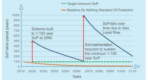
Schematicshowingadaptivemanagementwithaphasedinterventionovertime tomaintainaminimumSoP
Inrecentyearstherehasbeenachangetothewaycoastaldefencesare funded.Thefundingsystem,referredtoasapaymentforoutcomesapproach, rewardspartnershipfundingofschemesandprovidesmanypositivebenefits withlotsmoreschemesnowbeingbuiltasaresult.
Althoughaverysmallminorityofschemescanstillgainapprovalfor100% publicfunding(GrantinAid),schemeswithanexternalcontributionarelooked onfavourablytoalsoattractpublicmonies.Inaddition,themeritsofschemes arenotjudgedpurelyfinancially,andthewideroutcomesthatascheme deliversarealsoconsidered.
Forexample,ifaschememovespeopleinhighlydeprivedareasoutof significantfloodrisk,thispropelstheschemeuptheladderinthebidforpublic funding.
TheStrategyrecommendseconomicallysoundleadingstrategicapproachesto managingfloodanderosionrisk.Althoughsomefutureschemesmaybeableto attractsomepublic(GrantinAid)funding,contributionswilloftenberequired tomakeuptheshortfalltoenableschemestoprogress.Byknowingthe potentialfuturecostsofworks,mechanismstoinvestigateandsecurefunding canbedeveloped. Suchcontributionscouldcomefrom:
•ACommunityInfrastructureLevy–wheredevelopersareeffectivelytaxed andthismoneyisspentoncommunityprojects
•Directlythroughdevelopers(e.g.raisinglandthroughredevelopment)
•PotentialBeneficiariesofSchemes–businessesandprivateindividuals
•Locallevies
•LocalEnterprisePartnership
•Othersources.
DeliveringMore–broaderoutcomesandcontributions
TheStrategyprimarilypresentstheleadingstrategicapproachesformanaging therisksposedbycoastalfloodinganderosion.However,indoingthis,there arealsomanyotheropportunitiesforTheStrategytoprotect,supportand facilitatewiderbenefits.ThisisakeyobjectiveofTheStrategy.
Forexample,anewcoastaldefencetoprotectanareafromfloodingcanbeas simpleasaseawall.Whilstsuchadefencewillserveitspurpose,withsome joinedupthinkingtheremaybeopportunitiestoprovidemultiplebenefitsand notjustaflooddefence.
Broaderoutcomesandopportunitiesforwiderbenefitsthatcouldbedelivered alongsidestandardcoastaldefenceschemeshavebeenexploredduring Strategydevelopment.Potentialfutureopportunitiesinclude:
Business,regenerationandgrowth
•Renewableenergyoptionssuchas,solar,windandtidal
•Asecondpubliccrossingtotheislandfromthemainland
•Regenerationopportunitiestoenhancetourism,leisureandbusiness
•Multi-usedefencesincorporatingcafes,shopsandbeachhuts
Healthandwellbeing
•Createaccessiblespaces
•Improveconnectivitythroughneworenhancednetworkoffootpathsand cyclingroutes
•Playareasandinformalactivityspaces
•Socialspotstoconnectkeyareas
Recreation,amenityandtourism
•Widenandraisebeachesforamenity
•Connectsiteswithpromenadesandfootpaths
•Createasenseoflocalidentityandplace
•Incorporatenatureintothedesignofcoastaldefencesusingtidalpools oreco-formliners
•Realigndefencestomakespacefornature
•Saltmarshplanting
•Createbirdislandsandinstallbirdhides
•Wildflowermeadowsandbeepoststoencouragebiodiversity
•Interpretationboards
Heritage
•Heritagetrailsandboardwalkstolinksites
•Educationandinterpretationboards
UnlikelytobepaidforbyGovernmentGrantinAid,thesebroaderoutcome andwiderbenefitopportunitiesthatcouldbedeliveredalongsideFCERM schemesmayinturnactuallyopenupotheravenuesoffundingas partnershipfundingcontributionstowiderschemes.
Inordertoseekthedeliveryofthesemultiplebenefitsoffuturedefence schemes,TheStrategyhasidentified,signpostedandbegunexploringthe opportunities.
Adaptation
TheStrategyoptionsprovidetherecommendedpathwaysformanagingtidal floodingandcoastalerosiononHaylingIslandoverthenext100years. However,theimplementationoftheseoptionsisdependentonfunding availability.Withoutthenecessaryfunding,itmaynotbepossibletoconstruct /maintainthedefences/measuresrecommendedbytheoptions.Thereality isthatwewillneedtolooktoadaptationasarealisticresponsetocoastalrisks ontheislandnowandintothefuture.

‘...anticipatingappropriateactiontoprevent orminimisethelikelihoodandconsequences offloodingandcoastalchange,bothnow andinthefuture…’
CoastaladaptationshouldbeconsideredinALLLOCATIONSalongsidethe leadingstrategicoptionspresentedinTheStrategy.Weneedtoexplore methodstoadjusttotherealityofpresentandfuturecoastalfloodingand erosionrisk.
Adaptationfocussesonadjustingto,andmanaging,theimpactsofflooding andcoastalerosion,asopposedtotheotherstrategicoptionswhichaimto mitigatetheimpactsthroughphysicalfloodprotectionmeasures.Waysin whichcommunitiescanadjusttocoastalfloodanderosionriskaspartofan adaptationapproachinclude:
•Creatingcommunityfloodsupportgroups
•Signinguptofloodwarningsystemsandevacuatingpriortofloodevents
•Riskinformedland-useplanning
•Relocation
•Propertyfloodresilience

ThestrategyisintegrallylinkedtotheproductionofHavantBorough’semerging ‘BuildingaBetterFuture’LocalPlanandtheimplementationoftheHavantBorough RegenerationandEconomyStrategy2022–2036.
TheLocalPlanisinearlystagesofpreparation.Itwilladdresstheneeds,constraints andopportunitiesfordevelopmentacrossallpartsoftheBorough,andsetouthow much,whattypeandwheredevelopmentwilltakeplace.
CoastalPartnershaveworkedcloselywiththeHBCPlanningPolicyTeam throughoutthedevelopmentofTheStrategytoensurestronglinkageswiththe LocalPlanandback.Plannersareconsideringfloodriskintheirsitesassessments. EmergingLocalPlanpolicyfordevelopmentonthecoastgivesinprinciplesupport toFCERMschemes,andthedefenceandhabitatcreationprojectsidentifiedinThe StrategyactionplanwillfeatureintheLocalPlanandtheBorough’sInfrastructure DeliveryPlan.Provisionofimprovedcoastaldefencesinthefuturewillhelpprotect thosepartsofHaylingIslandwhichwarrantitandmakesurethatalloftheisland canremainaccessibletoensureasustainablefutureforthispartoftheBorough. Therefore,theLocalPlanhasfedbackintotheStrategydevelopmentandits optionsinrelationtocriticalroadinfrastructureandhelpedtoshapetheleading optionsinkeyareasoftheisland.


ForeachODUyouwillfindthefollowingfoursections:
ThissectionprovidesanoverviewofeachODUinrelationtoitslocation,key characteristics,defences(what,whoowns,whomaintainsandcondition), infrastructure(ifakeyfeature),coastalprocesses(ifrelevant)andenvironment (designationsandimportance).ThissectionalsoincludestheShoreline ManagementPlanPolicyforthefrontage.
Thissectionexplainswhatthemainriskisalongthefrontageinrelationtotidal floodingand/orcoastalerosion,andoutlineswhatisatriskovertheStrategy lifetimeinlightoffuturecoastalchangeandsealevelrise.
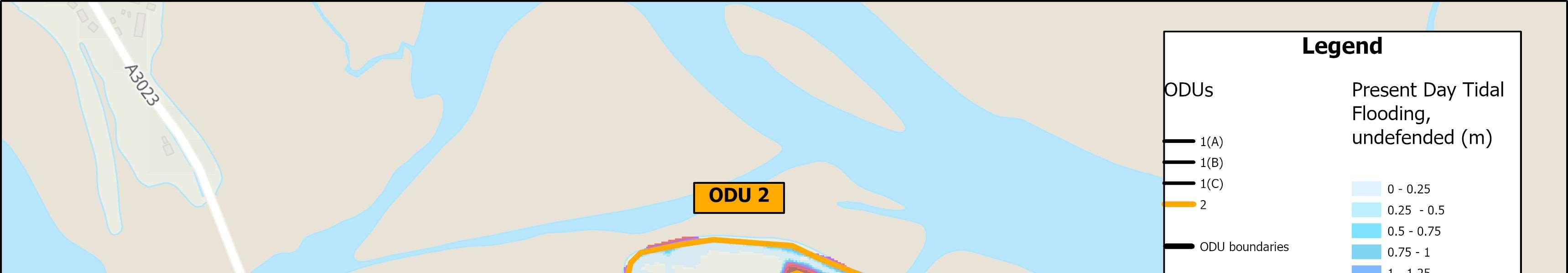
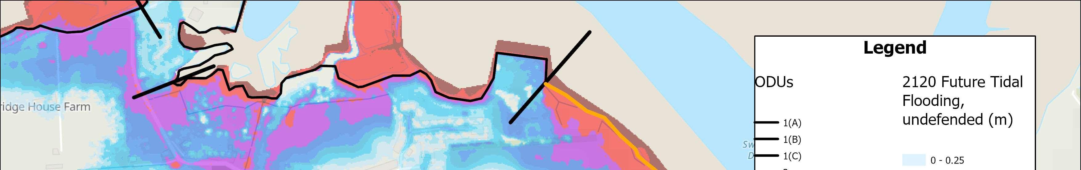
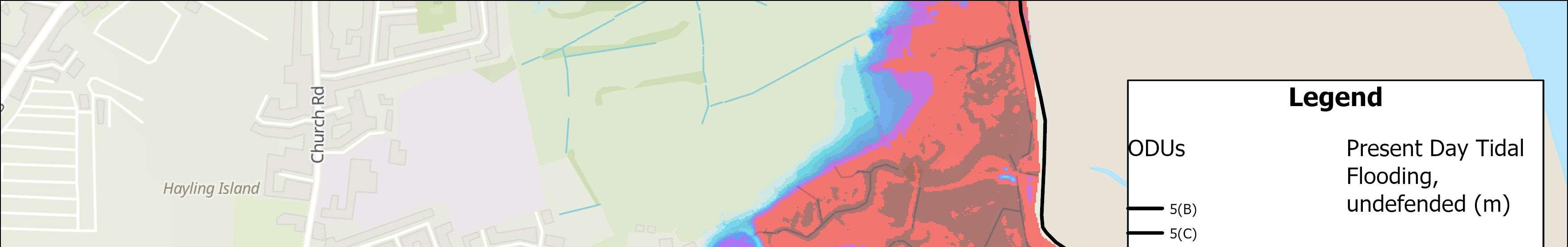
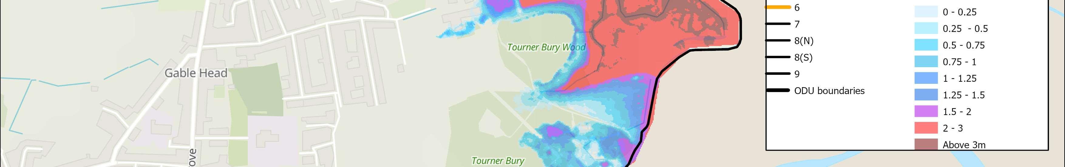
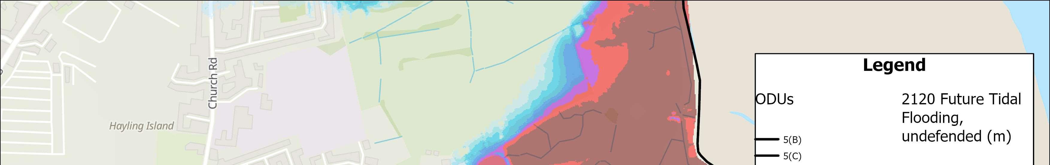
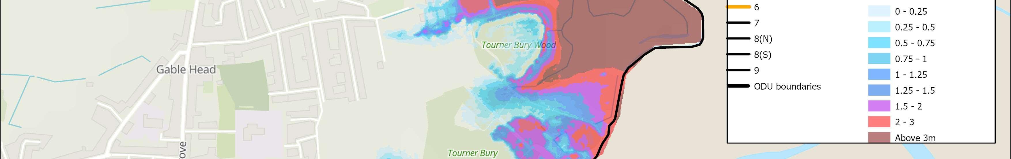
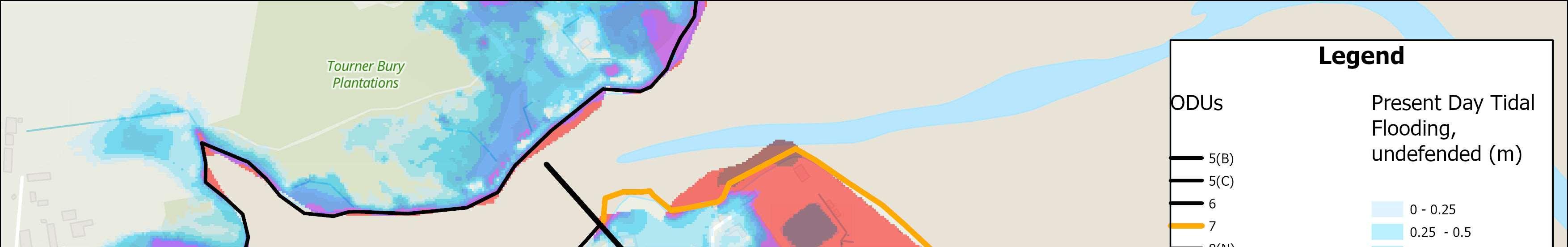
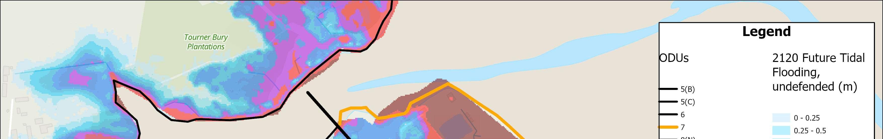
Twomapsareprovidedshowingthemodelledextentofanextremetidalflood event(1in200year,0.5%annualoccurrence),withoutanydefences,todayand in100years.The‘donothing’damagesforeachODUarealsoincludedinPresent Valueterms(i.e.damageshavebeendiscountedovertime).
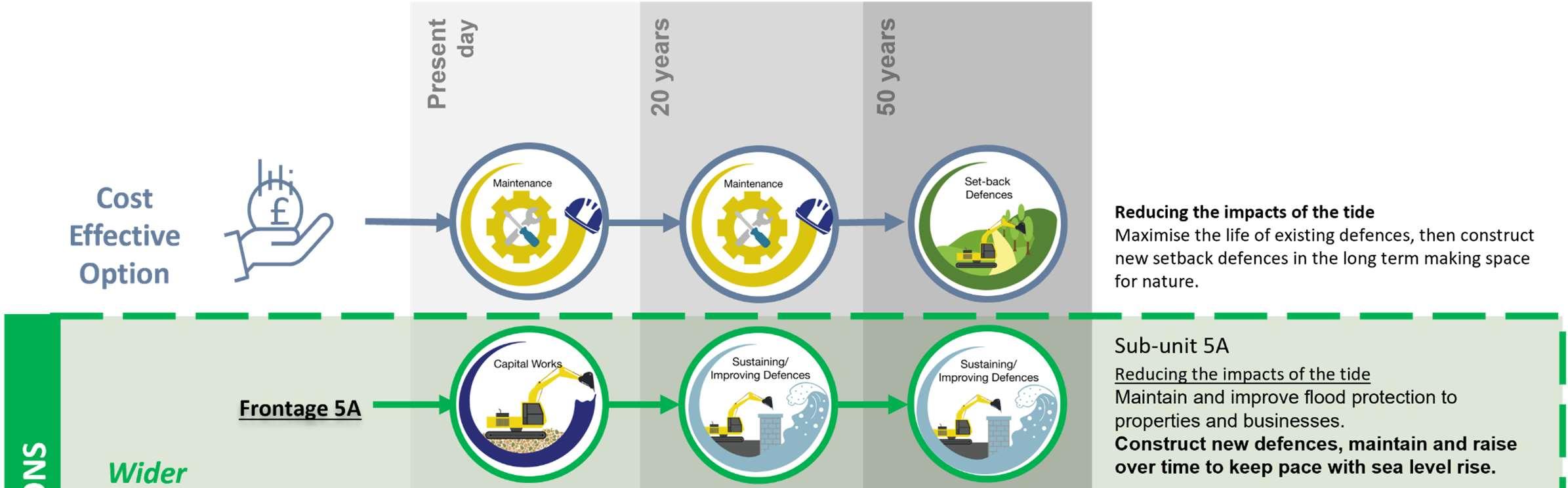
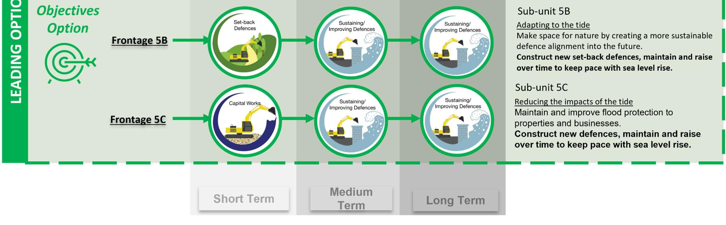
AleadingoptionroadmaphasbeenincludedforeachODU.WhereODU’shave beensplitfurther,theleadingoptionsforeachareincludedintheoverallODU roadmap.Eachroadmapincludesacost-effectiveoptionandawiderobjectives optionresultingfromtheassessmentsundertaken,asdescribedinSection3.
CostEffective Option
Option

£

Thisistheoptionwhichprovides bestvaluefortaxpayers’money inlinewithgovernmentpolicy andguidance.
Thisoptionmeetsthemost objectives(environmental,social andtechnical)usingascored multi-criteriaapproach.
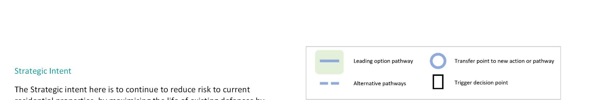
Theroadmapforeachpresentsavisualrepresentationofthestrategy option(s)withthesymbolsusedasfollows:
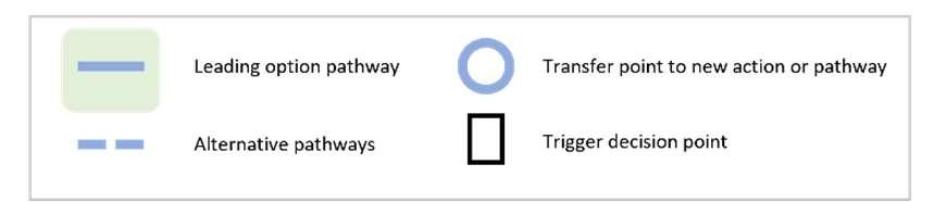
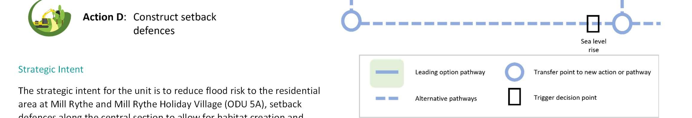
Key


Nofurtherinvestmentinexistingcoastaldefences.Defenceswouldbe allowedtofailovertimeandnaturalprocessestocontinue.
Maximisethelifeofexistingcoastaldefencesatcurrentheightthrough patchandrepairandscheduledmaintenance.
Constructionofnewcoastaldefences/refurbishmentofexistingcoastal defences.
Sustaining/Improvingexistingcoastaldefencesbyraisingtheheightor constructingadditionallengthsovertime,tokeeppacewithsealevel riseandincreasedrisk.
Constructionofasetbackdefencetoreducerisktoassets,alongside opportunitiesforintertidalhabitatcreation.
Adaptingtotheimpactsofcoastalfloodinganderosion.Thiscould includeanumberofofdifferentmeasures,suchaspropertyflood resilience,earlywarningsystems,relocationofassetsandriskinformed landplanning.
Inadditiontotheroadmap,atechnicaldescriptionoftheODU’s‘Overall StrategicOption’isprovided.
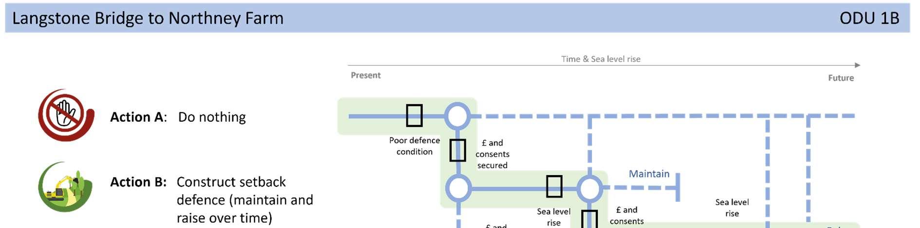
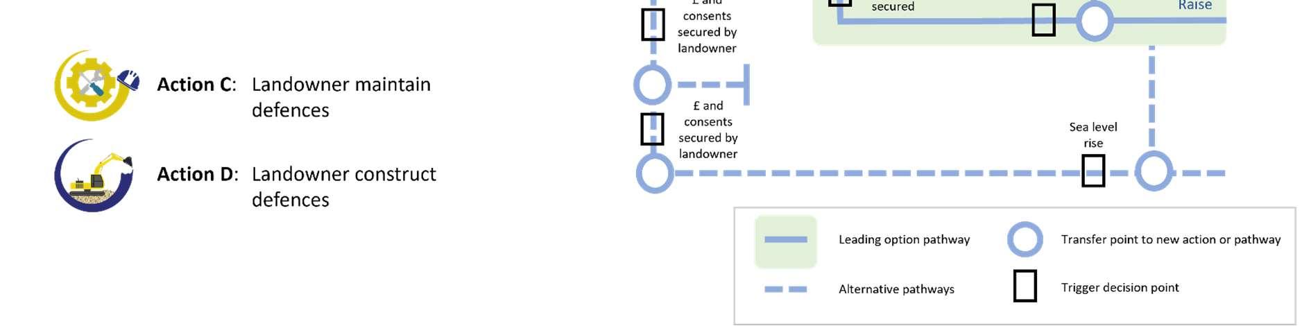
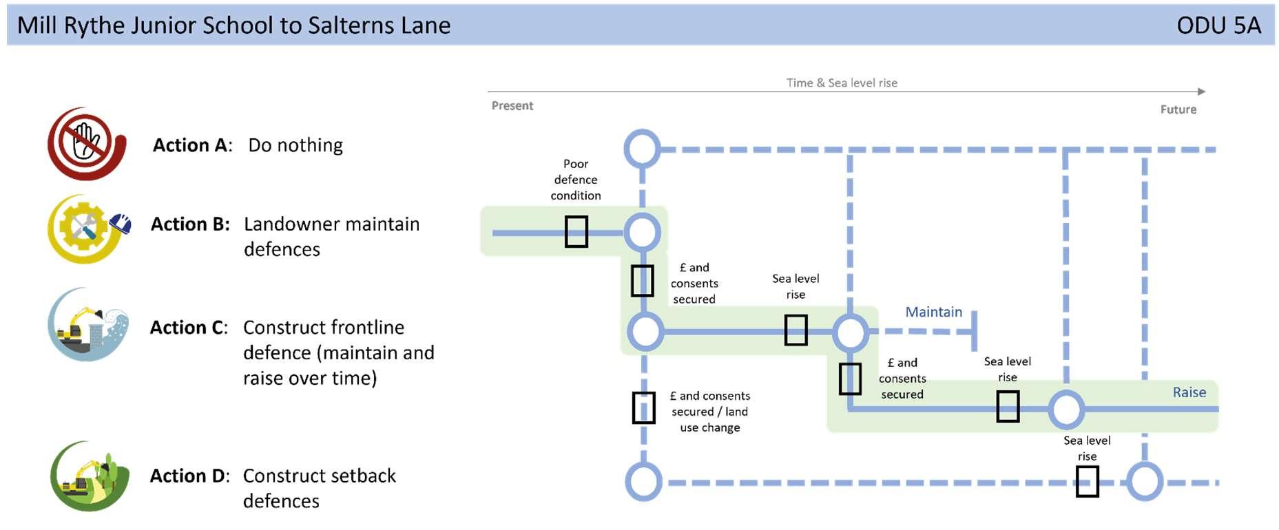
ThissectionprovidestheAdaptivePathway’sforeachODUandforeachsub-sectionif applicable.
Weuseadaptivepathwaystohelpcommunicatethedifferentactionsavailabletousas coastalmanagers,especiallywherethereislittlejustificationforfundingatraditional FloodandCoastalErosionRiskManagementscheme.
Anadaptivepathwayapproachhasthereforebeenadoptedtoallowusmoreflexibility tomanagerisksandadapttochangingconditionsovertimeusingtriggerpointswhere adecisionisrequiredtoinstigateapotentialmovetoanotherpathway.
ForeachODUdiscretemanagementactionpathwaysandtriggerpointsareshown, appropriatetothatfrontage,highlightingtheleadingoptionpathwayasrecommended inthisStrategy.
Thissectionalsoincludesadescriptionofthestrategicintenttocoastalmanagement alongthefrontageandnextstepsfollowingStrategyapproval.
Forallfutureschemesrecommendedinthenextsteps,fundingwillbearealchallenge todelivery,soitisexpectedthatavarietyofsourcesoffundingwillberequired alongsideGovernmentGrantinAidinorderforanytoprogress.

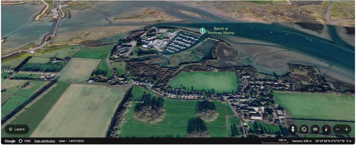
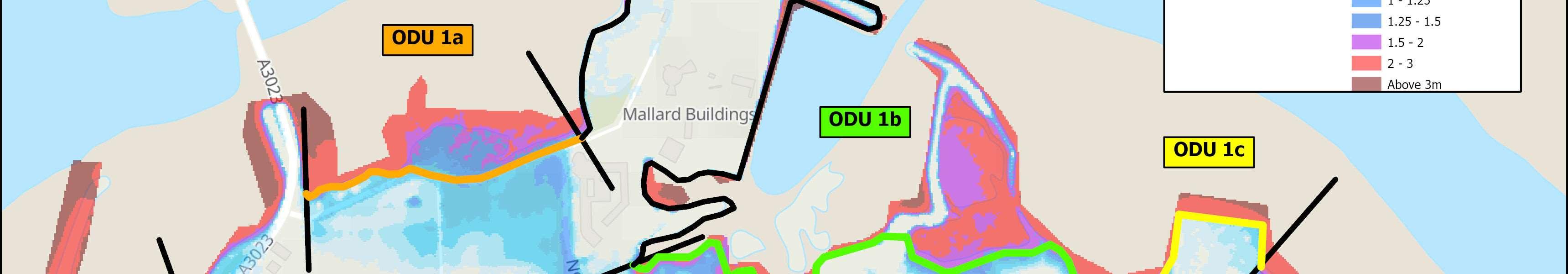
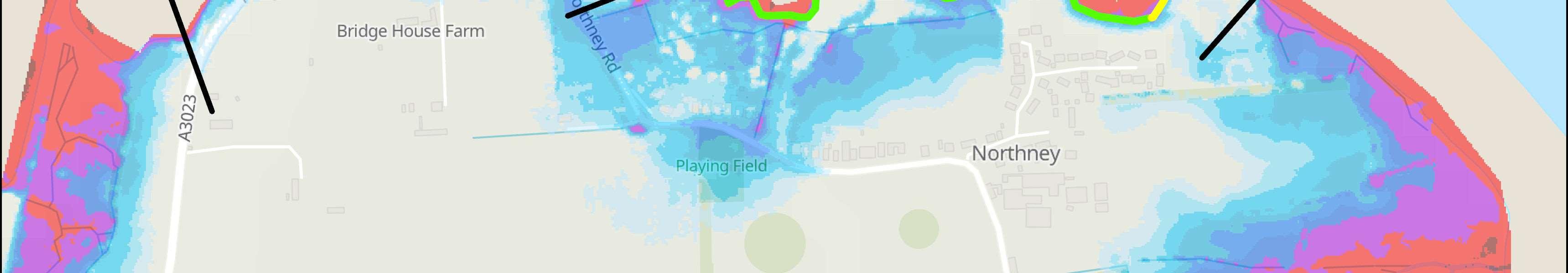
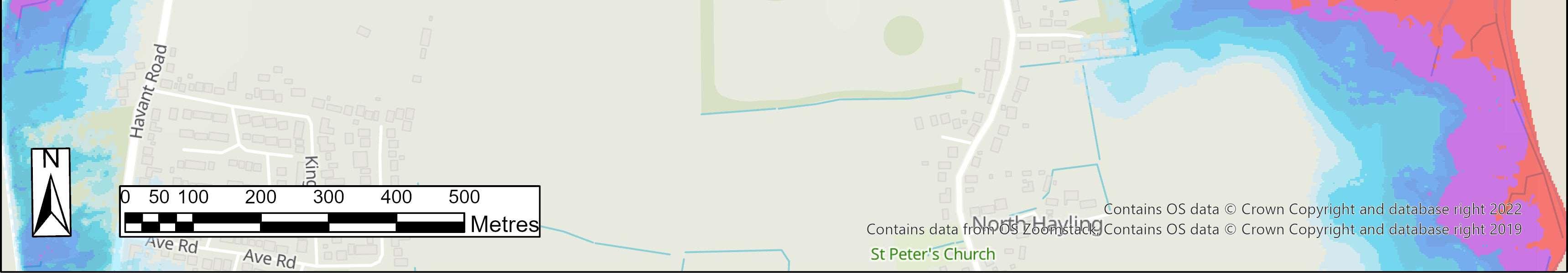
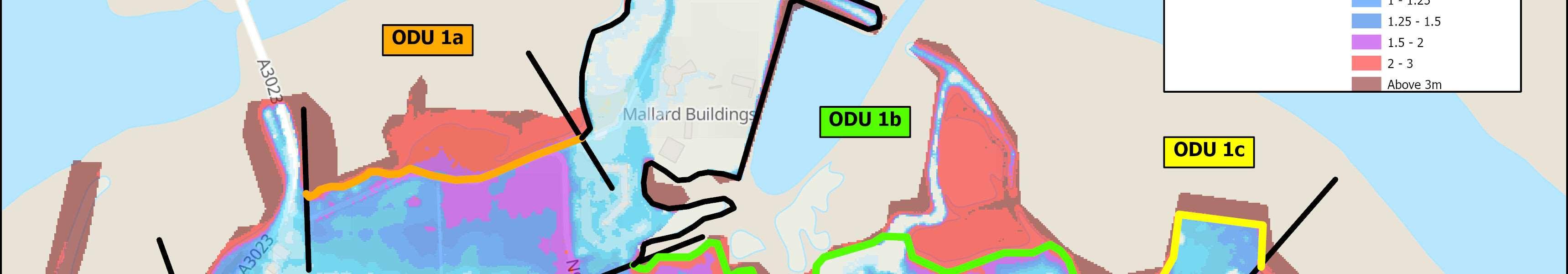
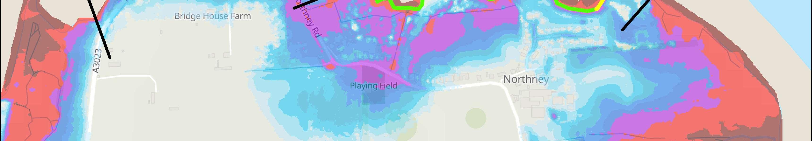
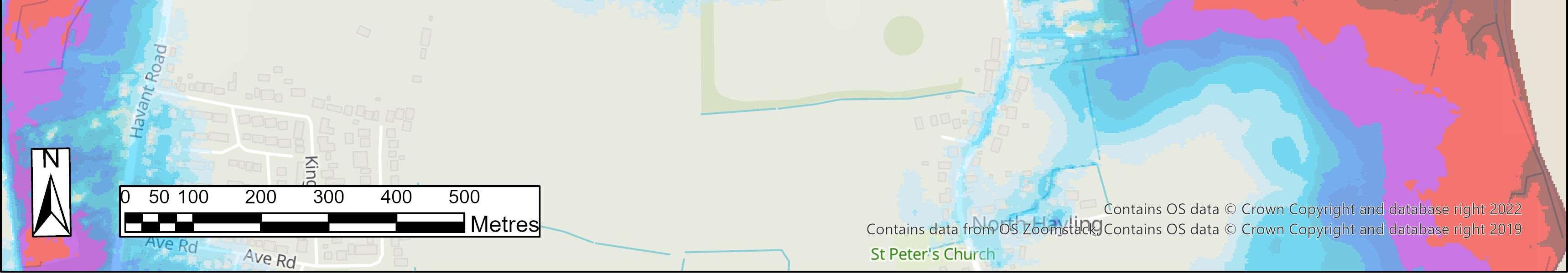
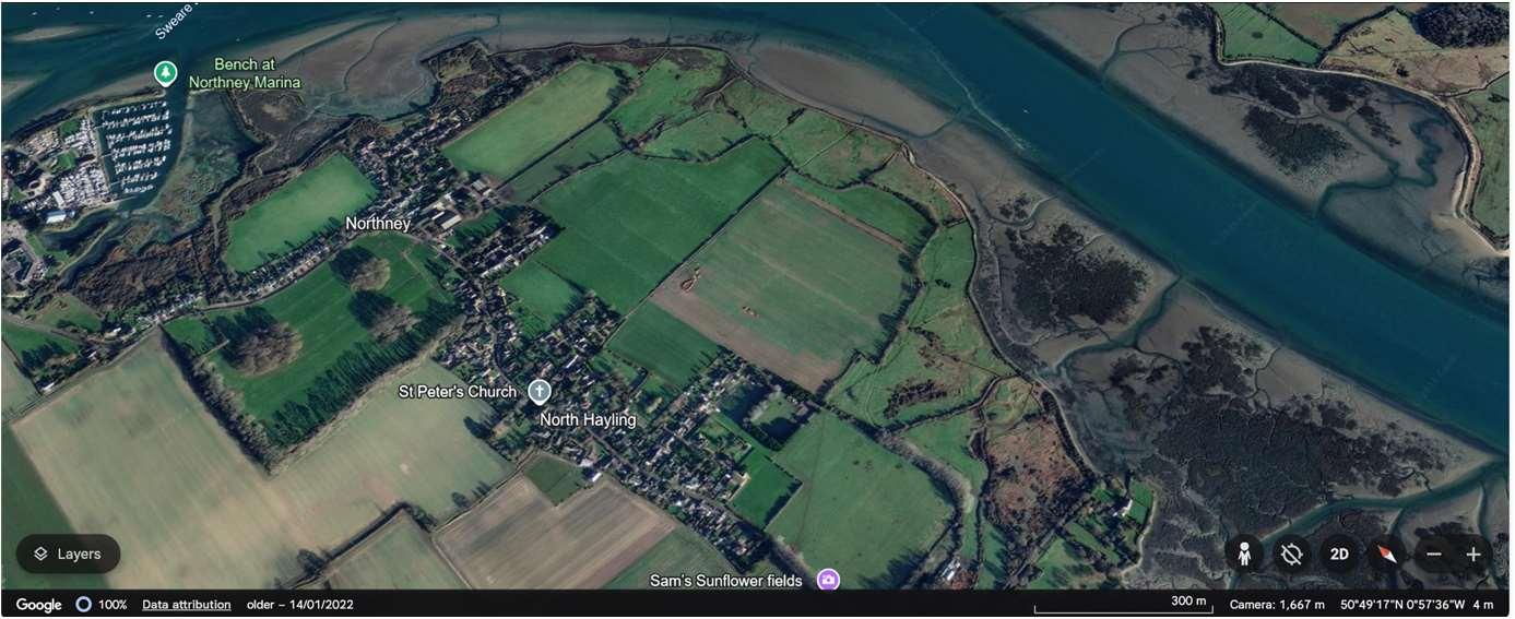
ODU1islocatedbetweenLangstoneBridgeandNorthneyFarm.This frontageiscomplexgiventhetidalfloodrisk,varyinglandusesandland ownership.ODU1isdividedinto3sub-units.Sub-unit1Aisboundedby NorthneyRoad,andimportantagriculturalland,sub-unit1Bincludesapublic recreationalareafrontingresidentialpropertiesandsub-unit1Cisaformer landfillsite.Sub-unit1Aand1BareseparatedbyNorthneyMarinainODU2.
Theexistingembankmentsareexpectedtohaveshortremainingliveswhere theyexist,withresiduallivestypicallybetween10and20years,butinsome localisedareas,lessthan10years.Thesedefencesarecurrentlymaintained byHampshireHighways,HavantBoroughCouncil,theEnvironmentAgencyor privately.
NorthneyroadisidentifiedasacriticalpieceofinfrastructureinHavant BoroughCouncil’sdraftlocalplanprovidinganalternativeemergencyaccess routeontotheisland.ItisalsocrucialtoaccessNorthneyvillageandmaintain theviabilityofNorthneyMarinaandtheLangstoneQuaysResortaswellas potentialfuturedevelopmentproposalsinthearea.Theroadisregularly inundatedthroughouttheyearandimpassableforhoursatatime.Thiswill becomemorefrequentinthefuturewithclimatechangeandsealevelrise.
Thefrontageiscoveredbysignificantenvironmentaldesignations,including SAC,SPA,RamsarandSSSIdesignationsonintertidalareas,aswellasSPA, RamsarandSSSIontheformerlandfillsite,andaNationalLandscapebothon landandintertidal.Thelandwardagriculturalandrecreationallandis importantasfunctionallylinkedhabitatforbirds,beingcore,primaryand secondarysupportareasintheSolentWadersandBrentGooseStrategy.
HoldtheLinepolicyalongthewholeofthisfrontageoverthenext100years.
Themainriskhereisfromtidalflooding,wherethefloodcelllinksODU1A,BandC.Overthenext100years,without defencesinplace,itisexpectedthatinadditiontotheregularinundationandlossofNorthneyRoad,therewillbeup to87propertiesatriskfromtidalfloodingacrosstheunit.
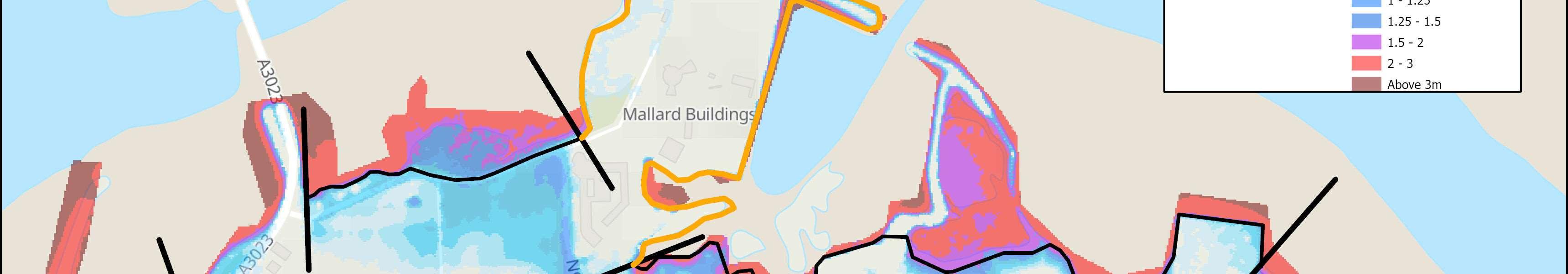
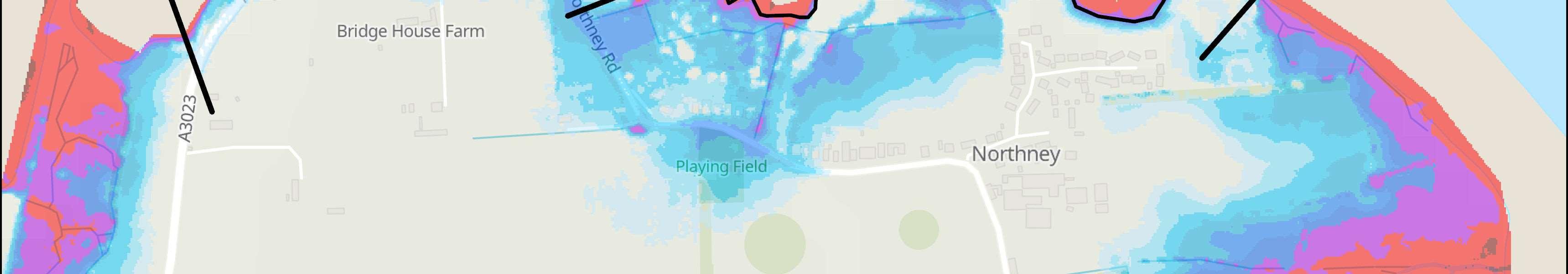
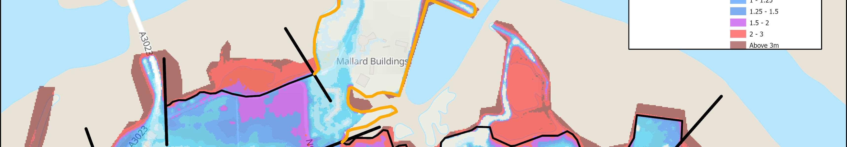
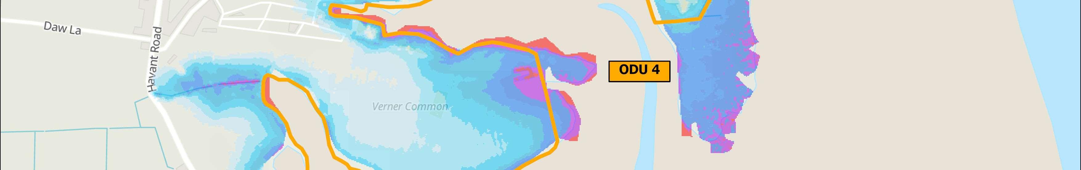
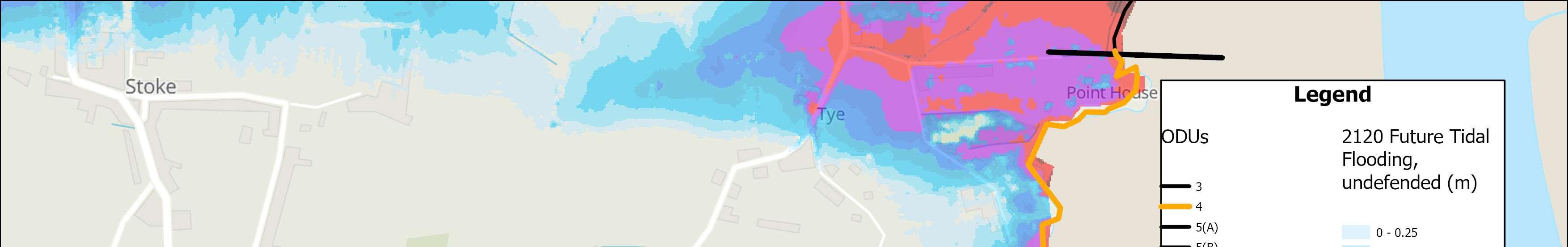
Themapsbelowshowthemodelledextentanddepthsofanextremetidalfloodevent(1in200year,0.5%annual probability),withoutanydefences,todayandin100years,allowingforsealevelrise.
Erosionrisk
Numberofpropertiesatrisk,withnodefences
Tidalfloodrisk
Numberofpropertiesatrisk,withnodefences
OverallStrategicOption
Sustain0.5%AnnualExceedanceProbability (AEP)withmanagedrealignmenthybrid
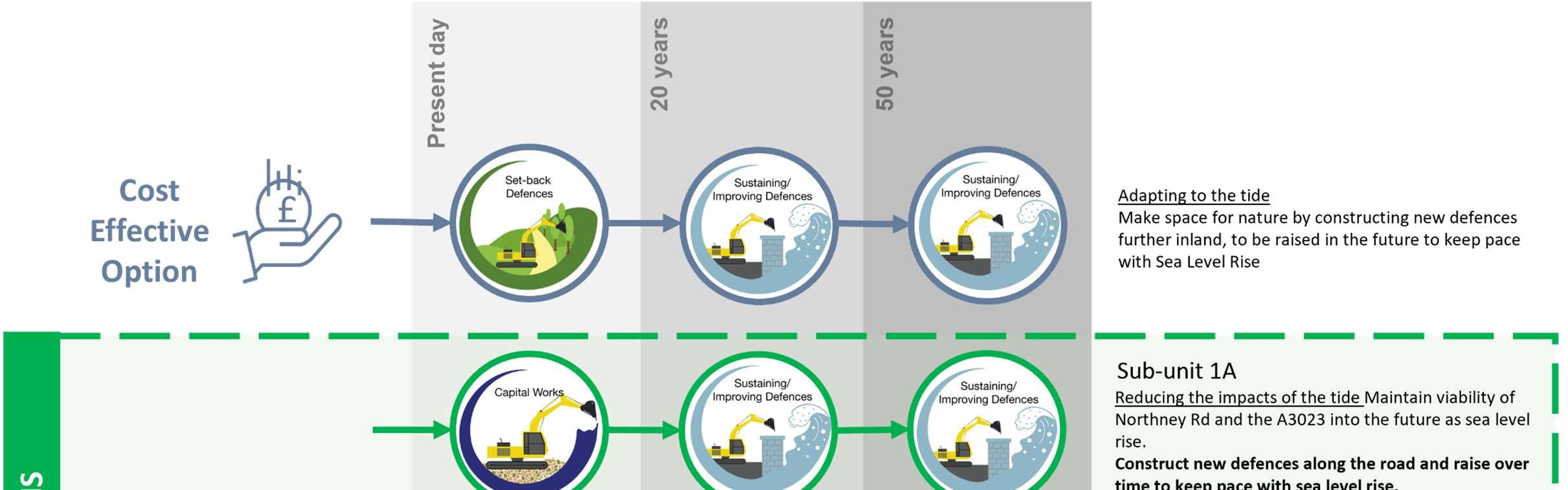
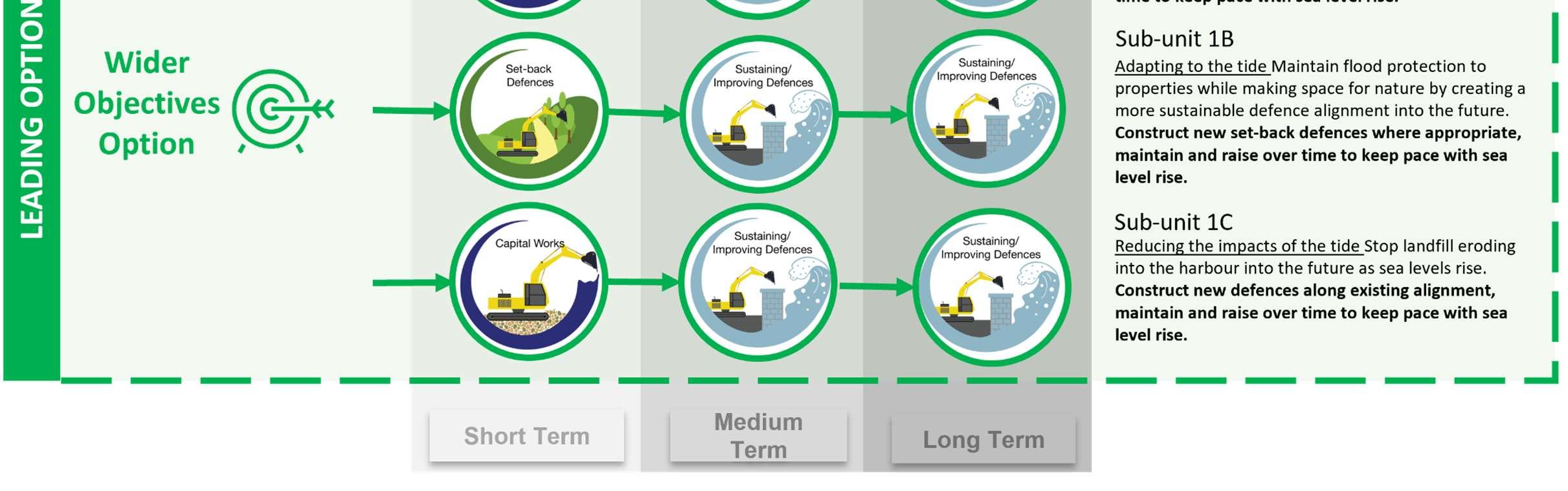
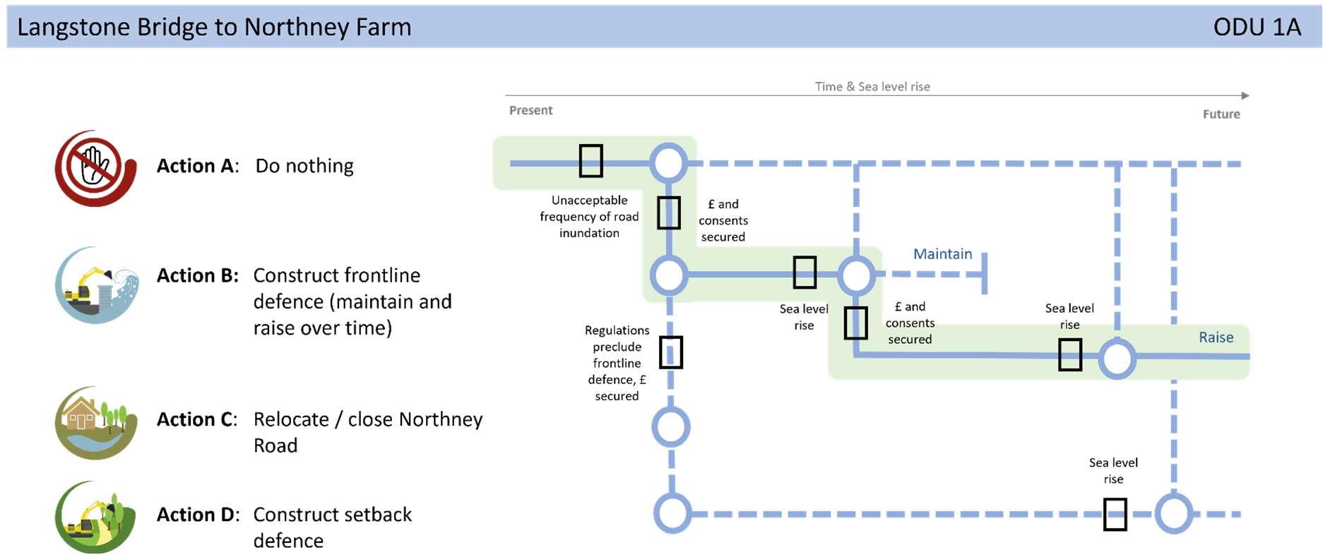
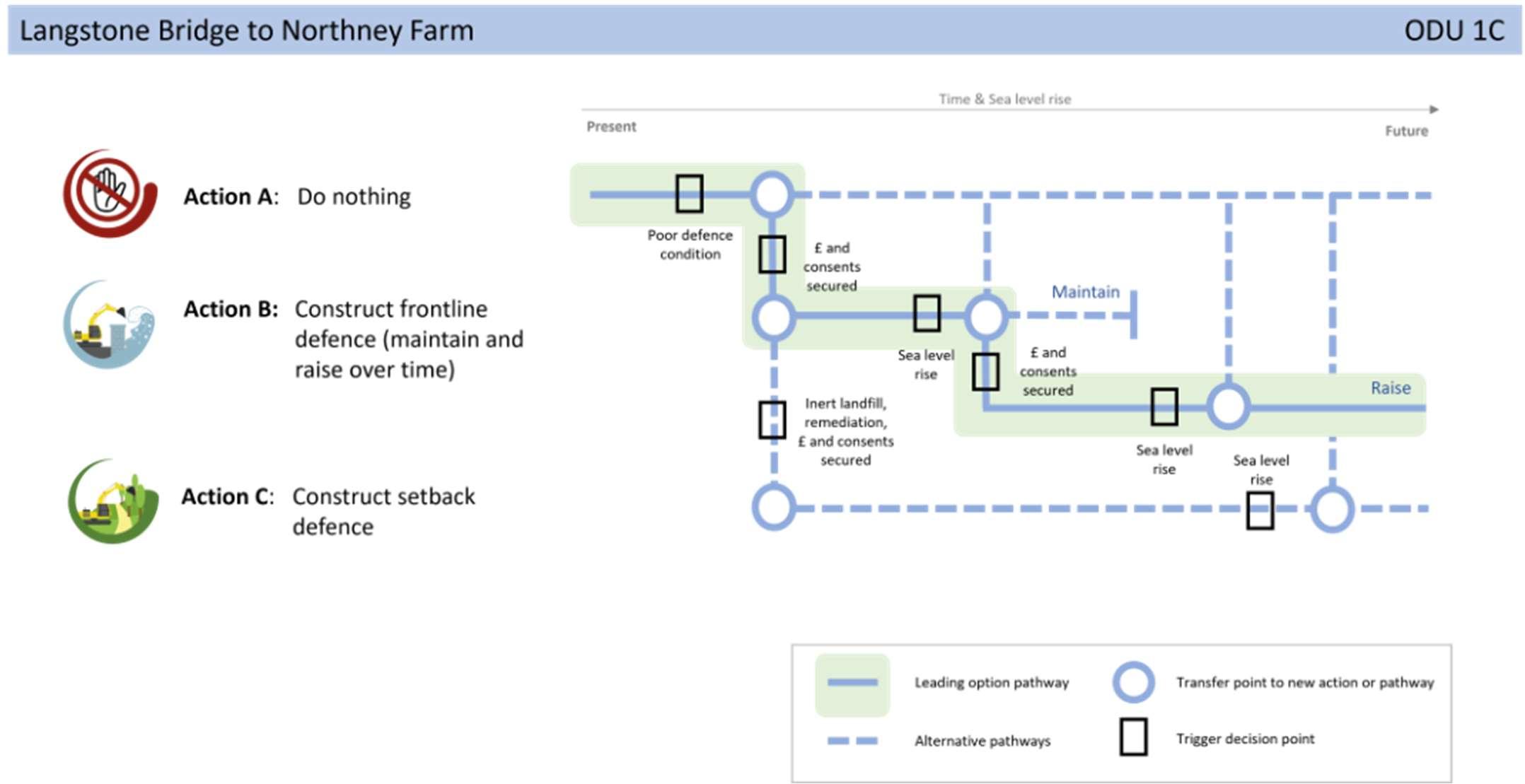
TheStrategicintentfortheunitistoimplementafrontlinedefence toprotectNorthneyRoadsubjecttoobtainingconsents(ODU1A); setbackdefencesalongthecentralsectiontoallowforhabitat creationandnaturalevolutionoftheshoreline(ODU1B)and continuetodefendtheformercoastallandfill(ODU1C).Notonly doesthisprovidefloodriskprotectiontothepropertiesbyclosing thefloodriskcell,butitalsoprotectsthecriticalroad infrastructureandformerlandfillsitewhilstmakingspacefor naturewhereviabletodoso.IffrontlinedefencesalongNorthney Roadarenotlikelytobeconsented,thenset-backdefences combinedwithrelocationoftheroadshouldbeinvestigated.Also, ifthelandfillisfoundnottobeharmfultotheenvironment,then opportunitiestosetbackdefencesshouldalsobeinvestigated here.ItisworthnotingthatsomepartsoftheStrategicintent deviateawayfromtheSMPpolicytoHoldtheLinefor100years.
AFloodandCoastalErosionRiskManagementSchemeforNorthney hasbeenproposedintheStrategy’sshorttermactionplan.Subjectto securingfunding,thiswillstartwithafeasibilitystudytoappraise appropriatecoastalmanagementoptionsandalignmentsfordefences alongthisfrontageandinvestigatethepropertiesoftheformercoastal landfillsite.


Mapdata:Google©2016-2022,DataSIO,NOAA,U.SNavy,NGA,GEBCO,IBCAO, Landsat/Copernicus
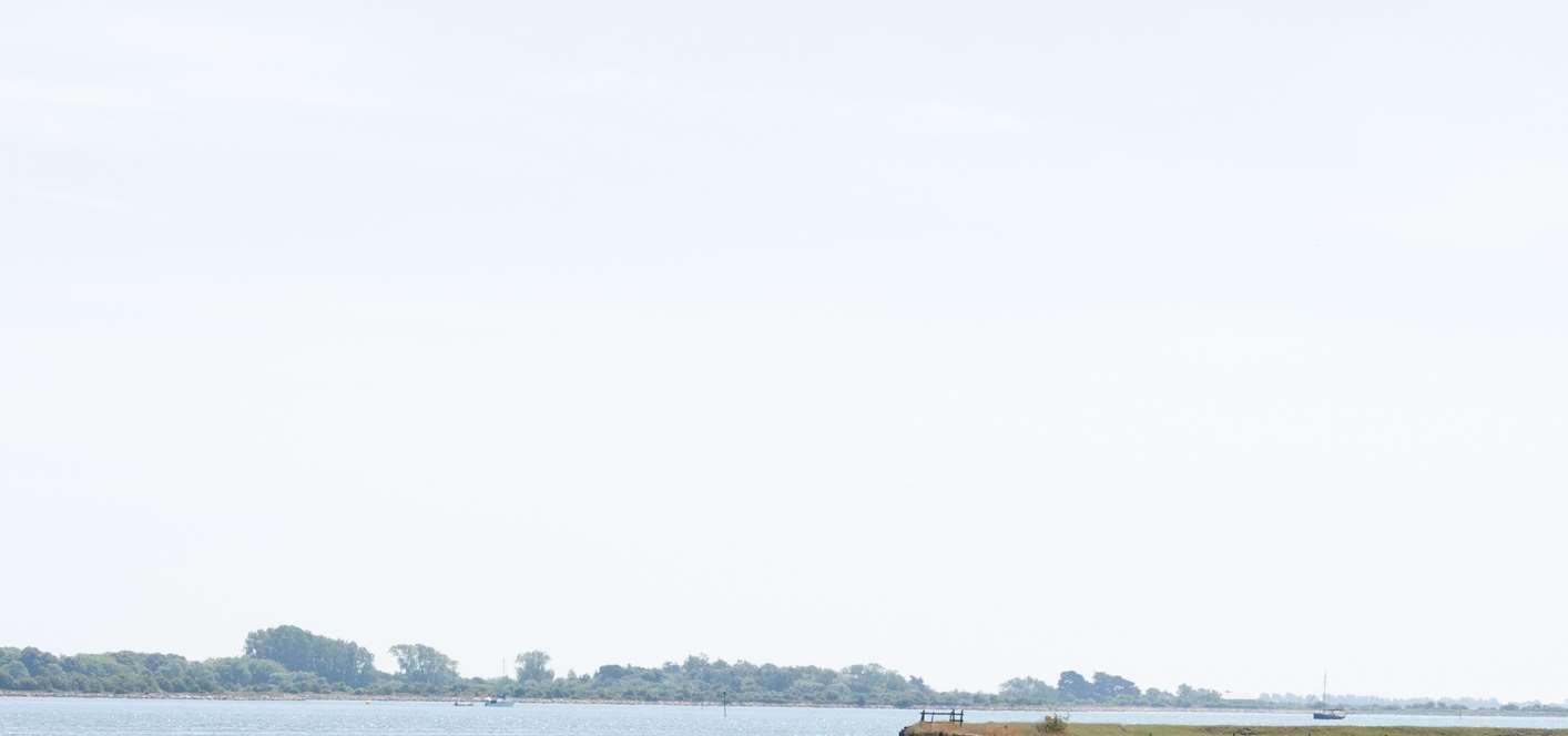
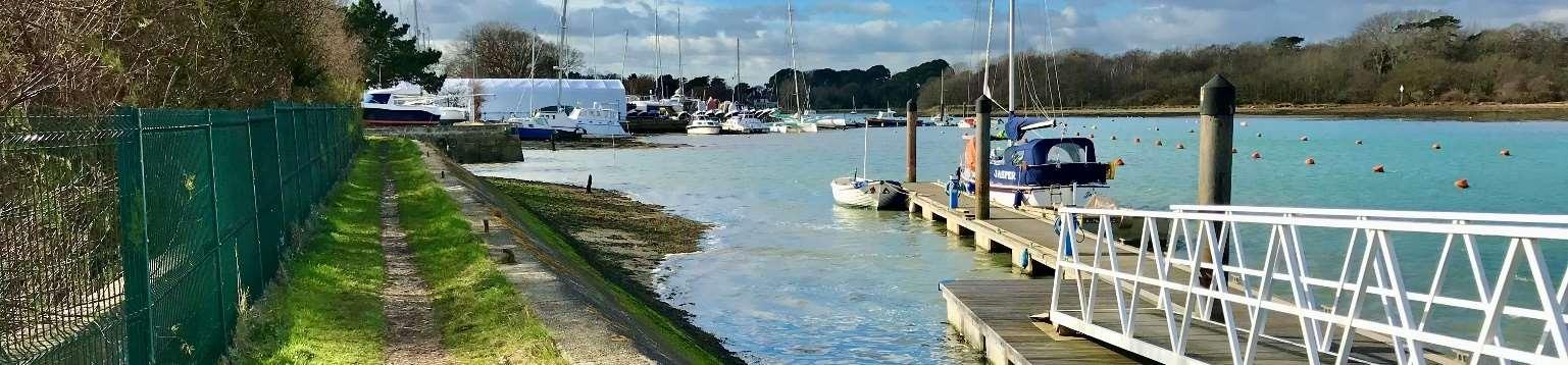
ThisunitislocatedbetweenODU1Aand1BandencompassesNorthneyMarina andtheLangstoneQuaysResort.TheMarinacomplexincludesamixof businessesandmorerecently,anumberofresidentialproperties.Thereis potentialforfurtherdevelopmenthereinthefuture.
Defences
Existingdefences,wherepresent,areprivatelyownedandmaintainedinformal embankmentsandlocalisedrockarmour.Residuallivesofthesedefencesare typicallybetween15and20years.Thereareveryfewpropertiesatriskasthe marinaisonrelativelyhighland.
Environment
Thefrontageissurroundedbyasuiteofenvironmentaldesignations(Ramsar, SPA,SAC,SSSI)whichcovertheintertidalareasoutsideofthemarinaitself. Landward,themarinaandhotelfallwithintheChichesterHarbourNational Landscape.
ShorelineManagementPlanPolicy
HoldtheLinealongthewholeofthisfrontageoverthenext100years.
Floodanderosionriskislowonthesiteitself,howevertheaccessroadtothefrontagealongNorthneyRoad (ODU1A)isatsignificantfloodrisknowandintothefuture.TheviabilityofNorthneyMarinaandsurrounding businesseswillthereforebehighlydependentonmaintainingaccesstothesiteviaNorthneyRoadintothe future.
Themapsbelowshowthemodelledextentanddepthsofanextremetidalfloodevent(1in200year,0.5% annualprobability),withoutanydefences,todayandin100years,allowingforsealevelrise.
Erosionrisk
Numberofpropertiesatrisk,withnodefences
Numberofpropertiesatrisk,withnodefences
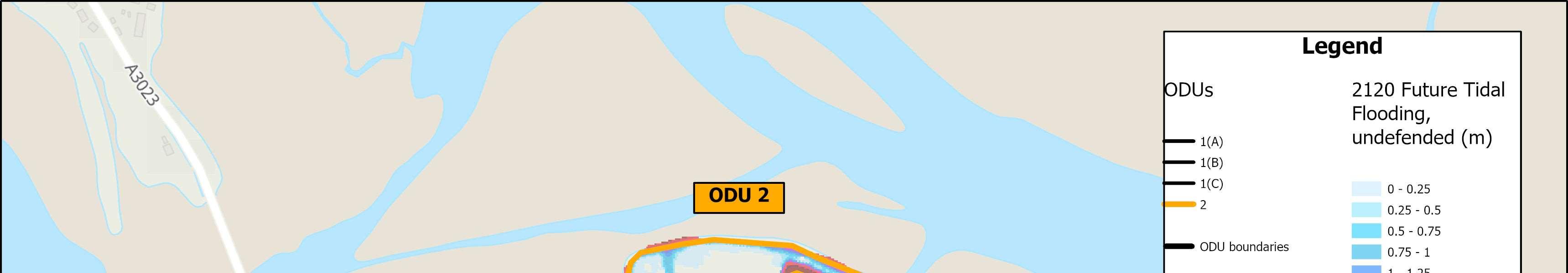


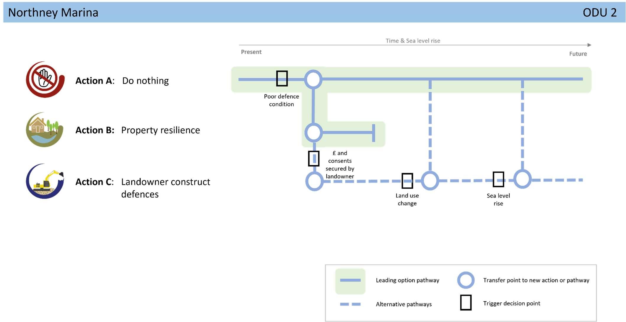
StrategicIntent
TheStrategicintentfortheunitisadaptationofassetstobecome moreresilienttoclimatechangeimpactsinthefutureasfloodand erosionriskisverylow.Iflandownerswishtomaintain(andfund) theirexistingdefencesinthefuture,theywillneedtoobtainthe relevantlicencesandconsentsfirst.
NextSteps
Noneidentifiedforthisfrontageintheshort-term,otherthanongoing conversationswithcommunitiesinrelationtolevelsofriskandwhat todointheeventofaflood.

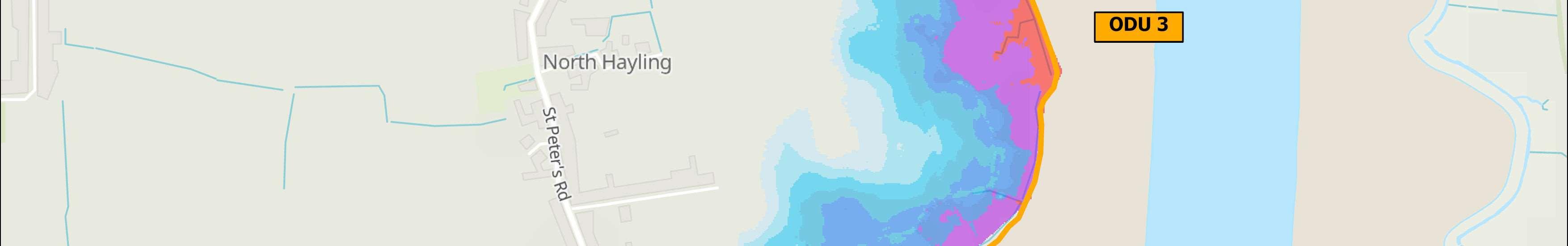
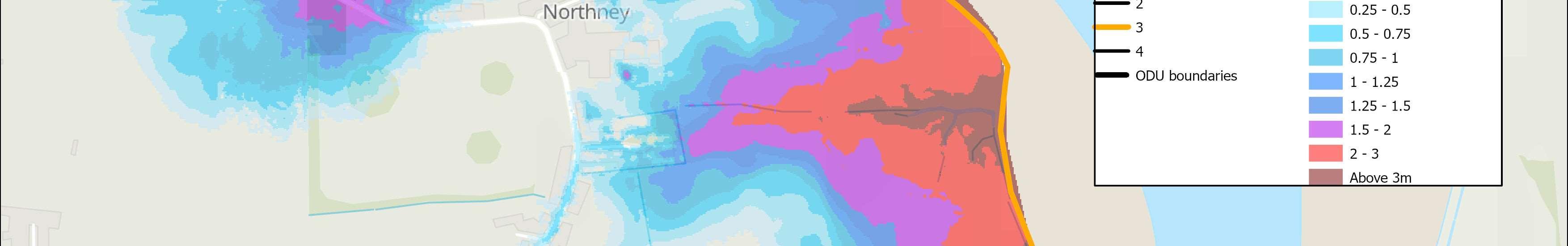
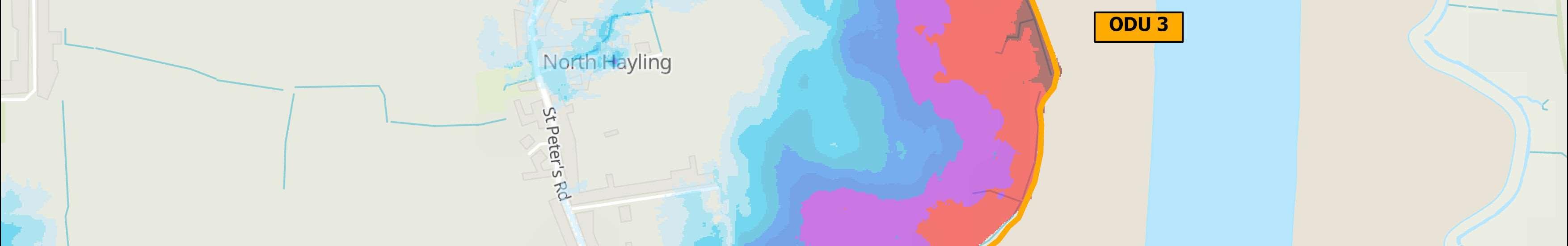
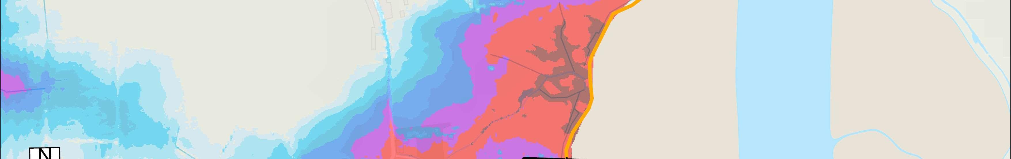
ODU3islocatedbetweenNorthneyFarmandChichesterRoadand predominatelyfeaturesfarmland,withthevillageofNorthneysetbackfurther inland.
Thedefencesinthisunitareprivatelyownedandmaintainedandcomprise embankmentswithavarietyofharddefences,includingsheetpilingand concrete.Defencesarelocallyinapoorconditionwithveryshortremaining lives,typicallylessthan10yearsorfailing.Theagriculturallandbehindis significantlyimportantforlivestockgrazingandsafeguardingthethriving businessintothefutureiskey.
Thefrontageiscoveredbysignificantenvironmentaldesignations,bothon landandintheHarbourandfallswithintheChichesterHarbourNational Landscape.Thecoastalgrazingmarshareawithintheagriculturallandis designatedasSSSI,RamsarandSPA,providingtheidealhabitatforCurlew andotherwaterbirdstofeedandroostathightide.Whilethefronting intertidalareasareSSSI,Ramsar,SPAandSAC.LandwardoftheSSSI,SPA/ Ramsarareas,theagriculturallandisimportantfunctionallylinkedhabitat forbirds,beingcoreandprimarysupportareasintheSolentWadersand BrentGooseStrategy.
HoldtheLine,butnopublicfundingavailableforprivatedefencesinthe shortandmediumtermandundertakefurtherdetailedstudiestoconsider managedrealignmenttocreatenewintertidalhabitatinthelongterm.
Thereissignificanttidalfloodriskherewhichwillincreaseindepthandextentinthefuturewithsealevelrise.
Overthenext100years,itisexpectedthatupto87propertiesinNorthneyVillagewillbeatriskoftidalflooding ifnofloodriskmeasuresareimplemented.
Themapsbelowshowthemodelledextentanddepthsofanextremetidalfloodevent(1in200year,0.5% annualprobability),withoutanydefences,todayandin100years,allowingforsealevelrise.
Numberofpropertiesatrisk,withnodefences
Numberofpropertiesatrisk,withnodefences
Donothing damages
£3,098,000 Presentvalue


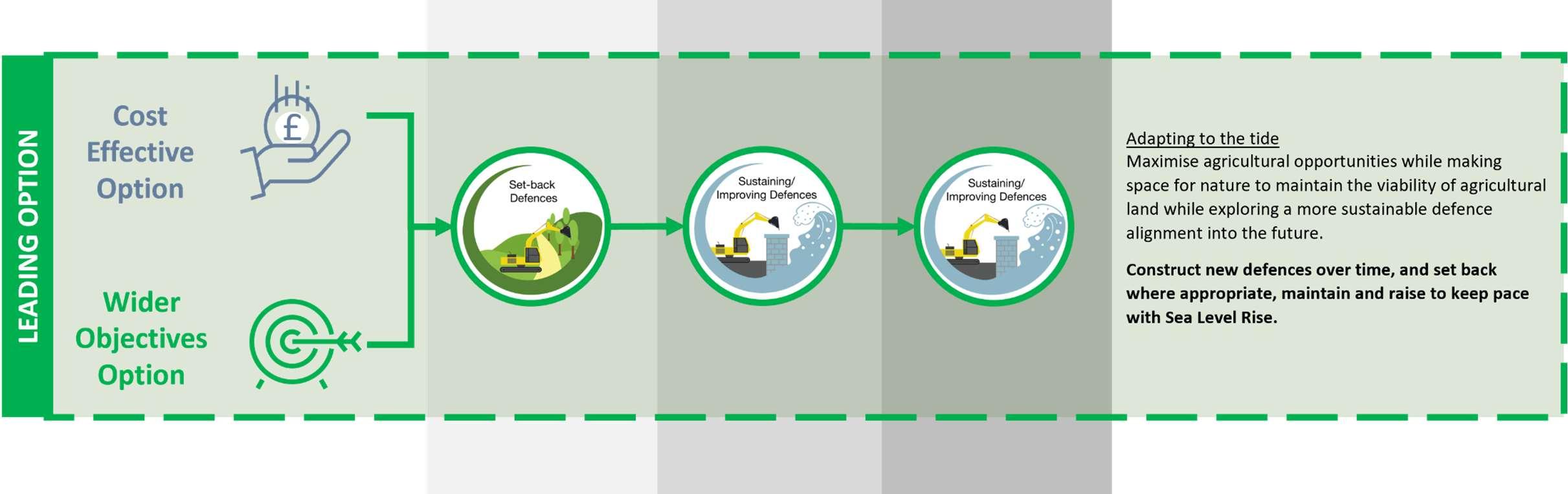

Thestrategicintentfortheunitistobalancetheagriculturalneeds withfindingopportunitiestocreatehabitatinordertobothmaintain viabilityoftheagriculturaluseandhelpmeetthelegalrequirementfor restorationandcompensationofhabitatswithinChichesterHarbour. Thiswillrequireconstructionofnewset-backdefenceinphases,anda blendedmanagementapproachinclosecollaborationwithallpartners andwillhelptoreducefloodrisktopropertiesinNorthneyvillageover thenext100years.
Anadditionalstudyisalreadyunderwaytounderstandthe complexitiesofthissiteinmoredetail,lookatpotentialoptionsandto findasolutionthatwillbalancetheneedsofallparties.
Deliveryofsolutionswhichmeettheneedsofallstakeholderswillbea challenge;particularlygiventheunfavourableconditionofthehabitats withinChichesterHarbour,whichisinpartduetoexistingdefences causingcoastalsqueeze,meaningfrontlinedefenceapproachesto floodanderosionprotectionmaynolongerbeconsentablewhere theyarenotprotectingpropertyorinfrastructure.
AhabitatrestorationschemeforNorthneyhasbeenproposedinthe Strategy’sshorttermactionplantofollowthestudy.Subjectto securingfunding,thiswillstartwithafeasibilitystudytoappraise appropriatecoastalmanagementoptionsandalignmentswhich providetheleastdamagingimpactonthenaturalenvironment.

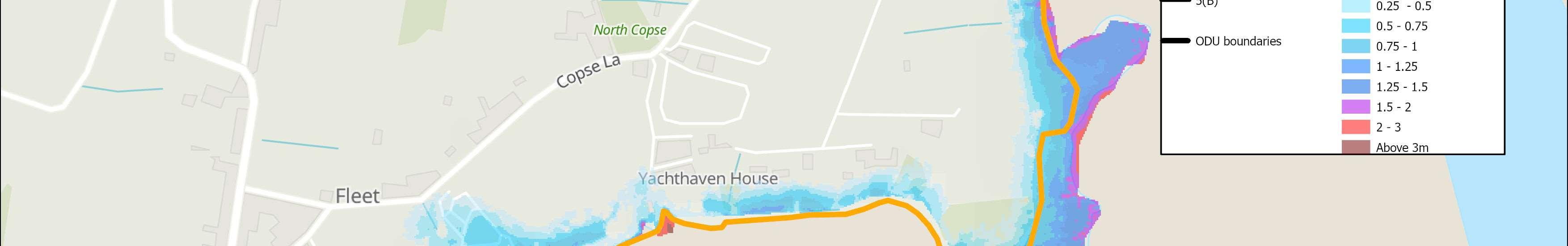
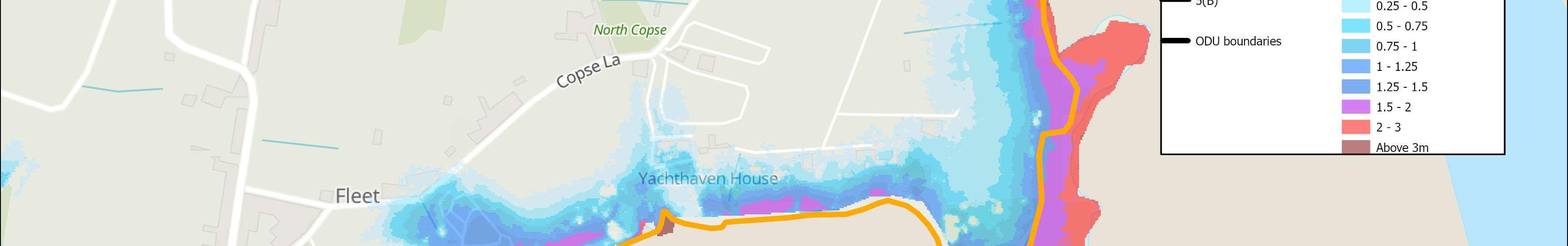
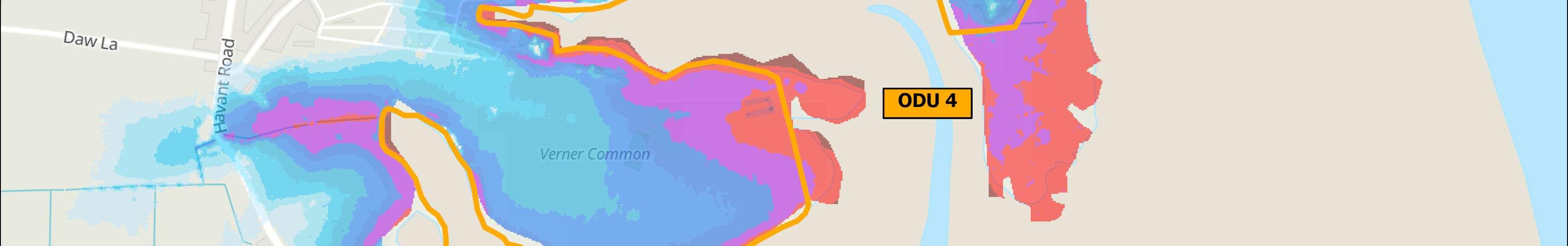
ODU4extendsfromtheNorthneyFarmboundaryatChichesterRoadsouthto MillRytheJuniorschool.Thisfrontagecomprisesamixofagriculturalland, interspersedwithsmallnumbersofresidentialproperties,aholidaycaravan parkandaworkingmarina.Twoareasofformercoastallandfillarealso locatedhere.
Someofthefrontageisundefended,butwheredefencesexist,theyareadhoc embankmentsandquaywalls,privatelyowned.Defencesaremaintained privatelyorbytheEnvironmentAgency.Residuallivesareshort,typically between10and15years,withsomelocallylessthan10yearsandsoare susceptibletofailureintheshortterm.
ThefrontagehassignificantenvironmentaldesignationsintheHarbour, including,SSSI,Ramsar,SPAandSAC.Onland,VernerCommonis designatedSSSI,RamsarandSPAandGutnerPointLocalNatureReserve, locatedinthesoutheastofthefrontage,isdesignatedasSSSI,Ramsar,SPA andSAC.SectionsofthisunitalsofallwithintheChichesterHarbour NationalLandscape.Thisfrontageincludeslandthatisimportantforbirds, havinganumberofcoreandprimarysupportareasidentifiedintheSolent WadersandBrentGooseStrategy.
HoldtheLine,butnopublicfundingavailableforprivatedefencesforthe next100years.Duetothesmallnumberofpropertiesatriskhere,thereis unlikelytobeanycentralfundingavailabletoprogressthispolicyintothe future.
Themainriskalongthisfrontageisfromtidalflooding,wherethereisacontinuousfloodcellalongthecoast.Land, however,risesquitequicklyinland,sofloodriskisrelativelylownow,butwillincreaseinthefuture,especiallyat VernerCommon.
Themapsbelowshowthemodelledextentanddepthsofanextremetidalfloodevent(1in200year,0.5%annual probability),withoutanydefences,todayandin100years,allowingforsealevelrise.
Erosionrisk
Numberofpropertiesatrisk,withnodefences
Numberofpropertiesatrisk,withnodefences


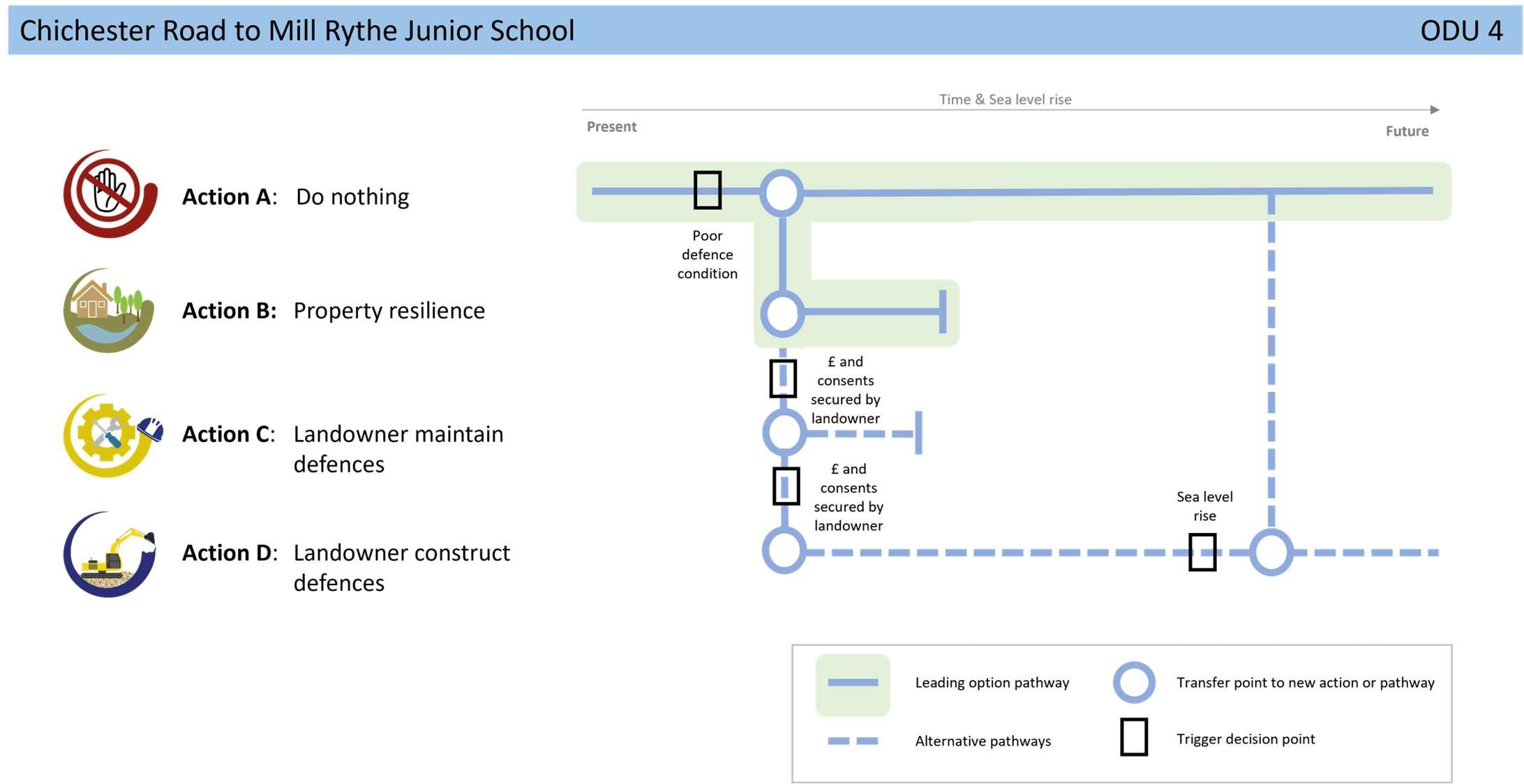
StrategicIntent
Thestrategicintentforthisunitisadaptationofassetstobecome moreresilienttoandadjusttoclimatechangeimpactsinthe futureasfloodriskislow.Iflandownerswishtomaintain/replace (andfund)theirdefencestoreducerisktoexistingresidentialand commercialpropertiesinthefuturebutalsopreventformer landfillfromeroding/leachingintotheHarbour,theywillneedto obtaintherelevantlicencesandconsentsfirst.Itisworthnoting thatthestrategicintentdeviatesawayfromtheSMPpolicytoHold theLinefor100years.
Noneidentifiedforthisfrontageintheshort-term,otherthan ongoingconversationswithcommunitiesinrelationtolevels ofriskandwhattodointheeventofaflood.


Mapdata:Google©2022,MaxarTechnologies
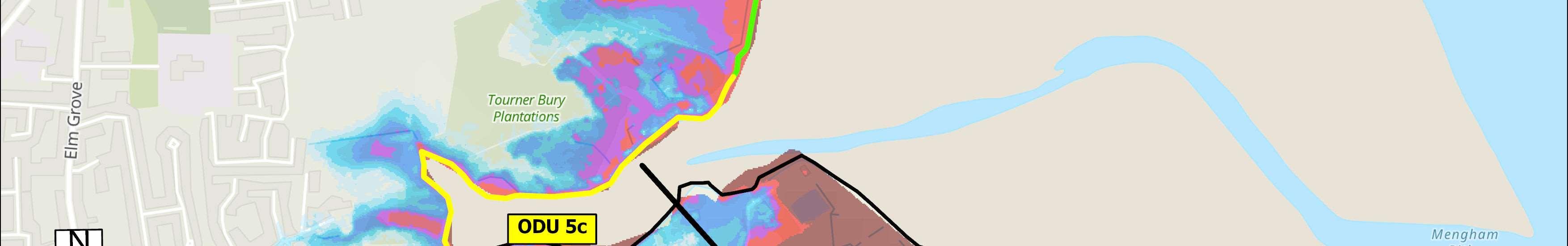
Overview
ODU5islocatedbetweenMillRytheJuniorSchoolandSalternsLane.This frontagehasbeensplitintothreesubunits(ODU5A,5Band5C)toreflectthe changesinlanduseandriskwithinthisunit.ODU5AincorporatestheMill RytheHolidayVillageborderedbyagriculturalland.ODU5Bispredominately agriculturalfarmlandalongsideTournerburyGolfCourse.TothesouthODU5C stretchesfromTournerburyWoodsEstatetoSalternsLaneandincludes TournerburyWoodsEstate,andadhocresidentialandcommercialproperties. Defences Defencesconsistofavarietyofembankmentandrevetmentstructures.InODU 5A,aroundtheMillRytheHolidayVillage,defencesareprivatelyownedbut maintainedbytheEnvironmentAgencyandhaveresiduallivesofbetween10 and15years.Elsewheretheresiduallivesoftheseprivatelyownedand maintaineddefencesarelessthan10yearsandinlocalisedareasarealready failing.TheexceptionbeingtherockrevetmentsouthofTounerburyGolf Coursewhichhasaresiduallifeofbetween15and20years.
Thefrontageiscoveredbysignificantenvironmentaldesignations,bothon landandintheHarbourandfallswithintheChichesterHarbourNational Landscape.AgriculturallandinODU5BandTournerburyWoodsEstatein ODU5CaredesignatedasSSSI,RamsarandSPA,whilethefrontingintertidal areasareSSSI,Ramsar,SPAandSAC.Anareaofformercoastallandfillisalso locatedinthefarsouthoftheunit,andTournerBuryScheduledMonument, theremainsofanIronAgeplateauhillfort,alsotothesouth,isatincreasing tidalfloodriskovertime.
ShorelineManagementPlanPolicy
HoldtheLine,butnopublicfundingavailableforprivatedefencesforthe next100years.
Riskhereisfromtidalflooding,wherethefloodextentreachesasfarasMillRythevillage.Here,over200 propertiesaswellasMillRytheJuniorSchoolareattidalfloodriskoverthenext100years,withoutdefencesin place.AlthoughtheGolfCourseandassociatedassetsareonhigherland,sonotatrisk,tidalfloodriskissignificant inthelowerlyingareas.IncontrastODU5Cisonhigherland,sofloodanderosionrisktoadhocpropertiesand TournerburyWoodsEstateislow.
Themapsbelowshowthemodelledextentanddepthsofanextremetidalfloodevent(1in200year,0.5%annual probability),withoutanydefences,todayandin100years,allowingforsealevelrise.
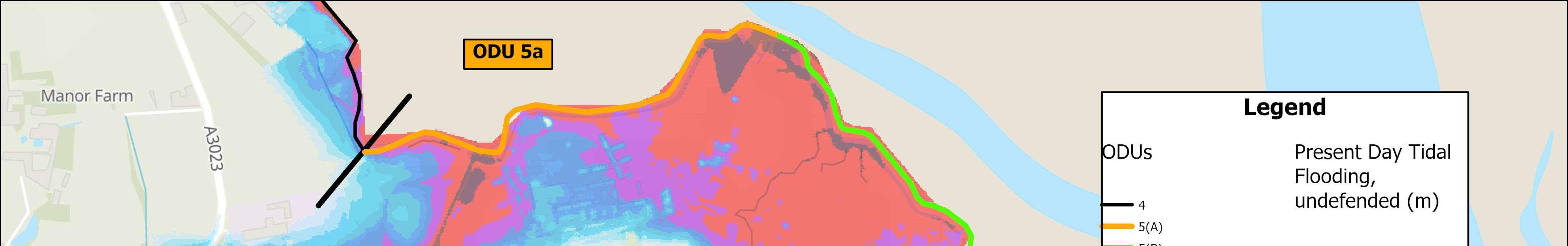
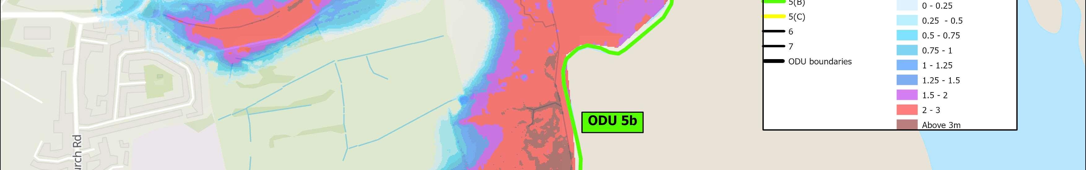

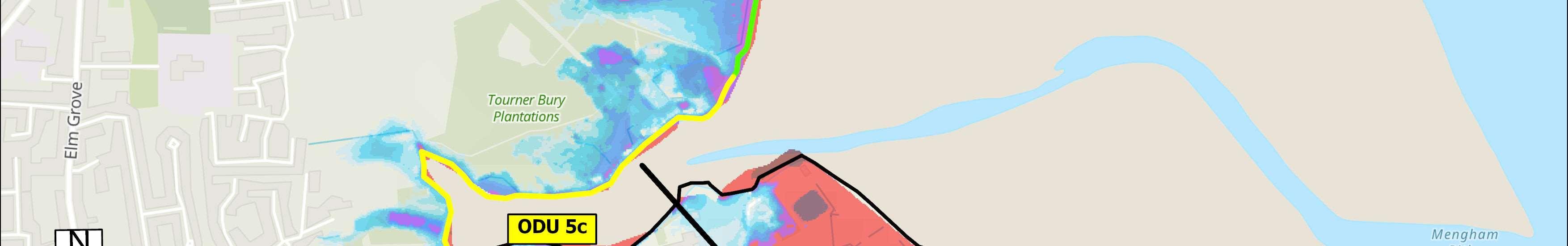
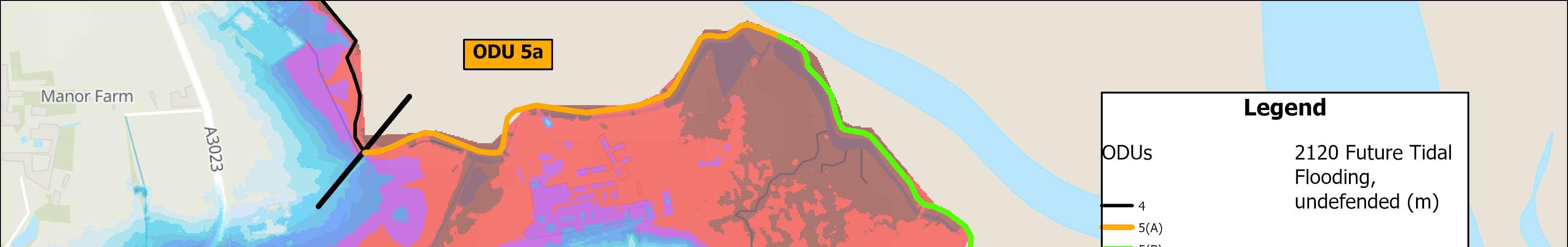
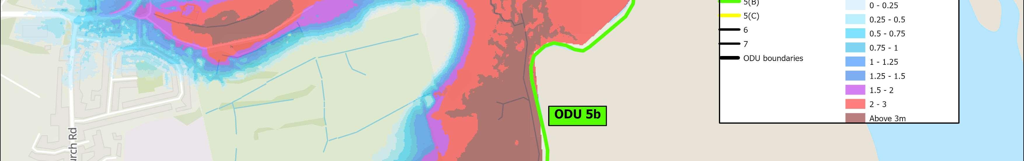

OverallStrategicOption Sustain1.33%AEPwith managedrealignment
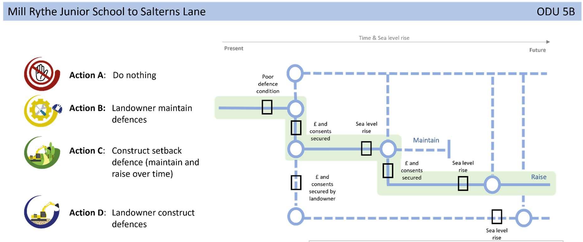
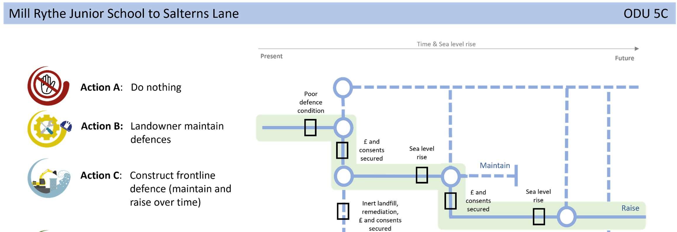
defencesalongthecentralsectiontoallowforhabitatcreationand naturalevolutionoftheshoreline(ODU5B),andinthesouth,prevent formerlandfillfromeroding/leachingintotheHarbour(ODU5C).
Notonlydoesthisprovidefloodriskprotectiontopropertiesandthe schoolinthenorth,butitalsoprotectsformercoastallandfillwhilst makingspacefornaturewhereviabletodoso,tomeettheneedsof ChichesterHarbourtocreateamosaicofnewhabitats.Thiswillrequire constructionofnewmoresustainabledefencesinphasesandablended managementapproachinclosecollaborationwithallpartners.Ifthe landfillisfoundnottobeharmfultotheenvironment,then opportunitiestosetbackdefencesshouldbeinvestigatedhere.
Anadditionalstudyisalreadyunderwaytounderstandthecomplexitiesof theTournerburyFarm(ODU5B)siteinmoredetailtolookatpotential optionsandtofindasolutionthatwillbalancetheneedsofallparties.A habitatrestorationschemeforTournerburyhasbeenproposedinthe Strategy’sshorttermactionplantofollowthestudy.Subjecttosecuring funding,thiswillstartwithafeasibilitystudytoappraiseappropriatecoastal managementoptionsandalignmentswhichprovidetheleastdamaging impactonthenaturalenvironment.
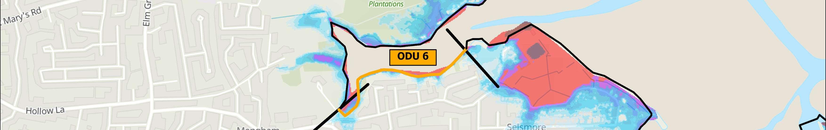
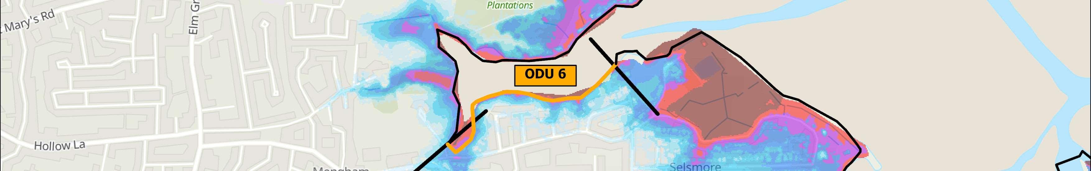
ODU6islocatedbetweenSalternsLaneintheWestandWilsonsBoatYardin theEast.Residentialpropertiesandaccompanyingadhocprivatelyowned defencescharacterisethisshortunit.
Defences
Residuallivesofdefencesareunknownduetoinaccessibilityalongthis frontage.InlandrelativelandlevelsarehighcomparedtoadjacentODUs.
Environment
TheintertidalHarbourareaborderingthisfrontageisenvironmentally designatedasSSSI,Ramsar,SPA,SACandfallswithintheChichesterHarbour NationalLandscape.
ShorelineManagementPlanPolicy
HoldtheLineforthenext100years.


Floodanderosionrisksarelowuntilthelongerterm,when99propertiesareshowntobeatriskoftidalflooding withnodefencespresent.
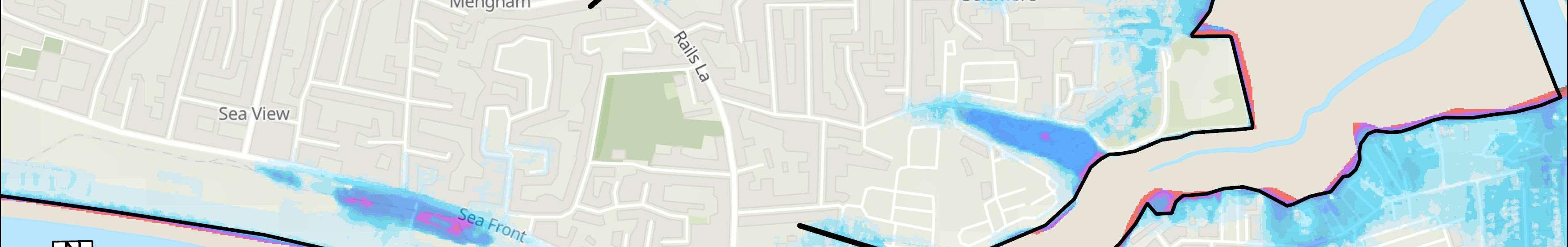
Themapsbelowshowthemodelledextentanddepthsofanextremetidalfloodevent(1in200year,0.5%annual probability),withoutanydefences,todayandin100years,allowingforsealevelrise.
Numberofpropertiesatrisk,withnodefences
Numberofpropertiesatrisk,withnodefences

MaintainthenImprove0.5% AEPfrom2075

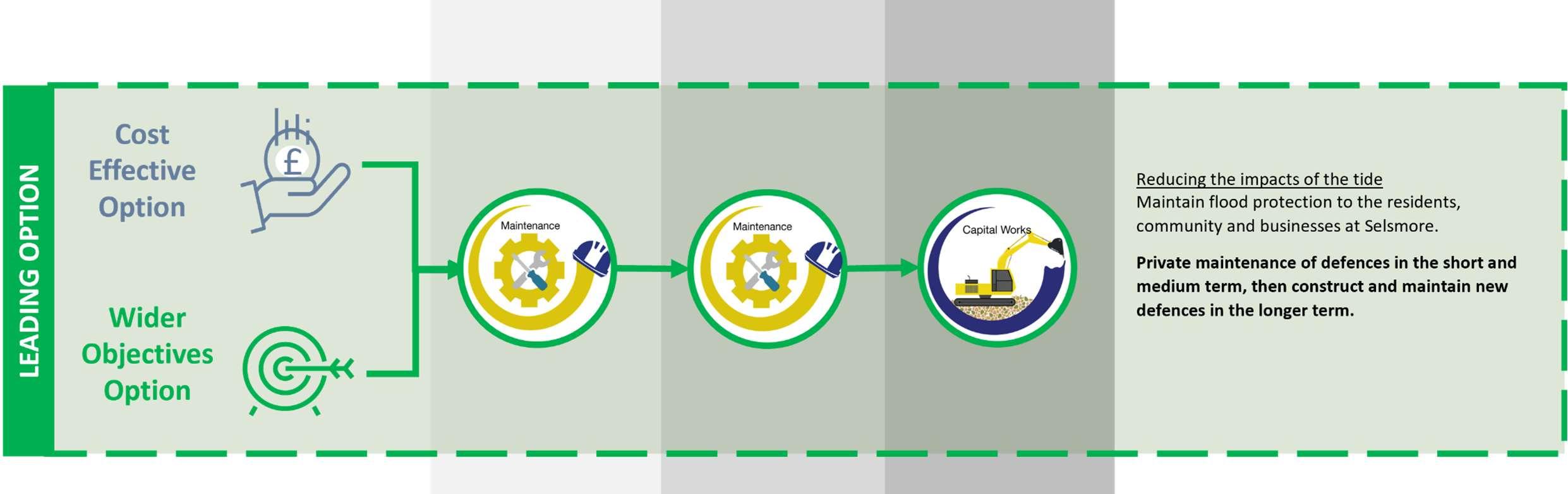

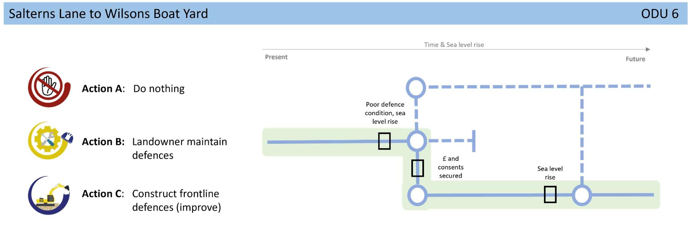
residentialproperties,bymaximisingthelifeofexistingdefencesby defenceownersintheshortandmediumterm,subjectto obtainingtherelevantlicencesandconsents,beforeconstructing newdefencesinthelongtermtoreducerisktoproperties.Where landownersarenolongerabletomaintaintheirdefences,or fundingforaschemeisnotfound,adaptationwillneedtobe exploredasacommunity,toadjusttotherealityoffuturecoastal floodanderosionrisk.
Noneidentifiedforthisfrontageintheshort-term,otherthanongoing conversationswithcommunitiesinrelationtolevelsofriskandwhat todointheeventofaflood.
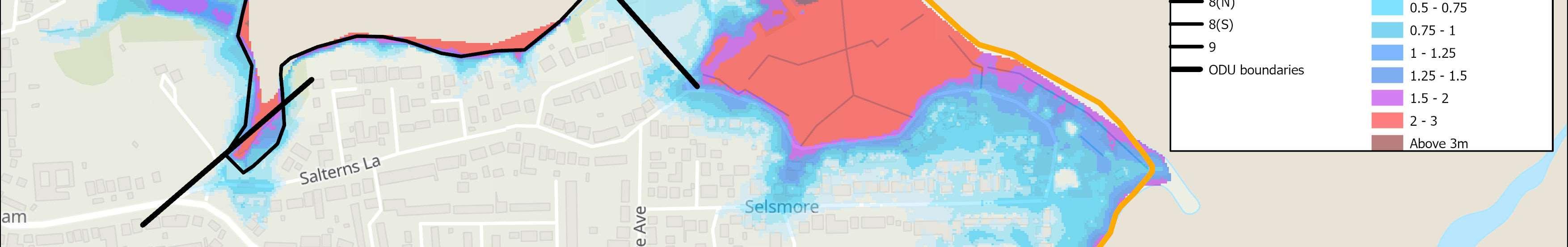
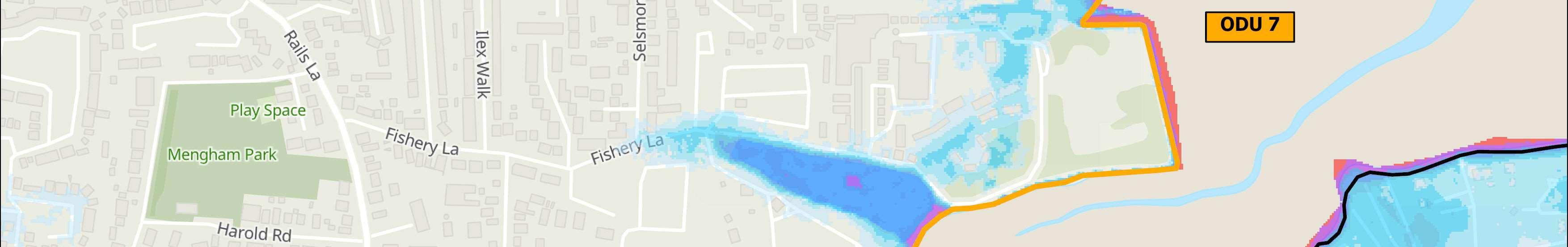
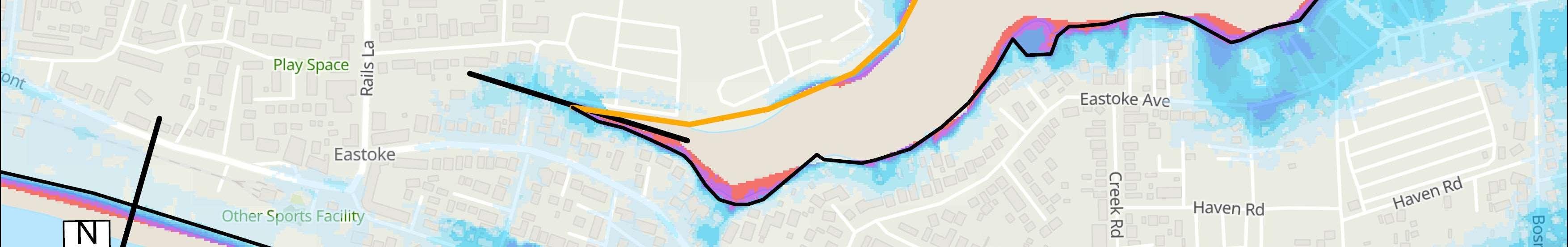
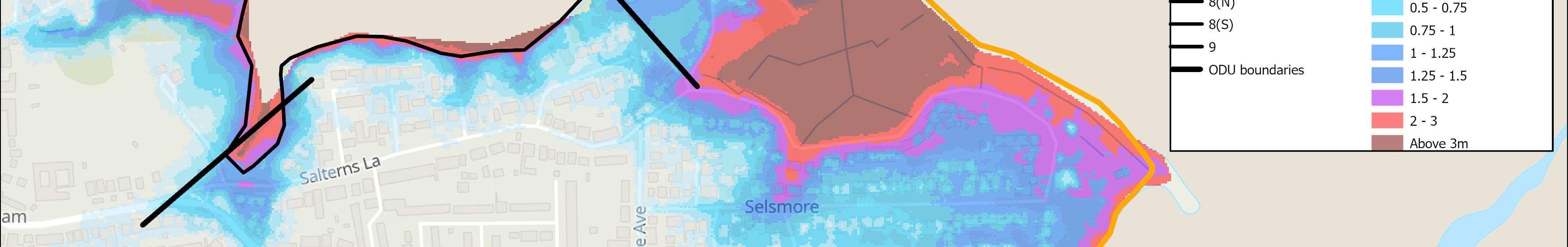
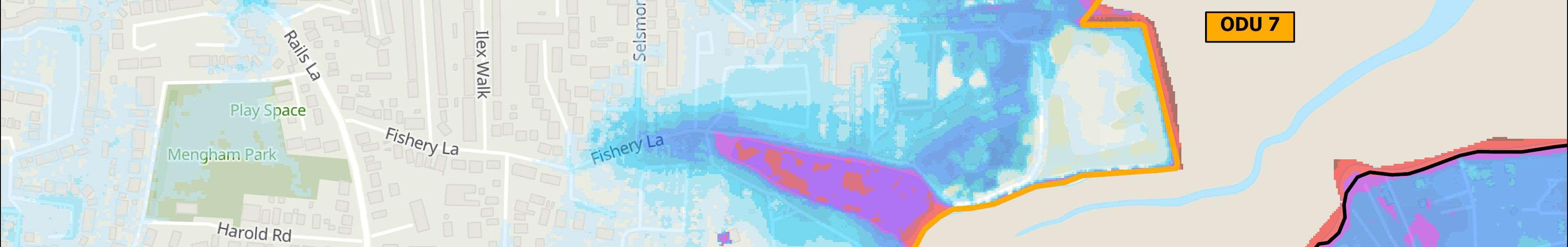
ODU7islocatedbetweenWilsonsBoatYardandFisheryCreek.Thefrontage comprisesalargeextentofresidentialpropertiesandavarietyofcommercial landuses,includingWilson’sBoatYard,MenghamRytheSailingClubanda numberofholiday/touringparks.
TheintertidalHarbourareaborderingthisfrontageisenvironmentally designatedasSSSI,Ramsar,SPA,SACand,alongwiththelandwardeastern fringe,fallswithintheChichesterHarbourNationalLandscape.Twoareasof formerlandfillarealsolocatedalongthemorevulnerablesectionoffrontage, whereriskoferosionisprobableinthenearfuture.
Defencesvaryalongthefrontage.Alongthenorth-easternsectionconcrete revetmentsandquaysareadjacenttotheEnvironmentAgency’sSelsmore andMenghamCoastalDefenceschemewhichconsistsofrockrevetment andwascompletedin2012.Defencesalongthissectionareprivately ownedbutmaintainedbytheEnvironmentAgencyandhaveresiduallives oftypically10to20plusyears.
Tothesouth,thereisashortsectionofrockfilledgabionbasketswhichare ingoodcondition,againprivatelyowned,butmaintainedbythe EnvironmentAgency.However,theremainingfrontageextendingtowards FisheryCreekconsistsofanaturalearthvergewithnoharddefences.The vergeisinpoorcondition,hasashortresiduallifeoflessthan10yearsand isactivelyerodinginplaces.
HoldtheLineforthenext100years.
Themainriskalongthenorth-eastfrontageisfromtidalflooding.Herethereisacontinuousfloodcellwhere approximately302propertiesareatriskoverthenext100years,withoutdefencesinplace.Alongthesouth-east coastthemainriskisfromerosionwherethereisformercoastallandfillatrisk.
Themapsbelowshowthemodelledextentanddepthsofanextremetidalfloodevent(1in200year,0.5%annual probability),withoutanydefences,todayandin100years,allowingforsealevelrise.
Erosionrisk
Numberofpropertiesatrisk,withnodefences
Numberofpropertiesatrisk,withnodefences
£10,888,000 PresentValue


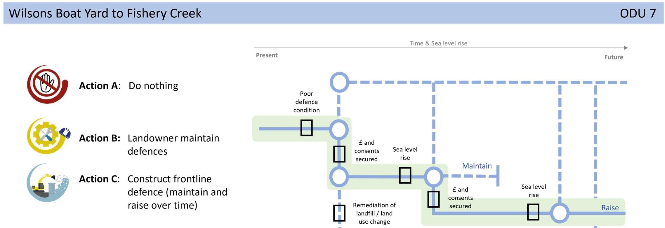
StrategicIntent
Thestrategicintentfortheunitistoreducefloodanderosionrisk topropertiesoverthenext100yearsbutalsopreventformer landfillfromeroding/leachingintotheHarbour.Thiswillrequire constructionofnewdefencesinaphasedapproachovertime.
AFloodandCoastalErosionRiskManagementSchemeforthe frontagehasbeenproposedintheStrategy’sshorttermactionplan. Subjecttosecuringfunding,thiswillstartwithafeasibilitystudyto appraiseappropriatecoastalmanagementoptionsandalignments alongthisfrontage.
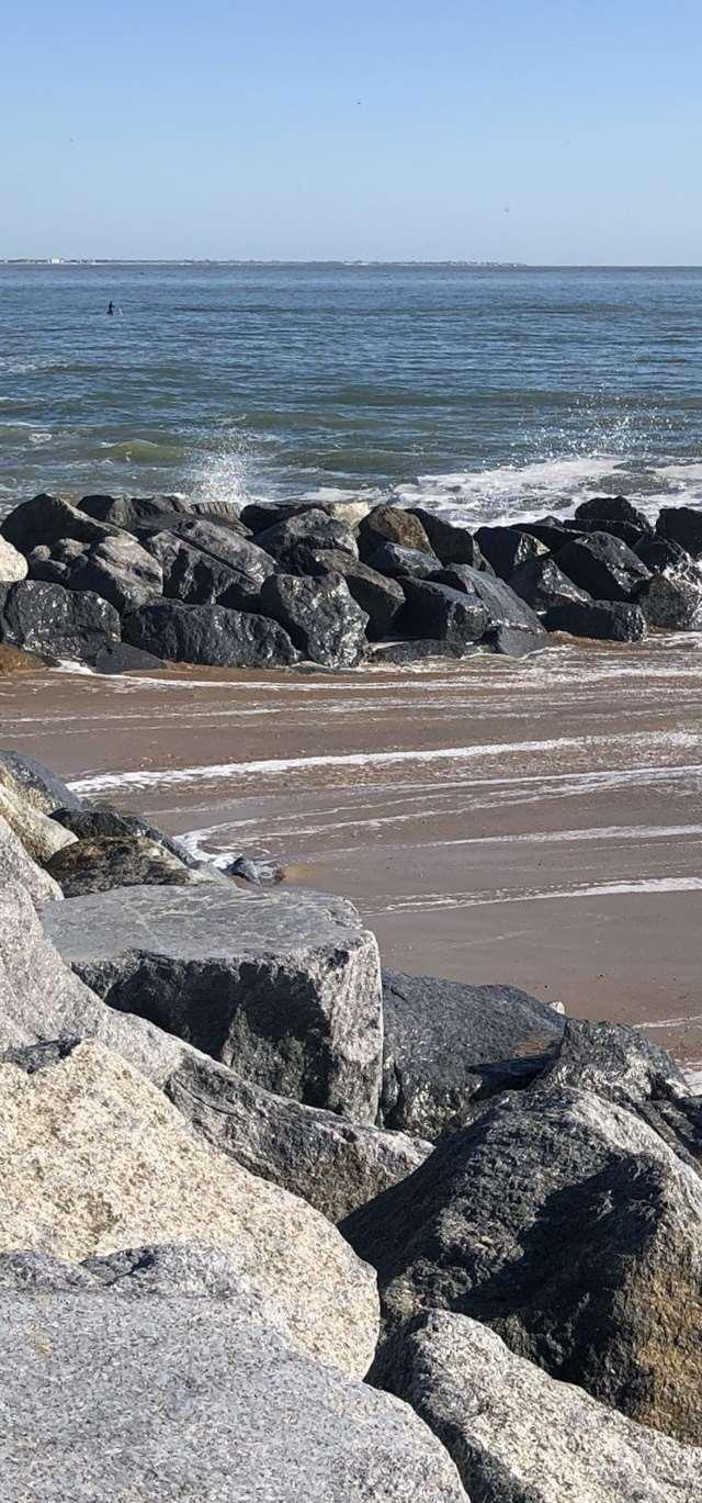
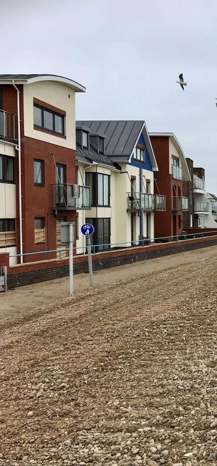
ODU8includestheEastokepeninsula,whichhasbeensplitintonorthern andsouthernsections.
Thisunitcoversboththeshelteredharbourenvironmentalongthenorthern shorealongwiththehighlydynamicsouthernopencoastfrontage,bothof whicharefrontedbysignificantenvironmentaldesignations.Thisresultsin thecomplexchallengeoftidallydrivenfloodriskintheharbourcoupledwith highenergywaveovertoppinganderosionriskalongtheopencoast.
Theareaisheavilyurbanisedandalsocontainsseveralholidayparks,aRNLI station,sailingclub,marinaandnaturereserve.Thesouthernfrontageiswell usedbyresidentsandtourists,soaccesstothebeachisimportant,andthe draftHavantBoroughCouncilLocalPlanidentifiesopportunitiesfor regenerationalongsomepartsofthesoutherncoastline.
TheintertidalHarbourareatothenorthandeastofthisfrontageis environmentallydesignatedasSSSI,Ramsar,SPA,SACand,alongwiththe northernlandwardfringe,spitandSandyPointLocalNatureReserve,falls withintheChichesterHarbourNationalLandscape.ThenatureReserveis alsoenvironmentallydesignatedasSSSI,RamsarandSPA,whiletheopen coastsubtidalareaisadesignatedSAC.
HaylingIslandisunusualcomparedtootherlocationsinthatitsbeachesare susceptibletobi-modalwaveconditions,wherelongperiodswellwaves refractaroundtheIsleofWight,coincidingwithlocalstormconditions.This resultsinveryenergeticwaveconditionsthatcanbeextremelydamagingto thecoastline.
Thereareawidevarietyofdefenceshere,includingseawalls,sheetpiling, rockrevetments(aspartoftheEastokeSchemecompletedin2005)and groynes.Themajorityofdefencesalongthenorthofthefrontagehave residuallivesbetween10and20yearsandareprivatelyownedand maintained,withtheexceptionofdefencesimmediatelywestofSparkes MarinawhicharemaintainedbytheEnvironmentAgency.Asyoumore roundtothesouthofthefrontage,rockrevetementsareingoodcondition andareownedandmaintainedbyHavantBoroughCouncil.Thebeachitself isavitalcomponentofthecoastaldefenceandiscurrentlymaintainedby HavantBoroughCouncilthroughbeachnourishmentandbeachrecycling whichtakesplaceatregularintervals.
ShorelineManagementPlanPolicy
HoldtheLineforthenext100years.
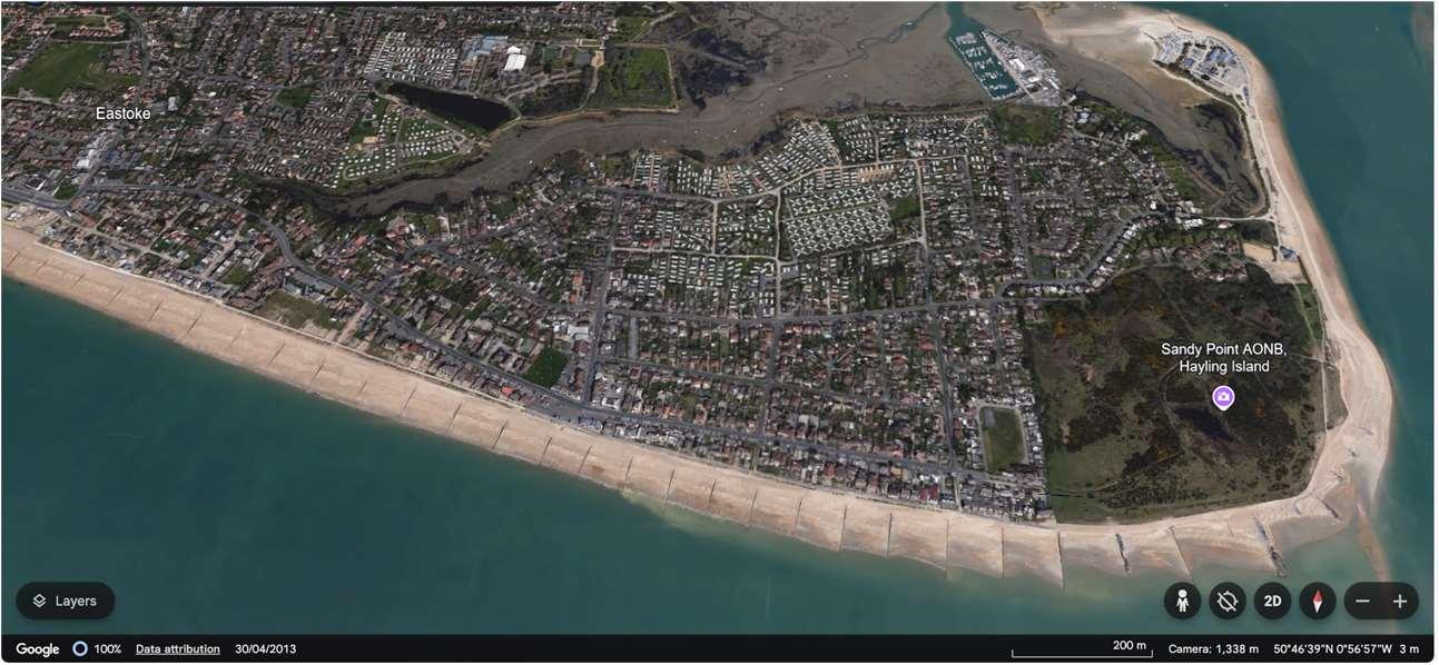
Therisksherearepredominantlyfromwaveovertoppingandcoastalerosioninthesouthandtidalfloodingfromthe north.Thesouthernfrontagehasalonghistoryofhighenergywaveaction,whichresultsinsignificantbeach drawdown,cutbackandlossofmaterial.Thisisduetobi-modalwaveconditions,whenlongperiodswellwavesrefract aroundtheIsleofWight,coincidingwithlocalstormconditions.Theresultishighlyenergeticwaveconditionsthatcan beverydamagingtothecoastline.
InthefuturethereisariskofjoinedupfloodingacrosstheentireEastokepeninsularandassuchtheunithastobe treatedasonecompletefloodcell.Thereareupto1,253propertiesatriskoferosionand1,472propertiesatriskof floodingoverthenext100yearswithoutdefences.
Themapsbelowshowthemodelledextentanddepthsofanextremetidalfloodevent(1in200year,0.5%annual probability),withoutanydefences,todayandin100years,allowingforsealevelrise.
Erosionrisk
Numberofpropertiesatrisk,withnodefences
Numberofpropertiesatrisk,withnodefences
Donothing damages
£286,875,000 PresentValue
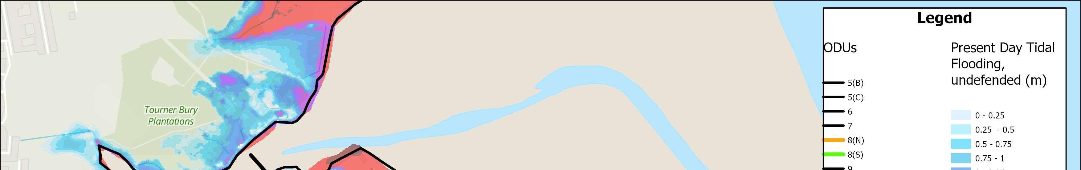
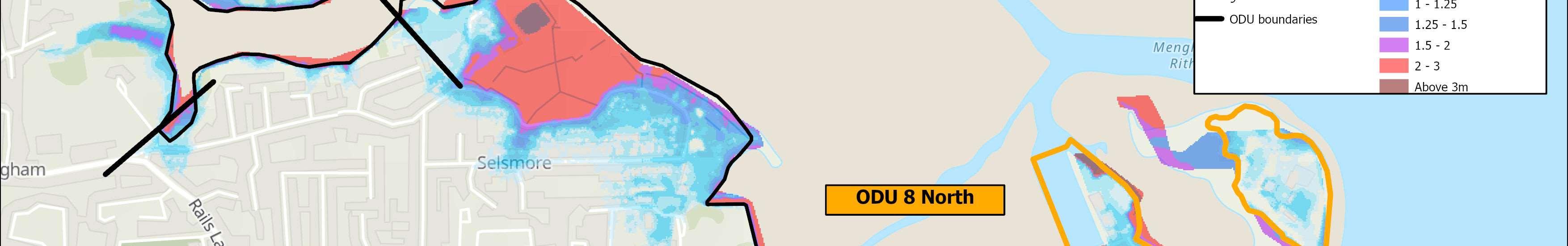
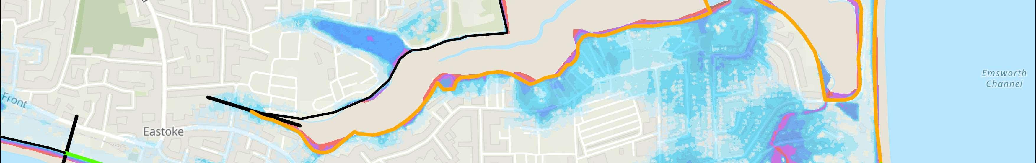
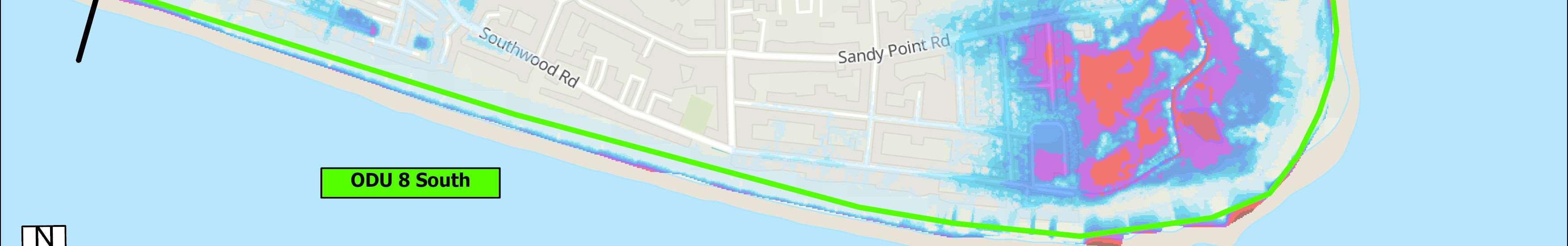
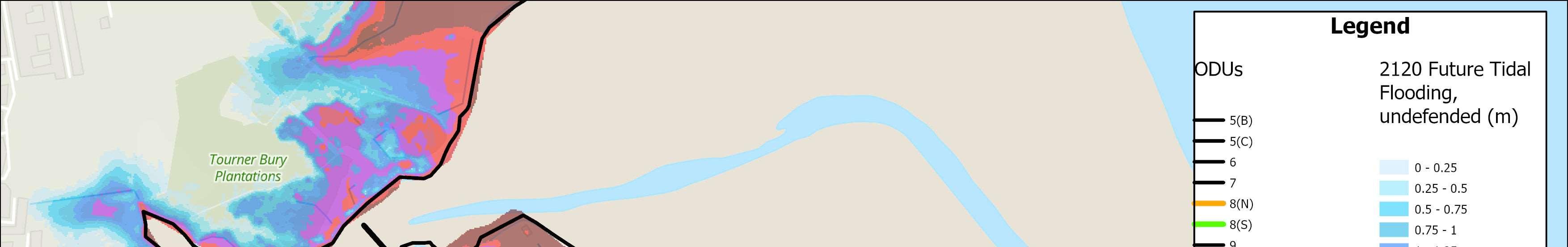
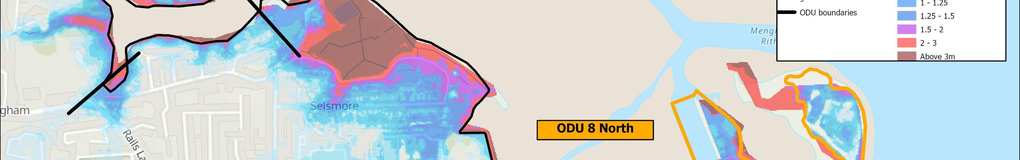
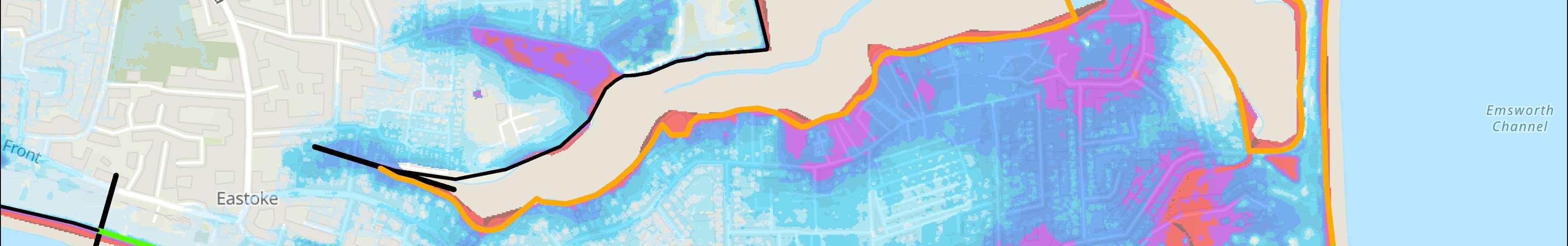
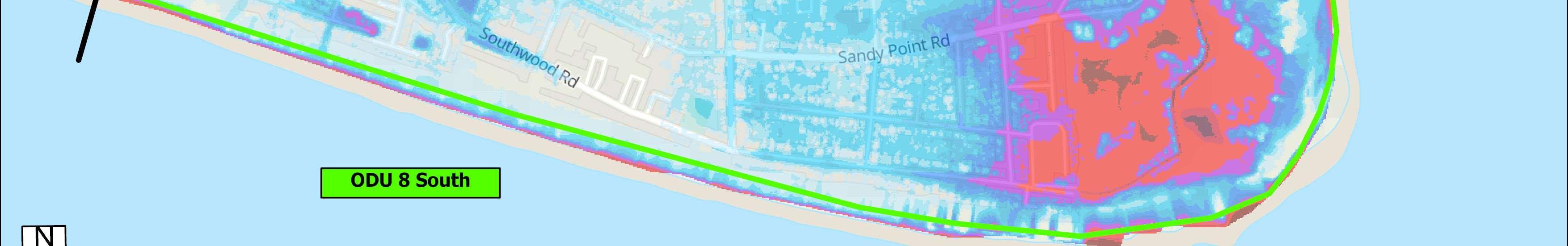
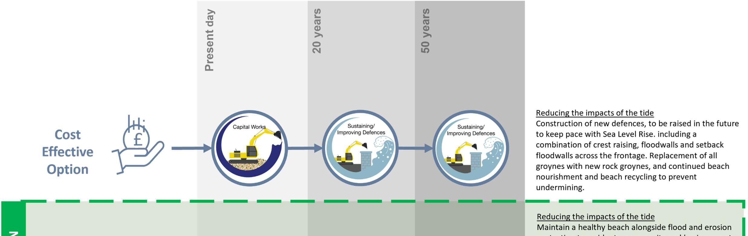
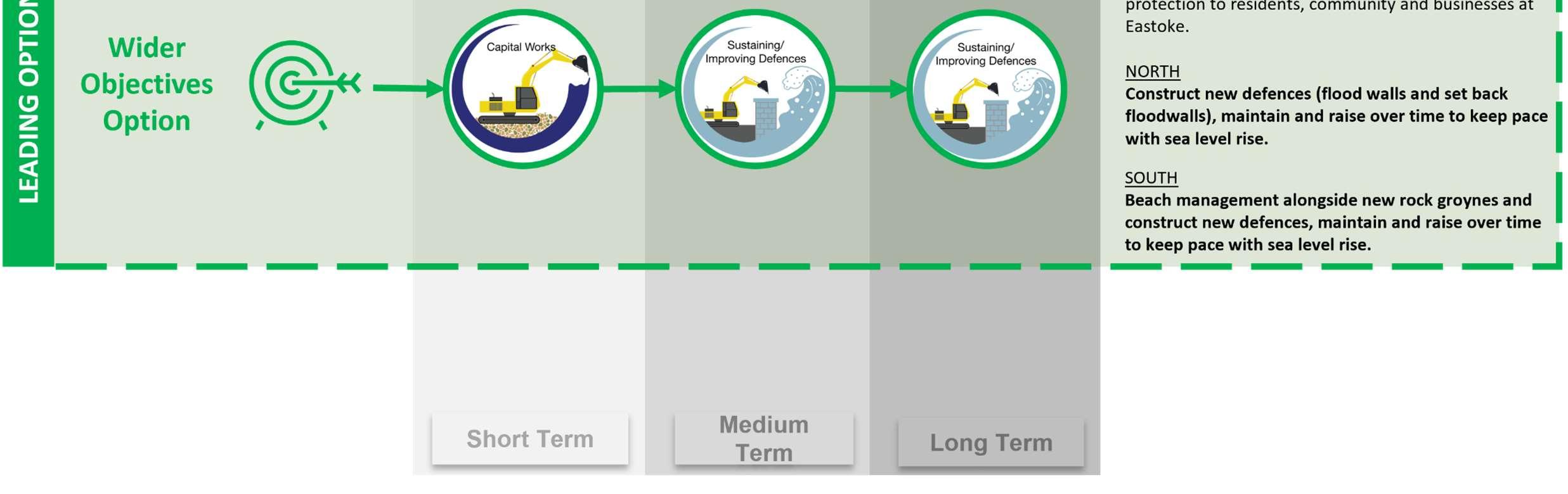
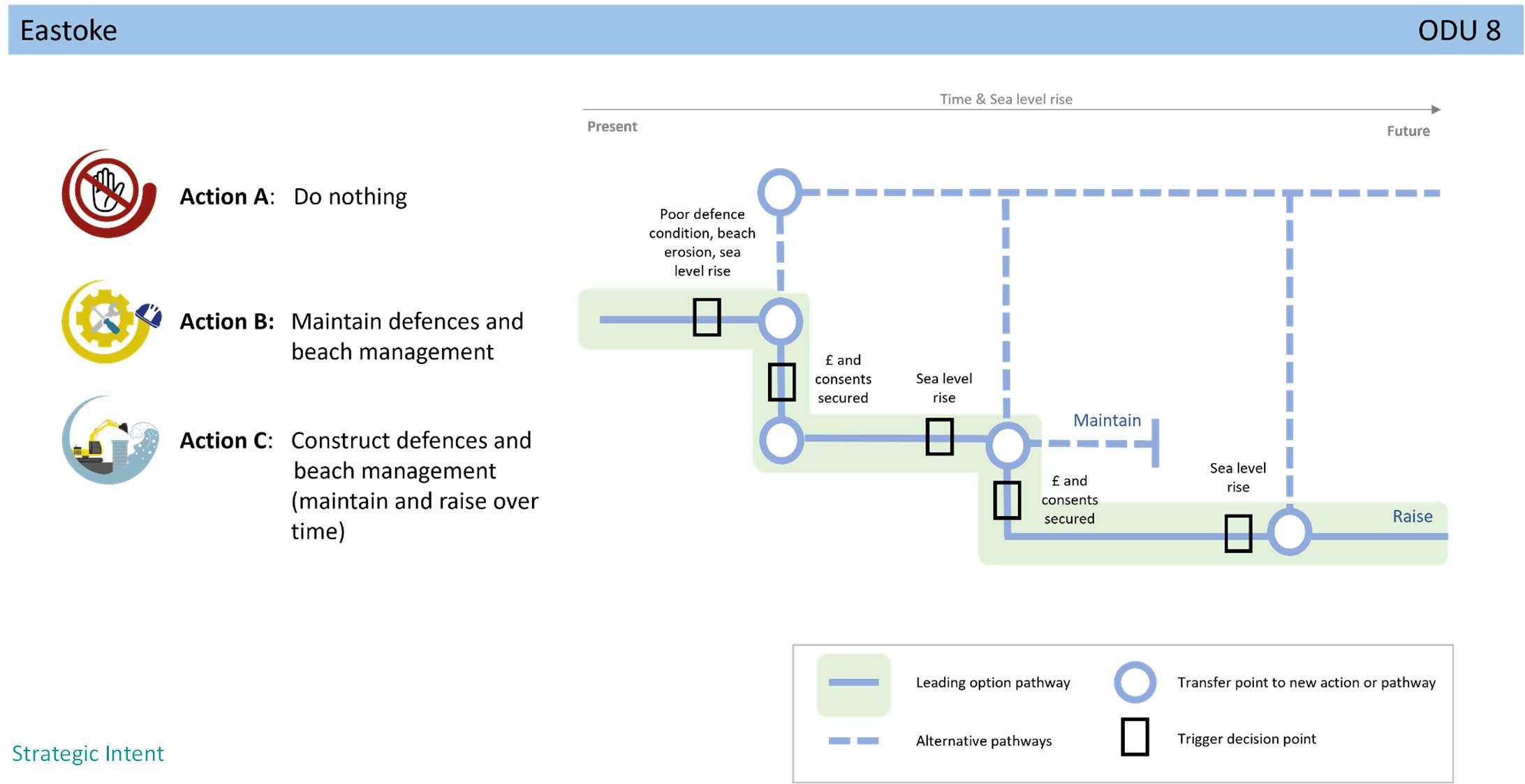
Thestrategicintentintheveryshorttermistorenewtheexisting BeachManagementPlanandimplementthisoverthenext5years (2024-2029).However,itisrecognisedthatbeyondthisamore strategicsuiteofmeasureswillberequiredtoprotecttheentire peninsula.Thiswillinvolvethedevelopmentofasinglepeninsular wideschemeunderonebusinesscasewithaprogrammeofworksto constructnewdefencessuchasfloodwallsalongthenorthernfrontage andthebuildingofanewrockrevetmentalongpartsofthesouthern frontage;coupledwithnewrockgroynes.Ontopofthisongoingbeach managementwillberequiredtomaintainahealthyandrobustbeach toreducetheimpactsofhighenergywaves.
FurtherstudiesintoBi-modalwavesarealreadyunderwayto understandtherisktothiscoastalunitwhichwillinformfuture managementofthebeach.AFloodandCoastalErosionRisk ManagementSchemeforEastokehasbeenproposedintheStrategy’s shorttermactionplan.Subjecttosecuringfunding,thiswillstartwith afeasibilitystudytolookatandappraiseappropriatecoastal managementoptionsforthepeninsular.

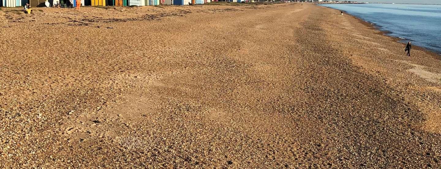
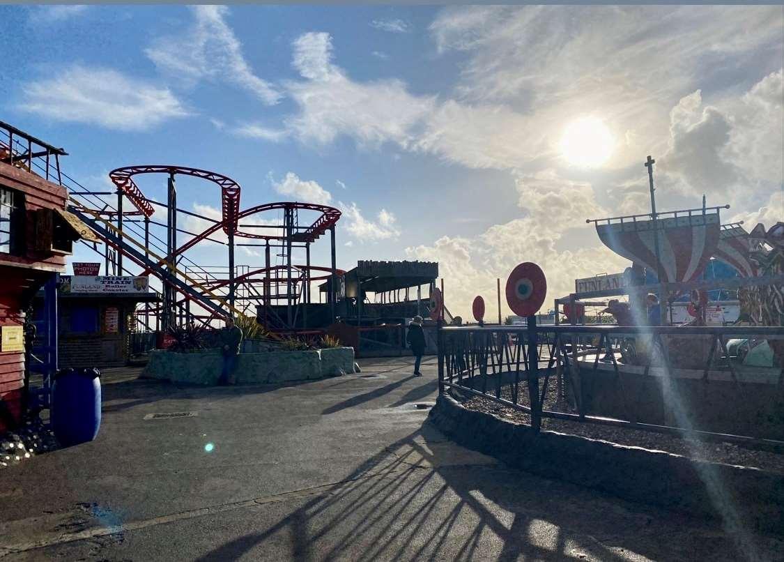
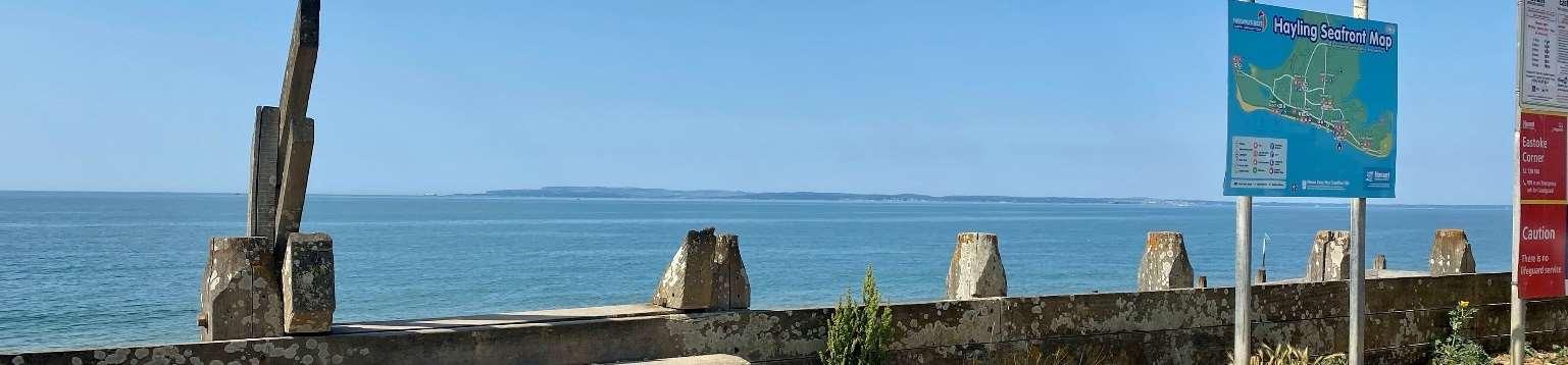


ODU9stretchesalongtheopencoastbetweenEastokeCornerandtheInnon theBeach.
Thebeachfrontageiswellusedbyresidentsandtourists,andincludescar parks,beachhuts,roadsandrecreationareas,andisbackedbyhigh concentrationsofresidential/commercialareas.
LandwardareasinthewestareenvironmentallydesignatedasaSSSIandthe subtidalareaofthewholeODUiswithintheSolentMaritimeSAC.
ThebeachformsthemaindefenceandiscurrentlymaintainedbyHavant BoroughCouncilthroughbeachnourishmentandbeachrecyclingwhichtakes placeatregularintervals.TheonlyotherdefencesareHavantBoroughCouncil ownedandmaintainedtimberrevetmentsandgroynestotheeastandthe privatelyownedandmaintainedconcreteseawallinfrontoftheInnonthe Beach.TheInnontheBeachactsasabeachcontrolstructure,effectively keepingthebeachinplace.
HoldtheLineforthenext100years.
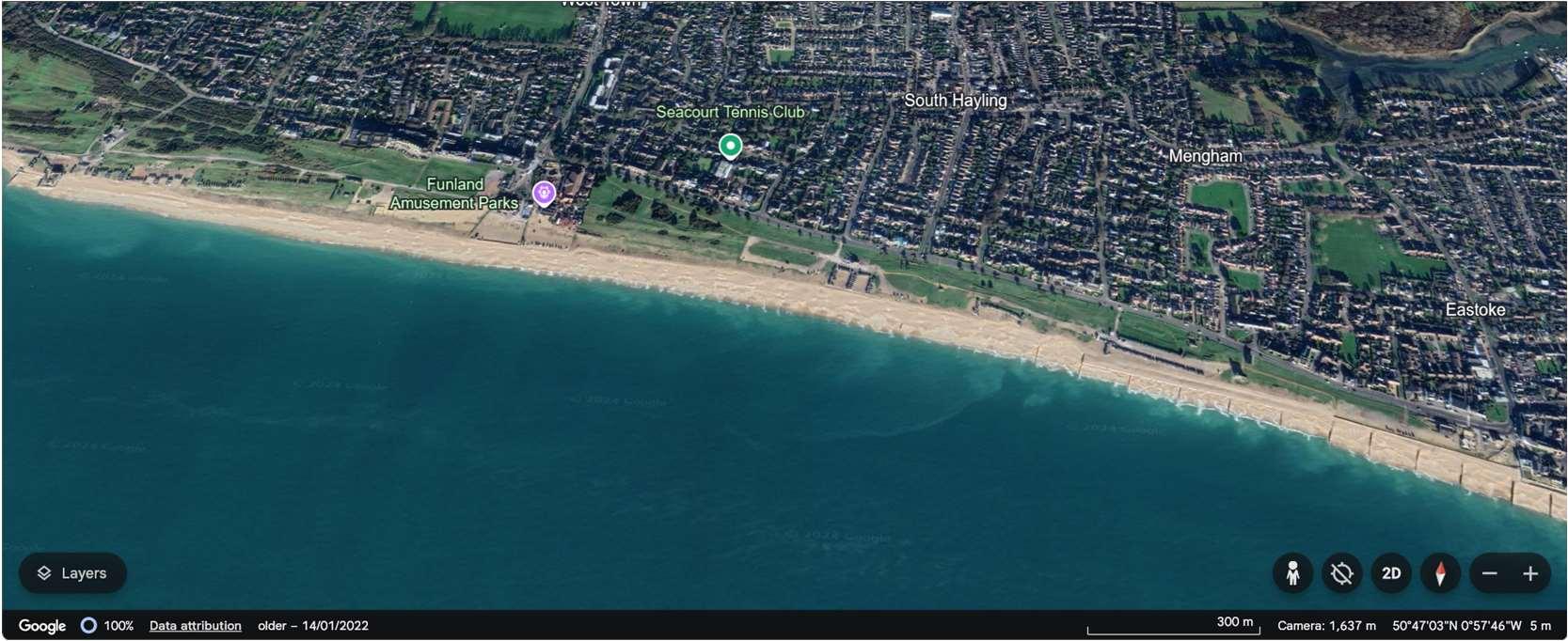
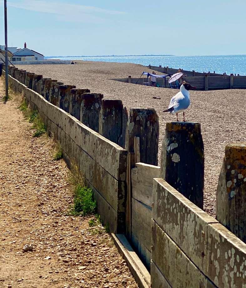
Riskhereispredominantlyfromwaveovertoppingandcoastalerosionasaresultofbi-modalwaveconditions, whenlongperiodswellwavesrefractaroundtheIsleofWight,coincidingwithlocalstormconditions.Theresultis highlyenergeticwaveconditionsthatcanbeverydamagingtothecoastline.
Althoughpropertiesaresetbackfromthebeach,itisexpectedthatupto147propertieswillbeatriskoferosion and121fromcoastalfloodingoverthenext100yearswithoutdefencesorabeachinplace.
Themapsbelowshowthemodelledextentanddepthsofanextremetidalfloodevent(1in200year,0.5%annual probability),withoutanydefences,todayandin100years,allowingforsealevelrise.
Erosionrisk
Numberofpropertiesatrisk,withnodefences
Tidalfloodrisk
Numberofpropertiesatrisk,withnodefences
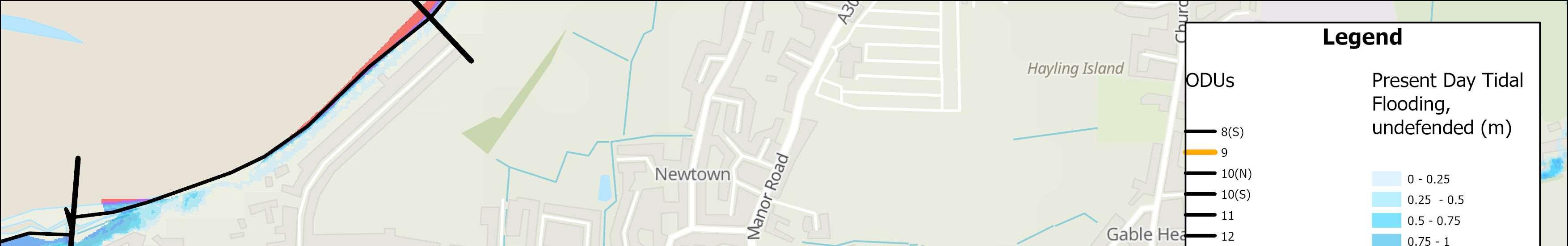
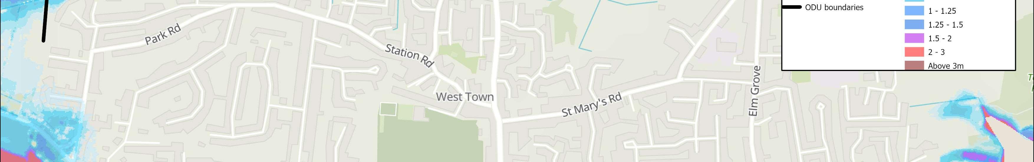
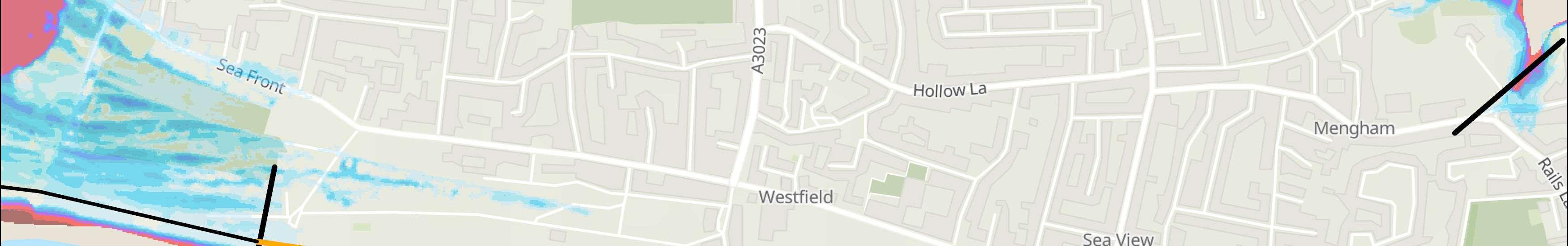
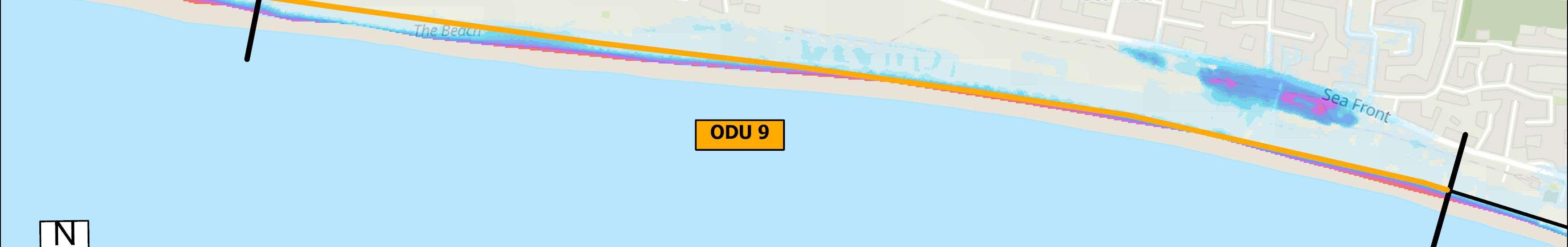
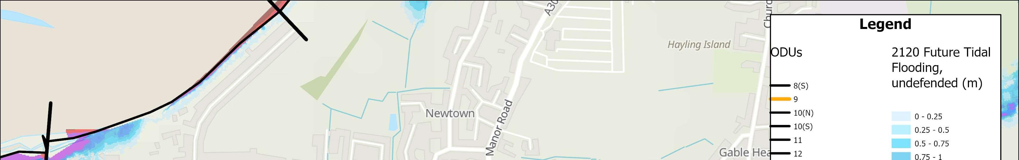
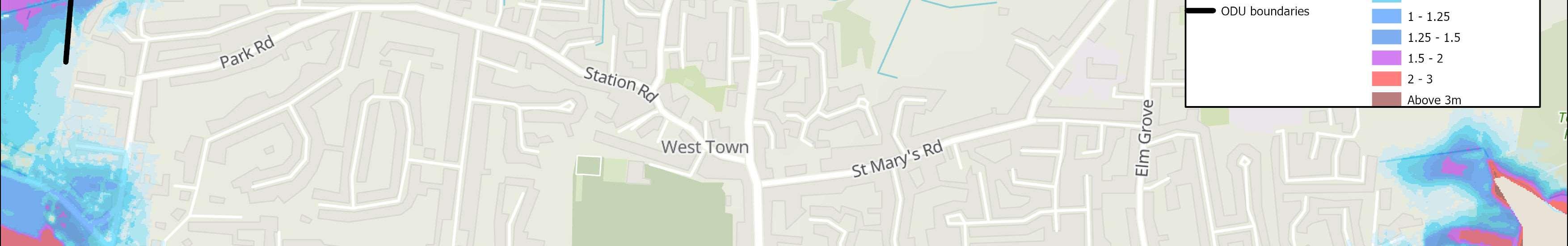
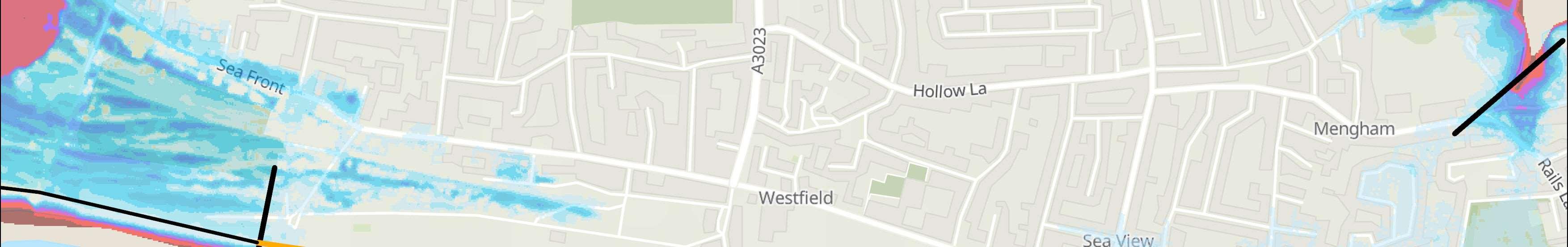
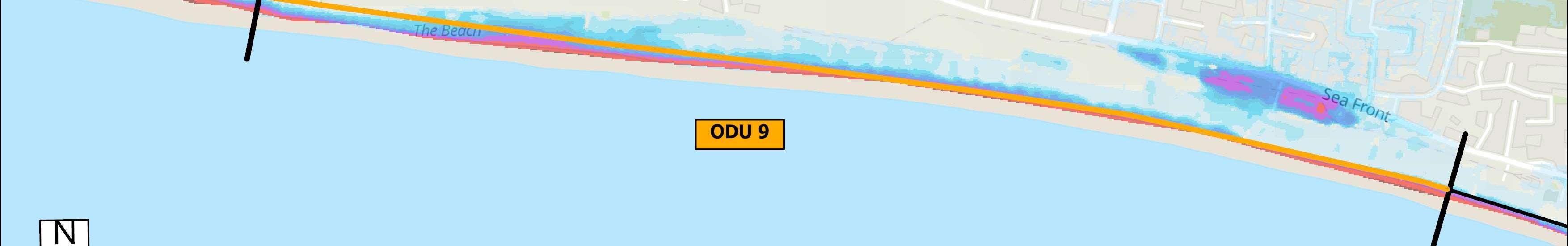
Sustain0.5%AEPMaintain terminalstructure

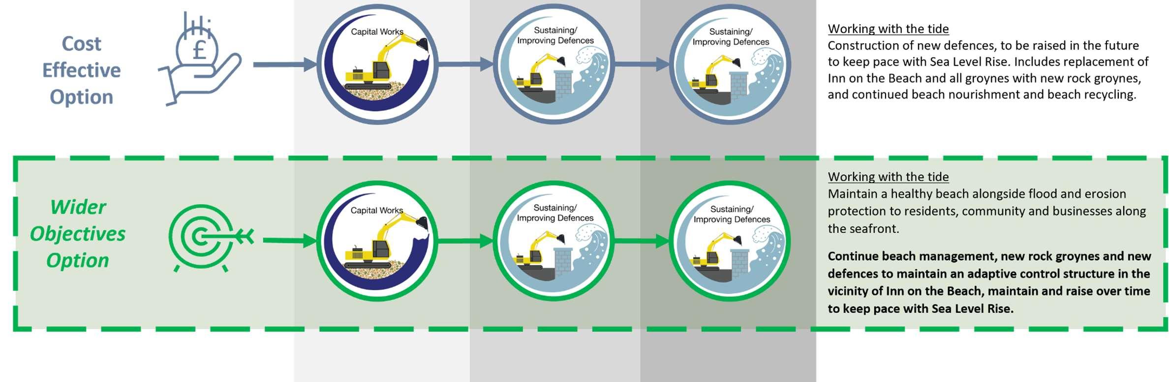

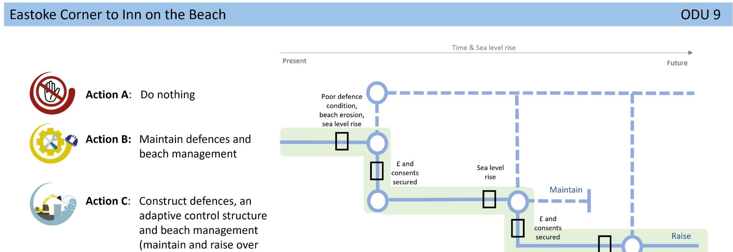
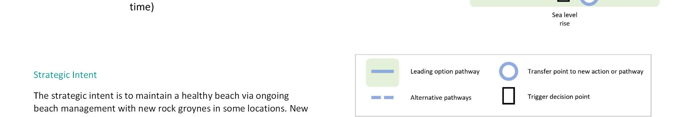
defencessetatthebackofthebeachwouldberequiredtoprotect thecommunityintothefutureandtomaintainanadaptivecontrol structureinthevicinityofInnontheBeachbecauseitplaysakey roleinthebeachmanagementherepromotingsediment accumulationtokeepthebeachinplacetotheeast.Thisisan importantfeatureforlongshoresedimenttransportandretaining thebeachprofileforuseinwiderbeachmanagementacrossthis unitandODU8.
NextSteps
FurtherstudiesintoBi-modalwavesarealreadyunderwayto understandtherisktothiscoastalunitwhichwillinformfuturebeach management.

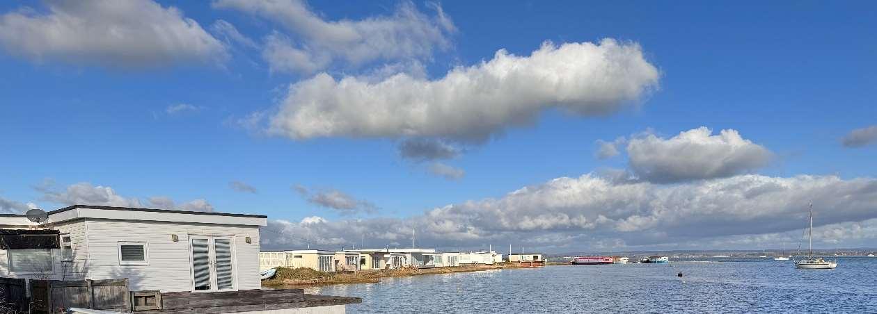
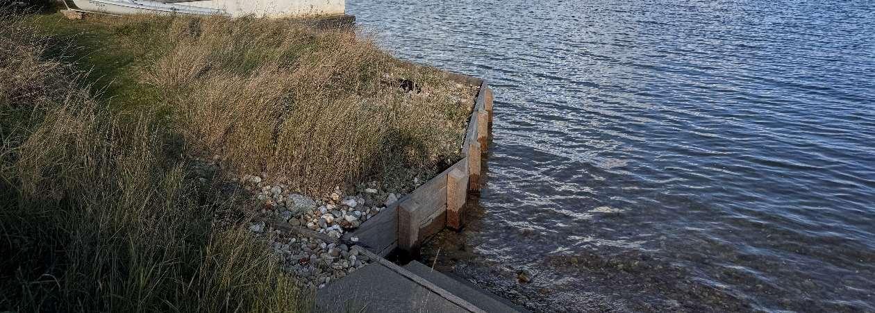
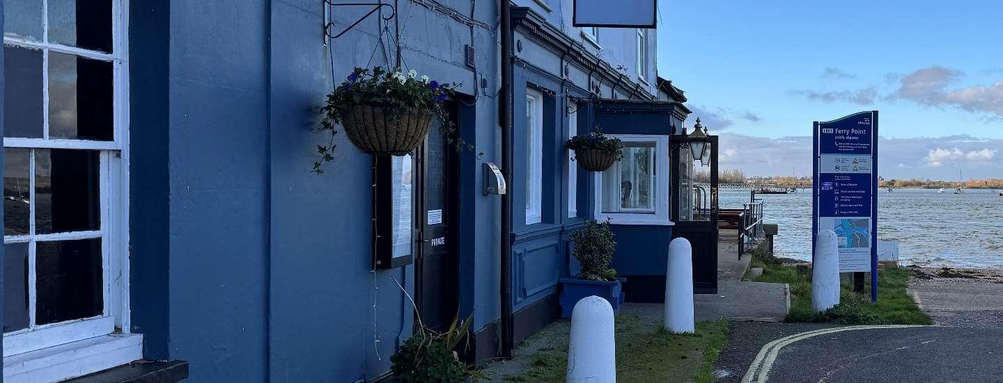

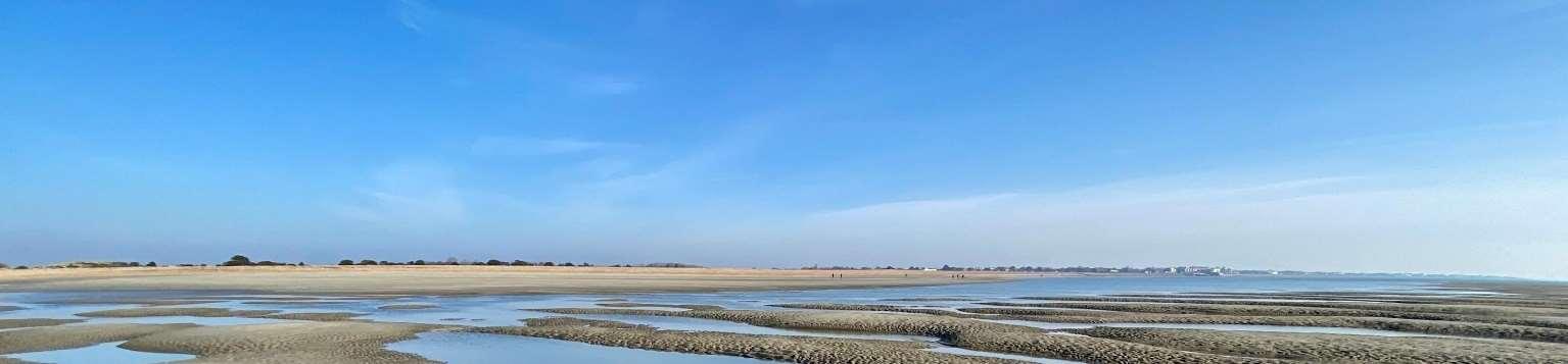
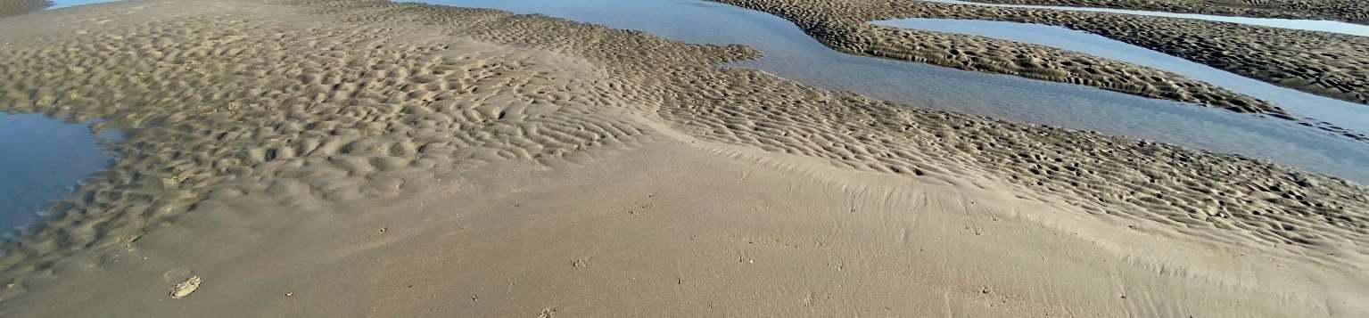
ODU10extendsbetweentheInnontheBeachandNorthShoreRoadandhas beensplitintonorthernandsouthernsections.Thehighenergyopencoastto thesouthisbackedbynaturalduneandmaritimegrasslandareasandinplacesis anaccretingcoastline.Thewesternandnorthernpartoftheunitcoversthe harbourentranceandshelteredcoastlinetothenorth.
Thelarge,undefendedopencoastsouthernfrontageincludesWestBeach,the naturalduneareaofSinahCommon,privategolfcourses,asailingclubandcar parks.TheDraftHBCLocalPlanidentifiedtheopportunityforregenerationat WestBeachnotingtheabundanceofenvironmentaldesignationsinthelocality.
Thenorthernharbourfrontageincludesbusinesses,theferrycrossingtoEastney, aboatyard,slipways,FerryRoad,theresidentialcommunityattheKench,the Kenchnaturereserveandaholidaycomplex.
TheopencoasttothesouthisenvironmentallydesignatedasaSAC,whilethe naturalduneandmaritimegrasslandonSinnahCommonisdesignatedSSSI.The intertidalHarbourareaborderingthisfrontageisenvironmentallydesignatedas SSSI,Ramsar,SPAandSAC,andthereisaLocalNatureReserveattheKench.
Thesouthernunitisstrategicallyreliantontheimplementationofnew adaptablecontrolstructuresinthevicinityofInnontheBeachtocontrolthe movementofsedimentandallowbeachmanagementacrosstheentireopen coastofHaylingIsland.Currently,theshortsectionoftimberrevetmentand rocktothewestofInnontheBeachismonitoredbyHavantBoroughCouncil whiletheremainingfrontagearoundGunnerPointisundefended. Ad-hocdefencesalongthenorthernfrontageareprivatelyownedand maintained,mainlyconsistofconcretewalls,blockworkandembankments andhaveresiduallivesofbetween10and20years.Thecommunityatthe Kenchprivatelyownsandmaintainstheirowndefencesandareactively planningadapttoclimatechangerisksinthefuture.
HoldtheLineforthenext100years,withanintenttoallownatural processestocontinuearoundGunnerPoint.
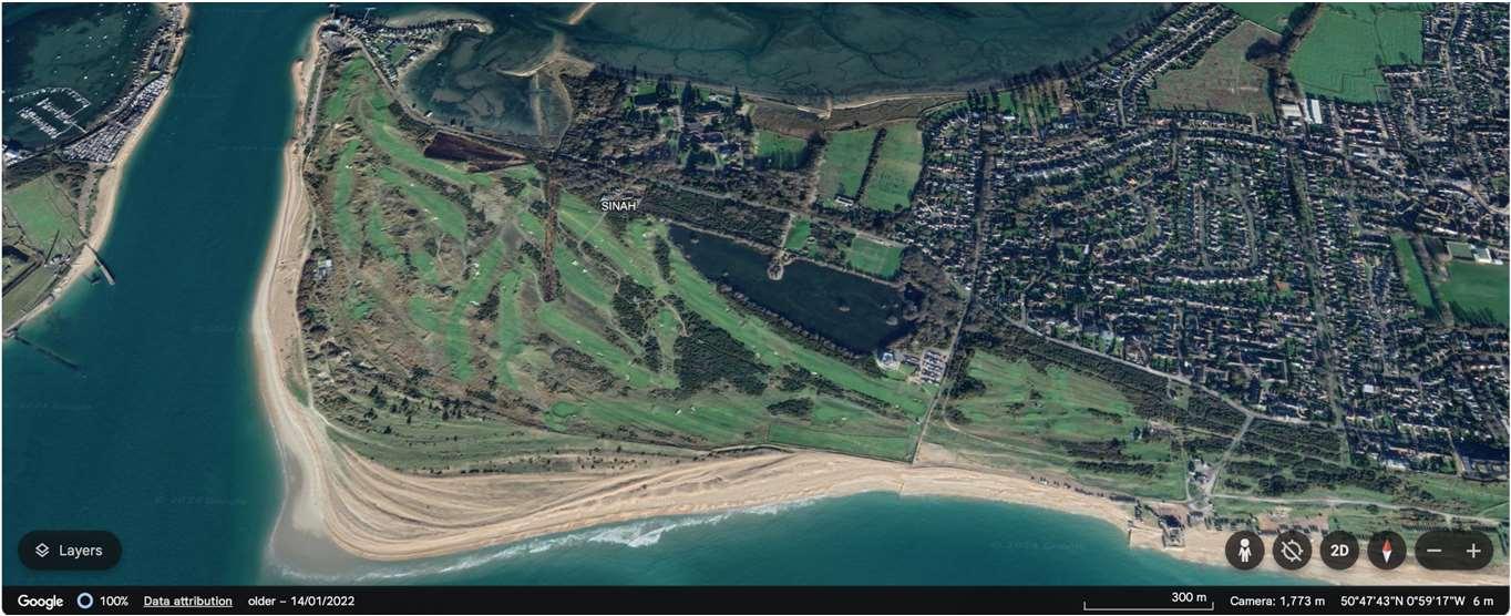
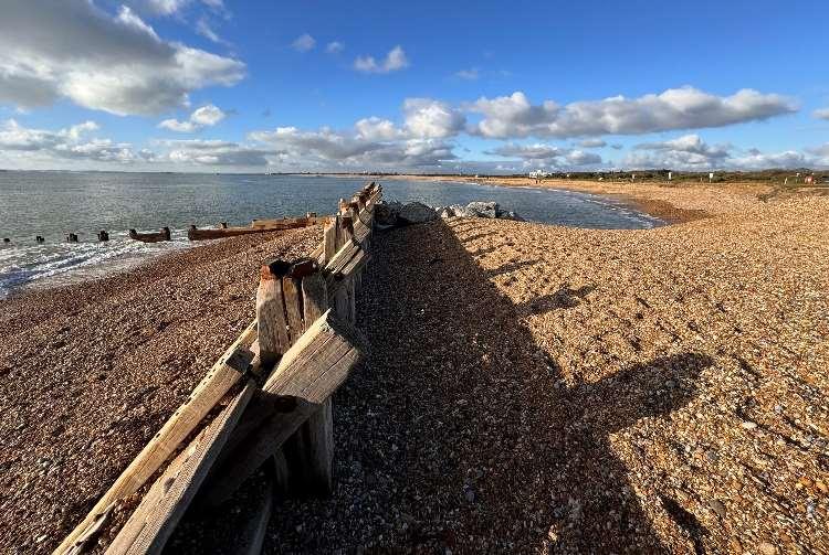
Theriskinthesouthisprimarilyfromwaveovertoppingandcoastalerosion,butareasofSinahCommonalso naturallyaccretearoundGunnerPoint.Thereisariskoftidalfloodingfromtheharbouralongthenorthern frontage.Thereareexpectedtobe53propertiesatriskoferosionand95atriskoffloodingoverthenext100years ifundefended,ofwhichmostaresituatedintheNorthoftheODU.
Themapsbelowshowthemodelledextentanddepthsofanextremetidalfloodevent(1in200year,0.5%annual probability),withoutanydefences,todayandin100years,allowingforsealevelrise.
Erosionrisk
Numberofpropertiesatrisk,withnodefences
Tidalfloodrisk
Numberofpropertiesatrisk,withnodefences
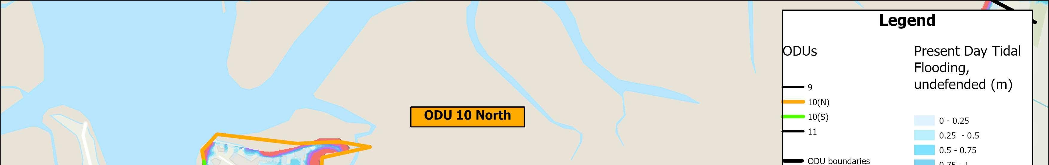
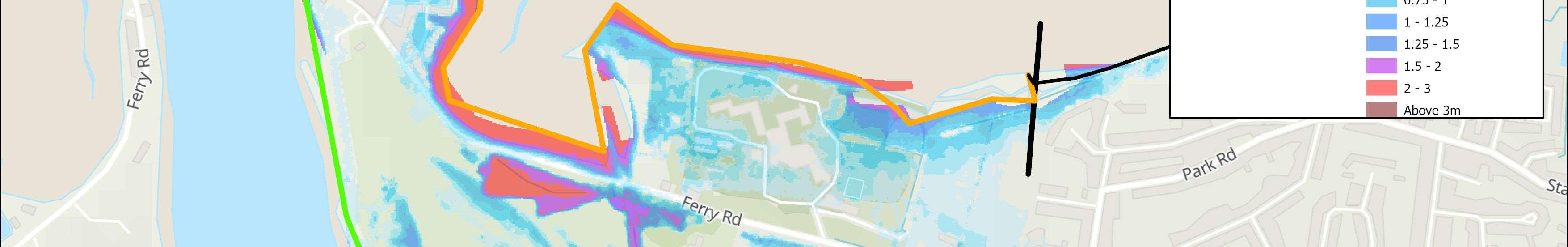
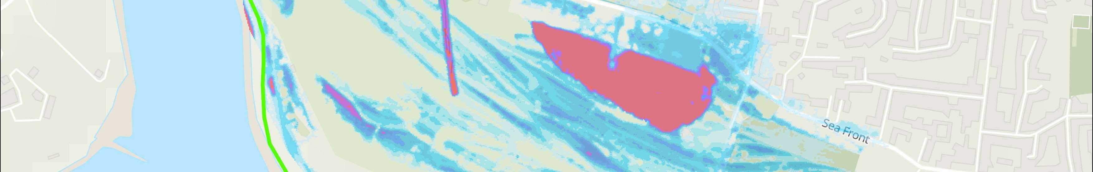
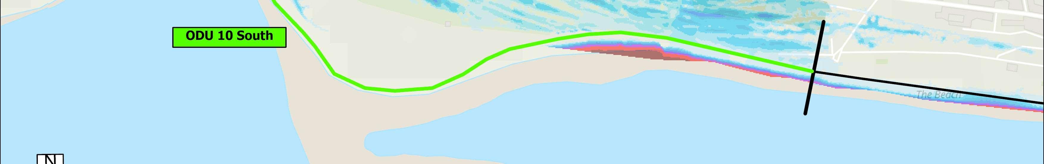
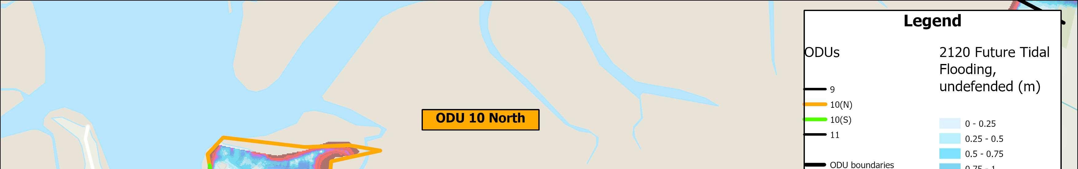
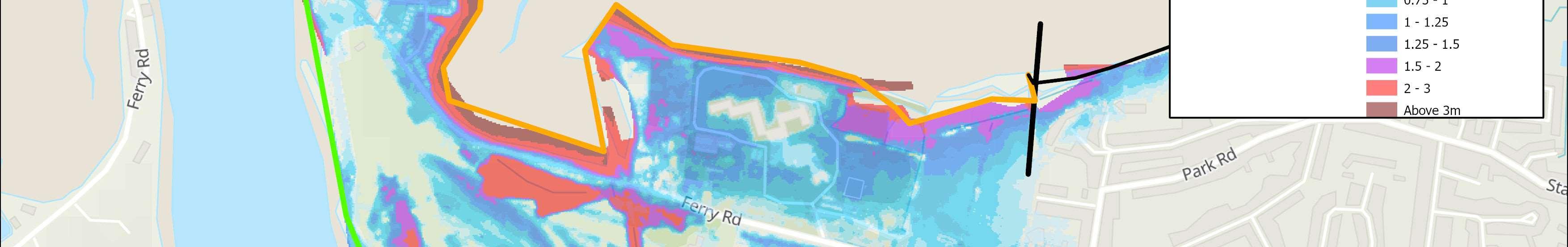
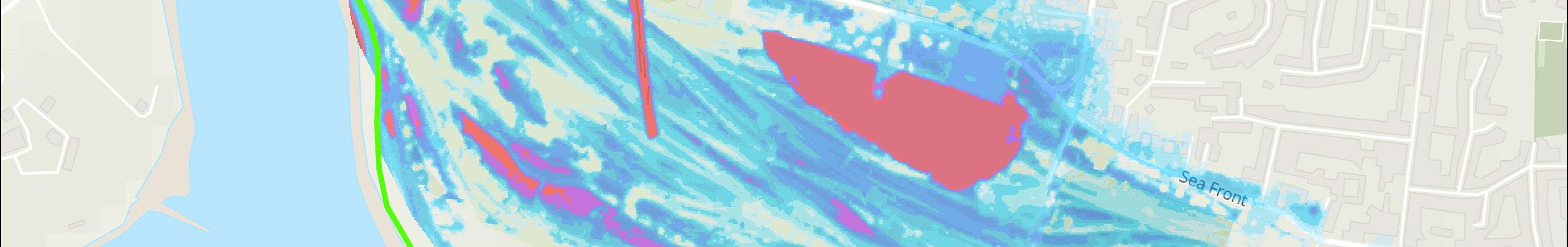
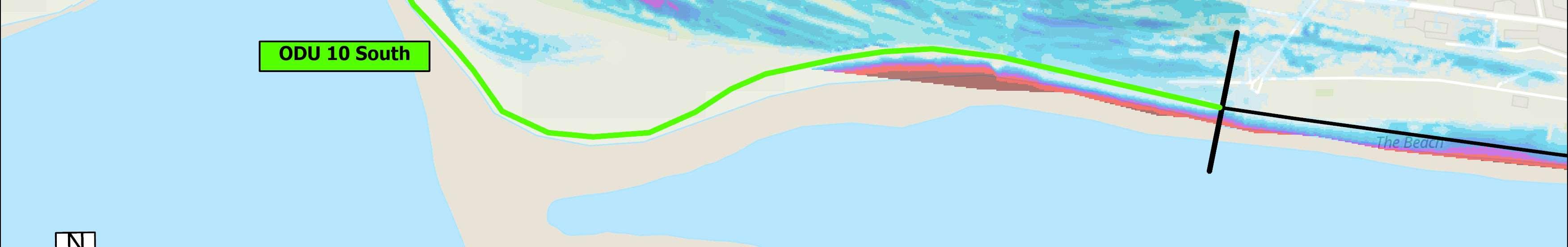

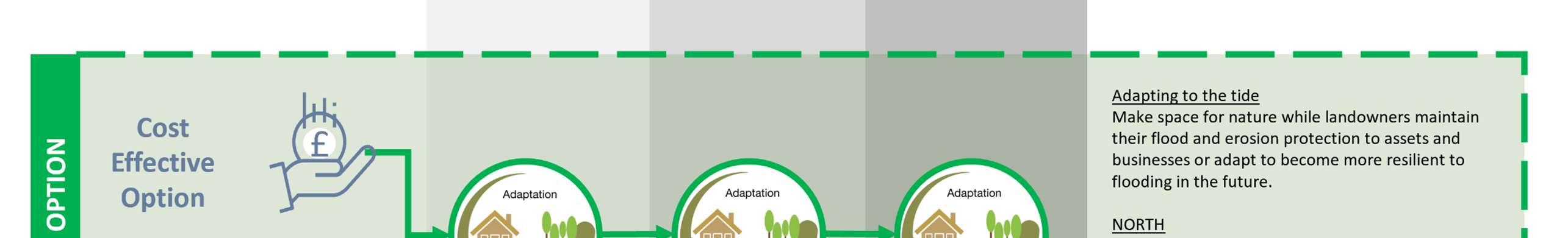
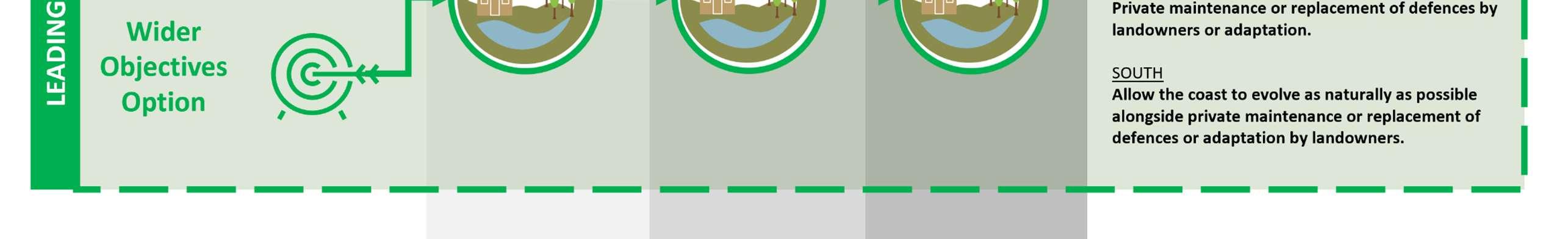

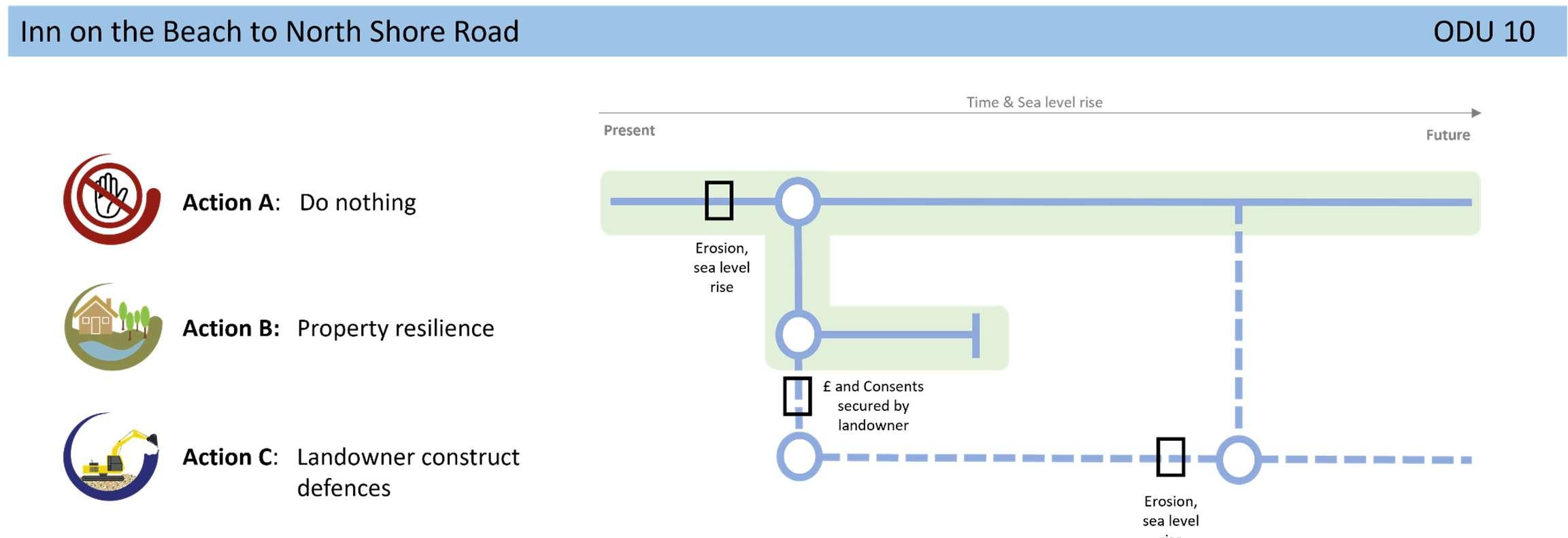
Throughouttheunit,theintentisforadaptationofassetsto becomemoreresilienttoclimatechangeimpactsinthefuture,ina managedway,alongsidenaturalevolutionoftheopencoast shorelinetoimprovepublicopenspaceandenhancethenatural environment.Acollaborativeapproachbetweenalllandowners andstakeholderswillberequiredtobalancethecomplexneedsof thecoastlinehere.Iflandownersdowishtocontinuetomaintain (andfund)theirdefencesinthefuture,theywillneedtoobtainthe relevantlicencesandconsentsfirst.
Aholisticenvironmentalmanagementplanforthisareaasidentifiedin theStrategy’sshorttermactionplanisunderway.Dialoguewithkey stakeholdersandlandownerswillcontinueregardingthemanagement optionsforthisfrontage.
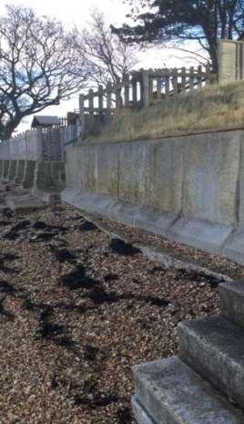
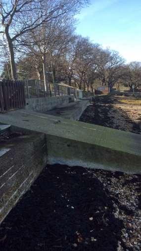
Overview
ODU11extendsalongtheresidentialNorthShoreRoadfrontage.
Residentialpropertiesandaccompanyingadhocmixofprivatelyownedandmaintaineddefencescharacterisethisunit.Defencesvaryfromconcretewallsto embankmentstobreezeblockstructures.Consequently,defencelifeandconditionvaryfromdefencetodefence,butgenerallyhaveresiduallivesofbetween10 and20years.
Environment
TheintertidalHarbourareaborderingthisrelativelyshelteredfrontageisenvironmentallydesignatedasSSSI,Ramsar,SPAandSAC.
ShorelineManagementPlanPolicy
Holdthelineforthenext100years.
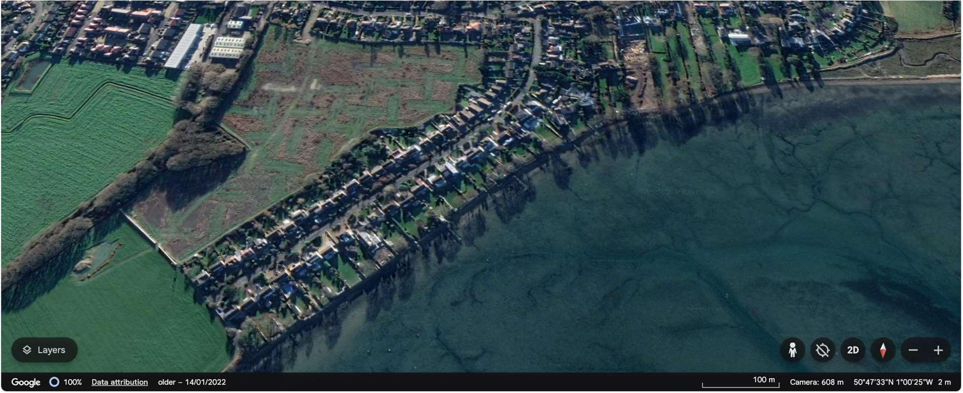
FloodriskhereisfromtidalinundationinthewestoftheunitinfrontofSinahLane,anderosiontotheeastinfront ofNorthShoreRoad.Withnodefences,thereisariskoffloodingandcoastalerosionintheshorttermonthewest side,howevererosionriskontheeastsideisnotpredictedtooccuruntilthemediumterm.
Duringlargerreturnperiodseventsinthefuture,withoutdefences,thereispotentialforthisfloodareainthewest, tomergewiththefloodcellfromthesouth,whereupto83propertiesareshowntobeatriskoverthenext100 years.
Themapsbelowshowthemodelledextentanddepthsofanextremetidalfloodevent(1in200year,0.5%annual probability),withoutanydefences,todayandin100years,allowingforsealevelrise.
Erosionrisk
Numberofpropertiesatrisk,withnodefences
Tidalfloodrisk
Numberofpropertiesatrisk,withnodefences
Donothing damages
£3,471,000 Presentvalue
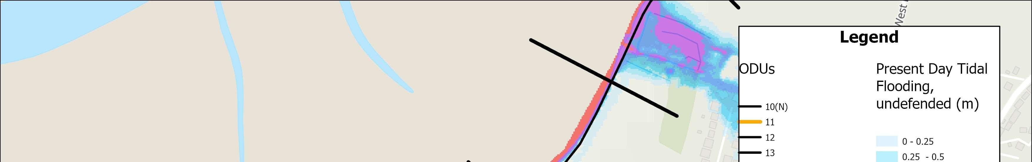
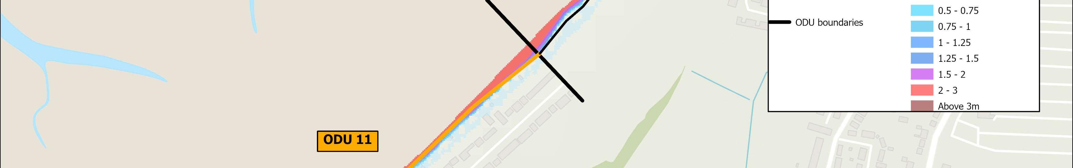
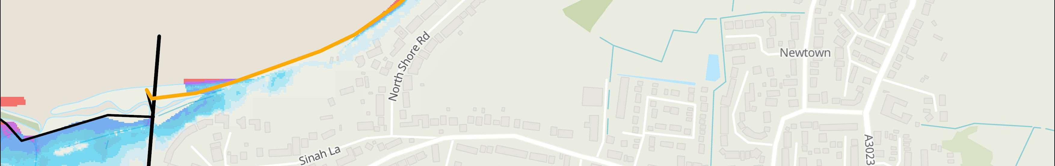
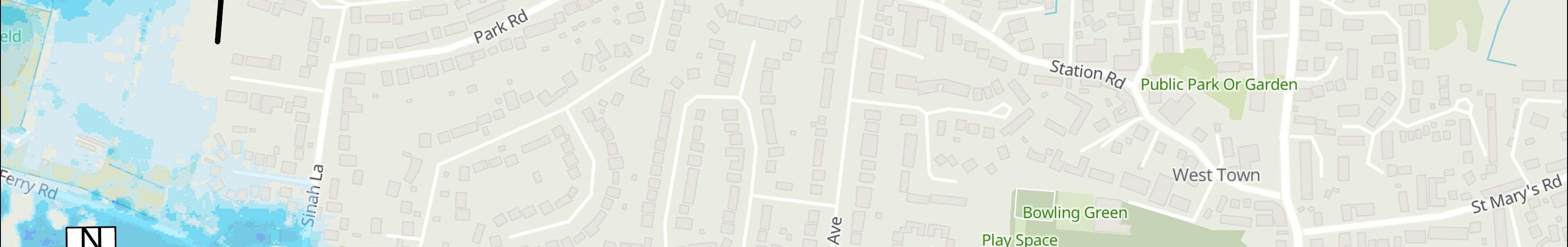
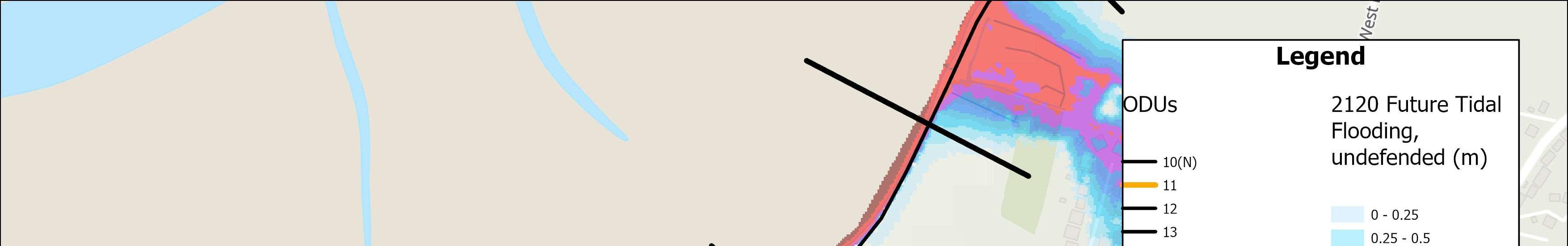
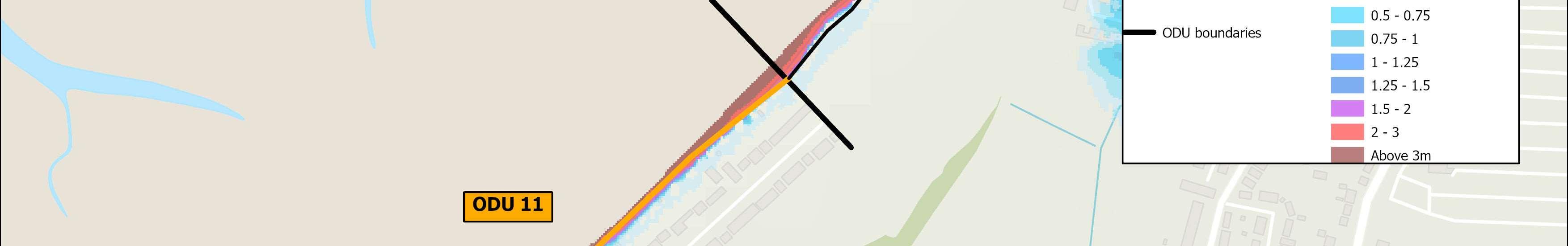
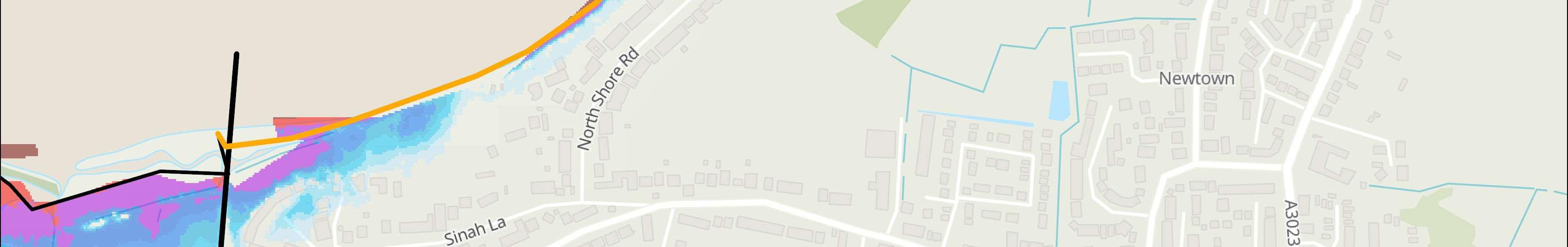
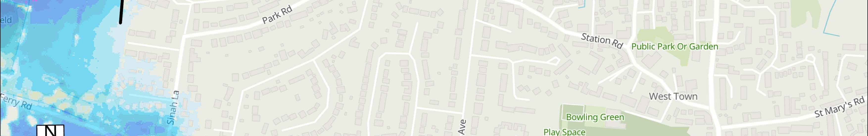

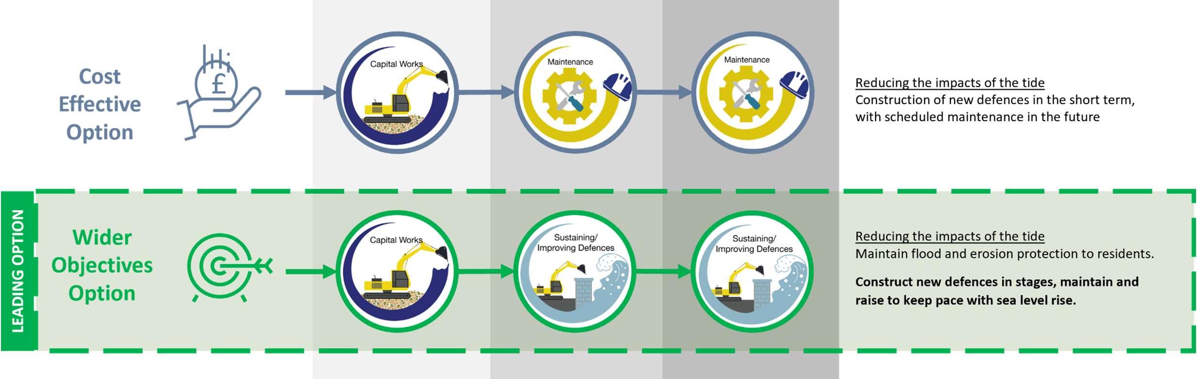

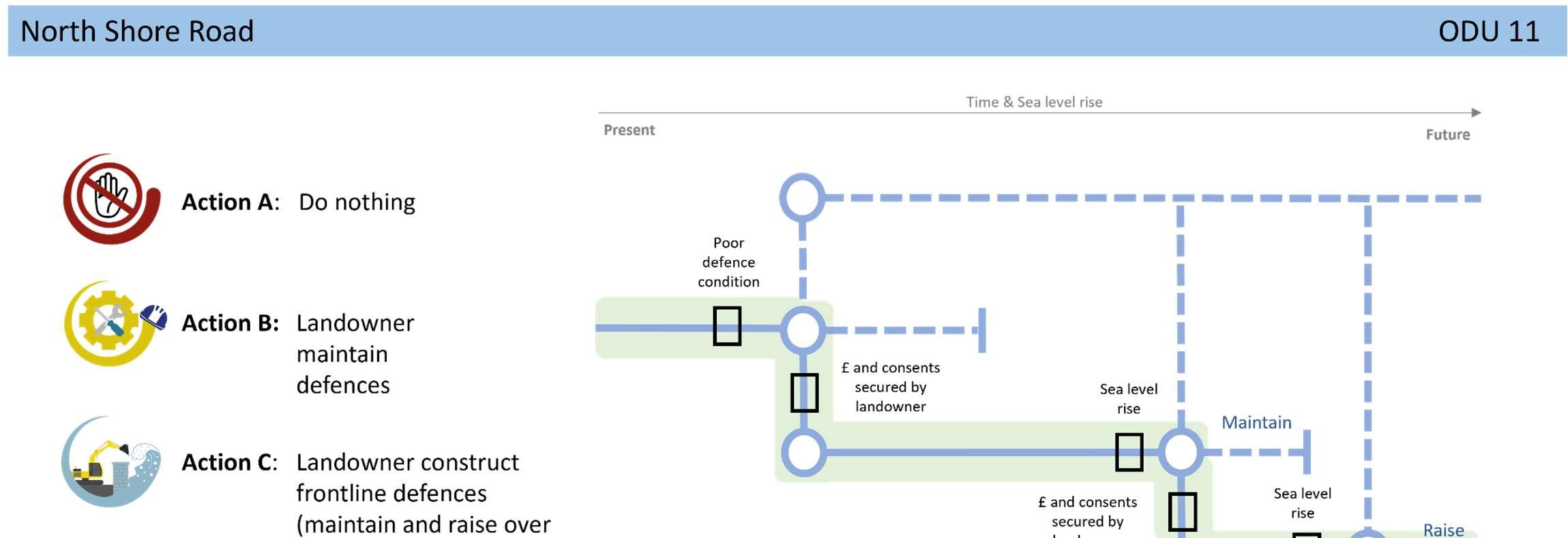

StrategicIntent
TheStrategicintenthereistomaintainfloodanderosion protectiontoresidents,byconstructingnewdefencesinstages, dependantonrisk.Wherelandownersarenolongerableto maintaintheirdefences,orfundingforaschemeisnotfound, adaptationwillneedtobeexploredasacommunity,toadjustto therealityoffuturecoastalfloodanderosionrisk.
Noneidentifiedforthisfrontageintheshort-term,otherthanongoing conversationswithcommunitiesinrelationtolevelsofriskandwhat todointheeventofaflood.
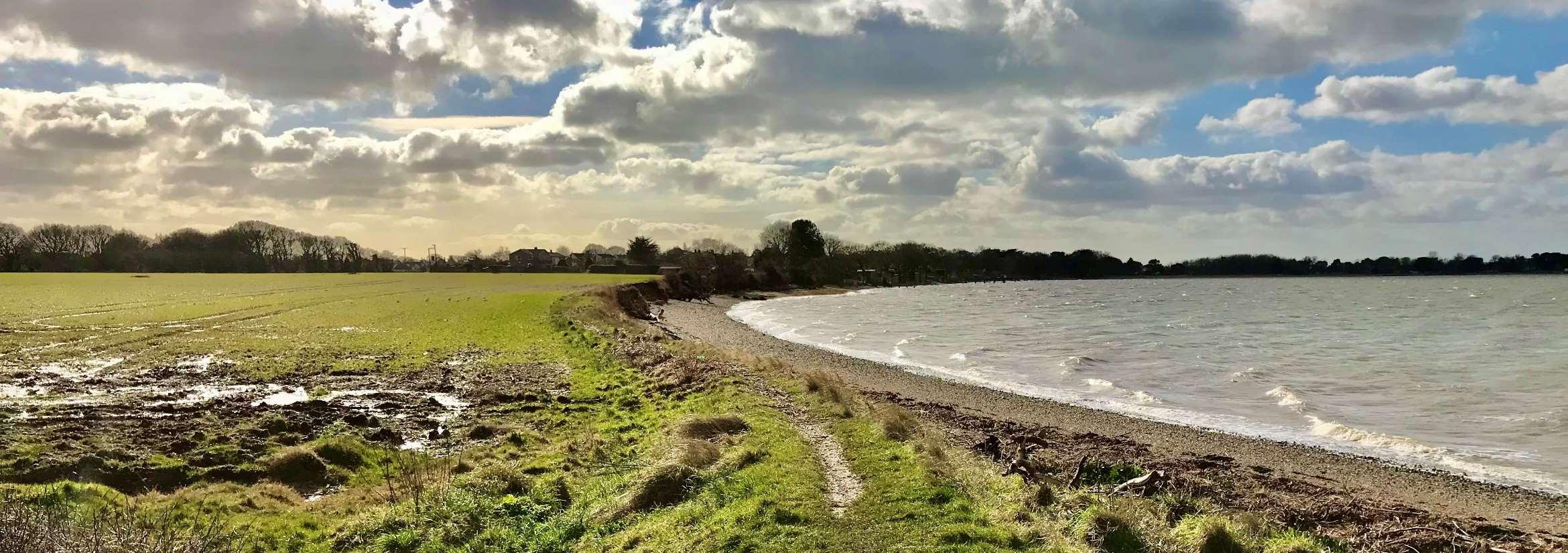
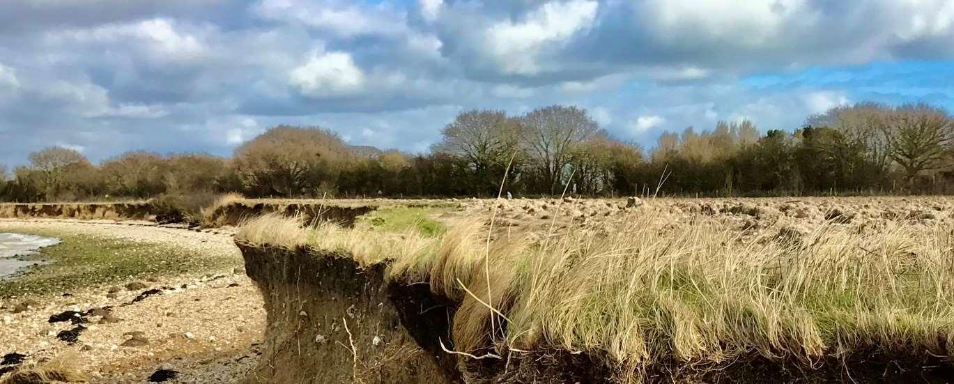
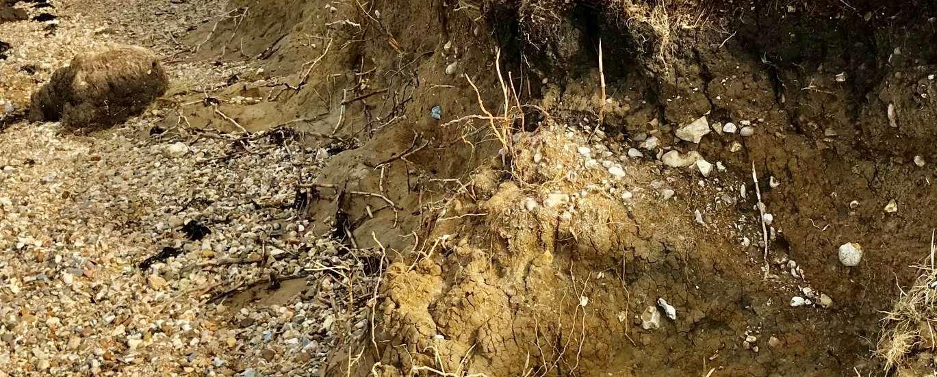
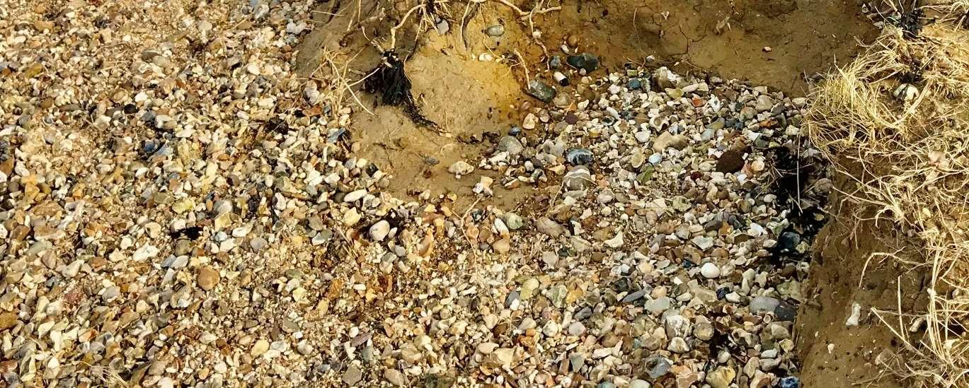

ODU12extendsfromNorthShoreRoadtoNewtown.Thisunitisasmall sectionofundevelopedandundefendedcoast,characterisedbyprivately ownedagriculturallandimportantforbirds,beingidentifiedasacoreareain theSolentWadersandBrentGooseStrategy.
ThewidelyusedHaylingBillyTrailandHaylingBillyLocalNatureReserveare setbackfromthecoastinthislocation.ACoastalChangeManagementArea hasbeendesignatedhere,throughtheHavantBoroughCouncilLocalPlan,to preventinappropriatedevelopmentfromtakingplacethatmaybeatriskfrom futureerosion.
Environment
Theintertidalareaadjacenttothisfrontageisheavilyenvironmentally designatedasaSSSI,Ramsar,SPAandSAC.
ShorelineManagementPlanPolicy
NoActiveInterventionacrossthisunitforthenext100years.
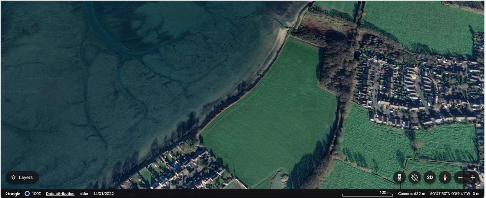
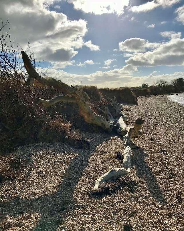
Duetothetopography,erosionisthemainrisk,however,therearenoassetsatriskalongthisfrontage.TheDo NothingdamagesinthisODUrelatetoagriculturalandrecreationallosses.
Themapsbelowshowthemodelledextentanddepthsofanextremetidalfloodevent(1in200year,0.5%annual probability),withoutanydefences,todayandin100years,allowingforsealevelrise.
Numberofpropertiesatrisk,withnodefences
Numberofpropertiesatrisk,withnodefences
Donothing damages
£90,000 PresentValue
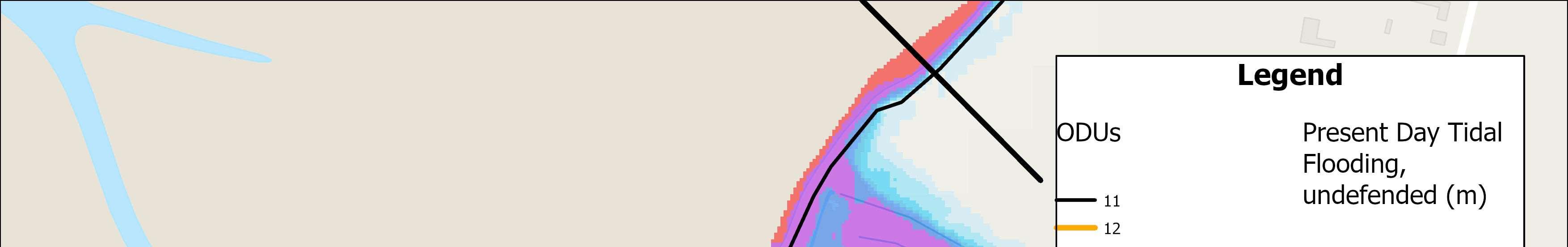
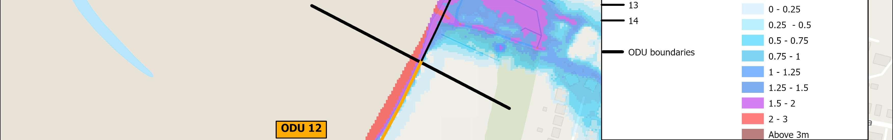


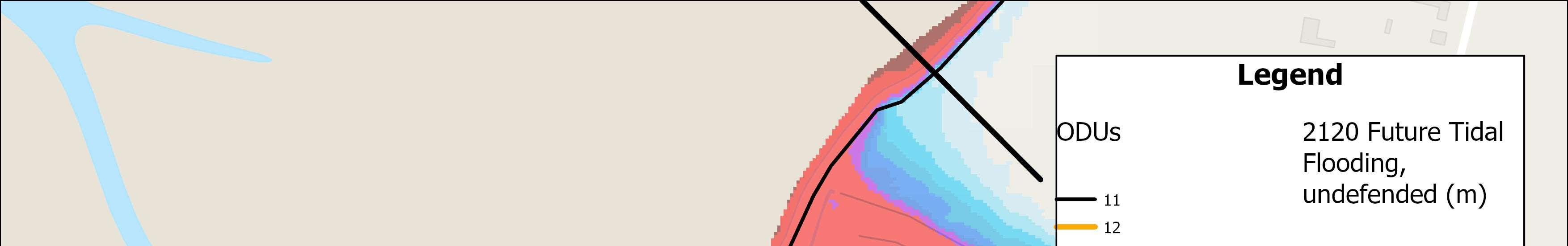
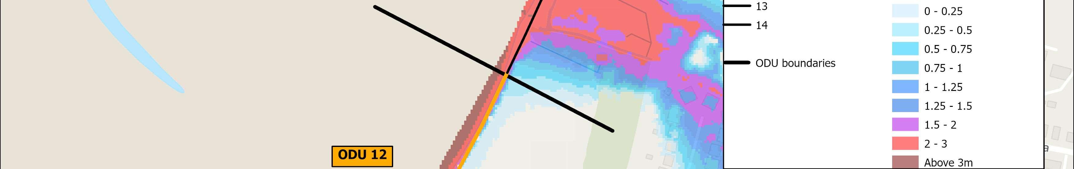

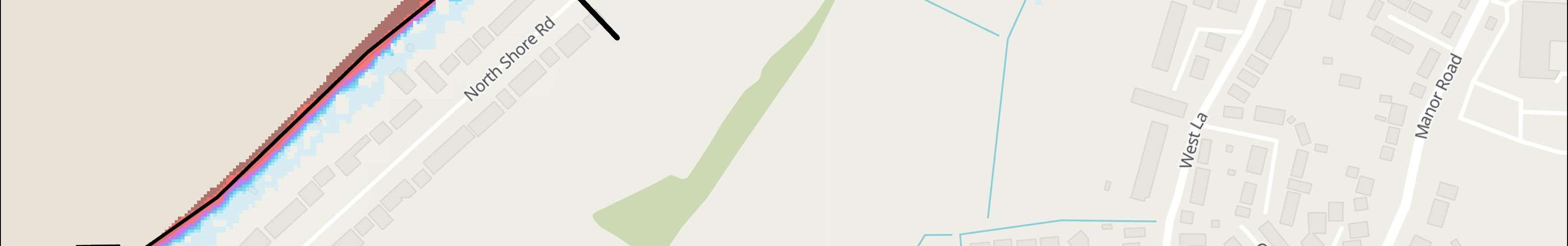

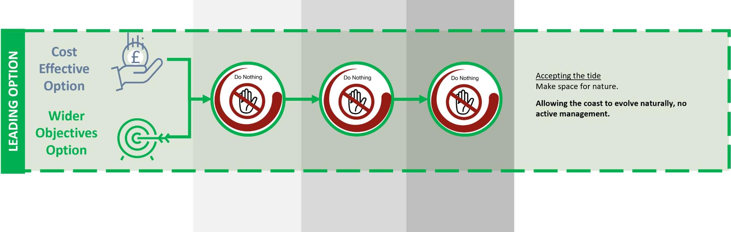

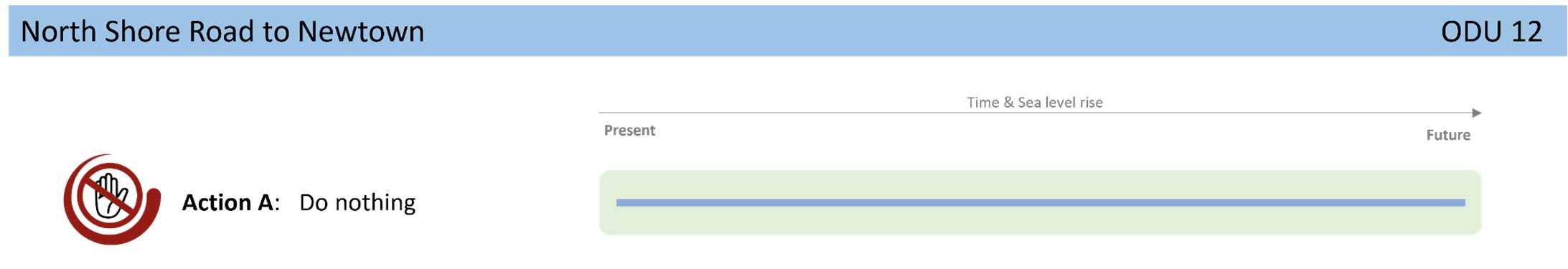


StrategicIntent
ThestrategicintentinthisODUistomakespacefornatureby allowingthecoasttocontinuetoevolvenaturally,erodingto providesedimenttotheharbourandbeaches.
NextSteps
Noneidentifiedforthisfrontageintheshort-term.

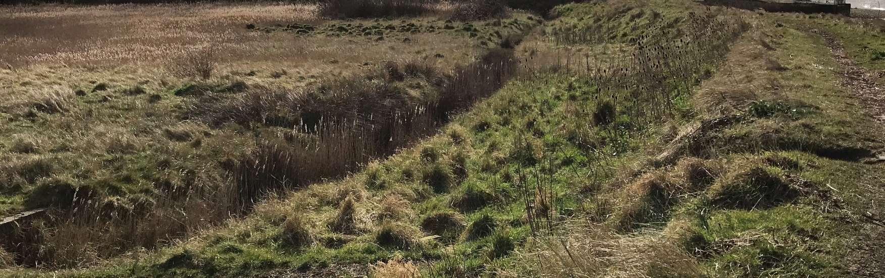
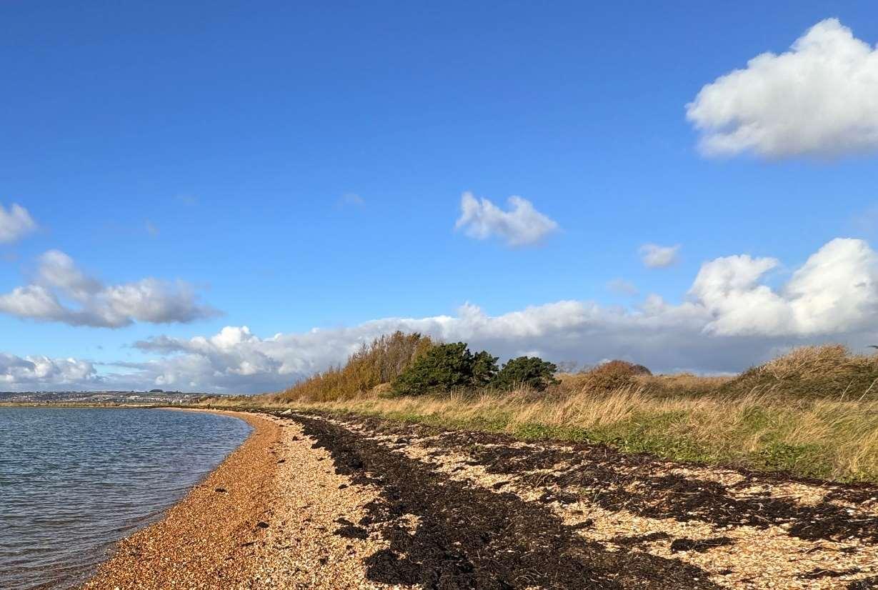

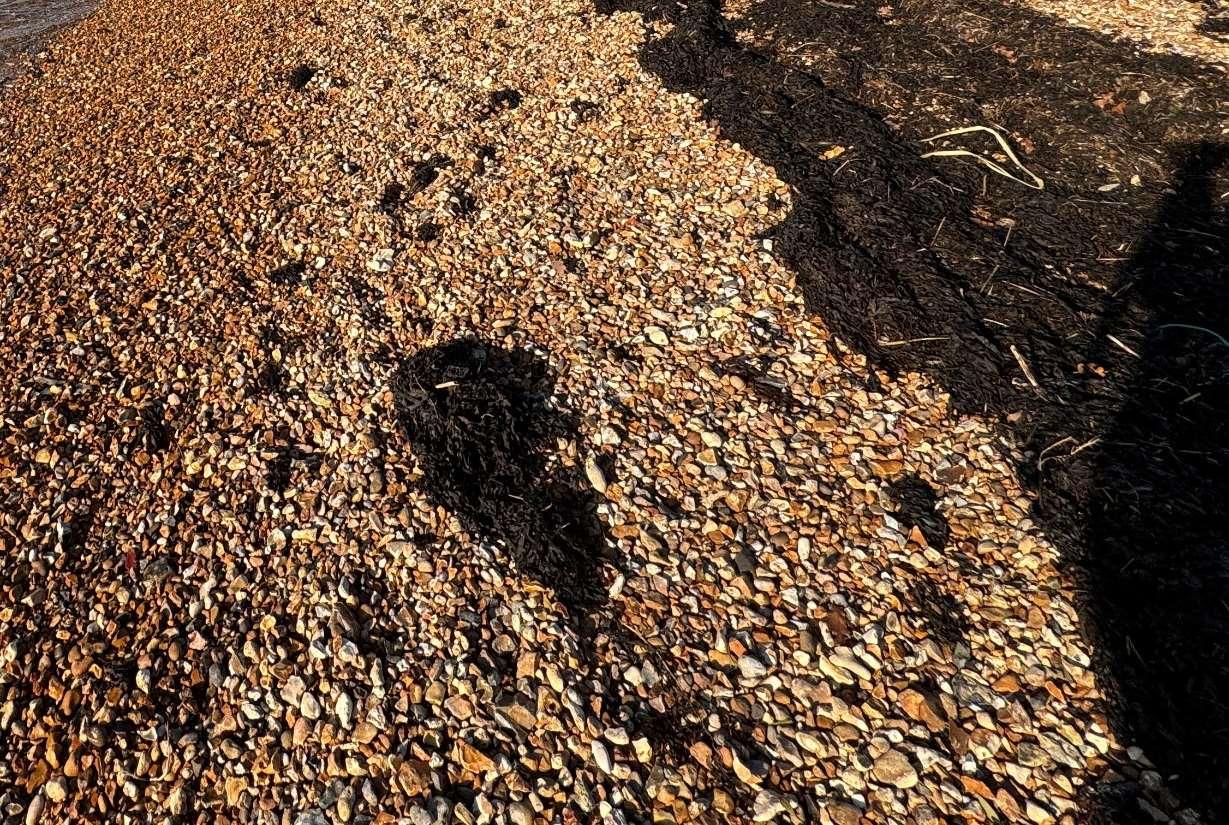
Overview
ODU13encompassesthecoastlineatNewtown.
DefencesconsistofanArmorlocembankmentwithalocalisedharddefence aroundanoutfall.Althoughthedefencesareprivatelyowned,theyare maintainedbytheEnvironmentAgencyandhaveresiduallivesofbetween15 and20years.Withmaintenance,theexistingdefencesareexpectedto continuetoprovideprotectionintothemediumterm.
Liketherestoftheisland’swestcoast,theintertidalareaadjacenttothis frontageisheavilyenvironmentallydesignatedasaSSSI,Ramsar,SPAandSAC. TheNewtowncoastalfrontageitselfconsistsofafield,whichisenvironmentally designatedasSSSI,RamsarandSPA,borderedbythewidelyusedHaylingBilly TrailandHaylingBillyLocalNatureReservetotheeast,beforeyoureachthe communityofNewtown.
ShorelineManagementPlanPolicy
DuetotheincreasedfloodriskatNewtown,this frontagehasalocalisedHoldTheLinepolicyforthe next100years.
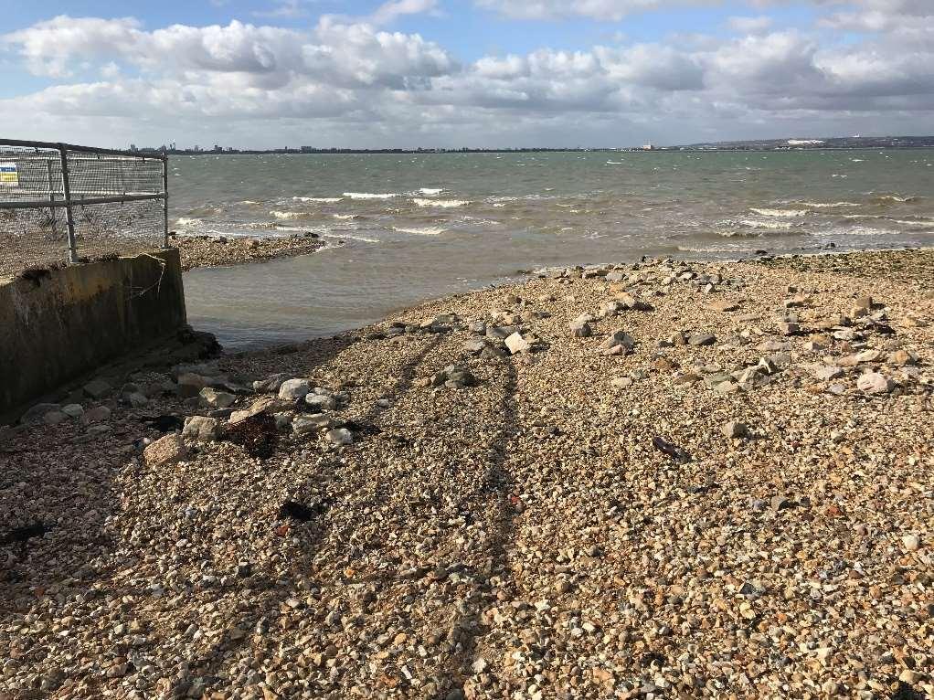
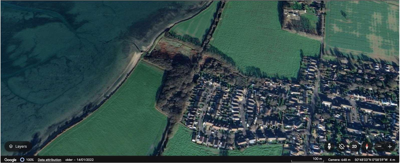
TheNewtownfrontageencompassesalocalisedpocketoftidalfloodriskwhichextendstothecommunityof Newtown.Withoutdefencesitisexpectedthattherewillbeupto80propertiesinNewtownatriskoffromtidal floodingoverthenext100years.
Themapsbelowshowthemodelledextentanddepthsofanextremetidalfloodevent(1in200year,0.5%annual probability),withoutanydefences,todayandin100years,allowingforsealevelrise.
Numberofpropertiesatrisk,withnodefences
Numberofpropertiesatrisk,withnodefences
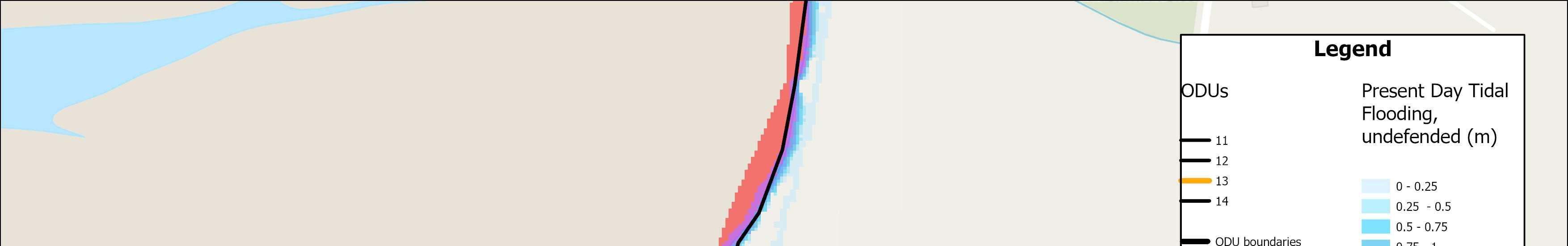


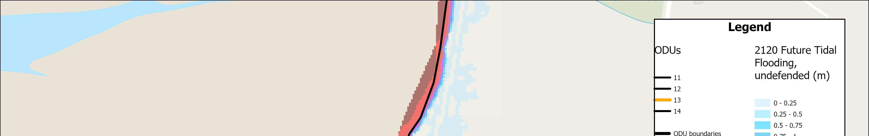


OverallStrategicOption Maintainthensustain0.5%AEPfrom 2045

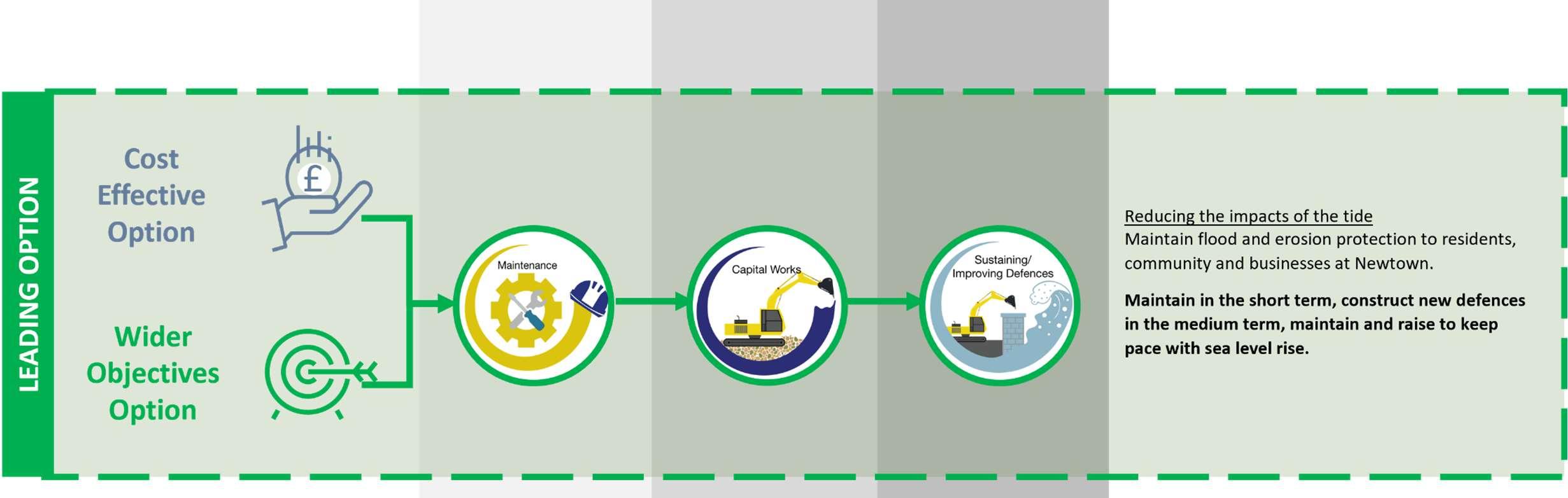

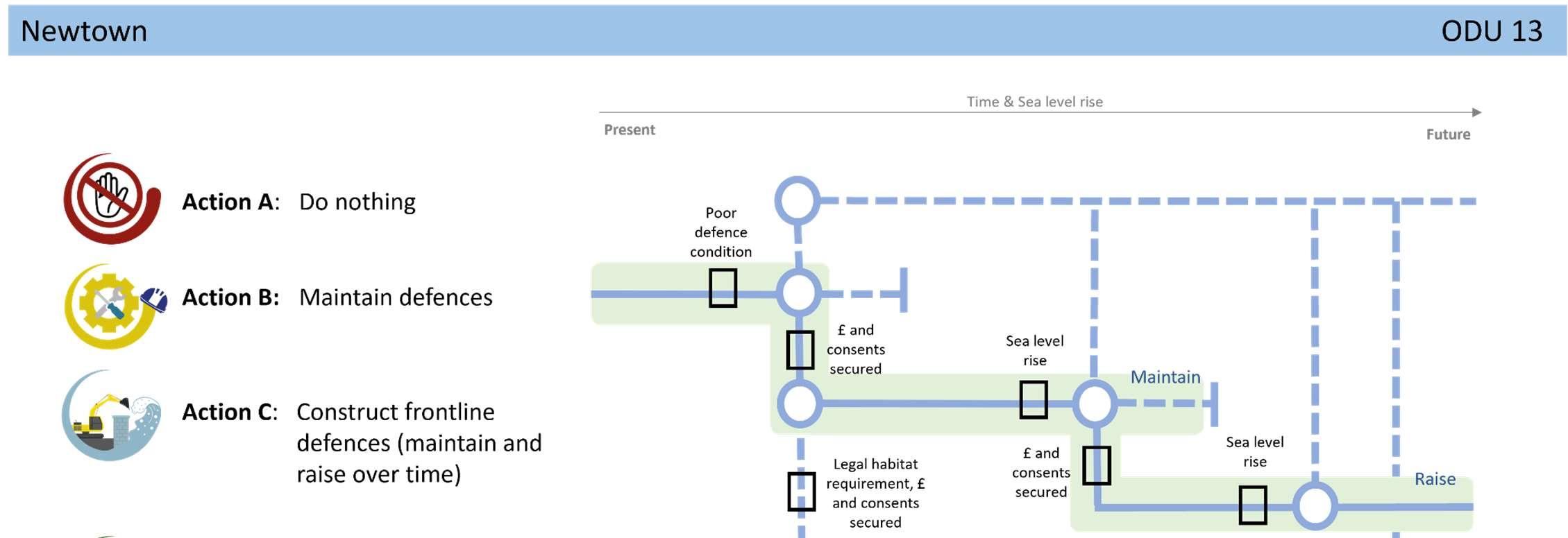
StrategicIntent
TheStrategicintenthereistocontinuetoreducerisktocurrent residentialproperties,communityandbusinessesinNewtown,by maintainingexistingdefencesintheshortterm,subjectto obtainingtherelevantlicencesandconsents,beforeconstructing newdefencesinthemediumtermtoreducerisktoproperties.
NextSteps
Noneidentifiedforthisfrontageintheshort-term,otherthanongoing conversationswithcommunitiesinrelationtolevelsofriskandwhat todointheeventofaflood.
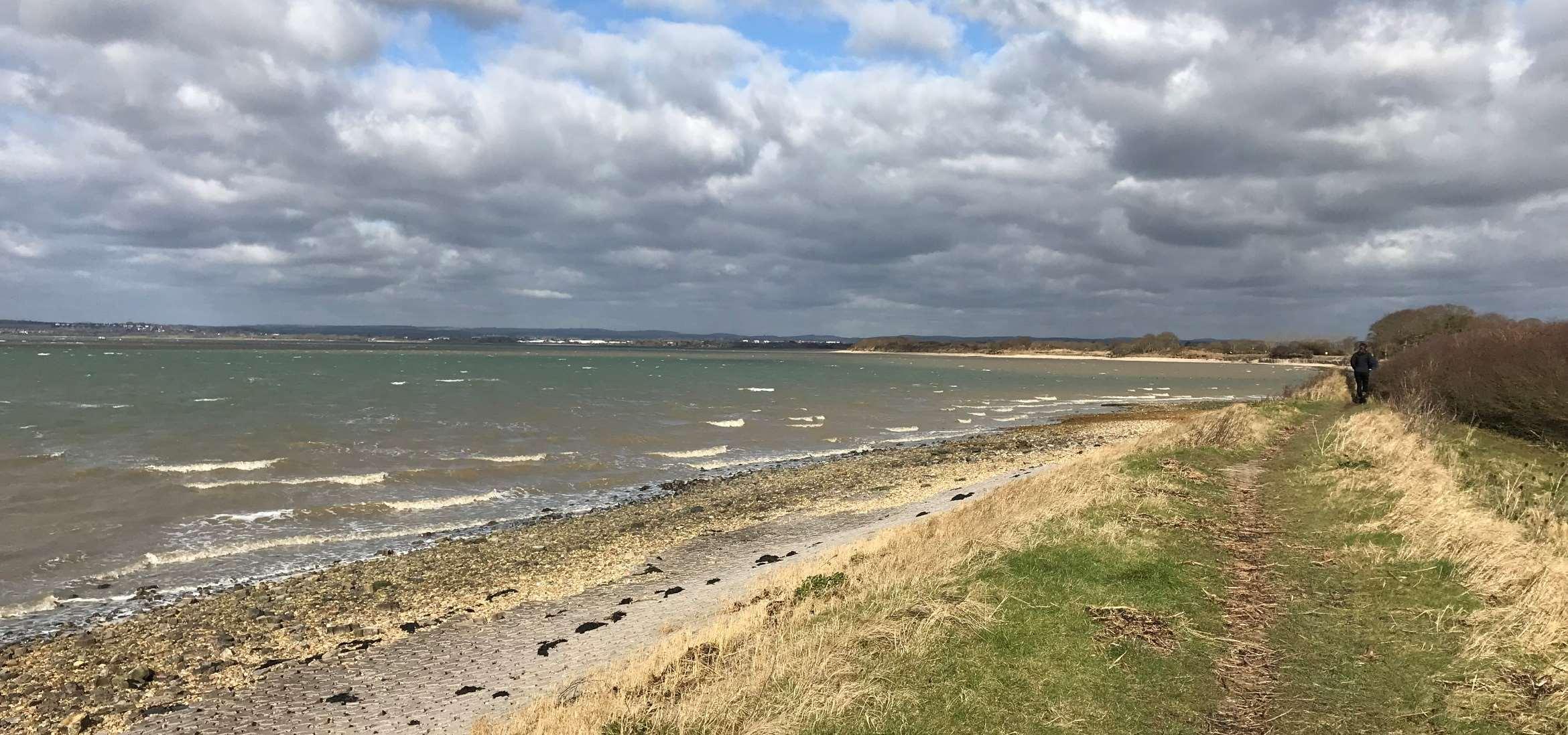

ODU14extendsalongthelargelyundevelopedandundefendedfrontagefrom NewtowntoStoke.Thisrelativelylongunitcomprisesmainlyprivate,or HampshireCountyCouncilownedagriculturallandadjacenttothecoast.
Thisunitismainlyundefended,butwhereadhocembankmentsand revetmentsdoexist,thesehavearesiduallifeoflessthan10years,andin someplaceshasalreadyfailed.Thesedefencesarecurrentlymaintainedby privatelandownersorHampshireCountyCouncil.
TheHaylingBillyTrailisanimportantpublicfootpathandNationalCycleRoute whichiswidelyused,andwhereclosetotheshorelineisatriskoferosion.The HaylingBillyTrail,alsodesignatedasaLocalNatureReserve,isacknowledged asacriticalpieceofinfrastructureintheDraftHavantBoroughCouncilLocal Planforsustainabletransport.
TheLangstoneHarbourintertidalareaadjacenttothisfrontageisheavily environmentallydesignatedasaSSSI,Ramsar,SPA,SACandisincludedasan importantSolentWaderandBrentGooseSiteandbirdrefugeintheDraftLocal Plan.
ShorelineManagementPlanPolicy
NoActiveInterventionforthenext100years.
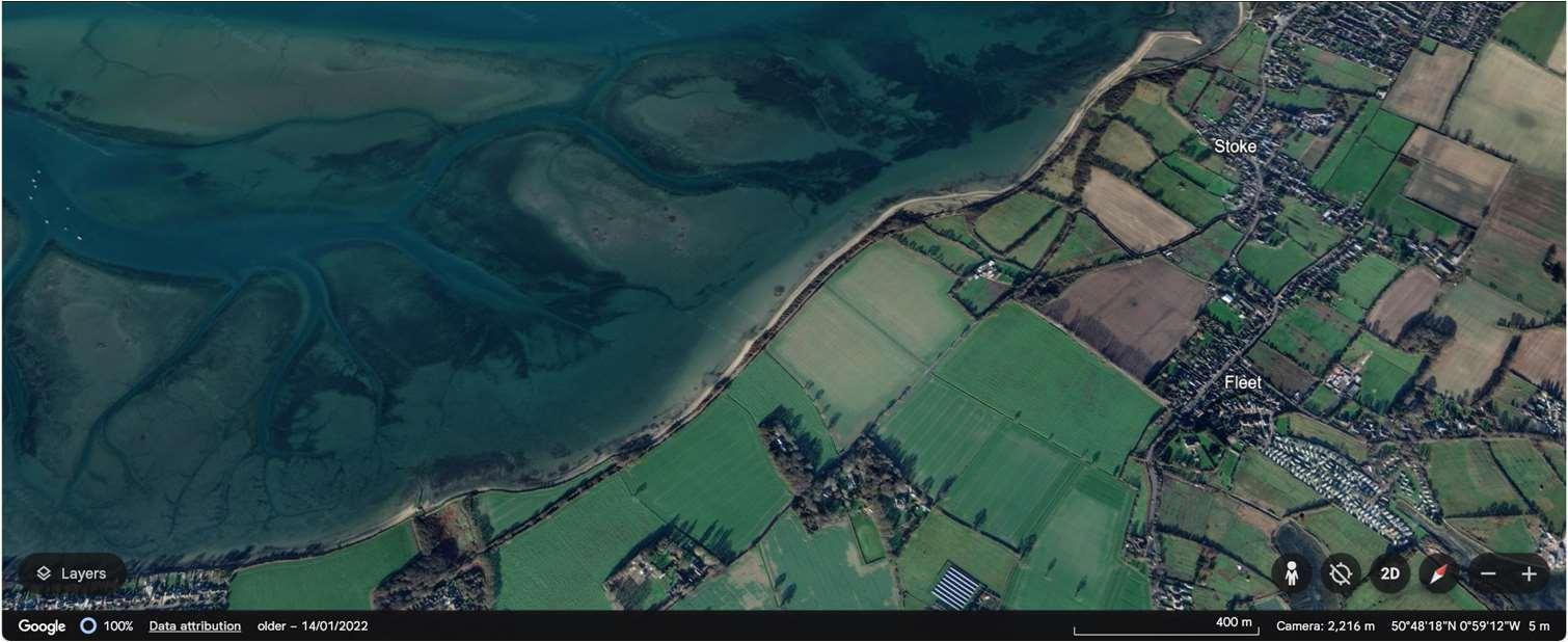
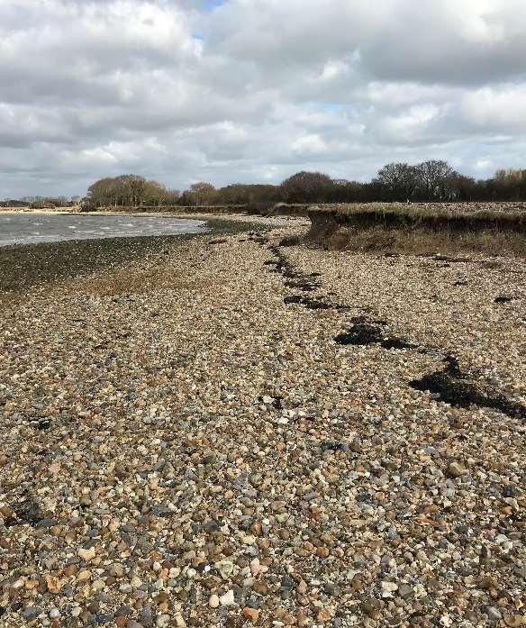
Erosionisthemainrisk,howevertherearepocketsoffloodriskinthecentreandfarnorthofthefrontage.Four propertiesareatfloodriskoverthenext100yearswithoutdefencesinplace,alongwithsmallsectionsofWest Lane,akeyaccessroutetothesouthoftheisland,andtheHaylingBillyTrail.
Themapsbelowshowthemodelledextentanddepthsofanextremetidalfloodevent(1in200year,0.5%annual probability),withoutanydefences,todayandin100years,allowingforsealevelrise.
Erosionrisk
Numberofpropertiesatrisk,withnodefences
Numberofpropertiesatrisk,withnodefences
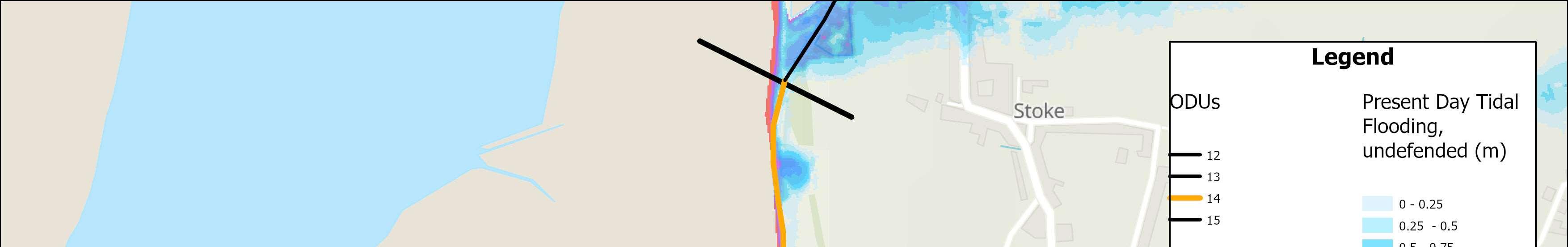
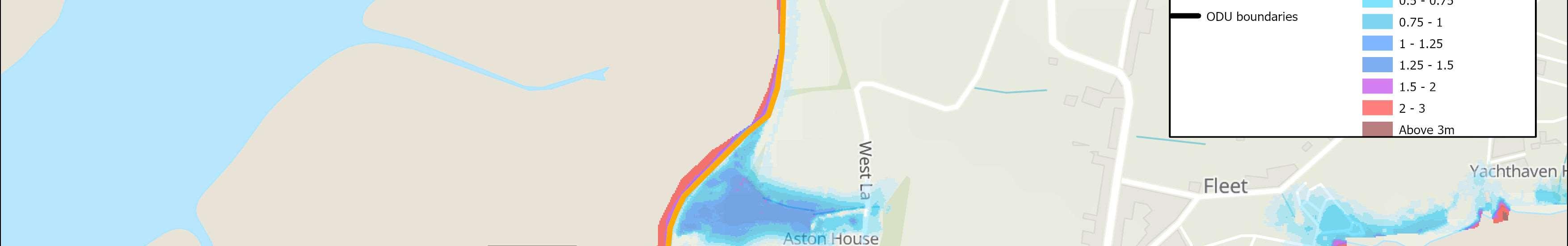
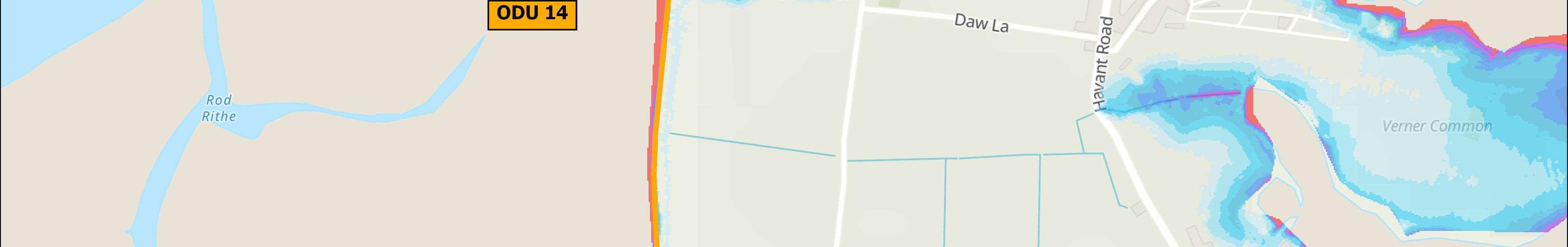
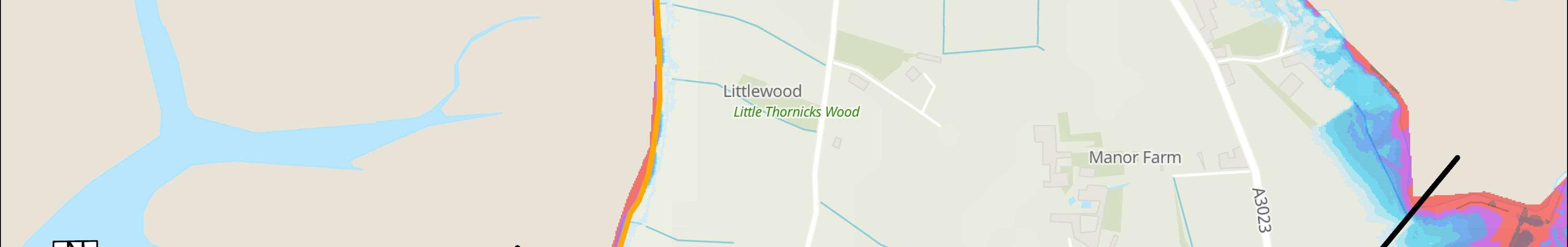
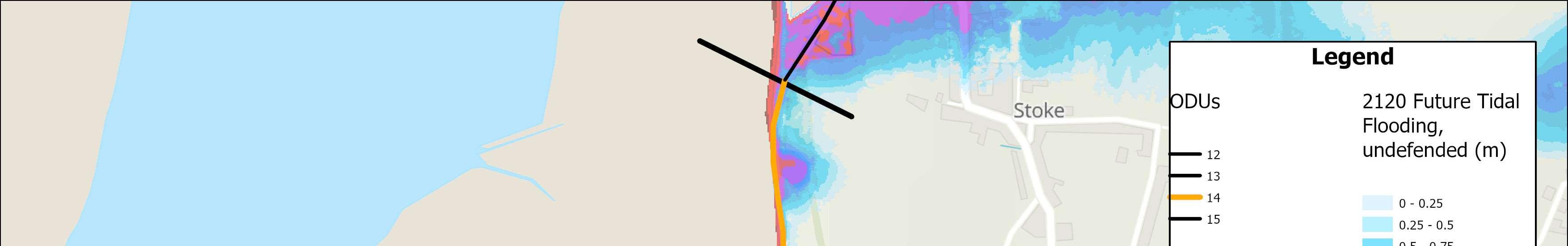
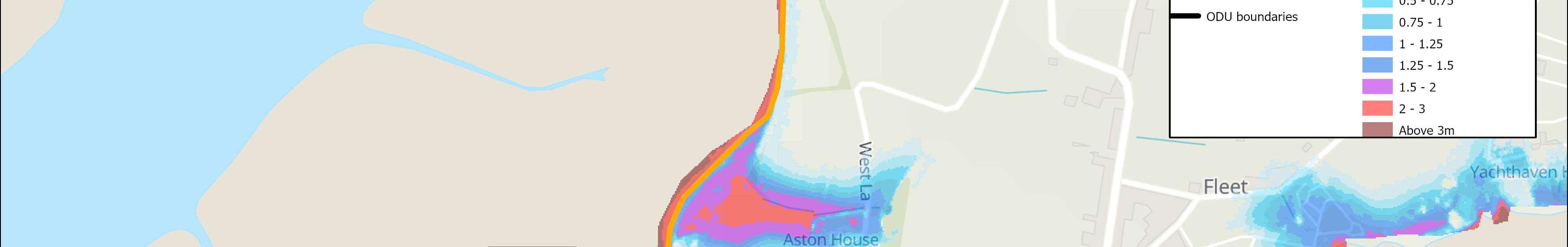
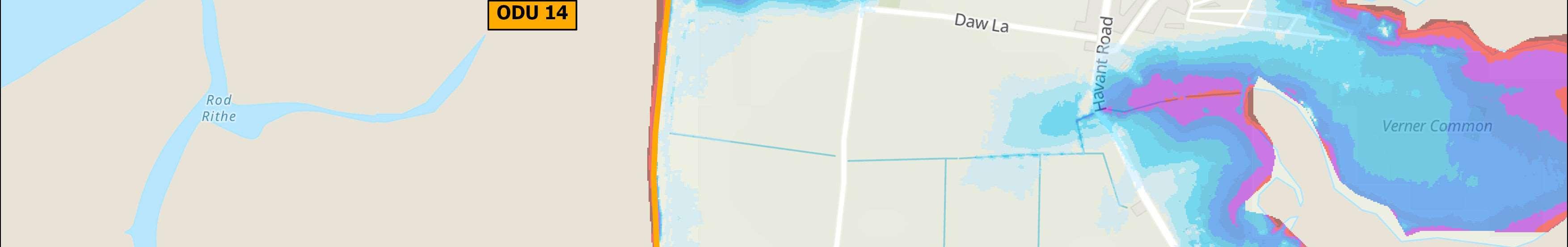
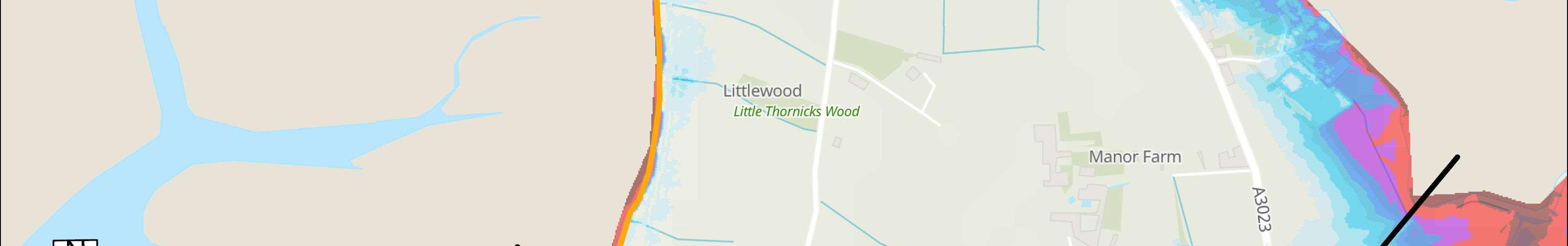
OverallStrategicOption
Donothing

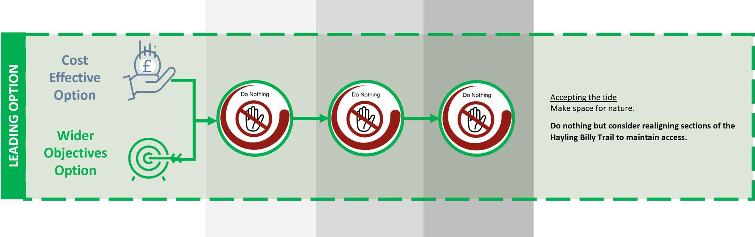

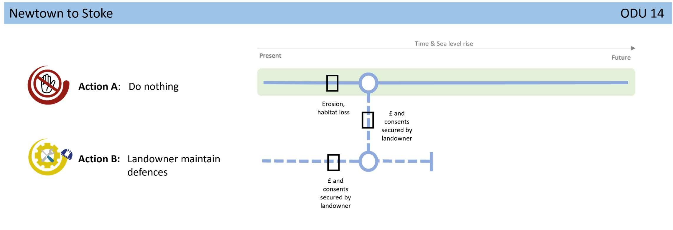
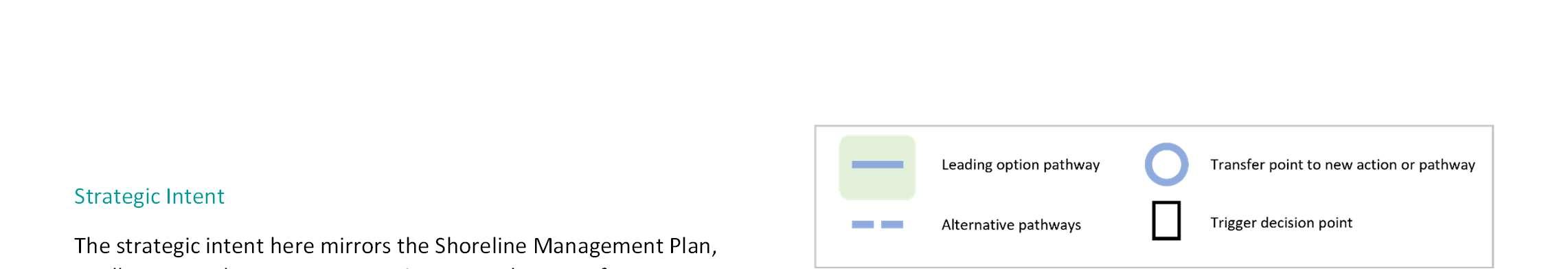
toallownaturalprocessestocontinuetomakespacefornature. PotentialrollbackoftheHaylingBillyTrailwillneedtobe consideredinareasatrisk,tomaintaintheaccessroutebecause buildingnewdefencestoprotecttheTrailinitscurrentlocationis unlikelytobeconsentablebyregulators.Adaptationwillneedto beexploredforthosefewpropertiesatfloodriskinthelonger term,andlocalisedfloodprotectiontoWestLaneshouldbe considereddependantonriskinthefuture.
Noneidentifiedforthisfrontageintheshort-term,otherthanongoing conversationswithcommunitiesinrelationtolevelsofriskandwhat todointheeventofaflood.

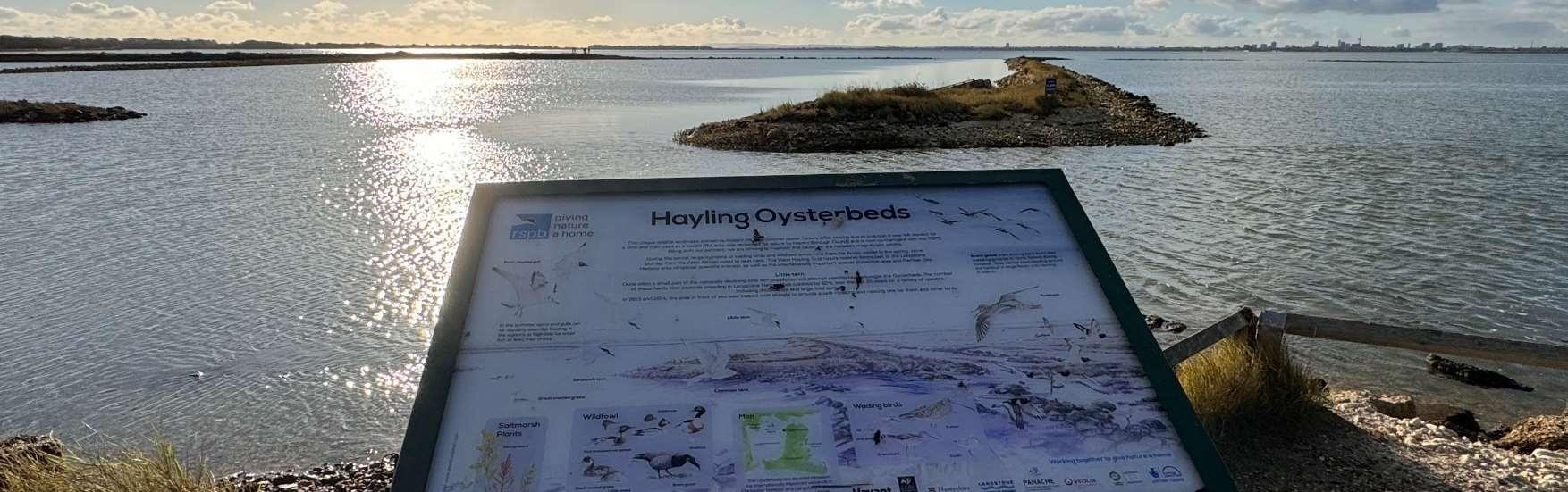
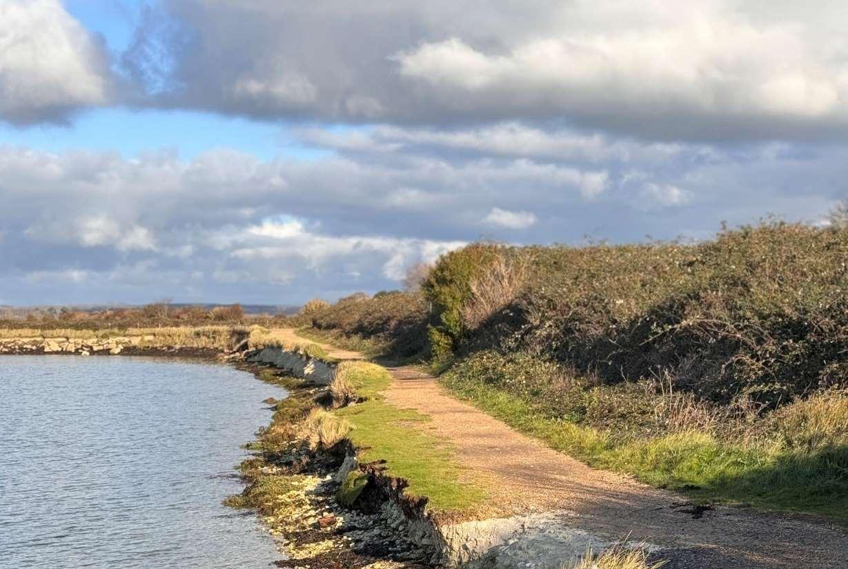

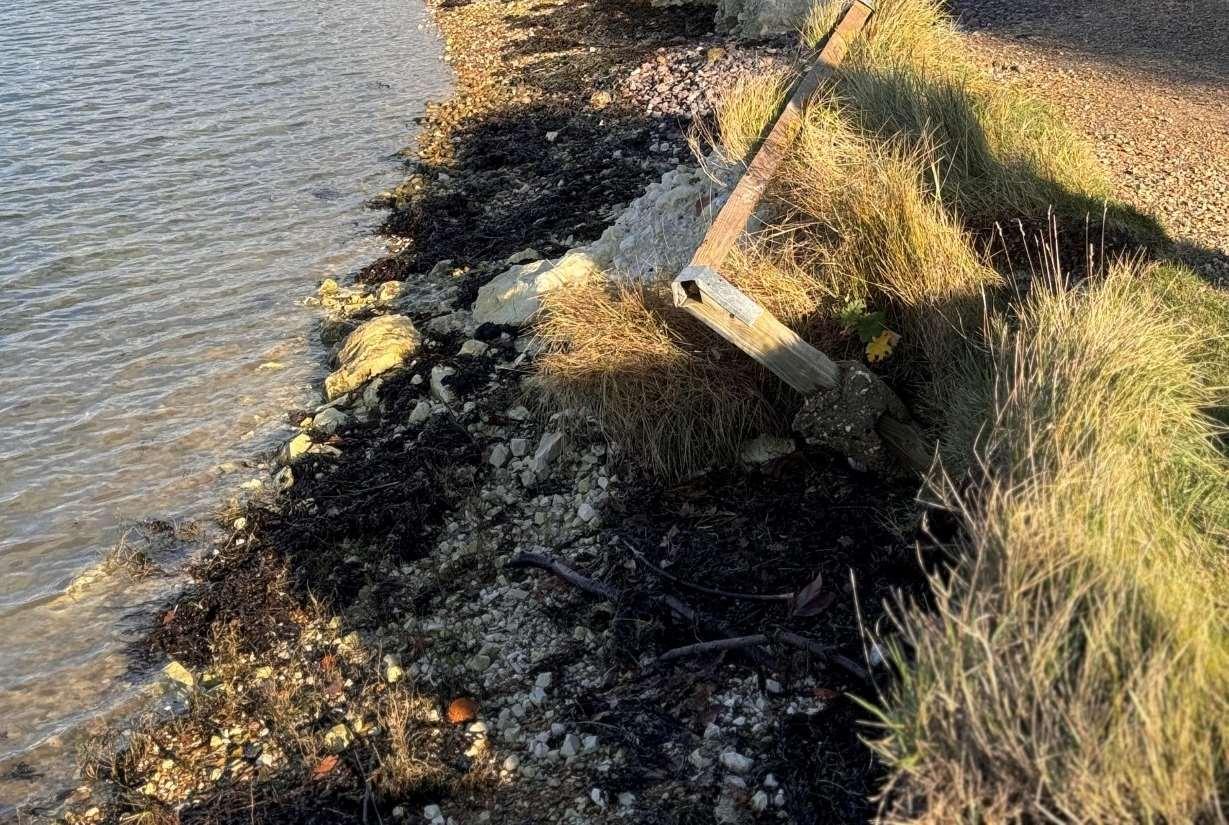
ODU15extendsfromStoketotheLangstonebridgecarpark.Thisunitis complexgiventhetidalfloodrisk,andvaryinglanduses.Thefrontageincludes agriculturalland,theOysterBeds,formerlandfillsites,thewidelyusedHayling BillyTrailwhichisaNationalCycleRoute,theA3023mainaccessroadonto HaylingandresidentialpropertiesatStoke.
Defencesconsistofamixofrevetments,embankmentsandgabionwithtypical residuallivesofbetween10and15years,althoughlocallysomesectionsareless than10years.Thesedefencesarecurrentlyownedandmaintainedby HampshireCountyCouncilorHavantBoroughCouncil,withtheexceptionofa smallsectionofrevetmenttothesouthoftheunitwhichisownedbyHampshire CountyCouncilbutmaintainedbytheEnvironmentAgency.
Thefrontageiscoveredbysignificantenvironmentaldesignations,including SSSI,Ramsar,SPAandSACinintertidalareasandtheOysterBeds,aswellas SSSI,RamsarandSPAontheformerlandfillsites.Thesiteisalsoidentifiedas animportantSolentWaderandBrentGooseSiteintheHavantBorough CouncilDraftLocalPlan.Therearetwolocalnaturereserveshere,TheWest HaylingLNRwhichextendsovertheformerOysterbedsandmanagedbythe RSPB,andtheHaylingBillyLNR.
HoldtheLineforthenext100years,butwithfurtherdetailedstudiesto considerManagedRealignmentatWestNorthneyandRegulatedTidal ExchangeatStoke.
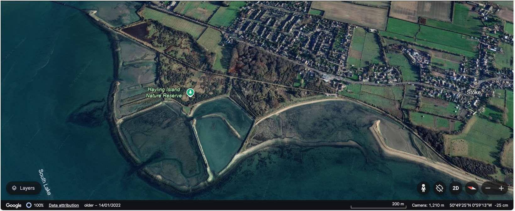
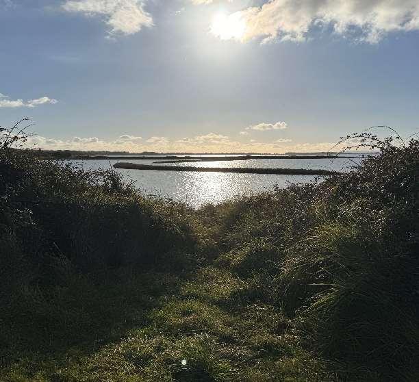
Erosionriskislow,althoughtheOysterBeds,formerlandfillsitesandpartsoftheHaylingBillyTrailmaybeatriskin thefuture.BothresidentialpropertiesandtheA3023however,areatriskoftidalfloodingwherethereisacoherent floodcellacrossthewholefrontage.Overthenext100yearsitisexpectedthattherewillbeupto268properties andsignificantsectionsoftheA3023atriskoftidalfloodingacrosstheunitwithoutprotection.
Themapsbelowshowthemodelledextentanddepthsofanextremetidalfloodevent(1in200year,0.5%annual probability),withoutanydefences,todayandin100years,allowingforsealevelrise.
Erosionrisk
Numberofpropertiesatrisk,withnodefences
Tidalfloodrisk
Numberofpropertiesatrisk,withnodefences
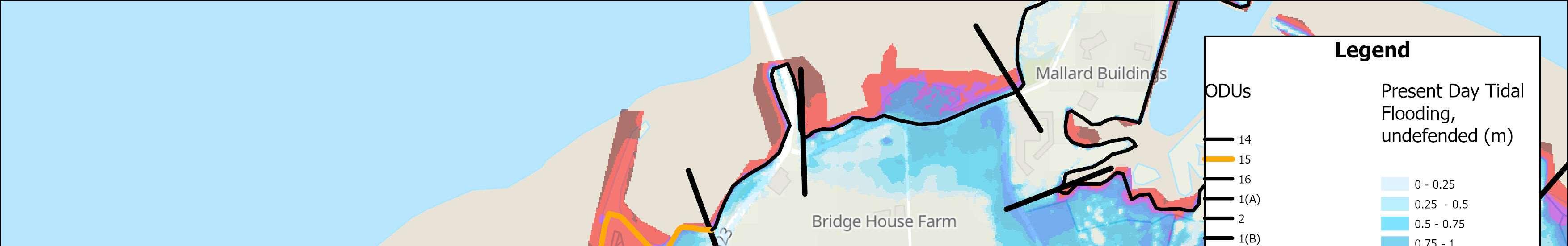
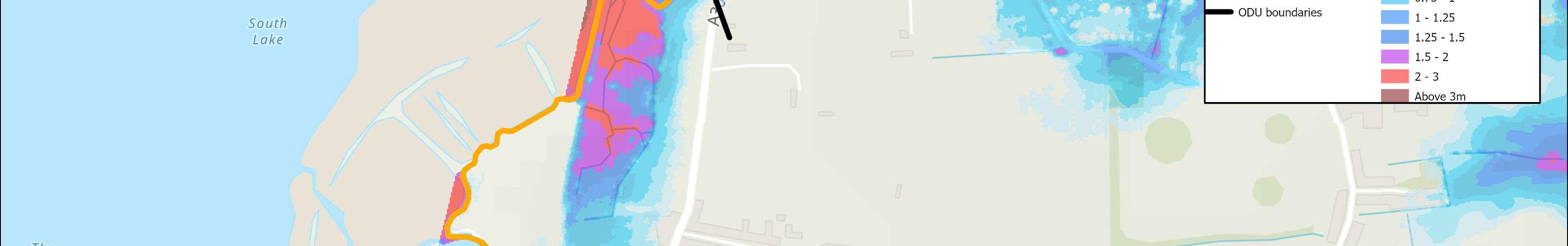
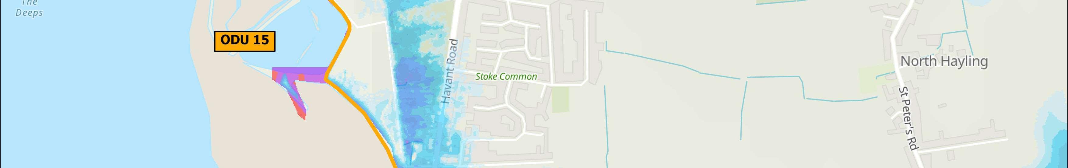
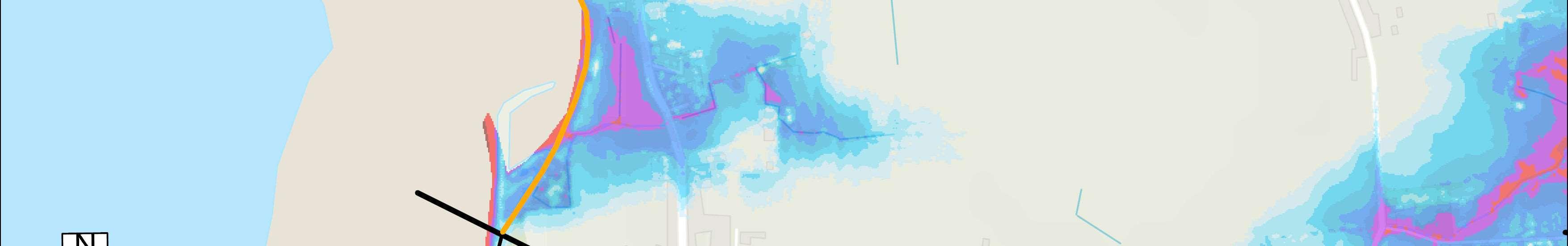
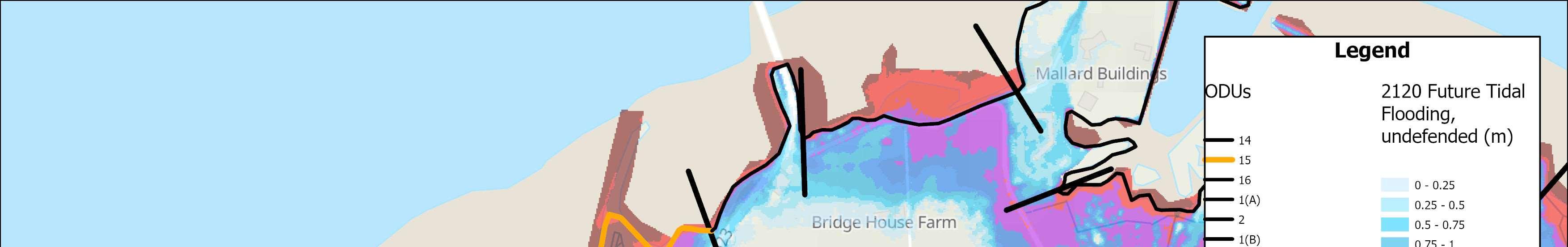
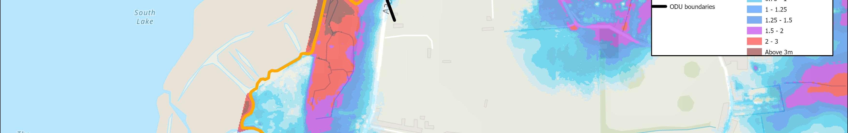
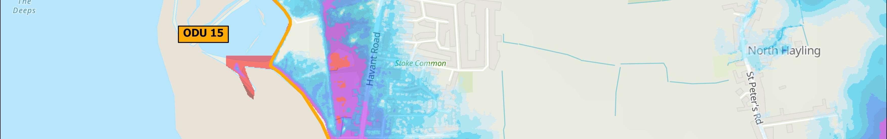
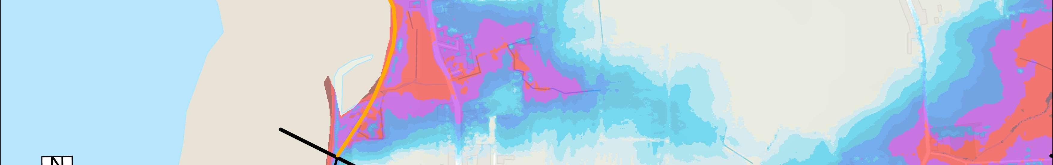

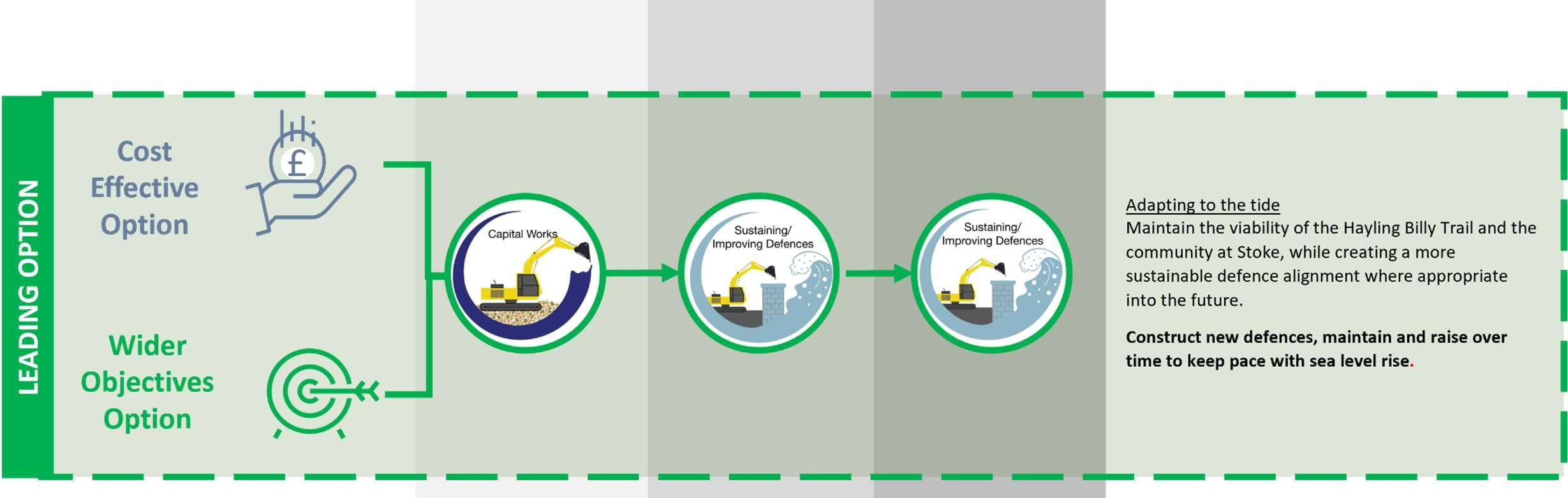

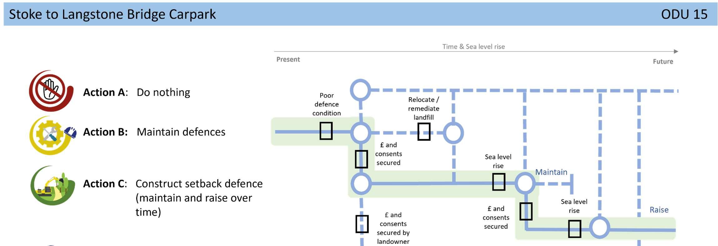
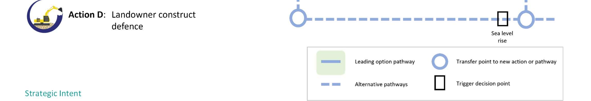
TheStrategicintentfortheunitistoconstructnewset-back defencesinaphasedapproach,tomaintaintheviabilityofthe A3023,theHaylingBillyTrailandthecommunityatStoke,protect formerlandfill,whilstmakingspacefornaturewhereviabletodo so.Intheareaofthehistoriclandfill,theexistingfrontlinedefences wouldbemaintainedtopreventerosionuntilfurtherstudiesare completed.Ifformerlandfillisfoundtobeinert,theoptioncould considerremediationandsetbackdefences.
AFloodandCoastalErosionRiskManagementStudyfortheA3023has beenproposedintheStrategy’sshorttermactionplan,subjectto securingfunding.
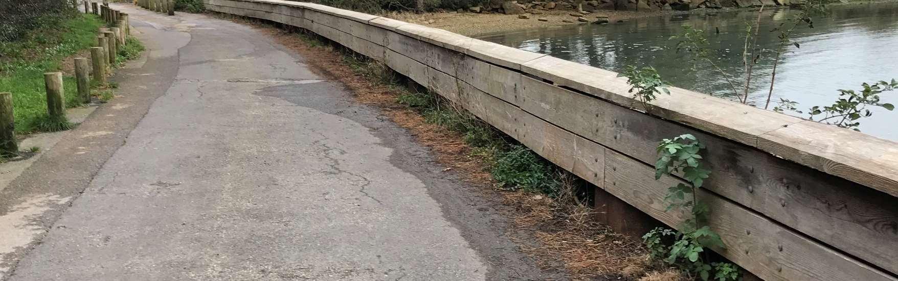
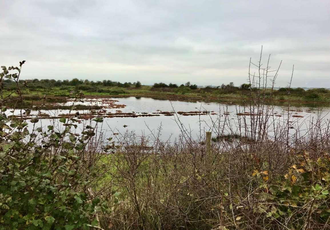

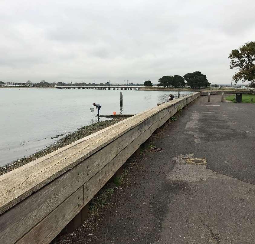
ODU16extendsfromtheLangstoneBridgecarparktoLangstoneBridge, withHaylingIsland’smainaccessroad,theA3023,runningcloselyalongside. ThemainrisktotheA3203,identifiedasacriticalpieceofinfrastructurein HavantBoroughCouncil’sdraftlocalplan,isfromtidalflooding.
Thereisamixofdefencesalongthisshortunit,includingsheetpilinganda revetment,ownedandmaintainedbyHampshireCountyCouncil.Residual lifeofthesedefencesisbetween10and20years.
Environment
TheHarbourintertidalareaadjacenttothisfrontageisheavily environmentallydesignatedasaSSSI,Ramsar,SPAandSAC.
ShorelineManagementPlanPolicy
HoldtheLineforthenext100years.
Lookingbackatthe OysterbedsfromODU16
ODU16location
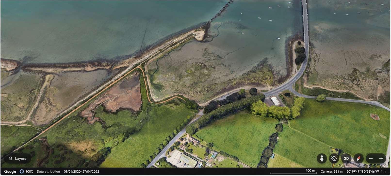
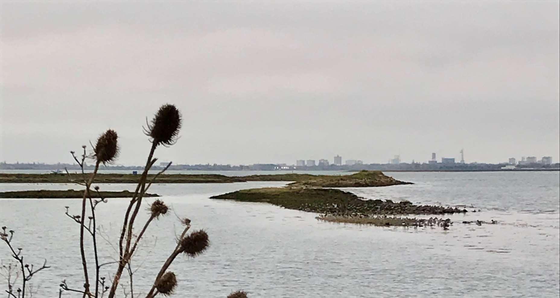
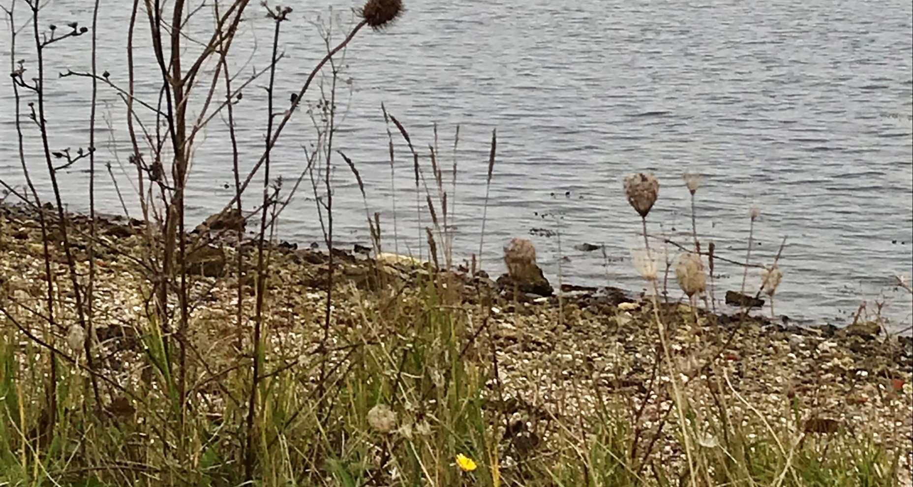

Themainriskhereisfromtidalflooding.Withoutdefencesinplace,thefloodcellcouldmergewithadjacentflood cellstotheeast(inODU1)andwest(inODU15)duringlargerreturnperiodevents.Inthisscenario,safeaccessand egressontoandofftheislandwouldbeseverelycompromised.
Themapsbelowshowthemodelledextentanddepthsofanextremetidalfloodevent(1in200year,0.5%annual probability),withoutanydefences,todayandin100years,allowingforsealevelrise.
Erosionrisk
Numberofpropertiesatrisk,withnodefences
Tidalfloodrisk
Numberofpropertiesatrisk,withnodefences
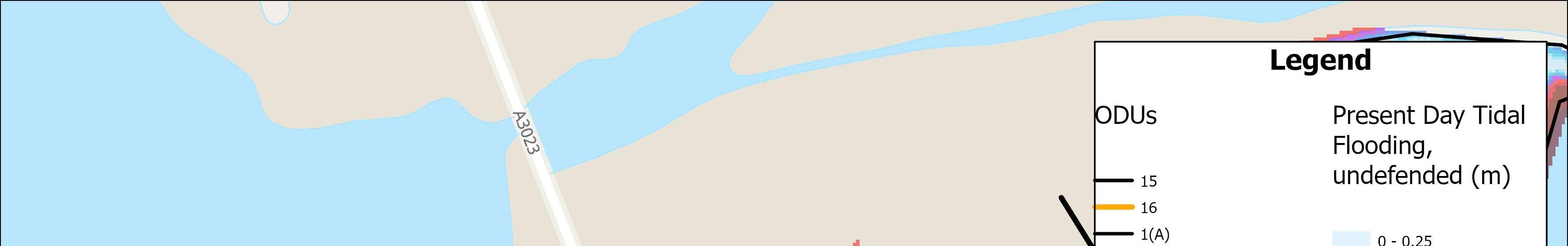
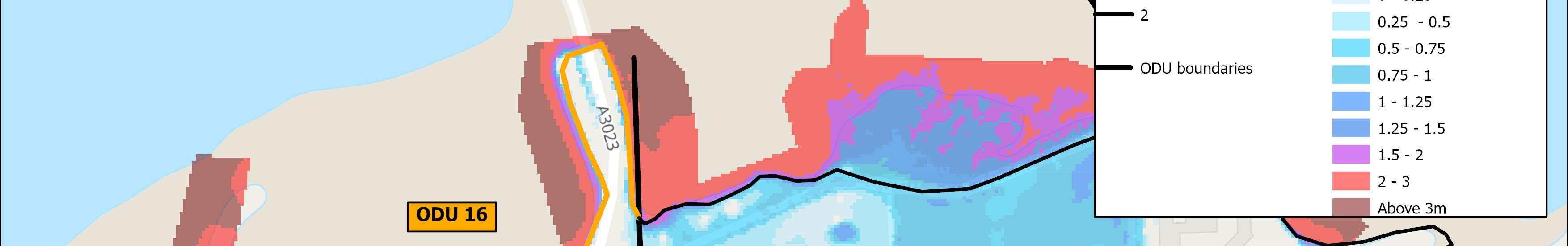
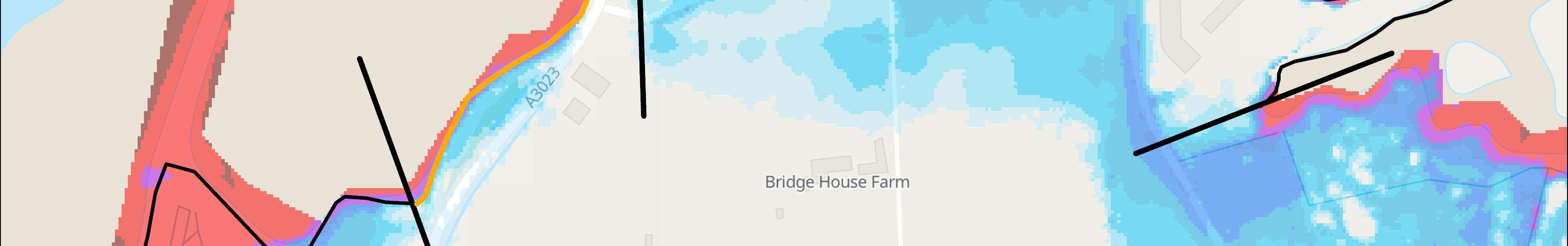
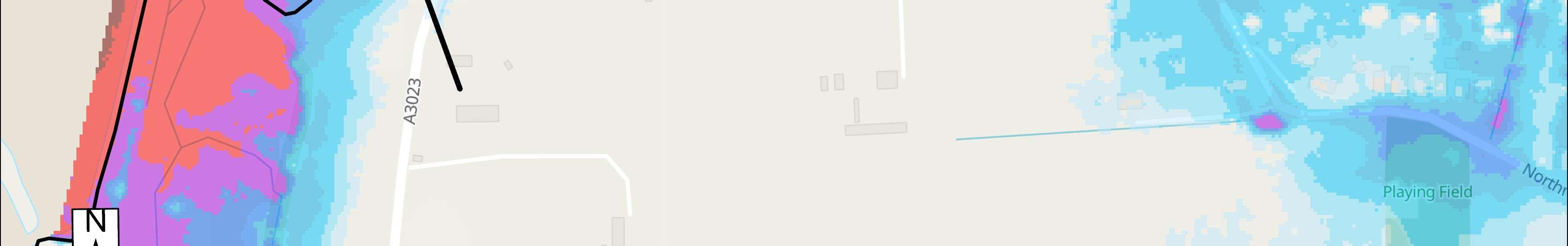
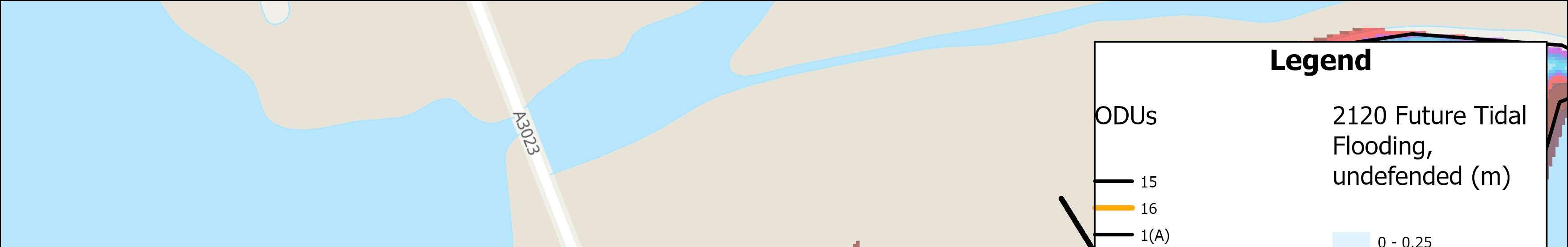
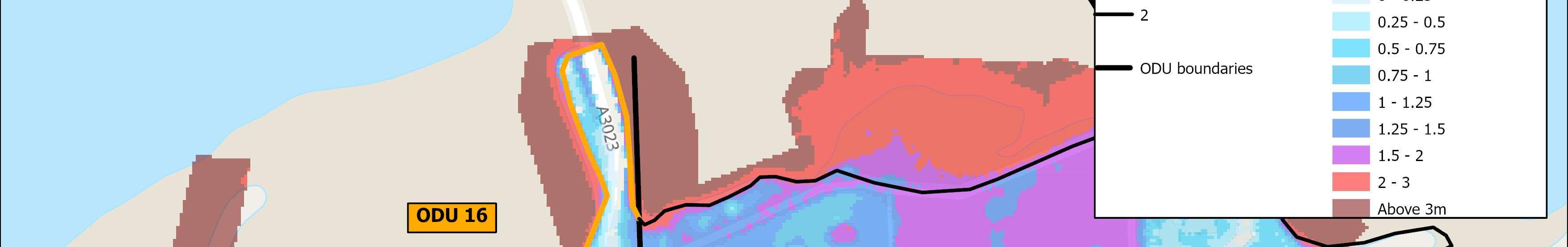
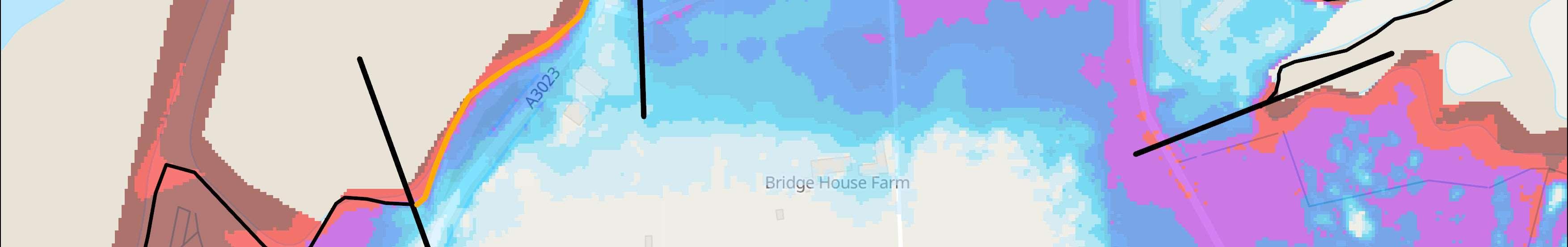
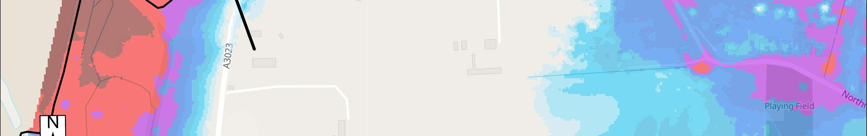

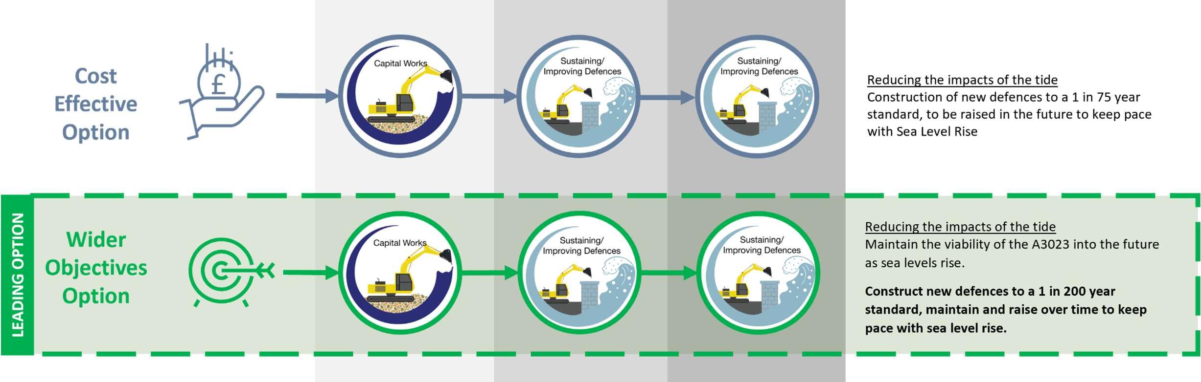

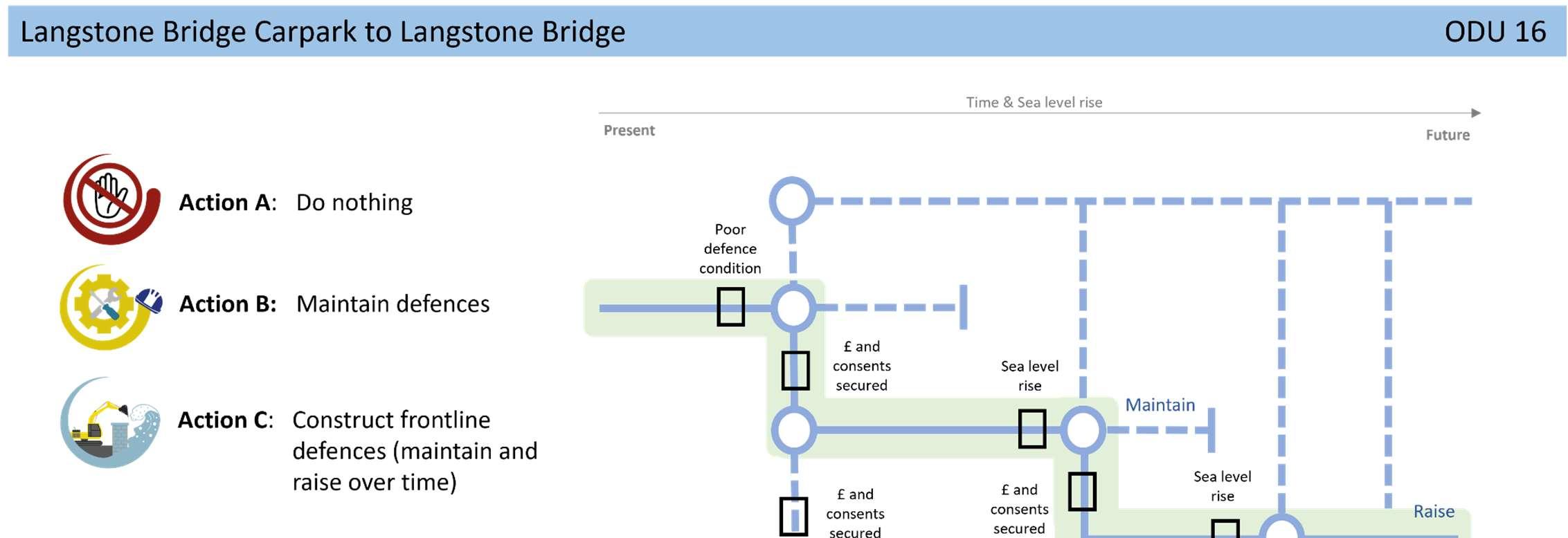
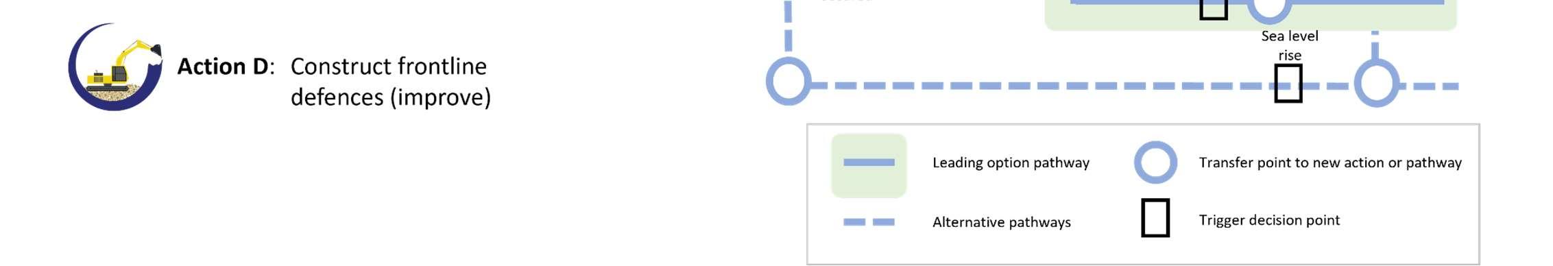
StrategicIntent
TheStrategicintentfortheunitistoprotectandmaintainthe viabilityoftheA3023intothefuture,ascriticalroadinfrastructure ontheisland.
NextSteps
AFloodandCoastalErosionRiskManagementStudyfortheA3023has beenproposedintheStrategy’sshorttermactionplan,subjectto securingfunding.
*PropertyResilience …modificationsaddedtoabuildingto loweritsfloodrisk.Itcanreducethe riskofwatergettingintopropertiesand speeduprecoveryafteraflood.
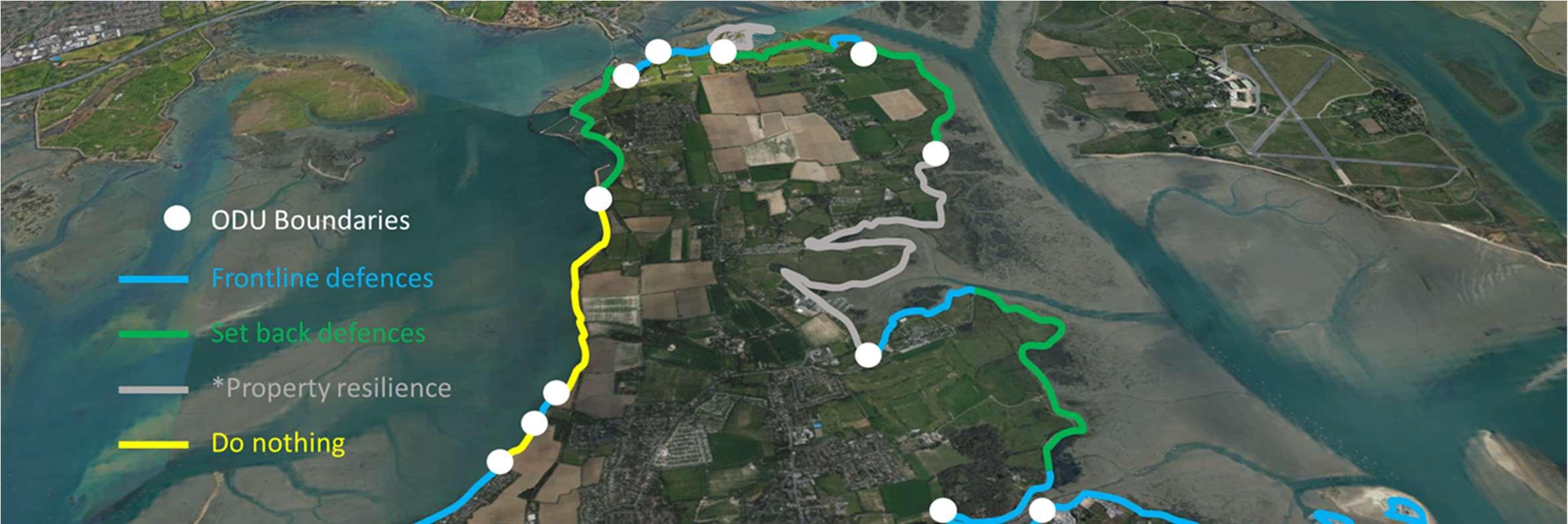
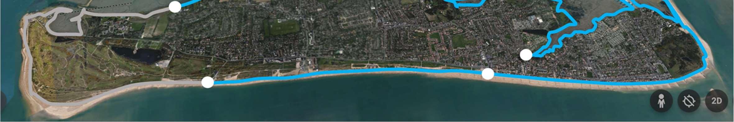
Mapdata:Google©2013-2024,Landsat/Copernicus,Airbus,DataSIO,NOAA,U.S.Navy,NGA,GEBCO,IBCAO,Geo-DE/BKG(©2009)


Thisreportoutlinedtheprocessbywhichtheoverallleadingoptionshave beendevelopedthroughamulti-criteriaappraisal.Theappraisalprocess consideredthetechnical,economic,environmentalandsocialaspectsofeach option.Thetablebelowpresentsasummaryoftheeconomiccostsand benefitsforeachoftheoverallleadingoptionsforeachODU.
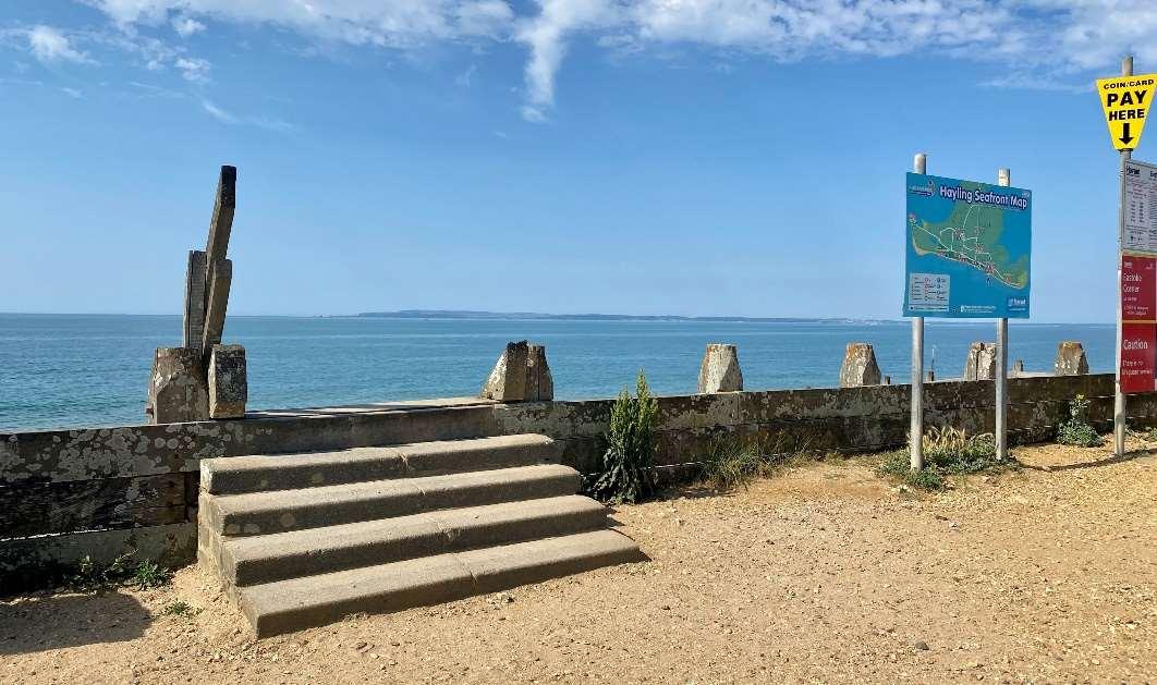


•Thereisnoguaranteethatanyoftheseleadingoptionswillbe progressed,it’salldowntofunding.
•Significantfundingfromavarietyofsourceswillbeneededtoprogress theleadingoptions.
•Publicfundsforcoastalmanagementarenotwidelyavailableandkey criteriahavetobemetinordertoapplyforfunds,butitmaybepossible tosecuresomefundsforkeyareassuchasEastoke,Selsmoreand Mengham.
•Wewillworktodevelopbusinesscasestoprogressschemesifthereis fundingandifit’sinthepublicinterest(technical,environmental,social andeconomicsolution).
TheStrategyhasidentifiedtheneedforanumberofstudies,projectsandschemesoverthenext10yearsiffundingandapprovalscanbesecured.Theseinclude habitatrestoration,beachmanagement,coastaldefenceandadaptationschemes.Aguideshowingtherelevantlocationsisshownbelow,togetherwiththe recommendedtimescalepresentedoverleaf,alongwithanticipatedcostsandpotentialfundingsources.
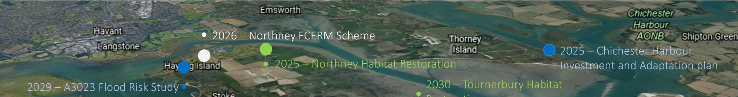
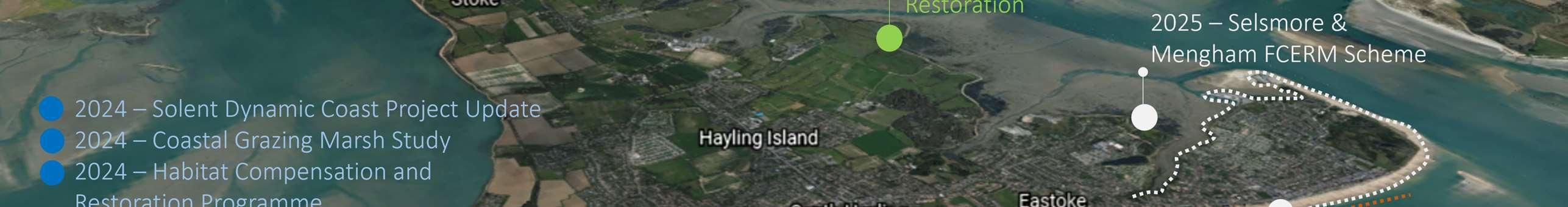
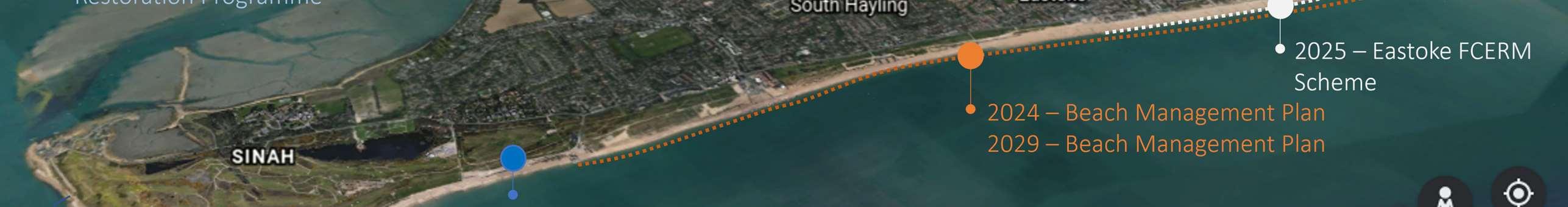
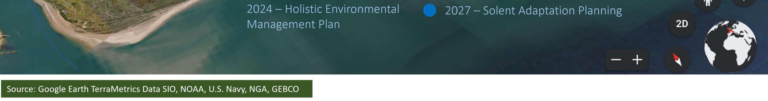
TheStrategyhasidentifiedhighlevelindicativecoststodeliverthe short-termactionplan.Thesecostsweredevelopedasasnapshot intime.Giventhecurrenteconomicsituation,thesecostswill needtobereassessedattheappropriatetime. Potentialfunding
SolentDynamicCoastProjectupdatetoupdate coastalsqueezelossesusingUKCP18sealevel riseprojections
SolentandSouthDownsHabitatCreationand RestorationProgrammeCoastalGrazingMarsh Studytoidentifysuitablecompensatorycoastal grazingmarshsites.
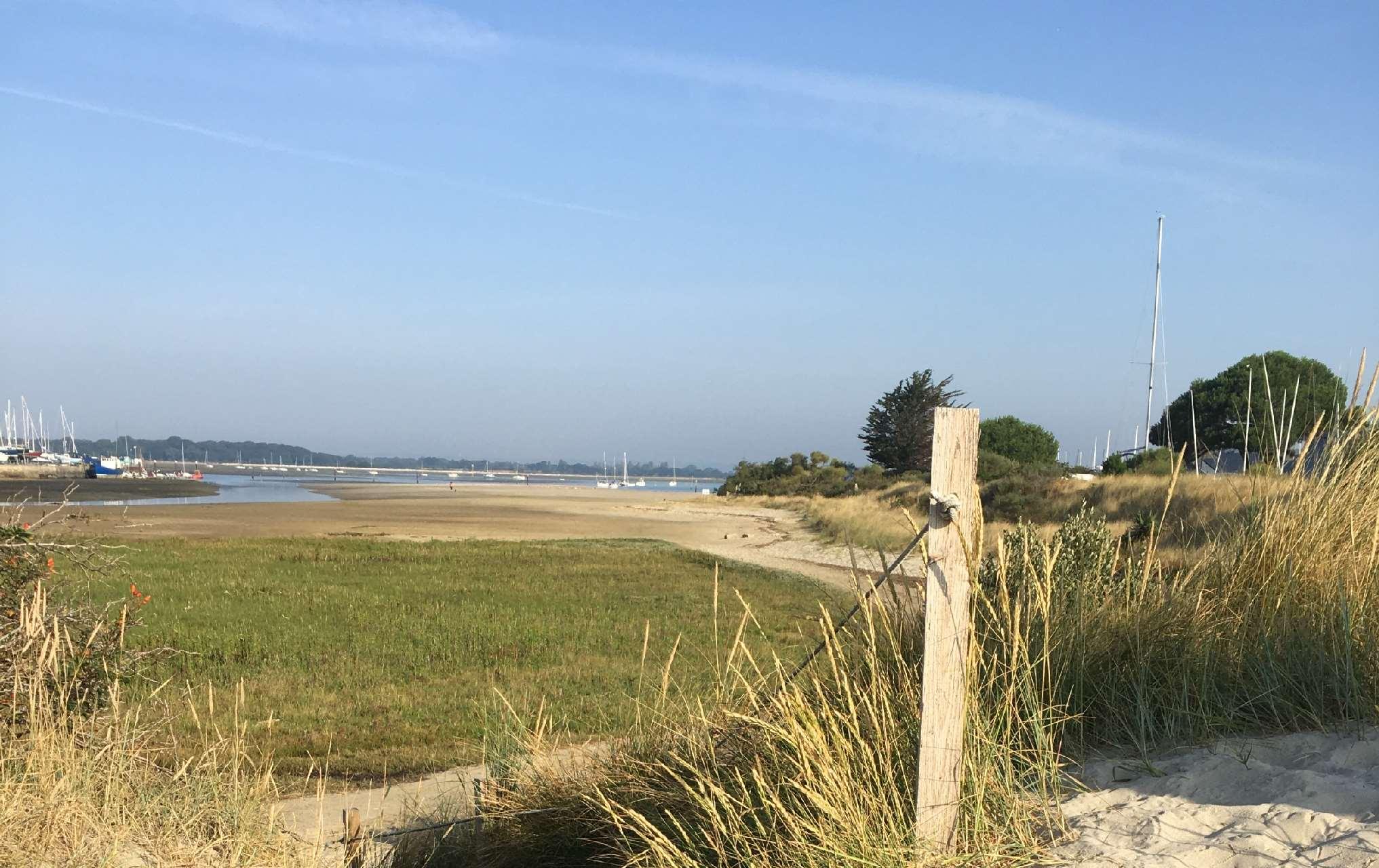


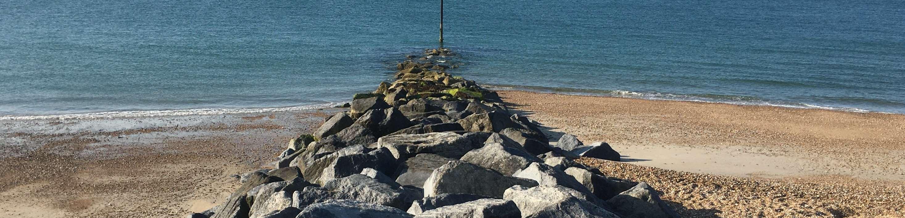

Protectyourselffromfutureflooding
Ifyouliveinanareathatisknowntobeatriskorhasbeenfloodedinthepast, makesurethatyouknowwhattoinaflood.Ifyouaren’tsureifyouliveina floodriskarea,youcanchecktheGovernments‘Checkforflooding’website.
Youcanmakeyourpropertyresilienttofloodwaterwhichwillreducethe damagecausedbyflooding,resultinginlesstimeoutofyourhomeorbusiness andcheaperrepairs.Ifyouareahomeowner,itisyourresponsibilitytoprotect yourpropertyfromflooding.
Thefollowingwebsiteshaveinformationwhichwillhelpyouprepareforand protectyourselffromflooding.
•EnvironmentAgencyplus'howtoplanaheadforflooding'
•CitizensAdviceBureau
•MetOfficeforuptodateweatherforecasts.
•TheBluePagesdirectoryhasvarioussuggestionsforproductsandservices thatareavailabletohelpprotectyourproperty.
•SignuptotheEnvironmentAgency’sFloodlineWarningsDirect.
CompetentstaffatHavantBoroughCouncilarepreparedtohandleany significantemergency.Theywillcoordinatethecouncil'seffortstomitigatethe incident'simpactontheborough'sresidents,businesses.Formoreinformation goto:www.havant.gov.uk/emergency-advice
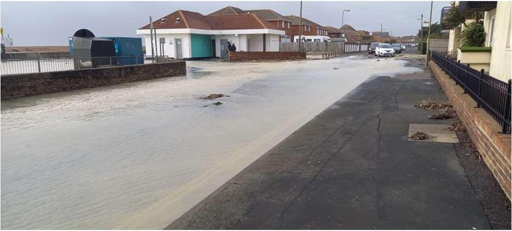
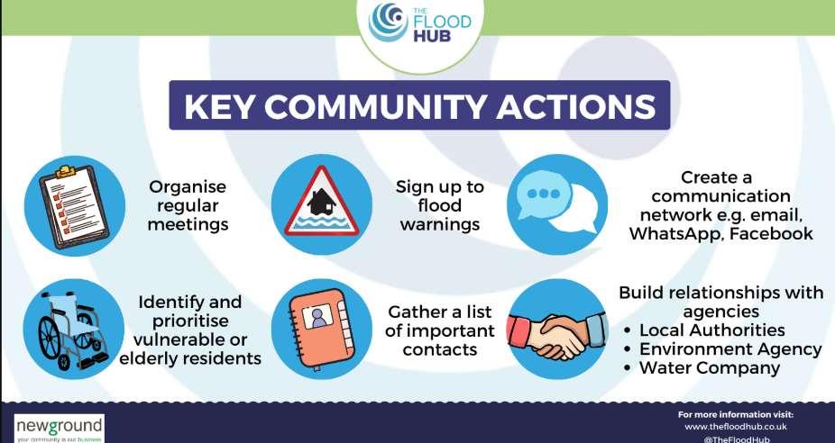
Considersettingupacommunityfloodactiongroup
Afloodactiongroupisavoluntarygroupofresidentswhoworkonbehalfof thecommunitytohelptoraiseawarenessoflocalfloodriskandreducethe impactoffloodevents.
Thegroupwouldhavealocalfocusandcanhaveavarietyofvaluableroles suchas:
•Monitorlocalconditionse.g.communityvolunteerskeepinganeyeoutfor blockeddrains.
•Developandreviewacommunityfloodplan.
•Prepareforandtakeactionduringafloodevente.g.helpingtoinstall PropertyLevelResilience.
•Identifykeyfloodingissueswithinthecommunity.
•Buildrelationshipsandlinesofcommunicationwithauthorities.
•LobbyingofdecisionmakersandcommentingonGovernment consultations.
•Helptoinfluencethedevelopmentoffuturefloodschemestomanageflood risk.
Formoreinformationonfloodactiongroupsandhowtosetupone,thereisa wealthofinformationonlineviatheEnvironmentAgency,TheFloodHuband theNationalFloodForum.AlternativelyspeaktoCoastalPartners.