13 minute read
Part Five – The Ridgeway
The Ridgeway
PART FIVE
Part 5 – The Ridgeway
Avebury to Reading
Distance: 86km Ascent: 960m
Highlights
• Following ancient paths with incredible views. • Iconic chalk horses. • Massive hill forts. • Famously atmospheric Neolithic tombs. • Fake sheep and deceptively English place names. • Dipping your toe in the Thames. • Halfway round restock and relax at Reading.
Navigation
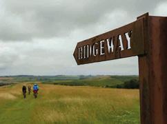
Another relatively simple section of route-following, with just a few track and road junctions where you’ll need to double-check directions. You’re mostly following the well-defined and distinctive black fingerpost-marked Ridgeway route all the way from Avebury to Goring, so it shouldn’t be too taxing. As long as you go the right way out of Goring, the back way into Reading won’t challenge your inner Magellan too much either.
200m
100m
0m
0km
300m
200m
100m
0m
0km 10km 20km
5km 10km 33km
15km
300m
200m
100m
0m
0km 20km 40km 60km 86km
Be aware 200m
Riding along the Ridgeway guarantees 100m sensational panoramic vistas, but 0m also leaves you at the mercy of the 0km 20km 40km
53km weather if it takes a turn for the worse. The track surfaces and your speed 300m can also vary dramatically depending 200m on recent weather so expect a slog 100m in some places if it’s soggy. 0m 0km 10km 20km 27km Apart from a couple of main road crossings, the first section is properly isolated too so make sure you’ve 300m got water and snacks on board to 200m get you through. 100m The chalk ruts can become very slippery when wet and can trap your wheels 0m and topple you over in the dry, so match 0km 32km10km 20km your speed to your skill levels. The descent of Thurle Down towards 200m Streatley is fast and loose with large 100m water bars across it, so moderate your 0m speed if you don’t fancy going flying. 0km 20km 40km 50km The climb before Coombe Park (OS grid ref: SU 627 780) suddenly ramps up steeply with steps across a gravel surface so expect to push if you’re not a powerhouse rider.

Area introduction and route summary
Rolling out of prehistoric Avebury you’re straight into early medieval history, following the line of the Saxon Herepath onto the Marlborough Downs. Here you join the Ridgeway National Trail. This well-defined and signposted ancient chalk track will guide you along the ridge of the escarpment, offering incredible views north across the vale or south into the Berkshire and Wiltshire Downs as you pass barrows and hill forts from before recorded time. Swindon and Wantage sit at the foot of the Downs perfectly positioned for resupply or an overnight stop, but otherwise this Once you’ve had your fill of ancient energy, or just had a sandwich among the stones, you head out across the far bank of Avebury henge and directly onto a section of truly timeless track. Variously known as the Wessex Ridgeway/Herepath or Green Street, this farm road rapidly turns to 'dual cabbageway' and then grassy double track. While the speed of actual progress along the winding singletrack sections here is weather and skill dependent, it’s certainly very easy to transport yourself back in time on a track that medieval merchants, Viking and Saxon armies, Celtic war parties and Stone Age drovers have all doubtless used. Don’t expect the flocks of sheep on Fyfield Down to move out of your way as you ancient track takes you to the furthest north point of the route at Uffington with its famous white horse carved into the hillside. You’ll be on the Ridgeway for a while yet too, but the latter part of this section marks a definite transition from the ancient isolation of the Ridgeway into a more recent and busier world. Once you drop off the tops to Goring, English tranquillity and Thameside grandeur are very much the order of the day, and you’ll be within a few hundred metres of the
Avebury to Ogbourne St George
centre of Reading before you realise it.
approach, as these ‘Grey Wethers’ are actually a large scatter of naturally occurring sarsen stones and a likely source for much of the area’s ancient architecture.
As you continue north on wider, faster, gravel tracks, you’ll pass the Winterbourne Down White Horse, but you’ll need to divert down the hill slightly to actually see it. As you roll down off the high point, there’s no way you’ll miss Barbury Castle. This dramatic double bank and ditch Iron Age hill fort dominates the skyline, and winching up the steep hill to the western gate gap is a solid bit of climbing. There aren’t many cycle routes that take you right through the centre of an Iron Age hill fort though, and from the massive ramparts you can see to the Cotswolds and River Severn on a clear day. Excavations have shown the footings for over 40 huts inside and the ramparts were reinforced with sarsen stone facing and a wooden palisade on top. It’s proposed as the site of the Battle of Beran Byrig where early Saxon leaders Cynric and Ceawlin defeated the Romano-British in the 6th century.
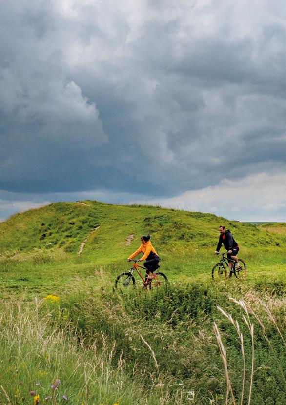
With these warring chieftains long gone, the North Wessex Downs Area of Outstanding Natural Beauty forms a serenely tranquil and relaxing section of your journey as you carry on along the Ridgeway on broad grass tracks alongside immaculate gallops. Make sure you don’t get carried away and miss the left turn onto Smeathe’s Ridge to descend into Ogbourne St George on a long and gently contouring track. If you’re feeling peckish or sleepy, then this is a good point for a quick diversion south to Ogbourne St George, or a few miles further down the Og valley on the NCN 482 old railway path route to Marlborough.
Herepath
Herepaths – “paths of the armed host” in Anglo-Saxon – appeared in English history in the 9th century as King Alfred connected his strongholds to try and defend against Viking invaders. Given that they often used obvious ridgelines for speed and safety, many of them followed existing prehistoric and Roman trackways. You’ll certainly be making good use of them on this section of the route and hopefully the Vikings won’t be causing trouble these days.
Ogbourne St George to Uffington Castle
Fed, watered or just bathed in quintessential Englishness, it’s time to wind gradually back up onto the Downs and head north again on double track to Liddington Castle south of Swindon. Dating from the 7th century BC, this is one of the earliest hill forts in Britain, with stunning views to the north making its positioning obvious and a quick detour to the brow of the hill well worth it. From there, it’s a fast but straight double track down to the Swindon road, then a dog-leg quickly over the M4. Don’t worry, not actually across it – there’s a bridge. Back onto back roads at Fox Hill, the route turns to track, climbing gradually up to overlook Hinton Parva, Bishopstone, Ashbury and Compton Beauchamp. This whole section from Swindon to Wantage offers potential pub or overnight stops fairly close by whenever your legs have had enough of pedalling, or your chosen daily mileage is done. Wantage makes a particularly fitting stopover as the birthplace of King Alfred around the year 849, with another statue of him to tick off before you reach the one back in Winchester.

Otherwise, it’s a gently contouring canter past the evocative stone frontage and burial mound of Wayland's Smithy, and along to Uffington Castle where the breathtaking white horse has been galloping across the Downs for thousands of years. You will need to drop down the hill from the Ridgeway to see it though, so don’t miss the cue markers.
Ogbourne St George
Judging from the archaeology, the perfect river valley location of Ogbourne St George has been occupied since the Mesolithic period (well before Avebury and Stonehenge). There are traces of activity all the way through the rest of prehistory as well as Celtic and Roman times (the dead straight road northwards is a giveaway there), right up to when ‘Occa’s Burn’ gets its Saxon language roots. It was a pretty big deal in Norman times with 71 buildings listed in the Domesday Book, and since then its position on the natural corridor between Swindon to the north and Marlborough a few miles to the south has put it on turnpike road and railway arteries. Its architecture is a textbook timeline of English building, while the address of the manor house was even used for headed letters between an imaginary ‘Pam’ and her loose-tongued love interest ‘Major Martin’ as part of the WWII Operation Mincemeat deception strategy because “no German could resist the ‘Englishness’ of such an address.”
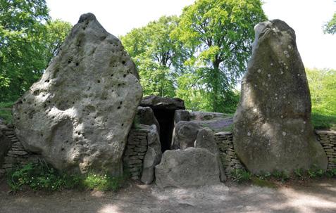
Wayland's Smithy
This haunting chambered Neolithic long barrow with its three massive entrance stones was first used for a group of 14 burials between 3590 and 3550 BC. The far larger barrow that you can still visit
Uffington Castle to Goring
Uffington’s horse might be prehistoric, but this part of the Downs continues to be horse-mad, with gallops and stables everywhere as you head east along the Ridgeway past Segsbury Castle. The rough track continues to where you cross the A338 to Wantage then back onto broken road towards Scutchamer’s Knob, an early Iron Age barrow that became the largest Anglo-Saxon moot point (meeting place) in the UK. You’re also following the remains of Grim’s Ditch – an intermittent Iron Age earthwork that runs for several kilometres along the north face of the Downs. The huge amounts of modern gallops continue to surround your Ridgeway ride all the way along to Thurle Down, where
today was built around a century later and has been a centre of folklore and mystery ever since. The name itself comes from the legend that it was the workshop of Wayland, the Saxon god of metalworking.
you finally drop off your own high horse and towards Goring. Don’t rush your descent though, as the rolling hills and micro valleys here are beautiful. In fact, Lardon Chase, The Holies and Lough Down are all National Trust owned with protected SSSI status as superb examples of the chalk grassland and woodland that are such a signature of the Downs. Remains from the Iron, Bronze and Neolithic ages prove this area has been attracting people for thousands of years since the Thames cut through to the coast here, creating the famous Goring Gap landform. Be careful on the last, fast section of off-road too. The descent has several large water bars that create very effective launch ramps if you hit them too quickly.
Uffington Castle and Uffington White Horse
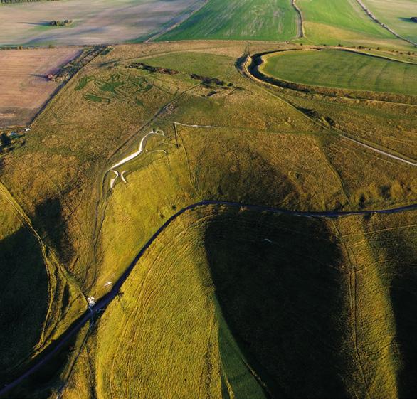
Cut 1m deep into the hillside in the Bronze Age or early Iron Age (1300-500 BC), the 110m long, stylised horse figure of Uffington is one of the most iconic symbols of Celtic prehistory. Aerial photography points to a larger, more realistic horse underneath the current effigy that’s gradually morphed from centuries of landslip and at least two centuries of ‘scouring festivals’ where locals cleaned up the hillside every seven years before a large celebratory feast in the fort above. This instantly recognisable piece of hillside art has inspired other white horses of various dates in the UK, and there are even replicas in Australia and Georgia, USA, but none can match the history and mystery of the original. Uffington Castle sits just above the horse and is one of the largest Iron Age hill forts in the UK. The large double bank and ditch defences were originally faced with sarsen stones to make them even more formidable. The interior of the fort contains the remains of several large roundhouse buildings though, meaning this was a proper settlement not just a sanctuary.


Goring to Reading
As if this wasn’t ‘green and pleasant lands’ enough, your first meeting with the Thames couldn’t be more English if it tried. Rolling down into Streatley and Goring, with their fascinating series of locks and weirs across the Thames plus riverside cafés, you’ll find the perfect place to stop for refreshment. There’s also a YHA youth hostel and a train station on the Oxford to London line if you want to stay overnight or come back to complete the ride another time. If you’re still pressing on, you now leave the Ridgeway and head south past the station and onto a narrow, up and down section of the Thames Path through woodland opposite Beale Park Wildlife Park. Be ready to use your lowest gears, traction control skills and then your brakes as you climb steeply up the last section of wood and then plummet into the next valley before contouring through Coombe Park, once the site of a beautiful Victorian house but sold a few years ago in a near derelict state for a mere £10 million.
Assuming you don’t have the loose change to put in a bid yourself, press on to Whitchurch-on-Thames. This is another beautiful English village complete with a Norman-based church. From here, it’s just a short stretch of quiet back road to the beautiful manor house and mill of Mapledurham Hall.

Mapledurham Hall
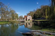
Dating from the 12th century (if not before) Mapledurham Hall and estate are an oasis of period charm and calm on the banks of the Thames. With a working water mill supplying flour for the cakes and scones of the tearoom, beautifully preserved church, farm buildings and farm workers’ cottages, it’s regularly used as a location for film and TV dramas as well as weddings. Check the regular programme of events from tractor rallies to fairs and dog shows, and book in for a guided tour too if you have time. From Mapledurham, tree- and hedge-lined concrete-surfaced bridlepaths continue to the edge of Reading (be careful of the big barrier log to keep cars out) before continuing down the equally arboreal avenue of the Warren through the Thameside suburb of Caversham, towards the centre of Reading itself. As one of the larger towns

St Peter’s Church Caversham
While it looks tranquil now, the St Peter’s church you see today was rebuilt after it was destroyed by Parliamentarian artillery fire in the English Civil War. The fact that the Royalists besieging Reading had stuck a cannon on top of the tower could probably be seen as reasonable provocation, though.
in the south of England (and bigger than many cities), Reading has a full range of facilities, shopping and accommodation options. At 175km in, it’s halfway round the complete King Alfred’s Way route too, so that makes it a perfect stopover point if you’ve split your journey into even numbers of days.
Reading
Sitting on the meeting of the Kennet and Avon Canal and the River Thames and on the main road and rail routes to London, Reading has been a big deal since at least the 8th century. By the medieval period it was the 10th richest town in England. A siege during the English Civil War caused significant damage, but iron working, railways and brewing saw it become a major centre again. It’s now a very vibrant and economically successful town with a large university and one of the UK’s biggest annual music festivals. In other words, you shouldn’t have trouble finding somewhere to stay and/or buy supplies for the next stage of your journey.

