

WELCOME TO BOLIVIA, A COUNTRY OF AUTHENTICITY
WRITTEN BY: MARIELA ZULETA (YOUR TOUR GUIDE IN BOLIVIA)


We start in La Paz
La Paz, the “highest capital in the world” [1] is one of the new wonder cities The city is officially at 3600m but there are different elevations due to its geography You arrived at the highest international airport in the world at 4100m. (El Alto city) and some of the lowest neighborhoods in La Paz are at 2800m (Río Abajo)
Don’t stress about the altitude
Be encouraged not to stress about the altitude discomforts for they can easily be avoided by taking a few precautions during the period of acclimatization on the first days.
1) Drink plenty fluids like coca tea and water (preferably water with electrolytes
2) Eat smaller portions for one can struggle with digestion since the metabolism slows down in the altitude
3) Don’t drink alcohol
4) Take it easy when you walk or climb steps
[1] La Paz is really the administrative capital and Sucre the constitutional capital La Paz won the federal war over Sucre at the end of the 19th century and became the Seat of Government for the executive and legislative powers. The judicial power remained in Sucre
MI TELEFÉR
La Paz is a city of am contrasts, and you c experience this just on one the most mo beautiful public tran systems in the world
Cable-Car or Telefé
Mi Teleférico is an urban a tramway network that connects the city strategically from the top to the bottom and it’s a remarkably efficient public transportation system as well as an unforgettable scenic experience that allows us to see the whole city from above, appreciating not only the social distinctions between neighborhoods but the surreal clay formations of the mountains where the city is built on and some of the highest snowcapped mountains of the Regal Range of the Andes

travel between La Paz and El Alto was limited to heavily crowded buses and minibuses that often got stuck in chaotic traffic and represented higher cost in time and money.
The hours of operation are 06:30am to 22:30pm (7:00am-21:00pm on Sundays and Holidays) with an average speed of 19km/hour. Each cabin can fit up to 10 people and the design is handicap-friendly and can fit wheelchairs or bikes The cost is 3BOB per line (color) and 2BOB the reconnection with a different color (line)
Mi Teleférico, built by the Dopplemeyer Garaventa Group, is considered the longest aerial cable car system in the world with 34 Km of
The energy to power the system is hydroelectric like in the whole city, but each cabin has solar panels on top to take

THE HEART OF SOUTH AMERICA
Bolivia is a unique country of almost magical authenticity
We are known as the “Heart of South America” because of our strategic geographical position at the center of the southern cone and because we are almost a geological synthesis of the American continent [2]
Bolivia is also one of the best cultural destinations in South America There is a cultural and natural heritage of the world considered especially valuable for humanity In Bolivia there are 13 different UNESCO’s World Heritages [3]
From some of the most ancient civilizations in the world to living cultures with millenary traditions meet true authenticity in one of the most unspoiled places in South America
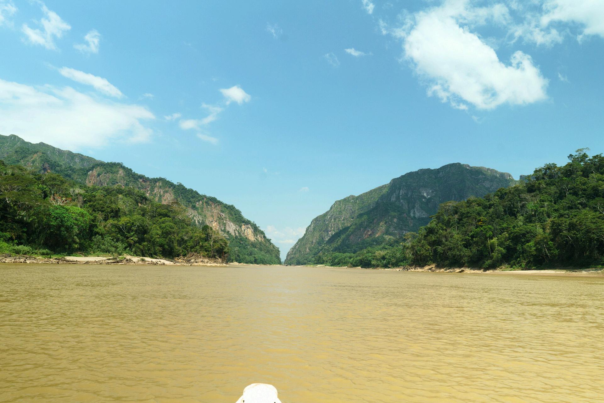
[2] From some of the highest mountain ranges of the Andes to the Amazonian Rain Forest and all the ecological floors in between, Bolivia is a visual paradise of snowy mountains colorful lakes and lagoons, deserts and salt flats, tropical lands, jungles and one of the highest bio-diversities in the world We will always demand the maritime access to the Pacific Ocean to put an end to our unjust landlocked condition
[3] UNESCO World Heritages: Three are from prehispanic times (Tiwanaku Samaipata Qhapac Ñan) Three are from colonial times (city of Potosí, City of Sucre, Jesuitic Missions) Five are inmaterial patrimony (Oruro Carnaval, Kallawaya Cosmovission, San Ignacio de Moxos Fiesta Pujllay Dance Alasita Festival, Gran Poder Parade) One is a natural patrimony (Noel Kempff Mercado National Park)

BOLIVIA
Bolivia is a multiethnic and multicultural country of high syncretism that reflects in beautiful and diverse cultural expressions like folklore, music, dances, traditional uses, cosmovision, etc.
The state recognizes officially 37 different languages besides Spanish More than 30% of the population is Quechua and Aymara but we are all “mestizos” (65%) Having said that, the statistics are not necessarily accurate, especially when it comes to complex matters such as identity and ethnicity.
There is freedom of religion in Bolivia
Since 2009, when a new Constitution was implemented, Bolivia became a laic, secular country that privileges all religious and dogmas. The majority is catholic (66%) not orthodox but syncretizing different cultures and cosmovision The witches’ market is a live testimony of some of these religious syncretism
Our ancestors were polytheists and worshiped the Sun (Inti) and Mother Earth (Pachamama) as the creators of life, cosmovision deeply bonded with the elements of nature like the wind and the water The mountains are considered guardian spirits and zoomorphic gods like the winged snake (Katari/Amaru) are symbols of wisdom and good economy.


The evangelizing colonial period (300 years) found it easier to syncretize with the local beliefs to achieve their colonial objectives than to try to eliminate them For example, they used to build their churches at the same sacred places of the Incas, Tiwanakus and other cultures The Andean indigenous blend their gods with the catholic symbols such as the virgin and other saints.
The rest of the stats are protestant (17%), no religion (10%), other religions (4%) and other Christians (3%) There is an active presence of foreign missionaries such as the Mennonites, Lutherans, Adventists, Baptists, Pentecostals, Methodists, Mormons, etc
The name of the country comes from a derivation of Simón Bolivar’s name. Today, the official name is Plurinational State of Bolivia, and we are just about 12 million people in a big land locked country (1’098 581 Km2)[4] surrounded by Brazil, Paraguay, Argentina, Perú and Chile.
Our main exportations are Gas, Zinc, Silver, Soybeans and soy products, Petroleum, Tourism, Tin and Gold But our main richness is Lithium, we possess approximately 70% of the planet’s lithium in the great Salt Flat of Uyuni (Fotos) We also got about 50% of the planet’s iron at the Bolivian Mutún
Our currency is the Boliviano. The equivalent of a Danish crown Roughly 7BOB for 1$us and although it hadn’t changed in about 15 years, today in the middle of a crisis is possible to find a blue rate of 10BOB or more for a dollar.
[4] Bolivia is 25 times bigger than Denmark, 3 times bigger than Norway, almost twice as big as France and the same size as Texas and California together
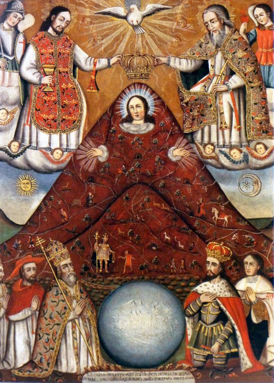

A LITTLE BIT OF HISTORY AND POLITICS
Bolivia, as many other south American countries, was colonized by the Spanish. They came in 1532 and subjugated the Incas and the Aymaras.
Before the Spanish invasion, countries like Bolivia and Perú had a vast period of states with high cultural production There were sophisticated cultures of monumental architecture and engineering like the Tiwanaku (3000 B C –800 A C ), the Chavín de Huantar (1200 BC- 100 AC) the Huari (700 A C – 1300 A C ), some believe they could’ve been the same people from Tiwanaku, the Paracas (1000 BC), some believe related to the Nasca culture (100AC –600AC), the Moche (100AC - 800AC) the Pukara (250 BC –380 AC), the Chimu (800 AC after the decline of Huari culture), and the Incas (1400-1532 A C )
The Incas conquered the Titicaca Lake region, the interandean valleys and the Amazonian lowlands between the XII and XV centuries The west of Bolivia became the Incan province of Qullasuyu
During the incan period the system of terraces was reutilized specially around the interandean warm valleys of Los Yungas (subtropical mountains) The network of roads was widened, and the tin and gold mining were intensified
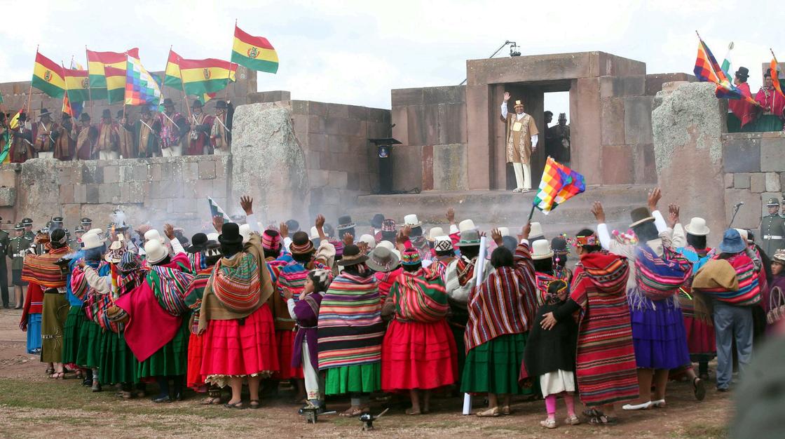
The Spaniards arrived in 1535 The first conquistador (first European) on these lands was Diego de Almagro It’s said that the Spaniards were able to subjugate us in only a decade, obviously related to the subjugation of the Incan Empire by Pizarro in Perú, which happened during a moment of political fragmentation due to a civil war between Huáscar and Atahuallpa, the two Incan brothers disputing the Incan throne at the moment of the Spanish invasion
The colonizers brought [5] new animals, plants, beliefs, laws and illnesses According to the chronicler priest De las Casas, between 1492 and 1560 at least 40 million indigenous died due to the diseases, the abuse and hunger imposed by the Spaniards
There were indigenous revolts since the beginning of the colonization. The collective memory counts stories like the epic one of Tomás Katari walking (because the indigenous were not allowed on horse) 2300Km from Potosí to Buenos Aires to denounce before the viceroy authority the abuses and corruption of the Corregidor, who later would kill Tomás Katari by shooting him in the face


[5] Domestic animals brought from the old world: horse, ox, donkey, pig, sheep and goat Plants brought from the old world: wheat, rice, olive tree, vine, orange, lemon, bananas, apples, sugar cane; also spices like cinnamon, pepper, thyme and clove The plants the new world gave to the old one: Maiz (corn), beans, potatoes, cacao-chocolate, peanuts, tomatoes, avocadoes, tobacco, pumpkins, pineapples, quinine; domestic animal: goose; minerals: silver, gold and fine woods (metaphor of the silver and bones bridge from Potosí to Paris: “a silver bridge could’ve been built between Potosí and Paris with all the silver they took, but also a bones bridge from all the dead indigenous) Among the illnesses that the colonizers brought were the influenza, measles, smallpox, chickenpox, bubonic plague, flu, etc

Walter Solón Romero The past of the 1952 Revolution Mural project for the Monument to the National Revolution Ink drawing, colored pencils and watercolors 1963
At the end of the 18th century, the indigenous of the Andes led by Túpac Katari in Bolivia and Túpac Amaru in Perú, formed indigenous resistance movements that in alliance with the creoles (Spanish descendant or mestizo elites) ended up achieving our independence in 1825
During the 19th century, Bolivia fell repeatedly into wars against its neighbors, culminating in a devastating loss in the War of the Pacific which resulted in Bolivia losing its access to the sea, along with rich nitrate fields, copper mines and important deserts
Bolivia, also officially lost the Chaco War (1932-1935) against Paraguay, although that was a war between gas corporations, not countries Bo Bolivian and Paraguayan soldie left to die of dehydration and s in the hostile hot Chaco lands. beautiful songs about this awfu of our history enriching our na folklore
In 1952 we had the National Re attempting a program of nation of resources and expansion of There was an agrarian reform a progressive measures
During the 60s and the 70s the fell into military dictatorships ( Guevara’s assassination happe during this period) and experie series of coups until a transitio democratic government in the (and a record of hyperinflation succession of right-wing politi in the nineties, forming coalitio taking turns to rule the country small percentages of the votin population
Our multiculturality and multie are one of our greatest strengt the same time the diversity of c generates tensions and has a t history of discrimination and su of the indigenous majorities
We are a postcolonial society with a heritage of incorporated racism In Bolivia, until 1952, it was illegal for an indigenous to set foot on the main square Murillo. It was illegal for an indigenous to learn how to read and write It was illegal for an indigenous to own property There was a legal form of slavery called “pongueaje” in which the indigenous would not perceive a salary in exchange for their work but tokens exchangeable for food and clothes With the revolution of 1952 the indigenous were granted a “second kind citizenship” that allowed them to vote but kept them in the worst position of class for too many decades

We’ve been experiencing a significant social transformation during almost the last 20 years since we had our first indigenous president A whole political class had access to politics for the first time Evo Morales won with 54% of the voting population and started his first government in 2006 In 2009 he called a constitutional referendum which was approved with 62% of the votes He won consecutively two more elections and ruled the country for 13 years There were major achievements during this period From being the second poorest country in the Latin American region (after Haiti) we lowered the extreme poverty from 38% to 15% The poverty index lowered from 60% to 34%, that means that of the 12 million people we are, 2 million stopped being poor and became middle class The local coin was empowered (88% of the deposits and 99% of the credits are in local coin) During Evo Morales’s government we became the second country in the world with the highest participation of women in politics We also became the second country in South America with the highest investment in education
There were significant improvements in the three main structural problems in Bolivia (health, education and roads) Although the Bolivian is a small economy (GDP 40 thousand million) until 2022 it was one of the most solid economies in South America We still have a corrupt government although we are not the sub champions of the world anymore
The most important social transformation has been the empowerment of the indigenous classes Before the “process of change” the Aymara people were choosing not to teach the ancient Aymara language to their children or not to dress in the Aymara fashion to have “better opportunities” in an official predominantly Spanish speaking country Fortunately, that tendency seems to have changed a bit.

LA PAZ
La Paz lies in a valley formed by a canyon created by the Choqueyapu River and surrounded by the outstanding mountains of the Andean highlands Some of the most important ones are from the Regal Range of the Andes, such as the majestic Illimani (6500m approx ) and Huayna Potosí (6000m approx). The Illimani (the name means “the water bearer” is the iconic custodian of this beautiful Andean city)
The original prehispanic name is Chuquiago Marka which means parcel of golden potatoes According to a legend, it was an ancient lake and one day all the stars fell off from heaven and dried it The legend might not be so far from the truth for La Paz could have been an ancient lake that broke down on the Palca canyon towards the Illimani Mountain It became a fertile valley adequate for agriculture The city is surrounded by colorful clay mountains that form tall spires with the eolic and water erosion (Moon Valley[6], Valley of the Souls, Palca Canyon)
Chuquiago Marka, 68 km from Tiwanaku, was characterized by intensive agriculture of terraces supported by contention stone walls (tacanas system)
Remains of the Tiwanaku culture was found in Putu Putu (Miraflores) and Achocalla (800 BC)
A hypothesis points out that around 1100 AC Tiwanaku disappears when Pachacuti Inca defeats the last Colla sovereign Chunqui Cápac during the Incan empire expansion. We know there was a long period of draught, and the religious elite had lost credibility There are examples in broken ceramic from Pariti and Tiwanaku reflecting the social crisis in the different scenes and representations of rituals of decapitation and dismembration (also found in Huari and Parakas) The disapearence of Tiwanaku is still an enigma subject of constant debate

Unlike many of the other mountains in the area this particular formation was created from sandstone and clay which made it particularly vulnerable to the elements
[6] Valle de la Luna is a complex labyrinth of spires and canyons which was created through a process of erosion
La Paz was founded by the Spaniards in 1548 and was a central point, between Potosí and Lima, along the so-called route of the silver A very important administrative region during colonial times, La Paz was also the place where the independence movement started Important revolts like Túpac Katari’s one in 1781 and Murillo’s hanging in 1809 took place in this city At the end of the 19th century, after the federal war, La Paz became the Seat of Government for the Executive and Legislative Powers Since then, it became the political, financial, social, academic and cultural center of the country.
Almost 70% of the population is between 15 and 65 years old in La Paz. There are excellent public and private universities, being the Medicine faculty and the Law faculty the most popular ones Engineering, Architecture, Economics, Business Management, Accounting, Social Sciences and other sciences are common professions in La Paz Commerce and bureaucracy are also the main activities


Salteña
Salteña is the name of one of the most delicious empanadas (beef pastries) you ´ll try in Bolivia! It's a great morning snack, typical of the Bolivian gastronomy, especially in the Andean part In La Paz it is an icon of the culinary tradition Baked and filled up with beef, boiled egg, potatoes and a tasty spicy stew, the salteña was invented in Potosí (probably from a derived recipe of the arabic pastries that were brought on to these lands by the Spaniards during the colonial period) sometime between the 16th and the 18th centuries The first reference to this juicy "empanada caldosa" is in 1776 but the name "Salteña" might have to do with the story of a lady [7] who was born in Salta but lived in Bolivia and used to make and sell these tasty soup empanadas in Potosí Her empanadas were very popular and started being called salteñas
Everything is traditional about the salteña, even the way to eat it There are popular "sayings" in La Paz about the salteña, for example: "only a person from La Paz can eat a salteña without dripping" or "only who is a good kisser can eat a salteña without making a mess". The salteña is an excellent snack available everywhere from little street kioscos to fancy pastry shops, 'cause everybody takes pride on their own recipe of salteña It's also very convenient at an approximate price of 1$us Don't leave La Paz without trying a salteña
My personal favorites in La Paz are: Salteñas Chuquisaqueñas (spicy beef and spicy chicken) La Paceña (chicken and veggies) Supersalteñas (traditional mild beef) and El Hornito (traditional mild beef, chicken, cheese, etc )
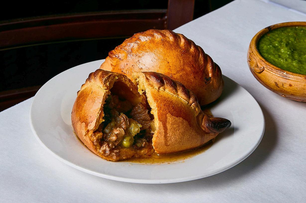
[7] According to A P Candia Juana Manuela Gorriti belonged to a poor Argentinian family living in Potosí and her “empanadas caldosas” gave the name to the Salteñas Later, she married Manuel Isidoro Belzu (President of Bolivia from 18481855) and became a writer
TIWANAKU & PUMAPUNKU
About 70 Km from La Paz, the ruins of the great civilization of Tiwanaku were declared a World Heritage Site by UNESCO in 2000.
The site was first recorded in written history in 1549 by Spanish chronist Pedro Cieza de León while searching for the southern Inca capital of the Collasuyo
Jesuit chronicler of Perú, Bernabé Cobo, mentioned that Tiwanaku’s name once was Taypi Q’ala, in Aymara “the central stone” alluding to the belief that it lay at the center of the world Tiwanaku lines up astronomically with Sirius, the brightest star in the firmament
According to Arthur Posnansky, the site is 11,000-17,000 years old based on comparisons to geological eras and archeoastronomy Carlos Ponce proposed the site was first occupied around 1580 BC, the site’s oldest radiocarbon date.
There are different proposals of chronologies about Tiwanaku’s cultural development, based on radiocarbon dating, stratigraphic levels and ceramic and sculpting styles and iconography Among the different theories about our ancient cultures Here we mention some of the most popular ones
Our ancient cultures developed from 3000 BC 'til 1532 Spanish conquest or invasion
During that period, there were advanced civilizations of monumental architecture, states with high cultural production (temples, public works and palaces), diversified economies, and advanced social and political organization systems. There are religious, economic and political power remains all over these Andean and Amazonian lands
Lake Titicaca, one of the most ancient lakes on the planet, is the highest navigable lake in the world and an ancestral landmark of great relevance for our cultures The Island of the Sun (Isla del Sol) an oasis, is according to Andean mythology, the origin of our cultures and Tiwanaku; one of the oldest civilizations on the planet. We invite you to enjoy an unforgettable experience in the most energetic place on earth.
The Tiwanaku culture is one of the most ancient and enigmatic civilizations in the
The monumental architecture of Pumapunku is the testimony of one of the oldest civilizations in South America. We'll leave Pumapunku
The Tiwanaku, world heritage site, is the ruins of an ancient city state (probably the capital) near the southeastern shore of Lake Titicaca
The city of Tiwanaku was divided into two avenues: the first, from east to west and the second, denominated Pumapunku from North to South In both avenues there are ceremonial centers This division reflects the Andean duality
There are two types of monumental structures in Tiwanaku: pyramids of Akapana and Pumapunku; and open enclosures to gather multitudes (Kalasasaya and Semi Underground Temple). Moon and Sun Gates are found all over these structures.

Chronology and location
There's a formative period (some authors affirm it's Chiripa, approx 3000BC200BC), an urban or classic period (200BC-700AC) and an expansive period (S VIII - S IX, other authors call it imperial)
The expansive character is reflected in the iconography of the sculptures There is Tiwanaku's presence found in the North of Argentina, the coast of Chile (San Pedro de Atacama) and the South of Perú (the North is Nazca and Moche). Some people believe Tiwanaku could be Huari, but other studies reflect differences between both cultures, especially the military character of Huari and ceremonial character of Tiwanaku.
The decay or fall occurred during the XII century of our era Most authors seem to coincide that there was a dramatic climate change (a prolonged draught) during which the people couldn't pay tribute There was crisis and the priests (religious power) lost credibility From this period, there is an impressive ceramic collection in the Pariti Island Museum.
The Tiwanaku elite was substituted for aymaras and quechuas From this period, we also find remains of human and animal sacrifices in the pyramid of Akapana. Representations of dismembration and decapitation rituals in ceramics iconography reflect the religious elite loss of prestige and credibility, the social crisis we are referring to.

Akapana
Itt is a buried piramid f seven platforms Measures: 18m height, 205m long, 185m wide
The meaning of Akapana is "the light bearer"
Regarding the time of construction, there are two positions: several archaeologists, due to the type of stone, consider that the construction and use of Akapana are early (133 BC) Others affirm that the construction took place during profound social and urban transformations between 700 and 800 AC
Both Akapana and other Tiwanaku monuments were dynamic and, in this sense, underwent constant changes
During the colonial era, the monument suffered several lootings that ended up destroying the central part of the pyramid
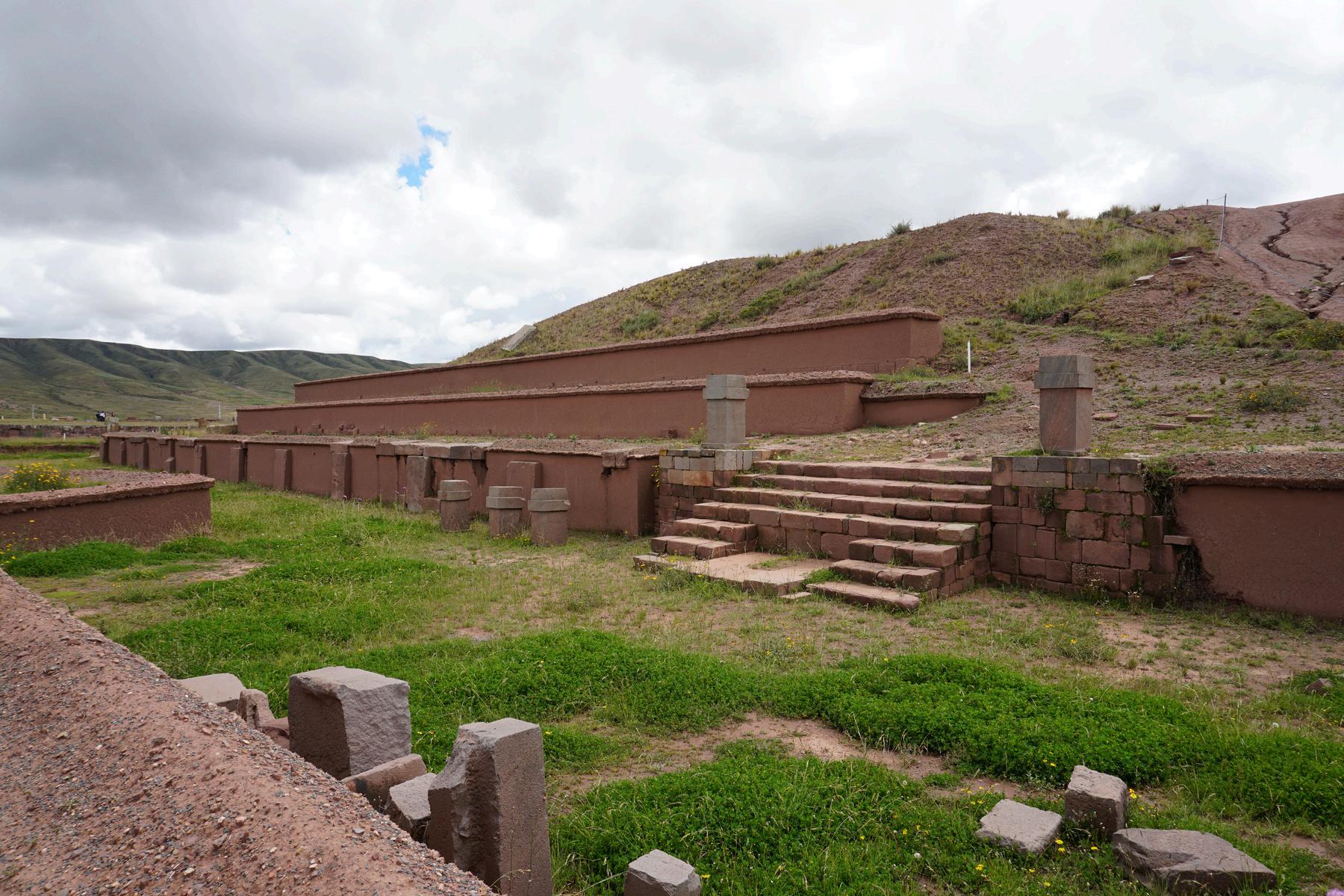
Scientific excavations have managed to determine that the pyramid is stepped on 7 platforms. It had a beautiful facade with stones adjusted to each other combined with large vertical pillars called rafas It is likely that they also served as boards for textiles
The excavations of the last 30 years allow us to infer that several priests lived in the pyramid (center of spiritual direction) Another theory states that the top was flat with a chakana design filled with water to study astronomy


Kalasasaya Monolith Ponce
Its name means Temple of Standing Stones
It is an open enclosure whose platform is U-shaped, 3m high and measures approximately 135x120m or 15,000 m2, making it one of the largest temples in the Andean area. Its walls combine regular stones with monumental rafas that would indicate the different movements of the Sun According to several scientists who have worked on the site, more than fifty rafas would indicate, each one, a stage of the solar cycle
Seven monumental steps leading towards the rising sun served as the entrance The main door is not original and has inaccuracies in its reconstruction. The Ponce monolith is probably the result of the appropriation of the spaces by a powerful elite
Discovered in the 1960s by Fortún, the wife of the archaeologist Ponce, it is 3m tall and represents a schematic anthropomorphic idol Head: on his face the nose that forms a T with the eyebrows and his geometric eyes stand out from which two tears with geometric drawings emerge.
On his head is the typical 4-pointed cap adorned with the same dancers or messengers found at the Puerta del Sol whose scepters end in puma heads.
The ear is also shown schematically From the hat fall 8 shoulder-length braids adorned with the double rectangle and finished with condor heads.
Arms and chest: the arms are rigidly glued to the torso, they also have incised decoration that represents the dancer, condor heads, the face of the main deity and geometric symbols On the chest stand out the two hands whose fingers point in the same direction and hold a keru (ceremonial vase) and a trophy man. For others it would not be a trophy but a snuff board
Puerta del Sol (Gate of the Sun)
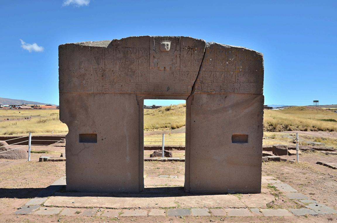
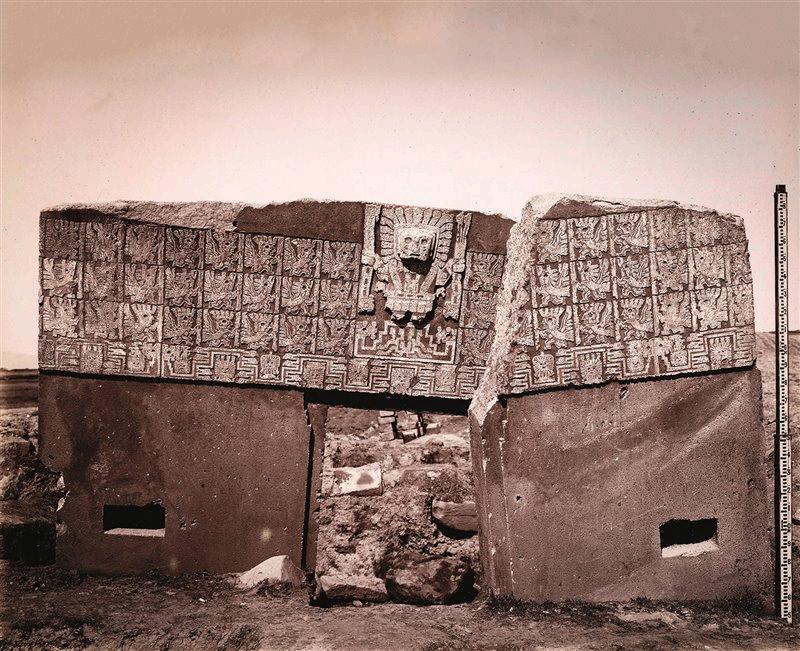
The Gate of the Sun is approximately 3 0 m tall and 4 0 m wide It was carved from a single piece of stone. Its weight is estimated to be 10 tons When rediscovered by European explorers in the mid-19th century, the megalith was lying horizontally and had a large crack through it. It presently stands in the location where it was found, although it is believed that this is not its original site Most likely it first came from Pumapunku but it was found at the top of the Akapana pyramid, probably reappropriated by a posterior culture.
Although there have been various modern interpretations of the mysterious inscriptions found on Puerta del Sol, the carvings that decorate the gate are believed to possess astronomical and/or astrological significance and may have served a calendrical purpose In addition, scholars suggest that the design below the central figure is meant to represent celestial cycles.
Being a later monument to the site in which it stands, the Gateway of the Sun could have also represented a transition from lunar religion to a solar religion based on its positioning to the sun to the West (reappropriation) Every year, on the 21st of June, the Winter Solstice on this side of the hemisphere, Bolivians gather festively on the night before to the Solstice to wait for the first sun beam

Semi Underground Temple
Measures: 26x28m, with an area of 742m2
It's a temple which is 2,64m below the surface with 7 steps and 4 interior walls decorated with 175 anthropomorphic and zoomorphic nail heads According to one hypothesis they represent trophy heads from their enemies to take their strength. Another hypothesis indicates that the heads represent their founding characters or mythical ancestors of the different communities that made up Tiwanaku, thus symbolizing their memory.
Another hypothesis suggests that they could be representatives of other cultures and civilizations that visited Tiwanaku, which was then a great cultural center.
The semi-subterranean temple would represent the world below, the world of the dead, that is why its door is directed towards the South
Ashlar and rafa architecture all over the temple (uniformly cut and dressed stones plus monolithic pillars)
Also, in the semi-subterranean temple there were important changes throughout history; one of them is the incorporation of the Bennet monolith that would demonstrate (according to Couture) the appropriation of space by a more powerful elite


Not yet excavated but clearly a semiunderground temple, Putuni was an elite cemetery A Keru (ceremonial vase) with impressive iconography: a flying being with deer horns and a Tumi /ceremonial knife) in its chest was found there.


Lithic Museum
Monolyth Pachamama or Bennet, is the biggest anthropomorphic figure found in Tiwanaku. Carved in one single block of red sandstone, it weighs approx 20 tons and it's 7,30m tall It was found buried at the semi underground temple
Iconography insitu. Collection of Monolythes from different epochs

Ceramic Museum
Insitu Tiwanaku Ceramic Collection, Metallurgy, Ancient burners and other ceremonial elements, musical instruments, funerary burial or mummy and Incan ceramic
PUMAPUNKU
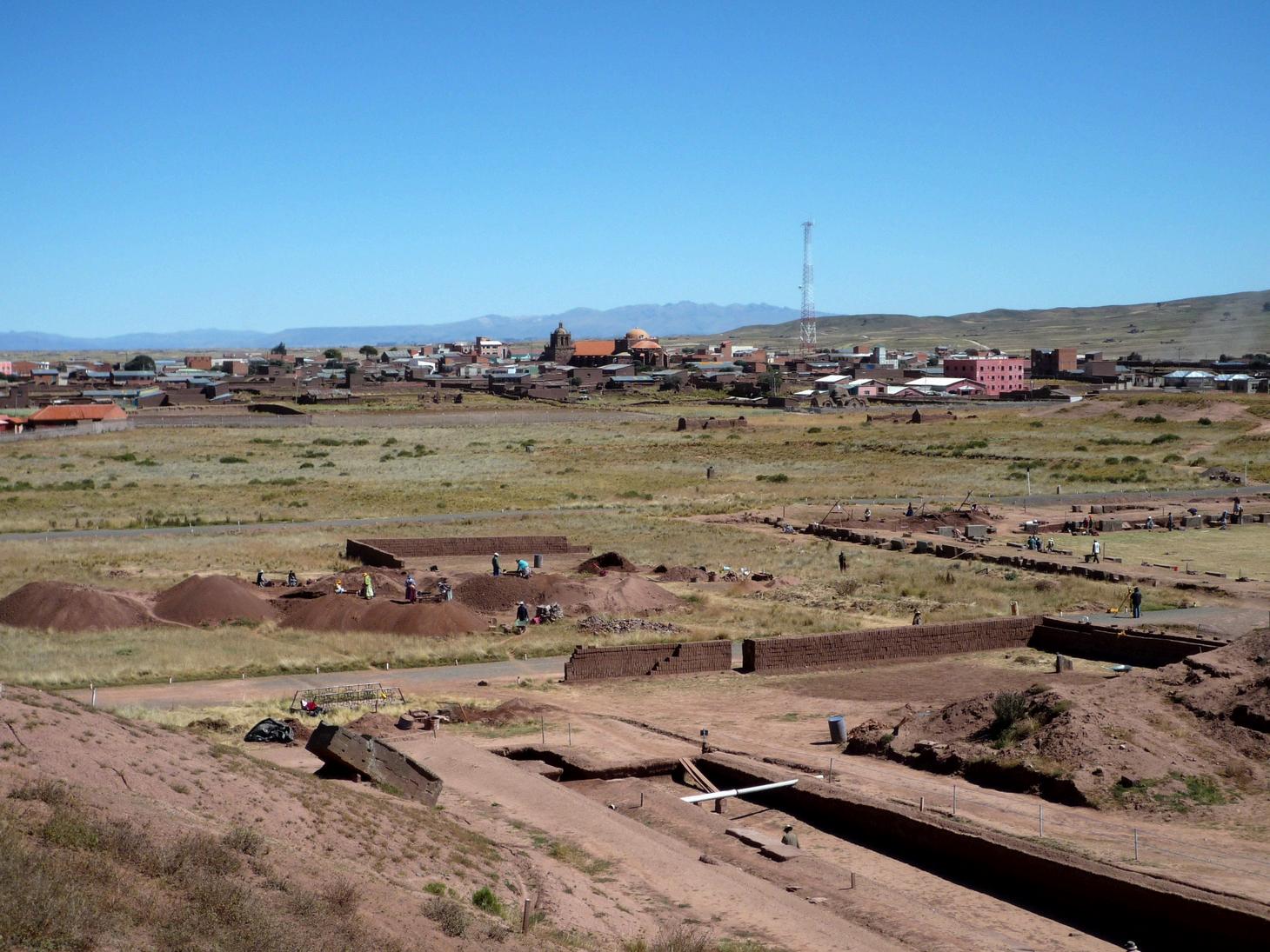
Pumapunku means "The Gate to the Puma (entrance to Lake Titicaca) and it's thought to had been unimaginably wondrous at its peak
Current understanding of this complex is limited due to its age There are different theories and chronologies based on radiocarbon dating, stratigraphic levels and styles of ceramic, sculpture and iconography Nevertheless, when it comes to these cultures there are more questions than answers.
Another fact is that the H stones are the most magnetic in the area, therefore the most energetic ones
This is a favorite spot for the History Channel There are debates about aliens and speculations about the stones shaped as a letter H being part of a spaceship station There's no invalid hypothesis at Pumapunku.
There’s a 32-ton one single block lying there next to the H Stones How long and how many people did it take to carry it there? There are gigantic stones that we still don't know how they were transported (but during this trip we can see where they could have been brought from, since there are quarries on the Q’apía Volcano nearby Copacabana and on our way to Puno)
There are also "butter marks" on large stones called in Spanish "piedras cansadas" or tired stones. They seem to belong to a very advanced society It also seems there was a major natural disaster (like an earthquake) that caused the level of destruction we see
The stonework is the most intriguing aspect of Pumapunku and it’s very similar to what we find in Ollantaytambo (Cusco, Sacred Valley) It was a terraced mound originally faced with megalithic blocks, each weighing several tens of tons.


The red sandstone and andesite stones seemed to be cut into geometric shapes that fit perfectly together without using mortar The technical finesse and precision displayed in these blocks is astounding Such is its precision that not even a razor blade or a thin paper can slip through the rocks Some of these blocks are finished on "machine" quality with perfectly drilled holes.
With an open-air architecture, they were worshipers of the sun Truly great architects, engineers and astronomists
The vertical blocks not only have an architectural but also a religious astronomical use (Rafas) They were interlocked by copper devices called grapas or staples
More recent studies accept the theories of geopolymers or artificial rocks They verified that the rocks are artificial (with geopolymers) and that they have not been carved with unknown technology or built by extraterrestrials. It was the
These rocks were analyzed by electron microscopy, something never done before They discovered the artificial nature of the rocks
For the gray sandstone rock, our ancestors invented an organo-mineral binder based on natural organic acids extracted from local plants and other natural reagents. This binder was then poured into molds and hardened for a few months Without a deep understanding of the chemistry of geopolymers, which studies the formation of these rocks by geosynthetics, it is difficult to recognize the artificial nature of rocks.
This scientific discovery confirms local legends that say: "the stones were made with plant extracts capable of softening the rock". This explanation has always been rejected by archaeologists, but the scientific evidence provided by scientists from France and Peru shows that the oral tradition was right: They made soft rocks that could harden!

LAKE TITICACA
It’s the highest navigable lake in the world at approx. 3800 m. Our people regard it as sacred and it's one of the most ancient lakes in the planet
Lake Tititcaca it's also one of the largest in South America (8500km2 approx, same size as Puerto Rico or Corsica) and deepest lakes in the world (275m max depth)
Located at the northern end of the high plateau, on the border of Peru and Bolivia, the western part of the lake lies within the Puno region of Peru, and the eastern side is in the Bolivian La Paz department
Five major river systems feed into Lake Titicaca. In order of their relative flow volumes, these are Ramis, Coata, Ilave, Huancané, and Suchez More than 20 other smaller streams empty their waters into
Since 2000, Lake Titicaca has experienced constantly receding water levels Between April and November 2009 alone, the water level dropped by 81 cm, reaching the lowest level since 1949 We achieved a new unfortunate record in 2023 This drop is caused by shortened rainy seasons and the melting of glaciers feeding the tributaries of the lake Water pollution is also an increasing concern because cities in the Titicaca watershed grow, sometimes outpacing solid waste and sewage treatment infrastructure. Lake Titicaca's biodiversity is threatened not only by water pollution but by the introduction of new species by humans (the fierce trout

Besides the trout and the Argentinian silver side (pejerrey, introduced in the colonial times by priests that brought the fish from Río de la Plata) the remaining endemic species are Ispi (like anchovies or small sardines), Karachi (catfish) and Mauri (bony yellowfish) Lake Titicaca is also home of the water frog (Telmatobius coleus), the world's largest aquatic amphibian According to a 1970 report by legendary French explorer Jacques Cousteau it can even grow as long as 50cm. It can weigh up to 1kg The frog lives at depths of 100mts It's an endangered species The name of this amphibian in Spanish means "blind frog" It comes out of the water to mate once a year The reproductive maturity age is 5 years.
The "sacred lake" is rich in minerals and remains of ancient cultures; it's also known as the most energetic place in the world From the Lake it's possible to appreciate the majestic beauty of the Regal Range of the Andes
A narrow strait, Estrecho de Tiquina (750m), separates the lake into two bodies of water The smaller, in the southeast, is called Lake Wiñay Marka (eternal city) or Lago Menor in Bolivia and Lago Pequeño (small lake) in Peru The larger body of water is called Chucuito
There are different etymologies about the name Titicaca, Titi (puma) and Qhala (stone) or K’ark’a would refer to the shape of the lake that with a little imagination resembles a puma. The “rock of the puma” or the “puma’s stone” According to


SURIQUI
Suriqui is a Bolivian island located in the smaller sub-basin of Lake Titicaca, belonging to the Wiñaymarca Archipelago
Administratively it is in the municipality of Puerto Pérez in the province of Los Andes in the department of La Paz It is a notable site, where wooden boats and totora rafts are made The totora reed (typha angustifolia) is a natural resource that allowed Andean men to navigate the lake since ancient times
The island has maximum dimensions of 3.7 km long by 2.2 wide and an approximate area of 4 5 km2 The island is located at an average height of 3,900 meters above sea level, while the highest point of the island is located at Cerro Silinkoyo, at 4,078 meters above sea level in the western part of the island It is ideal for ecological tourism
It is a region rich in biodiversity and ancient traditions Its landscape is surrounded by cordons of totorales, the emblematic reed of Lake Titicaca that attracts a diversity of aquatic birds, amphibians and other species

Suriqui island has always been the best place for boat building in Lake Titicaca The island gained notoriety in the 1970s because Norwegian explorer Thor Heyerdahl; after the failure of his expedition RA; learned about the people of Suriqui and decided to visit the island to organize a boat builders’ competition in 1970 Among 70 young Aymara men, Paulino Esteban and the Limachi brothers, were the winners and became key collaborators of Heyerdahl in the successful Ra II, for their ancient technique in the construction of the 12meter boat was essential to the success of the expedition and later other expeditions together with Heyerdahl and other renowned international explorers

During our visit to Suriqui, we get to meet Mr Fermín Limachi, the “Sea-crosser” that keeps alive the tradition of totora reed boat building and sailing the oceans showing the world our ancestor’s legacy He is the key collaborator for German explorer Dominique Görlitz in his expeditions Abora (s)
The skill and tradition of craftmanship with totora reeds can also be appreciated in the attractive furniture, ornaments and utensils made entirely of this natural fiber They produce scale replicas of the famous boats that sailed the seas, sculptures of animals, people and all kinds of handicrafts that are Suriqui’s heritage.
Suriqui island has always been the best place for boat building in Lake Titicaca The island gained notoriety in the 1970s because Norwegian explorer Thor Heyerdahl; after the failure of his expedition RA; learned about the people of Suriqui and decided to visit the island to organize a boat builders’ competition in 1970
Among 70 young Aymara men, Paulino Esteban and the Limachi brothers, were the winners and became key collaborators of Heyerdahl in the successful Ra II, for their ancient technique in the construction of the 12-meter boat was essential to the success of the expedition and later other expeditions together with Heyerdahl and other renowned international explorers

COPACABANA
Almost a hundred fifty km from La Paz, Copacabana is one of the most important religious and touristic centers in Bolivia
It is the main Bolivian town on the shores of Lake Titicaca The town has a large 16thcentury shrine, the Basilica of our lady of Copacabana, dedicated to the virgin of Candlemas, the patron saint of Bolivia The town is also known for its trout, pasank’allas and quaint atmosphere. Built between Mount Calvario and Mount Niño Calvario, the town has approximately 16,000 inhabitants Copacabana's religious celebrations, cultural heritage and traditional festivals are well known throughout Bolivia, Perú and Argentina.
Outside of the Basilica, one of the most interesting religious syncretism take place every day but specially on the weekends: the cars blessing by the priest and the yatiri. Devotees take their new cars to the town to
The granted favors are thanked in the chapel of candles where lots of recognition lacquers are displayed
The original name was Qutakawaña which means “viewpoint of the water” or according to others “the emerald viewpoint” The Spaniards changed the word into Copacabana, and this is the place that gave the name to the famous beaches in Río de Janeiro [8]

[8] A Brazilian priest carrying the image of the Virgin of Copacabana was sailing back to Río de Janeiro when a terrible storm threatened to kill everyone on board The story says the priest promise was to build a chapel for the Virgin if they were saved from the storm, and so he did
Copacabana was a very important Incan shrine at the time of arrival of the Spaniards, there are several ruins all along the peninsula and the town The Basilica was built on top of an Incan sacred place, and many believe that the true power of the image of the Virgin comes from the ancient Incan Huaca[9] Besides the place, there was a wooden Huaca, originally shaped as a snake of human male and female face that the Incas hid in Isla del Sol for several years to preserve it from the destruction of the extirpators of idolatries The image of the Virgin of Candlemas was carved in 1583 by Tito Yupanqui (the very first American artist) in mahogany wood The myth says that he did it modifying the same wooden Huaca into a Madonna Maybe that’s the reason why many “atheists” in Bolivia are anyways devoted to the Virgin of Copacabana
The local market displays colorfully the typical daily life of the locals who take pride in making the best sweet popcorn (pasan’kallas) in Bolivia


[9] Huaca is a sacred place or a sacred image to pre-hispanic cultures
ISLA DEL SOL
According to the mythology, the Sun Island is the birthplace of the Incan civilization
Isla del Sol or Sun Island is a Bolivian island located on Lake Titicaca, within the municipality of Copacabana in the province of Manco Kapac in the department of La Paz
It is 9 6 km long by 4 6 km wide and has an area of 14 3 km2, making it the largest island on Lake Titicaca. The population is approximately 3000 inhabitants spread in three communities: Yumani, in the south and Ch’alla and Ch’allapampa in the north
Its original name is Titikaka Island and therefore the lake where it is located bears i

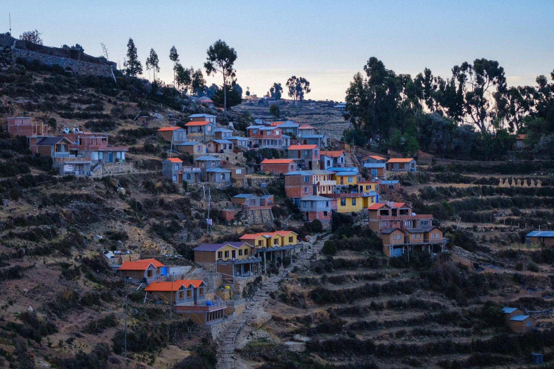
Isla del Sol is a wonderful Andean paradise where the ancient technology of Takanas or Andenes (agricultural terraces) is still working at its best Inherited from our ancestors, the terraces allow many products like fava/broad beans, different kinds of potatoes, quinoa, barley, tarhui, corn, onion, etc to grow healthy in the fertile lands of the island enriched with minerals (calcium, magnesium, sodium) It possesses a brilliant system to make better use of the spring water and rainwater creating microclimates that prevent the crops from freezing, and the terracing prevents erosion from the strong and cold winds It’s been the way we’ve been growing agriculture in these high lands for thousands of years
In front of Isla del Sol or the “Sun Island” stands the” Moon Island” or Isla de la Luna, which was a very important Aclla Huasi during the Incan empire
An Aclla Huasi was an economic institution where women lived and work in different areas according to their skills (textilery, culinary, intelligence, beauty/health, and artistic talent) At a very young age, from 9 to 14, the “best” women of the empire were recruited to be formed inside this “only women” institution The currency of exchange in those times was textiles and coca leaves, therefore these centers were quite significant for the economy of the empire The women were also essential for political matters such as alliances between clans or ethnic groups since they also were their selves an element of exchange The temple of the Virgins of the Sun is in current times a well-kept secret destination for mystical tourism. Today, the Koati community (200 people, 25 families) live on Isla de la Luna


CHAKANA OR THE ANDEAN CROSS
The Chakana (Andean cross, "stepped cross" or "scalonated cross") is a stepped cross motif used by pre-incan and Incan Andean societies.
There is a trinity that you will encounter in several experiences in the Andes, the three worlds reflected in the Andean cross or Chakana: In Aymara, the Alax Pacha or the upper world, represented by the condor (national bird of Bolivia and Perú) or in Quechua the Hanan Pacha or celestial world; the Aka Pacha (Aymara) or Kay Pacha (Quechua) this world represented by the puma, and the Manqha Pacha (Aymara) or Uku Pacha (Quechua)the under-ground world, represented by the snake (which symbolizes fertility or the mother earth)
The most used variation of this symbol today is made up of an equal-armed cross indicating the cardinal points of the compass and a superimposed square. Chakana means 'bridge’ and means 'to cross over' in Quechua The Andean cross motif appears in artifacts such as textiles and ceramics from such cultures as the Chavín, Wari, Chancay, Tiwanaku and Inca
It is believed that is dividing the solar cycles, marking the agricultural seasons and the moon cycles as well It was probably an astronomic tool since it’s possible to obtain the PI number using the radio of the circle formed inside of the cross. Its geometric form also contains the number 27 It reflects the Andean trinity dividing the three worlds (upper, present and underworld) and the Andean duality (chacha-warmi, arca-ira, etc ) The anthropologist Alan Kolata calls the Andean cross "one of the most ubiquitous, if least understood elements in Tiwanaku iconography. The Andean cross symbol has a long cultural tradition spanning 4,000 years up to the Inca empire and is still a symbol of the indigenous people of the Bolivian and Peruvian Andes


VELKOMMEN TIL BOLIVIA CULTOURS

GAMLE KULTURER TOUR 2024
