I am Darshan T k. I’ve recently completed my Master’s degree in Urbanism from the Manchester School of Architecture. This portfolio showcases my enthusiasm for design, offering a glimpse into my background and featuring projects from both my academic and professional spheres. I want to emphasize that I’ve gained extensive experience in handling practical situations on-site during my professional tenure.
Education
2023 - 2024
2014 - 2019
2012 - 2014
2002 - 2012
Manchester School of Architecture
SJB School of Architecture & Planning
PES Pre University College
Evershine High School
Work Experience
2019 - 2022
2018 - 2019
2018 - 2018
Pragrup Architecture & Urbanism
Pragrup Architecture & Urbanism- Internship
Teaching Assistant - GIRAFFE
Kindly review the attached resume for further details.
Urbano.. Selected Projects
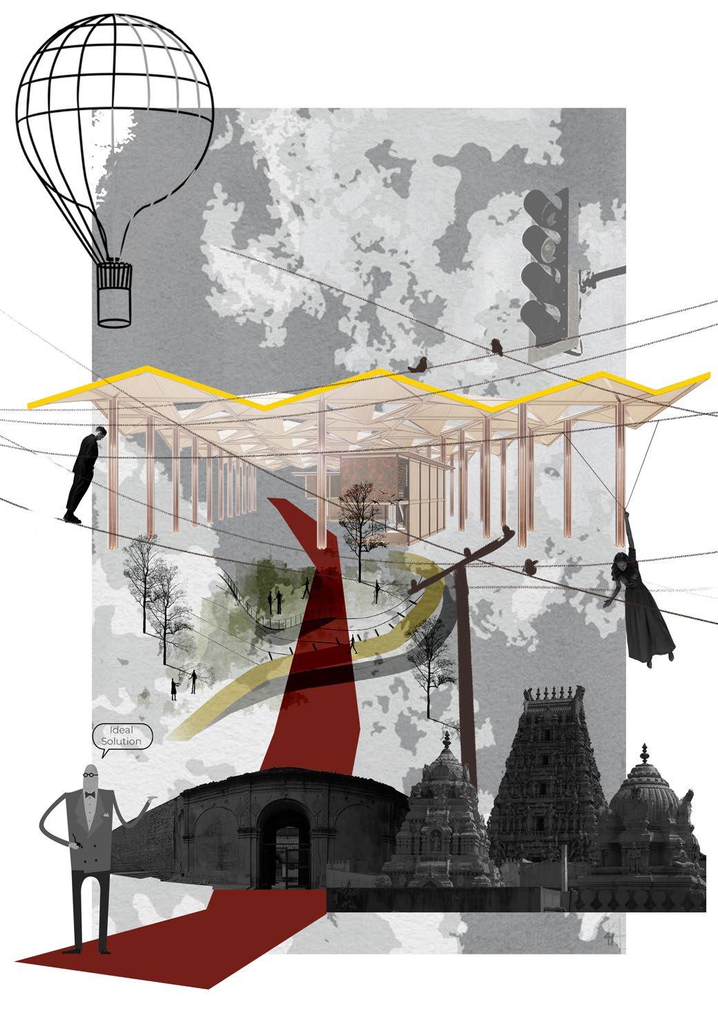
01. The A577 St
02. Heritage Revival
03. Tradition Renaissance
04. Aqua Park
05. Java Rain
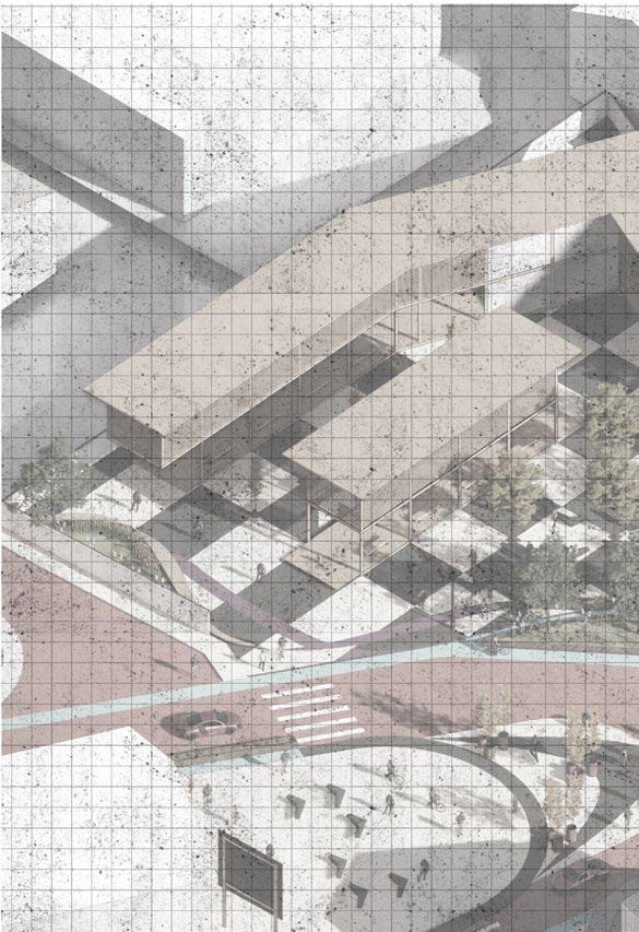
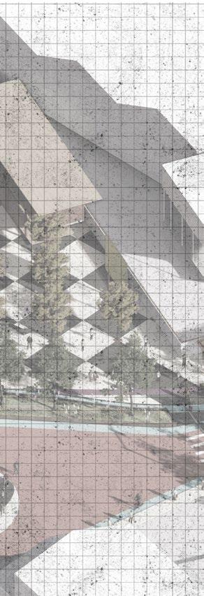
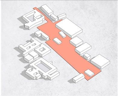
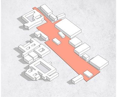
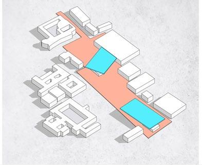
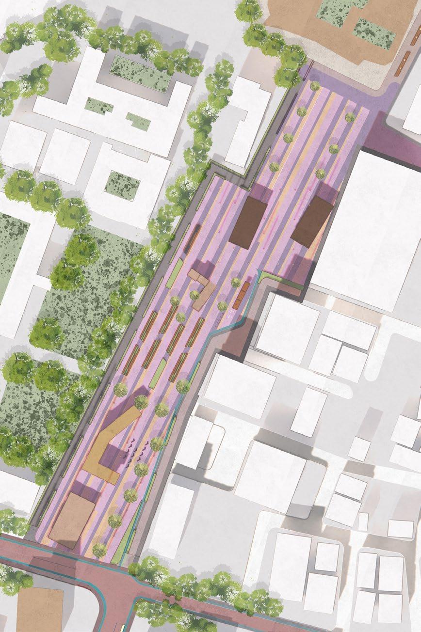
The A577 St
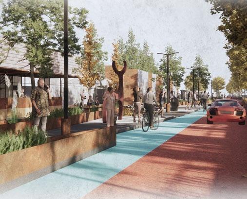
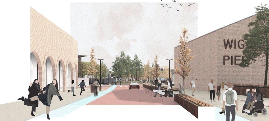
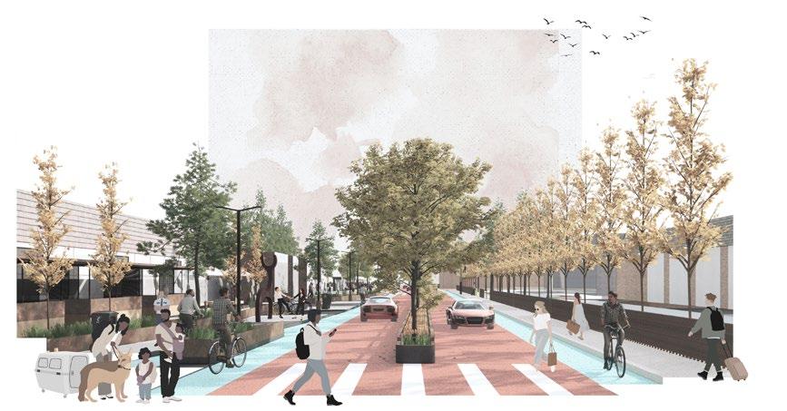
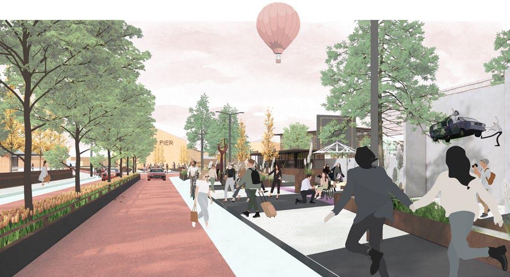
Redesign of street scape & enriching pedestrian experience.
Type :
Urban Design, Studio Project
Manchester School of Architecture
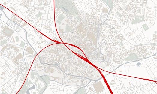
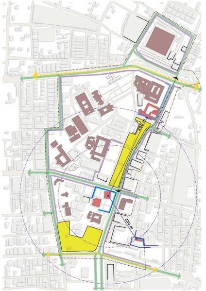
Throughout the 20th century, Wigan road infrastructure was expanded and enhanced to support the increasing traffic and development needs. The A577 highway, which passes through Wigan, connects the main road network of the Greater Manchester region. However, the stretch around the Pier and Wall-gate Street towards the Market Street experiences heavy traffic, making it less accessible for pedestrians to reach landmarks in the area. The current cycle tracks and footpaths are narrow and do not provide an inviting pedestrian experience towards the pier. Moreover, the highway’s sides are merely paved and lack any particular purpose, while the footpaths lack vibrancy.
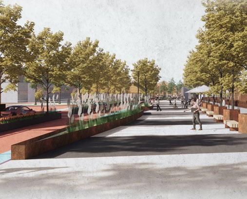
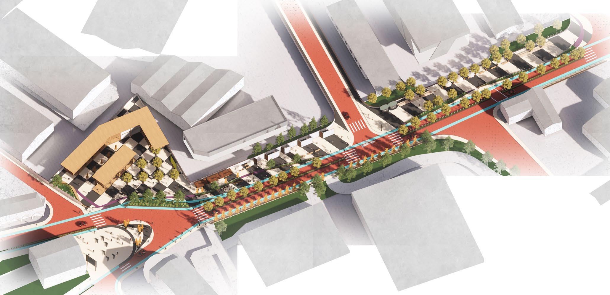
To make the street more pedestrian-friendly and less car-centric, there is a need to redesign the area by reducing the current four-lane two-way traffic road to a narrower singlelane motorway. This reduction will provide additional space for a cultural and pedestrianfriendly street. The goal of the redesign is to prioritize people over cars and enhance the pedestrian experience in the area.
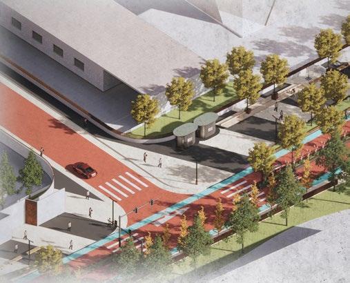
Proposed Street scape
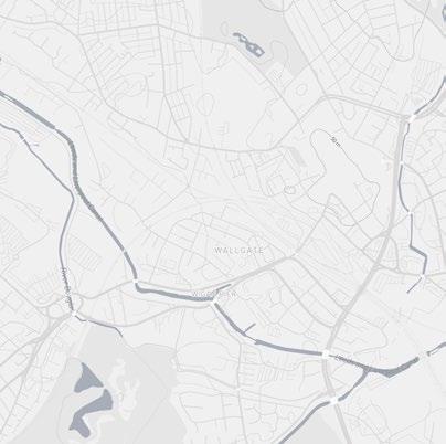
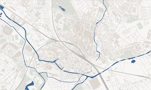
Railway Connect
Canal Network
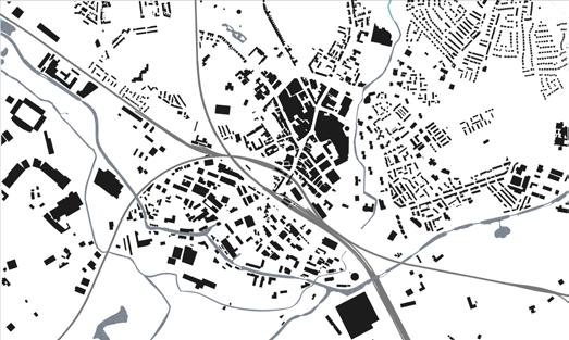
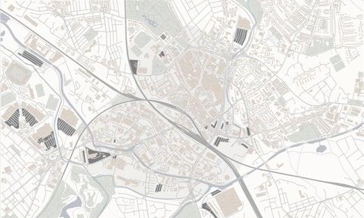
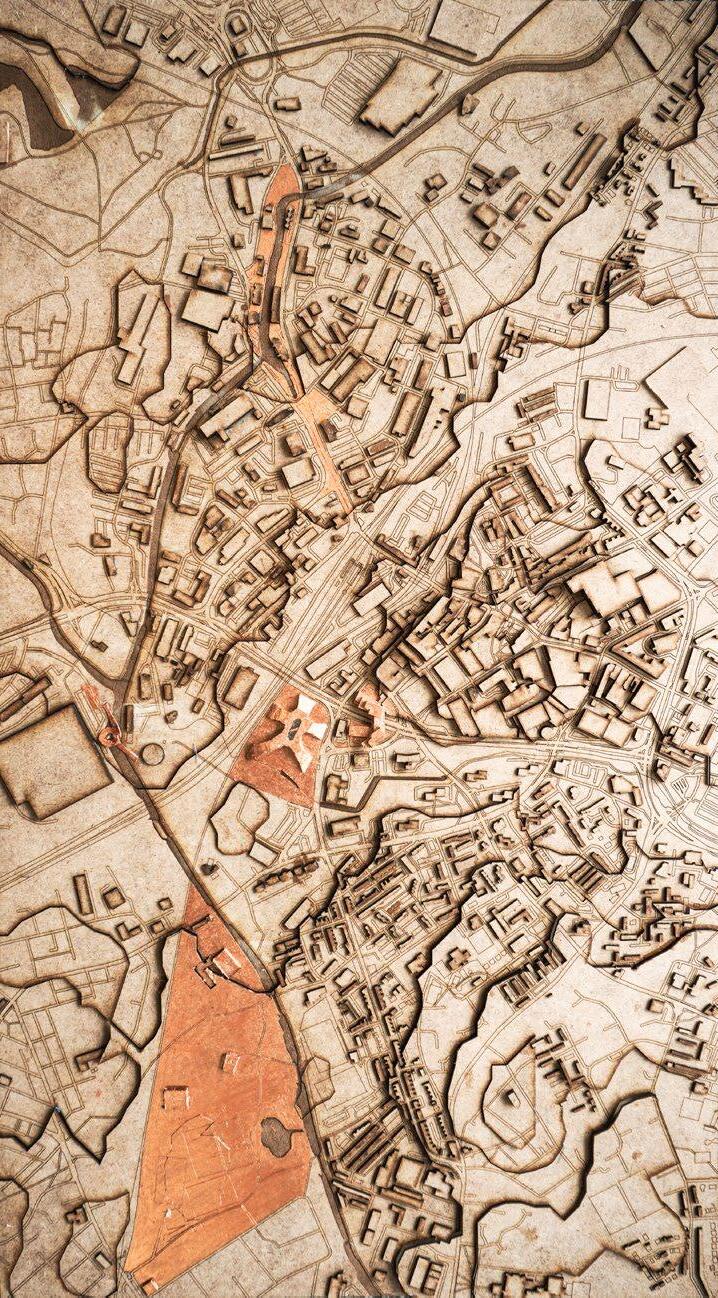
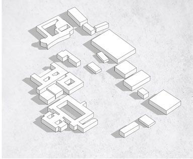
Analysis of urban fabric of Wigan town
Open Parking Lot
Figure Ground Map
WiganPier Rejuvenation
A577 St *
Proposed Masterplan for Wigan, UK Redesign of Streetscape
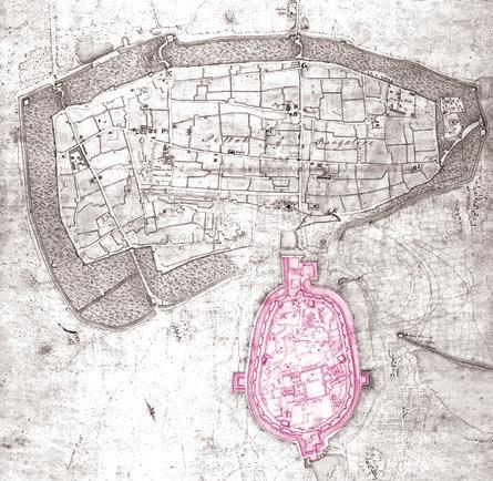
First map of bengaluru drawn shows the beginning of the fort area and the pete areas adjoining it.
Abstract
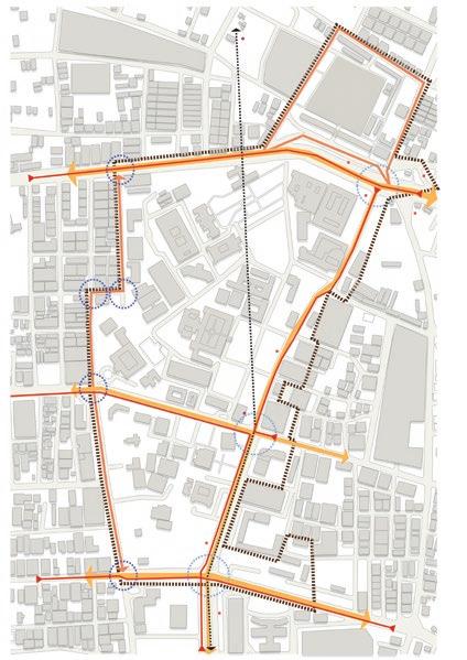
This Design proposal presents an examination and proposal for an inviting and pedestrianoriented district located in the historical central nucleus of the city. The intention is to surmount the obstacles of rapid urbanization and place a stronger emphasis on the city’s historical landmarks.
The study will investigate the response of the vicinity surrounding the heritage structures, the community’s attitude towards the heritage history, a detailed analysis of the infrastructure encircling these structures, and the interconnection among these comparable significant buildings.
Through a thorough analysis, a collection of strategies are formulated to enrich the communal spaces within this area, with the ultimate goal of fostering a positive forwardlooking approach and an urban arena proposal that aims at enhancing the value of our heritage buildings.
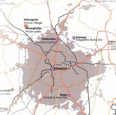
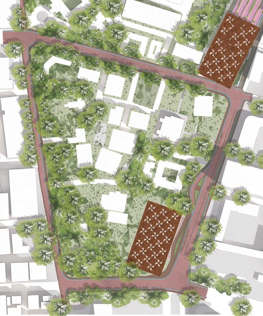
Study Area
Fort Area
This design proposal presents an examination and proposal for an inviting and pedestrian-oriented district located in the historical central nucleus of the city. The intention is to surmount the obstacles of rapid urbanization and place a stronger emphasis on the city’s historical landmarks. The study will investigate the response of the vicinity surrounding the heritage structures, the community’s attitude towards the heritage history, a detailed analysis of the infrastructure encircling these structures, and the interconnection among these comparable significant buildings.
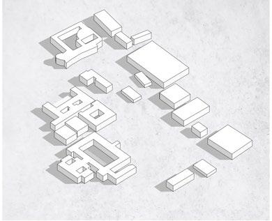
1. Existing Building Arrangement 2. View Angles from Fort to Palace 3. Envisioned Proposal Area Retaining Metro Blocks 4. Orientation for the Layout 5. Introduction of Roof Structure
Legend :
Pigmented Concrete Paver
Pigmented Concrete Paver
Pigmented Concrete Paver
Green Landscape
01. Palace Temple
02. Proposed street Design
03.
Metro Block
Existing
04. Dedicated Green Area 05. Building Frontage Area 06. Modular Exhibit Area 07. Seating & Planter Area 08. Viewing Platform
Open Paved Zone
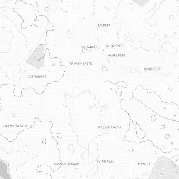
Bengaluru Fort
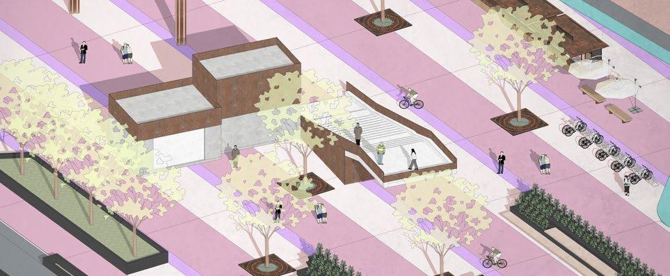
Proposed Hawker Area
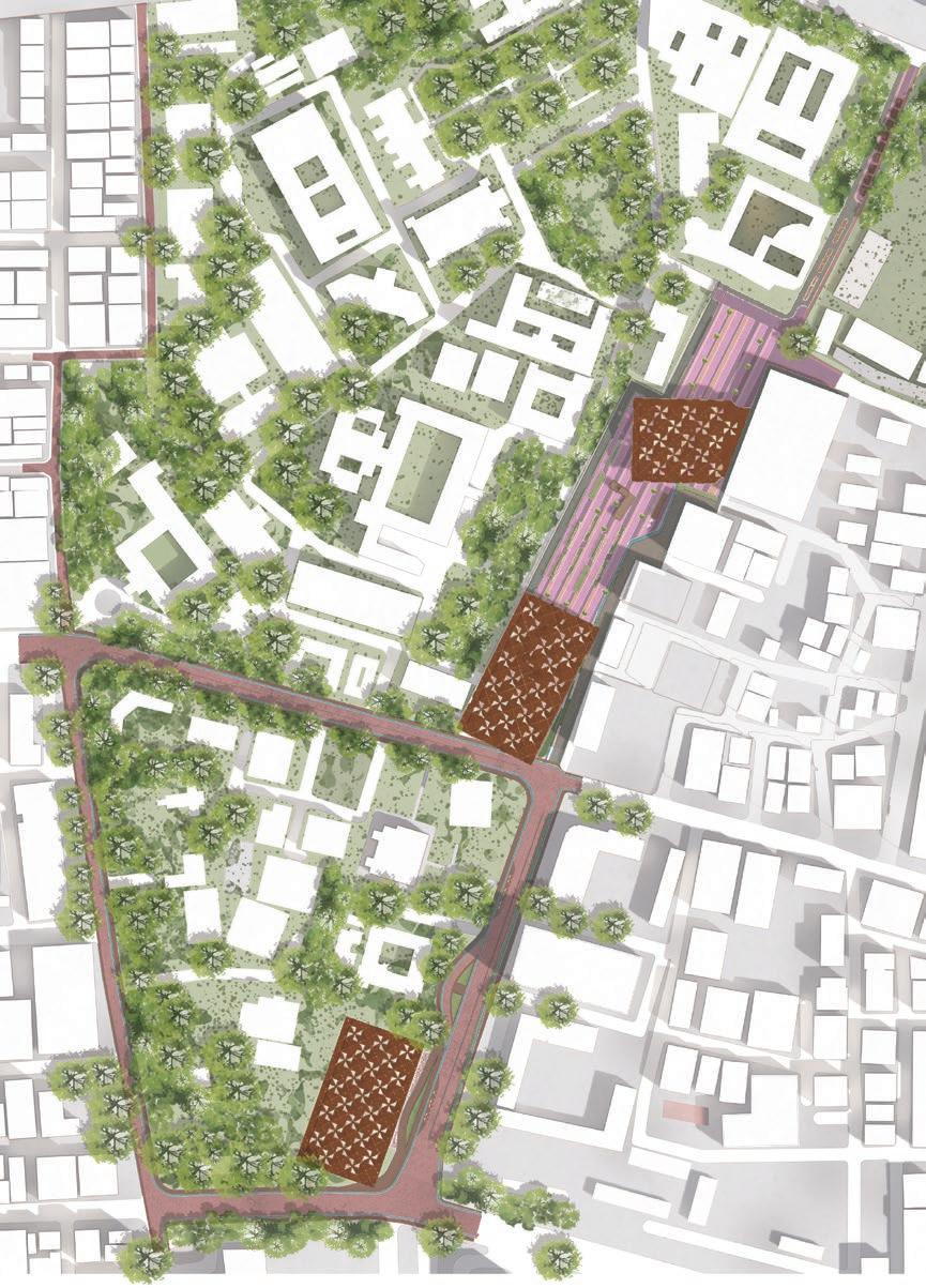
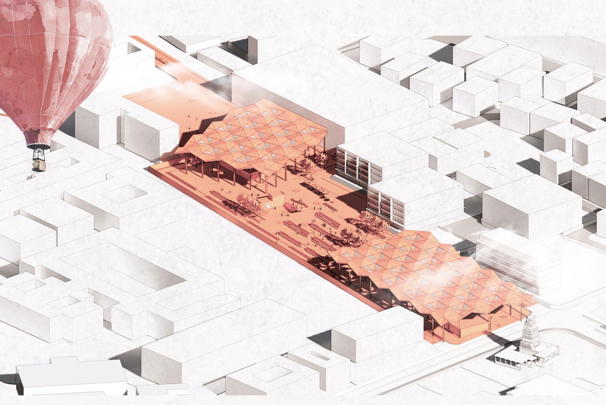
The layout is elongated, measuring approximately 340 m x 52 m. Consistent with this linear theme, most elements, including benches, planters, and other street furniture, follow a cohesive design language. A dedicated zone within the area features a cycle track, pedestrian pathway, and building frontage for structures along the perimeter.
Planter Footpath Main Arena Area Footpath Building Zone
Section 02
Planter Footpath
Viewing Platform Main Arena Area
Section 01 Footpath Building Zone
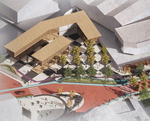
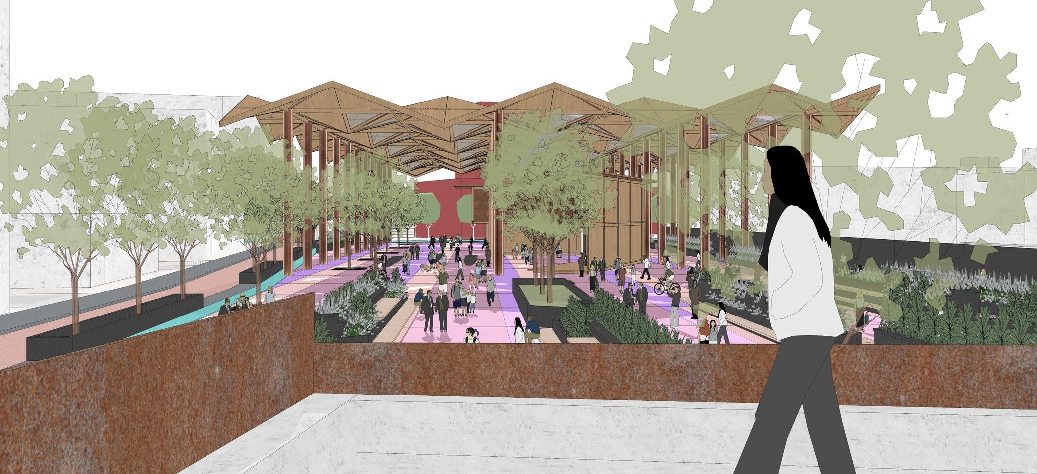
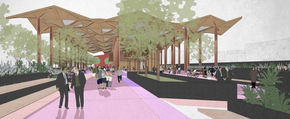
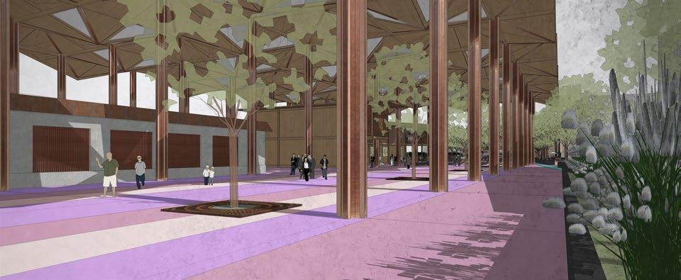
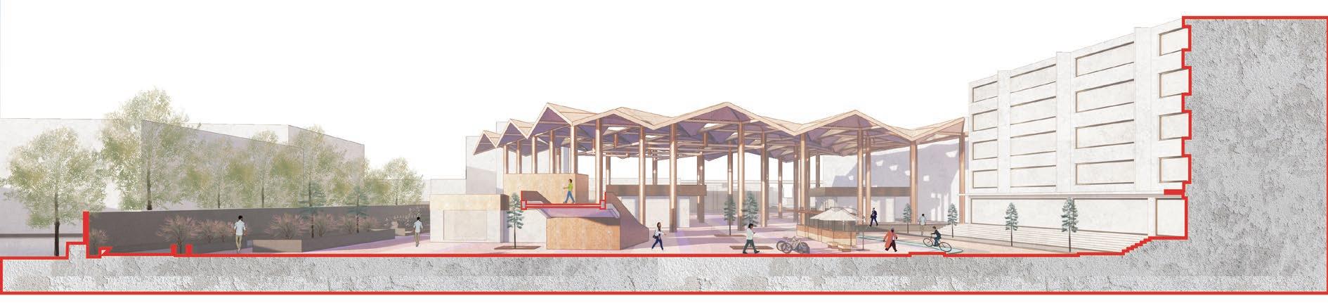
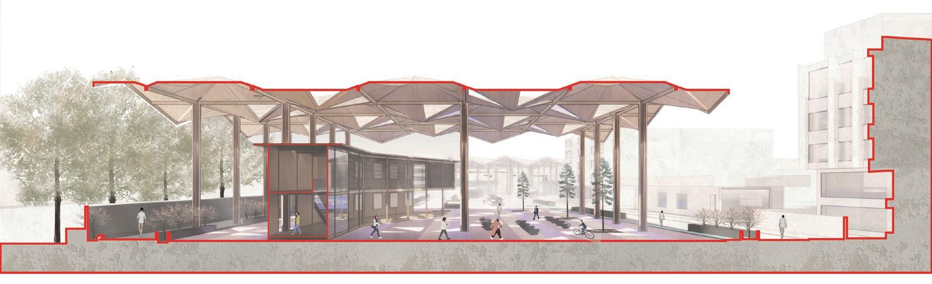
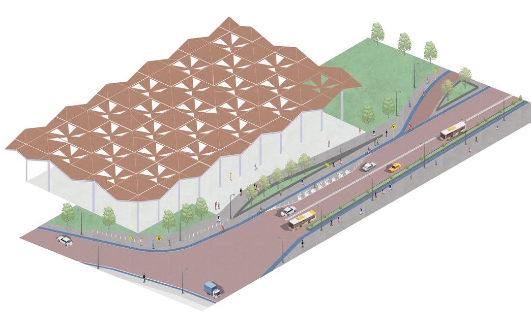
The bustling thoroughfare in the central region of the selected study zone is envisioned a transformation to enhance its pedestrian-friendliness. The current multilane motorway will be streamlined to a single lane, while the width of the pedestrian walkway is expanded. Adjacent to the motorway, new cycle tracks are introduced, one of which features a green buffer. Furthermore, a separate pedestrian-only pathway is created within the designated development site, accommodating a pavilion with a roof. The proportion of greenery is augmented to not only improve air quality but also serve as a natural filter amid the continuous traffic growth.
Proposed Street Design
01. Proposed Street Design
02. Proposed Pavilion with Roof Structure
03. Krishna Rajendra Road
04. Drop Off Motorway 05. Fort High School
Tippu palace
Palace Temple
Fort Arena
Historic core of the city With arena proposal.
Tradition Renaissance
Responsive hybrid of tradition & innovation
Type :
Thesis Project
Graduate year - Bachelors
SJBSAP
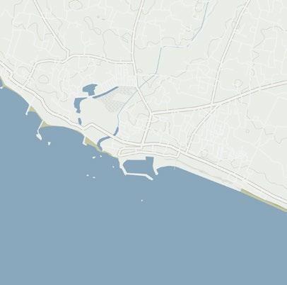
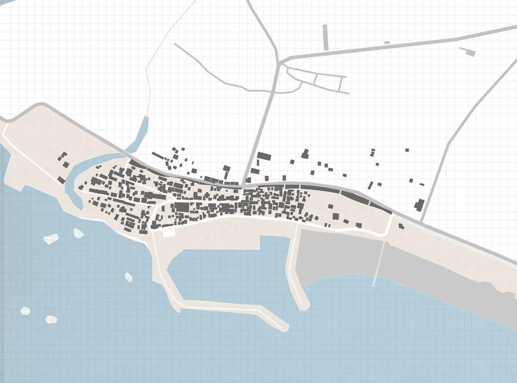
Tamilnadu, India
:
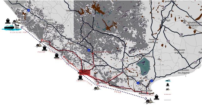
Major ports & harbors along coast and potential route of tourism.
Abstract
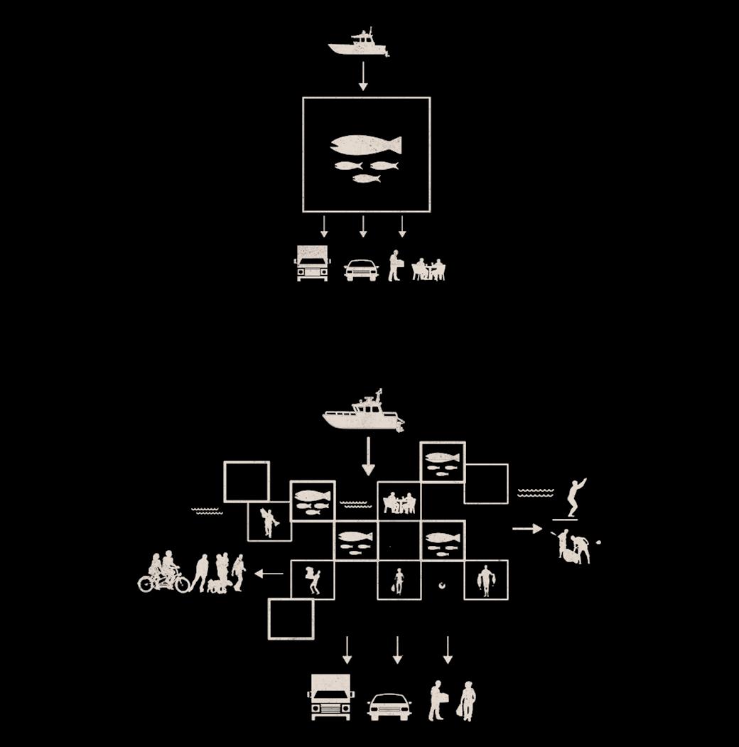
The thesis project aims to integrate public auxiliary functions with the existing daily activities of the fishing harbor and its fishermen. The harbor, which historically served as the primary port along the shoreline, was experiencing a gradual decline due to the introduction of new machinery for fisheries operations. However, tourism has the potential to become a primary catalyst to offset this decline.
The area will transition into a tourist visitor center during non-fishing seasons, attracting fewer tourists during other times of the year. These amenities not only enhance the economic sustainability of the area for fishermen but also inject vitality and liveliness into it.
This project seeks to merge distinct and contrasting functions into a cohesive whole, which may seem unusual at first glance. However, it becomes logical when considering the goal of providing economic support to the fishing community.
1. Everyday loading & unloading activities of harbor are enhanced by improving their spaces.
2. Everyday market activities take place along with fresh fish restaurant on top level of same market.
3. Existing features of harbor is maintained along with adding public realm around it.
4. Addition of view decks and leisure activity spaces along the edge line.
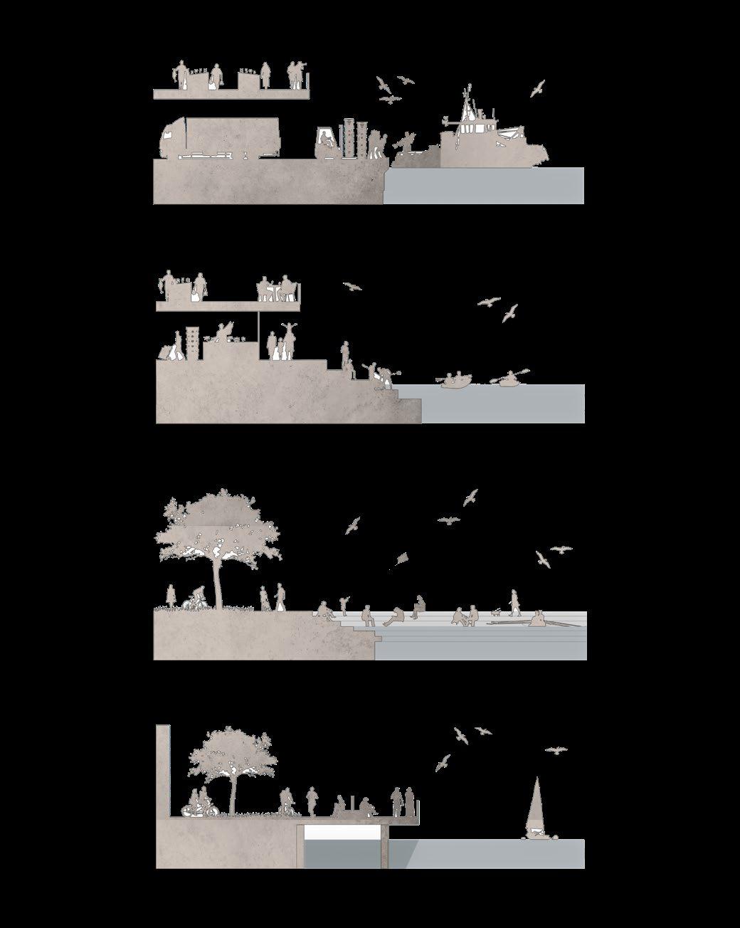
The design incorporates open areas that seamlessly blend with adjacent spaces, creating an open-plan layout. Fixed walls, windows, and doors are deliberately absent in certain areas to promote flexible utilization of the space. Shadows within these areas are crafted through strategically positioned walls, drawing inspiration from the organic layouts of fishermen’s homes.
1. Entry and exit profiles.
2. Level differences for activities.
3. Housing multiple spaces under same roof.
4. Innovation in the infrastructure.
The boat construction facility and fisheries museum serve as a hub for both tourists and local fishermen. Clearly defining and organizing the roles of each function facilitates smooth operation of the harbor, whether it’s during peak seasons or off-season periods.
The harbor’s open layout allows for versatile usage, enabling the conversion of off-season areas into temporary structures to enhance tourism. This, in turn, contributes to the economic prosperity of the entire fishing community.
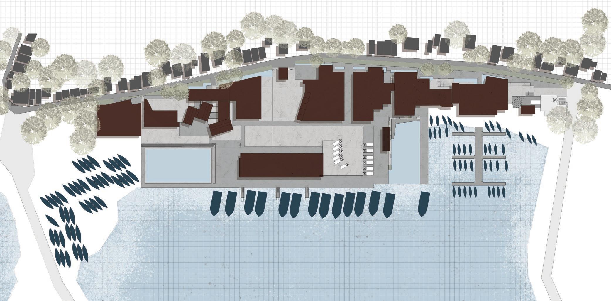
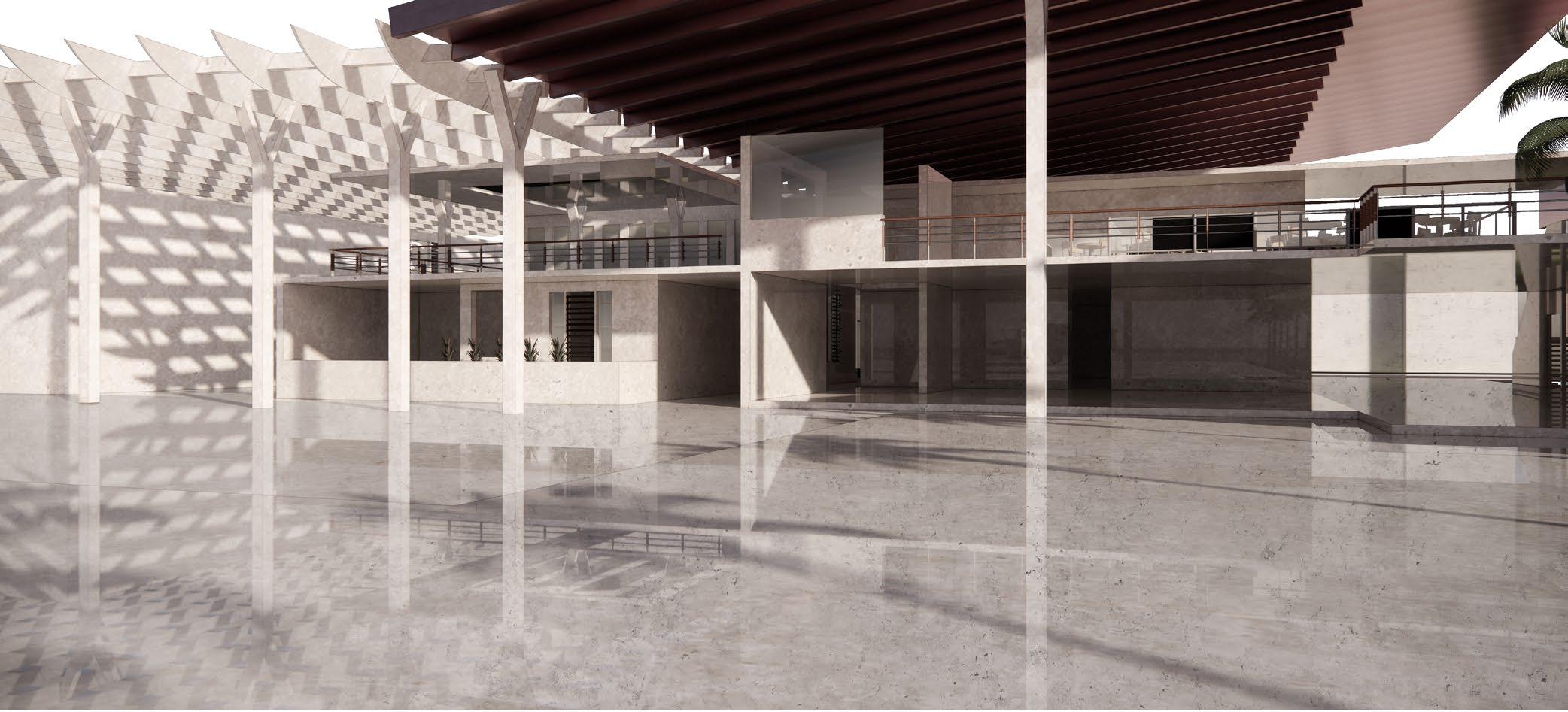
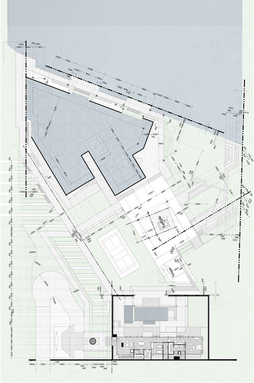
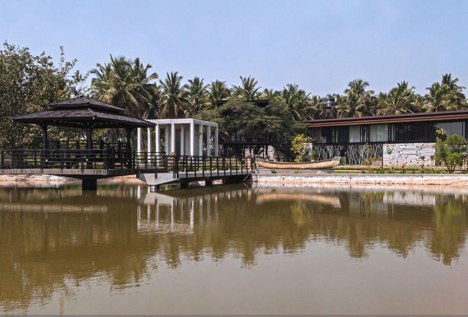
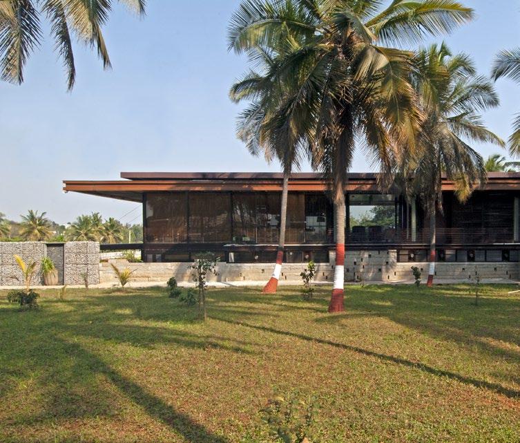
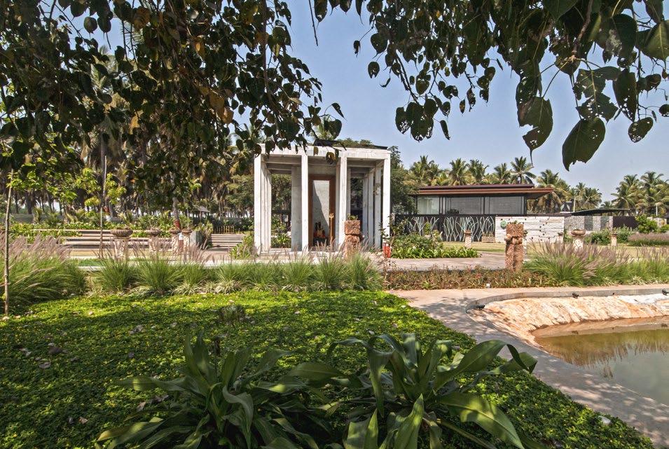
Aqua Park
A private weekend retreat nestled by the banks of a picturesque river.
Type :
Micro Urbanism
Live - Completed Project PRAGRUP
Abstract
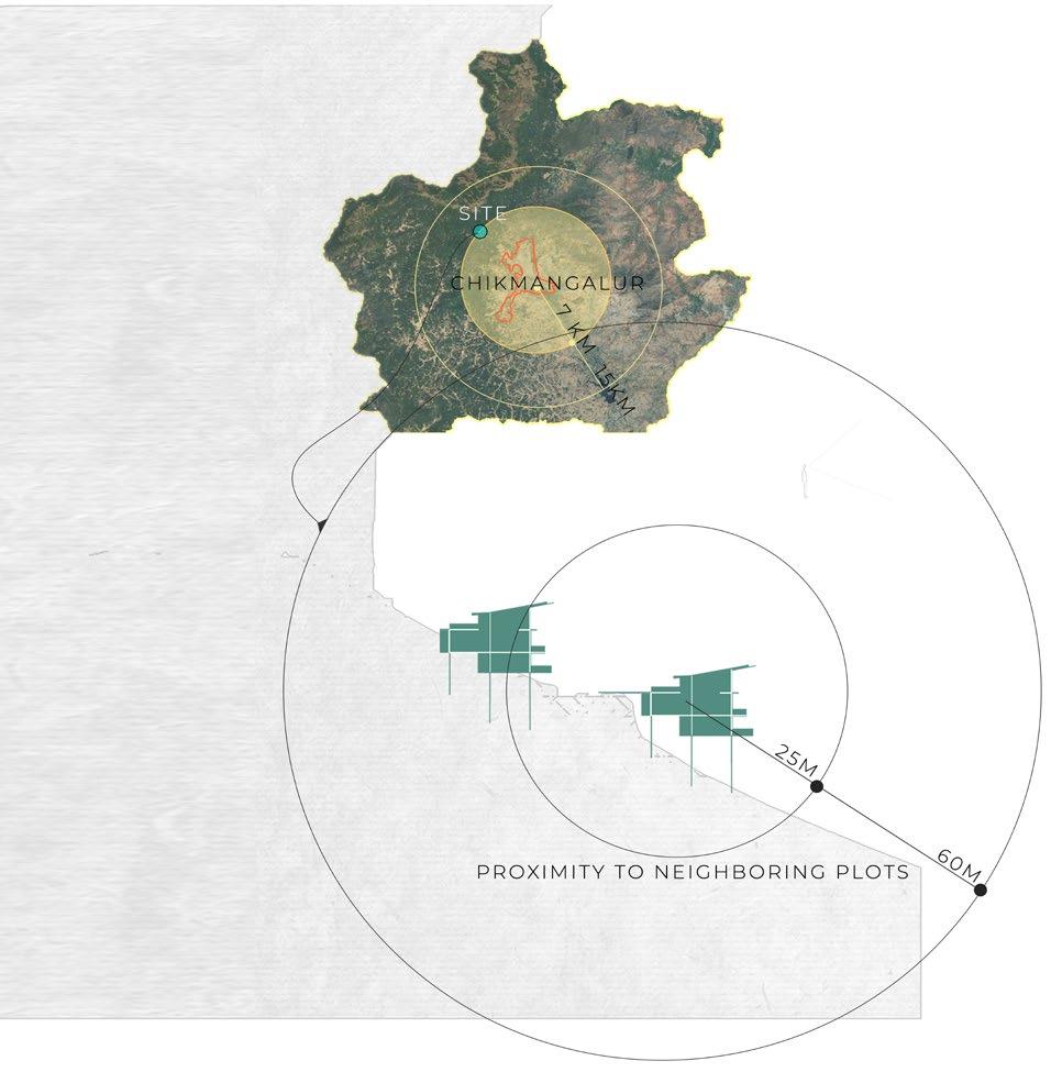
Bengaluru, India
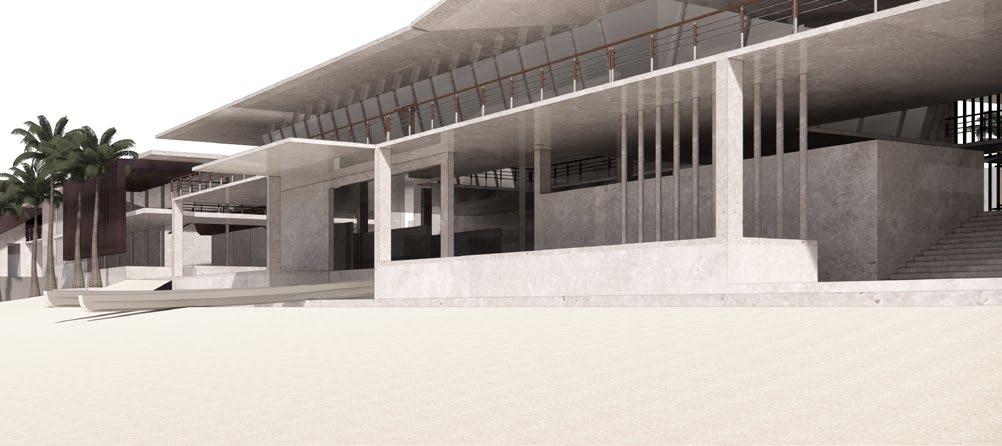
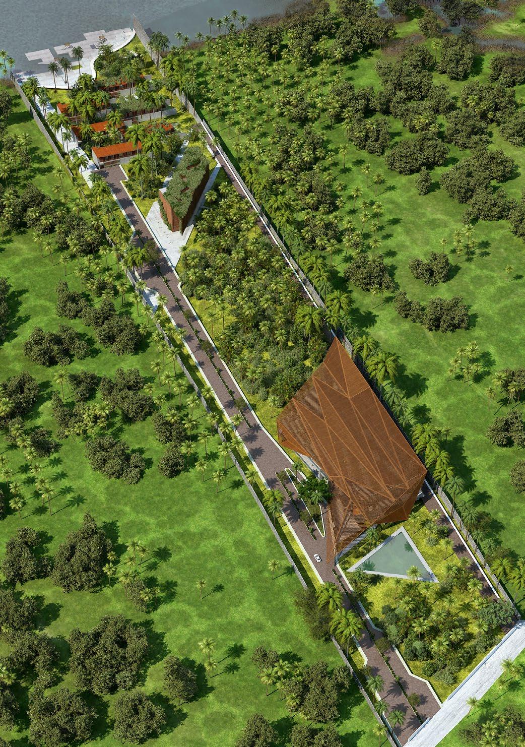
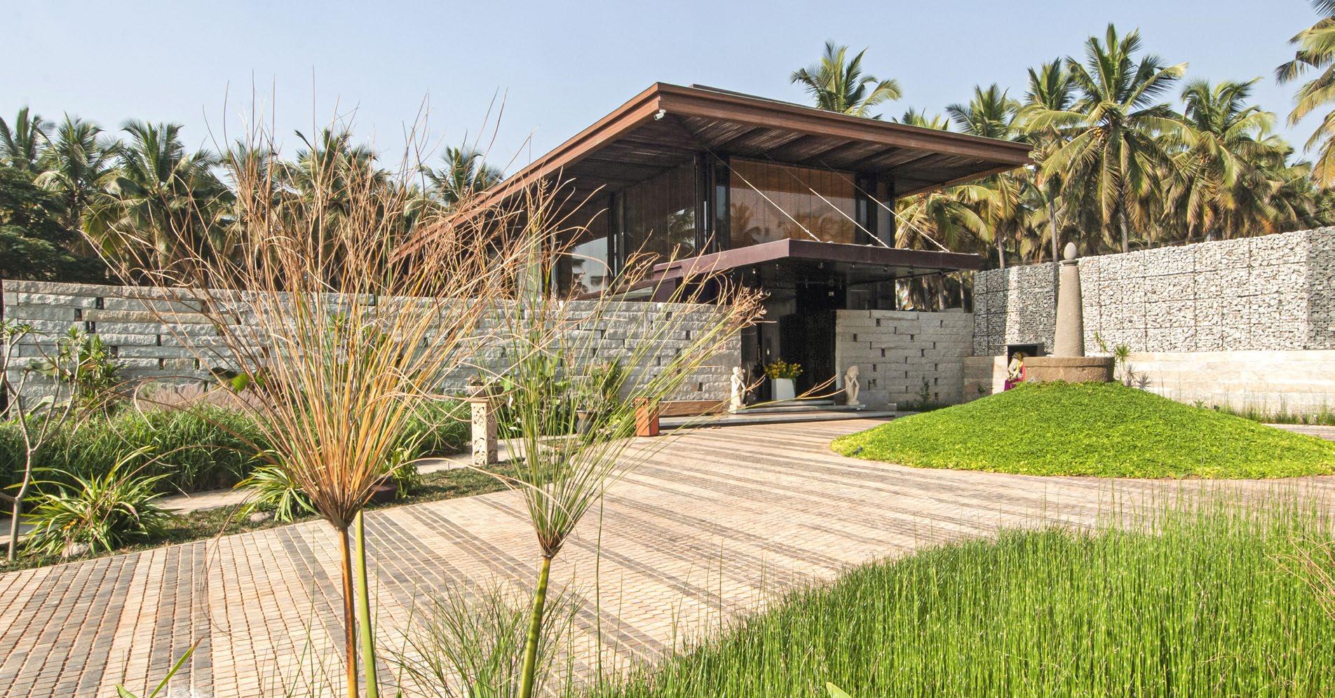
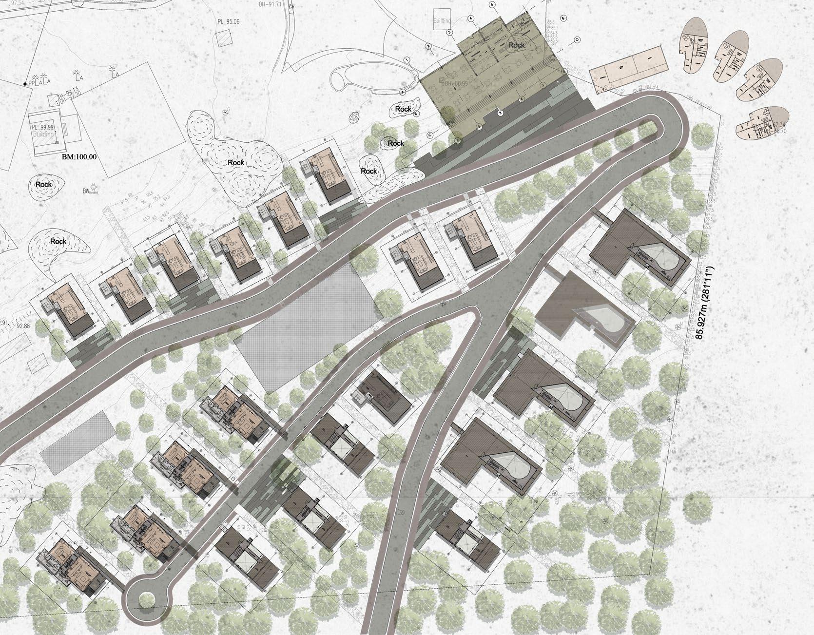
Nestled in a serene neighborhood on the outskirts of Bengaluru, Aqua park stands as a testament to meticulously crafted farmhouses. Emphasizing the use of recyclable materials and minimal land footprint, the design highlights sustainability. Positioned at the far end of a larger master plan, envisioning a resort with various studio units, dining options, and recreational facilities, Aqua ville is built with materials and craftsmanship allowing for easy disassembly and relocation.
A comprehensive plan for the entire property and the finished villa stands proudly by the river, serving as a testament to seamless construction. Natural timber, in its purest form, dominates the construction, ensuring longevity and aesthetic appeal for furniture and paneling. Situated facing a picturesque river, the villa’s design prioritizes immersion in nature from every angle.
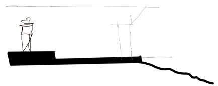
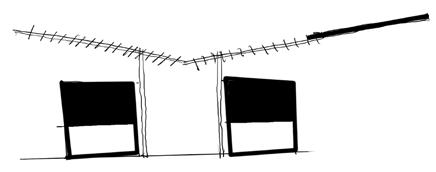
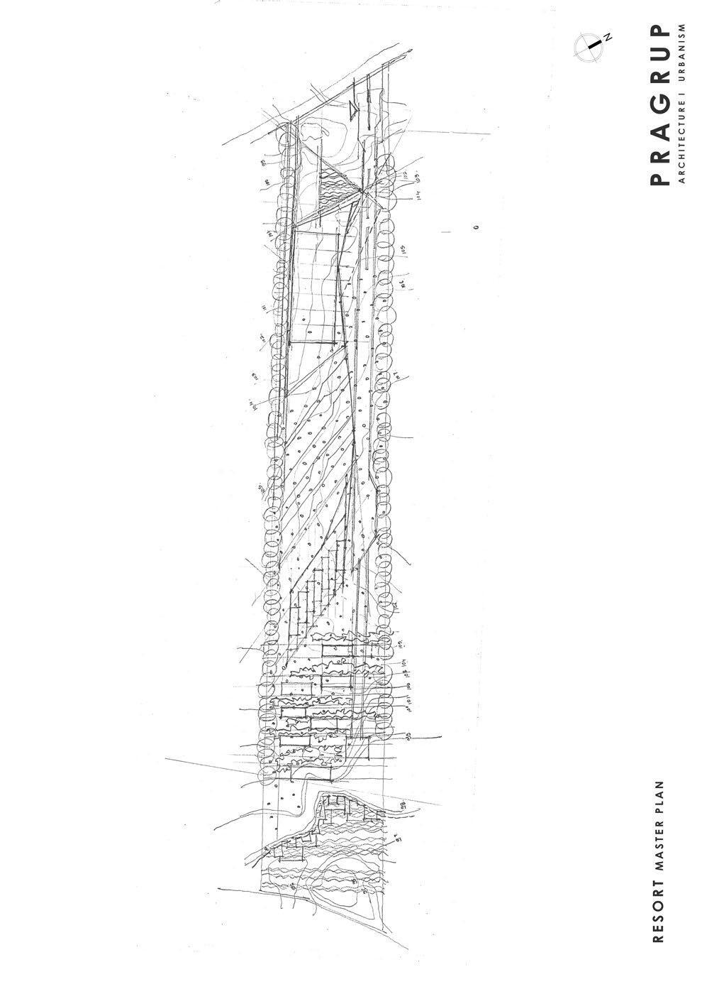
Urban Master plan Iteration - Sketch Method
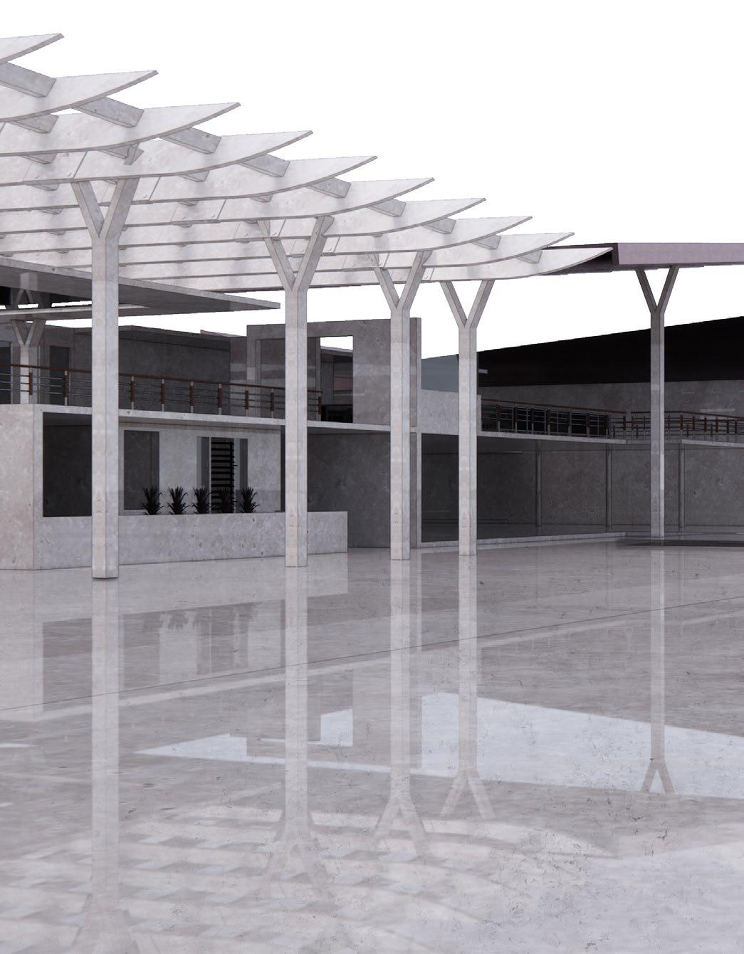
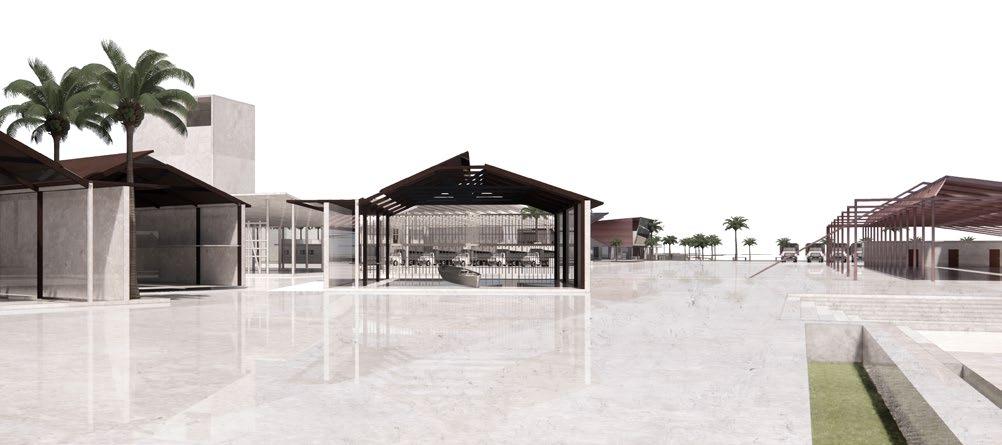
The overarching goal of this project is to create a recreational area for the community, which will also include the owner’s villa. The proposed master plan suggests that the buildings will seamlessly integrate into the natural landscape, appearing as if they were carefully crafted from the available space. In addition to the landscape, there will be pedestrianfriendly areas designed to encourage community gatherings and enhance the overall enjoyment of the space.
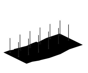
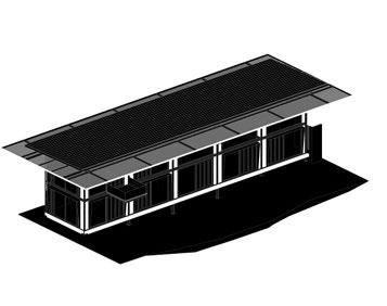
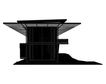
1. Placement of stilts as per the proposed grid
2. Horizontal plane with overhangs
3. Addition of windows and glass cover
4. Addition of inclined roof shingles
Java Rain
A solitary private villa elevated on stilts, offering panoramic views in every direction.
Location :
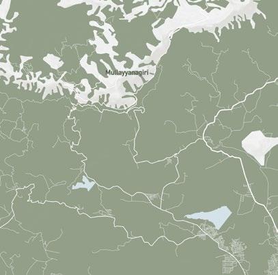
Mangalore, India
Type : Year :
Micro Urbanism
Unbuilt
PRAGRUP
2019
Abstract
The site features a genuine coffee plantation, characterized by a steep slope with a nearvertical drop of 65 meters over a span of 141 meters. Following the client’s instructions, the objective was to transform the site into a community of villas of varying sizes while preserving the natural landscape as much as possible.
Taking into account the site’s conditions and the client’s specifications, the design concept emerged, focusing on constructing the villas on stilts. The aim was to ensure the villas appeared light and airy internally without imposing heavily on the surrounding environment.
The entire structure is elevated using steel columns and beams, with only a minimal 10% concrete utilized for the villa foundations. Glass and wooden walls will provide uninterrupted views of the natural surroundings.
Wood is prominently featured throughout the design, blending seamlessly with the environment and adding to the overall aesthetic appeal.