FOREIGN MISSIONS CENTER MASTER PLAN
AT FORMER WALTER REED ARMY MEDICAL CENTER
/ Master Plan Report - 100% Submission
December 2018




EYP/ Architecture & Engineering
eypae.com
driven design
WARNING:
Contract:
S-AQMMA-11D- 0040
Task:
GS-P-11-12-MK-0007
PDN:
PJ2N00245
expertise
This document is the property of the U.S. Government. Further reproduction and/or distribution is prohibited without the express written approval of:
Department of State Bureau of Diplomatic Security Office of Physical Security Programs Facilities Security Division 1400 Wilson Boulevard Arlington, VA 22209
U.S.
FOREIGN MISSIONS CENTER MASTER PLAN AT FORMER WALTER REED ARMY MEDICAL CENTER
/ Master Plan Report - 100% Submission
December 2018

EYP/ Architecture & Engineering
eypae.com
expertise driven design
WARNING: This document is the property of the U.S. Government.
Further reproduction and/or distribution is prohibited without the express written approval of:
U.S. Department of State
Bureau of Diplomatic Security
Office of Physical Security Programs
Facilities Security Division
1400 Wilson Boulevard
Arlington, VA 22209
This Page is Intentionally Left Blank
EYP/
eypae.com expertise driven design
WARNING: This document is the property of the U.S. Government. Further reproduction and/or distribution is prohibited without the express written approval of:
U.S. Department of State
Bureau of Diplomatic Security
Office
1400
of Physical Security Programs
Facilities Security Division
Wilson Boulevard Arlington, VA 22209
Architecture & Engineering

DEPARTMENT OF STATE Foreign Missions Center Master Plan EYP/ i-i DECEMBER 2018 1. Executive Summary ............................................................. 1-1 1.1 Introduction ..................................................................................... 1-3 1.2 Planning Process 1-4 1.3 Foreign Missions Center Goals 1-5 1.4 Master Plan Concept 1-6 1.5 Documentation .............................................................................. 1-8 2. Introduction ......................................................................... 2-1 2.1 Planning Parameters ..................................................................... 2-3 2.2 Master Plan Goals and Objectives 2-7 2.3 Planning Process 2-11 3. Planning Analysis ................................................................ 3-1 3.1 Site Planning and Development History 3-5 3.2 Land Use and Site Context ........................................................ 3-10 3.3 Natural Elements ......................................................................... 3-20 3.4 Cultural Resources and Reuse Analysis 3-27 3.5 Utilities 3-38 3.6 Environmental 3-45 3.7 Transportation ............................................................................. 3-47 4. Plan Concept ........................................................................ 4-1 4.1 Plan Concept .................................................................................... 4-3 4.2 Preservation and Architectural Character 4-17 4.3 Campus Sustainability 4-20 4.4 Campus Design Elements 4-21 4.5 Open Space and Perimeter ........................................................ 4-25 4.6 General Guidelines for Utilities ................................................ 4-27 5. Design Guidelines ............................................................... 5-1 5.1 Design Review and Approval Process 5-3 5.2 Campus Zones 5-9 5.3 General Guidelines for Buildings and Structures 5-9 5.4 Guidelines for Existing Buildings ............................................ 5-12 5.5 Guidelines for New Construction ............................................ 5-17 5.6 Site Development and Sustainability 5-21 5.7 Vehicular Access and Parking 5-26 5.8 Utilities 5-28 5.9 Lot Development .......................................................................... 5-28 6. Acknowledgments .............................................................. 6-1 7. Appendices (Under Separate Cover) A. Geotechnical Study B.Final Environmental Impact Statement C. Tree Inventory D. Comprehensive Transportation Review
Table of Contents / 0
DEPARTMENT OF STATE Foreign Missions Center Master Plan EYP/ i-ii

DEPARTMENT OF STATE Foreign Missions Center Master Plan EYP/ 1-1 DECEMBER 2018
/ SECTION 1 EXECUTIVE SUMMARY

U.S. Department of State Mission Statement
Shape and sustain a peaceful, properous, just, and democratic world and foster conditions for stability and progress for the benefit of the Amercan people and people everywhere
Executive Summary / 1


1.1 INTRODUCTION
The U.S. Department of State (DOS) has identified the need to establish a Foreign Missions Center (FMC) in support of its mission to provide modern and secure facilities around the world which represent the United States of America. By an act of Congress in 1968, the International Chancery Center was established near the intersection of Van Ness Street and Connecticut Avenue, NW, to allow DOS to leverage those sites in the District of Columbia for sites in other countries. All of the lots within the International Chancery Center have been assigned to foreign missions. DOS seeks to establish another foreign missions campus, the FMC, in Washington to use for the same purpose.
DOS has an urgent need to meet the demand by foreign missions for appropriate facilities in Washington, D.C., which is one of the smallest national capitals in land area, but is home to more foreign embassies than any other city in the world. Within its borders, there are approximately 190 foreign embassies and 30 headquarters or offices of international organizations. These entities are in the District’s Northwest quadrant and are heavily concentrated along Massachusetts Avenue, the Sheridan-Kalorama neighborhood, and at the fully built-out International Chancery Center.
After reviewing several available parcels within the District of Columbia, DOS identified the former Walter Reed Army Medical Center (WRAMC) as the best potential site. In May 2005, the Secretary of Defense recommended to the Defense Base Closure and Realignment Commission (BRAC) the closure of the WRAMC. The Department of the Army transferred approximately 31.7 acres of the 113 acre property to DOS in 2015. This site is currently improved with several administrative, medical, and residential use buildings. The remaining portion of the WRAMC is to be transferred to the Walter Reed Local Redevelopment Authority (DC-LRA), a District of Columbia government entity and the Children’s National Medical Center (CNMC) for the protection of public health and/or research.
Located near the northern apex of the District of Columbia, the WRAMC has a long history and, consequently, any plans and studies need to take into consideration the historic context. The entire WRAMC campus is listed on the National Register of Historic Places and DC Inventory of Historic Sites as a historic district. The period of significance for the historic district is July 11 to 12, 1864 and 1909 to 1956. Any extant structure constructed between 1909 and 1956, the period of significance related to the WRAMC period, is considered a contributing resource. As a historic district all proposed projects within the boundaries will be subject to review following the local historic preservation requirements and guidelines.
DEPARTMENT OF STATE Foreign Missions Center Master Plan EYP/ 1-3 DECEMBER 2018
Figure 1.1: Proposed Foreign Missions Center master plan concept N
1.2 PLANNING PROCESS
The FMC campus master planning effort was started by DOS in December 2011. The planning process engaged DOS constituents and drew on the experiences and understanding of a wide range of participants including representatives from consulting agencies. The public have also been invited to participate through the National Environmental Protection Act requirements and the National Historic Preservation Act, Section 106 consultation efforts. One-on-one interviews, group meetings, planning workshops, public scoping meetings, open houses, and public hearings were conducted.
The existing capital resources on the former WRAMC have been thoroughly surveyed and documented. Studies included existing conditions surveys and reuse analysis of existing structures. Site analysis studies were prepared to establish a clear picture of existing and proposed land uses patterns and existing natural features informing discussions and proposals. Iterative discussions with DOS and representatives of the coordinating agencies confirmed programmatic objectives and priorities.
In December 2014, the U.S. Congress passed the annual National Defense Authorization that included a change to the distribution of the former WRAMC. The portion to be transferred to DOS was reduced from about 43.5 acres to 31.7 acres. The northeast portion of DOS parcel that included several buildings and a parking garage was designated for the recipient to use for the protection of public health, including research. The result of this change in campus area had required DOS to pause the design review process, environmental review process, and preservation consultation process in order to re-design the campus plan and reverify assumptions made during the initial planning analysis.
In addition to this master plan study, there are a couple of simultaneous planning efforts required for the DOS to develop the master plan for the FMC. Each of these efforts is part of the planning process and informs the master plan. These additional planning tasks include a study of potential environmental impacts and a study of the effects on contributing resources in the historic district.
National Environmental Protection Act
The DOS issued a notice of intent to file an Environmental Impact Statement (EIS) in June 2012. This notice of intent was followed by a public scoping comment period from July to August 2012 and included a public scoping meeting in which the public provided input.
The Draft Environmental Impact Statement (DEIS) was issued in early February 2014 and DOS conducted an open house and public hearing to receive comments from the public during the mandated public comment period. Due to the change in campus size, a Supplemental Draft Environmental Impact Statement (SDEIS) was issued for review and public comment in late March 2017. The review of the SDEIS also included an open house and public hearing. The Final Environmental Impact Statement (FEIS) was issued in November 2017 with the Record of Decision (ROD) to be filed in February 2018. These public interactions have significantly contributed to the development of the FMC master plan.
National Historic Preservation Act
The Department of the Army has performed a Section 106 consultation for the WRAMC for the BRAC undertaking. A Programmatic Agreement between the Army and the signatory parties incorporating mitigation measures was signed in January 2013. As part of the Programmatic Agreement, the Department of the Army developed a nomination of the Walter Reed Army Medical Center historic district to be listed on the National Register of Historic Places and the DC Inventory of Historic Sites. The WRAMC was designated a historic district by DC Preservation Office in May 2014 and by the U.S. Department of the Interior in March 2015.
The Section 106 consultation by DOS for the master plan of the Foreign Missions Center has been completed. The Section 106 consultation began in January 2013 with a meeting between Department of State, DC-Historic Preservation Office, and the Advisory Council on Historic Preservation to review the status of the project, outline public participation opportunities, and determine the form of agreement that would be developed at the conclusion of the consultation process. The parties agreed that the most appropriate form of resolution would be a Programmatic Agreement. Following this initial meeting, there was a public meeting held in summer 2013 to describe the Section 106 process, to share the initial findings of the consultant team, and to identify the consulting parties. The Section 106 consultation started in February 2014 and was paused when the size of the FMC was changed. The consultation process was restarted in the winter 2017. A Programmatic Agreement was finalized on December 4, 2018.
DEPARTMENT OF STATE Foreign Missions Center Master Plan EYP/ 1-4
Figure 1.2: View of 14th Street looking towards Dahlia Street

1.3 FOREIGN MISSIONS CENTER GOALS
DOS intends to develop a campus and assign lots to foreign missions for the express purpose of building chanceries. The chanceries may include cultural events venues and residences. In the role as the developer, DOS will manage the assignments and maintain common land areas, primarily streets, sidewalks, and public open space. The following are the planning goals.
• Enhance DOS’ efforts to gain new sites to construct safe, modern, and secure embassies and consulates overseas;
• Accommodate foreign government chanceries on a consolidated campus promoting safety and protection of diplomatic facilities as mandated by the Vienna Convention on Diplomatic Relations of 1961, and as authorized in the 1982 Foreign Missions Act;
• Support the Department of State’s commitment to sustainable design and reduction of carbon footprint;
• Create a cost-neutral development on the DOS portion of the WRAMC campus;
• Support the desire of foreign missions to build significant facilities that reflect the character and ethos of their native architectures;
• Optimize land use and strive to maximize assignable land to ease the burden of the cost model.
The development concept for the Foreign Missions Center is a cost-neutral model, without the requirement of new federal appropriations for development. The development and maintenance of the site infrastructure would be funded by the cost of lot assignments to foreign missions. The development of the FMC infrastructure will most likely be phased. DOS envisions initial parcels of the property to be assigned to fund both the initial infrastructure development and the following phase of infrastructure construction. The construction sequencing of the FMC infrastructure will be dependent on foreign government commitments for lots and existing buildings.
DEPARTMENT OF STATE Foreign Missions Center Master Plan EYP/ 1-5 DECEMBER 2018
Figure 1.3: View of Dahlia Street from Chapel looking east
1.4 MASTER PLAN CONCEPT
The master plan concept for the Foreign Missions Center (FMC) is for DOS to develop and maintain the site infrastructure, and for each foreign mission to develop the individual lots. The approach to the subdivision (parcelization) of the property involves the creation of a number of individual lots for chancery development with DOS providing the common area infrastructure for roadways, common green areas, and major on-site utilities. The common areas will be maintained by DOS. DOS plans to initiate long-term assignments to foreign missions for their development of individual parcels for chanceries. The master plan infrastructure allows for varying sizes of parcels and frontages as market conditions warrant.
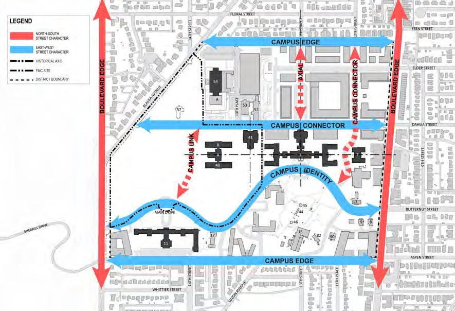
The vision for the FMC master plan is a contextual response to the city fabric around the site, the Walter Reed Local Redevelopment Authority (DCLRA) master plan, Children’s National Medical Center (CNMC) master plan, reinforcement of the existing cultural and natural landscapes, reuse of key historic structures and respectful of existing axial relationships. A simple and clear network of streets and open spaces transforms the proposed redevelopment by DOS, CNMC, and District of Columbia of the WRAMC into a unified, holistic plan poised to become a signature Washington, D.C. neighborhood within the 21st century. The east and west halves of the campus are sewn together with the clear definition of Dahlia Street as a boulevard adding connectivity and a sense of vibrancy between the DC-LRA portion and the FMC portion of the WRAMC campus. The primary entrance for the FMC on Main Drive is defined by the existing ellipse to the south but given further credence through the linear northsouth greenway, culminating in a park surrounding the historic Memorial Chapel on the north side of campus. This greenway serves as an amenity to the master plan but also has a practical purpose as a bio-retention park, managing a portion of the rain water run-off (storm water management plan) on the campus. There are four site-wide themes that provide the basis for the master plan concept.
DEPARTMENT OF STATE Foreign Missions Center Master Plan EYP/ 1-6
Figure 1.4: Campus Character
N N
Figure 1.5: Connectivity and Street Character

Campus Connectivity
The extension of the street grid from surrounding area into the Foreign Missions Center creates an interconnected link between the established and proposed developments. The FMC will be part of the re-invention of the WRAMC.
Historic Campus Planning Foundation
The planning foundation for the WRAMC is organized around an axial arrangement of buildings and green spaces. The preservation of historic structures maintains both a character and contextual foundation for the conceptual explorations and recommended plan. The reuse of the historic buildings represented on the concept plan for the FMC is dependent on the market conditions of these unique sites which can either stand alone or serve as complimentary additions to future chancery sites.
Campus Character
The character of the campus divides along 14th Street, with a more cultivated landscape to the east and a more forested landscape character to the west. The landscape east of 14th Street is characterized by man-made features such as formal gardens, avenue of trees, and built elements in the landscape. The landscape west of 14th Street is characterized by the predominantly native species tree canopy, reinforced by several areas with steeper slopes. The Design Guidelines will reinforce the juxtaposition of these two landscapes.
Open Space Framework
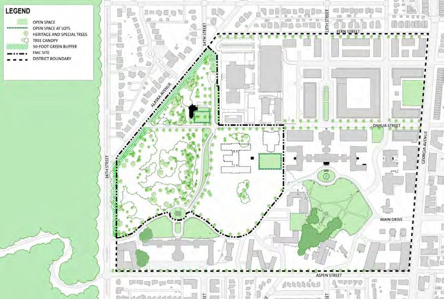
The open space concept consists of a hierarchy of tree-lined streets. Dahlia Street, which runs east-west, links the three developments portions of the Walter Reed Army Medical Center and to the city. 14th Street, which runs north-south, links the FMC with the lower portion of the FMC and provides a primary entry to the campus from Main Drive. This street is set apart by a linear park that starts at the ellipse on Main Drive and terminates at Building 57/Memorial Chapel. The area around Memorial Chapel is set apart to preserve its unique setting in the WRAMC. The existing landscape serves as a buffer between the residential neighborhoods and the FMC.
DEPARTMENT OF STATE Foreign Missions Center Master Plan EYP/ 1-7 DECEMBER 2018
Figure 1.6: Landscape Open Space
N N
Figure 1.7: Landscape Typologies
1.5 DOCUMENTATION
This Master Plan Report describes in further detail the planning process, analysis, master plan concept, and the design guidelines for the Foreign Missions Center at the WRAMC. This document is the final submission for review and comment by DOS and consulting agencies, including:
• The U.S. Commission of Fine Arts (CFA)
• The National Capital Planning Commission (NCPC)
• District of Columbia Office of Planning- Historic Preservation Office (DC-HPO)
• DC Planning including the Local Redevelopment Authority for the WRAMC (DC-LRA)
Design Guidelines and Review Process
The master plan establishes the overall design intent for the FMC campus and also includes design guidelines to be followed by each foreign mission in the design and construction of their chancery. The design guidelines cover a broad spectrum of design issues including tree preservation, historic preservation, lot development limitations, transportation demand management planning, and sustainability measures. In addition to the design guidelines, the master plan cites the Memorandum of Agreement between DOS and NCPC for the design review of each chancery development and major renovation. The NCPC will act as the reviewing agency using the review criteria established in the Foreign Missions Act of 1982. The process is to include a broad spectrum of input including local ANC, CFA, and DC agencies such as DDOT and DCPO.
DEPARTMENT OF STATE Foreign Missions Center Master Plan EYP/ 1-8
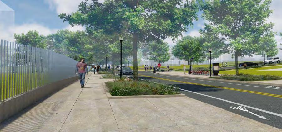
Figure 1.8 Proposed view of Dahlia Street

DEPARTMENT OF STATE Foreign Missions Center Master Plan EYP/ 2-1 JANUARY 2018
INTRODUCTION
/ SECTION 2
DEPARTMENT OF STATE Foreign Missions Center Master Plan EYP/ 2-2
N
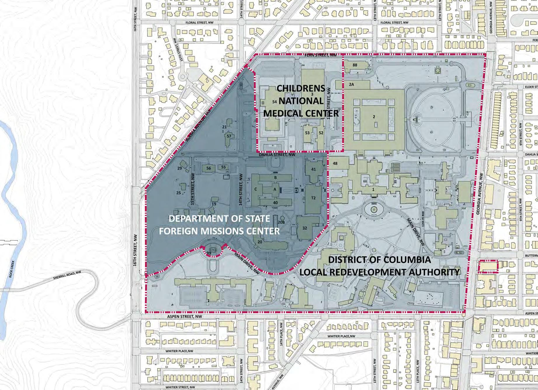
Figure 2.1: Walter Reed Army Medical Center - Existing Conditions
Introduction / 2


2.1 PLANNING PARAMETERS
The Department of State (DOS) has identified the need to establish a Foreign Missions Center (FMC) in support of its mission to provide appropriate facilities around the world representing the government of the United States of America. A similar center, the International Chancery Center (ICC), was established by law in 1968 near the intersection of Van Ness Street and Connecticut Avenue, NW. The first chancery at the ICC was built by the State of Israel in 1980. The most recent chancery completed on the site was by the People’s Republic of China in 2008. With one lot remaining to be developed by the Kingdom of Morocco, it has taken just over 30 years to develop the ICC campus.
DOS has an urgent need to meet the demand for modern and secure facilities for foreign missions in Washington, D.C. which is one of the smallest national capitals, but is home to more foreign embassies than any other city in the world. Within its borders, there are approximately 190 foreign embassies and 30 headquarters or offices of international organizations. These entities are located in the District’s Northwest quadrant and are heavily concentrated along Massachusetts Avenue, the Sheridan-Kalorama neighborhood, and at the fully built-out ICC.
Legislative Compliance
The Foreign Missions Act of 1982, 22 U.S.C. 4301-4316, reaffirms the federal government’s jurisdiction over the operation of foreign missions and international organizations in the United States. The Act established an Office of Foreign Missions (OFM) within DOS to review and control the operations of foreign missions in the United States and the benefits that are made available to them. It empowers the OFM to set the terms and conditions whereby benefits may be provided and sets forth the mechanism and criteria under which the location of foreign missions in Washington, D.C. are to be decided.
The Foreign Mission Act establishes procedures and criteria governing the location, replacement, or expansion of chanceries in Washington, D.C. The Act authorizes DOS to acquire property in the United States for the establishment of property exchange agreements with foreign governments, whereby the U.S. government would reciprocally obtain a site abroad that is of equal benefit to the United States. The Act further allows the Secretary of State to use funds previously obligated for the acquisition of diplomatic and consular properties abroad to execute the U.S. government’s obligation under such an agreement.
DEPARTMENT OF STATE Foreign Missions Center Master Plan EYP/ 2-3 JANUARY 2018
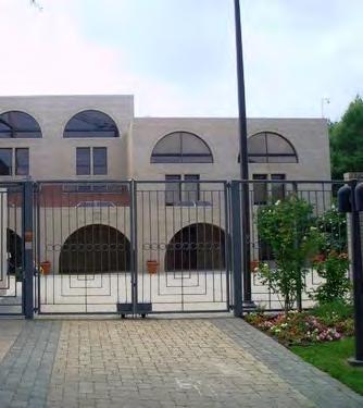
Figure 2.2: Embassy of Ghana at the ICC
Figure 2.3: Embassy of Israel at the ICC

Under the Foreign Missions Act, OFM’s Property Program manages all acquisitions, including leases, additions, and sales of real property by foreign missions to assure that it is consistent with national security interests, reciprocity, and applicable local and international law. Those foreign governments not providing the United States with substantially equivalent property rights are not permitted to utilize real estate for their diplomatic or consular posts.
To comply with the Foreign Missions Act, DOS must facilitate the provision of adequate and secure facilities for foreign missions. DOS previously fulfilled their mandate to provide property for foreign missions using available acreage within the ICC near the intersection of Connecticut Avenue and Van Ness Street NW. The ICC was built pursuant to the International Center Act of 1968, as amended in 1982 (PL 90-553, and PL 97-186), to supply property that would address the modern operational needs of foreign missions. Because all lots within the ICC are fully assigned, DOS has a need to comply with the Foreign Missions Act by establishing a second location for a similar development.
The International Center Act also provides legislative support for the development of a second ICC in that the Act states: “The Secretary may maintain therefrom a reserve for maintenance and security of those public improvements authorized by this Act which have not been conveyed to a government or international organization under the first section of this Act, and for surveys and plans related to the development of additional areas within the Nation’s Capital for chanceries and diplomatic purposes (Section 5(2)).”
In addition to these federal statutes, the 1961 Vienna Convention on Diplomatic Relations mandates that signatory nations, including the United States, must facilitate the acquisition of premises for foreign missions (Article 21). These premises must “accord full facilities for the performance of the functions of the mission (Article 25).” Further, signatory nations must provide secure facilities by taking “all appropriate steps to protect the premises of the mission (Article 22).”
On February 27, 2017, Department of State, Office of Foreign Missions and National Capital Planning Commission (NCPC) signed a Memorandum of Agreement (MOA) where NCPC will be the review authority for the FMC. The MOA clarifies roles and responsibilities during the design review process and reaffirms that the six review criteria established in the Foreign Missions Act will be used for NCPC’s evaluation of each chancery application.
DEPARTMENT OF STATE Foreign Missions Center Master Plan EYP/ 2-4
N
Figure 2.4: International Chancery Center (ICC) in Washington, D.C.

Resource: Walter Reed Army Medical Center
In May 2005, the Secretary of Defense recommended to the Defense Base Closure and Realignment Commission (BRAC) the establishment of a new Walter Reed National Military Medical Center (WRNMMC), consolidating elements from the Walter Reed Army Medical Center (WRAMC) with Navy medical operations. The new co-located WRNMMC is situated on the campus of the National Naval Medical Center in Bethesda, Maryland. This transition is complete having occurred in September, 2011. The Department of the Army transferred approximately 31.7 acres of the WRAMC to the Department of State in November 2015. The property is improved with several administrative, medical, and residential use buildings. The remaining portion of the WRAMC was transferred to the Walter Reed Local Redevelopment Authority (DC-LRA), a District of Columbia government entity and Children’s’ National Medical Center (CNMC) in the fall of 2016.
The site at the former WRAMC provides a resource in the District of Columbia where land may be assigned to foreign missions for development of their chanceries. In return, DOS may receive, through reciprocal agreements, similar property overseas. Each foreign mission will be responsible for the design and construction of their chancery, and each design will undergo design reviews with the Commission of Fine Arts, National Capital Planning Commission, and Historic Preservation Review Board.
Located near the northern apex of the District of Columbia, the WRAMC has a long and rich history and, consequently, any plans and studies need to take into consideration the historic context. The entire WRAMC campus was determined as eligible for listing on the National Register of Historic Places and DC Inventory of Historic Sites as a historic district. The period of significance for the historic district is July 11 to 12, 1864 and 1909 to 1956. Any extant structure constructed between 1909 and 1956, the period of significance related to the WRAMC period, is considered a contributing resource. As a historic district, all proposed projects within the boundaries would be subject to comment following the DC Preservation Office’s regulations and guidelines. In April 2014, the Walter Reed Army Medical Center historic district was approved to be part of the DC Inventory of Historic Sites. In March 2015, this new historic district was added to the National Register of Historic Places.
DEPARTMENT OF STATE Foreign Missions Center Master Plan EYP/ 2-5 JANUARY 2018
N
Figure 2.5: Proposed Foreign Missions Center location at former Walter Reed Army Medical Center
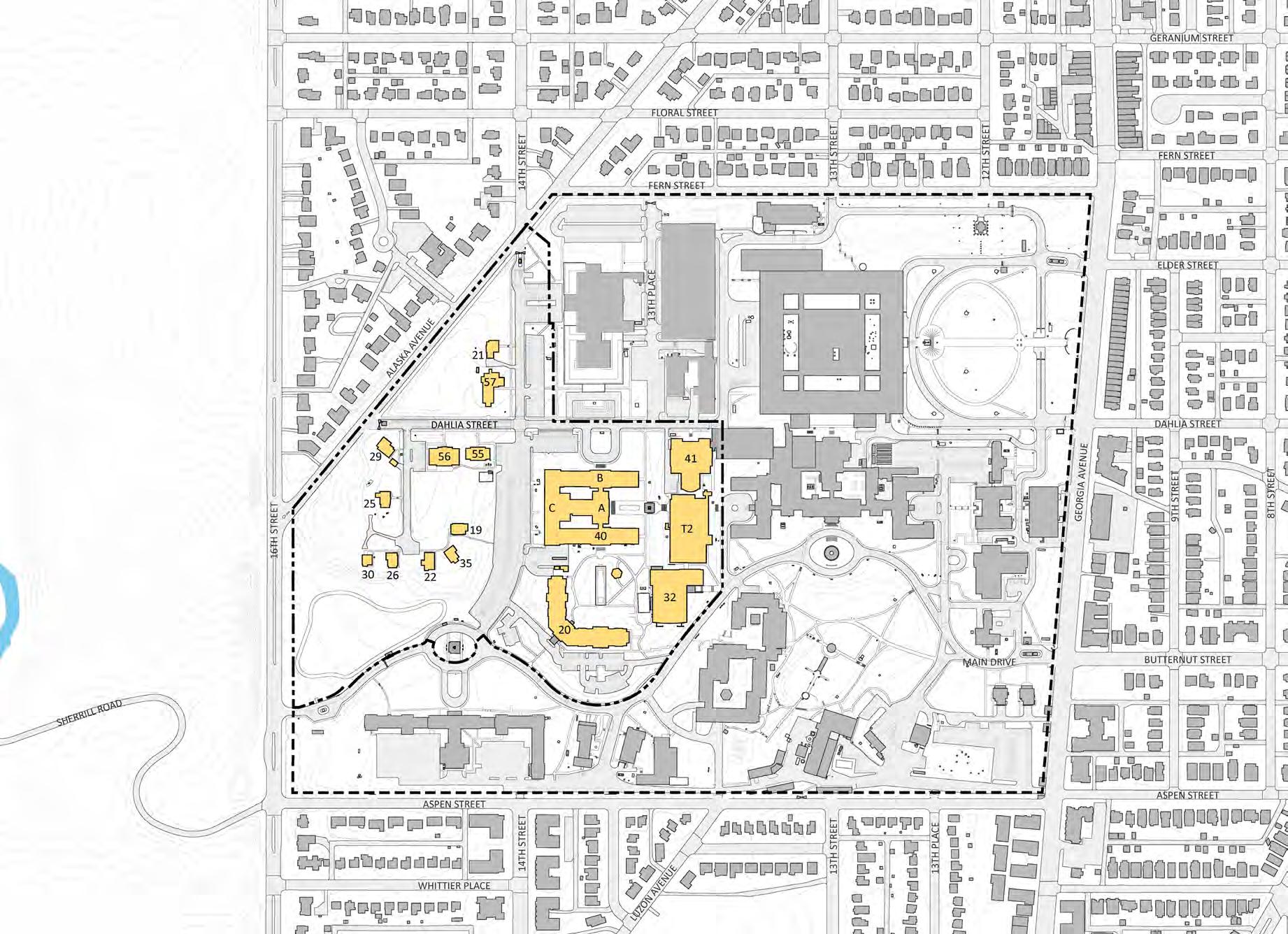
LEGEND
19-Officer’s Quarters
20-Mologne Guest House
21-Officer’s Quarters #7
22-Officer’s Quarters #8
25-Officer’s Quarters #11
26-Officer’s Quarters #12
29-Officer’s Quarters #16
30-Officer’s Quarters #17
32-Wagner Sports Center
35-Officer’s Quarters #19
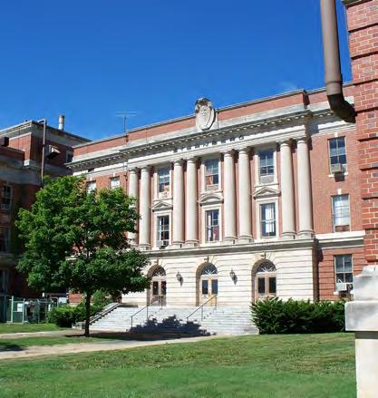
40-Walter Reed Army Institue of Research (WRAIR)
41-Old Red Cross Building
55-Fisher House 2
56-Fisher House 3
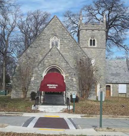
57-Memorial Chapel
T2-Medical Center Brigade
Existing buildings on FMC Site
DEPARTMENT OF STATE Foreign Missions Center Master Plan EYP/ 2-6
N
Figure 2.6: Walter Reed Army Medical Center - Inventory of Existing Buildings at Foreign Missions Center

2.2 MASTER PLAN GOALS AND OBJECTIVES
Vision and Goals
According to the National Capital Planning Commission’s 2016 Comprehensive Plan for the National Capital: Federal Elements, there is an expected demand for four or five new chancery sites every year. The International Chancery Center on Van Ness Street near Connecticut Avenue is completely built out. The NCPC Comprehensive Plan acknowledges the planning of the Foreign Missions Center (FMC) at the former WRAMC that can accommodate twelve to fifteen foreign missions in a high-density development with urban characteristics to incorporate a variety of chancery sizes.
The model for the FMC is the International Chancery Center (ICC) on Van Ness Street in Northwest Washington D.C. not far from the Walter Reed site. The ICC has 19 lots ranging in size from 0.5 acre to 2.6 acres. As of this publication, there are 17 chanceries, one Federal building, and one remaining open lot has been assigned and proposed designs have been approved. The ICC also includes four small parks with limited access to the public. The ICC campus was planned and developed in conjunction with the University of the District of Columbia and IntelSat on the former site of the National Institute of Standards and Technology. DOS intends to develop a campus and assign lots to foreign missions for the express purpose of building chanceries. The chanceries may include cultural events venues and residences. In the role as the developer, DOS will manage the assignments and maintain common land areas, primarily streets, sidewalks, and public open space. The following are the planning goals.
• Enhance DOS’ efforts to gain new sites to construct safe, modern, and secure embassies and consulates overseas;
• Accommodate foreign government chanceries on a consolidated campus promoting safety and protection of diplomatic facilities as mandated by the Vienna Convention on Diplomatic Relations, and as authorized in the Foreign Missions Act of 1982;
• Support DOS’ commitment to sustainable design and reduction of carbon footprint;
• Create a cost-neutral development on the DOS portion of the WRAMC campus;
• Support the desire of foreign missions to build significant facilities that reflect the character and ethos of their native architectures;
• Optimize land use and strive to maximize assignable land to ease the burden of the cost model.
DEPARTMENT OF STATE Foreign Missions Center Master Plan EYP/ 2-7 JANUARY 2018
Figure 2.7: Building 41 / Old Red Cross Building
Figure 2.9: Building 40A / Walter Reed Army Institute of Research
Figure 2.8: Building 57 / Memorial Chapel
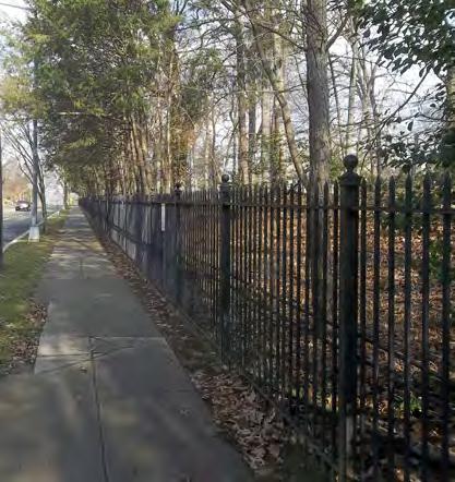
Figure 2.10: Perimeter Fence at Alaska Avenue
Program of Requirements
The primary permitted use for the lots on the FMC is for chanceries. A Chancery, as defined by the Foreign Missions Act is “…the principal offices of a foreign mission used for diplomatic or related purposes, and annexes to such offices (including ancillary offices and support facilities).” A Chancery includes both the buildings and the site that is used for chancery functions. Other uses may be allowed as long as they are combined with a chancery. Residential facilities for staff housing may be allowed as long as they are ancillary to the chancery. This definition from the enabling legislation, the Foreign Missions Act of 1982, supports the location of a chancery.
Campus Edges
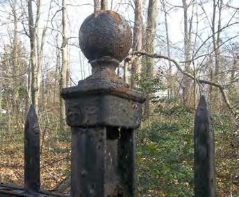
The FMC will be an open and welcoming environment to support the missions and functions of the chanceries. The campus perimeter should include access for the public to the foreign missions while providing a site that can be secured in extreme circumstances. Both of these goals can be addressed by clear delineation of the campus perimeter. The major elements of the campus perimeter will include incorporating existing black steel fence and treed landscape on the western edge along Alaska Avenue and 16th Street. The fence is also a contributing resource to the historic district. The treed landscapes will continue to provide a landscaped buffer adjacent to residential neighborhoods.
Access and Entrances
The FMC is to be an open campus that is accessible to the public and adjacent developments on the former WRAMC. Entrances are needed for the free movement of vehicles, bicycles, and pedestrians through the campus. Although traffic studies have indicated that only one vehicular entrance is needed to serve the anticipated vehicular volume, the FMC campus is being developed to provide open public vehicular access from four access points to the adjacent developments and surrounding public streets, to accommodate ease of access and egress of employee, emergency, and service vehicles. In times of high security, entrances may need to be readily closed, regulating and limiting access.
Streets and Parking
The primary means of accessing the campus will be the street system. Each street should be two-way with at least one vehicular travel lane in each direction. In addition to vehicular travel lanes, there may be a bicycle lane. For security reasons and lessons learned from the ICC, on-street parking will not be permitted. It is anticipated that most of the employees of each chancery will travel to and from the campus either by car, public transportation or alternative means of transportation.
DEPARTMENT OF STATE Foreign Missions Center Master Plan EYP/ 2-8
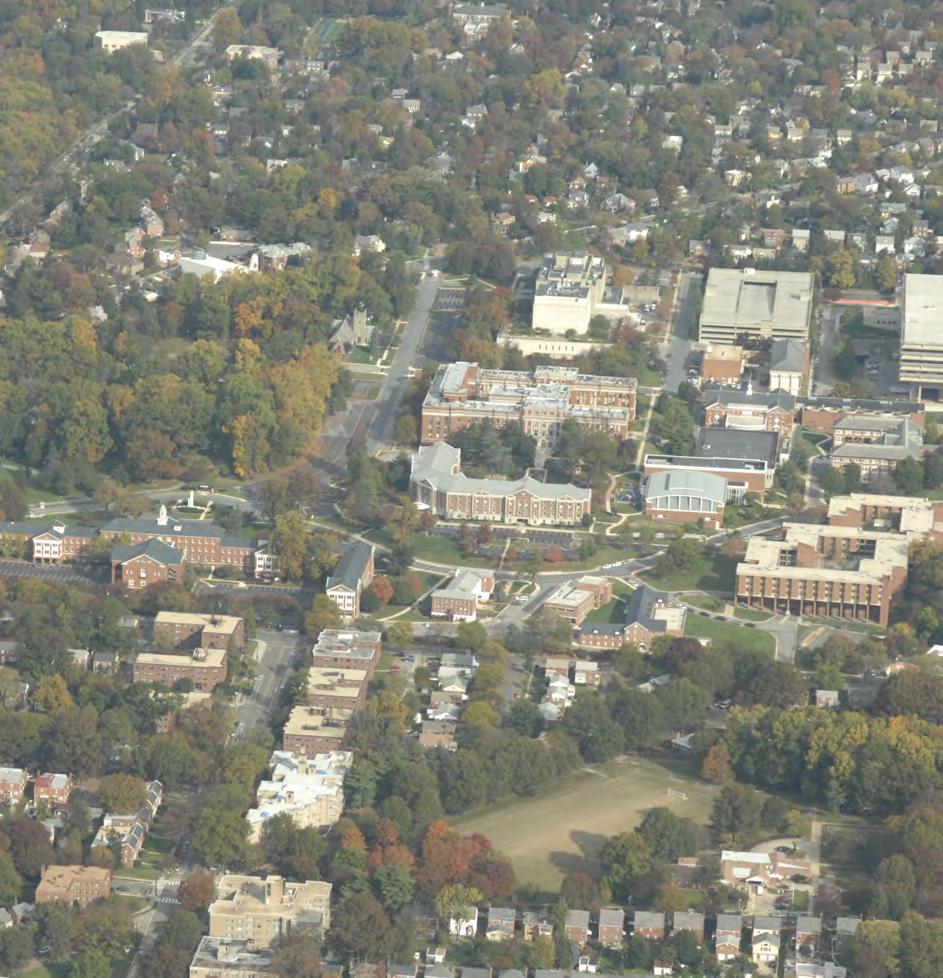
Figure 2.11: Aerial of Campus from the south
Each chancery will also need to accommodate some visitor parking. While DOS will encourage sustainable means of transportation, all foreign mission employees’ parking will need to be accommodated within each chancery lot. Chancery parking should be concealed and may be located in an underground structure.
Pedestrian Network
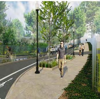
In addition to providing vehicular access to the campus, there will be a network of walkways and sidewalks that link the FMC campus to the surrounding communities, providing direct access to proposed DC-LRA amenities and Rock Creek Park. The pedestrian network shall primarily consist of sidewalks parallel to streets. The pedestrian network will provide safe passage for chancery employees and visitors from parking areas and public transportation to destinations. The sidewalks should be well lit and shaded with trees. Landscape buffers will provide a visible separation of vehicles from pedestrians, a location for shade trees and street lights, space for storm water management, and an overall greening of the campus. Paving and other street-scape materials should be durable and fixed for ease of maintenance and prevention of vandalism.
Utilities and Infrastructure

In order to support a viable development, existing utilities and campus infrastructure will need to be replaced with new services and infrastructure. It is the intention that local utility companies will provide services along the street infrastructure that is within DOS portions of the campus with each chancery bearing the direct expenses for connections and usage. DOS will not serve as either a utility vendor or wholesaler. DOS will develop the site infrastructure to supply utilities to each lot line for the assigned foreign mission’s development. Public utilities will be provided in the street rights-of-way. Each chancery lot will have access to utilities via a vault at the lot line. The underground utilities to be provided will include the following:
• Potable water supply for domestic use and fire protection
• Sanitary sewer
• Natural gas
• Electrical power
• Telecommunications (phone, data, and cable television)
• Storm drainage collection
These services will be supported by local utility companies. The site infrastructure will meet their standards. Coordination with District of Columbia for the development of sustainable practices and economy of scale and common betterment will be considered during the analysis and master plan development phases. The DC-LRA is also planning to develop a tri-generation plant which may be available for service to the FMC site.
Cost Neutral Development
The development concept for the FMC is to use a cost neutral model incurring no additional government appropriations. The development and maintenance of the site infrastructure would be funded by the lot assignments. This self-funding development model will depend on setting the appropriate value for the lots. The value per lot needs to support acquisition from the Department of the Army, caretaking operations, design and construction of infrastructure, and a maintenance trust to support the up-keep of common property for at least the next 50 years; and furthermore the cost per acre needs to be competitive with other District of Columbia land value/building leases in order to be marketable to the foreign mission community. The development of the FMC infrastructure will most likely be phased due to these financial constraints. DOS envisions initial portions of the property to be assigned to fund both initial infrastructure development and the following phase(s) of infrastructure construction.
Historic Preservation
The Walter Reed Army Medical Center Historic District was added in 2015 to the National Register due to its significance in the field of military medicine and its architecture and design. The boundary for the historic district is the entire WRAMC campus. The Walter Reed General Hospital, one of the oldest general military hospitals in the country, has played a key role in the treatment and rehabilitation of America’s soldiers in all of our major conflicts since World War I. The Army Medical School has been responsible for training Army physicians in military medicine and public health and advancing military medical care through research. The Armed Forces Institute of Pathology is internationally renowned for its research on pathology and the study of disease.
The WRAMC campus has undergone almost constant development and modifications from the time it opened in 1909 until it was closed as a military installation in 2011. During the 100 plus years of service to the military, there was significant growth and change related to increased demand during military
DEPARTMENT OF STATE Foreign Missions Center Master Plan EYP/ 2-9 JANUARY 2018
Figure 2.13: Building 57 / Memorial Chapel
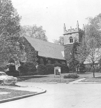
Figure 2.12: Building 57/Memorial Chapel (c. 1948)
conflicts. The proposed historic district is clearly delineated by the perimeter fence and gates that identify the boundary of the military installation. While there are a wide range of building types and architectural styles on the campus, the contributing resources from the period of significance are predominantly Colonial Revival and Georgian Revival style constructed of red brick with limestone detailing.
The development and expansion of the campus over time was not based on a single master plan, but the location of buildings and their inter-relationship resulted in a campus environment that utilizes open space along with vehicular and pedestrian pathways as organizing elements. The historic growth and redevelopment of the campus resulted in key buildings and elements acting as focal points and other elements providing the connective identity. While the property incorporates over one-hundred years of construction history it functions as a visually cohesive campus that represents the full history of development at the WRAMC.
DOS’s master plan for the Foreign Missions Center recognizes the legacy to the city and the nation of the former Walter Reed Army Medical Center. Where it is feasible, the plan proposes reusing existing buildings, structures, and landscapes to preserve the character of the campus. Also, the master plan proposes to develop a campus that supports the needs of the foreign missions community, harmonizes with the surrounding neighborhood and the proposed DC-LRA and CNMC developments, and aids in the preservation of the WRAMC campus.
Sustainability
DOS is sensitive to its global role, its regional impact, and local influence. By creating a sustainable environment and promulgating its methods and means of doing so, DOS’s actions will advance the reduction of the District of Columbia’s carbon footprint.
The campus plan features the potential for recycling and reinvigorating some existing buildings. Site development strategies avoid use of inappropriate sites and minimize the effects of campus activities on the ecosystem. As shown in the table below, the sustainability plan advances its goals in three topical categories as a means for organizing continuing discussions and for allocating responsibilities for sustainable initiatives.
Energy
Water
Resource Preservation
Reduce energy consumption.
Increase the amount of energy obtained from renewable sources.
Use Best Management Practices (BMPs) to manage storm water run-off, both to reduce the effects of runoff and to promote rainwater infiltration on the campus.
Increase the efficiency of water use to reduce the FMC’s burden on the local water supply and the municipal wastewater system.
Reduce reliance on disposable materials. Reuse and recycle to eliminate waste added to landfills. Purchase materials and local services selectively to lessen environmental impacts.
DEPARTMENT OF STATE Foreign Missions Center Master Plan EYP/ 2-10
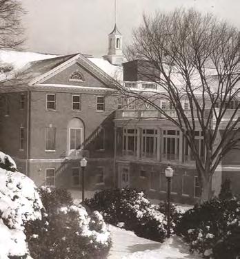
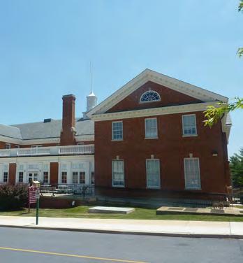
Figure 2.15: Building 41 / Old Red Cross Building
Table 2.1: Sustainability Goals
Figure 2.14: Building 41 / Old Red Cross Building (c. 1948)

2.3 PLANNING PROCESS
In addition to the master planning effort, there are several additional planning efforts required for the DOS to develop the master plan for the FMC. Each of these efforts is part of the planning process and informs the other planning efforts. These additional planning tasks include a study of potential environmental impacts and a study of the effects upon historic properties.
The National Environmental Policy Act of 1969 (NEPA) requires Federal agencies to evaluate the potential environmental impacts of any proposed major actions. DOS has completed an Environmental Impact Statement (EIS) for the planning of the FMC. The Final EIS was issued in November of 2017.
The National Historic Preservation Act of 1966 (NHPA) is the core legislation regarding the preservation of historic and cultural properties in the United States. Section 106 of the NHPA requires Federal agencies to take into account the effects of their undertakings on historic properties. The goal of Section 106 consultation is to identify historic properties that may be affected by the undertaking, assess the effects of the undertaking on these historic properties, and seek ways to avoid, minimize, or mitigate the potential adverse effects. This consultation includes participation of the local state historic preservation office and local organizations, groups, and private citizens with interests in the proposed actions.
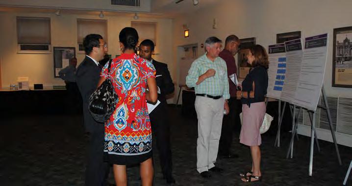
Planning Charrette
A design or planning charrette is an intensive and time-limited interaction that focuses on a topic or issue and draws upon the combined talents and insights of a group of people to generate possible solutions and identify an optimal solution.
In December 2014, U.S. Congress passed the annual National Defense Authorization that included a change to the distribution of the former WRAMC. The portion to be transferred by DOS was reduced from about 43.5 acres to about 31.7 acres. The northeast portion of DOS parcel that included several buildings and a parking garage was designated for the recipient to use for the protection of public health, including research. The Children’s National Medical Center (CNMC) is now the designate for transfer. The CNMC intends to re-use the structures for medical research and related clinical work. This change caused DOS to pause the NEPA process and Section 106 consultation in order to re-design the master plan. AProgrammatic agreement was finalized and signed on December 4, 2018.
DEPARTMENT OF STATE Foreign Missions Center Master Plan EYP/ 2-11 JANUARY 2018
Figure 2.16: Scoping Workshop
Master Planning Participation
A series of seven master planning charrettes were conducted in Washington, D.C. at the early planning stages. The purpose of these sessions was to determine a rational long-term planning framework for future development the Foreign Missions Center at the former Walter Reed Army Medical Center in Washington, D.C.
Representatives of the several key agencies responsible for the review and approval of the master plan were invited to participate in the charrettes with the planning team that include the Department of State (DOS) and its consultants. These agencies included the following:
• The U.S. Commission of Fine Arts (CFA)
• The National Capital Planning Commission (NCPC)
• District of Columbia Office of Planning- Historic Preservation Office (DC-HPO)
• DC Planning including the Local Redevelopment Authority for the WRAMC (DC-LRA)
Prior to the planning charrettes, the planning team had conducted a thorough assessment of the existing conditions of the proposed Foreign Missions Center campus. The assessed existing conditions included the campus infrastructure and utilities, buildings and other permanent structures, hazardous material concerns, landscape elements and significant trees, topography and geotechnical concerns, existing land use patterns, and transportation elements.
To create the programmatic requirements, detailed interviews were conducted with bureaus within DOS that will have direct responsibilities over the property acquisition, development, leasing, and administration of the FMC. The programmatic requirements for the FMC were reviewed and approved by the U.S. Department of State, Office of Foreign Missions. The documentation of these existing conditions and the programmatic requirements served as resource materials for planning charrettes.
A charrette process is most successful when every participant has the opportunity to engage in the conversation and contribute ideas. Thus, working groups of six is typically the upper limit for effective interaction, a figure consistent with organizational behavioral research. The Department of State’s consultant team served as facilitators to organize activities, providing an overview perspective, as well as specialized technical knowledge. Representatives of the consulting agencies
participated in the charrettes.
The activities for the charrettes proceeded as follows:
• The first two charrettes were devoted to developing potential cost models to establish a workable cost neutral development that would be marketable to foreign missions.
• The third charrette commenced the detailed analysis of the site and surrounding area. The participants were split into working groups that focused on topics such as existing and future land use, natural features, transportation and campus access, and campus edge conditions.
• The fourth charrette continued the analysis of the site focusing on potential development criteria. The small working groups addressed topics that included campus utilities and infrastructure, models for lot development and efficiency, and the ramifications of different development density and massing across the site.
• The fifth charrette focused on the investigation of the adaptive reuse of the existing buildings on campus. Each team developed different options striving to maximize adaptive building reuse. Each option and structure was then evaluated based on its existing condition, historic significance, architectural aesthetic, and potential for reuse as a chancery or auxiliary chancery function.
• In the sixth charrette working groups developed design diagrams using the program, site analysis, and adaptive building reuse findings generated by the previous exercises. Each group developed at least three planning concepts. A period at the end of the session was reserved to reassemble the plenary to present and critique concept alternatives.
• For the seventh charrette, the plenary group reassembled to review the refined the planning alternative diagrams and potential adaptive building reuses, with respect to the goals summary.
While staff members of the reviewing agencies were invited to participate in the planning charrettes, not all were able to attend every session. Throughout the planning process, the coordinating agencies were updated on the progress of site and building analyses and development of planning alternatives. These updates included presentations and working sessions with the agencies to assist in
DEPARTMENT OF STATE Foreign Missions Center Master Plan EYP/ 2-12
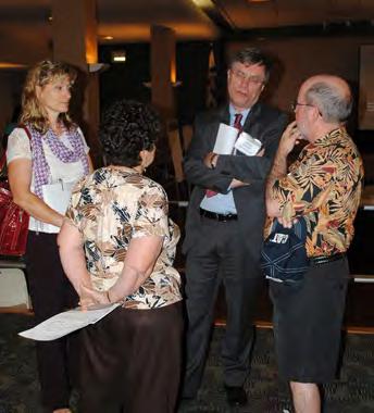
developing and evaluating a preferred alternative.
As part of the re-design effort, staff members of the reviewing agencies have been consulted and updated on the development of the design. The goal of this continued engagement is to continue to solicit input and feedback for the betterment of the design process and the preferred alternative.
Environmental Impact Statement (EIS) Process and Participation
NEPA is often referred to as an umbrella law providing a comprehensive framework for complying with other federal, state and local environmental legal requirements. An EIS will contain relevant information necessary for the agency to make a determination on the significance of the impacts the proposed action may have upon the environment. Resources considered in an EIS include land, water, air, structures, living organisms, environmental values at the site, and social, cultural, and economic factors, including transportation, traffic, and parking. As part of the NEPA process, agencies are required to identify and invite the participation of interested persons. Public input is used in the project evaluation process and throughout EIS development, including the scoping period (identifies what issues the EIS should cover), Draft EIS review and comment period, and Final EIS review period.
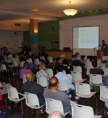
The Department of State issued a notice of intent to file an Environmental Impact Statement in June of 2012. This notice of intent was followed by a public scoping meeting in July and a scoping comment period from July to August of 2012 in which the public provided valuable input. Each of these public interactions has significantly contributed to the development of the Draft EIS and FMC master plan.
The Draft EIS was issued in February 2014 and DOS conducted an open house along with a public hearing to document comments from the public. Since the size and configuration of the site have changed, DOS submitted a Supplemental Draft EIS for public review and comment in March 2017. A public hearing and open house were held on the same day in April 2017. In addition, the draft master plan was presented to the CFA and NCPC for conceptual design review in the spring of 2017. The Final EIS was issued for review in November 2017 with the Record of Decision (ROD) to be recorded in the winter of 2018. The Programmatic Agreement was signed in December of 2018.
Section 106 Consultation Process and Participation
Prior to the initiation of this study, the closure of the WRAMC under the 2005 Base Realignment and Closure Commission (BRAC) made that undertaking subject to review under Section 106 of the NHPA. The Department of the Army’s Section 106 process was initiated in February 2010. Survey and research analyses were conducted by the Army to identify the historic resources within the WRAMC and consulting parties were identified. This process included a series of public meetings between March and August 2010. A final assessment report was issued in November 2011. A Programmatic Agreement incorporating mitigation measures was signed in January of 2013 summarizing the Section 106 process to date and mitigation actions for the Army’s BRAC undertaking.
DOS is required to perform its own Section 106 consultation. In January of 2013, a meeting was held with DOS, DC-Historic Preservation Office and the Advisory Council on Historic Preservation to review the status of the project, outline public participation opportunities, and determine the form of agreement that would be developed to record stipulations regarding effects to historic resources. The end product of this undertaking will be a master plan and design guidelines to guide the future development of the FMC. The parties agreed that the most appropriate form of agreement would be a Programmatic Agreement.
Section 106 provides for public participation throughout the review process. The public is provided with timely and complete documentation to facilitate their participation, and appropriate steps are taken to ensure that pertinent information is shared with consulting parties and considered during consultation. The first Section 106 public meeting was held in June of 2013 to address historic preservation issues. The following consulting parties have requested to be consulting parties for the Section 106 process:
• District of Columbia Office of Planning- Historic Preservation Office
• The Advisory Council on Historic Preservation
• The National Capital Planning Commission
• The Committee of 100 on the Federal City
• Alliance to Preserve the Civil War Defenses of Washington
DEPARTMENT OF STATE Foreign Missions Center Master Plan EYP/ 2-13 JANUARY 2018
Figure 2.17: Scoping Workshop
The first draft the Programmatic Agreement was issued in the fall of 2015. This process was put on hold in winter 2015 due to the change in FMC parcel. The Section 106 consultation process was restated in the winter 2017 with the issue of the second draft programmatic agreement in March 2017. The third draft of the programmatic agreement was issued in July 2017. The fourth draft of the programmatic agreement was issued in December 2017, the fifth draft in May 2018, the sixth draft in July 2018, and the final draft in September 2018. The Programmatic Agreement was finalized on December 4, 2018. It has been signed by DOS, DC-HPO, NCPC, and the Advisory Council for Historic Preservation.
DEPARTMENT OF STATE Foreign Missions Center Master Plan EYP/ 2-14
Figure 2.18: Section 106 Workshop

DEPARTMENT OF STATE Foreign Missions Center Master Plan EYP/ 3-1 DECEMBER 2018
PLANNING
/ SECTION 3
ANALYSIS
DEPARTMENT OF STATE Foreign Missions Center Master Plan EYP/ 3-2
N
Figure 3.1: Walter Reed Army Medical Center Campus in Washington, D.C.
Planning Analysis / 3


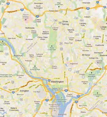
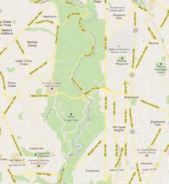
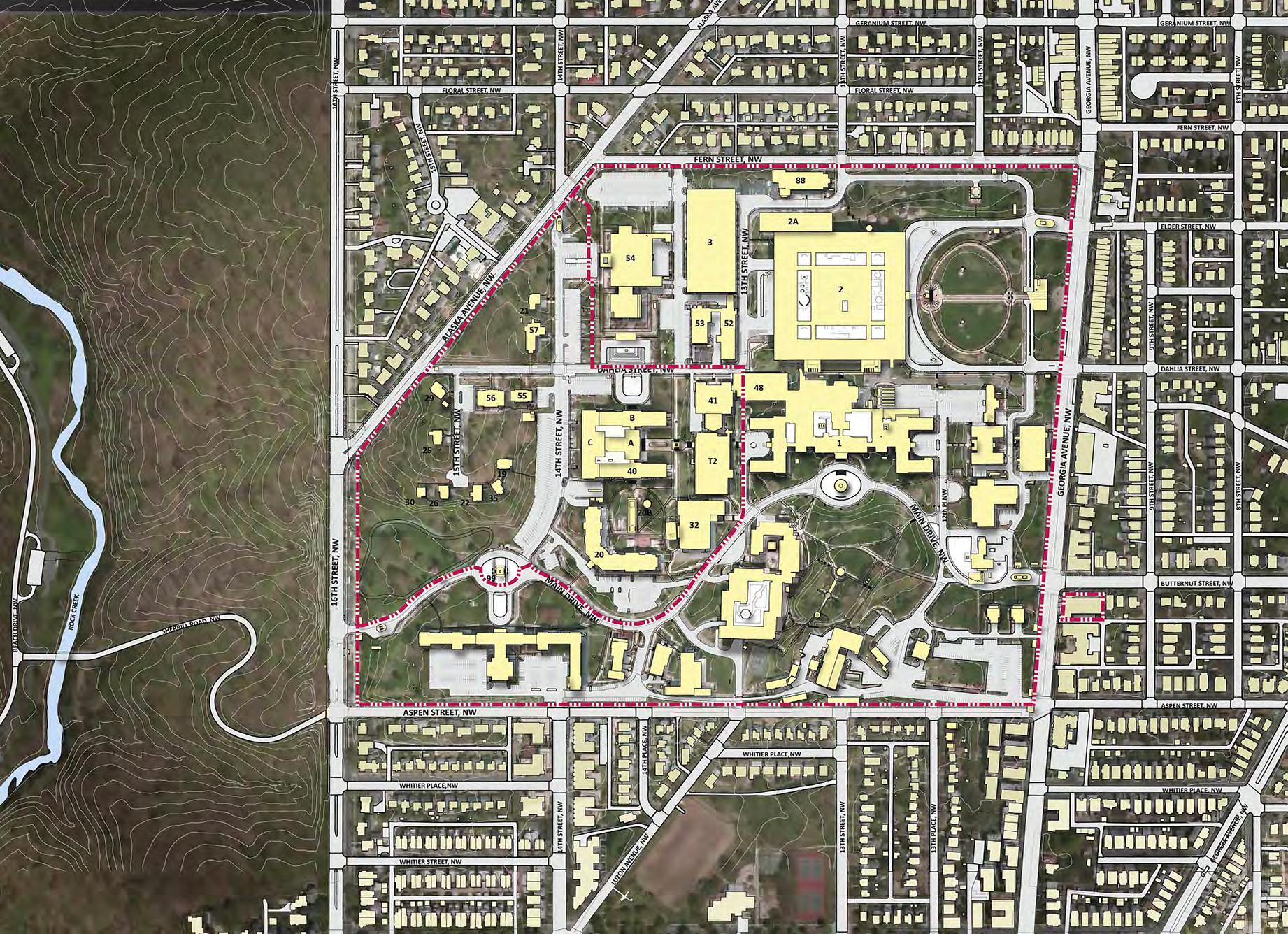
The former Walter Reed Army Medical Center (WRAMC) is located in northwest Washington, DC. It borders 16th Street and Rock Creek Park to the west, Georgia Avenue to the east, Fern Street and Alaska Avenue to the north, and Aspen Street to the south. This section of the report reflects a summary of the site analysis by the master planning team of the proposed Foreign Missions Center (FMC) at the former Walter Reed Army Medical Center (WRAMC). The following analysis is based on information provided by the Department of the Army and an existing conditions survey completed in the spring of 2012. This information has been supplemented through several review meetings with regional planning and design review agencies and a public scoping meeting. This planning analysis section includes the following studies:
• Site Planning and Development History
• Land Use and Site Context
• Natural Elements
• Cultural Resources: Buildings, Structures, and Landscapes
• Utilities
• Environmental
• Transportation
DEPARTMENT OF STATE Foreign Missions Center Master Plan EYP/ 3-3 DECEMBER 2018
N
Figure 3.2: Campus Location
DEPARTMENT OF STATE Foreign Missions Center Master Plan EYP/ 3-4
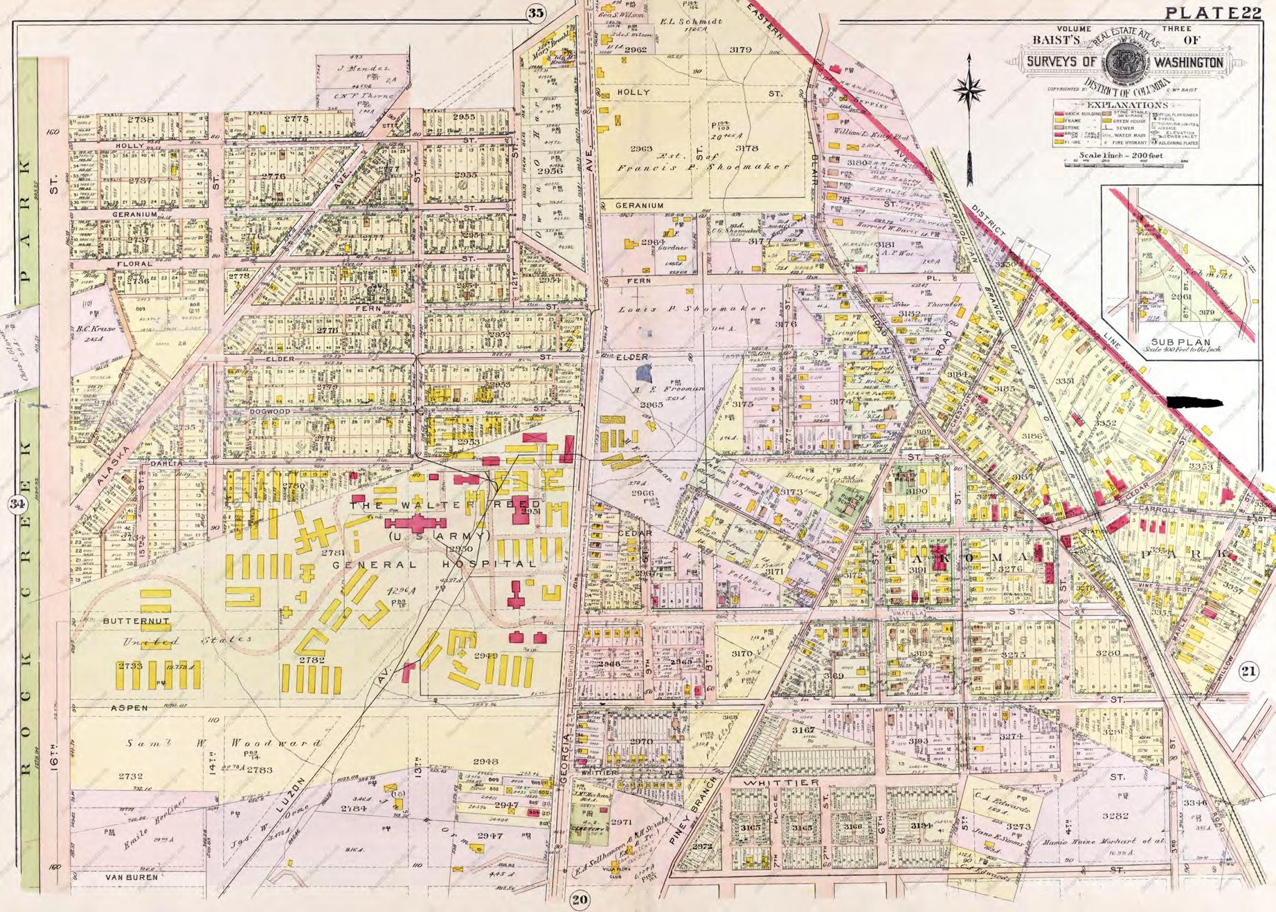
N Figure 3.3: Walter Reed Army Medical Center (c. 1919)
n.b. FMC property line on historic maps is an approximate location and shown to provide context for planning analysis.
3.1 SITE PLANNING AND DEVELOPMENT HISTORY
Located near the northern apex of the District of Columbia, the Walter Reed Army Medical Center (WRAMC) has been the subject of site planning efforts that looked to develop a highly organized campus since its opening in May 1909. Interspersed with these planning efforts were periods of rapid growth and construction, typically driven by an overseas military conflict which resulted in construction that diverged from the overall campus master plans. The campus that exists today has only an underlying framework of the planned campus from 1919 with a significant amount of constructed infill that obscures that framework.
Initial Plan and Construction - 1909
The core institutions that became the WRAMC date to the 19th century. In 1862, Surgeon General William A. Hammond first conceived of the need for a military medical reservation in Washington, D.C., including a permanent hospital, a medical school to train the Army’s surgeons, and a medical museum. His concerns were fueled by the unprecedented needs posed by the American Civil War. While Hammond’s overall plan was not approved, the Army Medical Museum and Library was established in 1862 and located downtown. The Museum was established to reduce the loss of life in warfare through the scientific study of medical specimens. In 1893, the War Department issued an order calling for the establishment of an Army Medical School in Washington, D.C. The mission of the school was to provide specialized training for newly commissioned doctors prior to their entrance into the medical corps. It was initially located in the same facility downtown as the Museum and Library. The final WRAMC component established was the General Hospital. In 1898 the post hospital at the Washington Barracks (present-day Fort McNair in southwest Washington, D.C.) was designated as the Army General Hospital.
DEPARTMENT OF STATE Foreign Missions Center Master Plan EYP/ 3-5 DECEMBER 2018
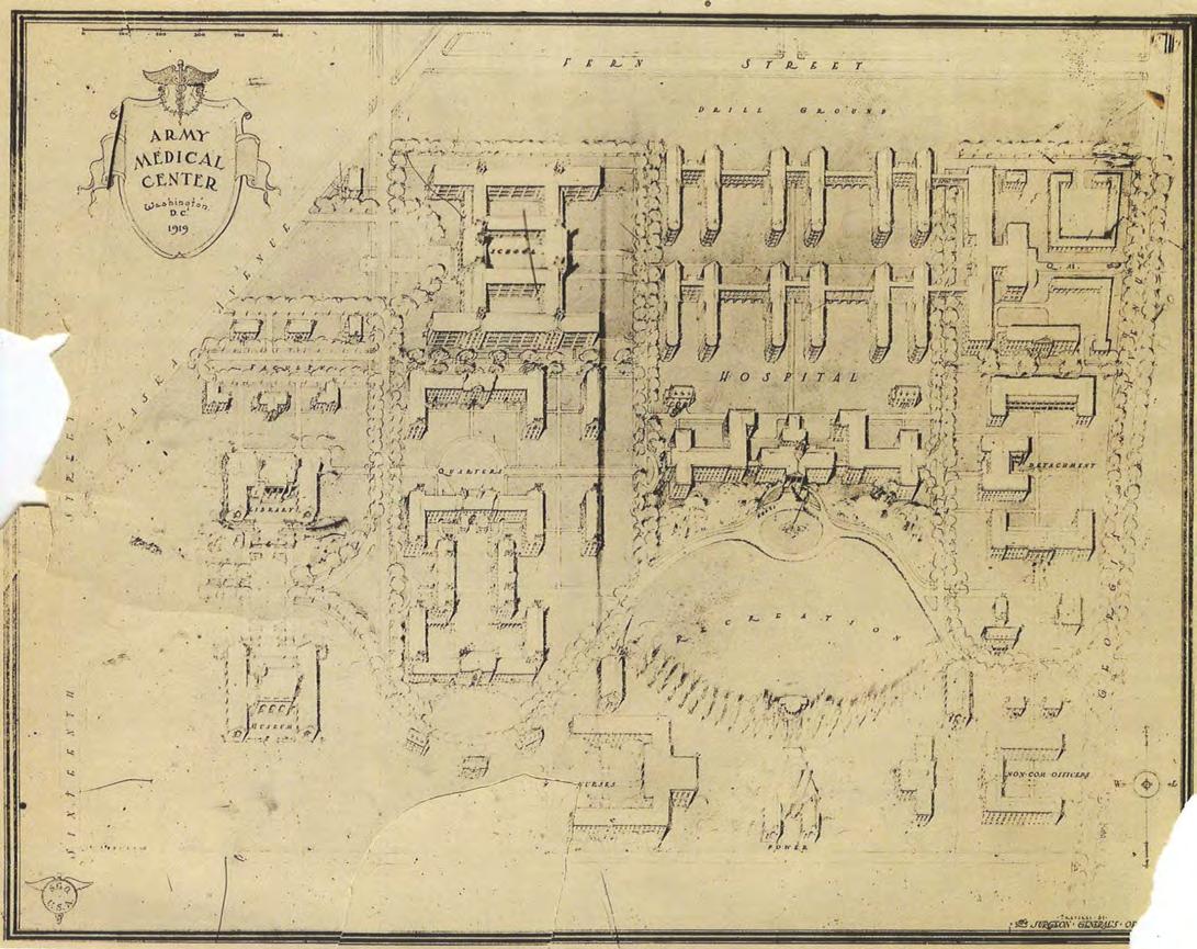
Figure 3.4: 1919 Army Medical Center Master Plan
n.b. FMC property line on historic maps is an approximate location and shown to provide context for planning analysis.

DEPARTMENT OF STATE Foreign Missions Center Master Plan EYP/ 3-6
N Figure 3.5: Walter Reed Army Medical Center (c. 1927)
n.b. FMC property line on historic maps is an approximate location and shown to provide context for planning analysis.
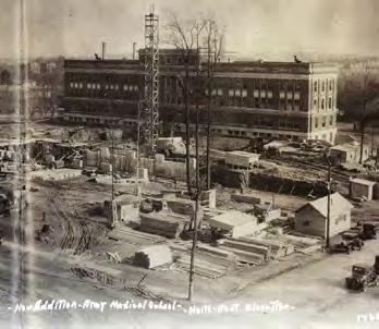
When the site for the Army Medical Department’s facilities was selected in the first decade of the 20th century, the area surrounding the site was rural, with a single paved road, Seventh Street Pike (now Georgia Avenue), and a small village known as Takoma Park to the east. The rustic nature of the site did not prevent Major William C. Borden from envisioning a large planned campus that would house the Walter Reed General Hospital, the Army Medical School, the Army Medical Museum, and the Surgeon General’s Library. This vision is captured in a rendering developed by architects Marsh and Peters of an aerial view looking north from what is now Aspen Street to approximately Fern Street and filling the site from 16th Street on the west to Georgia Avenue on the east.
While this aerial view represents nothing more than a vision and even the initial construction in 1909 was not based on this plan, it does represent the aspirations of the people who planned and built the campus. It is a plan that is a confluence of a highly organized military installation with early 20th century hospital planning and design. These two planning concepts form the philosophical core of the planning and construction at the WRAMC.
The first actual construction on the site, Building 1/Main Hospital, looks very much like the buildings in the Marsh and Peters rendering, but is sited on the east side of the tract, closest to Georgia Avenue, which included a street car service that could provide transportation between the post and the downtown area. Within two years, nine more brick buildings were built on the campus, carefully grouped around the Main Hospital, as well as a few wood framed buildings.
World War I
The period of US engagement in World War I, 1917 to 1918, saw an explosion of construction on the site, primarily wood framed buildings housing hospital wards and support facilities. A 1919 real estate atlas map shows more than 70 new buildings. The siting of these buildings is driven more by need than a master plan. They are located over the entire campus, some in alignment with an internal street grid; others based more by topography. A map of the site produced by the US Army Quarter Master Corp in the same year identifies the brick and stone buildings on the site, almost all of which were constructed prior to the war, as “permanent”, implying that the wood frame buildings were intended to be temporary.
Between the World Wars - 1919 to 1940
While the immediate need for space driven by World War I resulted in the built campus shown in the real estate atlas, there were also plans being developed looking to the future. In 1919 a master plan was developed that looked to organize the site, creating permanent structures to replace the wood framed buildings. This plan, issued by the Surgeon General’s Office, revolves around Building 1(Main Hospital), with hospital wards to the north, and a library and the Army Medical School to the west. While the site topography is not completely acknowledged, this plan does incorporate ideas and concepts that become the basis for later planning and construction. An east-west axis, aligned with the west pavilion of Building 1 is an organizing element for the west side of the campus. New buildings are grouped to develop open spaces that define different zones of the campus. Main Drive, with its picturesque curvilinear path, defines more natural recreational spaces as opposed to the rectilinear open spaces, one of which is labeled “Drill Ground”. The 1919 plan was not realized; in fact, the construction that takes place in the 1920s and 1930s is quite different than what was planned. In these decades, the Army Medical School (Building 40 (WRAIR)) and Building 41 (Red Cross Hall) are constructed to the west of the Main Hospital. The Medical School is on axis with the Hospital and the Red Cross Hall is to the north of the axis, creating an open, landscaped space between the three buildings. Between the Hospital and Dogwood Street a series of ward buildings and hospital support buildings are constructed, of which Building 52/Hospital Ward is the remaining survivor. The organizing plan element for these structures is a northsouth axis (13th Street) which aligns with the center pavilion of the Hospital. In 1931, the Building 57 (Memorial Chapel) is constructed on the western side of the campus, at the intersection of Dahlia and 14th Streets.
DEPARTMENT OF STATE Foreign Missions Center Master Plan EYP/ 3-7 DECEMBER 2018
Figure 3.6: Building 40 under construction (1931)

DEPARTMENT OF STATE Foreign Missions Center Master Plan EYP/ 3-8
N Figure 3.7: Walter Reed Army Medical Center (c. 1945)
n.b. FMC property line on historic maps is an approximate location and shown to provide context for planning analysis.
World War II
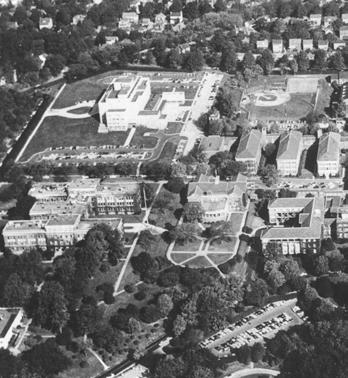
With the involvement of US troops in 1941, the WRAMC campus once again had to respond to an increased level of demand. While the level of construction activity at the campus between 1940 and 1945 was not as high as during World War I, there was still significant growth. During this period most of the new construction was focused on the northeast corner of the campus, north of Dogwood Street between Georgia Avenue and 13th Street, and to the south of Main Drive. Hospital wards, housing, and support facilities were created to serve the growing population of both staff and patients. While the construction was more permanent than what had been created during the Great War, the planning and siting was more focused on efficiency and capacity. The focus on open space and a campus setting that was nurtured between the wars was lost.
The Cold War - 1945 to 1970
While the United States continued to be engaged in overseas conflicts during these decades (1950s Korean War, 1960s Vietnam War) the impact on the hospital facilities at the Walter Reed campus was limited. Unlike the period between the two World Wars, virtually all of the buildings that existed in 1945 remained in use, with additions and modifications as needed to respond to new program needs and new technologies. The congested nature of the northeast quadrant of the campus remained, as did the axial alignments that extended from the Main Hospital to the north and west. The clarity of the 1919 master plan started to be obscured by additions that in-filled open space around certain buildings.
The largest piece of construction that was undertaken during this period was the Armed Forces Institute of Pathology (Building 54 (AFIP)). Located to the northwest of the Main Hospital the AFIP displaced some residential structures but occupied what had been essentially open space. Unlike the major construction in the 1920s and 1930s, the new building was oriented towards 14th Street with no site plan connections to either Building 40 or Building 1.
It was also during this period that the Walter Reed Army Medical Center became no longer a unique facility in the Army’s medical corp. While it remained the flagship medical facility for the Army until its closing, station medical facilities in the United States and overseas were expanded to be full medical centers offering levels of service similar to Walter Reed.
The Modern Era- 1970 to the Present
The most recent period in the development of the WRAMC campus is represented by new construction that was located primarily as infill, continuing to obscure the campus planning concepts that were established in the first half of the 20th century. While the museum addition on the south side of Building 54 created a stronger relationship between the AFIP and Building 40, it was not reinforced through a landscape plan. More indicative of this period is Building T2, a temporary medical facility constructed in 1972, which in-filled the open space between Buildings 1, 40 and 41. Finally in 1977 the new hospital, Building 2 (Heaton Pavilion), opened which eliminated virtually all of the buildings in the northeast quadrant of the campus north of the Main Hospital and wiped away both the city street grid and the internal axial planning elements on this portion of the campus.
In 2005, the Base Realignment and Closure Commission (BRAC) recommend that the Army close the WRAMC and relocate the associated medical facilities to nearby Bethesda, Maryland as part of a complex of health care and medical research facilities that include Bethesda Naval Hospital and National Institute of Health. In September 2011, the Army formally closed the WRAMC campus. In November 2015, approximately 31.7 acres were transferred by the Army to DOS. The remaining property has been transferred by the Army to DC-LRA and CNMC in fall of 2016, after DOS had taken possession of its portion.
DEPARTMENT OF STATE Foreign Missions Center Master Plan EYP/ 3-9 DECEMBER 2018
Figure 3.8: Aerial photo of Walter Reed Army Medical Center (c. 1950)
3.2 LAND USE AND SITE CONTEXT
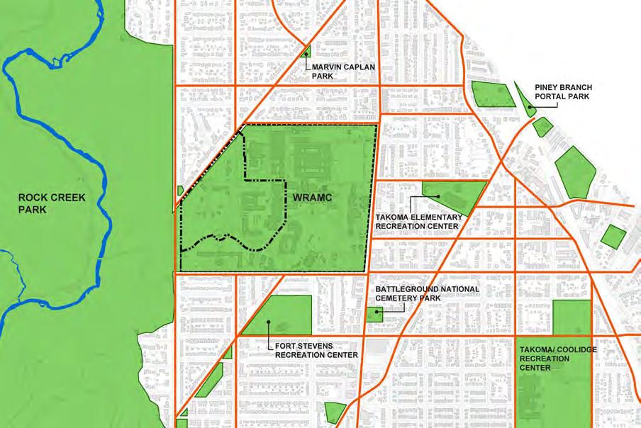
The Foreign Missions Center (FMC) will be located on about 31.7 acres of the approximate 113 acres of the WRAMC. The remainder of the campus will be redeveloped on behalf of the DC-LRA, a District of Columbia government entity. Most of the land that will comprise the FMC was acquired by the Army between 1918 and 1922 after the initial founding of the Hospital in 1909. Walking distance radii of five-minute and ten-minute intervals are centered on the intersection of 14th and Dahlia Streets. To generate the circles shown, a three-mile per hour walking speed is assumed across level ground. Most of the former WRAMC campus fits within the five-minute circle indicating a walkable and potentially pedestrian-friendly campus. Retail and commercial activities on Georgia Avenue is just over a five-minute walk from the center of the FMC. The Takoma Metro Station is just over a 15-minute walk from the center of the FMC.
Existing Land Use
The FMC portion of the WRAMC campus is bordered to the north by the primarily residential neighborhood of Shepherd Park, by Rock Creek Park to the west, and by DC-LRA proposed developments on the remainder of former WRAMC campus to the east and south. The DC-LRA portions of the campus are bordered by the neighborhoods of Takoma to the east and Brightwood to the south. These neighborhoods are mostly residential with some institutional (i.e. recreation center, schools, and churches) and commercial uses.
Georgia Avenue is the primary commercial zone for this area of the District of Columbia. The current land use along Georgia Avenue is a mixture of commercial, retail, and high density residential. There are several green/open spaces in the area that are associated with community activities such as the Fort Stevens Recreation and Senior Center at Van Buren and 14th Streets, Takoma Education Center at Dahlia Street and Piney Branch Road, Shepard Park School at 14th and Jonquil Streets, and Takoma Recreation and Coolidge Recreation Center at Van Buren and 5th Streets. The other major retail and commercial centers in the area are transit-oriented development proximate to the Takoma and Silver Spring Metro Stations.
Rock Creek Park is a major presence on the west side of the campus. 16th Street is a major north-south arterial road that serves commuters access to the downtown area and the beltway. 16th Street also provides a high-traffic
DEPARTMENT OF STATE Foreign Missions Center Master Plan EYP/ 3-10
Figure 3.9: Future DC-LRA Aerial Rendering

DEPARTMENT OF STATE Foreign Missions Center Master Plan EYP/ 3-11 DECEMBER 2018
N
Figure 3.10: Existing Land Use
separation of Rock Creek Park from the WRAMC.
Future Land Use
There are several major planning initiatives in the area. The first is the 2006 Comprehensive Master Plan for the District. The planning area for this region is called Rock Creek East. This city-wide master plan focuses on the continued improvements and developments along Georgia Avenue. The Upper Georgia Avenue, NW/Walter Reed area (RCE-2.3) focuses on the development of walkable shopping districts along Georgia Avenue that supports the residential and commercial communities in the area and new land use at WRAMC. Improved mass-transit access to this area is a critical component. The DC Comprehensive Plan was updated in 2009. The changes for Upper Georgia Avenue recognize other DC planning initiatives include the ongoing planning for the reuse of the WRAMC campus.
Upper Georgia Avenue Great Streets Redevelopment Plan is a planning initiative started in 2008. The purpose of the Great Streets initiative is to improve neighborhood livability through economic development. The proposed plan is a revitalization strategy and framework for future development along the Georgia Avenue corridor from Decatur Street to the south and Eastern Avenue to the north. The plan is segregated into zones with a dedicated zone for the section of Georgia Avenue adjacent to the WRAMC. The recommended actions include the reconnection of the former WRAMC with the community through street activating uses fronting Georgia Avenue. The potential use of pocket parks and greenways are anticipated as opportunities to enhance the appearances of the corridor and provide safe pedestrian connections. These goals are reflected in the DC-LRA proposed reuse plan for the WRAMC.
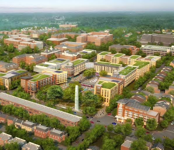
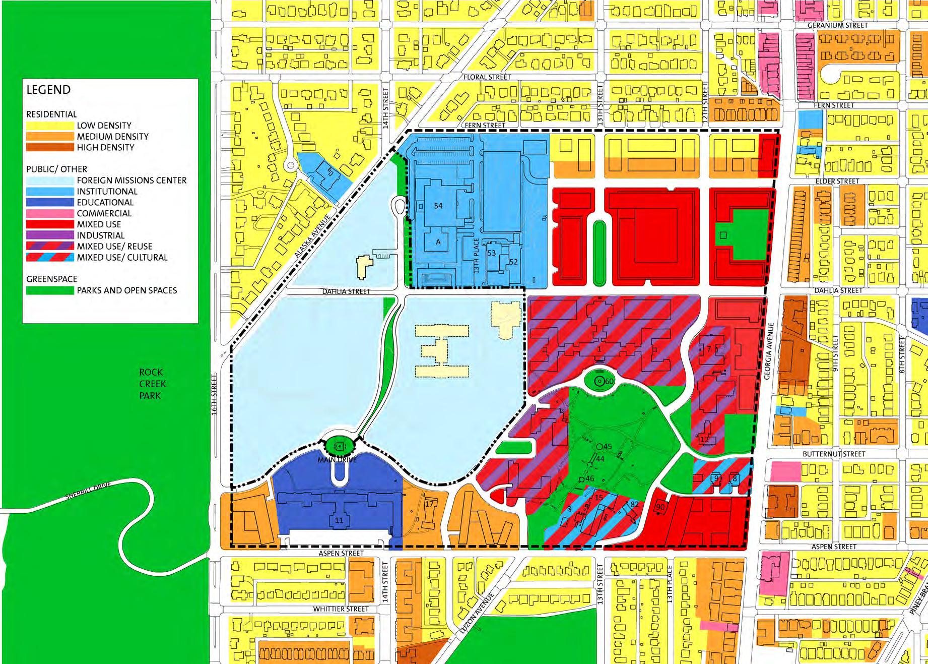
The other major focus is the reuse of the former WRAMC campus. DCLRA developed a small area reuse plan, the precursor to new zoning and development guidelines for the easterly portion of the campus. The DC-LRA development to the east of the FMC will be medium density residential, with a mixed use of retail and offices. DC-LRA plans for the area south of the FMC will be primarily medium density residential, a proposed charter school, and mixed-use creative. The Sunken Garden and the lawn that front of Delano Hall will be major open spaces in the DC-LRA proposed reuse plan.
For security reasons, WRAMC has been closed to the general public since
2001. The proposed development by DC-LRA will reopen the perimeter of the WRAMC. Aspen Street appears to still be a tertiary edge of campus. However, 14th Place and Luzon Avenue will be connected to Main Drive. The Fern Street edge will be open. Existing city streets that now terminate at the north edge of the WRAMC site (12th and 13th Streets) will be connected to new extensions of Elder and Dahlia Streets. Georgia Avenue frontage will also be re-opened to the public as a primary campus edge.
Primary pedestrian destinations for FMC employees will be the proposed retail and commercial areas within the DC-LRA development and along Georgia Avenue. Strong pedestrian linkages will be important. The FMC will be a destination of purpose. The reasons for going to the FMC campus will be to conduct business with the foreign missions.
DC-LRA Zoning for WRAMC
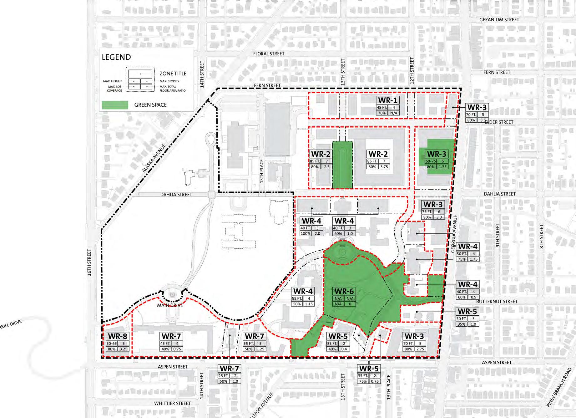
In the summer of 2015, the Zoning Commission for the District Columbia amended the Zoning Code to create zoning regulations for the DC-LRA portion of the WRAMC (Z.C. Order No. 14-22). The amendments create and implement the WR zone, which allows mixed-use development on the former WRAMC, including development ranging from moderate to high density. The DC-LRA portion has eight subzones and is mapped on the portion of the WRAMC that was transferred to the District of Columbia. The text amendments include references to existing streets and to proposed streets identified in the Walter Reed Medical Center Small Area Plan (SAP), as approved in the Walter Reed Army Medical Center Small Area Plan Approval Resolution of 2013, effective September 13, 2013, Res 20-0105 (60 DCR 12813).
DEPARTMENT OF STATE Foreign Missions Center Master Plan EYP/ 3-12
DEPARTMENT OF STATE Foreign Missions Center Master Plan EYP/ 3-13 DECEMBER 2018 N
Land Use
Figure 3.11: Future
DEPARTMENT OF STATE Foreign Missions Center Master Plan EYP/ 3-14 N
Figure 3.12: DC Zoning Summary for WRAMC
Site Context
This key plan indicates the locations of panoramic photographs taken of the perimeter of the site. The photographs focus on public streets, including 16th Street and Alaska Avenue. The associated panoramic images are on the following pages.

DEPARTMENT OF STATE Foreign Missions Center Master Plan EYP/ 3-15 DECEMBER 2018
Figure 3.13: Panorama Photography Key Diagram
DEPARTMENT OF STATE Foreign Missions Center Master Plan EYP/ 3-16
Alaska Avenue Panorama, Northwest Side (Neighborhood), Part A
Figure 3.14: Alaska Avenue Panorama, Northwest Side (Neighborhood)
Alaska Avenue Panorama, Northwest Side (Neighborhood), Part B
Alaska Avenue Panorama, Northwest Side (Neighborhood), Part C
16th Street
14th Street
Our Lady of Lebonon Maronite Church
Metro Bus Stop
DEPARTMENT OF STATE Foreign Missions Center Master Plan EYP/ 3-17 DECEMBER 2018
Alaska Avenue Panorama, Southeast Side (FMC), Part A
Figure 3.15: Alaska Avenue Panorama, Southeast Side (FMC)
Alaska Avenue Panorama, Southeast Side (FMC), Part B
Alaska Avenue Panorama, Southeast Side (FMC), Part C
14th Street Gate
Dahlia Street Gate
16th Street
Metro Bus Stop
DEPARTMENT OF STATE Foreign Missions Center Master Plan EYP/ 3-18
16th Street Panorama, East Side (Rock Creek), Part A
Figure 3.16: 16th Street Panorama, East Side (Rock Creek)
16th Street Panorama, East Side (Rock Creek), Part B
Sherrill
Metro Bus Stop Main Drive Intersection
16th Street Panorama, East Side (Rock Creek), Part C
Drive
DEPARTMENT OF STATE Foreign Missions Center Master Plan EYP/ 3-19 DECEMBER 2018
16th Street Panorama, West Side (FMC), Part A
Figure 3.17: 16th Street Panorama, West Side (FMC)
16th Street Panorama, West Side (FMC), Part B
Main Drive Gate Aspen Street Alaska Avenue Metro Bus Stop
16th Street Panorama, West Side (FMC), Part C
3.3 NATURAL ELEMENTS
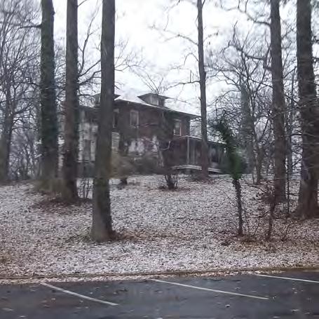
While the buildings are prominent features of the WRAMC campus, the campus is equally defined by its natural features including topography and vegetation.
Topography
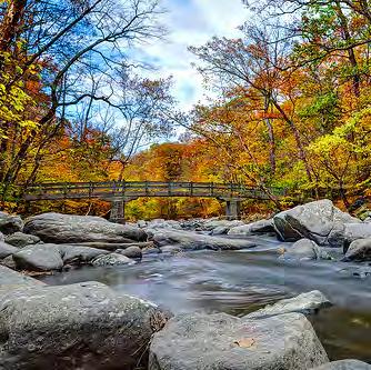
The accompanying drawing shows changes in elevation across the precinct and campus in 20-foot intervals. Elevations range between 140 and 380 feet above sea level – a total change of over 200 feet across the precinct.
This map illustrates the topography of the precinct with the urban context shown. While the open space at WRAMC allows for greater visibility of the changes in elevation, the urban context masks the changes in elevation across the precinct.
The lowest point of the study area is at Rock Creek at an elevation of about 140 feet above sea level. The highest ground in the precinct is north of the campus above the intersection of 14th Street and Fern Street at over 380 feet above sea level.
The high point on the WRAMC campus is near the intersection of Alaska Avenue and 14th Street. Building 54/Armed Forces Institute of Pathology and Building 3/Rumbaugh Garage occupy the upper elevations. The land falls off in two directions from this upper elevation, to the southwest towards Rock Creek Park and to the southeast towards the Sunken Garden, located south of Building 1/Main Hospital.
This illustration indicates areas on the site of topographic constraints. In these areas where the slope of the land is greater than ten percent, new construction will be a challenge. These potentially non-buildable areas will contribute to the natural character of this portion of the site already established by the presence of significant trees of fair-or-better quality.
The topographic conditions also dictate the natural flow of storm water across the site. The District of Columbia’s Green Building Act, which came into enforcement on January 1, 2012, will provide the basis for the criteria of campus site drainage. It is anticipated that each foreign mission will be responsible for the control of storm water quantity and quality on its site. These controls are integral components of DC regulations and potential sustainability certification. Detention for quantity control of common lands (roadways,
DEPARTMENT OF STATE Foreign Missions Center Master Plan EYP/ 3-20
Figure 3.19: Property Slope
Figure 3.18: Rock Creek Park

DEPARTMENT OF STATE Foreign Missions Center Master Plan EYP/ 3-21 DECEMBER 2018 N
Figure 3.20: Topography

sidewalks, and campus open space) can be incorporated into the roadway storm drainage system for the site and may, in fact, be attainable through peak attenuation from quality control (bio-filter) devices. While centralized systems were investigated, these systems required large areas that may limit the potential to maximize lot development and are not recommended.
Natural Features
The WRAMC site has a diverse array of vegetation and three distinct contributing landscape elements: remnant forest, buffer vegetation, and cultural landscapes. These landscape elements, along with the topography, have created a unique setting that has affected the past developments on the campus. These natural features are identified on the accompanying drawing.
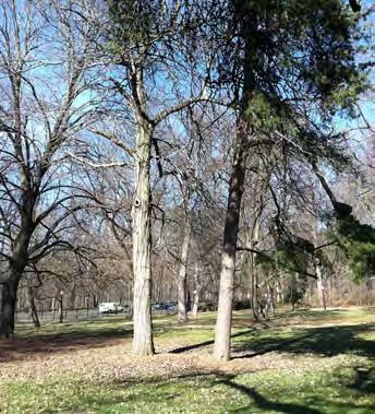
The remnant native forest areas include most of the western half of the campus as highlighted in medium green. Remnant native forests are endemic vegetation that predates contemporary development of the area.Various Oak and Tulip Poplar dominated patches of trees remain intact. These areas can be characterized by two sub-areas, based on topography. The subareas are areas with flat areas (less than ten percent grade) and steep slopes (greater than ten percent grade). A variety of mature trees are found on steep slopes. Typically, trees that have matured in this condition are unsuitable for relocation due to the complex root systems they developed to maintain stability. In the flat portions of the remnant native forest areas, several mature native trees exceed 100 to 150 years, predating the construction of many of the existing buildings on the site. None of these areas contain a native understory of shrubs or significant natural components in either structure or composition. Only the over-story is characteristic of a native canopy and forest cover.
The black bands are displayed across slope topography lines to indicate steep slope areas. Many of these areas are also covered with portions of the remnant native forest. It is the presence of these mature trees that maintains the slopes and prevents excessive erosion. Preserving steep slopes in a natural and vegetative state will minimize erosion and reduce stress on natural water resources.
Highlighted in dark green, the vegetative buffer is considered an important element by the neighboring community and local review agencies. Along several areas of the western edge of the campus, a variety of evergreen species have been planted for screening the site from the adjacent urban residential neighborhoods. This perimeter screening is enhanced by the remnant native forest along Alaska Avenue and 16th Street. During the public scoping meeting in July of 2012, preserving the existing mature trees and having a vegetative buffer between the FMC and the residential neighborhood was the second most popular comment.
During the planning analysis, several potential perimeter buffer dimensions were explored. Analysis of the existing trees and topography led to the recommendation of a more irregular edge versus a fixed dimension. The irregular vegetative buffer would provide opportunities to both reveal and conceal portions of the FMC campus. For example, along 16th Street and at campus entrances, such as 14th Street and Alaska Avenue, a reduction in the density and dimension of the vegetative edge could allow for the presence of the FMC to be revealed. However, along Alaska Avenue, the vegetative edge may be deeper in dimension to buffer the FMC land use from the residential neighborhoods. In this instance, a vegetative buffer with a minimum width of 50 feet from the existing perimeter fence is recommended.
Highlighted in light green, the cultural landscapes are areas of landscape plantings that have been planned, designed, and installed to support the functions of the built environment. These landscapes are located predominantly east of 14th Street. While these landscapes are in poor condition and have little aesthetic merit, they highlight a site condition for this portion of the campus. The area east of 14th Street is a planned, more developed section of the former WRAMC campus.
DEPARTMENT OF STATE Foreign Missions Center Master Plan EYP/ 3-22
Figure 3.21: Hemlocks along Alaska Avenue
Figure 3.22: Remnant Forest
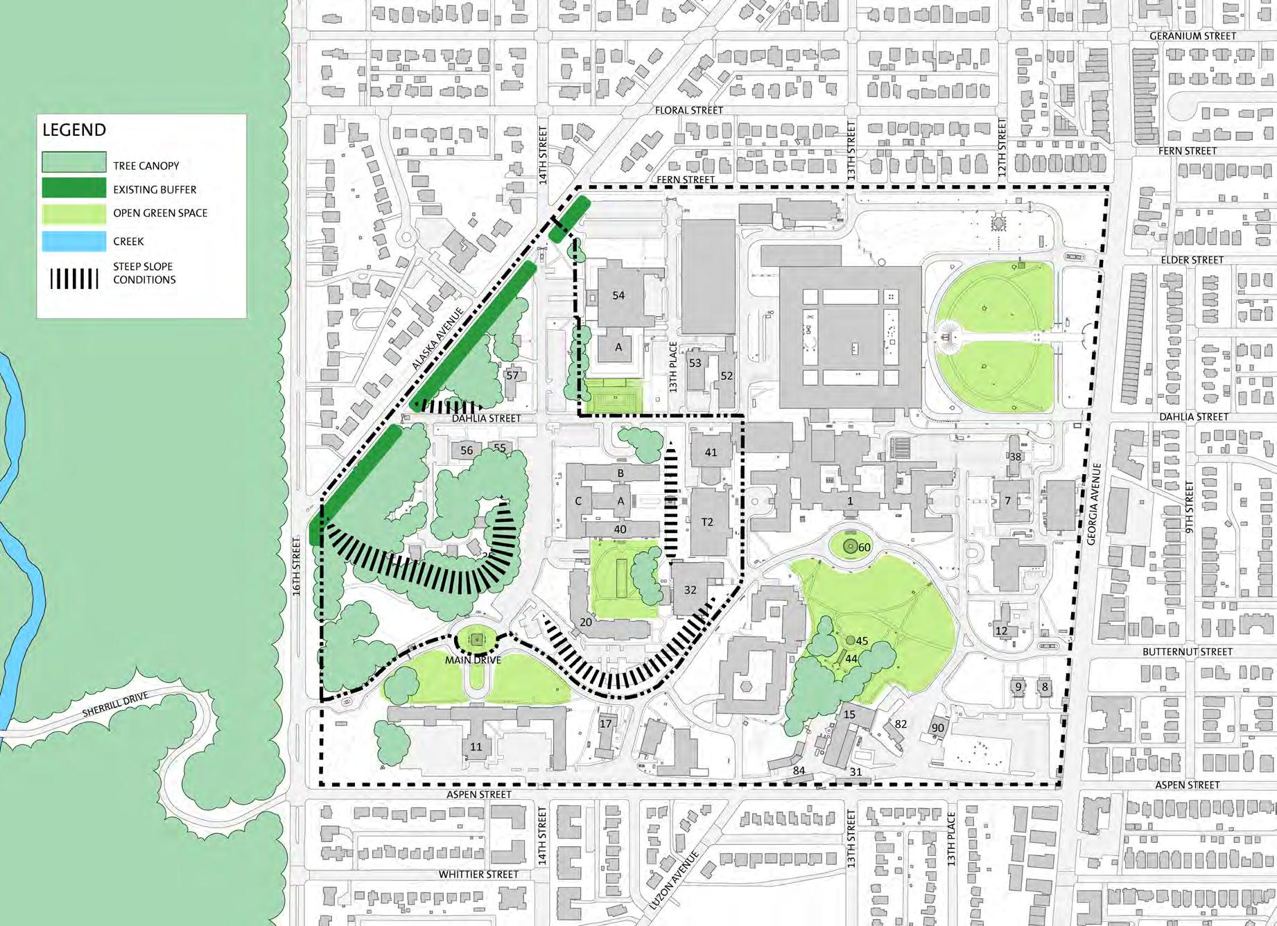
DEPARTMENT OF STATE Foreign Missions Center Master Plan EYP/ 3-23 DECEMBER 2018 N
Figure 3.23: Landscape Elements
Trees
An updated tree inventory of only the FMC portion of the WRAMC campus was conducted in the early spring of 2012 and included over 550 trees. Tree sizes are categorized by diameter at breast height (dbh), the diameter of the trunk measured 4.5 feet above the ground. The inventory includes trees ranging from 8 inches dbh and larger. The International Society of Arboriculture (ISA) standard format is used for the tree inventory. Condition ratings for each tree are based on methods outlined in the latest edition of The Guide for Plant Appraisal published by the International Society of Arboriculture.
The extent of the vegetative cover of the site is predominantly located within the western half of the site, west of 14th Street. The maturity of the natural landscape west of 14th Street is relatively undisturbed compared to the rest of the campus. Within this area, a variety of native trees are found typically in remnant forest patches. Remnant forests are second growth, natural growing tree stands that pre-date development on the site. Many of these trees are over 55 inches in circumference, which fall within The District of Columbia’s Urban Forest Preservation Act. This regulation states that trees measured between 14.00 inches dbh and 31.85 inches dbh are considered Special Trees Trees measured greater than 31.85 inches dbh are considered Heritage Trees. In the District, these Special Trees are under the care and maintenance of the property owner and require compensation and/or mitigation when removed. For Heritage Trees, these trees, if in healthy condition, should be protected and maintained. Several federal and local agencies such as DOS are exempt from the required mitigation and compensation. However, in the past, these exempt agencies have worked with the DC Department of Transportation’s Urban Forestry Office to identify tree removals, prepare protection protocols for designated trees to remain, and plant new trees on the property and along streets to help meet Sustainable DC goals.
The overall conditions of mature plantings found throughout the FMC campus ranges from very good to very poor, as of the assessment done in 2012. In cases where larger trees have ample root zone, these trees are generally cataloged to be in good or better conditions. Larger trees adjacent to parking lots or roadways tend to show symptoms of stress most likely due to a lack of sufficient root area. For Special Trees and Heritage Trees to be preserved, the root zones will need to be protected during development and afterwards. As a result, these root zones may limit the available lot area for development beyond the development limits in the design guidelines.
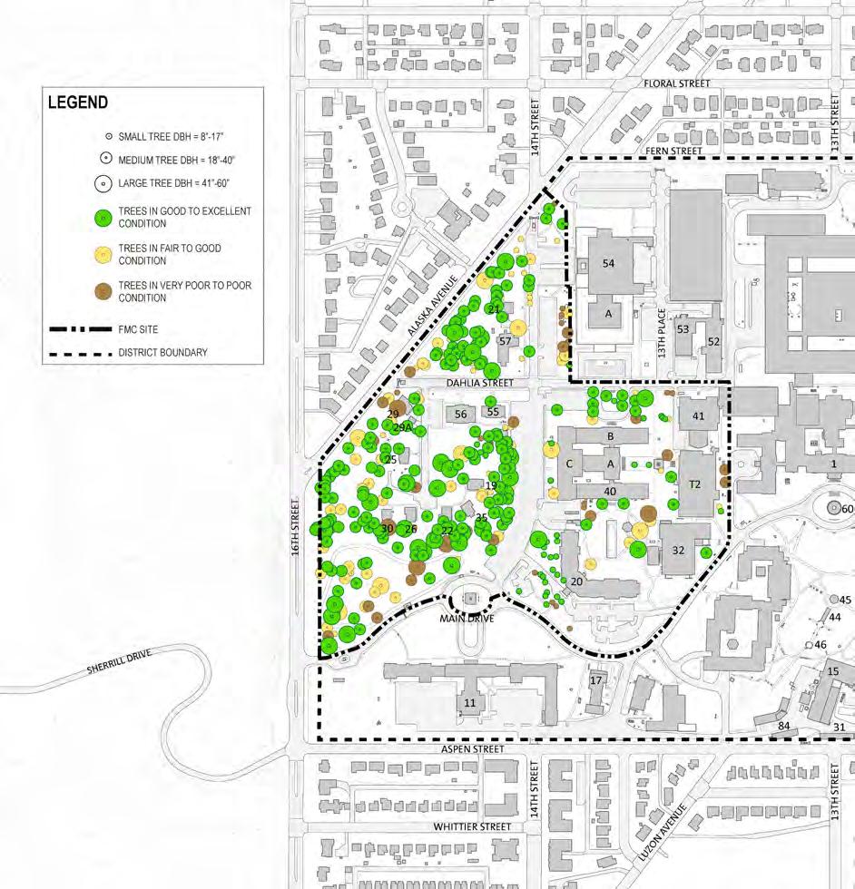
DEPARTMENT OF STATE Foreign Missions Center Master Plan EYP/ 3-24 N
Figure 3.24: Tree Assessment Survey
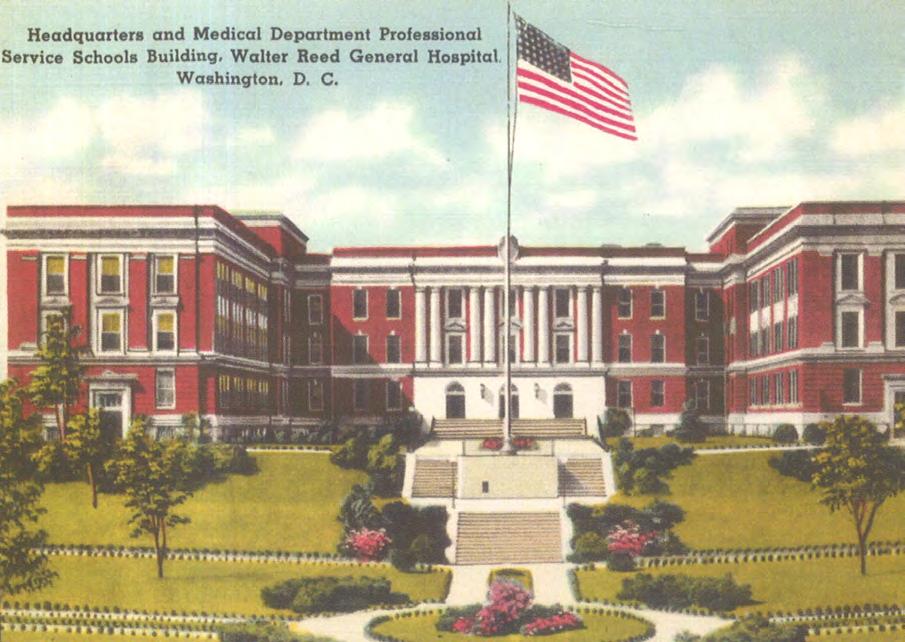
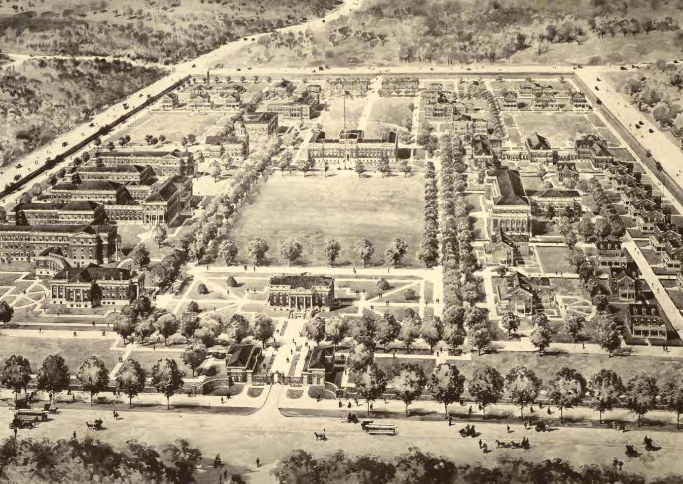
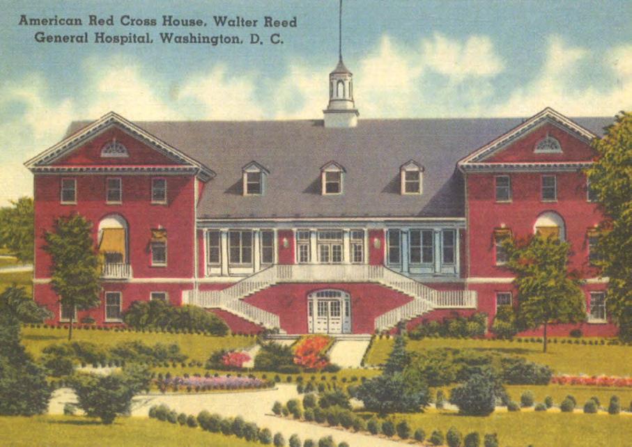
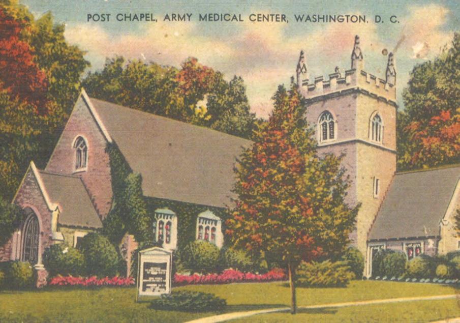
DEPARTMENT OF STATE Foreign Missions Center Master Plan EYP/ 3-25 DECEMBER 2018
Figure 3.25: Postcard of Building 40/Army Institute of Research Building (c. early 1940’s)
Figure 3.26: Postcard of Building 41/Old Red Cross Building (c. early 1940’s)
Figure 3.27: Borden Master Plan (c. 1909)
Figure 3.28: Postcard of Building 57/Memorial Chapel (c. early 1940’s)
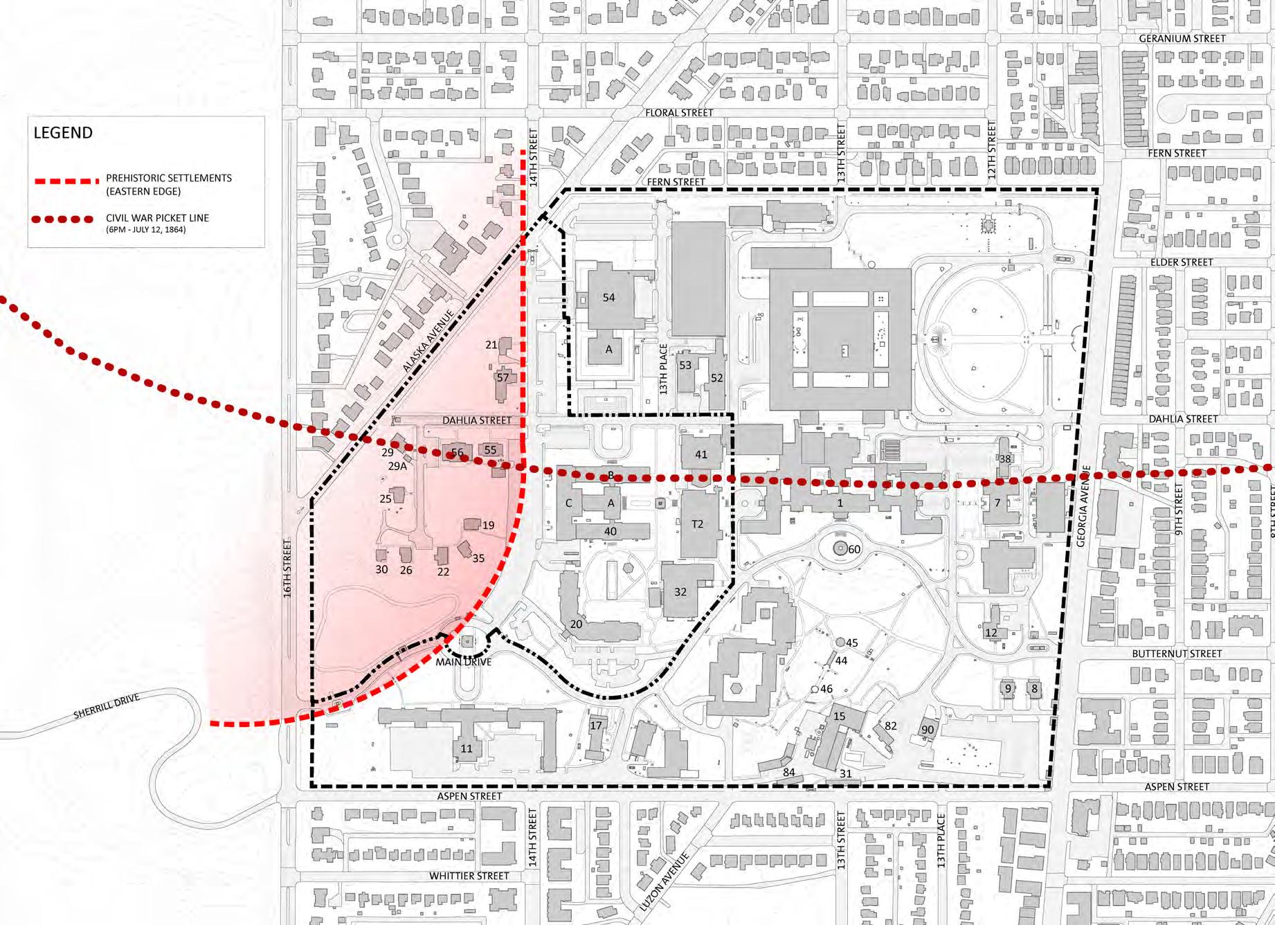
DEPARTMENT OF STATE Foreign Missions Center Master Plan EYP/ 3-26
N
Figure 3.29: Cultural Resources: Subsurface
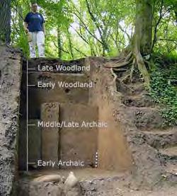
3.4 CULTURAL RESOURCES REUSE ANALYSIS
The entire Walter Reed Army Medical Center (WRAMC) campus is listed on the National Register of Historic Places and DC Inventory of Historic Sites as the Walter Reed Army Medical Center historic district. The Department of the Army developed and submitted the nomination for the historic district. This nomination was based on the Army’s assessment that was developed as part of its BRAC Section 106 consultation. In May 2014, the WRAMC historic district was listed on the DC Inventory of Historic Sites. In March 2015, the WRAMC historic
was
on the National
of Historic Places.
The period of significance for the historic district as July 11 and 12, 1864, the Civil War Battle of Fort Stevens, and from 1909 to 1956. After 1956 other Army medical centers were built across the country and overseas, reducing the unique quality of the WRAMC facility. All structures constructed within the period of significance are considered contributing resources to the historic district. The illustration to the following page indicates the context of the Department of State’s portion of the campus.

The drawing on the following page highlights the summary of the Army’s nomination. Since the entire campus is a historic district; it is represented in this drawing. Buildings and structures in red and landscapes in pale red are considered as contributing resources to the overall character and historic significance of the WRAMC historic district. During the Army’s nomination preparation process, some of the buildings and structures were being considered to be individually eligible for listing on the National Register of Historic Places for their association with historic events and/or people and architectural character. However, this additional designation was not pursued in the nomination documents and listing. The existing perimeter fence, which is considered a contributing resource, is highlighted in goldenrod. The remaining buildings, structures, and landscapes were either built after the period of significance or have been significantly modified and are no longer considered contributing resources.
Archeological Resources
Prior to the use as the Army Hospital and Medical Center, the land was primarily used for agricultural purposes. However, during the American Civil War, the campus was the focal point of the Battle of Fort Stevens. In the summer of 1864, Lt. General Jubal Early led the Second Corps of the Army of Northern Virginia on an invasion of Maryland. On July 11 and 12 of 1864, the Confederate Army engaged the Union Army entrenched at Fort Stevens, one of many defensive forts around the City of Washington. The Battleground National Cemetery is located about two blocks south of WRAMC on Georgia Avenue and contains both Union and Confederate soldiers who died on the battlefield. The Confederate picket line at the end of second day of battle was located just south of the current alignment of Dahlia Street. While the portion of the site that overlaps with the physical engagement of the two armies is south of that picket line, there was activity over the entire WRAMC site. While artifacts such as cannon balls have been claimed to have been recovered from the site, the locations of these discoveries have never been formally documented or verified. With the extensive development of the WRAMC campus in the 20th century it is anticipated that there may be little surviving archeological evidence associated with the battle except in relatively pristine areas of the campus, such as the area west of 14th Street.
The other potential archeological resource that may be found on campus will be evidence of prehistoric settlements. Prehistoric settlements in the area were frequently located proximate to headwaters of tributaries because of access to fresh water and elevated positions for defense. Mapping evidence from the 19th century indicates a seasonal tributary of Rock Creek along the current 14th Street alignment. Regular flooding of portions of the basement of Building 40/WRAIR may be due to existing springs that feed this tributary. Based on archeological findings at nearby sites in Rock Creek Park, the adjacent high ground west of 14th Street has the potential for discovery of prehistoric settlement activity. A key issue regarding potential prehistoric archeological resources is that materials tend to be deeply buried and may not be discovered until extensive excavation is undertaken for some aspect of the building and/or site development.
DEPARTMENT OF STATE Foreign Missions Center Master Plan EYP/ 3-27 DECEMBER 2018
Figure 3.31: Shooter’s Tree Memorial
Figure 3.30: Archaeological Excavation in Washington, D.C. area
district
listed
Register
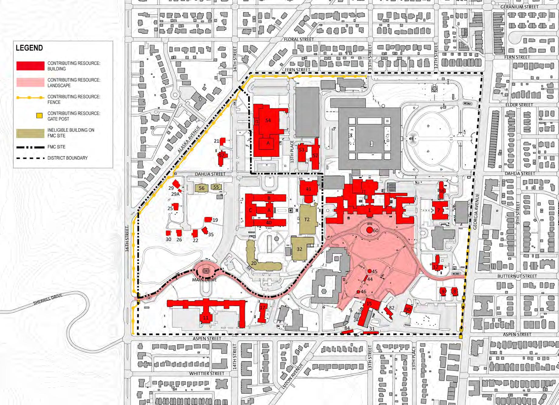
DEPARTMENT OF STATE Foreign Missions Center Master Plan EYP/ 3-28 N
Figure 3.32: Cultural Resources: Buildings, Structures, and Landscapes
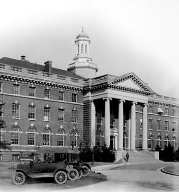
Overview of the Historic District
Given the almost constant demolition and construction that occurred during the entire history of the WRAMC the proposed historic district is physically and visually complex. While there are 28 buildings of various sizes and ages that have been identified as contributing resources, as well as site and landscape features, there have been significant changes to the campus post-1956 that impact our sense of the campus as it exists today. Imagining the historic district without these later modifications is a worthwhile exercise, at the same time, it does not provide a realistic picture of the campus as it existed at any one time during the period of significance. While Building 2 was constructed in 1972, the site it occupies today had numerous older structures on it that were removed to make way for the new building. The development of the campus is characterized not just by the addition of new buildings, but also by the removal or relocation of buildings. Within this framework of dynamic change any evaluation should take into account the context of the campus as it existed during the period of significance, how it exists today and how changes in the future might relate to those conditions.
As with other analyses of the campus there are zones that have different characteristics that can be utilized as a baseline for this assessment. There are three primary zones that characterize the development of the campus over time.
Main Core
This area is dominated by the Main Hospital Building and is organized around critical landscape elements. It includes Building 1/Main Hospital, Building 40/WRAIR, Building 41/Red Cross, and Building 7/Barracks. These four structures are aligned along a formal east-west axis and are stylistically similar. From the main lawn south of Building 1 this grouping could be viewed together, a view that has been compromised to the west by later construction (Buildings 14, 32, and T2) which has cut off the view of Buildings 40, and 41. In addition to the impact on the overall view of this group of buildings the temporary Building T2 sits directly on the one formal landscape element on the campus, a formal garden, that was created as a connector between Buildings 1, 40, and 41.
North of Dahlia Street
The zone north of Dahlia Street, particularly to the east side of the campus, was characterized by smaller scale, tightly sited and orthogonally organized structures that housed both hospital and residential functions. Buildings 52 and
53 are the only surviving structures of this typology which reached its peak in the years during and immediately after World War II. The construction of Building 2/Heaton Pavilion radically altered the context of this portion of the site leaving Buildings 52 and 53 in a vacuum. While Building 52 was physically connected to the Main Hospital when it was first constructed this relationship has been lost both physically and visually. At the peak of the clustered development in this zone of the campus, Building 52, other ward buildings and other structures, were organized by and related more to Dogwood Street along their north edge. Dogwood Street was an internal campus street that connected 14th Street to Georgia Avenue and originally set the northern border of the campus. Dogwood Street was lost with the construction of Building 2.
Building 54/AFIP was a significant variation to the campus in both its style and its siting. It does not relate to the other buildings on the campus in its materials or detailing and is sited facing away from the core of the campus towards 14th Street and the adjacent residential neighborhood outside the campus.Volumetrically it relates more to the 1970s hospital and dominates the adjacent contributing resources. The visual impact of Building 54 is strongest from the west, along Alaska Avenue.
West of 14th Street
The area west of 14th Street has been the least modified by building construction and the most natural portion of the site. This is a bit of a misconception; however, as the topography of this portion of the site has been modified over time either to accommodate roads or to provide a platform for the five residences that were moved to serve as Officer’s Quarters. This grouping of buildings is stylistically related more to the houses located in the surrounding neighborhoods than to the other buildings on the campus. Due to the vegetation in and around this cluster of buildings, there is also a limited visual connection between these residences and the eastern areas of the campus. The Memorial Chapel, sited at the intersection of 14th and Dahlia Streets, enjoyed a very different relationship to the campus from its construction until 1954. While not a large building it was located at an intersection, on a higher point of ground which made it a visual landmark sitting in an open area surrounded by residential scale structures. With the construction of Building 54, a much larger and physically dominating structure, the visual status of the Chapel was diminished, particularly when viewed from the east.
DEPARTMENT OF STATE Foreign Missions Center Master Plan EYP/ 3-29 DECEMBER 2018
Figure 3.33: Main Hospital Building (c. 1924)
Building Condition Assessment and Reuse Potential
The adjacent table summarizes the analysis of physical condition, historic significance, and reuse potential for all of the buildings within the FMC portion of the historic district. The summary of physical conditions is based on detailed assessments of each building. These assessments were conducted in spring of 2012 by the consultant team. The historic significance summaries are based upon the Department of the Army’s assessment, nomination, and listing of the WRAMC historic district on the DC Inventory of Historic Sites and the National Register of Historic Places.
The FMC will be a new campus for foreign mission chanceries. The assessment of reuse potential is the result of a detailed study of each building on the FMC. Each building was evaluated for potential adverse effects using the recognized evaluation criteria assessing impacts to historic structures. Also, each building on the FMC was evaluated based on physical conditions, aesthetic quality, potential for programmatic reuse, estimated costs for building reuse, efficient use of available lot area, and potential marketability to the foreign mission community.
Contributing Resources, Significant
All of the buildings that were built during the 1909 to 1956 period of significance of the historic district are considered contributing resources. A contributing resource is any element, structure or object which adds to the historical integrity or architectural qualities that make up the historic district. The following buildings can be considered of greater significance for their association with historic events and/or people, and architectural character of the historic district.
DEPARTMENT OF STATE Foreign Missions Center Master Plan EYP/ 3-30 Bldg. No. Current Name Current Use (2011) Date of ConstructionBuilding Area Physical Condition Historic Significance Reuse Potential 19Officer’s Quarters #5 Unoccupied c. 1915 4,180PoorContributingPoor 20Mologne House Hotel 1997 95,600Goodn/a Fair 21Officer’s Quarters #7 Unoccupied c. 1915 4,960PoorContributingPoor 22Officer’s Quarters #8 Unoccupied c. 1919 3,900FairContributingPoor 25Officer’s Quarters #11 Unoccupied c. 1919 3,802PoorContributingPoor 26Officer’s Quarters #12 Unoccupied c. 1918 3,121FailingContributingPoor 29Officer’s Quarters #16 Unoccupied c. 1915 4,220FairContributingPoor 30Officer’s Quarters #17 Unoccupied c. 1915 2,550FailingContributingPoor 32Wagner Sports Center Fitness complex/Gym 2003 35,525Excellentn/a Fair 35Officer’s Quarters #19 Unoccupied c. 1915 3,636FailingContributingPoor 40Army Institute of Research Unoccupied 40: 1923 40A: 1932 40B: 1932 40C: 1962 246,271FailingContributingPoor 41Old Red Cross Bldg. Medical offices 1927 1944 50,023GoodContributingGood 55Fisher House #2 Residence 1996 5,017Goodn/a Poor 56Fisher House #3 Residence 2004 8,692Goodn/a Fair 57Memorial Chapel Assembly 1931 6,632GoodContributingGood T2Medical Center Brigade Staff offices 1971 67,340Fair n/a Poor
Table 3.1: Condition Assessment
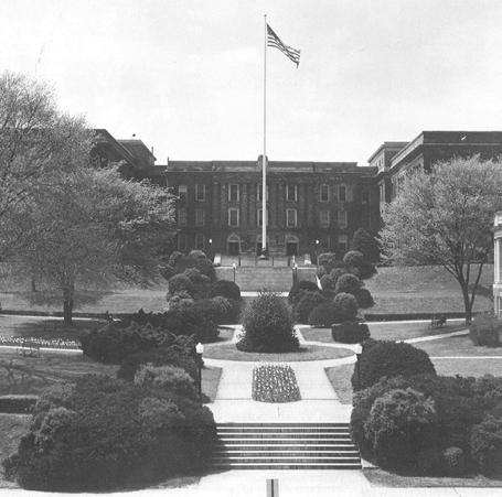
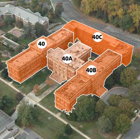
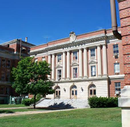
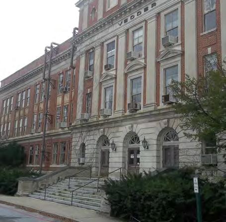
Building 40 / Walter Reed Army Institute of Research
Building 40 was constructed in sections. The south wing, Craig Pavilion, was completed first in 1923. The center section and north wing, Sternberg Auditorium, and Vedder Pavilion, were completed in 1932. The west wing, Siler Pavilion, was completed in 1962. The 1923 and 1932 wings are part of a single design and were constructed within the period of significance of the proposed historic district. Building 40 was built to house the Army Medical School. The Army Medical School was the site of many of the important medical advances in the fields of public health and preventative medicine. In 1953, the Army Medical School changed its name to the Walter Reed Army Institute of Research (WRAIR). In addition to the exterior of the building, some interior spaces Sternberg Auditorium and Stage (Building 40A), Sternberg Auditorium Lobby (Building 40A), First Floor Public Corridors (Building 40A), Public Lobbies (Buildings 40 and 40B), Corridor Stairs (Buildings 40 and 40B) have been identified as character defining features of the building, though they are not part of the historic listing. Since 1999, the building has not been occupied. Since the fall of 2004, Building 40 has been leased by the Army to a third party through an Enhanced Use Lease Agreement (EULA). The duration of the EULA is fifty (50) years with several renewal options for up to an additional forty (40) years. There is no evidence in the EULA that the lease is null and void. The overall condition of the building is poor. Portions of the building are deteriorating.
The portion of building 40 constructed before 1956 is a contributing resource to the proposed WRAMC historic district. Its history as the location for 75 years of one of the Army’s premier medical research institutions and its Georgian Revival architecture, which also contributes to the overall architectural character of the historic district, make it eligible. At over 240,000 GSF, Building 40 is much larger than a typical chancery (20,000 to 60,000 GSF). The current conditions, ongoing deterioration and building size will make it costly to renovate either the entire building or portions of the building. It is anticipated that DOS will have significant difficulty finding a foreign mission that will renovate this building or a portion of it into a chancery. Also, additional land will need to be dedicated for structured parking to accommodate the potential number of foreign mission employees for such a large building.
DEPARTMENT OF STATE Foreign Missions Center Master Plan EYP/ 3-31 DECEMBER 2018
Figure 3.34: Building 40 (1948)
Figure 3.35: Building 40 aerial
Figure 3.36: Building 40
Figure 3.37: Building 40
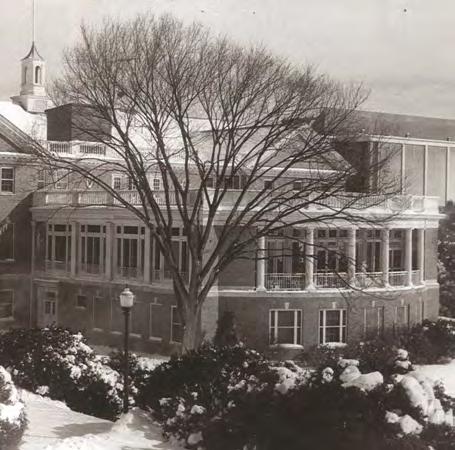
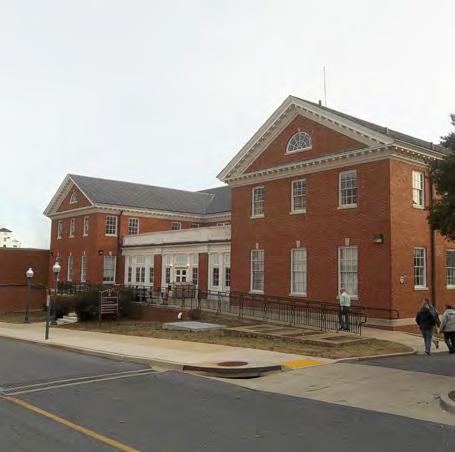
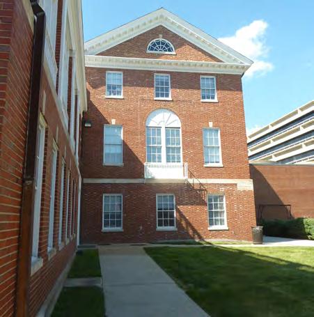
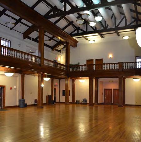
Building 41 / Old Red Cross Building:
Building 41 was completed in 1927 as an entertainment and recreation venue for the post. In 1944, a solarium was added to the south side of the building. This building and Memorial Chapel are representative of the long standing relationship between the American Red Cross organization and the American Armed Forces for the care of wounded service men and women. The building is considered a significant example of Colonial Revival architectural style. In 2001, the Old Red Cross Building was renovated into a training center and administrative offices while maintaining the two-story function hall and exterior character of the building. The overall condition of the building is good.
Building 41, including the 1944 solarium addition, is a contributing resource to the WRAMC historic district. At about 50,000 GSF, this building is the same size as many of the chanceries at the nearby ICC. It is anticipated that there is a strong potential that DOS will find a foreign mission that will renovate and reuse this building.
DEPARTMENT OF STATE Foreign Missions Center Master Plan EYP/ 3-32
Figure 3.38: Building 41 (1950’s))
Figure 3.39: Building 41
Figure 3.40: Building 41 (1928)
Figure 3.41: Building 41
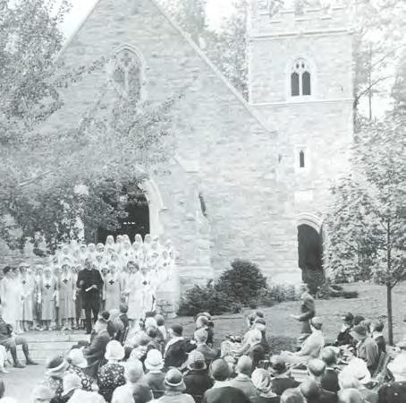


Building 57 – Memorial Chapel
Completed in 1931, Memorial Chapel was constructed with donations raised by the Red Cross’ Gray Lady Corps, a group that provided recreational services at military and veterans’ hospitals. The Chapel is built in the English Country Gothic style which differs greatly from the Georgian Revival style of the rest of the campus. Its original use was as a non-denominational worship space for the WRAMC patients, staff, visitors, and the surrounding neighborhoods. In addition to the exterior of the building, there are interior spaces and features (i.e. stained-glass windows) that have been identified as character defining features of the building. The Chapel was de-consecrated by the Army in 2011 as part of the base closure process.
Building 57 is a contributing resource to the WRAMC historic district. Due to its significance to the WRAMC and the surrounding community, DOS will retain the Chapel on its current site. Due to its size, configuration and style the Memorial Chapel is not recommended for reuse as a chancery. The recommended reuse is as an event and assembly venue for DOS and foreign missions’ community in the greater Washington, D.C. metro area.
DEPARTMENT OF STATE Foreign Missions Center Master Plan EYP/ 3-33 DECEMBER 2018
Figure 3.43: Memorial Chapel
Figure 3.42: Memorial Chapel at its dedication (1931)
Figure 3.44: Memorial Chapel (1948)
Figure 3.45: Memorial Chapel Interior
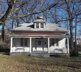


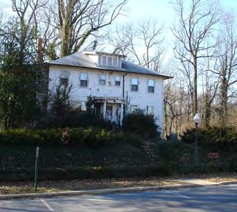

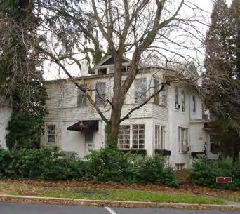
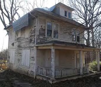

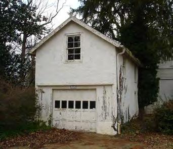
Contributing Resources, Other Buildings
The following buildings are also considered contributing resources to the WRAMC Historic District. While significant for the overall character of the historic district, these structures do not have strong associations with historic events and/or people and are not part of the overall architectural character of a majority of the historic district.
Buildings 19, 21, 22, 25, 26, 29, 29A, 30, and 35 - Officer’s Quarters
These residential structures were built between 1914 and 1920. All were located on land that was acquired by the Army in the early 1920s for the expansion of the medical center; and, therefore, these structures were not built by the Army. Buildings 21, 25, 29, and 29A are on their original sites. Buildings 19, 22, 26, 30 and 35 were located on Dogwood and Elder Streets and moved to their current locations around 1954 in order to clear the site for Building 54. These building are too small to be reused as chanceries. They are sited in close proximity to each other offering limited space for possible additions. Due to their siting, size, and poor to failing physical conditions, these structures will be removed from the campus.
Non-Contributing Resources, Buildings
The following buildings and structures were constructed after the period of significance and are not considered contributing resources to the historic district. They are also not individually eligible for listing on the national Register. While not meeting the standards for consideration as a cultural resource, each building was still evaluated for potential reuse as a chancery.
Building 20 – Mologne Guest House
Built in 1997, this hotel style building has 200 guest rooms, dining services, and small meeting facility. While the building is in fair to good condition, the structural and mechanical layouts of this short-term, residential building are not easily renovated into a chancery or office building. These existing conditions and the large site coverage of the L-shaped building limit its reuse. This building is considered a poor candidate for reuse as a chancery. However, this building may serve as temporary housing or office space for existing chanceries in Washington that are undergoing major renovation and/or expansion.
DEPARTMENT OF STATE Foreign Missions Center Master Plan EYP/ 3-34
Figure 3.46: Building 19
Figure 3.49: Building 25
Figure 3.52: Building 30
Figure 3.47: Building 21
Figure 3.50: Building 26
Figure 3.53: Building 35
Figure 3.48: Building 22
Figure 3.51: Building 29
Figure 3.54: Building 29A

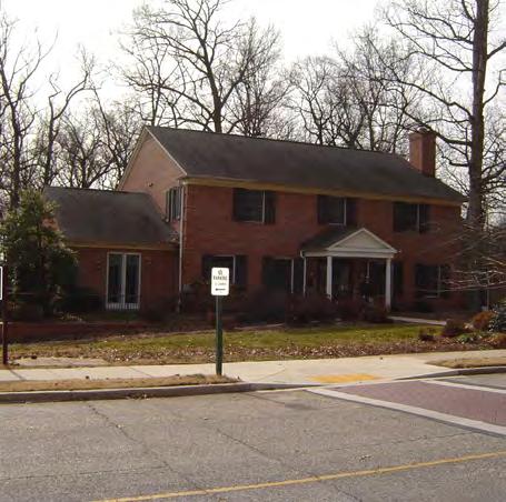
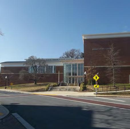

Building 32 – Wagner Sports Center
Completed in 2003, this 35,525 GSF, two-story fitness center is the newest structure at the WRAMC and is in good to excellent condition. However, the potential reuse of this building as a chancery is low. Large, double-height spaces such as the gymnasium and racquetball courts are not able to be efficiently renovated into a chancery space. In addition, the buildings close proximity to Main Drive may not provide sufficient setbacks from a public road for most foreign missions’ requirements.
Building 55 – Fisher House #2
Constructed in 1996, this domestic scale building was built to accommodate wounded service personnel and their families. The size, 5,240 GSF, and domestic scale of this facility make it a poor candidate for reuse as a chancery.
Building 56 – Fisher House #3
Built in 2004, the building is similar to its neighbor, Building 55. While the size is larger at 11,474 GSF, it is constructed at a domestic scale and could be converted to a chancery with a least a modest addition. Due to its recent construction and stand-alone mechanical systems, this building could be used prior to significant site improvements.
Building T2 – Medical Center Brigade
This building was built in 1972 as a temporary facility for the Medical Center’s brigade headquarters. The building is beyond its useful lifespan and cannot be reused as chancery building.
DEPARTMENT OF STATE Foreign Missions Center Master Plan EYP/ 3-35 DECEMBER 2018
Figure 3.55: Building 20
Figure 3.57: Building 32
Figure 3.56: Building 55
Figure 3.58: Building 56


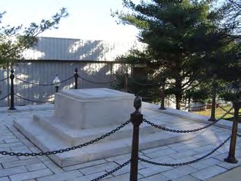
Landscapes and Other Structures
There are landscapes and structures associated with specific buildings such as the healing pool at Building 20/Mologne Guest House and the plaza. These landscapes and structures were evaluated with the associated buildings. There are several structures that are not associated with any building. These structures are noted below.
Main Drive Ellipse and Walter Reed Memorial
Structure 99/The Walter Reed Memorial and ellipse are integral elements of the WRAMC campus. Part of the 1933 extension of Main Drive to 16th Street, the ellipse is an important element of Main Drive and provides a counterpoint to the ellipse in front of the Building 1/Main Hospital Building. As a component of Main Drive, the ellipse is part of a contributing resource to the WRAMC historic district.
At the center of the ellipse is the Walter Reed Memorial. Dedicated in 1966, the monument is a later addition to the campus. It is a marble plinth and 25-foot, marble pedestal with a bronze bust of Major Walter Reed of the Army Medical Corps and namesake of the Medical Center. The sculpture is an example of the work of Felix De Weldon (1907-2003) whose most wellknown work is the Marine Corps Memorial in Arlington,Virginia. Since the monument is less than 50 years old and not within the time frame for the nominated district, it is neither individually eligible nor a contributing resource to the WRAMC historic district. The Army has relocated the Walter Reed Memorial to the new medical facility in Bethesda, Maryland.
WRAIR Time Capsule
Built around 1935, the Structure 10/WRAIR Time Capsule was a part of a set of granite stairs and plinth built between Building 1 and Building 40. When originally constructed, it was topped by a flag pole that was relocated from the ellipse in front of Building 1. In 1977 the flag pole was removed. In 1982, a time capsule of Army Medical School artifacts from the 1930s was installed in the granite base. While the structure was built during the period of significance (1909 to 1956), the structure is not considered a contributing resource due to significant modifications and loss of integrity from location and setting.
Perimeter Fence
The Walter Reed Army Medical Center is organized similar to most military installations. The perimeter boundary of the post is identified by a fence or barrier with entry points signified by gates. The perimeter fence at the WRAMC extends around the entire installation and like many of the other built elements on the campus has been modified over time to accommodate changing programmatic needs and technologies.
A portion of the perimeter fence adjacent to the FMC has been identified as a contributing resource to the WRAMC historic district. These identified sections include the fence from the southwest corner of the post, at the intersection of 16th Street and Aspen Street, north along 16th Street, northeast on Alaska Avenue between 16th Street and Fern Street and east on Fern Street to the 13th Street gate.
The majority of the fence that has been identified as a historic resource consists of small iron posts, approximately 4 inches by 4 inches evenly spaced at about 8 foot intervals anchored in concrete footings. These posts are capped with ball finials. Between the posts are iron pickets, 1 inch by 1 inch, held in place by a bottom rail and a top rail. The top of each picket comes to a pyramidal point. The height of the fence is approximately 6 feet.
At key points in the fence, primarily at entry points, the design is modified to incorporate larger gate posts and operable gates for both vehicles and pedestrians. At the main entry on 16th Street, the entry is further enhanced with brick piers with limestone bases and caps. The fence shape is also modified at the 16th Street entrance to include curved plan and elevation elements.
Significant modifications have been made to the fence over time, particularly in recent years for security reasons. The primary modification is a reinforcing cabling system that consists of two steel cables that run parallel to the ground at the mid-point of the pickets and are anchored into the ground at a number of locations. Other modifications include bollards and barriers at inactive entrances and locking systems on the gates at these same access points.
DEPARTMENT OF STATE Foreign Missions Center Master Plan EYP/ 3-36
Figure 3.59: Main Drive Ellipse
Figure 3.60: Walter Reed Memorial
Figure 3.61: WRAIR Time Capsule

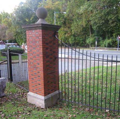

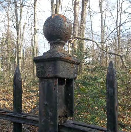
The fence is in generally good condition. The iron is exhibiting signs of paint failure and corrosion at some points. Soil build-up, particularly along Alaska Avenue has resulted in the lower portion of the fence being covered by soil and grass. It is likely that the iron elements which are hidden and in contact with earth are deteriorating due to corrosion. The masonry piers on 16th Street are in good condition.
The FMC is planned to be an open and welcoming environment to support the functions of the foreign missions populating the center. Full and complete public access to the foreign missions is a primary design criterion. The historic perimeter fence will be retained as part of the FMC.Vehicular and pedestrian access points to the FMC are being located where possible at existing gates. The security guardhouses will be removed. Where required by each foreign mission, more robust secondary barriers will be self-contained within each lot.
At both the southwest and northeast end of the historic fence the termination point extends beyond the boundary of the planned FMC. On 16th Street the FMC boundary will be at the north side of Main Drive. On Fern Street the boundary will be at a point between the 13th Place gate and the 13th Street gate, approximately at the west end of Building 88. On 16th Street the existing main gate provides a natural break between in the fence. On Fern Street, the dividing line is not well defined. The fence in this area is an unbroken run of iron posts and pickets. Based on the DC-LRA planning documents, it appears that the fence on the easterly side of the WRAMC will be removed.
DEPARTMENT OF STATE Foreign Missions Center Master Plan EYP/ 3-37 DECEMBER 2018
Figure 3.63: Main Gate at 16th Street
Figure 3.65: Perimeter Fence Detail
Figure 3.62: Perimeter Fence at 16th Street
Figure 3.64: Looking North on 16th Street at Aspen Street
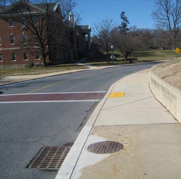
3.5 UTILITIES
The FMC portion of the WRAMC campus is currently served by utility systems that were created as the WRAMC infrastructure. The systems include storm drainage, sanitary sewerage, potable and fire protection water distribution, steam heat supply, chilled water service, natural gas distribution, telecommunications service, and power distribution. These services encompass both government-owned and private utility company components. With respect to existing conditions, descriptions of the utility systems are organized as follows:
• Water Supply and Distribution
• Natural Gas Distribution
• Steam Heat / Chilled Water Distribution
• Electrical Power and Telecommunications System
• Sanitary Sewerage
• Storm Drainage Network
One of the primary goals for DOS is to ensure that the site development will serve the proposed foreign missions for at least the next fifty years without disruption or major failure of infrastructure and utilities. In order to accomplish this goal, it is proposed that all new utilities and infrastructure will be needed.
Off-Site Infrastructure Analysis
The consultant team has reviewed available information and performed site investigations related to the existing property’s utility/infrastructure network. Based upon these evaluations, it has been determined that the exterior (off-site) infrastructure system appears adequate for the proposed FMC development. In other words, there exist adequate facilities at the perimeter of the FMC property for future connections necessitated by proposed campus uses. The size and capacity of all of the utilities identified at WRAMC are currently adequate for the proposed FMC needs. It is of crucial importance, however, that the existing capacity not be modified or reduced by other parties (the Army, the DC public utility agencies, private utility providers or adjacent present or future landowners) without DOS review and approval.
In order to assure that utility connections from public systems are commensurate with the conditions that currently exists, DOS plans to
DEPARTMENT OF STATE Foreign Missions Center Master Plan EYP/ 3-38
Figure 3.66: Existing campus storm drainage
Figure 3.67: Existing Electrical Manhole
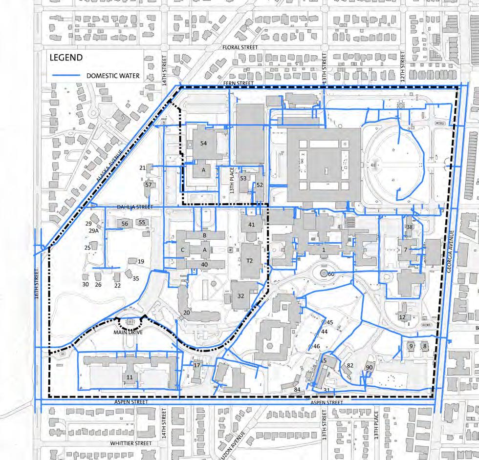
coordinate with the Army to attain an agreement that all utilities available for connection to the FMC campus at this time shall be maintained to an equivalent or greater standard at the perimeter of the tract and within the remainder of the property, outside of the DOS boundary. Further, existing easements between the Department of the Army and other agencies for off-site utilities should be reviewed to ascertain that they convey with the property and do not become null and void with any future transfers of land. Without these agreements it will be impossible to determine whether development of the property outside of the DOS boundary will adversely reduce the capacity at the connection point with the FMC. The equivalent or greater standard should be specifically defined to include size, location, and capacity of the future systems to meet or exceed existing conditions. Each utility network will need to be defined in terms of the appropriate performance criteria to be maintained.
Water Supply and Distribution
Potable and fire protection water for the FMC site is supplied by the DC Water and Sewer Authority (DCWater) and is served from two separate Operating Systems – the 3rd and 4th High Operating Systems. Water supply from DCWater is acceptable in quantity and quality for the existing and previous WRAMC purposes and can be expected to remain adequate. The existing distribution mains throughout the FMC campus are 8-inch diameter cast and ductile iron pipes. The system is looped both internally and externally (via DCWater 12-inch mains) for redundant supply. Available records indicate that the water system (including on-site pipes and valves) was built beginning in 1908; much of the system is over 50 years old. Shutoff and cross-connection valves are not always operable and pipe breaks or repairs are severely problematic as a result. The overall condition of the existing pipes is not well known and significant flow testing will be crucial under final design scenarios to determine appropriate system reliability indices. Public safety under fire emergency conditions will warrant these investigations. Potentially significant pipe and valve replacement may be necessary surrounding the existing network.
With the division of the WRAMC property into two sections – FMC and DC-LRA – cooperative agreements to maintain system looping will need to be addressed. With the development of the FMC campus, complete replacement of the distribution system to WASA standards may prove economical to create an effective public water utility network.
DEPARTMENT OF STATE Foreign Missions Center Master Plan EYP/ 3-39 DECEMBER 2018 N
Figure 3.68: Existing Water Supply and Distribution
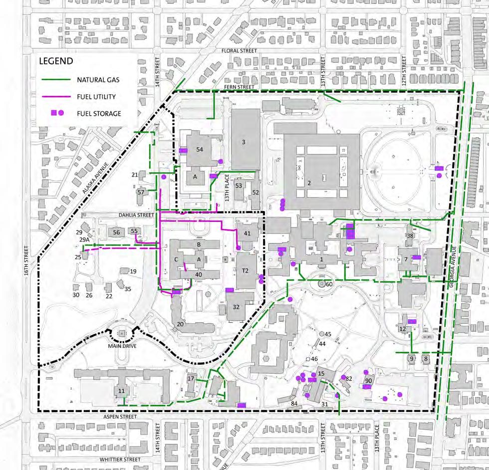
Natural Gas Distribution
Natural gas is supplied from existing commercial, private distribution mains located within Alaska Avenue and Fern Street with major laterals located along Dahlia Street, 14th Street, and Main Drive. No looping of the natural gas system is provided. While the WRAMC site was operational, natural gas was utilized for hot water heaters in individual buildings and was the primary heat source at the Building 15 - Central Heating Plant (outside of the FMC parcel). No evidence of any system inadequacies or problems was found during the existing conditions investigations.
Steam Heat / Chilled Water Distribution
Steam heat and chilled water are currently provided from centralized locations on the DC-LRA portion of the WRAMC site. These centralized facilities, Building 15 for steam and Building 48 for chilled water, will either be shut down under current plans or converted / relocated/ replaced by alternative sources under the DC Government’s development of the DCLRA portion. Since the timing of the FMC and the DC-LRA developments is not coincident, current planning is proceeding under the assumption that independent public sources will be utilized for heating and cooling needs. The FMC infrastructure development will not include steam heat or chilled water distribution. It is anticipated that each foreign mission will be responsible for heating and cooling needs within their facilities. In the event that the DCLRA is successful in their planned tri-generation energy program prior to any portion of the FMC development completion, the option remains to replace or augment planned public supply with this private system. In either case, the existing heating and cooling equipment within any building which is expected to remain under final Master Plan development will have to be retrofitted for alternative energy source.
DEPARTMENT OF STATE Foreign Missions Center Master Plan EYP/ 3-40
N Figure 3.69: Existing Natural Gas Distribution and Fuel System

Electrical Power and Telecommunications Systems
Electricity for the FMC site is currently provided by two points of service. The primary point of service is four medium voltage (MV) PEPCO feeders at 15kV that serve the FMC site and neighboring buildings on the campus via Building 15 on the south-east corner of DC-LRA portion of the WRAMC site. The second point of service to the site from PEPCO consists of two MV feeders that are dedicated to Building 54. These feeders enter the site underground from the local power company distribution, PEPCO, in Alaska Avenue. Local transformers to provide usable levels of power are located at grade on pads or in underground vaults and, in some cases, within building electrical rooms.
The campus electrical distribution feeders are relatively new and are distributed throughout the WRAMC site via underground concrete encased duct-banks and manholes. These four MV feeders are installed in a loop configuration to provide redundancy and backup. A portion of the existing underground duct-bank and manhole systems may be salvaged and be incorporated into the new FMC site configuration. New electrical service(s) from PEPCO should be brought into the FMC site from 16th Street or Alaska Avenue. Once the service is brought into the site, individually metered services should be provided for each of the potential building lots on the FMC campus. The MV service(s), individual metered services, and estimated demand load of the FMC site will need to be coordinated closely with PEPCO during design.
Telecommunications service to the WRAMC campus is provided by Verizon through trunk lines to Building 1 from Georgia Avenue. From Building 1, distribution cabling, manholes, below grade ducts, overhead lines, panels, and other components are owned by the Department of the Army. During WRAMC’s tenure at the site, the Army was responsible for the extension of communications service to any new users or tenants. This telecommunications distribution system is appropriate for the current singular campus use as an Army medical center. Since this system was designed for a single client versus multiple clients, it is recommended that this distribution system be abandoned and removed. New telecommunication service(s) should extend current services from adjacent roads: Alaska Avenue or 16th Street. Each potential lot should have access to telecommunication services and cable television services.
DEPARTMENT OF STATE Foreign Missions Center Master Plan EYP/ 3-41 DECEMBER 2018 N
Figure 3.70: Existing Electrical Distribution
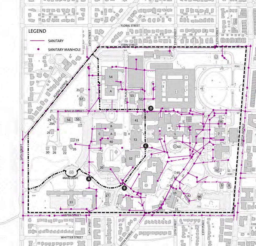
Sanitary Sewage
Sanitary wastewater from the WRAMC site is discharged into the WASA sewer mains which are near the intersection of Georgia Avenue and Dahlia Street. Mains depart the tract southwest of the existing Central Heating Plant at Aspen Street. None of the WASA sewer mains are located within the FMC campus. Consequently, all sewerage (manholes and piping) on the DOS parcels will be privately owned and maintained unless the agreement can be reached with WASA to take over the system.
A review of the available profiles of the sanitary sewer system indicates that the pipe sizes and slopes provide adequate capacity for the planned development of the FMC complex. However, most of the on-site sanitary pipe is terracotta and is not generally considered adequate under today’s system conditions. The existing private sewer laterals depart the DOS portion of the WRAMC property into the remainder site at four locations as shown. The table below summarizes the locations, sizes, and potential capacity, assuming a minimum one percent downstream slope. The existing off-site receiving sewer (at 21 inches diameter) includes (at an assumed one percent slope) a capacity of 7,383 gallons per minute.
DEPARTMENT OF STATE Foreign Missions Center Master Plan EYP/ 3-42 N
Figure 3.71: Existing Sanitary Sewer System
Key Location Size inches Capacity Gallons per minute A Southwest of Building 20 beneath Main Drive 12 1,662 B Southeast of Building 20 beneath Main Drive 8 563 C Southeast of Building T2 under Ambulance Drive 6 261 D Near intersection of Dahlia Street and 13th Street between Buildings 41 and 52 12 1,662 Total Capacity 4,148
Table 3.2 : Existing Sanitary Sewer Capacities
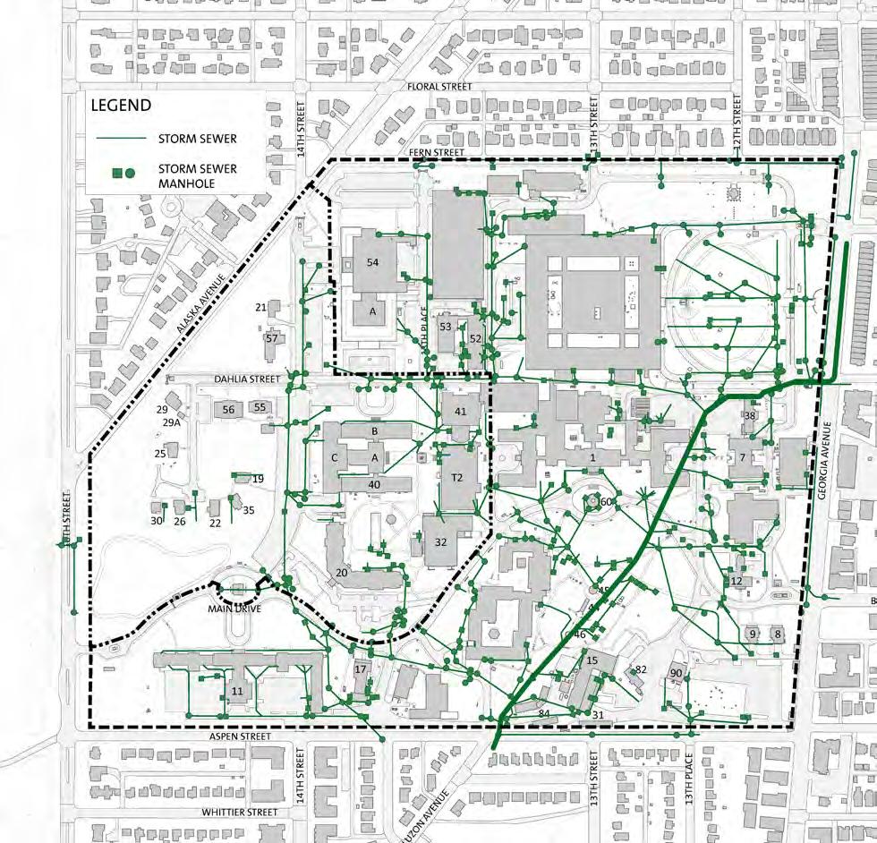
Storm Drainage
The surface components of the existing drainage system consist of a network of grated curb inlets, area drains, and grated trenches. Subsurface piping connects these receptacles and conveys storm water runoff from the site to four drainage outfalls from the FMC parcel onto the DC-LRA tract. Hence, easements and agreements for these critical outfalls will be necessary. These outfalls are below grade pipes beneath Main Drive, Ambulance Drive, and 13th Street at Dahlia Street. Each outfall drain connects to a major DC trunk sewer tunnel (Luzon Tunnel) within the WRAMC property. Inadequate information is available to determine the performance characteristics (i.e., full flow capacity and velocity) for the trunk line which serves 300 acres of upstream and onsite development. Preliminary hydrologic computations of the drainage shed predict peak 10-year storm discharges on the order of 500 cubic feet per second for this trunk line, which may result in significant tail-water constraints to drainage system performance. A small portion of the DC-LRA property (near Buildings 88 and 2A) discharges into and through the FMC campus. This contribution may need to be maintained, dependent on DC-LRA plans for that subarea.
The campus has a significant extent of impervious cover, accounting for approximately 23.4 acres, or 52 percent of the site’s area, as shown in the accompanying site plan. In the event of drainage system failure (clogging), overland relief for the FMC campus would be by 13th Street roadway just east of Building 3 for the eastern of the site and Main Drive for the western portion of the site.
Most of this piping is approaching its design life and increased maintenance costs are anticipated under continued use. Additionally, the piping network has historically and logically developed with the lots and buildings constructed by the Army at WRAMC. The re-development of the site as the FMC will naturally require significant, and potentially complete, replacement of the existing on-site system. This need for realignment of systems will also provide the opportunity for the replacement of existing inadequate components. With the major changes in design approach to storm water management since the system was originally constructed, planning for the FMC presumes that complete reconstruction of the storm water runoff collection and conveyance system will occur.
DEPARTMENT OF STATE Foreign Missions Center Master Plan EYP/ 3-43 DECEMBER 2018
N Figure 3.72: Existing Storm Sewer System
There is one ultimate outfall of the storm drainage, to the Luzon Tunnel, off of the DOS property. The DOS property will not be allowed to increase the peak rate of storm water runoff from the site per municipal and International Zoning Code standards for watershed management. The property will be required to reduce the developed peak flows from the site to pre-development conditions through detention, reuse, and low impact development. To accommodate the infrastructure improvements outside of individual lots (i.e., roads, walks, open space, etc.), detention/water quality improvement areas will be designated adjacent to the road network. With the incorporation of rainwater harvesting and water quality improvement measures into the network, peak discharge quantities can readily be controlled and managed to satisfy local regulation requirements. Therefore, no constraints created by the level of development for the property are anticipated by the storm drainage system. Each individual parcel will be required to address storm water requirements either via an independent facility located or a pro-rata share of a centralized facility. This will reduce storm water runoff to pre-developed conditions and therefore relieve the project of any downstream impacts.
The internal site design will require that overland relief flow paths be maintained throughout the property and the final Master Plan documents will include the design parameters recommended for incorporation on the site. It is important, however, that the final agreements with the Army (and continuing to future landowners) provide adequate offsite conveyances to meet the emergency flood relief in the event of a major storm drainage failure or blockage. Typically 100 year flow paths are provided to meet this potential catastrophic occurrence.

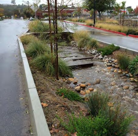
DEPARTMENT OF STATE Foreign Missions Center Master Plan EYP/ 3-44
Figure 3.74: Bioretention Pond
Figure 3.73: Rain Garden

3.6 ENVIRONMENTAL
Site Hazardous Materials Contamination
The site related environmental concerns listed in the U.S. Army’s 2006 Environmental Condition of Property (ECP) Report and the subsequent 2010 update are the following:
• Petroleum product storage and releases
• Utilities Potential impacts to soil and groundwater in and near the sanitary sewer and storm drain systems
• Potential impacts to soil and groundwater near transformer pads and vaults that formerly held transformers containing Polychlorinated Biphenyls (PCBs)
• Asbestos impacts within the steam tunnels and in un-renovated portions of buildings
The installation of new utility systems and excavation for foundations on the FMC will likely encounter some contaminated areas that will require remediation of at least the immediate areas to allow for the safe installation of the new utility systems. For marketability, the campus will need to be clean and free of all contaminated materials.
Under-ground and Above-ground Petroleum Storage
Currently, underground and aboveground fuel tanks have been identified at several locations within the property and were established for unique situations at WRAMC. These stand-alone systems of fuel storage and distribution piping appear to be for emergency purposes (i.e., backup generators) with small tanks for stipulated uses. All tanks are reported to have double-wall construction or secondary containment. There are no documented petroleum releases on the DOS portion of the WRAMC property. It is highly unlikely that this system will be adaptable to future uses. It is recommended that these facilities be removed from the site in conformance with Environmental Protection Agency requirements and that, in general, oil and gasoline storage and service facilities not be allowed under future development conditions. The only Army-reported petroleum release is on the adjacent DC-LRA property.
DEPARTMENT OF STATE Foreign Missions Center Master Plan EYP/ 3-45 DECEMBER 2018 N
Figure 3.75: Existing PCB Contamination
Mercury in Sanitary
At Building 40, medical waste including mercury may have been disposed of in the sanitary system. Preliminary samples indicate some mercury contamination in the sanitary outfall from these buildings. These sanitary lines should be removed.
Asbestos Containing Materials in Under-ground Utilities
Asbestos-containing materials are present at underground steam lines and tunnels. Undisturbed, the asbestos-containing materials may stay in place. However, this solution may limit future development opportunities. The preferred solution is that all tunnels and buried pipe be removed.
PCB Contamination
PCBs have been found in areas of older electrical transformers. Many of these locations are underground vaults. While the transformers have been removed, the PCB contamination is still present in some concrete vaults. The vaults that still collect water have PCB contaminated water. There is a concern that some of these vaults no longer hold water allowing the PCB contaminated water to leach into the ground around the vault. The site of concern on the FMC is at a transformer vault north of Building 40. The EPA allowed the Army to remediate PCB ground contamination areas for reuse as a hospital (commercial/industrial land use). If the contaminated land is to be used for more restrictive use (i.e. residential or educational), additional site clean-up may be required. Also, deep excavation for underground parking may require additional remediation.
Building-related Hazardous Materials Contamination
Asbestos-containing materials and lead-based paint are widely prevalent in buildings on the WRAMC site.
In 2009 and 2010, the Army completed an asbestos survey and re-inspection of 38 buildings at WRAMC. Sixteen buildings were not inspected as part of the survey because they were built or completely renovated after July 12, 1989, when most asbestos-containing products were banned by EPA. The buildings on the FMC site that were not inspected were: 19, 20, 22, 26, 30, 32, 35, and 56. However, the 2006 ECP states that in several of these buildings, asbestoscontaining materials are present. These buildings include: 19, 21, 22, 25, 26, 30, and 35. Since these buildings do not appear to have been renovated, it is
reasonable to assume that the asbestos-containing materials are still present. Building 40 was not inspected; it was inaccessible since a tenant was occupying the building. The steam tunnel network was also to be inspected, as part of the ECP Update. The Army indicated that all of the buildings that contain asbestos-containing materials have been maintained under an Operation and Maintenance Plan for the asbestos-containing materials.
The Army reported that there have been several asbestos fiber release episodes, primarily related to pipes that burst during seasonal changes. The releases were cleaned up in conjunction with pipe repair operations. In the past 5 years, there have been no EPA National Emission Standards for Hazardous Air Pollutants (NESHAP) violations during building renovations.
Lead-based paint exists in buildings on-site. The Army has assumed that all buildings constructed prior to 1978 contain lead-based paint. The only buildings not meeting this criterion are Buildings 20, 32, 55, and 56. Lead surveys and abatement activities have been completed by the Army in some buildings but the Army’s documentation is incomplete so the quantity and components of lead on-site are unknown. The Army has stated that the buildings at the property transfer will be in conditions acceptable to be used (presumably for commercial and industrial uses). The Army is not planning to do additional investigation or abatement. Further testing and verification may be needed if the buildings are to be used for residential purposes or are to be renovated as more stringent regulatory standards may apply at that time. As noted above, medical waste containing mercury may have been disposed of in the sanitary systems of Buildings 40. As a result, several sinks have been identified as being potentially contaminated with mercury. These sinks and associate traps and piping will need to be disposed of in accordance with local and national regulations.
Based on the age of some buildings, the ECP states that light ballasts containing PCBs may still be in use at some locations. The Army’s practice has been to replace such ballasts when they fail, and properly dispose of them.
DEPARTMENT OF STATE Foreign Missions Center Master Plan EYP/ 3-46
Figure 3.76: Building 40 Electrical Transformers
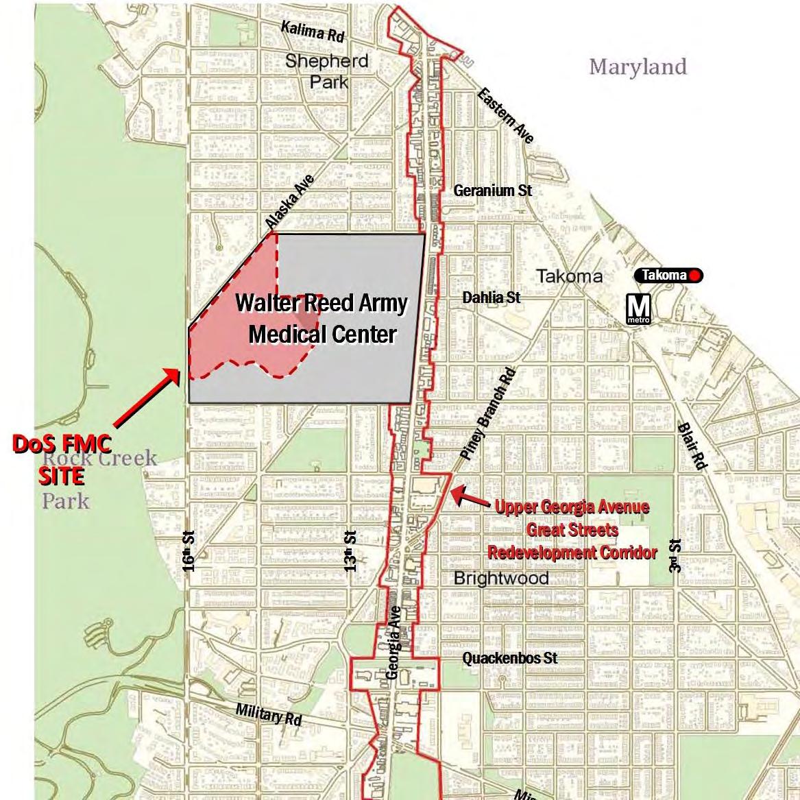
3.7 TRANSPORTATION
The WRAMC is located in the Northwest portion of Washington, DC, in Ward 4, in an area of the District that is primarily residential with some commercial activity. The WRAMC is located north of several future developments, including the construction of a Wal-Mart store along Georgia Avenue. Additionally, the Georgia Avenue corridor is projected to undergo future infrastructure changes due to the proposed Takoma-Buzzard Point streetcar line, which, if constructed as planned, will travel to the Takoma Metrorail Station and may be extended to the Silver Spring Metrorail Station.
The existing WRAMC is located adjacent to the Brightwood, Takoma, and Shepherd Park neighborhoods of Washington, DC. These neighborhoods are predominantly residential with some pockets of commercial activity. Neighborhood mobility is provided by local transit service, arterial and local roadways, sidewalks and crosswalks, and signed bike routes and on-street bike lanes. The site is bound by Georgia Avenue, Fern Street, 16th Street, and Aspen Street.
The development plan for the proposed FMC is located on the northwestern corner of the WRAMC site. The remaining development is planned to be transferred to the District of Columbia for development purposes, which will contain a mixed-use development as outlined in the District of Columbia Walter Reed Re-Use Master Plan. The proposed FMC is very similar to the International Chancery Center (ICC) located on Van Ness Street NW, west of Connecticut Avenue. A Comprehensive Transportation Review (CTR) was performed during the summer of 2016 and is included in this Master Plan as an Appendix.
DEPARTMENT OF STATE Foreign Missions Center Master Plan EYP/ 3-47 DECEMBER 2018
Figure 3.77: Transportation Site Location
N
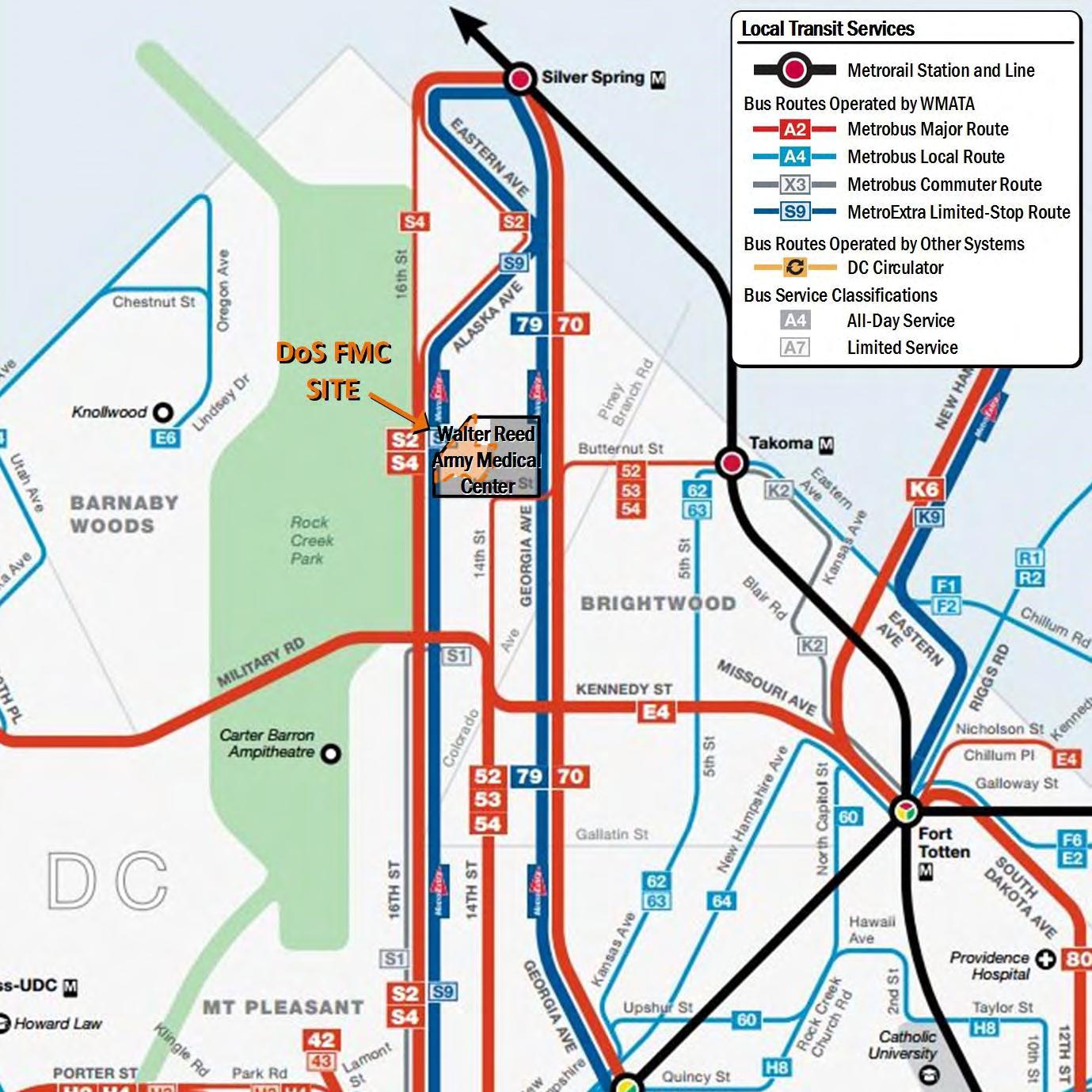
Overview of Regional Access
The existing WRAMC is situated in Northwest Washington, DC. Regional mobility and site access are provided by bus and rail transit, principal arterials, and regional multi-use bicycle trails. The site is within a 15 minute walk of the regional Metrorail system and is directly served by an express bus network. These transit services link the site with downtown Washington, DC, major population centers in Maryland and Virginia, national rail service, and the region’s three airports: Ronald Reagan Washington National Airport, Washington Dulles International Airport, and Baltimore/Washington International Thurgood Marshall Airport.
A trip between the site and downtown Washington, DC takes approximately 25 minutes by Metrobus. Traveling by Metrorail would require a similar amount of time due to the time required to travel between the site and the Takoma Metrorail station, which is the station located nearest to the site; once at the station, the rail trip takes approximately 15 minutes. These time estimates, including those listed below, were developed using GIS mapping and routing software. Estimated travel times are based on travel between the intersection of Dahlia Street and Georgia Avenue and the Metro Center Metrorail station located at 13th Street and G Street.
The adjacent roadways provide connections between the site and the regional and national network. 16th Street and Georgia Avenue, which border the site to the west and east, respectively, are principal arterial roadways in the District and link the site with downtown Washington, DC to the south and Silver Spring and the Capital Beltway to the north. A private vehicle trip from the site to downtown Washington, DC, which is approximately 5 miles, takes approximately 15 minutes. A trip between the site and the nearest Capital Beltway access point, which is located approximately 3 miles from the site, takes approximately 8 minutes.
The site is located within cycling distance of a regional network of multi-use trails, including the Metropolitan Branch Trail and the Capital Crescent Trail. These trails are commuter and recreational corridors that provide mobility throughout the study area and the region. There are on-street bicycle facilities in the study area that provide access to the multi-use trails and regional destinations. A bicycle trip between the site and downtown Washington, DC via the on-street bicycle network takes approximately 30 minutes.
Because of these connections to the regional street network and to nearby multi-use trails, there are no major barriers to site mobility and accessibility
DEPARTMENT OF STATE Foreign Missions Center Master Plan EYP/ 3-48
Figure 3.78: Existing Public Transit Routes
N
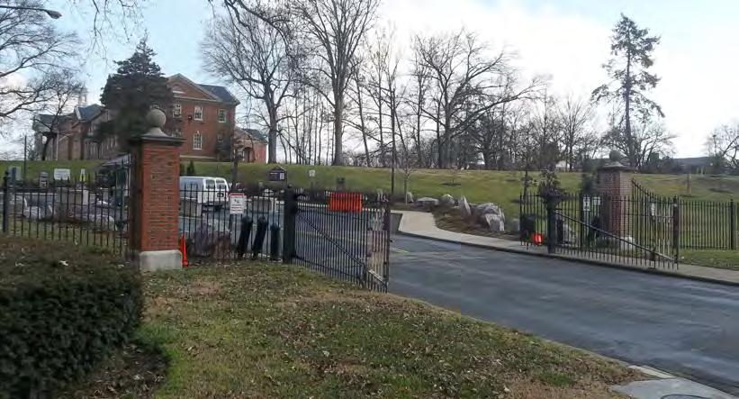

throughout the Washington, DC region. However, although the site is wellconnected to the adjacent roadway network via the local street grid, eastwest connectivity with Chevy Chase and other neighborhoods to the west is limited due to the finite number of connections through Rock Creek Park, which is located immediately adjacent to the site on the west side of 16th Street.
Overview of Local Access
The local transit network consists of bus service along 16th Street, 14th Street, Alaska Avenue, Georgia Avenue, 5th Street, Blair Road, Aspen Street, and Butternut Street. These bus routes have stops located immediately adjacent to the site and every few blocks along each bus route. Bus service links the site with the Takoma Metrorail Station, Silver Spring, and downtown Washington, DC. Several stops near the site have shelters, route information, and seating. The study area roadway network consists of principal arterials, minor arterials, collector roads, and local roads. The network surrounding the site is laid out in a grid pattern with a few avenues and roadways that bisect the network diagonally. Intersections are located at regular intervals and most streets located in the study area are two-way except portions of 8th Street NW, Van Buren Street, and Hemlock Street. The roadway network provides good traffic circulation throughout the study area, allowing for multiple routing options for drivers and dispersing vehicles throughout the roadway network. Access to the existing WRAMC was provided through several gates which are located along the periphery of the campus. However, several of these gates have been closed following the relocation of the Hospital. At the time data was collected for this transportation impact study, only the gate located at 16th Street and Main Drive was operational and provided access to the remaining on-site uses.
Travel through the study area by vehicles, pedestrians, and bicyclists is obstructed by the WRAMC due to the site closing in September 2011. It cuts off direct north-south and east-west traffic traveling through the study area because the roadways are blocked by the now closed campus gates and do not connect through the site. North-south travel along 13th and 14th Streets is impeded, as well as east-west travel along Dahlia Street, Butternut Street, and Elder Street. However, the impact to east-west travel is not as great as to north-south travel due to Rock Creek Park, which provides an additional
DEPARTMENT OF STATE Foreign Missions Center Master Plan EYP/ 3-49 DECEMBER 2018
Figure 3.80: Dahlia Street Gate at Alaska Avenue
Figure 3.79: Main Drive Gate at 16th Street
barrier to east-west movements in the study area.Vehicles, pedestrians, and bicyclists traveling on these study area roadways must circulate around the site or take alternate routes through the study area. However, with the proposed redevelopment of WRAMC, these access points will be fully operational.
Pedestrian facilities are provided throughout the study area, including sidewalks, curb ramps, crosswalks, and pedestrian signals. Conditions are acceptable for pedestrians, shade is provided by mature trees, sidewalks are buffered from traffic by planting strips and on-street parking, and traffic speeds are low along most collector and local roads. However, the following roadways do not have continuous sidewalks on both sides of the street, Aspen Street, Luzon Avenue, Geranium Street, and Blair Road. Pedestrian volumes are highest along Georgia Avenue near bus stops and between the site and the Takoma Metrorail station, which is approximately one mile from the DOS portion of the site.
The 2009 DDOT Pedestrian Master Plan identified Georgia Avenue as a high hazard corridor due to high traffic speeds and volumes.
On-street bicycle lanes are provided along 14th Street south of Aspen Street and on Piney Branch Road between Butternut Street and Underwood Street. Beach Drive, 8th Street, and Piney Branch Road are signed bike routes. Riding bicycles on sidewalks is permitted in the study area. The DDOT 2011 Bicycle Map indicates that cycling conditions are fair to poor along 16th Street and Georgia Avenue due to traffic speeds, traffic volumes, and roadway conditions. There is limited bicycle parking throughout the study area, and cyclists frequently use street signs or other objects to secure their bicycles.
The existing WRAMC obstructs north-south bicycle traffic along 14th Street. This is not a major obstruction for regional bicycle traffic because bicyclists must use either 16th Street or Georgia Avenue north of the site. However, the site does impact local traffic between the residential uses north and south of the site along 14th Street. Bicycling is possible along most local roads in the study area. Within the site, there are no bicycle facilities, but low traffic speeds and wide street widths allow cyclists to ride along many of the campus roadways. These cyclists are required to access the site via the only available driveway at 16th Street and Main Drive.
On-street parking is provided throughout the study area along all streets, including 16th Street and Georgia Avenue. Most study area parking spaces require residential parking permits, though some spaces are metered or unregulated. The remaining areas prohibit parking during peak periods and are unregulated during off-peak periods.
Vehicular Access Capacity Analysis
In order to determine the potential impacts of the proposed Foreign Missions Center, existing weekday morning and afternoon peak period traffic counts were collected at the International Chancery Center (ICC) on Van Ness Street, NW. The ICC currently contains 18 chanceries and one federal building comprising approximately 1.1 million gross square feet. Utilizing the ICC as a model for the future development of FMC, trip generation to and from the ICC was examined as a baseline. The following is a summary of the trips generated by the ICC during peak travel times:
• Traffic volumes were collected on Wednesday, March 19, 2014 between the hours of 6:30 and 9:30 AM and between 4:00 and 7:00 PM for the two intersections of International Drive/Court with Van Ness Street NW, which serve as the primary entrances onto the ICC campus.
• The existing trip generation rate was based on the peak hour traffic volumes from 8:30 to 9:30 AM and 4:30 to 5:30 PM. The weekday morning and afternoon peak hours represent when the peak vehicular traffic activity associated with the ICC were observed.
Total AM and PM peak hour trips generated by the ICC consist of the following:
• 465 trips during the morning peak hour (396 in and 69 out)
• 386 trips during the afternoon peak hour (57 in and 329 out)
Based on the trip generation rate and the approximate number of chanceries and approximate building area, the resulting trip generation for the FMC is anticipated to be
• 725 trips during the morning peak hour (624 in and 101 out)
• 609 trips during the afternoon peak hour (84 in and 526 out)
In order to provide a conservative trip generation projection, the study assumes a 100 percent automotive share. However, if the study assumed a non-auto reduction of 16 percent based on the distance from the FMC to the Takoma
DEPARTMENT OF STATE Foreign Missions Center Master Plan EYP/ 3-50


Metrorail Station, similar to the DC-LRA site study. The calculation above would lead to approximately 610 trips during the morning peak hour (525 in and 85 out) and 513 trips during the afternoon peak hour (71 in and 442 out).
In either instance, this level of traffic generation is significantly less than the traffic that is projected for the DC-LRA portion of the WRAMC campus. The DC-LRA potion is projected to generate 1,916 morning peak hour trips and 2,197 afternoon peak hour trips. As part of the Comprehensive Transportation Review for the Walter Reed Local Redevelopment Authority Reuse Plan, the trips generated by the ICC were used for the DC-LRA traffic analysis to represent the potential traffic that could be generated by FMC. Based on the DC-LRA and FMC capacity analysis, the primary intersection of 16th Street and Main Drive, which would serve the FMC, is projected to operate at efficient Levels of Service.
The traffic analysis assumed that the only entrance serving the FMC development would be the intersection of Main Drive and 14th Street. The results of this study are that the FMC development vehicular traffic could be accommodated by one access point.

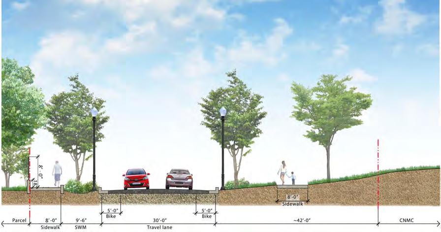
The analysis used the assumption that approximately 4 vehicles per minute would enter the FMC development during the morning peak hour and approximately 4 vehicles per minute would exit the FMC development during the afternoon peak hour.
There is one additional external access point that serve the DOS portion of the WRAMC campus. This entrance is currently closed. This access point is located at the intersection of Alaska Avenue and Dahlia Street.
While not critical to ensure efficient vehicular access to the FMC site, opening any of these entrances would provide additional capacity and alternative access to the FMC, CNMC, and DC-LRA campuses.
• Alaska Avenue and Dahlia Street
• 14th Street and Main Drive
• Dahlia Street at the DOS/DC-LRA border
DEPARTMENT OF STATE Foreign Missions Center Master Plan EYP/ 3-51 DECEMBER 2018
Figure 3.81: Dahlia St Cross Section (West of 14th Street)
Figure 3.82: 14th Street Cross Section (North of Dahlia Street)
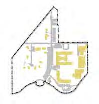

Internal Circulation Analysis
Two-way circulation on all internal roadways would provide access to most parcels within the FMC. Two-way directional roadways would provide the necessary internal circulation routes to serve the potential lots on the FMC campus.
Based on peak traffic flows identified in the previous section, the roadways required to provide efficient circulation would require only one travel lane in each direction on any segment of roadway within the FMC. There are no sections within the FMC that should be designed as four-lane cross-sections. In planning the eventual cross-sections for the roadways serving FMC, it is important to account for providing one vehicular travel lane in each direction and one bike lane in each direction on primary roadways throughout the site. This cross section would consist of a minimum of two 10-foot travel lanes and two 5-foot bike lanes for a total curb-to-curb cross section of 30 feet.
If the cross-sections of the development plan were to be minimized, the bicycle lanes could be eliminated, although not recommended. Bicycle lanes provide additional roadway width creating the opportunity for travel clearances around a disabled vehicle or vehicles entering or leaving a chancery compound. If the bicycle lanes are eliminated, the travel lanes should be designated as shared bicycle/vehicular travel lanes, and the minimum width of the travel lane should be increased to 12 feet for a total curb-to-curb cross section of 24 feet.

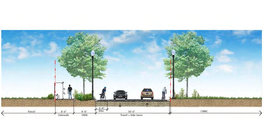
For internal intersection control, it is recommended that all intersections be designated as all-way stop intersections. In order to promote a pedestrianfriendly on-campus environment, providing all-way stops at all of the internal intersections will allow for positive stop control at the intersections to facilitate pedestrian crossings. The internal traffic flows do not warrant the signalization of any internal intersection. There are no roadway segments proposed within the DOS where there is a dead-end condition requiring any U-turns or 3-point turns.
Transit Service
The WRAMC campus is served by heavy rail (Metrorail) and local bus (Metrobus) services. These transit services provide local, city-wide, and regional transit connections and link the site with major cultural, residential, employment, and commercial destinations throughout the region. Rail and local bus service are provided by the Washington Metropolitan Area Transit Authority (WMATA). The site is primarily serviced by WMATA limited stop
DEPARTMENT OF STATE Foreign Missions Center Master Plan EYP/ 3-52
Figure 3.83: 14th Street Cross Section (between Main Dr. & Dahlia St.)
Figure 3.84: Dahlia Street Cross Section (East of 14th St)

Bicycle Facilities Analysis
Within the study area, bicyclists have access to multi-use trails, on-street bike lanes, signed bike routes, and local and residential streets. The study site is served directly by all these facilities. The bicycle network generally supports local bicycle use. There are several routes that link the study area with Silver Spring, Takoma Park, and other destinations in Northwest Washington, DC as shown in the accompanying map. It identifies street corridors where cycling conditions are poor and where there are barriers.
There are two connections that limit bicycle mobility and accessibility of bicyclists in the study area. Rock Creek Park is an east-west barrier. Although cycling through the park is possible, conditions within the Park and the limited number of east-west routes through the park reduce the attractiveness of cycling. The best east-west route is currently to the north, around the park, using local streets and the Capital Crescent Trail. The second barrier is the WRAMC campus itself, as it currently limits north-south mobility along 14th Street which otherwise has continuous bike lanes. Bicyclists traveling along 14th Street area must go around the study site since the north-south gates have been closed permanently. Creating marked bicycle lanes through the WRAMC campus along the 14th Street alignment will greatly improve cyclist access and safety within the study area.
The study area seems ideal for bike sharing, since there are many destinations and transit hubs, such as Takoma and Silver Spring, beyond ideal walking distances. Bicycle stations could be located at the Takoma and Silver Spring Metrorail Stations, as well as near the proposed FMC campus. Bike-share stations could also be located along Georgia Avenue north and south of the study site to improve mobility between the campus and commercial activities in the area.
Pedestrian Circulation Analysis
It would be beneficial to connect the future FMC pedestrian paths with the future pedestrian routes developed by the DC-LRA Reuse Plan. To achieve this objective, internal FMC pedestrian paths should link with the external sidewalks along Alaska Avenue and Fern Street, as well as with the pedestrian paths internal to the WRAMC campus along Main Drive and Dahlia Street. Sidewalks should be a minimum of 6 feet wide.
Parking Analysis
The existing WRAMC campus includes 4,508 parking spaces, with 1,032 spaces within the boundary of the FMC portion of the campus. These existing spaces are surface parking. For campus and chancery security, on-street parking will not be allowed. Foreign missions will be responsible to accommodate all of their parking requirements within their parcel. Most of the off-street parking will be within an underground structure at each chancery, similar to the current development requirements at the ICC.
Each chancery will be able to develop a limited number of visitor parking spaces as a surface lot on each parcel. However, it is anticipated that general visitor parking will be accommodated at public parking venues within the CNMC and DC-LRA developments, including the existing Rumbaugh Garage (1,135 spaces), which is to remain.
DEPARTMENT OF STATE Foreign Missions Center Master Plan EYP/ 3-54
Figure 3.86: Campus Transportation photo
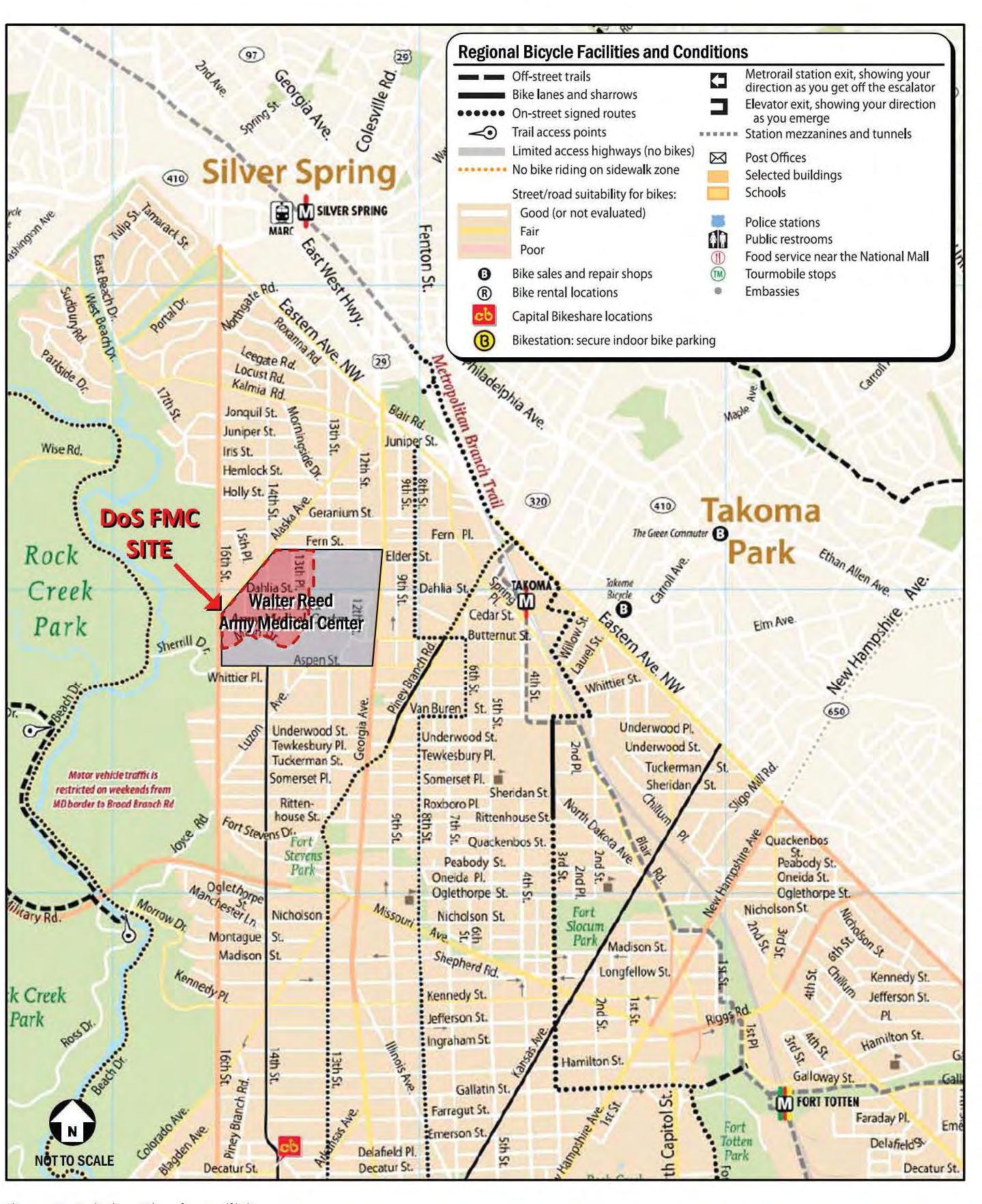
DEPARTMENT OF STATE Foreign Missions Center Master Plan EYP/ 3-55 DECEMBER 2018 N
Figure 3.87: Existing Bicycle Facilities
This Page is Intentionally Left Blank
DEPARTMENT OF STATE Foreign Missions Center Master Plan EYP/ 3-56

U S DEPARTMENT OF STATE Foreign Missions Center Master Plan EYP/ 4-1 DECEMBER 2018 / SECTION
PLAN CONCEPT
4

U S DEPARTMENT OF STATE Foreign Missions Center Master Plan EYP/ 4-2
N
Figure 4.1: FMC Master Plan Concept
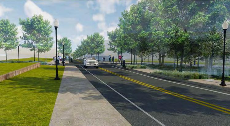

Plan Concept / 4

The master plan concept for the Foreign Missions Center (FMC) is for the Department of State (DOS) to develop and maintain the site infrastructure, and for each foreign mission to develop the individual lots. The approach to the subdivision (parcelization) of the property involves the creation of a number of individual lots for chancery development with DOS providing the common area infrastructure for roadways, common green areas, and major on-site utilities. The common areas will be maintained by DOS. DOS plans to initiate long-term assignments to foreign missions for their development of individual parcels for chanceries. The master plan infrastructure allows for varying sizes of parcels as the unique market conditions warrant.
The vision for the FMC master plan is a contextual response to the city fabric around the site, the Walter Reed Local Redevelopment Authority (DC-LRA) and Children’s National Medical Center (CNMC) master plans, reinforcement of the existing cultural and natural landscapes, reuse of key historic structures and respective of existing axial relationships. A simple and clear network of streets and open spaces respectfully transforms the proposed redevelopment by DOS and District of Columbia of the former Walter Reed Army Medical Center (WRAMC) into a unified, holistic plan poised to become a signature Washington, D.C. neighborhood within the 21st century. The east and west halves of the campus are sewn together with the clear definition of Dahlia Street as a boulevard adding connectivity and a sense of vibrancy between the DC-LRA and CNMC portions and the FMC portion of the former WRAMC campus. The primary entrance for the FMC on Main Drive is defined by the ellipse to the south but given further credence through the linear north-south greenway, culminating in an open space surrounding the historic Memorial Chapel on the north side of campus. This greenway serves as an amenity to the master plan but also has a practical purpose as a bioretention park, managing the rain water run-off on the campus.
4.1. PLAN CONCEPT
The District of Columbia is an assembly of street grids and open spaces punctuated by the diagonal avenues created by the L’Enfant Plan. The proposed master plan concept for the FMC builds upon the use of street grids and open spaces around the WRAMC and proposed master plan for the DC-LRA portion of the campus and the master plan for the CNMC portion of the campus. The figure on the previous page illustrates in green the existing open space around the WRAMC campus and in red, the primary network streets of the District Columbia that connect the open spaces.
U S DEPARTMENT OF STATE Foreign Missions Center Master Plan EYP/ 4-3 DECEMBER 2018
Figure 4.2: Proposed view of Dahlia Street Looking east from Memorial Chapel
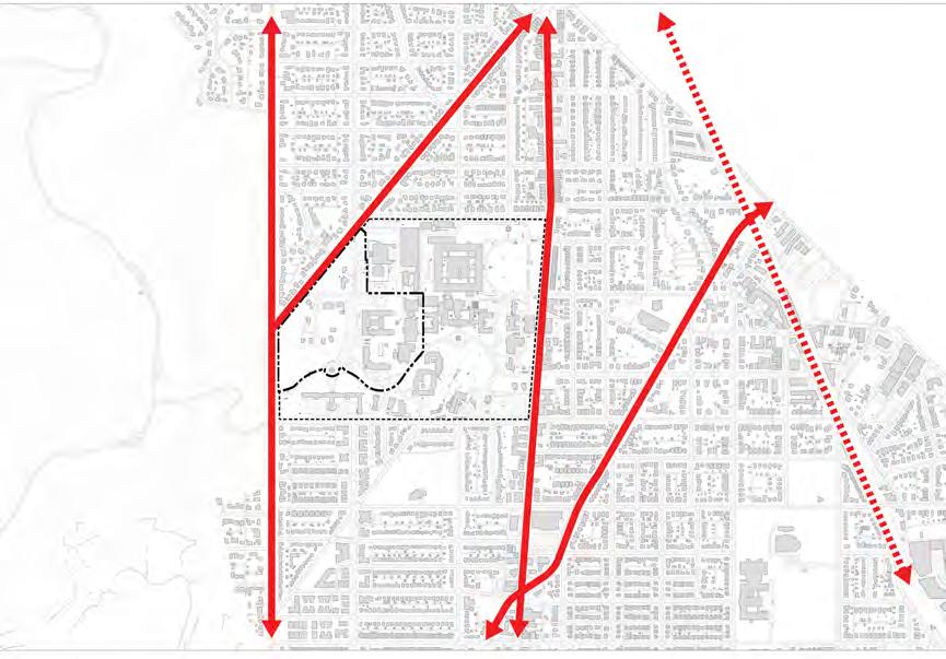
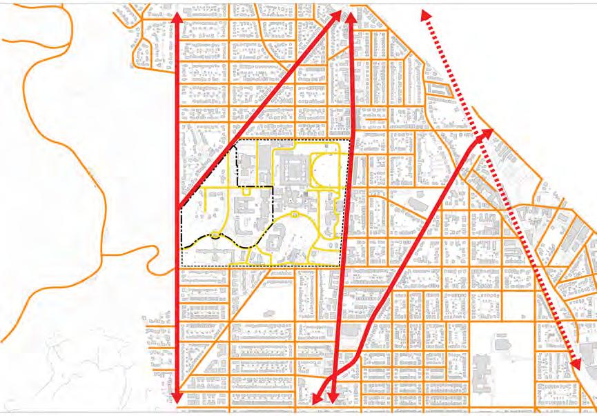
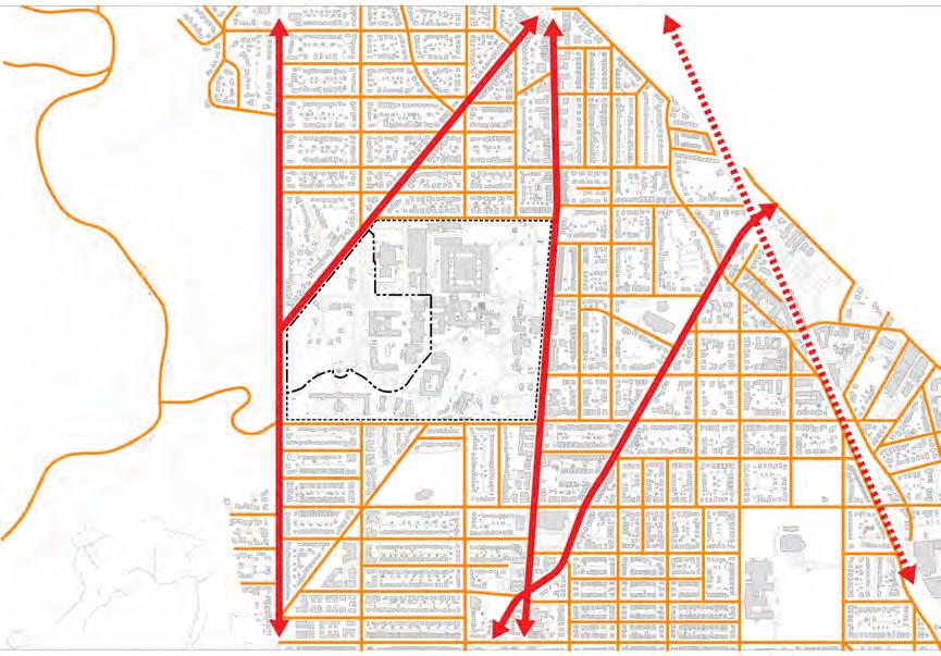

U S DEPARTMENT OF STATE Foreign Missions Center Master Plan EYP/ 4-4
Arterial Streets
Streets within
Secondary Streets Proposed DC-LRA
N
Figure 4.3: Urban Grid Diagrams
Existing
WRAMC
Streets
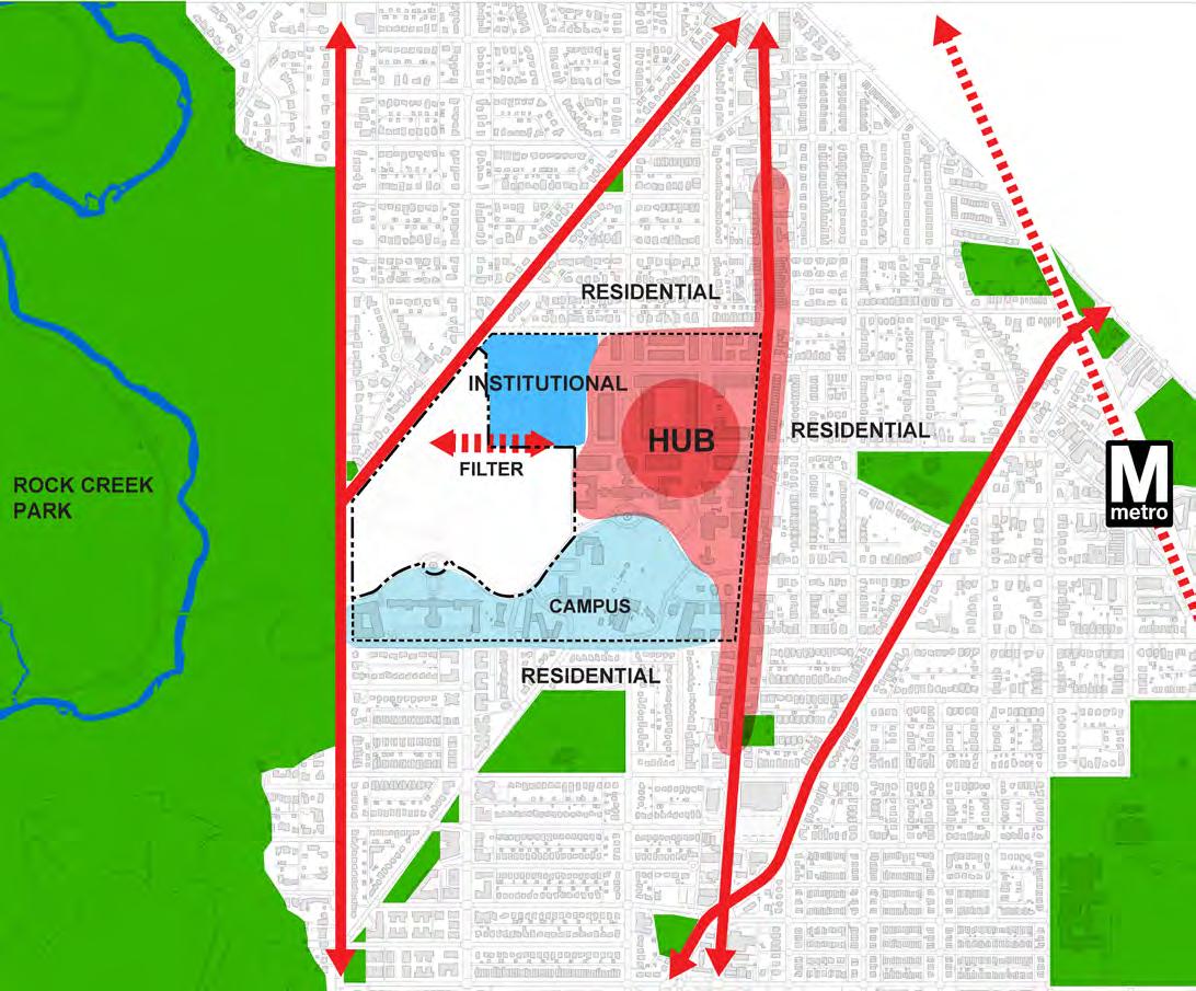
Urban Context
The Washington, D.C. grid has primarily two types of streets: arterial streets and secondary streets, as shown in the figures on the previous page. Arterial streets are significant for the traffic volumes that they carry and their impact upon the grid pattern of city streets. The arterial streets proximate to the former WRAMC are 16th Street and Georgia Avenue that run north – south, and Alaska Avenue and Piney Branch Road that run northeast – southwest. The secondary streets provide scale to the grid. These secondary streets create the urban block. Also shown in the diagrams on the previous page are the existing streets within the WRAMC as well as the DC-LRA proposed streets.
Site Organization
The DC-LRA has developed a master plan for the approximately 60 acres of the eastern and southern portions of WRAMC, which proposes a mix of uses that are organized around the existing campus character in the south and the re-insertion of the DC grid into the WRAMC site as an urban center or hub. The core of the redevelopment is the new town center north of Building 1/Main Hospital. This area is to be a hub of commercial and retail activity, expanding the existing land use patterns from Georgia Avenue onto the site. The campus area south of Building 1/Main Hospital will be a collection of institutional and non-profit services placed within the historic buildings and open campus of the former WRAMC.
In between the Foreign Missions Center and the DC-LRA development, the CNMC will establish a facility primarily to further medical research aspects of their mission. This facility will center on the reuse of the Building 54/Armed Forces Institute of Pathology Building. Early indications are that the CNMC intends to reuse most of the existing facilities because they can be easily adapted towards their proposed uses. However, these plans are still be developed and evaluated by CNMC and may change.
The FMC portion of the site is positioned to serve as a filter between the proposed DC-LRA commercial and retail development to the east and the adjacent neighborhoods and Rock Creek Park to the west, thus allowing a unique opportunity for the FMC to have a signature presence in this transformed Washington, D.C. neighborhood.
4-5 U S DEPARTMENT OF STATE Foreign Missions Center Master Plan EYP/ DECEMBER 2018
N
Figure 4.4: Site Organization
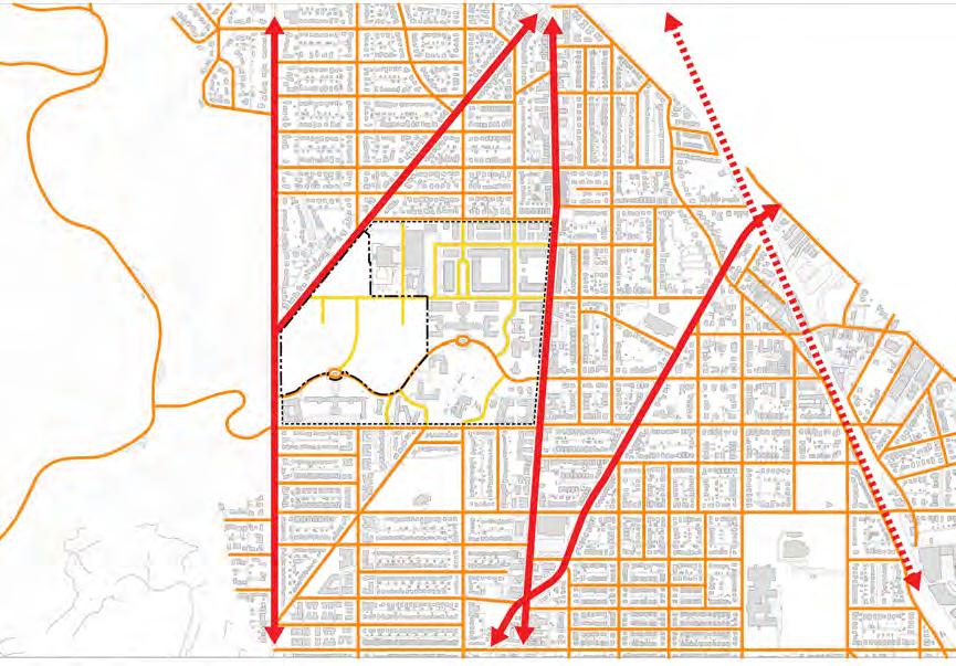
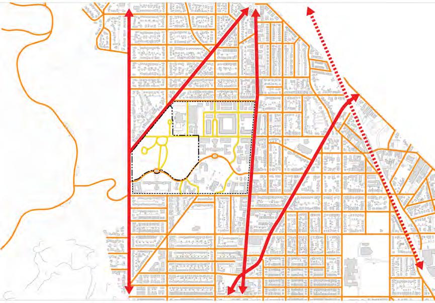


U S DEPARTMENT OF STATE Foreign Missions Center Master Plan EYP/ 4-6
N Design Option 1 Design Option 2 Design Option 3
Proposed FMC Streets
Figure 4.5: Urban Grid Diagrams
Design Option for FMC Streets
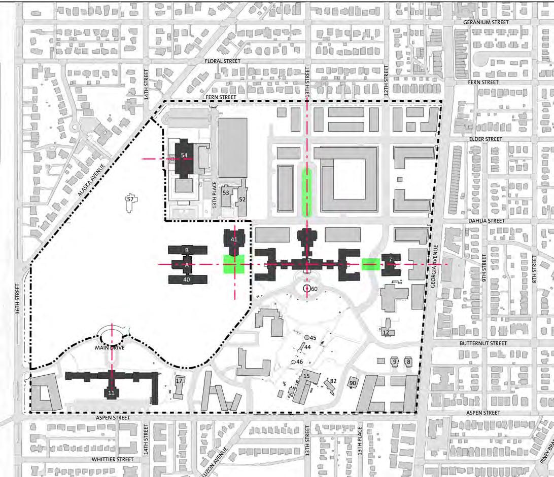
During the planning process several proposed arrangements of streets were explored. The images on the previous page are examples of these studies. Each solution explored the challenges of creating a holistic solution for the former WRAMC campus and linking the FMC to the urban grid of the adjacent neighborhoods and the vibrant activity of the new DC-LRA urban center. The proposed master plan resolution maintains many of the existing road alignments while linking the eastern and western of the campus together using Dahlia Street.
Historic Campus Planning Foundation
The planning foundation for the WRAMC site is organized around an axial arrangement of buildings and green spaces as shown in the adjacent diagram. The preservation of historic structures maintains both a character and contextual foundation for the conceptual explorations and recommended plan. The reuse of the historic buildings represented on the concept plan for the FMC is dependent on the market conditions of these unique sites which can either stand alone or serve as complimentary additions to future chancery sites.
The east-west axis potentially links the east and west halves of the WRAMC into a unified whole. The north-south axis on the DC-LRA site is historically significant while the north-south axis on the FMC site is a secondary arranged around what was once a formal garden space between Buildings 1, 40, and 41.
Campus connectivity is organized both on the arrangement of existing buildings on the campus and the structure of campus roadways. While never realized, the 1919 master plan concept did establish the orthogonal arrangement of many of the buildings on the campus. As some historic buildings are being proposed for renewal and re-purpose on the FMC, DCLRA, and CNMC developments and other buildings will be removed, the axial alignments between Building 1/Main Hospital and the adjacent historic structures on the FMC campus indicate an implied connection between FMC and DC-LRA. These alignments are reinforced by established green spaces and proposed open spaces.
4-7 U S DEPARTMENT OF STATE Foreign Missions Center Master Plan EYP/ DECEMBER 2018
N
Figure 4.6: Historic Campus Axiality Diagram


Connectivity to Urban Fabric
The connectivity of the WRAMC campus to the city is achieved through the proposed street alignments. Intersections that connect the proposed developments for the FMC, CNMC, and the DC-LRA along the edges of the site and those that extend directly into the urban fabric are represented in the accompanying diagram and labeled as such.
North – South Connections
In the north-south direction, 16th Street and Georgia Avenue provide boulevard edges that define the limits of the WRAMC campus. The streets/ boulevards each have a distinctive character that supports the relationship of the campus to the city. Georgia Avenue is an emerging commercial and retail corridor that will engage the proposed DC-LRA portion of the campus. 16th Street is an edge street that separates the proposed FMC from the adjacent Rock Creek Park and serves as a major thoroughfare into and out of the city. There are existing (14th Street) and proposed (12th Street) north-south streets that serve as campus connectors, linking the north (Dahlia Street) and south (Main Drive) portions of the WRAMC campus together.
East - West Connections
The WRAMC campus is framed by Aspen Street to the south and Fern Street to the north. These streets are campus edges that in the past have been defined by the steel picket fence around the WRAMC campus. Transitioning scales from the edge conditions to campus core, the existing and proposed buildings mediate between the large scale of the buildings at the campus core and the smaller single and multi-family residences north and south of the site. Beyond its historic associations, the curvilinear Main Drive establishes the identity of the WRAMC campus. While its curves create the appearance of a pastoral landscape, the drive also conforms to the contours of the topography. Dahlia Street is at the core of the campus. This proposed through-street will connect the two portions of the campus. It will also serve to link the campus to the city.
Campus Connectivity
The extension of the street grid from surrounding area into the FMC creates an interconnected link between the established and proposed developments. The FMC will be part of the re-invention of the former WRAMC.
U S DEPARTMENT OF STATE Foreign Missions Center Master Plan EYP/ 4-8
Figure 4.8: Connectivity Diagram: Street Character N
Figure 4.7: Campus Character Diagram
Campus Character
The character of the campus divides along Dahlia Street, with a more urban character to the north and a more open campus character to the south. This divide of character is enhanced by the proposed DC-LRA reuse plan and the intent of CNMC to reuse its structures. North of Dahlia Street, the urban character is created by the orthogonal arrangement of streets that extends the city grid onto the site. South of Dahlia Street, the campus is characterized by the orthogonal arrangement of the historic buildings juxtaposed with the curvilinear Main Drive and park-like open spaces.
Landscape Typologies
The FMC site is characterized by two existing distinct landscape typologies which demand an open space master plan design concept that reflects that character while providing meaningful open spaces, creative storm water management, and establishing viable pedestrian connections within the site and to the adjacent neighborhoods.
The two existing landscape typologies will continue in the master plan. The first typology is defined as a remnant native forest. This area is located west of 14th Street, and is characterized predominantly by mature, native tree canopies, a mix of steep slopes and flat areas, as well as existing buildings that are mostly residential in scale. Several of the trees in this area may be categorized as Special Trees or Heritage Trees, if healthy. DOS has identified these trees as part of this masterplan prior to releasing lots for development by foreign missions. It will be the responsibility of the foreign missions to follow substantial compliance with the DC Urban Forestry Administration requirements relative to preservation and/or replacement.
East of 14th Street, the landscape typology is predominantly a cultural landscape. This area is characterized by man-made elements such as plazas, walkways, and foundation plantings along building edges.
The master plan concept builds upon these two existing typologies by maintaining as well as reinforcing them. East of 14th Street will remain predominantly a cultural landscape, and the area west of 14th Street will echo the remnant forest’s natural character by preserving the stands of mature native trees, working with existing grades, creating tree-lined streets with sustainable storm water filtration systems, providing for clear pedestrian and vehicular connections to the adjacent neighborhood, and establishing a fifty-foot visual buffer along the west side of the FMC campus from the predominantly residential neighborhood.
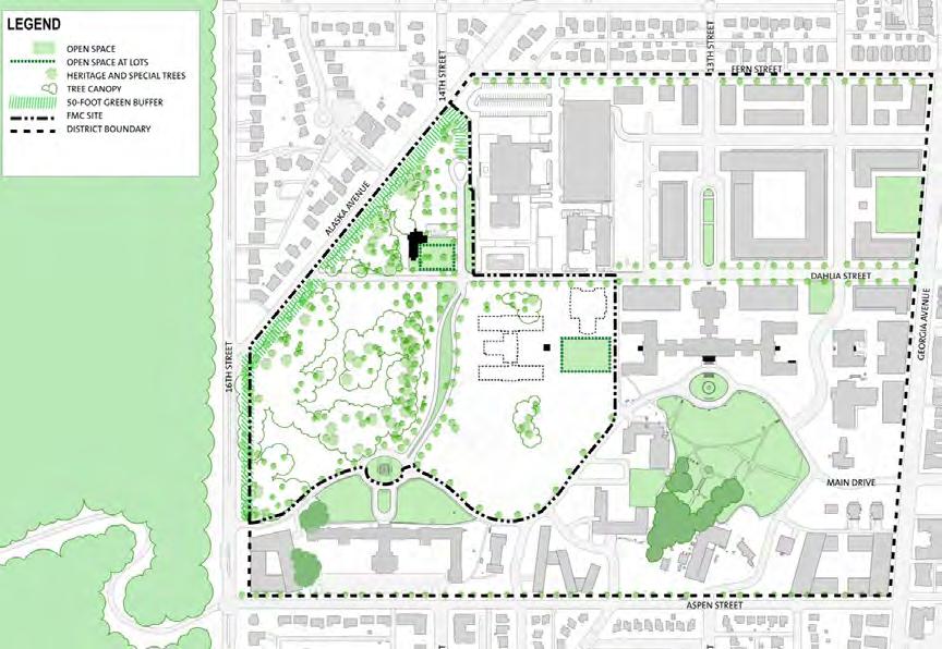
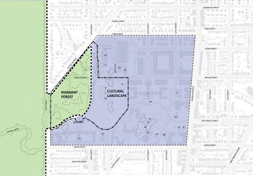
4-9 U S DEPARTMENT OF STATE Foreign Missions Center Master Plan EYP/ DECEMBER 2018
N
Figure 4.10: Campus Landscape Character
N
Figure 4.9: Landscape Open Space Diagram

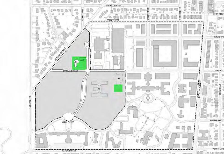
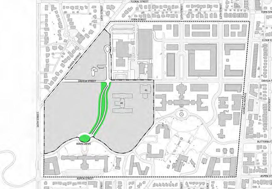

U S DEPARTMENT OF STATE Foreign Missions Center Master Plan EYP/ 4-10
Buffer
14th Street Park
Dahlia Boulevard
Figure 4.11: Open Space Framework Study Diagrams
Village Green
N

Open Space Framework
A variety of open space frameworks were investigated which are shown on the previous page. Each solution was developed from existing open space characteristics on the site. For example, prior to the construction of Building T-2, there was a formal open square surrounded by Buildings 1, 40, and 41. The proposal for a series of squares was based upon the memory of this former open space. It is from this exploration of open space that two concepts were formed. The first idea was a linear park at 14th Street where the Building 57/Memorial Chapel and a parking lot now stand. The second idea was the celebration of Dahlia Street as a campus connector and boulevard. These two ideas were brought together into the master plan open space concept. The open space concept consists of a hierarchy of tree-lined streets. The most important street is Dahlia Street which connects the FMC to the CNMC and DC-LRA portions of the WRAMC campus. The other important street on the campus is 14th Street. This street is set apart by a linear parkway. The parkway starts at the ellipse on Main Drive at the southern end. Along 14th Street the width of the parkway fluctuates as the western edge of the street is at the bottom of the steep slope leading up to the plateau south of Building 57/Memorial Chapel. The Chapel is surrounded by open space to preserve its unique setting. It is also a natural visual termination for the eastwest boulevard concept at Dahlia Street and a transition point for the east-west landscape site character.
4-11 U S DEPARTMENT OF STATE Foreign Missions Center Master Plan EYP/ DECEMBER 2018
Figure 4.12: Preferred Open Space Framework
N


Campus Circulation
The FMC is envisioned as an open campus. While DOS will reserve the right to limit access in instances of extreme national emergency, the gates of the former WRAMC will be opened and kept open. Pedestrian, bicycle and vehicular access to and through the FMC will be encouraged. In addition, the connections between the DC-LRA and CNMC portions of the former WRAMC will be enhanced in the proposed master plan.
Vehicular access to the WRAMC campus is proposed to be improved by removing many of the barriers from the former Army facility. Existing primary vehicular access points for the FMC at Main Drive and Dahlia Street will be open access points. For internal connections, Dahlia Street is connected to the DC-LRA portion of Dahlia Street linking 16th Street to Georgia Avenue, a feature new to the WRAMC campus. 14th Street will connect Main Drive and Dahlia Street within the FMC. It will terminate in front of Building 54 in a cul-de-sac that is reminiscent of the 1950’s era drop-off at Building 54. The streets of the FMC will support the pedestrian and bicycle network proposed in the DC-LRA SAP. All streets within the FMC will have signed and marked bicycle lanes. Along the streets, there will also be sidewalks ranging in width of six to eight feet. Between the street and sidewalks will be tree boxes, providing an additional level of pedestrian safety and eventually a shaded walking zone.
U S DEPARTMENT OF STATE Foreign Missions Center Master Plan EYP/ 4-12
Figure 4.14: Vehicular Circulation
Figure 4.13: Bicycle and Pedestrian Circulation
N N N 0’ 60’ 120’ 240’ 480’ Pedestrian & Bicycle Framework ASPEN STREET DAHLIA STREET MAIN DRIVE FERN STREET GEORGIA AVENUE ALASKA AVENUE 14TH STREET 16TH STREET 14TH STREET 13TH STREET 13TH STREET LUZONE AVENUE LEGEND SIGNED BIKE ROUTE STREETS W/ BIKELANES SIDEWALKS GREEN SPACE SHARED PED/BIKE CAPITAL BIKESHARE WRAMC FMC 41 52 57 54 40 11 17 1 7 12 9 8 60 45 44 46 15 82 90 53 A B A N 0’ 60’ 120’ 240’ 480’ Vehicular Framework LEGEND ASPEN STREET DAHLIA STREET MAIN DRIVE FERN STREET GEORGIA AVENUE ALASKA AVENUE 14TH STREET 16TH STREET 14TH STREET 13TH STREET 13TH STREET LUZONE AVENUE PRIMARY STREET SECONDARY STREET WRAMC FMC 41 52 57 54 40 11 17 1 7 12 9 8 60 45 44 46 15 82 90 53 A B A
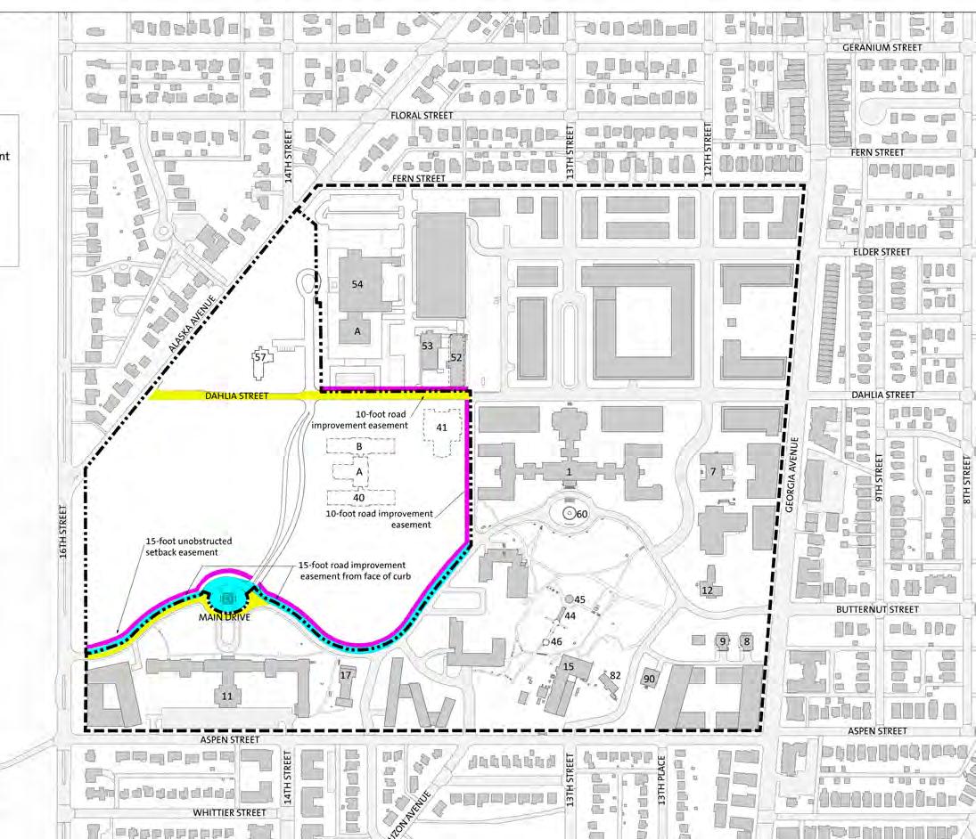
Easements
The concept for development is for DOS to provide and maintain the site infrastructure and for each foreign mission to develop the individual lots. The approach to the subdivision of the property involves the creation of a number of individual lots for chancery development with DOS providing the common area infrastructure for roadways, common green areas, and major on-site utilities. The common area will be maintained by DOS. DOS plans to initiate long-term leases to foreign missions for the development of individual parcels for chanceries. Within the common areas, the master plan creates a unified system of easements over the land for a wide variety of purposes, to include: public ingress and egress (vehicular, bicycle and pedestrian); public and private utility construction and maintenance; tree and slope conservation; storm water management and storm water quality improvement facilities; sight distance and public safety; landscape planting and maintenance; and signage. All easements will include both a plat depicting the extent of the easement and a deed which sets forth the specific rights and responsibilities of each party to the agreement. In this way, the FMC can monitor and control all activities within these areas while providing the flexibility for outside parties such as the DC-LRA or private utilities to carry out their proposed and necessary functions on and adjacent to the property.
DOS and DC-LRA have completed the negotiation for easements for each other’s properties within the FMC. The goal of these easements is to support a unified district and to support the designation of the singular WRAMC historic district. The purpose of these easements is to provide shared access to each property via Main Drive and Dahlia Street, provide access to the development and maintenance of shared utilities such as sanitary sewer and storm water, and provide limited access for the construction of site improvements such as streets, sidewalks and new buildings including aerial clearance for cranes.
4-13 U S DEPARTMENT OF STATE Foreign Missions Center Master Plan EYP/ DECEMBER 2018
N
Figure 4.15: Easements Diagram

Parcelization
The following images show various potential parcelizations that the Master Plan infrastructure can support. DOS seeks to ensure flexibility in being able to market different size parcels with a variety of street frontage types to accommodate the foreign mission community needs as well as DOS needs.
Analysis of campus land use, natural features, and campus development history indicate a divide along Dahlia Street. To the south of Dahlia Street, the former WRAMC has an arrangement of buildings and open spaces that is reminiscent of a collegiate campus. This historic character is reinforced by the proposed DC-LRA reuse plan. On the FMC campus, this character will be reinforced by the establishment of larger parcels along Main Drive, for the development of chanceries that may consist of more than one building.
The area along Dahlia Street has a different character that has changed over the development of the WRAMC site. Prior to the construction of the new hospital building and Building 54, this area contained regimented rows of hospital ward buildings and medical brigade housing. In fact, Dahlia Street was never completed as a through street. The DC-LRA reuse plan proposes two significant improvements to this area. First, the DC-LRA plan proposes integrating this section of the former WRAMC campus into the urban fabric of the city. Second, this zone of the campus is envisioned to become a mixeduse destination for the neighborhoods and region. The DOS portion of Dahlia Street is to serve as a transition from the proposed urban-like development patterns at the DC-LRA to the adjacent neighborhood of single-family residences. The foreign missions have programmatic requirements for a range of lot sizes for the development of purpose-built facilities. As a result, there are a variety of parcelization strategies for this street frontage and around Memorial Chapel of the FMC campus that will aid in the transition from the DC-LRA portion of the WRAMC campus to the adjacent neighborhood. In addition, the sites on 14th Street north of Dahlia Street provide more private frontages for foreign missions’ that prefer their chancery to be in a less prominent location.
In addition to marketing the reuse of contributing historic resources (Buildings 40 and 41), DOS proposes that any building that could function as a chancery may be a viable candidate for reuse. Recently, the government of Libya has proposed the reuse of Building 56, one of the Fisher Houses, for its chancery. This building will undergo a modest interior renovation that will transform the interior from a residence to a chancery. Existing site features such outdoor function spaces and parking will also be reused.
U S DEPARTMENT OF STATE Foreign Missions Center Master Plan EYP/ 4-14
Figure 4.16: Parcelization Option A
N
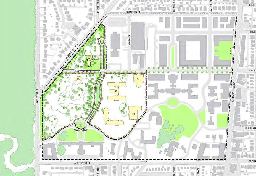
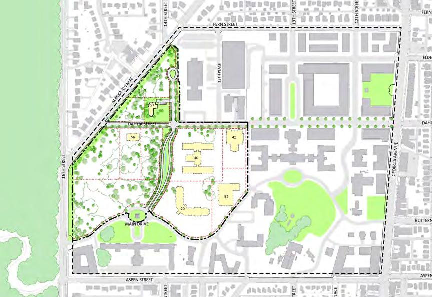


4-15 U S DEPARTMENT OF STATE Foreign Missions Center Master Plan EYP/ DECEMBER 2018
Plan Concept - Option C (15 lots) Plan Concept Plan Concept - Option A (11 lots) Plan Concept - Option B (13 lots) N 1 7 654 2 8 1110 9 1 765 3 2 8 13 12 11 109 15 1 765 4 2 8 13 12 11 10 9 14
Figure
4.17: Parcelization Option Diagrams
This table shows the individual lot sizes and the maximum building size and FAR which is based on the site massing and lot development guidelines (shown in the Design Guidelines section). FAR stands for Floor to Area Ratio and is a standard metric for measuring development density.
U S DEPARTMENT OF STATE Foreign Missions Center Master Plan EYP/ 4-16
U.S. DEPARTMENT OF STATE Foreign Missions Center Alternatives without 1/19/2017 OPTION A REMAINDER Lot Lot Size (SqFt) Lot Size (acres) Max. Bldg Coverage Max. Bldg Footprint Max. Bldg Height Max. Bldg AreaFAR Estimated Staff Visitor Parking Lot Lot Size (SqFt) Lot Size (acres) 1 74,785 1.72 25%18,696 356,089 0.75 113 6 Roads 196,350 4.51 2 47,064 1.08 25%11,766 335,298 0.75 71 6 Ellipse 10,977 0.25 Chapel39,640 0.91 Bldg 575,533 16,632 0.17 4 8 Parkway Median11,945 0.27 4 126,304 2.90 20%25,261 4101,043 0.80 203 6 Park 3,574 0.08 5 74,392 1.71 25%18,598 474,392 1.00 149 6 6 68,593 1.57 30%20,578 482,312 1.20 165 6 CAMPUS 1,379,495 31 67 7 178,679 4.10 Bldg 4063,544 4246,271 1.38 493 6 TOTAL 8 71,169 1.63 Bldg 4119,062 350,023 0.70 101 6 9 212,188 4.87 15%31,828 4127,313 0.60 255 10 10 175,098 4.02 20%35,020 4140,078 0.80 281 10 11 88,737 2.04 30%26,621 4106,484 1.20 213 10 OPTION B SUMMARY Lot Lot Size (SqFt) Lot Size (acres) Max. Bldg Coverage Max. Bldg Footprint Max. Bldg Height Max. Bldg AreaFAR Estimated Staff Visitor Parking Max Bldg AreaCampuswide FAR Avg Max Bldg Area Avg Lot FAR 1 74,785 1.72 25%18,696 356,089 0.75 113 6 Option A 1,025,935 0.74 85,495 0.78 2 47,064 1.08 25%11,766 335,298 0.75 71 6 Option B1,000,232 0.7371,445 0.78 Chapel39,640 0.91 Bldg 575,533 16,632 0.17 4 8 Option C 994,078 0.72 66,272 0.85 4 126,304 2.90 20%25,261 4101,043 0.80 203 6 5 43,627 1.00 25%10,907 443,627 1.00 88 6 6 99,358 2.28 30%29,807 4119,230 1.20 239 6 7 89,333 2.05 30%26,800 4107,200 1.20 215 6 8 89,346 2.05 30%26,804 4107,215 1.20 215 6 9 71,169 1.63 Bldg 4119,062 350,023 0.70 101 6 10 119,239 2.74 15%17,886 471,543 0.60 144 10 11 92,949 2.13 15%13,942 455,769 0.60 112 10 12 175,098 4.02 20%35,020 4140,078 0.80 281 10 13 88,737 2.04 30%26,621 4106,484 1.20 213 10 OPTION C Lot Lot Size (SqFt) Lot Size (acres) Max. Bldg Coverage Max. Bldg Footprint Max. Bldg Height Max. Bldg Area FAREstimated Staff Visitor Parking 1 41,599 0.95 25%10,400 331,199 0.75 63 6 2 33,186 0.76 25%8,297 324,890 0.75 50 6 3 47,064 1.08 25%11,766 335,298 0.75 71 6 Chapel39,640 0.91 Bldg 575,533 16,632 0.17 4 8 5 126,304 2.90 20%25,261 4101,043 0.80 203 6 6 74,392 1.71 25%18,598 474,392 1.00 149 6 7 68,593 1.57 30%20,578 482,312 1.20 165 6 8 58,844 1.35 30%17,653 470,613 1.20 142 6 9 60,978 1.40 30%18,293 473,174 1.20 147 6 10 58,856 1.35 30%17,657 470,627 1.20 142 6 11 86,061 1.98 Bldg 4119,062 350,023 0.58 101 6 12 119,239 2.74 15%17,886 471,543 0.60 144 10 13 92,949 2.13 15%13,942 455,769 0.60 112 10 14 175,098 4.02 20%35,020 4140,078 0.80 281 10 15 88,737 2.04 30%26,621 4106,484 1.20 213 10 Option A1,156,649 26.55 1,025,935 9.35 2,048 Option B1,156,649 26.55 1,000,232 10.971,999 Option C1,171,540 26.89 994,078 12.801,987 2016_12_12 Lot Summary_update
Table 4.1: Site, Building & Personnel Data
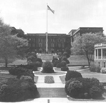
4.2 PRESERVATION AND ARCHITECTURAL CHARACTER
One of the goals of the FMC master plan is to participate in the preservation of the character and, where possible, the built environment of the nominated WRAMC historic district. The FMC creates a new use for this portion of the campus while also providing design guidelines for foreign missions to utilize in the design of additions and new structures that are sympathetic to the existing scale, massing, character, and cultural landscape of the site. The substantial difference between the past and proposed uses is the conversion of a military hospital and medical research campus into a campus suitable for the proposed mixed-use development, including foreign missions.
• Condition and Age of Structure: While several of the buildings have been recently renovated, many of the buildings have experienced some decay due to age and a reduction of maintenance. While some of these buildings could be adapted for reuse as a chancery, the potential additional costs may deter potential foreign missions. These buildings include the wood-frame officer’s quarters and Building 40, which are all in poor to failing conditions.
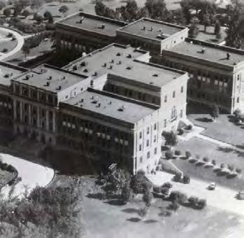
It is challenging to predict the marketability of individual buildings to the foreign mission community with any specificity. There is little market data and few trends to be gleaned from previous embassy or foreign mission reuse of institutional facilities. In general, foreign missions appear to prefer developing their own facilities, occupying existing office buildings, or re-using historic structures (typically larger scale early 20th century residential structures) such as those found along Massachusetts Avenue. There are no significant examples of large-scale adaptive reuse of institutional buildings by a foreign mission. This lack of examples could provide a challenge for the adaptive reuse of WRAMC buildings.
Each building on the FMC portion of the campus was studied at a conceptual level for the potential reuse as a chancery. Buildings and structures that are considered historic structures, either as a contributing resource and individually eligible or as a contributing resource, were the primary focus. Many of the buildings were found to be unsuitable for reuse for the following reasons:
• Size - too small: The programmatic requirements for a chancery require about 20,000 to 50,000 gross square feet. Buildings such as the officer’s quarters, Fisher Houses and Building 57/Memorial Chapel are considered too small to accommodate these space needs and are not readily adaptable for additions to meet the additional space needs.
• Size – too large: With the range of area noted above, there are several buildings that were deemed to be too large to meet the typical programmatic needs of a single foreign mission. Building 40/Walter Reed Army Institute of Research (WRAIR) is an example of a building too large for a majority of the contemporary chanceries.
• Building Aesthetics: As noted at the International Chancery Center, each foreign mission exhibited either their regional character or importance of presence in their chancery designs. Many of the buildings at the FMC are representative of an early 20th century military installation. Many of these buildings may not be appropriate representations of a foreign mission’s presence in Washington, D.C. For example. residential structures, such as the officer’s quarters, do not display the gravitas of a foreign mission.
Assessment of Adverse Effects
The following evaluation focuses on the Master Plan Concept as presented in this report. Within this alternative, two of the historic buildings within the boundary of the proposed FMC, Buildings 40 and 41, have been identified for potential reuse. This is dependent, however, upon the Department of State identifying and entering into an agreement with a foreign mission to reuse these buildings. The future of these buildings are independent of each other, the reuse of one does not depend upon or require the reuse of the other. Within the Plan Concept there is the potential that both buildings will be reused, or that both will be removed.
This assessment will focus on the latter scenario, a worst case scenario, where the greatest number of historic buildings is lost.
Assessment of Adverse Effects to the WRAMC Historic District
Implementation of the Plan Concept would result in a significant and permanent adverse effect to the WRAMC Historic District. The integrity of a historic district is based on the setting, design and association of the component parts. In the case of the WRAMC Historic District these are linked to the identifiable boundary, the arterial system within the campus and the surviving resources constructed between 1909 and 1956.
4-17 U S DEPARTMENT OF STATE Foreign Missions Center Master Plan EYP/ DECEMBER 2018
Figure 4.18: Building 40/WRAIR, east elevation (c. 1948)
Figure 4.19: Building 40/WRAIR, aerial view from northwest (c. 1950’s)
The boundary and arterial system would be retained and reinforced as part of the proposed undertaking. The Plan Concept would retain the primary vehicular arteries of Dahlia Street (east-west) and 14th Street (north-south).
Contributing resources (the residential structures) would be removed. One significant contributing resource (Building 57) would be retained and a reuse plan would be developed for the building. In the worst case scenario the other significant contributing resources (Buildings 40 and 41) will be removed.
The loss of Buildings 40 and 41 would significantly alter the main core of the campus, removing the western portion of a formal group. This visual relationship of the group as viewed from the main lawn south of Building 1 would be lost which was an important part of the early organization of the campus. Buildings 40 and 41 also framed a landscaped plaza along to the west of Building 1. The purpose of this landscaped open space would be lost unless new construction was developed to reinforce this spatial relationship.
The loss of the residential structures would be a permanent and direct adverse effect on the historic district as individual structures that represent a unique building type on the campus programmatically. The visual remoteness of these structures from the rest of the campus, particularly due to the site vegetation, minimizes the indirect effect of the loss to the historic district.
Assessment of Adverse Effects to Significant Contributing Resources
The Plan Concept would have no direct adverse effect on Buildings 1, 7, 8, 9, 11, 12, 17, 52, 53, and 54. These resources are located outside the boundary of the proposed FMC site and would not be physically altered by the proposed plan.
The Plan Concept will have a direct adverse effect on Buildings 40 and 41 if they are removed. The Plan Concept incorporates the potential reuse of all or a portion of Buildings 40 and 41. Reuse of these buildings would be contingent upon identifying a Foreign Mission interested in rehabilitation and reuse to accommodate an acceptable program. If the entire building or a portion of the building is reused, modifications would be required to the building to comply with code, incorporate programmatic needs and provide necessary support spaces. These modifications could have an adverse effect on character defining features. Removal or replacement of features could have an adverse effect on the materials and workmanship of the resource.
Full or partial removal of Building 40 and/or Building 41 would result in an adverse effect by altering or eliminating the buildings’ existing historic
location, setting, design, materials, workmanship, feeling and association with other historic district buildings.
The Plan Concept may have a direct adverse effect on Building 57/Memorial Chapel. The Plan Concept provides for the reuse of Building 57. The programmatic use of the facility has not been finalized. One option would be for the building to function as a shared meeting space for use by DOS and the foreign mission community. Prior to reuse, modifications would be required to comply with building code, incorporate programmatic needs and provide necessary support spaces (toilet rooms, kitchenette, etc.). These modifications could have an adverse effect on character defining features. Removal or replacement of features could have an adverse effect on the materials and workmanship of the resource.
Assessment of Adverse Effects to Contributing Resources
The Plan Concept would have no direct adverse effect on Buildings 15, 31, 38, 82, 84 and 90. These resources are located outside the boundary of the proposed FMC site and would not be physically altered by the proposed action.
The Plan Concept would result in a direct adverse effect to Buildings 19, 21, 22, 25, 26, 29, 29A, 30 and 35 Officers’ Quarters by removing the buildings. Five of the buildings (19, 22, 26, 30 and 35) are not on their original sites, indicating a history of these residential scale buildings being relocated to accommodate new development on the campus.
The Plan Concept will result in a direct adverse effect to the perimeter fence. The Plan Concept retains the perimeter fence on 16th Street and Alaska Avenue within the boundary of the proposed FMC. Existing gates and gate posts at Main Drive (north side of the gate) and Dahlia Street would remain in their current locations. The Plan Concept would eliminate the function of the gate and gate posts at 14th Street. The gate and fence would need to be modified and reconfigured at this location, possibly altering the integrity of the location, setting and/or design of the fence as it relates to the overall campus plan.
The Plan Concept would have no direct adverse effect on Main Drive. The Plan Concept includes potential minor changes to the northern edge of Main Drive, limited to curb cuts for access to new construction. The configuration and detailing of the north side of Main Drive will not be changed.


U S DEPARTMENT OF STATE Foreign Missions Center Master Plan EYP/ 4-18
Figure 4.20: Building 41/Old Red Cross, from southwest (c. 1948)
Figure 4.21: Building 57/Memorial Chapel, from southeast (c. 1948)
The Plan Concept will have no direct adverse effects on the other landscape elements located to the south of Building 1 such as the Rose Garden. These elements are not directly adjacent to the proposed undertaking and will not be modified as part of this work. The view shed is primarily from Building 1 looking south, away from the proposed Foreign Missions Center.
Assessment of Cumulative Effect
The cumulative effect of the Plan Concept would be significant and permanent. While the history of the WRAMC campus was one of change and accommodation to meet new program requirements, the loss of 10 of the 11 contributing buildings within the boundary of the Foreign Missions Center will diminish the integrity of the historic district as an assembly of related structures. The infrastructure framework of the district; the perimeter fence and the roadways, will remain but the visual continuity of the campus will be lost from outside looking in and more importantly from within the campus.
Potential Reuse of Existing Buildings
Building 40 – Walter Reed Army Institute of Research
The building’s state of disrepair and the significant renovation costs required to bring the property to a habitable state are major challenges for its reuse by a foreign mission. The reuse studies created a number of options that establish potential layouts for the reuse of portions or all of Building 40. The solutions which split the building into multiple component parts may be more viable, as they create buildings of a more usable size for a chancery. Access to survey the interior of the building was limited due to the conditions. While the building appears to be structurally sound, the interior finishes are significantly degraded. The concerns regarding the costs of rehabilitation are significant.
It is likely that other options present in the market would be more attractive to foreign missions than reuse of Building 40 or portions of the structure. This lack of market acceptance can only be confirmed by direct contact with potential foreign missions. However it is likely that most foreign missions would prefer a lower initial cost and more contemporary building that supports the goals and functions of a chancery.
Building 41 – Old Red Cross Building
Building 41 is the structure with the highest potential to be offered for reuse by a foreign mission on an immediate basis. The size and layout of the building would likely meet the programmatic requirements of a foreign mission’s chancery and could readily be occupied as a chancery with minimal renovation. In addition, the property is in good condition and has attractive features, such as the large assembly space that may be attractive to the foreign mission community. If repurposed, the proposed lot must include adequate area for new below grade parking that is not within the footprint of the existing building.
Building 57 – Memorial Chapel
It is difficult to envision this structure as part of a larger compound that represents a foreign mission. The religious architectural overtones may severely limit the interest in this facility. However, the importance of this structure to both the history and character of the WRAMC campus is understood and DOS plans to keep this building. Many foreign missions throughout the District are seeking assembly or gathering spaces to support their cultural outreach mission. DOS envisions the adaptive reuse of the Memorial Chapel as an event space that will be managed by the DOS or a private, contractor for the express use of DOS and the foreign mission community. A small surface parking area would be developed to support service access. During the public review and comment period of the NEPA process, several area residents have requested that Memorial Chapel be open for public access. DOS will explore options that will provide public access to Memorial Chapel beyond the anticipated foreign missions use for cultural events where the public are often invited.
4-19 U S DEPARTMENT OF STATE Foreign Missions Center Master Plan EYP/ DECEMBER 2018
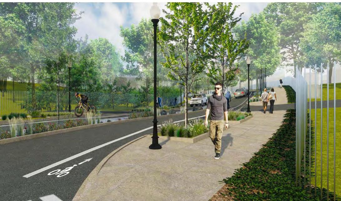

4.3 CAMPUS SUSTAINABILITY
In support of sustainable design principles, the master plan concept adopts sustainable stewardship of responsibly managing all resources for the benefit of the present and future generations of people, flora, and fauna. Primary objectives in the stewardship of resources include such goals as:
• Manage resources in a manner that is fiscally responsible
• Manage resources in a manner that is compliant with rules established by DOS and the regulations established by the District of Columbia Campus sustainability measures that are being addressed
• Access to alternative transportation through a bike lanes and a pedestrian network that connects to DC-LRA portions of campus and the city;
• Access to public transportation including Metrobus and Metrorail;
• Commitment to allocate a location at the intersection of Dahlia Street and 14th Street for a Capital Bikeshare Station and support additional Capital Bikeshare Station at the Tacoma Metro station;
• Reduce infrastructure energy needs through careful selection of street and pedestrian lighting fixtures;
• Reduce storm water quantity and improve storm water quality through robust bio-retention system;
• Preservations of special trees and steep slopes to improve storm water management and maintain character of campus.
Access to DC-LRA development will improve campus sustainability
• Access to mixed-use development that includes retail and commercial components reducing travel to more remote services;
• Access to DC-LRA public transportation improvements such as bike share, shuttle service to Metrorail stations, and future light rail improvements;
• Access to DC-LRA alternative power generation - co-generation or tri-generation electrical power that can be connected to the FMC electrical power infrastructure.
U S DEPARTMENT OF STATE Foreign Missions Center Master Plan EYP/ 4-20
Figure 4.22: Proposed view of 14th Street Looking north from ellipse at Main Drive


4.4 CAMPUS DESIGN ELEMENTS
The new FMC within the WRAMC historic district provides a dynamic reuse of this established campus. The Campus Design Guidelines recognize both the new vision for the DOS portion of the WRAMC campus and the need to maintain a coherent character of the historic district.
Street Character


The public circulation concept for the campus is a clear delineation of primary streets (14th Street, south of Dahlia Street, and Dahlia Street) and secondary streets (14th Street, north of Dahlia Street, and Dahlia Street between 14th Street and Alaska Avenue). The streets are extensions of the city grid connecting the FMC to the DC-LRA portion and the city. Streets provide an important element to the overall character of the FMC campus and provide the necessary access to individual lots. The street corridor also provides an opportunity for site development sustainability in storm water retention elements, light fixture selection, and shade trees along pedestrian pathways. The components summarized below are to ensure that the streets support multiple modes of transportation across the campus and the overall sense of place of the FMC. This section references the District of Columbia’s Public Realm Design Manual and its associated citations of local regulations and specifications for design.
4-21 U S DEPARTMENT OF STATE Foreign Missions Center Master Plan EYP/ DECEMBER 2018
Figure 4.24: Street Section: 14th Street, south of Dahlia Street
Figure 4.23: Street section: 14th Street, north of Dahlia Street
Streets
The purpose of the streets is to provide multi-modal corridors encouraging not only safe vehicular access, as well as pedestrian and bike traffic and in some cases, public transportation. Since the streets are extensions of the existing city grid, the streets shall be bituminous concrete (asphalt) and shall be built to DDOT standards including two curb ramps, lane and cross walk markings. The following criteria shall also be applied.
• All streets shall support two-way traffic
• Minimum design speed on FMC streets shall be 20 Mph
• No parking or stopping shall be allowed on streets within the FMC
• Travel lanes: ten (10) feet in width for streets with bike lanes
• Bike lanes (for Dahlia and 14th Streets): five (5) feet wide
• Curb material: concrete with granite sections at intersections per DDOT specifications. These details and materials shall be coordinated with the DC-LRA development.
• Gutter material: concrete per DDOT specifications. These details and materials shall be coordinated with the DC-LRA development.
• Curb Cuts for Lot Access shall be created by each foreign mission as the lots are developed. Refer to Lot Development Guidelines for additional information.
• Sight Distance: 30-foot by 30-foot sight distance triangle at every intersection corner per DDOT standards. Trees may be planted within the sight distance triangle if lower branches are trimmed up to eight (8) feet from grade.
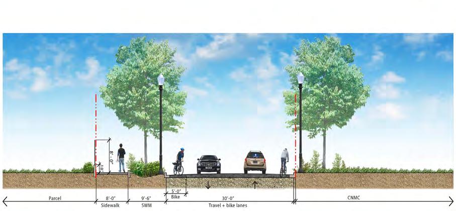


U S DEPARTMENT OF STATE Foreign Missions Center Master Plan EYP/ 4-22
Figure 4.26: Street Section: Dahlia Street, west of 14th Street
Figure 4.25: Street section: Dahlia Street, east of 14th Street

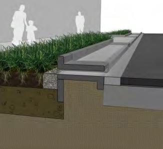
Street Trees
Each street within the FMC shall be lined with trees. Each of these Street Trees shall be located within a Tree Box. A Tree Box is an area bound on four sides usually within the sidewalk or at the street edge between the curb and sidewalk. The Tree Boxes shall include bio-retention elements that will support storm water management plan for DOS common areas on the FMC campus. Street Trees should be planted with regular spacing in straight rows to create a continuous street edge. Spacing may be adjusted slightly to accommodate lot access driveways and street/sidewalk lighting.
• Street Tree species may be varied for visual appeal and to promote a heterogeneous planting palette. Refer to DDOT’s Urban Forestry Administration (UFA) District’s recommended tree list.
• Locate Street Trees in a straight-line midway between the curb and adjacent sidewalk, even where the width of the Tree Box varies due to street alignments between FMC and DC-LRA.
• Street Tree spacing and placement standards throughout the FMC should be between 30 to 40 feet between trees.
• Street Tree species and tree alignments along Dahlia Street shall be coordinated with DC-LRA development.
Tree Boxes shall be located around Street Trees to maximize the site’s aesthetic and sustainable potential. Additional plantings within the tree boxes shall serve as a buffer between the pedestrian zone and the street.
• Tree Boxes shall be linear bio-retention areas designed to support FMC storm water management of the common areas.
• Tree Boxes shall not be continuous elements.
• Ground cover and low shrubs (maximum height of 12 to 18 inches) shall be native and/or adaptive species that require minimal watering for establishing and do not require any long-term irrigation.
• No permanent irrigation shall be provided within the Tree Boxes.
• Refer to DDOT guidelines for additional Tree Box standards.
4-23 U S DEPARTMENT OF STATE Foreign Missions Center Master Plan EYP/ DECEMBER 2018
Figure 4.27: Tree lined street
Figure 4.28: Tree Box
Pedestrian Zone
The sidewalk and open space will be the primary pedestrian zones within the campus. This pedestrian network will be the primary means of access for visitors to the foreign missions. The sidewalks will connect to public sidewalks at Alaska Avenue and Fern Street. The sidewalks will also connect to the proposed pedestrian network within the DC-LRA at Dahlia Street and Main Drive. The pedestrian elements (sidewalks, curb cuts, and lighting) shall be coordinated with the DC-LRA development.
• Sidewalks: Eight (8) feet in width at primary frontages. Six (6) feet in width at secondary frontages. Surface material shall be Portland cement concrete colored and finished per DDOT standard specifications.
• Curb Cuts: Accessible curb cuts for sidewalks shall be provided at intersections located within the crosswalks and/or pedestrian paths of travel. Curb Cuts shall be constructed to be compliant with ADA and UFAS design standards.
• Street Furnishings: No street furnishings fixed or moveable (i.e. benches, trash receptacles, mailboxes, bike racks) shall be permitted on or adjacent to FMC sidewalks.
Street/Pedestrian Lighting
Lighting of major circulation elements, such as streets, sidewalks and pedestrian pathways, shall be designed to prevent light trespass onto adjacent properties. The recommended lighting zone for FMC shall be LZ2: Moderate Ambient Lighting, as defined by IES recommended practices. In addition, there are DDOT standards for historic districts for lighting hardware, color, cutoff criteria, orientation, and minimum spacing. These standards will serve as the basis of design for street and pedestrian lighting at the FMC. In addition, the following guidelines shall be considered:
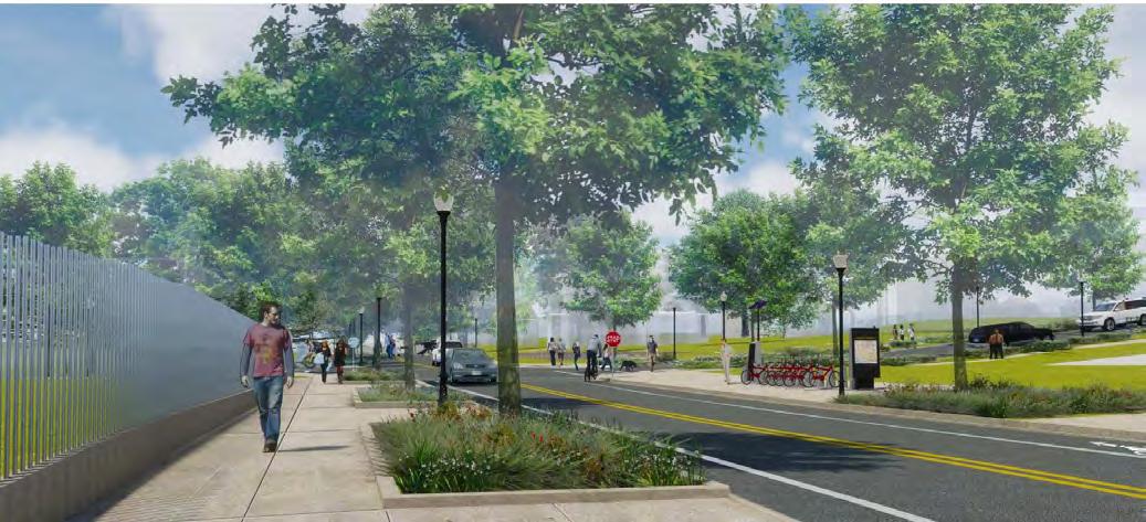

U S DEPARTMENT OF STATE Foreign Missions Center Master Plan EYP/ 4-24
Figure 4.29: Proposed view of Dahlia Street Looking west from Building 41
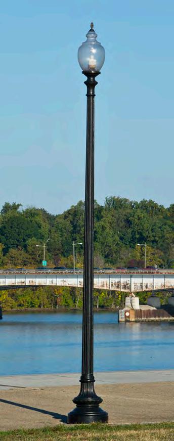
• Street and pedestrian lights shall be pole mounted. At streets and sidewalks, fixtures shall be mounted 16 to 18 feet above the sidewalk elevation. At pedestrian only zones (parks and open space), fixtures shall be mounted 12 to 14 feet above the adjacent pedestrian path elevation.
• Fixtures shall be full cut-off fixtures with the goal of maximum IES Backlight-Uplight-Glare (BUG) rating of B2-U3-G3.
• The character, architectural qualities, and manufacturer’s features of the light fixture and pole shall be uniform within the WRAMC historic district. Coordination with the DC-LRA development is required.
• Lower energy and longer lifespan luminaire solutions such as LED shall be required.
Street Signage and Pavement Markings
Street signage and pavement markings provide both directional information and control vehicular movement. Since the streets are extensions of the local city streets, these elements shall conform to DDOT standards and specifications. The signage associated with each foreign mission shall conform to the Lot Development Guidelines.
Security Structure(s)
The FMC campus will be an open campus providing ease of access to the foreign mission community while maintaining the character of a single campus within the WRAMC historic district. On rare occasions, the FMC campus may need to be secured. To support this need, existing security structures such as the Perimeter Fence shall be retained and maintained by DOS.
• While no additional structures are planned at this date, additional Guard Houses or Security Structures may be needed in the future at FMC access points or key street intersections. Design of new Guard Houses or Security Structure shall conform to the DC-HPO Guidelines for New Construction in a historic district.
4.5 OPEN SPACE AND PERIMETER
The character of the FMC is defined not only by the streetscape, but also by the internal open spaces and how the campus engages the adjacent streets and neighborhoods. The open spaces provide public amenities for the foreign mission community, WRAMC historic district, and adjacent neighborhoods. The area between the chancery lots and the perimeter fence provides a separation between the WRAMC historic district and a transition from the more urban-like developments along Georgia Avenue and the tree-lined neighborhood streets and Rock Creek Park.
Portions of the FMC have an existing canopy of trees. Based on surveys, the condition of existing trees varies from good to failing. Some of the trees are either heritage trees or special trees as defined by the DC Urban Forestry Administration (UFA). While all existing trees are important to the campus character, these Heritage Trees and Special Trees merit additional consideration when proposing new road alignments and lot development. When, due to either failing condition or challenge of location, these identified trees cannot remain; the removal of these trees warrants their replacement per the intent of Special Tree section under chapter 24-37 of the DC Municipal Regulations.
Existing Perimeter Fence
The WRAMC campus is surrounded by a black, iron, picket fence about six (6) feet high. The section of the fence along 16th Street and Alaska Avenue, and portions of Fern Street is also a contributing resource to the WRAMC Historic District. The fence along the DOS portion of the WRAMC shall be preserved and maintained as part of the FMC.
• The existing entry gate at Alaska Avenue and Dahlia Street shall be kept open.
• The existing entry gate at Alaska Avenue and 14th Street shall be maintained but shall be kept closed. Adjacent to the gate, a new entrance shall be provided in the perimeter fence for pedestrian and bicycle access. The location of this entrance shall be coordinated with the location of the access path.
4-25 U S DEPARTMENT OF STATE Foreign Missions Center Master Plan EYP/ DECEMBER 2018
Figure 4.30: Street Light


Buffer Zone
The FMC portion of the WRAMC campus abuts both residential neighborhoods and Rock Creek Park. When operated by the Army, this edge of the WRAMC campus was always highly vegetated with trees and shrubs and supported low density use. The FMC shall continue this condition by providing a 50-foot vegetative, landscaped buffer. This buffer shall be managed and maintained by DOS.
• The buffer zone is about 1.28 acres of the FMC. About 1.19 acres are within proposed foreign mission lots.
• At Alaska Avenue edge, maintain existing vegetative, landscape buffer in 10-foot DC right of way between Perimeter Fence and FMC property line. Provide additional 40-foot vegetative, landscape buffer within FMC. This portion within the FMC shall be maintained by the foreign missions.

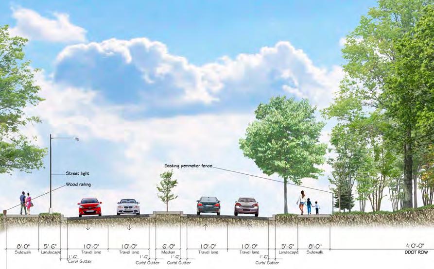
• At 16th Street edge, maintain existing vegetative, landscape buffer in 40-foot DC right of way between Perimeter Fence and FMC property line. Provide additional 10-foot vegetative, landscape buffer within FMC. This portion within the FMC shall be maintained by the foreign missions.
• Tree preservation within Buffer Zone shall substantially conform to DC tree preservation regulations.
14th Street Parkway
The master plan concept proposes a linear parkway along 14th Street. The parkway starts at the Ellipse on Main Drive and extends to the area around Building 57 (Memorial Chapel), just north of Dahlia Street. Between the Ellipse and Dahlia Street, the parkway follows the easterly edge of the steep slope below the current site of the Officer’s Quarters buildings. It is anticipated that the development on the steep slope will be limited, preserving the steep slope and many of the special trees on the slope. North of Dahlia Street, the open space is defined by the position of the Memorial Chapel, again preserving many of the special trees in this area. The primary feature of the parkway shall be a landscaped island in the roadway. The landscape island is located in the approximate location of a seasonal stream noted on pre-development maps of the area.
U S DEPARTMENT OF STATE Foreign Missions Center Master Plan EYP/ 4-26
Figure 4.32: Street Section: 16th Street
Figure 4.31: Street section: Main Drive, west of 14th Street
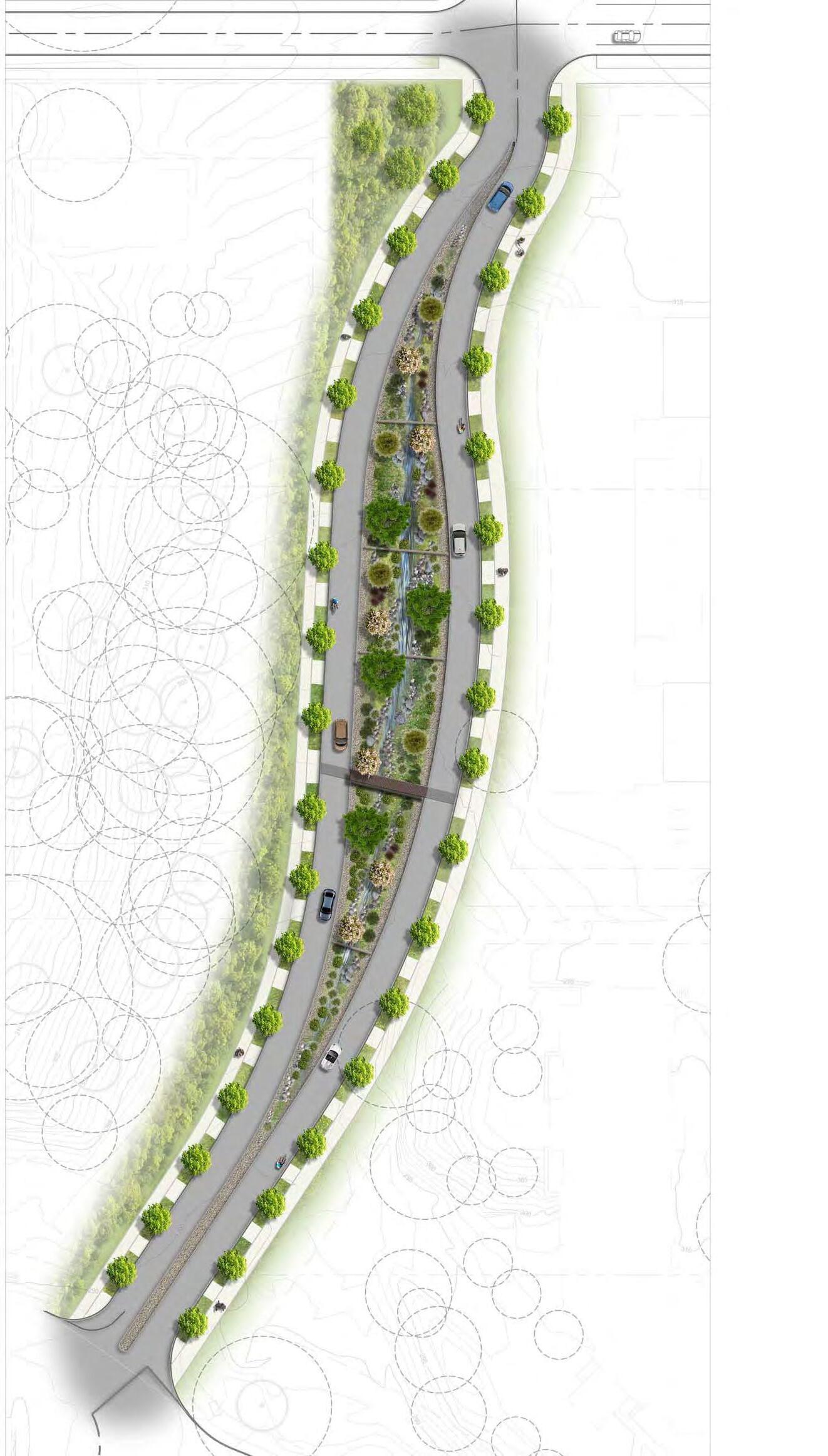
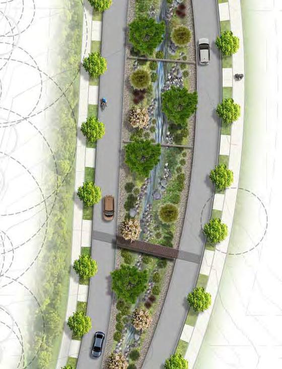
• The parkway median, ellipse and the small park at intersection of Dahlia and 14th Streets is about 0.61 acres of the FMC.
• Walkways along the parkway will be 6 to 8 feet wide. Walkway paving materials shall be durable. DOS will explore the use of porous pavement to meet agency and Federal sustainability goals.
• Landscaping within the parkway shall be varied, native species including open lawn area(s), shade trees, and storm water bio-retention plantings, suitable for periods of partial rainwater inundation.
• Historic marker and/or interpretive panel being provided by the Army per its programmatic agreement may be located along the parkway. It is recommended that this location be in vicinity of the Memorial Chapel.
• Traffic calming measures should be included.
• Per review with DDOT, provisions will be made to set aside a location for Capital Bikeshare station at the intersection of 14th Street and Dahlia Street.
• The green space where 14th Street is divided will be a series of step pool bio-retention facilities, controlling sheet flow runoff directly from the adjacent lanes of the new 14th Street. The total storage of the facilities in cumulative shall provide for the water quality volume necessary based on the pre-developed condition, and to detain the 10year peak outflow.
4.6 GENERAL GUIDELINES FOR UTILITIES
The FMC campus area is currently served by a number of utility systems which were created as WRAMC infrastructure. The ultimate conditions of the site have been considered for their impact on this existing infrastructure, and in order to determine if higher site usage will trigger the need for utility improvements. The services contain both government-owned and private utility company components. The utility systems have been organized into the following sections:
• Water Supply
• Natural Gas and Fuel Distribution
4-27 U S DEPARTMENT OF STATE Foreign Missions Center Master Plan EYP/ DECEMBER 2018
N
Figure 4.33: 14th Street Parkway Plan
See Inset to right
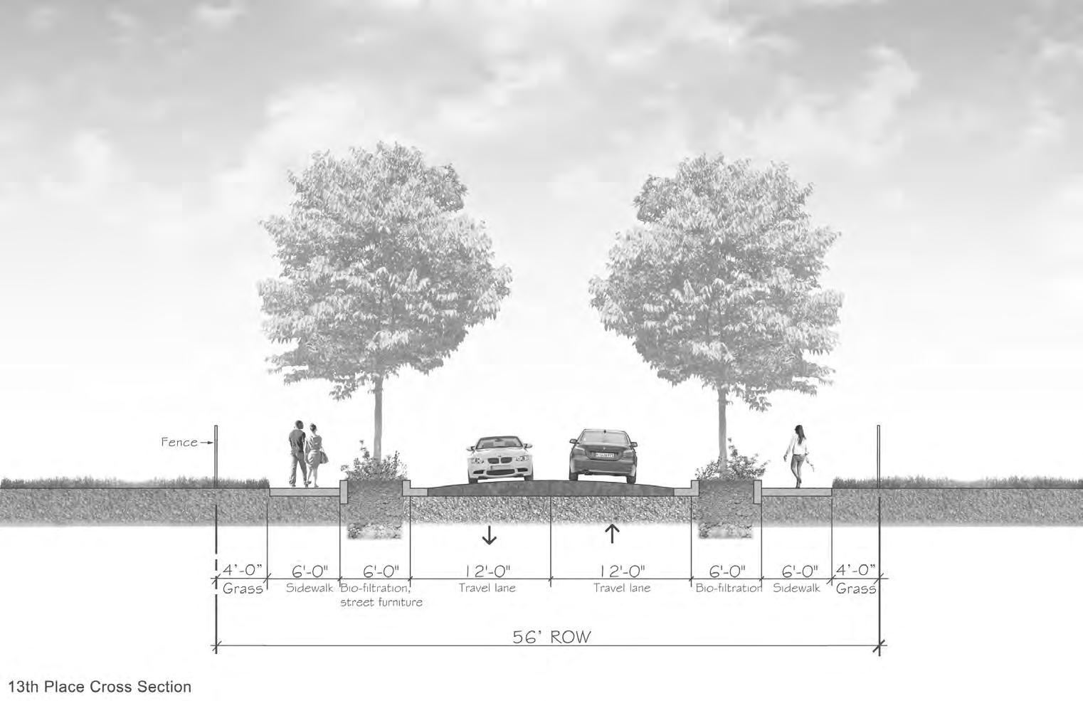


• Electrical Power and Telecommunications System
• Sanitary Sewerage
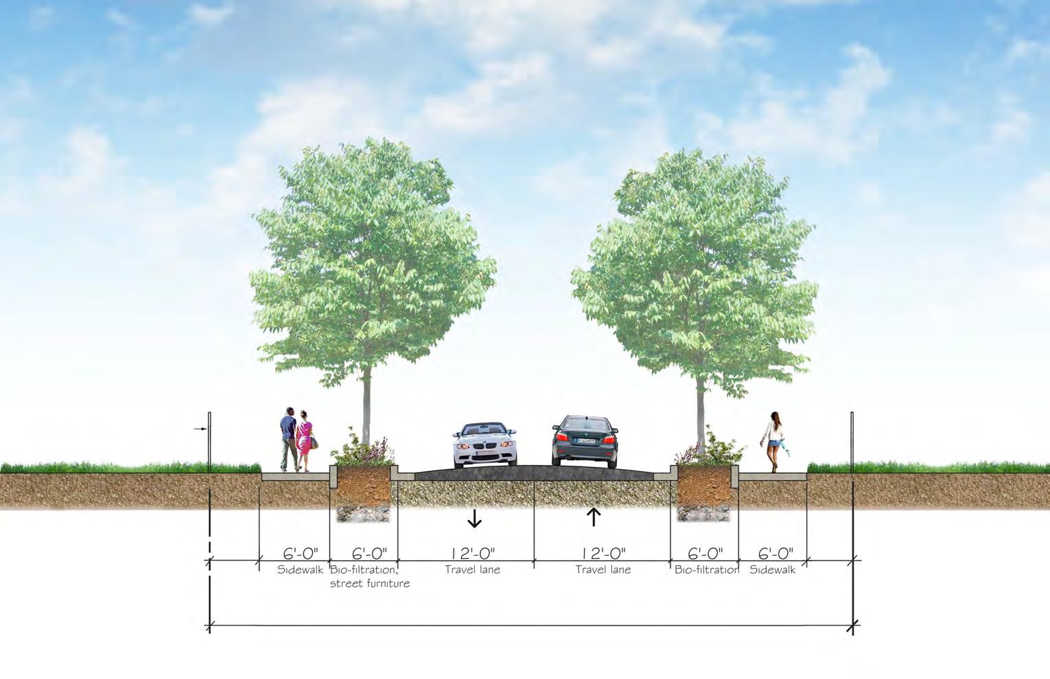
• Storm Drainage
• Storm water Management
Based on the Lot Development Guidelines, the FMC will be the equivalent of a campus of office buildings with secondary usages with a maximum estimated, overall floor area ratio (FAR) of 0.75. It is anticipated due to the traditional programmatic requirements of a chancery and related annexes that the infrastructure and utility demands are less intense than office uses. The preliminary analysis and campus development guidelines are based upon the more conventional office standard of development. With an estimated FAR of 0.75, the total building area of the FMC campus may be as large as approximately one million gross square feet (GSF).
The following analysis of the site utilities is to establish the general parameters under which the development of the campus infrastructure can be accomplished.
Water Supply and Distribution
Potable and fire protection water for the FMC site is currently supplied by the DC Water and Sewer Authority (DCWater) and is served from two separate Operating Systems – the 3rd and 4th High Operating Systems. The fire flow demand is not expected to change from the existing conditions to proposed conditions in any significant amount.
Based on four (4) existing connections being maintained to the offsite branches, the typical domestic water use for the development should remain within current systems capacity. In conjunction with current technologies and continuing concern over available water resources throughout the world, region and city, the FMC development will likely reduce potable water demands. These potential approaches are incorporated into Design Guidelines.
Individual chanceries are provided with guidelines to provide metering in order to, at a minimum, monitor the campus-wide infrastructure demand from each individual lot.
U S DEPARTMENT OF STATE Foreign Missions Center Master Plan EYP/ 4-28 TRI. GENERATION TEL COM. NATURAL GAS ELEC. SANITARY STORM DOMESTIC WATER
Figure 4.34: Street Section: Typical Utilities Layout

4-29 U S DEPARTMENT OF STATE Foreign Missions Center Master Plan EYP/ DECEMBER 2018
Utilities
N
Figure 4.35:
Layout
Natural Gas Distribution
Natural gas is provided from existing commercial, private distribution mains located within Alaska Avenue with major laterals located along Dahlia Street and 14th Street. No looping of the natural gas system is provided.
With the development of a large tract such as the FMC campus, it is normal that the natural gas company will provide continuing and upgraded service to the property, if adequate future demand is documented to their satisfaction. In many cases where demand increases are predicted, both off-site and on-site distribution services are provided at the supplier’s expense, subject to usage agreements. Accordingly, the development of the FMC will not likely be impeded by a lack of availability of natural gas and can be expedited if natural gas is selected as the primary source of heating on the property.
Electrical Power and Telecommunication
Electrical Power for the FMC campus is currently provided by two points of service. The primary point of service is four medium voltage (MV) PEPCO feeders at 15kV that serve the FMC site and adjacent buildings on the WRAMC campus via Building 15 on south-east corner of DC-LRA portion of the WRAMC site. The second point of service to the site from PEPCO consists of two MV feeders that are dedicated to Building 54. These Building 54 feeders enter the site underground from the local power company distributor, PEPCO, in Alaska Avenue.
The campus electrical distribution feeders are relatively new and are distributed throughout the WRAMC campus via underground concrete encased duct-banks and manholes. These four MV feeders are installed in a loop configuration to provide redundancy and backup. A portion of the existing underground duct-bank and manhole systems will be salvaged and be incorporated into the new FMC infrastructure configuration. New electrical service(s) from PEPCO should be brought into the FMC site from 16th Street or Alaska Avenue. Once the service is brought into the site, individually metered services will be provided for each of the potential building lots on the FMC campus. The MV service(s), individual metered services, and estimated demand load of the FMC site will need to be coordinated closely with PEPCO during both the site and individual chancery design.
DC-LRA and CNMC are evaluating opportunities to have micro-grids for their portions of the WRAMC. A micro-grid is a local energy grid with control capability, which means it can disconnect from the traditional grid and
operate autonomously. DOS could be asked to connect all or portions of the FMC to the either one of the two micro-grids.
The existing telecommunications service (Verizon) and distribution was established for a single user, the Army. This system will be abandoned and removed. New telecommunication service(s) should extend current services from adjacent roads, Alaska Avenue or 16th Street. Distribution of telecommunication services shall be in underground, concrete encased, duct banks.
Sanitary Sewerage
A review of the available profiles of the sanitary sewer system indicates that the pipe sizes and slopes provide adequate capacity for the planned development of the FMC campus. However, most of the on-site sanitary pipe is terracotta and is not generally considered adequate under current system conditions. New sanitary sewerage piping will be installed under the proposed streets connecting to existing sewer lateral locations.
The existing private sewer laterals depart the DOS property into the DC-LRA parcel at four locations: (A) southwest of Building 20 beneath Main Drive; (B) southeast of Building 20 beneath Main Drive; (C) southeast of Building T2 under Ambulance Drive; and (D) near the intersection of Dahlia Street and 13th Street between Buildings 48 and 52. These connections are (A) 12-inch (B) 8-inch (C) 6-inch (D) 12-inch, respectively and will be retained. Assuming a minimum downstream slope of 1 percent the capacity of these systems will be (A) 1,662 gallons per minute (B) 563 gallons per minute (C) 261 gallons per minute (D) 1,662 gallons per minute, respectively, and 4,148 gallons per minute cumulatively. The existing off-site receiving sewer (at 21inch diameter connection) includes (at an assumed 1 percent slope) a capacity of 7,383 gallons per minute.
With an average FAR of 1.0 (approximately one million square feet) the site is anticipated to produce approximately an average daily demand of 200,000 gallons per day (GPD), based on an average 200 GPD/1,000 GSF of office use. With a peaking factor of 4.0, the maximum peak instantaneous demand for the site will be 1,056 gallons per minute (GPM).
U S DEPARTMENT OF STATE Foreign Missions Center Master Plan EYP/ 4-30
Storm Drainage
The surface components of the existing drainage system consist of a network of grated curb inlets, area drains, and grated trenches. Subsurface piping connects these receptacles and conveys storm water runoff from the site to four drainage outfalls from the FMC parcel to the adjacent property, DC-LRA.
The re-development of the site as the FMC will require the complete replacement of the existing on-site storm drainage system. This need will also provide the opportunity for the replacement of existing inadequate components at little cost. With the major changes in design approach to storm water management since the system was originally constructed, planning for the FMC presumes that complete reconstruction of the storm water runoff collection and conveyance system will occur.
There is one ultimate outfall of the storm drainage, the Luzon Tunnel, off of the DOS property and on the DC-LRA parcel. Inadequate information is available to determine the performance characteristics (e.g., full flow capacity and velocity) for the trunk line which serves 300 acres of upstream and on-site development.
The FMC, in order to remain in compliance with DC Storm water regulations, will not be able to increase the peak rate of storm water runoff from the FMC campus. The campus and chancery lots (through detention, reuse, and low impact development) shall reduce the developed peak flows from the site to pre-developed conditions. For analysis purposes, the site is conceived as two major components: (a) common areas containing streets, walkways, landscape features, and utility corridors; and (b) development lots for chancery sites. These two areas are distinctly different in terms of their accessibility for maintenance and compliance evaluation since the common areas are to be controlled by DOS, while the chanceries are subject to individual security and access constraints.
Each foreign mission will be required to address storm water requirements either via independent facilities located on the lot or a pro-rata share contribution to a more centralized facility. Storm water runoff will be reduced to pre-developed conditions and therefore relieve the project of any downstream impacts.
The internal site design will require that storm water overland relief flow paths be maintained throughout the FMC campus. It is important, however, that the final agreements with the Army (and continuing to future landowners/
tenants such as the DC-LRA) provide adequate offsite conveyances to meet the emergency flood relief in the event of a major storm drainage failure or blockage. Typically, 100-year flow paths are provided to meet this potential catastrophic occurrence.
Erosion and Sediment Control
The FMC will be a multi-phased project which will include public infrastructure upgrades, and further developments for each individual parcel. In order to avoid residual perimeter controls remaining for years at a time, increasing the chance of failure due to wear and tear, the Erosion and Sediment Control Plan for the FMC should be viewed as several smaller projects. These smaller projects would be divided between the phases of the Department of State common infrastructure component phases, and between each individual chancery.
Each phase of the project will be required to establish Erosion and Sediment Control Plan which meets the requirements of the Districts Department of Environment (DDOE) for construction sites. Prior to any earth moving or disturbance of existing soil, the construction contractor shall be required to establish perimeter controls, including but not limited to; silt fence, diversion dikes, construction entrance, wash rack, dust control and where necessary silt traps and basins. All existing inlets within the vicinity of the disturbance area shall be provided adequate inlet protection, as will all proposed manholes prior to upslope stabilization. All necessary erosion and sediment control shall be in place before any disturbance within the watershed.
Erosion controls shall adhere to Erosion and Sediment Control Plan associated with a reviewed and approved plan. During the construction of any component of the project the responsible land disturber (a licensed civil or geotechnical professional engineer within the District of Columbia) shall be required to inspect the erosion controls on a once bi-weekly basis and after any rainfall event to identify erosion problems. Any modifications to the approved Erosion and Sediment Control Plan shall be approved by DDOE prior to the removal or relocation of any erosion controls.
At the completion of any individual project the contractor shall be required to confirm acceptability of perimeter control removal with the DDOE inspector. If approved, the erosion and sediment controls shall be allowed to demobilize.
4-31 U S DEPARTMENT OF STATE Foreign Missions Center Master Plan EYP/ DECEMBER 2018
Storm Water Management (SWM)
Design computations indicate that the entirety of the environmental water quality requirements for the property’s common areas and open spaces can be satisfied with a combination of roadway bio-retention facilities and the preservation of at least 250 existing trees on the site.
In support of the sustainability design principle, the concept for storm water is to determine the amount of improvements necessary within common areas (streetscape) for substantial compliance of non-chancery components of the site with DC SWM regulations and requirements. To accommodate the infrastructure improvements outside of individual lots (e.g., streets, common open space, walks, etc.), a detention/water quality improvement area has been designated in the master plan along primary streets, including 14th Street.
Roadway runoff will be collected at appropriate intervals along the gutter pan and directed to bio-retention facilities (tree boxes) for cleaning and disposal. In addition to the linear roadway system, the linear park along 14th Street will replace the existing surface parking lot and provide an additional centralized area for the treatment of storm water runoff. The open space along 14th Street will be divided will be a series of step pool bio-retention facilities, controlling sheet flow runoff directly from the adjacent lanes of the new 14th Street. Each stepped portion of the bio-retention linear system would be sized to control no more than about half an acre of impervious runoff in order to avoid siltation and damage from larger storm events. A common overflow pipe would be provided running the entirety of the length of these facilities to provide containment for larger storm events. The soil used shall be a suitable mixture which will encourage bio-remediation and evapotranspiration. The overall design concept will contribute to the reduction of storm water runoff, assist in the improvement of air quality and provide positive benefits for the urban heat island effect.
For the purpose of this analysis all of the existing tree preservation credits have been calculated towards the compliance from the first phase of the development, the common parcel, which encompasses the road network. Individual parcels shall not be permitted to account for any preserved trees within their lot.
• The existing site at meadow conditions (2-year design) would consist of an average runoff Curve Number (CN) of 72, or 0.9 inches of runoff matching the overall site composite.
• The existing site at pre-project (15-year design) would consist of an average CN of 85, or 3.5 inches of runoff matching the overall site composite.
• The existing site at pre-project (100-year design) would consist of an average CN of 85, or 6.5 inches of runoff matching the overall site composite.
U S DEPARTMENT OF STATE Foreign Missions Center Master Plan EYP/ 4-32
LUZONTUNNEL OUTFALL LINEAR BIORETENTION FACILITY (APPROX. 3,045 FT.) CENTRAL SWM FACILITY (APPROX 11,945 SQ. FT.) STORM OUTFALL VEGETATED BUFFER LEGEND SHERRILLDRIVE ASPEN STREET DAHLIA STREET MAIN DRIVE GEORGIA AVENUE ALASKA AVENUE 16TH STREET 14TH STREET 13TH STREET 13TH STREET LUZON AVENUE FERN STREET DAHLIA STREET WHITTIER STREET ASPEN STREET BUTTERNUT STREET PINEY BRANCH ROAD ELDER STREET FERN STREET GERANIUM STREET FLORAL STREET 14TH STREET 12TH STREET 9TH STREET 8TH STREET 13TH PLACE 41 52 57 54 40 11 17 1 7 12 9 8 60 45 44 46 15 82 90 53 A B A DEPARTMENT OF STATE Foreign Missions Center Master Plan EYP/ Architecture & Engineering Stormwater N 0’ 60’ 120’ 240’ 480’ December 15, 2016 N
Figure 4.36: Stormwater Diagram

/ SECTION 5
DESIGN GUIDELINES
DEPARTMENT OF STATE Foreign Missions Center Master Plans EYP/ 5-1 DECEMBER 2018
ROOFTOP
• Screened mechanical equipment
• Communications equipment
• Green roof (storm water management)
• Renewable energy equipment

GARDEN
• Function space
• Quiet/reflective space
• Storm water management
• Landscape
• Tree preservation
PRIVATE
• Offices
• Conference rooms
• Private residence(s)
• Structured parking (below)
PUBLIC
• Reception
• Meeting spaces
• Gallery and function space(s)
• Service (i.e. Visa counter)
• Deliveries
FORECOURT
• Main façade - openness
• Mission identity
• Visitor parking
• Security setback
• Landscape
• Storm water management
PERIMETER
• Fence
• Signage
• Entrance gate(s)
• Security structure
DEPARTMENT OF STATE Foreign Missions Center Master Plan EYP/ 5-2
Figure 5.1: Chancery Typology


Design Guidelines / 5
The entire U.S. Department of State’s Foreign Missions Center (FMC) is located on a portion of the former Walter Reed Army Medical Center (WRAMC) and within the boundary of the WRAMC Historic District in Washington, DC. The DC State Historic Preservation Office (DC-SHPO) is responsible for developing and enforcing guidelines related to construction within listed historic districts. Guidelines developed and published by the DCHPO are referenced below in the sections on Guidelines for New Construction and Guidelines for Existing Buildings. The guidelines developed specifically for the Foreign Missions Center are to be utilized in addition to the DC SHPO guidelines.
The intent of the design guidelines is to provide design parameters for lot development such as frontage, building disposition, building height, parking requirements, and lot access for both entry and service needs. Potential massing diagrams, while defining a recommended coverage for site and open space, shall also provide ways to break down scale of the buildings.
The Design Guidelines are arranged in nine sections. The sections focus on Design Review and Approval Process, Campus Zones, General Guidelines for Buildings and Structures, Guidelines for Existing Buildings, Guidelines for New Construction, Site Development Issues and Sustainability, Vehicular Access and Parking, Utilities, and Lot Development.
5.1 DESIGN REVIEW AND APPROVAL PROCESS
The U.S. Department of State (DOS) and foreign missions are required to comply with federal environmental and historic preservation laws. As part of the master planning effort, DOS has filed an Environmental Impact Statement and recorded a Record of Decision as required per the National Environmental Protection Act of 1969 (NEPA). DOS has also conducted a Section 106 consultation pursuant to the National Historic Preservation Act of 1966 (NHPA). The result of the Section 106 consultation is a Programmatic Agreement signed by DOS, Advisory Council on Historic Preservation, DC State Historic Preservation Office, and the National Capital Planning Commission.
The WRAMC is a historic district registered in the District of Columbia Inventory of Historic Sites and is listed in the National Register of Historic Places. The former WRAMC is also under the purview of the U.S. Commission of Fine Arts (CFA). The DC State Historic Preservation Office
DEPARTMENT OF STATE Foreign Missions Center Master Plan EYP/ 5-3 DECEMBER 2018
Figure 5.2: Foreign Missions Center - Aerial View
DC Agency Review (DDOT, Planning, etc.)
DC - State Historic Preservation Office
U.S. Commission of Fine Arts
National Capital Planning Commission
Action: Not Disapprove Disapprove
(DC-SHPO), U.S. Commission of Fine Arts (CFA), National Capital Planning Commission (NCPC), and the District of Columbia municipal agencies, including local Area Neighborhood Commissions (ANC), and other interested parties shall have roles in the evaluation of each chancery design for substantial compliance with local regulations and appropriate design response to the local and regional context.
The Office of Foreign Missions (OFM), an office within DOS, serves the interests of the American public, the American diplomatic community abroad, and the foreign diplomatic community residing in the United States ensuring that all diplomatic benefits, privileges, and immunities would be properly exercised in accordance with federal laws and international agreements. OFM will assist foreign missions through the design review and approval process.
National Capital Planning Commission (NCPC)
Through a memorandum of agreement (MOA) that was signed on February 27, 2017, DOS and NCPC agreed that NCPC is authorized to review foreign mission projects on land owned by the Federal government within the District of Columbia. The MOA summarizes the roles and responsibilities of both DOS and NCPC in the design review process. The requirements and criteria established pursuant to 22 U.S.C. § 4306 (Locations of Foreign Missions in the District of Columbia) section of the Foreign Missions Act apply to the design review and approval process for chancery projects at the FMC.
Step 1 – Area Neighborhood Commissions
The Advisory Neighborhood Commissions (ANC) consider a wide range of policies and programs affecting their neighborhoods, including traffic, parking, recreation, street improvements, liquor licenses, zoning, economic development, police protection, sanitation and trash collection, and the District’s annual budget.
In each of these areas, the intent of the ANC legislation is to ensure input from an advisory board that is made up of the residents of the neighborhoods that are directly affected by government action. The ANCs are the body of government with the closest official ties to the people in a neighborhood.
The ANCs present their positions and recommendations on issues to various District government agencies, the Executive Branch, and the Council. They also present testimony to independent agencies, boards, and commissions,
DEPARTMENT OF STATE Foreign Missions Center Master Plan EYP/ 5-4
Figure 5.3: FMBZA Review Process Flow Chart
Foreign Mission’s Chancery Design Submission Area Neighborhood Commission
Schedule review with NCPC within 90 days of submission Total timeline for review = 6 months
usually under the rules of procedure specific to those entities. By law, the ANCs may also present their positions to Federal agencies.
Foreign Missions are encouraged to consult with the ANC as early as possible after a design project is initiated, as well as during the development of the design. The boundaries of individual ANCs change from time to time, thus OFM will ensure that the foreign mission has the most current information concerning such matters.
OFM generally recommends that the above referenced consultations with the ANC be substantially completed prior to beginning discussions with the CFA or NCPC (Steps 3 and 4).
Step 2 - District of Columbia State Historic Preservation Office
The District of Columbia’s State Historic Preservation Office (DC-SHPO) is one of the preservation offices established in each state and territory under the National Historic Preservation Act of 1966. DC-SHPO duties include historic preservation planning, survey and identification of historic properties, public education, review of government projects affecting historic properties, and promotion of federal preservation tax incentives
Foreign Missions are encouraged to consult with the DC-SHPO staff as early as possible after a design project is initiated, as well as during the development of the design. DOS will assist the foreign mission with arranging such consultations.
OFM generally recommends that the above referenced consultations with DC-SHPO be substantially completed prior to beginning discussions with the CFA and NCPC (Steps 3 and 4). OFM will advise and assist the foreign mission with all such matters.
Step 3 – U.S. Commission of Fine Arts
Since 1910, the U.S. Commission of Fine Arts (CFA) has been responsible for the design review of government properties in the National Capital. The CFA reviews designs for federal and D.C. government buildings, monuments, memorials, parks, and public spaces throughout the District of Columbia, including the FMC.
1. Applications submitted to CFA will be in the name of DOS, on behalf of the foreign mission. Thus, consultation and coordination between the foreign mission and OFM with respect to this matter is critical.
2. Foreign Missions are encouraged to consult with the CFA staff as early as possible after a design project is initiated, as well as during the development of the design. DOS will assist the foreign mission with arranging such consultations.
3. Read the submission requirements for concept or final review as appropriate and prepare the necessary drawings and other materials for the proposed project. These requirements are available on the CFA’s website.
4. OFM will forward a submission for a concept or permit review, with appropriate drawings showing existing conditions and proposed construction and other required submission materials, directly to CFA.
5. Upon receipt of the submissions, CFA staff may contact OFM or the foreign mission to request additional or revised materials. If a proposed project is insufficiently documented for review, the CFA staff may recommend that the review of the case be postponed until a later CFA meeting.
6. Depending on the scope, size, prominence, and design of a proposed project, it will either be reviewed by the Commission of Fine Arts in its monthly public meeting, or reviewed by CFA staff and placed on the Consent Calendar for approval by the CFA in its meeting. CFA staff will notify applicants whose cases have been placed on the agenda for the public meeting.
7. Smaller-scale or less complex projects may be placed on the Consent Calendar of staff recommendations, which is subject to approval by the CFA in its meeting.
8. Projects requiring review by the CFA in its public meeting must be presented by the applicant or applicant’s representative at the CFA’s meeting.
9. When a project is approved in concept, the applicant may proceed to develop the project design and documentation in preparation for a submission for final review. Concept approval is often accompanied by detailed recommendations or conditions, which the applicant
DEPARTMENT OF STATE Foreign Missions Center Master Plan EYP/ 5-5 DECEMBER 2018
should incorporate into the design prior to making a submission for final review.
10. Once a project receives final approval, applicants generally need not return for further review unless changes are made to the approved final design. Final approval may also be accompanied by detailed recommendations or conditions, which the applicant must incorporate into the design documents prior to receiving full final approval.
Step 4 – National Capital Planning Commission
The National Capital Planning Act set forth at 40 U.S.C. §§8701 et seq., establishes the National Capital Planning Commission (NCPC) as the central planning agency for the federal government in the National Capital Region (NCR). The Act provides for the agency’s essential functions, including development of a Comprehensive Plan for the NCR; review of federal and some District of Columbia (DC) proposed developments and projects; review of DC zoning amendments; annual review of the Federal Capital Improvements Program and the DC Capital Improvements Program; and the development of special planning projects. One of NCPC’s principal responsibilities is to coordinate development activities of Federal and District of Columbia agencies in the Region.
1. Foreign missions shall consult the NCPC staff as early as possible after a design project is initiated, as well as during the development of the design. DOS will assist the foreign mission with arranging such consultations.
2. Schematic Development submissions are required where size, complexity, and/or projected impacts of proposed projects (including site improvements and commemorative works) necessitate early NCPC guidance prior to the expenditure of substantial funds for more detailed project design. In cases involving complex planning and development proposals, the Executive Director may require schematic development submissions.
o Where issues relate to the potential suitability of a proposed site, the Executive Director may require that schematic development proposals accompany the location and program submission. Any sponsoring agency may choose to make a schematic development
submission to solicit the Commission’s views prior to preparation of preliminary plans.
3. With certain exceptions, preliminary submissions must be made for all new construction or renovation projects after tentative design decisions have been made but well before detailed design work begin, typically at the 20 to 25 percent development stage. Timely submissions of preliminary plans are vital to avoid costly revisions in later detailed design stages.
4. If major changes are made in either the design or program of a proposed development after the NCPC has reviewed a preliminary submission, a revised preliminary plans for review shall be submitted as far in advance of completion and submission of final plans as possible, except where such changes have been made specifically in response to NCPC recommendations on the preliminary submission. Preliminary submissions may take the form of:
o Preliminary site and building plans for projects involving both building construction or renovation and related site improvements;
o Preliminary building plans for projects involving additions or renovation where no site improvements are involved;
o Preliminary site development plans for projects involving only site improvements; and
o Preliminary designs for all commemorative works proposals. In cases in which the proposed commemorative works involve only site improvements, including sculpture, content requirements for preliminary site development plans apply. Where proposed commemorative works include substantial structures, content requirements for preliminary site and building plans apply.
5. Final submissions must follow preliminary submissions, after design decisions have been made (including building and landscaping materials), typically at the 60 to 70 percent development stage, and prior to advertisement and award of construction contracts.
6. NCPC will ensure prompt scheduling of a chancery application as an action item on the NCPC’s agenda within 90 to 95 days of receipt of
DEPARTMENT OF STATE Foreign Missions Center Master Plan EYP/ 5-6
a completed application submitted on or before the Submission deadline established by the Commission for a particular meeting.
7. NCPC will conduct informal proceedings for all chancery applications. The proceedings shall focus on a staff presentation articulating the Executive Director’s position on an application. This process shall include no direct testimony and no cross examination although NCPC may direct questions to the foreign mission or the foreign mission may speak if it so desires. Further, hearings shall include public participation by those members of the public who express an interest in speaking or submitting written comments. Any determination concerning a chancery project at the FMC shall be based on the following criteria:
a. The international obligation of the United States to facilitate the provision of adequate and secure facilities for foreign missions in the Nation’s Capital;
b. Historic preservation, as determined by NCPC, in carrying out this responsibility; and in order to ensure compatibility with historic landmarks and districts, substantial compliance with District of Columbia and Federal regulations governing historic preservation shall be required with respect to new construction and to demolition of or alteration of historic landmarks;
c. The adequacy of off-street or other parking and the extent to which the area will be served by public transportation to reduce parking requirements, subject to such special security requirements as may be determined by the Secretary of State, after consultation with Federal agencies authorized to perform protective services;
d. The extent to which the area is capable of being adequately protected, as determined by the Secretary, after consultation with Federal agencies authorized to perform protective services;
e. The municipal interest as determined by the Mayor of the District of Columbia; and
f. The Federal interest, as determined by OFM on behalf of the Secretary of State.
8. NCPC shall render a final decision to “not disapprove” or “approve” a chancery application no later than six (6) months after the date a completed application is files. The Commission’s determination shall not be subject to the administrative proceedings of any other agency of official except as may be provided by the FMA.
Foreign missions may not lawfully deviate from final plans approved by the NCPC under these provisions. Therefore foreign missions are urged to resolve all outstanding planning and design issues with affected agencies and organizations prior to the submission of final site and building plans.
If substantial changes must be made in final plans after NCPC has taken action on them but prior to construction, foreign missions are required to submit revised final plans for NCPC review and action.
Role of Other Agency Review
Pursuant to 22 U.S.C. § 4306 (e) and (j), the following agencies may have active roles in the design review and recommendations for approval of the replacement, or expansion of chanceries on the FMC.
• National Capital Planning Commission (NCPC)
• U.S. Commission of Fine Arts (CFA)
• DC State Historic Preservation Office (DC-SHPO)
• DC Municipal Agencies and local ANC
DEPARTMENT OF STATE Foreign Missions Center Master Plan EYP/ 5-7 DECEMBER 2018

(WEST)(EAST)
DEPARTMENT OF STATE Foreign Missions Center Master Plan EYP/ 5-8
N
Figure 5.4: Foreign Missions Center - Campus Zones
CHAPEL ZONE Area around Memorial Chapel consists of lots that abut Alaska Avenue. Lot occupancy is typically a single building.
General Character:
Building Placement:
Defining Features:
Typical Building Height: Type of Civic Space:
Low to medium density buildings that transition from Dahlia Street to adjacent residential street.
Shallow Setbacks, buildings oriented to street defining a street wall,
Deep Vegative Buffer at Alaska Avenue
Dense tree coverage, open corner at Chapel No more than 3 Stories
14th Street, Dahlia Street, Vegetative Buffer
DAHLIA
STREET
ZONE - EAST Urban street consists of lots that abut Dahlia Street. Lot occupancy is typically a single building
General Character:
Building Placement:
Defining Features:
Medium density buildings forming a uniform street wall, trees within right-of-way, and highest pedestrian activity.
Shallow Setbacks, buildings oriented to street defining a street wall Tree coverage and steep slopes west of 14th St, Greater density of development east of 14th St, Legacy placemaking (axial relationships and open space)
Typical Building Height: Type of Civic Space:
2 to 4 Stories
Dahlia Street, Urban block
General Character:
Building Placement:
Defining Features:
Medium density buildings forming a uniform street wall, trees within right-of-way, and highest pedestrian activity.
Deep Setbacks, buildings oriented to street defining a street wall Tree coverage and steep slopes west of 14th St, Greater density of development east of 14th St, Legacy placemaking (axial relationships and open space)
Typical Building Height:
Type of Civic Space:
2 to 4 Stories
Dahlia Street, Views of Chapel
MAIN DRIVE ZONE Chancery compound consists of large lots with single or multiple buildings. These lots are located along Main Drive.
General Character:
Building Placement:
Defining Features:
Typical Building Height: Type of Civic Space:
Single or multiple buildings on landscaped open area, preservation of elements and features of natural landscape.
Variable Setbacks
Deep setbacks from Main Drive, Preserve character of ellipse, Preserve tree coverage along 16th St.
3 to 4 Stories
Main Drive, Ellipse
5.2 CAMPUS ZONES
The FMC campus is divided into three zones, the Chapel Zone, the Dahlia Street (East and West) Zone and the Main Drive Zone. Each zone reflects a different character and series of guidelines for development and each parcel or lot on the site can be categorized within one of these character zones.
5.3 GENERAL GUIDELINES FOR BUILDINGS AND STRUCTURES
The FMC Master Plan proposes a general pattern of building heights and lot coverage where there is a relatively uniform height across the campus and the densest development is north of Dahlia Street. In addition to the guidelines below, foreign missions shall be substantially compliant with DC Zoning regulations and NCPC Comprehensive Plan standards.
Density and Scale
The scale and massing of the developments within the FMC, while suiting the specific needs of the foreign missions, are expected to work within a framework complementary to the adjacent developments within the WRAMC historic district and surrounding residential neighborhoods. The drawing to the right articulates density zones for low- to mid-rise construction as well as a low rise campus zone, creating a sense of place and flexibility as well as accommodating and complementing the surrounding neighborhood. The intent of the density and scale is to minimize the effects of new construction on neighboring areas adjacent to campus.
The proposed limitations below follow the density and scale concept forwarded in the FMC Master Plan. The building height limit equals all occupiable floors (excluding mechanical penthouses) and shall be measured from the average grade five feet beyond the perimeter of the structure.
Roof top Elements
Rooftop elements such as parapets, mechanical penthouses, exhaust stacks, communications equipment, and other non-occupiable roof elements shall be carefully designed to ensure architectural compatibility and to minimize their visual impact.
Mechanical and elevator penthouses shall create visually attractive roofscapes and rooflines for the WRAMC Historic District. These elements shall be
DEPARTMENT OF STATE Foreign Missions Center Master Plan EYP/ 5-9 DECEMBER 2018
Table 5.1: Foreign Missions Center - Campus Zones
DAHLIA STREET ZONE - WEST Urban street consists of lots that abut Dahlia Street. Lot occupancy is typically a single building
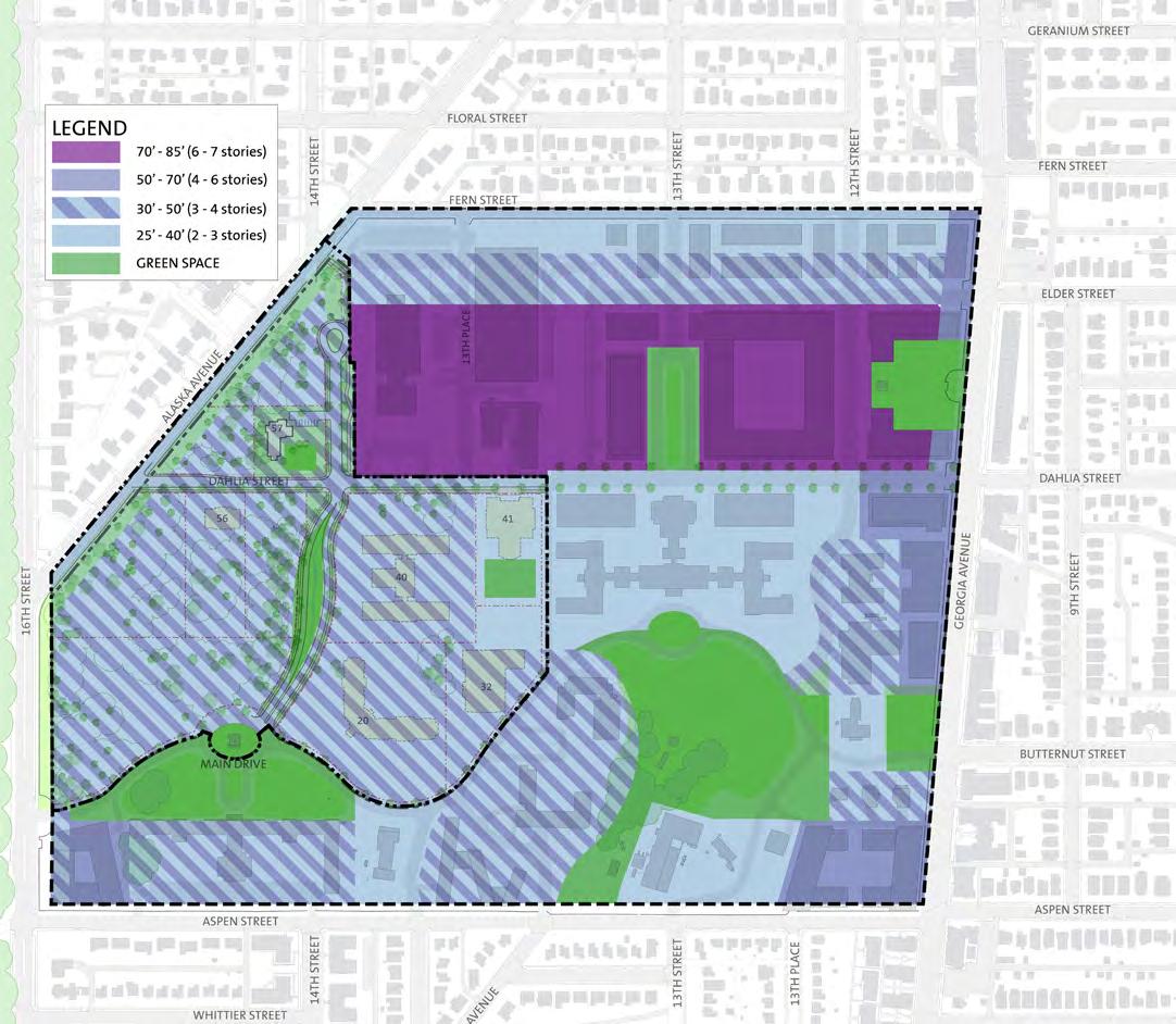
integrated into the architectural expression of the building, and can be articulated as an attic story or hidden within the roof form of the structure. All rooftop equipment shall be screened from view using materials consistent with the major building facades.
Installation of rooftop communications equipment, including satellite and microwave dishes, shall be carefully considered for location and visual impact. Communications equipment shall be installed at the lowest possible elevation above the roofline, and screened to the extent practicable from public view. Communications equipment shall be set back as far as possible from all edges of the roof (20 feet at a minimum). Rooftop communications equipment, which cannot be screened, should be placed in association with penthouse structures so as to avoid the appearance of a freestanding object on the roof. Antenna and mounting materials shall be unobtrusive and of a color that blends with surrounding structures.
Building Setbacks
On a campus-wide basis, the Master Plan proposes a general pattern of primary and secondary frontage setbacks of buildings from streets in order to create sense of space on the street. Setbacks from side lots and rear lots are proposed to clearly delineate each chancery. Details for setbacks, lot coverage and other development guidelines for each zone are summarized at the end of this section.
Definitions for frontage elements
Primary Frontage
This is the front or street address of each lot. Primary access to the chancery shall to be from the primary frontage. For development the hierarchy of the streets are as follows:
• Dahlia Street –primary
• Main Drive - primary
• 14th Street – secondary, other than potentially lots that have corner or dual frontage.
In coordination with the adjacent developments within the WRAMC Historic District, Dahlia Street and Main Drive each have unique characters. Dahlia Street east of 14th Street is a street with a more urban character. Buildings
DEPARTMENT OF STATE Foreign Missions Center Master Plan EYP/ 5-10
N
Figure 5.5: Foreign Missions Center - Massing and Scale Diagram

along Dahlia Street are located close to the sidewalk and as near to each other as possible to create a continuous wall of buildings to the street. This urban character will relax west of 14th Street to relate to the more pastoral setting on the west side of the campus. Main Drive shall have more park-like character with buildings setback from the street and open lawn areas.
Corner Lots
On corner lots, the frontage shall be both the primary street and secondary street. The formal entrance to the chancery can be from either or both streets.
Private Frontage
Private Frontage is the area between the lot line at the street and the primary façade of the building. This area is important as it is part of the development within the context of the WRAMC Historic District and surrounding neighborhoods. Buildings shall present an accessible appearance at the ground level. Private frontage elements and building entries shall be oriented to the primary street address. Blank walls without fenestration shall be avoided. For additional guidelines about private frontage and security elements, refer to the sections NCPC Comprehensive Plan that address Urban Design Elements and Foreign Missions and International Organizations Elements.
Fence
The purpose of a fence is to provide a physical barrier while maintaining visibility of the chancery façade and primary entrance. As a physical barrier, a fence may aid in securing the chancery lot. A fence is optional and not required. The location of the fence relative to the front yard lot line and height of fence will vary from campus zone to campus zone.
For example, for lots along Dahlia Street, east of 14th Street, the fence shall be located at the lot line and located on a low wall. The low wall shall be a common material, granite, from lot to lot. The total height of fence and wall shall not exceed 8 feet (2400 mm).
The maximum height for a fence, when set back from the lot line by at least 5 feet (1525 mm), shall be no greater than 9 feet (about 2.75 meters) above the adjacent final finish grade of the sidewalk. Security fences may surround the entire lot. The fence shall be at least 80 percent open and finished in a dark color.
Low walls not higher than 2’-8” (810 mm) above the finish grade may be included in the overall height of the fence. However, low walls shall be built of a common material, granite.
Screen Walls
A screen wall may be within the private frontage of a lot. However, it shall be setback a minimum of 20 feet (6100 mm) from the property line. The use of screen walls shall be limited to screen service functions such as a loading area and solid waste storage from both the public frontage and adjacent lots. Evergreen landscape elements may be used in lieu of a screen wall. The maximum height of the screen wall shall not be greater than the height of a four (4) to six (6) yard dumpster plus one (1) foot above the adjacent final finish grade. Screen walls must be setback at least 20 feet (6100 mm) from the frontage line and ten feet (3050 mm) from side and rear lot lines.
Security Structure
A small outbuilding or annex for protecting security personnel from the weather (gatehouse) or as a dedicated screening facility for visitors is permitted within the private frontage. This structure shall be designed for a minimal footprint and height.
Flag Poles
Flag poles are allowed within the private frontage of each chancery lot. The flag pole(s) shall be setback at least ten (10) feet (3050 mm) from the property line. The maximum height of the flag pole(s) is 24 feet (7300 mm).
Foreign Mission’s Public Art
Each Foreign Mission may choose to use public art as a representative expression. Foreign Mission’s public art shall be limited to one work within the private frontage. The location and size of the art shall be included in the design review process.
Exterior and Building Signage
One sign identifying the foreign mission is permitted for each lot. The location, size, and illumination of exterior signage shall be subject to the review and approval process. Building signage shall be limited to directional elements.
Visitor Parking
Each Foreign Mission is limited in the number of visitor surface parking. Since these parking spaces are not expected to be regularly used, these parking spaces shall be incorporated into the forecourt design so as to minimize their
DEPARTMENT OF STATE Foreign Missions Center Master Plan EYP/ 5-11 DECEMBER 2018
Figure 5.6: Fence Photo
Figure 5.7: Signage Photo
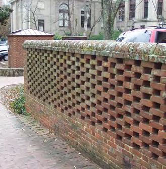
visual impact at the front of the building. Maximum quantity of visitor surface parking is based on zone and lot size.
5.4 GUIDELINES FOR EXISTING BUILDINGS
In the District of Columbia projects that involve historic properties or historic districts are governed by D.C. Law 2-144- Historic Landmark and Historic District Protection Act of 1978. Pursuant to the requirements of 22 U.S.C. § 4306, the review process for chancery development projects in the FMC will be evaluated in a manner that is similar to the handling of projects elsewhere in the District. The design guidelines and principles that have been established by the DC Historic Preservation Office are utilized by the review agencies noted in Section 5.1 and will be applicable to projects at the FMC. More information regarding the design guidelines developed by the DC Historic Preservation Office can be found on their website (http://planning.dc.gov/ DC/Planning/Historic+Preservation).
Preservation Standards
In general most design guidelines related to historic buildings or historic districts in the United States utilize the Secretary of the Interior’s Standards for the Treatment of Historic Properties as their foundation. Of the four types of treatment identified in the Standards, Rehabilitation is the one that is most relevant to the modification and reuse of a historic building. The following Guidelines for Rehabilitation are provided in the document Introduction to the Historic Preservation Guidelines issued by the DC Historic Preservation Office. These standards should be utilized as an initial outline when evaluating the potential reuse of one of the historic buildings:
1. A property shall be used for its historic purpose or be placed in a new use that requires minimal change to the defining characteristics of the building and its site and environment.
2. The historic character of a property shall be retained and preserved. The removal of historic materials or alteration of features and spaces that characterize a property shall be avoided.
3. Each property shall be recognized as a physical record of its time, place, and use. Changes that create a false sense of historical development, such
as adding conjectural features or architectural elements from other buildings, shall not be undertaken.
4. Most properties change over time; those changes that have acquired historic significance in their own right shall be retained and preserved.
5. Distinctive features, finishes and construction techniques or examples of craftsmanship that characterize a historic property shall be preserved.
6. Deteriorated historic features shall be repaired rather than replaced. Where the severity of deterioration requires replacement of distinctive features, the new feature shall match the old in design, color, texture, and other visual qualities and, where possible, materials. Replacement of missing features shall be substantiated by documentary, physical or pictorial evidence.
7. Chemical and physical treatments, such as sandblasting, that cause damage to historic materials shall not be used. The surface cleaning of structures, if appropriate, shall be undertaken using the gentlest means possible.
8. Significant archeological resources affected by a project shall be protected and preserved. If such resources must be disturbed, mitigation measures shall be undertaken.
9. New additions, exterior alterations or related new construction shall not destroy the historical materials that characterize the property. The new work shall be differentiated from the old and shall be compatible with the massing, size, scale, and architectural features to protect the historic integrity of the property and its environment.
10. New additions and adjacent or related new construction shall be undertaken in such a manner that if removed in the future, the essential form and integrity of the historic property and its environment would be unimpaired.
The DC Historic Preservation Office also publishes guidelines related to specific types of projects, including additions to historic buildings and new construction in historic districts. The following paragraph from the District of Columbia Historic Preservation Guidelines outlines the acceptable approach to designing an addition to a historic building:
DEPARTMENT OF STATE Foreign Missions Center Master Plan EYP/ 5-12
Figure 5.8: Screen Wall Photo

Additions to historic buildings are sometimes necessary to extend their functional or economic life. It is important to consider the affect that the addition’s location, size and exterior appearance will have on an existing building. When deciding where to locate an addition, its visibility from a public right-of way, the importance of the elevation to which it is attached and the effect it will have on the overall form and character of a historic building should be carefully considered. The height, width, proportions, rhythm of windows and doors, roof shape, ornamentation, projections and materials of the addition all contribute to its appearance. They should be compatible with, but need not exactly copy, the character of the historic building.
Historic Buildings
The Master Plan for the FMC identifies three buildings on the DOS portion of the WRAMC Historic District suitable for reuse as a chancery or in support of the foreign missions’ community. All three structures have been identified as contributing resources to the historic district. Each building has also been evaluated for its role in the development of the U.S. Army’s medical sciences and the buildings architectural character within the context of the historic district. Building 57 (Memorial Chapel) will be renovated by DOS for use in support of the foreign mission community. The following are brief synopses of the history of the three buildings and the character defining features that shall be recognized in a renovation.
DEPARTMENT OF STATE Foreign Missions Center Master Plan EYP/ 5-13 DECEMBER 2018
Figure 5.9: Foreign Missions Center - Historic Resources Diagram N
Building 40- Walter Reed Army Institute of Research (WRAIR)
Building 40 consists of three components constructed under different building campaigns. The south wing was constructed in 1923, the center and north wings in 1932 and the west wing in 1962. Originally constructed to house the Army Medical School, it was designated as WRAIR in 1955. Many of the important medical advances associated with the WRAMC were researched in this building complex. The portions of this building built during the period of significant are considered a contributing resource to the WRAMC historic district. Building 40 can also be recognized for its critical role in the history of the WRAMC and as an excellent example of Georgian Revival architecture that contributes to the coherence of the campus and the historic district.
Building Character Defining Features
• Brick façade with limestone trim
• Low-slope roof behind parapet
• Three primary entries with decorative detailing (south, north and east elevations)
• Punched window openings
• Axial relationship with Building 1 (Main Hospital) to the east Site Character Defining Features
• Maintain plane of east façade as it faces Building 1
• Maintain open area between Building 1, Building 40 and Building 41
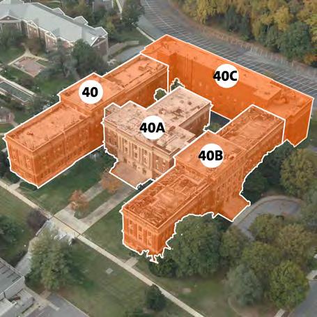

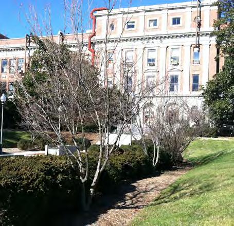
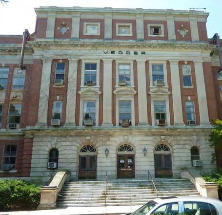
DEPARTMENT OF STATE Foreign Missions Center Master Plan EYP/ 5-14
Figure 5.11: Building 40A Entrance
Figure 5.13: Building 40B Entrance
Figure 5.10: Isometric View of Building 40
Figure 5.12: Building 40 Entrance
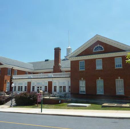


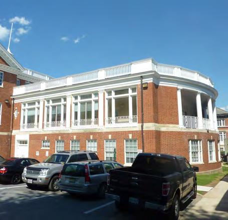
Building 41- Red Cross Building
The first section of Building 41 (facing Dahlia Street) was constructed in 1927; a solarium was added on the south side in 1944. Building 41 was the location for many social and recreational functions for the patients, staff, and visitors at WRAMC, including performances by visiting, popular entertainers. Building 41 is considered a contributing resource to the WRAMC historic district. Building 41 can also be recognized due to its association with the development of the post and as a significant example of the Colonial Revival style which contributes to the overall campus and the historic district.
Character Defining Features
• Brick façade with limestone detailing
• Pitched roofs with projecting cornices
• Main entry on north elevation
• Symmetrical layout of north elevation
Site Character Defining Features
• Maintain massing of Building 41 relative to Buildings 1 and 40
• Restore the open area between Building 1, Building 40 and Building 41. This area was historically a formal garden with planting beds arranged in symmetrical patterns. The elevation shall align with the ground floor of Building 41. The landscape shall be of similar character of a formal garden with planted beds, low shrubs and ornamental trees. Paving within the green space shall not be greater and 10 percent of the total area. Since parking needs to be accommodated on the site, the green space could be the roof of the structured parking.
• Elevations of buildings (new and/or existing) on adjacent lots shall be oriented towards the green space and provide formal elevations in response to the proposed open space.
DEPARTMENT OF STATE Foreign Missions Center Master Plan EYP/ 5-15 DECEMBER 2018
Figure 5.15: Building 41 South Elevation (c. 1928) prior to the solarium addition
Figure 5.17: Building 41 West Elevation of 1944, solarium addition
Figure 5.14: Building 41 Nor th Elevation
Figure 5.16: Building 41 Interior
Building 57- Memorial Chapel
Completed in 1931, Memorial Chapel was constructed with donations raised by the Red Cross’ Gray Lady Corps, a group that provided recreational services at military and veterans’ hospitals. The Chapel is built in the English Country Gothic style which differs greatly from the Georgian Revival and Colonial Revival styles of the rest of the campus. Its original use was as a non-denominational worship space for the WRAMC patients, staff, visitors, and the surrounding neighborhoods. The Chapel was de-consecrated by the Army in 2011 as part of the base closure process. Building 57 is considered a contributing resource to the WRAMC historic district. Building 57 can also be recognized as a significant example of the English Country Gothic Revival style which contributes to the overall campus and the historic district. In addition to the exterior, the main assembly space (nave, choir and alter areas) have retained the architectural character of the Gothic Revival style.
Character Defining Features
• Stone façade with limestone trim
• Traditional massing of an English Country Church with a highpitched roof, buttressed side walls and an articulated tower
• Stained-glass windows dedicated to the Gray Lady Corps
Site Character Defining Features
• Maintain the alignments of Dahlia Street and 14th Street and massing as viewed from the south and east (intersection of Dahlia and 14th Streets)
• Maintain the sloped open space to the south and east of the Chapel as landscaped areas
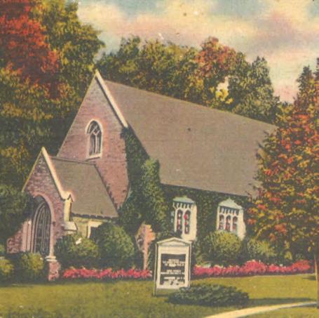

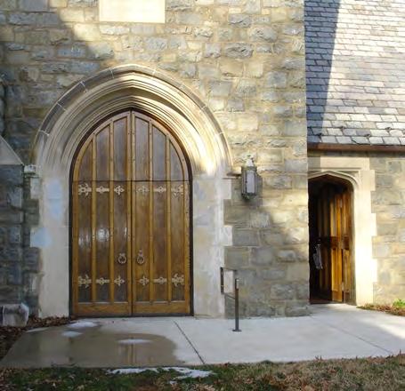

DEPARTMENT OF STATE Foreign Missions Center Master Plan EYP/ 5-16
Figure 5.19: Building 57 Entrance
Figure 5.21: Building 57 Interior
Figure 5.18: Building 57 - Postcard from 1940’s
Figure 5.20: Building 57 - Detail
5.5 GUIDELINES FOR NEW CONSTRUCTION
In the District of Columbia construction projects that involve historic properties or historic districts listed on the DC Inventory of Historic Sites are governed by D.C. Law 2-144 Historic Landmark and Historic District Protection Act of 1978. The following paragraph from the District of Columbia Historic Preservation Guidelines addresses the acceptable approach for the design of new construction in a historic district. More information regarding the design guidelines developed by the DC Historic Preservation Office can be found on their website (http://planning.dc.gov/DC/Planning/ Historic+Preservation).
• New construction in historic districts should follow the same general principles as additions to historic buildings. New buildings in historic districts should be compatible with the character of the district and neighboring buildings without exactly duplicating a historic style or architectural period. Attention should be paid to the new building’s location, particularly its setback and how it aligns with the front facades of neighboring buildings. In addition, attention should be paid to the new building’s height, width, proportions, rhythm of doors and windows, roof shape, ornamentation, projections as well as the landscaping of the property.
Pursuant to 22 U.S.C. § 4306 (g), foreign missions are required to comply substantially with District of Columbia building and related codes in a manner determined by the Secretary to be not inconsistent with the international obligations of the United States.
Architectural Character
New construction shall be visually compatible with the architectural character of the WRAMC historic district. To make new construction visually compatible with the character of the WRAMC historic district, it shall employ compatible materials and colors that are found on the campus. The following consideration shall be made when selecting a palette of exterior building materials.
• Develop an exterior color palette that complements the range of colors predominant on the WRAMC campus;
• Limit the use of the following exterior materials: Reflective metal finishes, and reflective glass. Select building materials that are compatible with the existing buildings within the historic district;
• Refer to District of Columbia Historic Preservation Guidelines for New Construction in Historic Districts for additional considerations.
Development Sites Related to Existing Historic Properties
In addition to Memorial Chapel (Building 57), the Master Plan for the FMC has identified two historic buildings that will be renovated and reused if an appropriate partner can be identified to execute a project. If reuse of these buildings is not viable the redevelopment of these sites will include the following specific design guidelines for new construction. In addition, one historic building will be renovated and used by DOS for the foreign mission community.
Alterations and/or additions should be designed and integrated into the historic fabric with minimal impact to the existing architecture.
All work will be designed and executed in a manner that minimizes damage to or removal of character-defining features or significant fabric of the building, structure, or setting.
All exterior work will be executed in a manner that minimizes damage to significant landscapes or site features adjacent to the building or structure.
DEPARTMENT OF STATE Foreign Missions Center Master Plan EYP/ 5-17 DECEMBER 2018
Building 40- Walter Reed Army Institute of Research (WRAIR)
• The WRAIR was located on the western portion of the campus with a distinct relationship to the original hospital building (Building 1) both aesthetically and in plan. New construction on this site will need to maintain and reinforce that existing relationship.
• The east-west axial relationship between the Hospital and the WRAIR will be retained. The east façade of the new construction on the Building 40 site will respond architecturally and terminate the existing axial arrangement with Building 1/Main Hospital.
• The east end of the WRAIR, consisting of the two laboratory wings and the entrance to the auditorium section creates a forecourt to the WRAIR that mirrors the west end of the Hospital. New construction on the WRAIR site will retain the building edge defined by the west facades of the laboratory wings and will be articulated to retain the idea of a forecourt. The center portion of this façade, the current entrance to the auditorium, will include an architectural element that serves the purpose of anchoring the west end of the formal axis with the hospital building.
• The massing of new construction on the WRAIR site will be simple volumes with low slope roofs.

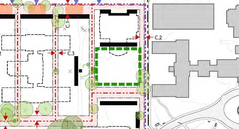
DEPARTMENT OF STATE Foreign Missions Center Master Plan EYP/ 5-18
Figure 5.23: Building 41 Lot Diagram
Figure 5.22: Building 40 East Elevation (c. 1955)
Facade of Bldg 40
Approx. location of flag pole, terminus of axis
steep slope, landscaped
Open landscape south of Bldg 41 Existing

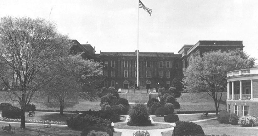
Building 41- Old Red Cross Building
• The Old Red Cross Building was located with a primary formal entrance façade to the north on Dahlia Street. This façade is symmetrical with the entry centered on the façade. New construction on this site will retain a primary entrance facing Dahlia Street. The entrance will be a focal point of an articulated façade that utilizes massing and proportion to develop a street level scale.
• The south face of the Red Cross Building, both in its original construction and after the solarium addition, helped frame a formal landscape that was edged by the Building 1/Main Hospital to the east and the WRAIR/Building 40 to the west. The south façade of new construction on this site shall retain the edge defined by the south façade of the Red Cross Building, either before or after construction of the solarium. The design of this façade will be compatible with the other buildings framing the open area.
• The landscape design for the open area south of the Red Cross Building will reinforce both the east-west axis between the Hospital and the Building 40 site and the north-south axis centered on the Building 41 site. The criteria for the open space shall be the same as the criteria cited if Building 41 was to remain.
DEPARTMENT OF STATE Foreign Missions Center Master Plan EYP/ 5-19 DECEMBER 2018
Figure 5.25: Building 40 East Elevation with Open Space in foreground on the right is the Solarium wing of Building 41 (c . 1948).
Figure 5.24: Aerial view of western portion of WRAMC campus (c. 1955). Building 41 is at the center of image with Building 40 to the left, Building 1 to the right, and Buildings 52, 53, and 54 above.
• The Memorial Chapel is located on the western portion of the campus with a distinct relationship to remnant native forest landscape west of 14th Street aesthetically and in plan. Site improvements and landscape on this site will maintain and reinforce that relationship.
• The open lawn area to the south and east of Memorial Chapel enhance the overall setting of the building and the visual impact of the massing, entrances, and bell tower. Site improvements shall maintain the open areas between 14th and Dahlia Streets and the south and east elevations of the Memorial Chapel.
• The north and west elevations of Memorial Chapel are somewhat concealed by the mature landscape and topography. While site improvements and potential additions may be necessary for the change in use of the building, the concealing features of the landscape and site topography shall be maintained.
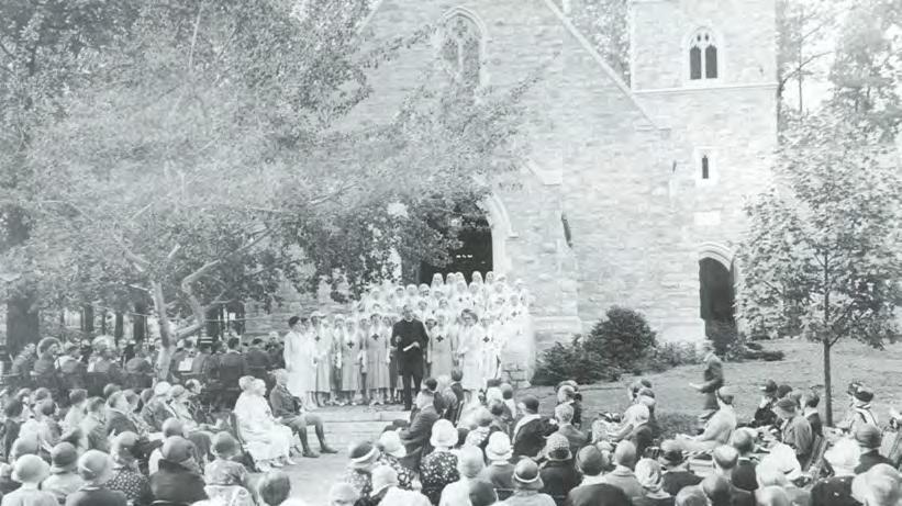

DEPARTMENT OF STATE Foreign Missions Center Master Plan EYP/ 5-20
Figure 5.27: Building 57 Southeast Elevation with Open Space in foreground (c. 1948).
Figure 5.26: Building 57 at its dedication (c. 1938).
Building 57 – Memorial Chapel
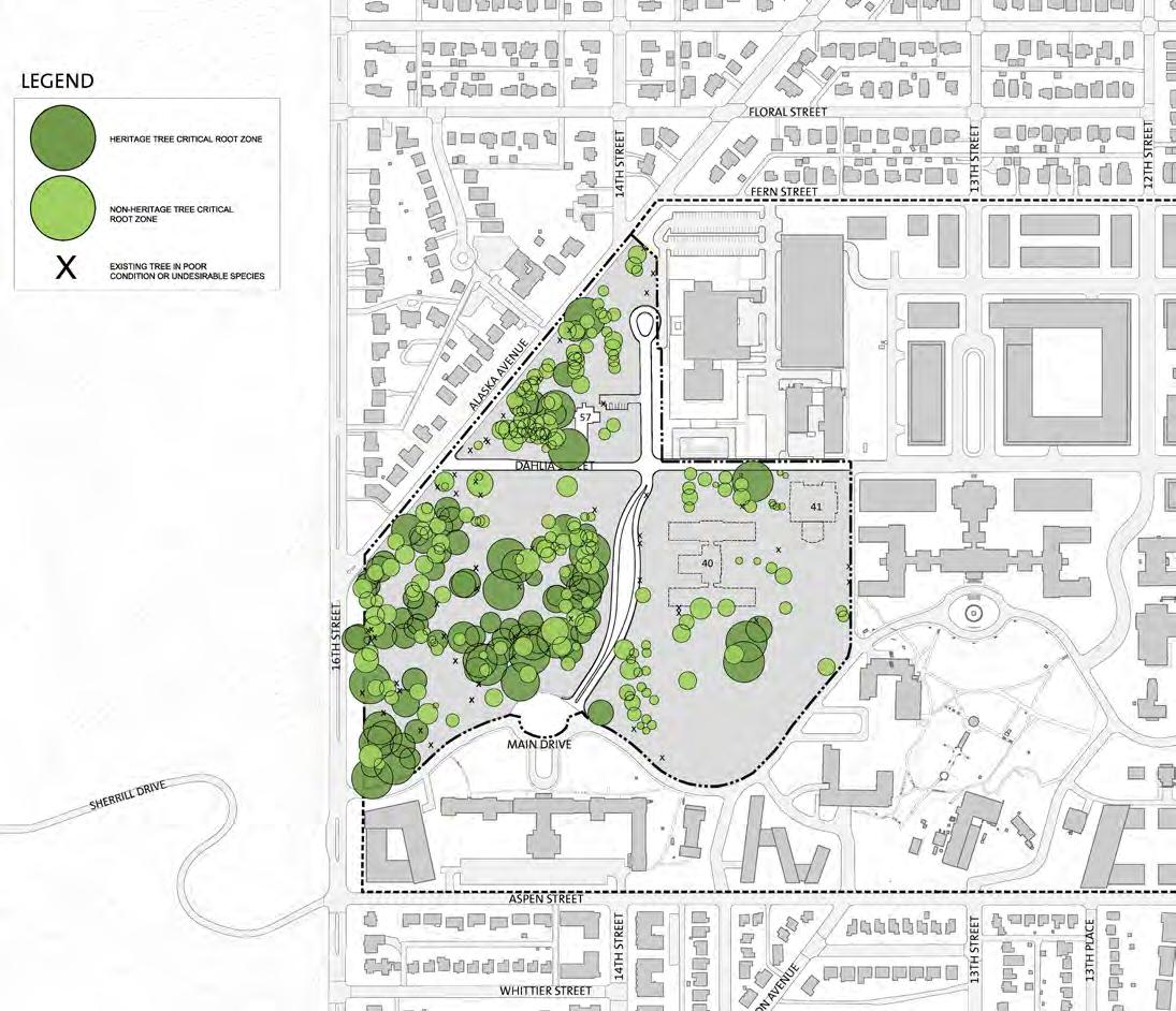
5.6 SITE DEVELOPMENT AND SUSTAINABILITY
In compliance with Federal Executive Orders, DOS has established several goals for its agency Sustainability Plan. The overall focus of these goals is the reduction of greenhouse gas emissions through reduction of energy intensity and use of renewable energy, reduction in potable water usage, and green design. These goals can translate into sustainable building and site development options that DOS shall encourage each foreign mission to explore where technically feasible. In addition, new construction and renovations shall be substantially compliant with local building codes and green building standards that promote sustainability.
The basic goals of sustainable design are to reduce consumption of nonrenewable resources, minimize waste, and create healthy, productive environments. There is additional focus to ensure new and renovated infrastructure maximizes energy efficiency while enhancing opportunities for the use of renewable energy sources. Any work completed to improve energy efficiency in the historic buildings or achieve other sustainability goals will follow the Secretary of the Interior’s Illustrated Guidelines on Sustainability for Rehabilitating Historic Buildings (2011).
Open Space and Landscape
The landscape character for the FMC lots guide foreign missions towards developing a standard for the beautification, maintenance and sustainability with the site. Site landscape character should substantially address recommendations and regulations from the Districts adopted Zoning Amendments (Title 11-Zoning of DC Municipal Regulations). These regulations set clear goals for creative and affective sustainable site development measures. These measures include:
• Pervious Surfaces – Title 11, Subtitle C, Chapter 5: This section establishes minimum pervious area requirements for each lot based on lot size and not zoning designation.
• Surface Parking Lot Landscape – Title 11, Subtitle C, Chapter 7, Section 715: This section of the zoning text sets a minimum area of 10 percent of any surface parking lot to be dedicated to planting.
• Green Area Ratio (GAR) – Title 11, Subtitle C, Chapter 6: This chapter establishes an increase in the quantity and quality of
DEPARTMENT OF STATE Foreign Missions Center Master Plan EYP/ 5-21 DECEMBER 2018
N
Figure 5.28: Foreign Missions Center - Critical Root-zones of Heritage Trees Diagram
environmental performance of the urban landscape. The GAR sets integrated environmental requirements for landscape elements and site design that contribute to the reduction of storm water runoff, the improvement of air quality, and the mitigation of the urban heat island effect.
The site provides valuable landscapes in the District that provide habitats and biodiversity for plant and animal species. Future development should build on this legacy by creating landscapes and ecosystems that are restorative, visually appealing, biologically diverse, and ecologically sound. Opportunities to achieve these goals lie in the integration of green roofs, green infrastructure, landscape plantings, and support of the District’s biodiversity initiatives. The habitat and biodiversity principles seek to create valuable landscapes and ecosystems that are restorative, visually appealing, and enhance community character, while being functional, maintainable, biologically diverse and ecologically sound. Reduce impervious surfaces to mitigate urban heat island effects. The intent of FMC is to include biodiversity and native species in landscape planting design.
Tree Preservation
Site plans shall take into consideration existing Heritage Trees and Special Trees in their respective layouts and provide ample root volume to adequately preserve theses existing trees. These trees will be identified for the foreign missions by DOS. Heritage Trees are defined by DC Municipal Regulations as any tree 100 inches (2540 mm) or greater in circumference, which is equivalent to 31.85 inches (790 mm) in diameter measured at 4.5 feet (1372 mm) above grade. These mature trees and associated dense canopy are mostly found west of 14th Street. Buildings, structures and paved areas should be placed with the existing trees in mind to not only preserve the tree, but obtain the greatest value from the existing canopy and other positive attributes. Heritage Trees and their associated critical root-zone (CR-Z) will be identified by DOS via a certified arborist for each foreign mission’s lot. It is recommended that each site plan take creative measures that work towards the preservation of existing Heritage Trees where possible. Some examples of these creative measures include planning configurations and cantilevered building areas to avoid CR-Z, atriums or courtyards that allow existing trees to live within the built environment, and site planning and cantilevered and/ or platform walkways and driveways to avoid CR-Z. Foreign missions are strongly encouraged to obtain a Heritage Tree Removal Permit through the DC Urban Forestry Administration (UFA).
Any Heritage Tree that will have disturbance within its CRZ should have its own tree protection program devised by a certified arborist per DDOT regulations. This protection program will, in detail, spell out the strategy for pruning/ treating the tree during and after construction. Heritage Trees which are not able to be preserved should require a thorough explanation as to why (i.e. detrimental to a functional layout, failing condition, etc.) provided as part of the design review process.
Special Trees are between 44 inches (1118 mm) and 100 inches (2540 mm) in circumference, which is equivalent to 14.00 inches (355 mm) and 31.85 inches (790 mm) in diameter measured at 4.5 feet (1372 mm) above grade. The removal of Special Trees on private property typically require a permit. Foreign missions are strongly encouraged to obtain a Special Tree Removal Permit through the DC UFA. DCMR Chapter 24-37 for Special Trees provides direction for replacement trees when a Special Tree or Heritage Tree is removed. These regulations stipulate the replacement of a Special Tree or Heritage Tree with a number of saplings on minimal size whose aggregate circumference equal or exceeds the circumference of the tree to be removed. DOS encourages substantial compliance by the foreign missions with these local regulations.
Plant Materials
Foreign missions shall integrate native vegetation into the landscape elements of their parcel. The size of trees, shrubs, and plant beds shall be considered with respect to their scale relationship to the chancery buildings, roads, and open spaces. There shall be a hierarchy of plantings, ranging from large tree and shrub massing along roads and entries, down to small garden scale plantings and floral display beds in courtyards and pedestrian gathering areas.
Plants can also serve to punctuate and reduce the scale of stairs, walls, terraces, and building facades, through the use of hanging, twining, or climbing plants, which can help the buildings and spaces become part of the landscape. Plants shall be used to soften the edges of buildings, paths, and outdoor areas with flowers.
Plants selected for use by foreign missions on the FMC campus shall possess appropriately long-lived characteristics, and have visual traits that offer refined intrinsic beauty to reflect the enduring quality of the campus. The overall design of each foreign mission planting should seek to complement the existing natural and surrounding plantings.
DEPARTMENT OF STATE Foreign Missions Center Master Plan EYP/ 5-22
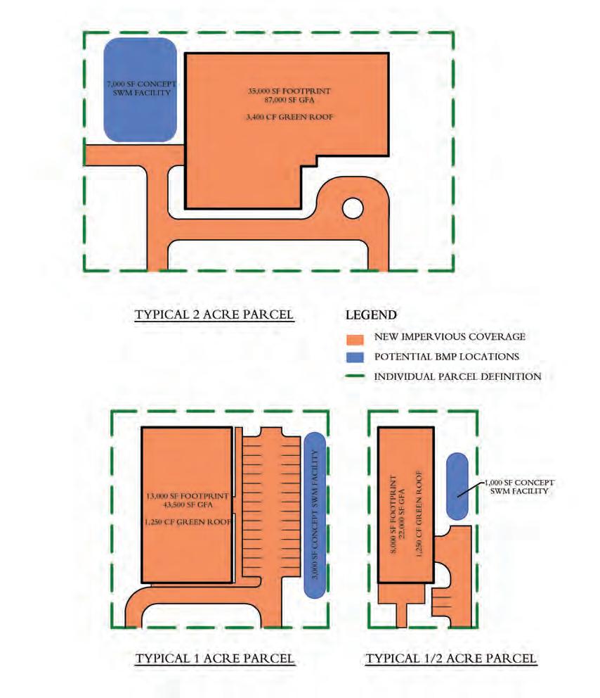
Selection and placement of plant materials shall be made in accordance with lighting and security issues to avoid obscuring views and creating hard to see places.
Storm water Management (SWM)
The site-wide FMC property shall be designed in substantial accordance with District Department of the Environment (DDOE) regulation. DOS will provide a storm water management plan for common areas of the property meeting DDOE requirements, in order to avoid off parcel storm water improvements for individual foreign missions, as well as to meet sustainability stewardship goals and local development requirements. Individual parcel shall provide DDOE compliant storm water management plan for improvements within their parcel, which:
• Reduce storm water run-off through low-impact development principles and techniques that enhance the green and open space of the campus.
• Preserved trees on individual parcels will not be permitted to account for the site-wide infrastructure parcel;
• The existing site at meadow conditions (2-year design) would consist of an average runoff Curve Number (CN) of 72, or 0.9 inches (23 mm) of runoff matching the overall site composite.
• The existing site at pre-project (15-year design) would consist of an average CN of 85, or 3.5 inches (89 mm) of runoff matching the overall site composite.
• The existing site at pre-project (100-year design) would consist of an average CN of 85, or 6.5 inches (165 mm) of runoff matching the overall site composite.
The above criteria shall be used regardless of the exact existing conditions of any individual parcel in order to ensure the campus will always remain in compliance with DDOE guidelines for total site.
Foreign missions are encouraged to incorporate features such as rain gardens into their landscaping to enhance their storm water management strategies.
Foreign missions are encouraged to maximize ground infiltration by increasing open space and using permeable pavement and structural pavement systems that allow for water and oxygen absorption to improve vegetative root growth.
DEPARTMENT OF STATE Foreign Missions Center Master Plan EYP/ 5-23 DECEMBER 2018
Figure 5.29: Foreign Missions Center - Stormwater Management Conceptual Lot Coverages Diagrams
Sustainable Buildings
Energy reduction through targeting at least 30 percent energy performance improvements over current ANSI/ASHRAE/IESNA Standard 90.1. Energy performance improvements can be achieved through several measures including high performance exterior envelopes, selection of heating and cooling systems, improved access to daylight, improved individual control of thermal comfort and lighting, and use of renewable energy sources.
Improve access to daylight and exterior views for occupants through shallow floor plates, increased building perimeter, exterior and interior permanent shading devices, and high performance glazing.
Water Use Efficiency and Management
Building water use can be reduced through the selection of water efficient fixtures and equipment. Alternative on-site sources of water such as rainwater and sink waste water can be used for non-potable applications such as toilet flushing.
Site water use can be reduced through selection of native or regionally adapted plant materials that require little to no irrigation. If irrigation is required,
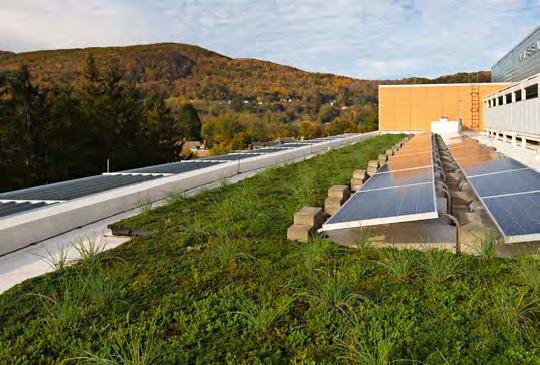
greywater systems could be used to limit or eliminate the use of potable water for irrigation.
Drip irrigation systems and native plantings requiring little moisture should be used to reduce water demands for parks and landscaped areas.
Infrastructure leak-detection technology and accurate metering should be used to reduce overall water consumption.
Pollution Prevention and Waste Reduction
Public transportation such as Metrobus and Metrorail and alternative transportation such as bicycles provide safe means to travel to and from the campus while limiting greenhouse gas emissions and reducing built area needed to accommodate staff parking needs.
Building solid waste (trash) may be reduced through changes in work patterns that limit the use of consumable materials. Provisions for recycling of materials can further reduce solid waste when consumable materials are used.
Renewable Energy
The use of on-site renewable sources such as photovoltaic arrays and windmills should be investigated.
In non-critical areas, lighting should integrate photovoltaics to reduce cabling requirements and promote the use of clean energy.
Other sources of renewable energy may be available through regional and local utility providers.
Materials and Waste Principles
Waste is becoming an increasingly important issue for cities to manage more efficiently. City waste is transported significant distances before being treated or finally disposed. Waste can be categorized into two classifications: construction waste and operational waste (day-to-day life of a city).
The materials and waste operations principles seek to make a substantial contribution to the principle of eliminating the “concept of waste” through good design, emphasizing source reduction, reuse, recycling and composting.
Foreign missions shall create a waste diversion plan to avoid landfills and/ or incineration. Foreign missions are encouraged to utilize green building practices that encourage the efficient use of recycled and recyclable materials. Further, foreign missions are encouraged to use low impact, low embodied energy materials for buildings and infrastructure, as well as products made of wood that are certified as harvested from sustainably managed forests.
DEPARTMENT OF STATE Foreign Missions Center Master Plan EYP/ 5-24
Figure 5.30: Example of Renewable Energy Element
Alternate Transportation
Emissions from vehicles are a significant generator of air pollution in urban locations such as Washington, DC. In addition, vehicular traffic congestion affects the quality of living for both the occupants of the cars and the neighborhoods that they travel through. Utilizing public transportation and alternative means of transportation, such as bicycles, will reduce vehicular trips and have a positive impact on the environment. There will be several Capital BikeShare stations within the former WRAMC including one station at the FMC.
The District has recognized these positive impacts on the city in recent changes to the DC Zoning regulations. Mitigation measures such as providing financial support for employees using public transportation, providing electric vehicle charging stations, and providing bicycle parking and washroom facilities.
Each chancery shall substantially meet the minimum DC Zoning requirements for bicycle parking and shower and changing facilities. Sustainability standards, such as LEED, mandate greater capacity for bicycle storage and support facilities than local regulations.
Short-term Bicycle Parking:
• Minimum 1 space per each 40,000 GSF,
• Locate on chancery lot within 120 feet of a primary entrance,
• Bicycle racks, lighting and paving shall conform to requirements in DC Zoning Regulations.
Long-term Bicycle Parking:
• Minimum 1 space per each 5,000 GSF,
• Locate within chancery building or structured parking,
• Bicycle room, Bicycle racks or locker, and access shall conform to requirements in DC Zoning Regulations,
• Provide changing rooms with showers and lockers to support employees who use alternative means of transportation. Refer to DC Zoning for minimum requirements.

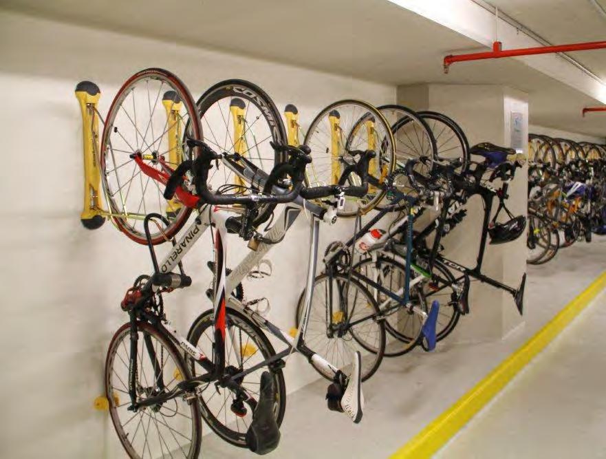
DEPARTMENT OF STATE Foreign Missions Center Master Plan EYP/ 5-25 DECEMBER 2018
Figure 5.32: Interior Bicycle Storage
Figure 5.31: Exterior Bicycle Storage
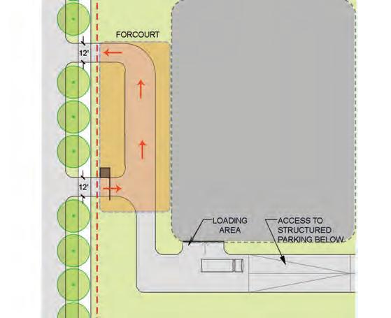


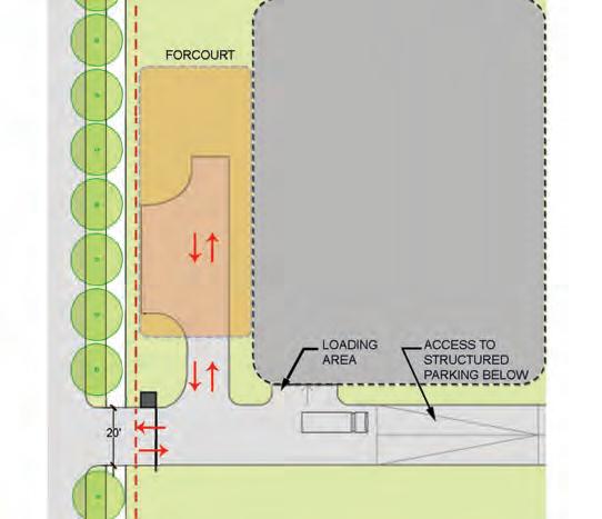
5.7 VEHICULAR ACCESS AND PARKING
Access and employee parking are important elements of the design guidelines. Instead of providing prescriptive requirements for parking, these design guidelines shall allow each foreign mission to address the parking and service access needs via a Transportation Demand Management Plan (TDM). The TDM shall be submitted to DDOT for review and shall be included as part of the project review and approval process.
Access Drive
Each lot shall have at least one (1) but not more than two (2) access drives to the abutting public street on which the lot fronts. Single lane access drives shall not exceed 12 feet (3700 mm) in width at the lot line. Two lane access drives shall not exceed 20 feet (6100 mm) in width at the lot line. All access drives shall meet the elevations of curbs, gutters and roadways. Locate access points requiring a curb cut a sufficient distance (not less than 33 feet (10100 mm)) from any street intersection so as not to disrupt traffic flow.
• Each chancery shall have at least one vehicular entry per lot;
• Two vehicular entries shall be allowed on larger lots;
• Curb cut must have minimum three (3) feet (1000 mm) radius and maximum six (6) feet (2000 mm) radius.
The design of access driveways shall be provided with adequate sight distances and turn-around areas for trucks within the access drive and substantially conform to DC Zoning and DDOT requirements. On-street loading and deliveries shall not be permitted. At least one off-street loading space shall be provided for each lot. Minimize the width of service or garage entrances on street frontages and make use of architectural treatments, such as specialty doors and gates, to mitigate the visual impact. Loading areas and associated turn-around zones shall be separated from employee and visitor vehicles access areas. DC Zoning provides standards for loading berths and service/delivery spaces, including quantity, location, size and layout, screening, and support/ ancillary functions.
The sloped drive to structured parking below the building shall be designed so as to minimize impacts to adjacent lots. Not more than 50 percent of the sloped drive shall be located outside of the building. Where possible, design of access drives shall take advantage of the natural slopes across the FMC campus.
DEPARTMENT OF STATE Foreign Missions Center Master Plan EYP/ 5-26
Figure 5.33C: Lot Access with One Entrance
Figure 5.33A: Lot Access with Two Entrances
Figure 5.33B: Lot Access with Two Entrances
Figure 5.33D: Lot Access with One Entrance
Transportation Impact and Parking Strategies
DOS is committed to providing a sustainable campus with the development of each chancery parcel within the FMC. A Transportation Demand Management (TDM) strategy and plan shall be required of each foreign mission. The implementation of TDM strategies for each parcel shall be dependent on the needs and policies of each foreign mission that develops parcels for chanceries within the FMC.
The goal of the TDM is to encourage chanceries within the FMC to reduce vehicle trips to and from the FMC. Due to the unique needs of each chancery, TDM elements shall be developed with each foreign mission as the chancery sites are designed to best meet the chancery and lot development needs. These individual TDM elements shall require all chanceries to provide a Transportation Management Plan to be reviewed by DDOT during chancery design.
• Each foreign mission shall submit a Transportation Demand Management (TDM) plan as part of the design review and approval process. The TDM plan will be reviewed and commented upon by DDOT;
• Each foreign mission shall meet 100 percent of its parking needs within its lot at time of occupancy and at 10 years after occupancy;
• All staff parking shall be in underground, structured parking (n.b. at Buildings 20 and 56, at grade parking is available if the structures are reused);
• Limited visitor parking (4 to 6 parking spaces) may be provided as surface parking on each chancery lot. Locate surface parking to side or rear of building and screen from street;
• Public and alternative transportation elements are available to each foreign mission to offset staff, visitor, and event parking needs. The public transportation elements include Metrobus and Metrorail. The alternative transportation elements pedestrian, bicycle, and carpooling. TDM planning shall strongly consider the utilization of public and alternative transportation elements for chancery staff to offset on-site parking needs. DC Zoning
provides standards for minimum long term and short term bicycle parking and associated shower and locker facilities;
• TDM studies shall also include regularly scheduled deliveries (i.e. office supplies, special package deliveries, postal service, and event catering) and waste removal;
• If it is anticipated that the chancery may be used for the occasional, special event, TDM studies shall include recommendations for event parking strategies.
DEPARTMENT OF STATE Foreign Missions Center Master Plan EYP/ 5-27 DECEMBER 2018
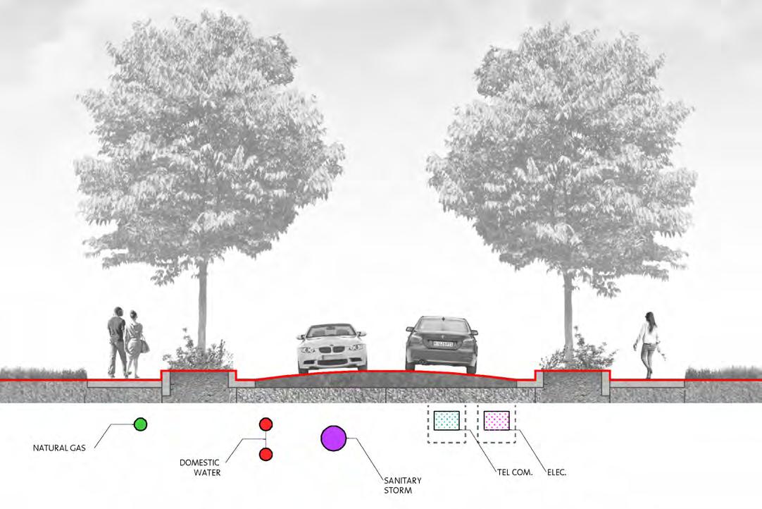
5.8 UTILITIES
DOS will be developing the site infrastructure as well as stub-out connections to a point beyond the road network to individual parcels, in order to assure availability to those parcels at the time of development without disruption or damage to site-wide infrastructure.
The following services shall be available at each parcel:
• Water Supply (potable and fire protection) – DC Water and Sewer Authority
• Natural Gas – Washington Gas
• Electrical Power – PEPCO (Exelon) or local micro-grid
• Telecommunications – Verizon et al.
• Sanitary Sewer – DC Water and Sewer Authority (DC Water)
• Storm Drainage Network – DC Department of Energy and Environment (DCDOE)
Each foreign mission shall be responsible for providing adequate information to DOS satisfying the guidelines and recommendations for all utility systems, including permit plans, capacity and demand calculations, and outfall locations so that DOS may determine the feasibility of each with regard to system and stub out capacity. Final connection and permitting requirements for utility vendors for individual parcels is the responsibility of the foreign mission.
DEPARTMENT OF STATE Foreign Missions Center Master Plan EYP/ 5-28
Figure 5.34: Foreign Missions Center - Typical Street Section Indicating Approximate Locations of in Street Utilities
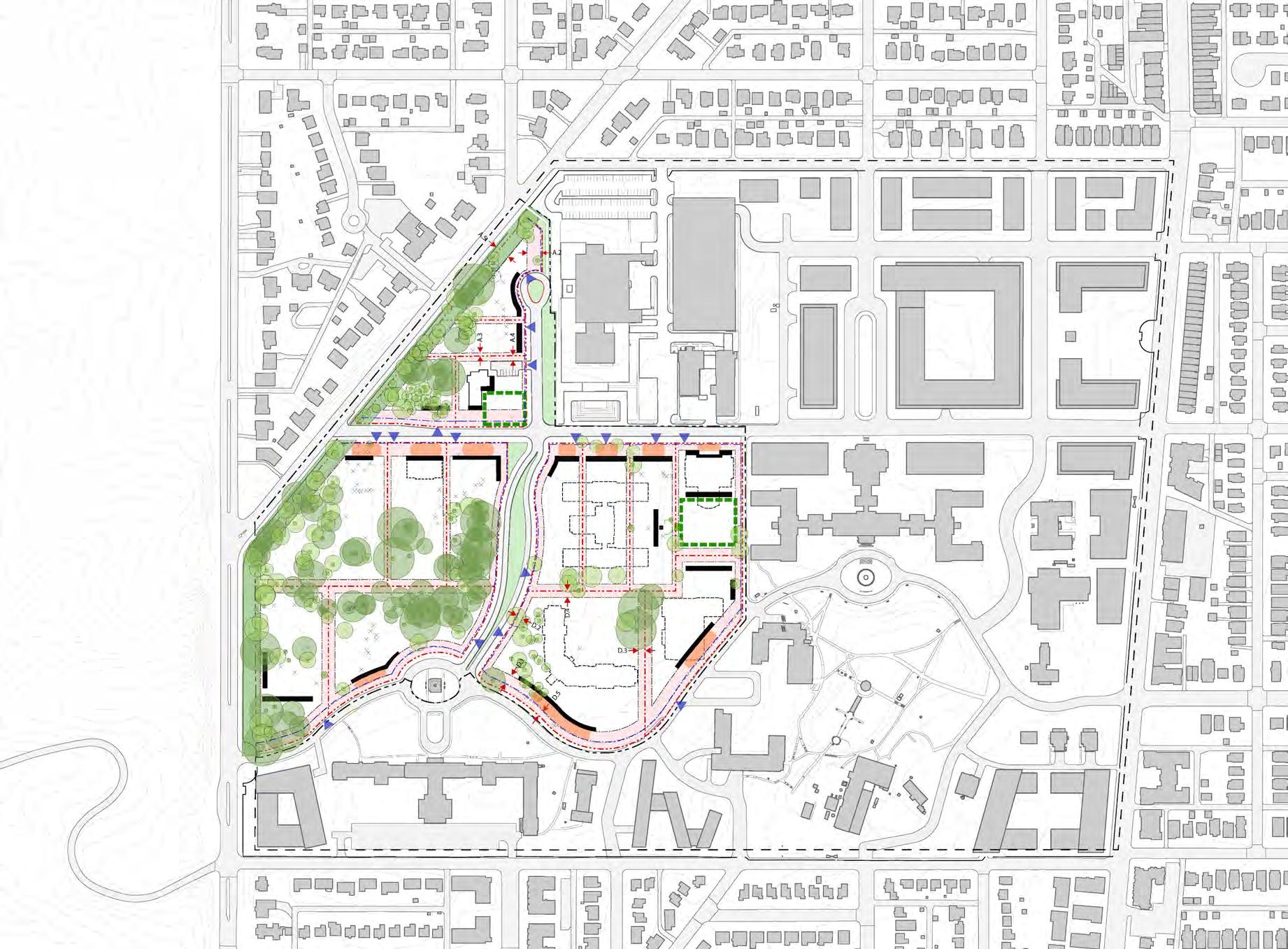
DEPARTMENT OF STATE Foreign Missions Center Master Plan EYP/ 5-29 DECEMBER 2018 LEGEND FMC Property Line Parcel Line Setback Primary Facade Vehicular Entrance Open Space at Lots Heritage and Special Trees Steep Slope Fence Line Forecourt Zone
Figure 5.35: Foreign Missions Center - Lot Development
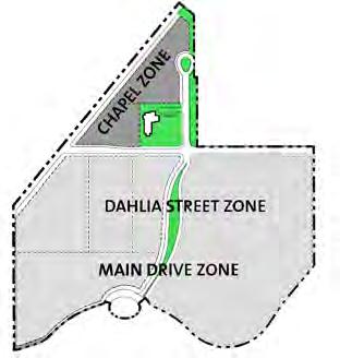
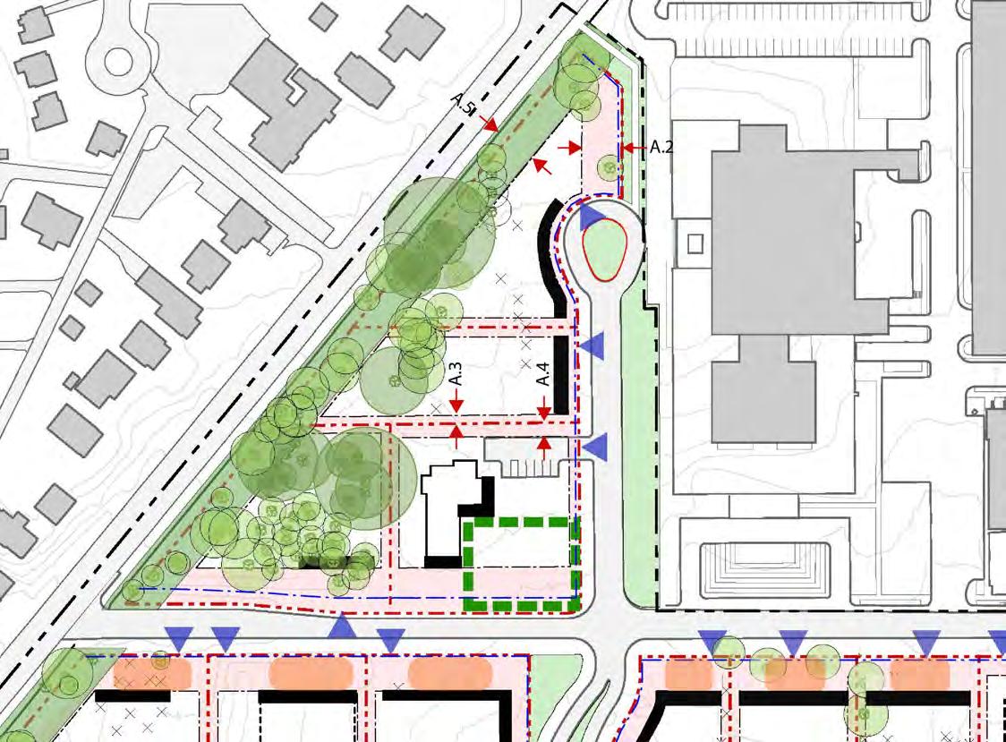

CHAPEL ZONE
Building Height
Principal Building 40 feet max. (3 stories)
Annex Building 30 feet max. (2 stories)
Lot Occupation
Building Coverage 25% max.
Lot Coverage 35% max.
Setbacks
Front Setback (primary frontage) 10 feet, min.
Sideyard Setback (at 14th Street alignment)) 50 feet, min.
Sideyard Setback 10 feet, min.
Rearyard Setback 15 feet, min.
Alaska Ave Buffer 50 feet from existing fence
Fences * 0, 15 feet
Lot Character & Improvements
• Tree preservation critical• Buildings f ace internal streets
• Maintain buffer at Alaska
• Preserve presence of Chapel
Parking Provisions
Staff Parking Provide TDM Plan
Visitor/Surface Parking4 to 6 spaces
Loading 1 max.
*Fences at all side & rear site boundaries not abutting street to be on property line.
DEPARTMENT OF STATE Foreign Missions Center Master Plan EYP/ 5-30
A.1 A.2 A.3 A.4 A.5
Figure 5.36: Foreign Missions Center - Chapel Zone Setbacks Diagram
FMC Property Line Parcel Line Setback Primary Facade Vehicular Entrance Open Space at Lots Heritage and Special Trees Steep Slope Fence Line Forecourt Zone
LEGEND
2
Lot 1 Lot
N Scale
Lot
3 Chapel
(W)(E)
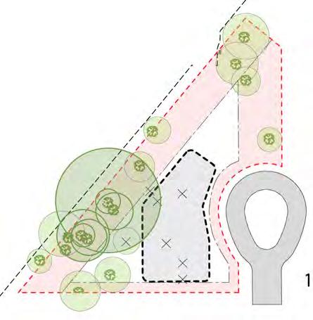
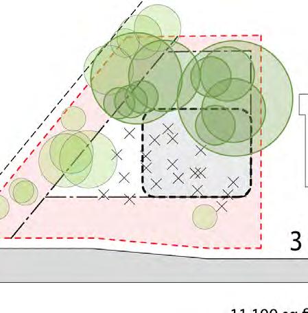

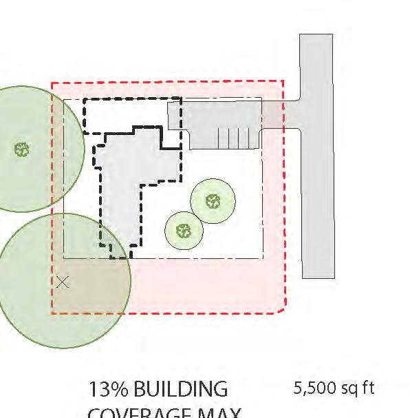
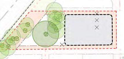
DEPARTMENT OF STATE Foreign Missions Center Master Plan EYP/ 5-31 DECEMBER 2018
Figure 37A: Lot 1 development options
1 building - 25% building coverage
Figure 37B: Lot 1 development options
2 buildings - 25% building coverage
Figure 37c: Lot 2 development options 25% building coverage
Figure 37D: Lot 3 development options 25% building coverage
Figure 37E: Chapel development options 13% existing building coverage
N
Figure 5.37: Foreign Missions Center - Chapel Zone Lot Diagrams
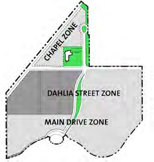
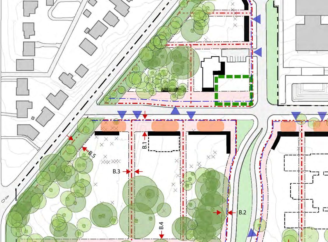

DAHLIA STREET ZONE (west of 14th Street)
Building Height
Principal Building 48 feet max. (4 stories)
32 feet, min. (2 stories)
Annex Building 30 feet max. (2 stories)
Lot Occupation
Building Coverage See plan
Lot Coverage 10% more, see plan
Setbacks
B.1 B.2 B.3 B.4 B.5
Front Setback (primary frontage) 40 feet, min.
Front Setback (secondary frontage) 20 feet, min.
Sideyard Setback 10 feet, min.
Rearyard Setback 20 feet, min.
Alaska Ave Buffer 50 feet from existing fence
Fences * 0,15 feet
Lot Character & Improvements
• Tree preservation critical• Buildings f ace internal streets
• Maintain buffer at Alaska
• Preserve presence of Chapel
Parking Provisions
Staff Parking Provide TDM Plan
Visitor/Surface Parking4 to 6 spaces
Loading 1 max.
*Fences at all side & rear site boundaries not abutting street to be on property line.
DEPARTMENT OF STATE Foreign Missions Center Master Plan EYP/ 5-32
Figure 5.38: Foreign Missions Center -Dahlia Street (west) Zone Setbacks Diagram
Lot 7 Lot 6 Lot 5
Bldg = 15% max. 2 Bldgs = 20% max.
Bldg = 25% max. 2 Bldgs = 25% max.
Bldg = 30% max. 2 Bldgs = 30% max.
FMC Property Line Parcel Line Setback Primary Facade Vehicular Entrance Open Space at Lots Heritage and Special Trees Steep Slope Fence Line Forecourt Zone
N Scale
1
1
1
LEGEND
(W)(E)


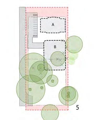
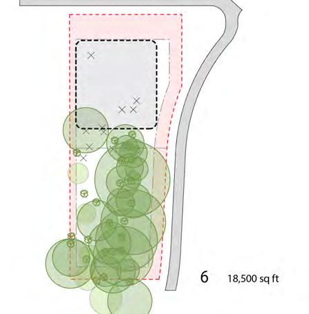
DEPARTMENT OF STATE Foreign Missions Center Master Plan EYP/ 5-33 DECEMBER 2018
Figure 39A: Lot 5 development options 1 building - 15% building coverage
Figure 39B: Lot 5 development options 2 buildings - 20% building coverage
Figure 39C: Lot 6 development options 2 buildings - 25% building coverage
Figure 39D: Lot 6 development options 1 building - 25% building coverage
Figure 39E: Lot 7 development options 1 building - 25% building coverage
N
Figure 5.39: Foreign Missions Center -Dahlia Street (west) Zone Lot Diagrams
(W)(E)

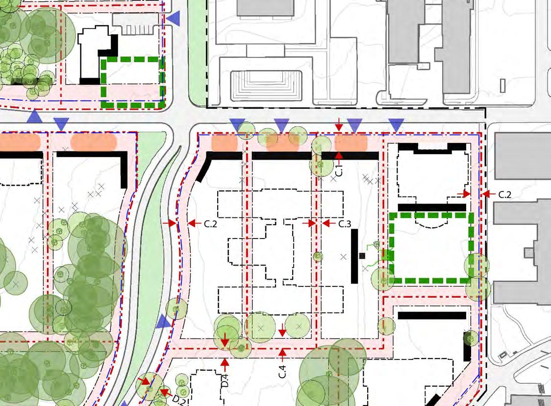

DAHLIA STREET ZONE (east of 14th Street)
Building Height
Principal Building 48 feet max. (4 stories)
32 feet, min. (2 stories)
Annex Building 30 feet max. (2 stories)
Lot Occupation
Building Coverage 30% max. for 1 building 40% max. for 2 buildings
Lot Coverage 40% max for 1 building 50% max. for 2 buildings.
Setbacks
Front Setback (primary frontage) 40 feet, min. (except 15 feet min. @ corner of Dahlia and 14th Streets)
Front Setback (secondary frontage) 20 feet, min.
Sideyard Setback 10 feet, min.
Rearyard Setback 20 feet, min.
Fence * 0, 15 feet
Lot Character & Improvements
• Create new open space south of Building 41
• Preserve axial relationship between Bldg 1 & Bldg 40
Parking Provisions
• Buildings f ace internal streets
Staff Parking Provide TDM Plan
Visitor/Surface Parking4 to 6 spaces
Loading 1 max.
*Fences at all side & rear site boundaries not abutting street to be on property line
**Fence along 14th Street (south of Dahlia St) may be 9 feet in height when set back 5 feet from property line.
LEGEND
DEPARTMENT OF STATE Foreign Missions Center Master Plan EYP/ 5-34
Figure 5.40: Foreign Missions Center - Dahlia Street (east) Zone Setbacks Diagram
C.1 C.2 C.3 C.4 Lot 10 Lot 11 Lot 9 Lot 8
FMC Property Line Parcel Line Setback Primary Facade Vehicular Entrance Open Space at Lots Heritage and Special Trees Steep Slope Fence Line Forecourt Zone
N Scale

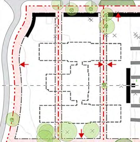

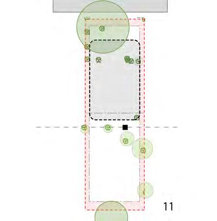


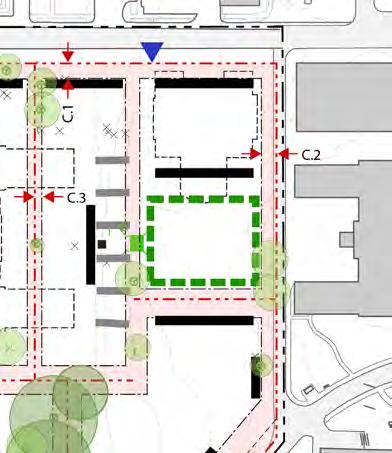

DEPARTMENT OF STATE Foreign Missions Center Master Plan EYP/ 5-35 DECEMBER 2018
Figure 41A: Lot 8a development options
Existing Building 40 (20% building coverage)
Figure 41B: Lot 8 development options 1 building - 30% building coverage
Figure 41C: Lot 8 development options 2 buildings - 40% building coverage
Figure 41D: Lot 10 development options 1 building - 30% building coverage
Figure 41E: Lot 10 development options 2 buildings - 40% building coverage
Figure 41F: Lot 11 development options
Existing Building 41 (30% building coverage)
N
Figure 5.41: Foreign Missions Center - Dahlia Street (east) Zone Lot Diagrams
(W)(E)
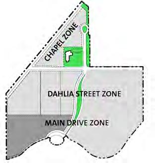
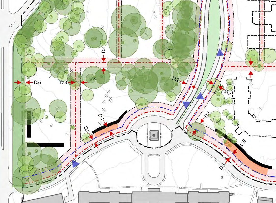

MAIN DRIVE ZONE (west of 14th Street)
Building Height
Principal Building 56 feet max. (4 stories) 40 feet, min. (3 stories)
Annex Building 30 feet max. (2 stories)
Lot Occupation
Building Coverage See plan
Lot Coverage 10% more, see plan
Setbacks
Front Setback (primary frontage) 25 feet, min.
Front Setback (secondary frontage) 20 feet, min.
Sideyard Setback 20 feet, min.
Rearyard Setback 20 feet, min.
DOS Easement 15 feet
16th Street Buffer 10 feet from property line
Fences ** 0, 15 feet
Lot Character & Improvements
• Tree preservation critical• Buildings f ace Main Drive
• Maintain buffer at 16th St• Buildings on Lot 7 to have secondary face at 16th St
• Preserve presence of ellipse
Parking Provisions
Staff Parking Provide TDM Plan
Visitor/Surface Parking6 to 10 spaces
Loading 2 max.
*Fences at all side & rear site boundaries not abutting street to be on property line.
**Fence along 14th Street (south of Dahlia St) may be 9 feet in height when set back 5 feet from property line.
DEPARTMENT OF STATE Foreign Missions Center Master Plan EYP/ 5-36
D.1 D.2 D.3 D.4 D.5 D.6
Figure 5.42: Foreign Missions Center - Main Drive (west) Zone Setbacks Diagram
Lot 13
Lot 12
1 Bldg = 15% max. 2 Bldgs = 20% max.
1 Bldg = 15% max.
Property Line
Line Setback
Facade
Entrance Open Space at Lots Heritage and Special Trees Steep Slope Fence Line
Zone
LEGEND FMC
Parcel
Primary
Vehicular
Forecourt
N Scale
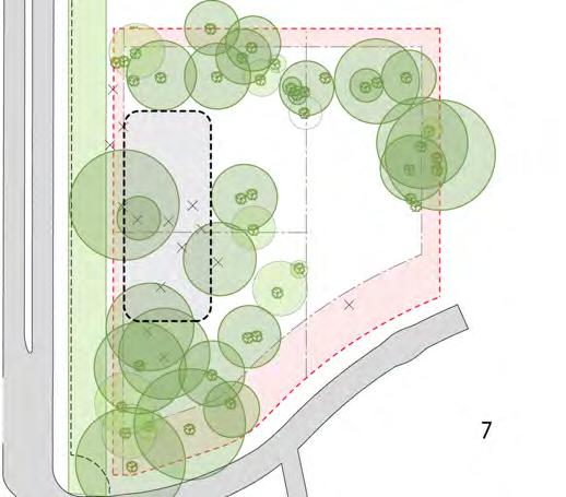

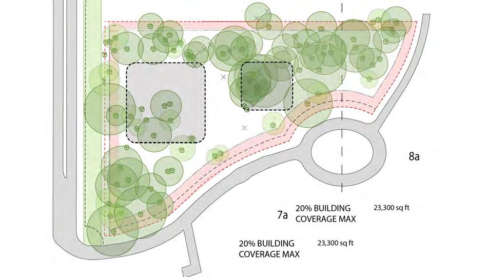
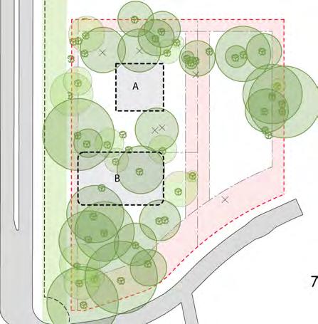
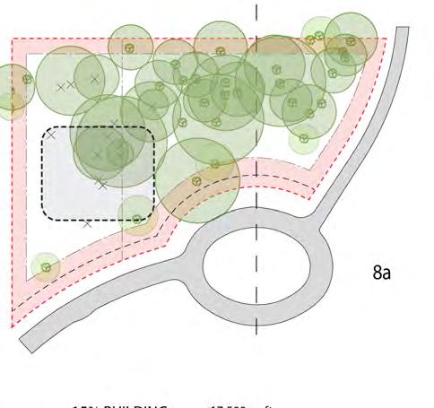
DEPARTMENT OF STATE Foreign Missions Center Master Plan EYP/ 5-37 DECEMBER 2018
Figure 43A: Lot 12 development options 1 building - 15% building coverage
Figure 43B: Lot 12 development options 2 buildings - 20% building coverage
Figure 43C: Lot 12 alternate development options 2 buildings - 20% building coverage
Figure 43D: Lot 13 development options 15% building coverage
Figure 43E: Lot 13 alternate development options 15% building coverage
N
Figure 5.43: Foreign Missions Center - Main Drive (west) Zone Lot Diagrams
(W)(E)

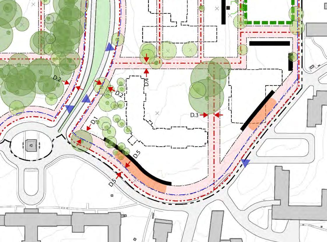
Lot 15
MAIN DRIVE ZONE (east of 14th Street)
Building Height
Principal Building 56 feet max. (4 stories) 40 feet, min. (3 stories)
Annex Building 32 feet max. (2 stories)
Lot Occupation
Building Coverage See plan
Lot Coverage 10% more, see plan
Setbacks
Front Setback (primary frontage) 25 feet, min.
Front Setback (secondary frontage) 20 feet, min.
Sideyard Setback 20 feet, min.
Rearyard Setback 20 feet, min.
DOS Easement 15 feet
Fences ** 0, 15 feet
Lot Character & Improvements
• Create new open space south of Building 41
• Preserve axial relationship between Bldg 1 & Bldg 40
Parking Provisions
• Buildings f ace Main Drive
• Open lawn in setback from Main Drive
Staff Parking Provide TDM Plan
Visitor/Surface Parking6 to 10 spaces
Loading 2 max.
*Fences at all side & rear site boundaries not abutting street to be on property line.
**Fence along 14th Street (south of Dahlia St) may be 9 feet in height when set back 5 feet from property line.
LEGEND

FMC
DEPARTMENT OF STATE Foreign Missions Center Master Plan EYP/ 5-38
D.1 D.2 D.3 D.4 D.5
Figure 5.44: Foreign Missions Center - Main Drive (east) Zone Setbacks Diagram
26%) 20% max. (existing 15%)
Lot 14 30% max. (existing
Property Line
Line Setback
Facade
Entrance Open Space at Lots
and Special Trees
Slope
Line
Zone
Parcel
Primary
Vehicular
Heritage
Steep
Fence
Forecourt
N Scale
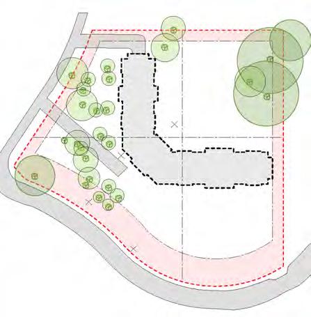

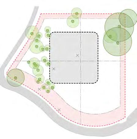

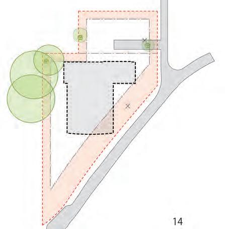
DEPARTMENT OF STATE Foreign Missions Center Master Plan EYP/ 5-39 DECEMBER 2018
Figure 45A: Lot 14 development options
Existing Building 20 (15% building coverage)
Figure 45B: Lot 14 development option 20% building coverage
Figure 45C: Lot 15 development options 30% building coverage
Figure 45D: Lot 15 development options 30% building coverage
Figure 45E: Lot 15 development options
Existing Building 32 (26% building coverage)
N
Figure 5.45: Foreign Missions Center - Main Drive (east) Zone Setbacks Diagram
This Page is Intentionally Left Blank
DEPARTMENT OF STATE Foreign Missions Center Master Plan EYP/ 5-40

U S DEPARTMENT OF STATE Foreign Missions Center Master Plan EYP/ 6-1 DECEMBER 2018
/ SECTION 6 ACKNOWLEDGEMENTS
This Page is Intentionally Left Blank
U S DEPARTMENT OF STATE Foreign Missions Center Master Plan EYP/ 6-2
Acknowledgements / 6

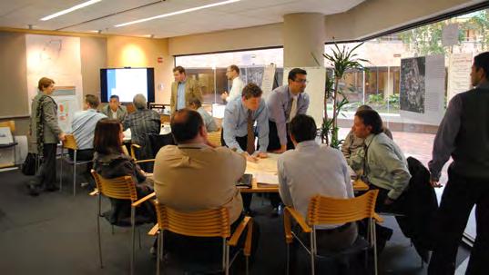
U.S. DEPARTMENT OF STATE
Bureaus and Offices
Office of the Under Secretary for Management
Office of Foreign Missions
Rightsizing, Policy, and Innovation
Bureau of Administration
Office of Operations
Real Property Management
Facilities Management Services
Bureau of Diplomatic Security
Diplomatic Security, Domestic Facilities Protection
Other Federal Agencies and Bureaus
U.S. Secret Service, Foreign Missions Branch
U S DEPARTMENT OF STATE Foreign Missions Center Master Plan EYP/ 6-3 DECEMBER 2018
Figure 6.1: Planning Charrette Workshop
MASTER PLANNING
Department of State Consultant Team
EYP Architecture & Engineering, Inc. Planning/Architecture/Preservation
AST Cowen Design Group, LLC Civil Engineering
Carvalho Good, PLLC Landscape Architecture
CHA Geotechnical Engineering
Gannett Fleming Environmental Engineering
Gorove Slade Associates, Inc. Traffic and Transportation Planning
Jones Lang LaSalle Americas, Inc. Market and Real Estate Advisor
Morris Wade Associates, Inc. Cost Management and Estimating
Public Engagement Associates Public Outreach
Master Plan - Consulting Agencies
The U.S. Commission of Fine Arts
The National Capital Planning Commission
The Advisory Council of Historic Preservation
District of Columbia, Office of Deputy Mayor for Planning and Economic Development
District of Columbia, District Department of Transportation
District of Columbia, Office of Planning – Historic Preservation Office
District of Columbia, Walter Reed Local Redevelopment Authority
ADDITIONAL PLANNING COORDINATION
NHPA, Section 106 – Consulting Parties
District of Columbia Office of Planning- Historic Preservation Office
The Advisory Council of Historic Preservation
The National Capital Planning Commission
The Committee of 100 on the Federal City
Alliance to Preserve the Civil War Defenses of Washington
National Park Service – Rock Creek Park
Walter Reed Society
NEPA, EIS – Stakeholders
Federal Agencies
U.S. Environmental Protection Agency, Region 3
Federal Highway Administration, District of Columbia Division
U.S. Army Corps of Engineers, Baltimore District
National Park Service, National Capital Region
U.S. Fish and Wildlife Service
The U.S. Commission of Fine Arts
District of Columbia Agencies
Office of Deputy Mayor for Planning and Economic Development
District Department of Transportation
Office of Planning
Office of Planning – Historic Preservation Office
Executive Office of the Mayor
District of Columbia Council
District of Columbia Water and Sewer Authority
District Department of Environment
District Department of Parks and Recreation
District Office of Zoning
Advisory Neighborhood Commission 4A
Advisory Neighborhood Commission 4B
Regional Agencies
Metro Washington Council of Government
The National Capital Planning Commission
Washington Metropolitan Area Transit Authority
U S DEPARTMENT OF STATE Foreign Missions Center Master Plan EYP/ 6-4


