An association of Davis Brody Bond and The Freelon Group Architects Lord Cultural Resources and Amaze Design
Smithsonian Institution
National Museum of African American History and Culture
VOLUME III
Existing Site Conditions
Geotechnical Analysis
Vehicular and Pedestrian Traffic Site Analysis
SUBMITTED BY: FREELON BOND
January 30, 2009
Pre-Design: Master Facilities Programming
Smithsonian Institution
National Museum of African American History and Culture
VOLUME I
A Preamble
B Introduction and Executive Summary
C Pre-design and Programming
VOLUME II
A Visitation Estimate
B Audience Research
C Public Engagement
D Collections Storage Plan
E General Museum Requirements
F Exhibition Master Plan
VOLUME III
A Existing Site Conditions
B Geotechnical Analysis
C Vehicular and Pedestrian Traffic
D Site Analysis
VOLUME IV
A Facility Program
B Engineering Systems
C Sustainable Design
D Accessibility
E Security
F Cost Estimates
VOLUME V
Room Data Sheets
VOLUME
A
VI Appendix
Volume III Contents
A Existing Site Conditions
01 Existing Site Conditions Summary 02 Site Location 03 Site History
Urban Design Context
Architectural Context
Site Plan
Site Utilities
Site Access
B Geotechnical Analysis 01 Introduction
Site Geology
Recommendations
C Vehicular and Pedestrian Traffic
Introduction
Existing Conditions
Projected Conditions
Key Findings
D Site Analysis 01 Site Planning Criteria
Landscape Program Requirements
05
07
04
06
08
02
03
01
02
03
04
02
A Existing Site Conditions
Smithsonian Institution National Museum of African American History and Culture 8
Existing Site Conditions Summary
The purpose of the Existing Site Conditions Report is to describe the National Museum of African American History and Culture (NMAAHC) site and its context. The report includes regional and vicinity maps illustrating the site location in relationship to major transportation facilities, natural features, and prominent landmarks. The Site History includes an overview of urban planning and African American history in the District of Columbia. The context of the site is described in two sections, the Urban Design Context and, the Architectural Context. The Urban Design Context contains information regarding land use, zoning and neighboring historic districts. The Architectural Context includes descriptions of adjacent facilities. A description of the site is presented through a series of site diagrams illustrating topography, landscape, and the placement of utilities. A second series of diagrams presents site issues related to access including parking, public transportation, pedestrian circulation, vehicular and service access.
9 Existing Site Conditions | FREELON BOND
01

Smithsonian Institution National Museum of African American History and Culture 10 95 49 6 s b POTOMACRIVER Tidal Basin s G G E S G 50 Capitol White House Jefferson Memorial Lincoln Memorial Washington Monument 1 1-50 395 395 295 NMAAHC Site National Mall Principal Landmark The Mall West Potomac Park East Potomac Park President’s Park South NMAH DOC N 01/2Mile 1/81/4Mile Mile
Vicinity Map
Aerial View of the NMAAHC Site
Site Location
The National Museum of African American History and Culture (NMAAHC) site, a 5.0-acre parcel is part of the Washington Monument Grounds. The site is bounded by Constitution Avenue on the north, Madison Drive on the south, 14th Street on the east and 15th Street on the west. The immediate site context includes the White House, the Washington Monument, the National Mall, the National Museum of American History (NMAH), and the Department of Commerce Building. The NMAAHC site is an open public space with no permanent structures. Walkways are provided at all four sides and across the center of the site. The topography slopes gently, declining from a highpoint at the southwest corner to the northern edge. The lower grade edge fronts on Constitution Avenue which was once a canal, and earlier the course of the Tiber Creek.
The Regional Map illustrates the Washington, DC, region and its major transportation arteries. The NMAAHC site is located in the northwest quadrant of Washington, DC, at the intersection of Route 50 and Route 1. The Vicinity Map shows the NMAAHC site in relationship to I-395, Route 1, Route 50, the National Mall and its principal landmarks. The National Mall is defined as the area of West Potomac Park, the Washington Monument Grounds, and the Mall. The National Mall is the most significant public space in our nation, indeed, it is widely referred to as America’s “front yard.” It is significant, not only for the structures and memorials located within it, but because of the democratic ideal it represents. The National Mall provides a vast public space for recreation, social, and civic gatherings.
The National Mall is intersected by two axes defining the Monumental Core of Washington, and its principal landmarks. A north-south axis extends from the White House to the Jefferson Memorial, and an eastwest axis extends from the Capitol to the Lincoln Memorial. The Washington Monument is located at the intersection of the cross axes. The NMAAHC site is located at the northeast corner of the Washington Monument Grounds. It is fitting for the NMAAHC site to be located at the center of America’s symbolic landscape to reinforce the centrality of the African American experience to American history.
11 Existing Site Conditions | FREELON BOND
District of Columbia Maryland Virginia FairfaxArlingtonCo. Co. PrinceGeorgesCo. Prince MontgomeryGeorgesCo. Co. NW NE SE NMAAHC Site N 95 Baltimore-Washington International Ronald Reagan National 1 1 395 295 295 50 50 495 395 95 Dulles International 495 495 I66 50 270 495 295 295 495 Regional Map 02

Territory of Columbia [Ellicott, 1793] Map is oriented with North at the upper right hand corner

Key Map
Smithsonian Institution National Museum of African American History and Culture 12
Site History
The site of the Nation’s Capital was established in 1791 at the confluence of two rivers - the Potomac and Eastern Branch or Anacostia. The county of Washington was established as a 100-square mile diamond, illustrated by the Territory of Columbia map, including the existing villages of Georgetown and Alexandria. The area west of the Potomac River was returned to Virginia in 1846. The city of Washington was defined by the fork of the two rivers, and a high ridge providing expansive views of the landscape. The Tiber Creek ran through the low land area that would become the monumental core of the city.
13 Existing Site Conditions | FREELON BOND
03
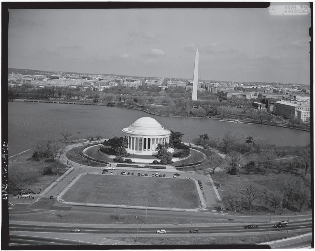
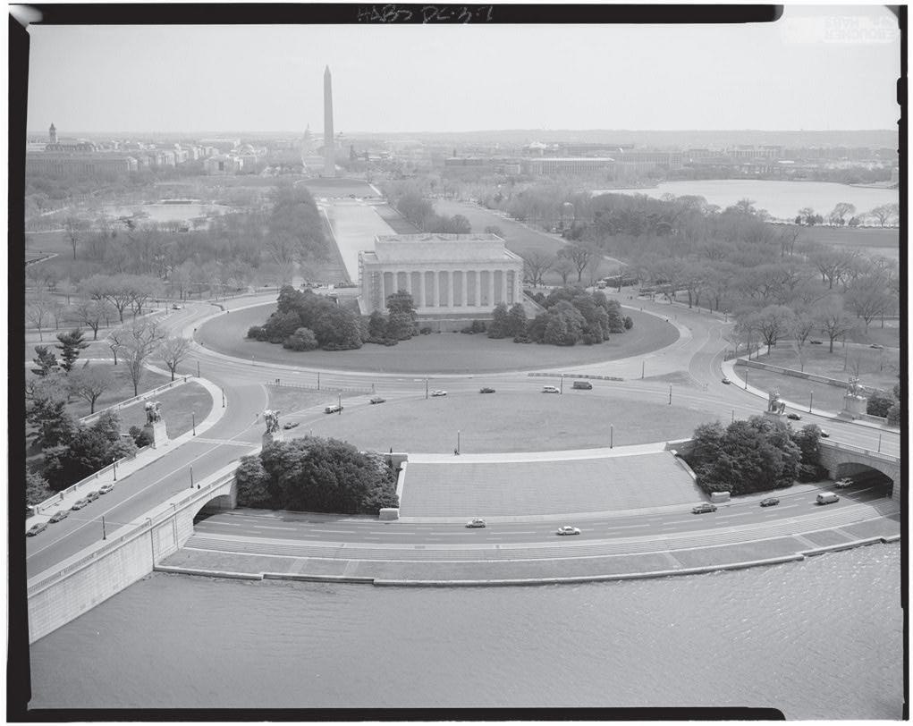
White House Axis (Boucher, 1992b) Capitol Axis (Boucher, 1992a)
L’Enfant Plan - 1791
Pierre L’Enfant, a French émigré who served as major of engineers in the American Revolutionary Army, developed the first city plan for Washington in 1791. L’Enfant was later dismissed from his position as city planner following disputes concerning the city’s development. The city plan was completed, with minor revisions, by Andrew Ellicott and Benjamin Banneker. Ellicott and Banneker had conducted the original survey of Washington. Banneker was a free African American, publisher and self-taught astronomer from Baltimore County, MD.
The L’Enfant plan is celebrated as a comprehensive baroque city plan, characterized by an orthogonal grid with intersecting diagonal avenues placed to create reciprocal vistas between monumental sites. The avenues radiate from two sites, the Congress House and President’s House, now known as the Capitol and the White House. The Congress House was sited on Jenkins Hill, now referred to as Capitol Hill. The site of the President’s House overlooked the mouth of the Tiber Creek and the Potomac River beyond. The organizing axes of the Monumental Core also originate from these sites. The first axis extends west from the centerline of the Congress House. The Congress, or Capitol, axis was intended to be a grand avenue punctuated by an equestrian statue of George Washington. The second axis extends south from the centerline of the President’s House. The President’s, or White House, axis was a vista from the President’s House to the Washington Memorial. The President’s House and the Congress Building were also linked with a ceremonial path, Pennsylvania Avenue.
A feature of the L’Enfant plan is an inland canal incorporating the Tiber and James Creeks. The canal was envisioned to parallel the grand avenue and create a ‘grand cascade’ in front of the Capitol as the Tiber Creek filled the canal. The western entry point of the canal is shown at the current location of 17th Street, where the Tiber Creek met the Potomac River. The canal continued eastward along the present course of Constitution Avenue to the Capitol. From the Capitol, the canal continued southward and was divided in two branches. The eastern branch discharged at the current location of the Washington Navy Yard. The western branch, also known as the James Creek Branch, was constructed in the 1870’s near the present location of Fort McNair.
The Washington City Canal became operational in 1815. The portion at the northern edge of the NMAAHC site, now Constitution Avenue, was completed in1822. The construction of the canal and towpath obliterated the landscape on the north side of the canal. The south side, however, remained open and undeveloped. At this time, the area of the Washington Monument Grounds was marshy lowland used for cattle grazing.
The purpose of the canal was to bring goods into the core of the city and connect the ports along the Potomac and Anacostia Rivers. However, the canal was subject to tidal fluctuations and sediment deposits that often left the canal too shallow to be navigable by most commercial boats. The canal was primarily used by large, flat-bottomed boats to transport coal and firewood for household use. The condition of the canal was worsened by its dual purpose as the main artery of the city’s sewer system. In the early 1870s, despite the recently completed improvements, dredging of the western portion of the canal, and the newly opened James Creek Branch, the process of filling the canal began. Constitution Avenue, then known as “B” Street, was established over the former canal.
East and West Potomac Parks - 1897
Potomac Park was created through a 20-year land reclamation project conducted by the US Army Corps of Engineers. In the late 1800s, the area of East and West Potomac Parks were the Potomac River tidal flats. Dredging the channel of the river and filling the marshy area of the flats added more than 700 acres of land to the Monumental Core. The reclaimed land was reserved as public park space by the Potomac Park Law in 1897.
Smithsonian Institution National Museum of African American History and Culture 14
L’Enfant Plan 1791 [1887]

Smithsonian Institution National Museum Of African American History and Culture FREELON BOND Existing Site Conditions Study 15
The McMillan Plan was developed by the Senate Park Commission to revitalize the Monumental Core of Washington. The Capitol Axis that L’Enfant had envisioned as a grand avenue had developed as individual parks, with a railroad crossing and station located near 6th Street. To the north, the area now known as Federal Triangle was an industrial complex of factories, warehouses, storage yards, and housing. The McMillan Plan extended the organizing axes of the L’Enfant plan into West Potomac Park, allowing for the placement of two additional memorials.
The McMillan Plan was influenced by the City Beautiful movement. The plan was prepared shortly after the World Columbian Exposition of 1893 in Chicago, an early example of the City Beautiful movement. It is characterized by the formal and monumental expression of civic space and Beaux-Arts style architecture. The chairman of the Senate Park Commission, Daniel Burnham, was also Director of Construction for the Exposition. In addition, the commission included other contributors to the Exposition—the architect Charles McKim, the sculptor Augustus Saint-Gaudens and landscape architect Frederick Law Olmsted, Jr.
The McMillan Plan is characterized by a formal symmetry intended to reinforce the symbolic relationships established by the L’Enfant plan. A key feature of the plan is the redevelopment of the Washington Monument grounds in a square of formal sunken gardens referencing the Capitol and White House axes. The McMillan Plan also established the National Mall, a linear green lawn or “tapis vert,” lined by groves of trees and civic buildings to mark the east-west Capitol axis. The National Mall was envisioned as a continuous public green to accentuate the vista between the Capitol and the Washington Monument. The Capitol axis was also extended westward, into the area of West Potomac Park, marked by a reflecting pool and terminated at the Lincoln Memorial site. The White House axis was extended to the south, into West Potomac Park, to an area called the “Washington Common,” now the site of the Jefferson Memorial.

17 Existing Site Conditions | FREELON BOND
NMAAHC Site
The McMillan Plan - 1901
The McMillan Plan


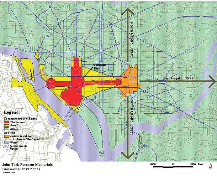
Commemorative Zones
Smithsonian Institution National Museum of African American History and Culture 18
1915 View of the Lincoln Memorial from the East 1938 Aerial View of 14th Steet at the National Mall, Department of Commerce building is at the top center of image
The National Mall was developed in general accordance with the McMillan Plan. However, proposals for West Potomac Park and the Washington Monument grounds were not implemented. Temporary buildings were located on the western portion of the National Mall during World War II. These structures were removed prior to the construction of Constitutional Gardens in the 1970’s.
Memorials and Museum Master Plan
In 2001, the National Capital Planning Commission (NCPC), in cooperation with the Commission of Fine Arts (CFA) and the National Capital Memorial Commission (NCCMC), developed the Memorials and Museum Master Plan. The purpose of the master plan is to guide the site selection process for future memorials. The Commemorative Zone Policy establishes three commemorative areas: The Reserve, Area I and Area II.
The Reserve is the Monumental Core where no new memorials will be permitted. The Reserve is described as the cross axes of the Mall complex, extending between the US Capitol to the Lincoln Memorial, and from the White House to the Jefferson Memorial. Area I is designated for works commemorating events of preeminent historic and national significance. Area I includes the Federal Triangle, the area of Southwest Federal Center north of Maryland Avenue, West Potomac Park, and Virginia shore of the Potomac River between the 14th Street and Key Bridges. Area II is the remainder of the city and metropolitan area where new works are encouraged.
The Memorials and Museum Master Plan identifies the NMAAHC site as part of the Reserve to be maintained as open space. However, Section 8 of the NMAAHC act specifies that the commemorative area will not apply to the NMAAHC. In addition, the L’Enfant and McMillan plans designated the NMAAHC site for a building. In 1910, it was approved as the site for a new State Department Headquarters. In 1995, the site was considered for the WWII Memorial.
African American History
The site of the District of Columbia, including the NMAAHC site, was farm land when the city was established in 1791. An agreement with landowners transferred ownership of sites required by the federal government. In exchange the remainder of the city was laid out in lots for development. The Washington Monument Grounds was appropriated for a memorial to President George Washington in the L’Enfant Plan and, therefore, was intended for government use. The NMAAHC site has remained undeveloped although it was designated as a building site by the L’Enfant and McMillan Plans.
The history of the site is described by its context, the National Mall, and Washington, DC. Slaves were the core of the District of Columbia’s early labor forces, the White House and Capitol both being built with slave labor. Slave owners were paid for the labor of slaves who were employed as sawyers, stone haulers and general laborers. As the city developed, many slaves were hired out to the brick-making industry. There were also skilled slave and free African Americans who were employed as journeymen carpenters and masons. Slave labor was used for the initial excavation and maintenance of the Washington Canal though most of the canal digging was performed by Irish immigrants, imported for this purpose. There was, however, a consistent use of slave labor which allowed employers to keep wages for free laborers low despite miserable working conditions. [Berger, 2007b]
In 1808, the importation of enslaved people was banned, which spurred the domestic slave trade. Washington was a center for the slave trade because it was a major stop for interstate slave traders. Several slave pens and sale sites were located in close proximity to the NMAAHC site. There were also a growing number of free African Americans in the vicinity who established a vibrant community despite legal restrictions on their freedom. Free African Americans were required to observe a curfew and carry a certificate of freedom and they were barred from owning most types of small businesses. In 1848, the city’s
19 Existing Site Conditions | FREELON BOND
southwestern waterfront was the site of the attempted escape of seventy-seven slaves aboard the Pearl. The small ship departed from the Seventh Street Wharf but was overtaken before reaching the Chesapeake Bay.
In Washington, slaves were emancipated nine months prior to the issuance of the Emancipation Proclamation in 1863. During the period of Reconstruction, Washington attracted a large number of free African Americans. By 1900, it had the largest African American population of any city in the country. Among the attractions of the capital city were opportunities for federal jobs and premier educational institutions. Howard University was established in 1867. In 1870, the elite Preparatory School for Colored Youth was opened, it is now known as Dunbar High School. In 1872, a municipal law was enacted that made segregation in public accommodations illegal in Washington. The city was de facto segregated, however, and U Street (approximately two miles north of the NMAAHC site) became the center of African American commerce, culture, and life.
On August 6, 1926 the first civil rights rally took place on the west end of the National Mall by two thousand members of the African Methodist Episcopal Zion Church. On Easter Sunday of 1939 renowned opera singer Marian Anderson performed on the steps of the Lincoln Memorial to an integrated audience of 75,000. Anderson had been barred from performing at Constitution Hall due to a policy of racial segregation. On August 28, 1963 Martin Luther King, Jr. delivered his seminal “I Have a Dream” speech from the steps of the Lincoln Memorial. In 1996, a memorial to King was authorized on the west side of the Tidal Basin, on axis between the Lincoln and Jefferson Memorials.
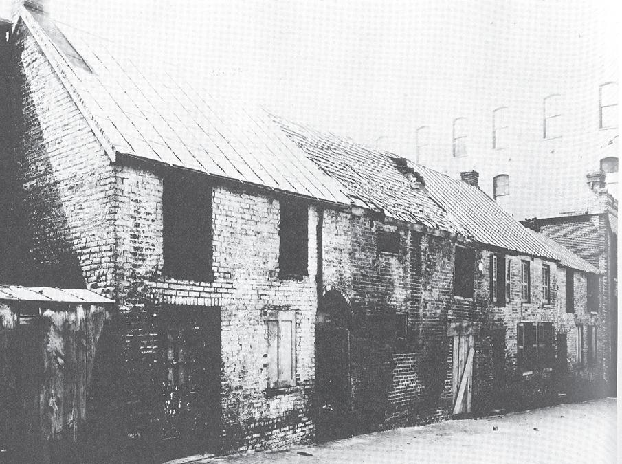
1880 Slave Pen located in the alley behind G Street NW, between 4 1/2 and 6th Streets. Demolished in 1889.
Smithsonian Institution National Museum of African American History and Culture 20
Zoning & Setbacks
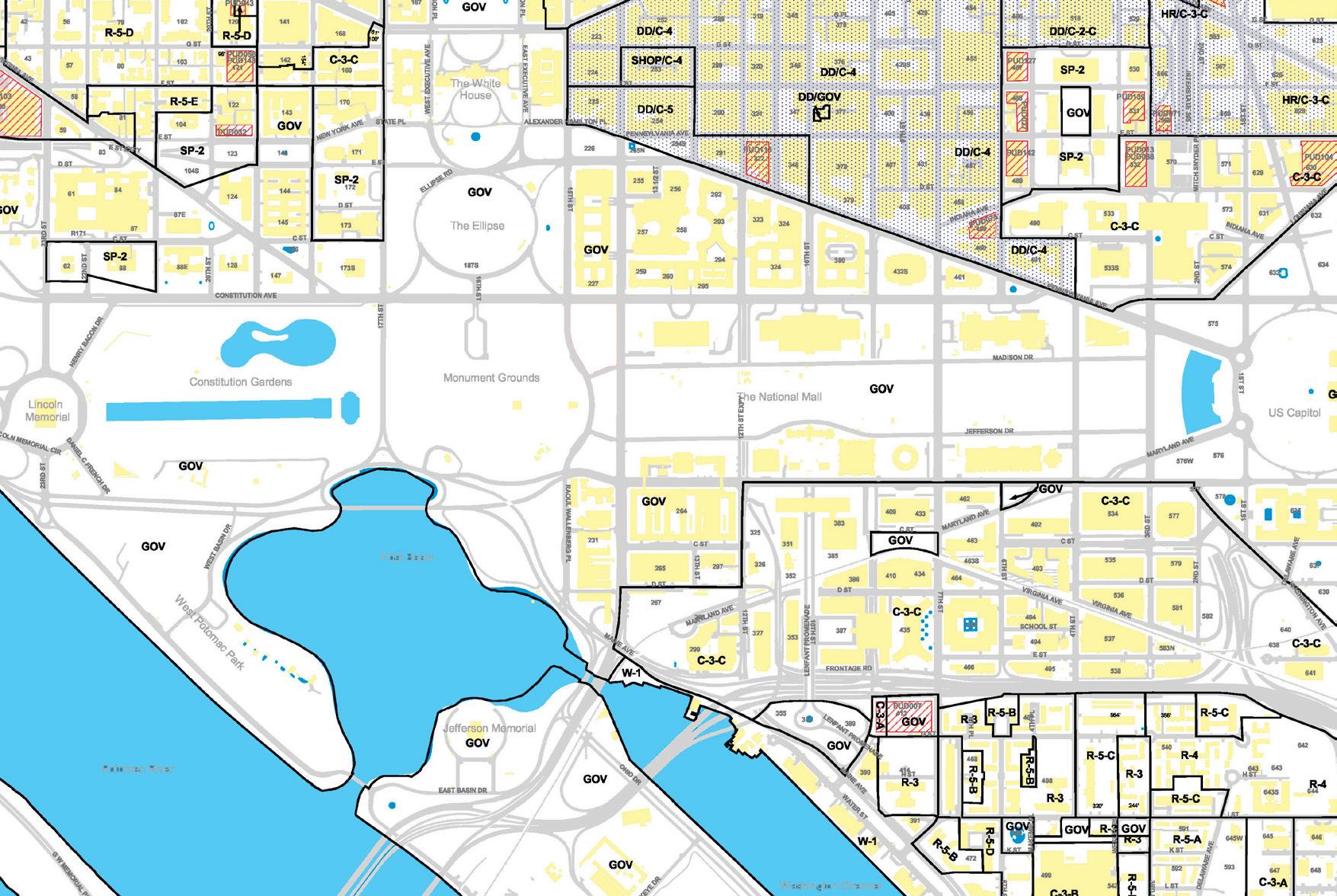
Source: DC Office of Zoning January 1, 2003
21 Existing Site Conditions | FREELON BOND
N NMAAHC Site Major Federal Tract Streets Buildings Overlay Districts PUDs GOV Zoning Designations Freer Gallery of Art Arthur M. Sackler Gallery National Gallery of Art East Building USDA Forest Service Department of Commerce Internal Revenue Service FTC Department of Justice National Sculpture Garden National Archives National Gallery of Art West Building Hirshhorn Museum Arts and Industries Building National Air and Space Museum Smithsonian Castle National Museum of African Art National Museum of Natural History National Museum of American History NMAI 14th STREET INDEPENDENCE AVENUE JEFFERSON DRIVE 3rd STREET PENNSYLVANIAAVE 4th STREET 15th STREET CONSTITUTION AVENUE MADISON DRIVE 10th STREET 12th STREET Security Setback Building Alignment
Smithsonian Institution National Museum of African American History and Culture 22
Urban Design Context
The National Museum of African American History and Culture (NMAAHC) site is located at the intersection of two main traffic corridors, 14th Street and Constitution Avenue. The site is at the west end of the northern row of National Mall museums, bounded by the dense urban fabric of the Federal Triangle to the north and the open space of the National Mall to the south and west. The NMAAHC site, therefore, provides a panoramic vista of the National Mall, Washington Monument, and the Ellipse. The urban design context of the NMAAHC site includes neighboring land uses, zoning and several historic districts and reservations. The historic areas which contribute to the NMAAHC site include the National Mall Historic District, the Washington Monument Grounds, East and West Potomac Parks, Pennsylvania Avenue National Historic Site, Federal Triangle Historic District, President’s Park South, and the Seventeenth Street Historic Area.
Land Use
The D.C. Office of Planning identifies the NMAAHC site as Parks, Recreation, and Open Spaces. The site is maintained as an open public space by the National Park Service (NPS) although administrative jurisdiction was passed to the Smithsonian Institution on June 1, 2007. A temporary concessions tent is located near the southwest corner of the site. The land use of the Federal Triangle area to the north of the site is designated Federal Public. The National Mall museums, located to the east of the NMAAHC site, are also designated Federal Public. The land use of the site will be changed by the construction of the NMAAHC to Federal Public.
Zoning
The D.C. Office of Zoning designates the NMAAHC site as a Major Federal Tract. The site is exempt from zoning because it is owned by the United States Government. However, review of building height, bulk,

Source: DC Office of Planning April 21, 2006
Land Use
23 Existing Site Conditions | FREELON BOND
NMAAHC Site Existing Land Use Low Density Residential Low-Medium Density Residential Medium Density Residential High Density Residential Commercial Transport, Communication, Utilities Industrial Mixed Use Institutional Federal Public Local Public Public, Quasi-Public, Institutional Parks and Open Spaces Parking Roads, Alleys, Median Transportation Right of Way Undetermined Water Vacant N 04
number of stories, setbacks and open space is subject to the approval of the National Capital Planning Commission (NCPC). The site zoning will not be changed by the construction of the NMAAHC. [DC Code 106.4, DC ST §6-641.15]
The NMAAHC site is located in a potential threat area, in close proximity to federal facilities and highly visible memorials. A set back of fifty feet for building security was referenced as a planning guideline in the Draft Environmental Impact Statement for the NMAAHC site. However, aligning the NMAAHC building massing with the northern row of National Mall museums would result in setbacks of approximately 115 feet on the north side and vary between120 to 200 feet on the south side of the site.
National Mall Historic District
The National Mall Historic District is bounded by Constitution and Pennsylvania Avenues to the north, First Street to the east, Maryland and Independence Avenues to the south, and 14th Street to the West. The expanse is characterized by a linear open lawn space, lined with four rows of mature American elms at the north and south. The open lawn area is bounded by Madison Drive to the north and Jefferson Drive to the south. Both are local one-way drives which provide vehicle access and parking to the buildings located in the District. The National Mall is also traversed by 4th Street and 7th Street, principal two-way roadways that run north and south.
In general, the buildings located in this Historic District are rectilinear masses sited on rectilinear lots. The exceptions are the Hirshhorn Museum, the National Gallery of Art – East Wing (NGA-East) and the National Museum of the American Indian (NMAI). In contrast to the density of the urban fabric surrounding the Mall, the buildings on the Mall cover 29% to 51% of their sites. These buildings are centered on their sites, with generous setbacks that create green space separations that help to individuate the buildings in the landscape. In addition to a primary entrance from the National Mall, many buildings also have a secondary entrance from other adjacent roadways.
Although the east and west setbacks are not consistent, building relationships are created across the Mall. The Mall buildings are aligned by their central axis in the north-south direction. The Department of Agriculture is centered on National Museum of American History (NMAH), and the National Museum of Natural History (NMNH) is centered on Smithsonian Castle, etc. The buildings located on the north side of the Mall, have consistent setbacks on the north and south sides. The buildings located on the south side of the Mall, however, have varying setbacks.
The Mall is zoned GOV and has Federal Public and Parks, Recreation and Open Space land uses. Notable buildings in this district include: Department of Agriculture/Whitten Building, The Freer Gallery of Art, Smithsonian Castle, Arts and Industries Building, Hirshhorn Museum, National Air and Space Museum, National Museum of the American Indian, National Museum of American History, National Museum of Natural History, and the National Gallery of Art – East and West Wings.
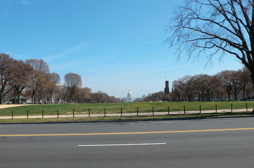

Smithsonian Institution National Museum of African American History and Culture 24
The Mall Washington Monument Grounds




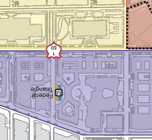


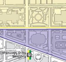


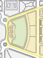


Smithsonian Institution National Museum Of African American History and Culture FREELON BOND 25 Existing Site Conditions Study 95 49 6 s b POTOMACRIVER Tidal Basin G GES G alTid M Federal Center SW L’Enfant Plaza M Smithsonian M Judiciary Square M Metro Center Gallery Place M M N 01/2Mile 1/81/4Mile Mile
Urban
17th Street Historic Area Federal Triangle Historic District National Mall Historic District President’s Park South Washington Monument Grounds West Potomac Park 2 1 2 NMAAHC Site Vietnam Veterans Memorial Center Martin Luther King, Jr. Memorial 395 295
NMAAHC Site
Design Context
The Washington Monument Grounds
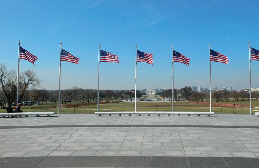
The Washington Monument Grounds are bound by Constitution Avenue to the north, 14th Street to the east, Independence Avenue to the south, and 17th Street to the west. Despite several proposals to construct formal gardens and terraces on the Monument Grounds, the landscape is characterized by a grassy mound with informal pedestrian paths and plantings. Mature trees are located along Constitution and Independence Avenues. Several curvilinear paths provide circulation around the grounds and to the monument. At the base of the monument is a circular plaza ringed with benches and American flags.
The Washington Monument Grounds are zoned GOV and have Recreation and Open Space land uses. In addition to the monument, other structures located on the grounds include the Monument Lodge and Sylvan Theater.
East and West Potomac Parks
The East and West Potomac Parks are bound to the north by Constitution Avenue, to the east by 17th Street, and by Independence Avenue, the Washington Channel, the Potomac River and Rock Creek Park. The boundary between East and West Potomac Parks is to the east of the 14th Street Bridge. In West Potomac Park, the Capitol Axis is extended with a reflecting pool punctuated by the Lincoln Memorial at the west end. The reflecting pool is bordered by formal paths and groves of mature trees. The White House Axis is extended by a vista to the Jefferson Memorial across the Tidal Basin.
The East and West Potomac Parks are zoned GOV and have Recreation and Open Space land uses. The Lincoln Memorial and Jefferson Memorial are the most prominent memorials located in this area. Other notable structures include: The WWII Memorial, Franklin D. Roosevelt Memorial, Korean War Veteran’s Memorial and the Vietnam Veteran’s Memorial. Two additional memorials are planned in West Potomac Park. The site of the future Washington, DC, Martin Luther King, Jr. National Memorial is located at the west side of the Tidal Basin. The Vietnam Veterans Memorial Visitor Center will be located near the Vietnam Veterans Memorial, to the north of the Lincoln Memorial.
Pennsylvania Avenue National Historic Site
The Pennsylvania Avenue National Historic Site consists of Pennsylvania Avenue and several structures between the Capitol and the White House. Pennsylvania Avenue is significant because it was specified in the L’Enfant plan as a communicating path between the Capitol and White House. It also has historical significance as a ceremonial site for inaugural parades, funeral processions and other events.
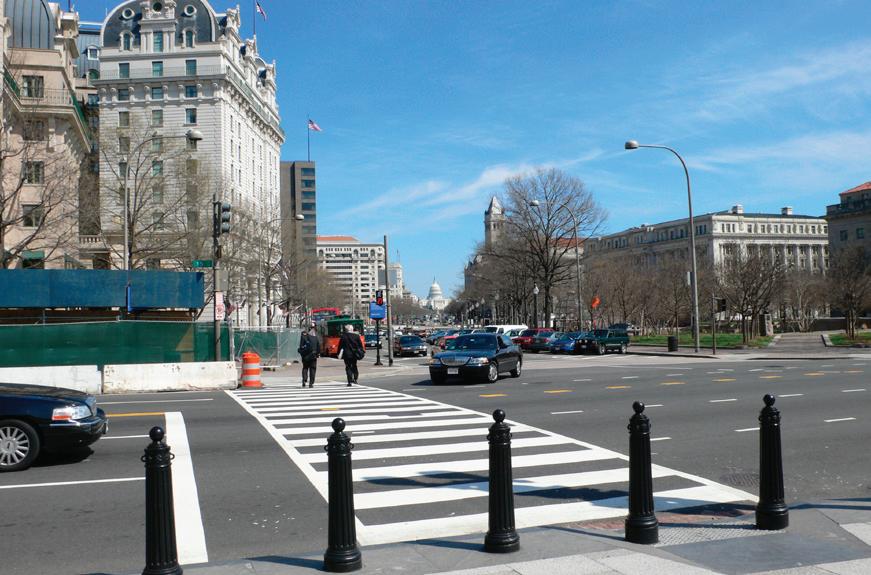
27 Existing Site Conditions | FREELON BOND
Pennsylvania Avenue
West Potomac Park and the Lincoln Memorial
The area has several zoning designations including Federal, Central Business and Limited Residential/ Office space. The land uses also vary, but Federal Public and Commercial are dominant. The Federal Triangle Historic District is included in this site. The notable structures are described in the following section.
Federal Triangle Historic District
The Federal Triangle Historic District is the area north of Constitution Avenue, south of Pennsylvania Avenue and east of 15th Street. It is located within the Pennsylvania Avenue Historic District. Federal Triangle was one of the first public building projects following the 1926 Public Buildings Act which allowed the government to hire private architects for the design of public buildings. The development of Federal Triangle was guided by the Board of Architectural Consultants headed by Edward H. Bennett of Bennett, Parsons and Frost. Each of the buildings within Federal Triangle was designed by a member of the Board of Architectural Consultants according to design guidelines.
Federal Triangle buildings are characterized by limestone facades and red tile hipped roofs. The individual buildings are also unified by relatively uniform building heights, massing and setbacks. The dominant building type is a courtyard structure which contributes to a strongly defined urban street edge.
The Federal Triangle area is zoned GOV with Federal Public land uses. Notable buildings in the district include: Department of Commerce, Ronald Reagan Building, Wilson (District) Building, Internal Revenue Service, Department of Justice, National Archives, and the Federal Trade Commission.
President’s Park South
The President’s Park South is the open park space south of the White House. It is bounded to the north by State Place, South Executive Avenue and Hamilton Place. It is bounded to the east by 15th Street, to the south by Constitution Avenue, and to the west by 17th Street. President’s Park South is a significant element of the L’Enfant Plan which established the open space as part of the memorial core. The most prominent feature of the park is the Ellipse – an elliptical roadway defining an open lawn.
The President’s Park South is zoned GOV and has Parks, Recreation and Open Space land uses. The White House Grounds are zoned GOV and has Federal Public land uses. Notable landmarks in this area include: the White House, the Bulfinch-Capitol Gatehouses, the Haupt Fountains, and the Zero Milestone.
Seventeenth Street Historic Area
The Seventeenth Street Historic Area consists of four buildings, located on 17th Street, directly across from the President’s Park South. The area is characterized by the Beaux Arts style buildings, which were built between 1897 and 1930.
The area is zoned GOV and Limited Residential/Office space with Institutional land uses. The buildings which constitute this area are the Corcoran Gallery of Art, the American Red Cross, the Daughters of the American Revolution, and the Pan American Union.
Smithsonian Institution National Museum of African American History and Culture 28

Federal Triangle
Source: www.houleweb.com/2006_01_01_intshotsarchives.html
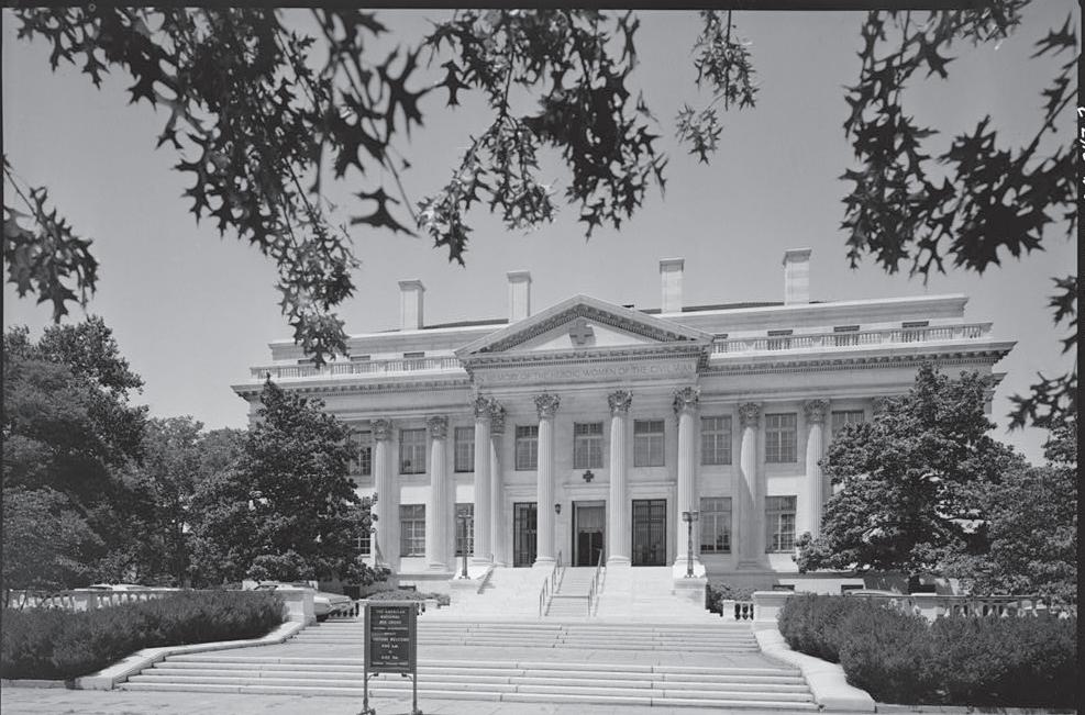

Source: www.visitingdc.com/neighbor/washington-dc-ellipse.htm
Site Views (continued on the following pages)
29 Existing Site Conditions | FREELON BOND
The
Ellipse
95 49 6 s b POTOMACRIVER Tidal Basin s G G E S G N 01/2Mile 1/81/4Mile Mile National Mall Principal Landmark 6 1 2 3 5 NMAAHC Site 4 7 8
Red Cross (Boucher, 1974)

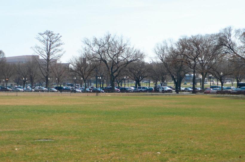
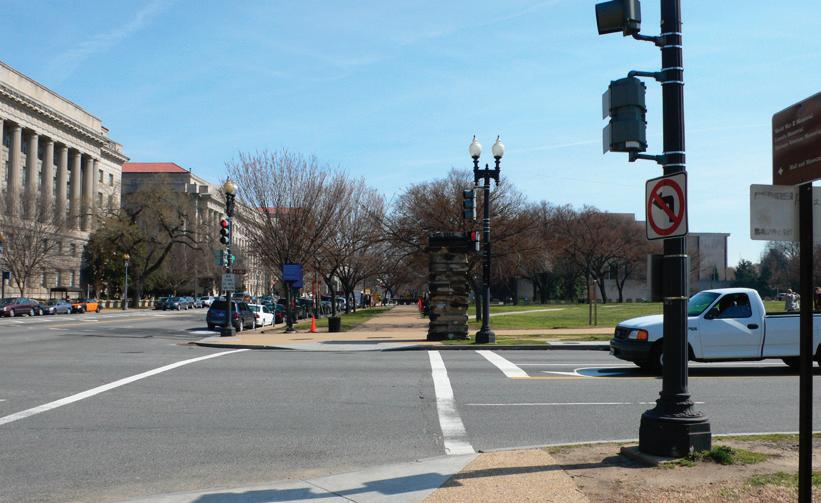
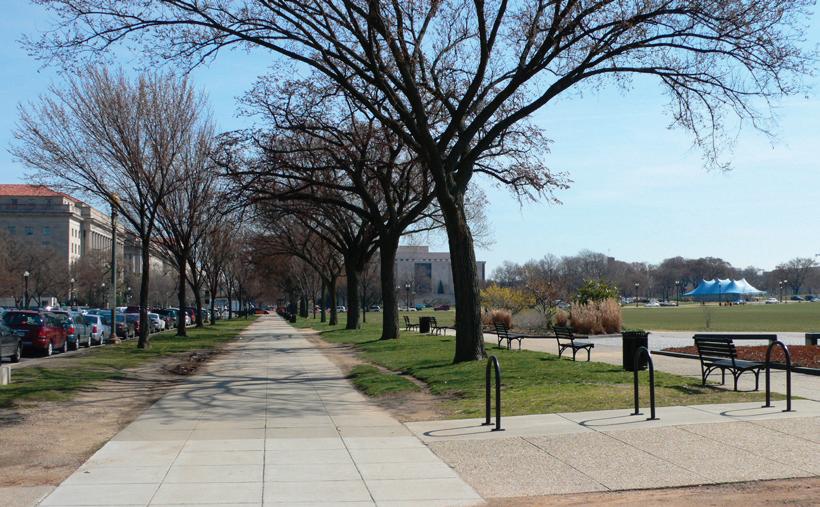

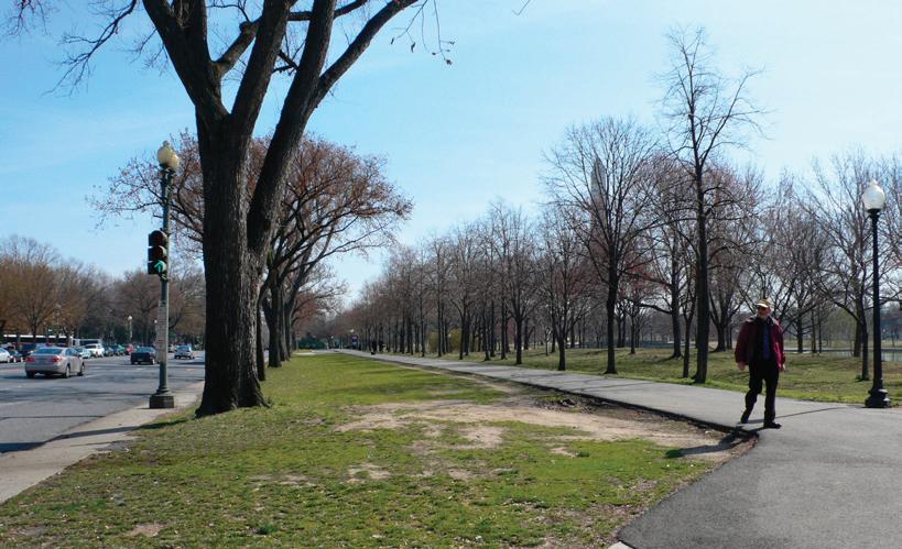
Smithsonian Institution National Museum of African American History and Culture 30
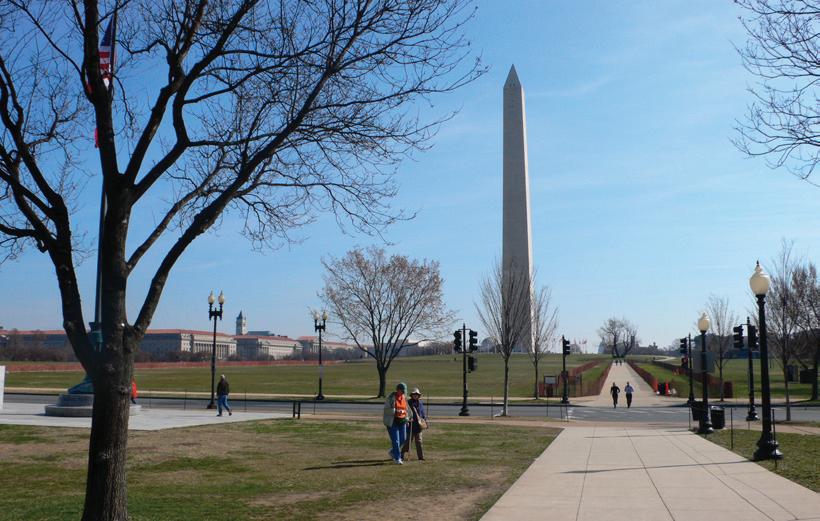
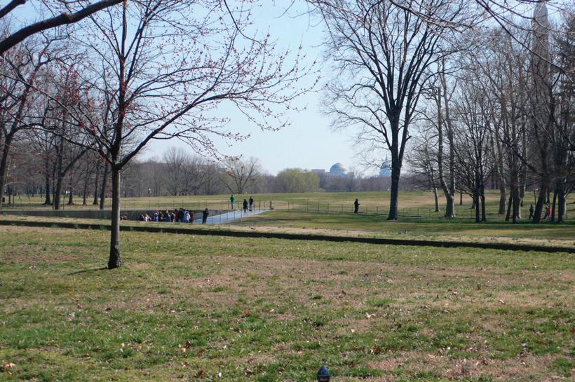
5 Approach along Constitution Avenue from the West
1 View from Kutz Bridge
2 View from WWII Memorial
3 View from Vietnam Veterans Memorial
4 View from Ellipse

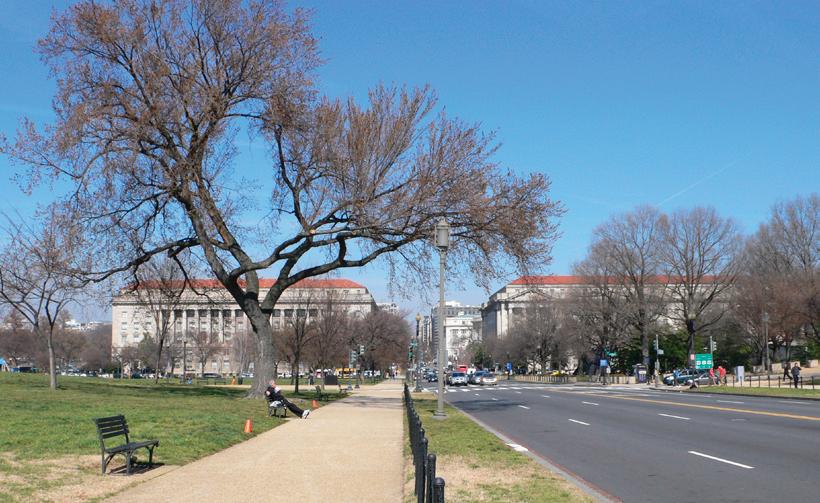


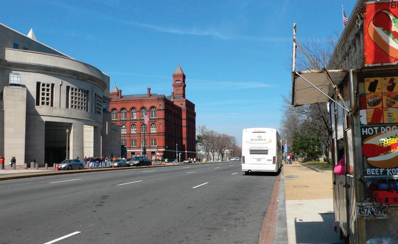
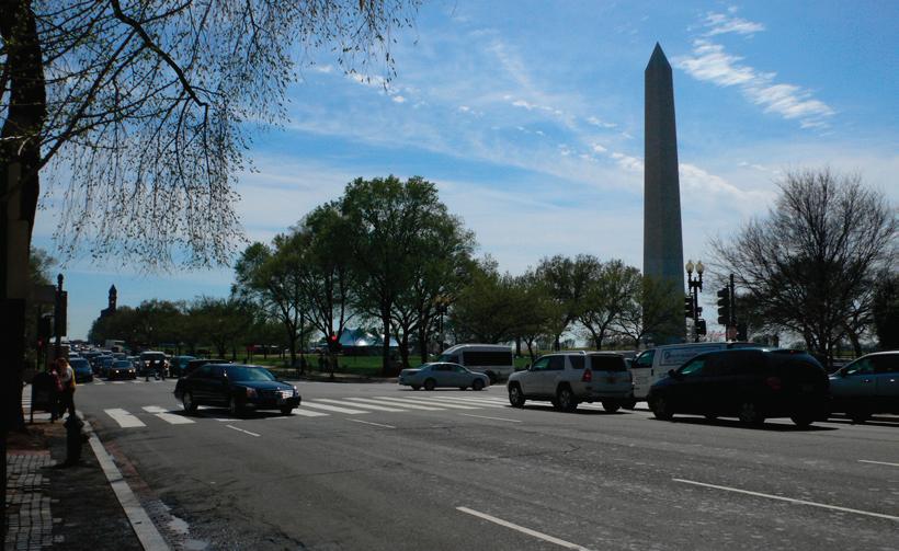
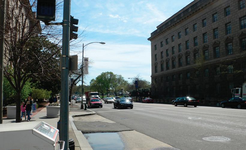

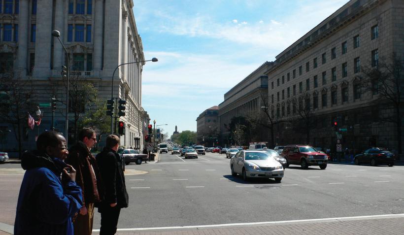
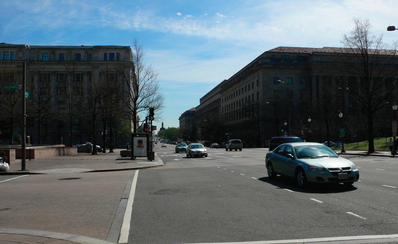
31 Existing Site Conditions | FREELON BOND
6 Approach along 14th Street from the South
7 Approach along 14th Street from the North
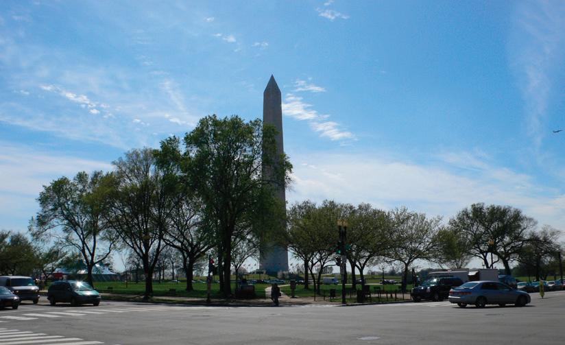

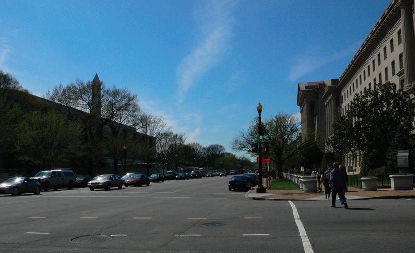

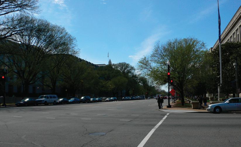
8 Approach along Constitution Avenue from the East
Smithsonian Institution National Museum of African American History and Culture 32
Architectural Context
The architectural context of the National Museum of African American History and Culture (NMAAHC) site includes the memorials and buildings of the National Mall, Federal Triangle and the Southwest Federal District. The principle landmarks of the National Mall, which mark the cross-axes, are rendered in lightcolored stone materials. The White House is constructed of painted aquia stone. The Capitol is also constructed of painted aquia stone and white marble. The Washington Monument, Lincoln and Jefferson Memorials are clad with white marble. Along the National Mall, many of the buildings are clad with natural stone materials including pink Tennessee Marble, pink granite and gray granite. The exceptions are the Smithsonian Castle constructed of red brick and sandstone; the Smithsonian Arts & Industries Building constructed of patterned brick; the USDA Forest Service constructed of red brick; and the Hirshhorn Museum constructed of pre-cast concrete panels with pink marble aggregate corresponding to the dominant building material on the National Mall. To the north of the NMAAHC site, the buildings of Federal Triangle are faced with limestone.
The Building Heights and Footprints table lists the heights and lot coverage of buildings in the immediate context of the NMAAHC. The tallest structures in the Monumental Core are the Washington Monument and the Capitol Dome. Along the National Mall, the heights and massing of buildings vary. The lowest structure fronting the National Mall is the Freer Gallery of Art at forty-six feet. The National Gallery of Art – West Wing is the tallest of the National Mall museums with a dome height of 138 feet, although its main roof structure is sixty-eight feet tall. In general, the massing of contemporary buildings is more rectilinear than that of the historic buildings on the National Mall. The exceptions are the National Gallery of Art –East Wing and the National Museum of the American Indian located at the eastern end of the National Mall. These buildings reflect the shape of their sites with triangular massing.
Washington Monument
The most prominent structure in the immediate context of the NMAAHC site is the Washington Monument to the southwest. The 555’ tall, white marble clad, obelisk is a presidential memorial to George Washington. The original design for the monument, by Robert Mills, was a flat-topped obelisk with a neoclassical colonnaded base. Construction of the monument began in 1848, but was halted in 1854 due to lack of funds. When construction resumed in 1878, the design of the monument was revised by Lt. Col. Thomas L. Casey to an unadorned obelisk with pointed pyramid top. The monument was completed in 1885, with a clear material demarcation at 150 feet above the ground marking the two phases of construction.
The location of the monument was designated in the L’Enfant city plan as the terminus of a grand avenue that is now the National Mall. The monument, described as an equestrian statue, was to have been constructed at the intersection of the White House and Capitol axes. However, at the time of construction the Washington Monument Grounds were a much smaller area of unstable land. As a result, the monument was located 370 feet to the east and 123 feet to the south of its intended location. The intended location of the Washington Monument is marked by the Jefferson Stone. The original marker was placed in 1804 to delineate a north-south meridian at the center of the White House. The purpose was to create a prime meridian in the United States, independent of the British prime meridian.
33 Existing Site Conditions | FREELON BOND 05
Table: Building Height & Footprint
Source: Building Footprints are illustrated in Smithsonian Institution National Museum of American History, Behring Center, Comprehensive Facilities Development Plan, Existing Conditions Report (SOM, 2005). Building Heights are listed in Table 6.2-1 Building Heights Survey, Draft Environmental Impact Statement for the Smithsonian National Museum of African American History and Culture (Berger, 2007).
Note 1: Source does not list Building Height, Building Footprint is included in overall Building Footprint for the Smithsonian Quadrangle
Note 2: Building Footprint is included in the overall Building Footprint for the Smithsonian Quadrangle
Note 3: Source does not list Building Height
Smithsonian Institution National Museum of African American History and Culture 34 Roof Elevation Base at Mid Building Building Height Building Footprint (% of Site) Capitol • Top of Wings 159 FT 89 FT 70 FT • Top of Dome 308 FT 89 FT 219 FT National Air and Space Museum 44% • Top of Roof 98 FT 14 FT 84 FT • Top of Glazed Galleries 78 FT 14 FT 64 FT Hirshhorn Museum 105 FT 23 FT 82 FT 27% Smithsonian Quadrangle 47% Arts and Industries Building Note 2 • Top of Main Roof 87 FT 31.5 FT 55.5 FT • Top of Cupola 127.5 FT 31.5 FT 96 FT Smithsonian Castle Note 2 • Top of Main Roof 87 FT 31 FT 56 FT • Top of Cupola 126.8 FT 31 FT 95.8 FT Freer Gallery 79 FT 33 FT 46 FT Note 2 Arthur M. Sackler Gallery - - - Note 1 National Museum of African Art - - - Note 1 Department of Agriculture 29% • Top of Parapet 100 FT 34 FT 66 FT • Top of Roof 115 FT 34 FT 81 FT National Gallery of Art - East 115.5 FT 8 FT 107.5 FT 44% National Gallery of Art - West 38% • Top of Main Parapet 79 FT 11 FT 68 FT • Top of Dome 149 FT 11 FT 138 FT National Museum of Natural History 42% • Top of Wings 88 FT 33 FT 55 FT • Top of Dome 121 FT 33 FT 88 FT National Museum of American History 93 FT 8 FT 85 FT 30% @ base National Museum of the American Indian - - Note 3 51%
Smithsonian Institution National Museum Of African American History and Culture FREELON BOND 35 Existing Site Conditions Study 95 49 6 s b POTOMACRIVER Tidal Basin G GES G M Federal Center SW L’Enfant Plaza M Smithsonian M Archives Navy Memorial M Federal Triangle M Judiciary Square M Metro Center Gallery Place M M M 50 1 1-50 395 N 01/2Mile 1/81/4Mile Mile
Architectural
Department of Commerce National Museum of American History National Museum of Natural History National Sculpture Garden National Gallery of Art - West National Gallery of Art - East National Museum of American Indian National Air and Space Museum Hirshhorn Museum Arts and Industries Building National Museum of African Art Smithsonian Castle Arthur M. Sackler Gallery Freer Gallery of Art Department of Agriculture USDA Forest Service Capitol White House 1 2 3 4 5 6 7 8 9 10 11 12 13 14 15 16 NMAAHC Site Principal Landmark Metro Station Jefferson Memorial Lincoln Memorial Washington Monument 1 2 3 4 6 11 9 8 7 The Ellipse 5 10 12 13 14 15 16 Constitution Avenue Independence Avenue 395 295
NMAAHC Site
Context
The National Museum of American History (NMAH)
To the east of the National Museum of African American History and Culture (NMAAHC) site, directly across 14th Street, is the National Museum of American History (NMAH). The museum, built between 1955 and 1964, was formerly called the Museum of History and Technology. The principal designer of the building was Walker O. Cain of McKim, Mead and White. The building is characterized by its recessed and projected planes of unadorned pink Tennessee marble panels. This massing sits atop a larger lower level, set below the grade of the National Mall, which creates a podium. The north and south setbacks at the podium level are consistent with the other museums located on the northern side of the National Mall. In the east-west direction, the building is centered on the Department of Agriculture which is located across the National Mall. A visitor entry on Madison Drive is accessed on the mall side of the podium. Visitors may also walk around the building to symmetrically placed stairs to the lower level entry at Constitution Avenue. The Constitution Avenue entry is also provided with a vehicle drop off area.
Department of Agriculture
The Department of Agriculture/Jamie L. Whitten Building is located to the southeast of the NMAAHC site on Jefferson Drive. It is the only federal agency building located on the National Mall. The limestone building was designed by Rankin, Kellogg and Crane in the American Neo-Classical style, and is characterized by a centrally organized massing. The wings of the building were built between 1904 and 1908. The center portion was added in 1930. The buildings on the southern side of the National Mall do not have consistent setbacks. However, the centerlines of NMAH and the Department of Agriculture are aligned.
USDA Forest Service
The USDA Forest Service/ Sydney R. Yates Federal Building is located approximately 1200 feet to the south of the NMAAHC site. The building, designed by James G. Hill, was completed in 1880 for the Bureau of Engraving and Printing. The building later housed the Auditor’s division and is also known as the Auditor’s Main Building. The building is constructed of red brick and stone in the Romanesque style and is characterized by a red brick clock tower at the corner of Independence Avenue and 14th Street. The building was modernized between 1987 and 1990 for the USDA Forest Service.
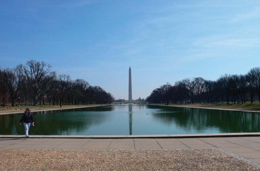
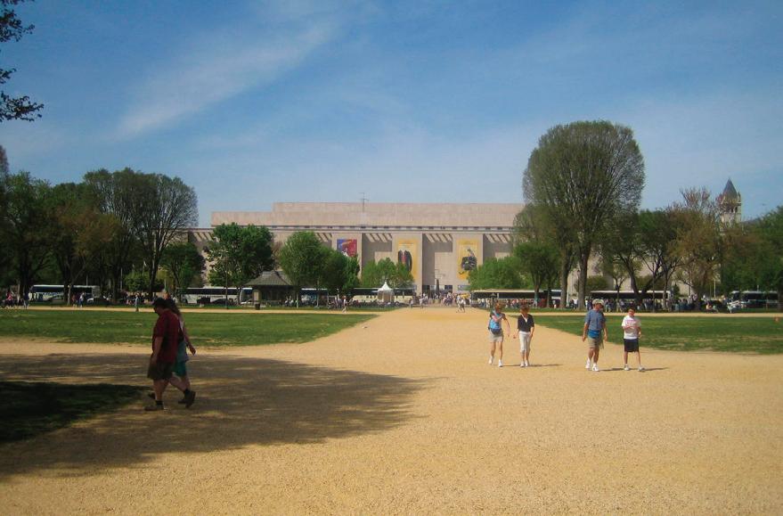
37 Existing Site Conditions | FREELON BOND
Washington Monument National
Museum of American History
Department of Commerce (DOC)
The Department of Commerce is located to the north of the NMAAHC site, directly across Constitution Avenue. It is also known as the Herbert C. Hoover building. The DOC building, designed by York and Sawyer, was built between 1927 and 1932. It is an American Neo-Classical building. Like much of Federal Triangle, it is characterized by its limestone exterior and red tile roof.
US Capitol Gatehouses and Gateposts
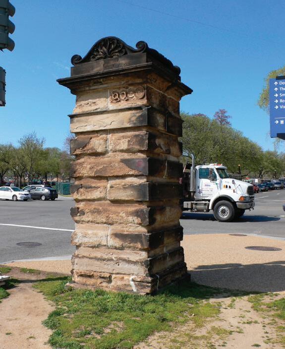
The US Capitol Gatehouses are also known as the Bulfinch Gatehouses after their architect, Charles Bulfinch. Bulfinch served as Architect of the Capitol from 1818-1829 and was responsible for rebuilding the Capitol following the War of 1812. The gatehouses were dedicated in 1828 and marked the entry to the Capitol. The gateposts were part of a fence that enclosed the Capitol grounds. The gatehouses were relocated in 1880 from the Capitol to their current locations in the President’s Park, at the intersections of 17th and 15th Streets with Constitution Avenue. Three of the gateposts were also relocated to the intersection of 15th Street and Constitution Avenue. One of the gateposts is located at the northwest corner of the NMAAHC site. The sandstone gatehouses and gateposts are characterized by rustic quoins and guilloche details found on the Capitol Building.
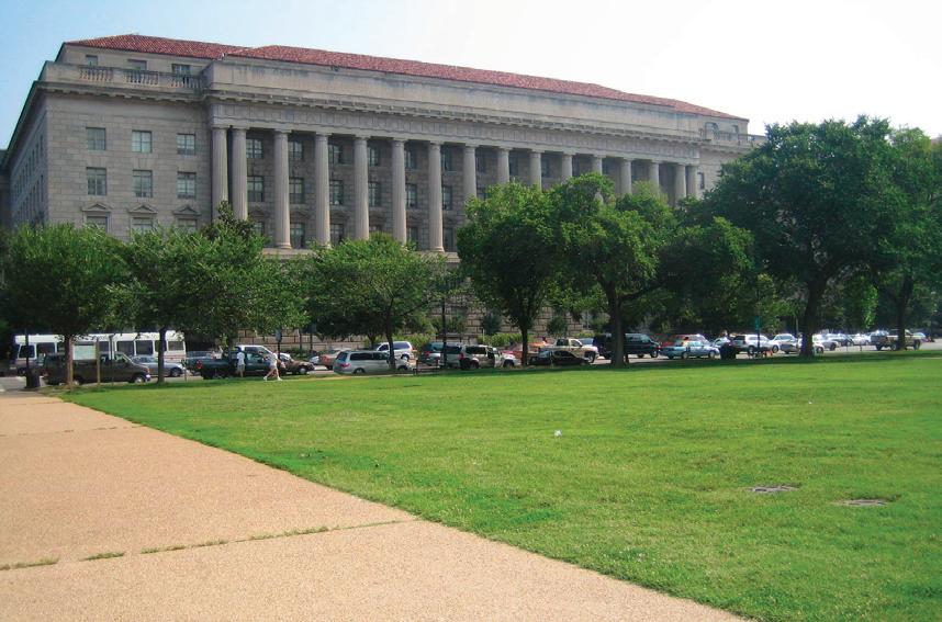 Department of Commerce


Smithsonian Institution National Museum of African American History and Culture 38
Bulfinch-Captiol Gatepost
USDA Forest Service Source: www.usda.gov/oc/photo/01c0465.jpg Department of Agriculture
Site Plan
The Site Plan illustrates the topography, landscape features, and existing structures located on the NMAAHC site. Geotechnical and groundwater surveys have not been conducted on the NMAAHC site. Information regarding the groundwater and soils conditions was derived from studies conducted on adjacent sites. Additional surveys are recommended to provide a complete description of the existing conditions of the site.
Temporary Concession Tent
US Capitol Gatepost
NMAH Service Lane


Existing Electrical Transformer
Existing Tour Bus Layby
Existing Steam Ventilator Vault
Street Lamp


39 Existing Site Conditions | FREELON BOND 06
080’160’ N
Fire Hydrant Water Fountain Public Telephone 1 2 3 4 5 6 Traffic Signal 18 19 15 14 13 10 9 8 16 17 11 12 10 9 8 13 14 15 16 17 7 7 12 11 Constitution Avenue MadisonDrive 15th Street 14th Street 1 2 2 3 2 4 5 5 6
7.5 min Quadrangle, Washington West, DC MD VA 1965 (photorevised 1983), NPS 2006
Source: USGS
Washington Monument Area Subsurface Soil Office of Public Buildings and Public Parks of the National Capital, Monument Grounds Test Borings, 1931 Elevation in FT above Mean Sea Level Layer Depth Soil Type +10 to +6
FT FILL +1 to -9
to -12
RIVER SILT (BLUE CLAY)
Total Boring Depth = 81 FT Water level recorded at 0.0 FT mean sea level
Source: NPS, Site Evaluation Study Phase 1: Data Gathering Report
NMAH Subsurface Soil
The Museum of History and Technology, Test Boring Data, McKim Mead & White Architects, 1958 Elevation in FT above Mean Sea Level Layer Depth
Strata Description Soil Type +8 to +1
BROWN SANDY CLAY, CINDERS BRICK & GRAVEL FILL FILL
SANDY CLAY & GRAVEL FILL
GRAVEL,
Source: NPS, Site Evaluation Study Phase 1: Data Gathering Report
& GRAVEL
Smithsonian Institution National Museum of African American History and Culture 40
4
10
-9
3
-12
10 FT
-22
5 FT
-27
-38 11 FT TOP OF
ROCK -38 to -57 19 FT MICA ROCK -57 to -76 19 FT
FT SANDY CLAY
FT
to -22
GRAVEL & SAND
to -27
RIVER SILT (BLUE CLAY)
to
MICA
7 FT
+1
4 FT
CLAY
2
CLAY
-5
15 FT COURSE
SAND
-20
4 FT MEDIUM
SAND
15 FT
4 FT
SAND
3 FT COURSE
SAND
-46
58 12 FT GRAY SILT,
SILT -58
1 FT COURSE
SAND
20
15
Water
General
to -3
BROWN
& GRAVEL -3 to -5
FT FINE BROWN GRAY CLAYEY SAND
& SAND
to -20
BROWN SAND & GRAVEL,TRACE CLAY
& GRAVEL
to -24
BROWN SAND & GRAVEL
& GRAVEL -24 to -39
COURSE BROWN SAND &
TRACE CLAY SAND & GRAVEL -39 to -43
FINE GRAY SILTY SAND
-43 to -46
BROWN SAND & GRAVEL, TRACE CLAY
to -
TRACE SAND & ORGANIC MATTER
to -59
GRAY SILTY SAND & GRAVEL
& GRAVEL -59 to -79
FT GREEN GRAY DISINTEGRATED ROCK ROCK -79 to -94
FT GREEN GRAY ROCK ROCK Total Boring Depth = 103 FT
level recorded at -13.0 FT mean sea level
Topography
The elevation of the NMAAHC site ranges from 6.6 feet at the north side to 19.7 feet at the south side and slopes at approximately 1%-2% grade. The National Mall has an overall level topography with a pronounced knoll at the Washington Monument.
Landscape
The landscape of the NMAAHC site is grassy, with a gradual slope. Mature trees are located along Constitution Avenue and 14th Street. A cluster of trees is located in the northeast corner of the site and relates to a cluster of trees across 14th Street on the NMAH site. The original landscape of the NMAAHC site consisted of the Tiber Creek flood plain and its upland area. The northern third of the site corresponds to the Tiber Creek flood plain. Fill material has been added to the site in depths ranging from one foot to eight feet. As a result, the contemporary landscape is more gradually sloped than the natural landscape. The fill material has been compacted after years of heavy use. As a result the site is less pervious causing rainwater to pond or runoff rather than be absorbed.
Groundwater & Soils
The soil conditions around the NMAAHC site are illustrated by test borings conducted at NMAH in 1958 and on the Washington Monument Grounds in 1931. Based on the available data, it is predicted that groundwater would be encountered at four to sixteen feet below grade. The high groundwater conditions will impact the excavation and development of the NMAAHC site. Due to its proximity to the Washington Monument, pile driving and dewatering by pumps will not be permitted to avoid destabilizing the monument foundation.
The NMAAHC site is not included in the 100-year or 500-year floodplains per the most recent FEMA Flood Insurance Rate Map (Washington, DC, Community Panel Number 1100010020B, effective date November 15, 1985.) However, in September 2007, FEMA proposed a modification to the base 100-year floodplain elevations in Washington, DC. If the modification is approved, the NMAAHC site would be located in the 100-year floodplain and subject to the requirements of Executive Order 11988 for floodplain management. A detailed overview of flood risk and other applicable regulations may be found in the NCPC Report on Flooding and Stormwater in Washington, DC, dated January 2008.
Recommendations
Additional site surveys are required to develop a complete set of “existing condition” drawings. Among the additional surveys recommended are the following:
A site survey illustrating the topographical features of the site within ten meters (33 feet) • beyond the property boundary including a benchmark elevation, spot elevations at street intersections, and paved surfaces.
A site survey to describe the landscape and horticultural features of the site including the • locations of existing trees noting their size and species. An analysis of potential flood depths based on existing sanitary and combined storm & • sewer during floods.
41 Existing Site Conditions | FREELON BOND
Smithsonian Institution National Museum of African American History and Culture 42
The Site Utilities diagram illustrates the approximate locations of subsurface utilities and infrastructure that are on or adjacent to the National Museum of African American History and Culture (NMAAHC) site. These include water distribution, sanitary and storm sewer, electric, gas, GSA utilities, and communications. In addition to the utilities shown, other abandoned utility lines remain on-site and may require removal and disposal. The exact location and quantity of utility lines is unknown. The development of the NMAAHC site may require active subsurface utility lines to be rerouted causing temporary disruption in service during construction. Final Environmental Impact Statement for the NMAAHC states that the majority of the project’s utilities would tie into Washington, DC services and “there would be no foreseeable issues associated with capacity since the infrastructure is generally in place to support additional growth. [Berger, 2008]
Electrical
Gas with Easement
GSA Steam Tunnel
GSA Condenser Intake
Combined/Sanitary Sewer
Storm Sewer
Telephone/ Communications
Water
Catchbasin
Inlet Grate
Water Fountain
Fire Hydrant
Public Telephone
Unidentified Manhole
Source: Draft Environmental Impact Statement for the Smithsonian NMAAHC, SI Mall Side Site Survey, Site Evaluation Study Phase 1: Data Gathering Report
43 Existing Site Conditions | FREELON BOND 07
Site Utilities
080’160’ N Temporary
Tent
Vault
Concession
Existing Steam Ventilator
Transformer
Existing Electrical
1 2 3
2-69KV 2-69KV
Constitution Avenue MadisonDrive 15th Street 14th Street 1 2 3 24in 6in 24in 12in 15in 12in 9’x6’-9” 15in 12in 12in 12in
Sewer
The District of Columbia Water and Sewer Authority (DCWASA) own sewer lines at the NMAAHC site. The sewer lines are part of either the combined sewer system (CSS) or separate system. The CSS, or sanitary lines, are located at Constitution Avenue, 14th and 15th Streets. At Constitution Avenue, the sanitary line is ten foot by eleven foot with twelve inch laterals at 14th and 15th Streets. Stormwater is collected along Constitution Avenue by the separate system and directed to an outfall at the Tidal Basin. The stormwater line is nine foot by six foot nine-inch at Constitution Avenue with laterals located along 14th, partially on 15th, and through the center of the site. [DCWASA Sewer Plat E-1-NW]
Water Distribution
DCWASA also owns water mains at the NMAAHC site. A twenty-four inch water main runs east-west along Constitution Avenue to the north of the site. A connecting twenty-inch water main runs north-south along 14th Street to the east of the site. In addition, the NPS owns and maintains water lines located within the site. [DCWASA E-1-NW, NPS]
Electric
PEPCO owns all power transmission lines at the NMAAHC site. Electric service lines are located along 14th Street and Constitution Avenue and include a four kilovolt (KV), a thirteen KV and two sixty-nine KV lines. An electrical transformer is located at the southwest corner of the site. Additional service lines for street and traffic lights are located around the site. In addition, NPS existing drawings identify electric and communication lines that may be abandoned from previous construction. [PEPCO plats 790F385, 790F384, NPS]
Gas
Washington Gas owns the gas transmission lines at the NMAAHC site. A twenty-four-inch, 200 psi WRPD gas transmission line is located on the northern third of the site. The gas line is located approximately seventy-nine feet from the Constitution Avenue curb line and requires a minimum easement of ten feet. Gas service lines are located to the east of the site at 14th Street. [Washington Gas Quad Map D-001-NW]
GSA Utilities
GSA steam supply and condensate return lines are located along 15th Street. The existing steam tunnel is 6.5 foot by 6.5 foot. A steam ventilator vault is located at the northwest corner of the site. In addition, a 3.5 foot by 5 foot GSA water intake culvert runs along the northern third of the site, south of the gas line. Service may be provided to the NMAAHC if an expansion of the existing chilled water system is deemed to be feasible.
Communications
A communications clay duct bank runs along Constitution Avenue on the north side of the site. An existing phone line crosses the site diagonally from northeast to southwest to serve the concession stand. The Smithsonian owned and operated fiber optic network, SI-NET, could be extended to serve the NMAAHC. This may be accommodated by a conduit from the NMAH or other nearby Smithsonian building.
Smithsonian Institution National Museum of African American History and Culture 44
Site Access
Vehicular Access
The Regional Map illustrates the location of major transportation arteries in relation to the NMAAHC site. The Vehicle Access diagram shows the immediate context of the site and its relationship to its bounding roadways. All four sides of the NMAAHC site are highly visible because it fronts on two main thoroughfares and the National Mall.
To the north of the NMAAHC site is Constitution Avenue, a two-way, eight lane principal artery which connects directly to I-66. The roadway is also designated Route 50 to the west of 14th Street and US 1/ Route 50 to the east of 14th Street. Constitution Avenue is a major east-west thoroughfare and serves
Source: Environmental Impact Statement for the Smithsonian NMAAHC, Site Evaluation Study Phase 1: Data Gathering Report
45 Existing Site Conditions | FREELON BOND
08 NMAH Service Lane Potential NMAAHC Service Access To Parking at Reagan Building 1 2 3
Roadway Local Roadway Tour Bus Layby Metered Parking Vendor Trailers 2002 Average Annual Weekday Traffic Volume 1 50 50 080’160’ N 1 9 4 4 8 99 Constitution Avenue MadisonDrive 15th Street 14th Street 1 To/From 395 I66 To/From 2 3 32,700 37,200 8,000 9,000 9,999 Vehicular Access
Arterial
Diagram
significant commuter and tourist traffic. Several public transit and tourist bus routes use Constitution Avenue. Therefore bus stops are located on the north and south side of the street. Constitution Avenue provides access to National Mall museums with entries on Constitution Avenue including the National Museum of American History, National Museum of Natural History, National Gallery of Art Sculpture Garden, and the National Gallery of Art - West Wing. Metered parking is currently permitted with peak travel time restrictions between 14th and 15th Street.
The east side of the site is bounded by 14th Street. It is a two-way, seven lane principal artery which connects directly to I-395. Fourteenth Street, a major gateway to downtown Washington, DC, serves significant commuter and tourist traffic. South of Constitution Avenue, the roadway is also designated US 1 and provides access to Ronald Reagan Washington National Airport. Bus stops are located on the east and west sides of the street. No parking is permitted on 14th Street between Madison Drive and Constitution Avenue.
To the west of the site is 15th Street, a two-way, four lane principal arterial roadway. Fifteenth Street traverses the Washington Monument Grounds from north to south. This roadway provides access to several visitor attractions including the White House and the Ellipse.
The south side of the site is bounded by Madison Drive. It is a local one-way, two-lane roadway which traverses the north side of the National Mall from 3rd Street to 15th Street. Madison Drive provides access to the National Museum of American History, National Museum of Natural History, National Gallery of Art Sculpture Garden, and the National Gallery of Art East and West Wings. Between 14th and 15th Street there is an existing layby lane and no parking is permitted.
As stated in the Final Environmental Impact Statement for the NMAAHC, the prominence of the site will create the need for shielded or underground service access.
Parking
Parking in the immediate area of the site is limited to metered on-street spaces. Metered parking is provided on Constitution Avenue, Madison Drive, and Jefferson Drive. Parking is restricted during peak travel periods on Constitution Avenue with no parking on the south side between 7:00 A.M. and 9:30 A.M. and at the north side between 4:00 to 6:30 P.M. Parking is priced at $0.25 for twenty minutes to a maximum of two hours. The metered parking is in effect weekdays between 7:00 A.M. and 6:30 P.M. Outside of this time period, on-street parking is free.
Free disabled person parking spaces are available on the National Mall. Twenty-one spaces are located on Jefferson Drive, at the Freer Gallery (seven spaces), near the Hirshhorn Museum and Sculpture Garden (seven spaces), and at the National Air and Space Museum (seven spaces). An additional fifteen are located on Madison Drive, at the National Museum of American History (five spaces), near the National Museum of Natural History (five spaces), and near the National Gallery of Art (five spaces).
An additional 2,000 daily parking spaces are available in the underground parking garage of the Ronald Reagan Building. The parking garage is accessible via two entrances on 14th Street and a third entrance on 13 ½ Street (off Pennsylvania Avenue). The current parking rates range from $8 to $21 dollars and the hours of operations are 5 A.M. until 2 A.M.
Public Transportation
Two Metrorail stations are located within a half-mile of the site. The Federal Triangle station, on the Orange and Blue lines, is located to the northeast of the site at 12th Street between Pennsylvania and Constitution Avenue. The Smithsonian Station, also on the Orange and Blue lines, is located to the southeast of the site
Smithsonian Institution National Museum of African American History and Culture 46
at 12th Street and Jefferson Drive. The Metrorail system provides access to Union Station via the Red line. At Union Station connections may be made to regional commuter railways, the Maryland Rail Commuter Service (MARC) and the Virginia Railway Express (VRE), and nationwide rail service with Amtrak.
The NMAAHC site is served by several Metrobus routes along Constitution Avenue (seven routes) and 14th Street (three routes). The public transportation diagram shows bus stops located in the immediate site context. The Smithsonian-National Gallery of Art Loop of the D.C. Circulator also serves the bus stop at Constitution Avenue and 14th Street between 9:30 A.M. and 6:00 P.M. daily. The DC Tourmobile also serves the site with a stop to the southwest of the site at 15th Street. Other tourbus traffic is primarily concentrated on Constitution and Independence Avenues.
Public Transportation Diagram
Source: Environmental Impact Statement for the Smithsonian NMAAHC, WMATA, DC Circulator and Tourmobile Route Maps
47 Existing Site Conditions | FREELON BOND 080’160’ N To Federal Triangle Metro Station To Tourmobile Stop 1 2 3 To Smithsonian Metro Station Constitution Avenue MadisonDrive 15th Street 14th Street 2 1 3 S-NG 13B 13F 13A 13G N3 X1 P1 11Y 52 53 XX Circulator Metrobus Tourmobile Tour Bus Layby Bus Stop Route Label
Pedestrian Circulation
The pedestrian circulation diagram shows the walkways, approach points, Metrobus, and tour bus stops in the immediate site context. A designated bicycle route is located at the west side of 15th Street. The highest pedestrian traffic is north-south on 14th and 15th Streets and east-west on Constitution Avenue. Each corner of the site is provided with crosswalks and countdown timers. The southeast corner of the site is the approach point from the Smithsonian Metro station and the National Mall museums via Madison Drive. The southwest corner of the site is the approach point from the Tourmobile stop, Washington Monument and West Potomac Park. The northwest corner of the site is the approach point from the White House, Washington Monument, and downtown. The northeast corner of the site is the approach point from Federal Triangle Metro station, National Archives, and the National Mall Museums via Constitution Avenue.
The location of the NMAAHC site provides many possibilities for pedestrian access. Many nearby museums provide multiple entries, a primary entry on the National Mall and a secondary entry in another location. The concept design for NMAAHC will determine the building’s orientation and, accordingly, pedestrian access. In addition, the Smithsonian Institution will determine if a potential pedestrian link across 14th Street is feasible, whether above or below grade.
Pedestrian Circulation Diagram
Source: Environmental Impact Statement for the Smithsonian NMAAHC
Smithsonian Institution National Museum of African American History and Culture 48 Pedestrian Traffic Bicycle Lane Crosswalk Tour Bus Layby Bus Stop 1 2 3 4 5 6 Constitution Avenue MadisonDrive 15th Street 14th Street 1 2 From Mall Museums, Federal Triangle Metro, National Archives, Reagan Building 3 4 5 6 080’160’ N Potential Below Grade Pedestrian Link to NMAH Tour Bus Drop Off From Mall Museums & Smithsonian Metro From White House & Downtown From Washington Monument & West Potomac Park
Documents Consulted for the Existing Site Conditions Summary
A. Morton Thomas and Associates, Inc.
2004 Topographic Survey, Smithsonian Institution Mall Facilities. A. Morton Thomas and Associates, Inc. Rockville, MD 20852
The Louis Berger Group, Inc.
2008 Final Environmental Impact Statement for the Smithsonian National Museum of African American History and Culture. Prepared for the Smithsonian Institution by the Louis Berger Group Inc., Washington, DC.
2007a Draft Phase II Archaeological Investigation for the National Museum of African American History and Culture, District of Columbia. Prepared for the Smithsonian Institution by the Louis Berger Group Inc., Washington, DC.
2007b Phase I Archaeological Investigation for the National Museum of African American History and Culture, District of Columbia. Prepared for the Smithsonian Institution by the Louis Berger Group Inc., Washington, DC.
Boschke, Albert
1857 Map of Washington City, District of Columbia. On file, Geography and Map Division, Library of Congress, Washington, DC.
Boucher, Jack E.
1992a Lincoln Memorial, West Potomac Park, Washington, District of Columbia, Aerial view from the west - HABS DC,WASH,462-7. Historic American Buildings Survey (Library of Congress). Library of Congress, Prints and Photograph Division, Washington, DC 20540 <http://hdl.loc.gov/loc.pnp/hhh.dc0472>
1992b Jefferson Memorial, East Potomac Park, Washington, District of Columbia, Aerial view from the south - HABS DC,WASH,453-18. Historic American Buildings Survey (Library of Congress). Library of Congress, Prints and Photograph Division, Washington, DC 20540 <http://hdl.loc.gov/loc.pnp/hhh.dc0473>
1974 Red Cross Building, Southwest corner of Seventeenth & E Streets Northwest, Washington, District of Columbia, General View from the East – HABS DC, WASH, 511-2. . Historic American Buildings Survey (Library of Congress). Library of Congress, Prints and Photograph Division, Washington, DC 20540 <http://hdl.loc.gov/loc.pnp/hhh.dc0460>
DC Office of Planning
2003 Zoning Map of the District of Columbia, Map 10. Accessible at: http://dcoz.dc.gov/info/ map/zmap10_pdf.shtm. Accessed April 1, 2008.
2006 Existing Land Use, Map Tile 10. Accessible at: http://planning.dc.gov/planning/frames. asp?doc=/planning/lib/planning/maps/LU_imagemaps/Map_10.pdf. Accessed April 1, 2008.
49 Existing Site Conditions | FREELON BOND
Ellicott, Andrew
1792 Plan of the City of Washington in the territory of Columbia. On file, Geography and Map Division, Library of Congress, Washington, DC.
1793 Territory of Columbia. On file, Geography and Map Division, Library of Congress, Washington, DC.
Federal Emergency Management Agency (FEMA)
2007 Flood Insurance Rate Map. Washington, DC, Community Panel Number 1100010018C. Revised Preliminary date: August 16, 2007.
KCI Technologies, Inc.
2007 14th Street Bridge Corridor Environmental Impact Statement, Existing Conditions Report. Prepared for the Federal Highway Administration by KCI Technologies, Inc., Hunt Valley, MD.
L’Enfant, Pierre Charles
1791 Plan of the city intended for the permanent seat of the government of [the] United States : projected agreeable to the direction of the President of the United States, in pursuance of an act of Congress, passed on the sixteenth day of July, MDCCXC, “establishing the permanent seat on the bank of the Potowmac. Facsimile: United States Coast and Geodetic Survey, [1887].
National Capital Planning Commission (NCPC)
2000 Commemorative Zones, January 2000. Accessed April 1, 2008. <http://www.ncpc.gov/ initiatives/pg.asp?p=commemorativezonepolicy>
2007 Draft National Capital Framework Plan, Destinations and Connections Beyond the National Mall, Preliminary Framework Plan Review.
2008 Report on Flooding and Stormwater in Washington, DC
The McMillan Plan of 1901. Accessed April 1, 2008 <http://www.ncpc.gov/UserFiles/ File/Photo%20Library/McMillanPlan,%201901.jpg>
The National Park Service (NPS)
2000 The White House & President’s Park Comprehensive Design Plan and Final Environmental Impact Statement.
2002 Washington Monument Permanent Security Improvements Environmental Assessment.
2003 National Capital Parks Central, Washington, DC. Visitor Transportation Survey.
National Register of Historic Places
1997 L’Enfant Plan of the City of Washington, District of Columbia - #97000332
Smithsonian Institution National Museum of African American History and Culture 50
Plexus Scientific Corporation, Page Southerland Page (Plexus)
2005 Site Evaluation Study Phase II: Analysis and Modeling. Prepared for the Smithsonian National Museum of African American History and Culture by Plexus Scientific Corporation and Page Southerland Page, VA.
2005 Site Evaluation Study Phase I: Data Gathering Report. Prepared for the Smithsonian National Museum of African American History and Culture by Plexus Scientific Corporation and Page Southerland Page, VA.
Reed, Robert
1980 Old Washington D.C. in Early Photographs 1846-1932. New York: Dover Publications, Inc.
Skidmore, Owings & Merrill, LLP
2005 National Museum of American History, Behring Center, Comprehensive Facilities Development Plan, Existing Conditions Report. Prepared for the Smithsonian Institution, by Skidmore, Owings & Merrill, LLP, Washington, DC.
Tarpy, Cliff
2004 “The battle for America’s front yard: debate over the new World War II Memorial isn’t the first to embroil the National Mall. And it won’t be the last. National Geographic, June 2006: pg. 60 (18)
United States Geological Survey (USGS)
1965 Washington West, DC-MD-VA, 7.5 Min Quadrangle. Photorevised 1983. United States Geological Survey, Washington, DC.
Wagner, Daniel P.
2007 Geoarcheological Analysis of the National Museum of African American History and Culture Site on the Washington Monument Grounds. Washington, DC, Geo-Sci Consultants, Inc., University Park, MD 20782.
Waterman, Thomas T.
1938 GATE PIER Now at Southeast Corner of Fifteenth and Constitution Avenue - HABS DC, WASH,1A-5. Historic American Buildings Survey (Library of Congress). Library of Congress, Prints and Photograph Division, Washington, DC 20540 <http://hdl.loc.gov/loc. pnp/hhh.dc0374>
Zimmerman, Martin
1991 “Open Space Design in the National Capital Region.” Blueprints, Vol. IX, No. 4, Fall 1991. Accessed March 12, 2008. <http://www.nbm.org/blueprints/90s/fall91/contents/ contents.htm>
51 Existing Site Conditions | FREELON BOND
Smithsonian Institution National Museum of African American History and Culture 52
B Geotechnical Analysis
Smithsonian Institution National Museum of African American History and Culture 54
Introduction
This chapter outlines specific geotechnical site issues pertinent to the development of the National Museum of African American History and Culture (NMAAHC). The purpose of this review is twofold:
1) To provide recommendations regarding additional surveys, borings, testing, and other geotechnical information necessary to determine the suitability of the site for development, and
2) To identify potential conflicts and costs associated with items such as subsurface utilities, seasonal high water tables, and projected flood events.
Project Site
The NMAAHC site is a 5-acre parcel located on the Washington Monument Grounds. The site is bounded by Constitution Avenue to the north, Madison Drive to the south, 14th Street, NW to the east and 15th Street, NW to the west. The immediate site context includes the White House, the Washington Monument, the National Mall, the National Museum of American History (NMAH), and the Department of Commerce Building. The NMAAHC site is an undeveloped open public space with no permanent structures. Several concrete walkways encircle and bisect the site. The topography slopes gently, declining from a highpoint at the southwest corner to the northwest edge. The lower grade edge fronts on Constitution Avenue which was once a canal, and earlier the course of the Tiber Creek.
At the time of this investigation only preliminary massing concepts associated with the Tier 1 Environmental Impact Statement for the proposed NMAAHC building were available. Preliminary massing concepts under consideration generally consist of a 5- to 7-story structure with 2 to 3 levels below grade.
Owned by the federal government and maintained by the National Park Service (NPS) as a green space within the National Mall, the property is often used as an assembly ground for public gatherings. Preliminary utility survey information indicates that the site contains various underground utilities including natural gas, storm sewer, water, combined sanitary sewer, electric, telephone, and General Services Administration (GSA) lines. These underground utility lines are shown on figures 1 and 2. The 14th Street Bridge Corridor Report further indicates that an Underground Storage Tank (UST) is located on-site.
Archeological Site History
Prior to the development of the District of Columbia the proposed NMAAHC site was located along the south bank of Tiber Creek, also known as Goose Creek. The Tiber Creek was a tidal estuary of the Potomac River.
L’Enfant City Plan of 1791 called for this area to be filled and for the creation of the Washington City Canal. The inland canal incorporated the Tiber and James Creeks to connect the Potomac River and Anacostia River and roughly followed what is currently Constitution Avenue. However, the canal was subject to tidal fluctuations and sediment deposits that often left the canal too shallow to be navigable by most commercial boats. The process of filling the canal began in the early 1870’s. The majority of the city’s combined sewer system was installed around this time.
Conclusions in the Phase II Archeological report indicate that “the loss of the archaeological record at the NMAAHC site would not limit the ability of archeologist or historians to study or interpret this area of the city. As a result, the Phase I and Phase II archaeological studies support a determination that “no National Register of Historic Places-eligible archaeological resources are present in the development site for the NMAAHC.”
55 Geotechnical Analysis | FREELON BOND
01

Drawing adapted from the Site Evaluation Study, Phase 1: Data Gathering Report dated September 30, 2005
Smithsonian Institution National Museum of African American History and Culture 56
Figure 1

Drawing adapted from the Site Evaluation Study, Phase 1: Data Gathering Report dated September 30, 2005
57 Geotechnical Analysis | FREELON BOND
Figure 2
Smithsonian Institution National Museum of African American History and Culture 58
Site Geology
Available documents indicate that the site lies within the Coastal Plain. The coastal plain is made up of poorly consolidated alluvial settlements of silt, clay, sand, and gravel. The site lies near the geologic fall line differentiating the Coastal Plain and Piedmont provinces. The Piedmont province dips below the coastal plain in this area. Bedrock comprised of Piedmont rocks is expected to lie approximately 50 to 70 feet below the ground surface. Pile information contained within the Smithsonian Institution National Museum of American History Behring Center Report (2005) indicates competent bedrock at a depth of 65 feet below the ground surface. The tables below give a summary of the existing ground surface test boring data included in the available literature.
Washington Monument Area Subsurface Soil Office of Public Buildings and Public Parks of the National Capital, Monument Grounds Test Borings, 1931
Total Boring Depth =81 Ft
Water Level Recorded at 0.0 Ft Mean Sea Level
Source: NPS, Site Evaluation Study Phase 1: Data Gathering Report
President’s Park Subsurface Soil Schnabel Engineering Associates, May 17, 1991 Depth from Ground Surface General Soil
14 Ft
14 to 25 Ft
Total Boring Depth =25 Ft
Silt and Clay Fill and Probable Fill with Bricks, Cinders, Coal and Shells, some Gravel and Roots Fill
Sandy Lean Clay and some Silt with Sand, some Organic Matter Lean Clay Clay and Silt
Water Level Recorded at 12 Ft Mean Sea Level
Source: Geotechnical Engineering Report, Comfort Station, President’s Park, Schnabel Engineering Associates, 1991
59 Geotechnical Analysis | FREELON BOND
Elevation in Feet above Mean Sea Level Layer Depth Soil Type + 10 to +1 4 Ft Fill +1 to -9 10 Ft Sandy Clay -9 to -12 3 Ft River Silt (Blue Clay) -12 to -22 10 Ft Gravel and Sand -22 to -27 5 Ft River Silt (Blue Clay) -27 to -38 11 Ft Top of Mica Rock -38 to -57 19 Ft Mica Rock -57 to -76 19 Ft
Soil Type
Description
02
NMAH Subsurface Soil
The Museum of History and Technology, Test Boring Data, McKim Mead & White Architects, 1958 Elevation in Ft above Mean
+8 to +1
+ to -3
Brown Sandy Clay, Cinders Brick and Gravel Fill Fill
Brown Sandy Clay and Gravel Fill Clay and Gravel -3 to
Fine Brown Gray Clayey Sand Clay and Sand
Course Brown Sand and Gravel, Trace Clay Sand and Gravel -20 to
Medium Brown Sand and Gravel Sand and Gravel
Course Brown Sand and Gravel, Trace Clay Sand and Gravel -39 to -43
-43 to -46
-46 to -58
-58 to
Fine Gray Silty Sand Sand
Course Brown Sand and Gravel, Trace Clay Sand and Gravel
Gray Silt, Trace Sand and Organic Matter Silt
Course Gray Silty Sand and Gravel Sand and Gravel -59 to
Gray
Boring Depth = 103 Ft Water Level Recorded at -13.0 Ft Mean Sea Level
Source NPS, Site Evaluation Study Phase 1: Data Gathering Report
Groundwater is expected at a depth of 4 to 16 feet below the existing ground surface as indicated by geotechnical explorations for adjacent sites including the President’s Park report and the National Museum of American History. According to the Federal Emergency Management Agency (FEMA) Flood Insurance Rate Map (Washington DC, Community Panel Number 1100010020B, effective date November 15, 1985) the NMAAHC site is not included in the 100-year or 500-year floodplains, However, in September 2007, FEMA proposed a modification to the base 100-year floodplain elevations in Washington, DC. If the modification is approved, the NMAAHC site would be located in the 100-year floodplain and subject to the requirements of Executive Order 11988 for floodplain management.
This area is also highly susceptible to localized flooding due to overflow of the combined sewer system and lowlying areas. Substantial flooding of the Monumental Core was observed during the June 2006 flood. The Report on Flooding and Stormwater in Washington, DC (2008) concluded that “Washington’s present-day hydrologic problems have their root in the burial of the natural drainage system. Areas in the city plagued by chronic water problems can be located by the original drainage system maps.” The L’Enfant City Plan could be used to identify the original waterways and drainage systems including the Tiber Creek and subsequent Washington Canal System.
Smithsonian Institution National Museum of African American History and Culture 60
Sea Level Layer Depth General Strata Description
Soil Type
7 Ft
4 Ft
-5 2 Ft
-5
-20 15 Ft
to
-24 4 Ft
-24
-39 15 Ft
to
4 Ft
3
Ft
12 Ft
1 Ft
-59
-79 20 Ft
-79
-94 15 Ft Green
Green Gray Disintegrated Rock Rock
to
Rock Rock Total
Site Considerations
As discussed previously, the NMAAHC will have several challenging construction considerations associated with its location on the National Mall. These challenges include relocation of the existing utilities on site, groundwater, possible buried storage tanks, and typical building-related difficulties related to urban construction.
The proposed construction will require the relocation of several existing utility lines located within the site. These utilities include electric, water, gas, sanitary sewer, and GSA lines. Coordination and permitting, a necessary step for construction within urban areas, will be required to relocate these lines. Typical costs for utility relocation may range from $200,000 to $500,000; however, elevated costs may be associated with the GSA line depending on its sensitivity.
The proposed building is expected to extend 2 to 3 stories below the groundwater table. Costs associated with groundwater mitigation will be highly dependent on the dewatering and structural system used for construction of the building. While slurry wall construction may eliminate dewatering concerns it can result in thicker walls and specialty construction. Conventional dewatering methods, such as well points and deep dewatering wells, may induce undesirable settlements within adjacent structures.
Additional costs associated with construction within the National Mall area should be expected. Traffic concerns, permitting, haul routes, noise levels, and stringent working constraints will result in elevated construction costs. An elevated fee of as much as 20% can be expected for construction within this area.
61 Geotechnical Analysis | FREELON BOND
Smithsonian Institution National Museum of African American History and Culture 62
Recommendations
We recommend that a site-specific geotechnical exploration be conducted on-site. Test borings should extend through the existing fill and coastal plain deposits and terminate on top of bedrock, expected at a depth of about 50 to 60 feet below the existing ground surface. The test borings should identify the existing soil types on site. We recommend that several groundwater observation wells be installed to determine the groundwater levels below the site. The resulting geotechnical report documenting the exploration should provide recommendations for the support of the proposed building, lateral earth pressures for design of the below grade wall, and other geotechnical construction considerations. A preliminary building design and estimated column loads should be provided prior to the final geotechnical exploration. A preliminary exploration may be beneficial to determine actual soil layer thicknesses and groundwater levels on-site.
Groundwater is expected to be within the zone of disturbance for construction of the NMAAHC building. Due to the building’s location adjacent to very sensitive structures, including the Washington Monument, Smithsonian Institution National Museum of American History, and the Department of Commerce Building, we recommend that groundwater dewatering be limited to the construction site. Excess drawdown of the water may result in increased effected strengths within the underlying soils, and settlement of adjacent properties. If deep dewatering techniques are considered during construction a pump drawdown test should be conducted to determine the extent of the groundwater depression.
Pump tests are conducted by the installation of several observation wells at different distances from the pump source. The water is then pumped from the source creating a depression in the groundwater. Observations conducted in the outlier wells can be used to estimate the groundwater depression and calculate settlements inducted by the depression.
We further recommend that a precondition survey be conducted of the existing structures and utilities that lie within the potential zone of influence of construction. The potential zone of influence can be defined as the area located within a zone projected at a 45 degree angle from the bottom of the excavation for the building. Typically a precondition survey would also include areas located 75 to 100 feet away from the zone of influence. At a minimum, the precondition survey should document significant existing cracks, settlement, water, or other damage to the existing structures prior to construction. This will permit interested parties to differentiate what damage may have occurred during construction of the NMAAHC building, and what damage was preexisting.
Due to the sensitivity of the adjacent structures, we recommend that a monitoring and contingency plan be developed for the site. A typical monitoring plan would include settlement and lateral movement monitoring points to track relative changes in the site and adjacent properties during construction. These points are established prior to construction to provide a base line reference. They should be monitored at regular intervals, especially when construction is performed below grade. If threshold levels are exceeded, monitoring frequency should increase. If action levels are reached, construction should stop until corrective action can be taken. Typical monitoring instruments include vibration monitors, inclinometers, tilt meters, and optical survey points. For this project it is also recommended that groundwater observation wells be installed to monitor groundwater changes due to the construction activities.
The 14th Street Bridge Corridor, Existing Conditions Report (2007), indicates that an existing Underground Storage Tank (UST) is located on the NMAAHC site. This tank is not identified in any of the other documentation. If present, environmental removal and disposal of the tank will be required. This typically entails contracting with a specialty UST removal and disposal company. The contractor will test the surrounding soils for contamination; if present, removal and proper disposal of the contaminated soils may also be required. We recommend that a Phase I and Phase II Environmental Site Assessment of the Site be conducted to verify the presence of the UST and determine the extent of the contamination on site. Typical costs for tank removal and disposal range from $10,000 to $30,000, depending on the size of the UST and the extent of the soil contaminant.
63 Geotechnical Analysis | FREELON BOND
03
Summary of Recommendations
This summary list of recommendations has been developed to support future geotechnical site analyses.
Conduct a site-specific geotechnical study covering the following topics: 1.
•
•
Groundwater data and monitoring wells
Subsurface data including soil stratification information
• information
•
Recommendations regarding support of the proposed structure and related settlement
Design recommendations including lateral earth pressures and seismic site coefficient
Conduct a pump drawdown test to determine the zone of influence of a dewatering 2. system.
Prepare a monitoring and contingency plan to observe the adjacent structure and include: 3.
•
•
•
•
A precondition survey of the structures of interest
A list of monitoring equipment to be used during construction
A baseline reading of the selected equipment prior to construction
Selected thresholds and action levels for the monitoring equipment
4.
Conduct a post-construction survey.
Documents Included in the Review
The following documents provided by the Smithsonian Institution were reviewed with respect to geotechnical issues, and informed our understanding of the project’s site conditions.
“Report on Flooding and Stormwater in Washington, DC,” National Capital Planning 1. Commission, January 2008
“Phase II Archaeological Investigation for the National Museum of African American 2. History and Culture,” Louis Berger Group, Inc., December 2007
“National Capital Framework Plan, Destinations and Connections Beyond the National 3. Mall,” Steering Committee, December 2007
“Draft Environmental Impact Statement,” Louis Berger Group, December 2007 4.
“Final Historic Preservation Report,” Robinson and Associates, July 2007 5.
“Final Phase I Archaeological Investigation,” Louis Berger Group, June 2007 6.
“14 7. th Street Bridge Corridor Environmental Impact Statement, Existing Conditions Report,” KCI Technologies, Inc., May 2007
“Site Evaluation Study, Phase II: Analysis and Modeling,” Plexus Scientific Corporation, 8. November 15, 2005
“Site Evaluation Study, Phase I: Data Gathering Report,” Plexus Scientific Corporation, 9. September 30, 2005
“National Museum of American History, Behring Center, Comprehensive Facilities 10. Development Plan, Existing Conditions Report,” Skidmore, Owings & Merrill, LLP, March 24, 2005
Smithsonian Institution National Museum of African American History and Culture 64
“Washington, DC, Visitor Transportation Survey,” Price Waterhouse Coopers, November 14, 11. 2003
“Final Site Report, National Museum of African American History and Culture,” Plan for 12. Action Presidential Commission, September 2003
“The Time Has Come: Report to the President and to the Congress, National Museum of 13. African American History and Culture Plan for Action,” Presidential Commission, April 2, 2003
“Washington Monument, Permanent Security Improvements Environmental Assessment,” 14. National Park Service, April 2002
“Comprehensive Design Plan and Final Environmental Impact Statement, The White 15. House and President’s Park,” May 2000
“Geotechnical Engineering Report, Comfort Station, President’s Park, 15 16. th Street, N.W., Washington, DC,” Schnabel Engineering Associates, May 17, 1991
“Central Heating Plant for Public Buildings, Stream Distribution-Plans and Profiles, 15 17. th Street & Mall, SW,” United Engineers & Constructors, Inc., March 2, 1932
65 Geotechnical Analysis | FREELON BOND
Smithsonian Institution National Museum of African American History and Culture 66
C Vehicular and Pedestrian Traffic
Smithsonian Institution National Museum of African American History and Culture 68
Introduction
The proposed development site is situated on the National Mall in northwest Washington, DC. The primary objective of this assessment is to study the conditions within the immediate area of the site, and to identify potential issues and improvement measures with respect to all transportation modes.
The study supports the pre-design phase of the museum development process and follows closely the guidelines and procedures established by the Institute of Transportation Engineers (ITE) and the District Department of Transportation (DDOT). This incorporates and builds on a Tier 1 Environmental Impact Statement (EIS) recently completed for the museum.1 Also, this study includes extensive field observations, data collection, various document reviews and analysis with respect to various transportation modes.
Figure 1 shows the location of the site within its regional setting. Figure 2 on the following page illustrates the local roadway network, its functional roadway classifications.

69 Vehicular and Pedestrian Traffic | FREELON BOND
Existing Transportation Conditions Assessment –Nati onal Museum of African American History and Culture August 4, 2008 Figure 1 –Regional Site Location Map
1 Tier 1 Final Environmental Impact Statement for the Smithsonian National Museum of African American History and Culture, Smithsonian Institution and National Capital Planning Commission, June 2008.
01
Figure 1: Regional Site Location Map
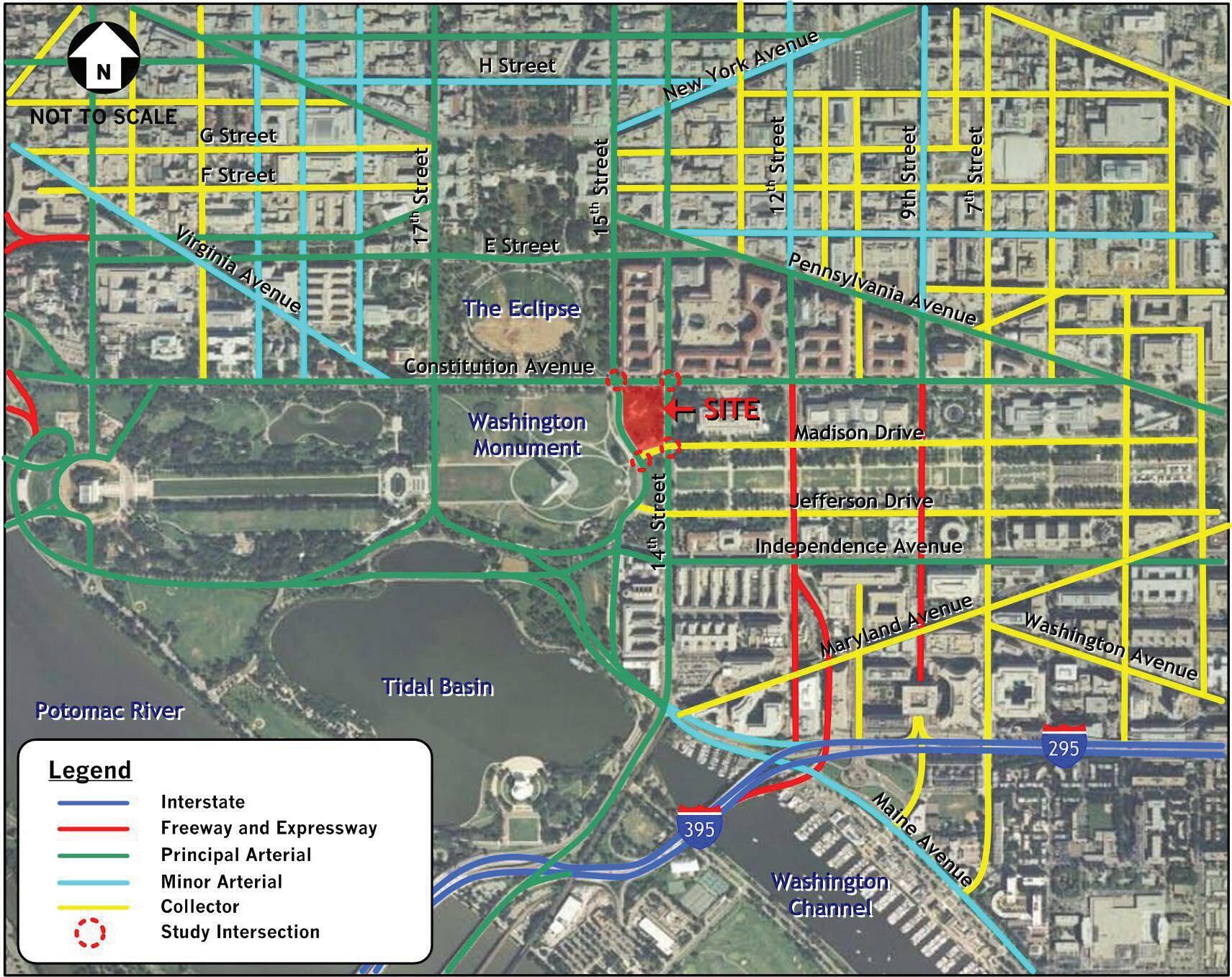
Smithsonian Institution National Museum of African American History and Culture 70 Existing Transportation Conditions Assessment –Nati onal Museum of African American History and Culture 3 August 4, 2008 Figure 2: Functional Roadway Clas sificationsLocal Roadway Network
Figure 2: Functional Roadway Classifications - Local Roadway Network
Existing Conditions
The operational and service characteristics of the key local roadways are described below:
Constitution Avenue • is an eight-lane, two-way principal arterial running east to west to the north of the site. It is designated US 1/50 east of 14th Street. West of 14th Street, it is designated US 50 and connects directly with Interstate 66. This roadway provides direct access to the NMAAHC site and a number of Federal buildings, museums and other visitor attractions, while serving significant commuter and tourist traffic volumes. Curbside parking is provided along both sides of Constitution Avenue with restrictions during the morning and afternoon peak periods. This roadway carries an Average Daily Traffic (ADT) volume of approximately 37,600 vehicles per weekday near the site, with lower volumes on weekends. The posted speed limit is 25 mph.
Fourteenth Street • is a seven-lane, two-way principal arterial running north-south to the east of the site. South of Constitution Avenue, it is designated US 1, and connects with Interstate 395 providing access to Northern Virginia. Fourteenth Street provides direct access to the NMAAHC site and several other museums, Federal buildings, and visitor attractions, and is a major commuter and visitor travel route. Parking is restricted along 14th Street in the immediate vicinity of the site at all times. This roadway serves an ADT volume of approximately 38,700 vehicles per weekday, with lower volumes on weekends. The posted speed limit is 25 mph.
Fifteenth Street • is a four-lane roadway running north-south to the west of the site. It is classified as a principal arterial north of Constitution Avenue. South of Constitution Avenue, it is classified as a local park road by the National Park Service. Fifteenth Street provides access to the NMAAHC site and several museums, Federal buildings, and visitor attractions. Parking is restricted along 15th Street in the immediate vicinity of the site. This roadway carries an ADT volume of approximately 13,600 vehicles on weekdays with significantly lower volumes on weekends. The posted speed limit is 25 mph.
Madison Drive • is a two-lane, one-way westbound roadway situated to the south of the site. It is classified as a local park road by the National Park Service. Madison Drive traverses the Mall from Third Street to 15th Street and provides access to the Smithsonian Institution museums and the National Gallery of Art. No parking is permitted between 14th and 15th Streets. However, a lay-by lane for use by the DC Tourmobile is provided on the north side of the roadway. Madison Drive carries an ADT volume of approximately 9,400 vehicles per weekday. The posted speed limit is 15 mph.
71 Vehicular and Pedestrian Traffic | FREELON BOND
02
The primary intersections providing immediate access to the proposed museum site are as follows:
Constitution Avenue and 14 • th Street, NW;
Constitution Avenue and 15 • th Street, NW;
• 15
14th Street and Madison Drive, NW; and
• th Street and Madison Drive, NW.
Figure 3 illustrates the existing roadway lane configurations and traffic control devices provided at those intersections.
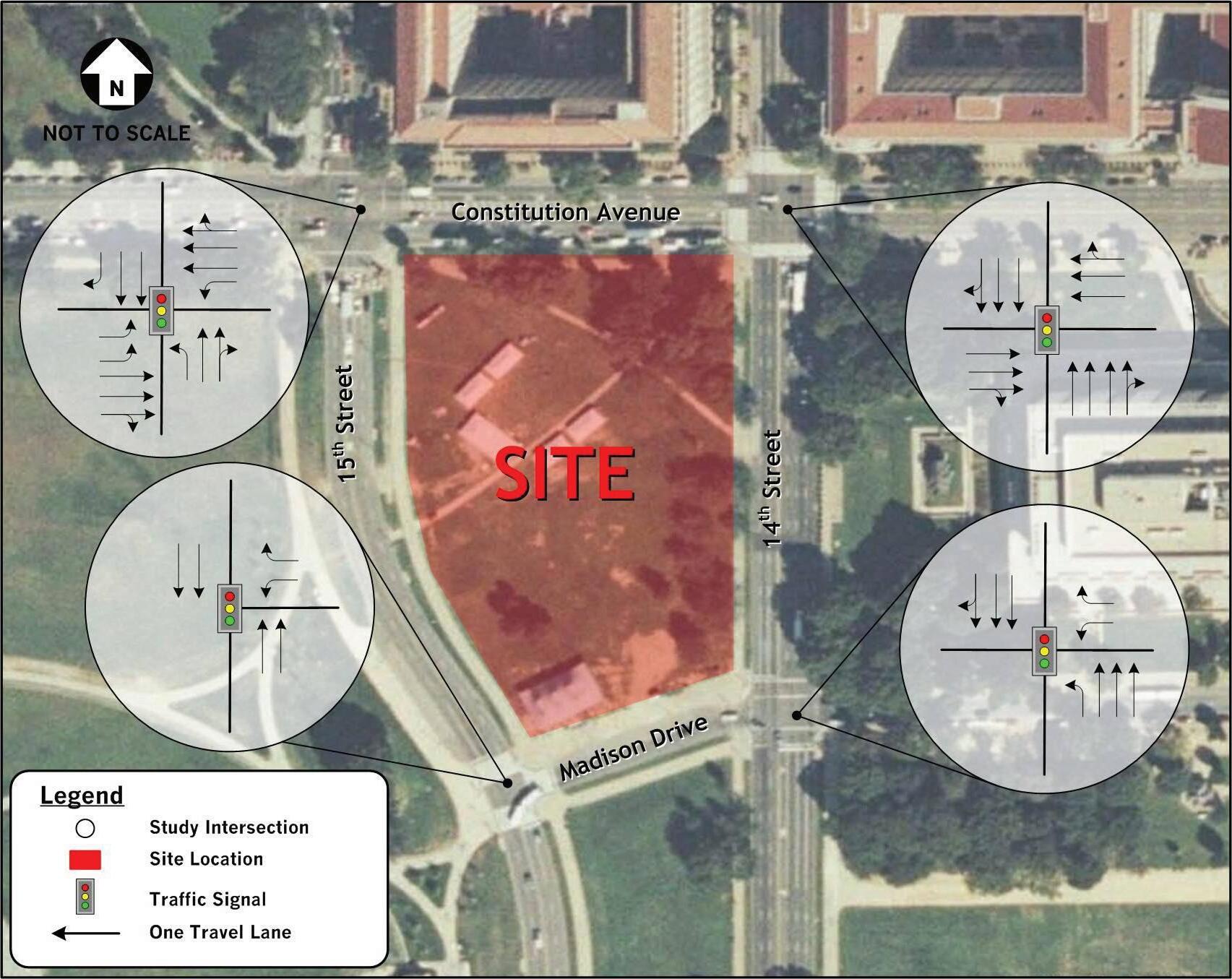
Smithsonian Institution National Museum of African American History and Culture 72
Transportation Conditions Assessment –Nati onal
6 August 4, 2008
Existing
Museum of African American History and Culture
Figure
3: Existing Roadway Lane Configuration and Traffic Control Devices
Figure 3: Existing Roadway Lane Configurations and Traffic Control Devices
PEDESTRIAN AND BICYCLE CIRCULATION
The proposed site is surrounded by an extensive on-street sidewalk and off-street path network providing connections to the National Mall’s museums and monuments, downtown, and the nearby Metrorail stations. The sidewalks on the west side of 15th Street and the south side of Madison Drive, are both designated as bicycle routes and provide bicycle connections to the rest of the National Mall and the Potomac River. Sidewalks exist along both sides of all streets surrounding the site and 2 off-street paths currently cut diagonally across the site itself, connecting 14th Street and 15th Street. Marked crosswalks, curb ramps, and pedestrian countdown timers help facilitate pedestrian crossings to the proposed site at all four of its perimeter intersections.
Most pedestrians within the vicinity of the proposed site appear to be tourists, with a large number of student groups. The dominant pedestrian flows occur east-west along Constitution Avenue and Madison Drive, with lower pedestrian flows north-south along 14th and 15th Streets. These linkages are key connections between downtown and the Metro stations, and the museums and monuments on the National Mall. Figure 4 shows the major pedestrian routes within the immediate area of the site.
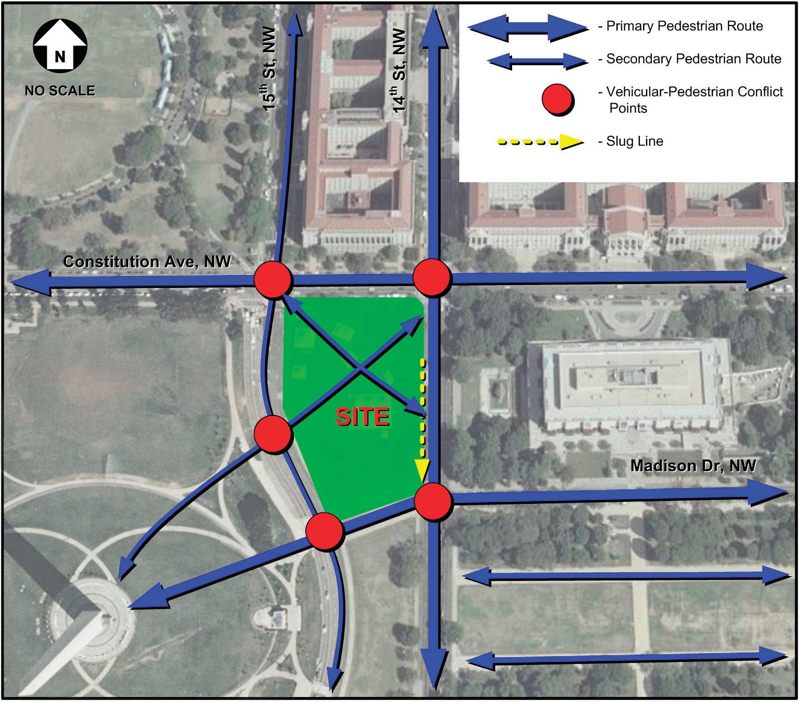
73 Vehicular and Pedestrian Traffic | FREELON BOND
Figure 4: Major Pedestrian Routes
Historical traffic accident data was obtained from the DDOT for the last three-year period for which such data is available (2004 - 2006). The data indicates that the intersection of Constitution Avenue at 14th Street experienced 122 reported accidents, including one that was pedestrian-related. It is also noted that DDOT has included this intersection in its top five percent list of high hazard intersections for calendar year 2006.2 As part of the Highway Safety Improvement Program, states are required to submit an annual report describing not less than 5 percent of their highway locations exhibiting the most severe safety needs. The intent of this provision is to raise public awareness of the highway safety needs and challenges in the states. The report must list the most hazardous locations along with potential remedies and any impediments to the implementation of the remedies excluding cost. Based on the 2007 annual report for the District3, it was determined that the intersection of 14th and Constitution Avenue ranked number nine out of the top five percent high hazard intersections with forty-five crashes, twelve injury crashes and eighteen injuries. The potential remedies identified for this location include improved signal visibility and coordination, and upgraded signage and pavement markings.
The intersection of Constitution Avenue and 15th Street experienced the second highest number of accidents (35), including one pedestrian-related accident which occurred in 2004.
Table 4 – Accident Data Summary (2004 – 2006)
Accident Rate = the number of accidents per million vehicles entering the intersection
PUBLIC TRANSPORTATION
Figure 5 on the following page illustrates the existing public transportation facilities and services discussed below.
Rail
The NMAAHC site is well served by rail transportation systems. These include the Washington Metropolitan Area Transit Authority (WMATA) Metrorail with connections to other regional and national rail lines. The WMATA Federal Triangle and Smithsonian Metrorail Stations, on the Orange and Blue Lines, are situated within a half-mile of the site. The Orange Line runs between New Carrollton, MD and Vienna-Fairfax-George Mason University, VA. The Blue Line runs between Largo Town Center, MD and Franconia-Springfield, VA. These rail lines connect with Union Station (via the Red Line), which serves as the terminus for the Maryland Rail Commuter Service (MARC), Virginia Railway Express (VRE) commuter service, and the Amtrak nationwide passenger rail system.
2 http://safety.fhwa.dot.gov/fivepercent/07dc.htm, US DOT, Federal Highway Administration
3 http://safety.fhwa.dot.gov/fivepercent/07dc.htm, US DOT, Federal Highway Administration.
Smithsonian Institution National Museum of African American History and Culture 74
Intersection 2004 2005 2006 Total Accident Rate Dominant Accident Type (Rear End) Pedestrian Related Constitution Avenue and 15th Street NW 13 10 12 35 0.85 9 (26%) 1 Constitution Avenue and 14th Street NW 38 39 45 122 2.88 35 (29%) 1 Madison Drive and 14th Street NW 9 10 5 24 0.57 6 (25%) 0 Madison Drive and 15th Street NW 1 0 0 1 0.07 0 (0%) 0

Metrobus
Currently the NMAAHC site is served by a number of WMATA Metrobus routes. These routes are as follows:
• 14th Street Line (Routes 52, 53, 54)
The 14th Street Line provides services to eight Metrorail stations including Takoma, Columbia Heights, McPherson Square, Metro Center (54), Federal Triangle (53, 54), Archives-Navy Memorial-Penn Quarter (54), Smithsonian (52), and L’Enfant Plaza stations (52, 54). This Line provides 15-minute headways4 from 4:00 A.M. to midnight on weekdays and weekends, near the proposed site. Routes 52 and 54 also provide bus service after midnight.
• Mt. Vernon Express Line (Route 11Y)
The Mt. Vernon Express Line serves locations in Fairfax County and downtown Alexandria, VA, and the District. This route runs along 14th Street, and operates only during weekday rush hours with 20-minute headways near the site. Northbound service is provided from 6:00A.M. to 9:00 A.M. and southbound service from 4:00 P.M. to 7:00 P.M.
4 Headway is the time difference between transit vehicles arriving at the same stop in the same direction on a given route.
75 Vehicular and Pedestrian Traffic | FREELON BOND
Existing Transportation Conditions Assessment –Nati onal Museum of African American History and Culture August 4, 2008 Figure 5: Public Transportation
Figure 5: Public Transportation
• National Airport-Pentagon-Washington Line (Route 13A, B, F, G)
The National Airport-Pentagon-Washington Line provides bus service to seven Metrorail stations including Archives-Navy Memorial-Penn Quarter, Federal Triangle, Smithsonian, Arlington Cemetery, Pentagon, Crystal City (13F, G) and Ronald Reagan Washington National Airport (13F, G) stations. This Line runs along Constitution Avenue, and operates during weekday and weekend rush hours with 20-minute headways, near the proposed site. Eastbound and westbound services are provided from 5:00 A.M. to 10:00 A.M. and 3:00 P.M. to 7:00 P.M., respectively.
• Anacostia-Eckington Line (Routes P1, 2, 6)
The Anacostia-Eckington Line provides service to seven Metrorail stations including Anacostia, Navy Yard (P1,2), Waterfront-SEU (P1, 2), Federal Center, Metro Center (P6), Gallery Place-Chinatown (P6), and Rhode Island Avenue-Brentwood (P6) stations. This bus line runs along Constitution Avenue, and provides 20-minute headways near the site from 5:00 A.M. to midnight on weekdays and weekends. Route P6 also provides services after midnight.
• Benning Road Line (Routes X1, 3)
The Benning Road Line provides service to five Metrorail stations including Minnesota Avenue, New Your Avenue-Florida Avenue-Gallaudet University (X3), U Street/African-American Civil War Memorial Cardozo (X3), and Woodley Park-Zoo/Adams Morgan (X3) stations. This bus line runs along Constitution Avenue, and operates during weekday rush hours with 15-minute headways near the site. Westbound service is provided from 6:00 A.M. to 9:00 A.M. and eastbound service from 3:30 P.M. to 6:30 P.M.
• Massachusetts Avenue Line (Routes N2, 3, 4, 6)
The Massachusetts Avenue Line provides service to six Metrorail stations including Friendship Heights, Tenleytown-American University Station (N2), Dupont Circle (N2, 4, 6), Farragut North (N2, 4, 6), Farragut West (N2, 4, 6), Foggy Bottom-George Washington University (N3), and Federal Triangle (N3) stations. This bus line runs along Constitution Avenue, and operates on weekdays and Saturday. It provides 30-minute headways from 5:30 A.M. to midnight. The N6 route offers aftermidnight service in the westbound direction only.
Metrobus ridership data obtained from WMATA and field observations indicates that excess capacity is available on the above bus routes, particularly during the off-peak period (9:30 A.M. to 4:00 P.M.).
DC Circulator
The Smithsonian/National Gallery of Art Loop of the DC Circulator system, provided by DDOT, makes continuous loops around the National Mall year-round on weekends between 10:00 A.M. and 6:00 P.M. The stop nearest the NMAAHC site is located on Constitution Avenue, just east of 14th Street and is serviced every 10 minutes. The DC Circulator Route Map is included as figure 6.
Shuttles and Tour Buses
Tour bus operations are concentrated within the National Mall between the Lincoln Memorial and the US Capitol. Major routes through the project area are along Constitution Avenue NW and Independence Avenue SW. The main access routes are New York Avenue NW, Pennsylvania Avenue NW, George Washington Memorial Parkway, I-66, Connecticut Avenue NW, Wisconsin Avenue NW, Arlington Memorial Bridge, and South Capitol Street. Madison Drive NW and Jefferson Drive SW, along the National Mall, are used as dropoff areas. In addition, there are an estimated 300 tour bus spaces throughout the District of Columbia, and at other visitor destinations, such as Arlington National Cemetery and the National Cathedral (DDOT 2005).
Smithsonian Institution National Museum of African American History and Culture 76
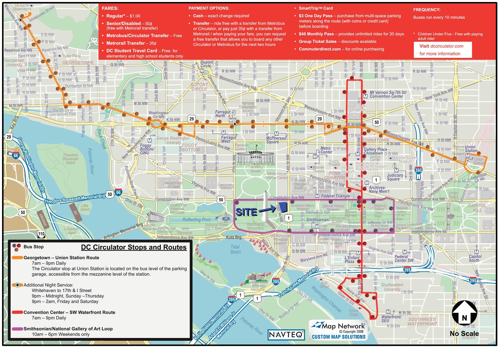
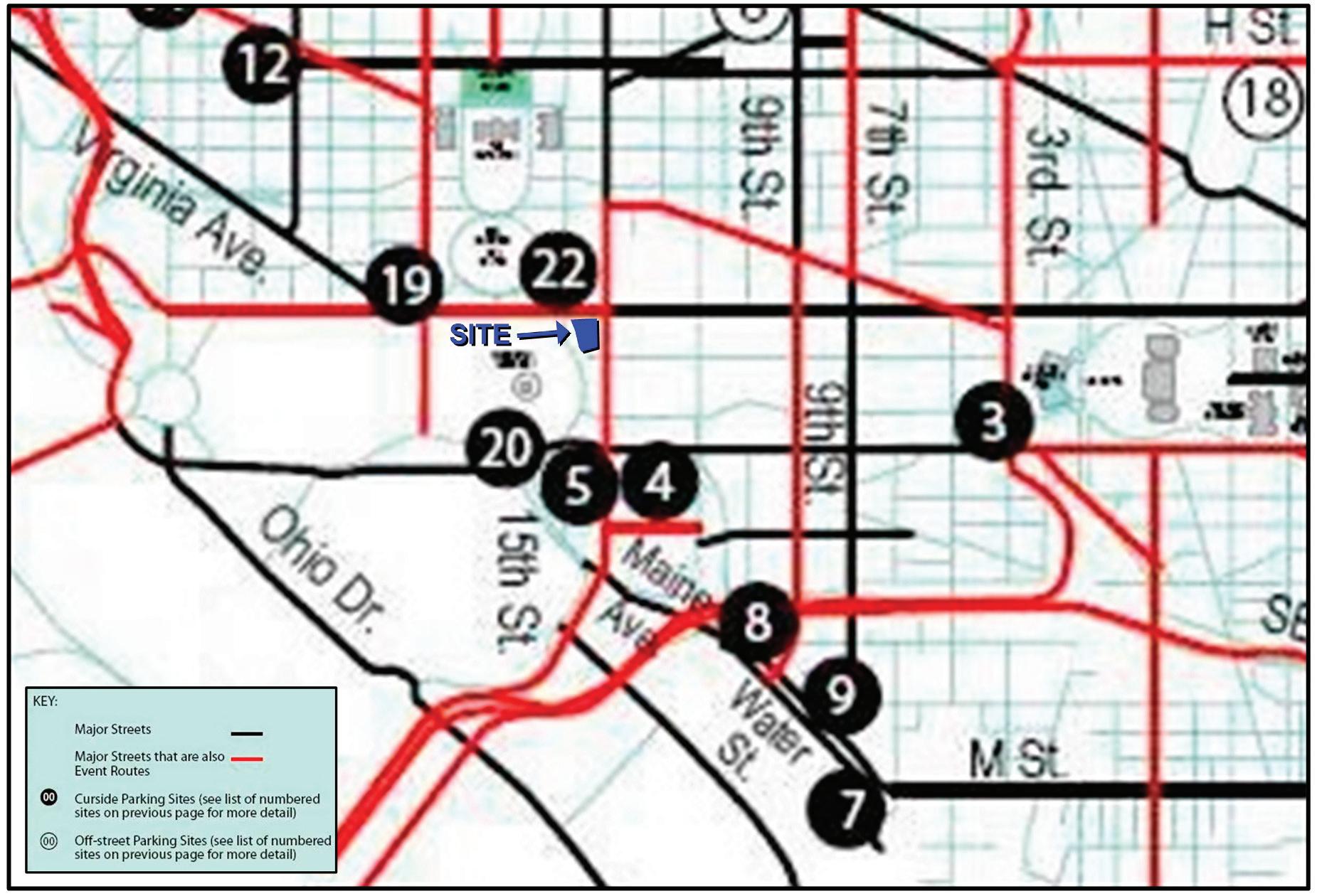
77
|
Vehicular and Pedestrian Traffic
FREELON BOND
Figure 6: DC Circulator Stops and Routes
Figure 7: Tourbus Routes and Parking Facilities Surrounding NMAAHC Site
The Union Station garage provides tour bus parking in the central part of the city. Additional parking facilities are being developed at the old Convention Center site and at RFK Stadium. A section of the city’s Tour Bus Parking Map is included at figure 7.
Tourmobile® Sightseeing provides intermittent shuttle services on the National Mall with routes along 14th Street, 15th Street, and Madison Drive, in the vicinity of the NMAAHC site. Free all-day parking lots are available for Tourmobile® patrons near the Jefferson Memorial. Spaces are limited and available on a first come, first serve basis. Free three-hour parking is available near the West Potomac Park stop on Ohio Drive SW, south of the Lincoln Memorial. Paid parking for both cars and buses is available at parking lots located at Arlington National Cemetery ($1.25 per hour for the first three hours, $2.00 per hour thereafter) and at Union Station. Tourmobile® routes are also accessible within walking distance of several Metrorail stations including Union Station (Red Line), Arlington Cemetery (Blue Line), and Smithsonian (Blue and Orange Line) stations. Figure 5 illustrates the public transportation facilities and services discussed above.
SLUG LINES
“Slugging” is a term used to describe a form of commuting. Slugging occurs when commuters stop to pick up passengers who are total strangers, in an effort to use the high occupancy roadway facilities on I-395 to access various suburban destinations in Virginia. However, this method of informal carpooling is an organized system with its own set of rules and specific pick-up and drop-off locations. It moves thousands of commuters daily, free of charge. The system of “slugging” operates as follows: a motorist needing additional passengers to meet the required high occupancy vehicle (HOV) minimum pulls up to one of the designated “slug” lines and the driver either displays a sign indicating the destination of the car or simply calls it out. The “slugs” (commuters waiting) first in line for that destination then enter the vehicle and confirm the destination. The carpool vehicle then continues to the desired destination.
The southbound side of 14th Street, approximately 150 feet south of Constitution Avenue, is the location of a slug line, which forms primarily during 4:00 P.M. - 6:00 P.M. on working weekdays. Vehicles picking up slugs during the evening peak hour temporarily impact through traffic movements along the southbound curb lane on 14th Street, causing such vehicles to wait until passengers are picked-up or to attempt to go around. In addition, because the slug stop is co-located with a WMATA bus stop, bus maneuvering is also temporarily impacted by the slugging operations (see figure 8).

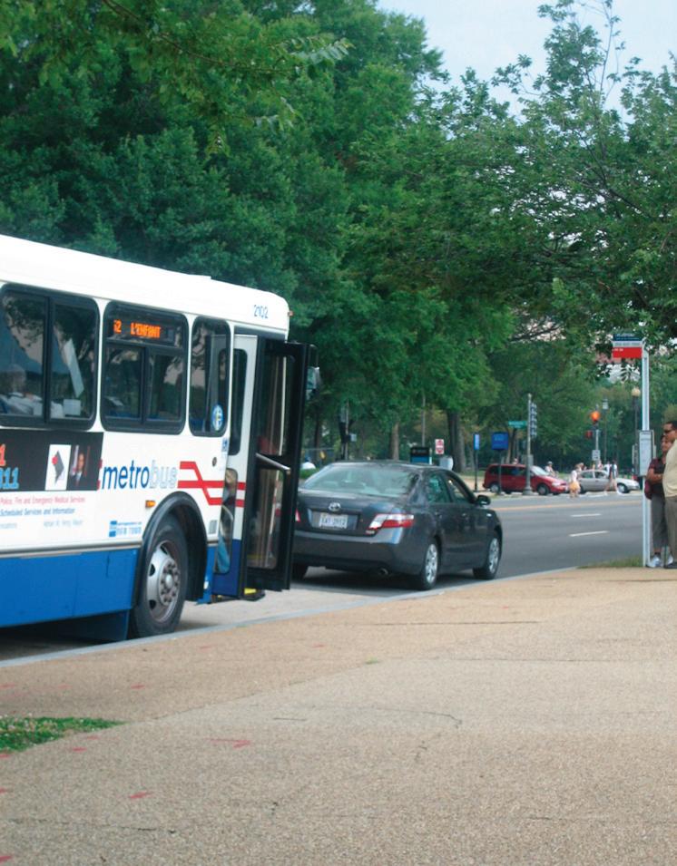
Smithsonian Institution National Museum of African American History and Culture 78
Figure 8: Slug Operations
OTHER ALTERNATIVE MODES OF PERSONAL TRANSPORTATION
Alternative modes of transportation are available to supplement transit access to the site, as well as recreational use within the National Mall. Currently, there are sixteen miles of multi-use trails within the National Mall and Memorial Parks, which support pedestrians, bicycles, water transport/excursion, and personal transportation vehicles. The Segway® HT, a new mode of personal transportation, is an electric, gyro stabilized two-wheeled vehicle with a maximum speed of up to 12.5 miles per hour. Access for persons with disabilities by Segway® HT and electric scooters are available throughout the National Mall. All other users of Segway® HT or electric scooters would be considered recreational users. Recreational use is restricted to specific north-south sidewalks crossing the National Mall. Based on National Park Service policy, recreational Segway® HT riders may cross the National Mall on sidewalks adjacent to streets managed by the District of Columbia, including 3rd, 4th, 7th, and 14th Streets NW.
Segway® HT rentals and tours of District sites are available through private companies. Segway® HT vehicles are also allowed on the Metro trains during evening and weekend periods, as well as during midday off-peak hours. In addition, the National Park Service has integrated the use of Segway® HTs for its staff and US Park Police throughout their sites within the District to increase mobility, while reducing transportation impacts on NPS resources.
EXISTING TRAFFIC VOLUMES
Vehicular and pedestrian traffic counts were conducted at the study intersections between the hours of 6:30 A.M. to 9:30 A.M. and 4:00 P.M. to 7:00 P.M. on Thursday, May 31, 2007, and Wednesday, July 9, 2008. The count summaries are included as Appendix J. Data indicates that the morning and afternoon system peak hours are 8:15 A.M. to 9:15 A.M. and 5:00 P.M. to 6:00 P.M., respectively. The peak hour vehicle and pedestrian volumes are illustrated in figures 9 and 10, respectively.
EXISTING CAPACITY ANALYSIS
Capacity analyses were undertaken for the four signalized intersections providing immediate access to the proposed museum site. These intersections are as follows:
Constitution Avenue and 14
• th Street, NW
Constitution Avenue and 15
• th Street, NW
• 15
14th Street and Madison Drive, NW
• th Street and Madison Drive, NW
These analyses were performed to determine the existing Level of Service (LOS) for the A.M. and P.M. peak hours for the study intersections. LOS is based upon the traffic volume present in each lane on the roadway, the capacity of each lane at the intersection, and the delay associated with each directional movement. The Levels of Service range from “A” being the best to “F” being the worst. LOS D/E is typically used as the acceptable LOS threshold in the District. The levels of service for signalized intersections are defined on the following pages:
79 Vehicular and Pedestrian Traffic | FREELON BOND
Level of Service A describes operations with very low average delay per vehicle, i.e., less than 10.0 seconds. This occurs when progression is extremely favorable and most vehicles arrive during the green phase. Most vehicles do not stop. Short signal cycle lengths may also contribute to low delay.
Level of Service B describes operations with average delay in the range of 10.1 to 20.0 seconds per vehicle. This generally occurs with good progression and/or short cycle lengths. More vehicles stop than for LOS A, causing higher levels of average delay.
Level of Service C describes operations with delay in the range of 20.1 to 35.0 seconds per vehicle. These higher delays may result from fair progression and/or longer cycle lengths. Individual cycle failures may begin to appear at this level. The number of vehicles stopping is significant at this level although many still pass through the intersection without stopping. This is generally considered the lower end of the range of the acceptable level of service in rural areas.
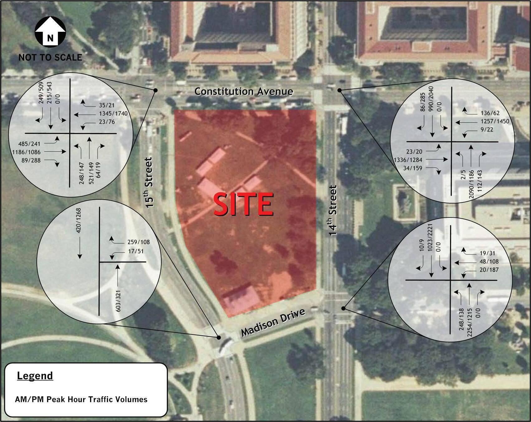
Smithsonian Institution National Museum of African American History and Culture 80
Existing Transportation Conditions Assessment –Nati onal Museum of African American History and Culture 13 August 4, 2008 Figure 6 –Existing Vehicle Peak Hour Volumes
Figure 9: Existing Vehicle Peak Hour Volumes
Level of Service D describes operations with delay in the range of 35.1 to 55.0 seconds per vehicle. At LOS D, the influence of congestion becomes more noticeable. Longer delays may result from some combination of unfavorable progression, long cycle lengths, and/or high traffic volumes as compared to the roadway capacity. Many vehicles are required to stop and the number of vehicles that do not have to stop declines. Individual signal cycle failures, where all waiting vehicles do not clear the intersection during a single green time, are noticeable. This is generally considered the lower end of the range of the acceptable level of service in urban areas.
Level of Service E describes operations with delay in the range of 55.1 to 80.0 seconds per vehicle. These higher delay values generally indicate poor progression, long cycle lengths, and high traffic volumes. Individual cycle failures are frequent occurrences. LOS E has been set as the limit of acceptable conditions.

81 Vehicular and Pedestrian Traffic | FREELON BOND
Figure 10: Existing Pedestrian Peak Hour Volumes
Level of Service F describes operations with average delay in excess of 80.0 seconds per vehicle. This is considered to be unacceptable to most drivers. This condition often occurs with over-saturation, i.e., when traffic arrives at a flow rate that exceeds the capacity of the intersection. It may also occur at high volumes with many individual cycle failures. Poor progression and long cycle lengths may also contribute to such delays.
The capacity analyses were based on: (1) the existing lane use and traffic controls shown on figure 3; (2) the peak hour vehicular and pedestrian traffic volumes for each study intersection (shown on figures 9 and 10, respectively); and (3) the Highway Capacity Manual 2000 (HCM) methodologies (using Synchro 6 software). Table 1 shows the results of the capacity analysis. Copies of the LOS calculation worksheets are included as Appendix K.
The capacity analysis results, presented in table 1, show that the intersections are operating within the arterial roadway congestion standard for DDOT, i.e., Level of Service D/E, based primarily on average vehicular delay (in seconds). It is also noted that the intersection of Constitution Avenue and 15th Street is approaching capacity, with Level of Service D during both the morning and afternoon peak hours.
Moderate queues occur along 14th Street at Constitution Avenue in the northbound direction during the morning peak period, and in the southbound direction during the afternoon peak period. Pedestrian level-of -service analysis was undertaken for the study intersections using the HCM methodology. The results show that pedestrians are provided with acceptable delay conditions (i.e., equivalent to C or better).
The capacity analysis concludes that the museum development would not degrade the existing capacity/ level-of-service conditions, based on the following factors:
Daily visitor person trips would constitute approximately 0.3 percent of the annual visitation
• (2.5 million person trips). The estimate of 2.5 million visitors per year represents the higher range of visitors that would be attracted to the NMAAHC.
Ninety percent (90%) of the daily trips would occur via alternative travel modes including
• transit and walk. The site is adjacent to the Smithsonian and Federal Triangle Metrorail stations and several bus routes along Constitution Avenue and 14th Street. Additionally, most of the visitors would approach the museum by walking from the transit stations and bus stops, and from other visitor attractions on the National Mall and adjacent areas.
No off-street parking would be provided on the site for visitors.
• The study intersections could be improved with optimized signal timing and coordination,
• enhanced pavement markings and other roadway changes to accommodate the projected museum vehicular and pedestrian traffic. These improvements have been identified for the Constitution Avenue/14th Street intersection by the DDOT.
Based on the above factors, the planned museum facility would not have adverse impacts on the operations and safety of the adjacent roadway network.
Smithsonian Institution National Museum of African American History and Culture 82
Table 1 – Capacity Analysis Results: Existing Conditions
Intersection (Approach)
Illegal Left Turns
The intersection of Constitution Avenue and 14th Street prohibits left-turn movements from all approaches except for buses and taxis making such movements from Constitution Avenue. However, field observations found that illegal left turns were observed from all approaches at all times. This violation creates conflict with other vehicular movements and with pedestrians and bicyclists, particularly during the morning and afternoon peak periods. Based on factors stated above, this violation is not likely to increase due to the operation of the planned museum.
PARKING
Previous studies of visitation to the National Mall have shown that there are approximately 2,000 on-street parking spaces within a convenient distance (1500 feet) from the National Mall. The parking supply within the immediate area of the proposed site is limited to metered on-street parking along Constitution Avenue, Madison Drive and Jefferson Drive. Most are priced at $0.25 per 20-minute period with a two-hour maximum. On Constitution Avenue, metered parking is provided along both sides of the roadway, but is restricted during the peak directional periods (i.e., south side between 7:00 A.M. to 9:30 A.M.; and north side between 4:00 P.M. to 6:00 P.M.). Outside of the 7:00 A.M. to 6:30 P.M. period, weekday parking is free-of-charge. This area also contains a number of on-street spaces, which are restricted to specific users that display a permitted decal associated with a government agency, and are not available to the general public.
83 Vehicular and Pedestrian Traffic | FREELON BOND
Existing Conditions A.M. Peak Hour P.M. Peak Hour Delay (sec/ veh) Level of Service Delay (sec/ veh) Level of Service Constitution Avenue and 15th Street, NW Overall 45.8 D 52.9 D Eastbound 47.4 D 50.8 D Westbound 46.6 D 51.4 D Northbound 47.4 D 72.0 E Southbound 34.3 C 53.0 D Constitution Avenue and 14th Street, NW Overall 34.7 C 38.3 D Eastbound 25.9 C 32.6 C Westbound 27.4 C 36.6 D Northbound 51.5 C 22.1 C Southbound 21.1 C 52.3 D Madison Drive and 14th Street, NW Overall 17.2 C 31.3 C Westbound 35.3 C 50.8 D Northbound 15.2 C 7.8 A Southbound 20.5 C 42.7 D Madison Drive and 15th Street, NW Overall 14.0 C 39.4 D Westbound 35.8 C 24.8 C Northbound 8.3 C 27.1 C Southbound 7.7 C 44.3 D
Field observations show that the on-street parking and garage spaces have very high utilization rates (95100%) throughout the year. This results in inefficient circulation by motorists searching for available spaces. Figure 11 shows the location of public on-street parking areas and parking garages near the museum site.
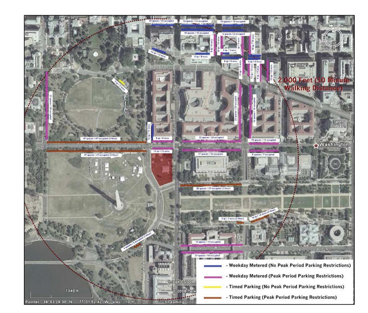
According to the District Office of Tourism and Promotions Tour Guide to Washington, approximately 32 long-term (2-hour limit/ 4-hour limit) and 4 short-term (15 minute limit) parking spaces for tour buses are available within the immediate area of the proposed site. The tour bus parking locations and regulations are summarized in table 2.
Smithsonian Institution National Museum of African American History and Culture 84
Existing Transportation Conditions Assessment –Nati onal Museum of African American History and Culture Figure 8 –Existing Parking Supply and Restrictions
Location Description 1200 - 1300 block D Street SW 10 spaces, 4-hour limit 200 14th Street SW 4 spaces, 15-minute limit 1700 block Virginia Avenue NW 5 spaces, 2-hour limit 200 - 400 block 15th Street 10 spaces, 2-hour limit 1700 – 1900 block 7 spaces, 2-hour limit
Figure 11: Existing Parking Supply and Restrictions
Table 2 – Tour Bus Parking Locations and Regulations
Projected Conditions
DEVELOPMENT PROGRAM
The general operating times of the planned museum would be 10:00 A.M. to 5:30 P.M. every day of the year, except December 25 (Christmas Day). Extended hours would be implemented to accommodate unusually high visitor demand which is likely to occur during special events. The institution would be operated by a 175-person staff, and is expected to be visited by 2.5 million persons annually. The anticipated daily patronage would be in the range of 13,000 persons. Virtually all of the employees would be encouraged, through various transportation demand management measures, to use alternative modes of travel (transit, walking and bicycling). The museum would be provided with underground loading facilities (including truck maneuvering and staging areas) and four parking spaces. No parking spaces will be provided on-site for visitors.
ROADWAY CAPACITY/ LEVEL OF SERVICE
This section evaluates the potential traffic impacts of the planned museum facility. The museum is programmed to be completed and opened to the public by year 2015 which was considered the design year for the purposes of this assessment. The key considerations and results of this assessment are presented in the following sub-sections.
Future (2015) No Build Traffic Conditions
The future (no build) traffic projections are based on the following factors:
Projected increase in through traffic on the study area roadways, until year 2015, based on review 1. of historical Average Daily Traffic (ADT) data for the period 2001 - 2006, and recommendations of DDOT. The historical ADT data indicates that traffic growth along the study area roadways have either remained stable or increased marginally. The DDOT typically recommends consideration of a 2.0% growth factor for planning purposes.
Other planned land use developments and their potential impacts on the study area roadway network. 2.
A significant number of land developments are planned for the general study area, including the US Peace Institute, Vietnam Veterans Memorial Visitors Center, American Veterans Disabled Life Memorial, Dwight D. Eisenhower Memorial, and the Washington, DC, Martin Luther King, Jr. National Memorial. Based on the locations of these developments within the National Monumental Core and their proximity to rail and bus transit services, it is expected that the greater proportion of trips associated with the developments would utilize pedestrian, bicycle, and transit modes. The vehicular trips are also likely to be concentrated during the off-peak periods on weekdays. Therefore, the vehicular trip generation and related impacts of those sites would not be significant.
Roadway improvements planned and/or programmed for the local roadway network. Based on 3. information obtained from DDOT and the other studies cited above, no short-term improvements are programmed for the local area roadway network. However, it is anticipated that transportation improvements would be recommended by the 14th Street Bridge Corridor Environmental Impact Statement being prepared for the Federal Highway Administration. The Draft Environmental Impact Statement (DEIS) is scheduled for public release in December 2008. It is expected that the recommended improvements would enhance access and mobility for passenger vehicles, transit, bicyclists, and pedestrians along the 14th Street Corridor including the NMAAHC site.
85 Vehicular and Pedestrian Traffic | FREELON BOND
03
The potential traffic impacts of the museum were assessed with respect to the four study area intersections, i.e., Constitution Avenue at 14th Street, Constitution Avenue at 15th Street, Madison Drive at 14th Street, and Madison Drive at 15th Street. Capacity analyses indicate that the intersections would operate acceptably under the projected future 2015 (no-build) traffic situation, including the assumed growth in through traffic and the other planned land use developments.
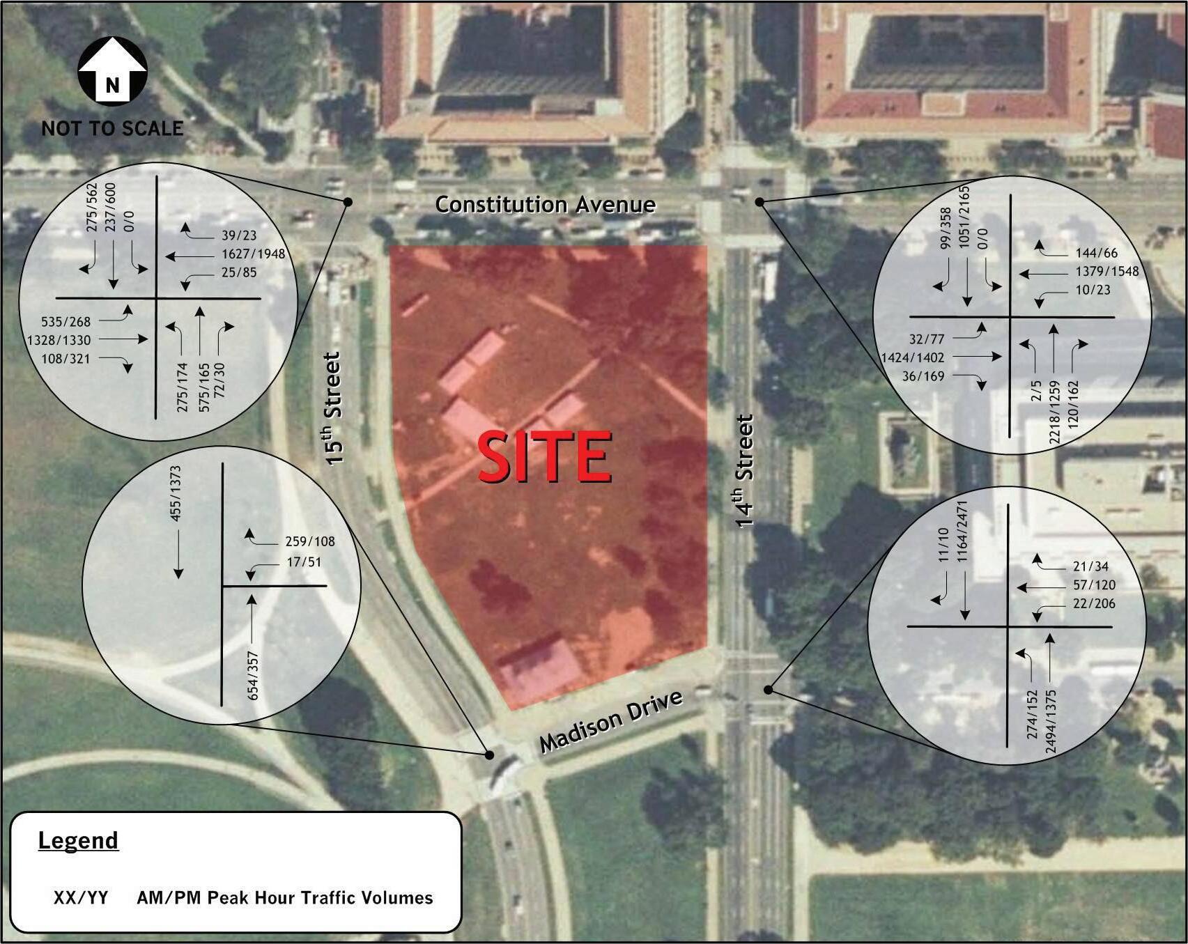
Smithsonian Institution National Museum of African American History and Culture 86
Future Transportation Conditions A ssessment –National Museum of African American History and Culture 9 August 15, 2008 9 Figure 1 –Total Future (2015) Peak Hour Traffic Volumes
Figure 12: Total Future (2015) Peak Hour Traffic Volumes
Future (2015) Total Traffic Conditions
This traffic situation is the combination of the future no-build situation and the projected weekday morning and afternoon peak hour vehicular trip generation and traffic assignment for the planned museum. The projected vehicular trip generation was derived from the projected annual visitor person trips (2.5 million) based on the following assumptions:
• approximately 13,000 persons);
Average daily visitor person trips would constitute 0.3% of the annual visitation (i.e.,
A.M. Peak hour visitor trips would constitute approximately 5% of the daily trips;
• P.M. peak hour visitor trips would constitute approximately 10% of the daily trips;
• Average auto occupancy would be approximately 2.5 persons per vehicle;
• Peak hour modal splits would be approximately 10% - passenger vehicle, 25% - transit, 55% -
• walk, and 10% - other, based on NPS Visitor Transportation Survey findings.
Based on the above considerations, the morning and afternoon peak hour trip generation for the planned museum would be quite low (i.e., 26 and 52 trips, respectively).
The expected trip distribution was determined by information presented in the National Park Services (NPS) Visitor Transportation Survey regarding where visitors stay during their trips to the National Mall, the existing travel patterns, and general familiarity with the District and the adjacent Maryland and Virginia suburbs. It is estimated that approximately 30% of the vehicular trips would generally approach from the north via 14th and 15th Streets, 20% from the east via Constitution and Independence Avenues, 25% from the south primarily via 14th Street, and 25% from the west via Constitution Avenue.
The future (2015) total traffic projections were derived by combining the background (no-build) traffic volumes with the museum traffic assignment. Figure 12 shows the projected total future peak hour (2015) traffic volumes. Capacity analyses were performed to determine the future LOS for the four study intersections and are shown in table 3 on the next page. The results indicate that the planned museum would have minimal or negligible impacts on future roadway and traffic conditions. The study intersections would continue to operate at acceptable levels of service, with the intersections along Constitution Avenue approaching capacity during the afternoon peak hours. The analyses considered increased pedestrian activity at the study intersections due to the planned museum and other adjacent land-use changes.
PARKING
The facility program includes minimal parking (i.e. four spaces). However, no parking would be provided for museum visitors. Over 4,000 on-street and garage parking spaces are provided within walking distance of the site. However, occupancy surveys indicate that available parking is limited during peak demand periods, leading to inefficient vehicular circulation by vehicles on the local area roadways. The operation of the planned museum is not expected to significantly exacerbate this situation, as the majority of the visitors would walk and/or use transit to access the museum. A large proportion of those walking would park several blocks away from the site to visit other attractions along the National Mall and vicinity prior to visiting the museum.
87 Vehicular and Pedestrian Traffic | FREELON BOND
Table 3 – Capacity Analysis Results: Total (2015) Future Conditions
Intersection (Approach)
TRANSIT
The NMAAHC will be served by several public transportation facilities and services. These include the WMATA Federal Triangle and Smithsonian Metrorail Stations on the Blue and Orange Lines, WMATA Metrobus services along the adjacent roadways, and tourist oriented services. Field observations and reports from WMATA indicate that there are no existing capacity constraints, and operational improvements could be made to accommodate increases in demand due to additional land use developments or special events within the area of the proposed site and the National Mall.
PEDESTRIAN AND BICYCLE CIRCULATION
The planned museum would result in a low to moderate increase in pedestrian volumes and conflicts with vehicles, particularly at the four study area intersections. The majority of visitors would likely include pedestrians coming from the National Mall across both 14th and 15th Streets, and crossing Constitution Avenue at 14th and 15th Streets. DDOT recognized that the Constitution Avenue/14th Street intersection is a high hazard location5, and has identified potential mitigation measures that include improved signal visibility, timing and coordination, and upgraded pedestrian signage and pavement markings.
5 http://safety.fhwa.dot.gov/fivepercent/07dc.htm, US DOT, Federal Highway Administration
Smithsonian Institution National Museum of African American History and Culture 88
Future Conditions (2015) A.M. Peak Hour P.M. Peak Hour Delay (sec/ veh) Level of Service Delay (sec/ veh) Level of Service Constitution Avenue and 15th Street Overall 51.5 D 58.9 E Eastbound 43.2 D 48.9 D Westbound 65.4 E 71.2 E Northbound 51.7 D 77.9 E Southbound 34.7 C 46.7 D Constitution Avenue and 14th Street Overall 36.9 D 56.8 E Eastbound 29.8 D 47.3 D Westbound 28.2 E 46.9 D Northbound 52.3 D 19.5 C Southbound 26.2 C 90.4 F Madison Drive and 14th Street Overall 20.8 B 50.6 D Westbound 35.6 D 50.1 D Northbound 19.8 B 16.3 B Southbound 22.0 C 71.4 E Madison Drive and 15th Street Overall 13.9 B 48.1 D Westbound 37.3 D 24.8 C Northbound 8.7 A 27.7 C Southbound 7.9 A 56.0 E
TOUR BUS
Numerous tour bus companies operate within the project area, in addition to several private sightseeing operators that provide hop-on and -off services. The planned museum would increase the number of tour bus trips to the project area. However, these additional trips would not have significant impacts. According to the District Office of Tourism and Promotions Tour Guide to Washington, 36 short-term parking spaces for tour buses are available within the immediate area of the proposed site.
Tour buses would be accommodated on the curb lanes along 14th and 15th Streets (adjacent to the site), and in the existing lay-by facility located along Madison Drive to the south of the museum site. The lay-by lane would also accommodate school and shuttle buses, automobiles, and taxis accessing the proposed site. The use of the curb lanes along 14th Street would be restricted to the southbound direction during the off-peak periods when excess roadway capacity would be available to prevent any significant adverse impacts to through traffic movements.
SERVICE ACCESS
Service access for the proposed museum would have no significant impact on the surrounding transportation system based on the envisaged service access, circulation, and staging provisions. The service area would be located under the museum, with access provided from 14th Street and/or 15th Street. Fourteenth Street is a multi-lane principal arterial which is directly connected to the I-395 freeway to the south. Service and delivery vehicle arrivals would be restricted to weekday and weekend off-peak daytime and night-time periods when the prevailing traffic volumes on the adjacent streets would be significantly lower compared with the peak commuting periods. Both 14th and 15th Streets are multi-lane facilities, and the access points will be provided with adequate turning radii and pedestrian safety features. These provisions would enable the ingress and egress movements to occur without significant vehicular and pedestrian traffic impacts. However, DDOT expressed concerns regarding the 14th Street access and additional discussions between DDOT and SI will need to occur during future phases of the development of the NMAAHC. The potential for vehicle queuing along the adjacent streets would be eliminated by the provision of an underground staging area, in conjunction with appropriate scheduling of truck arrivals.
Use of the four underground parking spaces identified in the facility program spaces would have no impact on service vehicle access and circulation, or the adjacent roadway network.
89 Vehicular and Pedestrian Traffic | FREELON BOND
POTENTIAL IMPROVEMENTS
Based on the above, the following improvements should be considered for discussion with DDOT and/or the National Park Service:
Signal optimization and coordination along Constitution Avenue, 14
• th Street, and 15th Street in the vicinity of the site;
Pedestrian safety measures at the study area intersections, including the following:
• Optimized pedestrian count-down signal operations; 1. Enhanced signage and police enforcement to prohibit left-turns by all vehicles, except 2. buses and taxis, at the Constitution Avenue/14th Street intersection; Ladder-patterned crosswalks for greater visibility; 3. 10-foot distance between stop bars and crosswalks to better separate motorists from 4. crossing pedestrians; and New curb-ramps facing crosswalks as opposed to the center of the intersection. 5.
Enhanced signage prohibiting parking on 14
• th and 15th Streets along the site.
Signage restricting charter bus drop-off and pick-up activity to 10:00 A.M. - 3:00 P.M. on 14
• th and 15th Streets along the site.
Smithsonian Institution National Museum of African American History and Culture 90
Key Findings
The key findings of the Existing and Projected Transit, Vehicular and Pedestrian Traffic Conditions are as follows:
The site is well served by roadway and pedestrian facilities providing regional and local site 1. access.
The study area roadways and intersections currently operate within the DDOT congestion/ 2. level-of-service standards and would operate at acceptable Levels of Service upon build-out of the planned museum by 2015. The intersection of Constitution Avenue and 15th Street is approaching capacity with Level-of-Service D during both the morning and afternoon peak hours.
Vehicles make illegal left turns at the intersection of Constitution Avenue and 14 3. th Street, creating a potentially dangerous situation for other vehicles and pedestrians. This violation is not likely to increase due to the operation of the planned museum.
The co-location of the slug line with the WMATA bus stop impacts bus maneuvers and the flow 4. of through traffic along the southbound curb lane on 14th Street. However, these impacts occur temporarily during 4:00 - 6:00 P.M. on working weekdays.
The planned museum would result in a low-to-moderate increase in pedestrian volumes 5. and conflicts with vehicles, particularly at the four study area intersections. DDOT identified the Constitution Avenue at 14th Street intersection as a high hazard location for calendar year 2006 6 and identified potential roadway improvements (optimized signal timing and coordination, enhanced pavement markings and other roadway changes) for the 14th Street intersection. Those improvements should be considered also for the 15th Street intersection.
The site is served by major transit services, including the WMATA Federal Triangle and 6. Smithsonian Metrorail Stations, several WMATA Metrobus routes along Constitution Avenue and 14th Street, tourist oriented bus services and additional transit service provided by the DC Circulator operated by the DDOT. Field observations and reports from WMATA indicate that there are no existing capacity constraints, and operational improvements could be made to accommodate increases in demand due to additional land use developments or the anticipated major special events within the area of the proposed site and the National Mall.
The planned museum would marginally increase the number of tour bus trips to the project 7. area. Tour bus drop-off and pick-up activities would be accommodated on the curb lanes along 14th and 15th Streets during the off-peak periods, and in the existing lay-by facility located along Madison Drive to the south of the museum site. The lay-by lane would also accommodate school and shuttle buses, automobiles, and taxis accessing the proposed site.
On-street and garage parking within the vicinity of the museum site is heavily utilized during 8. peak demand periods, leading to inefficient vehicular circulation in search of available spaces. The operation of the planned museum is not expected to significantly exacerbate this situation as the majority of the visitors would walk and use transit to access the museum.
Access to/from the proposed museum service/parking areas is anticipated to have no 9. significant impacts on the surrounding transportation system. (Final access strategy to be discussed with DDOT and determined during design phase)
6 http://safety.fhwa.dot.gov/fivepercent/07dc.htm, US DOT, Federal Highway Administration.
91 Vehicular and Pedestrian Traffic | FREELON BOND
04
In conclusion, the planned museum facility could be developed without any significant adverse impacts on existing and future traffic and parking conditions within the local area of the site. However, this study has identified potential improvements above which would enhance site access and reduce traffic impacts.
Smithsonian Institution National Museum of African American History and Culture 92
D Site Analysis
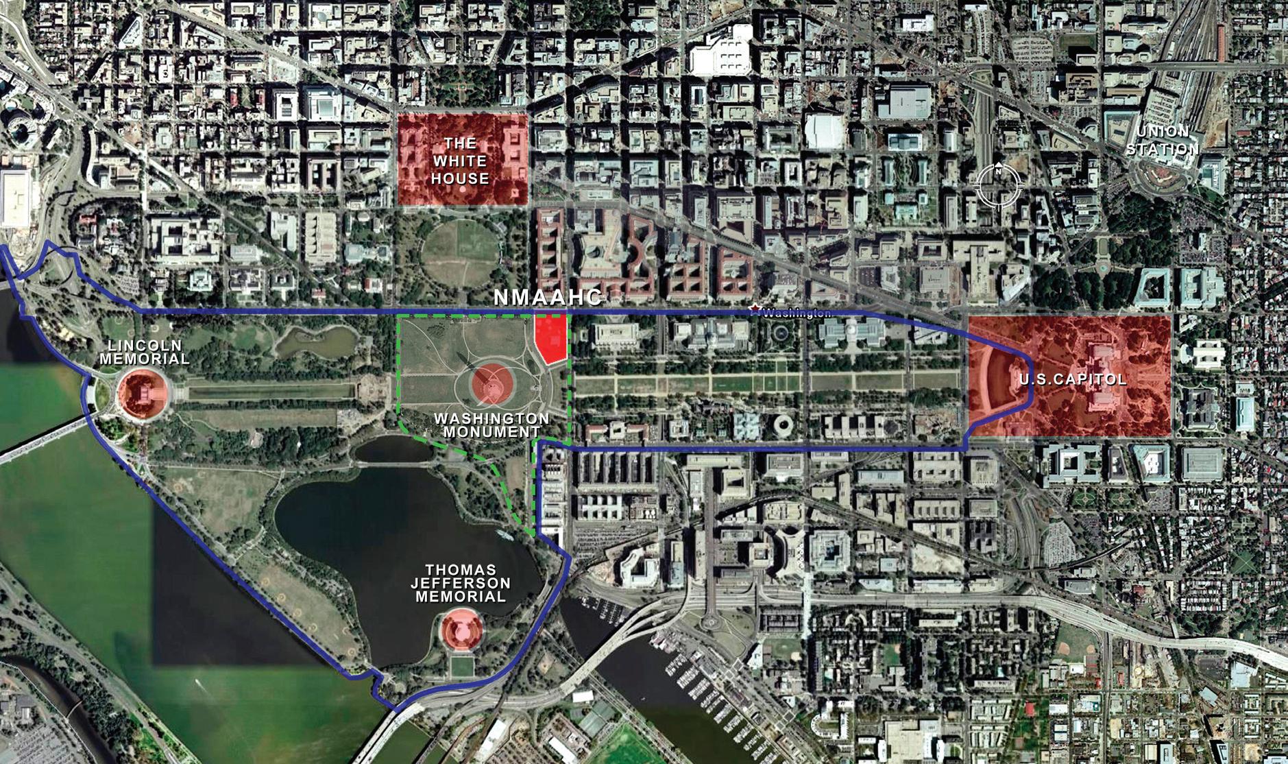
http://maps.google.com
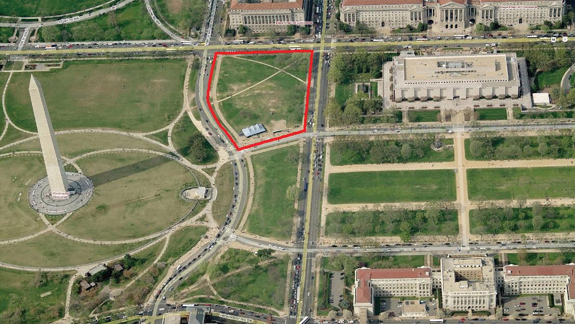
http://maps.google.com
Smithsonian Institution National Museum of African American History and Culture 94
Aerial View of the Site
NMAAHC site within the Washington Monument Grounds
National Mall Washington Monument and Grounds
5-minute Brisk Walk from Site 10-minute Brisk Walk from Site
NMAAHC site within the Monumental Core
Site Planning Criteria
General Description
The approximately 5-acre site for the National Museum of African American History and Culture (NMAAHC) is located within the Washington Monument Grounds.
Just a brisk 10-minute walk from the main axial buildings: the U.S. Capitol, the Lincoln Memorial, and the Jefferson Memorial, and a 5-minute walk from the White House, the site is most clearly identified as located at the toe of the northeastern slope of the Washington Monument.
Close to the intersection of the Legislative and Executive Axes of the L’Enfant and McMillan Commission Plans, marked symbolically by the Washington Monument, the site is also at the edge of the Federal Triangle, within the National Mall Historic District and the Monumental Core of downtown Washington, DC.
The site functions as a literal crossroads for pedestrian traffic circulating from the National Mall to the White House and the Ellipse, and from the Washington Monument to the Federal Triangle. A National Park Service (NPS) concessionaire is currently sited on the southwest corner. The site is also used as a staging ground for special events such as marathons.
On the ground the site is characterized by a gentle upward slope from north to south with occasional abrupt micro grading transitions at the site edges, by lawn intersected by diagonal crossing pathways, and a sparse planting of trees.
Overall, the site is currently open space that is well defined by the vocabulary and character of the surrounding area National Mall and Washington Monument grounds. However, the particularities of view sheds, topography, vehicular access, pedestrian flow, and other site conditions are unique and serve as both opportunities and challenges for the designers. Successful schemes must respond to the larger scale landscape context while providing spaces particular to the museum that address the complex topography and circulation through the site.
95 Site Analysis | FREELON BOND
01


Smithsonian Institution National Museum of African American History and Culture 96
View north toward site from along 15th Street
View West toward site
View from site southwest toward the Washington Monument
View northeast toward site from Washington Monument and grounds
site images: Monica E. Bower


97 Site Analysis | FREELON BOND
Site looking east from 15th Street
Site looking northwest along 14th Street with U.S. Department of Commerce in the background
Site looking northeast from the foot of the Washington Monument Grounds
site images: Monica E. Bower
Tiber Creek
The Robert King Map of 1818 depicted the former route of Tiber Creek and the Washington City Canal

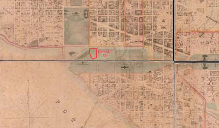
Map of Washington City [Boschke, 1857]
Detail showing the NMAAHC site in relation to the Washington City Canal
Smithsonian Institution National
of African American History and Culture 98
Museum
Reps 1997:67;CLP file
“Robert King 1818 Mall”
NMAAHC Site
Geologic History
The northwesterly half of the NMAAHC site was originally within Tiber Creek which ran along the northern edge of the National Mall roughly where Constitution Avenue is today. The site formed part of the edge of the creek that served the city.
Due to the presence of differential soils and sluggish subsurface drainage, both of which are evident of the former canal in this area, construction of the NMAAHC will require extensive geotechnical analysis and design of subsurface soils to ensure soil stabilization and to improve drainage throughout the site. This should be accounted for early in the design process and adequately budgeted into the overall site construction costs.
99 Site Analysis | FREELON BOND
City Geometry and Axial Alignments

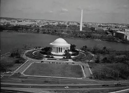

Smithsonian Institution National Museum of African American History and Culture 100
View along Executive Axis from south to north
View along Legislative Axis from west to east
Boucher, 1992b
Axis NMAAHC Site Building Alignments 50’ Security Setback
Boucher, 1992a
Axial Relationships
The site is located near the crossing point of the Legislative and Executive Axes. These seemingly perfect axial alignments between the White House, the Washington Monument, and the Jefferson Memorial north to south, and the the Lincoln Memorial, the Washington Monument, and the U.S. Capitol west to east are of invaluable cultural significance, and provide wonderful large scale organization to the open space. In fact, the location of the Washington Monument was shifted to the southeast to avoid unstable subgrade soils. The slightly slipped axes have added to the power of these geometries by allowing simultaneous views along each axis, composing remarkable scenes.
The site provides interrelated experiences of urban planning geometry, architecture, and landscape. The potential and responsibility of the new museum and landscape to relate to this unique condition is paramount to the success of the project.
101 Site Analysis | FREELON BOND
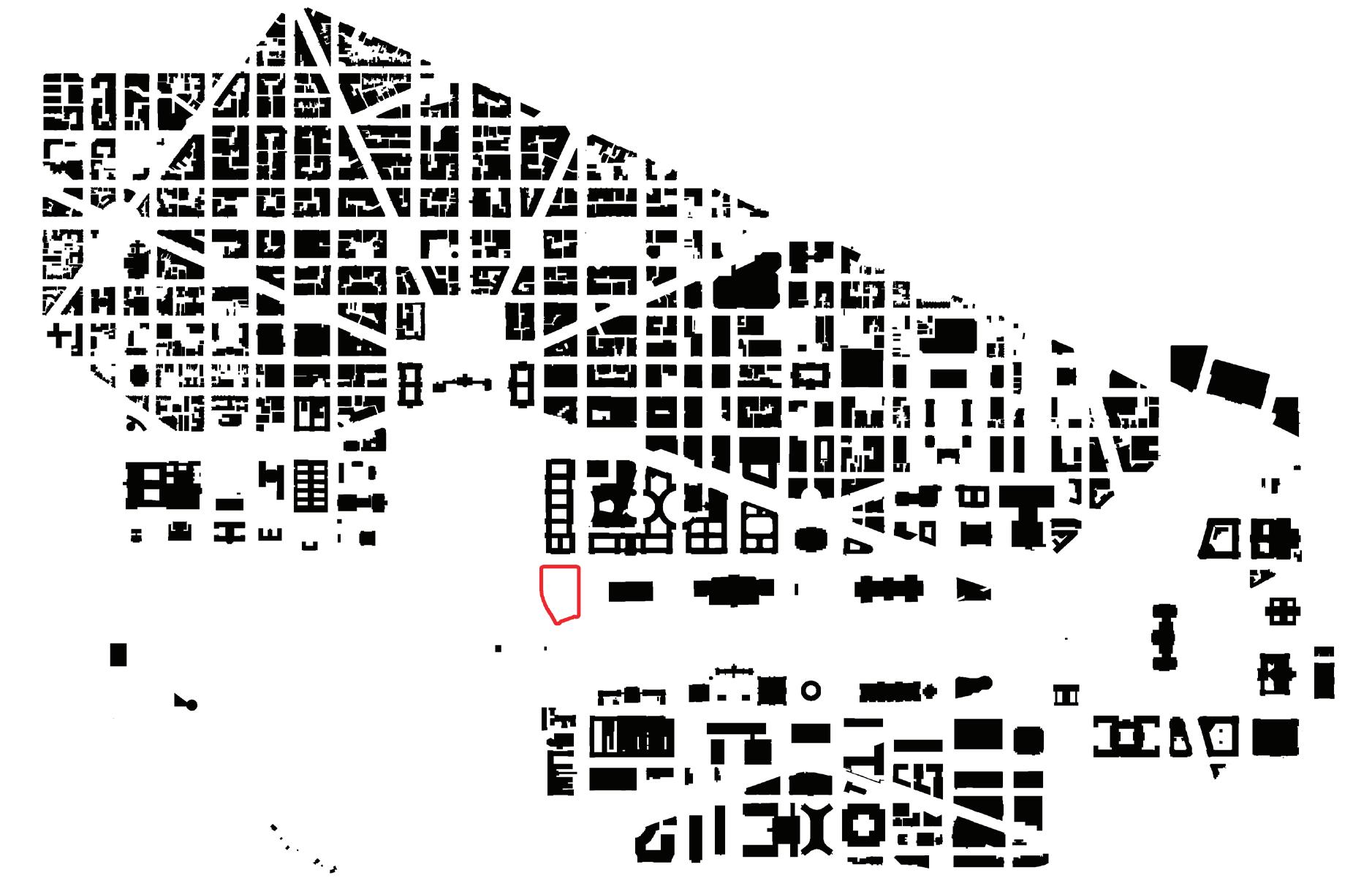
Detail Buildings

Smithsonian Institution National Museum of African American History and Culture 102 Buildings NMAAHC Site Existing Building
Geometries and Setbacks
The site is characterized by two related geometrical relationships within the context of the L’Enfant and McMillan Commission Plans: it has a strong axial relationship to the National Mall, and yet also creates an important edge for the Washington Monument and grounds.
Building setbacks for the site create a secure perimeter and establish relationships to existing buildings and landscape elements that surround the site. While no specific minimum setback has been determined as yet, a 50’-0” setback measured from the inside face of the sidewalk--as shown in the blocking and stacking diagrams provided in this report--has been established as a general design principle. The EIS report suggests a setback of 50’-0” from surrounding streets as a general design principle.
Street trees, relatively level topography, and formal vehicular entries for existing museums along Constitution Avenue provide a larger order, grander scale, and sense of address that the new museum should consider as it develops its northern edge. The setback along the National Mall at Madison Drive is significantly more complex, primarily due to a pronounced change in elevation beginning at the west façade of the National Museum of American History and the corresponding terminus of the linear plantings of elms on the National Mall. Perceived relationships between the proposed site and the existing line of museums are made more exceptional and further complicated by the site’s topography as it rises up to the Washington Monument at the southwest.
Architectural Relationships to Surrounding Buildings
The museums that comprise the National Mall are set within a green park landscape. The proposed site faces the solid, massive, urban beaux-arts façades of the Federal Triangle on the north edge of Constitution Avenue. It also relates to the existing museums at the south edge of Constitution Avenue, designed as a series of palaces set within the park, containing grand arrival and entry experiences. The museum site, the smallest element at the end of this northern line of grand palaces, will be located at the base of the Washington Monument, a juxtaposition that must be reconciled with sensitivity. The Washington Monument is equidistant between the site and the Holocaust Museum. Diagonal views of and topographical relationship to the Washington Monument and grounds should be considered. Less immediate, the site is near the White House, situated to the southeast of the Ellipse, its architectural relationship to the White House largely mitigated by this open space.
Each adjacent building will in turn have a relationship to the new museum building. From the Washington Monument there is an opportunity to draw visitors as well as the potential to view a smaller symbolic image from above and in the air. From the National Mall the new museum could also express openess and symbolic mystery, but must be composed with the Monument.
The presence, siting, and character of surrounding buildings will provide a complex set of relationships for the new museum, but of equal importance is the open space that surrounds the site. Existing diagonal pedestrian circulation from the northwest to the southeast, or from the Ellipse to the National Mall moves easily through the now current park-like environment of the site. The building and landscape should relate equally to open space and adjacent buildings.
103 Site Analysis | FREELON BOND
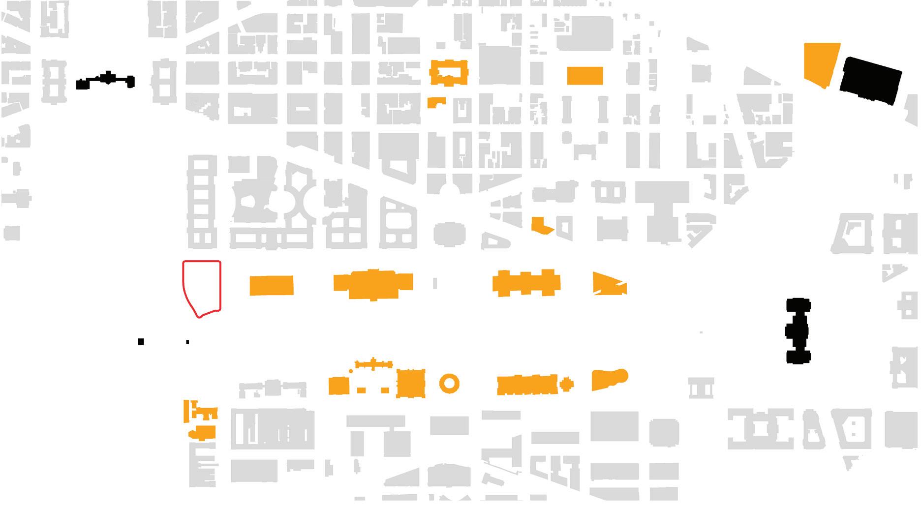
Existing

Smithsonian Institution National Museum of African American History and Culture 104
Landmark Building
Building
NMAAHC Site
Washington Monument
U.S. Dept. of Commerce
National Museum of American History
National Museum of Natural History
National Gallery of Art West
National Gallery of Art East
National Museum of the American Indian
National Air and Space Museum
Dept. of Agriculture
Smithsonian Castle, Hirshhorn Museum
Freer Gallery of Art, Arts and Industries Building
Arthur M. Sackler Gallery, National Museum of African Art
D.C. Visitor Center District Building Ronald Reagan Building and International Trade Center
NMAAHC Site Museum
Museums
Building Footprint
Museums
Bilaterally symmetric along the Legislative Axis, a series of museum buildings flanks the north and the south sides of the National Mall and ceremonially relate to Constitution and Independence Avenues. The buildings relate to the city grid and surrounding streets and generally present broader facades on the north and south than the east and west, also corresponding to the buildings’ primary entries. By comparison, the museums occupy less of their parcels than the Federal Triangle buildings and emphasize the underlying landscape park. The site for the new museum is similar to both the National Gallery of Art East Wing and the National Museum of the American Indian, as it formally ends a row of museums and has a significantly smaller parcel of land available for development in the east-west dimension.
Controlled entry and security for a museum’s collections can be at odds with the desire to attract visitors. The secure perimeter required of a national museum should assist with the elegant resolution of these programs.
105 Site Analysis | FREELON BOND
Modern Topsoil; Brown (10yr 5/3) Silt Loam (1/2 ft)
Mixed Fill; Yellowish Brown (10yr 5/8 and 10yr 5/4) Silt Loam (1/2 ft)
Mixed Fill; Dark Brownish Yellow (10yr 4/4) and Strong Brown (7.5yr 5/6) Silt Loam with Brick, Charcoal and Rock ( 1 1/2 ft)
Mixed Fill; Very Pale Brown (10yr 7/4) and Yellowish Brown (10yr 5/6) Silt Loam with Charcoal and Shell (1ft)
Fill; Yellowish Brown (10yr 5/6) Silt Loam (2ft)
Fill; Dark Yellowish Brown (10yr 4/6) Sandy Clay Loam with Gravels (1 1/2ft)
Clay and Gravel; Brown Sandy Clay and Gravel Fill (4ft)
Clay and Sand; Fine Brown Gray Clay Sand (2ft)
Sand and Gravel; Course Brown Sand and Gravel, Trace Clay (15ft)
Sand and Gravel; Medium Brown Sand and Gravel (4ft)
Sand and Gravel; Course Brown Sand and Gravel, Trace Clay (15ft)
Sand; Fine Gray Silty Sand (4ft)
Sand and Gravel; Course Brown Sand and Gravel, Trace Clay
Silt; Gray Silt, Trace Sand and Organic Matter
Sand and Gravel; Course Gray Silty Sand and Gravel
Rock; Green Gray Disintegrated Rock
Rock; Green Gray Rock
Perched Water 12ft Below Ground
Sustained Ground Water 20ft Below Ground

Adapted from Environmental Impact Statement & Section 106, Phase II Archaeological Investigation for the National Museum of African American History and Culture District of Columbia Final Report and the NMAH Subsurface Soil and Washington Monument Subsurface Soil charts (Source: NPS: Site Evaluation Study Phase 1: Data Gathering Report)
Smithsonian
of
History
106 Soils
Institution National Museum
African American
and Culture
A Q A B C D E F G H J K L M N O P Q I
Below Ground: Water, Soils, and Existing Utilities
A high water table and unstable sub-grade conditions as well as the location of the site immediately adjacent to the 100-year flood plain will present particular challenges to basement and loading dock design, horticulture, and stormwater management.
Existing utilities, particularly large scale storm water lines, are significant items for future coordination.
107 Site Analysis | FREELON BOND

Vehicular Circulation
Vehicular Circulation Traffic
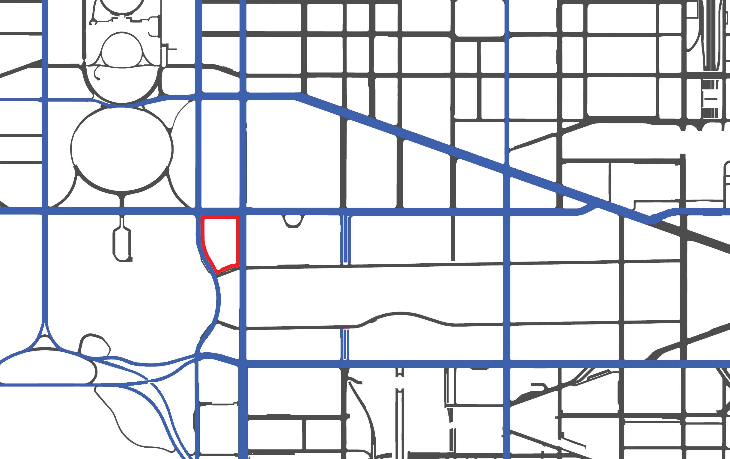
Through Road
Smithsonian
National
of African American History and Culture 108
Institution
Museum
Existing Building
NMAAHC Site
NMAAHC Site
Circulation
Vehicular circulation is organized by the city grid. At first impression it seems a fairly simple set of roads break at the National Mall to preserve its open space character. Closer analysis reveals a particular set of opportunities and constraints for the museum site. Tourmobiles currently circulate from Constitution Avenue to 14th Street to Madison Drive, providing three street views of the museum site. Opportunities for vehicular experiences of the museum should be considered in the round. Mitigation for the noise and the visual presence of adjacent traffic may be necessary both in the open space and within the museum interior.
Public Transportation to the museum is primarily provided by Metro with stops at the Smithsonian, the Federal Triangle, and the National Archives nearby. Consideration of sequenced movement, from Metro station to pedestrian path and so forth should be evaluated. Efforts to encourage the use of public transportation will be part of the sustainable goals for the project. Existing Tourmobiles, a private concession, and travel along 14th Street to 15th, currently offer views of three sides of the museum site. One line of the DC Circulator, a natural gas powered bus for tourists and locals, operates on the weekend, traveling east along Constitution Avenue with a stop in the block immediately east of the site.
Pedestrian circulation is also organized by two systems: the city grid and the park landscape. In areas where the city grid extends through the site, the walks extend the circulation patterns of surrounding streets and correspond to relatively flat ground. In park areas, a more picturesque, curvilinear organization of pathways is used and the paths respond to the slight undulations of topography. Significantly, sidewalk widths vary within these two systems and grow particularly wide (up to 30’-0” wide) on the National Mall itself. The wide paths offer a unique condition for events and flexible use of the open space in combination with the trees and flat ground. Though perhaps obvious, it is important to clarify that much of the pedestrian circulation is not constrained by locations of paths or sidewalks and in particular when there are large events crowds and individuals move through the lawn areas in every direction.
109 Site Analysis | FREELON BOND
Public Transportation

Existing Tourmobile Stops Metro Stops
Sidewalks
Tourmobile Route
NMAAHC Site S M
DC Circulator - Smithsonian/ National Gallery of Art Loop

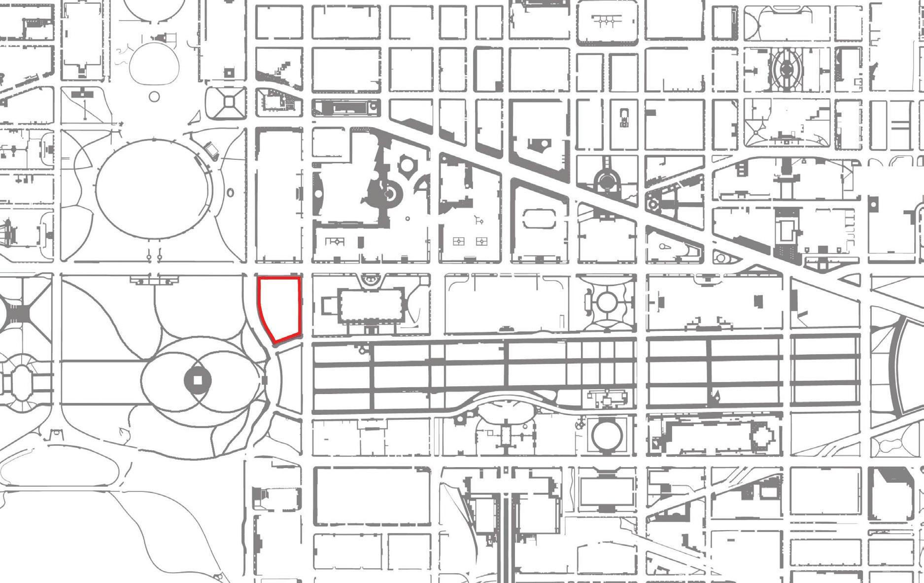
DC Circulator Stops NMAAHC Site
Smithsonian Institution National Museum of African American History and Culture 110
http://maps.google.com
Pedestrian Circulation, paved only

Pedestrian Circulation
NMAAHC Site
Pedestrian Circulation, desire lines
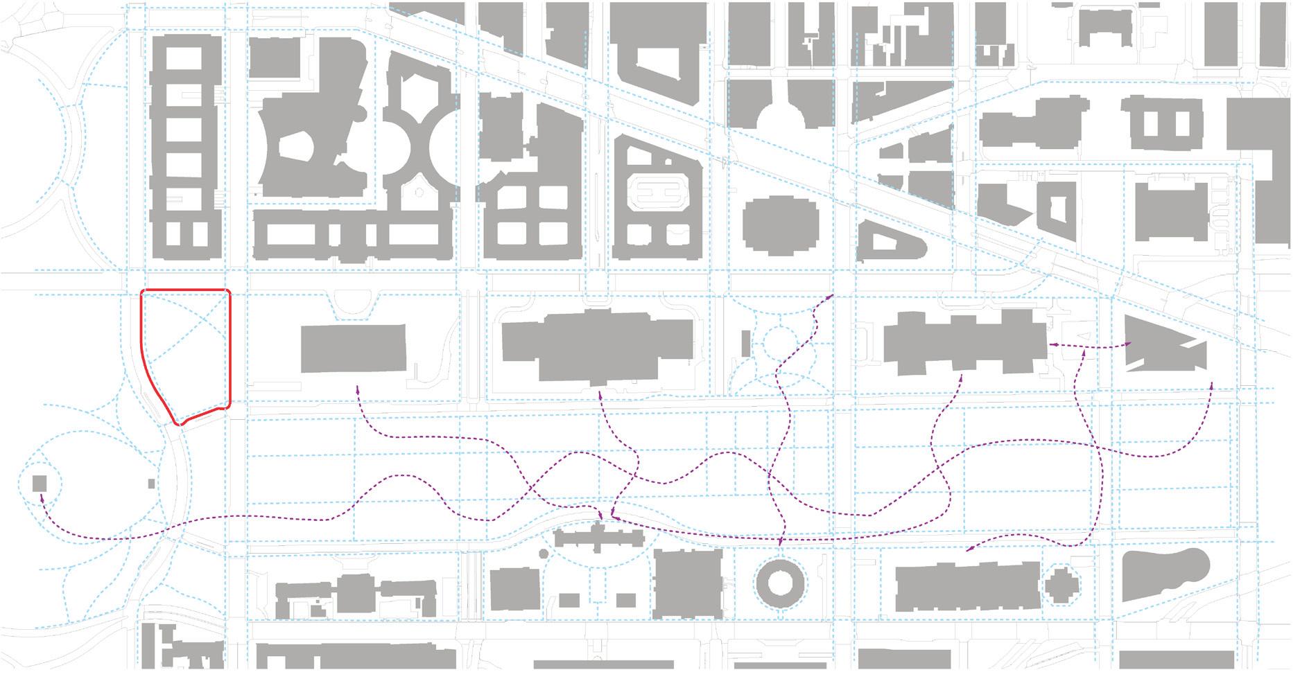
Pedestrian Free Movement
Pedestrian Circulation
Site
111 Site Analysis | FREELON BOND
NMAAHC
Public Identity
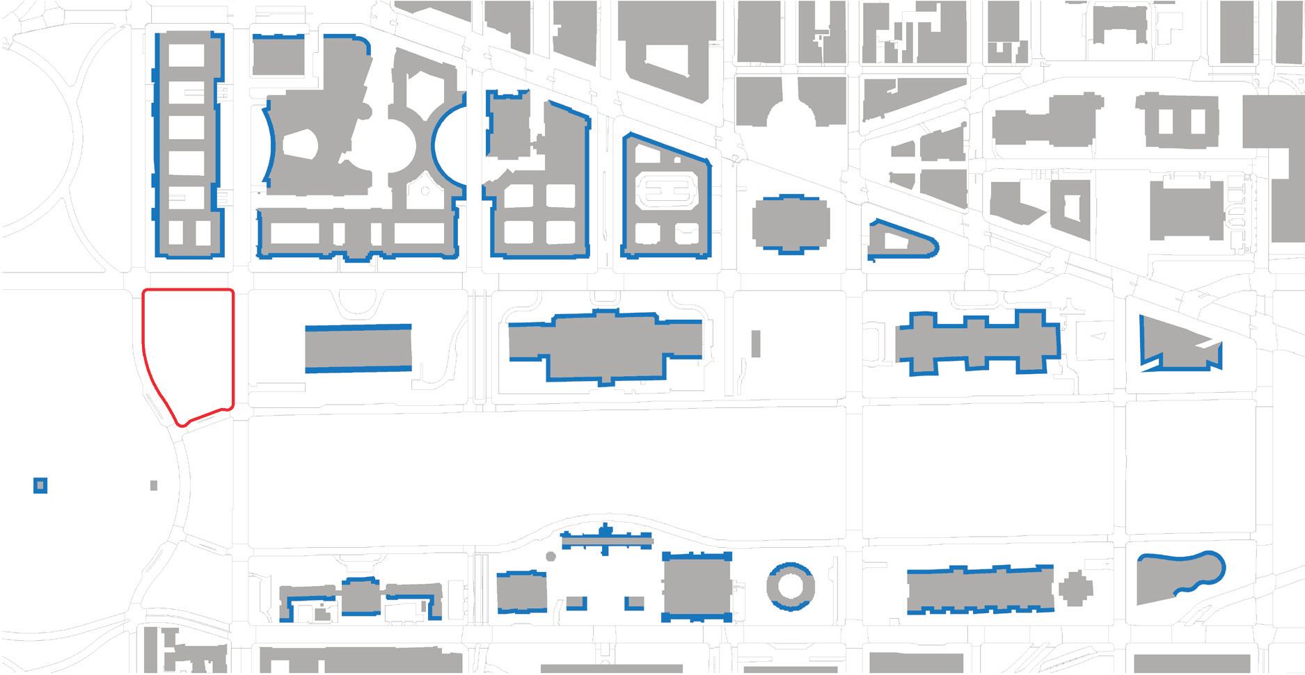
Diagonal Experience
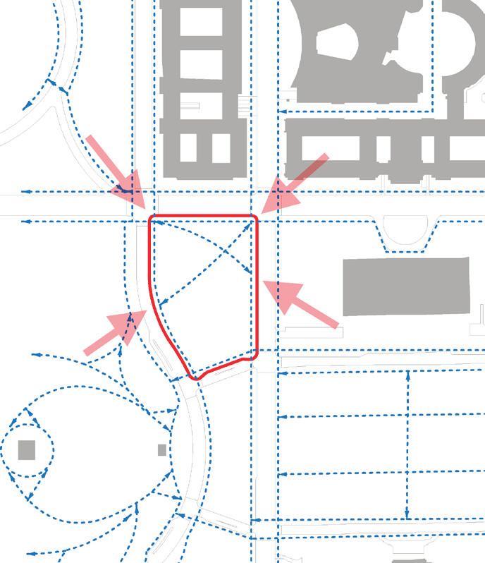

of African
112
Smithsonian Institution National Museum
American History and Culture
Iconic Facade
NMAAHC Site
Pedestrian Circulation
NMAAHC Site Approach
Identity/Entry
The iconic face of a museum is often its entry façade. Many of the museums along the National Mall have iconic façades to the north and south, facing the National Mall and the surrounding vehicular streets. There are also examples of unique façade conditions, such as the courtyard formed between the West and East Wings of the National Gallery of Art as well as the curving façade of the National Museum of the American Indian. Public façades serve to orient visitors, providing large scale way-finding and orientation, and over time become symbolic of the contents held within. Though many of the museums can be seen from all sides, the only building with omni-directional presence is the Washington Monument.
Approaches to the Washington Monument currently reinforce direct circulation from block corner to block corner. The site for the new museum is currently marked with two such diagonal circulation paths. The new museum could address its façades to the city grid as well as the diagonals that exist in relation to the Monument Site. The new museum should consider its presence not just in parallel orientation to the surrounding roads, but also to the corner views experienced by most pedestrian visitors. Refer to Volume IV, Section E for discussion of screening of visitors.
113 Site Analysis | FREELON BOND

NMAAHC Site * Indicates relationship with interior collection
Institution National Museum of African American History and Culture
114
Smithsonian
Iconic Gardens
* * * * * *
Washington Monument The Ellipse
NMAH Playground
National Sculpture Garden
Hirshhorn Sculpture Garden
Mellon Fountain
National Gallery of Art Square & Kiley Grove
National Museum of the American Indian Garden
U.S. Botanic Garden
Bartholdi Fountain

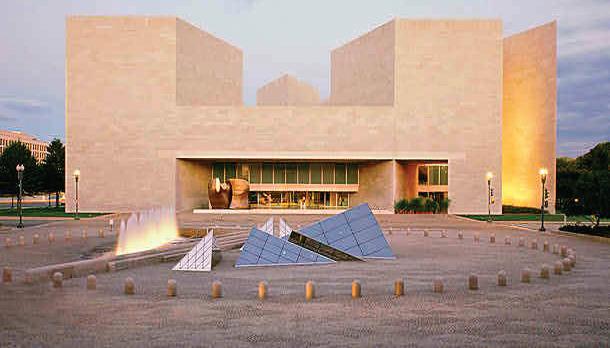

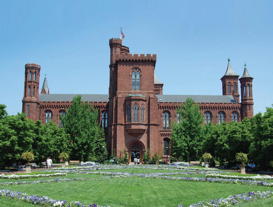
(1) http://upload.wikimedia.org/wikipedia/commons/c/c2/hirshhorn_museum_(sculpture_garden).jpg (2) http://www.nga.gov/education/classroom/new_angles/img/glossary/eastbuilding_facade.jpg (3) http://k43.pbase.com/g6/96/675696/2/79308295.ujnitefy.jpg (4) http://lh6.ggpht.com/_evuvvrf6c3y/sevzd6vzisi/aaaaaaaaa0i/rm5je55501q/haupt+garden+smithsonian+castel.jpg
Identity/Open Space
Many of the iconic and memorable spaces within the National Mall are gardens or smaller scaled outdoor spaces. Composed together with architecture these spaces are sometimes revealing of the collection held within a museum, but also serve as more intimately scaled spaces for gathering on the National Mall. More recent additions such as the National Gallery of Art Sculpture Garden and the landscape surrounding the National Museum of the American Indian tend to be inward looking and describe garden experiences that are differentiated from the landscape of the National Mall in character as well as spatial form. Sequential experiences are created for entry into a museum’s interior with the layering of outdoor gardens and open space. The opportunity for the museum experience to begin before you reach the front door is served by this use of outdoor space.
115 Site Analysis | FREELON BOND
Hirshhorn Sculpture Garden (1)
National Gallery of Art Square (2)
National Gallery of Art Sculpture Garden (3)
Enid A. Haupt Garden at the Smithsonian Castle (4)
Building Entries

Smithsonian
of
116
Institution National Museum
African American History and Culture
Primary Pedestrian Entry
Secondary Pedestrian Entry
Parking Lot
Vehicular Drop Off Loading Dock P
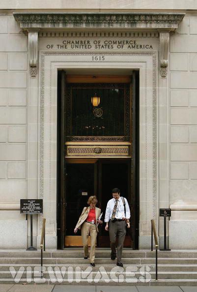


(1) Chamber of Commerce
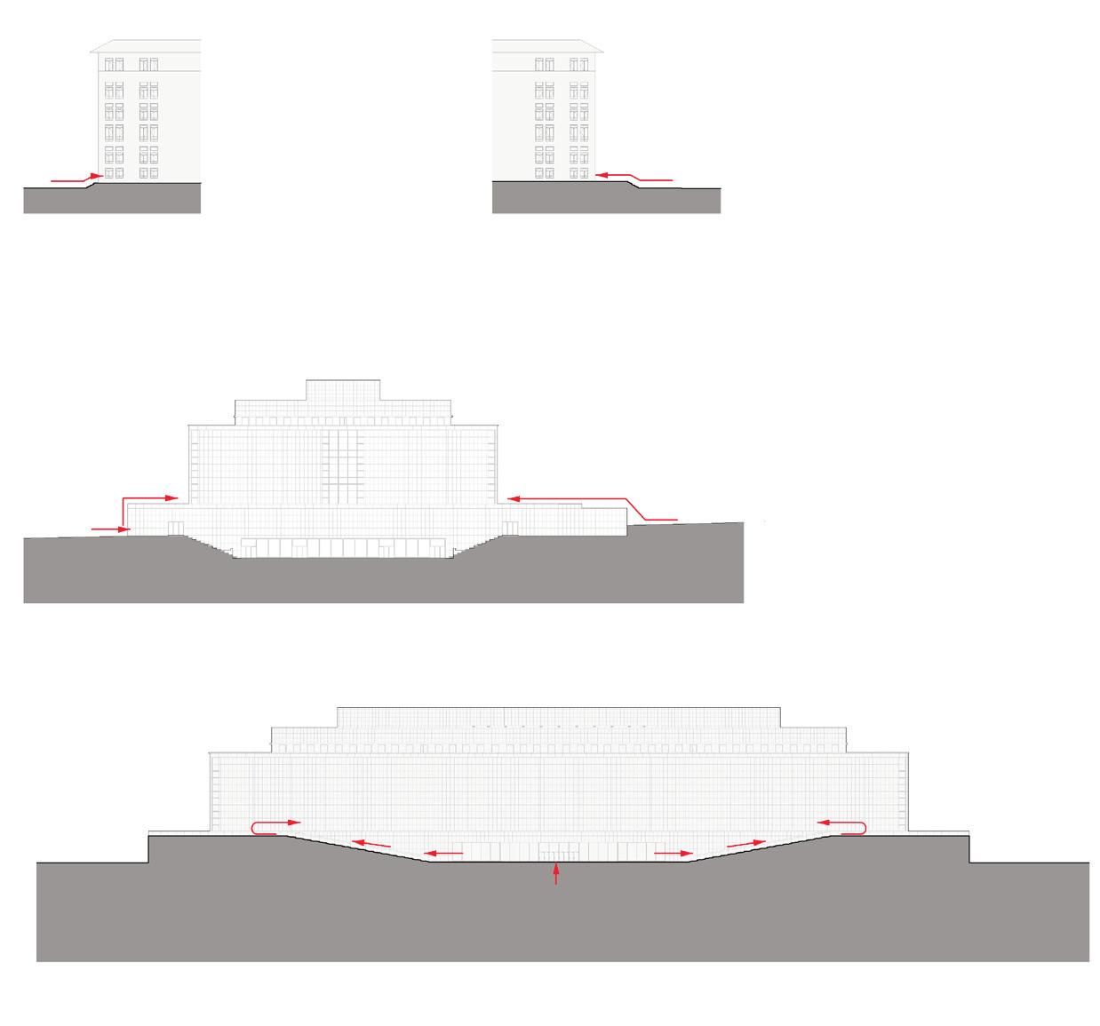
(2) http://static.cityvoter.com/getimage.ashx?img=00/00/00/00/30/01/3001-380316.jpg&w=294
(3) http://siarchives.si.edu/history/72_5114.gif
Entry
Nearly all museums have a primary pedestrian entry and a loading dock. Many also have a vehicular entry/ drop-off and may also have some parking. All of the museums on the National Mall except for the National Gallery of Art East and the National Museum of the American Indian have a primary pedestrian entry oriented to the National Mall. (And in a matter of speaking the underground circulation and entry from the National Gallery of Art West provides this for the National Gallery of Art East). Many of the existing entries are also elevated from the surrounding ground level, making the entries more formal and requiring ramped solutions for Americans with Disabilities Act (ADA) compatibility. The orientation and relationship of the primary pedestrian entry, the loading dock, and the other potential vehicular access are paramount to the design of the new museum as is the visitor arrival experience and security screening (refer to volume IV section E for further discussion of visitor screening).
117 Site Analysis | FREELON BOND
Madison Dr.
Madison Dr.
Constitution Ave.
Constitution Ave.
Constitution
Constitution Ave. West
Ave. East
(1) (2) (3)
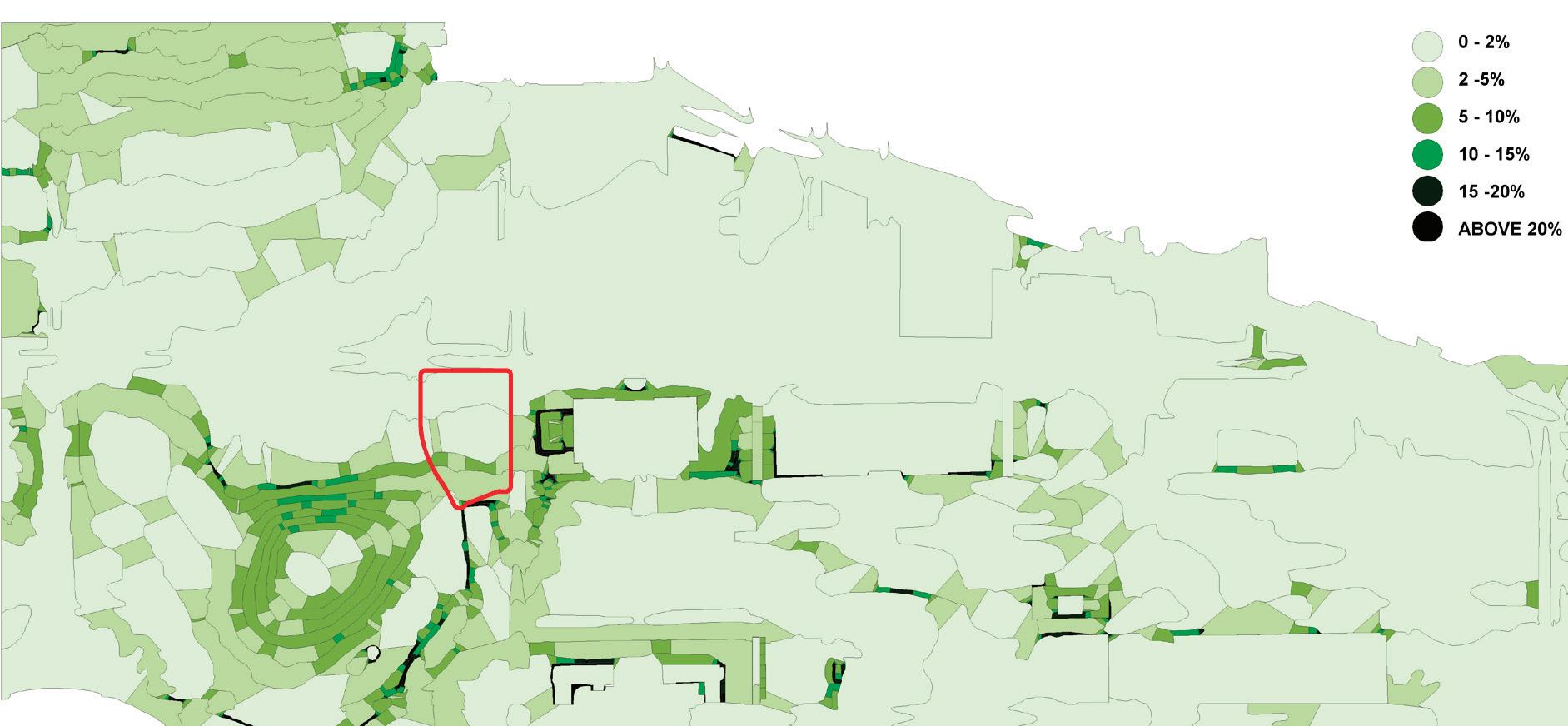

Smithsonian Institution National Museum of African American History and Culture 118
Site
NMAAHC
Site Slope
Topography
An intuitive understanding of the the Monumental Core reveals a flat National Mall and a hill at the base of the Washington Monument. A closer analysis of the existing slopes in large part reveals this to be true, but with significant micro-topographical exceptions in numerous locations. For example, the Smithsonian Castle sits atop a berm at the edge of the National Mall. The site for the new museum is unusual in the magnitude of these topographic irregularities on all sides except the north: to the east is the sunken court of the National Museum of American History, to the southeast paths slope up to the elevation of the National Mall, to the south is a berm, and to the west is the Washington Monument’s hill. The site itself slopes down from south to north for a total of 13 feet. Many of the programmatic uses of the National Mall and Washington Monument and grounds are facilitated by the character of the ground conditions. Flat sites accommodate tents and sloping sites accommodate informal seating or performance.
119 Site Analysis | FREELON BOND
Lawn /Open Space

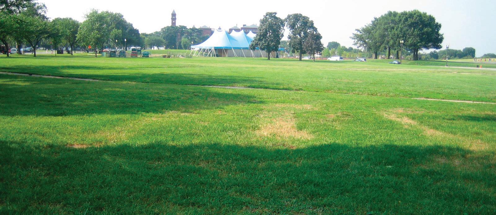

Smithsonian Institution National Museum of African American History and Culture 120
NMAAHC Site
Planting
Rows of elms provide structure to the National Mall, forming long shady corridors for circulation in the hot summer months. These lines of trees stop at the east side of 14th Street in relation to the end of the flat topography of the National Mall and at the west side of Union Square. For many, the lines of trees define the National Mall open space and give it a unique character in the park environment of the U.S. Capitol. The character of the elm as an elegant, upright tree with graceful branches assists in reinforcing the stately character of this landscape, befitting the edges of the symbolic axis of government. The Ellipse is another example of how symbolic geometries are reinforced by formal plantings of trees.
Trees are also planted informally to provide context and scale surrounding museum buildings as well as to provide larger grove plantings in the more pastoral areas surrounding the Washington Monument. In areas with fewer buildings the large groves of trees provide mass and scale for the edges of the Washington Monument and grounds in much the same way as buildings form the edges along the National Mall.
Lawn areas and low ground cover characterize the image of the National Mall and the Monument grounds. Flat rectangular panels of grass form the central spine of the National Mall and more rolling lawn areas cover the topography of the hill at the Washington Monument and surrounding areas. The flexibility of the lawn area can accommodate very large events, protests, informal recreation, and many other uses while also seeming scaled and elegant when not in use.
121 Site Analysis | FREELON BOND
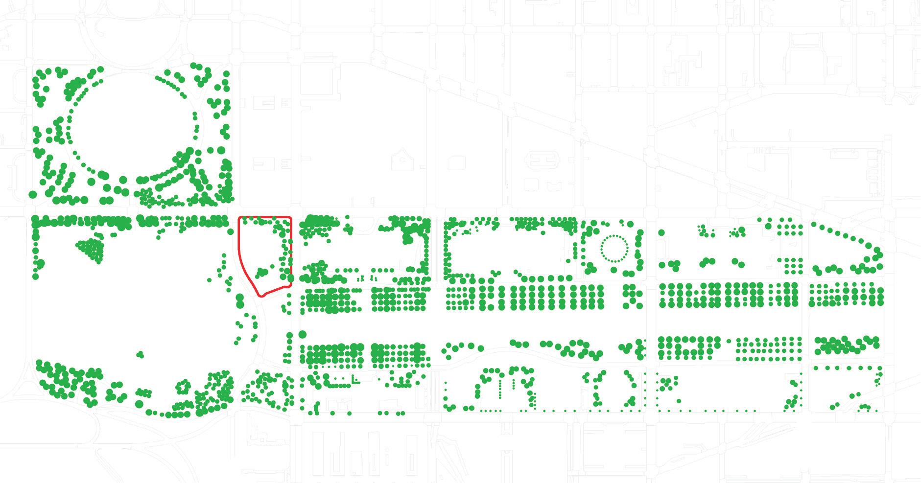
Planting Pattern
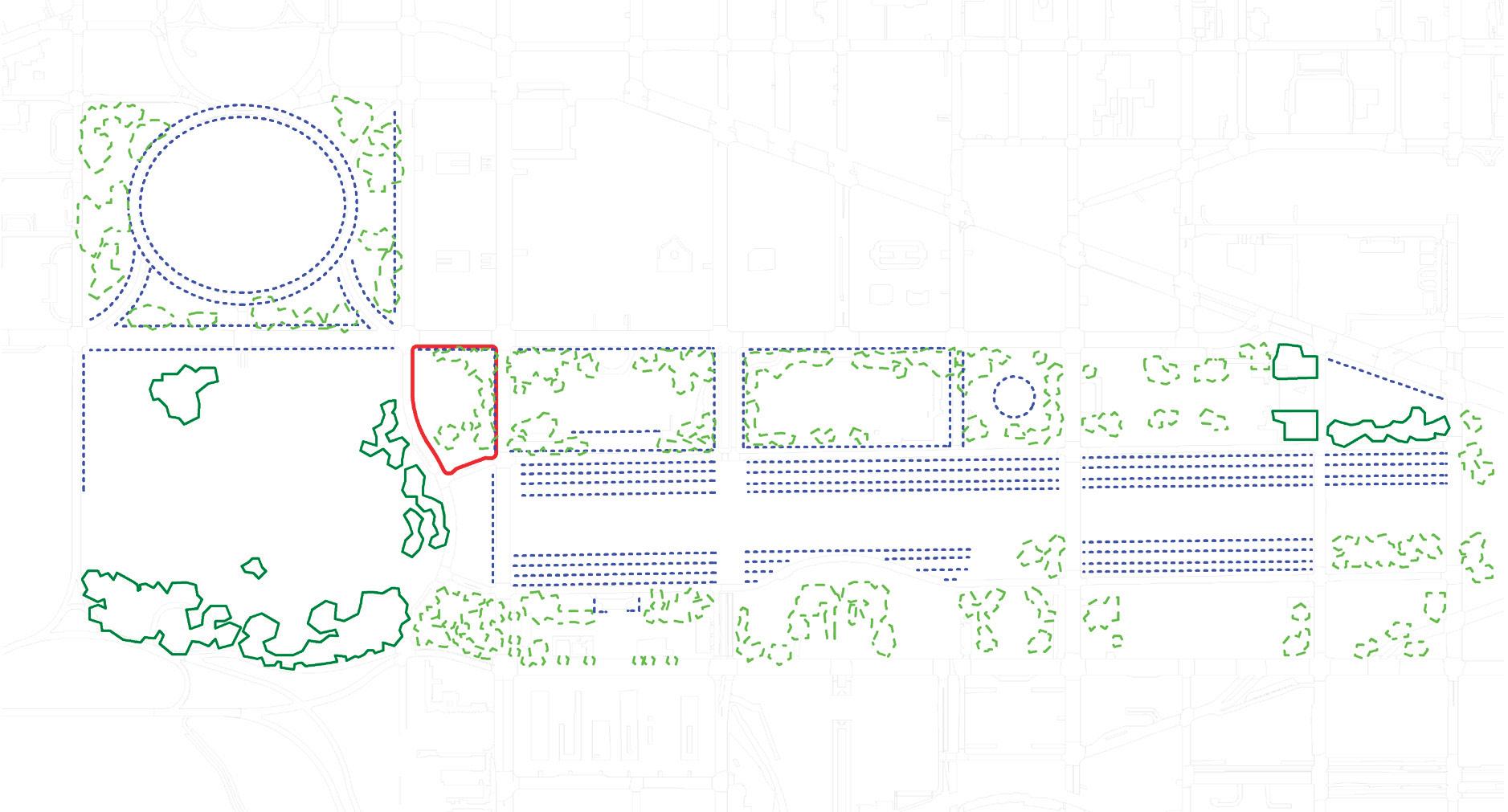
Smithsonian Institution National Museum of African American History and Culture 122
NMAAHC Site
NMAAHC Site
Allees
Context
Groves Trees
Trees in allees
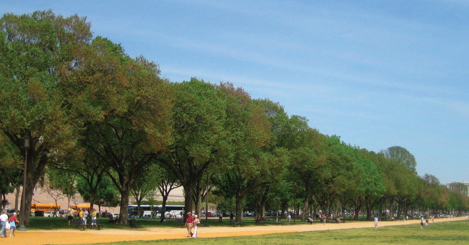
Trees in groves


http://healthyinfluence.com/wordpress/wp-content/uploads/2008/03/dc08edge.jp g
123 Site Analysis | FREELON BOND
Daniel Kiley Grove at the National Gallery of Art - East Wing
Landscape Character

Landscape Character Detail
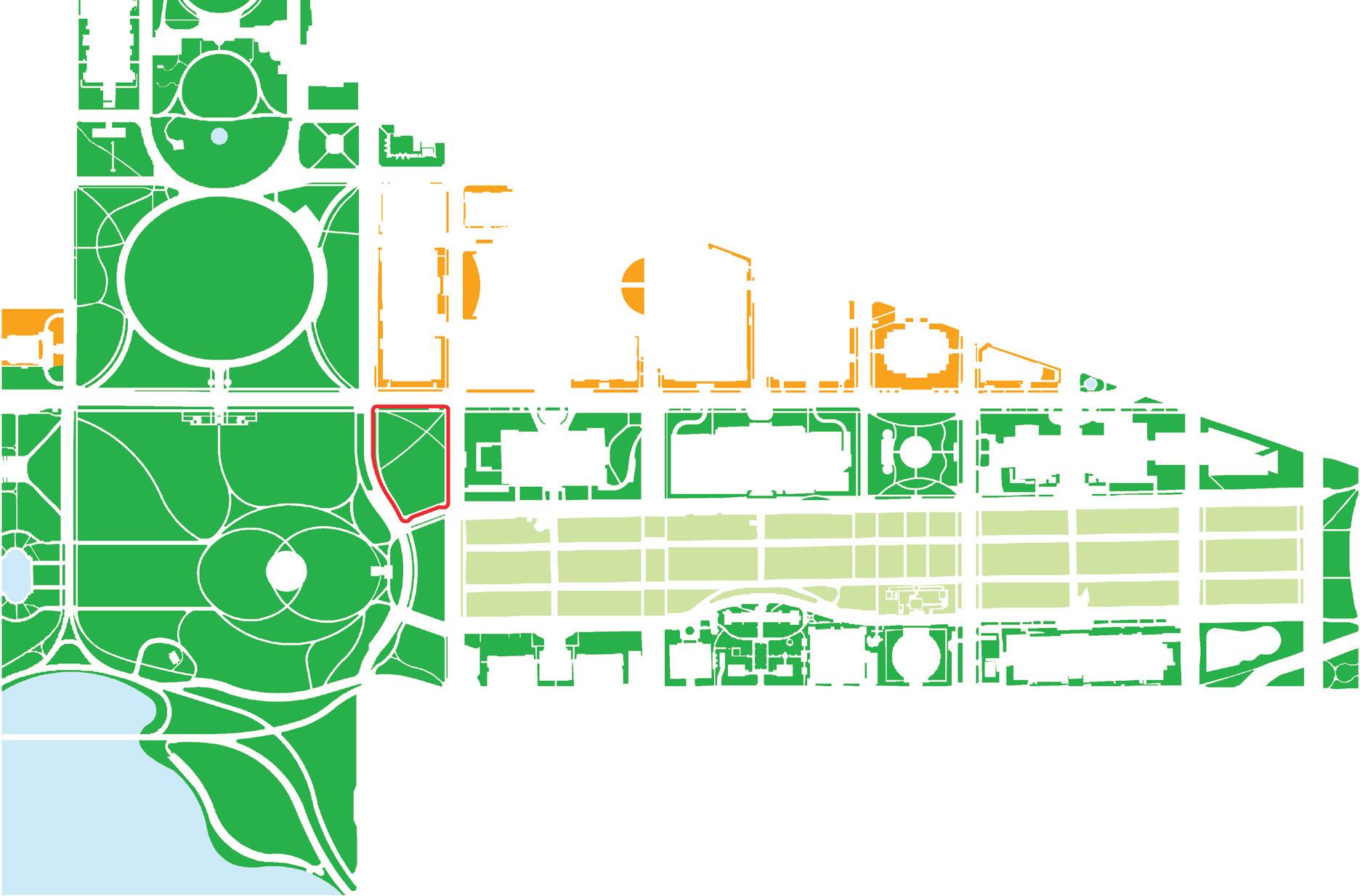
African
124
Smithsonian Institution National Museum of
American History and Culture
NMAAHC Site Park Street Mall Water Body
NMAAHC Site Park Street Mall Water Body
Landscape Character
Plantings, topography, and building location converge to create the character of the landscape for the National Mall and Washington Monument Grounds. The National Mall character is derived from its flat aspect, trees planted in rows, and wide straight pathways that all strengthen its long axial views. The Washington Monument Grounds, groves of trees coupled with the landscape immediately surrounding the museum buildings, contribute to the site’s park-like character already suggested by the rolling topography, informally planted trees, and small-scaled, meandering or locally ordered pathways. A third character is formed along Constitution Avenue with allees of street trees and imposing architectural façades with limited setback.
Significant to the historic aspect of this new museum is the reminder that the National Mall and Washington Monument Grounds have been in a state of evolution for their entire history. Within the order provided by the open space, the landscape has been able to accommodate numerous new buildings while seeming whole prior to their addition.
Looking closely at historic pictures of the site for the new museum, the site appears as both the toe of slope for the Washington Monument and as a part of continuous open space. Later additions of the road access along 15th Street have somewhat isolated the site from the Washington Monument and grounds.
Today the site is bound by park landscape character to the east, west, and south, and by a street character to the north. The National Mall character is least present, meeting the site only obliquely from the southeast.
125 Site Analysis | FREELON BOND


Smithsonian Institution National Museum of African American History and Culture 126
MRCE;CLP file “Gov buildings and Mall 1935” found in National Park Service Cultural Landscape Inventory 2006 The Mall, National Mall And Memorial Parks MRCE CLP file “Mall 12103-E Aug. 1977” found in National Park Service Cultural Landscape Inventory 2006 The Mall, National Mall And Memorial Parks 1935 1977
Historic Photos
127 Site Analysis | FREELON BOND
file “LM to Capitol 1940s
Cultural Landscape Inventory 2006 The
And
MRCE;CLP
Crop” found in National Park Service
Mall, National Mall
Memorial Parks
1940s


Smithsonian Institution National Museum of African American History and Culture 128
Section A - Elevation along Constitution Avenue
Section C - Elevation along Madison Drive
Match Line
Match Line
Scale
The museum site exists within numerous nested scales of landscape, architecture, and experience. The northern façades of museum buildings along Constitution Avenue reveal fairly continuous parapet heights of 90’ feet, similar overall width, and, for the most part, similar architectural character. The East Wing of the National Gallery is a significant exception, being both taller, narrower, and of a more contemporary character. Street trees mitigate and soften the presence of the buildings as well as strengthen the linear view down the National Mall. Some museums such as the National Gallery of Art West Wing have no street trees.
The site is located at the base of the Washington Monument and responds to the scale of both the monument building as well as the large hill at the base. A small berm at the east edge of the Washington Monument and grounds forms an edge to 15th Street. This “ha-ha” topographic feature heightens views from the National Mall west and buffers noise. It has been noted that during large events this small land form is occupied with people waiting, watching fireworks, and otherwise employing the berm as furniture.
The NMAAHC site, while having a relationship to the topography and plantings of the National Mall and Washington Monument Grounds, is somewhat isolated by the vehicular traffic that has access to all sides of the site.

129 Site Analysis | FREELON BOND
Plan
Key for Sections on Pages 42 - 45

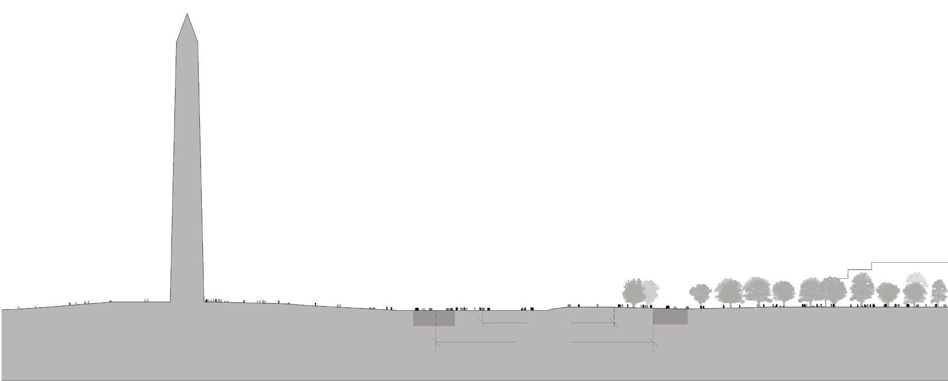

Smithsonian Institution National Museum of African American History and Culture 130
Section B - Section through the Washington Monument and the National Mall
Match Line
Site Boundary
Site


131 Site Analysis | FREELON BOND
Section E - Section through the Washington Monument grounds and the site looking west
Section D - Section through the site and Washington Monument grounds looking east
Site Boundary
Site Boundary

Smithsonian Institution National Museum of African American History and Culture 132
Event Recreation
Existing Uses
Tour / Visit
Social and Cultural Uses
The museum site is currently used for numerous functions, both symbolic and practical including protests, festivals, recreation, staging, and tourism. The National Mall itself hosts many of these functions within the stately elms, broad pathways, and flat lawn panels. Its flexibility is derived from the simple palette and commitment to formal execution of the design elements. The Washington Monument Grounds are similarly flexible and provide a focal point for such activities as well as a backdrop for performances.
Some event programs, such as the Black Family Reunion, would have unique opportunities in relation to the museum grounds to share programming, performance, and other thematic content.
All of the existing uses occur both simultaneously within the space of the National Mall and Washington Monument Grounds and temporally, by sharing the same space for different purposes at different times. The ability to use part of the museum grounds for National Mall programs, such as the Folklife Festival, could potentially attract visitors who were not seeking the museum content as a specific goal.
Existing Uses Synthesis
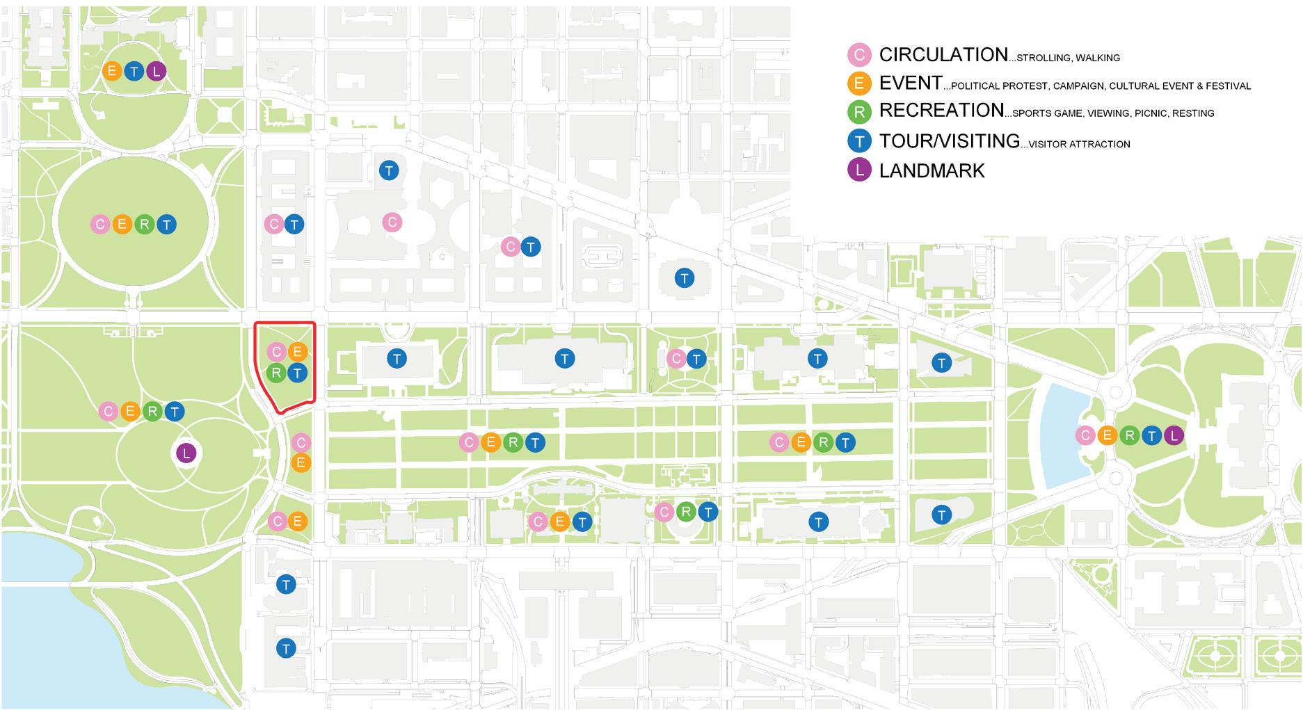
133 Site Analysis | FREELON BOND


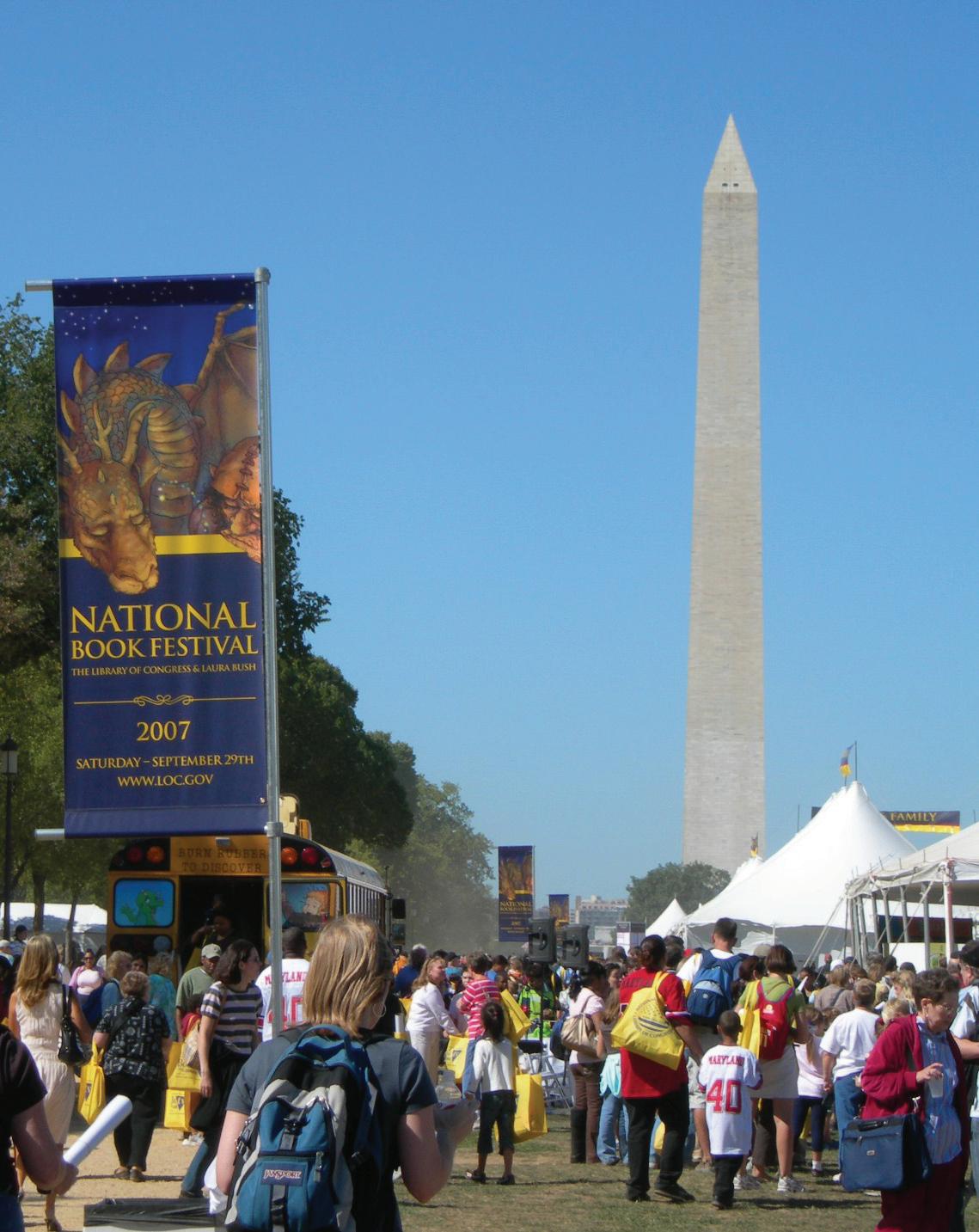

(1) http://img358.imageshack.us/img358/8739/z3dg.jpg
(2) http://americanhistory.si.edu/dynamic/images/small_exhibitions/image_2_296.jpg
(3) http://robertarood.files.wordpress.com/2007/09/dscn0492c.jpg
(4) http://www.folklife.si.edu/resources/2004festival/musica/during/dsc_0062.gif
134
Smithsonian Institution National Museum of African American History and Culture
Mall photos
Immigration Reform Protest (1)
Aids Quilt (2)
Springtime on the National Mall
National Book Festival (3)
Folklife Festival (4)
Monument photos


(1) http://i67.photobucket.com/albums/h300/algorhythmic-text/earth_day_dc_mall200.jpg
(2) http://www.mccullagh.org/db9/10d-6/fireworks-national-mall-1.jpg
(3) http://www.nps.gov/parkoftheweek/assets/photo/nama-4th-of-july.jpg
(4) http://sports.intertext.com/archives/monument.jpg
(5) http://com.miami.edu/parks/images/kite3.jpg
135 Site Analysis | FREELON BOND
Earth Day (1)
July 4th Fireworks (2)
Musical performance on Washington Monument and grounds (3)
Marine Corps Marathon looking west along Madison Drive toward the Washington Monument and the NMAAHC site (4)
Kite Festival looking west from the National Mall (1)
Sustainability/LEED
The site design will explore how best practices in hydrology, materials selection and detailing, microclimate design, native planting, alternative transportation, air quality, and noise mitigation can be achieved. The project seeks a USGBC LEED Gold rating.
Technology
Each building is symbolic of its time in architectural history and employs the technology of its era. The project is part of a great American tradition.

& Industries Building, 1881
(1) http://mobarrett.net/photos/domestic/2005/10_dc/images/dc_0510_960_31.jpg (2) http://www.visitingdc.com/images/freer-gallery-art-washington-dc.jpg (3) http://blog.aia.org/mt-static/plugins/ajaxify/tinymce/jscripts/tiny_mce/plugins/imagemanager/images/favorite_architecture_images/ 34_national_gallery_of_art_lg.jpg
(4) http://www.nga.gov/education/classroom/new_angles/img/glossary/eastbuilding_facade.jpg (5) http://www.fesmag.com/contents/images/archived-images/archives/2007/05/2007fdp/images/fdp-03.jpg
(6) http://newsdesk.si.edu/images_full/images/buildings/general/castle.jpg
(7) http://img.groundspeak.com/waymarking/display/5d2763cd-d366-4a25-af3a-3a34db55669c.jpg
(8) http://z.about.com/d/dc/1/0/i/8/nathist.jpg
(9) http://static.cityvoter.com/getimage.ashx?img=00/00/00/00/30/01/3001-380316.jpg&w=294
(10) http://z.about.com/d/dc/1/0/g/8/hurshhorn.jpg
(11) http://www.film.dc.gov/film/lib/film/sackler_gallery.jpg
(12) http://www.visitingdc.com/images/national-museum-african-art.jpg
(13) http://z.about.com/d/dc/1/0/h/8/nasm.jpg
Smithsonian Institution National Museum of African American History and Culture 136
1850 1900 1950 2000 2050
Washington Monument 1885 (1)
Freer Gallery of Art, 1923 (2)
National Gallery of Art West, 1937 (3)
National Gallery of Art East, 1978 (4)
National Museum of the American Indian, 2004 (5)
National Air and Space Museum, 1976 (13)
Sackler Gallery & NMAA, 1987 (11) (12)
Hirshhorn Museum, 1974 (10)
NMAH, 1964 (9)
NMNH, 1911 (8)
Smithsonian Castle, 1855 (6)
Arts
(7) Timeline
Landscape Program Requirements
Topography
Design of the NMAAHC landscape should evolve from an understanding of the site’s historical and existing topography. Proposals for the site should establish a meaningful relationship to this topography.
Design of the NMAAHC site should provide opportunity for experiencing the site from a range of distances and elevations. Views and vistas to and from the site should consider immediate relationships, both from directly across the street to locations farther afield.
Design for the NMAAHC landscape should integrate a secure site perimeter. This includes the integration and accommodation of below grade conditions such as underground parking.
The NMAAHC loading dock should be designed and screened so that it minimally detracts from any contiguous entries or adjacent landscape areas.
Entry
Entry into the building should be established through both architecture and landscape architecture into a layered, sequential experience.
Given the sloped topography of the site, careful attention should be given to the potential to enter the site and museum at various grades.
The NMAAHC site should provide clear pedestrian approaches from all directions. Pedestrian entries should establish a human scale and clear orientation through the landscape, and should also cultivate a sense of curiosity and interest.
Efficient and safe vehicular drop-off areas should be integrated, and not conflict with pedestrian access. Vehicular drop-off areas should provide a transition from the automobile scale to the pedestrian scale, and should be screened from the museum.
Design of the landscape should integrate ADA accessibility throughout the site.
Context
The NMAAHC landscape should meet required and designated alignments with surrounding architectural context.
Character of the NMAAHC should be designed as an integral part of the National Mall and Washington Monument Grounds, and also provide a museum garden specific to the program and site of the NMAAHC.
This project does not seek a particular landscape architectural style. Both the character and use of the landscape should be integrated into its physical and historical context, and reflect the mission of the museum. It should be well-designed, and constructed as a landscape of national, cultural significance.
137 Site Analysis | FREELON BOND 02
Landscape design should reflect its unique physical location as a resting place between the US Capitol, the National Mall, the White House, the Washington Monument, and the Lincoln Memorial.
Siting and design of the museum should respond to the National Mall and Washington Monument Grounds context and in particular provide adequate landscape area to integrate the site into this historical and living context.
A variety of scales and experiences should be considered in the design of the NMAAHC landscape, providing experiences unique to the NMAAHC site while simultaneously orientating the visitor back to the National Mall and Washington Monument Grounds.
The physical and visual massing of the museum should be both mitigated and exploited through landscape design, providing a significant architectural and landscape architectural contribution to the larger site of the National Mall and Washington Monument Grounds.
Sustainability
Stormwater management is of the highest priority for both flood management and sustainability concerns.
Native and adapted planting that minimizes water use and that resists disease and insects is recommended.
No potable water is to be used for irrigation; appropriate plantings should be selected to reduce irrigation required, and should be able to flourish using non-potable water.
Material selection should consider regionally available materials.
Design of the landscape should provide and organize elements of planting and water with weather patterns and cycles to generate microclimates throughout the site, conducive to year-round human use of the landscape.
Opportunities for reaching the NMAAHC by means of public transportation should be encouraged.
Programming
Landscape design should provide outdoor performance venues, able to accommodate a range of performances and gatherings.
A variety of seating options are preferred, providing comfortable resting places for a range of users. Seating areas for groups of 2 to 2000 should be considered.
While this is an important museum project with a significant location within the National Mall , it is desirable to also provide a contemplative space for reflection and separation from the activity of its context.
Landscape design should consider the location of sculpture and other art. Non-object art such as sound installations should also be considered.
The availability of fresh drinking water should be considered.
Smithsonian Institution National Museum of African American History and Culture 138
Landscape design should integrate water as a feature in the design, and should consider the sustainability of such a feature.
Landscape design should provide opportunities for temporary outdoor exhibitions.
Landscape design should provide places for outdoor dining, including space for casual everyday dining and for formal outdoor dining events.
Landscape design should both buffer sound from adjacent streets, and mitigate sound leaving the site premises.
While the programming for the site requires hardscape to accommodate the programmatic requirements of the project, it is desirable to design the site as a garden and/or to provide gardens within the landscape.
Costs
The NMAAHC landscape must be adequately funded from both public and private sources. Private donors for the museum could be recognized through special areas or features of the landscape.
The landscape should be designed and constructed to have a visual impact on the day of its opening. Specifically, plant selections should be of an adequate size to achieve programmatic requirements, and provide shade and scale from day one.
Material selection and detailing of the landscape should be of a level appropriate to a national museum. Although there will likely be a variety of pavement and planting materials within the landscape, high-end materials should be considered for the special spaces that provide beauty and durability, and reflect the status of this important project.
139 Site Analysis | FREELON BOND
Smithsonian Institution National Museum of African American History and Culture 140
NMAAHC Pre-design and Programming Team
Owner
Smithsonian Institution
NMAAHC
Pre-design and Programming Team Leader
Freelon Bond
General Museum Requirements, Audience Research, Public Engagement, Collections Storage Plan
Lord Cultural Resources
Exhibit Planning
Amaze Design
Visitation Studies
Institute for Learning Innovation
Landscape Planning
Peter Walker & Partners
Structural Engineering
Robert Silman Associates
MEP Engineering
WSP Flack and Kurtz
Sustainable Design
Rocky Mountain Institute (RMI)
Civil Engineering
Delon Hampton & Associates
Traffic Studies
Gorove Slade
Geotechnical & Environmental Engineering
Froehling & Robertson, Inc.
IT/AV/Data Management/Telecommunications
Shen Milsom Wilke
Multimedia - Performance
Fisher Dachs Associates
Code/Fire Protection
Rolf Jensen and Associates
Accessibility
Access-Andrews Consulting
Vertical Transportation
Lerch Bates
Lighting
Fisher Marantz Stone
Estimating
Faithful Gould
Security
Ducibella Venture & Santore
Document Editing
Kirsten Mullen


 Department of Commerce


