Unobstructed Cascade Mountain Views
Address: 66045 Hwy 20 Bend, OR 97703
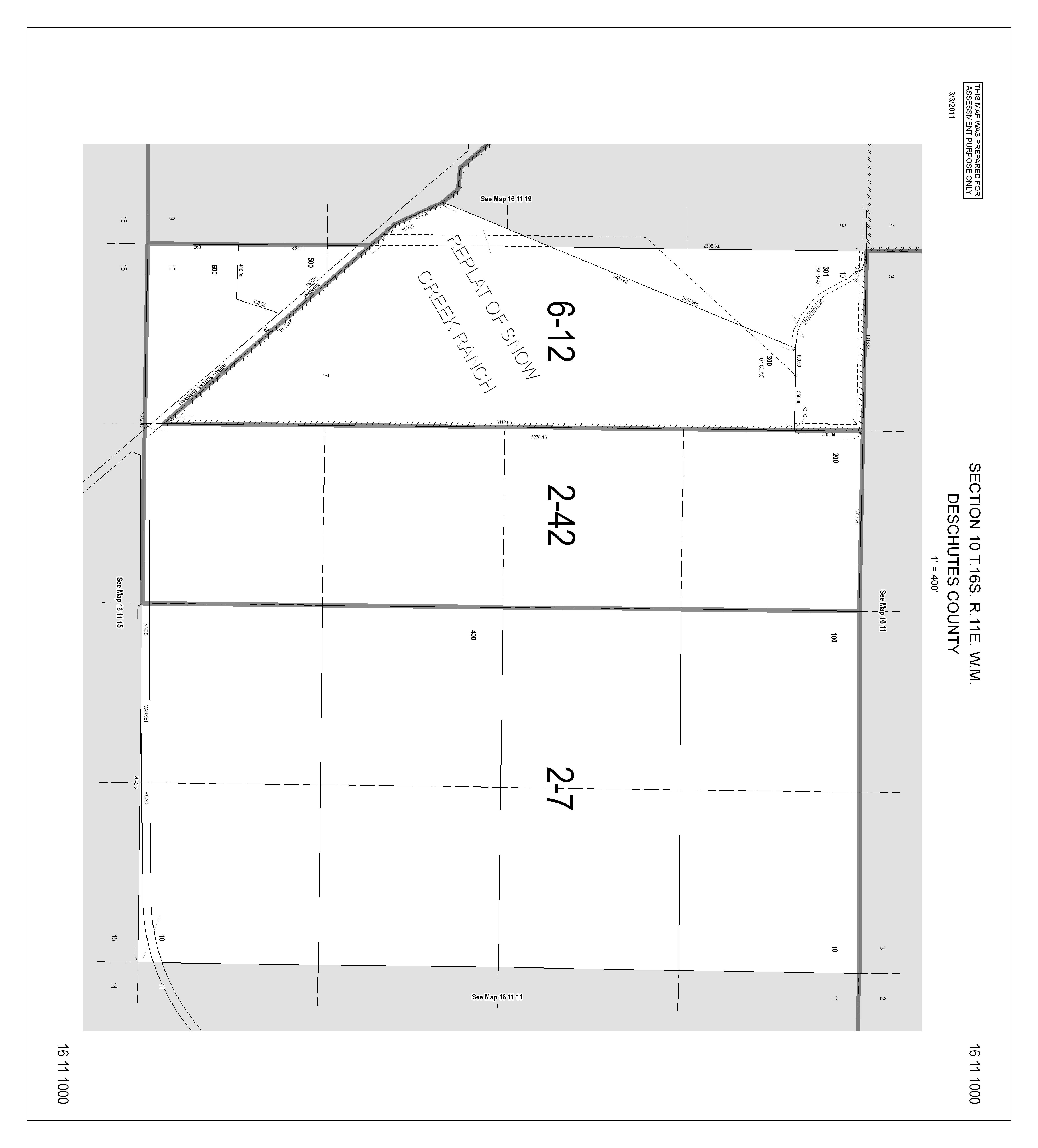
Tax Map: 161110 00600
Property:
Parcel # 143939 and 236647
• Stunning Cascade Mountain Views from home/potential home site
• Elevated building site is approved with Deschutes County for a replacement dwelling, sits off the highway.
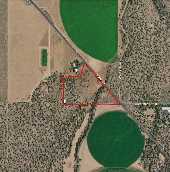
• 17.4 acres in Tumalo
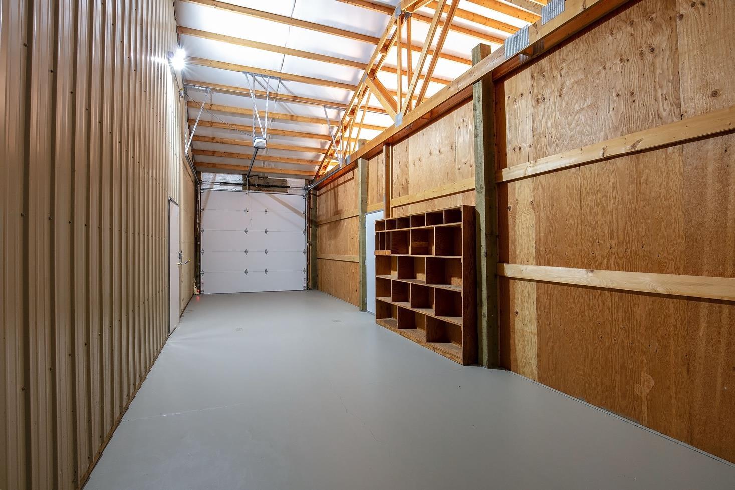
• Finished heated shop with 2 attached bays: one gravel and one with concrete floor:
• Gravel area of shop= 35 x 40 with 3 sliding doors 11’ w x 12h.
• Insulated area= 30 x 40 with 12 x 12 overhead door Pressure tank takes up 4x8 area.
• Concrete floor not insulated = 12 x 40 with 10 x 10 overhead door
• Ceiling height estimated to be 15’ plus 8’ to peak.
• Historic barn
• Blacksmith shop
• Two RV hookups/Pads
• Detached garage with 2 storage rooms/office
• Fenced paddocks for livestock and public land across the highway.
• Country Home is well maintained, 2340 sq ft, open floor plan with dining area, living room, utility room, single level, new roof and covered porch.
• Home is heated by electric furnace, heat pump and pellet stove
• Wonderful opportunity for any Central Oregon lifestyle
Irrigation: No water rights
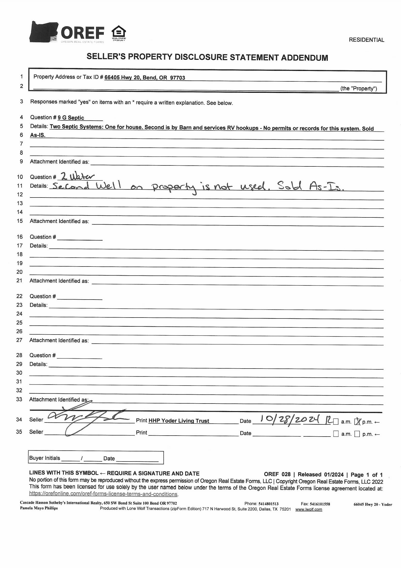
Domestic Water: Private Well – New Well in 2023. Old well (no well log) is connected to system with a valve, but is turned off to system.
Utilities: Central Electric CEC Two Meters 400 amp on property
Home/Shop/New Well 200 amp: 12 month average $120./month
Barn/RV Hookups (2 permitted hook ups) 200 amp12 month average $156./month
Note the RV pads had 2 RV’s hooked up for the 12 month average. Propane Tank 125 gallon (owned) serviced by CoEnergy Propane
Taxes: Tax Year 2024 $4657.32
Zoning: EFU TRB Exclusive Farm Use
Price: $1,150,000. MLS 220192053
Shown By Appointment Only
All information Provided by Cascade Hasson Sotheby’s International Realty and Agents is deemed reliable but not guaranteed, Buyer is responsible for any/all due diligence. | 541-923 -1376 | www.desertvalleygroup com




NARRATIVE. THE PURPOSE OF THIS SURVEY IS TO RE— ESTABLISH AND MONUMENT THAT TRACT OF LAND CONVEYED TO LESTER A. YODER, AS TRUSTEE OF THE HHP YODER LIVING TRUST, RECORDED 972022, IN INSTRUMENT 202233731, D1), DESCHUTES COUNTY OFFICIAL RECORDS. THE SUBJECT PROPERTY IS DESCRIBED IN ( D1) AS THE WEST ONE— HALF OF THE WEST ONE— HALF OF SECTION 10, LYING SOUTH OF THE BEND — SISTERS HIGHWAY EXCEPTING OUT A TRACT OF LAND DESCRIBED IN ( D1) AND D2). E. G. MANSFIELD SURVEYED AND MONUMENTED THIS TRACT IN ( R1). THE DIMENSIONS FOR THIS TRACT SHOWN IN ( R1) DOES NOT CLOSE BY 7. 9 FEET IN THE NORTH — SOUTH DIRECTION. THE DISTANCE MEASURED BETWEEN THE FOUND MONUMENT AT THE SW CORNER OF SECTION 10 AND THE SW CORNER OF SAID TRACT MEASURES 671. 76 FEET. THE RECORD DISTANCE NOTED IN ( R1, D1, D2) IS 660. 00 FEET A DIFFERENCE OF 11. 76 FEET. WE FOUND 3 OF THE 4 CORNERS SET IN MANSFIELDS SURVEY ( R1) AS SHOWN. THE DISTANCE BETWEEN THESE 3 MONUMENTS FIT RELATIVELY WELL WITH ( R1, D1, D2) AND FIT CLOSELY WITH EXISTING FENCES AS SHOWN IN DETAILS A", " B" AND C" AND WERE HELD. WE HELD THE INTERSECTION OF THE SOUTHERLY HIGHWAY RIGHT OF WAY LINE PER MONUMENTS FOUND AND THE EAST LINE OF THE WEST ONE— HALF OF THE WEST ONE— HALF OF SECTION 10 PER MONUMENT FOUND AT THE WEST ONE — SIXTEENTH CORNER AND THE MONUMENT SET IN ( R4). BASIS OF BEARINGS AND CONTROL FOR THIS SURVEY IS THE CENTRAL OREGON COORDINATE SYSTEM ( COCS). GPS CALIBRATIONS WERE MADE FROM THE ORGN BASE STATIONS INCLUDING BNDM, REDM, LAPN, P387 SISTERS, PNVL, AND MDRS) WITH TOPCON HIPER GPS. THE CALIBRATION TIES MULTIPLE COCS POINTS USING PUBLISHED COORDINATES. THE DESCHUTES 13 TRANSFORMATION USES
Drill stem/Pump depth Duration (hr)
(9) LOCATION OF WELL (legal description) Tax Lot Lot Twp Range E/W WM Sec 1/4 1/4 Lat ° ' " or
(10) STATIC WATER LEVEL
Existing Well / Pre-Alteration Completed Well
Depth water was first found
HARD GRAY BASALT BROKEN BASALT FRACTURED BROWN BASALT HARD GRAY BASALT BROKEN BASALT W/CINDER GRAVELS VOID NO RETURNS FRACTURED BASALT MILD GRAY BASALT BROKEN BASALT W/B BROWN BASALT W/BFRACTURED BASALT W/B BROKEN BASALT W/CLAYSTONE SEAMS
Temperature °F Lab analysis
Water quality concerns? Yes From Yes (describe below) To Description
Date Started
(unbonded) Water Well Constructor Certification
I certify that the work I performed on the construction, deepening, alteration, or abandonment of this well is in compliance with Oregon water supply well construction standards. Materials used and information reported above are true to the best of my knowledge and belief.
License Number Date
Signed
(bonded) Water Well Constructor Certification
I accept responsibility for the construction, deepening, alteration, or abandonment work performed on this well during the construction dates reported above. All work performed during this time is in compliance with Oregon water supply well construction standards. This report is true to the best of my knowledge and belief.
Date
STATIC WATER LEVEL
HOLE CONSTRUCTION
PERFORATIONS/SCREENS
(8) WELL TESTS: Minimum testing time is 1 hour
Comments/Remarks
Map of Hole
of Hole
Map
FINDINGS AND DECISION
FILE NUMBER(S): 247-23-000039-AD, 40-LM
SUBJECT PROPERTY/
OWNER/APPLICANT:
0DLOL DWH ULGD 0DUF
COMMUNITY DEVELOPMENT
Mailing Name: HHP YODER LIVING TRUST Map and Taxlot: 1611100000600 Account: 143939
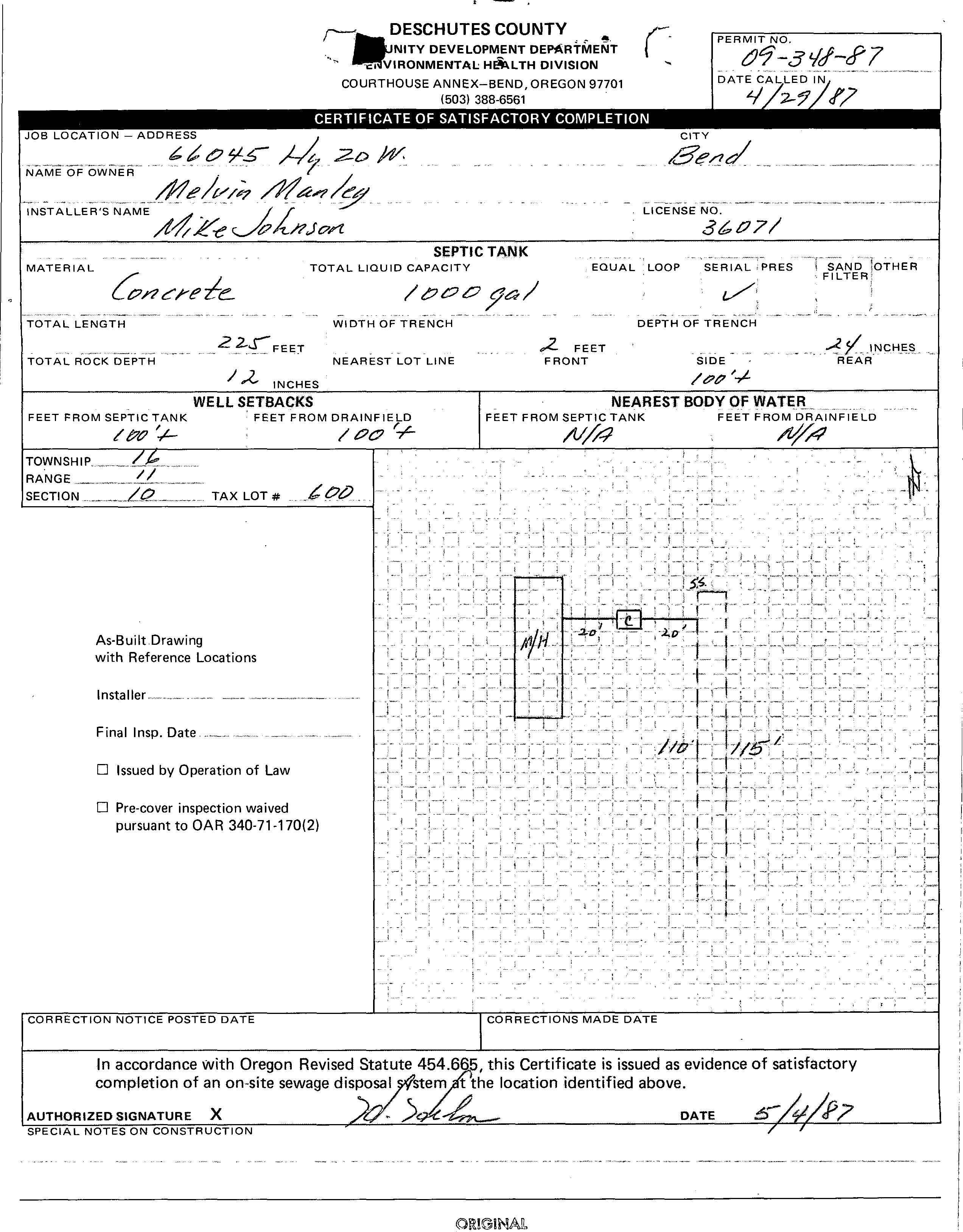
Situs Address: 66045 HWY 20, BEND, OR 97703
AGENT FOR APPLICANT: Tye Engineering & Surveying, Inc
Pam Tennant
725 NW Hill Street Bend, OR 97703
REQUEST:
A site plan review to establish a replacement dwelling in the Exclusive Farm Use (EFU) Zone, Landscape Management (LM) Combining Zone, Wildlife Area (WA) Combining Zone, and Conventional Housing (CH) Combining Zone.
STAFF CONTACT: Haleigh King, Associate Planner
Phone: 541-383-6710
Email: Haleigh.King@deschutes.org
RECORD:
Record items can be viewed and downloaded from: www.buildingpermits.oregon.gov
I. APPLICABLE CRITERIA
Deschutes County Code (DCC)
Title 18, Deschutes County Zoning Ordinance
Chapter 18.16, Exclusive Farm Use Zones (EFU)
Chapter 18.84, Landscape Management Combining Zone (LM)
Chapter 18.88, Wildlife Area Combining Zone (WA)
Chapter 18.92, Conventional Housing Combining Zone (CH)
Title 22, Deschutes County Development Procedures Ordinance
117 NW Lafayette Avenue, Bend, Oregon 97703 | P.O. Box 6005, Bend, OR 97708-6005 (541) 388-6575 cdd@deschutes .org www.deschutes.org/cd
II. BASIC FINDINGS
LOT OF RECORD: Verification is not required under DCC 22.04.040(B)(2)(c) as the property has previously been issued a land use permit, file no. LM-95-62.
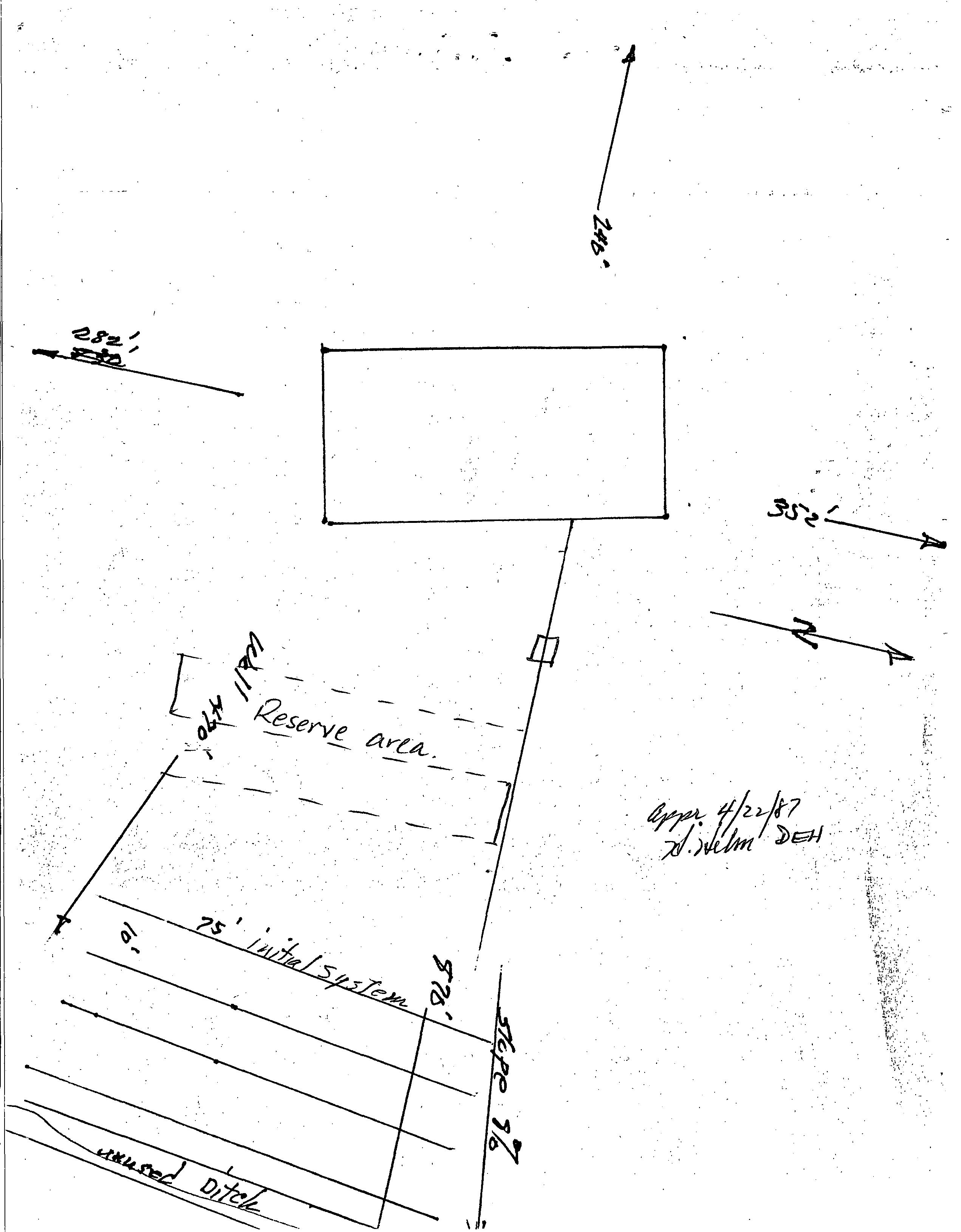
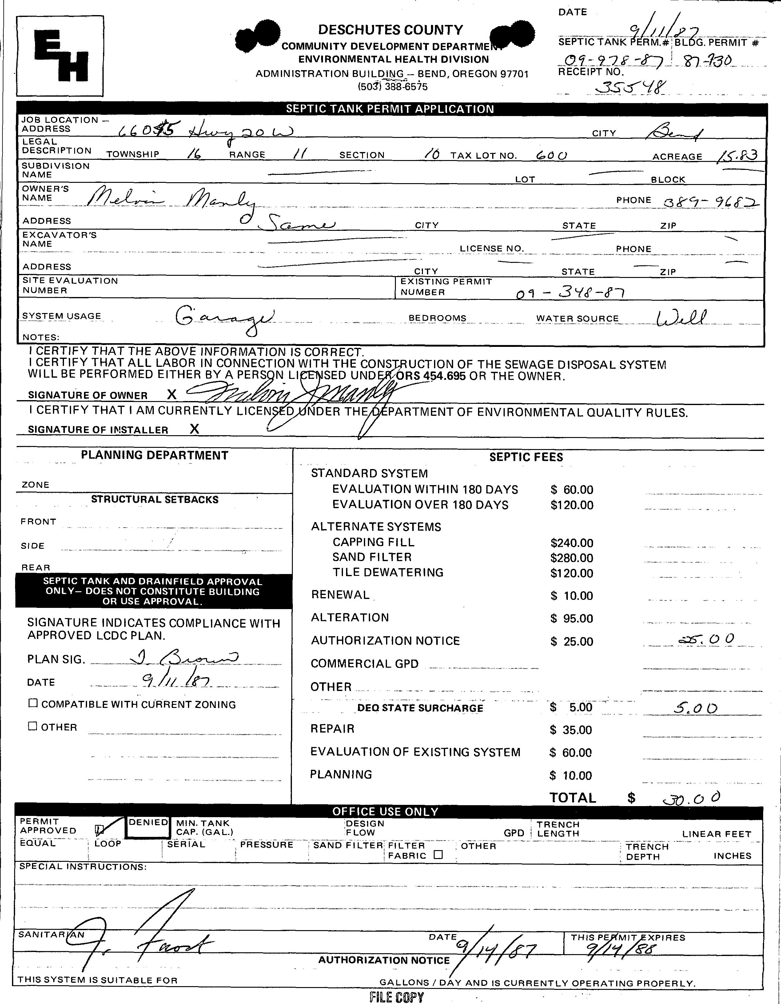
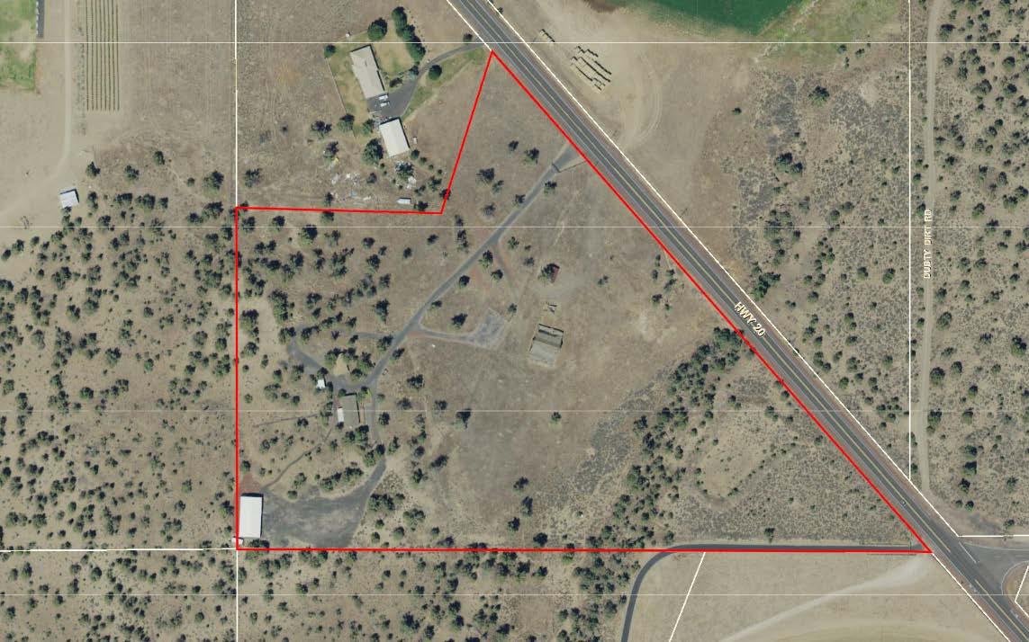
SITE DESCRIPTION: The subject 17.47-acre property contains an existing manufactured home, detached shop building, detached garage, carport, and barn. The property contains large open acreage of pasture, natural grasses, and scattered juniper trees and is served by an existing on-site wastewater system. The property is irregular in shape and fronts along Highway 20. The grade of the property is relatively even across the property.
Figure 1 – Subject Property - Map and Taxlot: 1611100000600
REVIEW PERIOD: The subject application(s) were submitted on January 18, 2023 and deemed complete by the Planning Division on February 17, 2023. The 150th day on which the County must take final action on this application is July 17, 2023.
III. FINDINGS & CONCLUSIONS
Title 18 of the Deschutes County Code, County Zoning
Chapter 18.16, Exclusive Farm Use Zones (EFU)
Section 18.16.020. Uses Permitted Outright.
The following uses and their accessory uses are permitted outright:
J. A lawfully established dwelling may be altered, restored or replaced, subject to DCC 18.16.023.
FINDING: The applicant proposes to construct a replacement dwelling. The existing dwelling was lawfully established under building permit no. 247-MH2650 in 1987. Therefore, staff finds the existing dwelling is lawfully established and may be replaced, subject to the requirements of DCC 18.16.023.
1. The replacement dwelling is subject to OAR 660-033-0130(30) and the County shall require as a condition of approval of a single-family replacement dwelling that the landowner for the dwelling sign and record in the deed records for the county a document binding the landowner, and the landowner’s successors in interest, prohibiting them from pursuing a claim for relief or cause of action alleging injury from farming or forest practices for which no action or claim is allowed under ORS 30.936 to 30.937.
FINDING: The proposed development is a replacement dwelling. A condition of approval has been added to ensure compliance.
Section 18.16.023. Lawfully Established Dwelling Replacement.
A lawfully established dwelling may be altered, restored or replaced under DCC 18.16.020(J) above if, when an application for a permit is submitted, the County finds to its satisfaction, based on substantial evidence that:
A. The dwelling to be altered, restored or replaced met the following wh en an application for a permit is submitted:
1. The dwelling has, or formerly had:
a. Intact exterior walls and roof structure;
b. Indoor plumbing consisting of a kitchen sink, toilet and bathing facilities connected to a sanitary waste disposal system;
c. Interior wiring for interior lights;
d. A heating system;
FINDING: Staff finds the dwelling has the required facilities.
2. In addition to the provisions of subsection (A)(1), the dwelling to be replaced meets one of the following conditions:
a. If the dwelling was removed, destroyed or demolished:
i. The dwelling’s tax lot does not have a lien for delinquent ad valorem taxes; and
ii. Any removal, destruction or demolition occurred on or after January 1, 1973;
FINDING: The dwelling’s tax lot does not have a lien for delinquent ad valorem taxes. The dwelling has not been removed, destroyed or demolished.
b. If the dwelling is currently in such a state of disrepair that the dwelling is unsafe for occupancy or constitutes an attractive nuisance, the dwelling’s tax lot does not have a lien for delinquent ad valorem taxes; or
FINDING: The dwelling is not currently in such a state of disrepair that the dwelling is unsafe for occupancy or constitutes an attractive nuisance.
c. A dwelling not described in subparagraph (a) or (b) of this paragraph was assessed as a dwelling for purposes of ad valorem taxation:
i. For the previous five property tax years; or
ii. From the time when the dwelling was erected upon or affixed to the land and became subject to assessment as described in ORS 307.010 (Definitions of “land” and “real property” for state property tax laws).
FINDING: The Deschutes County Assessor’s records show that the dwelling was assessed as a dwelling for purposes of ad valorem taxation for the previous five property tax years.
B. For replacement of a lawfully established dwelling under DCC 18.16.020(J):
1. The dwelling to be replaced must be removed, demolished or converted to an allowable nonresidential use:
a. Within one year after the date the replacement dwelling is certified for occupancy pursuant to ORS 455.055 and DCC Chapter 15.04; or
FINDING: As a condition of approval, the property owner will be required to remove, demolish or convert the existing dwelling to an allowable nonresidential use within one year after the date the replacement dwelling is certified for occupancy pursuant to ORS 455.055 and DCC Chapter 15.04.
b. If the dwelling to be replaced is, in the discretion of the County, in such a state of disrepair that the structure is unsafe for occupancy or constitutes an attractive nuisance, on or before a date set by the County that is not less than 90 days after the replacement permit is issued; and
FINDING: The dwelling is not currently in such a state of disrepair that the dwelling is unsafe for occupancy or constitutes an attractive nuisance
c. If a dwelling is removed by moving it off the subject parcel to another location, the applicant must first obtain approval from the County for the new location.
FINDING: The dwelling is not proposed to be removed by moving it off the subject parcel to another location.
2. The applicant must cause to be recorded in the deed records of the County a statement that the dwelling to be replaced has been removed, demolished or converted.
FINDING: As a condition of approval, the applicant shall cause to be recorded in the deed records of the County a statement that the dwelling to be replaced has been removed, demolished or converted.
3. Deed Restrictions.
a. As a condition of approval, if the dwelling to be replaced is located on a portion of the lot or parcel that is not zoned for exclusive farm use, the applicant shall execute and cause to be recorded in the deed records of the County a deed restriction prohibiting the siting of another dwelling on that portion of the lot or parcel.
b. The restriction imposed is irrevocable unless the County Planning Director, or the Director’s designee, places a statement of release in the deed records of the County to the effect that the provisions of 2019 Oregon Laws, chapter 440, section 1 and ORS 215.283 regarding replacement dwellings have changed to allow the lawful siting of another dwelling.
FINDING: The dwelling to be replaced is located on a portion of the lot or parcel that is zoned for exclusive farm use.
4. The replacement dwelling:
a. Must comply with applicable siting standards such as minimum setbacks. However, the standards may not be applied in a manner that prohibits the siting of the replacement dwelling.
b. Must comply with applicable building codes, plumbing codes, sanitation codes and other requirements related to health and safety or to siting at the time of construction. However, the standards may not be applied in a manner that prohibits the siting of the replacement dwelling.
FINDING: The proposed replacement dwelling complies with the applicable siting standards such as minimum setbacks The standards have not been applied in a manner that prohibits the siting of the replacement dwelling. Staff includes subsection (b) as a condition of approval.
C. The replacement dwelling per must be sited on the same lot or parcel:
1. Using all or part of the footprint of the replaced dwelling or near a road, ditch, river, property line, forest boundary or another natural boundary of the lot or parcel; and
FINDING: The replacement dwelling will be sited near a road, ditch, river, property line, forest boundary or another natural boundary of the lot or parcel. Specifically, the replacement dwelling will be sited 100 feet from the western property line.
2. If possible, for the purpose of minimizing the adverse impacts on resource use of land in the area, within a concentration or cluster of structures or within 500 yards of another structure.
FINDING: The replacement dwelling will be sited within a concentration or cluster of structures or within 500 yards of another structure.
D. A replacement dwelling permit that is issued under DCC 18.16.020(J):
1. Is a land use decision as defined in ORS 197.015 where the dwelling to be replaced:
a. Formerly had the features described in DCC 18.16.023(A)(1)(a) through(d); or
b. Is eligible for replacement under DCC 18.16.023(A)(2)(b).
2. Is not subject to the time to act limits of ORS 215.417.
FINDING: Notwithstanding DCC 18.16.023(D)(2), staff finds that, under, Sections 1, 2, 3 and 11, chapter 462, Oregon Laws 2013, only a “deferred replacement permit 1” does not expire. This replacement permit is also not a 4-year permit subject to ORS 215.417 until January 2, 2024. (See section 10, chapter 462, Oregon Laws 2013). Therefore, this replacement permit is subject to OAR 660-033-0140, and is void two years from the date of the final decision if the development action is not initiated in that period. Extensions of this two year period may be granted under DCC 22.36.010(C)(1 and 2).
E. A temporary residence approved under DCC 18.116.080 or 18.116.090 is not eligible for replacement under this section.
FINDING: The dwelling to be replaced is not a temporary residence approved under DCC 18.116.080 or 18.116.090.
Section 18.16.060. Dimensional Standards.
E. Building height. No building or structure shall be erected or enlarged to exceed 30 feet in height, except as allowed under DCC 18.120.040.
FINDING: The elevation drawings submitted with the application indicate the overall height of the structure(s) will be 30 feet or less in height. As a condition of approval, no building or structure shall be erected or enlarged to exceed 30 feet in height, except as allowed by DCC 18.120.040.
1 Sections 2(7)(A)(a), chapter 462, Oregon Laws 2013.
Section 18.16.070. Yards.
A. The front yard shall be a minimum of: 40 feet from a property line fronting on a local street, 60 feet from a property line fronting on a collector street, and 100 feet from a property line fronting on an arterial street.
B. Each side yard shall be a minimum of 25 feet, except that for a nonfarm dwelling proposed on property with side yards adjacent to property currently employed in farm use, and receiving special assessment for farm use, the side yard shall be a minimum of 100 feet.
C. Rear yards shall be a minimum of 25 feet, except that for a nonfarm dwelling proposed on property with a rear yard adjacent to property currently employed in farm use, and receiving special assessment for farm use, the rear yard shall be a minimum of 100 feet.
D. The setback from the north lot line shall meet the solar setback requirements in Section 18.116.180.
E. In addition to the setbacks set forth herein, any greater setbacks required by applicable building or structural codes adopted by the State of Oregon and/or the County under DCC 15.04 shall be met.
FINDING: The proposal is not subject to 100-foot nonfarm dwelling setbacks. The proposed structure complies with the setbacks under (A) to (C) above. The applicant proposes a 30-foot-tall structure which will require a 62.1-foot solar setback. The structure will observe a 360-foot setback to the north property line. The structure complies with the solar setback under (D) above.
As a condition of approval, structural setbacks from any north lot line shall meet the solar setback requirements in DCC 18.116.180. As a condition of approval, in addition to the setbacks set forth herein, any greater setbacks required by applicable building or structural codes adopted by the State of Oregon and/or the County under DCC 15.04 shall be met.
Section 18.16.080. Stream Setbacks.
To permit better light, air, vision, stream pollution control, protection of fish and wildlife areas and preservation of natural scenic amenities and vistas along streams and lakes, the following setbacks shall apply:
A. All sewage disposal installations, such as septic tanks and septic drainfields, shall be set back from the ordinary high water mark along all streams or lakes a minimum of 100 feet, measured at right angles to the ordinary high water mark. In those cases where practical difficulties preclude the location of the facilities at a distance of 100 feet and the County Sanitarian finds that a closer location will not endanger health, the Planning Director or Hearings Body may permit the location of these facilities closer to the stream or lake, but in no case closer than 25 feet.
B. All structures, buildings or similar permanent fixtures shall be set back from the ordinary high water mark along all streams or lakes a minimum of 100 feet measured at right angles to the ordinary high water mark.
FINDING: There are no streams or lakes in the project vicinity.
Section 18.16.090. Rimrock Setback.
Notwithstanding the provisions of DCC 18.16.070, setbacks from rimrock shall be as provided in DCC 18.116.160 or 18.84.090, whichever is applicable.
FINDING: There is no rimrock in the project vicinity.
Chapter 18.84, Landscape Management Combining Zone (LM)
Section 18.84.020. Application of Provisions.
The provisions of DCC 18.84 shall apply to all areas within one-fourth mile of roads identified as landscape management corridors in the Comprehensive Plan and the County Zoning Map. The provisions of DCC 18.84 shall also apply to all areas within the boundaries of a State scenic waterway or Federal wild and scenic river corridor and all areas within 660 feet of rivers and streams otherwise identified as landscape management corridors in the comprehensive plan and the County Zoning Map. The distance specified above shall be measured horizontally from the center line of designated landscape management roadways or from the nearest ordinary high water mark of a designated landscape management river or stream. The limitations in DCC 18.84.20 shall not unduly restrict accepted agricultural practices.
FINDING: Highway 20 is identified on the County Zoning Map as the landscape management feature. The subject property falls within the Landscape Management Combining Zone for this feature, therefore, the provisions of this chapter apply.
Section 18.84.030. Uses Permitted Outright.
Uses permitted in the underlying zone with which the LM Zone is combined shall be permitted in the LM Zone, subject to the provisions in DCC 18.84.
FINDING: As discussed herein, the proposed use is allowed outright in the underlying zone.
Section 18.84.050. Use Limitations.
A. Any new structure or substantial exterior alteration of a structure requiring a building permit or an agricultural structure within an LM Zone shall obtain site plan approval in accordance with DCC 18.84 prior to construction. As used in DCC 18.84 substantial exterior alteration consists of an alteration which exceeds 25 percent in the size or 25 percent of the assessed value of the structure.
FINDING: The proposed structure(s) require building permits. Therefore, the criteria of DCC 18.84
apply.
Section 18.84.080. Design review standards.
The following standards will be used to evaluate the proposed site plan:
A. Except as necessary for construction of access roads, building pads, septic drainfields, public utility easements, parking areas, etc., the existing tree and shrub cover screening the development from the designated road, river, or stream shall be retained. This provision does not prohibit maintenance of existing lawns, removal of dead, diseased or hazardous vegetation; the commercial harvest of forest products in accordance with the Oregon Forest Practices Act, or agricultural use of the land.
FINDING: The applicant provides the following statement in response to this criterion,
The applicant will be utilizing the existing access road, septic system, well and utilities and will connect the new dwelling to the existing systems as shown on the application map. The applicant is proposing to remove a couple of trees that fall within the building pad. The disruption of existing vegetation will be minimal.
Staff finds that removal of vegetation within the building pad, as stated above, is permitted under this criterion. The proposal, as conditioned, will comply with this criterion.
B. It is recommended that new structures and additions to existing structures be finished in muted earth tones that blend with and reduce contrast with the surrounding vegetation and landscape of the building site.
C. No large areas, including roofs, shall be finished with white, bright or reflective materials. Roofing, including metal roofing, shall be non-reflective and of a color which blends with the surrounding vegetation and landscape. DCC 18.84.080 shall not apply to attached additions to structures lawfully in existence on April 8, 1992, unless substantial improvement to the roof of the existing structure occurs.
FINDING: The applicant has proposed a black, non-reflective metal roof, muted green wood/hardie plank siding, and earth tone trim as part of the application. However, the applicant did not provide specific details of paint color or name. Surrounding vegetation consists primarily of juniper trees, scrub brush, and open pasture, which include various shades of browns, golds, and greens. Staff finds proposed muted earth tone colors blend with and reduce contrast with the surrounding vegetation and landscape of the building site, and that no large areas, including roofs, will be finished with white, bright, or reflective materials. Staff includes the following condition of approval to ensure compliance, prior to the issuance of building permits, the applicant will provide paint swatches or color names for the selected body and trim color for the dwelling to be reviewed by planning staff in accordance with the above requirement.
D. Subject to applicable rimrock setback requirements or rimrock setback exception standards in DCC 18. 84.090(E), all structures shall be sited to take advantage of
existing vegetation, trees and topographic features in order to reduce visual impact as seen from the designated road, river or stream. When more than one nonagricultural structure is to exist and no vegetation, trees or topographic features exist which can reduce visual impact of the subject structure, such structure shall be clustered in a manner which reduces their visual impact as seen from the designated road, river, or stream.
FINDING: The applicant provides the following statement in response to this criterion,
The applicant is proposing to locate the new dwelling west of the existing manufactured home. This location will make it easier to connect to the existing utilities. It will be in the area of the existing manufactured home and other outbuildings which help to screen the new structure from the highway. There is not a rimrock on the subject property.
Staff agrees with the applicant’s statement above. Staff finds the proposed structure will be sited to take advantage of existing vegetation, trees and existing buildings in order to reduce visual impact as seen from the designated road, river or stream.
E. Structures shall not exceed 30 feet in height measured from the natural grade on the side(s) facing the road, river or stream. Within the LM Zone along a state scenic waterway or federal wild and scenic river, the height of a structure shall include chimneys, antennas, flag poles or other projections from the roof of the structure. DCC 18.84.080(E) shall not apply to agricultural structures located at least 50 feet from a rimrock.
FINDING: Staff includes this requirement as a condition of approval.
F. New residential or commercial driveway access to designated landscape management roads shall be consolidated wherever possible.
FINDING: No new residential or commercial driveway access to designated landscape management roads is proposed.
G. New exterior lighting, including security lighting, shall be sited and shielded so that it is directed downward and is not directly visible from the designated road, river or stream.
FINDING: Staff includes this requirement as a condition of approval.
H. The Planning Director or Hearings Body may require the establishment of introduced landscape material to screen the development, assure compatibility with existing vegetation, reduce glare, direct automobile and pedestrian circulation or enhance the overall appearance of the development while not interfering with the views of oncoming traffic at access points, or views of mountains, forests and other open and scenic areas as seen from the designated landscape management road, river or
stream. Use of native species shall be encouraged. (Formerly section 18.84.080 (C))
FINDING: No introduced landscape material is required under this criterion.
I. No signs or other forms of outdoor advertising that are visible from a designated landscape management river or stream shall be permitted. Property protection signs (No Trespassing, No Hunting, etc.,) are permitted.
FINDING: No signs or other forms of outdoor advertising that are visible from a designated Landscape Management river or stream are proposed.
J. A conservation easement as defined in DCC 18.04.280 "Conservation Easement" and specified in DCC 18.116.220 shall be required as a condition of approval for all landscape management site plans involving property adjacent to the Deschutes River, Crooked River, Fall River, Little Deschutes River, Spring River, Whychus Creek and Tumalo Creek. Conservation easements required as a condition of landscape management site plans shall not require public access.
FINDING: The subject property is not adjacent to a listed waterway.
Section 18.84.090. Setbacks.
A. Except as provided in DCC 18.84.090, minimum setbacks shall be those established in the underlying zone with which the LM Zone is combined.
FINDING: Compliance with the setbacks established in the underlying zone with which the LM Zone is combined is reviewed herein
B. Road Setbacks. All new structures or additions to existing structures on lots fronting a designated landscape management road shall be set back at least 100 feet from the edge of the designated road right-of-way unless the Planning Director or Hearings Body finds that:
1. A location closer to the designated road would more effectively screen the building from the road; or protect a distant vista; or
2. The depth of the lot makes a 100-foot setback not feasible; or
3. Buildings on both lots abutting the subject lot have front yard setbacks of less than 100 feet and the adjacent buildings are within 100 feet of the lot line of the subject property, and the depth of the front yard is not less than the average depth of the front yards of the abutting lots.
If the above findings are made, the Planning Director or Hearings Body may approve a less restrictive front yard setback which will be appropriate to carry out the purpose of the zone.
FINDING: All new structures or additions to existing structures on lots fronting a designated Landscape Management road will be set back at least 100 feet from the edge of the designated road
right-of-way.
C. River and Stream Setbacks. All new structures or additions to existing structures shall be set back 100 feet from the ordinary high water mark of designated streams and rivers or obtain a setback exception in accordance with DCC 18.120.030. For the purpose of DCC 18.84.090, decks are considered part of a structure and must conform with the setback requirement.
The placement of on-site sewage disposal systems shall be subject to joint review by the Planning Director or Hearings Body and the Deschutes County Environmental Health Division. The placement of such systems shall minimize the impact on the vegetation along the river and shall allow a dwelling to be constructed on the site as far from the stream or lake as possible. Sand filter systems may be required as replacement systems when this will allow a dwelling to be located further from the stream or to meet the 100-foot setback requirement
FINDING: There are no designated streams or rivers within 100 feet of the subject property.
D. Rimrock Setback. New structures (including decks or additions to existing structures) shall be set back 50 feet from the rimrock in an LM Zone. An exception to this setback may be granted pursuant to the provisions of DCC 18.84.090(E).
FINDING: There is no rimrock in the project vicinity.
Section 18.84.095. Scenic waterway.
Approval of all structures in a State Scenic Waterway shall be conditioned upon receipt of approval of the Oregon Department of Parks and Recreation.
FINDING: The proposed structure(s) are not located in a State Scenic Waterway.
Chapter 18.88, Wildlife Area Combining Zone (WA)
Section 18.88.030. Uses Permitted Outright.
In a zone with which the WA Zone is combined, the uses permitted outright shall be those permitted outright by the underlying zone.
FINDING: As discussed above, the proposed use is allowed outright in the underlying zone.
Section 18.88.060. Siting Standards.
A. Setbacks shall be those described in the underlying zone with which the WA Zone is combined.
B. The footprint, including decks and porches, for new dwellings shall be located
entirely within 300 feet of public roads, private roads or recorded easements for vehicular access existing as of August 5, 1992 unless it can be found that:
1. Habitat values (i.e., browse, forage, cover, access to water) and migration corridors are afforded equal or greater protection through a different development pattern; or,
2. The siting within 300 feet of such roads or easements for vehicular access would force the dwelling to be located on irrigated land, in which case, the dwelling shall be located to provide the least possible impact on wildlife habitat considering browse, forage, cover, access to water and migration corridors, and minimizing length of new access roads and driveways; or,
3. The dwelling is set back no more than 50 feet from the edge of a driveway that existed as of August 5, 1992.
C. For purposes of DCC 18.88.060(B):
1. A private road, easement for vehicular access or driveway will conclusively be regarded as having existed prior to August 5, 1992 if the applicant submits any of the following:
a. A copy of an easement recorded with the County Clerk prior to August 5, 1992 establishing a right of ingress and egress for vehicular use;
b. An aerial photograph with proof that it was taken prior to August 5, 1992 on which the road, easement or driveway allowing vehicular access is visible;
c. A map published prior to August 5, 1992 or assessor's map from prior to August 5, 1992 showing the road (but not showing a mere trail or footpath).
2. An applicant may submit any other evidence thought to establish the existence of a private road, easement for vehicular access or driveway as of August 5, 1992 which evidence need not be regarded as conclusive.
FINDING: The southwest corner of the property contains a small portion of the WA Zone. The majority of the property, including the location of the replacement dwelling, is located outside of the WA Zone. Therefore, these standards do not apply to the replacement dwelling.
Section 18.88.070. Fencing Standards.
The following fencing provisions shall apply as a condition of approval for any new fences constructed as a part of development of a property in conjunction with a conditional use permit or site plan review.
A. New fences in the Wildlife Area Combining Zone shall be designed to permit wildlife passage. The following standards and guidelines shall apply unless an alternative fence design which provides equivalent wildlife passage is approved by the County after consultation with the Oregon Department of Fish and Wildlife:
1. The distance between the ground and the bottom strand or board of the fence shall be at least 15 inches.
2. The height of the fence shall not exceed 48 inches above ground level.
3. Smooth wire and wooden fences that allow passage of wildlife are preferred.
Woven wire fences are discouraged.
B. Exemptions:
1. Fences encompassing less than 10,000 square feet which surround or are adjacent to residences or structures are exempt from the above fencing standards.
2. Corrals used for working livestock.
FINDING: As noted above, only a small portion of the southwest corner of the subject property is within the WA Zone. Further, no new fencing is included in this proposal. As a condition of approval, all new fences shall comply with DCC 18.88.070.
Chapter 18.92, Conventional Housing Combining Zone (CH)
Section 18.92.020. Permitted Uses.
All outright and conditional uses allowed in the underlying zone except that in no case shall a housing type be allowed that is other than conventional or modular housing permanently attached to real property.
FINDING: No housing type that is other than conventional or modular housing permanently attached to real property is proposed.
IV. CONCLUSION
Based on the foregoing findings, staff concludes that the proposed use can comply with the applicable standards and criteria of the Deschutes County zoning ordinance if conditions of approval are met.
Other permits may be required. The applicants are responsible for obtaining any necessary permits from the Deschutes County Building Division and Deschutes County Environmental Soils Division as well as any required state and federal permits.
V. DECISION
APPROVAL, subject to the following conditions of approval.
VI. CONDITIONS OF APPROVAL
A. This approval is based upon the application, site plan, specifications, and supporting documentation submitted by the applicant. Any substantial change in this approved use will require review through a new land use application.
B. The property owner shall obtain any necessary permits from the Deschutes County Building Division and Environmental Soils Division.
C. No building or structure shall be erected or enlarged to exceed 30 feet in height, except as allowed by DCC 18.120.040
D. Structural setbacks from any north lot line shall meet the solar setback requirements in DCC 18.116.180.
E. In addition to the setbacks set forth herein, any greater setbacks required by applicable building or structural codes adopted by the State of Oregon and/or the County under DCC 15.04 shall be met.
F. Within one year from the date the replacement dwelling is certified for occupancy pursuant to ORS 455.055 and DCC Chapter 15.04, the existing dwelling shall be removed, demolished or converted to an allowable nonresidential use.
G. Within one year from the date the replacement dwelling is certified for occupancy, the applicant shall cause to be recorded in the deed records of the County a statement that the dwelling to be replaced has been removed, demolished or converted. A copy of the recording shall be provided to the Deschutes County Planning Department.
H. The replacement dwelling must comply with applicable building codes, plumbing codes, sanitation codes and other requirements related to health and safety or to siting at the time of construction. However, the standards may not be applied in a manner that prohibits the siting of the replacement dwelling.
I Except as necessary for construction of access roads, building pads, septic drainfields, public utility easements, parking areas, etc., the existing tree and shrub cover screening the development from the designated road, river, or stream shall be retained. This provision does not prohibit maintenance of existing lawns, removal of dead, diseased or hazardous vegetation; the commercial harvest of forest products in accordance with the Oregon Forest Practices Act, or agricultural use of the land.
J. Structures shall not exceed 30 feet in height measured from the natural grade on the side(s) facing the road.
K. New exterior lighting, including security lighting, shall be sited and shielded so that it is directed downward and is not directly visible from the designated road
L Prior to the issuance of a building permit for the proposed replacement dwelling, the applicant will provide paint swatches or color names for the selected body and trim color for the dwelling to be reviewed by planning staff in accordance with DCC 18.84.080.C.
M. Prior to the issuance of a building permit, the landowner for the dwelling must sign and
record in the deed records for the county a document binding the landowner, and the landowner’s successors in interest, prohibiting them from pursuing a claim for relief or cause of action alleging injury from farming or forest practices for which no action or claim is allowed under ORS 30.936 to 30.937.
VII. DURATION OF APPROVAL, NOTICE, AND APPEALS
The applicant shall initiate the use for the proposed development within two (2) years of the date this decision becomes final, or obtain approval of an extension under Title 22 of the County Code, or this approval shall be void.
This decision becomes final twelve (12) days after the date mailed, unless appealed by a party of interest. To appeal, it is necessary to submit a Notice of Appeal, the appeal fee of $250.00 and a statement raising any issue relied upon for appeal with sufficient specificity to afford the Hearings Body an adequate opportunity to respond to and resolve each issue.
Copies of the application, all documents and evidence submitted by or on behalf of the applicant and applicable criteria are available for inspection at no cost. Copies can be purchased for 25 cents per page.
NOTICE TO MORTGAGEE, LIEN HOLDER, VENDOR OR SELLER:
ORS CHAPTER 215 REQUIRES THAT IF YOU RECEIVE THIS NOTICE, IT MUST BE PROMPTLY FORWARDED TO THE PURCHASER.
DESCHUTES COUNTY PLANNING DIVISION
Written by: Haleigh King, Associate Planner
Reviewed by: Will Groves, Planning Manager
Attachment(s): Site Plan
Farm and Forest Management Easement and Explanation Replacement Dwelling Statement
FARM AND FOREST MANAGEMENT EASEMENTS
As a standard condition of an administrative determination approval for a replacement dwelling in the Exclusive Farm Use Zone, the attached Farm and Forest Management Easement and an Exhibit “A,” if needed, must be signed by the property owner and recorded with the Deschutes County Clerk. Exhibit A, if present, is a legal description (a metes and bounds description) that must be recorded in conjunction with the Easement
You will need to sign the document before a notary public and then take it to the Clerk’s office for recording. Please provide the Planning Division with a copy after recording.
To record the document, take the signed and notarized Easement and Exhibit “A” (if included) to the County Clerk’s office, 1300 NW Wall Street, Suite 202, Bend, Oregon, 97701, between 8:00 a.m. and 4:00 p.m. There is a recording fee for the first page and a recording fee for each additional page After this is accomplished, you must furnish copies of the recorded documents to the Planning Division. The Planning Division must have copies of the recorded Easement before the County issues any building permits.
If you have any questions regarding this matter, please feel free to contact the Planning Division at 388-6575.
Haleigh King, Associate Planner
Community Development Department
117 NW Lafayette, P.O. Box 6005
Bend, Oregon 97708-6005
FARM AND FOREST MANAGEMENT EASEMENT –REPLACEMENT DWELLING
Lester A Yoder, Trustee of the HHP Yoder Living Trust, herein called the Grantor, is the owner of real property described as set forth in that certain Statutory Warranty Deed dated September 7, 2022, as recorded in the Official Records of Deschutes County as instrument number 2022-33731 attached hereto and by this reference incorporated herein, and identified or depicted on Deschutes County Assessor's Maps as 1611100000600. In accordance with the conditions set forth in the decision of the Deschutes County Planning Division approving land use permit File No. 247-23-000039-AD, 40-LM Grantor hereby grants to the owner(s) of all property adjacent to the above described property (Grantees), a perpetual non-exclusive farm and forest practices management easement as follows:
1. The Grantor, its heirs, successors, and assigns, hereby acknowledges by the granting of this easement that the above-described property is situated in a designated farm zone in Deschutes County, Oregon, and may be subjected to conditions resulting from farming or forest practices on adjacent lands. Such operations include management and harvesting of timber, disposal of slash, reforestation, application of chemicals, road construction and maintenance, by raising, harvesting and selling crops or by the feeding, breeding, management and sale of, or the produce of, livestock, poultry, fur-bearing animals or honeybees or for dairying and the sale of dairy products or any other agricultural or horticultural use or animal husbandry or any combination thereof, and other accepted and customary farm and forest management activities conducted in accordance with federal and state laws. Such farm or forest management activities ordinarily and necessarily produce noise, dust, smoke, and other conditions that may conflict with Grantor's use of Grantor's property for residential purposes. Except as allowed by ORS 30.930 through 30.947, Grantor hereby waives all common law rights to object to normal, non-negligent farm and forest management activities legally conducted on adjacent lands that may conflict with Grantor’s use of Grantor’s property for residential purposes, and Grantor hereby gives an easement to the adjacent property owners for the resultant impact on Grantor's property caused by the farm and forest management activities on adjacent lands.
2. Grantor shall comply with all restrictions and conditions for maintaining residences in farm and forest zones that may be required by state, federal, and local land use laws and regulations. Grantor shall comply with all fire safety regulations developed by the Oregon Department of Forestry for residential development within a forest zone.
This easement is appurtenant to all property adjacent to the above-described property, and shall bind the heirs, successors, and assigns of Grantor, and shall endure for the benefit of the adjacent landowners, their heirs, successors, and assigns. The adjacent landowners, their heirs, successors, and assigns are hereby expressly granted the right of third-party enforcement of this easement.
Dated this ____ day of __________, 20__ GRANTOR/S
HHP Yoder Living Trust
Lester A. Yoder,
Trustee
STATE OF OREGON ) ) ss.
COUNTY OF )
On this day of , 20__, before me, a Notary Public in and for said County and State, personally appeared Lester A. Yoder, known to me to be the Trustee of the HHP Yoder Living Trust, who acknowledged to me that they executed the same freely and voluntarily on behalf of said Trust.
Notary Public for My Commission Expires:
Haleigh King, Associate Planner
Community Development Department
117 NW Lafayette, P.O. Box 6005
Bend, Oregon 97708-6005
REPLACEMENT DWELLING STATEMENT
Lester A. Yoder, as Trustee of HHP Yoder Living Trust, is the Owner of real property described as set forth in that certain Statutory Warranty Deed dated September 7, 2022, as recorded in the Official Records of Deschutes County as instrument number 2022-33731, and incorporated herein.
In accordance with the conditions set forth in the decision of the Deschutes County Planning Division approving Land Use Permit 247-23-000039-AD, 40-LM, the Owner hereby states that the existing dwelling was removed, demolished, or converted to an allowable nonresidential use on ___________ , 20 , within one year of the date the replacement dwelling was certified for occupancy by the County.
Dated this ____ day of __________, 20 OWNER
HHP Yoder Living Trust
By: Lester A. Yoder, Trustee
STATE OF ) ) ss. COUNTY OF ____________ )
On this ____ day of ____________, 20__, before me, a Notary Public in and for said County and State, personally appeared Lester A. Yoder, known to me to be the Trustee of the HHP Yoder Living Trust, who acknowledged to me that she executed the same freely and voluntarily on behalf of said Trust.
Notary Public for My Commission Expires:
owner inCareOf address cityStZip type cdd id
HHP Yoder Living Trust PO Box 1703 Sistes, OR 97759 FD 23-39-AD, 40-LM
Tye Engineering & Surveying, Inc. Pam Tennant 725 NW Hill Street Bend, OR 97703 FD 23-39-AD, 40-LM
NOTICE OF DECISION
0DLOL DWH
ULGD 0DUF
COMMUNITY DEVELOPMENT
The Deschutes County Planning Division has approved the land use application(s) described below:
FILE NUMBER(S): 247-23-000039-AD, 40-LM
SUBJECT PROPERTY/ OWNER/APPLICANT:
Mailing Name: HHP YODER LIVING TRUST
Map and Taxlot: 1611100000600
Account: 143939
Situs Address: 66045 HWY 20, BEND, OR 97703
AGENT FOR APPLICANT: Tye Engineering & Surveying, Inc.
Pam Tennant
725 NW Hill Street Bend, OR 97703
REQUEST: A site plan review to establish a replacement dwelling in the Exclusive Farm Use (EFU) Zone, Landscape Management (LM) Combining Zone, Wildlife Area (WA) Combining Zone, and Conventional Housing (CH) Combining Zone.
STAFF CONTACT: Haleigh King, Associate Planner
Phone: 541-383-6710
Email: Haleigh.King@deschutes.org
RECORD:
Record items can be viewed and downloaded from: www.buildingpermits.oregon.gov
I. APPLICABLE CRITERIA
Deschutes County Code (DCC)
Title 18, Deschutes County Zoning Ordinance
Chapter 18.16, Exclusive Farm Use Zones (EFU)
Chapter 18.84, Landscape Management Combining Zone (LM)
Chapter 18.88, Wildlife Area Combining Zone (WA)
Chapter 18.92, Conventional Housing Combining Zone (CH)
Title 22, Deschutes County Development Procedures Ordinance
117 NW Lafayette Avenue, Bend, Oregon 97703 | P.O. Box 6005, Bend, OR 97708-6005 (541) 388-6575
cdd@deschutes .org www.deschutes.org/cd
DECISION: Staff finds the application(s) meets applicable criteria and approval is being granted subject to the following conditions:
CONDITIONS OF APPROVAL
A. This approval is based upon the application, site plan, specifications, and supporting documentation submitted by the applicant. Any substantial change in this approved use will require review through a new land use application.
B. The property owner shall obtain any necessary permits from the Deschutes County Building Division and Environmental Soils Division.
C. No building or structure shall be erected or enlarged to exceed 30 feet in height, except as allowed by DCC 18.120.040
D. Structural setbacks from any north lot line shall meet the solar setback requirements in DCC 18.116.180.
E. In addition to the setbacks set forth herein, any greater setbacks required by applicable building or structural codes adopted by the State of Oregon and/or the County under DCC 15.04 shall be met.
F. Within one year from the date the replacement dwelling is certified for occupancy pursuant to ORS 455.055 and DCC Chapter 15.04, the existing dwelling shall be removed, demolished or converted to an allowable nonresidential use.
G Within one year from the date the replacement dwelling is certified for occupancy, the applicant shall cause to be recorded in the deed records of the County a statement that the dwelling to be replaced has been removed, demolished or converted. A copy of the recording shall be provided to the Deschutes County Planning Department.
H. The replacement dwelling must comply with applicable building codes, plumbing codes, sanitation codes and other requirements related to health and safety or to siting at the time of construction. However, the standards may not be applied in a manner that prohibits the siting of the replacement dwelling.
I. Except as necessary for construction of access roads, building pads, septic drainfields, public utility easements, parking areas, etc., the existing tree and shrub cover screening the development from the designated road, river, or stream shall be retained. This provision does not prohibit maintenance of existing lawns, removal of dead, diseased or hazardous vegetation; the commercial harvest of forest products in accordance with the Oregon Forest Practices Act, or agricultural use of the land.
J. Structures shall not exceed 30 feet in height measured from the natural grade on the side(s) facing the road.
K. New exterior lighting, including security lighting, shall be sited and shielded so that it is directed downward and is not directly visible from the designated road
L Prior to the issuance of a building permit for the proposed replacement dwelling, the applicant will provide paint swatches or color names for the selected body and trim color for the dwelling to be reviewed by planning staff in accordance with DCC 18.84.080.C.
M. Prior to the issuance of a building permit, the landowner for the dwelling must sign and record in the deed records for the county a document binding the landowner, and the landowner’s successors in interest, prohibiting them from pursuing a claim for relief or cause of action alleging injury from farming or forest practices for which no action or claim is allowed under ORS 30.936 to 30.937.
This decision becomes final twelve (12) days after the date mailed, unless appealed by a party of interest. To appeal, it is necessary to submit a Notice of Appeal, the appeal fee of $250.00 and a statement raising any issue relied upon for appeal with sufficient specificity to afford the Hearings Body an adequate opportunity to respond to and resolve each issue. Pursuant to Ordinance 2021014 and Deschutes County Code Section 22.32.015(B), appeals must be received by 4:00 pm.
Copies of the application, all documents and evidence submitted by or on behalf of the applicant and applicable criteria are available for inspection at no cost. Copies can be purchased for 25 cents per page.
NOTICE TO MORTGAGEE,
LIEN HOLDER, VENDOR OR SELLER: ORS CHAPTER 215 REQUIRES THAT IF YOU RECEIVE THIS NOTICE, IT MUST BE PROMPTLY FORWARDED TO THE PURCHASER.
This Notice was mailed pursuant to Deschutes County Code Chapter 22.24.


