All Brokers are licensed in the Sate of Oregon. Each office is independently owned & operated. All information is deemed reliable, but not guaranteed by Cascade Hasson Sotheby’s International Realty. Purchaser shall have sole responsibility to inspect the property and inform themselves of the true condition thereof. Purchaser accepts the responsibility before submitting any offer or executing contract. Any grazing permits /leases/water rights are NOT Guaranteed by Seller or Cascade Hasson Sotheby’s International Realty, Buyer is responsible for all due diligence


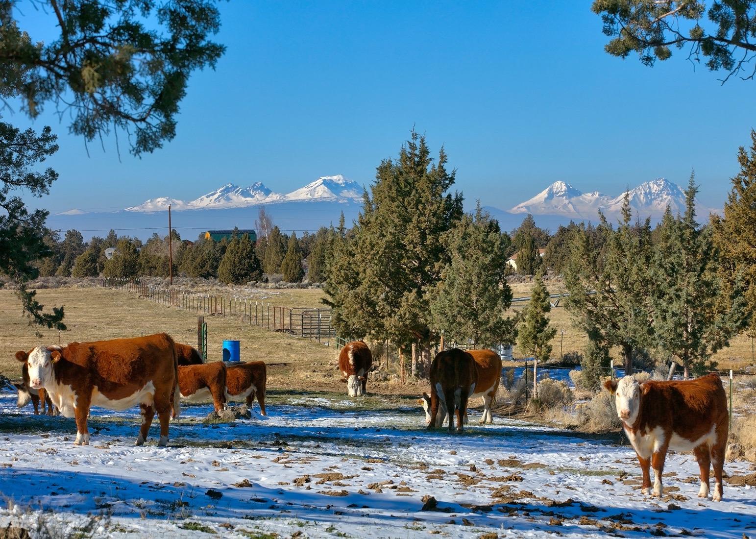
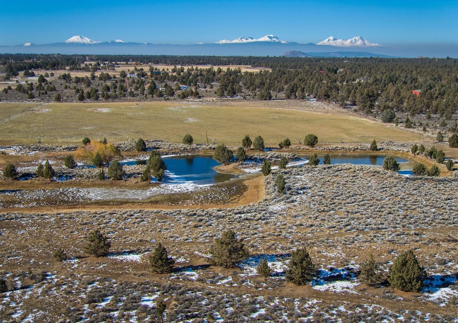
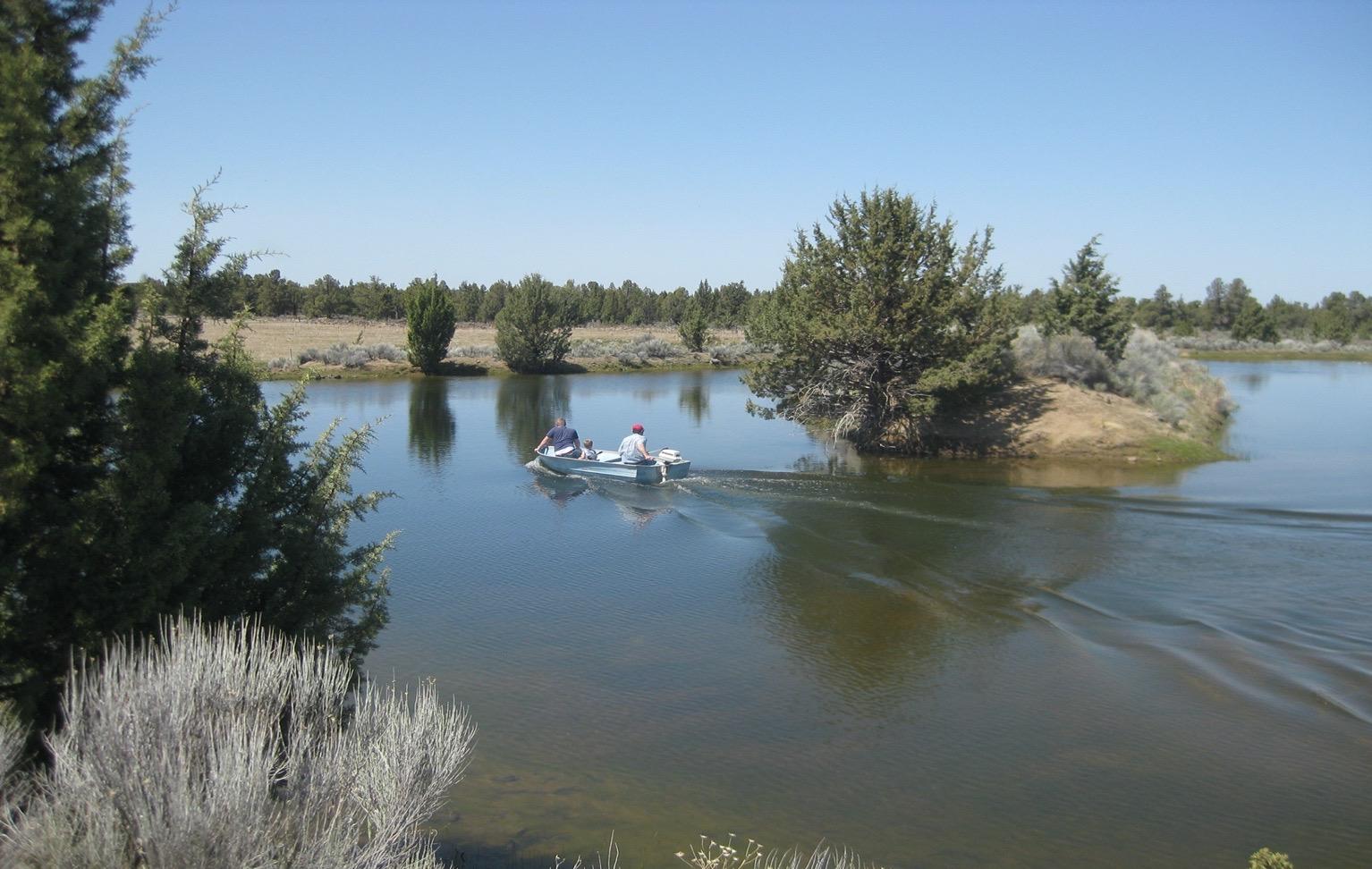
Cascade Mountain Views, Pond, Access to Public Land
Address: 24020 Skywagon Dr Bend, OR 97702
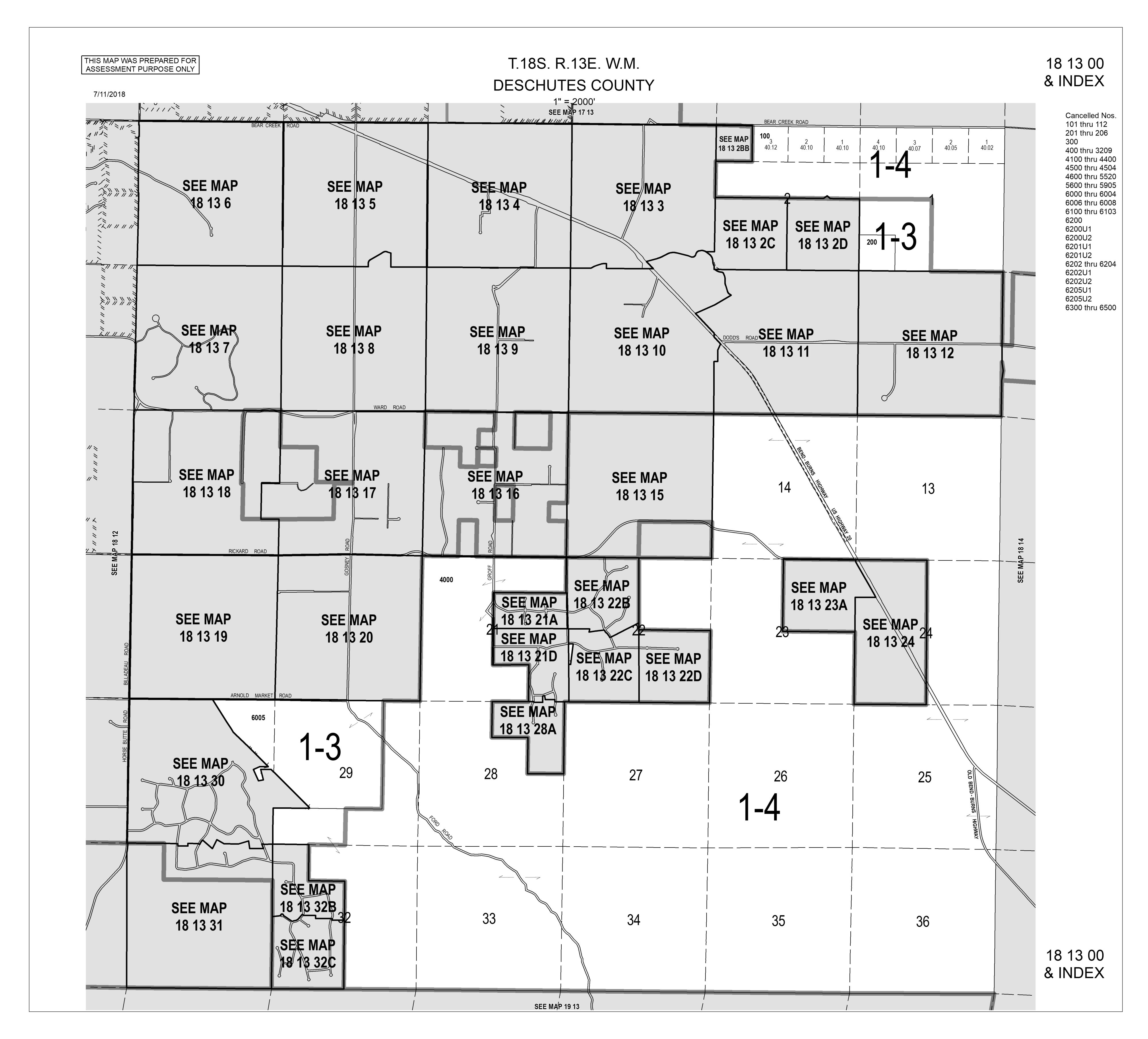
Tax Map: 181300 Tax lot 200 See survey map for Parcel 1 & 2 Parcel Number 112390
Property:
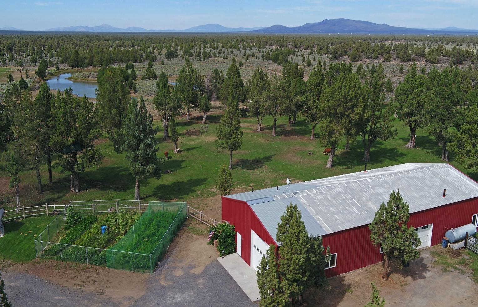
•40 acres, 27 acres COI water rights, big stocked pond, pivot, access to public land through COID land
•Fenced, cross fenced, 5 pastures, corral with cattle chute
•Bend School District, Approximately 10 minutes to East Bend
•Property is 2 legal lots of record:
•Parcel 1: 8:49 acres with home, outbuildings and 5.9 acres COID water rights
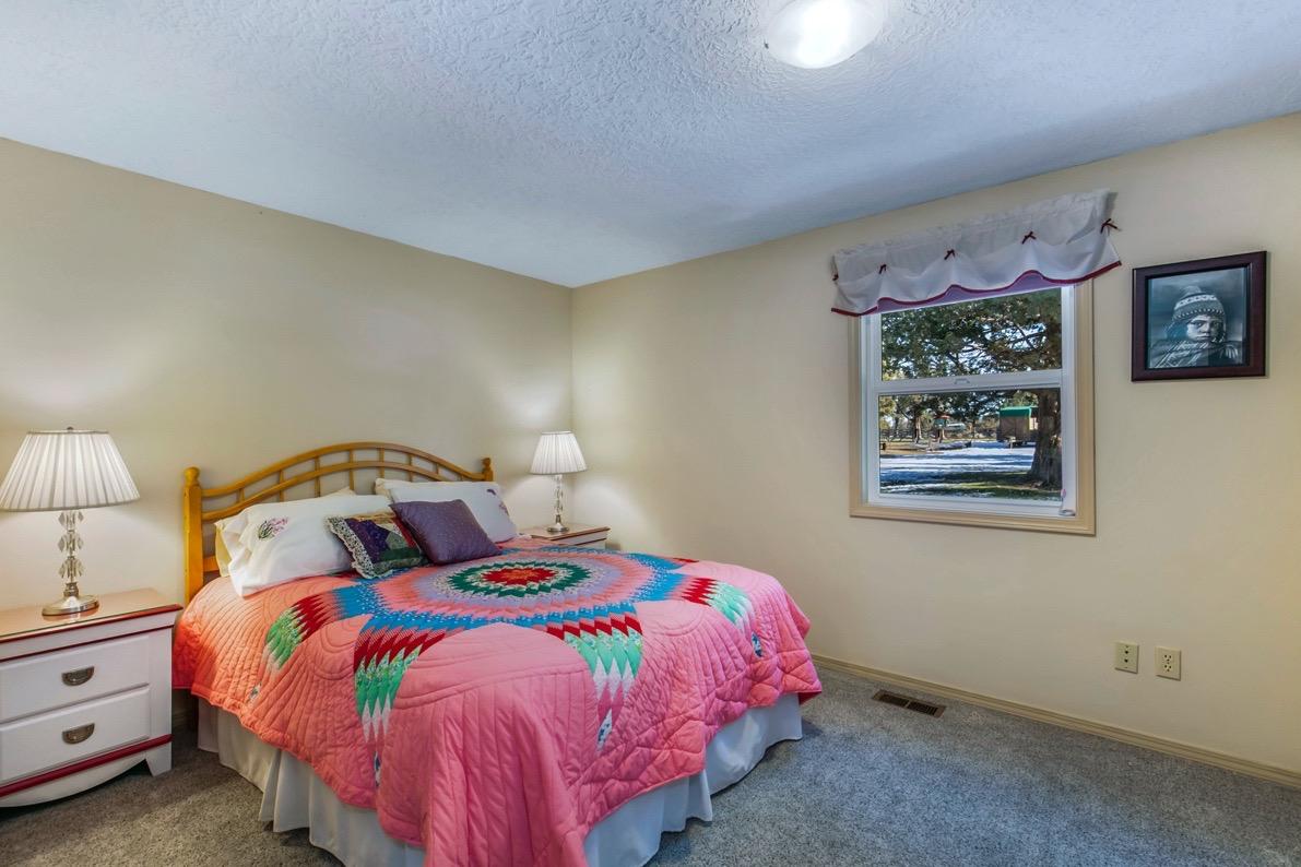
•Well maintained, updated 2,040 sq ft home built in 1974 recently updated and well maintained. Ranch Style 4 bedrooms, 2 baths, large open kitchen, breakfast bar, dining area, living room with vaulted ceilings, hickory wood floors and wood burning fireplace. Central Vacuum, electric forced air furnace, Central A/C. The oversized attached 2 car garage boasts a heated man cave and walk in pantry.
•Newer steel Shop is 40x99 (3960 sq ft), 200 amps, heated with oil furnace or wood stove, bathroom, kitchenette, office, RV storage, 2 RV clean outs and hookups. Doors are 12’x12’ and 10’x8’. Shop is connected to its own septic system installed in 2020.
•Barn 38’6’ x 55’6” for hay/equipment storage, air compressor shop included, corrals, set up for livestock
•Woodshed (12x24), Garden
•Parcel 2: 31.55 acres with building site that overlooks pond and has Cascade Mountain Views, septic feasibility approved standard system , power to building sited
Irrigation: 27 acres COID irrigation for 40 acres. Parcel 1 is 31 acres with 21.1 acres water rights pivot. Parcel 2 8.2 acres with 5.9 acres of water rights sprinklers See COID irrigation map
Domestic Water: Private Well, cistern on property is not used, COID irrigation is connected to landscape irrigation that is a sprinkler system, but not on a timer (it is a valve turn on)
Utilities: 3 meters 12 month Averages: House: $107./month Shop: $62. Farm: $152. Yellowknife internet
Taxes: Tax Year 2022 taxes for 40 acres $4,834.71 tax lots will be assessed separately in 2023. Property is in farm tax deferral Buyer is responsible for due diligences on land use and taxes.
Zoning: EFU Exclusive Farm Use
Price: $1,875,000. MLS 220156833 Shown By Appointment Only
All information Provided by Cascade Sotheby’s International Realty and Agents is deemed reliable but not guaranteed, Buyer is responsible for any/all due diligence. | 541 923 1376 | www.desertvalleygroup.com









 31 acres Building Site for Single Family Residence (approx.)



SURVEYORS NARRATIVE: The purpose of this survey was to adjust the common lines between the SW 1/ 4, SW 1/ 4 of Section 1 and the W 1/ 2, SE 1/ 4, SW 1/ 4, SW 1/ 4 of Section 1, T. 18 S., R, 13 E., of the W. M. The W. 1/ 2, SE 1/ 4, SW 1/ 4, SW 1/ 4 Is according to Deed 1972- 1900987 and was deemed a legal lot of record prior to this adjustment, determined the W 1/ 2, SE 1/ 4, SW 1/ 4, SW 1/ 4 by breaking down the SW 1/ 4, SW 1/ 4 by holding the midpoints between found monuments.
Monuments were held as noted, Monuments set this survey were set July 31, 2022
BASIS F BEARING:
Was determined by measuring between points 1001 and 1002, being North 89° 59' 47" East Basis of Bearings Determined By RTK ( Real Time Kinematic) Observation From an IMAX- GNSS Solution From the Oregon Real Time GNSS RGN) Network, The coordinate system used for this survey was the Oregon Coordinate Reference System ( CRS) BendRedmond- Prineville Zone,
REFERENCES: R1) Major Partition MJP- 77- 14 CS O4202) By Edgar W. Graves filed 8/ 8/ 1977, R2) Minor Partition MP- 78- 213 ( CSO4286) By Richard Graue dated 10/ 27/ 1978.


owner agent inCareOf address cityStZip type cdd id
Revocable Trust 24020 Skywagon Drive Bend, OR 97701 FD 21-769-LR and -770-LR
Scott and Lee Goodrich


owneragentinCareOfaddresscityStZiptypecdd id
DESCHUTES CO. ASSESSORELECTRONICNOD21-769-LR and -770-LR
Scott and Lee Goodrich Revocable Trust24020 Skywagon DriveBend, OR 97701NOD21-769-LR and -770-LR OOI, JAMES4680 SONGBIRDCHICO, CA 95973NOD21-769-LR and -770-LR BELL,GARY E24185 SKYWAGON DRBEND, OR 97701NOD21-769-LR and -770-LR SCHRADER, MICHAEL S & DIANE E24025 SKYWAGON DRBEND, OR 97701-9673NOD21-769-LR and -770-LR BRAATZ, RONALD W & JULIA A61510 COUGAR TRAILBEND, OR 97701NOD21-769-LR and -770-LR THOMAS, JOHN EDWARD & CONNIE JEAN61665 COUGAR TRLBEND, OR 97701NOD21-769-LR and -770-LR CRABTREE, MICHAEL61720 COUGAR TRLBEND, OR 97701NOD21-769-LR and -770-LR ALEC HAMILTON TRUSTTTEE61700 COUGAR TRLBEND, OR 97701NOD21-769-LR and -770-LR SCOTT & LEE GOODRICH REVOCABLE TRUSTSCOTT CO TTEE ETAL24020 SKYWAGON DRBEND, OR 97701NOD21-769-LR and -770-LR
CENTRAL OREGON IRRIGATION DISTRICT1055 SW LAKE CTREDMOND, OR 97756NOD21-769-LR and -770-LR WILSON,JIMMY D & LORI K21575 MCGILVRAY RDBEND, OR 97702NOD21-769-LR and -770-LR NORWOOD, RYAN G & ALI B23900 SKYWAGON DRBEND, OR 97701NOD21-769-LR and -770-LR HILLMAN, JAMES E & PARK, LUCY C2630 N HAYDEN ISLAND DR #32PORTLAND, OR 97217NOD21-769-LR and -770-LR THOMAS, JOHN EDWARD & CONNIE JEAN61665 COUGAR TRAILBEND, OR 97701NOD21-769-LR and -770-LR CRABTREE, MICHAEL61720 COUGAR TRAILBEND, OR 97701NOD21-769-LR and -770-LR
ALEC HAMILTON TRUSTTRUSTEE61700 COUGAR TRAILBEND, OR 97701NOD21-769-LR and -770-LR
September 8, 2022
SCOTT & LEE GOODRICH REVOCABLE TRUST 24020 SKYWAGON DR BEND, OR 97701
RE: 247-22-001084-EVAL 24020 SKYWAGON DR, BEND
This letter provides the results of the site evaluation conducted on the property referenced above for an onsite wastewater treatment system. The site was evaluated on August 23, 2022, and was found suitable to install a “System” as defined in Oregon Administrative Rules for Onsite Wastewater Treatment Systems, Chapter 340, Division 71. For more information about the different types of systems, descriptions, design criteria, important links and diagrams, contact our office or visit our website at www.deschutes.org/cd. (Click on the Onsite Waste Water Treatment Systems link)
MINIMUM SYSTEM REQUIREMENT
System Type: Standard
Maximum Design Flow ( gallon per day (gpd): 450 gpd
Tank Size: 1000 gallons
Minimum Trench Length (ft): 225 linear feet
Maximum Depth: 36 inches Minimum Depth: 18 inches
Specifications for all trenches, including capping fills, are contained in OAR 340 071
CONDITIONS OF APPROVAL
1. The system is sized for a maximum sewage flow of 450 gallons per day, the sizing for a 1 to 4 bedroom residence.
2. The area approved for the system is very specific. The land surface in the vicinity of the approved site must not be altered. Any alteration of the approved site or placement of a well within 100 feet of the approved site may invalidate this approval. Technical rule changes will not invalidate a favorable site evaluation, but may require use of a different kind of system.
3. A permit must be obtained from Deschutes County prior to the installation of the system. Application for a construction permit must be accompanied by an accurately drawn plan showing the layout and components of the system. The plan must show the following pertinent information including:

a. A scaled construction detail drawing for the proposed system.
b. The soil absorption design and layout, including elevations, for the initial and reserve systems.
117 NW Lafayette Avenue, Bend, Oregon 97703 | P.O. Box 6005, Bend, OR 97708 6005 (541) 388 6575 cdd@deschutes.org www.deschutes.org/cd
c. The proposed residence.
d. All other structures, wells waterlines, driveways, property line setbacks and property dimensions.
e. Accurately show the test pit locations
f. Setbacks of proposed system and reserve system from proposed and existing structures.
g. Follow the enclosed guidelines (Site Evaluation Field Inspection Form). Consult a licensed Department of Environmental Quality installer or a consultant if you need assistance. Inaccurate or incomplete construction details will require revisions and cause delays
4. Additional items that are required for Alternative Treatment Technology (ATT) system permit applications are:
a. A copy of the service contract between the authorized maintenance service provider and the property owner.
b. Information regarding the specific ATT with elevations of specific components such as the treatment unit, pump vaults, valves, floats, tanks and soil absorption system.
c. Profile of the proposed system in a way that shows the State DEQ approved installation method proposed.
d. List of materials for the proposed system. NOTE: Each manufacturer certifies installers for their ATT systems.
5. This site evaluation approval does not guarantee that land development permits can be issued. The application must obtain land use approval from the Deschutes County Planning Division before Deschutes County Environmental Soils can issue permits.
6. Additional requirements and/or comments: Install within the approval area. Maintain all applicable setbacks. A 50 foot setback is applicable to the un-lined pond since it functions as a private overflow for the canal. A bottomless sand filter is designated for the reserve system due to space. This evaluation is part of a proposed lot line adjustment.
REVIEW AVAILABLE
Site Evaluation Report Review: Pursuant to OAR 340 071, you may request a site evaluation report review if you believe this report to be in violation of Oregon Department of Environmental Quality (DEQ) rules. The DEQ conducts report reviews upon submission of the appropriate application materials including:
1. A written request that includes all information you have received from Deschutes County,
2. The reason the report is in error including the specific Oregon Administrative Rules that conflict with the report, and
3. The application fee.
117 NW Lafayette Avenue, Bend, Oregon 97703 | P.O. Box 6005, Bend, OR 97708 6005 (541) 388 6575 cdd@deschutes.org www.deschutes.org/cd
The DEQ will review the county’s report and visit the site to determine the report’s compliance with the applicable rules. A variance from the rules may also be requested through the DEQ. For further information regarding a report review or a variance to DEQ rules, please contact the Oregon Department of Environmental Quality at 475 NE Bellevue Dr., Suite 110, Bend OR 97701, phone 541 388 6146.
It is recommended to backfill the test pits to prevent a potential hazard on your property.
If you have any questions, please call this office at 541 388 6519
Sincerely,
ENVIRONMENTAL SOILS DIVISION
Kevin Hesson, REHS Onsite Wastewater Specialist II
KMH/mas
117 NW Lafayette Avenue, Bend, Oregon 97703 | P.O. Box 6005, Bend, OR 97708 6005 (541) 388 6575 cdd@deschutes.org www.deschutes.org/cd


Deschutes County 117 NW Lafayette Ave. PO Box 6005 Bend, OR 97708 541-388-6575 cdd-webmaster@deschutes.org Website: deschutes.org/cd

Date issued: 08/25/2022
Application status: Site Evaluation Approved
Work description: NEW SITE EVALUATION
Other special requirement: Installation shall take place within the approval area. Maintain setbacks to property lines, wells, underground utilities, etc. A 50 foot setback is applicable to the un-lined pond since it functions as a private overflow for the canal. A bottomless sand filter is designated for the reserve system due to space. This eval is part of a proposed lot line adjustment.
Installation shall take place within the approval area. Maintain setbacks to property lines, wells, underground utilities, etc. A 50 foot setback is applicable to the un-lined pond since it functions as a private overflow for the canal. A bottomless sand filter is designated for the reserve system due to space. This eval is part of a proposed lot line adjustment.
THIS IS NOT YOUR PERMIT. A Construction/Installation permit is required before you construct your system. Please contact this office when you are ready to apply for a construction/installation permit. We cannot sign off on any Building Codes forms until we issue your permit.
This site approval runs with the land and will automatically benefit subsequent owners. This site approval is valid until the approved system is constructed under a DEQ construction permit or unless the site is altered without approval from this office. Alterations/excavations/lot line adjustments made to the site, or placement of wells or utilities, etc., may invalidate this approval If you disagree with the decision of this report, you may apply for a site evaluation report review. The application for a site evaluation report review must be submitted to DEQ in writing within 60 days after the site evaluation report issue date and must include the site evaluation review fee in OAR 340-071-0140 Table 9A. A senior DEQ staff person will be assigned the site evaluation report review application.
You may apply for a variance to the onsite wastewater treatment system rules. The variance application must include a copy of the site evaluation report, plans and specifications for the proposed system, specify the rule(s) to which a variance is being requested, demonstrate the variance is warranted, and include the variance fee in OAR 340-071-140 Table 9C. A variance may only be granted if the variance officer determines that strict compliance with a rule is inappropriate or special physical conditions render strict compliance unreasonable, burdensome or impractical. A senior DEQ variance officer will be assigned the variance application.
Kevin Hesson Environmental Health Specialist 8/25/22ATTENTION:Oregon law requires you to follow rules adopted by the Oregon Utility Notification Center. Those rules are set forth by Oregon Administration Rules. You may obtain copies of the rules by calling the center. (Note: The telephone number for the Oregon Utility Notification Center is 1-800-332-2344.)




Skywagon Dr, Bend, OR 97701


24020 Skywagon Dr, Bend, OR 97701
1 D & F lines 51,55
Cougar Trail is maintained by the neighbors (not the county), no recorded maintenance agreement. Sellers have legal access through easements: Vol.156 p.383- between the COID bridge and the Cougar/Skywagon intersection. Vol. 207 p.667- between Dodds Road and the COID bridge. Vol 205 p.800- This easement is out of force right now, as it is all within the property. It was created to give access to the house lot before the same owner bought the rest of the property.
Easements
1 L line 62
Property is farm tax deferment, Buyers are responsible for due diligence and maintaining after the close of escrow.
2 C lines 85-86

Landscape Yard is connected to COI irrigation and is turned on with a valve, but is an in ground system.
3 Septics
There are two permitted septic systems on the property with buried tanks. One for the house and one for the shop with the RV clean outs.
Septic Feasibility is approved for the buildable acreage.

1 A lines 56-57
Home is in the AS zoning overlay- Airport Safety Zone for private airstrip.
This form has been licensed for use solely by Pamela Mayo Phillips pursuant to a Forms License Agreement with Oregon Real Estate Forms, LLC.
 Scott & Lee Goodrich Rev Trust
Cascade
